ASA_HRNK_Camp25_Update2

Create successful ePaper yourself
Turn your PDF publications into a flip-book with our unique Google optimized e-Paper software.
H R<br />
N K<br />
ANALYSIS<br />
N<br />
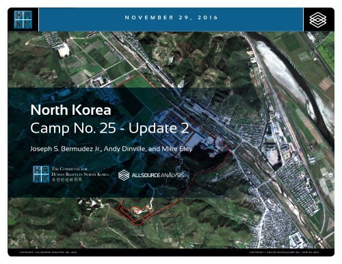
NOVEMBER 29 , 2 0 1 6<br />
North Korea<br />
Black Text<br />
Camp THE COMMITTEE No. FOR 25 - Update 2<br />
H R<br />
N K<br />
HUMAN RIGHTS IN NORTH KOREA<br />
북한인권위원회<br />
Joseph S. Bermudez Jr., Andy Dinville, and Mike Eley<br />
H R<br />
N K<br />
White Text<br />
THE COMMITTEE FOR<br />
HUMAN RIGHTS IN NORTH KOREA<br />
북한인권위원회<br />
COPYRIGHT ©ALLSOURCE ANALYSIS, INC. 2016 COPYRIGHT © 2015 BY DIGITALGLOBE INC., JUNE 30, 2015<br />
1
H R<br />
N K<br />
CH’OMA-BONG CAMP RESTRICTED NO. 25 AREA<br />
North Korea: Imagery Analysis of Camp No. 25 - Update 2<br />
China<br />
South<br />
Korea<br />
Location:<br />
Susŏng-dong, Ch’ŏngjin-si,<br />
Hamgyŏng-bukto<br />
Coordinates:<br />
41.834384 N, 129.725280 E<br />
Date of Report:<br />
August 26, 2016<br />
Date of Imagery:<br />
High resolution: January 18,<br />
2003 to September 21, 2015<br />
Declassified KH-4B: May 28,<br />
1970<br />
Declassified KH-9 (mapping<br />
camera): January 27, 1976<br />
Size of Facility:<br />
1.01 square kilometers (.389<br />
square miles)<br />
1,810 meters by 1,240 meters<br />
Background<br />
The United Nations Commission of Inquiry<br />
on Human Rights in North Korea (UN COI)<br />
determined that “crimes against humanity<br />
have been committed in North Korea,<br />
pursuant to policies established at the<br />
highest level of the State.” Many of these<br />
crimes against humanity take place against<br />
persons detained in political and other prison<br />
camps—persons who the Commission<br />
determined are among the “primary targets<br />
of a systematic and widespread attack”<br />
by the North Korean regime—including:<br />
murder, enslavement, torture, imprisonment,<br />
rape, forced abortions and other<br />
sexual violence, persecution on political<br />
grounds, and the enforced disappearance<br />
of persons.<br />
According to the UN COI, “The unspeakable<br />
atrocities that are being committed<br />
against inmates of the kwan-li-so political<br />
prison camps resemble the horrors of<br />
camps that totalitarian States established<br />
during the twentieth century.” 1<br />
Based on research conducted by the<br />
Committee for Human Rights in North<br />
Korea (<strong>HRNK</strong>), five trends have defined<br />
1 UN Human Rights Council, Report of the commission<br />
of inquiry on human rights in the Democratic People’s<br />
Republic of Korea, A/HRC/25/63, 17 February 2013,<br />
para. 60, available at http://hrnk.org/uploads/<br />
pdfs/A_HRC_25_63.pdf<br />
the human rights situation under the Kim<br />
Jong-un regime: 1) an intensive crackdown<br />
on attempted defections; 2) an aggressive<br />
purge of senior officials, aimed to consolidate<br />
the leader’s grip on power; 3) a<br />
“restructuring” of the political prison camp<br />
system, with some facilities, closer to the<br />
border with China, being shut down, while<br />
inland facilities have been expanded; 4)<br />
disproportionate oppression of women,<br />
who have assumed primary responsibility<br />
for the survival of their families; thus,<br />
women represent the majority of those<br />
arrested for perceived wrongdoing at the<br />
“jangmadang” markets, or for “illegally”<br />
crossing the border; and 5) the sustained, if<br />
not increased, economic importance of the<br />
political prison camps.<br />
Executive Summary<br />
As part of a joint undertaking with <strong>HRNK</strong> to<br />
use satellite imagery to shed light on<br />
human suffering in the Democratic<br />
People’s Republic of Korea (DPRK, more<br />
commonly known as North Korea),<br />
AllSource Analysis has been monitoring<br />
activity at political prison facilities throughout<br />
North Korea. This report details activity<br />
observed during the past two years at<br />
the prison facility commonly identified as<br />
Camp No. 25, but also known as Kwanli-so<br />
No. 25, Political Prison Camp No. 25<br />
or the Susŏng-dong Kyo-hwa-so, and<br />
updates <strong>HRNK</strong>’s February 2013 and June<br />
2014 reports on the same subject. 2<br />
For this report, AllSource Analysis analyzed<br />
pan-sharpened multispectral satellite<br />
imagery of Camp No. 25 and its immediate<br />
environs collected by DigitalGlobe from<br />
January 18, 2003, through September 21,<br />
2015, and USGS declassified KH-4B from<br />
May 28, 1970, and KH-9 from January 1,<br />
1976. This analysis focused upon examination<br />
of the following physical features,<br />
<br />
Entrances and guard positions<br />
<br />
Housing and agricultural support<br />
facilities and activities<br />
<br />
Internal arrangement<br />
<br />
Miscellaneous activity<br />
<br />
Security perimeters (internal and<br />
external)<br />
Based on analysis of these features, Camp<br />
No. 25 is a small operational prison camp<br />
that is well maintained as is indicated by<br />
general activity and maintenance in and<br />
immediately surrounding the camp. This<br />
2 Bermudez Jr., Joseph S. and Farfour, Micah. North<br />
Korea’s Camp No. 25, (Washington, D.C.: Committee<br />
for Human Rights in North Korea, February 25,<br />
2013), available at http://hrnk.org/uploads/pdfs/<br />
<strong>HRNK</strong>_<strong>Camp25</strong>_201302_Updated_LQ.pdf; Bermudez<br />
Jr., Joseph S., Dinville, Andy and Eley, Mike. North<br />
Korea’s Camp No. 25 Update, (Washington, D.C.:<br />
Committee for Human Rights in North Korea, June<br />
5, 2014), available at http://www.hrnk.org/uploads/<br />
pdfs/Camp%2025%20Update%20Good.pdf.<br />
COPYRIGHT ©ALLSOURCE ANALYSIS, INC. 2016 2
H R<br />
N K<br />
CH’OMA-BONG CAMP RESTRICTED NO. 25 AREA<br />
North Korea: Imagery Analysis of Camp No. 25 - Update 2<br />
analysis also supports escapee and other<br />
reports indicating that Camp No. 25’s<br />
primary economic activity is focused on<br />
light industry and agriculture. Despite<br />
extensive satellite imagery coverage<br />
of the camp, AllSource is presently<br />
unable to confirm or deny escapee and<br />
open-source reports that the camp has a<br />
prisoner population of 5,000 people.<br />
As with the analytical caution presented<br />
in previous reports (such as North<br />
Korea: Imagery Analysis Camp 16 and<br />
North Korea: Imagery Analysis of Camp<br />
14 produced by <strong>HRNK</strong> and AllSource<br />
Analysis), it is important to reiterate<br />
that North Korean officials, especially<br />
those within the Korean People’s Army<br />
and the internal security organizations,<br />
clearly understand the importance of<br />
implementing camouflage, concealment,<br />
and deception (CCD) procedures to mask<br />
their operations and intentions. 3 It would<br />
be reasonable to assume that they have<br />
done so here.<br />
Location and Organization<br />
Camp No. 25 is under the control of the<br />
3 Bermudez Jr., Joseph S., Dinville, Andy and Eley,<br />
Mike. Imagery Analysis of Camp 16, (Washington,<br />
D.C.: The Committee for Human Rights in North<br />
Korea [<strong>HRNK</strong>], 2015) available at https://www.hrnk.<br />
org/uploads/pdfs/<strong>ASA</strong>_<strong>HRNK</strong>_Camp16_v8_fullres_FINAL_12_15_15.pdf<br />
and Bermudez Jr., Joseph<br />
S. Imagery Analysis: North Korea’s Camp No. 15,<br />
Update, (Washington, D.C.: <strong>HRNK</strong>, 2014) available<br />
at http://hrnk.org/uploads/pdfs/Camp%2025%20<br />
Update%20Good.pdf.<br />
Prisons Bureau of the State Security<br />
Department (SSD), which is under the<br />
de facto control of the KWP OGD.<br />
Specifically, it is under the control of the<br />
SSD's North Hamgyong Provincial<br />
Bureau and is located approximately<br />
7.5 km northwestof the port of Ch’ŏngjin-si<br />
in Susŏng-dong, Ch’ŏngjin-si,<br />
Hamgyŏng-bukto. 4 More specifically, it is<br />
4 It is interesting to note that although the escapee<br />
descriptions of this facility’s mission matches that<br />
of other kwan-li-so, the physical characteristics observed<br />
in satellite imagery are more representative<br />
of the nation’s kyo-hwa-so, or long-term, felony<br />
penitentiaries and prison camps. David Hawk, The<br />
Hidden Gulag: Second Edition, Washington, D.C.:<br />
Committee for Human Rights in North Korea, 2012,<br />
www.hrnk.org/uploads/pdfs/<strong>HRNK</strong>_HiddenGulag2_Web_5-18.pdf.<br />
Another sources describes<br />
Camp No. 25 this way,<br />
It is not structured as a village but is a fenced<br />
facility that looks like an ordinary prison camp<br />
[kyo-hwa-so] and is designed for collective<br />
living arrangements. The No. 25 [kwan-li-so]<br />
houses political prisoners only, while those who<br />
committed economic crimes are not allowed<br />
into the facility. Some inmates are released<br />
upon completion of their term as terms are<br />
fixed. Political criminals are detained alone without<br />
their families. …North Korean defector XXX<br />
[sic] testified, “Military personnel are sent off to<br />
the Susong kyo-hwa-so [No. 25 kwan-li-so] if<br />
their alleged crimes are of a political nature. The<br />
Susong kyo-hwa-so [No. 25 kwan-li-so] is for<br />
those serving terms of 10 years or longer, but<br />
they can return to society once they complete<br />
these terms.” It was also testified that the<br />
No. 25 kwan-li-so housed senior staff at the<br />
Provincial Party, the head of a local MPS office,<br />
and other high-ranking officials. North Korean<br />
defector XXX [sic] testified that the father of his<br />
located on the south bank of the Solgol-ch’ŏn<br />
(i.e., Solgol stream) across from<br />
the village of Susŏng-dong, to which one<br />
foot and two road bridges connect it.<br />
The date of establishment of Camp No.<br />
25 is unclear. One report indicates that<br />
the camp was used as a prisoner-of-war<br />
camp housing South Korean soldiers at<br />
the end of the Korean War. 5 This, however,<br />
remains to be verified as it may not<br />
be referring to the present day camp but<br />
rather to an activity in this area. The area<br />
in which it is located has been involved<br />
in agricultural activities since at least the<br />
1950s. Satellite imagery does indicate<br />
that Camp No. 25 was established<br />
prior to May 28, 1970, at which time it<br />
occupied an irregular shaped area that<br />
measured approximately 577 meters by<br />
315 meters (631 yards by 344 yards) and<br />
encompassed 13.76 hectares (164,568<br />
friend used to perform the duty of turning over<br />
Korean War POWs to South Korea, but he was<br />
arrested while attempting to cross the border<br />
at the river in Namyang, Onsung County, North<br />
Hamgyoung Province. He ended up at the No.<br />
25 kwan-li-so in Chongjin.<br />
Do Kyung-Ok et al., White Paper on Human Rights<br />
in North Korea 2015 (Seoul: Korea Institute for<br />
National Unification, 2015), p. 122, available at<br />
http://www.kinu.or.kr/eng/pub/pub_04_01.jsp.<br />
5 “After the Korean War, it was used as a detention<br />
facility for South Korean POWs (Prisoners of<br />
War).” Do Kyung-Ok et al., White Paper on Human<br />
Rights in North Korea 2015 (Seoul: Korea Institute<br />
for National Unification, 2015), p. 122, available at<br />
http://www.kinu.or.kr/eng/pub/pub_04_01.jsp.<br />
square yards) and was expanded slightly<br />
by January 27, 1976, when it measured<br />
approximately 700 meters by 315 meters<br />
(765 yards by 344 yards) and encompassed<br />
15.30 hectares (181,987 square<br />
yards) (Figure 1, Figure 2). 6<br />
High-resolution satellite imagery from<br />
January 18, 2003, through September<br />
21, 2015, indicates that the camp has<br />
expanded during this period and that its<br />
primary economic activities are centered<br />
on agriculture and light industry (Figure 3<br />
through Figure 15).<br />
Several small villages and military<br />
facilities are located in the general area<br />
around the camp. The camp is connected<br />
to the regional electric power grid via<br />
overhead high voltage power transmission<br />
cables that run from the camp to<br />
the substation approximately 1 kilometer<br />
to the southeast. It is connected to the<br />
national rail network via the station at<br />
Susŏng-dong, 800 meters to the east<br />
of the facility (Figure 16). The closest air<br />
facility to Camp No. 25 is the Korean<br />
People’s Air Force’s Sŭngam-ni Air Base,<br />
located 18 kilometers south-southwest.<br />
This is a training base, and based on<br />
its mission, organization, and location,<br />
almost certainly provides no support to<br />
Camp No. 25.<br />
6 <strong>HRNK</strong> anticipates that we will be able to further<br />
refine the date of the camps establishment in<br />
future updates. Referenced imagery includes:<br />
KH-4B imagery dated May 28, 1970 and KH-9<br />
(mapping camera) imagery dated January 27, 1976.<br />
COPYRIGHT ©ALLSOURCE ANALYSIS, INC. 2016 3
H R<br />
N K<br />
CAMP NO. 25<br />
Figure 1<br />
Camp No. 25<br />
Overview of the Camp No. 25 area as seen in a declassified Top Secret KH-4B satellite image dated May 28, 1970. (41.8374 N, 129.7346 E)<br />
COPYRIGHT ©ALLSOURCE ANALYSIS, INC. 2016 COPYRIGHT © 1970 BY U.S. GEOLOGICAL SURVEY, MAY 28, 1970 4<br />
BACK
H R<br />
N K<br />
CAMP NO. 25<br />
Figure 2<br />
Camp No. 25<br />
Overview of the Camp No. 25 area as seen in a declassified Top Secret KH-4B satellite image dated January 1, 1976. (41.8354 N, 129.7297 E)<br />
COPYRIGHT ©ALLSOURCE ANALYSIS, INC. 2016 COPYRIGHT © 1976 BY U.S. GEOLOGICAL SURVEY, JANUARY 1, 1976 5<br />
BACK
H R<br />
N K<br />
CAMP NO. 25<br />
Figure 3<br />
Camp perimeter<br />
Entrance and checkpoint<br />
Guard barracks<br />
Guard position<br />
Entrance<br />
Entrance<br />
Old burial grounds<br />
Furniture factory and lumberyard<br />
Prisoner housing<br />
Entrance<br />
Headquarters and administration<br />
Reported crematorium<br />
Guard barracks<br />
Terraced orchards<br />
Agriculture and livestock support area<br />
Terraced orchards<br />
Air defense site<br />
0<br />
500 m<br />
Overview of Camp No. 25, January 18, 2003. (41.833 N, 129.725 E)<br />
COPYRIGHT ©ALLSOURCE ANALYSIS, INC. 2016 COPYRIGHT © 2003 BY DIGITALGLOBE, INC., JANUARY 18, 2003 6<br />
BACK
H R<br />
N K<br />
CAMP NO. 25<br />
Figure 4<br />
Camp perimeter<br />
Entrance and checkpoint<br />
Guard barracks<br />
Guard position<br />
New building<br />
0<br />
500 m<br />
Overview of Camp No. 25, March 5, 2004. (41.833 N, 129.725 E)<br />
COPYRIGHT ©ALLSOURCE ANALYSIS, INC. 2016 COPYRIGHT © 2004 BY DIGITALGLOBE, INC., MARCH 5, 2004 7<br />
BACK
H R<br />
N K<br />
CAMP NO. 25<br />
Figure 5<br />
Camp perimeter<br />
Entrance and checkpoint<br />
Guard barracks<br />
Guard position<br />
0<br />
500 m<br />
Overview of Camp No. 25, February 25, 2005. (41.833 N, 129.725 E)<br />
COPYRIGHT ©ALLSOURCE ANALYSIS, INC. 2016 COPYRIGHT © 2005 BY DIGITALGLOBE, INC., FEBRUARY 25, 2005 8<br />
BACK
H R<br />
N K<br />
CAMP NO. 25<br />
Figure 6<br />
Camp perimeter<br />
Entrance and checkpoint<br />
Guard barracks<br />
Guard position<br />
Razed building<br />
New guard position<br />
New guard position<br />
New guard position<br />
New guard position<br />
New guard position<br />
0<br />
500 m<br />
Overview of Camp No. 25, March 21, 2006. (41.833 N, 129.725 E)<br />
COPYRIGHT ©ALLSOURCE ANALYSIS, INC. 2016 COPYRIGHT © 2006 BY DIGITALGLOBE, INC., MARCH 21, 2006 9<br />
BACK
H R<br />
N K<br />
CAMP NO. 25<br />
Figure 7<br />
Camp perimeter<br />
Entrance and checkpoint<br />
Guard barracks<br />
Guard position<br />
Razed building<br />
0<br />
500 m<br />
Overview of Camp No. 25, April 11, 2007. (41.833 N, 129.725 E)<br />
COPYRIGHT ©ALLSOURCE ANALYSIS, INC. 2016 COPYRIGHT © 2007 BY DIGITALGLOBE, INC., APRIL 11, 2007 10<br />
BACK
H R<br />
N K<br />
CAMP NO. 25<br />
Figure 8<br />
Camp perimeter<br />
Entrance and checkpoint<br />
Guard barracks<br />
Guard position<br />
New building<br />
0<br />
500 m<br />
Overview of Camp No. 25, February 24, 2008. (41.833 N, 129.725 E)<br />
COPYRIGHT ©ALLSOURCE ANALYSIS, INC. 2016 COPYRIGHT © 2008 BY DIGITALGLOBE, INC., FEBRUARY 24, 2008 11<br />
BACK
H R<br />
N K<br />
CAMP NO. 25<br />
Figure 9<br />
Camp perimeter<br />
Entrance and checkpoint<br />
Guard barracks<br />
Guard position<br />
Razed building<br />
New building<br />
0<br />
500 m<br />
Overview of Camp No. 25, October 27, 2009. (41.833 N, 129.725 E)<br />
COPYRIGHT ©ALLSOURCE ANALYSIS, INC. 2016 COPYRIGHT © 2009 BY DIGITALGLOBE, INC., OCTOBER 27, 2009 12<br />
BACK
H R<br />
N K<br />
CAMP NO. 25<br />
Figure 10<br />
Camp perimeter<br />
Entrance and checkpoint<br />
Guard barracks<br />
Guard position<br />
Entrance closed<br />
12 buildings razed<br />
New leadership memorial building<br />
Nine buildings razed<br />
New agricultural support building<br />
New entrance gate and checkpoint<br />
New air defense site<br />
New high security walled building<br />
0<br />
500 m<br />
Overview of Camp No. 25, October 27, 2010. (41.833 N, 129.725 E)<br />
COPYRIGHT ©ALLSOURCE ANALYSIS, INC. 2016 COPYRIGHT © 2010 BY DIGITALGLOBE, INC., OCTOBER 27, 2010 13<br />
BACK
H R<br />
N K<br />
CAMP NO. 25<br />
Figure 11<br />
Camp perimeter<br />
Entrance and checkpoint<br />
Guard barracks<br />
Guard position<br />
0<br />
500 m<br />
Overview of Camp No. 25, January 6, 2011. (41.833 N, 129.725 E)<br />
COPYRIGHT ©ALLSOURCE ANALYSIS, INC. 2016 COPYRIGHT © 2011 BY DIGITALGLOBE, INC., JANUARY 6, 2011 14<br />
BACK
H R<br />
N K<br />
CAMP NO. 25<br />
Figure 12<br />
Camp perimeter<br />
Entrance and checkpoint<br />
Guard barracks<br />
Guard position<br />
New high security area<br />
0<br />
500 m<br />
Overview of Camp No. 25, May 19, 2012. (41.833 N, 129.725 E)<br />
COPYRIGHT ©ALLSOURCE ANALYSIS, INC. 2016 COPYRIGHT © 2012 BY DIGITALGLOBE, INC., MAY 19, 2012 15<br />
BACK
H R<br />
N K<br />
CAMP NO. 25<br />
Figure 13<br />
Camp perimeter<br />
Entrance and checkpoint<br />
Guard barracks<br />
Guard position<br />
0<br />
500 m<br />
Overview of Camp No. 25, May 26, 2013. (41.833 N, 129.725 E)<br />
COPYRIGHT ©ALLSOURCE ANALYSIS, INC. 2016 COPYRIGHT © 2013 BY DIGITALGLOBE, INC., MAY 26, 2013 16<br />
BACK
H R<br />
N K<br />
CAMP NO. 25<br />
Figure 14<br />
Camp perimeter<br />
Entrance and checkpoint<br />
Guard barracks<br />
Guard position<br />
0<br />
500 m<br />
Overview of Camp No. 25, November 7, 2014. (41.833 N, 129.725 E)<br />
COPYRIGHT ©ALLSOURCE ANALYSIS, INC. 2016 COPYRIGHT © 2014 BY DIGITALGLOBE, INC., NOVEMBER 7, 2014 17<br />
BACK
H R<br />
N K<br />
CAMP NO. 25<br />
Figure 15<br />
Camp perimeter<br />
Entrance and checkpoint<br />
Guard barracks<br />
Guard position<br />
Entrance<br />
Entrance<br />
Entrance<br />
Old burial grounds<br />
Entrance<br />
Water treatment<br />
Reported crematorium<br />
Probable leadership memorial hall<br />
Entrance<br />
Headquarters and administration<br />
Main entrance and checkpoint<br />
Agriculture and livestock support area<br />
Terraced orchards<br />
Security fence<br />
Terraced orchards<br />
Possible processing plant<br />
Air defense site<br />
Air defense site<br />
High security walled compound<br />
0<br />
500 m<br />
Overview of Camp No. 25, September 21, 2015. (41.833 N, 129.725 E)<br />
COPYRIGHT ©ALLSOURCE ANALYSIS, INC. 2016 COPYRIGHT © 2015 BY DIGITALGLOBE, INC., SEPTEMBER 21, 2015 18<br />
BACK
H R<br />
N K<br />
CAMP NO. 25<br />
Figure 16<br />
Probable leadership memorial hall<br />
Guard barracks<br />
Headquarters and administration<br />
Main entrance and checkpoint<br />
Entrance<br />
Possible processing plant<br />
0<br />
200 m<br />
Susŏng-dong Railroad Station, September 21, 2015. (41.834 N, 129.734 E)<br />
COPYRIGHT ©ALLSOURCE ANALYSIS, INC. 2016 COPYRIGHT © 2015 BY DIGITALGLOBE, INC., SEPTEMBER 21, 2015 19<br />
BACK
H R<br />
N K<br />
CH’OMA-BONG CAMP RESTRICTED NO. 25 AREA<br />
North Korea: Imagery Analysis of Camp No. 25 - Update 2<br />
Imagery Analysis<br />
Based on previous <strong>HRNK</strong> satellite<br />
imagery reports, publicly available<br />
information, and high resolution satellite<br />
imagery, Camp No. 25 and its immediate<br />
surroundings can be separated into five<br />
broad areas (Figure 17) 7 :<br />
7 The following sources were used throughout<br />
this section: Bermudez Jr., Joseph S. North<br />
Korea’s Camp No. 25 Update, (Washington, D.C.:<br />
Committee for Human Rights in North Korea, June<br />
5, 2014), available at http://hrnk.org/uploads/<br />
pdfs/<strong>HRNK</strong>_<strong>Camp25</strong>_201302_Updated_LQ.pdf;<br />
Bermudez Jr., Joseph S. and Farfour, Micah.<br />
North Korea’s Camp No. 25, (Washington, D.C.:<br />
Committee for Human Rights in North Korea,<br />
February 25, 2013), available at http://hrnk.org/<br />
uploads/pdfs/<strong>HRNK</strong>_<strong>Camp25</strong>_201302_Updated_LQ.pdf;<br />
Database Center for North Korean<br />
Human Rights, “Political Prison Camps in North<br />
Korea Today.” http://nkdb.org/2012/main.php;<br />
Hawk, David. The Hidden Gulag: Second Edition.<br />
(Washington, D.C.: Committee for Human Rights<br />
in North Korea, 2012), pp. 3, 63, 79 and 223,<br />
available at http://www.hrnk.org/uploads/pdfs/<br />
<strong>HRNK</strong>_HiddenGulag2_Web_5-18.pdf; Hawk, David.<br />
The Hidden Gulag: Third Edition. (Washington, D.C.:<br />
Committee for Human Rights in North Korea, 2013),<br />
pp. 22 and 25, available at http://www.hrnk.org/<br />
uploads/pdfs/NKHiddenGulag_DavidHawk(2).<br />
pdf; Hawk, David. The Hidden Gulag: Fourth Edition.<br />
(Washington, D.C.: Committee for Human Rights<br />
in North Korea, 2015), pg. 8, available at http://<br />
www.hrnk.org/uploads/pdfs/Hawk_HiddenGulag4_FINAL.pdf;<br />
Kim, Soo-am, Kook-shin Kim,<br />
Soon-hee Lim, Hyun-joon Chon, Kyu-chang Lee,<br />
and Jung-hyun Cho. White Paper on Human Rights<br />
in North Korea, 2003-2013. Seoul, Korea: Korea<br />
Institute for National Unification, 2003-2013.<br />
<br />
Security Perimeter<br />
<br />
Administrative<br />
<br />
Central Camp (light industry, prisoner<br />
housing, and agricultural support)<br />
<br />
Agricultural Activities<br />
<br />
Additional Activities<br />
Security Perimeter<br />
A security perimeter consisting of a<br />
combination of walls, fences, gates, and<br />
guard positions not only separates Camp<br />
No. 25 from the surrounding countryside<br />
but also segments it internally (Figure<br />
18). Neither the external perimeter of<br />
the camp nor the wall surrounding the<br />
central compound has changed signifihttp://www.kinu.or.kr/eng/pub/pub_04_01.jsp;<br />
NK<br />
News.org, “Picture of the Day: Camp 25 Outside of<br />
Chongjin, North Korea.” Last modified 2012. http://<br />
www.nknews.org/news_clipping/picture-of-theday-camp-25-outside-of-chongjin-north-korea/.<br />
(Accessed January 30, 2013); KINU White Paper on<br />
Human Rights in North Korea 2014, (Seoul: Korea<br />
Institute for National Unification, July 2014), pp. 180-<br />
81, 189, 194 and 624, (hereafter: KINU2014) available<br />
at: www.kinu.or.kr/eng/pub/; KINU White Paper on<br />
Human Rights in North Korea 2015, (Seoul: Korea<br />
Institute for National Unification, September 2015),<br />
pp. 115-116, 122, 126 and 517, (hereafter: KINU2015)<br />
available at: www.kinu.or.kr/eng/pub/; and Report<br />
of the Commission of Inquiry on Human Rights<br />
in the Democratic People’s Republic of Korea, A/<br />
HRC/25/CRP.1, (New York: UN Human Rights<br />
Council, 7 February 2014), pp. 222-224 and 263,<br />
available at http://www.ohchr.org/Documents/<br />
HRBodies/HRCouncil/CoIDPRK/Report/A.HRC.25.<br />
CRP.1_ENG.doc.<br />
cantly since our 2014 report. The external<br />
perimeter is approximately 5,100 meters<br />
long, encompasses approximately 100<br />
hectares (.389 square miles), and has<br />
seven internal and external entrances.<br />
All walls, fences, and gates are well<br />
maintained and in good repair, as is the<br />
perimeter patrol road. There is a main<br />
entrance and checkpoint astride the only<br />
road leading into the shallow valley in<br />
which Camp No. 25 is located. The walled<br />
prison component of the camp occupies<br />
a generally irregular-shaped area that<br />
measures approximately 350 meters by<br />
410 meters (382 yards by 448 yards) and<br />
encompasses 12.628 hectares (151,030<br />
square yards).<br />
Including the guard positions at the<br />
main and administrative area entrances,<br />
there are a total of 40 identifiable guard<br />
positions—22 along the perimeter,<br />
eight on the walls around the central<br />
compound, and ten distributed internally. 8<br />
Although this is one less than identified<br />
in <strong>HRNK</strong>’s 2014 report, this lower number<br />
is not significant and appears to be the<br />
result of routine adjustments made in<br />
agricultural activities around the camp.<br />
All guard positions are well positioned<br />
8 The identification of some guard positions is<br />
tentative. Additionally, there are several structures<br />
located within the camp perimeter that might also<br />
be guard positions, however, additional imagery<br />
and analysis is required to confirm this.<br />
to provide overlapping fields-of-view of<br />
the camp and are well maintained and in<br />
good repair. The absence of any vehicles<br />
along the perimeter patrol roads or at the<br />
guard positions suggests that guards<br />
rotate positions on foot rather than being<br />
shifted by vehicle.<br />
During the period under study, the camp<br />
grew in physical size. In 2003, there<br />
were approximately 20 guard positions<br />
strategically placed throughout the camp.<br />
New positions were slowly erected, with<br />
two added in 2007 and four in 2009.<br />
From 2003 through 2009, the camp<br />
had a perimeter of approximately 3,650<br />
meters (3,991 yards) and encompassed<br />
56.950 hectares (681,147 square yards).<br />
During 2010, however, the perimeter was<br />
dramatically expanded to approximately<br />
5,100 meters (5,577 yards), and the area<br />
enclosed increased to 101 hectares<br />
(.389 square miles)—a 37 percent<br />
and 72 percent increase, respectively.<br />
With this expansion, a new main gate<br />
was erected, two previously separate<br />
agriculture fields in the northwest area<br />
of the camp were combined, the road<br />
between fields was blocked off, and 17<br />
additional guard positions were erected,<br />
predominately along the new perimeter<br />
line. The security perimeter has remained<br />
essentially unchanged since 2013, and all<br />
guard positions and entrances appear to<br />
be well maintained and in good repair.<br />
COPYRIGHT ©ALLSOURCE ANALYSIS, INC. 2016 20
H R<br />
N K<br />
CAMP NO. 25<br />
Figure 17<br />
0<br />
500 m<br />
Camp No. 25 report areas, September 21, 2015. (41.833 N, 129.725 E)<br />
COPYRIGHT ©ALLSOURCE ANALYSIS, INC. 2016 COPYRIGHT © 2015 BY DIGITALGLOBE, INC., SEPTEMBER 21, 2015 21<br />
BACK
H R<br />
N K<br />
CAMP NO. 25<br />
Figure 18<br />
0<br />
500 m<br />
Camp No. 25 Perimeter and Guard Positions, September 21, 2015. (41.833 N, 129.725 E)<br />
COPYRIGHT ©ALLSOURCE ANALYSIS, INC. 2016 COPYRIGHT © 2015 BY DIGITALGLOBE, INC., SEPTEMBER 21, 2015 22<br />
BACK
H R<br />
N K<br />
CH’OMA-BONG CAMP RESTRICTED NO. 25 AREA<br />
North Korea: Imagery Analysis of Camp No. 25 - Update 2<br />
Administrative Area<br />
Camp No. 25’s primary access road<br />
and administrative area are located on<br />
the east side of the camp along the<br />
Solgol-ch’ŏn (i.e., Solgol stream). Two<br />
gates on the primary access road serve<br />
as entrances to the camp—the main gate<br />
in the east corner of the camp controls<br />
the road leading south to Ch’ŏngjin, while<br />
a secondary gate in the northeast corner<br />
controls the road leading to the village<br />
of Songgong-ni. On the road between<br />
the two gates are three bridges (two<br />
road bridges and one foot bridge) that<br />
cross the Solgol-ch’ŏn and connect the<br />
camp to the village of Susŏng-dong. The<br />
camp and administrative area are further<br />
separated from the access road by two<br />
additional gates.<br />
The administrative area consists of<br />
approximately 30 buildings, several monuments/memorials,<br />
and what appears to<br />
be a fishpond (Figure 19). Escapee reports<br />
and imagery analysis indicate that the<br />
buildings are used for prison administration,<br />
cultural welfare, housing, maintenance,<br />
and other support functions. 9<br />
In the past, the central courtyard for the<br />
barracks had frequently been used by<br />
guards and staff as a football pitch (i.e.,<br />
soccer field). Only one vehicle is visible in<br />
9 Cultural welfare is a term used for various political<br />
activities sponsored by the Korean Workers’ Party.<br />
For prison camps it has the general meaning of<br />
political re-education.<br />
the latest satellite image, and all buildings<br />
and grounds are well maintained and in<br />
good repair.<br />
Although there have been no significant<br />
changes within the administrative area<br />
since our last report, the construction<br />
activity on the banks of the Solgol-ch’ŏn<br />
appears to have been completed. This<br />
activity included the banks of the stream<br />
being improved with retaining walls, landscaping,<br />
the approaches to the footbridge<br />
being improved, construction of a park on<br />
the camp side of the stream—opposite<br />
the main entrance to the administrative<br />
area—and construction of what appears<br />
to be a park/sports facility (begun in<br />
early 2014) on the Susŏng-dong side<br />
of the stream. The presence of four<br />
well-maintained bridges (three road<br />
bridges and one foot bridge—one being<br />
further upstream of the camp) within 1<br />
kilometer and connecting Camp No. 25<br />
and Susŏng-dong suggests that there<br />
is an important economic and social<br />
relationship between the two.<br />
Little significant activity was noted in<br />
imagery from 2003 to 2009, with the<br />
exception of the construction of one<br />
building in 2004 and one building in<br />
2009. New roofs were applied to several<br />
buildings in 2009-2010.<br />
During 2010, a number of changes were<br />
noted, including the construction of what<br />
appears to be a leadership memorial hall<br />
(sometimes called an “Observatory”),<br />
additions to the adjacent fountain/<br />
reflecting pool, and new roofs on the<br />
barracks. Additionally, a new gate and<br />
guard position were constructed on the<br />
road between Ch’ŏngjin-si and the camp.<br />
No significant changes have been noted<br />
in the administrative area of the camp<br />
since 2011.<br />
Central Camp<br />
The central camp consists of an irregular-shaped<br />
walled-in compound composed<br />
of wood products, light industrial,<br />
prisoner housing, water treatment, and<br />
agricultural support areas. It is separated<br />
from the remainder of the camp by a<br />
barbed wire-topped 5-meter-high wall<br />
with eight guard towers that is approximately<br />
1,450-meters-long, encompasses<br />
12.628 hectares (151,030 square yards)<br />
and has seven gates.<br />
The wood products area consists of two<br />
milling and three factory buildings, a lumber<br />
yard, and wood chip storage bins. It is<br />
separated from the central compound by<br />
a wall with a gate. The central compound<br />
consists of several light industrial buildings<br />
and prisoner housing. One of the<br />
light industrial buildings is, according to<br />
escapees, used to manufacture bicycles<br />
using hand tools. A number of trucks<br />
are often present in the courtyard of the<br />
central industrial facility. This area has<br />
seen little change during the period under<br />
study, although several light industrial<br />
buildings were razed between 2006 and<br />
2007. Prisoner housing consists of a<br />
large 218 meter by 34 meter (238.4 yards<br />
by 37.2 yards) double-arched, roofed<br />
building that is sub-divided into four<br />
sections. There are numerous monitors<br />
(sometimes called clerestories) along the<br />
lengths of the roofs. This structure is in a<br />
moderate state of repair.<br />
The agricultural support is immediately<br />
adjacent to the central compound and<br />
separated from it by a wall. It consists of<br />
greenhouses, livestock and poultry pens,<br />
maintenance buildings, etc. Between<br />
February 2008 and October 2009, five<br />
small livestock buildings were razed and<br />
replaced with one large building.<br />
Beginning in late-2014, construction<br />
of what appears to be a small water<br />
treatment compound began in a small<br />
walled-in area immediately west of the<br />
wood products and north of the central<br />
compound. This was completed during<br />
2015 and consists of a building, pond,<br />
and two storage tanks. The reason for<br />
this development is unclear but may be<br />
related to the wood products factory or<br />
expanded livestock herds.<br />
All walls, buildings, and grounds appear<br />
to be generally well maintained and in a<br />
moderate state of repair. Both the wood<br />
products and light industrial factories<br />
appear to be operating, as evidenced by<br />
the presence of vehicles and supplies.<br />
COPYRIGHT ©ALLSOURCE ANALYSIS, INC. 2016 23
H R<br />
N K<br />
CAMP NO. 25<br />
Figure 19<br />
Entrance<br />
Entrance and checkpoint<br />
Furniture factory and lumberyard<br />
Prisoner housing<br />
Entrance<br />
Probable leadership memorial hall<br />
Water treatment<br />
Light industry<br />
Guard barracks<br />
Entrance<br />
Headquarters and administration<br />
Entrance<br />
Main entrance and checkpoint<br />
Agricultural and livestock support area<br />
Reported crematorium<br />
Possible processing plant<br />
Terraced orchards<br />
0<br />
200 m<br />
Central Compound and Administrative Areas, September 21, 2015. (41.833 N, 129.727 E)<br />
COPYRIGHT ©ALLSOURCE ANALYSIS, INC. 2016 COPYRIGHT © 2015 BY DIGITALGLOBE, INC., SEPTEMBER 21, 2015 24<br />
BACK
H R<br />
N K<br />
CH’OMA-BONG CAMP RESTRICTED NO. 25 AREA<br />
North Korea: Imagery Analysis of Camp No. 25 - Update 2<br />
Immediately outside the western corner<br />
of the central camp, and sharing one of<br />
its walls, is a small walled-in area that<br />
escapees describe as a crematory. 10<br />
Agriculture Areas<br />
Located within the camp’s perimeter are<br />
approximately 79 hectares (0.3 square<br />
miles) of cultivated fields of grain crops<br />
immediately north of the central camp<br />
and orchards on the hillsides to the west<br />
and south (Figure 20). During 2010, there<br />
was an expansion of the camp’s outer<br />
perimeter to encompass more land for<br />
agricultural. On the east side the wall<br />
separating the camp from the two flat<br />
agricultural fields immediately to the<br />
north was razed and a new wall erected<br />
encompassing them. Guard towers were<br />
placed in the center of these fields to<br />
provide full coverage of the expanded<br />
perimeter. During 2012, a large<br />
greenhouse was erected on the west side<br />
of these fields, on the northern perimeter.<br />
Subsequently, during 2015, a new variety<br />
of crop was planted in the western<br />
portion of the two fields (Figure 21).<br />
The steep terrain to the south and west of<br />
the central compound requires terraced<br />
agriculture and is covered with orchards.<br />
With the expansion of the camp’s outer<br />
perimeter during 2009-2010, this area<br />
10 Camp 25, Chongjin, North Korea, available at<br />
http://freekorea.us/camps/25-2/.<br />
was enlarged, and approximately 12-15<br />
farming buildings were razed and these<br />
areas converted into agricultural fields.<br />
With the expansion of the perimeter,<br />
an old burial ground along the northern<br />
boundary and another along the southern<br />
boundary were incorporated within<br />
the camp. Neither of these burial grounds<br />
has exhibited any evidence of activity<br />
during the period under study. This would<br />
suggest that any Camp No. 25 prisoner<br />
deaths are dealt with by cremation or<br />
burial elsewhere.<br />
Additionally, two years after the perimeter<br />
expansion during 2012-2013, an area<br />
northwest of the agricultural support area<br />
was used for temporary greenhouses.<br />
These were likely used to start the plants<br />
for the orchards that were subsequently<br />
planted in the area immediately to the<br />
west.<br />
Between May and October 2014, a small<br />
facility was built in the center of terraced<br />
orchards in the southern agricultural area<br />
(Figure 22). This facility is approximately<br />
100 meters (109 yards) from the central<br />
walled compound and consists of a<br />
retention pond, a small stepped structure<br />
built into the side of the hill, and several<br />
smaller outbuildings. Although its exact<br />
purpose is unknown, it appears to be a<br />
processing facility, probably associated<br />
with the orchards.<br />
All fields are well defined, maintained, and<br />
irrigated. The absence of any mechanical<br />
agricultural equipment in any imagery<br />
indicates that the fields and orchards<br />
are planted, maintained, and harvested<br />
by hand. All fields were under active<br />
cultivation during the period under study.<br />
With the exception of normally anticipated<br />
activities in typical rural North Korea<br />
settings, no other changes of significance<br />
are noted in the acres under cultivation<br />
during the past 18 months.<br />
Additional Activities<br />
Aside from the activities and facilities<br />
noted above, there are several others<br />
worthy of comment—a small secured<br />
compound, two old cemeteries, and two<br />
air defense sites. 11<br />
Located within the extreme southwest<br />
corner of Camp No. 25’s perimeter is a<br />
small 25 meter by 25 meter (27 yard<br />
by 27 yard) walled compound that was<br />
constructed during 2010 (Figure 23,<br />
Figure 24). Inside the compound is one<br />
11 The Korean tradition of burying the dead in burial<br />
mounds on hilltops and slopes (typically south<br />
facing) dates back centuries. While the practice<br />
is fading in South Korea it remains strong in<br />
North Korea, especially in rural areas. Typically, a<br />
grave site is located among ancestral graves and<br />
occupies a small round or oblong cleared area. In<br />
the center is the actual grave, over which a small<br />
mound in erected. Often a simple grave marker is<br />
placed in front of the burial mound.<br />
14 meter by 9 meter (15 yard by 9 yard)<br />
single-story building. Approximately<br />
100 meters to the east is a 14 meter by<br />
6 meter (15 yard by 6 yard) single-story<br />
building. The relative isolation of the<br />
walled compound within the camp and<br />
the fact that it is overlooked by seven<br />
guard positions is strongly suggestive of<br />
a high security prison compound as its<br />
size and construction are not consistent<br />
with DPRK practices for the storage of<br />
heavy equipment or munitions.<br />
Immediately adjacent to Camp No. 25’s<br />
perimeter are two air defense artillery<br />
sites—one to the west and one to the<br />
south (Figure 25, Figure 26). With the<br />
expansion of the perimeter in 2010,<br />
the southern anti-aircraft artillery (AAA)<br />
site, consisting of a battery of eight light<br />
caliber anti-aircraft guns, was removed<br />
and its land incorporated into the<br />
expanded perimeter. It was replaced by<br />
a new AAA site 60 meters to the south<br />
of the expanded perimeter. The AAA site<br />
to the west consists of a battery of six<br />
medium caliber anti-aircraft guns. Both<br />
sites consist of headquarters, barracks,<br />
and support buildings. Although these<br />
are well placed to provide protection<br />
to Camp No. 25, they are more likely<br />
components of the integrated air defense<br />
of Ch’ŏngjin-si.<br />
COPYRIGHT ©ALLSOURCE ANALYSIS, INC. 2016 25
H R<br />
N K<br />
CAMP NO. 25<br />
Figure 20<br />
Entrance<br />
Entrance<br />
Prisoner housing<br />
Entrance and checkpoint<br />
Probable leadership memorial hall<br />
Furniture factory and lumberyard<br />
Old burial grounds<br />
Water treatment<br />
Entrance<br />
Light industry<br />
0<br />
200 m<br />
Northern Agricultural Area, September 21, 2015. (41.836 N, 129.723 E)<br />
COPYRIGHT ©ALLSOURCE ANALYSIS, INC. 2016 COPYRIGHT © 2015 BY DIGITALGLOBE, INC., SEPTEMBER 21, 2015 26<br />
BACK
H R<br />
N K<br />
CAMP NO. 25<br />
Figure 21<br />
Old burial grounds<br />
Terraced orchards<br />
Reported crematorium<br />
0<br />
200 m<br />
Western Agricultural Area, September 21, 2015. (41.832 N, 129.715 E)<br />
COPYRIGHT ©ALLSOURCE ANALYSIS, INC. 2016 COPYRIGHT © 2015 BY DIGITALGLOBE, INC., SEPTEMBER 21, 2015 27<br />
BACK
H R<br />
N K<br />
CAMP NO. 25<br />
Figure 22<br />
Terraced orchards<br />
Reported crematorium<br />
Agriculture and livestock support area<br />
Possible processing plant<br />
Air defense site<br />
Air defense site<br />
Terraced orchards<br />
Security fence<br />
High security walled compound<br />
0<br />
200 m<br />
Southern Agricultural Area, September 21, 2015. (41.829 N, 129.722 E)<br />
COPYRIGHT ©ALLSOURCE ANALYSIS, INC. 2016 COPYRIGHT © 2015 BY DIGITALGLOBE, INC., SEPTEMBER 21, 2015 28<br />
BACK
H R<br />
N K<br />
CAMP NO. 25<br />
Figure 23<br />
Possible processing plant<br />
Air defense site<br />
Terraced orchards<br />
0<br />
200 m<br />
Secured Compound, September 21, 2015. (41.830 N, 129.727 E)<br />
COPYRIGHT ©ALLSOURCE ANALYSIS, INC. 2016 COPYRIGHT © 2015 BY DIGITALGLOBE, INC., SEPTEMBER 21, 2015 29<br />
BACK
H R<br />
N K<br />
CAMP NO. 25<br />
Figure 24<br />
Security fence<br />
High security walled compound<br />
0<br />
100 m<br />
Secured Compound, September 21, 2015. (41.828 N, 129.722 E)<br />
COPYRIGHT ©ALLSOURCE ANALYSIS, INC. 2016 COPYRIGHT © 2015 BY DIGITALGLOBE, INC., SEPTEMBER 21, 2015 30<br />
BACK
H R<br />
N K<br />
CAMP NO. 25<br />
Figure 25<br />
Possible processing plant<br />
Air defense site<br />
Terraced orchards<br />
0<br />
100 m<br />
Southern Air Defense Artillery Site, September 21, 2015. (41.829 N, 129.729 E)<br />
COPYRIGHT ©ALLSOURCE ANALYSIS, INC. 2016 COPYRIGHT © 2015 BY DIGITALGLOBE, INC., SEPTEMBER 21, 2015 31<br />
BACK
H R<br />
N K<br />
CAMP NO. 25<br />
Figure 26<br />
Air defense site<br />
Security fence<br />
High security walled compound<br />
0<br />
100 m<br />
Western Air Defense Artillery Site, September 21, 2015. (41.828 N, 129.719 E)<br />
COPYRIGHT ©ALLSOURCE ANALYSIS, INC. 2016 COPYRIGHT © 2015 BY DIGITALGLOBE, INC., SEPTEMBER 21, 2015 32<br />
BACK
H R<br />
N K<br />
CH’OMA-BONG CAMP RESTRICTED NO. 25 AREA<br />
North Korea: Imagery Analysis of Camp No. 25 - Update 2<br />
Assessment<br />
Analysis of imagery collected since 2003<br />
of Camp No. 25 and its environs indicates<br />
that,<br />
<br />
Camp No. 25 remains an operational<br />
prison facility that was significantly<br />
expanded between 2009 and 2010<br />
<br />
It is, by DPRK standards, a mature and<br />
well-maintained prison facility<br />
<br />
There have been no significant<br />
changes to the physical size, including<br />
prisoner housing, of the facility during<br />
the last 30 months<br />
<br />
Perimeter walls, fences, and gates are<br />
well maintained and in good repair<br />
<br />
Guard positions are well positioned to<br />
provide overlapping fields-of-view of<br />
the camp and are well maintained and<br />
in good repair<br />
<br />
Administrative, barracks, housing,<br />
cultural welfare, support buildings, and<br />
grounds are well maintained and in<br />
good repair<br />
<br />
The grounds and buildings (i.e., wood<br />
products factory, light industrial,<br />
and prisoner housing) of the central<br />
compound appear to be moderately<br />
well maintained and in a moderate<br />
state of repair<br />
<br />
The wood products and light industrial<br />
factories appear to be operating, as<br />
evidenced by the presence of vehicles<br />
and supplies<br />
<br />
All agricultural fields are well defined,<br />
maintained, and irrigated. The fields<br />
to the north of the camp have two<br />
different crops under cultivation.<br />
<br />
Prisoner population has likely<br />
remained relatively constant and<br />
is employed to both maintain the<br />
agricultural fields, orchards, and<br />
livestock, and to work in the camp’s<br />
wood products and light industrial<br />
factories<br />
<br />
There is likely a sustained, if not<br />
increased economic relationship<br />
between Camp No. 25 and the<br />
adjacent villages of Susŏng-dong and<br />
Songgong-ni.<br />
Despite extensive satellite imagery coverage<br />
of the camp area, it is presently not<br />
possible to confirm or deny escapee and<br />
open-source reports that the camp has a<br />
prisoner population of 5,000 people.<br />
Continued monitoring of the area is<br />
needed to derive more conclusive<br />
evidence of prisoner population size and<br />
possible human rights abuses.<br />
Recommendations<br />
Further monitoring of Camp No. 25 is<br />
recommended to develop an objective<br />
baseline understanding of the camp’s<br />
activities, maintain an evidentiary catalog<br />
of physical changes at the facility, update<br />
its status, develop more conclusive<br />
evidence of prisoner population size, and<br />
assist with the identification of possible<br />
human rights abuses.<br />
COPYRIGHT ©ALLSOURCE ANALYSIS, INC. 2016 33
H R<br />
N K<br />
NORTH CAMP KOREA’S NO. 25 CAMP 14<br />
North Korea: Imagery Analysis of Camp No. 25 - Update 2<br />
Gazetteer<br />
Location Latitude (N) Longitude (E)<br />
Ch’ŏngjin-si 41.8872 129.8319<br />
Susŏng-dong 41.8272 129.7361<br />
Kwan-li-so No. 25 (Camp No. 25) 41.8334 129.7251<br />
Songgong-ni 41.8436 129.7158<br />
COPYRIGHT ©ALLSOURCE ANALYSIS, INC. 2016 34
H R<br />
N K<br />
ANALYSIS<br />
H R<br />
N K<br />
Black Text<br />
THE COMMITTEE FOR<br />
HUMAN RIGHTS IN NORTH KOREA<br />
북한인권위원회<br />
ZHOUSH NORTH NOVEMBER TROLEUM KOREA’S STORAGE 29 CAMP , 2 0 114<br />
15 6FACILITY<br />
H R<br />
N K<br />
White Text<br />
THE COMMITTEE FOR<br />
HUMAN RIGHTS IN NORTH KOREA<br />
북한인권위원회<br />
<strong>HRNK</strong> is the leading U.S.-based bipartisan, non-governmental organization in<br />
the field of North Korean human rights research and advocacy, tasked to focus<br />
international attention on human rights abuses in that country. It is <strong>HRNK</strong>’s mission<br />
to persistently remind policy makers, opinion leaders, and the general public<br />
in the free world and beyond that more than 20 million North Koreans need our<br />
attention.<br />
Since its establishment in 2001, <strong>HRNK</strong> has played an important intellectual<br />
leadership role on North Korean human rights issues by publishing more than 30<br />
major reports (available at http://hrnk.org/publications/hrnk-publications.php).<br />
<strong>HRNK</strong> became the first organization to propose that the human rights situation<br />
in North Korea be addressed by the UN Security Council. <strong>HRNK</strong> was directly,<br />
actively, and effectively involved in all stages of the process supporting the work<br />
of the UN Commission of Inquiry. In the past five years, <strong>HRNK</strong> has been invited<br />
numerous times to provide expert testimony before the U.S. Congress.<br />
For media inquiries, please contact Executive Director Greg Scarlatoiu at +1<br />
202.499.7973 or by e-mail at executive.director@hrnk.org.<br />
AllSource Analysis, Inc. helps customers by focusing on what’s most important—<br />
changes that directly impact their organizations. Our team of professional imagery,<br />
geospatial and open source research analysts are backed by direct access to the<br />
satellite imagery collections from numerous providers of sub-meter resolution<br />
imagery. AllSource Analysis keeps a constant eye on the world to provide early<br />
insights into the business, market, military and political changes that impact<br />
people around the world.<br />
Questions or comments concerning AllSource<br />
Analysis can be sent to info@allsourceanalysis.com.<br />
Images in this report may be color-corrected<br />
for the purpose of publication.<br />
Indemnity: You will indemnify, defend, and<br />
hold harmless AllSource Analysis, Inc. and its<br />
subsidiaries, affiliates and subcontractors, and<br />
their respective owners, officers, directors, employees<br />
and agents, from and against any and<br />
all direct or indirect claims, damages, losses,<br />
liabilities, expenses, and costs (including reasonable<br />
attorneys fees) arising from or out of:<br />
(1) Your use of the Product for any purpose; (2)<br />
Your actual or alleged breach of any provision<br />
of this Agreement; or (3) damage to property<br />
or injury to or death of any person directly or<br />
indirectly caused by You. AllSource Analysis,<br />
Inc. will provide You with notice of any such<br />
claim or allegation, and AllSource Analysis, Inc.<br />
has the right to participate in the defense of<br />
any such claim at its expense.<br />
All satellite imagery in this document: DigitalGlobe and the U.S. Geological Survey.<br />
COPYRIGHT ©ALLSOURCE ANALYSIS, INC. 2016<br />
COPYRIGHT © 2014 BY DIGITALGLOBE INC., DECEMBER 14, 2014 35

![CV-MBM[186]](https://img.yumpu.com/59137292/1/190x238/cv-mbm186.jpg?quality=85)