ASA_HRNK_Camp12_201608_v10_LR

Create successful ePaper yourself
Turn your PDF publications into a flip-book with our unique Google optimized e-Paper software.
H R<br />
N K<br />
ANALYSIS<br />
NORTH A U GKOREA’S U S T 2 9 . CAMP 2 0 1 6 14<br />
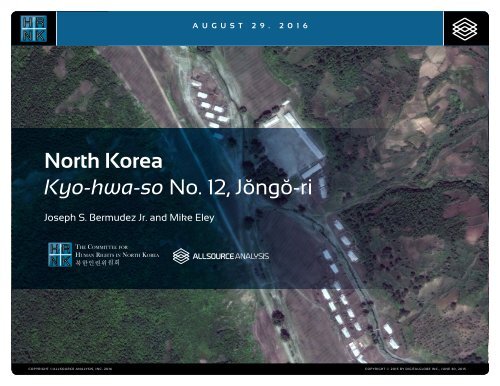
North Korea<br />
Black Text<br />
Kyo-hwa-so THE COMMITTEE FOR No. 12, Jŏngŏ-ri<br />
H R<br />
N K<br />
HUMAN RIGHTS IN NORTH KOREA<br />
북한인권위원회<br />
Joseph S. Bermudez Jr. and Mike Eley<br />
H R<br />
N K<br />
White Text<br />
THE COMMITTEE FOR<br />
HUMAN RIGHTS IN NORTH KOREA<br />
북한인권위원회<br />
COPYRIGHT ©ALLSOURCE ANALYSIS, INC. 2016 COPYRIGHT © 2015 BY DIGITALGLOBE INC., JUNE 30, 2015<br />
1
H R<br />
N K<br />
CH’OMA-BONG KYO-HWA-SO NO. RESTRICTED 12, JŎNGŎ-RI AREA<br />
North Korea: Imagery Analysis of Kyo-hwa-so No. 12, Jŏngŏ-ri<br />
China<br />
South<br />
Korea<br />
Location:<br />
Hoeryŏng-si, Hamgyŏng-bukto<br />
Coordinates:<br />
42.209410 N, 129.755100 E<br />
Date of Report:<br />
August 29, 2016<br />
Date of Imagery:<br />
High resolution: July 12, 2003<br />
through May 24, 2015<br />
Landsat: May 27, 1976 through<br />
June 6, 1984<br />
Declassified KH-4: April 7, 1967<br />
Size of Facility:<br />
23,600 square meters (28,230<br />
square yards)<br />
188 meters by 128 meters (205<br />
yards by 139 yards)<br />
Overview of North Korea’s Prison Camp<br />
System<br />
North Korea has a complex variety of<br />
facilities for detention and forced labor.<br />
The two large-scale facilities that are both<br />
usually termed “prison camps” in English<br />
are termed kwan-li-so and kyo-hwa-so<br />
in Korean. Kyo-hwa-so are re-education<br />
prison labor camps, and kwan-li-so are<br />
penal labor colonies.<br />
Kwan-li-so are, with one exception,<br />
sprawling encampments that encompass<br />
mountain ranges and valleys deep in the<br />
interior of central and north-central North<br />
Korea and are surrounded by barbed wire<br />
fences and guard towers. These penal<br />
labor colonies are administered by the<br />
powerful State Security Department (or<br />
Agency).<br />
In addition to kwan-li-so political prison<br />
camps, North Korea also operates prison<br />
labor camps called kyo-hwa-so. Kyohwa-so<br />
labor camps are “serious crimes”<br />
re-education prison camps, sometimes<br />
appearing in satellite photographs as a<br />
number of buildings surrounded by typical<br />
prison walls, and sometimes appearing as<br />
prison camps with widely separated prison<br />
sections surrounded by barbed wire and<br />
guard towers.<br />
What the kyo-hwa-so prison camps share<br />
with the kwan-li-so prison camps are<br />
extremely brutal conditions. The brutality<br />
affects both those convicted of actual<br />
offenses and those sentenced for essentially<br />
political offenses. A state can deprive<br />
its citizens of their liberty for what are universally<br />
regarded as criminal acts. A state<br />
may not, under contemporary international<br />
norms and standards, fail to provide food<br />
to those unjustly, or even justly, deprived of<br />
their liberty or subject them to forced labor<br />
so intense and dangerous that it leads to<br />
widespread deaths in detention. 1<br />
Based on research conducted by the<br />
Committee for Human Rights in North<br />
Korea (<strong>HRNK</strong>), five trends have defined<br />
the human rights situation under the Kim<br />
Jong-un regime: 1) an intensive crackdown<br />
on attempted defections; 2) an aggressive<br />
purge of senior officials, aimed to consolidate<br />
the leader’s grip on power; 3) a<br />
“restructuring” of the political prison camp<br />
system, with some facilities, closer to the<br />
border with China, being shut down, while<br />
inland facilities have been expanded; 4)<br />
disproportionate oppression of women,<br />
who have assumed primary responsibility<br />
for the survival of their families; thus,<br />
women represent the majority of those<br />
arrested for perceived wrongdoing at the<br />
“jangmadang” markets, or for “illegally”<br />
1. Hawk, David. The Hidden Gulag IV: Gender Repression<br />
and Prisoner Disappearances, (Washington, D.C.:<br />
<strong>HRNK</strong> 2015), pp. 12-27, (hereafter: HG4) available at<br />
https://www.hrnk.org/uploads/pdfs/Hawk_Hidden-<br />
Gulag4_FINAL.pdf.<br />
crossing the border; and 5) the sustained, if<br />
not increased, economic importance of the<br />
political prison camps.<br />
<strong>HRNK</strong> calls upon the government of the<br />
Democratic People’s Republic of Korea<br />
(DPRK) to:<br />
Increase the quantity and variety of food<br />
provisions to its prisoners to ensure<br />
they do not starve to death or become<br />
malnourished. All people have a right to<br />
food.<br />
Improve the working conditions in its<br />
mines by having and practicing safety<br />
standards and ventilating the mines.<br />
Also, reduce the number of hours per<br />
day that prisoners must work in the<br />
mines, and give them additional food<br />
and water for difficult manual labor.<br />
Ensure that waste run-off from mining<br />
does not contaminate fresh water<br />
sources for people in and around the<br />
mines and detention facilities as this<br />
may lead to serious health and environmental<br />
problems.<br />
Continue to grant mass amnesty in<br />
order to reduce the overcrowding in<br />
prison cells. This will reduce the number<br />
of deaths and sickness in detention.<br />
Allow the ICRC to have immediate, full,<br />
and genuine access to all detention<br />
facilities in the DPRK.<br />
Comply with the Standard Minimum<br />
Rules for Treatment of Prisoners.<br />
COPYRIGHT ©ALLSOURCE ANALYSIS, INC. 2016 2
H R<br />
N K<br />
CH’OMA-BONG KYO-HWA-SO NO. RESTRICTED 12, JŎNGŎ-RI AREA<br />
North Korea: Imagery Analysis of Kyo-hwa-so No. 12, Jŏngŏ-ri<br />
Introduction<br />
As part of a joint undertaking with <strong>HRNK</strong><br />
to use satellite imagery to shed light<br />
on human suffering in the DPRK (more<br />
commonly known as North Korea),<br />
AllSource Analysis (hereafter AllSource)<br />
has been monitoring activity at prison<br />
facilities throughout North Korea. This<br />
report details activity at a facility that is<br />
commonly identified as Kyo-hwa-so No.<br />
12, but is also known as Jŏngŏ-ri, Camp<br />
No. 12, or Jeongori Kyo-hwa-so No. 12. 2<br />
Executive Summary<br />
For this report, AllSource analyzed<br />
pan-sharpened multispectral satellite<br />
imagery of Kyo-hwa-so No. 12 and<br />
its immediate environs collected by<br />
DigitalGlobe, Airbus Defense and Space,<br />
and N<strong>ASA</strong>’s EO-1 from July 12, 2003<br />
through May 24, 2015, N<strong>ASA</strong>’s Landsat<br />
from May 27, 1976 through June 06, 1984,<br />
and USGS declassified KH-4 from April 7,<br />
1967 (Figure 1). Imagery analysis confirms<br />
that the area is a kyo-hwa-so (reeducation<br />
prison labor camp) and<br />
provides an understanding of its<br />
operational status based on the<br />
presence and changes in a number of<br />
physical features:<br />
2. Jŏngŏ-ri is frequently spelled as Chŏngŏ-ri.<br />
Entrance and checkpoint<br />
Housing and agricultural support<br />
facilities and activity<br />
Internal arrangement<br />
Mining activity<br />
Miscellaneous activity<br />
Road network<br />
Security.<br />
Based on analysis of these features,<br />
Kyo-hwa-so No. 12 is an operational<br />
prison camp that is, by North Korean<br />
standards, a small and well-maintained<br />
facility, as indicated by general activity<br />
and maintenance in and immediately<br />
surrounding the camp. This analysis also<br />
supports former prisoner and other<br />
reports that Kyo-hwa-so No. 12’s<br />
economic activity is focused on light<br />
industry, agriculture, and mining.<br />
It is important to reiterate the analytical<br />
caution presented in previous reports<br />
(such as North Korea: Imagery Analysis<br />
Camp 16 and North Korea’s Camp No. 25<br />
Update) produced by <strong>HRNK</strong> and All-<br />
Source. North Korean officials, especially<br />
those within the Korean People’s Army<br />
and the internal security organizations,<br />
clearly understand the importance of<br />
implementing camouflage, concealment,<br />
and deception (CCD) procedures to mask<br />
their operations and intentions. It would<br />
be reasonable to assume that they have<br />
done so here. 3<br />
Location and Organization<br />
Kyo-hwa-so No. 12 is a kyo-hwa-so<br />
under the control of the Prisons Bureau<br />
of the Ministry of People’s Security,<br />
which is directly under the National<br />
Defense Commission. Specifically, it<br />
is under the control of the ministry’s<br />
North Hamgyong Provincial Bureau. 4<br />
The camp is located approximately 490<br />
kilometers (km) northeast of the capital<br />
city of P’yŏngyang and approximately 25<br />
km south of Hoeryŏng-si. Specifically, it<br />
consists of two primary facilities located<br />
in two valleys on the northwest slopes of<br />
the Sin-bong (mountain) (Figure 2). The<br />
3. Bermudez Jr., Joseph S., Dinville, Andy and Eley,<br />
Mike. Imagery Analysis of Camp 16, (Washington,<br />
D.C.: The Committee for Human Rights in North<br />
Korea [<strong>HRNK</strong>], 2015) available at https://www.hrnk.<br />
org/uploads/pdfs/<strong>ASA</strong>_<strong>HRNK</strong>_Camp16_v8_fullres_FINAL_12_15_15.pdf<br />
and Bermudez Jr., Joseph<br />
S. Imagery Analysis: North Korea’s Camp No. 15,<br />
Update, (Washington, D.C.: <strong>HRNK</strong>, 2014) available<br />
at http://hrnk.org/uploads/pdfs/Camp%2025%20<br />
Update%20Good.pdf.<br />
4. KINU White Paper on Human Rights in North Korea<br />
2016, (Seoul: Korea Institute for National Unification,<br />
April 25, 2016), pp. 79-81, (hereafter: KINU2016)<br />
available at http://www.kinu.or.kr/report/<br />
report_03_01.jsp?page=1&num=43&mode=view&-<br />
field=&text=&order=&dir=&bid=DATA04&ses=.<br />
first facility is the walled prison facility<br />
located at the confluence of two unnamed<br />
streams and incorporates the two<br />
small villages of Musal-li (Musan-dong)<br />
and Kolchŏn’gŏ-ri. It derives one of its<br />
more commonly used names of Jŏngŏ-ri<br />
Kyo-hwa-so No. 12 from a shortened<br />
version of Kolchŏn’gŏ-ri. Adding to this<br />
confusion is the fact that the larger and<br />
more well-known town of Jŏn’gŏ-ri is<br />
2.5 km to the southwest. The second<br />
facility is a copper mine located in a small<br />
branch valley a short distance south of<br />
the prison facility.<br />
Based on analysis of historical Landsat<br />
satellite imagery, Kyo-hwa-so No. 12 appears<br />
to have been established between<br />
1980 and 1983. 5 It was established in an<br />
area that had historically been involved in<br />
agricultural (i.e., orchards, beans, potatoes,<br />
and corn) and logging since at least<br />
the late 1960s. Recent high-resolution<br />
satellite imagery confirms escapee<br />
5. Landsat imagery used for this determination<br />
includes: LM21240311976148FAK07 (May 27,<br />
1976), LM21240311977268AAA05 (September<br />
25, 1977), LM31240311978200AAA02 (July 19,<br />
1978), LM21240311979150AAA06 (May 30,<br />
1979), LM21240311980253HAJ00 (September<br />
09, 1980), LM21240311981121HAJ00 (May 01,<br />
1981), LM31240311982179HAJ07 (June 28, 1982),<br />
LM41150311983290HAJ00 (October 17, 1983), and<br />
LT51150311984173HAJ00 (June 06, 1984).<br />
COPYRIGHT ©ALLSOURCE ANALYSIS, INC. 2016 3
H R<br />
N K<br />
CH’OMA-BONG KYO-HWA-SO NO. RESTRICTED 12, JŎNGŎ-RI AREA<br />
North Korea: Imagery Analysis of Kyo-hwa-so No. 12, Jŏngŏ-ri<br />
reports that the camp has added light<br />
industry and mining to its list of activities<br />
and that the original walled prison facility<br />
was expanded to its present size with the<br />
addition of an attached walled compound<br />
to handle an increased female population.<br />
Numerous small- and medium-sized<br />
cultivated fields, which were created by<br />
logging activities, are located throughout<br />
the area. Additionally, there are several<br />
small mining activities, most of which<br />
appear to have been abandoned.<br />
The camp appears to be connected to<br />
the regional electric power grid via buried<br />
high voltage power transmission cables<br />
that run from the town of Jŏn’gŏ-ri area<br />
to a substation at the camp’s mining<br />
facility. It is connected to the national<br />
rail network via the stations at Jŏn’gŏ-ri<br />
2.5 km southwest and P’ungsal-li 4.3 km<br />
north of the facility. With the exception of<br />
an unused grass airfield at Punyŏng, 21.5<br />
km south of the facility, the closest air<br />
facility is the Korean People’s Air Force<br />
Sŭngam-ni Air Base located 60 km to the<br />
south. This is a training base. Based on<br />
its mission, organization, and location, it<br />
almost certainly provides no support to<br />
Kyo-hwa-so No. 12.<br />
Imagery Analysis<br />
For analytical purposes, the camp is<br />
divided into 15 discrete locations or activities<br />
that provide insight into changes<br />
to the facility and its environs during the<br />
time period under study (Figure 3). 6<br />
Area 1, Security<br />
Since Kyo-hwa-so No. 12 is a small<br />
walled prison facility in a remote mountain<br />
valley, it does not have an extended<br />
patrolled security perimeter, as do North<br />
Korea’s kwan-li-so. 7 At least one former<br />
6. The following sources were used throughout this<br />
section: Hawk, David. The Hidden Gulag Second<br />
Edition, (Washington, D.C.: <strong>HRNK</strong>, 2003), pp. 85-89,<br />
107 and 227, (hereafter: HG2) available at http://<br />
www.hrnk.org/uploads/pdfs/ <strong>HRNK</strong>_HiddenGulag2_Web_5-18.pdf;<br />
HG4, pp. 12-27; KINU White<br />
Paper on Human Rights in North Korea 2014,<br />
(Seoul: Korea Institute for National Unification, July<br />
2014), pp. 139-143, (hereafter: KINU2014) available<br />
at www.kinu.or.kr/eng/pub/; KINU White Paper on<br />
Human Rights in North Korea 2015, (Seoul: Korea<br />
Institute for National Unification, September 2015),<br />
pp. 80-84, (hereafter: KINU2015) available at www.<br />
kinu.or.kr/eng/pub/; and Report of the Commission<br />
of Inquiry on Human Rights in the Democratic<br />
People’s Republic of Korea, A/HRC/25/CRP.1, (New<br />
York: UN Human Rights Council, 7 February 2014),<br />
pp. 65-66 and 199, available at http://www.ohchr.<br />
org/Documents/HRBodies/HRCouncil/CoIDPRK/<br />
Report/A.HRC.25.CRP.1_ENG.doc.<br />
detainee indicates that there are small<br />
remote guard positions on the ridges surrounding<br />
the valley in which Kyo-hwa-so<br />
No. 12 is located. 8 With the exception of<br />
one possible guard position that appears<br />
to have been present since 2003, none<br />
of these have been identified (Figure<br />
4). Several important activities, such as<br />
a mine processing facility and a mine<br />
portal and worker housing compound, do,<br />
however, have guard positions (Figure 5).<br />
There is a main entrance and checkpoint<br />
astride the only road leading into the<br />
valley. The walled prison facility occupies<br />
a generally rectangular-shaped area that<br />
measures approximately 188 meters by<br />
128 meters (205 yards by 139 yards) and<br />
encompasses 2.360 hectares (28,230<br />
square yards). It has approximately threemeter-high<br />
walls, four elevated guard<br />
positions, and two exterior entrances.<br />
Area 2, Main Entrance and Checkpoint<br />
The main facility entrance and checkpoint<br />
to the valley housing Kyo-hwa-so No.<br />
12 is located approximately 1.9 km to the<br />
northwest of the facility astride the only<br />
road leading to the area. In 2003, the<br />
entrance and checkpoint consisted of<br />
only a small building (Figure 6). By 2008,<br />
this had been expanded to three buildings<br />
including a checkpoint, barracks, and<br />
administration buildings. Between 2009<br />
and 2012, these buildings received new<br />
roofs (Figure 7).<br />
Area 3, Musal-li<br />
The village of Musal-li (Musan-dong) is<br />
located approximately 1.2 km southeast<br />
of the main facility entrance and<br />
checkpoint, astride a small stream that<br />
runs through it. The area consists of<br />
approximately 28 housing units and<br />
a small partially enclosed compound,<br />
accessed from a small bridge across the<br />
stream, on the north side of the stream.<br />
This compound is similar to those seen<br />
throughout North Korea that house small<br />
military, para-military, or security units,<br />
although a firm determination cannot be<br />
made at this time.<br />
There have been a small number of<br />
minor changes to the village between<br />
2003 and 2015 (Figure 8). For example,<br />
between February 2012 and February<br />
2013, three buildings were razed and the<br />
road through the village was improved.<br />
All such changes, however, are typical of<br />
what is seen in rural North Korea.<br />
7. HG2, pp. 85-89.<br />
8. HG2, pp. 85-89.<br />
COPYRIGHT ©ALLSOURCE ANALYSIS, INC. 2016 4
H R<br />
N K<br />
KYO-HWA-SO NO. 12, JŎNGŎ-RI<br />
Figure 1<br />
0<br />
930 m<br />
Overview of the Kyo-hwa-so No. 12 area, as seen with a declassified Top Secret KH-4 satellite image dated April 7, 1967, superimposed on a June 30,<br />
2015 image. (42.2102 N, 129.7536 E)<br />
COPYRIGHT ©ALLSOURCE ANALYSIS, INC. 2016 DATA AVAILABLE FROM THE U.S. GEOLOGICAL SURVEY, APRIL 7, 1967 5<br />
BACK
H R<br />
N K<br />
KYO-HWA-SO NO. 12, JŎNGŎ-RI<br />
Figure 2<br />
0<br />
930 m<br />
Overview of the Kyo-hwa-so No. 12 area, June 30, 2015. (42.2102 N, 129.7536 E)<br />
COPYRIGHT ©ALLSOURCE ANALYSIS, INC. 2016 COPYRIGHT © 2015 BY DIGITALGLOBE INC., JUNE 30, 2015 6<br />
BACK
H R<br />
N K<br />
KYO-HWA-SO NO. 12, JŎNGŎ-RI<br />
Figure 3<br />
16<br />
2<br />
3<br />
1<br />
4<br />
6<br />
5<br />
15<br />
7<br />
9<br />
17<br />
8<br />
10<br />
11<br />
12<br />
13<br />
0<br />
14<br />
1,000 m<br />
Kyo-hwa-so No. 12 report areas. (42.2102 N, 129.7536 E)<br />
COPYRIGHT ©ALLSOURCE ANALYSIS, INC. 2016 COPYRIGHT © 2015 BY DIGITALGLOBE INC., JUNE 30, 2015 7<br />
BACK
H R<br />
N K<br />
KYO-HWA-SO NO. 12, JŎNGŎ-RI<br />
Figure 4<br />
Possible guard position<br />
0 50 m<br />
Area 1 - Possible guard position on the ridge to the west of Kyo-hwa-so No. 12, July 12, 2003. (42.2095 N, 129.7421 E)<br />
COPYRIGHT ©ALLSOURCE ANALYSIS, INC. 2016 COPYRIGHT © 2003 BY DIGITALGLOBE INC., JULY 12, 2003 8<br />
BACK
H R<br />
N K<br />
KYO-HWA-SO NO. 12, JŎNGŎ-RI<br />
Figure 5<br />
Possible guard position<br />
0 50 m<br />
Area 1 - Possible guard position on the ridge to the west of Kyo-hwa-so No. 12, June 30, 2015. (42.2095 N, 129.7421 E)<br />
COPYRIGHT ©ALLSOURCE ANALYSIS, INC. 2016 COPYRIGHT © 2003 BY DIGITALGLOBE INC., JUNE 30, 2015 9<br />
BACK
H R<br />
N K<br />
KYO-HWA-SO NO. 12, JŎNGŎ-RI<br />
Figure 6<br />
Entrance and checkpoint<br />
0 50 m<br />
Area 2 - Main entrance and checkpoint, July 12, 2003. (42.2218 N, 129.7380 E)<br />
COPYRIGHT ©ALLSOURCE ANALYSIS, INC. 2016 COPYRIGHT © 2003 BY DIGITALGLOBE INC., JULY 12, 2003 10<br />
BACK
H R<br />
N K<br />
KYO-HWA-SO NO. 12, JŎNGŎ-RI<br />
Figure 7<br />
Entrance and checkpoint<br />
0 50 m<br />
Area 2 - Main entrance and checkpoint, June 30, 2015. (42.2218 N, 129.7380 E)<br />
COPYRIGHT ©ALLSOURCE ANALYSIS, INC. 2016 COPYRIGHT © 2015 BY DIGITALGLOBE INC., JUNE 30, 2015 11<br />
BACK
H R<br />
N K<br />
KYO-HWA-SO NO. 12, JŎNGŎ-RI<br />
Figure 8<br />
Buildings removed between 2012 and 2013<br />
Probable military or security compound<br />
Road upgraded between 2012 and 2013<br />
0 160 m<br />
Area 3 - The village of Musal-li (Musan-dong), June 30, 2015. (129.7515 N, 42.2139 E)<br />
COPYRIGHT ©ALLSOURCE ANALYSIS, INC. 2016 COPYRIGHT © 2015 BY DIGITALGLOBE INC., JUNE 30, 2015 12<br />
BACK
H R<br />
N K<br />
CH’OMA-BONG KYO-HWA-SO NO. RESTRICTED 12, JŎNGŎ-RI AREA<br />
North Korea: Imagery Analysis of Kyo-hwa-so No. 12, Jŏngŏ-ri<br />
Areas 4-6, Headquarters, Prison, and<br />
Support Facilities<br />
The administrative and security headquarters,<br />
prison, and support facilities<br />
of Kyo-hwa-so No. 12 are located 1.9<br />
kilometers south of the main facility<br />
entrance and checkpoint. These appear to<br />
have been established between 1980 and<br />
1983 on the site of the old farming village<br />
of Kolchŏn’gŏ-ri. If North Korea followed<br />
practices seen elsewhere at the time the<br />
village was razed, the original inhabitants<br />
were likely moved to new housing nearby.<br />
These facilities occupy an irregular<br />
shaped area that measures approximately<br />
860 meters by 390 meters (940<br />
yards by 426 yards) and encompasses<br />
approximately 23.715 hectares (283, 629<br />
square yards). For analytical purposes,<br />
this area can be divided into four functional<br />
subcomponents:<br />
Housing<br />
Administration and security<br />
Agricultural support<br />
Walled prison.<br />
There were a total of 65 housing units<br />
located immediately adjacent to the<br />
walled prison as of June 2015. These<br />
were distributed as follows: 29 (of which<br />
one is partially complete) to the north, 22<br />
to the south, and 14 scattered along the<br />
northern bank of the adjacent stream.<br />
These housing units are very likely for the<br />
camp’s various managers, senior party<br />
officials, and senior security officials and<br />
their families. A few of the structures<br />
on the eastern edge of this area, on the<br />
north side of the stream, may have been<br />
from the original Kolchŏn’gŏ-ri village. A<br />
small number of minor changes (e.g., the<br />
construction of a small walled agricultural<br />
compound as of February 2012) have<br />
occurred in this area during the period of<br />
study, however, all of these are typical of<br />
what is expected to be seen during the<br />
normal course of operating such a facility<br />
in rural North Korea.<br />
Adjacent to the northwest wall of the<br />
prison are two compounds that house<br />
the camp’s administration and security<br />
headquarters, local Korean Workers’ Party<br />
offices, guard barracks, support staff, and<br />
support buildings (including a school<br />
for children). Directly to the west of the<br />
prison are two small agricultural support<br />
compounds—both of which are walled<br />
in. The first consists of greenhouses,<br />
stables, and livestock pens. The second<br />
compound is for storage (Figure 9, Figure<br />
10, Figure 11, Figure 12).<br />
This area is connected to the regional<br />
power grid via above ground power lines<br />
coming from the camp’s sole substation<br />
near the mining facility to the south.<br />
The original prison facility occupies a<br />
generally rectangular shaped area that<br />
measures approximately 142 meters<br />
by 128 meters (155 yards by 139 yards)<br />
and encompasses approximately 1.818<br />
hectares (21,738 square yards). Satellite<br />
imagery generally supports former<br />
prisoner descriptions of changes to<br />
the internal layout of the main prison<br />
compound and the fact that there have<br />
been changes to the various buildings<br />
(Figure 13). Former detainee Kim Won-gil<br />
identifies a furniture and a tool factory as<br />
the primary light industries operated by<br />
prisoners in the main prison. 9 According<br />
to Kim and other former inmates, both<br />
factories are reportedly the responsibility<br />
of prisoner Work Unit 1. In addition to this<br />
description of the internal layout, satellite<br />
imagery shows several small garden<br />
plots and what likely is a small courtyard<br />
for small animals and fowl. 10<br />
9. HG2, pp. 85-89.<br />
10. Ibid..<br />
According to the KINU White Paper on Human<br />
Rights in North Korea 2016, prisoners<br />
at Kyo-hwa-so No. 12 are grouped into<br />
five divisions. Male prisoners are assigned<br />
to Divisions 1, 2, 4, and 5, whereas female<br />
prisoners are assigned to Division 3. Each<br />
division is sub-divided into units. Division<br />
1 has approximately 12 units. Divisions 2<br />
and 3 each have around 10 units, while<br />
Division 4 has around 4 units, and Division<br />
5 has around 3 units. There is also a unit of<br />
undernourished prisoners. 11<br />
According to former detainees, female<br />
prisoners were introduced to Kyo-hwa-so<br />
No. 12 starting in late 2007 and soon<br />
numbered approximately 1,000, of whom<br />
approximately 80% had reportedly been<br />
forcibly repatriated back to North Korea<br />
from China. 12 Former prisoners report<br />
that though these female prisoners were<br />
originally housed in the main prison,<br />
as their numbers increased, an annex<br />
or “Women’s Section” (Division 3) was<br />
constructed prior to 2010 (Figure 14). 13<br />
11. KINU2016, pp. 81-82.<br />
12.. HG4, pp. 12-27.<br />
13. It should be noted that as written some former<br />
prisoner accounts confuse the original construction<br />
of female housing within the main prison<br />
compound during 2007-2008 with the construc-<br />
COPYRIGHT ©ALLSOURCE ANALYSIS, INC. 2016 13
H R<br />
N K<br />
CH’OMA-BONG KYO-HWA-SO NO. RESTRICTED 12, JŎNGŎ-RI AREA<br />
North Korea: Imagery Analysis of Kyo-hwa-so No. 12, Jŏngŏ-ri<br />
Satellite imagery more closely identifies<br />
the construction of the “Women’s<br />
Section” to the period between February<br />
and August 2009. This rectangular<br />
walled annex measures approximately<br />
46 meters by 128 meters (50 yards by 139<br />
yards) and encompasses approximately<br />
.6 hectares (7,000 square yards). Unlike<br />
the original prison compound, the<br />
“Women’s Section” does not have any<br />
visible garden plots.<br />
Former prisoners report that this<br />
Women’s Section has a division leader, a<br />
secretary, doctor, three female managers,<br />
and is “…divided into work units for tree<br />
and log cutting, agricultural production<br />
(beans, potatoes, and corn), livestock<br />
or animal husbandry, cooking (for the<br />
prisoners), which are the typical prison<br />
work units, plus a wig-making unit and<br />
an eyelash-making unit.” 14 These same<br />
reports contain detailed information<br />
concerning the internal layout of the<br />
women’s section and, while satellite<br />
imagery cannot determine the precision<br />
of these statements, the overall layout<br />
and dimensions provided very closely<br />
match the imagery. 15<br />
tion of the separate “Women’s Compound” during<br />
February-August 2009.<br />
14. Ibid. p. 17.<br />
15. KINU2016, pp. 81-82.<br />
In its present configuration, the expanded<br />
prison facility itself occupies a generally<br />
rectangular shaped area that measures<br />
approximately 188 meters by 128 meters<br />
(205 yards by 139 yards) and encompasses<br />
2.406 hectares (28,780 square<br />
yards). 16 It is surrounded by an approximately<br />
three-meter-high wall with two<br />
entrances (one for the main compound<br />
and one for the annex). There is no gate<br />
connecting the two compounds. Built into<br />
the wall are four elevated guard positions,<br />
one of which may have been abandoned<br />
as it no longer has a roof (Figure 15).<br />
Former detainees have reported different<br />
population figures over time for Kyohwa-so<br />
No. 12. For example, 1,300-1,500<br />
during 1998-1999, 1,700 during 2003-<br />
2006, and 5,000 (1,000 women and<br />
4,000 men) during 2008-2010. Although<br />
satellite imagery cannot confirm<br />
former detainee population estimates, the<br />
physical footprint of the prison suggests<br />
that if the more recent figures are even<br />
somewhat accurate, then the facility is<br />
overcrowded by most foreign standards.<br />
Areas 7-11, Mining Activity<br />
Satellite imagery collected from 2002<br />
through 2015 confirms former prisoner<br />
16. These measurements should be viewed as close<br />
approximations since the facility is not a rectangle<br />
with 90 o corners and they were derived from 50<br />
cm ground sample distance satellite imagery.<br />
reports about the presence of a copper<br />
mine in the valley south of Kyo-hwa-so<br />
No. 12 (Figure 16). This mining facility<br />
consists of four major components: a<br />
waste pond, mine processing buildings,<br />
mine and prisoner housing, and support<br />
buildings. 17 Former detainee Kim Won-gil<br />
identifies the mining activities to be the<br />
responsibility of prisoner Work Units 4, 5,<br />
and 6. 18<br />
At the entrance to the valley, 300 meters<br />
south of Kyo-hwa-so No. 12, is a waste<br />
pond covering 2.128 hectares (25,450<br />
square yards) for the mine processing<br />
facility. This pond is impounded by an<br />
earthen dam erected from mine waste.<br />
Raw waste is delivered to the pond via<br />
ditch and pipe. Here it settles and then<br />
is dredged out and used to reinforce the<br />
dam. Sitting on the dam is a drag-line<br />
excavator that dredges the pond and<br />
maintains the dam. Given the visible<br />
condition of the waste pond and dam<br />
and proximity to the nearby stream, it is<br />
17. At least one former detainee has reported that<br />
in addition to copper mining, Kyo-hwa-so No.<br />
12 was involved in the extraction of limestone.<br />
KINU2014, pp. 139-143. Another report states that<br />
the mine separates copper and gold out of the ore.<br />
2015 White Paper on North Korean Human Rights,<br />
(Seoul: Database Center for North Korean Human<br />
Rights, December 2015), p. 426.<br />
18. HG2, pp. 85-89. KINU2015, pp. 80-84 appears to<br />
provide a somewhat different description of the<br />
Work Units.<br />
likely that contaminants are present in<br />
the water downstream. This, in turn, raises<br />
the concern for possible health issues<br />
for persons living and working along the<br />
stream. On the south side of the waste<br />
pond is an approximately 4.3-meters-tall<br />
and 2-meters-wide structure that may be<br />
an abandoned guard tower or a smokestack<br />
from a razed structure.<br />
Approximately 570 meters south of the<br />
waste pond is a small ore processing<br />
facility consisting of a storage tank, four<br />
processing buildings, and eight support<br />
and housing structures (Figure 17). This<br />
facility was surrounded by a security<br />
fence and three guard positions from<br />
2003 to 2010 when the security fence<br />
was moved closer to the buildings.<br />
Between May and June 2015, it appears<br />
that the security fence may have been removed.<br />
Mine ore cars bring ore extracted<br />
from the nearby mine to the processing<br />
facility, where it is dumped, via a 370-meters-long<br />
electrified mine railway. Here<br />
the processing facility crushes the ore<br />
and produces copper products that are<br />
shipped out by truck (possibly to the rail<br />
station at P’ungsal-li, approximately 11 km<br />
to the north).<br />
Between July and September 2011, a<br />
road was built connecting the processing<br />
facility to a mine 1.2 kilometers to the<br />
northeast. This mine appears to have<br />
COPYRIGHT ©ALLSOURCE ANALYSIS, INC. 2016 14
H R<br />
N K<br />
CH’OMA-BONG KYO-HWA-SO NO. RESTRICTED 12, JŎNGŎ-RI AREA<br />
North Korea: Imagery Analysis of Kyo-hwa-so No. 12, Jŏngŏ-ri<br />
been established in 2010, and to have<br />
been dormant soon after the road was<br />
completed, as the tailings pile appears<br />
to have remained of consistent size and<br />
shape since late 2011 (Figure 18).<br />
Electricity for all the activities within the<br />
Kyo-hwa-so No. 12 area is provided via<br />
a small electric substation 180 meters<br />
south of the processing facility (Figure 19).<br />
Approximately 200 meters south and<br />
uphill of the ore processing facility is<br />
the mine portal and prisoner housing<br />
compound and a group of support<br />
buildings (Figure 20). The compound is<br />
approximately 135 meters long and 40<br />
meters wide and covers .500 hectares<br />
(5,980 square yards). It is surrounded<br />
by a three-to-four-meter-wide triple wire<br />
security fence that is approximately three<br />
meters high and two guard buildings.<br />
This compound consists of a mine portal,<br />
large prisoner housing building, and three<br />
support buildings/sheds. It has two entrances—one<br />
for the mine ore carts and<br />
one for personnel/vehicles. Sometime<br />
between December 2010 and February<br />
2013, the prisoner housing building<br />
was modified and currently measures<br />
9.5 meters wide by 94 meters long. It is<br />
presently not possible to calculate the<br />
number of prisoners being housed within<br />
the building, as the details of the interior<br />
layout are not available. Immediately<br />
south of the prisoner housing compound<br />
are several housing or support structures.<br />
It is interesting to note that though some<br />
former detainees from Kyo-hwa-so No. 12<br />
make mention of prisoners from the main<br />
prison working at the mine, none has<br />
mentioned the mining activities specifically<br />
or this prisoner housing compound.<br />
Area 12, Secure Explosives Facility<br />
Approximately 230 meters south of the<br />
prisoner housing compound is a secured<br />
bermed facility, measuring 64 meters by<br />
48 meters (69 yards by 52 yards), that is<br />
surrounded by a wire security fence and<br />
guard tower (Figure 21). This facility has<br />
two storehouses for explosives used in<br />
the mine and is typical of those seen at<br />
other mines throughout North Korea.<br />
Area 13, Walled Compound<br />
Approximately 800 meters up the valley<br />
from the explosives storehouses is a small<br />
walled compound measuring approximately<br />
13 meters by 12 meters (14 yards<br />
by 12 yards) and containing one small<br />
building (Figure 22). Given its location and<br />
proximity to the agricultural fields spreading<br />
out to the south, it may be used for<br />
tool storage and/or a guard position when<br />
prisoners are at work in the fields.<br />
Area 14, Razed Mining Facility<br />
Approximately 800 meters to the east<br />
of the previous building, in a spreading<br />
agricultural area, are the remains of a<br />
small prison mining facility that was<br />
present in 2003. This activity consisted<br />
of an irregularly-shaped compound<br />
measuring approximately 83 meters<br />
by 85 meters (90 yards by 92 yards)<br />
and encompassing .597 hectares (7,140<br />
square yards). It was surrounded by a<br />
double wire security fence with a single<br />
entrance, one external guard position, and<br />
approximately five buildings. Immediately<br />
adjacent to it was the mine portal, several<br />
support buildings, and a tailings pile. By<br />
December 2008, the facility had been<br />
partially razed. By February 2012, it had<br />
been completely razed. Between April<br />
2014 and May 2015, what appears to be<br />
a livestock confinement building was<br />
constructed, and livestock can be seen<br />
near the stream below the mine tailings<br />
pile (Figure 23, Figure 24).<br />
Area 15, Other Agricultural and Mining<br />
Activities<br />
As noted above, examination of<br />
satellite imagery reveals the presence<br />
of numerous small and medium-sized<br />
cultivated fields located throughout the<br />
area (Figure 25). It is likely that many of<br />
these were created by logging activities<br />
and, according to former prisoner<br />
statements, maintained by Kyo-hwa-so<br />
No. 12 prisoners. A former detainee<br />
identifies these agricultural activities to<br />
be the responsibility of prisoner Work<br />
Units 2 and 3, and the mining activities to<br />
be the responsibility of prisoner Work<br />
Units 4, 5, and 6. 19 Additionally, there are<br />
several small mining and possibly<br />
quarrying activities throughout the area,<br />
almost all of which appear to be inactive<br />
or abandoned.<br />
Area 16, Housing Area<br />
At the point where the Kyo-hwa-so No. 12<br />
road exits the valley and crosses the<br />
Hoeryŏng-chŏn at Susang-dong, there is<br />
a small housing area (Figure 26). Between<br />
2003 and 2008, the road past the area<br />
and leading to Kyo-hwa-so No. 12 was<br />
straightened and improved. Between<br />
February 2012 and February 2013, the<br />
road was washed out by flooding and<br />
never rebuilt. During this latter time period,<br />
the agricultural support area and threshing<br />
house were enlarged. As of June 2015, this<br />
area contained 39 housing units, a<br />
threshing house, and several agricultural<br />
support buildings. It is unclear if this area<br />
is related to Kyo-hwa-so No. 12.<br />
19. HG2, pp. 85-89.<br />
COPYRIGHT ©ALLSOURCE ANALYSIS, INC. 2016 15
H R<br />
N K<br />
KYO-HWA-SO NO. 12, JŎNGŎ-RI<br />
Figure 9<br />
Housing area<br />
Camp administration, security headquarters, and support area<br />
Main prison<br />
Agricultural support<br />
Housing area<br />
0 160 m<br />
Area 4 - Kyo-hwa-so No. 12 administration, security, and main prison area, July 12, 2003. (42.2104 N, 129.7548 E)<br />
COPYRIGHT ©ALLSOURCE ANALYSIS, INC. 2016 COPYRIGHT © 2003 BY DIGITALGLOBE INC., JULY 12, 2003 16<br />
BACK
H R<br />
N K<br />
KYO-HWA-SO NO. 12, JŎNGŎ-RI<br />
Figure 10<br />
Housing area<br />
Camp administration, security headquarters, and support area<br />
Main prison<br />
Agricultural support<br />
Housing area<br />
0 160 m<br />
Area 4 - Kyo-hwa-so No. 12 administration, security, and main prison area, December 26, 2008. (42.2104 N, 129.7548 E)<br />
COPYRIGHT ©ALLSOURCE ANALYSIS, INC. 2016 COPYRIGHT © 2008 BY DIGITALGLOBE INC., DECEMBER 26, 2008 17<br />
BACK
H R<br />
N K<br />
KYO-HWA-SO NO. 12, JŎNGŎ-RI<br />
Figure 11<br />
Housing area<br />
Camp administration, security headquarters, and support area<br />
Main prison<br />
Agricultural support<br />
Housing area<br />
Women’s section added in 2009<br />
0 160 m<br />
Area 4 - Kyo-hwa-so No. 12 administration, security, and main prison area, December 9, 2010. (42.2104 N, 129.7548 E)<br />
COPYRIGHT ©ALLSOURCE ANALYSIS, INC. 2016 COPYRIGHT © 2010 BY DIGITALGLOBE INC., DECEMBER 12, 2010 18<br />
BACK
H R<br />
N K<br />
KYO-HWA-SO NO. 12, JŎNGŎ-RI<br />
Figure 12<br />
Walled compound added in 2012<br />
Housing area<br />
Camp administration, security headquarters, and support area<br />
Main prison<br />
Agricultural support<br />
Housing area<br />
Women’s section added in 2009<br />
0 160 m<br />
Area 4 - Kyo-hwa-so No. 12 administration, security, and main prison area, June 30, 2015. (42.2104 N, 129.7548 E)<br />
COPYRIGHT ©ALLSOURCE ANALYSIS, INC. 2016 COPYRIGHT © 2015 BY DIGITALGLOBE INC., JUNE 30, 2015 19<br />
BACK
H R<br />
N K<br />
KYO-HWA-SO NO. 12, JŎNGŎ-RI<br />
Figure 13<br />
Guard tower<br />
Camp administration, security headquarters, and support area<br />
Main prison<br />
Agricultural support<br />
Entrance<br />
Guard tower<br />
Entrance<br />
Housing area<br />
Women’s section added in 2009<br />
Guard tower<br />
Guard tower<br />
0 80 m<br />
Area 5 - Kyo-hwa-so No. 12’s main prison facility, June 30, 2015. (42.2099 N, 129.7557 E)<br />
COPYRIGHT ©ALLSOURCE ANALYSIS, INC. 2016 COPYRIGHT © 2015 BY DIGITALGLOBE INC., JUNE 30, 2015 20<br />
BACK
H R<br />
N K<br />
KYO-HWA-SO NO. 12, JŎNGŎ-RI<br />
Figure 14<br />
Guard tower<br />
Entrance<br />
Entrance<br />
Women’s section added in 2009<br />
Guard tower<br />
Guard tower<br />
0 80 m<br />
Area 6 - Kyo-hwa-so No. 12’s “Women’s Section,” June 30, 2015. (42.2091 N, 129.7552 E)<br />
COPYRIGHT ©ALLSOURCE ANALYSIS, INC. 2016 COPYRIGHT © 2015 BY DIGITALGLOBE INC., JUNE 30, 2015 21<br />
BACK
H R<br />
N K<br />
KYO-HWA-SO NO. 12, JŎNGŎ-RI<br />
Figure 15<br />
Area 6 - Composite graphic of Kyo-hwa-so No. 12 Jŏngŏ-ri “Women’s Section” by Rosa Park, <strong>HRNK</strong>. (42.2091 N, 129.7552 E)<br />
COPYRIGHT ©ALLSOURCE ANALYSIS, INC. 2016 22<br />
BACK
H R<br />
N K<br />
KYO-HWA-SO NO. 12, JŎNGŎ-RI<br />
Figure 16<br />
Dam<br />
Dragline excavator<br />
Waste pond<br />
0 60 m<br />
Area 7 - Copper mine waste pond, June 30, 2015. (42.2064 N, 129.7529 E)<br />
COPYRIGHT ©ALLSOURCE ANALYSIS, INC. 2016 COPYRIGHT © 2015 BY DIGITALGLOBE INC., JUNE 30, 2015 23<br />
BACK
H R<br />
N K<br />
KYO-HWA-SO NO. 12, JŎNGŎ-RI<br />
Figure 17<br />
Perimeter fence line changed between 2010 and 2012<br />
Guard position<br />
New road as of February 2, 2012<br />
Ore processing facility<br />
Guard position<br />
Mine railroad<br />
Guard position<br />
0 40 m<br />
Area 8 - Ore processing facility, June 30, 2015. (42.2014 N, 129.7552 E)<br />
COPYRIGHT ©ALLSOURCE ANALYSIS, INC. 2016 COPYRIGHT © 2015 BY DIGITALGLOBE INC., JUNE 30, 2015 24<br />
BACK
H R<br />
N K<br />
KYO-HWA-SO NO. 12, JŎNGŎ-RI<br />
Figure 18<br />
New road as of February 2, 2012<br />
Mine<br />
0 40 m<br />
Area 9 - Dormant mine, June 30, 2015. (42.2061 N, 129.7592 E)<br />
COPYRIGHT ©ALLSOURCE ANALYSIS, INC. 2016 COPYRIGHT © 2015 BY DIGITALGLOBE INC., JUNE 30, 2015 25<br />
BACK
H R<br />
N K<br />
KYO-HWA-SO NO. 12, JŎNGŎ-RI<br />
Figure 19<br />
Electric substation<br />
0 50 m<br />
Area 10 - Electric substation, June 30, 2015. (42.2061 N, 129.7592 E)<br />
COPYRIGHT ©ALLSOURCE ANALYSIS, INC. 2016 COPYRIGHT © 2015 BY DIGITALGLOBE INC., JUNE 30, 2015 26<br />
BACK
H R<br />
N K<br />
KYO-HWA-SO NO. 12, JŎNGŎ-RI<br />
Figure 20<br />
Guard position<br />
Triple-wire security fence<br />
Mine railroad<br />
Prisoner housing<br />
Mine portal<br />
Railroad entrance<br />
Guard position<br />
Entrance<br />
0 50 m<br />
Area 11 - Mine portal and prisoner housing, June 30, 2015. (42.1993 N, 129.7586 E)<br />
COPYRIGHT ©ALLSOURCE ANALYSIS, INC. 2016 COPYRIGHT © 2015 BY DIGITALGLOBE INC., JUNE 30, 2015 27<br />
BACK
H R<br />
N K<br />
KYO-HWA-SO NO. 12, JŎNGŎ-RI<br />
Figure 21<br />
Guard position<br />
High explosives storage<br />
0 50 m<br />
Area 12 - Secured explosives storehouse, June 30, 2015. (42.1972 N, 129.7602 E)<br />
COPYRIGHT ©ALLSOURCE ANALYSIS, INC. 2016 COPYRIGHT © 2015 BY DIGITALGLOBE INC., JUNE 30, 2015 28<br />
BACK
H R<br />
N K<br />
KYO-HWA-SO NO. 12, JŎNGŎ-RI<br />
Figure 22<br />
Walled compound<br />
0 50 m<br />
Area 13 - Walled compound, June 30, 2015. (42.1950 N, 129.7638 E)<br />
COPYRIGHT ©ALLSOURCE ANALYSIS, INC. 2016 COPYRIGHT © 2015 BY DIGITALGLOBE INC., JUNE 30, 2015 29<br />
BACK
H R<br />
N K<br />
KYO-HWA-SO NO. 12, JŎNGŎ-RI<br />
Figure 23<br />
Mine portal<br />
Double-wire security fence<br />
Tailings pile<br />
Entrance<br />
Guard position<br />
Livestock confinement<br />
0 50 m<br />
Area 14 - Prison mine activity, July 12, 2003. (42.1948 N, 129.7738 E)<br />
COPYRIGHT ©ALLSOURCE ANALYSIS, INC. 2016 COPYRIGHT © 2012 BY DIGITALGLOBE INC., JULY 12, 2003 30<br />
BACK
H R<br />
N K<br />
KYO-HWA-SO NO. 12, JŎNGŎ-RI<br />
Figure 24<br />
Mine portal<br />
Tailings pile<br />
Livestock confinement<br />
0 40 m<br />
Area 14 - Livestock confinement building and abandoned prison mine activity, June 30, 2015. (42.1948 N, 129.7738 E)<br />
COPYRIGHT ©ALLSOURCE ANALYSIS, INC. 2016 COPYRIGHT © 2015 BY DIGITALGLOBE INC., JUNE 30, 2015 31<br />
BACK
H R<br />
N K<br />
KYO-HWA-SO NO. 12, JŎNGŎ-RI<br />
Figure 25<br />
Mining exploration<br />
Mining exploration<br />
Mining exploration<br />
Cultivated fields<br />
0 80 m<br />
Area 15 - Small mining and agricultural activities like those shown here are scattered around Kyo-hwa-so No. 12, June 30, 2015. (42.2099 N, 129.7672 E)<br />
COPYRIGHT ©ALLSOURCE ANALYSIS, INC. 2016 COPYRIGHT © 2015 BY DIGITALGLOBE INC., JUNE 30, 2015 32<br />
BACK
H R<br />
N K<br />
KYO-HWA-SO NO. 12, JŎNGŎ-RI<br />
Figure 26<br />
Housing<br />
Threshing house and agricultural support area<br />
Road present from 2008; washed out by 2013<br />
0 160 m<br />
Area 16 - Housing area near Susang-dong at the beginning of the road that leads to Kyo-hwa-so No. 12, June 30, 2015. (42.2275 N, 129.7321 E)<br />
COPYRIGHT ©ALLSOURCE ANALYSIS, INC. 2016 COPYRIGHT © 2015 BY DIGITALGLOBE INC., JUNE 30, 2015 33<br />
BACK
H R<br />
N K<br />
CH’OMA-BONG KYO-HWA-SO NO. RESTRICTED 12, JŎNGŎ-RI AREA<br />
North Korea: Imagery Analysis of Kyo-hwa-so No. 12, Jŏngŏ-ri<br />
Area 17, Jŏngŏ-ri Rail Station<br />
The camp is connected to the national rail<br />
network via the stations at P’ungsal-li, 4.3<br />
km north of the facility, and the town of<br />
Jŏngŏ-ri, 2.5 km southwest (Figure 27).<br />
Assessment<br />
Observations and analysis derived<br />
from satellite imagery collected by<br />
DigitalGlobe, Airbus Defense and Space,<br />
N<strong>ASA</strong>’s EO-1 from July 12, 2003 through<br />
May 24, 2015, N<strong>ASA</strong>’s Landsat from<br />
May 27, 1976 through June 6, 1984, and<br />
USGS declassified KH-4, combined with<br />
former prisoner statements and other<br />
publicly available information, indicate<br />
that:<br />
The Kyo-hwa-so No. 12 prison facility<br />
was established between 1980 and<br />
1983 and has operated as such since<br />
that time.<br />
The prison was expanded between<br />
February and August 2009 with the<br />
addition of a rectangular walled annex<br />
for female prisoners. By North Korean<br />
standards, Kyo-hwa-so No. 12 is a<br />
small and well-maintained facility as<br />
is indicated by agricultural activity,<br />
mining activity, and maintenance<br />
in and around the camp’s various<br />
facilities.<br />
Prisoners detained at the camp are<br />
engaged in light industrial, agricultural,<br />
mining, and to a lesser degree,<br />
logging activities.<br />
Sometime prior to 2009, the camp’s<br />
population increased as is evidenced<br />
by the construction of an annex for<br />
female prisoners between February<br />
and August 2009.<br />
At the same time, the administrative,<br />
support, and guard populations likely<br />
increased only slightly as is indicated<br />
by only very minor changes to the<br />
housing infrastructure.<br />
The administrative, barracks, housing,<br />
light industrial, and support structures<br />
throughout the camp appear to be<br />
well maintained and in relatively<br />
good repair. Additionally, the grounds<br />
around these structures and the road<br />
network supporting them are well<br />
maintained.<br />
The few livestock facilities within the<br />
camp are well maintained and show<br />
only minor signs of change.<br />
The camp appears to be connected<br />
to the regional electric power grid via<br />
buried high voltage power transmission<br />
cables that run from the town of<br />
Jŏn’gŏ-ri to a substation at the camp’s<br />
mining facility. From here, power is<br />
distributed to various camp buildings<br />
via above ground power lines.<br />
Recommendations<br />
Continued monitoring of Kyo-hwa-so<br />
No. 12 is recommended to develop an<br />
objective baseline understanding of the<br />
camp’s activities, maintain an evidentiary<br />
catalog of physical changes at the facility,<br />
update its status, develop more conclusive<br />
evidence of prisoner population<br />
size, and assist with the identification of<br />
possible human rights abuses.<br />
COPYRIGHT ©ALLSOURCE ANALYSIS, INC. 2016 34
H R<br />
N K<br />
KYO-HWA-SO NO. 12, JŎNGŎ-RI<br />
Figure 27<br />
Railroad station<br />
Railroad tunnel<br />
0 160 m<br />
Area 17 - Rail station at the town of Jŏn’gŏ-ri, June 30, 2015. (42.2056 N, 129.7266 E)<br />
COPYRIGHT ©ALLSOURCE ANALYSIS, INC. 2016 COPYRIGHT © 2015 BY DIGITALGLOBE INC., JUNE 30, 2015 35<br />
BACK
H R<br />
N K<br />
KYO-HWA-SO NORTH KOREA’S NO. 12, CAMP JŎNGŎ-RI 14<br />
North Korea: Imagery Analysis of Kyo-hwa-so No. 12, Jŏngŏ-ri<br />
Gazetteer<br />
Location Latitude (N) Longitude (E)<br />
Kyo-hwa-so No. 12 42.209410 129.755100<br />
Chŏn’gŏri-yŏk (Rail station) 42.205000 129.725278<br />
Hoeryŏng-si 42.442778 129.750833<br />
Jŏngŏ-ri (Town) 42.203056 129.724722<br />
Kalmadŏk 42.187500 129.743889<br />
Kolchŏn’gŏ-ri 42.208889 129.755278<br />
Musal-li (Musan-dong) 42.211667 129.752222<br />
P’ungsal-li 42.253333 129.758333<br />
Sin-bong 42.194167 129.790278<br />
Susang-dong 42.234167 129.735556<br />
COPYRIGHT ©ALLSOURCE ANALYSIS, INC. 2016 36
H R<br />
N K<br />
ANALYSIS<br />
H R<br />
N K<br />
Black Text<br />
THE COMMITTEE FOR<br />
HUMAN RIGHTS IN NORTH KOREA<br />
북한인권위원회<br />
ZHOUSHAN NORTH A U GPETROLEUM KOREA’S U S T 2 9 , CAMP 2 0STORAGE 1 6 14 15 FACILITY<br />
H R<br />
N K<br />
White Text<br />
THE COMMITTEE FOR<br />
HUMAN RIGHTS IN NORTH KOREA<br />
북한인권위원회<br />
<strong>HRNK</strong> is the leading U.S.-based bipartisan, non-governmental organization in<br />
the field of North Korean human rights research and advocacy, tasked to focus<br />
international attention on human rights abuses in that country. It is <strong>HRNK</strong>’s mission<br />
to persistently remind policy makers, opinion leaders, and the general public<br />
in the free world and beyond that more than 20 million North Koreans need our<br />
attention.<br />
Since its establishment in 2001, <strong>HRNK</strong> has played an important intellectual leadership<br />
role on North Korean human rights issues by publishing more than thirty<br />
major reports (available at http://hrnk.org/publications/hrnk-publications.php).<br />
<strong>HRNK</strong> became the first organization to propose that the human rights situation<br />
in North Korea be addressed by the UN Security Council. <strong>HRNK</strong> was directly,<br />
actively, and effectively involved in all stages of the process supporting the work<br />
of the UN Commission of Inquiry. In the past five years, <strong>HRNK</strong> has been invited<br />
numerous times to provide expert testimony before the U.S. Congress.<br />
For media inquiries, please contact Executive Director Greg Scarlatoiu at<br />
+1 202.499.7973 or by e-mail at executive.director@hrnk.org.<br />
AllSource Analysis, Inc. helps customers by focusing on what’s most important—<br />
changes that directly impact their organizations. Our team of professional imagery,<br />
geospatial and open source research analysts are backed by direct access to the<br />
satellite imagery collections from numerous providers of sub-meter resolution<br />
imagery. AllSource Analysis keeps a constant eye on the world to provide early<br />
insights into the business, market, military and political changes that impact<br />
people around the world.<br />
Questions or comments concerning<br />
AllSource Analysis can be sent to info@<br />
allsourceanalysis.com. Images in this report<br />
may be color-corrected for the purpose of<br />
publication.<br />
Indemnity: You will indemnify, defend, and<br />
hold harmless AllSource Analysis, Inc. and<br />
its subsidiaries, affiliates and subcontractors,<br />
and their respective owners, officers, directors,<br />
employees and agents, from and against<br />
any and all direct or indirect claims, damages,<br />
losses, liabilities, expenses, and costs<br />
(including reasonable attorneys fees) arising<br />
from or out of:<br />
(1) Your use of the Product for any purpose; (2)<br />
Your actual or alleged breach of any provision<br />
of this Agreement; or (3) damage to property<br />
or injury to or death of any person directly or<br />
indirectly caused by You. AllSource Analysis,<br />
Inc. will provide You with notice of any such<br />
claim or allegation, and AllSource Analysis, Inc.<br />
has the right to participate in the defense of<br />
any such claim at its expense.<br />
All satellite imagery in this document: DigitalGlobe and the U.S. Geological Survey.<br />
COPYRIGHT ©ALLSOURCE ANALYSIS, INC. 2016<br />
COPYRIGHT © 2014 BY DIGITALGLOBE INC., DECEMBER 14, 2014 37
![CV-MBM[186]](https://img.yumpu.com/59137292/1/190x238/cv-mbm186.jpg?quality=85)