ATOLL RESEARCH BULLETIN - Smithsonian Institution
ATOLL RESEARCH BULLETIN - Smithsonian Institution
ATOLL RESEARCH BULLETIN - Smithsonian Institution
You also want an ePaper? Increase the reach of your titles
YUMPU automatically turns print PDFs into web optimized ePapers that Google loves.
5. GEOGRAPHY AND ECOLOGY OF COSMOLEDO <strong>ATOLL</strong><br />
C. J. Bayne, B. H. Cogan, A. W. Diamond, J. Frazier, P. Grubb,<br />
A. Hutson, M. E. D. Poore, 0. R. Stoddart, J. D. Taylor<br />
Introduction<br />
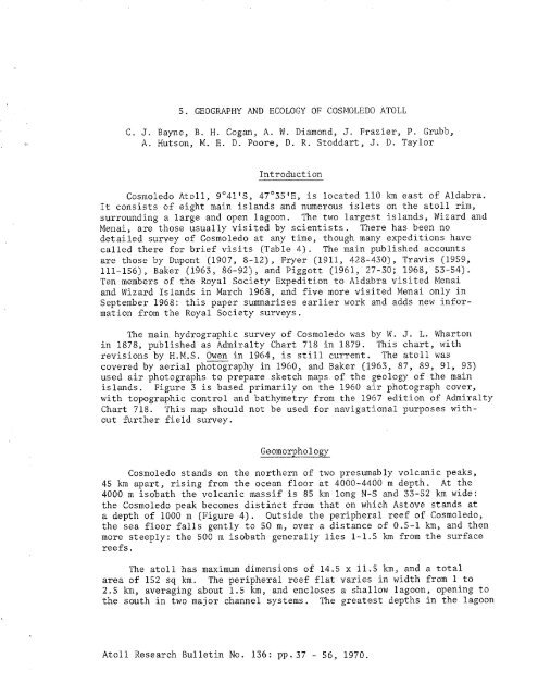
Cosmoledo Atoll, go41'S, 47'35'E, is located 110 km east of Aldabra.<br />
It consists of eight main islands and numerous islets on the atoll rim,<br />
surrounding a large and open lagoon. The two largest islands, Wizard and<br />
Menai, are those usually visited by scientists. There has been no<br />
detailed survey of Cosmoledo at any time, though many expeditions have<br />
called there for brief visits (Table 4). The main published accounts<br />
are those by Dupont (1907, 8-12), Fryer (1911, 428-430), Travis (1959,<br />
111-156), Baker (1963, 86-92), and Piggott (1961, 27-30; 1968, 53-54).<br />
Ten members of the Royal Society Expedition to Aldabra visited Menai<br />
and Wizard Islands in March 1968, and five more visited Menai only in<br />
September 1968: this paper summarises earlier work and adds new infor-<br />
mation from the Royal Society surveys.<br />
The main hydrographic survey of Cosmoledo was by W. J. L. Wharton<br />
in 1878, published as Admiralty Chart 718 in 1879. This chart, with<br />
revisions by H.M.S. - Owen in 1964, is still current. The atoll was<br />
covered by aerial photography in 1960, and Baker (1963, 87, 89, 91, 93)<br />
used air photographs to prepare sketch maps of the geology of the main<br />
islands. Figure 3 is based primarily on the 1960 air photograph cover,<br />
with topographic control and bathymetry from the 1967 edition of Admiralty<br />
Chart 718. This map should not be used for navigational purposes without<br />
further field survey.<br />
Geomorphology<br />
Cosmoledo stands on the northern of two presumably volcanic peaks,<br />
45 km apart, rising from the ocean floor at 4000-4400 m depth. At the<br />
4000 m isobath the volcanic massif is 85 km long N-S and 33-52 km wide:<br />
the Cosmoledo peak becomes distinct from that on which Astove stands at<br />
a depth of 1000 m (Figure 4). Outside the peripheral reef of Cosmoledo,<br />
the sea floor falls gently to 50 m, over a distance of 0.5-1 km, and then<br />
more steeply: the 500 m isobath generally lies 1-1.5 km from the surface<br />
reefs.<br />
The atoll has maximum dimensions of 14.5 x 11.5 km, and a total<br />
area of 152 sq km. The peripheral reef flat varies in width from 1 to<br />
2.5 km, averaging about 1.5 km, and encloses a shallow lagoon, opening to<br />
the south in two major channel systems. The greatest depths in the lagoon<br />
Atoll Research Bulletin No. 136: pp.37 - 56, 1970.


