pdf-zusammengefasst

Create successful ePaper yourself
Turn your PDF publications into a flip-book with our unique Google optimized e-Paper software.
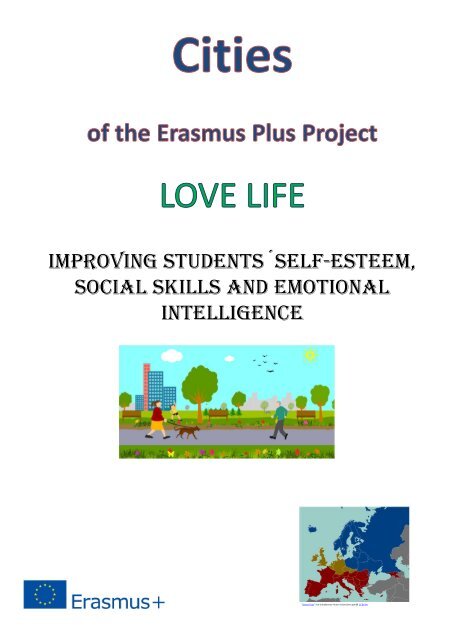
ImprovIng students´self-esteem,<br />
socIal skIlls and emotIonal<br />
IntellIgence<br />
"Dieses Foto" von Unbekannter Autor ist lizenziert gemäß CC BY-SA
Coordinates: 50°20′17″N 7°42′38″E<br />
Bad Ems<br />
Bad Ems is a town in Rheinland Pfalz, Germany. It is the administrative seat of the<br />
Rhein-Lahn rural district and is well known as a spa on the river Lahn. Bad Ems is<br />
the seat of the Verbandsgemeinde (administrative community) Bad Ems. The town<br />
has around 9,000 inhabitants.<br />
Bad Ems<br />
Contents<br />
Geography<br />
History<br />
Mining<br />
Economy<br />
Mineral springs<br />
Infrastructure<br />
Transport<br />
Governance<br />
Mayor<br />
Town twinning<br />
Notable people<br />
Sons and daughters of the town<br />
Personalities who are associated with the city<br />
Notes<br />
References<br />
External links<br />
A Water tower built in Bad Ems in 1907<br />
Coat of arms<br />
Geography<br />
The town is located on both banks of the River Lahn, the natural border between the<br />
Taunus and the Westerwald, two parts of the Rhenish Slate Mountains. The town<br />
and its outer districts are situated within the Nassau Nature Reserve.<br />
Bad Ems<br />
History<br />
In Roman times, a castrum was built at Bad Ems as part of the Upper Germanic<br />
Limes, but today not much of the structure remains. In the woods around the town,<br />
however, there are distinct traces of the former Roman border .<br />
The town was first mentioned in official documents in 880 and received its town<br />
charter in 1324. The Counts of Nassau and Katzenelnbogen rebuilt the bath and<br />
used it together with other noble visitors. [2] In the 17th and 18th centuries Bad Ems<br />
was considered one of Germany's most famous bathing resorts. It reached its<br />
heyday in the 19th century when it welcomed visitors from all over the world and<br />
became the summer residence of various European monarchs and artists, including<br />
Kaiser Wilhelm I of Germany, Tsars Nicholas I and Alexander II of Russia, Richard<br />
Wagner, Fyodor Dostoevsky and Vasili Vasilyevich Vereshchagin, etc.<br />
Location of Bad [show]<br />
Ems within Rhein-<br />
Lahn-Kreis district
In 1870, the town, then part of Prussian Hesse-Nassau, became known as the place<br />
where the Ems Dispatch originated, instigating the Franco-Prussian War.<br />
In 1876, in the Haus Vier Türme (Four Tower House), the Ems Edict was signed by<br />
Alexander II of Russia, banning the use of the Ukrainian language. Today, a<br />
monument at the spot commemorates this historical event.<br />
Mining<br />
In the 19th and 20th centuries a lot of mining for metal ores took place in the town,<br />
concentrated on lead, silver, zinc and copper. The Romans had already dug for ores<br />
using open cast mining, which continued throughout the Middle Ages. The many<br />
indentations on Blöskopf Hill bear witness to this period of history. As time went<br />
by, the method changed from open cast mining to underground mining with tunnels<br />
and shafts. Mining of this kind is first mentioned in a document dated 1158, and it<br />
continued on into the 18th century, although with long interruptions.<br />
The advent of the Industrial Revolution led to the expansion of the mine, which<br />
from 1871 operated under the name of Emser Blei- und Silberwerk AG (Bad Ems<br />
Lead and Silver Works, Inc.). In 1909 the company was taken over by what later<br />
became the Stolberger Zink AG (Stolberg Zinc Inc.) and mining continued until the<br />
end of the Second World War brought things to a halt in 1945. After the war, the<br />
mine no longer received any subsidies, but until 1959, stockpiled ore and ore from<br />
other mines were sorted at the central preparation plant in Silberau.<br />
Today, the mine is still known as "Mercur", the collective name for various<br />
individual pits. Since 1996, the mine has been set up as a museum.<br />
Economy<br />
Industry in Bad Ems is mainly limited to companies related to its spa status, but<br />
nonetheless fairly varied, including medicine, electrical engineering and tourism.<br />
Mineral springs<br />
Natural Ems salt is produced from local mineral water. The spring's mineral water,<br />
noted for its very high mineral content, is also marketed separately for drinking and<br />
inhalation purposes; when inhaled using a vaporizer, the water has a beneficial<br />
effect on sore throats. [3]<br />
Coordinates: 50°20′17″N 7°42′38″E<br />
Country<br />
State<br />
District<br />
Municipal<br />
assoc.<br />
Government<br />
• Mayor<br />
Germany<br />
Rhineland-<br />
Palatinate<br />
Rhein-Lahn-Kreis<br />
Bad Ems<br />
Bernard Abt (SPD)<br />
Area<br />
• Total 15.36 km 2<br />
Elevation<br />
(5.93 sq mi)<br />
80 m (260 ft)<br />
Population (2015-12-31) [1]<br />
• Total 9,229<br />
• Density 600/km 2<br />
Time zone<br />
(1,600/sq mi)<br />
CET/CEST<br />
(UTC+1/+2)<br />
Postal codes 56130<br />
Dialling codes 02603<br />
Vehicle<br />
EMS<br />
registration<br />
Website<br />
www.bad-ems.de<br />
Infrastructure<br />
Transport<br />
The town is linked to a view point at the Bismarckturm (Bismarck tower) by the<br />
Kurwaldbahn funicular railway. Bad Ems station lies on the Lahn Valley Railway.<br />
Governance<br />
Bad Ems from the Concordia heights<br />
Mayor<br />
The mayor of Bad Ems is Bernard Abt (SPD).
Town twinning<br />
Bad Ems is twinned with:<br />
Droitwich Spa (United Kingdom)<br />
Lubin (Poland)<br />
Cosne-Cours-sur-Loire(France)<br />
Blankenfelde-Mahlow (Germany)<br />
Notable people<br />
Bad Ems from the River Lahn<br />
Sons and daughters of the town<br />
1888: Max Jacob, puppeteer and founder of the Hohnsteiner Puppenbühne<br />
1898: Adolf Reichwein, German educator, economist and cultural politicians,<br />
resistance fighter during the Third Reich, died 1944<br />
Personalities who are associated with the city<br />
1811: Joseph Derenbourg, orientalist, died 1895<br />
1819: Jacques Offenbach, composer, last stay in Bad Ems, many operettas<br />
listed here, died 1880<br />
1841: John Naish, Lord Chancellor of Ireland, died in Bad Ems while taking<br />
a cure in 1890 and is buried there<br />
1944: Botho Strauss, writer and playwright, born in Naumburg, schooling<br />
through high school in Bad Ems<br />
1952: Thomas C. Breuer, writer and comedian, born in Eisenach, schooling<br />
in Bad Ems<br />
1974: Josef Winkler, born in Koblenz, former member of parliament (Alliance<br />
90/The Greens)<br />
Plaque dedicated to Ems Ukaz in<br />
Bad Ems.<br />
Notes<br />
1. "Gemeinden in Deutschland mit Bevölkerung am 31. Dezember 2015"(http://ww<br />
w.statistik.rlp.de/fileadmin/dokumente/berichte/A1033_201522_hj_G.<strong>pdf</strong>)(PDF).<br />
Statistisches Bundesamt(in German). 2016.<br />
2. The History of the County of Katzenelnbogen and the First Riesling of the World<br />
(http://www.graf-von-katzenelnbogen.de/)<br />
3. http://www.emser-kraenchen-tafelwasser.de/informationen.html<br />
Adolf Reichwein in 1944<br />
(Volksgerichtshof)<br />
References<br />
Stella Ghervas, « Spas' political virtues : Capodistria at Ems (1826) », Analecta Histórico<br />
Médica, IV, 2006 (with A. Franceschetti).<br />
Much of the content of this article comes from the equivalent Germanlanguage<br />
Wikipedia article (retrieved September 5, 2005).<br />
External links<br />
Media related to Bad Ems at Wikimedia Commons<br />
Jaques Offenbach<br />
Historical footage of Bad Ems, 1914, filmportal.de<br />
Retrieved from "https://en.wikipedia.org/w/index.php?title=Bad_Ems&oldid=845855919 "
This page was last edited on 14 June 2018, at 16:16(UTC).<br />
Text is available under the Creative Commons Attribution-ShareAlike License; additional terms may apply. By using this site,<br />
you agree to the Terms of Use and Privacy Policy. Wikipedia® is a registered trademark of the Wikimedia Foundation, Inc., a<br />
non-profit organization.
Barrow-in-Furness<br />
Barrow-in-Furness /ˈbæroʊ ɪn ˈfɜːrnəs/ FUR-nəs, commonly known as Barrow, is a town and<br />
borough in Cumbria, England. Historically part of Lancashire, it was incorporated as a municipal<br />
borough in 1867 and merged with Dalton-in-Furness Urban District in 1974 to form the Borough of<br />
Barrow-in-Furness. At the tip of the Furness peninsula, close to the Lake District, it is bordered by<br />
Morecambe Bay, the Duddon Estuary and the Irish Sea. In 2011, Barrow's population was 57,000, the<br />
second largest urban area in Cumbria, after Carlisle. Natives of Barrow, as well as the local dialect, are<br />
known as Barrovian. [1]<br />
Barrow-in-Furness<br />
In the Middle Ages, Barrow was a small hamlet within the Parish of Dalton-in-Furness with Furness<br />
Abbey, now on the outskirts of the modern-day town, controlling the local economy before its<br />
dissolution in 1537. The iron prospector Henry Schneider arrived in Furness in 1839 and, with other<br />
investors, opened the Furness Railway in 1846 to transport iron ore and slate from local mines to the<br />
coast. Further hematite deposits were discovered, of sufficient size to develop factories for smelting<br />
and exporting steel. By the late 19th century, the Barrow Hematite Steel Company-owned steelworks<br />
was the world's largest. [2]<br />
Barrow's location and the availability of steel allowed the town to develop into a significant producer<br />
of naval vessels, a shift that was accelerated during World War I and the local yard's specialisation in<br />
submarines. The original iron- and steel-making enterprises closed down after World War II, leaving<br />
Vickers shipyard as Barrow's main industry and employer. Several Royal Navy flagships, the vast<br />
majority of its nuclear submarines as well as numerous other naval vessels, ocean liners and oil tankers<br />
have been manufactured at the facility.<br />
Clockwise from the upper left: Central<br />
Barrow with the skyline of Blackpool<br />
also visible, Barrow Island, Walney<br />
Bridge and Furness College, Furness<br />
Abbey, Ramsden Square, Dock<br />
Museum and DDH, Barrow Town Hall<br />
and St. Mary's Church<br />
The end of the Cold War and subsequent decrease in military spending saw high unemployment in the<br />
town through lack of contracts; despite this, the BAE Systems shipyard remains operational as the<br />
UK's largest by workforce and is undergoing a major expansion associated with the Dreadnought-class<br />
submarine programme. [3] Today Barrow is a hub for energy generation and handling. Offshore wind<br />
farms form one of the highest concentrations of turbines in the world. [4]<br />
Contents<br />
Toponymy<br />
Nicknames<br />
History<br />
Early history<br />
19th century<br />
20th century<br />
21st century<br />
Governance<br />
Geography<br />
Islands<br />
Climate<br />
Demography<br />
Population<br />
Ethnicity and language<br />
Religion<br />
Economy<br />
Shipyard and port<br />
Energy generation<br />
Tourism and leisure<br />
Regeneration and redevelopment<br />
Other<br />
Employment<br />
Coat of arms of Barrow-in-Furness<br />
Barrow-in-<br />
Furness<br />
Barrow-in-Furness shown within<br />
Cumbria
Transport<br />
Road<br />
Bus<br />
Rail<br />
Air<br />
Sea<br />
Sport<br />
Football<br />
Rugby<br />
Golf<br />
Other sports<br />
Culture<br />
Architecture<br />
Arts<br />
Media<br />
Newspapers<br />
Radio<br />
Television<br />
Dialect and accent<br />
Nightlife<br />
Food<br />
Social issues<br />
Lifestyle<br />
Health<br />
Crime<br />
Education<br />
See also<br />
References<br />
External links<br />
Population 56,745 (2011<br />
Census)<br />
Demonym<br />
OS grid reference<br />
• London<br />
District<br />
Shire county<br />
Region<br />
Country<br />
Sovereign state<br />
Post town<br />
Barrovian<br />
SD198690<br />
222 mi (357 km)<br />
Barrow-in-<br />
Furness<br />
Cumbria<br />
North West<br />
England<br />
United Kingdom<br />
BARROW -IN-<br />
FURNESS<br />
Postcode district LA13, LA14<br />
Dialling code 01229<br />
Police<br />
Fire<br />
Ambulance<br />
EU Parliament<br />
UK Parliament<br />
Cumbria<br />
Cumbria<br />
North West<br />
North West<br />
England<br />
Barrow and<br />
Furness<br />
Toponymy<br />
The name was originally that of an island, Barrai, which can be traced back to 1190. This was later renamed Old Barrow, recorded as Oldebarrey in 1537,<br />
and Old Barrow Insula and Barrohead in 1577. The island was then joined to the mainland and the town took its name. The name itself seems to mean<br />
"island with promontory", combining British barro- and Old Norse ey, but it is more likely that Scandinavian settlers simply accepted barro- as a<br />
meaningless name, and so added an explanatory Old Norse second element. [5]<br />
Nicknames<br />
In the late 19th and early 20th centuries, Barrow was nicknamed "the English Chicago" because of the sudden and rapid growth in its industry, economic<br />
stature and overall size. [6] More recently the town has been dubbed the "capital of blue-collar Britain" by the Daily Telegraph, reflecting its strong working<br />
class identity. [7] Barrow is also often jokingly referred to as being at the end of the longest cul-de-sac in the country because of its isolated location at the<br />
tip of the Furness peninsula. [8]<br />
History<br />
Early history<br />
Barrow and the surrounding area has been settled non-continuously for several millennia with evidence of Neolithic inhabitants on Walney Island. Despite<br />
a rich history of Roman settlement across Cumbria and the discovery of related artefacts in the Barrow area, no buildings or structures have been found to<br />
support the idea of a functioning Roman community on the Furness peninsula. [9] The Furness Hoard discovery of Viking silver coins and other artefacts in<br />
2011 provided significant archaeological evidenceof Norse settlement in the early 9th century. Several areas of Barrow including Yarlside and Ormsgill, as<br />
well as "Barrow" and "Furness", have names of Old Norse origin. The Domesday Book of 1086 recorded the settlements of Hietun, Rosse and Hougenai,<br />
which are now the districts of Hawcoat, Roose and Walney respectively.<br />
In the Middle Ages the Furness peninsula was controlled by the Cistercian monks of the Abbey of St Mary of Furness, known as Furness Abbey. This was<br />
located in the "Vale of Nightshade", now on the outskirts of the town. [10] Founded for the Savigniac order, it was built on the orders of King Stephen in<br />
1123. Soon after the abbey's foundation the monks discovered iron ore deposits, later to provide the basis for the Furness economy. These thin strata, close<br />
[11] [12]
to the surface, were extracted through open cut workings, [11] which were then smelted by the monks. [12]<br />
The proceeds from mining, along with agriculture and fisheries, meant that by the 15th century the abbey<br />
had become the second richest and most powerful Cistercian abbey in England, after Fountains Abbey in<br />
Yorkshire. [13] The monks of Furness Abbey constructed a wooden tower on nearby Piel Island in 1212<br />
which acted as their main trading point; it was twice invaded by the Scots, in 1316 and 1322. In 1327 King<br />
Edward III gave Furness Abbey a licence to crenellate the tower, and a motte-and-bailey castle was built.<br />
However Barrow itself was just a hamlet in the parish of Dalton-in-Furness, reliant on the land and sea for<br />
survival. Small quantities of iron and ore were exported from jetties on the channel separating the village<br />
from Walney Island. Amongst the oldest buildings in Barrow are several cottages and farmhouses in<br />
Newbarns (now a ward of the borough) which date back to the early 17th century; as well as Rampside<br />
Hall, a Grade I listed building and the best-preserved in the town from the 1600s. Even as late as 1843<br />
there were still only 32 dwellings, including two pubs. [14]<br />
Furness Abbey, one of England's<br />
most powerful monasteries in the<br />
Middle Ages<br />
19th century<br />
In 1839 Henry Schneider arrived as a young speculator and dealer in iron, and he discovered lar ge deposits<br />
of haematite in 1850. He and other investors founded the Furness Railway, the first section of which<br />
opened in 1846, to transport the ore from the slate quarries at Kirkby-in-Furness and haematite mines at<br />
Lindal-in-Furness and Askam and Ireleth to a deep-water harbour near Roa Island. [15] The crucial and<br />
difficult link across Morecambe Bay between Ulverston and Carnforth on the main line was promoted, as<br />
the Ulverston and Lancaster Railway, by a group led by John Brogden and opened in 1857. It was<br />
promptly purchased by the Furness Railway. [16][17]<br />
Barrow Steelworks circa. 1877<br />
transported by sea.<br />
The docks built between 1863 and 1881 in the more sheltered channel between the mainland and Barrow<br />
Island replaced the port at Roa Island. The first dock to open was Devonshire Dock in 1867, and Prime<br />
Minister William Ewart Gladstone stated his belief that "Barrow would become another Liverpool". The<br />
increasing quantities of iron ore mined in Furness were then brought into the centre of Barrow to be<br />
The investors in the burgeoning mining and railway industries decided that greater profits could be made<br />
by smelting the iron ore and converting the resultant pig-iron into steel, and then exporting the finished<br />
product. Schneider and James Ramsden, the railway's general manager, erected blast furnaces at Barrow<br />
that by 1876 formed the largest steelworks in the world. [18] Its success was a result of the availability of<br />
local iron ore and coal from the Cumberland mines and easy rail and sea transport. The Furness Railway,<br />
which counted local aristocrats William Cavendish, 7th Duke of Devonshireand the Duke of Buccleuch as<br />
investors, kick-started the Industrial Revolution on the peninsula. The railway brought mined ore to the<br />
town, where the steelworks produced large quantities of steel. It was used for shipbuilding, and derived<br />
products such as rails were also exported from the newly-built docks. [15]<br />
Painting of the Barrow Jute Works in<br />
1875<br />
Barrow's population grew rapidly. Population figures for the town itself were not collected until 1871, [19] though sources suggest that Barrow's population<br />
was still as low as 700 in 1851. [20] During the first half of the 19th century, Barrow formed part of the parish of Dalton-in-Furness, the population of which<br />
shows some of Barrow's early growth from the 1850s:<br />
Population of the Parish of Dalton-in-Furness [19]<br />
Year 1801 1811 1821 1831 1841 1851 1861<br />
Population 1,954 2,074 2,446 2,697 3,231 4,683 9,152<br />
In 1871 Barrow's population was recorded at 18,584 and in 1881 at 47,259, less than forty years after the railway was built. [19] The majority of migrants<br />
originated from elsewhere in Lancashire although significant numbers settled in Barrow from Ireland and Scotland, which represented 11% and 7% of the<br />
local population in the 1890s. [21][22] By the turn of the 20th century, the Scottish-born population had increased to form the highest portion anywhere in<br />
England. In an attempt to diversify Barrow's economy James Ramsden founded the Barrow and Calcutta Jute Company in 1870 and the Barrow Jute Works<br />
was soon constructed alongside the Furness Railway line in Hindpool. The mill employed 2,000 women at its peak and was awarded a gold medal for its<br />
produce at the 1878 Paris Exposition Universelle. [23]<br />
The sheltered strait between Barrow and Walney Island was an ideal location for the shipyard. The first ship to be built, the Jane Roper, was launched in<br />
1852; the first steamship, a 3,000-ton liner named Duke of Devonshire, in 1873. Shipbuilding activity increased, and on 18 February 1871 the Barrow<br />
Shipbuilding Company was incorporated. Barrow's relative isolation from the United Kingdom's industrial heartlands meant that the newly formed
Barrow's shipyard circa. 1890<br />
company included several capabilities that would usually be subcontracted to other establishments. In<br />
particular, a large engineering works was constructed including a foundry and pattern shop, a forge, and an<br />
engine shop. In addition, the shipyard had a joiners' shop, a boat-building shed and a sailmaking and<br />
rigging loft. [24]<br />
During these boom years, Ramsden proposed building a planned town to accommodate the large<br />
workforce which had arrived. There are few planned towns in the United Kingdom, and Barrow is one of<br />
the oldest. Its centre contains a grid of well-built terraced houses, with a tree-lined road leading away from<br />
a central square. Ramsden later became the first mayor of Barrow, [25] which was given municipal borough<br />
status in 1867, and county borough status in 1889. [26] The imposing red sandstone town hall, designed by W.H. Lynn, was built in a neo-gothic style in<br />
1887. [27] Prior to this, the borough council had met at the railway headquarters: the railway company's control of industry extended to the administration of<br />
the town itself.<br />
The Barrow Shipbuilding Company was taken over by the Sheffield steel firm of Vickers in 1897, by<br />
which time the shipyard had surpassed the railway and steelworks as the largest employer and landowner<br />
in Barrow. The company constructed Vickerstown, modelled on George Cadbury's Bournville, on the<br />
adjacent Walney Island in the early 20th century to house its employees. [28] It also commissioned Sir<br />
Edwin Lutyens to design Abbey House as a guest house and residence for its managing director,<br />
Commander Craven. [29]<br />
20th century<br />
Map of Barrow dated 1890 showing<br />
no development on Walney Island<br />
and little north of the Furness Line<br />
Abbey House was commissioned by<br />
Vickers and designed by Sir Edwin<br />
Lutyens<br />
By the 1890s the shipyard was heavily engaged in the<br />
construction of warships for the Royal Navy and also for export. The Royal Navy's first submarine,<br />
Holland 1, was built in 1901, [30] and by 1914 the UK had the most advanced submarine fleet in the world,<br />
with 94% of it constructed by Vickers. Vickers was also famous for the construction of airships and airship<br />
hangars during the early 20th century. Originally constructed in a large shed at Cavendish Dock,<br />
production later relocated to Barrow/Walney Island Airport. HMA No. 1, nicknamed the Mayfly is the<br />
most notable airship to have been built in Barrow. The first of its kind in the UK it came to an untimely<br />
end on 24 September 1911 when it was wrecked by wind during trials. Well-known ships built in Barrow<br />
include Mikasa, the Japanese flagship during the 1905 Russo-Japanese War, the liner SS Oriana and the<br />
aircraft carriers HMS Invincible and HMAS Melbourne. It should also be noted that there was a significant<br />
presence of Vickers' armament division in Barrow with the huge Heavy Engineering Workshop on<br />
Michaelson Road supplying ammunition for the British Army and Royal Navy throughout both world<br />
wars. World War 1 brought significant temporary migration as workers arrived to work in the munitions<br />
factory and shipyard, with the town's population reaching to an estimated peak of around 82,000 during<br />
the War. [19] Thousands of local men fought abroad during World War I, 616 were ultimately killed in<br />
action. [31]<br />
Cornmill Crossing in 1895 (a former<br />
goods-depot on the Furness<br />
Railway), a retail park now exists on<br />
the site<br />
During World War II, Barrow was a target for the German air force looking to disable the town's<br />
shipbuilding capabilities (see Barrow Blitz). [32] The town suffered the most in a short period between<br />
April and May 1941. During the war, a local housewife, Nella Last, was selected to write a diary of her<br />
experiences on the home front for the Mass-Observation project. Her memoirs were later adapted for<br />
television as Housewife, 49 starring Victoria Wood. The difficulty in targeting bombs meant that the<br />
shipyards and steelworks were often missed, at the expense of the residential areas. Ultimately, 83 people<br />
were killed and 11,000 houses in the area were left damaged. To escape the heaviest bombardments, many<br />
people in the central areas left the town to sleep in hedgerows with some being permanently evacuated.<br />
Barrow's industry continued to supply the war effort, with Winston Churchill visiting the town on one<br />
occasion to launch the aircraft carrier HMS Indomitable. [33] Besides the dozens of civilians killed during<br />
World War II, some 268 Barrovian men were also killed whilst in combat. [31]<br />
Barrow's population reached a second peak in of 77,900 in 1951, [34] however by this point the long decline of mining and steel-making as a result of<br />
overseas competition and dwindling resources had already begun. The Barrow ironworks closed in 1963, [35] three years after the last Furness mine shut.<br />
The by then small steelworks followed suit in 1983, [36] leaving Barrow's shipyard as the town's principal industry. From the 1960s onwards it concentrated<br />
its efforts in submarine manufacture, and the UK's first nuclear-powered submarine, HMS Dreadnought was constructed in 1960. HMS Resolution, the<br />
Swiftsure, Trafalgar and Vanguard-class submarines all followed. The last of these are armed with Trident II missiles as part of the British government's<br />
Trident nuclear programme.
The end of the Cold War in 1991 marked a reduction in the demand for military ships and submarines, and<br />
the town continued its decline. The shipyard's dependency on military contracts at the expense of civilian<br />
and commercial engineering and shipbuilding meant it was particularly hard hit as government defence<br />
spending was reduced dramatically. [37] As a result, the workforce shrank from 14,500 in 1990 to 5,800 in<br />
February 1995, [38] with overall unemployment in the town rising over that period from 4.6% to 10%. [3]<br />
The rejection by the VSEL management of detailed plans for Barrow's industrial renewal in the mid-tolate<br />
1980s remains controversial. [39] This has led to renewed academic attention in recent years to the<br />
possibilities of converting military-industrial production in declining shipbuilding areas to the offshore<br />
renewable energy sector. [40]<br />
Barrow-built Mikasa was the Imperial<br />
Japanese Navy's flagship during the<br />
Russo-Japanese War<br />
21st century<br />
In a 2002 outbreak of legionellosis in the town, 172 people were reported to have caught the disease, of<br />
whom seven died. This made it the fourth worst outbreak in the world in terms of number of cases and<br />
sixth worst in terms of deaths. The source of the bacteria was later found to be steam from a badly<br />
maintained air conditioning unit in the council-run arts centre Forum 28. [41]<br />
HMS Albion and HMS Bulwark<br />
undergoing fitting out in 2002 at BAE<br />
Systems Marine in Barrow<br />
At the conclusion of the inquest into the seven deaths, the coroner for Furness and South Cumbria<br />
criticised the council for its health and safety failings. [42] In 2006, council employee Gillian Beckingham<br />
and employer Barrow Borough Council were cleared of seven charges of manslaughter. Beckingham, the<br />
council senior architect was fined £15,000 and the authority £125,000. Following the trials the contractor<br />
responsible for maintaining the plant settled a £1.5 million claim by the Council for damages. [43] The<br />
borough council was the first public body in the country to face corporate manslaughter char ges. [44]<br />
2006 saw the construction of Barrow Offshore Wind Farm which has acted as a catalyst for further investment in offshore renewable energy. Ormonde<br />
Wind Farm and Walney Wind Farm followed in 2011, the latter of which became the largest offshore wind farm in the world. The three wind farms are<br />
located west of Walney Island and are operated primarily by DONG Energy, contain a total of 162 turbines and have a combined nameplate capacity of<br />
607 MW providing energy for well over half a million homes. West of Duddon Sands Wind Farm was commissioned in 2014 and is currently the largest of<br />
the four wind farms.<br />
Governance<br />
Barrow is the largest town in the Borough of Barrow-in-Furness [45] and the largest settlement in the<br />
peninsula of Furness. The borough is the direct inheritor of the municipal and county borough charters<br />
given to the town in the late 19th century. [46] Historically it is part of the Hundred of Lonsdale 'north of<br />
the sands' in the historic county boundariesof Lancashire. [47] Since the local government reforms enacted<br />
in England in 1974 the town has been within the administrative county of Cumbria. It still forms a part of<br />
the Duchy of Lancaster. The Barrow-in-Furness Borough Council forms the 'lower' tier of local<br />
government under Cumbria County Council. [48] Since the 2011 local election, the Labour Party has had<br />
overall control of the Borough council, while the Borough elected 10 Labour and 1 Conservative Party<br />
councillor at the 2013 Cumbria County election. The town, along with Walney Island, is unparished and<br />
forms the bulk of the wards which make the entire borough's area. The Mayor and Deputy Mayor of<br />
Barrow are elected annually, and hold the roles of chairman and Vice-Chairman of Barrow-in-Furness<br />
Borough Council. [49] The borough and former county borough of Barrow-in-Furness have been served by<br />
107 mayors, beginning with Sir James Ramsden in 1867 and continuing through to incumbent 2015/16<br />
mayor Ann Thomson. [49]<br />
Barrow's Grade II* listed town hall<br />
viewed from Schneider Square<br />
The Barrow-in-Furness UK Parliament constituency first came into existence during the 1885 United<br />
Kingdom general election, with David Duncan of the Liberal Party becoming the first MP for the town. The seat was won by the Conservative Party in<br />
1892, before being won for the first time by Labour in 1906. In the subsequent forty years the seat swung between Conservative and Labour , but since 1945<br />
it has been generally considered a Labour safe seat. [50] In 1983, the constituency was expanded to include several commuter towns such as Dalton-in-<br />
Furness and Ulverston and was renamed Barrow and Furness. It was subsequently won by the Conservatives, with the victory attributed to Labour's stance<br />
against the nuclear-powered submarines that werebeing constructed in Barrow. [50] Following a change in Labour policy the party won Barrow and Furness<br />
in 1992. John Woodcock has been the MP for the constituency since the 2010 general election.<br />
Council/ Electoral wards of Barrow-in-Furness<br />
Barrow Island | Central | Hawcoat | Hindpool | Newbarns | Ormsgill | Parkside | Risedale | Roosecote | Walney North | Walney South
Geography<br />
Barrow is situated at the tip of the Furness peninsula on the north-western edge of Morecambe Bay, south of the Duddon Estuary and east of the Irish Sea.<br />
Walney Island, to the west of Barrow, surrounds the peninsula's Irish Sea coast and is separated from Barrow by the narrow Walney Channel. Both<br />
Morecambe Bay and the Duddon Estuary are characterized by large areas of quicksand and fast-moving tidal bores. Areas of sand dunes exist on coasts<br />
surrounding Barrow, particularly at Roanhead and North Walney. The town centre and major industrial areas sit on a fairly flat coastal shelf, with hillier<br />
ground rising to the east of the town, peaking at 94 metres (310 ft) at Yarlside. Barrow sits on soils deposited during the end of the Ice Age, eroded from<br />
the mountains of the Lake District National Park, 10 miles (15 km) to the north-east. Barrow's soils are composed of glacial lake clay and glacial till, while<br />
Walney is almost entirely made up of reworked glacial morraine. [51][52] Beneath these soils is a sandstone bedrock, from which many of the town's older<br />
buildings are constructed. [52]<br />
Barrow town centre is located to the north-east of the docks, with suburbs also extending to the north and east, as well as onto Walney. The towns of<br />
Dalton-in-Furness and Askam-in-Furness are the other sizable settlements of the Borough of Barrow-in-Furness. Barrow is the only major urban area in<br />
South Cumbria, with the nearest settlements of a similar size being Lancaster and Morecambe. Other towns nearby include Ulverston, Millom, Grangeover-Sands,<br />
Kendal and Windermere.<br />
Map of Barrow Aerial view of Barrow and Walney Island Barrow within North West England<br />
(top left)<br />
Islands<br />
The town is sheltered from the Irish Sea by Walney Island, a 14 mile (22.5 km) long island connected to the mainland by the bascule type Jubilee bridge.<br />
About 13,000 live on the isle's various settlements, mostly in Vickerstown, which was built to house workers in the rapidly expanding shipyard. Another<br />
significant island which lay in the Walney Channel was Barrow Island, but following the filling of the channel to create land for the shipyard it is now<br />
directly connected to the town. Other islands which lie close to Barrow are Piel Island, whose castle protected the harbour from marauding Scots, Sheep<br />
Island, Roa Island and Foulney Island.<br />
Climate<br />
Barrow on the west coast of Great Britain has a temperate maritime climate owing to the North Atlantic Current and tends to have milder winters than<br />
central and eastern parts of the country. The town lies in Hardiness zone 9 and has an average yearly temperature of 10.4 °C.
Climate data for Barrow-in-Furness, England, United Kingdom<br />
Month Jan Feb Mar Apr May Jun Jul Aug Sep Oct Nov Dec Year<br />
Record high<br />
°C (°F)<br />
13<br />
(55)<br />
14<br />
(57)<br />
19<br />
(66)<br />
22<br />
(72)<br />
27<br />
(81)<br />
31<br />
(88)<br />
33<br />
(91)<br />
33<br />
(92)<br />
27<br />
(80)<br />
23<br />
(74)<br />
16<br />
(61)<br />
14<br />
(57)<br />
33<br />
(92)<br />
Average<br />
high °C (°F)<br />
7<br />
(44)<br />
8<br />
(46)<br />
9<br />
(49)<br />
12<br />
(53)<br />
15<br />
(59)<br />
17<br />
(62)<br />
19<br />
(66)<br />
19<br />
(67)<br />
17<br />
(63)<br />
14<br />
(57)<br />
10<br />
(50)<br />
7<br />
(45)<br />
13<br />
(55)<br />
Average low<br />
°C (°F)<br />
4<br />
(39)<br />
4<br />
(39)<br />
4<br />
(40)<br />
6<br />
(43)<br />
8<br />
(47)<br />
11<br />
(52)<br />
13<br />
(56)<br />
13<br />
(56)<br />
12<br />
(53)<br />
9<br />
(49)<br />
7<br />
(44)<br />
4<br />
(39)<br />
8<br />
(46)<br />
Record low<br />
°C (°F)<br />
−10<br />
(14)<br />
−9<br />
(16)<br />
−9<br />
(15)<br />
−4<br />
(24)<br />
−2<br />
(29)<br />
2<br />
(36)<br />
4<br />
(39)<br />
3<br />
(37)<br />
0<br />
(32)<br />
−5<br />
(23)<br />
−7<br />
(20)<br />
−11<br />
(12)<br />
−11<br />
(12)<br />
Average<br />
precipitation<br />
mm (inches)<br />
71.1<br />
(2.80)<br />
67.3<br />
(2.65)<br />
63.5<br />
(2.50)<br />
54.1<br />
(2.13)<br />
55.1<br />
(2.17)<br />
61.5<br />
(2.42)<br />
56.4<br />
(2.22)<br />
68.3<br />
(2.69)<br />
86.1<br />
(3.39)<br />
110.5<br />
(4.35)<br />
91.9<br />
(3.62)<br />
85.3<br />
(3.36)<br />
871.1<br />
(34.3)<br />
Source: MSN W eather [53]<br />
Demography<br />
Population<br />
The Barrow council district, which includes adjacent urban areas, had a population of around 69,100 according to the 2011 census. This is 4% less than the<br />
2001 figure of 71,900, and the highest percentage population loss in the country between 2001 and 2011. [54][55] The Office for National Statistics states<br />
Barrow's population as being in long term decline with a projected population of around 65,000 by 2037. This is largely a result of negative net<br />
migration. [56]<br />
Ethnicity and language<br />
The 2011 census states 96.9% of Barrow's population as White British, and ethnic minority populations in Barrow stood at 3.1%. [57] Other ethnic groups in<br />
Barrow include Other White 1.3%, Asian 1.0%, Mixed Race 0.5%, Black 0.1%, Arab 0.1% and all other ethnic groups represented 0.1% of the population.<br />
The first people to settle in what is now Barrow were the Celts and Scandinavians followed by the Cornish. Most Barrovians however are descended from<br />
immigrants from Scotland, Ireland and other parts of England who arrived from the late 19th century onwards. Barrow has significant Chinese (in<br />
particular those originating from Hong Kong), Filipino, Indian, Thai and Kosovan communities as well as a Polish population which partly dates back to<br />
World War II, however in general Barrow has a much lower proportion of ethnic minorities than national average. [57]<br />
Barrow's Chinese connections were the subject of a documentary on Chinese state television in 2014. [58] The programme covered diplomat Li<br />
Hongzhang's fact finding mission to the town's steelworks and shipyard in 1896 as well as the 2012 discovery of a hoard of Chinese coins discovered in<br />
Barrow dated around a similar time that have been suggested as having been brought over by sailors or labourers. [58] The Society for Anglo-Chinese<br />
Understanding is a charity with a branch based in Barrow that aims to develop relations with the British Chinese community and the general British<br />
population. It was established in 1975 and publishes the quarterly China Eye magazine.<br />
In 2011 93.2% of the borough's population was born in England, 2.6% in Scotland, 0.6% in Northern<br />
Ireland and 0.5% in Wales. 3.1% of the town's 2011 population were born elsewhere in the world, 1.3% of<br />
which were born in the European Union. The five most common foreign countries of birth were Poland,<br />
the Republic of Ireland, Germany, the Philippines and India. [59]<br />
According to the 2011 census, 98.8% of Barrovians spoke English as a main language, although around 40<br />
languages are spoken in the town with Polish, Chinese, and Tagalog prevailing as the second, third and<br />
fourth most common main languages (0.3%, 0.2% and 0.1% of the population respectively). [60] Of the<br />
797 Barrovians who had a main language other than English, 82.9% can speak English well to very<br />
well. [61]<br />
Religion<br />
In the 2011 census 70.7% of Barrow's population stated themselves as being Christian. People stating no<br />
religion or chose not to state totalled 28.4% combined. Other religious groups represented 0.9% of the<br />
population, with Islam and Buddhism prevailing as the first and second most common groups. [62]<br />
St. James' Church, the largest place<br />
of worship in Barrow
Conishead Priory, the first Kadampa Buddhist centre in the west, is home to around 100 Buddhists and is located off the Barrow to Ulverston Coast Road<br />
within the South Lakeland district. [63] Historically Barrow was home to a notable Ashkenazi Jewish community that peaked in size during the 1930s with a<br />
synagogue in the town. Despite this it closed in 1974 and only a dozen Jews were recorded by the 201 1 census. [64]<br />
Economy<br />
Historically Barrow's economy was dominated by the manufacturing sector, with the Barrow Hematite<br />
Steel Company and Vickers Shipbuilding and Engineering being amongst the most important global<br />
companies in their respective fields during the 20th century. In the present day, manufacturing remains the<br />
largest employment sector in the town with BAE Systems being the single largest employer. However, like<br />
most of the UK, employment trends have greatly diversified since the 20th century and there are no other<br />
predominant employment sectors in Barrow.<br />
An Astute-class submarine underconstruction<br />
inside Devonshire Dock<br />
Hall in 2013<br />
Barrow has played a vital role in global ship and submarine construction for around 150 years. Ottoman<br />
submarine Abdül Hamid was built in the town in 1886 and became the first submarine in the world to fire<br />
a live torpedo underwater, while oil tanker British Admiral became the first British vessel to exceed<br />
100,000 tonnes when launched in 1965. The vast majority of all current and former Royal Navy submarines were constructed in Barrow as well as<br />
numerous Royal Navy Fleet Flagships.<br />
Shipyard and port<br />
The BAE Systems Maritime – Submarinesshipyard at Barrow is the largest in the UK by workforce ahead<br />
of BAE Systems Maritime – Naval Ships in Govan, Cammell Laird in Birkenhead and Harland and Wolff<br />
in Belfast. It was expanded in 1986 by construction of a new covered assembly facility, the Devonshire<br />
Dock Hall (DDH), completed by Alfred McAlpine, on land that was created by infilling part of the<br />
Devonshire Dock with 2.4 million tonnes of sand pumped from nearby Roosecote Sands. [65] DDH is the<br />
tallest building in Cumbria at 51 m. With a length of 268 m (879 ft), width of 51 m (167 ft) and an area of<br />
25,000 square metres (270,000 sq ft) it is one of the largest shipbuilding construction complex of its kind<br />
in Europe. [66]<br />
The DDH provides a controlled environment for ship and submarine assembly, and avoids the difficulties<br />
caused by building on the slope of traditional slipways. Outside the hall, a 24,300 tonne capacity shiplift<br />
allows completed vessels to be lowered into the water independently of the tide. Vessels can also be lifted<br />
out of the water and transferred to the hall. [67] The first use of the DDH was for construction of the<br />
HMS Invincible pictured in Florida in<br />
2004 is one of the most famous ships<br />
to have been built in Barrow<br />
Vanguard-class submarines, and later vessels of the Trafalgar class were also built there. The shipyard is currently constructing the Astute-class<br />
submarines, the first of which was launched on 8 June 2007. [68] BAE Systems is currently studying the design of a new class of ballistic missile<br />
submarines. BAE Systems also has orders for submarine pressure domes for the Spanish Navy. [69]<br />
The shipyard has been awarded contracts for the construction of submarines which will carry nuclear missiles in a successor programme to the current<br />
Vanguard class containing the Trident system. [70] BAE Systems is investing £300 million in Barrow's shipyard to construct buildings capable of<br />
manufacturing and assembling the new class of submarines. This major development is the lar gest in 25 years at the shipyard and will see thousands of new<br />
jobs created, further cementing its place as the UK's largest shipyard and one of the few to have seen continuous contracts since founding over a century<br />
ago. [70]<br />
The most recent surface vessels to be constructed in Barrow were Wave-class tanker RFA Wave Knight<br />
and Albion-class amphibious assault ships HMS Albion and HMS Bulwark in the early 2000s when the<br />
shipyard was part of BAE Systems Marine division. It also undertook fitting out and commissioning of<br />
helicopter carrier HMS Ocean in the mid-1990s after the ship was built by Kvaerner Govan in Glasgow.<br />
Barrow Offshore Wind Farm<br />
Associated British Ports Holdings owns and operates the Port of Barrow which can berth vessels up to<br />
200 m (660 ft) long and with a draught of 10 m (33 ft). The four main docks include Buccleuch Dock,<br />
Cavendish Dock, Devonshire Dock and Ramsden Dock, with the latter handling almost all of the port's<br />
cargo. Buccleuch and Devonshire Docks are utilised primarily by BAE Systems, while Cavendish Dock<br />
the largest by surface area is now a reservoir. Principal traffic includes the export of condensate by-product<br />
from the production of gas at the Rampside Gas Terminal, wood pulp and locally quarried limestone<br />
which is exported to Scandinavia for use in the paper industry. The port, which has deep water access, also handles the shipment of nuclear fuels and<br />
radioactive waste for BNFL's nearby Sellafield plant. [71]
James Fisher & Sons, a service provider in all sectors of the marine industry and a specialist supplier of engineering services to the nuclear industry in the<br />
UK and abroad, [72] was founded in Barrow in 1847. [73] It is listed on the London Stock Exchange and is the largest company to have its headquarters<br />
situated in Cumbria. [74] Annual revenue stood at £307 million in 2012 (up 15% from £268 million in 2011), as well as staff numbers standing at over 1,500<br />
worldwide, with 120 of those in the Barrow headquarters. [74][75] Numerous vessels are registered at the Port of Barrow, with the majority being owned by<br />
James Fisher & Sons and International Nuclear Services/Pacific Nuclear Transport Limited.<br />
Energy generation<br />
In 1985, gas was discovered in Morecambe Bay, and to this day the products have been processed onshore<br />
at Rampside Gas Terminal in south Barrow. [76] The complex is operated jointly by Centrica and<br />
ConocoPhillips. Directly adjacent to Rampside Gas Terminal is Roosecote Power Station which was the<br />
first CCGT power station to supply electricity to the United Kingdom's National Grid. Although originally<br />
coal-fired, the station became gas-fired until it was mothballed in 2015.<br />
Barrow and its wider urban area form part of 'Britain's Energy Coast', [77] and has one of the highest<br />
concentrations of wind farms in the world, the vast majority are located offshore and have been built<br />
during the early 2010s. All four of these wind farms are located off the coast of Walney Island, including<br />
the 108 turbine West Duddon wind farm, 102 turbine Walney Wind Farm, 30 turbine Barrow Offshore<br />
Wind Farm and 30 turbine Ormonde Wind Farm. Walney Wind Farm was the largest offshore wind farm<br />
in the world upon completion, in 2015 it received Government consent to be trebled in size. DONG<br />
Energy and Scottish Power maintain a wind farm operations base with 30 full-time staff members at the<br />
Port of Barrow. [78]<br />
West Shore Beach at Earnse Bay<br />
with Black Combe visible in the<br />
distance<br />
Sellafield and Heysham nuclear power stationsare also located within 25 miles (40 km) of Barrow.<br />
Tourism and leisure<br />
South Lakes Safari Zooon the<br />
outskirts of the borough is one of<br />
Cumbria's top tourist attractions<br />
Although it is at the end of a peninsula, Barrow is only around 20 minutes from the Lake District, [79]<br />
Barrow has been referred to as a "gateway to the lakes" and "where the lakes meets the sea", [80] a status<br />
which could be enhanced by the new marina complex and planned cruise ship terminal. [81]<br />
Barrow itself has several tourist attractions that support just over 1,000 jobs; the town saw a higher growth<br />
in tourist expenditure during the 2000s than Cumbria as a whole and had about 2.3 million overnight stays<br />
during 2008. [82] Barrow's most popular free-entry tourist attraction is the Dock Museum. The museum<br />
tells the history of Barrow (including the steelworks industry, the shipyard and the Barrow Blitz), as well<br />
as offering gallery space to local artists and schoolchildren. It is built upon and around an old graving<br />
dock. [83] Walney Island has two world-renowned nature reserves (the 130 hectare (0.5 sq mi) South<br />
Walney Nature Reserve [84] and the 650 hectare (2.5 sq mi) North Walney Nature Reserve). [85] Both nature<br />
reserves have Site of Special Scientific Interest designation, as do the Duddon Estuary and Sandscale<br />
Haws to the north of the borough. Barrow has a number of beaches which are popular in the summer with<br />
sunbathers, kitesurfers and caravanners. They include Earnse Bay, Biggar Bank, Roanhead and Rampside. The first two of these provide views of the Isle<br />
of Man and Anglesey on exceptionally clear days. The wider borough has more than 60 km of coastline. [86] The Park Leisure Centre is a fitness suite with<br />
a pool, set in the 45-acre (18 ha) Barrow Park. [87] The historic ruins of Furness Abbey and Piel Castle, which are both managed by English Heritage, are<br />
also popular tourist destinations. South Lakes Safari Zoo is one of Europe's leading conservation zoos and has been voted Cumbria's best tourist attraction<br />
in five non-consecutive years although it has a checkered history; it lies within the borough of Barrow-in-Furness on the outskirts of Dalton. The zoo<br />
underwent a multi-million pound expansion during the mid-2010s. It now holds thousands of animals and covers an area of 51 acres (21 ha) making it one<br />
of the Northern England's largest such parks. [88]<br />
Barrow has been described as the Lake District's premier shopping town, with 'big name shops mingling<br />
with small local ones'. [87] The town centre is home to a large indoor market [89][90] and Portland Walk<br />
Shopping Centre. [91] Barrow has many retail and leisure parks for a town of its size, including Cornmill<br />
Crossing, Cornerhouse Retail Park, Hollywood Park, Hindpool Retail Park and Walney Road Retail<br />
Park. [92][93] Between them they host a number of supermarkets, electrical, home furnishing, clothing and<br />
discount stores, gyms, restaurants and Cumbria's largest cinema. Other modern visitor attractions in<br />
Barrow include the growing leisure destination at James Freel Close (consisting of an indoor kart racing<br />
complex, bowling alley, indoor skate park, trampoline centre and gym), as well as 'Lazer Zone' in<br />
Hindpool Road's former Custom House and a similar lazer quest, 'escape room' and play centre in the<br />
former Hitchens Building on Buccleuch Street.<br />
Piel Island and castle are a popular<br />
attraction in Barrow
Regeneration and redevelopment<br />
Urban regeneration has been ongoing in Barrow since the 1990s. Portland Walk Shopping Centre opened<br />
in 1998 anchored by Debenhams as part of a major reconstruction of Barrow town centre. Around the<br />
same time the Hindpool Retail Parks and Dock Museum were constructed over various former industrial<br />
sites in Barrow, including the dry dock, the Barrow Jute Works and the Barrow Steel Works. [94] Recent<br />
construction projects in the town also include the £43 million expansion of Furness College's Channelside<br />
campus, [95] £22.5 million Furness Academy new build, [96] £14.5 million central Barrow flood relief<br />
scheme, [97] £8.5 million Barrow police station, [98] £5 million town centre redevelopment scheme, [99] £4<br />
million Scottish Power Wind Farm operations centre [78] as well as the North Central Renewal Area, shake<br />
up of the town's residential and retirement homes and a number of large-scale hotel schemes catering for<br />
the influx of contractors working for BAE Systems. [100]<br />
The Waterfront is an ambitious ongoing £200 million Dockland regeneration project, which began in<br />
2007. The project includes a new 'Barrow Marina Village' which will incorporate an £8 million 400-berth<br />
marina, 650 homes, restaurants, shops, hotels and a new state of the art bridge across Cavendish Dock. A<br />
large watersports centre is also proposed, with the possibility of a cruise ship terminal. Some cruise ships<br />
are already scheduled to dock in Barrow, mainly for tourists to visit the Lake District, although there is no<br />
official cruise ship terminal yet. [101] Developments have stalled since 2010 when the Northwest Regional<br />
Development Agency was disbanded and essential government funding was lost. Despite this Barrow<br />
Borough Council has since purchased land needed to make the development a reality and currently<br />
controls 95% of the site. [102] The executive director of the council has stated construction of the<br />
Waterfront could resume by 2017 as economic prospects improve and has pledged funds to conduct a<br />
market testing exercise. The allocation of Growth Deal investment (2014 - 2021) will make improvements<br />
to the Barrow Waterfront Enterprise Zone far more secure [102] In 2014 a £300 million investment into the<br />
shipyard was announced by BAE Systems, in anticipation of the new generation of UK nuclear<br />
submarines. [70][103] Construction will take up to eight years and create thousands of new jobs at the<br />
shipyard thereafter. [70] Amongst proposals are an extension to the DDH complex and new buildings in the<br />
central yard area off Bridge Road on Barrow Island (a site formerly mooted for a huge construction hall for the construction of Queen Elizabeth-class<br />
aircraft carrier sections which the yard failed to win contracts for), these will house pressure hull units ready for shot blasting and painting, and be a place<br />
for joining submarine equipment modules. [103] Redevelopment of the 5.8 hectare central yard area commenced in 2016. It is to be dominated by the<br />
Central Yard Complex Facility which upon completion will measure 178 m (584 ft) long, 94 m (308 ft) wide and 41 m (135 ft) tall, only 10% smaller than<br />
the volume of the pre-expansion Devonshire Dock Hall.<br />
The Central Yard Facility,<br />
photographed in July 2017, is at the<br />
centre of BAE Systems' £300 million<br />
redevelopment<br />
Duke of Edinburgh Hoteland Emlyn<br />
Hughes House<br />
Other large scale developments associated with BAE include a 30,000 m 2 (320,000 sq ft) logistics centre which was constructed in the Waterfront Business<br />
Park in 2015 and a 8,100 m 2 (87,000 sq ft) central training facility which is proposed at Buccleuch Dock Road.<br />
Other<br />
Other major employers include the National Health Service, through Furness General Hospital, which employs 1,800 staff, [104] the Kimberly Clark paper<br />
mill which has 400 employees, [105] BAE Systems' Land and Armaments division, Furness Building Society which is one of the twenty largest of its kind,<br />
Cumbria County Council and Barrow Borough Council. Amongst many retailers that have established themselves in Barrow, the furniture store Stollers is<br />
noted as being one of the largest shops of its kind in the UK.<br />
Employment<br />
According to the 2011 census, 78.2% of males aged 16–64 and females aged 16–59 in Barrow were economically active. This figure is higher than the<br />
North West and England averages. [106] 73.8% of the population was employed, which again is higher than regional and national averages; the<br />
unemployment rate stood at 5.6% which is lower than both averages. [106] Despite this the percentage of people claiming key benefits, which is<br />
independent of the unemployment figure, is much higher than both averages at 21.0%, or almost a quarter of all Barrovians of working age. [106] The most<br />
common form of benefit received was the Incapacity Benefit, claimed by 11.0% of the adult population, while 4.0% claimed Jobseeker's Allowance, which<br />
is on a par with the national average. [106]<br />
The list below shows how many people were employed in certain sectors according to the 2011 census. Little change has occurred over the 10-year period<br />
since the previous census; Barrow still has a much higher percentage of workers in the manufacturing sector than the national average, ranking third in<br />
2011 behind Corby, Northamptonshire and Pendle, Lancashire. [107][108] South West Cumbria has one of the UK's most self-contained workforces, and<br />
Barrow itself has the sixth lowest proportion of people who travel outside of the country for work. [109] In 2001, 76% of the working age population in<br />
Barrow commuted within 5 kilometres (3.1 mi) for work, when compared to the England average of 54%. [110] A significant proportion of the town's<br />
population are employed at the Sellafield nuclear facility and at the GlaxoSmithKline plant in Ulverston.
Manufacturing: 6,570 employed (21.0% of the town's working population)<br />
Wholesale and retail trade: 4,728 (15.1%)<br />
Human health and social work: 4,539 (14.5%)<br />
Construction: 2,387 (7.6%)<br />
Education: 2,381 (7.6%)<br />
Accommodation and food service activities: 1,962 (6.3%)<br />
Public administration and defence: 1,913 (6.1%)<br />
Transport and storage: 1,296 (4.1%)<br />
Administrative and support service: 1,055 (3.4%)<br />
Professional, scientific and technical: 1,000 (3.2%)<br />
Information and communication: 496 (1.6%)<br />
Financial and insurance: 492 (1.6%)<br />
Electricity, gas, steam and air conditioning supply: 441 (1.4%)<br />
Water supply: 264 (0.8%)<br />
Real estate: 221 (0.7%)<br />
Mining and quarrying: 165 (0.5%)<br />
Agriculture, forestry and fishing: 122 (0.4%)<br />
Other: 1,225 (3.9%)<br />
Craven House is headquarters of<br />
James Fisher & Sons, the only<br />
Barrow company on the London<br />
Stock Exchange<br />
Transport<br />
Road<br />
Barrow's principal road link is the A590. This runs to Barrow from the M6 motorway via Ulverston,<br />
skirting the southern Lake District. [111] Just north of Barrow is the southern end of the A595, linking the<br />
town to West Cumbria. [111] The A5087 connects Barrow's southern suburbs to Ulverston via a scenic<br />
coastal route. Abbey Road is the principal road through central Barrow, whilst Walney Bridge connects<br />
Barrow Island to Walney Island.<br />
Tesco is a significant employer, with<br />
several outlets across Barrow<br />
The possibility of a bridge link over Morecambe Bay is occasionally raised, and feasibility studies have<br />
been carried out. [112]<br />
Bus<br />
Bus services within the town are operated by Stagecoach North West. There is no specifically designated<br />
bus station, although many bus routes start and end near the town hall. The original bus station, since<br />
demolished, was known for its role in a 1970s television commercial for Chewits sweets. [113] As well as<br />
local suburban and village services, longer distance buses run to Millom, Ulverston, Bowness,<br />
Windermere and Kendal.<br />
Walney Bridge (officially Jubilee<br />
Bridge) links Barrow Island to Walney<br />
Island<br />
Rail<br />
Barrow-in-Furness railway station provides connections to Whitehaven, Workington and Carlisle to the<br />
north, via the Cumbrian Coast Line, and to Ulverston, Grange-over-Sands and Lancaster to the east, via<br />
the Furness Line – both of which connect to the West Coast Mainline. Numerous daily trains run to<br />
Manchester. The station handles over 600,000 passengers annually. Barrow has a second railway station,<br />
Roose, which serves the suburb of the same name.<br />
Barrow-in-Furness railway station<br />
viewed from Abbey Road<br />
Furness Abbey, Barrow's third main line station, closed in 1950. There was also a station on Barrow<br />
Island, for commuters between the shipyard and nearby towns served by the Furness Railway. This<br />
railway link was severed in 1966 when the famous cradle bridge across the docks was closed permanently<br />
for safety reasons. There were also stations at Piel, Rabbit Hill, Rampside, Ramsden Dock and Strand.<br />
Between 1885 and 1932, the Barrow-in-Furness Tramways Company operated a double-decker tram<br />
service over several miles, primarily around central Barrow, Barrow Island and Hindpool.<br />
Air
Barrow/Walney Island Airport (IATA airport code: BWF, ICAO: EGNL) is a former commercial airport and Royal Air Force base currently owned by BAE<br />
Systems who operates two Beechkraft Kingair B200 and one B250 aircraft which fly to various destinations across the UK every weekday, including<br />
Bristol, Glasgow, London and Manchester. The airport's runways take on a triangular form, the longest runway is almost 4,000 feet (1,200 m). In 2016<br />
BAE Systems and DONG Energy submitted plans to redevelop and expand the airport, although the latter has since built a new separate heliport off Park<br />
Road, Ormsgill. Manchester Airport is the closest major airport, with direct links to Barrow railway station and about two hours away by road.<br />
Sea<br />
Despite being one of the UK's leading shipbuilding centres, the Associated British Ports' Port of Barrow is only a minor port. Historically, the Isle of Man<br />
Steam Packet and the Barrow Steam Navigation Company(a subsidiary of the Furness Railway and later London, Midland and Scottish Railway) operated<br />
a number of steamers and passenger ferry services between Rampside and Ramsden Dock and Ardrossan (Scotland), Belfast (Northern Ireland), Blackpool,<br />
Douglas (Isle of Man), Fleetwood and Heysham. [114] All services had ceased operation by the mid-20th century .<br />
For a short period during the early 1880s transatlantic travel was possible from the town. The Anchor Line operated a fortnightly service utilising three of<br />
its steamships, Alexandria, Caledonia and Columbia, between Barrow and New York City via Dublin. There are proposals to construct a cruise ship<br />
terminal in Barrow as part of the Waterfront redevelopment project. [115]<br />
Sport<br />
Football<br />
Barrow A.F.C. are in the Conference National division of English football. [116] The team, founded in<br />
1901, are nicknamed "the Bluebirds" and play their home games at the Holker Street stadium. [117] The<br />
side were members of the Football League until they failed to be re-elected in 1972. [117] In 1990, they<br />
won the FA Trophy beating Leek Town 3-0 in the final at Wembley Stadium, London. [118] Twenty years<br />
later, on 8 May 2010, Barrow repeated the feat, beating Stevenage Borough 2-1 after extra time. [119]<br />
Barrow were bought by Texas-based businessman Paul Casson in 2014 with a 5-year plan of returning the<br />
team to the Football League and completely redeveloping Holker Street, including the addition of three<br />
new stands.<br />
Holker Street, the home of Barrow<br />
A.F.C.<br />
Football players born in Barrow include England internationals Emlyn Hughes [120] and Gary<br />
Stevens, [121] as well as Harry Hadley, [122] and Vic Metcalfe. [123] Of current professional footballers, Wayne Curtis, [124] Morecambe striker, and Iran<br />
Under-20 and Hibernian winger Shana Haji [125] both hail from the town.<br />
Holker Old Boys F.C., based at Rakesmoor Lane, are the town's second most successful football team, and they play in the North West Counties Football<br />
League Division One.<br />
Rugby<br />
Craven Park, the home of Barrow<br />
Raiders<br />
Rugby league is a well-established sport and the town is considered as one of the game's traditional<br />
heartlands at professional and amateur levels. [126] The professional team, Barrow Raiders, whose home<br />
games are at Craven Park, played in the Championship until 2011 but as of 2012, they now operate in the<br />
league below, known as Championship One. In the 1950s the side played in three Challenge Cup finals,<br />
winning the last of these against Workington Town. In the 1997 reorganisation of the sport the original<br />
Barrow RLFC team merged with Carlisle Border Raiders to form Barrow Border Raiders, [127] with the<br />
word "border" later dropped. Players who were born in the town and played at a professional level include<br />
brothers Ade [128] and Mat Gardner [129] and Willie Horne. [130] The latter captained Barrow to their<br />
Challenge Cup victory and represented Great Britain at an international level. He was inducted into the<br />
"Barrow Hall of Fame" along with former Barrow players Phil Jackson and Jimmy Lewthwaite. [131]<br />
At a local level, eight amateur rugby league teams participate in the Barrow & District League. They<br />
include Askam, Barrow Island, Dalton, Hindpool, Milliom, Roose Pioneers, Ulverston and Walney<br />
Golf<br />
Barrow is home to two large golf clubs. Barrow Golf Club, founded in 1922, is situated in Hawcoat and covers some 6,209 yards (5,678 m) with 18<br />
holes. [132] Furness Golf Club, founded in 1872, is the sixth oldest golf club in England and is possibly the more famous of the two. It is located on Walney<br />
Island, just 50 yards (46 m) from the Irish Sea. It also offers an 18-hole course, a shop and other facilities. [133] The Furness Golf Centre is located on the
outskirts of Barrow close to Roanhead and is home to a 14-bay driving range, golf shop, swing studio and the Fairway Hotel. [134] The hoaxer Maurice<br />
Flitcroft, known as the "world's worst golfer" lived and worked in the town. [135]<br />
Other sports<br />
Barrow has staged speedway racing at three venues since the pioneer days in the late 1920s. The first track was at Holker Street. This venue had a revival<br />
for a short spell in the early to mid-1970s being utilised by the short-lived Barrow Bombers. In 1930 the sport moved to Little Park but this a somewhat<br />
hazy venue. The sport had a revival in 1978 at Park Avenue Industrial Estate but this was relatively short lived. Barrow is home to the Walney Terriers<br />
American Football club, formed in 2011 the club originally trained at Memorial Fields on Walney Island before establishing training grounds elsewhere in<br />
Barrow and Ulverston. The Terriers play in the North West conference of the BAFA's National League alongside the likes of the Manchester Titans and<br />
Merseyside Nighthawks.<br />
One of the town's most notable annual sporting events is the Keswick to Barrow (K2B), a 40-mile (60 km) walking and running event that has taken place<br />
every year since 1967 between Keswick and Barrow. The event has raised millions for charity and regularly sees in excess of 3,000 participants. [136]<br />
Culture<br />
Barrow, although one of the country's smallest local authorities contains a wealth of natural and built heritage assets, which includes 274 Listed Buildings<br />
and four SSSIs. The 2015 Heritage Index formed by the Royal Society of Arts and the Heritage Lottery Fund placed the borough as seventh highest of 325<br />
English districts with especially high scores relating to nationally important landscape and natural heritage assets and industrial heritage assets. [137]<br />
Architecture<br />
View of Barrow looking south from the Slag Bank including (left to right) Fells of the Lake District, Thorncliffe Crematorium, Ormsgill,<br />
Holker Street, Hindpool, St. James' Church, Piel Castle, the Town Hall, BAE Systems Central Yard Facility and Devonshire Dock Hall, the<br />
new Barrow Police Station, Furness College, Walney Bridge and Walney Channel, Vickerstown, the Irish Sea, Walney and Ormonde Wind<br />
Farms and Barrow/Walney Island Airport<br />
View of Barrow looking east across Walney Channel including (left to right) Fells of the Lake District, Slag Bank, Furness College, St.<br />
James' Church, the Dock Museum, Devonshire Dock Hall, BAE Systems Central Yard Facility and Walney Bridge<br />
Barrow is one of Britain's few planned towns and the spacious tree-lined avenues within parts of the town centre are more akin to the layout of a much<br />
larger city. [138] The town centre is distinguished by its Victorian and Edwardian era civic buildings, such as the Town Hall, Main Public Library, former<br />
Technical School, former Central Fire Station, Salvation Army Building, Custom House, National Westminster Bank, The Duke of Edinburgh Hotel, St.<br />
George's Church, St. Mary's RC Church and St. James' Church. Oppositely, several distinctive buildings have been demolished in Barrow since the mid-
20th Century as a result of neglect or war damage, amongst the most iconic are Abbots Wood, Barrow<br />
Central Railway Station, Infield House, North Lonsdale Hospital, Scotch Buildings and the Waverley<br />
Hotel. Lancaster architects Sharpe, Paley and Austin were prolific throughout the development of Barrow.<br />
A number of Barrow's landmark buildings were constructed from locally sourced sandstone, evident from<br />
the high number of brown and red coloured stone buildings in the town. Similar materials were used in a<br />
number of local buildings in the early 20th Century, and often accompanied by terracotta. There are also<br />
an increasing number of modern office buildings as well as the shipyard's construction halls which<br />
dominate much of Barrow's skyline. Despite much of Barrow having been constructed from the late 19th<br />
to mid 20th centuries, architectural styles vary greatly across the town from the Art Deco John Whinnerah<br />
Institute to the Byzantine style St. John's Church, Neo-Elizabethan Abbey House and Tudor Revival<br />
Vickerstown estate.<br />
Vickerstown, a model village built on<br />
Walney Island around 1900<br />
Barrow has 8 Grade I listed buildings, 15 Grade II* and 249 Grade II buildings. The majority of Grade I<br />
listed buildings and structures are in and around the Furness Abbey complex while many Grade II* listed<br />
buildings in the town are 19th century tenements on Barrow Island including the Devonshire<br />
Buildings. [139] There are a number of Conservation Areas across Barrow named as such for their<br />
architectural or historical significance, they include Barrow Island, Biggar, Central Barrow, Furness<br />
Abbey, North Scale, North and South Vickerstown and St. George's Square. [140] Historically Barrow's<br />
skyline was dominated by shipyard cranes and industrial chimneys, although little evidence of this remains<br />
in the present day with the last hammerhead crane – the iconic yellow crane of Buccleuch Dock – being<br />
dismantled in 2011, despite calls for listing status like the smaller Titan Clydebank in Glasgow. The tallest<br />
building in Barrow is Devonshire Dock Hall at 51 metres (167 ft). Also worth of note are the turbines of<br />
Ormonde Wind Farm located just off the coast of Barrow which stand at 152 metres (499 ft).<br />
In terms of housing, the majority of dwellings in Barrow are Victorian terraces. At 47.0% of local housing<br />
stock in 2011, the figure is much higher than England's average of 24.5%. 29.7% of dwellings are semidetached,<br />
12.09% detached and 10.2% flats, maisonettes or apartments. [141] Great variety in housing styles is a feature across central Barrow, Barrow<br />
Island, Hindpool, and Vickerstown. Most were built around a grid design in accordance with plans drawn up by James Ramsden.<br />
Red brick and terracotta were<br />
popular building materials at the turn<br />
of the 20th century in Barrow - a style<br />
which is imitated to this day<br />
Arts<br />
Music<br />
Barrow has produced several musical performers of note. They include Thomas Round, a singer and actor in D'Oyly Carte productions of Savoy Opera [142]<br />
as well as Glenn Cornick, the original bass guitarist in the rock band Jethro Tull. [143] Paul MacKenzie, bass player with 1980s Preston-based thrash metal<br />
band Xentrix, is from Barrow. [144] More recently, hip-hop DJ and record producer Aim has had considerable commercial success. [145]<br />
Expressive arts<br />
Several notables in Art and Literature have come from Barrow. Artist Keith Tyson, the 2002 Turner Prize<br />
winner, was born in nearby Ulverston, attended the Barrow-in-Furness College of Engineering and worked<br />
at the then VSEL shipyard. [146] Constance Spry, the author and florist who revolutionised interior design<br />
in the 1930s, and 1940s, moved to the town with her son Anthony during World War I to work as a welfare<br />
supervisor. [147] Peter Purves, later a Blue Peter presenter, began his acting career with 2 years as a<br />
member of the Renaissance Theatre Company at the town's Her Majesty's Theatre. [148]<br />
The Forum, Barrow's largest theatre<br />
and arts venue<br />
is the only cinema in the town.<br />
During the mid-20th century, Barrow contained a wealth of theatres/cinemas including the Coliseum,<br />
Electric Theatre, Essoldo, Her Majesty's Theatre, Hippodrome, Pavilion, Ritz, Roxy, Royalty Theatre and<br />
Tivoli. All but the Pavilion and Roxy have since been demolished, most recently in 2004 with the<br />
demolition of the Apollo (formerly the Ritz). The Canteen Media & Arts Centre – known simply as "The<br />
Canteen" – and The Forum are now the main venues for theatre, while the Vue Cinema in Hollywood Park<br />
Literature<br />
In fictional works, Barrow and Vickerstown on Walney Island featured in children's show The Railway Series, which developed into Thomas the Tank<br />
Engine, as the point where the fictional Island of Sodor connected to mainland Britain and the national rail network. [149]<br />
A number of the Lake Poets have referred to locations in present day Barrow, with one notable example being William Wordsworth's 1805<br />
autobiographical poem The Prelude which describes his visits to Furness Abbey. The Portuguese poet Fernando Pessoa wrote a series of sonnets called<br />
"Barrow-on-Furness" (sic). His "heteronym" Álvaro de Campos lived in Barrow when he was studying ship engineering, but Pessoa himself had never<br />
visited, and mistakenly assumed that "Furness" was the name of a river. [150] According to narrative exposition in Chapter five of Dorothy L. Sayers' 1926
novel Clouds of Witness, Inspector Charles Parker, Lord Peter Wimsey's friend and eventual brother-in-law, attended Barrow-in-Furness Grammar School.<br />
Renowned novelist D. H. Lawrence was in Barrow during the outbreak of World War I and wrote about his experiences in the town. The 2015 novel<br />
Career of Evil by J. K. Rowling's pseudonym Robert Galbraith was parially set in Barrow. [151]<br />
Media<br />
Newspapers<br />
There is one paid-for evening daily paper, the North West Evening Mail. There is also a weekly freesheet<br />
called the Advertiser, which is delivered to most households in the Furness area. Both are owned by<br />
independent publisher the CN Group, formerly Cumbrian Newspapers. [152]<br />
Radio<br />
Barrow is served by one commercial radio station, Heart North Lancashire and Cumbria, which broadcasts<br />
from Lancaster and serves the area around Morecambe Bay. Another commercial station, Abbey FM,<br />
ceased broadcasting in February 2009 when it went into administration. [153] The BBC's local radio service<br />
is BBC Radio Cumbria, who have studio facilities in the town. [154]<br />
Portland Walk, one of Barrow's<br />
primary retail areas<br />
Television<br />
Barrow lies in the Granada TV – North West England region with the main signal coming from the Winter Hill transmitter near Bolton. There is also a<br />
relay transmitter at Millom whose signal can be received in the northern end of the town.<br />
Various television personalities were born in the district. Dave Myers was a biker born in Barrow, and found fame as one half of television cookery duo the<br />
Hairy Bikers. [155] Karen Taylor is a TV comedian best known for her BBC Three sketch show Touch Me, I'm Karen Taylor. [156] Steve Dixon is a<br />
newsreader for Sky News, [157] while Nigel Kneale was a well-known film and television scriptwriter. [158] The UK's top Thai demo chef and celebrity<br />
'Chef Ooy' has also lived and worked in Barrow for the last 25 years.<br />
Wartime diarist and local housewife Nella Last's memoirs were adapted for television, with parts of the<br />
town used in filming. The resulting programme, Housewife, 49, written by and starring comedian Victoria<br />
Wood, was broadcast by ITV in 2006. It won two BAFTA awards – one for Best Single Drama, the other<br />
for Best Actress (Victoria Wood). [159][160] CITV children's show The Treacle People had two villains<br />
named Barrow and Furness. [161] Myles Wright also was born in Barrow and lived in the nearby village of<br />
Marton.<br />
Barrow-in-Furness is the connection between England and the fictional Island of Sodor in the Thomas the<br />
Tank Engine TV series, as well as in the Railway Series books by the Rev. W. Awdry, on which the TV<br />
series is based.<br />
Barrow has a large number of public<br />
works of art, including statues of<br />
prominent political figures and<br />
sporting personalities<br />
Dialect and accent<br />
In general the Barrovian accent tends to drop certain letters (including H and T).<br />
Furness is unique within Cumbria and the local dialect and accent is fairly Lancashire-orientated. Until<br />
1974 Furness was an exclave of Lancashire. As with Liverpool for example however, the Barrovian<br />
dialect has been influenced by large numbers of settlers from various regions. During the town's rapid<br />
growth from 1860 onwards, thousands came to Barrow from Scotland, Ireland, Wales and elsewhere in<br />
northern England. As Glaswegian and Geordie dialects mingled in Barrow numerous more migrated from<br />
Lancashire and other parts of England which in effect created the noticeably Northern Barrovian dialect.<br />
Nightlife<br />
There are many pubs and working men's clubs in Barrow. Barrow has fourteen of the latter, one of the highest number per capita of any British town. [162]<br />
There are also many bars and clubs found primarily in Barrow town centre on Duke Street and Cornwallis Street. Popular venues on Duke Street include<br />
the following bars: Jefferson's, the Buddha Bar, Bar Cairo and the Drawing Room. They did have a Yates's but the building was deemed unsafe and has<br />
since been demolished. Cornwallis Street – often dubbed the "Gaza Strip" by locals – is currently undergoing a multi-million pound renovation with the<br />
former Martini's being the flagship renovation into Club M. Other clubs on Cornwallis Street include: Kavanna's, O'Sullivan's and Skint. Between 2004 and<br />
2010 Barrow was home to one of North West England's largest nightclubs, the 2,500 capacity Blue Lagoon occupied the entire hull of the former Danish<br />
ferry Princess Selandia which has now left the town. [163] Barrow's largest nightclub is now Manhattans which opened on Cavendish Street in late 201.
Food<br />
A traditional favourite food in Barrow is the pie and particularly the meat and potato pie. [164] Pie shops<br />
are common, and Green's of Jarrow Street is noted as a favourite of Barrow-born celebrity chef Dave<br />
Myers [165] and journalist Martin Tarbuck who declared them to be Britain's best pies in a book dedicated<br />
to the subject. [166]<br />
Barrow was also the home of soft-drink company Marsh's, which produced a distinctive sarsaparilla<br />
flavoured fizzy drink known as Sass. [167] Marsh's was purchased by Purity Soft Drinks of Birmingham in<br />
1993, and the company stopped producing Sass in 1999. Remaining bottles have subsequently sold for<br />
high prices as a collector's item. [168] A new product, labelled "Barrow Sass", was launched in 2014 in a<br />
bid to replicate traditional Sass. [169] The coasts around Barrow have rich cockle beds from which cockles<br />
have traditionally been gathered, although numbers have been low following intensive gathering during<br />
the early 2000s, in the run up to the 2004 Morecambe Bay cockling disaster. [170][171] One of England's few remaining Oyster farms can also be found<br />
located in the Biggar area of Walney. Traditional Cumberland sausages are less associated with Barrow itself than the rest of Cumbria, but are readily<br />
available from the surrounding rural area. [172] Cumbria has produced a number of famed dishes and is home to countless Michelin Guide restaurants, one<br />
of which is located in Dalton.<br />
The Crow's Nest on Barrow Island, a<br />
typical Victorian era public house<br />
Social issues<br />
Lifestyle<br />
Having emerged as mixture of working class cultures from across Britain and Ireland in the 19th Century,<br />
subsequent low levels of migration and a continued tradition of industrial employment mean that Barrow's<br />
culture still reflects many of the traditions of the British Working Class. [173] In September 2008, Barrow<br />
was named as the most working class location in the United Kingdom, based on a series of measures<br />
devised to judge the lifestyle of the people. [174] The research was carried out by Locallife.co.uk which<br />
determined that there is a fish and chip shop, working men's club, bookmakers or trade union office for<br />
every 2,917 people (Crewe, Doncaster, Wolverhampton and Preston completed the top five of 'the most<br />
working class places in Britain'). [175] This is in direct contrast to the 1870s when a developing Barrow had<br />
more aristocrats per head of the population than anywhere else in the country . [174]<br />
In the 2015 Indices of Deprivation, Barrow was ranked as the 44th most deprived district in England (out<br />
of a total of 326). [176] The equivalent figures for 2007 and 2010 stood at 29th most deprived and 32nd<br />
most deprived respectively. [177] The Indices of Deprivation is based on income, employment, education,<br />
The majority of housing within the<br />
town is terraced, built for working<br />
class families<br />
health, crime and barriers to housing and services and living environment. Within these subcategories, most notably Barrow ranked as the 5th most<br />
deprived in terms of health deprivation and disability, and in huge contrast, 324th most deprived in terms of access to housing and services (i.e. 3rd least<br />
deprived). [176] In the 2010 Indices of Deprivation, the majority of areas in Barrow Island, Central, Hindpool, Ormsgill were amongst the 3% most deprived<br />
areas in the country, while large parts of suburban Barrow including Newbarns and Roose were amongst the 25% of least deprived areas in England. [177]<br />
Health<br />
Furness General Hospital, the<br />
primary hospital for Barrow and<br />
South West Cumbria<br />
The principal hospital in Barrow is Furness General Hospital, operated by the University Hospitals of<br />
Morecambe Bay NHS Trust and located on the outskirts of the town. As of July 2010 there were 12 NHS<br />
GP practices/doctors' surgeries and 5 NHS dental surgeries in Barrow. [178] The life expectancy for males<br />
in Barrow is 77.1 years (compared to the England average of 79.5) and 81.5 years for females (compared<br />
to the national average of 83.2). [179] A 2016 NHS in depth publication on health in Barrow indicated that<br />
the population of Barrow is by most measures in a worse state than the national average. [179] Indicators<br />
such as hospital stays for alcohol related harm, excessive weight, diabetes, smoking related death and self<br />
harm are significantly worse than the England average. However, a number of indicators are similar to the<br />
average or are significantly better, including rates of homelesness, STI transmission and road deaths." [179]<br />
Barrow has the tenth worst rate of Incapacity Benefit claimants for mental illness in the country.<br />
Crime<br />
Policing is by Cumbria Constabulary, which alongside the county of Cumbria was formed in 1974. Previously the town was policed by Barrow-in-Furness<br />
Borough Police. Barrow previously had one full-time police station in Market Street in the Central ward. A new multi-million pound building was built on<br />
James Freel Close on Channelside in Hindpool and is the town's only police station, with extra jail cells and improved facilities. Several consecutive annual
publications by Cumbria Constabulary entitled the 'Cumbria Community Safety Strategic Assessment'<br />
have stated that overall crime in Barrow is declining, with some indicators far better than the national<br />
average. [180] Despite this, crime levels as a whole are higher than the national average: 2013 statistics<br />
show crime levels in the borough as the 16th worst in the UK; most notably, Barrow has amongst the<br />
worst rates of alcohol misuse in the country. [181] Between July and December 2013 Barrow saw an<br />
average of 7.39 crimes per 100 of the population; the UK average was 6.57. [181] Incidents of anti-social<br />
behaviour stood at 7.83 per 100 in Barrow, cf 5.02 in the UK. [181] Burglary averaged 0.53 per 100 in 2013<br />
while the national average was 1.00 per 100. Robbery averaged 0.02 in Barrow and 0.07 nationwide,<br />
shoplifting 0.72 and 0.53 and vehicle crime at 0.31 and 0.58. [181] Violent crimes and sexual offences<br />
occurred at a rate of 1.70 per 100, significantly higher than UK average of 1.06 and ranking the area as the<br />
29th worst out of 348 in the country. [181] Crime rates remain the highest in deprived areas of inner wards<br />
such as Central and Hindpool. [180]<br />
Barrow's new main police station<br />
(under construction) in June 2015<br />
Education<br />
Education in the state-funded sector includes fifteen primary schools, five infant schools, five junior<br />
schools and many nurseries. The three secondary schools in the town are: Furness Academy, St. Bernard's<br />
Catholic High School and Walney School. Chetwynde School is an all-through school for children aged 4<br />
to 18. Formerly an independent school, Chetwynde became a state-funded free school in 2014.<br />
In the further education sector there is one college, Furness College. Furness College merged with Barrow<br />
Sixth Form College in 2016 forming the largest college in Cumbria [182] . Technical and professional<br />
qualifications are delivered at the Channelside campus, with A' levels delivered at the Rating Lane<br />
campus, the home of the former sixth form college. Although there is no higher education institution based<br />
in Barrow, Furness College offers several higher apprenticeships, foundation degrees, Bachelor's and<br />
Master's programmes accredited by the University of Cumbria, University of Lancaster and the University<br />
of Central Lancashire. [183]<br />
The town's main library is the Central Library in Ramsden Square, situated near the town centre. [184] The<br />
library was established in 1882 in a room near the town hall, and moved to its current premises in 1922. A<br />
branch of the County Archive Service, opened in 1979 and containing many of the town's archives, is<br />
located within adjoining premises, [185] whilst until 1991 the library also housed the Furness Museum, a<br />
forerunner of the Dock Museum. [186] Smaller branch libraries are currently provided at Walney, Roose<br />
and Barrow Island. Known librarian Michael Wilson originates in Barrow-in-Furness. Michael Wilson is<br />
currently leader of the Collection Logistics Alpha Team at Cambridge University Library. [184]<br />
See also<br />
The Copper Box building at Furness<br />
College's Channelside campus<br />
Furness Academy was established in<br />
2009 and opened a new site in 2013<br />
Barrovian<br />
Borough of Barrow-in-Furness<br />
Barrow and Furness (UK Parliament constituency)<br />
List of people from Barrow-in-Furness<br />
List of ships and submarines built in Barrow-in-Furness<br />
Listed buildings in Barrow-in-Furness<br />
List of places of worship in Barrow-in-Furness<br />
References<br />
1. Jenkins, Russell (22 December 2006). "Chocolate blog sends town into meltdown". The Times. UK: News International: 15.<br />
2. Barrow Steelworks (http://www.ironbridge.org.uk/about_us/ironbridge_archaeology/projects/barrow/)Archived (https://web.archive.org/w<br />
eb/20070819160207/http://www.ironbridge.org.uk/about_us/ironbridge_archaeology/projects/barrow/)19 August 2007 at the Wayback<br />
Machine.<br />
3. "Appendix on unemployment as part of report into British Aerospace PLC proposed merger with VSEL" (https://web.archive.org/web/200<br />
70928011251/http://www.competition-commission.gov.uk/rep_pub/reports/1995/fulltext/365a4.8.<strong>pdf</strong>)(PDF). Competition Commission. 23<br />
May 1995. Archived from the original (http://www.competition-commission.gov.uk/rep_pub/reports/1995/fulltext/365a4.8.<strong>pdf</strong>)(PDF) on 28<br />
September 2007. Retrieved 31 August 2007.<br />
4. World's biggest ofshore wind farm opens of Britain as new minister admits high cost(https://www.telegraph.co.uk/earth/earthnews/9071<br />
998/Worlds-biggest-ofshore-wind-farm-opens-of-Britain-as-new-minister-admits-high-cost.html)The Telegraph, 9 February 2012.<br />
Accessed: 9 February 2012.<br />
5. Mills, David (1976). The Place Names of Lancashire. London: Batsford Books. ISBN 0-7134-3248-9.
6. "Barrow-in-Furness: kept on life support by perpetual warfare"(http://www.bdonline.co.uk/buildings/barrow-in-furness-kept-on-life-suppor<br />
t-by-perpetual-warfare/5011365.article).<br />
7. "most working class town - Google Search"(https://www.google.com/search?sourceid=navclient&ie=UTF-8&rlz=1T4ACAW_en___GB38<br />
4&q=most+working+class+town). www.google.com.<br />
8. Westcott, Lucy Townsend and Kathryn (17 July 2012). "Five lesser-spotted things in the census"(https://www.bbc.co.uk/news/magazine-<br />
18853714) – via www.bbc.co.uk.<br />
9. "Roman Treasure" (http://www.dockmuseum.org.uk/Romans). Dock Museum. Retrieved 3 August 2015.<br />
10. "Local history and heritage"(https://web.archive.org/web/20070609195921/http://www.barrowbc.gov.uk/default.aspx?page=150#abbey).<br />
Barrow Borough Council. Archived from the original (http://www.barrowbc.gov.uk/Default.aspx?page=150#abbey)on 9 June 2007.<br />
Retrieved 10 June 2007.<br />
11. "Iron Mining" (http://www.cumbria-industries.org.uk/ironmining.htm). Industries of Cumbria. Archived (https://web.archive.org/web/20070<br />
702101913/http://www.cumbria-industries.org.uk/ironmining.htm) from the original on 2 July 2007. Retrieved 10 June 2007.<br />
12. Raymond, Michael. "A Forgotten Medieval Powerhouse: Furness Abbey"(http://newhistories.group.shef.ac.uk/wordpress/wordpress/a-fo<br />
rgotten-medieval-powerhouse-furness-abbey/) . New Histories Magazine. Retrieved 3 August 2015.<br />
13. English Heritage. "Furness Abbey" (http://www.english-heritage.org.uk/server/show/ConProperty.149). English Heritage. Retrieved<br />
6 May 2007.<br />
14. "Plan of Barrow 1843" (https://web.archive.org/web/20070704111547/http://www.barrowbc.gov.uk/<strong>pdf</strong>/summary%20of%20plan%20area<br />
s.<strong>pdf</strong>) (PDF). Barrow Borough Council. Archived from the original (http://www.barrowbc.gov.uk/<strong>pdf</strong>/summary%20of%20plan%20areas.pd<br />
f) (PDF) on 4 July 2007. Retrieved 10 June 2007.<br />
15. "History of the Furness Railway Company"(https://web.archive.org/web/20070715153252/http://www.furnessrailwaytrust.org.uk/frco.ht<br />
m). The Furness Railway Trust. Archived from the original (http://www.furnessrailwaytrust.org.uk/frco.htm) on 15 July 2007. Retrieved<br />
8 July 2007.<br />
16. Marshall, J.D. (1981) [1958]. Furness and the Industrial Revolution. Michael Moon, Beckermet, Cumbria. pp. 215–8. ISBN 0-904131-26-<br />
2.<br />
17. Richardson, Joseph (1870). Furness Past and Present. 1 of 2. pp. 18–24.<br />
18. "Barrow"<br />
(https://web.archive.org/web/20070819160207/http://www.ironbridge.org.uk/about_us/ironbridge_archaeology/projects/barrow/) .<br />
Ironbridge Gorge Museum Trust. Archived from the original (http://www.ironbridge.org.uk/about_us/ironbridge_archaeology/projects/barr<br />
ow/) on 19 August 2007. Retrieved 25 August 2007.<br />
19. Bainbridge, TH. "Barrow in Furness: A Population Study". Economic Geography. 15 (4): 379–383. JSTOR 141773 (https://www.jstor.org/<br />
stable/141773).<br />
20. "Timeline History of Barrow-in-Furness"(http://www.visitoruk.com/Barrow-in-furness/19th-century-T454.html). VisitorUK. Retrieved<br />
16 July 2015.<br />
21. "Culture, Conflict, and Migration: The Irish in Victorian Cumbria" (https://books.google.com/books?id=4w5jOmmHagAC&source=gbs_na<br />
vlinks_s). Liverpool University Press. Retrieved 6 April 2015.<br />
22. "The Scots in Victorian and Edwardian Belfast: A Study in Elite Migration"(https://books.google.com/books?id=jI6lBgAAQBAJ&printsec=<br />
frontcover#v=onepage&q&f=false). Oxford University Press. Retrieved 1 April 2015.<br />
23. "Barrow Flax and Jute Co"(http://www.gracesguide.co.uk/Barrow_Flax_and_Jute_Co). Grace's Guide. Retrieved 10 March 2013.<br />
24. The Naval and Armaments Company Limited (1896). The Works at Barrow-in-Furness of The Naval Construction and Armaments<br />
Company Limited – Historical and Descriptive. Barrow-in-Furness: The Naval and Armaments Company Limited, partly reprinted from<br />
'Engineering' magazine. p. 54.<br />
25. "Former Mayors" (https://web.archive.org/web/20150923182432/http://www.barrowbc.gov.uk/council-democracy/mayor/former-mayors/) .<br />
Borough of Barrow-in-Furness. Archived from the original (http://www.barrowbc.gov.uk/council-democracy/mayor/former-mayors/)on 23<br />
September 2015. Retrieved 3 August 2015.<br />
26. "History of Dalton-in-Furness"(http://www.dalton-in-furness.org.uk/dalton-online/history/modern-town/modern-town-localgov.html).<br />
Dalton Online. Dalton Community Association. Archived (https://web.archive.org/web/20070810055439/http://www.dalton-in-furness.org.<br />
uk/dalton-online/history/modern-town/modern-town-localgov .html) from the original on 10 August 2007. Retrieved 6 July 2007.<br />
27. "Local History and Heritage"(https://web.archive.org/web/20070609195921/http://www.barrowbc.gov.uk/default.aspx?page=150).<br />
Barrow Borough Council. Archived from the original (http://www.barrowbc.gov.uk/Default.aspx?page=150)on 9 June 2007. Retrieved<br />
8 July 2007.<br />
28. Partridge, Frank (16 March 2006). "The Complete Guide to: England's Islands"(https://web.archive.org/web/20070927211406/http://trav<br />
el.independent.co.uk/uk/article351869.ece). The Independent. London: Independent News & Media. Archived from the original (http://tra<br />
vel.independent.co.uk/uk/article351869.ece)on 27 September 2007. Retrieved 10 August 2007.<br />
29. "Homepage" (http://www.abbeyhousehotel.com/). Abbey House Hotel. Retrieved 3 August 2015.<br />
30. "Submarine History of Barrow-in-Furness"(https://web.archive.org/web/20070704042341/http://www.submarineheritage.com/history.htm<br />
l). Submarine Heritage Centre. Archived from the original (http://www.submarineheritage.com/history.html) on 4 July 2007. Retrieved<br />
20 July 2007.<br />
31. Museums, Imperial War. "Barrow In Furness Cenotaph"(http://www.ukniwm.org.uk/server/show/conMemorial.2079/fromUkniwmSearch/<br />
1). Imperial War Museums.
32. "The Battle of Britain – Diary – 2 September 1940"(https://web.archive.org/web/20070815202245/http://www.raf.mod.uk/bob1940/septe<br />
mber2.html). RAF. 16 February 2005. Archived from the original (http://www.raf.mod.uk/bob1940/september2.html) on 15 August 2007.<br />
Retrieved 5 August 2007.<br />
33. "World War II" (https://web.archive.org/web/20070813205557/http://www.dockmuseum.org.uk/docs/Publication%20world%20war%20II-w<br />
eb.<strong>pdf</strong>) (PDF). Dock Museum. 16 February 2005. Archived from the original (http://www.dockmuseum.org.uk/docs/Publication%20worl<br />
d%20war%20II-web.<strong>pdf</strong>)(PDF) on 13 August 2007. Retrieved 25 August 2007.<br />
34. Freeman, TW (1966). The Conurbations of Great Britain(Second ed.). Manchester: The University Press. p. 239.<br />
35. "Project Corus (Workington) Steering Group Report" (https://web.archive.org/web/20070928094413/http://www.nwda.co.uk/docs/Project<br />
_Corus_July05.doc). Northwest Development Agency. 1 June 2005. Archived from the original (http://www.nwda.co.uk/docs/Project_Cor<br />
us_July05.doc) (DOC) on 28 September 2007. Retrieved 31 August 2007.<br />
36. "Barrow Steel" (http://www.banklands.com/Barrow%20Steel.htm). Archived (https://web.archive.org/web/20070702005911/http://www.ba<br />
nklands.com/Barrow%20Steel.htm)from the original on 2 July 2007. Retrieved 21 July 2007.<br />
37. Maggie Mort; Graham Spinardi (2004). "Defence and the decline of UK mechanical engineering – the case of ickers V at Barrow".<br />
Business History. 46 (1): 1–22. doi:10.1080/00076790412331270099(https://doi.org/10.1080/00076790412331270099) .<br />
38. "Views of main parties as part of report into British Aerospace PLC proposed merger with VSEL"(https://web.archive.org/web/20110520<br />
023806/http://www.competition-commission.gov.uk/rep_pub/reports/1995/fulltext/365c5.<strong>pdf</strong>)(PDF). Competition Commission. 23 May<br />
1995. Archived from the original (http://www.competition-commission.gov.uk/rep_pub/reports/1995/fulltext/365c5.<strong>pdf</strong>)(PDF) on 20 May<br />
2011.<br />
39. Mort, Maggie (2002). Building the Trident Network. MIT Press. ISBN 0-262-13397-0.<br />
40. Schofield, Steven (January 2007). "Oceans of Work: Arms Conversion Revisited" (https://web.archive.org/web/20070710111238/http://w<br />
ww.basicint.org/nuclear/beyondtrident/oceans.<strong>pdf</strong>) (PDF). British American Security Information Council . Archived from the original (htt<br />
p://www.basicint.org/nuclear/beyondtrident/oceans.<strong>pdf</strong>) (PDF) on 10 July 2007. Retrieved 25 August 2007.<br />
41. "Legionnaires' source oficially traced" (http://news.bbc.co.uk/1/hi/england/2205186.stm) . BBC News. 20 August 2002. Archived (https://<br />
web.archive.org/web/20030814170447/http://news.bbc.co.uk/1/hi/england/2205186.stm) from the original on 14 August 2003. Retrieved<br />
21 July 2003.<br />
42. "A Total Shambles" (https://web.archive.org/web/20070623083652/http://www.nwemail.co.uk/news/viewarticle.aspx?id=508368) . North<br />
West Evening Mail. 12 June 2007. Archived from the original (http://www.nwemail.co.uk/news/viewarticle.aspx?id=508368) on 23 June<br />
2007. Retrieved 21 July 2007.<br />
43. "Bug Death Council Worker Cleared" (http://news.bbc.co.uk/1/hi/england/cumbria/5232086.stm) . BBC News. 31 July 2006. Retrieved<br />
21 July 2007.<br />
44. "Back in the Line of Fire"(https://web.archive.org/web/20071006125830/http://www.cipfa.org.uk/publicfinance/features_details.cfm?New<br />
s_id=24043). publicfinance.co.uk. Archived from the original (http://www.cipfa.org.uk/publicfinance/features_details.cfm?News_id=2404<br />
3) on 6 October 2007. Retrieved 21 July 2007.<br />
45. "Cumbria's Population in Urban Areas 2003"(http://www.cumbria.gov.uk/elibrary/view.asp?ID=6027) (XLS). Cumbria County Council.<br />
Retrieved 11 December 2006.<br />
46. "Barrow Borough Council – Former Mayors"(https://web.archive.org/web/20070928030726/http://www.barrowbc.gov.uk/default.aspx?pa<br />
ge=2490). Barrow Borough Council. Archived from the original (http://www.barrowbc.gov.uk/default.aspx?page=2490)on 28 September<br />
2007. Retrieved 18 August 2007.<br />
47. "Lancashire AncC: Historical Boundaries"(https://web.archive.org/web/20071001001412/http://www.visionofbritain.org.uk/bound_map_p<br />
age.jsp?first=true&u_id=10173000&c_id=10001043) . A Vision of Britain Through Time. Archived from the original (http://www.visionofbrit<br />
ain.org.uk/bound_map_page.jsp?first=true&u_id=10173000&c_id=10001043)on 1 October 2007. Retrieved 9 March 2007.<br />
48. "Draft Statutory Instrument 2004 The Regional Assembly and Local Government Referendums (Date of Referendums, Referendum<br />
Question and Explanatory Material) (North West Region) Order 2004"(http://www.opsi.gov.uk/SI/si2004/draft/20049539.htm). Office of<br />
Public Sector Information. Archived (https://web.archive.org/web/20071001000704/http://www.opsi.gov.uk/SI/si2004/draft/20049539.htm)<br />
from the original on 1 October 2007. Retrieved 18 August 2007.<br />
49. "Barrow Borough Council – Mayor's Role"(http://www.barrowbc.gov.uk/about-the-council/barrow-council/mayor/former-mayors/) . Barrow<br />
Borough Council. Retrieved 4 March 2017.<br />
50. "Barrow & Furness" (http://ukpollingreport.co.uk/2015guide/barrowandfurness/) . UK Polling Report. Retrieved 16 September 2013.<br />
51. May, VJ. "Walney Island" (http://jncc.defra.gov.uk/<strong>pdf</strong>/gcrdb/GCRsiteaccount2042.<strong>pdf</strong>) (PDF). DEFRA. Retrieved 16 July 2015.<br />
52. Raison, CA (1999). "North Morecambe Terminal, Barrow: pile design for seismic conditions"(http://www.raisonfosterassociates.co.uk/do<br />
wnloads/barrow-piling.<strong>pdf</strong>)(PDF). Proceedings of the ICE - Geotechnical Engineering. 137: 149±163. Retrieved 16 July 2015.<br />
53. "Average Weather for Barrow-in-Furness"(http://weather.uk.msn.com/local.aspx?&wealocations=wc%3aUKXX1577&setunit=F).<br />
MSN.com. Retrieved 3 August 2007.<br />
54. "Census statistics for Barrow-in-Furness 2001"(http://www.statistics.gov.uk/census2001/profiles/16uc.asp). National Statistics. Retrieved<br />
11 May 2007.<br />
55. "Census 2011: At a glance"(https://www.bbc.co.uk/news/uk-18681865). 16 July 2012 – via www.bbc.co.uk.<br />
56. "Table 2: 2012-based Subnational PopulationProjections for Local Authorities in England"(http://www.ons.gov.uk/ons/rel/snpp/sub-natio<br />
nal-population-projections/2012-based-projections/rft-population-las.xls) . Office for National Statistics. Retrieved 20 August 2014.<br />
57. "Ethnic Group, 2011 (QS201EW)"(http://www.neighbourhood.statistics.gov.uk/dissemination/LeadTableView.do?a=7&b=6275013&c=bar<br />
row&d=13&e=13&g=6411253&i=1001x1003x1004&m=0&r=1&s=1366140355413&enc=1&dsFamilyId=2575) . Office for National<br />
Statistics. Retrieved 16 April 2013.
58. "Links Between Barrow and China to be Featured in Film"(https://archive.is/20140817153354/http://www.in-cumbria.com/links-betweenbarrow-and-china-to-be-featured-in-film-1.1100560)<br />
. in-cumbria.com. Archived from the original (http://www.in-cumbria.com/links-betwee<br />
n-barrow-and-china-to-be-featured-in-film-1.1100560)on 17 August 2014. Retrieved 17 August 2014.<br />
59. "Country of Birth (detailed), 2011 (QS203EW)"(http://www.neighbourhood.statistics.gov.uk/dissemination/LeadTableView.do?a=7&b=62<br />
75013&c=barrow&d=13&e=13&g=6411253&i=1001x1003x1004&m=0&r=1&s=1366138221646&enc=1&dsFamilyId=2525) . Retrieved<br />
16 April 2013.<br />
60. "Main Language (detailed), 2011 (QS204EW)"(http://www.neighbourhood.statistics.gov.uk/dissemination/LeadTableView.do?a=7&b=62<br />
75013&c=barrow&d=13&e=13&g=6411253&i=1001x1003x1004&m=0&r=1&s=1366138221646&enc=1&dsFamilyId=2528) . Retrieved<br />
16 April 2013.<br />
61. "Proficiency in English, 2011 (QS205EW)"(http://www.neighbourhood.statistics.gov.uk/dissemination/LeadTableView.do?a=7&b=627501<br />
3&c=barrow&d=13&e=14&g=6411253&i=1001x1003x1004&m=0&r=1&s=1366143203704&enc=1&dsFamilyId=2500) . Retrieved 16 April<br />
2013.<br />
62. "Religion, 2011 (KS209EW)"(http://www.neighbourhood.statistics.gov.uk/dissemination/LeadTableView.do?a=7&b=6275013&c=barrow&<br />
d=13&e=14&g=6411253&i=1001x1003x1004&m=0&r=1&s=1366142319396&enc=1&dsFamilyId=2479) . Retrieved 16 April 2013.<br />
63. "Conishead Priory, Ulverston" (http://www.aboutulverston.co.uk/location/conisheadpriory.htm). AboutUlverston.co.uk. Archived (https://w<br />
eb.archive.org/web/20070804012408/http://www.aboutulverston.co.uk/location/conisheadpriory.htm) from the original on 4 August 2007.<br />
Retrieved 21 July 2007.<br />
64. "Barrow-in-Furness Jewish Community & Synagogue"(http://www.jewishgen.org/jcr-uk/Community/barrow/). Jewish Communities and<br />
Records. Retrieved 3 August 2015.<br />
65. The Road to Success: Alfred McAlpine 1935 – 1985 page 174, Tony Gray, Rainbird Publishing, 1987<br />
66. Taylor, Alison. "Marine Marvel" (http://www.thecqi.org/Documents/community/Special-Interest-Groups/Defence/Marine_marvel_jul_07.pd<br />
f) (PDF). The Chartered Quality Institute. Retrieved 3 August 2015.<br />
67. BAE Systems. "Devonshire Dock Hall (DDH): One of the most advanced Shipbuilding Complexes in the World" (https://web.archive.org/<br />
web/20070704111547/http://www.baesystems.com/BAEProd/groups/public/documents/ss_asset/bae_subs_ddhdatasheet.<strong>pdf</strong>) (PDF).<br />
Archived from the original (http://www.baesystems.com/BAEProd/groups/public/documents/ss_asset/bae_subs_ddhdatasheet.<strong>pdf</strong>)<br />
(PDF) on 4 July 2007. Retrieved 3 June 2007.<br />
68. "New UK nuclear submarine launched"(http://news.bbc.co.uk/1/hi/uk/6733777.stm). BBC News. 8 June 2007. Archived (https://web.arch<br />
ive.org/web/20070618113755/http://news.bbc.co.uk/1/hi/uk/6733777.stm) from the original on 18 June 2007. Retrieved 14 June 2007.<br />
69. "BAE lands submarine export order"(http://news.bbc.co.uk/1/hi/business/6615139.stm) . BBC News. 2 May 2007. Archived (https://web.a<br />
rchive.org/web/20070605155840/http://news.bbc.co.uk/1/hi/business/6615139.stm) from the original on 5 June 2007. Retrieved 14 June<br />
2007.<br />
70. "Defence boom will create thousands of BAE jobs in Barrow"(http://www.nwemail.co.uk/News/Defence-b om-will-create-thousands-of-B<br />
AE-Systems-jobs-in-Barrow-f2441d1a-a8f9-401e-befd-67a5aa217b58-ds) . North West Evening Mail. Retrieved 13 March 2014.<br />
71. "Port of Barrow" (http://www.abports.co.uk/custinfo/ports/barrow.htm). Associated British Ports. Archived (https://web.archive.org/web/20<br />
070927122945/http://www.abports.co.uk/custinfo/ports/barrow.htm) from the original on 27 September 2007. Retrieved 20 August 2007.<br />
72. "Welcome to James Fisher"(http://www.james-fisher.co.uk/). James Fisher official website. James Fisher and Sons. 2005. Archived (http<br />
s://web.archive.org/web/20070828041321/http://www.james-fisher.co.uk/) from the original on 28 August 2007. Retrieved 30 August<br />
2007.<br />
73. MacIsaac, Mary (6 April 2003). "With a fair wind blowing there are profits to be made on the high seas"(http://business.scotsman.com/to<br />
pics.cfm?tid=895&id=401272003). The Scotsman. Armchair Investor. UK. Archived (https://web.archive.org/web/20070810073535/http://<br />
business.scotsman.com/topics.cfm?tid=895&id=401272003)from the original on 10 August 2007. Retrieved 30 August 2007.<br />
74. "Barrow Company's Profits Soar by 11 Percent"(https://web.archive.org/web/20150608051838/http://www.whitehavennews.co.uk/barro<br />
w-company-s-profits-soar-by-11-per-cent-1.931938) . Whitehaven News. Archived from the original (http://www.whitehavennews.co.uk/ba<br />
rrow-company-s-profits-soar-by-11-per-cent-1.931938)on 8 June 2015. Retrieved 5 March 2014.<br />
75. "Jobs Hope as Fisher Booms"(https://web.archive.org/web/20070926212059/http://www.nwemail.co.uk/news/viewarticle.aspx?id=53662<br />
9). North West Evening Mail. 29 August 2007. Archived from the original (http://www.nwemail.co.uk/news/viewarticle.aspx?id=536629)<br />
on 26 September 2007. Retrieved 30 August 2007.<br />
76. "About Us" (https://web.archive.org/web/20070906181440/http://www.centrica.com/index.asp?pageid=459). Centrica Gas. Archived from<br />
the original (http://www.centrica.com/index.asp?pageid=459) on 6 September 2007. Retrieved 21 July 2007.<br />
77. "ACTING LOCALLY, THINKING GLOBALLY" (http://www.britainsenergycoast.com/). Britain's Energy Coast. Retrieved 25 June 2011.<br />
78. "New £4 Million Wind Farm Operations Base in Barrow Seeks Skilled Workers" (http://www.scottishpowerrenewables.com/news/pages/n<br />
ew_4_million_wind_farm_operations_base_in_barrow_seeks_skilled_workers.asp) . Scottish Power. Retrieved 8 July 2014.<br />
79. "Barrow in Furness" (https://web.archive.org/web/20071011092642/http://www.totaltravel.co.uk/travel/north-west/carlisle-cumbrian-coast/<br />
south-cumbria/travel-guides/Destinations/barrow-in-furness) . totaltravel.com. Archived from the original (http://www.totaltravel.co.uk/trav<br />
el/north-west/carlisle-cumbrian-coast/south-cumbria/travel-guides/Destinations/barrow-in-furness) on 11 October 2007. Retrieved<br />
14 August 2007.<br />
80. "Half Term Fun for the Kids Just on the Doorstep" (https://web.archive.org/web/20070926210914/http://www.nwemail.co.uk/news/viewart<br />
icle.aspx?id=467814). North West Evening Mail. 17 February 2007. Archived from the original (http://www.nwemail.co.uk/news/viewarticl<br />
e.aspx?id=467814) on 26 September 2007. Retrieved 14 August 2007.
81. "November 2005 – Executive Committee Agenda"(https://web.archive.org/web/20070928030709/http://www.barrowbc.gov.uk/docs/Nove<br />
mber%202005%20-%20Executive%20Committee%20Agenda.doc) . Barrow Borough Council. November 2005. p. 5. Archived from the<br />
original (http://www.barrowbc.gov.uk/docs/November%202005%20-%20Executive%20Committee%20Agenda.doc)(DOC) on 28<br />
September 2007. Retrieved 14 August 2007.<br />
82. "Cumbria Local Economic Assessment"(https://web.archive.org/web/20140416145143/http://www.cumbriaobservatory.org.uk/elibrary/C<br />
ontent/Internet/536/675/4356/40501155120.<strong>pdf</strong>)(PDF). Cumbria Observatory. Archived from the original (http://www.cumbriaobservator<br />
y.org.uk/elibrary/Content/Internet/536/675/4356/40501155120.<strong>pdf</strong>) (PDF) on 16 April 2014. Retrieved 6 April 2013.<br />
83. "Barrow Dock Museum"(http://www.bbc.co.uk/cumbria/enjoy_cumbria/places/barrow_dock_museum.shtml). Enjoy Cumbria. BBC.<br />
Retrieved 14 August 2007.<br />
84. "South Walney" (https://web.archive.org/web/20110903122209/http://www.cumbriawildlifetrust.org.uk/south-walney.html). Cumbria<br />
Wildlife Trust. Archived from the original (http://www.cumbriawildlifetrust.org.uk/south-walney.html) on 3 September 2011. Retrieved<br />
2 September 2011.<br />
85. "North Walney: what makes it special?"(http://www.naturalengland.org.uk/ourwork/conservation/designatedareas/nnr/northwalneywhatm<br />
akesitspecial.aspx). Natural England. Retrieved 2 September 2011.<br />
86. "Beaches" (https://web.archive.org/web/20110724154537/http://www.barrowbc.gov.uk/default.aspx?page=153). Barrow Borough<br />
Council. Archived from the original (http://www.barrowbc.gov.uk/default.aspx?page=153)on 24 July 2011. Retrieved 6 April 2013.<br />
87. "Barrow-in-Furness Tourist Information" (http://www.aboutbritain.com/towns/barrow-in-furness.asp). AboutBritain.com. Archived (https://<br />
web.archive.org/web/20070828073226/http://www.aboutbritain.com/towns/barrow-in-furness.asp)from the original on 28 August 2007.<br />
Retrieved 25 August 2007.<br />
88. "South Lakes Wild Animal Park"(http://www.visitcumbria.com/sl/south-lakes-wild-animal-park.htm). Visit Cumbria. Archived (https://web.<br />
archive.org/web/20110719164425/http://visitcumbria.com/sl/south-lakes-wild-animal-park.htm) from the original on 19 July 2011.<br />
Retrieved 2 September 2011.<br />
89. van der Zee, Bibi (7 August 2007). "Pitch Perfect, Part Two" (https://web.archive.org/web/20070702120519/http://www.guardian.co.uk/g<br />
2/story/0%2C%2C1838907%2C00.html). The Guardian. London. Archived from the original (https://www.theguardian.com/g2/story/0,,18<br />
38907,00.html) on 2 July 2007. Retrieved 27 July 2007.<br />
90. "Barrow Borough Council – Barrow Markets"(https://web.archive.org/web/20070824210003/http://www.barrowbc.gov.uk/Default.aspx?p<br />
age=149). Barrow Borough Council. 7 March 2007. Archived from the original (http://www.barrowbc.gov.uk/default.aspx?page=149)on<br />
24 August 2007. Retrieved 27 July 2007.<br />
91. "Shopping and Town Centre" (https://web.archive.org/web/20070911122313/http://www.barrowbc.gov.uk/Default.aspx?page=161).<br />
Barrow Borough Council. Archived from the original (http://www.barrowbc.gov.uk/Default.aspx?page=161)on 11 September 2007.<br />
Retrieved 23 September 2007.<br />
92. "Exploring the Area around Barrow-in-Furness"(https://web.archive.org/web/20070911222136/http://www.barrowbc.gov.uk/Default.asp<br />
x?page=137). Barrow Borough Council. Archived from the original (http://www.barrowbc.gov.uk/Default.aspx?page=137)on 11<br />
September 2007. Retrieved 23 September 2007.<br />
93. "24 Hour Shopping" (http://www.barrow.furness.co.uk/barrow_lifestyle.asp?ID=L6). Barrow. Furness.co.uk. Furness Enterprise Ltd.<br />
Retrieved 30 August 2007.<br />
94. "Barrow Dock Museum"(http://www.bbc.co.uk/cumbria/enjoy_cumbria/places/barrow_dock_museum.shtml). BBC Cumbria. Retrieved<br />
16 July 2015.<br />
95. "New build" (http://www.furness.ac.uk/new-build). Furness College. Retrieved 26 June 2013.<br />
96. "Furness Academy's £22.5 million vision to finally become reality"(https://archive.is/20130628032403/http://www.nwemail.co.uk/news/fur<br />
ness-academy-s-22-5m-vision-finally-to-become-reality-1.913623?referrerPath=) . North West Evening Mail. Archived from the original (h<br />
ttp://www.nwemail.co.uk/news/furness-academy-s-22-5m-vision-finally-to-become-reality-1.913623?referrerPath=)on 28 June 2013.<br />
Retrieved 26 June 2013.<br />
97. "Barrow DG5 Flood Relief Scheme"(http://www.waterprojectsonline.com/case_studies/2009/UU_Barrow_2009.<strong>pdf</strong>)(PDF).<br />
waterprojectsonline.coml. Retrieved 8 July 2014.<br />
98. "Multi million pound plans for Barrow police station revealed"(https://archive.is/20130628032342/http://www.nwemail.co.uk/home/multimi<br />
llion-pound-plans-for-barrow-police-station-unveiled-1.1065289?referrerPath=home) . North West Evening Mail. Archived from the<br />
original (http://www.nwemail.co.uk/home/multimillion-pound-plans-for-barrow-police-station-unveiled-1.1065289?referrerPath=home)on<br />
28 June 2013. Retrieved 26 June 2013.<br />
99. "Barrow town centre scheme on schedule"(https://web.archive.org/web/20130506111214/http://capitasymonds.co.uk/news__events/ne<br />
ws/barrow_town_centre_scheme_on_s.aspx) . Capita Symonds. Archived from the original (http://www.capitasymonds.co.uk/news__eve<br />
nts/news/barrow_town_centre_scheme_on_s.aspx)on 6 May 2013. Retrieved 26 June 2013.<br />
100. "North Central Renewal Area"(https://web.archive.org/web/20140714202300/http://www.barrowbc.gov.uk/PDF/NorthCentralNRAAug200<br />
8.<strong>pdf</strong>) (PDF). Barrow Borough Council. Archived from the original (http://www.barrowbc.gov.uk/PDF/NorthCentralNRAAug2008.<strong>pdf</strong>)<br />
(PDF) on 14 July 2014. Retrieved 26 June 2013.<br />
101. "Little-Known Barrow Plans British Fanfare for Princess Cruise Passengers" (http://www.cruisecritic.co.uk/news/news.cfm?ID=3166).<br />
Cruise Critic. Retrieved 16 July 2015.<br />
102. "Work on Barrow's Marina Vision Could Begin 'Within Three Years' " (https://web.archive.org/web/20140911212037/http://www.nwemail.c<br />
o.uk/news/work-on-barrow-s-marina-vision-could-begin-within-three-years-1.1161141) . North West Evening Mail. Archived from the<br />
original (http://www.nwemail.co.uk/news/work-on-barrow-s-marina-vision-could-begin-within-three-years-1.1161141)on 11 September<br />
2014. Retrieved 11 September 2014.
103. "BAE Systems Development will change Barrow skyline"(https://web.archive.org/web/20140313165418/http://www.nwemail.co.uk/news/<br />
bae-systems-development-will-change-barrow-skyline-1.1122540) . North West Evening Mail. Archived from the original (http://www.nwe<br />
mail.co.uk/news/bae-systems-development-will-change-barrow-skyline-1.1122540) on 13 March 2014. Retrieved 13 March 2014.<br />
104. "Cumbria Prosperity Priorities Summit held on 2 April 2004"(https://web.archive.org/web/20070927121818/http://www.nwra.gov.uk/down<br />
loads/documents/imported/321089760698.doc) . North West Regional Assembly. Archived from the original (http://www.nwra.gov.uk/dow<br />
nloads/documents/imported/321089760698.doc)(DOC) on 27 September 2007. Retrieved 20 August 2007.<br />
105. "Furness Enterprise – Fast Moving Consumer Goods"(https://web.archive.org/web/20070929040235/http://www.furnessenterprise.co.u<br />
k/furness_enterprise_sectors.asp?menuID=13&ID=IS6) . Furness Enterprise. Archived from the original (http://www.furnessenterprise.co.<br />
uk/furness_enterprise_sectors.asp?menuID=13&ID=IS6)on 29 September 2007. Retrieved 20 August 2007.<br />
106. "Key Figures for Economic Deprivation"(http://www.neighbourhood.statistics.gov.uk/dissemination/LeadKeyFigures.do?a=3&b=6275013<br />
&c=barrow&d=13&e=4&g=6411253&i=1001x1003x1004&m=0&r=1&s=1367432044166&enc=1) . Office for National Statistics. Retrieved<br />
1 May 2013.<br />
107. "Area: Barrow-in-Furness (Local Authority)"(http://www.neighbourhood.statistics.gov.uk/dissemination/LeadTableView.do?a=3&b=62750<br />
13&c=barrow&d=13&e=9&g=6411253&i=1001x1003x1004&m=0&r=1&s=1367430603744&enc=1&dsFamilyId=2538) . statistics.gov.uk.<br />
Retrieved 4 July 2013.<br />
108. "170 Years of Industrial Change across England and Wales" (http://www.ons.gov.uk/ons/rel/census/2011-census-analysis/170-years-of-i<br />
ndustry/170-years-of-industrial-changeponent.html) . Office for National Statistics. Retrieved 22 April 2014.<br />
109. "2011 Census Analysis - Distance Travelled to Work" (http://www.ons.gov.uk/ons/dcp171776_357812.<strong>pdf</strong>)(PDF). Office for National<br />
Statistics. Retrieved 22 June 2015.<br />
110. "Distance Travelled to Work - Workplace Population, 2001 (UV80)" (http://www.neighbourhood.statistics.gov.uk/dissemination/LeadTable<br />
View.do?a=7&b=6275013&c=barrow&d=13&g=6411253&i=1001x1003x1006&k=distance&m=0&r=1&s=1435005696594&enc=1&domai<br />
nId=16&dsFamilyId=189). Office for National Statistics. Retrieved 22 June 2015.<br />
111. "Barrow area map" (http://maps.google.co.uk/maps?f=q&hl=en&geocode=&q=Barrow+in+Furness&ie=UTF8&ll=54.173287,-2.999268&s<br />
pn=0.205782,0.6427&z=11&om=1)(Flash). Google Maps. Google. Retrieved 26 August 2007.<br />
112. Hetherington, Peter (19 May 2004). "Council gives thumbs up to 12 mile (19 km) bridge for Morecambe Bay"(https://www.theguardian.c<br />
om/uk_news/story/0,3604,1220030,00.html). The Guardian. London. Retrieved 9 March 2007.<br />
113. "Barrow Chewits ad" (http://www.bbc.co.uk/cumbria/content/articles/2006/03/30/cumbriaonfilm_chewits_feature.shtml) . BBC Cumbria.<br />
Retrieved 17 July 2007.<br />
114. "Go Anywhere On a Boat From Barrow"(https://web.archive.org/web/20150112185109/http://www.nwemail.co.uk/memories/go-anywher<br />
e-on-a-boat-from-barrow-1.116441?referrerPath=home%2F2.4856) . North West Evening Mail. Archived from the original (http://www.nw<br />
email.co.uk/memories/go-anywhere-on-a-boat-from-barrow-1.116441?referrerPath=home/2.4856) on 12 January 2015. Retrieved<br />
11 January 2015.<br />
115. "Town chosen for cruise ship terminal"(http://news.bbc.co.uk/1/hi/england/cumbria/4706191.stm) . BBC. 22 July 2005. Retrieved 15 June<br />
2007.<br />
116. "Sports in Barrow and Furness"(https://web.archive.org/web/20070828161827/http://www.barrowbc.gov.uk/Default.aspx?page=151).<br />
Barrow Borough Council. Archived from the original (http://www.barrowbc.gov.uk/default.aspx?page=151)on 28 August 2007. Retrieved<br />
19 August 2007.<br />
117. "Barrow Football Club" (http://www.bbc.co.uk/cumbria/sport/clubs/barrow/12_2003.shtml). BBC. Retrieved 19 August 2007.<br />
118. "The FA Trophy" (http://www.napit.co.uk/viewus/infobank/football/fatophy.php). Napit.co.uk. Archived (https://web.archive.org/web/20070<br />
823063143/http://www.napit.co.uk/viewus/infobank/football/fatophy.php) from the original on 23 August 2007. Retrieved 19 August 2007.<br />
119. "Walker wins it for hometown Barrow"(http://www.thefa.com/TheFACup/FACompetitions/TheFATrophy/Match%20Centre/Final%202010/<br />
080510). TheFA.com. Retrieved 8 May 2010.<br />
120. "Emlyn Hughes Obituary"(https://www.telegraph.co.uk/news/main.jhtml?xml=/news/2004/11/10/db1001.xml). The Daily Telegraph.<br />
London. 11 November 2004. Retrieved 8 July 2007.<br />
121. Pike, Richard; Poutianinen, Marko (1999)."Stevens, Gary 1981–88"(http://www.toffeeweb.com/history/legends/Stevens.asp). Hall of<br />
Fame. ToffeeWeb. Archived (https://web.archive.org/web/20070611233558/http://tof feeweb.com/history/legends/Stevens.asp)from the<br />
original on 11 June 2007. Retrieved 8 July 2007.<br />
122. "Player Report – Harry Hadley"(http://www.englandstats.com/playerreport.php?pid=424). EnglandStats.com. Retrieved 21 July 2007.<br />
123. "Player Profile – Vic Metcalfe" (http://www.englandstats.com/playerreport.php?pid=659). EnglandStats.com. Retrieved 7 August 2007.<br />
124. "Wayne makes Wembley History" (https://web.archive.org/web/20070926211331/http://www.nwemail.co.uk/unknown/viewarticle.aspx?id<br />
=500925). North West Evening Mail. CN Group. 21 May 2007. Archived from the original (http://www.nwemail.co.uk/unknown/viewarticl<br />
e.aspx?id=500925) on 26 September 2007. Retrieved 7 August 2007.<br />
125. Dastafshan, Afshin. "Shana Haji, the first Iranian player in Scotland"(https://web.archive.org/web/20070927010053/http://www.persianmi<br />
rror.com/Article_det.cfm?id=1367&getArticleCategory=42&getArticleSubCategory=4). Persian Mirror. Archived from the original (http://w<br />
ww.persianmirror.com/Article_det.cfm?id=1367&getArticleCategory=42&getArticleSubCat egory=4) on 27 September 2007. Retrieved<br />
21 June 2007.<br />
126. Wilson, Andy (16 October 1997). "RUGBY LEAGUE: CARLISLE MERGER SIGNALS RETHINK". The Guardian. UK: Guardian Media<br />
Group. p. 27. "Now Carlisle's decision to move in with Barrow, a traditional hotbed of league where the amateur game remains as strong<br />
as ever, may be followed by a new club from South Wales entering Super League next year."
127. Wilson, Andy (16 October 1997). "RUGBY LEAGUE: CARLISLE MERGER SIGNALS RETHINK". The Guardian. UK: Guardian Media<br />
Group. p. 27. "CARLISLE and Barrow have decided to merge into a new club, Barrow Border Raiders, with repercussions extending well<br />
beyond the Second Division and Cumbria."<br />
128. "Gardner out for indefinite period"(http://news.bbc.co.uk/sport1/hi/rugby_league/6599411.stm) . BBC News. 27 April 2007. Archived (http<br />
s://web.archive.org/web/20070711031424/http://news.bbc.co.uk/sport1/hi/rugby_league/6599411.stm) from the original on 11 July 2007.<br />
Retrieved 21 July 2007.<br />
129. Burke, David (11 March 2006). "A Welcome MAT for My Mate ADE; HUDDERSFIELD GIANTS V ST HELENS, TOMORROW, KICK-<br />
OFF 3 pm". Daily Mirror. UK: Mirror Group Newspapers. p. 57. "Mat, brought up in Barrow with Ade, said: "It's always been a dream of<br />
mine to play against my elder brother and this could be the time it becomes a reality . There's also a big chance we could be meeting<br />
head-on on the wing and that would be fantastic. I was pleased with my performance at Wakefield Trinity, I just hope Jon Sharp was<br />
pleased too – that's obviously the key to me playing against Saints." "<br />
130. "Vickerstown Cricket Club, Walney" (https://web.archive.org/web/20070926211104/http://www.nwemail.co.uk/goingout/viewarticle.aspx?i<br />
d=326017). North West Evening Mail. 26 January 2006. Archived from the original (http://www.nwemail.co.uk/goingout/viewarticle.aspx?i<br />
d=326017) on 26 September 2007. Retrieved 21 June 2007.<br />
131. Fagan, Sean. "Rugby League History – Interview with Phil Jackson"(http://www.rl1908.com/Legends/jackson.htm). RL1908.com.<br />
Archived (https://web.archive.org/web/20070813013011/http://rl1908.com/Legends/jackson.htm) from the original on 13 August 2007.<br />
Retrieved 4 August 2007.<br />
132. "Barrow Golf Club" (http://www.englishgolf-courses.co.uk/cumbria/barrow.php). www.englishgolf-courses.co.uk.<br />
133. "Furness Golf Club,Barrow In Furness,Cumbria,England"(http://www.golftoday.co.uk/clubhouse/coursedir/cumbria/furness.html) .<br />
www.golftoday.co.uk.<br />
134. "Fairway Hotel and Furness Golf Centre"(https://web.archive.org/web/20130404005520/http://www.fairway-hotel.co.uk/index.php).<br />
Fairway Hotel. Archived from the original (http://www.fairway-hotel.co.uk/index.php)on 4 April 2013. Retrieved 6 April 2013.<br />
135. Murray, Scott; Farnaby, Simon (2011). The Phantom of the Open: Maurice Flitcroft, The World's Worst Golfer . Yellow Jersey Press.<br />
ISBN 0224083171.<br />
136. "About The Walk" (https://web.archive.org/web/20130219014716/http://www.keswick2barrow.co.uk/about.asp). Keswick to Barrow.<br />
Archived from the original (https://www.keswick2barrow.co.uk/about.asp) on 19 February 2013. Retrieved 3 May 2013.<br />
137. "Explore the Heritage Index for England"(https://www.thersa.org/action-and-research/rsa-projects/public-services-and-communities-fold<br />
er/heritage-and-place/England/). The Royal Society for the Encouragement of Arts, Manufactures and Commerce . Retrieved<br />
24 September 2015.<br />
138. "Destination guide for Barrow-in-Furness"(http://www.enjoyengland.com/destinations/find/englands-northwest/cumbria/barrow-in-furnes<br />
s.aspx). Enjoy England. Archived (https://web.archive.org/web/20070711101803/http://www.enjoyengland.com/destinations/find/england<br />
s-northwest/cumbria/barrow-in-furness.aspx)from the original on 11 July 2007. Retrieved 8 August 2007.<br />
139. "Listed Buildings" (https://web.archive.org/web/20070928030802/http://www.barrowbc.gov.uk/default.aspx?page=2758). Barrow Borough<br />
Council. Archived from the original (http://www.barrowbc.gov.uk/default.aspx?page=2758)on 28 September 2007. Retrieved 16 August<br />
2007.<br />
140. "Conservation Areas in the Borough"(https://web.archive.org/web/20121123213335/http://www.barrowbc.gov.uk/Default.aspx?page=16<br />
96). Barrow Borough Council. Archived from the original (http://www.barrowbc.gov.uk/default.aspx?page=1696)on 23 November 2012.<br />
Retrieved 9 June 2013.<br />
141. "Accommodation Type – Households, 2011"(http://www.neighbourhood.statistics.gov.uk/dissemination/LeadTableView.do?a=3&b=6275<br />
013&c=barrow&d=13&e=7&g=6411253&i=1001x1003x1004&m=0&r=1&s=1365528720388&enc=1&dsFamilyId=2570) . Office for<br />
National Statistics. Retrieved 9 April 2013.<br />
142. "Thomas Round" (http://diamond.boisestate.edu/GaS/whowaswho/R/RoundThomas.htm) . Boise State University. Retrieved 7 August<br />
2007.<br />
143. "Glenn Cornick" (https://web.archive.org/web/20070815135747/http://www.j-tull.com/musicians/pastmembers/glenncornick.html) . The<br />
Official Jethro Tull Website. Archived from the original (http://www.j-tull.com/musicians/pastmembers/glenncornick.html) on 15 August<br />
2007. Retrieved 7 August 2007.<br />
144. "Metalist Magazine" (https://web.archive.org/web/20110716200952/http://www.metalist.co.il/interviewprivate.asp?id=141&lang=eng) .<br />
Archived from the original (http://www.metalist.co.il/interviewprivate.asp?id=141&lang=eng) on 16 July 2011. Retrieved 10 January 2009.<br />
145. Sue, David (23 June 2006). "Superstar DJ continues to Aim high"(https://web.archive.org/web/20070930165611/http://www.manchester<br />
eveningnews.co.uk/entertainment/music/rock_and_pop/s/216/216434_superstar_dj_continues_to_aim_high.html) . Manchester Evening<br />
News. Guardian Media Group. Archived from the original (http://www.manchestereveningnews.co.uk/entertainment/music/rock_and_po<br />
p/s/216/216434_superstar_dj_continues_to_aim_high.html)on 30 September 2007. Retrieved 7 August 2007.<br />
146. "Keith Tyson Biography" (https://web.archive.org/web/20110629202045/http://collection.britishcouncil.org/collection/artist/5/19092) .<br />
British Council. Archived from the original (http://collection.britishcouncil.org/collection/artist/5/19092)on 29 June 2011. Retrieved<br />
4 August 2007.<br />
147. "Constance Spry / Florist, Author + Social Reformer (1886–1960)"(https://web.archive.org/web/20070806082527/http://www.designmus<br />
eum.org/design/constance-spry). Design Museum. Archived from the original (http://www.designmuseum.org/design/constance-spry) on<br />
6 August 2007. Retrieved 4 August 2007.<br />
148. "Peter Purves in the Theatre"(http://www.peterpurves.com/inthetheatre.html). peterpurves.com. Archived (https://web.archive.org/web/2<br />
0070911234336/http://www.peterpurves.com/inthetheatre.html) from the original on 11 September 2007. Retrieved 4 August 2007.
149. "Thomas the Tank Engine books" (https://web.archive.org/web/20070921151657/http://www.storybookengland.com/authors.php?form_id<br />
=3413682892). Storybook England. Archived from the original (http://www.storybookengland.com/authors.php?form_id=3413682892)on<br />
21 September 2007. Retrieved 25 August 2007.<br />
150. "Álvaro de Campos's Geography"(http://www.cervantesvirtual.com/obra-visor/hispania--11/html/). Hispania. Retrieved 1 January 2012.<br />
151. "Career of Evil by Robert Galbraith review – a daft but enjoyable hunt for a serial killer" (https://www.theguardian.com/books/2015/oct/21/<br />
career-of-evil-by-robert-galbraith-review). The Guardian. Retrieved 20 November 2015.<br />
152. "CN Group – Publishing"(https://web.archive.org/web/20070407150107/http://cngroup.co.uk/publishing/index.html) . Archived from the<br />
original (http://www.cngroup.co.uk/publishing/index.html) on 7 April 2007. Retrieved 10 June 2007.<br />
153. "Abbey FM ceases broadcasting"(https://web.archive.org/web/20090205190014/http://radiotoday .co.uk/news.php?extend.4343.2).<br />
Radio Today. 30 January 2009. Archived from the original (http://radiotoday.co.uk/news.php?extend.4343.2) on 5 February 2009.<br />
Retrieved 24 February 2009.<br />
154. "BBC – Cumbria – Local Radio – The Barrow Of fice" (http://www.bbc.co.uk/cumbria/content/articles/2005/10/19/barrow_ofice_feature.sh<br />
tml). BBC. Retrieved 16 August 2007.<br />
155. Greenstreet, Rosanna (10 May 2006). "My Home: Dave Myers of the Hairy Bikers"(https://web.archive.org/web/20070927211243/http://<br />
money.independent.co.uk/property/homes/article363011.ece). The Independent. London: Independent News & Media. Archived from the<br />
original (http://money.independent.co.uk/property/homes/article363011.ece)on 27 September 2007. Retrieved 7 August 2007.<br />
156. "Karen's sketch show opens"(https://web.archive.org/web/20070926212137/http://www.nwemail.co.uk/news/viewarticle.aspx?id=50886<br />
3). North West Evening Mail. CN Group. 11 June 2007. Archived from the original (http://www.nwemail.co.uk/news/viewarticle.aspx?id=5<br />
08863) on 26 September 2007. Retrieved 25 July 2007.<br />
157. Jardine, Cassandra (3 November 2003). " 'Diabetes is not as simple as it appears' " (https://www.telegraph.co.uk/global/main.jhtml?xml=/<br />
global/2003/11/03/hdiab03.xml). The Daily Telegraph. London. Retrieved 7 August 2007.<br />
158. "Nigel Kneale" (http://www.timesonline.co.uk/tol/comment/obituaries/article622130.ece). The Times. London. 2 November 2006. p. 71.<br />
Archived (https://web.archive.org/web/20070211131713/http://www.timesonline.co.uk/tol/comment/obituaries/article622130.ece)from<br />
the original on 11 February 2007. Retrieved 8 February 2007.<br />
159. Wylie, Ian (1 December 2006). "Victoria plays it straight" (http://www.manchestereveningnews.co.uk/entertainment/film_and_tv/s/229/22<br />
9723_victoria_plays_it_straight.html). Manchester Evening News. Guardian Media Group. Retrieved 5 August 2007.<br />
160. "Top Award for Diary Drama Set in Barrow"(https://web.archive.org/web/20070926211416/http://www.nwemail.co.uk/news/viewarticle.as<br />
px?id=481129). North West Evening Mail. 27 March 2007. Archived from the original (http://www.nwemail.co.uk/news/viewarticle.aspx?i<br />
d=481129) on 26 September 2007. Retrieved 14 August 2007.<br />
161. "Treacle People microsite"(http://www.channel4.com/learning/microsites/T/treacle/series2.html). Channel 4. Retrieved 10 May 2007.<br />
162. Jackson, Kate (5 October 2008). "Barrow-in-Furness: The working class capital of Britain"(https://www.mirror.co.uk/news/top-stories/200<br />
8/10/06/barrow-in-furness-the-working-class-capital-of-britain-115875-20779478/) .<br />
163. http://www.gardinersecurity.co.uk/articles.asp?pID=1&id=314<br />
164. Tarbuck, Martin. "The 10 Greatest Pies In Britain"(http://sabotagetimes.com/life/10-greatest-pies-britain) . Sabotage Times. Retrieved<br />
17 July 2015.<br />
165. "The Green's Green Food of Home"(https://web.archive.org/web/20150721042202/http://www.timesandstar.co.uk/the-green-s-green-s-f<br />
ood-of-home-1.158252). North West Evening Mail. Archived from the original (http://www.timesandstar.co.uk/the-green-s-green-s-food-of<br />
-home-1.158252) on 21 July 2015. Retrieved 17 July 2015.<br />
166. "Upper crust: Writer scoffs his way to a winner in search for Britain's favourite pie"(https://www.mirror.co.uk/news/uk-news/upper-crust-w<br />
riter-scoffs-way-5282206). Daily Mirror. Retrieved 17 July 2015.<br />
167. "Mystery that threatens cult soft drink"(http://www.thefreelibrary.com/Mystery+that+threatens+cult+soft+drink.-a060206032) .<br />
Birmingham Post & Mail Ltd. Retrieved 17 July 2015.<br />
168. "Record Bid for Bottle of Sass"(https://web.archive.org/web/20150721002701/http://www.newsandstar.co.uk/record-bid-for-bottle-of-sas<br />
s-1.486029). North West Evening Mail. Archived from the original (http://www.newsandstar.co.uk/record-bid-for-bottle-of-sass-1.486029)<br />
on 21 July 2015. Retrieved 17 July 2015.<br />
169. "Sass in the Miz at Barrow Cocktail Bar"(https://web.archive.org/web/20150721070012/http://www.in-cumbria.com/sass-in-the-mix-at-ba<br />
rrow-cocktail-bar-1.1219999). North-West Evening Mail. Archived from the original (http://www.in-cumbria.com/sass-in-the-mix-at-barrow<br />
-cocktail-bar-1.1219999)on 21 July 2015. Retrieved 17 July 2015.<br />
170. "Restraint needed to restore cockles"(http://www.nwemail.co.uk/News/Restraint-needed-to-restore-cockles-5387c86f-f860-4811-b37e-c<br />
5f677214e2c-ds). North West Evening Mail. Retrieved 17 July 2015.<br />
171. "Cocklers' gangmaster made £100 a day"(https://www.theguardian.com/uk/2006/jan/24/ukcrime1). The Guardian. Retrieved 17 July<br />
2015.<br />
172. "Butchers' campaign to protect sausage in Cumbria"(http://www.nwemail.co.uk/News/Butchers-campaign-to-protect-sausage-in-Cumbri<br />
a-6701513e-0a11-4974-a183-72c55fb022ee-ds) . North-West Evening Mail. Retrieved 17 July 2015.<br />
173. Davies, Caroline. "Barrow, capital of blue-collar Britain"(https://www.theguardian.com/society/2008/oct/05/1). The Guardian. Retrieved<br />
16 July 2015.<br />
174. "Have your say on Barrow's flat cap image"(https://web.archive.org/web/20081201022016/http://www.nwemail.co.uk/news/barrow/1.244<br />
620). North West Evening Mail. Archived from the original (http://www.nwemail.co.uk/news/barrow/1.2 4620) on 1 December 2008.<br />
Retrieved 6 October 2010.<br />
175. "Barrow-in-Furness: The working class capital of Britain"(https://www.mirror.co.uk/news/top-stories/2008/10/06/barrow-in-furness-the-wo<br />
rking-class-capital-of-britain-115875-20779478/) . The Mirror. Retrieved 6 October 2010.
176. "Indices of Deprivation 2015 Local Authority Summaries"(https://www.gov.uk/government/uploads/system/uploads/attachment_data/file/<br />
464464/File_10_ID2015_Local_Authority_District_Summaries.xlsx) . Office for National Statistics. Retrieved 6 October 2015.<br />
177. "Indices of Deprivation 2010"(https://web.archive.org/web/20140911203616/http://www.barrowbc.gov.uk/default.aspx?page=1572).<br />
Office for National Statistics. Archived from the original (http://www.barrowbc.gov.uk/default.aspx?page=1572)on 11 September 2014.<br />
Retrieved 11 September 2014.<br />
178. "Find and choose services"(http://www.nhs.uk/servicedirectories/pages/servicesearch.aspx). NHS. Archived (https://web.archive.org/we<br />
b/20100722013546/http://www.nhs.uk/servicedirectories/Pages/ServiceSearch.aspx)from the original on 22 July 2010. Retrieved<br />
22 July 2010.<br />
179. "Barrow-in-Furness Health Profile"(http://fingertipsreports.phe.org.uk/health-profiles/2016/e07000027.<strong>pdf</strong>)(PDF). NHS. 2016. Retrieved<br />
27 June 2018.<br />
180. "Cumbria Community Safety Strategic Assessment"(https://web.archive.org/web/20140910200016/http://www.cumbriaobservatory.org.u<br />
k/elibrary/Content/Internet/536/671/4674/5172/41260152144.<strong>pdf</strong>)(PDF). Cumbria Intelligence Observatory. 2012. Archived from the<br />
original (http://www.cumbriaobservatory.org.uk/elibrary/Content/Internet/536/671/4674/5172/41260152144.<strong>pdf</strong>) (PDF) on 10 September<br />
2014. Retrieved 9 September 2014.<br />
181. "Crime statistics for Barrow-in-Furness"(https://www.mirror.co.uk/news/uk-news/crime-statistics-for-barrow-in-furness-3217045) .<br />
Cumbria Constabulary. 2013. Retrieved 9 September 2014.<br />
182. "Barrow colleges merger hailed "exciting new era for education" " (http://www.nwemail.co.uk/news/barrow/Barrow-colleges-merger-haile<br />
d-exciting-new-era-for-education-c401988c-92d0-4bde-9806-3b13892705b3-ds) . North West Evening Mail. Retrieved 17 January 2017.<br />
183. "University Education" (http://www.furness.ac.uk/course-index/university-education). Furness College. Retrieved 22 July 2015.<br />
184. "Libraries and Archives"(https://web.archive.org/web/20070827135601/http://www.barrowbc.gov.uk/Default.aspx?page=163). Barrow<br />
Borough Council. Archived from the original (http://www.barrowbc.gov.uk/Default.aspx?page=163)on 27 August 2007. Retrieved<br />
18 August 2007.<br />
185. "Cumbria County Council (Barrow)"(http://www.familia.org.uk/services/england/cumbria_barrow.html). Familia. Archived (https://web.arc<br />
hive.org/web/20070906141740/http://www.familia.org.uk/services/england/cumbria_barrow.html) from the original on 6 September 2007.<br />
Retrieved 18 August 2007.<br />
186. "Museum History" (https://web.archive.org/web/20070805222430/http://www.dockmuseum.org.uk/museum_history.htm). Dock Museum.<br />
Archived from the original (http://www.dockmuseum.org.uk/museum_history.htm) (Flash) on 5 August 2007. Retrieved 18 August 2007.<br />
External links<br />
Media related to Barrow-in-Furness at Wikimedia Commons<br />
Barrow-in-Furness travel guide from Wikivoyage<br />
Retrieved from "https://en.wikipedia.org/w/index.php?title=Barrow-in-Furness&oldid=849476838 "<br />
This page was last edited on 9 July 2018, at 08:35(UTC).<br />
Text is available under the Creative Commons Attribution-ShareAlike License; additional terms may apply. By using this site, you agree to the<br />
Terms of Use and Privacy Policy. Wikipedia® is a registered trademark of the Wikimedia Foundation, Inc., a non-profit organization.
Coordinates: 51°14′53″N 22°34′13″E<br />
Lublin<br />
Lublin (Polish: [ˈlublʲin] ( listen); Latin: Lublinum) is the ninth largest city in Poland and the second largest city<br />
of Lesser Poland. It is the capital and the center of Lublin Voivodeship (province) with a population of 349,103<br />
(March 2011). Lublin is the largest Polish city east of the Vistula River and is approximately 170 kilometres (106<br />
miles) to the southeast of Warsaw by road.<br />
Lublin<br />
One of the events that greatly contributed to the city's development was the Polish-Lithuanian Union of Krewo in<br />
1385. Lublin thrived as a centre of trade and commerce due to its strategic location on the route between Vilnius<br />
and Kraków; the inhabitants had the privilege of free trade in the Grand Duchy of Lithuania. The Lublin<br />
Parliament session of 1569 led to the creation of a real union between the Crown of the Kingdom of Poland and<br />
the Grand Duchy of Lithuania, thus creating the Polish-Lithuanian Commonwealth. Lublin witnessed the early<br />
stages of Reformation in the 16th century. A Calvinist congregation was founded and groups of radical Arians<br />
appeared in the city, making it an important global centre of Arianism. At the turn of the centuries, Lublin was<br />
recognized for hosting a number of outstanding poets, writers and historians of the epoch. [2]<br />
Until the partitions at the end of the 18th century, Lublin was a royal city of the Crown Kingdom of Poland. Its<br />
delegates and nobles had the right to participate in the Royal Election. In 1578 Lublin was chosen as the seat of<br />
the Crown Tribunal, the highest appeal court in the Polish–Lithuanian Commonwealth, and for centuries the city<br />
has been flourishing as a centre of culture and higher learning, with Kraków, Warsaw, Poznań and Lwów.<br />
Although Lublin was not spared from severe destruction during World War II, its picturesque and historical Old<br />
Town has been preserved. The district is one of Poland's official national Historic Monuments (Pomnik historii),<br />
as designated May 16, 2007, and tracked by the National Heritage Board of Poland. [3]<br />
The city is viewed as an attractive location for foreign investment and the analytical Financial Times Group has<br />
found Lublin to be one of the best cities for business in Poland. [4] The Foreign direct investment ranking (FDI)<br />
placed Lublin second among larger Polish cities in the cost-effectiveness category. Lublin is noted for its green<br />
spaces and a high standard of living. [5]<br />
Contents<br />
History<br />
Jagiellonian Poland<br />
World War II<br />
Geography<br />
Climate<br />
Population<br />
Economy and infrastructure<br />
Media<br />
Transport<br />
Roads<br />
Culture and tourism<br />
The arts<br />
Museum<br />
Cinema<br />
Theatres<br />
Galleries<br />
Old Town<br />
Pubs and restaurants<br />
City of festivals<br />
European Capital of Culture<br />
Sports<br />
Education<br />
Politics<br />
International relations<br />
Twin towns — sister cities<br />
Gallery<br />
Notable residents<br />
See also<br />
References<br />
External links<br />
Left to right: Panorama of the Old Town ·<br />
Mannerist tenements· Lublin Castle ·<br />
General view of Lublin· Market Square ·<br />
Parish Square: Plac Po Farze<br />
Flag<br />
Coat of arms<br />
Motto(s): Fidelitatem et Constantinam (in<br />
Latin)<br />
Wiernością i Stałością (in Polish) [1]<br />
Lublin<br />
Lublin<br />
Coordinates: 51°14′53″N 22°34′13″E
History<br />
Archaeological finds indicate a long presence of cultures in the area. A complex of settlements started to develop<br />
on the future site of Lublin and in its environs in the 6th-7th centuries. Remains of settlements dating back to the<br />
6th century were discovered in the center of today's Lublin on Czwartek ("Thursday") Hill.<br />
The period of the early Middle Ages was marked by intensification of habitation, particularly in the areas along<br />
river valleys. The settlements were centered around the stronghold on Old Town Hill, which was likely one of the<br />
main centers of Lendians tribe. When the tribal stronghold was destroyed in the 10th century, the center shifted to<br />
the northeast, to a new stronghold above Czechówka valley and, after the mid-12th century, to Castle Hill. At<br />
least two churches are presumed to have existed in Lublin in the early medieval period. One of them was most<br />
probably erected on Czwartek Hill during the rule of Casimir the Restorer in the 11th century. [6] The castle<br />
became the seat of a Castellan, first mentioned in historical sources from 1224 but was quite possibly present<br />
from the start of the 12th or even 10th century. The oldest historical document mentioning Lublin dates from<br />
1198, so the name must have come into general use some time earlier. [6]<br />
The location of Lublin at the eastern borders of the Polish lands gave it military significance. During the first half<br />
of the 13th century, Lublin was a target of attacks by Mongols, Ruthenians and Lithuanians, which resulted in its<br />
destruction. [6] It was also ruled by Kingdom of Galicia–Volhynia between 1289 and 1302. [6] Lublin was founded<br />
as a town by Władysław I the Elbow-high or between 1258 and 1279 during the rule of prince Bolesław V the<br />
Chaste. [6] Casimir III the Great, appreciating the site's strategic importance, built a masonry castle in 1341 and<br />
encircled the city with defensive walls. [7] From 1326, if not earlier, the stronghold on Castle Hill included a<br />
chapel in honor of the Holy Trinity. A stone church dated to the years 1335-1370 exists to this day . [6]<br />
Country<br />
Voivodeship<br />
County<br />
Poland<br />
Lublin<br />
Lubelskie<br />
Established before 12th century<br />
Town rights 1317<br />
Government<br />
• Mayor<br />
Area<br />
• City<br />
Krzysztof Żuk<br />
147 km 2 (57 sq mi)<br />
Population (2009)<br />
• City 349,103<br />
• Density 2,400/km 2 (6,200/sq mi)<br />
• Metro 664,000<br />
Time zone<br />
• Summer (DST)<br />
CET (UTC+1)<br />
CEST (UTC+2)<br />
Postal code 20-001 to 20-999<br />
Area code(s) +48 81<br />
Car plates<br />
Website<br />
LU<br />
http://www.um.lublin.pl/<br />
http://www.lublin.eu/en<br />
Jagiellonian Poland<br />
In 1392, the city received an important trade privilege from king Władysław II Jagiełło. With the coming of peace between<br />
Poland and Lithuania, it developed into a trade centre, handling a large portion of commerce between the countries. In 1474<br />
the area around Lublin was carved out of Sandomierz Voivodeship and combined to form the Lublin Voivodeship, the third<br />
voivodeship of Lesser Poland.<br />
Neogothic façade of Lublin Castle<br />
During the 15th century and 16th century the town grew rapidly. The largest trade fairs of the Polish–Lithuanian<br />
Commonwealth were held in Lublin. During the 16th century the noble parliaments sejm) ( were held in Lublin several times.<br />
On 26 June 1569, one of the most important proclaimed the Union of Lublin, which united Poland and Lithuania. The<br />
Lithuanian name for the city is Liublinas. Lublin as one of the most influential cities [6] of the state enjoyed voting rights<br />
during the royal elections in Poland.<br />
Some of the artists and writers of the 16th century Polish renaissance lived and worked in Lublin, including Sebastian<br />
Klonowic and Jan Kochanowski, who died in the city in 1584. In 1578 the Crown Tribunal, the highest court of the Lesser<br />
Poland region, was established in Lublin. [6]<br />
Castle courtyard with a fortified keep<br />
Since the second half of the 16th century, Protestant Reformation movements devolved in Lublin, and a large congregation<br />
of Polish Brethren was present in the city. One of Poland's most important Jewish communities was established in Lublin<br />
around this time. [6] Jews established a widely respected yeshiva, Jewish hospital, synagogue, cemetery and education centre<br />
(kahal) and built the Grodzka Gate (known as the Jewish Gate) in the historic district. Jews were a vital part of the city's life<br />
until the Holocaust, during which they were relocated to the infamous Lublin Ghetto and ultimately murdered. [6]<br />
The yeshiva became a centre of learning of Talmud and Kabbalah, leading the city to be called "the Jewish Oxford." [6]<br />
In 1567, the rosh yeshiva (headmaster) received the title of rector from the king along with rights and privileges equal<br />
to those of the heads of Polish universities.<br />
In the 17th century, the town declined due to a Russo-Ukrainian invasion in 1655 and a Swedish invasion during the<br />
Northern Wars. After the third of the Partitions of Poland in 1795 Lublin was located in the Austrian empire, then since<br />
1809 in the Duchy of Warsaw, and then since 1815 in the Congress Poland under Russian rule.<br />
At the beginning of the 19th century new squares, streets and public buildings were built. In 1877 a railway connection<br />
to Warsaw and Kovel and Lublin Station were constructed, spurring industrial development. Lublin's population grew<br />
from 28,900 in 1873 to 50,150 in 1897 (including 24,000 Jews). [8]<br />
Union of Lublin, painting by Jan Matejko at<br />
the Lublin Museum<br />
Russian rule ended in 1915, when the city was occupied by German and Austro-Hungarian armies. After the defeat of the Central Powers in 1918, the first government of<br />
independent Poland operated in Lublin for a short time. In the interwar years, the city continued to modernise and its population grew; important industrial enterprises were<br />
established, including the first aviation factory in Poland, the Plage i Laśkiewicz works, later nationalised as the LWS factory. The Catholic University of Lublinwas founded<br />
in 1918.<br />
World War II
After the 1939 German and Soviet invasion of Poland the city found itself in the General Government territory<br />
controlled by Nazi Germany. The population became a target of severe Nazi repressions focusing on Polish Jews. An<br />
attempt to "Germanise" the city led to an influx of the ethnic Volksdeutsche increasing the number of German minority<br />
from 10–15% in 1939 to 20–25%. Near Lublin, the so-called 'reservation' for the Jews was built based on the idea of<br />
racial segregation known as the "Nisko or Lublin Plan". [9]<br />
The Jewish population was forced into the newly set Lublin Ghetto near Podzamcze. The city served as headquarters<br />
for Operation Reinhardt, the main German efort to exterminate all Jews in occupied Poland. The majority of the ghetto<br />
inmates, about 26,000 people, were deported to the Bełżec extermination camp between 17 March and 11 April 1942.<br />
The remainder were moved to facilities around the Majdanek concentration camp established at the outskirts of the<br />
city. Almost all of Lublin's Jews were murdered during the Holocaust in Poland.<br />
Great Fire of Lublin (1719)<br />
After the war, some survivors emerged from hiding with the Christian rescuers or returned from the Soviet Union, and<br />
reestablished a small Jewish community in the city, but their numbers were insignificant. Most left Poland for Israel<br />
and the West. [10]<br />
On 24 July 1944, the city was taken by the Soviet Army and became the temporary headquarters of the Sovietcontrolled<br />
communist Polish Committee of National Liberation established by Joseph Stalin, which was to serve as<br />
basis for a puppet government. The capital of new Poland was moved to Warsaw in January 1945 after the Soviet<br />
westward offensive.<br />
In the postwar years, Lublin continued to grow, tripling its population and greatly expanding its area. A considerable<br />
scientific and research base was established around the newly founded Maria Curie-Sklodowska University. A large<br />
Automobile Factory FSC was built in the city.<br />
Geography<br />
Cracow Gate in the Old Town is among<br />
the most recognisable landmarks of the<br />
city.<br />
Climate<br />
Lublin has a humid continental climate (Köppen Dfb) with cold, damp winters and warm summers.<br />
Climate data for Lublin (1936−2011)<br />
Month Jan Feb Mar Apr May Jun Jul Aug Sep Oct Nov Dec Year<br />
Record high<br />
°C (°F)<br />
Average<br />
high °C (°F)<br />
Daily mean<br />
°C (°F)<br />
Average low<br />
°C (°F)<br />
Record low<br />
°C (°F)<br />
Average<br />
precipitation<br />
mm (inches)<br />
Average<br />
precipitation<br />
days<br />
Average<br />
relative<br />
humidity (%)<br />
Mean<br />
monthly<br />
sunshine<br />
hours<br />
18.0<br />
(64.4)<br />
−0.7<br />
(30.7)<br />
−3.1<br />
(26.4)<br />
−5.9<br />
(21.4)<br />
−32.2<br />
(−26)<br />
22.7<br />
(0.894)<br />
16.2<br />
(61.2)<br />
0.4<br />
(32.7)<br />
−2.5<br />
(27.5)<br />
−5.7<br />
(21.7)<br />
−31.1<br />
(−24)<br />
25.9<br />
(1.02)<br />
22.0<br />
(71.6)<br />
5.7<br />
(42.3)<br />
1.6<br />
(34.9)<br />
−2<br />
(28)<br />
−30.9<br />
(−23.6)<br />
27.3<br />
(1.075)<br />
27.2<br />
(81)<br />
12.7<br />
(54.9)<br />
7.8<br />
(46)<br />
3.0<br />
(37.4)<br />
−7.2<br />
(19)<br />
42.4<br />
(1.669)<br />
35.7<br />
(96.3)<br />
18.4<br />
(65.1)<br />
13.1<br />
(55.6)<br />
7.7<br />
(45.9)<br />
−4.1<br />
(24.6)<br />
51.1<br />
(2.012)<br />
33.9<br />
(93)<br />
21.4<br />
(70.5)<br />
16.2<br />
(61.2)<br />
10.7<br />
(51.3)<br />
0.0<br />
(32)<br />
66.6<br />
(2.622)<br />
35.0<br />
(95)<br />
23.3<br />
(73.9)<br />
17.9<br />
(64.2)<br />
12.5<br />
(54.5)<br />
2.0<br />
(35.6)<br />
71.5<br />
(2.815)<br />
37.0<br />
(98.6)<br />
23.0<br />
(73.4)<br />
17.4<br />
(63.3)<br />
12.0<br />
(53.6)<br />
0.0<br />
(32)<br />
64.0<br />
(2.52)<br />
33.2<br />
(91.8)<br />
18.1<br />
(64.6)<br />
12.9<br />
(55.2)<br />
8.2<br />
(46.8)<br />
−4<br />
(25)<br />
55.5<br />
(2.185)<br />
25.0<br />
(77)<br />
12.3<br />
(54.1)<br />
7.9<br />
(46.2)<br />
4.0<br />
(39.2)<br />
−7.6<br />
(18.3)<br />
40.6<br />
(1.598)<br />
18.9<br />
(66)<br />
5.4<br />
(41.7)<br />
2.6<br />
(36.7)<br />
0.0<br />
(32)<br />
−17.9<br />
(−0.2)<br />
36.7<br />
(1.445)<br />
15.0<br />
(59)<br />
0.8<br />
(33.4)<br />
−1.4<br />
(29.5)<br />
−3.9<br />
(25)<br />
−23.9<br />
(−11)<br />
33.6<br />
(1.323)<br />
37.0<br />
(98.6)<br />
11.8<br />
(53.2)<br />
7.6<br />
(45.7)<br />
3.5<br />
(38.3)<br />
−32.2<br />
(−26)<br />
537.9<br />
(21.177)<br />
23.3 19.5 18.4 13.1 13.0 11.8 12.3 9.3 11.2 13.3 18.1 20.8 184.1<br />
88.7 85.9 79.8 68.9 71.9 73.7 75.1 74.4 79.8 84.0 89.4 90.2 80.1<br />
53 73 115 174 226 237 238 248 165 124 48 37 1,738<br />
Source: Climatebase.ru [11]<br />
Population<br />
The diagram shows population growth over the past 400 years. In 1999, the population of Lublin was estimated to 359,154, the highest in the city's history .
Maria Curie-Skłodowska<br />
University<br />
Economy and infrastructure<br />
The Lublin region is a part of eastern Poland, which has benefited less from the economic transformation after 1989 than regions of Poland located closer to Western Europe.<br />
Despite the fact that Lublin is one of the closest neighbour cities for Warsaw, the investition inflow in services from the Polish capital has secured a steady growth due to<br />
relatively fast connection, while external investitions are progressing, enabling nearby satellite municipality Świdnik for large-scale industrial investitions, seamlessly testing<br />
the capacity of the agglomeration. The close cooperation with Warsaw is significant to the regional economy, bringing quality cultural events inshore, yet the proximity of<br />
Warsaw is an underestimated asset.<br />
Lublin is a regional center of IT companies. Asseco Business Solutions S.A., eLeader Sp z o.o., CompuGroup Medical<br />
Polska Sp. z o.o., Abak-Soft Sp. z o.o. and others have their headquarters here. Other companies (for example Comarch S.A.,<br />
Britenet Sp. z o.o., Simple S.A., Asseco Poland S.A.) outsourced to Lublin, to take advantage of the educated specialists.<br />
There is a visible growth in professionals eager to work in Lublin, due to reasons, like quality of life, culture management,<br />
the environment, improving connection to Warsaw, levels of education, or financial, because of usually higher operating<br />
margins of global organizations present in the area.<br />
The large car factory FSC (Fabryka Samochodów Ciężarowych) seemed to have a brighter future when it was acquired by<br />
the South Korean Daewoo conglomerate in the early 1990s. With Daewoo's financial troubles in 1998 related to the Asian<br />
financial crisis, the production at FSC practically collapsed and the factory entered bankruptcy. [6] Efforts to restart its van<br />
production succeeded when the engine supplier bought the company to keep its prime market. [6] With the decline of Lublin<br />
as a regional industrial centre, the city's economy has been reoriented toward service industries. Currently, the largest<br />
employer is the Maria Curie-Sklodowska University(UMCS).<br />
Polish MPs in the PZL Świdnik<br />
helicopter factory<br />
The price of land and investing costs are lower than in western Poland. However, the Lublin area has to be one of the main beneficiaries of the EU development funds. [12]<br />
Jerzy Kwiecinski, the deputy secretary of state in the Ministry for Regional Development at the Conference of the Ministry for Regional Development (Poland in the<br />
European Union — new possibilities for foreign investors) said:<br />
In the immediate financial outlook, between 2007 and 2013, we will be the largest beneficiaries of the EU — every fifth Euro will be spent in Poland. In total,<br />
we will have at our disposal 120 billion EUR, assigned exclusively for post development activities. This sum will be an enormous boost for our country . [13]<br />
In September 2007, the prime minister signed a bill creating a special economic investment zone in Lublin that offers tax incentives. It is part of “Park Mielec” — the<br />
European Economic Development area. [14] At least 13 large companies had declared their wish to invest here, e.g., Carrefour, Comarch, Safo, Asseco, Aliplast, Herbapol and<br />
Perła Browary Lubelskie. [15] At the same time, the energy giant Polska Grupa Energetyczna, which will build Poland's first nuclear power station, is to have its main offices<br />
in Lublin.<br />
Modern shopping centers built in Lublin like Tarasy Zamkowe (Castle Terraces), Lublin Plaza, Galeria Olimp, Galeria Gala, the largest shopping mall in the city, covering<br />
33,500 square meters of area. Similar investments are planned for the near future such as Park Felin (Felicity) and a new underground gallery ("Alchemy") between and<br />
beneath Świętoduska and Lubartowska Streets. [16]<br />
Media<br />
There is a public TV station in the city: TVP Lublin which owns a 104-meter-tall concrete television tower. [17] The station put its first program on the air in 1985. In recent<br />
years it contributed programming to TVP3 channel and later TVP Info.
The radio stations airing from Lublin include 'Radio eR - 87.9 FM', Radio 'Eska Lublin' - 103.6 FM, Radio Lublin (regional station of the Polish Radio) - 102.2 FM, [ Radio<br />
Centrum (university radio station)] - 98.2 FM, Radio 'Free' (city station of the Polish Radio) - 89,9 FM, and Radio 'Złote Przeboje' (Golden Hits) Lublin - 95.6 FM.<br />
Local newspapers include Kurier Lubelski daily, regional partner of the national newspaper Dziennik Wschodni daily, Gazeta Wyborcza [ Lublin Edition] daily (regional<br />
supplement to the national newspaper Gazeta Wyborcza), [ Metro] (daily, free) and Nasze Miasto Lublin weekly (free).<br />
Transport<br />
From Lublin railway station, ten trains depart each day to Warsaw, and three to Kraków, as in other major cities in Poland. Lublin has also direct train connections with<br />
Rzeszów, Szczecin, Gdynia and other Polish cities and towns in the region as Nałęczów, Chełm or Zamość. Long-distance buses depart from near the Castle in the Old Town<br />
and serve most of the same destinations as the rail network. The express train to Warsaw takes about two and half hours. [18] The Lublin Airport is located in Świdnik, about<br />
10 km (6.2 miles) SE of Lublin. There is a direct train link from the airport to downtown.<br />
Roads<br />
As of 2009 no motorways or expressways connect the city with the rest of Poland. In the coming decade the construction of<br />
expressways S12, S17 and S19 will improve road access to the city. On 17 December 2009 the bidding process for the<br />
construction of S17 expressway around Lublin was started. The construction began in 2010 and was finished in 2014. The<br />
project included a high capacity bypass road around Lublin, removing most of the through traffic from the city streets and<br />
decreasing congestion.<br />
Lublin is one of only four towns in Poland to have trolleybuses (the others are Gdynia, Sopot and ychy). T [19]<br />
Lublin Train Station<br />
Culture and tourism<br />
Lublin is the largest city in eastern Poland and serves as an important regional cultural capital. Since then, many important international events have taken place here,<br />
involving Ukrainian, Lithuanian, Russian and Belarusian artists, researchers and politicians. The frescos at the Holy Trinity Chapel in Lublin Castle are a mixture of Catholic<br />
motifs with eastern Russian-Byzantine styles, reinforcing how the city connects the West with the East.<br />
The arts<br />
Museum<br />
The premier museum in the city is the Lublin Museum, one of the oldest and largest museums of Eastern Poland, as well as the Majdanek State Museum with 121,404<br />
visitors in 2011. [20]<br />
Cinema<br />
Lublin is a city with filmmaking past. A few important films were recorded here, e.g., Oscar-winning The Reader was partially filmed at the Nazi Majdanek concentration<br />
camp, in the boundaries of nowadays Lublin area. [21]<br />
In 2008, Lublin in cooperation with Ukrainian Lviv, filmed promotional materials, to promote them as cinematic cities. Films were handed out between filmmakers present at<br />
Cannes Festival. [22] Action was sponsored by the European Union. There are movie theaters in Lublin including Cinema City (multiplex), Cinema Bajka, Cinema Chatka<br />
Żaka, and Cinema Medyk.<br />
Theatres<br />
There are many cultural organizations in Lublin, either municipal, governmental and/or non-governmental. Among the<br />
popular venues are municipal theatres and playhouses such as:<br />
Musical Theatre in Lublin - Teatr Muzyczny w Lublinie, opera, operetta, musical, ballet<br />
Henryk Wieniawski Lublin Philharmonic - Filharmonia Lubelska<br />
Juliusz Osterwa Theatrein Lublin - Teatr im. Juliusza Osterwy w Lublinie]<br />
Hans Christian Andersen Theatre - with puppet programmes for children<br />
Fringe theatres:<br />
Centrum Projekt Pracovnia Maat<br />
Centrum Kultury w Lublinie<br />
Ośrodek Praktyk Teatralnych – Gardzienice<br />
Ośrodek „Brama Grodzka - Theatre NN”<br />
Old Theatre in Lublin, opening night<br />
Galleries<br />
There are numerous art galleries in Lublin; some are run by private owners, and some are municipal, government, NGO, or associations' venues. The Labyrinth Gallery,<br />
formerly "BWA", is the Artistic Exhibitions Ofice (Biuro Wystaw Artystycznych).<br />
Old Town
Lublin, by some tourists can be called "a little Krakow", and this is true by the citizens sharing a number of Lesser Poland<br />
traditions, historic architecture and a unique ambiance, especially in the Old Town. Catering to students, who account for<br />
35% of the population, the city offers a vibrant music and nightclub scene [23] Lublin has many theatres and museums and a<br />
professional orchestra, the Lublin Philharmonic. [24][25][26][27] Old buildings, even ruins, create a magic and unique<br />
atmosphere of the renaissance city. Lublin’s Old Town has cobbled streets and traditional architecture. Many venues around<br />
Old Town enjoy an architecture applicable for restaurants, art galleries, and clubs. Apart from entertainment this area has<br />
been designed to place small businesses and prestigious of fices. The Church of St. Josaphat was built in 1786.<br />
Pubs and restaurants<br />
Crown Tribunal in the Old Town<br />
The Old Town Hall and Tribunal in the Market Square is surrounded by burgher houses and winding lanes. [28][29][30] In the<br />
Old Town and the immediate environs there are over 100 restaurants, cafes, pubs, clubs and other catering outlets, with cuisine of all kinds, ranging from haut cuisine to<br />
takeaways<br />
City of festivals<br />
Lublin would like to be known as "the Capital of Festivals". [6] Every year a new festival appears. The most significant of them<br />
include:<br />
Karnawał Sztuk-Mistrzów - Carnival Arts-Masters.<br />
Noc Kultury - Culture Night - usually the first Saturday night of June, hundreds of events in the whole city , cultural<br />
manifestation of city's potential; admission is free. [31]<br />
OpenCity Festival - outdoor performances festival, international artists and performers, make art installations in public<br />
places in Lublin. [32]<br />
Museum Night - like in whole world, Lublin's museums, are opened for visitors.<br />
Jarmark Jagielloński - Jagiellonian Trades - every year, about 100k tourists, arrive in Lublin to feel a middle-age<br />
atmosphere.<br />
Lubelskie Dni Kultury Studenckiej - an annual students' holiday , usually celebrated for about three weeks between<br />
May and June, students holiday in Lublin, are the longest in Poland.<br />
Słowo daję - Festiwal Opowiadaczy - I give you my word. Storytellers Festival<br />
A street fair in the Old Town<br />
Rozstaje Europy - International Festival of Document Film<br />
Mikołajki Folkowe - International Folk Music Festival("St. Nicholas Folk Day") - organized by the Maria<br />
Curie-Skłodowska University in Lublin.<br />
Strefa Inne Brzmienia ("Different Sounds Area" International Music Festival , which connects Lublin and Lviv<br />
citizens together.<br />
Lublin. Miasto Poezji - Poetry Festival organised by Ośrodek "Brama Grodzka - Teatr NN" and Polish<br />
Literature Institute of Catholic University in Lublin.<br />
Noc z Czechowiczem - A Night with Czechowicz- walking the trace, from "Poem about the City of Lublin"<br />
written by Józef Czechowicz at first full moon at July, organized by Ośrodek "Brama Grodzka - Teatr NN"<br />
Najstarsze Pieśni Europy - The oldest songs of Europe- Festival of Muzyka Kresów Foundation.<br />
Future Shorts - World Short Film Label<br />
Międzynarodowe Spotkania Teatrów Tańca - International Lublin Dance Festival<br />
Lithuanian Square<br />
Międzynarodowy Festiwal Teatralny "Konfrontacje" - International Theatre Festival "Confrontations"<br />
Festiwal Kultury Alternatywnej "ZdaErzenia" - Festival of Alternative Culture in Lublin<br />
Sąsiedzi - Festiwal Teatrów Europy Środkowej - Neighbours - Central European Theatres Festival<br />
Festiwal "Prowokacje" - Young Polish Fashion Creators Festival<br />
Studencki Ogólnopolski Festiwal Teatralny Kontestacje - Polish Students' Theatre Festival<br />
Międzynarodowe Spotkania Folklorystyczne im. Ignacego Wachowiaka - International Folk Dance Festival<br />
Lubelska Scena Rockowa - Lublin Rock Scene<br />
Taniec Znaku - first in Poland Internet Theatre, project of Lublin Maat Theatre, [33]<br />
Scena Młodych - Youth Scene, music festival<br />
Zwierciadła - Mirrors - High School Theatres Revision<br />
Zaduszki Jazzowe - Jazz All Souls' Day - it takes place in Dominican Order Monastery<br />
Grand Hotel<br />
"Invitro" Scena Prapremier -"Invitro" Pre-première Scene [34]<br />
Solo życia - Classical Music Festival - creator of this festival is composer Mieczysław Jurecki<br />
Letnia Strefa Muzyki - Summer Music Area - Young Polish musicians, promotion, on thesmall scene,<br />
organizers: Akwarela Cafe and Lublins' President Council<br />
European Capital of Culture<br />
In 2007, Lublin joined the group of Polish cities as candidates for the title of European Capital of Culture. Lublin won<br />
through to shortlisting and was considered a dark horse of that competition. Ultimately Wrocław was chosen.<br />
Lublin is the city that symbolises European idea of integration, universal heritage of democracy and tolerance<br />
and the idea of dialogue between the cultures of the West and East. Lublin is a unique place where the<br />
cultures and religions meet. Here the East meets West, and the European Union meets Belarus and Ukraine.<br />
It is the perfect place of cooperation for European artists living within and outside the European Union.<br />
Lublin is a city open to artists, a place where unique initiatives and activities take place. Lublin means the<br />
experience of hundreds of years of rich history and cultural heritage which constitutes endless source of<br />
inspiration for new generations.<br />
Lublin Town Hall
European Culture is not only modern museums and enormous festivals, but first of all people and their<br />
activities, aims, aspirations, possibilities, potential and the desire for development. The development of<br />
culture and being granted the title of European Capital of Culture is a chance for development of one the<br />
poorest regions of the European Union." [35] — Adam Wasilewski, President of Lublin<br />
Since 2007, there are special meetings, enter2016, which anyone could take part in. The city's Marketing Office have created a website: Lublin2016.eu, available in Polish,<br />
English, Ukrainian, Spanish and Portuguese. Lublin is a pilot city of the Council of Europe and the European Commission Intercultural cities programme.<br />
Sports<br />
Start Lublin – men's basketball team, 12th in Era Basket Liga in 2003–04 season.<br />
MKS Lublin – women's handball team playing in Polish Ekstraklasa Women's Handball League: 2nd place in<br />
2003–04 season: also a winner of Women's EHF Cup in season 2000-01.<br />
Motor Lublin – professional football team competing in the Polish 3rd league (as of 2016).<br />
Lublinianka – men's football team competing in the Polish 4th league (as of 2016).<br />
Budowlani Lublin – a local rugby union team competing in the Polish, and surrounding district league.<br />
Speed Car Motor Lublin– speedway club competing in the Polish league (first division).<br />
LSKT – Lublin's Taekwon-do sport club.<br />
Tytani Lublin – semi-professional American football team<br />
Arena Lublin<br />
Education<br />
There are five public schools of higher education:<br />
Maria Curie-Sklodowska University(UMCS)<br />
John Paul II Catholic University of Lublin(KUL)<br />
Medical University of Lublin<br />
University of Life Sciences in Lublin<br />
Politechnika Lubelska<br />
Lublin is home to private higher education establishments.<br />
University of Economics and Innovationin Lublin<br />
Lubelska Szkoła Biznesu<br />
Wyższa Szkoła Nauk Społecznych z siedzibą w Lublinie<br />
Wyższa Szkoła Przedsiębiorczości i Administracji<br />
Vincent Pol University in Lublin<br />
Faulty of Biotechnology, KUL<br />
Politics<br />
Members of Parliament elected from District 6 which consists of the City of Lublin. [36]<br />
Joanna Mucha (43 459)<br />
Włodzimierz Karpiński (10 260)<br />
Wojciech Wilk (6 348)<br />
Jakub Kulesza (15 058)<br />
Elżbieta Kruk (43 432)<br />
Gabriela Masłowska (23 287)<br />
Sylwester Tułajew (17 289)<br />
Artur Soboń (16 643)<br />
Jarosław Stawiarski (15 807)<br />
Krzysztof Michałkiewicz (15 806)<br />
Lech Sprawka (15 713)<br />
Krzysztof Głuchowski (9 924)<br />
Krzysztof Szulowski (9 019)<br />
Jerzy Bielecki (8 510)<br />
Notable Members of Parliament (Sejm) elected from Lublin constituency:<br />
Zyta Gilowska, PiS<br />
Stanisław Głębocki, Samoobrona<br />
Arkadiusz Kasznia, SLD-UP<br />
Elżbieta Kruk, PiS<br />
Grzegorz Kurczuk, SLD-UP<br />
Robert Luśnia, LPR<br />
Andrzej Mańka, PiS<br />
Gabriela Masłowska, LPR<br />
Krzysztof Michałkiewicz, PiS<br />
Wiktor Osik, SLD-UP<br />
Zdzisław Podkański, PSL<br />
Tadeusz Polański, PSL
Izabella Sierakowska, SLD-UP<br />
Zygmunt Jerzy Szymański, SLD-UP<br />
Leszek Świętochowski, PSL<br />
Marian Widz, Samoobrona<br />
Józef Żywiec, Samoobrona<br />
Members of the European Parliament elected from the Lublin constituency include Lena Kolarska-Bobińska.<br />
International relations<br />
Lublin is a pilot city of the Council of Europe and the EU Intercultural cities programme. [37]<br />
Twin towns — sister cities<br />
Lublin is twinned with: [38]<br />
Alcalá de Henares, Spain [38]<br />
Brest, Belarus [38][39]<br />
Debrecen, Hungary [38]<br />
Delmenhorst, Germany [38]<br />
Erie, Pennsylvania, United States [38]<br />
Ivano-Frankivsk, Ukraine [38][40]<br />
Lancaster, United Kingdom [38] Lublin, Wisconsin, United States [38]<br />
Luhansk, Ukraine [38]<br />
Lutsk, Ukraine [38]<br />
L'viv, Ukraine [38]<br />
Münster, Germany [38][41]<br />
Nancy, France [38]<br />
Nykøbing Falster, Denmark [38]<br />
Panevėžys, Lithuania [38] Pernik, Bulgaria [38]<br />
Nilüfer, Turkey [38]<br />
Rishon LeZion, Israel [38][42]<br />
Starobilsk, Ukraine [38]<br />
Sumy, Ukraine [38]<br />
Tilburg, Netherlands [38]<br />
Viseu, Portugal [38]<br />
Windsor, Canada [38][43]<br />
Gallery<br />
Another characteristic building in<br />
Lublin is the Royal Castle<br />
Juliusz Osterwa Theatre Lublin Cathedral Interior of the Cathedral<br />
Courtyard of the Dominican Abbey UMCS Botanical Gardens 14th-century Holy Trinity Chapel Frescoes inside the chapel<br />
Grodzka Gate<br />
A folk music concert during the<br />
Lublin Graffiti Festival<br />
Kozienalia, Lublin Days of Student<br />
Jagiellonian Fair<br />
Culture, beginning with a street<br />
parade
440th anniversary of the Union of<br />
Lublin<br />
Arena Lublin Zemborzyce Lake DZT Honker produced in Lublin by<br />
the DZT Tymińscy factory<br />
The first part of a bypass road<br />
around Lublin<br />
Radio & TV tower in Lublin A trolleybus in the centre of the city Lublin Airport<br />
Notable residents<br />
Biernat z Lublina, (~1465-~1529) Polish poet, fabulist, translator and physician<br />
Franciszka Arnsztajnowa(1865-1942), nee Meyerson, poet, playwright, translator<br />
Jacek Bąk, Polish footballer and captain of Poland during World Cup 2006<br />
Józef Czechowicz, (1903-1939), poet, writer, editor<br />
Katarzyna Dolinska, contestant on Cycle 10 of America's Next Top Model, came in 5th place<br />
Rabbi Jacob ben Ephraim (unknown-1648), "The Gaon Rabbi Jacob of Lublin"<br />
Rabbi Joshua Falk (1555–1614), also known as Joshua ben Alexander HaCohen Falk<br />
Rabbi Shneur Zalman Fradkin(1830-1902), "The Toras Chessed"<br />
Rabbi Aryeh Tzvi Frumer (1884-1943), "The Kozhiglover Rav", Holocaust victim<br />
Rafał Gan-Ganowicz (1932-2002), mercenary, journalist, and activist<br />
Jacob Glatstein (1896–1971), literary critic<br />
Alter Mojze Goldman (1909–1988), resistance fighter<br />
Rabbi Zadok HaKohen Rabinowitz (1823-1900)<br />
Kitty Hart-Moxon (1926-), Holocaust survivor<br />
Rabbi Moses Isserles (1520-1572), "Rema"<br />
Jozef Ignacy Kraszewski (1812-1887), Polish writer, publisher, historian, journalist, scholar, political activist, painter and author<br />
Anna Langfus (1920-1966), nee Anna Szternfinkiel, writer , Prix de Goncourt winner in 1966<br />
Felix Lembersky (1913-1970), artist, painter<br />
Janusz Lewandowski(1951-), MEP, former minister of privatisation<br />
Rabbi Solomon Luria (1510-1573), "The Maharshal"<br />
Wincenty Pol (1807-1872), poet and geographer<br />
Rabbi Jacob Pollak (1460-1541)<br />
Stanisław Kostka Potocki(1755–1821), Polish nobleman, politician and writer<br />
Rabbi Sholom Rokeach (1781-1855), "Sar Sholom", the first Belzer Rebbe<br />
Yitzhak Sadeh (born Isaac Landsberg; 1890-1952), a founder of the Israel Defense Forces<br />
Rabbi Shalom Shachna (unknown-1558)<br />
Rabbi Meir Shapiro (1887-1933), "The Lubliner Rav"<br />
Rabbi Joel Sirkis (1561-1640), also known as Joel ben Samuel Sirkis<br />
Henryk Wieniawski (1835–1880), violinist; born in Lublin<br />
Rabbi Yaakov Yitzchak of Lublin (1745–1815), "The Seer of Lublin"<br />
Rabbi Mordecai Yoffe (1530-1612), "The Levush"<br />
Wladyslaw Zmuda, Polish footballer and four-time World Cup participant<br />
Johann Hermann Zukertort, chess grand master<br />
Henio Zytomirski (1933-1942), Holocaust victim<br />
See also<br />
Lublin Department (Polish: Departament Lubelski): a unit of administrative division and local government in Poland's Duchy of Warsaw, 1806–15<br />
Lublin Holocaust Memorial<br />
Old Jewish Cemetery, Lublin<br />
Tourism in Poland<br />
Union of Lublin (painting)<br />
Missionary Church and Monastery, Lublin
References<br />
1. "Interpelacja w sprawie mozliwosci i stanu realizacji postulatow"(http://bip.lublin.eu/radydzielnic/index.php?t=210&id=196894)(<strong>pdf</strong>) (in Polish).<br />
Przewodniczago Rady Miasta Lublin. August 19, 2013.<br />
2. "Local history - Information about the town - Lublin - Virtual Shtetl" (http://www.sztetl.org.pl/en/article/lublin/3,local-history/?action=view). Retrieved<br />
20 March 2017.<br />
3. RP, Kancelaria Sejmu. "Internetowy System Aktów Prawnych"(http://isap.sejm.gov.pl/DetailsServlet?id=WDU20070860574).<br />
4. Lublin, UM. "Why Lublin? / Lublin – investment destination / Investors / Business / Lublin City Of fice" (http://lublin.eu/en/business/investors/lublin--investm<br />
ent-destination/why-lublin/). Retrieved 20 March 2017.<br />
5. Lublin, UM. "Standard of living in Lublin / Lublin – investment destination / Investors / Business / Lublin City Of fice" (http://lublin.eu/en/business/investors/l<br />
ublin--investment-destination/standard-of-living-in-lublin/) . Retrieved 20 March 2017.<br />
6. Andrzej Rozwałka, Rafał Niedźwiadek, Marek Stasiak (2006). 'Origines Polonorum': Lublin wczesnośredniowieczny. The medieval urban complex of<br />
Lublin. A study of its spatial development . TRIO / FNP. pp. 199–203. Summary translated by Philip Earl Steele(https://web.archive.org/web/20160225165<br />
050/http://hellostudio.eu/polonorum/wp-content/uploads/2012/08/Lublin_summary .<strong>pdf</strong>) (PDF).<br />
7. "Tourist Guide: Lublin" (https://web.archive.org/web/20150420082704/http://www.lublin.eu/images/media/1246528127_informator_angielski_POPRAWKI<br />
_06.2009.<strong>pdf</strong>) (PDF). Lublin City Council. 2009. p. 2. Archived from the original (http://www.lublin.eu/images/media/1246528127_informator_angielski_P<br />
OPRAWKI_06.2009.<strong>pdf</strong>) (PDF) on 20 April 2015.<br />
8. Joshua D. Zimmerman, Poles, Jews and the Politics of Nationality, Univ of Wisconsin Press, 2004, ISBN 0-299-19464-7, Google Print, p.16 (https://book<br />
s.google.com/books?id=6sbr9cZyw_4C&pg=PA16&dq=population+Brest+Poles+Jews&lr=&as_brr=3&ei=HS_3SZ2-NITyzQSUtaWtBQ)<br />
9. Diemut Majer; United States Holocaust Memorial Museum (2003). "Non-Germans" under the Third Reich: The Nazi Judicial and Administrative System in<br />
Germany and Occupied Eastern Europe with Special Regard to Occupied Poland, 1939–1945 (https://books.google.com/books?id=w-IQu7nWQwQC&pg<br />
=PA759). JHU Press. p. 759. ISBN 978-0-8018-6493-3. Retrieved 19 February 2012.<br />
10. Helena Ziemba neé Herszenborn; Irena Gewerc-Gottlieb (2001). "Ścieżki Pamięci, Żydowskie Miasto w Lublinie – Losy , Miejsca, Historia (Path of<br />
Memory. Jewish Town in Lublin - Fate, Places, History)". 1. Mój Lublin Szczęśliwy i Nieszczęśliwy; 2. W Getcie i Kryjówce w Lublinie(http://biblioteka.teat<br />
rnn.pl/dlibra/Content/20604/sciezki_pamieci_1.<strong>pdf</strong>)(PDF file, direct download 4.9 MB)(in Polish). Rishon LeZion, Israel; Lublin, Poland: Ośrodek "Brama<br />
Grodzka - Teatr NN" & Towarzystwo Przyjaźni Polsko-Izraelskiej w Lublinie. pp. 24, 27, 29 , 30.<br />
11. "Climatological Normals for Lublin, Poland"(http://climatebase.ru/station/12495/?lang=en) . Retrieved November 27, 2013.<br />
12. "Samorząd Miasta Lublin"(http://www.um.lublin.pl/um/index.php?t=200&id=45863). Um.lublin.pl. Retrieved 2009-05-05.<br />
13. internet ART; www.internetart.pl (2007-05-31). "PAIiIZ | News | Inwestycje w Polsce"(http://www.paiz.gov.pl/nowosci/?id_news=1392&lang_id=1).<br />
Paiz.gov.pl. Retrieved 2009-05-05.<br />
14. Marcin Bielesz (2007-09-27)."Lublin fetuje specjalną strefę ekonomiczną"(http://miasta.gazeta.pl/lublin/1,35640,4527639.html) . Miasta.gazeta.pl.<br />
Retrieved 2009-05-05.<br />
15. http://miasta.gazeta.pl/lublin/1,35640,4527639.html , http://ww2.tvp.pl/3903,20051107265122.strona<br />
16. opracowali: tn, dil, msa, ms, jb, pr, wa (2007-01-01). "Taki był 2006 rok" (http://miasta.gazeta.pl/lublin/1,36651,3823552.html) . Miasta.gazeta.pl. Retrieved<br />
2009-05-05.<br />
17. "Przegląd obiektów z emisjami"(http://emi.emitel.pl/EMITEL/obiekty.aspx?obiekt=DODR_E1L). Emi.emitel.pl. Retrieved 2009-05-05.<br />
18. "Lublin - Rozkład jazdy pociągów PKP, autobusów PKS oraz komunikacji miejskiej dla miasta Lublin"(http://www.rozklad.mortin.pl/lublin.html).<br />
Rozklad.mortin.pl. Retrieved 2009-06-02.<br />
19. "Zarząd Transportu Miejskiego w Lublinie"(http://www.ztm.lublin.eu/?sid=34&lng=en).<br />
20. "Statystyki" (http://www.majdanek.com.pl/obozy/majdanek/pmm_statystyki.html). Frekwencja zwiedzających. Państwowe Muzeum na Majdanku. 2011.<br />
Retrieved 2013-04-28.<br />
21. "The Reader" (https://www.imdb.com/title/tt0976051/trivia). 30 January 2009 – via IMDb.<br />
22. "Lublin, Lwów | miasto filmowe - Aktualności"(http://www.film.lublin.eu). Film.lublin.eu. 2008-04-08. Retrieved 2009-07-08.<br />
23. "Lublin-Lubelski Serwis Informacyjny-lublin"(http://www.lsi.lublin.pl/de/deptak1.htm). Lsi.lublin.pl. Retrieved 2009-05-05.<br />
24. http://www.teatr-osterwy.lublin.pl Archived (https://web.archive.org/web/20070818090846/http://www.teatr-osterwy.lublin.pl/) 2007-08-18 at the Wayback<br />
Machine.<br />
25. "Archived copy" (https://web.archive.org/web/20071108014338/http://www.galeria.pl/nominacja.htm). Archived from the original (http://www.galeria.pl/no<br />
minacja.htm) on 2007-11-08. Retrieved 2016-07-04.<br />
26. Fortuna(grafika), Kamil Resztak(php) & Grzegorz. "Filharmonia im. H. Wieniawskiego w Lublinie, filharmonia lubelska, filharmonia w Lublinie, orkiestra<br />
symfoniczna, koncerty, muzyka kameralna, zespoły :: Strona główna"(http://filharmonialubelska.pl/).<br />
27. http://zamek-lublin.pl/index.php?l=pl&r=1<br />
28. "Lubelski Serwis Informacyjny"(http://www.lsi.lublin.pl/stm/stmia.htm). Retrieved 20 March 2017.<br />
29. Polska, Wirtualna. "Wirtualna Polska - Wszystko co ważne - www.wp.pl" (http://hucal-jacek.webpark.pl/galery_files/smiasto1.htm) .<br />
30. "Lublin - Foto Galeria - Strona główna - Fotografie Lublina"(http://www.lublin-art.pl/thumbnails.php?album=14).<br />
31. http://www.nockultury.pl<br />
32. "Festiwal Otwarte Miasto"(http://www.opencity.pl).<br />
33. "Theatre Maat" (http://di.com.pl/news/19616,1,0,Taniec_znaku_w_teatrze_internetowym_takze_mobilnie.html) . Di.com.pl. 2008-02-29. Retrieved<br />
2010-10-03.<br />
34. "TVP o Scenie InVitro" (http://ww6.tvp.pl/3173,20080105632771.strona) . Ww6.tvp.pl. 2010-09-29. Retrieved 2010-10-03.<br />
35. "Why Lublin?" (http://kultura.lublin.eu/wiadomosci,1,2391,Dlaczego_Lublin.html?locale=pl_PL) . Kultura.lublin.eu. Retrieved 2010-10-03.<br />
36. Skomra, Sławomir. "Nowi posłowie z Lubelszczyzny. To ich wysłaliśmy do Sejmu (ZDJĘCIA)"(http://www.kurierlubelski.pl/aktualnosci/art/9032032,nowi-p<br />
oslowie-z-lubelszczyzny-to-ich-wyslalismy-do-sejmu-zdjecia,id,t.html) . Retrieved 20 March 2017.<br />
37. Council of Europe (2011). "Intercultural city: Lublin, Poland"(http://www.coe.int/t/dg4/cultureheritage/culture/Cities/lublin_en.asp). coe.int. Retrieved<br />
22 May 2011.
38. "Miasta Partnerskie Lublina"(https://web.archive.org/web/20130116171020/http://lublin.eu/Miasta_partnerskie_Lublina-1-443-3-413_436.html) [Lublin -<br />
Partnership Cities] (in Polish). lublin.eu. Archived from the original (http://www.lublin.eu/Miasta_partnerskie_Lublina-1-443-3-413_436.html)on 2013-01-<br />
16. Retrieved 2013-08-07.<br />
39. Побратимские связи г. Бреста (https://web.archive.org/web/20090418161507/http://city .brest.by/article_in.php?id=1464&tc=26&tc2=31)(in Russian).<br />
City.brest.by. Archived from the original (http://city.brest.by/article_in.php?id=1464&tc=26&tc2=31) on 2009-04-18. Retrieved 2010-10-03.<br />
40. Офіційний сайт міста Івано-Франківська (http://www.mvk.if.ua/news/4114/). mvk.if.ua (in Ukrainian). Retrieved 7 March 2010.<br />
41. "Portrait of Münster: Die Partnerstädte"(https://web.archive.org/web/20130509134659/http://www.muenster.de/stadt/partnerstaedte/portrait-en.html).<br />
Stadt Münster. Archived from the original (http://www.muenster.de/stadt/partnerstaedte/portrait-en.html)on 2013-05-09. Retrieved 2013-08-07.<br />
42. "The Municipality of Lublin City"(https://web.archive.org/web/20090423004815/http://www.um.lublin.eu/en/index.php?t=200&id=40896) . Um.lublin.eu.<br />
1992-10-01. Archived from the original (http://www.um.lublin.eu/en/index.php?t=200&id=40896) on 2009-04-23. Retrieved 2009-05-05.<br />
43. "Lublin's Partner and Friend Cities"(https://web.archive.org/web/20110720165658/http://www.um.lublin.eu/en/index.php?t=200&id=40909) . The<br />
Municipality of Lublin City. Archived from the original (http://www.um.lublin.eu/en/index.php?t=200&id=40909) on 20 July 2011. Retrieved 2 July 2009.<br />
External links<br />
Lublin official website (in Polish)(in English)<br />
Official site Lublin the City of Inspiration (English version)<br />
Lublin Municipality oficial website (in Polish)(in English)<br />
Lublin, Poland at JewishGen<br />
Retrieved from "https://en.wikipedia.org/w/index.php?title=Lublin&oldid=848203714"<br />
This page was last edited on 30 June 2018, at 12:09(UTC).<br />
Text is available under the Creative Commons Attribution-ShareAlike License; additional terms may apply. By using this site, you agree to the Terms of Use<br />
and Privacy Policy. Wikipedia® is a registered trademark of the Wikimedia Foundation, Inc., a non-profit organization.
Coordinates: 38°03′N 23°48′E<br />
Marousi<br />
Marousi or Maroussi (Greek: Μαρούσι, also Αμαρούσιο<br />
Amarousio) is a suburban city in the northeastern part of the Athens<br />
agglomeration, Greece. Marousi dates back to the era of the ancient<br />
Athenian Republic; its ancient name was Athmonon (Ἄθμονον) and it<br />
represented one of the 10 Athenian sub-cities. The area held a main<br />
ancient temple, where Amarysia Artemis, the goddess of hunting,<br />
was adored, and the city's modern name derives from that of the<br />
goddess, Amarysia, which denotes the origin of the worship back in<br />
Amarynthos, Euboea.<br />
Marousi<br />
Μαρούσι<br />
Contents<br />
Geography<br />
Economy<br />
Education<br />
Sports<br />
Historical population<br />
Twin cities<br />
Notable people<br />
Gallery<br />
See also<br />
References<br />
External links<br />
From top left:Kifisias avenue, Syntrivaniou<br />
square, Neoclassical houses, The Square at the<br />
Train Station<br />
Geography<br />
Marousi is situated 13 km (8 mi) northeast of Athens city centre. The<br />
municipality has an area of 12.938 km 2 . [2] The built-up area of<br />
Marousi is continuous with those of the neighbouring suburbs Pefki,<br />
Kifisia, Vrilissia and Halandri. Within Marousi lies the biggest forest<br />
in urban Athens, "Dasos Syngrou" (also "Alsos Syggrou"). The<br />
Athens Olympic Sports Complex, the largest sports complex in<br />
Greece, built for the 2004 Summer Olympics, is located in the<br />
southwestern part of the municipality.<br />
The main thoroughfare is Kifisias Avenue, which connects Marousi<br />
with central Athens and the northern beltway Motorway 6. Marousi<br />
has 3 stations on Athens Metro Line 1, and two suburban<br />
(Proastiakos) commuter railway stations: Nerantziotissa station and<br />
Kifisias railway station.<br />
Marousi is also home to a number of prestigious public (Peiramatiko<br />
Lyceum Anavryton) and private educational institutions.<br />
Flag<br />
Marousi<br />
Location within the region<br />
[show]
Economy<br />
Marousi's favourable infrastructure (Motorway 6, Athens Metro,<br />
Proastiakos suburban railroad) has led to strong economic growth.<br />
The main offices of the Greek subsidiaries of several multinational<br />
corporations, including Kodak, Bayer, Kimberly-Clark, Siemens,<br />
Takeda Pharmaceutical Company, Microsoft and Nestlé, and the<br />
ANT1 television studios are located in Marousi. The managing office<br />
of Consolidated Contractors Company, a large Middle Eastern and<br />
International EPC Contractor, is located in Marousi. The Mall<br />
Athens, one of the largest shopping centres in southeastern Europe, is<br />
situated in the southwestern part of Marousi.<br />
Vivartia has its head office in Marousi. [3]<br />
Google Athens is headquartered in Marousi. [4]<br />
Education<br />
The new building of Greek Ministry of Education is located in<br />
Marousi, in the district Neratziotissa. In the same district is located<br />
the School of Pedagogical and Technological Education, a Greek<br />
university. The German School of Athens is also located in<br />
Marousi. [5]<br />
Sports<br />
Maroussi is the place of Greek Olympic Sport Center. It is located in<br />
the southwest of the suburb, in an area that is named Kalogreza.<br />
Maroussi has also some sport gymnasium such as Dais Indoor Hall [6]<br />
and Maroussi Indoor Hall [7] that are used by local teams. Local teams<br />
are Maroussi B.C. with long-time presence in A1 Ethniki Basketball<br />
Country<br />
Administrative<br />
region<br />
Regional unit<br />
Government<br />
• Mayor<br />
Coordinates: 38°03′N 23°48′E<br />
Greece<br />
Attica<br />
North Athens<br />
Giοrgos Patoulis (ND)<br />
Area<br />
• Municipality 12.938 km 2<br />
Elevation<br />
(4.995 sq mi)<br />
230 m (750 ft)<br />
Population (2011) [1]<br />
• Municipality 72,333<br />
• Municipality 5,600/km 2<br />
density<br />
(14,000/sq mi)<br />
Time zone<br />
• Summer (DST)<br />
Postal code<br />
151 xx<br />
Area code(s) 21<br />
Vehicle registration Z<br />
Website<br />
EET (UTC+2)<br />
EEST (UTC+3)<br />
www.maroussi.gr<br />
and A.C. Doukas with many titles in Handball and Futsal. The Olympic Stadium is used as home stadium by famous clubs of Greek<br />
football, currently by AEK and in the past by Panathinaikos and Olympiacos.<br />
Sport clubs based in Maroussi<br />
Club Founded Sports Achievements<br />
Maroussi B.C. 1950 Basketball 2001 European cup in Basketball.<br />
A.C. Doukas 1979<br />
Basketball, Handball, Futsal and other<br />
sports<br />
Panhellenic titles in Handball and<br />
Futsal<br />
Niki Maroussi 1991 Basketball Presence in Beta National basketball<br />
Triton Maroussi 1994 Water Polo Presence in A1 National women<br />
Marousi 2004 1998 Baseball Panhellenic titles in baseball<br />
Historical population
Year<br />
Population<br />
1981 48,150<br />
1991 64,092<br />
2001 69,470<br />
2011 72,333<br />
Twin cities<br />
Marousi is twinned with the following cities:<br />
Faenza, Italy<br />
Niš, Serbia<br />
Lakatamia, Cyprus<br />
Notable people<br />
Spiridon Louis (1873–1940), a Greek shepherd who won the first modern-day Marathon at<br />
the 1896 Summer Olympics, thereby becoming a national hero<br />
Prince Michael of Greece(1938–), also known as Michel de Grece, son of Prince Christopher<br />
of Greece and grandson of King George I of the Hellenes. Prince Michael lived in Marousi<br />
from his marriage to Marina Karella in 1965, since late 1970s.<br />
Aimilia Tsoulfa, Golden Medalist in Sailing, Athens Olympic Games 2004<br />
Aliki Vougiouklaki (1934–1996), movie star and singer who appeared in 42 movies, mostly<br />
musicals<br />
Vicky Kaya (1978–), fashion model and actress<br />
Labis Livieratos, singer<br />
Spiros Louis<br />
Gallery
Sunset view of the OAKA<br />
Complex.<br />
Nerantziotissa station at<br />
Marousi.<br />
Agia<br />
neighbourhood<br />
Marousi<br />
Filothei<br />
at<br />
Pindou Square<br />
Mount Hymettus from<br />
Marousi<br />
See also<br />
List of cities in Greece<br />
References<br />
1. "Απογραφή Πληθυσμού - Κατοικιών 2011. ΜΟΝΙΜΟΣ Πληθυσμός"(http://www.statistics.gr/documents/20181/12105<br />
03/resident_population_census2011rev.xls) (in Greek). Hellenic Statistical Authority.<br />
2. "Population & housing census 2001 (incl. area and average elevation)"(https://web.archive.org/web/2015092121204<br />
7/http://dlib.statistics.gr/Book/GRESYE_02_0101_00098%20.<strong>pdf</strong>)(PDF) (in Greek). National Statistical Service of<br />
Greece. Archived from the original (http://dlib.statistics.gr/Book/GRESYE_02_0101_00098%20.<strong>pdf</strong>)(PDF) on 2015-<br />
09-21.<br />
3. "Contact (http://www.vivartia.com/?page_id=2624&lang=en)" (Archive (https://www.webcitation.org/6Q7vCLHvW?url<br />
=http://www.vivartia.com/?page_id%3D2624%26lang%3Den)). Vivartia. Retrieved on 6 June 2014. "VIVARTIA 10,<br />
Ziridi str 15123 – MAROUSI" - Address in Greek (http://www.vivartia.com/?page_id=615)(Archive (https://www.webc<br />
itation.org/6Q7w4clz1?url=http://www.vivartia.com/?page_id%3D615): "VIVARTIA ΣΥΜΜΕΤΟΧΩΝ Α.Ε. Ζηρίδη 10<br />
15123 – ΜΑΡΟΥΣΙ-ΑΘΗΝΑ"<br />
4. "Google locations (https://www.google.com/about/company/facts/locations/)." Google. Retrieved on May 25, 2016.<br />
"Google Athens 7 Fragoklissias St, 2nd floor Marousai Athens 151 25, Greece "<br />
5. "Kontakt (http://www.dsathen.gr/de/kontakt)." German School of Athens. Retrieved on 17 January 2015. "Dimokritou<br />
6 & Ziridi GR 151 23 Maroussi"<br />
6. "Dais Indoor Hall" (http://sports.daiscenter.gr/gr/indoor-sports-hall). daiscenter.gr. Retrieved 11 March 2015.<br />
7. "Κλειστό Αμαρουσίου" (http://www.stadia.gr/marousi/marousi-gr.html). stadia.gr. Retrieved 11 March 2015.<br />
External links<br />
Municipality of Amarousion
Peiramatiko Lyceum of Anavryta (Greek)<br />
Retrieved from "https://en.wikipedia.org/w/index.php?title=Marousi&oldid=836238641 "<br />
This page was last edited on 13 April 2018, at 14:47(UTC).<br />
Text is available under the Creative Commons Attribution-ShareAlike License; additional terms may apply. By using this<br />
site, you agree to the Terms of Use and Privacy Policy. Wikipedia® is a registered trademark of the Wikimedia<br />
Foundation, Inc., a non-profit organization.
Coordinates: 40°57′N 17°18′E<br />
Monopoli<br />
Monopoli (Italian: [moˈnɔːpoli]; Monopolitano: Menòpele [məˈnɔpələ]) is a<br />
town and municipality in Italy, in the province of Bari and region of Apulia.<br />
The town is roughly 156 square kilometres (60 sq mi) in area and lies on the<br />
Adriatic Sea about 40 kilometres (25 miles) southeast of Bari. It has a<br />
population of 49.246 (2014) [1] and is important mostly as an agricultural,<br />
industrial and tourist centre.<br />
Monopoli<br />
Comune<br />
Città di Monopoli<br />
Contents<br />
History<br />
Geography<br />
Overview<br />
Frazioni<br />
Demographics<br />
Main sights<br />
Sport<br />
Notable residents<br />
International relations<br />
Twin towns — sister cities<br />
See also<br />
References<br />
Bibliography<br />
External links<br />
View of Monopoli from the city beach of<br />
Cala Porta Vecchia<br />
Coat of arms<br />
History<br />
Monopoli within the Province of Bari<br />
Map of the fortifications of Monopoli<br />
in the 16th century<br />
Monopoli<br />
The area was first settled in about 500 BC as a fortified Messapian city.<br />
In order to improve communication with the East, between the years 108 and<br />
110 AD, the Emperor Trajan ordered the construction of a Via Publica which<br />
was named after him. Monopoli is the city in Apulia that has the longest
stretch of the Via Traiana. This is one of the most important Roman roads of<br />
the Empire. In 2012 the city of Monopoli created an archeological park around<br />
the remains of this ancient road. The difference between this new road and the<br />
Appian Way was the shorter distance between Benevento and Brindisi. The<br />
Appian Way started in Rome, reaching Benevento and continuing on to<br />
Taranto, and from there the road continued to Brindisi, from which port people<br />
could take ship for Greece, the Orient and the Balkans. The Via Traiana,<br />
which followed an older route, began in Benevento and crossing the flat<br />
tableland up to Canosa continued on to Ruvo, where a fork in the road led in<br />
two different directions. The inland road went to Modugno, Ceglie del Campo,<br />
Capurso, Rutigliano and Conversano, while the coastal road went to Bari,<br />
Polignano, and Monopoli. These two roads joined again at Egnazia, from<br />
where the road continued to Brindisi. This road which Emperor Trajan had<br />
constructed became the route of choice to reach Brindisi because it was shorter<br />
than the Appian Way. It was travelled by military troops, merchants, slaves,<br />
pilgrims and, after the fall of Rome, even by hordes of barbarians. There is<br />
another important road on the other side of the Adriatic Sea which seems to be<br />
the continuation of this road. It is called the Egnazia Way and starts in<br />
Dyrrachium (Durazzo), in Albania, crossing a mountainous area to reach<br />
Thessaloniki (Salonica) and continuing on to Constantinople (Istanbul).<br />
After the destruction of Gnathia by the Ostrogoth king Totila in 545, its<br />
inhabitants fled to Monopoli, from which it derives its name as "only city". In<br />
the following centuries the area would be controlled by the Byzantines,<br />
Normans and Hohenstaufen, and was a starting point for naval Crusades<br />
expeditions, living in that period the peak of its splendour. Later it was a fief<br />
under Angevine and Aragonese feudal lords.<br />
In 1484 the city came under Venetian control and saw an economic upswing as<br />
a seaport on the Adriatic Sea as a base between Bari and Brindisi, as well as<br />
through trading its own agricultural goods. It was frequently attacked by<br />
Muslim pirates in the following decades. These continuous threats forced<br />
Monopoli to build strong fortifications which allowed them in 1529 to resist<br />
against the Armada of Charles V for three months, forcing the Spaniards to<br />
abandon the siege. However, the next year, Monopoli passed under Spanish<br />
rule, but remained a free city.<br />
Location of Monopoli in Italy<br />
Coordinates: 40°57′N 17°18′E<br />
Country Italy<br />
Region Apulia<br />
Metropolitan Bari (BA)<br />
city<br />
Frazioni<br />
Government<br />
• Mayor<br />
See list<br />
Emilio Romani<br />
(Popolo delle<br />
Libertà)<br />
Area<br />
• Total 157.89 km 2<br />
(60.96 sq mi)<br />
Elevation<br />
9 m (30 ft)<br />
Population (31-12-2014) [1]<br />
• Total 49,246<br />
• Density 310/km 2<br />
Demonym(s)<br />
Time zone<br />
• Summer (DST)<br />
(810/sq mi)<br />
Postal code 70043<br />
Dialing code 080<br />
Monopolitani<br />
CET (UTC+1)<br />
CEST (UTC+2)<br />
Patron saint Madonna della<br />
Madia<br />
Saint day December 16<br />
Website<br />
Official website<br />
It became part of the newly unified state Kingdom of Italy in 1860.<br />
The city, lying in the south of Italy Mezzogiorno, enjoyed a certain economic<br />
development during the 1960s, thanks to the opening of a Tognana (an<br />
important Italian ceramic manufacturer) industrial plant. The closure of this<br />
plant in the end of the 1990s certainly worsened the city's economy;<br />
Monopoli's economic recovery in the latest year has mostly been due to new<br />
industries (the most important is the MerMec, which produces railway<br />
material) and the development of tourism, especially in the coast and the<br />
countryside.<br />
Old port<br />
Geography
Overview<br />
Located in the south-eastern corner of its province, near the borders with the<br />
one of Brindisi, and by the Adriatic Coast, Monopoli borders with the<br />
municipalities of Alberobello, Castellana Grotte, Fasano (BR) and Polignano a<br />
Mare. [2] The town is 15 km from Fasano, 33 from Martina Franca, 44 from<br />
Bari, 64 from Taranto and 75 from Brindisi.<br />
Frazioni<br />
The territory outside the walled city counts 99 hamlets (frazioni) and localities<br />
named contrade. Some of them, which merged with the urbanized area of the<br />
town, were suppressed and became outer wards. The others are mostly rural<br />
localities, mainly composed by some scattered farmhouses.<br />
The 99 contrade are: Antonelli, Aratico, Arenazza, Assunta, aione, Balice,<br />
Barcato, Bellocchio, Belvedere, Cacaveccia, Capitolo, Cardillo, Carmanna,<br />
Carluccio, Carrassa, Casale, Cavallerizza, Cervarulo, Chianchizza, Chiesa dei<br />
Morti, Ciminiera, Ciporelli, Conchia, Corvino, Cozzana, Cristo Cozzana,<br />
Cristo delle Zolle, Cristo Re, Due Torri, Gorgofreddo, Gravina, Grotta<br />
dell'Acqua, Guadiano, Guidano, Impalata, Laghezza, Lama di Macina,<br />
Lamalunga, Lamammolilla, Lamantia, Lamarossa, Lamascrasciola, Losciale,<br />
Macchia di Casa, Macchia di Monte, Mazzone, Monte Scopa, Moredifame,<br />
Mozzo, Nispole, Padresergio, Pagliericci, Pantano (inurbata), Parco di Tuccio,<br />
Paretano, Passarello, Passionisti (inurbata), Peroscia, Petrarolo, Piangevino,<br />
Pilone, Romanelli, Samato, Sant' Andrea, Sant' Antonio d'Ascula, San<br />
Bartolomeo, San Francesco da Paola, San Gerardo, San Luca, San Lucia, San<br />
Nicola, Sant' Oceano, Sant' Oronzo, Santo Stefano, Santa Teresa, San<br />
Vincenzo, Scarciglia, Sicarico, Sorba, Spina, Stomazzelli, Tavanello,<br />
Terranova, Tormento, Torichiano, Torre d'Orta, Torricella, Tortorella, Vagone,<br />
Virbo, Zampogna, Zecca and Zingarello.<br />
Demographics<br />
The Charles V castle behind the<br />
cannons of the bastion S.Maria<br />
Cannons of The Charles V castle<br />
Castle/Abbey of St. Stephen<br />
Rock church of St. George
Bastione Santa Maria<br />
Main sights<br />
Castle of Charles V. Finished in 1525, it has a pentagonal plan. It is located on a promontory which was originally<br />
separated from the medieval city. It was restored and enlarged in the 17th century. Starting from the early 19th<br />
century, it was used as a jail, a status it kept until 1969. It is currently the seat of art exhibition and cultural events.<br />
Coastal castle of St. Stephen, built by the Norman lord Godfrey of Conversano in 1086. It was subsequently turned<br />
into a Benedictine monastery.<br />
Jerusalem Hospital, founded in 1350 by the Hospitaller<br />
Monopoli Cathedral -18th century, minor basilica<br />
Palazzo Palmieri (18th century)<br />
Monte San Nicola (Mount St.Nicholas) faunal reserve. The reserve, lying on the summit of hill, 290 metres (950 ft)<br />
high in the Murge plateau, is important for the presence of some endemic plants.<br />
Sport<br />
The local football club is the S.S. Monopoli 1966. Its home ground is the Stadio Vito Simone Veneziani.<br />
Notable residents<br />
Giorgio Lapazaya (ca. 1495 – ca.1570), mathematician and musician<br />
Giacomo Insanguine (1728–95), composer<br />
Domenico Morgante (1956), musicologist, organist and harpsichordist<br />
International relations<br />
Twin towns — sister cities<br />
Monopoli is twinned with:<br />
Lyss, Switzerland [3]<br />
Romania Lugoj, Romania
See also<br />
Albania Vlorë, Albania<br />
Monopoli railway station<br />
References<br />
1. (in Italian) Source (http://demo.istat.it/bilmens2014gen/index.html) : Istat 2014<br />
2. 40804 (https://openstreetmap.org/browse/relation/40804)Monopoli on OpenStreetMap<br />
3. Conseil des Communes et Regions d'Europe(http://www.asccre.ch/N193/berne-bern-berna/?M=216) Archived (http<br />
s://archive.is/20120722095847/http://www.asccre.ch/N193/berne-bern-berna/?M=216)2012-07-22 at Archive.is (in<br />
French) accessed 27 April 2011<br />
Bibliography<br />
Francesco Antonio Glianes, Monopoli nel Medioevo e nel Rinascimento, Schena Editore.<br />
L. Finamore Pepe, Monopoli e la Monarchia delle Puglie, Monopoli, 1897.<br />
Sebastiano Lillo, Monopoli sintesi storico geografica, Grafiche Colucci Monopoli, 1976.<br />
Stefano Carbonara, Monopoli nel Secondo Novecento, Schena Editore.<br />
Domenico Cofano, Monopoli nell'età del Rinascimento, Biblioteca Comunale Prospero Rendella.<br />
Giuseppe Andreassi, Mare d'Egnazia, Schena Editore.<br />
Domenico Capitanio, Il sistema difensivo e la città, Monopoli nel suo passato vol.5, Comune di Monopoli,<br />
Grafischena s.r.l., Fasano. 1992.<br />
External links<br />
(in Italian) Monopoli official website<br />
(in Italian) Office of tourism of Monopoli<br />
(in Italian) Meteo and city webcam of Monopoli<br />
Retrieved from "https://en.wikipedia.org/w/index.php?title=Monopoli&oldid=840563196 "<br />
This page was last edited on 10 May 2018, at 17:49(UTC).<br />
Text is available under the Creative Commons Attribution-ShareAlike License; additional terms may apply. By using this<br />
site, you agree to the Terms of Use and Privacy Policy. Wikipedia® is a registered trademark of the Wikimedia<br />
Foundation, Inc., a non-profit organization.
Coordinates: 45°26′N 13°31′E<br />
Umag<br />
Umag (Croatian pronunciation: [ûmaɡ]; Italian: Umago) is a coastal city in Istria,<br />
Croatia. The city hosts a yearly ATP tennis tournament on clay courts.<br />
Contents<br />
Umag<br />
City<br />
City of Umag<br />
Grad Umag – Città di Umago [1]<br />
Geography<br />
Population<br />
History<br />
Economy<br />
Sport<br />
Towns and villages in municipality<br />
References<br />
External links<br />
Umag town center<br />
Geography<br />
It is the westernmost city of Croatia, and the municipality includes Bašanija,<br />
the westernmost point of Croatia.<br />
Flag<br />
Population<br />
Umag has a population of 7,769 (2001), for a total municipal population of<br />
13,064 (2001). Like many other towns in Istria, Umag has a multi-ethnic<br />
population. Croats comprise an absolute majority with 59.6%; Italians 18.3%,<br />
Serbs 3.8%, Slovenes 2.2%, Bosniaks 1.7%, Albanians 1.3% and those<br />
regionally declared (as Istrians) make up the final 1.57%.<br />
[2]<br />
Umag<br />
History<br />
Location of Umag within Croatia<br />
Coordinates: 45°26′N 13°31′E<br />
Country Croatia<br />
County Istria<br />
Mayor House<br />
Government<br />
• Mayor<br />
Area<br />
• Total<br />
Vili Bassanese<br />
(SDP)<br />
87 km 2 (34 sq mi)<br />
Umag was mentioned for the first time in the 7th century by an anonymous<br />
citizen from Ravenna, but already existed in Roman times. Proof of that is<br />
found in the numerous remains of Roman retreats, the so-called villa rustica<br />
Elevation<br />
0 m (0 ft)<br />
Population (2001)<br />
• Total 13,467<br />
• Density 150/km 2
Northern waterfront<br />
uncovered all along the coast.<br />
The town's history is closely<br />
linked to the settlement of<br />
Sipar whose ruins can be<br />
found on the narrow cape, six<br />
kilometres north of Umag. In<br />
the 9th century, the fortified<br />
Time zone<br />
• Summer (DST)<br />
(400/sq mi)<br />
Postal code 52 470<br />
Area code(s) 052<br />
Website<br />
CET (UTC+1)<br />
CEST (UTC+2)<br />
grad-umag.hr<br />
settlement of Sipar was devastated by invaders, the Neretva pirates. However, after<br />
this unfortunate incident Umag grew in significance thanks also to its location, a<br />
small islet separated from the mainland with a narrow channel. It was actually this<br />
location that safeguarded the settlement from the continuous invasions throughout<br />
the centuries. The Roman period of relative prosperity was substituted by one of insecurity caused primarily by frequent invasions,<br />
outbreaks of plague, cholera, and malaria. The number of its dwellers declined rapidly. Umag became part of the reigns of Odoacer,<br />
Theodoric, and was also ruled by the Langobards.<br />
From the 6th to the 8th centuries it fell under Byzantine dominion, followed by the rule of the Lombards in 751 and Francs in 774.<br />
The period to come was marked by insecurity and frequent changes of government from the Patriarchs of Grado and Aquileia to the<br />
Bishops of Trieste. However, the increasingly powerful Venetian Republic imposed its rule over Istria, forcing Umag and other<br />
western Istrian towns to swear loyalty to Venice. Actually, in 1269, the Commune of Umag promised loyalty to Venice which from<br />
that time all through 1797 was to appoint governors of Umag from among its nobility . This period was by no means a peaceful one.<br />
Century old clashes with Genoa brought about more destruction and looting. In 1370 the Genovese navy attacked Umag, destroying<br />
the town's archive. The outbreaks of plague that decimated the dwellers forced the Venetian authorities to consider colonising the area<br />
with new settlers, mainly from the territories threatened by Turkish invasions. The harbour of Umag was utilised for loading<br />
agricultural surplus from the hinterland. Up to the collapse of Venice Umag had lived like other Istrian towns. Its communal<br />
arrangement was guaranteed in the Statute from 1541.<br />
With the fall of the Venetian Republic, Umag, like the entire eastern Adriatic coast, came under the rule of France until 1815 when it<br />
passed over to Austria until 1918. With the end of World War I Istria became part of Italy. After World War II, the flaring up of the<br />
Trieste crises resulted in the establishment of the Free Territory of Trieste, while Umag became part of Zone B governed by the<br />
Yugoslav Army, and eventually became part of SR Croatia within SFR Yugoslavia in 1954. After Umag became part of Yugoslavia,<br />
there was an exodus of many Italians from the city, who until then constituted the majority of its population.<br />
In 1993 with the establishment of the new local rule Umag became an independent municipality (općina), and in 1997 was awarded<br />
the status of town or city (grad).<br />
Economy<br />
The natural features of the area have considerably influenced the development of the<br />
economy as a whole. The geographical location of Umag, in particular, has ensured<br />
an intensive and dynamic growth of the tourist industry after World War II, which<br />
has been expanding rapidly ever since. The closeness of big west European markets<br />
and the rise in standard of East European countries have both accounted for the<br />
expansion of this economic branch which is tightly linked to other economic<br />
resources in the region the most significant being agriculture. The best fertile soil<br />
and the vast arable land in the area have fostered the production of traditional<br />
Mediterranean crops present in the region for thousands of years, with particular<br />
emphasis on olive growing and wine growing.<br />
Croatia Open stadium Stella Maris
The latter accounts for a successful winemaking industry and the emer ging in recent years of a number of highly renowned local wine<br />
makers that can be traced in the wine chart of Istria. Linked with agriculture is the rapidly expanding tourist branch agro-tourism<br />
which has not only enriched the tourist offer but is also committed to preserving the old-world values of the region. Apart from that,<br />
mention must be made of the "Podravka" food factory in Umag where huge quantities of tomatoes are processed. In fact, the food<br />
industry started in Umag in the early 20th century with the opening of the "Arrigoni" plant for packing fish and tomatoes and the<br />
building of a flour mill, the predecessor of today's bakery and biscuit factory .<br />
Today new factories have grown up in two industrial zones (Ungarija and Kravlji rt), which are provided with the necessary<br />
infrastructure continuously rebuilt and enlarged. The economic growth of Umag is based on the stimulation and support of small and<br />
medium- sized firms and the establishment of business zones. For this purpose, the town authorities have set apart 355,200.00 kuna<br />
for the program aimed at stimulating the growth of agriculture and businesses for the year 2002. Besides, Umag is the founding<br />
member of the "Istarska razvojna agencija" IDA (Istrian Development Agency), with its seat in Pula.<br />
Sport<br />
Umag hosts a 250-level ATP men's tennis tournament in July. [3]<br />
Towns and villages in municipality<br />
The list of town and villages in the municipality. [4]<br />
Babići / Babici<br />
Bašanija / Bassania<br />
Crveni Vrh / Monterosso<br />
Čepljani / Ceppiani<br />
Đuba / Giubba<br />
Finida / Finida<br />
Juricani / Giurizzani<br />
Katoro / Cattoro<br />
Kmeti / Metti<br />
Križine / Cresine<br />
Lovrečica / San Lorenzo<br />
Materada / Matterada<br />
Monterol / Monterol<br />
Murine / Morino<br />
Petrovija / Petrovia<br />
Savudrija / Salvore<br />
Seget / Seghetto<br />
Sveta Marija na Krasu / Madonna del Carso<br />
Umag / Umago<br />
Valica / Valizza<br />
Vardica / Vardizza<br />
Vilanija / Villania<br />
Zambratija / Zambrattia<br />
Historical population<br />
of Umag–Umago<br />
Year Pop. ±%<br />
1880 4,536 —<br />
1890 5,071 +11.8%<br />
1900 5,689 +12.2%<br />
1910 6,548 +15.1%<br />
1921 6,858 +4.7%<br />
1931 7,704 +12.3%<br />
1948 7,103 −7.8%<br />
1953 6,896 −2.9%<br />
1961 7,554 +9.5%<br />
1971 8,160 +8.0%<br />
1981 9,936 +21.8%<br />
1991 12,348 +24.3%<br />
2001 12,901 +4.5%<br />
2011 13,467 +4.4%<br />
Source: Naselja i stanovništvo<br />
Republike Hrvatske 1857–2001, DZS,<br />
Zagreb, 2005<br />
References<br />
1. The official site (http://www.grad-umag.hr/index.html), see also the statute in Croatian (http://www.grad-umag.hr/<strong>pdf</strong>/s<br />
tatut-hr.<strong>pdf</strong>) and Italian (http://www.grad-umag.hr/<strong>pdf</strong>/statut-it.<strong>pdf</strong>)language.<br />
2. Population by ethnicity, census 2001 (http://www.dzs.hr/Eng/censuses/Census2001/Popis/E01_02_02/E01_02_02_z<br />
up18.html)<br />
3. Tournament article on the ATP site (http://www.atpworldtour.com/tennis/tournaments/umag.aspx)
4. Names defined in the municipal statute in Croatian (http://www.grad-umag.hr/<strong>pdf</strong>/statut-hr.<strong>pdf</strong>) and italian (http://ww<br />
w.grad-umag.hr/<strong>pdf</strong>/statut-it.<strong>pdf</strong>)language, see also the narodne-novine list (http://narodne-novine.nn.hr/clanci/sluzb<br />
eni/dodatni/129139.htm)(ref. to [1] (http://narodne-novine.nn.hr/clanci/sluzbeni/127788.html) )<br />
External links<br />
Umag travel guide from Wikivoyage<br />
Umag official site<br />
Official Tourist Board Umag<br />
Map of Umag<br />
First portal of Umag<br />
Retrieved from "https://en.wikipedia.org/w/index.php?title=Umag&oldid=848110555"<br />
This page was last edited on 29 June 2018, at 21:04(UTC).<br />
Text is available under the Creative Commons Attribution-ShareAlike License; additional terms may apply. By using this<br />
site, you agree to the Terms of Use and Privacy Policy. Wikipedia® is a registered trademark of the Wikimedia<br />
Foundation, Inc., a non-profit organization.