

SanduskyCoVisitorsPageHYPERLINKS EXPORTED

Create successful ePaper yourself
Turn your PDF publications into a flip-book with our unique Google optimized e-Paper software.
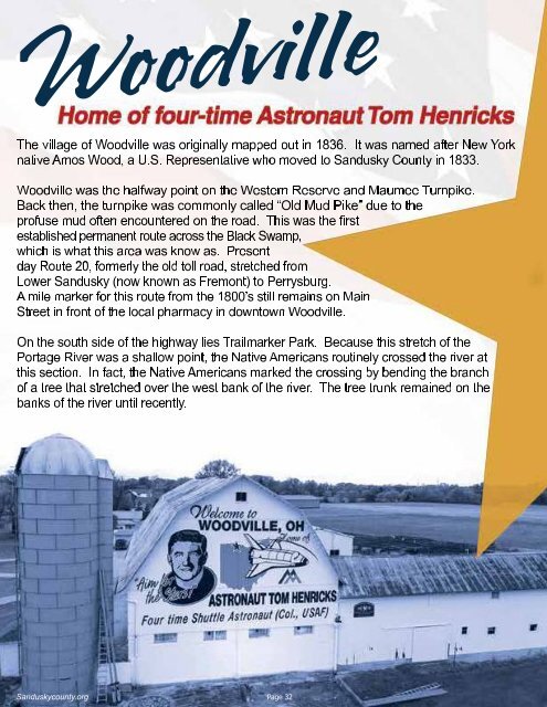
Woodville<br />
The village of Woodville was originally mapped out in 1836. It was named after New York<br />
native Amos Wood, a U.S. Representative who moved to Sandusky County in 1833.<br />
Woodville was the halfway point on the Western Reserve and Maumee Turnpike.<br />
Back then, the turnpike was commonly called “Old Mud Pike” due to the<br />
profuse mud often encountered on the road. This was the first<br />
established permanent route across the Black Swamp,<br />
which is what this area was know as. Present<br />
day Route 20, formerly the old toll road, stretched from<br />
Lower Sandusky (now known as Fremont) to Perrysburg.<br />
A mile marker for this route from the 1800’s still remains on Main<br />
Street in front of the local pharmacy in downtown Woodville.<br />
On the south side of the highway lies Trailmarker Park. Because this stretch of the<br />
Portage River was a shallow point, the Native Americans routinely crossed the river at<br />
this section. In fact, the Native Americans marked the crossing by bending the branch<br />
of a tree that stretched over the west bank of the river. The tree trunk remained on the<br />
banks of the river until recently.<br />
Sanduskycounty.org Page 32