ETBI Journal of Education - Vol 2:1 - June 2020 (Sustainable Development Goals 2015 -2030)
The theme of Volume 2 Issue 1 - Sustainable Development Goals 2015 -2030
The theme of Volume 2 Issue 1 - Sustainable Development Goals 2015 -2030

Create successful ePaper yourself
Turn your PDF publications into a flip-book with our unique Google optimized e-Paper software.
<strong>ETBI</strong> <strong>Journal</strong> <strong>of</strong> <strong>Education</strong> <strong>June</strong> <strong>2020</strong><br />
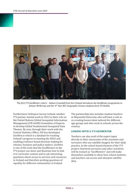
The first 5*S GeoMentor cohort – Aideen Croasdell from Esri Ireland introduces the GeoMentor programme to<br />
Eimear McNerney and her 4 th Year BSc Geographic Science students from TU Dublin.<br />
Furthermore Ordnance Survey Ireland, another<br />
5*S partner started work in 2012 in their role on<br />
the United Nations Global Geospatial Information<br />
Management (UN-GGIM) Committee <strong>of</strong> Experts<br />
to develop Global Fundamental Geospatial Data<br />
Themes. By now, through their work with the<br />
Central Statistics Office, OSI has developed<br />
GeoHive.ie which is a datahub for tracking<br />
Ireland’s progress to meeting the SDGS and<br />
enabling evidence-based decision-making for<br />
citizens, business and policy makers. GeoHive<br />
is one <strong>of</strong> the tools that the GeoMentors in the<br />
5*S project can show and illustrate how to link<br />
it to curricular content and to ask interesting<br />
questions about access to services and resources<br />
in Ireland and therefore probing questions <strong>of</strong><br />
equality for different communities in Ireland.<br />
The partnership also includes student teachers<br />
in Maynooth University who will have a role in<br />
co-creating lesson ideas tailored for different<br />
age-groups and who work in schools across the<br />
country.<br />
LINKING WITH A 5*S GEOMENTOR<br />
Teachers can also avail <strong>of</strong> the expert input<br />
directly to their classrooms <strong>of</strong> the scientists and<br />
surveyors who use satellite imagery for their daily<br />
practice. In the school-based element <strong>of</strong> the 5*S<br />
project chartered surveyors and other scientists<br />
will be trained as “GeoMentors” and will make<br />
themselves available to show how school students<br />
and teachers can access and interpret satellite<br />
data.<br />
PAGE 11