Water & Wastewater Asia September/October 2021
Water & Wastewater Asia is an expert source of industry information, cementing its position as an indispensable tool for trade professionals in the water and wastewater industry. As the most reliable publication in the region, industry experts turn this premium journal for credible journalism and exclusive insight provided by fellow industry professionals. Water & Wastewater Asia incorporates the official newsletter of the Singapore Water Association (SWA).
Water & Wastewater Asia is an expert source of industry information, cementing its position as an indispensable tool for trade professionals in the water and wastewater industry. As the most reliable publication in the region, industry experts turn this premium journal for credible journalism and exclusive insight provided by fellow industry professionals. Water & Wastewater Asia incorporates the official newsletter of the Singapore Water Association (SWA).

Create successful ePaper yourself
Turn your PDF publications into a flip-book with our unique Google optimized e-Paper software.
ENVIRONMENTAL REPORT<br />
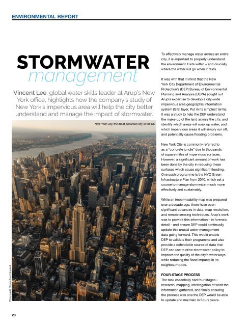
STORMWATER<br />
management<br />
Vincent Lee, global water skills leader at Arup’s New<br />
York office, highlights how the company’s study of<br />
New York’s impervious area will help the city better<br />
understand and manage the impact of stormwater.<br />
New York City, the most populous city in the US<br />
To effectively manage water across an entire<br />
city, it is important to properly understand<br />
the environment it sits within – and crucially<br />
where the water will go when it rains.<br />
It was with that in mind that the New<br />
York City Department of Environmental<br />
Protection’s (DEP) Bureau of Environmental<br />
Planning and Analysis (BEPA) sought out<br />
Arup’s expertise to develop a city-wide<br />
impervious area geographic information<br />
system (GIS) layer. Put in its simplest terms,<br />
it was a study to help the DEP understand<br />
the make-up of the land across the city, and<br />
identify which areas will soak up water, and<br />
which impervious areas it will simply run off,<br />
and potentially cause flooding problems.<br />
New York City is commonly referred to<br />
as a “concrete jungle” due to thousands<br />
of square miles of impervious surfaces.<br />
However, a significant amount of work has<br />
been done by the city in reducing these<br />
surfaces which cause significant flooding.<br />
One such programme is the NYC Green<br />
Infrastructure Plan from 2010, which set a<br />
course to manage stormwater much more<br />
effectively and sustainably.<br />
Photo credit: Triston Dunn/Unsplash<br />
While an impermeability map was prepared<br />
over a decade ago, there have been<br />
significant advances in data, map resolution,<br />
and remote sensing techniques. Arup’s work<br />
was to provide this information – in forensic<br />
detail – and ensure DEP could continually<br />
update this crucial water management<br />
data going forward. This would enable<br />
DEP to validate their programme and also<br />
provide a defendable source of data that<br />
DEP can use to drive stormwater policy to<br />
improve the quality of the city’s waterways<br />
while reducing the flood impacts in its<br />
neighbourhoods.<br />
FOUR-STAGE PROCESS<br />
The task essentially had four stages –<br />
research, mapping, interrogation of what the<br />
information gathered, and finally ensuring<br />
the process was one the DEP would be able<br />
to update and maintain in future years.<br />
28