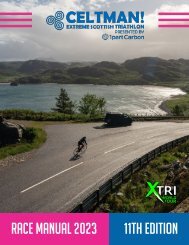
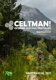
CELTMAN! 2022 Race Manual

You also want an ePaper? Increase the reach of your titles
YUMPU automatically turns print PDFs into web optimized ePapers that Google loves.
un :<br />
41 kilometres from Kinlochewe (T2), first heading south<br />
west on footpaths through the foothills of Beinn Eighe.<br />
Then a short tarmac section along the A896 heading<br />
towards Torridon village. You will then turn left and cross<br />
the A’ Ghairbhe river and climb through the forest on tracks<br />
and rough footpaths. You will then join a new ‘hydro’ track<br />
across the shoulder of Carn Dhomhnuill Mhic a’ Ghobha<br />
before dropping inti the Coulin Estate. The views from the<br />
top of the track are spectacular – make sure you take 10<br />
seconds to look around you. You’re highly likely to see Deer<br />
and other impressive wildlife.<br />
T2A (mountain safety checkpoint) is located in Glen Torridon<br />
at the entrance to Beinn Eighe mountain (Grid Ref: 977579).<br />
NOTE : BEWARE OF TRAFFIC<br />
The high level mountain section that<br />
follows is over the Beinn Eighe Range (on<br />
2 Munros - Spidean Coire nan Clach and<br />
Ruadh-stac Mor). This section of the run<br />
is over steep, rocky and exposed terrain,<br />
and includes the descent of a steep scree<br />
(small rocks) slope.<br />
Note that the course does NOT go to the<br />
top of Spidean Coire nan Clach – you will<br />
turn at the Trig Point (a small concrete<br />
pillar at grid ref: 965596) instead. This is<br />
because the final approach to the summit<br />
is on a narrow rocky ridge that requires<br />
scrambling skills. There are huge exposed<br />
falls to both left and right. We think that<br />
two-way (tired) athlete traffic on the ridge<br />
is a bad idea. The Mountain Rescue Team<br />
agree with us!. You will however, visit the<br />
summit of Ruadh-stac Mor.<br />
The climb from T2A to the first ridge is<br />
largely on a fairly well defined and easily<br />
followed path, though it deteriorates as<br />
you approach the ridge. Once the ridge<br />
is reached, you will turn right and climb<br />
(again on a rough path) to the Trig Point.<br />
There will be a checkpoint here. You<br />
will then turn left onto the ridge linking<br />
to Ruadh-stac Mor. The ridge is narrow<br />
and exposed in places, and is rocky. The<br />
path is indistinct therefore map-based<br />
navigation might be required if conditions<br />
dictate. Enjoy the views and the sense of<br />
adventure – you have earned them! You<br />
will skirt below the summit of Coinneach<br />
Mhor on a small ‘sheep track’, and will rejoin<br />
the ridge just above the scree gulley.<br />
You will then complete the climb of Ruadhstac<br />
Mor. This is initially rocky, but then<br />
becomes a broad-backed grassy ridge.<br />
There will be a checkpoint on the summit.<br />
<strong>CELTMAN</strong>! <strong>Race</strong> <strong>Manual</strong> <strong>2022</strong><br />
13