The KAMM/WAsP Numerical Wind Atlas. A powerful ... - Risø
The KAMM/WAsP Numerical Wind Atlas. A powerful ... - Risø
The KAMM/WAsP Numerical Wind Atlas. A powerful ... - Risø
You also want an ePaper? Increase the reach of your titles
YUMPU automatically turns print PDFs into web optimized ePapers that Google loves.
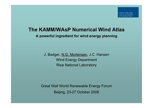
<strong>The</strong> <strong>KAMM</strong>/<strong>WAsP</strong> <strong>Numerical</strong> <strong>Wind</strong> <strong>Atlas</strong><br />
A <strong>powerful</strong> ingredient for wind energy planning<br />
J. Badger, N.G. Mortensen, J.C. Hansen<br />
<strong>Wind</strong> Energy Department<br />
<strong>Risø</strong> National Laboratory<br />
Great Wall World Renewable Energy Forum<br />
Beijing, 23-27 October 2006
Environmental<br />
<strong>Atlas</strong>es<br />
National<br />
<strong>Wind</strong> <strong>Atlas</strong><br />
Maps etc. §§<br />
Master<br />
plans<br />
<strong>Wind</strong> Farm Planning<br />
Legislation<br />
EIA<br />
GUIDELINES<br />
APPROVALS
Outline<br />
• <strong>Wind</strong> resource mapping<br />
• reanalysis wind climatology (NCEP/NCAR)<br />
• mesoscale modelling (<strong>KAMM</strong>)<br />
• <strong>Numerical</strong> wind atlas<br />
• numerical wind atlas concept<br />
• verification of methodology<br />
• Applications and sustainability<br />
• planning, feasibility studies, project preparation<br />
• wind farm planning and AEP estimation<br />
Acknowledgements: New and Renewable Energy Authority (Egypt), Egyptian<br />
Meteorological Authority, Danida (Denmark), National Centers for Environmental<br />
Prediction and National Center for Atmospheric Research (USA), United States<br />
Geological Survey.
<strong>Wind</strong> resource mapping by modelling<br />
• Mesoscale model<br />
• Output: annual averages of<br />
wind speed and power<br />
• Regular horizontal grid<br />
• Area: 10,000-100,000’s of km2 • Resolution: 3-5 km<br />
• <strong>Wind</strong> measurements are not<br />
required, but…<br />
• Super-computer and skilled staff<br />
are needed!<br />
• Uncertainty inherently larger<br />
than observational wind atlas
Regional winds from NCEP/NCAR reanalysis
<strong>Wind</strong> resource map of Egypt<br />
• Mean wind speed<br />
50 m a.g.l. [ms -1 ]<br />
• <strong>KAMM</strong> modelling<br />
• Resolution 7.5 km<br />
• NCEP/NCAR data<br />
• SRTM30 elevation<br />
• GLCC land cover<br />
• Terrain features may<br />
give higher wind<br />
speeds locally!<br />
• Output formats:<br />
• map graphics<br />
• statistics
…and Egyptian offshore wind resources<br />
• Mean wind speed<br />
50 m a.s.l. [ms -1 ]<br />
• <strong>KAMM</strong> modelling<br />
• Resolution 7.5 km<br />
• NCEP/NCAR data<br />
• Output formats:<br />
• map graphics<br />
• statistics
<strong>Numerical</strong> wind atlas<br />
• NWA analysis procedure ↑ (<strong>WAsP</strong>-like)<br />
<strong>KAMM</strong> Predicted <strong>Wind</strong> Climate<br />
(> 50,000 virtual met. stations!)<br />
+ roughness map (GLCC)<br />
+ elevation map (SRTM30)<br />
⇒ Regional <strong>Wind</strong> Climate<br />
• Application procedure ↓ (<strong>WAsP</strong>)<br />
Regional <strong>Wind</strong> Climate<br />
+ sheltering obstacles<br />
+ roughness map (GE)<br />
+ elevation map (SRTM3)<br />
⇒ Predicted <strong>Wind</strong> Climate<br />
+ power and thrust curves<br />
⇒ Predicted wind farm AEP
Detailed wind resources<br />
• <strong>WAsP</strong> modelling<br />
of detailed mean<br />
wind speed @<br />
10 m a.g.l.<br />
• Resolution 25 m<br />
• <strong>KAMM</strong> regional<br />
wind climate<br />
• But does it work<br />
in practice?!?
Meteorological mast in Egypt<br />
25-m lattice tower, concrete foundation Top-pole mounting to avoid flow distortion
Verification: Western Desert<br />
<strong>WAsP</strong> wind speed [m/s]<br />
15<br />
14<br />
13<br />
12<br />
11<br />
10<br />
9<br />
8<br />
7<br />
6<br />
5<br />
4<br />
3<br />
2<br />
1<br />
0<br />
0 1 2 3 4 5 6 7 8 9 10 11 12 13 14 15<br />
NWA wind speed [m/s]<br />
Abu Simbel<br />
Asswan<br />
Dakla South<br />
Kharga<br />
Shark El-Ouinat<br />
1:1
Verification: Northwest coast<br />
<strong>WAsP</strong> wind speed [m/s]<br />
15<br />
14<br />
13<br />
12<br />
11<br />
10<br />
9<br />
8<br />
7<br />
6<br />
5<br />
4<br />
3<br />
2<br />
1<br />
0<br />
0 1 2 3 4 5 6 7 8 9 10 11 12 13 14 15<br />
NWA wind speed [m/s]<br />
Alexandria<br />
El-Galala<br />
El-Mathany<br />
Ras El-Hekma<br />
Sidi Barrani<br />
1:1
Verification – Gulf of Suez/Red Sea<br />
<strong>WAsP</strong> wind speed [m/s]<br />
15<br />
14<br />
13<br />
12<br />
11<br />
10<br />
9<br />
8<br />
7<br />
6<br />
5<br />
4<br />
3<br />
2<br />
1<br />
0<br />
0 1 2 3 4 5 6 7 8 9 10 11 12 13 14 15<br />
NWA wind speed [m/s]<br />
Abu Darag<br />
Abu Darag NW<br />
Gulf of-El-Zayt<br />
Hurghada WETC<br />
St. Paul<br />
Zafarana M7<br />
Zafarana<br />
El-Zayt NW<br />
1:1<br />
Ras Sedr<br />
Katamaya<br />
Ras Ghareb
Verification in Egypt – summary<br />
Domain<br />
Western Egypt<br />
Eastern Egypt<br />
Northwest Coast<br />
Western Desert<br />
Gulf of Suez<br />
Red Sea<br />
Grid size<br />
[km]<br />
7.5<br />
7.5<br />
5.0<br />
5.0<br />
5.0<br />
5.0<br />
Mean abs. error<br />
All stations<br />
[%]<br />
12.4<br />
7.6<br />
5.2<br />
3.1<br />
9.4<br />
10.5<br />
Mean abs. error<br />
Selected stations<br />
[%]<br />
⎯<br />
⎯<br />
⎯<br />
⎯<br />
5.6<br />
4.4
<strong>Numerical</strong> <strong>Wind</strong> <strong>Atlas</strong> – application range<br />
1. National scale wind resource overview<br />
• Input: numerical wind atlas database (large domains)<br />
• Output: resource maps, statistics, GIS data,…<br />
• Purpose: national planning, decision making, master plans,…<br />
2. Regional scale resource assessments and wind power planning<br />
• Input: numerical wind atlas database (regional domains)<br />
• Output: as 1. + predicted wind climates, power productions,…<br />
• Purpose: regional planning, feasibility studies,…<br />
3. Local scale resource assessments and wind farm planning<br />
• Input: observational wind atlas data<br />
• Output: as 1. + predicted wind climates, power productions,…<br />
• Purpose: planning, feasibility studies, project preparation,…<br />
• Bankable resource assessments close to met. stations
Red Belt Northing [m]<br />
Detailed wind resources at Zafarana<br />
718000 719000 720000 721000<br />
Row 4<br />
3200<br />
3100<br />
3000<br />
2900<br />
2800<br />
2700<br />
2600<br />
Row 3<br />
Row 2<br />
Row 1<br />
769000 770000 771000 772000 773000 774000<br />
Red Belt Easting [m]
A complete NWA package<br />
• <strong>Wind</strong>-climatological inputs<br />
• <strong>Numerical</strong> wind atlas (nation-wide)<br />
• Observational wind atlas (met. stations)<br />
• Topographical inputs (nation-wide)<br />
• SRTM 3" elevation data<br />
• SRTM Water Body Data (coasts, lakes, rivers)<br />
• Google Earth satellite imagery (land-use)<br />
• Topographical and thematic maps<br />
• Software tools<br />
• Microscale modelling tools<br />
• Terrain mapping tools<br />
• Technology transfer and capacity building
<strong>The</strong> future…<br />
• <strong>Numerical</strong> wind atlas (<strong>KAMM</strong>/<strong>WAsP</strong> methodology)<br />
• Long-term data (1948-present) – infrequent updating ok<br />
• Observational wind atlas<br />
• Some reference met. stations should continue<br />
• New measurement programmes may be initiated<br />
• <strong>Wind</strong> <strong>Atlas</strong> can be updated, extended and detailed<br />
• Main conclusions for Egypt<br />
• wind resource assessment, siting and wind farm planning<br />
can now be done within hours anywhere in Egypt<br />
• Mean absolute error on U typically around 5%<br />
• present approach may be continued for several years
THE END<br />
Thank you for your attention! ☺<br />
(slide by Magnus, 10 years old)


