National Cycle Network Go Traffic Free in Scotland - Sustrans
National Cycle Network Go Traffic Free in Scotland - Sustrans
National Cycle Network Go Traffic Free in Scotland - Sustrans

Create successful ePaper yourself
Turn your PDF publications into a flip-book with our unique Google optimized e-Paper software.
Udd<strong>in</strong>gston<br />
Coatbridge<br />
Bargeddie<br />
To Hamilton<br />
13<br />
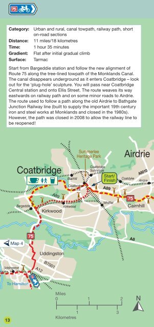
Category: Urban and rural, canal towpath, railway path, short<br />
on-road sections<br />
Distance: 11 miles/18 kilometres<br />
Time: 1 hour 35 m<strong>in</strong>utes<br />
Gradient: Flat after <strong>in</strong>itial gradual climb<br />
Surface: Tarmac<br />
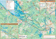
Start from Bargeddie station and follow the new alignment of<br />
Route 75 along the tree-l<strong>in</strong>ed towpath of the Monklands Canal.<br />
The canal disappears underground as it enters Coatbridge – look<br />
out for the ‘plug-hole’ sculpture. You will pass near Coatbridge<br />
Central station and onto Ellis Street. The route weaves its way<br />
eastwards on railway path and on some m<strong>in</strong>or roads to Airdrie.<br />
The route used to follow a path along the old Airdrie to Bathgate<br />
Junction Railway l<strong>in</strong>e (built to supply the important 19th century<br />
iron and steel works at Monklands and closed <strong>in</strong> the 1980s).<br />
However, the path was closed <strong>in</strong> 2008 to allow the railway l<strong>in</strong>e to<br />
be reopened!<br />
Map 4<br />
A12 A12<br />
A89 A89<br />
Kirkwood<br />
Udd<strong>in</strong>gston<br />
B7001 B7001<br />
Blairhill<br />
Coatbridge<br />
Central<br />
Kirkwood<br />
Summerlee<br />
Heritage Park<br />
Miles<br />
0 1<br />
1<br />
Kilometres<br />
Coatbridge<br />
Sunnyside<br />
Start/<br />
F<strong>in</strong>ish<br />
A89 A89<br />
Whifflet<br />
3<br />
Airdrie<br />
Coatdyke<br />
2<br />
A8 A8<br />
A8010 A8010<br />
Airdrie<br />
Cairnhill<br />
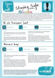
Cyclist on the new path between Airdrie and Bathgate<br />
Drumgelloch<br />
Coatbridge to Hillend Reservoir 5<br />
Caldercruix<br />
Start/<br />
F<strong>in</strong>ish<br />
Hillend<br />
Reservoir<br />
Map 6<br />
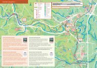
A replacement path has been constructed by <strong>Network</strong> Rail. The<br />
last section between Drumgelloch and Pla<strong>in</strong>s is due to open <strong>in</strong><br />
2012 and will be on a shared-use pavement alongside the A89.<br />
East of Pla<strong>in</strong>s, most of the new route is on excellent tarmac path<br />
alongside the railway, with a short on-road section through<br />
Caldercruix. It takes you through open countryside to reach<br />
pretty Hillend Reservoir, which is ideal for a picnic. Either retrace<br />
your route or catch a tra<strong>in</strong> from Caldercruix to Glasgow or<br />
Ed<strong>in</strong>burgh. You also have the option of cont<strong>in</strong>u<strong>in</strong>g to Bathgate<br />
(see map 6).<br />
14