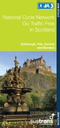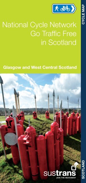
National Cycle Network Go Traffic Free in Scotland - Sustrans
National Cycle Network Go Traffic Free in Scotland - Sustrans
National Cycle Network Go Traffic Free in Scotland - Sustrans

Create successful ePaper yourself
Turn your PDF publications into a flip-book with our unique Google optimized e-Paper software.
Forth Road Bridge & Dalmeny<br />
<strong>National</strong> <strong>Cycle</strong> <strong>Network</strong><br />
<strong>Go</strong> <strong>Traffic</strong> <strong>Free</strong><br />
<strong>in</strong> <strong>Scotland</strong><br />
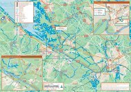
Glasgow and West Central <strong>Scotland</strong><br />
SCOTLAND CYCLE MAP
Overview<br />
Use this booklet to follow safe and attractive walk<strong>in</strong>g<br />
and cycl<strong>in</strong>g options <strong>in</strong> and around Glasgow and across<br />
west-central <strong>Scotland</strong>. It shows the ma<strong>in</strong> traffic-free<br />
sections on the <strong>National</strong> <strong>Cycle</strong> <strong>Network</strong>, Regional<br />
Routes and key local routes. Use it to plan your<br />
(carbon-free) trips around and out of town. See how far<br />
and easily you can travel without a car.<br />
For <strong>in</strong>formation on cycle routes across <strong>Scotland</strong>, see<br />
<strong>Sustrans</strong>’ Routes2Ride website – you can also add<br />
your own routes, comments and photos.<br />
www.routes2ride.org.uk/scotland<br />
Use Ordnance Survey maps and the SPOKES map<br />
of Glasgow (www.spokes.org.uk) to plan your own<br />
routes. Contact the relevant local authorities for more<br />
<strong>in</strong>formation on cycl<strong>in</strong>g routes <strong>in</strong> each area.<br />
How to use this booklet<br />
This booklet highlights walk<strong>in</strong>g and cycl<strong>in</strong>g routes <strong>in</strong> the follow<strong>in</strong>g<br />
areas:<br />
1<br />
Glasgow and environs p4<br />
Ayrshire area p32<br />
Each detailed map uses the follow<strong>in</strong>g key<br />
Featured route<br />
<strong>National</strong> <strong>Cycle</strong> <strong>Network</strong> traffic-free<br />
<strong>National</strong> <strong>Cycle</strong> <strong>Network</strong> on-road<br />
Regional route/other routes<br />
Proposed cycle route<br />
Railway (station)<br />
Take care po<strong>in</strong>t / section<br />
Steep hill / One way<br />
Campsite/Caravan/Youth hostel<br />
Viewpo<strong>in</strong>t<br />
Public house<br />
Cafe<br />
Bike Shop<br />
Shop<br />
Public toilets<br />
Post office<br />
Tourist Information<br />
Castle Tourist attraction<br />
Signalled cross<strong>in</strong>g<br />
Millennium Milepost<br />
Time: The time given to complete a route is calculated on<br />
an average travell<strong>in</strong>g time of 7 miles or 11 km per hour. This<br />
allows for a leisurely cycl<strong>in</strong>g pace or for plenty of stops.<br />
Times and distances given for l<strong>in</strong>ear routes are for one way<br />
only.<br />
Obey the rules of the road<br />
Be courteous<br />
l Give way to pedestrians<br />
<strong>Go</strong>od Cycl<strong>in</strong>g Code<br />
l Remember that some people are hard of hear<strong>in</strong>g or visually<br />
impaired<br />
l Where there are wheelchair users or horse riders, please<br />
give way<br />
l R<strong>in</strong>g a bell <strong>in</strong> good time or politely call out to warn of your<br />
approach<br />
Care for the environment<br />
l Can you reach the start of your journey by bike or public<br />
transport?<br />
l Follow the Scottish Outdoor Access Code; <strong>in</strong> particular,<br />
do not damage crops, don’t disturb livestock or wildlife and<br />
always take litter home<br />
Look after yourself<br />
l Take care at junctions, when cycl<strong>in</strong>g downhill and on loose or<br />
wet surfaces<br />
l In remote areas carry food, water, repair kit, map and<br />
waterproofs<br />
l Keep your bike roadworthy; use lights <strong>in</strong> poor visibility<br />
l Consider wear<strong>in</strong>g a helmet and conspicuous cloth<strong>in</strong>g<br />
Us<strong>in</strong>g public transport<br />
Why not use the tra<strong>in</strong> to carry you and your bike further afield or<br />
to take you home after a cycle? Bicycles can be carried on most<br />
tra<strong>in</strong>s, but it is advisable to check <strong>in</strong> advance and book a place<br />
as space is limited. For rail <strong>in</strong>formation call 08457 48 49 50 or<br />
visit www.nationalrail.co.uk. Bicycles can be carried on Cityl<strong>in</strong>k<br />
coaches, but they must be bagged or boxed. Check before<br />
travell<strong>in</strong>g. Phone 0871 266 33 33 or visit www.cityl<strong>in</strong>k.co.uk.<br />
For <strong>in</strong>formation on all public transport with<strong>in</strong> <strong>Scotland</strong>, call<br />
0871 200 22 33 or visit www.travel<strong>in</strong>escotland.com.<br />
Scottish Outdoor Access Code<br />
Know the Code before you go …<br />
Enjoy <strong>Scotland</strong>’s outdoors - responsibly!<br />
Everyone has the right to be on most<br />
land and <strong>in</strong>land water provid<strong>in</strong>g they<br />
act responsibly. Your access rights and responsibilities<br />
are expla<strong>in</strong>ed fully <strong>in</strong> the Scottish Outdoor Access Code.<br />
Whether you’re <strong>in</strong> the outdoors or manag<strong>in</strong>g the outdoors, the<br />
key th<strong>in</strong>gs are to:<br />
l take responsibility for your own actions;<br />
l respect the <strong>in</strong>terests of other people;<br />
l care for the environment.<br />
F<strong>in</strong>d out more by visit<strong>in</strong>g www.outdooraccess-scotland.com<br />
or phon<strong>in</strong>g your local Scottish Natural Heritage office.<br />
2
West Kilbride<br />
3<br />
<strong>Go</strong>urock<br />
Ardrossan<br />
Greenock<br />
Dalry<br />
Kilbirnie<br />
Irv<strong>in</strong>e Bay<br />
Tarbet<br />
Helensburgh<br />
Lochw<strong>in</strong>noch<br />
Port<br />
Glasgow<br />
Bridge of<br />
Weir<br />
Kilw<strong>in</strong>n<strong>in</strong>g<br />
Johnstone<br />
Beith<br />
Irv<strong>in</strong>e<br />
Kilmacolm<br />
Dundonald<br />
Map and text © <strong>Sustrans</strong> 2012<br />
Maps are reproduced from Ordnance Survey<br />
material with the permission of Ordnance<br />
Survey on behalf of the Contoller of Her<br />
Majesty’s Stationery Office © Crown copyright.<br />
Unauthorised reproduction <strong>in</strong>fr<strong>in</strong>ges Crown<br />
copyright and may lead to prosecution or civil<br />
proceed<strong>in</strong>gs. Licence number 100020852<br />
Balloch<br />
Dumbarton<br />
Bowl<strong>in</strong>g<br />
Ersk<strong>in</strong>e<br />
Paisley<br />
Barrhead<br />
Miles<br />
2 6<br />
0 2 4 8<br />
Kilometres<br />
Kilmarnock<br />
Milngavie<br />
Strathblane<br />
Glasgow<br />
Rutherglen<br />
Balloch to Tarbet p6<br />
Bowl<strong>in</strong>g to Balloch p8<br />
Kilsyth<br />
Kirk<strong>in</strong>tilloch<br />
Coatbridge<br />
Cumbernauld<br />
Motherwell<br />
Airdrie<br />
<strong>Traffic</strong>-free <strong>National</strong> <strong>Cycle</strong> <strong>Network</strong> section<br />
Hamilton<br />
Other routes<br />
Glasgow & environs<br />
Glasgow to Bowl<strong>in</strong>g p10<br />
Glasgow to Udd<strong>in</strong>gston p12<br />
Coatbridge to Hillend Reservoir p14<br />
Hillend Reservoir to Bathgate p16<br />
Kelv<strong>in</strong>grove to Port Dundas p18<br />
Strathkelv<strong>in</strong> Railway Path p20<br />
Bowl<strong>in</strong>g to Kirk<strong>in</strong>tilloch p22<br />
Kirk<strong>in</strong>tilloch to Falkirk p24<br />
Glasgow to Paisley p26<br />
Paisley to <strong>Go</strong>urock p28<br />
Paisley to Kilbirnie p30<br />
On-road <strong>National</strong> <strong>Cycle</strong> <strong>Network</strong> section<br />
Falkirk<br />
Time: The time given to complete a route is calculated on an<br />
average travell<strong>in</strong>g time of 7 miles or 11 km per hour. This<br />
allows for a leisurely cycl<strong>in</strong>g pace or for plenty of stops.<br />
Times and distances given for l<strong>in</strong>ear routes are for one way<br />
only.<br />
Whilst every effort has been made to achieve accuracy of<br />
<strong>in</strong>formation <strong>in</strong> this booklet at time of publication, <strong>Sustrans</strong><br />
can take no responsibility for: loss or <strong>in</strong>jury (<strong>in</strong>clud<strong>in</strong>g fatal) to<br />
persons; loss of damage to property or equipment; trespass,<br />
irresponsible rid<strong>in</strong>g or any other mishap that may be suffered<br />
as a result of follow<strong>in</strong>g route descriptions <strong>in</strong> this booklet.<br />
Bathgate<br />
4
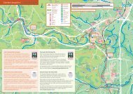
Arrochar and Tarbet<br />
5<br />
Tarbet<br />
Start/<br />
F<strong>in</strong>ish<br />
A82 A82<br />
<strong>Traffic</strong>-free path<br />
to Helensburgh<br />
Rubha Mor<br />
Inverbeg<br />
West West Loch Loch Lomond Lomond <strong>Cycle</strong> <strong>Cycle</strong> Path Path<br />
<strong>National</strong> Park Centre, Luss<br />
(Loch Lomond & The Trossachs <strong>National</strong> Park)<br />
Aldochlay<br />
Duchlage<br />
Arden<br />
Map 2<br />
Miles<br />
0 1 2<br />
0<br />
Kilometres<br />
Ben Lomond<br />
(<strong>National</strong> Trust for <strong>Scotland</strong>)<br />
Rowardennan<br />
Youth Hostel<br />
Luss Camp<strong>in</strong>g and<br />
Caravann<strong>in</strong>g Club Site<br />
Luss<br />
Loch Lomond<br />
Youth Hostel<br />
<strong>National</strong> Park<br />
Gateway Centre<br />
Start/<br />
F<strong>in</strong>ish<br />
2 3<br />
Loch Lomond<br />
Balloch Castle<br />
and Country<br />
Park<br />
Balloch<br />
Motor<strong>in</strong>g Heritage Centre<br />
(Scottish Museums Council)<br />
Milarrochy Bay Camp<strong>in</strong>g<br />
and Caravann<strong>in</strong>g Club Site<br />
Wh<strong>in</strong>ny Hill Wood<br />
(Woodland Trust)<br />
A811 A811<br />
Balloch<br />
Cycl<strong>in</strong>g beside Loch Lomond<br />
© Loch Lomond & The Trossachs <strong>National</strong> Park<br />
<strong>National</strong> Park Centre, Centre, Balmaha<br />
(Loch Lomond & The<br />
Trossachs <strong>National</strong> Park)<br />
Balmaha<br />
Loch Lomond <strong>National</strong><br />
Nature Reserve<br />
(Scottish<br />
Natural Heritage)<br />
Gartocharn<br />
<strong>National</strong><br />
Park Boundary<br />
To Aberfoyle<br />
and Callander<br />
Balloch to Tarbet 1<br />
Category: Rural, cycle path<br />
Distance: 17 miles/28 kilometres<br />
Time: 2 hours 30 m<strong>in</strong>utes<br />
Gradient: Flat<br />
Surface: Tarmac, wh<strong>in</strong> dust<br />
From the foot of Loch Lomond, at Balloch,<br />
this traffic-free route runs parallel to the A82<br />
with superb island views. The halfway po<strong>in</strong>t is<br />
marked by the historic village of Luss where<br />
there’s a good visitor centre and a range of<br />
comfy coffee shops. As you progress up the<br />
loch you’ll notice how it narrows and is<br />
overlooked by the Munros, Ben Lomond and<br />
Ben Vorlich. <strong>Cycle</strong> highlights <strong>in</strong>clude the<br />
stretches of old road by the loch shore at<br />
Rubha Mór.<br />
There are regular tra<strong>in</strong>s from Glasgow to<br />
Balloch. On the return journey it’s possible<br />
to catch a tra<strong>in</strong> from the Arrochar & Tarbet<br />
station for Glasgow (limited service); change<br />
at Dumbarton Central to return to Balloch.<br />
<strong>Cycle</strong> book<strong>in</strong>g required.<br />
6
7<br />
<strong>National</strong><br />
Park Boundary<br />
Miles<br />
0<br />
Map 1<br />
1<br />
1 2<br />
Start/<br />
F<strong>in</strong>ish<br />
3<br />
2<br />
Dumbarton<br />
Bowl<strong>in</strong>g to Balloch 2<br />
Category: Urban, cycle path<br />
Distance: 10 miles/16 kilometres<br />
Time: 1 hour 30 m<strong>in</strong>utes<br />
Gradient: Flat<br />
Surface: Tarmac<br />
Enjoy an easy cycle from Bowl<strong>in</strong>g to<br />
Dumbarton with views of the Clyde,<br />
before a visit to Dumbarton Castle. This<br />
stronghold, where Mary Queen of Scots<br />
hid as a child, has the longest recorded<br />
history of any British castle and dates<br />
back to 450 AD.<br />
Cont<strong>in</strong>ue to follow the River Leven, which<br />
powered a host of lead<strong>in</strong>g edge <strong>in</strong>dustrial<br />
textile mills <strong>in</strong> the 18th and 19th centuries.<br />
Once you see moored boats you’re near<br />
the journey’s end at Balloch. This route<br />
can be easily shortened as it runs close to<br />
several tra<strong>in</strong> stations.<br />
Start/<br />
F<strong>in</strong>ish<br />
Map 3<br />
8
This is a marvellous route from the centre of Glasgow, which<br />
follows the River Clyde and the Forth & Clyde Canal for effortless<br />
cycl<strong>in</strong>g.<br />
Start from Bell’s Bridge where <strong>National</strong> Routes 7 and 75 cross<br />
the Clyde. Sh<strong>in</strong>y modern build<strong>in</strong>gs, which <strong>in</strong>clude the Glasgow<br />
Science Centre, give the area a futuristic look.<br />
Further on, the Glasgow Harbour area is be<strong>in</strong>g redeveloped -<br />
follow the diversion signs. When the redevelopment is complete<br />
<strong>National</strong> Route 7 will run alongside the river. At Clydebank the<br />
route jo<strong>in</strong>s the Forth & Clyde Canal and then passes under the<br />
Ersk<strong>in</strong>e Bridge before end<strong>in</strong>g at Bowl<strong>in</strong>g where the Canal flows<br />
<strong>in</strong>to the River Clyde. This route can be easily shortened as it runs<br />
close to several tra<strong>in</strong> stations.<br />
Start/<br />
F<strong>in</strong>ish<br />
9<br />
Map 2<br />
White Cart<br />
Water<br />
Category: Urban, riverside and canal cycle path<br />
Distance: 11miles/17 kilometres<br />
Time: 1 hour 40 m<strong>in</strong>utes<br />
Gradient: Flat<br />
Surface: Ma<strong>in</strong>ly tarmac<br />
Renfrew<br />
To Paisley<br />
(not<br />
complete)<br />
Bell’s Bridge and the Scottish Exhibition and Conference Centre on the<br />
River Clyde<br />
Yoker<br />
Ibrox Stadium<br />
Westerton<br />
To To <strong>Go</strong>urock <strong>Go</strong>urock & & Ayr Ayr<br />
Maryhill<br />
Start/<br />
F<strong>in</strong>ish<br />
Glasgow to Bowl<strong>in</strong>g 3<br />
Miles<br />
0 1 2<br />
1<br />
Kilometres<br />
2 3<br />
To To Ed<strong>in</strong>burgh Ed<strong>in</strong>burgh<br />
(via (via Forth Forth & & Clyde Clyde<br />
and and Union Union Canals) Canals)<br />
Glasgow<br />
Exhibition Centre<br />
Map 4 & 9<br />
Port Dundas<br />
Map 11<br />
M8 M8<br />
<strong>Sustrans</strong> Connect2<br />
Scheme<br />
10
Map 3<br />
To Clydebank,<br />
Dumbarton and Loch<br />
Lomond and The<br />
Trossachs <strong>National</strong> Park<br />
Scottish Exhibition<br />
and Conference<br />
Centre<br />
Waverley<br />
Paddle Boat<br />
Science<br />
Centre<br />
To Paisley,<br />
<strong>Go</strong>urock and<br />
Irv<strong>in</strong>e<br />
ROAD ROAD<br />
POINTHOUSE POINTHOUSE<br />
GOVAN GOVAN ROAD ROAD<br />
NCEFIELD NCEFIELD QUAY QUAY<br />
LA LA<br />
WEST WEST<br />
PAISLEY PAISLEY ROAD ROAD<br />
M8 M8<br />
M8 M8<br />
A804 A804<br />
Start/<br />
F<strong>in</strong>ish<br />
Pollokshields East<br />
Central<br />
STREET STREET<br />
BROOMIELAW<br />
BROOMIELAW CLYDE CLYDE<br />
MORRISON MORRISON STREET STREET<br />
Waterbus<br />
Term<strong>in</strong>al<br />
BRIDGE BRIDGE ST ST A77 A77<br />
M74 M74<br />
Queen St<br />
BALLATER BALLATER STREET STREET<br />
CALEDONIA CALEDONIA ROAD ROAD<br />
High Street<br />
ON LOND ROAD<br />
ON LOND ROAD<br />
Oatlands<br />
Glasgow<br />
KING'S KING'S DR DR<br />
Bellgrove<br />
People’s<br />
Palace<br />
Bridgeton<br />
Bridgeton<br />
Dalmarnock<br />
GLASGOW GLASGOW ROAD ROAD<br />
LONDON LONDON ROAD ROAD<br />
Rutherglen<br />
Celtic Park<br />
Stadium<br />
A74 A74<br />
To East Kilbride<br />
Category: Urban, riverside paths, 1 mile on-road section by<br />
Newton<br />
Distance: 12 miles/19 kilometres<br />
Time: 1 hour 45 m<strong>in</strong>utes<br />
Gradient: Ma<strong>in</strong>ly flat but hillier by Udd<strong>in</strong>gston<br />
Surface: Ma<strong>in</strong>ly tarmac; also paved and dust sections<br />
For an exceptionally easy city ride, follow the River Clyde<br />
east from Bell’s Bridge on Route 75. With<strong>in</strong> m<strong>in</strong>utes you’ll be<br />
cycl<strong>in</strong>g through leafy Glasgow Green where the People’s<br />
Palace is worth a detour for a coffee <strong>in</strong> a hot-house.<br />
The path then w<strong>in</strong>ds along the tree-l<strong>in</strong>ed banks of the River<br />
Clyde for about five miles. After pass<strong>in</strong>g under the new M74<br />
and Cambuslang Road, cross the Clyde near Carmyle and<br />
cont<strong>in</strong>ue on traffic-free paths and quiet roads to reach<br />
Udd<strong>in</strong>gston. From Udd<strong>in</strong>gston you can catch a tra<strong>in</strong> back to<br />
the city (or from any other stations on or near the route).<br />
Parkhead<br />
ROAD ROAD<br />
LONDON LONDON<br />
M74 M74<br />
Cross at<br />
second<br />
bridge<br />
Cambuslang<br />
Carmyle<br />
Carmyle<br />
LONDON LONDON ROAD ROAD<br />
A74 A74<br />
Westburn<br />
Newton<br />
Newton<br />
Miles<br />
0 1<br />
0 1 2 3<br />
Kilometres<br />
Glasgow to Udd<strong>in</strong>gston 4<br />
Neptune’s Way Bridge and the F<strong>in</strong>nieston Crane, Glasgow<br />
To Hamilton<br />
M73 M73<br />
Udd<strong>in</strong>gston<br />
Udd<strong>in</strong>gston<br />
Udd<strong>in</strong>gston<br />
Bothwell<br />
Castle<br />
Start/<br />
F<strong>in</strong>ish<br />
Blantyre<br />
David<br />
Liv<strong>in</strong>gstone<br />
Centre<br />
Bridge<br />
To Airdrie, Bathgate<br />
and Ed<strong>in</strong>burgh<br />
11 12<br />
NEW NEW ROAD ROAD<br />
EDINBURGH EDINBURGH<br />
Map 5
Udd<strong>in</strong>gston<br />
Coatbridge<br />
Bargeddie<br />
To Hamilton<br />
13<br />
Category: Urban and rural, canal towpath, railway path, short<br />
on-road sections<br />
Distance: 11 miles/18 kilometres<br />
Time: 1 hour 35 m<strong>in</strong>utes<br />
Gradient: Flat after <strong>in</strong>itial gradual climb<br />
Surface: Tarmac<br />
Start from Bargeddie station and follow the new alignment of<br />
Route 75 along the tree-l<strong>in</strong>ed towpath of the Monklands Canal.<br />
The canal disappears underground as it enters Coatbridge – look<br />
out for the ‘plug-hole’ sculpture. You will pass near Coatbridge<br />
Central station and onto Ellis Street. The route weaves its way<br />
eastwards on railway path and on some m<strong>in</strong>or roads to Airdrie.<br />
The route used to follow a path along the old Airdrie to Bathgate<br />
Junction Railway l<strong>in</strong>e (built to supply the important 19th century<br />
iron and steel works at Monklands and closed <strong>in</strong> the 1980s).<br />
However, the path was closed <strong>in</strong> 2008 to allow the railway l<strong>in</strong>e to<br />
be reopened!<br />
Map 4<br />
A12 A12<br />
A89 A89<br />
Kirkwood<br />
Udd<strong>in</strong>gston<br />
B7001 B7001<br />
Blairhill<br />
Coatbridge<br />
Central<br />
Kirkwood<br />
Summerlee<br />
Heritage Park<br />
Miles<br />
0 1<br />
1<br />
Kilometres<br />
Coatbridge<br />
Sunnyside<br />
Start/<br />
F<strong>in</strong>ish<br />
A89 A89<br />
Whifflet<br />
3<br />
Airdrie<br />
Coatdyke<br />
2<br />
A8 A8<br />
A8010 A8010<br />
Airdrie<br />
Cairnhill<br />
Cyclist on the new path between Airdrie and Bathgate<br />
Drumgelloch<br />
Coatbridge to Hillend Reservoir 5<br />
Caldercruix<br />
Start/<br />
F<strong>in</strong>ish<br />
Hillend<br />
Reservoir<br />
Map 6<br />
A replacement path has been constructed by <strong>Network</strong> Rail. The<br />
last section between Drumgelloch and Pla<strong>in</strong>s is due to open <strong>in</strong><br />
2012 and will be on a shared-use pavement alongside the A89.<br />
East of Pla<strong>in</strong>s, most of the new route is on excellent tarmac path<br />
alongside the railway, with a short on-road section through<br />
Caldercruix. It takes you through open countryside to reach<br />
pretty Hillend Reservoir, which is ideal for a picnic. Either retrace<br />
your route or catch a tra<strong>in</strong> from Caldercruix to Glasgow or<br />
Ed<strong>in</strong>burgh. You also have the option of cont<strong>in</strong>u<strong>in</strong>g to Bathgate<br />
(see map 6).<br />
14
Hillend Start/<br />
ReservoirF<strong>in</strong>ish<br />
15<br />
Category: Rural, railway path<br />
Distance: 9 miles/15 kilometres<br />
Time: 1 hour 20 m<strong>in</strong>utes<br />
Gradient: Flat<br />
Surface: Tarmac<br />
Explore <strong>Scotland</strong>’s central plateau on <strong>National</strong> Route 75. Like<br />
the route from Airdrie on map 5, this section used to be on a<br />
path along the disused Airdrie to Bathgate Junction Railway l<strong>in</strong>e.<br />
With the reopen<strong>in</strong>g of the railway <strong>in</strong> December 2010, a new, high<br />
quality tarmac path has been built which runs all the way to<br />
Bathgate. It is traffic-free apart from short sections on<br />
residential roads through Blackridge and as you come <strong>in</strong>to<br />
Bathgate. Take care where the route crosses roads. The path<br />
passes over open country with the sculpture trail along the way<br />
reflect<strong>in</strong>g the rich <strong>in</strong>dustrial and railway heritage of the area. The<br />
flat and safe terra<strong>in</strong> makes it ideal for all the family. You can<br />
catch a tra<strong>in</strong> to Ed<strong>in</strong>burgh or to Glasgow and Helensburgh at<br />
any of the stations along the route.<br />
Airdrie & District Angl<strong>in</strong>g Club Club<br />
Open Daily 15 Mar - 6 Oct Oct<br />
Map 5<br />
www.airdrie-angl<strong>in</strong>g.co.uk<br />
Miles<br />
0 1<br />
0 1 2<br />
Kilometres<br />
3<br />
2<br />
Blackridge Armadale<br />
Hillend Reservoir to Bathgate 6<br />
The Fibonacci Tower - one of several artworks along Route 75<br />
Ramp<br />
Bathgate<br />
Bathgate<br />
Start/<br />
F<strong>in</strong>ish<br />
<strong>Sustrans</strong> will be work<strong>in</strong>g with the local authorities over the next<br />
few years to make the route even better, <strong>in</strong>clud<strong>in</strong>g full sign<strong>in</strong>g,<br />
plant<strong>in</strong>g, seat<strong>in</strong>g and <strong>in</strong>terpretation.<br />
16
Kelv<strong>in</strong><br />
Way<br />
Maryhill<br />
River River<br />
Kelv<strong>in</strong> Kelv<strong>in</strong><br />
B808 B808<br />
A81 A81<br />
Maryhill<br />
Kelv<strong>in</strong><br />
Way<br />
Dowanhill<br />
River River Kelv<strong>in</strong> Kelv<strong>in</strong><br />
17<br />
Map 3<br />
Miles<br />
0<br />
0<br />
Kilometres<br />
Start/<br />
F<strong>in</strong>ish<br />
FERRY FERRY ROAD ROAD<br />
Summerston<br />
Stock<strong>in</strong>gfield<br />
Junction - follow<br />
signs under canal<br />
Botanic<br />
Gardens<br />
QUEEN QUEEN MARGARE<br />
MARGARE DR DR TT GREAT GREAT WESTERN WESTERN RD RD<br />
Hillhead<br />
Kelv<strong>in</strong>grove<br />
Museum<br />
1<br />
Summerston<br />
Gilshochill<br />
B808 B808<br />
A82 A82 M8 M8<br />
Kelv<strong>in</strong><br />
Way<br />
Kelv<strong>in</strong>grove<br />
Park<br />
1<br />
A804 A804<br />
Possil Marsh<br />
(SWT)<br />
Ruchill<br />
A81 A81<br />
GARSCUBE<br />
ROAD<br />
Forth Forth and and<br />
Clyde Clyde Canal Canal<br />
A879 A879<br />
Possilpark<br />
and Parkhouse<br />
Partick<br />
Thistle F.C<br />
Firhill<br />
Spiers<br />
Wharf<br />
Start/<br />
F<strong>in</strong>ish<br />
Kelv<strong>in</strong>grove to Port Dundas 7<br />
Bishopbriggs<br />
Category: Urban, riverside and canal paths<br />
Distance: 6 miles/10 kilometres<br />
Time: 1 hour<br />
Gradient: Flat along canal, apart from at<br />
Maryhill Locks; small <strong>in</strong>cl<strong>in</strong>es on<br />
Kelv<strong>in</strong> Way<br />
Surface: Kelv<strong>in</strong> Way is tarmac, canal<br />
towpath is wh<strong>in</strong> dust surfaced<br />
Port<br />
Dundas<br />
A804 A804<br />
Map 9 & 10<br />
Ashfield<br />
For cyclists this scenic route is the ultimate way<br />
to see a quieter side of Glasgow. Start from the<br />
fabulous Kelv<strong>in</strong>grove Art Gallery to follow the<br />
River Kelv<strong>in</strong> walk and cycleway (signed)<br />
upstream through Kelv<strong>in</strong>grove Park. Cont<strong>in</strong>ue<br />
for 2.5 miles and take a ramp on the right,<br />
signed Forth & Clyde Canal.<br />
<strong>Cycle</strong> uphill by the Maryhill flight of locks and<br />
follow the towpath to Port Dundas for a<br />
stress-free ride. Enjoy wide rang<strong>in</strong>g views over<br />
the city before reach<strong>in</strong>g Speirs Wharf. From<br />
there, either retrace your route or take the<br />
zig-zag path down from the end of the canal,<br />
turn left onto the dist<strong>in</strong>ctive red route and<br />
follow the signs <strong>in</strong>to the centre of Glasgow.<br />
Map 3 & 4<br />
A803 A803<br />
18
Hillsfoot<br />
Kelv<strong>in</strong>side<br />
River River<br />
Kelv<strong>in</strong> Kelv<strong>in</strong><br />
Kelv<strong>in</strong><br />
Way<br />
Strathblane<br />
A81 A81<br />
A891 A891<br />
To Mugdock Country Park,<br />
Milngavie and<br />
Kelv<strong>in</strong> Way<br />
Loch Ard<strong>in</strong>n<strong>in</strong>g (SWT)<br />
Maryhill<br />
B808 B808<br />
Craigend Muir<br />
A879 A879<br />
Ruchill<br />
Forth Forth and and<br />
Clyde Clyde Canal Canal<br />
Clachan of<br />
Campsie<br />
Strathkelv<strong>in</strong><br />
Railway Path<br />
Summerston<br />
Possil Marsh<br />
(SWT)<br />
Bishopbriggs<br />
cience ciencesteps<br />
or follow m<strong>in</strong>or roads to Milngavie and jo<strong>in</strong> the Kelv<strong>in</strong> Way<br />
Park<br />
land<br />
River River<br />
Kelv<strong>in</strong> Kelv<strong>in</strong><br />
Ballagan Glen (SWT)<br />
Category: Ma<strong>in</strong>ly rural, urban sections, railway path, walkable<br />
on-road sections<br />
Distance: 10 miles/16 kilometres<br />
Time: 1 hour 30 m<strong>in</strong>utes<br />
Gradient: Flat<br />
Surface: Tarmac and wh<strong>in</strong> dust<br />
Escape from the city on this tree and flower-l<strong>in</strong>ed path and head<br />
towards the dramatic Campsie Fells. From Lenzie station, turn<br />
left and take the first right onto Garngaber Avenue. Cont<strong>in</strong>ue<br />
along the road for 800 yards or so and turn left onto the signed<br />
Strathkelv<strong>in</strong> Railway Path. (If you want to take the railway path<br />
south to Moodiesburn, cont<strong>in</strong>ue through the traffic lights and<br />
turn right onto the path.) Head<strong>in</strong>g north towards Kirk<strong>in</strong>tilloch take<br />
the left fork <strong>in</strong> the path to reach the B757. Turn right and follow<br />
the road for a short distance (or use the paths through the park)<br />
and turn left <strong>in</strong>to Mar<strong>in</strong>a Way. Turn right, left and left aga<strong>in</strong> to<br />
Buchley<br />
reach Southbank Mar<strong>in</strong>a, where you cross the canal on a<br />
spectacular prow-shaped bridge. Head east on the canal<br />
towpath, cross over Townhead road and after approximately 500<br />
Roman Fort and<br />
yards follow the signs to the Strathkelv<strong>in</strong> course of Way. Take care<br />
Anton<strong>in</strong>e Wall<br />
negotiat<strong>in</strong>g the roundabout just before you rejo<strong>in</strong> the path.<br />
Cont<strong>in</strong>ue by Milton of Campsie where the path turns Bishopbriggs west and<br />
runs parallel to the volcanically formed Campsie Hills before<br />
end<strong>in</strong>g by the Kirkhouse Inn <strong>in</strong> Strathblane. You can retrace your<br />
(starts near Summerston the railway station) back to Glasgow.<br />
Maryhill<br />
Gilshochill<br />
Milton<br />
Note<br />
Stock<strong>in</strong>gfield<br />
Junction- follow<br />
signs under canal<br />
The Kelv<strong>in</strong> Way from Milngavie to Maryhill is quite rough <strong>in</strong> parts.<br />
19<br />
Start/<br />
F<strong>in</strong>ish<br />
Miles<br />
0 1 2<br />
0<br />
Kilometres<br />
1 2 3<br />
Possilpark<br />
and Parkhouse<br />
Ashfield<br />
A803 A803<br />
A807 A807<br />
Torrance<br />
Cyclists on the Strathkelv<strong>in</strong> Way<br />
A891 A891<br />
Lennoxtown<br />
Glazert Water<br />
A803 A803<br />
Map 9<br />
Gallowhill<br />
Auld Kirk<br />
Museum<br />
B757 B757<br />
Mar<strong>in</strong>a<br />
Start/<br />
F<strong>in</strong>ish<br />
Lenzie<br />
B757 B757<br />
Lenzie<br />
Auch<strong>in</strong>loch<br />
Strathkelv<strong>in</strong> Railway Path 8<br />
Milton of<br />
Campsie<br />
A891 A891<br />
Kirk<strong>in</strong>tilloch<br />
B757 B757<br />
Forth and<br />
Clyde Canal<br />
B819 B819<br />
Muirhead<br />
Waterside<br />
A803 A803<br />
Map 10<br />
Strathkelv<strong>in</strong><br />
Way<br />
B8048 B8048<br />
B8023 B8023<br />
Moodiesburn<br />
Gartcosh<br />
Twechar<br />
20<br />
A8 A8
Dalmuir<br />
oot<br />
A8014<br />
A8014<br />
Clydebank<br />
B8055 B8055<br />
Route<br />
nce ncecont<strong>in</strong>ues<br />
rk<br />
21<br />
Start/F<strong>in</strong>ish at<br />
Bowl<strong>in</strong>g. See map 3<br />
Map 3<br />
Maryhill<br />
River River<br />
Kelv<strong>in</strong> Kelv<strong>in</strong><br />
Kelv<strong>in</strong><br />
Way<br />
Drumry<br />
Renfrew-Yoker Ferry<br />
Whitecrook<br />
River River<br />
Kelv<strong>in</strong> Kelv<strong>in</strong><br />
A81 A81<br />
Yoker<br />
A814 A814<br />
Summerston<br />
Stock<strong>in</strong>gfield<br />
Junction- follow<br />
signs under canal<br />
Maryhill<br />
Yoker<br />
Summerston<br />
Gilshochill<br />
Drumchapel<br />
A82 A82<br />
B808 B808<br />
Drumchapel<br />
Garscadden<br />
Roman Fort and<br />
course of<br />
Anton<strong>in</strong>e Wall<br />
Possil Marsh<br />
(SWT)<br />
A879 A879<br />
Possilpark<br />
and Parkhouse<br />
Knightswood<br />
Scotstounhill<br />
Be a considerate cyclist<br />
l Avoid cycl<strong>in</strong>g where your tyres will damage the path<br />
or verges<br />
l Give way to others on the towpath and warn them of<br />
your approach<br />
l For more <strong>in</strong>formation contact British Waterways on<br />
01923 201120 or www.waterscape.com<br />
Map 7<br />
Buchley<br />
Forth Forth and and<br />
Clyde Clyde Canal Canal<br />
Anton<strong>in</strong>e Wall:<br />
Bearsden Bath-house<br />
Milton<br />
Ashfield<br />
Bearsden<br />
Westerton<br />
A809 A809<br />
A739 A739<br />
Miles Hillsfoot<br />
0 1<br />
0<br />
Kilometres<br />
A803 A803<br />
Bishopbriggs<br />
Bishopbriggs<br />
Science<br />
Park<br />
Anniesland<br />
Kelv<strong>in</strong>side<br />
1 2<br />
Maryhill<br />
River River<br />
Kelv<strong>in</strong> Kelv<strong>in</strong><br />
Kelv<strong>in</strong><br />
Way<br />
River River<br />
Kelv<strong>in</strong> Kelv<strong>in</strong><br />
A807 A807<br />
A81 A81<br />
Summerston<br />
Stock<strong>in</strong>gfield<br />
Junction- follow<br />
signs under canal<br />
Maryhill<br />
Torrance<br />
Bowl<strong>in</strong>g to Kirk<strong>in</strong>tilloch Buchley 9<br />
Summerston<br />
Gilshochill<br />
B808 B808<br />
A803 A803<br />
Roman Fort and<br />
course of<br />
Anton<strong>in</strong>e Wall<br />
Possil Marsh<br />
(SWT)<br />
Kirk<strong>in</strong>tilloch<br />
Gallowhill<br />
Auld Kirk<br />
Museum<br />
Mar<strong>in</strong>a<br />
Lenzie<br />
Set sail on the world’s first sea to sea ship canal!<br />
The Forth & Clyde Canal was completed <strong>in</strong> 1790<br />
allow<strong>in</strong>g vessels to cross <strong>Scotland</strong> from the Clyde<br />
to the Forth at Grangemouth. The canal empties Auch<strong>in</strong>loch<br />
<strong>in</strong>to the Clyde at the Bowl<strong>in</strong>g Bas<strong>in</strong> where this<br />
excellent route starts (Bowl<strong>in</strong>g tra<strong>in</strong> station is<br />
nearby - see map 3).<br />
<strong>Cycle</strong> through Clydebank, where <strong>National</strong> Route 7<br />
leaves the canal, and follow the towpath effortlessly<br />
through Glasgow city. There are plenty of rail<br />
options to shorten the journey or you can cont<strong>in</strong>ue<br />
through open countryside to Kirk<strong>in</strong>tilloch (see map<br />
8 for Lenzie rail connection).<br />
A879 A879<br />
Possilpark<br />
and Parkhouse<br />
Ruchill<br />
Category: Urban, canal towpath<br />
Distance: 16 miles/26 kilometres<br />
Time: 2 hours 20 m<strong>in</strong>utes<br />
Gradient: Flat<br />
Surface: Tarmac, wh<strong>in</strong> dust<br />
3<br />
2<br />
Forth Forth and and<br />
Clyde Clyde Canal Canal<br />
Route<br />
cont<strong>in</strong>ues Milton<br />
below<br />
Map 8<br />
Ashfield<br />
Start/<br />
F<strong>in</strong>ish<br />
Map 10<br />
B757 B757<br />
Lenzie<br />
22
Lenzie<br />
B757 B757<br />
loch<br />
r<br />
Lenzie<br />
Miles<br />
0 1<br />
0<br />
Kilometres<br />
Milton of<br />
Campsie<br />
Strathkelv<strong>in</strong><br />
Railway Path<br />
A891 A891<br />
Map 8 & 9<br />
Start/<br />
F<strong>in</strong>ish<br />
Kirk<strong>in</strong>tilloch<br />
B757 B757<br />
Route Banton<br />
cont<strong>in</strong>ues<br />
Dullatur Marsh<br />
(SWT)<br />
Forth Forth and and<br />
Clyde Clyde Canal Canal<br />
Anton<strong>in</strong>e Wall:<br />
Dullatur<br />
Cumbernauld<br />
M80 M80<br />
1 2<br />
Forth and<br />
Clyde Canal<br />
B819 B819<br />
Anton<strong>in</strong>e Wall:<br />
Castlecary To<br />
Westerwood<br />
Airport<br />
Waterside<br />
Cumbernauld<br />
Glen (SWT)<br />
A803 A803<br />
A803 A803<br />
Strathkelv<strong>in</strong><br />
Way<br />
Banknock<br />
B816 B816<br />
3<br />
B8048 B8048<br />
2<br />
B8023 B8023<br />
Twechar<br />
Moodiesburn<br />
A80 A80<br />
M80 M80<br />
Longcroft<br />
B816 B816<br />
Anton<strong>in</strong>e Wall:<br />
Bar Hill Fort<br />
Bankhead<br />
Kilsyth's<br />
Heritage<br />
Auch<strong>in</strong>starry<br />
B8048 B8048<br />
A803 A803<br />
Kilsyth<br />
B802 B802<br />
Croy<br />
Croy<br />
A803 A803<br />
M876 M876<br />
Anton<strong>in</strong>e Wall:<br />
Croy Hill<br />
Bonnybridge<br />
Dullatur<br />
B816 B816<br />
Kirk<strong>in</strong>tilloch to Falkirk 10<br />
Banton<br />
Dullatur Marsh<br />
(SWT)<br />
Anton<strong>in</strong>e Wall:<br />
Dullatur<br />
Cumbernauld<br />
A883 A883<br />
Forth Forth and and<br />
Clyde Clyde Canal Canal<br />
M80 M80<br />
Category: Ma<strong>in</strong>ly rural, canal towpath<br />
Distance: 16 miles/26 kilometres<br />
Time: 2 hours 20 m<strong>in</strong>utes<br />
Cumbernauld<br />
Gradient: Flat<br />
Surface: Wh<strong>in</strong> dust, some tarmac<br />
Greenfaulds<br />
A803 A803<br />
Falkirk<br />
Rough Falkirk Wheel<br />
Castle<br />
(Roman Fort)<br />
Union Union Canal Canal<br />
Anton<strong>in</strong>e Wall:<br />
Castlecary To<br />
Westerwood<br />
Airport<br />
Cumbernauld<br />
Glen (SWT)<br />
Camelon<br />
A803 A803<br />
To Ed<strong>in</strong>burgh<br />
<strong>Cycle</strong> a delightful section of the Forth & Clyde Canal<br />
east of Kirk<strong>in</strong>tilloch. There’s plenty to see en route and<br />
<strong>in</strong> the warmer months it’s a wildlife haven. An optional<br />
start is from Lenzie tra<strong>in</strong> station (see map 8).<br />
Near Falkirk, the strik<strong>in</strong>g 35-metre high Falkirk Wheel<br />
l<strong>in</strong>ks the Forth & Clyde with the Union Canal via a<br />
rotat<strong>in</strong>g caisson. Boat rides are available and there’s a<br />
visitor centre and café. Half a mile to the west of the<br />
Wheel and l<strong>in</strong>ked to it by footpaths, the Roman-built<br />
Anton<strong>in</strong>e Wall can be visited at Rough Castle. <strong>Cycle</strong><br />
uphill past the Wheel, through the tunnel to the Union<br />
Canal and cont<strong>in</strong>ue to the signed Falkirk High station,<br />
where you can catch tra<strong>in</strong>s to Ed<strong>in</strong>burgh or Glasgow.<br />
Banknock<br />
Route<br />
cont<strong>in</strong>ues<br />
below<br />
23 24<br />
B816 B816<br />
Start/<br />
F<strong>in</strong>ish<br />
Falkirk<br />
High
Paisley Gilmour<br />
Street<br />
Paisley<br />
Abbey<br />
25<br />
Category: Urban, riverside paths, parks and town road sections<br />
Distance: 9 miles/14 kilometres<br />
Time: 1 hour 20 m<strong>in</strong>utes<br />
Gradient: Ma<strong>in</strong>ly flat<br />
Surface: Tarmac<br />
<strong>Cycle</strong> to Paisley for a great day out! From Glasgow cross the<br />
Clyde on Bell’s Bridge, by the huge F<strong>in</strong>nieston Crane, to follow<br />
on-road and traffic-free cycle paths <strong>in</strong>to Pollok Park.<br />
In this large city park you can visit the Burrell Collection with its<br />
extensive art and curios collection and excellent café. Also open<br />
to the public is the 18th century Pollok House, which has art<br />
works by El Greco and Murillo. Most of the rema<strong>in</strong>der of the<br />
route to Paisley Canal station follows pleasant riverside paths by<br />
the White Cart Water. Crookston Castle and Paisley Abbey are<br />
also worth a visit.<br />
Miles<br />
0<br />
0<br />
Kilometres<br />
Map 12 &13<br />
Paisley Canal<br />
Start/<br />
F<strong>in</strong>ish<br />
B774 B774<br />
Paisley<br />
1<br />
A761 A761<br />
Hawkhead<br />
1<br />
A726 A726<br />
Dykebar<br />
Hill<br />
2<br />
Oldhall<br />
White White Cart Cart<br />
Water Water<br />
3<br />
2<br />
Crookston<br />
A736 A736<br />
Crookston<br />
Castle<br />
Pollok House, Glasgow © Eamonn Mc<strong>Go</strong>ldrick<br />
Cardonald<br />
Mosspark<br />
Pollok<br />
A761 A761<br />
Craigton<br />
Corkerhill<br />
Bellahouston<br />
Mosspark<br />
M77 M77<br />
Map 3<br />
Ibrox<br />
Football<br />
Stadium<br />
Transport<br />
Museum<br />
Pollok House<br />
Glasgow to Paisley 11<br />
A8 A8<br />
River River Clyde Clyde<br />
Ibrox<br />
Drumbreck<br />
B768 B768<br />
Pollok Country<br />
Park<br />
Burrell Collection<br />
Pollokshaws West<br />
Glasgow<br />
Science<br />
Centre<br />
Drumbreck<br />
B769 B769<br />
SECC<br />
Bell’s<br />
Bridge<br />
Maxwell Park<br />
B768 B768<br />
A8 A8<br />
M8 M8<br />
B763 B763<br />
Kelv<strong>in</strong>grove<br />
Park<br />
Glasgow<br />
Crossmyloof<br />
Shawlands<br />
Map 4<br />
Exhibition Centre<br />
Start/<br />
F<strong>in</strong>ish<br />
Pollokshields<br />
Pollokshields<br />
West<br />
26
Ferry to Dunoon<br />
<strong>Go</strong>urock<br />
Start/<br />
F<strong>in</strong>ish<br />
27<br />
Miles<br />
0<br />
Greenock Cut<br />
Greenock Cut<br />
Visitor Centre<br />
1<br />
0 1 2<br />
Kilometres<br />
3<br />
2<br />
Ferries to Kilcreggan and Helensburgh<br />
Drumfrochar<br />
Clyde Muirshiel<br />
Regional Park<br />
Rough track<br />
Devol<br />
Glen<br />
Category: Ma<strong>in</strong>ly rural with urban section, railway<br />
path, on-road sections <strong>in</strong> Elderslie and<br />
<strong>in</strong> Greenock and <strong>Go</strong>urock<br />
Distance: 21 miles/34 kilometres<br />
Time: 3 hours<br />
Gradient: Steady but easy <strong>in</strong>cl<strong>in</strong>e from L<strong>in</strong>wood<br />
to above Port Glasgow. Steep descent<br />
and ascent at Devol Glen and descent<br />
<strong>in</strong>to Greenock<br />
Surface: Tarmac<br />
Most of this route is on an old railway l<strong>in</strong>e, which<br />
passes through attractive open farmland. At a large<br />
sculpture near Johnstone, branch right, signed<br />
<strong>National</strong> Route 75 to <strong>Go</strong>urock.<br />
The character of this route changes as it enters<br />
Port Glasgow and traverses the hillside before a<br />
drop <strong>in</strong>to Greenock. From there, enjoy the sea air<br />
as you cycle to <strong>Go</strong>urock and onward ferry options.<br />
Roman legion sculpture on the route<br />
Map 13<br />
Paisley to <strong>Go</strong>urock 12<br />
Paisley<br />
Paisley<br />
Paisley<br />
Start/<br />
F<strong>in</strong>ish<br />
Map 11<br />
28
29<br />
Category: Rural after <strong>in</strong>itial urban section,<br />
railway path, short on-road sections<br />
<strong>in</strong> Elderslie and Kilbirnie<br />
Distance: 14 miles/23 kilometres<br />
Time: 2 hours<br />
Gradient: Flat, slight <strong>in</strong>cl<strong>in</strong>e from Lochw<strong>in</strong>noch<br />
to Kilbirnie<br />
Surface: Tarmac<br />
This section forms part of the Lochs and Glens<br />
<strong>Cycle</strong> Route, which runs from Carlisle to Inverness<br />
on <strong>National</strong> Route 7. Start from the platform of<br />
Paisley Canal station and at the path junction near<br />
Johnstone follow <strong>National</strong> Route 7 south on an<br />
idyllic old railway l<strong>in</strong>e that passes no less than<br />
three lochs.<br />
At Castle Semple Loch there’s a visitor centre and<br />
café. Further along it’s worth the short detour on<br />
a purpose built cycle path to an RSPB centre for<br />
waterfowl view<strong>in</strong>g. Lochw<strong>in</strong>noch tra<strong>in</strong> station is<br />
nearby if you want to shorten the ride. Otherwise<br />
cont<strong>in</strong>ue on <strong>National</strong> Route 7 to Kilbirnie, which is<br />
close to Glengarnock station.<br />
Kilbirnie<br />
Start/<br />
F<strong>in</strong>ish<br />
Map14<br />
Clyde Muirshiel<br />
Regional Park<br />
Longbar<br />
Access gateway on the <strong>National</strong> <strong>Cycle</strong> <strong>Network</strong><br />
Paisley to Kilbirnie 13<br />
Paisley<br />
Map 12 Map 11<br />
Miles<br />
0 1<br />
0 1 2<br />
Kilometres<br />
Paisley<br />
3<br />
2<br />
A761<br />
Start/<br />
F<strong>in</strong>ish<br />
30
31<br />
West Kilbride<br />
Ardrossan<br />
Dalry<br />
Irv<strong>in</strong>e Bay<br />
Kilbirnie<br />
Lochw<strong>in</strong>noch<br />
Kilw<strong>in</strong>n<strong>in</strong>g<br />
Prestwick<br />
Beith<br />
Irv<strong>in</strong>e<br />
Dundonald<br />
Troon<br />
Ayr<br />
Alloway<br />
Paisley<br />
Kilmarnock<br />
Barrhead<br />
Ayrshire area<br />
Kilbirnie to Irv<strong>in</strong>e p34<br />
Irv<strong>in</strong>e to Alloway p36<br />
West Kilbride to Irv<strong>in</strong>e p38<br />
Irv<strong>in</strong>e to Kilmarnock p40<br />
Time: The time given to complete a route is<br />
calculated on an average travell<strong>in</strong>g time of 7 miles<br />
or 11 km per hour. This allows for a leisurely cycl<strong>in</strong>g<br />
pace or for plenty of stops. Times and distances<br />
given for l<strong>in</strong>ear routes are for one way only.<br />
Miles<br />
0<br />
On-road <strong>National</strong> <strong>Cycle</strong> <strong>Network</strong> section<br />
<strong>Traffic</strong>-free <strong>National</strong> <strong>Cycle</strong> <strong>Network</strong> section<br />
Other routes<br />
2 4 6<br />
0 2 4 6 8 10<br />
Kilometres<br />
32
Stevenston<br />
33<br />
Map16<br />
B7 5 2<br />
Dalry<br />
A78(T)<br />
Stevenston<br />
Dalgarven<br />
Mill<br />
Dalry<br />
Kilw<strong>in</strong>n<strong>in</strong>g<br />
Kilw<strong>in</strong>n<strong>in</strong>g<br />
A738<br />
B780<br />
Blair<br />
Abbey<br />
Kilbirnie<br />
B70 7<br />
Garnock<br />
Floods<br />
Nature<br />
Reserve<br />
B779<br />
A737<br />
Start/<br />
F<strong>in</strong>ish<br />
Glengarnock<br />
A737<br />
Egl<strong>in</strong>ton Country Park<br />
Irv<strong>in</strong>e<br />
Scottish<br />
Magnum Maritime<br />
Leisure Museum<br />
Centre Irv<strong>in</strong>e<br />
Beach<br />
Park<br />
A737<br />
To Lochw<strong>in</strong>noch,<br />
Johnstone, Paisley<br />
and Glasgow<br />
B778<br />
B707<br />
B7<br />
A737<br />
New Town Trail<br />
A78(T)<br />
Irv<strong>in</strong>e<br />
B7081<br />
A736<br />
Kilbirnie<br />
Loch<br />
Start/<br />
F<strong>in</strong>ish<br />
Longbar<br />
B7080<br />
A737<br />
B785<br />
B7 77<br />
Miles<br />
0 1<br />
0 1 2 3<br />
Kilometres<br />
For more <strong>in</strong>formation on<br />
the New Town Trail<br />
see www.ayrshirepaths.org.uk<br />
To Troon,<br />
Prestwick,<br />
Ayr and<br />
Carlisle<br />
B7080<br />
Map13<br />
Map17<br />
Map15<br />
To Kilmarnock<br />
Ideal cycl<strong>in</strong>g country<br />
Kilbirnie to Irv<strong>in</strong>e 14<br />
Category: Ma<strong>in</strong>ly rural, 25% traffic-free cycle path, 75% on-road<br />
Distance: 12 miles/20 kilometres<br />
Time: 1 hour 50 m<strong>in</strong>utes<br />
Gradient: Undulat<strong>in</strong>g to Kilw<strong>in</strong>n<strong>in</strong>g then flat<br />
Surface: Tarmac<br />
An enjoyable, ma<strong>in</strong>ly on-road section, which forms part of<br />
<strong>National</strong> Route 7. From Kilbirnie the route passes close to<br />
Glengarnock station before follow<strong>in</strong>g a relatively quiet road for<br />
7 miles through the rural Garnock valley to reach Kilw<strong>in</strong>n<strong>in</strong>g,<br />
where the route becomes traffic-free aga<strong>in</strong>.<br />
Kilw<strong>in</strong>n<strong>in</strong>g Abbey makes a visit to this town worthwhile. Dat<strong>in</strong>g<br />
from 1187, the abbey played an important part <strong>in</strong> <strong>Scotland</strong>’s<br />
religious life for 400 years.<br />
Cont<strong>in</strong>ue on Route 7, pass<strong>in</strong>g a turn off for Route 73 to<br />
Ardrossan (see map 16) and the New Town Trail – a 12 mile<br />
traffic-free route around Irv<strong>in</strong>e. <strong>Traffic</strong>-free paths lead easily to<br />
Irv<strong>in</strong>e station, close to the Scottish Maritime Museum.<br />
34
35 1<br />
Miles<br />
0 1<br />
0 1 2<br />
Kilometres<br />
Irv<strong>in</strong>e Beach<br />
Park<br />
Start/<br />
F<strong>in</strong>ish<br />
Irv<strong>in</strong>e Bay<br />
To Maybole, Glentrool,<br />
Newton Stewart and<br />
Dumfries<br />
3<br />
2<br />
Irv<strong>in</strong>e<br />
A71<br />
A737<br />
Gailes<br />
Marsh<br />
Wildlife<br />
Reserve<br />
Marr<br />
College<br />
Troon<br />
Citadel<br />
Leisure<br />
Centre<br />
A78(T)<br />
Barassie<br />
Royal Troon<br />
<strong>Go</strong>lf Club<br />
Alloway<br />
Troon<br />
Ayr<br />
Burns Heritage Park<br />
Map 14<br />
Shewalton<br />
Wood<br />
Wildlife<br />
Reserve<br />
A759<br />
A759<br />
MAIN STREET<br />
Newton<br />
on Ayr<br />
Start/<br />
F<strong>in</strong>ish<br />
A78(T)<br />
Ayr<br />
Prestwick<br />
Town<br />
A79<br />
A78(T)<br />
Glasgow<br />
Prestwick<br />
International<br />
Airport<br />
Map 17<br />
Dundonald<br />
A78<br />
Monkton<br />
Prestwick<br />
A77<br />
Prestwick beach © David <strong>Go</strong>ld<br />
Irv<strong>in</strong>e to Alloway 15<br />
Category: Rural and urban, coastal, roadside paths,<br />
woodland paths, promenades, local roads<br />
Distance: 22 miles/35 kilometres<br />
Time: 3 hours<br />
Gradient: Flat<br />
Surface: Tarmac<br />
This long, open stretch by the Ayrshire coast is very<br />
enjoyable on a warm sunny day. If you’re lucky with the<br />
weather you should take the short detour signed south of<br />
Irv<strong>in</strong>e for Beach Park.<br />
After a paddle, cont<strong>in</strong>ue south, through Shewalton Wood<br />
Wildlife Reserve, to Troon harbour. Then the route follows a<br />
great traffic-free cycle path by the railway l<strong>in</strong>e and Royal<br />
Troon golf course before a short on-road section leads <strong>in</strong>to<br />
Ayr (tra<strong>in</strong> station).<br />
Cont<strong>in</strong>ue south on Route 7. Two l<strong>in</strong>k paths provide a<br />
pleasant detour to Alloway and the Robert Burns <strong>National</strong><br />
Heritage Park.<br />
36
37<br />
West Kilbride<br />
West Kilbride<br />
Start/<br />
F<strong>in</strong>ish<br />
A78 A78<br />
Ferry to Arran<br />
Ardrossan<br />
Harbour<br />
Ardrossan<br />
Town<br />
Ardrossan<br />
A78 A78<br />
Saltcoats<br />
A738 A738<br />
Ardrossan<br />
South Beach<br />
Saltcoats<br />
Category: Coastal, rural and urban, traffic-free and on-road<br />
sections<br />
Distance: 13 miles/21 kilometres<br />
Time: 1 hour 50 m<strong>in</strong>utes<br />
Gradient: Flat<br />
Surface: Tarmac<br />
This route gives quality cycl<strong>in</strong>g by a beautiful and open stretch of<br />
coast. From the outskirts of West Kilbride a cyclepath runs<br />
parallel to the A78 with stunn<strong>in</strong>g views of Arran’s ‘sleep<strong>in</strong>g giant’<br />
profile. It’s possible to walk or cycle from West Kilbride tra<strong>in</strong><br />
station to the start.<br />
After Ardrossan, follow <strong>National</strong> Route 73, pass<strong>in</strong>g golden<br />
beaches before head<strong>in</strong>g <strong>in</strong>land, with some road sections, to jo<strong>in</strong><br />
Route 7. Then go south for Irv<strong>in</strong>e (tra<strong>in</strong> station); or north for<br />
Kilw<strong>in</strong>n<strong>in</strong>g (tra<strong>in</strong> station). To cont<strong>in</strong>ue on Route 73 to Kilmarnock,<br />
see map 17.<br />
Stevenston<br />
Locally <strong>in</strong>spired artwork near Kilw<strong>in</strong>n<strong>in</strong>g<br />
A78 A78<br />
Stevenston<br />
Miles<br />
0<br />
B752 B752<br />
0<br />
Kilometres<br />
Kilw<strong>in</strong>n<strong>in</strong>g<br />
Kilw<strong>in</strong>n<strong>in</strong>g<br />
Irv<strong>in</strong>e Bay<br />
1<br />
1<br />
West Kilbride to Irv<strong>in</strong>e 16<br />
Map 14<br />
2 3<br />
Map 15<br />
A78(T) A78(T)<br />
Abbey<br />
Bogside<br />
Flats<br />
To Kilbirnie,<br />
Lochw<strong>in</strong>noch and<br />
Glasgow<br />
Garnock<br />
Floods<br />
Nature<br />
Reserve<br />
B779 B779<br />
Start/<br />
F<strong>in</strong>ish<br />
Magnum<br />
Leisure<br />
Centre<br />
Irv<strong>in</strong>e<br />
Beach<br />
Park<br />
Egl<strong>in</strong>ton Country Park<br />
A737 A737<br />
Scottish<br />
Maritime<br />
Museum<br />
Irv<strong>in</strong>e<br />
New Town Trail<br />
Irv<strong>in</strong>e<br />
A71 A71<br />
Map 17<br />
A78(T) A78(T)<br />
Gailes Marsh<br />
Wildlife<br />
Reserve 38<br />
B7080 B7080<br />
A71 A71<br />
T) T)
ey<br />
Bogside<br />
Flats<br />
39<br />
Map 16<br />
Garnock<br />
Floods<br />
Nature<br />
Reserve<br />
B779 B779<br />
Magnum<br />
Leisure<br />
Centre<br />
Irv<strong>in</strong>e<br />
Beach<br />
Park<br />
0<br />
Kilometres<br />
Egl<strong>in</strong>ton Country Park<br />
A737 A737<br />
Scottish<br />
Maritime<br />
Museum<br />
Irv<strong>in</strong>e<br />
Irv<strong>in</strong>e<br />
Bay<br />
New Town Trail<br />
Irv<strong>in</strong>e<br />
Start/<br />
F<strong>in</strong>ish<br />
A71 A71<br />
A78(T) A78(T)<br />
Gailes Marsh<br />
Wildlife<br />
Reserve<br />
Map 15<br />
1<br />
B7080 B7080<br />
A71 A71<br />
A78(T) A78(T)<br />
For more <strong>in</strong>formation on<br />
the New Town Trail<br />
see www.ayrshirepaths.org.uk<br />
A78(T) A78(T)<br />
2 3<br />
Map 14<br />
Shewalton<br />
Wood Wildlife<br />
Reserve<br />
2<br />
To Troon,<br />
Prestwick, Ayr<br />
and Carlisle<br />
A71 A71<br />
Dreghorn<br />
Gentle cycl<strong>in</strong>g around Irv<strong>in</strong>e<br />
Spr<strong>in</strong>gside<br />
A71 A71<br />
B7081 B7081<br />
Knockentiber<br />
Crosshouse<br />
Irv<strong>in</strong>e to Kilmarnock<br />
Kilmaurs<br />
Kilmaurs<br />
Kilmarnock<br />
Category: Urban and rural, riverside and railway paths,<br />
short on-road sections <strong>in</strong> Kilmarnock<br />
Distance: 8 miles/13 kilometres<br />
Time: 1 hour 10 m<strong>in</strong>utes<br />
Gradient: Flat<br />
Surface: Tarmac<br />
Enjoy a blissfully flat and almost entirely traffic-free cycle<br />
to Kilmarnock. This section follows Route 73, which is<br />
signed off Route 7 where it crosses the River Irv<strong>in</strong>e.<br />
<strong>Cycle</strong> by the river to Dreghorn where John Boyd Dunlop,<br />
Dundonald<br />
<strong>in</strong>ventor of the pneumatic tyre, was born <strong>in</strong> 1840.<br />
Thanks to him cycl<strong>in</strong>g is a cushioned affair compared<br />
to the prototypes of yesteryear. Cont<strong>in</strong>ue through open<br />
country on the old railway path and follow the signs <strong>in</strong>to<br />
Kilmarnock where there’s a tra<strong>in</strong> station, with l<strong>in</strong>ks to the<br />
north and south.<br />
A71 A71<br />
AYR AYR RD RD<br />
A735 A735<br />
17<br />
Kilmarnock<br />
Start/<br />
F<strong>in</strong>ish<br />
40<br />
B751 B751
From gentle rides along old railway l<strong>in</strong>es, canal<br />
towpaths and quiet country routes over moorland,<br />
mounta<strong>in</strong> and forest terra<strong>in</strong>, cycl<strong>in</strong>g <strong>in</strong> <strong>Scotland</strong><br />
has someth<strong>in</strong>g for everyone.<br />
This map shows the <strong>National</strong> <strong>Cycle</strong> <strong>Network</strong><br />
routes <strong>in</strong> <strong>Scotland</strong>. You may want to cycle part of<br />
them as a day trip or enjoy a longer cycle.<br />
See page 46 for a list of maps and guides<br />
available from <strong>Sustrans</strong>.<br />
1<br />
10<br />
<br />
<br />
<br />
<br />
<br />
<br />
<br />
<br />
<strong>National</strong> <strong>Cycle</strong> <strong>Network</strong> <strong>in</strong> <strong>Scotland</strong><br />
SHETLAND ISLANDS<br />
41 42<br />
1<br />
Sumburgh<br />
1<br />
Lerwick<br />
Unst
About <strong>Sustrans</strong><br />
<strong>Sustrans</strong> makes smarter travel choices possible, desirable and<br />
<strong>in</strong>evitable. We’re a lead<strong>in</strong>g UK charity enabl<strong>in</strong>g people to travel<br />
by foot, bike or public transport for more of the journeys we<br />
make every day. We work with families, communities, policymakers<br />
and partner organisations so that people are able to<br />
choose healthier, cleaner and cheaper journeys, with better<br />
places and spaces to move through and live <strong>in</strong>.<br />
It’s time we all began mak<strong>in</strong>g smarter travel choices. Make your<br />
move and support <strong>Sustrans</strong> today. www.sustrans.org.uk<br />
We’d love you to help us.<br />
If you like the sound of what we do, please help us to improve<br />
cycl<strong>in</strong>g and walk<strong>in</strong>g for more people across the UK. By giv<strong>in</strong>g<br />
from £5 a month you’ll be mak<strong>in</strong>g a difference: more paths to<br />
places you want to go and more projects to make local travel<br />
safer, healthier and greener for everyone.<br />
To become a <strong>Sustrans</strong> supporter today please complete the<br />
form on the opposite page and send it to:<br />
<strong>Sustrans</strong><br />
<strong>Free</strong>post BS7739<br />
Bristol<br />
BS1 5FA<br />
or call 0845 838 0651<br />
For more <strong>in</strong>formation on the <strong>National</strong> <strong>Cycle</strong> <strong>Network</strong>, to buy<br />
maps and guides or to f<strong>in</strong>d out more about <strong>Sustrans</strong>, visit<br />
www.sustrans.org.uk or call 0845 113 00 65<br />
If you’d like to help <strong>Sustrans</strong> <strong>in</strong> a hands-on way, why not<br />
become a volunteer ranger?<br />
As a <strong>Sustrans</strong> volunteer ranger you will help to look after and<br />
promote a section of the <strong>National</strong> <strong>Cycle</strong> <strong>Network</strong> near your<br />
home, and so encourage more people to cycle and walk.<br />
To f<strong>in</strong>d how to become a volunteer ranger visit<br />
www.sustrans.org.uk/rangers<br />
Support <strong>Sustrans</strong> today<br />
43 44<br />
!<br />
Please complete this form and send it to:<br />
<strong>Sustrans</strong>, <strong>Free</strong>post BS7739, Bristol BS1 5FA.<br />
Alternatively, you can make a donation onl<strong>in</strong>e by visit<strong>in</strong>g<br />
www.sustrans.org.uk or over the phone on 0845 838 0651.<br />
First name<br />
Address<br />
Surname<br />
Postcode Telephone<br />
E-mail address<br />
Data protection: We’d like to keep you updated on <strong>Sustrans</strong>’<br />
activities and events by post, telephone and/or email. If you’d<br />
prefer not to receive details about our special appeals, please<br />
tick here Your details will not be shared with anyone else.<br />
How to donate: Choose your preferred donation method and<br />
complete either section A or B and section C<br />
A<br />
YES<br />
I’ll jo<strong>in</strong><br />
<strong>Sustrans</strong><br />
with a<br />
Direct Debit<br />
B<br />
YES<br />
I’ll jo<strong>in</strong><br />
<strong>Sustrans</strong><br />
with a<br />
Donation<br />
C<br />
Gift Aid<br />
Make your<br />
support go<br />
further for free<br />
Your monthly gift will provide us with vital<br />
regular <strong>in</strong>come to help us develop the <strong>National</strong><br />
<strong>Cycle</strong> <strong>Network</strong> for us all to enjoy.<br />
(Please tick) £5 £10 £15 £ other<br />
Please complete the Direct Debit <strong>in</strong>struction<br />
overleaf.<br />
(Please tick) £20 £30 £50 £ other<br />
Please enclose a cheque/PO/Charity Voucher<br />
payable to <strong>Sustrans</strong> and send this form to:<br />
<strong>Sustrans</strong>, <strong>Free</strong>post BS7739, Bristol BS1 5FA<br />
Please send me a pack on leav<strong>in</strong>g a legacy<br />
to <strong>Sustrans</strong><br />
Use Gift Aid and you can make your donation<br />
worth even more. For every pound you give to<br />
us, we get an extra 25 pence from HMRC.<br />
So just tick here. It’s that simple.<br />
I am a UK taxpayer and I want all donations<br />
I’ve made to <strong>Sustrans</strong> <strong>in</strong> the last four years and<br />
all donations <strong>in</strong> future to be treated as Gift Aid<br />
donations until I notify you otherwise. Note:<br />
You must pay an amount of UK <strong>in</strong>come tax<br />
and/or capital ga<strong>in</strong>s tax for each tax year (6<br />
April one year to 5 April the next) that is at least<br />
equal to the amount of tax that the charity will<br />
reclaim on your gifts for the tax year (currently<br />
25 pence for every pound given).<br />
Registered Charity No. 326550 (England and Wales)<br />
SCO39263 (<strong>Scotland</strong>)
Instruction to your Bank or Build<strong>in</strong>g Society to pay<br />
by Direct Debit<br />
Please fill <strong>in</strong> the whole form and send it to:<br />
<strong>Sustrans</strong>, <strong>Free</strong>post BS7739, Bristol, BS1 5FA<br />
Name and full postal address of your Bank or Build<strong>in</strong>g Society<br />
To: The Manager Bank/Build<strong>in</strong>g Society<br />
Instruction to your Bank or Build<strong>in</strong>g Society<br />
Please pay <strong>Sustrans</strong> Direct Debits from the account detailed <strong>in</strong><br />
this <strong>in</strong>struction subject to the safeguards assured by the Direct<br />
Debit Guarantee. I understand that this <strong>in</strong>struction may rema<strong>in</strong><br />
with <strong>Sustrans</strong> and, if so, details will be passed electronically to<br />
my Bank or Build<strong>in</strong>g Society.<br />
Banks and Build<strong>in</strong>g Societies may not accept Direct Debit <strong>in</strong>structions<br />
for some types of account.<br />
45<br />
Address<br />
Name(s) of Account Holder(s)<br />
Bank/Build<strong>in</strong>g Society account number<br />
Branch sort code<br />
Orig<strong>in</strong>ator’s <strong>in</strong>dentification number<br />
6 7 2 6 7 7<br />
Reference number<br />
Signature(s)<br />
Date<br />
Postcode<br />
!<br />
Also available from <strong>Sustrans</strong><br />
To order maps and guides for stunn<strong>in</strong>g cycl<strong>in</strong>g and walk<strong>in</strong>g<br />
routes throughout <strong>Scotland</strong> and the rest of the UK please call<br />
0845 113 00 65 or visit www.sustranshop.co.uk<br />
<strong>National</strong> <strong>Cycle</strong> <strong>Network</strong><br />
Maps for <strong>Scotland</strong>:<br />
Lochs & Glens Pack<br />
Cover<strong>in</strong>g <strong>National</strong> Route 7 between<br />
Inverness and Carlisle<br />
Code NNP01, £18.00<br />
Lochs & Glens South<br />
Carlisle to Glasgow via the Ayrshire coast<br />
Code NN7B, £6.99<br />
Lochs & Glens North<br />
Northern section of the Lochs and Glens cycle route<br />
between Glasgow and Inverness<br />
Code NN7C, £6.99<br />
Coast & Castles North<br />
Ed<strong>in</strong>burgh to Aberdeen<br />
Code NN1D, £6.99<br />
Coast & Castles South<br />
Ed<strong>in</strong>burgh to Newcastle<br />
Code NN1C, £6.99<br />
Salmon Run<br />
Dundee to Perth and Pitlochry plus five circular rides<br />
<strong>in</strong> the Tay Valley<br />
Code NN77, £3.99<br />
Oban to Campbeltown<br />
Code NN78, £3.99<br />
Aberdeen to Shetland (2 map pack)<br />
Code NN1E, £8.99<br />
Forth & Clyde <strong>Cycle</strong> Routes<br />
Code NN75, £6.99<br />
Round the Forth<br />
Code NN76, £6.99<br />
46
Area covered by this booklet<br />
Tarbet<br />
Greenock<br />
Kilmacolm<br />
Lochw<strong>in</strong>noch<br />
Ardrossan Kilw<strong>in</strong>n<strong>in</strong>g<br />
Irv<strong>in</strong>e<br />
Kilmarnock<br />
Troon<br />
Ayr<br />
Dumbarton<br />
Clydebank<br />
Paisley<br />
Glasgow<br />
Falkirk<br />
Airdrie<br />
Bathgate<br />
To f<strong>in</strong>d maps, route <strong>in</strong>formation and suggested routes<br />
from cyclists throughout <strong>Scotland</strong> visit:<br />
www.routes2ride.org.uk/scotland<br />
<strong>Sustrans</strong> and the <strong>National</strong> <strong>Cycle</strong> <strong>Network</strong><br />
The routes <strong>in</strong> this book form part of the <strong>National</strong> <strong>Cycle</strong><br />
<strong>Network</strong>, more than 13,000 miles of traffic-free paths,<br />
quiet lanes and on-road walk<strong>in</strong>g and cycl<strong>in</strong>g routes<br />
around the UK.<br />
The <strong>Network</strong> is coord<strong>in</strong>ated by <strong>Sustrans</strong>, the charity that’s<br />
enabl<strong>in</strong>g people to travel by foot, bike or public transport<br />
for more of the journeys we make every day. Our work<br />
makes it possible for people to choose healthier, cleaner<br />
and cheaper journeys, with better places and spaces to<br />
move through and live <strong>in</strong>.<br />
It’s time we all began mak<strong>in</strong>g smarter travel choices.<br />
Make your move and support <strong>Sustrans</strong> today.<br />
www.sustrans.org.uk<br />
0845 838 0651<br />
Registered Charity No. 326550 (England and Wales) SC039263 (<strong>Scotland</strong>)<br />
Front cover: Roman legion on Route 75 © <strong>Sustrans</strong><br />
This booklet has been produced<br />
with the support of the Scottish <strong>Go</strong>verment<br />
Second edition 2012