2013 - University College Cork
2013 - University College Cork
2013 - University College Cork

You also want an ePaper? Increase the reach of your titles
YUMPU automatically turns print PDFs into web optimized ePapers that Google loves.
RESEARCH PROJECTS<br />
32<br />
Geomatics and Remote Sensing<br />
NETMAR: OPEN SERVICE NETWORK FOR MARINE<br />
ENVIRONMENTAL DATA<br />
Research Centre/Department/School: CMRC<br />
Start Year: 2010<br />
End Year: <strong>2013</strong><br />
Funding Body: FP7<br />
Researchers: Declan Dunne<br />
Contact PI: Declan Dunne (d.dunne@ucc.ie)<br />
Website: http://netmar.nersc.no<br />
The NETMAR project will develop a pilot European Marine Information System (EUMIS) that<br />
will enable users to search, download and integrate satellite, in situ and model data from ocean<br />
and coastal areas. EUMIS will be a user-configurable system offering flexible discovery of data and<br />
geo-processing services. Access to these services and also workflow chaining facilities for these<br />
services will be based on open web GIS standards. EUMIS will be a distributed system where a<br />
number of services and subsystems will be integrated and made interoperable by means of semantic<br />
technologies. EUMIS will use a semantic framework coupled with ontologies for identifying<br />
and accessing distributed data.<br />
The implementation of EUMIS will be done through a set of case studies from different marine<br />
application domains, ranging from near real-time monitoring and forecasting of marine pollution<br />
to the exploration of long-term historical time series variables for climate change assessment. The<br />
EUMIS subsystems will be based on open source software, and will be offered as contributions to<br />
the SISE (Single Information Space in Europe for the Environment) and SEIS (Shared Environmental<br />
Information System). The subsystems will support the implementation of the INSPIRE<br />
Directive and be of benefit to the implementation of GMES (Global Monitoring for Environment<br />
and Security) and GEOSS (Global Earth Observation System of Systems).<br />
CMRC is leading work packages concerning the specification of the NETMAR System Architecture<br />
and Semantic Framework. CMRC is also leading the coastal web atlas interoperability pilot<br />
which is targeted towards the International Coastal Atlas Network (ICAN) user community.<br />
KEY PUBLICATIONS & OUTPUTS<br />
D2.1: Review of projects, initiatives and technologies addressing system<br />
architectures for distributed Environmental Information Systems<br />
D2.4.2: Authoritative specification of NETMAR system architecture<br />
D3.2: Review of available ontology tooling<br />
D3.3: Review of available ontologies and their interfaces<br />
D3.8: Prototype interlinked ontology resource fully populated to<br />
NETMAR requirements<br />
D4.1: Review semantic frameworks<br />
D4.4.2: Implementation of semantic framework<br />
D4.5: Authoritative specification of semantic framework<br />
D5.1.1: Data delivery services – Basic data services<br />
D5.1.2: Data delivery services – Semantically enabled data services<br />
D5.2.1: Data processing services – Basic processing services<br />
D5.2.2: Data processing services – Semantically enabled processing services<br />
D5.3.1: WPS server – Basic WPS package<br />
D5.3.2: WPS server – Fully semantically enabled processing services<br />
D6.5: Final version of NETMAR portal (http://eumis.nersc.no)<br />
D7.7: NETMAR cookbooks for data delivery and processing services<br />
D7.8: NETMAR cookbooks for semantic data delivery and processing services<br />
D7.9.2: ICAN semantic interoperability pilot cookbooks<br />
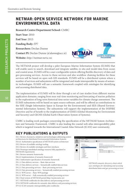
NETMAR semantic discovery client which<br />
uses ontologies for identifying and accessing<br />
distributed data and geo-processing services.