2013 - University College Cork
2013 - University College Cork
2013 - University College Cork

You also want an ePaper? Increase the reach of your titles
YUMPU automatically turns print PDFs into web optimized ePapers that Google loves.
APPRAISAL OF IRISH SEA SEABED IMAGING FOR<br />
TIDAL ENERGY GENERATION (ISSITEG)<br />
Research Centre/Department/School:<br />
School of Biological, Earth & Environmental Sciences<br />
Contact PI: Andy Wheeler (a.wheeler@ucc.ie)<br />
Researchers: Boris Dorschel<br />
Start Year: January 2012<br />
End Year: December 2012<br />
Funding Body: Geological Survey of Ireland<br />
Funding: €30k<br />
Research Projects Listing<br />
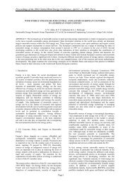
The most reliable and predictable renewable energy source is tidal energy. This predictability makes<br />
tidal energy an ideal source to supply the base load for a secure renewable energy mix. The technology<br />
of tidal energy generation is however still at its infancy with only a few test sites worldwide including<br />
Strangford Lough. The Irish government has included tidal energy in the Strategic Environmental<br />
Assessment (SEA) of the Offshore Renewable Energy Development Plan (OREDP).<br />
In the ORDEP the tidal energy potential was only assessed from a coarse 2-dimensional tidal model<br />
with a 500 m cell resolution. The existing 2D model only indicates areas of enhanced tidal energy on<br />
a country-wide base. It is insufficient to accurately assess local tidal resources of potential sites for<br />
offshore energy extraction thus underestimating Ireland’s tidal energy potential. Furthermore, it does<br />
not consider seabed topography, an important parameter for the distribution of tidal energy, and<br />
only incorporates 2 directly measured tidal current data sets for the entire Irish foreshore area.<br />
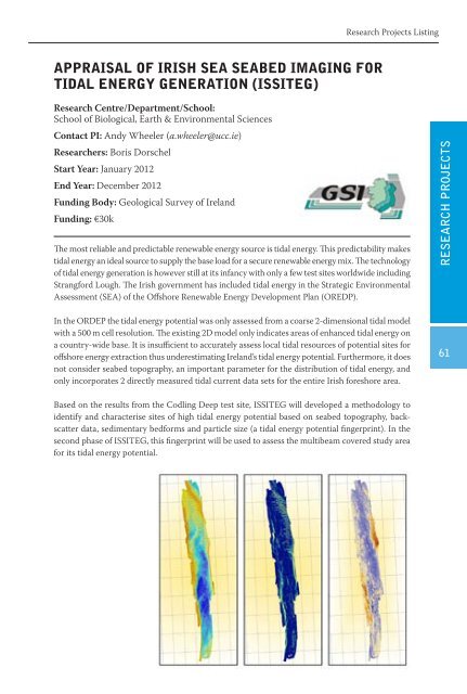
Based on the results from the Codling Deep test site, ISSITEG will developed a methodology to<br />
identify and characterise sites of high tidal energy potential based on seabed topography, backscatter<br />
data, sedimentary bedforms and particle size (a tidal energy potential fingerprint). In the<br />
second phase of ISSITEG, this fingerprint will be used to assess the multibeam covered study area<br />
for its tidal energy potential.<br />
RESEARCH PROJECTS<br />
6