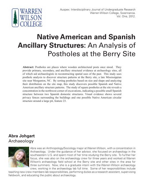
Native American and Spanish Ancillary Structures - Warren Wilson ...
Native American and Spanish Ancillary Structures - Warren Wilson ...
Native American and Spanish Ancillary Structures - Warren Wilson ...

You also want an ePaper? Increase the reach of your titles
YUMPU automatically turns print PDFs into web optimized ePapers that Google loves.
Auspex: Interdisciplinary Journal of Undergraduate Research<br />
<strong>Warren</strong> <strong>Wilson</strong> College, Swannanoa.<br />
Vol. One, 2012.<br />
<strong>Native</strong> <strong>American</strong> <strong>and</strong> <strong>Spanish</strong><br />
<strong>Ancillary</strong> <strong>Structures</strong>: An Analysis of<br />
Postholes at the Berry Site<br />
Abra Johgart<br />
Archaeology<br />
Abstract: Postholes are places where wooden architectural posts once stood. They<br />
provide primary, secondary, <strong>and</strong> ancillary structural evidence at archaeology sites, all<br />
of which aid archaeologists in reconstructing spatial uses of the past. This study uses<br />
posthole analysis to discover structure patterns at the Berry site, a late Mississippian<br />
site near Morganton, NC. By sorting postholes based on size <strong>and</strong> shape <strong>and</strong> analyzing<br />
their distribution on the site map, this study discovers possible <strong>Spanish</strong> <strong>and</strong> <strong>Native</strong><br />
<strong>American</strong> ancillary structure patterns. The study of square postholes at the site reveals a<br />
concentration in the northwest corner of excavations, indicating a possible small <strong>Spanish</strong><br />
structure between two <strong>Spanish</strong> domestic structures. Visual evidence shows several<br />
privacy fences surrounding the buildings <strong>and</strong> one possible <strong>Native</strong> <strong>American</strong> circular<br />
structure around a large pit, feature 23.<br />
Abra was an Anthropology/Sociology major at <strong>Warren</strong> <strong>Wilson</strong>, with a concentration in<br />
Archaeology. Under the guidance of her advisor, she focused on archaeology in the<br />
southeastern U.S. <strong>and</strong> spent most of her time studying the Berry site. To further her<br />
focus, she was also on the archaeology crew for three years <strong>and</strong> worked at <strong>Warren</strong><br />
<strong>Wilson</strong>’s archaeology field school at the Berry site <strong>and</strong> other sites in the area for<br />
three summers. Now, she is a graduate intern with the <strong>Warren</strong> <strong>Wilson</strong> archaeology<br />
crew, working in the archaeology lab full time. Some of her responsibilities include<br />
teaching new crew members lab responsibilities, performing duties as a research assistant, supervising<br />
fieldwork, <strong>and</strong> educating the public about archaeology.
Introduction<br />
One thing that all cultures have in common is<br />
that they require the utilization of space. The choices<br />
that cultures make about how to use that space reflect<br />
social organization <strong>and</strong> systems of meaning for<br />
particular cultures. One choice societies have is where<br />
<strong>and</strong> where not to build. On a large scale, this means<br />
deciding where to establish a village within a region.<br />
On a smaller scale, villagers must decide where to build<br />
a house within the village or where to build a fence in<br />
relation to the house.<br />
Space in a village is divided into three groups:<br />
domestic space, ceremonial space, <strong>and</strong> public space.<br />
Archaeological excavations of public <strong>and</strong> ceremonial<br />
space contain information about the leaders of society:<br />
they tell the stories of the great men <strong>and</strong> women of the<br />
time. Excavations of domestic space tell a different<br />
story: they contain information about how people lived<br />
their everyday lives. They tell not only the stories of the<br />
great leaders but also of the common people who made<br />
village life possible.<br />
Domestic space includes both the household<br />
<strong>and</strong> the area surrounding the household (Gougeon<br />
2007:140). Throughout North <strong>American</strong> prehistory,<br />
before written records, most domestic activity took<br />
place outside of the house, including cooking <strong>and</strong> craft<br />
making. Studies of the architecture of this outdoor<br />
domestic space inform us about how people interacted<br />
with each other <strong>and</strong> what activities took place. We can<br />
learn about the materials they used, what they used<br />
those materials for, <strong>and</strong> the significance of this humanmade<br />
domestic environment.<br />
The Berry site in Morganton, North Carolina, is<br />
one site where studying outdoor domestic space could<br />
aid our underst<strong>and</strong>ing of past everyday life, specifically<br />
life during the contact period in the interior of the<br />
eastern United States. Architecture at the Berry site can<br />
provide information about such aspects of life as political<br />
organization, economic organization, subsistence, <strong>and</strong><br />
aesthetic tastes. Previous research has been done on<br />
the burnt structures associated with the <strong>Spanish</strong> Fort<br />
San Juan in order to examine the relationship between<br />
<strong>Spanish</strong> soldiers <strong>and</strong> native villagers, but research has<br />
not yet explored outdoor domestic space between the<br />
structures (Beck, Moore, <strong>and</strong> Rodning 2006; Best <strong>and</strong><br />
Rodning 2003). Research on these outdoor activity areas<br />
is important because the fort is thought to be located on<br />
an old section of the village, so there is the possibility<br />
of evidence of both native <strong>and</strong> <strong>Spanish</strong> activity, much<br />
of which took place outside.<br />
This study examines the use of outdoor domestic<br />
space at the Berry Site by studying posthole distribution<br />
outside of the known structures. This research analyzes<br />
the dimensions <strong>and</strong> characteristics of the postholes<br />
<strong>and</strong> their spatial relationships, <strong>and</strong> compares these<br />
characteristics to postholes in known structures at<br />
the Berry site <strong>and</strong> at other Mississippian <strong>and</strong> colonial<br />
<strong>Spanish</strong> sites. I explore evidence of Mississippian<br />
<strong>and</strong> <strong>Spanish</strong> architectural structures via the postholes<br />
they left behind. Data from this study contribute to<br />
our underst<strong>and</strong>ing of interactions between villagers<br />
<strong>and</strong> <strong>Spanish</strong> soldiers by illuminating characteristics of<br />
the built environment <strong>and</strong> activity areas in the outdoor<br />
domestic space of Fort San Juan <strong>and</strong> Joara during <strong>and</strong><br />
preceding the time of <strong>Spanish</strong> contact in 1567.<br />
Research Framework<br />
The Mississippian Period denotes societies<br />
in the southeastern United States from around A.D.<br />
1000 to A.D. 1500 <strong>and</strong> includes societies with similar<br />
styles of artifacts, architecture, <strong>and</strong> settlement patterns<br />
(Boudreaux 2007). Important <strong>and</strong> relevant themes in the<br />
literature are Mississippian town designs, architectural<br />
designs, <strong>and</strong> how posthole patterns inform the research<br />
of both. Previous research on these topics aided my<br />
own research on posthole patterns at the Berry site<br />
<strong>and</strong> helped me underst<strong>and</strong> the meaning of its built<br />
environment.<br />
Ethnohistoric <strong>and</strong> Archaeological Background<br />
of the Berry Site<br />
The ethnohistoric <strong>and</strong> archaeological records<br />
provide evidence of both <strong>Native</strong> <strong>American</strong> <strong>and</strong><br />
<strong>Spanish</strong> occupation at the Berry site. Ethnohistoric<br />
documents show that <strong>Spanish</strong> soldiers traveled through<br />
the southeastern United States, including the area<br />
where the Berry site is located. During these travels,<br />
<strong>Spanish</strong> soldiers interacted with <strong>Native</strong> <strong>American</strong>s <strong>and</strong><br />
established permanent <strong>and</strong> temporary settlements.<br />
One group of <strong>Spanish</strong> soldiers came from Santa<br />
Elena, the capital of sixteenth-century <strong>Spanish</strong> Florida,<br />
established in 1566, located on the southern tip of<br />
modern-day Parris Isl<strong>and</strong>, South Carolina. Later that<br />
year, 250 soldiers arrived in Santa Elena to reinforce<br />
the colony. Because Santa Elena was not prepared to<br />
feed all of the soldiers, Captain Juan Pardo took half<br />
of his men on an exploring expedition of the interior<br />
l<strong>and</strong>s. During Pardo’s expeditions, he built a total of<br />
six forts, with the first <strong>and</strong> most important being Fort<br />
San Juan, located at the native town of Joara (Beck,
Moore, <strong>and</strong> Rodning 2006:5).<br />
The Berry site in the western Piedmont of<br />
North Carolina represents the sixteenth-century native<br />
Mississippian town of Joara, one of the largest native<br />
towns in western North Carolina at that time (Best <strong>and</strong><br />
Rodning 2003). In 1567, Pardo directed the construction<br />
of <strong>Spanish</strong> Fort San Juan at this location. With the aid<br />
of the native villagers, Pardo’s soldiers built a fivestructure<br />
fort immediately north of the town’s mound.<br />
The five structures were in a circular arrangement<br />
around what was possibly a plaza. The plaza area<br />
contains both postholes <strong>and</strong> features, but no identifiable<br />
structures. Relations between the villagers <strong>and</strong> the<br />
<strong>Spanish</strong> soldiers were cooperative in the beginning, as<br />
evidenced by native architectural design elements in the<br />
<strong>Spanish</strong> structures, but the fort was short-lived; the native<br />
villagers burnt the fort down in 1568 after the <strong>Spanish</strong><br />
wore out their welcome (Best <strong>and</strong> Rodning 2003).<br />
The belief that the Berry site is the location of<br />
Fort San Juan comes from the architectural style of<br />
the five structures <strong>and</strong> the presence of certain <strong>Spanish</strong><br />
artifacts that were not typically used as trade items, like<br />
lead shot, nails, <strong>and</strong> <strong>Spanish</strong> ceramics (Beck, Moore,<br />
<strong>and</strong> Rodning 2006:9). Ethnohistoric documents<br />
suggest that domestic structures at Pardo’s forts were<br />
larger than native domestic structures, but built in a<br />
similar style, which fits the description of the structures<br />
at the Berry site (Beck, Moore, <strong>and</strong> Rodning 2006).<br />
The Berry site includes three different<br />
occupational areas: the <strong>Native</strong> <strong>American</strong> village,<br />
located in the south area of the site; the mound, located<br />
in the center; <strong>and</strong> Fort San Juan, in the northernmost<br />
area (Figure 1). Upper Creek, a tributary of the upper<br />
Catawba River, runs along the east side of the site. Most<br />
of the excavations have taken place north of the mound,<br />
in the fort area of the site. Distributions of artifacts<br />
indicate that the site extends farther south <strong>and</strong> west than<br />
excavations have explored, so the whole extent of Joara<br />
has not been discovered. The village may be located<br />
both north <strong>and</strong> south of the mound, with Fort San Juan<br />
being built in part of the village, as opposed to outside<br />
of the village.<br />
Mississippian Town Design<br />
Mississippian towns usually include five<br />
different spatial elements: plazas, mounds, boundaries,<br />
gates, <strong>and</strong> domestic units (Lewis et al. 1998:11,<br />
Gougeon 2007:150). Plazas, distinguished by their lack<br />
of any built environment, are no less important than<br />
the structures that surround them (Gougeon 2007:146,<br />
Figure 1: Berry Site Map<br />
Lewis et al. 1998:11). The term plaza indicates<br />
“positive outdoor space,” meaning that this space has a<br />
definite shape <strong>and</strong> is partially enclosed by surrounding<br />
structures (Gougeon 2007:147). Plazas are areas that<br />
have been purposefully left empty, as opposed to “left<br />
over space,” which is empty space between structures<br />
in which it is impractical to build another structure<br />
(Gougeon 2007:147). Archaeologically, plazas may be<br />
the least interesting part of a town to study because of<br />
the lack of artifacts <strong>and</strong> features, but they represent one<br />
of the most important parts of the town. According to<br />
Lewis et al., “the majority of social life is acted out on .<br />
. . the plaza, not in the structures” (1998:12).<br />
Mounds are ritual structures included in larger<br />
Mississippian towns. They are large earthen structures<br />
made from dirt taken from borrow pits <strong>and</strong> are usually<br />
built near the plaza. There are two different types of<br />
mounds: platform <strong>and</strong> burial. Platform mounds are<br />
more common during the Mississippian period, but<br />
they may contain some burials as well as being used<br />
as platforms for building (Boudreaux 2007). Houses<br />
of important leaders, religious structures, charnel<br />
houses, <strong>and</strong> public meeting buildings are located
on top of platform mounds (Lewis et al. 1998:17).<br />
Towns are divided into different spatial levels<br />
by boundaries <strong>and</strong> gates, which are each different<br />
types of locks. A lock is something that restricts public<br />
access to private space. A boundary is a lock that covers<br />
a large unit of space (i.e., a palisade); a gate is a lock<br />
that controls a point of space (i.e., a door) (Lewis et al.<br />
1998:18). Palisades <strong>and</strong> protective ditches, which were<br />
often present in Mississippian towns, separate domestic<br />
areas from the outer areas of towns. Gates in the palisades<br />
controlled access to towns (Gougeon 2007:146-147,<br />
Lewis et al. 1998). Some Mississippian towns have<br />
evidence of multiple stages of palisade building; as the<br />
towns grew larger, palisades had to exp<strong>and</strong> (Boudreaux<br />
2007:42, Dickens 1978). Boundaries also separate<br />
neighborhoods within a town (Lewis et al. 1998:19). The<br />
stairs leading up from plaza areas to the top of a mound<br />
represent a gate, which restricts access to private space.<br />
Household clusters are the neighborhoods that<br />
make up the domestic area of a town. A house cluster<br />
is a group of primary <strong>and</strong> secondary structures around a<br />
common patio (Gougeon 2007:148, Steere 2009). Other<br />
terms for patio are outdoor activity area <strong>and</strong> miniplaza<br />
(Gougeon 2007), which can be used interchangeably.<br />
Household units can include a primary structure,<br />
secondary structure, <strong>and</strong> outdoor activity area (Gougeon<br />
2007:139-140). In the Mississippian town of Joara, this<br />
research focuses on the household cluster that forms the<br />
<strong>Spanish</strong> fort, which may include a miniplaza or even<br />
a small plaza in the center of the fort. It is unclear<br />
whether the fort was included as a neighborhood in the<br />
village or separated from the village.<br />
Types of Mississippian Architecture<br />
Mississippian towns include many different<br />
types of architecture within their boundaries. Any type<br />
of built environment can generally be called a structure,<br />
but there are several different types of structures.<br />
Public structures are one type. The other main type of<br />
structure is a domestic structure, which includes primary,<br />
secondary, <strong>and</strong> ancillary structures (Gougeon 2007).<br />
Primary structures, also known as winter<br />
structures, are domestic structures containing both walls<br />
<strong>and</strong> a roof. They include both circular <strong>and</strong> rectilinear<br />
forms (Boudreaux 2007). Secondary <strong>and</strong> ancillary<br />
structures are often located near primary structures.<br />
Secondary structures, sometimes called summer<br />
shelters, are open-sided covered structures. They have<br />
roofs, but no walls. These buildings may have been<br />
originally designed as storage facilities but were later<br />
used as a type of domestic structure (Gougeon 2007:140).<br />
<strong>Ancillary</strong> constructions (i.e., privacy fences, outdoor<br />
hearths, storage pits, burials, borrow pits, <strong>and</strong> hide<br />
processing racks) were built in the miniplaza, partially<br />
enclosed by the primary <strong>and</strong> secondary structures<br />
(Gougeon 2007:147, Dickens 1978). The outdoor<br />
domestic space of Fort San Juan probably includes both<br />
secondary <strong>and</strong> ancillary structures but may also include<br />
primary <strong>and</strong> public structures.<br />
Posthole Research<br />
Postholes provide evidence for architecture<br />
in archaeology sites. They represent places where<br />
wooden posts once stood (i.e., domestic structure,<br />
public building, or palisade). They may be a variety of<br />
different sizes but are identifiable by darker soil color<br />
<strong>and</strong> different soil type <strong>and</strong> density than the surrounding<br />
soil matrix (Gougeon 2007:141). Postholes represent<br />
any kind of human-built environment <strong>and</strong> can be<br />
found in any area of a village. Patterns of postholes<br />
show where structures were <strong>and</strong> their relationships.<br />
Post molds (the stain of the post inside the posthole)<br />
display even more information: they present evidence<br />
for construction techniques such as the size <strong>and</strong> shape<br />
of posts used (Gougeon 2007:141, Lacquement 2007).<br />
Postholes can either represent an area where a post was<br />
placed <strong>and</strong> deteriorated in that same area or an area<br />
where a post was placed <strong>and</strong> later removed (Figure<br />
2). The post mold is created when the post is placed<br />
in the posthole, <strong>and</strong> soil is filled in around the post.<br />
If the post deteriorates in the posthole, the post mold,<br />
sometimes referred to as the postpipe, may contain<br />
wood remains <strong>and</strong> have a darker, more organic fill<br />
than the surrounding posthole. If the post is removed<br />
Figure 2: Posthole Diagram<br />
Source: http://en.wikipedia.org/wiki/File:Postholegraphic2.png
from the posthole before deteriorating, the post mold<br />
will be less noticeable <strong>and</strong> may be completely gone due<br />
to the slumping of posthole fill into the post void. If<br />
the post was burned in place, sometimes the charred<br />
remains of the post will remain in-situ.<br />
Historical accounts provide insight into different<br />
ways posts were used <strong>and</strong> viewed by native people.<br />
<strong>Native</strong> <strong>American</strong>s viewed posts as functional (e.g.,<br />
roof support post) or symbolic (e.g., monumental post).<br />
Monumental posts, which are a type of symbolic post,<br />
are large posts erected in plazas, similar to flag poles<br />
we have today (Boudreaux 2007).<br />
One method of analyzing functional postholes<br />
is delineating them in the field (Benyshek et al. 2010).<br />
The first step in determining structure patterns is to<br />
identify postholes, which requires keeping detailed<br />
field records on all cultural, non-cultural, <strong>and</strong> possibly<br />
cultural postholes. South <strong>and</strong> DePratter (1996:77)<br />
distinguish posthole-sized pits at Santa Elena from<br />
definite postholes. They do not identify a postholesized<br />
pit as a posthole unless it is part of an identifiable<br />
structural outline or contains a post mold. Once<br />
the postholes are recorded on a computerized map,<br />
Benyshek et al. (2010) search for symmetry, alignment,<br />
<strong>and</strong> regular post spacing. Schroedl’s (1986) team at<br />
Chota-Tanasee depends on the presence of hearths <strong>and</strong><br />
regular post mold spacing of post molds with uniform<br />
depth, diameter, <strong>and</strong> fill that form a closed geometric<br />
pattern around the hearth to define structures. In 1974,<br />
Schroedl’s (1986:82) Chota-Tanasee team stopped<br />
excavating post molds, instead using a soil probe to<br />
discover post mold depth. Using these simple methods,<br />
the researchers are able to locate structure patterns.<br />
Methods<br />
In order to underst<strong>and</strong> the use of space in the<br />
miniplazas at the Berry site, I studied the postholes in<br />
these areas. I analyzed three dimensions of excavated<br />
postholes—size, shape, <strong>and</strong> color—using a quantitative<br />
coding instrument that characterizes postholes. I used<br />
my observations to classify postholes based on these<br />
dimensions (see below). I obtained data on the postholes<br />
from posthole excavation forms, unit excavation<br />
forms, feature forms, <strong>and</strong> maps, which the excavators<br />
completed at the time of excavation. Postholes with<br />
similar characteristics were analyzed by their location<br />
on the site map.<br />
The first of the three dimensions of postholes<br />
I examined was size. Posthole size includes measures<br />
of diameter <strong>and</strong> depth. All of these data were recorded<br />
on the posthole excavation form, unit form, feature<br />
form, or map, depending on the year of excavation. I<br />
divided the postholes into the categories of smallest,<br />
small, medium, <strong>and</strong> large based on their diameters. The<br />
smallest postholes were less than 10 centimeters across,<br />
small postholes were between 10 <strong>and</strong> 19 centimeters<br />
across, medium postholes were between 20 <strong>and</strong> 30<br />
centimeters, <strong>and</strong> large postholes were more than 30<br />
centimeters. Posthole depth was divided into shallowest<br />
(less than 10 centimeters deep), shallow (between 10<br />
<strong>and</strong> 19 centimeters deep), average (between 20 <strong>and</strong> 40<br />
centimeters deep), <strong>and</strong> deep (more than 40 centimeters<br />
deep).<br />
Identifying the shape of postholes is very<br />
important in determining the origin of the postholes. The<br />
two shapes it is important to distinguish are circular <strong>and</strong><br />
square, but in my analysis I divided them into circular,<br />
oval, square, rectangular, or irregular because those were<br />
the most common descriptors on the excavation forms.<br />
Any postholes that did not fit into these categories (e.g.,<br />
triangular) were treated individually.<br />
In addition to analyzing the shape of excavated<br />
postholes, I also analyzed the shape of some unexcavated<br />
postholes. Most unexcavated postholes do not include<br />
records of any of the information I need for my<br />
instrument, which is why I left most of them out of this<br />
part of my analysis, but these unexcavated postholes<br />
appeared square at the surface <strong>and</strong> were labeled<br />
“possible STP” (possible shovel test pit) on the unit<br />
maps. Although these postholes were included on the<br />
unit maps as possible STPs, they were excluded from<br />
the main site map because excavators assumed these<br />
were modern disturbances. I added these unexcavated<br />
square disturbances to the map <strong>and</strong> analyzed them<br />
alongside the excavated square postholes.<br />
The third dimension I analyzed was soil color<br />
which is recorded on the posthole excavation form<br />
or the posthole map. It is based on the excavators’<br />
observations, so is not completely reliable. I did not<br />
get the exact color of the soil, but I did have the color of<br />
the soil relative to the surrounding soil matrix. The soil<br />
can be a single color, like dark brown or dark grayish<br />
brown, or it can be mottled, containing multiple colors<br />
of soil.<br />
Some postholes that have multiple colors of soil<br />
contain post molds. Some researchers use the terms<br />
“posthole” <strong>and</strong> “post mold” interchangeably, but there<br />
is a subtle difference. A posthole is the hole that was<br />
dug to house a post; a post mold is a stain where the<br />
post actually stood. This can include burned posts
that leave charcoal in the ground where the post once<br />
stood. Post molds are identifiable because they have<br />
a different color soil stain located inside the posthole<br />
stain. Most postholes do not contain post molds, so<br />
unless the posthole excavation form or map indicates<br />
that a post mold was present, I assumed there was no<br />
post mold present.<br />
Using these categories I observed spatial<br />
relationships between the postholes on the Berry site<br />
map, created in Adobe Illustrator. I separated the<br />
postholes into excavated, unexcavated, <strong>and</strong> possibly<br />
cultural (STP) layers <strong>and</strong> separated the excavated<br />
postholes into layers based on depth, diameter, <strong>and</strong><br />
shape. I was able to view each map layer separately<br />
from the other layers, so by creating these different<br />
layers, I can view, for example, all of the large excavated<br />
postholes without the interference of unexcavated<br />
postholes or postholes of different sizes. Postholes with<br />
similar depths may have been part of a single structure,<br />
so the locations of postholes with similar depths were<br />
compared <strong>and</strong> analyzed for structure patterns. Diameter<br />
also contributes to identifying posthole patterns, but is<br />
not a good indicator on its own. Although postholes<br />
may have been larger than the posts that were placed in<br />
them posts of similar sizes probably had postholes of<br />
similar sizes, so postholes with similar diameters may<br />
indicate structure patterns.<br />
Besides using the information I was able to<br />
obtain from my instrument for excavated postholes, I<br />
also examined the Berry site map for posthole patterns<br />
including all postholes <strong>and</strong> features. Later, I examined<br />
the map including all postholes, but excluding features.<br />
The number of postholes at the Berry site has never<br />
been recorded, so I do not know how many postholes<br />
were included in this part of my research.<br />
All of the data I used came from the north<br />
end of the mound, outside of the five burnt structures.<br />
The principle investigator (Dr. David Moore) used a<br />
purposive sampling method in order to excavate three<br />
by three meter units in <strong>and</strong> around the structures. From<br />
these excavated units postholes were also purposively<br />
selected to be excavated as teaching tools during the<br />
field school. Out of the 173 excavated postholes, I was<br />
able to use data from 154 of the postholes. Postholes<br />
4, 35, 1037, 1054, 1055, 1098, 1102, <strong>and</strong> 1123 were<br />
determined to not be postholes after excavation, <strong>and</strong> I<br />
removed them from my analysis <strong>and</strong> the site map.<br />
Findings <strong>and</strong> Discussion<br />
I used several different methods of data analysis<br />
to determine the significance of the characteristics of<br />
the non-structural postholes at the Berry site. First, I<br />
compiled all of the data from the posthole excavation<br />
forms <strong>and</strong> determined the maximum depth, maximum<br />
diameter, minimum depth, minimum diameter, mean<br />
depth, mean diameter, st<strong>and</strong>ard deviation of depth,<br />
<strong>and</strong> st<strong>and</strong>ard deviation of diameter for all of the nonstructural<br />
postholes <strong>and</strong> postholes divided by shape.<br />
I gathered comparative data from the postholes in<br />
<strong>Structures</strong> 1 <strong>and</strong> 5 at the Berry Site as well as from the<br />
<strong>Spanish</strong> site, Santa Elena, <strong>and</strong> the Cherokee site, Chota-<br />
Tanasee. Second, I observed the spatial relationships<br />
between the postholes on the Berry site map.<br />
Berry Site Non-Structural Postholes<br />
Of the Berry site’s numerous postholes not<br />
associated with the five known structures, I found the<br />
average depth <strong>and</strong> diameter of 167 excavated postholes<br />
(Table 1). The average depth is 13.176 cm, <strong>and</strong> the<br />
average diameter is 16.733 cm. Depths range from<br />
1.1 cm to 72 cm, <strong>and</strong> the diameters range from 1.5<br />
cm to 53 cm. After finding the averages of all of the<br />
postholes, I divided the postholes based on shape. The<br />
average depth of the 39 circular postholes is 14.937 cm,<br />
<strong>and</strong> the average diameter is 20.041 cm. The 16 oval<br />
postholes have an average depth of 17.644 cm <strong>and</strong> an<br />
average diameter of 18.881 cm. The square postholes,<br />
of which only 5 have been excavated, have an average<br />
depth of 23.6 cm <strong>and</strong> an average diameter of 31.4 cm.<br />
Table 1<br />
PH ID # of<br />
PHs<br />
Berry Site Non-Structural Excavated Postholes<br />
Mean<br />
Depth<br />
(cm)<br />
St<strong>and</strong>ard<br />
Deviation<br />
of Depth<br />
(cm)<br />
Max<br />
Depth<br />
(cm)<br />
Min<br />
Depth<br />
(cm)<br />
Mean<br />
Diameter<br />
(cm)<br />
All 167 13.2 11.0 72 1.1 16.7<br />
Circular 39 14.9 14.4 72 1.5 20.0<br />
Oval 16 17.6 14.2 40 3 18.9<br />
Square 5 23.6 9.4 38 15 31.4<br />
PH ID St<strong>and</strong>ard<br />
Deviation of<br />
Diameter (cm)<br />
Max Diameter<br />
(cm)<br />
Min Diameter<br />
(cm)<br />
All 9.9 53 1.5<br />
Circular 11.5 50 5<br />
Oval 9.9 33 1.5<br />
Square 6.3 40 23
From these averages, square postholes appear<br />
to have the greatest depth <strong>and</strong> diameter of any shape<br />
<strong>and</strong> are 10.424 cm deeper <strong>and</strong> 14.667 cm wider than<br />
the average depth <strong>and</strong> diameter of all 167 Berry<br />
site postholes together. Because the depths of the<br />
167 postholes have such a wide range, the st<strong>and</strong>ard<br />
deviation for the depths of the postholes is large. The<br />
depth of square postholes falls within one st<strong>and</strong>ard<br />
deviation of the average depth of all postholes, which is<br />
an acceptable range, <strong>and</strong> means that the average depth<br />
of square postholes is not significantly different than<br />
the average depth of all 167 postholes. The diameter of<br />
square postholes falls outside of one st<strong>and</strong>ard deviation<br />
of the average diameter of all postholes, meaning that<br />
the diameter of square postholes is significantly different<br />
than the diameter of all 167 postholes.<br />
Chota-Tanasee Site<br />
The sites of Chota <strong>and</strong> Tanasee are Overhill<br />
Cherokee villages located on the east side of the Little<br />
Tennessee River seven miles east-southeast of Vonore,<br />
Tennessee. The Overhill settlements are one of three<br />
clusters of Cherokee settlements with distinct political,<br />
social, economic, <strong>and</strong> linguistic traits (Schroedl 1986:5).<br />
The Overhill Cherokee lived in northern Cherokee<br />
country along the Little Tennessee <strong>and</strong> Tellico Rivers.<br />
Chota <strong>and</strong> Tanasee were two of over sixty Cherokee<br />
settlements occupied during the eighteenth century. The<br />
Overhill Cherokee may have had contact with <strong>Spanish</strong><br />
explorers DeSoto <strong>and</strong> Pardo in the sixteenth century,<br />
but there was no sustained contact with Europeans until<br />
the Cherokee established trade relationships with the<br />
British in the eighteenth century (Schroedl 1986:7).<br />
The Chota-Tanasee site has many different<br />
examples of postholes. Schroedl (1986) divides<br />
postholes—based on assumed purpose—into post<br />
molds in oval pits with posts, post molds in rectangular<br />
pits with posts, major roof support postholes <strong>and</strong> post<br />
molds in the townhouses, post molds associated with<br />
the townhouses, <strong>and</strong> post molds associated with the<br />
summer pavilion. Because of the limited scope of my<br />
study, I only use the data from the summer pavilion <strong>and</strong><br />
pits with posts (Table 2).<br />
At Chota-Tanasee there are 222 post molds<br />
associated with the summer pavilion. The average<br />
depth is 14.326 cm, <strong>and</strong> the average diameter is 15.85<br />
cm. The depths of the post molds ranged from 3.048<br />
cm to 39.624 cm, <strong>and</strong> the diameters ranged from 4.572<br />
to 28.956 cm. The average depth of Chota-Tanasee<br />
summer pavilion postholes is only 1.15 cm deeper<br />
Table 2<br />
PH ID # of<br />
PHs<br />
oval pits<br />
with posts<br />
rectangular<br />
pits with<br />
posts<br />
summer<br />
pavilion<br />
Chota-Tanasee Postholes<br />
Mean<br />
Depth<br />
(cm)<br />
St<strong>and</strong>ard<br />
Deviation<br />
of Depth<br />
(cm)<br />
Max<br />
Depth<br />
(cm)<br />
Min<br />
Depth<br />
(cm)<br />
Mean<br />
Diameter<br />
(cm)<br />
19 24.4 12.8 45.7 7.6 17.4<br />
43 28.7 10.1 45.7 4.6 16.2<br />
222 14.3 6.7 39.6 3.0 15.9<br />
PH ID St<strong>and</strong>ard<br />
Deviation<br />
of<br />
Diameter<br />
(cm)<br />
oval pits<br />
with posts<br />
rectangular<br />
pits with<br />
posts<br />
summer<br />
pavilion<br />
Max<br />
Diameter<br />
(cm)<br />
Min<br />
Diameter<br />
(cm)<br />
5.8 30.5 9<br />
3.7 30.5 9.1<br />
5.5 29.0 4.6<br />
than the average depth of Berry site postholes, <strong>and</strong> the<br />
average diameter is only 0.883 cm smaller than Berry<br />
site postholes, which easily falls within one st<strong>and</strong>ard<br />
deviation of the average, meaning that Berry site nonstructural<br />
postholes are similar to eighteenth-century<br />
Cherokee summer pavilion postholes.<br />
Santa Elena Site<br />
Santa Elena is a sixteenth-century <strong>Spanish</strong><br />
site with a variety of different postholes <strong>and</strong> features.<br />
The site has evidence of pre-<strong>Spanish</strong> <strong>Native</strong> <strong>American</strong><br />
occupation, a French fort ab<strong>and</strong>oned two years before<br />
the <strong>Spanish</strong> arrived, <strong>Spanish</strong> occupation between<br />
1566 <strong>and</strong> 1587, <strong>and</strong> twentieth-century Marine Corps<br />
occupation. Each period of occupation has distinct<br />
features <strong>and</strong> artifacts associated with it.<br />
There are postholes or posthole-sized pits<br />
associated with the pre-<strong>Spanish</strong> occupation, <strong>Spanish</strong><br />
occupation, <strong>and</strong> Marine Corps occupation. The<br />
information I use comes from the 1993 excavation of<br />
the 38BU162N Block at Santa Elena.<br />
There are ten possible <strong>Spanish</strong> postholes—<br />
Features 32, 33, 48, 49, 52, 68B, 68C, 105, 105A,<br />
<strong>and</strong> 107 (Table 3)—not associated with structures in<br />
Block 38BU162N. South <strong>and</strong> DePratter (1996) call<br />
these posthole-size pits because they do not have post
molds <strong>and</strong> have no identifiable structural pattern. Some<br />
of these posthole-size pits contain <strong>Spanish</strong> artifacts<br />
(See Table 3); postholes 68B <strong>and</strong> 68C contain unfired<br />
daub that indicates their <strong>Spanish</strong> origin. The <strong>Spanish</strong><br />
postholes have blended edges between the posthole<br />
fill <strong>and</strong> surrounding soil matrix. These edges are more<br />
distinct than tree holes but less distinct than Marine<br />
Corps postholes.<br />
There are three postholes with diameters around<br />
three meters, while seven postholes have diameters of<br />
less than 60 cm. One posthole does not have diameter<br />
or depth data recorded. The three postholes with the<br />
largest diameters are outliers <strong>and</strong> are excluded from the<br />
average diameter for <strong>Spanish</strong> postholes at Santa Elena.<br />
The average diameter of the other six postholes is 41.33<br />
cm. The average depth of those same six postholes is<br />
25.5 cm.<br />
Santa Elena postholes have diameters that are<br />
24.597 cm larger than average Berry site postholes <strong>and</strong><br />
are 12.324 cm deeper. Both of these differences fall<br />
outside one st<strong>and</strong>ard deviation of the mean, signifying<br />
that Santa Elena postholes are not similar to Berry site<br />
postholes. The square, possibly <strong>Spanish</strong>, postholes<br />
at the Berry site are more comparable to Santa Elena<br />
postholes. Square Berry site postholes are only 9.93 cm<br />
smaller in diameter than Santa Elena postholes, <strong>and</strong> only<br />
1.9 cm shallower. The diameter still falls outside one<br />
st<strong>and</strong>ard deviation of the mean, but the depth is within<br />
one st<strong>and</strong>ard deviation of the mean. This demonstrates<br />
that although possible <strong>Spanish</strong> Berry site postholes are<br />
not similar to Santa Elena non-structural postholes, they<br />
are more similar in size than general Berry site postholes.<br />
Table 3<br />
Santa Elena <strong>Spanish</strong> Postholes<br />
Feature # Shape Diameter<br />
(cm)<br />
Depth<br />
(cm)<br />
Contents<br />
32 Majolica<br />
33 55 44 Earthenware,<br />
olive jar<br />
48 Oval 296 12<br />
49 Circular 27 6 Majolica<br />
52 58 35<br />
68B 26 7<br />
68C Oval 293 26 Olive jar<br />
105 Oval 316 13 Majolica<br />
105A 55 35 Majolica,<br />
olive jar<br />
107 27 26<br />
The Marine Corps postholes—features 53, 92, 93, <strong>and</strong><br />
97 (Table 4)—were all square shaped <strong>and</strong> had a lighter<br />
posthole fill color <strong>and</strong> sharp outlines. The sharp outline<br />
between posthole fill <strong>and</strong> the surrounding soil matrix<br />
indicates that these postholes were dug recently, because<br />
there has not been much soil leeching. These postholes<br />
date to the World War I era when the site was used as a<br />
training facility, bombing range, <strong>and</strong> golf course.<br />
The average diameter of Marine Corps postholes<br />
is 36.5 cm, <strong>and</strong> the depths of the two excavated<br />
postholes are 24 <strong>and</strong> 55 cm. Feature 53 contained<br />
wooden post fragments <strong>and</strong> wire nails, which provide<br />
further evidence for its twentieth-century origin.<br />
Table 4<br />
Santa Elena Marine Corps Postholes<br />
Feature # Shape Diameter<br />
(cm)<br />
Depth (cm) Contents<br />
53 Square 43 55 Wire nails<br />
92 Square 18 24<br />
93 Square 21 Not<br />
Excavated<br />
97 Square 64 Not<br />
Excavated<br />
Berry Site <strong>Structures</strong> 1 <strong>and</strong> 5<br />
At the Berry site, archaeologists find similarities<br />
as well as differences in posthole styles between the<br />
two excavated structures. The two posthole styles are<br />
<strong>Native</strong> <strong>American</strong> <strong>and</strong> <strong>Spanish</strong> postholes. Structure<br />
1 was built of more durable materials <strong>and</strong> of a more<br />
stable architectural design. One of the postholes in this<br />
structure contained an upright post, which was the same<br />
size as the hole it was in (Figure 3). This is evidence of<br />
the native technique of ramming posts into the ground<br />
(Beck et al. 2010).<br />
Structure 5, although a similar size to structure<br />
1, was built of less durable materials <strong>and</strong> in a shallower<br />
basin indicating that it may have been built at a later<br />
time, <strong>and</strong> with less <strong>Native</strong> <strong>American</strong> help. One of<br />
the postholes in this structure had a post mold much<br />
smaller than the posthole <strong>and</strong> had an iron shim wedged<br />
in between the post mold <strong>and</strong> the edge of the posthole<br />
(Figure 3). The larger posthole is evidence that the<br />
hole was dug with shovels before the post was placed<br />
in. Historical documents show that Pardo’s soldiers<br />
had shovels with them at Fort San Juan, whereas<br />
<strong>Native</strong> <strong>American</strong>s would not have used shovels, so this<br />
posthole was probably dug by the <strong>Spanish</strong> soldiers or by<br />
<strong>Native</strong> <strong>American</strong>s with <strong>Spanish</strong> tools (Beck et al. 2010).
Figure 3: <strong>Native</strong> Posthole Style (Left)<br />
<strong>and</strong> <strong>Spanish</strong> Posthole Style (Right)<br />
The structures have exterior wall posts <strong>and</strong><br />
interior roof support posts. The interior posts have<br />
larger diameters <strong>and</strong> depths than the exterior posts. The<br />
average depth of Structure 5 postholes is 27.577 cm, <strong>and</strong><br />
the average diameter is 20.885 cm. The average depth<br />
of Structure 1 postholes is 24.636 cm, <strong>and</strong> the average<br />
diameter is 18.909 cm. The depths of the postholes of<br />
both of the structures lie outside one st<strong>and</strong>ard deviation<br />
of the mean of general Berry site postholes <strong>and</strong> are<br />
significantly larger than the non-structural postholes.<br />
Table 5<br />
PH ID # of<br />
PHs<br />
Structure<br />
5<br />
Structure<br />
1<br />
Berry Site Structure Postholes<br />
Mean<br />
Depth<br />
(cm)<br />
PH ID St<strong>and</strong>ard<br />
Deviation<br />
of<br />
Diameter<br />
(cm)<br />
Structure<br />
5<br />
Structure<br />
1<br />
St<strong>and</strong>ard<br />
Deviation<br />
of Depth<br />
(cm)<br />
Max<br />
Depth<br />
(cm)<br />
Min<br />
Depth<br />
(cm)<br />
Mean<br />
Diameter<br />
(cm)<br />
13 27.6 12.9 48 7 20.9<br />
22 24.6 18.8 59 1 18.9<br />
Max<br />
Diameter<br />
(cm)<br />
Min<br />
Diameter<br />
(cm)<br />
7.5 37 10<br />
7.1 34 10<br />
Square Posthole Distribution<br />
I analyzed postholes for differences between<br />
<strong>Native</strong> <strong>and</strong> <strong>Spanish</strong> postholes. The shapes of postholes<br />
are a good indicator of who created them. Square<br />
postholes were most likely not dug by native people<br />
because of their lack of square digging implements.<br />
Historical records provide evidence that Pardo’s<br />
soldiers carried shovels with them, so they possessed<br />
a greater capability to dig square postholes than did<br />
natives (Beck, Moore, Rodning 2010). Not only does<br />
the square shape indicate a <strong>Spanish</strong> posthole, but the<br />
depth <strong>and</strong> size of existing post molds provide evidence<br />
as to how the posthole was created. Post molds in<br />
<strong>Native</strong> postholes would have been closer to the size of<br />
the postholes because native people used a ramming<br />
technique to insert posts rather than digging a posthole<br />
to insert a post into (Beck, Moore, Rodning 2010).<br />
Square-shaped postholes could also indicate historic<br />
postholes of other origins, but since the Berry site<br />
already has evidence of <strong>Spanish</strong> occupation, it is likely<br />
that these postholes are <strong>Spanish</strong>.<br />
There are five excavated square postholes at<br />
the Berry site (Table 6) as well as twelve unexcavated<br />
square-shaped posthole-sized stains labeled “possible<br />
STPs” on the unit maps that were not originally included<br />
on the site map.<br />
Table 6<br />
Posthole<br />
#<br />
Post<br />
Mold<br />
Excavated Square Postholes<br />
Shape Diameter<br />
(cm)<br />
Depth<br />
(cm)<br />
Contents<br />
1109 y square 34 18.5 potsherds,<br />
charcoal<br />
1112 n square 29 38 charcoal<br />
1156 p square 23 28 small sherds,<br />
pebbles<br />
1176 y square 31 18.5 biface,<br />
postsherds<br />
Fea. 41 n square 40 15<br />
After excavating posthole 1109, one of these<br />
“possible STPs,” during the 2010 field season, we<br />
discovered that our initial assumptions—that the mottled<br />
square stains were modern archaeological shovel test<br />
pits—were wrong: Posthole 1109 had a post mold,<br />
which an STP would not have. Unexcavated possible<br />
STPs were added to the map <strong>and</strong> analyzed next to<br />
excavated possible STPs <strong>and</strong> other square postholes.<br />
Posthole 1109 (Figure 4), which was originally<br />
thought to be a possible STP because of its square<br />
shape <strong>and</strong> mottled soil color, was excavated, <strong>and</strong> found<br />
to have a solid-colored, circular post mold inside the<br />
mottled, square posthole. The circular post mold is 13<br />
cm across <strong>and</strong> 23 cm deep, while the posthole is 34<br />
cm across <strong>and</strong> 15.5 cm deep. The post mold is less<br />
compact than the surrounding posthole <strong>and</strong> continues
deeper than the posthole. Square posthole 1176 (Figure<br />
4) also contains a circular, less compact post mold, but<br />
this post mold does not extend deeper than the posthole.<br />
Square posthole 1156 contains a possible square post<br />
mold.<br />
There is a concentration of seven possible<br />
STPs in the northwest corner of the Berry site between<br />
<strong>Structures</strong> 2 <strong>and</strong> 5 (Figure 5). Four of these possible<br />
STPs, along with two other similarly-sized unexcavated<br />
postholes, appear to form the outline of a small structure.<br />
A fifth possible STP is located directly in the center of<br />
this posthole pattern. There are several other postholes<br />
around the border of the possible structure. Due to the<br />
square shape of these postholes it is likely that this is<br />
a <strong>Spanish</strong> structure associated with one or both of the<br />
nearby <strong>Spanish</strong> domestic structures.<br />
Figure 4: Postholes 1109 <strong>and</strong> 1176 Before <strong>and</strong> After Excavation<br />
Figure 5: Possible <strong>Spanish</strong> Structure in NW Corner<br />
A second concentration of six possible STPs <strong>and</strong><br />
square postholes (Figure 6) is located in the southern<br />
area north of the mound, between <strong>Structures</strong> 3 <strong>and</strong> 5.<br />
This pattern is slightly larger than the pattern found in<br />
the northwest corner of the site <strong>and</strong> is not in as close<br />
proximity to a domestic structure. Three of the square<br />
postholes in this pattern have been excavated.<br />
This possible <strong>Spanish</strong> structure intrudes into the<br />
possible <strong>Native</strong> structure around feature 23, indicating<br />
that these two structures were not in use at the same time<br />
(Figure 7). Neither the <strong>Native</strong> structure, nor feature<br />
23, was in use during the time of <strong>Spanish</strong> occupation.<br />
Further evidence that the <strong>Spanish</strong> structure was built<br />
after the feature 23 structure is that one of the postholes<br />
in the <strong>Spanish</strong> structure intrudes into feature 23. This<br />
posthole is visible at the top of feature 23, indicating that<br />
the pit had been filled in prior to the time the posthole<br />
was dug.<br />
Figure 6: Possible <strong>Spanish</strong> Structure in South Area<br />
Figure 7: South <strong>Spanish</strong> Structure Intrudes into Feature 23<br />
Another example of sixteenth-century <strong>Spanish</strong><br />
architecture is found at San Luis in northern Florida<br />
(Scarry <strong>and</strong> McEwan 1995). Excavations at this<br />
Apalachee site found evidence of several <strong>Spanish</strong><br />
structures, including small structures associated<br />
with larger domestic structures. The earliest <strong>Spanish</strong><br />
domestic structure found at the site had an associated<br />
detached building that could have been a storage room<br />
or hen house. There were also activity areas around<br />
these <strong>Spanish</strong> buildings that included animal pens.<br />
Evidence shows that <strong>Spanish</strong> houses, like <strong>Native</strong>
<strong>American</strong> houses, were organized around a patio <strong>and</strong><br />
had associated corrals, yards, or other activity areas<br />
(Scarry <strong>and</strong> McEwan 1995). Based on this evidence,<br />
I suggest that these small possible <strong>Spanish</strong> structures<br />
at the Berry site are storage structures for the domestic<br />
<strong>Spanish</strong> structures.<br />
Privacy Fences<br />
By studying patterns of all the postholes, both<br />
excavated <strong>and</strong> unexcavated, I connected many lines of<br />
small postholes. There are five straight lines of postholes<br />
that do not appear to be part of larger structures (Figure<br />
8). Two of the lines appear to curve at a right angle but<br />
do not continue into a complete roofed structure. Four of<br />
these appear to be privacy fences running parallel to the<br />
walls of the structures of the <strong>Spanish</strong> fort. The privacy<br />
fences around three sides of Structure 5 are about two<br />
meters from the structure walls. The fence by Structure<br />
3 is only about one meter from the eastern wall. The<br />
other three posthole lines not associated with structures<br />
could be part of unidentified ancillary structures in the<br />
miniplaza.<br />
Because these privacy fences are associated<br />
with the <strong>Spanish</strong> structures, I assume these were built<br />
during the time of <strong>Spanish</strong> occupation. Although none<br />
of the postholes surrounding the structures have been<br />
excavated, the shapes of the postholes are still illustrated<br />
on the site map, even though I do not have data for their<br />
depths or diameters. None of these postholes appear to<br />
have a square shape, which indicates that these fences<br />
were probably built by <strong>Native</strong> <strong>American</strong>s when they<br />
built Structure 5.<br />
Figure 8: Berry Site Privacy Fences<br />
Conclusions<br />
After examining the postholes at the Berry site,<br />
there is clear evidence that there are more structures at<br />
the site than there first appear to be. These structures<br />
are not as apparent as the <strong>Spanish</strong> domestic structures<br />
because they were not burned or semisubterranean, so<br />
there is no evidence of soil discoloration from burning<br />
or burnt posts, <strong>and</strong> they are much smaller. There<br />
is evidence of both <strong>Native</strong> <strong>American</strong> <strong>and</strong> <strong>Spanish</strong><br />
postholes styles <strong>and</strong> evidence of both pre-<strong>Spanish</strong><br />
<strong>Native</strong> <strong>American</strong> architecture <strong>and</strong> <strong>Spanish</strong> architecture<br />
in the fort area of the Berry site. I found evidence of<br />
two possible <strong>Spanish</strong> structures <strong>and</strong> several privacy<br />
fences around the <strong>Spanish</strong> domestic structures. The<br />
postholes at the Berry site most closely resemble the<br />
postholes at the Cherokee site Chota-Tanasee, but the<br />
possible <strong>Spanish</strong> postholes at the Berry site resemble<br />
the postholes at Santa Elena.<br />
From these findings I can infer a little about<br />
Fort San Juan <strong>and</strong> about the area before the fort was<br />
built. The <strong>Native</strong> <strong>American</strong> style postholes in this<br />
area, along with the possible pit with posts, show<br />
either Cherokee influence or similar architectural<br />
development between the Cherokee <strong>and</strong> <strong>Native</strong><br />
<strong>American</strong>s at the Berry site. The privacy fences <strong>and</strong><br />
possible <strong>Spanish</strong> storage structures further emphasize<br />
the domestic nature of the structures at Fort San Juan.<br />
Limitations <strong>and</strong> Delimitations<br />
The results from my data apply to the area<br />
of the Berry Site thought to be the <strong>Spanish</strong> Fort San<br />
Juan, which is also the native Mississippian village of<br />
Joara. The posthole patterns <strong>and</strong> styles I find at Joara<br />
can be compared to other Mississippian sites, <strong>and</strong> any<br />
postholes I identify as <strong>Spanish</strong> can be compared to<br />
other contact period <strong>Spanish</strong> sites on the east coast of<br />
the United States.<br />
The main limitation of my research was the small<br />
number of excavated postholes. Most of the excavated<br />
postholes are in the north area of the site, which is the<br />
fort area. Because only a portion of the postholes in this<br />
area have been uncovered, <strong>and</strong> even fewer have been<br />
excavated, identifying structure patterns is difficult.<br />
When attempting to discover patterns throughout<br />
an area, it is impossible to use a sample. In order to<br />
complete my research, it is necessary for all, or most, of<br />
the postholes in the fort area to be excavated. Another<br />
limitation of this sample is that I cannot compare the<br />
postholes in this area with postholes in other areas of<br />
the site, so it is impossible to determine if the patterns
find are representative of the whole site.<br />
Because of my small sample of excavated<br />
postholes, I was not able to utilize my posthole<br />
instrument to the extent that I wanted. I used the data<br />
I collected with this instrument to compare Berry site<br />
postholes with postholes at only two other sites, but I<br />
was not able to use much of this data to analyze the<br />
distribution of different types of postholes throughout<br />
the Berry site map because the sample had such a small<br />
distribution.<br />
Instead, I studied the map with all of the<br />
excavated <strong>and</strong> unexcavated postholes on it. Although I<br />
did get results from this method, the only way to check<br />
the accuracy of these results is to do a more in-depth<br />
analysis. Finding posthole patterns on a map full of<br />
postholes is similar to finding constellations in the stars:<br />
Using one’s imagination, it is possible to find any number<br />
of patterns that do not actually represent structures.<br />
In addition, field school students excavated the<br />
postholes, which could create a possible nonsampling<br />
error. The field school setting also leads to inconsistent<br />
data because a different person excavated each posthole.<br />
Questions For Future Research<br />
Future researchers need to finish excavating the<br />
postholes at the Berry site in order to identify posthole<br />
patterns based on the depth of the postholes. Although<br />
I attempted this in my research, the postholes in only a<br />
small area of the site had been excavated, so I was not<br />
able to identify any patterns using this method. After<br />
all of the postholes at the Berry site are excavated,<br />
including postholes in all areas of the site, postholes<br />
in different areas should be compared to discover<br />
if different areas were used for different purposes or<br />
during different times. Postholes in the north area of<br />
the site might have more <strong>Spanish</strong> or Cherokee influence<br />
than postholes in other areas of the site.<br />
Further research can also be done in the areas<br />
around the possible <strong>Spanish</strong> structures to determine the<br />
purpose of these structures. More in-depth research<br />
needs to be done on the square postholes at the Berry<br />
site. Although I have been calling these <strong>Spanish</strong><br />
postholes, it is possible that they represent other types<br />
of historical structures. From my research of Santa<br />
Elena, I discovered that the <strong>Spanish</strong> postholes at that<br />
site do not have a square shape, but the postholes from<br />
the Marine Corps period do. More research needs to be<br />
done to determine if the square postholes at the Berry<br />
site are actually <strong>Spanish</strong> or are more modern historic<br />
postholes.<br />
Significance of Study<br />
This study provides information regarding the<br />
usage of space at the Berry site, specifically in <strong>and</strong> around<br />
Fort San Juan. Posthole patterns at the Berry site indicate<br />
various types of structures <strong>and</strong> provide underst<strong>and</strong>ing<br />
of the built environment. Underst<strong>and</strong>ing the built<br />
environment at the Berry site is important because it<br />
provides insights into the interactions that took place<br />
among the people living there, including interactions<br />
between <strong>Native</strong> <strong>American</strong>s <strong>and</strong> <strong>Spanish</strong> soldiers. My<br />
research provides evidence of architectural structures<br />
of Fort San Juan <strong>and</strong> pre-<strong>Spanish</strong> <strong>Native</strong> <strong>American</strong><br />
architecture, <strong>and</strong> contributes to a large body of research<br />
on site structure <strong>and</strong> contact situations. It adds to the<br />
broad research about both Mississippian settlements<br />
<strong>and</strong> <strong>Spanish</strong> contact sites, as well as providing specific<br />
data about the structure of the Berry site.<br />
References<br />
Beck, Jr., Robin A., David Moore, <strong>and</strong> Christopher B.<br />
Rodning<br />
2006 Identifying Fort San Juan: A 16th-<br />
Century <strong>Spanish</strong> Occupation at the<br />
Berry Site, North Carolina. Paper<br />
presented at the 63rd Annual Meeting<br />
of the Southeastern Archaeological<br />
Conference, Little Rock, AR,<br />
November 8-11.<br />
Beck, Jr., Robin A., Christopher B. Rodning, <strong>and</strong><br />
David Moore<br />
2010 The Architecture of Contact: Exploring<br />
the Built Environment of Fort San Juan.<br />
Paper presented at the 67th Annual<br />
Meeting of the Southeastern<br />
Archaeological Conference, Lexington,<br />
KY, October 29.<br />
Benyshek, Tasha, Benjamin A. Steere, Paul Webb, Joel<br />
C. Jones, <strong>and</strong> Hannah Guidry<br />
2010 Finding, Delineating, <strong>and</strong> Recording<br />
Structure Patterns: Recent Excavations<br />
in Western North Carolina. Paper<br />
presented at the 67th Annual Meeting<br />
of the Southeastern Archaeological<br />
Conference, Lexington, KY October 28<br />
Best, Megan S., <strong>and</strong> Christopher B. Rodning<br />
2003 Mississippian Chiefdoms <strong>and</strong> the<br />
<strong>Spanish</strong> Frontier: An overview of<br />
recent excavations at the Berry Site.<br />
Paper presented at the 60th Annual<br />
Meeting of the Southeastern
Archaeological Conference, Charlotte,<br />
NC.<br />
Boudreaux, Edmond A.<br />
2007 Archaeology of Town Creek.<br />
Tuscaloosa: University of Alabama<br />
Press.<br />
Dickens, S. Roy<br />
1978 Mississippian Settlement Patterns in the<br />
Appalachian Summit Area: The Pisgah<br />
<strong>and</strong> Qualla Phases. In Mississippian<br />
Settlement Patterns. Bruce D. Smith,<br />
ed. Pp. 115-139. New York: Academic<br />
Press.<br />
Gougeon, Ramie A.<br />
2007 Architectural Grammar of Late<br />
Mississippian Houses in Northwest<br />
Georgia. In Architectural Variability in<br />
the Southeast. Cameron H.<br />
Lacquement, ed. Pp. 32-48. Tuscaloosa:<br />
University of Alabama Press.<br />
Lacquement, Cameron H.<br />
2007a Introduction to Architectural<br />
Variability in the Southeast. In<br />
Architectural Variability in the<br />
Southeast. Cameron H. Lacquement,<br />
ed. Pp. 1-11. Tuscaloosa: University of<br />
Alabama Press.<br />
2007b Typology, Chronology, <strong>and</strong><br />
Technological Changes of<br />
Mississippian Domestic Architecture in<br />
West-Central Alabama. In Architectural<br />
Variability in the Southeast. Cameron<br />
H. Lacquement, ed. Pp. 49-72.<br />
Tuscaloosa: University of Alabama<br />
Press.<br />
Lewis, Berry R., Charles Stout <strong>and</strong> Cameron B.<br />
Wesson<br />
1998 Design of Mississippian Towns. In<br />
Mississippian Towns <strong>and</strong> Sacred<br />
Spaces: Searching for an Architectural<br />
Grammar. Berry R. Lewis <strong>and</strong> Charles<br />
Stout, eds. Pp. 200-226. Tuscaloosa:<br />
University of Alabama Press.<br />
Scarry, John F. <strong>and</strong> Bonnie G. McEwan<br />
1995 Domestic Architecture in Apalachee<br />
Province: Apalachee <strong>and</strong> <strong>Spanish</strong><br />
Residential Styles in the Late<br />
Prehistoric <strong>and</strong> Early Historic Period<br />
Southeast. <strong>American</strong> Antiquity 60(3):<br />
482-495.<br />
Schroedl, Gerald F.<br />
1986 Overhill Cherokee Archaeology at<br />
Chota-Tanasee. University of<br />
Tennessee Department of Anthropology<br />
Report of Investigations, 38. Knoxville:<br />
Tennessee Valley Authority<br />
Publications in Anthropology.<br />
South, Stanley <strong>and</strong> Chester B. DePratter<br />
1996 Discovery at Santa Elena: Block<br />
Excavation 1993. South Carolina<br />
Institute of Archaeology <strong>and</strong><br />
Anthropology Research Manuscript<br />
Series 222. Columbia, SC: University<br />
of South Carolina.<br />
Steere, Benjamin<br />
2010 Archaeology of Houses <strong>and</strong><br />
Households in the <strong>Native</strong> Southeast.<br />
Ph.D. dissertation proposal,<br />
Department of Anthropology,<br />
University of Georgia.