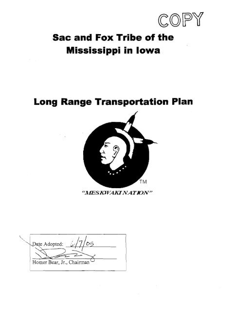
Sac and Fox Tribe of the Mississippi in Iowa Long Range ...
Sac and Fox Tribe of the Mississippi in Iowa Long Range ...
Sac and Fox Tribe of the Mississippi in Iowa Long Range ...

You also want an ePaper? Increase the reach of your titles
YUMPU automatically turns print PDFs into web optimized ePapers that Google loves.
<strong>Sac</strong> <strong>and</strong> <strong>Fox</strong> <strong>Tribe</strong> <strong>of</strong> <strong>the</strong><br />
<strong>Mississippi</strong> <strong>in</strong> <strong>Iowa</strong><br />
<strong>Long</strong> <strong>Range</strong> Transportation Plan<br />
te Adopted:<br />
Homer Bear, Jr., Chairman "
Chapter 1<br />
Introduction<br />
Transportation is def<strong>in</strong>ed as means <strong>of</strong> conveyance or travel from one place to ano<strong>the</strong>r.<br />
Transportation is essential for community development, no matter if <strong>the</strong> community is as<br />
large as a sprawl<strong>in</strong>g metropolitan area or as small as a residential development.<br />
Accessibility <strong>and</strong> circulation is basic to human survival <strong>and</strong> can be as simple as a wallung<br />
path or as complex as a metropolitan multi-modal network which <strong>in</strong>cludes vehicular,<br />
tra<strong>in</strong>, subway, bik<strong>in</strong>g, walk<strong>in</strong>g, <strong>and</strong> air transportation. The <strong>Sac</strong> <strong>and</strong> <strong>Fox</strong> Tribal<br />
community's transportation system is a vital component <strong>of</strong> all daily operations <strong>and</strong><br />
aspects <strong>of</strong> life. The transportation system also constitutes a major portion <strong>of</strong> <strong>the</strong> tribal<br />
budget, <strong>in</strong>clud<strong>in</strong>g: vehicle purchases <strong>and</strong> ma<strong>in</strong>tenance; road design, construction <strong>and</strong><br />
ma<strong>in</strong>tenance; <strong>and</strong> management <strong>of</strong> <strong>the</strong>se operations.<br />
This plann<strong>in</strong>g study recognizes <strong>the</strong> pr<strong>in</strong>ciple that transportation systems, l<strong>and</strong> use, <strong>and</strong><br />
economic activities are <strong>in</strong>terdependent. The way <strong>in</strong> which <strong>the</strong> residents <strong>of</strong> <strong>the</strong> community<br />
use <strong>the</strong> l<strong>and</strong> determ<strong>in</strong>es, to a great extent, <strong>the</strong> number <strong>and</strong> variety <strong>of</strong> trips occurr<strong>in</strong>g on <strong>the</strong><br />
transportation system. On <strong>the</strong> o<strong>the</strong>r h<strong>and</strong>, <strong>the</strong> location <strong>and</strong> quality <strong>of</strong> transportation<br />
facilities <strong>in</strong>fluence <strong>the</strong> development <strong>of</strong> l<strong>and</strong> <strong>and</strong> <strong>the</strong> location <strong>of</strong> major activities by<br />
connect<strong>in</strong>g people with <strong>the</strong>se activities.<br />
This transportation plan provides a comprehensive analysis <strong>of</strong> exist<strong>in</strong>g <strong>and</strong><br />
future transportation needs for <strong>the</strong> <strong>Sac</strong> <strong>and</strong> <strong>Fox</strong> <strong>Tribe</strong>. This plan represents<br />
a long-range plan (20 year timeframe), but also considers short term (3-5<br />
year) transportation issues. This plan should be reviewed <strong>and</strong> updated every<br />
three to five years. The goals <strong>of</strong> this effort are: to develop <strong>and</strong> ma<strong>in</strong>ta<strong>in</strong> an<br />
effective, safe, accessible transportation system; to consider <strong>and</strong> protect <strong>the</strong><br />
<strong>Tribe</strong>'s natural resources <strong>and</strong> cultural heritage with transportation<br />
decisions; to promote susta<strong>in</strong>able economic development; <strong>and</strong> to cont<strong>in</strong>ually<br />
improve <strong>the</strong> community's quality <strong>of</strong> life.<br />
Indian Reservation Roads<br />
Indian Reservation Roads (IRR) are public roads that are located with<strong>in</strong> or provide access<br />
to Indian reservation or Indian trust l<strong>and</strong> or restricted Indian l<strong>and</strong> that is not subject to fee<br />
title alienation without <strong>the</strong> approval <strong>of</strong> <strong>the</strong> Federal Government. The IRR system,<br />
<strong>the</strong>refore, <strong>in</strong>cludes BIA, Tribal, state <strong>and</strong> county roads <strong>and</strong> bridges which are <strong>in</strong>tegral to<br />
<strong>the</strong> <strong>Sac</strong> <strong>and</strong> <strong>Fox</strong> <strong>Tribe</strong>.<br />
Fund<strong>in</strong>g for Plann<strong>in</strong>g Process<br />
Fund<strong>in</strong>g for this plann<strong>in</strong>g process was provided through <strong>the</strong> Indian Reservation Roads<br />
(IRR) Transportation Plann<strong>in</strong>g Funds - Fund<strong>in</strong>g is available to Indian Tribal<br />
Governments for transportation plann<strong>in</strong>g on Indian l<strong>and</strong>s. This is authorized by Title 23,<br />
U.S.C, Section 204(j), which states ". . . up to 2 percent <strong>of</strong> funds made available for IRR<br />
for each fiscal year shall be allocated to those Indian Tribal Governments apply<strong>in</strong>g for<br />
transportation plann<strong>in</strong>g pursuant to <strong>the</strong> provisions <strong>of</strong> <strong>the</strong> Indian Self-Determ<strong>in</strong>ation And
Education Assistance Act" (P.L. 93-638, as amended). Additional fund<strong>in</strong>g was secured<br />
through <strong>the</strong> BIA's Adm<strong>in</strong>istrative Capacity Build<strong>in</strong>g funds.<br />
As a result <strong>of</strong> federal funds be<strong>in</strong>g utilized <strong>in</strong> <strong>the</strong> development <strong>of</strong> this plan, certa<strong>in</strong><br />
processes must be adhered to <strong>in</strong>clud<strong>in</strong>g: <strong>the</strong> development <strong>of</strong> a transportation plann<strong>in</strong>g<br />
committee, <strong>in</strong>terim progress reports, public meet<strong>in</strong>gs <strong>and</strong> opportunities for public<br />
<strong>in</strong>volvement, coord<strong>in</strong>ation with o<strong>the</strong>r governmental jurisdictions, <strong>and</strong> various o<strong>the</strong>r<br />
regulations <strong>and</strong> requirements. These requirements set <strong>the</strong> stage <strong>and</strong> gave structure to <strong>the</strong><br />
entire plann<strong>in</strong>g process.<br />
Governmental Responsibilities <strong>and</strong> Coord<strong>in</strong>ation<br />
Transportation adm<strong>in</strong>istration is a complex task requir<strong>in</strong>g close coord<strong>in</strong>ation between<br />
various governmental agencies <strong>in</strong> order to perform <strong>the</strong> <strong>in</strong>terrelated adm<strong>in</strong>istrative <strong>and</strong><br />
operational functions <strong>of</strong> plann<strong>in</strong>g, manag<strong>in</strong>g, construct<strong>in</strong>g <strong>and</strong> ma<strong>in</strong>ta<strong>in</strong><strong>in</strong>g <strong>the</strong> system.<br />
At least four levels <strong>of</strong> government (Federal, State, local, <strong>and</strong> tribal) <strong>in</strong>teract to adm<strong>in</strong>ister<br />
<strong>the</strong> transportation system serv<strong>in</strong>g <strong>the</strong> community. Adm<strong>in</strong>istrative functions differ<br />
between levels <strong>of</strong> government because <strong>of</strong> differences <strong>in</strong> responsibilities. Agencies have<br />
been established with<strong>in</strong> each <strong>of</strong> <strong>the</strong>se governmental levels to deal specifically with <strong>the</strong>se<br />
adm<strong>in</strong>istrative responsibilities.<br />
The Federal Government has a wide variety <strong>of</strong> adm<strong>in</strong>istrative responsibilities perta<strong>in</strong><strong>in</strong>g<br />
to highway transportation, <strong>in</strong>clud<strong>in</strong>g <strong>the</strong> adm<strong>in</strong>istration <strong>of</strong> <strong>the</strong> Highway Trust Fund <strong>and</strong><br />
o<strong>the</strong>r designated transportation funds, safety st<strong>and</strong>ards, regulations, <strong>and</strong> o<strong>the</strong>r programs<br />
<strong>and</strong> services required by law. Most <strong>of</strong> <strong>the</strong> adm<strong>in</strong>istrative responsibilities for highway<br />
transportation rest with <strong>the</strong> Federal Highway Adm<strong>in</strong>istrative (FHWA) <strong>of</strong> <strong>the</strong> U.S.<br />
Department <strong>of</strong> Transportation (DOT). Implementation <strong>of</strong> <strong>the</strong>se Federal policies <strong>and</strong><br />
programs is usually carried out by o<strong>the</strong>r Federal agencies, or by agencies at <strong>the</strong> state or<br />
local levels.<br />
The Bureau <strong>of</strong> Indian Affairs (BIA), a part <strong>of</strong> <strong>the</strong> Department <strong>of</strong> <strong>the</strong> Interior, is one <strong>of</strong> <strong>the</strong><br />
Federal agencies charged with implement<strong>in</strong>g basic DOT <strong>and</strong> FHWA policy on <strong>the</strong><br />
reservations. This charge is carried out by <strong>the</strong> Bureau through its Transportation Division<br />
<strong>in</strong> Albuquerque, <strong>the</strong> BIA Midwest Region Area Roads Eng<strong>in</strong>eer, <strong>and</strong> <strong>the</strong> Tribal<br />
Govern<strong>in</strong>g Board.<br />
The State <strong>of</strong> <strong>Iowa</strong>, through its Department <strong>of</strong> Transportation (IDOT) , has a broad range<br />
<strong>of</strong> adm<strong>in</strong>istrative responsibilities perta<strong>in</strong><strong>in</strong>g to highway transportation. These<br />
responsibilities entail: 1) <strong>the</strong> establishment <strong>of</strong> State transportation policy; 2) system<br />
research <strong>and</strong> plann<strong>in</strong>g; 3) <strong>the</strong> development <strong>of</strong> design st<strong>and</strong>ards; 4) <strong>the</strong> analysis <strong>of</strong> policy<br />
alternatives <strong>and</strong> development <strong>of</strong> f<strong>in</strong>ancial plans; 5) <strong>the</strong> adm<strong>in</strong>istration <strong>of</strong> Federal <strong>and</strong><br />
State funds <strong>and</strong> <strong>the</strong> allocation <strong>of</strong> those funds to local levels <strong>of</strong> government.<br />
The <strong>Tribe</strong> has <strong>the</strong> responsibility to seek coord<strong>in</strong>ation with <strong>the</strong> BL4 <strong>in</strong> determ<strong>in</strong><strong>in</strong>g<br />
construction <strong>and</strong> ma<strong>in</strong>tenance needs <strong>of</strong> roads on <strong>the</strong> BIA System <strong>and</strong> <strong>the</strong> IRR System.
The <strong>Sac</strong> <strong>and</strong> <strong>Fox</strong> <strong>Tribe</strong> established a transportation plann<strong>in</strong>g committee to guide <strong>the</strong><br />
development <strong>of</strong> <strong>the</strong> plan <strong>and</strong> <strong>in</strong>dividual plan components. Coord<strong>in</strong>ation <strong>and</strong> cooperation<br />
among Indian Tribal Governments, local, State, <strong>and</strong> Federal transportation agencies can<br />
produce many benefits to <strong>the</strong> participants <strong>in</strong> <strong>the</strong> transportation plann<strong>in</strong>g process.<br />
Cooperation <strong>and</strong> coord<strong>in</strong>ation are key aspects <strong>of</strong> a successful transportation plann<strong>in</strong>g<br />
process. They <strong>of</strong>fer <strong>the</strong> opportunity for Indian Tribal Governments to exercise <strong>the</strong>ir<br />
sovereignty through government-to-government relationships. They are necessary if<br />
o<strong>the</strong>r issues that exist between Indian tribal <strong>and</strong> non-tribal governments are to be<br />
resolved. In addition, coord<strong>in</strong>ation <strong>and</strong> cooperation among <strong>the</strong>se groups provide <strong>the</strong><br />
opportunity to access o<strong>the</strong>r fund<strong>in</strong>g sources. The transportation committee coord<strong>in</strong>ated<br />
with <strong>the</strong> follow<strong>in</strong>g entities:<br />
<strong>Sac</strong> <strong>and</strong> <strong>Fox</strong> tribal government operations<br />
Meskwaki Cas<strong>in</strong>o<br />
Tama County Eng<strong>in</strong>eer<strong>in</strong>g Department<br />
Region 6 Plann<strong>in</strong>g Commission<br />
<strong>Iowa</strong> Department <strong>of</strong> Transportation<br />
Federal Highway Adm<strong>in</strong>istration<br />
Bureau <strong>of</strong> Indian Affairs<br />
Clapsaddle-Garber Associates<br />
Project Approach<br />
The project approach used <strong>in</strong> this study is comprised <strong>of</strong> four phases: collection <strong>of</strong> exist<strong>in</strong>g<br />
data; collection <strong>of</strong> new data; data analysis; <strong>and</strong> plan development. This approach requires<br />
that both transportation data as well as socio-economic <strong>and</strong> environmental data be<br />
<strong>in</strong>vestigated simultaneously dur<strong>in</strong>g <strong>the</strong> data collection <strong>and</strong> analysis phases <strong>of</strong> <strong>the</strong> project.<br />
Each <strong>of</strong> <strong>the</strong> four phases <strong>of</strong> <strong>the</strong> project approach are described below:<br />
Collection <strong>of</strong> Exist<strong>in</strong>g Data<br />
This phase <strong>of</strong> <strong>the</strong> Study <strong>in</strong>volved collect<strong>in</strong>g exist<strong>in</strong>g data from State <strong>and</strong> local<br />
governments, <strong>the</strong> BIA <strong>and</strong> tribal sources. On <strong>the</strong> transportation system side, <strong>in</strong>formation<br />
was ga<strong>the</strong>red on system adm<strong>in</strong>istrators, operators <strong>and</strong> users. The data collected <strong>in</strong>cludes<br />
previous plann<strong>in</strong>g studies, exist<strong>in</strong>g <strong>in</strong>ventory data, travel dem<strong>and</strong> <strong>and</strong> traffic counts,<br />
accident data, <strong>and</strong> ma<strong>in</strong>tenance data. The <strong>in</strong>formation accumulated on <strong>the</strong> environmental<br />
<strong>and</strong> socio-economic side <strong>in</strong>cludes data such as exist<strong>in</strong>g l<strong>and</strong> use activities, economic<br />
development plans, demographics, cultural <strong>in</strong>formation, hous<strong>in</strong>g, <strong>in</strong>frastructure <strong>and</strong><br />
environmental concerns.<br />
Collection <strong>of</strong> New Data<br />
This phase <strong>in</strong>volved collect<strong>in</strong>g new data pert<strong>in</strong>ent to <strong>the</strong> study area. The <strong>in</strong>formation on<br />
<strong>the</strong> transportation system side <strong>in</strong>cludes data ga<strong>the</strong>red dur<strong>in</strong>g <strong>the</strong> road <strong>in</strong>ventory, traffic<br />
counts, updated accident data. O<strong>the</strong>r new data for consideration <strong>in</strong>cludes proposed<br />
economic development <strong>and</strong> o<strong>the</strong>r l<strong>and</strong> use developments; population projections are
exam<strong>in</strong>ed to determ<strong>in</strong>e <strong>the</strong> dem<strong>and</strong> for future development; <strong>and</strong> environmental<br />
constra<strong>in</strong>ts were reviewed to identify areas suitable for development.<br />
Additional data was collected by means <strong>of</strong> survey<strong>in</strong>g <strong>the</strong> community. A Plann<strong>in</strong>g <strong>and</strong><br />
Development Survey was distributed to all member households <strong>in</strong> May <strong>of</strong> 2002 with a<br />
thirty percent response rate. This survey addressed numerous plann<strong>in</strong>g issues <strong>and</strong><br />
projects, <strong>and</strong> three questions related to road plann<strong>in</strong>g. This <strong>in</strong>formation will be utilized <strong>in</strong><br />
develop<strong>in</strong>g <strong>the</strong> priority projects for <strong>the</strong> Transportation Plan. The follow<strong>in</strong>g are <strong>the</strong><br />
transportation related questions on <strong>the</strong> survey:<br />
Should <strong>the</strong> <strong>Tribe</strong> consider pav<strong>in</strong>g <strong>and</strong> improv<strong>in</strong>g additional roads on <strong>the</strong> settlement?<br />
o 75 percent approval for pav<strong>in</strong>g <strong>and</strong> improv<strong>in</strong>g additional roads<br />
Specific roads or segments <strong>of</strong> roads: (most popular responses)<br />
o AlVma<strong>in</strong> roads<br />
o Meskwaki Road<br />
o West Village Road<br />
Should <strong>the</strong> <strong>Tribe</strong> develop a trail system for walk<strong>in</strong>g <strong>and</strong> bik<strong>in</strong>g throughout <strong>the</strong><br />
community?<br />
o 89 percent approval for develop<strong>in</strong>g a trail system<br />
Data Analysis<br />
Dur<strong>in</strong>g this phase <strong>of</strong> <strong>the</strong> study, <strong>the</strong> data previously collected on <strong>the</strong> Community's<br />
transportation system were analyzed <strong>in</strong> order to determ<strong>in</strong>e deficiencies <strong>and</strong> to establish<br />
needs. Analysis <strong>of</strong> <strong>the</strong> exist<strong>in</strong>g transportation system provided <strong>in</strong>formation for<br />
identify<strong>in</strong>g short-range <strong>and</strong> mid-range improvements <strong>and</strong> ma<strong>in</strong>tenance needs. Analysis<br />
<strong>of</strong> demographic <strong>and</strong> l<strong>and</strong> use data provided <strong>in</strong>formation on long-range improvements.<br />
Plan Development<br />
The plan development phase <strong>of</strong> <strong>the</strong> Study encompasses all factors affect<strong>in</strong>g management<br />
<strong>of</strong> <strong>the</strong> transportation system. This phase <strong>in</strong>cluded evaluat<strong>in</strong>g <strong>the</strong> exist<strong>in</strong>g system <strong>and</strong><br />
forecast<strong>in</strong>g <strong>the</strong> probable future changes <strong>in</strong> <strong>the</strong> transportation network. An underst<strong>and</strong><strong>in</strong>g<br />
<strong>of</strong> both roadway usage <strong>and</strong> l<strong>and</strong> use is important for determ<strong>in</strong><strong>in</strong>g roadway needs with<strong>in</strong><br />
<strong>the</strong> Settlement.<br />
Purpose, Objectives <strong>and</strong> Strategies<br />
Def<strong>in</strong><strong>in</strong>g <strong>the</strong> purpose, objectives <strong>and</strong> strategies gives direction to <strong>the</strong> plan <strong>and</strong> plann<strong>in</strong>g<br />
process. The follow<strong>in</strong>g is <strong>the</strong> purpose for develop<strong>in</strong>g a transportation plan:<br />
Purpose: To provide a framework for effective decision-mak<strong>in</strong>g, result<strong>in</strong>g <strong>in</strong> <strong>the</strong><br />
efficient <strong>in</strong>vestment <strong>of</strong> limited funds for transportation projects.<br />
Objectives are an expression <strong>of</strong> <strong>the</strong> desired, measurable end results <strong>of</strong> <strong>the</strong> plan.<br />
Objectives <strong>of</strong> this plann<strong>in</strong>g process <strong>in</strong>clude:<br />
Improve <strong>the</strong> ma<strong>in</strong>tenance <strong>of</strong> <strong>the</strong> exist<strong>in</strong>g road network.
Upgrade <strong>and</strong> improve road segments.<br />
Increase <strong>the</strong> safety <strong>of</strong> <strong>the</strong> road network.<br />
Develop a multi-modal network which <strong>in</strong>cludes trails.<br />
Develop new roads <strong>in</strong> coord<strong>in</strong>ation with community <strong>and</strong> economic development.<br />
Increase transit oriented opportunities.<br />
Increase transportation fund<strong>in</strong>g opportunities.<br />
Strategies are broadly stated means <strong>of</strong> deploy<strong>in</strong>g resources to achieve <strong>the</strong> objectives.<br />
Through <strong>the</strong> process <strong>of</strong> collect<strong>in</strong>g data, meet<strong>in</strong>g with <strong>the</strong> committee <strong>and</strong> develop<strong>in</strong>g this<br />
plan, strategies have been developed. Strategies are listed <strong>in</strong> <strong>the</strong> <strong>Long</strong> <strong>Range</strong><br />
Improvement Plan section <strong>of</strong> this plan. Action plans outl<strong>in</strong>e <strong>the</strong> tasks required to<br />
implement <strong>the</strong> strategies. The Tribal Transportation Improvement Plan (TTIP) is an<br />
action plan for implementation for <strong>the</strong> next 3 to 5 years.
Chapter 2<br />
Background Data<br />
History <strong>of</strong> <strong>the</strong> <strong>Sac</strong> <strong>and</strong> <strong>Fox</strong> <strong>Tribe</strong><br />
In <strong>the</strong> sixteenth century <strong>the</strong> eastern branch <strong>of</strong> <strong>the</strong> Algonqu<strong>in</strong> confederacies, <strong>the</strong> forest<br />
dwellers, were liv<strong>in</strong>g along <strong>the</strong> eastern seaboard. The Meskwalu <strong>Tribe</strong> was a member <strong>of</strong><br />
this eastern woodl<strong>and</strong> group which <strong>in</strong>cluded Sauk, Kickapoo, Shawnee, Menom<strong>in</strong>ee,<br />
Chippewa <strong>and</strong> <strong>the</strong> Pottawatomie.<br />
The pressure <strong>of</strong> <strong>the</strong> "new settlers" <strong>and</strong> encroachment by o<strong>the</strong>r <strong>Tribe</strong>s caused <strong>the</strong> migration<br />
<strong>of</strong> <strong>the</strong> Meskwaki Indians to an area around Lake Michigan which extended from what is<br />
now Green Bay, Wiscons<strong>in</strong>, to <strong>the</strong> city <strong>of</strong> Chicago. At <strong>the</strong> end <strong>of</strong> <strong>the</strong> eighteenth century,<br />
<strong>the</strong> <strong>Tribe</strong> moved west to <strong>the</strong> <strong>Mississippi</strong> River. Dur<strong>in</strong>g this period, <strong>the</strong> <strong>Tribe</strong> was allied<br />
with <strong>the</strong> Iroquois <strong>and</strong> later with <strong>the</strong> Five Nations <strong>in</strong> <strong>the</strong> French <strong>and</strong> Indian Wars. At this<br />
time <strong>the</strong> name <strong>Fox</strong> was attached to <strong>the</strong> <strong>Tribe</strong>. The <strong>Tribe</strong> called <strong>the</strong>mselves Meskwaki<br />
(Red Earth People) because <strong>the</strong> l<strong>and</strong> <strong>the</strong>y were created fiom was <strong>of</strong> red earth.<br />
Cont<strong>in</strong>u<strong>in</strong>g <strong>in</strong>-migration pressures caused <strong>the</strong> <strong>Tribe</strong> to settle around Dubuque <strong>and</strong><br />
eventually to <strong>the</strong> area surround<strong>in</strong>g Rock Isl<strong>and</strong>, Ill<strong>in</strong>ois. The Sauks lived across <strong>the</strong> river<br />
from <strong>the</strong> Meskwa.lu Indians. For convenience sake, <strong>the</strong> government dealt with <strong>the</strong> two<br />
tribes as a s<strong>in</strong>gle entity ... <strong>the</strong> <strong>Sac</strong> <strong>and</strong> <strong>Fox</strong>.<br />
In 1842, after <strong>the</strong> Blackhawk Wars, <strong>the</strong> government moved <strong>the</strong> Meskwaki Indians to a<br />
reserve <strong>in</strong> Kansas. Eventually, <strong>the</strong> <strong>Tribe</strong> moved back to <strong>the</strong> <strong>Mississippi</strong> &ver Valley<br />
(<strong>Iowa</strong>). The government <strong>the</strong>n planned to move <strong>the</strong>m to <strong>the</strong> Indian Territory <strong>in</strong> Oklahoma<br />
(<strong>the</strong> Sauks are still <strong>the</strong>re). Dur<strong>in</strong>g this period, <strong>the</strong> b<strong>and</strong>s <strong>of</strong> <strong>the</strong> Meskwaki bought eighty<br />
acres <strong>of</strong> l<strong>and</strong> <strong>in</strong> Tama County, <strong>Iowa</strong>, <strong>and</strong> <strong>the</strong> Meskwaki Indian Settlement was<br />
established July 13, 1857. The title for this l<strong>and</strong> was held by <strong>the</strong> Governor <strong>of</strong> <strong>Iowa</strong> for<br />
<strong>the</strong>ir protection. This trust was later (1 896) transferred to <strong>the</strong> Federal Government. S<strong>in</strong>ce<br />
that time, <strong>the</strong> Meskwaki Indians have purchased more l<strong>and</strong> <strong>and</strong> <strong>the</strong>ir current hold<strong>in</strong>gs are<br />
now over 7,000 acres. Up to <strong>the</strong> middle <strong>of</strong> <strong>the</strong> 1970s, <strong>the</strong> <strong>Tribe</strong> paid property taxes to <strong>the</strong><br />
State. Uniquely, <strong>the</strong> <strong>Tribe</strong>'s l<strong>and</strong> is <strong>the</strong>irs, but a majority <strong>of</strong> it is held <strong>in</strong> trust by <strong>the</strong><br />
Federal Government.<br />
Community Pr<strong>of</strong>ile<br />
As a <strong>Tribe</strong>, <strong>the</strong> Meskwaki are a very traditional <strong>and</strong> conservative people. They have<br />
tried, with only limited means, to reta<strong>in</strong> <strong>and</strong> nurture <strong>the</strong>ir heritage <strong>in</strong> <strong>the</strong> way which has<br />
been h<strong>and</strong>ed down. This belief has susta<strong>in</strong>ed <strong>the</strong>m as a people, but it has also kept <strong>the</strong>m<br />
from <strong>the</strong> ma<strong>in</strong>stream <strong>of</strong> society, <strong>and</strong> <strong>the</strong>y did not keep pace with <strong>the</strong> rapidly develop<strong>in</strong>g<br />
money economy. S<strong>in</strong>ce <strong>the</strong>y cannot live <strong>in</strong> isolation, it becomes necessary to undertake<br />
<strong>the</strong> development activities necessary for <strong>the</strong>ir survival. Still, <strong>the</strong>y are conv<strong>in</strong>ced that it<br />
can be done with<strong>in</strong> <strong>the</strong> context <strong>of</strong> <strong>the</strong>ir heritage.<br />
The Settlement has had an annual Pow Wow for more than 80 years. It is a traditional<br />
celebration <strong>and</strong> a time for <strong>the</strong> Meskwaki people to re-articulate <strong>the</strong>ir heritage <strong>and</strong> to
prepare spiritually for <strong>the</strong> future. It is also a ga<strong>the</strong>r<strong>in</strong>g time for all Native Americans so<br />
<strong>the</strong>y might share <strong>the</strong> spiritual <strong>and</strong> emotional values so vital to <strong>the</strong>ir way 0.f life.<br />
O<strong>the</strong>r aspects <strong>of</strong> tribal life cont<strong>in</strong>ue to be practiced, <strong>in</strong>clud<strong>in</strong>g traditional ceremonies by<br />
<strong>the</strong> various clans <strong>and</strong> <strong>the</strong> <strong>Tribe</strong> as a whole. The uniquely Meskwaki arts <strong>and</strong> crafts also<br />
cont<strong>in</strong>ue to be practiced <strong>and</strong> taught. It is fur<strong>the</strong>r significant that an estimated 80-90<br />
percent <strong>of</strong> <strong>the</strong> people still speak Meskwaki.<br />
SizeLocation<br />
The <strong>Sac</strong> <strong>and</strong> <strong>Fox</strong> <strong>Tribe</strong> <strong>of</strong> <strong>the</strong> <strong>Mississippi</strong> <strong>in</strong> <strong>Iowa</strong> is located <strong>in</strong> Central <strong>Iowa</strong><br />
approximately 14 miles east <strong>of</strong> Marshalltown, <strong>and</strong> 4 miles west <strong>of</strong> TamaIToledo <strong>in</strong> Tama<br />
County. It is divided by <strong>the</strong> Union Pacific Railroad <strong>and</strong> now extends north <strong>of</strong> U.S.<br />
~ l ~ h 30. w a The ~ <strong>Tribe</strong>'s l<strong>and</strong> is comprised <strong>of</strong> a variety <strong>of</strong> l<strong>and</strong> features <strong>in</strong>clud<strong>in</strong>g flood<br />
pla<strong>in</strong>s along <strong>the</strong> <strong>Iowa</strong> fiver, roll<strong>in</strong>g hills, tree st<strong>and</strong>s <strong>and</strong> forest cover, wetl<strong>and</strong>s, pasture<br />
<strong>and</strong> farm l<strong>and</strong>. The Settlement has grown from 80 acres i.n 1857 to over 7,000 acres <strong>in</strong><br />
2005. Figure 2-1 maps <strong>the</strong> location physical <strong>and</strong> layout <strong>of</strong> <strong>the</strong> Settlement.<br />
Figure 2- 1. <strong>Sac</strong> <strong>and</strong> <strong>Fox</strong> <strong>Tribe</strong> Location<br />
Deleted<br />
In addition to ma<strong>in</strong> settlement l<strong>and</strong>, <strong>the</strong> <strong>Tribe</strong> owns approximately 700 acres <strong>of</strong> l<strong>and</strong> <strong>in</strong><br />
Palo Alto County west <strong>of</strong> West Bend, <strong>Iowa</strong>. This l<strong>and</strong> is currently farmed <strong>and</strong> set aside<br />
as a wildlife refuge. The Palo Alto area will not be taken <strong>in</strong>to consideration as part <strong>of</strong><br />
this plan.<br />
Population<br />
Historical population data is available through Tribal records as well as through state <strong>and</strong><br />
federal census <strong>in</strong>formation. The earliest Tribal population records <strong>the</strong> population <strong>of</strong> <strong>the</strong><br />
Meskwaki Indians as 12,000 <strong>in</strong> 1665. Tribal records have a majority <strong>of</strong> annual<br />
population counts between 1665 <strong>and</strong> <strong>the</strong> present for enrolled members. S<strong>in</strong>ce <strong>the</strong><br />
Meskwaki Indians have moved throughout <strong>the</strong>ir history, <strong>the</strong>se counts may refer to<br />
populations <strong>in</strong> differ<strong>in</strong>g geographic locations across <strong>the</strong> Midwest. State <strong>and</strong> federal<br />
census counts are specific for residents on <strong>the</strong> Settlement. Generally, <strong>the</strong> population <strong>of</strong><br />
<strong>the</strong> Meskwaki Indians dropped from 12,000 <strong>in</strong> 1665 (total count) to 144 (<strong>Iowa</strong> count) <strong>in</strong><br />
1 855. After 1855, enrollment population gradually <strong>in</strong>creased from 144 to <strong>the</strong> present<br />
enrolled membership <strong>of</strong> approximately 1,288 (9116102, Fiscal Department), not all <strong>of</strong><br />
which reside on <strong>the</strong> Settlement. The 2000 Census recorded a Settlement population <strong>of</strong><br />
76 1. Tribal counts more accurately depict a Settlement population <strong>of</strong> 977 (1 212610 1,<br />
Public Works). Table 2-1 depicts historical <strong>and</strong> future population projections for <strong>the</strong><br />
Settlement.<br />
Future population is <strong>of</strong>ten <strong>the</strong> basis for plann<strong>in</strong>g. Future population is <strong>of</strong>ten difficult to<br />
project, <strong>and</strong> different methods may take various characteristics <strong>of</strong> <strong>the</strong> population <strong>in</strong>to<br />
consideration. Alternative methods <strong>in</strong>clude:<br />
project<strong>in</strong>g number <strong>of</strong> households <strong>and</strong> average household size,
project<strong>in</strong>g past population trends (growth rates) <strong>in</strong>to <strong>the</strong> future,<br />
number <strong>of</strong> jobsllabor force estimates,<br />
<strong>in</strong>-migration <strong>and</strong> out-migration patterns,<br />
l<strong>and</strong> development projections, <strong>and</strong><br />
birth rates <strong>and</strong> survival rates.<br />
Project<strong>in</strong>g population for <strong>the</strong> settlement is unique when compared to o<strong>the</strong>r governmental<br />
jurisdictions. Simply project<strong>in</strong>g <strong>the</strong> number <strong>of</strong> tribal members is not sufficient, s<strong>in</strong>ce<br />
some members will choose to live <strong>of</strong>f-settlement <strong>and</strong> o<strong>the</strong>r non-tribal members co-locate<br />
with tribal members. Therefore, <strong>the</strong> most significant factors to project<strong>in</strong>g population for<br />
<strong>the</strong> settlement are <strong>the</strong> number <strong>of</strong> hous<strong>in</strong>g units <strong>and</strong> <strong>the</strong> average household size. The<br />
<strong>Tribe</strong> has strong control over <strong>the</strong> number <strong>of</strong> hous<strong>in</strong>g units, <strong>and</strong> <strong>the</strong>n future average<br />
household sizes can be estimated. Hous<strong>in</strong>g applications <strong>and</strong> prelim<strong>in</strong>ary hous<strong>in</strong>g<br />
subdivision phases <strong>in</strong>dicate <strong>the</strong> dem<strong>and</strong> <strong>and</strong> proposed developments to meet future<br />
hous<strong>in</strong>g needs. This <strong>in</strong>formation can be merged with projected household sizes for <strong>the</strong><br />
purpose <strong>of</strong> project<strong>in</strong>g settlement population. Table 2-1 exhibits <strong>the</strong> Settlement population<br />
records taken from state, federal <strong>and</strong> Tribal census <strong>in</strong>formation as well as future<br />
population projections.<br />
Table 2- 1. Settlement Population<br />
Year<br />
1900<br />
1905<br />
1910<br />
1915<br />
1920<br />
1925<br />
1930<br />
1940<br />
1950<br />
1960<br />
1970<br />
1980<br />
1990<br />
2000<br />
2001<br />
2005<br />
2010<br />
Population<br />
376<br />
346<br />
295<br />
357<br />
348<br />
342<br />
347<br />
480<br />
450<br />
462<br />
422<br />
509<br />
577<br />
761<br />
977<br />
1,201<br />
1,366<br />
source<br />
U.S. Census<br />
State Census<br />
U.S. Census<br />
State C m<br />
U.S. Census<br />
Stare C m<br />
U.S. Census<br />
U.S. Census<br />
U.S. Census<br />
U.S. Census<br />
U.S. Census<br />
U.S. Census<br />
U.S. Census<br />
U.S. Census<br />
Settlement Count (Public Works 12/26/01)<br />
364 households @ 3.3 persodHH<br />
41 4 households @ 3.3 persons/HH<br />
Tribal Government Operations<br />
In order to reta<strong>in</strong> identity as an <strong>in</strong>dependent governmental entity, <strong>the</strong> <strong>Tribe</strong> has developed<br />
<strong>and</strong> operated many programs <strong>and</strong> services for <strong>the</strong> community. Independence, sovereignty<br />
<strong>and</strong> self governance (freedom from external control) is <strong>of</strong> highest importance to <strong>the</strong><br />
<strong>Tribe</strong>. The <strong>Sac</strong> <strong>and</strong> <strong>Fox</strong> tribal government operations employ over 100 persons <strong>and</strong><br />
consist <strong>of</strong> over 20 departments <strong>and</strong> programs. Generally, <strong>the</strong>se programs <strong>in</strong>clude:
Executive<br />
Health Services Natural Resources<br />
Management Healthy Start Newsletter Publication<br />
Enrollment Higher Education Public Works<br />
Fiscal Historical Preservation Personnel<br />
Facilities Hous<strong>in</strong>g P lam<strong>in</strong>g<br />
Management<br />
Mental Health Senior Services<br />
Family Services<br />
M.A.D.A.C. Youth Development<br />
The tribe ma<strong>in</strong>ta<strong>in</strong>s <strong>the</strong> transportation network through <strong>the</strong> Public Works Department.<br />
Public Works currently employs eleven staff members who manage operations <strong>and</strong><br />
ma<strong>in</strong>ta<strong>in</strong> <strong>the</strong> road network, water <strong>and</strong> sewer networks, <strong>and</strong> solid waste management. The<br />
Cas<strong>in</strong>o has additional staff to ma<strong>in</strong>ta<strong>in</strong> <strong>the</strong>ir parhng <strong>and</strong> road network.<br />
Although <strong>the</strong> <strong>Tribe</strong> prefers to be <strong>in</strong>dependent <strong>of</strong> o<strong>the</strong>r governmental jurisdictions, it still<br />
must coord<strong>in</strong>ate with <strong>the</strong> State <strong>of</strong> <strong>Iowa</strong>, Tama County, <strong>and</strong> surround<strong>in</strong>g communities for<br />
services which <strong>the</strong> <strong>Tribe</strong> does not provide. Currently, <strong>the</strong> <strong>Tribe</strong> must seek cooperative<br />
agreements with o<strong>the</strong>r governmental entities <strong>in</strong> <strong>the</strong> areas <strong>of</strong> police, fire, <strong>and</strong> emergency<br />
response. A law enforcement agreement between <strong>the</strong> <strong>Tribe</strong> <strong>and</strong> Tama County is renewed<br />
on an annual basis to provide full-time coverage for <strong>the</strong> Settlement. Firefight<strong>in</strong>g<br />
agreements are <strong>in</strong> place with <strong>the</strong> Cities <strong>of</strong> Tama, Toledo, <strong>and</strong> Montour for fire response,<br />
<strong>and</strong> ambulatory emergency response is provided by <strong>the</strong> Cities <strong>of</strong> Tama <strong>and</strong> Toledo.<br />
Water <strong>and</strong> Sewer Infrastructure<br />
The exist<strong>in</strong>g water treatment plant consists <strong>of</strong> an Osmonics reverse osmosis water<br />
treatment system which became operational <strong>in</strong> 1999. This water treatment provides<br />
quality water to a majority <strong>of</strong> <strong>the</strong> residents <strong>of</strong> <strong>the</strong> <strong>Tribe</strong> as well as <strong>the</strong> Meskwalu B<strong>in</strong>go-<br />
Cas<strong>in</strong>o-Hotel. The water source consists <strong>of</strong> four wells, each 44 to 50 feet deep. Wells<br />
three <strong>and</strong> four were constructed <strong>in</strong> 1998. Water storage consists <strong>of</strong> a 100,000 gallon<br />
multi-legged elevated steel tank located near <strong>the</strong> Public Works Build<strong>in</strong>g. This tank was<br />
constructed <strong>in</strong> 1998. A 300,000 gallon multi-legged elevated steel tank is also located<br />
approximately 1 % miles north <strong>of</strong> <strong>the</strong> exist<strong>in</strong>g water tower. Generally, <strong>the</strong> residents at <strong>the</strong><br />
West Village development <strong>and</strong> south <strong>of</strong> <strong>the</strong> <strong>Iowa</strong> River are served by Poweshiek Water<br />
Association.<br />
The wastewater treatment plant consists <strong>of</strong> an Aero-Mod mechanical treatment plant.<br />
Phase I accommodates <strong>the</strong> design flows for current dem<strong>and</strong>s, future hous<strong>in</strong>g plans, <strong>and</strong><br />
o<strong>the</strong>r developments without consider<strong>in</strong>g <strong>the</strong> cas<strong>in</strong>o <strong>and</strong> hotel expansion plans. The<br />
exist<strong>in</strong>g three cell controlled discharge lagoon system is used for excess capacity needs.<br />
Phase I allows for 0.15 million gallons per day (MGD) treatment capacity. Phase I1 will<br />
meet <strong>the</strong> needs <strong>of</strong> <strong>the</strong> proposed cas<strong>in</strong>o <strong>and</strong> hotel expansion.<br />
A majority <strong>of</strong> <strong>the</strong> settlement is served by <strong>the</strong> wastewater treatment plant. Septic systems<br />
are used to treat wastewater for some areas <strong>of</strong> <strong>the</strong> <strong>Tribe</strong> such as <strong>the</strong> West Village<br />
development (west <strong>of</strong> <strong>the</strong> cas<strong>in</strong>o) <strong>and</strong> developments south <strong>of</strong> <strong>the</strong> <strong>Iowa</strong> River.
Employment <strong>and</strong> Economy<br />
Employment opportunities are available on <strong>the</strong> settlement through <strong>the</strong> Meskwaki B<strong>in</strong>go-<br />
Cas<strong>in</strong>o-Hotel, Tribal government, Trad<strong>in</strong>g Post convenience store, <strong>and</strong> <strong>the</strong> settlement<br />
school. Many residents also work outside <strong>of</strong> <strong>the</strong> Settlement <strong>in</strong> <strong>the</strong> surround<strong>in</strong>g<br />
communities. In addition, <strong>the</strong>re were over 9,200 full- <strong>and</strong> part-time jobs <strong>in</strong> Tama County<br />
<strong>in</strong> <strong>the</strong> year 2000, with a majority <strong>of</strong> those <strong>in</strong> <strong>the</strong> 1) Service Sector, 2) Retail Sector, <strong>and</strong> 3)<br />
Government <strong>and</strong> Governmental Enterprises.<br />
The Bureau <strong>of</strong> Indian Affairs compiles labor market <strong>in</strong>formation from <strong>the</strong> <strong>Sac</strong> <strong>and</strong> <strong>Fox</strong><br />
<strong>Tribe</strong> every two years. This <strong>in</strong>formation is useful, but it does not pa<strong>in</strong>t a complete picture<br />
<strong>of</strong> <strong>the</strong> settlement economy. One reason this <strong>in</strong>formation is not completely accurate for<br />
tribal use is that it accounts for all Indian labor force <strong>in</strong> <strong>the</strong> service area, which <strong>in</strong>cludes<br />
Indians from any tribe, <strong>and</strong> not just Meskwaki Indians. The second reason this<br />
<strong>in</strong>formation is not completely accurate for <strong>the</strong> <strong>Tribe</strong> is that <strong>the</strong> data is taken from a<br />
determ<strong>in</strong>ed "service area" which <strong>in</strong>cludes surround<strong>in</strong>g communities <strong>and</strong> property outside<br />
<strong>of</strong> <strong>the</strong> settlement boundaries. Altl~ough <strong>the</strong> BIA labor market <strong>in</strong>formation is not totally<br />
accurate for triballsettlement statistics, it is <strong>the</strong> report that <strong>the</strong> federal government refers<br />
to <strong>in</strong> regard to local employment statistics <strong>and</strong> unemployment rates.<br />
. .<br />
Information collected for calendar year 2003 <strong>in</strong>dicates that 41.6% <strong>of</strong> <strong>the</strong> population<br />
between <strong>the</strong> ages <strong>of</strong> 16 <strong>and</strong> 64 are employed, which accounts for approximately 28 1<br />
persons. Population not available for work accounts for 8.9% <strong>of</strong> this age group <strong>and</strong><br />
unemployment accounts for 58.4%. This is dramatically higher than <strong>the</strong> County<br />
unemployment rate <strong>of</strong> 10.2% for year 2003. Of <strong>the</strong> 28 1 persons employed,<br />
approximately 35% are employed <strong>in</strong> <strong>the</strong> public sector <strong>and</strong> 65% are employed <strong>in</strong> <strong>the</strong><br />
private sector. Table 2-2 exhibits <strong>in</strong>formation taken from <strong>the</strong> BIA Labor Market Study<br />
Table 2-2. 2003 BIA Labor Market Study<br />
Male Female<br />
Tribal Enrollment (<strong>of</strong>ficial hibal membership totals) 622 687<br />
Total Res~dent/Service Area Indian Population 652 691<br />
Labor force determ<strong>in</strong>ation<br />
Number under age 16 300 281<br />
Number age 16 through 64 313 363<br />
Number over age 64 39 47<br />
Population not available for work 24 36<br />
Employed <strong>in</strong> public sector positions 45 54<br />
Employed <strong>in</strong> pnvate sector positions 84 98<br />
Employed but below <strong>the</strong> poverty l<strong>in</strong>e 0 0<br />
Total number employed<br />
Total number unemployed<br />
Unemployment iate<br />
Settlement employnlent centers consist <strong>of</strong> <strong>the</strong> Meskwaki B<strong>in</strong>go-Cas<strong>in</strong>o-Hotel, Tribal<br />
government, Trad<strong>in</strong>g Post convenience store, <strong>and</strong> <strong>the</strong> settlement school. There are a total<br />
Total<br />
1309<br />
1343
<strong>of</strong> 1,375 employment positions available on <strong>the</strong> settlement. Table 2-3 is a breakdown <strong>of</strong><br />
<strong>the</strong> employment totals for each entity.<br />
Table 2-3. 2002 Settlement Employment Centers<br />
Employment center Number <strong>of</strong> positions<br />
Meskwaki B<strong>in</strong>go-Cas<strong>in</strong>o-Hotel 1,200<br />
Tribal Government 108<br />
Trad<strong>in</strong>g Post 14<br />
Settlement School 53<br />
Total 1375<br />
The local economy basically consists <strong>of</strong> <strong>the</strong> employers listed <strong>in</strong> Table 2-3. With<strong>in</strong> Tama<br />
County, employment falls with<strong>in</strong> <strong>the</strong> categories listed <strong>in</strong> <strong>the</strong> follow<strong>in</strong>g <strong>Iowa</strong> Workforce<br />
Development table.<br />
Table 2-4. Tarna County Place <strong>of</strong> Work - 2002<br />
Place <strong>of</strong> Work<br />
Total<br />
Goods Produc<strong>in</strong>g<br />
Consbuction & M<strong>in</strong><strong>in</strong>g<br />
Manufactur<strong>in</strong>g<br />
Service Produc<strong>in</strong>g<br />
Transp., Commun., <strong>and</strong> Pub. Util.<br />
Wholesale <strong>and</strong> Rerail Trade<br />
Wholesale Trade<br />
Retail Trade<br />
F<strong>in</strong>ance, Insurance, Real Esrate<br />
SeMces<br />
Government<br />
Toral Residents<br />
5,450<br />
700<br />
220<br />
490<br />
4,750<br />
210<br />
1280<br />
430<br />
850<br />
150<br />
900<br />
2,220<br />
L<strong>and</strong> Use<br />
An underst<strong>and</strong><strong>in</strong>g <strong>of</strong> l<strong>and</strong> use is central to any plann<strong>in</strong>g study. Transportation plann<strong>in</strong>g<br />
studies are particularly reliant upon l<strong>and</strong> use data because transportation facilities are<br />
virtually always constructed or improved ei<strong>the</strong>r <strong>in</strong> response to <strong>in</strong>creas<strong>in</strong>g development or<br />
as a means for spark<strong>in</strong>g development <strong>in</strong> areas that are presently undeveloped.<br />
This study has been prepared with a great deal <strong>of</strong> attention given to <strong>the</strong> l<strong>and</strong> use patterns<br />
exist<strong>in</strong>g on or near <strong>the</strong> Community. A current l<strong>and</strong> cover <strong>and</strong> l<strong>and</strong> use map, shown <strong>in</strong><br />
Figure 2-3, depicts <strong>the</strong> current l<strong>and</strong> use <strong>of</strong> <strong>the</strong> Settlement. An exam<strong>in</strong>ation <strong>of</strong> <strong>the</strong> map's<br />
legend reveals n<strong>in</strong>e l<strong>and</strong> use categories, each represented by a different symbol. The n<strong>in</strong>e<br />
l<strong>and</strong> use classes developed for this study <strong>and</strong> <strong>the</strong>ir def<strong>in</strong>itions are:<br />
Tree <strong>and</strong> Forest<br />
Tree <strong>and</strong> forest designations are those areas which have a majority <strong>of</strong> <strong>the</strong> area as tree<br />
cover. These areas are generalized, but can be fur<strong>the</strong>r classified <strong>in</strong>to 14 specific<br />
categories <strong>of</strong> tree cover, <strong>in</strong>clud<strong>in</strong>g: black walnut, bottoml<strong>and</strong> hardwood, box elder,<br />
cottonwood, hackberry, lowl<strong>and</strong> brush, locust, mixed hardwood, silver maple, oak-
hickory, white p<strong>in</strong>e, red oak, slippery elm, <strong>and</strong> upl<strong>and</strong> brush. There are approximately<br />
2,700 acres with tree <strong>and</strong> forest cover on <strong>the</strong> Settlement.<br />
Tree clear<strong>in</strong>g is not recommended for <strong>the</strong> development <strong>of</strong> l<strong>and</strong>. Tree <strong>and</strong> forest cover is<br />
sacred to <strong>the</strong> people, <strong>and</strong> tree clear<strong>in</strong>g should only be done when <strong>the</strong>re is no o<strong>the</strong>r<br />
alternative.<br />
Commercial<br />
The commercially designated areas those enterprises which cater to <strong>the</strong> Meskwaki<br />
residents as well as <strong>the</strong> travel<strong>in</strong>g public with various services <strong>and</strong> retail sales. Currently,<br />
commercial areas consist <strong>of</strong> <strong>the</strong> Trad<strong>in</strong>g Post Convenience Store <strong>and</strong> <strong>the</strong> Meskwaki<br />
Hotel-B<strong>in</strong>go-Cas<strong>in</strong>o.<br />
Governmental<br />
The areas designated as governmental use consist <strong>of</strong> government facilities operations,<br />
such as: <strong>the</strong> Tribal Center area, Public Works, Healthy Start, <strong>the</strong> hous<strong>in</strong>g department's<br />
storage build<strong>in</strong>g, <strong>the</strong> old school site, MADAC, <strong>and</strong> Youth Development. The new school<br />
is also categorized as governmental.<br />
Lakes <strong>and</strong> Reservoirs<br />
This designation <strong>in</strong>cludes bodies <strong>of</strong> water such as lakes, reservoirs, <strong>and</strong> ponds. kvers<br />
<strong>and</strong> streams are designated separately as l<strong>in</strong>e features.<br />
Farm<br />
The farm designation <strong>in</strong>cludes those areas which are used for <strong>the</strong> purpose <strong>of</strong> row crops<br />
such as corn <strong>and</strong> soybeans. This designation does not <strong>in</strong>clude pastures. Currently <strong>the</strong>re<br />
are four tribal members farm<strong>in</strong>g approximately 1,500 acres on <strong>the</strong> settlement <strong>in</strong> Tama<br />
County. The primary crops grown are corn <strong>and</strong> soybeans. Crop rotation, conservation<br />
tillage, <strong>and</strong> grassed waterways are used on <strong>the</strong> farml<strong>and</strong> to help reduce soil erosion <strong>and</strong><br />
ma<strong>in</strong>ta<strong>in</strong> <strong>and</strong>lor improve soil quality.<br />
The soils on <strong>the</strong> settlement can be divided <strong>in</strong>to two ma<strong>in</strong> groups. The Colo series<br />
consists <strong>of</strong> poorly dra<strong>in</strong>ed, moderately permeable soils on flood pla<strong>in</strong>s <strong>and</strong> <strong>in</strong> upl<strong>and</strong><br />
waterways. The Fayette series is made up <strong>of</strong> well dra<strong>in</strong>ed, moderately permeable soils on<br />
upl<strong>and</strong> ridge tops <strong>and</strong> side slopes. The current concerns to <strong>the</strong> soils <strong>of</strong> <strong>the</strong> settlement<br />
<strong>in</strong>clude excessive erosion, loss <strong>of</strong> productivity from reduced fertility, <strong>and</strong> erosion<br />
occurr<strong>in</strong>g on construction sites. These concerns lead to decreased production, lower<br />
economic returns, <strong>and</strong> dim<strong>in</strong>ish water quality <strong>and</strong> fish <strong>and</strong> wildlife habitat.<br />
Grass<br />
Grass areas <strong>in</strong>clude pastures <strong>and</strong> l<strong>and</strong> which may not be farmed because <strong>of</strong> <strong>the</strong> location,<br />
slope or flood<strong>in</strong>g frequency. Grassy areas are <strong>in</strong>undated or saturated by surface or<br />
groundwater at a frequency <strong>and</strong> duration sufficient to support a prevalence <strong>of</strong> plants<br />
capable <strong>of</strong> grow<strong>in</strong>g <strong>in</strong> saturated soil conditions <strong>and</strong> considered wetl<strong>and</strong>s.
Wetl<strong>and</strong>s must conta<strong>in</strong> hydric soils, hydrophytic vegetation, <strong>and</strong> wetl<strong>and</strong> hydrology.<br />
Wetl<strong>and</strong>s are important to conta<strong>in</strong><strong>in</strong>g <strong>and</strong> slow<strong>in</strong>g floodwaters <strong>in</strong> <strong>the</strong> <strong>Iowa</strong> River Valley,<br />
<strong>and</strong> also provide habitat to a wide variety <strong>of</strong> wildlife. The tribe has identified<br />
approximately 1,648 acres <strong>of</strong> wetl<strong>and</strong>s. Of <strong>the</strong>se acres, 790 acres are <strong>in</strong> valley-marg<strong>in</strong><br />
areas, located outside <strong>the</strong> <strong>Iowa</strong> River floodpla<strong>in</strong>, <strong>and</strong> <strong>in</strong>clude farml<strong>and</strong>, wet prairie/sedge<br />
meadow, <strong>and</strong> forested areas. There are 760 acres <strong>in</strong> flood channel areas, primarily<br />
located directly adjacent to <strong>the</strong> <strong>Iowa</strong> River. An additional 98 acres <strong>of</strong> forested wetl<strong>and</strong>s<br />
are located <strong>in</strong> tributary corridor riparian areas along m<strong>in</strong>or streams. Wetl<strong>and</strong> del<strong>in</strong>eations<br />
will be a component to all development projects, <strong>in</strong>clud<strong>in</strong>g road developments. The<br />
Natural Resources Department will coord<strong>in</strong>ate with <strong>the</strong> plann<strong>in</strong>g <strong>and</strong> public works<br />
departments <strong>in</strong> del<strong>in</strong>eat<strong>in</strong>g wetl<strong>and</strong>s, complet<strong>in</strong>g permit applications, <strong>and</strong> mitigat<strong>in</strong>g<br />
wetl<strong>and</strong> losses due to construction projects.<br />
Hous<strong>in</strong>g<br />
The hous<strong>in</strong>g designation <strong>in</strong>cludes those areas where residential units are <strong>the</strong> primary use<br />
<strong>of</strong> <strong>the</strong> l<strong>and</strong>.<br />
Industrial<br />
The <strong>Tribe</strong> currently does not have any <strong>in</strong>dustrial developments. The sole location for this<br />
designation is <strong>the</strong> wastewater treatment plant <strong>and</strong> adjacent sewage lagoons.<br />
Recreational<br />
Recreational areas <strong>in</strong>clude those areas which are used primarily for<br />
recreational uses. This may <strong>in</strong>clude, but is not limited to, campgrounds, pow-wow<br />
grounds, <strong>and</strong> o<strong>the</strong>r areas locally accepted as recreational <strong>in</strong> nature.<br />
Additionally, ano<strong>the</strong>r l<strong>and</strong> use <strong>of</strong> <strong>the</strong> Settlement is that <strong>of</strong> cultural <strong>and</strong> archeological<br />
resources. These areas would <strong>in</strong>clude ceremonial areas, cemeteries <strong>and</strong> burial grounds,<br />
cultural <strong>and</strong> medic<strong>in</strong>al plant<strong>in</strong>gs, etc. Because <strong>of</strong> <strong>the</strong> private <strong>and</strong> sensitive nature <strong>of</strong> <strong>the</strong>se<br />
resources, <strong>the</strong>y are not denoted on <strong>the</strong> l<strong>and</strong> use map.
Figure 2-3. L<strong>and</strong> Use <strong>and</strong> L<strong>and</strong> Cover<br />
Deleted<br />
Future L<strong>and</strong> Use<br />
Future l<strong>and</strong> use plann<strong>in</strong>g affects <strong>the</strong> development <strong>of</strong> l<strong>and</strong> <strong>and</strong> designation <strong>of</strong> l<strong>and</strong> uses.<br />
Various analysis <strong>in</strong>clud<strong>in</strong>g <strong>the</strong> strength <strong>and</strong> weaknesses analysis <strong>and</strong> <strong>the</strong> opportunities<br />
<strong>and</strong> constra<strong>in</strong>ts analysis assist with <strong>the</strong> designation <strong>of</strong> future l<strong>and</strong> uses. Figure 2-4 shows<br />
<strong>the</strong> future l<strong>and</strong> use plan for <strong>the</strong> Settlement. Note that an <strong>of</strong>ficial l<strong>and</strong> use plan has not yet<br />
been adopted by <strong>the</strong> <strong>Tribe</strong>. The follow<strong>in</strong>g are some basic pr<strong>in</strong>ciples which also govern<br />
<strong>the</strong> development <strong>of</strong> a future l<strong>and</strong> use plan.<br />
Exist<strong>in</strong>g Uses. L<strong>and</strong> use plann<strong>in</strong>g places an emphasis on protect<strong>in</strong>g <strong>the</strong> exist<strong>in</strong>g<br />
desirable <strong>and</strong> stable parts <strong>of</strong> <strong>the</strong> community. In most l<strong>and</strong> use plans, 90 percent or more<br />
<strong>of</strong> developed areas <strong>of</strong> <strong>the</strong> community will show <strong>the</strong> same future l<strong>and</strong> use as <strong>the</strong> current<br />
one. Therefore, <strong>the</strong>re is not much difference between current <strong>and</strong> future l<strong>and</strong> uses for <strong>the</strong><br />
desirable developed areas <strong>of</strong> <strong>the</strong> <strong>Tribe</strong>.<br />
Use Compatibility. Today, <strong>the</strong> most basic pr<strong>in</strong>ciples <strong>of</strong> compatibility separate <strong>in</strong>dustrial<br />
uses from residential uses, for <strong>the</strong> protection <strong>of</strong> each <strong>of</strong> those categories <strong>of</strong> use, <strong>and</strong><br />
generally also separate residential uses from <strong>in</strong>tense commercial, <strong>in</strong>stitutional, <strong>and</strong><br />
governmental uses.<br />
L<strong>and</strong> Dem<strong>and</strong>. A start<strong>in</strong>g po<strong>in</strong>t <strong>in</strong> l<strong>and</strong> use plann<strong>in</strong>g is <strong>of</strong>ten l<strong>and</strong> dem<strong>and</strong> projections,<br />
typically focus<strong>in</strong>g on developed l<strong>and</strong> needs. Projections <strong>of</strong> future populations are used to<br />
determ<strong>in</strong>e how much l<strong>and</strong> will be necessary to house that dem<strong>and</strong>. Industrial l<strong>and</strong> needs<br />
are based on economic development plans <strong>and</strong> employment <strong>in</strong>formation. Commercial<br />
l<strong>and</strong> needs are projected as a function <strong>of</strong> population <strong>and</strong> traffic counts.<br />
Environmental Opportunities <strong>and</strong> Constra<strong>in</strong>ts. The determ<strong>in</strong>ation <strong>of</strong> environmental<br />
factors can help a community decide which areas are most appropriate for future<br />
development, which areas ought to be protected for agricultural, <strong>and</strong> which areas ought to<br />
be protected because <strong>the</strong>y are environmentally sensitive. Development <strong>in</strong> areas such as<br />
forest, floodpla<strong>in</strong>s, wetl<strong>and</strong>s, <strong>and</strong> o<strong>the</strong>r environmentally significant areas should be<br />
carefully considered. Agriculture is an important part <strong>of</strong> <strong>the</strong> local economy, <strong>and</strong> areas for<br />
fann<strong>in</strong>g should be preserved.<br />
Transportation Influences. Transportation significantly affects l<strong>and</strong> use patterns.<br />
Industry <strong>and</strong> retailers want to locate along major routes, not along residential routes<br />
where unreasonable amounts <strong>of</strong> traffic are created which <strong>in</strong>terfere with residential traffic.<br />
Institutional <strong>and</strong> governmental uses should also be located along major transportation<br />
routes In general, trip generators should be located along major arterials.<br />
Development Capacity Analysis. Future development <strong>and</strong> l<strong>and</strong> use plann<strong>in</strong>g is also<br />
constra<strong>in</strong>ed by <strong>the</strong> development capacity. Typically, this <strong>in</strong>cludes <strong>in</strong>frastructure such as<br />
vehicular access, water, sewer <strong>and</strong> o<strong>the</strong>r utilities <strong>and</strong> <strong>in</strong>frastructure. Service areas <strong>and</strong><br />
capacity constra<strong>in</strong>ts <strong>of</strong>ten steer development <strong>in</strong>to certa<strong>in</strong> areas.
HistoricaUCultural Preservation. Cultural <strong>and</strong> archeological resources are <strong>in</strong>tegral to<br />
Tribal heritage. ~istori'cal <strong>and</strong> cultural areas <strong>in</strong>clude <strong>the</strong> pow-wow grounds, ceremonial<br />
areas, cemeteries <strong>and</strong> burial grounds, cultural <strong>and</strong> medic<strong>in</strong>al plant<strong>in</strong>gs, etc. These areas<br />
must be protected from future l<strong>and</strong> use development.
Figure 2-4. Future L<strong>and</strong> Use<br />
Deleted<br />
Multi-Modal Transportation<br />
Although this plan mostly focuses on <strong>the</strong> road network, <strong>the</strong> transportation system consists<br />
<strong>of</strong> many modes <strong>of</strong> transportation. The o<strong>the</strong>r major modes <strong>of</strong> transportation will be<br />
touched on <strong>in</strong> this section <strong>of</strong> <strong>the</strong> plan.<br />
Rail Service<br />
The Union Pacific Railroad (comprised <strong>of</strong> <strong>the</strong> orig<strong>in</strong>al Union Pacific, Missouri Pacific,<br />
Chicago <strong>and</strong> North Western, <strong>and</strong> Sou<strong>the</strong>rn Pacific railroads) operates a ma<strong>in</strong> l<strong>in</strong>e from<br />
Cl<strong>in</strong>ton to Council Bluffs which bisects <strong>the</strong> Settlement from east to west. The UP is <strong>the</strong><br />
largest railroad <strong>in</strong> <strong>the</strong> US., operat<strong>in</strong>g nearly 34,000 miles <strong>in</strong> 24 states <strong>in</strong> <strong>the</strong> western two-<br />
thirds <strong>of</strong> <strong>the</strong> United States <strong>and</strong> <strong>in</strong>to Mexico. The UP operations l<strong>in</strong>k major West coast <strong>and</strong><br />
Gulf ports with major gateways to <strong>the</strong> east <strong>in</strong>clud<strong>in</strong>g Chicago, St. Louis, Memphis, <strong>and</strong><br />
New Orleans.<br />
A great variety <strong>of</strong> freight commodities are moved by rail, rang<strong>in</strong>g from mail, textiles <strong>and</strong><br />
furniture to lumber, plastic pellets <strong>and</strong> automobiles. However, more than three-fourths <strong>of</strong><br />
all <strong>Iowa</strong> rail traffic <strong>in</strong>volves bulk commodities, primarily coal, gra<strong>in</strong> <strong>and</strong> gra<strong>in</strong> products<br />
(food <strong>and</strong> fertilizer). The ma<strong>in</strong> products h<strong>and</strong>led by <strong>the</strong> UP <strong>in</strong>clude chemicals, coal, food<br />
<strong>and</strong> food products, forest products, gra<strong>in</strong> <strong>and</strong> gra<strong>in</strong> products, <strong>in</strong>termodal, metals <strong>and</strong><br />
m<strong>in</strong>erals, <strong>and</strong> automobiles <strong>and</strong> parts. Potential economic development <strong>in</strong>itiatives should<br />
keep <strong>in</strong> m<strong>in</strong>d <strong>the</strong> opportunity for rail service. Many bus<strong>in</strong>esses <strong>and</strong> <strong>in</strong>dustries rely on rail<br />
transportation for delivery <strong>of</strong> products <strong>and</strong> materials <strong>and</strong> would f<strong>in</strong>d it advantageous to<br />
develop near a rail l<strong>in</strong>e.<br />
Air Transportation<br />
A m<strong>in</strong>or need for air transportation currently exists, which may fur<strong>the</strong>r <strong>in</strong>crease with<br />
additional economic growth. Regionally, <strong>the</strong>re are several general aviation airports <strong>and</strong><br />
three commercial service airports which can be utilized to meet <strong>the</strong> Settlement needs.<br />
Development <strong>of</strong> a small general aviation airport may be feasible, but this would not meet<br />
<strong>the</strong> corporate <strong>and</strong> bus<strong>in</strong>ess airport needs which typically require longer runways.<br />
Airports which are designed for bus<strong>in</strong>ess jets have very strict Federal Aviation<br />
Adm<strong>in</strong>istration (FAA) requirements for m<strong>in</strong>imum runway lengths, safety zones,<br />
m<strong>in</strong>imum clearance heights, <strong>and</strong> topographical requirements which may not be able to be<br />
met with <strong>the</strong> current l<strong>and</strong> base.<br />
River Transportation<br />
The <strong>Iowa</strong> River passes through <strong>the</strong> Settlement, but is not a navigable river. <strong>Iowa</strong> is<br />
served by two navigable rivers, <strong>the</strong> <strong>Mississippi</strong> <strong>and</strong> Missouri, total<strong>in</strong>g 491 miles.<br />
Therefore, <strong>the</strong>re is no opportunity for water transportation for <strong>the</strong> Settlement.
Transit services<br />
Transit services are needed for medical, employment, shopp<strong>in</strong>g, <strong>and</strong> recreational needs<br />
for all age groups on <strong>the</strong> Settlement. Tribal services <strong>and</strong> programs are located at various<br />
locations throughout <strong>the</strong> settlement, <strong>and</strong> homesites are also dispersed throughout <strong>the</strong><br />
settlement. A number <strong>of</strong> residents are not able to drive <strong>and</strong> have a difficulty <strong>in</strong> mak<strong>in</strong>g it<br />
to appo<strong>in</strong>tments. The settlement currently does not have a full scale transit service, but<br />
does provide limited services for medical <strong>and</strong> health treatment related appo<strong>in</strong>tments. The<br />
follow<strong>in</strong>g data was provided by <strong>the</strong> Meskwaki Health Cl<strong>in</strong>ic for <strong>the</strong>ir provision <strong>of</strong> transit<br />
services:<br />
Year 2000 - 927.7 hours<br />
Year 2001 - 679.2 hours<br />
Year 2002 - 756.2 hours<br />
Region 6 (Peoplerides) public transit services can be accessed by anyone on <strong>the</strong><br />
settlement. All vehicles are fully accessible for disabled, <strong>and</strong> <strong>the</strong>se services could be<br />
exp<strong>and</strong>ed <strong>and</strong>/or coord<strong>in</strong>ated with current Meskwaki transit services. Region 6 contracts<br />
public transit services with various o<strong>the</strong>r organizations such as Ellsworth Municipal<br />
Hospital, Gr<strong>in</strong>nell Regional Medical Center, <strong>and</strong> Poweshiek Mental Health. These<br />
organizations operate one <strong>of</strong> <strong>the</strong> Region 6 transit vehicles <strong>and</strong> are provided annual<br />
f<strong>in</strong>ancial support. This option should be fur<strong>the</strong>r explored to determ<strong>in</strong>e whe<strong>the</strong>r a deeper<br />
relationship could exist with outside providers <strong>of</strong> transit services.
Chapter 3<br />
Exist<strong>in</strong>g Transportation System<br />
System Description<br />
The <strong>in</strong>formation conta<strong>in</strong>ed <strong>in</strong> <strong>the</strong> system description is used to identify current <strong>and</strong> future<br />
transportation system deficiencies. Improvement concepts <strong>and</strong> strategies to meet <strong>the</strong>se<br />
deficiencies were analyzed from <strong>the</strong> follow<strong>in</strong>g system characteristics:<br />
Inventory<br />
An <strong>in</strong>ventory <strong>of</strong> exist<strong>in</strong>g services <strong>and</strong> facilities is used to determ<strong>in</strong>e <strong>the</strong> size <strong>and</strong> condition<br />
<strong>of</strong> <strong>the</strong> system. The <strong>in</strong>ventory will def<strong>in</strong>e location, lengths, widths, surface types,<br />
horizontal <strong>and</strong> vertical curves, structures, dra<strong>in</strong>age <strong>and</strong> traffic volumes. The ownership<br />
<strong>of</strong> all <strong>the</strong> roads <strong>in</strong> <strong>the</strong> current <strong>in</strong>ventory is shown <strong>in</strong> Figure 3-1. Table 3-1 shows a<br />
breakdown, by mileage, <strong>of</strong> all roads on <strong>the</strong> <strong>in</strong>ventory by ownership <strong>and</strong> pavement type.<br />
Note that not every road is <strong>in</strong>cluded on <strong>the</strong> road <strong>in</strong>ventory. Some roads lead to culturally<br />
sensitive areas such as cemeteries, culturally significant areas, ceremonial areas,<br />
traditional plant<strong>in</strong>gs, <strong>and</strong> o<strong>the</strong>r sensitive sites. These are considered private roads <strong>and</strong><br />
have been omitted from <strong>the</strong> <strong>in</strong>ventory.<br />
Table 3- 1. Roadway Ownership Mileage by Surface Type<br />
Ownership Surface Type<br />
Ekth Gravel Paved Total<br />
Bh Roads 4.7 5.5 0.1 10.3<br />
Tribal Roads 7.1 6.8 3.8 17.7<br />
State Highways 0.0 0.0 6.6 6.6<br />
County Roads 0.0 14.9 14.6 29.5<br />
TOTAL 11.8 27.2 25.1 64.1<br />
Classification<br />
Most fund<strong>in</strong>g is geared to a functionally classified system <strong>of</strong> roads <strong>and</strong> streets. The BJA<br />
Functional Classification System was designed to def<strong>in</strong>e <strong>the</strong> function <strong>and</strong> identify <strong>the</strong><br />
importance <strong>of</strong> various roads. Table 3-2 shows <strong>the</strong> BJA functional class for all roads on<br />
<strong>the</strong> <strong>in</strong>ventory. The BIA functional classifications are def<strong>in</strong>ed as follows:<br />
1. Major arterial roads provid<strong>in</strong>g an <strong>in</strong>tegrated network with characteristics for<br />
serv<strong>in</strong>g traffic between large population centers, generally without stub connections<br />
<strong>and</strong> hav<strong>in</strong>g average daily traffic volumes <strong>of</strong> 10,000 vehicles per day or more with<br />
more than two lanes <strong>of</strong> traffic.<br />
2. Rural m<strong>in</strong>or arterial roads provid<strong>in</strong>g an <strong>in</strong>tegrated network hav<strong>in</strong>g <strong>the</strong><br />
characteristics for serv<strong>in</strong>g traffic between large population centers, generally without<br />
stub connections. May also l<strong>in</strong>k smaller towns <strong>and</strong> communities to major resort areas<br />
that attract travel over long distances <strong>and</strong> generally provide for relatively high overall<br />
travel speeds with m<strong>in</strong>imum <strong>in</strong>terference to through traffic movement. Generally<br />
provide for at least <strong>in</strong>ter-county or <strong>in</strong>ter-state service <strong>and</strong> are spaced at <strong>in</strong>tervals<br />
consistent with population density. This class <strong>of</strong> road will have less than 10,000<br />
vehicles per day.<br />
3. Streets that are located with<strong>in</strong> communities serv<strong>in</strong>g residential areas.
4. Rural major collector road is collector to rural local roads.<br />
5. Rural local road that is ei<strong>the</strong>r a section l<strong>in</strong>e <strong>and</strong>lor stub type roads,.make<br />
connections with<strong>in</strong> <strong>the</strong> grid <strong>of</strong> <strong>the</strong> IRR system. This class <strong>of</strong> road may serve areasm<br />
around villages, <strong>in</strong>to farm<strong>in</strong>g areas, to schools, tourist attractions, or various small<br />
enterprises. Also <strong>in</strong>cluded are roads <strong>and</strong> motorized trails for adm<strong>in</strong>istration <strong>of</strong> forests,<br />
graz<strong>in</strong>g, m<strong>in</strong><strong>in</strong>g, oil, recreation, or o<strong>the</strong>r use purposes.<br />
6. City m<strong>in</strong>or arterial streets that are located with<strong>in</strong> communities, <strong>and</strong> serve as access<br />
to major arterials.<br />
7. City collector streets that are located with<strong>in</strong> communities <strong>and</strong> serve as collectors to<br />
<strong>the</strong> city local streets.<br />
8. This class encompasses all non-road projects such as paths, trails, walkways, or<br />
o<strong>the</strong>r designated types <strong>of</strong> routes for public use by foot traffic, bicycles, trail bikes,<br />
snowmobiles, all terra<strong>in</strong> vehicles, or o<strong>the</strong>r uses to provide for <strong>the</strong> general access <strong>of</strong><br />
non-vehicular traffic.<br />
9. This classification encompasses o<strong>the</strong>r transportation facilities such as public<br />
park<strong>in</strong>g facilities adjacent to IRR routes <strong>and</strong> scenic byways, rest areas, <strong>and</strong> o<strong>the</strong>r<br />
scenic pullouts, ferry boat term<strong>in</strong>als, <strong>and</strong> transit term<strong>in</strong>als.<br />
10. This classification encompasses airstrips that are with<strong>in</strong> <strong>the</strong> boundaries <strong>of</strong> <strong>the</strong><br />
IRR system grid <strong>and</strong> are open to <strong>the</strong> public. These airstrips are <strong>in</strong>cluded for <strong>in</strong>ventory<br />
<strong>and</strong> ma<strong>in</strong>tenance purposes only.<br />
1 1. This classification <strong>in</strong>dicates an overlapp<strong>in</strong>g or previously <strong>in</strong>ventoried section or<br />
sections <strong>of</strong> a route <strong>and</strong> is used to <strong>in</strong>dicate that it is not to be used for accumulat<strong>in</strong>g<br />
needs data. This class is used for report<strong>in</strong>g <strong>and</strong> identification purposes only.<br />
Road Inventory Segments<br />
The follow<strong>in</strong>g roads represent <strong>the</strong> <strong>Sac</strong> <strong>and</strong> <strong>Fox</strong> IRR Inventory <strong>and</strong> <strong>the</strong> status <strong>of</strong> each<br />
route.<br />
Table 3-2. IRR Route Details<br />
Route No.<br />
0001 01<br />
0001 02<br />
0002 01<br />
0002 02<br />
Route No.<br />
0002 03<br />
0002 04<br />
0002 05<br />
0003 01<br />
0004 01<br />
0005 01<br />
0006 01<br />
0006 02<br />
0006 03<br />
0006 04<br />
0006 810<br />
0007 01<br />
0012 01<br />
0012 02<br />
Route Name Strip Map Classification<br />
Meskwaki ~d.1305'St. -- 4<br />
305' Street -- 4<br />
Battleground Rd. -- 4<br />
Battleground Rd. -- 4<br />
Route Name Strip Map Classification<br />
Battleground Rd. -- 4<br />
Battleground Rd. -- 4<br />
Battleground Rd. -- 4<br />
Stone House Rd. -- 4<br />
Seymour Rd. -- 4<br />
Spr<strong>in</strong>gs Rd. -- 4<br />
Cas<strong>in</strong>o Entrance -- 4<br />
Bridge -- 4<br />
305' St. -- 4<br />
305" St. -- 4<br />
-- -- --<br />
<strong>Sac</strong> <strong>and</strong> <strong>Fox</strong> Rd. -- 3<br />
Trad<strong>in</strong>g Post Rd. -- 4<br />
Trad<strong>in</strong>g Post Rd. -- 4<br />
Notes<br />
Change route number to 1 103<br />
Change route number to 1102<br />
Change route number to 1205<br />
F403 Battleground Rd. bridge<br />
Notes<br />
Change route number to 1205<br />
F406 bridge<br />
Change route number to 1205<br />
Change route number to 1301<br />
Change route number to 1302<br />
Change route number to 1202<br />
Change route number to 1 10 1<br />
FOOO Cas<strong>in</strong>o Entrance bridge<br />
Change route number to 1 102<br />
Change route number to 1 102<br />
Unidentified - remove route<br />
Change route number to 1203<br />
Change route number to 120 1<br />
Change route number to 120 1
0012 03<br />
0012 04<br />
0501 01<br />
0501 02<br />
0501 810<br />
0501 820<br />
0549 810<br />
1101* 01<br />
1101* 02<br />
1101* 03<br />
1102* 01<br />
1102* 02<br />
1103* 01<br />
1201* 01<br />
1201* 02<br />
1201* 03<br />
1202 01<br />
1203 01<br />
1205 01<br />
1205 02<br />
1205 03<br />
1301* 01<br />
1302* 01<br />
1401* 01<br />
1401* 02<br />
1402* 01<br />
1402* 02<br />
Route No.<br />
1901* 01<br />
1902* 01<br />
1903* 01<br />
1904* 01<br />
1905 01<br />
1906 01<br />
1907 01<br />
Bridge -- 4<br />
Trad<strong>in</strong>g Post Rd. -- 4<br />
West Quail Rd. -- 4<br />
West Quail Rd. -- 4<br />
-- -- --<br />
-- -- --<br />
-- -- --<br />
Cas<strong>in</strong>o Entrance 4 2<br />
Bridge 4 2<br />
Cas<strong>in</strong>o Entrance 4 2<br />
305' St. 1 4<br />
305' St. 1 4<br />
Meskwaki Rd. 1 4<br />
Trad<strong>in</strong>g Post Rd. 4 2<br />
Bridge 4 2<br />
Trad<strong>in</strong>g Post Rd. 4 2<br />
Spr<strong>in</strong>gs Rd. 5 4<br />
<strong>Sac</strong> <strong>and</strong> <strong>Fox</strong> Rd. 5 4<br />
Battleground Rd. 1 4<br />
Bridge 1 4<br />
Battleground Rd. 1 4<br />
Stonehouse Rd. 6 5<br />
Seymour Rd. 6 5<br />
Tribal Office Rd. 5 4<br />
Tribal Office Rd. 5 4<br />
School Rd. 5 4<br />
School Rd. 5 4<br />
Route Name Strip Map Classification<br />
School Rd. Extension 5 4<br />
Trad<strong>in</strong>g Post Connector 4 4<br />
West Cas<strong>in</strong>o Entrance 4 4<br />
Health Cl<strong>in</strong>ic 5 4<br />
Regional Trial Fig. 4.2 5<br />
West Village Trail Fig. 4.2 5<br />
Tribal Center1<br />
Red Earth Trail Fig. 4.2 5<br />
Northwood Stub Trail Fig. 4.2 5<br />
North Area Stub Trail Fig. 4.2 5<br />
School to School Trail Fig. 4.2 5<br />
30sth St. Trail Fig. 4.2 5<br />
Pow Wow Trail Fig. 4.2 5<br />
West Village Rd. 2 4<br />
Northwood Dr. 3 4<br />
Red Earth Dr. 3 4<br />
Deerfield Cross<strong>in</strong>g 3 4<br />
Edgewood Dr. 3 4<br />
West Quail 5 4<br />
West Village #1 2 4<br />
West Village #2 2 4<br />
F Ave. Circle 3 4<br />
Red Earth #1 3 4<br />
Red Earth #2 3 4<br />
Red Earth #3 3 4<br />
Red Earth #4 3 4<br />
Red Earth #5 3 4<br />
Circle Ridge Dr. 3 4<br />
F409 Trad<strong>in</strong>g Post bridge<br />
Change route number to 120 1<br />
Change route number to 2206 ,<br />
Change route number to 2206<br />
Unidentified - remove route<br />
Unidentified - remove route<br />
Unidentified - remove route<br />
BIA Rte.<br />
BIA Rte. Old Bridge number FOOO<br />
BIA Rte.<br />
BIA Rte.<br />
BIA Rte.<br />
BIA Rte.<br />
BIA Rte.<br />
BIA F409 Bridge<br />
BIA Rte.<br />
BIA Rte.<br />
BIA Rte.<br />
BIA Rte.<br />
BIA F406 bridge<br />
BIA Rte.<br />
BIA Rte.<br />
BIA Rte.<br />
BIA Rte.<br />
BIA Rte.<br />
BIA Rte.<br />
BIA Rte.<br />
Notes<br />
Proposed BIA Rte.<br />
Proposed BIA Rte.<br />
Proposed BIA Rte.<br />
Proposed BIA Rte.<br />
Proposed BIA Rte.<br />
Proposed BIA Rte.<br />
Proposed BIA Rte.<br />
Proposed BIA Rte.<br />
Proposed BIA Rte.<br />
Proposed BIA Rte.<br />
Proposed BIA Rte.<br />
Proposed BIA Rte.<br />
Tribal Rte.<br />
Tribal Rte.<br />
Tribal Rte.<br />
Tribal Rte.<br />
Tribal Rte.<br />
Tribal Rte.<br />
Tribal Rte.<br />
Tribal Rte.<br />
Tribal Rte.<br />
Tribal Rte.<br />
Tribal Rte.<br />
Tribal Rte.<br />
Tribal Rte.<br />
Tribal Rte.<br />
Tribal Rte.
2310 01 Northwood #1 3 4 Tribal Rte.<br />
2311 01 30.5~~ St. Ct. ' 5 4 Tribal Rte.<br />
2312 01 Meskwaki #6 5 4 Tribal Rte.<br />
2313 01 West Quail Ct. 5 4 Tribal Rte.<br />
2314 01 East Quail 5 4 Tribal Rte.<br />
2315 01 East Quail Ct. 5 4 Tribal Rte.<br />
2316 01 Meskwaki #I 5 4 Tribal Rte.<br />
2317 01 Meskwaki #2 6 4 Tribal Rte.<br />
2318 01 Meskwalu #3 6 4 Tribal Rte.<br />
2319 01 Meskwaki #4 6 4 Tribal Rte.<br />
2320 01 Meskwaki #5 5 4 Tribal Rte.<br />
2321 01 Drum 5 4 Tribal Rte.<br />
2322 01 Lasley 5 4 Tribal Rte.<br />
2323 01 Keahna Church 6 4 Tribal Rte.<br />
Route Number Route Name Strip Map<br />
2324 01 Stone House Rd. --<br />
Classification<br />
4<br />
Notes<br />
Change route number to 130 1<br />
2325 01 Seymour Rd. -- 4 Change route number to 1302<br />
240 1 0 1 Lagoon Access # 1 4 4 Tribal Rte.<br />
2402 0 1 Employee Park<strong>in</strong>g 4 4 Tribal Rte.<br />
2403 01 B<strong>in</strong>go 4 4 Tribal Rte.<br />
2404 0 1 Lagoon Access #2 4 4 Tribal Rte.<br />
2405 01 Cas<strong>in</strong>o Loop 4 4 Tribal Rte.<br />
2405 02 Cas<strong>in</strong>o Loop 4 4 Tribal Rte.<br />
2406 01 305' Street Service Rd. 5 4 Tribal Rte.<br />
2407 01 Meskwaki Service Rd. 5 4 Tribal Rte.<br />
2408 01 Heath Cl<strong>in</strong>ic North Access5 4 Tribal Rte.<br />
2409 01 Pow Wow Grounds 6 4 Tribal Rte.<br />
2409 02 Pow Wow Grounds 6 4 Tribal Rte.<br />
2410 01 340' Street Service Rd. 6 4 Tribal Rte.<br />
2411 01 Youth Center 7 4 Tribal Rte.<br />
2411 02 Youth Center 7 4 Tribal Rte.<br />
2412 01 Wells Rd. 5 4 Tribal Rte.<br />
2412 02 Wells Rd. 5 4 Tribal Rte.<br />
3101 01 County Rd. E49 8 4 County Rte.<br />
3201 01 E Ave. 8 4 County Rte.<br />
3202 01 335' St. 8 4 County Rte.<br />
3202 02 -- 8 4 County Rte.<br />
3203 01 G Ave. 8 4 County Rte.<br />
3204 01 H Ave. 8 4 County Rte.<br />
3205 01 F Ave. 8 4 County Rte.<br />
3401 01 340' St. 8 4 County Rte.<br />
4101 01<br />
5001 01<br />
U.S.Highway30<br />
Keahna Church<br />
8<br />
--<br />
2<br />
4<br />
State Rte.<br />
Change route number to 2323<br />
5002 01<br />
5003 01<br />
Meskwaki Service Rd.<br />
Drum<br />
--<br />
--<br />
4<br />
4<br />
Change route number to 2407<br />
Change route number to 2321<br />
5004 01 West Quail Rd. -- 4 Change route number to 2206<br />
5005 01 -- -- 4 Unidentified - remove route<br />
* denotes new route number additions to <strong>the</strong> IRR <strong>in</strong>ventory <strong>in</strong> 2005.
Figure 3-1. Road Ownership<br />
Deleted<br />
Surface Type<br />
Roadway surfaces used on <strong>the</strong> settlement <strong>in</strong>clude asphalt pavement, concrete pavement,<br />
gravel, <strong>and</strong> earth. The type <strong>of</strong> surface on a roadway is usually determ<strong>in</strong>ed by <strong>the</strong> amount<br />
<strong>of</strong> traffic <strong>the</strong> roadway carries. However, due to monetary <strong>and</strong> political pressures, this<br />
may not always be <strong>the</strong> case. A map <strong>of</strong> road surface types is shown <strong>in</strong> Figure 3-3.
Figure 3-3. Roadway Surfaces<br />
Deleted<br />
Dra<strong>in</strong>age <strong>and</strong> Bridges<br />
Effective dra<strong>in</strong>age <strong>of</strong> water from roadways is essential <strong>in</strong> order to extend <strong>the</strong> useful life <strong>of</strong><br />
<strong>the</strong> road. This is accomplished by plac<strong>in</strong>g culverts <strong>and</strong> bridges under <strong>the</strong> roadways to<br />
keep <strong>the</strong> water away from <strong>the</strong> pavement <strong>and</strong> <strong>the</strong> road base. For <strong>the</strong> purposes <strong>of</strong> <strong>the</strong><br />
<strong>in</strong>ventory <strong>and</strong> this plan, only bridges were evaluated. Officially, a bridge is def<strong>in</strong>ed as a<br />
structure erected over a depression or obstruction hav<strong>in</strong>g an open<strong>in</strong>g measured along <strong>the</strong><br />
center <strong>of</strong> <strong>the</strong> roadway <strong>of</strong> more than twenty feet. The <strong>Tribe</strong> has three qualify<strong>in</strong>g BIA<br />
bridges <strong>in</strong> <strong>the</strong> <strong>in</strong>ventory. It is <strong>the</strong> <strong>in</strong>tention to add numerous State <strong>and</strong> County structures<br />
to <strong>the</strong> <strong>in</strong>ventory as shown on <strong>the</strong> follow<strong>in</strong>g figure <strong>and</strong> table. This will allow <strong>the</strong> <strong>Tribe</strong> to<br />
enter <strong>in</strong>to cost share agreements with o<strong>the</strong>r governmental entities for repairs <strong>and</strong><br />
improvements to <strong>the</strong>se structures.
Table 3-3. Future Inventory Bridges<br />
Figure 3-4. Bridge Inventory<br />
Deleted<br />
Route Owner Route Name Route Number Number <strong>of</strong> Structures<br />
State <strong>of</strong> <strong>Iowa</strong> U.S. Highway 30 4101 3<br />
Tama County E-49 3101 6<br />
Tama County E Avenue 3201 3<br />
Tama County 335th St. 3202 2<br />
Tama County G Avenue 3203 1<br />
Traffic Data<br />
Road user characteristics form <strong>the</strong> foundation <strong>of</strong> transportation plann<strong>in</strong>g. A detailed<br />
knowledge <strong>of</strong> exist<strong>in</strong>g travel behavior <strong>and</strong> patterns is essential for evaluat<strong>in</strong>g current<br />
transportation facilities <strong>and</strong> for plann<strong>in</strong>g future system needs. The follow<strong>in</strong>g user<br />
characteristics were <strong>in</strong>vestigated:<br />
Circulation<br />
An effective transportation system provides for adequate circulation. Users must have<br />
more than one route with which to reach a specific dest<strong>in</strong>ation. This is especially true<br />
with respect to emergency services. A blocked roadway could spell disaster if <strong>the</strong>re were<br />
no alternate route. In addition, a lack <strong>of</strong> circulation can overload exist<strong>in</strong>g facilities <strong>and</strong><br />
cause "bottlenecks." The roadway system on <strong>the</strong> settlement currently lacks circulation.<br />
Meskwalu Road is <strong>the</strong> only alternative for users travel<strong>in</strong>g from <strong>the</strong> north end <strong>of</strong> <strong>the</strong><br />
settlement to <strong>the</strong> south end or vice versa.<br />
Volumes<br />
Traffic volumes <strong>in</strong>dicate <strong>the</strong> importance <strong>of</strong> <strong>the</strong> routes <strong>and</strong> provide a def<strong>in</strong>ition <strong>of</strong> travel<br />
patterns. Traffic volumes were collected for routes located on <strong>and</strong> around <strong>the</strong> settlement.<br />
Settlement volumes were collected through <strong>the</strong> use <strong>of</strong> tube-type traffic counters. Off-<br />
settlement volumes were collected from <strong>Iowa</strong> Department <strong>of</strong> Transportation's (IDOT)<br />
traffic count maps for Tama County. Figure 3-5 shows current <strong>and</strong> historical average<br />
daily traffic (ADT) for major roads on <strong>the</strong> <strong>in</strong>ventory that are located <strong>of</strong>f <strong>the</strong> settlement.<br />
Figure 3-6 shows current <strong>and</strong> historical ADT for major roads on <strong>the</strong> settlement. Figure 3-<br />
6 clearly demonstrates that Meskwaki Road carries a large amount <strong>of</strong> traffic, especially<br />
consider<strong>in</strong>g it is a gravel-surfaced roadway. By provid<strong>in</strong>g an alternate route for north-<br />
south travel on <strong>the</strong> settlement, better circulation could be achieved, <strong>the</strong>reby decreas<strong>in</strong>g<br />
<strong>the</strong> high volumes on Meskwaki Road.
Figure 3-5. Local Traffic Volumes<br />
Deleted
Figure 3-6. Settlement Traffic Volumes<br />
Deleted<br />
Travel Dem<strong>and</strong><br />
Travel with<strong>in</strong> <strong>and</strong> outside <strong>of</strong> <strong>the</strong> community consists <strong>of</strong> <strong>in</strong>dividual trips. All trips have a<br />
purpose. Generators are <strong>the</strong> dest<strong>in</strong>ations <strong>of</strong> <strong>the</strong>se trips - <strong>the</strong> reasons people travel. Some<br />
<strong>of</strong> <strong>the</strong> high traffic generators <strong>of</strong> <strong>the</strong> Meskwalu community <strong>in</strong>clude <strong>the</strong> cas<strong>in</strong>o, <strong>the</strong> Trad<strong>in</strong>g<br />
Post, <strong>the</strong> school, <strong>the</strong> health center <strong>and</strong> <strong>the</strong> tribal <strong>of</strong>fices. Traffic generators outside <strong>the</strong><br />
community's borders <strong>in</strong>clude nearby cities such as Tama/Toledo, Montour <strong>and</strong><br />
Marshalltown.<br />
Accident Data<br />
Traffic accidents provide a degree <strong>of</strong> feedback on <strong>the</strong> relative safety <strong>of</strong> <strong>the</strong> transportation<br />
system. A problem may exist if a section <strong>of</strong> highway or a particular <strong>in</strong>tersection exhibits<br />
an accident rate significantly higher than those <strong>of</strong> comparable facilities. Ascerta<strong>in</strong><strong>in</strong>g <strong>the</strong><br />
nature <strong>of</strong> <strong>the</strong> facility's particular problems is a major step <strong>in</strong> improv<strong>in</strong>g <strong>the</strong> performance<br />
<strong>of</strong> that system. By far, <strong>the</strong> most heavily traveled roadway near <strong>the</strong> settlement is US<br />
Highway 30. Due to <strong>the</strong> shear number <strong>of</strong> vehicles that travel this route, it has <strong>the</strong> highest<br />
probability for traffic accidents. Figure 3-7 shows <strong>the</strong> location <strong>and</strong> number <strong>of</strong> traffic<br />
accidents that have occurred along US Highway 30 <strong>in</strong> <strong>the</strong> vic<strong>in</strong>ity <strong>of</strong> <strong>the</strong> settlement <strong>in</strong> <strong>the</strong><br />
years 199 1 through 2000.<br />
Each l<strong>in</strong>e reflects an accident location. Dark l<strong>in</strong>es represent "property damage only"<br />
accidents <strong>and</strong> light l<strong>in</strong>es represent <strong>in</strong>jury accidents. Only two fatal accidents occurred<br />
dur<strong>in</strong>g this timeframe, <strong>and</strong> both <strong>of</strong> <strong>the</strong>m are represented by circles.<br />
It is quite evident from Figure 3-7 that <strong>the</strong> location with <strong>the</strong> highest number <strong>of</strong> overall<br />
accidents (36), one be<strong>in</strong>g fatal, is <strong>the</strong> <strong>in</strong>tersection <strong>of</strong> US 30 <strong>and</strong> <strong>the</strong> cas<strong>in</strong>o entrance.<br />
This <strong>in</strong>tersection consists <strong>of</strong> what is essentially a two-lane access road cross<strong>in</strong>g a<br />
divided four-lane highway.<br />
Traffic volumes <strong>in</strong> this vic<strong>in</strong>ity are very high, <strong>and</strong> <strong>the</strong>re are many turn<strong>in</strong>g movements<br />
be<strong>in</strong>g made <strong>in</strong>to <strong>and</strong> out <strong>of</strong> <strong>the</strong> cas<strong>in</strong>o entrance. It should also be noted that <strong>the</strong> speed<br />
limit on US 30 is 55 miles per hour. The comb<strong>in</strong>ation <strong>of</strong> high volumes, high speed,<br />
<strong>and</strong> turn<strong>in</strong>g movements is what makes this <strong>in</strong>tersection so dangerous.<br />
In order to reduce <strong>the</strong> number <strong>of</strong> accidents at this location, <strong>the</strong> <strong>Tribe</strong> should meet with<br />
representatives from <strong>the</strong> IDOT to discuss alternatives for improv<strong>in</strong>g <strong>the</strong> safety <strong>of</strong> this<br />
<strong>in</strong>tersection. Some options <strong>in</strong>clude: reduc<strong>in</strong>g <strong>the</strong> speed limit on US 30 <strong>in</strong> <strong>the</strong> area <strong>of</strong><br />
<strong>the</strong> <strong>in</strong>tersection, add<strong>in</strong>g more advanced warn<strong>in</strong>g for users <strong>of</strong> US 30, build<strong>in</strong>g<br />
acceleration/deceleration lanes, <strong>and</strong> construct<strong>in</strong>g an overpass.
Figure 3-7. Accidents Along US Highway 30 (1991-2000)<br />
Deleted<br />
Source: <strong>Iowa</strong> Department <strong>of</strong> Transportation Office <strong>of</strong> Traffic <strong>and</strong> Safety<br />
Ma<strong>in</strong>tenance<br />
The primary purpose <strong>of</strong> any roadway ma<strong>in</strong>tenance is to keep <strong>the</strong> transportation facilities<br />
<strong>in</strong> safe operat<strong>in</strong>g condition <strong>and</strong> to protect <strong>the</strong> public's <strong>in</strong>vestment. The entire<br />
transportation program is affected by <strong>the</strong> degree <strong>of</strong> efficiency <strong>of</strong> <strong>the</strong> ma<strong>in</strong>tenance work<br />
performed on <strong>the</strong> system. The organizational structure for road ma<strong>in</strong>tenance is based on<br />
a route's designation.<br />
Routes on <strong>the</strong> state road system are <strong>the</strong> direct responsibility <strong>of</strong> IDOT. District<br />
Ma<strong>in</strong>tenance Eng<strong>in</strong>eers formulate <strong>the</strong> annual ma<strong>in</strong>tenance work program. The annual<br />
program is funded us<strong>in</strong>g monies appropriated for both rout<strong>in</strong>e <strong>and</strong> special ma<strong>in</strong>tenance.<br />
Some examples <strong>of</strong> state ma<strong>in</strong>tenance activities <strong>in</strong>clude: general ma<strong>in</strong>tenance, w<strong>in</strong>ter<br />
ma<strong>in</strong>tenance, bridge ma<strong>in</strong>tenance <strong>and</strong> roadside facilities.<br />
The county is responsible for ma<strong>in</strong>ta<strong>in</strong><strong>in</strong>g routes on <strong>the</strong> county road system.<br />
Roads carry<strong>in</strong>g a BIA designation are eligible for ma<strong>in</strong>tenance through <strong>the</strong> Area Roads<br />
Eng<strong>in</strong>eer <strong>and</strong> Agency Roads Eng<strong>in</strong>eer. However, ma<strong>in</strong>tenance <strong>and</strong> construction <strong>of</strong> roads<br />
with a Tribal designation is solely <strong>the</strong> <strong>Tribe</strong>'s responsibility. The <strong>Tribe</strong>'s options <strong>in</strong>clude:<br />
<strong>the</strong> establishment <strong>of</strong> a BIA road ma<strong>in</strong>tenance program for <strong>the</strong> Community, <strong>the</strong><br />
establishment <strong>of</strong> a tribal highway department through a road ma<strong>in</strong>tenance contract with<br />
<strong>the</strong> BIA as permitted under Public Law 93-638, or <strong>the</strong> establishment <strong>of</strong> a ma<strong>in</strong>tenance<br />
agreement with a local governmental entity or construction firm. These options may be<br />
limited by <strong>the</strong> amount <strong>of</strong> hnds available to <strong>the</strong> <strong>Tribe</strong> <strong>and</strong> <strong>the</strong> amount <strong>the</strong>y choose to<br />
allocate to roadway ma<strong>in</strong>tenance.<br />
It is recommended that <strong>the</strong> <strong>Tribe</strong> develop a road ma<strong>in</strong>tenance program. This program<br />
will allow <strong>the</strong> <strong>Tribe</strong> to track <strong>and</strong> better budget for road ma<strong>in</strong>tenance. Information <strong>in</strong><br />
regard to deferred ma<strong>in</strong>tenance will also be tracked <strong>the</strong>reby allow<strong>in</strong>g <strong>the</strong> <strong>Tribe</strong> to better<br />
underst<strong>and</strong> long range costs to ma<strong>in</strong>ta<strong>in</strong><strong>in</strong>g <strong>the</strong> road <strong>in</strong>ventory. The BJA Midwest<br />
Regional Office is able to assist <strong>the</strong> <strong>Tribe</strong> with <strong>the</strong> development <strong>of</strong> such a program.<br />
Network Deficiencies<br />
Network deficiencies deal with roadway surface characteristics such as rutt<strong>in</strong>g, crack<strong>in</strong>g,<br />
corrugation, bleed<strong>in</strong>g, gravel loss, grade depression <strong>and</strong> performance dur<strong>in</strong>g <strong>in</strong>clement<br />
wea<strong>the</strong>r.<br />
Rutt<strong>in</strong>g is a surface condition familiar to all dnvers. It is <strong>the</strong> result <strong>of</strong> <strong>in</strong>adequate<br />
dra<strong>in</strong>age <strong>and</strong> may cause damage to <strong>the</strong> road base if <strong>the</strong> condition is severe. It should be
noted that m<strong>in</strong>or rutt<strong>in</strong>g is a common occurrence on gravel roads. A quick ma<strong>in</strong>tenance<br />
response will usually solve <strong>the</strong> problem <strong>and</strong> avoid long-term damage.<br />
Corrugation is a surface or base problem that creates a "washboard" effect. This<br />
condition is <strong>of</strong>ten found <strong>in</strong> areas where vehicle brak<strong>in</strong>g is common. Vehicle h<strong>and</strong>l<strong>in</strong>g can<br />
be severely affected by this condition.<br />
Grade depression is a condition which results fiom erosion or settlement <strong>of</strong> a portion <strong>of</strong> a<br />
roadway. As a result <strong>of</strong> this problem, gravel roads may be poorly dra<strong>in</strong>ed <strong>and</strong> show<br />
evidence <strong>of</strong> rutt<strong>in</strong>g or o<strong>the</strong>r surface problems. Paved roads will show evidence <strong>of</strong> dips<br />
<strong>and</strong> surface crachng.
Chapter 4<br />
Transportation Plan<br />
An effective transportation plan must convert <strong>in</strong>to an action program which schedules<br />
proposed improvements <strong>in</strong> accordance with available funds. Funds must be matched to<br />
<strong>the</strong> prioritized improvements when funds are not sufficient enough to provide for all <strong>the</strong><br />
current or future needs-. This will result <strong>in</strong> <strong>the</strong> development <strong>of</strong> a Transportation Program.<br />
As each year goes by, adjustments may need to be made <strong>in</strong> <strong>the</strong> programm<strong>in</strong>g to fit<br />
changes <strong>in</strong> fund<strong>in</strong>g, policies, l<strong>and</strong> use, public dem<strong>and</strong>s, etc.<br />
The <strong>Tribe</strong> can request a change to <strong>the</strong> BIA Road System to create or delete mileage, to<br />
transfer mileage or to change <strong>the</strong> class <strong>of</strong> <strong>the</strong> road. Roads can have <strong>the</strong>ir right-<strong>of</strong>-way<br />
transferred to <strong>the</strong> BIA road system if <strong>the</strong> road was designed <strong>and</strong> built to American<br />
Association <strong>of</strong> State Highway <strong>and</strong> Transportation Officials (AASHTO) st<strong>and</strong>ards,<br />
<strong>in</strong>spected by a qualified <strong>in</strong>spector, accepted by <strong>the</strong> BIA <strong>and</strong> accompanied with a<br />
ma<strong>in</strong>tenance agreement. Fur<strong>the</strong>rmore, <strong>the</strong> tribal council must pass a resolution<br />
request<strong>in</strong>g to modify <strong>the</strong> BIA road system.<br />
Roads are usually classified accord<strong>in</strong>g to <strong>the</strong>ir locale <strong>and</strong> usage. St<strong>and</strong>ards are<br />
established for <strong>the</strong> purpose <strong>of</strong> def<strong>in</strong><strong>in</strong>g m<strong>in</strong>imum criteria for <strong>the</strong> ma<strong>in</strong>tenance <strong>and</strong><br />
construction <strong>of</strong> rural <strong>and</strong> urban routes for each functional classification. These st<strong>and</strong>ards<br />
are used as a management tool <strong>and</strong> serve as guidel<strong>in</strong>es for decision mak<strong>in</strong>g. When<br />
comb<strong>in</strong>ed with <strong>in</strong>ventories conducted by <strong>the</strong> operators, <strong>the</strong>se guidel<strong>in</strong>es provide <strong>in</strong>sight<br />
<strong>in</strong>to network deficiencies.<br />
The follow<strong>in</strong>g sections identify <strong>and</strong> discuss <strong>the</strong> different st<strong>and</strong>ards that should be<br />
established for comparison purposes <strong>in</strong> order to allow <strong>the</strong> system operators to accurately<br />
determ<strong>in</strong>e exist<strong>in</strong>g <strong>and</strong> future network needs.<br />
Ma<strong>in</strong>tenance<br />
Road ma<strong>in</strong>tenance is a key adm<strong>in</strong>istrative <strong>and</strong> operational activity that plays an important<br />
role <strong>in</strong> <strong>the</strong> implementation <strong>of</strong> a transportation plan. An appropriately adm<strong>in</strong>istered<br />
ma<strong>in</strong>tenance program is a crucial factor <strong>in</strong> achiev<strong>in</strong>g maximum efficiency from a<br />
transportation network. Proper ma<strong>in</strong>tenance can also reduce <strong>the</strong> need for major<br />
refurbishment efforts <strong>in</strong> <strong>the</strong> future.<br />
An evaluation <strong>of</strong> ma<strong>in</strong>tenance needs for <strong>the</strong> basic IRR system was conducted as part <strong>of</strong><br />
this study. The purpose <strong>of</strong> this evaluation was to assess <strong>the</strong> amount <strong>of</strong> effort <strong>and</strong> funds<br />
necessary <strong>in</strong> order to ma<strong>in</strong>ta<strong>in</strong> <strong>the</strong> network. The dollar value <strong>of</strong> ma<strong>in</strong>tenance on <strong>the</strong>se<br />
routes is shown <strong>in</strong> Table 4-3. Annual ma<strong>in</strong>tenance amounts were calculated for a 0.10<br />
mile section <strong>of</strong> road based on surface type (paved, granular or ear<strong>the</strong>n). It was assumed<br />
that a paved road would have jo<strong>in</strong>ts <strong>and</strong> cracks sealed every five years <strong>and</strong> <strong>the</strong> shoulders<br />
reworked every three years. The related cost for annual upkeep for a 0.10 section <strong>of</strong><br />
paved roads is $750. For a granular road, <strong>the</strong> surface should be regraded <strong>and</strong> rerocked<br />
twice annually which leads to annual ma<strong>in</strong>tenance costs <strong>of</strong> $2500 per 0.10 mile section.<br />
There are m<strong>in</strong>imal costs associated with <strong>the</strong> annual upkeep <strong>of</strong> ear<strong>the</strong>n roads. These see
much lower traffic volumes than o<strong>the</strong>r sections <strong>of</strong> road <strong>in</strong> <strong>the</strong> <strong>in</strong>ventory. As a result, an<br />
annual ma<strong>in</strong>tenance cost <strong>of</strong> $150 was assigned to <strong>the</strong>se road types. F<strong>in</strong>ally, an annual<br />
ma<strong>in</strong>tenance cost <strong>of</strong> $2500 per bridge or major dra<strong>in</strong>age structure was assigned. .<br />
Design St<strong>and</strong>ards<br />
Design st<strong>and</strong>ards are <strong>the</strong> m<strong>in</strong>imum guidel<strong>in</strong>es used <strong>in</strong> <strong>the</strong> construction <strong>and</strong> or<br />
reconstruction <strong>of</strong> a roadway. Horizontal curves, vertical curves, surface width, shoulder<br />
width, dra<strong>in</strong>age <strong>and</strong> bridge width are some <strong>of</strong> <strong>the</strong> roadway components which have<br />
st<strong>and</strong>ardized designs.<br />
The st<strong>and</strong>ards used for design<strong>in</strong>g a particular road are typically based on its functional<br />
classification <strong>and</strong> its ADT. There is a high correlation between ADT, functional<br />
classification <strong>and</strong> design st<strong>and</strong>ards. This correlation is usually reflected <strong>in</strong> more str<strong>in</strong>gent<br />
design st<strong>and</strong>ards be<strong>in</strong>g required for those routes hav<strong>in</strong>g higher functional designations<br />
<strong>and</strong> higher traffic volumes. The composition <strong>of</strong> <strong>the</strong> ADT is also important when def<strong>in</strong><strong>in</strong>g<br />
design st<strong>and</strong>ards. A high percentage <strong>of</strong> trucks on a section <strong>of</strong> road with a low ADT must<br />
be accounted for dur<strong>in</strong>g pavement design.<br />
Roadway width is ano<strong>the</strong>r important design criteria because it can affect safety <strong>and</strong><br />
average speed regardless <strong>of</strong> o<strong>the</strong>r roadway design elements. It makes sense that heavily-<br />
used roadways are designed with greater overall pavement widths than seldom-used<br />
service roads. AASHTO recommends a 24-foot wide surface width with six-foot<br />
shoulders for a nual road with heavy traffic. This st<strong>and</strong>ard has been adhered to on recent<br />
Meskwalu construction projects <strong>and</strong> was used <strong>in</strong> <strong>the</strong> development <strong>of</strong> estimated costs for<br />
future projects.<br />
Composition <strong>of</strong> traffic is also important <strong>in</strong> def<strong>in</strong><strong>in</strong>g design st<strong>and</strong>ards. A roadway hav<strong>in</strong>g<br />
a low ADT may actually be support<strong>in</strong>g a high percentage <strong>of</strong> trucks or buses. Obviously,<br />
heavier vehicles cause greater damage to <strong>the</strong> roadway. This k<strong>in</strong>d <strong>of</strong> situation is addressed<br />
by us<strong>in</strong>g traffic composition characteristics <strong>in</strong> <strong>the</strong> development <strong>of</strong> <strong>the</strong> design st<strong>and</strong>ards.<br />
Ano<strong>the</strong>r important design st<strong>and</strong>ard relates to <strong>the</strong> centerl<strong>in</strong>e pr<strong>of</strong>iles <strong>of</strong> exist<strong>in</strong>g <strong>and</strong> future<br />
roadways. AASHTO recommends a maximum grade <strong>of</strong> six percent for roll<strong>in</strong>g terra<strong>in</strong>.<br />
This is ano<strong>the</strong>r design element that can greatly improve <strong>the</strong> safety <strong>of</strong> a given section <strong>of</strong><br />
roadway if applied properly dur<strong>in</strong>g design or reconstruction.<br />
The design st<strong>and</strong>ards used <strong>in</strong> this study for rural routes are shown <strong>in</strong> Table 4-1. These<br />
st<strong>and</strong>ards are <strong>the</strong> same as those recommended by AASHTO <strong>and</strong> typically used by IDOT<br />
Table 4-1. Rural Design St<strong>and</strong>ards<br />
-----<br />
Tribal Road Classification Surface Width (feet)<br />
Major Arterial<br />
M<strong>in</strong>or Arterial<br />
24<br />
22<br />
6<br />
4<br />
Shoulder Width (feet)<br />
Trips per day ADT<br />
900<br />
650<br />
500<br />
400<br />
Bridge Width [feet)<br />
34<br />
30
Major Collector<br />
M<strong>in</strong>or Collector<br />
Local Road<br />
Service Road<br />
20<br />
20<br />
18<br />
16<br />
4<br />
4<br />
2<br />
0<br />
It is important to note at this time that <strong>the</strong>re is a f<strong>in</strong>e balance between strictly adher<strong>in</strong>g to<br />
a set <strong>of</strong> design st<strong>and</strong>ards <strong>and</strong> <strong>the</strong> practicality <strong>of</strong> <strong>the</strong>ir application. Every design situation<br />
has unique needs. The sensitivities <strong>of</strong> adjacent l<strong>and</strong>s <strong>and</strong> property owners cannot be<br />
overlooked dur<strong>in</strong>g <strong>the</strong> design phase.<br />
Performance St<strong>and</strong>ards<br />
Performance st<strong>and</strong>ards are established to provide motorists with sufficient <strong>in</strong>formation to<br />
allow <strong>the</strong>m to safely operate <strong>the</strong>ir vehicles. These st<strong>and</strong>ards <strong>in</strong>clude direct <strong>in</strong>formation<br />
such as advisory signs <strong>and</strong> <strong>in</strong>direct <strong>in</strong>formation referred to as driver expectancies. The<br />
st<strong>and</strong>ards vary with <strong>the</strong> type <strong>and</strong> character <strong>of</strong> <strong>the</strong> road. For <strong>in</strong>stance, major arterial routes<br />
will normally have a larger number <strong>of</strong> advisory signs than m<strong>in</strong>or collector routes. This is<br />
to ensure a greater consistency <strong>of</strong> vehicle operation for <strong>the</strong> more heavily-traveled routes.<br />
The role <strong>of</strong> driver expectation is particularly important <strong>in</strong> establish<strong>in</strong>g performance<br />
st<strong>and</strong>ards. Consistency is key. Performance characteristics should be consistent<br />
throughout each route as well as among routes hav<strong>in</strong>g <strong>the</strong> same functional classification.<br />
Speed serves as a good example <strong>of</strong> this need for consistency. A dnver on an arterial<br />
route should be able to expect a consistently high travel speed requir<strong>in</strong>g very little<br />
variation result<strong>in</strong>g from design or roadway conditions. Service roads are at <strong>the</strong> o<strong>the</strong>r end<br />
<strong>of</strong> <strong>the</strong> spectrum. Drivers on routes that function as service roads expect to drive at a<br />
slower speed <strong>and</strong> accept more frequent changes <strong>in</strong> speed because <strong>of</strong> design or road<br />
conditions.<br />
The rural performance st<strong>and</strong>ards presented <strong>in</strong> Table 4-2 were applied to <strong>the</strong> analysis <strong>of</strong><br />
rural roads with<strong>in</strong> <strong>the</strong> Community. These st<strong>and</strong>ards relate to acceptable speed, acceptable<br />
change <strong>in</strong> speed <strong>and</strong> ride quality.<br />
Table 4-2. Rural Performance St<strong>and</strong>ards<br />
Tribal Road I Acceptable Speed (MPH) Acceptable Change <strong>in</strong> SpeM<br />
- Classification (MPH)<br />
---<br />
Maior Arterial 50.0 0.5 No Adverse Effects<br />
Major Collector<br />
M<strong>in</strong>or Collector<br />
37.5<br />
32.5<br />
5.0<br />
400<br />
200<br />
70<br />
30<br />
250<br />
150<br />
50<br />
20<br />
28<br />
28<br />
24<br />
24<br />
Ride Quality<br />
Slight Reduction <strong>in</strong> Speed<br />
I<br />
7.0 Slight to Moderate Reduction <strong>in</strong><br />
Speed
Local Road 30.0 . 10.0<br />
Service Road<br />
Signs should be used only where warranted by facts <strong>and</strong> field studies. Signs are essential<br />
where special regulations apply at specific places or at specific times only, or where<br />
hazards are not self-evident. They also give <strong>in</strong>formation as to highway routes, directions,<br />
dest<strong>in</strong>ations <strong>and</strong> po<strong>in</strong>ts <strong>of</strong> <strong>in</strong>terest. Signs ord<strong>in</strong>arily are not needed to confm rules <strong>of</strong> <strong>the</strong><br />
road.<br />
Roadway geometric design <strong>and</strong> signage st<strong>and</strong>ards should be coord<strong>in</strong>ated so that sign<strong>in</strong>g<br />
can be effectively placed to give <strong>the</strong> motorist necessary directional <strong>and</strong> warn<strong>in</strong>g<br />
<strong>in</strong>formation. The Manual on Uniform Traffic Control Devices (MUTCD) has been<br />
developed by AASHTO <strong>in</strong> an attempt to unify applicable st<strong>and</strong>ards with different classes<br />
<strong>of</strong> road <strong>and</strong> street systems. The MUTCD will prove to be a valuable reference for all<br />
traffic control related issues.<br />
<strong>Long</strong> <strong>Range</strong> Improvement Plan<br />
Table 4-3 prioritizes <strong>the</strong> all transportation related projects accord<strong>in</strong>g to <strong>the</strong> estimated time<br />
<strong>of</strong> completion - short-term (0-5 years), mid-term (5-10 years) or long-term (10-20 years).<br />
Table 4-3. Project Prioritization<br />
Time Frame<br />
0-5 years<br />
0-5 years<br />
0-5 years<br />
0-5 years<br />
0-5 years<br />
0-5 years<br />
0-5 yean<br />
0-5 years<br />
0-5 years<br />
0-5 years<br />
0-5 years<br />
0-5 years<br />
0-5 years<br />
0-5 years<br />
5-10 yrs.<br />
5-10 yrs.<br />
5-10 yrs.<br />
5-10 yr~.<br />
5-10 yrs.<br />
25.0<br />
15.0<br />
Typically Poor<br />
Ownership Route Name<br />
Route Number Project Description<br />
BIA Meshwaki Rd<br />
1103 Replace box culvert s.w. <strong>of</strong> Tribal Center<br />
BIA 305" Sweet<br />
1102 Base <strong>and</strong> surface reconstruction<br />
BL4 (proposed) Health Cl<strong>in</strong>ic Access 1904 Access road to new health cl<strong>in</strong>ic location<br />
BIA (proposed) Frontage Rd.<br />
1902 Between West Village Rd <strong>and</strong> Trad<strong>in</strong>g Post<br />
BL4 (proposed) School Rd. Extension 1901 Complete road plans around ball fields at <strong>the</strong> school<br />
BIA Battleground Rd<br />
1205 Raise elevation b/c <strong>of</strong> flood<strong>in</strong>g<br />
BIA (proposed) Red Earth East<br />
None Phase 5 hous<strong>in</strong>g east <strong>of</strong> Red Earth Dr.<br />
BIA (proposed) Frontage Rd Trail<br />
1906 Trail along frontage road<br />
BIA (proposed) Tribal CenterIRed Earth Trail 1907 Trail connect<strong>in</strong>g Tribal Center to school <strong>and</strong><br />
cont<strong>in</strong>u<strong>in</strong>g to Red Earth Dr.<br />
Tribal<br />
West Village Rd<br />
2201,2301,2302 Pave West Village Road<br />
Tribal<br />
South Farm Pond Access 241 1 Upgrade access to new ponds at South Farm<br />
County<br />
G Avenue Bridge<br />
3203 Replace bridge<br />
County<br />
340' St. Bridge<br />
340 1 Replace bridge<br />
County<br />
C Avenue Bridge<br />
None Rebuild bridge<br />
BIA<br />
Meskwaki Rd.<br />
1103 Pave from 305'~ St. to Tribal Center<br />
BIA<br />
<strong>Sac</strong> <strong>and</strong> <strong>Fox</strong> Rd<br />
1203 Pave, curb <strong>and</strong> gutter <strong>Sac</strong> <strong>and</strong> <strong>Fox</strong> Rd.<br />
BIA (proposed) Health Cl<strong>in</strong>ic Connection None Extend health cl<strong>in</strong>ic access road to Meskwaki Rd.<br />
BIA (proposed) Healthy Start Hous<strong>in</strong>g None New hous<strong>in</strong>g phase adjacent to Healthy Start<br />
BLA (proposed) Red Earth Loop<br />
None In611 hous<strong>in</strong>g site connect<strong>in</strong>g Red Ekth to Deerfield<br />
Cross<strong>in</strong>g<br />
BIA (proposed) Tribal CenterRed Earth Trail 1907 Trail cont<strong>in</strong>u<strong>in</strong>g from Tribal CenterRed Earth<br />
connection north around loop<br />
BIA (proposed) Northwood Connection Trial<br />
Trail cont<strong>in</strong>uance to Northwood Dr.<br />
BIA (proposed) Phase 4 Hous<strong>in</strong>g Trail 1909 Trail connect<strong>in</strong>g Phase 4 hous<strong>in</strong>g area (North)<br />
BIA (proposed) 305" Street Trail<br />
1911 Trail follow<strong>in</strong>g 305' Slreet
BJA (proposed) Meskwaki Rd to Pow Wow tr 1912 Trail adjacent to Meskwaki Rd<br />
BWTribal , West Quail Rd 2206,23 13 Pave West Quail Rd.<br />
Tribal East Quail Rd <strong>and</strong> Ct. 23 14,23 15 Pave East Quail Rd '<br />
BJA Meskwaki Rd. 1103 Pave hrn Tribal Center to E49<br />
BJA (proposed) Regional Trail 1905 Regional mil l<strong>in</strong>k through Settlement
Figure 4- 1. Proposed Roads<br />
Deleted
Fi,pre 4-2. Proposed Trails<br />
Deleted<br />
O<strong>the</strong>r Projects<br />
The <strong>Long</strong> <strong>Range</strong> Improvement Plan addresses priorities for construction projects. The<br />
follow<strong>in</strong>g are additional projects <strong>and</strong> <strong>in</strong>itiatives to consider for improvements to <strong>the</strong><br />
transportation network:<br />
Signage <strong>and</strong> signage <strong>in</strong>ventory<br />
Speed limits<br />
Road ma<strong>in</strong>tenance program<br />
Transit system<br />
Safety issues<br />
Multi-modal transportation<br />
Recommendations <strong>and</strong> Evaluation<br />
The Transportation Plan for <strong>the</strong> <strong>Sac</strong> <strong>and</strong> <strong>Fox</strong> <strong>Tribe</strong> <strong>of</strong> <strong>the</strong> <strong>Mississippi</strong> <strong>in</strong> <strong>Iowa</strong> should be<br />
adopted by resolution <strong>of</strong> <strong>the</strong> Tribal Council as part <strong>of</strong> <strong>the</strong> <strong>Tribe</strong>'s ongo<strong>in</strong>g transportation<br />
plann<strong>in</strong>g effort. To ma<strong>in</strong>ta<strong>in</strong> this effort, <strong>the</strong> Plan should be reviewed at least every five<br />
years <strong>and</strong> updated as needed. This should aid <strong>the</strong> <strong>Tribe</strong> <strong>in</strong> <strong>the</strong>ir cont<strong>in</strong>u<strong>in</strong>g efforts to<br />
acquire funds <strong>and</strong> <strong>in</strong> discussions with state <strong>and</strong> county <strong>of</strong>ficials concern<strong>in</strong>g opportunities<br />
for coord<strong>in</strong>ation <strong>and</strong> cooperation <strong>of</strong> improvement projects <strong>and</strong> ma<strong>in</strong>tenance needs.<br />
Tribal vs. BIA Designation<br />
A majority <strong>of</strong> <strong>the</strong> new roads are designated as "Tribal7' ownership. Many <strong>of</strong> <strong>the</strong> older<br />
roads on <strong>the</strong> Settlement are designated as "BIA" roads. The <strong>Tribe</strong> may wish to designate<br />
any public Tribal road as a BIA road <strong>in</strong> order to make <strong>the</strong>se roads eligible for BIA<br />
ma<strong>in</strong>tenance fund<strong>in</strong>g. New roads can also be classified as BIA roads, which would make<br />
<strong>the</strong>m available for construction funds.<br />
Fund<strong>in</strong>g<br />
Underst<strong>and</strong><strong>in</strong>g how fund<strong>in</strong>g relates to o<strong>the</strong>r adm<strong>in</strong>istrative duties is crucial. The purpose<br />
<strong>of</strong> establish<strong>in</strong>g priorities time frames, objectives <strong>and</strong> legal codes is to establish <strong>the</strong> basis<br />
for <strong>the</strong> system operators to analyze needs <strong>and</strong> <strong>the</strong>n make appropriate recommendations.<br />
These recommendations, along with support<strong>in</strong>g data, are funneled back through <strong>the</strong><br />
adm<strong>in</strong>istrators to assist <strong>in</strong> <strong>the</strong>ir determ<strong>in</strong>ations <strong>of</strong> budget <strong>and</strong> fund<strong>in</strong>g requirements.<br />
Transportation fund<strong>in</strong>g comes from a variety <strong>of</strong> sources. Each fund<strong>in</strong>g source has its<br />
own requirements <strong>and</strong> limitations. The follow<strong>in</strong>g are some <strong>of</strong> <strong>the</strong> sources for fund<strong>in</strong>g:<br />
Highway Trust Funds - Direct Federal:<br />
These funds are adm<strong>in</strong>istered by <strong>the</strong> Direct Federal Division <strong>of</strong> <strong>the</strong> FHWA, through <strong>the</strong><br />
BIA to <strong>the</strong> tribes. The use <strong>of</strong> <strong>the</strong>se funds is limited to construction <strong>and</strong> reconstruction <strong>of</strong><br />
roads on <strong>the</strong> BIA System.<br />
TEA-2 1 st<strong>and</strong>s for <strong>the</strong> Transportation Equity Act for <strong>the</strong> 21'' Century (23USC<br />
202(d)(2)(D)) (Public Law 105-178). This act provides <strong>the</strong> fund<strong>in</strong>g for <strong>the</strong> IRR program.
This program provides fund<strong>in</strong>g for <strong>the</strong> plann<strong>in</strong>g, design, construction, or reconstruction<br />
<strong>of</strong> designated public roads, bridges, <strong>and</strong> o<strong>the</strong>r transportation facilities <strong>and</strong> activities<br />
serv<strong>in</strong>g Indian communities, l<strong>and</strong>s, <strong>and</strong> reservations. It is adm<strong>in</strong>istered jo<strong>in</strong>tly by <strong>the</strong>,<br />
BIA <strong>and</strong> FHWA.<br />
Tribal Road Ma<strong>in</strong>tenance Funds:<br />
These funds, adm<strong>in</strong>istered by <strong>the</strong> BIA, are derived from appropriations made by<br />
Congress to <strong>the</strong> various tribes. The use <strong>of</strong> <strong>the</strong>se ma<strong>in</strong>tenance funds for BIA roads is<br />
determ<strong>in</strong>ed by <strong>the</strong> Tribal Govern<strong>in</strong>g Board. This is <strong>the</strong> most prevalent source <strong>of</strong><br />
recurr<strong>in</strong>g fund<strong>in</strong>g for <strong>the</strong> <strong>Tribe</strong>. As <strong>of</strong> <strong>the</strong> time <strong>of</strong> <strong>the</strong> development <strong>of</strong> this plan,<br />
ma<strong>in</strong>tenance fund<strong>in</strong>g (per mile) for BIA routes are as follows:<br />
Asphalt surface: $2,500<br />
Gravel surface: $1,900<br />
Improved earth surface: $1,300<br />
Unimproved earth surface: $600<br />
Snow <strong>and</strong> ice removal: $1,100<br />
Additional bridge ma<strong>in</strong>tenance fund<strong>in</strong>g from bridge <strong>in</strong>spection reports<br />
State Funds:<br />
These funds, adm<strong>in</strong>istered by IDOT, are derived from motor fuel taxes, vehicle<br />
registration fees, <strong>the</strong> transportation bond<strong>in</strong>g program, <strong>and</strong> miscellaneous appropriations<br />
made by <strong>the</strong> Legislature. State revenues are used to match Federal dollars <strong>and</strong> must<br />
support all necessary ma<strong>in</strong>tenance on state <strong>and</strong> county roads. The <strong>Tribe</strong>, as a sovereign<br />
nation, would be eligible for fund<strong>in</strong>g through most DOT programs that are available to<br />
o<strong>the</strong>r local <strong>Iowa</strong> governmental agencies. Fund<strong>in</strong>g programs <strong>in</strong>clude: aviation, economic<br />
development, rail, road, street, bridge, traffic safety <strong>and</strong> eng<strong>in</strong>eer<strong>in</strong>g, trails, <strong>and</strong> transit.<br />
Fur<strong>the</strong>r <strong>in</strong>formation can be found <strong>in</strong> <strong>the</strong> IDOT Fund<strong>in</strong>g Guide on <strong>the</strong> IDOT web site.<br />
Local Funds:<br />
These funds, adm<strong>in</strong>istered by <strong>the</strong> <strong>in</strong>dividual counties, townships <strong>and</strong> cities, are primarily<br />
derived from local property taxes. These funds are used to match State <strong>and</strong> Federal<br />
dollars <strong>and</strong> must support all ma<strong>in</strong>tenance <strong>of</strong> local roads. These funds can be used<br />
primarily on those county-owned segments which are on <strong>the</strong> IRR <strong>in</strong>ventory.<br />
Regional Fund<strong>in</strong>g:<br />
The <strong>Tribe</strong> can apply for Region 6 Plann<strong>in</strong>g Commission Transportation Enhancement<br />
Funds on an annual basis to complete eligible transportation enhancement projects. It is<br />
possible that <strong>the</strong>re may be some transportation projects on <strong>the</strong> settlement that would be<br />
eligible for <strong>the</strong> Region 6 Surface Transportation Program. The STP program is primarily<br />
for highway projects on <strong>the</strong> federal aid network, <strong>and</strong> public transit roll<strong>in</strong>g stock. Region<br />
6 will strive to keep <strong>the</strong> <strong>Tribe</strong> <strong>in</strong>formed about Region 6 meet<strong>in</strong>gs <strong>and</strong> fund<strong>in</strong>g<br />
opportunities. All <strong>of</strong> <strong>the</strong> Regional transportation funds are programmed from January -<br />
March. Funds are typically programmed 3-4 years <strong>in</strong>to <strong>the</strong> future, so if <strong>the</strong> <strong>Tribe</strong> is<br />
seek<strong>in</strong>g funds from Region 6 it is important to start early <strong>in</strong> <strong>the</strong> process.
It is possible that Region 6 could also assist <strong>the</strong> <strong>Tribe</strong> <strong>in</strong> access<strong>in</strong>g Federal Transit<br />
Adm<strong>in</strong>istration funds for roll<strong>in</strong>g stock or FTA <strong>and</strong> IDOT funds for operat<strong>in</strong>g vehicles.<br />
One <strong>of</strong> <strong>the</strong> primary conditions, however, with access<strong>in</strong>g state or federal transit funds is<br />
.that <strong>the</strong> vehicles will need to be open to <strong>the</strong> general public. All <strong>the</strong> public transit vehicles<br />
also would need to be signed like current Peoplerides vehicles. The annual transit<br />
fund<strong>in</strong>g applications are due <strong>in</strong> March, but <strong>the</strong> funds are not typically available for 2-3<br />
years.<br />
Strip Maps<br />
The follow<strong>in</strong>g pages are <strong>the</strong> strip maps submitted with <strong>the</strong> 2005 <strong>in</strong>ventory updates.