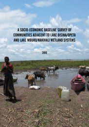
A Ecological Baseline Surveys Of: - Lake Bisina - Nature Uganda
A Ecological Baseline Surveys Of: - Lake Bisina - Nature Uganda
A Ecological Baseline Surveys Of: - Lake Bisina - Nature Uganda

You also want an ePaper? Increase the reach of your titles
YUMPU automatically turns print PDFs into web optimized ePapers that Google loves.
5.5 Materials and Methods<br />
5.5.1 Study area<br />
The assessment focused on two satellite lakes in each of the two wetland systems namely lakes<br />
Mburo and Kachera in the Mburo-Nakivali system, <strong>Lake</strong> Victoria basin; Opeta and <strong>Bisina</strong> in the<br />
Opeta-<strong>Bisina</strong> wetland system <strong>Lake</strong> Kyoga basin.<br />
The Mburo-Nakivali weland system covers a surface area of about 570 Km 2<br />
. <strong>Lake</strong> Kachera is part<br />
of a complex of lakes (Mburo, Nakivali and Kiijanebalora) and extensive papyrus swamp (Burgis et<br />
al., 1987) located at 00 0<br />
35’S; 31 0<br />
07’ E, with a total surface area of 36.3 km 2<br />
, and a maximum depth<br />
of 4.1 m (Worthington, 1932). <strong>Lake</strong> Kachera has a maximum length of 20.0 km and width of 3.5<br />
km (Atlas of <strong>Uganda</strong>, 1967; Welcomme, 1972;). The lake has one river out flow Kibali discharging<br />
through River Kagera into <strong>Lake</strong> Victoria. The size and shape of the lake varies from time to time<br />
due to floating islands. The shoreline vegetation is fringed with papyrus (Cyperus papyrus), reeds<br />
(Phragmites mauritianus), forest, and scattered banana plantations. <strong>Lake</strong> Kachera is borderd by<br />
Rakai district and <strong>Lake</strong> Mburo National Park and is exposed to very many anthropogenic factors. The<br />
communities around <strong>Lake</strong> Kachera have for long depended on fishing as a major economic activity.<br />
The non fishing communities around the lake are either traditional cattle keepers or cultivators, but<br />
most of the communities around the lake now practice mixed farming combining both livestock<br />
management and crop cultivation to varying degrees (Marquardt et al., 1994; Kamugisha et al.,<br />
1997; Namara and Infield, 1998; Emerton, 1999).<br />
Fig. 7 Fish survey sites in Mburo – Nakivali wetland system<br />
<strong>Ecological</strong> <strong>Baseline</strong> <strong>Surveys</strong> of <strong>Lake</strong> <strong>Bisina</strong>, <strong>Lake</strong> Opeta, <strong>Lake</strong> Mburo and Nakivali Wetlands Systems 77