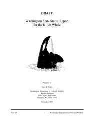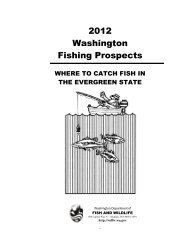
Download Document - Washington Department of Fish & Wildlife
Download Document - Washington Department of Fish & Wildlife
Download Document - Washington Department of Fish & Wildlife

You also want an ePaper? Increase the reach of your titles
YUMPU automatically turns print PDFs into web optimized ePapers that Google loves.
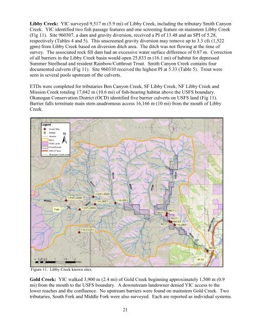
Libby Creek: YIC surveyed 9,517 m (5.9 mi) <strong>of</strong> Libby Creek, including the tributary Smith Canyon<br />
Creek. YIC identified two fish passage features and one screening feature on mainstem Libby Creek<br />
(Fig 11). Site 960307, a dam and gravity diversion, received a PI <strong>of</strong> 13.48 and an SPI <strong>of</strong> 5.28,<br />
respectively (Tables 4 and 5). This unscreened gravity diversion may remove up to 3.3 cfs (1,522<br />
gpm) from Libby Creek based on diversion ditch area. The ditch was not flowing at the time <strong>of</strong><br />
survey. The associated rock fill dam had an excessive water surface difference <strong>of</strong> 0.87 m. Correction<br />
<strong>of</strong> all barriers in the Libby Creek basin would open 25,833 m (16.1 mi) <strong>of</strong> habitat for depressed<br />
Summer Steelhead and resident Rainbow/Cutthroat Trout. Smith Canyon Creek contains four<br />
documented culverts (Fig 11). Site 960310 received the highest PI at 5.33 (Table 5). Trout were<br />
seen in several pools upstream <strong>of</strong> the culverts.<br />
ETDs were completed for tributaries Ben Canyon Creek, SF Libby Creek, NF Libby Creek and<br />
Mission Creek totaling 17,042 m (10.6 mi) <strong>of</strong> fish-bearing habitat above the USFS boundary.<br />
Okanogan Conservation District (OCD) identified five barrier culverts on USFS land (Fig 11).<br />
Barrier falls terminate main stem anadromous access 16,166 m (10 mi) from the mouth <strong>of</strong> Libby<br />
Creek.<br />
Figure 11. Libby Creek known sites.<br />
Gold Creek: YIC walked 3,900 m (2.4 mi) <strong>of</strong> Gold Creek beginning approximately 1,500 m (0.9<br />
mi) from the mouth to the USFS boundary. A downstream landowner denied YIC access to the<br />
lower reaches and the confluence. No upstream barriers were found on mainstem Gold Creek. Two<br />
tributaries, South Fork and Middle Fork were also surveyed. Each are reported as individual systems.<br />
21