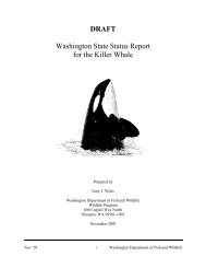
Download Document - Washington Department of Fish & Wildlife
Download Document - Washington Department of Fish & Wildlife
Download Document - Washington Department of Fish & Wildlife

Create successful ePaper yourself
Turn your PDF publications into a flip-book with our unique Google optimized e-Paper software.
in order to identify all significant watersheds within the state (Fig. 1). These basins are classified<br />
under Watershed Resource Inventory Areas (WRIA) and designated under <strong>Washington</strong><br />
Administrative Code (WAC) 173-500-040 (Kim, 2004). Natural resource agencies and restoration<br />
groups use WRIA numbers to direct state and federal funding for implementation <strong>of</strong> salmonid habitat<br />
restoration projects (WDFW, 1997).<br />
The Methow River is an influential tributary <strong>of</strong> the Columbia River, draining 1,805 square miles<br />
(mi 2 ). It is bordered by the Cascade Range to the west, the Buckhorn Mountains and the Okanogan<br />
Watershed (WRIA 49) to the east, Canada on the north and the Columbia River to the south (Golder<br />
Assoc, 2002). WDOE delineated this watershed into smaller units. Measurements stated in River<br />
Miles (RM) are approximated from the confluence. Lower Methow is defined from the mouth <strong>of</strong> the<br />
Methow River to the confluence with Twisp River (RM 0 - 40). Middle Methow continues from the<br />
Twisp River to the confluence with the Chewuch River (RM 40 - 50.2). Upper Methow extends from<br />
the Chewuch River to the headwaters (> 50.2 RM) near Mt. Hardy on the Okanogan/Skagit County<br />
line (Bucknell and Kauffman, 1976).<br />
WDOE recognizes low instream flows and naturally occurring desiccation in some reaches <strong>of</strong> the<br />
Methow River Basin as a result <strong>of</strong> climatic and geological conditions (WSCC, 2004). The Methow<br />
River is fed through many tributaries, most <strong>of</strong> which are seasonally dry. Surveyed stream lengths and<br />
associated tributaries do not include seasonally dry creek beds.<br />
Stream Selection Criteria<br />
Streams <strong>of</strong> the Methow Watershed were selected for our inventory based on predetermined criteria.<br />
Streams must meet fish bearing criteria and be flowing at the time <strong>of</strong> survey to be considered in this<br />
inventory. Streams must have gradients less than 20 percent and an average ordinary high-water<br />
width in excess <strong>of</strong> 0.9 meters (m) (3 feet) to be considered fish bearing in Eastern <strong>Washington</strong><br />
(WDFW 2000). Basin areas <strong>of</strong> qualified streams are found in Table 1. Streams not meeting these<br />
criteria were excluded from this inventory (Table 2). Due to funding restrictions, only streams that<br />
breached private parcels were considered.<br />
Several streams were previously assessed by other agencies for existing barriers prior to this<br />
inventory. An abbreviated list <strong>of</strong> previously completed streams is found in Table 2. A<br />
comprehensive list <strong>of</strong> evaluated streams, including the major rivers <strong>of</strong> WRIA 48, can be found in<br />
Salmon, Steelhead and Bull Trout Habitat Limiting Factors for WRIA 48 (Andonaegui, 2000).<br />
Anadromous salmonid utilization has been documented in Pearrygin, Gold, Libby, Wolf, Buttermilk,<br />
Goat, and Poorman Creek subwatersheds according to the <strong>Washington</strong> State Salmon and Steelhead<br />
Stock Inventory report (SASSI) (WDFW, 1993). These streams also support resident and migratory<br />
trout.<br />
5