WRIA 62 WMP 032305 - Washington State Department of Ecology
WRIA 62 WMP 032305 - Washington State Department of Ecology
WRIA 62 WMP 032305 - Washington State Department of Ecology

You also want an ePaper? Increase the reach of your titles
YUMPU automatically turns print PDFs into web optimized ePapers that Google loves.
REPORT PREPARED FOR THE<br />
<strong>WRIA</strong> <strong>62</strong> Watershed Planning Unit<br />
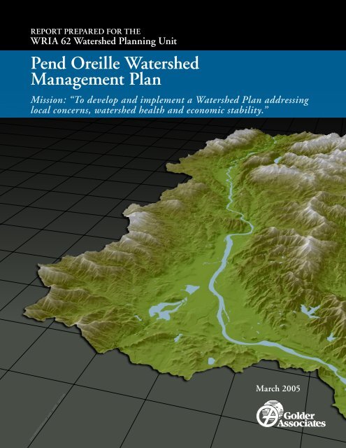
Pend Oreille Watershed<br />
Management Plan<br />
Mission: “To develop and implement a Watershed Plan addressing<br />
local concerns, watershed health and economic stability.”<br />
02312890033030cv02 .indd DATE 02/17/05<br />
March 2005
Distribution:<br />
PEND OREILLE (<strong>WRIA</strong> <strong>62</strong>)<br />
WATERSHED MANAGEMENT PLAN<br />
Submitted to:<br />
Pend Oreille Conservation District<br />
and<br />
Pend Oreille Watershed Planning Unit<br />
Submitted by:<br />
Golder Associates Inc.<br />
1200 W. Ironwood Drive, Suite 102, Coeur d’Alene, Idaho 83814<br />
and<br />
18300 NE Union Hill Road, Suite 200, Redmond, <strong>Washington</strong> 98052<br />
Funded by the <strong>Washington</strong> <strong>Department</strong> <strong>of</strong> <strong>Ecology</strong>,<br />
Grant No. G9900022.<br />
4 Hard Copies, 15 Cds - Pend Oreille Conservation District<br />
5 Hard Copies, 5 Cds - Pend Oreille County<br />
2 Hard Copies, 2 Cds - Golder Associates Inc.<br />
March, 2005 023-1289-003.3040<br />
<strong>WRIA</strong> <strong>62</strong> <strong>WMP</strong> 032505
March, 2005 Executive Summary - 1 023-1289-003.3040<br />
EXECUTIVE SUMMARY<br />
This Executive Summary, including Tables 3-1 through 3-7, is a stand-alone overview <strong>of</strong> the<br />
Pend Oreille Watershed Management Plan. This plan is intended to be a locally-supported,<br />
long-term plan, focusing on water availability, and also addressing water quality and habitat<br />
in the Pend Oreille Watershed. This plan was developed by the Planning Unit within Phase<br />
III <strong>of</strong> Watershed Planning, as defined by the Watershed Management Act (Chapter 90.82<br />
Revised Code <strong>of</strong> <strong>Washington</strong>).<br />
THE <strong>WRIA</strong> <strong>62</strong> PLANNING UNIT<br />
The majority <strong>of</strong> the <strong>WRIA</strong> <strong>62</strong> Planning Unit members (listed below) live and work in the<br />
watershed. This Planning Unit formed in 1998 with a mission:<br />
<strong>WRIA</strong> <strong>62</strong> <strong>WMP</strong> <strong>032305</strong><br />
“To develop and implement a Watershed Plan addressing local concerns,<br />
watershed health and economic stability.”<br />
Pend Oreille Conservation District (Lead Agency and non-voting member)<br />
Pend Oreille County Planning <strong>Department</strong> (Initiating Government)<br />
City <strong>of</strong> Newport (Initiating Government)<br />
Pend Oreille Public Utility District #1 (Initiating Government)<br />
Kalispel Tribe Natural Resources Division (Initiating Government)<br />
Pend Oreille County Weed Board<br />
<strong>Washington</strong> <strong>State</strong> Agencies<br />
US Forest Service, Colville National Forest and Idaho Panhandle National Forest<br />
Real Estate and Development<br />
Agriculture / Diking Districts<br />
Tri-<strong>State</strong> Water Quality Council (non-voting member)<br />
Seattle City Light<br />
Ponderay Newsprint Company (Industry)<br />
Selkirk Conservation Alliance<br />
Stimson Lumber (Private Timber)<br />
Teck Cominco (Mining)<br />
Paul Caton – Landowner<br />
Duane Sch<strong>of</strong>ield – Landowner<br />
Don and Joann LaBelle – Landowners<br />
In accordance with RCW 90.82.010 Finding, the development <strong>of</strong> this plan “serves vital local<br />
interests by placing it in the hands <strong>of</strong> the people: Who have the greatest knowledge <strong>of</strong> both the<br />
resources and the aspirations <strong>of</strong> those who live and work in the watershed; and who have the<br />
greatest stake in the proper, long-term management <strong>of</strong> the resources. The development <strong>of</strong> such<br />
plans serves the state’s vital interests by ensuring the state’s water resources are used wisely, by<br />
protecting existing water rights, by protecting instream flows for fish, and by providing for the<br />
economic well- being <strong>of</strong> the state’s citizenry and communities.”
March, 2005 Executive Summary - 2 023-1289-003.3040<br />
LOCATION<br />
The Pend Oreille Watershed, also referred to as Water Resource Inventory Area (<strong>WRIA</strong>) <strong>62</strong>,<br />
encompasses about 1,300 square miles <strong>of</strong> the Pend Oreille River watershed within<br />
northeastern <strong>Washington</strong> <strong>State</strong> (Figure ES-1). <strong>WRIA</strong> <strong>62</strong> represents only about five percent<br />
<strong>of</strong> the total Pend Oreille River drainage basin. The Pend Oreille River, one <strong>of</strong> the major subbasins<br />
<strong>of</strong> the Columbia River, drains the Clark Fork – Pend Oreille watershed which spans<br />
about 26,000 square miles and includes the fourth and fifth largest lakes in the United <strong>State</strong>s:<br />
Flathead Lake in Montana and Lake Pend Oreille in Idaho.<br />
For Watershed Planning purposes, the Planning Unit organized <strong>WRIA</strong> <strong>62</strong> into thirty-nine<br />
(39) hydrologic sub-basins with tributaries that drain into the Pend Oreille River mainstem in<br />
<strong>Washington</strong> or the Priest River Basin in Idaho as well as two areas alongside the Pend Oreille<br />
River mainstem in <strong>Washington</strong> (from Newport to Box Canyon Dam and from Box Canyon<br />
Dam to the Canadian border) which drain directly into the Pend Oreille River (Figure ES-1).<br />
SUPPORTING TECHNICAL INFORMATION<br />
This plan is supported by technical assessments prepared in Phase II <strong>of</strong> Watershed Planning<br />
by Entrix (2002), GeoEngineers (2004) and Golder Associates (2005). The assessments<br />
compile and assess existing water quantity, water quality and habitat information for the<br />
watershed. The following bullets summarize the important findings <strong>of</strong> the technical work<br />
that are relevant to this plan.<br />
• Population growth in <strong>WRIA</strong> <strong>62</strong> is expected to be the greatest in the southern part <strong>of</strong> the<br />
watershed (within the Calispell, Davis, Skookum, Kent and McCloud sub-basins) and<br />
along the mainstem <strong>of</strong> the Pend Oreille River from Newport to Ione (Figure ES-1).<br />
• The water resources that are available to support future population growth occur<br />
primarily as groundwater supply to domestic exempt wells and surface water within the<br />
Pend Oreille River (which may be withdrawn directly from the river or via wells in<br />
hydraulic continuity with the river).<br />
• Most <strong>of</strong> the tributary streams (and groundwater in hydraulic connection with these<br />
streams) are restricted to further water rights appropriation by Surface Water Source<br />
Limitations (SWSLs) administered by the <strong>Washington</strong> <strong>State</strong> <strong>Department</strong> <strong>of</strong> <strong>Ecology</strong> and<br />
in place as a result <strong>of</strong> fisheries concerns identified by the <strong>Washington</strong> <strong>State</strong> <strong>Department</strong><br />
<strong>of</strong> Fish and Wildlife. Currently there is insufficient streamflow data for these streams<br />
(other than Sullivan Creek and Calispell Creek) to assess the statistical validity <strong>of</strong> these<br />
restrictions. Note that this Plan did not result in these restrictions but works towards<br />
finding out if these restrictions are scientifically defensible by recommending instream<br />
flow studies. As a priority, instream flow studies are recommended for the sub-basins<br />
that are expected to experience the greatest population growth (i.e. the Calispell, Davis,<br />
Skookum, Kent and McCloud sub-basins).<br />
• Groundwater quality is good with little evidence <strong>of</strong> human related impacts.<br />
<strong>WRIA</strong> <strong>62</strong> <strong>WMP</strong> <strong>032305</strong>
March, 2005 Executive Summary - 3 023-1289-003.3040<br />
• Surface water quality in <strong>WRIA</strong> <strong>62</strong> is generally good. The primary water quality concerns<br />
are temperature (the most common water quality impairment) dissolved oxygen, pH,<br />
fecal coliform bacteria, total dissolved gas, exotic aquatic species, sediment and several<br />
pesticides (in the Pend Oreille River). In accordance with the Clean Water Act, <strong>Ecology</strong><br />
is required to develop Total Maximum Daily Loads (TMDLs). Currently, <strong>Ecology</strong> is<br />
developing total dissolved gas (related to dam operations) and temperature TMDLs for<br />
the mainstem <strong>of</strong> the Pend Oreille River and is in the process <strong>of</strong> assessing a number <strong>of</strong><br />
pesticide listings, also for the mainstem <strong>of</strong> the Pend Oreille River. Temperature and fecal<br />
coliform concerns on Colville National Forest Land are also being addressed through<br />
TMDLs.<br />
• There are numerous habitat restoration activities taking place in the watershed. Many <strong>of</strong><br />
these efforts share a similar geographic area <strong>of</strong> interest, focal species, participatory<br />
agencies /individuals and planning timelines.<br />
PLAN ISSUES AND ACTIONS<br />
Following on from the technical work, the Planning Unit identified water resource issues that<br />
they felt needed to be addressed within this Plan. The Planning Unit worked by consensus <strong>of</strong><br />
the members to develop the issues, framed as problem statements. The Planning Unit then<br />
identified and developed management actions to address these challenges. The issues are<br />
ordered in this plan in categories with corresponding codes: water quantity (QUANT); water<br />
quality (WQUAL); habitat (H); water rights (WR); growth and land use (GR&LU);<br />
economic impacts and community involvement (EC); and, implementation (IMP). The<br />
issues, actions and the entities responsible for implementation <strong>of</strong> the actions are the heart <strong>of</strong><br />
this plan and are listed in the following tables:<br />
<strong>WRIA</strong> <strong>62</strong> <strong>WMP</strong> <strong>032305</strong><br />
• Table 3-1: Water Quantity<br />
• Table 3-2: Water Quality<br />
• Table 3-3: Habitat<br />
• Table 3-4: Water Rights<br />
• Table 3-5: Growth and Land Use<br />
• Table 3-6: Economic Impacts and Community Involvement<br />
• Table 3-7: Implementation<br />
PLAN OBLIGATIONS<br />
In accordance with the Watershed Planning Act (Chapter 90.82 RCW), <strong>Washington</strong> <strong>State</strong> and<br />
Pend Oreille County are obligated to implement plan actions. Other planning participants,<br />
including tribes, cities, towns and water providers, are not legally obligated under the Act but<br />
by approval <strong>of</strong> the Plan assume responsibility for implementing prescribed actions. Early in<br />
this planning process, the Planning Unit acknowledged that there would be finite funding
March, 2005 Executive Summary - 4 023-1289-003.3040<br />
available for implementation <strong>of</strong> the actions and that many <strong>of</strong> the entities that voluntarily<br />
agreed to implement actions may not have sufficient funding to do so during the<br />
implementation Phase (Phase IV <strong>of</strong> Watershed Planning). As a result, the Planning Unit<br />
agreed that actions recommended for implementation would not pose a funding obligation on<br />
the responsible party and that implementation <strong>of</strong> the actions would be contingent upon<br />
available resources as well as each entity’s legal obligations.<br />
IMPLEMENTATION<br />
The actions prescribed in this plan will be implemented during Phase IV <strong>of</strong> Watershed<br />
Planning (dependant upon available funding and resources). Phase IV <strong>of</strong> Watershed<br />
Planning commences when this plan is approved by the Planning Unit and the Pend Oreille<br />
County Commissioners. It is intended that this plan will be a long-term planning document<br />
and will continue to be implemented into the future after Phase IV and as resources allow.<br />
THE IMPLEMENTING BODY<br />
The Planning Unit recommends that an Implementing Body be formed to coordinate and<br />
prioritize implementation <strong>of</strong> the Plan actions. In order to be eligible for implementation<br />
funds, the Implementing Body must continue to be representative <strong>of</strong> the community. The<br />
Planning Unit recommends that the current Memorandum <strong>of</strong> Agreement between the<br />
Watershed Planning Initiating Governments (i.e. Pend Oreille County, the Pend Oreille<br />
Public Utility District No. 1, the City <strong>of</strong> Newport and the Kalispel Tribe), which covers<br />
Phase I, II and III <strong>of</strong> Watershed Planning, be amended to include Phase IV. The Planning<br />
Unit’s vision is that willing members <strong>of</strong> the Planning Unit and others within the community<br />
will volunteer to make up the Implementing Body so that there is strong continuity between<br />
the Planning and Implementation Phases.<br />
A LIVING PLAN<br />
The Planning Unit sees this document as a living plan that will be revised and updated by the<br />
Implementing Body as needed to address current concerns. It is anticipated that the<br />
Implementing Body will prioritize actions for implementation based on the importance <strong>of</strong> the<br />
issues to be addressed, community support, a high likelihood <strong>of</strong> success and cost-sharing<br />
opportunities associated with implementation <strong>of</strong> the action.<br />
<strong>WRIA</strong> <strong>62</strong> <strong>WMP</strong> <strong>032305</strong>
March, 2005 Executive Summary - 5 023-1289-003.3040<br />
HOW THIS PLAN WILL BENEFIT THE COMMUNITY<br />
The core principal embodied in Watershed Planning is “that state agencies must work<br />
cooperatively with local citizens in a process <strong>of</strong> planning for future uses <strong>of</strong> water by giving<br />
local citizens and the governments closest to them the ability to determine the management <strong>of</strong><br />
water in the <strong>WRIA</strong>” (RCW 90.82.040 Findings-2003).<br />
Examples <strong>of</strong> how this plan and supporting technical information will benefit the <strong>WRIA</strong> <strong>62</strong><br />
community include:<br />
• Providing information on where water resources are available for future development and<br />
the processes to develop these resources to support future growth in <strong>WRIA</strong> <strong>62</strong>.<br />
• Being proactive with instream flow studies. <strong>Ecology</strong> is planning to conduct these studies<br />
at some time in the future. This plan obligates <strong>Ecology</strong> and WDFW to assist the<br />
Implementing Body to conduct instream flow studies and to involve the Implementing<br />
Body in any instream flow studies that are conducted by <strong>Ecology</strong> in <strong>WRIA</strong> <strong>62</strong>.<br />
• Recommendations to provide educational materials and technical assistance to residents<br />
and landowners to address milfoil, river bank erosion and livestock operations.<br />
• Providing information on water rights application, water banking and other processes to<br />
support water rights issues.<br />
• Recommending that concerns about flooding in Pend Oreille County are voiced at local<br />
and regional flood control forums.<br />
<strong>WRIA</strong> <strong>62</strong> <strong>WMP</strong> <strong>032305</strong>
March, 2005 TABLE 3-1<br />
Water Quantity - Issues, Actions and Responsible Parties<br />
023-1289-003.3040<br />
Page 1 <strong>of</strong> 3<br />
CODE ISSUE / ACTION<br />
OBLIGATED OR<br />
RESPONSIBLE ENTITY JUSTIFYING STATUTE(S)<br />
QUANT1: There is a need to characterize groundwater resources and hydraulic continuity between groundwater and surface water at a local scale in areas<br />
where growth and water supply are a potential concern<br />
RCW 90.82.070(1)(b)&(f).<br />
QUANT1-1<br />
QUANT2a-1<br />
Explore the need to, and if necessary, write grants or hire a grant writer to obtain funding to support technical<br />
studies to evaluate water resources and hydraulic continuity between surface water and groundwater at a local<br />
scale in areas where growth and water supply are a potential concern. These areas have been identified as the<br />
Calispell, Davis, Skookum, Kent and McCloud sub-basins and the mainstem <strong>of</strong> the Pend Oreille River from the<br />
Idaho state-line north to Ione.<br />
Evaluate the need to conduct instream flow studies and where and how to conduct these studies to address<br />
competing water needs in <strong>WRIA</strong> <strong>62</strong>. Priority locations for instream flow setting are the Calispell, Davis,<br />
Skookum, Kent and McCloud sub-basins.<br />
Implementing body<br />
QUANT2a: To effectively address competing water needs now and in the future, instream flow needs for the Pend Oreille River mainstem and the tributaries<br />
to the Pend Oreille River and Priest River Basin in <strong>WRIA</strong> <strong>62</strong> should be more fully understood in areas where water demand is expected to increase.<br />
Implementing body<br />
QUANT2a-2 Develop an instream flow presentation for County Commissioners and other interested stakeholder groups. Implementing body<br />
QUANT2a-3<br />
Support establishment and continuation <strong>of</strong> stream gaging to improve understanding <strong>of</strong> flows within the tributaries<br />
to the Pend Oreille River that occur within the sub-basins that are predicted to experience the greatest water<br />
demand in the future (i.e. the Calispell, Davis, Skookum, Kent and McCloud sub-basins).<br />
Implementing body, Kalispel<br />
Tribe<br />
RCW 90.82.010; RCW<br />
90.82.040 Notes: Finding-Intent-<br />
2001 c237; RCW<br />
90.82.070(1)(b),(e),(g)&(2);<br />
RCW 90.82.080.<br />
Golder Associates Tb 3-1 to 3-7 <strong>WRIA</strong> <strong>62</strong> <strong>WMP</strong> Responsible Parties
March, 2005 TABLE 3-1<br />
QUANT2b-1<br />
QUANT2b-2<br />
QUANT2b-3<br />
QUANT2b-4<br />
QUANT2b-5<br />
Water Quantity - Issues, Actions and Responsible Parties<br />
Note:<br />
<strong>Ecology</strong> will not be obligated to provide technical assistance that involves actual field work, analysis or reporting. <strong>Ecology</strong><br />
does agree to be obligated to provide technical assistance with the review <strong>of</strong> documents (scopes <strong>of</strong> work, analyses, reports<br />
etc.) as well as to collaborate with the Implementing Body during the negotiation <strong>of</strong> flow recommendations. <strong>Ecology</strong> also<br />
clarified that it cannot take on the obligation to involve the <strong>WRIA</strong> <strong>62</strong> planning entity in instream flow studies that may<br />
occur after Phase IV Implementation. It will be the responsibility <strong>of</strong> the Watershed Planning Implementing Body to make<br />
recommendations to <strong>Ecology</strong> at the end <strong>of</strong> the Phase IV if this situation is anticipated.<br />
WDFW agree to be obligated to provide technical assistance to the Watershed Planning Implementing Body for Steps A, B<br />
and C as priorities, funding and staff resources allow.<br />
Recommend that the Legislature provide <strong>Ecology</strong> with additional funds for instream flow work for the Watershed<br />
Planning Implementing Body to complete instream flow studies in the collaborative manner described in RCW<br />
90.82.080 during Phase IV Watershed Planning.<br />
The Watershed Planning Implementing Body will pursue funding to supplement implementation funds and will<br />
conduct instream flow studies in <strong>WRIA</strong> <strong>62</strong> at locations prioritized by the watershed planning implementing body<br />
with technical assistance from agencies (e.g., <strong>Ecology</strong>, WDFW) and qualified consultants.<br />
Recommend that <strong>Ecology</strong> involve the Implementing Body with scoping instream flow studies if <strong>Ecology</strong> starts<br />
instream flow work in <strong>WRIA</strong> <strong>62</strong> during Phase IV <strong>of</strong> Watershed Planning. If <strong>Ecology</strong> starts instream flow work in<br />
<strong>WRIA</strong> <strong>62</strong> after Phase IV, recommend that <strong>Ecology</strong> involve the <strong>WRIA</strong> <strong>62</strong> watershed planning entity if it is still<br />
functioning.<br />
After minimum instream flow rule making for the Pend Oreille River mainstem, the Watershed Planning Unit<br />
recommends that <strong>Ecology</strong> consider petitioning the <strong>Washington</strong> <strong>State</strong> Governor to write a letter to Congress to raise <strong>Ecology</strong><br />
the minimum discharge from Albeni Falls Dam from 4,000 cfs to be equivalent to the minimum instream flow rule.<br />
Implementing body, WDFW,<br />
<strong>Ecology</strong><br />
WA <strong>State</strong> Legislature, <strong>Ecology</strong>,<br />
Implementing Body<br />
Implementing body, WDFW,<br />
<strong>Ecology</strong><br />
Implementing body, <strong>Ecology</strong><br />
023-1289-003.3040<br />
Page 2 <strong>of</strong> 3<br />
CODE ISSUE / ACTION<br />
OBLIGATED OR<br />
RESPONSIBLE ENTITY JUSTIFYING STATUTE(S)<br />
QUANT2b: There is a need to ensure that the Watershed Planning Implementing Body is involved in instream flow studies, study recommendations and any<br />
instream flow rule-making in <strong>WRIA</strong> <strong>62</strong>.<br />
RCW 90.82.010; RCW<br />
90.82.040 Notes: Finding-Intent-<br />
2001 c237; RCW<br />
Obligate <strong>Ecology</strong> and WDFW to provide technical assistance to the implementing body during Phase IV<br />
90.82.070(1)(b),(e),(g)&(2);<br />
Watershed Planning to complete Step A (Scope <strong>of</strong> Work), Step B (Instream Flow Assessment - field work,<br />
analysis and reporting) and Step C (Negotiation <strong>of</strong> instream flows in a collaborative manner) forinstream flows in<br />
<strong>WRIA</strong> <strong>62</strong> (following the collaborative manner described in RCW 90.82.080).<br />
RCW 90.82.080.<br />
Golder Associates Tb 3-1 to 3-7 <strong>WRIA</strong> <strong>62</strong> <strong>WMP</strong> Responsible Parties
March, 2005 TABLE 3-1<br />
QUANT3-2<br />
QUANT3-3<br />
Water Quantity - Issues, Actions and Responsible Parties<br />
Voice concerns regarding the impacts <strong>of</strong> flooding in Pend Oreille County to <strong>Washington</strong>'s representative on the<br />
Technical Management Team (TMT) that addresses Columbia River dam amd reservoir operations.<br />
Identify what changes to project operations could be implemented to improve conditions regarding flooding in<br />
Pend Oreille county.<br />
QUANT4: There is a need to promote water conservation, reclamation and reuse strategies in <strong>WRIA</strong> <strong>62</strong>.<br />
QUANT4-1<br />
QUANT4-2<br />
QUANT4-3<br />
QUANT4-4<br />
Create a sub-committee to support on-going efforts and coordinate future water conservation, reclamation and<br />
reuse efforts in <strong>WRIA</strong> <strong>62</strong>.<br />
Identify and write grants to support development <strong>of</strong> water conservation, reclamation and reuse strategies that are<br />
relevant to <strong>WRIA</strong> (including water conservation, reclamation and reuse strategies applicable to municipal /<br />
domestic water use, commercial and industrial water use and agricultural water use).<br />
Identify and write grants to support development, presentation and distribution <strong>of</strong> public education materials to<br />
promote water conservation, reclamation and reuse strategies that are relevant to <strong>WRIA</strong> <strong>62</strong>.<br />
Send information to the <strong>WRIA</strong> <strong>62</strong> population to arrive at the beginning <strong>of</strong> July every year reminding people to<br />
conserve water over the drier summer months.<br />
QUANT4-5 Place notices in local papers, newsletters or on the radio reminding people to conserve water over the summer.<br />
Implementing body<br />
Implementing body<br />
Implementing body<br />
Implementing body<br />
Implementing body<br />
Pend Oreille Conservation<br />
District, Pend Oreille Public<br />
Utility District<br />
Pend Oreille Conservation<br />
District, Pend Oreille Public<br />
Utility District, City <strong>of</strong> Newport<br />
023-1289-003.3040<br />
Page 3 <strong>of</strong> 3<br />
CODE ISSUE / ACTION<br />
OBLIGATED OR<br />
RESPONSIBLE ENTITY JUSTIFYING STATUTE(S)<br />
RCW 90.82.040 Notes: Finding-<br />
QUANT3: Flood control.<br />
Intent-2001 c237; RCW<br />
Voice concerns regarding the impacts <strong>of</strong> flooding in Pend Oreille County and work with groups that influence the<br />
Pend Oreille River flow rates and water levels. These groups may include but are not limited to the Army Corps <strong>of</strong><br />
90.82.070(3).<br />
QUANT3-1 Engineers, Northwest Power Conservation Council, Bonneville Power Administration, Bureau <strong>of</strong> Reclamation,<br />
Seattle City Light, Pend Oreille Public Utility District, North Idaho Lakes Commission, Idaho Fish & Game, Pend<br />
Oreille County Diking Districts Nos. 1, 2 and 3, and FEMA.<br />
Implementing body<br />
RCW 90.82.010; RCW<br />
90.82.040 Notes: Finding-Intent-<br />
2001 c237; RCW 90.82.070(2).<br />
Golder Associates Tb 3-1 to 3-7 <strong>WRIA</strong> <strong>62</strong> <strong>WMP</strong> Responsible Parties
March, 2005 TABLE 3-2<br />
Water Quality - Issues, Actions and Responsible Parties<br />
023-1289-003.3040<br />
Page 1 <strong>of</strong> 3<br />
CODE ISSUE / ACTION<br />
OBLIGATED OR<br />
RESPONSIBLE ENTITY JUSTIFYING STATUTE(S)<br />
RCW 90.82.030(1)&(3); RCW<br />
WQUAL1: There is a need to develop a protocol to coordinate and ensure that <strong>WRIA</strong> <strong>62</strong> water quality data is provided for input into the JSAP database<br />
Enter <strong>WRIA</strong> <strong>62</strong> water quality data into the JSAP database, maintain the JSAP database and ensure data is available<br />
WQUAL1-1<br />
Kalispel Tribe<br />
via the internet.<br />
90.82.040 Notes: Findings-2003<br />
1st sp.s.c 4; RCW<br />
90.82.090(1)&(7).<br />
WQUAL1-2<br />
WQUAL1-3<br />
Identify committed entities to submit water quality data on a regular basis to the Kalispel Tribe for incorporation<br />
into the JSAP database.<br />
Define a <strong>WRIA</strong> <strong>62</strong> monitoring and reporting protocol and coordinate data to be submitted to the Kalispel Tribe for<br />
incorporation into the JSAP database.<br />
Implementing body<br />
Implementing body<br />
WQUAL1-4 Keep up to date with water quality monitoring and protection activities within <strong>WRIA</strong> <strong>62</strong>. Implementing body<br />
WQUAL2: Eurasian watermilfoil and other aquatic nuisance weeds pose a threat to native habitat and public safety in the Pend Oreille watershed.<br />
WQUAL2-1<br />
Convene aquatic plant management group, with Pend Oreille County Weed Board as the lead, to identify and agree<br />
upon actions to reduce Eurasian watermilfoil and other aquatic nuisance weeds in <strong>WRIA</strong> <strong>62</strong>.<br />
WQUAL2-2 Establish and implement an aquatic nuisance weed public outreach and education program.<br />
WQUAL3a-1<br />
Participate (interact, provide input to and coordinate with <strong>Ecology</strong>) in TMDL processes on tributary streams<br />
within <strong>WRIA</strong> <strong>62</strong>.<br />
Pend Oreille County Weed Board,<br />
Implementing body<br />
Pend Oreille County Weed Board,<br />
Pend Oreille County Public<br />
Works<br />
WQUAL3a: There is a need to participate in current and future TMDL processes and provide input on TMDLs for tributary streams that originate within<br />
<strong>WRIA</strong> <strong>62</strong>.<br />
Implementing body<br />
WQUAL3a-2 Pursue funding for implementation strategies that come out <strong>of</strong> TMDL studies for tributary streams. Implementing body<br />
RCW 90.82.090(2).<br />
RCW 90.82.005; RCW<br />
90.82.090(4)&(6).<br />
Golder Associates Tb 3-1 to 3-7 <strong>WRIA</strong> <strong>62</strong> <strong>WMP</strong> Responsible Parties
March, 2005 TABLE 3-2<br />
Water Quality - Issues, Actions and Responsible Parties<br />
023-1289-003.3040<br />
Page 2 <strong>of</strong> 3<br />
CODE ISSUE / ACTION<br />
OBLIGATED OR<br />
RESPONSIBLE ENTITY JUSTIFYING STATUTE(S)<br />
RCW 90.82.005; RCW<br />
WQUAL3b: There is a need to participate in the TMDL processes and provide input on TMDLs for the mainstem Pend Oreille River.<br />
90.82.090(4)&(6).<br />
WQUAL3b-1<br />
WQUAL3b-2<br />
WQUAL3b-3<br />
Provide input into 303(d) listings in applicable waters <strong>of</strong> <strong>Washington</strong>, the Kalispel Tribe reservation and, where<br />
appropriate, Idaho.<br />
Coordinate with agencies and stakeholders to participate and provide input to TMDL development and<br />
implementation for Pend Oreille River in <strong>Washington</strong>, the Kalispel Tribe reservation and, where appropriate,<br />
Idaho.<br />
Strongly recommend that <strong>Ecology</strong> invite the Idaho <strong>Department</strong> <strong>of</strong> Environmental Quality (IDEQ) to develop a<br />
Memorandum <strong>of</strong> Understanding to address development and implementation <strong>of</strong> appropriate TMDLs for the Pend<br />
Oreille River in <strong>Washington</strong> and Idaho.<br />
WQUAL4a-1 Support WDOH's on-going efforts to improve drinking water quality where needed in <strong>WRIA</strong> <strong>62</strong>.<br />
WQUAL4a-2<br />
WQUAL4b-1<br />
Encourage WDOH to communicate with the Watershed Planning Implementing Body with respect to education<br />
and funding opportunities to assist <strong>WRIA</strong> <strong>62</strong> water systems / communities improve drinking water quality.<br />
Support the Northeast Tri-County Health District and WDOH to conduct sanitary surveys <strong>of</strong> Group A and B<br />
systems in <strong>WRIA</strong> <strong>62</strong>.<br />
Implementing body<br />
Implementing body<br />
<strong>Ecology</strong><br />
WQUAL4a: The natural quality <strong>of</strong> drinking water provided to some communities does not meet <strong>Washington</strong> <strong>State</strong> secondary drinking water standards.<br />
WQUAL4b: There is a need to review wellhead protection plans throughout <strong>WRIA</strong> <strong>62</strong> and improve these plans as needed.<br />
WQUAL4b-2<br />
WQUAL4b-3<br />
Recommend that Pend Oreille County consider including Group A and Group B public water system wellheads in<br />
critical areas ordinnace as the ordinance is updated.<br />
Coordinate with WDOH and the Northeast Tri-County Health District to identify water systems that have not<br />
developed and/or are not implementing wellhead protection plans. Encourage these systems to obtain technical<br />
assistance to develop and/or implement a wellhead protection plan.<br />
Implementing body, WDOH,<br />
NETC Health District<br />
WDOH<br />
Implementing body, WDOH,<br />
NETC Health District<br />
Implementing body, Pend Oreille<br />
County.<br />
Implementing body, WDOH,<br />
NETC Health District<br />
RCW 90.82.048(3); RCW<br />
90.82.070(2); RCW<br />
90.82.090(1)&(2).<br />
RCW 90.82.010; RCW<br />
90.82.040 Notes: Finding-<br />
Intent-2001 c 237; RCW<br />
90.82.048(3); RCW<br />
90.82.070(2).<br />
Golder Associates Tb 3-1 to 3-7 <strong>WRIA</strong> <strong>62</strong> <strong>WMP</strong> Responsible Parties
March, 2005 TABLE 3-2<br />
WQUAL5-2<br />
WQUAL5-3<br />
WQUAL5-4<br />
WQUAL5-5<br />
Water Quality - Issues, Actions and Responsible Parties<br />
Seek funding for projects that promote the protection and improvement <strong>of</strong> water quality, including:<br />
a. Projects to review and collect water quality data on <strong>WRIA</strong> <strong>62</strong> streams where data is lacking or needed.<br />
b. Projects to identify and assess point and non-point sources <strong>of</strong> impairments, develop and implement restoration /<br />
mitigation plans and monitor effectiveness <strong>of</strong> clean up efforts.<br />
c. Projects to protect unimpaired / healthy streams.<br />
Identify funding to continue operation <strong>of</strong> pressure transducers and field water quality monitoring within Calispell,<br />
Davis, Skookum and Kent sub-basins. The Kalispel Tribe will take on the responsibility <strong>of</strong> maintaining the seven<br />
stream gages (installed during Phase II) and downloading flow information for the Calispell, Davis, Skookum and<br />
Kent sub-basins.<br />
Implementing body<br />
Implementing body, Kalispel<br />
Tribe<br />
Implement the water quality monitoring plan developed in the Phase 2 Level 2 report. The recommendations <strong>of</strong><br />
this plan are: 1. Coordinated TMDL development and implementation in WA and ID; 2. Conduct biological and<br />
baseline monitoring in <strong>WRIA</strong> <strong>62</strong> sub-basins that drain from WA into ID; 3. Conduct temperature studies on the<br />
Pend Oreille River between Box Canyon and Canada; 4. Develop water quality datasets that are comparable<br />
between <strong>WRIA</strong> <strong>62</strong> waterbodies; 5. Conduct water quality monitoring in sub-basins where population growth is<br />
Implementing body, <strong>Ecology</strong><br />
predicted; 6. Develop and implement a stormwater program for urban areas; 7. Recommend <strong>Ecology</strong> upgrade the<br />
Metaline Falls monitoring site to a core monitoring location; 8. Increase the use <strong>of</strong> coordinated and comparable<br />
biological monitoring; 9. Require the use <strong>of</strong> water quality monitoring plans, QAPPs and comparable protocols;<br />
10. Develop a <strong>WRIA</strong> <strong>62</strong> data management system; 11. Install freeze protection on automated equipment in <strong>WRIA</strong><br />
<strong>62</strong> tributaries.<br />
Consider any regulations that may help reduce the impacts <strong>of</strong> population growth on water quality. For example,<br />
recommend that the County consider aquifer recharge areas in Critical Areas Ordinance.<br />
Pend Oreille County<br />
023-1289-003.3040<br />
Page 3 <strong>of</strong> 3<br />
CODE ISSUE / ACTION<br />
OBLIGATED OR<br />
RESPONSIBLE ENTITY JUSTIFYING STATUTE(S)<br />
WQUAL5: The 303(d) list identifies impaired waterbodies and requires <strong>Washington</strong> <strong>State</strong> to work towards cleaning up impaired waterbodies and<br />
establishing TMDLs. However there is a need to identify an appropriate process to protect unimpaired waters in <strong>WRIA</strong> <strong>62</strong> that meet or exceed applicable<br />
water quality standards.<br />
RCW 90.82.005; RCW<br />
90.82.040 Notes: Findings-2003<br />
1st sp.s.c 4; RCW<br />
90.82.090(2)&(7).<br />
WQUAL5-1<br />
Review <strong>Ecology</strong>'s current water quality assessment and identify waterbodies within <strong>WRIA</strong> <strong>62</strong> to implement:<br />
a. Projects to review and collect water quality data on <strong>WRIA</strong> <strong>62</strong> streams where data is lacking or needed.<br />
b. Projects to identify and assess point and non-point sources <strong>of</strong> impairments, develop and implement restoration / Implementing body<br />
mitigation plans and monitor effectiveness <strong>of</strong> clean up efforts.<br />
c. Projects to protect unimpaired / healthy streams.<br />
Golder Associates Tb 3-1 to 3-7 <strong>WRIA</strong> <strong>62</strong> <strong>WMP</strong> Responsible Parties
March, 2005 TABLE 3-3<br />
Habitat - Issues, Actions and Responsible Parties<br />
023-1289-003.3040<br />
Page 1 <strong>of</strong> 2<br />
CODE ISSUE / ACTION<br />
OBLIGATED OR<br />
RESPONSIBLE ENTITY JUSTIFYING STATUTE(S)<br />
H1: There is a need to continue coordination <strong>of</strong> aquatic habitat programs within <strong>WRIA</strong> <strong>62</strong>.<br />
RCW 90.82.030(3); RCW<br />
90.82.100.<br />
H1-1 Coordinate with the Pend Oreille Salmonid Recovery Team and other habitat programs. Implementing body<br />
H2: Invasion <strong>of</strong> noxious terrestrial weeds has the potential to degrade water quality and terrestrial, riparian and aquatic habitats by increasing water<br />
yield run<strong>of</strong>f and preventing the establishment <strong>of</strong> native vegetation.<br />
H2-1<br />
H2-2<br />
H2-3<br />
H2-4<br />
H3a-1<br />
H3a-2<br />
H3a-3<br />
H3a-4<br />
Develop and distribute public education materials (e.g., signs, leaflets, fliers, BMPs) to educate residents,<br />
developers and construction workers on how they can prevent the spread <strong>of</strong> noxious terrestrial weeds.<br />
Coordinate with interested landowners and managers to survey lands on a regular basis (at 4-year intervals) and<br />
use management tools to remove small amounts <strong>of</strong> noxious weeds found at the time <strong>of</strong> the surveys.<br />
Develop management implementation plans (including prioritization <strong>of</strong> lands) with interested landowners for<br />
larger noxious weed populations.<br />
Assist the Pend Oreille County Weed Board to identify support (funding, in-kind and volunteer services) to help<br />
with implementation <strong>of</strong> the Pend Oreille County biocontrol program.<br />
Develop a scope <strong>of</strong> work for a technical study to identify the causes <strong>of</strong> river bank erosion along the Pend Oreille<br />
River in <strong>WRIA</strong> <strong>62</strong>.<br />
Develop and implement a public education program to improve understanding <strong>of</strong> bank erosion along the mainstem<br />
<strong>of</strong> the Pend Oreille River.<br />
Compile reasonable bank stabilization strategies for landowners along the mainstem <strong>of</strong> the Pend Oreille River and<br />
provide education and assistance to landowners to implement these strategies.<br />
Review shoreline plans and comprehensive plans for bank erosion mitigation strategies and make<br />
recommendations to local government on bank stabilization strategies for inclusion within Shoreline Master<br />
Programs and the Pend Oreille County Comprehensive Plan.<br />
Pend Oreille County Weed<br />
Board<br />
Pend Oreille County Weed<br />
Board<br />
Pend Oreille County Weed<br />
Board<br />
Implementing body<br />
H3a: River bank erosion along the mainstem <strong>of</strong> the Pend Oreille River is resulting in degraded riparian habitat and water quality. The causes <strong>of</strong><br />
erosion need to be confirmed and mitigated.<br />
Implementing body<br />
Implementing body<br />
Implementing body<br />
Implementing body<br />
RCW 90.82.090(2).<br />
RCW 90.82.090(2); RCW<br />
90.82.110.<br />
Golder Associates Tb 3-1 to 3-7 <strong>WRIA</strong> <strong>62</strong> <strong>WMP</strong> Responsible Parties
March, 2005 TABLE 3-3<br />
H3b-1<br />
H3b-2<br />
H3b-3<br />
H3b-4<br />
Habitat - Issues, Actions and Responsible Parties<br />
Scope a technical study to identify the causes <strong>of</strong> stream bank erosion along the tributaries to the Pend Oreille River<br />
in <strong>WRIA</strong> <strong>62</strong>.<br />
Develop and implement a public education program to improve understanding <strong>of</strong> bank erosion along the tributaries<br />
to the Pend Oreille River.<br />
Compile reasonable bank stabilization strategies for landowners along the tributaries to the Pend Oreille River and<br />
provide education and assistance to landowners to implement these strategies.<br />
Review shoreline plans and comprehensive plans for bank erosion mitigation strategies and make<br />
recommendations to local government on bank stabilization strategies for inclusion within Shoreline Master<br />
Programs and the Pend Oreille County Comprehensive Plan.<br />
Implementing body<br />
Implementing body<br />
Implementing body<br />
Implementing body<br />
023-1289-003.3040<br />
Page 2 <strong>of</strong> 2<br />
CODE ISSUE / ACTION<br />
OBLIGATED OR<br />
RESPONSIBLE ENTITY JUSTIFYING STATUTE(S)<br />
H3b: Stream bank erosion in <strong>WRIA</strong> <strong>62</strong> along the tributaries to the Pend Oreille River is resulting in degraded riparian habitat and water quality. The<br />
causes <strong>of</strong> stream bank erosion need to be confirmed and mitigated.<br />
RCW 90.82.090(2); RCW<br />
90.82.110.<br />
Golder Associates Tb 3-1 to 3-7 <strong>WRIA</strong> <strong>62</strong> <strong>WMP</strong> Responsible Parties
March, 2005 TABLE 3-4<br />
CODE ISSUE / ACTION<br />
WR1-1<br />
Water Rights - Issues, Actions and Responsible Parties<br />
WR1: There is currently limited opportunity for the local community to provide recommendations to the <strong>Department</strong> <strong>of</strong> <strong>Ecology</strong> in the processing <strong>of</strong><br />
water rights transfers, changes, applications and relinquishments.<br />
WR1-2<br />
WR1-3<br />
WR1-4<br />
WR2-1<br />
Coordinate with <strong>WRIA</strong> 55 (the Little Spokane River watershed) and evaluate the future need for a regional<br />
Spokane / Pend Oreille County Water Conservancy Board and / or Water Trust / Bank.<br />
Recommend that the Legislature allocate funds to provide financial incentives to those who wish to relinquish<br />
unused allocated water<br />
Evaluate the need to recommend to the Legislature a change in the “use-it or lose-it” time frame (Chapter 90.14<br />
RCW) for water rights from 5 years to 20 years. This would involve a statute change to Chapter 90.14 RCW.<br />
Recommend that the Legislature allow the unused portions <strong>of</strong> irrigation water rights to be banked. This would be<br />
a conservation incentive. This would involve a statute change in Chapter 90.14 RCW.<br />
Explore the concept <strong>of</strong> a water reservation for future growth (including domestic exempt well use, irrigation,<br />
industrial, commercial and municipal water use) in the <strong>WRIA</strong> <strong>62</strong> sub-basins that are expected to experience the<br />
highest population growth (Calispell, Davis, Skookum, Kent and McCloud) and where other water resources may<br />
not be available (i.e. outside water purveyor service areas).<br />
Implementing body<br />
WA <strong>State</strong> Legislature<br />
WR2: When future minimum instream flows are established, any new water rights that are junior to the minimum instream flows may be restricted<br />
when minimum instream flows are not met. There is a need to quantify water available for future allocation and/or reservation.<br />
WR2-2<br />
Recommend that the Legislature provide for in-house domestic and normal stock water withdrawal from domestic<br />
exempt wells (withdrawal less than 5,000 gallons per day as defined in RCW 90.44.050) when water use is<br />
restricted as a result <strong>of</strong> instream flow regulation. Note: "In-house domestic use" means use <strong>of</strong> water for drinking,<br />
cleaning, sanitation, and other uses in a residence, excluding irrigation <strong>of</strong> lawn and garden.<br />
Implementing body<br />
WA <strong>State</strong> Legislature<br />
023-1289-003.3040<br />
Page 1 <strong>of</strong> 1<br />
OBLIGATED OR<br />
RESPONSIBLE ENTITY JUSTIFYING STATUTE(S)<br />
RCW 90.82.005; RCW<br />
90.82.010; RCW 90.82.030(1);<br />
RCW 90.82.040 Notes: Findings-<br />
Implementing body<br />
2003 1st sp.s.c 4; RCW<br />
90.82.040 Notes: Finding-Intent-<br />
2001 c 237; RCW<br />
WA <strong>State</strong> Legislature<br />
90.82.070(2)&(3).<br />
RCW 90.82.005; RCW<br />
90.82.010; RCW 90.82.030(1);<br />
RCW 90.82.040 Notes: Findings-<br />
2003 1st sp.s.c 4; RCW<br />
90.82.040 Notes: Finding-Intent-<br />
2001 c 237; RCW<br />
90.82.070(1)(g)&(2); RCW<br />
90.82.120.<br />
Golder Associates Tb 3-1 to 3-7 <strong>WRIA</strong> <strong>62</strong> <strong>WMP</strong> Responsible Parties
March, 2005 TABLE 3-5<br />
CODE ISSUE / ACTION<br />
GR&LU1-1<br />
Growth and Landuse Planning - Issues, Actions and Responsible Parties<br />
GR&LU1: There is a need to integrate information on current and projected water supply and demand with land use.<br />
GR&LU1-2<br />
Watershed Planning Implementing Body to become involved with the County Planning Commission and<br />
comprehensive planning processes.<br />
Assess available water supply in the areas expected to experience the most population growth (i.e. the Calispell,<br />
Davis, Skookum, Kent and McCloud sub-basins). Note that improved understanding <strong>of</strong> streamflows in <strong>WRIA</strong> <strong>62</strong><br />
is needed to determine water availability within these sub-basins.<br />
GR&LU1-3 Assist Pend Oreille County in addressing Critical Areas Ordinance and updating the shorelines master program. Implementing body<br />
GR&LU1-4<br />
GR&LU1-5<br />
GR&LU1-6<br />
GR&LU1-7<br />
Integrate findings from the Phase II technical assessments and water needs assessment (see GR&LU 1-2) into local<br />
water system plans and county, city and town land use plans and shoreline master programs.<br />
Consider water supply information when updating land use designations to ensure consistency between the<br />
Comprehensive Plan land use designations and the <strong>WRIA</strong> <strong>62</strong> Watershed Management Plan technical findings and<br />
recommendations.<br />
Require pro<strong>of</strong> <strong>of</strong> water availability from the applicant prior to amending Urban Growth Area (UGA) boundaries.<br />
The proposal for expansion should include documentation <strong>of</strong> the ability <strong>of</strong> the city / town / development (if it is to<br />
be self-served) to provide adequate water. Burden <strong>of</strong> pro<strong>of</strong> is on the applicant. Domestic wells <strong>of</strong> 5,000 gallons<br />
per day or less serving one household are not included in this burden <strong>of</strong> pro<strong>of</strong>.<br />
Coordinate sub-basin specific water supply needs with alternative water supply options including reuse,<br />
reclamation, and conservation (e.g., development <strong>of</strong> a regional water supply using water withdrawn from the Pend<br />
Oreille River and treated).<br />
023-1289-003.3040<br />
Page 1 <strong>of</strong> 3<br />
OBLIGATED OR<br />
RESPONSIBLE ENTITY JUSTIFYING STATUTE(S)<br />
RCW 90.82.005; RCW<br />
90.82.010; RCW 90.82.030(1);<br />
RCW 90.82.040 Notes: Findings-<br />
Implementing body<br />
2003 1st sp.s.c 4; RCW<br />
90.82.040 Notes: Finding-Intent-<br />
2001 c 237; RCW 90.82.048(3);<br />
Implementing body<br />
RCW 90.82.070(2).<br />
Implementing body, Pend Oreille<br />
County<br />
Pend Oreille County<br />
Pend Oreille County<br />
Implementing body<br />
Golder Associates Tb 3-1 to 3-7 <strong>WRIA</strong> <strong>62</strong> <strong>WMP</strong> Responsible Parties
March, 2005 TABLE 3-5<br />
Growth and Landuse Planning - Issues, Actions and Responsible Parties<br />
023-1289-003.3040<br />
Page 2 <strong>of</strong> 3<br />
CODE ISSUE / ACTION<br />
OBLIGATED OR<br />
RESPONSIBLE ENTITY JUSTIFYING STATUTE(S)<br />
RCW 90.82.010; RCW<br />
GR&LU2a: There is a need to identify and assess locations and associated management practices <strong>of</strong> livestock operations that utilize riparian areas.<br />
90.82.090(2); RCW 90.82.110.<br />
GR&LU2a-1<br />
GR&LU2a-2<br />
GR&LU2a-3<br />
Coordinate with local land management agencies, agricultural groups, landowners, etc., to identify individuals or<br />
groups that utilize riparian areas for livestock operations.<br />
Pursue funding to conduct research to identify and assess livestock management methods in riparian areas utilized<br />
for livestock operations.<br />
Support utilizing GIS to develop map layers which include livestock ownerships, locations and management<br />
methods within riparian areas.<br />
GR&LU2a-4 Prepare an action plan involving all entities that are involved with grazing in riparian areas.<br />
GR&LU2b-1 Develop and distribute outreach and educational materials related to livestock management in riparian areas.<br />
GR&LU2b-2<br />
GR&LU2b-3<br />
Promote and assist landowners in applying to cost-share programs such as the WDFW Landowner Incentive<br />
Program (LIP), NRCS Environmental Quality Incentive Program (EQUIP), NRCS Wildlife Habitat Incentive<br />
Program (WHIP), NRCS Wetland Reserve Program (WRP), USDA Sustainable Agriculture Research and<br />
Education (SARE) Program Producer Grant Program, USFWS Partners for Fish and Wildlife and Private<br />
Stewardship Grants, USDA Farm Service Administration Conservation Reserve Program (CRP), <strong>Ecology</strong>’s 319<br />
funds (for non-point source water quality issues), and other relevant cost share programs available for livestock<br />
management in riparian areas.<br />
Promote land management technical assistance programs such as the NRCS Conservation <strong>of</strong> Private Grazing Land<br />
Program and the Grazing Lands Conservation Initiative, as well as technical assistance through the USFWS,<br />
USFS, WDFW, KNRD, BLM and Pend Oreille Conservation District.<br />
Pend Oreille Conservation<br />
District, NRCS<br />
Implementing body, Pend Oreille<br />
Conservation District, NRCS<br />
Implementing body, Pend Oreille<br />
Conservation District, NRCS<br />
Pend Oreille Conservation<br />
District, NRCS<br />
GR&LU2b: There is a continued need for funding <strong>of</strong> education and program implementation related to livestock management in riparian areas.<br />
GR&LU2b-4<br />
Coordinate with the Pend Oreille Salmonid Recovery Team (Chapter 77.85 RCW) on education grants to educate<br />
private landowners on the benefits <strong>of</strong> livestock management in riparian areas and grants available to fund related<br />
projects.<br />
Pend Oreille Conservation<br />
District, NRCS<br />
Pend Oreille Conservation<br />
District, NRCS<br />
Pend Oreille Conservation<br />
District, NRCS<br />
Pend Oreille Conservation<br />
District, NRCS<br />
RCW 90.82.010; RCW<br />
90.82.090(2); RCW 90.82.110.<br />
Golder Associates Tb 3-1 to 3-7 <strong>WRIA</strong> <strong>62</strong> <strong>WMP</strong> Responsible Parties
March, 2005 TABLE 3-5<br />
CODE ISSUE / ACTION<br />
Growth and Landuse Planning - Issues, Actions and Responsible Parties<br />
GR&LU3: Road building and improper maintenance can negatively impact water quality and aquatic habitat.<br />
Support on-going and future programs / multiple entity projects on lands in <strong>WRIA</strong> <strong>62</strong> to identify and address road<br />
GR&LU3-1<br />
maintenance problems.<br />
GR&LU3-2<br />
GR&LU3-3<br />
GR&LU3-4<br />
Research and follow the pilot study that <strong>Ecology</strong> is working on with WDOT and WDFW, currently referred to as<br />
the Transportation Permit Efficiency and Accountability Committee (TPEAC). If this approach appears<br />
appropriate, work with <strong>Ecology</strong> to apply this process to <strong>State</strong> and County roads in <strong>WRIA</strong> <strong>62</strong>.<br />
Obtain assistance and guidance as needed from technical agencies (<strong>Ecology</strong>, WDOT, DNR, WDFW, Pend Oreille<br />
County) to minimize impacts <strong>of</strong> road building and improper maintenance in <strong>WRIA</strong> <strong>62</strong>.<br />
Recommend <strong>Ecology</strong> provide additional on-the-ground support to ensure BMPs (for road building and<br />
maintenance) are being implemented in <strong>WRIA</strong> <strong>62</strong> for projects less than 5 acres. This would involve <strong>Ecology</strong> staff<br />
involvement at the planning and implementation stages <strong>of</strong> a road building / maintenance project.<br />
023-1289-003.3040<br />
Page 3 <strong>of</strong> 3<br />
OBLIGATED OR<br />
RESPONSIBLE ENTITY JUSTIFYING STATUTE(S)<br />
RCW 90.82.005; RCW<br />
90.82.090(2)&(7); RCW<br />
90.82.110; RCW 90.82.120(3).<br />
Implementing body<br />
Implementing body, <strong>Ecology</strong>,<br />
WDOT, WDFW<br />
Implementing body, <strong>Ecology</strong>,<br />
WDOT, DNR, WDFW, Pend<br />
Oreille County<br />
<strong>Ecology</strong><br />
GR&LU3-5 Become involved in revisions to the Colville National Forest Plan. Implementing body<br />
GR&LU4: The Pend Oreille County Shoreline Master Program needs to be updated.<br />
GR&LU4-1<br />
Recommend that Pend Oreille County, with assistance from the Watershed Planning Implementing Body, apply<br />
for funding from <strong>Ecology</strong> and other outside sources to update the Pend Oreille County Shoreline Master Program<br />
prior to the 2012 <strong>Ecology</strong> deadline.<br />
Pend Oreille County,<br />
Implementing body<br />
RCW 90.82.005; RCW<br />
90.82.120(1)&(2).<br />
Golder Associates Tb 3-1 to 3-7 <strong>WRIA</strong> <strong>62</strong> <strong>WMP</strong> Responsible Parties
March, 2005 TABLE 3-6<br />
CODE ISSUE / ACTION<br />
Economic Impacts and Community Involvement - Issues, Actions and Responsible Parties<br />
EC1a: There are insufficient resources to support implementation <strong>of</strong> all the actions in this Plan.<br />
EC1a-1 Employ a grant writer to help obtain additional funds for watershed planning implementation. Implementing body<br />
EC1a-2<br />
Recommend that the Legislature provide additional funds to be used in Phase IV <strong>of</strong> Watershed Planning to help<br />
fund proposed actions.<br />
023-1289-003.3040<br />
Page 1 <strong>of</strong> 1<br />
OBLIGATED OR<br />
RESPONSIBLE ENTITY JUSTIFYING STATUTE(S)<br />
RCW 90.82.010.<br />
WA <strong>State</strong> Legislature<br />
EC1a-3 Encourage local agencies / volunteers to cover the 10% match required for use <strong>of</strong> implementation funds. Implementing body<br />
EC1a-4<br />
EC1b-1<br />
EC1b-2<br />
Recommend that the Legislature modify Chapter 90.82 RCW to make supplemental funds (available in Phase II<br />
for water quality, storage and instream flow) available in Phase IV for water quality, storage and instream flow<br />
studies.<br />
Identify water-related laws and regulations and develop outreach materials and an outreach mechanism to educate<br />
the public.<br />
Convene a sub-committee as needed to:<br />
a. Identify state rules that the <strong>WRIA</strong> <strong>62</strong> communities could be exempt from due to size and limited economic<br />
resources; and,<br />
b. Develop specific requests for the regulatory authorities to supply economic impact information for distribution<br />
to local communities.<br />
WA <strong>State</strong> Legislature<br />
EC1b: There is a need to identify and inform local communities about resources to assist local communities in complying with water regulation.<br />
Implementing body<br />
Implementing body<br />
EC1b-3 Encourage <strong>WRIA</strong> <strong>62</strong> agencies to use local resources where applicable. Implementing body<br />
EC2: There is a need to ensure meaningful community input to water regulations.<br />
EC2-1<br />
Keep the list <strong>of</strong> processes where local input is required, encouraged or allowed up to date and provide this<br />
information to <strong>WRIA</strong> <strong>62</strong> residents (e.g., a regular “What’s Coming” column in the local paper).<br />
Implementing body<br />
EC2-2 Develop and implement mechanisms to improve local input to water related policy and regulations. Implementing body<br />
RCW 90.82.010.<br />
RCW 90.82.005; RCW<br />
90.82.010; 90.82.030(1).<br />
Golder Associates Tb 3-1 to 3-7 <strong>WRIA</strong> <strong>62</strong> <strong>WMP</strong> Responsible Parties
March, 2005 TABLE 3-7<br />
CODE ISSUE / ACTION<br />
Implementation - Issues, Actions and Responsible Parties<br />
1. Management entities, roles and action plans are not coordinated.<br />
2. Education needs to support watershed management objectives are unknown.<br />
3. Funding opportunities to support watershed management objectives are unknown.<br />
4. There is no formal mechanism to modify and update the Phase III Plan.<br />
5. The Legislature currently prohibits spending <strong>of</strong> supplemental assessment funds during implementation.<br />
IMP-1<br />
Designate a locally based Implementing Body to coordinate implementation <strong>of</strong> the Watershed Management<br />
Plan consistent with Chapter 90.82 RCW.<br />
023-1289-003.3040<br />
Page 1 <strong>of</strong> 1<br />
OBLIGATED OR<br />
RESPONSIBLE ENTITY JUSTIFYING STATUTE(S)<br />
RCW 90.82.043; RCW<br />
90.82.048; RCW 90.82.110;<br />
RCW 90.82.120(2).<br />
Implementing body<br />
IMP-2 Prioritize educational needs, projects, policies and management strategies for funding and implementation. Implementing body<br />
IMP-3 Continue to identify alternate funding sources (alternate to watershed planning funds). Implementing body<br />
IMP-4<br />
Request that the <strong>State</strong> Legislature allow Supplemental Phase II Watershed Planning funds to be applied for<br />
and spent during Phase IV implementation.<br />
WA <strong>State</strong> Legislature,<br />
Implementing body<br />
IMP-5 Consider implementation funding for grant writers. Implementing body<br />
IMP-6<br />
IMP-7<br />
Develop recommendations (such as cooperative agreements) for formalizing obligations on the entities<br />
identified as responsible for Plan actions.<br />
Develop formal mechanism to update and modify the Phase III Plan without having to go through a formal<br />
County hearing.<br />
Implementing body<br />
Implementing body<br />
Golder Associates Tb 3-1 to 3-7 <strong>WRIA</strong> <strong>62</strong> <strong>WMP</strong> Responsible Parties
�<br />
�<br />
�<br />
�<br />
ƒ�����—�<br />
v—��<br />
€�����<br />
v—��<br />
g—�������<br />
v—��<br />
s���<br />
x������<br />
w��—����<br />
x��������<br />
f�—�<br />
v—��<br />
‡‚se2TI<br />
‡—��������<br />
s�—��<br />
g�����—�<br />
h—���<br />
v—��<br />
w��—����2p—���<br />
g����<br />
€���2y������2g�����<br />
g�����<br />
ƒ������<br />
‡‚se2SW<br />
‡‚se2TP<br />
ƒ�����—�<br />
g—�������<br />
q�—����<br />
v�g���<br />
„—��—<br />
ƒ�—��<br />
w���<br />
‚�˜�<br />
ƒ������<br />
v���<br />
u—������<br />
r�����2<br />
p���<br />
ƒ—���<br />
h—���<br />
g��—�<br />
p����<br />
v����2<br />
‡���2<br />
f�—��2<br />
€�����2<br />
‚����<br />
f��2w����<br />
…����2<br />
‡���2<br />
f�—��2<br />
€�����2<br />
‚����<br />
f�—�<br />
v���<br />
g��2g��2e�<br />
ƒ—��<br />
€����<br />
w�����<br />
g����<br />
„���˜��<br />
v���2ƒp<br />
u���<br />
‚����—�<br />
w—�����<br />
v���<br />
s���—�<br />
wg����<br />
w—���—��<br />
q—������<br />
„��������<br />
f�—���<br />
‚����—�<br />
€�—����—�<br />
ƒ���˜��<br />
‡‚se2SS<br />
g����˜�—2‚����<br />
e�˜���2p—���2h—�<br />
€���2y������2‚����<br />
f��2g—����<br />
2h—�<br />
f����—��2<br />
h—�<br />
ƒ�����—�2h—�<br />
€���2y������2‚����<br />
ƒ������2<br />
v—���<br />
‡—��������<br />
f������2g����˜�—<br />
h—��X2t—�2UD2PHHR p�����X2<br />
‚�������X2I<br />
h�—��X2ue† iƒEI<br />
€���2y������2‡—�������2y�������<br />
HPQIPVWHHPPHVH•IIISHRF—��<br />
viqixh<br />
‡—���˜�����<br />
‡‚se2f����—��<br />
…�˜—�2e��—�<br />
…ƒ2E2g—�—�—2f�����<br />
ƒ�—��2f����—����<br />
g�����<br />
f����—����<br />
u—������2<br />
‚�����—����<br />
� h—��<br />
ƒ�˜Ef—���<br />
f����—����<br />
w—�2€��������X2<br />
‡—��������2ƒ�—��2€�—��2x����<br />
xehVQ2p���<br />
ƒ—��22I992a2U2w����<br />
H U<br />
ƒ����X2‡hyiD2‡hy„D2<br />
‡eqheD2…ƒqƒD2fg2wƒ‚w<br />
u—������2„��˜�<br />
„���2������2�—�2������—���2�������2��2����F22‚����������<br />
��2˜�—�2—��2�����2�—�2������2��2����2��2������—����F
March, 2005 Citizens’ Summary - 1 023-1289-003.3040<br />
CITIZENS’ SUMMARY<br />
This section was written by Planning Unit members who are also residents and/or<br />
landowners in <strong>WRIA</strong> <strong>62</strong> and is dedicated to summarizing their main concerns. In an attempt<br />
to understand local concerns, citizens were given ample opportunity to submit their thoughts<br />
via several means including questionnaires and public meetings. In addition, most <strong>of</strong> these<br />
thoughts and/or concerns were openly discussed during the planning process and appear<br />
throughout the body <strong>of</strong> the watershed plan.<br />
Citizen Input<br />
Local citizen input is essential to the success <strong>of</strong> watershed planning. Residents have firsthand<br />
knowledge <strong>of</strong> the issues involved with the watershed in which they live. These are also<br />
the people directly affected by the decisions <strong>of</strong> government agencies responsible for<br />
managing watershed resources. In light <strong>of</strong> this, the Watershed Planning Act in <strong>Washington</strong><br />
<strong>State</strong> was passed to establish a collaborative process between local citizens, interest groups,<br />
Tribes, and government agencies to identify and solve water-related issues. Unfortunately,<br />
local citizens <strong>of</strong>ten perceive their concerns as being unimportant to government personnel<br />
compared to agency objectives. Whether or not agency objectives are valued more than<br />
citizen concerns, the perception <strong>of</strong> unimportance <strong>of</strong>ten negatively affects citizen attitudes,<br />
thus reducing the effectiveness <strong>of</strong> the watershed planning process.<br />
Protecting the Resource<br />
The water resources <strong>of</strong> Pend Oreille County are relatively clean and unimpacted compared to<br />
other watersheds in the state. The Pend Oreille River, lakes and streams also provide<br />
residents with a seemingly infinite supply <strong>of</strong> water throughout the year. However there are<br />
several factors such as flooding, erosion, development, and climate change that could<br />
adversely impact water quantity and water quality without proper planning. Improper or<br />
nonexistent planning has created critical water resource issues for numerous watersheds<br />
throughout the world at irrecoverable expense. Taking the opportunity and responsibility,<br />
now, to make positive planning choices will help maintain the quality and quantity <strong>of</strong> water<br />
resources in Pend Oreille County.<br />
Flooding<br />
Flooding is a seasonal threat to the residents <strong>of</strong> Pend Oreille County, mostly occurring in the<br />
spring and primarily along the mainstem <strong>of</strong> the Pend Oreille River. Calispell Valley farmers<br />
talk <strong>of</strong> two flooding threats occurring during the spring <strong>of</strong> the year. In March and April the<br />
local run<strong>of</strong>f within the Calispell basin occasionally causes localized flooding. As soon as the<br />
local threat subsides a secondary and more ominous run<strong>of</strong>f comes from the headwaters <strong>of</strong> the<br />
watershed including the Clark Fork, Flathead and Priest river drainages. Run<strong>of</strong>f from all <strong>of</strong><br />
these tributaries combines to flow down the Pend Oreille River in May and June. The<br />
intensity <strong>of</strong> each <strong>of</strong> these threats is largely dependent on snowpack and weather. A rain on<br />
snow event can exacerbate the effects <strong>of</strong> the spring run<strong>of</strong>f.<br />
Erosion<br />
Associated with flooding on the mainstem <strong>of</strong> the Pend Oreille River, is the threat <strong>of</strong> erosion<br />
caused by the high flows during peak run<strong>of</strong>f periods. Some erosion is natural, but major<br />
<strong>WRIA</strong> <strong>62</strong> <strong>WMP</strong> <strong>032305</strong>
March, 2005 Citizens’ Summary - 2 023-1289-003.3040<br />
fluctuations, including rapid reductions in river water levels, may cause mass wasting <strong>of</strong><br />
riverbanks due to supersaturation <strong>of</strong> the clay and sandy soils which exacerbates sloughing <strong>of</strong><br />
the riverbanks. The soils in the basin are highly erodable and erosion is a major concern to<br />
the citizens <strong>of</strong> Pend Oreille County.<br />
Exempt Wells<br />
Future population growth in Pend Oreille County is certain to impact the availability <strong>of</strong> water<br />
for local resident use. The <strong>Department</strong> <strong>of</strong> <strong>Ecology</strong>, anticipating this growth, is committed to<br />
establishing minimum instream flows for tributaries to the Pend Oreille River to fulfill their<br />
statutory obligations per Chapters 90.22 and 90.54 RCW. With this impending action, some<br />
local citizens are concerned that domestic exempt well use will be restricted based on future<br />
minimum instream flows. Other areas <strong>of</strong> the state, where minimum instream flows have<br />
been set, have had domestic well use limited when minimum instream flows were not met.<br />
Citizens concerned about exempt wells being conditioned on instream flows would like to<br />
recommend that state law be changed to reflect a regulatory exemption from minimum<br />
instream flows for domestic exempt well use. Another group <strong>of</strong> citizens believe the<br />
establishment <strong>of</strong> water reservations based on current use, expected growth, and instream<br />
flows would help to manage water availability for future growth.<br />
Climate Change<br />
The effects <strong>of</strong> climate change on local water resources, whether caused by natural climate<br />
variability or via human generated emissions, is a concern <strong>of</strong> local citizens. In response to<br />
similar concerns expressed by watershed planning groups across the state, the University <strong>of</strong><br />
<strong>Washington</strong>’s Climate Impacts Group has written a short summary containing general<br />
information regarding these issues. The intent <strong>of</strong> this document is to provide planning groups<br />
with information relevant to climate change for inclusion in watershed management plans. In<br />
order to serve the concerns <strong>of</strong> our citizens, we have included the UW Climate Impacts Group<br />
document in Appendix A1.<br />
In addition, Paul Caton, a landowner in <strong>WRIA</strong> <strong>62</strong> and Watershed Planning Unit member,<br />
summarized his concerns in a paper entitled, “<strong>WRIA</strong> <strong>62</strong>, Watershed 50-Year Planning<br />
Considerations in View <strong>of</strong> Global Warming – a Citizen’s Perspective”. Paul’s paper is<br />
included as Appendix A2.<br />
<strong>WRIA</strong> <strong>62</strong> <strong>WMP</strong> <strong>032305</strong>
March, 2005 -i- 023-1289-003.3040<br />
<strong>WRIA</strong> <strong>62</strong> <strong>WMP</strong> <strong>032305</strong><br />
TABLE OF CONTENTS<br />
EXECUTIVE SUMMARY (Including Tables 3-1, 3-2, 3-3, 3-4, 3-5, 3-6 and 3-7)<br />
Table 3-1 Water Quantity - Issues, Actions and Responsible Parties<br />
Table 3-2 Water Quality - Issues, Actions and Responsible Parties<br />
Table 3-3 Habitat - Issues, Actions and Responsible Parties<br />
Table 3-4 Water Rights - Issues, Actions and Responsible Parties<br />
Table 3-4 Growth and Land Use Planning - Issues, Actions and Responsible Parties<br />
Table 3-6 Economic Impacts and Community Involvement - Issues, Actions and Responsible<br />
Parties<br />
Table 3-7 Implementation - Issues, Actions and Responsible Parties<br />
CITIZENS’ SUMMARY<br />
1.0 INTRODUCTION..........................................................................................................1<br />
1.1 <strong>WRIA</strong> <strong>62</strong> Overview..............................................................................................1<br />
1.2 Acknowledgements ..............................................................................................1<br />
1.3 Mission and Objective ..........................................................................................3<br />
1.4 Plan Structure.......................................................................................................3<br />
1.5 Supporting Technical Documents ..........................................................................4<br />
1.6 Plan Availability...................................................................................................5<br />
2.0 BACKGROUND ON WATERSHED PLANNING.......................................................6<br />
2.1 Overview <strong>of</strong> the Watershed Planning Act...............................................................6<br />
2.1.1 <strong>State</strong>wide Planning Process.......................................................................6<br />
2.1.2 General Obligations and Expectations ........................................................7<br />
2.2 Watershed Planning in <strong>WRIA</strong> <strong>62</strong>...........................................................................8<br />
2.2.1 Initiating Governments .............................................................................8<br />
2.2.2 The <strong>WRIA</strong> <strong>62</strong> Planning Unit .....................................................................8<br />
2.2.3 Bylaws and Decision Making Structure......................................................9<br />
2.2.4 Technical Committees...............................................................................9<br />
2.2.5 Planning History and Schedule ................................................................ 10<br />
2.2.6 Obligations and Expectations .................................................................. 11<br />
2.2.7 Plan Scope ............................................................................................. 12<br />
2.3 Public Outreach.................................................................................................. 12<br />
2.4 Other Plans and Processes................................................................................... 13<br />
2.5 Watershed Planning into the Future ..................................................................... 13<br />
3.0 THE <strong>WRIA</strong> <strong>62</strong> WATERSHED MANAGEMENT PLAN ...........................................14<br />
3.1 Water Quantity ................................................................................................... 15<br />
3.1.1 QUANT-1.............................................................................................. 15<br />
3.1.2 QUANT-2a............................................................................................ 16<br />
3.1.3 QUANT 2b ............................................................................................ 17<br />
3.1.4 QUANT 3.............................................................................................. 18<br />
3.1.5 QUANT 4.............................................................................................. 19<br />
3.2 Water Quality..................................................................................................... 20
March, 2005 -ii- 023-1289-003.3040<br />
<strong>WRIA</strong> <strong>62</strong> <strong>WMP</strong> <strong>032305</strong><br />
3.2.1 WQUAL-1............................................................................................. 20<br />
3.2.2 WQUAL-2............................................................................................. 21<br />
3.2.3 WQUAL-3a ........................................................................................... 22<br />
3.2.4 WQUAL-3b........................................................................................... 23<br />
3.2.5 WQUAL-4a ........................................................................................... 23<br />
3.2.6 WQUAL-4b........................................................................................... 24<br />
3.2.7 WQUAL-5............................................................................................. 25<br />
3.3 Habitat............................................................................................................... 27<br />
3.3.1 H-1........................................................................................................ 27<br />
3.3.2 H-2........................................................................................................ 27<br />
3.3.3 H-3a ...................................................................................................... 28<br />
3.3.4 H-3b...................................................................................................... 29<br />
3.4 Water Rights ...................................................................................................... 30<br />
3.4.1 WR-1..................................................................................................... 30<br />
3.4.2 WR-2..................................................................................................... 31<br />
3.5 Growth and Land Use Planning ........................................................................... 32<br />
3.5.1 GR&LU-1.............................................................................................. 32<br />
3.5.2 GR&LU-2a............................................................................................ 33<br />
3.5.3 GR&LU-2b............................................................................................ 34<br />
3.5.4 GR&LU-3.............................................................................................. 35<br />
3.5.5 GR&LU-4.............................................................................................. 36<br />
3.6 Economic Impacts and Community Involvement .................................................. 37<br />
3.6.1 EC-1a .................................................................................................... 37<br />
3.6.2 EC-1b.................................................................................................... 38<br />
3.6.3 EC-2...................................................................................................... 38<br />
4.0 BACKGROUND AND RATIONALE FOR PLANNING ISSUES AND<br />
MANAGEMENT ACTIONS.......................................................................................39<br />
4.1 Background and Rationale for Water Quantity Issues............................................ 39<br />
4.1.1 QUANT-1 Background and Rationale ...................................................... 39<br />
4.1.2 QUANT-2a Background and Rationale .................................................... 41<br />
4.1.3 QUANT-2b Background and Rationale .................................................... 42<br />
4.1.4 QUANT-3 Background and Rationale ...................................................... 44<br />
4.1.4.1 Dams in the Pend Oreille River Watershed................................... 45<br />
4.1.4.2 Conflicts .................................................................................... 52<br />
4.1.4.3 Impacts <strong>of</strong> Flooding in <strong>WRIA</strong> <strong>62</strong>................................................. 53<br />
4.1.4.4 Local and Regional Flood Control Forums ................................... 53<br />
4.1.4.5 Actions for Consideration............................................................ 56<br />
4.1.5 QUANT-4 Background and Rationale ...................................................... 56<br />
4.2 Background and Rationale for Water Quality Issues.............................................. 58<br />
4.2.1 WQUAL-1 Background and Rationale ..................................................... 58<br />
4.2.2 WQUAL-2 Background and Rationale ..................................................... 58<br />
4.2.3 WQUAL-3a Background and Rationale ................................................... 59<br />
4.2.4 WQUAL-3b Background and Rationale ................................................... 61<br />
4.2.5 WQUAL-4a Background and Rationale ................................................... <strong>62</strong><br />
4.2.6 WQUAL-4b Background and Rationale ................................................... 63<br />
4.2.7 WQUAL-5 Background and Rationale ..................................................... 64<br />
4.3 Background and Rationale for Habitat Issues........................................................ 67<br />
4.3.1 H-1 Background and Rationale ................................................................ 67<br />
4.3.2 H-2 Background and Rationale ................................................................ 68
March, 2005 -iii- 023-1289-003.3040<br />
<strong>WRIA</strong> <strong>62</strong> <strong>WMP</strong> <strong>032305</strong><br />
4.3.3 H-3a Background and Rationale .............................................................. 68<br />
4.3.4 H-3b Background and Rationale .............................................................. 69<br />
4.4 Background and Rationale for Water Rights Issues............................................... 71<br />
4.4.1 WR-1 Background and Rationale ............................................................. 71<br />
4.4.2 WR-2 Background and Rationale ............................................................. 72<br />
4.5 Background and Rationale for Growth and Land Use Planning Issues.................... 75<br />
4.5.1 GR&LU-1 Background and Rationale ...................................................... 75<br />
4.5.2 GR&LU-2a Background and Rationale .................................................... 75<br />
4.5.3 GR&LU-2b Background and Rationale .................................................... 76<br />
4.5.4 GR&LU-3 Background and Rationale ...................................................... 76<br />
4.5.5 GR&LU-4 Background and Rationale ...................................................... 77<br />
4.6 Background and Rationale for Economic Impact and Community Involvement Issues78<br />
4.6.1 EC-1a Background and Rationale ............................................................ 78<br />
4.6.2 EC-1b Background and Rationale ............................................................ 78<br />
4.6.3 EC-2 Background and Rationale .............................................................. 78<br />
5.0 WATER RELATED PLANNING PROGRAMS AND PROCESSES.........................80<br />
5.1 Other Watershed – Wide Planning Programs and Processes................................... 80<br />
5.1.1 Intermountain Province (IMP) Sub-basin Planning ................................... 80<br />
5.1.2 Salmonid Recovery Planning................................................................... 81<br />
5.1.3 Federal Endangered Species Act (ESA) Bull Trout Recovery Planning ...... 82<br />
5.1.4 Kalispel Natural Resources <strong>Department</strong> (KNRD) Fish and Wildlife<br />
Management Plan................................................................................... 83<br />
5.1.5 Colville National Forest Management Plan............................................... 83<br />
5.1.6 Idaho Panhandle National Forest Management Plan.................................. 83<br />
5.1.7 Joint Stock Assessment Project................................................................ 84<br />
5.1.8 Tri-<strong>State</strong> Water Quality Council .............................................................. 84<br />
5.1.9 Transboundary Gas Group....................................................................... 85<br />
5.1.10 Columbia River Treaty............................................................................ 85<br />
5.1.11 VARQ................................................................................................... 85<br />
5.2 Total Maximum Daily Load (TMDL) Development and Implementation in<br />
<strong>Washington</strong> and Idaho ........................................................................................ 86<br />
5.2.1 303(d) Listed Waterbodies in <strong>Washington</strong> ................................................ 86<br />
5.2.2 TMDLs in <strong>Washington</strong> ........................................................................... 87<br />
5.2.3 303(d) Listed Waterbodies in Idaho ......................................................... 87<br />
5.2.4 TMDLs in Idaho..................................................................................... 88<br />
5.3 Growth and Land Use Planning ........................................................................... 89<br />
5.3.1 Growth Management .............................................................................. 89<br />
5.3.2 Pend Oreille County Comprehensive Planning.......................................... 89<br />
5.3.3 Shorelines Management.......................................................................... 89<br />
5.3.4 Water Conservation, Reclamation and Reuse (HB 1338) ........................... 90<br />
5.3.5 Forest Practice Rules and Forest and Fish Report...................................... 91<br />
6.0 IMPLEMENTATION ..................................................................................................93<br />
6.1 Watershed Planning Implementation Requirements............................................... 93<br />
6.2 Implementation Issues and Recommended Actions ............................................... 93<br />
6.3 Watershed Plan Implementing Body .................................................................... 94<br />
6.4 Mechanism to Allow for Plan Updates................................................................. 94<br />
6.5 A Living Plan..................................................................................................... 94
March, 2005 -iv- 023-1289-003.3040<br />
<strong>WRIA</strong> <strong>62</strong> <strong>WMP</strong> <strong>032305</strong><br />
6.6 Issue Prioritization .............................................................................................. 95<br />
6.7 Funding ............................................................................................................. 97<br />
6.8 Plan Obligations ................................................................................................. 98<br />
6.9 Implementation Checklist.................................................................................... 98<br />
7.0 STATE ENVIRONMENTAL POLICY ACT (SEPA)...............................................100<br />
7.1 <strong>WRIA</strong> <strong>62</strong> Plan Approach for Programmatic SEPA compliance............................ 100<br />
7.2 SEPA and Watershed Planning .......................................................................... 101<br />
7.3 SEPA compliance for the Pend Oreille (<strong>WRIA</strong> <strong>62</strong>) Watershed Management Plan. 102<br />
7.3.1 Plan Consistencies with the <strong>State</strong>wide Programmatic Watershed Planning<br />
EIS ...................................................................................................... 102<br />
7.3.2 Other SEPA Assumptions and Qualifications ......................................... 104<br />
7.3.3 <strong>WRIA</strong> <strong>62</strong> Plan SEPA Compliance Tables............................................... 105<br />
7.4 Summary ......................................................................................................... 125<br />
8.0 REFERENCES...........................................................................................................126
March, 2005 -v- 023-1289-003.3040<br />
<strong>WRIA</strong> <strong>62</strong> <strong>WMP</strong> <strong>032305</strong><br />
LIST OF TABLES<br />
Table 3-1 Water Quantity - Issues, Actions and Responsible Parties<br />
Table 3-2 Water Quality - Issues, Actions and Responsible Parties<br />
Table 3-3 Habitat - Issues, Actions and Responsible Parties<br />
Table 3-4 Water Rights - Issues, Actions and Responsible Parties<br />
Table 3-4 Growth and Land Use Planning - Issues, Actions and Responsible Parties<br />
Table 3-6 Economic Impacts and Community Involvement - Issues, Actions and Responsible<br />
Parties<br />
Table 3-7 Implementation - Issues, Actions and Responsible Parties<br />
Table 4-1 Summary <strong>of</strong> Stream Closures in <strong>WRIA</strong> <strong>62</strong><br />
Table 4-2 <strong>WRIA</strong> <strong>62</strong> and Upstream Dams and Reservoirs<br />
Table 4-3 Lake Pend Oreille Elevation Rule Curves<br />
Table 4-4 Highest Discharges and Flow Volumes for Pend Oreille River at Newport<br />
Table 4-5 Flood Damage Conditions Related to Pend Oreille River at Newport Gage<br />
Table 4-6 TMDLs in <strong>Washington</strong> and Idaho<br />
Table 4-7 <strong>WRIA</strong> <strong>62</strong> Group A Water Systems<br />
Table 4-8 <strong>WRIA</strong> <strong>62</strong> Group A Water Systems<br />
Table 4-9 Summary <strong>of</strong> Funding Sources for the <strong>WRIA</strong> <strong>62</strong> Watershed Management Plan<br />
Table 6-1 <strong>WRIA</strong> <strong>62</strong> Issue Prioritization<br />
Table 7-1 SEPA Analysis for Water Quantity Actions<br />
Table 7-2 SEPA Analysis for Water Quality Actions<br />
Table 7-3 SEPA Analysis for Habitat Actions<br />
Table 7-4 SEPA Analysis for Water Rights Actions<br />
Table 7-5 SEPA Analysis for Growth and Land Use Actions<br />
Table 7-6 SEPA Analysis for Economic Impacts and Community Involvement Actions<br />
Table 7-7 SEPA Analysis for Implementation Actions<br />
LIST OF FIGURES<br />
Figure ES1 Pend Oreille Watershed Overview<br />
Figure 1-1 Pend Oreille Watershed Overview<br />
Figure 2-1 Watershed Planning History and Schedule<br />
Figure 4-1 Surficial Geology<br />
Figure 4-2 Population Change 1990-2000<br />
Figure 4-3 Population Growth and Stream Flow Limitations<br />
Figure 4-4 Phase II Surface Water Monitoring Sites<br />
Figure 4-5 Dams in the Pend Oreille – Clark Fork Watershed<br />
Figure 4-6 Total Maximum Daily Loads (TMDLs)<br />
Figure 4-7 1998 303(d) Listed Waterbodies<br />
Figure 4-8 2002/2004 Proposed 303(d) Listings for <strong>Washington</strong> and Draft 2000/2003 303(d)<br />
Listings for Idaho<br />
Figure 4-9 Conceptual Water Resource Management<br />
Figure 4-10 National Forest Grazing Allotments<br />
Figure 5-1 <strong>WRIA</strong> <strong>62</strong> Related Plans and Processes
March, 2005 -vi- 023-1289-003.3040<br />
<strong>WRIA</strong> <strong>62</strong> <strong>WMP</strong> <strong>032305</strong><br />
LIST OF APPENDICES<br />
Appendix A Watershed Planning and Climate Change<br />
A1 Climate Impacts on Water Resources (University <strong>of</strong> <strong>Washington</strong>, 2004)<br />
A2 Watershed 50-year Planning Considerations in View <strong>of</strong> Global Warming – a<br />
Citizen’s Perspective (Caton, 2004)<br />
Appendix B Executive Summaries, Phase II, Level 1 and 2 Technical Assessments<br />
B1 Table <strong>of</strong> Contents, Phase II, Level 1 Technical Assessment<br />
B2 Summary and Conclusions, Phase II, Level 2 Technical Assessment<br />
B3 Main Text, 2003/2004 Stream Data Collection<br />
Appendix C <strong>WRIA</strong> <strong>62</strong> Initiating Documents<br />
C1 Chapter 90.82 RCW Watershed Planning Act<br />
C2 Memorandum <strong>of</strong> Agreement between Initiating Governments and<br />
Letters <strong>of</strong> Support from the City <strong>of</strong> Newport, Pend Oreille County, the Public<br />
Utility District, the Kalispel Tribe, and Stevens County.<br />
C3 By-Laws<br />
Appendix D Issue Identification Work Session Summaries<br />
D1 Phase II, Level 1 Issue Identification and Sub-basin Ranking<br />
D2 Phase II, Level Work Sessions 1 and 2<br />
Appendix E Public Outreach Plan<br />
Appendix F Supporting Rules, Laws and Guidance<br />
F1 Chapter 173-590 WAC Procedures Relating to the Reservation <strong>of</strong> Water for<br />
Future Public Water Supply<br />
F2 Chapter 90.22 RCW Minimum Water Flows and Levels<br />
F3 Chapter 173-153 WAC Water Conservancy Boards<br />
F4 <strong>Ecology</strong> Guidance Setting Instream Flows and Allocating Water for Future<br />
Out-<strong>of</strong>-Stream Uses<br />
Appendix G Information Supporting Water Quantity Issues<br />
G1 Pend Oreille PUD No. 1 Diking District Agreements<br />
G2 Guidelines for Technical Management Team<br />
Appendix H Information Supporting Water Quality Issues<br />
H1 TMDL Coordination Letters to EPA, <strong>Ecology</strong> and IDEQ<br />
Appendix I Information Supporting Habitat Issues<br />
I1 Pend Oreille Salmonid Recovery Team Strategy<br />
Appendix J Information Supporting Water Rights Issues<br />
J1 Applying for and Maintaining Water Rights<br />
J2 Frequently Asked Questions about Water Rights in <strong>Washington</strong><br />
Appendix K Information Supporting Economic and Community Involvement Issues<br />
K1 Potential Funding Sources
March, 2005 -vii- 023-1289-003.3040<br />
<strong>WRIA</strong> <strong>62</strong> <strong>WMP</strong> <strong>032305</strong><br />
LIST OF ACRONYMS<br />
ACOE Army Corps <strong>of</strong> Engineers<br />
AF acre-feet<br />
amsl above mean sea level<br />
BiOp Biological Opinion<br />
BLM Bureau <strong>of</strong> Land Management<br />
BMP Best Management Practices<br />
BOR United <strong>State</strong>s Bureau <strong>of</strong> Reclamation<br />
BPA Bonneville Power Administration<br />
CAG Citizens Advisory Group<br />
CD Compact Disc<br />
CDBG Community Development Block Grant<br />
cfs cubic feet per second<br />
CRP Farm Service Administration Conservation Reserve Program<br />
CTED Community Trade and Economic Development<br />
DOH <strong>Washington</strong> <strong>State</strong> <strong>Department</strong> <strong>of</strong> Health<br />
DNS Determination <strong>of</strong> Non-Significance<br />
DS Determination <strong>of</strong> Significance<br />
<strong>Ecology</strong> <strong>Washington</strong> <strong>State</strong> <strong>Department</strong> <strong>of</strong> <strong>Ecology</strong><br />
EIM Environmental Information Management<br />
EIS Environmental Impact <strong>State</strong>ment<br />
EPA United <strong>State</strong>s Environmental Protection Agency<br />
EQIP Environmental Quality Incentive Program<br />
ERWoW Evergreen Rural Water <strong>of</strong> <strong>Washington</strong><br />
ESA Endangered Species Act<br />
FCAAP Flood Control Assistance Account Program<br />
FCRPS Federal Columbia River Power System<br />
FEMA Federal Emergency Management Agency<br />
FERC Federal Energy Regulatory Commission<br />
ft feet<br />
GIS Geographic Information System<br />
GMA Growth Management Act<br />
HB House Bill<br />
ID Idaho<br />
IMP Intermountain Province<br />
IT Implementation Team<br />
IDFG Idaho <strong>Department</strong> <strong>of</strong> Fish and Game<br />
JPO Joint Plan <strong>of</strong> Operation<br />
JSAP Joint Stock Assessment Program<br />
KNRD Kalispel Tribe Natural Resource <strong>Department</strong><br />
LIP Landowner Incentive Program<br />
MOA Memorandum <strong>of</strong> Agreement<br />
MOU Memorandum <strong>of</strong> Understanding<br />
NEPA National Environmental Policy Act<br />
NMFS National Marine Fisheries Service<br />
NPCC Northwest Power and Conservation Council<br />
NPDES National Pollutant Discharge Elimination System<br />
NRCS Natural Resource Conservation Service<br />
POCD Pend Oreille Conservation District
March, 2005 -viii- 023-1289-003.3040<br />
POET Pend Oreille Environmental Team<br />
PUD Public Utility District<br />
QAPP Quality Assurance Project Plan<br />
RCW Revised Code <strong>of</strong> <strong>Washington</strong><br />
RM River Mile<br />
SARE Sustainable Agriculture Research and Education<br />
SEPA <strong>State</strong> Environmental Policy Act<br />
SRFB Salmon Recovery Funding Board<br />
SWSL Surface Water Source Limitation<br />
TAG Technical Advisory Group<br />
TDG Total Dissolved Gas<br />
TMDL Total Maximum Daily Load<br />
TMT Technical Management Team<br />
UGA Urban Growth Area<br />
USDA United <strong>State</strong>s <strong>Department</strong> <strong>of</strong> Agriculture<br />
USFS United <strong>State</strong>s Forest Service<br />
USFWS United <strong>State</strong>s Fish and Wildlife Service<br />
VARQ Variable Flow<br />
WA <strong>Washington</strong><br />
WAC <strong>Washington</strong> Administrative Code<br />
WCC <strong>Washington</strong> Conservation Commission<br />
WDFW <strong>Washington</strong> <strong>Department</strong> <strong>of</strong> Fish and Wildlife<br />
WDOH <strong>Washington</strong> <strong>State</strong> <strong>Department</strong> <strong>of</strong> Health<br />
WETRC <strong>Washington</strong> Environmental Training Centre<br />
WSDOT <strong>Washington</strong> <strong>State</strong> <strong>Department</strong> <strong>of</strong> Transportation<br />
WHIP Wildlife Habitat Incentive Program<br />
WPU Watershed Planning Unit<br />
<strong>WRIA</strong> Water Resource Inventory Area<br />
<strong>WRIA</strong> 55 Little Spokane River Watershed<br />
<strong>WRIA</strong> 57 Middle Spokane River Watershed<br />
<strong>WRIA</strong> 59 Colville River Watershed<br />
<strong>WRIA</strong> <strong>62</strong> Pend Oreille River Watershed<br />
WRP Wetland Reserve Program<br />
<strong>WRIA</strong> <strong>62</strong> <strong>WMP</strong> <strong>032305</strong>
March, 2005 -1- 023-1289-003.3040<br />
1.0 INTRODUCTION<br />
This chapter <strong>of</strong> the Pend Oreille River Watershed Management Plan (Plan) presents an overview <strong>of</strong><br />
the watershed, acknowledges the people involved, presents the objective <strong>of</strong> this plan, describes the<br />
Plan structure and provides a road map that users <strong>of</strong> this plan can follow to find supporting<br />
information. The Pend Oreille River Watershed is denoted as Watershed Resource Inventory Area<br />
(<strong>WRIA</strong>) <strong>62</strong>. <strong>WRIA</strong>s are described in Chapter 173-100 <strong>Washington</strong> Administrative Code (WAC).<br />
<strong>WRIA</strong> <strong>62</strong>, its sub-basins, and the cities, towns, counties, and tribal lands within the watershed are<br />
shown in Figure 1-1.<br />
1.1 <strong>WRIA</strong> <strong>62</strong> Overview<br />
The Pend Oreille Watershed (<strong>WRIA</strong> <strong>62</strong>) encompasses about 1,300 square miles <strong>of</strong> the Pend Oreille<br />
River watershed within northeastern <strong>Washington</strong> <strong>State</strong> (Figure 1-1). About 1,000 square miles <strong>of</strong><br />
<strong>WRIA</strong> <strong>62</strong> drains to the lower Pend Oreille River. The lower Pend Oreille River flows northwards<br />
72.3 miles from the <strong>Washington</strong> – Idaho border at Newport, <strong>Washington</strong> to the <strong>Washington</strong> – British<br />
Columbia border. In Canada, the Pend Oreille River flows an additional 13 miles until its confluence<br />
with the Columbia River. In addition, <strong>WRIA</strong> <strong>62</strong> includes about 300 square miles <strong>of</strong> land that drains<br />
eastward towards Idaho’s Priest River. <strong>WRIA</strong> <strong>62</strong> represents only about five percent <strong>of</strong> the total Pend<br />
Oreille River drainage basin. The Pend Oreille River, one <strong>of</strong> the major sub-basins <strong>of</strong> the Columbia<br />
River, drains the Clark Fork – Pend Oreille watershed, which spans about 26,000 square miles and<br />
includes the fourth and fifth largest lakes in the United <strong>State</strong>s: Flathead Lake in Montana and Lake<br />
Pend Oreille in Idaho, respectively. After flowing through <strong>WRIA</strong> <strong>62</strong>, the Pend Oreille River flows<br />
into Canada where it joins the Columbia River at river mile 745.5.<br />
For watershed planning purposes, the Planning Unit organized <strong>WRIA</strong> <strong>62</strong> into thirty-nine (39)<br />
hydrologic sub-basins with tributaries that drain into the Pend Oreille River mainstem in <strong>Washington</strong><br />
or the Priest River Basin in Idaho as well as two areas alongside the Pend Oreille River mainstem in<br />
<strong>Washington</strong> (from Newport to Box Canyon Dam and from Box Canyon Dam to the Canadian border)<br />
which drain directly into the Pend Oreille River (Figure 1-1).<br />
To a large extent, the western boundary <strong>of</strong> <strong>WRIA</strong> <strong>62</strong> coincides with the Stevens County - Pend<br />
Oreille County boundary so that only the western upland (and sparsely populated) portions <strong>of</strong> the<br />
Calispell, Tacoma, Cedar, Flume, Pewee and Russian sub-basins are within Stevens County (Figure<br />
1-1). The majority <strong>of</strong> the land area, and essentially all the population <strong>of</strong> <strong>WRIA</strong> <strong>62</strong>, is encompassed<br />
within Pend Oreille County. For this reason, Stevens County declined to be involved in the <strong>WRIA</strong> <strong>62</strong><br />
planning process. The incorporated cities and towns include (from north to south) : the Towns <strong>of</strong><br />
Metaline Falls, Metaline, Ione and Cusick and the City <strong>of</strong> Newport (Figure 1-1).<br />
1.2 Acknowledgements<br />
The Pend Oreille River Watershed Management Plan (Plan) represents the participation <strong>of</strong> numerous<br />
stakeholders from the Pend Oreille Watershed over six years. Many <strong>of</strong> these stakeholders spent<br />
countless hours providing information, developing plan issues and actions, and attending meetings to<br />
represent their constituencies. These individuals are listed below. The currently active<br />
representatives are denoted by an asterisk.<br />
Representative – Agency / Group<br />
*Ken Austin – City <strong>of</strong> Newport (Initiating Government)<br />
*Lori Blau – Industry<br />
<strong>WRIA</strong> <strong>62</strong> <strong>WMP</strong> <strong>032305</strong>
March, 2005 -2- 023-1289-003.3040<br />
Mark Brown – Mining<br />
*Pat Buckley – Pend Oreille Public Utility District #1 (Initiating Government)<br />
*Jim Carney – Agriculture / Diking Districts<br />
*Paul Caton – Landowner<br />
Jill Cobb – Idaho Panhandle National Forests (US Forest Service)<br />
*Don Comins – Pend Oreille Conservation District (Lead Agency)<br />
*Meg Decker – Selkirk Conservation Alliance<br />
*Sandy Dotts - <strong>Washington</strong> <strong>Department</strong> <strong>of</strong> Fish and Wildlife<br />
*Paul Edgren - Real Estate and Development<br />
*Matthew Fairchild - Idaho Panhandle National Forests (US Forest Service)<br />
Gary Fergen - Pend Oreille County (Initiating Government)<br />
Russ Fletcher – Pend Oreille Conservation District (Lead Agency)<br />
Nancy Glines – Colville National Forest (US Forest Service)<br />
*John Gross – Kalispel Tribe Natural Resources <strong>Department</strong> (Initiating Government)<br />
Keith Holliday – <strong>Washington</strong> <strong>Department</strong> <strong>of</strong> <strong>Ecology</strong><br />
Scott Hall – Kalispel Tribe Natural Resources <strong>Department</strong> (deceased)<br />
*David Jensen – Pend Oreille County Planning <strong>Department</strong> (Initiating Government)<br />
*Ray King – City <strong>of</strong> Newport (Initiating Government)<br />
*Kevin Kinsella - Mining<br />
Ken Kuhn – Pend Oreille County Planning <strong>Department</strong> (Initiating Government)<br />
*Don LaBelle – Landowner<br />
*Joann LaBelle – Landowner<br />
Randall Leestma - Landowner<br />
Carol Mack – Pend Oreille Conservation District (Lead Agency)<br />
*Jim Marthaller - Pend Oreille County Planning <strong>Department</strong> (Initiating Government)<br />
*Jim Newton – <strong>Washington</strong> <strong>Department</strong> <strong>of</strong> Natural Resources<br />
*Dick Noble – Real Estate and Development<br />
Dwight Opp – Private Timber<br />
Jean Parodi - <strong>Washington</strong> <strong>Department</strong> <strong>of</strong> <strong>Ecology</strong><br />
*Wade Pierce – Private Timber<br />
Steve Roberge – Pend Oreille Conservation District (Lead Agency)<br />
Kevin Robinette – <strong>Washington</strong> <strong>Department</strong> <strong>of</strong> Fish and Wildlife<br />
*Marty Robinson - Pend Oreille Public Utility District #1 (Initiating Government)<br />
*Duane Sch<strong>of</strong>ield - Landowner<br />
*Tom Shuhda – Colville National Forest (US Forest Service)<br />
Mark Simpson – Natural Resources Conservation Service (NRCS)<br />
*Al Solonsky – Seattle City Light<br />
*Sharon Sorby – Pend Oreille County Weed Board<br />
John Stuart – Pend Oreille Environmental Team (POET)<br />
*Mimi Wainwright – <strong>Washington</strong> <strong>Department</strong> <strong>of</strong> <strong>Ecology</strong><br />
*Ruth Watkins - Tri-<strong>State</strong> Water Quality Council<br />
<strong>WRIA</strong> <strong>62</strong> <strong>WMP</strong> <strong>032305</strong>
March, 2005 -3- 023-1289-003.3040<br />
Neil White – Pend Oreille County Planning <strong>Department</strong> (Initiating Government)<br />
*Michelle Wingert – Kalispel Tribe Natural Resources Division (Initiating Government)<br />
Charlotte Yergens – Pend Oreille Conservation District (Lead Agency)<br />
*Matt Zupich - Pend Oreille Conservation District (Lead Agency)<br />
1.3 Mission and Objective<br />
The Mission <strong>of</strong> the Pend Oreille Planning Unit, as approved in the January 18, 2001 by-laws, is:<br />
<strong>WRIA</strong> <strong>62</strong> <strong>WMP</strong> <strong>032305</strong><br />
“To develop and implement a Watershed Plan addressing local concerns, wa tershed health<br />
and economic stability.”<br />
The Planning Unit’s objective for the Plan is to develop strategies that will balance competing<br />
demands for water, while at the same time addressing local concerns, preserving and enhancing the<br />
health <strong>of</strong> the watershed, and considering the economic stability <strong>of</strong> the watershed. Additional<br />
information on the Planning Unit and the by-laws is included in Chapter 2.<br />
1.4 Plan Structure<br />
This plan is intended for a number <strong>of</strong> audiences including: those who are reading the information for<br />
the first time; those who have been involved in the process from the start; and, those entities who will<br />
be implementing Plan actions. With this in mind, the core <strong>of</strong> this plan – the issues, actions and<br />
responsible parties - are presented at the front <strong>of</strong> the document with the supporting information in<br />
subsequent Chapters.<br />
The following summarizes the structure <strong>of</strong> this document:<br />
Executive Summary –The Executive Summary, along with Tables 3-1 through 3-7, provide a<br />
concise overview <strong>of</strong> this plan.<br />
Citize ns’ Summary - The intent <strong>of</strong> this section is to include, at the front <strong>of</strong> this plan, the voices and<br />
concerns <strong>of</strong> Watershed Planning Unit members who are also residents and/or landowners in <strong>WRIA</strong><br />
<strong>62</strong>.<br />
Chapter 1 introduces the Plan.<br />
Chapter 2 provides background information on the Watershed Planning Act and focuses on the<br />
watershed planning process in <strong>WRIA</strong> <strong>62</strong>.<br />
Chapter 3 is the core <strong>of</strong> the Plan and presents the issues, the proposed management actions and<br />
identifies the entities responsible for implementation <strong>of</strong> the actions.<br />
Chapter 4 describes the background and rationale for the issues and proposed actions. The purpose<br />
<strong>of</strong> this chapter is to clarify reasons why Planning Unit members feel these issues are important to the<br />
watershed. Important discussion points and technical information are also included to support issues<br />
and actions.<br />
Chapter 5 summarizes water related planning programs and processes that are relevant to the<br />
Watershed Planning process in <strong>WRIA</strong> <strong>62</strong>.
March, 2005 -4- 023-1289-003.3040<br />
Chapter 6 presents the <strong>WRIA</strong> <strong>62</strong> Planning Unit’s concept for implementation <strong>of</strong> this plan.<br />
Chapter 7 provides documentation <strong>of</strong> programmatic <strong>State</strong> Environmental Policy Act (SEPA)<br />
compliance specific to the <strong>WRIA</strong> <strong>62</strong> Watershed Management Plan for adoption <strong>of</strong> the Plan by Pend<br />
Oreille County.<br />
Chapter 8 lists the references cited in this document.<br />
Additional supporting information is included within the Appendices to this plan.<br />
1.5 Supporting Technical Documents<br />
The following documents contain technical information compiled and assessed in Phase II <strong>of</strong> the<br />
Pend Oreille River Watershed planning process:<br />
• The Phase II, Level 1 <strong>WRIA</strong> <strong>62</strong> Technical Assessment (Entrix, 2002);<br />
• The Phase II, Level 2 <strong>WRIA</strong> <strong>62</strong> Technical Assessment (Golder, 2005);<br />
• Surface Water Monitoring Water Resource Inventory Area <strong>62</strong> (Geoengineers, 2004)<br />
The tables <strong>of</strong> contents and summaries (if any) for these documents are included in Appendix B.<br />
Complete reports are available in hard copy for review at the Pend Oreille Conservation District in<br />
Newport, WA, at the <strong>Ecology</strong> Eastern Regional <strong>of</strong>fice in Spokane, WA. Electronic copies <strong>of</strong> these<br />
reports are available on the Plan Compact Disc (CD).<br />
These documents characterize the Pend Oreille River Watershed in terms <strong>of</strong> water quantity, water<br />
quality and habitat information available at the time the work was completed. Primary areas <strong>of</strong><br />
information include:<br />
• General Watershed Characterization including: geography, climate, geology and<br />
geomorphology, soils, hydrogeology, hydrology and land use.<br />
• Water Quantity including: current and future water use; water rights allocation; surface water<br />
resources; groundwater resources; water availability versus water use; water allocation versus<br />
water use; streamflow monitoring plan; and, streamflow monitoring data collection.<br />
• Water Quality including: surface water and groundwater quality data compilation and<br />
characterization; and, surface water quality monitoring plan.<br />
• Aquatic Habitat including: fish distributions and current habitat programs and projects.<br />
Since relevant information continues to be collected in the watershed, this plan acknowledges that<br />
some components <strong>of</strong> these documents are now outdated and encourages interested parties to<br />
communicate with the Watershed Planning Implementing Body to obtain current information.<br />
<strong>WRIA</strong> <strong>62</strong> <strong>WMP</strong> <strong>032305</strong>
March, 2005 -5- 023-1289-003.3040<br />
1.6 Plan Availability<br />
Hard copy <strong>of</strong> this plan, including the Appendices, is available for review at the following locations:<br />
Pend Oreille Conservation District, 100 N. <strong>Washington</strong> Ave., Newport, WA 99156.<br />
Tel:(509) 447-4217.<br />
<strong>Washington</strong> <strong>State</strong> <strong>Department</strong> <strong>of</strong> <strong>Ecology</strong>, Eastern Regional Office, 4601 North Monroe,<br />
Spokane, WA 99205. Tel: (509) 329-3400.<br />
Newport Public Library, 116 S. <strong>Washington</strong> Ave., Newport, WA 99156.<br />
Tel: (509) 447-2111.<br />
Calispell Valley Library, 107 First Ave., Cusick, WA 99119.<br />
Tel: (509) 445-1215.<br />
Metaline Community Library, 302 Park St., Metaline Falls 99153.<br />
Tel: (509) 446-3232<br />
Ione Public Library, 112 Central Ave., Ione, WA 99139.<br />
Tel: (509) 442-3030.<br />
A copy <strong>of</strong> Plan in pdf format, including the Appendices, is available on Compact Disc (CD) and can<br />
be obtained by calling the Pend Oreille Conservation District Watershed Coordinator in Newport,<br />
WA at (509) 447-4217.<br />
The Plan is also available for viewing and downloading (as pdf files) in sections from the Pend<br />
Oreille Conservation District web site at www.pocd.org/wria.html.<br />
<strong>WRIA</strong> <strong>62</strong> <strong>WMP</strong> <strong>032305</strong>
March, 2005 -6- 023-1289-003.3040<br />
2.0 BACKGROUND ON WATERSHED PLANNING<br />
The purpose <strong>of</strong> this chapter is to provide background information on the Watershed Planning Act and<br />
watershed planning in <strong>WRIA</strong> <strong>62</strong>.<br />
2.1 Overview <strong>of</strong> the Watershed Planning Act<br />
The Pend Oreille River Watershed Management Plan has been created in accordance with the<br />
Watershed Management Act (Chapter 90.82 Revised Code <strong>of</strong> <strong>Washington</strong> (RCW)). The Act was<br />
passed by the <strong>State</strong> Legislature in 1998 to provide a forum for citizens <strong>of</strong> the watershed to develop<br />
locally based solutions to watershed issues. A copy <strong>of</strong> Chapter 90.82 RCW is included within<br />
Appendix C1. Twelve <strong>Washington</strong> <strong>State</strong> agencies (listed below) signed a Memorandum <strong>of</strong><br />
Understanding (MOU) identifying roles and responsibilities for coordination under the Act. This<br />
memorandum commits these agencies to work through issues in order to speak with one<br />
governmental voice when sitting at local Planning Unit tables.<br />
<strong>WRIA</strong> <strong>62</strong> <strong>WMP</strong> <strong>032305</strong><br />
• <strong>Department</strong> <strong>of</strong> Agriculture<br />
• Conservation Commission<br />
• <strong>Department</strong> <strong>of</strong> Community, Trade and Economic Development<br />
• <strong>Department</strong> <strong>of</strong> <strong>Ecology</strong><br />
• <strong>Department</strong> <strong>of</strong> Fish and Wildlife<br />
• <strong>Department</strong> <strong>of</strong> Health<br />
• <strong>Department</strong> <strong>of</strong> Natural Resources<br />
• <strong>Department</strong> <strong>of</strong> Transportation<br />
• Interagency Committee for Outdoor Recreation<br />
• Puget Sound Water Quality Action Team<br />
• Salmon Recovery Office, within the Governor’s Office<br />
• <strong>State</strong> Parks and Recreation Commission<br />
Although the Watershed Planning Act does not give the Planning Unit authority to change existing<br />
laws, alter water rights or treaty rights, or require any party to take an action unless that party agrees,<br />
it does provide the Planning Unit considerable flexibility in guiding the planning process and<br />
developing potential strategies for managing the water resources within a <strong>WRIA</strong>.<br />
2.1.1 <strong>State</strong>wide Planning Process<br />
The watershed planning process begins with a group <strong>of</strong> governments called “initiating governments,”<br />
which must include all the counties within the watershed, the largest city, and the largest water<br />
purveyor. Counties may opt out as per RCW 90.82.130 (2) (c). Indian Tribes with reservation land<br />
within the management area must be invited to participate as an initiating government in accordance<br />
with RCW 90.82.060(4) and (5). The initiating governments appoint a lead agency to oversee the<br />
planning process, determine the scope <strong>of</strong> planning (by selecting optional elements) and develop a<br />
proposed group <strong>of</strong> stakeholders that represent water interest in the community.<br />
The grant funding that supports watershed planning is separated into: Phase I Organizing ($50,000),<br />
Phase II Assessment ($200,000), Phase III Planning ($250,000) and Phase IV Implementation<br />
($400,000). The legislature added additional funds to supplement the assessment phase.<br />
Supplemental grants <strong>of</strong> up to $100,000 were designated for Storage (as an optional element <strong>of</strong> the<br />
Water Quantity component), Instream Flow, and Water Quality.
March, 2005 -7- 023-1289-003.3040<br />
The Watershed Planning Act (Chapter 90.82.RCW) describes watershed planning as four separate<br />
components; Water Quantity, Instream Flow, Water Quality, and Habitat. The scope <strong>of</strong> watershed<br />
planning must include the Water Quantity component in order to qualify for grant funding under this<br />
Chapter. The remaining three components are optional. The four planning elements are detailed<br />
below:<br />
• The water quantity component <strong>of</strong> the plan is mandatory and addresses water quantity by<br />
assessing water supply and use in the watershed and developing strategies for future use<br />
(RCW 90.82.070). Watershed plans must address quantity with strategies that would<br />
supply adequate instream water for fish and out-<strong>of</strong>-stream water for future uses and/or<br />
development.<br />
• The water quality component addresses water quality in the watershed by synthesizing<br />
current available data, and gathering metadata on current and historical water quality<br />
programs and studies. The intent <strong>of</strong> this component is the development <strong>of</strong> watershedwide<br />
assessment <strong>of</strong> water quality and local approaches for monitoring and Total<br />
Maximum Daily Load (TMDL) implementation.<br />
• The habitat component guides plan development to consider protection and enhancement<br />
<strong>of</strong> fish habitat. This component, as per RCW 90.82.100, “must rely on existing laws,<br />
rules, or ordinances created for the purpose <strong>of</strong> protecting, restoring, or enhancing fish<br />
habitat, including the Shoreline Management Act (Chapter 90.58 RCW), the Growth<br />
Management Act (Chapter 36.70A RCW), and the Forest Practices Act (Chapter 76.09<br />
RCW)”.<br />
• Instream Flows are defined as scientifically-based surface water flows set by<br />
administrative rule to ensure adequate water for fish, other instream values and senior<br />
out-<strong>of</strong>-stream beneficial uses. This planning component is designed to set minimum<br />
instream flows for streams within the watershed. If the Planning Unit chooses not to<br />
address instream flows, in the planning process, setting <strong>of</strong> instream flows could be taken<br />
on by <strong>Ecology</strong><br />
2.1.2 General Obligations and Expectations<br />
In general, Watershed Management Plans will be used to guide future water management in<br />
participating <strong>WRIA</strong>s. <strong>Ecology</strong> and the Planning Unit expect to use the actions recommended in this<br />
plan to aid water management decisions in <strong>WRIA</strong> <strong>62</strong>.<br />
When the Watershed Management Plan is approved by the Planning Unit and participating <strong>State</strong><br />
agencies, <strong>Ecology</strong> will be obligated to integrate Plan actions into strategies and will be required to<br />
track its work obligations. The following sections from the 2003 update <strong>of</strong> Chapter 90.82 RCW<br />
provide details and directives to agencies and organizations about Plan obligations and expectations:<br />
<strong>WRIA</strong> <strong>62</strong> <strong>WMP</strong> <strong>032305</strong><br />
• RCW 90.82.130(3)(c) “for an organization voluntarily accepting an obligation,<br />
the organization must adopt policies, procedures, agreements, rules, or<br />
ordinances to implement the Plan and should annually review implementation<br />
needs with respect to budget and staffing.”<br />
• RCW 90.82.130(4) “After a Plan is adopted…the department (<strong>of</strong> <strong>Ecology</strong>) shall<br />
use the Plan as the framework for making future water resource decisions for the
March, 2005 -8- 023-1289-003.3040<br />
<strong>WRIA</strong> <strong>62</strong> <strong>WMP</strong> <strong>032305</strong><br />
planned watershed. Additionally, the department shall rely upon the Plan as a<br />
primary consideration in determining the public interest related to such<br />
decisions.”<br />
2.2 Watershed Planning in <strong>WRIA</strong> <strong>62</strong><br />
The <strong>WRIA</strong> <strong>62</strong> Watershed Management Plan (Plan) is the product <strong>of</strong> over six years <strong>of</strong> collaboration,<br />
and is intended to be a locally-supported, long-term plan focusing on water availability, and also<br />
addressing water quality and habitat in the Pend Oreille River Watershed (<strong>WRIA</strong> <strong>62</strong>). The <strong>WRIA</strong> <strong>62</strong><br />
Watershed Planning Unit opted not to address the instream flow component. However, some<br />
planning actions do address future potentia l instream flow rule-making in the watershed. The<br />
following sections describe the watershed planning process in <strong>WRIA</strong> <strong>62</strong>.<br />
2.2.1 Initiating Governments<br />
In July <strong>of</strong> 1998 the Pend Oreille County Watershed Committee met and took steps to apply for Phase<br />
I funds to organize the Watershed Planning Unit. In 1998 letters <strong>of</strong> support identifying the Pend<br />
Oreille Conservation District as Lead Agency were received from the Pend Oreille County<br />
Commissioners, the Pend Oreille Public Utility District, the City <strong>of</strong> Newport, the Kalispel Tribe and<br />
the Stevens County Commissioners. In July 2000, the Memorandum <strong>of</strong> Agreement (MOA) was<br />
written and signed identifying the Initiating Governments and the Lead Agency. The Initiating<br />
Governments are the Kalispel Tribe (by virtue <strong>of</strong> accepting the invitation to support the watershed<br />
planning process as per RCW 90.82.060(5)), Pend Oreille County, City <strong>of</strong> Newport and the Pend<br />
Oreille County Public Utility District #1. The Pend Oreille Conservation District was designated as<br />
the Lead Agency for the process and is not an Initiating Government. A copy <strong>of</strong> the MOA and letters<br />
<strong>of</strong> support are included in Appendix C2.<br />
2.2.2 The <strong>WRIA</strong> <strong>62</strong> Planning Unit<br />
As <strong>of</strong> November, 2004, the <strong>WRIA</strong> <strong>62</strong> Planning Unit comprised the following agencies, groups and<br />
citizens. Of the members listed below, the <strong>State</strong> and Federal agencies are each eligible for one vote<br />
(i.e., both <strong>State</strong> and Federal agencies will each vote as a single entity).<br />
PLANNING UNIT REPRESENTATION (November 2004)<br />
Pend Oreille Conservation District (Lead Agency and non-voting member)<br />
Pend Oreille County Planning <strong>Department</strong> (Initiating Government)<br />
City <strong>of</strong> Newport (Initiating Government)<br />
Pend Oreille Public Utility District #1 (Initiating Government)<br />
Kalispel Tribe Natural Resources Division (Initiating Government)<br />
Pend Oreille County Weed Board<br />
<strong>Washington</strong> <strong>State</strong> Agencies<br />
US Forest Service, Colville National Forest and Idaho Panhandle National Forest<br />
Real Estate and Development<br />
Agriculture / Diking Districts<br />
Tri-<strong>State</strong> Water Quality Council (non-voting member)<br />
Seattle City Light<br />
Ponderay Newsprint Company (Industry)
March, 2005 -9- 023-1289-003.3040<br />
Selkirk Conservation Alliance<br />
Stimson Lumber (Private Timber)<br />
Teck Cominco (Mining)<br />
Paul Caton – Landowner<br />
Duane Sch<strong>of</strong>ield – Landowner<br />
Don and Joann LaBelle – Landowners<br />
2.2.3 Bylaws and Decision Making Structure<br />
The MOA (Appendix C2) dictates that the “Pend Oreille Watershed Planning Unit and Government<br />
participants will conduct decision-making by consensus as described in the Watershed Planning Unit<br />
By-Laws”. A copy <strong>of</strong> the bylaws for the <strong>WRIA</strong> <strong>62</strong> Planning Unit (dated January 18, 2001 and<br />
amended on September 18, 2003) are included as Appendix C3.<br />
As stated in the bylaws under Section 5b, Decision Making (as amended on September 18, 2003),<br />
<strong>WRIA</strong> <strong>62</strong> <strong>WMP</strong> <strong>032305</strong><br />
“The Planning Unit shall operate by consensus for the decision making process.<br />
Consensus is defined as an agreement by all consensus building members. <strong>State</strong><br />
and Federal agency representatives will vote with one voice respectively. Any<br />
issue requiring consensus, will be voted on by attending members, the attending<br />
members will decide if the issue is administrative or non-administrative.<br />
Administrative decisions require one vote to adopt. Non-administrative decisions<br />
take either two Planning Unit votes or one Planning Unit vote followed by a<br />
physical mailing to Planning Unit members explaining the proposed issue.<br />
Planning Unit members will have one week (from time <strong>of</strong> mailing) to respond.<br />
Failure to respond results in a sustained vote.”<br />
The Watershed Planning Unit reaffirmed at the January 15, 2004 Planning Unit meeting<br />
decision making by consensus <strong>of</strong> all Planning Unit members. At the January 15, 2004<br />
Planning Unit meeting, different forms <strong>of</strong> consensus were agreed to as follows:<br />
Strong consensus - I like it !<br />
Endorse with minor reservations - Basically, it’s OK.<br />
Liveable solution - I can live with it.<br />
Abstain - I have no opinion.<br />
Stand aside - It would not be my choice, but it’s not so important to me that I want to<br />
stand in the way <strong>of</strong> the group.<br />
Formal minority report - I’ll support the decision, but I want my disagreement to be<br />
noted in writing.<br />
2.2.4 Technical Committees<br />
Although not formally recognized in the MOA nor the bylaws, the Planning Unit establishes technical<br />
committees as needed to work through specific issues and to bring these issues to the Planning Unit.
March, 2005 -10- 023-1289-003.3040<br />
Technical committee members are included in the acknowledgements section at the beginning <strong>of</strong> this<br />
document.<br />
2.2.5 Planning History and Schedule<br />
The <strong>WRIA</strong> <strong>62</strong> watershed planning timelines are illustrated on Figure 2-1. The following paragraphs<br />
<strong>of</strong> this section describe the milestones in more detail.<br />
On July 14, 1998 the Pend Oreille County Watershed Committee initiated Watershed Planning in<br />
<strong>WRIA</strong> <strong>62</strong> with a proposal to apply for Phase I funds. During Phase I, letters <strong>of</strong> support were<br />
garnered, the Initiating Governments were convened, the Memorandum <strong>of</strong> Agreement was developed<br />
and signed in July <strong>of</strong> 2000 and a scope <strong>of</strong> work was developed to address the Phase II Technical<br />
Assessment. The first public meeting was held in the Cusick High School on the evening <strong>of</strong> August<br />
19, 1999. Thirty people attended.<br />
On January 17, 2002, the Phase II, Level 1 Technical Assessment was completed (Entrix, 2002). The<br />
table <strong>of</strong> contents for this report is attached as Appendix B1. The entire document is available for<br />
review at the Pend Oreille Conservation District <strong>of</strong>fices in Newport, WA and in electronic format on<br />
the Final Plan CD.<br />
Initial work on the Watershed Management Plan began during Phase II <strong>of</strong> the watershed planning<br />
process with identification <strong>of</strong> issues and sub-basin prioritization by the Plannin g Unit at the May and<br />
June 2001 Planning Unit meetings (Entrix, 2002). Information from the May and June 2001 meetings<br />
are included in Appendix D1. Issue development was continued during Work Session No. 1<br />
(December, 2002) and Work Session No. 2 (January, 2003). The purpose <strong>of</strong> these work sessions was<br />
to identify and confirm stakeholder issues, define problem statements and begin to develop<br />
recommended actions to address the problems identified. The summaries for Work Sessions Nos. 1<br />
and 2 are included in Appendix D2.<br />
The results <strong>of</strong> Work Sessions Nos. 1 and 2 (Appendix D2) were used by the Planning Unit to confirm<br />
the scope <strong>of</strong> work for additional Phase II technical assessment (Level 2 <strong>of</strong> Phase II). The work<br />
completed included a Level 2 Technical Assessment (Golder, 2005) and stream data collection and<br />
analysis during 2003 / 2004 (GeoEngineers, 2004). The summary and conclusions for the Phase II,<br />
Level 2 Technical Assessment (Golder, 2005) is included as Appendix B2. The report text for the<br />
stream data collection work (GeoEngineers, 2004) is included as Appendix B3. The complete<br />
documents are available for review at the Pend Oreille Conservation District <strong>of</strong>fices in Newport, WA<br />
and in electronic format on the Final Plan CD.<br />
Phase III Planning Unit Work Sessions Nos. 3 and 4 were convened in October and November 2003,<br />
respectively, to further develop stakeholder issues. Phase III issue development continued at<br />
regularly scheduled monthly Planning Unit meetings following these work sessions through to and<br />
including the December, 2004 Planning Unit meeting. The final outcome <strong>of</strong> issue development is<br />
included within this Watershed Management Plan as Chapter 3.<br />
The following bullets summarize the timelines for Phase III through approval <strong>of</strong> the Plan:<br />
• Issue Identification – December 2002 and January 2003<br />
• Preliminary Plan Format – December 2003<br />
• Issue Development – October 2003 to December 2004<br />
• Meeting with Commissioners (Issues and Instream Flow Direction) - December 13, 2004<br />
<strong>WRIA</strong> <strong>62</strong> <strong>WMP</strong> <strong>032305</strong>
March, 2005 -11- 023-1289-003.3040<br />
• Final Confirmation <strong>of</strong> Issues - December 14, 2004<br />
• First Working Draft Plan - December 17, 2004<br />
• Steering Committee Meeting (Review <strong>of</strong> First Working Draft Comments) - January 18, 2005<br />
• WPU Meeting (Review <strong>of</strong> First Working Draft Comments) – January 20, 2005<br />
• Final Draft Plan to <strong>State</strong> Caucus and Planning Unit - January 26, 2005<br />
• Meeting with Commissioners (Presentation <strong>of</strong> Final Draft Plan) – January 31, 2005<br />
• Meeting with Commissioners (Solicit Final Draft Plan Comments) – February 7, 2005<br />
• Meeting with Commissioners (Solicit Final Draft Plan Comments) – February 14, 2005<br />
• WPU Meeting (Review Final Draft Comments) – February 17, 2005<br />
• Steering Committee Meeting (Review <strong>of</strong> Final Draft Comments) - February 24, 2005<br />
• Final red-line Plan for WPU and Commissioners’ Review – March 4, 2005<br />
• WPU Meeting (first meeting to review and approve Final Red-Line Plan) – March 14, 2005<br />
• Meeting to update the Commissioners – March 14, 2005<br />
• WPU Meeting (second meeting to review and approve Final Red-Line Plan) – March 17,<br />
2005<br />
• Planning Unit Approved Plan to <strong>Ecology</strong> and County Commissioners – March 25, 2005<br />
Public outreach efforts, lead by the Pend Oreille Conservation District, have been ongoing since June,<br />
1999 and will continue until the Plan is adopted by the County legislative authorities. The public<br />
outreach plan is included as Appendix E.<br />
2.2.6 Obligations and Expectations<br />
As outlined in the Memorandum <strong>of</strong> Agreement signed by the <strong>WRIA</strong> <strong>62</strong> Initiating Governments<br />
(Appendix C2), the Planning Unit will submit the draft Watershed Management Plan to the Initiating<br />
Governments for approval. The Initiating Governments will have thirty (30) days to comment and<br />
return the Plan for amendment. After revisions have been made, the Planning Unit will re-submit the<br />
Plan to the Initiating Governments for final approval.<br />
In the MOA (Appendix C2), it states that “Government and regulatory agency participants shall<br />
provide specific written approval to the Initiating Governments <strong>of</strong> all Plan elements that create an<br />
obligation on the agency”. In the MOA, “obligation” means any required action which imposes fiscal<br />
impact, a redeployment <strong>of</strong> resources or a change in existing policy. “Governments” are those entities<br />
empowered with legislative or regulatory power by state or local statutes. At the January 2005<br />
Watershed Planning Unit meeting, the Planning Unit agreed that specific written approval to the<br />
Initiating Governments would not be necessary and that approval <strong>of</strong> this Watershed Management Plan<br />
constitutes acceptance by government and regulatory agency participants <strong>of</strong> the obligations within the<br />
Plan.<br />
In accordance with the bylaws (Appendix C3), the Planning Unit must approve the plan by consensus.<br />
Once key management actions are defined and the Planning Unit approves the Plan, it must be<br />
submitted to Pend Oreille County. The County legislative authorit y is then required to:<br />
• Provide public notice <strong>of</strong>, and conduct at least one public hearing on the plan; and;<br />
• Hold legislative session to either approve the plan or return it to the Planning Unit with<br />
suggested revisions.<br />
The entities responsible for the actions identified in this Watershed Management Plan are listed in<br />
Tables 3-1, 3-2, 3-3, 3-4, 3-5, 3-6 and 3-7, along with corresponding actions.<br />
<strong>WRIA</strong> <strong>62</strong> <strong>WMP</strong> <strong>032305</strong>
March, 2005 -12- 023-1289-003.3040<br />
2.2.7 Plan Scope<br />
The <strong>WRIA</strong> <strong>62</strong> Initiating Governments agreed initially to address all four elements <strong>of</strong> watershed<br />
planning (i.e., the mandatory component <strong>of</strong> water quantity and the optional components <strong>of</strong> water<br />
quality, habitat and instream flow). Prior to applying for supplemental funding, the Planning Unit<br />
approached the County Commissioners regarding the setting <strong>of</strong> instream flows. After a presentation<br />
to the Commissioners, the Commissioners decided not to support the setting <strong>of</strong> instream flows and, as<br />
a result, the Planning Unit, amended their contract with <strong>Ecology</strong> to exclude Phase II instream flow<br />
studies.<br />
2.3 Public Outreach<br />
Public outreach and participation are important components <strong>of</strong> Watershed Planning. A Public<br />
Outreach Plan was developed by the Pend Oreille Conservation District and the Watershed Planning<br />
Unit Public Relations Committee as part <strong>of</strong> Phase III Watershed Planning. The Outreach Plan and<br />
documentation <strong>of</strong> outreach related activities are provided in Appendix E. Planning Unit members<br />
undertook responsibility for briefing their constituencies about the Plan as it was developed. A list <strong>of</strong><br />
all <strong>of</strong> the public outreach activities and entities that were informed throughout the watershed planning<br />
process is included in Appendix E.<br />
Public outreach activities included:<br />
• Formation <strong>of</strong> a Watershed Planning Public Relations Committee;<br />
• Frequent briefings and updates with the Pend Oreille County Commissioners including<br />
two presentations on <strong>WRIA</strong> <strong>62</strong> watershed planning in general and two presentations on<br />
instream flow issues;<br />
• Briefings with the Newport City Council, the PUD No. 1 Commissioners, Pend Oreille<br />
County Planning Commission, the Tri-<strong>State</strong> Water Quality Council and the Newport<br />
Kiwanas Club;<br />
• Public meetings (two) in Cusick;<br />
• Booths at the 2000, 2001, 2002, 2003 and 2004 annual Pend Oreille County Fair;<br />
• Booth at the 2004 Newport Centennial;<br />
• Flyers included within 7,500 utility bills;<br />
• Local survey <strong>of</strong> landowner problems specifically directed at watershed issues;<br />
• Utilization <strong>of</strong> the Pend Oreille Conservation District’s website (www.pocd.org) to<br />
advertise watershed planning activities and to post technical documents for public<br />
downloading;<br />
• Production <strong>of</strong> an infomercial for broadcasting on cable television ten times per day for<br />
three months. The infomercial is available on VHS from the Pend Oreille Conservation<br />
District <strong>of</strong>fice in Newport, WA and can be downloaded from the Pend Oreille<br />
Conservation District’s web-site; and,<br />
• Published articles in the local newspapers and the Quarterly Pend Oreille Conservation<br />
District’s Watershed News.<br />
<strong>WRIA</strong> <strong>62</strong> <strong>WMP</strong> <strong>032305</strong>
March, 2005 -13- 023-1289-003.3040<br />
2.4 Other Plans and Processes<br />
Numerous water related plans, programs and processes are ongoing in the Pend Oreille Watershed.<br />
Furthermore, watershed boundaries do not follow political boundaries, so watershed planning may be<br />
a component <strong>of</strong> (or be affected by) water-related activities in other <strong>WRIA</strong>s, including the Watershed<br />
Management Plans developed for adjacent <strong>WRIA</strong>s (Figure 1-1). Adjacent <strong>WRIA</strong>s which have<br />
recently completed Watershed Management Plans include <strong>WRIA</strong> 59 (the Colville River Watershed to<br />
the west <strong>of</strong> <strong>WRIA</strong> <strong>62</strong>) and <strong>WRIA</strong> 55 (the Little Spokane River Watershed to the south <strong>of</strong> <strong>WRIA</strong> <strong>62</strong>).<br />
It is the intent <strong>of</strong> the Planning Unit that this Watershed Management Plan complement ongoing plans,<br />
policies and processes. Where applicable, implementation <strong>of</strong> the <strong>WRIA</strong> <strong>62</strong> Watershed Management<br />
Plan is intended to facilitate the goals <strong>of</strong> related plans, policies, and processes and avoid duplication<br />
<strong>of</strong> effort. A detailed discussion <strong>of</strong> concurrent water-related plans and processes in this watershed is<br />
provided in Chapter 5.<br />
2.5 Watershed Planning into the Future<br />
The purpose <strong>of</strong> this plan is to direct implementation <strong>of</strong> management actions to address the water<br />
quantity, water quality, habitat, water rights, growth and land use and economic issues that are<br />
currently considered important to the members <strong>of</strong> the <strong>WRIA</strong> <strong>62</strong> Planning Unit. The Planning Unit<br />
acknowledges that there are insufficient resources to implement all the actions identified within this<br />
plan and, as a result, implementation <strong>of</strong> actions will be directed by priorities and will be contingent<br />
upon available resources. The Planning Unit also recognizes that management priorities within the<br />
watershed may change over time with changing environmental regulation, population growth,<br />
changing land use and climate change. As a result, it is important that the Watershed Planning<br />
Implementing Body develop a schedule for updating this plan as the initial task <strong>of</strong> Phase IV<br />
Implementation. Directions for Phase IV Implementation are included in Chapter 6.<br />
<strong>WRIA</strong> <strong>62</strong> <strong>WMP</strong> <strong>032305</strong>
March, 2005 -14- 023-1289-003.3040<br />
3.0 THE <strong>WRIA</strong> <strong>62</strong> WATERSHED MANAGEMENT PLAN<br />
This chapter is the core <strong>of</strong> the <strong>WRIA</strong> <strong>62</strong> Watershed Management Plan and summarizes the issues,<br />
goals and management actions identified and developed by the <strong>WRIA</strong> <strong>62</strong> Planning Unit. The entities<br />
responsible for implementation <strong>of</strong> the actions are identified within each management action and are<br />
summarized in Tables 3-1, 3-2, 3-3, 3-4, 3-5, 3-6 and 3-7. The <strong>Washington</strong> <strong>State</strong> law justifying each<br />
issue is also presented within the text and tables. The intent <strong>of</strong> this chapter is to present the<br />
culmination <strong>of</strong> the Plan simply and concisely. The background and rationale for the issues and<br />
actions are included in Chapter 4.<br />
The issues addressed in this Watershed Management Plan have been developed under the following<br />
key issue categories (and summarized in the associated tables):<br />
• Water Quantity (Table 3-1);<br />
• Water Quality (Table 3-2);<br />
• Habitat (Table 3-3);<br />
• Water Rights (Table 3-4);<br />
• Growth and Land Use Planning (Table 3-5);<br />
• Economic Impacts and Community Involvement (Table 3-6); and,<br />
• Implementation (Table 3-7).<br />
Within each category above, the Planning Unit identified specific issues (presented as problem<br />
statements), goals and management actions to address the issue. For each action, there is an entity or<br />
entities responsible for implementation. Early in this planning process, the Planning Unit<br />
acknowledged that there would be finite funding available for implementation and that many <strong>of</strong> the<br />
entities that voluntarily agreed to implement actions may not have sufficient funding to do so during<br />
the implementation Phase (Phase IV) <strong>of</strong> Watershed Planning. As a result, the Planning Unit agreed<br />
that actions recommended for implementation would not pose a funding obligation on the responsible<br />
party and that implementation <strong>of</strong> the actions would be contingent upon available resources as well as<br />
each entity’s legal obligations.<br />
The Planning Unit recommends that an Implementing Body be formed to coordinate and prioritize<br />
implementation <strong>of</strong> the Plan actions. The Planning Unit recommends that the current Memorandum <strong>of</strong><br />
Agreement (Appendix C2) between the Watershed Planning Initiating Governments, which covers<br />
Phase I, II and III <strong>of</strong> Watershed Planning, be amended to include Phase IV. The Planning Unit’s<br />
vision is that members <strong>of</strong> the Planning Unit and others within the community will volunteer to make<br />
up the Implementing Body so that there is strong continuity between the Planning and<br />
Implementation Phases.<br />
The following sections present the issues and actions developed by the Planning Unit under the<br />
categories <strong>of</strong> Water Quantity (QUANT), Water Quality (WQUAL), Habitat (H), Water Rights (WR),<br />
Growth and Land Use (GR&LU), and Economic Impacts and Community Involvement (EC). Issues<br />
and actions associated with Implementation (IMP) are included in Chapter 6. The issues, actions and<br />
responsible parties are summarized in Tables 3-1, 3-2, 3-3, 3-4, 3-5, 3-6 and 3-7. The Planning Unit<br />
acknowledges that there will likely be insufficient funds to address all these issues during Phase IV <strong>of</strong><br />
Watershed Planning. As a result, the Planning Unit prioritized issues for implementation by ranking<br />
all the issues. Issue prioritization is described further in Chapter 6.<br />
<strong>WRIA</strong> <strong>62</strong> <strong>WMP</strong> <strong>032305</strong>
March, 2005 -15- 023-1289-003.3040<br />
3.1 Water Quantity<br />
The water quantity issues addressed within this management plan are defined by the following<br />
problem statements. The Revised Code <strong>of</strong> <strong>Washington</strong> (RCW) justifying inclusion <strong>of</strong> the issues<br />
within this plan are noted for each issue.<br />
QUANT-1: There is a need to characterize groundwater resources and hydraulic continuity<br />
between groundwater and surface water at a local scale in areas where growth and water<br />
supply are a potential concern. [RCW 90.82.070(1)(b)&(f)].<br />
QUANT-2a: To effectively address competing water needs now and in the future, instream<br />
flow needs for the Pend Oreille River mainstem and the tributaries to the Pend Oreille River<br />
and Priest River Basin in <strong>WRIA</strong> <strong>62</strong> should be more fully understood in areas where water<br />
demand is expected to increase. [RCW 90.82.010; RCW 90.82.040 Notes: Finding-Intent-2001<br />
c237; RCW 90.82.070(1)(b),(e),(g)&(2); RCW 90.82.080].<br />
QUANT-2b: There is a need to ensure that the Watershed Planning Implementing Body is<br />
involved in instream flow studies, study recommendations and any instream flow rule -making<br />
in <strong>WRIA</strong> <strong>62</strong>. [RCW 90.82.010; RCW 90.82.040 Notes: Finding-Intent-2001 c237; RCW<br />
90.82.070(1)(b),(e),(g)&(2); RCW 90.82.080].<br />
QUANT-3: Flood control. [RCW 90.82.040 Notes: Finding-Intent-2001 c237; RCW<br />
90.82.070(3)].<br />
QUANT-4: There is a need to promote water conservation, reclamation and reuse strategies in<br />
<strong>WRIA</strong> <strong>62</strong>. [RCW 90.82.010; RCW 90.82.040 Notes: Finding-Intent-2001 c237; RCW<br />
90.82.070(2)].<br />
The following sections further develop these water quantity issues. Background information is<br />
included in Chapter 4. A summary <strong>of</strong> the water quantity issues, actions and responsible parties is<br />
provided in Table 3-1.<br />
3.1.1 QUANT-1<br />
Problem <strong>State</strong>ment: There is a need to characterize groundwater resources and hydraulic continuity<br />
between groundwater and surface water at a local scale in areas where growth and water supply are a<br />
potential concern.<br />
Goal: To improve understanding <strong>of</strong> the groundwater resources and hydraulic continuity between<br />
groundwater and surface water at a local scale where needed in <strong>WRIA</strong> <strong>62</strong> to support water supply<br />
demand and population growth into the future.<br />
Statute Justification: RCW 90.82.070(1)(b)&(f).<br />
Management Action(s):<br />
QUANT 1-1 The Watershed Planning Implementing Body will explore the need to, and, if<br />
necessary, write grants or hire a grant writer. The objective <strong>of</strong> this action is to<br />
obtain funding to support technical studies to evaluate water resources and<br />
hydraulic continuity between surface water and groundwater at a local scale and<br />
in areas where growth and water supply are a potential concern. These areas<br />
<strong>WRIA</strong> <strong>62</strong> <strong>WMP</strong> <strong>032305</strong>
March, 2005 -16- 023-1289-003.3040<br />
3.1.2 QUANT-2a<br />
<strong>WRIA</strong> <strong>62</strong> <strong>WMP</strong> <strong>032305</strong><br />
have been identified as the Calispell, Davis, Skookum, Kent and McCloud subbasins<br />
and the mainstem <strong>of</strong> the Pend Oreille River from the Idaho state -line north<br />
to Ione (Figure 4.2).<br />
Problem <strong>State</strong>ment: To effectively address competing water needs now and in the future, instream<br />
flow needs for the Pend Oreille River mainstem and the tributaries to the Pend Oreille River and<br />
Priest River Basin in <strong>WRIA</strong> <strong>62</strong> should be more fully understood in areas where water demand is<br />
expected to increase.<br />
Goal: Establish study locations and collect instream flow information to address competing water<br />
needs in <strong>WRIA</strong> <strong>62</strong>.<br />
Statute Justification: RCW 90.82.010; RCW 90.82.040 Notes: Finding-Intent-2001 c237; RCW<br />
90.82.070(1)(b),(e),(g)&(2); RCW 90.82.080.<br />
Management Action(s):<br />
QUANT 2a-1 The Watershed Planning Implementing Body will evaluate the need to conduct<br />
instream flow studies and where and how to conduct these studies to address<br />
competing water needs in <strong>WRIA</strong> <strong>62</strong>. Priority locations for instream flow setting<br />
have been identified by the Watershed Planning Unit as the Calispell, Davis,<br />
Skookum, Kent and McCloud sub-basins. The Watershed Planning Unit<br />
acknowledges that instream flows may need to be developed for major tributaries<br />
in <strong>WRIA</strong> <strong>62</strong>.<br />
QUANT 2a-2 The Watershed Planning Implementing Body will develop a presentation for<br />
County Commissioners and other interested stakeholder groups. The<br />
presentation will include information on the following:<br />
1. Current and future water use and water needs;<br />
2. The purpose for conducting instream flow studies in <strong>WRIA</strong> <strong>62</strong>;<br />
3. An overview <strong>of</strong> instream flow methodologies and objectives;<br />
4. Water reservations as per Chapter 173-590 WAC;<br />
5. The relationship between instream flows, senior water rights, interruptible<br />
(junior) water rights, and water resources and supply;<br />
6. <strong>Ecology</strong>’s intent to develop instream flows statewide;<br />
7. <strong>Ecology</strong>’s position that new water rights may not be granted in sub-basins<br />
where instream flow needs are unknown and where there is a potential<br />
that water availability is limited; and,<br />
8. The process by which instream flows are recommended and set in rule.<br />
QUANT 2a-3 Watershed Planning Implementing Body will support establishment and<br />
continuation <strong>of</strong> stream flow monitoring to improve understanding <strong>of</strong> flows within<br />
the tributaries to the Pend Oreille River and the Priest River in <strong>WRIA</strong> <strong>62</strong> that are<br />
predicted to experience the greatest water demand in the future (i.e. the Calispell,<br />
Davis, Skookum, Kent and McCloud sub-basins). Available Phase IV funds may<br />
be used to support this effort along with other funds and in-kind services. The<br />
Kalispel Tribe has agreed to take on the responsibility <strong>of</strong> maintaining and
March, 2005 -17- 023-1289-003.3040<br />
3.1.3 QUANT 2b<br />
<strong>WRIA</strong> <strong>62</strong> <strong>WMP</strong> <strong>032305</strong><br />
downloading the seven dataloggers at the stream gages that were installed in the<br />
Calispell, Davis, Skookum and Kent sub-basins during the Phase II assessment.<br />
Problem <strong>State</strong>ment: There is a need to ensure that the Watershed Planning Implementing Body is<br />
involved in instream flow studies, study recommendations and any instream flow rule -making in<br />
<strong>WRIA</strong> <strong>62</strong>.<br />
Goal: To ensure that the Watershed Planning Implementing Body is involved in any processes in<br />
<strong>WRIA</strong> <strong>62</strong> to conduct minimum instream flow studies and that the Watershed Planning Implementing<br />
Body is involved in recommendations and rule-making resulting from minimum instream flow<br />
studies in <strong>WRIA</strong> <strong>62</strong>.<br />
Note: The Watershed Planning Unit agreed by consensus to address instream flow setting in the<br />
five sub-basins anticipated to experience the greatest population growth (i.e. the Calispell, Davis,<br />
Skookum, Kent and McCloud sub-basins) as a priority before considering other sub-basins in<br />
<strong>WRIA</strong> <strong>62</strong>.<br />
Statute Justification: RCW 90.82.010; RCW 90.82.040 Notes: Finding-Intent-2001 c237; RCW<br />
90.82.070(1)(b),(e),(g)&(2); RCW 90.82.080.<br />
Management Action(s):<br />
QUANT2b-1 Obligate <strong>Ecology</strong> and WDFW to provide technical assistance to the<br />
Implementing Body during Phase IV <strong>of</strong> Watershed Planning to complete Step A<br />
(Scope <strong>of</strong> Work), Step B (Instream Flow Assessment - field work, analysis and<br />
reporting) and Step C (Negotiation <strong>of</strong> instream flows in a collaborative manner)<br />
for instream flows in <strong>WRIA</strong> <strong>62</strong> (following the collaborative manner described in<br />
RCW 90.82.080).<br />
Note:<br />
<strong>Ecology</strong> will not be obligated to provide technical assistance that involves<br />
actual field work, analysis or reporting. <strong>Ecology</strong> does agree to be obligated to<br />
provide technical assistance with the review <strong>of</strong> documents (scopes <strong>of</strong> work,<br />
analyses, reports etc.) as well as to collaborate with the Implementing Body<br />
during the negotiation <strong>of</strong> flow recommendations. <strong>Ecology</strong> also clarified that it<br />
cannot take on the obligation to involve the <strong>WRIA</strong> <strong>62</strong> planning entity in<br />
instream flow studies that may occur after Phase IV Imple mentation. It will be<br />
the responsibility <strong>of</strong> the Watershed Planning Implementing Body to make<br />
recommendations to <strong>Ecology</strong> at the end <strong>of</strong> the Phase IV if this situation is<br />
anticipated.<br />
WDFW agree to be obligated to provide technical assistance to the Watershed<br />
Planning Implementing Body for Steps A, B and C as priorities, funding and<br />
staff resources allow.
March, 2005 -18- 023-1289-003.3040<br />
QUANT2b-2 Recommend that the Legislature provide <strong>Ecology</strong> with additional funds for<br />
instream flow work for the Watershed Planning Implementing Body to use to<br />
complete instream flow studies in the collaborative manner described in RCW<br />
90.82.080 during Phase IV <strong>of</strong> Watershed Planning.<br />
QUANT2b-3 The Watershed Planning Implementing Body will pursue funding to supplement<br />
implementation funds and will conduct instream flow studies in <strong>WRIA</strong> <strong>62</strong> at<br />
locations prioritized by the Watershed Planning Implementing Body with<br />
technical assistance from agencies (e.g., <strong>Ecology</strong>, WDFW) and qualified<br />
consultants.<br />
QUANT2b-4 Recommend that <strong>Ecology</strong> involve the Implementing Body with scoping instream<br />
flow studies if <strong>Ecology</strong> starts instream flow work in <strong>WRIA</strong> <strong>62</strong> during Phase IV<br />
<strong>of</strong> Watershed Planning. If <strong>Ecology</strong> starts instream flow work in <strong>WRIA</strong> <strong>62</strong> after<br />
Phase IV, recommend that <strong>Ecology</strong> involve the <strong>WRIA</strong> <strong>62</strong> watershed planning<br />
entity if it is still functioning.<br />
QUANT2b-5 After minimum instream flow rule making for the Pend Oreille River mainstem,<br />
the Watershed Planning Unit recommends that <strong>Ecology</strong> consider petitioning the<br />
<strong>Washington</strong> <strong>State</strong> Governor to write a letter to Congress to raise the minimum<br />
discharge from Albeni Falls Dam from 4,000 cfs to be equivalent to the<br />
minimum instream flow rule.<br />
3.1.4 QUANT 3<br />
Problem <strong>State</strong>ment: Flood control.<br />
Goal: To voice concerns about flooding in Pend Oreille County on local and regional forums related<br />
to flood control.<br />
Statute Justification: RCW 90.82.040 Notes: Finding-Intent-2001 c237; RCW 90.82.070(3).<br />
Management Action(s):<br />
QUANT3-1 The Watershed Planning Implementing Body will voice concerns regarding the<br />
impacts <strong>of</strong> flooding in Pend Oreille County and work with groups that influence<br />
the Pend Oreille River flow rates and water levels. These groups may include<br />
but are not limited to the Army Corps <strong>of</strong> Engineers, Northwest Power and<br />
Conservation Council, Bonneville Power Administration, Bureau <strong>of</strong><br />
Reclamation, Seattle City Light, Pend Oreille Public Utility District, North Idaho<br />
Lakes Commission, <strong>Washington</strong> <strong>Department</strong> <strong>of</strong> Fish and Wildlife, Idaho Fish &<br />
Game, Pend Oreille County Diking Districts Nos. 1, 2 and 3 and the Federal<br />
Emergency Management Agency (FEMA).<br />
QUANT3-2 The Watershed planning Implementing Body will voice concerns regarding the<br />
impacts <strong>of</strong> flooding in Pend Oreille County to <strong>Washington</strong>’s representative on<br />
the Technical Management Team (TMT) that addresses Columbia River dam and<br />
reservoir operations. <strong>Washington</strong>’s representative on the TMT is currently Cindy<br />
LeFleur <strong>of</strong> WDFW.<br />
<strong>WRIA</strong> <strong>62</strong> <strong>WMP</strong> <strong>032305</strong>
March, 2005 -19- 023-1289-003.3040<br />
QUANT3-3 The Watershed Planning Implementing Body will identify what changes to<br />
project operations could be implemented to improve conditions regarding<br />
flooding in Pend Oreille County.<br />
3.1.5 QUANT 4<br />
Problem <strong>State</strong>ment: There is a need to promote water conservation, reclamation and reuse strategies<br />
in <strong>WRIA</strong> <strong>62</strong>.<br />
Goal: To develop and promote water conservation, reclamation and reuse strategies that are relevant<br />
to <strong>WRIA</strong> <strong>62</strong> and support existing efforts.<br />
Statute Justification: RCW 90.82.010; RCW 90.82.040 Notes: Finding-Intent-2001 c237; RCW<br />
90.82.070(2).<br />
Management Action(s):<br />
QUANT4-1 Watershed Planning Implementing Body will create a sub-committee to<br />
support on-going efforts and coordinate future water conservation,<br />
reclamation and reuse efforts in <strong>WRIA</strong> <strong>62</strong>.<br />
QUANT4-2 Watershed Planning Implementing Body will identify and write grants to<br />
support development <strong>of</strong> water conservation, reclamation and reuse strategies<br />
that are relevant to <strong>WRIA</strong> <strong>62</strong> (including water conservation, reclamation and<br />
reuse strategies applicable to municipal / domestic water use, commercial<br />
and industrial water use and agricultural water use).<br />
QUANT4-3 Watershed Planning Implementing Body will identify and write grants to<br />
support development, presentation and distribution <strong>of</strong> public education<br />
materials to promote water conservation, reclamation and reuse strategies<br />
that are relevant to <strong>WRIA</strong> <strong>62</strong>.<br />
QUANT4-4 The Pend Oreille Public Utility District No. 1 and Pend Oreille Conservation<br />
District will send information to the <strong>WRIA</strong> <strong>62</strong> residents to arrive at the<br />
beginning <strong>of</strong> July every year reminding people to conserve water over the<br />
drier summer months.<br />
QUANT4-5 The Pend Oreille Public Utility District No. 1, Pend Oreille Conservation<br />
District and City <strong>of</strong> Newport will place notices in local papers, newsletters<br />
and/or on the radio reminding people to conserve water over the summer.<br />
<strong>WRIA</strong> <strong>62</strong> <strong>WMP</strong> <strong>032305</strong>
March, 2005 -20- 023-1289-003.3040<br />
3.2 Water Quality<br />
The water quality issues addressed within this management plan are defined by the following problem<br />
statements. The Revised Code <strong>of</strong> <strong>Washington</strong> (RCW) justifying inclusion <strong>of</strong> the issues within this<br />
plan are noted for each issue.<br />
WQUAL-1: There is a need to develop a protocol to coordinate and ensure that <strong>WRIA</strong> <strong>62</strong><br />
water quality data is provided for input into the Joint Stock Assessment Program (JSAP)<br />
database. [RCW 90.82.030(1)&(3); RCW 90.82.040 Notes: Findings -2003 1 st sp.s.c 4; RCW<br />
90.82.090(1)&(7)].<br />
WQUAL-2: Eurasian watermilfoil and other aquatic nuisance weeds pose a threat to native<br />
habitat and public safety in the Pend Oreille watershed. [RCW 90.82.090(2)].<br />
WQUAL-3a: There is a need to participate in current and future Total Maximum Daily Load<br />
(TMDL) processes and provide input on TMDLs for tributary streams that originate within<br />
<strong>WRIA</strong> <strong>62</strong>. [RCW 90.82.005; RCW 90.82.090(4)&(6)].<br />
WQUAL-3b: There is a need to participate in the TMDL processes and provide input on<br />
TMDLs for the mainstem Pend Oreille River. [RCW 90.82.005; RCW 90.82.090(4)&(6)].<br />
WQUAL-4a: The natural quality <strong>of</strong> drinking water provided to some communities does not<br />
meet <strong>Washington</strong> <strong>State</strong> secondary drinking water standards. [RCW 90.82.048(3); RCW<br />
90.82.070(2); RCW 90.82.090(1)&(2)].<br />
WQUAL-4b: There is a need to review wellhead protection plans throughout <strong>WRIA</strong> <strong>62</strong> and<br />
improve these plans as needed. [RCW 90.82.010; RCW 90.82.040 Notes: Finding-Intent-2001 c<br />
237; RCW 90.82.048(3); RCW 90.82.070(2)].<br />
WQUAL-5: The 303(d) list identifies impaired waterbodies and requires <strong>Washington</strong> <strong>State</strong> to<br />
work towards cleaning up impaired waterbodies and establishing TMDLs. However there is a<br />
need to identify an appropriate process to protect unimpaired waters in <strong>WRIA</strong> <strong>62</strong> that meet or<br />
exceed applicable water quality standards. [RCW 90.82.005; RCW 90.82.040 Notes: Findings-<br />
2003 1 st sp.s.c 4; RCW 90.82.090(2)&(7)].<br />
The following sections further develop these water quality issues. Background information is<br />
included in Chapter 4. A summary <strong>of</strong> the water quality issues, actions and responsible parties is<br />
provided in Table 3-2.<br />
3.2.1 WQUAL-1<br />
Problem <strong>State</strong>ment: There is a need to develop a protocol to coordinate and ensure that <strong>WRIA</strong> <strong>62</strong><br />
water quality data is provided for input into the Joint Stock Assessment Program (JSAP) database.<br />
Goal: A comprehensive <strong>WRIA</strong> <strong>62</strong> water quality database will be accessible via the web and will<br />
have an active steward to maintain the database into the future. This database will be accessible to all<br />
users in the watershed and a system will be established for agencies and groups to submit data.<br />
Statute Justification: RCW 90.82.030(1)&(3); RCW 90.82.040 Notes: Findings-2003 1 st sp.s.c 4;<br />
RCW 90.82.090(1)&(7).<br />
<strong>WRIA</strong> <strong>62</strong> <strong>WMP</strong> <strong>032305</strong>
March, 2005 -21- 023-1289-003.3040<br />
Management Action(s):<br />
WQUAL 1-1 The Watershed Planning Unit recommends that the Kalispel Tribe enter <strong>WRIA</strong><br />
<strong>62</strong> water quality data into the Joint Stock Assessment Program (JSAP) database.<br />
The Watershed Planning Unit also recommends that the Kalispel Tribe maintain<br />
the JSAP database and ensure that the data are available via the internet.<br />
WQUAL 1-2 The Watershed Planning Implementing Body will identify committed entities to<br />
submit water quality monitoring data on a regular basis to the Kalispel Tribe for<br />
incorporation into the JSAP database.<br />
WQUAL 1-3 The Watershed Planning Implementing Body will define a <strong>WRIA</strong> <strong>62</strong> monitoring<br />
and reporting protocol and will coordinate data to be submitted to the Kalispel<br />
Tribe for incorporation into the JSAP database.<br />
WQUAL 1-4 The Watershed Planning Implementing Body will keep up to date with water<br />
quality monitoring and protection activities within <strong>WRIA</strong> <strong>62</strong>.<br />
3.2.2 WQUAL-2<br />
Problem <strong>State</strong>me nt: Eurasian watermilfoil and other aquatic nuisance weeds pose a threat to native<br />
habitat and public safety in the Pend Oreille watershed.<br />
Goal: Reduce Eurasian watermilfoil and other aquatic nuisance weeds in <strong>WRIA</strong> <strong>62</strong>.<br />
Statute Justification: RCW 90.82.090(2).<br />
Management Action(s):<br />
WQUAL 2-1 With Pend Oreille County Weed Board as the lead agency, convene an aquatic<br />
plant management group and include members <strong>of</strong> the Watershed Planning<br />
Implementing Body who wish to be involved. This aquatic plant management<br />
group will identify and agree upon actions to reduce Eurasian watermilfoil and<br />
other aquatic nuisance weeds in <strong>WRIA</strong> <strong>62</strong>. Contingent upon available funding,<br />
implementation <strong>of</strong> these actions and effectiveness monitoring will be supported<br />
by the Implementing Body during Phase IV <strong>of</strong> Watershed Planning. Support by<br />
the Implementing Body could include the use <strong>of</strong> implementation funds, grant<br />
monies or other outside funds.<br />
WQUAL 2-2 The Watershed Planning Unit recommends that the Pend Oreille County Weed<br />
Board establish and implement an aquatic nuisance weed public outreach and<br />
education program.<br />
<strong>WRIA</strong> <strong>62</strong> <strong>WMP</strong> <strong>032305</strong><br />
The following action, which is included in the Interim Integrated Aquatic Plant<br />
Management Plan (Pend Oreille County, 2003), has been identified by the WPU<br />
to be implemented by the Pend Oreille County Weed Board:<br />
a. Prepare and distribute public education materials (e.g., signs, leaflets, fliers)<br />
to educate residents and visitors on how they can prevent the spread <strong>of</strong><br />
aquatic invasive plants. Review available public outreach and education
March, 2005 -22- 023-1289-003.3040<br />
3.2.3 WQUAL-3a<br />
<strong>WRIA</strong> <strong>62</strong> <strong>WMP</strong> <strong>032305</strong><br />
materials available from <strong>Ecology</strong> and create new materials where needed.<br />
Education will focus on prevention and management.<br />
The following action, which is included in the Interim Integrated Aquatic Plant<br />
Management Plan (Pend Oreille County, 2003), has been identified by the WPU<br />
to be implemented by the Pend Oreille County Public Works <strong>Department</strong>:<br />
b. Establish a program/schedule for replacing signs at boat ramps to educate the<br />
public on the need to clean aquatic vegetation from water craft.<br />
The following actions, which are not included in the Interim Integrated Aquatic<br />
Plant Management Plan (Pend Oreille County, 2003), have been identified by the<br />
WPU to be implemented by the Pend Oreille County Weed Board:<br />
c. Recommend that Pend Oreille County establish a “Milfoil Day” or other<br />
annual public event to increase awareness on prevention and management <strong>of</strong><br />
milfoil and other aquatic nuisance weeds.<br />
d. Develop methods to educate river users who may not be local residents or<br />
property owners.<br />
e. Increase education at the County Fair by participation <strong>of</strong> agencies with fair<br />
booths including Pend Oreille Public Utility District, Pend Oreille<br />
Conservation District and Kalispel Tribe.<br />
Problem <strong>State</strong>ment: There is a need to participate in current and future TMDL processes and<br />
provide input on TMDLs for tributary streams that originate within <strong>WRIA</strong> <strong>62</strong>.<br />
Goal: Watershed Planning Implementing Body to participate in (interact and provide input to) the<br />
TMDL process for tributary streams that originate within <strong>WRIA</strong> <strong>62</strong> with the objective <strong>of</strong> improving<br />
water quality and/or removing tributary streams in <strong>WRIA</strong> <strong>62</strong> from the 303(d) list <strong>of</strong> impaired waters<br />
by meeting <strong>State</strong> and tribal (where appropriate) water quality standards.<br />
Statute Justification: RCW 90.82.005; RCW 90.82.090(4)&(6).<br />
Management Action(s):<br />
WQUAL 3a-1 Watershed Planning Implementing Body will participate (interact, provide input<br />
to and coordinate with <strong>Ecology</strong>) in TMDL processes on tributary streams within<br />
<strong>WRIA</strong> <strong>62</strong>.<br />
WQUAL 3a-2 Watershed Planning Implementing Body will pursue funding for implementation<br />
strategies that come out <strong>of</strong> TMDL studies on tributary streams within <strong>WRIA</strong> <strong>62</strong>.
March, 2005 -23- 023-1289-003.3040<br />
3.2.4 WQUAL-3b<br />
Problem <strong>State</strong>ment: There is a need to participate in the TMDL processes and provide input on<br />
TMDLs for the mainstem Pend Oreille River.<br />
Goal: Watershed Planning Implementing Body to participate in (interact and provide input to) the<br />
TMDL processes for the mainstem <strong>of</strong> the Pend Oreille River with the objective <strong>of</strong> meeting <strong>State</strong> and<br />
tribal (where appropriate) water quality standards.<br />
Statute Justification: RCW 90.82.005; RCW 90.82.090(4)&(6).<br />
Management Action(s):<br />
WQUAL 3b-1 The Watershed Planning Implementing Body will provide input to 303(d) listings<br />
in applicable waters <strong>of</strong> <strong>Washington</strong>, the Kalispel Tribe reservation and, where<br />
appropriate, Idaho.<br />
WQUAL 3b-2 The Watershed Planning Implementing Body will coordinate with agencies and<br />
stakeholders to participate and provide input to TMDL development and<br />
implementation for Pend Oreille River in <strong>Washington</strong>, the Kalispel Tribe<br />
reservation and, where appropriate, Idaho.<br />
WQUAL 3b-3 The Watershed Planning Unit strongly recommends that <strong>Ecology</strong> invite the Idaho<br />
<strong>Department</strong> <strong>of</strong> Environmental Quality (IDEQ) to develop a Memorandum <strong>of</strong><br />
Understanding to address development and implementation <strong>of</strong> appropriate<br />
TMDLs for the Pend Oreille River in <strong>Washington</strong> and Idaho.<br />
3.2.5 WQUAL-4a<br />
Problem <strong>State</strong>ment: The natural quality <strong>of</strong> drinking water provided to some communities does not<br />
meet <strong>Washington</strong> <strong>State</strong> secondary drinking water standards.<br />
Goal: Good quality drinking water provided to all communities in <strong>WRIA</strong> <strong>62</strong>.<br />
Statute Justification: RCW 90.82.048(3); RCW 90.82.070(2); RCW 90.82.090(1)&(2).<br />
Management Action(s):<br />
WQUAL 4a-1 Watershed Planning Implementing Body will communicate with <strong>Washington</strong><br />
<strong>Department</strong> <strong>of</strong> Health (WDOH) to identify the water systems / communities in<br />
<strong>WRIA</strong> <strong>62</strong> that require assistance to improve drinking water quality. The<br />
Watershed Planning Implementing Body acknowledges that WDOH has<br />
expended effort and funds within <strong>WRIA</strong> <strong>62</strong> to improve the quality <strong>of</strong> water<br />
supplied to communities where needed. The intent <strong>of</strong> this strategy is to support<br />
WDOH’s on-going efforts through the following actions (as appropriate):<br />
i. Purveyor education;<br />
ii. Well and water distribution system maintenance;<br />
iii. Water treatment; and,<br />
iv. Development <strong>of</strong> alternative sources.<br />
<strong>WRIA</strong> <strong>62</strong> <strong>WMP</strong> <strong>032305</strong>
March, 2005 -24- 023-1289-003.3040<br />
<strong>WRIA</strong> <strong>62</strong> <strong>WMP</strong> <strong>032305</strong><br />
The Watershed Planning Implementing Body will identify funding and technical<br />
assistance through WDOH to support these actions.<br />
WQUAL 4a-2 The Watershed Planning Unit encourages WDOH to communicate with the<br />
Watershed Planning Implementing Body with respect to education and funding<br />
opportunities to assist water systems / communities in <strong>WRIA</strong> <strong>62</strong> that require<br />
assistance to improve drinking water quality.<br />
3.2.6 WQUAL-4b<br />
Problem <strong>State</strong>ment: There is a need to review wellhead protection plans throughout <strong>WRIA</strong> <strong>62</strong> and<br />
improve these plans as needed.<br />
Goal: Assist communities with inadequate or no wellhead protection planning by identifying<br />
technical assistance and funding sources for education and preparation <strong>of</strong> wellhead protection plans.<br />
Statute Justification: RCW 90.82.010; RCW 90.82.040 Notes: Finding-Intent-2001 c 237; RCW<br />
90.82.048(3); RCW 90.82.070(2).<br />
Management Action(s):<br />
WQUAL 4b-1 The Watershed Planning Unit recommends that the Implementing Body support<br />
the Northeast Tri-County Health District and the WA <strong>Department</strong> <strong>of</strong> Health to<br />
conduct sanitary surveys <strong>of</strong> Group A and B water systems in <strong>WRIA</strong> <strong>62</strong>.<br />
WQUAL 4b-2 The Watershed Planning Unit recommends that Pend Oreille County consider<br />
including Group A and Group B Public Water System wellheads in Critical<br />
Areas Ordinance in future updates <strong>of</strong> the Comprehensive Plan and Critical Areas<br />
Ordinance. The Watershed Planning Implementing Body will assist Pend Oreille<br />
County as appropriate to include wellheads in Critical Areas Ordinance.<br />
WQUAL 4b-3 The Watershed Planning Implementing Body will coordinate with WDOH and<br />
the Northeast Tri-County Health District to identify water systems that have not<br />
developed and/or are not adequately implementing a wellhead protection plan.<br />
The Watershed Planning Implementing Body will communicate with the<br />
operators <strong>of</strong> these systems and encourage them to obtain educational materials<br />
and technical assistance from water resource groups and agencies (e.g.,<br />
Evergreen Rural Water, <strong>Washington</strong> Environmental Training Center (WETRC),<br />
WDOH, Northeast Tri-County Health District) to develop and/or implement<br />
wellhead protection plans.
March, 2005 -25- 023-1289-003.3040<br />
3.2.7 WQUAL-5<br />
Problem <strong>State</strong>ment: The 303(d) list identifies impaired waterbodies and requires <strong>Washington</strong> <strong>State</strong><br />
to work towards clean up <strong>of</strong> impaired waterbodies and establishing TMDLs. However there is a need<br />
to identify an appropriate process to protect unimpaired waters in <strong>WRIA</strong> <strong>62</strong> that meet or exceed<br />
applicable water quality standards.<br />
Goal: Maintain compliance with state and tribal (where appropriate) water quality standards and<br />
prevent degradation <strong>of</strong> waters that meet or exceed state water quality standards in <strong>WRIA</strong> <strong>62</strong>.<br />
Statute Justification: RCW 90.82.005; RCW 90.82.040 Notes: Findings-2003 1 st sp.s.c 4; RCW<br />
90.82.090(2)&(7).<br />
Management Action(s):<br />
WQUAL 5-1 The Watershed Planning Implementing Body will review <strong>Ecology</strong>’s current<br />
water quality assessment and identify waterbodies within <strong>WRIA</strong> <strong>62</strong> to implement<br />
projects as appropriate and coordinated with other efforts, including:<br />
a. Projects that review and collect water quality data on <strong>WRIA</strong> <strong>62</strong> streams<br />
where data is lacking or needed;<br />
b. Projects that identify and assess point and non-point sources <strong>of</strong><br />
impairments, develop and implement restoration / mitigation plans and<br />
monitor effectiveness <strong>of</strong> efforts; and,<br />
c. Projects that protect unimpaired / healthy streams.<br />
WQUAL 5-2 The Watershed Planning Implementing Body will provide support and seek<br />
funding for projects that promote the protection <strong>of</strong> unimpaired and improvement<br />
<strong>of</strong> impaired water bodies, including:<br />
1. Support projects that review and collect water quality data on <strong>WRIA</strong> <strong>62</strong><br />
streams where data is lacking or needed;<br />
2. Support projects that identify and assess point and non-point sources <strong>of</strong><br />
impairments, develop and implement restoration / mitigation plans and<br />
monitor effectiveness <strong>of</strong> clean up efforts; and,<br />
3. Support projects that protect unimpaired / healthy streams.<br />
WQUAL 5-3 The Watershed Planning Implementing Body will identify support and funding to<br />
continue operation <strong>of</strong> pressure transducers and field water quality monitoring<br />
within Calispell, Davis, Skookum and Kent sub-basins. The Kalispel Tribe will<br />
take on the responsibility <strong>of</strong> maintaining and downloading the flow information<br />
from the seven stream gages that were installed in the Calispell, Davis, Skookum<br />
and Kent sub-basins during Phase II <strong>of</strong> Watershed Planning.<br />
WQUAL 5-4 The Watershed Planning Unit recommends that the Implementing Body<br />
implement the water quality monitoring plan developed in the Phase II Level 2<br />
report. The recommendations <strong>of</strong> this plan are:<br />
1. Coordinated TMDL development and implementation in WA and ID;<br />
2. Conduct biological and baseline monitoring in <strong>WRIA</strong> <strong>62</strong> sub-basins that<br />
drain from WA into ID;<br />
3. Conduct temperature studies on the Pend Oreille River between Box<br />
Canyon and Canada;<br />
<strong>WRIA</strong> <strong>62</strong> <strong>WMP</strong> <strong>032305</strong>
March, 2005 -26- 023-1289-003.3040<br />
<strong>WRIA</strong> <strong>62</strong> <strong>WMP</strong> <strong>032305</strong><br />
4. Develop water quality datasets that are comparable between <strong>WRIA</strong> <strong>62</strong><br />
waterbodies;<br />
5. Conduct water quality monitoring in sub-basins where population growth<br />
is predicted;<br />
6. Develop and implement a stormwater program for urban areas;<br />
7. Recommend <strong>Ecology</strong> upgrade the Metaline Falls monitoring site to a<br />
core monitoring location;<br />
8. Increase the use <strong>of</strong> coordinated and comparable biological monitoring;<br />
9. Require the use <strong>of</strong> water quality monitoring plans, Quality Assurance<br />
Project Plans (QAPPs) and comparable protocols;<br />
10. Develop a <strong>WRIA</strong> <strong>62</strong> data management system; and,<br />
11. Install freeze protection on automated equipment in <strong>WRIA</strong> <strong>62</strong> tributaries.<br />
WQUAL 5-5 Recommend that Pend Oreille County consider any ordinances that may help<br />
reduce the impacts <strong>of</strong> population growth on water quality (e.g., aquifer recharge<br />
areas in critical areas ordinance).
March, 2005 -27- 023-1289-003.3040<br />
3.3 Habitat<br />
The habitat issues addressed within this management plan are defined by the following problem<br />
statements. The Revised Code <strong>of</strong> <strong>Washington</strong> (RCW) justifying inclusion <strong>of</strong> the issues within this<br />
plan are noted for each issue.<br />
H-1: There is a need to continue coordination <strong>of</strong> aquatic habitat programs within <strong>WRIA</strong> <strong>62</strong>.<br />
[RCW 90.82.030(3); RCW 90.82.100].<br />
H-2: Invasion <strong>of</strong> noxious terrestrial weeds has the potential to degrade water quality and<br />
terrestrial, riparian and aquatic habitats by increasing water yield run<strong>of</strong>f and preventing the<br />
establishment <strong>of</strong> native vegetation. [RCW 90.82.090(2)].<br />
H-3a: River bank erosion along the mainstem <strong>of</strong> the Pend Oreille River is resulting in degraded<br />
riparian habitat and water quality. The causes <strong>of</strong> erosion need to be confirmed and mitigated.<br />
[RCW 90.82.090(2); RCW 90.82.110].<br />
H-3b: Stream bank erosion in <strong>WRIA</strong> <strong>62</strong> along tributaries to the Pend Oreille River is resulting<br />
in degraded riparian habitat and water quality. The causes <strong>of</strong> stream bank erosion need to be<br />
confirmed and mitigated. [RCW 90.82.090(2); RCW 90.82.110].<br />
The following section further develops these habitat issues. Background information is included in<br />
Chapter 4. A summary <strong>of</strong> the habitat issues, actions and responsible parties is provided on Table 3-3.<br />
3.3.1 H-1<br />
Problem <strong>State</strong>ment: There is a need to continue coordination <strong>of</strong> aquatic habitat programs within<br />
<strong>WRIA</strong> <strong>62</strong>.<br />
Goal: Ensure <strong>WRIA</strong>-wide coordination (including members <strong>of</strong> the public and agencies) <strong>of</strong> aquatic<br />
habitat programs. Note that projects involving the management <strong>of</strong> fish populations will not be<br />
addressed by the Watershed Planning Implementing Body.<br />
Statute Justification: RCW 90.82.030(3); RCW 90.82.100.<br />
Management Action(s):<br />
H 1-1 The Watershed Planning Implementing Body will coordinate with the Pend Oreille<br />
Salmonid Recovery Team and other habitat programs per RCW 90.82.100.<br />
3.3.2 H-2<br />
Problem <strong>State</strong>ment: Invasion <strong>of</strong> noxious terrestrial weeds has the potential to degrade water quality<br />
and terrestrial, riparian and aquatic habitats by increasing water yield run<strong>of</strong>f and preventing the<br />
establishment <strong>of</strong> native vegetation.<br />
Goal: Provide education on the prevention and mitigation <strong>of</strong> noxious terrestrial weeds in <strong>WRIA</strong> <strong>62</strong>.<br />
Statute Justification: RCW 90.82.090(2).<br />
<strong>WRIA</strong> <strong>62</strong> <strong>WMP</strong> <strong>032305</strong>
March, 2005 -28- 023-1289-003.3040<br />
Management Action(s):<br />
H 2-1 Pend Oreille County Weed Board will develop and distribute public education<br />
materials (e.g., signs, leaflets, fliers, BMPs) to educate residents, developers and<br />
construction workers on how they can prevent the spread <strong>of</strong> noxious terrestrial<br />
weeds.<br />
H 2-2 The Pend Oreille County Weed Board will coordinate with interested landowners<br />
and managers to survey lands on a regular basis (at 4-year intervals) and use<br />
management tools (shovel, pulaski, backpack sprayer with herbicide) to remove<br />
small amounts <strong>of</strong> noxious weeds found at the time <strong>of</strong> the surveys.<br />
H 2-3 The Pend Oreille County Weed Board will develop management implementation<br />
plans (including prioritization <strong>of</strong> lands) with interested landowners for larger<br />
noxious weed populations.<br />
H 2-4 The Watershed Planning Implementing Body will assist the Pend Oreille County<br />
Weed Board to identify support (funding, in-kind and volunteer services) to help<br />
with implementation <strong>of</strong> the Pend Oreille County biocontrol program.<br />
3.3.3 H-3a<br />
Problem <strong>State</strong>ment: River bank erosion along the mainstem <strong>of</strong> the Pend Oreille River is resulting in<br />
degraded riparian habitat and water quality. The causes <strong>of</strong> erosion need to be confirmed and<br />
mitigated.<br />
Goal: To identify the causes <strong>of</strong> river bank erosion along the mainstem <strong>of</strong> the Pend Oreille River and<br />
work to minimize river bank erosion in the future.<br />
Statute Justification: RCW 90.82.090(2); RCW 90.82.110.<br />
Management Action(s):<br />
H 3a-1 Watershed Planning Implementing Body will develop a scope <strong>of</strong> work for a<br />
technical study to identify the causes <strong>of</strong> river bank erosion along the Pend Oreille<br />
River in <strong>WRIA</strong> <strong>62</strong>. The study will include review and prioritization <strong>of</strong> areas<br />
where there is concern and will identify mitigation / stabilization alternatives.<br />
H 3a-2 Watershed Planning Implementing Body will develop and implement a public<br />
education program to improve understanding <strong>of</strong> bank erosion along the mainstem<br />
<strong>of</strong> the Pend Oreille River.<br />
H 3a-3 Watershed Planning Implementing Body will compile reasonable bank<br />
stabilization strategies for landowners along the mainstem <strong>of</strong> the Pend Oreille<br />
River and provide education and assistance to landowners to implement these<br />
strategies (current Natural Resource Conservation Service (NRCS) specifications<br />
for bank stabilization are overwhelming to most landowners).<br />
H 3a-4 Watershed Planning Implementing Body will review shoreline plans and<br />
comprehensive plans for bank erosion mitigation strategies and will make<br />
<strong>WRIA</strong> <strong>62</strong> <strong>WMP</strong> <strong>032305</strong>
March, 2005 -29- 023-1289-003.3040<br />
3.3.4 H-3b<br />
<strong>WRIA</strong> <strong>62</strong> <strong>WMP</strong> <strong>032305</strong><br />
recommendations to local governments on bank stabilization strategies for<br />
inclusion within the Shoreline Master Programs and the Pend Oreille County<br />
Comprehensive Plan.<br />
Problem <strong>State</strong>ment: Stream bank erosion in <strong>WRIA</strong> <strong>62</strong> along tributaries to the Pend Oreille River is<br />
resulting in degraded riparian habitat and water quality. The causes <strong>of</strong> stream bank erosion need to be<br />
confirmed and mitigated.<br />
Goal: Substantiate the causes <strong>of</strong> stream bank erosion along tributaries to the Pend Oreille River and<br />
minimize stream bank erosion in the future.<br />
Statute Justification: RCW 90.82.090(2); RCW 90.82.110.<br />
Management Action(s):<br />
H 3b-1 Watershed Planning Implementing Body will develop a scope <strong>of</strong> work for a<br />
technical study to identify the causes <strong>of</strong> stream bank erosion along the tributaries<br />
to the Pend Oreille River in <strong>WRIA</strong> <strong>62</strong>. The study will include review <strong>of</strong><br />
prioritization <strong>of</strong> areas where there is more interest / concern and will identify<br />
mitigation / stabilization alternatives.<br />
H 3b-2 Watershed Planning Implementing Body will develop and implement a public<br />
education program to improve understanding <strong>of</strong> bank erosion along the<br />
tributaries to the Pend Oreille River.<br />
H 3b-3 Watershed Planning Implementing Body will compile reasonable stream bank<br />
stabilization strategies for landowners along the tributaries to the Pend Oreille<br />
River and provide education and assistance to landowners to implement these<br />
strategies (current NRCS specifications for bank stabilization are overwhelming<br />
to most landowners).<br />
H 3b-4 Watershed Planning Implementing Body will review shoreline plans and<br />
comprehensive plans for stream bank erosion mitigation strategies and will make<br />
recommendations to local government on bank stabilization strategies for<br />
inclusion within the Shoreline Master Programs and the Pend Oreille County<br />
Comprehensive Plan.
March, 2005 -30- 023-1289-003.3040<br />
3.4 Water Rights<br />
The water rights issues addressed within this management plan are defined by the following problem<br />
statements. The Revised Code <strong>of</strong> <strong>Washington</strong> (RCW) justifying inclusion <strong>of</strong> the issues within this<br />
plan are noted for each issue.<br />
WR-1: There is currently limited opportunity for the local community to provide<br />
recommendations to the <strong>Department</strong> <strong>of</strong> <strong>Ecology</strong> in the processing <strong>of</strong> water rights transfers,<br />
changes, applications and relinquishments. [RCW 90.82.005; RCW 90.82.010; RCW<br />
90.82.030(1); RCW 90.82.040 Notes: Findings-2003 1 st sp.s.c 4; RCW 90.82.040 Notes: Finding-<br />
Intent-2001 c 237; RCW 90.82.070(2)&(3)].<br />
WR-2: When future minimum instream flows are established, any new water rights that are<br />
junior to the minimum instream flows may be restricted when minimum instream flows are not<br />
met. There is a need to quantify water available for future allocation and/or reservation.<br />
[RCW 90.82.005; RCW 90.82.010; RCW 90.82.030(1); RCW 90.82.040 Notes: Findings-2003 1 st<br />
sp.s.c 4; RCW 90.82.040 Notes: Finding-Intent-2001 c 237; RCW 90.82.070(1)(g)&(2); RCW<br />
90.82.120].<br />
The following sections further develop these water rights issues. Background information is included<br />
in Chapter 4. A summary <strong>of</strong> the water rights issues, actions and responsible parties is provided in<br />
Table 3-4.<br />
3.4.1 WR-1<br />
Problem <strong>State</strong> ment: There is currently limited opportunity for the local community to provide<br />
recommendations to the <strong>Department</strong> <strong>of</strong> <strong>Ecology</strong> in the processing <strong>of</strong> water rights transfers, changes,<br />
applications and relinquishments.<br />
Goal: To ensure water rights transfers, changes, applications and relinquishments are processed with<br />
community input and in a timely fashion.<br />
Statute Justification: RCW 90.82.005; RCW 90.82.010; RCW 90.82.030(1); RCW 90.82.040<br />
Notes: Findings-2003 1 st sp.s.c 4; RCW 90.82.040 Notes: Finding-Intent-2001 c 237; RCW<br />
90.82.070(2)&(3).<br />
Management Action(s):<br />
WR 1-1 The Watershed Planning Implementing Body will:<br />
a) Coordinate with <strong>WRIA</strong> 55 (the Little Spokane River watershed); and,<br />
b) Evaluate the future need for a regional Spokane / Pend Oreille County Water<br />
Conservancy Board and/or Water Trust / Bank.<br />
WR 1-2 The Watershed Planning Unit recommends that the Legislature allocate funds to<br />
provide financial incentives to those who wish to relinquish unused allocated water.<br />
WR 1-3 The Watershed Planning Implementing Body will evaluate the need to recommend to<br />
the Legislature a change in the “use-it or lose-it” time frame (Chapter 90.14 RCW)<br />
for water rights from 5 years to 20 years. This would involve a statute change to<br />
Chapter 90.14 RCW.<br />
<strong>WRIA</strong> <strong>62</strong> <strong>WMP</strong> <strong>032305</strong>
March, 2005 -31- 023-1289-003.3040<br />
WR 1-4 The Watershed Planning Unit recommends that the Legislature allow the unused<br />
portions <strong>of</strong> irrigation water rights to be banked. This would be a conservation<br />
incentive. This would involve a statute change in Chapter 90.14 RCW.<br />
3.4.2 WR-2<br />
Problem <strong>State</strong>ment: When future minimum instream flows are established, any new water rights<br />
that are junior to the minimum instream flows may be restricted when minimum instream flows are<br />
not met. There is a need to quantify water available for future allocation and/or reservation.<br />
Goal: To provide certainty in supplying water for future growth via a water reservation for subbasins<br />
with high projected population growth and available water.<br />
Statute Justification: RCW 90.82.005; RCW 90.82.010; RCW 90.82.030(1); RCW 90.82.040<br />
Notes: Findings-2003 1 st sp.s.c 4; RCW 90.82.040 Notes: Finding-Intent-2001 c 237; RCW<br />
90.82.070(1)(g)&(2); RCW 90.82.120.<br />
Management Action(s):<br />
WR 2-1 Watershed Planning Implementing Body to explore the concept <strong>of</strong> a water<br />
reservation (per Chapter 173-590 WAC) for future growth (including domestic<br />
exempt well use, irrigation, industrial, commercial and municipal water use) in the<br />
<strong>WRIA</strong> <strong>62</strong> sub-basins that are expected to experience the highest population growth<br />
(i.e., the Calispell, Davis, Skookum, Kent and McCloud sub-basins) and where other<br />
water resources may not be available (i.e. outside water purveyor service areas).<br />
WR 2-2 The Watershed Planning Unit recommends that the Legislature provide for in-house<br />
domestic and normal stock water withdrawal from domestic exempt wells<br />
(withdrawal less than 5,000 gallons per day as defined in RCW 90.44.050) when<br />
water use is restricted as a result <strong>of</strong> instream flow regulation.<br />
Note: "In-house domestic use" means use <strong>of</strong> water for drinking, cleaning, sanitation, and other uses<br />
in a residence, excluding irrigation <strong>of</strong> lawn and garden.<br />
<strong>WRIA</strong> <strong>62</strong> <strong>WMP</strong> <strong>032305</strong>
March, 2005 -32- 023-1289-003.3040<br />
3.5 Growth and Land Use Planning<br />
The growth and land use planning issues addressed within this management plan are defined by the<br />
following problem statements. The Revised Code <strong>of</strong> <strong>Washington</strong> (RCW) justifying inclusion <strong>of</strong> the<br />
issues within this plan are noted for each issue.<br />
GR&LU-1: There is a need to integrate information on current and projected water supply<br />
and demand with land use. [RCW 90.82.005; RCW 90.82.010; RCW 90.82.030(1); RCW<br />
90.82.040 Notes: Findings-2003 1 st sp.s.c 4; RCW 90.82.040 Notes: Finding-Intent-2001 c 237;<br />
RCW 90.82.048(3); RCW 90.82.070(2)].<br />
GR&LU-2a: There is a need to identify and assess locations and associated management<br />
practices <strong>of</strong> livestock operations that utilize riparian areas. [RCW 90.82.010; RCW<br />
90.82.090(2); RCW 90.82.110].<br />
GR&LU-2b: There is a continued need for funding <strong>of</strong> education and program implementation<br />
related to livestock management in riparian areas. [RCW 90.82.010; RCW 90.82.090(2); RCW<br />
90.82.110].<br />
GR&LU-3: Road building and improper maintenance can negatively impact water quality and<br />
aquatic habitat. [RCW 90.82.005; RCW 90.82.090(2)&(7); RCW 90.82.110; RCW<br />
90.82.120(3)].<br />
GR&LU-4: The Pend Oreille County Shoreline Master Program needs to be updated. [RCW<br />
90.82.005; RCW 90.82.120(1)&(2)].<br />
The following sections further develop these growth and land use planning issues. Background<br />
information is included in Chapter 4. A summary <strong>of</strong> the growth and land use planning issues, actions<br />
and responsible parties is provided in Table 3-5.<br />
3.5.1 GR&LU-1<br />
Problem <strong>State</strong>ment: There is a need to integrate information on current and future projected water<br />
supply and demand with land use.<br />
Goal: To integrate data on water availability and water supply needs (water rights and current and<br />
projected water use information) into county, town and city planning processes.<br />
Statute Justification: RCW 90.82.005; RCW 90.82.010; RCW 90.82.030(1); RCW 90.82.040<br />
Notes: Findings-2003 1 st sp.s.c 4; RCW 90.82.040 Notes: Finding-Intent-2001 c 237; RCW<br />
90.82.048(3); RCW 90.82.070(2).<br />
Management Action(s):<br />
GR&LU 1-1 The Watershed Planning Unit recommends that a representative <strong>of</strong> the Watershed<br />
Planning Implementing Body be involved with the County Planning Commission<br />
and County comprehensive planning processes.<br />
GR&LU 1-2 The Watershed Planning Implementing Body will assess available water supply<br />
in the areas expected to experience the most population growth (i.e. the Calispell,<br />
Davis, Skookum, Kent and McCloud sub-basins). Note that improved<br />
<strong>WRIA</strong> <strong>62</strong> <strong>WMP</strong> <strong>032305</strong>
March, 2005 -33- 023-1289-003.3040<br />
<strong>WRIA</strong> <strong>62</strong> <strong>WMP</strong> <strong>032305</strong><br />
understanding <strong>of</strong> streamflows is needed to determine water availability in these<br />
sub-basins.<br />
GR&LU 1-3 The Watershed Planning Unit recommends that the Watershed Planning<br />
Implementing Body assist Pend Oreille County in addressing Critical Areas<br />
ordinance and updating the shorelines master program.<br />
GR&LU 1-4 The Watershed Planning Unit recommends that findings from the Phase II<br />
technical assessments and water needs assessment (see GR&LU 1-2) are<br />
integrated into local water system plans and county, city and town land use plans<br />
and shoreline master programs.<br />
GR&LU 1-5 The Watershed Planning Unit recommends that Pend Oreille County consider<br />
water supply information when updating land use designations to ensure<br />
consistency between the Comprehensive Plan land use designations and the<br />
<strong>WRIA</strong> <strong>62</strong> Watershed Management Plan technical findings and recommendations.<br />
GR&LU 1-6 The Watershed Planning Unit recommends that Pend Oreille County require<br />
pro<strong>of</strong> <strong>of</strong> water availability from the applicant prior to amending Urban Growth<br />
Area (UGA) boundaries. The proposal for expansion should include<br />
documentation <strong>of</strong> the ability <strong>of</strong> the city / town / development (if it is to be selfserved)<br />
to provide adequate water. Burden <strong>of</strong> pro<strong>of</strong> is on the applicant.<br />
Domestic wells <strong>of</strong> 5,000 gallons per day or less serving one household are not<br />
included in this burden <strong>of</strong> pro<strong>of</strong>.<br />
GR&LU 1-7 The Watershed Planning Implementing Body will coordinate sub-basin specific<br />
water supply needs with alternative water supply options including reuse,<br />
reclamation, and conservation (e.g., development <strong>of</strong> a regional water supply<br />
using water withdrawn from the Pend Oreille River and treated).<br />
3.5.2 GR&LU-2a<br />
Problem <strong>State</strong>ment: There is a need to identify and assess locations and associated management<br />
practices <strong>of</strong> livestock operations that utilize riparian areas.<br />
Goal: To identify and assess the locations and associated management practices <strong>of</strong> livestock<br />
operations which utilize riparian areas and prepare an action plan.<br />
Statute Justification: RCW 90.82.010; RCW 90.82.090(2); RCW 90.82.110.<br />
Management Action(s):<br />
GR&LU 2a-1 Pend Oreille Conservation District and NRCS will coordinate with local land<br />
management agencies, agricultural groups, landowners, etc., to identify<br />
individuals or groups that utilize riparian areas for livestock operations.<br />
GR&LU 2a-2 The Watershed Planning Implementing Body will pursue funding to conduct<br />
research to identify and assess livestock management methods in riparian areas<br />
utilized for livestock operations.
March, 2005 -34- 023-1289-003.3040<br />
GR&LU 2a-3 The Watershed Planning Implementing Body will support utilizing GIS to<br />
develop map layers which include livestock ownerships, locations and<br />
management methods within riparian areas.<br />
GR&LU 2a-4 Pend Oreille Conservation District and NRCS will prepare an action plan. All<br />
entities involved with grazing in riparian areas should be involved with<br />
development <strong>of</strong> this action plan.<br />
3.5.3 GR&LU-2b<br />
Problem <strong>State</strong>ment: There is a continued need for funding <strong>of</strong> education and program<br />
implementation related to livestock management in riparian areas.<br />
Goal: To provide outreach / education to those in <strong>WRIA</strong> <strong>62</strong> managing livestock in riparian areas and<br />
to identify programs / funding to provide assistance for projects to minimize the impacts <strong>of</strong> managing<br />
livestock in riparian areas.<br />
Statute Justification: RCW 90.82.010; RCW 90.82.090(2); RCW 90.82.110.<br />
Management Action(s):<br />
GR&LU 2b-1 Pend Oreille Conservation District and NRCS will develop and distribute<br />
outreach and educational materials.<br />
GR&LU 2b-2 Pend Oreille Conservation District and NRCS will promote and assist<br />
landowners in applying for cost-share programs such as the WDFW Landowner<br />
Incentive Program (LIP), NRCS Environmental Quality Incentive Program<br />
(EQIP), NRCS Wildlife Habitat Incentive Program (WHIP), NRCS Wetland<br />
Reserve Program (WRP), USDA Sustainable Agriculture Research and<br />
Education (SARE) Program Producer Grant Program, USFWS Partners for Fish<br />
and Wildlife and Private Stewardship Grants, USDA Farm Service<br />
Administration Conservation Reserve Program (CRP), <strong>Ecology</strong>’s 319 funds (for<br />
non-point source water quality issues), and other relevant cost share programs<br />
available for livestock management in riparian areas.<br />
GR&LU 2b-3 Pend Oreille Conservation District and NRCS will promote land management<br />
technical assistance programs such as the NRCS Conservation <strong>of</strong> Private Grazing<br />
Land Program and the Grazing Lands Conservation Initiative, as well as<br />
technical assistance through the USFWS, USFS, WDFW, KNRD, BLM and<br />
Pend Oreille Conservation District.<br />
GR&LU 2b-4 Pend Oreille Conservation District and NRCS will coordinate with the Pend<br />
Oreille Salmonid Recovery Team (Chapter 77.85 RCW) on education grants to<br />
educate private landowners on the benefits <strong>of</strong> livestock management in riparian<br />
areas and grants available to fund related projects.<br />
<strong>WRIA</strong> <strong>62</strong> <strong>WMP</strong> <strong>032305</strong>
March, 2005 -35- 023-1289-003.3040<br />
3.5.4 GR&LU-3<br />
Proble m <strong>State</strong>ment: Road building and improper maintenance can negatively impact water quality<br />
and aquatic habitat.<br />
Goal: To minimize the water quality impacts <strong>of</strong> Federal, <strong>State</strong>, County, City, Town and private road<br />
building and maintenance.<br />
Statute Justification: RCW 90.82.005; RCW 90.82.090(2)&(7); RCW 90.82.110; RCW<br />
90.82.120(3).<br />
Management Action(s):<br />
GR&LU 3-1 The Watershed Planning Implementing Body will support on-going and future<br />
programs and/or multiple entity projects on lands in <strong>WRIA</strong> <strong>62</strong> to identify and<br />
address road maintenance problems. Supported strategies may include but are<br />
not limited to:<br />
• Identification <strong>of</strong> road segments near water supply wells that have the<br />
potential to impact the quality <strong>of</strong> water supplied by the wells;<br />
• Erosion control for existing and planned road segments;<br />
• Culvert replacement / improvements;<br />
• Relocating / removing / reconstructing road segments out <strong>of</strong> riparian<br />
areas; and,<br />
• Education at all levels (public and government).<br />
<strong>WRIA</strong> <strong>62</strong> <strong>WMP</strong> <strong>032305</strong><br />
Support may be in the form <strong>of</strong> watershed planning implementation funds, in-kind<br />
services and support <strong>of</strong> applications for funding from other entities. The<br />
Watershed Planning Implementing Body will assist the entity conducting the<br />
work to communicate information on problem areas to the appropriate agencies<br />
(e.g., Pend Oreille County, WDOT, <strong>Ecology</strong>, WDFW, WDOH and the Northeast<br />
Tri-County Health <strong>Department</strong>).<br />
GR&LU 3-2 The Watershed Planning Implementing Body will research and follow the pilot<br />
study that <strong>Ecology</strong> is working on with WDOT and WDFW, currently referred to<br />
as the Transportation Permit Efficiency and Accountability Committee (TPEAC).<br />
If this approach appears appropriate, work with <strong>Ecology</strong> to apply this process to<br />
<strong>State</strong> and County roads in <strong>WRIA</strong> <strong>62</strong>.<br />
GR&LU 3-3 Watershed Planning Unit requests assistance and guidance as needed from<br />
technical agencies (<strong>Ecology</strong>, WDOT, DNR, WDFW, Pend Oreille County) to<br />
minimize impacts <strong>of</strong> road building and improper maintenance in <strong>WRIA</strong> <strong>62</strong>. This<br />
technical assistance may include but is not limited to: 1) public education; and 2)<br />
on-the-ground assistance as needed locally.<br />
GR&LU 3-4 The Watershed Planning Unit recommends that <strong>Ecology</strong> provide additional onthe-ground<br />
support to ensure BMPs (for road building and maintenance) are<br />
being implemented in <strong>WRIA</strong> <strong>62</strong> for projects less than 5 acres (including use <strong>of</strong><br />
BMPs for decontamination <strong>of</strong> heavy equipment and use <strong>of</strong> clean fill to minimize<br />
invasion <strong>of</strong> noxious weeds as per issue H-2). This would involve <strong>Ecology</strong> staff
March, 2005 -36- 023-1289-003.3040<br />
<strong>WRIA</strong> <strong>62</strong> <strong>WMP</strong> <strong>032305</strong><br />
involvement at the planning and implementation stages <strong>of</strong> a road building /<br />
maintenance project.<br />
GR&LU 3-5 The Watershed Planning Implementing Body will become involved in revisions<br />
to the Colville National Forest Plan.<br />
3.5.5 GR&LU-4<br />
Problem <strong>State</strong>ment: The Pend Oreille County Shoreline Master Program needs to be updated.<br />
Goal: Update the Pend Oreille County Shoreline Master Program by the end <strong>of</strong> 2012.<br />
Statute Justification: RCW 90.82.005; RCW 90.82.120(1)&(2).<br />
Management Action(s):<br />
GR&LU 4-1 The Watershed Planning Unit recommends that Pend Oreille County, with<br />
assistance from the Watershed Planning Implementing Body, apply for funding<br />
from <strong>Ecology</strong> and other outside sources to update the Pend Oreille County<br />
Shoreline Master Program prior to the 2012 <strong>Ecology</strong> deadline.
March, 2005 -37- 023-1289-003.3040<br />
3.6 Economic Impacts and Community Involvement<br />
The issues related to economic impacts <strong>of</strong> this watershed plan and community involvement are<br />
defined by the following problem statements. The Revised Code <strong>of</strong> <strong>Washington</strong> (RCW) justifying<br />
inclusion <strong>of</strong> the issues within this plan are noted for each issue.<br />
EC-1a: There are ins ufficient resources to support implementation <strong>of</strong> all the actions in this<br />
plan. [RCW 90.82.010].<br />
EC-1b: There is a need to identify and inform local communities about resources to assist local<br />
communities in complying with water regulation. [RCW 90.82.010].<br />
EC-2: There is a need to ensure meaningful community input into water regulations. [RCW<br />
90.82.005; RCW 90.82.010; 90.82.030(1)].<br />
The following sections further develop these issues. Background information is included in Chapter<br />
4. A summary <strong>of</strong> the economic impact issues, actions and responsible parties is provided in Table 3-<br />
6.<br />
3.6.1 EC-1a<br />
Problem <strong>State</strong>ment: There are insufficient resources to support implementation <strong>of</strong> all the actions in<br />
this plan.<br />
Goal: To obtain resources in addition to the current <strong>Washington</strong> <strong>State</strong> Watershed Planning<br />
Implementation funding to support implementation <strong>of</strong> Plan actions.<br />
Statute Justification: RCW 90.82.010.<br />
Management Action(s):<br />
EC 1a-1 The Watershed Planning Implementing Body will employ a grant writer to help<br />
obtain additional funds for implementation <strong>of</strong> watershed planning recommendations.<br />
EC 1a-2 The Watershed Planning Unit recommends that the Legislature provide additional<br />
funds to be used in Phase IV <strong>of</strong> Watershed Planning to help finance proposed actions.<br />
EC 1a-3 The Watershed Planning Implementing Body will encourage local agencies and<br />
volunteer services to finance the 10% match required for use <strong>of</strong> implementation<br />
funds.<br />
EC 1a-4 The Watershed Planning Unit recommends that the Legislature modify Chapter 90.82<br />
RCW to make supplemental funds (available in Phase II for water quality, storage<br />
and instream flow) available in Phase IV implementation for water quality, storage<br />
and instream flow studies.<br />
<strong>WRIA</strong> <strong>62</strong> <strong>WMP</strong> <strong>032305</strong>
March, 2005 -38- 023-1289-003.3040<br />
3.6.2 EC-1b<br />
Problem <strong>State</strong>ment: There is a need to identify and inform local communities about resources to<br />
assist local communities in complying with water regulation.<br />
Goal: Local community understanding <strong>of</strong> and compliance with water regulation in <strong>WRIA</strong> <strong>62</strong>.<br />
Statute Justification: RCW 90.82.010.<br />
Management Action(s):<br />
EC 1b-1 The Watershed Planning Implementing Body will identify or develop relevant waterrelated<br />
laws and regulations and will develop outreach materials and an outreach<br />
mechanism to educate members <strong>of</strong> the public on how to effectively comply with<br />
water-related laws and regulations.<br />
EC 1b-2 The Watershed Planning Implementing Body will convene a sub-committee as<br />
needed to:<br />
a) Identify state rules that the <strong>WRIA</strong> <strong>62</strong> communities could be exempt from,<br />
due to size and limited economic resources; and,<br />
b) Develop specific requests for the regulatory authorities to supply economic<br />
impact information for distribution to local communities.<br />
EC 1b-3 The Watershed Planning Unit encourages <strong>WRIA</strong> <strong>62</strong> agencies to use local resources<br />
where applicable.<br />
3.6.3 EC-2<br />
Problem <strong>State</strong>ment: There is a need to ensure meaningful community input into water regulations.<br />
Goal: Promote meaningful local input into development <strong>of</strong> water related regulations.<br />
Statute Justification: RCW 90.82.005; RCW 90.82.010; 90.82.030(1).<br />
Management Action(s):<br />
EC 2-1 The Watershed Planning Implementing Body will develop and keep up-to-date a list<br />
<strong>of</strong> processes where local input is required, encouraged or allowed. The Watershed<br />
Planning Implementing Body will provide this information to <strong>WRIA</strong> <strong>62</strong> residents<br />
(e.g., a regular “What’s Coming” column in the local paper).<br />
EC 2-2 The Watershed Planning Implementing Body will develop and implement<br />
mechanisms to improve local input into water related law, policy and regulations<br />
(i.e., educate the public about the various processes that include public input and<br />
develop specific actions to improve public participation).<br />
<strong>WRIA</strong> <strong>62</strong> <strong>WMP</strong> <strong>032305</strong>
March, 2005 -39- 023-1289-003.3040<br />
4.0 BACKGROUND AND RATIONALE FOR PLANNING ISSUES AND<br />
MANAGEMENT ACTIONS<br />
The purpose <strong>of</strong> this chapter is to provide the background and rationale for the issues and management<br />
actions presented in Chapter 3. Where appropriate, the reader is referred to supporting technical<br />
information, including the information contained with the Phase II technical compilation and<br />
assessment documents (Entrix, 2002; GeoEngineers, 2004; Golder, 2005). This chapter is divided<br />
into six sections consistent with the Planning Unit’s issue categories: Water Quantity; Water Quality;<br />
Habitat; Water Rights; Growth and Land Use Planning; and, Economic Impacts and Community<br />
Involvement. Implementation issues and actions are addressed in Chapter 6.<br />
4.1 Background and Rationale for Water Quantity Issues<br />
The following sections provide background information for each <strong>of</strong> the water quantity issues.<br />
4.1.1 QUANT-1 Background and Rationale<br />
Problem <strong>State</strong>ment: There is a need to characterize groundwater resources and hydraulic<br />
continuity between groundwater and surface water at a local scale in areas where growth and<br />
water supply are a potential concern.<br />
The geology <strong>of</strong> a watershed or sub-basin controls to a large extent where groundwater occurs, how<br />
groundwater moves and if groundwater is available for water supply. The geology also has a<br />
controlling influence on hydraulic continuity which is the hydraulic interaction between groundwater<br />
and surface water within a watershed (Ec ology, 1998a). A hydrogeologic unit can be characterized as<br />
either an aquitard (also referred to as a confining unit) or an aquifer. An aquitard is a low<br />
permeability unit (such as clay) that restricts the movement <strong>of</strong> groundwater. An aquifer comprises<br />
saturated, permeable geologic units that are capable <strong>of</strong> transmitting useable quantities <strong>of</strong> water.<br />
The most important geologic units in <strong>WRIA</strong> <strong>62</strong> in terms <strong>of</strong> groundwater supply potential are the<br />
coarse grained sediments deposited by glaciers and fluvial sediments deposited by the present and<br />
ancestral Pend Oreille River and its tributaries. The Tiger Formation sediments and the Metaline<br />
Formation limestones and dolomites may also provide limited groundwater supply due to their coarse<br />
grain size and dissolution features, respectively. Figure 4.1 illustrates the surface location <strong>of</strong> these<br />
units and highlights the areas where coarse grained unconsolidated sediments occur.<br />
Characterization <strong>of</strong> the hydrogeology <strong>of</strong> <strong>WRIA</strong> <strong>62</strong> is included in the Phase II, Level 2 Technical<br />
Assessment for <strong>WRIA</strong> <strong>62</strong> (Golder, 2005). The following points, taken from this report, are relevant<br />
to this issue:<br />
• The unconsolidated sand and gravel aquifers in <strong>WRIA</strong> <strong>62</strong> are generally unconfined and located<br />
along the Pend Oreille River valley and adjacent to Pend Oreille River tributaries at lower<br />
elevations in the <strong>WRIA</strong> (Figure 4.1).<br />
• Groundwater supplies adequate to supply domestic uses are available locally from the coarse<br />
grained, unconsolidated sediments (including glacial and non-glacial sands and gravels).<br />
• Groundwater supply wells completed in these unconsolidated sand and gravel aquifers are<br />
generally less than 100 feet in depth.<br />
<strong>WRIA</strong> <strong>62</strong> <strong>WMP</strong> <strong>032305</strong>
March, 2005 -40- 023-1289-003.3040<br />
• Since most <strong>of</strong> the groundwater supply wells completed in the unconsolidated sand and gravel<br />
aquifers in <strong>WRIA</strong> <strong>62</strong> are shallow and relatively close to surface water, there is a potential that<br />
some <strong>of</strong> these wells are under the influence <strong>of</strong> surface water. Ultimately, these wells will have to<br />
comply with guidelines set forth by <strong>Washington</strong> <strong>State</strong> DOH (DOH, 2003).<br />
• For both the Pend Oreille River and its tributaries, site specific information, such as baseflow<br />
hydrograph evaluation and seepage runs, may be needed to make determinations on the nature <strong>of</strong><br />
the hydraulic interaction between surface water and groundwater.<br />
Based on population projections, the highest population growth rates (and therefore anticipated future<br />
water demand) are predicted to occur within the southern sub-basins, including Calispell, Davis,<br />
Skookum, Kent and McCloud and along the mainstem <strong>of</strong> the Pend Oreille River from the Idaho stateline<br />
north to the Ione (Figure 4.2). It is therefore these areas where population growth and water<br />
supply are expected to be a potential concern.<br />
Appropriation <strong>of</strong> water from the <strong>WRIA</strong> <strong>62</strong> sub-basins are limited by <strong>Ecology</strong> administered surface<br />
water source limitations (SWSLs) pursuant to RCW 77.55.050 which states,<br />
“It is the policy <strong>of</strong> this state that a flow <strong>of</strong> water sufficient to support game fish and food fish<br />
populations be maintained at all times in the streams <strong>of</strong> this state. The director <strong>of</strong> ecology<br />
shall give the director notice <strong>of</strong> each application for a permit to divert or store water. The<br />
director has thirty days after receiving the notice to state his or her objections to the<br />
application. The permit shall not be issued until the thirty-day period has elapsed. The<br />
director <strong>of</strong> ecology may refuse to issue a permit if, in the opinion <strong>of</strong> the director, issuing the<br />
permit might result in lowering the flow <strong>of</strong> water in a stream below the flow necessary to<br />
adequately support food fish and game fish populations in the stream. The provisions <strong>of</strong> this<br />
section shall in no way affect existing water rights.”<br />
Those streams on <strong>Ecology</strong>’s Surface Water Source Limited (SWSL) list in <strong>WRIA</strong> <strong>62</strong> have been<br />
identified to have limitations in available water supply as a result <strong>of</strong> fisheries concerns. The <strong>WRIA</strong><br />
<strong>62</strong> streams on the SWSL list are included on Table 4-1 and illustrated on Figure 4.3. In addition,<br />
WDFW has recommended that <strong>Ecology</strong> not grant water rights that have the potential to impact small<br />
streams with less than 5 cfs mean annual flow or water rights from the mainstem <strong>of</strong> the Pend Oreille<br />
River when the seven-day low flow falls below 7,700 cfs. As shown on Figure 4-3 and Table 4-1, the<br />
Calispell, Davis and Skookum sub-basins are considered to have “limitations” with respect to<br />
available water supply and are on the SWSL list. In addition the available flow records for Kent and<br />
McCloud Creeks (Golder, 2005) indicate that the mean annual flows <strong>of</strong> these streams are less than 5<br />
cfs. So, in effect, the sub-basins where growth is anticipated in <strong>WRIA</strong> <strong>62</strong> are closed to further<br />
appropriation by SWSLs unless the appropriation <strong>of</strong> the water can be shown not to impact surface<br />
water pursuant to RCW 77.55050.<br />
The majority <strong>of</strong> the hydrogeolgic information reviewed and assessed within Phase II <strong>of</strong> the watershed<br />
planning process is not sufficiently detailed to completely quantify groundwater resources. However,<br />
conceptual hydrologic and hydrogeologic models can be used to establish hydraulic continuity in<br />
many situations. Groundwater withdrawals, including domestic exempt wells, must not impair senior<br />
water rights nor affect the flow <strong>of</strong> any surface water body (RCW 90.44.030). In addition, <strong>Ecology</strong><br />
considers groundwater to be in continuity with surface water in a sub-basin with surface water<br />
<strong>WRIA</strong> <strong>62</strong> <strong>WMP</strong> <strong>032305</strong>
March, 2005 -41- 023-1289-003.3040<br />
restrictions unless a study can adequately prove otherwise 1 . The WPU therefore acknowledges that<br />
site-specific studies to characterize the nature <strong>of</strong> the hydraulic interaction between groundwater and<br />
surface water may be needed where groundwater supply to support population growth has the<br />
potential to impact surface water.<br />
4.1.2 QUANT-2a Background and Rationale<br />
Problem <strong>State</strong>ment: To effectively address competing water needs now and in the future,<br />
instream flow needs for the Pend Oreille River mainstem and the tributaries to the Pend Oreille<br />
River and Priest River Basin in <strong>WRIA</strong> <strong>62</strong> should be more fully understood in areas where<br />
water demand is expected to increase.<br />
Competing water needs, both in stream and out <strong>of</strong> stream, include water needs for municipal /<br />
domestic, agricultural, industrial and commercial supply as well as water needs to protect terrestrial<br />
and aquatic biota.<br />
As described in Section 4.1.1 above, the highest population growth rates (and therefore the areas<br />
where water demand is expected to increase in the future) are predicted to occur within the southern<br />
sub-basins, including Calispell, Davis, Skookum, Kent and McCloud and along the mainstem <strong>of</strong> the<br />
Pend Oreille River from the Idaho state -line north to the Town <strong>of</strong> Ione (Figure 4.2).<br />
In order to understand and quantify if water is available for future appropriation within these areas,<br />
the Watershed Planning Unit agreed during the Phase II technical assessment that stream flow<br />
information is needed for the southern sub-basins that are expected to experience the highest<br />
population growth rates. As a component <strong>of</strong> Phase II, the Watershed Planning Unit contracted<br />
collection <strong>of</strong> stream flow data between June 2003 and June 2004 at seven locations within the<br />
southern sub-basins <strong>of</strong> Calispell, Davis, Skookum and Kent (GeoEngineers, 2004). The locations <strong>of</strong><br />
the surface water monitoring sites are shown on Figure 4.4. The Kalispel Tribe agreed to take on the<br />
responsibility <strong>of</strong> maintaining and downloading data from these seven stream gages during Phase IV.<br />
The Watershed Planning Unit agreed that sufficient flow information exists for the mainstem <strong>of</strong> the<br />
Pend Oreille River. Flow information for the mainstem <strong>of</strong> the Pend Oreille River is summarized in<br />
the Phase II, Level 1 and Level 2 reports (Entrix, 2002; Golder, 2005).<br />
It is the intent <strong>of</strong> the Watershed Planning Unit to continue data collection within the southern subbasins<br />
during Phase IV implementation with the support <strong>of</strong> the Implementing Body and contingent<br />
upon available funding. It is the intent <strong>of</strong> the Watershed Planning Unit that this information be used<br />
to support development <strong>of</strong> instream flows for these sub-basins in the future.<br />
The second aspect <strong>of</strong> this issue is that the Watershed Planning Unit agrees that their priority for<br />
instream flow setting is the southern sub-basins <strong>of</strong> Calispell, Davis, Skookum, Kent and McCloud<br />
since it is these sub-basins that are anticipated to experience population growth and therefore<br />
increased water demand in the future. It is the intent <strong>of</strong> the Watershed Planning Unit through this<br />
management plan, to encourage <strong>Ecology</strong> to set instream flows within these <strong>WRIA</strong> <strong>62</strong> sub-basins as a<br />
priority. Since these sub-basins are essentially closed to further appropriation by <strong>Ecology</strong><br />
administered SWSLs (see Section 4.1.1 above), the Watershed Planning Unit feels it is important to<br />
develop scientifically based instream flows for these sub-basins to determine if there is water<br />
available within these areas to support future growth. If instream studies indicate that water is<br />
1 See <strong>Washington</strong> Supreme Court decision Postema v. Pollution Control Hearings Board, 142 Wn.2d 68, 93<br />
(2000) which determined that <strong>Ecology</strong> may deny/condition water rights where there is hydraulic continuity and<br />
impairment <strong>of</strong> existing surface rights including instream flow.<br />
<strong>WRIA</strong> <strong>62</strong> <strong>WMP</strong> <strong>032305</strong>
March, 2005 -42- 023-1289-003.3040<br />
available, it is the intent <strong>of</strong> the Watershed Planning Unit to consider reserving this available water<br />
through establishment <strong>of</strong> a water reservation for future public water supply pursuant to Chapter 173-<br />
590 WAC. A copy <strong>of</strong> Chapter 173-590 WAC is included in Appendix F1. If instream flow studies<br />
indicate that water is not available for further appropriation during all or at particular times <strong>of</strong> the<br />
year, it is the intent <strong>of</strong> the Watershed Planning Unit to consider mitigation and alternative water<br />
supply management options such as water conservation, reclamation and reuse, water storage 1 , water<br />
rights transfers, water banking and development <strong>of</strong> alternate supplies (such as the mainstem <strong>of</strong> the<br />
Pend Oreille River). The Watershed Planning Unit considers this the first step in a sequential<br />
process.<br />
The Watershed Planning Unit acknowledges that instream flows may need to be developed for major<br />
tributaries within <strong>WRIA</strong> <strong>62</strong> to get a complete picture <strong>of</strong> water needs and water availability. In<br />
addition to the tributaries in the Planning Unit’s priority sub-basins, i.e. Calispell Creek, Davis Creek,<br />
Skookum Creek (both forks), Kent Creek and McCloud Creek, these include (in no order <strong>of</strong> priority)<br />
Indian Creek, Cee Cee Ah Creek, Mill Creek, Middle Creek, LeClerc Creek (all branches), Sullivan<br />
Creek, Flume Creek, Lunch/Sweet Creek, Cedar Creek, Big Muddy Creek, Little Muddy Creek, Lost<br />
Creek, SF Lost Creek, Tacoma Creek, Trimble Creek, Cusick Creek, Marshall Creek, Lower West<br />
Branch Priest River, Kalispell Creek, Granite Creek, Maitlen Creek, Gardiner Creek, and Harvey<br />
Creek. There are a few streams in <strong>WRIA</strong> <strong>62</strong> that are intermittent (i.e. are dry in summer months) in<br />
the headwaters, along sections or along their entire length. Whether or not these streams are<br />
intermittent in any particular year, depends upon the local climate and hydrogeology.<br />
4.1.3 QUANT-2b Background and Rationale<br />
Problem <strong>State</strong>ment: There is a need to ensure that the Watershed Planning Implementing<br />
Body is involved in instream flow studies, study recommendations and any instream flow rulemaking<br />
in <strong>WRIA</strong> <strong>62</strong>.<br />
Administrative rules regarding instream flows in <strong>WRIA</strong> <strong>62</strong> have not been established by <strong>Ecology</strong> in<br />
accordance with Chapter 173-500 WAC. In addition, during the watershed planning process the<br />
Watershed Planning Unit and Pend Oreille County Commissioners could not agree by consensus to<br />
take on the optional Phase II instream flow component. House Bill (HB) 1832 states that the funding<br />
for instream flow studies should be a priority and that <strong>Ecology</strong> will conduct instream flow<br />
assessments in areas where stakeholders have chosen not to address this component. RCW<br />
90.82.040(2)(a)(iii)(c) states, "If the initiating governments for a planning unit elect not to establish or<br />
amend instream flows as part <strong>of</strong> the unit's planning process, the department [<strong>of</strong> <strong>Ecology</strong>] shall retain one<br />
hundred thousand dollars to carry out an assessment to support establishment <strong>of</strong> instream flows and to<br />
establish such flows in accordance with RCW 90.54.020(3)(a) and Chapter 90.22." Chapter 90.22 RCW<br />
is included in Appendix F2. RCW 90.54.020(3)(a) states:<br />
(3) The quality <strong>of</strong> the natural environment shall be protected and, where possible, enhanced<br />
as follows:<br />
(a) Perennial rivers and streams <strong>of</strong> the state shall be retained with base flows necessary to<br />
provide for preservation <strong>of</strong> wildlife, fish, scenic, aesthetic and other environmental values,<br />
and navigational values. Lakes and ponds shall be retained substantially in their natural<br />
condition. Withdrawals <strong>of</strong> water which would conflict therewith shall be authorized only in<br />
1 The objective <strong>of</strong> water storage would be to minimize decreases in low summer streamflows, increase water<br />
supply reliability and meet future water demand. A broad range <strong>of</strong> concepts could be considered such as<br />
wetland and riparian enhancement, surface water impoundments, infiltration ponds, aquifer storage and<br />
recovery and direct discharge <strong>of</strong> groundwater for streamflow augmentation.<br />
<strong>WRIA</strong> <strong>62</strong> <strong>WMP</strong> <strong>032305</strong>
March, 2005 -43- 023-1289-003.3040<br />
those situations where it is clear that overriding considerations <strong>of</strong> the public interest will be<br />
served.<br />
Since the <strong>WRIA</strong> <strong>62</strong> Watershed Planning Unit opted not to address instream flows within Phase II <strong>of</strong><br />
Watershed Planning, the law states that <strong>Ecology</strong> will perform this task at some time in the future. At<br />
present, <strong>Ecology</strong> has no specific timeframe nor locations for conducting instream flow studies in <strong>WRIA</strong><br />
<strong>62</strong> but acknowledges that the studies will occur sometime in the future.<br />
Since instream flow needs are a component <strong>of</strong> the equation to quantify water availability in a watershed<br />
or sub-basin, the <strong>WRIA</strong> <strong>62</strong> Watershed Planning Unit believes that it is important for the <strong>WRIA</strong> <strong>62</strong> Phase<br />
IV Implementing Body to be involved in instream flow setting in <strong>WRIA</strong> <strong>62</strong>. The <strong>WRIA</strong> <strong>62</strong> Watershed<br />
Planning Unit believes that it would be most useful for instream flows to be developed as a priority in the<br />
southern sub-basins <strong>of</strong> Calispell, Davis, Skookum, Kent and McCloud that are expected to experience<br />
the highest population growth rates and therefore water demand in the future. However, the Watershed<br />
Planning Unit also acknowledges that instream flows may need to be developed for all major tributaries<br />
in <strong>WRIA</strong> <strong>62</strong>. Furthermore, the Watershed Planning Unit insists that any setting <strong>of</strong> minimum instream<br />
flows be based on the best available science and methodologies to support the establishment <strong>of</strong> the<br />
minimum instream flows.<br />
At the November 2004 Watershed Planning Unit meeting, the Watershed Planning Unit agreed by<br />
consensus to recommend instream flow setting in <strong>WRIA</strong> <strong>62</strong> during Phase IV <strong>of</strong> Watershed Planning in<br />
the collaborative manner described in RCW 90.82.080 (Appendix C1). This proposal was presented to<br />
the Pend Oreille County Commissioners on December 13, 2004 for their approval. At this meeting the<br />
Commissioners (Mitch Brown, Mike Hanson and Sam Nicholas) approved the Planning Unit’s<br />
recommendation to address instream flows within the southern sub-basins that are expected to experience<br />
the greatest population growth.<br />
In terms <strong>of</strong> rule-making, <strong>Ecology</strong> agreed that instream flow studies for as many remaining tributaries<br />
in <strong>WRIA</strong> <strong>62</strong> as feasible should be completed prior to entering into rule-making. <strong>Ecology</strong> and WDFW<br />
agreed, at least preliminarily, that further Pend Oreille River mainstem flow analysis may not be<br />
warranted and that <strong>Ecology</strong> and WDFW could support a flow <strong>of</strong> 7,700 cfs at Newport in regulation<br />
(email communication between Hal Beecher (WDFW) and Mimi Wainwright (<strong>Ecology</strong>), October 27,<br />
2004). Instream flow studies for tributaries in <strong>WRIA</strong> <strong>62</strong> might be completed a number <strong>of</strong> ways: some<br />
may already have acceptable recommended flows; some may be completed by the Pend Oreille<br />
Native Salmonid Recovery Team; the Watershed Planning Implementing Body may choose to<br />
conduct some instream flow studies; and/or remaining flows could be completed with<br />
WDFW/<strong>Ecology</strong> resources.<br />
The Watershed Planning Unit noted that the minimum discharge mandated by Congress for Albeni<br />
Falls Dam is 4,000 cfs. With the intent <strong>of</strong> making this minimum discharge consistent with the future<br />
minimum instream flow rule for the Pend Oreille River, the Planning Unit recommends that <strong>Ecology</strong><br />
consider petitioning the <strong>Washington</strong> <strong>State</strong> Governor to write a letter to Congress to raise the<br />
minimum discharge from Albeni Falls Dam from 4,000 cfs to be equivalent to the minimum instream<br />
flow rule (after this rule is established).<br />
Water rights issued by <strong>Ecology</strong> from the main stem <strong>of</strong> the Pend Oreille River for the last couple <strong>of</strong><br />
years have been conditioned to the 7,700 cfs at the Newport gage. 7,700 cfs is a minimum flow for<br />
regulation (i.e. it is a SWSL and not a minimum instream flow rule). Based on the historic record, the<br />
flows in the Pend Oreille River fall below 7,700 cfs at the Newport gage one year in ten, usually in<br />
August. When <strong>Ecology</strong> goes into rule making to set minimum instream flows in <strong>WRIA</strong> <strong>62</strong>, it is<br />
<strong>WRIA</strong> <strong>62</strong> <strong>WMP</strong> <strong>032305</strong>
March, 2005 -44- 023-1289-003.3040<br />
<strong>Ecology</strong>’s intent at this time to propose 7,700 cfs at the Newport gage as a regulatory minimum<br />
instream flow. The following bullets provide an overview <strong>of</strong> the actions taken by <strong>Ecology</strong> when the<br />
flow in the Pend Oreille River main stem falls below 7,700 cfs:<br />
• Interruptible water rights holders will be ordered to cease water use until the flows rise<br />
above 7,700 cfs as identified in the report <strong>of</strong> exam for the water right.<br />
• Any new applications for surface water rights from the main stem <strong>of</strong> the Pend Oreille River<br />
and groundwater rights in hydraulic continuity with the main stem <strong>of</strong> the Pend Oreille<br />
River will be conditioned to 7,700 cfs at the Newport gage.<br />
• A plan to mitigate if flows fall below 7,700 cfs at the Newport gage will be required by<br />
<strong>Ecology</strong> for a water to be withdrawn when flows fall below 7,700 cfs at the Newport gage.<br />
During review <strong>of</strong> this plan, <strong>Ecology</strong> clarified that they will not be obligated to provide technic al<br />
assistance that involves actual field work, analysis or reporting. <strong>Ecology</strong> does agree to be obligated<br />
to provide technical assistance with the review <strong>of</strong> documents (scopes <strong>of</strong> work, analyses, reports etc.)<br />
as well as to collaborate with the Implementing Body during the negotiation <strong>of</strong> flow<br />
recommendations. <strong>Ecology</strong> also clarified that it cannot take on the obligation to involve the <strong>WRIA</strong><br />
<strong>62</strong> planning entity in instream flow studies that may occur after Phase IV Implementation. It will be<br />
the responsibility <strong>of</strong> the Watershed Planning Implementing Body to make recommendations to<br />
<strong>Ecology</strong> at the end <strong>of</strong> the Phase IV if this situation is anticipated.<br />
During review <strong>of</strong> this plan, WDFW clarified that they agree to be obligated to provide technical<br />
assistance to the Watershed Planning Implementing Body for Steps A, B and C as priorities, funding<br />
and staff resources allow.<br />
4.1.4 QUANT-3 Background and Rationale<br />
Problem <strong>State</strong>ment: Flood Control.<br />
The Watershed Planning Unit is concerned that the issue <strong>of</strong> flooding in Pend Oreille County is not<br />
being sufficiently considered in local and regional forums related to flood control. Based on<br />
information within the Phase II reports (Entrix, 2002; Golder, 2005), only about 1,300 cfs total run<strong>of</strong>f<br />
to the Pend Oreille River on an average annual basis is derived from <strong>WRIA</strong> <strong>62</strong>. The remainder <strong>of</strong> the<br />
flow within the Pend Oreille River in <strong>WRIA</strong> <strong>62</strong> (about 26,690 cfs at the downstream boundary <strong>of</strong><br />
<strong>WRIA</strong> <strong>62</strong>) is derived from the watershed upstream <strong>of</strong> <strong>WRIA</strong> <strong>62</strong>. In terms <strong>of</strong> flood control in <strong>WRIA</strong><br />
<strong>62</strong>, this indicates that the Pend Oreille mainstem flows are controlled primarily by climatic conditions<br />
and dam operations upstream <strong>of</strong> <strong>WRIA</strong> <strong>62</strong>.<br />
To support this issue, the Watershed Planning Unit requested that the following information be<br />
included within this management Plan:<br />
<strong>WRIA</strong> <strong>62</strong> <strong>WMP</strong> <strong>032305</strong><br />
• Information on the projects that have the most impact on flows and water levels in the<br />
Pend Oreille River;<br />
• Information on local and regional forums related to flood control; and,<br />
• Information on the economic impacts <strong>of</strong> flooding in Pend Oreille County.<br />
The following sections provide this information. It is intended that this information will be used by<br />
the Watershed Planning Implementing Body to confirm priority implementation actions to increase
March, 2005 -45- 023-1289-003.3040<br />
local input into flood related issues in Pend Oreille County. At present, the Watershed Planning Unit<br />
does not have a unified message to convey. A message reflecting the views <strong>of</strong> the Watershed<br />
Planning Implementing Body will be necessary prior to pursuing management actions related to<br />
flood control in <strong>WRIA</strong> <strong>62</strong>. During development <strong>of</strong> this issue, the Watershed Planning Unit noted<br />
that any representative <strong>of</strong> the Watershed Planning Implementing Body that becomes involved in<br />
forums related to flood control will need to be sensitive to representing the pos ition <strong>of</strong> the<br />
Implementing Body and not their own personal position or the position <strong>of</strong> their employer or<br />
affiliation. In practice this means that any representative <strong>of</strong> the Implementing Body cannot represent<br />
the position <strong>of</strong> the Implementing Body regarding flood control within <strong>WRIA</strong> <strong>62</strong> without the prior<br />
consensus <strong>of</strong> the Implementing Body.<br />
4.1.4.1 Dams in the Pend Oreille River Watershed<br />
Based on available flow information, the average annual flow <strong>of</strong> the Pend Oreille River at Newport<br />
(the upstream boundary <strong>of</strong> <strong>WRIA</strong> <strong>62</strong>) is about 25,680 cfs and the average annual flow <strong>of</strong> the Pend<br />
Oreille River downstream <strong>of</strong> Boundary Dam (close to the downstream boundary <strong>of</strong> <strong>WRIA</strong> <strong>62</strong>) is<br />
26,990 cfs (Entrix, 2002). This indicates that only about 1,300 cfs total run<strong>of</strong>f to the Pend Oreille<br />
River on an average annual basis is derived from <strong>WRIA</strong> <strong>62</strong>. The remainder <strong>of</strong> the flow within the<br />
Pend Oreille River in <strong>WRIA</strong> <strong>62</strong> is derived from the watershed upstream <strong>of</strong> <strong>WRIA</strong> <strong>62</strong>. This watershed<br />
spans about 26,000 square miles, comprises the watershed <strong>of</strong> the Clark Fork River, Pend Oreille Lake<br />
and the Pend Oreille River in Idaho and includes the fourth and fifth largest lakes in the United <strong>State</strong>s,<br />
Flathead Lake and Pend Oreille Lake, respectively. The Clark Fork – Pend Oreille watershed is also<br />
highly regulated, as illustrated by Figure 4-5 which shows the locations <strong>of</strong> the dams within the<br />
watershed. Table 4-2 lists the important (in terms <strong>of</strong> flood control) dams and reservoirs within and<br />
upstream <strong>of</strong> <strong>WRIA</strong> <strong>62</strong>.<br />
The dams which have the greatest control on flows and elevations within the Pend Oreille River in<br />
<strong>WRIA</strong> <strong>62</strong> include Hungry Horse Dam in the upper Clark Fork watershed in Montana and Albeni Falls<br />
Dam, located in Idaho, about 2.5 miles upstream <strong>of</strong> <strong>WRIA</strong> <strong>62</strong> (Figure 4-5). Within <strong>WRIA</strong> <strong>62</strong>, there<br />
are two dams on the Pend Oreille River (Figure 4-5), Box Canyon Dam (located at River Mile 34.4,<br />
2.5 miles north <strong>of</strong> Ione) and Boundary Dam (located at River Mile 17 about one mile south <strong>of</strong> the US-<br />
Canadian border). Box Canyon Dam and Boundary Dam have some control on river elevations in<br />
certain reaches and at specific times according to operating procedures. In addition, the Power House<br />
Dam, located within the Calispell sub-basin has some potential to influence stream flows locally.<br />
The following sections provide information on these facilities.<br />
4.1.4.1.1 Dams Managed by Federal Agencies<br />
Dams and hydropower operations managed by the federal government are governed by operating<br />
curves and environmental constraints that are met through individual projects’ responses to biological<br />
opinions and other regulations. Federal dams in the Clark Fork – Pend Oreille watershed that have<br />
the most impact on <strong>WRIA</strong> <strong>62</strong> Pend Oreille River flows and river elevations are Hungry Horse Dam<br />
and reservoir on the Flathead River which is managed by the Bureau <strong>of</strong> Reclamation (BOR) and<br />
Albeni Falls Dam on the Pend Oreille River in Idaho which is managed by the Army Corps <strong>of</strong><br />
Engineers (ACOE). Both these projects are Federal Columbia River Power System (FCRPS) dams.<br />
The FCRPS dams are operated to implement the current actions called for in the 2000 National<br />
Marine Fisheries Service and US Fish and Wildlife Service Biological Opinions (BiOps) as well as<br />
non-Biological Opinion related requirements and purposes such as flood control. At present the year<br />
2000 National Marine Fisheries Service Biological Opinion for the FCRPS dams is in remand per US<br />
<strong>WRIA</strong> <strong>62</strong> <strong>WMP</strong> <strong>032305</strong>
March, 2005 -46- 023-1289-003.3040<br />
Federal District Courts ruling. The current provisions <strong>of</strong> the 2000 National Marine Fisheries Service<br />
Biological Opinion will remain in place until a new Biological Opinion is finalized. Based on review<br />
<strong>of</strong> the strategies and actions listed in the 2000 Biological Opinions, the Action Agencies (i.e., the<br />
Army Corps <strong>of</strong> Engineers, US Bureau <strong>of</strong> Reclamation and Bonneville Power Administration) have<br />
developed the following priorit ies (in order) for flow management and reservoir operation:<br />
1. Operate storage reservoirs (Hungry Horse and Libby) to meet minimum flow and ramp rate<br />
criteria for resident fish;<br />
2. Refill the storage projects by June 30 to provide summer flow augmentation. A la te<br />
snowmelt run<strong>of</strong>f may delay refill in order to avoid excessive spill;<br />
3. Operate storage projects to be at their April 10 flood control elevations to increase available<br />
flows for spring flow management; and,<br />
4. Provide fall and winter flows for chum salmon spawning and incubation.<br />
The Biological Opinions also acknowledge the concept <strong>of</strong> adaptive management so that the operation<br />
<strong>of</strong> the system should be adjusted based on acquired knowledge about current conditions and effects <strong>of</strong><br />
management actions (as opposed to following a rigid set <strong>of</strong> rules).<br />
4.1.4.1.1.1 Hungry Horse Dam<br />
Hungry Horse Dam and reservoir was built in 1952 with the purpose <strong>of</strong> hydroelectric power<br />
generation. It is managed by the US Bureau <strong>of</strong> Reclamation (BOR) as a part <strong>of</strong> the “main control<br />
plan” system <strong>of</strong> reservoirs in the Federal Columbia River Power System. The reservoir itself has a<br />
sizable storage capacity, and currently operates with more interest in water storage and flood control<br />
than for power generation. More than five times the power that can be produced at Hungry Horse can<br />
be produced by downstream dams, so release levels try to be consistent with downstream needs.<br />
A 2000 Biological Opinion by the National Marine Fisheries Service and the US Fish and Wildlife<br />
Service determined that conditions downstream <strong>of</strong> the dams in the Columbia River Power System<br />
needed to be improved for endangered fish species. In response to this biological opinion, in 2002,<br />
Hungry Horse dam began to operate under a new interim flow plan, called VARQ (for variable<br />
discharge). This flow plan will not become permanent until the completion <strong>of</strong> an EIS (scheduled for<br />
2005). Currently, Libby and Grand Coulee Dams are also operating under a VARQ interim flow<br />
plan.<br />
In 2000, a lawsuit between the National Wildlife Federation and National Marine Fisheries Service<br />
(NMFS) forced the 2000 Biological Opinion to resolve some cited deficiencies. A new Biological<br />
Opinion addressing these concerns was released September 9, 2004 and was available for public<br />
comment until October 8, 2004. Operations at Hungry Horse continue working under the 2000<br />
Biological Opinion until its deficiencies are resolved through the completion <strong>of</strong> the 2004 Biological<br />
Opinion.<br />
Currently, the US Bureau <strong>of</strong> Reclamation (BOR) and the Army Corps <strong>of</strong> Engineers (ACOE) are<br />
conducting an EIS on VARQ for Hungry Horse, Libby, and Grand Coulee. Through the EIS process,<br />
the BOR and ACOE have initiated or completed a variety <strong>of</strong> studies evaluating the potential impacts<br />
<strong>of</strong> various flood control and fish operations at Libby and Hungry Horse. One <strong>of</strong> these studies<br />
compares the VARQ and standard flood control procedures for Hungry Horse Reservoir and<br />
describes the associated hydrologic effects downstream (USBOR, 2004). This study concludes that:<br />
<strong>WRIA</strong> <strong>62</strong> <strong>WMP</strong> <strong>032305</strong>
March, 2005 -47- 023-1289-003.3040<br />
1) VARQ results in slightly lower flows in the Pend Oreille River below Albeni Falls Dam during<br />
March and April when flooding at Cusick can be a problem; and, 2) flows in the Pend Oreille River<br />
below Albeni Falls Dam are slightly higher in June under VARQ but the frequency <strong>of</strong> exceeding the<br />
flood warning threshold <strong>of</strong> 100,000 is essentially the same for VARQ as the Standard flood control<br />
plan. This study can be viewed on the internet at http://137.77.133.1/pn/programs/VARQ/links.html.<br />
Implementation <strong>of</strong> VARQ does not generally change Hungry Horse reservoir levels unless water<br />
volume is between 80-100% <strong>of</strong> a typical water year (otherwise VARQ elevations are consistent with<br />
Standard Flood Control elevations). In terms <strong>of</strong> flooding in <strong>WRIA</strong> <strong>62</strong>, the biggest concern is that<br />
Hungry Horse reservoir is held high in the winter in order to achieve flood control levels by April 10.<br />
If there is unusually high precipitation in March, it is likely that Hungry Horse would be required to<br />
spill water (to maintain flood control levels) at the same time, therefore exacerbating the impact <strong>of</strong> the<br />
local spring melt and run<strong>of</strong>f occurring in <strong>WRIA</strong> <strong>62</strong>. The combination <strong>of</strong> Hungry Horse spilling and<br />
high local run<strong>of</strong>f increases the potential for flooding to occur in the Calispell Valley and other low<br />
lying areas along the Pend Oreille River.<br />
4.1.4.1.1.2 Albeni Falls Dam<br />
Albeni Falls Dam is a multiple purpose water resource project owned by the U.S. Government and<br />
regulated under authorization from Congress by the Army Corps <strong>of</strong> Engineers (ACOE) Northwestern<br />
Division and Seattle District. Any change in operations that cause river flows and elevations outside<br />
authorized limits (see Table 4-3 and the bullets below) would require authorization from Congress.<br />
The project is located in Idaho on the Pend Oreille River at river mile 90.1, about 2.5 miles upstream<br />
and east <strong>of</strong> the City <strong>of</strong> Newport and the upstream boundary <strong>of</strong> <strong>WRIA</strong> <strong>62</strong>. The project is operated to<br />
regulate Lake Pend Oreille considering upstream flood control (primarily for the City <strong>of</strong> Sandpoint)<br />
and also for recreation, fish and wildlife conservation and power generation. Flood control benefits<br />
are realized upstream <strong>of</strong> the dam by lowering the elevation <strong>of</strong> Lake Pend Oreille during peak floods<br />
(between 80,000 and 220,000 cfs). The ACOE is mandated to operate Albeni Falls Dam in a manner<br />
that does not make flooding any worse downstream than it would be under natural conditions.<br />
The inflows to Pend Oreille Lake are largely determined by the outflow <strong>of</strong> Avista’s Cabinet Gorge<br />
Dam upstream <strong>of</strong> Albeni Falls. The outflows from Albeni Falls Dam are managed to maintain lake<br />
elevations. Project operating limits (resulting in useable storage <strong>of</strong> about 1,155,100 AF) range from a<br />
minimum authorized lake elevation <strong>of</strong> 2,049.7 ft amsl to normal full pool at 2,0<strong>62</strong>.5 ft amsl.<br />
However there is no scheduled or anticipated plan to draft the lake below the minimum normal pool<br />
elevation <strong>of</strong> 2,051 ft amsl (resulting in actual useable storage <strong>of</strong> 1,042,700 AF). Typically summer<br />
pool is held at 20<strong>62</strong>.5 feet amsl to just after Labor Day and winter pool is between 2051 and 2055 feet<br />
depending on fish needs. Spring fill rate is generally determined by inflows and the natural<br />
constriction at Dover.<br />
Table 4-3 summarizes the Lake Pend Oreille Elevation Rule Curves. In addition to the rule curves,<br />
the following elevation change and discharge limits are imposed on operations at Albeni Falls Dam:<br />
<strong>WRIA</strong> <strong>62</strong> <strong>WMP</strong> <strong>032305</strong><br />
• Maximum Lake Pend Oreille elevation change <strong>of</strong> 0.4 ft per day above elevations <strong>of</strong><br />
2,058 ft amsl.<br />
• Maximum Lake Pend Oreille elevation change <strong>of</strong> 0.5 ft per day below elevations <strong>of</strong><br />
2,058 ft amsl.<br />
• Minimum instantaneous discharge <strong>of</strong> 4,000 cfs.
March, 2005 -48- 023-1289-003.3040<br />
<strong>WRIA</strong> <strong>62</strong> <strong>WMP</strong> <strong>032305</strong><br />
• Maximum hourly discharge change <strong>of</strong> 5,000 cfs.<br />
• Maximum change in average daily discharge <strong>of</strong> 10,000 cfs.<br />
As a component <strong>of</strong> the operation <strong>of</strong> Albeni Falls Dam there is an agreement between the <strong>State</strong> <strong>of</strong><br />
Idaho (represented by Idaho <strong>Department</strong> <strong>of</strong> Fish and Game) and the U.S. Government (represented by<br />
the ACOE) dated July 5, 1957 which provides for the loss or damage to wildlife resources. The<br />
agreement recognizes that unrestricted operation <strong>of</strong> Albeni Falls Dam would be detrimental to<br />
kokanee fry and states that the U.S Government will operate the project to avoid (where possible and<br />
maintaining consistency with the objective <strong>of</strong> power production) imposing operations which are<br />
unnecessarily detrimental to kokanee fry (ACOE, 2002). In response to public concern that the fall<br />
drawdown and pool fluctuations between November and March detrimentally impact kokanee<br />
spawning and egg incubation, Lake Pend Oreille drawdown and winter pool elevations were modified<br />
in 1967 and in the 1980s. These modifications resulted in the completion <strong>of</strong> the fall lake drawdown<br />
between November 15 and 20 to accommodate early spawning kokanee and establishment <strong>of</strong> a<br />
mandatory minimum control elevation from December 1 through March 31 to prevent dewatering <strong>of</strong><br />
kokanee eggs during their incubation.<br />
Lake drawdown tests to investigate the effect <strong>of</strong> higher winter lake levels on kokanee spawning were<br />
proposed in 1995 by Idaho <strong>Department</strong> <strong>of</strong> Fish and Game (IDF&G) and supported by the Northwest<br />
Power and Conservation Council (NPCC). In a letter dated December 9, 1995 to the NPCC, the<br />
ACOE indicated its intent to implement the test starting in the winter <strong>of</strong> 1996. The test schedule<br />
included three years <strong>of</strong> drawdown to 2,055 ft amsl and two years <strong>of</strong> drawdown to lower levels. The<br />
first three test seasons (with Lake elevations held at 2,055 ft amsl) were completed in the winters <strong>of</strong><br />
1996/1997, 1997/1998 and 1998/1999. However, the final two years, when the lake was originally<br />
scheduled to be held at 2,051 ft amsl over the winter, was challenged in court by the National Marine<br />
Fisheries Service (NMFS) and U.S. Fish and Wildlife Service (USFWS) due to concerns about the<br />
impact on bull trout in Lake Pend Oreille due to a possible collapse <strong>of</strong> the kokanee food source and<br />
the water supply for chum salmon in the lower Columbia. As a result <strong>of</strong> court actions and settlement<br />
agreements involving the ACOE, NMFS, USFWS, the Lake Pend Oreille Idaho Club and the Pend<br />
Oreille PUD, the lake was held at a compromise level <strong>of</strong> 2,053 ft amsl during the winters <strong>of</strong><br />
1999/2000 and 2000/2001 and at 2,051 ft amsl during the winter <strong>of</strong> 2001/2002. Following this, the<br />
lake has been held at 2,055 ft amsl and 2,051 ft amsl over the winters <strong>of</strong> 2002/2003 and 2003/2004,<br />
respectively.<br />
The ACOE acknowledges that Lake Pend Oreille drawdown is the major concern <strong>of</strong> those who<br />
believe that it has caused the decline in kokanee populations and has affected recreation, fishing,<br />
aesthetics, access and property values around the Lake (ACOE, 2002). The ACOE has disputed these<br />
claims on the basis that other factors (e.g., unrestricted sports and commercial fishing, imported<br />
mysid shrimp that compete with kokanee for food, reduced Lake water quality, upstream dam<br />
operations and predation on juvenile kokanee) may have contributed to the present problem. The<br />
ACOE also acknowledges the problems associated with managing the elevation <strong>of</strong> Lake Pend Oreille<br />
for competing needs and interests. The ACOE agrees that higher winter lake elevations have<br />
increased the outflow <strong>of</strong> water from Lake Pend Oreille earlier than normal in the spring. This<br />
increased earlier spring flow has coincided with the <strong>WRIA</strong> <strong>62</strong> run<strong>of</strong>f and has caused spring flooding<br />
<strong>of</strong> low lying land between Albeni Falls Dam and Box Canyon Dam. The ACOE is currently<br />
regulating Albeni Falls Dam in conformance with the original Congressional authorization and<br />
acknowledges that a major change in Lake drawdown may require Federal action.
March, 2005 -49- 023-1289-003.3040<br />
The lake is scheduled to be held at 2,055 ft amsl between November 15, 2004 and March 31, 2005.<br />
The 2004 Biological Opinion for the Columbia River Power System (which includes the Pend Oreille<br />
River system) will establish the schedule for Lake Pend Oreille elevations. A schedule <strong>of</strong> two or<br />
three years high (i.e. 2,055 ft amsl) followed by one year low (2,051 ft amsl) is being considered.<br />
The schedule for Lake Pend Oreille elevation will be confirmed on an annual basis by the Technical<br />
Management Team (TMT). The TMT was established by the 2000 Biological Opinion by the<br />
National Marine Fisheries Service and the US Fish and Wildlife Service to advise the operating<br />
agencies on dam and reservoir operations. Additional information on the TMT is provided in Section<br />
4.1.4.4.1.<br />
4.1.4.1.2 FERC Licensed Dams<br />
Federal Energy Regulatory Commission (FERC) licensing is required <strong>of</strong> all non-federal hydroelectric<br />
power projects that affect navigable waters, occupy U.S. lands, use water or hydropower at a<br />
government dam, or affect the interests <strong>of</strong> interstate commerce. FERC licenses are issued for periods<br />
between 30-50 years. After an initial FERC license expiration, interim yearly permits may be issued<br />
until the facility completes relicensing. Following the relicensing process, another 30-50 year permit<br />
is issued. Depending on the relicense process selected, there may be an opportunity for stakeholders<br />
to become involved during relicensing and have an impact on how the projects are operated and the<br />
mitigation and enhancement measures taken by the operator to achieve a new license. Considering<br />
flood control in <strong>WRIA</strong> <strong>62</strong>, the most important FERC licensed dams are Box Canyon Dam and<br />
Boundary Dam.<br />
4.1.4.1.2.1 Box Canyon Dam<br />
Box Canyon Dam (FERC project 2042) is located at RM 34.4, 2.5 miles north <strong>of</strong> the town <strong>of</strong> Ione.<br />
Box Canyon Dam is owned and operated by the Pend Oreille Public Utility District (PUD) No. 1 and<br />
has been licensed by FERC since 1952. Box Canyon is being operated on annual licenses since<br />
expiration <strong>of</strong> the original FERC license in February 2002. The PUD is currently working towards a<br />
long term FERC license.<br />
With very little active storage capacity (about 60,000 AF), Box Canyon is essentially a run-<strong>of</strong>-theriver<br />
project. The Box Canyon reservoir (and project) extends 56.6 miles along the Pend Oreille<br />
River to downstream <strong>of</strong> the Albeni Falls Dam during normal operations. According to its FERC<br />
license, Box Canyon Dam is operated with two mandatory constraints at Pend Oreille River flows <strong>of</strong><br />
less than about 90,000 cfs when the dam gates are in place and the dam has control <strong>of</strong> river<br />
elevations:<br />
1. Operations at Box Canyon will not result in greater than two feet <strong>of</strong> backwater at Albeni Falls<br />
Dam; and,<br />
2. Operations at Box Canyon will not result in an elevation greater than 2041 ft amsl at USGS<br />
Cusick gage at river mile 70.1.<br />
The first constraint is in place to minimize head loss at Albeni Falls Dam and the latter constraint is in<br />
place to minimize flooding in the town <strong>of</strong> Cusick and the Calispell Valley.<br />
In addition, the PUD has placed the following informal constraint on its operations that it expects to<br />
be included in its new long term license. The purpose <strong>of</strong> this constraint is to reduce the potential for<br />
river bank sloughing caused by rapid dewatering <strong>of</strong> the banks along the Box Canyon reservoir.<br />
<strong>WRIA</strong> <strong>62</strong> <strong>WMP</strong> <strong>032305</strong>
March, 2005 -50- 023-1289-003.3040<br />
3. Operations at Box Canyon will not result in drawdown <strong>of</strong> the reservoir at a rate <strong>of</strong> greater<br />
than 3 inches per hour so long as this rate <strong>of</strong> drawdown does not cause dam safety concerns.<br />
Typically, the PUD is able to operate the project with the reservoir at an elevation below 2041 ft amsl<br />
at Cusick with two feet <strong>of</strong> backwater at Albeni Falls Dam for Pend Oreille River flows between 5,000<br />
and 65,000 cfs. At flows between 65,000 and 90,000 cfs, the PUD pulls down the river elevation at<br />
Box Canyon Dam by removing gates to maintain an elevation <strong>of</strong> 2041 ft amsl at Cusick. At flows<br />
greater than 90,000 cfs, all gates are removed and Box Canyon does not produce power due to loss <strong>of</strong><br />
head and has no control on the river elevations and flows upstream <strong>of</strong> the dam.<br />
In addition to the two requirements <strong>of</strong> its FERC license, the PUD has formal agreements with the<br />
three diking districts listed below. Copies <strong>of</strong> the agreements are included in Appendix G1.<br />
<strong>WRIA</strong> <strong>62</strong> <strong>WMP</strong> <strong>032305</strong><br />
• Diking District No. 1 (Trimble Creek)<br />
• Diking District No. 2 (Calispell Creek)<br />
• Diking District No. 3 (Cusick Creek)<br />
The agreement with Diking District No. 1 (Trimble Creek) has been in place since March 1963.<br />
According to this agreement the PUD operates the pump inside the Trimble Creek dike to hold the<br />
elevation <strong>of</strong> the creek inside the dike below 2034.5 ft amsl to the extent possible. If the actual<br />
elevation <strong>of</strong> the creek on the Pend Oreille River side <strong>of</strong> the dike is less than 2034.5 ft amsl, the dike<br />
gate is opened and the creek is able to free flow to the Pend Oreille River. If the actual elevation <strong>of</strong><br />
the creek on the Pend Oreille River side <strong>of</strong> the dike is greater than 2034.5 ft amsl, the dike gate is<br />
closed and the pump operated to try (to the extent possible) to keep the creek elevation inside the dike<br />
below 2034.5 ft amsl.<br />
The agreement with Diking District No. 2 (Calispell Creek) is referred to as Plan E and was most<br />
recently revised and adopted by the PUD Board in September 2000. Plan E (included in Appendix<br />
G1) involves the operation <strong>of</strong> 6 pumps (two with 65 cfs capacity and four with 100 cfs capacity)<br />
which are set to operate automatically to maintain an approximate elevation <strong>of</strong> between 2027 and<br />
2028 ft amsl on Calispell Creek inside the dike between November 1 and May 31 and an approximate<br />
elevation <strong>of</strong> between 2027 and 2027.5 ft amsl inside the dike between June 1 and October 31. When<br />
the pumps are unable to maintain an elevation inside the dike less than 2032.25, the agreement<br />
obligates the PUD to pull gates at Box Canyon Dam to lower the elevation <strong>of</strong> the Pend Oreille River<br />
to its natural elevation if that elevation is below 2032.25 ft amsl (the natural elevation equivalent to a<br />
flow <strong>of</strong> 43,000 cfs). If the flows in the Pend Oreille River are less than 43,000 cfs, the PUD is able to<br />
do this to allow Calispell Creek to free flow through the dike (as well as being pumped over the dike).<br />
If the flows in the Pend Oreille River are greater than 43,000 cfs and the natural elevation in the Pend<br />
Oreille River causes the flow direction to be reversed (i.e. flow to occur from the Pend Oreille River<br />
into Calispell Creek) the dike gates are closed and remain closed with the pumps operating while the<br />
natural elevation <strong>of</strong> the Pend Oreille River is higher than that <strong>of</strong> Calispell Creek inside the dike.<br />
Under these conditions (i.e. flows in the Pend Oreille River greater than 43,000 cfs), the PUD is not<br />
obligated to pull down the river since the natural elevation <strong>of</strong> the river is greater than 2032.25 at the<br />
Calispell Creek dike.<br />
Diking District No. 3 (Cusick Creek) operates a Locke Dam on the Locke drainage to the Pend<br />
Oreille River and two pumps that pump water over the lock from Cusick Creek into the Pend Oreille<br />
River. The operations are controlled by the Diking District No. 3 commissioners. The PUD provides<br />
maintenance and operating expenses and assistance for the pumps and structures as per an agreement<br />
signed in April 1971.
March, 2005 -51- 023-1289-003.3040<br />
The concern with flooding in the Box Canyon project area is primarily in the low lying areas <strong>of</strong> the<br />
Calispell, Trimble and Cusick Creek valleys and includes the town <strong>of</strong> Cusick. In this area the creeks<br />
usually experience high spring flows in March through April associated with snow melt within <strong>WRIA</strong><br />
<strong>62</strong>. During these high spring creek flows it is important to pump the water from these creeks over the<br />
dikes into the Pend Oreille River as well as to allow the creeks to free flow through the dikes. The<br />
high flows in the Pend Oreille River mainstem usually occur in May and June and are associated with<br />
higher elevation snow melt in the Clark Fork watershed. If the lower lying spring melt in <strong>WRIA</strong> <strong>62</strong><br />
coincides with high spring flows in the Pend Oreille mainstem (when the creeks are unable to free<br />
flow into the Pend Oreille River mainstem through the dikes), flooding is more likely to occur in the<br />
Calispell, Trimble and Cusick valleys since water discharge from these creeks over the dikes is<br />
limited by the capacity <strong>of</strong> the pumps. Coordination between Diking Districts, the PUD and the<br />
ACOE at this time is necessary to help limit flooding as much as possible (ACOE, 2002).<br />
This flooding potential in <strong>WRIA</strong> <strong>62</strong> is exacerbated during those years when the elevation <strong>of</strong> Pend<br />
Oreille Lake is held high (above 2053 ft amsl) in the winter resulting in a reduction <strong>of</strong> storage<br />
capacity in the lake. Additional inflow to the lake must be passed on by Albeni Falls Dam to avoid<br />
flooding in the towns along the lakeshore, in particular Sandpoint. When Pend Oreille Lake is held<br />
lower during the winter (i.e. at elevations <strong>of</strong> 2051 to 2053 ft amsl), there is some storage capacity<br />
available in the lake and there is the potential that the Army Corps <strong>of</strong> Engineers (ACOE) can assist<br />
the PUD by releasing less than 43,000 cfs from Albeni Falls Dam for enough time to allow the creeks<br />
to free flow into the Pend Oreille mainstem along with pumping <strong>of</strong> water over the dikes. In addition,<br />
increasing the capacity <strong>of</strong> the pumps inside the dikes, may in some situations alleviate or reduce the<br />
impacts <strong>of</strong> flooding within the Calispell, Trimble and Cusick Valleys.<br />
4.1.4.1.2.2 Boundary Dam<br />
Boundary Dam (FERC project 2144) is located on river mile (RM) 17 within the northern portion <strong>of</strong><br />
<strong>WRIA</strong> <strong>62</strong>, about one mile south <strong>of</strong> the U.S. - Canadian border and is the last dam on the Pend Oreille<br />
River in <strong>WRIA</strong> <strong>62</strong>. Boundary Dam is owned by the City <strong>of</strong> Seattle and is operated by Seattle City<br />
Light under an original FERC license that was issued in 1961. This original license expires at the end<br />
<strong>of</strong> September 2011.<br />
Boundary Dam provides approximately 40% <strong>of</strong> Seattle's annual energy and is operated for optimum<br />
energy production and system reliability in the northwest, primarily considering power generation<br />
economics, peak load-following and providing operating reserves.<br />
Seattle's FERC license allows Boundary Dam to operate with a maximum drawdown <strong>of</strong> forty feet,<br />
from a normal full pool <strong>of</strong> 1990 ft amsl. Typically, the dam operates within a twenty-foot drawdown<br />
from a full pool <strong>of</strong> 1990 ft amsl. The Boundary Dam reservoir extends to Box Canyon Dam (located<br />
17.5 river miles upstream <strong>of</strong> Boundary Dam).<br />
Boundary Dam discharges approximately 52,000 cfs at full generation capability at full pool. At<br />
flows between 52,000 cfs and 160,000 cfs the incremental water is discharged via two radial-gated<br />
spillways located on each abutment. Incremental flow from 160,000 cfs to 395,000 cfs is passed via<br />
seven gated sluiceways.<br />
Due to natural river constrictions and the 17.5 mile distance between Boundary Dam and Box Canyon<br />
Dam, operations at Boundary Dam have limited, if any, impact on operations at Box Canyon Dam<br />
during times when flooding upstream <strong>of</strong> Box Canyon Dam is a concern. Boundary Dam is required<br />
to notify dams downstream <strong>of</strong> high flows, including Teck Cominco's Waneta Dam (when flows at<br />
<strong>WRIA</strong> <strong>62</strong> <strong>WMP</strong> <strong>032305</strong>
March, 2005 -52- 023-1289-003.3040<br />
Boundary exceed 150,000 cfs) and B.C Hydro's Seven Mile Dam (when flows at Boundary exceed<br />
250,000 cfs).<br />
Seattle City Light has initiated various stakeholder forums in preparation for the upcoming FERC<br />
relicensing process. The best way for the Watershed Planning Implementing Body to voice concerns,<br />
if any, to Seattle City Light is to keep track <strong>of</strong> and become involved in the relicensing process.<br />
4.1.4.1.3 Sub-basin Dams<br />
The Power Lake Dam, located at the outflow <strong>of</strong> Power Lake to Calispell Creek, is owned and<br />
operated by the Pend Oreille PUD No. 1. The generators at the Calispell Powerhouse are used to<br />
control the level <strong>of</strong> Power Lake and subsequently the amount <strong>of</strong> water flowing into Calispell Lake.<br />
The current operational schedule is as follows:<br />
• Attempt maximum drawdown prior to and any time during spring run<strong>of</strong>f.<br />
• Drawdown lake through early summer to ten feet below normal pool elevation by July 25.<br />
• Gradually reduce outflow from July 25 to August 1. Both generators will be shut down on<br />
August 1.<br />
• If the lake fills before September 1, attempt minor late August outflow with an increase<br />
during late September.<br />
• Provide late September water to raise level on Calispe ll Marsh.<br />
Drawing the lake down prior to and during spring run<strong>of</strong>f provides a small storage volume to capture<br />
spring flows and may help to reduce flooding downstream in the Calispell Valley.<br />
4.1.4.2 Conflicts<br />
In the 2005 Draft Water Management Plan for the Federal Columbia River Power System (FCRPS)<br />
dams, system managers acknowledge that there is <strong>of</strong>ten insufficient water to meet all the actions<br />
specified in the 2000 Biological Opinions and meet other system uses such as flood protection. Water<br />
Management Plans for the FCRPS dams are prepared annually by the action agencies (the Army<br />
Corps <strong>of</strong> Engineers, US Bureau <strong>of</strong> Reclamation and Bonneville Power Administration) as outlined in<br />
the 2004 Final Updated Proposed Action <strong>of</strong> the FCRPS Biological Opinion Remand and the 2000<br />
U.S. Fish and Wildlife Service Biological Opinion concerning the FCRPS dams. Current and past<br />
Water Management Plans for the FCRPS dams can be accessed on the web at http://www.nwdwc.usace.army.mil/tmt/.<br />
One way to maximize flood control is to provide abundant storage space in the event a large flood<br />
occurs. Conversely the 2000 Biological Opinions require the storage projects to be as full as possible<br />
to increase the likelihood <strong>of</strong> refill (in order to provide flows for spring flow management and summer<br />
flow augmentation). Flood control procedures specify the amount <strong>of</strong> storage needed to provide flood<br />
protection. The storage space is provided to reduce the risk associated with forecast and run<strong>of</strong>f<br />
uncertainty. In an effort to reduce forecast error and to better estimate the run<strong>of</strong>f volume and timing,<br />
the 2000 Biological Opinions call for the Army Corps <strong>of</strong> Engineers, US Bureau <strong>of</strong> Reclamation and<br />
Bonneville Power Administration to study system flood control requirements and forecast procedures<br />
to determine if they can be improved. Discussion <strong>of</strong> conflicts between operational requirements and<br />
<strong>WRIA</strong> <strong>62</strong> <strong>WMP</strong> <strong>032305</strong>
March, 2005 -53- 023-1289-003.3040<br />
alternatives for addressing conflicts will occur in the Technical Management Team (TMT) with<br />
disputes taken to the Implementation Team (IT) and at times to Federal Executives.<br />
4.1.4.3 Impacts <strong>of</strong> Flooding in <strong>WRIA</strong> <strong>62</strong><br />
All maximum flows on the Clark Fork and Pend Oreille Rivers are the result <strong>of</strong> snowmelt run<strong>of</strong>f<br />
during the April through June period. The Clark Fork River and the mainstem <strong>of</strong> the Pend Oreille<br />
River normally begin their snowmelt run<strong>of</strong>f in late March, April or early May, flows continue to rise<br />
steadily until the crest is reached in May or June, and then flows recede to a base flow level by the<br />
end <strong>of</strong> August or September. The tributaries to the Pend Oreille River in <strong>WRIA</strong> <strong>62</strong> normally begin<br />
snowmelt run<strong>of</strong>f in March. Snowmelt run<strong>of</strong>f for these tributaries continues to rise through April,<br />
generally peaking in late April or early May and then recedes through June and July to baseflow<br />
levels by early August.<br />
During the 83-year period <strong>of</strong> peak discharges (1904-1941; 1952-1996), 24 floods with flows greater<br />
than 100,000 cfs have occurred at the Albeni Falls Dam site (11 floods prior to 1952 and 13 floods<br />
after 1952). Maximum discharges for the ten highest known floods on the Clark Fork – Pend Oreille<br />
River and the ten highest April – August run<strong>of</strong>f volumes at the Pend Oreille River at Newport stream<br />
gage are listed in Table 4-4. Stage-damage conditions for the Pend Oreille River corresponding to<br />
stage at the Pend Oreille River at Newport gage are listed in Table 4-5.<br />
During the flood <strong>of</strong> 1997, some riverside communities in <strong>WRIA</strong> <strong>62</strong> were flooded for six weeks. The<br />
<strong>Washington</strong> <strong>State</strong> <strong>Department</strong> <strong>of</strong> Transportation hauled rip-rap for two weeks to rebuild and support<br />
the dikes around the town <strong>of</strong> Cusick. Many communities commuted to work via boat for six weeks.<br />
Farmers in the Calispell and Trimble sub-basins estimate their losses at about $2,713,000. Due to the<br />
variable nature <strong>of</strong> snow pack and annual flood events, combined with upstream reservoir operations,<br />
some years the economic impacts <strong>of</strong> flooding to the Pend Oreille County PUD No. 1 is minimal.<br />
Other years the financial impact is several hundred thousand dollars per year.<br />
The August 2004 Pend Oreille County Local Hazard Mitigation Plan (Pend Oreille County Hazard<br />
Mitigation Task Force, 2004) notes the cost <strong>of</strong> recent flooding events as the following:<br />
• Kalispel Tribe <strong>of</strong> Indians - $75,000 for severe flooding and landslides in 1997.<br />
• Pend Oreille County - $1,900,000 for flooding in 1996.<br />
• Pend Oreille County - $5,575,000 for flooding in 1997.<br />
• Pend Oreille County PUD No. 1 - $130,000 for severe flooding and landslides in 1997.<br />
Information on public safety related to flooding in <strong>WRIA</strong> <strong>62</strong> is included within the Hazard Mitigation<br />
Plan (Pend Oreille County Hazard Mitigation Task Force, 2004).<br />
4.1.4.4 Local and Regional Flood Control Forums<br />
The purpose <strong>of</strong> this section is to provide the Watershed Planning Implementing Body with<br />
information on forums related to flood control. The intent is that the Implementing Body will use this<br />
information to confirm actions for voicing concerns about flooding in Pend Oreille County during<br />
Phase IV implementation.<br />
<strong>WRIA</strong> <strong>62</strong> <strong>WMP</strong> <strong>032305</strong>
March, 2005 -54- 023-1289-003.3040<br />
4.1.4.4.1 Technical Management Team<br />
The Technical Management Team (TMT) was established by the 2000 Biological Opinions to advise<br />
the operating agencies on dam and reservoir operations for the Federal Columbia River Power System<br />
(FCRPS). The TMT’s mission is to ensure broad technical participation and use <strong>of</strong> best available<br />
technical information and to encourage consensus in recommendations on operating the FCRPS.<br />
When consensus is not reached, the TMT ensures that the basis for the participant’s recommendations<br />
and Federal decisions is fully explained and documented. Action agencies in coordination with<br />
regional parties through the TMT endeavor to consider the multiple uses <strong>of</strong> the system while<br />
providing, as a high priority, the measure to benefit listed species.<br />
The TMT implements Biological Opinions and develops and implements Water Management Plans<br />
for the FCRPS. The TMT meets on a regular basis (every other Wednesday between the last week in<br />
March and August 31) and all meetings (including a conference call line) are open to interested<br />
parties. The current representative for <strong>Washington</strong> <strong>State</strong> on the TMT is Cindy LaFleur with<br />
<strong>Washington</strong> <strong>Department</strong> <strong>of</strong> Fish and Wildlife. Guidelines for the TMT are included as Appendix G2.<br />
Additional information on the TMT, including membership, can be found at http://www.nwdwc.usace.army.mil/tmt/.<br />
4.1.4.4.2 Northwest Power and Conservation Council<br />
The Northwest Power and Conservation Council (NPCC) (http://www.nwppc.org/) was established in<br />
1980 under the Northwest Power Act as an 8-member Council comprising <strong>of</strong> two voting members<br />
representing each <strong>of</strong> the states <strong>of</strong> <strong>Washington</strong>, Oregon, Idaho and Montana. Each member currently<br />
serves a three year term. The Council develops and maintains a regional power plan and a fish and<br />
wildlife program to balance the Northwest's environment and energy needs and has three primary<br />
tasks:<br />
1. Develop a 20-year electric power plan that will guarantee adequate and reliable energy at the<br />
lowest economic and environmental cost to the Northwest;<br />
2. Develop a program to protect and rebuild fish and wildlife populations affected by<br />
hydropower development in the Columbia River Basin; and,<br />
3. Educate and involve the public in the Council’s decision-making processes.<br />
The <strong>Washington</strong> Council members and staff are listed below.<br />
<strong>WRIA</strong> <strong>62</strong> <strong>WMP</strong> <strong>032305</strong>
March, 2005 -55- 023-1289-003.3040<br />
Northwest Power and Conservation Council, <strong>Washington</strong> Council Members<br />
Vancouver Office<br />
110 Y Street<br />
Vancouver, WA, 98661<br />
Mail<br />
P.O. Box 2187<br />
Vancouver, WA 98668<br />
Tel:360-693-6951<br />
Fax:360699-4093<br />
Spokane Office<br />
705 West First Avenue, MS-1<br />
Spokane, WA 99201.<br />
Tel:509-<strong>62</strong>3-4386<br />
Fax <strong>62</strong>3-4380<br />
Olympia Office<br />
Natural Resources Bldg.<br />
600 Capitol Way N.<br />
Mail-stop 43200<br />
Olympia, WA 98501-1091<br />
Tel:360-902-2302<br />
Fax:360-902-2319<br />
<strong>WRIA</strong> <strong>62</strong> <strong>WMP</strong> <strong>032305</strong><br />
Council Member: Frank L. Cassidy Jr. ("Larry")<br />
Staff<br />
Jo-Ann Black-Burrell Administrative Assistant<br />
Tony Grover<br />
(696-1584)<br />
Council Member: Dr. Tom Karier<br />
Staff<br />
4.1.4.4.3 Relicensing <strong>of</strong> FERC Projects<br />
<strong>Washington</strong> Sub-basin Planning<br />
Contract Manager<br />
Mary Dorsey Administrative Assistant<br />
Stacy Horton<br />
327-3775 (Mon), <strong>62</strong>3-4376 (T-F) Biologist<br />
Raven McShane <strong>State</strong> and Government Liaison<br />
Under the Watershed Planning Act (Chapter 90.82 RCW) , the watershed planning process is not able<br />
to affect FERC license conditions. As per RCW 90.92.080(4):<br />
Nothing in this chapter either: (a) Affects the department's authority to establish flow<br />
requirements or other conditions under RCW 90.48.260 or the federal clean water act (33<br />
U.S.C. Sec. 1251 et seq.) for the licensing or relicensing <strong>of</strong> a hydroelectric power project<br />
under the federal power act (16 U.S.C. Sec. 791 et seq.); or (b) affects or impairs existing<br />
instream flow requirements and other conditions in a current license for a hydroelectric<br />
power project licensed under the federal power act.<br />
The Watershed Planning Implementing Body can ask that voluntary actions be taken to change<br />
current operations that affect flooding and erosion. These changes may be considered if they are<br />
allowable under the current FERC license and 401 certification (i.e., the current FERC license and<br />
401 would need to be flexible enough in their range <strong>of</strong> allowable operating procedures, to enable<br />
changing the way the water is released to address the issues).<br />
As mentioned above, Seattle City Light has initiated various stakeholder forums in preparation for the<br />
upcoming FERC relicensing process for Boundary Dam. The best way for the Watershed Planning<br />
Implementing Body to voice concerns, if any, to Seattle City Light is to keep track <strong>of</strong> and become<br />
involved in the relicensing process.
March, 2005 -56- 023-1289-003.3040<br />
The Pend Oreille PUD No. 1 is currently operating on annual licenses and is negotiating for a long<br />
term license. Once the long term license is granted, there may be opportunities for the Watershed<br />
Planning Implementing Body to voice concerns, if any, through implementation <strong>of</strong> projects and<br />
studies required as components <strong>of</strong> the license.<br />
4.1.4.5 Actions for Consideration<br />
During the issue development process, the following actions were proposed for consideration by the<br />
Watershed Planning Implementing Body to reduce the potential for flooding in Pend Oreille County.<br />
These are not included in Chapter 3 since they were not further developed into Plan actions.<br />
<strong>WRIA</strong> <strong>62</strong> <strong>WMP</strong> <strong>032305</strong><br />
1. Recommend that Lake Pend Oreille is held at 2051 ft amsl during the winter.<br />
2. Recommend changes to the pumping capacity at Cusick inside the dikes based on<br />
available funding.<br />
3. Request that upstream dams that have the most potential to impact flooding in Pend<br />
Oreille County (Albeni Falls and Hungry Horse) consider flooding in Pend Oreille<br />
County as a component <strong>of</strong> their operations.<br />
4. Recommend that the Watershed Planning Implementing Body have a seat at the table<br />
for future relicensing <strong>of</strong> facilities.<br />
5. Recommend that the Watershed Planning Implementing Body write a letter to the local<br />
congressional representative expressing concerns about flooding in <strong>WRIA</strong> <strong>62</strong>.<br />
Regarding listed item No. 5 above, Hungry Horse and Albeni Falls Dam are operated under<br />
authorization from Congress. Therefore, a letter voicing concerns about flooding in Pend Oreille<br />
County sent to local Congressional representatives would be passed on to Bureau <strong>of</strong> Reclamation<br />
(owner / operator <strong>of</strong> Hungry Horse) and the Army Corps <strong>of</strong> Engineers (owner / operator <strong>of</strong> Albeni<br />
Falls) for consideration.<br />
Application for Flood Control Assistance Account Program (FCAAP) funding may be considered by<br />
the Implementing Body to assist with flood control actions. In 2005, two Flood Control Assistance<br />
Account Program (FCAAP) grant funding applications were received by Pend Oreille County:<br />
1. The Town <strong>of</strong> Ione for removal <strong>of</strong> Cedar Creek Dam; and,<br />
2. The Pend Oreille Conservation District applying on behalf <strong>of</strong> Diking District #3 to complete<br />
a Flood Hazard Mitigation Plan.<br />
4.1.5 QUANT-4 Background and Rationale<br />
Problem <strong>State</strong>ment: There is a need to promote water conservation, reclamation and reuse<br />
strategies in <strong>WRIA</strong> <strong>62</strong>.<br />
With limited availability <strong>of</strong> water for competing needs, particularly in the summer months, the<br />
Watershed Planning Unit acknowledges the importance <strong>of</strong> water conservation, reclamation and reuse<br />
to efficiently use available water in <strong>WRIA</strong> <strong>62</strong>.<br />
In terms <strong>of</strong> water conservation, reclamation and reuse, the Watershed Planning Unit recognizes the<br />
following ongoing efforts in <strong>WRIA</strong> <strong>62</strong>:<br />
• The Pend Oreille Public Utility District No. 1 implemented a rate structure in 1995 to encourage<br />
water conservation.
March, 2005 -57- 023-1289-003.3040<br />
• Ponderay Newsprint Company diverts water from the Pend Oreille River for use in its<br />
manufacturing process. Water is reused on average fifteen times in the process before it is purged<br />
from the papermaking process, treated in their effluent treatment plant, and returned to the river.<br />
• The Town <strong>of</strong> Cusick land-applies wastewater during the summer months.<br />
• The Town <strong>of</strong> Ione has replaced one-third to one-half <strong>of</strong> its water distribution system through a<br />
Community Trade and Economic Development (CTED) Community Development Block Grant<br />
(CDBG). The primary purpose <strong>of</strong> this on-going effort is to reduce water losses from leaking<br />
pipes.<br />
The intent <strong>of</strong> this issue is to support continuation <strong>of</strong> these efforts, establishment <strong>of</strong> new efforts and to<br />
educate the population <strong>of</strong> <strong>WRIA</strong> <strong>62</strong> about the need to conserve water, especially during the dry<br />
summer months.<br />
There have been a few regional conservation programs within <strong>Washington</strong> <strong>State</strong>, including the three<br />
listed below. The Watershed Planning Implementing Body is encouraged to contact these and other<br />
groups for information on successful efforts to promote water conservation through education.<br />
1. The Conservation Coalition is a group <strong>of</strong> water systems in the Puget Sound Region who have<br />
been working on conservation together for over ten years. Their website is:<br />
www.bewatersmart.net. The chair <strong>of</strong> the group is currently Janet Sailer (425-392-<strong>62</strong>56 x204,<br />
janet@sammplat.wa.org1.) from the Sammamish Plateau.<br />
2. The Saving Water Partnership is a group <strong>of</strong> water systems that consists <strong>of</strong> Seattle and its<br />
wholesale water systems. Their website (www.savingwater.org) lists contacts for the<br />
partnership.<br />
3. Kitsap WaterPAK is a group <strong>of</strong> water systems in Kitsap County that worked together on<br />
developing a coordinated water system plan for the county. Following completion <strong>of</strong> the<br />
water system plan, Kitsap WaterPAK decided to continue to work on many other elements <strong>of</strong><br />
water system operation including conservation. Debbie Thomas from Kitsap PUD (360-<strong>62</strong>6-<br />
7723 and email:dthomas@kpud.org) is a contact for this group.<br />
<strong>Washington</strong> <strong>State</strong> <strong>Department</strong> <strong>of</strong> Health (WDOH) is currently developing water use efficiency<br />
regulations for Municipal Water Suppliers as required by the 2003 Municipal Water Law (also known<br />
as HB 1338). A group <strong>of</strong> statewide stakeholders are finalizing their recommendations to WDOH on<br />
the rule. Draft rule language is expected in April 2005. The rule is to be completed by December<br />
2005.<br />
At this time, there are no funds available from the WDOH for developing water conservation<br />
reminders (as per the comments received from <strong>Washington</strong> <strong>State</strong>, December 2, 2004). The<br />
<strong>Department</strong> <strong>of</strong> Health does have a conservation brochure which can be provided to the Watershed<br />
Planning Implementing Body via electronic format for distribution.<br />
<strong>WRIA</strong> <strong>62</strong> <strong>WMP</strong> <strong>032305</strong>
March, 2005 -58- 023-1289-003.3040<br />
4.2 Background and Rationale for Water Quality Issues<br />
The following sections provide background information for each <strong>of</strong> the water quality issues.<br />
4.2.1 WQUAL-1 Background and Rationale<br />
Problem <strong>State</strong>ment: There is a need to develop a protocol to coordinate and ensure that <strong>WRIA</strong><br />
<strong>62</strong> water quality data is provided for input into the Joint Stock Assessment Program (JSAP)<br />
database.<br />
During the early stages <strong>of</strong> Phase III Planning, the lack <strong>of</strong> coordination between the entities collecting<br />
water quality data was identified as a concern. The Watershed Planning Unit considered applying for<br />
supplemental funding to develop a web-enabled water quality database and protocols for entities<br />
collecting data within the watershed to submit information for inclusion within the database. The<br />
intent <strong>of</strong> the project was to have up-to-date water quality data for <strong>WRIA</strong> <strong>62</strong> easily accessible from a<br />
single location. Discussion <strong>of</strong> the project raised concerns that a number <strong>of</strong> water quality databases<br />
already exist, such as the U.S. Environmental Protection Agency (EPA) Legacy Data Center and<br />
STORET and <strong>Ecology</strong>’s Environmental Information Management System (EIM), and that creation <strong>of</strong><br />
a <strong>WRIA</strong> <strong>62</strong> database would be a duplication <strong>of</strong> effort. However, concerns were raised that the<br />
existing databases do not include all water quality data for <strong>WRIA</strong> <strong>62</strong>. In addition concerns were<br />
raised that an active steward would be required to manage a <strong>WRIA</strong> <strong>62</strong> database into the future.<br />
The Kalispel Tribe informed the Watershed Planning Unit that the Joint Stock Assessment Program<br />
(JSAP) database was in the process <strong>of</strong> being developed and populated and it is the intent <strong>of</strong> the JSAP<br />
to make this data accessible via the internet. The Joint Stock Assessment Project (JSAP) specifically<br />
addresses NPCC Council measure 10.8B.26 <strong>of</strong> the 1994 program. The JSAP is a management tool<br />
using ecosystem principles to manage artificial fish assemblages and native fish in altered<br />
environments existing in the Columbia River System above Chief Joseph and Grand Coulee Dams.<br />
Following discussions with representatives <strong>of</strong> the Kalispel Tribe, the Watershed Planning Unit agreed<br />
that the most effective use <strong>of</strong> resources would be for the <strong>WRIA</strong> <strong>62</strong> water quality data collectors to<br />
submit groundwater and surface water quality information to the Kalispel Tribe in the required format<br />
for inclusion within the JSAP database. Since the JSAP is a long term project, funded by the<br />
Bonneville Power Administration, the Watershed Planning Unit felt the system would be maintained<br />
into the future and that collaboration with the Kalispel Tribe to incorporate water quality data for<br />
<strong>WRIA</strong> <strong>62</strong> would be the most efficient use <strong>of</strong> resources.<br />
Coordination <strong>of</strong> the collection and reporting <strong>of</strong> <strong>WRIA</strong> <strong>62</strong> water quality data for submission to the<br />
JSAP database is expected to be accomplished by the Watershed Planning Implementing Body and<br />
the Kalispel Tribe. The Watershed Planning Implementing Body is expected to coordinate data<br />
collection and submission <strong>of</strong> the data to the Kalispel Tribe. This will involve identification,<br />
collection and quality assurance <strong>of</strong> data not currently in the JSAP database and submission <strong>of</strong> these<br />
data to JSAP managers. The Kalispel Tribe is expected to enter the data into the database and ensure<br />
that the data are available via the internet.<br />
4.2.2 WQUAL-2 Background and Rationale<br />
Problem <strong>State</strong>ment: Eurasian watermilfoil and other aquatic nuisance weeds pose a threat to<br />
native habitat and public safety in the Pend Oreille watershed.<br />
The growth, and in some locations proliferation, <strong>of</strong> Eurasian watermilfoil and other aquatic nuisance<br />
weeds such as curlyleaf pondweed in <strong>WRIA</strong> <strong>62</strong> impairs recreational activities (e.g., boating, fishing<br />
<strong>WRIA</strong> <strong>62</strong> <strong>WMP</strong> <strong>032305</strong>
March, 2005 -59- 023-1289-003.3040<br />
and swimming), is an aesthetic concern and may be negatively impacting resident fish populations<br />
(Pend Oreille County, 2003). The Pend Oreille River is listed for pH on <strong>Ecology</strong>’s 303d list <strong>of</strong><br />
impaired waters. High pH levels are likely caused by aquatic weed growth. The intent <strong>of</strong> this issue is<br />
to help address this water quality impairment by implementing public education activities and<br />
bringing together a group <strong>of</strong> stakeholders within Phase IV <strong>of</strong> Watershed Planning to agree upon<br />
actions to reduce the distribution and densitie s <strong>of</strong> Eurasian watermilfoil and, to a lesser degree, other<br />
aquatic nuisance weeds such as curly pondweed in <strong>WRIA</strong> <strong>62</strong>.<br />
In 1991 the Legislature appropriated funding (paid for through boat and trailer licensing fees) for the<br />
establishment and maintenance <strong>of</strong> an Aquatic Plants Management program through <strong>Ecology</strong> to<br />
prevent the establishment and control <strong>of</strong> aquatic weeds. The program includes educational, technical<br />
and financial assistance. Grants (application cycle 1 Oct-1 Nov) are available for planning, research,<br />
implementation, and education/outreach. The web site link<br />
(http://www.ecy.wa.gov/programs/wq/links/plants.html) describes in detail what services are<br />
available and grant application criteria. <strong>Ecology</strong> is planning an "Aquatic Plant School" in cooperation<br />
with Portland <strong>State</strong> University and the Smithsonian for 2005. <strong>Ecology</strong> contacts for this event and for<br />
additional information on <strong>Washington</strong> <strong>State</strong> funded measures to combat the introduction and spread<br />
<strong>of</strong> milfoil are:<br />
<strong>WRIA</strong> <strong>62</strong> <strong>WMP</strong> <strong>032305</strong><br />
• Kathy Hamel, <strong>Ecology</strong>/Water Quality, Tel: (360) 407-65<strong>62</strong>, Email:<br />
kham461@ecy.wa.gov; and,<br />
• Jenifer K Parsons, <strong>Ecology</strong>/Environmental Assessment Program, Tel: (509) 457-7136;<br />
Email: jenp461@ecy.wa.gov.<br />
4.2.3 WQUAL-3a Background and Rationale<br />
Problem <strong>State</strong>ment: There is a need to participate in current and future Total Maximum Daily<br />
Load (TMDL) processes and provide input on TMDLs for tributary streams that originate<br />
within <strong>WRIA</strong> <strong>62</strong>.<br />
The Clean Water Act requires <strong>State</strong>s and Tribes with water quality jurisdiction to develop a list <strong>of</strong><br />
waterbodies not meeting water quality standards. Development <strong>of</strong> Total Maximum Daily Loads<br />
(TMDLs) is the process by which <strong>State</strong>s and Tribes attempt to achieve water quality standards.<br />
<strong>Washington</strong> <strong>State</strong> has jurisdiction over waterbodies within <strong>WRIA</strong> <strong>62</strong>, with the exception <strong>of</strong> waters<br />
within the exterior boundaries <strong>of</strong> the Kalispel Indian Reservation. The Kalispel Tribe has jurisdiction<br />
over waterbodies on Kalispel Indian Reservation lands. Idaho <strong>State</strong> has jurisdiction over waterbodies<br />
within Idaho. The role <strong>of</strong> the Environmental Protection Agency (EPA) is to review and approve<br />
TMDLs and ensure that the TMDLs will work towards attaining applicable water quality standards<br />
(i.e. <strong>State</strong> and Tribal water quality standards).<br />
Information on the <strong>WRIA</strong> <strong>62</strong> 303(d) listings and current TMDL activities are included in the Phase II,<br />
Level 2 report (Golder, 2005). At present there are no on-going TMDLs for tributary streams to the<br />
Pend Oreille River in <strong>WRIA</strong> <strong>62</strong> outside <strong>of</strong> the Colville National Forest. There are completed and<br />
ongoing TMDLs on tributary streams to the Priest River Basin in Idaho that originate in <strong>WRIA</strong> <strong>62</strong>.<br />
Completed and on-going TMDLs are illustrated on Figure 4-6. TMDLs in Idaho are listed in Table 4-<br />
6.
March, 2005 -60- 023-1289-003.3040<br />
The US Forest Service (USFS) is currently working on TMDLs for the Colville National Forest<br />
which include temperature TMDLs in <strong>WRIA</strong> <strong>62</strong> for 1998 303(d) listings for Lost Creek and Cedar<br />
Creek in Ione and fecal coliform TMDLs on the Colville National Forest outside <strong>of</strong> <strong>WRIA</strong> <strong>62</strong>. The<br />
model being used for temperature can be used to address future temperature listings in the Colville<br />
National Forest. However, the fecal coliform model will only apply to the sites in the Colville<br />
National Forest that are listed on the 1998 303(d) list, therefore if there are any future fecal coliform<br />
listings on the Colville National Forest, a new fecal coliform TMDL will likely be needed. The<br />
USFS Colville National Forest TMDLs timelines are tentatively:<br />
• TMDL Report External Stakeholder Review – April 2005<br />
• TMDL Report Submitted to EPA – June 2005<br />
The Colville National Forest spans Ferry, Stevens and Pend Oreille Counties. Forming an advisory<br />
group <strong>of</strong> interested citizens from Ferry, Stevens and Pend Oreille counties would be cumbersome and<br />
since neither <strong>Ecology</strong> or the USFS is obligated to form advisory groups to develop or implement<br />
TMDLs, the USFS and <strong>Ecology</strong> have decided instead to use a variety <strong>of</strong> other methods to seek input<br />
from forest users, interested people and various planning groups when working on the Colville<br />
National Forest TMDLs. It is likely that public meetings will be held which will provide an avenue<br />
for the <strong>WRIA</strong> <strong>62</strong> Planning Unit or Implementing Body to contribute. In addition, all TMDLs go<br />
through a public comment period which is another opportunity for people to participate in the Colville<br />
National Forest TMDL process. To support action WQUAL 3a-1, the <strong>WRIA</strong> <strong>62</strong> Watershed Planning<br />
Implementing Body should become involved with public meetings and during the public comment<br />
period.<br />
There are currently six approved sediment TMDLs and one approved temperature TMDL in streams<br />
within the Priest River watershed in Idaho that have the potential to impact water quality downstream<br />
in <strong>WRIA</strong> <strong>62</strong>. These TMDLs are (Table 4-6 and Figure 4-6):<br />
• Sediment for Reeder Creek, Kalispel Creek, Binarch Creek, Lower West Branch Priest<br />
River, the East River watershed and the Lower Priest River; and,<br />
• Temperature for the East River watershed.<br />
In addition, the following TMDLs are planned by the Idaho <strong>Department</strong> <strong>of</strong> Environmental Quality<br />
(IDEQ) in the Priest River Basin in Idaho near future (Table 4-6 and Figure 4-6):<br />
• Temperature for Hughes Fork, Granite Creek, Reeder Creek, Kalispel Creek, Binarch<br />
Creek, Lower West Branch Priest River and the Lower Priest River; and,<br />
• Sediment, temperature and total dissolved gas for the Pend Oreille River (from Lake<br />
Pend Oreille to the <strong>Washington</strong> – Idaho border).<br />
<strong>WRIA</strong> <strong>62</strong> is set to be “scoped” by <strong>Ecology</strong> again for TMDLs in 2008-2009. <strong>Ecology</strong> can, however,<br />
schedule TMDLs earlier if the study information is needed sooner. <strong>Ecology</strong>’s draft 2002/2004 303(d)<br />
list includes additional tributary listings both on and <strong>of</strong>f the Colville National Forest. TMDL work on<br />
these tributaries will likely be scheduled after the list is finalized, but possibly earlier than 2009 if it<br />
promotes coordinated planning <strong>of</strong> TMDLs throughout the basin. The 1998 and draft 2000/2004<br />
303(d) listed water bodies are illustrated on Figures 4-7 and 4-8, respectively.<br />
<strong>WRIA</strong> <strong>62</strong> <strong>WMP</strong> <strong>032305</strong>
March, 2005 -61- 023-1289-003.3040<br />
4.2.4 WQUAL-3b Background and Rationale<br />
Problem <strong>State</strong>ment: There is a need to participate in the TMDL processes and provide input<br />
on TMDLs for the mainstem Pend Oreille River.<br />
The Clean Water Act requires <strong>State</strong>s and Tribes with water quality jurisdiction to develop a list <strong>of</strong><br />
waterbodies not meeting water quality standards. Development <strong>of</strong> Total Maximum Daily Loads<br />
(TMDLs) is the process by which <strong>State</strong>s and Tribes attempt to achieve water quality standards.<br />
<strong>Washington</strong> <strong>State</strong> has jurisdiction over waterbodies within <strong>WRIA</strong> <strong>62</strong>, with the exception <strong>of</strong> waters<br />
within the exterior boundaries <strong>of</strong> the Kalispel Indian Reservation. The Kalispel Tribe has jurisdiction<br />
over waterbodies on Kalispel Indian Reservation lands. Idaho <strong>State</strong> has jurisdiction over waterbodies<br />
within Idaho. The role <strong>of</strong> the Environmental Protection Agency (EPA) is to review and approve<br />
TMDLs and ensure that the TMDLs will work towards attaining applicable water quality standards<br />
(i.e. <strong>State</strong> and Tribal water quality standards).<br />
Information on the <strong>WRIA</strong> <strong>62</strong> 303(d) listings and current TMDL activities are included in the Phase II,<br />
Level 2 report (Golder, 2005). Development <strong>of</strong> the Pend Oreille River TMDLs will be completed by<br />
the entities with water quality jurisdiction (i.e., <strong>Ecology</strong> in <strong>Washington</strong>, the Idaho <strong>Department</strong> <strong>of</strong><br />
Environmental Quality in Idaho and the Kalispel Tribe on reservation lands, with review and approval<br />
by EPA).<br />
<strong>Ecology</strong> is in the process <strong>of</strong> developing Total Dissolved Gas (TDG) and temperature TMDLs for the<br />
mainstem <strong>of</strong> the Pend Oreille River (Figure 4-6). Details are available in <strong>Ecology</strong>’s Quality<br />
Assurance Project Plans (QAPPs) for the Temperature and TDG Pend Oreille River Total Daily<br />
Maximum Load Technical Studies (<strong>Ecology</strong>, 2004b; <strong>Ecology</strong> 2004c). The QAPPs and information<br />
on TMDL timelines are available on <strong>Ecology</strong>’s web site<br />
(http://www.ecy.wa.gov/programs/wq/tmdl/watershed/tmdl_info-ero.html). <strong>Ecology</strong> is considering<br />
contracting with a specialist to review, expand and re-run an existing CE-QUAL-W2 temperature<br />
model for the Pend Oreille River from the Idaho state line to Box Canyon Dam, and publish this<br />
analysis in a Phase 1 report. Seattle City Light is planning to develop a CE-QUAL-W2 model for the<br />
Boundary Dam reservoir, with technical support from <strong>Ecology</strong>. The final temperature TMDL will be<br />
developed when the Idaho, Box Canyon, and Boundary models can be evaluated together. It is also<br />
<strong>Ecology</strong>’s intent to coordinate with the Idaho <strong>Department</strong> <strong>of</strong> Environmental Quality to take the output<br />
from a planned CE-QUAL-W2 temperature model <strong>of</strong> Lake Pend Oreille and the Pend Oreille River in<br />
Idaho as input to the <strong>Washington</strong> model at the state line.<br />
The following TMDLs are planned by the Idaho <strong>Department</strong> <strong>of</strong> Environmental Quality (IDEQ) in the<br />
Priest River Basin in Idaho (Table 4-6 and Figure 4-6):<br />
• Sediment, temperature and total dissolved gas for the Pend Oreille River (from Lake<br />
Pend Oreille to the <strong>Washington</strong> – Idaho border).<br />
The total dissolved gas (TDG) issues for the Clark Fork - Pend Oreille system in Idaho are primarily<br />
being addressed, at the current time, through implementation <strong>of</strong> the Gas Supersaturation Control<br />
Program for the Clark Fork Project (Avista 2004). This TDG program focuses on operations <strong>of</strong> the<br />
Cabinet Gorge Hydroelectric Development, eight miles upstream <strong>of</strong> Pend Oreille Lake. In 2005,<br />
Idaho DEQ will initiate a sub-basin assessment and TMDL effort for the Pend Oreille River. TDG<br />
issues will be examined as they pertain to the Albeni Falls Hydroelectric Project and river conditions<br />
between Albeni Falls and the Idaho - <strong>Washington</strong> state line.<br />
<strong>WRIA</strong> <strong>62</strong> <strong>WMP</strong> <strong>032305</strong>
March, 2005 -<strong>62</strong>- 023-1289-003.3040<br />
The Watershed Planning Unit feels it is important that the <strong>Washington</strong> <strong>State</strong> <strong>Department</strong> <strong>of</strong> <strong>Ecology</strong>,<br />
the Idaho <strong>Department</strong> <strong>of</strong> Environmental Quality and the Kalispel Tribe, all assisted by EPA,<br />
coordinate the development <strong>of</strong> the TMDLs for the Pend Oreille River, particularly at the technical<br />
assessment phase. For example, the Watershed Planning Unit feels it is important that natural<br />
temperature conditions are identified correctly (through modeling) and that this is done for the upper<br />
watershed in Idaho (Lake Pend Oreille and the Pend Oreille River in Idaho) before modeling efforts<br />
are conducted for the lower Pend Oreille River in <strong>Washington</strong>. Only after natural temperature<br />
conditions are understood should <strong>Ecology</strong> and the Idaho <strong>Department</strong> <strong>of</strong> Environmental Quality try to<br />
quantify any potential increases due to projects in Idaho and <strong>Washington</strong>. The efforts to understand<br />
natural temperature conditions will determine whether or not the Pend Oreille River temperatures are<br />
truly an impairment or if some (or all) <strong>of</strong> the elevated temperatures are due to natural conditions. The<br />
Planning Unit has emphasized the need for coordination in letters sent to EPA, <strong>Ecology</strong> and IDEQ on<br />
February 2, 2005. A copy <strong>of</strong> these letters are included in Appendix H.<br />
<strong>Ecology</strong> held the initial TMDL public meeting, in Newport, in January, 2005. At this meeting,<br />
<strong>Ecology</strong> explained the overall TMDL process, presented the study plans (i.e., the TDG and<br />
temperature QAPPs) and solicited questions and concerns from those present. The Kalispel Tribe<br />
explained the Tribe’s involvement. The Tri-<strong>State</strong> Water Quality Council asked those present to sign<br />
up to be contacted about upcoming meetings and development <strong>of</strong> a stakeholder advisory group. The<br />
<strong>WRIA</strong> <strong>62</strong> Watershed Planning Implementing Body can provide input to the TMDLs by becoming<br />
involved with this advisory group. The Tri-<strong>State</strong> Water Quality Council will be facilitating and<br />
coordinating this stakeholder advisory group.<br />
In addition to the ongoing TDG and temperature TMDLs for the Pend Oreille River mainstem in<br />
<strong>WRIA</strong> <strong>62</strong>, the Pend Oreille River is being assessed to determine whether or not it should remain on<br />
the 303(d) list for Aldrin in fish tissue (<strong>Ecology</strong>, 2004d). Aldrin (a toxic chemical) will be analyzed<br />
in fish tissue and the results compared to the criteria specified by <strong>Ecology</strong>’s Water Quality 303(d)<br />
Listing Policy. The QAPP for the assessment (http://www.ecy.wa.gov/biblio/0403115.html) was<br />
completed in October 2004 and the sampling in November 2004. The final report is due in May<br />
2005.<br />
4.2.5 WQUAL-4a Background and Rationale<br />
Problem <strong>State</strong>ment: The natural quality <strong>of</strong> drinking water provided to some communities does<br />
not meet <strong>Washington</strong> <strong>State</strong> secondary drinking water standards.<br />
Within Section 3.8.2 <strong>of</strong> the Phase II, Level 2 Technical Assessment (Golder, 2005) information is<br />
presented on groundwater quality within the Kalispel Reservation, groundwater supplied to the Town<br />
<strong>of</strong> Ione and an assessment is made <strong>of</strong> the groundwater quality for public water systems in <strong>WRIA</strong> <strong>62</strong><br />
based on information contained within the WDOH water quality database. The findings <strong>of</strong> the<br />
assessment are that groundwater quality is generally good in <strong>WRIA</strong> <strong>62</strong> with little evidence <strong>of</strong> human<br />
related impacts to groundwater quality. However, high levels <strong>of</strong> hardness, iron and manganese (due<br />
to natural geochemical processes) are common in <strong>WRIA</strong> <strong>62</strong> groundwater and have been detected in<br />
wells completed in the unconsolidated and consolidated sediments, and in bedrock. Elevated<br />
hardness causes scale on the inside <strong>of</strong> pipes and boilers. If groundwater containing dissolved iron and<br />
manganese (from a reducing environment) is exposed to the atmosphere, the iron and manganese in<br />
solution is oxidized to a less soluble form and precipitates as an oxide or carbonate. Iron and<br />
manganese oxides and carbonates can clog well screens and water distribution piping, can cause taste<br />
<strong>WRIA</strong> <strong>62</strong> <strong>WMP</strong> <strong>032305</strong>
March, 2005 -63- 023-1289-003.3040<br />
problems in drinking water and can stain laundry. Groundwater treatment and regular well<br />
maintenance is needed to avoid these problems.<br />
In response to this finding, members <strong>of</strong> the Planning Unit acknowledged that WDOH has expended<br />
effort and funds within <strong>WRIA</strong> <strong>62</strong> to improve the quality <strong>of</strong> water supplied to communities in <strong>WRIA</strong><br />
<strong>62</strong>, but that community assistance continues to be a need in the watershed. As the result, the Planning<br />
Unit recommended that the Implementing Body communicate with WDOH and that WDOH also take<br />
the initiative to communicate with the Implementing Body to address this issue within Phase IV <strong>of</strong><br />
Watershed Planning. Purveyor education, identification <strong>of</strong> funding sources and technical assistance<br />
as needed from WDOH are considered in the recommended Plan actions.<br />
4.2.6 WQUAL-4b Background and Rationale<br />
Problem <strong>State</strong>ment: There is a need to review wellhead protection plans throughout <strong>WRIA</strong> <strong>62</strong><br />
and improve these plans as needed.<br />
Within Section 3.9 <strong>of</strong> the Phase II, Level 2 Technical Assessment (Golder, 2005), it is noted that the<br />
City <strong>of</strong> Newport, Town <strong>of</strong> Ione and Sunvale Acres 4 th Addition Water Systems have Wellhead<br />
Protection Plans approved by WDOH. However, other Group A water systems do not have WDOH<br />
approved wellhead protection plans, although they may have plans on file. Per WAC 246-290-135,<br />
Group A water systems are required to develop and implement a Wellhead Protection Plan. Tables 4-<br />
7 and 4-8 list Group A and Group B public water systems in <strong>WRIA</strong> <strong>62</strong>, respectively.<br />
Wellhead Protection Plans are typically approved by WDOH for a fee as part <strong>of</strong> WDOH’s planning<br />
program, but may be approved outside <strong>of</strong> the planning process. Free technical assistance for small<br />
systems is available for developing wellhead protection plans through Evergreen Rural Water<br />
(http://www.erwow.org/). Kitty Weisman is the Source Water Protection Specialist for Evergreen<br />
Rural Water and can be contacted at cweisman@erwow.org or at 1-800-272-5981. Kitty has<br />
expressed an interest in working with the Implementing Body during Phase IV <strong>of</strong> Watershed<br />
Planning. The <strong>Washington</strong> Environmental Training Center (WETRC) also provides technical<br />
assistance and training (http://www.greenriver.edu/wetrc/index.htm). WETRC is a self-supported,<br />
specialized, continuing education program that strives to protect public health, preserve<br />
environmental quality and insure reliable management, operation and maintenance <strong>of</strong> environmental<br />
systems by providing training. WETRC works closely with regulatory agencies such as WDOH,<br />
<strong>Ecology</strong>, the <strong>Washington</strong> <strong>Department</strong> <strong>of</strong> Labor and Industries, and the Environmental Protection<br />
Agency to keep up with the latest developments in environmental safety and health regulations.<br />
Additional information and technical assistance are also available from the Northeast Tri-County<br />
Health District and WDOH.<br />
Wellhead protection regulations are found in WAC 246-290-135, which states that water systems<br />
shall develop and implement a wellhead protection plan and the plan should be part <strong>of</strong> the water<br />
system plan (WSP) or small water system management program (SWSMP). The specific elements <strong>of</strong><br />
a wellhead protection plan are defined in WAC 246-290-135.<br />
The Planning Unit discussed the need to have a coordinated program to ensure that all <strong>WRIA</strong> <strong>62</strong><br />
water systems have developed and are implementing wellhead protection plans. The WDOH has a<br />
Joint Plan <strong>of</strong> Operation (JPO) with the Northeast Tri-County Health District, which includes<br />
completing sanitary surveys <strong>of</strong> Group A and B water systems in Pend Oreille County. Every year the<br />
Northeast Tri-County Health District is given a number <strong>of</strong> Group A and B water systems in Pend<br />
Oreille County by WA DOH to survey. By the end <strong>of</strong> 5 years (2007), the Northeast Tri-County<br />
Health District will have rotated through all the Group A and B water systems in Pend Oreille<br />
<strong>WRIA</strong> <strong>62</strong> <strong>WMP</strong> <strong>032305</strong>
March, 2005 -64- 023-1289-003.3040<br />
County. Starting in 2008, the 5 year rotational survey will start again. As a component <strong>of</strong> this<br />
survey, the surveyor evaluates the Sanitary Control Area <strong>of</strong> the well for any potential contaminants.<br />
This is an element <strong>of</strong> a wellhead protection plan but is not a complete wellhead protection plan. If the<br />
Northeast Tri-County Health District identifies a high public health risk while conducting a sanitary<br />
survey, a schedule for the risk to be corrected is determined and tracked by WDOH. If the Northeast<br />
Tri-County Health District finds a deficiency in the survey, the Northeast Tri-County Health District<br />
works with the water system to address the deficiency. This JPO ensures that the water systems also<br />
create and implement plans to address water quality sampling, cross connection protection and<br />
coliform monitoring. However, the JPO does not address the fact that wellhead protection plans may<br />
not be developed or implemented by water systems in <strong>WRIA</strong> <strong>62</strong>.<br />
The Watershed Planning Unit discussed a number <strong>of</strong> options to address the fact that wellhead<br />
protection plans may not be developed or implemented by water systems in <strong>WRIA</strong> <strong>62</strong>. The<br />
Watershed Planning Unit decided to make a recommendation to identify these systems and encourage<br />
them to obtain technical assistance. The Watershed Planning Unit also agreed that including Group A<br />
and Group B public water system wellheads in the County’s Critical Areas Ordinance would help to<br />
reduce the potential for contamination. GIS coverages for Group A and Group B public water system<br />
wellheads are available from WDOH for use by the County.<br />
4.2.7 WQUAL-5 Background and Rationale<br />
Problem <strong>State</strong>ment: The 303(d) list identifies impaired waterbodies and requires <strong>Washington</strong><br />
<strong>State</strong> to work towards cleaning up impaired waterbodies and establishing TMDLs. However<br />
there is a need to identify an appropriate process to protect unimpaired waters in <strong>WRIA</strong> <strong>62</strong><br />
that meet or exceed applicable water quality standards .<br />
The intent <strong>of</strong> this issue and the corresponding actions is to “keep clean water clean and clean up dirty<br />
water” in the spirit <strong>of</strong> the 1987 revisions to the Clean Water Act. The goal <strong>of</strong> the Clean Water Act<br />
(CWA) is to “restore and maintain the chemical, physical and biological integrity <strong>of</strong> the Nation’s<br />
waters”. The CWA established the basic structure for regulating discharges <strong>of</strong> pollutants into the<br />
waters <strong>of</strong> the United <strong>State</strong>s. It gave EPA the authority to implement pollution control programs and<br />
also continued requirements to set water quality standards for all contaminants in surface waters. The<br />
Act made it unlawful for any person to discharge any pollutant from a point source into navigable<br />
waters, unless a permit was obtained under its provisions. It also recognized the need for planning to<br />
address the critical problems posed by non-point source pollution. Changes in 1987 created the <strong>State</strong><br />
Water Pollution Control Revolving Fund, more commonly known as the Clean Water <strong>State</strong><br />
Revolving Fund. This new funding strategy addressed water quality needs by building on EPA-<strong>State</strong><br />
partnerships. Evolution <strong>of</strong> CWA programs over the last decade has also included a shift from a<br />
program-by-program, source-by-source, pollutant-by-pollutant approach to more holistic watershedbased<br />
strategies. Under the watershed approach equal emphasis is placed on protecting healthy<br />
waters and restoring impaired ones. A full array <strong>of</strong> issues are addressed, not just those subject to<br />
CWA regulatory authority. Involvement <strong>of</strong> stakeholder groups in the development and<br />
implementation <strong>of</strong> strategies for achieving and maintaining state water quality and other<br />
environmental goals is another hallmark <strong>of</strong> this approach.<br />
In 1998, EPA policy was updated to better refine the water quality assessment process, requiring a<br />
complete Water Quality Assessment to be completed by states, as opposed to a listing <strong>of</strong> only<br />
waterbodies requiring a TMDL. In 2004, a draft <strong>of</strong> <strong>Washington</strong>’s first, more detailed Water Quality<br />
Assessment list was completed, which highlights existing and potential water quality problems across<br />
the state in addition to listing the traditional “303(d) list” waterbodies. This draft Water Quality<br />
<strong>WRIA</strong> <strong>62</strong> <strong>WMP</strong> <strong>032305</strong>
March, 2005 -65- 023-1289-003.3040<br />
Assessment tells a more complete story about the condition <strong>of</strong> <strong>Washington</strong>’s waters. The draft Water<br />
Quality Assessment breaks water bodies into the following categories:<br />
• Category 1 – Meets standards for clean waters.<br />
• Category 2 – Waters <strong>of</strong> Concern. In these waterbodies, there is some evidence that there<br />
may be a water quality problem, but not enough evidence to require a TMDL study at this<br />
time. (At least 10% <strong>of</strong> water quality samples must exceed the standard in order for a<br />
water body segment to be placed on the 303(d) list.) Category 2 waters are waters that<br />
<strong>Ecology</strong> will continue to test and watch closely.<br />
• Category 3 – No data. This category functions mainly as a placeholder and indicates that<br />
the water quality <strong>of</strong> the waterbody is unknown.<br />
• Category 4 – Polluted waters that do not require a TMDL either because the impairment<br />
is currently being dealt with through the TMDL process, or because a TMDL would not<br />
adequately address the water quality problem. Category 4 is broken down into the<br />
following sub-categories:<br />
<strong>WRIA</strong> <strong>62</strong> <strong>WMP</strong> <strong>032305</strong><br />
1. Category 4a – Has a TMDL.<br />
2. Category 4b – Has a pollution control plan. Pollution control plans are not<br />
TMDLs, but they do have many <strong>of</strong> the same features as TMDLs and there<br />
must be some legal or financial guarantee that they will be implemented.<br />
3. Category 4c – Impaired by a non-pollutant. The water quality problems in<br />
these waterbodies cannot be solved through the TMDL process. Examples <strong>of</strong><br />
impairments that can cause Category 4c listing include low flows, stream<br />
channelization, habitat conditions, or dams.<br />
• Category 5 – Polluted waters that require a TMDL (commonly called the “303(d) list”)<br />
(Roughly 10% <strong>of</strong> water quality samples taken must exceed the standard in order for a<br />
waterbody to be placed in Category 5).<br />
It is the intent <strong>of</strong> the Watershed Planning Unit to review <strong>Ecology</strong>’s current water quality assessment<br />
and use it to identify waterbodies where projects may be implemented to address this issue. In<br />
addition, it was agreed that the Watershed Planning Implementing Body will coordinate with other<br />
past, ongoing and planned efforts within <strong>WRIA</strong> <strong>62</strong> (such as TMDLs and FERC relicensing efforts) to<br />
avoid duplication and inconsistencies.<br />
If the Watershed Planning Implementing Body wishes to protect and/or clean up a water body in<br />
<strong>WRIA</strong> <strong>62</strong> that is on the 303(d) list (defined as Category 5 in the new standards), the Implementing<br />
Body may develop a water quality clean-up plan. However, if the waterbody is listed as a Category 2<br />
(waters <strong>of</strong> concern), then the Watershed Planning Implementing Body may develop a monitoring plan<br />
to confirm the suspected water quality problem, and if confirmed may then go on to develop a water<br />
quality clean-up plan. If a clean-up plan is approved by <strong>Ecology</strong>, the waterbody may be moved to a<br />
Category 4b and a TMDL may not be needed. Additional information on <strong>Ecology</strong>’s listing policy,<br />
entitled “Assessment <strong>of</strong> Water Quality for the Section 303(d) List can be found on the internet at:<br />
http://www.ecy.wa.gov/programs/wq/303d/2002/303d_policy_final.pdf. Information on the location<br />
<strong>of</strong> Category 5 and Category 2 water bodies is included within the Phase II, Level 2 technical<br />
assessment (Golder, 2005).
March, 2005 -66- 023-1289-003.3040<br />
Strategy WQUAL 5-4 recommends that the Water Planning Implementing Body implement the water<br />
quality monitoring plan developed in the Phase II, Level 2 Technical Assessment (Golder, 2005).<br />
This plan was developed to address issues raised by the entities collecting water quality data in <strong>WRIA</strong><br />
<strong>62</strong> and issues raised in previous programs and reports.<br />
The recommended water quality monitoring actions listed in the Phase II, Level 2 Technical<br />
Assessment (Golder, 2005) are:<br />
1. Coordinate TMDL development and implementation in WA and ID.<br />
2. Conduct biological and baseline monitoring in sub-basins that drain into Idaho.<br />
3. Conduct temperature studies on the Pend Oreille River between Box Canyon and Canada.<br />
4. Develop water quality datasets that are comparable between <strong>WRIA</strong> <strong>62</strong> waterbodies.<br />
5. Conduct water quality monitoring in sub-basins where population growth is predicted.<br />
6. Develop and implement a stormwater monitoring program for urban areas (Metaline,<br />
Metaline Falls, Ione, Cusick and Newport).<br />
7. Upgrade <strong>Ecology</strong>’s Metaline Falls site to a Core Monitoring Location.<br />
8. Increase use <strong>of</strong> coordinated and comparable biological monitoring.<br />
9. Require use <strong>of</strong> water quality monitoring plans, QAPPs and comparable protocols<br />
10. Develop a <strong>WRIA</strong> <strong>62</strong> Data Management System.<br />
11. Install freeze protection on automated equipment in <strong>WRIA</strong> <strong>62</strong> tributaries.<br />
Justification for these recommendations are provided in Appendix F <strong>of</strong> the Phase II, Level 2 report<br />
(Golder, 2005). It is recommended that the Watershed Planning Implementing Body implement these<br />
recommendations contingent upon available funding and considering activities that have occurred<br />
since this work was completed.<br />
Strategy WQUAL 5-5 recommends that Pend Oreille County consider any ordinances that may help<br />
to reduce the impacts <strong>of</strong> population growth on water quality. These ordinances may include<br />
landscaping, stormwater, wetland and shoreline ordinances and could result in inclusion <strong>of</strong> wellhead<br />
protection areas in critical areas ordinance.<br />
<strong>WRIA</strong> <strong>62</strong> <strong>WMP</strong> <strong>032305</strong>
March, 2005 -67- 023-1289-003.3040<br />
4.3 Background and Rationale for Habitat Issues<br />
The following section provides background information for the habitat issues.<br />
4.3.1 H-1 Background and Rationale<br />
Problem <strong>State</strong>ment: There is a need to continue coordination <strong>of</strong> aquatic habitat programs<br />
within <strong>WRIA</strong> <strong>62</strong>.<br />
The <strong>WRIA</strong> <strong>62</strong> Planning Unit opted to address habitat as a component <strong>of</strong> the planning process.<br />
Therefore, as per the Watershed Planning Act (RCW 90.82.100), the Plan must be integrated with<br />
strategies developed under other processes to respond to potential and actual listings <strong>of</strong> salmon and<br />
other fish species listed as threatened or endangered under the federal Endangered Species Act (ESA)<br />
as well as rely on existing laws, rules and ordinances in place to protect, restore or enhance fish<br />
habitat.<br />
The <strong>WRIA</strong> <strong>62</strong> Planning Unit acknowledges that habitat programs and fisheries management<br />
approaches and activities by various agencies in <strong>WRIA</strong> <strong>62</strong> are not always well coordinated and may,<br />
in some circumstances, conflict. However, there is general consensus among the Planning Unit<br />
members that aquatic habitat management is critical to the maintenance and recovery <strong>of</strong> the various<br />
species that are important to the Planning Unit members. As examples, the Kalispel Tribe runs a bass<br />
hatchery and Pend Oreille County promotes sport-fishing in the Comprehensive Plan and believes<br />
that bass, brown trout and Eastern brook trout (which are non-native fish) are an important part <strong>of</strong> the<br />
Pend Oreille County outdoor lifestyle.<br />
There was discussion among Planning Unit members about fish population management. WDFW<br />
stated that fish population management is outside the scope <strong>of</strong> watershed planning. However, there<br />
are some activities that may result in fish population management which are also considered by<br />
WDFW as habitat restoration. For example, an activity addressing fish passage that provides for<br />
connectivity <strong>of</strong> stream habitat may have fish management implications which WDFW would address<br />
as a separate issue. In addition, non-native fish removal may support the values <strong>of</strong> habitat<br />
improvement projects, but is not a habitat improvement project per se. WDFW suggested that the<br />
Planning Unit consider language such as, "Fish population management and habitat improvement<br />
activities can be/should be coordinated to provide the highest benefit to both populations and habitat".<br />
The Kalispel Tribe believes that habitat includes all physical, chemical and biological components <strong>of</strong><br />
niche space occupied and that therefore non-native fish removal may be considered as a habitat<br />
improvement.<br />
Following the discussion, the Planning Unit made the decision to support strategies developed by the<br />
Pend Oreille Salmonid Recovery Team that are also agreed to by the Implementing Body with the<br />
exception <strong>of</strong> projects addressing management <strong>of</strong> fish populations. The Planning Unit believes that<br />
coordinating with the Pend Oreille Salmonid Recovery Team does not mean that the Watershed<br />
Planning Implementing Body has to or will agree with all the activities <strong>of</strong> the Pend Oreille Salmonid<br />
Recovery Team. The following paragraphs provide additional information on the efforts <strong>of</strong> the Pend<br />
Oreille Salmonid Recovery Team.<br />
A plan for salmon recovery in <strong>Washington</strong> <strong>State</strong> was introduced in 1998 and is funded through House<br />
Bill (HB) 2496. In 1999, bull trout was included in this plan, and as a result, <strong>WRIA</strong> <strong>62</strong> became<br />
involved in native salmonid recovery planning. The Pend Oreille Conservation District was<br />
appointed as the Lead Entity for the Pend Oreille Salmonid Recovery Team in 2000 under the Salmon<br />
Recovery Act (Chapter 77.85 RCW).<br />
<strong>WRIA</strong> <strong>62</strong> <strong>WMP</strong> <strong>032305</strong>
March, 2005 -68- 023-1289-003.3040<br />
Because salmonid recovery planning is a <strong>State</strong> <strong>of</strong> <strong>Washington</strong> planning process, the geographic focus<br />
area is <strong>WRIA</strong> <strong>62</strong>. This overlaps directly with the HB 2514 Watershed Planning efforts area. Focal<br />
species for this effort have been native salmonids, specifically bull trout, westslope cutthroat trout,<br />
and pygmy whitefish. The goal <strong>of</strong> the Pend Oreille Salmonid Recovery Team is to support native<br />
salmonid recovery in <strong>WRIA</strong> <strong>62</strong> by improving priority native salmonid habitat through a cooperative<br />
effort between private citizens and local, state, federal, and tribal governments. As the Lead Entity,<br />
the Pend Oreille Conservation District provides the forum and administrative support for the process.<br />
The <strong>WRIA</strong> <strong>62</strong> Salmonid Recovery Planning Process has developed a plan entitled Strategy for<br />
Protection and Improvement <strong>of</strong> Native Salmonid Habitat in the Pend Oreille Watershed, <strong>Washington</strong><br />
Water Resource Inventory Area <strong>62</strong> (Strategy). This report (Pend Oreille Conservation District, 2004)<br />
is a living document, updated as required for each grant cycle and when new information becomes<br />
available. This report is included within Appendix I. Currently (as <strong>of</strong> July, 2004) the Strategy<br />
document has been completed for the 5 th round <strong>of</strong> the 2004 Salmon Recovery Funding Board grant<br />
cycle.<br />
The Pend Oreille Salmonid Recovery Team comprises a Citizens’ Advisory Group (CAG) composed<br />
<strong>of</strong> local citizen stakeholders and a Technical Advisory Group (TAG) <strong>of</strong> federal, state, local<br />
governments and tribes that guides the technical components <strong>of</strong> the work. Members <strong>of</strong> the TAG and<br />
CAG for <strong>WRIA</strong> <strong>62</strong> are listed the Strategy document included in Appendix I.<br />
In addition to the Pend Oreille Salmonid Recovery Team, there are a number <strong>of</strong> other habitat<br />
programs ongoing in <strong>WRIA</strong> <strong>62</strong>, including WDFW, Seattle City Light, Pend Oreille PUD No.1 and<br />
Kalispel Tribe’s Natural Resources <strong>Department</strong> programs. The Watershed Planning Unit agreed that<br />
there is a need to consider coordination with these groups and programs.<br />
4.3.2 H-2 Background and Rationale<br />
Problem <strong>State</strong>ment: Invasion <strong>of</strong> noxious terrestrial weeds has the pote ntial to degrade water<br />
quality and terrestrial, riparian and aquatic habitats by increasing water yield run<strong>of</strong>f and<br />
preventing the establishment <strong>of</strong> native vegetation.<br />
With continued growth and development in Pend Oreille County, the Pend Oreille County Weed<br />
Board identified a need to improve public understanding about the potential for noxious weeds to<br />
degrade water quality and terrestrial, riparian and aquatic habitats by increasing water yield run<strong>of</strong>f<br />
and preventing the establishment <strong>of</strong> native vegetation. The H-2 action items listed in Section 3.3.2<br />
will be implemented (based upon available funding) primarily by the Pend Oreille County Weed<br />
Board working cooperatively with the Pend Oreille Extension and the Watershed Planning<br />
Implementing Body. Watershed Planning Unit members suggested that public education could be<br />
conducted through a property-tax mail insert.<br />
4.3.3 H-3a Background and Rationale<br />
Problem <strong>State</strong>ment: River bank erosion along the mainstem <strong>of</strong> the Pend Oreille River is<br />
resulting in degraded riparian habitat and water quality. The causes <strong>of</strong> erosion need to be<br />
confirmed and mitigated.<br />
During public outreach activities, river bank erosion along the mainstem <strong>of</strong> the Pend Oreille River<br />
was identified by members <strong>of</strong> the public as a concern at both the Newport Centennial and the Pend<br />
Oreille County Fair where surveys were conducted regarding watershed related issues. Flooding and<br />
<strong>WRIA</strong> <strong>62</strong> <strong>WMP</strong> <strong>032305</strong>
March, 2005 -69- 023-1289-003.3040<br />
riverbank erosion were most frequently cited as the most serious problem recognized by the people<br />
surveyed. Planning Unit discussions followed. It was agreed that causes <strong>of</strong> bank erosion along the<br />
mainstem <strong>of</strong> the Pend Oreille River in <strong>WRIA</strong> <strong>62</strong> need to be substantiated and then actions developed<br />
by the Watershed Planning Implementing Body to address the issue. Existing sources <strong>of</strong> inf ormation<br />
include past and on-going erosion surveys within the Box Canyon Reservoir completed by the Pend<br />
Oreille PUD #1 (an interim report is available) and erosion surveys and bank stabilization work<br />
completed by the Kalispel Tribe with Ray Entz as the contact for this work.<br />
Discussion continued on the sources <strong>of</strong> information available for landowners to address river bank<br />
erosion. The Planning Unit felt that the existing specifications provided by the NRCS are<br />
overwhelming to most landowners. NRCS design specifications are site specific and must be<br />
provided by a certified engineer. At a minimum the NRCS requires that all bank stabilization projects<br />
meet the design criteria <strong>of</strong> all permitting agencies (including Pend Oreille County, WDFW and the<br />
Army Corps <strong>of</strong> Engineers). The NRCS streambank stabilization and shoreline protection standards<br />
(which provide criteria for design, implementation and maintenance <strong>of</strong> streambank stabilization<br />
measures) can be accessed from the internet at http://www.nrcs.usda.gov/technical/efotg/.<br />
This plan proposes that the Watershed Planning Implementing Body develop and implement a public<br />
education program and compile bank stabilization strategies that are reasonable for landowners to<br />
implement. The Watershed Planning Implementing Body would then provide assistance to land<br />
owners to implement bank stabilization measures that meet these standards. Additional Best<br />
Management Practices are included within WDFW’s Integrated Streambank Protection Guidelines<br />
which can be accessed from the internet at http://wdfw.wa.gov/hab/ahg/.<br />
It will important for the Implementing Body to coordinate with entities completing riverbank erosion<br />
and stabilization studies in <strong>WRIA</strong> <strong>62</strong> to develop and implement the Plan actions and to ensure that the<br />
actions are not duplicative <strong>of</strong> other past, on-going and planned activities in <strong>WRIA</strong> <strong>62</strong>.<br />
In addition, the Planning Unit acknowledged that the Pend Oreille County Shoreline Master Plan<br />
(Pend Oreille County, 1974) and the Pend Oreille County Comprehensive Plan need to be updated<br />
with respect to the current state <strong>of</strong> river bank erosion, in consideration <strong>of</strong> land clearing activities that<br />
may exacerbate river bank erosion and river bank stabilization strategies. The town <strong>of</strong> Cusick<br />
received funding from <strong>Ecology</strong> to develop a Shoreline Master Plan specific to Cusick. It will be<br />
important for the Implementing Body to review this plan as well as other Shoreline Plans and to<br />
consider coordination <strong>of</strong> Shoreline Planning within <strong>WRIA</strong> <strong>62</strong>.<br />
4.3.4 H-3b Background and Rationale<br />
Problem <strong>State</strong>ment: Stream bank erosion in <strong>WRIA</strong> <strong>62</strong> along the tributaries to the Pend Oreille<br />
River is resulting in degraded riparian habitat and water quality. The causes <strong>of</strong> stream bank<br />
erosion need to be confirmed and mitigated.<br />
The Watershed Planning Unit agreed that the causes <strong>of</strong> stream bank erosion on the tributaries to the<br />
Pend Oreille River in <strong>WRIA</strong> <strong>62</strong> need to be substantiated and then actions developed and implemented<br />
by the Watershed Planning Implementing Body to address the issue. As with Issue H-3a above, the<br />
Planning Unit felt that the existing specifications provided by the NRCS are overwhelming to most<br />
landowners. The recommended Plan actions to develop and implement a public education program<br />
and to compile bank stabilization strategies that are reasonable for landowners to implement were<br />
developed as a result. In addition, the Planning Unit acknowledged that the Pend Oreille County<br />
Shoreline Master Plan (Pend Oreille County, 1974) and the Pend Oreille County Comprehensive Plan<br />
<strong>WRIA</strong> <strong>62</strong> <strong>WMP</strong> <strong>032305</strong>
March, 2005 -70- 023-1289-003.3040<br />
need to be updated with respect to the current state <strong>of</strong> stream bank erosion, when considering land<br />
clearing activities that may exacerbate river bank erosion and river bank stabilization strategies. As<br />
with Issue H-3a above, it will important for the Implementing Body to coordinate with entities<br />
completing riverbank erosion and stabilization studies in <strong>WRIA</strong> <strong>62</strong> to develop and implement the<br />
Plan actions and to ensure that the actions are not duplicative <strong>of</strong> other past, on-going and planned<br />
activities in <strong>WRIA</strong> <strong>62</strong>.<br />
<strong>WRIA</strong> <strong>62</strong> <strong>WMP</strong> <strong>032305</strong>
March, 2005 -71- 023-1289-003.3040<br />
4.4 Background and Rationale for Water Rights Issues<br />
The following sections provide background information for the water rights issues.<br />
4.4.1 WR-1 Background and Rationale<br />
Problem <strong>State</strong>ment: There is currently limited opportunity for the local community to provide<br />
recommendations to the <strong>Department</strong> <strong>of</strong> <strong>Ecology</strong> in the processing <strong>of</strong> water rights transfers,<br />
changes, applications and relinquishments.<br />
Since many <strong>of</strong> the tributaries in <strong>WRIA</strong> <strong>62</strong> are subject to Surface Water Source Limitations (SWSLs)<br />
(see Section 4.1.1), the Planning Unit members discussed options to promote water conservation and<br />
to encourage water rights holders to relinquish, sell or bank their water rights in order to free-up<br />
additional water.<br />
The Planning Unit acknowledged that the “use-it or lose-it” time frame (Chapter 90.14 RCW) for<br />
water rights, particularly irrigation water rights, does not encourage water conservation since if the<br />
water right is not put to beneficial use for a five year time span, the water right becomes invalid.<br />
Therefore the water right holder may use the water even though the water is not essential for the<br />
designated purpose <strong>of</strong> use in order to maintain the validity <strong>of</strong> the right.<br />
Water rights in <strong>Washington</strong> are maintained through the beneficial use <strong>of</strong> water allotted through that<br />
water right. Under this system, when a water right is not “used” for a period <strong>of</strong> time, the right to that<br />
water can be lost. This system was developed in order to ensure that water resources are put to the<br />
highest beneficial use possible, to provide maximum benefit to <strong>Washington</strong>’s citizens. Therefore, if a<br />
water right holder is not using water allotted to him, and someone else needs the water, the water<br />
right holder’s right to the water that he is not using may be relinquished in order to make it available<br />
for another beneficial use.<br />
The water right relinquishment, or “use it or lose it” rule is recorded in Chapter 90.14 RCW, which<br />
states,<br />
“any person hereafter entitled to divert or withdraw waters <strong>of</strong> the <strong>State</strong> through an<br />
appropriation…who abandons or voluntarily fails, without sufficient cause, to beneficially<br />
use all or any part <strong>of</strong> said right for a period <strong>of</strong> five successive years shall relinquish such<br />
right or portion there<strong>of</strong>, and such right shall revert back to the <strong>State</strong>.”<br />
The definition <strong>of</strong> beneficial uses <strong>of</strong> water is recorded in RCW 90.54.020. The statute allows the<br />
following beneficial uses <strong>of</strong> water: domestic, stock watering, industrial, commercial, agricultural,<br />
irrigation, hydroelectric power production, mining, fish and wildlife maintenance and enhancement,<br />
recreational, and thermal power production purposes, and preservation <strong>of</strong> environmental and aesthetic<br />
values, and all other uses compatible with the enjoyment <strong>of</strong> the public waters <strong>of</strong> the state.<br />
The water allocation versus water use assessment for <strong>WRIA</strong> <strong>62</strong> (Golder, 2005) indicates that about<br />
104,000 AF/yr <strong>of</strong> water in <strong>WRIA</strong> <strong>62</strong> is allocated to agricultural irrigation but only about 1,500 AF/yr<br />
is currently being used. Strategy WR1-2 is designed to consider legislative action to encourage<br />
owners <strong>of</strong> inactive irrigation rights to sell, bank, lease or relinquish their water rights so that the water<br />
can be used beneficially. At present, there is no incentive for holders <strong>of</strong> inactive irrigation rights to<br />
do so. The Watershed Planning Unit identified pros and cons associated with increasing the “use-it or<br />
lose-it” time frame from five to twenty years.<br />
<strong>WRIA</strong> <strong>62</strong> <strong>WMP</strong> <strong>032305</strong>
March, 2005 -72- 023-1289-003.3040<br />
The pros associated with increasing the “use-it or lose-it” time frame from five to twenty years were<br />
identified by the Watershed Planning Unit as:<br />
• Increasing this timeframe would make some <strong>WRIA</strong> <strong>62</strong> water rights valid that would be<br />
considered invalid under a five year timeframe. These water rights could then be sold,<br />
banked, leased or relinquished so that the water could be used beneficially.<br />
• There could potentially be more certainty about available water.<br />
• Other Watershed Planning Units in WA have made this recommendation in watershed<br />
management plans.<br />
The cons associated with increasing the “use-it or lose-it” time frame from five to twenty years were<br />
identified by the Watershed Planning Unit as:<br />
• This recommendation requires a change in the statute (Chapter 90.14 RCW) and would<br />
therefore require considerable effort and support from the <strong>State</strong> Legislature.<br />
• The change may serve as a disincentive for progressive water right users since a change<br />
may “reward” those who have not put their water right to beneficial use.<br />
• It would be more difficult for <strong>Ecology</strong> to administer water rights over a twenty year timeframe.<br />
• The change may encourage water rights users to use water rather than conserve water.<br />
• If an unused right is reactivated, it will diminish streamflow, potentially impairing senior<br />
water rights and instream flows.<br />
The Planning Unit agreed that there is a need to evaluate the recommendation (to increase the “use-it<br />
or lose-it” time frame from five to twenty years) further during the Implementation Phase (Phase IV)<br />
<strong>of</strong> Watershed Planning. In particular, the Planning Unit agreed to evaluate the impacts to senior<br />
water rights holders that have put their water to beneficial use.<br />
The Planning Unit also discussed the option <strong>of</strong> establishing a Water Conservancy Board as per<br />
Chapter 173-153 WAC (Appendix F3). However due to the relatively few applications for water<br />
rights changes (seven in March 2003), the Planning Unit did not consider this a priority for the Plan<br />
and recommended instead that the Implementing Body evaluate this further and consider a regional<br />
Water Conservancy Board. The Watershed Planning Unit recommends that the Implementing Body<br />
contact Linda Kiefer, with Stevens County, regarding establishing a water conservancy board.<br />
Additional supporting information on applying for and maintaining water rights (including water<br />
banking and water trusts) and on water conservancy boards is included in Appendix J.<br />
4.4.2 WR-2 Background and Rationale<br />
Problem <strong>State</strong>ment: When future minimum instream flows are established, any new water<br />
rights that are junior to the minimum instream flows may be restricted when minimum<br />
instream flows are not met. There is a need to quantify water available for future allocation<br />
and/or reservation.<br />
The Planning Unit acknowledges that instream flow rules will be set at some time in the future for all<br />
major tributaries in <strong>WRIA</strong> <strong>62</strong>. The Planning Unit also recognizes that water supply that is continuous<br />
throughout the year is needed to support population growth. Since instream flow rules have the<br />
potential to curtail junior water rights at times <strong>of</strong> the year when the instream flow rule is not met, the<br />
establishment <strong>of</strong> minimum instream flows was considered by the Planning Unit as having the<br />
<strong>WRIA</strong> <strong>62</strong> <strong>WMP</strong> <strong>032305</strong>
March, 2005 -73- 023-1289-003.3040<br />
potential to limit population growth in <strong>WRIA</strong> <strong>62</strong> where domestic exempt wells may be the best<br />
alternative or the only alternative for drinking water supply. The Planning Unit believes that<br />
establishing minimum instream flows to support in-stream needs and to protect senior water rights<br />
while also providing for rural development is a realistic and achievable goal.<br />
The Planning Unit feels that domestic exempt wells are important to support rural development and<br />
population growth in <strong>WRIA</strong> <strong>62</strong>. As a result, the Planning Unit discussed the option <strong>of</strong> making a<br />
recommendation to the Legislature not to condition exempt wells (as defined in RCW 90.44.050) to<br />
instream flows that may be set in the future. This recommendation was strongly supported by some<br />
Planning Unit members and strongly opposed by others. Since the Planning Unit operates by<br />
consensus, this recommendation was removed from the Plan. Further discussion resulted in the<br />
recommendation that in-house domestic use and normal stock watering from domestic exempt wells<br />
drilled after establishment <strong>of</strong> minimum instream flow rules not be restricted by these rules. "In-house<br />
domestic use" means use <strong>of</strong> water for drinking, cleaning, sanitation, and other uses in a residence,<br />
excluding irrigation <strong>of</strong> lawn and garden. The Planning Unit acknowledged that about 70% <strong>of</strong> water<br />
withdrawn by domestic exempt wells may be returned to shallow aquifer systems through a septic<br />
system or via percolation (USGS, 2000). In policy, <strong>Ecology</strong> considers a 50% return flow.<br />
In more rural watersheds such as the Pend Oreille, where public water systems are not available to<br />
many residents, permit-exempt domestic wells are relied upon for most residential water needs. The<br />
Planning Unit has attempted to plan for domestic exempt wells by setting up a framework that will<br />
include evaluating instream flows, and utilizing estimates <strong>of</strong> groundwater and surface water<br />
availability in sub-basins to develop a reservation(s) <strong>of</strong> water (per Chapter 590 WAC) to, in part,<br />
identify future reliable sources <strong>of</strong> water.<br />
Since <strong>Ecology</strong> has closed to further appropriation or placed low-flow restrictions on many <strong>of</strong> the<br />
<strong>WRIA</strong> <strong>62</strong> sub-basins with insufficient stream flow gaging information to support the closures (see<br />
Table 4-1 and Figure 4-3), the Planning Unit discussed the option <strong>of</strong> the Implementing Body<br />
addressing instream flow studies proactively in order to quantify how much water is needed for<br />
instream resources and to determine if additional water is available for future appropriation.<br />
The Planning Unit agreed that if an instream flow study indicates water is available for future<br />
appropriation, that the Implementing Body should consider placing this water within a reservation for<br />
future growth (per Chapter 590 WAC). This reservation, since it is set considering instream flow<br />
needs, would be senior to the instream flow rule and therefore would not be conditioned to the<br />
instream flow. The Planning Unit agreed that it should consider instream flow setting in the subbasins<br />
that are closed to further appropriation or restricted and in the sub-basins that are expected to<br />
experience the greatest population growth. As illustrated on Figure 4-2, these are the Calispell,<br />
Davis, Skookum, Kent and McCloud sub-basins. The types and amount <strong>of</strong> water appropriated in the<br />
reservation would be determined by the Implementing Body based on how the Implementing Body<br />
predicted growth to occur. For example, if growth is expected to occur primarily by domestic exempt<br />
wells, then a reasonable amount <strong>of</strong> water (less than the statutory 5,000 gallon per day allocation and<br />
considering water returns to the ground) would be applied to a domestic exempt well and based on the<br />
water available, a domestic exempt well limit would be set for the geographical area covered by the<br />
reservation.<br />
At such a time when the reservation is close to being allocated, there will be a need to follow a<br />
process to conduct more detailed water availability studies and/or to develop a mitigation framework.<br />
More detailed water supply studies could address: hydraulic continuity between ground water and<br />
surface water; development <strong>of</strong> an alternate water source (such as water withdrawal from a confined<br />
aquifer or withdrawal from the mainstem <strong>of</strong> the Pend Oreille River along with treatment and<br />
<strong>WRIA</strong> <strong>62</strong> <strong>WMP</strong> <strong>032305</strong>
March, 2005 -74- 023-1289-003.3040<br />
distribution); and, water reclamation and reuse. Mitigation must show that withdrawal will not impair<br />
senior water rights, including instream flows. Mitigation strategie s may include: purchasing and<br />
retiring an active water right; pumping water into the stream from a location that will not impact<br />
senior water rights and instream flows; water conservation; returning stored water to the stream in the<br />
summer; and, establishing a water trust or banking / leasing system.<br />
If instream flow studies indicate that there is no water available for further appropriation, then the<br />
Planning Unit agrees that more detailed water availability studies and/or a mitigation framework<br />
would be needed in order to support future water appropriation.<br />
These concepts are presented schematically in Figure 4-9. <strong>Ecology</strong>’s guidance on setting instream<br />
flows and allocating water for future out-<strong>of</strong>-stream uses provides additional information (Appendix<br />
F4).<br />
<strong>WRIA</strong> <strong>62</strong> <strong>WMP</strong> <strong>032305</strong>
March, 2005 -75- 023-1289-003.3040<br />
4.5 Background and Rationale for Growth and Land Use Planning Issues<br />
The following sections provide background information for the growth and land use planning issues.<br />
4.5.1 GR&LU-1 Background and Rationale<br />
Problem <strong>State</strong>ment: There is a need to integrate information on current and future projected<br />
water supply and demand with land use.<br />
The Planning Unit discussed the apparent disconnect between growth and land use planning and<br />
available water resources (for both instream and out-<strong>of</strong>-stream uses). The Planning Unit<br />
recommended that relevant technical information developed within the Phase II technical assessments<br />
(Entrix, 2002; GeoEngineers, 2004; Golder, 2005) be integrated into County, City and Town planning<br />
processes.<br />
Pend Oreille County agreed with the issue and approved the actions. However, they acknowledged<br />
that the County would not be able to take on any further obligations within the current<br />
Comprehensive Plan (tentatively scheduled for completion in June 2005). The County staff indicated<br />
that better integration <strong>of</strong> water supply and growth and land use planning could be considered in future<br />
Comprehensive Plan updates.<br />
4.5.2 GR&LU-2a Background and Rationale<br />
Problem <strong>State</strong>ment: There is a need to identify and assess locations and associated<br />
management practices <strong>of</strong> livestock operations that utilize riparian areas.<br />
There are a number <strong>of</strong> different scales <strong>of</strong> livestock operations within <strong>WRIA</strong> <strong>62</strong>, ranging from small<br />
farms that raise livestock in a relatively small area to large farms and rangeland where livestock roam<br />
year round or seasonally. As indicated on Figure 4-10, the USFS manages the majority <strong>of</strong> the land in<br />
<strong>WRIA</strong> <strong>62</strong>, including a number <strong>of</strong> grazing allotments. The BLM, <strong>State</strong> DNR, private land owners and<br />
the Kalispel Tribe also own land that is used for grazing livestock.<br />
As noted in the <strong>WRIA</strong> <strong>62</strong> Phase II, Level 1 report (Entrix, 2002), improper grazing can reduce<br />
streamside vegetation, which may result in increased water temperature and decreased stream<br />
complexity and habitat diversity. Stream banks are weakened when streamside vegetation is removed<br />
and trampling may result in bank erosion and increased sediment delivery to the stream. Improper<br />
livestock management can also contribute to water quality problems such as high fecal coliform<br />
levels due to manure deposition in and adjacent to the streams. The level <strong>of</strong> negative impact to<br />
riparian vegetation and water quality depends largely upon livestock access to the stream. In areas<br />
that are heavily forested or vegetated, livestock access to the streams can be limited. Conversely, if<br />
the vegetation is primarily grass and open tree stands and the streams are not fenced, livestock access<br />
to the streams can occur frequently and the level <strong>of</strong> impact has the potential to be much greater.<br />
The WPU agreed that there is a need to identify the locations <strong>of</strong> livestock operations within <strong>WRIA</strong> <strong>62</strong><br />
and to assess the degree <strong>of</strong> impact to riparian vegetation and water quality. At present, there are a<br />
number <strong>of</strong> 303(d) listings for temperature and fecal coliform in both the 1998 and draft 2000/2004<br />
listings in <strong>WRIA</strong> <strong>62</strong>. These listings are illustrated on Figures 4-7 and 4-8, respectively. The current<br />
303(d) listings and categorization for <strong>WRIA</strong> <strong>62</strong> streams are available from <strong>Ecology</strong>’s web site at<br />
http://www.ecy.wa.gov/programs/wq/links/impaired_wtrs.html. There may also be other streams <strong>of</strong><br />
concern where data are lacking. It is intended that this action would address those streams for which<br />
data are lacking.<br />
<strong>WRIA</strong> <strong>62</strong> <strong>WMP</strong> <strong>032305</strong>
March, 2005 -76- 023-1289-003.3040<br />
The WPU also acknowledges that all entities involved in grazing in riparian areas (including the<br />
NRCS, USFS, DNR, BLM, Pend Oreille Conservation District and private land owners) should be<br />
involved in development <strong>of</strong> actions plans to address any negative impacts associated with livestock<br />
operations utilizing riparian areas.<br />
4.5.3 GR&LU-2b Background and Rationale<br />
Problem <strong>State</strong>ment: There is a continued need to identify funding for education and program<br />
implementation related to livestock management in riparian areas.<br />
The WPU agreed that there is a continued need to educate landowners with livestock operations about<br />
the potential for their operations to impact riparian areas and water quality, and to identify resources<br />
for these landowners to implement improvement measures. Educational materials, technical<br />
assistance and funding resources are available from a number <strong>of</strong> sources, including <strong>Ecology</strong>, Pend<br />
Oreille Conservation District, <strong>Washington</strong> <strong>State</strong> University Extension and NRCS. The WPU agreed<br />
that the Pend Oreille Conservation District is the appropriate entity to coordinate and implement these<br />
actions, contingent upon available funding.<br />
4.5.4 GR&LU-3 Background and Rationale<br />
Problem <strong>State</strong>ment: Road building and improper maintenance can negatively impact water<br />
quality and aquatic habitat.<br />
Although there are road building / maintenance standards and Best Management Practices (BMPs)<br />
used in <strong>WRIA</strong> <strong>62</strong>, the WPU feels strongly that there continues to be the potential for negative impacts<br />
to water quality. These impacts may be caused by roads built in the past and from roads that are<br />
currently being built or that will be built in the future by all entities involved in road building in<br />
<strong>WRIA</strong> <strong>62</strong>.<br />
Forest Service roads and roads managed under the Forest Practices Act are not included in these<br />
strategies since they are built and maintained under existing regulations and the watershed planning<br />
process cannot obligate entities guided by the Forest Practices Act (per RCW 90.82.120(3)). Road<br />
building and maintenance guidelines and rules for Federal, <strong>State</strong> and Private forest lands are<br />
contained within the <strong>Washington</strong> Forest Practices Rules (for private and state forest lands) and the<br />
Northwest Forest Plan and various BMPs and national / regional specifications (for federal forest<br />
lands). In order to have input to road building and maintenance issues in <strong>WRIA</strong> <strong>62</strong> on National<br />
Forest land, the Planning Unit developed the action for the Implementing Body to become involved in<br />
revisions to the Colville National Forest Plan. In addition, <strong>Ecology</strong> has a memorandum <strong>of</strong> agreement<br />
(MOA) with the USFS aimed at improving water quality for people and fish. The most significant<br />
element <strong>of</strong> this MOA is an aggressive commitment to a road maintenance schedule that mirrors the<br />
requirements <strong>of</strong> the 1999 Forests and Fish state legislation. In the MOA, the USFS agrees to manage<br />
its lands and activities to meet or exceed state water quality standards. In the event that the USFS<br />
causes a water quality violation on or outside USFS land, <strong>Ecology</strong> will first use the MOA between the<br />
USFS and <strong>Ecology</strong> to address the violation. If there is no resolution, <strong>Ecology</strong> will take enforcement<br />
action against the USFS for violating state water quality standards. Note that this does not include<br />
temperature or fecal coliform in streams on Colville National Forest land since these are currently<br />
being addressed by TMDLs.<br />
<strong>WRIA</strong> <strong>62</strong> <strong>WMP</strong> <strong>032305</strong>
March, 2005 -77- 023-1289-003.3040<br />
Pend Oreille County confirmed that road building and maintenance and the consequent impacts to<br />
water quality are being adequately addressed on County roads as a component <strong>of</strong> the Eastern<br />
<strong>Washington</strong> Stormwater Management Phase II BMPs.<br />
<strong>Washington</strong> <strong>State</strong> <strong>Department</strong> <strong>of</strong> Transportation (WSDOT) currently addresses erosion control, water<br />
quality, stormwater and habitat issues through the implementation <strong>of</strong> the Highway Run<strong>of</strong>f Manual,<br />
the Eastern <strong>Washington</strong> Stormwater Manual, and the Maintenance 4(d) Manual. These are standard<br />
components <strong>of</strong> WSDOT’s planning, design, construction and maintenance operations. In addition,<br />
WSDOT has applied for a statewide National Pollutant Discharge Elimination System (NPDES)<br />
Phase II permit from <strong>Ecology</strong>. This permit will involve implementing Stormwater Management<br />
Controls and likely include a statewide public education component among other minimum<br />
requirements. With these procedures, guidances and programs in place, WSDOT should be able to<br />
meet and in some instances, exceed the expectations outlined for WSDOT in the Watershed Planning<br />
actions. WSDOT has stated that, through all <strong>of</strong> their stages <strong>of</strong> development from Planning though<br />
Maintenance as they pertain to Water Quality, Stormwater, Erosion Control, Habitat or related<br />
Watershed concerns, WSDOT will be cooperative in participating in multiple entity projects as<br />
applicable and as funding permits. WSDOT are and will continue to <strong>of</strong>fer technical assistance as<br />
needed.<br />
WSDOT in cooperation with WDFW conducts fish barrier assessments on WSDOT Right <strong>of</strong> Way<br />
and has a program in place to address the prioritization, replacement/retr<strong>of</strong>it <strong>of</strong> these structures. The<br />
fish barrier work is implemented based on legislative funding and the scope <strong>of</strong> the projects in the<br />
area.<br />
Currently, <strong>Ecology</strong>, WSDOT and WDFW are working on a pilot study referred to as the<br />
Transportation Permit Efficiency and Accountability Committee (TPEAC). This pilot study aims to<br />
integrate transportation design work and regulatory issues early in the project rather than at the time<br />
when an environmental problem (such as a water quality violation) is identified – which is usually<br />
during construction or after the project has been completed. This new approach uses watershed and<br />
local planning information early (e.g. pre-design). The process is currently being piloted by habitat<br />
and field staff on a road widening project on US 12 near Walla Walla, SR 59 near Lynden and I-5<br />
near Centralia. The Watershed Pla nning Unit recommends that the Implementing Body tracks these<br />
projects to see if this approach would be applicable to road building and maintenance in <strong>WRIA</strong> <strong>62</strong>.<br />
4.5.5 GR&LU-4 Background and Rationale<br />
Problem <strong>State</strong>ment: The Pend Oreille County Shoreline Master Program needs to be updated.<br />
The Pend Oreille County Shoreline Master Plan was completed in August 1974. An updated program<br />
is required by <strong>Ecology</strong> by 2012. The Planning Unit discussed the need to update the Plan prior to the<br />
2012 deadline to address increasing development <strong>of</strong> the shorelines within <strong>WRIA</strong> <strong>62</strong>. However the<br />
County could not commit to updating the Plan in the near future due to limited staffing and funding<br />
resources. The County supports assistance from the Implementing Body and hopes that the<br />
Watershed Planning Implementing Body will continue to function as a group to be able to provide<br />
assistance to the County at the time when the Shoreline Plan can be updated. In addition to assistance<br />
from the Implementing Body, there may be Shoreline Master Program grants available from <strong>Ecology</strong><br />
in the future to help Pend Oreille County update its Shoreline Master Plan.<br />
<strong>WRIA</strong> <strong>62</strong> <strong>WMP</strong> <strong>032305</strong>
March, 2005 -78- 023-1289-003.3040<br />
4.6 Background and Rationale for Economic Impact and Community Involvement Issues<br />
The following sections provide background information for the economic impact and community<br />
involvement issues.<br />
4.6.1 EC-1a Background and Rationale<br />
Problem <strong>State</strong>ment: There are insufficient resources to support implementation <strong>of</strong> all the<br />
actions in this plan.<br />
The Planning Unit acknowledged that there are insufficient Watershed Planning Phase IV funds to<br />
support implementation <strong>of</strong> all the actions in the Plan. As a result, the Planning Unit agreed that it<br />
would be important to prioritize actions for implementation and identify other potential funding<br />
sources to support Plan implementation. Appendix K provides information on potential funding<br />
sources that could be considered by the Implementing Body. A summary <strong>of</strong> the information is<br />
provided on Table 4-9.<br />
4.6.2 EC-1b Background and Rationale<br />
Problem <strong>State</strong>ment: There is a need to identify and inform local communities about resources<br />
to assist local communities in complying with water regulation.<br />
Members <strong>of</strong> the Planning Unit feel that, in some cases, it does not appear that regulatory agencies<br />
consider the cost to local communities <strong>of</strong> water regulation. Funds and technical assistance are not<br />
made clearly available to the local community to help them to comply with new water regulations.<br />
Concern was expressed that the cost associated with Federal, <strong>State</strong> and local water regulation is not<br />
clear to the local community. However, <strong>Ecology</strong> and the County (as per <strong>State</strong> law) are currently<br />
required to do a cost-benefit analysis for new regulation and these analyses are available to the public.<br />
In addition, the Watershed Planning Unit acknowledged that many <strong>of</strong> the Best Management Practices<br />
and specifications are written for the western <strong>Washington</strong> climate and are not always relevant to<br />
eastern <strong>Washington</strong>. The Planning Unit felt that there was a need to educate the public on water<br />
related laws and regulations and help them to comply with water regulation. The laws and<br />
regulations include (but are not limited to) bank stabilization, riparian management, wetlands,<br />
wellhead protection, critical areas ordinances and shorelines management. It will be the<br />
responsibility <strong>of</strong> the Implementing Body to compile a list <strong>of</strong> these laws and regulations and to<br />
develop educational materials to inform local communities. Information on potential funding sources<br />
to assist local communities comply with regulations are included within Appendix K.<br />
4.6.3 EC-2 Background and Rationale<br />
Problem <strong>State</strong>ment: There is a need to ensure meaningful community input to water<br />
regulations.<br />
This issue has two components: the first is related to how public input is addressed and the second is<br />
related to educating people so that they are able to be involved.<br />
Comment was provided by some Planning Unit members that the public <strong>of</strong>ten feel like second rate<br />
citizens when asked by agencies to comment. Often comments are not acknowledged and the public<br />
feel that their comment is a waste <strong>of</strong> time and that the decision has already been made irrelevant <strong>of</strong><br />
their concerns.<br />
<strong>WRIA</strong> <strong>62</strong> <strong>WMP</strong> <strong>032305</strong>
March, 2005 -79- 023-1289-003.3040<br />
The following ideas to improve public participation were identified by Planning Unit members:<br />
1. Give presentations at schools (since this educates children and since children encourage their<br />
parents to get involved).<br />
2. Give out information at Pend Oreille County twice a year when people pay their taxes.<br />
3. Have a community day / evening sponsored by local agencies and businesses that is catered.<br />
4. Encourage evening meetings for public input.<br />
5. Provide information in media (local newspapers, TV and radio).<br />
6. Give presentations on the issue(s) and provide opportunities to comment at places <strong>of</strong><br />
employment. This would involve businesses working with regulatory agencies to allow their<br />
employees to spend this time to become involved.<br />
7. Educate the public on what is coming, and give them direction on how and when to comment.<br />
The results <strong>of</strong> a recent Pend Oreille County survey to find out how the public are informed indicated<br />
that word-<strong>of</strong>-mouth is the way most people find out about local issues.<br />
The following is a list <strong>of</strong> water related processes that are on-going or may occur in the future in<br />
<strong>WRIA</strong> <strong>62</strong> that require, encourage or allow public input:<br />
• <strong>State</strong> Environmental Policy Act (SEPA)<br />
• National Environmental Policy Act (NEPA)<br />
• TMDLs<br />
• Lead Entity Strategy<br />
• Watershed Planning Implementation<br />
• Comprehensive Planning<br />
• Shoreline Master Program<br />
• US Forest Plan Updates<br />
• FERC relicensing <strong>of</strong> dams<br />
• Usk Bridge replacement<br />
• Technical Management Team for the Federal Columbia River Power System<br />
<strong>WRIA</strong> <strong>62</strong> <strong>WMP</strong> <strong>032305</strong>
March, 2005 -80- 023-1289-003.3040<br />
5.0 WATER RELATED PLANNING PROGRAMS AND PROCESSES<br />
Watershed Planning in <strong>WRIA</strong> <strong>62</strong> is one <strong>of</strong> many planning programs and processes that are ongoing in<br />
the local and regional area. In an effort to educate the reader, to identify situations where <strong>WRIA</strong> <strong>62</strong><br />
watershed planning may interact with another process and to help avoid duplication, some <strong>of</strong> these<br />
programs and processes are briefly described in this Chapter. Figure 5-1 presents a schematic<br />
illustrating the relationships between the <strong>WRIA</strong> <strong>62</strong> Watershed Planning process and other local and<br />
regional water related programs and processes.<br />
5.1 Other Watershed – Wide Planning Programs and Processes<br />
This section provides a brief overview <strong>of</strong> other watershed scale planning programs and processes<br />
occurring within, adjacent to or including <strong>WRIA</strong> <strong>62</strong>.<br />
5.1.1 Intermountain Province (IMP) Sub-basin Planning<br />
Plans developed under the Northwest Power and Conservation Council’s (NPCC’s) Sub-basin<br />
Planning program are intended to guide the review, selection, and funding <strong>of</strong> projects to carry out the<br />
NPCC’s Columbia River Basin Fish and Wildlife Program. These plans provide a blueprint for<br />
Bonneville Power Administration (BPA) funding <strong>of</strong> projects that protect, mitigate, and enhance fish<br />
and wildlife adversely impacted by the development and operation <strong>of</strong> the Columbia River<br />
hydropower system.<br />
The Pend Oreille Sub-basin Plan was completed May 19, 2004 for the Intermountain Province (IMP)<br />
<strong>of</strong> the Columbia River Watershed, which includes <strong>Washington</strong>’s portion <strong>of</strong> the Pend Oreille<br />
watershed (<strong>WRIA</strong> <strong>62</strong>), the Priest River watershed and Lake Pend Oreille up to the Montana state<br />
border with Idaho. These plans are intended to be used to help meet the requirements <strong>of</strong> the 2000<br />
Federal Columbia River Power System Biological Opinion and to aid in recovery planning for<br />
threatened and endangered species. Sub-basin Plans were developed with local sub-basin<br />
participation and represent the collaborative efforts and knowledge <strong>of</strong> the fish and wildlife managers<br />
from federal and state agencies and tribes. The Plan consists <strong>of</strong> an introduction, an overview <strong>of</strong> the<br />
Intermountain Province, and separate chapters for each <strong>of</strong> the six sub-basins. The plan is available on<br />
the internet at: http://www.nwcouncil.org/fw/sub-basinplanning/admin/level2/intermtn/plan.<br />
The geographic focus for the Sub-basin Planning process is much broader than that <strong>of</strong> Watershed<br />
Planning (per Chapter 90.82 RCW). The Intermountain Province contains six sub-basins including<br />
Lake Rufus Woods, San Poil, Upper Columbia, Spokane, Coeur d’Alene, and Pend Oreille. The IMP<br />
Sub-basin Plan includes the entire Lake Pend Oreille Watershed in Idaho, Montana and <strong>Washington</strong>.<br />
Participants in this process include an Oversight Committee (OC), Provincial Coordinator, Advisory<br />
Council, Technical Committee, and Sub-basin Work Teams. The Provincial Coordinator works in<br />
concert with the Advisory Council, Oversight Committee, and Technical Committee to coordinate<br />
meetings, outreach, communication, and sub-basin planning activities at the provincial level and to<br />
provide support as necessary to sub-basin work groups.<br />
The Sub-basin Work Teams were formed by soliciting a broad range <strong>of</strong> interested stakeholders and<br />
inviting their participation in the sub-basin planning process in a manner most suitable to their<br />
interests. The IMP Oversight Committee, Advisory Council, Technical Committee and other<br />
interested stakeholders were asked to help identify candidates to participate in the Sub-basin Work<br />
Teams. Candidates were added to an IMP contact list. Additionally, each person contacted was also<br />
asked if they know <strong>of</strong> others who should be added to the contact list. The candidate list included a<br />
<strong>WRIA</strong> <strong>62</strong> <strong>WMP</strong> <strong>032305</strong>
March, 2005 -81- 023-1289-003.3040<br />
wide range <strong>of</strong> interests to represent many potential views on each Sub-basin Work Team. Each Subbasin<br />
Plan Work Team is composed <strong>of</strong> approximately 15 to 20 representatives and includes diverse<br />
stakeholder representation.<br />
In addition to Sub-basin Planning described above, the NPCC Fish and Wildlife Program also<br />
completed sub-basin summaries for each <strong>of</strong> the Columbia River sub-watersheds. The sub-basin<br />
summaries are a data compilation <strong>of</strong> fish life history, distribution, population, biology and habitat<br />
studies, and land use information. These sub-basin summaries provide the necessary informational<br />
framework on which the Sub-basin Plan is developed.<br />
Core members <strong>of</strong> the Pend Oreille sub-basin team which have the legal responsibility for fish and<br />
wildlife management are the Idaho <strong>Department</strong> <strong>of</strong> Fish and Game (IDFG), <strong>Washington</strong> <strong>Department</strong><br />
<strong>of</strong> Fish and Wildlife (WDFW), U.S. Fish and Wildlife Service (USFWS), the Coeur d’Alene Tribe,<br />
and the Kalispel Tribe <strong>of</strong> Indians. Many, but not all <strong>of</strong> these members, overlap with the Sub-basin<br />
Plan Work Team membership. Their role in the sub-basin team is to provide input on the status <strong>of</strong><br />
habitat quality, ongoing monitoring efforts, and habitat strategies; recommend actions to meet habitat<br />
quality objectives; and, assure consistency with other planning efforts.<br />
5.1.2 Salmonid Recovery Planning<br />
A plan for salmon recovery in <strong>Washington</strong> <strong>State</strong> was introduced in 1998 and is funded through House<br />
Bill (HB) 2496. In 1999, bull trout was included in this plan, and as a result, <strong>WRIA</strong> <strong>62</strong> became<br />
involved in the HB 2496 Salmon Recovery Process. The Pend Oreille Conservation District (POCD)<br />
was appointed as the Lead Entity for the Pend Oreille Salmonid Recovery Team in 2000 under the<br />
Salmon Recovery Act (Chapter 77.85 RCW).<br />
The geographic focus <strong>of</strong> native salmonid recovery planning in the Pend Oreille watershed is <strong>WRIA</strong><br />
<strong>62</strong>, overlapping directly with the Watershed Planning (Chapter 90.82 RCW) area. Locally, focal<br />
species for this planning effort are bull trout, westslope cutthroat trout, and pygmy whitefish.<br />
The goal <strong>of</strong> the Pend Oreille Salmonid Recovery Team effort is to support native salmonid recovery<br />
in <strong>WRIA</strong> <strong>62</strong> by improving critical habitat through a cooperative effort between private citizens and<br />
local, state, federal, and tribal governments. The Pend Oreille Salmonid Recovery Team comprises a<br />
citizens’ advisory group (CAG) composed <strong>of</strong> local citizen stakeholders. A technical advisory group<br />
(TAG) <strong>of</strong> federal, state, local governments, tribes, and private organizations guides the technical<br />
components <strong>of</strong> the work. As the Lead Entity for the Pend Oreille Salmonid Recovery Team, the Pend<br />
Oreille Conservation District provides the forum and administrative support for native salmonid<br />
recovery in Pend Oreille County.<br />
The Strategy for Improvement <strong>of</strong> Native Salmonid Habitat in the Pend Oreille Watershed,<br />
<strong>Washington</strong> Water Resource Inventory Area <strong>62</strong> (Pend Oreille Conservation District, 2004) was<br />
created to serve as a guide for salmonid recovery planning within <strong>WRIA</strong> <strong>62</strong>. The plan (included in<br />
Appendix I) uses the best available science, local citizen’s knowledge, and technical expertise to<br />
identify and prioritize actions necessary for improvement <strong>of</strong> native salmonid habitat and populations.<br />
The Strategy serves the following purposes:<br />
• Helps potential project sponsors select projects that clearly fit into a collective, unified<br />
recovery strategy;<br />
• Aids in the project prioritization process;<br />
<strong>WRIA</strong> <strong>62</strong> <strong>WMP</strong> <strong>032305</strong>
March, 2005 -82- 023-1289-003.3040<br />
• Facilitates coordination and cooperation between local natural resource and fisheries<br />
managers concerning specific projects, efforts, and strategies; and,<br />
• Identifies methods <strong>of</strong> building public support for native salmonid recovery in <strong>WRIA</strong> <strong>62</strong>.<br />
Funding for habitat improvement projects needed for native salmonid recovery is administered by the<br />
<strong>State</strong> Salmon Recovery Funding Board (SRFB). Applications for this funding within the Pend<br />
Oreille Watershed are prioritized by the Pend Oreille Salmonid Recovery Team, then submitted to the<br />
SRFB. Grants for the 5 th Round Funding Cycle by the Salmon Recovery Funding Board were<br />
announced December 9, 2004. Funding received for work to be completed in the Pend Oreille<br />
Watershed is as follows:<br />
• $725,144 to the Town <strong>of</strong> Ione for removing the Cedar Creek Dam to allow fish<br />
migration;<br />
• $85,563 to the Pend Oreille Conservation District for assessing the barriers to fish<br />
migration in the Priest River basin; and,<br />
• $113,735 to the Pend Oreille Conservation District for improving fish passage in Indian<br />
Creek.<br />
5.1.3 Federal Endangered Species Act (ESA) Bull Trout Recovery Planning<br />
The U.S. Fish and Wildlife Service (USFWS) issued a final rule listing the Columbia River and<br />
Klamath River populations <strong>of</strong> bull trout (Salvelinus confluentus) as Threatened under the ESA on<br />
June 10, 1998 (63 FR 31647). As a result, the USFWS is developing recovery planning strategies for<br />
bull trout populations throughout <strong>Washington</strong>. A draft plan was released in 2002. A team <strong>of</strong> local<br />
biologists, including several from the Pend Oreille Salmonid Recovery Team Technical Advisory<br />
Group, assisted in development <strong>of</strong> the plan.<br />
To facilitate the recovery planning process and avoid duplication <strong>of</strong> effort, the recovery team adopted<br />
the logistical framework proposed in the 1999 draft statewide strategy to recover salmon entitled<br />
“Extinction Is Not an Option” (WGSRO, 1999). As recommended in this draft strategy, bull trout<br />
recovery planning areas (or “recovery units”) overlap the state’s salmon recovery regions. The use <strong>of</strong><br />
recovery units will allow for better coordination during salmon and bull trout recovery planning and<br />
implementation. The Northeast <strong>Washington</strong> Recovery Unit is one <strong>of</strong> 22 recovery units designated for<br />
bull trout in the Columbia River Basin.<br />
The geographic area for Bull Trout Recovery under ESA Planning is broader than that <strong>of</strong> Watershed<br />
Planning (per Chapter 90.82 RCW). The Northeast <strong>Washington</strong> Recovery Unit encompasses the<br />
mainstem Columbia River and tributaries above Chief Joseph Dam up to the Canadian border. Major<br />
tributaries include the San Poil, Spokane, Kettle, Colville and Pend Oreille rivers. Based on survey<br />
data and pr<strong>of</strong>essional judgment, the Northeast <strong>Washington</strong> Recovery Unit Team identified one core<br />
area (Pend Oreille River) in the recovery unit. For the purposes <strong>of</strong> recovery, a core area represents<br />
the closest approximation <strong>of</strong> a “biologically functioning unit.” Core areas consist <strong>of</strong> core habitat that<br />
could supply all the necessary elements for every life stage <strong>of</strong> bull trout (e.g., spawning, rearing,<br />
migratory, and adult), and have one or more groups <strong>of</strong> bull trout. Core areas are the basic units by<br />
which recovery within a recovery unit is gauged.<br />
<strong>WRIA</strong> <strong>62</strong> <strong>WMP</strong> <strong>032305</strong>
March, 2005 -83- 023-1289-003.3040<br />
5.1.4 Kalispel Natural Resources <strong>Department</strong> (KNRD) Fish and Wildlife Management Plan<br />
The Kalispel Tribe's Fish and Wildlife Management Plan has provided guiding principles to the<br />
Kalispel Tribe's Natural Resources <strong>Department</strong> (KNRD) since 1997. The KNRD Fish and Wildlife<br />
Management Plan (KNRD, 1997) outlines the mission, goals, and objectives for sound resource<br />
management on and in the lands transferred to reservation status pursuant to Executive Order dated<br />
March 23, 1914. The 1997 plan focuses on a pragmatic watershed approach to natural resource<br />
management. It directs the KNRD toward "the enhancement and management <strong>of</strong> native, locally<br />
adapted biota” and also calls for “the management <strong>of</strong> introduced biota where native enhancement and<br />
management are not feasible." The KNRD expects an updated version <strong>of</strong> the 1997 plan to be<br />
presented to the Tribal Council for approval during 2005. The updated plan will likely be<br />
conceptually similar to the 1997 plan but will account for changes in law and policy that have<br />
occurred since the adoption <strong>of</strong> the 1997 plan.<br />
Tribal biologists, as directed by the plan, are involved in numerous forums charged with development<br />
and implementation <strong>of</strong> environmental and natural resources policy and management. These efforts<br />
take place on and near the Kalispel Indian Reservation first and foremost but extend throughout<br />
Kalispel Ceded Lands. Kalispel tribal biologists are involved in a variety <strong>of</strong> forums addressing fish<br />
and fish habitat management, water resources development and protection, land use, and cultural<br />
resources management and protection. Priority, however, is <strong>of</strong>ten given to leveraged funds resulting<br />
in implementation and restoration projects.<br />
5.1.5 Colville National Forest Management Plan<br />
The Colville National Forest is currently managed under the 1988 Colville National Forest Land and<br />
Resource Management Plan (USFS, 1988). The goal <strong>of</strong> the Plan is to provide a management program<br />
reflective <strong>of</strong> a mixture <strong>of</strong> management activities that allow use and protection <strong>of</strong> National Forest<br />
resources; fulfill legislative requirements; and address local, regional, and national issues and<br />
concerns. The overall goal <strong>of</strong> this plan is to provide a strategy or framework for quality management<br />
<strong>of</strong> the Colville National Forest that is responsive to the needs <strong>of</strong> the public and which provides for the<br />
maximum public net benefit within the context <strong>of</strong> multiple uses.<br />
In 2003, a team from the US Forest Service began working on updated forest plans for the Colville,<br />
Okanogan, and Wenatchee National Forests. The updated plans will incorporate elements <strong>of</strong> the<br />
Northwest Forest Plan into the local forest plans, and will also incorporate data, science, and goals <strong>of</strong><br />
the Interior Columbia Basin Ecosystem Management Report. The updated Colville National Forest<br />
Plan is expected in 2006. Information about the current planning process can be found at:<br />
http://www.fs.fed.us/r6/colville/cow.<br />
5.1.6 Idaho Panhandle National Forest Management Plan<br />
The Idaho Panhandle National Forest is currently managed according to the 1987 Idaho Panhandle<br />
National Forest Land and Resource Management Plan (Forest Plan). This plan guides all natural<br />
resource management activities in and establishes management strategies for the Forest. It describes<br />
management practices, levels <strong>of</strong> resource production and management, and availability and suitability<br />
<strong>of</strong> lands for resource management.<br />
The Idaho Panhandle Forest Plan is currently undergoing revision with the Kootenai National Forest<br />
Plan. More information about this current planning process can be found at:<br />
http://www.fs.fed.us/kipz.<br />
<strong>WRIA</strong> <strong>62</strong> <strong>WMP</strong> <strong>032305</strong>
March, 2005 -84- 023-1289-003.3040<br />
5.1.7 Joint Stock Assessment Project<br />
The Kalispel Natural Resources <strong>Department</strong> (KNRD) leads the Joint Stock Assessment Project<br />
(JSAP) which, in part, collects and maintains fish distribution and habitat data for the area in<br />
<strong>Washington</strong> that is above Chief Joseph dam and blocked to anadromous fish passage. The JSAP is a<br />
cooperative project, funded by BPA and lead by KNRD, with the Spokane Tribe, Colville Tribe, and<br />
<strong>Washington</strong> <strong>Department</strong> <strong>of</strong> Fish and Wildlife as cooperators. Current data contributors, other than<br />
the coordinating entities, include the Colville National Forest, Eastern <strong>Washington</strong> University, and<br />
the <strong>Department</strong> <strong>of</strong> <strong>Ecology</strong>. Fisheries and habitat data has been compiled into a 195 megabyte<br />
database written using Micros<strong>of</strong>t SQL Server 2000. The Kalispel Tribe is currently working with a<br />
consultant to build a web-enabled geographical user interface using ArcIMS. The database is hosted<br />
by the Kalispel Tribe in Spokane on a server with over 240 gigabytes <strong>of</strong> space. There is space<br />
available to host additional data.<br />
5.1.8 Tri-<strong>State</strong> Water Quality Council<br />
The Tri-<strong>State</strong> Water Quality Council is a non-pr<strong>of</strong>it group that works to improve water quality<br />
throughout the Clark Fork River and Pend Oreille River in Montana, Idaho and <strong>Washington</strong>. The<br />
Council works to carry out the water quality protection measures outlined in the Clark Fork - Pend<br />
Oreille Basin Water Quality Study (EPA, 1993). Primary planning objectives <strong>of</strong> this study are to:<br />
• Control nuisance algae growth in the Clark Fork River by reducing nutrient<br />
concentrations from point and non-point sources <strong>of</strong> pollution;<br />
• Protect Pend Oreille Lake water quality by maintaining or reducing current rates <strong>of</strong><br />
nutrient loading from the Clark Fork River;<br />
• Reduce near shore eutrophication in Pend Oreille Lake by reducing nutrient loading from<br />
local non-point sources; and,<br />
• Improve Pend Oreille River water quality through aquatic weed management and nonpoint<br />
source controls in tributaries.<br />
To carry out these objectives, the Council has developed a basin-wide water quality monitoring<br />
program, public education programs, and numerous ad hoc committees focused on point and nonpoint<br />
pollution sources.<br />
The Council’s goals for 2000-2005 are:<br />
1. Develop a stable funding base - including congressional, agency and philanthropic<br />
support;<br />
2. Involve non-point source groups in the development and implementation <strong>of</strong> in-stream<br />
targets and programs;<br />
3. Continue to integrate good science (data collection, analysis, interpretation and<br />
sharing) in all Council activities including the basin-wide monitoring program;<br />
4. Continue to implement and modify the VNRP to meet 10-year targets;<br />
5. Develop a Pend Oreille Lake management strategy;<br />
6. Ensure quality staff to adequately administer programs and manage the organization;<br />
7. Continue to ensure the health and development <strong>of</strong> the Council through:<br />
<strong>WRIA</strong> <strong>62</strong> <strong>WMP</strong> <strong>032305</strong>
March, 2005 -85- 023-1289-003.3040<br />
<strong>WRIA</strong> <strong>62</strong> <strong>WMP</strong> <strong>032305</strong><br />
• Agency commitment;<br />
• Expanded networking; and,<br />
• Building trust in relationships.<br />
8. Improve public involvement through:<br />
• Increasing dialogue among groups working on different issues;<br />
• Increasing public awareness <strong>of</strong> water quality threats and basin history; and,<br />
• Communicating benefits.<br />
5.1.9 Transboundary Gas Group<br />
The Transboundary Gas Group (TGG) is a voluntary coalition <strong>of</strong> agencies, tribes and industry from<br />
Canada and the US that formed in 1998 to address system-wide dissolved gas concentrations<br />
throughout the Columbia River basin. The TGG was formed to help coordinate dissolved gas<br />
planning activities between Canada, the United <strong>State</strong>s, tribes, first nations, and other organizations.<br />
The group’s goal is, "to reduce dissolved gas, on a system-wide basis, in the most cost-effective<br />
manner possible, for all aquatic life."<br />
The Transboundary Gas Group meets twice each year. The latest developments in dissolved gas<br />
monitoring, abatement methods, modeling, and biological effects are discussed at the meetings. The<br />
group has also <strong>of</strong>fered opinions and guidance regarding dissolved gas questions that have arisen in the<br />
Pacific Northwest. Further information about the group can be found at:<br />
www.nwr.noaa.gov/1hydrop/hydroweb/tgg .html.<br />
5.1.10 Columbia River Treaty<br />
The Columbia River Treaty was signed between Canada and the United <strong>State</strong>s on January 17, 1961.<br />
The Treaty relates to the management and use <strong>of</strong> the Columbia River for hydroelectric power<br />
generation, flood control, storage, and diversion. The treaty directed Canada to construct three dams<br />
within Canada (Mica, Keeleyside and Duncan Dams) in order to provide for over 15 million acre feet<br />
<strong>of</strong> storage. The treaty also directed the construction <strong>of</strong> Libby Dam in the United <strong>State</strong>s, whose<br />
reservoir extends into Canada. The construction <strong>of</strong> these storage dams increased flood protection and<br />
provided additional storage and power generation capacity. In return for providing storage on the<br />
Columbia River, the United <strong>State</strong>s agreed to provide Canada with hydroelectric power generated on<br />
the River (or payment for that power), as well as payment for the flood control benefits provided by<br />
the Canadian dams.<br />
5.1.11 VARQ<br />
Variable Discharge, or “VARQ” is the name given to the Army Corps <strong>of</strong> Engineers alternative flood<br />
control operation plan being used at the Hungry Horse reservoir in the Pend Oreille Clark Fork<br />
Drainage. VARQ was designed in response to a National Marine Fisheries Service and US Fish and<br />
Wildlife Service Biological Opinion for the Federal Columbia River Power System. VARQ helps<br />
assure refill <strong>of</strong> the reservoir, and thus helps with flow augmentation for sturgeon, bull trout, salmon<br />
and steelhead stocks listed as threatened or endangered. In addition, VARQ moves some flood
March, 2005 -86- 023-1289-003.3040<br />
control releases from Hungry Horse Dam from the winter months to the spring to aid flow<br />
augmentation.<br />
Reservoir operation under VARQ is generally the same as previous operation during big water years.<br />
In lower water years (80%-100% <strong>of</strong> average), the winter drawdown is reduced. This provides for<br />
higher spring flows that are closer to natural conditions.<br />
The Environmental Assessment for VARQ on Hungry Horse Reservoir was completed in December<br />
2002 (ACOE and BOR, 2002) and Hungry Horse Reservoir began operating under VARQ that year.<br />
An Environmental Impact <strong>State</strong>ment is expected to be completed in September 2005.<br />
5.2 Total Maximum Daily Load (TMDL) Development and Implementation in <strong>Washington</strong><br />
and Idaho<br />
Under Section 303(d) <strong>of</strong> the Clean Water Act, the <strong>State</strong>s [i.e., <strong>Washington</strong> <strong>Department</strong> <strong>of</strong> <strong>Ecology</strong><br />
(<strong>Ecology</strong>) and Idaho <strong>Department</strong> <strong>of</strong> Environmental Quality (IDEQ)] and tribes (Kalispel Tribe) are<br />
required to identify and prioritize waterbodies that do not meet water quality standards. This list,<br />
known as the List <strong>of</strong> Impaired or Threatened Waterbodies or 303(d) List, was most recently updated<br />
and approved by EPA in WA and ID in 1998. The draft 2002/2004 list is pending EPA approval.<br />
The last public comment period for the listings ended in December 17, 2004.<br />
The US EPA requires the states to set priorities for cleaning up 303(d) listed waters and to establish a<br />
Total Maximum Daily Load (TMDL) for each under the Clean Water Act. A TMDL is the Total<br />
Maximum Daily Load <strong>of</strong> a pollutant that can be assimilated by a water body while it maintains<br />
compliance with the water quality standards for its beneficial use. A TMDL study entails an analysis<br />
<strong>of</strong> how much <strong>of</strong> a pollutant load a waterbody can assimilate without violating water quality standards,<br />
which are based on the beneficial uses (class <strong>of</strong> uses) assigned to each waterbody.<br />
5.2.1 303(d) Listed Waterbodies in <strong>Washington</strong><br />
The primary water quality problems in <strong>WRIA</strong> <strong>62</strong> are temperature, dissolved oxygen, pH, fecal<br />
coliform bacteria, total dissolved gas, exotic aquatic species, sediment, pathogens, and several<br />
pesticides. Impaired waterbodies in <strong>Washington</strong> approved by EPA for listing on the 303(d) list are<br />
shown as impaired within the section <strong>of</strong> a township and range where the sample(s) indicating the<br />
exceedance was taken.<br />
In <strong>WRIA</strong> <strong>62</strong>, as in the rest <strong>of</strong> <strong>Washington</strong> <strong>State</strong>, temperature is the most common impairment <strong>of</strong><br />
surface water quality. Dissolved oxygen levels are also listed for several tributaries in <strong>WRIA</strong> <strong>62</strong>.<br />
Dissolved oxygen and temperature are closely related. The capacity <strong>of</strong> water to dissolve oxygen<br />
decreases with increasing temperature, and salmonids are sensitive to dissolved oxygen levels as well<br />
as temperature. Exotic aquatic species, especially Eurasian watermilfoil (Myriophyllum spicatum) are<br />
on the 303(d) list for the Pend Oreille River. Other 303(d) listed parameters include total dissolved<br />
gas (a result <strong>of</strong> regional hydropower facilities’ operations) and several organic compounds, mostly<br />
pesticides or their by-products. Skookum Creek is on the 303(d) list for fecal coliform, most<br />
probably due to land use practices. The 1998 and draft 2000 /2004 303(d) listed waterbodies are<br />
illustrated on Figure 4-7 and 4-8.<br />
<strong>WRIA</strong> <strong>62</strong> <strong>WMP</strong> <strong>032305</strong>
March, 2005 -87- 023-1289-003.3040<br />
5.2.2 TMDLs in <strong>Washington</strong><br />
In 1998, <strong>Ecology</strong> signed a Memorandum <strong>of</strong> Agreement with the EPA and agreed to have Total<br />
Maximum Daily Loads in place for over 1500 water quality parameters by 2013.<br />
<strong>Ecology</strong> is required by EPA to include the following elements in a TMDL study (<strong>Ecology</strong>, 2002):<br />
• Technical study identifying the pollutants causing the water quality problem and the<br />
sources <strong>of</strong> these pollutants;<br />
• Waste loads or load allocations for pollutant sources which distribute allowable levels <strong>of</strong><br />
pollutant discharges among contributing sources;<br />
• A margin <strong>of</strong> safety to ensure water quality standards will be met under the worst<br />
conditions likely to be experienced;<br />
• Population growth factor to ensure the allocations will continue to be adequate for more<br />
than the immediate time period;<br />
• A consideration <strong>of</strong> seasonal variation <strong>of</strong> flows and contaminant concentrations (water<br />
quality standards must be met during all seasons <strong>of</strong> the year);<br />
• An implementation strategy to prevent, reduce or clean up excess pollution;<br />
• A follow-up monitoring plan to demonstrate success <strong>of</strong> pollution controls contained in<br />
the implementation plan or the need for additional action;<br />
• An administrative record;<br />
• Reasonable assurances for the success <strong>of</strong> the implementation plan;<br />
• An estimate <strong>of</strong> when the waterbody will meet standards; and<br />
• Public involvement at all key decision steps <strong>of</strong> the process.<br />
There are currently no approved TMDLs in <strong>WRIA</strong> <strong>62</strong>. However the following TMDLs are ongoing<br />
in <strong>WRIA</strong> <strong>62</strong> (Figure 4-6 and Table 4-6):<br />
• Temperature for the Pend Oreille River;<br />
• Total dissolved gas (TDG) for the Pend Oreille River; and,<br />
• Temperature in the Colville National Forest.<br />
5.2.3 303(d) Listed Waterbodies in Idaho<br />
The Idaho <strong>Department</strong> <strong>of</strong> Environmental Quality (IDEQ) has a two-part process for monitoring water<br />
quality and determining whether a waterbody fully supports designated and existing beneficial uses.<br />
The first part is the Beneficial Use Reconnaissance Project (BURP), which relies heavily on<br />
biological parameters and aquatic habitat as outlined in the Water Body Assessment Guidance II<br />
(Grafe et al., 2002). Under the BURP project, data is gathered systematically from year to year in<br />
field surveys for macroinvertebrates (aquatic insects), fish, water chemistry, and habitat conditions.<br />
Additional data from outside sources may also be used if relevant. The data is evaluated using the<br />
Water Body Assessment Guidance II (WBAG II) to determine the water body’s status with respect to<br />
meeting water quality standards. Where standards are not met, the water body is added to the 303(d)<br />
list.<br />
<strong>WRIA</strong> <strong>62</strong> <strong>WMP</strong> <strong>032305</strong>
March, 2005 -88- 023-1289-003.3040<br />
In the second part <strong>of</strong> the process, a sub-basin assessment is conducted to determine pollutant sources<br />
in the 303(d) listed waters, and IDEQ gathers additional data to supplement the initial assessment.<br />
After this period <strong>of</strong> further study, the water body is de-listed (if beneficial uses are not impaired), or a<br />
TMDL is developed to restore the impaired water body.<br />
In Idaho, when a sampling station deems a stream impaired, all locations upstream in the watershed<br />
are also considered impaired. Therefore, if a fourth order stream location is found to be impaired, all<br />
fourth order streams in the watershed would be listed as impaired. If a first order stream is considered<br />
impaired, a TMDL would be needed for the entire watershed. This differs from <strong>Washington</strong> where a<br />
stream is listed on the 303(d) within the section <strong>of</strong> a township and range where the sample(s)<br />
indicating the exceedance was taken.<br />
Water quality impairments in the Pend Oreille drainage in Idaho include temperature, sediment,<br />
dissolved oxygen, total dissolved gas, and pathogens. The 1998 and draft 2000/2003 303(d) listed<br />
waterbodies are illustrated on Figure 4-7 and 4-8.<br />
5.2.4 TMDLs in Idaho<br />
There are currently six approved sediment TMDLs and one approved temperature TMDL in streams<br />
within the Priest River watershed that have the potential to impact water quality downstream in<br />
<strong>WRIA</strong> <strong>62</strong> (Figure 4-6 and Table 4-6). These TMDLs are:<br />
• Sediment for Reeder Creek, Kalispel Creek, Binarch Creek, Lower West Branch Priest<br />
River, the East River watershed and the Lower Priest River; and,<br />
• Temperature for the East River watershed.<br />
In addition, the following TMDLs are planned in the near future:<br />
• Temperature for Hughes Fork, Granite Creek, Reeder Creek, Kalispel Creek, Binarch<br />
Creek, Lower West Branch Priest River and the Lower Priest River; and,<br />
• Sediment, temperature and total dissolved gas for the Pend Oreille River (from Lake<br />
Pend Oreille to the <strong>Washington</strong> – Idaho border).<br />
The total dissolved gas (TDG) issues for the Clark Fork - Pend Oreille system in Idaho are primarily<br />
being addressed, at the current time, through implementation <strong>of</strong> the Gas Supersaturation Control<br />
Program for the Clark Fork Project (Avista, 2004). This TDG program focuses on operations <strong>of</strong> the<br />
Cabinet Gorge Hydroelectric Development, eight miles upstream <strong>of</strong> Pend Oreille Lake. In 2005,<br />
Idaho DEQ will initiate a sub-basin assessment and TMDL effort for the Pend Oreille River. TDG<br />
issues will be examined as they pertain to the Albeni Falls Hydroelectric Project and river conditio ns<br />
between Albeni Falls and the Idaho - <strong>Washington</strong> state line.<br />
<strong>WRIA</strong> <strong>62</strong> <strong>WMP</strong> <strong>032305</strong>
March, 2005 -89- 023-1289-003.3040<br />
5.3 Growth and Land Use Planning<br />
This section provides information on processes that are relevant to growth and land use planning.<br />
5.3.1 Growth Management<br />
In 1990, <strong>Washington</strong> <strong>State</strong>’s Growth Management Act (GMA) (Chapter 36.70A RCW) provided for<br />
comprehensive planning with local control, with the intent <strong>of</strong> encouraging conservation, responsible<br />
use <strong>of</strong> lands and resources, and sustainable economic development. The GMA required the adoption<br />
<strong>of</strong> comprehensive land use plans to designate urban growth areas for concentrated development and<br />
growth, designate resource lands to preserve and plan for long term resource use (mining, forestry,<br />
and agriculture), and retain the integrity, character, and sustainability <strong>of</strong> these lands. This<br />
concentrated growth also provides a structure such that increasing populations in urban areas are<br />
served by a regulated water source rather than an exempt (from water right requirements) Group B<br />
system or individual well.<br />
5.3.2 Pend Oreille County Comprehensive Planning<br />
The Growth Management Act was amended in 1995 to require counties and cities to include the best<br />
available science in developing policies and development regulations to protect the functions <strong>of</strong><br />
critical areas. The schedule for this review, evaluation, and update was established by RCW<br />
36.70A.130 in 2002. This schedule requires Pend Oreille County and all cities within the County to<br />
complete this update by December 1, 2007. Pend Oreille County is tentatively scheduled to have its<br />
first Comprehensive Plan finalized in June 2005.<br />
5.3.3 Shorelines Management<br />
<strong>Washington</strong>’s Shoreline Management Act (SMA), Chapter 90.58 RCW, was adopted by the public in<br />
a 1972 referendum “to prevent the inherent harm in an uncoordinated and piecemeal development <strong>of</strong><br />
the state’s shorelines.” The SMA has three broad policies:<br />
• Encourage water-dependent uses: "uses shall be preferred which are consistent with<br />
control <strong>of</strong> pollution and prevention <strong>of</strong> damage to the natural environment, or are unique<br />
to or dependent upon use <strong>of</strong> the states' shorelines...”<br />
• Protect shoreline natural resources, including "...the land and its vegetation and<br />
wildlife, and the water <strong>of</strong> the state and their aquatic life..."<br />
• Promote public access: “the public’s opportunity to enjoy the physic al and aesthetic<br />
qualities <strong>of</strong> natural shorelines <strong>of</strong> the state shall be preserved to the greatest extent feasible<br />
consistent with the overall best interest <strong>of</strong> the state and the people generally."<br />
The next Pend Oreille County Shoreline Master Plan update is scheduled for 2012. The process for<br />
this update is as follows:<br />
1. Conduct Shoreline Inventory and Analysis. This process includes the gathering <strong>of</strong><br />
relevant reports and information, as well as synthesis <strong>of</strong> information from existing<br />
reports.<br />
2. Determine Environmental Designations for shorelines. The designations used by<br />
Shoreline Management Plans will change with the next update. These designations<br />
<strong>WRIA</strong> <strong>62</strong> <strong>WMP</strong> <strong>032305</strong>
March, 2005 -90- 023-1289-003.3040<br />
<strong>WRIA</strong> <strong>62</strong> <strong>WMP</strong> <strong>032305</strong><br />
will be: natural, rural-conservancy, aquatic, high-intensity, urban conservancy, or<br />
shoreline residential. Protections afforded to each shoreline depend on its<br />
designation.<br />
3. Conduct a Cumulative Impact Analysis to determine impacts <strong>of</strong> reasonably<br />
foreseeable future development on shoreline ecological functions.<br />
4. Develop a Restoration Plan for the shorelines.<br />
5.3.4 Water Conservation, Reclamation and Reuse (HB 1338)<br />
House Bill 1338, <strong>of</strong>ten called the “Muni Bill” clarified water rights permitting for “municipal water<br />
suppliers”. <strong>Ecology</strong> reported the following points about HB 1338:<br />
1. Clarifies the definition <strong>of</strong> municipal water supply purposes (RCW 90.03.015(4)) as<br />
beneficial use <strong>of</strong> water: (a) for residential purposes through fifteen or more<br />
residential service connections or for providing residential use <strong>of</strong> water for a<br />
nonresidential population that is, on average, at least twenty-five people for at least<br />
sixty days a year; (b) for governmental or governmental proprietary purposes by a<br />
city, town, public utility district, county, sewer district, or water district; or (c)<br />
indirectly for the purposes in (a) or (b) through the delivery <strong>of</strong> treated or raw water to<br />
a public water system for such use. If water is beneficially used under a water right<br />
for the purposes listed in (a), (b), or (c), any other beneficial use <strong>of</strong> water under the<br />
right generally associated with the use <strong>of</strong> water within a municipality is also for<br />
"municipal water supply purposes," including, but not limited to, beneficial use for<br />
commercial, industrial, irrigation <strong>of</strong> parks and open spaces, institutional, landscaping,<br />
fire flow, water system maintenance and repair, or related purposes. If a<br />
governmental entity holds a water right that is for the purposes listed in (a), (b), or<br />
(c), its use <strong>of</strong> water or its delivery <strong>of</strong> water for any other beneficial use generally<br />
associated with the use <strong>of</strong> water within a municipality is also for "municipal water<br />
supply purposes," including, but not limited to, beneficial use for commercial,<br />
industrial, irrigation <strong>of</strong> parks and open spaces, institutional, landscaping, fire flow,<br />
water system maintenance and repair, or related purposes. (NOTE: Under current<br />
law, water rights for municipal supply purposes do not “relinquish” due to lack <strong>of</strong><br />
use.)<br />
2. Authorizes the use <strong>of</strong> water rights held by municipal water suppliers for<br />
environmental purposes (e.g., fish and wildlife, water quality, habitat values) and to<br />
implement watershed plans, habitat conservation plans, FERC licenses, etc.<br />
3. Clarifies that the population or number <strong>of</strong> connections listed on existing water rights<br />
held by municipal water suppliers is not a limiting factor if there is a <strong>Department</strong> <strong>of</strong><br />
Health water system plan approval or specified number.<br />
4. Clarifies that the place <strong>of</strong> use <strong>of</strong> water rights held by municipal water suppliers<br />
includes the municipal supplier’s service area, as authorized by the <strong>Department</strong> <strong>of</strong><br />
Health. Any change in a place <strong>of</strong> use must not be inconsistent with land use or<br />
watershed plans. Establishes a duty to serve within the authorized retail service area.<br />
5. Clarifies the legal status <strong>of</strong> existing water rights held by municipal water suppliers<br />
certificates issued for future growth by declaring them to be in good standing.
March, 2005 -91- 023-1289-003.3040<br />
6. Requires the <strong>Department</strong> <strong>of</strong> Health to develop conservation regulations and to adopt<br />
comprehensive rules by December 2005. To fund the development and<br />
implementation <strong>of</strong> the conservation program, the bill allows the <strong>Department</strong> <strong>of</strong><br />
Health to collect additional operating permit fees equivalent to 25 cents per<br />
residential service connection per year through June 2007.<br />
7. Requires the <strong>Department</strong> <strong>of</strong> Health to consult annually with <strong>Ecology</strong>, Fish and<br />
Wildlife, and Community, Trade and Economic Development, regarding<br />
coordination <strong>of</strong> water system plans and watershed plans.<br />
8. Requires watershed implementation plans to address the future use <strong>of</strong> inchoate water<br />
rights.<br />
9. Prioritizes existing instream flow funding to areas where the exercise <strong>of</strong> inchoate<br />
rights may greatly affect streamflows.<br />
10. Clarifies requirements for consideration <strong>of</strong> water reuse when preparing water supply<br />
and wastewater treatment plans.<br />
11. Allows inchoate (authorized but never used) surface water rights to be moved outside<br />
<strong>of</strong> the authorized service area if instream flows are addressed, or in cases <strong>of</strong> public<br />
health emergencies.<br />
12. Authorizes a pilot watershed agreement to allow water right holders to gain<br />
additional flexibility and certainty in exchange for contributin g to watershed<br />
objectives.<br />
5.3.5 Forest Practice Rules and Forest and Fish Report<br />
The 1974 Forest Practices Act (Chapter 76.09 RCW) defines a plan to protect public resources while<br />
assuring that <strong>Washington</strong> continues to be a productive timber growing area. The Act regulates<br />
activities related to growing, harvesting or processing timber on all local government, state and<br />
private forest lands. Practices related to growing, harvesting or processing timber, including, but not<br />
limited to, road construction and maintenance, thinning, salvage, harvesting, reforestation, brush<br />
control, and using fertilizers or pesticides are regulated under the act and its corresponding rules<br />
(Forest Practice Rules, Chapter 222 WAC).<br />
The Forest Practice Rules were updated in 2001 according to needs described in the 1999 Forest and<br />
Fish Report (and are now <strong>of</strong>ten called the “Forest and Fish Rules”). The 1999 Forest and Fish Report<br />
contained recommendations on the development and implementation <strong>of</strong> rules statutes and programs<br />
intended to:<br />
• Provide compliance with the Endangered Species Act for aquatic and riparian-dependent<br />
species on non-federal forest lands;<br />
• Restore and maintain riparian habitat on non-federal forest lands to support a harvestable<br />
supply <strong>of</strong> fish;<br />
• Meet the requirements <strong>of</strong> the Clean Water Act for water quality on non-federal forest<br />
lands; and,<br />
• Keep the timber industry economically viable in the <strong>State</strong> <strong>of</strong> <strong>Washington</strong>.<br />
The 2001 Forest Practice Rules contain directives for adaptive management, road construction and<br />
maintenance, forest practices in aquatic and riparian areas, watershed analysis, and other facets <strong>of</strong><br />
<strong>WRIA</strong> <strong>62</strong> <strong>WMP</strong> <strong>032305</strong>
March, 2005 -92- 023-1289-003.3040<br />
forest practices. These rules can be found in Chapter 222 WAC, and apply to forest practices<br />
conducted on state and privately owned timberlands.<br />
<strong>WRIA</strong> <strong>62</strong> <strong>WMP</strong> <strong>032305</strong>
March, 2005 -93- 023-1289-003.3040<br />
6.0 IMPLEMENTATION<br />
The purpose <strong>of</strong> this chapter is to provide a framework for implementation <strong>of</strong> the <strong>WRIA</strong> <strong>62</strong> Watershed<br />
Management Plan that meets the requirement <strong>of</strong> the Watershed Planning Act and that addresses issues<br />
associated with implementation as defined by the Planning Unit.<br />
6.1 Watershed Planning Implementation Requirements<br />
Implementation <strong>of</strong> the Watershed Management Plan occurs within Phase IV <strong>of</strong> the Watershed<br />
Planning process. Following approval <strong>of</strong> the Watershed Management Plan, the Watershed Planning<br />
Implementing Body can apply for Phase IV implementation funding. The Watershed Planning<br />
Implementing Body must complete and submit a detailed Implementation Plan to <strong>Ecology</strong> within one<br />
year <strong>of</strong> accepting implementation grant funding in order to receive grants for the second and all<br />
subsequent years <strong>of</strong> implementation grant funding. In accordance with RCW 90.82.043 (Appendix<br />
C1), the implementation plan must include:<br />
<strong>WRIA</strong> <strong>62</strong> <strong>WMP</strong> <strong>032305</strong><br />
• A description <strong>of</strong> coordination and oversight responsibilities;<br />
• Identification <strong>of</strong> any agreements, rules or ordinances needed to implement actions;<br />
• Identification <strong>of</strong> state or local approvals and permits needed to implement actions;<br />
• A description <strong>of</strong> how the actions to be implemented will be funded;<br />
• Strategies to provide water for instream flows, agriculture and commercial, industrial and<br />
residential water use along with timelines to achieve these strategies and interim<br />
milestones to measure progress;<br />
• An effort to consult with other entities planning within <strong>WRIA</strong> <strong>62</strong> in order to eliminate<br />
any activities or policies that are duplicative or inconsistent; and,<br />
• An accounting <strong>of</strong> inchoate (unused) municipal water rights and how they will be used to<br />
meet future water supply demand.<br />
6.2 Implementation Issues and Recommended Actions<br />
The following implementation problem statements, goal and management actions were identified by<br />
the <strong>WRIA</strong> <strong>62</strong> Planning Unit during Phase III <strong>of</strong> Watershed Planning. This chapter <strong>of</strong> the Plan<br />
(Chapter 6) fulfils the goal and objective to develop an implementation guideline for the Plan. Table<br />
3-7 summarizes the implementation issues, actions and responsible parties.<br />
1. Management entities, roles and action plans are not coordinated.<br />
2. Education needs to support watershed management objectives are unknown.<br />
3. Funding opportunities to support watershed management objectives are unknown.<br />
4. There is no formal mechanism to modify and update the Phase III Plan.<br />
5. The Legislature currently prohibits spending <strong>of</strong> supplemental assessment funds during<br />
implementation.<br />
Goal: To develop guidelines for implementation <strong>of</strong> the <strong>WRIA</strong> <strong>62</strong> Watershed Management Plan.
March, 2005 -94- 023-1289-003.3040<br />
Management Action(s)<br />
<strong>WRIA</strong> <strong>62</strong> <strong>WMP</strong> <strong>032305</strong><br />
IMP-1 Designate a locally based Implementing Body to coordinate implementation <strong>of</strong><br />
the watershed management plan consistent with Chapter 90.82 RCW.<br />
IMP-2 Prioritize educational needs, projects, policies and management strategies for<br />
funding and implementation.<br />
IMP-3 Continue to identify alternate funding sources (alternate to watershed planning<br />
funds).<br />
IMP-4 Request that the <strong>State</strong> Legislature allow Supplemental Phase II Watershed<br />
Planning funds to be applied for and spent during Phase IV implementation.<br />
IMP-5 Consider implementation funding for grant writers.<br />
IMP-6 Develop recommendations (such as cooperative agreements) for formalizing<br />
obligations on the entities identified as responsible for Plan actions.<br />
IMP-7 Develop formal mechanism to update and modify the Phase III Plan without<br />
having to go through a formal County hearing.<br />
6.3 Watershed Plan Implementing Body<br />
The Planning Unit recommends that an Implementing Body be formed to coordinate and prioritize<br />
implementation <strong>of</strong> the Plan actions. Based on Planning Unit discussions during the Phase III process,<br />
it is anticipated that the Phase III Planning Unit will evolve into a governing body for Plan<br />
implementation. The Planning Unit recommends that the current Memorandum <strong>of</strong> Agreement<br />
(Appendix C2) between the Watershed Planning Initiating Governments (i.e. Pend Oreille County,<br />
the Pend Oreille Public Utility District No. 1, the City <strong>of</strong> Newport and the Kalispel Tribe), which<br />
covers Phase I, II and III <strong>of</strong> Watershed Planning, be amended to include Phase IV. The Planning<br />
Unit’s vision is that willing members <strong>of</strong> the Planning Unit as well as others within the community<br />
will volunteer to make up the Implementing Body so that there is strong continuity between the<br />
Planning and Implementation Phases.<br />
The final structure <strong>of</strong> this entity will be determined as the initial step in Phase IV Implementation and<br />
will require establishment <strong>of</strong> a Memorandum <strong>of</strong> Agreement (MOA) and operating procedures specific<br />
to Plan implementation. In order to be eligible for Watershed Planning implementation funds, the<br />
Implementing Body must continue to be representative <strong>of</strong> the community.<br />
6.4 Mechanism to Allow for Plan Updates<br />
The <strong>WRIA</strong> <strong>62</strong> Planning Unit acknowledges that there may be a need to update this plan during the<br />
Implementation Phase. Therefore it is important that the Implementing Body develop operational<br />
procedures to allow amendment <strong>of</strong> and additions to the Plan.<br />
6.5 A Living Plan<br />
The Planning Unit sees this document as a living plan that will be revised and updated by the<br />
Implementing Body as needed to address current concerns. It is anticipated that the Implementing
March, 2005 -95- 023-1289-003.3040<br />
Body will prioritize actions for implementation based on the importance <strong>of</strong> the issues to be addressed,<br />
community support, a high likelihood <strong>of</strong> success and cost-sharing opportunities associated with<br />
implementation <strong>of</strong> the action. It is intended that this plan will be a long-term planning document and<br />
will continue to be implemented into the future after Phase IV and as resources allow.<br />
6.6 Issue Prioritization<br />
With the intent <strong>of</strong> prioritizing actions for implementation, the <strong>WRIA</strong> <strong>62</strong> Planning Unit members<br />
ranked the issues identified in this plan in November, 2004. The results are presented in Table 6-1.<br />
The top tier issues (ranked 1 through 10) are listed on the following page. The <strong>WRIA</strong> <strong>62</strong> Planning<br />
Unit considers implementation <strong>of</strong> the actions to address these issues as the priority actions for the<br />
Implementing Body to address in the event that funding, resources and time are limited. It is also<br />
acknowledged that additional priority actions may be identified during implementation and that the<br />
Implementation Body has the authority to further prioritize the issues and actions. The top tier issues<br />
(and their corresponding actions) are therefore presented as an initial guide for implementation.<br />
<strong>WRIA</strong> <strong>62</strong> <strong>WMP</strong> <strong>032305</strong>
March, 2005 -96- 023-1289-003.3040<br />
RANK ISSUE<br />
<strong>WRIA</strong> <strong>62</strong> <strong>WMP</strong> <strong>032305</strong><br />
Summary <strong>of</strong> Top Tier Issues for Implementation<br />
1 Growth and Land Use Planning, GR&LU-1<br />
There is a need to integrate information on current and projected water supply and demand with<br />
land use.<br />
2 Water Quality, WQUAL-2<br />
Eurasian watermilfoil and other aquatic nuisance weeds pose a threat to native habitat and public<br />
safety in the Pend Oreille watershed.<br />
2 Water Rights, WR-2<br />
When future minimum instream flows are established, any new water rights that are junior to the<br />
minimum instream flows may be restricted when minimum instream flows are not met. There is a<br />
need to quantify water available for future allocation and/or reservation.<br />
4 Water Quantity, QUANT-2a<br />
To effectively address competing water needs now and in the future, instream flow needs for the<br />
Pend Oreille River mainstem and the tributaries to the Pend Oreille River and Priest River Basin<br />
in <strong>WRIA</strong> <strong>62</strong> should be more fully understood in areas where water demand is expected to<br />
increase.<br />
5 Water Quantity, QUANT-2b<br />
There is a need to ensure that the Watershed Planning Implementing Body is involved in instream<br />
flow studies, study recommendations and any instream flow rule-making in <strong>WRIA</strong> <strong>62</strong>.<br />
6 Economic Impacts, EC-2<br />
There is a need to ensure meaningful community input into water regulations.<br />
7 Habitat, H-3b<br />
Stream bank erosion in <strong>WRIA</strong> <strong>62</strong> along the tributaries to the Pend Oreille River is resulting in<br />
degraded riparian habitat and water quality. The causes <strong>of</strong> stream bank erosion need to be<br />
confirmed and mitigated.<br />
7 Growth and Land Use Planning, GR&LU-3<br />
Road building and improper maintenance can negatively impact water quality and aquatic habitat.<br />
9 Economic Impacts, EC-1b<br />
There is a need to identify and inform local communities about resources to assist local<br />
communities in complying with water regulation. (Note that the goal <strong>of</strong> this issue is local<br />
community understanding <strong>of</strong> and compliance with water regulation in <strong>WRIA</strong> <strong>62</strong>).<br />
10 Water Quality, WQUAL-3b<br />
There is a need to participate in the TMDL processes and provide input on TMDLs for the<br />
mainstem Pend Oreille River.<br />
10 Habitat, H-3a<br />
River bank erosion along the mainstem <strong>of</strong> the Pend Oreille River is resulting in degraded aquatic<br />
habitat and water quality. The causes <strong>of</strong> erosion need to be confirmed and mitigated.<br />
10 Water Quality, WQUAL-4a<br />
The natural quality <strong>of</strong> drinking water provided to some communities does not meet <strong>Washington</strong><br />
<strong>State</strong> secondary drinking water standards.<br />
10 Water Quantity, QUANT-3<br />
Flood Control. (Note that the goal <strong>of</strong> this issue is to have more local input into flood related<br />
issues in <strong>WRIA</strong> <strong>62</strong>).
March, 2005 -97- 023-1289-003.3040<br />
6.7 Funding<br />
The <strong>WRIA</strong> <strong>62</strong> Watershed Planning Unit considers this working plan and, as such, additional actions<br />
for implementation may arise in the future once projects are implemented, data collected and issues<br />
better understood. In order to implement the actions in this plan and continue development <strong>of</strong><br />
concepts into new actions for implementation, annual funding will be required. The following<br />
paragraphs provide a description <strong>of</strong> funding sources. The actual costs <strong>of</strong> Plan implementation will be<br />
determined in Phase IV.<br />
Phase IV implementation funds that include:<br />
<strong>WRIA</strong> <strong>62</strong> <strong>WMP</strong> <strong>032305</strong><br />
• Up to $100,000 for the first three years <strong>of</strong> implementation, with a 10% required<br />
match ($11,111 per year). Second and third year funding is conditioned on the<br />
completion <strong>of</strong> an approved Detailed Implementation Plan.<br />
• At the end <strong>of</strong> three years, up to $50,000 for the fourth and fifth years <strong>of</strong><br />
implementation, with a 10% required match ($5,556 per year).<br />
Matching funds may include financial contributions, in-kind goods and services (including volunteer<br />
services).<br />
The <strong>WRIA</strong> <strong>62</strong> Watershed Planning Unit also recommends that the Legislature consider making<br />
supplemental funding associated with Phase II Planning available for use in Phase IV Implementation<br />
for those watersheds (such as <strong>WRIA</strong> <strong>62</strong>) that did not apply for supplemental Phase II funding for<br />
instream flow, water quality or storage planning elements. If the Legislature makes these funds<br />
available, an additional $300,000 ($100,000 each to support instream flow, water quality or storage<br />
assessments) may be available.<br />
Other potential funding sources are listed below. Additional potential funding sources are identified<br />
and described in Appendix K <strong>of</strong> this plan.<br />
• Specific grants that may be available through the <strong>Washington</strong> <strong>State</strong> <strong>Department</strong>s <strong>of</strong><br />
<strong>Ecology</strong>, Fish and Wildlife and Health that will vary over time.<br />
• Federal funding sources for monitoring, pollution prevention and control, watershed<br />
and drinking water source protection, wetlands and wildlife. These funding sources<br />
are compiled in EPA’s Catalog <strong>of</strong> Federal Funding Sources for Watershed<br />
Protection.<br />
• Centennial Clean Water Funds available through the <strong>Washington</strong> <strong>State</strong> <strong>Department</strong>s<br />
<strong>of</strong> <strong>Ecology</strong>.<br />
• Pend Oreille Salmonid Recovery Team with funding through the Salmon Recovery<br />
Funding Board (SRFB).<br />
• The Northwest Power and Conservation Council funding <strong>of</strong> habitat restoration<br />
projects and public involvement and education through the Bonneville Power<br />
Administration (BPA).<br />
• Fundraising by the Watershed Planning Implementing Body.
March, 2005 -98- 023-1289-003.3040<br />
The <strong>WRIA</strong> <strong>62</strong> Planning Unit recommends that the Implementing Body consider hiring a grant writer<br />
to assist with applying for these potentially available funds.<br />
6.8 Plan Obligations<br />
According to the Watershed Planning Act, <strong>Washington</strong> <strong>State</strong> and Pend Oreille County are obligated<br />
to implement plan actions for those actions that the entities have agreed to be obligated to. Other<br />
planning participants may also agree to be obligated as per RCW 90.82.130(3)(c).<br />
The following summarizes the various types <strong>of</strong> Plan obligations (as per RCW 90.82.130(3)):<br />
• <strong>State</strong> agencies must adopt by rule the obligations <strong>of</strong> both <strong>State</strong> and county governments (or, with<br />
consent <strong>of</strong> the Planning Unit, may adopt policies and procedure in lieu <strong>of</strong> rules).<br />
• <strong>State</strong> agencies must fulfill their obligations as soon as possible after Plan approval.<br />
• Counties that have not opted out <strong>of</strong> the planning process are to adopt any ordinances necessary<br />
for implementation <strong>of</strong> their agreed upon obligations per RCW 90.82.130(3)(b) and take other<br />
actions to fulfill obligations and recommendations as soon as possible after Plan approval.<br />
• Other participants (in accordance with RCW 90.82.130(3)(c)) that voluntarily accept an<br />
obligation must adopt policies, procedures, agreements, rules or ordinances as relevant to<br />
implement Plan actions and should annually review implementation needs with respect to budget<br />
and staffing.<br />
The Watershed Planning Unit recognizes that implementation is subject to budgetary constraints and<br />
that no entity is obligated to implement an action unless adequate funding is available to do so.<br />
Tables 3-1 through 3-7 list the agencies and groups responsible for implementation <strong>of</strong> each action<br />
recommended in this plan.<br />
6.9 Implementation Checklist<br />
The following checklist summarizes the initial implementation steps described in this Chapter. This<br />
checklist is intended to guide initial implementation activities and development <strong>of</strong> the detailed<br />
Implementation Plan. The actual steps taken during implementation will be determined by the<br />
Implementing Body.<br />
• Formalize structure <strong>of</strong> the Watershed Planning Implementing Body and establish a Memorandum<br />
<strong>of</strong> Agreement (MOA) and operational procedures specific to Plan implementation and<br />
amendment. Develop and sign cooperative agreements formalizing specific implementation<br />
responsibilities.<br />
• Complete a Detailed Implementation Plan in accordance with RCWs 90.82.043 and 048.<br />
• Prioritize actions for funding and implementation and identify permits and approvals needed to<br />
implement these actions.<br />
• Develop a mechanism to track the progress and effectiveness <strong>of</strong> each action implemented and for<br />
determining appropriate steps to take if the results are unsatisfactory or contrary to those<br />
expected. (Note that top tier issues WR-2, QUANT-2a, QUANT-2b include actions that are<br />
<strong>WRIA</strong> <strong>62</strong> <strong>WMP</strong> <strong>032305</strong>
March, 2005 -99- 023-1289-003.3040<br />
intended to provide water for instream flows and future growth and are therefore considered as<br />
the strategies needed to meet this implementation requirement).<br />
• Develop a mechanism to consult with other entities that are planning within <strong>WRIA</strong> <strong>62</strong> when an<br />
action is planned for implementation in order to eliminate any activities or policies that are<br />
duplicative or inconsistent.<br />
• Quantify inchoate (unused) municipal water rights and address how they will be used to meet<br />
future water supply demand.<br />
• Establish the mechanism for the Implementing Body to contract with qualified consultants and<br />
individuals to assist with implementation <strong>of</strong> actions.<br />
• Consider hiring a grant writer to identify and apply for additional funding sources (additional to<br />
Phase IV Implementation Funds available through the Legislature).<br />
<strong>WRIA</strong> <strong>62</strong> <strong>WMP</strong> <strong>032305</strong>
March, 2005 -100- 023-1289-003.3040<br />
7.0 STATE ENVIRONMENTAL POLICY ACT (SEPA)<br />
This Chapter <strong>of</strong> the Pend Oreille River Watershed Management Plan provides documentation <strong>of</strong><br />
programmatic <strong>State</strong> Environmental Policy Act (SEPA) compliance specific to the Pend Oreille Water<br />
Resource Inventory Area <strong>62</strong> (<strong>WRIA</strong> <strong>62</strong>) Watershed Management Plan (Plan) for adoption <strong>of</strong> the Plan<br />
by Pend Oreille County.<br />
This Chapter provides the following information:<br />
• A description <strong>of</strong> the process used to evaluate consistency <strong>of</strong> the <strong>WRIA</strong> <strong>62</strong> Plan with the<br />
statewide Programmatic Environmental Impact <strong>State</strong>ment (EIS) for Watershed Planning;<br />
• A summary <strong>of</strong> the assumptions and judgments used in determining SEPA compliance <strong>of</strong><br />
<strong>WRIA</strong> <strong>62</strong> Plan actions; and,<br />
• Documentation <strong>of</strong> compliance <strong>of</strong> each action recommended in the <strong>WRIA</strong> <strong>62</strong> Plan with<br />
requirements for programmatic, non-project SEPA review.<br />
7.1 <strong>WRIA</strong> <strong>62</strong> Plan Approach for Programmatic SEPA compliance<br />
The <strong>WRIA</strong> <strong>62</strong> Planning Unit discussed the following options for SEPA compliance:<br />
• Adoption <strong>of</strong> the statewide programmatic Watershed Planning EIS and Determination <strong>of</strong><br />
Significance (DS). This is an option if the statewide programmatic Watershed Planning EIS<br />
adequately addresses all probable adverse impacts. The County (as lead SEPA agency) will<br />
use all or part <strong>of</strong> an existing document (the statewide programmatic Watershed Planning EIS)<br />
to meet all or part <strong>of</strong> the proponent’s responsibilities under SEPA to prepare an EIS or other<br />
environmental document. A Determination <strong>of</strong> Significance (DS) is a written decision by the<br />
lead SEPA agency that the proposal is likely to have a significant adverse environmental<br />
impact and therefore an EIS is required (WAC 197-11-310 and WAC 197-11-360).<br />
• Adoption, DS, and Addendum. Same as DS option above, with the addition <strong>of</strong> an<br />
addendum which provides local decision makers with additional local information on<br />
compliance with the statewide programmatic Watershed Planning EIS.<br />
• Adoption, DS, and Supplemental EIS. If the statewide programmatic Watershed Planning<br />
EIS addresses some but not all <strong>of</strong> the probable significant adverse environmental impacts, a<br />
supplemental EIS is necessary.<br />
• Determination <strong>of</strong> Non-Significance (DNS). This could be issued if it is determined that<br />
there are no probable significant adverse impacts associated with the recommended actions<br />
contained in the <strong>WRIA</strong> <strong>62</strong> Plan. In the event that a DNS includes mitigation measures as a<br />
result <strong>of</strong> the process specified in WAC 197-11-350, a Mitigated Determination <strong>of</strong> Non-<br />
Significance (MDNS) could be issued.<br />
The qualifications, assumptions, and consistencies analy zed to achieve programmatic SEPA<br />
compliance for the <strong>WRIA</strong> <strong>62</strong> Plan are included within this Chapter <strong>of</strong> the Plan (Chapter 7). This<br />
Chapter is considered as the addendum to the statewide programmatic Watershed Planning EIS. The<br />
purpose <strong>of</strong> this Chapter is to document the logic used in the SEPA gap analysis and the compliance <strong>of</strong><br />
each action in the Plan with programmatic SEPA.<br />
<strong>WRIA</strong> <strong>62</strong> <strong>WMP</strong> <strong>032305</strong>
March, 2005 -101- 023-1289-003.3040<br />
The <strong>WRIA</strong> <strong>62</strong> Planning Unit recommends, upon review <strong>of</strong> the <strong>WRIA</strong> <strong>62</strong> Watershed Management<br />
Plan (Plan), that Pend Oreille County (as the lead SEPA agency) adopt the statewide<br />
programmatic Watershed Planning EIS and issue a determination <strong>of</strong> significance (DS) to meet its<br />
responsibility to prepare a SEPA compliant review <strong>of</strong> the Plan. Adoption <strong>of</strong> the statewide<br />
programmatic Watershed Planning EIS is addressed with this Chapter (Chapter 7) <strong>of</strong> the Plan.<br />
After adoption <strong>of</strong> the statewide programmatic Watershed Planning EIS, there is a fourteen (14)<br />
day waiting period before an action can be taken to approve the Plan (WAC 197-11-630).<br />
7.2 SEPA and Watershed Planning<br />
The <strong>State</strong> Environmental Policy Act (SEPA) (Chapter 43.21C RCW) was enacted by the <strong>State</strong><br />
legislature to ensure that <strong>State</strong> and local agencies consider likely environmental consequences <strong>of</strong><br />
proposed actions during decision-making processes concerning such activities. These consequences<br />
are considered during the SEPA review process.<br />
Under SEPA rules, non-project actions are defined as governmental actions involving decisions on<br />
policies, plans, and programs. Such actions can include the adoption or amendment <strong>of</strong> policies,<br />
programs, and plans, such as Watershed Plans under Chapter 90.82 RCW. Any non-project action<br />
must be reviewed under SEPA unless specifically exempted.<br />
The <strong>Washington</strong> <strong>State</strong> <strong>Department</strong> <strong>of</strong> <strong>Ecology</strong> (<strong>Ecology</strong>) published a Final Environmental Impact<br />
<strong>State</strong>ment for Watershed Pla nning under Chapter 90.82 RCW in August 2003 (<strong>Ecology</strong>, 2003d). A<br />
copy <strong>of</strong> this statewide programmatic Watershed Planning EIS is available for review at the Pend<br />
Oreille Conservation District <strong>of</strong>fice in Newport, WA and on the internet at<br />
http://www.ecy.wa.gov/biblio/0306013.html. Actions that could be included in local watershed plans<br />
are considered as SEPA “alternatives” in this statewide programmatic Watershed Planning EIS.<br />
Probable significant adverse environmental impacts that may be associated with these “alternatives”<br />
were also discussed in the statewide programmatic Watershed Planning EIS. If actions in a local<br />
watershed plan are consistent with the alternatives listed in the statewide programmatic Watershed<br />
Planning EIS, non-project programmatic SEPA requirements can be fulfilled by the statewide<br />
programmatic Watershed Planning EIS.<br />
There are three SEPA compliance processes associated with actions in the <strong>WRIA</strong> <strong>62</strong> Plan:<br />
1) Programmatic coverage <strong>of</strong> the County Watershed Plan approval process.<br />
<strong>WRIA</strong> <strong>62</strong> <strong>WMP</strong> <strong>032305</strong><br />
Programmatic coverage <strong>of</strong> the <strong>WRIA</strong> <strong>62</strong> Plan is achieved through adoption <strong>of</strong> the<br />
statewide programmatic Watershed Planning EIS and the issuance <strong>of</strong> a Determination <strong>of</strong><br />
Significance for the <strong>WRIA</strong> <strong>62</strong> Plan.<br />
2) SEPA compliance related directly to rule-making by the <strong>State</strong>. The <strong>State</strong> may accept an<br />
obligation to propose a Water Resource Management rule as an outcome <strong>of</strong> actions in the<br />
<strong>WRIA</strong> <strong>62</strong> plan. This SEPA process for rule-making will be implemented by the <strong>State</strong> when<br />
the action is initiated, and is not the responsibility <strong>of</strong> the Planning Unit or the lead SEPA<br />
agency for Watershed Planning.<br />
SEPA compliance for rule-making will be accomplished through a separate SEPA process,<br />
lead by the <strong>State</strong>, at the time the action is implemented.<br />
3) Non-programmatic SEPA for specific actions. Some specific project or non-project actions<br />
recommended in the <strong>WRIA</strong> <strong>62</strong> Plan, such as the initiation <strong>of</strong> a specific construction or<br />
management activity, will go through a separate SEPA review <strong>of</strong> the individual action itself<br />
at the time the action is implemented. The SEPA review completed at the current
March, 2005 -102- 023-1289-003.3040<br />
<strong>WRIA</strong> <strong>62</strong> <strong>WMP</strong> <strong>032305</strong><br />
programmatic, non-project level <strong>of</strong> the SEPA process is adequate for County approval.<br />
Where alternatives in the statewide programmatic Watershed Planning EIS provide coverage<br />
for these actions, some <strong>of</strong> the documentation needed for the project-level SEPA approval<br />
process may reference the statewide programmatic Watershed Planning EIS and this Chapter.<br />
However, the extent <strong>of</strong> the project SEPA process needed for each action is dependent entirely<br />
upon the nature <strong>of</strong> the specific action and its potential adverse environmental impacts. In<br />
some cases, these individual actions are in their early planning stages and are not sufficie ntly<br />
developed to make a SEPA judgment at the time <strong>of</strong> plan adoption by the County.<br />
This non-programmatic SEPA review <strong>of</strong> specific actions is not a prerequisite for the SEPA<br />
compliance necessary to achieve County approval <strong>of</strong> the Watershed Plan, but will generally<br />
be necessary for plan implementation.<br />
In summary, this chapter <strong>of</strong> the <strong>WRIA</strong> <strong>62</strong> Watershed Management Plan and adoption <strong>of</strong> the statewide<br />
programmatic Watershed Planning EIS fulfills the programmatic SEPA requirements necessary for<br />
County approval <strong>of</strong> the <strong>WRIA</strong> <strong>62</strong> Plan. SEPA compliance for individual (project and non-project)<br />
actions in the <strong>WRIA</strong> <strong>62</strong> Plan may also be granted during this approval process; however, some<br />
actions will be required to undergo specific project or non-project level review at the time that the<br />
individual action is implemented.<br />
For federal actions, NEPA compliance is required when the action is implemented. However, this<br />
compliance is not a prerequisite for approval <strong>of</strong> the Watershed Plan by the County, nor is it necessary<br />
during the programmatic SEPA review. Additionally, the Watershed Planning Unit cannot obligate a<br />
federal agency to implement any actions, but can make recommendations to a federal agency.<br />
7.3 SEPA compliance for the Pend Oreille (<strong>WRIA</strong> <strong>62</strong>) Watershed Management Plan<br />
7.3.1 Plan Consistencies with the <strong>State</strong>wide Programmatic Watershed Planning EIS<br />
Recommended actions in the <strong>WRIA</strong> <strong>62</strong> Plan that are consistent with alternatives described in the<br />
statewide programmatic Watershed Planning EIS do not require supplemental information or<br />
additional consideration to achieve non-project programmatic SEPA compliance. A SEPA gap<br />
analysis was conducted where all alternatives in the statewide programmatic Watershed Planning EIS<br />
were reviewed and compared with recommended actions in the <strong>WRIA</strong> <strong>62</strong> Plan.<br />
The alternatives from the statewide programmatic Watershed Planning EIS that were applied to the<br />
<strong>WRIA</strong> <strong>62</strong> Plan are listed below. Further descriptions <strong>of</strong> these alternatives and potential<br />
environmental impacts can be found in the statewide programmatic Watershed Planning EIS.<br />
The following alternatives apply to one or more actions in the <strong>WRIA</strong> <strong>62</strong> Plan:<br />
Water Quantity<br />
• WP 1 – Develop and implement municipal conservation programs including demand<br />
management and operational efficiency measures.<br />
• WP 2 – Develop and implement agricultural water conservation and irrigation efficiency<br />
efforts through regional or irrigation district infrastructure improvements.<br />
• WP 3 – Develop and implement on-farm agricultural water conservation and irrigation<br />
efficiency efforts.<br />
• WP 4 – Develop and implement industrial conservation measures.
March, 2005 -103- 023-1289-003.3040<br />
• WP 5 – Construct and operate water reclamation and reuse facilities (reclamation plants and<br />
day use areas) to provide water for beneficial uses.<br />
• WP 7 – Request <strong>Ecology</strong> to transfer existing water rights for out-<strong>of</strong>-stream beneficial uses<br />
acquired through purchase, lease, voluntary methods, or condemnation to other out-<strong>of</strong>-stream<br />
beneficial uses.<br />
• WP 8 – Request <strong>Ecology</strong> to transfer existing water rights for out-<strong>of</strong>-stream beneficial uses<br />
acquired through purchase, lease, voluntary methods, or condemnation to instream beneficial<br />
uses through the state’s Trust Water Right Program.<br />
Instream Flow<br />
• WP 26 – Request <strong>Ecology</strong> to set instream flows by administrative rule (in the <strong>Washington</strong><br />
Administrative Code).<br />
Water Quality<br />
Habitat<br />
• WP 33 – Request conservation districts or irrigation districts to assist in achieving reductions<br />
in non-point pollution and/or to implement Total Maximum Daily Loads established for<br />
specific federal 303(d) listed water bodies.<br />
• WP 35 – Request local governments and state agencies to continue to implement or more<br />
fully implement existing water quality plans, including plans developed under Chapter 400-<br />
12 WAC.<br />
• WP 36 – Develop and implement a water quality public education program intended to<br />
prevent or reduce non-point pollution with focus on pollution sources associated with an<br />
urban setting, or with focus on pollution sources associated with a rural setting.<br />
• WP 37 – Request local governments and <strong>Ecology</strong> to develop and operate water quality<br />
monitoring programs, including installation and maintenance <strong>of</strong> monitoring devices, to<br />
measure the extent <strong>of</strong> non-point pollution and/or measure the effectiveness <strong>of</strong> non-point<br />
pollution control measures.<br />
• WP 38 – Request local governments to modify Growth Management Act comprehensive<br />
plans and other land use plans to help reduce the potential for non-point pollution and/or to<br />
implement Total Maximum Daily Loads established for federal 303(d) listed water bodies.<br />
• WP 39 – Request local governments to amend shoreline master programs to help reduce the<br />
potential for non-point pollution and/or implement Total Maximum Daily Loads established<br />
for 303(d) listed water bodies.<br />
• WP 40 – Request local governments to modify local regulations such as critical areas<br />
ordinances, stormwater regulations, and on-site sewage regulations to help reduce the<br />
potential for non-point pollution and/or implement Total Maximum Daily Loads established<br />
for federal 303(d) listed water bodies.<br />
• WP 42 – Implement habitat improvement projects involving construction or placement <strong>of</strong><br />
instream structures, such as cross vanes, vortex weirs, large woody debris, fish screens, or<br />
side channels.<br />
<strong>WRIA</strong> <strong>62</strong> <strong>WMP</strong> <strong>032305</strong>
March, 2005 -104- 023-1289-003.3040<br />
• WP 45 – Request the <strong>Washington</strong> <strong>Department</strong> <strong>of</strong> Transportation, local governments, or other<br />
applicable agencies to remove or replace bridges, culverts, roadways, and other infrastructure<br />
as necessary to eliminate or reduce their impacts as fish passage obstructions and/or channel<br />
constrictions.<br />
• WP 46 – Support construction <strong>of</strong> fish passage facilities where such facilities do not currently<br />
exist.<br />
• WP 47 – Implement habitat improvement projects involving out-<strong>of</strong>-stream riparian<br />
restoration or enhancement such as replanting or bank stabilization projects. Bioengineering<br />
methodologies should be incorporated into bank stabilization projects.<br />
• WP 48 – Move river dikes back from existing river channels to allow for floodplain<br />
restoration and channel maintenance.<br />
• WP 50 – Request local governments to develop regulations or programs to control sources <strong>of</strong><br />
sediment that are not addressed through critical areas ordinances or other existing regulations<br />
and programs.<br />
• WP 51 – Request local governments to integrate habitat improvement planning into flood<br />
hazard reduction plans.<br />
• WP 52 – Request conservation districts and irrigation districts to assist in achieving<br />
protection <strong>of</strong> habitat including, as appropriate, establishment and maintenance <strong>of</strong> riparian<br />
buffers and control <strong>of</strong> erosion and sedimentation.<br />
• WP 53 – Request local, state, and federal governments, conservation districts, and private<br />
entities to acquire land and/or conservation easements for purposes <strong>of</strong> protecting habitat.<br />
• WP 56 – Support implementation <strong>of</strong> the recommendations <strong>of</strong> <strong>Washington</strong>’s Forest and Fish<br />
Report.<br />
7.3.2 Other SEPA Assumptions and Qualifications<br />
During the SEPA gap analysis, a number <strong>of</strong> recommended actions in the <strong>WRIA</strong> <strong>62</strong> Plan were found<br />
that are not described explicitly by alternatives in the statewide programmatic Watershed Planning<br />
EIS. However, it was determined that all <strong>of</strong> the actions not explicitly covered by the statewide<br />
programmatic Watershed Planning EIS either do not have adverse environmental impacts or do not<br />
require additional SEPA coverage at the programmatic level for reasons based on the qualifications<br />
listed in the bullets below. Therefore an additional EIS is not required. The qualifications and<br />
assumptions used to make this determination are provided below.<br />
The following are the qualifications and assumptions that are not specifically discussed in the<br />
statewide programmatic Watershed Planning EIS that are relevant to the <strong>WRIA</strong> <strong>62</strong> Plan:<br />
• Recommended actions that do not have a foreseeable “adverse environmental impact” do not<br />
require a SEPA alternative, or a statement <strong>of</strong> SEPA compliance. The following types <strong>of</strong><br />
actions are listed in the <strong>WRIA</strong> <strong>62</strong> Plan and are not expected to have an adverse environmental<br />
impact:<br />
<strong>WRIA</strong> <strong>62</strong> <strong>WMP</strong> <strong>032305</strong><br />
o Recommendations for methods <strong>of</strong> coordination between interest groups and<br />
developing work strategies (Noted in the tables below as collaboration);<br />
o Recommended actions for convening interest/stakeholder groups (Noted in the tables<br />
below as collaboration);
March, 2005 -105- 023-1289-003.3040<br />
<strong>WRIA</strong> <strong>62</strong> <strong>WMP</strong> <strong>032305</strong><br />
o Recommendations for finding funding for new or existing projects (Noted in the<br />
tables below as funding);<br />
o Recommendations for data gathering, data management, and/or project planning<br />
(Noted in the tables below as study); and,<br />
o Recommendations for public education and/or research. (Noted in the tables below<br />
as public education).<br />
• Recommendations that call for enforcement <strong>of</strong> existing regulations or continuation <strong>of</strong> existing<br />
programs that have undergone SEPA review at the initiation <strong>of</strong> the regulation or program and<br />
would not require further review at this time. (Noted in the tables below as continue<br />
existing).<br />
• Recommended actions that involve review or revision <strong>of</strong> existing ordinances<br />
/policies/programs will go through a SEPA review process during adoption <strong>of</strong> the revised<br />
ordinance/policy/program, therefore these are not subject to individual SEPA alternative<br />
statements at this time. However, SEPA alternatives in the statewide programmatic<br />
Watershed Planning EIS may also apply to these recommended actions based on the<br />
anticipated revisions or changes to the existing ordinances/policies/programs. (Noted in the<br />
tables below as other SEPA).<br />
• Actions that require rule-making are not expected to comply with SEPA at this time, as they<br />
will undergo a separate SEPA review process lead by the <strong>State</strong> at the time that the rule is<br />
made. (Noted in the tables below as <strong>State</strong> SEPA).<br />
• For some actions, too little information is provided to make a SEPA judgment at this time<br />
because the action has not been fully developed. No foreseeable impacts are evident at this<br />
time. The action may undergo project or non-project level SEPA review at a later date or<br />
may be covered under statewide programmatic Watershed Planning EIS alternatives. (Noted<br />
in the tables below as early planning stages. Where relevant, Watershed Planning EIS<br />
alternatives may also be listed.)<br />
7.3.3 <strong>WRIA</strong> <strong>62</strong> Plan SEPA Compliance Tables<br />
Tables 7-1 through 7-7 in the text below list each action in the <strong>WRIA</strong> <strong>62</strong> Plan, along with the<br />
statewide programmatic Watershed Planning EIS alternative or other analysis criteria used to achieve<br />
non-project programmatic SEPA compliance. The tables include a SEPA analysis <strong>of</strong> the<br />
implementation actions presented in Chapter 6 <strong>of</strong> this plan (Table 7-7) as well as the actions to<br />
address the Planning Unit’s six issue categories. The tables are included within the text so that Pend<br />
Oreille County can use this Chapter <strong>of</strong> the Plan (Chapter 7) as supporting information to adopt the<br />
statewide programmatic Watershed Planning EIS and issue a determination <strong>of</strong> significance (DS) to<br />
meet its responsibility to prepare a SEPA compliant review <strong>of</strong> the Plan.<br />
In some cases, more than one Watershed Planning alternative or a combination <strong>of</strong> qualifications and<br />
assumptions and alternatives are consistent with one action. Where combinations <strong>of</strong> alternatives<br />
and/or qualifications or assumptions are used, evidence for SEPA compliance is more robust. In a<br />
few cases, the alternatives in the statewide programmatic Watershed Planning EIS are more detailed<br />
or more fully developed than actions in the <strong>WRIA</strong> <strong>62</strong> Plan. Consistencies drawn between these more<br />
fully developed statewide programmatic Watershed Planning EIS alternatives and Plan actions may<br />
be helpful in achieving non-programmatic SEPA coverage for Plan actions when needed, as the<br />
statewide programmatic Watershed Planning EIS may again be adopted in future SEPA processes.<br />
These alternatives are noted in the tables below as (WP XX).
March, 2005 -106- 023-1289-003.3040<br />
<strong>WRIA</strong> <strong>62</strong> <strong>WMP</strong> <strong>032305</strong><br />
TABLE 7-1<br />
SEPA Analysis for Water Quantity Actions<br />
QUANT-1: There is a need to characterize groundwater resources and hydraulic continuity<br />
between groundwater and surface water at a local scale in areas where growth and water<br />
supply are a potential concern.<br />
Management Action SEPA Analysis<br />
1. The Watershed Planning Implementing Body will explore the need to,<br />
and, if necessary, write grants or hire a grant writer. The objective <strong>of</strong><br />
this action is to obtain funding to support technical studies to evaluate<br />
water resources and hydraulic continuity between surface water and<br />
groundwater at a local scale and in areas where growth and water<br />
supply are a potential concern. These areas have been identified as<br />
the Calispell, Davis, Skookum, Kent and McCloud sub-basins and the<br />
mainstem <strong>of</strong> the Pend Oreille River from the Idaho state-line north to<br />
Ione.<br />
Funding, (Study)<br />
QUANT-2a: To effectively address competing water needs now and in the future, instream<br />
flow needs for the Pend Oreille River mainstem and the tributaries to the Pend Oreille River<br />
and Priest River Basin in <strong>WRIA</strong> <strong>62</strong> should be more fully understood in areas where water<br />
demand is expected to increase.<br />
Management Action SEPA Analysis<br />
1. The Watershed planning Implementing Body will evaluate the need to<br />
conduct instream flow studies and where and how to conduct these<br />
studies to address competing water needs in <strong>WRIA</strong> <strong>62</strong>. Priority<br />
locations for instream flow setting have been identified as the<br />
Calispell, Davis, Skookum, Kent and McCloud sub-basins. The<br />
Watershed Planning Unit acknowledges that instream flows may need<br />
to be developed for major tributaries in <strong>WRIA</strong> <strong>62</strong>.<br />
2. The Watershed planning Implementing Body will develop a<br />
presentation for County Commissioners and other interested<br />
stakeholder groups.<br />
3. The Watershed planning Implementing Body will support<br />
establishment and continuation <strong>of</strong> stream flow monitoring to improve<br />
understanding <strong>of</strong> flows within the tributaries to the Pend Oreille River<br />
and the Priest River in <strong>WRIA</strong> <strong>62</strong> that are predicted to experience the<br />
greatest water demand in the future. Available Phase IV funds may<br />
be used to support this effort along with other funds and in-kind<br />
services. The Kalispel Tribe has agreed to take on the responsibility<br />
<strong>of</strong> maintaining and downloading dataloggers at the seven stream<br />
gages that were installed in the Calispell, Davis, Skookum and Kent<br />
sub-basins during the Phase II technical assessment.<br />
Collaboration,<br />
Study<br />
Public Education<br />
Study,<br />
Collaboration
March, 2005 -107- 023-1289-003.3040<br />
QUANT-2b: There is a need to ensure that the Watershed Planning Implementing Body is<br />
involved in instream flow studies, study recommendations and any instream flow rule -making<br />
in <strong>WRIA</strong> <strong>62</strong>.<br />
<strong>WRIA</strong> <strong>62</strong> <strong>WMP</strong> <strong>032305</strong><br />
Management Action SEPA Analysis<br />
1. Obligate <strong>Ecology</strong> and WDFW to provide technical assistance to<br />
the Implementing Body during Phase IV Watershed Planning to<br />
complete Step A (Scope <strong>of</strong> Work), Step B (Instream Flow<br />
Assessment - field work, analysis and reporting) and Step C<br />
(Negotiation <strong>of</strong> instream flows in a collaborative manner) for<br />
instream flows in <strong>WRIA</strong> <strong>62</strong> (following the collaborative manner<br />
described in RCW 90.82.080).<br />
Note:<br />
<strong>Ecology</strong> will not be obligated to provide technical assistance<br />
that involves actual field work, analysis or reporting. <strong>Ecology</strong><br />
does agree to be obligated to provide technical assistance with<br />
the review <strong>of</strong> documents (scopes <strong>of</strong> work, analyses, reports etc.)<br />
as well as to collaborate with the Implementing Body during the<br />
negotiation <strong>of</strong> flow recommendations. <strong>Ecology</strong> also clarified<br />
that it cannot take on the obligation to involve the <strong>WRIA</strong> <strong>62</strong><br />
planning entity in instream flow studies that may occur after<br />
Phase IV Implementation. It will be the responsibility <strong>of</strong> the<br />
Watershed Planning Implementing Body to make<br />
recommendations to <strong>Ecology</strong> at the end <strong>of</strong> the Phase IV if this<br />
situation is anticipated.<br />
WDFW agree to be obligated to provide technical assistance to<br />
the Watershed Planning Implementing Body for Steps A, B and<br />
C as priorities, funding and staff resources allow.<br />
2. Recommend that the Legislature provide <strong>Ecology</strong> with additional<br />
funds for instream flow work for the Watershed Planning<br />
Implementing Body to use to complete instream flow studies in<br />
the collaborative manner described in RCW 90.82.080 during<br />
Phase IV Watershed Planning.<br />
3. The Watershed Planning Implementing Body will pursue funding<br />
to supplement implementation funds and will conduct instream<br />
flow studies in <strong>WRIA</strong> <strong>62</strong> at locations prioritized by the<br />
Watershed Planning Implementing Body with technical assistance<br />
from agencies (e.g., <strong>Ecology</strong>, WDFW) and qualified consultants.<br />
4. Recommend that <strong>Ecology</strong> to involve the Implementing Body with<br />
scoping instream flow studies if <strong>Ecology</strong> starts instream flow<br />
work in <strong>WRIA</strong> <strong>62</strong> during Phase IV Watershed Planning. If<br />
<strong>Ecology</strong> starts instream flow work in <strong>WRIA</strong> <strong>62</strong> after Phase IV,<br />
recommend that <strong>Ecology</strong> involve the <strong>WRIA</strong> <strong>62</strong> watershed<br />
planning entity if it is still in place.<br />
<strong>State</strong> SEPA,<br />
Study, (WP 26)<br />
<strong>State</strong> SEPA,<br />
Study, (WP 26)<br />
<strong>State</strong> SEPA,<br />
Study, (WP 26)<br />
<strong>State</strong> SEPA,<br />
Study, (WP 26)
March, 2005 -108- 023-1289-003.3040<br />
<strong>WRIA</strong> <strong>62</strong> <strong>WMP</strong> <strong>032305</strong><br />
5. After minimum instream flow rule making for the Pend Oreille<br />
River mainstem, the Watershed Planning Unit recommends that<br />
<strong>Ecology</strong> consider petitioning the <strong>Washington</strong> <strong>State</strong> Governor to<br />
write a letter to Congress to raise the minimum discharge from<br />
Albeni Falls Dam from 4,000 cfs to be equivalent to the minimum<br />
instream flow rule.<br />
QUANT-3: Flood control.<br />
<strong>State</strong> SEPA,<br />
Collaboration<br />
Management Action SEPA Analysis<br />
1. The Watershed Planning Implementing Body will voice concerns<br />
regarding the impacts <strong>of</strong> flooding in Pend Oreille County and work<br />
with groups that influence the Pend Oreille River flow rates and water<br />
levels. These groups may include but are not limited to the Army<br />
Corps <strong>of</strong> Engineers, Northwest Power and Conservation Council,<br />
Bonneville Power Administration, Bureau <strong>of</strong> Reclamation, Seattle<br />
City Light, Pend Oreille Public Utility District, North Idaho Lakes<br />
Commission, <strong>Washington</strong> <strong>Department</strong> <strong>of</strong> Fish and Wildlife, Idaho<br />
Fish & Game, Pend Oreille County Diking Districts Nos. 1, 2 and 3<br />
and the Federal Emergency Management Agency (FEMA)..<br />
2. The Watershed Planning Implementing Body will voice concerns<br />
regarding the impacts <strong>of</strong> flooding in Pend Oreille County to<br />
<strong>Washington</strong>’s representative on the Technical Management Team<br />
(TMT) that addresses Columbia River dam and reservoir operations.<br />
3. Watershed Planning Implementing Body will identify what changes<br />
to project operations could be implemented to improve conditions<br />
regarding flooding in Pend Oreille County.<br />
Collaboration,<br />
Public Education<br />
Collaboration,<br />
Public Education<br />
Collaboration,<br />
Study
March, 2005 -109- 023-1289-003.3040<br />
QUANT-4: There is a need to promote water conservation, reclamation and reuse strategies in<br />
<strong>WRIA</strong> <strong>62</strong>.<br />
Management Action SEPA Analysis<br />
<strong>WRIA</strong> <strong>62</strong> <strong>WMP</strong> <strong>032305</strong><br />
1. Watershed Planning Implementing Body will create a subcommittee<br />
to support on-going efforts and coordinate future water<br />
conservation, reclamation and reuse efforts in <strong>WRIA</strong> <strong>62</strong>.<br />
2. Watershed Planning Implementing Body will identify and write<br />
grants to support development <strong>of</strong> water conservation, reclamation<br />
and reuse strategies that are relevant to <strong>WRIA</strong> <strong>62</strong> (including<br />
water conservation, reclamation and reuse strategies applicable to<br />
municipal / domestic water use, commercial and industrial water<br />
use and agricultural water use).<br />
3. Watershed Planning Implementing Body will identify and write<br />
grants to support development, presentation and distribution <strong>of</strong><br />
public education materials to promote water conservation,<br />
reclamation and reuse strategies that are relevant to <strong>WRIA</strong> <strong>62</strong>.<br />
4. The Pend Oreille Public Utility District No. 1 and Pend Oreille<br />
Conservation District will send information to the <strong>WRIA</strong> <strong>62</strong><br />
residents to arrive at the beginning <strong>of</strong> July every year reminding<br />
people to conserve water over the drier summer months.<br />
5. The Pend Oreille Public Utility District, Pend Oreille<br />
Conservation District and City <strong>of</strong> Newport will place notices in<br />
local papers, newsletters and/or on the radio reminding people to<br />
conserve water over the summer.<br />
Collaboration,<br />
Public Education,<br />
(WP 1, 2, 3, 4, 5)<br />
Funding, (WP<br />
1,2,3,4,5)<br />
Funding, Public<br />
Education, (WP 1)<br />
Public Education,<br />
WP 1, WP 2.<br />
Public Education,<br />
WP 1
March, 2005 -110- 023-1289-003.3040<br />
<strong>WRIA</strong> <strong>62</strong> <strong>WMP</strong> <strong>032305</strong><br />
TABLE 7-2<br />
SEPA Analysis for Water Quality Actions<br />
WQUAL-1: There is a need to develop a protocol to coordinate and ensure that <strong>WRIA</strong> <strong>62</strong><br />
water quality data is provided for input into the JSAP database.<br />
Management Action SEPA Analysis<br />
1. The Watershed Planning Unit recommends that the Kalispel Tribe<br />
enter <strong>WRIA</strong> <strong>62</strong> water quality data into the Joint Stock Assessment<br />
Program (JSAP) database. The Watershed Planning Unit also<br />
recommends that the Kalispel Tribe maintain the JSAP database and<br />
for ensure that the data is available via the internet.<br />
2. The Watershed Planning Implementing Body will identify committed<br />
entities to submit water quality monitoring data on a regular basis to<br />
the Kalispel Tribe for incorporation into the JSAP database.<br />
3. The Watershed Planning Implementing Body will define a <strong>WRIA</strong> <strong>62</strong><br />
monitoring and reporting protocol and will coordinate data to be<br />
submitted to the Kalispel Tribe for incorporation into the JSAP<br />
database.<br />
4. The Watershed Planning Implementing Body will keep up to date<br />
with water quality monitoring and protection activities within <strong>WRIA</strong><br />
<strong>62</strong>.<br />
Collaboration,<br />
Study<br />
Collaboration<br />
Collaboration,<br />
Study<br />
Collaboration<br />
WQUAL-2: Eurasian watermilfoil and other aquatic nuisance weeds pose a threat to native<br />
habitat and public safety in the Pend Oreille watershed.<br />
Management Action SEPA Analysis<br />
1. With Pend Oreille County Weed Board as the lead agency, convene<br />
an aquatic plant management group and include members <strong>of</strong> the<br />
Watershed Planning Implementing Body who wish to be involved.<br />
This aquatic plant management group will identify and agree upon<br />
actions to reduce Eurasian watermilfoil and other aquatic nuisance<br />
weeds in <strong>WRIA</strong> <strong>62</strong>. Contingent upon available funding,<br />
implementation <strong>of</strong> these actions and effectiveness monitoring will be<br />
supported by the Implementing Body during Phase IV <strong>of</strong> Watershed<br />
Planning. Support by the Implementing Body could include the use<br />
<strong>of</strong> implementation funds, grant monies or other outside funds.<br />
2. The Watershed Planning Unit recommends that the Pend Oreille<br />
County Weed Board establish and implement an aquatic nuisance<br />
weed public outreach and education program.<br />
The following action, which is included in the Interim Integrated<br />
Collaboration<br />
WP 36, Continue<br />
Existing, Public<br />
Education
March, 2005 -111- 023-1289-003.3040<br />
<strong>WRIA</strong> <strong>62</strong> <strong>WMP</strong> <strong>032305</strong><br />
Aquatic Plant Management Plan (Pend Oreille County, 2003), has<br />
been identified by the WPU to be implemented by the Pend<br />
Oreille County Weed Board:<br />
a. Prepare and distribute public education materials (e.g.,<br />
signs, leaflets, fliers) to educate residents and visitors on<br />
how they can prevent the spread <strong>of</strong> aquatic invasive<br />
plants. Review available public outreach and education<br />
materials available from <strong>Ecology</strong> and create new<br />
materials where needed. Education will focus on<br />
prevention and management.<br />
The following action, which is included in the Interim Integrated<br />
Aquatic Plant Management Plan (Pend Oreille County, 2003), has<br />
been identified by the WPU to be implemented by the Pend<br />
Oreille County Public Works <strong>Department</strong>:<br />
b. Establish a program/schedule for replacing signs at boat<br />
ramps to educate the public on the need to clean aquatic<br />
vegetation from water craft.<br />
The following actions, which are not included in the Interim<br />
Integrated Aquatic Plant Management Plan (Pend Oreille County,<br />
2003), have been identified by the WPU to be implemented by<br />
the Pend Oreille County Weed Board:<br />
c. Recommend that Pend Oreille County establish a<br />
“Milfoil Day” or other annual public event to increase<br />
awareness on prevention and management <strong>of</strong> milfoil and<br />
other aquatic nuisance weeds.<br />
d. Develop methods to educate river users who may not be<br />
local residents or property owners.<br />
e. Increase education at the County Fair by participation <strong>of</strong><br />
agencies with fair booths including Pend Oreille Public<br />
Utility District, Pend Oreille Conservation District and<br />
Kalispel Tribe.
March, 2005 -112- 023-1289-003.3040<br />
WQUAL-3a: There is a need to participate in current and future TMDL processes and provide<br />
input on TMDLs for tributary streams that originate within <strong>WRIA</strong> <strong>62</strong>.<br />
Management Action SEPA Analysis<br />
1. Watershed planning Implementing Body will participate (interact,<br />
provide input to and coordinate with <strong>Ecology</strong>) in TMDL processes on<br />
tributary streams within <strong>WRIA</strong> <strong>62</strong>.<br />
2. Watershed planning Implementing Body will pursue funding for<br />
implementation strategies that come out <strong>of</strong> TMDL studies on tributary<br />
streams in <strong>WRIA</strong> <strong>62</strong>.<br />
<strong>WRIA</strong> <strong>62</strong> <strong>WMP</strong> <strong>032305</strong><br />
Collaboration,<br />
(WP 32)<br />
Funding, (WP 32)<br />
WQUAL-3b: There is a need to participate in the TMDL processes and provide input on<br />
TMDLs for the mainstem Pend Oreille River.<br />
Management Action SEPA Analysis<br />
1. Watershed Planning Implementing Body will provide input to 303(d)<br />
listings in applicable waters <strong>of</strong> <strong>Washington</strong>, the Kalispel Tribe<br />
reservation and, where appropriate, Idaho.<br />
2. Watershed planning Implementing Body to coordinate with agencies<br />
and stakeholders to participate and provide input to TMDL<br />
development and implementation for Pend Oreille River in<br />
<strong>Washington</strong>, the Kalispel Tribe reservation and, where appropriate,<br />
Idaho.<br />
3. The Watershed Planning Unit strongly recommends that <strong>Ecology</strong><br />
invite the Idaho <strong>Department</strong> <strong>of</strong> Environmental Quality to develop a<br />
Memorandum <strong>of</strong> Understanding to address development and<br />
implementation <strong>of</strong> TMDLs for the Pend Oreille River in <strong>Washington</strong><br />
and Idaho.<br />
Early Planning<br />
Stages,<br />
Collaboration,<br />
(WP 32)<br />
Early Planning<br />
Stages,<br />
Collaboration<br />
(WP 32, WP 33)<br />
Collaboration
March, 2005 -113- 023-1289-003.3040<br />
WQUAL-4a: The natural quality <strong>of</strong> drinking water provided to some communities does not<br />
meet <strong>Washington</strong> <strong>State</strong> secondary drinking water standards.<br />
Management Action SEPA Analysis<br />
1. Watershed planning Implementing Body will communicate with<br />
WDOH to identify the water systems / communities in <strong>WRIA</strong> <strong>62</strong> that<br />
require assistance to improve drinking water quality. The Watershed<br />
Planning Implementing Body acknowledges that WDOH has<br />
expended effort and funds within <strong>WRIA</strong> <strong>62</strong> to improve the quality <strong>of</strong><br />
water supplied to communities where needed. The intent <strong>of</strong> this<br />
strategy is to support WDOH’s on-going efforts through the following<br />
actions (as appropriate):<br />
<strong>WRIA</strong> <strong>62</strong> <strong>WMP</strong> <strong>032305</strong><br />
• Purveyor education;<br />
• Well and water distribution system maintenance;<br />
• Water treatment; and,<br />
• Development <strong>of</strong> alternative sources.<br />
The Watershed Planning Implementing Body will identify funding<br />
and technical assistance through WDOH to support these actions.<br />
2. The Watershed Planning Unit encourages WDOH to communicate<br />
with the Watershed Planning Implementing Body with respect to<br />
education and funding opportunities to assist water systems /<br />
communities in <strong>WRIA</strong> <strong>62</strong> that require assistance to improve drinking<br />
water quality.<br />
Public Education,<br />
Study, Funding,<br />
Coordination,<br />
Early Planning<br />
Stages<br />
Public Education,<br />
Study, Funding,<br />
Coordination.<br />
WQUAL-4b: There is a need to review wellhead protection plans throughout <strong>WRIA</strong> <strong>62</strong> and<br />
improve these plans as needed.<br />
Management Action SEPA Analysis<br />
1. The Watershed Planning Unit recommends that the Implementing<br />
Body support the Northeast Tri-County Health District and the<br />
WDOH to conduct sanitary surveys <strong>of</strong> Group A and B water systems<br />
in <strong>WRIA</strong> <strong>62</strong>.<br />
2. The Watershed Planning Unit recommends that Pend Oreille County<br />
consider including Group A and Group B Public Water System<br />
wellheads in Critical Areas Ordinance in future updates <strong>of</strong> the<br />
Comprehensive Plan and Critical Areas Ordinance. The Watershed<br />
Planning Implementing Body will assist Pend Oreille County as<br />
appropriate to include wellheads in Critical Areas Ordinance.<br />
Collaboration,<br />
Continue Existing,<br />
Study<br />
WP 40, Other<br />
SEPA
March, 2005 -114- 023-1289-003.3040<br />
3. The Watershed Planning Implementing Body will coordinate with<br />
WDOH and the Northeast Tri-County Health District to identify<br />
water systems that have not developed and/or are not adequately<br />
implementing a wellhead protection plan. The Watershed Planning<br />
Implementing Body will communicate with the operators <strong>of</strong> these<br />
systems and encourage them to obtain educational materials and<br />
technical assistance from water resource groups and agencies (e.g.,<br />
Evergreen Rural Water, <strong>Washington</strong> Environmental Training Center<br />
(WETRC), WDOH, Northeast Tri-County Health District) to develop<br />
and/or implement wellhead protection plans.<br />
<strong>WRIA</strong> <strong>62</strong> <strong>WMP</strong> <strong>032305</strong><br />
Continue existing,<br />
Public Education<br />
WQUAL-5: The 303(d) list identifies impaired waterbodies and requires <strong>Washington</strong> <strong>State</strong> to<br />
work towards clean up <strong>of</strong> impaired waterbodies and establishing TMDLs. However there is a<br />
need to identify an appropriate process to protect unimpaired waters in <strong>WRIA</strong> <strong>62</strong> that meet or<br />
exceed applicable water quality standards.<br />
Management Action SEPA Analysis<br />
1. The Watershed Planning Implementing Body will review <strong>Ecology</strong>’s<br />
current water quality assessment and identify waterbodies within<br />
<strong>WRIA</strong> <strong>62</strong> to implement projects as appropriate and coordinated with<br />
other efforts, including:<br />
• Projects that review and collect water quality data on <strong>WRIA</strong><br />
<strong>62</strong> streams where data is lacking or needed;<br />
• Projects that identify and assess point and non-point sources<br />
<strong>of</strong> impairments, develop and implement restoration /<br />
mitigation plans and monitor effectiveness <strong>of</strong> efforts; and,<br />
• Projects that protect unimpaired / healthy streams.<br />
2. The Watershed Planning Implementing Body will provide support<br />
and seek funding for projects that promote the protection <strong>of</strong><br />
unimpaired and improvement <strong>of</strong> impaired waterbodies, including:<br />
• Projects that review and collect water quality data on <strong>WRIA</strong><br />
<strong>62</strong> streams where data is lacking or needed;<br />
• Projects that identify and assess point and non-point sources<br />
<strong>of</strong> impairments, develop and implement restoration /<br />
mitigation plans and monitor effectiveness <strong>of</strong> efforts; and,<br />
• Projects that protect unimpaired / healthy streams through<br />
cooperative and existing regulatory means to support projects<br />
(types listed.).<br />
3. The Watershed Planning Implementing Body will identify support<br />
and funding to continue operation <strong>of</strong> pressure transducers and field<br />
water quality monitoring within Calispell, Davis, Skookum and Kent<br />
sub-basins (that was started in Phase II). The Kalispel Tribe will take<br />
on the responsibility <strong>of</strong> maintaining and downloading the flow<br />
information in the Calispell, Davis Skookum and Kent sub-basins.<br />
Collaboration,<br />
Early Planning<br />
Stages, may be<br />
Other SEPA on<br />
some projects.<br />
WP 37, Funding<br />
Continue existing,<br />
Collaboration,<br />
Funding
March, 2005 -115- 023-1289-003.3040<br />
4. The Watershed Planning Unit recommends that the Implementing<br />
Body implement the water quality monitoring plan developed in the<br />
Phase II Level 2 report. The recommendations <strong>of</strong> this plan are:<br />
<strong>WRIA</strong> <strong>62</strong> <strong>WMP</strong> <strong>032305</strong><br />
1. Coordinated TMDL development and implementation in WA<br />
and ID;<br />
2. Conduct biological and baseline monitoring in <strong>WRIA</strong> <strong>62</strong> subbasins<br />
that drain from WA into ID;<br />
3. Conduct temperature studies on the Pend Oreille River between<br />
Box Canyon and Canada;<br />
4. Develop water quality datasets that are comparable between<br />
<strong>WRIA</strong> <strong>62</strong> waterbodies;<br />
5. Conduct water quality monitoring in sub-basins where<br />
population growth is predicted;<br />
6. Develop and implement a stormwater program for urban areas;<br />
7. Recommend that <strong>Ecology</strong> upgrade the Metaline Falls<br />
monitoring site to a core monitoring location;<br />
8. Increase the use <strong>of</strong> coordinated and comparable biological<br />
monitoring;<br />
9. Require the use <strong>of</strong> water quality monitoring plans, QAPPs and<br />
comparable protocols;<br />
10. Develop a <strong>WRIA</strong> <strong>62</strong> data management system; and,<br />
11. Install freeze protection on automated equipment in <strong>WRIA</strong> <strong>62</strong><br />
tributaries.<br />
5. Recommend that Pend Oreille County Planning consider any<br />
ordinances that may help reduce the impacts <strong>of</strong> population growth on<br />
water quality.<br />
WP 35, WP 37,<br />
Study<br />
WP 38, Other<br />
SEPA
March, 2005 -116- 023-1289-003.3040<br />
<strong>WRIA</strong> <strong>62</strong> <strong>WMP</strong> <strong>032305</strong><br />
TABLE 7-3<br />
SEPA Analysis for Habitat Actions<br />
H-1: There is a need to continue coordination <strong>of</strong> aquatic habitat programs within <strong>WRIA</strong> <strong>62</strong>.<br />
Management Action SEPA Analysis<br />
1. The Watershed Planning Implementing Body will coordinate with the<br />
Pend Oreille Salmonid Recovery Team and other habitat programs<br />
per RCW 90.82.100.<br />
(WP 42, 46, 47,<br />
48, 45, 51, 52, 53,<br />
55, 56),<br />
Collaboration,<br />
H-2: Invasion <strong>of</strong> noxious terrestrial weeds has the potential to degrade water quality by<br />
increasing water yield run<strong>of</strong>f and preventing the establishment <strong>of</strong> native vegetation.<br />
Management Action SEPA Analysis<br />
1. Pend Oreille County Weed Board will develop and distribute public<br />
education materials (e.g., signs, leaflets, fliers, BMPs) to educate<br />
residents, developers and construction workers on how they can<br />
prevent the spread <strong>of</strong> noxious terrestrial weeds.<br />
2. Pend Oreille County Weed Board will coordinate with interested<br />
landowners and managers to survey lands on a regular basis (at 4-year<br />
intervals) and use management tools (shovel, pulaski, backpack<br />
sprayer with herbicide) to remove small amounts <strong>of</strong> noxious weeds<br />
found at the time <strong>of</strong> the surveys.<br />
3. Pend Oreille County Weed Board will develop management<br />
implementation plans (including prioritization <strong>of</strong> lands) with<br />
interested landowners for larger noxious weed populations.<br />
4. The Watershed Planning Implementing Body will assist the Pend<br />
Oreille County Weed Board to identify support (funding, in-kind and<br />
volunteer services) to help with implementation <strong>of</strong> the Pend Oreille<br />
County biocontrol program.<br />
WP 36, Public<br />
Education<br />
WP 36, Public<br />
Education<br />
WP 36, Public<br />
Education<br />
WP 36, Public<br />
Education<br />
H-3a: River bank erosion along the mainstem <strong>of</strong> the Pend Oreille River is resulting in degraded<br />
riparian habitat and water quality. The causes <strong>of</strong> erosion need to be confirmed and mitigated.<br />
Management Action SEPA Analysis<br />
1. The Watershed Planning Implementing Body will develop a scope <strong>of</strong><br />
work for a technical study to identify the causes <strong>of</strong> river bank erosion<br />
along the Pend Oreille River in <strong>WRIA</strong> <strong>62</strong>. The study will include<br />
review and prioritization <strong>of</strong> areas where there is more interest /<br />
concern and will identify mitigation / stabilization alternatives.<br />
2. The Watershed Planning Implementing Body will develop and<br />
implement a public education program to improve public<br />
understanding <strong>of</strong> bank erosion along the mainstem <strong>of</strong> the Pend Oreille<br />
River.<br />
WP 37, Study,<br />
Other SEPA<br />
WP 36, Public<br />
Education
March, 2005 -117- 023-1289-003.3040<br />
3. The Watershed Planning Implementing Body will compile reasonable<br />
bank stabilization strategies for landowners along the mainstem <strong>of</strong> the<br />
Pend Oreille River and provide education and assistance to<br />
landowners to implement these strategies (current NRCS<br />
specifications for bank stabilization are overwhelming to most<br />
<strong>WRIA</strong> <strong>62</strong> <strong>WMP</strong> <strong>032305</strong><br />
landowners).<br />
4. The Watershed Planning Implementing Body will review shoreline<br />
plans and comprehensive plans for bank erosion mitigation strategies<br />
and will make recommendations to local government on bank<br />
stabilization strategies for inclusion within the Shoreline Master<br />
Programs and the Pend Oreille County Comprehensive Plan.<br />
Public Education,<br />
Study<br />
WP 38, WP 39,<br />
Study, Other<br />
SEPA<br />
H-3b: Stream bank erosion in <strong>WRIA</strong> <strong>62</strong> along the tributaries to the Pend Oreille River is<br />
resulting in degraded riparian habitat and water quality. The causes <strong>of</strong> stream bank erosion<br />
need to be confirmed and mitigated.<br />
Management Action SEPA Analysis<br />
1. The Watershed Planning Implementing Body will develop a scope <strong>of</strong><br />
work for a technical study to identify the causes <strong>of</strong> stream bank<br />
erosion along the tributaries to the Pend Oreille River in <strong>WRIA</strong> <strong>62</strong>.<br />
The study will include review <strong>of</strong> prioritization <strong>of</strong> areas where there is<br />
more interest / concern and will identify mitigation / stabilization<br />
alternatives.<br />
2. The Watershed Planning Implementing Body will develop and<br />
implement a public education program to improve public<br />
understanding <strong>of</strong> bank erosion along the tributaries to the Pend<br />
Oreille River.<br />
3. The Watershed Planning Implementing Body will compile reasonable<br />
stream bank stabilization strategies for landowners along the<br />
tributaries to the Pend Oreille River and provide education and<br />
assistance to landowners to implement these strategies (current NRCS<br />
specifications for bank stabilization are overwhelming to most<br />
landowners).<br />
4. The Watershed Planning Implementing Body will review shoreline<br />
plans and comprehensive plans for stream bank erosion mitigation<br />
strategies and will make recommendations to local government on<br />
stream bank stabilization strategies for inclusion within the Shoreline<br />
Master Programs and the Pend Oreille County Comprehensive Plan.<br />
WP 37, Study<br />
Public Education,<br />
WP 36<br />
Public Education,<br />
Study<br />
WP 38, WP 39,<br />
Other SEPA
March, 2005 -118- 023-1289-003.3040<br />
<strong>WRIA</strong> <strong>62</strong> <strong>WMP</strong> <strong>032305</strong><br />
TABLE 7-4<br />
SEPA Analysis for Water Rights Actions<br />
WR-1: There is currently limited opportunity for the local community to provide<br />
recommendations to the <strong>Department</strong> <strong>of</strong> <strong>Ecology</strong> in the processing <strong>of</strong> water rights transfers,<br />
changes, applications and relinquishments.<br />
Management Action SEPA Analysis<br />
1. The Watershed Planning Implementing Body will:<br />
a. Coordinate with <strong>WRIA</strong> 55 (the Little Spokane River<br />
watershed); and,<br />
b. Evaluate the future need for a regional Spokane / Pend<br />
Oreille County Water Conservancy Board and/or Water Trust<br />
/ Bank.<br />
2. The Watershed Planning Unit recommends that the Legislature<br />
allocate funds to provide financial incentives to those who wish to<br />
relinquish unused allocated water.<br />
3. The Watershed Planning Implementing Body will evaluate the need<br />
to recommend to the Legislature a change in the “use-it or lose-it”<br />
time frame (Chapter 90.14 RCW) for water rights from 5 years to 20<br />
years. This would involve a statute change to Chapter 90.14 RCW.<br />
The Watershed Planning Unit recommends that the Legislature allow<br />
the unused portions <strong>of</strong> irrigation water rights to be banked. This<br />
would be a conservation incentive. This would involve a statute<br />
change in Chapter 90.14 RCW.<br />
Coordination,<br />
Study,<br />
(WP 7, WP 8)<br />
<strong>State</strong> SEPA.<br />
Study<br />
<strong>State</strong> SEPA.<br />
WR-2: When future minimum instream flows are established, any new water rights that are<br />
junior to the minimum instream flows may be restricted when minimum instream flows are not<br />
met. There is a need to quantify water available for future allocation and/or reservation.<br />
Management Action SEPA Analysis<br />
1. The Watershed Planning Implementing Body to explore the<br />
concept <strong>of</strong> a water reservation for future growth (including<br />
domestic exempt well use, irrigation, industrial, commercial and<br />
municipal water use) in the <strong>WRIA</strong> <strong>62</strong> sub-basins that are<br />
expected to experience the highest population growth (Calispell,<br />
Davis, Skookum, Kent and McCloud) and where other water<br />
resources may not be available (i.e. outside water purveyor<br />
service areas).<br />
2. The Watershed Planning Unit recommends that the Legislature<br />
provide for in-house domestic and normal stock water withdrawal<br />
from domestic exempt wells (withdrawal less than 5,000 gallons<br />
per day as defined in RCW 90.44.050) when water use is<br />
restricted as a result <strong>of</strong> instream flow regulation.<br />
Study, (Other<br />
SEPA)<br />
<strong>State</strong> SEPA
March, 2005 -119- 023-1289-003.3040<br />
<strong>WRIA</strong> <strong>62</strong> <strong>WMP</strong> <strong>032305</strong><br />
TABLE 7-5<br />
SEPA Analysis for Growth and Land Use Actions<br />
GR&LU-1: There is a need to information on current and projected water supply and demand<br />
with land use.<br />
Management Action SEPA Analysis<br />
1. The Watershed Planning Unit recommends that a representative<br />
<strong>of</strong> the Watershed Planning Implementing Body be involved with<br />
the County Planning Commission and County comprehensive<br />
planning processes.<br />
2. The Watershed Planning Implementing Body will assess<br />
available water supply in the areas expected to experience the<br />
most population growth (i.e. the Calispell, Davis, Skookum, Kent<br />
and McCloud sub-basins). Note that improved understanding <strong>of</strong><br />
streamflows in <strong>WRIA</strong> <strong>62</strong> is needed to determine water<br />
availability within these sub-basins.<br />
3. The Watershed Planning Unit recommends that the Watershed<br />
Planning Implementing Body assist Pend Oreille County in<br />
addressing Critical Areas ordinance and updating the shorelines<br />
master program.<br />
4. The Watershed Planning Unit recommends that findings from the<br />
Phase II technical assessments and water needs assessment (see<br />
GR&LU 1-2 above) are integrated into local water system plans<br />
and county, city and town land use plans.<br />
5. The Watershed Planning Unit recommends that Pend Oreille<br />
County consider water supply information when updating land<br />
use designations to ensure consistency between the<br />
Comprehensive Plan land use designations and the <strong>WRIA</strong> <strong>62</strong><br />
Watershed Management Plan technical findings and<br />
recommendations.<br />
6. The Watershed Planning Unit recommends that Pend Oreille<br />
County require pro<strong>of</strong> <strong>of</strong> water availability from the applicant<br />
prior to amending Urban Growth Area (UGA) boundaries. The<br />
proposal for expansion should include documentation <strong>of</strong> the<br />
ability <strong>of</strong> the city / town / development (if it is to be self-served)<br />
to provide adequate water. Burden <strong>of</strong> pro<strong>of</strong> is on the applicant.<br />
Domestic wells <strong>of</strong> 5,000 gallons per day or less serving one<br />
household are not included in this burden <strong>of</strong> pro<strong>of</strong>.<br />
7. The Watershed Planning Implementing Body will coordinate subbasin<br />
specific needs with alternative water supply options<br />
including reuse, reclamation, and conservation (e.g., development<br />
<strong>of</strong> a regional water supply using water withdrawn from the Pend<br />
Oreille River and treated).<br />
Other SEPA<br />
Other SEPA,<br />
Study<br />
Other SEPA<br />
WP 38, WP 40<br />
Other SEPA<br />
WP 38, WP 40<br />
Other SEPA<br />
Other SEPA<br />
Other SEPA
March, 2005 -120- 023-1289-003.3040<br />
GR&LU-2a: There is a need to identify and assess locations and associated management<br />
practices <strong>of</strong> livestock operations that utilize riparian areas.<br />
Management Action SEPA Analysis<br />
1. The Pend Oreille Conservation District will coordinate with local land<br />
management agencies, agricultural groups, landowners, etc., to<br />
identify individuals or groups that utilize riparian areas for livestock<br />
operations.<br />
2. The Watershed Planning Implementing Body will pursue funding to<br />
conduct research to identify and assess livestock management<br />
methods in riparian areas utilized for livestock operations.<br />
3. The Watershed Planning Implementing Body will support utilizing<br />
GIS to develop map layers which include livestock ownerships,<br />
locations and management methods within riparian areas.<br />
4. The Pend Oreille Conservation District and NRCS will prepare an<br />
action plan. All entities involved with grazing in riparian areas<br />
should be involved with development <strong>of</strong> this action plan.<br />
<strong>WRIA</strong> <strong>62</strong> <strong>WMP</strong> <strong>032305</strong><br />
Study<br />
Study, Funding<br />
Study, Funding<br />
WP 47, Early<br />
Planning Stages,<br />
Collaboration<br />
GR&LU-2b: There is a continued need for funding <strong>of</strong> education and program implementation<br />
related to livestock management in riparian areas.<br />
Management Action SEPA Analysis<br />
1. The Pend Oreille Conservation District and NRCS will develop and<br />
distribute outreach and educational materials.<br />
2. The Pend Oreille Conservation District and NRCS will promote and<br />
assist landowners in applying for cost-share programs such as the<br />
WDFW Landowner Incentive Program (LIP), NRCS Environmental<br />
Quality Incentive Program (EQUIP), NRCS Wildlife Habitat<br />
Incentive Program (WHIP), NRCS Wetland Reserve Program (WRP),<br />
USDA Sustainable Agriculture Research and Education (SARE)<br />
Program Producer Grant Program, USFWS Partners for Fish and<br />
Wildlife and Private Stewardship Grants, USDA Farm Service<br />
Administration Conservation Reserve Program (CRP), <strong>Ecology</strong>’s 319<br />
funds (for non-point source water quality issues), and other relevant<br />
cost share programs available for livestock management in riparian<br />
areas.<br />
3. The Pend Oreille Conservation District and NRCS will promote land<br />
management technical assistance programs such as the NRCS<br />
Conservation <strong>of</strong> Private Grazing Land Program and the Grazing<br />
Lands Conservation Initiative, as well as technical assistance through<br />
the USFWS, USFS, WDFW, KNRD, BLM and Pend Oreille<br />
Conservation District.<br />
4. The Pend Oreille Conservation District and NRCS will coordinate<br />
with the Pend Oreille Salmonid Recovery Team (Chapter 77.85<br />
WP 36, Public<br />
Education<br />
WP 36, Funding<br />
WP 36<br />
Collaboration, WP
March, 2005 -121- 023-1289-003.3040<br />
<strong>WRIA</strong> <strong>62</strong> <strong>WMP</strong> <strong>032305</strong><br />
RCW) on education grants to educate private landowners on the<br />
benefits <strong>of</strong> livestock management in riparian areas and grants<br />
available to fund related projects.<br />
GR&LU-3: Road building and improper maintenance can negatively impact water quality and<br />
aquatic habitat.<br />
Management Action SEPA Analysis<br />
1. The Watershed Planning Implementing Body will support on-going<br />
and future programs and/or multiple entity projects on lands in <strong>WRIA</strong><br />
<strong>62</strong> to identify and address road maintenance problems. Supported<br />
strategies may include but are not limited to:<br />
• Identification <strong>of</strong> road segments near water supply wells that<br />
have the potential to impact the quality <strong>of</strong> water supplied by<br />
the wells;<br />
• Erosion control for existing and planned road segments;<br />
• Culvert replacement / improvements;<br />
• Relocating / removing / reconstructing road segments out <strong>of</strong><br />
riparian areas; and,<br />
• Education at all levels (public and government).<br />
Support may be in the form <strong>of</strong> watershed planning implementation<br />
funds, in-kind services and support <strong>of</strong> applications for funding from<br />
other entities. The Watershed Planning Implementing Body will<br />
assist the entity conducting the work to communicate information on<br />
problems areas to the appropriate agencies (e.g., Pend Oreille County,<br />
WDOT, <strong>Ecology</strong>, WDFW, WDOH and the Northeast Tri-County<br />
Health <strong>Department</strong>).<br />
2. Watershed planning Implementing Body will research and follow the<br />
pilot study that <strong>Ecology</strong> is working on with WDOT and WDFW,<br />
currently referred to as the Transportation Permit Efficiency and<br />
Accountability Committee (TPEAC). If this approach appears<br />
appropriate, work with <strong>Ecology</strong> to apply this process to <strong>State</strong> and<br />
County roads in <strong>WRIA</strong> <strong>62</strong>.<br />
3. The Watershed Planning Unit requests assistance and guidance as<br />
needed from technical agencies (<strong>Ecology</strong>, WDOT, DNR, WDFW,<br />
Pend Oreille County) to minimize impacts <strong>of</strong> road building and<br />
improper maintenance in <strong>WRIA</strong> <strong>62</strong>. This technical assistance may<br />
include but is not limited to: 1) public education; and 2) on-theground<br />
assistance as needed locally.<br />
4. The Watershed Planning Unit recommends that <strong>Ecology</strong> to provide<br />
additional on-the-ground support to ensure BMPs (for road building<br />
and maintenance) are being implemented in <strong>WRIA</strong> <strong>62</strong> for projects<br />
less than 5 acres (including use <strong>of</strong> BMPs for decontamination <strong>of</strong><br />
heavy equipment and use <strong>of</strong> clean fill to minimize invasion <strong>of</strong><br />
36<br />
WP 42, WP 45,<br />
Collaboration,<br />
Continue Existing<br />
Collaboration<br />
Collaboration,<br />
Public Education<br />
Other SEPA
March, 2005 -122- 023-1289-003.3040<br />
<strong>WRIA</strong> <strong>62</strong> <strong>WMP</strong> <strong>032305</strong><br />
noxious weeds as per issue H-2). This would involve <strong>Ecology</strong> staff<br />
involvement at the planning and implementation stages <strong>of</strong> a road<br />
building / maintenance project.<br />
5. The Watershed Planning Implementing Body will become involved in<br />
revisions to the Colville National Forest Plan.<br />
Collaboration<br />
GR&LU-4: The Pend Oreille County Shoreline Master Program needs to be updated.<br />
Management Action SEPA Analysis<br />
1. The Watershed Planning Unit recommends that Pend Oreille<br />
County, with assistance from the Watershed Planning<br />
Implementing Body, apply for funding from <strong>Ecology</strong> and other<br />
outside funding sources to update the Pend Oreille County<br />
Shoreline Master Program prior to the 2012 <strong>Ecology</strong> deadline.<br />
WP 39, Funding,<br />
(Other SEPA)
March, 2005 -123- 023-1289-003.3040<br />
<strong>WRIA</strong> <strong>62</strong> <strong>WMP</strong> <strong>032305</strong><br />
TABLE 7-6<br />
SEPA Analysis for Economic Impacts and Community Involvement Actions<br />
EC-1a: There are insufficient resources to support the implementation <strong>of</strong> all the actions in this<br />
plan.<br />
Management Action SEPA Analysis<br />
1. The Watershed Planning Implementing Body will employ a grant<br />
writer to help obtain additional funds for implementation <strong>of</strong><br />
watershed planning recommendations.<br />
2. The Watershed Planning Unit recommends that the Legislature<br />
provide additional funds to be used in Phase IV <strong>of</strong> Watershed<br />
Planning to help finance proposed actions.<br />
3. The Watershed Planning Implementing Body will encourage local<br />
agencies and volunteer services to finance the 10% match required for<br />
use <strong>of</strong> implementation funds.<br />
4. The Watershed Planning Unit recommends that the Legislature<br />
modify Chapter 90.82 RCW to make supplemental funds (available in<br />
Phase II for water quality, storage and instream flow) available in<br />
Phase IV implementation for water quality, storage and instream flow<br />
studies.<br />
Funding<br />
Funding<br />
Funding<br />
Funding<br />
EC-1b: There is a need to identify and inform local communities about resources to assist local<br />
communities in complying with water regulation.<br />
Management Action SEPA Analysis<br />
1. The Watershed Planning Implementing Body will identify or develop<br />
relevant water-related laws and regulations and will develop outreach<br />
materials and an outreach mechanism to educate members <strong>of</strong> the<br />
public on how to effectively comply with water-related laws and<br />
regulations.<br />
2. The Watershed planning Implementing Body will convene a subcommittee<br />
as needed to:<br />
a. Identify state rules that the <strong>WRIA</strong> <strong>62</strong> communities could be<br />
exempt from due to size and limited economic resources; and,<br />
b. Develop specific requests for the regulatory authorities to<br />
supply economic impact information for distribution to local<br />
communities.<br />
3. The Watershed Planning Unit encourages <strong>WRIA</strong> <strong>62</strong> agencies to use<br />
local resources where applicable.<br />
Public Education<br />
Collaboration,<br />
Study<br />
Collaboration,<br />
Early Planning<br />
Stages
March, 2005 -124- 023-1289-003.3040<br />
EC-2: There is a need to ensure meaningful community input into water regulations.<br />
Management Action SEPA Analysis<br />
1. The Watershed Planning Implementing Body will develop and keep<br />
up-to-date a list <strong>of</strong> processes where local input is required,<br />
encouraged or allowed. The Watershed Planning Implementing Body<br />
will provide this information to <strong>WRIA</strong> <strong>62</strong> residents (e.g., a regular<br />
<strong>WRIA</strong> <strong>62</strong> <strong>WMP</strong> <strong>032305</strong><br />
“What’s Coming” column in the local paper).<br />
2. The Watershed Planning Implementing Body will develop and<br />
implement mechanisms into improve local input to water related law,<br />
policy and regulations (i.e., educate the public about the various<br />
processes that include public input and develop specific actions to<br />
improve public participation).<br />
Public Education<br />
Collaboration,<br />
Public Education
March, 2005 -125- 023-1289-003.3040<br />
<strong>WRIA</strong> <strong>62</strong> <strong>WMP</strong> <strong>032305</strong><br />
TABLE 7-7<br />
SEPA Analysis for Implementation Actions<br />
Implementation problem statements:<br />
1. Management entities, roles and action plans are not coordinated.<br />
2. Education needs to support watershed management objectives are unknown.<br />
3. Funding opportunities to support watershed management objectives are unknown.<br />
4. There is no formal mechanism to modify and update the Phase III Plan<br />
5. The Legislature currently prohibits spending <strong>of</strong> supplemental assessment funds during<br />
implementation.<br />
Management Action SEPA Analysis<br />
1. Designate a locally based Implementing Body to coordinate<br />
implementation <strong>of</strong> the watershed management plan consistent with<br />
Chapter 90.82 RCW.<br />
2. Prioritize educational needs, projects, policies and management<br />
strategies for funding and implementation.<br />
3. Continue to identify alternate funding sources (alternate to watershed<br />
planning funds).<br />
4. Request that the <strong>State</strong> Legislature allow Supplementa l Phase II<br />
Watershed Planning funds to be applied for and spent during Phase<br />
IV implementation.<br />
Collaboration<br />
Early Planning<br />
Stages<br />
Funding<br />
Funding<br />
5. Consider implementation funding for grant writers. Funding<br />
6. Develop recommendations (such as cooperative agreements) for<br />
formalizing obligations on the entities identified as responsible for<br />
Plan actions.<br />
7. Develop formal mechanism to update and modify the Phase III Plan<br />
without having to go through a formal County hearing.<br />
7.4 Summary<br />
Collaboration<br />
Other SEPA<br />
(Non-project)<br />
This chapter (Chapter 7) <strong>of</strong> the Pend Oreille River Watershed (<strong>WRIA</strong> <strong>62</strong>) Management Plan (Plan)<br />
provides documentation <strong>of</strong> compliance <strong>of</strong> the <strong>WRIA</strong> <strong>62</strong> Plan with statewide programmatic SEPA<br />
requirements. This chapter (Chapter 7) is to be attached to the Determination <strong>of</strong> Significance filed for<br />
the Plan adoption action by Pend Oreille County and provides local information relevant to the <strong>WRIA</strong><br />
<strong>62</strong> Plan that is not explicitly included in the statewide programmatic Watershed Planning EIS<br />
(<strong>Ecology</strong>, 2003d).
March, 2005 -126- 023-1289-003.3040<br />
8.0 REFERENCES<br />
ACOE, 2002. Albeni Falls Dam Water Control Manual. Prepared by the Army Corps <strong>of</strong> Engineers.<br />
ACOE and BOR, 2002. Upper Columbia Alternative Flood Control and Fish Operations Interim<br />
Implementation Libby and Hungry Horse Dams, Montana, Idaho and <strong>Washington</strong>. Final<br />
Environmental Impact Assessment. December, 2002.<br />
Avista, 2004. Final Gas Supersaturation Control Program for the Clark Fork Project - as called for in<br />
the Clark Fork Settlement Agreement, Appendix F5 and Articles 413, 432 and Appendix D <strong>of</strong><br />
the FERC License for the Clark Fork Project (FERC No. 2058). Avista Corp., Spokane WA.<br />
97 p.<br />
Carlson, J., 2002. Report to the Legislature: Water Conservancy Boards. <strong>Ecology</strong> publication # 02-<br />
11-017. Available online at: http://www.ecy.wa.gov/biblio/0211017.html. (Accessed 10/04).<br />
Clifford, P., Laundry, C., & Larsen-Hayden, A., 2004. Analysis <strong>of</strong> Water Banks in Western <strong>State</strong>s.<br />
<strong>Ecology</strong> publication # 04-11-011. Available online at: http://www.ecy.wa.gov<br />
/biblio/0411011.html (Accessed 10/04).<br />
Embrey, S.S., Hansen, A.J. and Cline, D.R., 1997. Ground-Water Resources <strong>of</strong> Three Areas on the<br />
Spokane and Kalispel Indian Reservations, Northeastern <strong>Washington</strong>. Unites <strong>State</strong>s Geological<br />
Survey Water Resources Investigations Report 94-4235. Prepared in cooperation with Bureau <strong>of</strong><br />
Indian Affairs, U.S. <strong>Department</strong> <strong>of</strong> the Interior.<br />
Entrix, 2002. Phase II, Level 1 Assessment <strong>WRIA</strong> <strong>62</strong>. Prepared for the Pend Oreille Conservation<br />
District and Pend Oreille (<strong>WRIA</strong> <strong>62</strong>) Watershed Planning Unit. Prepared by Entrix, Inc.,<br />
Seattle, <strong>Washington</strong>. January, 2002.<br />
EPA, 1993. Clark Fork – Pend Oreille Basin Water Quality Study. A Summary <strong>of</strong> Findings and a<br />
Management Plan. U.S. Environmental Protection Agency, Regions 8 and 10, <strong>State</strong> <strong>of</strong><br />
Montana, <strong>State</strong> <strong>of</strong> <strong>Washington</strong> and <strong>State</strong> <strong>of</strong> Idaho. January, 1993.<br />
GeoEngineers, 2004. Surface Water Monitoring Water Resource Inventory Area <strong>62</strong>. Prepared for the<br />
Pend Oreille Conservation District. File No. 10240-002-00. June 30, 2004.<br />
Golder, 2005. Pend Oreille (<strong>WRIA</strong> <strong>62</strong>) Phase II, Level 2 Assessment. Prepared by Golder<br />
Associates Inc.<br />
Grafe, C.S., Mebane, C.A., McIntyre, M.J., Essig, D.A., Brandt, D.H. and Mosier, D.T., 2002. The<br />
Idaho <strong>Department</strong> <strong>of</strong> Environmental Quality waterbody assessment guidance, second edition –<br />
final. Idaho <strong>Department</strong> <strong>of</strong> Environmental Quality, Boise, ID.<br />
Kalispel Natural Resources <strong>Department</strong> (KNRD), 1997. Fish and Wildlife Management Plan.<br />
Kalispel Tribe <strong>of</strong> Indians, 1997.<br />
Pend Oreille Conservation District, 2004. Strategy for Protection and Improvement <strong>of</strong> Native<br />
Salmonid Habitat in the Pend Oreille Watershed, <strong>Washington</strong>. Water Resource Inventory Area<br />
<strong>62</strong>. Prepared by the Pend Oreille Conservation District in cooperation with Pend Oreille County,<br />
Kalispel Tribe, City <strong>of</strong> Newport. July, 2004.<br />
<strong>WRIA</strong> <strong>62</strong> <strong>WMP</strong> <strong>032305</strong>
March, 2005 -127- 023-1289-003.3040<br />
Pend Oreille County, 2003. Interim Aquatic Plant Management Plan for the Pend Oreille River (RM<br />
34.4 – 90.1). Prepared by Pend Oreille County, Newport, <strong>Washington</strong>. December 2003.<br />
Pend Oreille County, 1974. Shoreline Master Plan. August 1974.<br />
Pend Oreille County Hazard Mitigation Task Force, 2004. Pend Oreille County Local Hazard<br />
Mitigation Plan. August 2004.<br />
United <strong>State</strong>s Bureau <strong>of</strong> Reclamation (USBOR), 2004. Hydrologic Analysis <strong>of</strong> Upper Columbia<br />
Alternative Operations, including the VARQ Flood Control Plan at Hungry Horse Dam,<br />
Montana. Prepared by U.S. Bureau <strong>of</strong> Reclamation, Boise, ID. September, 2004. Available at:<br />
http://137.77.133.1/pn/programs/VARQ/pdf/hhhydro.pdf (accessed 03/05).<br />
United <strong>State</strong>s Forest Service (USFS), 1988. Forest Plan: Colville National Forest. Pacific Northwest<br />
Region, USFS. Available at: http://www.fs.fed.us/r6/colville/forest/projects/87-forestplan/plan87.html<br />
(accessed 01/04).<br />
United <strong>State</strong>s Geological Survey (USGS), 2000. Estimated Domestic, Irrigation, and Industrial Water<br />
Use in <strong>Washington</strong>, 2000. U.S. Geologic al Survey Science Investigations Report 2004-5015.<br />
Available at: http://water.usgs.gov/pubs/sir/2004/5015/ (accessed 03/05).<br />
<strong>Washington</strong> Governor's Salmon Recovery Office (WGSRO), 1999. Draft statewide strategy to<br />
recover salmon, extinction is not an option. Olympia, <strong>Washington</strong>.<br />
<strong>Washington</strong> Conservation Commission (WCC), 2003. Bull Trout Limiting Factors Analysis.<br />
Olympia, WA.<br />
<strong>Washington</strong> <strong>State</strong> <strong>Department</strong> <strong>of</strong> Health (DOH), 2001. Water System Design Manual. DOH #331-<br />
123 (Rev.8/01).<br />
<strong>Washington</strong> <strong>State</strong> <strong>Department</strong> <strong>of</strong> Health (DOH), 2003. Ground Water Under the Direct Influence <strong>of</strong><br />
Surface Water. GWI Determination Procedures Manual.<br />
<strong>Washington</strong> <strong>State</strong> <strong>Department</strong> <strong>of</strong> <strong>Ecology</strong>, 1992. Trust Water Right Program: Guidelines. <strong>Ecology</strong><br />
publication # 92-88.<br />
<strong>Washington</strong> <strong>State</strong> <strong>Department</strong> <strong>of</strong> <strong>Ecology</strong>, 1998a. Draft Report on the Technical Advisory<br />
Committee on the Capture <strong>of</strong> Surface Water by Wells. <strong>Washington</strong> <strong>Department</strong> <strong>of</strong> <strong>Ecology</strong><br />
Publication #98-154. January 1998.<br />
<strong>Washington</strong> <strong>State</strong> <strong>Department</strong> <strong>of</strong> <strong>Ecology</strong>, 1998b. Focus: Water Right Relinquishment. <strong>Ecology</strong><br />
Publication #98-1812-WR. Revised July 1998. Available online at:<br />
http://www.ecy.wa.gov/biblio/981812wr.html. (Accessed 10/04).<br />
<strong>Washington</strong> <strong>State</strong> <strong>Department</strong> <strong>of</strong> <strong>Ecology</strong> (<strong>Ecology</strong>), 2002. Guidance Document for Developing<br />
Total Maximum Daily Loads (TMDLs). <strong>Ecology</strong> Publication #99-23-WQ. Revised June 2002.<br />
Electronic version available at: http://www.ecy.wa.gov/biblio (Accessed 10/03).<br />
<strong>Washington</strong> <strong>State</strong> <strong>Department</strong> <strong>of</strong> <strong>Ecology</strong> (<strong>Ecology</strong>), 2003a. <strong>Washington</strong> Water Acquisition<br />
Program: Finding Water to Restore Streams. <strong>Ecology</strong> Publication #03-11-005. Available<br />
<strong>WRIA</strong> <strong>62</strong> <strong>WMP</strong> <strong>032305</strong>
March, 2005 -128- 023-1289-003.3040<br />
<strong>WRIA</strong> <strong>62</strong> <strong>WMP</strong> <strong>032305</strong><br />
online at: Available online at: http://www.ecy.wa.gov/biblio/0311005.html. (Accessed<br />
10/04).<br />
<strong>Washington</strong> <strong>State</strong> <strong>Department</strong> <strong>of</strong> <strong>Ecology</strong> (<strong>Ecology</strong>), 2003b. 2003 Report to the Legislature<br />
Publication: Water Right Application Processing. <strong>Ecology</strong> Publication #03-11-015.<br />
Available online at: http://www.ecy. wa.gov/biblio/0311015.html. (Accessed 10/04).<br />
<strong>Washington</strong> <strong>State</strong> <strong>Department</strong> <strong>of</strong> <strong>Ecology</strong> (<strong>Ecology</strong>), 2003c. 2003 Report to the Legislature<br />
Publication: Water Right Application Processing. <strong>Ecology</strong> Publication #03-11-015.<br />
Available online at: http://www.ecy. wa.gov/biblio/0311015.html. (Accessed 10/04)<br />
<strong>Washington</strong> <strong>State</strong> <strong>Department</strong> <strong>of</strong> <strong>Ecology</strong> (<strong>Ecology</strong>), 2003d. Final Environmental Impact <strong>State</strong>ment<br />
for Watershed Planning under Chapter 90.82 RCW. <strong>Washington</strong> <strong>Department</strong> <strong>of</strong> <strong>Ecology</strong>,<br />
Shorelands and Environmental Assistance Program, <strong>Ecology</strong> Publication #03-06-013, July<br />
18, 2003.<br />
<strong>Washington</strong> <strong>State</strong> <strong>Department</strong> <strong>of</strong> <strong>Ecology</strong>, 2004a. Frequently Asked Questions about Water Rights in<br />
<strong>Washington</strong>. <strong>Ecology</strong> Publication #96-1804-S&WR. Revised April 2004. Available online<br />
at: http://www.ecy.wa.gov/biblio/961804swr.html. (Accessed 10/04).<br />
<strong>Washington</strong> <strong>State</strong> <strong>Department</strong> <strong>of</strong> <strong>Ecology</strong>, 2004b. Quality Assurance Project Plan Pend Oreille River<br />
Total Dissolved Gas Total Daily Maximum Load Technical Study. <strong>Washington</strong> <strong>Department</strong><br />
<strong>of</strong> <strong>Ecology</strong>, Environmental Assessment Program, <strong>Ecology</strong> Publication #04-03-107, May<br />
2004. Available at http://www.ecy.wa.gov/biblio/0403107.html.<br />
<strong>Washington</strong> <strong>State</strong> <strong>Department</strong> <strong>of</strong> <strong>Ecology</strong>, 2004c. Quality Assurance Project Plan Pend Oreille River<br />
Temperature Total Daily Maximum Load Technical Study. <strong>Washington</strong> <strong>Department</strong> <strong>of</strong><br />
<strong>Ecology</strong>, Environmental Assessment Program, <strong>Ecology</strong> Publication #04-03-109, September<br />
2004. Available at http://www.ecy.wa.gov/biblio/0403109.html.<br />
<strong>Washington</strong> <strong>State</strong> <strong>Department</strong> <strong>of</strong> <strong>Ecology</strong>, 2004d. Quality Assurance Project Plan. Verification <strong>of</strong><br />
303(d) Listings for Fish Tissue in the Skagit and Pend Oreille Rivers. <strong>Washington</strong><br />
<strong>Department</strong> <strong>of</strong> <strong>Ecology</strong>, Environmental Assessment Program, <strong>Ecology</strong> Publication #04-03-<br />
115, November 2004. Available at http://www.ecy.wa.gov/pubs/0403115.pdf.
TABLES<br />
(Not included within the text)
FIGURES
APPENDICES