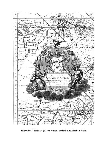
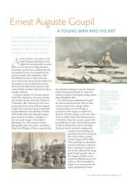
Illustration 3: Johannes (II) van Keulen - dedication to Abraham <strong>An</strong>ias
The <strong>chart</strong> here belongs to <strong>the</strong> first group and is specified on <strong>the</strong> list as ‘Indische zee gelijkgradige van de Caap tot de Straat Sunda’ [Plane <strong>chart</strong> <strong>of</strong> <strong>the</strong> <strong>India</strong>n Ocean, from <strong>the</strong> Cape to Sunda Straits], for a price <strong>of</strong> six guilders and ten stuivers (halfpennies). The <strong>chart</strong> plays a key role for <strong>the</strong> crossing and navigation <strong>of</strong> <strong>the</strong> <strong>India</strong>n Ocean. After a compulsory period <strong>of</strong> rest at <strong>the</strong> Cape <strong>of</strong> Good Hope, <strong>the</strong> VOC ships were required to follow a prescribed route (sailing instructions or sailing orders) for <strong>the</strong> journey from <strong>the</strong> Cape to <strong>the</strong> Sunda Strait. The course first had to be set due south to <strong>the</strong> regions with continuous blowing westerns winds. With <strong>the</strong>se advantageous sailing winds one had to sail 850 miles to <strong>the</strong> east and <strong>the</strong>n steer <strong>the</strong> bow north towards Sunda Strait. Because determining longitude on <strong>the</strong> open sea was <strong>of</strong> great difficulty in those days, <strong>the</strong> crossing <strong>of</strong> <strong>the</strong> <strong>India</strong>n Ocean was a hazardous journey. By changing eastern to nor<strong>the</strong>rn course too late, some VOC ships unexpectedly ran aground on <strong>the</strong> reefs and shoals <strong>of</strong> <strong>the</strong> west coast <strong>of</strong> Australia and sank, especially in darkness. A famous fatality is <strong>the</strong> 1727 shipwreck <strong>of</strong> <strong>the</strong> Zeewijck, a 70 tonnes vessel equipped by <strong>the</strong> Chamber <strong>of</strong> Zeeland. Part <strong>of</strong> <strong>the</strong> west coast <strong>of</strong> Australia is visible on this <strong>chart</strong> (ill. 5). Despite <strong>the</strong> fact that <strong>the</strong> outer corner has been cut <strong>of</strong>f (because <strong>of</strong> <strong>the</strong> later use as book binding), <strong>the</strong> Australian coast is visible under <strong>the</strong> name [Land van] den Eendragt, a name originating from <strong>the</strong> oldest <strong>Dutch</strong> contact with this coast by <strong>the</strong> ship Eendracht in 1616. On our <strong>chart</strong> this is also testified by <strong>the</strong> name Dirck Hartogs Rhee. A remarkable feature <strong>of</strong> this <strong>chart</strong> is <strong>the</strong> reference to <strong>the</strong> 1727 calamity <strong>of</strong> <strong>the</strong> Zeewijck: Zee[wijck] geble[ven] (Zee[wijck] lost here). On June 9, 1727, this 145 foot ship ran aground on one <strong>of</strong> <strong>the</strong> coral reefs (Half Moon Reef) <strong>of</strong> <strong>the</strong> Houtman Abrolhos. Part <strong>of</strong> <strong>the</strong> castaways could survive on nearby Gun Island and after many miseries <strong>the</strong>y succeeded to build a small sloop from <strong>the</strong> wreck <strong>of</strong> <strong>the</strong> Zeewijck. After ten months, approximately 90 men (<strong>of</strong> <strong>the</strong> crew <strong>of</strong> 208 that had sailed from Zeeland) managed to leave Gun Island. Incredibly, <strong>the</strong>y managed to reach Sunda Strait and arrived in Batavia in April 30, 1728. The reference to <strong>the</strong> wreckage <strong>of</strong> <strong>the</strong> Zeewijck has not been recorded on any o<strong>the</strong>r known VOC <strong>vellum</strong> <strong>chart</strong> <strong>of</strong> <strong>the</strong> <strong>India</strong>n Ocean, <strong>the</strong> fact that it is recorded here is a fur<strong>the</strong>r confirmation that this <strong>chart</strong> was produced in Middelburg. In <strong>the</strong> waters between <strong>the</strong> Australian coast and Java a few islands can be seen. The name Trials Rudsen reminds <strong>the</strong> loss <strong>of</strong> <strong>the</strong> English ship Trial in 1622, and <strong>the</strong> name Monij (today’s Christmas Island) goes back to <strong>the</strong> visit <strong>of</strong> <strong>the</strong> fleet <strong>of</strong> Willem de Vlamingh in 1697. Our <strong>chart</strong> shows hundreds <strong>of</strong> toponyms along <strong>the</strong> coasts. Although <strong>the</strong> majority is in Portuguese, we also see <strong>Dutch</strong> names along <strong>the</strong> west coast <strong>of</strong> Sumatra (Cocos Eijlanden, ’t Verkens Eijland, Goefortuijn, Nassou); on Sumatra (gebroken Hoek, vlacke Hoek); in Sunda Strait (t Prince Eijland). Remarkable in Malacca is <strong>the</strong> reference to Straet Sincapura. In Bengal <strong>the</strong> Timmerswerf (carpenter’s wharf) is mentioned. On <strong>the</strong> Orissa coast is a reference to <strong>the</strong> 1643 disaster <strong>of</strong> ano<strong>the</strong>r VOC ship: Neptunus verongeluckt (Neptunus lost). The plane <strong>chart</strong> f <strong>the</strong> <strong>India</strong>n Ocean did not only serve for <strong>the</strong> crossing to Sunda Strait, but also for <strong>the</strong> journey to Ceylon. After approximately 700 miles east <strong>of</strong> <strong>the</strong> Cape, <strong>the</strong> course is changed north, as is testified on our <strong>chart</strong> by faint traces <strong>of</strong> a plotted track in pencil (<strong>of</strong> which unfortunately only <strong>the</strong> number 14 is decipherable, tracks were drawn in pencil and erased later).