Geo-Resources and Geo-Hazards Since 2007 more than 50 % of ...
Geo-Resources and Geo-Hazards Since 2007 more than 50 % of ...
Geo-Resources and Geo-Hazards Since 2007 more than 50 % of ...

You also want an ePaper? Increase the reach of your titles
YUMPU automatically turns print PDFs into web optimized ePapers that Google loves.
<strong>Geo</strong>-<strong>Resources</strong> <strong>and</strong> <strong>Geo</strong>-<strong>Hazards</strong><br />
Annual Report <strong>2007</strong>: 122-127, Faculty <strong>of</strong> Materials- <strong>and</strong> <strong>Geo</strong>-Sciences, Technische Universität Darmstadt<br />
<strong>Since</strong> <strong>2007</strong> <strong>more</strong> <strong>than</strong> <strong>50</strong> % <strong>of</strong> the global population is living in urban settlements.<br />
Cities have a metabolism which needs, amongst others, water <strong>and</strong> mass resources<br />
from the environment <strong>and</strong> discharges high amounts <strong>of</strong> fluids <strong>and</strong> waste with a possible<br />
hazardous potential for the current <strong>and</strong> future generations. Further<strong>more</strong>, cities<br />
need additional material to grow <strong>and</strong> exp<strong>and</strong>. In many cases, this material is loam<br />
<strong>and</strong> clay for bricks as well as s<strong>and</strong>, gravel <strong>and</strong> limestone for concrete. For instance, it<br />
may be astonishing at first sight to know that s<strong>and</strong> <strong>and</strong> gravel is the most extracted<br />
resource on our globe. Cities <strong>of</strong>ten seal the resources they need for their own growth<br />
without knowing it. It still occurs in industrialized <strong>and</strong> non-industrialized countries because<br />
the knowledge <strong>of</strong> geoscientists is regarded as too complex by many decision<br />
makers. This fact should motivate geoscientists to put in efforts to translate <strong>and</strong> visualize<br />
their knowledge for these persons.<br />
Staff Members<br />
Head Pr<strong>of</strong>. Dr. Andreas Hoppe<br />
Research Associates Dr. Stefan Lang<br />
Dr. Rouwen Lehné<br />
Dipl.-<strong>Geo</strong>ökol. Monika H<strong>of</strong>mann<br />
Dipl.-<strong>Geo</strong>l. Ina Spottke<br />
Technical Personnel Dipl.-Kartogr. (FH) Ulrike Simons<br />
Holger Scheibner<br />
Secretaries Kirsten Herrmann<br />
Monika Schweikhard<br />
Diploma student Anja Desch<br />
Student apprentice Marian R. Saavedra<br />
Research Projects<br />
The chair <strong>of</strong> geo-resources <strong>and</strong> geo-hazards participates in a joint inter- <strong>and</strong> transdisciplinary<br />
effort <strong>of</strong> almost a dozen colleagues from the Technische Universität<br />
Darmstadt on the “Eigenlogik der Städte”. The principal idea <strong>of</strong> this group says that<br />
cities can be analyzed following its inherent laws based on historically development<br />
<strong>and</strong> material properties which determine future developments. One <strong>of</strong> three groups<br />
(with Andreas Hoppe as speaker) concentrates on “urban environments – routes <strong>and</strong><br />
roundabout routes to sustainability”. It will mainly investigate geology, water/waste<br />
water <strong>and</strong> energy as well as the h<strong>and</strong>ling <strong>of</strong> institutions <strong>and</strong> decision makers during<br />
the last decades with the necessity <strong>of</strong> a sustainable development.<br />
The reconstruction <strong>of</strong> the geological architecture on the Cenozoic terrestrial Hanau-<br />
Seligenstadt Basin between the Odenwald <strong>and</strong> Spessart Mts with its important geopotentials<br />
for the Rhine-Main Area has been finished by Stefan Lang who defended<br />
his findings in a dissertation in February. Dipl.-<strong>Geo</strong>l. Ina Spottke started as research
Annual Report <strong>2007</strong>: 122-127, Faculty <strong>of</strong> Materials- <strong>and</strong> <strong>Geo</strong>-Sciences, Technische Universität Darmstadt<br />
assistant at the same time to investigate the hydraulic regime <strong>of</strong> the area. Target is<br />
an optimizing <strong>of</strong> 3D reconstruction with the s<strong>of</strong>tware gOcad by an underst<strong>and</strong>ing <strong>of</strong><br />
interrelations between sedimentological models <strong>and</strong> hydraulic data.<br />
The evaluation <strong>of</strong> geo-resources <strong>and</strong> geo-hazards in the Ebro Basin in the surroundings<br />
<strong>of</strong> Zaragoza (Spain), the fast growing capital <strong>of</strong> the Province <strong>of</strong> Aragón, has<br />
been concluded <strong>and</strong> defended in a dissertation in February by Teresa Lamelas Gracia.<br />
The ongoing project in the northern periphery <strong>of</strong> Belo Horizonte (Minas Gerais, Brazil)<br />
aims at evaluating geo-resources <strong>and</strong> geo-hazards for a sustainable growth <strong>of</strong> the<br />
city. In the last year, the focus was on multitemporal analysis <strong>of</strong> s<strong>and</strong> extraction <strong>and</strong><br />
gully erosion modelling.<br />
During a visit <strong>of</strong> Andreas Hoppe as short-time lecturer at the Universidad Autónoma<br />
de Nuevo León in Monterrey (Mexico), cooperation has been agreed with the colleagues<br />
in Linares in the field <strong>of</strong> geo-hazards. The city <strong>of</strong> Monterrey has actually<br />
<strong>more</strong> <strong>than</strong> 2 ½ million inhabitants; it is growing fast <strong>and</strong> developing with suburbs into<br />
its surroundings dominated by the steep hills <strong>of</strong> the Sierra Madre Oriental.<br />
In March <strong>2007</strong> Dr. Rouwen Lehné joined the group <strong>and</strong> concentrates on various,<br />
GIS-supported projects, especially about neotectonics. A project to translate local<br />
geology for tourists was started (for the “Barfußpfad” <strong>of</strong> Bad Sobernheim in<br />
Rheinl<strong>and</strong>-Pfalz which is visited by <strong>more</strong> <strong>than</strong> 100.00 persons per year). During his<br />
visit at Technical University <strong>of</strong> Tallinn (Estonia) in August <strong>2007</strong> he agreed on projects<br />
in the field <strong>of</strong> geo-resources.<br />
In Darmstadt the group accompanied the construction <strong>of</strong> the “Darmstadtium”, the<br />
city’s science <strong>and</strong> congress centre, by investigating the underground. The congress<br />
centre is situated upon the eastern master fault <strong>of</strong> the Upper Rhine Graben. In order<br />
to detect future movements between Odenwald <strong>and</strong> Rhinegraben, a geodetic measurement<br />
device was installed in cooperation with the Czech Academy <strong>of</strong> Sciences<br />
(Prague) which will detect horizontal <strong>and</strong> vertical displacements at 10 -2 mm scale.<br />
In an interdisciplinary seminar Andreas Hoppe discussed together with the historian<br />
Dieter Schott natural catastrophes. As speaker <strong>of</strong> the Evenarí Forum for German-<br />
Jewish Studies at TUD he organized together with historians an excursion to Israel<br />
under the aspects <strong>of</strong> “natural history – history – politics” <strong>and</strong> at TUD a series <strong>of</strong> Evenarí<br />
Lectures on “cultures”. In addition, he served as chief-editor <strong>of</strong> the “Zeitschrift<br />
der Deutschen Gesellschaft für <strong>Geo</strong>wissenschaften” (ZDGG); the journal is indexed<br />
in Science Citation Index now.<br />
Publications<br />
Hoppe, A. (<strong>2007</strong>): Verleihung der Leopold-von-Buch-Plakette an Pr<strong>of</strong>. Dr. Fritz<br />
Steininger. - Z. Dt. Ges. <strong>Geo</strong>wiss. 158 (2): 195-196, Stuttgart (doi 10.1127/1860-<br />
1804/<strong>2007</strong>/0158-0195).
Annual Report <strong>2007</strong>: 122-127, Faculty <strong>of</strong> Materials- <strong>and</strong> <strong>Geo</strong>-Sciences, Technische Universität Darmstadt<br />
Hoppe, A. & Lang, S. (<strong>2007</strong>): The eastern master fault <strong>of</strong> the Upper Rhine Graben<br />
below the Science <strong>and</strong> Conference Centre in Darmstadt (Germany). – Z. Dt. Ges.<br />
<strong>Geo</strong>wiss. 158 (1): 113-117, Stuttgart (doi 10.1127/1860-1804/<strong>2007</strong>/0158-0113).<br />
Hoppe, A., Janicka, J., Lerch, C. & Brübach, J. (<strong>2007</strong>): <strong>Geo</strong>thermal resources in the<br />
shallow, unsaturated zone <strong>of</strong> the Wiesbaden spa district, Germany. – <strong>Geo</strong>thermics<br />
(doi 10.1016/j.geothermics.<strong>2007</strong>.11.003).<br />
Hoppe, A., Leppig, U. & v. Sperber, M., eds. (<strong>2007</strong>): Festschrift for Reinhard Pflug on<br />
the occasion <strong>of</strong> his 75th anniversary on 1-April-<strong>2007</strong>. With contributions from P.A.<br />
Almeida-Abreu, E.H.G. Araújo, H.S.J. Benoit Dupont, K. Bitzer, J. Boess, M.C. Fiebig,<br />
S. Giese, A. Gruber, S.G. Hagemann, A. Hoppe, C. Hübner, R. Jatho, R. Jung, ,<br />
R. Junker, P. Kehrer, K. Krammer, K.J.H. Kux, S. Lang, C. Lindenbeck, M.A. Martins-<br />
Neto, J. Orzol, F. Renger, T. Ries, S. Rühl, W. Schmidt, M. Schulz, F. Sengl, R.<br />
Springhorn, S. Struck, H. Ulmer, D.H.G. Walde, R. Zentler. – Z. Dt. Ges. <strong>Geo</strong>wiss.,<br />
158 (1): 1-193, Stuttgart.<br />
Lamelas, M.T., Marinoni, O., Hoppe, A. & de la Riva, J. (<strong>2007</strong>). Groundwater vulnerability<br />
map for the Ebro alluvial aquifer between Jalón <strong>and</strong> Ginel tributaries (Spain). –<br />
Environm. <strong>Geo</strong>l. 53 (4): 861-878 (doi 10.1007/s00254-007-0699-5).<br />
Lehné, R. & Sirocko, F. (<strong>2007</strong>): Rezente Bodenbewegungspotenziale in Schleswig-<br />
Holstein (Deutschl<strong>and</strong>) – Ursachen und ihr Einfluss auf die Entwicklung der rezenten<br />
Topographie. - Z. Dt. Ges. <strong>Geo</strong>wiss. 158 (2): 329-347, Stuttgart (doi 10.1127/1860-<br />
1804/<strong>2007</strong>/0158-0329).<br />
Lerch, C. & Hoppe, A. (<strong>2007</strong>): Erstellung eines geologischen 3D-Modells zur verbesserten<br />
Berechnung der Schutzfunktion der Grundwasserüberdeckung. – Grundwasser<br />
12 (2): 144-153, Heidelberg (doi 10.1007/ s00767-007-0022-0).
Annual Report <strong>2007</strong>: 122-127, Faculty <strong>of</strong> Materials- <strong>and</strong> <strong>Geo</strong>-Sciences, Technische Universität Darmstadt<br />
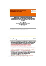
Displacements at the eastern master fault<br />
<strong>of</strong> the Upper Rhine Graben in Darmstadt<br />
A. Hoppe 1 , B. Košťák 2 , R. Lehné 1 , U. Simons 1 & J. Stemberk 2<br />
1 Institute for Applied <strong>Geo</strong>sciences, Darmstadt University <strong>of</strong> Technology, Germany,<br />
2 Czech Academy <strong>of</strong> Sciences, Prague, Czech Republic<br />
The Upper Rhine Graben in Germany is a still subsiding tectonic unit with an active<br />
sinistral strike slip component (Fig. 1). This is accompanied by recent isostatic rebound<br />
which results from the still ongoing back-formation <strong>of</strong> a mantle plume that<br />
originated in Cretaceous times. This plume can be deduced for that area where<br />
during Cretaceous times, with a very high sea level, no sediments have been deposited.<br />
The further development resulted in a smaller plume <strong>and</strong> a failed rift <strong>and</strong><br />
subsidence.<br />
The Upper Rhine Graben is also a densely populated area with a higher hazard <strong>of</strong><br />
earthquake <strong>and</strong> intense construction activities. High precision measurements on dividing<br />
planes like faults <strong>and</strong> joints can help to decipher micro-movements <strong>and</strong> their<br />
mechanisms. Most suitable for such high precision measurements (i.e. 3D-monitoring)<br />
are dividing planes which are known as recent active. Outcrops to install such<br />
devices are rare. So it has been an opportunity to install a measuring station for the<br />
3D monitoring <strong>of</strong> displacements when in the city <strong>of</strong> Darmstadt the eastern master<br />
fault has been exposed recently.<br />
Embedded in an already existing system <strong>of</strong> long term monitoring in Europe working<br />
successfully for <strong>more</strong> <strong>than</strong> 25 years [1] the Rhine Graben allows the comparison <strong>of</strong><br />
tectonically active regions with <strong>more</strong> stable parts <strong>of</strong> the European crust like Bohemia<br />
where a measuring program by the Czech Academy <strong>of</strong> Sciences has been started<br />
recently.<br />
Fig. 1: Outline <strong>of</strong> the Science <strong>and</strong> Congress Centre “darmstadtium” <strong>and</strong> the master fault [2]<br />
<strong>and</strong> kinematic model [3] <strong>of</strong> the Upper Rhine Graben for the Pleistocene <strong>and</strong> Holocene.
Annual Report <strong>2007</strong>: 122-127, Faculty <strong>of</strong> Materials- <strong>and</strong> <strong>Geo</strong>-Sciences, Technische Universität Darmstadt<br />
The device (Fig. 2) is a development <strong>of</strong> the Czech Academy <strong>of</strong> Sciences (Košťák<br />
2006) <strong>and</strong> detects displacement rates even in the order <strong>of</strong> 10 -1 to 10 o mm a -1 . First<br />
measurements (Fig. 3) show such displacements, but it should be stressed that<br />
these actually may not be related in any case to tectonic movements or isostatic<br />
rebound resp. as during the measurement intervals, intense construction activities in<br />
the building <strong>and</strong> its surroundings took place! It is hoped, that future measurements<br />
under normal conditions will detect the geological components.<br />
Fig. 2: A dilatometric measurement station was installed in May <strong>2007</strong> between sediments <strong>of</strong><br />
the Rhine Graben <strong>and</strong> the crystalline rocks <strong>of</strong> the Odenwald.<br />
displacement (mm)<br />
0,3<br />
0,2<br />
0,1<br />
0<br />
-0,1<br />
-0,2<br />
-0,3<br />
-0,4<br />
-0,5<br />
-0,6<br />
1.6.07<br />
8.6.07<br />
15.6.07<br />
22.6.07<br />
29.6.07<br />
6.7.07<br />
13.7.07<br />
20.7.07<br />
27.7.07<br />
3.8.07<br />
10.8.07<br />
17.8.07<br />
Fig. 3: First measurements on the master fault at the Darmstadtium in 2008. Please note that<br />
these movements may be caused by construction activities <strong>of</strong> the Science <strong>and</strong> Congress<br />
Centre during that time.<br />
References: [1 ] Stemberk, J., Piccardi, L. & Košťák, B., eds. (<strong>2007</strong>): European COST 625<br />
action “3D monitoring <strong>of</strong> active tectonic structures”. – Acta <strong>Geo</strong>dyn. <strong>Geo</strong>mat. 4 (1 / 145): 107<br />
S., Prague (Acad. Sci. Czech Rep.). [2] Hoppe, A. & Lang, S. (<strong>2007</strong>): The eastern master<br />
fault <strong>of</strong> the Upper Rhine Graben below the Science <strong>and</strong> Conference Centre in Darmstadt<br />
(Germany). – Z. Dt. Ges. <strong>Geo</strong>wiss. 158: 113-117, Stuttgart. [3] Schumacher, M.E. (2002):<br />
Upper Rhine Graben: role <strong>of</strong> preexisting structures during rift evolution. – Tectonics, 21: 1–<br />
17. [4] Košťák, B. (2006): Deformation effects in rock massifs <strong>and</strong> their long term monitoring.<br />
– Quart. J. Eng. <strong>Geo</strong>l. Hydrogeol. 39: 249-258.<br />
24.8.07<br />
31.8.07<br />
7.9.07<br />
14.9.07<br />
21.9.07<br />
28.9.07<br />
5.10.07<br />
12.10.07<br />
19.10.07<br />
26.10.07<br />
X<br />
Y<br />
Z