

Family / Scientific name - Coastal Forests of Kenya and Tanzania
Family / Scientific name - Coastal Forests of Kenya and Tanzania
Family / Scientific name - Coastal Forests of Kenya and Tanzania

You also want an ePaper? Increase the reach of your titles
YUMPU automatically turns print PDFs into web optimized ePapers that Google loves.
1 Introduction<br />
REMP Technical Report 44: Biodiversity Summary<br />
1.1 Aim<br />
The aim <strong>of</strong> this report is to compile biodiversity information for Rufiji District into one volume. It<br />
should be noted that no additional survey work was undertaken in compiling this report, <strong>and</strong> thus<br />
full acknowledgement is given to the authors <strong>of</strong> the various studies used to compile this report. The<br />
relevant studies are listed at the beginning each section.<br />
This report compiles information known to date, it is not expected that species lists presented are<br />
exhaustive, particularly for little known groups such as invertebrates.<br />
The species lists are assembled giving where possible details <strong>of</strong> forest dependence, endemism <strong>and</strong><br />
conservation status, these are defined below in section 1.3.<br />
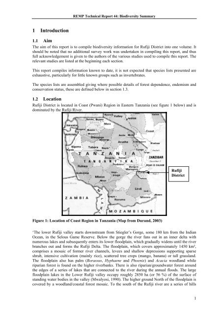
1.2 Location<br />
Rufiji District is located in Coast (Pwani) Region in Eastern <strong>Tanzania</strong> (see figure 1 below) <strong>and</strong> is<br />
dominated by the Rufiji River.<br />
Figure 1: Location <strong>of</strong> Coast Region in <strong>Tanzania</strong> (Map from Dur<strong>and</strong>, 2003)<br />
Rufiji<br />
District<br />
‘The lower Rufiji valley starts downstream from Stiegler’s Gorge, some 180 km from the Indian<br />
Ocean, in the Selous Game Reserve. Below the gorge the river fans out in an inner delta with<br />
numerous lakes <strong>and</strong> subsequently enters its lower floodplain, which gradually widens until the river<br />
branches out <strong>and</strong> forms the Rufiji Delta. The floodplain, which covers approximately 1450 km²,<br />
comprises a mosaic <strong>of</strong> former river channels, levees <strong>and</strong> shallow depressions supporting sparse<br />
shrub, intensive cultivation (mainly rice), scattered tree crops (mango, banana) or tall grassl<strong>and</strong>.<br />
The floodplain also has palm (Borassus, Hyphaene <strong>and</strong> Phoenix) <strong>and</strong> Acacia woodl<strong>and</strong> while<br />
riparian forest is found on the higher riverbanks. There is also riparian/groundwater forest around<br />
the edges <strong>of</strong> a series <strong>of</strong> lakes that are connected to the river during the annual floods. The large<br />
floodplain lakes in the Lower Rufiji valley occupy roughly 2850 ha (or 56 %) <strong>of</strong> the surface <strong>of</strong><br />
st<strong>and</strong>ing water bodies in the valley (Mwalyosi, 1990). The higher ground North <strong>of</strong> the floodplain is<br />
covered by a woodl<strong>and</strong>/coastal forest mosaic. To the south <strong>of</strong> the Rufiji river are a series <strong>of</strong> hills<br />
1


