

Bridging the Gap: linking timber trade with infrastructural ...
Bridging the Gap: linking timber trade with infrastructural ...
Bridging the Gap: linking timber trade with infrastructural ...

You also want an ePaper? Increase the reach of your titles
YUMPU automatically turns print PDFs into web optimized ePapers that Google loves.
Published by TRAFFIC East/Sou<strong>the</strong>rn Africa<br />
© 2005 TRAFFIC East/Sou<strong>the</strong>rn Africa.<br />
All rights reserved.<br />
All material appearing in this publication is copyrighted<br />
and may be reproduced <strong>with</strong> permission. Any<br />
reproduction in full or in part of this publication must<br />
credit TRAFFIC East/Sou<strong>the</strong>rn Africa as <strong>the</strong> copyright<br />
owner.<br />
The views off <strong>the</strong> authors expressed in this publication do<br />
not necessarily reflect those of <strong>the</strong> TRAFFIC network,<br />
WWF, IUCN – The World Conservation Union, or <strong>the</strong><br />
Embassy of Finland.<br />
The designations of geographical entities in this<br />
publication, and <strong>the</strong> presentation of material, do not imply<br />
<strong>the</strong> expression of any opinion whatsoever on <strong>the</strong> part of<br />
TRAFFIC or its supporting organizations concerning <strong>the</strong><br />
legal status of any country, territory or area, or of its<br />
authorities, or concerning <strong>the</strong> delimitation of its frontiers<br />
or boundaries.<br />
The TRAFFIC symbol copyright and Registered<br />
Trademark ownership is held by WWF. TRAFFIC is a<br />
joint programme of WWF and IUCN.<br />
“The overall national vision on<br />
biodiversity conservation is to build a<br />
society that values all <strong>the</strong> biodiversity<br />
richness, using it sustainably and<br />
equitably, while taking <strong>the</strong> responsibility<br />
for actions that meet both <strong>the</strong> competing<br />
requirements of <strong>the</strong> present and <strong>the</strong><br />
legitimate claims of <strong>the</strong> future<br />
generations.”<br />
National Biodiversity Strategy and Action<br />
Plan (1999)<br />
Suggested citation: Milledge, S.A.H. and Kaale, B.K.<br />
(2005). <strong>Bridging</strong> <strong>the</strong> <strong>Gap</strong> - Linking <strong>timber</strong> <strong>trade</strong> <strong>with</strong><br />
infrastructure development in Sou<strong>the</strong>rn Tanzania:<br />
Baseline data before completion of <strong>the</strong> Mkapa Bridge.<br />
TRAFFIC East/Sou<strong>the</strong>rn Africa, Dar es Salaam,<br />
Tanzania.<br />
Key words: Timber <strong>trade</strong>, poverty alleviation, miombo<br />
woodlands, Tanzania, Rufiji River, Mkapa Bridge.<br />
ISBN: 0-9584025-9-0<br />
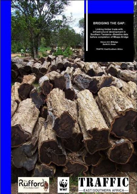
Front cover photograph: Hard wood logs awaiting<br />
collection in village, Rufiji District.<br />
Credit: Simon Milledge/TRAFFIC East/Sou<strong>the</strong>rn Africa<br />
1
BRIDGING THE GAP:<br />
Linking Timber Trade <strong>with</strong><br />
Infrastructural Development in<br />
Sou<strong>the</strong>rn Tanzania – Baseline<br />
data before completion of<br />
Mkapa Bridge<br />
Simon A.H. Milledge<br />
Bariki K. Kaale<br />
Credit: Simon Milledge/TRAFFIC East/Sou<strong>the</strong>rn Africa<br />
2
CONTENTS<br />
ACKNOWLEDGEMENTS 3<br />
ABBREVIATIONS 4<br />
EXECUTIVE SUMMARY 5<br />
INTRODUCTION 8<br />
Forests and national development 8<br />
Isolation of sou<strong>the</strong>rn Tanzania miombo woodlands and coastal forests 9<br />
Justification for study area 11<br />
METHODOLOGY 13<br />
Data collection of government records 13<br />
Field Research 15<br />
Mapping of logging roads 15<br />
Data analysis 16<br />
Limitations of methodology 18<br />
BACKGROUND 20<br />
National overview 20<br />
Type of land use 20<br />
Forest and woodland distribution and status 21<br />
Trends in forest and woodland degradation 24<br />
Importance of miombo woodlands and coastal forests to development in Tanzania 25<br />
STUDY AREA OVERVIEW 29<br />
VOLUMES OF ROUND WOOD IN TRADE 32<br />
Timber harvest records 32<br />
Timber <strong>trade</strong> dynamics south of Rufiji River 33<br />
Shipment of <strong>timber</strong> across Rufiji River 35<br />
Total volume of <strong>timber</strong> transported north across Rufiji River 38<br />
Estimated harvest pressure by district 39<br />
SPECIES COMPOSITION OF ROUND WOOD IN TRADE 40<br />
Timber harvest records 40<br />
Comparison of <strong>timber</strong> harvest records between districts 41<br />
Timber moving north of Rufiji River 42<br />
Species composition of <strong>timber</strong> products 46<br />
Changes in species composition 47<br />
Size of harvested <strong>timber</strong> 51<br />
Declining sizes of sawn wood 54<br />
1
HARVEST AREAS, DESTINATIONS, MARKETS AND SEASONALITY 55<br />
Major harvest areas in Rufiji District 55<br />
Major harvest areas in Lindi Region 57<br />
Changes in harvest areas 58<br />
Major markets and <strong>trade</strong> routes 59<br />
Transport across <strong>the</strong> Rufiji River 61<br />
Vehicle types used for <strong>timber</strong> <strong>trade</strong> 62<br />
Seasonal variations in <strong>timber</strong> <strong>trade</strong> 65<br />
Trade in key <strong>timber</strong> species 68<br />
TRADE IN CHARCOAL AND OTHER TIMBER PRODUCTS 73<br />
Introduction 73<br />
Volumes of charcoal <strong>trade</strong>d 74<br />
Charcoal shipments 75<br />
Sources, <strong>trade</strong> routes and markets for charcoal 75<br />
O<strong>the</strong>r forest products in <strong>trade</strong> 77<br />
SOCIOLOGICAL ASPECTS OF TIMBER TRADE 78<br />
Gender of forest product <strong>trade</strong>rs 78<br />
Age of forest product <strong>trade</strong>rs 79<br />
Education levels of forest product <strong>trade</strong>rs 80<br />
DISCUSSION 81<br />
Evidence of linkages between poverty and quality of woodland/forest resources 81<br />
Major challenges 82<br />
RECOMMENDATIONS 89<br />
Costs of not taking action and benefits of taking action 89<br />
Ongoing monitoring of <strong>the</strong> <strong>timber</strong> <strong>trade</strong> 89<br />
Capacity building 90<br />
Empowerment of <strong>the</strong> local communities 96<br />
Improving forest management plans 96<br />
Additional recommendations 98<br />
REFERENCES 100<br />
ANNEXES 107<br />
Annex 1 Tanzania industrial plantations, 2001 107<br />
Annex 2 Regulatory and institutional framework of <strong>the</strong> forestry sector 107<br />
Annex 3 Miombo woodlands of Tanzania 112<br />
Annex 4. Description of study area 113<br />
Annex 5. Sample checkpoint form for recording movement of <strong>timber</strong> products 119<br />
2
ACKNOWLEDGEMENTS<br />
This study was made possible through funding provided by <strong>the</strong> WWF-Miombo Ecoregion Programme<br />
whose generous support is gratefully acknowledged. The Embassy of Finland in Dar es Salaam kindly<br />
funded <strong>the</strong> printing of <strong>the</strong> final report.<br />
Various ministries and institutions provided support in implementing <strong>the</strong> study through <strong>the</strong> provision of<br />
background materials, guidance in formulating study methodologies, interviews and review. We would<br />
like to extend our gratitude to those officials who provided timely advice and technical assistance<br />
covering a wide range of disciplines, including representatives from: President’s Office (Planning<br />
Commission); Vice Presidents Office (Division of Environment); Ministry of Natural Resources and<br />
Tourism (Divisions of Forestry and Beekeeping, Wildlife, Fishery and Tourism); Ministry of Land,<br />
Human Settlements and Development; Ministry of Community Development, Women and Children;<br />
Ministry of Water and Livestock Development; Ministry of Agriculture; Ministry of Energy and<br />
Minerals; Ministry of Communication and Transport; Ministry of Works; National Environment<br />
Management Council; Regional Secretariats and local government Councils from Coast, Lindi and<br />
Mtwara Regions; Tanzania Harbours Corporation; Danish International Development Agency<br />
(DANIDA), WWF, Tanzania Forest Conservation Group, REMP-IUCN and TASONABI.<br />
This study would not have been possible <strong>with</strong>out <strong>the</strong> commitment and hard work shown by numerous<br />
field research assistants (whose names are deliberately kept anonymous) recruited in Coast and Lindi<br />
Regions between October 2001 and January 2002.<br />
The authors would also like to express <strong>the</strong>ir sincere appreciation to a few key individuals who provided<br />
invaluable support, assistance and advice. Special thanks are extended to Prof. S. Iddi (Director of<br />
Forestry and Beekeeping), Mr. E. Severre (Director of Wildlife), Mr. T. Maembe (Director of Fisheries),<br />
Mr. E. Lyimo (Revenue Officer, Division of Forestry and Beekeeping (FBD)), Mr. Mkeya (Revenue<br />
Officer, FBD), Ms. H. Ramadhani (Head of Community Forestry, FBD), Mr. Mgheni (Lindi Natural<br />
Resources Officer), Mr. Minde (Rufiji District Forest Officer), Mr. Kisanga (Manager Mtwara Port,<br />
Tanzania Harbours Authority), Mr. Senkoro (Ministry of Works), Dr. O. Hamerlynck (Chief Technical<br />
Advisor, IUCN), Dr. H. Mwageni (WWF-Tanzania Programme Office (TPO) Country Representative),<br />
Mr. S. Mariki (WWF-TPO), Mr. P. Sumbi (WWF-TPO), Mrs. F. Shonhiwa (WWF Sou<strong>the</strong>rn Africa<br />
Regional Programme Office), Dr. D. Gumbo (WWF Miombo Ecoregion Co-ordinator), Ms. N. Doggart<br />
(Tanzania Forest Conservation Group), Mr. T. Milliken (Director, TRAFFIC East/Sou<strong>the</strong>rn Africa), Mr.<br />
H. K. Chen (Senior Forest Trade Advisor, TRAFFIC), Mr. D. Newton (National Representative,<br />
TRAFFIC East/Sou<strong>the</strong>rn Africa-South Africa), and Mrs. J. Mremi (formerly Research Officer, TRAFFIC<br />
East/Sou<strong>the</strong>rn Africa). Lastly, but by no means least, Mr. S. Broad, Mrs. J. Gray, Ms. T. Mulliken and<br />
Mrs. M. Sirola (TRAFFIC International) are thanked for <strong>the</strong>ir thorough and steadfast assistance <strong>with</strong> <strong>the</strong><br />
final report review process.<br />
3
ABBREVIATIONS<br />
CAWM<br />
CBNRM<br />
CBD<br />
CCD<br />
CITES<br />
DANIDA<br />
EAC<br />
ERP<br />
ESAP<br />
FBD<br />
FINNIDA<br />
GDP<br />
GIS<br />
GPS<br />
MDC<br />
MNRT<br />
MTEF<br />
NCAA<br />
NEMC<br />
NEPAD<br />
NFP<br />
NPES<br />
OPEC<br />
PIC<br />
PRSP<br />
RDFAPTF<br />
REMP<br />
SADC<br />
TANAPA<br />
TASONABI<br />
TAWICO<br />
TAWIRI<br />
TFCG<br />
TFCMP<br />
TWCM<br />
TWICO<br />
TZS<br />
UNCED<br />
UNEP<br />
UNFCC<br />
UNFF<br />
WMA<br />
WWF<br />
WSSD<br />
College of African Wildlife Management (Tanzania)<br />
Community Based Natural Resource Management<br />
Convention on Biological Diversity<br />
Convention to Combat Desertification<br />
Convention on International Trade in Endangered Species of Wild Fauna and Flora<br />
Danish International Development Agency<br />
East African Community<br />
Economic Recovery Programme (Tanzania)<br />
Economic and Social Action Programme (Tanzania)<br />
Forest and Beekeeping Division (Tanzania)<br />
Finnish International Development Agency<br />
Gross Domestic Product<br />
Geographic Information System<br />
Global Positioning System<br />
Mtwara Development Corridor<br />
Ministry of Natural Resources and Tourism (Tanzania)<br />
Medium Term Expenditure Framework<br />
Ngorongoro Conservation Area Authority<br />
National Environment Management Council (Tanzania)<br />
The New Partnership for Africa’s Development<br />
National Forest Programme (Tanzania)<br />
National Poverty Eradication Strategy (Tanzania)<br />
Organisation of Petroleum Exporting Countries<br />
Portfolio Investment Company Limited<br />
Poverty Reduction Strategic Paper (Tanzania)<br />
Rufiji District Forest Action Plan Task Force<br />
Rufiji Environment Management Programme<br />
Sou<strong>the</strong>rn Africa Development Corporation<br />
Tanzania National Parks<br />
Tanzania Specialists Organisation on Natural Resources and Biodiversity<br />
Tanzania Wildlife Corporation<br />
Tanzania Wildlife Research Institute<br />
Tanzania Forest Conservation Group<br />
Tanzania Forest Conservation and Management Project<br />
Tanzania Wildlife Conservation Monotoring Unit<br />
Tanzania Wood Industries Corporation<br />
Tanzania Shillings<br />
United Nations Conference on Environment and Development<br />
United Nations Environment Programme<br />
United Nations Framework Convention on Climate Change<br />
United Nations Forum on Forests<br />
Wildlife Management Area<br />
World Wide Fund for Nature (known as World Wildlife Fund in USA)<br />
World Summit on Sustainable Development<br />
4
EXECUTIVE SUMMARY<br />
The close relationship between livelihoods, economies and woodlands has been well documented both<br />
globally and <strong>with</strong>in <strong>the</strong> United Republic of Tanzania. Rural and urban households, <strong>the</strong> private sector, and<br />
local and central governments show varying degrees of dependence upon woodland <strong>timber</strong> resources,<br />
which provide some of <strong>the</strong> most highly-valued products and services in poorer countries. Woodlands<br />
<strong>the</strong>refore present enormous potential in alleviating poverty and enhancing social development. On <strong>the</strong><br />
o<strong>the</strong>r hand, growing disparities in poverty levels, population growth, unsustainable practices and growing<br />
pressure on limited resources are increasingly threatening this potential, resulting in negative impacts on<br />
both woodland integrity and <strong>the</strong> quality of livelihoods.<br />
One apparent irony is that improved development may often result in greater negative impacts on<br />
livelihoods and <strong>the</strong> environment, and <strong>the</strong>se impacts may vary both spatially and temporally. Sustainable<br />
development, particularly in areas where people rely heavily on environmental resources, <strong>the</strong>refore relies<br />
on striking a careful balance. Development projects that are prone to negative environmental impacts in<br />
<strong>the</strong> absence of adequate implementation of environmental impact assessment findings include mining,<br />
aquaculture, hydroelectric power plants and transport development. Fur<strong>the</strong>r, despite clear linkages<br />
between social development, poverty alleviation and <strong>timber</strong> products, woodland management normally<br />
suffers from insufficient funding, and available resources are rarely used proactively to mitigate adverse<br />
consequences of development initiatives. Instead, efforts tend to be reactionary after negative impacts<br />
have been felt.<br />
This study, <strong>the</strong> first of its kind in <strong>the</strong> country, has documented valuable baseline information on <strong>timber</strong><br />
<strong>trade</strong> dynamics from miombo woodlands and coastal forests in sou<strong>the</strong>rn Tanzania before completion of<br />
an important development project. The Mkapa Bridge spanning <strong>the</strong> Rufiji River, <strong>the</strong> longest bridge of its<br />
kind in east and sou<strong>the</strong>rn Africa, officially was opened in August 2003. This bridge will greatly enhance<br />
access to large expanses of <strong>timber</strong> resources south of <strong>the</strong> delta, which were previously inaccessible from<br />
<strong>the</strong> north during seasonal floods. This area has one of <strong>the</strong> highest levels of poverty in Tanzania, but also<br />
contains some of <strong>the</strong> last remaining viable stands of miombo woodland and coastal forest in <strong>the</strong> country.<br />
Indeed, this region has <strong>the</strong> highest proportion of unreserved woodlands whose management depends on<br />
<strong>the</strong> same communities who derive so many benefits, including a range of environmental services and<br />
<strong>timber</strong> products.<br />
This study was conducted using a combination of methodologies, including field research, analysis of<br />
official <strong>trade</strong>-related data, mapping of logging roads and o<strong>the</strong>r spatial information, stakeholder interviews<br />
and a review of available literature. As a result it was possible to assemble detailed baseline data on a<br />
range of important factors and to present a series of indicators to facilitate <strong>the</strong> future monitoring of <strong>the</strong><br />
environmental and socio-economic impact of <strong>the</strong> Mkapa Bridge. Key challenges were identified,<br />
including management capacity and practices, revenue collection, forest management, evidence of<br />
unsustainable offtake and large-scale, illegal <strong>trade</strong>. These issues are discussed toge<strong>the</strong>r <strong>with</strong><br />
recommendations for future work that will help ensure that <strong>the</strong> bridge has a positive impact on poverty<br />
alleviation and woodland management in sou<strong>the</strong>rn Tanzania.<br />
Baseline <strong>timber</strong> <strong>trade</strong> data<br />
In order to increase available knowledge on <strong>trade</strong> dynamics of natural resources from miombo woodlands<br />
and coastal forests, baseline data is presented on volumes, products, species, sizes, harvest areas, <strong>trade</strong><br />
routes, markets, revenues and various sociological factors over <strong>the</strong> past year. An estimated 2.1 million m 3<br />
of wood fuel is consumed annually in <strong>the</strong> study area, whilst around 42 000 m 3 of <strong>timber</strong> (round wood<br />
5
equivalent) was transported north over <strong>the</strong> Rufiji River and some 2 420 m 3 shipped from <strong>the</strong> three ports in<br />
<strong>the</strong> study area during 2001. In addition, significant quantities of <strong>timber</strong> products are used in rural and<br />
urban centres <strong>with</strong>in <strong>the</strong> study area, as well as leaving <strong>the</strong> mainland unrecorded by sea.<br />
At least 24 hard wood <strong>timber</strong> species were harvested from <strong>the</strong> study area during 2001, <strong>with</strong> <strong>the</strong> most<br />
popular tree species being Gum Copal Hymenaea verrucosa, Cape Mahogany Trichilia emetica, African<br />
Teak Pterocarpus angolensis, Snake Bean Tree Swartzia madagascarensis and Pod Mahogany Afzelia<br />
quanzensis. Hymenaea verrucosa accounted for 82% of small logs that were recorded at Kibiti<br />
checkpoint (<strong>the</strong> first official checkpoint north of <strong>the</strong> Rufiji River), while 57% of large logs were Swartzia<br />
madagascarensis. Four species, namely Hymenaea verrucosa, Pterocarpus angolensis, Trichilia emetica<br />
and Afzelia quanzensis, accounted for 92% of sawn wood passing <strong>the</strong> checkpoint during 2001.<br />
Higher accessibility to woodlands in Rufiji District, in particular north of <strong>the</strong> Rufiji River, has resulted in<br />
<strong>the</strong> highest harvesting pressures. Rufiji District accounted for 85% of <strong>the</strong> total harvested wood while<br />
Kilwa District accounted for 10%. Taking into account woodland areas and harvest levels, Rufiji District<br />
has by far <strong>the</strong> highest <strong>the</strong>oretical harvest pressure, a factor of almost five times higher than Kilwa and 50<br />
times higher than Liwale District. Major harvest areas in <strong>the</strong> study area include Ngumburuni, Ruhoi,<br />
Ikwiriri, Nyamwage, and <strong>the</strong> woodland complex of Nainokwe-Zinga-Likawage-Liwiti.<br />
Almost all products moving north over <strong>the</strong> river are destined for Dar es Salaam. Greater seasonality in<br />
<strong>trade</strong> was documented south of <strong>the</strong> Rufiji River due to restricted access during <strong>the</strong> rainy season, although<br />
this is predicted to change following completion of <strong>the</strong> bridge. Sawn wood accounted for less than twothirds<br />
of officially recorded <strong>trade</strong> but 83% of <strong>the</strong> actual <strong>trade</strong>. An estimated six per cent of all sawn wood<br />
(mostly planks) moving north originates from sawmills in Ikwiriri, north of <strong>the</strong> Rufiji River.<br />
Sociological profiles of <strong>timber</strong> product <strong>trade</strong>rs were collected for <strong>the</strong> first time, including gender,<br />
education and age. The majority of <strong>trade</strong>rs were aged between 26 and 45, and 93% had left primary<br />
school. Women constituted <strong>the</strong> minority (11%), half of whom <strong>trade</strong>d planks. Men, on <strong>the</strong> o<strong>the</strong>r hand,<br />
showed a preference for trading logs.<br />
Levels of unsustainable and illegal <strong>timber</strong> <strong>trade</strong> activities<br />
The results revealed two disturbing trends, namely evidence of unsustainable <strong>timber</strong> <strong>trade</strong> and large-scale,<br />
illegal activities. These trends were particularly evident north of <strong>the</strong> Rufiji River where access to<br />
woodlands is currently greatest. Timber harvest fees vary according to which one of <strong>the</strong> five Classes <strong>the</strong><br />
species is listed. The highest fees are paid for <strong>the</strong> most valuable species listed in Class I, whilst <strong>the</strong> least<br />
valued species are included in Class V. Overharvesting of <strong>the</strong> higher-value hardwood species from Rufiji<br />
District has pushed <strong>trade</strong>rs to exploit a larger number of alternative species, mostly Class V. Indeed,<br />
<strong>the</strong>se alternative species accounted for almost all Class V licences issued from <strong>the</strong> entire study area. On<br />
<strong>the</strong> o<strong>the</strong>r hand, <strong>the</strong> proportion of <strong>the</strong> most valuable hardwood species harvested increases markedly<br />
moving southwards from <strong>the</strong> Rufiji River. During 2001, over 80% of licences issued from districts in<br />
Lindi Region was comprised of Class I and II species.<br />
In addition to an increasing proportion of lower value species in <strong>trade</strong>, o<strong>the</strong>r evidence of unsustainable<br />
<strong>timber</strong> <strong>trade</strong> activities included changes in harvest areas following systematic clearance moving<br />
southwards, fewer large trees remaining in wild stands, harvesting of undersize trees, and declining plank<br />
sizes. An alarming rate of woodland clearance for agriculture expansion, mainly in unreserved land, was<br />
observed throughout <strong>the</strong> study area. The absence of suitable property rights, security of tenure, poor<br />
enforcement of laws related to woodland management, and inadequate administrative and technical<br />
6
guidance from central and district authorities for sustainable management of woodlands (due to a critical<br />
shortage of skilled manpower and insufficient funding) are some of <strong>the</strong> factors contributing to extensive<br />
woodland clearance.<br />
Large-scale, uncontrolled and often illegal <strong>trade</strong> throughout <strong>the</strong> study area resulted in large discrepancies<br />
between government records and actual <strong>trade</strong> levels. For example, five times as much <strong>timber</strong> passes<br />
north through Kibiti checkpoint than was officially recorded. The types, causes and impacts of illegal<br />
<strong>trade</strong> are discussed. Of particular concern was <strong>the</strong> lack of evidence demonstrating legal <strong>timber</strong> harvesting<br />
during field work, such as accompanying, official documentation or felled <strong>timber</strong> bearing legal hammer<br />
marks. The incidence of misclassification and <strong>the</strong> issue of “offcuts” as a means to mask illegal <strong>trade</strong> in<br />
preferred species were also disturbingly high. Evidence from <strong>the</strong> study area showed that illegal <strong>trade</strong> is<br />
resulting in significant loss of revenue - vital income for local government authorities and communities -<br />
as well as woodland degradation. It is clear that several species have already become commercially<br />
extinct in parts of <strong>the</strong> study area. For example, Afzelia quanzensis, Millettia stuhlmannii and Swartzia<br />
madagascarensis are predicted to join <strong>the</strong> growing list of commercially extinct hardwood species in<br />
Rufiji District that currently include Dalbergia melanoxylon, Khaya antho<strong>the</strong>ca, Milicia exelsa, Newtonia<br />
spp. and Pterocarpus angolensis.<br />
Future outlook<br />
The majority of people in <strong>the</strong> study area depend heavily on free forest goods, products and services to<br />
support <strong>the</strong>ir livelihoods in <strong>the</strong> absence of viable alternatives. Wise utilization of natural resources in <strong>the</strong><br />
study area has <strong>the</strong> potential to be <strong>the</strong> foundation for poverty alleviation efforts in sou<strong>the</strong>rn Tanzania in<br />
addition to supporting local and central governments. Improved forest/woodland management and<br />
socially equitable access, use and <strong>trade</strong> of forest and woodland resources could drastically increase longterm<br />
benefits to rural communities – at <strong>the</strong> very least helping to mitigate fur<strong>the</strong>r poverty, but at <strong>the</strong> very<br />
best contributing towards poverty alleviation.<br />
However, forestry is not currently regarded as a priority sector in <strong>the</strong> study area despite <strong>the</strong> fact that it<br />
influences <strong>the</strong> progress of o<strong>the</strong>r priority sectors for development. The threat posed by malpractices, lost<br />
revenues and forest degradation to <strong>the</strong> long-term sustainability of <strong>timber</strong> <strong>trade</strong> are likely to be exacerbated<br />
following increased access to harvest areas after completion of <strong>the</strong> Mkapa Bridge. Given its proximity to<br />
<strong>the</strong> bridge, it is expected that <strong>the</strong> study area is most likely to be affected in terms of increased exploitation<br />
by outsiders and lost incomes from <strong>trade</strong> in <strong>timber</strong> products by both community and government sectors.<br />
Insufficient management capacity is <strong>the</strong> major limiting factor to effecting proper forest management in<br />
<strong>the</strong> study area, <strong>the</strong>reby securing its role in helping poverty eradication efforts in <strong>the</strong> long term.<br />
Recommendations to improve management for <strong>the</strong> long-term benefit of sustainable development in <strong>the</strong><br />
study area include extensive capacity building at checkpoints, empowerment of local communities in<br />
forest management, improved forest management plans and law enforcement assistance.<br />
Importantly, it is recommended that sustained monitoring and research complement future initiatives in<br />
order to assess changes in <strong>trade</strong> dynamics, <strong>the</strong> impacts on livelihoods and <strong>the</strong> success of any<br />
interventions. A proposed monitoring methodology <strong>with</strong> preliminary list of 63 indicators is presented.<br />
Baseline <strong>timber</strong> <strong>trade</strong> data are presented prior to completion of <strong>the</strong> Mkapa Bridge, to enable <strong>the</strong><br />
monitoring of numerous predicted changes including <strong>the</strong> magnitude, seasonality, legality, harvest areas,<br />
<strong>trade</strong> routes, species and product composition.<br />
7
INTRODUCTION<br />
Forests and national development<br />
The United Republic of Tanzania, along <strong>with</strong> many o<strong>the</strong>r countries in <strong>the</strong> Sou<strong>the</strong>rn Africa Development<br />
Corporation (SADC) region, is in <strong>the</strong> process of political and economic reform in an attempt to achieve<br />
poverty eradication goals. In this regard, all sectors, including <strong>the</strong> environment, are required to address<br />
national development objectives. The Vice-President’s Office identified <strong>the</strong> linkage between poverty and<br />
<strong>the</strong> environment as a major challenge for combating poverty in Tanzania (Anon., 2002e). The higher<br />
dependence of poorer people on natural resources, especially forest products, and <strong>the</strong> evident<br />
overutilisation of natural resources that is leading to environmental degradation and increased poverty,<br />
highlights <strong>the</strong> need to ensure environmental concerns are acknowledged <strong>with</strong>in o<strong>the</strong>r sectoral policies<br />
(Anon., 2000d; Anon., 2002e). However, richer people also have an impact and a role to play. Empirical<br />
evidence in o<strong>the</strong>r countries has shown clear linkages between <strong>the</strong> environment and poverty,<br />
demonstrating how poorer households have <strong>the</strong> greatest dependence on natural resources, including <strong>the</strong><br />
generation of income, whilst richer households have <strong>the</strong> most impact on <strong>the</strong> environment through <strong>the</strong> use<br />
of greater quantities of environmental resources (Cavendish, 2000).<br />
Whilst forestry is not amongst <strong>the</strong> priority sectors for poverty eradication in Tanzania, <strong>the</strong> sustainable<br />
conservation of forests and woodlands is a prerequisite for <strong>the</strong> development of <strong>the</strong> priority sectors,<br />
namely education, health, agriculture, roads, water and judiciary (Kilahama, 2002). Indeed, forests and<br />
woodlands, covering over a third of <strong>the</strong> land area, are <strong>the</strong> most valuable natural resources in Tanzania,<br />
supporting rural and urban livelihoods through <strong>the</strong> provision of essential products 1 , commercial services 2<br />
and many o<strong>the</strong>r, generally undervalued, environmental services 3 . The Vice-President’s office stated that<br />
biological diversity services and <strong>the</strong>ir commercial enterprises could potentially become <strong>the</strong> biggest source<br />
of foreign exchange in <strong>the</strong> future, helping alleviate poverty (Anon., 2002e). The National Forest Policy<br />
(1998) fur<strong>the</strong>r recognizes that “<strong>trade</strong> in wood and non-wood forest products offer considerable potential<br />
for increased economic development through income and employment generation as well as export<br />
earnings” (Anon., 1998a).<br />
Never<strong>the</strong>less, <strong>the</strong> undervaluation of forest and woodland resources (both economic and social values),<br />
and a poor understanding of <strong>the</strong>ir links to national sustainable development, has plagued effective<br />
management in <strong>the</strong> past. Serious degradation of priority forests and woodlands from both environment<br />
and development perspectives has been well documented in Tanzania, both in protected and unprotected<br />
land. This degradation - predicted to continue at least for <strong>the</strong> next generation – will likely lead to fur<strong>the</strong>r<br />
losses of biodiversity values at all levels, and will hinder development in <strong>the</strong> priority sectors if allowed to<br />
continue, consequently contributing to an increase in poverty (Turuka, 1998; Anon., 2001a,e).<br />
1 Forest products, <strong>timber</strong> and non-<strong>timber</strong>, include wood energy, building poles and <strong>timber</strong>, medicines, fruits,<br />
mushrooms, oils, beverages, bamboo, gums, fodder, fibre, honey, candles, dyes, ornamental plants, household<br />
utensils and handicrafts.<br />
2 Commercial services include income and employment from a range of enterprises, including food processing<br />
plants (fisheries and agriculture), furniture and pulp enterprises (forestry) and <strong>the</strong> tourism and hotel industry<br />
(wildlife and forestry).<br />
3 Forest services include maintaining ecological cycles and micro-climates, nutrient cycling, soil fertility, erosion<br />
control, water catchment, watershed protection, stabilising stream flows, and sink filter for air pollution emissions<br />
and carbon sequestration.<br />
8
The National Forest Policy (1998) states that “unregulated <strong>trade</strong> can instigate uncontrolled exploitation<br />
and has <strong>the</strong> potential of accelerating forest destruction and degradation through loss of biodiversity”<br />
(Anon., 1998a). Trade in forest products, in particular for <strong>timber</strong> and charcoal, has contributed to <strong>the</strong><br />
degradation of miombo woodlands and coastal forests that cover two-thirds of <strong>the</strong> country (Anon.,<br />
2001b). The past decade has shown marked changes in <strong>timber</strong> <strong>trade</strong> dynamics, <strong>with</strong> a geographic shift in<br />
supply and changes in species composition influenced by accessibility to, and abundance of, forest<br />
resources. For example, <strong>with</strong> decreasing availability of <strong>the</strong> preferred Pterocarpus angolensis, preference<br />
has turned to o<strong>the</strong>r species, notably Brachystegia speciformis and Afzelia quanzensis. Fur<strong>the</strong>r, decline in<br />
availability and size of targeted species such as Pterocarpus angolensis in western and central Tanzania<br />
has led to rising exploitation of less accessible sources, including <strong>the</strong> coastal forests and miombo<br />
woodlands of Lindi Region.<br />
Miombo woodlands remain a vital natural resource for <strong>the</strong> country, both for economic and ecological<br />
reasons. They make up two-thirds of Tanzania’s forests and woodlands and stretch down through Zambia<br />
and Mozambique into Zimbabwe. These areas have a high floral diversity and concentrations of large<br />
and, sometimes, rare mammals, many of which migrate seasonally (e.g. elephants). Miombo woodland<br />
intergrades <strong>with</strong> coastal forests and surround some of <strong>the</strong> Eastern Arc Mountains, both areas of global<br />
conservation value for <strong>the</strong>ir high levels of species richness and endemism.<br />
Isolation of sou<strong>the</strong>rn Tanzania miombo woodlands and coastal forests<br />
Up until 2003, poor roads and <strong>the</strong> absence of permanent river crossings largely isolated <strong>the</strong> sou<strong>the</strong>rn<br />
miombo woodlands and coastal forests from Dar es Salaam. In particular, seasonal flooding across <strong>the</strong><br />
Rufiji River delta almost completely prevented terrestrial movements of <strong>timber</strong> and o<strong>the</strong>r cargo across its<br />
banks during parts of <strong>the</strong> year (Figure 1). Before <strong>the</strong> newly constructed Mkapa Bridge was opened, only<br />
one major ferry operated on <strong>the</strong> Rufiji River, situated at a small settlement called Ndundu, south of<br />
Ikwiriri town.<br />
With over 33% of <strong>the</strong> nation’s population, 75% of its industry and <strong>the</strong> highest national rate of urban<br />
migration, Dar es Salaam is Tanzania’s largest consumer and export market for hardwood <strong>timber</strong>.<br />
However, relative isolation has prevented <strong>the</strong> large natural stands of valuable hardwoods occurring in<br />
miombo woodlands and coastal forests in Lindi and Mtwara Regions from <strong>the</strong> massive exploitation<br />
witnessed in o<strong>the</strong>r parts of <strong>the</strong> country. Fur<strong>the</strong>r, this isolation has left <strong>the</strong>se regions <strong>with</strong> amongst <strong>the</strong><br />
poorest infrastructure in <strong>the</strong> country, particularly roads, power and communications. Low economic<br />
prospects have resulted in this area being one of <strong>the</strong> nation’s poorest (Anon., 2000d).<br />
It can be reasonably argued that economic and social progress in <strong>the</strong> area have been hindered by not fully<br />
capitalizing on <strong>the</strong> existing development potential of natural resources from <strong>the</strong> remaining tracts of<br />
wildnerness. On <strong>the</strong> o<strong>the</strong>r hand, isolation may have also prevented <strong>the</strong> likely scenario whereby outsiders 4<br />
gain unrestricted access to, and receive most of <strong>the</strong> benefits from, <strong>the</strong>se woodland and forest resources, to<br />
<strong>the</strong> detriment of local communities who lack <strong>the</strong> capacity to ensure equitable and sustainable benefit<br />
sharing.<br />
4 People not from <strong>the</strong> local area, often characterized by <strong>the</strong>ir higher capital and capacity to <strong>trade</strong> than local<br />
communities, but <strong>with</strong> fewer incentives for sustainable management.<br />
9
Figure 1<br />
Map of sou<strong>the</strong>rn Tanzania showing location of Rufiji River and o<strong>the</strong>r geographic details<br />
Sources: Tanzania Natural Resources Information Centre; Hunting Technical Services, 1997.<br />
10
However, significant changes in development and <strong>timber</strong> harvest are predicted in <strong>the</strong> future, sparked by<br />
<strong>the</strong> construction of Mkapa Bridge across <strong>the</strong> Rufiji River 5 . Officially opened in August 2003, this bridge<br />
creates a permanent link between Dar es Salaam and sou<strong>the</strong>rn Tanzania. Moreover, government and<br />
SADC level initiatives, <strong>the</strong> development of <strong>the</strong> Mtwara Development Corridor 6 (a joint undertaking of<br />
Malawi, Mozambique, Tanzania and Zambia) and growing private investment are likely to accelerate<br />
development in <strong>the</strong> south. Whilst on <strong>the</strong> one hand this will improve many aspects of development in <strong>the</strong><br />
region, <strong>the</strong>se changes will almost certainly increase pressure on <strong>the</strong> <strong>timber</strong> resources. Therefore, <strong>the</strong>re is<br />
an urgent need for effective sustainable use initiatives that help maintain <strong>the</strong> integrity of miombo<br />
woodlands and coastal forests as well as contribute positively towards poverty alleviation strategies.<br />
Justification for study area<br />
This project has concentrated on <strong>the</strong> interface between development and conservation, seeking to increase<br />
<strong>the</strong> potential for completion of <strong>the</strong> Mkapa Bridge to have a positive impact on poverty alleviation and<br />
natural resource management in sou<strong>the</strong>rn Tanzania.<br />
The study area covered by this project included seven districts belonging to three regions, namely Rufiji<br />
District (Coast Region), Lindi, Kilwa, Liwale, Ruangwa and Nachingwea Districts (Lindi Region), and<br />
Mtwara District (Mtwara Region). This study area was selected based upon<br />
various criteria. Firstly, <strong>the</strong>se districts are in closest proximity to <strong>the</strong> Mkapa<br />
Bridge, and are likely to be <strong>the</strong> most directly affected (positively and<br />
negatively) in <strong>the</strong> near future. Secondly, from <strong>the</strong> national development<br />
perspective, this area represents one of <strong>the</strong> poorest in Tanzania and most<br />
rural livelihoods are heavily dependent upon woodland and forest resources<br />
in <strong>the</strong> form of food, housing, fuel, medicines and income. Thirdly, from an<br />
environmental perspective, this area contains some of <strong>the</strong> largest remaining<br />
wild stands of miombo woodland in Africa, as well as some of <strong>the</strong> largest<br />
areas of unprotected woodland and <strong>the</strong> highest quantities of woodland per<br />
capita in Tanzania. Their future integrity is largely dependent upon<br />
management by surrounding communities. These woodlands still contain<br />
large, commercially-viable stands of many <strong>timber</strong> species, although spatial<br />
declines have been noted for some species.<br />
Children sitting on logs,<br />
Kilwa Masoko.<br />
By providing credible <strong>timber</strong> <strong>trade</strong> information on <strong>the</strong> situation in sou<strong>the</strong>rn Tanzania before and after<br />
completion of <strong>the</strong> Mkapa Bridge (and o<strong>the</strong>r associated development activities), this project provides a<br />
unique opportunity to study and positively influence <strong>the</strong> impacts of a national development project on<br />
both natural resource use and peoples’ livelihoods. It is hoped that this information will help future<br />
management interventions address both sustainable utilization of miombo woodlands and national<br />
poverty alleviation objectives during <strong>the</strong> subsequent period of economic growth and development. It is<br />
also hoped that <strong>the</strong> same principles and approaches may be applied appropriately to o<strong>the</strong>r development<br />
projects.<br />
Credit: Simon Milledge/TRAFFIC East/Sou<strong>the</strong>rn Africa<br />
5 The USD 29 million project was financed by <strong>the</strong> Government of Tanzania, <strong>the</strong> Kuwait Fund for Arab Economic<br />
Development, OPEC Fund for International Development and <strong>the</strong> Saudi Fund for Development.<br />
6 The Mtwara Development Corridor initiative started in 1997 and includes <strong>the</strong> construction of <strong>the</strong> Unity Bridge<br />
across <strong>the</strong> Ruvuma River, a 829 km Mtwara-Mbamba Bay road project, <strong>the</strong> Mchuchuma Colliery and Thermal<br />
Power Project, in addition to various mining, oil, gas, fisheries, agriculture and fisheries initiatives.<br />
11
In this way, <strong>the</strong> project is helping to address <strong>the</strong> following challenges in <strong>the</strong> forestry sector <strong>with</strong> respect to<br />
<strong>the</strong> Rio Declaration as identified by <strong>the</strong> Government of Tanzania (Anon., 2002e):<br />
i. To enhance <strong>the</strong> potential utilization of forests while managing <strong>the</strong>m to ensure sustainability;<br />
ii.<br />
iii.<br />
To achieve high levels of integration of forestry consideration into all development<br />
initiatives which adversely affect forestry; and<br />
To strike a balance between <strong>the</strong> economic use of forestry and forest conservation.<br />
This project also aims to contribute towards one of <strong>the</strong> high priority issues identified under <strong>the</strong> first<br />
objective of <strong>the</strong> National Forestry Programme (2001-2010):<br />
Objective #1: Sustainable supply of forestry products and services ensured to meet <strong>the</strong> needs at <strong>the</strong><br />
local and national levels<br />
Priority issue: Inadequate data on available forest resources for utilization, and baseline<br />
data for conservation and management purposes<br />
12
METHODOLOGY<br />
This study was conducted during a 12-month period commencing in August 2001, and was co-ordinated<br />
by <strong>the</strong> Tanzania office of TRAFFIC East/Sou<strong>the</strong>rn Africa. The timeframe was designed to ensure that<br />
essential baseline data were collected before completion of Mkapa Bridge. Prior to conducting any<br />
fieldwork, stakeholder consultations were conducted <strong>with</strong> more than 70 people to collect existing<br />
literature, understand perceptions from different sectors, and to modify and plan <strong>the</strong> research<br />
methodologies. Stakeholders were visited in Dar es Salaam, Rufiji, Kilwa and Lindi Districts, including<br />
representatives from <strong>the</strong> Forestry and Beekeeping Division, regional and district government offices,<br />
foreign aid agencies, village committee members, local and international non-governmental<br />
organizations, commercial logging companies and o<strong>the</strong>r members of <strong>the</strong> private sector. Over 150<br />
relevant documents were collected pertaining to natural resource distribution, use, <strong>trade</strong>, socio-economics,<br />
monitoring, <strong>trade</strong> regulation, policies, legislation and poverty alleviation.<br />
Three field trips were conducted in total, spanning <strong>the</strong> period from October 2001 to January 2002.<br />
During <strong>the</strong>se field trips, information was collected through: government data; roadside <strong>trade</strong> research; and<br />
mapping of logging roads.<br />
Data collection of government records<br />
Central and local government <strong>timber</strong> <strong>trade</strong> records were collected from five districts: Rufiji, Kilwa, Lindi,<br />
Nachingwea and Liwale. An attempt was made to collect data for at least <strong>the</strong> most recent calendar year<br />
(Table 1). Comprehensive records were collected and analysed from <strong>timber</strong> harvest licensing offices<br />
throughout <strong>the</strong> study area, major government natural resource checkpoints, <strong>the</strong> Ndundu ferry service, one<br />
sawmill in Ikwiriri, and shipments from Mtwara, Lindi and Kilwa ports (Table 1; Figure 2).<br />
Timber harvest licensing offices<br />
Wherever possible, data were collected from original harvest licences in order to obtain <strong>the</strong> most detailed<br />
and accurate information available. Annex 2 provides fur<strong>the</strong>r information on <strong>the</strong> fee structure for harvest<br />
licences. In addition, numerous monthly, biannual and annual reports were collected. Special attention<br />
was paid to analysing harvest areas specified on <strong>the</strong> harvest licences as <strong>the</strong>se are not routinely analysed by<br />
authorities.<br />
Government natural resource checkpoints<br />
Raw data were collected from five strategic checkpoints (Figure 2). All five checkpoints exhibited poor<br />
infrastructure and equipment, a factor that was reported to negatively affect motivation and possibly drive<br />
corrupt practices. Records taken at Kibiti checkpoint - located north of Ikwiriri, <strong>the</strong> most important<br />
checkpoint strategically <strong>with</strong> respect to <strong>the</strong> Rufiji River crossing - were expanded for a three-month<br />
period to include additional social variables, namely <strong>the</strong> age, gender and education level of <strong>the</strong> <strong>trade</strong>rs<br />
involved (Table 1).<br />
13
Table 1<br />
Data collected from government sources<br />
Period of data collection<br />
Description of data collected<br />
Timber Harvest Licensing Offices<br />
Rufiji District (Kibiti Office)<br />
12 months: 2001 monthly licence summaries Month, product, species, quantity and revenue<br />
6 months: Apr-Sep 2000 monthly licence summaries Month, product, species, quantity and revenue<br />
Kilwa District (Kilwa Masoko Office)<br />
66 months: Jan 1995 to Jun 2000 monthly summaries Month, product, species, quantity<br />
15 months: Jul 2000 to Sep 2001 monthly summaries Month, product, species, quantity and revenue<br />
12 months: 99/00 revenue summary Month, revenue<br />
4 years: 94/95 – 97/98 D. melanoxylon summaries Year, quantity, revenue<br />
12 months: Jul 1999 to Jun 2000 Month, quantity, revenue<br />
6 months: Jul-Dec 1997 individual licences Month, species, quantity, origin<br />
15 months: Jul 2000 to Sep 2001 individual licences Month, species, quantity, origin<br />
Lindi, Nachingwea, Ruangwa, Liwale Districts (Lindi Town Office)<br />
19 months: Jul 2000 to Jan 2002 individual licences Month, species, quantity, origin<br />
Government Natural Resource Checkpoints<br />
Kibiti - 3 months: mid-Oct 2001 to mid-Jan 2002 Date, vehicle registration and type, owner sex, age, education,<br />
cargo type, origin, quantity, species, value<br />
Kibiti - 15 months: Jul 2000 to Sep 2001<br />
Date, vehicle registration and type, cargo type, origin, quantity,<br />
species and value<br />
Madangwa - 2 months: Aug to Sep 2001<br />
Date, vehicle registration and type, source, species and quantity<br />
Malendego - 2 months: Aug to Sep 2001<br />
Date, vehicle registration and type, source, species and quantity<br />
Muhoro - 2 months: Aug to Sep 2001<br />
Date, vehicle registration and type, source, species and quantity<br />
Migeregere - 2 months: Sep to Oct 2001<br />
Date, vehicle registration and type, source, species and quantity<br />
Rufiji River Crossing<br />
Ndundu ferry - 12 months: Jan to Dec 2001<br />
Month, number of vehicles, direction of travel<br />
Ikwriri Sawmills<br />
PIC Ltd. – 12 months: Jan to Dec 2001<br />
Date, species, length, girth<br />
Marine Shipments from Major Ports<br />
Dar es Salaam - 24 months: Jan 2001 to Dec 2002 Month, product type, quantity, source, destination<br />
Mtwara - 24 months: Jan 2001 to Dec 2002<br />
Month, product type, quantity, source, destination<br />
Zanzibar - 24 months: Jan 2001 to Dec 2002<br />
Month, product type, quantity, source, destination<br />
O<strong>the</strong>r sources of official data<br />
Summarized monthly data for different weight ranges of vehicles crossing <strong>the</strong> Rufiji River on <strong>the</strong> Ndundu<br />
ferry during 2001 were obtained from <strong>the</strong> Ministry of Works. In addition, three major ports ship <strong>timber</strong><br />
products from sou<strong>the</strong>rn Tanzania – Kilwa, Lindi and Mtwara (Figure 2). Official <strong>timber</strong> <strong>trade</strong> records<br />
from <strong>the</strong>se three ports during 2000 and 2001 were obtained from <strong>the</strong> Tanzania Harbours Authority.<br />
Lastly, detailed sawmill purchase records were made available to TRAFFIC from one major sawmill in<br />
Ikwiriri - Portfolio Investment Company Limited (PIC). These data included <strong>the</strong> species and dimensions<br />
of all logs processed during 2001. Attempts to collect similar information from <strong>the</strong> o<strong>the</strong>r two sawmills in<br />
Ikwiriri were unsuccessful.<br />
14
Field Research<br />
Research assistants were positioned at strategic locations to collect relevant data pertaining to <strong>the</strong> <strong>trade</strong> in<br />
<strong>timber</strong> products from sou<strong>the</strong>rn Tanzania. The purpose of this information was to verify <strong>the</strong> accuracy of<br />
official data especially regarding <strong>the</strong> quantity and type of logs, planks and charcoal. O<strong>the</strong>r <strong>timber</strong><br />
products were generally too small or difficult to identify by this methodology.<br />
A total of seven research assistants at different locations were identified and trained, prior to collecting<br />
data continuously for a period of just over three months. Training lasted a period of one week and data<br />
collected during this training period were not included in <strong>the</strong> analysis. Locations were primarily chosen<br />
based on <strong>the</strong>ir strategic positioning <strong>with</strong> respect to major roads and junctions, logging routes, river<br />
crossings and government checkpoints (Figure 2). The locations where also chosen to detect those<br />
vehicles that may later avoid official natural resource<br />
checkpoints, by selecting sites where most transport routes<br />
become more restricted or bottle-necked (e.g. at rivers).<br />
Final selection of <strong>the</strong> sites also correlated to <strong>the</strong><br />
availability of suitable research assistants (e.g. literacy,<br />
knowledge of <strong>trade</strong> in <strong>timber</strong> products, vehicle<br />
identification skills, honesty, lack of connections <strong>with</strong> <strong>the</strong><br />
<strong>timber</strong> <strong>trade</strong>, etc.). Information was collected covertly and<br />
included date, time, direction of travel, vehicle type (make<br />
and tonnage), registration number, cargo and approximate<br />
quantity. Data were recorded in exercise books and later<br />
entered into computerized spreadsheets.<br />
Rufiji River, Utete<br />
The positioning of some research assistants was also chosen to enable double-checking of o<strong>the</strong>r research<br />
assistants. This helped improve data accuracy, particularly at critical locations such as <strong>the</strong> Ndundu ferry<br />
crossing. During <strong>the</strong> research period, one research assistant was discontinued, and <strong>the</strong> data collected by<br />
ano<strong>the</strong>r research assistant were not included in <strong>the</strong> analysis due to concerns over <strong>the</strong>ir accuracy. By <strong>the</strong><br />
end of <strong>the</strong> three-month period, a total of over 4000 vehicles had been recorded by <strong>the</strong> research assistants<br />
and related information entered into a computer for analysis.<br />
Credit: Simon Milledge/TRAFFIC<br />
East/Sou<strong>the</strong>rn Africa<br />
Mapping of logging roads<br />
In <strong>the</strong> same way that stump surveys in woodlands can provide indicators of harvest activity, <strong>the</strong> density of<br />
off-road logging routes used by trucks may also provide indicators of harvest and <strong>trade</strong> levels. Driving<br />
along all major truck routes in <strong>the</strong> study area, <strong>the</strong> location of all logging truck routes and forest product<br />
outlets along <strong>the</strong> main trunk routes was recorded using a four-wheel drive vehicle and a Global<br />
Positioning System (GPS). Only those logging roads deemed to be in current use were recorded,<br />
characterised by <strong>the</strong> presence of vehicle movement since <strong>the</strong> last rainy season. In addition to recording<br />
spatial information, <strong>the</strong> relative size of different forest product outlets was recorded (e.g. number of sacks<br />
of charcoal, volume of firewood observed). The route taken through sou<strong>the</strong>rn miombo woodlands<br />
included <strong>the</strong> Kibiti-Mkongo-Ikwiriri ‘triangle’, extending from Ikwiriri to Nangururkuru, Kilwa, Lindi,<br />
Nachingwea and Liwale (Figure 1). GPS co-ordinates were later downloaded and analysed using<br />
ArcView GIS software. During <strong>the</strong> process of mapping logging roads, a photographic diary was kept and<br />
observations regarding <strong>timber</strong> <strong>trade</strong> dynamics recorded.<br />
15
Figure 2<br />
Location of major sources of data<br />
Note: Refer also to Figure 1.<br />
Data analysis<br />
Due to <strong>the</strong> enormous amount of information collected during <strong>the</strong> study, data analysis was prioritized<br />
around <strong>the</strong> following <strong>timber</strong> products: logs, sawn wood, charcoal and carvings. Data from different<br />
sources were compared toge<strong>the</strong>r as shown in Table 2 to determine <strong>the</strong> following: volumes; species<br />
composition; harvest areas; <strong>trade</strong> routes; transport techniques; seasonality and trends; <strong>timber</strong> size; and<br />
socio-economic factors.<br />
Due to differences in data recording from different sources, it was necessary to standardize all<br />
information before any analysis could take place. The standardization of three categories of information<br />
was particularly challenging: volumes, vehicle types and place names. Products are commonly recorded<br />
<strong>with</strong> differing units, for example, firewood was recorded as bundles, cubic metres and sacks. Every<br />
product was converted into one common unit to ease data analysis. For example, firewood was expressed<br />
as cubic metres, furniture as number of pieces, and charcoal as number of sacks. All sawn wood volumes<br />
were converted and expressed as cubic metre round wood equivalents so that <strong>the</strong>y could be directly<br />
compared <strong>with</strong> volumes of logs (round wood) in <strong>trade</strong>. The average conversion rate of 1 m 3 round wood<br />
= 0.3 m 3 sawn wood was used, as recommended by <strong>the</strong> Ministry of Natural Resources and Tourism<br />
(MNRT). Official <strong>timber</strong> shipment records from <strong>the</strong> three ports in <strong>the</strong> study area were converted from<br />
tonnages to cubic metre round wood equivalent at <strong>the</strong> ratio of 1:0.7 for hardwoods, as recommended by<br />
<strong>the</strong> Forest and Beekeeping Division.<br />
16
Table 2<br />
Types of analyses made among different sources of information<br />
Sources of<br />
information:<br />
Ndundu ferry<br />
crossing<br />
Natural resource<br />
checkpoints<br />
Timber licencing<br />
offices<br />
Ikwiriri<br />
sawmill<br />
records<br />
Port<br />
<strong>timber</strong><br />
shipments<br />
Natural<br />
resource<br />
checkpoints<br />
Timber<br />
licencing<br />
offices<br />
Ikwiriri<br />
sawmill<br />
records<br />
Seasonality during<br />
2001; number of<br />
vehicles and<br />
tonnages<br />
Seasonality during<br />
2001<br />
Seasonality during<br />
2001<br />
Volumes; species<br />
composition; seasonality,<br />
2001; harvest areas<br />
Volumes; seasonality,<br />
2001; species composition<br />
Volumes; species<br />
composition;<br />
seasonality, 2001<br />
Port <strong>timber</strong><br />
shipments<br />
Seasonality during<br />
2001<br />
Volumes; harvest areas;<br />
species composition<br />
Volumes; species<br />
composition<br />
Species;<br />
seasonality<br />
Field data<br />
assistants<br />
Trends during Oct-<br />
Dec 01; vehicle<br />
tonnages<br />
Trade routes; vehicle<br />
tonnages; trends in<br />
vehicles; species; trends<br />
in products; volumes;<br />
harvest areas<br />
Trends; volumes;<br />
harvest areas;<br />
species<br />
composition<br />
Volumes;<br />
<strong>timber</strong><br />
measurements<br />
Volumes<br />
In <strong>the</strong> case of logs, official records indicate two categories – small logs (vigogo) and large logs (magogo)<br />
– although <strong>the</strong>se categories are not described in any relevant legislation or policy. However, close<br />
analysis of all such records from <strong>the</strong> study area revealed that almost <strong>with</strong>out exception, <strong>the</strong>re is a clear<br />
differentiation <strong>with</strong> small logs representing volumes above 10 pieces per m 3 whilst large logs represent<br />
volumes of less than 10 pieces per m 3 . In cases where <strong>the</strong> volume was not known and <strong>the</strong> number of<br />
pieces was recorded instead, <strong>the</strong> average value for that particular product, species and source district was<br />
used. During final analysis, all figures were recorded to <strong>the</strong> nearest 10 m 3 .<br />
Analysis of vehicle types was necessary to assist in estimating volumes of <strong>timber</strong> products. For example,<br />
research assistants stationed on ei<strong>the</strong>r side of <strong>the</strong> Ndundu ferry were able to discreetly inspect <strong>the</strong> cargo of<br />
each vehicle stopping before crossing <strong>the</strong> Rufiji River and subsequently record vehicle make, tonnage,<br />
cargo, capacity filled, and o<strong>the</strong>r details. Using estimations of carrying capacity of major forest products<br />
by different vehicles obtained from <strong>the</strong> Forest and Beekeeping Division, reliable estimations of <strong>timber</strong><br />
product volumes were calculated. These values were subsequently compared to government records from<br />
licensing offices, checkpoints and ports. More detailed information such as vehicle number plate and<br />
colour was used firstly to avoid double counting and, secondly, to enable accuracy checks between<br />
different research assistants. Great variation in <strong>the</strong> accuracy of <strong>timber</strong> <strong>trade</strong> data exists for a variety of<br />
reasons. Thus, one objective of this study was to scrutinize methodologies used to ensure successful<br />
application in future work.<br />
Standardisation of place names was required to enable GIS mapping of source areas and <strong>trade</strong> routes for<br />
major <strong>timber</strong> products. This was an extremely time-consuming process since many locations described<br />
on harvest licences represent broad geographic areas, or may not be represented on available cartographic<br />
17
maps. The source of <strong>timber</strong>, as shown on checkpoint and harvest licence records, in addition to <strong>the</strong><br />
mapping data, was mapped using Arc View 3.2 software. Analysis benefited from <strong>the</strong> collection of<br />
additional map layers including vegetation types, protected areas and infrastructure. Theoretical harvest<br />
pressure maps were derived from harvest licences using ‘regularized’ contour lines.<br />
Unless o<strong>the</strong>rwise specified, all currencies expressed in Tanzania shillings (TZS) were converted to US<br />
dollars using <strong>the</strong> January 25 th 2003 rate of USD 1.00 to TZS 1030 (Anon., 2003a).<br />
Limitations of methodology<br />
A number of limitations exist <strong>with</strong> analysis of <strong>timber</strong> product <strong>trade</strong> data. With respect to official <strong>trade</strong><br />
records, perhaps <strong>the</strong> most challenging limitation is <strong>the</strong> accuracy of such records. For example, it is clear<br />
that <strong>timber</strong> harvested does not always match <strong>the</strong> species, quantity or area prescribed on <strong>the</strong> harvest<br />
licences. Indeed, this was precisely <strong>the</strong> reason for using research assistants to collect complementary data<br />
covertly to enable checking of accuracy.<br />
The data from research assistants stationed at Ndundu ferry were far more accurate than those from o<strong>the</strong>r<br />
locations for two main reasons. Firstly, <strong>the</strong> ability to identify products positively at o<strong>the</strong>r locations was<br />
impacted by <strong>the</strong> fact that most vehicles could pass by at greater speeds and could not be stopped for<br />
inspection. For example, <strong>the</strong> cargo of 79% of <strong>the</strong> heavy vehicles traveling north past a research assistant<br />
stationed along <strong>the</strong> Ikwiriri-Kibiti road was not known during one three-month study period (data not<br />
used in analysis). However, in <strong>the</strong> case of <strong>the</strong> Ndundu ferry, all vehicles were forced to stop prior to<br />
boarding, enabling adequate time for covert inspection of goods.<br />
Secondly, nocturnal movements of <strong>timber</strong> products along roads north of Rufiji River continue despite<br />
prohibitory regulations, and some research assistants were unable to observe such activities. However,<br />
research assistants stationed on both sides of <strong>the</strong> ferry were fur<strong>the</strong>r advantaged since <strong>the</strong> ferry is not<br />
operational at night, <strong>the</strong> period when research assistants were also off duty.<br />
Many o<strong>the</strong>r factors affect <strong>the</strong> accuracy of data collected by research assistants, including literacy,<br />
education, experience and motivation. In addition, some researchers had ano<strong>the</strong>r job in <strong>the</strong> vicinity, which<br />
at times detracted from <strong>the</strong> time and effort put into collecting <strong>the</strong> <strong>timber</strong> <strong>trade</strong> data. For example, <strong>the</strong>re<br />
was a significant difference between data collected on opposite banks of <strong>the</strong> Ndundu ferry. Since both<br />
research assistants were only collecting data for vehicles traveling north, it would be expected that <strong>the</strong><br />
data collector on <strong>the</strong> south bank would collect more data since <strong>the</strong> vehicles traveling north stop <strong>the</strong>re for<br />
longer. In reality, <strong>the</strong> collector on <strong>the</strong> north bank noted more vehicles carrying <strong>timber</strong> products, reflecting<br />
a greater efficiency in recording. However, both research assistants at Ndundu ferry noted vehicles that<br />
<strong>the</strong> o<strong>the</strong>r failed to record, and both demonstrated varying levels of accuracy due to misrecording of<br />
information. These factors highlight <strong>the</strong> need to carefully select research assistants and ensure strategic<br />
positioning of research assistants to help check data accuracy.<br />
As noted above, data collected by <strong>the</strong> research assistants at Ndundu ferry varied considerably in <strong>the</strong> total<br />
number of vehicles passing during <strong>the</strong> three-month period. For example, in <strong>the</strong> case of planks, an<br />
estimated 2260 m 3 were recorded on <strong>the</strong> north bank, compared to 1270 m 3 reported from <strong>the</strong> south bank.<br />
The higher value, 2260 m 3 , was taken as <strong>the</strong> minimum estimate. After detailed analysis and crosschecks,<br />
it was determined that <strong>the</strong> most accurate estimate of planks moving across <strong>the</strong> Ndundu ferry during <strong>the</strong><br />
three-month period was 2690 m 3 (see below and section on Movement of Timber Across Rufiji River).<br />
Whilst this figure is close to <strong>the</strong> figure recorded at <strong>the</strong> north bank (2260 m 3 ), it is much higher than <strong>the</strong><br />
18
south bank (1270 m 3 ). Therefore, <strong>the</strong> estimated number of planks traveling over <strong>the</strong> ferry would have<br />
been vastly underestimated had data been recorded from <strong>the</strong> south bank only. This underlines <strong>the</strong><br />
importance of having more than one individual collecting data at each location to enable crosschecking.<br />
Fur<strong>the</strong>r, it is important to make a detailed analysis of <strong>the</strong>se data, down to <strong>the</strong> level of individual vehicles<br />
crossing <strong>the</strong> ferry. After detailed comparison of <strong>the</strong> data collected from both sides of <strong>the</strong> Ndundu ferry<br />
crossing, it can be seen that whilst <strong>the</strong> individual stationed at <strong>the</strong> north bank was clearly more vigilant in<br />
recording planks, some vehicles were still missed, which were recorded on <strong>the</strong> south bank. Based on<br />
careful matching of records from both sides of <strong>the</strong> crossing, a maximum estimate of 3110 m 3 planks was<br />
established. However, this maximum estimate might be an overestimate due to data recording errors. For<br />
example, if a particular vehicle is (accidentally) recorded in a differently manner on both sides of <strong>the</strong><br />
river, it may be treated as two different vehicles during analysis. For this reason, <strong>the</strong> estimate used in this<br />
report is <strong>the</strong> average of <strong>the</strong> minimum and maximum estimates, or (2690 m 3 planks). Analysis and<br />
crosschecking should <strong>the</strong>refore be conducted at <strong>the</strong> level of individual vehicles.<br />
In conclusion, experience from this study showed that four main factors strongly contribute towards<br />
greater data accuracy:<br />
<strong>the</strong> strategic positioning of research assistants to detect as many vehicles as possible and help check<br />
data accuracy (preferably situated where vehicles can stop and/or junctions of offroad logging<br />
(panya) routes);<br />
<strong>the</strong> careful selection of research assistants;<br />
<strong>the</strong> use of two data ga<strong>the</strong>rers per location to enable crosschecking; and<br />
detailed analysis of records to <strong>the</strong> level of individual vehicles.<br />
19
BACKGROUND<br />
National overview<br />
The United Republic of Tanzania is located along <strong>the</strong> east coast of Africa between parallels 1 0 -12 0 S and<br />
meridians 29 0 – 41 0 E. Bordering eight countries and <strong>the</strong> Indian Ocean, Tanzania covers 945 090 km 2 of<br />
which 62 000 km 2 are water bodies (Figure 3). The total land area of <strong>the</strong> Tanzania mainland is 881 000<br />
km 2 and that of Zanzibar is 2000 km 2 (Anon., 1999a). Most of <strong>the</strong> country is located at 1000-1500 m<br />
above sea level, although a lower plateau occurs south of <strong>the</strong> Rufiji Valley at 500-700 m above sea level.<br />
There are a number of mountain ranges including <strong>the</strong> highest peak in Africa, Mount Kilimanjaro, at 5,895<br />
m. Tanzania mainland is divided administratively into 20 regions, each sub-divided into a total of 113<br />
districts (Anon., 2000e). Tanzania is a member of both <strong>the</strong> Sou<strong>the</strong>rn<br />
Figure 3<br />
Africa Development Community (SADC) and <strong>the</strong> East African<br />
Community (EAC), and is part of The New Partnership for Africa’s Map of Tanzania<br />
Development (NEPAD). Figure 3<br />
The population of Tanzania is estimated at 34.6 million people of<br />
which 51% are women and about 46% are under <strong>the</strong> age of 15<br />
(Anon., 2003b). Tanzania has experienced rapid population growth<br />
from seven million people in 1961 and continues to grow at an<br />
estimated rate of 2.8% per year (Rajabu, 2002). Urban migration is a<br />
growing phenomenon <strong>with</strong> urban populations growing at seven to<br />
eight per cent per year. The percentage of <strong>the</strong> population living in<br />
urban areas has changed from 15% in <strong>the</strong> 1970s to 25% in 2000<br />
(Rajabu, 2002). HIV/AIDS, malaria and water-borne diseases result<br />
in low life expectancies of only 48 years (Anon., 2002b).<br />
Agriculture is <strong>the</strong> mainstay of <strong>the</strong> Tanzanian economy, contributing 45-50% of GDP, 75% of foreign<br />
exchange earnings and employing around 80% of <strong>the</strong> working population. However, only five per cent of<br />
<strong>the</strong> mainland is utilised for cultivation whilst grazing occupies over 50% (Table 3). Contributions of<br />
o<strong>the</strong>r sectors to <strong>the</strong> GDP based on 1998 estimates include industry (7%) and social services (2%) (Rajabu,<br />
2002).<br />
Table 3<br />
Land use types and <strong>the</strong>ir distribution in Tanzania mainland<br />
Type of land use Area (000 ha) % Type of land use Area (000 ha) %<br />
Grazing land 48 740 51.7 Small holder cultivation 3 880 4.1<br />
Forests and woodlands 33 555 35.6 Urban development 1 600 1.7<br />
Inland water 5 900 6.3 Large-scale cultivation 585 0.6<br />
Source: Anon. (2000a).<br />
Since <strong>the</strong> mid-1980’s, Tanzania has implemented various reforms in <strong>the</strong> political system, economic<br />
management and government administration. In 1992, a multiparty democracy system was introduced<br />
and successful multiparty elections were first held in 1995. The economic reform programmes that<br />
20
commenced in 1986 have converted <strong>the</strong> command-based economy into a market-oriented economy.<br />
Trade, exchange rates and interest rates are now fully liberalised. Public service reform has included <strong>the</strong><br />
privatisation of most parastatals and local governments have been streng<strong>the</strong>ned through <strong>the</strong> Local<br />
Government Reform Programme (Anon., 2000e). As a result, <strong>the</strong> country’s GDP has been increasing for<br />
<strong>the</strong> last decade, and inflation has declined from 30% in 1995 to little more than 7.9% in 2000 (Anon.,<br />
1999b). However, despite its high potential and progress in recent years, Tanzania continues to be ranked<br />
amongst <strong>the</strong> five poorest countries in <strong>the</strong> world <strong>with</strong> half <strong>the</strong> population living below <strong>the</strong> locally-defined<br />
poverty line, equivalent to USD 180 per year (Anon., 1998d).<br />
Tanzania has a wealth of natural resources including minerals, wildlife, fisheries, forestry and beekeeping<br />
(Anon., 2000e). The country has notably high floral and faunal species diversity and endemism (among<br />
<strong>the</strong> 12 most biologically diverse countries in <strong>the</strong> world) and <strong>the</strong> country earns an estimated USD 70<br />
million annually from wildlife tourism and sport hunting (Anon., 1999g). Rapid population growth and<br />
urban migration has created land pressure in isolated areas and unsustainable utilisation of natural<br />
resources.<br />
Forest and woodland distribution and status<br />
Based on 1998 records from <strong>the</strong> MNRT, Tanzania has 33.5 million hectares (ha) of forests and woodlands<br />
that constitute approximately 36% of <strong>the</strong> total mainland area (Anon., 1998a,b; Table 4; Figure 4a). The<br />
majority are woodlands - mostly Brachystegia-Julbernardia savanna woodland - <strong>with</strong> a smaller area<br />
covered by montane forests, coastal forests and mangroves (Table 4; Figure 4d). Tabora, Rukwa and<br />
Lindi Regions possess <strong>the</strong> largest areas of woodlands and forests in <strong>the</strong> country, at 5.3, 4.9 and 4.3<br />
million ha, respectively.<br />
Figure 4b illustrates how <strong>the</strong> average forest area per inhabitant varies across <strong>the</strong> country. Four regions<br />
have particularly good natural forest cover of more than two ha per inhabitant, namely Lindi, Rukwa,<br />
Tabora and Coast (i.e. including <strong>the</strong> study area). On <strong>the</strong> o<strong>the</strong>r hand, regions <strong>with</strong> poor natural forest<br />
cover (less than 0.5 ha per inhabitant) included Mara, Dar es Salaam, Mwanza, Kilimanjaro, Kagera and<br />
Shinyanga. These regions are currently experiencing acute scarcity of wood fuel and o<strong>the</strong>r forest<br />
products and services (Anon., 2001c).<br />
Table 4<br />
Type, use and legal status of forests and woodlands in Tanzania<br />
Description Area (000 ha) Total area (000 ha)<br />
Forest type<br />
Uses of Forest Land<br />
Legal Status<br />
Source: Anon. (1998a).<br />
Montane forests 1 141<br />
Mangrove forests 115<br />
Woodlands 32 299<br />
Production forest area 23 810<br />
Protection forest area (mainly catchment areas) 9 745<br />
Forest Reserves 12 517<br />
Forests/woodlands in National Parks etc. 2 000<br />
Non-reserved forest land 19 038<br />
33 555<br />
33 555<br />
33 555<br />
21
Over two-thirds of <strong>the</strong> forests and woodlands are under production including 16 industrial softwood<br />
plantations and three hardwood plantations covering around 80 000 ha (Annex 1). Around 12.5 million<br />
ha of <strong>the</strong> total forest area in Tanzania have been gazetted as Forest Reserves and a fur<strong>the</strong>r 2000 ha occur<br />
in National Parks and Game Reserves (Table 4; Figure 4c). All mangrove forests in Tanzania are<br />
gazetted as Forest Reserves (Holmes, 1995).<br />
Figure 4<br />
Forest and protected area distribution in Tanzania<br />
(a) Forest and woodland cover<br />
(b) Regional forest distribution per inhabitant in ha<br />
Key: Dark green areas represent closed forest; light green areas represent<br />
open/fragmented forest; red areas represent o<strong>the</strong>r wooded lands.<br />
(c) Distribution of protected areas<br />
(d) Miombo woodlands and coastal forests<br />
Key: Light shaded areas represent Forest Reserves;<br />
dark shaded areas represent o<strong>the</strong>r protected areas.<br />
Sources: Anon. (1994; 1998a,b; 2000a,b,c; 2002d); Mnzava (1989).<br />
Key: Light areas represent miombo woodland;<br />
dark shaded areas represent coastal forests<br />
22
The majority of reserved forests and woodlands are managed by <strong>the</strong> central government (10.9 million ha)<br />
<strong>with</strong> <strong>the</strong> remainder (1.9 million ha) managed by local government. The regulatory and institutional<br />
framework of <strong>the</strong> forestry sector, including policies and legislation covering protected areas, <strong>trade</strong> and use<br />
of forest resources is given in Annex 2. The largest areas of reserved forest occur in Rukwa, Tabora and<br />
Morogoro Regions. The same regions have <strong>the</strong> greatest area of Forest Reserves managed by <strong>the</strong> central<br />
government. Tabora, Shinyanga, Mbeya and Iringa have <strong>the</strong> largest areas of local government Forest<br />
Reserves. Almost two-thirds (61%) of Tanzania’s woodlands and forests are unreserved, lacking proper<br />
management (Table 4). Lindi Region has <strong>the</strong> largest area of unreserved woodland/forest in <strong>the</strong> country,<br />
totaling around 3.75 million ha.<br />
In Tanzania, Brachystegia - Julbernardia savanna<br />
woodland covers almost two-thirds of <strong>the</strong> forested land<br />
(Mgoo et al., 2000). A detailed description of miombo<br />
woodlands is given in Annex 3. The floral diversity in<br />
<strong>the</strong> miombo woodlands of Tanzania is estimated at<br />
around 8500 species (Anon., 2000a; Anon., 1999i).<br />
These woodlands are equally rich in fauna and provide<br />
habitats for rare large mammals, including<br />
approximately half <strong>the</strong> remaining Black Rhino Diceros<br />
bicornis in <strong>the</strong> country (including all of <strong>the</strong> subspecies<br />
D.b. minor), 92% of African Elephant Loxodonta<br />
Miombo woodland, Lindi District.<br />
africana, populations of Wild Dog Lycaon pictus, Hartebeest Alcelaphus buselaphus, Sable Hippotragus<br />
niger and Roan Antelope H. equinus (Barnes et al., 1999). In <strong>the</strong> Selous Game Reserve alone, <strong>the</strong> largest<br />
protected area in Africa (45 000 km 2 ) and home to <strong>the</strong> largest elephant population in <strong>the</strong> world, at least<br />
440 species of bird, 2045 species of vascular plant and a rich herpetofauna have been recorded (Vollesen,<br />
1980). O<strong>the</strong>r parts of <strong>the</strong> miombo woodlands in Tanzania are equally unique. Rukwa Valley<br />
encompasses one of <strong>the</strong> last remaining montane Chimpanzee Pan troglodytes populations in <strong>the</strong> Mahale<br />
Mountains, <strong>the</strong> Kilombero Valley holds around 75% of <strong>the</strong> remaining global population of Puku Kobus<br />
vardoni, whilst several large mammal herbivores rely on migratory routes in South Ruvuma connecting<br />
Tanzania and Mozambique (East, 1998; Anon., 1999h).<br />
For <strong>the</strong>se reasons, almost half (96,000 km2) of miombo woodlands in Tanzania has been set aside as<br />
some form of wildlife protected area (Mgoo et al., 2000). These include world-renowned protected areas<br />
and heritage sites such as <strong>the</strong> Selous Game Reserve, Ruaha, Udzungwa and<br />
Mahale Mountains National Parks. These conservation areas have pioneered<br />
numerous forms of wildlife management including non-consumptive tourism,<br />
sustainable utilization programmes and community-based natural resource<br />
management.<br />
Coastal forests cover a coastal belt approximately 50-200 km wide, except where<br />
<strong>the</strong>y penetrate fur<strong>the</strong>r inland along broad river valleys (Figure 4). Coastal forests<br />
and thickets occur as isolated and fragmented patches (in some cases as small as 2<br />
km 2 ) limited to hilltops and offshore islands and total around 800 km 2 . Coastal<br />
forests, toge<strong>the</strong>r <strong>with</strong> <strong>the</strong> Eastern Arc Mountains 7 , are globally recognised for <strong>the</strong>ir<br />
Credit: Simon Milledge/TRAFFIC East/<br />
Sou<strong>the</strong>rn Africa<br />
Rare and endemic East<br />
Coast Akalat.<br />
Credit: IUCN/O. Hamerlynck<br />
7 The Eastern Arc Mountains are characterized as a separate ecosystem from coastal forests, <strong>the</strong>ir relatively long<br />
period of environmental stability and isolation has led to extremely high levels of biodiversity and endemism.<br />
23
high levels of species richness and endemism. Lindi District coastal forests contain <strong>the</strong> highest number of<br />
threatened species of all districts in Tanzania (Table 5).<br />
Table 5<br />
Numbers of threatened species occurring in Tanzania coastal forests<br />
Site Name<br />
ANIMALS<br />
PLANTS<br />
IUCN Red List Category IUCN Red List Category<br />
CR EN VU Total CR EN VU Total<br />
Totals<br />
Lindi District 4 4 8 13 21 34 42<br />
Kisarawe District 4 4 8 2 19 21 29<br />
Bagamoyo District 4 4 8 2 11 13 21<br />
Rufiji District 2 4 6 5 10 15 21<br />
Muheza District 2 5 7 6 6 13<br />
Kilwa District 2 2 4 2 1 5 8 12<br />
Mafia Island 2 2 4 1 7 8 12<br />
Pangani District 2 3 5 1 4 5 10<br />
Sources: IUCN 2004 Red Data List; Conservation International Critical Ecosystem Partnership Fund.<br />
Whilst <strong>the</strong>re are no data available on <strong>the</strong> levels of forest loss, severe degradation is known to occur <strong>with</strong><br />
an estimated 79% of coastal forests in East Africa highly or very highly threatened. In Tanzania, almost<br />
all of <strong>the</strong> coastal forest patches are threatened. Major threats include unsustainable extraction of <strong>timber</strong>,<br />
poles and charcoal, expanding agriculture, fire and enroachment. Fifty-two of <strong>the</strong> 76 known forest sites<br />
in Tanzania are located in Forest Reserves, and <strong>the</strong>se contain around 82% of <strong>the</strong> known coastal forest area<br />
(Burgess et al., 1996). However, <strong>the</strong>ir limited size makes <strong>the</strong>m extremely vulnerable to <strong>the</strong>se threats<br />
(Sheil, 1992).<br />
Trends in forest and woodland degradation<br />
Tanzania, like many o<strong>the</strong>r African countries, is experiencing serious degradation of its forest and<br />
woodland resources (Okello, 1994; Anon., 1999i). Forest resources, particularly those on unreserved<br />
land, are under enormous pressure from <strong>the</strong> expansion of agricultural activities, livestock grazing, fires<br />
and o<strong>the</strong>r human activities (Iddi, 2002; Anon., 2001a).<br />
Current studies on Tanzania forest cover have indicated that between 1970 and 1998, Tanzania lost<br />
around 10 million ha of forests land through uncontrolled clearing of forests mainly for agriculture and<br />
livestock expansion (Anon., 1998a; Anon., 2001a,b). According to <strong>the</strong> National Forest Programme<br />
(NFP), forest cover change between 1990 and 1995 was estimated at –1.0% per year, slightly higher than<br />
<strong>the</strong> regional average of –0.8% per year. The National Forest Policy estimated current deforestation rates<br />
at 130 000 - 500 000 ha per year, however, current estimates are lower at 91 000 - 98 000 ha per year<br />
(Mariki et al., 2003; Anon., 1998a; Anon., 2002d).<br />
However, at lower altitudes (below 1000 m) <strong>the</strong>y integrade <strong>with</strong> coastal forest, for example, areas in <strong>the</strong> Usambara<br />
and Uluguru Mountains (Burgess et al., 1996).<br />
24
Degradation of forests and deforestation is taking place both in government Forest Reserves and in<br />
unreserved forests on public land (Salehe, 1995; Anon., 1997a; 1998e; 2000e). However, forests and<br />
woodlands are particularly overexploited on public lands where population pressure for agricultural land<br />
and fuel wood has been greatest and management is weakest. Research in central Tanzania revealed that<br />
<strong>the</strong> restoration process of degraded miombo woodlands through natural regeneration is slowed by <strong>the</strong><br />
semi-arid climate of <strong>the</strong> area combined <strong>with</strong> poor soil nutrient status (Eliapenda, 2000). A maximum<br />
increment in standing volume of 7.4 m 3 /ha/yr has been recorded for Morogoro District, and an average<br />
stand re-growth of 2.3 m 3 /ha/yr recorded in <strong>the</strong> Kitulangalo area (Malimbwi et al., 1998; Malimbwi et al.,<br />
2000).<br />
In many cases, <strong>the</strong> economic opportunities lost<br />
through forest degradation and deforestation is not<br />
realistically known (Mnzava, 1989; Kaoneka, 2000).<br />
The situation has been exacerbated by a decline in<br />
government capability to police Forest Reserves over<br />
<strong>the</strong> past two decades due to financial constraints.<br />
Wells et al. (2000) claimed that whilst economic<br />
liberalization policies have facilitated systems of wood<br />
supply and <strong>trade</strong>, it has also reduced <strong>the</strong> government’s<br />
ability to control resource exploitation. Indeed, some<br />
Forest Reserves have been completely cleared and<br />
turned to agriculture or wasteland (Anon., 2001a,b,c).<br />
Clear felling and burning, Kilwa District.<br />
Credit: Simon Milledge/TRAFFIC East/<br />
Sou<strong>the</strong>rn Africa<br />
Kaoneka (2000) cited indirect or underlying causes of deforestation as rapid population growth, poverty,<br />
market failures, absence of proper definition of property rights and security of tenure and general policy<br />
failures. The United Nations Environment Programme (UNEP) identified <strong>the</strong> effects of <strong>trade</strong><br />
liberalisation as one root cause of accelerated deforestation, through expanding activities <strong>with</strong>in <strong>the</strong> sector<br />
and related sectors such as agriculture (Anon., 2002i). O<strong>the</strong>r factors contributing to <strong>the</strong> degradation and<br />
deforestation of woodlands include: unavailability of alternative sources of products and services from<br />
woodlands for subsistence livelihoods to <strong>the</strong> majority of users; use of inefficient utilization technologies<br />
on wood products; and poor enforcement of laws related to woodland management (Anon., 2001b).<br />
There is inadequate administrative and technical guidance from central and local authorities for<br />
conservation and management of woodland and forest resources due to a shortage of skilled human<br />
resources and insufficient funding. Un-coordinated land uses by different land use stakeholders in <strong>the</strong><br />
rural areas are also contributing to degradation of woodlands. For example, exhaustive clearance of<br />
miombo woodland for short-term agriculture and excessive burning regimes threaten <strong>the</strong>ir integrity and<br />
<strong>the</strong>refore <strong>the</strong> services <strong>the</strong>y provide to peoples’ livelihoods and <strong>the</strong> entire ecosystem in general. Largescale<br />
and intensive logging is threatening <strong>the</strong> commercial and ecological viability of some <strong>timber</strong> species.<br />
Importance of miombo woodlands and coastal forests to development in Tanzania<br />
The importance of woodland and forest resources to <strong>the</strong> socio-economic development of Tanzania<br />
includes a combination of ecological, economic and social values benefiting rural and urban societies.<br />
The forestry sector contributes an estimated 3.0-3.4% of total gross domestic product, although this is a<br />
gross underestimate due to <strong>the</strong> unvalued provision of services such as water catchment for hydropower<br />
dams, water supplies, maintaining ecological cycles and micro-climates, soil erosion control, nutrient<br />
25
cycling, soil fertility, employment opportunities, and a sink filter for air pollution emissions and carbon<br />
sequestration (Anon., 2001a,b,e; Mariki et al., 2003; Mogaka et al., 2001; Roe et al., 2002; Turpie, 2000;<br />
Anon., 1998e; 2002i). In Tanzania, miombo woodlands form <strong>the</strong> catchment areas for hydropower plants<br />
including Kidatu, Mtera and Kihansi dams (Iddi, 1997). They also include <strong>the</strong> major catchment areas for<br />
<strong>the</strong> Malagarasi wetland Ramsar site, a globally important site for avian conservation, including Wattled<br />
Cranes Bugeranus carunculatus and Shoebill Storks Balaeniceps rex (Anon., 1999f).<br />
Tourism-related employment and o<strong>the</strong>r economic activities from miombo woodland and, to a lesser<br />
extent, coastal forests, contribute towards <strong>the</strong> nation’s GDP. Foreign exchange earnings from tourism<br />
reached USD 730 million in 2002, accounting for 16% of <strong>the</strong> GDP. This compares very favourably to <strong>the</strong><br />
estimated average annual export earnings from wildlife and tourism of USD 81 million in <strong>the</strong> late 1990s<br />
(Anon., 1998b). Within <strong>the</strong> study area, <strong>the</strong> Selous Conservation Programme has been instrumental in<br />
helping to ensure benefits from wildlife management activities are also accrued to local communities,<br />
<strong>with</strong> an average gross income per village at nearly TZS 1 million during 1999/2000 (Hahn et al., 2001).<br />
There are also many undervalued forest products, both <strong>timber</strong> and non-<strong>timber</strong>, including wood energy,<br />
building poles and <strong>timber</strong>, herbal medicines, edible fruits, mushrooms, plant-derived oils, leaves and<br />
beverages, bamboo, gums, fodder, fibre, honey, candles, dyes, ornamental plants, household utensils and<br />
handicrafts (Iddi, 1997). Underestimation of <strong>the</strong>ir value has been estimated at 35-60%. Various studies<br />
have confirmed that <strong>the</strong> value to communities of forest products consumed directly is immense (Anon.,<br />
2001a,e; Mogaka et. al., 2001). In <strong>the</strong> early 1990s, <strong>the</strong> local and national values of forests are estimated at<br />
approximately USD 1050 and USD 1500 per ha, respectively, although this still does not include some<br />
important indirect benefits such as cultural benefits (Anon., 1994; Mgoo et al., 2000). UNEP estimated<br />
that <strong>the</strong> total monetary value of benefits arising from <strong>the</strong><br />
impacts of <strong>trade</strong> liberalisation policies on <strong>the</strong> forestry sector<br />
of Tanzania was USD 44 million (Anon., 2002i). Positive<br />
socio-economic and environmental impacts included an<br />
increase in <strong>the</strong> production, distribution and marketing of<br />
forest products. The forestry sector employs about three per<br />
cent of paid labour and over three million people in <strong>the</strong><br />
informal sector, selling charcoal, firewood, <strong>timber</strong>, honey<br />
and o<strong>the</strong>r non-woody products (excluding wildlife products)<br />
(Anon., 2001b).<br />
Dovecote, Liwale District.<br />
Fuel wood remains <strong>the</strong> most important use of wood, accounting for at least 92% of <strong>the</strong> country’s energy<br />
use and around 95% of <strong>the</strong> total wood products consumed in <strong>the</strong> country. Per capita consumption is<br />
estimated at 1 m 3 per year (Anon., 1998a; 2002a,i). Households in <strong>the</strong> Kitulangalo area realize an income<br />
of TZS 43 000 (USD 53.09 8 ) per month from charcoal production from miombo woodlands, higher than<br />
<strong>the</strong> minimum government salary (Malimbwi et al., 2000). Non-woody forest products such as bee<br />
products, food, fruits, nuts, medicinal plants, gums, resins, barks, natural dyes, aromatics and fibres<br />
contribute positively to household economy in rural areas and are good sources of income to women.<br />
Beekeeping in miombo areas of Tanzania contributed around 58% of farmers’ cash income, equivalent to<br />
USD 1050 per ha.<br />
Due to <strong>the</strong>ir low cost and wide availability, plant-based traditional medicines are more popular than<br />
western alternatives in many areas of Tanzania, and it is estimated that about 70% of Tanzanians use<br />
Credit: Simon Milledge/TRAFFIC<br />
East/Sou<strong>the</strong>rn Africa<br />
8 Using exchange rate of USD 1.00 to TZS 810, 31 st December 2000 (Anon., 2003a).<br />
26
medicinal plants for curing illnesses (Marshall, 1998; Anon., 2001a,b). A total of around 1000 species<br />
are used in traditional medicine, <strong>with</strong> at least 98 <strong>trade</strong>d in urban centres (Mariki et al., 2003).<br />
Commercially valuable <strong>timber</strong> species in Tanzania include Pterocarpus angolensis, Milicia excelsa,<br />
Ocotea usambarensis, Khaya antho<strong>the</strong>ca, Elea welwitschii, Brachystegia speciformis, Cephalosphera<br />
usambarensis, Afzelia quanzensis, Beilschmiedia kweo, Millettia stuhlmannii, Brachylaena huillensis,<br />
Dalbergia melanoxylon, Grevillea robusta, Newtonia buchananii, and Podocarpus spp. (Anon., 2000c;<br />
Roe et al., 2002). The main sources of hardwood <strong>timber</strong> include <strong>the</strong> miombo woodlands of Tabora and<br />
Rukwa Regions, <strong>the</strong> coastal forests and miombo woodlands of Kilwa, Liwale and Lindi Districts, and<br />
some highland pockets in Morogoro and Tanga Regions. Coastal forests were subjected to heavy<br />
commercial logging pressure during <strong>the</strong> 1950s and early 1960s, continuing until <strong>the</strong> 1980s and beyond in<br />
some areas (Burgess et al., 1996). Miombo woodlands harbour particularly high value, export-quality<br />
hardwood <strong>timber</strong> species such as Pterocarpus angolensis, Dalbergia melanoxylon, Milicia excelsa,<br />
Khaya antho<strong>the</strong>ca and Afzelia quanzensis (Munyanziza et al., 1999). For example, <strong>the</strong> retail price for<br />
African Blackwood Dalbergia melanoxylon export-quality billets reaches up to USD 18 000/m 3 (Jenkins<br />
et al., 2002; Nshubemuki, 1993). Pit sawyers supply over half of <strong>the</strong> total domestic demand for forest<br />
wood (Wells et al., 2000).<br />
A total of almost TZS 3412 million (USD 4.21 million) in forest revenue was collected by central<br />
government during 2000/2001, out of which two-thirds originated from plantations (projects) and onethird<br />
from <strong>timber</strong> harvested from central government Forest Reserves. Figure 5 illustrates how revenue<br />
collection from Forest Reserves was particularly high in districts around Dar es Salaam, a reflection of<br />
both relative forest product <strong>trade</strong> levels and relative revenue collection capacity levels (e.g. capacity is<br />
highest along major trunk roads entering Dar es Salaam). Local governments are also highly dependent<br />
on forest-derived revenue. For example, Rufiji District derives some 60% of its locally derived income<br />
from forests (John et al., 2003).<br />
Figure 5<br />
Revenue collection (TZS) from central government Forest Reserves, 2000/2001<br />
Source: Anon. (2001b).<br />
27
In 1998, <strong>the</strong> government budget for forestry was less than 1% of <strong>the</strong> total national budget (Anon., 1998a).<br />
In 1999/2000, <strong>the</strong> financing structure of <strong>the</strong> Forest and Beekeeping Division (FBD) operations was TZS<br />
11,465 million (USD 14.30 million), consisting of TZS 7,748 million (USD 9.66 million) donor<br />
contributions, TZS 2,570 million (USD 3.20 million) government budget and TZS 1,147 million (USD<br />
1.43 million) retention scheme (Salmi et al., 2000).<br />
The forestry sector accounts for around 10% of foreign exchange earnings, derived from exports of<br />
<strong>timber</strong> (sawn wood, softwood pulp, paper and round wood), <strong>timber</strong> products, honey, beeswax,<br />
mushrooms and o<strong>the</strong>r non-wood forest products (Roe et al., 2002). Average annual export earnings from<br />
forest products is around USD 14 million (Anon., 1998a). In 1999/2000, a total of 7965 m 3 sawn wood<br />
(worth USD 0.99 million) and 1337 m 3 round wood (USD 0.38 million) was exported (Table 6). Major<br />
markets include Japan, Singapore, Hong Kong, India, Taiwan and <strong>the</strong>re was a growing preference for<br />
Swartzia madagascarensis and Teak Tectonia grandis. Honey and beeswax exports average 4860 t and<br />
324 t per year respectively (Anon., 2001b).<br />
Table 6<br />
Reported exports of forest products, 1996/1997 – 1999/2000<br />
Product Amount USD<br />
(1000)<br />
1996/97 1997/98 1998/99 1999/2000<br />
Amount USD Amount USD Amount<br />
(1000)<br />
(1000)<br />
USD<br />
(1000)<br />
Logs, m 3 2 178.0 436.0 9 525.0 6 191.6 3 896.5 718.0 1 366.7 382.4<br />
Sawn <strong>timber</strong>, m 3 51.0 5.7 8 630.8 1 035.7 8 065.9 684.5 7 964.7 993.0<br />
Blackwood, m 3 28.6 355.0 107.5 1 357.6 122.3 1 193.2 75.7 852.3<br />
Floorings, m 3 329.7 998.0 1 125.5 3 405.6 67.8 128.4 45.7 76.3<br />
Carvings, pcs 52 197.0 105.0 264 512.0 891.5 253 124.0 967.6 169 870.0 238.3<br />
Tree seeds, t - - - - 0.2 11.6 21.2 2.0<br />
Beeswax, t 202.0 678.0 316.0 1 044.8 332.0 1 202.7 251.0 1 229.8<br />
Honey, t 2.5 2.1 225.0 274.9 39.0 35.5 44.7 32.5<br />
O<strong>the</strong>rs - - - - 3 645.3 481.2 - 9.7<br />
Total 2 579.8 14 180.7 5 422.7 3 616.3<br />
Source: Anon. (2001b).<br />
28
STUDY AREA OVERVIEW<br />
The study area covered by this project included seven districts belonging to three regions, namely Rufiji<br />
District (Coast Region), Lindi, Kilwa, Liwale, Ruangwa and Nachingwea Districts (Lindi Region), and<br />
Mtwara District (Mtwara Region). The total population in <strong>the</strong> study area was estimated at over 1.3<br />
million people in 2000. Selected social indicators are shown in Table 7. Rural people’s livelihoods are<br />
heavily dependent upon woodland and forest resources in <strong>the</strong> form of food, housing, fuel, medicines and<br />
income. The transport and communications infrastructure are poor in relation to <strong>the</strong> rest of <strong>the</strong> country.<br />
For example, out of a total 5596 km of road networks in Mtwara Region, only 135 km are tarmac. The<br />
study area holds only one major road <strong>linking</strong> to Dar es Salaam, one airport capable of handling large<br />
aircraft, and one marine port capable of handling deep berth cargo. There are no railway networks, and<br />
telecommunication and electricity services are few and unreliable. Major rivers flowing through <strong>the</strong><br />
study area include <strong>the</strong> Mbewekuru, Matandu and Rufiji (Figure 1).<br />
Table 7<br />
Regional ranking of selected social indicators in study area<br />
Social indicator Coast Lindi Mtwara<br />
GNP per capita regional ranking (1997) 7 10 9<br />
Food security regional ranking 4 5 9<br />
Nutrition level regional ranking 11 6 9<br />
Health status regional ranking 9 4 8<br />
Gross enrollment (primary school) 9 2 13<br />
Note: Rank ‘1’ implies most deprived region and ‘20’ least deprived region.<br />
Source: Poverty and Welfare Monitoring Indicators, Vice President’s Office, November 1999.<br />
A significant proportion of <strong>the</strong> study area is covered by miombo woodland, which disperses into coastal<br />
forest and thicket to <strong>the</strong> east (Figure 6). Open woodland, wooded grassland and bushland dominate <strong>the</strong><br />
landscape of Lindi Region. A detailed vegetation map of <strong>the</strong> study area is shown in Figure 1 and fur<strong>the</strong>r<br />
information on <strong>the</strong> study area is given in Annex 4.<br />
The study area contains some of <strong>the</strong> largest remaining wild stands of miombo woodland in Tanzania, <strong>with</strong><br />
among <strong>the</strong> highest indices of forest density, quantities of forest per capita and unprotected woodland in<br />
<strong>the</strong> country (Table 8). Lindi Region has <strong>the</strong> third highest forest area of any region in <strong>the</strong> country, 4.3<br />
million ha, following Tabora (5.3 million ha) and Rukwa (4.9 million ha).<br />
Coast, Lindi and Mtwara Regions, along <strong>with</strong> o<strong>the</strong>rs in eastern Tanzania, are characterised by having a<br />
high proportion (over 85%) of forests as unreserved, public land. Lindi Region has <strong>the</strong> largest forest area<br />
on public land in <strong>the</strong> country, estimated at 3.75 million ha, and also has <strong>the</strong> largest forest cover per capita<br />
(5.4 ha per inhabitant). Based on 1998 records from <strong>the</strong> MNRT, Coast Region also had a higher forest<br />
cover per capita (3.0 ha per inhabitant) than <strong>the</strong> national average of one ha per inhabitant (Figure 4b;<br />
Anon., 1998a). Despite <strong>the</strong> high percentage of unreserved forest in Lindi and Coast Regions and <strong>the</strong> high<br />
forest cover per capita, community-based management efforts are largely undeveloped.<br />
29
Figure 6<br />
Maps showing details of study area<br />
(a) District boundaries<br />
(b) Roads and villages<br />
(c) Protected Area coverage<br />
(d) Extent of major vegetation types<br />
Mangrove<br />
Forest<br />
Table 8<br />
Regional and district distribution of forests (ha) in study area<br />
Region District Central Government Local authority Public land Total forest area<br />
Coast Rufiji 81 787 68 633 1 081 510 1 231 930<br />
Kilwa 206 713 0 1 084 787 1 291 500<br />
Lindi<br />
Lindi 46 522 2 218 727 230 775 970<br />
Liwale 303 158 0 1 434 942 1 738 100<br />
Nachingwea 28 491 0 506 209 534 700<br />
Mtwara Mtwara 8 402 668 261 263 270 333<br />
Source: Anon. (2001b).<br />
30
The coastal forests found in <strong>the</strong> study area are of national biodiversity importance (Burgess and Clarke,<br />
2000). Lindi District contains more threatened animal and plant species found in coastal forests than any<br />
o<strong>the</strong>r district in Tanzania, whilst Kilwa District has <strong>the</strong> highest number of critically endangered plants<br />
found in coastal forests (Table 5).<br />
The study area includes a significant proportion of <strong>the</strong> Selous Game Reserve (Figure 6), although wildlife<br />
also occurs outside protected areas. Significant returns, mostly at national level, are accrued from tourism<br />
in <strong>the</strong> Selous Game Reserve. At <strong>the</strong> local level, greater financial returns to communities in <strong>the</strong> study area<br />
come from trophy hunting and government approved sales of game meat (Baldus et al., 2001; Malima,<br />
2002; Ndunguru et al., 1998). Communities also consume large but unquantified amounts of game meat<br />
from illegal sources (Barnett, 2000).<br />
Benefits from wild animal species are poorly understood when compared to <strong>timber</strong> products, and it is not<br />
known whe<strong>the</strong>r <strong>the</strong>y offset <strong>the</strong> significant impacts of human-wildlife conflicts such as threats to personal<br />
life and property (Anon., 1998c; Hahn and Kaggi, 2001). The study area has amongst <strong>the</strong> highest levels<br />
of human-wildlife conflict in <strong>the</strong> country (Milledge et al., 2003). Between October 2002 and February<br />
2003, lions on <strong>the</strong> sou<strong>the</strong>rn Rufiji River delta floodplain, which borders <strong>the</strong> Selous Game Reserve, killed<br />
13 people and wounded an additional four. The farming communities in Rufiji District lose on average<br />
20% of <strong>the</strong>ir crops to wildlife (Hamerlynck, 2003).<br />
A large proportion of <strong>the</strong> population of Lindi and Mtwara Regions live near <strong>the</strong> coast and approximately<br />
5500 fishermen and 1700 vessels may be found along <strong>the</strong> coastline of Kilwa, Lindi and Mtwara Districts<br />
(Anon., 2001d). The marine ecosystem, coral reefs in particular, provide food, services and employment<br />
opportunities, although most reefs in Lindi and Mtwara Regions are extensively damaged above a depth<br />
of 10m, primarily by dynamite fishing (Anon., 2001g). Kilwa, Lindi and Mtwara toge<strong>the</strong>r have a total of<br />
64 permanent landing sites (Anon., 2001d). Nearly 60% of households in Rufiji District engage in<br />
fishing activities and, in those households, fishing accounts for some 70% of <strong>the</strong> income from natural<br />
resources (Turpie, 2000).<br />
Kilwa, Lindi and Mtwara Districts support 22 430, 4500 and 8940 ha of mangrove forest respectively,<br />
whilst <strong>the</strong> Rufiji delta supports <strong>the</strong> largest single mangrove forest in eastern Africa, covering 53 000 ha<br />
(Anon., 2001g). The main threat to mangroves is overexploitation, especially to produce poles for<br />
building and export, firewood and charcoal. Trade in mangrove products was not covered in detail during<br />
this study although <strong>the</strong>y are in high demand. Conversion of habitat for agricultural production presents<br />
ano<strong>the</strong>r threat. In <strong>the</strong> nor<strong>the</strong>rn Rufiji delta alone, over 1700 ha of mangrove were cleared for rice<br />
cultivation in <strong>the</strong> decade from 1989 and 1999, and current replanting efforts are unable to compensate for<br />
<strong>the</strong> continued clearing (Anon., 2002h).<br />
31
VOLUMES OF ROUND WOOD IN TRADE<br />
Whilst each district in <strong>the</strong> study area has harvest licensing offices, checkpoints and forest/revenue<br />
collection officers, <strong>the</strong> management capacity varies enormously and, in all cases is insufficient compared<br />
to <strong>the</strong> size of forest areas currently harvested.<br />
As a result of insufficient capacity, poor infrastructure and<br />
vast areas over which harvesting takes place, <strong>the</strong> <strong>timber</strong> <strong>trade</strong><br />
in sou<strong>the</strong>rn Tanzania is characterised by high levels of illegal<br />
harvesting, sale and transport, and <strong>the</strong>refore losses in<br />
revenue. For this reason, officially recorded volumes of<br />
<strong>timber</strong> in <strong>trade</strong> need to be verified against o<strong>the</strong>r indicators to<br />
estimate actual <strong>trade</strong> levels. Analysis of official records<br />
included harvest licences, port shipments, district checkpoint<br />
record and sawmills, all of which was compared <strong>with</strong> data<br />
collected covertly at strategic locations.<br />
Logging truck passing through Kibiti checkpoint.<br />
Credit: Simon Milledge/TRAFFIC East/<br />
Sou<strong>the</strong>rn Africa<br />
Timber harvest records<br />
During 2001, harvest licences were issued by <strong>the</strong> six districts in <strong>the</strong> study area for a total of 10 163 m 3 of<br />
<strong>timber</strong> (Table 9). This compares to 12 962 m 3 of <strong>timber</strong> for which harvest licences were issued during<br />
2000. During this two-year period, over three-quarters of <strong>the</strong> harvest licences by volume (77%) were<br />
issued in Rufiji District, <strong>with</strong> a fur<strong>the</strong>r 17% issued in Kilwa District. Notable decreases in harvest<br />
volumes on <strong>the</strong> licences were recorded between 2000 and 2001 from Kilwa, Liwale and Rufiji Districts.<br />
Table 9<br />
Volume of round wood (m 3 ) licensed for harvest by district, 2000-2001<br />
District 2000 2001<br />
Kilwa 2 119 988<br />
Lindi 163 172<br />
Liwale 271 119<br />
Nachingwea * 57 163<br />
Ruangwa * 53 123<br />
Rufiji 10 299 8 598<br />
Total 12 962 10 163<br />
Source: District <strong>timber</strong> licences, 2000-2001.<br />
Note: * data not collected for January to June<br />
2000 for Nachingwea and Ruangwa Districts. Map<br />
shows 2001 data only<br />
32
Data on harvest licences covering a longer time period were collected from Rufiji and Kilwa Districts.<br />
Since 1992, <strong>the</strong> volumes of <strong>timber</strong> licensed for harvest in Rufiji have steadily increased, reaching a<br />
maximum of 10 300 m 3 in 2000 before dropping to around 8600 m 3 in 2001 (Figure 7). The pattern in<br />
Kilwa since 1995 is slightly different, reaching just less than 4000 m 3 in 1997 and 1999, <strong>the</strong>n declining to<br />
988 m 3 in 2001 (Figure 7).<br />
Figure 7<br />
Volumes of round wood (m 3 ) licensed for harvest in Kilwa and Rufiji Districts, 1992-2001<br />
10,000<br />
8,000<br />
6,000<br />
m3<br />
4,000<br />
2,000<br />
0<br />
Kilw a Rufiji<br />
10,300<br />
8,598<br />
6,819<br />
5,561<br />
3,982<br />
3,887<br />
2,980<br />
2,239<br />
2,428<br />
2,119<br />
1,379<br />
1,500 3,399<br />
834<br />
988<br />
896 1,361<br />
1992 1993 1994 1995 1996 1997 1998 1999 2000 2001<br />
Source: District licence statistics, 1992-2001.<br />
Timber harvested south of <strong>the</strong> Rufiji River has three main destinations. Firstly, <strong>timber</strong> may be utilised<br />
<strong>with</strong>in <strong>the</strong> district in which it was harvested, in both urban centres (such as Lindi and Mtwara towns) and<br />
rural households. Secondly, <strong>timber</strong> may be shipped by sea, ei<strong>the</strong>r from <strong>the</strong> major ports of Mtwara, Kilwa<br />
or Lindi, or via informal exit points particularly in Kilwa and Lindi Districts. Lastly, <strong>timber</strong> products<br />
may be taken northwards, across <strong>the</strong> Rufiji River. Most of <strong>the</strong> goods taken northwards are destined for<br />
Dar es Salaam, although some logs are taken to sawmills en route for processing.<br />
Timber <strong>trade</strong> dynamics south of Rufiji River<br />
Forest resources used in rural and urban areas<br />
Limited information is available regarding quantities and use/<strong>trade</strong> dynamics of woodland and forest<br />
products by rural and urban communities in <strong>the</strong> study area. There is little doubt that <strong>the</strong>re is high<br />
dependence by rural communities on <strong>the</strong>se products, although absolute volumes used by rural and urban<br />
households is unknown.<br />
A comprehensive study on subsistence use of wood and non-wood products from miombo woodlands in<br />
Kisarawe and Kibaha Districts, Coast Region, revealed that eight main forest products were collected at<br />
no monetary cost from miombo woodlands for subsistence purposes,<br />
mainly construction, fuel, food and medicine (Kaale et. al., 2002).<br />
An estimated 695 kg (1 m 3 ) of firewood was collected per year per<br />
person, whilst <strong>the</strong> construction of a three-roomed grass-thatched<br />
house required on average 143 poles, 481 small sticks, 28 bundles of<br />
ropes and 33 bundles of grass. Houses last between four and 10<br />
years, although <strong>the</strong> grass roof is replaced every one to two years.<br />
Large quantities of mushrooms, wild fruits and traditional medicines<br />
Grass bundles, Liwale District.<br />
Credit: Simon Milledge/<br />
TRAFFIC East/Sou<strong>the</strong>rn Africa<br />
33
are also collected at no or little cost. Valuation of <strong>the</strong>se forest products indicated that <strong>the</strong>y contributed<br />
around TZS 43 424 (USD 42.16) towards per capita income (Kaale et. al., 2002; Table 10). It is<br />
important to note that <strong>the</strong>se values are rarely included in household valuation exercises; in 1997, <strong>the</strong><br />
average per capita income in Coast Region was reported to be only TZS 22 624 (USD 36.79) (Anon.,<br />
1997f). In addition, some villagers purchase forest products including firewood, charcoal, poles, <strong>with</strong>ies,<br />
thatch grass, ropes, wooden kitchen utensils, wooden furniture and construction <strong>timber</strong> (Kaale et. al.,<br />
2002).<br />
Table 10<br />
Value per capita (TZS) of different <strong>timber</strong> products collected in Coast Region<br />
Product Value per capita (TZS) Product Value per capita (TZS)<br />
Firewood 12 498 Grass 815<br />
Poles 930 Wild fruits 15 237<br />
Withies 245 Mushrooms 11 726<br />
Ropes 241 Medicines 1 762<br />
Source: Anon., 1997f.<br />
A study conducted by <strong>the</strong> Rufiji Environmental Management Project (REMP) in Ikwiriri township and<br />
Mbunjumvuleni village in Rufiji District revealed that an average of 523-600 kg of firewood (0.75-0.86<br />
m 3 ) and 32-42 kg charcoal per capita per year were used in 2000 (Kaale et al., 2000). It can be seen that<br />
<strong>the</strong>se figures are slightly lower, but comparable to those from Kisarawe and Kibaha Districts. These<br />
figures also fall <strong>with</strong>in <strong>the</strong> range of 1-2 kg/person/day estimated for Eastern Africa (Anon., 1999j). Based<br />
upon <strong>the</strong>se estimates of fuel wood consumption and population figures, almost 2.1 million m 3 fuel wood<br />
is consumed in <strong>the</strong> study area per year.<br />
Timber shipped from sou<strong>the</strong>rn Tanzania<br />
According to official records collected from <strong>the</strong> three major ports in sou<strong>the</strong>rn Tanzania, Mtwara, Lindi<br />
and Kilwa, shipments during 2000 and 2001 totalled <strong>the</strong> equivalent of 7357 m 3 of round wood, including<br />
5576 m 3 sawn wood and 1781 m 3 of logs (Figure 8). In general, <strong>the</strong>se data show an apparent decline<br />
from 2000 to 2001. According to government records, three-quarters of <strong>the</strong> sawn wood is shipped from<br />
Kilwa port, whilst almost all logs were shipped from Mtwara port (Figure 8). However, approximately<br />
400 stamped logs were observed at Kilwa port awaiting shipment during this study.<br />
34
Figure 8<br />
Sawn wood and logs shipped from major ports, 2000-2001 (m 3 round wood equivalent)<br />
Port 2000 2001<br />
Sawn wood<br />
Mtwara 510 43<br />
Lindi 943 0<br />
Kilwa 1 824 2 257<br />
Logs<br />
Mtwara 1 631 120<br />
Lindi 30 0<br />
Kilwa 0 0<br />
3,000<br />
2,000<br />
1,000<br />
0<br />
Mtwara Lindi Kilwa<br />
2000 2001 2000 2001<br />
Timber<br />
Logs<br />
Source: Tanzania Harbours Authority, Port Manager Mtwara, 2002.<br />
Credit: Simon Milledge/ TRAFFIC East/<br />
Sou<strong>the</strong>rn Africa<br />
Logs ready for export, Kilwa<br />
Masoko, October 2002.<br />
However, in addition to <strong>the</strong>se official shipments from<br />
designated ports, large quantities of sawn wood (and charcoal)<br />
is also known to be transported from smaller ports lacking<br />
government checkpoints along <strong>the</strong> coastline to Zanzibar and<br />
Mafia Island. Some of this wood is subsequently exported<br />
from Zanzibar. The majority of this wood is cut into planks<br />
using pitsaws and later transported to <strong>the</strong>se minor ports using<br />
bicycles. Teams of six to eight bicycles are common, each<br />
carrying six planks every journey. Dhows are used to transport<br />
<strong>the</strong> wood, mostly to Zanzibar, <strong>with</strong> up to 600 planks carried on<br />
each trip. A maximum of two trips can be made in one month.<br />
Team of bicycles carrying planks to coastal<br />
ports, Kilwa District.<br />
Credit: Simon Milledge/ TRAFFIC<br />
East/Sou<strong>the</strong>rn Africa<br />
Shipment of <strong>timber</strong> across Rufiji River<br />
Ndundu ferry crossing<br />
During <strong>the</strong> three-month period from 15 th October 2001 to 14 th January 2002, an estimated 10 500 m 3<br />
wood (round wood equivalent) was shipped north across <strong>the</strong> Rufiji River via <strong>the</strong> Ndundu ferry, according<br />
to data collected by research assistants. Planks constituted 85% of <strong>the</strong> <strong>trade</strong> (approximately 8950 m 3 )<br />
whilst logs amounted to 1545 m 3 (Table 11).<br />
A very rough estimate of <strong>the</strong> total quantity of <strong>timber</strong> products transported northwards over Ndundu ferry<br />
during 2001 can be calculated using Ndundu vehicle records. These records provide monthly totals for<br />
vehicles from different weight classes crossing <strong>the</strong> ferry and show seasonal variations throughout <strong>the</strong><br />
year. During 2001, a total of 3933 3-14 t vehicles (<strong>the</strong> weight of vehicles known to carry <strong>timber</strong><br />
products) were recorded as using <strong>the</strong> ferry, of which 1017 (26%) crossed during <strong>the</strong> months of October-<br />
December. If it assumed that <strong>the</strong> total quantity of products crossing via ferry is directly proportional to<br />
<strong>the</strong> number of vehicles, <strong>the</strong>n <strong>the</strong> volume of wood products ferried north during 2001 could be on <strong>the</strong> order<br />
of 40 400 m 3 . However, this calculation is likely to be an overestimate owing to seasonal variation in<br />
goods transported; October and November are peak months for <strong>timber</strong> <strong>trade</strong> across <strong>the</strong> river, coinciding<br />
as <strong>the</strong>y do <strong>with</strong> <strong>the</strong> dry season.<br />
35
It is already known that some trucks carrying <strong>timber</strong> northwards subsequently transport o<strong>the</strong>r goods<br />
southwards. For example, one ten tonne Mercedes Benz was recorded carrying oranges, small logs and<br />
planks on different occasions during <strong>the</strong> study period. It is <strong>the</strong>refore possible that <strong>timber</strong> may be<br />
transported northwards by particular transporters during certain months, but o<strong>the</strong>r goods (e.g. salt or fish<br />
products) transported at o<strong>the</strong>r times of <strong>the</strong> year. For this reason, this total figure should be treated as a<br />
crude estimate and fur<strong>the</strong>r work is required to ascertain what seasonal variations in cargo preference exist.<br />
Table 11<br />
Estimated volumes (m 3 ) of <strong>timber</strong> transported north across Ndundu ferry, Oct 2001 to Jan 2002<br />
Description Logs, large Logs, small Planks Total<br />
Total volume recorded on north bank 920 270 7 530 8 720<br />
Total volume recorded on south bank 530 450 4 230 5 210<br />
Volume taking into account double-counting on both banks 1 120 600 10 370 12 090<br />
Minimum volume crossing Ndundu ferry 920 450 7 530 8 900<br />
Maximum volume crossing Ndundu ferry 1 120 600 10 370 12 090<br />
Average volume crossing Ndundu ferry 1 020 525 8 950 10 500<br />
Ikwiriri sawmills<br />
During <strong>the</strong> study period, three sawmills were operating at Ikwiriri, namely Badr East Africa Enterprises<br />
Limited (BEAE Ltd.), Mahmood International Limited (MI Ltd.) and Portfolio Investment Company<br />
Limited (PIC Ltd.). Some information on <strong>the</strong> first two mills was collected, while detailed records on logs<br />
processed by PIC Ltd. during 2001 were collected and analysed.<br />
Established in 1998, PIC Ltd. (Ikwiriri) is a small sawmill utilising a bend saw to cut large tree trunks,<br />
and a few circular saws for re-sawing and sizing (Kaale et al., 2000). During 2001, PIC Ltd. processed a<br />
total of 2536 logs <strong>with</strong> a total volume of 2432 m 3 . The average monthly purchases of 203 m 3 closely<br />
match earlier estimates of 208 m 3 (Kaale et al., 2000). Peak <strong>trade</strong> occurred during <strong>the</strong> driest period<br />
between August and November (averaging 237 m 3 monthly), when <strong>timber</strong> originating from south of <strong>the</strong><br />
Rufiji River could easily cross <strong>the</strong> ferry. Monthly processing levels remained above 150 m 3 throughout<br />
<strong>the</strong> year <strong>with</strong> substantial volumes processed even when <strong>the</strong> Rufiji River remained largely impassable<br />
during <strong>the</strong> long rainy season and <strong>timber</strong> was sourced mostly from north of <strong>the</strong> river.<br />
BEAE Ltd. is a smaller sawmill, also equipped<br />
<strong>with</strong> a bend saw and two circular saws. Kaale et<br />
al. (2000) estimated total log inputs at around<br />
1200 m 3 of logs per year (based on 5 m 3 per day<br />
and 240 working days per year).<br />
MI Ltd. was established in 1995 and mainly deals<br />
in Dalbergia melanoxylon for export. Log input<br />
was estimated at 2 m 3 per day and around 480 m 3<br />
per year (Kaale et al., 2000). The availability of<br />
D. melanoxylon logs from Ikwiriri area was<br />
Export quality Dalbergia melanoxlyon billets.<br />
Credit: Simon Milledge/ TRAFFIC<br />
East/Sou<strong>the</strong>rn Africa<br />
36
eported to be very low, <strong>with</strong> most sourced from Utete area and Kilwa District.<br />
The total volume of round wood processed by <strong>the</strong>se three sawmills during 2001 was, <strong>the</strong>refore, estimated<br />
at 4112 m 3 .<br />
Kibiti checkpoint<br />
Kibiti checkpoint is <strong>the</strong> first official checkpoint north of <strong>the</strong> Rufiji River. It is strategically located at <strong>the</strong><br />
intersection of two roads that <strong>the</strong>oretically supply all <strong>timber</strong> (and o<strong>the</strong>r goods) moving north towards Dar<br />
es Salaam. It is, <strong>the</strong>refore, of national importance in terms of monitoring and revenue collection. Whilst<br />
a significant proportion of <strong>the</strong> wood products (especially sawn wood and large logs) do pass through<br />
Kibiti checkpoint, in reality, many vehicles bypass <strong>the</strong> checkpoint using smaller roads to avoid payment<br />
of village and district <strong>timber</strong> levies. This highlights <strong>the</strong> enormous challenges already faced by authorities,<br />
a situation that will only be exacerbated after <strong>the</strong> Mkapa Bridge is opened. Official records were<br />
collected from Kibiti checkpoint for 2001, which tend to be handwritten ledger books containing vehicle<br />
and harvest licence details in addition to actual <strong>timber</strong> volumes. It should be noted that deficiencies in<br />
staff capacity (particularly numbers of personnel, skill levels and motivation) result in inaccuracies and<br />
frequent underestimation of <strong>timber</strong> products.<br />
During 2001, a total of 8608 m 3 round wood equivalent of logs and planks were recorded at Kibiti<br />
checkpoint (Table 12). Due to <strong>the</strong> high turnover from <strong>the</strong> Ikwiriri sawmills, planks outweighed logs<br />
(1:1.6), driven by <strong>the</strong> lower royalties paid for sawn wood when compared to uncut logs (Figure 9). It is<br />
notable how much higher <strong>the</strong> ratio between sawn wood and logs was at Ndundu ferry crossing (1:5.8)<br />
than at Kibiti checkpoint (1:1.6). One would expect <strong>the</strong> reverse since many planks are produced from<br />
Ikwiriri sawmills. The discrepancy is believed to be attributable to large-scale illegal and unrecorded<br />
<strong>trade</strong> in planks. More small logs were recorded at Kibiti checkpoint than large logs since <strong>the</strong> Ikwiriri<br />
sawmills purchase most of <strong>the</strong> large logs. Fur<strong>the</strong>r, smaller operators are reportedly felling undersize<br />
trees, as well as returning to previously felled trees to collect remaining branches (‘off-cuts’).<br />
Table 12<br />
Quantities of <strong>timber</strong> products recorded at Kibiti checkpoint, 2001<br />
Description Volume (m 3 ) Description Volume (m 3 )<br />
Planks 5 312.1 m 3 Logs, large 944.1 m 3<br />
Logs, small 2 001.4 m 3 Logs, unspecified 350.6 m 3<br />
Source: Kibiti checkpoint records, 2001.<br />
37
Figure 9<br />
Quantities of planks (round wood equivalent) and logs recorded at Kibiti checkpoint, 2001<br />
Logs, unspecified<br />
4% Logs, large<br />
11%<br />
Planks<br />
62%<br />
Logs, small<br />
23%<br />
Source: Kibiti checkpoint records, 2001.<br />
Total volume of <strong>timber</strong> transported north across Rufiji River<br />
Comparison of data collected by research assistants at Kibiti checkpoint <strong>with</strong> complimentary data<br />
collected at o<strong>the</strong>r specific locations north of <strong>the</strong> Rufiji River was made to ascertain true volumes of<br />
<strong>timber</strong> transported north of <strong>the</strong> Rufiji River. In summary, an estimated 23% of <strong>the</strong> <strong>timber</strong> that was<br />
shipped over <strong>the</strong> Rufiji River was actually recorded at Kibiti checkpoint (Table 13). The majority of this<br />
discrepancy was due to unrecorded sawn wood. This can be attributed to numerous causes, including<br />
underdeclaration of goods (ei<strong>the</strong>r due to inaccurate estimations of volumes or corrupt practices at <strong>the</strong><br />
checkpoint) and using minor roads to bypass <strong>the</strong> official checkpoint. As a result, approximately 80% of<br />
<strong>the</strong> potential revenue was lost during this three-month period.<br />
Table 13<br />
Volumes (m 3 ) of round wood passing through Kibiti, 15 th October 2001 to 14 th January 2002<br />
Description Logs Planks Total<br />
Estimated volume passing across Ndundu ferry crossing (A) 1 550 8 950 10 500<br />
Estimated volume passing from Mkongo to Ikwiriri (B) 160 330 490<br />
Estimated volume passing from Mkongo to Kibiti (C) 660 900 1 560<br />
Estimated volume processed by sawmills (D) 1 000 0 1 000<br />
Estimated volume produced by sawmills (E) 0 666 666<br />
Predicted volume passing Kibiti (F = A+B+C-D+E) 1 370 10 850 12 220<br />
Recorded volume passing Kibiti (G) 1 300 1 570 2 870<br />
Percentage volume recorded at Kibiti ((G-F)*100)/G) 95% 15% 23%<br />
Source: TRAFFIC survey data and Kibiti checkpoint records, 2001/2002.<br />
Fur<strong>the</strong>r, a large discrepancy exists between <strong>the</strong> volumes of <strong>timber</strong> for which harvest licences were issued<br />
and volumes actually harvested. During 2001, licences were only issued for <strong>the</strong> harvest of 10 163 m 3<br />
38
ound wood from <strong>the</strong> study area. Over <strong>the</strong> same period, an estimated 42 000 m 3 <strong>timber</strong> was transported<br />
north over <strong>the</strong> Rufiji River, and 2420 m 3 shipped from <strong>the</strong> ports of Mtwara, Lindi and Kilwa Masoko.<br />
This does not include informal shipments by sea, charcoal and construction <strong>timber</strong> sold in urban markets<br />
<strong>with</strong>in <strong>the</strong> country, nor vast quantities of wood fuel (approximately 2.1 million m 3 ) and o<strong>the</strong>r forest<br />
products used by individual households.<br />
Estimated harvest pressure by district<br />
If <strong>the</strong> forest areas of each district are taken into account, an<br />
estimated average harvest pressure may be calculated for each<br />
district, <strong>with</strong> <strong>the</strong> assumption that average forest stocking<br />
densities are <strong>the</strong> same for each district and all areas of forest<br />
are harvestable (Table 14). As expected, this analysis shows<br />
that Rufiji District has by far <strong>the</strong> highest estimated harvest<br />
pressure, a factor of almost five times higher than Kilwa<br />
District and 50 times higher than Liwale District, highlighting<br />
<strong>the</strong> immediate need for harvest plans.<br />
Dalbergia melaxolyon stand, Lindi district.<br />
Credit: Simon Milledge/ TRAFFIC<br />
East/Sou<strong>the</strong>rn Africa<br />
Table 14<br />
Volume of <strong>timber</strong> licensed for harvest and estimated harvest pressure by district, 2000-2001<br />
District<br />
Estimated<br />
forest area (ha)<br />
Year<br />
Volume <strong>timber</strong><br />
issued on harvest<br />
licences (m 3 )<br />
Estimated harvest<br />
pressure<br />
(m 3 /10,000Ha)<br />
Average harvest<br />
pressure, 2000-1<br />
(m 3 /10,000Ha)<br />
Nachingwea and<br />
Ruangwa<br />
534 700<br />
Liwale 1 738 100<br />
Lindi 775 970<br />
Kilwa 1 291 500<br />
Rufiji 1 231 930<br />
2000 109.5 2.0<br />
2001 286.5 5.4<br />
2000 271.1 1.6<br />
2001 118.8 0.7<br />
2000 163.3 2.1<br />
2001 171.9 2.2<br />
2000 2 119.4 16.4<br />
2001 987.8 7.6<br />
2000 5 484.6 44.5<br />
2001 8 559.4 69.5<br />
3.7<br />
1.1<br />
2.2<br />
12.0<br />
57.0<br />
Source: District licence records; Anon. (1997g).<br />
39
SPECIES COMPOSITION OF ROUND WOOD IN TRADE<br />
The species composition of round wood in <strong>trade</strong> was determined from comparison of records from <strong>timber</strong><br />
harvest licences, Kibiti natural resource checkpoint, sawmills and forest stump surveys. Tree species<br />
belong to one of five different classes (I-V) according to <strong>the</strong>ir value. Log fees in 2002 ranged from TZS<br />
70 000/m 3 (USD 68.29/m 3 ) for class I species, to TZS 10 000/m 3 (USD 9.76/m 3 ) for Class V species<br />
(refer to Annex 2).<br />
Timber harvest records<br />
Harvesting licences were issued for a total of 27 hardwood <strong>timber</strong> species in <strong>the</strong> study area during 2000<br />
and 2001 (Table 15). During 2001, <strong>the</strong> two most popular species by harvest volume were Class V<br />
species, Hymenaea verrucosa (41%) and Trichilia emetica (21%), <strong>with</strong> licences issued almost exclusively<br />
for harvest <strong>with</strong>in Rufiji District. O<strong>the</strong>r popular species during 2001 included Class II Pterocarpus<br />
angolensis (11%), Swartzia madagascarensis (7%) and Afzelia quanzensis (7%). In fact, Class V and II<br />
species constituted <strong>the</strong> majority by volume during 2001, at 66% and 28% respectively. According to<br />
official harvest licence records, <strong>the</strong> single Class I species, Dalbergia melanoxylon¸ constituted a relatively<br />
low volume at just 107 m 3 . As shown in Figure 10, four species comprised 80% of <strong>the</strong> harvest licences<br />
by volume during 2001.<br />
Figure 10<br />
Relative volume of harvests licensed for <strong>timber</strong> species, 2001<br />
Milicia ex elsa<br />
Ery throphleum africanum<br />
1%<br />
3%<br />
Afromosia angolensis<br />
3%<br />
Millettia stuhlmanii<br />
3%<br />
Afzelia quanzensis<br />
7%<br />
Dalbergia melanox y lon<br />
1%<br />
Maeopsis eminii<br />
1%<br />
O<strong>the</strong>r<br />
1%<br />
Sw artzia<br />
madagascarensis<br />
7%<br />
Hy menaea v errucosa<br />
41%<br />
Pterocarpus angolensis<br />
11%<br />
Source: District licence statistics, 2001.<br />
Trichilia emetica<br />
21%<br />
40
Species harvested in 2001, but not harvested in 2000, included Albizia gummifera, Newtonia spp. and<br />
Sterculia quinqueloba.<br />
Table 15<br />
Volumes (m 3 ) of round wood licensed for harvest in study area by Class and species, 2000-2001<br />
Class and<br />
Kilwa Lindi Liwale Nachingwea Ruangwa Rufiji Totals<br />
Scientific name 2000 2001 2000 2001 2000 2001 2000 2001 2000 2001 2000 2001 2000 2001<br />
Class I<br />
Dalbergia melanoxylon 160.0 10.5 39.0 86.0 0.5 5.0 10.3 204.0 107.3<br />
Class II<br />
Pterocarpus angolensis 1449.0 745.5 75.0 45.1 245.0 96.8 2.0 7.9 31.0 102.9 60.3 1 802.0 1 058.5<br />
Swartzia madagascarensis 98.0 483.0 678.8 581.0 678.8<br />
Afzelia quanzensis 111.0 69.3 2.3 7.0 3.5 3.0 62.0 4.0 693.0 508.6 818.0 645.7<br />
Millettia stuhlmannii 71.0 45.0 10.0 171.0 224.4 242.0 279.4<br />
Milicia exelsa 32.0 1.0 70.0 122.5 5.0 108.0 123.5<br />
Newtonia spp. 2.0 0.0 2.0<br />
Class III<br />
Albizia versicolor 1.0 15.5 1.0 23.0 17.7 25.0 33.2<br />
Brachystegia spp. 63.0 58.0 109.0 6.0 172.0 64.0<br />
Julbernardia globiflora 4.0 5.0 29.0 52.6 38.0 52.6<br />
Class IV<br />
Albizia gummifera 28.9 0.0 28.9<br />
Erythrophleum africanum 52.0 264.3 52.0 264.3<br />
Bombax rhodognaphalon 6.0 18.0 20.0 18.5 7.0 7.2 8.0 10.1 1.5 58 37.3<br />
Maeopsis eminii 62.0 27.0 114.0 78.2 176.0 105.2<br />
Class V<br />
Hymenaea verrucosa 4.0 2464.0 4072.7 2464 4 076.7<br />
Trichilia emetica 613.0 2074.6 613.0 2 074.6<br />
Afrormosia angolensis 331.0 274.6 331.0 274.6<br />
Grewia bicolor 30.0 30.0 0.0<br />
Sclerocarya birrea 140.0 80.0 140.0 80.0<br />
Manilkara mochisia 104.0 104.0 0.0<br />
Amblyogonocarpus<br />
92.0 26.3 92.0 26.3<br />
obtusangulus<br />
Sterculia quinqueloba 8.6 0.0 8.6<br />
O<strong>the</strong>r 37.0 70.1 2.0 1.0 95.0 38.0 167.1<br />
TOTALS 2120.0 1045.9 163.0 171.9 272.0 118.8 57.0 163.1 53.0 123.5 5423.0 8565.4 8 088.0 10 188.6<br />
Note: Data not collected for January to June 2000 for Nachingwea and Ruangwa Districts, and from January to<br />
March and October to December 2000 for Rufiji District.<br />
Source: District licence statistics, 2000-2001.<br />
Comparison of <strong>timber</strong> harvest records between districts<br />
The species for which harvest licences are issued varies greatly <strong>with</strong> different districts, both in terms of<br />
<strong>the</strong> numbers of different species and <strong>the</strong> proportion of each species licensed for harvest (Table 15). A<br />
declining number of species were issued on harvest licences as one moves southwards from <strong>the</strong> Rufiji<br />
River. During 2000 and 2001, <strong>the</strong> highest numbers of species (22) were included on licences issued for<br />
41
Rufiji District, while licences for nine were issued for Kilwa District and licences for no more than four<br />
each were issued for Lindi, Liwale, Nachingwea and Ruangwa Districts.<br />
Secondly, <strong>the</strong> harvest licences from each district vary in terms of <strong>the</strong> proportion of different species<br />
(Figure 11). The majority of licences issued in Rufiji District are Class V species and account for almost<br />
all Class V licences issued from <strong>the</strong> entire study area (Table 15). Almost half of <strong>the</strong> licences issued from<br />
Rufiji District in 2001 were Hymenaea verrucosa, <strong>with</strong> a fur<strong>the</strong>r quarter attributable to Trichilia emetica.<br />
The low proportion of Class II species from Rufiji District suggests overexploitation of <strong>the</strong>se higher value<br />
species.<br />
Moving southwards from <strong>the</strong> Rufiji River, <strong>the</strong> proportion of Class I and II species increases markedly.<br />
During 2001, over 80% of licences issued from Kilwa, Lindi, Nachingwea, Liwale and Ruangwa Districts<br />
were comprised of Class I and II species. Class I Dalbergia melanoxylon was issued from four districts,<br />
predominantly Kilwa and Nachingwea Districts. Indeed, this species alone accounted for over 50% by<br />
harvest volume licensed for Nachingwea District in 2001. Pterocarpus angolensis remains <strong>the</strong> most<br />
popular Class II species, accounting for 83% by harvest volume licensed for Ruangwa, 81% for Liwale<br />
and 75% for Kilwa. The most popular species by harvest volume licensed for Lindi was Milicia exelsa<br />
(71%).<br />
Figure 11<br />
Relative proportion of different classes of <strong>timber</strong> between district harvest licences, Kibiti<br />
checkpoint and an Ikwiriri sawmill<br />
Sawmill<br />
Ruangwa licenses<br />
Nachingwea licenses<br />
Liwale licenses<br />
Lindi licenses<br />
Kilwa licenses<br />
Rufiji licenses<br />
All licenses<br />
Kibiti checkpoint<br />
Class I Class II Class III Class IV Class V<br />
0% 20% 40% 60% 80% 100%<br />
Sources: Rufiji, Kilwa, Lindi, Nachingwea and Liwale District harvest licences (2001), Kibiti checkpoint (October<br />
2001 to January 2002) and PIC Ltd. (Ikwiriri) sawmill (2001).<br />
Timber moving north of Rufiji River<br />
Three indicators of species composition were obtainable for <strong>timber</strong> moving north of <strong>the</strong> Rufiji River,<br />
which in turn was compared <strong>with</strong> harvest records from <strong>the</strong> study area. These included official district<br />
42
checkpoint records from Kibiti, stump survey results from selected Forest Reserves, and sawmill records<br />
in Ikwiriri. In addition, field observations were used to assist data interpretation.<br />
Species composition of <strong>timber</strong> recorded at Kibiti checkpoint<br />
During <strong>the</strong> three-month period from October 2001 to January 2002, over one-half of <strong>the</strong> round wood<br />
recorded was declared as Hymenaea verrucosa, followed by Pterocarpus angolensis, Trichilia emetica,<br />
Afzelia quanzensis and Swartzia madagascarensis (Table 16 and Figure 17). These were <strong>the</strong> same top<br />
five species recorded from harvest licences issued in <strong>the</strong> study area during 2001. Toge<strong>the</strong>r, <strong>the</strong>se five<br />
species accounted for over 90% all round wood passing though Kibiti checkpoint, again closely<br />
comparable to <strong>the</strong> figure of 87% from harvest licences. Similarly, <strong>the</strong> proportions by class were very<br />
similar between <strong>the</strong> two data sources (Figure 11).<br />
Table 16<br />
Round wood volume of hardwoods passing through Kibiti checkpoint, Oct 2001 to Jan 2002<br />
Scientific name m 3 round wood Scientific name m 3 round wood<br />
Hymenaea verrucosa 1 861 Julbernardia globiflora 40<br />
Pterocarpus angolensis 512 Maeopsis eminii 26<br />
Trichilia emetica 461 Dalbergia melanoxylon 16<br />
Afzelia quanzensis 175 Albizia gummifera 15<br />
Swartzia madagascarensis 169 Brachystegia spp. 14<br />
Albizia versicolor 85 Erythrophleum africanum 7<br />
Afrormosia angolensis 67 Amblyogonocarpus obtusangulus 5<br />
Millettia stuhlmannii 43 Newtonia spp. 5<br />
Source: Kibiti checkpoint records, 2001-2002.<br />
Figure 12<br />
Proportion of hardwood species passing through Kibiti checkpoint, Oct 2001 to Jan 2002<br />
Albizia<br />
versicolor<br />
Swartzia 2%<br />
madagascaren<br />
sis<br />
5%<br />
Afzelia<br />
quanzensis<br />
5%<br />
Trichilia<br />
emetica<br />
13%<br />
Afromosia<br />
angolensis<br />
2%<br />
O<strong>the</strong>rs<br />
5%<br />
Hymenaea<br />
verrucosa<br />
53%<br />
Pterocarpus<br />
angolensis<br />
15%<br />
Source: Kibiti checkpoint records, 2001-2002.<br />
43
Species composition of <strong>timber</strong> processed at Ikwiriri sawmills<br />
During <strong>the</strong> period of research, three sawmills were operational in Ikwiriri. One sawmill, MI Ltd.,<br />
specialised in Dalbergia melanoxylon whilst <strong>the</strong> o<strong>the</strong>r two companies, including PIC Ltd., were less<br />
restrictive in <strong>the</strong>ir selection of <strong>timber</strong> species (Table 17).<br />
Table 17<br />
Main species processed by different sawmills in Ikwiriri, Rufiji District, 2001<br />
Scientific name PIC Ltd. BEAE Ltd. MI Ltd.<br />
Afzelia quanzensis Yes Yes<br />
Amblyogonocarpus obtusangulus Yes Yes<br />
Brachystegia spp. Yes Yes<br />
Burkea africana<br />
Yes<br />
Dalbergia melanoxylon<br />
Erythrophleum africanum<br />
Yes<br />
Hymenaea verrucosa Yes Yes<br />
Julbernardia globiflora<br />
Yes<br />
Millettia stuhlmannii Yes Yes<br />
Swartzia madagascariensis<br />
Yes<br />
Trichilia emetica Yes Yes<br />
Yes<br />
Sources: PIC Ltd records, 2001; Kaale et al. (2000).<br />
Detailed records of <strong>timber</strong> processed were collected from one major sawmill in Ikwiriri, PIC Ltd., for <strong>the</strong><br />
year 2001. A total of around 20 species were processed by PIC Ltd. during that ỳear. Five species<br />
constituted 96% of all processed <strong>timber</strong> by volume, <strong>with</strong> two species constituting nearly four-fifths of all<br />
<strong>timber</strong> processed – Hymenaea verrucosa (1453 logs, 1538.5 m 3 ) and Julbernardia globiflora (311 logs,<br />
401.3 m 3 ) (Figure 13).<br />
Overall, three-quarters of <strong>timber</strong> processed by PIC Ltd. was Class V species, similar to records collected<br />
from both harvest licences issued in <strong>the</strong> study area and Kibiti checkpoint records (Figure 11). On <strong>the</strong><br />
o<strong>the</strong>r hand, many more Class III species and far fewer Class II species were processed by PIC Ltd.<br />
compared to harvest licence and Kibiti checkpoint records, largely due to <strong>the</strong> large volume of J.<br />
globiflora processed. It is not clear whe<strong>the</strong>r <strong>the</strong> large quantities of J. globiflora were used locally (e.g.<br />
bridge and jetty construction), or if <strong>the</strong>y were transported undetected or misidentified, hence <strong>the</strong>ir<br />
omission from Kibiti checkpoint records.<br />
The majority of <strong>timber</strong> species processed by BEAE Ltd. were cut into sawn wood for local and export<br />
markets, although two species, Millettia stuhlmannii and Swartzia madagascariensis, were cut into<br />
parquet flooring tiles purely for export (Kaale et al., 2000). Table 17 shows similarity in species<br />
processed by PIC Ltd. and BEAE Ltd.<br />
44
Figure 13<br />
Main species processed by PIC Ltd. sawmills in Ikwiriri, Rufiji District, 2001<br />
Afzelia<br />
quanzensis<br />
3%<br />
Trichilia emetica<br />
5%<br />
Brachystegia<br />
spp.<br />
8%<br />
Erythrophleum<br />
africanum<br />
2%<br />
O<strong>the</strong>r<br />
2%<br />
Julbernardia<br />
globifora<br />
17%<br />
Hymenaea<br />
verrucosa<br />
63%<br />
Source: PIC Ltd records, 2001.<br />
Species composition from forest reserve stump surveys<br />
Forest stump surveys are one method to help ground truth o<strong>the</strong>r information, such as that contained on <strong>the</strong><br />
harvest licences. A stump survey was conducted at Ruhoi Forest Reserve in Rufiji District during 2000<br />
(Anon., 2002f). The weighted percentage of stumps (i.e. taking into account variable average diameters<br />
of different species) revealed that Trichilia emetica and Afzelia quanzensis accounted for <strong>the</strong> largest<br />
volumes of freshly felled <strong>timber</strong> (Table 18). The stump survey (N=322) also showed that <strong>the</strong>re were<br />
large differences between <strong>the</strong> species composition of harvests observed in <strong>the</strong> field and on harvest<br />
licences. Most notably, Pterocarpus angolensis, a Class II species that was not issued on any harvest<br />
licences in Rufiji District during 2000, was indeed being harvested (Table 18). This high value species<br />
was clearly being illegally targeted for <strong>trade</strong>. This species is <strong>the</strong> most favoured <strong>timber</strong> in Dar es Salaam,<br />
although prices continue to rise (Wells et al., 2000). Similarly, fresh stumps of A. quanzensis and<br />
Swartzia madagascariensis (Class II) accounted for more than twice <strong>the</strong>ir harvest volumes recorded on<br />
licences, resulting in underreporting and losses in revenue. On <strong>the</strong> o<strong>the</strong>r hand, fresh stumps of Hymenaea<br />
verrucosa (Class V) accounted for eight per cent of <strong>the</strong> total stumps found in <strong>the</strong> forest, but never<strong>the</strong>less<br />
accounted for 46% of <strong>the</strong> total permitted harvest volume recorded on licences. Traders appear to have<br />
been illegally harvesting and trading in <strong>the</strong> more valuable Class II species having paid lower royalties for<br />
<strong>the</strong> cheaper Class V species.<br />
Unfortunately, individual harvest licences detailing <strong>the</strong> harvest areas were not available for 2000, and<br />
Kibiti checkpoint records did not record species at that time. Whilst species selection almost certainly<br />
varies between different areas of <strong>the</strong> same district, Ruhoi Forest Reserve is known to be a major source of<br />
<strong>timber</strong> in <strong>the</strong> case of Rufiji District and <strong>the</strong> results are <strong>the</strong>refore believed to be fairly reliable. Between<br />
October 2001 and January 2002, <strong>the</strong> species and origin of all <strong>timber</strong> originating from Ruhoi Forest<br />
Reserve and passing through Kibiti checkpoint was recorded, showing a similar species composition to<br />
<strong>the</strong> licence records for 2000 (Table 18). These data would be a useful benchmark to compare against a<br />
more updated stump survey in Ruhoi Forest Reserve. Never<strong>the</strong>less, one cannot assume that <strong>the</strong> same<br />
45
patterns occur over <strong>the</strong> entire study area and it is imperative that more systematic stump surveys are<br />
conducted and compared to licence and/or checkpoint records. Despite <strong>the</strong> problems experienced in<br />
stump identification and stump age determination, stump surveys are a particularly important technique in<br />
areas where illegal harvesting and/or misclassification is suspected and species have different royalties.<br />
Whilst royalty setting and enforcement mechanisms should in <strong>the</strong>ory facilitate compliance, <strong>the</strong> generally<br />
low enforcement capacity results in compliance difficulties. The temptation for avoiding royalty<br />
payments is highest for <strong>the</strong> higher-ranking classes where <strong>the</strong>re is a large difference in potential profit<br />
margins between different classes (Anon., 2002f).<br />
Table 18<br />
Comparison of species composition between official records and Ruhoi Forest Reserve stump<br />
survey<br />
Scientific name<br />
Weighted % of<br />
stumps in Ruhoi<br />
Forest Reserve, 2000<br />
% volume <strong>timber</strong><br />
issued on harvest<br />
licences from Rufiji<br />
District, 2000<br />
% volume <strong>timber</strong> from<br />
Ruhoi Forest Reserve<br />
passing Kibiti checkpoint,<br />
Oct 01-Jan 02<br />
Trichilia emetica (V) 22.4 10.1 18<br />
Afzelia quanzensis (II) 21.6 12.4 4<br />
Swartzia madagascarensis (II) 14.9 6.9 3<br />
Pterocarpus angolensis (II) 10.7 0 1<br />
Hymenaea verrucosa (V) 8.4 45.5 67<br />
Sources: Anon. (2002f); Kibiti checkpoint statistics, 2001/2.<br />
Species composition of <strong>timber</strong> products<br />
Unlike harvest licence records, information collected from Kibiti checkpoint allowed for an analysis of<br />
wood product by species. Indeed, this highlights <strong>the</strong> importance of maintaining this level of detail in <strong>the</strong><br />
checkpoint records, as o<strong>the</strong>rwise such an analysis would be impossible. It is noticeable how <strong>the</strong> species<br />
composition varies <strong>with</strong> different wood products (Table 19). Hymenaea verrucosa accounted for <strong>the</strong><br />
majority of small logs (82%), whilst 57% of large logs belonged to Swartzia madagascarensis. Four<br />
species accounted for 92% of <strong>the</strong> planks passing Kibiti checkpoint (H. verrucosa, Pterocarpus<br />
angolensis, Trichilia emetica and Afzelia quanzensis). Some<br />
<strong>timber</strong> species in Rufiji District are not targeted by pitsawyers,<br />
ei<strong>the</strong>r because <strong>the</strong>y are too hard or heavy (e.g. H. verrucosa, T.<br />
emetica) or because <strong>the</strong>y are exported from Tanzania as logs (e.g.<br />
S. madagascarensis, Millettia stuhlmannii, Afrormosia<br />
angolensisi) (Anon., 2002f). It is also noticeable how many more<br />
species are recorded as planks when compared to logs (Table 19).<br />
This can be attributed to <strong>the</strong> large volume of wood that is cut into<br />
planks at Ikwiriri sawmills as well as pit saws throughout <strong>the</strong> study<br />
area.<br />
Confiscated <strong>timber</strong> products, Kibiti.<br />
Credit: Simon Milledge/ TRAFFIC<br />
East/Sou<strong>the</strong>rn Africa<br />
46
Two species, Swartzia madagascarensis and Afrormosia angolensis, were only transported as large logs,<br />
whilst at least four o<strong>the</strong>r species were only transported as planks. O<strong>the</strong>r species show different ratios that<br />
provide useful baseline information for future monitoring.<br />
Table 19<br />
Species composition (m 3 ) of wood products recorded at Kibiti checkpoint, Oct 2001 to Jan 2002<br />
Scientific name Firewood Logs Logs, large Logs, small Planks Totals<br />
Hymenaea verrucosa 5.0 41.8 826.9 668.3 1 542.0<br />
Pterocarpus angolensis 21.9 415.5 437.4<br />
Trichilia emetica 2.0 2.0 73.0 285.2 362.2<br />
Afzelia quanzensis 10.0 10.0 25.1 100.6 145.7<br />
Swartzia madagascarensis 132.5 132.5<br />
Albizia versicolor 8.0 47.0 20.6 75.6<br />
Millettia stuhlmannii 20.2 23.0 43.2<br />
Afrormosia angolensis 27.0 27.0<br />
Maeopsis eminii 26.0 26.0<br />
Julbernardia globiflora 5.0 15.7 20.7<br />
Albizia gummifera 4.0 10.8 14.8<br />
Dalbergia melanoxylon 14.6 14.6<br />
Brachystegia spp. 12.0 12.0<br />
Erythrophleum africanum 7.1 7.1<br />
Newtonia spp. 5.0 5.0<br />
Source: Kibiti checkpoint records, 2001-2002.<br />
It should be noted that <strong>the</strong> classification ‘firewood’ for Dalbergia melanoxylon actually refers to off-cuts,<br />
and may not be an adequate description since <strong>the</strong>se off-cuts are rarely burnt, but instead are used in Dar es<br />
Salaam for furniture, parquet flooring and o<strong>the</strong>r decorative purposes. Fur<strong>the</strong>r, investigations during this<br />
study revealed that transporters commonly conceal large consignments of export-quality billets of D.<br />
melanoxylon beneath off-cuts classified as ‘firewood’.<br />
Changes in species composition<br />
Available data supports anecdotal reports that depletion of <strong>the</strong> more valuable hardwoods has changed<br />
species preference towards a higher proportion of <strong>the</strong> cheaper and lower value species (Class IV and V).<br />
Analysis of historical licence data for Rufiji District (which accounts for <strong>the</strong> majority of harvest licences<br />
issued in <strong>the</strong> study area by volume) dating back to 1992 reveals that Class V species were issued licences<br />
from 1995 although <strong>the</strong>y only started to constitute over 50% all licences by volume from 1998 onwards<br />
(Table 20; Figure 14).<br />
47
Table 20<br />
Class composition of hardwood licences (m 3 ) issued in Rufiji District, 1992-2001<br />
Class 1992 1993 1994 1995 1996 1997 1998 1999 2000 2001 Total<br />
Class I 106.8 232.9 263.0 70.5 23.5 30.0 0.0 6.3 7.0 10.3 750.3<br />
Class II 2 521.5 895.5 562.2 1 317.2 913.2 2 663.0 1 591.7 2 431.4 2 319.0 1 482.3 16 697.0<br />
Class III 334.8 220.5 0.0 107.4 131.9 149.0 153.3 199.3 317.0 76.3 1 689.5<br />
Class IV 0.5 4.5 1.0 40.0 4.0 109.0 802.3 278.0 727.0 372.9 2 339.2<br />
Class V 16.0 25.5 8.0 704.1 288.8 451.0 3 013.9 3 903.7 6 929.0 6 655.9 21 995.9<br />
Total 2 979.6 1 378.9 834.2 2 239.2 1 361.4 3 402.0 5 561.2 6 818.7 10 299.0 8 597.7 43 471.9<br />
Source: Rufiji District licence data, 1992-2001.<br />
Table 20 also shows how Class IV species have increased since 1997 and Dalbergia melanoxylon (Class<br />
I) declined dramatically after 1994. The latter trend supports ground observations showing how less<br />
valuable <strong>timber</strong> species are being selected following mass reduction of wild stands of <strong>the</strong> more valuable<br />
hardwoods due to overexploitation. Within Class II, declines in Pterocarpus, Newtonia, Milicia and<br />
Khaya were gradually replaced by alternatives such as Swartzia, Milletia and Afzelia. The DFAPTF<br />
reported that Dalbergia melanoxylon, Khaya antho<strong>the</strong>ca, Milicia exelsa and Pterocarpus angolensis are<br />
already commercially extinct in Rufiji District, whilst Afzelia quanzensis, Millettia stuhlmannii and<br />
Swartzia madagascarensis are threatened <strong>with</strong> commercial extinction in <strong>the</strong> future (Anon., 2002g).<br />
Figure 14<br />
Class composition of hardwood licences (m 3 ) issued in Rufiji District, 1992-2001<br />
10,000<br />
8,000<br />
6,000<br />
4,000<br />
Class V<br />
Class IV<br />
Class III<br />
Class II<br />
Class I<br />
2,000<br />
0<br />
1992 1993 1994 1995 1996 1997 1998 1999 2000 2001<br />
Source: Rufiji District licence data, 1992-2001.<br />
Similarly, south of <strong>the</strong> Rufiji River in Kilwa District where Class II species currently dominate harvest<br />
licences issued, increasing quantities of lower value <strong>timber</strong> species (e.g. Brachystegia spp., Maeopsis<br />
eminii) have been issued since 1998 (Table 21). Fur<strong>the</strong>r, <strong>the</strong> proportions of high-value Dalbergia<br />
48
melanoxylon (Class I), Milicia excelsa (Class II) and Khaya anthoteca (Class II) started to decline in 1995<br />
(Figure 15).<br />
Table 21<br />
Class composition of hardwood licences (m 3 ) issued in Kilwa District, 1992-2001<br />
Class 1995 1996 1997 1998 1999 2000 2001 Total<br />
Class I 169.8 178.0 202.0 108.3 81.7 160.4 10.5 910.7<br />
Class II 723.2 1 320.3 3 779.8 2 271.6 3 720.3 1 761.0 860.8 14 437.0<br />
Class III 1.7 0.7 22.5 24.0 63.3 73.5 185.7<br />
Class IV 3.0 24.5 60.8 67.8 27.0 183.1<br />
Class V 30.0 4.0 34.0<br />
Total 896.0 1 501.0 3 982.5 2 426.9 3 886.8 2 082.5 975.8 15 750.5<br />
Source: Kilwa District licence data, 1995-2001.<br />
Figure 15<br />
Relative volumes (m 3 ) of major <strong>timber</strong> species issued on licences in Kilwa District, 1995-2001<br />
2001<br />
2000<br />
1999<br />
1998<br />
1997<br />
1996<br />
1995<br />
A fzelia quanzensis<br />
A lbizia versicolor<br />
Brachystegia spp.<br />
Dalbergia melanoxylon<br />
G rewia bicolor<br />
K haya anthoteca<br />
Maeopsis eminii<br />
Milicia exelsa<br />
Millettia stuhlm anii<br />
P terocarpus angolensis<br />
S wartzia madagascarensis<br />
0% 10% 20% 30% 40% 50% 60% 70% 80% 90% 100%<br />
Source: Kilwa District licences, 1995-2001.<br />
Data covering species composition of harvest licences over <strong>the</strong> entire study area were available for <strong>the</strong><br />
years 2000 and 2001 only. Whilst it is recognized that comparison of data covering two years is not<br />
sufficient alone to determine trends, it is useful to detect differences between successive years.<br />
Comparison is compounded by inaccuracies in some official data sources. Never<strong>the</strong>less, comparison of<br />
data between 2000 and 2001 matched <strong>the</strong> longer-term changes in species composition and preference<br />
observed in Kilwa and Rufiji Districts. It is <strong>the</strong>refore unlikely that <strong>the</strong>se changes represent random<br />
fluctuations in <strong>trade</strong> data. Harvest licences issued in 2000 and 2001 from all six districts shows how <strong>the</strong><br />
proportion of Class IV and V species has increased, in contrast to <strong>the</strong> more valuable Class I, II and III<br />
species (Figure 16).<br />
49
Figure 16<br />
Volume of round wood harvested from study area by class, 2000-2001<br />
(a) 2000 (b) 2001<br />
Class I<br />
3%<br />
Class I<br />
1%<br />
Class II<br />
28%<br />
Class V<br />
46%<br />
Class II<br />
44%<br />
Class V<br />
66%<br />
Class III<br />
1%<br />
Class IV<br />
4%<br />
Class IV<br />
4%<br />
Class III<br />
3%<br />
Source: District licences, 2000-2001.<br />
Figure 17 illustrates <strong>the</strong> changes in class composition of wood harvested from <strong>the</strong> study area by district<br />
between 2000 and 2001, showing two indicators of declining <strong>trade</strong> in higher value <strong>timber</strong> compatible <strong>with</strong><br />
evidence presented earlier. Firstly, <strong>the</strong> increase in Class V round wood harvested from Rufiji District,<br />
and secondly <strong>the</strong> decline in Class I round wood harvested from Nachingwea and Kilwa Districts. It is<br />
possible that <strong>the</strong> increase in Class V species is fuelled by high profit margins, <strong>with</strong> selling prices of TZS<br />
300 000 - 425 000/m 3 (Trichilia emetica, Hymenaea verrucosa, Afromosia angolensis) considerably<br />
higher than licence rates (TZS 10 000/m 3 for round wood, equivalent to TZS 30 000/m 3 for sawn wood).<br />
Figure 17<br />
Comparison of volumes of round wood harvested in study area by class, 2000-2001<br />
100%<br />
80%<br />
60%<br />
40%<br />
V<br />
IV<br />
III<br />
II<br />
I<br />
20%<br />
0%<br />
2000 2001 2000 2001 2000 2001 2000 2001 2000 2001 2000 2001<br />
N achingw ea Ruangw a Liw ale Lindi K ilw a Rufiji<br />
Source: District licence data, 2000-2001.<br />
50
A few species have shown particularly large changes in volumes harvested between 2000 and 2001. Out<br />
of 17 hardwood species issued on harvest licences during both years, <strong>the</strong> volumes increased for eight<br />
species and declined for <strong>the</strong> remaining nine species (Table 15). The largest increases were recorded for<br />
<strong>the</strong> less valuable Class IV and V species Erythrophleum africanum, (408%), Trichilia emetica (238%)<br />
and Hymenaea verrucosa (65%), followed by Class III Julbernardia globifora (37%) and Albizia<br />
versicolor (34%). On <strong>the</strong> o<strong>the</strong>r hand, <strong>the</strong> majority of Class I and II species all showed declines in harvest<br />
licence volumes between 2000 and 2001.<br />
In terms of overall species composition, <strong>the</strong> proportion of most species issued on harvest licences<br />
changed little between 2000 and 2001, <strong>with</strong> four species changing by more than 4% (Figure 18). The<br />
proportion of Trichilia emetica and Hymenaea verrucosa increased by 13% and 10% respectively, whilst<br />
Pterocarpus angolensis and Afzelia quanzensis decreased by 12% and 4% respectively.<br />
Figure 18<br />
Percentage change in species composition of round wood (m 3 ) harvested in study area, 2000-2001<br />
Amlyogonocarpus obtusangulus<br />
Brachystegia spp.<br />
Dalbergia melanoxylon<br />
Sclerocarya birrea<br />
Pterocarpus angolensis<br />
Maeopsis eminii<br />
Bombax rhodognaphalon<br />
Afzelia quanzensis<br />
Afrormosia angolensis<br />
Milicia exelsa<br />
Millettia stuhlmannii<br />
Swartzia madagascarensis<br />
Albizia versicolor<br />
Julbernardia globiflora<br />
Hymenaea verrucosa<br />
Trichilia emetica<br />
Erythrophleum africanum<br />
-15 -10 -5 0 5 10 15<br />
Source: District licence data, 2000-2001<br />
Size of harvested <strong>timber</strong><br />
Preliminary baseline information on <strong>timber</strong> sizes currently in <strong>trade</strong> was obtained from 2001 records of<br />
processed <strong>timber</strong> at PIC Ltd. sawmill, Ikwiriri. During 2001, this company processed a total of 2536 logs<br />
<strong>with</strong> a total volume of 2432 m 3 . Five species constituted 96% of all processed <strong>timber</strong> by volume, <strong>with</strong><br />
two species constituting nearly four-fifths of all <strong>timber</strong> processed – Hymenaea verrucosa and<br />
Julbernardia globiflora.<br />
The average log measurements of different species are shown in Table 22. These values and associated<br />
graphs provide baseline data on average volume, girth and length measurements, which are useful<br />
indicators to monitor in response to changes in availability in <strong>the</strong> wild or changes in market preference.<br />
51
Table 22<br />
Log size of main <strong>timber</strong> species processed by PIC Ltd., 2001<br />
Scientific Name<br />
Total volume<br />
(m 3 )<br />
Average length<br />
(m)<br />
Average girth<br />
(m)<br />
Average volume<br />
(m 3 )<br />
Hymenaea verrucosa 1 538.5 3.3 2.0 1.1<br />
Julbernardia globiflora 401.3 3.6 2.1 1.3<br />
Brachystegia spp. 184.7 3.1 1.9 0.9<br />
Trichilia emetica 131.7 3.6 1.2 0.4<br />
Afzelia quanzensis 69.0 2.3 1.7 0.6<br />
Erythrophleum africanum 53.4 2.9 1.5 0.6<br />
Amblyogonocarpus obtusangulus 9.1 3.1 1.7 0.7<br />
Apodytes dimidiata 5.1 3.8 1.7 0.8<br />
Rhus spp. 4.9 3.5 2.1 1.2<br />
Newtonia spp. 2.9 3.6 1.8 1.0<br />
Lannea schweinfurthii 2.8 3.8 2.1 1.4<br />
Sclerocarya birrea 2.6 2.8 1.7 0.7<br />
Pterocarpus angolensis 1.1 2.9 1.6 0.6<br />
Millettia stuhlmannii 0.5 2.9 1.1 0.3<br />
Source: PIC Ltd. sawmill, 2001.<br />
There is significant variation in log size between different <strong>timber</strong> species. The average length, girth and<br />
volume were 3.3 m (ranging 2.3 – 3.8 m), 1.8 m (ranging 1.1 – 2.1 m) and 1 m 3 (ranging 0.3 – 1.4 m 3 ),<br />
respectively. The largest girth sizes were for Lannea schweinfurthii, Julbernardia globiflora, Rhus spp.<br />
and Hymenaea verrucosa, whilst smallest sizes were for Millettia stuhlmannii and Trichilia emetica. As<br />
expected, a clear relationship exists between average log volume and average girth measurements (Figure<br />
19):<br />
volume = (0.93 x girth) – 0.82<br />
Figure 19<br />
Relationship between average volume and average girth of <strong>timber</strong> species whose processed<br />
volumes by PIC Ltd. exceeded 10 m 3 during 2001<br />
Volume (m3)<br />
1.4<br />
1.2<br />
1.0<br />
0.8<br />
0.6<br />
0.4<br />
0.2<br />
y = 0.9612x - 0.8411<br />
1.1 1.3 1.5 1.7 1.9 2.1<br />
Source: PIC Ltd. sawmill, 2001.<br />
Girth (m)<br />
52
The frequency distributions of length and girth measurements are shown in Figure 20. Whilst both<br />
measurements have a similar range, <strong>the</strong> girth measurements have a more normal distribution. Two-thirds<br />
(67%) of all logs processed measured between 3.35 and 3.96 m in length (between 11 and 13 feet exactly)<br />
including 22% measuring precisely 3.66 m (12 feet) long. This is due to <strong>the</strong> preferred length of planks<br />
being around 12 feet.<br />
Figure 20<br />
Measurements of logs processed by PIC Ltd. during 2001<br />
(a) Length (m)<br />
number of logs<br />
400<br />
300<br />
200<br />
100<br />
0<br />
0.61 1.86 2.16 2.50 2.99 3.32 3.63 3.84 4.15 4.60<br />
length (m)<br />
(b) Girth (m)<br />
200<br />
number of logs<br />
150<br />
100<br />
50<br />
0<br />
0.64 1.16 1.40 1.68 1.92 2.23 2.50 2.83 4.60<br />
girth (m)<br />
Source: PIC Ltd. sawmill, 2001.<br />
53
Declining sizes of sawn wood<br />
Table 22 shows how <strong>the</strong> average length of some valuable Class II logs processed by PIC Ltd. is now<br />
smaller than <strong>the</strong> market preference for sawn wood lengths, 3.66 m (12 feet). These include Pterocarpus<br />
angolensis (2.9 m), Millettia stuhlmannii (2.9 m) and Afzelia quanzensis (2.3 m). The smaller log lengths<br />
of <strong>the</strong>se valuable species, in particular Pterocarpus angolensis, matches claims by <strong>trade</strong>rs throughout <strong>the</strong><br />
study area that plank sizes have decreased markedly since <strong>the</strong> 1980s. Field observations during this study<br />
confirmed Pterocarpus angolensis planks in some areas measuring only 1.8-2.1 m in length due to <strong>the</strong><br />
scarcity of mature specimens, as well as evidence of recent harvesting of young trees throughout <strong>the</strong><br />
study area. Fur<strong>the</strong>r evidence of unsustainable harvesting comes from a<br />
survey conducted along <strong>the</strong> Kibiti-Ikwiriri road by REMP in 2000,<br />
which revealed that <strong>the</strong> average diameter of fresh Pterocarpus<br />
angolensis stumps in Ngumburuni Forest Reserve was 0.3 m, half <strong>the</strong><br />
minimum harvestable diameter of 0.6 m for sustainable harvest practices<br />
(Anon., 2002f,h). This wood is subsequently <strong>trade</strong>d as ‘off-cuts’<br />
(normally branches from previously felled trees) that are not subject to<br />
licensing or o<strong>the</strong>r forms of regulation, hence fall outside existing<br />
measures to control and monitor <strong>timber</strong> utilisation.<br />
Credit: IUCN/O. Hamerlynck<br />
Hamerlynck (2003) reported steep declines in <strong>the</strong> availability of Afzelia<br />
quanzensis in Rufiji District since 1999, <strong>with</strong> <strong>trade</strong>rs even targeting<br />
diseased and irregular specimens for <strong>the</strong> production of short 1.8m planks.<br />
Harvesting of young Pterocarpus<br />
angolensis in Rufiji District, later to<br />
be sold as ‘off-cuts’.<br />
Official Kibiti checkpoint records reveal fur<strong>the</strong>r evidence of unsustainable <strong>trade</strong> leading to declining<br />
plank sizes. Whilst sawn wood sizes are never homogenous, sawn wood travelling north through Kibiti<br />
from October 2001 to January 2002 averaged just 0.05 m 3 round wood equivalent (or 18.41 planks per m 3<br />
round wood). According to <strong>the</strong> Rufiji District Forest Action Plan Task Force (RDFAPTF), a cubic metre<br />
of round wood from well-stocked miombo woodland should yield around 12 standard planks (Anon.,<br />
2002f). The higher number of planks being cut from a cubic metre of wood indicates smaller sized<br />
planks. However, <strong>the</strong> average sawn wood volume of 0.05 m 3 round wood equivalent should be<br />
interpreted <strong>with</strong> caution since <strong>the</strong> accuracy of source data is questionable.<br />
54
HARVEST AREAS, DESTINATIONS, MARKETS AND SEASONALITY<br />
Major harvest areas in Rufiji District<br />
Rufiji District accounted for 85% of all hardwood licensed for harvest from <strong>the</strong> study area during 2001<br />
(Table 9). Data regarding harvest areas and relative harvest pressure in Rufiji District were obtained from<br />
Kibiti checkpoint records, all based on harvest licence information (Figure 21). The contour map for logs<br />
recorded at Kibiti checkpoint between October 2001 and January 2002, where each contour represents a<br />
difference of 50 m 3 round wood, revealed that <strong>the</strong> area of highest harvest pressure was Ngumburuni,<br />
followed by Ruhoi, Ikwiriri and Nyamwage (Figure 21). The major harvest areas for sawn wood were<br />
almost identical to those for round wood.<br />
Figure 21<br />
Timber harvest pressure in relation to protected areas and major vegetation types, Rufiji District<br />
Sources: Kibiti checkpoint records, 2000-2001.<br />
Note: Number of neighbours = 20; power = 2; contour interval = 50 m 3 round wood.<br />
Surveys conducted in <strong>the</strong> sou<strong>the</strong>rn part of Ngumburuni Forest Reserve during 2001-2 reported that <strong>the</strong><br />
forests were criss-crossed by roads and in places excessive logging has opened <strong>the</strong> canopy (Anon.,<br />
2002h). Ngumburuni, Ruhoi, Namakutwa, Utete and Ngulakula were noted as areas that were<br />
increasingly attracting settlers and charcoal burners.<br />
55
Logging truck routes along <strong>the</strong> main roads north of <strong>the</strong> Rufiji River revealed a similar picture to <strong>the</strong><br />
harvest licences although a much higher concentration of roads, and <strong>the</strong>refore expected harvest pressure,<br />
was evident in Ruhoi Forest Reserve (Figure 22). This matches reports made by <strong>the</strong> RDFAPTF that<br />
Ruhoi Forest Reserve was a major source of <strong>timber</strong> issued on Rufiji District licences (Anon., 2002f).<br />
Whilst it is possible that some harvesting moved from Ngumburuni Forest Reserve in 2001 to Ruhoi<br />
Forest Reserve in 2002, it is also evident that significant quantities of <strong>timber</strong> issued on Ngumburuni<br />
Forest Reserve licences during 2001 were actually harvested from o<strong>the</strong>r areas. Although contrary to<br />
forest regulations, this practice is sometimes knowingly conducted by district authorities to increase <strong>the</strong>ir<br />
revenues. For example, a local authority Forest Reserve 9 in Rufiji District may be listed as <strong>the</strong> source<br />
area even if it is known that <strong>timber</strong> will be harvested from open land in <strong>the</strong> same district, or even from<br />
woodlands from ano<strong>the</strong>r district. This method is employed to increase district forestry revenue but<br />
adversely affects attempts at monitoring <strong>the</strong> spatial variation in <strong>timber</strong> harvesting, information that is<br />
needed for sustainable forestry management 10 . It is <strong>the</strong>refore possible that significant quantities of <strong>the</strong><br />
<strong>timber</strong> recorded as originating from Ngumburuni Forest Reserve during 2001 actually came from o<strong>the</strong>r<br />
areas.<br />
Figure 22<br />
Distribution of off-road logging routes (represented by flags) along Kibiti-Ikwiriri-Mkongo ‘triangle’<br />
north of Rufiji River, Oct 2001<br />
9 A local authority Forest Reserve is owned and managed by <strong>the</strong> local (usually district) government, including<br />
collection of harvest levies. O<strong>the</strong>r Forest Reserves are managed by <strong>the</strong> central government, whilst large areas of<br />
forest occur in open, unreserved land (unprotected).<br />
10 Royalties (according to <strong>the</strong> Forests (Amendment) Rules) for wood harvested from central government Forest<br />
Reserves are sent to <strong>the</strong> Forest and Beekeeping Division headquarters in Dar es Salaam. District authorities retain<br />
royalties collected from wood harvested in district authority Forest reserves according to <strong>the</strong>ir by-laws (Annex 2).<br />
56
Major harvest areas in Lindi Region<br />
Data from licences issued for major miombo woodland and coastal forest areas in Lindi Region (i.e. not<br />
including Rufiji District, Coast Region) were maped to determine harvest areas. Licensed harvest areas<br />
were spread throughout Kilwa, Lindi, Ruangwa, Nachingwea and Liwale Districts.<br />
Figure 23 highlights <strong>the</strong> relative harvest pressures over <strong>the</strong> entire area based upon harvest licences. Each<br />
contour represents a difference of 10 m 3 round wood. The contour map highlights more graphically <strong>the</strong><br />
relatively high harvest pressure throughout Kilwa District, particularly in <strong>the</strong> north and spreading into<br />
Liwale District. Areas of particularly high harvest pressure include Nainokwe-Zinga-Likawage-Liwiti.<br />
O<strong>the</strong>r <strong>timber</strong> harvest foci include Hoteli Tatu, Njinjo and Mavuji in Kilwa District; Chimbendenga-<br />
Kipara in Nachingwea District; Rondo and Namichiga-Nambilanje in Ruangwa District; Ng’apa-Milola<br />
and Mipingo in Lindi District; and Mkutano-Kikulyungu and Nangando-Kipule-Kichonda in Liwale<br />
District (Figure 23). The map closely matches reports from <strong>the</strong> Kilwa District forest officer who claimed<br />
areas of highest harvest in Kilwa are Njinjo, Likawage and Narnjirinji.<br />
Figure 23<br />
Timber harvest pressure in Lindi Region in relation to protected areas and major vegetation types<br />
Sources: District <strong>timber</strong> harvest licences, 2000.<br />
Note: Number of neighbours = 20; power = 2; contour interval = 10 m 3 round wood.<br />
57
This harvest pattern is supported by mapping of logging vehicle routes in Lindi Region, where higher<br />
densities of roads were observed adjacent to areas where high numbers of harvest licences were issued<br />
(Figure 24).<br />
Figure 24<br />
Distribution of off-road logging routes (represented by flags) in Lindi Region, October 2001<br />
Mapping of information from harvest licences issued in Lindi region indicated that <strong>the</strong>re is significant<br />
harvest pressure inside <strong>the</strong> Selous Game Reserve (Figure 23). Indeed, this matched field observations,<br />
and was fur<strong>the</strong>r supported by reports of harvesting inside <strong>the</strong> Reserve (Hamerlynck, 2003). As mentioned<br />
above, some caution should be made when interpreting <strong>the</strong>se results due to inaccuracies in information<br />
recorded on harvest licences. The general absence of woodland and forest inventory data means that no<br />
comparative analysis can be undertaken to calculate relative harvest pressures and sustainability.<br />
Changes in harvest areas<br />
A number of <strong>trade</strong>rs and government officials reported that stocks of certain species had declined in<br />
abundance locally, particularly Pterocarpus angolensis, resulting in <strong>trade</strong>rs traveling much fur<strong>the</strong>r to find<br />
harvestable trees. De Waal (2001) reported increasing scarcity of P. angolensis and Dalbergia<br />
melanoxylon in Liwale District. These reports are supported by information presented earlier whereby<br />
increases in <strong>the</strong> harvesting of lower value species was evident from Rufiji District and Kilwa District<br />
from 1995 and 1998 onwards, respectively. For example, overharvesting of D. melanoxylon in <strong>the</strong> study<br />
area has pushed harvesting progressively southwards. Jenkins et al. (2001) reported that D. melanoxylon<br />
had effectively been harvested out from Rufiji District, <strong>with</strong> a sou<strong>the</strong>rly shift in harvesting. Harvest<br />
58
licences show how MI (Ltd.), <strong>the</strong> largest sawmill specialising in <strong>the</strong> species in <strong>the</strong> study area, used to<br />
harvest in Rufiji District but was forced to shift to Kilwa District as stocks declined. Table 23 shows how<br />
<strong>the</strong> harvest areas <strong>with</strong>in Kilwa District have also changed significantly in recent years.<br />
Table 23<br />
Changes in harvest area for Dalbergia melanoxylon in Kilwa District, 1997-2000<br />
1997 harvest areas Quantity licensed for harvest 2000 harvest areas Quantity licensed for harvest<br />
Nandera 22.6 Mavuji 80.0<br />
Kikole 45.6<br />
Chumo 50.0<br />
Nanjirinji 24.0<br />
Mingumbi 37.9<br />
Source: Kilwa District harvest licences, 1997-2000.<br />
On <strong>the</strong> o<strong>the</strong>r hand, it is evident that some <strong>trade</strong>rs are now specializing in smaller logs, returning to heavily<br />
harvested areas to collect <strong>the</strong> larger branches of previously felled trees (‘off-cuts’).<br />
Fur<strong>the</strong>r, stocks have declined so severely in some areas that undersize trees are<br />
now being felled indiscriminantly. In turn, <strong>trade</strong>rs claim <strong>the</strong>se smaller logs as<br />
‘off-cuts’, <strong>the</strong>reby avoiding all forms of regulation and royalty payment<br />
(Anon., 2002f,h). For example, <strong>the</strong> thriving, unregulated market for ‘off-cuts’<br />
from Ngumburuni Forest Reserve in Rufiji District was not supplied by<br />
branches, but from undersize trees (Anon., 2002h). In 2001, <strong>the</strong> average<br />
diameter of fresh Pterocarpus angolensis stumps recorded between <strong>the</strong> Kibiti –<br />
Ikwiriri road was just below 30 cm, half <strong>the</strong> minimum allowed harvestable<br />
diameter of 60 cm (Anon., 2002f).<br />
Major markets and <strong>trade</strong> routes<br />
Two main markets exist for hardwood <strong>timber</strong> harvested from <strong>the</strong> study area – Dar es Salaam and<br />
Zanzibar. O<strong>the</strong>r urban markets include Lindi and Mtwara. The majority is used for construction (e.g.<br />
windows, doors, boats, furniture, etc.). The annual demand for construction wood in Dar es Salaam is<br />
estimated at 103 000 m 3 softwood and 42 000 m 3 hard wood (Wells et al., 2000). In addition, significant<br />
quantities are exported in <strong>the</strong> form of parquet flooring tiles or musical<br />
instrument billets. According to government records from Mtwara,<br />
Lindi and Kilwa ports, more shipments are destined for Zanzibar than<br />
mainland Tanzania (Table 24), although <strong>the</strong> destination was not clear<br />
for large quantities of logs and <strong>timber</strong> (Figure 25). It is believed that<br />
<strong>the</strong> majority of <strong>timber</strong> transported by boat, including <strong>timber</strong> from<br />
informal ports along <strong>the</strong> Kilwa coastline, is destined for Zanzibar,<br />
whilst most <strong>timber</strong> transported by road is destined for Dar es Salaam.<br />
Young Pterocarpus<br />
angolensis, generally <strong>trade</strong>d<br />
as ‘off-cuts’.<br />
Boating building using Pterocarpus<br />
angolensis in Zanzibar<br />
Credit: IUCN/O. Hamerlynck<br />
Credit: Simon Milledge/<br />
TRAFFIC East/Sou<strong>the</strong>rn Africa<br />
59
Table 24<br />
Destination of <strong>timber</strong> and logs shipped (m 3 round wood) from sou<strong>the</strong>rn Tanzania ports, 2000-2001<br />
Dar es Salaam Zanzibar DSM/ZNZ Overseas Not specified Totals<br />
Logs Timber Logs Timber Logs Timber Logs Timber Logs Timber Logs Timber<br />
Mtwara 0.0 195.2 120.0 14.3 1 465.0 323.8 166.0 9.5 0.0 9.5 1 751.0 552.4<br />
Lindi 0.0 95.2 5.0 204.8 25.0 642.9 0.0 0.0 0.0 0.0 30.0 942.9<br />
Kilwa 0.0 585.7 0.0 1 614.3 0.0 1881.0 0.0 0.0 0.0 0.0 0.0 4 081.0<br />
Total 0.0 876.1 125.0 1 833.4 1 490.0 2 847.7 166.0 9.5 0.0 9.5 1 781.0 5 576.3<br />
Source: Tanzania Harbours Authority, Port Manager Mtwara, 2002.<br />
Figure 25<br />
Destination of <strong>timber</strong> and logs shipped from sou<strong>the</strong>rn Tanzania ports, 2000-2001<br />
3000<br />
2000<br />
1000<br />
0<br />
Logs Timber Logs Timber Logs Timber Logs Timber<br />
Dar es Salaam Zanzibar DSM/ZNZ Ov erseas<br />
Kilw a<br />
Lindi<br />
Mtw ara<br />
Source: Tanzania Harbours Authority, Port Manager Mtwara, 2002.<br />
Mtwara was <strong>the</strong> only port in sou<strong>the</strong>rn Tanzania from which logs or <strong>timber</strong> were directly exported<br />
overseas, although in relatively small quantities (176 m 3 during 2000 and 2001). Whilst it is known that<br />
significant quantities originating from sou<strong>the</strong>rn Tanzania are exported from Dar es Salaam and Zanzibar,<br />
statistics do not differentiate between <strong>the</strong> precise sources of <strong>timber</strong> products (Table 24).<br />
In addition to <strong>the</strong> ports of Mtwara, Lindi and Kilwa Masoko, a fur<strong>the</strong>r four ports are known to ship<br />
hardwoods from <strong>the</strong> mainland: Matapatapa, Kilwa Kivinje, Mavuji and Rushungi. Considerable<br />
quantities, as yet undetermined, of sawn wood are transported unrecorded by vehicles and teams of<br />
bicycles to <strong>the</strong>se ports. The latter commonly consist of around six to eight bicycles travelling up to six<br />
hours <strong>with</strong> <strong>timber</strong> sourced from as far as <strong>the</strong> Selous Game Reserve. GIS mapping of logging truck routes<br />
throughout <strong>the</strong> study area clearly revealed a low density of used tracks between Nangurukuru and <strong>the</strong><br />
Rufiji River, partly attributable to <strong>the</strong> unfavourable condition of <strong>the</strong> soil for transport during seasonal<br />
flooding (Figure 26). Instead, teams of bicycle dominated transport of planks in this part of <strong>the</strong> study<br />
area.<br />
60
Figure 26<br />
Off-road logging truck routes joining <strong>the</strong> main road (shown as flags) between <strong>the</strong> Rufiji River and<br />
Nangurukuru town<br />
The low proportion of tarmac roads in <strong>the</strong> study area limits <strong>timber</strong> product transport, and most trucks<br />
prefer to keep to such primary roads, particularly in <strong>the</strong> wet season. Secondary, dirt roads are used ei<strong>the</strong>r<br />
to bypass checkpoints or as access routes to <strong>timber</strong> harvest or storage areas. The majority of <strong>timber</strong><br />
transported by road crosses <strong>the</strong> Rufiji River at <strong>the</strong> Ndundu ferry <strong>with</strong> smaller quantities crossing at Utete.<br />
Timber <strong>trade</strong>rs commonly change vehicles in Nangurukuru, strategically positioned as a junction for<br />
traffic originating from Kilwa, Lindi and Liwale Districts. Most commonly, planks are reloaded into<br />
sealed lorries, often at night to avoid detection.<br />
Transport across <strong>the</strong> Rufiji River<br />
According to statistics collected by <strong>the</strong> Ministry of Works, a total of 9790 vehicles were carried over <strong>the</strong><br />
Rufiji River by <strong>the</strong> Ndundu ferry during 2001. Using <strong>the</strong> assumption that around half of <strong>the</strong>se vehicles<br />
travelled north and <strong>the</strong> o<strong>the</strong>r half travelled south, a monthly average of around 400 vehicles crossed <strong>the</strong><br />
Rufiji River northwards using <strong>the</strong> Ndundu ferry during 2001, <strong>with</strong> a minimum of nearly 250 in May and a<br />
maximum of 630 in December. Lowest numbers of vehicles occur during April and May since heavy<br />
rains cause rising water levels and faster currents to slow down <strong>the</strong> ferry (sometimes stopping<br />
completely), whilst waterlogged roads hinder movement south of <strong>the</strong> river (Figure 28).<br />
61
Figure 27<br />
Number of vehicles crossing Ndundu ferry by month during 2001 and meteorological information<br />
1,500<br />
1,000<br />
500<br />
0<br />
Jan Feb Mar Apr May Jun Jul Aug Sep Oct Nov Dec<br />
Source: Ministry of Works, 2002.<br />
Vehicle types used for <strong>timber</strong> <strong>trade</strong><br />
Data collected from <strong>the</strong> Ndundu ferry and Kibiti District checkpoint show that Isuzu and Mercedes Benz<br />
are <strong>the</strong> most common vehicle brands for transporting logs and sawn wood, accounting for around one-half<br />
of all wood products by volume (Figure 28). A total of 18 vehicle makes were recorded at Kibiti District<br />
checkpoint, compared to 24 at Ndundu ferry.<br />
Figure 28<br />
Pie charts to show volume of logs and sawn wood (m 3 ) transported by different vehicles<br />
(a) Kibiti check point<br />
(b) Ndundu ferry<br />
Leyland<br />
Forward<br />
3%<br />
2%<br />
Mitsubishi<br />
3%<br />
Canter<br />
6%<br />
Scania<br />
7%<br />
Liaz<br />
7%<br />
O<strong>the</strong>r<br />
11%<br />
Fiat<br />
10%<br />
Isuzu<br />
29%<br />
Mercedes Benz<br />
22%<br />
Canter 3%<br />
Sources: Kibiti checkpoint, 2001; TRAFFIC survey data, 2000-2001.<br />
4%<br />
Nissan<br />
Leyland<br />
6%<br />
Fiat<br />
5%<br />
Scania<br />
6%<br />
Fuso<br />
7%<br />
O<strong>the</strong>r<br />
10%<br />
Liaz<br />
14%<br />
Isuzu<br />
24%<br />
Benz<br />
21%<br />
Six categories of vehicle (as determined by Ministry of Works records) were recorded at <strong>the</strong> Ndundu<br />
ferry crossing, each <strong>with</strong> different fees according to <strong>the</strong>ir weight (Table 25). The most common vehicles<br />
belong to <strong>the</strong> 3-7 t category (58%), followed by 8-14 t (15%), 1-2 t (14%) and >15 t (Figure 29). Small,<br />
private vehicles weighing less than one tonne and trucks carrying trailers are <strong>the</strong> most affected by <strong>the</strong> wet<br />
season (from March to May) due to <strong>the</strong>ir inability to tolerate poor road conditions (Table 25).<br />
62
Table 25<br />
Total number of vehicles recorded at Ndundu ferry, Rufiji District, 2001<br />
Vehicle category Jan Feb Mar Apr May Jun Jul Aug Sep Oct Nov Dec Totals<br />
15 tonnes 49 53 72 65 66 78 114 79 123 155 181 210 1 245<br />
Truck and trailer 4 30 11 11 5 9 16 26 20 20 53 0 205<br />
Total 436 795 762 501 484 541 924 790 925 1 221 1 145 1 266 9 790<br />
Source: Ministry of Works, 2002.<br />
Note: These figures represent vehicles passing both northwards and southwards across Rufiji River.<br />
Figure 29<br />
Frequency of vehicle types recorded at Ndundu ferry, Rufiji District, 2001<br />
>15 t<br />
11%<br />
Truck & trailer<br />
1% 15 t trucks and 0.2% of <strong>the</strong><br />
Table 26<br />
Frequency of vehicles and volume of wood products carried by vehicles of different tonnage<br />
recorded at Ndundu ferry, October 2001 to January 2002<br />
Vehicle<br />
tonnage<br />
Logs, large Logs, small Planks Totals<br />
Estimated Number Estimated Number Estimated Number<br />
volume of vehicles volume of vehicles volume of vehicles<br />
Number<br />
of vehicles<br />
Estimated<br />
volume<br />
Seasonal variations in <strong>timber</strong> <strong>trade</strong><br />
A more accurate indication of seasonal patterns in vehicles carrying wood products over <strong>the</strong> Rufiji River<br />
can <strong>the</strong>refore be obtained by concentrating only on vehicles <strong>with</strong> tonnages between three and 14 tonnes<br />
(Figure 32). The resulting trend shows a high peak of activity in February and a period of least activity<br />
extending from April through to June during, and shortly after, <strong>the</strong> long rainy season. Unlike <strong>the</strong> rising<br />
trend seen for all vehicles types (Figure 27), numbers of 3-14 t vehicles remained fairly constant between<br />
July and December, averaging 335 per month (Figure 32).<br />
Figure 32<br />
Number of 3-7 t and 8-14 t vehicles crossing Ndundu ferry by month, 2001<br />
Number of vehicles<br />
600<br />
400<br />
8-14 tonnes<br />
3-7 tonnes<br />
200<br />
0<br />
Jan Feb Mar Apr May Jun Jul Aug Sep Oct Nov Dec<br />
Source: Ministry of Works, 2002.<br />
As expected from <strong>the</strong> close relationship between <strong>the</strong> Ndundu ferry, Ikwiriri sawmills and Kibiti<br />
checkpoint, a similar seasonal pattern is seen from both Kibiti checkpoint records and purchases made by<br />
a major sawmill in Ikwiriri, PIC Ltd., except that no peak in activity is seen for <strong>the</strong> month of February<br />
(Table 27). The highest volumes of wood products passed Kibiti checkpoint between July and December,<br />
and <strong>the</strong> highest <strong>timber</strong> purchase levels by PIC Ltd. occurred between August and November (Figure 33).<br />
Figure 33<br />
Volumes of round wood (m 3 ) recorded at Kibiti checkpoint and processed by PIC Ltd., 2001<br />
Ikwiriri sawmill (m3) Ikwiriri sawmill Kibiti checkpoint<br />
Kibiti checkpoint (m3)<br />
300<br />
1,200<br />
1,000<br />
200<br />
800<br />
600<br />
100<br />
400<br />
200<br />
0<br />
0<br />
Jan Feb Mar Apr May Jun Jul Aug Sep Oct Nov Dec<br />
Sources: PIC Ltd. sawmill, Ikwiriri, 2001; Kibiti checkpoint records, 2001.<br />
65
The Ikwiriri sawmill data shows <strong>the</strong> least variation since <strong>timber</strong> can still be sourced from north of <strong>the</strong><br />
Rufiji River even when <strong>the</strong> river is not crossable. The seasonal patterns for issuance of harvest licences<br />
seem to support this <strong>the</strong>ory (Table 27). Harvest licences issued from Lindi Region peak shortly after <strong>the</strong><br />
rainy season has subsided between June and September, a month or two in advance of <strong>the</strong> peaks in<br />
movement of <strong>timber</strong> northwards between July and November (Figure 34). In reality, this one to two<br />
month time lapse is not due to <strong>the</strong> time taken in between obtaining <strong>the</strong> licence, felling, stamping and<br />
transporting, since in most cases <strong>the</strong> <strong>timber</strong> has been felled long in advance (including continued felling<br />
during <strong>the</strong> wet season). Observations showed that dealers in logs continue to fell trees and leave <strong>the</strong> logs<br />
in <strong>the</strong> forest during <strong>the</strong> wet season. During <strong>the</strong> dry season when accessibility to <strong>the</strong> forest improves, <strong>the</strong><br />
dealers obtain <strong>the</strong> harvest licences necessary to transport. Therefore, <strong>the</strong> true pattern of tree felling cannot<br />
be determined from harvest licence or checkpoint records. The actions of tree fellers, transporters and<br />
<strong>trade</strong>rs is well co-ordinated and <strong>the</strong> current regulations covering tree harvesting and transport are not<br />
being followed due to a shortage of forestry manpower at district level.<br />
Figure 34<br />
Volumes of hardwood licensed for harvest, 2001<br />
Lindi Region (m3)<br />
400<br />
Lindi Region<br />
Rufiji District<br />
Rufiji District (m3)<br />
1,000<br />
300<br />
800<br />
200<br />
600<br />
400<br />
100<br />
200<br />
0<br />
Jan Feb Mar Apr May Jun Jul Aug Sep Oct Nov Dec<br />
0<br />
Source: District harvest licences, 2001.<br />
In contrast to Lindi Region, <strong>the</strong>re are nei<strong>the</strong>r clear peaks nor troughs in harvest licences issued from<br />
Rufiji District (Figure 34). This is largely because harvest, transport and <strong>trade</strong> levels remain constant<br />
throughout <strong>the</strong> year, including <strong>the</strong> wetter months since harvest areas in nor<strong>the</strong>rn Rufiji District (i.e. north<br />
of <strong>the</strong> Rufiji River) are by far <strong>the</strong> most accessible areas when <strong>the</strong> Rufiji River and surrounding delta is<br />
impassable. Indeed, during <strong>the</strong>se wetter months, harvest pressure north of <strong>the</strong> Rufiji River is almost<br />
certainly many factors higher than areas to <strong>the</strong> south.<br />
Official shipment records from Kilwa, Lindi and Mtwara ports did not show <strong>the</strong> same patterns as <strong>the</strong><br />
Ndundu ferry, Kibiti checkpoint and Ikwiriri sawmill data described above (Table 27). Given <strong>the</strong><br />
relatively sporadic nature of <strong>timber</strong> shipments from sou<strong>the</strong>rn Tanzania, a more accurate picture of<br />
seasonality was obtained by combining data for 2000 and 2001 (Figure 35). Two peaks in shipments are<br />
noticeable, <strong>the</strong> first in March and <strong>the</strong> second in July. It is possible that <strong>the</strong> peak in March, <strong>the</strong> wettest<br />
time of <strong>the</strong> year, effects shipment by sea owing to <strong>the</strong> logistical difficulties of transporting <strong>timber</strong> north<br />
across <strong>the</strong> Rufiji River, although data over a longer time period are needed to confirm this.<br />
66
Figure 35<br />
Total <strong>timber</strong> shipments from Mtwara, Lindi and Kilwa ports by month, 2000-2001<br />
1,200<br />
1,000<br />
m3<br />
800<br />
600<br />
400<br />
200<br />
Kilwa<br />
Lindi<br />
Mtwara<br />
0<br />
Jan Feb Mar Apr May Jun Jul Aug Sep Oct Nov Dec<br />
Source: Tanzania Harbours Authority, Port Manager Mtwara, 2002.<br />
Table 27<br />
Various <strong>timber</strong> statistics by month (m 3 round wood)<br />
Description Jan Feb Mar Apr May Jun Jul Aug Sep Oct Nov Dec Total<br />
Timber passing through Kibiti checkpoint, 2001<br />
Planks 308.1 219.7 261.3 153.9 285.1 351.5 736.3 619.7 707.5 623.5 530.3 515.2 5 312.1<br />
Logs 42.3 121.5 295.4 275.8 197.8 257.9 231.7 229.0 356.9 364.8 537.0 386.1 3 296.2<br />
Total 350.4 341.2 556.7 429.7 482.9 609.4 968.0 848.7 1 064.4 988.3 1 067.3 901.3 8 608.3<br />
PIC Ltd. sawmill, 2001<br />
Purchases 151.8 169.9 197.9 199.9 202.2 1 96.3 170.3 253.0 194.7 254.1 247.3 194.4 2 431.8<br />
Harvest licences, 2001<br />
Lindi Region 42.2 64.8 173.5 99.8 67.0 317.6 275.3 194.8 222.8 21.4 65.1 20.8 1 565.1<br />
Rufiji District 496.0 509.4 793.5 739.0 631.0 725.2 748.2 855.1 749.1 887.8 524.7 900.3 8 559.3<br />
Total 538.2 574.2 967.0 838.8 698.0 1 042.8 1 023.5 1 049.9 971.9 909.2 589.8 921.1 10 124.4<br />
Shipments, 2000-2001<br />
Mtwara 123.8 209.5 9.5 19.0 14.3 42.9 28.6 57.1 19.0 0.0 28.6 0.0 552.3<br />
Lindi 0.0 0.0 547.6 0.0 0.0 204.8 0.0 95.2 0.0 0.0 95.2 0.0 942.8<br />
Kilwa 228.6 157.1 123.8 342.9 223.8 161.9 1 114.3 442.9 219.0 376.2 257.1 433.3 4 080.9<br />
Total 352.4 366.6 680.9 361.9 238.1 409.6 1 142.9 595.2 238.0 376.2 380.9 433.3 5 576.0<br />
Sources: Kibiti checkpoint records, 2001; PIC Ltd. sawmill, 2001; Tanzania Harbours Authority; District licence<br />
records, 2001; Port Manager Mtwara, 2002.<br />
Shipment of sawn wood showed greater seasonal variation than logs<br />
(Figure 36). According to Kibiti checkpoint records, <strong>the</strong> volume of<br />
planks transported dipped in <strong>the</strong> wettest month, April, and peaked from<br />
July through to December.<br />
Log volumes, however remained at relatively low levels from January<br />
to August, <strong>the</strong>n rose steadily to a peak in November. This gradual rise<br />
is probably related to <strong>the</strong> gradual increase in accessibility of remote<br />
harvest areas in <strong>the</strong> months proceeding <strong>the</strong> wet season.<br />
Checking consignment, Kibiti<br />
checkpoint.<br />
Credit: Simon Milledge/ TRAFFIC<br />
East/Sou<strong>the</strong>rn Africa<br />
67
Figure 36<br />
Volumes of logs and sawn wood (expressed as round wood equivalents in m 3 ) recorded passing<br />
Kibiti checkpoint, 2001<br />
Volume (m3) Planks Logs<br />
800<br />
600<br />
400<br />
200<br />
0<br />
Jan Feb Mar Apr May Jun Jul Aug Sep Oct Nov Dec<br />
Source: Kibiti checkpoint records, 2001.<br />
Trade in key <strong>timber</strong> species<br />
The following section provides information for species that have shown significant changes in demand<br />
and/or high levels of current harvest (see section on Trends in Species Composition).<br />
Pterocarpus angolensis (African Teak, Mninga) - Class II<br />
Pterocarpus angolensis is one of <strong>the</strong> most well known woods in sou<strong>the</strong>rn tropical Africa, <strong>with</strong> a highly<br />
desired golden red-brown colour used for quality furniture and construction. It is a medium-sized to large<br />
deciduous tree, up to 20 m tall, found in woodland and wooded grassland in Kilwa, Lindi, Morogoro and<br />
Tabora (Mbuya et al., 1994).<br />
According to official harvest statistics, <strong>the</strong> proportion of P. angolensis decreased by 12% from 2000 to<br />
2001. Harvest licences show that <strong>the</strong> species constitutes a large proportion of <strong>timber</strong> <strong>trade</strong> from <strong>the</strong> study<br />
area (10%), although this is suspected to be considerably higher due to illegal <strong>trade</strong> and misclassification.<br />
The majority of harvest permits were issued for Lindi Region during 2001, especially Kilwa, Ruangwa<br />
and Liwale Districts. Kilwa District alone accounted for 54% of harvests, although volumes had been<br />
significantly higher in <strong>the</strong> previous three years (Figure 37).<br />
Evidence of unsustainable harvesting of P. angolensis north of Rufiji River revealed that <strong>the</strong> average<br />
diameter of fresh stumps was half <strong>the</strong> minimum harvestable diameter for sustainable harvest practices<br />
(Anon., 2002f,h). As discussed earlier, this wood is subsequently <strong>trade</strong>d as ‘off-cuts’ that are not subject<br />
to licensing or o<strong>the</strong>r forms of regulation, and this practice has led to massive overexploitation in some<br />
areas.<br />
Major source areas included Nainokwe, Zinga and Likawage (Figure 38). According to licences issued,<br />
harvesting was spread relatively evenly throughout Rufiji District where harvest volumes have declined<br />
significantly since 1992.<br />
68
Figure 37<br />
Volumes (m 3 ) of Pterocarpus angolensis harvest licences issued for Kilwa and Rufiji Districts<br />
(a) Kilwa District<br />
(b) Rufiji District<br />
3,000<br />
2,880<br />
3,193<br />
1,500<br />
1,302<br />
2,000<br />
1,000<br />
0<br />
1,835<br />
1,449<br />
963<br />
746<br />
541<br />
1995 1996 1997 1998 1999 2000 2001<br />
1,000<br />
500<br />
0<br />
366 378<br />
231<br />
125<br />
2 76 0<br />
69<br />
0<br />
1992 1993 1994 1995 1996 1997 1998 1999 2000 2001<br />
Sources: Kilwa District <strong>timber</strong> harvest licence statistics, 1995-2001; Kibiti checkpoint statistics, 1992-2001.<br />
Figure 38<br />
Harvest areas for Pterocarpus angolensis showing major rivers, district and protected areas<br />
(a) Lindi Region<br />
(b) Rufiji District<br />
Rufiji delta<br />
Sources: District <strong>timber</strong> harvest licence records, 2001; Kibiti checkpoint records, 2001.<br />
Afzelia quanzensis (Pod mahogany, Mbambakofi) - Class II<br />
Afzelia quanzensis is a fairly fast growing semi-deciduous tree species growing to 12-35 m tall in miombo<br />
woodlands, lowland thicket and dry woodland (Mbuya et al., 1994). It is targeted for furniture,<br />
construction and carving (e.g. doors, dhows, canoes). Along <strong>with</strong> Pterocarpus angolensis, it is ano<strong>the</strong>r<br />
species that is harvested in relatively high volumes and has witnessed a decline in overall composition in<br />
harvest levels. In Rufiji District, A. quanzensis had traditionally been protected as a kind of holy or taboo<br />
tree, although this stopped in <strong>the</strong> mid-1990s after outsiders started to target <strong>the</strong> species (Hamerlynck,<br />
2003). According to government records, <strong>the</strong> proportion of A. quanzensis in overall <strong>trade</strong> decreased by<br />
four per cent between 2000 and 2001. Harvest licences show that <strong>the</strong> species constitutes six per cent of<br />
69
all <strong>timber</strong> <strong>trade</strong> in <strong>the</strong> study area, although this is suspected to be considerably higher due to illegal<br />
harvesting.<br />
Figure 39<br />
Volumes (m 3 ) of Afzelia quanzensis harvest licences issued for Kilwa and Rufiji Districts<br />
(a) Kilwa District<br />
(b) Rufiji District<br />
400<br />
2,000<br />
1,798<br />
300<br />
200<br />
224 228<br />
325<br />
1,500<br />
1,000<br />
757<br />
945<br />
800<br />
1,221<br />
983<br />
1,275<br />
100<br />
92<br />
111<br />
69<br />
500<br />
528<br />
337<br />
509<br />
0<br />
11<br />
0<br />
1995 1996 1997 1998 1999 2000 2001<br />
1992 1993 1994 1995 1996 1997 1998 1999 2000 2001<br />
Sources: Kilwa District <strong>timber</strong> harvest licence statistics, 1995-2001; Kibiti checkpoint statistics, 1992-2001.<br />
Rufiji District was <strong>the</strong> source of three-quarters of all A. quanzensis harvested in <strong>the</strong> study area during<br />
2001. Trends in harvest licences issued from Rufiji and Kilwa Districts show how volumes increased<br />
from <strong>the</strong> early 1990s to a high in 1999 before declining rapidly (Figure 39). Hamerlynck (2003) reports<br />
steep declines in <strong>the</strong> availability of this species from Rufiji District. Harvest areas according to licences<br />
are shown in Figure 40.<br />
Figure 40<br />
Harvest areas for Afzelia quanzensis showing major rivers, district and protected area boundaries<br />
(a) Lindi Region<br />
(b) Rufiji District<br />
Source: District <strong>timber</strong> harvest licence records, 2001; Kibiti checkpoint records, 2001.<br />
70
Hymenaea verrucosa (Gum copal tree, Mnangu) - Class V<br />
This tree earns its name from valued gum extracted from <strong>the</strong> bark and fruit, although it also has a<br />
valuable, hard, but workable, <strong>timber</strong> (Mbuya et al., 1994). An evergreen tree of dry lowland forests and<br />
coastal forests, it grows to 6-25 m tall.<br />
According to available records, Hymenaea verrucosa currently accounts for <strong>the</strong> highest <strong>trade</strong> levels,<br />
representing 40% of all licences issued in <strong>the</strong> study area during 2000-2001. Fur<strong>the</strong>r, <strong>the</strong> proportion of H.<br />
verrucosa has increased by 10% during this period, although it is also apparent that in some areas higher<br />
value (Class II) species are illegally harvested using licences for H. verrucosa. According to government<br />
records, harvesting of H. verrucosa from Lindi Region is almost negligible. Harvest volumes have<br />
increased markedly in Rufiji District since 1995 (Figure 41). Currently, <strong>the</strong> main source areas in Rufiji<br />
District are Ngumburuni and Ruhoi Forest Reserves (Figure 41).<br />
Figure 41<br />
Rufiji District harvest areas and volumes (m 3 ) for Hymenaea verrucosa<br />
5,000<br />
4,000<br />
4,687<br />
4,073<br />
3,000<br />
2,000<br />
1,000<br />
691<br />
274 355<br />
1,315<br />
2,694<br />
0<br />
1992 1993 1994 1995 1996 1997 1998 1999 2000 2001<br />
Sources: District <strong>timber</strong> harvest licence records, 2001; Kibiti checkpoint statistics, 1992-2001.<br />
Trichilia emetica (Cape mahogany, Mlopolopo) - Class V<br />
Trichilia emetica is an evergreen tree growing to 15-30 m tall growing in areas of well-drained, rich soil<br />
and high ground water (Mbuya et al., 1994). The <strong>timber</strong> from this tree is used for a variety of purposes<br />
including <strong>timber</strong> for furniture, boats, poles and tool handles. According to official records, this species<br />
has recently entered <strong>trade</strong> <strong>with</strong> <strong>the</strong> first harvest licences issued in 1998 (Figure 42). Similar to Hymenaea<br />
verrucosa, this is ano<strong>the</strong>r species that is harvested in relatively high volumes (20% of all licences during<br />
2000-2001) and has witnessed increases in its overall composition in harvest levels between 2000 and<br />
2001 (13% increase). Again similar to H. verrucosa, all harvest licences issued in <strong>the</strong> study area were for<br />
Rufiji District, and Ngumburuni Forest Reserve was listed as a major source of <strong>timber</strong> (Figure 42). The<br />
recent increases in volumes recorded may be attributed partly due to declines in o<strong>the</strong>r <strong>timber</strong> species, and<br />
partly to misclassification to avoid royalties.<br />
71
Figure 42<br />
Rufiji District harvest areas and volumes (m 3 ) for Trichilia emetica<br />
3,000<br />
2,000<br />
1,000<br />
1,195<br />
454<br />
1,037<br />
2,075<br />
0<br />
1992 1993 1994 1995 1996 1997 1998 1999 2000 2001<br />
Sources: District <strong>timber</strong> harvest licence records, 2001; Kibiti checkpoint statistics, 1992-2001.<br />
Dalbergia melanoxylon (African blackwood, Mpingo) - Class I<br />
Dalbergia melanoxylon is a small tree found in low-altitude (0-1,300 m) savannah or woodland (Mbuya<br />
et al., 1994). The tree is well branched and slow growing, to around seven m tall <strong>with</strong> a diameter of no<br />
more than 20-30 cm. The very hard, durable, termite-resistant, purple-black heartwood is used for<br />
carvings and exports to make valuable musical instruments. It is <strong>the</strong> only Class I species harvested in<br />
significant volumes from <strong>the</strong> study area.<br />
An average of 42 m 3 was exported during 1980-1991, increasing to an annual average of 74 m 3 over <strong>the</strong><br />
next ten years (Marshall, 1996; Jenkins et al., 2002). Moore et al. (1987) estimated a total of 1500<br />
carvers in Tanzania and 1500 m 3 used annually, <strong>with</strong> illegal felling accounting for one-half of all<br />
harvesting (Gregory et al., 1999). Jenkins et al. (2001) estimated that approximately 100-200 m 3 are<br />
currently exported as billets each year. This closely matches government records, <strong>with</strong> an average of 102<br />
m 3 recorded between 1998 and 2000. Official exports of carvings totalled around 170 000 pieces in<br />
1999-2000 (Jenkins et al., 2002).<br />
Two sawmills specializing in Dalbergia melanoxylon operate in <strong>the</strong> study area, in Lindi and Ikwiriri<br />
towns (Jenkins et al., 2001). Volumes of D. melanoxylon harvested from <strong>the</strong> study area demonstrate a<br />
continuing pattern of decline due to overharvesting. Figure 43 shows how harvest volumes from Rufiji<br />
District started to decline in 1994 following overexploitation, after which harvests increased in<br />
neighbouring Kilwa District. However, harvest volumes subsequently began to decline from Kilwa<br />
District from 1997, dropping sharply in 2000 following a brief rise in harvests.<br />
Individual licences show how areas harvested in 1997 (Nandera, Kikole, Chumo, Nanjirinji and<br />
Mingumbi) were no longer harvested in 2000. As demand continues to drive <strong>the</strong> search for viable stands<br />
southwards, Nachingwea is currently <strong>the</strong> major source of D. melanoxylon although it is uncertain how<br />
long this source will stay commercially viable (Figure 44). Jenkins et al. (2001) reported that Liwale,<br />
Rwangwa and Nachingwea Districts were currently <strong>the</strong> main sources of D. melanoxylon in Tanzania,<br />
especially from Lionja Forest Reserve in Nachingwea District.<br />
72
Figure 43<br />
Volumes (m 3 ) of Dalbergia melanoxylon harvest licences issued for Kilwa and Rufiji Districts<br />
(a) Kilwa District<br />
(b) Rufiji District<br />
250<br />
200<br />
150<br />
170 178<br />
202<br />
160<br />
300<br />
200<br />
263<br />
233<br />
100<br />
50<br />
0<br />
108<br />
82<br />
10<br />
100<br />
0<br />
107<br />
70<br />
23<br />
30<br />
6<br />
7 10<br />
1995 1996 1997 1998 1999 2000 2001<br />
1992 1993 1994 1995 1996 1997 1998 1999 2000 2001<br />
Sources: Kilwa District <strong>timber</strong> harvest licence statistics, 1995-2001; Kibiti checkpoint statistics, 1992-2001.<br />
Figure 44<br />
Harvest areas for Dalbergia melanoxylon showing major rivers, district and protected areas<br />
(a) Lindi Region<br />
(b) Rufiji District<br />
Rufiji delta<br />
Sources: District <strong>timber</strong> harvest licence records, 2001; Kibiti checkpoint records, 2001.<br />
TRADE IN CHARCOAL AND OTHER TIMBER PRODUCTS<br />
Introduction<br />
Charcoal is widely used as a source of domestic energy in Tanzania, particularly in urban areas. Driven<br />
by low incomes amongst <strong>the</strong> majority of charcoal users and <strong>the</strong> lack of affordable alternative energy<br />
sources, <strong>the</strong> majority of medium to low-income families in urban areas rely heavily upon charcoal as <strong>the</strong>ir<br />
principle source of domestic energy (Jambiya, 1999). Charcoal production near a growing city such as<br />
Dar es Salaam promotes a lucrative business for many households, but this is often realised at <strong>the</strong> expense<br />
73
of environmental protection (Monela et al., 1993). However, <strong>the</strong> capacity of <strong>the</strong> government to keep<br />
accurate records of charcoal production is low.<br />
Volumes of charcoal <strong>trade</strong>d<br />
According to district licence statistics, 181 126 bags of charcoal were produced and recorded in <strong>the</strong> study<br />
area during 2000 and 2001 (Table 28). The majority (108 338) was produced in 2001, an increase of 49%<br />
from <strong>the</strong> previous year.<br />
In <strong>the</strong> study area, simple earth kilns <strong>with</strong> low charcoal conversion efficiency are used for charcoal<br />
production. One cubic metre of round wood produces on average two to three bags of charcoal (Anon.,<br />
2001c). However, measured weights of charcoal bags in <strong>the</strong> study area varied from 30-38 kg per bag,<br />
higher than <strong>the</strong> national average of 28 kg (Anon., 2000a). Bags used for selling charcoal were not<br />
uniform in size, accounting for <strong>the</strong> variance in weight. However, based on <strong>the</strong> assumption that two to<br />
three bags of charcoal are produced from once cubic metre of round wood, an estimated total of 60 375 to<br />
90 563 m 3 of round wood were used to produce <strong>the</strong> 181 126 bags of charcoal recorded in <strong>the</strong> study area<br />
during 2000 and 2001.<br />
Table 28<br />
Number of charcoal bags produced in study area, 2000-2001<br />
District 2000 2001 Total<br />
Lindi 493 493<br />
Nachingwea 246 55 301<br />
Rufiji 72 049 108 283 180 332<br />
Total 72 788 108 338 181 126<br />
Source: District licence statistics, 2000-2001.<br />
Note: No data was collected from Kilwa and Ruangwa Districts.<br />
Credit: Simon Milledge/ TRAFFIC East/Sou<strong>the</strong>rn Africa<br />
Charcoal kiln and bags in transport,<br />
Large-scale clearance of one hectare of miombo woodland provides Rufiji District.<br />
on average 35 m 3 of round wood for charcoal production (Anon.,<br />
2001c). Thus, an equivalent of almost 1725 to 2588 ha of woodlands could have been cleared during <strong>the</strong><br />
same two-year period although this is believed to be a large underestimate due to illegal production. This<br />
figure is substantially lower than <strong>the</strong> estimated 4354 ha of miombo cleared per year to produce <strong>the</strong><br />
charcoal transported to Dar es Salaam along <strong>the</strong> Morogoro road in <strong>the</strong> early 1990s (Monela et al., 1993).<br />
Monela et al. (1999) reported that <strong>the</strong> demand for charcoal was increasing in Dar es Salaam and o<strong>the</strong>r<br />
urban areas of Tanzania since <strong>the</strong> majority of <strong>the</strong> population lack access to, or are unable to afford,<br />
electricity for cooking. Fur<strong>the</strong>r, research in miombo regions of Coast Region showed that <strong>the</strong> number of<br />
people seeking income generation and employment opportunities through charcoal production was<br />
increasing rapidly, consequently increasing pressure on natural woodlands. Besides local villagers,<br />
immigrants from o<strong>the</strong>r regions are also involved in charcoal production. Low agricultural production is<br />
also forcing local people to find alternatives for income generation through charcoal production (Monela<br />
et al., 1999).<br />
74
Charcoal shipments<br />
Official data on charcoal shipped from <strong>the</strong> study area to Zanzibar were not available. However,<br />
observations and reports from villagers showed that a substantial amount of charcoal was shipped to<br />
Zanzibar illegally using dhows, especially from small ports in Kilwa District. The demand for charcoal in<br />
Zanzibar is reported to be high in <strong>the</strong> face of declining natural forests on <strong>the</strong> island (Mwampamba, 2002).<br />
In 1989, charcoal consumption in Zanzibar was estimated to be 7460 t per year, but by 1999 <strong>the</strong><br />
consumption had increased to 40 640 t per year. Sustainability of charcoal production in Zanzibar from<br />
natural forests and trees in farmland (e.g. old mango trees) is reported to be low, driving increased<br />
demand for charcoal from <strong>the</strong> mainland, most of which is delivered through informal channels.<br />
Sources, <strong>trade</strong> routes and markets for charcoal<br />
Charcoal production in <strong>the</strong> study areas was mainly taking place in Rufiji District, accounting for over<br />
98% of <strong>the</strong> total charcoal produced and recorded by district authorities. The high level of charcoal<br />
production in Rufiji District is heavily influenced by <strong>the</strong> high demand in Dar es Salaam, where 65% of<br />
households use charcoal (Jambiya, 1999). Visual observations and GIS mapping showed that <strong>with</strong>in<br />
Rufiji District, <strong>the</strong> Rufiji River strongly demarcated where charcoal production and <strong>trade</strong> was taking<br />
place. The majority of charcoal production is currently taking place on <strong>the</strong> nor<strong>the</strong>rn side of river although<br />
this is expected to change after completion of <strong>the</strong> bridge (Figure 45).<br />
Figure 45<br />
Location and relative size of charcoal retail outlets north of <strong>the</strong> Rufiji River, October 2001<br />
75
According to Kibiti natural resource checkpoint records, <strong>the</strong> main charcoal production areas in Rufiji<br />
District include Ngulakula, Mng’aru, Ngumburuni Forest Reserve, Kimbuga and Mkupuka (Figure 46).<br />
However, smaller quantities of charcoal were also reported to have originated from Nachingwea, Kilwa,<br />
Lindi and Mtwara Districts. Charcoal retail outlets were also recorded on <strong>the</strong> outskirts of Lindi town<br />
during October 2001. Despite <strong>the</strong> ban on charcoal production in Forest Reserves <strong>with</strong>in Rufiji District,<br />
charcoal production is still continuing.<br />
Figure 46<br />
Main source areas for charcoal in Rufiji District, 2001<br />
Note: Number of neighbours = 20; power = 2; contour interval = 100.<br />
Normally, 7-10 t trucks carry between 100 and 120 charcoal bags. Records from Kibiti checkpoint also<br />
revealed that charcoal production and sale was most active during <strong>the</strong> dry months between May and<br />
December (Figure 47).<br />
76
Figure 47<br />
Quantities of charcoal (bags) recorded at Kibiti checkpoint, 2001<br />
5,000<br />
4,000<br />
3,000<br />
2,000<br />
1,000<br />
0<br />
Jan Feb Mar Apr May Jun Jul Aug Sep Oct Nov Dec<br />
Source: Kibiti checkpoint records, 2001.<br />
O<strong>the</strong>r forest products in <strong>trade</strong><br />
There is a dearth of data on forest products o<strong>the</strong>r than <strong>timber</strong> and charcoal <strong>trade</strong>d from <strong>the</strong> study area.<br />
This study focused on <strong>the</strong> most common forest products <strong>trade</strong>d. According to district licence records, a<br />
significant quantity of poles was harvested, mostly coming from <strong>the</strong> mangrove forests of Rufiji District.<br />
Rufiji District recorded a total of 16 600 and 13 960 poles <strong>trade</strong>d in 2000 and 2001 respectively (Table<br />
29).<br />
Table 29<br />
Quantities of forest products o<strong>the</strong>r than <strong>timber</strong> and charcoal harvested in <strong>the</strong> study area by<br />
district, 2000-2001<br />
Product District 2000 2001<br />
Firewood Nachingwea 1 head load 7 m 3<br />
Ruangwa 13 m 3<br />
Medicinal plants Nachingwea 2 kg and 2 m 3<br />
Poles<br />
Nachingwea 174 pieces and 10 scores 45 pieces<br />
Rufiji 16 600 pieces 13 960 pieces<br />
Woven plate Nachingwea 20 each<br />
Source: District licence statistics, 2000-2001.<br />
Limited data on o<strong>the</strong>r products transported through <strong>the</strong> Kibiti natural resource checkpoint were available<br />
for 2001. These included carvings (Dalbergia melanoxylon), furniture, pallets and slabs (Table 30). A<br />
total of 3.0 and 4.7 t of carvings were shipped from Mtwara port during 2000 and 2001 respectively.<br />
Along <strong>with</strong> Bagamoyo, Mtwara, Tanga, Morogoro, Kibiti, Kisarawe and Chanika, Rufiji is an important<br />
source of D. melanoxylon for <strong>the</strong> Mwenge carving market, <strong>the</strong> largest outlet of in East Africa (Malugu et<br />
al., 2002). Jenkins et al. (2001) speculated that volumes of wood used by carvers are of <strong>the</strong> same order of<br />
magnitude (approximately 2000-4000 m 3 annually) as are being processed by sawmills for export.<br />
77
Table 30<br />
Quantities of <strong>timber</strong> products recorded at Kibiti checkpoint, 2001<br />
Description<br />
Quantities and units<br />
Planks 5 312.1 m 3<br />
Logs, small 2 001.4 m 3<br />
Logs, large 944.1 m 3<br />
Logs 350.6 m 3<br />
Charcoal<br />
29 966 bags<br />
Carvings 14 901 pieces + 0.2 m 3<br />
Furniture pieces<br />
319 pieces<br />
Firewood 80 bundles + 46.6 m 3<br />
Pallets 5 640 pieces and 1 610.1 m 3<br />
Poles<br />
1 850 pieces<br />
Slabs 290 pieces and 60 m 3<br />
Sleeper 362.8 m 3<br />
Wood pieces 24 528 pieces + 92.3 m 3<br />
Unspecified 17 190 pieces + 63.9 m 3<br />
Source: Kibiti checkpoint records, 2001.<br />
SOCIOLOGICAL ASPECTS OF TIMBER TRADE<br />
Data recording at natural resource checkpoints has traditionally focused on product volumes, licence<br />
information and revenues. During October 2001 to January 2002, Kibiti checkpoint personnel started<br />
recording <strong>the</strong> gender, age and education of <strong>trade</strong>rs. The purpose of this trial exercise was to gain a better<br />
understanding of <strong>the</strong> contribution of <strong>trade</strong> in forest products to different sectors of society.<br />
Gender of forest product <strong>trade</strong>rs<br />
During <strong>the</strong> three-month period, sociological data covering a total of 631 people trading in 11 forest<br />
products were recorded (Table 31). The majority was transporting planks (35%), small logs (32%) and<br />
charcoal (24%). Women were by far <strong>the</strong> minority, accounting for only 10.6% (67) of all <strong>trade</strong>rs. Men<br />
most strongly dominated <strong>the</strong> <strong>trade</strong>s in small and large logs, both in terms of numbers of people involved<br />
and volumes transported (Table 32).<br />
Table 31<br />
Number of men and women and volume of major wood products transported via Kibiti checkpoint<br />
Gender Description Carvings Charcoal Firewood Logs Logs, large Logs, small Planks<br />
Women Number of people<br />
Volume of product<br />
Volume per person<br />
Men Number of people<br />
Volume of product<br />
Volume per person<br />
0<br />
0<br />
0<br />
3<br />
250 pcs<br />
83 pcs<br />
Source: Kibiti checkpoint records, 2001-2002.<br />
24<br />
873 bags<br />
36 bags<br />
125<br />
9 624 bags<br />
77 bags<br />
1 0<br />
5 m 3 0<br />
5 m 3 0<br />
3 11<br />
10 m 3 38 m 3<br />
3 m 3<br />
2 7 33<br />
12 m 3 4 m 3 10 m 3<br />
23 m 3 27 m 3 338 m 3<br />
3 m 3 31<br />
315 m 3<br />
10 m 3 198<br />
198 m 3<br />
10 m 3 188<br />
633 m 3<br />
9 m 3<br />
1 1<br />
78
Table 32<br />
Proportion of selected wood products recorded at Kibiti checkpoint by gender<br />
Wood Percentage by volume of product Percentage by number of people<br />
product % women % men % women % men<br />
Charcoal 8 92 16 84<br />
Large logs 7 93 6 94<br />
Small logs 2 98 3 97<br />
Planks 21 79 15 85<br />
Source: Kibiti checkpoint records, 2001-2002.<br />
In terms of <strong>the</strong> numbers of people involved, men and women vary in <strong>the</strong> proportion of <strong>timber</strong> products<br />
<strong>trade</strong>d (Figure 48). In <strong>the</strong> case of men, over one-third <strong>trade</strong>d in small logs, followed by planks (33%) and<br />
charcoal (22%). However, half of <strong>the</strong> women <strong>trade</strong>d planks, followed by charcoal (36%) and small logs<br />
(10%). Table 31 also shows how on average women carry less charcoal, but more planks, per person than<br />
men.<br />
Figure 48<br />
Proportion of men and women transporting different <strong>timber</strong> products via Kibiti<br />
Logs, small Planks Charcoal Logs, large Logs O<strong>the</strong>r<br />
F<br />
M<br />
0% 10% 20% 30% 40% 50% 60% 70% 80% 90% 100%<br />
Source: Kibiti checkpoint records, 2001-2002.<br />
Age of forest product <strong>trade</strong>rs<br />
The age of <strong>timber</strong> product <strong>trade</strong>rs ranged from 18 years to 80 years old. Out of 629 <strong>trade</strong>rs, 528 (84%)<br />
were aged between 26 and 40 years old (Figure 49). Traders over 41 years of age were all men.<br />
Figure 49<br />
Age of <strong>trade</strong>rs transporting <strong>timber</strong> products via Kibiti checkpoint<br />
160<br />
120<br />
80<br />
40<br />
0<br />
Men<br />
Women<br />
18 to 25 26 to 30 31 to 35 36 to 40 41 to 45 46 to 50 51 to 55 56 to 60 61+<br />
Source: Kibiti checkpoint records, 2001-2002.<br />
79
Education levels of forest product <strong>trade</strong>rs<br />
Education levels of dealers in <strong>timber</strong> products ranged from primary school leavers to university degree<br />
holders. Out of 586 <strong>trade</strong>rs, <strong>the</strong> majority (93%) were primary school leavers <strong>with</strong> only five per cent<br />
having completed O-levels. The remaining 2% of <strong>the</strong> <strong>trade</strong>rs had A-levels, diplomas and university<br />
degrees. There were no <strong>trade</strong>rs lacking any education recorded during <strong>the</strong> monitoring period.<br />
Eighty-one per cent of all <strong>trade</strong>rs educated beyond primary school were less than 40 years old. The more<br />
educated <strong>trade</strong>rs (i.e. O-level or above) were mostly engaged in selling planks (10% of all plank <strong>trade</strong>rs),<br />
followed by charcoal (seven per cent of all charcoal <strong>trade</strong>rs) (Table 33).<br />
Table 33<br />
Education levels of <strong>trade</strong>rs transporting different <strong>timber</strong> products via Kibiti checkpoint<br />
Description Primary O level A level Diploma Degree<br />
Charcoal 124 8 2<br />
Logs 8 1<br />
Logs, large 28 3<br />
Logs, small 187 6<br />
Planks 184 14 3 5 1<br />
Poles, firewood, slabs, pallets, carvings and wood pieces 12<br />
Total 543 32 5 5 1<br />
Source: Kibiti checkpoint records, 2001-2002.<br />
Education levels for women and men were similar, although women <strong>trade</strong>rs appeared to be slightly more<br />
educated, <strong>with</strong> 12% taking fur<strong>the</strong>r education after primary school, compared to seven per cent for men<br />
(Table 34).<br />
Table 34<br />
Education levels, age ranges and gender of <strong>trade</strong>rs via Kibiti checkpoint<br />
Age Primary O level A level Diploma Degree Total<br />
range F M Total F M Total F M Total M Total M Total<br />
18 to 25 1 29 30 3 3 1 1 34<br />
26 to 30 15 132 147 1 5 6 2 2 155<br />
31 to 35 30 137 167 4 6 10 1 1 178<br />
36 to 40 11 135 146 1 6 7 3 3 1 1 157<br />
41 to 45 33 33 2 2 1 1 36<br />
46 to 50 4 4 2 2 6<br />
51 to 55 6 6 1 1 7<br />
56 to 60 7 7 2 2 9<br />
61+ 1 2 3 3<br />
Total 58 485 543 6 25 31 1 4 5 5 5 1 1 585<br />
Source: Kibiti checkpoint records, 2001-2002.<br />
80
DISCUSSION<br />
Evidence of linkages between poverty and quality of woodland/forest resources<br />
Clear links between woodland utilization and livelihoods are evident in sou<strong>the</strong>rn Tanzania.<br />
Understanding <strong>the</strong>se linkages is important to, firstly, streng<strong>the</strong>n national efforts to eliminate poverty and,<br />
secondly, to mitigate adverse impacts on <strong>the</strong> environment that may exacerbate poverty. For example,<br />
low purchasing power has resulted in a high dependence on wood fuel for cooking, which has negative<br />
consequences on <strong>the</strong> environment and quality of life especially for <strong>the</strong> rural poor (Anon., 2001f). ‘Winwin’<br />
scenarios and strategies need to be identified to ensure synergistic efforts to achieve both social<br />
development and conservation of miombo woodlands and coastal forests (Figure 50).<br />
The study area contains some of <strong>the</strong> largest remaining wild stands of miombo woodland in Africa, <strong>with</strong><br />
amongst <strong>the</strong> highest indices of forest density, quantities of forest per capita and unprotected woodland in<br />
<strong>the</strong> country. It also incorporates some of <strong>the</strong> most intact coastal forests <strong>with</strong> high species diversity and<br />
endemism. At <strong>the</strong> same time, this area represents one of <strong>the</strong> poorest in Tanzania, and most rural<br />
livelihoods are heavily dependent upon woodland and forest resources in <strong>the</strong> form of food, housing, fuel,<br />
medicines and income. For example, <strong>the</strong> value of miombo woodland products collected <strong>with</strong>out any<br />
payment collected for direct use in Coast Region was valued at almost twice <strong>the</strong> average per capita<br />
income (Kaale et al., 2002). The decline in supply of certain <strong>timber</strong> species has heavily impacted <strong>the</strong><br />
ability of <strong>the</strong> Rufiji people to make durable canoes, an essential tool for transport and access to markets.<br />
Not only are woodland and forest products important to rural livelihoods, but <strong>the</strong>ir use also accounts for<br />
significant volumes of <strong>timber</strong> harvests. Fuel wood consumption in <strong>the</strong> study area per year was estimated<br />
at 2.1 million m 3 .<br />
Figure 50<br />
Diagram showing different scenarios <strong>with</strong> regards to use/<strong>trade</strong> in woodland products<br />
(a) ‘Win-win’<br />
(b) ‘Lose-lose’<br />
Benefits accrued<br />
to livelihoods<br />
Benefits accrued<br />
to Government<br />
Decline in<br />
benefits accrued<br />
to livelihoods<br />
Decline in<br />
benefits accrued<br />
to Government<br />
Integrity of<br />
woodlands<br />
maintained<br />
Woodland<br />
degradation<br />
Sustainable levels<br />
of <strong>trade</strong> and use<br />
Legal <strong>trade</strong><br />
Unsustainable<br />
<strong>trade</strong> and use<br />
Illegal <strong>trade</strong><br />
Sufficiently<br />
managed <strong>trade</strong><br />
and utilisation<br />
Insufficient<br />
management<br />
at all levels<br />
81
The high levels of dependence on <strong>the</strong> woodland/forest resources make rural communities in sou<strong>the</strong>rn<br />
Tanzania particularly vulnerable to environmental degradation. On <strong>the</strong> o<strong>the</strong>r hand, <strong>the</strong>re are<br />
opportunities to achieve woodland/forest-based poverty alleviation according to Sunderlin et al. (2003,<br />
by (i) preventing shrinkage of forest resources if <strong>the</strong>y are necessary for maintaining well-being<br />
(protecting <strong>the</strong> pie); (ii) making forest resources accessible and redistributing resources and rents<br />
(dividing <strong>the</strong> pie differently); and (iii) increasing <strong>the</strong> production value (enlarging <strong>the</strong> pie).<br />
This study has also revealed how major urban and export markets, local and central governments, also<br />
heavily benefit from <strong>trade</strong> in miombo <strong>timber</strong> products from sou<strong>the</strong>rn Tanzania. For example,<br />
governments collected revenue on a total of 10 163 m 3 <strong>timber</strong> harvested from 27 species during 2001<br />
and a fur<strong>the</strong>r 5058 m 3 of round wood officially transported by sea from <strong>the</strong> study area during 2000-2001.<br />
A total of almost TZS 161 million (USD 155 000) was collected as revenue from <strong>timber</strong> products by <strong>the</strong><br />
MNRT during 2000-2001.<br />
In summary, <strong>the</strong> livelihoods of communities living adjacent to woodlands, local and central governments<br />
would be in a much worse situation in <strong>the</strong> absence of <strong>trade</strong> and utilization of miombo and coastal forest<br />
products.<br />
Major challenges<br />
This study revealed that a number of challenges remain <strong>with</strong> respect to ensuring that miombo woodlands<br />
retain <strong>the</strong>ir integrity and benefits continue to be accrued in <strong>the</strong> long term by stakeholders at all levels,<br />
especially <strong>the</strong> rural poor. Of particular concern is <strong>the</strong> evidence of woodland degradation in <strong>the</strong> study<br />
area due to agricultural expansion, commercial <strong>timber</strong> harvesting, fuel wood collection and charcoal<br />
production.<br />
Insufficient management capacity and practices at all levels (including communities, local and central<br />
government) have led to lost revenues, poor forest management, and illegal and unsustainable <strong>trade</strong>. In<br />
turn, this threatens <strong>the</strong> integrity of miombo woodlands and seriously compromises prospects for poverty<br />
eradication in <strong>the</strong> area by degrading <strong>the</strong> services and products supporting rural livelihoods, urban<br />
markets, government and private sector economies. It is, <strong>the</strong>refore, important that not only are <strong>the</strong><br />
challenges strategically addressed, but that relevant indicators are developed and continually monitored<br />
to measure <strong>the</strong> success of any interventions.<br />
Management capacity and practices<br />
Extreme shortages of institutional capacity were recorded throughout <strong>the</strong><br />
study area. A critical shortage of manpower was a common phenomenon<br />
in all <strong>the</strong> districts surveyed, <strong>with</strong> only five forestry staff available each in<br />
Kilwa and Rufiji Districts. Since at least two officials are stationed at<br />
licence offices or checkpoints, it is almost impossible to ensure<br />
implementation of existing forest laws and adequate monitoring of<br />
forest-related activities. For example, in 2002 <strong>the</strong>re were only one or<br />
two qualified foresters for <strong>the</strong> entire Rufiji District, which has some 100 Checkpoint, Nachingwea district.<br />
000 ha reserved forest and several hundred thousand hectares of unreserved woodland. As a result of a<br />
decline in field activities (e.g. identifying trees in forest, estimating standing volume to calculate licence<br />
Credit: Simon Milledge/<br />
TRAFFIC East/Sou<strong>the</strong>rn Africa<br />
82
fees, applying ‘minimum breath height’ rules, and hammering), most of <strong>the</strong> evaluation of <strong>timber</strong><br />
products is actually conducted at checkpoints.<br />
In addition, most of <strong>the</strong> checkpoint officials were not trained in forestry and not conversant <strong>with</strong> <strong>timber</strong><br />
identification, forest legislation and policy. Many checkpoint officials had problems in identifying<br />
forged documents and <strong>the</strong> <strong>trade</strong> in undersize or banned <strong>timber</strong>. Basic office facilities, poor equipment<br />
and long working hours all contribute to low morale amongst checkpoint personnel, and <strong>the</strong>se factors<br />
were cited by forest officers as major reasons leading to corrupt practices. Mud and grass-thatched huts<br />
were used as checkpoint offices, in many cases <strong>with</strong>out furniture or toilet facilities. With <strong>the</strong> exception<br />
of Kibiti, checkpoints had no means of transport to facilitate fur<strong>the</strong>r investigation of dealers in forest<br />
products, especially those illegally transporting products by night using detours, reportedly a common<br />
phenomenon in Lindi and Coast Regions. Fur<strong>the</strong>r, most checkpoints had a shortage of, or lacked,<br />
essential basic equipment to facilitate revenue collection, including pocket calculators, tables for<br />
calculating <strong>timber</strong> volumes, ledger books, measuring tapes, torches or weighing scales.<br />
Most checkpoint officials are employees of village governments or district authorities, <strong>with</strong> fewer<br />
numbers of central government personnel. However, <strong>the</strong>re is no clear memorandum of understanding on<br />
<strong>the</strong> sharing of responsibilities between <strong>the</strong> village/district employees and central government. In reality,<br />
differing objectives and poor linkages between different institutions are proving to be obstacles to<br />
effective management at checkpoints. For example, central government revenue collection is in general<br />
weak due to poor institutional linkages and a lack of trained manpower to implement <strong>the</strong> different forest<br />
rules regarding revenue collection.<br />
Whilst <strong>the</strong> greatest emphasis on revenue collection at most checkpoints was on village and district<br />
authority revenue, minimal attention is placed on collecting information useful as secondary indicators<br />
of woodland status, for example data on species composition, harvest areas or o<strong>the</strong>r details. As a result,<br />
record keeping varied greatly between checkpoints.<br />
Revenue collection<br />
In general, <strong>timber</strong> revenue is only collected if harvesters and transporters of wood products happen to<br />
pass checkpoints. Since many <strong>trade</strong>rs bypass <strong>the</strong> checkpoints, a significant amount of revenue is lost.<br />
Potential revenues are fur<strong>the</strong>r lost by <strong>the</strong> inability of some checkpoint staff to check consignments<br />
against accompanying documentation adequately or because of direct collusion between <strong>trade</strong>rs and<br />
checkpoint personnel. Common methods to avoid royalties include species misclassification,<br />
underdeclaration of volumes and transporting wood as planks or semi-processed furniture parts. The<br />
transport of so-called ‘off-cuts’ and wood pieces as furniture parts is an increasingly common practice in<br />
<strong>the</strong> study area, <strong>with</strong> both methods routinely used to reduce royalty payments.<br />
Forest management<br />
The large areas of ungazetted, open woodland in <strong>the</strong> study area imply that <strong>the</strong>ir future integrity is largely<br />
dependent upon management by surrounding communities. Ongoing efforts by central and local<br />
authorities to empower local communities to manage <strong>the</strong>ir natural resources through wise utilization is,<br />
<strong>the</strong>refore, a prerequisite for sustainable conservation of miombo woodlands in <strong>the</strong> study area. However,<br />
low awareness and acknowledgement of <strong>the</strong> contribution of forests to community livelihoods - by<br />
villagers and decision makers at all levels - is a major constraint to sustainable development. De Waal<br />
83
(2001) claimed that limiting factors to achieving full community-based forest management in Liwale<br />
District include not only low community awareness, but also reluctance on <strong>the</strong> part of government<br />
officials to educate and empower villagers due to <strong>the</strong> fear of losing revenue.<br />
Observations and discussions held <strong>with</strong> numerous stakeholders revealed that <strong>the</strong>re is a serious lack of<br />
active forest management programmes, such as forest surveys, inventories and species harvest quotas.<br />
The most advanced work in <strong>the</strong> study area has been undertaken in Rufiji District, although this has yet to<br />
show tangible results in terms of successful, proactive forest management. In 2000, REMP conducted<br />
detailed inventories in five Forest Reserves in Rufiji District (Utete, Weme, Mtanza, Kichi and Mbunju)<br />
to provide data for enhancing sustainable utilization (Malimbwi, 2000). A total of 247 tree and shrub<br />
species were identified out of which 24 were potential <strong>timber</strong> species, constituting an average of about<br />
55 m 3 /ha or 24% of <strong>the</strong> total volume of 230m 3 /ha in <strong>the</strong> surveyed Forest Reserves. Inventory results<br />
showed that all five Forest Reserves had very low harvestable <strong>timber</strong> stocks of commonly-used <strong>timber</strong><br />
species, <strong>with</strong> some preferred species already exhausted. Species that did not qualify for fur<strong>the</strong>r<br />
harvesting in Utete Forest Reserve include Dalbergia melanoxylon, Hymenaea verrucosa, Julbernardia<br />
globiflora, Kigelia africana, Markhamia lutea, Newtonia buchananii, Sclerocarya birrea and Vitex<br />
domiana. Harvestable species (diameter at breast height above 40 cm) also of concern included<br />
Swartzia madagascariensis, Afzelia quanzensis, Tamarindus indica, Xeroderris stuhlmannii,<br />
Pterocarpus angolensis, Lonchocarpus capassa, Pseudolachnostylis maprouneifolia, Brachystegia<br />
speciformis and Brachystegia bussei (Malimbwi, 2000). REMP are currently attempting to implement a<br />
forest action plan (Anon., 2002f). Limited work has also been undertaken in Lindi and Kilwa Districts<br />
<strong>with</strong> <strong>the</strong> financial assistance of <strong>the</strong> Finnish International Development Agency (FINNIDA) and<br />
DANIDA.<br />
In Rufiji District, only two reserves, Kiwengoma and Namakutwa, currently have a management plan,<br />
and are <strong>the</strong>oretically closed to harvesting. In terms of effectiveness, <strong>the</strong> management of catchment<br />
Forest Reserves is considerably higher than most Forest Reserves found throughout <strong>the</strong> study area, but<br />
o<strong>the</strong>rwise <strong>the</strong>re seems to be little difference between harvest practices in protected (gazetted) Forest<br />
Reserves (under central or local government management) and public land <strong>with</strong>in <strong>the</strong> study area.<br />
Traders were observed collecting forest products freely in all forested areas. REMP identified<br />
Ngumburuni Forest Reserve as of particular concern, <strong>with</strong> approximately one-third of <strong>the</strong> 3000 ha<br />
reserve being cleared for cultivation, and/or exploited as a local government Forest Reserve <strong>with</strong><br />
unmarked boundaries and <strong>with</strong>out a management plan (Anon., 2002h). Minimum harvestable sizes are<br />
not respected, no species-specific, spatial or temporal quotas or management regimes have been set for<br />
any of <strong>the</strong> hardwood species in <strong>the</strong> study area despite evidence of decline.<br />
Due to a shortage of skilled personnel, all central and district authority Forest Reserves in <strong>the</strong> study area<br />
o<strong>the</strong>r than Kiwengoma and Namakutwa lacked management plans and <strong>the</strong>ir boundaries are not properly<br />
demarcated. Maps of most of <strong>the</strong> Forest Reserves are also not available at district offices. Growth and<br />
regeneration characteristics in <strong>the</strong> Forest Reserves are poorly understood, hence district officials are<br />
unable to provide data on sustainable harvesting and management of <strong>the</strong> forests. In many cases,<br />
government officials are unaware of what harvests are actually taking place deep <strong>with</strong>in <strong>the</strong> reserves.<br />
The general trend is that most of <strong>the</strong> central and district authority Forest Reserves in <strong>the</strong> study area were<br />
overexploited and encroached. Exploitation of protected species has continued virtually unhampered<br />
over <strong>the</strong> entire area, characterised by initial exploitation of large trees by organised loggers (normally<br />
84
saw millers and <strong>trade</strong>rs from Dar es Salaam and Zanzibar), followed by forest colonisation by pit sawers<br />
(initially using trucks and later transporting by bicycle or foot).<br />
Pitsawing is widespread in <strong>the</strong> study area and has flourished due to <strong>the</strong> favourable economic returns, low<br />
investment costs, low chances of apprehending illegal pitsawyers, poor patrolling and low penalties.<br />
Monela and Solberg (1998) noted that while pitsawyers may pose less of an environmental concern than<br />
mechanical logging, pitsawyers threaten sustainable forest management through indiscriminate cutting<br />
of trees, construction of dwelling huts, setting bush fires, littering and o<strong>the</strong>r undesirable practices<br />
causing costs to <strong>the</strong> forest owner and society. As tree stocks decline and pit sawyers move elsewhere,<br />
intensive harvesting of smaller trees for poles and firewood ensues, followed by <strong>trade</strong>rs returning to<br />
previously logged areas to recover small logs.<br />
Evidence of unsustainable <strong>timber</strong> <strong>trade</strong><br />
This study has confirmed expectations that degradation of miombo woodlands is occurring in <strong>the</strong> study<br />
area. Unfortunately, few studies have been conducted to measure <strong>the</strong> growing stock in reserved and<br />
unreserved areas. During surveys of five Forest Reserves in Rufiji District, Malimbwi (2000) concluded<br />
that all <strong>the</strong> surveyed Forest Reserves were under harvesting pressure, <strong>with</strong> current unsustainable<br />
harvesting levels leading to deterioration of <strong>the</strong> woodlands. Negative environmental impacts resulting<br />
from fuel wood extraction, identified as a problem in <strong>the</strong> National Energy Policy of Tanzania, are<br />
relatively low when compared to land clearance for agricultural expansion. Clearance of land in Liwale<br />
District for agricultural expansion was equated to TZS 4 million (almost USD 4000) per ha equivalent in<br />
lost charcoal and sawn wood production (Kaale, 2000).<br />
Whilst periodic surveys have not been conducted in <strong>the</strong> study area to determine precise changes in<br />
miombo woodland coverage and integrity, several secondary factors indicate signs of overharvesting and<br />
unsustainable <strong>trade</strong> levels:<br />
Change in harvest areas<br />
Traders reported declines in <strong>the</strong> most preferred species in Rufiji District, resulting in many <strong>trade</strong>rs<br />
harvesting in Lindi Region. Perhaps <strong>the</strong> clearest evidence of spatial decline is for Dalbergia<br />
melanoxylon, whose systematic clearance of export-quality trees has driven harvesting progressively<br />
southwards since <strong>the</strong> mid-1990s. All <strong>trade</strong>rs also reported travelling significantly fur<strong>the</strong>r to get <strong>timber</strong>.<br />
Increasing quantity of lower quality species harvested<br />
Whilst tax avoidance may affect <strong>the</strong> quality of data (due to misclassification of harvested <strong>timber</strong> on<br />
licences), <strong>the</strong> increasing scarcity of valuable Class II hardwood species in Rufiji District has led to a<br />
higher proportion of Class V species being harvested. Moving southwards, <strong>the</strong>re is an increasing<br />
proportion of Class I and II <strong>timber</strong> being harvested. Malimbwi (2000) and Kaale et. al. (2000) report<br />
that Afzelia quanzensis, Millettia stuhlmannii and Swartzia madagascarensis are likely to join <strong>the</strong> list of<br />
o<strong>the</strong>r <strong>timber</strong> species that have become commercially extinct in Rufiji District since <strong>the</strong> 1970s, namely<br />
Dalbergia melanoxylon, Khaya antho<strong>the</strong>ca, Milicia exelsa, Newtonia spp. and Pterocarpus angolensis.<br />
85
Fewer large trees remaining<br />
According to interviews <strong>with</strong> numerous stakeholders and field<br />
observations, some <strong>trade</strong>rs were returning to previously harvested<br />
areas to collect smaller logs. This practice was deemed profitable in<br />
light of depleted viable live stands of valuable species such as<br />
Hymenaea verrucosa and Pterocarpus angolensis.<br />
Credit: Simon Milledge/<br />
TRAFFIC East/Sou<strong>the</strong>rn Africa<br />
Traders returning to previously felled<br />
Harvesting of undersize trees<br />
trees to collect smaller logs, Kilwa.<br />
Stump surveys conducted by REMP in selected Forest Reserves in<br />
Rufiji District support field observations over a larger area that undersize harvesting continues. In<br />
particular, <strong>the</strong> average stump diameter of Pterocarpus angolensis harvested around Ruhoi Forest<br />
Reserve in 2000 was half <strong>the</strong> recommended minimum for sustainable management practices. Harvesting<br />
of smaller trees as ‘off-cuts’, for poles and firewood is also taking place in <strong>the</strong> forests, consequently<br />
leading to severe loss of species biodiversity. Due to a lack of management and control, even valuable<br />
species such as Dalbergia melanoxylon are being harvested for charcoal production. Regeneration of<br />
<strong>the</strong> most valuable commercial trees was observed to be low, due to a lack of seed mo<strong>the</strong>r trees in most of<br />
<strong>the</strong> forests.<br />
Declining plank sizes<br />
Similarly, data from sawmills and field observations supported reports from <strong>trade</strong>rs that <strong>the</strong> average<br />
plank size was declining for <strong>the</strong> more valuable species. For example, Pterocarpus angolensis planks<br />
measuring only 6-7 feet are now commonly <strong>trade</strong>d, almost half <strong>the</strong> preferred length of 12 feet.<br />
Large-scale, illegal <strong>trade</strong><br />
This study documented large-scale, illegal <strong>trade</strong> in <strong>timber</strong> products<br />
flourishing throughout <strong>the</strong> study area. Illegal and informal<br />
activities take a number of different forms, although <strong>the</strong> relative<br />
importance of each was not ascertained during this study.<br />
Concealment and evasion were amongst <strong>the</strong> most common<br />
techniques to avoid payment of royalties. The most common<br />
practices involved <strong>the</strong> utilisation of off-road truck routes to avoid<br />
official checkpoints, travelling at night, locking trucks to avoid<br />
inspection, and hiding <strong>timber</strong> under o<strong>the</strong>r products (e.g. salt).<br />
Truck delivering logs to woodland<br />
clearing, Lindi district.<br />
Credit: Simon Milledge/<br />
TRAFFIC East/Sou<strong>the</strong>rn Africa<br />
In many circumstances, official harvest documentation has been obtained, but <strong>trade</strong>rs chose to<br />
underdeclare or misdeclare <strong>the</strong> goods. Timber <strong>trade</strong>rs may quote lower classes of tree species in <strong>the</strong>ir<br />
licences in order to pay low royalty rates. For example, whilst Class II species may actually be<br />
harvested (TZS 40 000 (USD 39.02) per m 3 ), <strong>the</strong> licence quotes less valuable, Class V <strong>timber</strong> species<br />
(TZS 10 000 (USD 9.76) per m 3 ).<br />
The precise origin of <strong>timber</strong> is rarely checked in <strong>the</strong> field and many <strong>trade</strong>rs harvest <strong>timber</strong> in areas not<br />
specified on <strong>the</strong> harvest licence. In some cases, <strong>the</strong> wrong districts, let alone <strong>the</strong> wrong harvesting areas,<br />
86
are indicated on <strong>the</strong> licences. For example, wood harvested in Rufiji District is commonly recorded as<br />
harvested in Mkuranga District whilst many <strong>trade</strong>rs claiming to harvest in Rufiji District are in reality<br />
harvesting from Kilwa and Liwale Districts. In some cases, harvest licences are prepared after <strong>the</strong> <strong>trade</strong>r<br />
has harvested and transported <strong>the</strong> products to a checkpoint of <strong>the</strong> <strong>trade</strong>r’s choice.<br />
Large volumes of <strong>timber</strong> are felled <strong>with</strong>out any licence. Indeed, none of <strong>the</strong> <strong>trade</strong>rs encountered during<br />
this survey were carrying <strong>the</strong> necessary documentation. Research conducted in Rufiji District also noted<br />
that none of <strong>the</strong> operators encountered during forest surveys were in possession of a valid licence<br />
(Anon., 2002f). At Ikwiriri, it was noted that collectors of fuel wood and producers of charcoal from<br />
miombo woodlands were not paying any royalties to <strong>the</strong> district or central government.<br />
Large-scale, illegal <strong>trade</strong> has resulted in large discrepancies<br />
between government records and actual <strong>trade</strong> levels. For example,<br />
official harvest records barely matched <strong>the</strong> volume of <strong>timber</strong><br />
recorded leaving <strong>the</strong> study area, let alone products that left<br />
unrecorded or those used <strong>with</strong>in <strong>the</strong> study area. During 2001, a<br />
total 10 163 m 3 round wood was issued on harvest licences in <strong>the</strong><br />
study area, matching fairly closely <strong>the</strong> official figure of 11 228 m 3<br />
<strong>timber</strong> known to have left <strong>the</strong> study area. This included a total of<br />
2420 m 3 round wood equivalent logs and planks reported as<br />
shipments from Kilwa, Lindi and Mtwara ports during 2001, and<br />
Abandoned logging camp, Liwale district.<br />
8808 m 3 round wood equivalent recorded moving through Kibiti natural resources checkpoint, en route<br />
to Dar es Salaam. However, <strong>the</strong>se figures are a vast underestimate since <strong>the</strong>y do not include subsistence<br />
use of <strong>timber</strong> products, urban sales of <strong>timber</strong> in sou<strong>the</strong>rn Tanzania, illegal harvesting and <strong>trade</strong> in <strong>timber</strong>.<br />
Field research reliably estimated that five times as much <strong>timber</strong> passed north through Kibiti than was<br />
officially recorded and significant quantities also leave <strong>the</strong> mainland unrecorded by sea.<br />
Levels of illegal <strong>trade</strong> are significantly higher than estimates by forest officers working in <strong>the</strong> study area.<br />
This level of undetected, illegal <strong>trade</strong> (77%) is close to <strong>the</strong> figure of 85% documented in Mwanza (Wells<br />
et al., 2000). Hamerlynck (2003) estimated that government records from Rufiji District reflected a<br />
maximum of 20-30% of <strong>the</strong> actual offtake.<br />
Several important driving forces affect illegal activities in <strong>the</strong> study area, most importantly profit<br />
margins and enforcement levels. Besides <strong>the</strong> various taxes required at local and central government<br />
levels, operational costs in <strong>the</strong> <strong>timber</strong> business include transport, logging and sawing costs. Calculations<br />
made in Rufiji District have shown that in general <strong>the</strong> <strong>timber</strong> <strong>trade</strong> is not profitable if one actually paid<br />
all <strong>the</strong> desired royalties, taxes and environmental fees (Anon., 2002f). Calculations showed that<br />
transport costs account for 40-50% of <strong>the</strong> total cost, while taxes account for 34-44 % and logging and<br />
sawing account for 13-15%. To remain in business, a <strong>trade</strong>r must explore opportunities of minimising<br />
<strong>the</strong> payment of royalties and taxes. In reality, this is a relatively simple procedure due to <strong>the</strong> inefficient<br />
government system of collecting forest revenue and enforcing forest legislation, in turn due to capacity<br />
deficiencies. In particular, capacity is deficient in <strong>the</strong> areas of staffing levels, staffing expertise,<br />
equipment, morale and operating budgets. Whilst enforcement levels are generally low and many<br />
<strong>trade</strong>rs operate illegally <strong>with</strong> relative impunity in <strong>the</strong> study area, such activities may occur in<br />
collaboration <strong>with</strong> corrupt officials. Enforcement efficiency is reduced fur<strong>the</strong>r in some areas due to <strong>the</strong><br />
informal nature of harvesting and <strong>trade</strong>. For example, <strong>the</strong> widespread use of bicycles to transport planks<br />
south of <strong>the</strong> Rufiji River from pitsawyers to <strong>the</strong> coast poses enormous challenges for law enforcement<br />
Credit: Simon Milledge/<br />
TRAFFIC East/Sou<strong>the</strong>rn Africa<br />
87
since <strong>the</strong>y are difficult to monitor. Almost all shipments in this manner are conducted illegally and<br />
present large revenue losses to local and central governments.<br />
The main implications of <strong>the</strong>se illegal activities are huge revenue losses, and <strong>the</strong> degradation of<br />
woodland and forests that will result in negative social impacts on rural communities. For example,<br />
around 80% potential revenue is currently being lost at Kibiti checkpoint, <strong>the</strong>reby reducing income to<br />
central and district governments. It can be argued that small-scale <strong>trade</strong>rs may actually benefit more<br />
through illegal <strong>trade</strong> since <strong>the</strong>y receive negligible, tangible benefits in return from <strong>the</strong> current<br />
redistribution levels of forest-derived government revenue. However, increasing numbers of largerscale<br />
<strong>trade</strong>rs, who tend to come from outside <strong>the</strong> study area, results in a ‘lose-lose’ scenario in terms of<br />
revenue returns and distribution at <strong>the</strong> local level. The profit margins available through illegal <strong>trade</strong> are<br />
a major force driving <strong>the</strong> increase in illegal <strong>timber</strong> <strong>trade</strong> activities in parts of <strong>the</strong> study area. In this way,<br />
illegal <strong>trade</strong> can lead to serious woodland degradation.<br />
Wastage<br />
Observations during this study revealed low conversion rates for producing sawn wood and charcoal in<br />
<strong>the</strong> study area, resulting in wastage and lost revenue. Timber producers only use a small proportion of a<br />
felled tree log for sawn wood, leaving large quantities of valuable wood in <strong>the</strong> forest. This wastage has<br />
been partly driven by royalty calculations being based on <strong>the</strong> volume of logs collected instead of <strong>the</strong><br />
volume of wood felled. Similarly, very low conversion rates in charcoal production were recorded using<br />
traditional earth kilns, <strong>with</strong> a recovery rate of between 8-15% on weight basis (Monela et al., 1999;<br />
Kaale et al., 2000). This compares to <strong>the</strong> potential 25% through proper<br />
selection and treatment of fuel wood and management of <strong>the</strong> kiln<br />
during carbonisation (Kaale et al., 2000).<br />
Fur<strong>the</strong>r, high wastage was observed at <strong>the</strong> Ikwiriri sawmill specialising<br />
in Dalbergia melanoxylon. Relatively little is resold or reused, <strong>with</strong><br />
small quantities used by carvers. Jenkins et al. (2001) estimated that<br />
<strong>the</strong> overall recovery rate from round wood to exported billet is 5-10%.<br />
Wastage at sawmill, Kilwa Masoko.<br />
Credit: Simon Milledge/<br />
TRAFFIC East/Sou<strong>the</strong>rn Africa<br />
Fire<br />
Fire is a natural part of <strong>the</strong> miombo ecosystem although human-induced fires are often more destructive<br />
than naturally acurring ones. Excessive <strong>timber</strong> <strong>trade</strong> may also exacerbate damage caused by fire. As<br />
large trees are removed, <strong>the</strong> forest canopy becomes progressively more open allowing grasses to<br />
colonise (Anon., 2002f). This greatly increases <strong>the</strong> risk of more intense, late dry-season fires that affect<br />
forest regeneration in particular fire-sensitive species such as Dalbergia melanoxylon. The<br />
disappearance of certain species and general thinning out of forests can lead to a reduction in o<strong>the</strong>r<br />
forest-dependent species, particularly primates, shade-dependant plants, forest birds and invertebrates.<br />
88
RECOMMENDATIONS<br />
Costs of not taking action and benefits of taking action<br />
This study has clearly presented evidence of overharvesting leading to lost revenues, malpractices and<br />
forest degradation. The threats to long-term sustainability of <strong>timber</strong> <strong>trade</strong> are likely to be exacerbated<br />
following increased access to harvest areas, unfettered crossing of <strong>the</strong> Rufiji River and a rise in<br />
development in sou<strong>the</strong>rn Tanzania following completion of <strong>the</strong> bridge. Given its proximity to <strong>the</strong><br />
bridge, it is expected that <strong>the</strong> study area is most likely to be affected in terms of increased exploitation<br />
by outsiders and lost incomes from <strong>trade</strong> in <strong>timber</strong> products by both community and government sectors.<br />
Failure to counteract <strong>the</strong>se trends will result in continued forest degradation, serious deleterious<br />
consequences to local communities’ livelihoods and revenue losses at all levels. Ongoing monitoring is<br />
necessary to assess <strong>timber</strong> extraction and assess sustainable utilization levels.<br />
On <strong>the</strong> o<strong>the</strong>r hand, <strong>the</strong>re are opportunities to directly influence efforts to achieve not just sustainable<br />
utilization from <strong>the</strong> largest remaining wild stands of miombo in Tanzania, but also poverty alleviation in<br />
one of <strong>the</strong> poorest regions most dependent upon natural resources. Improved forest/woodland<br />
management and socially equitable access, use and <strong>trade</strong> of forest and woodland resources could<br />
drastically increase long-term benefits to rural communities – at <strong>the</strong> very least helping to mitigate fur<strong>the</strong>r<br />
poverty, but at <strong>the</strong> very best contributing towards poverty alleviation. Indeed, a significant number of<br />
key stakeholders and partners support <strong>the</strong> implementation of various capacity-building activities and <strong>the</strong><br />
need for a sustained effort to monitor <strong>the</strong> impact of <strong>the</strong> Mkapa Bridge on <strong>timber</strong> <strong>trade</strong> from sou<strong>the</strong>rn<br />
Tanzania and development. Fur<strong>the</strong>r, this project provides a unique opportunity to study <strong>the</strong> relationships<br />
between development and <strong>the</strong> environment, beneficial to fur<strong>the</strong>r development of <strong>the</strong> PRSP.<br />
Ongoing monitoring of <strong>the</strong> <strong>timber</strong> <strong>trade</strong><br />
The impact of <strong>the</strong> Mkapa Bridge (and subsequent improvements to<br />
o<strong>the</strong>r infrastructure, such as roads) on <strong>timber</strong> <strong>trade</strong> and social<br />
development in sou<strong>the</strong>rn Tanzania can only be measured by<br />
comparing data collected periodically after completion of <strong>the</strong><br />
bridge <strong>with</strong> <strong>the</strong> baseline data presented in this report. In <strong>the</strong><br />
process of collecting information during this study, potential<br />
indicators for ongoing monitoring were identified. Based on<br />
results ga<strong>the</strong>red during this study, it is predicted that numerous<br />
changes in <strong>timber</strong> <strong>trade</strong> dynamics will take place following<br />
completion of <strong>the</strong> bridge, due to increased access to harvest areas<br />
south of Rufiji River and social development in <strong>the</strong> region.<br />
Rufiji River bridge under development,<br />
October 2001.<br />
Credit: Simon Milledge/<br />
TRAFFIC East/Sou<strong>the</strong>rn Africa<br />
Indicators were chosen to enable monitoring of <strong>the</strong> following predicted changes:<br />
• increased magnitude or volume in <strong>timber</strong> <strong>trade</strong> overall;<br />
• increased proportion of <strong>timber</strong> coming from south of Rufiji River;<br />
• increased proportion of illegally harvested and transported <strong>timber</strong> in transit;<br />
• changes in harvest areas due to overexploitation and access to previously less exploited areas;<br />
89
• changes in <strong>trade</strong> routes according to changes in harvest areas, and a greater proportion of <strong>timber</strong><br />
transported by land than sea;<br />
• changes in class and species composition due to misclassification and overexploitation <strong>with</strong> a<br />
higher percentage of lower value species harvested moving southwards;<br />
• changes in product composition <strong>with</strong> higher numbers of planks and smaller logs;<br />
• higher proportion of larger trucks moving across <strong>the</strong> Rufiji River transporting <strong>timber</strong>;<br />
• higher percentage of vehicles moving across <strong>the</strong> Rufiji River involved in <strong>timber</strong> <strong>trade</strong>;<br />
• decline in <strong>the</strong> average size of logs and sawn wood due to overexploitation; and<br />
• reduction in seasonality in <strong>trade</strong>.<br />
Whilst some indicators will need to be refined, replaced or added (especially to encapsulate<br />
environment-poverty linkages) over time, a total of 58 general indicators and a fur<strong>the</strong>r five speciesspecific<br />
indicators were identified during this preliminary study (Table 35). Table 35 includes <strong>the</strong><br />
source of data collected during this study, prospects for future data collection, and level of priority for<br />
future collection. As a minimum, future data collection efforts should aim to ensure collection of all<br />
high priority indicators. Greater efforts are required to develop strategies of detecting and monitoring<br />
quantities of sawn <strong>timber</strong> transported by bicycles, dhows and closed lorries.<br />
It is fur<strong>the</strong>r envisaged that lessons learnt from <strong>the</strong> ongoing monitoring of <strong>the</strong>se indicators will assist <strong>the</strong><br />
Government of Tanzania refine national-level monitoring of environment-poverty linkages and poverty<br />
reduction efforts. As stated in <strong>the</strong> PRSP (Anon., 2000d): ‘Future iterations of <strong>the</strong> PRSP …. will capture<br />
more fully <strong>the</strong>se linkages and help define a more consistent framework for managing activities aimed at<br />
protecting <strong>the</strong> environment.’<br />
Capacity building<br />
A lack of management capacity at all levels was identified as a major causal factor for current alarming<br />
trends in forest degradation that will ultimately lead to negative livelihood and economic impacts.<br />
Highest priorities include <strong>the</strong> streng<strong>the</strong>ning of Kibiti checkpoint, <strong>the</strong> first official checkpoint north of<br />
Rufiji River located in a strategic position to capture most of <strong>the</strong> wood products moving across <strong>the</strong> Rufiji<br />
River north towards Dar es Salaam. Capacity building should be intensified by <strong>the</strong> central government<br />
(FBD) in collaboration <strong>with</strong> district authorities throughout <strong>the</strong> study area, including <strong>the</strong> enhancement of<br />
existing checkpoint facilities, development of monitoring tools, skills training in forest products,<br />
standardised data collection and improved liasons and co-ordination between different bodies. The need<br />
to build capacity at local government level was prioritised during <strong>the</strong> Meeting of Directors of<br />
Conservation and Economic Planning, held in February 2002 in Kenya (Mariki et al., 2003).<br />
Low wages and incentives are believed to be one reason why some government staff and even police<br />
officers become involved in <strong>the</strong> untrustful control of illegal harvesting and <strong>trade</strong> in <strong>timber</strong> products<br />
(Anon., 2002c). It is <strong>the</strong>refore imperative that existing salary structures and working conditions are<br />
reviewed and increased, something that should be justifiable considering <strong>the</strong> high percentage of revenues<br />
coming from sale of forest products.<br />
90
Table 35.<br />
Monitoring indicators including baseline data<br />
DESCRIPTION OF INDICATOR BASELINE DATA TIME FUTURE DATA COLLECTION PRIORITY<br />
1. Volumes of Timber in Trade<br />
1.1 Official total volume of round wood harvested in<br />
study area<br />
1.2 Official ratio of round wood harvested from<br />
different districts<br />
1.3 Official total log and <strong>timber</strong> shipments from three<br />
ports<br />
1.4 Ratio of shipments from three ports<br />
10 163 m3 2001 High<br />
85% Rufiji (8505 m3)<br />
10% Kilwa (976 m3)<br />
2% Nachingwea (163 m3)<br />
2% Lindi (172 m3)<br />
1% Ruangwa (123 m3)<br />
1% Liwale (119 m3)<br />
2001<br />
Data readily available – District forest offices compile harvest<br />
licences monthly and annually<br />
7,357 m3 High<br />
2000- Data readily available – Tanzania Harbours Authority compile data<br />
56% Kilwa: 31% Mtwara: 2001 annually<br />
Low<br />
13% Lindi<br />
1.5 Estimated total volume leaving study area by sea<br />
Not recorded -<br />
unofficially<br />
Data would only become available from appropriate field research<br />
Medium<br />
1.6 Estimated ratio of official shipments to unrecorded<br />
(currently being researched by TRAFFIC)<br />
Not recorded -<br />
sea shipments<br />
Medium<br />
1.7 Estimated volume crossing Rufiji River from south 40 400 m3 2001<br />
Data was collected during field research, and only available in future<br />
if vehicles can be stopped near river for adequate covert inspection<br />
High<br />
1.8 Estimated total volume entering sawmills in Ikwiriri 4112 m3 2001 Data available from sawmill records, interviews and observations Medium<br />
1.9 Official volume passing north through Kibiti<br />
Data not currently analysed but are available from Kibiti checkpoint<br />
8608 m3 2001<br />
checkpoint<br />
records<br />
Medium<br />
1.10 Percentage volume round wood passing north of<br />
Data calculated from above indicators (see section on Total Volume<br />
Rufiji River recorded at Kibiti checkpoint (degree of 23% 2001<br />
of Timber Moving North of Rufiji River)<br />
accuracy)<br />
High<br />
2. Timber Harvest Areas<br />
High<br />
2.1 Main harvest areas in Rufiji District<br />
Ngumburuni, Ruhoi,<br />
Ikwiriri, Nyamwage; see also<br />
map<br />
2001<br />
Data not currently analysed by district authorities but are available<br />
from Kibiti checkpoint records<br />
Ruhoi; see also map 2001 Data available from mapping of logging roads in study area High<br />
High<br />
2.2 Main harvest areas in Lindi Region<br />
Nainokwe-Zinga-Likawage-<br />
Liwiti; see also map<br />
2001<br />
Data not currently analysed but are available from district forest<br />
offices which compile harvest licences monthly and annually<br />
High<br />
91
DESCRIPTION OF INDICATOR BASELINE DATA TIME FUTURE DATA COLLECTION PRIORITY<br />
3. Key Species of Round Wood in Trade<br />
3.1 Number of species officially harvested from study area 24 species 2001<br />
Hymenaea verrucosa – 41%; 53%<br />
Trichilia emetica – 21%; 13%; 5%<br />
3.2 Main species in <strong>trade</strong><br />
Pterocarpus angolensis – 11%; 15%<br />
Swartzia madagascarensis – 7%; 5%<br />
Afzelia quanzensis – 7%; 5%<br />
3.3 Total volume of top five species 87%; 90% 2001<br />
3.4 Species whose proportion in <strong>trade</strong> decreased markedly Pterocarpus angolensis – 12%<br />
over past year<br />
3.5 Species whose proportion in <strong>trade</strong> increased markedly<br />
over past year<br />
3.6 Proportion of difference classes in <strong>trade</strong><br />
3.7 Changes in class composition over past year<br />
3.8 Origin of Class II<br />
3.9 Origin of Class V<br />
3.10 Proportion of Class II and V in Lindi Region<br />
3.11 Proportion of Class II and V in Rufiji District<br />
4. Timber Products<br />
Afzelia quanzensis – 4%<br />
Hymenaea verrucosa – 10%<br />
Trichilia emetica – 13%<br />
66% Class V, 4% IV; 1% III; 28% II; 1%<br />
I<br />
Class I decreased from 3% to 1%<br />
Class II decreased from 44% to 28%<br />
Class V increased from 46% to 66%<br />
47% Class II licences from Lindi Region<br />
53% Class II licences from Rufiji District<br />
0% Class V licences from Lindi Region<br />
100% Class V licences from Rufiji<br />
District<br />
85% Lindi Region licences Class II<br />
0% Lindi Region licences Class V<br />
17% Rufiji District licences Class II<br />
77% Rufiji District licences Class V<br />
Data readily available – district forest offices<br />
compile harvest licences monthly and<br />
annually<br />
Low<br />
Data available from district harvest licences;<br />
2001<br />
whilst not currently analysed, data also<br />
available from Kibiti checkpoint records;<br />
High<br />
additional data could be collected in <strong>the</strong> future<br />
from systematic field surveys of fresh stumps<br />
Medium<br />
2000-2001 High<br />
2000-2001 High<br />
2001 High<br />
2000-2001<br />
Data not routinely analysed by government<br />
High<br />
authorities but are available from district<br />
2001 harvest licences, monthly and annual reports Medium<br />
2001 Medium<br />
2001 High<br />
4.1 Ratio of logs : planks crossing Rufiji River 1 : 5.8 2001<br />
Data collected during field research and only<br />
available in future if vehicles can be stopped High<br />
near river for adequate covert inspection<br />
4.2 Ratio of logs : planks recorded at Kibiti checkpoint 1 : 1.6 2001 High<br />
4.3 Main species transported as small logs 82% Hymenaea verrucosa 2001 Data not currently analysed by government High<br />
4.4 Main species transported as large logs 57% Swartzia madagascarensis 2001 authorities but are available from Kibiti<br />
High<br />
4.5 Main species transported as planks<br />
92% 4 spp - H. verrucosa, P. angolensis,<br />
checkpoint records<br />
2001<br />
T. emetica, A. quanzensis<br />
High<br />
2001<br />
High<br />
92
DESCRIPTION OF INDICATOR BASELINE DATA TIME FUTURE DATA COLLECTION PRIORITY<br />
5. Transport Across Rufiji River<br />
5.1 Most common vehicles carrying <strong>timber</strong> products Isuzu and Benz 2001 Low<br />
5.2 Proportion of vehicle tonnages carrying <strong>timber</strong> products 0.3%
DESCRIPTION OF<br />
INDICATOR<br />
BASELINE DATA<br />
TIME<br />
FUTURE DATA<br />
COLLECTION<br />
PRIORITY<br />
8. Species-Specific Indicators<br />
8.1 Hymenaea verrucosa<br />
Class V<br />
8.2 Trichilia emetica<br />
Class V<br />
8.3 Pterocarpus angolensis<br />
Class II<br />
8.4 Swartzia madagascarensis<br />
Class II<br />
8.5 Afzelia quanzensis<br />
Class II<br />
8.6 Millettia stuhlmannii<br />
Class II<br />
8.7 Afrormosia angolensis<br />
Class V<br />
8.8 Erythrophleum africanum<br />
Class IV<br />
8.9 Milicia exelsa<br />
Class II<br />
8.10 Dalbergia melanoxylon<br />
Class I<br />
41% all harvest licences in study area; 53% all <strong>timber</strong> recorded at Kibiti checkpoint<br />
3% large logs; 54% small logs; 43% planks recorded at Kibiti checkpoint<br />
65% increase in licence volumes; 10% increase in overall species composition<br />
21% all harvest licences in study area; 13% all <strong>timber</strong> recorded at Kibiti checkpoint<br />
1% large logs; 20% small logs; 79% planks recorded at Kibiti checkpoint<br />
238% increase in licence volumes; 13% increase in overall species composition<br />
11% all harvest licences in study area; 15% all <strong>timber</strong> recorded at Kibiti checkpoint<br />
0% large logs; 5% small logs; 95% planks recorded at Kibiti checkpoint<br />
41% decrease in harvest licences; 12% decrease in overall species composition<br />
7% all harvest licences in study area; 5% all <strong>timber</strong> recorded at Kibiti checkpoint<br />
100% large logs; 0% small logs; 0% planks recorded at Kibiti checkpoint<br />
17% increase in harvest licences; Negligible change in species composition<br />
7% all harvest licences in study area; 5% all <strong>timber</strong> recorded at Kibiti checkpoint<br />
7% large logs; 19% small logs; 74% planks recorded at Kibiti checkpoint<br />
21% decrease in harvest licences; 4% decrease in overall species composition<br />
3% all harvest licences in study area; 1% all <strong>timber</strong> recorded at Kibiti checkpoint<br />
47% large logs; 0% small logs; 53% planks recorded at Kibiti checkpoint<br />
15% increase in harvest licences; Negligible change in species composition<br />
3% all harvest licences in study area; 2% all <strong>timber</strong> recorded at Kibiti checkpoint<br />
100% large logs; 0% small logs; 0% planks recorded at Kibiti checkpoint<br />
17% decrease in harvest licences; 1% decrease in overall species composition<br />
3% all harvest licences in study area; 0.2% all <strong>timber</strong> recorded at Kibiti checkpoint<br />
0% large logs; 0% small logs; 100% planks recorded at Kibiti checkpoint<br />
408% increase in harvest licences; 2% increase in overall species composition<br />
1% all harvest licences in study area; 0% all <strong>timber</strong> recorded at Kibiti checkpoint<br />
0% large logs; 0% small logs; 0% planks recorded at Kibiti checkpoint<br />
15% increase in harvest licences; Negligible change in species composition<br />
1% all harvest licences in study area; 0.4% all <strong>timber</strong> recorded at Kibiti checkpoint<br />
Carvings and ‘firewood’ recorded at Kibiti checkpoint<br />
47% decrease in harvest licences; 2% decrease in overall species composition<br />
2001<br />
2001<br />
2000-2001<br />
Data not currently analysed by<br />
government authorities but are<br />
available from district harvest<br />
licences and checkpoint records<br />
High<br />
94
DESCRIPTION OF INDICATOR BASELINE DATA TIME FUTURE DATA COLLECTION PRIORITY<br />
9. Trade in Charcoal<br />
9.1 Number of bags officially harvested from study area 108 338 2001<br />
9.2 Proportion of charcoal harvested from Rufiji District<br />
compared to <strong>the</strong> rest of <strong>the</strong> study area<br />
9.3 Major source areas of charcoal in Rufiji District<br />
98% 2001<br />
Ngulakula, Mng’aru, Ngumburuni Forest<br />
Reserve, Kimbuga, Mkupuka; see also<br />
map<br />
9.4 Major source areas of charcoal in Lindi Region Minimal official n/a<br />
10. Sociological Indicators<br />
10.1 Percentage women <strong>trade</strong>rs 10.6%<br />
10.2 Percentage different products transported by men<br />
35% small logs, 33% planks, 22%<br />
charcoal<br />
10.3 Percentage different products transported by women<br />
49% planks, 36% charcoal, 10% small<br />
logs<br />
10.4 Percentage charcoal transported by women 8% by volume, 16% by number of people<br />
10.5 Percentage large logs transported by women 7% by volume, 6% by number of people<br />
10.6 Percentage small logs transported by women 2% by volume, 3% by number of people<br />
10.7 Percentage planks transported by women<br />
21% by volume, 15% by number of<br />
people<br />
10.8 Percentage aged 26-40 years 84%<br />
10.9 Percentage primary school leavers 93%<br />
10.10 Products transported by most educated Planks<br />
2001<br />
Data readily available – district forest offices<br />
compile harvest licences monthly and<br />
annually<br />
Data available from district harvest licences<br />
although not currently analysed<br />
Data available from district harvest licences;<br />
whilst not currently analysed, data also<br />
available from Kibiti checkpoint records;<br />
Data available from district harvest licences<br />
although not currently analysed<br />
2001 Data collected from modified checkpoint<br />
record books<br />
High<br />
High<br />
High<br />
High<br />
Medium<br />
95
Empowerment of <strong>the</strong> local communities<br />
Large areas of unreserved woodland and evidence of degradation highlights <strong>the</strong> need to increase<br />
empowerment of local communities in managing <strong>the</strong>ir natural resources, specifically through<br />
community-based forest management and wildlife management areas. Concerted multi-sectoral efforts<br />
are required to educate villagers on existing national policies, strategies and legislation that support<br />
participatory community management of natural resources for poverty alleviation. In particular, how <strong>the</strong><br />
sustainable conservation of natural resources will also contribute positively to development of priority<br />
sectors, mainly agriculture, education, health, transport and judiciary. Specific assistance is required in<br />
developing land use plans and by laws. Empowerment of local communities holds good potential for<br />
exerting greater control over <strong>the</strong> informal transport routes using bicycles, and village institutions could<br />
take over monitoring of <strong>the</strong> movement of products.<br />
It is important that standardised data collection at checkpoints includes social data on <strong>trade</strong>rs in forest<br />
products. Such information would be useful in <strong>the</strong> facilitation of awareness raising campaigns and <strong>the</strong><br />
provision of technical assistance to <strong>trade</strong>rs to improve trading practices and <strong>the</strong>ir livelihoods.<br />
Hamerlynck (2003) noted that in order to prevent <strong>the</strong> same deprivation of natural resources vital to local<br />
livelihoods (canoes) from occurring south of <strong>the</strong> Rufiji River, it would seem necessary to facilitate <strong>the</strong><br />
empowerment of local communities in <strong>the</strong> designation and management of Village Forest Reserves and<br />
Joint Forest Management Plans. Experience from Rufiji shows that it is essential that communities are<br />
aware of <strong>the</strong>ir rights under <strong>the</strong> new laws and to facilitate <strong>the</strong> registration procedures.<br />
Participants at a workshop on community-based natural resources management in Rufiji District, held in<br />
June 2002, agreed to three key principles. These should be applied to <strong>the</strong> entire study area:<br />
• participation of all stakeholders <strong>with</strong> regard to natural resources management now is a prerequisite<br />
since <strong>the</strong> current policy and law allows <strong>the</strong> community to manage and own natural resources;<br />
• each village should have a village environment management plan; and<br />
• during preparation of conservation and wise use plans, it is very important to involve all<br />
stakeholders, as <strong>the</strong>ir participation will help to prevent potential conflicts.<br />
Improving forest management plans<br />
Effective management is seriously hindered by poor knowledge regarding <strong>timber</strong> stocks and <strong>trade</strong><br />
dynamics, and <strong>the</strong> lack of forest management plans in <strong>the</strong> study area. Efforts are required in all central<br />
and district authority Forest Reserves in <strong>the</strong> study area to ensure that boundaries are properly<br />
demarcated; maps available and management plans are prepared. Fur<strong>the</strong>r, structured field surveys are<br />
required, initially in areas under highest harvest pressure, to establish species distribution, abundance,<br />
growth, harvesting and regeneration characteristics. Zoning and harvesting plans should be introduced,<br />
based on scientific, inventory data and socio-economic analyses of <strong>the</strong> surrounding communities. It is<br />
imperative that revenue district targets do not primarily determine offtake levels since this is proving<br />
unsustainable. It is recommended that <strong>the</strong>se harvesting plans include pro-active measures such as <strong>the</strong><br />
promotion of less-used species, diversification of products, improvements to tools and technologies, and<br />
<strong>the</strong> use of concessions.<br />
It is fur<strong>the</strong>r recommended that <strong>the</strong> harvesting and <strong>trade</strong> in Class I and II species should be more strictly<br />
regulated since evidence shows that <strong>the</strong>ir supply potential is declining rapidly. Following impacts at <strong>the</strong><br />
species level, <strong>the</strong>re is a rapid succession of indiscriminate clearance of land for charcoal and agriculture<br />
96
(Figure 51). Regulatory options to be explored may be specific to certain species, wood products,<br />
geographical areas and/or seasons. For example, logging and/or charcoal bans may be necessary in key<br />
areas, and efforts are required to control <strong>the</strong> <strong>trade</strong> in small logs (‘off-cuts’) to minimize harvesting of<br />
immature trees. Similarly, greater attention needs to be paid to areas under highest harvest pressure,<br />
such as Ngumburuni Forest Reserve, and <strong>the</strong> following species: Dalbergia melanoxylon, Khaya<br />
antho<strong>the</strong>ca, Milicia exelsa, Pterocarpus angolensis, Afzelia quanzensis, Millettia stuhlmannii and<br />
Swartzia madagascarensis. Fur<strong>the</strong>r, <strong>the</strong> degree of regulation may range from a total moratorium to<br />
ongoing monitoring through licences and permits. The National Forest Policy (1998), Policy Statement<br />
(14) supports this recommendation, stating: ‘Internal <strong>trade</strong> and exports of forest produce, excluding<br />
those regulated by international agreements of which Tanzania is a party, will be promoted. To prevent<br />
forest destruction and degradation through commercial exploitation, <strong>trade</strong> of certain forest products<br />
may be regulated.’<br />
Figure 51<br />
Diagram illustrating <strong>the</strong> successive exploitation practices leading to woodland degradation.<br />
A number of o<strong>the</strong>r regulatory tools should be explored to assist <strong>with</strong> exports of woodland/forest<br />
products. These include <strong>the</strong> use of export quotas, piloting forest product certification mechanisms<br />
(minimum biological, social and economic standards in Tanzania) and gaining fur<strong>the</strong>r assistance of <strong>the</strong><br />
international community. The potential for CITES to help in achieving sustainable international <strong>trade</strong> in<br />
<strong>timber</strong> products is becoming increasingly accepted, as it represents an established, global, mandatory<br />
and co-ordinated system to help verify source, <strong>trade</strong> levels, legality and sustainability (Keong, 2002;<br />
Milledge, 2003b). Options for listing species such as Dalbergia melanoxylon on CITES should be<br />
explored.<br />
It is important to ensure that regulatory interventions constitute socially acceptable and responsible<br />
conservation as o<strong>the</strong>rwise negative impacts of regulations on livelihoods may inadvertantly undermine<br />
<strong>the</strong> original environmental management objectives (Roe et al., 2002; Milledge, 2003a,c).<br />
Greater effort should be made to utilise <strong>the</strong> available information on harvest areas, which up until this<br />
study has not been analysed. Fur<strong>the</strong>r, it is important that forest officials certify <strong>the</strong> origin of wood<br />
products in <strong>the</strong> field and not at checkpoints to minimise incorrect recording of harvest areas.<br />
The specific recommendations arising from <strong>the</strong> Rufiji District Forest Action Plan are also supported by<br />
<strong>the</strong> results of this study (Anon., 2002g; John et al., 2003).<br />
97
• Demarkation of forest boundaries and definition of management responsibility and legal status<br />
• Adoption of zoning and harvesting plans<br />
• Defining and controlling charcoal production areas<br />
• Revitalizing and initiating collaborative forest management arrangements<br />
• Effective law enforcement and revenue collection<br />
• Consolidating <strong>the</strong> “whole tree” licensing system in <strong>the</strong> district<br />
• Adopting a moratorium on Afzelia quanzensis harvesting and o<strong>the</strong>r depleted species<br />
• Promotion of Afrormosia angolensis from Class V to Class II.<br />
• Improving <strong>the</strong> revenue retention scheme at district level<br />
• Revenue generation from tree seeds<br />
• Promoting <strong>the</strong> planting of indigenous tree seeds<br />
• Development of guidelines for sustainable agriculture in Rufiji<br />
• Awareness raising and cooperation <strong>with</strong> forest products <strong>trade</strong>rs<br />
• Implementing a monitoring system which includes <strong>the</strong> harvesting area<br />
Additional recommendations<br />
Checkpoint records<br />
Record keeping and analysis are vital prerequisites for management, and actions need to be taken to<br />
improve <strong>the</strong> uniformity and content of records kept at checkpoints. Existing records vary considerably<br />
for reasons discussed earlier, and <strong>the</strong> information is not used in a consolidated manner despite great<br />
potential to assist management efforts. In <strong>the</strong> interest of making <strong>the</strong> most efficient use of available time<br />
and resources, it is recommended that one format be used for all checkpoints throughout <strong>the</strong> country. A<br />
recommended format is given in Annex 5. It is also necessary to instigate formal procedures for<br />
collecting and consolidating this information between different levels of government.<br />
Law enforcement assistance<br />
In order to reduce <strong>the</strong> scale of illegal activities and associated losses of revenue, it is recommended to<br />
instigate training activities aimed at increasing knowledge of forest laws, improving inter-agency coordination<br />
and revenue tracking. This training needs to be continuous and involve relevant stakeholders<br />
from both Tanzania mainland and Zanzibar, <strong>with</strong> an emphasis on informal ports. In <strong>the</strong> short-term, it is<br />
advised that greater law enforcement effort be placed on discouraging <strong>the</strong> harvest and <strong>trade</strong> in smallsized<br />
<strong>timber</strong>.<br />
Reducing wastage<br />
Efforts should be made to improve conversion rates for producing sawn wood and charcoal in <strong>the</strong> study<br />
area, which currently results in considerable wastage and lost revenue.<br />
98
Alternative energy sources<br />
Accounting for around 92% of <strong>the</strong> country’s energy use and around 95% of <strong>the</strong> total wood products<br />
consumed in <strong>the</strong> country, unsustainable consumption of fuel wood is having a serious impact on<br />
unreserved woodland in particular. Development of affordable alternative sources of energy needs to be<br />
prioritised at <strong>the</strong> national level if current deforestation trends are to be reversed, as recognized by <strong>the</strong><br />
national energy policy (Anon., 2001f; Monela et al., 1999).<br />
The close proximity of <strong>the</strong> study area to valuable gas deposits near Songo Songo presents some potential<br />
to alleviate <strong>the</strong> dependence on wood fuels, although economic accessibility by <strong>the</strong> majority of<br />
households remains doubtful. Biomass substitutes to charcoal hold potential for producing a cheaper<br />
alternative in certain localities, although efforts to produce such substitutes have suffered from <strong>the</strong> lack<br />
of private sector buy-in.<br />
Plantations<br />
Very little wood originates from plantations (soft and hard woods) in <strong>the</strong> study area, unlike o<strong>the</strong>r areas<br />
of Tanzania despite <strong>the</strong>ir huge potential to supply wood for construction markets (Wells et al., 2000).<br />
Options for increasing <strong>the</strong> number and size of plantations under private and government ownership<br />
should be explored in sou<strong>the</strong>rn Tanzania, <strong>with</strong> attention paid to balancing <strong>the</strong> successful management of<br />
existing wild forests against <strong>the</strong> clearing of land for fast-growing plantation species.<br />
Fur<strong>the</strong>r research<br />
In addition to specific research into <strong>the</strong> illegal and informal <strong>trade</strong> dynamics mentioned above, fur<strong>the</strong>r<br />
research on influential market forces (such as Zanzibar) should be initiated by <strong>the</strong> FBD in collaboration<br />
<strong>with</strong> o<strong>the</strong>r institutions dealing <strong>with</strong> poverty reduction and <strong>trade</strong> in natural resources. Management would<br />
benefit from more knowledge covering <strong>the</strong> movement of natural resource products in Zanzibar ports and<br />
urban market surveys on <strong>the</strong> Tanzania mainland. Management effectiveness would also benefit from<br />
more silvicultural research in <strong>the</strong> area, especially species’ ecological requirements and tending practices.<br />
Many factors affect <strong>the</strong> species composition of wood purchased, primarily market preferences and<br />
availability of <strong>the</strong> <strong>timber</strong> resource. However, sawmills tend to differ from small-scale <strong>timber</strong> merchants<br />
in that <strong>the</strong>y are less compromised by budgetary constraints and, <strong>the</strong>refore, more capable of dealing in<br />
high value species. However, on <strong>the</strong> o<strong>the</strong>r hand, <strong>the</strong> distance and accessibility of suitable species tends<br />
to be a limiting factor for sawmills. These factors may affect <strong>the</strong> proportions of different species used by<br />
sawmills and individuals. However, little knowledge is available regarding <strong>the</strong> differences in species<br />
selection and trends between <strong>the</strong> two sectors, an important factor to consider since it has important<br />
implications on markets and thus potential management interventions. In this respect, it would also be<br />
advantageous for future monitoring to mark harvest licences differently for sawmills and individuals.<br />
This would allow for a comparison between <strong>the</strong> two sectors.<br />
Fur<strong>the</strong>r research is required to clarify <strong>the</strong> relative impacts of <strong>trade</strong>s in different <strong>timber</strong> products on<br />
livelihoods. In this respect, it is important to investigate <strong>the</strong> relative costs and benefits to rural people of<br />
converting forest and woodland to agricultural land as depicted in Figure 51. This is important as<br />
<strong>with</strong>out understanding <strong>the</strong> incentives and challenges faced by rural communities, it is more difficult to<br />
find socially acceptable and equitable solutions to environmental degradation.<br />
99
REFERENCES<br />
Anon. (1994). Tanzania Forestry Action Plan 1990/1-2007/08. Ministry of Natural Resources and<br />
Tourism, Dar es Salaam, United Republic of Tanzania.<br />
Anon. (1996). The National Science and Technology Policy of Tanzania. Ministry of Science,<br />
Technology and Higher Education. Government Printers, Dar es Salaam, United Republic of<br />
Tanzania.<br />
Anon. (1997a). National Biodiversity Country Study. Government of <strong>the</strong> United Republic of Tanzania,<br />
Vice President’s Office, Dar es Salaam, Tanzania.<br />
Anon. (1997b). National Environment Policy. Government of <strong>the</strong> United Republic of Tanzania, Vice<br />
President’s Office, Dar es Salaam, Tanzania. 32pp.<br />
Anon. (1997c). Mineral Policy. Ministry of Energy and Minerals. Government Printers, Dar es Salaam,<br />
United Republic of Tanzania.<br />
Anon. (1997d). National Land Policy. Ministry of Lands, Human Settlements and Development.<br />
Government Printers, Dar es Salaam, United Republic of Tanzania. 42pp.<br />
Anon. (1997e). National Fisheries Sector Policy and Strategy. Ministry of Natural Resources and<br />
Tourism. Government Printers, Dar es Salaam, United Republic of Tanzania. 24pp.<br />
Anon. (1997f). Coast Region Socio-economic Profile. Planning Commission, Dar es Salaam, United<br />
Republic of Tanzania.<br />
Anon. (1997g). Lindi Region Socio-economic Profile. Planning Commission, Dar es Salaam, United<br />
Republic of Tanzania.<br />
Anon. (1997h). Mtwara Region Socio-economic Profile. Planning Commission, Dar es Salaam, United<br />
Republic of Tanzania.<br />
Anon. (1998a). National Forest Policy. Ministry of Natural Resources and Tourism. Government<br />
Printers, Dar es Salaam, United Republic of Tanzania. 59pp.<br />
Anon. (1998b). National Beekeeping Policy. Ministry of Natural Resources and Tourism. Government<br />
Printers, Dar es Salaam, United Republic of Tanzania. 57pp.<br />
Anon. (1998c). The Wildlife Policy of Tanzania. Ministry of Natural Resources and Tourism.<br />
Government Printers, Dar es Salaam, United Republic of Tanzania. 34pp.<br />
Anon. (1998d). The National Poverty Eradication Strategy. Vice President’s Office, Dar es Salaam,<br />
United Republic of Tanzania.<br />
Anon. (1998e). Tanzania Country Study on Biological Diversity. United Republic of Tanzania – Vice<br />
President’s Office, Dar es Salaam, Tanzania.<br />
Anon. (1999a). The Tanzania Development Vision 2025. Government Printers, Dar es Salaam, United<br />
Republic of Tanzania.<br />
Anon. (1999b). Tanzania in Figures. Bureau of Statistics, Planning Commission, Dar es Salaam,<br />
Tanzania. 28pp.<br />
Anon. (1999c). Land Act. Ministry of Lands, Human Settlements and Development. Government<br />
Printers, Dar es Salaam, United Republic of Tanzania. 515pp.<br />
Anon. (1999d). Village Land Act. Ministry of Lands, Human Settlements and Development.<br />
Government Printers, Dar es Salaam, United Republic of Tanzania.<br />
Anon. (1999e). National Tourism Policy. Ministry of Natural Resources and Tourism. Government<br />
Printers, Dar es Salaam, United Republic of Tanzania. 38pp.<br />
Anon. (1999f). Study on <strong>the</strong> Natural Basis for Community Wetland Utilisation in Malagarasi –<br />
Tanzania. Ministry of Foreign Affairs – DANIDA, Dar es Salaam, Tanzania.<br />
100
Anon. (1999g). Tanzania Country Strategy Paper. Department for International Development, London,<br />
UK. 16pp.<br />
Anon. (1999h). Aerial Census: Selous Game Reserve, Mikumi National Park and Surrounding Areas.<br />
Dry Season. October 1998. Unpublished Tanzania Wildlife Conservation Monitoring Unit<br />
(TWCM)/Frankfurt Zoological Society (FZS) Wildlife Survey Report. Frankfurt Zoological<br />
Society, Arusha, Tanzania.<br />
Anon. (1999i). National Biodiversity Strategy and Action Plan – final draft. Government of <strong>the</strong> United<br />
Republic of Tanzania, Vice President’s Office, Dar es Salaam, Tanzania.<br />
Anon. (1999j). Western Indian Ocean Environment Outlook. United Nations Environment Programme,<br />
Nairobi, Kenya.<br />
Anon. (2000a). National Forest Programme Workshop Proceedings on <strong>the</strong> Status of Ecosystem<br />
Conservation and Management in Tanzania and Vision for <strong>the</strong> Future. Volume 1. Task Force on<br />
Land Management. National Forest Programme Formulation in Tanzania. Forestry and<br />
Beekeeping Division, Dar es Salaam, United Republic of Tanzania.<br />
Anon. (2000b). National Forest Programme Workshop Proceedings on <strong>the</strong> Status of Forest Land<br />
Management in Tanzania and Vision for <strong>the</strong> Future. Volume 2. Task Force on Land Management.<br />
National Forest Programme Formulation in Tanzania. Forestry and Beekeeping Division, Dar es<br />
Salaam, United Republic of Tanzania.<br />
Anon. (2000c). National Forest Programme Workshop Proceedings on <strong>the</strong> Status of Forest Based<br />
Industry and Products in Tanzania and Vision for <strong>the</strong> Future. Volume 3. Task Force on Land<br />
Management. National Forest Programme Formulation in Tanzania. Forestry and Beekeeping<br />
Division, Dar es Salaam, United Republic of Tanzania.<br />
Anon. (2000d). Poverty Reduction Strategic Paper. Government of <strong>the</strong> United Republic of Tanzania,<br />
Vice President’s Office, Dar es Salaam, Tanzania. 63pp.<br />
Anon. (2000e). Tanzania Assistance Strategy – A Medium Term Framework for Promoting Local<br />
Ownership and Development Partnership. Presidents Office- Planning Commission, Dar es<br />
Salaam, United Republic of Tanzania. 27pp.<br />
Anon. (2001a). Community Based Forest Management Guidelines. Ministry of Natural Resources and<br />
Tourism - Forestry and Beekeeping Division, Dar es Salaam, United Republic of Tanzania. 86pp.<br />
Anon. (2001b). National Forest Programme (2001-2010). Ministry of Natural Resources and Tourism -<br />
Forestry and Beekeeping Division, Dar es Salaam, United Republic of Tanzania.<br />
Anon. (2001c). Woodfuel Strategy Options Support to Formulation of National Forestry Programme.<br />
Ministry of Natural Resources and Tourism, Dar es Salaam, United Republic of Tanzania.<br />
Anon. (2001d). Frame Survey Results for Marine Waters, 2001. Fisheries Division. Ministry of Natural<br />
Resources and Tourism, Dar es Salaam, United Republic of Tanzania. 13pp.<br />
Anon. (2001e). The Economic Value of East Africa’s Forests. IUCN – East Africa Regional Office,<br />
Nairobi, Kenya.<br />
Anon. (2001f). National Energy Policy. Ministry of Energy and Minerals. Government Printers, Dar es<br />
Salaam, United Republic of Tanzania.<br />
Anon. (2001g). Tanzania State of <strong>the</strong> Coast 2001: People and <strong>the</strong> Environment. Tanzania Coastal<br />
Management Partnership (Science and Technical Working Group), Dar es Salaam, Tanzania.<br />
50pp.<br />
Anon. (2001h). Integrating environment into <strong>the</strong> PRSP process. First steps to developing a plan of<br />
action. First draft. Vice President’s Office, Dar es Salaam, Tanzania. 13pp.<br />
101
Anon. (2001i). Forest Ordinance (cap 389) Rules – The Forests Amendment Rules 2001. Government<br />
Printers, Dar es Salaam, United Republic of Tanzania. 10pp.<br />
Anon. (2002a). National Report to The Earth Summit on Sustainable Development: Implementation of<br />
Agenda 21. Vice President’s Office, Dar es Salaam, Tanzania. 57pp.<br />
Anon. (2002b). Household Budget Survey 2000. National Bureau of Statistics, President’s Office,<br />
Planning and Privatization, Dar es Salaam, Tanzania.<br />
Anon. (2002c). Annual Report of <strong>the</strong> State of Corruption in Tanzania, 2001. Economic and Social<br />
Research Foundation (ESRF) and Front Against Corrupt Elements in Tanzania (FACET). Dar es<br />
Salaam, Tanzania. 165 pp.<br />
Anon. (2002d). Forest in Figures. Division of Forestry and Beekeeping, Ministry of Natural Resources<br />
and Tourism, Dar es Salaam, United Republic of Tanzania.<br />
Anon. (2002e). Report of <strong>the</strong> Fourth Preparatory Committee Meeting for <strong>the</strong> World Summit on<br />
Sustainable Development (WSSD), Bali, Indonesia, 24 May to 7 June 2002. Vice President’s<br />
Office, Dar es Salaam, United Republic of Tanzania. 8pp.<br />
Anon. (2002f). Progress Report, 10 th March 2002. Rufiji District Forest Action Plan Task Force, Rufiji<br />
District, Tanzania.<br />
Anon. (2002g). The Rufiji District Forest Action Plan. Rufiji Environment Managment Project, Utete,<br />
Tanzania. 15pp.<br />
Anon. (2002h). 10 th Project Steering Committee Meeting, Field Visit, 28 th to 29 th November 2002. Rufiji<br />
Environment Management Project, Utete, Tanzania. 6pp.<br />
Anon. (2002i). Integrated Assessment of Trade Liberalization and Trade-Related Policies. A country<br />
study on <strong>the</strong> forestry sector in Tanzania. UNEP, New York, USA and Geneva, Switzerland.<br />
Anon. (2003a). FX Converter – 164 Currency Converter. http://www.oanda.com/converter/classic.<br />
Viewed 31st January 2003.<br />
Anon. (2003b). Tanzania Census: 2002 Population and Housing Census General Report. Central<br />
Census Office, National Bureau of Statistics, President’s Office, Planning and Privatization, Dar es<br />
Salaam, Tanzania.<br />
Baldus, R.D. and Siege, L. (Eds). (2001). Experiences With Community Based Wildlife Conservation in<br />
Tanzania. Tanzania Wildlife Discussion Paper No. 29. Wildlife Division/GTZ, Dar es Salaam,<br />
Tanzania. 69pp.<br />
Barnes, R.F.W, Craig, G.C., Dublin, H.T., Overton, G., Simons, W. and Thouless, C.R. (1999). African<br />
Elephant Database 1998. IUCN/SSC African Elephant Specialist Group. IUCN, Gland,<br />
Switzerland and Cambridge, UK. 249pp.<br />
Barnett, R. (2000). Food For Thought: Trade and Utilisation of Wild Meat in East and Sou<strong>the</strong>rn Africa.<br />
TRAFFIC East/Sou<strong>the</strong>rn Africa, Nairobi, Kenya. 264pp.<br />
Burgess, N. and Clarke, G. (Eds.). (2000). Coastal Forests of Eastern Africa. IUCN, Gland, Switzerland<br />
and Cambridge, UK.<br />
Burgess, N., Fitzgibbon, C.D. and Clarke, P. (1996). Coastal Forests. In: McClanahan, T.R. and Young,<br />
T.P. (Eds), East African Ecosystems and Their Conservation. Pp. 329-360. Oxford University<br />
Press, New York, US and Oxford, UK.<br />
Cavendish, W. (2000). Empirical Regularities in <strong>the</strong> Poverty-Environment Relationship of Rural<br />
Households: Evidence from Zimbabwe. Labour Party, London, UK. 40pp.<br />
Chidumayo E.N. (1997). Miombo Ecology and Management. Stockholm Environmental Institute,<br />
Stockholm, Sweden.<br />
102
De Waal, D. (2001). Setting Precendents in <strong>the</strong> Hangai Forest. Forests, Trees and People Newsletter 44:<br />
42-46.<br />
East, R. (1998). African Antelope Database 1998. IUCN/SSC Antelope Specialist Group. IUCN, Gland,<br />
Switzerland.<br />
Eliapenda, S. (2000). Plant Ecological Studies Related to Restoration of a Degraded Ecosystem in<br />
central Tanzania. Acta Universitatis Upsaliensis. Comprehensive Summaries of Uppsala<br />
Dissertations from <strong>the</strong> Faculty of Science and Technology. Uppsala, Sweden. 40pp.<br />
Gardiner, J.J. and Tuite, P. (1990). An Inventory of Trees and Shrubs in Miombo Woodland of South<br />
Tanzania. University College, Department of Forestry, Dublin, Ireland.<br />
Gregory, A., Ball, S.M.J., Eziefula, U.E. (1999). Tanzanian Mpingo 98 Full Report. Cambridge Mpingo<br />
Project, Cambridge, UK. 116pp.<br />
Hahn, R. and Kaggi, D. (2001). Selous Game Reserve: Development of CBC in <strong>the</strong> Buffer Zone Facts<br />
and Figures. In: Baldus, R. and Siege, L. (Eds), Experiences With Community Based Wildlife<br />
Conservation in Tanzania. pp. 44-59. Tanzania Wildlife Discussion Paper No. 29. Wildlife<br />
Division/GTZ Wildlife Programme, Dar es Salaam, Tanzania.<br />
Hamerlynck, O. (2003). Canoes and some related livelihood issues in Rufiji District. Rufiji<br />
Environmental Management Project, Utete, Tanzania. 2pp.<br />
Holmes, J. (1995). Natural Forest Hand Book for Tanzania. Forest Ecology and Management. Sokoine<br />
University of Agriculture, Faculty of Forestry, Morogoro, Tanzania.<br />
Iddi, S. (1997). Eastern Arc Mountains and <strong>the</strong>ir National and Global Importance. Forest and<br />
Beekeeping Division, Dar es Salaam, Tanzania.<br />
Iddi, S. (2002). Community Participation in Forest Management in Tanzania. Forest and Beekeeping<br />
Division, Dar es Salaam, Tanzania.<br />
Jambiya, G.L.K. 1999. Dar es Salaam Charcoal Consumer’s Study. CHAPOSA, Stockholm<br />
Environmental Institute, Stockholm, Sweden. 11pp.<br />
Jenkins, M. and Kwisthout, H. (2001). Sustainable Management and Trade in African Blackwood, Trip<br />
Report, Tanzania, June 2001. Flora and Fauna International, Cambridge, UK. 4pp.<br />
Jenkins, M., Oldfield, S. and Aylett, T. (2002). International Trade in African Blackwood. Fauna &<br />
Flora International, Cambridge, UK.<br />
John, P. and Hamerlynck, O. (2003). Collaborative Forest Management: <strong>the</strong> Rufiji Experience. Paper<br />
presented at <strong>the</strong> Participatory Forest Management Practioners and Facilitators Meeting, Morogoro,<br />
8-10 July 2003. Rufiji District Council, Utete, Tanzania, and Rufiji Environment Management<br />
Project, Dar es Salaam, Tanzania.<br />
Kaale, B.K. (2002). Angai Community Based Forestry Programme – Liwale District. Rural Integrated<br />
Project Support (RIPS), Mtwara, Tanzania.<br />
Kaale, B.K., Ramadhani H.K., Kimaryo B.T., Maro R.S., and Abdi H. (2002). Participatory Forest<br />
Resource Assessment. Misitu Yetu project, CARE Tanzania, Dar es Salaam, Tanzania. 81pp.<br />
Kaale, B.K., Ndilanha, A.E., Songela, F. and Abdi, H. (2000). Fuelwood and Charcoal Uses <strong>with</strong><br />
Possible Alternative Energy Sources in Ikwiriri Township and Mbunjumvuleni Village – Rufiji<br />
District. Rufiji Environment Management Project. Technical Report No.4, Tanzania. 68pp.<br />
Kaoneka, A.R.S. (2000). A Review of Forest Management. Forestry and Beekeeping Division, Dar es<br />
Salaam, Tanzania.<br />
Keong, C.H. (2002). CITES system: a viable procedure for tracking of logs and <strong>timber</strong> products?<br />
Presentation made at ‘Verifying wood source: Developing Effective wood tracking and chain-of-<br />
103
custody systems’ workshop in Phnom Penh, Cambodia, 18-21 March 2002. TRAFFIC South East<br />
Asia, Malaysia.<br />
Kilahama, F. (2002). Natural Resources for Sustainable Development: A Case for Poverty Reduction in<br />
Tanzania. Kakakuona 25: 42-46. Dar es Salaam, Tanzania.<br />
Kojwang, H. (Ed) (2001). Conserving <strong>the</strong> Miombo Ecoregion. Reconnaissance Summary. WWF<br />
Sou<strong>the</strong>rn Africa Regional Programme Office, Harare, Zimbabwe. 24pp.<br />
Malima, C. (2002). Community Based Conservation in Wildlife and O<strong>the</strong>r Natural Resources:<br />
Experience of Ngarambe village – Rufiji District, Tanzania. WWF Tanzania Programme Office,<br />
Dar es Salaam, Tanzania. 12pp.<br />
Malimbwi, R.E. (2000). An Inventory Report of <strong>the</strong> Principle Timber Resources of <strong>the</strong> Miombo and<br />
Riverine Woodlands and Forests of Rufiji District. Technical Report No.12. Rufiji Environment<br />
Management Project, Utete, Tanzania.<br />
Malimbwi, R.E., Kielland-Lund, J. and Nduwamungu, J. (1998). Species Diversity and Standing Crop<br />
Development in Four Miombo Vegetation Communities. In: Chamshama, S.A.O (ed.)<br />
Proceeedings of <strong>the</strong> First Annual Forestry Research Workshop. Special Issue. Sokoine University<br />
of Agriculture, Faculty of Forestry, Record No. 67, p.201-212. Morogoro, Tanzania.<br />
Malimbwi, R.E., Misana, S., Monela, G.C., Jambiya, G. and Zahabu, E. (2000). Impact of Charcoal<br />
Extraction to <strong>the</strong> Forest Resources of Tanzania: The Case of Kitulangalo area, Tanzania.<br />
CHAPOSA, Stockholm Environmental Institute, Stockholm, Sweden. 31pp.<br />
Malugu, I. and West, V. (2002). Mwenge Carving Centre: Market Survey. Miombo 24:15. Wildlife<br />
Conservation Society of Tanzania, Dar es Salaam, Tanzania.<br />
Mariki, S., Shechambo, F. and Salehe, J. (2003). The Contribution of Environmental Goods and Services<br />
to Tanzania’s Economy: <strong>with</strong> reference to poverty reduction. IUCN – The World Conservation<br />
Union. Policy Brief No.5. IUCN Eastern Africa Regional Office, Nairobi, Kenya.<br />
Marshall, N. (1996). Assessing <strong>the</strong> Volume of Trade. In: The proceedings of <strong>the</strong> Maputo workshop, 6-9 th<br />
November 1995. Fauna & Flora International, Cambridge, UK. Pp.16-22.<br />
Marshall, N. (1998). Searching for a Cure: Conservation of Medicinal Wildlife Resources in East and<br />
Sou<strong>the</strong>rn Africa. TRAFFIC East/Sou<strong>the</strong>rn Africa, Cambridge, UK. 112pp.<br />
Mbuya, L.P., Msanga, H.P., Ruffo, C.K., Birnie, A. and Tengnas, B. (1994). Useful Trees and Shrubs<br />
for Tanzania. Technical Handbook No. 6. Regional Soil Conservation Unit/SIDA, Nairobi, Kenya.<br />
542pp.<br />
Milledge, S. (2003a). TRAFFIC and <strong>the</strong> Poverty-Environment Nexus: Understanding <strong>the</strong> rhetoric,<br />
linkages and relevance <strong>with</strong> examples from TRAFFIC East/Sou<strong>the</strong>rn Africa. TRAFFIC<br />
East/Sou<strong>the</strong>rn Africa, Dar es Salaam, Tanzania.<br />
Milledge, S. (2003b). Relevance of recent CITES developments to <strong>timber</strong> <strong>trade</strong> in Tanzania. The Arc<br />
Journal 15(5). ISBN 0856-8715.<br />
Milledge, S. (2003c). Positive and negative conservation and livelihood impacts of wildlife <strong>trade</strong><br />
regulation in <strong>the</strong> East Usambara Mountains. The Arc Journal 15(2-3). ISBN 0856-8715.<br />
Milledge, S., Semesi, S. and Mremi, J. (2004). Levels of human-wildlife conflict in Tanzania: an<br />
overview. TRAFFIC East/Sou<strong>the</strong>rn Africa, Dar es Salaam, Tanzania.<br />
Mgoo, J.S. and Nsolomo, V.R. (2000). Status Report on Ecosystem Conservation and Management in<br />
Tanzania and Vision for <strong>the</strong> Future. First assignment of <strong>the</strong> Ecosystem and Management Task<br />
Force for <strong>the</strong> Orientation Workshop, 29/2 – 1/3/2000. National Forest Programme, Dar es Salaam,<br />
Tanzania. 53pp.<br />
104
Milliken, J. (1999). Youth migrants and urban migration in Lindi. Thesis for Masters of Sociology.<br />
University of Dar es Salaam, Tanzania.<br />
Mnzava, E.M. (1983). Tree Planting in Tanzania. A Voice from Villagers. Ministry of Natural Resources<br />
and Tourism – Forest and Beekeeping Division. Dar es Salaam, United Republic of Tanzania.<br />
Mnzava, E.M. (1989). National Survey of Biomass Woodfuel Activities in Tanzania. SADC Energy<br />
Sector, Angola.<br />
Mogaka, H., Simons G., Turpie J., Emerton L. and Karanja F. (2001). Economic Aspects of Community<br />
involvement in Sustainable Forest Management in Eastern and Sou<strong>the</strong>rn Africa. The World<br />
Conservation Union (IUCN).<br />
Monela, G.C., O’Kting’ati, A. and Kiwele, P.M. (1993). Socio-economic Aspects of Charcoal<br />
Consumption and Environmental Consequences along <strong>the</strong> Dar es Salaam – Morogoro Highway,<br />
Tanzania. Forest Ecology and Management 58: 249-255.<br />
Monela, G.C. and Solberg, B. (1998). Cost-benefit and Impact Assessment of Pitsawing: Empirical<br />
Study from <strong>the</strong> Nguru Mountains, Tanzania. In: Chamshama, S.A.O (ed.) Proceeedings of <strong>the</strong><br />
First Annual Forestry Research Workshop. Special Issue, Sokoine University of Agriculture,<br />
Faculty of Forestry, Record No. 67, p.139-154. Morogoro, Tanzania.<br />
Monela G.C., Zahabu, E., Malimbwi, R., Jambiya, G. and Misana, S. (1999). Socio-economics of<br />
Charcoal Extraction in Tanzania: A Case of Eastern Part of Tanzania. CHAPOSA, Stockholm<br />
Environmentalt Institute, Stockholm, Sweden. 13pp.<br />
Moore, K. and Hall, J.E. (1987). Report of a Mission to Assess <strong>the</strong> Management and Conservation of<br />
Dalbergia melanoxylon, or <strong>the</strong> Mpingo, in Tanzania. Unpublished report to UNEP.<br />
Munyanziza, E. and Wiersum, K.F. (1999). Indigenous Knowledge of Miombo Trees in Morogoro,<br />
Tanzania. Indigenous Knowledge and Development Monitor, July 1999. NUFFIC-CIRAN, The<br />
Ne<strong>the</strong>rlands. http://www.nuffic.nl/ciran/ikdm/7-2/munyanzi.html. Viewed March 2002.<br />
Mwageni, E., Momburi, D., Juma, Z., Irema, M., Masanja, H., TEHIP and AMMP teams. (2002). Rufiji<br />
DSS, Tanzania. INDEPTH Monograph: Volume 1, Part C. Tanzania Essential Health<br />
Interventions Project: Adult Morbidity and Mortality Project. Ministry of Health, Dar es Salaam,<br />
Tanzania. 10pp.<br />
Mwampamba, T. H. (2002). The Ecological Effects of Charcoal Production on <strong>the</strong> Zanzibar Coral Rags.<br />
Research proposal for undertaking a Masters of Science by Thesis in Botany Department at <strong>the</strong><br />
University of Dar es Salaam, Tanzania.<br />
Ndunguru, I.F. and Hahn, R. (1998). Reconciling Human Interests <strong>with</strong> Conservation in <strong>the</strong> Selous<br />
Game Reserve (Tanzania). International Workshop on Community Based Natural Resource<br />
Management, Washington DC, United States, May 10-14, 1998. 7pp.<br />
Nshubemuki, L. (1993). Dalbergia melanoxylon: Valuable Wood from a Neglected Tree. NFT highlight<br />
Sept 1993: 93-95. Nitrogen Fixing Tree Association, Hawaii.<br />
Okello L. (1994). Study on land use changes in Tanzania. Centre for Energy, Environment, Science and<br />
Technology, Dar es Salaam, Tanzania.<br />
Rajabu, A. (2002). Operational Focal Point Country Report on National Co-ordination of GEF<br />
Activities in Tanzania. A paper presented at <strong>the</strong> national coordination workshop held in Dakar,<br />
Senegal, 24-25 June 2002. 13pp.<br />
Roe, D., Mulliken, T., Milledge, S., Mremi, J., Mosha, S. and Grieg-Gran, M. (2002). Making a killing<br />
or making a living? Wildlife <strong>trade</strong>, <strong>trade</strong> controls and rural livelihoods. Biodiversity and<br />
Livelihoods Issues No.6. IIED, London, UK. 114pp.<br />
105
Salehe J. (1995). Inventory of Timber and Biodiversity: A Case Study for Pugu Forest Reserve. Sokoine<br />
University of Agriculture, Morogoro, Tanzania.<br />
Salmi, J., Oy, I. And Monela, G. (2000). Formulation of National Forest Programme in Tanzania: Study<br />
on Financing in Forestry. Final Report. Ministry of Natural Resources and Tourism, Forestry and<br />
Beekeeping Division, Dar es Salaam, United Republic of Tanzania.<br />
Semesi, A. (1992). The Mangrove Resource of <strong>the</strong> Rufiji Delta, Tanzania. Wetlands Conservation<br />
Conference for Sou<strong>the</strong>rn Africa. In: Matiza, T. and H.N. Chabwela (Eds.), Proceedings of <strong>the</strong><br />
Sou<strong>the</strong>rn African Development Coordination Conference. Gaborone, Botswana, 3-5 June 1991.<br />
Pp. 157-172. IUCN, Gland, Switzerland.<br />
Sheil, D. (1992). Tanzanian coastal forests – unique, threatened, and overlooked. Oryx 26(2):107-114.<br />
Sunderlin, W., Angelsen, A. and Wunder, S. (2003). Forests and Poverty Alleviation. In: FAO State of<br />
<strong>the</strong> World’s Forests 2003. Rome, Italy: Food and Agriculture Organisation of <strong>the</strong> United Nations.<br />
Turpie J. (2000). The Use and Value of Natural Resources of <strong>the</strong> Rufiji Floodplains and Delta.<br />
Technical Report No. 17, Rufiji Environmental Management Project, Utete, Tanzania.<br />
Turuka E. (1998). Impact of Sectoral, Intersectoral and Macro-economic Policies on Miombo<br />
Woodlands Management: A Review of Tanzania New Agricultural Policy. Workshop paper for<br />
CIFOR/EC Miombo Research Project. Department of Forest Economics. Sokoine University of<br />
Agriculture, Morogoro, Tanzania.<br />
Vollesen, K.A.J. (1980). Annotated checklist of <strong>the</strong> vascular plants of <strong>the</strong> Selous Game Reserve,<br />
Tanzania. Opera Botanica 59. Dar es Salaam, Tanzania.<br />
Wells, J., Syagga, P., Shao, I. and Lonner, G. (2000). Construction Wood Markets: Competing demands<br />
for renewable natural resources in <strong>the</strong> context of rapid urbanization. Final Report. South Bank<br />
University, London, Univeristy of Nairobi, Kenya, University of Dar es Salaam, Tanzania, and<br />
Swedish University of Agricultural Sciences, Sweden.<br />
106
ANNEXES<br />
Annex 1 Tanzania industrial plantations, 2001<br />
Plantation Region Area ha Main species planted<br />
Meru/Usa Arusha 6 884.9 Cupressus lusitanica, Pinus elliotie, P. Caribeae, Eucalyptus saligna, E.<br />
maidenii<br />
Ruvu woodfuel Coast 633.0 Pinus caribeae, Eucalyptus saligna, E. tereticornis, Senna siamea<br />
Sao hill forest Iringa 40 041.3 Pinus patula, P. elliotie, P. caribaea, Eucalyptus saligna, Eucalyptus<br />
maidenii<br />
Rubare Kagera 285.1 Pinus caribaea<br />
N. Kilimanjaro Kilimanjaro 6 478.5 Cupressus lusitanica, Pinus patula, Grevillea robusta<br />
W. Kilimanjaro Kilimanjaro 3 487.7 Cupressus lusitanica, Pinus patula, Grevillea robusta<br />
Rondo Lindi 2 598.7 P. caribaea, Milicia excelsa, Tectonia grandis, P. angolensis, Dalbergia<br />
melanoxylon<br />
Kawetire Mbeya 1 700.0 Cupressus lusitanica, Pinus patula, Eucalyptus maidenii<br />
Kiwira Mbeya 2 637.4 Pinus patula<br />
Mtibwa Morogoro 1 408.5 Tectonia grandis, Cedrela mexicana<br />
Ukaguru Morogoro 1 699.0 Cupressus lustanica, Pinus patula, Pinus elliottii, Pinus caribaea<br />
Rubya Mwanza 1 816.0 Pinus caribaea, Pinus patula<br />
Buhindi Mwanza 3 210.0 Pinus caribaea<br />
Matogoro Ruvuma 868.2 Pinus patula, Pinus elliotii<br />
Shume/Magamba Tanga 3 803.9 Cupressus lusitanica, Pinus patula, Grevillea robusta<br />
Longuza Tanga 2 449.4 Tectonia grandis, Terminalia ivorensis, Maesopsis eminii,<br />
Cephalosphera usambarensis<br />
Source: Anon. (2001b).<br />
Annex 2<br />
Regulatory and institutional framework of <strong>the</strong> forestry sector<br />
Over <strong>the</strong> past five years, Tanzania has initiated a thorough revision of national policies and strategies<br />
<strong>with</strong> <strong>the</strong> aim of realising a 50% reduction in abject poverty by 2010 and total eradication by 2025.<br />
These include <strong>the</strong> National Development Vision 2025, National Poverty Eradication Strategy (NPES),<br />
Poverty Reduction Strategic Paper (PRSP), Rural Development Strategy, and Tanzania Assistance<br />
Strategy (Anon., 1999a; Anon., 2000d). In recognition of <strong>the</strong> Rio Declaration on Environment and<br />
Development, Tanzania has also committed to implementing Agenda 21 through <strong>the</strong> review and<br />
development of appropriate policies, agendas and strategies.<br />
At <strong>the</strong> sectoral level, five policies have been recently revised: National Environmental Policy (Anon.,<br />
1997b), National Fisheries Sector Policy (Anon., 1997e), National Forest Policy (Anon., 1998a),<br />
National Beekeeping Policy (Anon., 1998b) and Wildlife Policy of Tanzania (Anon., 1998c). O<strong>the</strong>r<br />
relevant policies include <strong>the</strong> Tourism Policy (Anon., 1999e), Land Policy (Anon., 1997d), and Mineral<br />
Policy (Anon., 1997c). Tanzania established three biodiversity planning tools <strong>with</strong>in <strong>the</strong> provisions of<br />
<strong>the</strong> Convention of Biological Diversity, <strong>the</strong> National Biodiversity Country Study (Anon., 1997a),<br />
National Biodiversity Strategy and Action Plan (1999) (Mgoo et al., 2000; Anon., 1999i).<br />
Mainstreaming gender, environmental conservation, involvement of local communities and multisectoral<br />
co-operation are generic components that are considered in policies at all levels. Revision of<br />
107
policies and national strategies in Tanzania from 1996 onwards is based on learning from best practices<br />
and use of appropriate and efficient technologies of natural resource utilisation (Anon., 1996; 1999e;<br />
2001a,b). Tanzania has recognised <strong>the</strong> importance of creating an enabling environment for <strong>the</strong> local<br />
community to participate effectively in national development programmes. Empowerment of grass root<br />
institutions and communities is taken as an important policy issue for promoting democratic systems and<br />
economic development. While gross economic growth is necessary, it is important to ensure that it is<br />
broad-based and centred on improving <strong>the</strong> livelihoods of <strong>the</strong> poor. The revised National Forest Policy<br />
and Tanzania Wildlife Policy proffer radical changes, including <strong>the</strong> empowerment of <strong>the</strong> local<br />
communities to manage forest and wildlife resources in collaboration <strong>with</strong> government officials and<br />
o<strong>the</strong>r stakeholders (Anon., 1998a,c).<br />
The eradication of poverty and sound environmental conservation to enhance livelihoods are <strong>the</strong> main<br />
national development priorities in <strong>the</strong> short and medium term. At policy level, it is acknowledged that,<br />
<strong>the</strong> majority of Tanzanian livelihoods depend on natural resources (Anon., 2001b; Anon., 2000e).<br />
However, proven experience has shown that <strong>the</strong> quality and quantity of natural resources, in particular<br />
forests, is dwindling, consequently threatening living standards. At <strong>the</strong> same time, rural populations<br />
may have a strong and positive role to play in environmental management (Anon., 2001h). The National<br />
Environmental Action Plan (1994) and <strong>the</strong> National Environmental Policy (Anon., 1997b) identify six<br />
categories of priority environmental problems in Tanzania: land degradation; lack of accessible good<br />
quality water; environmental pollution; loss of wildlife habitats and biodiversity; deterioration of aquatic<br />
systems; and deforestation. Efforts are ongoing to ensure that activities to address <strong>the</strong>se environmental<br />
concerns are also addressing <strong>the</strong> main focus of <strong>the</strong> PRSP (Anon., 2001h).<br />
Recently revised legislation regarding land acquisition, ownership and utilisation have impacts on <strong>the</strong><br />
environment, natural resource conservation and wise use of forest products. Land Act No 4 of 1999<br />
defines land tenure structure in Tanzania (Anon., 1999c). It is <strong>the</strong> main implementation legal instrument<br />
for <strong>the</strong> Land Policy of 1995. Land Act (1999) Part III, subsection 7 gives declaration to hazardous land<br />
that provides opportunities for natural resource conservation. The main contribution of <strong>the</strong> Land Act to<br />
management of natural resources is <strong>the</strong> definition of land tenure systems in Tanzania. However, <strong>the</strong><br />
majority of local communities in Tanzania are not aware of <strong>the</strong> Land Act of 1999 and how it affects <strong>the</strong>ir<br />
livelihoods.<br />
Village Land Act No. 5 of 1999 is complimentary to <strong>the</strong> Land Act No. 4 of 1999. The Village Land Act<br />
empowers <strong>the</strong> Village Council to manage all village lands in accordance <strong>with</strong> <strong>the</strong> principles of a trustee<br />
<strong>with</strong> <strong>the</strong> villagers being <strong>the</strong> beneficiaries (Anon., 1999d). The Village Land Act is very important to <strong>the</strong><br />
sustainable management of forest resources since around two-thirds of <strong>the</strong> total forest land in Tanzania is<br />
unreserved, village land (Anon., 1998a). The Act supports wise use of village land, including <strong>the</strong><br />
sustainable management of natural resources. The Act also encourages a group of villages to manage<br />
village land jointly to enhance <strong>the</strong> conservation of natural resources on a landscape level, for example<br />
<strong>the</strong> joint management of water catchment forests or biodiversity conservation.<br />
Whilst still in operation, <strong>the</strong> Forest Ordinance Cap. 389 of 1957, Grass Fire Control Ordinance of 1943<br />
and Export of Timber Ordinance of 1953 are replaced by <strong>the</strong> Forest Act of 2002 (passed by Parliament in<br />
April 2002). The latter will become fully operational once regulations are approved. The Forest Act of<br />
2002 and <strong>the</strong> National Forest Programme (2001-2010) are <strong>the</strong> main instruments to implement <strong>the</strong><br />
National Forest Policy (Anon., 1998a).<br />
108
However, forests outside Forest Reserves may be covered by o<strong>the</strong>r legislation listed above such as <strong>the</strong><br />
Wildlife Act No.12 (1974), Ngorongoro Conservation Area Authority Cap. 413 Ordinance (1959) and<br />
National Park Ordinance Cap. 412, Supp. 59 (1959). These legal instruments cover <strong>the</strong> creation and<br />
declaration of protected areas and species, permit and licence requirements, royalties and penalties. Of<br />
particular importance is <strong>the</strong> Wildlife Conservation Act (1974), which governs <strong>the</strong> protection,<br />
conservation, development, regulation and control of fauna and fauna products in Game Reserves and<br />
game controlled areas. The WCA overlap <strong>with</strong> <strong>the</strong> Forest Ordinance Cap. 389 on issues related to<br />
hunting of wildlife in Forest Reserves and harvesting of forest products in Game Reserves and game<br />
controlled areas whose management does not prohibit consumptive uses of wildlife and forest products.<br />
The Plant Protection Act No. 13 of 1997 provides for regulation of plants and plant protection<br />
substances and <strong>the</strong> protection of natural environment against plant protection substances. According to<br />
<strong>the</strong> Act, natural environment include its components soil, water, air, species or wild flora and fauna, as<br />
well as interaction between <strong>the</strong>m. Effective implementation of <strong>the</strong> Plant Protection Act will contribute<br />
to conservation and management of forest resources by regulating importation of undesirable exotic trees<br />
and o<strong>the</strong>r plant species into Tanzania.<br />
Tanzania is a signatory to various international and regional conventions related to forestry, biodiversity<br />
and environmental conservation. Implementation of <strong>the</strong>se conventions has necessitated revision of<br />
policies including those used for <strong>the</strong> forestry sector. The UN Conference on Environment and<br />
Development (UNCED), in 1992, adopted globally authoritative Forest Principles and cross-sectoral<br />
recommendations on forest conservation (Chapter 11 of Agenda 21). These principles encompassed<br />
holistic and cross-sectoral approaches and stressed <strong>the</strong> sovereign right of individual countries towards<br />
sustainable forest management. Relevant international conventions and agreements of which Tanzania<br />
is a member include <strong>the</strong> Convention on Biodiversity (CBD), Convention on International Trade in<br />
Endangered Species of Wild Flora and Fauna (CITES), Convention to Combat Desertification (CCD),<br />
Convention Concerning <strong>the</strong> Protection of <strong>the</strong> World Cultural and Natural Heritage, Convention on <strong>the</strong><br />
Conservation of Migratory Species of Wild Animals (Bonn Convention), Convention on Wetlands of<br />
International Importance (Ramsar Convention), United Nations Forum on Forests (UNFF), United<br />
Nations Framework Convention on Climate Change (UNFCCC and <strong>the</strong> Kyoto Protocol).<br />
The conservation and utilisation of wildlife in Tanzania is largely based on categorisation of areas and<br />
species according to <strong>the</strong>ir degree of protection. The protected area network now covers 38% of <strong>the</strong> total<br />
land area and incorporates 12 National Parks, <strong>the</strong> Ngorongoro Conservation Area, 28 Game Reserves, 38<br />
Game Controlled Areas and 540 Forest Reserves. In addition, seven Marine Reserves and one Marine<br />
Park have been established. The 540 Forest Reserves cover approximately 132 000 km 2 (15%) of<br />
Tanzania’s surface area, of which three per cent overlap <strong>with</strong> Wildlife Protected Areas. Human<br />
settlement is prohibited <strong>with</strong>in Forest Reserves, although utilisation of <strong>the</strong> natural resources varies<br />
depending on whe<strong>the</strong>r <strong>the</strong>y are a Protected or Productive Forest Reserve (Roe et al., 2002).<br />
The overall policy, institutional and legal framework for environmental management consists of <strong>the</strong> Vice<br />
President’s Office, National Environmental Management Council (NEMC), sectoral/line ministries and<br />
local government authorities (Anon., 2002a; Anon., 2001h). The Vice President’s Office is responsible<br />
for overall policy-making, co-ordination and planning <strong>with</strong> respect to <strong>the</strong> environment. NEMC,<br />
established under <strong>the</strong> National Environment Management Council Act No. 19 (1983), is a national<br />
advisory body to <strong>the</strong> Vice President’s Office on environmental issues. The Ministry of Natural<br />
Resources and Tourism contains four divisions, namely Wildlife, Fisheries, Forestry and Beekeeping,<br />
109
and Tourism. The Ministry of Natural Resources and Tourism also supervises five parastatal wildlife<br />
organizations, Tanzania National Parks (TANAPA), Tanzania Wildlife Research Institute (TAWIRI),<br />
Ngorongoro Conservation Area Authority (NCAA), College of African Wildlife Management (CAWM),<br />
and Tanzania Wildlife Corporation (TAWICO). The local government structure also includes wildlife,<br />
fisheries, forestry and beekeeping officers whose mandate covers <strong>the</strong> management of natural resources<br />
<strong>with</strong>in every district or division.<br />
Before <strong>the</strong> mid-1980s, <strong>the</strong> government (through <strong>the</strong> Forest Division) managed forests whilst <strong>the</strong><br />
Tanzania Wood Industries Corporation (TWICO) controlled wood-based industries. However, <strong>the</strong> large<br />
area of forests on open land under public control and <strong>the</strong> limited resources available for <strong>the</strong> designated<br />
Forest Reserves resulted in poor management. Liberalisation of <strong>the</strong> forest sector since <strong>the</strong> mid-1980s<br />
has included decentralisation and joint forest management <strong>with</strong> local communities. The government’s<br />
role on natural resource management has also changed from that of control and policing to that of<br />
providing an enabling environment to <strong>the</strong> private and business sector to manage natural resources<br />
(Anon., 2001a,b; Anon., 2000e). The FBD provides overall policy guidance for <strong>the</strong> forestry sector<br />
although a new executive agency to manage forest resources on behalf of <strong>the</strong> country is being<br />
established under <strong>the</strong> recently launched Tanzania Forest Conservation and Management Project<br />
(TFCMP). Management and protection of <strong>the</strong> Forest Reserves has been highly decentralised under<br />
district administration <strong>with</strong> <strong>the</strong> exception of major catchment forests.<br />
According to existing forest legislation, licences and permits are required for <strong>the</strong> legal harvest, transport,<br />
sale and export of <strong>timber</strong> and <strong>timber</strong> products. Harvest licences must accompany all <strong>timber</strong> harvested<br />
from reserved and unreserved land, and appropriate harvest fees need to be paid according to <strong>the</strong> product<br />
and species in question. The harvest licences are used to compile monthly, biannual and annual reports<br />
to local and central government authorities, summarising <strong>the</strong> revenue earned and <strong>trade</strong> volumes by<br />
product and/or species. In 2002, <strong>the</strong> respective annual registration fees for all forest produce dealers and<br />
<strong>trade</strong>rs were:<br />
Dealers in sawmills, chipboard, plywood and pulp mills TZS 200 000 (USD 195.12)<br />
Dealers in <strong>timber</strong>, logs and poles, and curio shops TZS 100 000 (USD 97.56)<br />
Dealers in charcoal and firewood TZS 50 000 (USD 48.78)<br />
Dealers in wood furniture TZS 50 000 (USD 48.78)<br />
Dealers in bee products for export TZS 30 000 (USD 29.27)<br />
Dealers in o<strong>the</strong>r forest products TZS 20 000 (USD 19.51)<br />
Timber harvest licences are valid for 30 days. Trees should initially be identified in <strong>the</strong> forest, and <strong>the</strong><br />
estimated standing volume used to caculate <strong>the</strong> licence fee. Different minimum breast height (MBH)<br />
diameters apply to different species. After felling, <strong>the</strong> volume of cut logs should be verified against <strong>the</strong><br />
licence and <strong>the</strong> logs punched <strong>with</strong> an official hammer. The logs may <strong>the</strong>n be cut into sawn wood and<br />
transported <strong>with</strong> a Transit Pass.<br />
Forestry levies are set according to <strong>the</strong> Forests (Amendment) Rules (Anon., 2001i) and form <strong>the</strong><br />
dominant source of local revenue for many districts in <strong>the</strong> study area. Fees payable on non-plantation<br />
forest produce vary according to <strong>the</strong> product and species. Log fees have gradually increased since 1997<br />
and, in 2002, were TZS 10 000-70 000/m 3 (USD 9.76-68.29/m 3 ) depending on <strong>the</strong> <strong>timber</strong> class, <strong>with</strong> <strong>the</strong><br />
more valuable species having <strong>the</strong> highest fees (Table 36).<br />
O<strong>the</strong>r fees include poles at TZS 200-250 (USD 0.20-0.24) each, <strong>with</strong>ies at TZS 1500 (USD 1.46) per 30,<br />
firewood at TZS 3000 (USD 2.93) per m 3 , charcoal at TZS 400 (USD 0.39) per 28kg bag, medicinal<br />
110
arks at TZS 2000 (USD 1.95) per kg and medical plants at TZS 500 (USD 0.49) per kg. These fees are<br />
payable for all <strong>timber</strong> and products harvested from Forest Reserves. In open land, fees are only payable<br />
for 24 of <strong>the</strong> most threatened tree species.<br />
Table 36<br />
Forestry levies paid for <strong>timber</strong> in Tanzania, 1997-2002 (TZS per m 3 )<br />
Class Before 1997 5/1997 to 6/2000 7/2000 to 2/2001 3/2001 to 5/2002<br />
I 50 000 60 000 70 000 70 000<br />
II 20 000 25 000 50 000 40 000<br />
III 10 000 15 000 30 000 30 000<br />
IV 7 500 7 500 15 000 15 000<br />
V 3 000 3 000 10 000 10 000<br />
Source: Anon. (2002f).<br />
Fees from plantations are lower <strong>with</strong> log fees for wood at TZS 1500-12 000 (USD 1.46-11.71) per m 3<br />
(except Tectona grandis and Juniperus procera which cost up to TZS 50 000 (USD 48.78) per m 3 ),<br />
firewood at TZS 500-1000 (USD 0.49-0.98) per m 3 and poles at TZS 200-300 (USD 0.20-0.29) per m 3 .<br />
Royalties, according to <strong>the</strong> Forests (Amendment) Rules (Anon., 2001i), for wood harvested from central<br />
government Forest Reserves are sent to <strong>the</strong> Forest and Beekeeping Division headquarters in Dar es<br />
Salaam. District authorities retain royalties collected from wood harvested in district authority Forest<br />
reserves according to <strong>the</strong>ir by-laws. For example, district council levies paid at Kibiti checkpoint (Rufiji<br />
District) include TZS 150 (USD 0.15) per piece of sawn wood (12’x1’x1”), TZS 1,000 (USD 0.98) per<br />
piece of furniture, TZS 30 (USD 0.03) per bag of charcoal, and a 50% levy on central government<br />
royalties paid on all logs.<br />
Checkpoints are normally stationed at administrative boundaries for <strong>the</strong> purpose of monitoring and<br />
collecting harvest revenues on specified agricultural products and natural resources. In <strong>the</strong> case of forest<br />
products, officers are supposed to ensure that <strong>the</strong> transported products match <strong>the</strong> accompanying harvest<br />
licence(s). Considerable variation exists between checkpoints in terms of <strong>the</strong>ir mandate, manpower and<br />
capacity. For example, checkpoints may be under <strong>the</strong> auspice of <strong>the</strong> central government, regional<br />
government, district government, village government, or a combination of <strong>the</strong> above. Checkpoints tend<br />
to specialize in collecting revenue for specific products, often from only one direction. In <strong>the</strong> case of<br />
forest products, very few checkpoints are staffed by skilled forestry officers. These factors contribute to<br />
losses of government revenue, as well as contribute to <strong>the</strong> high variation in <strong>the</strong> quality of records kept.<br />
According to <strong>the</strong> Forest Act of 2002, maximum penalties for offences in forest reserves include a TZS<br />
one million fine and/or two years imprisonment. Penalties are compoundable but may not exceed five<br />
times <strong>the</strong> maximum fine. In Rufiji District, fines for defaulters on forest royalty payments are set at five<br />
times <strong>the</strong> official value of <strong>the</strong> forest produce (Anon., 2002f).<br />
111
Annex 3<br />
Miombo woodlands of Tanzania<br />
Miombo woodlands span ten countries from <strong>the</strong> Congo Basin and eastern African savannas west to<br />
Angola, covering a total area of approximately 3.6 million km 2 (Figure 54). They can be defined by <strong>the</strong><br />
dominance or high frequency of trees belonging to <strong>the</strong> legume sub-family Caesalpinioideae, such as<br />
Brachystegia, Julbernardia, Isoberlinia, Baikiaea, Cryptosepalum, Burkea and Colophospermum<br />
(Kojwang, 2001). Mature, relatively undisturbed stands typically comprise a 10-20 m high, single<br />
storey, partly closed canopy of mostly pinnate-leafed<br />
trees; a discontinued under-storey of broad-leafed<br />
shrubs; and an often sparse but continuous<br />
herbaceous layer of forbs, small sedges and C4<br />
grasses (Chidumayo, 1997; Kojwang, 2001). The<br />
majority of miombo woodlands are briefly<br />
deciduous, many of <strong>the</strong> dominant tree species only<br />
losing <strong>the</strong>ir leaves for a short period of <strong>the</strong> late dry<br />
season. In drier areas, miombo woodlands may be<br />
completely deciduous while in moister areas <strong>the</strong>y<br />
may be virtually evergreen. There are six key<br />
biophysical determinants that pattern miombo<br />
woodlands: long-term geological stability; long dry<br />
season climate lasting over five months; flat<br />
topography and relatively poor drainage; old,<br />
nutrient-poor soils; low levels of large mammal<br />
herbivory <strong>with</strong> episodic high levels of insect and<br />
small mammal herbivory; and frequent fires<br />
(Kojwang, 2001).<br />
Figure 54<br />
Extent of miombo woodland in sou<strong>the</strong>rn Africa<br />
and Tanzania<br />
Source: Kojwang, (2001).<br />
In Tanzania, Brachystegia – Julbernardia savanna<br />
woodland covers almost two-thirds of <strong>the</strong> forested<br />
land (Mgoo et al., 2000). The flora in <strong>the</strong> miombo<br />
woodlands of Tanzania is estimated at around 8500<br />
species (Anon., 2000a; Anon., 1999i). Gardiner et<br />
al. (1990) documented 106 tree and shrub miombo<br />
species in Ihowanza, Iringa Region, while Malimbwi<br />
et al. (1998) recorded 91 species in Morogoro<br />
District. Wildlife protected areas constitute 47% (96<br />
000 km 2 ) of this zone in Tanzania (Mgoo et al.,<br />
2000). According to Kojwang (2001), four major<br />
vegetation types occur <strong>with</strong>in miombo in Tanzania,<br />
namely dry miombo, wet miombo, Itigi thicket and<br />
wetland/grassland (Figure 54).<br />
Source: Kojwang (2001).<br />
Dry miombo is <strong>the</strong> dominant woodland type in Tanzania found in most regions. It is floristically poorer<br />
than wet miombo <strong>with</strong> Brachystegia speciformis, B. boehmii and Julbernardia globiflora dominating.<br />
The canopy is generally less than 15 m in height and trees are deciduous for a month or more during <strong>the</strong><br />
dry season. Species of Acacia are found on clay soils in drainage lines. Annual rainfall is less than 1000<br />
112
mm and relatively unreliable. The herbaceous layer consists of medium to tall C4 grasses. In drier<br />
areas, Julbernardia and Combretum species become dominant.<br />
Wet miombo is mainly found in west and south-west Tanzania. These are floristically rich woodlands,<br />
often dense <strong>with</strong> a canopy usually greater than 15 m high <strong>with</strong> Brachystegia species being dominant.<br />
Annual rainfall is usually more than 1000 mm. The herbaceous layer comprises tall grasses such as<br />
Hyparrhenia. In <strong>the</strong> wettest areas <strong>the</strong> dominant trees are only briefly deciduous, <strong>the</strong> canopy is almost<br />
closed and shade tolerant species such as Rubiaceae are found in <strong>the</strong> understorey.<br />
Itigi thicket is mainly found in Singida Region. It consists of dry deciduous forests dominated by<br />
Baphia and Combretum species and Bussea massaiensis. Edaphic grasslands, floodplains and wetlands<br />
that are included in miombo woodland vegetation cover are found in Rukwa, Tabora, Kigoma and<br />
Shinyanga Regions. In addition, Afromontane vegetation, consisting of a mosaic of moist evergreen<br />
forest and grasslands, is found <strong>with</strong>in miombo woodlands. In Tanzania, Afromontane vegetation is<br />
found in mountainous areas in Morogoro, Iringa, Mbeya, Rukwa, Kigoma and Kagera Regions.<br />
Miombo woodlands also merge <strong>with</strong> Acacia-savanna grasslands, Acacia-Commiphora thornbush and<br />
coastal thickets (Holmes, 1995; Kojwang, 2001; Anon., 2000b).<br />
Annex 4.<br />
Description of study area<br />
Coast Region<br />
Coast Region covers an area of 33 539 km 2 <strong>with</strong> two-thirds defined as public land (Table 37). Coast<br />
Region is divided into six districts, namely Bagamoyo, Kibaha, Kisarawe, Mkuranga, Rufiji and Mafia.<br />
Based on <strong>the</strong> 1988 population census, Coast Region has a population of over 820 000 people <strong>with</strong> an<br />
average density of 24.6 people per km 2 . The average household size in <strong>the</strong> region is 4.86 (Anon.,<br />
1997f). Rufiji District, <strong>the</strong> only district in Coast Region in <strong>the</strong> study area, covers a total of 14 471 km 2<br />
(including 1,132 km 2 covered by <strong>the</strong> Rufiji River <strong>with</strong> its large flood plain and delta, <strong>the</strong> most extensive<br />
in <strong>the</strong> country). It is composed of six divisions, 19 wards and 94 villages and 385 hamlets (Mwageni et<br />
al., 2002; Table 38). Rufiji District had an estimated population of 182 000 in 2002, equivalent to 12.6<br />
people per km 2 (Mwageni et al., 2002).<br />
Table 37<br />
Land use in Coast Region<br />
Land use<br />
Estimated<br />
area (km 2 )<br />
% total land<br />
area<br />
Public land (mostly open forests, shrubs and bushes <strong>with</strong> no defined owner) 22 642 67.5<br />
Forest reserves 3 013 9.0<br />
Crop land (land under cultivation for food and cash crops) 2 991 8.9<br />
Grazing land (land suitable for grazing) 2 147 6.4<br />
Water area (land under water) 1 132 3.4<br />
State farms (land allocated for diary cattle farming, ranches and plantations) 1 021 3.0<br />
Settlements (land used for human settlements) 593 1.8<br />
Total 33 539 100<br />
Source: Anon. (1997f).<br />
113
Table 38<br />
Demographic information for districts in Coast Region<br />
District<br />
Area<br />
km 2<br />
Population<br />
1988<br />
census<br />
Annual<br />
population<br />
growth rate %<br />
1988<br />
Administrative Units<br />
Population 2000<br />
projections Divisions Wards Villages<br />
Bagamoyo 9 842 171 918 2.4 231 177 6 16 78<br />
Kibaha 1 812 83 018 2.3 257 110 3 8 39<br />
Kisarawe 4 464 195 709 1.8 102 826 4 11 52<br />
Mkuranga 2 432 4 10 97<br />
Rufiji 14 471 152 316 2.3 * 182 000 * 6 19 94 *<br />
Mafia 518 33 054 3.6 50 529 2 7 20<br />
Total 33 539 2.1 823 642 25 71 380<br />
Note: Mkuranga was part of Kisarawe District during <strong>the</strong>1988 population census.<br />
Source: Anon. (1997f); Mwageni et al. (2002).<br />
In 1996, Coast Region had a total of 391 primary schools, 27 secondary schools, of which 95 and seven<br />
respectively, were located in Rufiji District (Anon., 1997f). According to <strong>the</strong> 1988 population census<br />
results, males were more literate (66%) than females (34%) in <strong>the</strong> district (Mwageni et al., 2002). Rufiji<br />
District had <strong>the</strong> highest number of medical facilities in <strong>the</strong> region (Table 39).<br />
Table 39<br />
Education and health facilities in Coast Region, 1996<br />
DISTRICTS<br />
Facilities<br />
Kisarawe Mkuranga Rufiji Kibaha Bagamoyo Mafia<br />
Total<br />
Primary Schools 140 * 95 45 93 18 391<br />
Secondary Schools 4 3 7 5 7 1 27<br />
Vocational training 1 * 1 3 5 0 10<br />
Hospitals 1 0 2 1 1 1 6<br />
Rural Health Centre 2 2 4 2 4 0 14<br />
Dispensaries 14 13 49 25 29 10 140<br />
Source: Anon. (1997f).<br />
Coast Region experiences a typical tropical climate <strong>with</strong> an average temperature of 28 o C. There are two<br />
rainy seasons <strong>with</strong> an average rainfall of about 800 to 1000 mm per year. The main wet season occurs<br />
between March to June. Agriculture, <strong>the</strong> main economic activity in Coast Region, employs over 90% of<br />
<strong>the</strong> population, although agricultural production and income is relatively low. The main food crops<br />
cultivated in Coast Region are rice, maize, cassava, sorghum and cowpeas. In 1997, none of <strong>the</strong> districts<br />
in <strong>the</strong> region produced <strong>the</strong> annual food requirements to feed its population (Anon., 1997f). Cash crops<br />
produced in Coast Region include cashew nuts, coconuts, cotton, sesame and fruits (oranges, pineapples,<br />
mangoes and papaws). Cashew nut is <strong>the</strong> major cash crop in Coast Region that contributes more than<br />
30% of <strong>the</strong> total regional income. Cotton is mainly grown in Bagamoyo and Rufiji Districts, although<br />
favourable soils for cotton growing exist in many parts of Coast Region.<br />
114
Coast Region has a total forest area of 2 436 839 ha out of which 330 144 ha are reserved and <strong>the</strong><br />
remaining 2 106 695 ha fall under open public forests. The region has a total of 31 Forest Reserves, two<br />
Game Reserves and five Game Controlled Areas. Rufiji District contains 13 central government Forest<br />
Reserves and three of <strong>the</strong> region’s local authority Forest Reserves (Table 40). Toge<strong>the</strong>r, <strong>the</strong>y total some<br />
150 420 ha. Coast Region also includes <strong>the</strong> Rufiji Delta, which holds some 53 255 ha of mangrove<br />
forest, <strong>the</strong> largest such stand in East Africa (Semesi, 1992).<br />
Development plans in <strong>the</strong> Coast Region acknowledge that forests have indirect and direct contributions<br />
to <strong>the</strong> society <strong>with</strong> strong linkages to community livelihoods. According to <strong>the</strong> Regional<br />
Commissioner’s 1997 report, most of <strong>the</strong> forests in Coast Region - especially <strong>the</strong> open public forests -<br />
are in danger of being heavily depleted due to widespread deforestation, shifting agriculture and<br />
uncontrolled forest fires (Anon., 1997f).<br />
Table 40<br />
Distribution of Forest Reserves by district in Coast Region<br />
District<br />
Number of Forest Reserves<br />
Owned by central govt. Owned by local auth. Total Area (ha)<br />
Bagamoyo 6 0 6 77 235<br />
Kibaha 1 0 1 31 930<br />
Kisarawe 4 0 4<br />
Mkuranga 3 0 3<br />
67 559<br />
Rufiji 13 3 16 150 420<br />
Mafia 1 0 1 3 000<br />
Total 28 3 31 330 144<br />
Sources: Anon. (1998a); Anon. (2000a,b,c); Anon. (1997f).<br />
In 1996, <strong>the</strong>re were around 3200 local beekeepers in Coast Region who own more than 20 000 local or<br />
traditional beehives, and about 1379 modern or transitional beehives <strong>with</strong> a capacity of producing an<br />
average of 800 tonnes of honey and 80 tonnes of beeswax in one year (Anon., 1997f). The availability<br />
of forests and trees in farmland provide good beekeeping opportunities in <strong>the</strong> Coast Region. However,<br />
<strong>the</strong> real potential of beekeeping in <strong>the</strong> region has not been fully realized, <strong>with</strong> only around 29 000 kg<br />
honey and 1560 kg beeswax produced annually. Popular tourist attractions include game viewing, beach<br />
resorts, diving, sport hunting and historical sites.<br />
Lindi Region<br />
Lindi Region covers an area of 67 000 km 2 and is divided into six districts, 28 divisions, 116 wards and<br />
365 villages (Table 41). In year 2000, <strong>the</strong> population of Lindi Region was projected to be around 803<br />
938 people <strong>with</strong> an average density of 12 people per km 2 . The average household size in <strong>the</strong> region is<br />
4.7. In 1996, Lindi Region had a total of 340 primary schools and 15 secondary schools, mostly in Lindi<br />
(Table 42).<br />
115
Table 41<br />
Demographic information for districts in Lindi Region<br />
District<br />
Area<br />
km 2<br />
Popn.<br />
1988<br />
census<br />
Annual<br />
popn.<br />
growth rate<br />
% 1988<br />
Population<br />
2000<br />
projections<br />
Projected<br />
popn.<br />
density per<br />
km 2 in 2000<br />
Administrative Units<br />
Division Ward Village<br />
Kilwa 13 920 150 212 1.4 177 485 12.8 6 21 74<br />
Lindi Rural 7 538 197 917 0.7 215 198 28.5 10 28 121<br />
Ruangwa 2 080 86 407 0.7 92 951 45.2 3 12 62<br />
Nachingwea 7 070 118 017 2.1 151 445 21.4 5 27 65<br />
Liwale 36 084 52 211 3.1 75 313 2.1 3 15 39<br />
Lindi Urban 308 41 581 6.7 90 546 294.0 1 13 4<br />
Total 67 000 646 345 2.0 803 938 12.0 28 116 365<br />
Source: Anon. (1997g).<br />
Table 42<br />
Education and health facilities in Lindi Region, 1996<br />
Facility<br />
Lindi (U)<br />
Lindi (R) and<br />
Ruangwa<br />
DISTRICT<br />
Nachingwea Kilwa Liwale<br />
Total<br />
Primary Schools 13 138 70 84 35 340<br />
Secondary Schools 3 5 3 3 1 15<br />
Hospitals 1 1 2 2 1 7<br />
Rural Health Centre 0 7 1 4 0 12<br />
Dispensaries 9 44 17 34 16 120<br />
Source: Anon. (1997g).<br />
Lindi Region experiences a hot and humid rainy season from November/December to April/May and a<br />
cool, less humid, dry season from June to October. The pattern of rainfall peaks in April <strong>with</strong> mean<br />
rainfall ranging from 774 mm to 1191 mm per year. Air temperatures are slightly higher along <strong>the</strong> coast<br />
than inland, <strong>with</strong> <strong>the</strong> monthly mean ranging from 27.7 o C at Kilwa in March to 22.2 o C at Nachingwea in<br />
July. Relative humidity is highest in <strong>the</strong> coastal area, averaging 87% in Lindi town during March and<br />
April (Anon., 1997g).<br />
The main economic activity in <strong>the</strong> region is agriculture, which employs over 90% of <strong>the</strong> population.<br />
Subsistence agriculture contributes 60% of <strong>the</strong> GDP followed by natural resources, which contributes<br />
27% (Table 43). The main food crops cultivated in Lindi Region are maize, sorghum, cassava and rice.<br />
In general, <strong>the</strong> region has not attained self-sufficiency in terms of its annual food requirements <strong>with</strong><br />
noted deficiencies both in cereals and protein supply. Cashew nut and sunflower are <strong>the</strong> major cash<br />
crops grown in Lindi Region. Lindi Region commands <strong>the</strong> best production of sunflower in Tanzania<br />
(accounting for approximately 72%), and contributed 15% of <strong>the</strong> total cashew nut production in <strong>the</strong><br />
country during 1996, ranking second to Mtwara. Livestock and industry are underdeveloped in <strong>the</strong><br />
region. Due to low employment opportunities in <strong>the</strong> region, a high number of youth prefer to migrate<br />
from rural areas to towns as far away as Dar es Salaam (Milliken, 1999).<br />
116
Table 43<br />
Sectoral contribution to Lindi Region GDP<br />
Sector 1992/93 1993/94 1994/95 1995/96<br />
Agriculture 59.0% 61.0% 63.0% 66.0%<br />
Natural resources 28.8% 29.0% 28.0% 27.0%<br />
Livestock 5.4% 5.0% 5.0% 5.0%<br />
Industries 1.4% 1.6% 1.6% 1.9%<br />
Source: Anon. (1997g).<br />
A total of 5893 km 2 of Lindi Region is covered by Forest Reserves, of which 87% are managed by<br />
central government and <strong>the</strong> remaining 27% by district authorities. The region has large areas of<br />
unreserved woodlands and grasslands that cover an estimated 43 410 km 2 . In 1996, it was reported that<br />
Lindi Region was experiencing a high rate of deforestation due to uncontrolled cutting of trees for<br />
<strong>timber</strong>, firewood, charcoal and clearing of land for agriculture expansion (Anon., 1997g).<br />
Miombo woodlands suitable for beekeeping cover about 40 200 km 2 of Lindi Region. Beekeeping is<br />
practiced mainly in Liwale and Kilwa Districts using traditional methods. A total of 18 000 km 2 of <strong>the</strong><br />
Selous Game Reserve is in Liwale District. However, due to poor infrastructure <strong>the</strong> tourism industry is<br />
not yet well developed in <strong>the</strong> region.<br />
Mtwara Region<br />
Mtwara Region covers an area of 16 720 km 2 and is divided into five districts, 21 divisions, 98 wards<br />
and 554 villages (Table 44). In year 2000, <strong>the</strong> population of Mtwara Region was projected to be around<br />
875 977 people <strong>with</strong> average annual growth rate of 1.4% and an average density of 53 people per km 2 .<br />
Average household size in <strong>the</strong> region is 4.4.<br />
Table 44<br />
Demographic information for districts in Mtwara Region<br />
District<br />
Area<br />
km 2<br />
Popn.<br />
1988<br />
census<br />
Annual<br />
popn.<br />
growth<br />
rate %<br />
1988<br />
Population<br />
2000<br />
projections<br />
Projected<br />
population<br />
density per<br />
km 2 in 2000<br />
Administrative Units<br />
Division Wards Villages<br />
Mtwara/<br />
163 75 857 4.0 121 449 745.1 2 13 6<br />
Mikindani (U)<br />
Mtwara Rural 3 597 168 189 1.6 203 480 56.6 6 17 101<br />
Newala 2 126 301 247* 1.0 155 615 73.2 3 16 130<br />
Tandahimba 1 894 * 1.0 183 824 97.1 3 22 103<br />
Masasi 8 940 330 684 1.9 414 480 45.4 7 30 214<br />
Total 16 720 875 977 1.4 1 078 848 64.5 21 98 554<br />
Source: Anon. (1997h).<br />
Note: * Includes Tandahimba District<br />
117
The main occupation in Mtwara Region is agriculture, occupying around 92% of <strong>the</strong> population. Poor<br />
soils and climatic conditions typical of miombo woodlands limit agricultural potential. Food crops<br />
include cassava, millet, sorghum, cow peas, pigeon peas and maize. The major cash crop is cashew nuts,<br />
and Mtwara Region ranks first nationally, contributing about 50% of national cashew nut production.<br />
O<strong>the</strong>r cash crops include groundnuts and sunflower.<br />
Since 1995, sapphire, christalbella, alexandrite, tourmaline and rhodolite have been mined in Masasi<br />
District, providing hopes for boosting <strong>the</strong> region’s economy through development of <strong>the</strong> mining<br />
industry. Similar to Lindi Region, a major capacity limitation in Mtwara Region is <strong>the</strong> negative net<br />
lifetime migration, losing people to o<strong>the</strong>r parts of <strong>the</strong> country, mainly to Dar es Salaam (Milliken, 1999).<br />
Health facilities include 4 hospitals, 14 health centres, 126 dispensaries and 133 MCH clinics. Adult<br />
literacy in <strong>the</strong> region is estimated to be 57.1%, and education facilities include 493 primary schools and<br />
13 secondary schools.<br />
Mtwara Region has a total of 139 295 ha of forests accounting for 8.33% of <strong>the</strong> regional land. Of <strong>the</strong><br />
total forest area, 130 545 ha (93.7%) are central government Forest Reserves and 8749 ha (6.3%) are<br />
local authority Forest Reserves (Anon., 1997h). The Regional Commissioner’s Office reported in 1997<br />
that uncontrolled harvesting of trees for <strong>timber</strong>, poles, charcoal and firewood exceeds <strong>the</strong> estimated<br />
annual yield from <strong>the</strong> forests, consequently leading to progressive degradation of <strong>the</strong> forests. Mtwara<br />
Region has a high potential for beekeeping utilising existing miombo woodlands and cashew nut trees.<br />
A total of 65 450 ha of Mtwara Region is designated as Game Reserves, although poor infrastructure has<br />
limited tourism development.<br />
118
Annex 5. Sample checkpoint form for recording movement of <strong>timber</strong> products<br />
KITUO CHA UKAGUZI: WILAYA: MKOA: MWEZI: MWAKA:<br />
MWENYE<br />
MAZAO<br />
GARI<br />
LESENI, TRANSIT<br />
PASI, ERV NA<br />
USHURU WA<br />
HALMASHAURII<br />
MAZAO<br />
MTOA<br />
LESENI<br />
MALIPO<br />
TZS<br />
119<br />
MKAGUZI<br />
Tarehe<br />
Jina<br />
Jinsia<br />
Umri<br />
Elimu<br />
Namba<br />
Aina<br />
Rangi<br />
Namba ya leseni<br />
Namba Transit pass<br />
ERV Namba<br />
Namba ya Ushuru wa Halmashauri<br />
Namba ya Nyundo<br />
Aina<br />
Aina ya miti<br />
Kiasi kwenye leseni<br />
Kiasi halisi kilichobebwa<br />
Ziada/pungufu<br />
Yalikotoka<br />
Aina ya msitu<br />
Yanakopelekwa<br />
Jina la Afisa aliyetoa leseni<br />
Jumala ya malipo yaliyolipwa TZS<br />
Jina la Afisa aliyekagua mazao<br />
Sahihi ya Afisa aliyekagua<br />
NB. Recommended format for register is A3 size paper.
120


