

Bridging the Gap: linking timber trade with infrastructural ...
Bridging the Gap: linking timber trade with infrastructural ...
Bridging the Gap: linking timber trade with infrastructural ...

You also want an ePaper? Increase the reach of your titles
YUMPU automatically turns print PDFs into web optimized ePapers that Google loves.
Field Research<br />
Research assistants were positioned at strategic locations to collect relevant data pertaining to <strong>the</strong> <strong>trade</strong> in<br />
<strong>timber</strong> products from sou<strong>the</strong>rn Tanzania. The purpose of this information was to verify <strong>the</strong> accuracy of<br />
official data especially regarding <strong>the</strong> quantity and type of logs, planks and charcoal. O<strong>the</strong>r <strong>timber</strong><br />
products were generally too small or difficult to identify by this methodology.<br />
A total of seven research assistants at different locations were identified and trained, prior to collecting<br />
data continuously for a period of just over three months. Training lasted a period of one week and data<br />
collected during this training period were not included in <strong>the</strong> analysis. Locations were primarily chosen<br />
based on <strong>the</strong>ir strategic positioning <strong>with</strong> respect to major roads and junctions, logging routes, river<br />
crossings and government checkpoints (Figure 2). The locations where also chosen to detect those<br />
vehicles that may later avoid official natural resource<br />
checkpoints, by selecting sites where most transport routes<br />
become more restricted or bottle-necked (e.g. at rivers).<br />
Final selection of <strong>the</strong> sites also correlated to <strong>the</strong><br />
availability of suitable research assistants (e.g. literacy,<br />
knowledge of <strong>trade</strong> in <strong>timber</strong> products, vehicle<br />
identification skills, honesty, lack of connections <strong>with</strong> <strong>the</strong><br />
<strong>timber</strong> <strong>trade</strong>, etc.). Information was collected covertly and<br />
included date, time, direction of travel, vehicle type (make<br />
and tonnage), registration number, cargo and approximate<br />
quantity. Data were recorded in exercise books and later<br />
entered into computerized spreadsheets.<br />
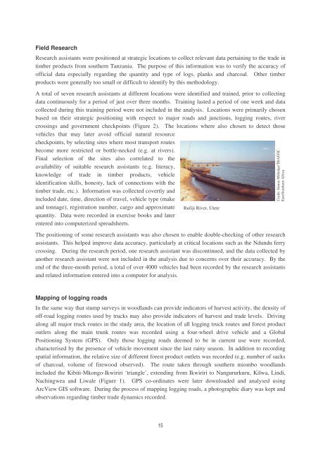
Rufiji River, Utete<br />
The positioning of some research assistants was also chosen to enable double-checking of o<strong>the</strong>r research<br />
assistants. This helped improve data accuracy, particularly at critical locations such as <strong>the</strong> Ndundu ferry<br />
crossing. During <strong>the</strong> research period, one research assistant was discontinued, and <strong>the</strong> data collected by<br />
ano<strong>the</strong>r research assistant were not included in <strong>the</strong> analysis due to concerns over <strong>the</strong>ir accuracy. By <strong>the</strong><br />
end of <strong>the</strong> three-month period, a total of over 4000 vehicles had been recorded by <strong>the</strong> research assistants<br />
and related information entered into a computer for analysis.<br />
Credit: Simon Milledge/TRAFFIC<br />
East/Sou<strong>the</strong>rn Africa<br />
Mapping of logging roads<br />
In <strong>the</strong> same way that stump surveys in woodlands can provide indicators of harvest activity, <strong>the</strong> density of<br />
off-road logging routes used by trucks may also provide indicators of harvest and <strong>trade</strong> levels. Driving<br />
along all major truck routes in <strong>the</strong> study area, <strong>the</strong> location of all logging truck routes and forest product<br />
outlets along <strong>the</strong> main trunk routes was recorded using a four-wheel drive vehicle and a Global<br />
Positioning System (GPS). Only those logging roads deemed to be in current use were recorded,<br />
characterised by <strong>the</strong> presence of vehicle movement since <strong>the</strong> last rainy season. In addition to recording<br />
spatial information, <strong>the</strong> relative size of different forest product outlets was recorded (e.g. number of sacks<br />
of charcoal, volume of firewood observed). The route taken through sou<strong>the</strong>rn miombo woodlands<br />
included <strong>the</strong> Kibiti-Mkongo-Ikwiriri ‘triangle’, extending from Ikwiriri to Nangururkuru, Kilwa, Lindi,<br />
Nachingwea and Liwale (Figure 1). GPS co-ordinates were later downloaded and analysed using<br />
ArcView GIS software. During <strong>the</strong> process of mapping logging roads, a photographic diary was kept and<br />
observations regarding <strong>timber</strong> <strong>trade</strong> dynamics recorded.<br />
15


