maritime history - Gert Jan Bestebreurtje
maritime history - Gert Jan Bestebreurtje
maritime history - Gert Jan Bestebreurtje

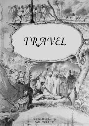
Create successful ePaper yourself
Turn your PDF publications into a flip-book with our unique Google optimized e-Paper software.
585 BAKER, J.N.L. The <strong>history</strong> of geography. Oxford, 1963. Cloth, with dustwrapper.<br />
XXVIII,266 pp. € 30,00<br />
586 BEHRMANN, W. Über die niederdeutschen Seebücher des 15. und 16.<br />
Jahrhunderts. (Hamburg, 1906). Reprint. Amst., 1978. Wrappers. With 4 folding<br />
maps. VI,110 pp. € 18,00<br />
587 BENSAUDE, J. L’astronomie nautique au Portugal a l’époque des grandes<br />
découvertes. (Berne, 1912-17). Réimpression. Amst., 1967. Cloth (sl. soiled). With<br />
illustrations. 301 pp. € 25,00<br />
588 CHUBB, Th. The printed maps in the atlases of Great Britain and Ireland. A<br />
bibliography, 1579-1870. With an introduction by F.P. Sprent. London, 1927. Reprint.<br />
(London), 1966. 4to. Cloth. With many plates. XVII,479 pp. € 150,00<br />
589 DAHLGREN, E.W. Les débuts de la cartographie du Japon. (Uppsala, 1911).<br />
Réimpression. Amst., 1977. Wrappers. With many illustrations. 65 pp. € 15,00<br />
590 ENGELBRECHT, W.A. Schets van de geschiedenis der Nederlandsche cartografie<br />
en van hare beteekenis ook voor andere landen. Rede. (Rott., 1938). 4to.<br />
Wrappers. 26 lvs. € 15,00<br />
591 GOFF, Fr.R. Joseph Sabin, bibliographer (1821-1881). Amst., N. Israel,<br />
(1963). Wrappers. With portrait. 30 pp. € 15,00<br />
592 HARRISSE, H. Découverte et évolution cartographique de Terre-Neuve et des<br />
pays circonvoisins 1497-1501-1769. Paris 1900. Réimpression. Amst., 1968. 4to.<br />
Cloth. With 26 plates, and 165 illustrations. IV,LXXII,416 pp. € 70,00<br />
593 HARRISSE, H. Notes pour servir a l’histoire, a la bibliographie et a la cartographie<br />
de la Nouvelle-France et des pays adjacents 1545-1700. Paris, 1872.<br />
Réimpression. Amst., 1976. Cloth. XXXVI,370 pp. - Important contribution towards<br />
the bibliography and cartography of Canada. € 35,00<br />
594 HASSE, A.R. Reports of explorations printed in the documents of the United<br />
States Government (a contribution toward a bibliography). (Wash., 1899). Reprint.<br />
N.Y., (1969). Cloth. 90 pp. € 30,00<br />
595 HAYES, Derek. Historical atlas of the North Pacific Ocean. Maps of discovery<br />
and scientific exploration 1500-2000. London, the British Museum Press,<br />
(2001). Folio. Boards, with dustwrapper. With many coloured illustrations. 224 pp.<br />
€ 55,00