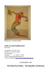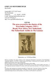
maritime history - Gert Jan Bestebreurtje
maritime history - Gert Jan Bestebreurtje
maritime history - Gert Jan Bestebreurtje

You also want an ePaper? Increase the reach of your titles
YUMPU automatically turns print PDFs into web optimized ePapers that Google loves.
611 MORITZ, E. Die Entwickelung des Kartenbildes der Nord- und Ostseeländer<br />
bis auf Mercator. Mit besonderer Berücksichtigung Deutschlands. (1908).<br />
Nachdruck. Amst., 1967. Cloth. V,84 pp. - Cartography of the North Sea and the<br />
Baltic. € 15,00<br />
612 MULLER, Frederik. Catalogue of books, maps, plates on America, and of a<br />
remarkable collection of early voyages .. presenting an essay towards a Dutch-<br />
American bibliography. (Amst., 1872-75). Reprint. With subject- and personal names<br />
index by G.J. Brouwer. Amst., 1966. 3 volumes in 1. Cloth. With facsimiles. 640 pp. -<br />
Important reference work. € 65,00<br />
613 NEUBAUER, A. La géographie du Talmud. (1868). Réimpression. Amst.,<br />
1965. Wrappers. XL,468 pp. - Geography of Palestine and adjacent and foreign<br />
countries. Hebrew and French indices. € 35,00<br />
614 ORTROY, F. van. Bibliographie de l’oeuvre Mercatorienne. (Paris, 1918-20).<br />
Réimpression. Amst., 1978. Wrappers. 80 pp. € 18,00<br />
615 PARRY, D.E. The cartography of the East Indian Islands. Insulae Indiae<br />
Orientalis. (London), 2005. 4to. Boards, with dustwrapper. With many coloured illustrations.<br />
241 pp. - A comprehensive reference. € 125,00<br />
616 PAULITSCHKE, Ph. Die Afrika-Literatur in der Zeit von 1500 bis 1750<br />
N.Ch. Ein Beitrag zur geographischen Quellenkunde. (1882). Nachdruck. Amst.,<br />
1964. Wrappers. 122 pp. € 45,00<br />
617 PUTMAN, Robert. Oude scheepskaarten en hun makers. Hoogtepunten uit<br />
vijf eeuwen cartografie. (2e druk). (Alphen a/d Rijn, 1983). Folio. Boards, with dustwrapper.<br />
With many coloured charts. 143 pp. € 55,00<br />
618 REISTOGTEN OM DEN AARDKLOOT. Bibliografie van reis- en expeditieverslagen<br />
in het bezit van de Bibliotheek van de Koninklijke Nederlandse<br />
Akademie van Wetenschappen. Amst., 1995. Folio. Wrappers. 269 pp. € 45,00<br />
619 SKELTON, R.A. Explorers’ maps. Chapters in the cartographic record of geographical<br />
discovery. London, (1970). 4to. Boards, with dustwrapper. With numerous<br />
illustrations. XI,337 pp. € 45,00<br />
620 SKELTON, R.A. Decorative printed maps of the 15th to 18th centuries. A<br />
revised edition of Old decorative maps and charts by A.L. Humphreys. London, 1966.<br />
4to. Boards, with dustwrapper. With 84 plates (12 in colour). VIII,80 pp. € 65,00