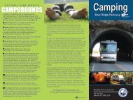
Blue Ridge Park way - Massanutten Resort
Blue Ridge Park way - Massanutten Resort
Blue Ridge Park way - Massanutten Resort

You also want an ePaper? Increase the reach of your titles
YUMPU automatically turns print PDFs into web optimized ePapers that Google loves.
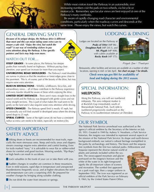
GENERAL DRIVING SAFETY<br />
Because of its unique design, the <strong>Park</strong><strong>way</strong> drive is different<br />
than most and this can mean taking some extra care to<br />
ensure a safe visit. “Enjoy the view, but watch the<br />
road!” is our <strong>way</strong> of reminding visitors to pay<br />
extra attention along the <strong>Park</strong><strong>way</strong>. A few specific<br />
pointers and facts may help even more.<br />
WATCH OUT FOR…<br />
STEEP GRADES – In some places, the <strong>Park</strong><strong>way</strong> has steeper<br />
grades than normally found on high<strong>way</strong>s. Without paying close<br />
attention, your speed can increase far more than you expect.<br />
UNFORGIVING ROAD SHOULDERS – The <strong>Park</strong><strong>way</strong>’s road shoulders<br />
are narrow in places so that the meadows or forest edges grow close to<br />
the pavement. This is, of course, part of the beauty of the drive, but may<br />
require some extra attention.<br />
BUILT-IN DISTRACTIONS – Wildlife, wildflowers, bicyclists, and<br />
extraordinary views… all of these contribute to the <strong>Park</strong><strong>way</strong> experience<br />
and every traveler should be aware of these while enjoying the drive.<br />
LIMITED SIGHT DISTANCES – There aren’t many straight lines in the<br />
natural world and the <strong>Park</strong><strong>way</strong> was designed with gentle curves and not<br />
many straight sections. This is part of what makes the road seem to lie<br />
gently on the land and it also requires some extra attention while driving.<br />
SPEED CHANGES – The <strong>Park</strong><strong>way</strong> speed limit is mostly 45 mph, but<br />
occasionally you will find yourself in developed areas where the driving<br />
speed drops to 25 mph.<br />
SPIRAL CURVES - Some of the tight curves do not have a consistent<br />
radius so extra care needs to be taken, especially on motorcycles.<br />
OTHER IMPORTANT<br />
SAFETY ADVICE<br />
Hiking shoes or boots are recommended for most trails, especially<br />
the more strenuous ones. Steep and rocky areas and slippery<br />
stream crossings require extra attention and careful footing. Even<br />
for trails marked “easy,” it is advisable to wear flat or rubber-soled<br />
shoes for comfort and good traction. Wearing sandals, “flip-flops,”<br />
or high heels can result in accidents.<br />
Lock valuables in the trunk of your car or take them with you.<br />
Sudden changes in weather are common in these mountains.<br />
Even in mild seasons, rapid dips in temperature and unexpected<br />
thunderstorms frequently occur, and at higher elevations the wind<br />
and temperature can carry a surprising chill. Be prepared for<br />
weather changes by bringing along suitable clothing.<br />
6<br />
Do not drink the water from streams or springs.<br />
While most visitors travel the <strong>Park</strong><strong>way</strong> in an automobile, ever<br />
increasing numbers visit the park on two-wheels, via bicycle or<br />
motorcycle. Remember, spectacular views are best enjoyed at one of the<br />
<strong>Park</strong><strong>way</strong>’s many overlooks.<br />
Be aware of rapidly changing road character and environmental<br />
conditions, particularly when the road<strong>way</strong> curves and descends at the<br />
same time. Please enjoy the views, but watch the curves.<br />
Enjoy the<br />
View - Watch<br />
the Road<br />
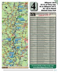
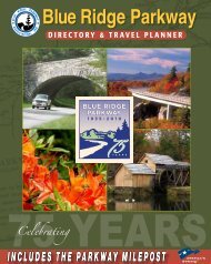
THE PARKWAY MILEPOST<br />
Lodges are located on the <strong>Park</strong><strong>way</strong> at<br />
Peaks of Otter (MP 86) ,<br />
Doughton <strong>Park</strong> (MP 241.1), and<br />
Mt. Pisgah (MP 408),<br />
with cabins available at<br />
Rocky Knob (MP 175).<br />
LODGING & DINING<br />
Pisgah Inn • Treetops<br />
Restaurants, other facilities and services are available at a number of other<br />
locations, opening in mid- or late April. See chart on page 7 for details.<br />
Check www.nps.gov/blri for availability of<br />
food and lodging during the 2012 season.<br />
SPECIAL INFORMATION:<br />
MILEPoSTS:<br />
Along the <strong>Park</strong><strong>way</strong>, you will see numbered<br />
mileposts. The zero milepost marker is<br />
at Rockfish Gap immediately south of<br />
Shenandoah National <strong>Park</strong>. Each mile is<br />
numbered progressively southward on the<br />
<strong>Park</strong><strong>way</strong> to its southernmost entrance at Cherokee.<br />
OUR SYMBOL<br />
The National <strong>Park</strong> Service arrowhead was authorized as the<br />
agency’s official emblem by the Secretary of the Interior on July<br />
20, 1951. Created in 1949 by Aubrey V. Neasham, a <strong>Park</strong> Service<br />
historian, the insignia was intended to represent several aspects of<br />
the mission of the National <strong>Park</strong> Service: Its shape and earth-brown<br />
background embody our nation’s cultural heritage exemplified in<br />
the parks by archaeology and history. The bison and the sequoia<br />
tree (symbols from the first two national parks--Yellowstone and<br />
Sequoia) represent the diverse natural world of<br />
plants and animals included within the system.<br />
The snowcapped mountain and glacier<br />
portrayed on the insignia’s horizon and the<br />
white of the water in its right foreground<br />
signify the all-important values of scenery<br />
and recreation. The symbol first appeared<br />
on a park road sign, then a ranger uniform in<br />
September 1952. The icon was registered as an<br />
official emblem of the <strong>Park</strong> Service on February<br />
9, 1965, by the United States Patent Office.