community-based disaster risk management and the media media kit
community-based disaster risk management and the media media kit
community-based disaster risk management and the media media kit

You also want an ePaper? Increase the reach of your titles
YUMPU automatically turns print PDFs into web optimized ePapers that Google loves.
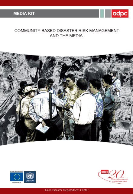
MEDIA KIT<br />
COMMUNITY-BASED DISASTER RISK MANAGEMENT<br />
AND THE MEDIA<br />
Asian Disaster Preparedness Center
The Partnerships for Disaster Reduction - South East Asia Phase 3 (PDRSEA3)<br />
program is jointly implemented by (ADPC) <strong>and</strong> <strong>the</strong> UNESCAP with funding<br />
support from <strong>the</strong> European Commission Humanitarian Aid Department (ECHO)<br />
under its ‘Fourth DIPECHO Action Plan for Sou<strong>the</strong>ast Asia’. The one-year project,<br />
which commenced in February 2005, aims to establish an improved, enabling<br />
environment for CBDRM through promoting ownership in national programs<br />
<strong>and</strong> local entities, enhancing <strong>the</strong> capabilities of CBDRM practitioners <strong>and</strong> <strong>the</strong><br />
expansion of new <strong>and</strong> streng<strong>the</strong>ning of existing partnerships in Sou<strong>the</strong>ast Asia<br />
particularly in <strong>the</strong> target countries Cambodia, Indonesia, Lao PDR, Timor Léste<br />
<strong>and</strong> Vietnam.<br />
The Asian Disaster Preparedness Center (ADPC), established in 1986 is a<br />
regional, inter-governmental, non-profi t organization <strong>and</strong> resource center <strong>based</strong><br />
in Bangkok, Thail<strong>and</strong>. ADPC is m<strong>and</strong>ated to promote safer communities <strong>and</strong><br />
sustainable development through <strong>the</strong> reduction of <strong>the</strong> impact of <strong>disaster</strong>s in<br />
response to <strong>the</strong> needs of countries <strong>and</strong> communities in Asia <strong>and</strong> <strong>the</strong> Pacifi c by<br />
raising awareness, helping to establish <strong>and</strong> streng<strong>the</strong>n sustainable institutional<br />
mechanisms, enhancing knowledge <strong>and</strong> skills, <strong>and</strong> facilitating <strong>the</strong> exchange of<br />
information, experience <strong>and</strong> expertise.<br />
Asian Disaster Preparedness Center (ADPC)<br />
P.O. Box 4, Klong Luang, Pathumthani 12120, Thail<strong>and</strong><br />
Tel.: (66-2) 516-5900 to 5910<br />
Fax: (66-2) 524-5360<br />
E-mail: adpc@adpc.net<br />
Website: www.adpc.net<br />
United Nations Economic <strong>and</strong> Social Commission for Asia <strong>and</strong> Pacifi c is <strong>the</strong><br />
regional arm of <strong>the</strong> United Nations Secretariat for <strong>the</strong> Asian <strong>and</strong> Pacifi c regions,<br />
located in Bangkok, Thail<strong>and</strong>. UNESCAP is committed to materialize <strong>the</strong> visions<br />
of <strong>the</strong> United Nations Millennium Declaration, which was adopted by <strong>the</strong> UN<br />
General Assembly in September 2000. The current PDR-SEA project is being<br />
implemented jointly by UNESCAP <strong>and</strong> ADPC at <strong>the</strong> regional level.<br />
For more information, please contact:<br />
UNESCAP<br />
United Nations Building, Rajadamnern Nok Avenue, Bangkok 10200, Thail<strong>and</strong><br />
Tel.: (66-2) 288-1450<br />
Fax: (66-2) 288-1059<br />
Website: http://www.unescap.org/<br />
The European Commission Humanitarian Aid Department (ECHO) oversees<br />
<strong>and</strong> coordinates <strong>the</strong> European Union’s humanitarian operations in non-member<br />
countries, in partnership with non-governmental organizations, specialized<br />
agencies of <strong>the</strong> United Nations, <strong>and</strong> o<strong>the</strong>r international bodies. DIPECHO is <strong>the</strong><br />
Disaster Preparedness program set up by ECHO in 1996 to prevent <strong>and</strong> prepare<br />
for natural <strong>disaster</strong>s.<br />
For more information, please contact:<br />
European Commission Humanitarian Aid Offi ce<br />
200 rue de la loi B-1049 Brussels, Belgium<br />
Tel.: (32 2) 295 4400<br />
Fax: (32 3) 295 4572<br />
E-mail: echobangkok@ECHO-Bangkok.org
MEDIA KIT<br />
COMMUNITY-BASED<br />
DISASTER RISK MANAGEMENT<br />
AND THE MEDIA<br />
VICKY PUZON-DIOPENES<br />
AND ZUBAIR MURSHED
MEDIA KIT<br />
Media <strong>kit</strong><br />
Community-<strong>based</strong> Disaster Risk Management <strong>and</strong> <strong>the</strong> Media<br />
Published by <strong>the</strong> Asian Disaster Preparedness Center through<br />
its Partnerships for Disaster Reduction - Sou<strong>the</strong>ast Asia Phase 3<br />
(PDRSEA3) Project jointly implemented by ADPC <strong>and</strong> UNESCAP with<br />
funding support from DIPECHO<br />
© ADPC 2006<br />
Bangkok, Thail<strong>and</strong><br />
Authors: Vicky Puzon-Diopenes <strong>and</strong> Zubair Murshed<br />
Design <strong>and</strong> Layout: Lowil fred Espada<br />
For more information on this publication <strong>and</strong> to order a copy, write to:<br />
Vicky Puzon-Diopenes<br />
Information Manager<br />
Partnerships for Disaster Reduction - Sou<strong>the</strong>ast Asia (PDRSEA)<br />
Asian Disaster Preparedness Center<br />
PO Box 4, Klong Luang, Pathumthani 12120, Thail<strong>and</strong><br />
Tel: +66 2 516 5900 to 10, Ext 408<br />
Fax: +66 2 524 5360<br />
Email: vicky@adpc.net<br />
URL: www.adpc.net
preface<br />
20 years of commitment to safer communities <strong>and</strong><br />
sustainable development through <strong>disaster</strong> reduction<br />
The Asian Disaster Preparedness Center celebrates its 20 year anniversary in<br />
2006. I would like to take this opportunity to express my sincere appreciation to<br />
all its partner institutions, national governments, numerous UN organizations<br />
<strong>and</strong> o<strong>the</strong>r international organizations for <strong>the</strong>ir collaboration <strong>and</strong> support to<br />
ADPC during <strong>the</strong> past two decades. The work of all stakeholders in <strong>disaster</strong><br />
<strong>management</strong>, including ADPC staff <strong>and</strong> alumni have contributed to making<br />
communities <strong>and</strong> countries better prepared, safer, <strong>and</strong> more resilient in face<br />
of <strong>disaster</strong>s. ADPC is proud to have been a pioneer in some of <strong>the</strong> signifi cant<br />
changes-in paradigm, concepts, <strong>and</strong> practices paving <strong>the</strong> way to reduction of<br />
<strong>the</strong> impacts of natural <strong>disaster</strong>s.<br />
ADPC was established in 1986 under late Colonel Brian Ward’s illustrious<br />
leadership to address <strong>the</strong> <strong>disaster</strong> <strong>management</strong> needs of countries in<br />
Asia. In its twenty years ADPC responded dynamically to <strong>the</strong> paradigm<br />
shift in <strong>disaster</strong> <strong>management</strong>, readily <strong>and</strong> actively adjusting its operational<br />
strengths to address <strong>the</strong> evolving developments in <strong>disaster</strong> <strong>risk</strong> <strong>management</strong><br />
by structuring its technical focus on climate <strong>risk</strong> <strong>management</strong>, <strong>disaster</strong><br />
<strong>management</strong> systems, urban <strong>disaster</strong> <strong>risk</strong> <strong>management</strong> <strong>and</strong> public health in<br />
emergencies. This vigorous <strong>and</strong> comprehensive approach is fur<strong>the</strong>r reinforced<br />
by ensuring that ADPC’s projects <strong>and</strong> programs enhance institutional<br />
capacities, apply <strong>community</strong>-<strong>based</strong> <strong>disaster</strong> <strong>risk</strong> <strong>management</strong> practices,<br />
i
ii<br />
MEDIA KIT<br />
<strong>and</strong> promote <strong>and</strong> support mainstreaming of <strong>disaster</strong> <strong>management</strong> into<br />
<strong>the</strong> development processes. These activities complement ADPC’s<br />
involvement in building national <strong>and</strong> provincial <strong>disaster</strong> <strong>management</strong><br />
systems, identifying <strong>disaster</strong> <strong>risk</strong> <strong>management</strong> needs, <strong>and</strong> developing<br />
strategic solutions. ADPC’s st<strong>and</strong>ing <strong>and</strong> twenty years of experience<br />
in <strong>the</strong> region is confi rmed by <strong>the</strong> substantive encouragement <strong>and</strong><br />
support from various multi-lateral <strong>and</strong> bi-lateral development <strong>and</strong> donor<br />
agencies; as manifested in <strong>the</strong> implementation of our extensive array of<br />
projects <strong>and</strong> programs.<br />
As it moves forward beyond its twenty years of operations, ADPC will<br />
continue to build upon its operational <strong>and</strong> technical strengths <strong>and</strong> to<br />
evolve in its role as a regional resource center, <strong>and</strong> to act as a regional<br />
early warning center. ADPC will fur<strong>the</strong>r pursue operational partnerships<br />
<strong>and</strong> collaborations with all stakeholders in <strong>disaster</strong> <strong>risk</strong> <strong>management</strong><br />
into sustainable development policies <strong>and</strong> practices throughout <strong>the</strong><br />
Asia <strong>and</strong> Pacifi c regions.<br />
In closing, permit me to express my gratitude to our staff <strong>and</strong> consultants<br />
who have shared commitment, dedication <strong>and</strong> loyalty to ADPC’s goals<br />
<strong>and</strong> mission.<br />
As its Executive Director, it is my honor to be part of this fi ne organization.<br />
I am confi dent that ADPC will continue to be responsive to <strong>the</strong> priorities<br />
of our key stakeholders in governments <strong>and</strong> <strong>the</strong> international <strong>community</strong><br />
overcoming challenges to serve <strong>the</strong> region <strong>and</strong> beyond.<br />
Message from Dr. Suvit Yodmani<br />
Executive Director, Asian Disaster Preparedness Center
i Preface<br />
iii Contents<br />
viii Acknowledgments<br />
01 Introduction<br />
contents<br />
contents<br />
part one.<br />
KEY CONCEPTS ON DISASTER AND MEDIA<br />
chapter 1. introduction to <strong>disaster</strong> <strong>risk</strong><br />
<strong>management</strong><br />
06 Impact of Disasters<br />
07 Impact to Environment<br />
07 Impact to Public Health<br />
07 Economic, Social <strong>and</strong> Political Impacts<br />
08 Disaster Risk Management<br />
09 Disaster Risk Management Process<br />
10 Phases of Disaster Risk Management<br />
12 The Hyogo Framework for Action from<br />
2005-15<br />
iii
iv<br />
MEDIA KIT<br />
15 Community-<strong>based</strong> Disaster Risk<br />
Management (CBDRM)<br />
15 Philosophy<br />
16 Actors<br />
17 Aim of <strong>the</strong> CBDRM Approach<br />
17 Features of <strong>the</strong> CBDRM Approach<br />
18 Defi nitions<br />
chapter 2. <strong>media</strong> <strong>and</strong> <strong>disaster</strong> <strong>risk</strong><br />
<strong>management</strong><br />
22 The Role of Media in Disaster Risk<br />
Management<br />
23 Disaster Risk Communication <strong>and</strong> <strong>the</strong><br />
Media<br />
24 The Role of <strong>the</strong> Media BEFORE a<br />
Disaster (Pre-Disaster Phase)<br />
26 The Role of <strong>the</strong> Media DURING a<br />
Disaster (Crisis Phase)<br />
28 The Role of <strong>the</strong> Media AFTER a Disaster<br />
(Post-Disaster Phase)<br />
29 Media Strategies<br />
30 Most Frequently Asked Questions During<br />
Disasters<br />
31 Guidelines for <strong>the</strong> Media on <strong>the</strong><br />
Development of Messages for Public<br />
Awareness<br />
32 Ethical Guidelines for <strong>the</strong> Media in<br />
Disaster Reporting<br />
34 Application of Ethical Practices to<br />
Disaster/Crisis Reporting<br />
chapter 3. useful information for <strong>the</strong><br />
<strong>media</strong><br />
37 Introduction<br />
37 Early Warning <strong>and</strong> Preparedness
contents<br />
38 Community-<strong>based</strong> FLOOD<br />
Preparedness<br />
40 Types of Floods<br />
41 Flood Dangers<br />
41 Flood Warnings<br />
43 Flood Survival Tips<br />
49 Community-<strong>based</strong> FIRE Preparedness<br />
49 Causes of Forest Fires<br />
52 Fires at Home<br />
55 O<strong>the</strong>r Fire Hazards in <strong>the</strong> Home<br />
56 Home Fire Escape Plan<br />
57 Fire Survival Tips<br />
61 Community-<strong>based</strong> LANDSLIDE<br />
Preparedness<br />
61 Causes of L<strong>and</strong>slides<br />
63 Direct Impacts of L<strong>and</strong>slides<br />
63 Indirect Impacts of L<strong>and</strong>slides<br />
64 Indicators of L<strong>and</strong>slide Phenomenon<br />
67 General Advice<br />
71 Community-<strong>based</strong> TYPHOON<br />
Preparedness<br />
71 Classifi cations of Tropical Cyclones<br />
74 Typhoon Preparedness<br />
76 When Typhoon Warnings are Issued<br />
82 Community-<strong>based</strong> DROUGHT<br />
Preparedness<br />
82 Types of Drought<br />
84 Causes of Drought<br />
84 Impacts of Drought<br />
86 Drought Preparedness<br />
v
vi<br />
MEDIA KIT<br />
89 Community-<strong>based</strong> EARTHQUAKE<br />
Preparedness<br />
92 What are <strong>the</strong> Recommended Protection<br />
Against Earthquakes?<br />
97 Community-<strong>based</strong> TSUNAMI<br />
Preparedness<br />
part two.<br />
COUNTRY RESOURCES<br />
chapter 4. country hazard <strong>and</strong><br />
vulnerability profi les<br />
108 Cambodia<br />
108 Brief Hazard Profi le<br />
111 Cambodia Hazard Calendar<br />
112 Indonesia<br />
112 Brief Hazard Profi le<br />
114 Indonesia Hazard Risk Hotspots<br />
116 Seismic Hazard Map of Indonesia<br />
117 Lao PDR<br />
117 Brief Hazard Profi le<br />
118 Lao PDR Hazard Calendar<br />
121 Timor Léste<br />
121 Brief Hazard Profi le<br />
124 Timor Leste Hazard Impact Matrix<br />
125 Vietnam<br />
125 Brief Hazard Profi le<br />
127 Vietnam Hazards Calendar<br />
chapter 5. country CBDRM case studies<br />
Cambodia<br />
128 CASE STUDY 1. A Flood Preparedness<br />
Experience in Cambodia
contents<br />
133 CASE STUDY 2. Coping with Flood <strong>and</strong><br />
Mitigating Flood Risk in<br />
Cambodian Communities<br />
Indonesia<br />
137 CASE STUDY 1. Preparedness in Disaster<br />
Management in Indonesia<br />
140 CASE STUDY 2. Streng<strong>the</strong>ning Community<br />
Resilience in Crisis through<br />
NEAR<br />
Lao PDR<br />
143 CASE STUDY 1. Reducing Fire Threats<br />
to Homes: Piloting<br />
Community<strong>based</strong> Fire Risk<br />
Assessment in Ban Hatsady<br />
Village<br />
147 CASE STUDY 2. Disaster Preparedness<br />
Program (DPP) in Lao PDR<br />
Timor Léste<br />
150 CASE STUDY 1. Capacity Building for<br />
Disaster Risk Reduction in<br />
Lautem District<br />
152 CASE STUDY 2. The Nature <strong>and</strong> Practice of<br />
CBDRM in East Timor<br />
Vietnam<br />
159 CASE STUDY 1. Development Workshop<br />
France Initiatives in Thanh<br />
Thuy Chanh Village<br />
161 CASE STUDY 2. Planting Mangrove Saves<br />
Lives <strong>and</strong> Money in Vietnam<br />
chapter 6. resources<br />
163 National Resources<br />
180 Regional Resources<br />
184 Sources<br />
vii
introduction<br />
of <strong>the</strong> Hyogo Framework for Action 2005-2015, produced in <strong>the</strong><br />
WCDR, <strong>the</strong> ADPC, UNESCAP <strong>and</strong> DIPECHO have decided to work<br />
with <strong>the</strong> <strong>media</strong> in fi ve Sou<strong>the</strong>ast Asian countries, i.e. Cambodia, Timor<br />
Léste, Indonesia, Lao PDR <strong>and</strong> Vietnam. The purpose of this initiative<br />
is to orient <strong>the</strong> <strong>media</strong> about its role in <strong>disaster</strong> <strong>risk</strong> <strong>management</strong> <strong>and</strong><br />
particularly on how <strong>media</strong> can enable <strong>the</strong> at-<strong>risk</strong> communities to reduce<br />
<strong>disaster</strong> <strong>risk</strong>s, cope with <strong>disaster</strong>s <strong>and</strong> recover from <strong>the</strong>ir impact. Under<br />
this initiative, National Orientation Workshops for <strong>the</strong> Media were<br />
organized in <strong>the</strong> fi ve countries during 2005. The National Orientation<br />
Workshop for <strong>the</strong> Media had <strong>the</strong> following objectives:<br />
• To orient <strong>media</strong> people on <strong>community</strong>-<strong>based</strong> <strong>disaster</strong> <strong>risk</strong><br />
<strong>management</strong> practices; <strong>and</strong><br />
• To develop strategies for <strong>the</strong> involvement of <strong>media</strong> in supporting<br />
<strong>community</strong> action for <strong>disaster</strong> <strong>risk</strong> <strong>management</strong>.<br />
This Media Kit has been developed as a guide for <strong>media</strong> professionals<br />
in <strong>the</strong> fi ve countries: i) as a H<strong>and</strong>out for <strong>the</strong> National Orientation<br />
Workshop for Media; ii) to raise <strong>the</strong> awareness of <strong>media</strong> about its role<br />
in <strong>disaster</strong> <strong>risk</strong> reduction; <strong>and</strong> iii) to enable <strong>the</strong>m to perform that role<br />
in an effective manner. The H<strong>and</strong>book is comprised of two parts. Part<br />
one explains <strong>the</strong> key concepts of <strong>disaster</strong> <strong>and</strong> <strong>media</strong>, CBDRM, <strong>the</strong><br />
role of <strong>media</strong> in <strong>disaster</strong> <strong>risk</strong> <strong>management</strong>, <strong>and</strong> useful information for<br />
<strong>the</strong> <strong>media</strong> on <strong>disaster</strong> preparedness. Part two includes country-<strong>based</strong><br />
resources such as hazard profi les, case studies on CBDRM, <strong>and</strong><br />
contact information of national <strong>and</strong> regional organizations engaged in<br />
<strong>disaster</strong> <strong>risk</strong> <strong>management</strong>.<br />
We hope that you will fi nd this information useful <strong>and</strong> that it will contribute<br />
towards <strong>disaster</strong> <strong>risk</strong> reduction in your country.<br />
3
introduction<br />
introduction<br />
Every now <strong>and</strong> <strong>the</strong>n <strong>disaster</strong>s cause huge loss of life <strong>and</strong> property <strong>and</strong><br />
<strong>the</strong>y damage <strong>the</strong> environment in <strong>the</strong> countries of South East Asia, e.g.<br />
Cambodia, Timor Léste, Indonesia, Lao PDR <strong>and</strong> Vietnam. Disasters<br />
affect negatively <strong>the</strong> sustainable development in <strong>the</strong> affected societies<br />
<strong>and</strong> countries. Disasters are caused by hazards which impact upon<br />
vulnerable people, infrastructure, assets <strong>and</strong> environment. Some of <strong>the</strong><br />
common hazards experienced in <strong>the</strong> region include typhoons, fl oods,<br />
drought, forest fi res, l<strong>and</strong>slide, earthquakes <strong>and</strong> tsunami. We can avoid<br />
<strong>and</strong> reduce losses from <strong>disaster</strong>s, by ei<strong>the</strong>r mitigating <strong>the</strong> hazards or<br />
reducing <strong>the</strong> vulnerabilities of <strong>the</strong> people living in hazard prone areas.<br />
The process of <strong>disaster</strong> <strong>risk</strong> reduction involves identifi cation of hazards/<br />
vulnerabilities, analyzing <strong>the</strong>ir potential impact, identifying priorities for<br />
<strong>risk</strong> reduction <strong>and</strong> identifi cation <strong>and</strong> implementation of solutions.<br />
In order to reduce <strong>risk</strong>s to <strong>disaster</strong>s everybody needs to get involved.<br />
This includes government departments, scientifi c organizations,<br />
research institutions, NGOs, United Nations agencies, donor agencies,<br />
<strong>the</strong> <strong>media</strong>, <strong>and</strong> <strong>the</strong> private sector. The role of at-<strong>risk</strong> communities <strong>and</strong><br />
groups is most important in reducing <strong>the</strong> <strong>risk</strong>s of <strong>disaster</strong>s. All of <strong>the</strong><br />
above stakeholders have different perceptions about <strong>the</strong> nature of <strong>risk</strong>s,<br />
priorities for <strong>risk</strong> reduction <strong>and</strong> <strong>the</strong> appropriate solutions. Therefore,<br />
1
2<br />
MEDIA KIT<br />
extensive communication amongst <strong>the</strong> multiple stakeholders is required<br />
in order to underst<strong>and</strong> each o<strong>the</strong>r’s opinions <strong>and</strong> identify solutions that<br />
are acceptable to each o<strong>the</strong>r.<br />
The role of at-<strong>risk</strong> communities is highly important in this whole process<br />
because ultimately a large number of solutions will be implemented<br />
at <strong>the</strong> family <strong>and</strong> <strong>community</strong> level by <strong>the</strong> local people. Therefore, any<br />
solutions implemented without <strong>the</strong> participation <strong>and</strong> involvement of<br />
<strong>the</strong> at-<strong>risk</strong> communities ei<strong>the</strong>r may not be relevant or not suffi cient to<br />
reduce <strong>disaster</strong> <strong>risk</strong>s effectively. The experiences in <strong>the</strong> Asian region<br />
show that <strong>the</strong> at-<strong>risk</strong> communities have many capacities to reduce <strong>risk</strong>s<br />
<strong>and</strong> cope with <strong>disaster</strong>s when <strong>the</strong>y occur. However, it is important to<br />
enhance <strong>the</strong>ir capacities fur<strong>the</strong>r to enable <strong>the</strong>m to effectively cope with<br />
<strong>the</strong> <strong>disaster</strong> problem.<br />
Historically, <strong>the</strong> <strong>media</strong> has been playing an active role in <strong>disaster</strong><br />
situations. Whenever a <strong>disaster</strong> occurs, <strong>the</strong> <strong>media</strong> has to cover it<br />
to provide information about what happened, what authorities <strong>and</strong><br />
international aid organizations are doing to respond <strong>and</strong> how effective<br />
<strong>the</strong> response is. The <strong>media</strong> also has been playing an important part<br />
in communicating early warning to at-<strong>risk</strong> communities. Recently <strong>the</strong><br />
role of <strong>the</strong> <strong>media</strong> is being recognized in o<strong>the</strong>r phases of <strong>the</strong> <strong>disaster</strong><br />
cycle as well, e.g. <strong>the</strong> Pre-Disaster Phase <strong>and</strong> <strong>the</strong> Rehabilitation <strong>and</strong><br />
Reconstruction Phase, aside from <strong>the</strong> During-Disaster Phase, in which<br />
<strong>the</strong> <strong>media</strong> is already an active player.<br />
Now <strong>the</strong> governments, United Nations, donor agencies, <strong>and</strong> development<br />
NGOs have recognized that <strong>the</strong> <strong>media</strong> can assist in reducing <strong>disaster</strong><br />
<strong>risk</strong>s. The <strong>media</strong> plays an important role in providing analysis on<br />
<strong>disaster</strong> <strong>risk</strong>s <strong>and</strong> vulnerabilities, in facilitating communication amongst<br />
multiple stakeholders, in highlighting <strong>the</strong> need for longer term actions<br />
to reduce <strong>risk</strong>s, <strong>and</strong> particularly in increasing awareness of <strong>the</strong> at-<strong>risk</strong><br />
communities on <strong>disaster</strong> preparedness. Thus Media can perform a very<br />
important function of facilitating communication amongst <strong>the</strong> different<br />
stakeholders in general, as well as raising awareness of <strong>the</strong> at-<strong>risk</strong><br />
communities.<br />
This role of <strong>the</strong> <strong>media</strong> was acknowledged in <strong>the</strong> World Conference on<br />
Disaster Reduction (WCDR) that was held in Kobe, Japan at <strong>the</strong> initiative<br />
of <strong>the</strong> United Nations in January 2005. In line with <strong>the</strong> recommendations
introduction<br />
of <strong>the</strong> Hyogo Framework for Action 2005-2015, produced in <strong>the</strong><br />
WCDR, <strong>the</strong> ADPC, UNESCAP <strong>and</strong> DIPECHO have decided to work<br />
with <strong>the</strong> <strong>media</strong> in fi ve Sou<strong>the</strong>ast Asian countries, i.e. Cambodia, Timor<br />
Léste, Indonesia, Lao PDR <strong>and</strong> Vietnam. The purpose of this initiative<br />
is to orient <strong>the</strong> <strong>media</strong> about its role in <strong>disaster</strong> <strong>risk</strong> <strong>management</strong> <strong>and</strong><br />
particularly on how <strong>media</strong> can enable <strong>the</strong> at-<strong>risk</strong> communities to reduce<br />
<strong>disaster</strong> <strong>risk</strong>s, cope with <strong>disaster</strong>s <strong>and</strong> recover from <strong>the</strong>ir impact. Under<br />
this initiative, National Orientation Workshops for <strong>the</strong> Media were<br />
organized in <strong>the</strong> fi ve countries during 2005. The National Orientation<br />
Workshop for <strong>the</strong> Media had <strong>the</strong> following objectives:<br />
• To orient <strong>media</strong> people on <strong>community</strong>-<strong>based</strong> <strong>disaster</strong> <strong>risk</strong><br />
<strong>management</strong> practices; <strong>and</strong><br />
• To develop strategies for <strong>the</strong> involvement of <strong>media</strong> in supporting<br />
<strong>community</strong> action for <strong>disaster</strong> <strong>risk</strong> <strong>management</strong>.<br />
This Media Kit has been developed as a guide for <strong>media</strong> professionals<br />
in <strong>the</strong> fi ve countries: i) as a H<strong>and</strong>out for <strong>the</strong> National Orientation<br />
Workshop for Media; ii) to raise <strong>the</strong> awareness of <strong>media</strong> about its role<br />
in <strong>disaster</strong> <strong>risk</strong> reduction; <strong>and</strong> iii) to enable <strong>the</strong>m to perform that role<br />
in an effective manner. The H<strong>and</strong>book is comprised of two parts. Part<br />
one explains <strong>the</strong> key concepts of <strong>disaster</strong> <strong>and</strong> <strong>media</strong>, CBDRM, <strong>the</strong><br />
role of <strong>media</strong> in <strong>disaster</strong> <strong>risk</strong> <strong>management</strong>, <strong>and</strong> useful information for<br />
<strong>the</strong> <strong>media</strong> on <strong>disaster</strong> preparedness. Part two includes country-<strong>based</strong><br />
resources such as hazard profi les, case studies on CBDRM, <strong>and</strong><br />
contact information of national <strong>and</strong> regional organizations engaged in<br />
<strong>disaster</strong> <strong>risk</strong> <strong>management</strong>.<br />
We hope that you will fi nd this information useful <strong>and</strong> that it will contribute<br />
towards <strong>disaster</strong> <strong>risk</strong> reduction in your country.<br />
3
part one
KEY CONCEPTS ON<br />
DISASTER AND MEDIA
6<br />
MEDIA KIT<br />
Disasters<br />
chapter 1<br />
introduction to<br />
<strong>disaster</strong> <strong>risk</strong> <strong>management</strong><br />
Disasters threaten life <strong>and</strong> livelihood. According to a United Nations<br />
report (Reducing Disaster Risk: A Challenge for Development, UNDP,<br />
2004), one-million fi ve hundred thous<strong>and</strong> people died between 1980<br />
<strong>and</strong> 2000 due to <strong>disaster</strong>s caused by earthquakes, volcanoes, storms<br />
<strong>and</strong> severe drought. Thous<strong>and</strong>s of people in more than 100 countries<br />
are periodically exposed to at least one event of earthquake, tropical<br />
cyclone, fl ood or drought. As a result of <strong>disaster</strong>s triggered by <strong>the</strong>se<br />
natural hazards, more than 184 deaths per day are recorded in different<br />
parts of <strong>the</strong> world.<br />
In general terms, typical impacts or effects of <strong>disaster</strong>s tend to be:<br />
• Loss of life<br />
• Injury<br />
• Damage to <strong>and</strong> destruction of property<br />
• Damage to <strong>and</strong> destruction of subsistence <strong>and</strong> cash crops<br />
• Disruption of production<br />
• Disruption of lifestyle<br />
• Loss of livelihoods<br />
• Disruption of essential services
chapter 1. introduction to <strong>disaster</strong> <strong>risk</strong> <strong>management</strong><br />
• Damage to national infrastructure <strong>and</strong> disruption to governmental<br />
systems<br />
• National economic loss<br />
• Sociological <strong>and</strong> psychological after-effects<br />
Impact to Environment<br />
Disasters impact <strong>the</strong> environment in a number of ways: e.g. destruction<br />
to infrastructure (homes, buildings); decreased quantity <strong>and</strong> quality<br />
of water supply; destruction of agricultural crops <strong>and</strong> food stocks;<br />
increased mortality of livestock, wildlife <strong>and</strong> marine species <strong>and</strong> damage<br />
to <strong>the</strong>ir habitats; <strong>and</strong> <strong>the</strong> presence of unburied human bodies or animal<br />
carcasses. These impacts vary from <strong>disaster</strong> to <strong>disaster</strong>.<br />
Impact to Public Health<br />
The sudden onsets of <strong>disaster</strong>s cause not only widespread death but<br />
also injuries, outbreaks of epidemic disease <strong>and</strong> famine. Different types<br />
of <strong>disaster</strong> have different effects on health. Post-<strong>disaster</strong> potential<br />
health <strong>risk</strong>s do not occur at <strong>the</strong> same time. Instead, <strong>the</strong>y tend to arise<br />
at different times. Casualties occur mainly at <strong>the</strong> time <strong>and</strong> place of<br />
impact <strong>and</strong> require im<strong>media</strong>te medical care. Earthquakes regularly<br />
cause many injuries requiring medical care, while fl oods, storm<br />
surges <strong>and</strong> tsunamis cause relatively fewer injuries but may cause<br />
secondary effects such as an epidemic due to population movement<br />
<strong>and</strong> environmental changes. However, <strong>the</strong> <strong>risk</strong>s of increased disease<br />
transmission take longer to develop <strong>and</strong> are greatest where <strong>the</strong>re is<br />
crowding <strong>and</strong> reduced st<strong>and</strong>ards of sanitation.<br />
Economic, Social <strong>and</strong> Political Impacts<br />
Disasters disrupt economies. After a <strong>disaster</strong>, normal economic activities<br />
are severely curtailed; people must leave <strong>the</strong>ir jobs <strong>and</strong> devote <strong>the</strong>ir time<br />
to <strong>disaster</strong>-related activities, such as evacuation, search <strong>and</strong> rescue, or<br />
to <strong>the</strong> care of survivors <strong>and</strong> victims. Most often, in poor communities,<br />
whole livelihoods <strong>and</strong> houses are destroyed, <strong>and</strong> <strong>the</strong> basic necessities<br />
like food <strong>and</strong> shelter will be lacking. Oftentimes, for poor households,<br />
<strong>disaster</strong>s bring about more poverty. On a larger scale, whe<strong>the</strong>r or not<br />
an economy can recover quickly depends on <strong>the</strong> losses sustained.<br />
7
8<br />
MEDIA KIT<br />
Disaster Risk Management<br />
Sustainable development rests on <strong>the</strong> successful integration of <strong>disaster</strong><br />
<strong>risk</strong> <strong>management</strong> into <strong>community</strong> <strong>and</strong> development planning to reduce<br />
<strong>risk</strong> <strong>and</strong> <strong>the</strong> impact of <strong>disaster</strong>s.<br />
Disaster <strong>risk</strong> <strong>management</strong> aims to reduce or avoid <strong>the</strong> potential losses<br />
<strong>and</strong> damages brought about by hazards, assure prompt <strong>and</strong> appropriate<br />
assistance to victims of <strong>disaster</strong>, <strong>and</strong> achieve rapid <strong>and</strong> effective<br />
recovery. This includes an ongoing process by which governments,<br />
businesses, communities, <strong>and</strong> civil society plan for <strong>and</strong> reduce <strong>the</strong><br />
impact of <strong>disaster</strong>s, react during <strong>and</strong> im<strong>media</strong>tely following a <strong>disaster</strong>,<br />
<strong>and</strong> take steps to recover after a <strong>disaster</strong> has occurred.<br />
Appropriate actions at all points are needed to enhance greater<br />
preparedness, better warnings, reduce vulnerability <strong>and</strong> <strong>the</strong> prevention<br />
of <strong>disaster</strong>s. The process should also include <strong>the</strong> shaping of public<br />
policies <strong>and</strong> plans that mitigate <strong>the</strong> effects of <strong>disaster</strong>s on people,<br />
property, <strong>and</strong> infrastructure. The mitigation <strong>and</strong> preparedness phases<br />
occur as <strong>disaster</strong> <strong>management</strong> improvements are made in anticipation<br />
of a <strong>disaster</strong> event. Developmental considerations play a key role<br />
in contributing to <strong>the</strong> mitigation <strong>and</strong> preparation of a <strong>community</strong> to<br />
effectively confront a <strong>disaster</strong>. As a <strong>disaster</strong> occurs, <strong>disaster</strong> <strong>risk</strong><br />
<strong>management</strong> actors, in particular humanitarian organizations, become<br />
involved in <strong>the</strong> im<strong>media</strong>te response <strong>and</strong> long-term recovery.<br />
Disaster Risk Management Process<br />
The <strong>disaster</strong> <strong>risk</strong> <strong>management</strong> process is comprised of fi ve steps: <strong>risk</strong><br />
identifi cation, <strong>risk</strong> analysis, prioritization of <strong>risk</strong>s, treatment of <strong>risk</strong>s, <strong>and</strong><br />
monitoring <strong>and</strong> evaluation.<br />
Risk Identifi cation<br />
This step seeks to identify <strong>the</strong> hazards <strong>and</strong> <strong>the</strong> potential threats <strong>the</strong>y may<br />
pose. Comprehensive identifi cation using a well-structured systematic<br />
process is critical, because a <strong>risk</strong> that is not identifi ed at this stage may<br />
be excluded from fur<strong>the</strong>r analysis. The aim of <strong>risk</strong> identifi cation is to<br />
develop a comprehensive list of sources of <strong>risk</strong>s <strong>and</strong> events that might<br />
have an impact on <strong>the</strong> <strong>community</strong>. The list should be comprehensive<br />
as unidentifi ed <strong>risk</strong>s can pose a major threat to <strong>the</strong> <strong>community</strong>. Having
chapter 1. introduction to <strong>disaster</strong> <strong>risk</strong> <strong>management</strong><br />
identifi ed <strong>the</strong> possible <strong>risk</strong>s, it is necessary to consider possible causes<br />
<strong>and</strong> scenarios, as <strong>the</strong>re are many ways an event can occur. Approaches<br />
used to identify <strong>risk</strong>s include checklists, judgments <strong>based</strong> on experience<br />
<strong>and</strong> records, fl ow charts, brainstorming, systems analysis, scenario<br />
analysis <strong>and</strong> system engineering techniques.<br />
Risk Analysis<br />
Risk analysis aims to establish an underst<strong>and</strong>ing of <strong>the</strong> level of <strong>risk</strong> <strong>and</strong><br />
its nature. It involves consideration of <strong>the</strong> sources of <strong>risk</strong>, <strong>the</strong>ir positive<br />
<strong>and</strong> negative consequences <strong>and</strong> <strong>the</strong> likelihood that those consequences<br />
may occur. Factors that affect consequences <strong>and</strong> likelihood may be<br />
identifi ed. Risk is analyzed by combining consequences <strong>and</strong> <strong>the</strong>ir<br />
likelihood. Identify <strong>the</strong> existing processes, devices or practices that<br />
act to minimize negative <strong>risk</strong>s or enhance positive <strong>risk</strong>s <strong>and</strong> assess<br />
<strong>the</strong>ir strength <strong>and</strong> weaknesses. The magnitude of consequences of an<br />
event, should it occur, <strong>and</strong> <strong>the</strong> likelihood of <strong>the</strong> event <strong>and</strong> its associated<br />
consequences, are assessed. These will be considered in <strong>the</strong> context<br />
of <strong>the</strong> existing strategies <strong>and</strong> controls. Consequences <strong>and</strong> likelihood<br />
are combined to produce a level of <strong>risk</strong>.<br />
Risk Prioritization<br />
The purpose of <strong>risk</strong> prioritization is to analyze <strong>and</strong> identify priority areas<br />
for action. Decisions may include whe<strong>the</strong>r a <strong>risk</strong> needs treatment,<br />
whe<strong>the</strong>r an activity should be undertaken, <strong>and</strong> what should be <strong>the</strong><br />
priorities for treatment. Decisions would be <strong>based</strong> on <strong>the</strong> level of <strong>risk</strong>,<br />
specifi ed consequences, <strong>the</strong> likelihood of specifi ed events or outcomes,<br />
<strong>and</strong> <strong>the</strong> overall effect of multiple events. In some circumstances, <strong>the</strong><br />
<strong>risk</strong> prioritization may lead to a decision to undertake fur<strong>the</strong>r analysis.<br />
Risk Treatment<br />
Risk prioritization provides a list of <strong>risk</strong>s requiring treatment. Risk<br />
treatment involves identifying strategies for treating <strong>the</strong>se <strong>risk</strong>s,<br />
evaluating those options, preparing treatment plans <strong>and</strong> implementing<br />
<strong>the</strong>m. Before appropriate treatment actions can be determined, <strong>the</strong><br />
analysis of each <strong>risk</strong> may need to be revisited <strong>and</strong> extended to draw<br />
out <strong>the</strong> information needed to identify <strong>and</strong> explore different treatment<br />
options. It is particularly important to identify <strong>the</strong> causes of <strong>the</strong> <strong>risk</strong>s so<br />
<strong>the</strong>se are treated <strong>and</strong> not just <strong>the</strong> symptoms. Risk treatment may itself<br />
introduce new <strong>risk</strong>s that need to be identifi ed, assessed, treated <strong>and</strong><br />
monitored.<br />
9
10<br />
MEDIA KIT<br />
Monitoring <strong>and</strong> Evaluation<br />
Monitoring is conducted to supervise <strong>the</strong> progress on implementation<br />
of <strong>the</strong> <strong>disaster</strong> <strong>risk</strong> <strong>management</strong> process. Evaluation is organized<br />
to periodically investigate <strong>the</strong> progress <strong>and</strong> analyze its impact <strong>and</strong><br />
achievements. Monitoring <strong>and</strong> evaluation is an essential <strong>and</strong> integral<br />
part of managing <strong>risk</strong>, <strong>and</strong> is one of <strong>the</strong> most important steps of <strong>the</strong> <strong>risk</strong><br />
<strong>management</strong> process. It is necessary to monitor <strong>risk</strong>s, <strong>the</strong> effectiveness<br />
<strong>and</strong> appropriateness of <strong>the</strong> strategies <strong>and</strong> <strong>management</strong> systems set<br />
up to implement <strong>risk</strong> treatments <strong>and</strong> <strong>the</strong> <strong>risk</strong> <strong>management</strong> plans as a<br />
whole. This process should be continuous <strong>and</strong> dynamic.<br />
Phases of Disaster Risk Management<br />
Disaster <strong>risk</strong> <strong>management</strong> includes <strong>the</strong> following phases:<br />
• Prevention - Preventing or avoiding <strong>the</strong> adverse impact of hazards.<br />
Examples: prevention programs (dyke construction, controlled<br />
burning)<br />
• Mitigation - Minimizing or reducing <strong>the</strong> impacts of <strong>disaster</strong>.<br />
Examples: building codes <strong>and</strong> zoning, vulnerability analyses, public<br />
education<br />
• Preparedness - Planning how to respond.<br />
Examples: preparedness plans, emergency exercises/training,<br />
warning systems<br />
• Response - Efforts to minimize <strong>the</strong> hazards created by a <strong>disaster</strong>.<br />
Examples: search <strong>and</strong> rescue, emergency relief<br />
• Recovery - Returning <strong>the</strong> <strong>community</strong> to an acceptable level of living.<br />
Examples: temporary housing, grants, medical care<br />
Prevention<br />
Prevention activities aim to reduce <strong>the</strong> probability of <strong>disaster</strong> occurrence<br />
through measures meant to avoid its adverse effects. In many <strong>disaster</strong>prone<br />
countries, <strong>the</strong> severity of <strong>disaster</strong>s vary from year to year, but <strong>the</strong><br />
<strong>disaster</strong>s are seasonal <strong>and</strong> to that extent predictable. In those instances,<br />
technologies may be present or must be sought to address <strong>the</strong> issue<br />
of <strong>disaster</strong> prevention. These technologies exist for seasonal <strong>and</strong><br />
predictable <strong>disaster</strong>s such as typhoons, hurricane, <strong>and</strong> fl oods. Examples<br />
of such technologies are wind-resistant housing technologies to prevent<br />
typhoon damage; <strong>and</strong> dyke, dam <strong>and</strong> embankment construction to<br />
prevent <strong>and</strong> control fl ood. Disasters covering large areas that involve<br />
heavy environmental degradation are quite challenging to prevent.
chapter 1. introduction to <strong>disaster</strong> <strong>risk</strong> <strong>management</strong><br />
Mitigation<br />
Mitigation activities aim to reduce <strong>the</strong> impacts or effects of unavoidable<br />
<strong>disaster</strong>s. Mitigation measures include building codes, vulnerability<br />
analyses updates, zoning <strong>and</strong> l<strong>and</strong> use <strong>management</strong>, building use<br />
regulations <strong>and</strong> safety codes, preventive health care, <strong>and</strong> public<br />
awareness <strong>and</strong> education.<br />
Some specifi c examples of mitigation activities:<br />
• Streng<strong>the</strong>ning buildings or incorporation of hazard resistance in<br />
structures to render <strong>the</strong>m more resistant against typhoons, fl oods,<br />
<strong>and</strong> earthquakes<br />
• Changing agricultural crop cycles so that it matures <strong>and</strong> are<br />
harvested before fl ood or typhoon season<br />
• Restriction of activities in high-<strong>risk</strong> areas<br />
• Economic diversifi cation to allow losses in one sector to be offset by<br />
increased output in o<strong>the</strong>r areas<br />
Both Mitigation <strong>and</strong> Prevention depend on <strong>the</strong> incorporation of<br />
appropriate measures in national, regional, <strong>and</strong> <strong>community</strong> development<br />
planning. Its effectiveness also depends on <strong>the</strong> availability of information<br />
on hazards, emerging <strong>risk</strong>s, <strong>and</strong> <strong>the</strong> counter measures to be taken. It<br />
also includes <strong>the</strong> shaping of public policies <strong>and</strong> plans that ei<strong>the</strong>r modify<br />
<strong>the</strong> causes of <strong>disaster</strong>s or mitigate <strong>the</strong>ir effects on people, property,<br />
<strong>and</strong> infrastructure.<br />
Preparedness<br />
The goal of <strong>disaster</strong> preparedness is to achieve a satisfactory level of<br />
readiness to respond to any <strong>disaster</strong> in order to save lives, minimize<br />
<strong>disaster</strong> damage, <strong>and</strong> enhance <strong>disaster</strong> response operations.<br />
Preparedness includes planning exercises that streng<strong>the</strong>n <strong>the</strong> capacity<br />
of governments, organizations, <strong>and</strong> communities. These measures<br />
can be described as a readiness to deal with <strong>disaster</strong>s <strong>and</strong> can be<br />
streng<strong>the</strong>ned by having response mechanisms <strong>and</strong> procedures,<br />
rehearsals, public education <strong>and</strong> building early warning systems.<br />
Preparedness can also ensure that strategic reserves of food,<br />
equipment, water, medicines <strong>and</strong> o<strong>the</strong>r essentials are maintained in<br />
case of national or local catastrophes.<br />
Preparedness measures include: preparedness plans; emergency<br />
exercises/ drills; warning systems; emergency communications systems;<br />
11
12<br />
MEDIA KIT<br />
evacuations plans <strong>and</strong> training; resource inventories; emergency<br />
personnel/contact lists; mutual aid agreements; <strong>and</strong> public information/<br />
education. Preparedness actions depend on <strong>the</strong> incorporation of<br />
appropriate measures in national <strong>and</strong> regional development plans. In<br />
addition, <strong>the</strong>ir effectiveness depends on <strong>the</strong> availability of information<br />
on hazards, emerging <strong>risk</strong>s <strong>and</strong> <strong>the</strong> countermeasures to be taken,<br />
<strong>and</strong> on <strong>the</strong> degree to which government agencies, non-governmental<br />
organizations <strong>and</strong> <strong>the</strong> general public are able to make use of <strong>the</strong><br />
information.<br />
Response<br />
The aim of <strong>disaster</strong> response is to provide im<strong>media</strong>te assistance to<br />
maintain life, improve health <strong>and</strong> support <strong>the</strong> morale of <strong>the</strong> affected<br />
population. Such assistance may range from providing specifi c but<br />
limited aid, such as assisting refugees with transport, temporary shelter,<br />
<strong>and</strong> food, to establishing semi-permanent settlement in camps <strong>and</strong> o<strong>the</strong>r<br />
locations. It may also involve initial repairs to damaged infrastructure.<br />
The focus in <strong>the</strong> response phase is on meeting <strong>the</strong> basic needs of <strong>the</strong><br />
people until more permanent <strong>and</strong> sustainable solutions can be found.<br />
Humanitarian organizations are often strongly present in this activity.<br />
Recovery<br />
As <strong>the</strong> <strong>disaster</strong> is brought under control, <strong>the</strong> affected population or<br />
<strong>community</strong> will gain <strong>the</strong>ir capability of undertaking a growing number<br />
of activities aimed at restoring <strong>the</strong>ir lives <strong>and</strong> <strong>the</strong> infrastructure that<br />
supports <strong>the</strong>m. There is no distinct point at which im<strong>media</strong>te response<br />
changes into recovery <strong>and</strong> <strong>the</strong>n into long-term sustainable development.<br />
There will be many opportunities during <strong>the</strong> recovery period to enhance<br />
prevention <strong>and</strong> increase preparedness, thus reducing vulnerability.<br />
Ideally, <strong>the</strong>re should be a smooth transition from recovery to on-going<br />
development.<br />
The Hyogo Framework for Action from 2005-2015<br />
The United Nations General Assembly convened a World Conference<br />
on Disaster Reduction, held in Kobe, Hyogo, Japan, from 18 to 22<br />
January 2005. The Conference aimed to take stock of progress in<br />
<strong>disaster</strong> <strong>risk</strong> reduction since <strong>the</strong> Yokohama Conference in 1994 <strong>and</strong> to<br />
establish directions for <strong>the</strong> next ten years. With <strong>the</strong> participation of all<br />
UN member countries, agencies <strong>and</strong> o<strong>the</strong>r international organizations,
chapter 1. introduction to <strong>disaster</strong> <strong>risk</strong> <strong>management</strong><br />
<strong>the</strong> conference adopted <strong>the</strong> present “Hyogo Framework for Action<br />
2005-2015: Building <strong>the</strong> Resilience of Nations <strong>and</strong> Communities to<br />
Disasters” which provides <strong>the</strong> latest framework <strong>and</strong> strategy for <strong>disaster</strong><br />
<strong>risk</strong> <strong>management</strong>.<br />
The following is <strong>the</strong> summary framework of <strong>the</strong> strategic goals <strong>and</strong><br />
priorities for “The Hyogo Framework for Action 2005-2015”.<br />
Strategic Goals:<br />
• The integration of <strong>disaster</strong> <strong>risk</strong> reduction into sustainable development<br />
policies <strong>and</strong> planning.<br />
• Development <strong>and</strong> streng<strong>the</strong>ning of institutions, mechanisms <strong>and</strong><br />
capacities to build resilience to hazards.<br />
• The systematic incorporation of <strong>risk</strong> reduction approaches into <strong>the</strong><br />
implementation of emergency preparedness, response <strong>and</strong> recovery<br />
programs.<br />
Priorities for Action:<br />
1. Ensure that <strong>disaster</strong> <strong>risk</strong> reduction (DRR) is a national <strong>and</strong> a local<br />
priority with a strong institutional basis for implementation.<br />
Key activities:<br />
• DRR institutional mechanisms (national platforms); designated<br />
responsibilities<br />
• DRR part of development policies <strong>and</strong> planning, sector wise <strong>and</strong><br />
multi-sector<br />
• Legislation to support DRR<br />
• Decentralization of responsibilities <strong>and</strong> resources<br />
• Assessment of human resources <strong>and</strong> capacities<br />
• Foster political commitment<br />
• Community participation<br />
2. Identify, assess <strong>and</strong> monitor <strong>disaster</strong> <strong>risk</strong>s <strong>and</strong> enhance early<br />
warning.<br />
Key activities:<br />
• Risk assessments <strong>and</strong> maps, multi-<strong>risk</strong>: elaboration <strong>and</strong><br />
dissemination<br />
• Indicators on DRR <strong>and</strong> vulnerability<br />
• Data <strong>and</strong> statistical loss information<br />
13
14<br />
MEDIA KIT<br />
• Early warning; people centered; information systems; public<br />
policy<br />
• Scientifi c <strong>and</strong> technological development; data sharing, space<strong>based</strong><br />
earth observation, climate modeling <strong>and</strong> forecasting; early<br />
warning<br />
• Regional <strong>and</strong> emerging <strong>risk</strong>s<br />
3. Use knowledge, innovation <strong>and</strong> education to build a culture of safety<br />
<strong>and</strong> resilience at all levels.<br />
Key activities:<br />
• Information sharing <strong>and</strong> cooperation<br />
• Networks across disciplines <strong>and</strong> regions; dialogues<br />
• Use of st<strong>and</strong>ard DRR terminology<br />
• Inclusion of DRR into school curricula, formal <strong>and</strong> informal<br />
education<br />
• Training <strong>and</strong> learning on DRR: <strong>community</strong> level, local authorities,<br />
targeted sectors, equal access<br />
• Research capacity; multi-<strong>risk</strong>; socio-economic; application<br />
• Public awareness <strong>and</strong> <strong>media</strong><br />
4. Reduce <strong>the</strong> underlying <strong>risk</strong> factors.<br />
Key activities:<br />
• Sustainable ecosystems <strong>and</strong> environmental <strong>management</strong><br />
• DRR strategies integrated with climate change adaptation<br />
• Food security for resilience<br />
• DRR integrated into health sector <strong>and</strong> safe hospitals<br />
• Protection of critical public facilities<br />
• Recovery schemes <strong>and</strong> social safety nets<br />
• Vulnerability reduction with diversifi ed income options<br />
• Financial <strong>risk</strong>-sharing mechanisms<br />
• Public-private partnership<br />
• L<strong>and</strong>-use planning <strong>and</strong> building codes<br />
• Rural development plans <strong>and</strong> DRR
chapter 1. introduction to <strong>disaster</strong> <strong>risk</strong> <strong>management</strong><br />
5. Streng<strong>the</strong>n <strong>disaster</strong> preparedness for effective response at all<br />
levels.<br />
Key activities:<br />
• Disaster <strong>management</strong> capacities: policy, technical <strong>and</strong><br />
institutional capacities<br />
• Dialogue, coordination & information exchange between <strong>disaster</strong><br />
managers <strong>and</strong> development sectors<br />
• Regional approaches to <strong>disaster</strong> response, with <strong>risk</strong> reduction<br />
focus<br />
• Review <strong>and</strong> exercise preparedness <strong>and</strong> contingency plans<br />
• Emergency funds<br />
• Voluntarism <strong>and</strong> participation<br />
Cross Cutting Issues:<br />
• Multi-hazard approach<br />
• Gender perspective <strong>and</strong> cultural diversity<br />
• Community <strong>and</strong> volunteer’s participation<br />
• Capacity building <strong>and</strong> technological transfer<br />
Community-<strong>based</strong> Disaster Risk Management<br />
(CBDRM)<br />
Community-<strong>based</strong> Disaster Risk Management (CBDRM) is a process<br />
in which at-<strong>risk</strong> communities are actively engaged in <strong>the</strong> identifi cation,<br />
analysis, treatment, monitoring <strong>and</strong> evaluation of <strong>disaster</strong> <strong>risk</strong>s in order<br />
to reduce <strong>the</strong>ir vulnerabilities <strong>and</strong> enhance <strong>the</strong>ir capacities. This means<br />
that people are at <strong>the</strong> heart of decision-making <strong>and</strong> implementation<br />
of <strong>disaster</strong> <strong>risk</strong> <strong>management</strong> activities. The involvement of <strong>the</strong> most<br />
vulnerable social groups is considered as paramount in this process,<br />
while <strong>the</strong> support of <strong>the</strong> least vulnerable groups to <strong>the</strong>m is necessary<br />
for successful implementation. The government <strong>and</strong> non-government<br />
organizations play a supportive role through providing information,<br />
organizing <strong>and</strong> streng<strong>the</strong>ning <strong>community</strong> groups, giving fi nancial <strong>and</strong><br />
technical assistance <strong>and</strong> physical inputs <strong>and</strong> through building linkages.<br />
15
16<br />
MEDIA KIT<br />
Philosophy<br />
• Address <strong>the</strong> root causes of vulnerabilities <strong>and</strong> transform <strong>the</strong><br />
structures that generate inequality <strong>and</strong> underdevelopment.<br />
• Achieve sustainable development through <strong>the</strong> continued well-being<br />
of people by avoiding shocks <strong>and</strong> crises. This can be achieved<br />
through recognizing <strong>the</strong> need for <strong>community</strong> action for <strong>disaster</strong> <strong>risk</strong><br />
reduction in all development practice.<br />
• Any efforts to reduce <strong>disaster</strong> <strong>risk</strong>s should build upon a <strong>community</strong>’s<br />
knowledge <strong>and</strong> experience about hazards, vulnerabilities <strong>and</strong><br />
<strong>disaster</strong> <strong>risk</strong> reduction. Recognize <strong>the</strong> importance of local customs,<br />
culture <strong>and</strong> materials while developing <strong>and</strong> implementing <strong>risk</strong><br />
reduction programs.<br />
Actors<br />
The role of vulnerable groups <strong>and</strong> persons is central in <strong>disaster</strong> <strong>risk</strong><br />
<strong>management</strong>, since ultimately it is about <strong>the</strong>ir life. Therefore people are<br />
given <strong>the</strong> opportunity to identify <strong>disaster</strong> <strong>risk</strong>s, fi nd solutions <strong>and</strong> make<br />
choices to build <strong>the</strong>ir own safer future. Thus a “bottom-up” approach is<br />
considered an essential strategy.<br />
Disaster <strong>risk</strong> reduction efforts must involve multiple social groups in<br />
a <strong>community</strong>. Different groups may have different vulnerabilities <strong>and</strong><br />
capacities <strong>and</strong> different perceptions of <strong>risk</strong>s <strong>and</strong> how <strong>the</strong>y should be<br />
managed.<br />
Outside agencies <strong>and</strong> individuals have signifi cant roles in <strong>community</strong><strong>based</strong><br />
<strong>disaster</strong> <strong>risk</strong> <strong>management</strong>. Community-<strong>based</strong> initiatives will<br />
require resources from outside <strong>the</strong> <strong>community</strong>. Government departments,<br />
NGOs <strong>and</strong> civil society groups (e.g. faith-<strong>based</strong> groups, business,<br />
academe, <strong>and</strong> o<strong>the</strong>r professionals) can provide such resources. They<br />
can provide resources in various forms, e.g. funds, material inputs,<br />
technical assistance <strong>and</strong> sharing of information. They can also support<br />
<strong>community</strong> work through group formation, streng<strong>the</strong>ning of existing<br />
groups <strong>and</strong> providing training.<br />
The <strong>media</strong> can play an important role in generating support for<br />
<strong>community</strong> action for <strong>disaster</strong> <strong>risk</strong> <strong>management</strong>, through infl uencing<br />
government departments, NGOs <strong>and</strong> business entities.
Aim of <strong>the</strong> CBDRM Approach<br />
chapter 1. introduction to <strong>disaster</strong> <strong>risk</strong> <strong>management</strong><br />
The aim of CBDRM is to reduce vulnerabilities <strong>and</strong> to streng<strong>the</strong>n<br />
peoples’ capacity to cope with <strong>the</strong> <strong>disaster</strong> <strong>risk</strong>s <strong>the</strong>y face. The direct<br />
involvement of <strong>the</strong> <strong>community</strong> in undertaking local level <strong>risk</strong> reduction<br />
measures is a must.<br />
Features of <strong>the</strong> CBDRM Approach<br />
Experiences in <strong>the</strong> implementation of CBDRM point to <strong>the</strong> following<br />
essential features:<br />
Disaster <strong>risk</strong> reduction is <strong>the</strong> aim. The main strategy is to enhance<br />
capacities <strong>and</strong> resources of most vulnerable groups <strong>and</strong> to reduce <strong>the</strong>ir<br />
vulnerability in order to avoid <strong>the</strong> occurrence of <strong>disaster</strong>s in future.<br />
Recognition of <strong>the</strong> link between <strong>disaster</strong> <strong>risk</strong> <strong>management</strong> <strong>and</strong><br />
<strong>the</strong> development process. Disaster <strong>risk</strong> <strong>management</strong> should lead<br />
to general improvement in people’s quality of life <strong>and</strong> <strong>the</strong> natural<br />
environment. Addressing <strong>the</strong> root causes of <strong>disaster</strong>s, such as poverty,<br />
discrimination <strong>and</strong> marginalization, poor governance <strong>and</strong> bad political<br />
<strong>and</strong> economic <strong>management</strong>, would contribute towards <strong>the</strong> overall<br />
improvement in <strong>the</strong> quality of life <strong>and</strong> environment.<br />
Community is <strong>the</strong> key resource in <strong>disaster</strong> <strong>risk</strong> <strong>management</strong>. The<br />
<strong>community</strong> is <strong>the</strong> key actor as well as <strong>the</strong> primary benefi ciary of <strong>the</strong><br />
<strong>disaster</strong> <strong>risk</strong> <strong>management</strong> process.<br />
Application of multi-sectoral <strong>and</strong> multi-disciplinary approaches.<br />
CBDRM brings toge<strong>the</strong>r <strong>the</strong> many local <strong>community</strong> <strong>and</strong> even national<br />
stakeholders for <strong>disaster</strong> <strong>risk</strong> <strong>management</strong> to exp<strong>and</strong> its resource<br />
base.<br />
An evolving <strong>and</strong> dynamic framework. The sharing of experiences,<br />
methodologies <strong>and</strong> tools by communities <strong>and</strong> CBDRM practitioners<br />
continues to enrich practice.<br />
Different people have different perceptions of <strong>risk</strong>. Specifi cally,<br />
men <strong>and</strong> women who may have different underst<strong>and</strong>ing <strong>and</strong> experience<br />
in coping with <strong>risk</strong> may also have a different perception of <strong>risk</strong> <strong>and</strong><br />
17
18<br />
MEDIA KIT<br />
<strong>the</strong>refore may have different views on how to reduce <strong>the</strong> <strong>risk</strong>s. It is<br />
important to recognize <strong>the</strong>se differences.<br />
Various <strong>community</strong> members <strong>and</strong> groups in <strong>the</strong> <strong>community</strong><br />
have different vulnerabilities <strong>and</strong> capacities. Different individuals,<br />
families <strong>and</strong> groups in <strong>the</strong> <strong>community</strong> have different vulnerabilities <strong>and</strong><br />
capacities. These are determined by age, gender, class, occupation<br />
(sources of livelihoods), ethnicity, language, religion <strong>and</strong> physical<br />
location.<br />
Defi nitions<br />
Capacities. The resources <strong>and</strong> skills people possess, can develop <strong>and</strong><br />
access, to reduce <strong>disaster</strong> <strong>risk</strong>s <strong>and</strong> prepare for hazards.<br />
Climate change. The climate of a place or region is changed if over<br />
an extended period (typically decades or longer) <strong>the</strong>re is a statistically<br />
signifi cant change in <strong>the</strong> mean temperature or variability of <strong>the</strong> climate<br />
for that place or region.<br />
Community. In <strong>the</strong> context of <strong>disaster</strong> <strong>risk</strong> <strong>management</strong>, a <strong>community</strong><br />
can be defi ned as people living in one geographical area, who are<br />
exposed to common hazards due to <strong>the</strong>ir location. They may have<br />
common experience in responding to hazards <strong>and</strong> <strong>disaster</strong>s. However,<br />
<strong>the</strong>y may have different perceptions of <strong>and</strong> exposure to <strong>risk</strong>. Groups<br />
within <strong>the</strong> locality will have a stake in <strong>risk</strong> reduction measures (ei<strong>the</strong>r in<br />
favor or against).<br />
Community-<strong>based</strong> Disaster Risk Management (CBDRM). A process<br />
of <strong>disaster</strong> <strong>risk</strong> <strong>management</strong> in which at-<strong>risk</strong> communities are actively<br />
engaged in <strong>the</strong> identifi cation, analysis, treatment, monitoring <strong>and</strong><br />
evaluation of <strong>disaster</strong> <strong>risk</strong>s in order to reduce <strong>the</strong>ir vulnerabilities <strong>and</strong><br />
enhance <strong>the</strong>ir capacities. This means that <strong>the</strong> people are at <strong>the</strong> heart<br />
of decision-making <strong>and</strong> implementation of <strong>disaster</strong> <strong>risk</strong> <strong>management</strong><br />
activities. The involvement of <strong>the</strong> most vulnerable is paramount <strong>and</strong><br />
<strong>the</strong> support of <strong>the</strong> least vulnerable is necessary. In CBDRM, local <strong>and</strong><br />
national governments are involved <strong>and</strong> supportive.<br />
Disaster. The serious disruption of <strong>the</strong> functioning of society, causing<br />
widespread human, material or environmental losses, which exceed <strong>the</strong>
chapter 1. introduction to <strong>disaster</strong> <strong>risk</strong> <strong>management</strong><br />
ability of <strong>the</strong> affected communities to cope using <strong>the</strong>ir own resources.<br />
Disasters occur when <strong>the</strong> negative effects of <strong>the</strong> hazards are not well<br />
managed.<br />
Disaster Risk Management. A systematic application of <strong>management</strong><br />
policies, procedures <strong>and</strong> practices to identify, analyze, assess, treat,<br />
monitor <strong>and</strong> evaluate <strong>risk</strong>s. This involves decision-making <strong>based</strong> on <strong>the</strong><br />
examination of those <strong>risk</strong>s, which includes hazard, vulnerability, <strong>and</strong><br />
capacity of people <strong>and</strong> institutions.<br />
Early warning. The provision of timely <strong>and</strong> effective information,<br />
through identifi ed institutions, that allows those exposed to a hazard<br />
to act to avoid or reduce <strong>the</strong>ir <strong>risk</strong> <strong>and</strong> prepare for effective response.<br />
Early warning systems include: underst<strong>and</strong>ing <strong>and</strong> mapping <strong>the</strong><br />
hazard; monitoring <strong>and</strong> forecasting impending events; processing <strong>and</strong><br />
disseminating underst<strong>and</strong>able warnings to political authorities <strong>and</strong> <strong>the</strong><br />
population; <strong>and</strong> undertaking appropriate <strong>and</strong> timely actions in response<br />
to <strong>the</strong> warnings.<br />
Emergency <strong>management</strong>. The organization <strong>and</strong> <strong>management</strong> of<br />
resources <strong>and</strong> responsibilities for dealing with all aspects of emergencies,<br />
particularly in preparedness, response <strong>and</strong> rehabilitation. Emergency<br />
<strong>management</strong> involves plans, structures <strong>and</strong> arrangements established<br />
to engage <strong>the</strong> normal endeavors of government, voluntary <strong>and</strong> private<br />
agencies in a comprehensive <strong>and</strong> coordinated way to respond to <strong>the</strong><br />
whole spectrum of emergency needs.<br />
Hazard. Any phenomenon, substance or situation, which has <strong>the</strong><br />
potential to cause disruption or damage to infrastructure <strong>and</strong> services,<br />
people, <strong>the</strong>ir property <strong>and</strong> <strong>the</strong>ir environment. There are many kinds of<br />
hazards. Some are mentioned below:<br />
Biological hazard. Processes of organic origin or those conveyed<br />
by biological vectors, including exposure to micro-organisms, toxins<br />
<strong>and</strong> bioactive substances.<br />
Geological hazard. Natural earth processes or phenomena caused<br />
by earth movements. Geological hazards include earthquakes,<br />
tsunami, l<strong>and</strong>slides, <strong>and</strong> volcanic erosion.<br />
19
20<br />
MEDIA KIT<br />
Hydro-meteorological hazards. Natural processes or phenomena<br />
of atmospheric, hydrological or oceanographic nature. Hydrometeorological<br />
hazards include: fl oods, debris <strong>and</strong> mud fl oods;<br />
tropical cyclones, storm surges, thunder/hailstorms, rain <strong>and</strong> wind<br />
storms, blizzards <strong>and</strong> o<strong>the</strong>r severe storms; drought; cyclone, tornado<br />
<strong>and</strong> hurricane; desertifi cation; wild l<strong>and</strong> fi res; temperature extremes;<br />
s<strong>and</strong> or dust storms; permafrost <strong>and</strong> snow or ice avalanches.<br />
Man-made or Technological hazards. Danger originating from<br />
technological or industrial accidents, dangerous procedures,<br />
infrastructure failures or certain human activities. Technological<br />
hazards include: industrial pollution, nuclear activities <strong>and</strong><br />
radioactivity, toxic wastes, dam failures, transport, industrial or<br />
technological accidents (explosions, fi res, spills).<br />
Mitigation. Structural <strong>and</strong> non-structural measures undertaken to limit<br />
<strong>the</strong> adverse impact of natural hazards, environmental degradation <strong>and</strong><br />
technological hazards.<br />
Preparedness. Activities <strong>and</strong> measures taken in advance to ensure<br />
effective response to <strong>the</strong> impact of hazards, including <strong>the</strong> issuance of<br />
timely <strong>and</strong> effective early warnings <strong>and</strong> <strong>the</strong> temporary evacuation of<br />
people <strong>and</strong> property from threatened locations.<br />
Prevention. Actions taken to avoid <strong>the</strong> adverse impact of hazards<br />
<strong>and</strong> minimize related environmental, technological <strong>and</strong> biological<br />
<strong>disaster</strong>s. Depending on social <strong>and</strong> technical feasibility <strong>and</strong> cost/benefi t<br />
considerations, investing in preventive measures is justifi ed in areas<br />
frequently affected by <strong>disaster</strong>s. In <strong>the</strong> context of public awareness<br />
<strong>and</strong> education related to <strong>disaster</strong> <strong>risk</strong> reduction, changing attitudes <strong>and</strong><br />
behavior contribute to promoting a “culture of prevention”.<br />
Public awareness. The processes of informing <strong>the</strong> general population<br />
to increase consciousness about <strong>risk</strong>s <strong>and</strong> how people can act to reduce<br />
<strong>the</strong>ir exposure to hazards. Public awareness activities foster changes in<br />
behavior leading towards a culture of <strong>risk</strong> reduction. This involves public<br />
information, dissemination, education, radio or television broadcasts,<br />
use of printed <strong>media</strong>, as well as <strong>the</strong> establishment of information centers<br />
<strong>and</strong> networks <strong>and</strong> <strong>community</strong> <strong>and</strong> participation actions.
chapter 1. introduction to <strong>disaster</strong> <strong>risk</strong> <strong>management</strong><br />
Risk. The probability that negative consequences may arise<br />
when hazards interact with vulnerable areas, people, property <strong>and</strong><br />
environment<br />
Risk assessment/analysis. A methodology to determine <strong>the</strong> nature<br />
<strong>and</strong> extent of <strong>risk</strong> by analyzing potential hazards <strong>and</strong> evaluating existing<br />
conditions of vulnerability that could pose as potential threat or harm<br />
to people, property, livelihoods <strong>and</strong> <strong>the</strong> environment on which <strong>the</strong>y<br />
depend.<br />
Risk communication. Any purposeful exchange of information<br />
between interested parties regarding levels of hazards or environmental<br />
<strong>risk</strong>s; or decisions, actions or policies aimed at managing or controlling<br />
such <strong>risk</strong>s.<br />
Risk reduction measures. These are various activities, projects<br />
<strong>and</strong> programs that <strong>the</strong> communities may identify after assessing <strong>and</strong><br />
analyzing <strong>the</strong> <strong>risk</strong>s that <strong>the</strong>y face. These measures are specifi cally<br />
intended to reduce <strong>the</strong> current <strong>risk</strong>s <strong>and</strong> prevent future <strong>risk</strong>s in <strong>the</strong><br />
<strong>community</strong>.<br />
Recovery. Actions taken after a <strong>disaster</strong> to restore or improve <strong>the</strong> pre<strong>disaster</strong><br />
living conditions of <strong>the</strong> stricken <strong>community</strong>, while encouraging<br />
<strong>and</strong> facilitating necessary adjustments to reduce <strong>disaster</strong> <strong>risk</strong>. Recovery<br />
(rehabilitation <strong>and</strong> reconstruction) provides an opportunity to apply<br />
<strong>disaster</strong> <strong>risk</strong> reduction measures.<br />
Relief/response. The provision of assistance or intervention during or<br />
im<strong>media</strong>tely after a <strong>disaster</strong> to meet <strong>the</strong> life saving <strong>and</strong> basic subsistence<br />
needs of <strong>the</strong> people affected. It can be of an im<strong>media</strong>te, short-term, or<br />
protracted duration.<br />
Vulnerability. Conditions of economic, social, physical or geographic<br />
nature, which reduce <strong>the</strong> ability of a <strong>community</strong> to prepare for <strong>and</strong> cope<br />
with <strong>the</strong> impact of hazards, <strong>and</strong> reduce <strong>risk</strong>s of <strong>disaster</strong>s.<br />
21
22<br />
MEDIA KIT<br />
chapter 2<br />
<strong>media</strong> <strong>and</strong> <strong>disaster</strong> <strong>risk</strong><br />
<strong>management</strong><br />
The Role of Media in Disaster Risk<br />
Management<br />
Mass Media or simply “<strong>media</strong>” are channels of communication through<br />
which messages fl ow, produced for popular consumption <strong>and</strong> relayed<br />
through <strong>the</strong> print (e.g. newspapers, magazines) or electronic (e.g.<br />
radio, television, internet) <strong>media</strong>. It also refers to <strong>the</strong> organized means<br />
of dissemination of facts, opinions, <strong>and</strong> analysis, through a wider<br />
variety of o<strong>the</strong>r <strong>media</strong>, which, aside from <strong>the</strong> general forms mentioned<br />
above, also include: cinema fi lms, billboards, books, compact discs,<br />
DVDs, videocassettes, <strong>and</strong> o<strong>the</strong>r forms of publishing <strong>and</strong> broadcasting.<br />
Today, <strong>the</strong> <strong>media</strong> functions not only to disseminate facts <strong>and</strong> relay or<br />
transfer information; it also serves as society’s watchdog highlighting<br />
injustice (surveillance), a warning medium in <strong>disaster</strong>s, <strong>and</strong> a source<br />
of entertainment. Also, <strong>the</strong> <strong>media</strong>’s great potential <strong>and</strong> capacity to<br />
infl uence has taken on roles that hold society toge<strong>the</strong>r <strong>and</strong> serve as<br />
a forum for public <strong>and</strong> <strong>community</strong> interaction. As societies grow more<br />
<strong>and</strong> more complicated, its dependence on <strong>the</strong> <strong>media</strong> for information<br />
has increased. The <strong>media</strong> has also evolved <strong>and</strong> developed more unique
chapter 2. <strong>media</strong> <strong>and</strong> <strong>disaster</strong> <strong>risk</strong> <strong>management</strong><br />
functions. One of <strong>the</strong>se functions relate to <strong>disaster</strong> <strong>risk</strong> <strong>management</strong>,<br />
where <strong>the</strong> <strong>media</strong> plays a pivotal role in saving lives.<br />
Disaster Risk Communication <strong>and</strong> <strong>the</strong> Media<br />
The <strong>media</strong>’s convergence with <strong>disaster</strong> <strong>risk</strong> <strong>management</strong> derives from<br />
<strong>the</strong> need to inform, educate <strong>and</strong> empower communities with relevant<br />
knowledge for infl uencing public action <strong>and</strong> policy towards <strong>disaster</strong><br />
preparedness <strong>and</strong> mitigation. Through <strong>disaster</strong> <strong>risk</strong> communication, <strong>the</strong><br />
<strong>media</strong> has been given an important role which contributes to reducing<br />
<strong>the</strong> loss to life <strong>and</strong> property arising from <strong>disaster</strong>s.<br />
First of all, <strong>disaster</strong> <strong>risk</strong> communication is at <strong>the</strong> heart of <strong>the</strong> <strong>disaster</strong> <strong>risk</strong><br />
<strong>management</strong> process. Disaster <strong>risk</strong> communication refers to <strong>the</strong> dialogue<br />
process through which multiple stakeholders (government offi cials,<br />
NGOs, UN, private sector, <strong>and</strong> communities) identify <strong>and</strong> analyze <strong>risk</strong>s,<br />
<strong>and</strong> identify <strong>and</strong> implement solutions to reduce those <strong>risk</strong>s. All <strong>disaster</strong><br />
<strong>risk</strong> <strong>management</strong> actions including <strong>risk</strong> identifi cation, <strong>risk</strong> analysis, <strong>risk</strong><br />
prioritization, <strong>risk</strong> treatment <strong>and</strong> monitoring <strong>and</strong> evaluation, involves<br />
communication among multiple stakeholders. Various stakeholders<br />
have different opinions about <strong>the</strong> nature of <strong>risk</strong>s, <strong>the</strong> proposed<br />
solutions <strong>and</strong> <strong>the</strong>ir implementation. This means discussing about <strong>risk</strong>s,<br />
<strong>the</strong> sources, vulnerabilities, measures for vulnerability reduction, <strong>and</strong><br />
costs <strong>and</strong> implementation arrangements. Through this process <strong>the</strong>se<br />
stakeholders are able to share <strong>the</strong>ir concerns <strong>and</strong> opinions, underst<strong>and</strong><br />
each o<strong>the</strong>rs’ perspective <strong>and</strong> identify commonly agreed solutions,<br />
which are acceptable to everybody. This communication is referred to<br />
as “<strong>disaster</strong> <strong>risk</strong> communication.”<br />
The communication amongst various stakeholders happens through<br />
different means. They include formally organized face to face meetings,<br />
workshops, conferences, seminars, etc. Communication among<br />
stakeholders often occurs informally through news items, analysis<br />
published in <strong>the</strong> <strong>media</strong>, coverage of <strong>disaster</strong> events <strong>and</strong> coverage<br />
of forums on <strong>disaster</strong> <strong>risk</strong> <strong>management</strong>. The <strong>media</strong> <strong>the</strong>refore, has a<br />
very important role in facilitating communication among stakeholders<br />
<strong>and</strong> infl uencing <strong>the</strong> opinions of different stakeholders for <strong>disaster</strong> <strong>risk</strong><br />
<strong>management</strong>.<br />
23
24<br />
MEDIA KIT<br />
One important strategy in <strong>disaster</strong> <strong>risk</strong> communication is informing at<strong>risk</strong><br />
populations or communities about <strong>risk</strong>s to increase <strong>the</strong>ir awareness<br />
<strong>and</strong> mobilize <strong>the</strong>m to take actions to reduce <strong>the</strong>ir exposure <strong>and</strong><br />
vulnerability to hazards. Such communication is popularly known as<br />
“public awareness.” Public awareness activities aim to foster changes<br />
in behavior leading towards a culture of safety. This involves public<br />
information, dissemination, education, broadcasts through television <strong>and</strong><br />
radio, use of printed <strong>media</strong>, as well as, <strong>the</strong> establishment of information<br />
centers <strong>and</strong> networks, <strong>and</strong> forums for <strong>community</strong> participation.<br />
Within <strong>the</strong> above mentioned context, <strong>the</strong> role of <strong>the</strong> <strong>media</strong> can be fur<strong>the</strong>r<br />
divided into three phases in relation to <strong>the</strong> <strong>disaster</strong> <strong>risk</strong> <strong>management</strong><br />
approach. These three phases include Pre-, During (Crisis) <strong>and</strong> Post<strong>disaster</strong><br />
phases.<br />
The Role of <strong>the</strong> Media BEFORE a Disaster (Pre-Disaster Phase)<br />
In Pre-<strong>disaster</strong> phase <strong>the</strong> primary role of <strong>media</strong> is to emphasize <strong>the</strong><br />
importance of <strong>disaster</strong> <strong>risk</strong> reduction <strong>and</strong> preparedness. It should<br />
encourage <strong>the</strong> decision makers <strong>and</strong> <strong>the</strong> at-<strong>risk</strong> communities to undertake<br />
appropriate actions to avoid future <strong>disaster</strong>s. The <strong>media</strong> can do this by<br />
highlighting potential sources of <strong>risk</strong>s <strong>and</strong> vulnerabilities, analyzing <strong>risk</strong><br />
patterns <strong>and</strong> educating <strong>the</strong> communities about <strong>the</strong> measures <strong>the</strong>y can<br />
undertake at family, <strong>community</strong> <strong>and</strong> organizational levels to mitigate<br />
<strong>the</strong> hazards <strong>and</strong> reduce <strong>the</strong>ir vulnerabilities. Provision of early warning<br />
is also an essential function which <strong>media</strong> can perform in a pre-<strong>disaster</strong><br />
phase to alert <strong>the</strong> at-<strong>risk</strong> communities to take precautionary measures<br />
to avoid an impending <strong>disaster</strong>. It has been proven in many cases that<br />
where information was adequately transmitted to at-<strong>risk</strong> communities<br />
through <strong>the</strong> <strong>media</strong>, communities were able to take timely actions to<br />
avert considerable damage to life <strong>and</strong> livelihoods.<br />
The <strong>media</strong> can perform <strong>the</strong> following functions to promote <strong>disaster</strong><br />
mitigation <strong>and</strong> preparedness:<br />
1. Analysis of <strong>risk</strong> sources <strong>and</strong> patterns: The processes of<br />
urbanization, population growth, industrialization, <strong>and</strong> environmental<br />
degradation are contributing towards generating <strong>risk</strong>s <strong>and</strong> <strong>disaster</strong>s<br />
in today’s world. The four aforementioned elements can lead to<br />
hazards which could increase vulnerabilities of people. The <strong>media</strong><br />
can publish articles, reviews, <strong>and</strong> expert opinions on how <strong>the</strong>se four
chapter 2. <strong>media</strong> <strong>and</strong> <strong>disaster</strong> <strong>risk</strong> <strong>management</strong><br />
factors are increasing vulnerabilities of certain groups of people or<br />
certain geographical regions in <strong>the</strong> countries.<br />
2. Public Information: The <strong>media</strong> can play a signifi cant role in<br />
providing information on <strong>the</strong> potential dangers <strong>and</strong> <strong>risk</strong>s in <strong>the</strong><br />
country. They can inform about <strong>the</strong> seasonality of different hazards,<br />
e.g. <strong>the</strong> fl ood season, drought seasons, typhoon season, etc. The<br />
<strong>media</strong> can highlight which groups of people are most at-<strong>risk</strong> <strong>and</strong><br />
provide information on preparedness <strong>and</strong> mitigation measures.<br />
3. Early Warning: The issuing of early warning information is a<br />
well accepted <strong>media</strong> function. Scientifi c forecasts about potential<br />
hazards are commonly broadcasted through radio, television, <strong>and</strong><br />
newspapers. However, care should be taken so that <strong>the</strong>re is proper<br />
interpretation <strong>and</strong> relay of this early warning information to avoid<br />
unnecessary panic <strong>and</strong> minimize false reports.<br />
4. Preparedness Information: An essential component of <strong>the</strong><br />
messages related to early warning is to provide information to<br />
communities about <strong>the</strong> precautionary measures that <strong>the</strong>y can take to<br />
avoid <strong>the</strong> loss of life <strong>and</strong> property from hazards. This would include<br />
information on evacuation, crop safety (early harvesting), safety of<br />
family assets, food storage, documents, livestock safety, <strong>and</strong> o<strong>the</strong>r<br />
mitigation measures.<br />
5. Advocate for <strong>risk</strong> reduction: Infl uencing opinions of major decisionmakers<br />
<strong>and</strong> mobilizing <strong>the</strong>m to take appropriate actions to reduce<br />
<strong>risk</strong>s is an important function that <strong>the</strong> <strong>media</strong> must perform. The<br />
decisions of politicians <strong>and</strong> bureaucrats are many times infl uenced<br />
by political priorities <strong>and</strong> <strong>the</strong>y may not be very keen to undertake<br />
actions to reduce <strong>risk</strong>s. The <strong>media</strong> should infl uence <strong>the</strong>ir decisions<br />
<strong>and</strong> encourage <strong>the</strong>m to prioritize <strong>risk</strong> reduction.<br />
6. Encourage people’s participation: It is imperative that <strong>the</strong> role<br />
of at-<strong>risk</strong> communities is recognized in national policy, planning<br />
<strong>and</strong> programming for <strong>disaster</strong> <strong>risk</strong> <strong>management</strong>. However, this is<br />
mostly ignored by decision-makers. The <strong>media</strong> must highlight <strong>the</strong><br />
need for <strong>the</strong> involvement of communities <strong>and</strong> <strong>the</strong> recognition of <strong>the</strong>ir<br />
role. The <strong>media</strong> can also publish <strong>the</strong> opinions of people from at<strong>risk</strong><br />
communities on what <strong>the</strong>y think should be done to reduce <strong>the</strong>ir<br />
25
26<br />
MEDIA KIT<br />
vulnerabilities <strong>and</strong> <strong>risk</strong>s <strong>and</strong> how <strong>the</strong>y would like to get involved in<br />
government <strong>and</strong> NGO programs.<br />
The Role of <strong>the</strong> Media DURING a Disaster (Crisis Phase)<br />
During <strong>the</strong> occurrence of any <strong>disaster</strong>, <strong>the</strong> focus is to save as many lives<br />
as possible <strong>and</strong> avoid <strong>the</strong> <strong>risk</strong>s from any secondary hazards. Damage<br />
<strong>and</strong> loss assessment, <strong>and</strong> provision of emergency assistance (food,<br />
water, clothing, shelter, fi rst aid, search <strong>and</strong> rescue <strong>and</strong> evacuation of<br />
trapped populations) are <strong>the</strong> im<strong>media</strong>te priorities of <strong>disaster</strong> managers.<br />
During a <strong>disaster</strong> crisis, <strong>the</strong> government (through <strong>the</strong> NDMO) will<br />
normally provide information to <strong>the</strong> <strong>media</strong> on <strong>the</strong> basic facts about<br />
<strong>the</strong> <strong>disaster</strong> <strong>and</strong> <strong>the</strong> actions being taken by <strong>the</strong> authorities. However,<br />
in frequent cases, <strong>the</strong> information relayed might be incomplete.<br />
Considering <strong>the</strong> range of players involved in an emergency response<br />
<strong>and</strong> <strong>the</strong> fast changing situation, it may be diffi cult for <strong>the</strong> authorities to<br />
keep track of everything <strong>and</strong> share that information with <strong>the</strong> <strong>media</strong>. It<br />
is <strong>the</strong>refore important that <strong>the</strong> <strong>media</strong> communicate with all <strong>the</strong> local,<br />
national, <strong>and</strong> international partners to get appropriate information <strong>and</strong><br />
keep <strong>the</strong> general public accurately informed. The key players involved<br />
in an emergency response may include <strong>the</strong> government, police, military,<br />
civil defense, Red Cross, NGOs, UN (OCHA, WFP, FAO, UNHCR,<br />
UNDP, <strong>and</strong> UNICEF) <strong>and</strong> o<strong>the</strong>rs depending upon <strong>the</strong> nature of <strong>the</strong><br />
<strong>disaster</strong>.<br />
The <strong>media</strong> can perform <strong>the</strong> following functions during an emergency<br />
situation:<br />
1. Inform <strong>the</strong> public with timely <strong>and</strong> factual information: this<br />
includes provision of information about what happened or <strong>the</strong> extent<br />
of <strong>the</strong> <strong>disaster</strong>, <strong>the</strong> losses caused <strong>and</strong> <strong>the</strong> current situation of <strong>the</strong><br />
hazard.<br />
2. Advice <strong>the</strong> public about actions to be taken: The public can<br />
undertake a range of actions during <strong>the</strong> emergency period in order<br />
to avoid fur<strong>the</strong>r losses. The <strong>media</strong> can provide relevant information<br />
for emergency <strong>and</strong> precautionary measures, e.g. evacuation, areas<br />
<strong>the</strong>y should not go to, water purifi cation techniques for safe drinking<br />
water.
chapter 2. <strong>media</strong> <strong>and</strong> <strong>disaster</strong> <strong>risk</strong> <strong>management</strong><br />
3. Inform on actions being taken by authorities <strong>and</strong> aid groups:<br />
These include information on what <strong>the</strong> government has done to<br />
save <strong>the</strong> lives <strong>and</strong> property in <strong>the</strong> affected areas; what actions<br />
o<strong>the</strong>r agencies are undertaking; <strong>and</strong> what o<strong>the</strong>r plans, actions<br />
<strong>and</strong> measures authorities have to save lives <strong>and</strong> provide essential<br />
assistance to <strong>the</strong> victims.<br />
4. Relay messages concerning <strong>the</strong> welfare of isolated or trapped<br />
groups: Groups of people or families might be isolated <strong>and</strong> trapped<br />
in certain areas (over <strong>the</strong> roofs, trees, or isolated isl<strong>and</strong>s, etc).<br />
Since <strong>the</strong> families <strong>and</strong> relatives of such people would possibly be<br />
in distress, <strong>the</strong> <strong>media</strong> can ga<strong>the</strong>r <strong>and</strong> provide information about <strong>the</strong><br />
condition of such groups <strong>and</strong> relay <strong>the</strong>m to <strong>the</strong> public.<br />
5. Facilitate communication among affected people <strong>and</strong> <strong>the</strong>ir<br />
relatives, friends, families in o<strong>the</strong>r parts of <strong>the</strong> country or<br />
worldwide: In large scale <strong>disaster</strong>s, communication lines between<br />
<strong>the</strong> <strong>disaster</strong>-affected area <strong>and</strong> <strong>the</strong> o<strong>the</strong>r parts of <strong>the</strong> country are<br />
likely to break down. The <strong>media</strong> can facilitate communication among<br />
survivors <strong>and</strong> <strong>the</strong>ir families.<br />
6. Highlight <strong>the</strong> needs of survivors: Authorities <strong>and</strong> aid groups<br />
might be overwhelmed by <strong>the</strong> scale of <strong>the</strong> emergency operations<br />
<strong>and</strong> might overlook certain groups of survivors. It is <strong>the</strong> role of <strong>the</strong><br />
<strong>media</strong> to make sure that all groups of people affected by <strong>the</strong> <strong>disaster</strong><br />
are able to receive appropriate aid. The <strong>media</strong> can also help in<br />
mobilizing assistance from <strong>the</strong> local or international communities.<br />
7. Highlight <strong>the</strong> need for application of minimum st<strong>and</strong>ards:<br />
International st<strong>and</strong>ards on <strong>disaster</strong> relief have been developed by<br />
<strong>the</strong> UNHCR as well as by <strong>the</strong> international aid <strong>community</strong>. The<br />
st<strong>and</strong>ards developed by <strong>the</strong> international aid <strong>community</strong> are known<br />
as SPHERE, <strong>the</strong> Humanitarian Charter <strong>and</strong> Minimum St<strong>and</strong>ards in<br />
Disaster Response. These st<strong>and</strong>ards provide <strong>the</strong> guidelines on <strong>the</strong><br />
minimum needs of <strong>disaster</strong> survivors in terms of water sanitation,<br />
shelter, food, environmental health <strong>and</strong> o<strong>the</strong>r aspects. The <strong>media</strong><br />
must monitor <strong>and</strong> report whe<strong>the</strong>r <strong>the</strong> agencies are following <strong>the</strong>se<br />
st<strong>and</strong>ards in <strong>the</strong>ir implementation of relief <strong>and</strong> response so that<br />
better services are provided to <strong>the</strong> survivors.<br />
27
28<br />
MEDIA KIT<br />
The SPHERE st<strong>and</strong>ards can be accessed online at: http://www.<br />
sphereproject.org<br />
8. Communicate potential secondary <strong>risk</strong>s to minimize fur<strong>the</strong>r<br />
<strong>disaster</strong> or damage: In <strong>the</strong> aftermath of a <strong>disaster</strong> <strong>the</strong>re are a<br />
range of secondary hazards that are likely to occur: fi res, l<strong>and</strong>slides<br />
or tsunamis after <strong>the</strong> earthquake; fl ash fl oods <strong>and</strong> l<strong>and</strong>slides after<br />
<strong>the</strong> typhoons; or electrocution or epidemics after <strong>the</strong> fl ooding. It is<br />
important to underst<strong>and</strong> <strong>the</strong> <strong>risk</strong> of secondary hazards <strong>and</strong> inform<br />
<strong>the</strong> people to undertake appropriate actions to avoid fur<strong>the</strong>r losses<br />
or damage. The <strong>media</strong> should be able to acquire information on<br />
secondary hazards from scientifi c experts (doctors, engineers,<br />
meteorological department) <strong>and</strong> advice from authorities from<br />
government or o<strong>the</strong>r international aid agencies.<br />
The Role of <strong>the</strong> Media AFTER a Disaster (Post-Disaster Phase)<br />
In <strong>the</strong> post-<strong>disaster</strong> phase, <strong>the</strong> focus is normally geared towards<br />
rehabilitation <strong>and</strong> reconstruction of damaged infrastructure, livelihoods,<br />
environment <strong>and</strong> economic <strong>and</strong> social systems. During this phase<br />
it is equally important to integrate <strong>disaster</strong> <strong>risk</strong> reduction into <strong>the</strong><br />
rehabilitation <strong>and</strong> reconstruction process, so that future <strong>risk</strong>s can be<br />
reduced. If this factor is neglected, communities will again be vulnerable<br />
to future <strong>disaster</strong>s.<br />
The <strong>media</strong> can:<br />
1. Appeal for assistance from all parties: Mobilization of fi nancial,<br />
technical <strong>and</strong> material resources is an important requirement in <strong>the</strong><br />
post-<strong>disaster</strong> phase. The local, provincial <strong>and</strong> national authorities<br />
may not have enough resources to respond to <strong>the</strong> needs of<br />
rehabilitation <strong>and</strong> reconstruction. It will be important to assess <strong>the</strong><br />
needs <strong>and</strong> inform relevant local <strong>and</strong> international aid agencies to<br />
mobilize resources for assistance.<br />
2. Communicate about rehabilitation <strong>and</strong> reconstruction plans:<br />
This involves informing <strong>the</strong> public in <strong>the</strong> affected areas as well<br />
as o<strong>the</strong>r stakeholders about <strong>the</strong> rehabilitation <strong>and</strong> reconstruction<br />
plans developed by <strong>the</strong> government, UN <strong>and</strong> I/NGOs. The <strong>media</strong><br />
can facilitate debates regarding <strong>the</strong> plans in order to ensure that<br />
<strong>the</strong> concerns of survivors are truly addressed <strong>and</strong> that such plans
chapter 2. <strong>media</strong> <strong>and</strong> <strong>disaster</strong> <strong>risk</strong> <strong>management</strong><br />
are developed <strong>and</strong> implemented with <strong>the</strong> active participation of all<br />
stakeholders, particularly <strong>the</strong> benefi ciaries/ communities.<br />
3. Encourage survivor participation in recovery: It is imperative<br />
that <strong>the</strong> opinions of survivors are considered in <strong>the</strong> development<br />
<strong>and</strong> implementation of recovery strategies. However, under <strong>the</strong> high<br />
pressure imposed to rebuild infrastructure as soon as possible, <strong>the</strong><br />
authorities <strong>and</strong> o<strong>the</strong>r aid organizations may overlook this aspect.<br />
The <strong>media</strong> can encourage <strong>the</strong> participation of survivors. The <strong>media</strong><br />
can also conduct opinion polls among <strong>disaster</strong> survivors, <strong>and</strong> solicit<br />
<strong>the</strong> people’s opinion on how recovery plans can be made more<br />
relevant to <strong>the</strong> needs of <strong>the</strong> <strong>community</strong>.<br />
4. Infl uence for integrating <strong>risk</strong> reduction <strong>and</strong> prevention: The<br />
process of rehabilitation <strong>and</strong> reconstruction provides a golden<br />
opportunity to integrate <strong>risk</strong> reduction considerations in rebuilding<br />
infrastructure to ensure that it is safer from future <strong>disaster</strong>s. The<br />
<strong>media</strong> can contribute to sustainable social development by providing<br />
relevant information which will highlight, promote <strong>and</strong> advocate<br />
<strong>the</strong> need for <strong>the</strong> integration of <strong>risk</strong> reduction considerations into<br />
rehabilitation <strong>and</strong> reconstruction.<br />
Media Strategies<br />
In order to perform <strong>the</strong> above-mentioned tasks, <strong>the</strong> <strong>media</strong> can follow<br />
different approaches. Some of <strong>the</strong>m include <strong>the</strong> following.<br />
• Organizing expert dialogues: Dialogue among experts on <strong>the</strong><br />
causes of <strong>disaster</strong>s, <strong>risk</strong>s, <strong>and</strong> vulnerabilities <strong>and</strong> on <strong>the</strong> identifi cation<br />
of appropriate solutions would play an important role in facilitating<br />
communication among stakeholders on <strong>disaster</strong> problems <strong>and</strong> also<br />
in raising people’s awareness. Therefore <strong>the</strong> <strong>media</strong> must consider<br />
holding forums among representatives of scientifi c organizations,<br />
e.g. meteorological department, National Disaster Management<br />
Offi ce (NDMO), Mekong River Commission committee, UNDP,<br />
WFP, FAO, Red Cross, etc.<br />
• Public auditing: The <strong>media</strong> can conduct surveys <strong>and</strong> opinion<br />
polls to rate <strong>the</strong> relevance, quality <strong>and</strong> quantity of <strong>the</strong> relief <strong>and</strong><br />
rehabilitation assistance.<br />
29
30<br />
MEDIA KIT<br />
• Research broadcast <strong>and</strong> articles: Media professionals can conduct<br />
research on specifi c issues such as <strong>the</strong> <strong>risk</strong> generating factors in <strong>the</strong><br />
<strong>community</strong> <strong>and</strong> publish <strong>the</strong>m in newspapers or broadcast through<br />
radio <strong>and</strong> TV.<br />
• Interviews: The <strong>media</strong> can organize interviews with <strong>disaster</strong><br />
<strong>management</strong> offi cials, e.g. <strong>the</strong> director of <strong>the</strong> National Disaster<br />
Management Offi ce, <strong>the</strong> secretary general of <strong>the</strong> Red Cross, experts<br />
of <strong>the</strong> Mekong River Commission, etc. to highlight certain issues in<br />
<strong>disaster</strong> <strong>risk</strong> <strong>management</strong>.<br />
• Field visits: The <strong>media</strong> professionals can cover <strong>the</strong> plight of <strong>the</strong><br />
vulnerable or <strong>disaster</strong> affected people in order to advocate for <strong>disaster</strong><br />
<strong>risk</strong> reduction or provision of appropriate relief <strong>and</strong> rehabilitation.<br />
• Public forums: The <strong>media</strong> can hold a conference or forum to bring<br />
toge<strong>the</strong>r all stakeholders, e.g. authorities, NGOs, donors, UN <strong>and</strong><br />
<strong>community</strong> members to facilitate dialogue around certain issues.<br />
• Broadcast <strong>and</strong> publish warning <strong>and</strong> preparedness actions:<br />
When <strong>the</strong> hazard season is approaching, <strong>the</strong> <strong>media</strong> can publish<br />
<strong>and</strong> broadcast warning <strong>and</strong> preparedness messages to inform <strong>the</strong><br />
general public about <strong>the</strong> <strong>risk</strong>s <strong>and</strong> possible <strong>disaster</strong>s <strong>the</strong>y may face<br />
<strong>and</strong> <strong>the</strong> actions <strong>the</strong>y can take to avoid or minimize loss of life <strong>and</strong><br />
property.<br />
Most Frequently Asked Questions During Disasters<br />
In a post-<strong>disaster</strong> situation, <strong>the</strong> general public, <strong>the</strong> authorities, aid<br />
groups <strong>and</strong> o<strong>the</strong>r stakeholders would be interested to know everything<br />
<strong>the</strong>re is about <strong>the</strong> <strong>disaster</strong>. The following may be considered as guide<br />
questions in obtaining relevant information to be disseminated through<br />
various <strong>media</strong> channels:<br />
• Description of <strong>the</strong> event<br />
• How <strong>and</strong> when it happened?<br />
• How many people were killed or affected?<br />
• How many survivors <strong>and</strong> what are <strong>the</strong>ir conditions <strong>and</strong> needs?<br />
• Why such a heavy toll in mortality <strong>and</strong> morbidity?<br />
• Extent of damage<br />
• What safety measures are being taken?
chapter 2. <strong>media</strong> <strong>and</strong> <strong>disaster</strong> <strong>risk</strong> <strong>management</strong><br />
• Who or what is to blame? (cause of <strong>disaster</strong>)<br />
• Has this ever happened before? And has <strong>the</strong> preparedness <strong>and</strong><br />
emergency response improved?<br />
• What about psychosocial assistance to those who have been<br />
injured?<br />
• How does this problem affect operations?<br />
• What are <strong>the</strong> next steps to be taken to ensure survival?<br />
• Measures being planned to ensure care of survivors<br />
Guidelines for <strong>the</strong> Media on <strong>the</strong> Development of Messages for<br />
Public Awareness<br />
In order to ensure that <strong>the</strong> messages that are prepared <strong>and</strong> transmitted<br />
by your newspapers <strong>and</strong> radio or TV channels are underst<strong>and</strong>able <strong>and</strong><br />
meet <strong>the</strong> information needs, you should follow <strong>the</strong> guidelines given<br />
below.<br />
A good message must:<br />
• Address public concern<br />
• Contain what people want to know<br />
• Give guidance on how to respond<br />
• Provide accurate <strong>and</strong> timely information<br />
• Use examples, stories <strong>and</strong> analogies to take your<br />
point<br />
• Not assume that <strong>the</strong>re is a common underst<strong>and</strong>ing<br />
between expert <strong>and</strong> target group<br />
You (Media Professionals) must consider <strong>the</strong> following<br />
aspects while developing a <strong>risk</strong> message:<br />
• Information is clear <strong>and</strong> comprehensive<br />
• Information is credible<br />
• Message does not arouse unnecessary fear<br />
• Length of <strong>the</strong> message is appropriate to convey <strong>the</strong><br />
meaning <strong>and</strong> not too long<br />
• Think how <strong>the</strong> message will be received<br />
31
32<br />
MEDIA KIT<br />
• Written communication leaves a record<br />
• Choice of words <strong>and</strong> <strong>the</strong> tone of language demonstrate<br />
a relationship of trust <strong>and</strong> partnership with <strong>the</strong> target<br />
group.<br />
What can make a message ineffective?<br />
• The application of probabilistic information may<br />
increase confusion.<br />
• “Rational appeal” often comprised of numerical or<br />
statistical information may not be understood by target<br />
groups who use different criteria to assess <strong>risk</strong>s, which<br />
is not “rational.”<br />
• A rational argument is <strong>based</strong> on <strong>the</strong> induction of<br />
empirical evidence presented in a logical <strong>and</strong> consistent<br />
way.<br />
• An argument is assumed to be emotional (pathos)<br />
when it addresses <strong>the</strong> feelings, values, or emotions<br />
of <strong>the</strong> receiver. Arguments mainly focusing on <strong>the</strong><br />
consequences of hazardous activities could be<br />
conceptualized as emotional arguments because <strong>the</strong>y<br />
usually appeal to <strong>the</strong> values, emotions, or feelings of<br />
<strong>the</strong> receiver.<br />
• An emotional appeal from an attractive source may<br />
have more effect than a rational appeal from an<br />
unattractive.<br />
Ethical Guidelines for <strong>the</strong> Media in Disaster<br />
Reporting<br />
Ethics deals with personal, institutional, <strong>and</strong> societal issues of right <strong>and</strong><br />
wrong. Good <strong>media</strong> practice must be ethical - to know <strong>the</strong> difference<br />
between right <strong>and</strong> wrong behavior <strong>and</strong> to do what is right to <strong>the</strong> greatest<br />
extent possible. Applying ethical behavior in <strong>media</strong> practice is a powerful
chapter 2. <strong>media</strong> <strong>and</strong> <strong>disaster</strong> <strong>risk</strong> <strong>management</strong><br />
tool for public service, providing information to people in a responsible,<br />
truthful, independent <strong>and</strong> fair way.<br />
Ethical <strong>media</strong> practice can be realized by keeping in mind few key<br />
principles:<br />
Truthfulness. A <strong>media</strong> professional is expected to be well informed<br />
about <strong>the</strong> happenings around him, so as to inform <strong>and</strong> educate <strong>the</strong> public<br />
in a clear <strong>and</strong> effective way. Distorted, misrepresented, biased <strong>and</strong><br />
opinionated information violates <strong>the</strong> ethics of journalism. Exaggeration<br />
must be avoided as it can lead to racial, religious or political confl icts<br />
leading to violence.<br />
Serving Public Interest. Good <strong>media</strong> practice should be free of<br />
obligation to any interest o<strong>the</strong>r than <strong>the</strong> public’s right to know. They<br />
remain free of associations <strong>and</strong> activities that may compromise <strong>the</strong>ir<br />
integrity or damage <strong>the</strong>ir credibility, providing news <strong>and</strong> information that<br />
people need to function as effective citizens, seeking solutions as well<br />
as exposing problems <strong>and</strong> wrongdoing, providing a public forum for<br />
diverse people <strong>and</strong> views, <strong>and</strong> promoting <strong>the</strong> underst<strong>and</strong>ing of complex<br />
issues.<br />
Humanitarian approach. It is important to maintain a decent <strong>and</strong><br />
sympa<strong>the</strong>tic attitude while reporting crimes, accidents <strong>and</strong> <strong>disaster</strong>s. Use<br />
of bad language, obscene or shocking pictures should be avoided.<br />
Respect for privacy. People’s right to privacy needs to be respected<br />
by <strong>media</strong> professionals. However, this should not be an obstacle to hold<br />
public servants like politicians or o<strong>the</strong>r individuals/entities accountable<br />
for <strong>the</strong>ir actions.<br />
Integrity. Refuse gifts, favors, fees, free travel <strong>and</strong> special treatment,<br />
<strong>and</strong> shun secondary employment, political involvement, public offi ce<br />
<strong>and</strong> service in <strong>community</strong> organizations if <strong>the</strong>y compromise journalistic<br />
integrity.<br />
Honoring <strong>the</strong> Sources. Media professionals owe a responsibility not<br />
only to <strong>the</strong> public but also to <strong>the</strong> sources of information. If required <strong>the</strong>y<br />
need to maintain confi dentiality of sensitive information <strong>and</strong> avoid any<br />
action that would compromise <strong>the</strong> safety <strong>and</strong> security of <strong>the</strong> sources.<br />
33
34<br />
MEDIA KIT<br />
Accountability. Mistakes must be admitted <strong>and</strong> corrected promptly.<br />
Test <strong>the</strong> accuracy of information from all sources <strong>and</strong> exercise care<br />
to avoid inadvertent error. Deliberate distortion of news stories is not<br />
permissible. Media professionals must clarify <strong>and</strong> explain <strong>the</strong> news or<br />
reports <strong>and</strong> invite dialogue with <strong>the</strong> public, as well as encourage <strong>the</strong>m<br />
to voice grievances or submit <strong>the</strong>ir opinion.<br />
Application of Ethical Practices to Disaster/Crisis Reporting<br />
Reporting a <strong>disaster</strong> raises a number of unusual dilemmas for <strong>the</strong> <strong>media</strong><br />
professional. These issues include whe<strong>the</strong>r to become a participant,<br />
to provide help for those affl icted, or to remain in <strong>the</strong> usual role of<br />
an observer. O<strong>the</strong>r issues that require ethical considerations are on<br />
reporting death, intrusion with victim’s <strong>and</strong> survivor’s grief, interviews<br />
on survivors particularly on children, <strong>the</strong> extent of coverage of an<br />
emotionally-fraught situation especially in photo opportunities when<br />
<strong>the</strong> subjects are not fully aware of its purpose or <strong>the</strong>ir rights. Ano<strong>the</strong>r<br />
issue is <strong>the</strong> confl ict between <strong>the</strong> priorities of emergency <strong>and</strong> response,<br />
medical, relief, or government agencies <strong>and</strong> those of <strong>the</strong> <strong>media</strong> during<br />
a <strong>disaster</strong>.<br />
Ano<strong>the</strong>r emerging issue is <strong>the</strong> effect of reporting <strong>disaster</strong>s to <strong>media</strong><br />
professionals. “Compassion fatigue” is a secondary traumatic stress<br />
experienced by <strong>media</strong> professionals <strong>and</strong> journalists who report on<br />
<strong>disaster</strong>s, emergencies <strong>and</strong> crisis. Media organizations have an ethical<br />
responsibility to support <strong>the</strong>ir members in such cases. The BBC is one<br />
news organization that requires its <strong>media</strong> staff to undergo a “Hostile<br />
Environment <strong>and</strong> First Aid Training” course before covering wars or<br />
natural <strong>disaster</strong>s. This provides training in, among o<strong>the</strong>r things, posttraumatic<br />
stress disorder.<br />
It is important that <strong>media</strong> professionals acknowledge <strong>and</strong> respect <strong>the</strong><br />
privacy of those affected by <strong>disaster</strong>. This includes protection against<br />
additional distress caused by intrusion or <strong>the</strong> use of graphic or explicit<br />
images <strong>and</strong> language. Caution must be exercised against intrusion<br />
into personal grief <strong>and</strong> distress. Interviews or inquiries must be carried<br />
out with sympathy <strong>and</strong> discretion <strong>and</strong> publication must be h<strong>and</strong>led<br />
sensitively at all times. Report reality as objectively as possible but<br />
<strong>disaster</strong> reporting should also be as balanced as possible to avoid
chapter 2. <strong>media</strong> <strong>and</strong> <strong>disaster</strong> <strong>risk</strong> <strong>management</strong><br />
causing distress <strong>and</strong> anxiety. The use of appropriate language is<br />
essential.<br />
Coverage of <strong>disaster</strong>s should be done with compassion <strong>and</strong> empathy,<br />
not adding to <strong>the</strong> distress of survivors, relatives <strong>and</strong> victims. People<br />
already in distress must not be put under pressure. Ethical practices<br />
must be adhered to, no matter what <strong>the</strong> circumstances may be.<br />
Following are some practical guidelines in ethical <strong>disaster</strong> reporting:<br />
• Show compassion for those who may be affected adversely by<br />
news coverage. Use special sensitivity when dealing with children<br />
<strong>and</strong> those grieving. The Dart Center for Journalism <strong>and</strong> Trauma in<br />
<strong>the</strong> US has guidelines on this point: “Children are more vulnerable<br />
to trauma because of <strong>the</strong>ir size, age <strong>and</strong> dependence. Prior trauma,<br />
past mental health problems or a family history of such problems<br />
may increase a child’s <strong>risk</strong>. Traumatized children may want to tell<br />
<strong>the</strong>ir story, but it may not be in <strong>the</strong>ir best interests to be interviewed,<br />
<strong>and</strong> in some circumstances it can exacerbate <strong>the</strong>ir exposure to<br />
trauma.”<br />
• Be sensitive when seeking or using interviews or photographs of<br />
those affected by tragedy or grief, as it may elicit traumatic memories<br />
<strong>and</strong> anxiety.<br />
• Recognize that ga<strong>the</strong>ring <strong>and</strong> reporting information may cause harm<br />
or discomfort. Pursuit of <strong>the</strong> news is not a license for arrogance.<br />
• Respect <strong>the</strong> work of emergency workers, relief <strong>and</strong> rescue squads,<br />
public safety agencies or o<strong>the</strong>r authorities especially during <strong>the</strong><br />
im<strong>media</strong>te onset of <strong>disaster</strong>. Do not press for information that may<br />
not be cleared for offi cial release yet.<br />
• Avoid reporting that may instill fear <strong>and</strong> panic. Ensure that stories<br />
presented will not offend public taste.<br />
• Be open <strong>and</strong> allow survivors to access <strong>the</strong> <strong>media</strong> to fi nd lost relatives<br />
or to make public service announcements.<br />
• Do not expose <strong>media</strong> crew or <strong>the</strong> public to danger (in cases of<br />
<strong>disaster</strong>) just to get a story.<br />
35
36<br />
MEDIA KIT<br />
• Crisis reporting lead to a tendency to focus on “numbers” such as<br />
death toll <strong>and</strong> damage counts. Focus should also be given to make<br />
appeals for displaced survivors <strong>and</strong> future reconstruction.<br />
• Underst<strong>and</strong> trauma, post-traumatic stress disorder, secondary<br />
traumatic stress, <strong>and</strong> victims’ rights.<br />
• Remember that “compassionate reporting need not preclude getting<br />
<strong>the</strong> story.”<br />
• Support o<strong>the</strong>r <strong>media</strong> professionals who become deeply affected by<br />
tragedy <strong>and</strong> needing emotional support.
Introduction<br />
Early Warning <strong>and</strong> Preparedness<br />
chapter 3. useful information for <strong>the</strong> <strong>media</strong><br />
chapter 3<br />
useful information<br />
for <strong>the</strong> <strong>media</strong><br />
Early warning <strong>and</strong> preparedness are two very important functions in<br />
saving lives <strong>and</strong> property, particularly in <strong>the</strong> developing countries, where<br />
authorities may not have huge amounts of resources to undertake<br />
structural mitigation measures.<br />
The <strong>media</strong> has a very important role in promoting <strong>disaster</strong> preparedness<br />
<strong>and</strong> communicating about warning. Therefore, you must interact with<br />
<strong>the</strong> scientifi c experts <strong>and</strong> authorities before <strong>the</strong> approaching of a hazard<br />
<strong>and</strong> communicate to people about what actions <strong>the</strong>y can take to reduce<br />
loss of life <strong>and</strong> property.<br />
In order to assist you, in this part, information has been provided about<br />
various actions that people can undertake at <strong>the</strong> family or <strong>community</strong><br />
level to avoid losses from different hazards that may occur in your<br />
country, e.g. typhoons, fl oods, l<strong>and</strong>slides, forest fi res, drought, tsunami<br />
or earthquake. Most of <strong>the</strong>se hazards are seasonal in nature <strong>and</strong> <strong>the</strong>y<br />
occur during certain months of <strong>the</strong> year on an annual basis.<br />
37
38<br />
MEDIA KIT<br />
In consultation with <strong>the</strong> offi cials of <strong>the</strong> National Disaster Management<br />
Offi ce (NDMO) in your country you can use this information to raise<br />
awareness of people before <strong>the</strong> fl ood, typhoon or drought season.<br />
We hope that this information will be helpful to you in performing your<br />
duties to save <strong>the</strong> lives of people in your country.<br />
Community-<strong>based</strong> FLOOD Preparedness<br />
A FLOOD is a high fl ow or overfl ow of water from a river or similar<br />
source of water occurring over a period of time. Periods of heavy rain<br />
can result in an extra volume of water coming into <strong>the</strong> waterways,<br />
leading to increase in <strong>the</strong> water level of streams <strong>and</strong> rivers. A fl ood<br />
happens when <strong>the</strong> carrying capacity of <strong>the</strong> waterways fail to hold <strong>the</strong><br />
total volume of increased water at any given time.<br />
A SUPERFLOOD is a ‘fl ood of danger’ to people <strong>and</strong> settlement on a<br />
regional or sub-national basis. It can create widespread inundation <strong>and</strong><br />
lead to <strong>disaster</strong> conditions. Such a fl ood may be expected every twenty<br />
years in some river basins <strong>and</strong> every one hundred years in o<strong>the</strong>rs.<br />
Coastal fl oods may result from overhead rain or overbank fl ooding but<br />
can also result from storm-driven seas overfl owing <strong>the</strong> l<strong>and</strong>.<br />
Who are vulnerable?<br />
People who live near rivers or in low-lying coastal areas, live with<br />
<strong>the</strong> threat of fl oods. They are vulnerable to fl oods as <strong>the</strong>y live in an<br />
area which can experience different levels of fl ooding. The closer <strong>the</strong><br />
waterway is to <strong>the</strong> living area on a fl ood plain, <strong>the</strong> higher <strong>the</strong> vulnerability<br />
to fl ood will be.<br />
Most countries in Asia experience frequent <strong>and</strong> devastating fl oods.<br />
Because of <strong>the</strong> vast differences in topography, climate <strong>and</strong> causes of<br />
fl ooding throughout Asia, it is only natural that wide variations in <strong>the</strong><br />
physical aspects <strong>and</strong> effects of fl oods will be experienced.
chapter 3. useful information for <strong>the</strong> <strong>media</strong><br />
The majority<br />
of deaths<br />
caused by<br />
fl oods result<br />
from people<br />
attempting to<br />
swim, walk or<br />
drive through<br />
fl ood water.<br />
39
40<br />
MEDIA KIT<br />
Types of Floods<br />
Flash Floods.<br />
These are characterized by a sharp rise followed by a relatively rapid<br />
recession soon after rainfall causing high fl ow velocities that damage<br />
crops <strong>and</strong> properties.<br />
Rain fl ood due to high intensity rainfalls.<br />
The very high rainfall intensities <strong>and</strong> durations in <strong>the</strong> monsoon season<br />
will often generate water volumes in excess of <strong>the</strong> local drainage<br />
capacity, causing local fl oods.<br />
Monsoon fl oods from major rivers<br />
The major rivers generally rise slowly <strong>and</strong> <strong>the</strong> period of rise <strong>and</strong> fall may<br />
extend over 10-20 days or more. Water spilling through distributaries<br />
<strong>and</strong> over <strong>the</strong> banks of major rivers cause <strong>the</strong> most extensive fl ood<br />
damage, particularly when several major rivers rises simultaneously.<br />
Floods due to storm surges in coastal areas<br />
Normally coastal areas in Asia consist of large estuaries, extensive<br />
tidal fl ats <strong>and</strong> low-lying l<strong>and</strong>s. Storm surges generated by tropical<br />
cyclones <strong>and</strong> tidal waves cause fl ooding <strong>and</strong> extensive damage to life<br />
<strong>and</strong> property.<br />
Flood Impacts<br />
• Result in injury or death to people <strong>and</strong> animals<br />
• Damage to houses, property <strong>and</strong> infrastructure. These include<br />
damage to facilities like hospitals, clinics, schools, roads, railways,<br />
telephone <strong>and</strong> electricity supplies<br />
• Affect livelihood of people because fl oods destroy crops, farml<strong>and</strong>s<br />
<strong>and</strong> livestock<br />
• Can cause food shortage<br />
• Long-lasting fl oods can disturb routine cultivation pattern<br />
• Can cause soil erosion. After fl oods, l<strong>and</strong>s are usually covered with<br />
debris, s<strong>and</strong> or boulders which reduce farming areas <strong>and</strong> fertility of<br />
soil<br />
• Disrupt clean water supplies <strong>and</strong>/or contaminate sources of water<br />
which can subsequently cause diseases<br />
• Trigger epidemics, water borne diseases, help mosquitoes to breed<br />
resulting in <strong>the</strong> spread of malaria
Flood Dangers<br />
chapter 3. useful information for <strong>the</strong> <strong>media</strong><br />
Water depths <strong>and</strong> currents<br />
The majority of deaths caused by fl oods result from people attempting<br />
to swim, walk or drive through fl ood water. Flood water depths <strong>and</strong><br />
currents are easily misjudged <strong>and</strong> <strong>the</strong>refore capable of sweeping away<br />
<strong>and</strong> submerging even large vehicles.<br />
Flash fl oods<br />
Flash fl oods can not be easily predicted by wea<strong>the</strong>r forecasting<br />
departments. Living or camping in fl ood plains during rainy season is<br />
dangerous. Flash fl oods are fatal <strong>and</strong> kill many people because of <strong>the</strong><br />
sudden release of water from water sources such as rivers or dams.<br />
During monsoon period, bathing or swimming in irrigation channels,<br />
storm water drains or inl<strong>and</strong> rivers in mountain regions should be<br />
avoided.<br />
Hidden dangers<br />
Many of those who drown in fl oods may have been killed by a violent<br />
current of moving water or being hit by objects in <strong>the</strong> water or river bed.<br />
Simply being a good swimmer is not enough to survive. It is advisable<br />
not to enter or dive into fl ood waters when an obvious current exists.<br />
Just 6 inches of rapidly moving fl ood can knock a person down. A mere<br />
2 feet of water can fl oat a large vehicle such as a bus.<br />
O<strong>the</strong>r potential injuries<br />
Possibility of hypo<strong>the</strong>rmia, a serious medical condition in which <strong>the</strong><br />
body temperature falls to a very low level after being soaked for a long<br />
time. Risk of illness after drinking/ingestion of fl ood water or water<br />
contaminated with sewage or o<strong>the</strong>r hazardous waste. Electrocution by<br />
overhead or fallen power lines.<br />
Flood Warnings<br />
Before a fl ood strikes, <strong>the</strong>re is usually a good warning period, except<br />
when fl ash fl ooding occurs because it happens too quickly <strong>and</strong><br />
unexpectedly for warnings to be issued. Warnings are usually issued by<br />
local authorities such as <strong>the</strong> meteorological department. The following<br />
are <strong>the</strong> most common terms used in fl ood warnings:<br />
41
42<br />
MEDIA KIT<br />
Minor fl ooding<br />
This causes inconveniences such as closure of minor roads or low l<strong>and</strong><br />
bridges.<br />
Moderate fl ooding<br />
Low-lying areas are affected, requiring removal of livestock, equipment,<br />
<strong>and</strong> evacuation of isolated homes. Main traffi c bridges may be<br />
covered.<br />
Local fl ooding<br />
Intense rainfall could cause a high runoff in some areas, but would not<br />
usually lead to signifi cant rises in <strong>the</strong> main streams.<br />
Signifi cant river rises<br />
This warning is issued to indicate <strong>the</strong> uncertainty of <strong>the</strong> water level <strong>and</strong><br />
<strong>the</strong> possibility of existing fl ood level to increase which may be exceeded<br />
in <strong>the</strong> main streams. It lets people know that possible rises are expected<br />
within a short period of time.<br />
Once a fl ood warning is issued, it means that a fl ood is anticipated. The<br />
key factors that contribute to fl ooding <strong>and</strong> fl ash fl ooding <strong>and</strong> signs to<br />
watch are:<br />
• Unusually heavy rain over several hours or steady substantial rain<br />
over several days<br />
• When a typhoon or o<strong>the</strong>r tropical system is affecting <strong>the</strong> area<br />
• When water is rising rapidly in streams <strong>and</strong> rivers<br />
During this time, it is important to stay tuned to local wea<strong>the</strong>r<br />
announcements on <strong>the</strong> television, radio or <strong>community</strong> broadcast<br />
system to get accurate <strong>and</strong> timely storm updates. Be alert for signs of<br />
fl ash fl ooding <strong>and</strong> be ready to evacuate at urgent notice. Once a fl ash<br />
fl ood warning is issued in your area, or <strong>the</strong> moment you realize that a<br />
fl ash fl ood is imminent, act quickly to save yourself.
Flood Survival Tips<br />
chapter 3. useful information for <strong>the</strong> <strong>media</strong><br />
If you are living in an area prone to fl oods, following this advice can<br />
save your life <strong>and</strong> property.<br />
Before <strong>the</strong> Flood<br />
Flood preparedness<br />
• Ensure that all communities <strong>and</strong> family members living in fl ood<br />
prone areas underst<strong>and</strong> <strong>the</strong> dangers properly.<br />
• Know <strong>the</strong> fl ood history of your area.<br />
• Make a mental note of where <strong>the</strong> high ground is.<br />
• Underst<strong>and</strong> <strong>the</strong> fl ood warning messages, what will be <strong>the</strong> impacts of<br />
major, moderate <strong>and</strong> minor fl ooding to your area, <strong>and</strong> what are <strong>the</strong><br />
areas vulnerable to different degrees of fl ooding.<br />
• In times of adverse wea<strong>the</strong>r conditions, always listen to <strong>the</strong> offi cial<br />
warnings issued by local authorities <strong>and</strong> news reports on <strong>the</strong> local<br />
radio or television.<br />
• Prepare a fl ood emergency <strong>kit</strong>.<br />
• Prepare <strong>and</strong> discuss <strong>the</strong> details of local fl ood hazard map with <strong>the</strong><br />
involvement of o<strong>the</strong>r <strong>community</strong> members.<br />
• Indicate <strong>the</strong> fl ood path <strong>and</strong> possible sequences of fl ooding in <strong>the</strong><br />
area in advance.<br />
• Evacuation plans should be made in advance. Each member of<br />
<strong>the</strong> family must be given specifi c instructions <strong>and</strong> responsibilities in<br />
case of evacuation.<br />
• If your <strong>community</strong> has boats, make sure that <strong>the</strong>y are well maintained<br />
<strong>and</strong> properly tied up to a tree or o<strong>the</strong>r permanent object.<br />
• Protect <strong>community</strong> water supply sources.<br />
• Inspect escape routes, houses, etc. before fl oods for weaknesses. If<br />
you fi nd any, help to protect <strong>the</strong>m by building up a wall of s<strong>and</strong> bags<br />
to block <strong>the</strong> fl ood waters.<br />
• If communities are subject to fl ash fl oods, organize groups <strong>and</strong><br />
plan for fl ood level monitoring <strong>and</strong> have a discussion on how <strong>the</strong><br />
information can be disseminated.<br />
• Organize a search <strong>and</strong> rescue (S&R) team <strong>and</strong> identify <strong>the</strong> areas<br />
which will be isolated in case of fl ooding. Prepare a plan for <strong>the</strong> S&R<br />
team.<br />
• Organize a fi rst aid team <strong>and</strong> ensure it has proper fi rst aid equipment<br />
<strong>and</strong> emergency medicine <strong>kit</strong>.<br />
43
44<br />
MEDIA KIT<br />
Preparing an Emergency Kit<br />
To survive during <strong>and</strong> after a fl ood, it is wise to prepare<br />
a fl ood emergency <strong>kit</strong> for each family member. The <strong>kit</strong><br />
should contain:<br />
• A portable radio <strong>and</strong> torch with fresh batteries<br />
• Several fresh batteries<br />
• C<strong>and</strong>les <strong>and</strong> water-proof matches<br />
• Reasonable stocks of drinking water, canned food <strong>and</strong><br />
food items such as instant noodles<br />
• A medical fi rst aid <strong>kit</strong> (with topical antibiotic, b<strong>and</strong>ages,<br />
etc.)<br />
• A supply of essential medicine for cold, cough, diarrhea,<br />
headache, fever <strong>and</strong> o<strong>the</strong>r common illnesses, etc.<br />
• Strong shoes <strong>and</strong> if possible, a pair of rubber gloves<br />
• A waterproof bag for clothing, documents <strong>and</strong><br />
valuables<br />
• A plastic bucket to collect fresh water until you get<br />
water supplies<br />
• Your emergency contact numbers <strong>and</strong> addresses (who<br />
should be informed in case of emergency)<br />
Surviving during a fl ood<br />
• Keep your emergency <strong>kit</strong> safe <strong>and</strong> dry.<br />
• Do not eat food which has been in contact with fl ood water. Do not<br />
eat spoiled food supplied by outsiders, which can contain bacteria<br />
to make you ill. Do not eat dead animals, which may have died due<br />
to diseases.<br />
• Collect rainwater until you get fresh water supplies. Boil all water<br />
before drinking it. This is a better <strong>and</strong> safe way to obtain water until<br />
o<strong>the</strong>r water supplies have been declared safe.<br />
• Do not use water from dug wells during such times until it has been<br />
declared safe by authorities.<br />
• Do not use gas, electricity or o<strong>the</strong>r electrical appliances which has<br />
been fl ood affected, until <strong>the</strong>y have been safely checked.<br />
• Watch for your children; do not allow <strong>the</strong>m to play or swim in fl ood<br />
water.
chapter 3. useful information for <strong>the</strong> <strong>media</strong><br />
• Beware of poisonous animals such as snakes <strong>and</strong> spiders which<br />
may move to drier areas in your premises.<br />
• Avoid wading even in shallow water as it may be contaminated. If<br />
you must enter shallow fl ood water, wear appropriate shoes. The<br />
contaminated water <strong>and</strong> soil can be harmful <strong>and</strong> can cause skin<br />
diseases.<br />
• Check with <strong>the</strong> police or local authorities safe routes before driving<br />
anywhere <strong>and</strong> do not enter fl ood water without checking depth,<br />
current, etc.<br />
• If on foot, do not attempt to walk through fl ood waters, turn around<br />
<strong>and</strong> go safely to higher ground.<br />
• Keep away from river banks in <strong>the</strong> fl ooded area as <strong>the</strong>se may be<br />
undermined <strong>and</strong> may collapse.<br />
• If your vehicle stalls in fl ood water, im<strong>media</strong>tely ab<strong>and</strong>on it <strong>and</strong> climb<br />
to higher ground.<br />
• Listen to local radio <strong>and</strong> TV stations <strong>and</strong> follow all advice <strong>and</strong><br />
warnings.<br />
• Discuss <strong>the</strong> situation with <strong>community</strong> members, village leaders <strong>and</strong><br />
authorities during such time until <strong>the</strong> fl ood threat is completely over.<br />
Emergency Flood Proofi ng<br />
Emergency fl ood proofi ng has to be put in effect at short<br />
notice. Methods commonly used involve building temporary<br />
embankments, levees, or barriers using whatever material<br />
easily accessible during <strong>the</strong> fl oods. Although inexpensive,<br />
it is hard work <strong>and</strong> requires good planning to ensure<br />
materials, labor <strong>and</strong> equipment are available with short<br />
notice.<br />
The most readily available material is s<strong>and</strong>. S<strong>and</strong>bags<br />
stacked to form a barrier against rising water levels are <strong>the</strong><br />
most common emergency fl ood proofi ng technique. The<br />
bags must be strong enough to hold s<strong>and</strong> or o<strong>the</strong>r fi lling<br />
material <strong>and</strong> withst<strong>and</strong> <strong>the</strong> contact with water indefi nitely<br />
because <strong>the</strong> water exerts pressure on <strong>the</strong> s<strong>and</strong>bags. If<br />
possible, a trench may be dug (along <strong>the</strong> center of <strong>the</strong><br />
levee or embankment) to prevent <strong>the</strong> levee from moving.<br />
45
46<br />
MEDIA KIT<br />
The bags should not be too full with s<strong>and</strong>. This allows one<br />
to overlap ano<strong>the</strong>r, which locks bags toge<strong>the</strong>r. Bags should<br />
be placed in a way such that each layer is at a right angle<br />
to <strong>the</strong> layers above <strong>and</strong> below, to add stability. To prevent<br />
seepage, a durable plastic sheet can be placed to cover<br />
<strong>the</strong> side exposed to fl ood water. An alternative way could<br />
be to construct a stack of small wooden planks, empty oil<br />
barrels, etc. <strong>and</strong> <strong>the</strong>n place s<strong>and</strong>bags in front of <strong>the</strong>m to<br />
add stability. A plastic sheet can be placed to cover <strong>the</strong><br />
side exposed to fl ood water in order to prevent passage of<br />
water through s<strong>and</strong>bags.<br />
If evacuation is advised…<br />
When you are advised to evacuate by <strong>community</strong> leaders<br />
or o<strong>the</strong>r local authorities, please follow <strong>the</strong> earlier plan<br />
agreed upon by <strong>the</strong> <strong>community</strong>. If you decide to leave <strong>the</strong><br />
area on your own, please inform <strong>the</strong> responsible people,<br />
neighbors <strong>and</strong> give all <strong>the</strong> details of <strong>the</strong> place you are<br />
going to.<br />
Before leaving take <strong>the</strong> following actions:<br />
• Collect all your valuables, documents, certifi cates, etc.<br />
• Stack your furniture <strong>and</strong> possessions above likely fl ood<br />
level<br />
• Turn off electricity, gas supply <strong>and</strong> water <strong>and</strong> close<br />
windows <strong>and</strong> doors of <strong>the</strong> house<br />
• Take care of all electrical appliances<br />
• Empty freezers <strong>and</strong> refrigerators; leave <strong>the</strong> doors open;<br />
unplug <strong>the</strong>m<br />
• Do not forget your emergency <strong>kit</strong><br />
• Lock <strong>the</strong> windows <strong>and</strong> doors of your house before<br />
leaving<br />
• Be sure to follow <strong>the</strong> recommended evacuation routes
After <strong>the</strong> fl ood<br />
chapter 3. useful information for <strong>the</strong> <strong>media</strong><br />
If your home has been fl ooded, <strong>the</strong> fl ood waters may recede in some<br />
areas, but many dangers may still exist. The following are things to<br />
remember after fl oods:<br />
• Inform <strong>community</strong> leaders or your neighbors that you are returning<br />
home <strong>and</strong> obtain advice before making a decision.<br />
• Roads may still be closed because <strong>the</strong>y have been damaged or are<br />
still covered by water. If you happen to come across such roads with<br />
stop signs please avoid that road <strong>and</strong> fi nd ano<strong>the</strong>r way.<br />
• Keep listening to radio for news. Additional fl ooding or fl ash fl oods<br />
may occur.<br />
• Emergency workers may be assisting people in fl ooded areas, <strong>and</strong><br />
you may be able to help.<br />
• Try to avoid walking through fl ooded areas. Flooding may have<br />
caused familiar places to change since fl ood waters often erode<br />
roads <strong>and</strong> walkways. Flood debris may hide animals, broken bottles<br />
<strong>and</strong> sharp steel ends.<br />
• If you must walk through fl ooded area, stay on fi rm ground. St<strong>and</strong>ing<br />
water may be electrically charged from underground or fallen power<br />
lines.<br />
• Use mosquito/insect repellant <strong>and</strong> use mosquito nets as you sleep.<br />
• Do not go near river banks or where <strong>the</strong>re are signs of l<strong>and</strong>slides or<br />
to areas where people have been evacuated.<br />
• Do not allow children to enter houses/buildings that have been<br />
fl ooded until it has been checked by an adult.<br />
• Do not touch any damp electrical sockets or turn on <strong>the</strong> electricity<br />
if <strong>the</strong> house was previously fl ooded until it has been checked <strong>and</strong><br />
dried out for some time.<br />
Returning to normal life<br />
Floods can cause emotional <strong>and</strong> physical stress. You need to look after<br />
yourselves <strong>and</strong> your family during <strong>the</strong> transition period. The following<br />
are ways to help you <strong>and</strong> your family return to normal life:<br />
• Before entering <strong>the</strong> house, get advice from a skilled person about <strong>the</strong><br />
supply of electricity, water, gas, etc. Get <strong>the</strong>ir advice on necessary<br />
repairs <strong>and</strong> do not enter <strong>the</strong> house if you cannot get any advice.<br />
• Rest <strong>and</strong> eat well before starting cleanup operations. Make sure that<br />
<strong>the</strong>re is no more threat of occurrence of fl oods in <strong>the</strong> near future.<br />
47
48<br />
MEDIA KIT<br />
• Get <strong>the</strong> assistance of skilled persons to repair leaks.<br />
• Clean up, drain <strong>and</strong> start drying out <strong>the</strong> house when fl ood water<br />
recedes.<br />
• Take out everything that is wet <strong>and</strong> can be moved out.<br />
• On dry days, keep all doors <strong>and</strong> windows open. On wet days, keep<br />
windows slightly open.<br />
• Drain away water in <strong>the</strong> house <strong>and</strong> try to increase <strong>the</strong> airfl ow into <strong>the</strong><br />
house to assist drying process.<br />
• Repair latrines <strong>and</strong> disinfect <strong>the</strong> water supply sources of <strong>the</strong><br />
household.<br />
• Check for trapped water <strong>and</strong> mud in all cavities. Check <strong>the</strong> condition<br />
of walls <strong>and</strong> fi ttings. If <strong>the</strong>re are any signs of leaking walls, foundation<br />
damage, buckled fl ows, new cracks on walls, out of shape doors,<br />
etc., consult a qualifi ed skilled person. Get a skilled person to inspect<br />
<strong>the</strong> condition of <strong>the</strong> house <strong>and</strong> take on fur<strong>the</strong>r action, if <strong>the</strong> house is<br />
not safe for living.<br />
How to lessen fl ooding <strong>and</strong> its impacts<br />
• Have a meeting with <strong>the</strong> village <strong>community</strong> <strong>and</strong> leaders to review<br />
<strong>the</strong> proceedings during <strong>and</strong> after fl ooding. Draw lessons that<br />
can be learned <strong>and</strong> discuss where it went wrong, diffi culties<br />
encountered, setbacks, as well as successes. Try to accommodate<br />
all recommendations in <strong>the</strong> list of preparedness actions for <strong>the</strong> next<br />
fl oods.<br />
• Encourage <strong>community</strong> members to participate in cleaning up <strong>the</strong><br />
environment <strong>and</strong> common areas.<br />
• Plant bamboo or appropriate trees around <strong>the</strong> houses <strong>and</strong> in <strong>the</strong><br />
common areas to prevent erosion.<br />
• Stop cutting trees. Instead, plant trees. They provide a strong natural<br />
protection against fl oods.<br />
• Do not throw trash in rivers or canals.<br />
• Do not throw anything like cigarette butts, wrappers especially those<br />
made of plastic or non-biodegradable objects, anywhere which may<br />
clog or block <strong>the</strong> drainage system <strong>the</strong>reby impeding <strong>the</strong> fl ow of<br />
water.<br />
• Support <strong>community</strong> activities intended to lessen effects of fl oods.
chapter 3. useful information for <strong>the</strong> <strong>media</strong><br />
Community-<strong>based</strong> FIRE Preparedness<br />
Fire is a chemical reaction between three elements: oxygen, heat <strong>and</strong><br />
fuel. If any of <strong>the</strong> three elements disappear, <strong>the</strong> fi re will disappear too.<br />
1. FUEL - Fuel or combustible materials, e.g. newspapers, clothing,<br />
curtains, carpet, furniture, etc.<br />
2. OXYGEN - Present in <strong>the</strong> air<br />
3. HEAT- Flames, electricity, hot metal, or even a tiny spark of fi re<br />
If conditions are right, a fi re can start almost anywhere at any time.<br />
Most fi re hazards occur when <strong>the</strong> wea<strong>the</strong>r is dry <strong>and</strong> hot.<br />
The heat source for starting a fi re in nature can be natural (e.g. a lightning<br />
strike) or man-made (e.g. careless use of fi re or even cigarettes, etc.).<br />
Fuels include anything from dry grass <strong>and</strong> leaves to branches, wood or<br />
houses. Different types of fuel burn at different temperatures because<br />
each substance has a so-called “ignition temperature.” The oil in <strong>the</strong><br />
leaves of a eucalyptus tree is one of <strong>the</strong> most explosive fuels that exist<br />
in nature.e of its low ignition temperature.<br />
What are wildfi res/forest fi res/bush fi res?<br />
Fires can get out of control <strong>and</strong> spread over large areas very easily. For<br />
instance, an unattended small campfi re may easily get out of control<br />
<strong>and</strong> cause a very large, uncontrolled fi re. These escaped fi res are<br />
often referred to as “wildfi res.” Depending on what type of vegetation or<br />
material is burning <strong>the</strong>y can be referred to as “forest fi res,” “bush fi res,”<br />
“grass fi res” or “peat fi res.”<br />
Causes of Forest Fires<br />
The most common natural cause of wildfi res is lightning. However, most<br />
wildfi res are caused directly or indirectly by people, for example fi res<br />
can escape when farmers burn <strong>the</strong> l<strong>and</strong> to make it more fertile (<strong>the</strong>se<br />
are referred to as uncontrolled or escaped l<strong>and</strong>-use fi res) or by children<br />
playing with matches. Fires can also start when people are careless<br />
in using cigarettes, when cooking in <strong>the</strong> woods or in using campfi res.<br />
Sometimes, people even start fi res intentionally (arson).<br />
49
50<br />
MEDIA KIT<br />
Negligence <strong>and</strong> ignorance in<br />
using home appliances have<br />
caused many fi res
chapter 3. useful information for <strong>the</strong> <strong>media</strong><br />
Fire can be a useful tool for human beings as long as it is under control,<br />
but if it gets out of control it can become dangerous both for people <strong>and</strong><br />
nature. Here are some examples of both positive <strong>and</strong> negative effects<br />
of fi re for people <strong>and</strong> nature.<br />
People:<br />
• Positive effects: useful tool in agriculture, pastoralism <strong>and</strong> forestry<br />
• Negative effects: harmful for human health <strong>and</strong> safety, destroys<br />
property (houses, stores, public buildings, schools, important<br />
equipment, etc.)<br />
Nature:<br />
• Positive effects: Fire can be useful in maintaining <strong>the</strong> ecosystems.<br />
It can stimulate <strong>the</strong> growth of grasses <strong>and</strong> help some plants to<br />
reproduce as some seeds can germinate only after a fi re.<br />
• Negative effects: Large <strong>and</strong> destructive fi res can destroy <strong>and</strong> reduce<br />
<strong>the</strong> number of different types of plants <strong>and</strong> animals in an area, <strong>and</strong><br />
can <strong>the</strong>reby permanently spoil <strong>the</strong> richness of <strong>the</strong> l<strong>and</strong>scape.<br />
What can be done to prevent forest fi res from happening?<br />
As most wildfi res are caused by people, many of <strong>the</strong>m can also be<br />
prevented. Here are some ideas on how you can prevent fi res in your<br />
own neighborhood:<br />
• Never play with matches. One stick can burn <strong>the</strong> whole forest!<br />
• If you see someone playing with fi re or throwing a cigarette butt in<br />
<strong>the</strong> woods, tell an adult about it im<strong>media</strong>tely.<br />
• Children should not be allowed to make a campfi re without <strong>the</strong> help<br />
of <strong>the</strong>ir parents or o<strong>the</strong>r adults.<br />
• If <strong>the</strong> wea<strong>the</strong>r is windy <strong>and</strong> dry, do not make a campfi re.<br />
• If <strong>the</strong> conditions are good <strong>and</strong> you decide to make a campfi re, select<br />
an open place, far from trees, dry leaves <strong>and</strong> branches. Clean <strong>the</strong><br />
earth of rubbish for 3 meters around <strong>the</strong> place where you plan to<br />
build a campfi re.<br />
• Never leave a fi re alone!<br />
• Before leaving <strong>the</strong> area, put out <strong>the</strong> fi re carefully with water <strong>and</strong><br />
earth.<br />
• Keep <strong>the</strong> forest environment clean. Do not leave bottles or glass<br />
litter in <strong>the</strong> forest. They might act as a magnifying glass <strong>and</strong> start a<br />
fi re.<br />
51
52<br />
MEDIA KIT<br />
• Plan l<strong>and</strong>scaping with fi re prevention in mind; create fi re breaks<br />
(such as a green lawn, rock garden, or well-spaced trees) 10-30<br />
feet around your home.<br />
• Clear debris, prune dead <strong>and</strong> thin trees near any building.<br />
Fires at Home<br />
Your home toge<strong>the</strong>r with your loved possessions can be destroyed by<br />
fi re mainly due to carelessness. It can also injure, maim or kill members<br />
of your family.<br />
Be aware of <strong>the</strong> major causes of fi re in homes:<br />
• Matches <strong>and</strong> smoking hazards<br />
• Overheating <strong>and</strong> cooking hazards<br />
• Electrical hazards<br />
• Children playing with matches <strong>and</strong> o<strong>the</strong>r lighting apparatus<br />
Matches <strong>and</strong> smoking hazards<br />
A common act of carelessness is to throw away lighted matches <strong>and</strong><br />
cigarette butts. Even pipe embers can produce a fi re if <strong>the</strong>y are in<br />
contact with combustible materials like newspapers <strong>and</strong> cloth.<br />
Make sure that you extinguish all matches, cigarette butts <strong>and</strong> pipe<br />
contents before you dispose <strong>the</strong>m off.<br />
Do<br />
• Provide ash-trays for matches <strong>and</strong> cigarettes.<br />
• Extinguish all matches <strong>and</strong> cigarette butts completely.<br />
Don’t<br />
• Throw lighted matches <strong>and</strong> cigarette butts into rubbish<br />
chutes or out of <strong>the</strong> window.<br />
• Smoke in bed.<br />
• Leave lighted cigarettes unattended.<br />
Overheating <strong>and</strong> cooking hazards<br />
Negligence <strong>and</strong> ignorance in using home appliances have caused many<br />
fi res. Observe fi re safety measures strictly to prevent any tragedy.
chapter 3. useful information for <strong>the</strong> <strong>media</strong><br />
Do<br />
• Unplug heat-producing appliances, e.g. irons <strong>and</strong><br />
toasters, when you are not using <strong>the</strong>m.<br />
• Have suffi cient ventilation for appliances such as your<br />
TV, video, refrigerator, etc.<br />
Don’t<br />
• Leave your cooking unattended.<br />
• Forgetfully leave your hot iron on clo<strong>the</strong>s or <strong>the</strong> ironing<br />
pad.<br />
• Leave combustible materials, e.g. curtains, clo<strong>the</strong>s,<br />
etc., close to light bulbs.<br />
Electrical hazards<br />
Electricity makes your home appliances, e.g. TV, fan, kettle, etc.<br />
function. However, we must not forget about <strong>the</strong> potential fi re hazards<br />
while using <strong>the</strong>m. Always take care to use <strong>the</strong>m properly <strong>and</strong> safely.<br />
Do<br />
• Switch off electrical appliances if not in use, especially<br />
irons, lights, fans, bath heaters, <strong>and</strong> TV.<br />
• Always consult a qualifi ed electrician for any electrical<br />
fi tting.<br />
• Inspect <strong>and</strong> replace worn-out insulation.<br />
• Tighten any loose wire connection.<br />
• Only use plugs that fi t outlet (a three prong plug should<br />
only go into a three prong outlet).<br />
• Check that wire insulation is in good condition.<br />
• Keep motors <strong>and</strong> tools properly lubricated.<br />
• Use extension cords only when necessary <strong>and</strong> only if<br />
<strong>the</strong>y are rated high enough for <strong>the</strong> job.<br />
• Use waterproof cords outdoors.<br />
• Follow manufacturer’s instructions for all electrical<br />
equipment.<br />
• Leave electrical repairs to skilled maintenance<br />
personnel <strong>and</strong> licensed electricians.<br />
53
54<br />
MEDIA KIT<br />
Don’t<br />
• Overload a single electrical outlet.<br />
• Use an over-rated fuse for an appliance.<br />
• Trail wiring on <strong>the</strong> fl oor, under <strong>the</strong> carpet or through<br />
doors <strong>and</strong> windows. The wiring can become damaged<br />
& damp.<br />
• Allow electric cords to contact hot surfaces (e.g. hot<br />
irons) <strong>and</strong> corrosive chemicals (e.g. acids).<br />
• Don’t overload outlets or motors.<br />
• Don’t let grease, dust, or dirt build up on machinery.<br />
• Don’t place cords near heat or water.<br />
• Don’t run electrical cords along <strong>the</strong> fl oor, under rugs<br />
<strong>and</strong> carpets or through doors where <strong>the</strong>y can be<br />
damaged.<br />
• Don’t touch anything electric with wet h<strong>and</strong>s.<br />
• Don’t put anything but an electrical plug into an electrical<br />
outlet.<br />
• Don’t use temporary wiring in place of permanent<br />
wiring.<br />
Children playing with matches <strong>and</strong> o<strong>the</strong>r lighting apparatus<br />
Children are naturally curious <strong>and</strong> will play with matches <strong>and</strong> lighting<br />
apparatus such as lighters, if <strong>the</strong>se are left within <strong>the</strong>ir reach.<br />
You have a responsibility to ensure <strong>the</strong> following:<br />
• Don’t leave matches <strong>and</strong> o<strong>the</strong>r lighting apparatus within<br />
children’s reach.<br />
• Forbid any child to play with fi re, whe<strong>the</strong>r indoors or<br />
outdoors.<br />
• Explain <strong>and</strong> teach <strong>the</strong>m <strong>the</strong> dangers of playing with fi re.
O<strong>the</strong>r Fire Hazards in <strong>the</strong> Home<br />
chapter 3. useful information for <strong>the</strong> <strong>media</strong><br />
Flammable liquids<br />
Flammable liquids such as petrol, paints <strong>and</strong> thinners vaporize readily<br />
<strong>and</strong> can catch fi re easily.<br />
Always observe <strong>the</strong> following:<br />
• They should be used away from heat or any source of fi re.<br />
• They should be stored in small amounts, <strong>and</strong> in tightly closed metal<br />
containers <strong>and</strong> marked clearly.<br />
• These metal containers should be kept away from heat or any source<br />
of ignition.<br />
• They should not be used to start or revive a fi re.<br />
Domestic liquefi ed petroleum gas (LPG)<br />
This is a common <strong>and</strong> convenient cooking facility. However, basic<br />
safety precautions must be noted.<br />
• Ensure that <strong>the</strong> supply hose from <strong>the</strong> cylinder to <strong>the</strong> cooker is in<br />
good condition <strong>and</strong> tightly fi tted. Such supply hoses should be of an<br />
approved type.<br />
• Shut off <strong>the</strong> gas when it is not in use.<br />
• Report any leakage from <strong>the</strong> cylinder <strong>and</strong> its fi ttings im<strong>media</strong>tely to<br />
<strong>the</strong> authorized dealer or supplier.<br />
• DO NOT attempt to search for leaks with matches or naked light.<br />
Open all doors <strong>and</strong> windows to ventilate <strong>the</strong> leaking gas.<br />
• Cylinders should be kept in a well-ventilated area <strong>and</strong> away from<br />
heat. They should also be prevented from hard knocks.<br />
Burning rubbish<br />
It is illegal to dump <strong>and</strong> burn rubbish indiscriminately. Strong winds can<br />
blow burning debris into an unattended house or room <strong>and</strong> start a fi re.<br />
Lighted joss-sticks <strong>and</strong> c<strong>and</strong>les<br />
These pose a great fi re hazard. Always ensure that <strong>the</strong>re is no possibility<br />
of <strong>the</strong>m falling onto combustible materials like paper, cloth, furniture,<br />
etc.<br />
Curtains<br />
Ensure that curtains or o<strong>the</strong>r combustible materials such as table<br />
covers or tablecloths are placed well away from cooking areas.<br />
55
56<br />
MEDIA KIT<br />
Home Fire Escape Plan<br />
An escape plan is a strategy for a safe exit from your home during a<br />
fi re.<br />
Hopefully, you’ll never have a fi re in your home. But if a fi re does occur,<br />
your safety will depend on calm, rational action. An escape plan can be<br />
your key to a safe way out.<br />
Designing a home escape plan<br />
Draw <strong>the</strong> fl oor plan of your home on a piece of paper. Post your plan<br />
where it can easily be seen (such as on your refrigerator). Be sure to<br />
include:<br />
• All doors <strong>and</strong> windows<br />
• Primary <strong>and</strong> alternate exits<br />
• Emergency phone numbers<br />
• Outdoor meeting place<br />
• Special assignments (who will call fi re department, sound <strong>the</strong> alarm,<br />
check that everyone got out, etc.)<br />
• Location of smoke detectors<br />
Hold fi re drills regularly<br />
Your plan may look good on paper, but will it really work? Regular<br />
drills allow you to test your plan <strong>and</strong> adjust it as needed. Practice<br />
using alternate escape routes. Children should practice getting out of<br />
windows (only while under a parent’s/guardian’s supervision)<br />
Special plans/arrangements<br />
Certain people face greater <strong>risk</strong>s during a fi re. You may need to make<br />
special arrangements for:<br />
• Infants/children<br />
• Elderly people<br />
• Hearing-impaired<br />
• Visually impaired<br />
• Mentally retarded<br />
• Physically h<strong>and</strong>icapped
Fire Survival Tips<br />
chapter 3. useful information for <strong>the</strong> <strong>media</strong><br />
• Crawl to <strong>the</strong> door on your h<strong>and</strong>s <strong>and</strong> knees, not on your stomach.<br />
Smoke <strong>and</strong> gases rise to <strong>the</strong> ceiling <strong>and</strong> <strong>the</strong> air is safer close to <strong>the</strong><br />
fl oor.<br />
• Feel <strong>the</strong> door before opening it. If it is cool, brace yourself against<br />
it <strong>and</strong> open it carefully. If you notice smoke or heat, close it<br />
im<strong>media</strong>tely.<br />
• Use an alternate exit (second way out - window if possible) if <strong>the</strong><br />
door is hot or smoke comes through it.<br />
• Signal for help by waving a sheet or any light-colored clothing if you<br />
cannot escape through <strong>the</strong> window.<br />
• Go to your family meeting place in front <strong>and</strong> away from your home<br />
to check that everyone got out <strong>and</strong> to meet <strong>the</strong> fi re department.<br />
• Never go back into a burning building. Tell fi refi ghters im<strong>media</strong>tely if<br />
someone is left in <strong>the</strong> building.<br />
• Seek medical help for burns <strong>and</strong> o<strong>the</strong>r injuries.<br />
If You Discover a Fire, Don’t Panic<br />
• Get everyone out of <strong>the</strong> room on fi re.<br />
• Close <strong>the</strong> door of <strong>the</strong> room to stop <strong>the</strong> spread of smoke<br />
<strong>and</strong> fi re. Then ensure that everyone gets out of <strong>the</strong><br />
house.<br />
• Call your local Fire Service or authorities. Make sure<br />
that members of your family know this number.<br />
• If possible, try to extinguish <strong>the</strong> fi re when everyone<br />
is safely out of <strong>the</strong> house. But only do so without<br />
endangering yourself or o<strong>the</strong>rs.<br />
If You Are Trapped<br />
Be calm <strong>and</strong> follow <strong>the</strong>se steps:<br />
• Enter a safe room - preferably one which is overlooking<br />
a road.<br />
57
58<br />
MEDIA KIT<br />
• Shut <strong>the</strong> door behind you. Cover <strong>the</strong> bottom of <strong>the</strong> door<br />
with a blanket or rug to prevent smoke from seeping<br />
through.<br />
• Shout for help from windows or o<strong>the</strong>r openings to alert<br />
passers-by. Then WAIT FOR RESCUE.<br />
• Don’t jump out of a high-rise fl at. Help is on <strong>the</strong> way<br />
very soon.<br />
If Your Clothing Catches Fire<br />
What should you do if your clo<strong>the</strong>s (or someone else’s<br />
clo<strong>the</strong>s) are on fi re?<br />
• Lie down im<strong>media</strong>tely. This will prevent <strong>the</strong> fl ames from<br />
burning your face as <strong>the</strong>y burn upwards.<br />
• At <strong>the</strong> same time, roll your body against <strong>the</strong> fl oor to<br />
help smo<strong>the</strong>r <strong>the</strong> fl ames.<br />
If You See Ano<strong>the</strong>r Person’s Clothing On Fire<br />
• Force him onto <strong>the</strong> fl oor.<br />
• Grab a heavy fabric (blanket, coat, rug, towel, curtain,<br />
etc.) <strong>and</strong> wrap it around him. BEWARE that your own<br />
clo<strong>the</strong>s do not catch fi re too.<br />
• Call for <strong>the</strong> medical ambulance im<strong>media</strong>tely.<br />
• Enlist <strong>the</strong> assistance of a doctor, nurse or fi rst aid<br />
person <strong>and</strong> treat <strong>the</strong> victim for burns <strong>and</strong> shock before<br />
<strong>the</strong> arrival of <strong>the</strong> ambulance.
chapter 3. useful information for <strong>the</strong> <strong>media</strong><br />
Reminders For The Family In Case Of Fire<br />
• Make sure all family members know how to “Stop, Drop<br />
<strong>and</strong> Roll.”<br />
• Have an emergency plan established, including where<br />
to meet in case of fi re.<br />
• Practice emergency exit drills, with two ways out of<br />
each room.<br />
• Protect valuables in a fi re-proof safe <strong>and</strong>/or away from<br />
<strong>the</strong> home.<br />
• Make sure children can reach windows <strong>and</strong> know how<br />
to open door <strong>and</strong> window locks.<br />
What To Do In A Fire Emergency, In Case Of:<br />
• SHOCK - Don’t touch <strong>the</strong> victim. Turn off power<br />
im<strong>media</strong>tely if possible <strong>and</strong> call <strong>the</strong> fi re department for<br />
medical help. Use a stick, rubber, cloth or o<strong>the</strong>r nonconducting<br />
aid to move <strong>the</strong> victim away from <strong>the</strong> shock<br />
source. If not breathing, give artifi cial respiration. If <strong>the</strong><br />
heart has stopped, give CPR. Try not to move <strong>the</strong> victim.<br />
Keep <strong>the</strong> person lying down <strong>and</strong> lightly covered.<br />
• ELECTRICAL FIRE - Don’t use water or touch <strong>the</strong><br />
burning object. If possible to do it safely, unplug or turn<br />
off <strong>the</strong> current. If <strong>the</strong> fi re is small, put it out with a CO2<br />
or multipurpose ABC extinguisher. Always notify <strong>the</strong><br />
fi re department im<strong>media</strong>tely.<br />
• BURNS - For minor burns, rinse with cool water <strong>and</strong><br />
cover with clean dry cloth. Cover a major burn with a<br />
clean dry cloth <strong>and</strong> seek im<strong>media</strong>te medical attention.<br />
59
60<br />
MEDIA KIT<br />
Mining...farming activities<br />
on slopes...clearing l<strong>and</strong><br />
for cultivation...commercial<br />
logging...These activities<br />
increase surface run-off of<br />
rainwater <strong>and</strong> expose <strong>the</strong> soil<br />
to erosion.
chapter 3. useful information for <strong>the</strong> <strong>media</strong><br />
Community-<strong>based</strong> LANDSLIDE<br />
Preparedness<br />
A LANDSLIDE occurs when part of a natural slope is unable to<br />
support its own weight. For example, soil material on a slippery surface<br />
underneath, can become heavy with rainwater <strong>and</strong> slide down due to<br />
its increased weight. A l<strong>and</strong>slide is a downward or outward movement<br />
of soil, rock or vegetation under <strong>the</strong> infl uence of gravity. This movement<br />
can occur in many ways. It can be a fall, topple, slide, spread or fl ow.<br />
The speed of <strong>the</strong> movement may range from very slow to rapid. The<br />
mass of moving material can destroy property along its path of movement<br />
<strong>and</strong> cause death to people <strong>and</strong> livestock. Although l<strong>and</strong>slides usually<br />
occur at steep slopes, <strong>the</strong>y may also occur in areas with low relief or<br />
slope gradient. Listed below are some examples.<br />
• Cutting failures can occur during highway excavations, building<br />
construction, etc.<br />
• River bank failures<br />
• Lateral spreading of soil material<br />
• Collapse of mines, waste piles <strong>and</strong> garbage fi lls<br />
• Slope failures associated with quarries <strong>and</strong> open-pit mines<br />
• Underwater l<strong>and</strong>slides on <strong>the</strong> fl oors of lakes of reservoirs <strong>and</strong><br />
offshore marine settings<br />
Causes of L<strong>and</strong>slides<br />
The basic causes of slope instability can be:<br />
• Weakness in <strong>the</strong> composition, material or geological structure of<br />
rock or soil formation.<br />
• External factors, which impact <strong>the</strong> ground water regimes, such as:<br />
- Heavy rain<br />
- Snowmelt<br />
- Changes in ground water level, etc.<br />
• Earthquakes or volcanic activities<br />
• Creation of new site conditions such as changes to natural slope<br />
due to construction activities.<br />
Natural <strong>and</strong> man-made changes to such unstable slopes can trigger<br />
l<strong>and</strong>slides.<br />
61
62<br />
MEDIA KIT<br />
Man-made Causes<br />
These are human activities on slopes such as:<br />
• Construction done without proper engineering inputs<br />
• Farming practices<br />
• Removal of vegetation cover <strong>and</strong> deforestation, etc.<br />
These activities may cause increase in slope gradient or signifi cant<br />
change in surface <strong>and</strong> ground water regimes adding to <strong>the</strong> instability<br />
of slopes.<br />
Excavations or cuts increase <strong>the</strong> slope angle <strong>and</strong> fi ll operations carried<br />
out without specialist advise. Mining, blasting rock or reclamation of<br />
l<strong>and</strong> can also destabilize slopes. Farming activities on slopes involve<br />
removal of vegetation cover usually followed by terracing. Sometimes,<br />
farmers burn down vegetation as a convenient method of clearing l<strong>and</strong><br />
for cultivation. Commercial logging results in deforestation. These<br />
activities increase surface run-off of rainwater <strong>and</strong> expose <strong>the</strong> soil<br />
to erosion. Changes in water regime result from raising or lowering<br />
of ground water table. Alteration of surface drainage can also be a<br />
contributory factor. Irrigation alters natural surface drainage. Surface<br />
run-off of irrigated water on slopes exposes soil under cultivation to<br />
erosion. Part of this water is absorbed by soil increasing its weight, which<br />
can put an additional load on <strong>the</strong> slope. Seepage <strong>and</strong> accumulation of<br />
irrigated water on slopes can raise <strong>the</strong> ground water table. This can<br />
also result from wastewater discharge, water pipe leakage, leakage<br />
from permanent <strong>and</strong> temporary storage facilities such as ponds <strong>and</strong><br />
subsurface irrigation facilities.<br />
Human activity can also lead to <strong>the</strong> lowering of <strong>the</strong> water table. Pumping<br />
from unlined water supply wells, rapid lowering of water level in rivers,<br />
lakes or reservoirs can bring about lowering of <strong>the</strong> water table under<br />
soil.<br />
Natural Factors<br />
There are several natural factors that can cause slope failure. These<br />
are outlined below:<br />
• Intense rainfall or deposition of snow will raise <strong>the</strong> ground water<br />
table, decrease <strong>the</strong> soil strength <strong>and</strong> increase weight of associated<br />
material.
chapter 3. useful information for <strong>the</strong> <strong>media</strong><br />
• Rapid snowmelt in mountains - Rapid melting of snow adds water to<br />
soil mass on slopes.<br />
• Fluctuation of water levels due to tidal action<br />
• Lowering of water level in rivers, reservoirs, etc.<br />
• Erosion caused by continuous runoff over a slope. The removal of<br />
trees <strong>and</strong> lateral support of a soil mass by fl ow of water in streams,<br />
rivers, wave action, etc. can bring about instability of <strong>the</strong> soil mass.<br />
• Deposition of loose sediments in delta areas<br />
• Deposition of rocks<br />
• Ground vibrations created during earthquakes<br />
• Volcanic activity - In areas where <strong>the</strong>re is an existing volcano,<br />
volcanic ash deposits (sometimes called as lahar deposits) are<br />
prone to erosion <strong>and</strong> subject to mud fl ows due to intense rainfall.<br />
Combination of Factors<br />
There is <strong>the</strong> possibility that several natural factors occur simultaneously.<br />
In some cases, one hazard triggers ano<strong>the</strong>r. For example, an<br />
earthquake may trigger a l<strong>and</strong>slide, which in turn may dam a valley<br />
causing upstream fl ooding <strong>and</strong> subsequent dam burst. This will lead<br />
to fl ooding in lower catchment areas. Ano<strong>the</strong>r example can be where<br />
heavy rainfall is accompanied by cyclonic wind. This can cause wind<br />
debris fl ow <strong>and</strong> fl ooding in <strong>the</strong> same area. Interactive events that occur<br />
in sequence may produce cumulative effects that are signifi cantly<br />
different from those expected from any single event.<br />
Direct Impacts of L<strong>and</strong>slides<br />
Physical damage - Anything on top of or in <strong>the</strong> path of a l<strong>and</strong>slide will<br />
suffer damage. Debris may block roads, supply lines (telecommunication,<br />
electricity, water, etc.), <strong>and</strong> waterways.<br />
Casualties - Deaths <strong>and</strong> injuries to people <strong>and</strong> animals.<br />
Indirect loses - Loss of productivity of agricultural <strong>and</strong> forests l<strong>and</strong>,<br />
reduced property values, erosion, fl ooding in downstream area, etc.<br />
Indirect Impacts of L<strong>and</strong>slides<br />
Infl uence of l<strong>and</strong>slides in dam safety. The safety of a dam can be<br />
severely compromised by l<strong>and</strong> sliding in <strong>the</strong> upstream area of <strong>the</strong> dam<br />
63
64<br />
MEDIA KIT<br />
or on <strong>the</strong> slopes bordering <strong>the</strong> reservoir. Possible impacts include:<br />
• Flood surges caused by movements of large masses of soil into <strong>the</strong><br />
reservoir. The wave formed by those failures can overtop <strong>the</strong> dam<br />
causing downstream fl ooding <strong>and</strong> possibly failures to <strong>the</strong> dam.<br />
• Increased sedimentation in <strong>the</strong> reservoir, resulting in loss of water<br />
storage <strong>and</strong> increased likelihood that <strong>the</strong> dam will be overtopped<br />
during periods of excessive runoff.<br />
L<strong>and</strong>slides <strong>and</strong> fl ooding. L<strong>and</strong>slides <strong>and</strong> fl ooding are closely<br />
associated because both are related to intense rainfall, runoff <strong>and</strong><br />
ground saturation. Debris fl ow can cause fl ooding by blocking valleys<br />
<strong>and</strong> stream channels, forcing large amount of water to back-up. This<br />
causes backwater fl ooding in <strong>the</strong> upstream area <strong>and</strong> if <strong>the</strong> blockage<br />
gives away, quick downstream fl ooding too. In turn, fl ooding can cause<br />
l<strong>and</strong>slides, due to rapidly moving fl oodwaters, which often undercut<br />
slopes or abutments. Once support is removed from <strong>the</strong> base of<br />
saturated slopes, l<strong>and</strong> sliding often takes place.<br />
L<strong>and</strong>slides <strong>and</strong> seismic activity. The occurrence of earthquake<br />
in steep l<strong>and</strong>slide-prone areas greatly increases <strong>the</strong> likelihood of<br />
devastating mudfl ows <strong>and</strong> reactivation of mass movements on slopes.<br />
Large fi lls can become unstable due to moderate seismic activity if<br />
proper lateral support is not provided. Damaged electrical wires also<br />
may start fi res.<br />
Indicators of L<strong>and</strong>slide Phenomenon<br />
Areas prone to l<strong>and</strong>slides <strong>and</strong> rock fall hazards<br />
• Areas with a history of l<strong>and</strong>slides<br />
• Base of mountainous slopes with small streams or<br />
drainage paths<br />
• Areas adjacent to a base or top of a cut or fi ll slope<br />
• Developed hill slopes (settlements) where leach fi eld<br />
septic systems are located<br />
• Area adjacent to <strong>the</strong> base of rock mass showing joints<br />
• Area at <strong>the</strong> base of a steep slope with a lot of detached<br />
but buried boulders
chapter 3. useful information for <strong>the</strong> <strong>media</strong><br />
Areas that are considered to be safe from l<strong>and</strong>slides but<br />
have a potential <strong>risk</strong>.<br />
• Escarpment or faces of hard bedrock that have not<br />
moved in <strong>the</strong> past but have a few joints or narrow<br />
cracks developed within <strong>the</strong> mass<br />
• At <strong>the</strong> top or along <strong>the</strong> nose of ridges adjacent to steep<br />
high slopes<br />
• Steep slope areas with thick soil mass free of<br />
vegetation<br />
• Areas where slope angle changes abruptly <strong>and</strong><br />
variations occur in <strong>the</strong> thickness of soil, as a result of<br />
construction activities<br />
• Relatively fl at areas with thick soil mass <strong>and</strong> frequent<br />
seepage<br />
Features that might be noticed prior to major<br />
l<strong>and</strong>slides or rock fall in mountainous areas<br />
• Sudden appearance <strong>and</strong> rapid expansion of cracks on<br />
road pavements or ground surface<br />
• Sudden appearance of springs, seepage traces or<br />
patches with ground saturation in areas that have not<br />
typically been wet before<br />
• Sudden movement of soil masses away from building<br />
foundations<br />
• Movement of pavements, decks, sidewalls of<br />
structures, or bulging of retaining walls relative to <strong>the</strong><br />
main structure<br />
• Tilting or leaning of trees, lampposts, telecommunication<br />
poles, fences, retaining walls, etc.<br />
• Sudden breakage of water supply lines <strong>and</strong> o<strong>the</strong>r<br />
underground installations<br />
• Subsidence of roads, pavements, ground, etc.<br />
• Rapid increase in water levels in pools creeks, streams,<br />
etc. in mountainous areas<br />
• Increased turbidity in stream water fl ow<br />
• Sudden appearance <strong>and</strong> disappearance of creeks<br />
65
66<br />
MEDIA KIT<br />
• Sudden appearance <strong>and</strong> rapid enlargement of cracks<br />
on walls of houses<br />
• Sticking doors <strong>and</strong> windows, visible open spaces<br />
between windows <strong>and</strong> <strong>the</strong>ir frames<br />
L<strong>and</strong>slide Preparedness Measures<br />
• Meet <strong>the</strong> authorities <strong>and</strong> discuss <strong>the</strong> problem of<br />
l<strong>and</strong>slides if your <strong>community</strong> experiences <strong>the</strong>m<br />
regularly.<br />
• Community members can prepare hazard maps <strong>and</strong><br />
defi ne <strong>the</strong> limits of danger zones so as to regulate <strong>the</strong><br />
activities within those zones.<br />
• Organize Watch Groups <strong>and</strong> Rescue Teams within <strong>the</strong><br />
<strong>community</strong>.<br />
Measures to Reduce <strong>the</strong> Likelihood of L<strong>and</strong>slides<br />
• Try to protect <strong>the</strong> slopes. Prevent people from excavating<br />
or removing materials from <strong>the</strong> soil or cutting trees<br />
without proper advice from specialized institutions.<br />
• Replant trees where <strong>the</strong>y have been removed on slopes<br />
<strong>and</strong> slope base to prevent soil erosion.<br />
• Keep records of erosion, l<strong>and</strong>slide masses <strong>and</strong> falling<br />
rocks. Never construct buildings on <strong>the</strong>ir debris without<br />
proper guidance. Loosened masses can subside when<br />
load is added to <strong>the</strong>m.<br />
• Avoid building houses at <strong>the</strong> base of slopes that are<br />
prone to l<strong>and</strong>slides. Before purchasing a piece of<br />
l<strong>and</strong> or building on your own l<strong>and</strong>, try to get as much<br />
information as possible on its history of l<strong>and</strong>slides.<br />
Elders of <strong>the</strong> area can give you information on past<br />
incidents.<br />
• Observe <strong>the</strong> features on <strong>the</strong> up slope area before you<br />
start any construction. Fill areas constructed above
chapter 3. useful information for <strong>the</strong> <strong>media</strong><br />
lacking appropriate slope retaining structures, rock<br />
debris or boulders can move into your l<strong>and</strong>. Make sure<br />
about <strong>the</strong> stability of <strong>the</strong> up slope area before you start<br />
to build on your l<strong>and</strong>. If you are in doubt obtain advice<br />
from a specialist on <strong>the</strong> subject.<br />
• Do not obstruct natural streams or drainage paths during<br />
construction. Be mindful of <strong>the</strong> o<strong>the</strong>r structures on <strong>the</strong><br />
down slope. Avoid dropping rock pieces, boulders,<br />
loose earth, etc. down <strong>the</strong> slope during construction.<br />
Introduce a retaining structure to prevent movement of<br />
fi ll material, if you need to fi ll your l<strong>and</strong> located on <strong>the</strong><br />
slope.<br />
• When constructing on a slope, use a design that suits<br />
<strong>the</strong> natural slope. This will also save on <strong>the</strong> cost of<br />
construction. Do not remove vegetation <strong>and</strong> large trees<br />
while constructing.<br />
General Advice<br />
Preparedness measures for those living in l<strong>and</strong>slide prone areas that<br />
should be observed during periods of heavy rain.<br />
General guidelines for those living in a l<strong>and</strong>slide-prone area<br />
• Listen to wea<strong>the</strong>r forecast on <strong>the</strong> radio, TV, etc. about heavy rains.<br />
Continuous heavy rainfall during a 24-hour period or a high-density<br />
rainfall within a period of a few hours has <strong>the</strong> potential to trigger<br />
l<strong>and</strong>slides. This threshold limit may vary depending on <strong>the</strong> strength<br />
of material <strong>and</strong> slope gradient.<br />
• Be alert if you are living in an area in which l<strong>and</strong>slides occur regularly.<br />
Organize groups to inspect <strong>the</strong> slopes.<br />
• Remain awake during nights of heavy continuous rain <strong>and</strong> be ready<br />
to move to a safer location.<br />
• Observe <strong>the</strong> symptoms mentioned above such as appearance of<br />
cracks <strong>and</strong> <strong>the</strong>ir rapid expansion over <strong>the</strong> slope. They may indicate<br />
<strong>the</strong> possibility of a l<strong>and</strong>slide. Inform <strong>the</strong> authorities when such<br />
symptoms are recognized.<br />
• Listen for abnormal sounds of soil <strong>and</strong> rock movement or breaking<br />
of trees. They may be associated with l<strong>and</strong>slide movements.<br />
67
68<br />
MEDIA KIT<br />
• Observe abnormal behavior of domestic animals such as dogs <strong>and</strong><br />
cats. They are very sensitive to natural hazards. They might indicate<br />
<strong>the</strong> danger by making unusual sounds, unruly behavior, etc.<br />
• Never go closer to observe cracks on <strong>the</strong> slope. If you spot cracks,<br />
inform <strong>the</strong> authorities <strong>and</strong> move out from <strong>the</strong> area.<br />
• In case you need to evacuate, do so im<strong>media</strong>tely. Do not try to<br />
collect your belongings. L<strong>and</strong>slides can occur suddenly.<br />
• While evacuating, do not cross possible l<strong>and</strong>slide paths.<br />
• When you see falling rocks, seek cover behind trees <strong>and</strong> o<strong>the</strong>r solid<br />
objects.<br />
For those living at <strong>the</strong> base of mountains in areas with high seismic<br />
activity<br />
• There is a strong possibility that an earthquake, even a minor<br />
one, may trigger l<strong>and</strong>slide movements especially in areas where<br />
l<strong>and</strong>slides occur regularly. Therefore, be alert when an earthquake<br />
occurs. Try to organize groups to monitor <strong>the</strong> situation.<br />
• Organize groups to inspect slopes during <strong>and</strong> after heavy rains.<br />
Remain awake in <strong>the</strong> night <strong>and</strong> be ready to evacuate at short<br />
notice.<br />
• An earthquake can be a warning for a l<strong>and</strong>slide. If a noticeable<br />
change is observed in up slope such as appearance of cracks, <strong>the</strong><br />
fall of boulders, collapse or smaller mudfl ows, do not stay at <strong>the</strong><br />
base of <strong>the</strong> slope. Move away.<br />
• Ground shaking associated with earthquakes will continue for some<br />
time. There can be a series of earthquakes that follow each o<strong>the</strong>r. If<br />
you were requested to evacuate, do not return until <strong>the</strong> authorities<br />
announce that <strong>the</strong> area is safe.<br />
• L<strong>and</strong>slides that occur as a result of ground shaking can create a<br />
large volume of mudfl ow along <strong>the</strong> slope into <strong>the</strong> valley. Therefore,<br />
do not move in <strong>the</strong> direction of <strong>the</strong> valley if you are requested to<br />
evacuate, move to elevated areas.<br />
For those living at <strong>the</strong> base of mountains with high volcanic activity<br />
• Observe <strong>the</strong> slopes with deposits of ash <strong>and</strong> rock debris. Organize<br />
groups to inspect <strong>the</strong> slopes during <strong>the</strong> period of continued rain.<br />
Remain awake in <strong>the</strong> night <strong>and</strong> be ready to move to safer locations<br />
with short notice.<br />
• If a l<strong>and</strong>slide occurs on a slope where deposits of ash are observed,<br />
it can create a considerable volume of mud. Therefore, do not move
chapter 3. useful information for <strong>the</strong> <strong>media</strong><br />
in <strong>the</strong> direction of <strong>the</strong> valley if you are requested to evacuate. Move<br />
to <strong>the</strong> identifi ed safer areas.<br />
For those living adjacent to fi lled ground or reclaimed l<strong>and</strong> where slope<br />
protection measures is not adequate to retain <strong>the</strong> fi lled mass<br />
• Observe any l<strong>and</strong> subsidence. If your house is located on <strong>the</strong> fi ll or<br />
at <strong>the</strong> edge of such an area, inform <strong>the</strong> authorities when you notice<br />
a change.<br />
For those living adjacent to river banks<br />
• Listen to wea<strong>the</strong>r forecasts especially for heavy rains in <strong>the</strong> upstream<br />
areas, which may cause fl oods in <strong>the</strong> lower areas.<br />
• Observe any cracks that may appear parallel to <strong>the</strong> riverbank.<br />
• Observe any cracks on <strong>the</strong> ground where your house is located.<br />
• Observe any cracks on <strong>the</strong> walls or foundation of your house.<br />
• If you notice any expansion of those cracks, inform <strong>the</strong> authorities<br />
<strong>and</strong> im<strong>media</strong>tely move to a safer area.<br />
• Such observations have to be made both during <strong>the</strong> rise <strong>and</strong> <strong>the</strong><br />
decline of water levels. Rapid draw down of water may cause more<br />
dangerous slips on riverbanks than while water is rising.<br />
• Do not send children to make such observations. The riverbank may<br />
collapse without warning. Keep children away from <strong>the</strong> slopes on<br />
riverbanks.<br />
For people living at <strong>the</strong> foothills closer to stream beds with large<br />
upstream catchments area<br />
• People living in <strong>the</strong>se areas can be surprised by fl ash fl oods.<br />
• Wea<strong>the</strong>r forecasting institutions cannot predict fl ash fl oods. Listen to<br />
wea<strong>the</strong>r forecasts about heavy rainfalls. Observe cloud movements<br />
toward mountain peaks. Heavy rainfalls, which have a potential to<br />
trigger l<strong>and</strong>slides, may be caused by cloudbursts. Resulting fl ash<br />
fl oods can contain a considerable quantity of mud <strong>and</strong> can be very<br />
dangerous.<br />
• Be alert if you are living in an area where fl ash fl oods occur regularly.<br />
Organize groups to inspect river fl ow conditions.<br />
• Living or camping out in <strong>the</strong> rainy seasons on fl ood plains where <strong>the</strong>re<br />
is history of fl ash fl ood is very dangerous. Be extremely careful.<br />
• Observe any unusual movement of wild animals into <strong>the</strong> village<br />
during heavy rain. It may be an indication of <strong>the</strong> development of<br />
fl oods in <strong>the</strong> upstream area.<br />
69
70<br />
MEDIA KIT<br />
For those living on a slope or at <strong>the</strong> base or in an area closer to a spring<br />
or small stream<br />
• Be especially alert. If you observe a sudden drop or increase in water<br />
fl ow with water changing from clear to muddy, alert your neighbors<br />
<strong>and</strong> keep away from that area.<br />
After a L<strong>and</strong>slide<br />
• Do not enter <strong>the</strong> area without permission from <strong>the</strong> authorities.<br />
• Do not enter damaged buildings until <strong>the</strong> authorities declare <strong>the</strong>m as<br />
safe.<br />
• If you are engaged in <strong>the</strong> removal of debris or <strong>the</strong> digging up of bodies<br />
buried in <strong>the</strong> mass, do so in an organized way. Consult members<br />
of <strong>the</strong> affected <strong>community</strong> before using any heavy machinery or<br />
equipment. Lives can be saved if services of experienced rescue<br />
parties can be obtained.<br />
• Try to remove water from <strong>the</strong> debris deposit. Divert all water paths<br />
away from <strong>the</strong> affected slope area <strong>and</strong> <strong>the</strong> debris.<br />
• Do not allow children to go through <strong>the</strong> loose <strong>and</strong> new deposits of<br />
debris. The surface may appear to be dry but <strong>the</strong> wet conditions can<br />
prevail within <strong>the</strong> mass.<br />
• Remember: One slide can follow ano<strong>the</strong>r. The slide area can be<br />
fur<strong>the</strong>r enlarged with subsequent movement of debris.<br />
• Defi ne <strong>the</strong> limits of <strong>the</strong> area as l<strong>and</strong>slide affected area. It is better, if<br />
a signboard can be placed to warn o<strong>the</strong>rs not to disturb <strong>the</strong> area.<br />
• Consult a specialized agency before carrying out future development<br />
work in <strong>and</strong> around affected area. Advice <strong>community</strong> members<br />
accordingly.<br />
• Make representations to your local authority to divert roads, pipelines<br />
<strong>and</strong> telecommunication lines from <strong>the</strong> affected are. Help <strong>the</strong>m to<br />
fi nd suitable safe areas to relocate <strong>the</strong>m.<br />
Be vigilant! If a l<strong>and</strong>slide occurs near your home, check<br />
<strong>the</strong> foundation <strong>and</strong> walls of your home for cracks. Search<br />
for any new cracks in <strong>the</strong> surrounding area. Look out for<br />
any symptoms of l<strong>and</strong>slide movement. Be vigilant during<br />
<strong>the</strong> monsoon period. Be especially vigilant during <strong>and</strong><br />
after intense rainfall.
Community-<strong>based</strong> TYPHOON<br />
Preparedness<br />
chapter 3. useful information for <strong>the</strong> <strong>media</strong><br />
A TYPHOON is an intense tropical disturbance characterized by a low<br />
pressure area at <strong>the</strong> center. In <strong>the</strong> Nor<strong>the</strong>rn Hemisphere, as a result<br />
of <strong>the</strong> earth’s rotation about its side, <strong>the</strong> wind blows counterclockwise<br />
around <strong>the</strong> center of a low pressure area, <strong>and</strong> in <strong>the</strong> Sou<strong>the</strong>rn<br />
Hemisphere, <strong>the</strong> wind blows clockwise. The typhoon is <strong>the</strong> strongest of<br />
a class of wea<strong>the</strong>r disturbances called tropical cyclones.<br />
Formation of Typhoon<br />
• Warm, moist air above <strong>the</strong> sea rises quickly to <strong>the</strong> cooler high<br />
altitudes causing a very low pressure area <strong>and</strong> formation of cumulus<br />
nimbus clouds.<br />
• Surrounding air at <strong>the</strong> sea surface moves in to take <strong>the</strong> place of <strong>the</strong><br />
rising air. Rotational forces of <strong>the</strong> earth result in a circular motion<br />
of <strong>the</strong> winds <strong>and</strong> cloud formations around <strong>the</strong> central low-pressure<br />
area. The motion is clockwise in <strong>the</strong> South Pacifi c.<br />
• Colder air is drawn slowly to <strong>the</strong> center of <strong>the</strong> system forming <strong>the</strong><br />
eye of <strong>the</strong> storm.<br />
• Winds close to <strong>the</strong> eye become very strong (hurricane force).<br />
• Entire cyclone systems are moved along by <strong>the</strong> trade winds at<br />
speeds of between 10-25 km per hour.<br />
The Eye of <strong>the</strong> Typhoon<br />
The “eye” of a typhoon is a small central area of some 10 to 50 kilometers<br />
in diameter. It is characterized by relatively calm or light winds, clear to<br />
partly cloudy skies, high humidity, warm temperatures, <strong>and</strong> usually fi ne<br />
wea<strong>the</strong>r.<br />
Classifi cations of Tropical Cyclones<br />
Tropical cyclones are classifi ed according to <strong>the</strong> strength of <strong>the</strong><br />
accompanying winds. The three categories into which tropical cyclones<br />
fall are:<br />
• Tropical Depression. Maximum wind speed near <strong>the</strong> center is less<br />
than 63 kilometers per hour<br />
• Tropical Storm. Maximum wind speed near <strong>the</strong> center ranges from<br />
63 to 118 kilometers per hour<br />
71
72<br />
MEDIA KIT<br />
Keep listening to <strong>the</strong> radio for<br />
offi cial messages <strong>and</strong> wea<strong>the</strong>r<br />
forecasts...
chapter 3. useful information for <strong>the</strong> <strong>media</strong><br />
...don’t forget that typhoons have<br />
been known to come back.<br />
image source<br />
http://www.pacifi cworlds.com<br />
73
74<br />
MEDIA KIT<br />
• Typhoon. Maximum wind speed near <strong>the</strong> center is 118 kilometers<br />
per hour or greater<br />
Impacts of a Typhoon<br />
• Loss of lives <strong>and</strong> property<br />
• Injuries<br />
• Disruption of public services <strong>and</strong> utilities, including communications,<br />
transportation of all types, electrical power, water supply <strong>and</strong><br />
sanitation<br />
• Damage to roads, bridges, dams, runways <strong>and</strong> harbors<br />
• Damage <strong>and</strong> total destruction to agricultural farms<br />
• Massive fl oods <strong>and</strong> fl ash fl oods<br />
Typhoon Preparedness<br />
Preparedness is defi ned as <strong>the</strong> measures taken to reduce, to <strong>the</strong><br />
minimum level possible, <strong>the</strong> loss of human lives <strong>and</strong> o<strong>the</strong>r damage,<br />
through <strong>the</strong> organizing of prompt <strong>and</strong> effi cient actions of response <strong>and</strong><br />
rehabilitation.<br />
There are four main stages when preparedness activities should<br />
be undertaken: preparation for <strong>the</strong> typhoon season; when typhoon<br />
warnings are issued; during <strong>the</strong> typhoon; <strong>and</strong> after <strong>the</strong> typhoon<br />
Preparation for <strong>the</strong> Typhoon Season<br />
The purpose of actions here are to undertake long-term<br />
<strong>and</strong> annual practical <strong>and</strong> planning measures to reduce<br />
vulnerability in <strong>the</strong> event of a typhoon:<br />
• Check <strong>the</strong> house for weak points - loose or damaged<br />
wooden frame or wall cladding, loose or missing nails,<br />
termite or moisture damage to wooden structure -<br />
particularly <strong>the</strong> house corners <strong>and</strong> bracing. Make any<br />
necessary repairs.<br />
• Check <strong>the</strong> roof for loose sheeting or loose nails, etc.<br />
Use spiral thread nails for repairs.<br />
• Ensure that windows can be protected ei<strong>the</strong>r by shutters<br />
(make some if necessary) or by taping.
chapter 3. useful information for <strong>the</strong> <strong>media</strong><br />
• Clear trees <strong>and</strong> branches that overhang <strong>the</strong> house <strong>and</strong><br />
any dead trees from around <strong>the</strong> house.<br />
• Make sure gutters are not broken <strong>and</strong> will take water to<br />
<strong>the</strong> tank if you have one.<br />
• Clear gutters, drains, creeks <strong>and</strong> streams of any debris<br />
so that <strong>the</strong>y can carry rainwater away quickly <strong>and</strong><br />
reduce <strong>the</strong> <strong>risk</strong> of fl ooding.<br />
• If you are planting crops, plant some in places where<br />
<strong>the</strong>y are sheltered from <strong>the</strong> wind (taro under trees,<br />
etc.).<br />
• Livestock owners should identify a safe fenced<br />
enclosure, above fl ood level, to which <strong>the</strong>ir animals<br />
could be moved when a typhoon approaches. If none<br />
exists, neighborhood farmers might work toge<strong>the</strong>r to<br />
prepare an appropriate enclosure.<br />
• Prepare a home emergency <strong>kit</strong> <strong>and</strong> make someone<br />
responsible for maintaining it (a good job for a 10 year<br />
old child). It should include:<br />
- Water containers with covers (large jars, soft drink<br />
bottles, etc.)<br />
- Dry or tinned food <strong>and</strong> a can opener<br />
- Plastic sheeting, bags <strong>and</strong> sacks<br />
- Battery powered or wind-up radio<br />
- Lighting (torch, c<strong>and</strong>les or lamp with fuel <strong>and</strong> spare<br />
wick)<br />
- Spare batteries for <strong>the</strong> radio <strong>and</strong> torches, matches<br />
- First Aid Kit (b<strong>and</strong>ages, clean cloths, antiseptic,<br />
antibiotic, pain reliever, etc.)<br />
- Any medicines that family members must take<br />
- Change of clothing for everyone<br />
- Rope/string, hammer <strong>and</strong> nails to tie things down<br />
NOTE: If some of <strong>the</strong> above items have to be in daily use, <strong>the</strong>y should be<br />
listed as part of <strong>the</strong> emergency <strong>kit</strong> <strong>and</strong> brought toge<strong>the</strong>r when a typhoon<br />
approaches.<br />
• Keep important documents in one place, preferably in<br />
a plastic bag, so that <strong>the</strong>y are protected <strong>and</strong> can be<br />
collected quickly if evacuation is necessary.<br />
75
76<br />
MEDIA KIT<br />
• Have a family conference <strong>and</strong> plan for typhoons,<br />
making sure everyone knows what is in <strong>the</strong> emergency<br />
<strong>kit</strong> <strong>and</strong> where it is kept.<br />
- The nearest safe shelter if <strong>the</strong> house is threatened<br />
or damaged<br />
- How to get safely to that shelter<br />
- The most important items to be looked after, <strong>and</strong><br />
where <strong>the</strong>y are kept<br />
- Where to meet if <strong>the</strong> family cannot get home in time<br />
(children may be at school or parents away working<br />
or visiting)<br />
- How <strong>and</strong> where to get help if needed<br />
• Find out about <strong>the</strong> typhoon warning system, particularly<br />
where warnings can be obtained.<br />
• Find out about <strong>the</strong> local <strong>disaster</strong> plan <strong>and</strong> particularly<br />
where offi cial shelters are situated.<br />
When Typhoon Warnings are Issued<br />
The purpose of actions here are to undertake im<strong>media</strong>te emergency<br />
measures before <strong>the</strong> typhoon strikes.<br />
When <strong>the</strong> typhoon is less than 2 days away<br />
• Check buildings again for any weaknesses <strong>and</strong> repair<br />
<strong>the</strong>m. Particular attention should be paid to roofs.<br />
• Clear <strong>the</strong> area round <strong>the</strong> house or buildings of any<br />
loose objects that could blow around <strong>and</strong> cause injury<br />
or damage. This may require clearing coconut trees<br />
of nuts <strong>and</strong> old <strong>and</strong> dead fronds <strong>and</strong> o<strong>the</strong>r trees of<br />
dead branches. Remove any branches that hang over<br />
buildings.<br />
• Consider storing some dry wood for cooking fuel in an<br />
emergency.<br />
• Place any possessions you need to keep under cover<br />
or tie <strong>the</strong>m down.
chapter 3. useful information for <strong>the</strong> <strong>media</strong><br />
• Reinforce roofs by tying ropes <strong>and</strong> branches or planks<br />
over <strong>the</strong>m <strong>and</strong> anchoring <strong>the</strong> ropes at ground level.<br />
Don’t put rocks or bricks on <strong>the</strong> roof - <strong>the</strong>y may fall on<br />
somebody.<br />
• Locate <strong>and</strong> prepare shutters or get tape or newspaper<br />
to cover windows.<br />
• Collect chickens, ducks <strong>and</strong> o<strong>the</strong>r small animals <strong>and</strong><br />
place <strong>the</strong>m inside a secure building in cages or boxes<br />
above fl ood level.<br />
• Move livestock to an enclosure above fl ood level. Do<br />
not te<strong>the</strong>r animals unless <strong>the</strong>re is no alternative. If<br />
<strong>the</strong>y must be te<strong>the</strong>red, give <strong>the</strong>m more room to move<br />
than usual <strong>and</strong>, again, make sure <strong>the</strong>y are above fl ood<br />
level.<br />
• Check <strong>the</strong> emergency <strong>kit</strong> <strong>and</strong> emergency food supplies,<br />
replenishing as necessary. Check emergency radios,<br />
torches <strong>and</strong> <strong>the</strong>ir batteries. Check fuel supplies.<br />
• Make sure you have food for at least 3 days. Place<br />
emergency food supplies in a waterproof <strong>and</strong> hurricane<br />
proof container.<br />
• Fill vehicles with fuel. Store light trailers <strong>and</strong> carts away<br />
from trees <strong>and</strong> lash <strong>the</strong>m down. Remove wheels for<br />
added safety.<br />
• Don’t go to sea in a small boat. If you are at sea fi shing<br />
or traveling in a small boat, get ashore as soon as<br />
possible.<br />
• If possible, take small boats to higher ground, turn<br />
<strong>the</strong>m over <strong>and</strong> secure with ropes. If this is not possible,<br />
consider fi lling <strong>the</strong>m with s<strong>and</strong> <strong>and</strong> sinking <strong>the</strong>m in<br />
shallow water for recovery after <strong>the</strong> storm. Secure<br />
larger boats in safe havens with extra lashings or<br />
anchors.<br />
• Keep listening to <strong>the</strong> radio for <strong>the</strong> latest warnings <strong>and</strong><br />
advice.<br />
77
78<br />
MEDIA KIT<br />
When <strong>the</strong> typhoon is less than 24 hours away<br />
Rain <strong>and</strong> wind usually had started to increase some hours<br />
earlier.<br />
• Complete any of <strong>the</strong> previously-mentioned measures<br />
that were not fi nished.<br />
• Dismantle well pumps <strong>and</strong> place <strong>the</strong>m in a safe place.<br />
Cover wells.<br />
• Harvest <strong>and</strong> store any ripe crops. Cut most leaves of<br />
cassava <strong>and</strong> banana trees to reduce wind damage.<br />
• Close <strong>and</strong> secure windows with shutters <strong>and</strong> tape. Put<br />
extra catches <strong>and</strong> crossbars on doors <strong>and</strong> windows.<br />
• If you have no shutters or tape, it is advisable to paste a<br />
thick layer of newspaper or o<strong>the</strong>r paper over <strong>the</strong> inside<br />
of windows using a paste made from water <strong>and</strong> rice,<br />
cassava or taro starch. This may not stop windows<br />
breaking but will reduce <strong>the</strong> chance of people inside<br />
being sprayed with bits of broken glass if <strong>the</strong> window<br />
breaks.<br />
• Fill water containers with safe drinking water <strong>and</strong> cover<br />
<strong>the</strong>m. Try to have at least 5 liters for every person in<br />
<strong>the</strong> family. Fill o<strong>the</strong>r containers with water for washing,<br />
etc.<br />
• Remove clocks, pictures <strong>and</strong> wall hangings from walls<br />
<strong>and</strong> o<strong>the</strong>r objects from shelves. Secure those items in<br />
a safe place, preferably above fl ood level.<br />
• Place valuables, equipment, tools <strong>and</strong> appliances in<br />
a small room that is considered <strong>the</strong> strongest in <strong>the</strong><br />
house. If possible move <strong>the</strong>m above fl ood level.<br />
• Place papers in plastic bags <strong>and</strong> store above fl ood<br />
level.<br />
• Cover larger furniture, fi ling cabinets, computers, etc.<br />
with plastic sheeting or large plastic bags. Small offi ce<br />
equipment, including telephones, can be placed in<br />
drawers.<br />
• Remove all clothing, etc. from lines <strong>and</strong> drawers <strong>and</strong><br />
store in plastic bags <strong>and</strong> sacks.<br />
• Confi rm that <strong>the</strong> emergency food supplies are in a safe<br />
place with some protected cooking utensils.
chapter 3. useful information for <strong>the</strong> <strong>media</strong><br />
• Remove <strong>and</strong> store glass objects that might get<br />
broken <strong>and</strong> cause injuries. These include light bulbs,<br />
fl uorescent tubes <strong>and</strong> lampshades.<br />
• Turn off <strong>and</strong> unplug electrical devices. Switch off <strong>the</strong><br />
electricity’s main source at <strong>the</strong> switch box (but not<br />
while st<strong>and</strong>ing in water - st<strong>and</strong> on a chair or wooden<br />
box if <strong>the</strong> fl oor is wet).<br />
• As <strong>the</strong> wind increases, make sure everyone is<br />
sheltered, particularly children <strong>and</strong> <strong>the</strong> elderly. Try to<br />
get everyone to shelter in <strong>the</strong> smallest <strong>and</strong> strongest<br />
room in <strong>the</strong> house.<br />
• Keep listening to <strong>the</strong> radio for <strong>the</strong> latest warnings <strong>and</strong><br />
advice.<br />
Evacuation before <strong>the</strong> typhoon<br />
• If you live in area subject to river fl ooding, or close to <strong>the</strong> beach at a<br />
low level, you should move to a safe shelter above fl ood level before<br />
<strong>the</strong> typhoon arrives. Don’t wait until <strong>the</strong> last minute in <strong>the</strong> hope of<br />
saving all your possessions. You could disappear with <strong>the</strong>m!<br />
• When you are evacuating, make sure everyone knows where you<br />
are going <strong>and</strong> that <strong>the</strong>re is plenty of time to get <strong>the</strong>re. If time is<br />
limited, take only blankets, clo<strong>the</strong>s <strong>and</strong> food. If <strong>the</strong>re is time to ga<strong>the</strong>r<br />
supplies, follow priorities. Suggested priorities are:<br />
- Plastic sheeting<br />
- Important documents <strong>and</strong> paper<br />
- Emergency water<br />
- Matches <strong>and</strong> a lamp<br />
- Torch with spare batteries<br />
- Extra food<br />
- The rest of <strong>the</strong> emergency <strong>kit</strong><br />
- O<strong>the</strong>r valuables<br />
• Wear strong clothing <strong>and</strong> shoes (not thongs) to protect against glass<br />
cuts.<br />
• Put cooking utensils from outside <strong>kit</strong>chens into <strong>the</strong> house.<br />
• Switch off electricity <strong>and</strong> gas <strong>and</strong> lock <strong>the</strong> house before you leave.<br />
79
80<br />
MEDIA KIT<br />
• While evacuating, be careful of:<br />
- Washed out bridges<br />
- Broken power lines<br />
- Floating debris in streams<br />
- Falling trees <strong>and</strong> branches<br />
- Blowing building debris, particularly glass <strong>and</strong> corrugated iron<br />
• Do not walk through water more than knee deep. Flood currents can<br />
be very strong.<br />
• On arrival at any offi cial shelter, register so that somebody knows<br />
where you are.<br />
During <strong>the</strong> Typhoon<br />
Actions here are focused on preventing human injury <strong>and</strong> loss of life:<br />
• Stay inside.<br />
• Keep calm until <strong>the</strong> emergency has ended.<br />
• Shelter in <strong>the</strong> strongest part of <strong>the</strong> house where most walls are<br />
helping to hold <strong>the</strong> roof up.<br />
• Stay away from glass windows <strong>and</strong> doors, particularly glass louver<br />
windows.<br />
• Open windows a little on <strong>the</strong> side of <strong>the</strong> house opposite to that on<br />
which <strong>the</strong> wind is blowing. This helps to equalize pressure <strong>and</strong><br />
reduces <strong>the</strong> <strong>risk</strong> that <strong>the</strong> roof will lift off. As <strong>the</strong> wind swings round,<br />
close <strong>the</strong> original windows <strong>and</strong> open windows on <strong>the</strong> new downwind<br />
side.<br />
• Beware of <strong>the</strong> calm ‘eye’ of <strong>the</strong> storm. This can last for an hour or<br />
so. If <strong>the</strong> wind drops suddenly, stay inside unless you have to make<br />
emergency repairs.<br />
• Close <strong>the</strong> windows <strong>and</strong> be ready to open <strong>the</strong>m on <strong>the</strong> new downwind<br />
side as soon as you know where <strong>the</strong> wind is coming from. If you<br />
have to go outside, take shelters again as soon as you hear <strong>the</strong><br />
sound of wind rising. It will probably rise very quickly, be very strong<br />
<strong>and</strong> come from a new direction.<br />
• If <strong>the</strong> house starts to break up, protect everyone with mattresses or<br />
blankets; hold on to strong fi xtures or shelter under beds or strong<br />
tables.<br />
• Listen to <strong>the</strong> radio whenever you can for forecasts <strong>and</strong> messages.
After <strong>the</strong> Typhoon<br />
chapter 3. useful information for <strong>the</strong> <strong>media</strong><br />
Actions here are focused around starting to deal with <strong>the</strong> impacts <strong>and</strong><br />
damages from <strong>the</strong> typhoon:<br />
• Check that everyone is safe <strong>and</strong> uninjured. Treat any injuries, keep<br />
<strong>the</strong>m clean <strong>and</strong> covered.<br />
• Check that neighbors are also safe <strong>and</strong> rescue any that are<br />
trapped.<br />
• If you had left your home, don’t go back until it is safe to do so.<br />
Return by a safe route taking all <strong>the</strong> precautions you took when<br />
evacuating.<br />
• Repair damage as best as you can.<br />
• Collect any fallen fruit or damaged crops that can be used.<br />
• Check refrigerated food for spoilage if power has been cut off during<br />
<strong>the</strong> emergency.<br />
• Clear up debris, particularly any that might cause injuries, <strong>and</strong> stack<br />
it tidily.<br />
• Keep away from fallen or broken electrical or telephone lines.<br />
• Disconnect all appliances before switching power on, <strong>the</strong>n switch on<br />
lights <strong>and</strong> connect appliances gradually, being ready to disconnect<br />
quickly if <strong>the</strong>re is a problem.<br />
• Boil any water used for drinking.<br />
• Report to <strong>disaster</strong> authorities any casualties or damage that you<br />
cannot deal with or any help that is needed.<br />
• If you are in a village or isolated place <strong>and</strong> have a serious casualty<br />
who needs outside help, mark out a large cross “X” on <strong>the</strong> ground,<br />
preferably with white or light colored cloth or o<strong>the</strong>r materials. This<br />
will help aerial survey aircraft to know that you need help.<br />
• When you have time, start to clear roads <strong>and</strong> airstrip so that help<br />
can reach you more easily.<br />
• Keep listening to <strong>the</strong> radio for offi cial messages <strong>and</strong> wea<strong>the</strong>r<br />
forecasts - don’t forget that typhoons have been known to come<br />
back.<br />
81
82<br />
MEDIA KIT<br />
Community-<strong>based</strong> DROUGHT<br />
Preparedness<br />
DROUGHT has many defi nitions. One of <strong>the</strong> most commonly accepted<br />
defi nition is that drought occurs in circumstances arising due to<br />
“temporary reduction in water or moisture availability signifi cantly<br />
below <strong>the</strong> normal or expected level for a specifi ed period.” Often,<br />
drought is associated also with o<strong>the</strong>r climatic factors such as increased<br />
temperature <strong>and</strong> reduced humidity.<br />
Types of Drought<br />
There are three types of drought namely, meteorological, agricultural<br />
<strong>and</strong> hydrological.<br />
Meteorological drought. Usually defi ned by a signifi cant decrease<br />
from normal precipitation over an area. As per <strong>the</strong> Indian Meteorological<br />
Department (IMD), meteorological drought is defi ned as occurring<br />
when <strong>the</strong> seasonal rainfall received over an area is less than 75% of<br />
its long-term average value. It is fur<strong>the</strong>r classifi ed as moderate drought<br />
if <strong>the</strong> rainfall defi cit is between 26-50% <strong>and</strong> severe drought when <strong>the</strong><br />
defi cit exceeds 50% of <strong>the</strong> normal.<br />
Agricultural drought. Occurs when <strong>the</strong>re is not enough soil moisture<br />
<strong>and</strong> rainfall is inadequate to support crops. Agricultural drought happens<br />
after meteorological drought<br />
Hydrological drought. Refers to marked depletion of surface water <strong>and</strong><br />
fall in water tables. Generally, hydrological drought follows agricultural<br />
drought
chapter 3. useful information for <strong>the</strong> <strong>media</strong><br />
Consider alternative onfarm<br />
related businesses...<br />
Diversifi cation can be a<br />
good long-term approach<br />
to revenue shortfalls from<br />
drought<br />
83
84<br />
MEDIA KIT<br />
What are <strong>the</strong> Different Periods When Drought can Occur?<br />
Drought can occur due to lack of rainfall in <strong>the</strong> following three periods:<br />
Early season drought. The early season drought occurs in association<br />
with delay in commencement of sowing rains.<br />
Mid-season drought. Occurs in association with breaks in <strong>the</strong><br />
monsoon. If it occurs during <strong>the</strong> vegetative phase of crop growth, it<br />
results in reduced or slow plant growth.<br />
Late season or terminal drought. Occurs because of early cessation<br />
of <strong>the</strong> rain season.<br />
Causes of Drought<br />
There are several causes for <strong>the</strong> occurrence of drought. Some of <strong>the</strong><br />
main causes are:<br />
• Failure or erratic behavior of monsoon<br />
• Overexploitation of surface <strong>and</strong> ground water<br />
• Inadequate water conservation measures<br />
• Depletion in forest cover<br />
• Slopy <strong>and</strong> undulating terrains<br />
• Shifting of agricultural practices (low to moderate water dem<strong>and</strong><br />
crops to high crops)<br />
• Meager irrigation facilities<br />
• Poor water <strong>management</strong> practices at household <strong>and</strong> farm level<br />
Impacts of Drought<br />
Drought has a multifaceted impact that includes physical, bio-physical,<br />
social, <strong>and</strong> economic consequences.<br />
Physical<br />
• Scarcity of water for drinking, domestic <strong>and</strong> irrigation purposes<br />
• Depletion in ground water level<br />
• Reduced fl ow from perennial water sources<br />
• L<strong>and</strong> degradation
chapter 3. useful information for <strong>the</strong> <strong>media</strong><br />
Bio-physical<br />
• Increase in deforestation/forest cover removal<br />
• Scarcity of fodder<br />
• Damage to crop quality<br />
• Livestock death or incapacitation<br />
• Unusual movements of fl ocks <strong>and</strong> herds in search of pasture<br />
• Impaired productivity of forest l<strong>and</strong>s<br />
• Direct loss of tree, especially young ones<br />
• Extinction of endangered species <strong>and</strong> loss of bio-diversity<br />
• Drying up of water sources <strong>and</strong> deterioration in water quality<br />
• Damage to fi sh habitat<br />
• Decline in crop production or negative impacts on agriculture economy<br />
Economic<br />
• Loss from dairy/fi shery/o<strong>the</strong>r livestock production<br />
• Loss of livelihoods/employment opportunities<br />
• Increased prices of food/fodder<br />
• Falling of current agricultural <strong>and</strong> non-agricultural wages<br />
Social<br />
• Migration of people in search of alternative livelihood<br />
• Loss of human life (heat stress, suicides, starvation, deaths,<br />
unhygienic conditions in <strong>the</strong> working areas)<br />
• Distress sale of assets (movable <strong>and</strong> non-movable)<br />
• Increased inequity among social groups<br />
• Increased confl icts - water user’s confl icts, political confl icts <strong>and</strong><br />
o<strong>the</strong>r social confl icts<br />
• Negative impacts on nutritional status<br />
• Increased mental <strong>and</strong> physical stress (e.g. anxiety, depression, loss<br />
of security, domestic violence, etc.) <strong>and</strong> morbidity<br />
• Increase in crime rate<br />
• Social cost of migration, e.g. break-up of communities <strong>and</strong> families<br />
• Inability of certain groups within <strong>the</strong> population to afford increased<br />
food prices results in switch to cheaper <strong>and</strong> sometimes less preferred<br />
foods or reduction in overall food intake, etc.<br />
• Loss of education due to reduction in school attendance by children<br />
lacking energy <strong>and</strong>/or money for fees, <strong>and</strong> increase in child labor<br />
85
86<br />
MEDIA KIT<br />
Drought Preparedness<br />
Before <strong>the</strong> drought<br />
• Examine your water use effi ciency <strong>and</strong> irrigation needs.<br />
• Keep up-to-date forage inventories. Accurate forage inventories in<br />
silos, haymows <strong>and</strong> o<strong>the</strong>r storage areas help you to determine feed<br />
supplies during a drought.<br />
• Consider alternative on-farm related businesses (AOFRB).<br />
Diversifi cation can be a good long-term approach to revenue<br />
shortfalls from drought. Some potential businesses include:<br />
- Alternative crops such as shiitake mushrooms, ginseng, specialty<br />
vegetables, greenhouse plants, dried <strong>and</strong>/or cut fl owers, etc.<br />
- Alternative livestock<br />
- Non-production farm-related ventures such as camping, fee<br />
hunting/shooting preserves, trout ponds, farm vacations, resort<br />
establishments, summer camps on <strong>the</strong> farm, herd sitting, boat<br />
<strong>and</strong> camper storage, <strong>and</strong> farm markets<br />
- Home-<strong>based</strong> enterprises including sewing projects, crafts, catering<br />
services, upholstery, secretarial services/word processing,<br />
taxidermy, etc.<br />
During <strong>the</strong> drought<br />
• Discuss fi nancial <strong>and</strong> feed assistance in <strong>the</strong> early phase of a<br />
drought.<br />
• Look to your country agricultural agent for up-to-date information on<br />
managing during a drought.<br />
• Adjust fertilizer rates. If you have not yet applied fertilizers, adjust<br />
your rates <strong>based</strong> on lower yield expectancy for <strong>the</strong> drought year.<br />
• Protect livestock from heat.<br />
• Consider alternative crops.<br />
• Consider selling unprofi table livestock.<br />
Managing Livestock During a Drought<br />
Drought usually gets its reputation from its impact on crops. But its<br />
impact on livestock can be equally dramatic. Hot, dry wea<strong>the</strong>r increases<br />
<strong>the</strong> water needs of livestock, but often decreases water supplies. Crops<br />
may not yield as planned, causing a feed shortage. Consequently,<br />
farmers may face special challenges, including decisions about whe<strong>the</strong>r<br />
to buy feed or sell livestock.
chapter 3. useful information for <strong>the</strong> <strong>media</strong><br />
Water requirements may increase to double <strong>the</strong> normal intake for animals<br />
during hot wea<strong>the</strong>r. Clean, fresh water is important. If animals do not<br />
meet <strong>the</strong>ir water needs, <strong>the</strong>y may refuse to eat, experience lowered<br />
production, become sick or die. Water supplies also may become a<br />
problem as <strong>the</strong> drought wears on. Wells <strong>and</strong> piping may be inadequate<br />
if water dem<strong>and</strong> increases dramatically; shallow wells <strong>and</strong> streams may<br />
dry up. You may need to transport water.<br />
• If animals are kept outside, provide shade during hot wea<strong>the</strong>r. Heat<br />
from <strong>the</strong> sun is a major culprit in overstressed animals.<br />
• Swine may sunburn during hot, sunny wea<strong>the</strong>r. Try to keep <strong>the</strong>m out<br />
of <strong>the</strong> sun.<br />
• Turn cows outside at night to cool <strong>the</strong>m <strong>and</strong> cool <strong>the</strong> barn. Since<br />
animals cool <strong>the</strong>mselves primarily through breathing, barns tend to<br />
get warm <strong>and</strong> humid quickly.<br />
• Maintain access to water. Provide automatic drinking cups so<br />
animals can meet <strong>the</strong>ir requirements during hot wea<strong>the</strong>r. Keep water<br />
containers clean.<br />
Do’s <strong>and</strong> Don’ts for Drought Preparedness<br />
Do<br />
• Arrangement of reasonable buffer stock of food grain<br />
<strong>and</strong> fodder<br />
• Ensure supply of good drinking water in rural areas for<br />
human <strong>and</strong> livestock in drought affected areas.<br />
• Assess fodder requirements in drought affected areas<br />
<strong>and</strong> locate areas where shortages are likely to occur<br />
<strong>and</strong> arrange supplies from outside.<br />
• Fodder cultivation to be encouraged wherever feasible<br />
• Rejuvenation of traditional rainwater system, viz. rivers,<br />
tanks, etc.<br />
• Rainwater harvesting for both drinking <strong>and</strong> cropping<br />
purposes<br />
• Management of human <strong>and</strong> livestock population to<br />
reduce pressure on fragile arid ecosystem<br />
87
88<br />
MEDIA KIT<br />
• Timely availability of credit, postponement of revenue<br />
collection <strong>and</strong> repayment of short-term agriculture<br />
loans<br />
• Appropriate l<strong>and</strong>-use planning (inter-cropping system);<br />
encourage sprinkler <strong>and</strong> drip irrigation system<br />
• Provision for cattle camp in drought affected areas<br />
• Creation of local task force in village to initiate relief<br />
measures im<strong>media</strong>tely after <strong>the</strong> drought takes place<br />
• Implementation of crop <strong>and</strong> livestock insurance<br />
schemes<br />
• Early warning <strong>and</strong> drought monitoring should be carried<br />
out on long, medium <strong>and</strong> short-term forecast<br />
Don’t<br />
• Misuse water<br />
• Destroy natural vegetation<br />
• Overgraze animals<br />
• Cultivate water loving plants in water scarce areas<br />
• Don’t promote monoculture in drought prone areas <strong>and</strong><br />
encourage mixed cropping.
chapter 3. useful information for <strong>the</strong> <strong>media</strong><br />
Community-<strong>based</strong> EARTHQUAKE<br />
Preparedness<br />
Earthquakes are sudden, rapid vibrations of <strong>the</strong> earth caused by sudden<br />
rapture <strong>and</strong> shifting of rock beneath <strong>the</strong> Earth’s surface. The vibrations<br />
of <strong>the</strong> earth can range from barely noticeable to catastrophically<br />
destructive. There are three classes of earthquakes that are now<br />
recognized: tectonic, volcanic <strong>and</strong> artifi cially produced.<br />
Tectonic quakes are, by far, <strong>the</strong> most common, devastating <strong>and</strong> most<br />
diffi cult to predict. They are caused by stresses set up by movements of<br />
a dozen or so huge plates that form <strong>the</strong> Earth’s crust. Most earthquakes<br />
occur at <strong>the</strong> boundaries of <strong>the</strong>se plates, where two plates slide over,<br />
under <strong>and</strong> collide against each o<strong>the</strong>r. Some earthquakes do occur in<br />
<strong>the</strong> middle of plates.<br />
Volcanic quakes are seldom very large or destructive. They often<br />
precede or accompany volcanic eruptions.<br />
Artifi cially produced earthquakes are earthquakes induced by activities<br />
such as <strong>the</strong> fi lling of new reservoirs or <strong>the</strong> pumping of fl uids deep into<br />
<strong>the</strong> earth through wells. This type of earthquakes can be noticeable but<br />
are hardly destructive.<br />
Why is There a Need To Know About Earthquakes?<br />
Earthquakes strike without warning. They may occur at any time of<br />
<strong>the</strong> day or night. Each year, 70 to 75 damaging earthquakes occur<br />
throughout <strong>the</strong> world. In Asia during <strong>the</strong> past decade, several strong<br />
earthquakes have occurred. The following are some of <strong>the</strong>m:<br />
8 October 2005 - A deadly earthquake occurred in Kashmir killing more<br />
than 90,000 people.<br />
26 January 2001 - An earthquake occurred in a western state of India,<br />
centering in <strong>the</strong> town of Bhuj in Gujarat, an industrial <strong>and</strong> agricultural<br />
state, which killed over 10,000 people.<br />
21 September 1999 - More than 2,400 people were killed in <strong>the</strong> strongest<br />
Taiwanese earthquake in more than a decade. The earthquake hit<br />
Taiwan in <strong>the</strong> middle of <strong>the</strong> night.<br />
89
90<br />
MEDIA KIT<br />
If you are<br />
indoors, stay<br />
indoors. If you<br />
are outdoors,<br />
stay outdoors.<br />
Many injuries<br />
occur as people<br />
enter or leave<br />
buildings.
chapter 3. useful information for <strong>the</strong> <strong>media</strong><br />
17 January 1995 - 6,430 people died in <strong>the</strong> earthquake that ripped<br />
through Kobe <strong>and</strong> central Japan. It was <strong>the</strong> biggest earthquake to hit<br />
<strong>the</strong> country in <strong>the</strong> last 50 years.<br />
12 December 1992 - An earthquake hit a string of isl<strong>and</strong>s in East Nusa<br />
Tenggara province of Indonesia. At least 2,200 people were killed.<br />
What are <strong>the</strong> Common Effects of Earthquakes?<br />
Ground shaking from earthquakes can destroy structures such<br />
as buildings <strong>and</strong> bridges resulting in death or injuries, extensive<br />
property damages, <strong>and</strong> disrupt fl ow of gas, electric <strong>and</strong> telephone<br />
services. Buildings with foundations resting on unstable foundations<br />
are at <strong>risk</strong> because <strong>the</strong>y can be shaken off <strong>the</strong>ir mountings during an<br />
earthquake.<br />
Earthquakes can also trigger environmental hazards to both urban<br />
<strong>and</strong> rural areas in several ways including l<strong>and</strong>slides, l<strong>and</strong> faulting,<br />
liquefaction, tsunamis <strong>and</strong> fl ash fl oods. Finally, <strong>the</strong>re is <strong>the</strong> formidable<br />
threat of fi re.<br />
Faulting - Faulting is <strong>the</strong> breaking up of l<strong>and</strong> caused by an earthquake.<br />
Buildings that straddle an active fault may be damaged.<br />
L<strong>and</strong>slides - L<strong>and</strong>slides comprise mass of soil <strong>and</strong> rocks that crumble<br />
down <strong>the</strong> slopes of mountains, hills or cliffs as a result of any shaking<br />
due to earthquake. In severe cases, peoples can be buried alive.<br />
Tsunamis - Tsunamis are large ocean waves that occur when <strong>the</strong><br />
ocean fl oor or coastal area is tilted or offset when it is hit by a strong<br />
earthquake. It could become a towering wall of water 15 meters high<br />
or more by <strong>the</strong> time it reaches <strong>the</strong> shore where it is capable of causing<br />
much damage, possibly destroying <strong>the</strong> entire coastal settlement.<br />
Liquefaction - Liquefaction usually occurs in <strong>the</strong> area where <strong>the</strong> soil<br />
is soft, loose <strong>and</strong> saturated with water. As a result of shaking due to<br />
earthquake, <strong>the</strong> soil moves <strong>and</strong> behaves like quicks<strong>and</strong> affecting any<br />
structure on <strong>the</strong> surface to sink or tilt.<br />
91
92<br />
MEDIA KIT<br />
What are <strong>the</strong> Recommended Protection Against Earthquakes?<br />
Asia is very prone to earthquakes <strong>and</strong> <strong>the</strong>re is a strong possibility<br />
that an earthquake may occur at anytime. Unfortunately, <strong>the</strong>re is still<br />
no way to predict an earthquake. Therefore, it is crucial to learn how<br />
to prepare, in advance, before an earthquake strikes. With proper<br />
mitigation <strong>and</strong> preparedness, <strong>the</strong> damages caused by an earthquake<br />
can be minimized. Lives <strong>and</strong> properties could be saved.<br />
Things to do before an earthquake occurs<br />
Majority of damage due to earthquakes can be prevented. Therefore<br />
a good preparation would minimize <strong>the</strong> effects of earthquakes, both<br />
injuries <strong>and</strong> fi nancial losses.<br />
Make sure every family member knows how to respond in case of an<br />
earthquake.<br />
• Know <strong>the</strong> safe spots in each room - under a sturdy table or desks,<br />
against <strong>the</strong> interior wall or a column, under a door frame<br />
• Practice DROP, COVER, AND HOLD in each safe spot - Drop<br />
under a sturdy desk or table, hold on to its leg, <strong>and</strong> protect your<br />
eyes by pressing your face against your arms. Practicing will make<br />
<strong>the</strong>se actions an automatic response. When <strong>the</strong>re is an emergency,<br />
many people hesitate, forgetting what <strong>the</strong>y are supposed to do.<br />
Responding quickly <strong>and</strong> automatically will help to protect you from<br />
injury.<br />
• Know <strong>the</strong> danger spots - near windows, mirrors, hanging objects,<br />
tall, unsecured furniture, shelves holding heavy objects.<br />
• Locate safe places outdoors - in <strong>the</strong> open, away from buildings,<br />
bridges, trees, telephone <strong>and</strong> electric post <strong>and</strong> lines <strong>and</strong><br />
overpasses.<br />
• Identify exits <strong>and</strong> alternative exits - Always know all <strong>the</strong> possible<br />
ways to leave your house <strong>and</strong> work place in emergency situations.<br />
Practice getting out of your home or building; check <strong>and</strong> see if <strong>the</strong><br />
planned exits are clear of obstacles.<br />
• Know <strong>the</strong> location of <strong>the</strong> shutoff valves for water, gas, <strong>and</strong> electricity.<br />
Learn how to operate those valves.<br />
• Learn fi rst aid.
chapter 3. useful information for <strong>the</strong> <strong>media</strong><br />
• Develop an emergency communication plan - in case family members<br />
are not toge<strong>the</strong>r during <strong>the</strong> earthquake, that is, when adults are at<br />
work <strong>and</strong> children are at school.<br />
How to make <strong>the</strong> home a safe place<br />
• Secure heavy furnishings such as cupboards <strong>and</strong><br />
bookcases against walls to prevent <strong>the</strong>m from falling<br />
over <strong>and</strong> injuring persons.<br />
• Keep large, heavy object <strong>and</strong> breakables on lower<br />
shelves to prevent yourself from serious injuries caused<br />
by falling objects.<br />
• Store all fl ammables or hazardous liquids outside <strong>the</strong><br />
house, in <strong>the</strong>ir proper containers, away from structures<br />
since earthquakes may trigger fi res or explosions within<br />
<strong>the</strong> building.<br />
• Hang heavy items such as pictures <strong>and</strong> mirrors away<br />
from beds, couches, <strong>and</strong> anywhere people sit.<br />
• Brace overhead light fi xtures to prevent <strong>the</strong>m from<br />
falling during <strong>the</strong> earthquake.<br />
• Pull down <strong>and</strong> close shutters or draw curtains as<br />
protection from fl ying glass, especially for windows<br />
that are near <strong>the</strong> bed in <strong>the</strong> event of an earthquake<br />
occurring at night <strong>and</strong> people are asleep.<br />
Ensure that a stock of appropriate supply is kept<br />
• Food <strong>and</strong> drinking water<br />
• First-aid <strong>kit</strong> <strong>and</strong> essential medicine<br />
• Flashlight with extra batteries, kept in several<br />
locations<br />
• Portable radio with extra batteries. Radio will be <strong>the</strong><br />
best source of information following <strong>the</strong> earthquake<br />
especially when <strong>the</strong> electricity power is out.<br />
Don’t forget that you also need to store adequate supplies in each<br />
vehicle in case you are driving when a tremor occurs.<br />
93
94<br />
MEDIA KIT<br />
Things to Do During an Earthquake<br />
STAY CALM. If you are indoors, stay indoors. If you are outdoors, stay<br />
outdoors. Many injuries occur as people enter or leave buildings.<br />
If you are indoors<br />
Stay inside. Move away from windows, doors, tall cabinets, breakables<br />
or heavy objects that could fall. Take cover under a desk or sturdy table<br />
<strong>and</strong> hold on or stay against an interior wall or column. Remember that<br />
most fatal injuries are head wounds, <strong>the</strong>refore, DROP, COVER AND<br />
HOLD.<br />
If you must leave a building, do so in an orderly manner. Rushing to<br />
get out can result in injuries. Do not use <strong>the</strong> elevator. As a precaution<br />
against possible fi res, use <strong>the</strong> stairs.<br />
If you are outdoors<br />
Move to a clear area away from trees, signs, buildings, electrical wires<br />
<strong>and</strong> poles. DROP AND COVER your head until <strong>the</strong> shaking stops.<br />
If you are in a vehicle<br />
Stop <strong>and</strong> remain inside until <strong>the</strong> shaking stops. Avoid buildings,<br />
overpasses, bridges, power lines, <strong>and</strong> roads beside ravines <strong>and</strong> cliffs<br />
in which l<strong>and</strong>slides may occur. Be cautious of possible road damages<br />
while you proceed.<br />
Things to Do After an Earthquake<br />
• Check yourself for injuries.<br />
• Protect yourself from fur<strong>the</strong>r hazards by putting on long pants, a<br />
long-sleeved shirt, sturdy shoes, <strong>and</strong> work gloves. These will protect<br />
you from fur<strong>the</strong>r injuries caused by broken objects.<br />
• Check o<strong>the</strong>rs for injuries. Give fi rst aid, <strong>and</strong> cover <strong>the</strong> seriously<br />
injured with blankets to prevent shock. Do not attempt to move<br />
seriously injured persons unless <strong>the</strong>y are in im<strong>media</strong>te danger if<br />
<strong>the</strong>y are <strong>the</strong>re.<br />
• Check <strong>the</strong> building for damages. You may have to leave <strong>the</strong> building<br />
if it is seriously damaged or prone to collapse in <strong>the</strong> aftershock.
chapter 3. useful information for <strong>the</strong> <strong>media</strong><br />
• If <strong>the</strong>re is fi re, call <strong>the</strong> fi re department <strong>and</strong> try to extinguish <strong>the</strong> fi re.<br />
Eliminate fi re hazards. If <strong>the</strong>re is heavy smoke, crawl to get out of<br />
<strong>the</strong> building, fresh air will be closer to <strong>the</strong> fl oor.<br />
• Do not use matches, turn off electrical switches <strong>and</strong> use batteryoperated<br />
fl ashlights if <strong>the</strong>re is possible gas leak especially<br />
im<strong>media</strong>tely after <strong>the</strong> earthquake. Light sparks can trigger fi re or<br />
explosions if <strong>the</strong>re is gas leak.<br />
• Inspect <strong>the</strong> utilities in <strong>the</strong> building. Shut off <strong>the</strong>ir valves if <strong>the</strong>re is<br />
damage. If <strong>the</strong> water pipes are damaged, avoid using water from <strong>the</strong><br />
tap, as it may be unsafe.<br />
• Clean up spilled medicine, gasoline or o<strong>the</strong>r fl ammable liquids<br />
im<strong>media</strong>tely. Leave <strong>the</strong> area if you smell gas or fumes from o<strong>the</strong>r<br />
chemicals.<br />
• Do not use <strong>the</strong> telephone unless <strong>the</strong>re is an im<strong>media</strong>te, lifethreatening<br />
emergency. After an earthquake, telephone lines will<br />
be jammed with emergency telephone calls. Please keep <strong>the</strong> lines<br />
available for those with im<strong>media</strong>te needs.<br />
• Be prepared for aftershocks. Plan on where you will take cover when<br />
<strong>the</strong>y occur. Each time you feel one, DROP, COVER AND HOLD!<br />
What are Aftershocks?<br />
Aftershocks are smaller earthquakes that follow <strong>the</strong> main shock <strong>and</strong><br />
can cause fur<strong>the</strong>r damage to weakened buildings. Aftershocks can<br />
continue to occur in <strong>the</strong> fi rst hours, days, weeks, or months after <strong>the</strong><br />
quake.<br />
Earthquake Intensity<br />
Modifi ed Mercalli Scale (1931)<br />
Seismic intensity refers to <strong>the</strong> strength of a tremor at a<br />
given location during an earthquake. Below is <strong>the</strong> scale<br />
used to classify <strong>the</strong> intensity of an earthquake.<br />
1 Only felt by seismographs <strong>and</strong> very few people who<br />
are favorably placed to sense tremors.<br />
2 Only felt by a few people at rest on upper fl oors.<br />
Objects that are made to move easily shake.<br />
95
96<br />
MEDIA KIT<br />
3 Noticeably felt by persons on <strong>the</strong> top fl oors of offi ce<br />
buildings. St<strong>and</strong>ing vehicles rock slightly. Most<br />
people do not think it is an earthquake.<br />
4 Most people indoors feel <strong>the</strong> earthquake. Dishes,<br />
window panes, <strong>and</strong> doors shake. Stationary vehicles<br />
rock hard.<br />
5 Almost all people feel <strong>the</strong> earthquake. Sleepers<br />
wakened. Poorly placed objects fall. Pendulum<br />
clocks stop.<br />
6 Felt by all. Many frightened <strong>and</strong> run outdoors.<br />
7 Almost all people run outdoors. Poorly placed<br />
objects or poorly designed walls <strong>and</strong> o<strong>the</strong>r things<br />
suffer some damage.<br />
8 Solidly constructed buildings suffer some damage.<br />
Chimneys, monuments, <strong>and</strong> walls fall, furniture falls<br />
over. S<strong>and</strong> or mud ejected slightly. Changes in well<br />
water.<br />
9 Solidly constructed buildings suffer heavy damage,<br />
<strong>and</strong> some collapse. Conspicuous cracks in ground.<br />
10 Most stone structures destroyed. Major cracks <strong>and</strong><br />
fi ssures in ground. Railroad tracks bent.<br />
11 Few buildings survive. Bridges are damaged, large<br />
fi ssures in ground. Much destruction.<br />
12 Ground undulates. Objects are thrown into air.<br />
Earthquake Magnitude<br />
Magnitude (M) is <strong>the</strong> measurement of an earthquake’s energy. If <strong>the</strong><br />
magnitude increases by 1, <strong>the</strong>n <strong>the</strong> energy of <strong>the</strong> earthquake increases<br />
about 30 fold. Devised by C.F. Richter in 1935, Magnitude is an index<br />
of <strong>the</strong> seismic energy released by an earthquake, expressed in terms of<br />
<strong>the</strong> motion that would be measured by a specifi c type of seismograph<br />
located 100 km from <strong>the</strong> epicenter of an earthquake. Nowadays<br />
several magnitude scales are in use. They are <strong>based</strong> on amplitudes of<br />
different types of seismic waves, on signal duration or on <strong>the</strong> seismic<br />
movement.
chapter 3. useful information for <strong>the</strong> <strong>media</strong><br />
Community-<strong>based</strong> TSUNAMI Preparedness<br />
Tsunamis, also called seismic sea waves or incorrectly tidal waves,<br />
are caused generally by earthquakes, less commonly by submarine<br />
l<strong>and</strong>slides, infrequently by submarine volcanic eruptions <strong>and</strong> very rarely<br />
by large meteorite impacts in <strong>the</strong> ocean. Submarine volcanic eruptions<br />
have <strong>the</strong> potential to produce truly awesome tsunami waves. The Great<br />
Krakatau Volcanic Eruption of 1883 generated giant waves reaching<br />
heights of 40 meters above sea level, killing more than 30,000 people<br />
<strong>and</strong> wiping out numerous coastal villages.<br />
All oceanic regions of <strong>the</strong> world can experience tsunamis, but in <strong>the</strong><br />
Pacifi c Ocean <strong>and</strong> its marginal seas, <strong>the</strong>re is a much more frequent<br />
occurrence of large, destructive tsunamis because of <strong>the</strong> many large<br />
earthquakes along <strong>the</strong> margins of <strong>the</strong> Pacifi c Ocean.<br />
In <strong>the</strong> deep ocean, destructive tsunamis can be small - often only a<br />
few tens of centimeters or less in height – <strong>and</strong> cannot be seen nor<br />
felt on ships at sea. But as <strong>the</strong> tsunami reaches shallower coastal<br />
waters, wave height can increase rapidly. Sometimes, coastal waters<br />
are drawn out into <strong>the</strong> ocean just before <strong>the</strong> tsunami strikes. When this<br />
occurs, more shoreline may be exposed than even at <strong>the</strong> lowest tide.<br />
This major withdrawal of <strong>the</strong> sea should be taken as a natural warning<br />
sign that tsunami waves will follow.<br />
The Great Waves<br />
The phenomenon we call “tsunami” (soo-NAH-mee) is a series of<br />
traveling ocean waves of extremely long length generated primarily<br />
by earthquakes occurring below or near <strong>the</strong> ocean fl oor. Underwater<br />
volcanic eruptions <strong>and</strong> l<strong>and</strong>slides can also generate tsunamis. In <strong>the</strong><br />
deep ocean, <strong>the</strong> tsunami waves propagate across <strong>the</strong> deep ocean with<br />
a speed exceeding 800 kilometers per hour (~500 miles per hour), <strong>and</strong><br />
a wave height of only a few tens of centimeters (1 foot) or less. Tsunami<br />
waves are distinguished from ordinary ocean waves by <strong>the</strong>ir great<br />
length between wave crests, often exceeding 100 km (60 miles) or<br />
more in <strong>the</strong> deep ocean, <strong>and</strong> by <strong>the</strong> time between <strong>the</strong>se crests, ranging<br />
from 10 minutes to an hour.<br />
As <strong>the</strong>y reach <strong>the</strong> shallow waters of <strong>the</strong> coast, <strong>the</strong> waves slow down<br />
<strong>and</strong> <strong>the</strong> water can pile up into a wall of destruction tens of meters (30<br />
97
98<br />
MEDIA KIT<br />
...but, if you think a tsunami<br />
may be coming...
chapter 3. useful information for <strong>the</strong> <strong>media</strong><br />
...Move quickly inl<strong>and</strong> <strong>and</strong><br />
to higher ground!<br />
99
100<br />
MEDIA KIT<br />
ft) or more in height. The effect can be amplifi ed where a bay, harbor or<br />
lagoon funnels <strong>the</strong> wave as it moves inl<strong>and</strong>. Large tsunamis have been<br />
known to rise over 30 meters (100 ft). Even a tsunami 3-6 meters high<br />
can be very destructive <strong>and</strong> cause many deaths <strong>and</strong> injuries.<br />
Tsunamis are a threat to life <strong>and</strong> property for all coastal residents living<br />
near <strong>the</strong> ocean. During <strong>the</strong> 1990s, over 4,000 people were killed by<br />
10 tsunamis, including more than 1,000 lives lost in <strong>the</strong> 1992 Flores<br />
region, Indonesia, <strong>and</strong> 2,200 lives in <strong>the</strong> 1998 Aitape, Papua New<br />
Guinea tsunamis. Property damage was nearly one billion United<br />
States dollars. Although 80% of all tsunamis occur in <strong>the</strong> Pacifi c, <strong>the</strong>y<br />
can also threaten coastlines of countries in o<strong>the</strong>r regions, including <strong>the</strong><br />
Indian Ocean, Mediterranean Sea, Caribbean region, <strong>and</strong> even <strong>the</strong><br />
Atlantic Ocean. The most devastating tsunami occurred in December<br />
2004, when a M9.0 earthquake off of northwestern Sumatra, Indonesia<br />
produced a destructive tsunami that attacked coasts throughout <strong>the</strong><br />
Indian Ocean, killing 300,000 people, displacing more than one million<br />
people, <strong>and</strong> causing billions of dollars of property damage.<br />
Earthquakes <strong>and</strong> Tsunamis<br />
An earthquake can be caused by volcanic activity, but most are<br />
generated by movements along fault zones associated with <strong>the</strong> plate<br />
boundaries. Most strong earthquakes, representing 80% of <strong>the</strong> total<br />
energy released worldwide by earthquakes, occur in subduction zones<br />
where an oceanic plate slides under a continental plate or ano<strong>the</strong>r<br />
younger oceanic plate.<br />
Not all earthquakes generate tsunamis. To generate a tsunami, <strong>the</strong> fault<br />
where <strong>the</strong> earthquake occurs must be underneath or near <strong>the</strong> ocean,<br />
<strong>and</strong> cause vertical movement of <strong>the</strong> seafl oor (up to several meters) over<br />
a large area (up to a hundred thous<strong>and</strong> square kilometers). Shallow<br />
focus earthquakes (depth less 70 km or 42 mi) along subduction zones<br />
are responsible for most destructive tsunamis. The amount of vertical<br />
<strong>and</strong> horizontal motion of <strong>the</strong> sea fl oor, <strong>the</strong> area over which it occurs,<br />
<strong>the</strong> simultaneous occurrence of slumping of underwater sediments<br />
due to <strong>the</strong> shaking, <strong>and</strong> <strong>the</strong> effi ciency with which energy is transferred<br />
from <strong>the</strong> earth’s crust to <strong>the</strong> ocean water are all part of <strong>the</strong> tsunami<br />
generation mechanism.
chapter 3. useful information for <strong>the</strong> <strong>media</strong><br />
The Facts<br />
• Tsunamis that strike coastal locations are almost always caused by<br />
earthquakes. The earthquake might occur far away or near where<br />
you live. While earthquakes occur in all ocean basins around <strong>the</strong><br />
world, most do not generate tsunamis.<br />
• Some tsunamis can be very large. In coastal areas <strong>the</strong>ir height can<br />
be as high as 10 m or more (30 m in extreme cases), <strong>and</strong> <strong>the</strong>y cause<br />
impacts like fl ash fl oods. Later waves are often full of debris.<br />
• All low lying coastal areas can be struck by tsunamis.<br />
• A tsunami consists of a series of waves with crests arriving every<br />
10 to 60 minutes. Often <strong>the</strong> fi rst wave may not be <strong>the</strong> largest. The<br />
danger from a tsunami can last for several hours after <strong>the</strong> arrival of<br />
<strong>the</strong> fi rst wave. Tsunami waves typically do not curl <strong>and</strong> break, so do<br />
not try to surf a tsunami!<br />
• Tsunamis can move faster than a person can run.<br />
• Sometimes a tsunami initially causes <strong>the</strong> water near <strong>the</strong> shore to<br />
recede, exposing <strong>the</strong> ocean fl oor.<br />
• The force of some tsunamis is enormous. Large rocks weighing<br />
several tons, along with boats <strong>and</strong> o<strong>the</strong>r debris, can be moved<br />
inl<strong>and</strong> hundreds of meters by tsunami wave activity, <strong>and</strong> homes<br />
<strong>and</strong> buildings destroyed. All this material <strong>and</strong> water move with great<br />
force, <strong>and</strong> can kill or injure people.<br />
• Tsunamis can occur at any time, day or night.<br />
• Tsunamis can travel up rivers <strong>and</strong> streams, from <strong>the</strong> ocean.<br />
• Tsunami can easily wrap around isl<strong>and</strong>s <strong>and</strong> be just as dangerous<br />
on coasts not facing <strong>the</strong> source of <strong>the</strong> tsunami.<br />
What You Should Do<br />
As dangerous as tsunamis are, <strong>the</strong>y do not happen very<br />
often. You should not let this natural hazard diminish your<br />
enjoyment of <strong>the</strong> beach <strong>and</strong> ocean. But, if you think a<br />
tsunami may be coming, <strong>the</strong> ground shakes under your<br />
feet, <strong>the</strong> ocean recedes out to sea exposing <strong>the</strong> sea<br />
bottom, you hear <strong>the</strong> train-like roar of <strong>the</strong> tsunami, or<br />
you know that <strong>the</strong>re is a warning, tell your relatives <strong>and</strong><br />
friends, <strong>and</strong> MOVE QUICKLY INLAND AND TO HIGHER<br />
GROUND!<br />
101
102<br />
MEDIA KIT<br />
Ten “Musts” Before a Tsunami<br />
1. Find out if your home is in a danger area. Know <strong>the</strong><br />
height of your house above sea level <strong>and</strong> its distance<br />
from <strong>the</strong> coast. Evacuation orders may be <strong>based</strong> on<br />
<strong>the</strong>se numbers.<br />
2. Be familiar with tsunami warning signs, especially a<br />
noticeable rapid rise or fall in coastal waters.<br />
3. Make sure all family members know how to respond to<br />
a tsunami.<br />
4. Make an evacuation plan. Pick an inl<strong>and</strong> location that<br />
is elevated <strong>and</strong> pick more than one evacuation route to<br />
play safe.<br />
5. Teach family members how <strong>and</strong> when to turn off gas,<br />
electricity, <strong>and</strong> water.<br />
6. Teach children how <strong>and</strong> when to make emergency<br />
calls.<br />
7. Have <strong>the</strong> following <strong>disaster</strong> supplies on h<strong>and</strong>.<br />
- Flashlight <strong>and</strong> extra batteries<br />
- Portable, battery-operated radio <strong>and</strong> extra<br />
batteries<br />
- First aid <strong>kit</strong> <strong>and</strong> manual<br />
- Emergency food <strong>and</strong> water<br />
- Can opener<br />
- Essential medicines<br />
- Cash <strong>and</strong> credit cards<br />
- Sturdy shoes<br />
8. Develop an emergency communication plan for <strong>the</strong><br />
family, in case family members are separated from one<br />
ano<strong>the</strong>r during a tsunami. Have a plan for getting back<br />
toge<strong>the</strong>r.<br />
9. Ask an out-of-town relative or friend to serve as <strong>the</strong><br />
“family contact” after a <strong>disaster</strong>, <strong>and</strong> make sure<br />
everyone knows <strong>the</strong> name, address, <strong>and</strong> phone number<br />
of <strong>the</strong> contact person.<br />
10. Always keep <strong>and</strong> update <strong>the</strong> record of your local<br />
emergency <strong>management</strong> offi ces.
Be Aware of Tsunami Facts.<br />
chapter 3. useful information for <strong>the</strong> <strong>media</strong><br />
This Knowledge Could Save Your Life!<br />
• If you are in school <strong>and</strong> you hear <strong>the</strong>re is a tsunami<br />
warning, you should follow <strong>the</strong> advice of teachers <strong>and</strong><br />
o<strong>the</strong>r school personnel.<br />
• If you are at home <strong>and</strong> hear <strong>the</strong>re is a tsunami warning,<br />
make sure your entire family is aware. Prepare a family<br />
emergency plan beforeh<strong>and</strong> so that everyone knows<br />
what to do. Your family should evacuate your house<br />
if you live in a tsunami evacuation zone. Move in an<br />
orderly, calm, <strong>and</strong> safe manner to <strong>the</strong> evacuation site or<br />
to any safe place outside your evacuation zone. Follow<br />
<strong>the</strong> advice of local emergency <strong>and</strong> law enforcement<br />
authorities.<br />
• If you are at <strong>the</strong> beach or near <strong>the</strong> ocean <strong>and</strong> you feel<br />
<strong>the</strong> earth shake, move im<strong>media</strong>tely to higher ground.<br />
DO NOT WAIT for a tsunami warning to be announced.<br />
Stay away from rivers <strong>and</strong> streams that lead to <strong>the</strong><br />
ocean as you would stay away from <strong>the</strong> beach <strong>and</strong><br />
ocean if <strong>the</strong>re is a tsunami. A tsunami from a local<br />
earthquake could strike some areas before a tsunami<br />
warning can be announced.<br />
• Tsunamis generated in distant locations will generally<br />
give people enough time to move to higher ground.<br />
For locally generated tsunamis, where you might feel<br />
<strong>the</strong> ground shake, you may only have a few minutes to<br />
move to higher ground.<br />
• High, multistory, reinforced concrete hotels are located<br />
in many low-lying coastal areas. The upper fl oors can<br />
provide a safe place to fi nd refuge should <strong>the</strong>re be a<br />
tsunami warning <strong>and</strong> you cannot move quickly inl<strong>and</strong><br />
to higher ground. Local Civil Defense procedures may,<br />
however, not allow this type of evacuation in your area.<br />
Homes <strong>and</strong> small buildings located in low-lying coastal<br />
areas are not designed to withst<strong>and</strong> tsunami impacts.<br />
Do not stay in <strong>the</strong>se structures should <strong>the</strong>re be a<br />
tsunami warning.<br />
103
104<br />
MEDIA KIT<br />
• Offshore reefs <strong>and</strong> shallow areas may help break<br />
<strong>the</strong> force of tsunami waves, but large <strong>and</strong> dangerous<br />
waves can still be a threat to coastal residents in <strong>the</strong>se<br />
areas. Staying away from all low-lying coastal areas is<br />
<strong>the</strong> safest advice when <strong>the</strong>re is a tsunami warning.<br />
What to Do During a Tsunami<br />
• Listen to a radio or television for emergency information <strong>and</strong> be<br />
ready to evacuate if asked to do so.<br />
• Evacuate to high ground at once, with emergency supplies, if you<br />
hear an offi cial tsunami warning or detect signs of a tsunami.<br />
• Stay away from <strong>the</strong> beach. Don’t go down <strong>the</strong> beach to watch<br />
tsunami. If you can see <strong>the</strong> wave, you are too close to escape it.<br />
• Wait until you are sure it is safe to come down.<br />
• Be always calm <strong>and</strong> don’t panic.<br />
If You are on a Ship or Boat<br />
Since tsunami wave activity is imperceptible in <strong>the</strong> open ocean, do not<br />
return to port if you are at sea <strong>and</strong> a tsunami warning has been issued<br />
for your area. Tsunamis can cause rapid changes in water level <strong>and</strong><br />
unpredictable dangerous currents in harbors <strong>and</strong> ports.<br />
If <strong>the</strong>re is time to move your boat or ship from port to a<br />
location where <strong>the</strong> water is more than 400 m deep (<strong>and</strong><br />
after you know a tsunami warning has been issued), you<br />
should weigh <strong>the</strong> following considerations:<br />
• Most large harbors <strong>and</strong> ports are under <strong>the</strong> control<br />
of a harbor authority <strong>and</strong>/or a vessel traffi c system.<br />
These authorities direct operations during periods of<br />
increased readiness, including <strong>the</strong> forced movement of<br />
vessels if deemed necessary. Keep in contact with <strong>the</strong><br />
authorities, should a forced movement of vessels be<br />
directed.
chapter 3. useful information for <strong>the</strong> <strong>media</strong><br />
• Smaller ports may not be under <strong>the</strong> control of a harbor<br />
authority. If you are aware of a tsunami warning, be<br />
sure you have enough time to motor your vessel<br />
safely into deep water. Small boat owners may fi nd<br />
it safest to leave <strong>the</strong>ir boat at <strong>the</strong> pier <strong>and</strong> physically<br />
move to higher ground, particularly in <strong>the</strong> event of a<br />
locally-generated tsunami. Concurrent severe wea<strong>the</strong>r<br />
conditions (rough seas outside of <strong>the</strong> harbor) could<br />
present a greater hazardous situation to small boats,<br />
so physically moving yourself to higher ground may be<br />
<strong>the</strong> only option.<br />
• Damaging wave activity <strong>and</strong> unpredictable currents<br />
can affect harbors for a period of time following <strong>the</strong><br />
initial tsunami impact on <strong>the</strong> coast. Contact <strong>the</strong> harbor<br />
authority before returning to port making sure to verify<br />
that conditions in <strong>the</strong> harbor are safe for navigation <strong>and</strong><br />
berthing.<br />
After <strong>the</strong> Tsunami<br />
• Stay tuned to a battery-operated radio for <strong>the</strong> latest emergency<br />
information.<br />
• Help <strong>the</strong> injured, infants, children, women, <strong>the</strong> elderly, or trapped<br />
persons.<br />
• Stay out of damaged buildings. Return home only when authorities<br />
say it is safe.<br />
• Enter your home with caution. Use a fl ashlight as <strong>the</strong>re may be<br />
broken glasses, wreckages, or snakes.<br />
• Open doors <strong>and</strong> windows to help dry <strong>the</strong> building quickly.<br />
• Shovel mud while it is still moist to give walls <strong>and</strong> fl oors <strong>the</strong> opportunity<br />
to dry.<br />
• Check food supplies <strong>and</strong> test drinking water.<br />
• Throw out fresh food that has come in contact with fl ood waters as<br />
it might have been contaminated.<br />
• Check for gas or electrical leaks, <strong>and</strong> damage to sewage <strong>and</strong> water<br />
pipes.<br />
• If you need to build a new house, check building codes <strong>and</strong> observe<br />
wind <strong>and</strong> wave resistance plan for future protection.<br />
105
part two
COUNTRY<br />
RESOURCES
108<br />
MEDIA KIT<br />
Cambodia<br />
Brief Hazard Profi le<br />
chapter 4<br />
country hazard <strong>and</strong><br />
vulnerability profi les<br />
Cambodia is one of <strong>the</strong> poorest countries in <strong>the</strong> world. The country<br />
has been ravaged by armed confl ict for three decades. Since <strong>the</strong> Paris<br />
peace agreement of 1991, rehabilitation <strong>and</strong> recons-truction forms<br />
<strong>the</strong> main focus of <strong>the</strong> country’s development policies. Development<br />
assistance to <strong>the</strong> country continues to be largely focused on rehabilitation<br />
<strong>and</strong> humanitarian assistance. Recently, <strong>the</strong> country attained<br />
certain achievement in <strong>the</strong> nation’s reconstruction <strong>and</strong> development<br />
process with its move from a low human development index rank of<br />
153 (in 1997) to a medium rank of 121 (in 1999) out of 174 countries.<br />
However, in 2004, it ranked 130 out of 177 countries.<br />
Hazards<br />
The main natural hazard to which Cambodia is exposed is fl oods. O<strong>the</strong>r<br />
natural hazards include occasional typhoons, drought <strong>and</strong> epidemics.<br />
The country is naturally susceptible to annual fl ooding during <strong>the</strong> main<br />
monsoon season along <strong>the</strong> two major watersheds along <strong>the</strong> Tonle Sap
chapter 4. country hazard <strong>and</strong> vulnerability profi les<br />
<strong>and</strong> Mekong Rivers. Heavy rains occur annually in <strong>the</strong> Upper Mekong<br />
countries of China, Lao, Myanmar <strong>and</strong> Thail<strong>and</strong>. When this happens,<br />
<strong>the</strong> Mekong river overfl ows into <strong>the</strong> Tonle Sap Lake which naturally<br />
increases its surface area up to four times its normal size. Surrounding<br />
provinces within seven-kilometer radius get fl ooded. During wet season,<br />
<strong>the</strong> Mekong River also fl oods its banks up to four meters of water. The<br />
Mekong <strong>and</strong> its tributaries, combined with local rainfall, annually fl ood<br />
17,100 km2 or 25% of <strong>the</strong> plain area. Mekong River <strong>and</strong> Tonle Sap<br />
generously provide food <strong>and</strong> income to 87% of Cambodia’s population<br />
living in watershed plain (CARE, 2001). Heavy rains during slow<br />
moving storms aggravated by large-scale deforestation also results in<br />
fl ashfl ood. The fl ood <strong>risk</strong> has seemed to increase over <strong>the</strong> years. The<br />
Tonle Sap has served for centuries as an effective fl ood surge reservoir<br />
for <strong>the</strong> Mekong River.<br />
Silt deposits are now<br />
threatening its storage<br />
capacity. The frequency<br />
of fl ooding in recent<br />
years seems to confi rm<br />
<strong>the</strong> increasing <strong>risk</strong>s.<br />
With <strong>the</strong> deterioration of<br />
drainage <strong>and</strong> irrigation<br />
systems during <strong>the</strong><br />
Khmer Rouge era,<br />
local fl ooding has<br />
exacerbated. Typhoons<br />
occasionally strike <strong>the</strong><br />
country directly, but most<br />
of <strong>the</strong> typhoon-related<br />
damage has been<br />
caused by localized<br />
fl oods associated with<br />
heavy rain.<br />
Mid Population (July)<br />
Annual Growth Rate<br />
Urban Population<br />
Pop. below poverty line<br />
GDP/capita (PPP USD)<br />
GDP by sector:<br />
agriculture<br />
industry<br />
services<br />
L<strong>and</strong> Use:<br />
arable l<strong>and</strong><br />
permanent crops<br />
o<strong>the</strong>rs<br />
cambodia<br />
13,607,069<br />
01.81%<br />
15.00%<br />
40.00%<br />
2,100<br />
32.90%<br />
29.20%<br />
37.90%<br />
20.96%<br />
00.61%<br />
78.43%<br />
2005<br />
2005 est<br />
2005<br />
2004 est<br />
2005<br />
2004<br />
2004<br />
2004<br />
2001<br />
2001<br />
2001<br />
Climate<br />
Topical, Rainy monsoon season (May to Nov)<br />
Dry season (Dec to Apr)<br />
Source: UNDP, Global Health Facts Organization,<br />
World Fact Book 2005<br />
According to a CSD report, about 76.5% of <strong>the</strong> total cultivated areas are<br />
totally rainwater dependent. As crop production depends on availability<br />
of rainfall, food production is seriously threatened not only by fl oods but<br />
by drought as well. Water related hazards - fl oods <strong>and</strong> drought - play a<br />
major role in aggravating <strong>the</strong> poverty <strong>and</strong> vulnerability of communities<br />
in Cambodia, especially <strong>the</strong> poor. It has been observed that water<br />
109
110<br />
MEDIA KIT<br />
related hazards have been increasing for <strong>the</strong> past seven years <strong>and</strong> has<br />
contributed to food insecurity (CSD, 2002).<br />
Cambodia is also one of <strong>the</strong> world’s most heavily mined countries<br />
with an estimated 4-6 million l<strong>and</strong>mines scattered across mainly rural<br />
l<strong>and</strong>. Australian Aid, toge<strong>the</strong>r with that of o<strong>the</strong>r countries, has helped<br />
to reduce mine <strong>and</strong> unexploded ordnance casualty rates from 3,000<br />
per year to around 800. L<strong>and</strong>mines <strong>and</strong> unexploded ordnance continue<br />
to constitute some of <strong>the</strong> most serious obstacles to Cambodia’s<br />
reconstruction <strong>and</strong> development.<br />
Vulnerability<br />
The main <strong>risk</strong> posed by <strong>the</strong> impact of hazards in Cambodia is to render<br />
its people <strong>and</strong> administration vulnerable. The poor of Cambodia are<br />
particularly vulnerable. Most live in rural areas where <strong>the</strong>y are dependent<br />
on subsistence agriculture. They are often forced onto marginal fl oodprone<br />
l<strong>and</strong>, areas subject to drought or not yet cleared of l<strong>and</strong>mines <strong>and</strong><br />
unexploded ordnance. Food insecurity worsens <strong>the</strong> situation of many<br />
people. Social safety-nets remain weak with little government support.<br />
The population has very limited means to cope with <strong>the</strong> external<br />
disturbances of a <strong>disaster</strong>. The national <strong>and</strong> local government systems<br />
are at <strong>the</strong> moment still weak to deal with <strong>the</strong> impacts of a <strong>disaster</strong>. Rural<br />
to urban migration, changes in l<strong>and</strong> use, environmental degradation<br />
<strong>and</strong> <strong>the</strong> increasing frequency of extreme climate events (La Niña) will<br />
worsen <strong>and</strong> increase <strong>the</strong> frequency of damaging fl oods in Cambodia.<br />
Recent Impacts<br />
The 2000 fl oods in Cambodia were exceptional <strong>and</strong> appeared as<br />
<strong>the</strong> worst <strong>disaster</strong> in Cambodian history, lasting longer, being more<br />
widespread <strong>and</strong> severe than those in <strong>the</strong> past years. It resulted in 347<br />
deaths, 80% of which were children. Of <strong>the</strong> 750,618 families affected<br />
by fl ooding, about 85,000 families were temporarily evacuated. Total<br />
economic loss was estimated at US$ 150 million. Among <strong>the</strong> four<br />
countries affected by <strong>the</strong> 2000 fl ooding (Cambodia, Lao PDR, Vietnam<br />
<strong>and</strong> Thail<strong>and</strong>), Cambodia accounted for 43% of total deaths, <strong>and</strong> 40%<br />
of total damages. It affected 750,618 households in 21 provinces or<br />
municipality, damaged 688,021 hectares of consumption <strong>and</strong> cash<br />
crops, <strong>and</strong> caused a great deal of loss to properties <strong>and</strong> infrastructure.
Cambodia Hazard Calendar<br />
chapter 4. country hazard <strong>and</strong> vulnerability profi les<br />
111
112<br />
MEDIA KIT<br />
In <strong>the</strong> midst of recovering from <strong>the</strong> fl oods of <strong>the</strong> preceding year, <strong>the</strong><br />
country was again affected by fl oods in 2001, signaling a worsening<br />
<strong>and</strong> increasing frequency of fl ooding. The country was also affected by<br />
drought particularly in <strong>the</strong> provinces of Battambang, Pursat, Prey Veng,<br />
Kompong Speu, Kampong Cham <strong>and</strong> Svay Rieng, which experienced<br />
insuffi cient rainfall throughout <strong>the</strong> year. The lack of drinking water<br />
affected not only <strong>the</strong> human population but livestock as well. In most of<br />
<strong>the</strong>se areas farmers could not plant rice because of <strong>the</strong> unavailability<br />
of seeds that were damaged during <strong>the</strong> previous year. Total economic<br />
damage from natural <strong>disaster</strong>s in <strong>the</strong> year 2001 was estimated at US$<br />
36 millions. Nearly one million people were affected by fl ood-related<br />
food shortages, while over half a million were affected by food shortages<br />
caused by drought.<br />
The 2002 drought started as early as January in some places <strong>and</strong> by<br />
<strong>the</strong> end of July had spread to all 24 provinces, with <strong>the</strong> provinces of<br />
Kampong Speu, Takeo, Kampot, <strong>and</strong> Kampong Chhnang hardest hit.<br />
Some of <strong>the</strong> worst affected districts were in o<strong>the</strong>r provinces, namely<br />
Banteay Meanchey, Pursat, Prey Veng <strong>and</strong> Battambang provinces.<br />
As a result of <strong>the</strong> drought, farmers were not able to plant wet season<br />
rice, or transplant seedlings, which were damaged. Crop production<br />
was signifi cantly affected, especially in Prey Veng <strong>and</strong> Kampong Speu<br />
provinces. Subsidiary crops were also heavily damaged.<br />
Indonesia<br />
Brief Hazard Profi le<br />
Indonesia is <strong>the</strong> world’s largest archipelago. The country experienced<br />
an economic growth of 4.8% in 2000. This growth rate may not be<br />
sustained since it is attributed to favorable short-term factors, including<br />
high world oil prices, a surge in non-oil exports, <strong>and</strong> increased domestic<br />
dem<strong>and</strong> for consumer durables.<br />
Hazards<br />
The particular geographical <strong>and</strong> geological characteristics of <strong>the</strong><br />
Indonesian archipelago place <strong>the</strong> country among <strong>the</strong> most vulnerable<br />
to natural hazards. It has more than 500 volcanoes, of which 128<br />
are active, occupying <strong>the</strong> zones of Sunda, B<strong>and</strong>a, Halmahera <strong>and</strong>
chapter 4. country hazard <strong>and</strong> vulnerability profi les<br />
Minahasa. The country is subject to a high level of seismic activities due<br />
to its location at <strong>the</strong> intersection of three crustal plates namely, Eurasia<br />
Plate, Ancient Australia-Indian continent, <strong>and</strong> Pacifi c Ocean Floor in <strong>the</strong><br />
nor<strong>the</strong>ast. Much of <strong>the</strong> activities occur at sea, bringing in added <strong>risk</strong>s<br />
of tsunamis or tidal waves. Many parts of <strong>the</strong> country are susceptible<br />
to drought most recently caused by <strong>the</strong> El Niño phenomenon, which<br />
resulted in crop failure <strong>and</strong> uncontrolled forest fi res from large-scale<br />
forest conversion <strong>and</strong> l<strong>and</strong>-clearing activities. Indonesia also has over<br />
5,000 small <strong>and</strong> big rivers, of which 30% cross high population density<br />
area, posing fl ood hazards.<br />
Vulnerability<br />
Exposure to <strong>the</strong> above<br />
hazards is determined<br />
by <strong>the</strong> topography.<br />
Sumatra, Java, Bali,<br />
East Nusa Tenggara,<br />
Maluku, Sulawesi <strong>and</strong><br />
Irian Jaya are subject<br />
to seismic activity.<br />
Because of high soil<br />
fertility, people choose<br />
to settle along <strong>the</strong><br />
slopes of its active<br />
volcanoes. Overfl ows<br />
of shallow rivers during<br />
monsoon rains fl ood<br />
South Sumatera, Jambi,<br />
Riau, West Sumatera,<br />
North Sumatera, <strong>and</strong><br />
Aceh. The fl oods of <strong>the</strong><br />
Mid Population (July)<br />
Annual Growth Rate<br />
Urban Population<br />
Pop. below poverty line<br />
GDP/capita (PPP USD)<br />
GDP by sector:<br />
agriculture<br />
industry<br />
services<br />
L<strong>and</strong> Use:<br />
arable l<strong>and</strong><br />
permanent crops<br />
o<strong>the</strong>rs<br />
indonesia<br />
241,973,879<br />
01.45%<br />
45.50%<br />
15.20%<br />
3,700 USD<br />
15.10%<br />
44.50%<br />
40.40%<br />
11.32%<br />
07.23%<br />
81.45%<br />
Climate<br />
Topical monsoon, Dry season (May to Oct)<br />
Rainy season (Nov to Apr)<br />
2005 est<br />
2005 est<br />
2003<br />
2004<br />
2002<br />
2005<br />
2005<br />
2005<br />
2001<br />
2001<br />
2001<br />
Source: UNDP, Global Health Facts Organization,<br />
World Fact Book 2005<br />
year 2000 caused by continuous rain drenched <strong>the</strong> sou<strong>the</strong>rn part of<br />
Belu District, West Timor. The affected area is fl at <strong>and</strong> low-lying <strong>and</strong><br />
forms <strong>the</strong> major rice growing area. Household capacity to cope with<br />
<strong>the</strong> consequences of <strong>disaster</strong>s is weak especially in rural areas, where<br />
most live on or below <strong>the</strong> poverty line. The fast expansion of urban areas<br />
has resulted in haphazard development, with an increasing number of<br />
people living in vulnerable settlements. Forest <strong>management</strong> practices<br />
characterized by clear-cut logging with very little effective restoration<br />
put pressure on <strong>the</strong> natural environment.<br />
113
114<br />
MEDIA KIT<br />
Indonesia Hazard Risk Hotspots<br />
Flood Hazard<br />
Deciles<br />
1 st - 4 th<br />
5 th - 7 th<br />
8 th - 10 th<br />
Earthquake<br />
Hazard Deciles<br />
1 st - 4 th<br />
5 th - 7 th<br />
8 th - 10 th<br />
Drought<br />
Hazard Deciles<br />
1 st - 4 th<br />
5 th - 7 th<br />
8 th - 10 th<br />
Note: A decile is a portion within a whole that has been divided into ten equal parts, in<br />
this case weighted on mortality <strong>and</strong> proportion of GDP impacted.
Cyclone<br />
Hazard Deciles<br />
1 st - 4 th<br />
5 th - 7 th<br />
8 th - 10 th<br />
L<strong>and</strong>slide<br />
Hazard Deciles<br />
1 st - 4 th<br />
5 th - 7 th<br />
8 th - 10 th<br />
Volcano<br />
Hazard Deciles<br />
1 st - 4 th<br />
5 th - 7 th<br />
8 th - 10 th<br />
chapter 4. country hazard <strong>and</strong> vulnerability profi les<br />
Source: Center For Hazards <strong>and</strong> Risk Research at Columbia University, USA<br />
115
116<br />
MEDIA KIT<br />
The sou<strong>the</strong>rn <strong>and</strong> western isl<strong>and</strong>s (Java, Sumatra, etc.) are exposed to<br />
<strong>the</strong> largest number of hazards <strong>and</strong> have high <strong>risk</strong> levels for droughts,<br />
earthquakes, fl oods, l<strong>and</strong>slides, <strong>and</strong> volcanoes. The geophysical<br />
hazards are confi ned to <strong>the</strong> mountainous regions of <strong>the</strong> isl<strong>and</strong>s while<br />
droughts <strong>and</strong> fl oods affect larger areas. On o<strong>the</strong>r isl<strong>and</strong>s, droughts are<br />
<strong>the</strong> most widespread hazard, though l<strong>and</strong>slides, fl oods, <strong>and</strong> earthquakes<br />
affect selected regions. Compared to o<strong>the</strong>r hazards, fl oods have <strong>the</strong><br />
largest <strong>risk</strong> when weighted by <strong>the</strong> proportion of GDP <strong>and</strong> mortality.<br />
Seismic Hazard Map of Indonesia<br />
Source: The map was made as part of GSHAP (Global Seismic Hazard Assessment<br />
Project) by some 500 scientists over seven years, through a project of <strong>the</strong> project, part<br />
of <strong>the</strong> United Nations International Decade of Natural Disaster Reduction<br />
Indonesia consists almost entirely of isl<strong>and</strong> arcs raised by tectonic <strong>and</strong><br />
volcanic activity during <strong>the</strong> long collision of <strong>the</strong> Australian <strong>and</strong> Eurasian<br />
plates. Only <strong>the</strong> great isl<strong>and</strong> of Borneo is largely continental. The<br />
immense arc of <strong>the</strong> Greater <strong>and</strong> Lesser Sunda isl<strong>and</strong>s, from Sumatra<br />
to Timor at <strong>the</strong> far<strong>the</strong>st sou<strong>the</strong>rn point, is a major source of subduction-
chapter 4. country hazard <strong>and</strong> vulnerability profi les<br />
related seismicity. And as <strong>the</strong> world learned from <strong>the</strong> M9.0 earthquake<br />
of 26 December 2004 off Sumatra’s western tip, this arc constitutes a<br />
great tsunami hazard to <strong>the</strong> entire Indian Ocean to its south <strong>and</strong> west.<br />
If a map of volcanic hazard could be made of Indonesia, much of it, too,<br />
would be dark red.<br />
Lao PDR<br />
Brief Hazard Profi le<br />
Lao PDR is a l<strong>and</strong>-locked country, sharing borders with China, Myanmar,<br />
Thail<strong>and</strong>, Vietnam <strong>and</strong> Cambodia. It is <strong>the</strong> least developed country in<br />
<strong>the</strong> region, with majority of its population living in lowl<strong>and</strong> areas along<br />
<strong>the</strong> Mekong River. The percentage of arable l<strong>and</strong> is low, not all of which<br />
can be used due to <strong>the</strong> lethal anti-personnel cluster bombs that continue<br />
to plague <strong>the</strong> eastern<br />
part of <strong>the</strong> sou<strong>the</strong>rn<br />
provinces. The country<br />
still relies largely on<br />
agriculture: around 76%<br />
of its workforce is in<br />
agriculture, contributing<br />
51% to its economic<br />
revenue. The national<br />
economy heavily<br />
relies on overseas<br />
development aid, which<br />
accounts for 20.5% of<br />
its total GDP.<br />
Hazards<br />
Floods <strong>and</strong> drought<br />
are considered <strong>the</strong><br />
main natural hazards<br />
to which <strong>the</strong> country is<br />
lao PDR<br />
Mid Population (July)<br />
Annual Growth Rate<br />
Urban Population<br />
Pop. below poverty line<br />
GDP/capita (PPP USD)<br />
GDP by sector:<br />
agriculture<br />
industry<br />
services<br />
L<strong>and</strong> Use:<br />
arable l<strong>and</strong><br />
permanent crops<br />
o<strong>the</strong>rs<br />
6,217,161<br />
02.42%<br />
19.00%<br />
40.00%<br />
1,900 USD<br />
48.60%<br />
25.90%<br />
25.90%<br />
03.80%<br />
00.35%<br />
95.85%<br />
Climate<br />
Topical monsoon, Dry season (Dec to Apr)<br />
Rainy season (May to Nov)<br />
2005 est<br />
2005 est<br />
2003<br />
1975-2003<br />
2002<br />
2005<br />
2005 est<br />
2003<br />
2001<br />
2001<br />
2001<br />
Source: UNDP, Global Health Facts Organization,<br />
World Fact Book 2005<br />
exposed. Floods mostly occur in <strong>the</strong> alluvial plains of <strong>the</strong> Mekong <strong>and</strong><br />
its tributaries during <strong>the</strong> May-September monsoon season. Since <strong>the</strong><br />
past 35 years, <strong>the</strong> country has frequently experienced natural <strong>disaster</strong>s<br />
<strong>and</strong> is experiencing major fl ooding every 1.4 years. Thirteen major<br />
117
118<br />
MEDIA KIT<br />
Lao PDR Hazard Calendar<br />
hazard jan feb mar apr may jun<br />
typhoon<br />
fl ood<br />
drought*<br />
Not<br />
specifi ed 3<br />
forest fi res Central & South 1<br />
epidemic<br />
(arbovirus)<br />
epidemic<br />
(measles)<br />
epidemic<br />
(diarrhea)<br />
Savannakhet<br />
Khammuane 3<br />
Vientiane,<br />
surrounding<br />
provinces3 Sekong<br />
province3 Bokeo 1<br />
Not<br />
specifi ed 3<br />
Houaphanh 3
chapter 4. country hazard <strong>and</strong> vulnerability profi les<br />
jul<br />
Whole<br />
country<br />
aug sep oct nov dec<br />
3<br />
Not specifi ed 3<br />
Whole<br />
country 3<br />
Central & South 1<br />
Savannakhet3 Borikhamsay3 Luangnamtha3 Luang<br />
Prabang 3<br />
Champassak 3<br />
Sekong3 Attapeu3 Khammuane3 Saravan3 Not<br />
specifi ed 3<br />
Not<br />
specifi ed 3<br />
Sources:<br />
1. Natural Disasters <strong>and</strong> Mitigative Measures in Lao PDR<br />
http://www.adrc.or.jp/countryreport/LAO/LAOeng98/index.html#_Toc451849710<br />
2. Country Report 2003. Lao PDR<br />
http://www.adrc.or.jp/countryreport/LAO/2003/index.html<br />
3. ADRC 20th Century Asian Natural Disasters Data Book<br />
http://www.adrc.or.jp/publications/databook/databook_20th/top_e.htm<br />
* One report identifi ed occurrence in <strong>the</strong> North2 but did not specify <strong>the</strong> months<br />
119
120<br />
MEDIA KIT<br />
fl oods have occurred over <strong>the</strong> past 35 years. The area most affected<br />
(central <strong>and</strong> sou<strong>the</strong>rn regions) accounts for <strong>the</strong> zone of greatest<br />
economic activity in <strong>the</strong> country, where 63% of <strong>the</strong> country’s population<br />
live. Typhoons that enter <strong>the</strong> country from Vietnam can compound <strong>the</strong><br />
rainfall pattern <strong>and</strong> cause additional fl ooding. An issue of concern for<br />
<strong>the</strong> future is <strong>the</strong> siltation in <strong>the</strong> lower Mekong River basin.<br />
Drought affects about 20% of <strong>the</strong> country’s population, adversely<br />
affecting agricultural production. The areas most prone to drought<br />
are <strong>the</strong> western provinces <strong>and</strong> some of <strong>the</strong> higher elevations of <strong>the</strong><br />
sou<strong>the</strong>rn provinces.<br />
O<strong>the</strong>r potentially disastrous events include l<strong>and</strong>slides, fi re (both urban<br />
<strong>and</strong> forest fi re), agricultural pests <strong>and</strong> epidemics. An analysis of<br />
<strong>disaster</strong> impacts on urbanizing areas show that fi res cause <strong>the</strong> greatest<br />
loss of life <strong>and</strong> property. Dense building concentrations, narrow roads,<br />
fl ammable building materials, aging water supply <strong>and</strong> electrical system,<br />
as well as <strong>the</strong> lack of resources to upgrade preparedness <strong>and</strong> response<br />
skills have resulted in a growing <strong>risk</strong> of large scale, multiple structure<br />
fi res.<br />
Vulnerability<br />
Majority of <strong>the</strong> country’s population do not have <strong>the</strong> capacity to cope<br />
with <strong>disaster</strong>s due to poverty. Most inhabit <strong>the</strong> fl oodplains, making <strong>the</strong>m<br />
vulnerable to <strong>the</strong> annual fl ooding. Its high population growth rate puts<br />
additional strain on environmental conditions. Diffi culties in access <strong>and</strong><br />
communication are a major constraint in <strong>the</strong> country’s development<br />
<strong>and</strong> in <strong>the</strong> response to <strong>disaster</strong>s particularly. Only a limited part of <strong>the</strong><br />
country can be reached by “all wea<strong>the</strong>r” roads, <strong>and</strong> large parts become<br />
inaccessible in times of <strong>disaster</strong>.<br />
Recent Impacts<br />
Floods in 2000 brought loss to more than 42,000 hectares of agriculture<br />
crops <strong>and</strong> damaged more than 200 irrigation units, <strong>and</strong> loss of 15 lives.<br />
Parallel to <strong>the</strong>se, many regions faced severe drought which caused<br />
shortage of drinking water, water for consumption <strong>and</strong> for agriculture<br />
<strong>and</strong> animal raising.<br />
Flash fl oods <strong>and</strong> l<strong>and</strong>slides occurred in Houaphanh, Luang Prabang<br />
<strong>and</strong> Vientiane provinces which were never seen before in <strong>the</strong> country.
chapter 4. country hazard <strong>and</strong> vulnerability profi les<br />
The fl ashfl oods <strong>and</strong> l<strong>and</strong>slides in Vientiane province in July 2001<br />
destroyed 8 houses, all cultivation area, <strong>and</strong> in general affected more<br />
than 200 families in 4 villages.<br />
Fire also made a big impact. During 1997-2000 more than 500 cases of<br />
fi res were reported <strong>and</strong> estimated losses reached 30 billion kips (US$<br />
2.7 million). Urban fi res have devastating impact on <strong>the</strong> communities<br />
of Lao PDR. The capital city of Vientiane is specifi cally susceptible<br />
to <strong>the</strong> recurring problem of fi res. About 352 fi re events were recorded<br />
between 1990-2002 with an estimated cost of loss at around US$ 5.4<br />
million.<br />
Timor Léste<br />
Brief Hazard Profi le<br />
Timor comes from <strong>the</strong> Malay word for “East”; <strong>the</strong> isl<strong>and</strong> of Timor is part<br />
of <strong>the</strong> Malay Archipelago <strong>and</strong> is <strong>the</strong> largest <strong>and</strong> easternmost of <strong>the</strong><br />
Lesser Sunda Isl<strong>and</strong>s.<br />
The Democratic Republic of Timor Léste is located in <strong>the</strong> eastern part<br />
of <strong>the</strong> Timor Isl<strong>and</strong> with <strong>the</strong> western part belonging to <strong>the</strong> Republic of<br />
Indonesia as part of <strong>the</strong> East Nusa Tengara province. It is bordered<br />
by <strong>the</strong> Wetar straits to <strong>the</strong> north <strong>and</strong> <strong>the</strong> Timor Sea in <strong>the</strong> South. From<br />
1511 till 1975 Timor Léste was a colony of Portugal.<br />
The Portuguese colony of Timor declared itself independent on 28<br />
November 1975 only to be invaded <strong>and</strong> occupied by Indonesian forces<br />
nine days later. It was incorporated into Indonesia in July 1976 as <strong>the</strong><br />
province of East Timor. A campaign of pacifi cation followed over <strong>the</strong><br />
next two decades, during which an estimated 100,000 to 250,000<br />
people lost <strong>the</strong>ir lives. On 30 August 1999, in an UN-supervised<br />
popular referendum, <strong>the</strong> people of East Timor overwhelmingly voted for<br />
independence from Indonesia. During 1999-2001, anti-independence<br />
militias - supported by Indonesia - conducted widespread violence.<br />
On 20 May 2002, Timor Léste was internationally recognized as an<br />
independent state <strong>and</strong> <strong>the</strong> world’s newest democracy.<br />
121
122<br />
MEDIA KIT<br />
Hazards<br />
East Timor is at <strong>risk</strong> to a number of natural hazards. Each year, heavy<br />
seasonal rain falling on steep slopes causes frequent fl ash fl ooding <strong>and</strong><br />
l<strong>and</strong>slides, which are considered to be <strong>the</strong> two major natural hazards in<br />
<strong>the</strong> country. Apart from <strong>the</strong>ir potential to cause casualties <strong>and</strong> damage<br />
Mid Population (July)<br />
Annual Growth Rate<br />
Urban Population<br />
Pop. below poverty line<br />
GDP/capita (PPP USD)<br />
GDP by sector:<br />
agriculture<br />
industry<br />
services<br />
L<strong>and</strong> Use:<br />
arable l<strong>and</strong><br />
permanent crops<br />
o<strong>the</strong>rs<br />
timor léste<br />
1,040,880<br />
02.09%<br />
07.70%<br />
62.00%<br />
400 USD<br />
25.40%<br />
17.20%<br />
57.40%<br />
04.71%<br />
00.67%<br />
94.62%<br />
Climate<br />
Topical, Hot, Humid with peak (Oct to Dec)<br />
Monsoon rains (Dec to Mar)<br />
2005 est<br />
2003<br />
1975-2003<br />
2004 est<br />
2001<br />
2001<br />
2001<br />
2005 est<br />
2001<br />
2001<br />
2001<br />
Source: UNDP, Global Health Facts Organization,<br />
World Fact Book 2005<br />
to rural communities,<br />
<strong>the</strong>se events cause<br />
major disruption to <strong>the</strong><br />
fragile road network,<br />
isolating communities<br />
<strong>and</strong> even whole districts<br />
for a long duration. In<br />
Lautem, fl ash fl oods with<br />
highly erosive rains <strong>and</strong><br />
food insecurity caused<br />
by long unpredictable<br />
dry seasons are its two<br />
main natural hazards.<br />
From November to<br />
April, <strong>the</strong> country is<br />
at <strong>risk</strong> from tropical<br />
cyclones <strong>and</strong> lesser<br />
tropical storms, which<br />
can cause coastal<br />
fl ooding <strong>and</strong> wave damage. In <strong>the</strong> dry season, drought conditions exist<br />
in large parts of East Timor. A delay in <strong>the</strong> onset of seasonal rains can<br />
become disastrous as fi res can get quickly out of control. This year,<br />
<strong>the</strong> monsoon season started late due to <strong>the</strong> effects of El Niño which<br />
caused severe drought in parts of <strong>the</strong> country. This had an impact on<br />
food production. Food aid had to be provided to selected villages.<br />
Geological hazards also threaten East Timor. Areas to <strong>the</strong> north of <strong>the</strong><br />
isl<strong>and</strong> have experienced earthquakes of up to 6.9 on <strong>the</strong> Richter scale<br />
within <strong>the</strong> last 10 years. These can cause local tsunamis. A four meter<br />
high tsunami, caused by a major earthquake, struck <strong>the</strong> north coast of<br />
Timor in 1995.<br />
In addition, o<strong>the</strong>r hazards exist, including pollution (particularly marine<br />
pollution); major transport accidents; epidemics; urban fi res; agricultural
chapter 4. country hazard <strong>and</strong> vulnerability profi les<br />
hazards, including pest <strong>and</strong> disease attacks on crops <strong>and</strong> outbreaks of<br />
exotic animal diseases. These <strong>risk</strong>s are likely to increase as <strong>the</strong> nation<br />
develops unless necessary precautions are made <strong>and</strong> regulations put in<br />
place. The following is a list of all <strong>the</strong> hazards present in Timor-Léste:<br />
Natural<br />
• L<strong>and</strong>slides<br />
• Flash fl ooding<br />
• Tropical storms<br />
Man Made<br />
• Marine accidents<br />
• Rural fi res<br />
• Drought<br />
• Earthquakes<br />
• Marine fl ooding<br />
• Epidemics<br />
• Road accidents • Civil strife<br />
The hazard of human epidemics may be more of a cause of concern.<br />
If diseases such as malaria, ARI, or diarrhea are not even controlled<br />
during non-<strong>disaster</strong> situations, we can expect <strong>the</strong>se to rise rapidly<br />
during <strong>disaster</strong> events to levels that are more diffi cult to control.<br />
Vulnerability<br />
Community <strong>based</strong> approaches to <strong>disaster</strong> <strong>risk</strong> analysis; <strong>risk</strong> reduction<br />
<strong>and</strong> <strong>risk</strong> <strong>management</strong> are much needed in Timor-Léste as a high<br />
percentage of <strong>the</strong> population is at <strong>risk</strong>. In many locations, hazards are<br />
common, <strong>community</strong> vulnerabilities are high, <strong>and</strong> local capacities are<br />
low.<br />
Timor Léste experiences regular natural <strong>disaster</strong>s <strong>and</strong> in <strong>the</strong> past has<br />
suffered from violent confl ict. Climatic variability has a major infl uence<br />
on <strong>the</strong> vulnerability of individuals <strong>and</strong> communities, especially in<br />
relation to food security. Timor-Léste is periodically <strong>and</strong> signifi cantly<br />
affected by <strong>the</strong> El Niño Sou<strong>the</strong>rn Oscillation wea<strong>the</strong>r pattern. Each year,<br />
localized fl ooding, l<strong>and</strong>slides, destructive winds, pests <strong>and</strong> disease<br />
increase hardship <strong>and</strong> suffering in many rural communities. Over 90%<br />
of households are known to experience a “hungry season” annually<br />
with food shortages extending from 3 to 5 months in <strong>the</strong> period from<br />
November to March.<br />
Vulnerability has continued to remain high in many areas since <strong>the</strong> postballot<br />
violence of late 1999 when so many families were displaced <strong>and</strong><br />
<strong>the</strong>ir assets lost. In addition to natural <strong>disaster</strong>s, <strong>the</strong>re remain threats<br />
from civil strife <strong>and</strong> confl ict. Current assessments are that <strong>risk</strong>s relating<br />
123
124<br />
MEDIA KIT<br />
to civil unrest in Timor-Léste are low, particularly in areas outside of<br />
Dili. Since <strong>the</strong> riots on 4 December 2002, <strong>the</strong> government is particularly<br />
aware of <strong>the</strong> <strong>risk</strong>s of social unrest, due to unresolved issues such as<br />
poverty, unemployment <strong>and</strong> unmet expectations <strong>and</strong> has devised a<br />
stability program in response.<br />
Community vulnerability in Timor-Léste is closely related to food security<br />
<strong>and</strong> well being at <strong>the</strong> household level. Lack of access to suffi cient food<br />
<strong>and</strong> of poor nutritional practices have resulted in high levels of chronic<br />
malnutrition. Risk <strong>management</strong> can be usefully focused on <strong>the</strong> common<br />
food security threats such as fl ood, drought, tropical storms, pests <strong>and</strong><br />
diseases.<br />
Timor Léste Hazard Impact Matrix<br />
hazard frequency scale probability of occurence<br />
l<strong>and</strong>slide very high for Baucau, Viqueque<br />
<strong>and</strong> Lautem; Medium for Cova<br />
Lima<br />
fl ooding high to medium of inundation<br />
<strong>and</strong> overbank types mostly in <strong>the</strong><br />
south except Los Palos, Gleno /<br />
Ermera <strong>and</strong> Aileu<br />
earthquake south coast of Tmor Léste is 100<br />
km away from fault<br />
70% or hifher in rainy season; it<br />
can be created by high magnitude<br />
earthquakes affecting Dili<br />
70% or higher in rainy season<br />
10% chance with 8-9 intensity on<br />
<strong>the</strong> Mercalli scale will occur in 50<br />
years; Magnitude 5-9 in 10 years<br />
in Alor / Wetar area<br />
tsunami sou<strong>the</strong>rn, central, <strong>the</strong> higl<strong>and</strong>s<br />
<strong>and</strong> <strong>the</strong> Mekong River Delta<br />
drought /<br />
ENSO / El<br />
Niño<br />
Bacaue <strong>and</strong> Covalima 4-7 year cycles of ENSO<br />
Marine<br />
Flooding<br />
tropical<br />
storm<br />
nor<strong>the</strong>rn coast varies with event, signifi cant<br />
marine pollution potential<br />
monsoon periods in all country<br />
particularly ainero, covalima<br />
forest fi re 4 depending on intensity of<br />
drought<br />
yearly (no major event in 25<br />
years but 3 storms passed close<br />
enough to cause strong winds)<br />
coinciding with ENSO cycles<br />
Source: National Disaster Risk Management Plan Annexes (Draft), NDMO East Timor,<br />
March 2005
Vietnam<br />
Brief Hazard Profi le<br />
chapter 4. country hazard <strong>and</strong> vulnerability profi les<br />
Vietnam is a long, narrow country, with major urban centers in <strong>the</strong><br />
North (Hanoi) <strong>and</strong> in <strong>the</strong> South (Ho Chi Minh City). The central region<br />
is relatively less developed. Since <strong>the</strong> establishment of a policy of<br />
economic openness in<br />
1988, <strong>the</strong> country has<br />
been going through<br />
a rapid <strong>and</strong> profound<br />
economic transition.<br />
There are indications<br />
that <strong>the</strong> rapid economic<br />
development tends to<br />
increase disparities<br />
between urban <strong>and</strong><br />
rural communities, <strong>and</strong><br />
<strong>the</strong> government has<br />
established policies<br />
to reduce this effect.<br />
Offi cial development<br />
assistance has strongly<br />
increased since <strong>the</strong><br />
early 1990s, accounting<br />
for 5% of <strong>the</strong> total<br />
GDP in 1999. This is a<br />
vietnam<br />
Mid Population (July)<br />
Annual Growth Rate<br />
Urban Population<br />
Pop. below poverty line<br />
GDP/capita (PPP USD)<br />
GDP by sector:<br />
agriculture<br />
industry<br />
services<br />
L<strong>and</strong> Use:<br />
arable l<strong>and</strong><br />
permanent crops<br />
o<strong>the</strong>rs<br />
83, 535, 576<br />
01.04%<br />
25.80%<br />
28.90%<br />
3,000 USD<br />
21.00%<br />
40.90%<br />
38.10%<br />
19.97%<br />
05.95%<br />
74.08%<br />
Climate<br />
Topical humidity, Hot <strong>and</strong> rainy (May to Oct)<br />
Cold season (Nov to Apr)<br />
2005 est<br />
2005 est<br />
2003<br />
2002<br />
2002<br />
2005<br />
2005<br />
2005<br />
2001<br />
2001<br />
2001<br />
Source: UNDP, Global Health Facts Organization,<br />
World Fact Book 2005<br />
relatively high rate, ranking third after Laos <strong>and</strong> Cambodia. Assistance<br />
was provided in a range of sectors, <strong>and</strong> included integration of refugees,<br />
environmental cooperation, assistance to NGOs <strong>and</strong> EU investment<br />
partner programs.<br />
Hazards<br />
Because of its geographical location, Vietnam is most prone to typhoons,<br />
fl oods, storms <strong>and</strong> salinity intrusions. Typhoons, with a l<strong>and</strong>fall average<br />
of four to six per year, raise sea levels by many meters <strong>and</strong> send storm<br />
surges up estuaries to inundate valuable cropl<strong>and</strong>s. These typhoon<br />
rains, when added to rising river levels (already high because of <strong>the</strong><br />
125
126<br />
MEDIA KIT<br />
monsoon rains), create fl oods that threaten devastation to millions<br />
of households. Two of Asia’s major river systems have <strong>the</strong>ir delta in<br />
Vietnam: <strong>the</strong> Red River Basin in <strong>the</strong> North <strong>and</strong> <strong>the</strong> Mekong River in <strong>the</strong><br />
South. Both deltas are densely populated <strong>and</strong> account for <strong>the</strong> majority<br />
of annual agricultural production of <strong>the</strong> country. For <strong>the</strong>se <strong>and</strong> o<strong>the</strong>r<br />
river systems in Vietnam, <strong>the</strong> peak discharge almost invariably leads to<br />
fl ooding. Floods are an annual event; river fl oods, sea incursions <strong>and</strong><br />
fl ash fl oods all occur regularly.<br />
O<strong>the</strong>r natural hazards that pose a threat to <strong>the</strong> country are l<strong>and</strong>slides<br />
(mostly as a secondary impact of heavy rain) <strong>and</strong> occasional drought.<br />
Industrialization <strong>and</strong> urbanization may pose additional threats in terms<br />
of urban <strong>disaster</strong>s <strong>and</strong> technological hazards.<br />
Vulnerability<br />
In a low-income country like Vietnam, vulnerability is closely related<br />
to <strong>the</strong> level of income, which determines how well communities are<br />
able to respond to <strong>and</strong> recover from a <strong>disaster</strong>. Fur<strong>the</strong>r contributing to<br />
vulnerability are factors like <strong>the</strong> level of adaptation to <strong>the</strong> occurrences of<br />
fl oods, <strong>and</strong> <strong>the</strong> availability of alternative income sources. Poor housing<br />
quality is a major vulnerability in urban households: over 50% of <strong>the</strong><br />
structures in urban areas have a non-permanent character.<br />
Recent Impacts<br />
Vietnam continues to suffer serious losses in terms of human lives <strong>and</strong><br />
properties from extreme hydro-meteorological events such as <strong>the</strong> Linda<br />
Storm that affected sou<strong>the</strong>rn Vietnam in 1997, fl ooding that affected <strong>the</strong><br />
central provinces in 1999, <strong>and</strong> <strong>the</strong> 2000 <strong>and</strong> 2001 catastrophic fl oods in<br />
<strong>the</strong> Mekong delta. The total losses of <strong>the</strong>se events amounted to 4,460<br />
deaths <strong>and</strong> a loss of 17,600 billion VND.<br />
In 2004 <strong>and</strong> early 2005, unusual conditions of wea<strong>the</strong>r, hydrology <strong>and</strong><br />
meteorology have resulted in heavy damages. Large scale drought<br />
has plagued provinces of <strong>the</strong> Sou<strong>the</strong>rn, Central, <strong>the</strong> Highl<strong>and</strong>s <strong>and</strong> <strong>the</strong><br />
Mekong Delta since <strong>the</strong> end of 2004, affecting agricultural production,<br />
especially of rice <strong>and</strong> coffee crops, <strong>and</strong> resulting in water shortages for<br />
daily living. Hot wea<strong>the</strong>r at <strong>the</strong> end of <strong>the</strong> 2005 dry season has also led<br />
to tornadoes <strong>and</strong> hail storms in many locations. These have occurred<br />
in conjunction with fl ash fl oods <strong>and</strong> l<strong>and</strong>slides in <strong>the</strong> nor<strong>the</strong>rn mountain<br />
provinces.
Vietnam Hazards Calendar<br />
chapter 4. country hazard <strong>and</strong> vulnerability profi les<br />
hazard jan feb mar apr may jun jul aug sep oct nov dec<br />
typhoon<br />
fl oods<br />
l<strong>and</strong>slide<br />
drought sou<strong>the</strong>rn, central, <strong>the</strong><br />
higl<strong>and</strong>s <strong>and</strong> <strong>the</strong> Mekong<br />
River Delta<br />
forest sou<strong>the</strong>rn, central, <strong>the</strong><br />
higl<strong>and</strong>s <strong>and</strong> <strong>the</strong> Mekong<br />
River Delta<br />
north<br />
coast<br />
central<br />
coast<br />
sou<strong>the</strong>rn coast<br />
Source: Disaster Management Center, Department of Dyke Management <strong>and</strong> Flood<br />
<strong>and</strong> Storm Control, Ministry of Agriculture <strong>and</strong> Rural Development<br />
127
128<br />
MEDIA KIT<br />
Cambodia<br />
CASE STUDY 1<br />
chapter 5<br />
country CBDRM<br />
case studies<br />
A Flood Preparedness Experience in Cambodia<br />
ACF Cambodia<br />
In <strong>the</strong> lower Mekong basin, fl oods are viewed as a normal<br />
seasonal event, bringing both positive <strong>and</strong> negative<br />
consequences, which has evolved over many years. The<br />
benefi ts of fl ooding include <strong>the</strong> renewal of nutrient laden<br />
soil <strong>and</strong> water supply that sustain agriculture <strong>and</strong> fi sh<br />
production, for irrigation <strong>and</strong> livestock, <strong>and</strong> <strong>the</strong> distribution<br />
of fi ngerlings in lakes <strong>and</strong> ponds.<br />
However, it has been observed that in recent years, fl oods<br />
have become more irregular. Exceptional fl oods have
chapter 5. country CBDRM case studies<br />
tended to be more frequent, of greater amplitude <strong>and</strong>/<br />
or of longer duration (1996, 1997, 2000 <strong>and</strong> 2001). The<br />
combination of deforestation upstream, changing regional<br />
wea<strong>the</strong>r patterns <strong>and</strong> recent infrastructures (e.g. dams,<br />
roads, banks for <strong>the</strong> protection of <strong>the</strong> Mekong River)<br />
have <strong>and</strong> will continue to increase <strong>the</strong> irregularities of <strong>the</strong><br />
seasonal fl ooding.<br />
This phenomenon, in addition to <strong>the</strong> physical, socioeconomic<br />
<strong>and</strong> institutional vulnerability of <strong>the</strong> population<br />
exposed to fl oods, has increased <strong>the</strong> <strong>risk</strong> of <strong>disaster</strong> for<br />
<strong>the</strong> said populations. People are <strong>the</strong>n caught in a vicious<br />
circle, as <strong>the</strong> most signifi cant aspect of <strong>the</strong>se fl oods is a<br />
progressive cumulative impact on <strong>the</strong> vulnerability of <strong>the</strong><br />
people at <strong>risk</strong>. The <strong>risk</strong>s faced by <strong>the</strong> communities during<br />
fl oods which were identifi ed by <strong>the</strong>m during <strong>the</strong> Hazard,<br />
Vulnerability, <strong>and</strong> Capacity Assessment are:<br />
1. Food scarcity (less rice because crops are lost)<br />
2. Exposure to diseases<br />
3. Loss of shelter (houses destroyed).<br />
However, <strong>the</strong> vulnerable communities have evolved<br />
various coping mechanisms for both normal <strong>and</strong><br />
exceptional seasonal fl ooding: to eat less, to borrow<br />
money, to seek for job outside <strong>the</strong> village/country, to build<br />
bamboo barriers <strong>and</strong> to re-locate to safe areas for 1 week<br />
to several months. The decision to stay or move is crucial<br />
to save properties <strong>and</strong> lives as any movement of persons<br />
<strong>and</strong> property consumes vital household income.<br />
Action contre la Faim (ACF) is an international NGO,<br />
working since 1997 in <strong>the</strong> province of Kampong Cham.<br />
The province is located in central east Cambodia within<br />
<strong>the</strong> lower Mekong Basin. It is <strong>the</strong> most populated province<br />
with 1,690,000 inhabitants living in 16 districts <strong>and</strong> a<br />
high population density along <strong>the</strong> Mekong River. Since<br />
1997, ACF, in close collaboration with its 2 partners, <strong>the</strong><br />
Provincial Red Cross (PRC) <strong>and</strong> <strong>the</strong> Provincial Committee<br />
129
130<br />
MEDIA KIT<br />
for Disaster Management (PCDM) implemented Disaster<br />
Preparedness projects funded by DipECHO <strong>and</strong> MRC. In<br />
<strong>the</strong> course of <strong>the</strong> years, ACF focused its Disaster<br />
Preparedness projects on three main components:<br />
1. Streng<strong>the</strong>ning PCDM, DCDM (District Committee<br />
for Disaster Management) <strong>and</strong> CCDM (Commune<br />
Committee for Disaster Management)<br />
2. Flood Early Warning System for vulnerable<br />
communities<br />
3. Flood Information <strong>management</strong><br />
Early Warning System for Vulnerable Communities Along<br />
<strong>the</strong> Mekong River <strong>and</strong> Flood Information Management<br />
The Early Warning System (EWS) is a very promising<br />
activity in terms of relevance <strong>and</strong> sustainability. Using<br />
<strong>the</strong> daily forecast of <strong>the</strong> Mekong River Commission,<br />
received by e-mail at <strong>the</strong> PRC offi ce around 12:00 p.m.,<br />
<strong>the</strong> PRC radio operator sends at 2:00 p.m. by VHF radio<br />
<strong>the</strong> forecast to each village volunteer (47 villages now <strong>and</strong><br />
25 more in 2005). The village volunteer (Village chief or<br />
Red-Cross Volunteer) displays <strong>the</strong> current <strong>and</strong> 3-days<br />
forecast water level on a specially designed public board.<br />
Blue <strong>and</strong> green arrows show <strong>the</strong> trend of <strong>the</strong> water level<br />
in <strong>the</strong> village (increase or decrease) for <strong>the</strong> present day<br />
<strong>and</strong> <strong>the</strong> 3 next days. Finally, a warning sign (green, orange<br />
or red) inform <strong>the</strong> villagers if <strong>the</strong> village is nearly to be<br />
fl ooded or will be fl ooded in <strong>the</strong> coming days. The warning<br />
level is specifi c to each village <strong>and</strong> defi ned by <strong>the</strong> villagers<br />
through participatory meeting.<br />
The implementation of EWS activity in a village starts with<br />
a participatory meeting where, after a hazard-capacityvulnerability<br />
assessment, villagers expressed <strong>the</strong>ir<br />
knowledge on prediction <strong>and</strong> forecast <strong>and</strong> <strong>the</strong>ir preferred<br />
way to receive <strong>the</strong> forecast. The warning levels specifi c to<br />
each village are defi ned, as well as <strong>the</strong> way <strong>and</strong> persons
chapter 5. country CBDRM case studies<br />
responsible for warning dissemination. Then, <strong>the</strong> actions<br />
to be taken when <strong>the</strong> warning level has been reached are<br />
discussed. A public place is identifi ed where a fl ood mark<br />
with <strong>the</strong> warning levels (green, orange, red) is painted.<br />
Finally, facilitators present <strong>the</strong> public board where <strong>the</strong><br />
forecast will be displayed. Villagers decide on its location<br />
<strong>and</strong> who will be responsible for <strong>the</strong> reception/display of<br />
information. The equipment (board, fl ood mark) is later on<br />
installed <strong>and</strong> training is given to <strong>the</strong> volunteers.<br />
The volunteer also daily observes <strong>the</strong> water level on <strong>the</strong><br />
fl ood mark <strong>and</strong> records it. The records are collected at<br />
<strong>the</strong> end of <strong>the</strong> fl ood season, toge<strong>the</strong>r with a fl ood damage<br />
survey. All <strong>the</strong> information is compiled in a fl ood database<br />
that contains data from more than 600 villages since <strong>the</strong><br />
year 2000. A set of maps is <strong>the</strong>n produced. Besides serving<br />
as unique historical record for <strong>the</strong> province, <strong>the</strong> database<br />
<strong>and</strong> maps are essential tools for <strong>the</strong> local authorities in<br />
decision-making <strong>and</strong> development planning.<br />
Lessons Learned<br />
The main success of this activity is <strong>the</strong> autonomous <strong>and</strong><br />
effi cient communication between MRC <strong>and</strong> <strong>the</strong> villages,<br />
through <strong>the</strong> PRC <strong>and</strong> village volunteers. The water level<br />
forecast for <strong>the</strong> Mekong River is received <strong>and</strong> displayed<br />
correctly in each village targeted by <strong>the</strong> project. Moreover,<br />
<strong>the</strong> 1-day forecast from <strong>the</strong> MRC is accurate <strong>and</strong> credible<br />
to <strong>the</strong> villagers. All <strong>the</strong> villagers interviewed affi rm that<br />
access to <strong>the</strong> water level forecast is really useful for <strong>the</strong>m,<br />
even if <strong>the</strong>y have never seen <strong>the</strong> board or even if <strong>the</strong>y<br />
don’t use it to get <strong>the</strong> information. Finally, this is a low cost,<br />
sustainable <strong>and</strong> easy-to-replicate system. All stakeholders<br />
strongly support this activity.<br />
However, <strong>the</strong> method also had some limitations. Some of<br />
<strong>the</strong> diffi culties that limited <strong>the</strong> achievement of <strong>the</strong> planned<br />
objectives are discussed below.<br />
131
132<br />
MEDIA KIT<br />
Although <strong>the</strong> dissemination of <strong>the</strong> information is optimal<br />
from national level down to <strong>the</strong> village, we observed<br />
however that <strong>the</strong> dissemination of <strong>the</strong> information within <strong>the</strong><br />
village (from EWS village volunteer to <strong>the</strong> villagers) were<br />
not as expected. Evaluations showed that <strong>the</strong> information<br />
did not reach all <strong>the</strong> villagers, especially <strong>the</strong> households<br />
far from <strong>the</strong> board, illiterate people, <strong>and</strong> women head of<br />
family.<br />
The volunteer fulfi lls his responsibilities of displaying <strong>the</strong><br />
information on <strong>the</strong> board but does not undertake any o<strong>the</strong>r<br />
dissemination activities such as meeting with villagers<br />
<strong>and</strong> visits to vulnerable household. Social barriers <strong>and</strong> <strong>the</strong><br />
absence of economic compensation for <strong>the</strong> volunteer are<br />
believed to be important limitations.<br />
Moreover, <strong>the</strong> board remains complicated. Even with<br />
<strong>the</strong> use of colors <strong>and</strong> arrows, illiterate people still have<br />
diffi culties to access <strong>the</strong> information. People living far from<br />
<strong>the</strong> board have diffi culties to reach <strong>the</strong> board during fl ood<br />
season, a problem affecting especially <strong>the</strong> women head<br />
of families.<br />
Conclusion <strong>and</strong> Way Forward<br />
A too technical top-down approach, which, however,<br />
allowed setting up <strong>the</strong> system, had certainly some part of<br />
responsibility in <strong>the</strong> diffi culties encountered.<br />
A more systematic participatory approach with <strong>the</strong> villagers,<br />
<strong>the</strong> possibility for <strong>the</strong> villagers to choose <strong>the</strong>ir preferred<br />
way to receive <strong>the</strong> forecast <strong>and</strong> <strong>the</strong> simplifi cation of <strong>the</strong><br />
board will certainly improve <strong>the</strong> access of everybody to<br />
<strong>the</strong> information (in terms of reception <strong>and</strong> underst<strong>and</strong>ing).<br />
The use of o<strong>the</strong>r communication channel (i.e. FM radio,<br />
television) is now investigated <strong>and</strong> will be <strong>the</strong> key to<br />
reach all <strong>the</strong> population especially <strong>the</strong> vulnerable groups.<br />
Messages should be simplifi ed as much as possible.
chapter 5. country CBDRM case studies<br />
Success will also depend on <strong>the</strong> improvement of <strong>the</strong><br />
communication within <strong>the</strong> village. A special work with<br />
children in <strong>the</strong> schools will be undertaken. Children are<br />
an essential vector of transmission <strong>and</strong> dissemination<br />
of awareness messages between <strong>the</strong> outside <strong>and</strong> <strong>the</strong><br />
household.<br />
Efforts will be made to set up <strong>community</strong> action plan after<br />
<strong>the</strong> reception <strong>and</strong> underst<strong>and</strong>ing of <strong>the</strong> warning message.<br />
Finally, next steps should focus on <strong>the</strong> h<strong>and</strong>over of <strong>the</strong><br />
dissemination of <strong>the</strong> forecast <strong>and</strong> <strong>the</strong> fl ood information<br />
<strong>management</strong> to <strong>the</strong> PCDM.<br />
Source: Action Contre la Faim Cambodia, acf.kcham@laposte.net<br />
CASE STUDY 2<br />
Coping with Flood <strong>and</strong> Mitigating Flood Risk in<br />
Cambodian Communities<br />
ADPC<br />
Cambodia is susceptible to annual river fl ood during<br />
<strong>the</strong> monsoon season along two major watersheds, <strong>the</strong><br />
Tonle Sap Lake <strong>and</strong> <strong>the</strong> Mekong River. This annual<br />
threat prompted <strong>the</strong> Community-Based Flood Mitigation<br />
<strong>and</strong> Preparedness Project (CBFMP) of <strong>the</strong> Asian Urban<br />
Disaster Mitigation Program (AUDMP) of <strong>the</strong> Asian<br />
Disaster Preparedness Center (ADPC) to establish<br />
sustainable mechanism for fl ood vulnerability reduction<br />
by building <strong>the</strong> capacities of communities to plan <strong>and</strong><br />
implement mitigation solutions or micro-projects.<br />
The project was established in twenty-three villages under<br />
three districts – Kang Meas District in Kampong Cham,<br />
Kien Suay District in K<strong>and</strong>al, <strong>and</strong> Peam Ro District in Prey<br />
133
134<br />
MEDIA KIT<br />
Veng. CBFMP relied on a network of Red Cross Volunteers<br />
(RCVs) <strong>and</strong> Cambodian Red Cross (CRC) offi cials at <strong>the</strong><br />
commune, district <strong>and</strong> provincial levels to lead communities<br />
in protecting <strong>the</strong>mselves from <strong>the</strong> impact of fl oods.<br />
Four steps were undertaken to establish <strong>and</strong> sustain an<br />
organizational framework for identifying needs <strong>and</strong> costeffective<br />
mitigation strategies.<br />
1. Selecting Project Sites <strong>and</strong> Volunteers<br />
Red Cross defi ned <strong>the</strong> selection criteria for target<br />
communities <strong>and</strong> RCVs residing at selected<br />
communities.<br />
2. Capacity Building<br />
Volunteers were trained using a curriculum developed<br />
by <strong>the</strong> ADPC that consisted of 4 modules. Additional<br />
support after training was done through regular group<br />
meetings <strong>and</strong> site visits to support <strong>the</strong> RCVs as <strong>the</strong>y<br />
worked in <strong>the</strong>ir respective communities. Later, CRC<br />
replicated its achievements into <strong>the</strong> umbrella program<br />
called Community-Based Disaster Preparedness<br />
Program (CBDP).<br />
3. Community Organizing<br />
Trained RCVs established a village-level Disaster<br />
Management Committees (DMCs) in each targeted<br />
<strong>community</strong>. DMCs were set up for <strong>the</strong> <strong>management</strong><br />
of <strong>the</strong> project. However, many committee members<br />
also carried out <strong>disaster</strong> mitigation <strong>and</strong> preparedness<br />
activities in collaboration with <strong>the</strong> RCVs.<br />
4. Risk Assessment<br />
RCVs were trained to facilitate a mapping exercise in<br />
<strong>the</strong>ir communities to identify hazard-prone areas. The<br />
activity was intended to help <strong>the</strong>m discuss <strong>and</strong> reach<br />
consensus on planning <strong>and</strong> implementing mitigation<br />
solutions. However, when <strong>the</strong> RCVs lead <strong>the</strong> production
chapter 5. country CBDRM case studies<br />
of <strong>the</strong> <strong>risk</strong> map, it limited <strong>community</strong> participation. Often<br />
<strong>the</strong> results were just sketch maps that were mostly for<br />
<strong>the</strong> benefi ts of CRC staffs <strong>and</strong> NGO visitors.<br />
The process of selecting project sites, training <strong>community</strong><br />
volunteers, establishing local DMCs, <strong>and</strong> <strong>risk</strong> mapping in<br />
villages aimed at participatory identifi cation of mitigation<br />
strategies. During <strong>the</strong> process, <strong>community</strong> members were<br />
able to prioritize, plan <strong>and</strong> implement mitigation solutions<br />
to minimize <strong>the</strong> impact of fl ood.<br />
It was recognized however, that implementing mitigation<br />
solutions need to consider <strong>the</strong> following issues: a) Does<br />
everyone agree with <strong>the</strong> mitigation solutions? b) Where<br />
to get <strong>the</strong> funding? c) How to mobilize resources? d) How<br />
to mobilize people? e) How to maintain <strong>the</strong> mitigation<br />
solution? f) Mitigation minimizes <strong>the</strong> impact of fl ood, but<br />
what about preparing for it?<br />
Empowering communities to manage <strong>disaster</strong> <strong>risk</strong><br />
required <strong>the</strong>ir full support <strong>and</strong> involvement for: a) resource<br />
mobilization <strong>and</strong> proposal development; b) implementation<br />
of mitigation solutions; <strong>and</strong> c) preparedness planning.<br />
Resource mobilization <strong>and</strong> proposal development was<br />
undertaken by RCVs, with <strong>the</strong> support of <strong>the</strong> CRC <strong>and</strong><br />
o<strong>the</strong>r agencies. Volunteers helped villagers fi nd solution by<br />
addressing <strong>the</strong>m at <strong>community</strong> events to ga<strong>the</strong>r consensus<br />
on mitigation solutions <strong>and</strong> request for <strong>the</strong>ir contributions<br />
(in cash or in kind) for planned activities. The mitigation<br />
solutions developed generally focused on water control<br />
structures necessary for livelihood or access. These<br />
included repairing dams <strong>and</strong> dikes, cleaning out irrigation<br />
ditches, culverts <strong>and</strong> water gates, raising road levels or<br />
constructing small bridges. DMCs <strong>and</strong> RCVs helped build<br />
<strong>the</strong> workforce <strong>and</strong> funds. Since most villagers were poor,<br />
communities had to develop proposals for donor funding<br />
of <strong>the</strong>ir projects.<br />
135
136<br />
MEDIA KIT<br />
In <strong>the</strong> implementation of mitigation solutions, ownership of<br />
projects is crucial because it affects people’s motivation<br />
to use <strong>and</strong> sustain it in <strong>the</strong> long term. For example, an<br />
‘outsider’-managed road project in Prek Ta Keo village<br />
created confl icts due to differing needs <strong>and</strong> expectations<br />
of <strong>the</strong> donor, subcontractor <strong>and</strong> <strong>community</strong>. Failure to<br />
involve people in <strong>the</strong> decision-making process can lead<br />
to negative impacts on people’s livelihood. Meanwhile, <strong>the</strong><br />
people of Boeng Psauth Village decided to build a new<br />
bridge as <strong>the</strong>ir fl ood mitigation project. In <strong>the</strong> process<br />
<strong>the</strong>y experienced a lot of diffi culties <strong>and</strong> problems, such<br />
as limited resources (human, fi nancial <strong>and</strong> material) <strong>and</strong><br />
poor timing of project implementation leading to lack of<br />
commitment. However, upon completion of <strong>the</strong> project, <strong>the</strong><br />
DMC members felt confi dent enough to build a bridge of<br />
<strong>the</strong>ir own having understood most of <strong>the</strong> technical aspects<br />
involved.<br />
Despite <strong>the</strong> complications experienced by several<br />
villages, replications of mitigation solutions were apparent<br />
after <strong>the</strong> completion of CBFMP. Villagers in Peam Mean<br />
Chhey Commune built two more bridges after <strong>the</strong>ir fi rst<br />
construction. Replications of <strong>the</strong> CBFMP approach were<br />
also seen beyond <strong>the</strong> targeted communities. Neighboring<br />
villages that observed <strong>the</strong> good output of <strong>the</strong> target villages<br />
became interested with <strong>the</strong> initiative <strong>and</strong> also started <strong>the</strong>ir<br />
own projects.<br />
Preparedness planning varied from one <strong>community</strong> to<br />
ano<strong>the</strong>r. RCVs also used <strong>community</strong> events to advice<br />
people on specifi c <strong>disaster</strong> preparedness actions that <strong>the</strong>y<br />
needed to consider. Such discussions lead to communities<br />
working toge<strong>the</strong>r in assisting <strong>the</strong> relocation of houses<br />
that are located along <strong>the</strong> Mekong River in Koh Ta Ngor I<br />
village. O<strong>the</strong>r communities were mobilized to fi ll s<strong>and</strong>bags<br />
along roads <strong>and</strong> riverbanks in preparation for <strong>the</strong> year<br />
2001 fl oods in Kampong Cham <strong>and</strong> K<strong>and</strong>al provinces.<br />
Early warning <strong>and</strong> people’s participation in disseminating
chapter 5. country CBDRM case studies<br />
such messages enables communities to prepare for<br />
fl ood occurrence <strong>and</strong> to take necessary actions such as<br />
evacuations in advance.<br />
The successful completion of fl ood mitigation solutions <strong>and</strong><br />
its im<strong>media</strong>te benefi ts resulted to increased trust among<br />
<strong>community</strong> members, minimized <strong>the</strong> impact of fl ood <strong>and</strong><br />
improved <strong>the</strong> quality of life of <strong>the</strong> people. Communities<br />
under vulnerable conditions that are empowered <strong>and</strong><br />
enabled to increase <strong>the</strong>ir managerial <strong>and</strong> technical<br />
capacities often creates fur<strong>the</strong>r development initiatives<br />
within <strong>and</strong> beyond <strong>the</strong>ir own <strong>community</strong>.<br />
Source: Safer Cities 2 <strong>and</strong> 3, Asian Urban Disaster Mitigation Program,<br />
Asian Disaster Preparedness Center<br />
Indonesia<br />
CASE STUDY 1<br />
Preparedness in Disaster Management in Indonesia<br />
Indonesian Red Cross <strong>and</strong> Danish Red Cross<br />
In Indonesia <strong>the</strong>re is a proverb that says “better to prepare,<br />
than regret later,” which echoes <strong>the</strong> English saying of<br />
“prevention is better than cure.” These maxims should be<br />
adhered to when dealing with natural <strong>disaster</strong>s.<br />
If we know that <strong>the</strong>re is <strong>the</strong> possibility of a <strong>disaster</strong> in<br />
<strong>the</strong> area where we live, it would be most prudent if we<br />
took action to prevent it, or at least to reduce its impact.<br />
Disaster <strong>management</strong> is no longer only about responding<br />
after a <strong>disaster</strong> has occurred, but also involves conducting<br />
prevention <strong>and</strong> <strong>risk</strong> mitigation initiatives, known as <strong>disaster</strong><br />
preparedness.<br />
137
138<br />
MEDIA KIT<br />
Disaster <strong>management</strong> is a series of continuous activities<br />
that are carried out to mitigate <strong>the</strong> impact of a <strong>disaster</strong>.<br />
The activities are conducted before, during <strong>and</strong> after <strong>the</strong><br />
<strong>disaster</strong> strikes. When a <strong>disaster</strong> occurs, initial actions<br />
include <strong>the</strong> provision of fi rst aid <strong>and</strong> emergency aid, <strong>and</strong><br />
<strong>the</strong> distribution of relief items. Post-<strong>disaster</strong> actions include<br />
rehabilitation <strong>and</strong> reconstruction.<br />
Just because a <strong>disaster</strong> has not yet occurred, that does not<br />
mean that <strong>the</strong>re are no <strong>disaster</strong> <strong>management</strong> activities.<br />
In <strong>disaster</strong> prone areas, it is necessary to implement<br />
<strong>risk</strong> mitigation to reduce <strong>the</strong> negative consequences of<br />
potential <strong>disaster</strong>s.<br />
The Indonesian Red Cross (PMI), in cooperation with <strong>the</strong><br />
Danish Red Cross (DRC), is implementing Community<strong>based</strong><br />
Disaster Preparedness (CBDP) <strong>and</strong> Community<strong>based</strong><br />
Risk Reduction (CBRR) programs. The programs<br />
are quite similar, as <strong>the</strong> goal of both is to reduce human<br />
suffering <strong>and</strong> loss of livelihood when <strong>disaster</strong> strikes. The<br />
two programs are not merely responsive, but are carried<br />
out before <strong>disaster</strong> hits.<br />
So how can <strong>the</strong> impact of a <strong>disaster</strong> be reduced before<br />
it happens? Is it really possible to do this? Certainly.<br />
When fl oods strike, it is diffi cult for communities to gain<br />
access to clean water, which forces <strong>the</strong> people to use<br />
unsanitary water <strong>and</strong> this leads to outbreaks of disease.<br />
We should <strong>the</strong>refore think about how to procure clean<br />
water for fl ood prone areas to avoid <strong>the</strong> emergence of<br />
various diseases.<br />
Of course, it is also important to think of physical ways to<br />
combat fl ooding, such as <strong>the</strong> construction of dikes. But<br />
when local conditions make it too diffi cult to build a dike,<br />
<strong>the</strong>n <strong>the</strong> procurement of clean water becomes <strong>the</strong> priority<br />
within <strong>the</strong> framework of <strong>disaster</strong> mitigation. Examples of<br />
o<strong>the</strong>r forms of <strong>disaster</strong> mitigation include reforestation, <strong>the</strong>
chapter 5. country CBDRM case studies<br />
breeding of fi sh which eat <strong>the</strong> larvae of mosquitoes that<br />
transmit malaria <strong>and</strong> dengue fever, <strong>the</strong> rehabilitation of<br />
rivers <strong>and</strong> streams, etc.<br />
Who can conduct <strong>disaster</strong> preparedness? Everyone. In<br />
<strong>the</strong> CBDP Program, <strong>the</strong> PMI <strong>and</strong> local <strong>community</strong> form a<br />
Community-<strong>based</strong> Action Team (CBAT). CBAT members<br />
are PMI volunteers who receive special training in <strong>disaster</strong><br />
<strong>management</strong>. When a <strong>disaster</strong> strikes, CBAT will carry out<br />
evacuations, provide fi rst aid, <strong>and</strong> distribute food <strong>and</strong> o<strong>the</strong>r<br />
necessary items. Before a <strong>disaster</strong> occurs, CBAT <strong>and</strong> <strong>the</strong><br />
<strong>community</strong> identify potential <strong>disaster</strong> <strong>risk</strong>s, assessing<br />
which types are most likely to occur <strong>and</strong> what are <strong>the</strong><br />
worst hazards.<br />
Through regular meetings, CBAT <strong>and</strong> <strong>the</strong> <strong>community</strong><br />
discuss how to reduce <strong>the</strong>se <strong>risk</strong>s. The <strong>community</strong> can<br />
<strong>the</strong>n make an action plan, which will serve as input for <strong>the</strong><br />
local PMI chapter. A good action plan is one that follows<br />
<strong>the</strong> bottom-up approach, coming from <strong>the</strong> <strong>community</strong>’s<br />
ideas <strong>and</strong> letting <strong>the</strong> people determine <strong>the</strong>ir priority<br />
actions. PMI <strong>and</strong> <strong>the</strong> government can contribute to action<br />
plans. Contributions can be made in many forms, such as<br />
a technical draft on how to conduct <strong>risk</strong> reduction action,<br />
or <strong>the</strong> establishment of a communication channel to <strong>the</strong><br />
government. Alternatively, a contribution can be in <strong>the</strong><br />
form of funding of a <strong>disaster</strong> mitigation program. In this<br />
case, mitigation could be conducted in physical (structural)<br />
<strong>and</strong> non-physical forms.<br />
At <strong>the</strong> branch level, PMI trains a Disaster Response Team<br />
(Satgana) which is tasked to conduct training for CBAT at<br />
<strong>the</strong> village level. The curriculum for <strong>the</strong> CBAT training is<br />
provided by PMI National Headquarters.<br />
It is envisaged that within <strong>the</strong> years to come, hundreds<br />
of thous<strong>and</strong>s of people throughout Indonesia will benefi t<br />
from <strong>the</strong> CBDP <strong>and</strong> CBRR programs because <strong>the</strong>y will be<br />
139
140<br />
MEDIA KIT<br />
more capable of protecting <strong>the</strong>mselves against <strong>disaster</strong>s<br />
<strong>and</strong> thus enjoy better <strong>and</strong> safer lives.<br />
This article fi rst appeared in <strong>the</strong> September 2005 edition of Siaga!<br />
Bulletin, reprinted with permission from Indonesian Red Cross.<br />
CASE STUDY 2<br />
Streng<strong>the</strong>ning Community Resilience in Crisis<br />
through NEAR<br />
Catholic Relief Services<br />
It takes very little to push a vulnerable <strong>community</strong> over <strong>the</strong><br />
edge <strong>and</strong> one crisis can destroy thous<strong>and</strong>s of lives <strong>and</strong><br />
livelihoods. Indonesians, like residents of many developing<br />
countries, are constantly faced with some crises or o<strong>the</strong>r.<br />
Existing problems are often exacerbated <strong>and</strong> already<br />
weak systems can collapse completely, leaving people<br />
in desperate need of food, health-care <strong>and</strong> o<strong>the</strong>r basic<br />
services.<br />
Between 1997 <strong>and</strong> 2003, Indonesia has suffered more<br />
than 30 major humanitarian crisis including fl oods,<br />
droughts, earthquakes, <strong>and</strong> confl ict. Catholic Relief<br />
Services’ (CRS) Network for Early-warning Assistance<br />
<strong>and</strong> Resilience (NEAR) program was created to mitigate<br />
<strong>the</strong> effects of <strong>the</strong>se <strong>disaster</strong>s by working with communities<br />
to identify vulnerabilities, <strong>and</strong> to develop mitigation <strong>and</strong><br />
preparedness strategies for future crises. NEAR st<strong>and</strong>s<br />
for networks through <strong>community</strong>, government, civil <strong>and</strong><br />
private sectors for early warning in order to analyze, map,<br />
prepare <strong>and</strong> plan for <strong>the</strong> <strong>disaster</strong> event <strong>and</strong> assistance via<br />
relief, response <strong>and</strong> mobilization, <strong>and</strong> to build resilience by<br />
empowering, securing, creating an ownership leading to<br />
sustenance. NEAR’s over-arching goal thus is to enhance<br />
<strong>community</strong> resilience throughout Indonesia. This is done
chapter 5. country CBDRM case studies<br />
sustenance. NEAR’s over-arching goal thus is to enhance<br />
<strong>community</strong> resilience throughout Indonesia. This is done<br />
by refl ecting on past trends, patterns <strong>and</strong> perceived<br />
vulnerabilities, on-site appraisals to determine validity of<br />
information, cross-sharing of lessons through workshops<br />
<strong>and</strong> abating crisis through implementation of <strong>community</strong><br />
designed small scale resilience activities. These local<br />
<strong>community</strong> initiatives help minimize loss of life when crises<br />
occur, support sustainable recovery <strong>and</strong> resiliency <strong>and</strong><br />
serve as model examples for sharing with o<strong>the</strong>r vulnerable<br />
communities <strong>and</strong> local government offi ces.<br />
Because multiple sectors are often affected by a crisis,<br />
<strong>the</strong> strategy of NEAR is ga<strong>the</strong>ring experts in a variety<br />
of fi elds: education, health, food security, agriculture,<br />
capacity building, <strong>and</strong> economics to share <strong>the</strong>ir knowledge<br />
with participants. It encourages <strong>community</strong> exchange<br />
networks, mapping, mitigation planning, integrated human<br />
development, associations <strong>and</strong> links, concept design <strong>and</strong><br />
proposal development, accountability, awareness raising,<br />
<strong>and</strong> setting up early warning system.<br />
CRS believes that accurate knowledge of <strong>community</strong><br />
needs <strong>and</strong> <strong>the</strong> root causes of crisis will help reduce <strong>the</strong>ir<br />
impact. Building local capacity is one of CRS’s core goals,<br />
<strong>and</strong> NEAR is an important means of achieving this. Local<br />
organizations throughout Indonesia have joined with CRS<br />
to increase <strong>the</strong> collective capacity to respond to crises.<br />
Through workshops <strong>and</strong> o<strong>the</strong>r activities developed by<br />
CRS, <strong>the</strong>se organizations have an opportunity to learn<br />
how to identify <strong>the</strong>ir communities’ unique vulnerabilities<br />
<strong>and</strong> local crises indicators. By analyzing this information,<br />
<strong>the</strong> organizations can develop activities to reduce <strong>the</strong><br />
impact of crises <strong>and</strong> effectively respond to <strong>the</strong>m.<br />
Activities such as awareness campaigns, <strong>community</strong><br />
meetings, <strong>and</strong> <strong>the</strong> distribution of literature on early<br />
warning systems are helping to build individual capacity<br />
141
142<br />
MEDIA KIT<br />
activities under this pilot program have included<br />
Environmental Protection; Geographical Information<br />
Systems for Vulnerability <strong>and</strong> Poverty Mapping; Disease<br />
Monitoring; Hygiene Awareness; Flood Proofi ng; Safety<br />
<strong>and</strong> Preparedness Programs for schools, religious<br />
groups <strong>and</strong> <strong>community</strong> groups; Confl ict Reduction/Peace<br />
Building Schemes; Public Safety Information Campaigns;<br />
Earthquake Drills <strong>and</strong> Emergency Response Simulations.<br />
While implementing <strong>the</strong>se activities <strong>and</strong> sharing of<br />
experiences it is noted that <strong>community</strong> groups quickly start<br />
to take <strong>the</strong>ir own initiatives to fi nd solutions towards <strong>the</strong>ir<br />
problems by advocating to <strong>the</strong> local government authorities<br />
through <strong>the</strong> <strong>media</strong> <strong>and</strong> open dialogues, designing small<br />
scale activities to abate potential crisis <strong>and</strong> seek external<br />
assistance when local capacity is insuffi cient.<br />
Currently, NEAR is working with local organizations in<br />
selected regions of Indonesia to build <strong>the</strong>ir capacity to<br />
prepare for <strong>and</strong> respond to emergencies. The program<br />
encourages o<strong>the</strong>r organizations to link up to this network.<br />
In addition to its activities with local organizations, NEAR is<br />
also streng<strong>the</strong>ning linkages with local governments, central<br />
ministries, local agencies <strong>and</strong> o<strong>the</strong>r networks. Activities<br />
are currently being implemented in selected regions of <strong>the</strong><br />
country - North Maluku, West Kalimantan, Lampung, West<br />
<strong>and</strong> East Nusa Tenggara <strong>and</strong> Central Java.
Lao PDR<br />
CASE STUDY 1<br />
chapter 5. country CBDRM case studies<br />
Reducing Fire Threats to Homes: Piloting Community<strong>based</strong><br />
Fire Risk Assessment in Ban Hatsady Village<br />
Fires cause <strong>the</strong> greatest loss of life <strong>and</strong> property in <strong>the</strong><br />
urban areas of Lao PDR. In response to <strong>the</strong> challenge,<br />
<strong>the</strong> government initiated <strong>the</strong> Lao PDR Urban Disaster<br />
Mitigation Project (LUDMP) in July 2002. It is composed of<br />
3 organizations: <strong>the</strong> National Disaster Management Offi ce<br />
(NDMO), <strong>the</strong> Urban Research Institute (URI), <strong>and</strong> <strong>the</strong> Fire<br />
Prevention <strong>and</strong> Protection Police Department (FPPPD).<br />
Each of <strong>the</strong>se LUDMP partners has specifi c roles in<br />
<strong>the</strong> LUDMP program activities. The LUDMP focuses on<br />
incorporating <strong>risk</strong> <strong>management</strong> <strong>and</strong> hazard mitigation<br />
into development planning of urban areas with <strong>the</strong> city of<br />
Vientiane as pilot.<br />
As <strong>the</strong> center of both national <strong>and</strong> municipal government<br />
administration, <strong>the</strong> capital city of Vientiane is experiencing<br />
construction boom <strong>and</strong> it is specifi cally susceptible to <strong>the</strong><br />
recurring problem of fi res. Dense building concentrations,<br />
narrow roads, fl ammable building materials, aging water<br />
supply <strong>and</strong> electrical system, as well as <strong>the</strong> lack of<br />
resources to upgrade preparedness <strong>and</strong> response skills<br />
have resulted in a growing <strong>risk</strong> of large scale, multiple<br />
structure fi res.<br />
LUDMP initiated activities to reduce fi re <strong>disaster</strong><br />
vulnerability of population, infrastructure <strong>and</strong> economic<br />
assets in Vientiane <strong>and</strong> o<strong>the</strong>r cities <strong>and</strong> o<strong>the</strong>r urban<br />
communities of Lao PDR. It brought toge<strong>the</strong>r <strong>community</strong><br />
members <strong>and</strong> government agencies at <strong>the</strong> local level to<br />
prepare <strong>the</strong> ground for a joint development of fi re protection<br />
initiatives.<br />
143
144<br />
MEDIA KIT<br />
A fi re <strong>risk</strong> zonation mapping process took place in<br />
Vientiane, covering 100 villages in <strong>the</strong> 4 administrative<br />
districts of Chanthabouli, Sikhottabong, Sisattanak, <strong>and</strong><br />
Xaysettha. These places have important roles in <strong>the</strong><br />
political <strong>and</strong> economic activities in <strong>the</strong> city. The Vientiane<br />
Fire Risk Zonation map was produced by integrating seven<br />
layers of information: building material type, availability of<br />
fi re sources, fi re fi ghting scenario, fi re history, electrical<br />
wiring, building density <strong>and</strong> accessibility. Result showed<br />
more than half of communities covered were “high <strong>risk</strong>”<br />
while six were “very high <strong>risk</strong>” to fi re hazards. The map<br />
served as <strong>the</strong> basis for <strong>the</strong> formulation of fi re <strong>risk</strong> reduction<br />
strategies at <strong>the</strong> city <strong>and</strong> national levels. Fire prevention<br />
measures identifi ed were regulatory development,<br />
<strong>community</strong> education <strong>and</strong> outreach, increased number<br />
of upgraded fi re service equipments <strong>and</strong> trainings <strong>and</strong><br />
exchange programs.<br />
Among <strong>the</strong> “very high <strong>risk</strong>” communities, Ban Hatsady<br />
village in Chanthabouli district was selected to undertake <strong>the</strong><br />
<strong>community</strong>-<strong>based</strong> fi re <strong>risk</strong> mapping process. It was chosen<br />
<strong>based</strong> on fi re history <strong>and</strong> heightened awareness for fi re<br />
protection activities, as well as presence of banks, market<br />
<strong>and</strong> o<strong>the</strong>r <strong>community</strong> entities. Ban Hatsady is a mediumsized<br />
<strong>community</strong> with 242 houses in 5 subdivisions. In <strong>the</strong><br />
last fi ve years, four big fi re events had occurred.<br />
The Ban Hatsady villagers produced <strong>the</strong>ir own fi re <strong>risk</strong> map<br />
using <strong>the</strong> same attributes used in <strong>the</strong> Vientiane city <strong>risk</strong><br />
mapping with some modifi cation to suit <strong>the</strong> <strong>community</strong>’s<br />
situation. The fi re <strong>risk</strong> mapping was carried out in <strong>the</strong><br />
following stages: assessing level of preparedness;<br />
identifying fi re <strong>risk</strong> attributes <strong>and</strong> <strong>community</strong> resources;<br />
mapping attributes <strong>and</strong> resources; identifying <strong>risk</strong><br />
mitigation measures; <strong>and</strong> <strong>risk</strong> reduction planning.<br />
Group discussions, interviews, ocular survey <strong>and</strong> review of<br />
secondary data were done to assess <strong>the</strong> <strong>community</strong>’s level
chapter 5. country CBDRM case studies<br />
of preparedness <strong>and</strong> perceptions to <strong>risk</strong>. The <strong>community</strong><br />
identifi ed <strong>the</strong> following fi re <strong>risk</strong> attributes <strong>and</strong> <strong>community</strong><br />
resources that can be used in <strong>the</strong> preparedness, mitigation<br />
<strong>and</strong> prevention activities: fi re history; fi re resources<br />
related to livelihood; building construction <strong>and</strong> density;<br />
quality of electrical wiring system; access in <strong>and</strong> out of<br />
<strong>community</strong> of fi re truck, vehicles, <strong>and</strong> people in <strong>the</strong> event<br />
of fi re; houses where <strong>the</strong>re are young children (7 years<br />
<strong>and</strong> below) <strong>and</strong> elderly (65 <strong>and</strong> above) who should be put<br />
to safety in <strong>the</strong> event of fi re; <strong>community</strong> resources (e.g.<br />
fi re hydrants <strong>and</strong> o<strong>the</strong>r water sources, s<strong>and</strong>, buckets, fi re<br />
extinguisher, ladder, ropes <strong>and</strong> public/private telephones);<br />
<strong>and</strong> <strong>community</strong> resources that can provide support in <strong>the</strong><br />
<strong>risk</strong> reduction process (e.g. <strong>community</strong> leaders, health<br />
professionals, teachers <strong>and</strong> security committee). Then<br />
<strong>the</strong>y marked in <strong>the</strong>ir base map <strong>the</strong> location of <strong>risk</strong> attributes<br />
<strong>and</strong> <strong>the</strong> location of <strong>community</strong> resources.<br />
The <strong>community</strong> identifi ed short <strong>and</strong> long term <strong>risk</strong><br />
reduction strategies. Specifi c objectives were set up by<br />
<strong>the</strong> participants to guide <strong>the</strong>m through <strong>the</strong> strategy of <strong>the</strong><br />
identifi cation process. They brainstormed on examples<br />
of preparedness, mitigation <strong>and</strong> prevention measures<br />
<strong>and</strong> also <strong>based</strong> on <strong>the</strong>ir experiences. They listed specifi c<br />
reduction activities, set a time frame to perform such<br />
activities, identifi ed organizations or persons responsible,<br />
type of resources needed, <strong>and</strong> <strong>the</strong> agency or organization<br />
that could possibly support <strong>the</strong> process.<br />
The following are <strong>the</strong> <strong>risk</strong> reduction activities that were<br />
identifi ed <strong>and</strong> implemented:<br />
• Increasing <strong>community</strong> awareness was done through<br />
posters on “Fire Safety Procedures” <strong>and</strong> <strong>the</strong> fi re<br />
emergency number “190” that were distributed to all<br />
households <strong>and</strong> posted in strategic corners in <strong>the</strong><br />
<strong>community</strong>.<br />
145
146<br />
MEDIA KIT<br />
• Implementing a 24-hour fi re preparedness measures<br />
by households having ready water buckets <strong>and</strong> s<strong>and</strong> at<br />
strategic places in <strong>the</strong>ir homes.<br />
• Organizing <strong>and</strong> streng<strong>the</strong>ning of <strong>community</strong> fi re<br />
volunteers brigades composed of youth, women <strong>and</strong><br />
men were done to guard <strong>the</strong> <strong>community</strong> against fi re.<br />
• Training <strong>and</strong> education on fi re drills <strong>and</strong> fi rst aid<br />
were conducted to enhance skills of <strong>community</strong> fi re<br />
volunteers.<br />
• Enforcing fi re safety regulations such as inspection<br />
<strong>and</strong> rehabilitation of electrical wiring system, widening<br />
of roads for easy access to fi re services, installation of<br />
fi re hydrants <strong>and</strong> regular <strong>community</strong> clean up.<br />
• Networking <strong>and</strong> resource generation was planned by<br />
<strong>the</strong> <strong>community</strong> through fundraising activities for <strong>the</strong><br />
Ban Hatsady Security Community Welfare Fund to<br />
support <strong>disaster</strong>-affected families.<br />
Lessons learned from <strong>the</strong> Ban Hatsady fi re <strong>risk</strong> mapping<br />
<strong>and</strong> <strong>risk</strong> reduction planning experiences were: <strong>the</strong><br />
importance of <strong>community</strong>-<strong>based</strong> approach to <strong>disaster</strong><br />
mitigation; enhancing skills <strong>and</strong> knowledge in fi re<br />
prevention; <strong>community</strong> self-help by improving skills of fi re<br />
volunteers; proper selection of <strong>community</strong> fi re volunteers;<br />
manual mapping works; budgeting attributes for longterm<br />
sustainability; replicating success to neighboring<br />
communities; building a safe <strong>and</strong> sustainable <strong>community</strong>;<br />
regular monitoring ensures long-term <strong>community</strong> safety;<br />
holistic <strong>and</strong> integrated planning; adherence to building<br />
<strong>and</strong> fi re safety code is an outst<strong>and</strong>ing challenge; <strong>and</strong><br />
<strong>the</strong> importance of cooperation/coordination among<br />
stakeholders.<br />
Source: Safer Cities 9, Asian Urban Disaster Mitigation Program,<br />
ADPC
CASE STUDY 2<br />
chapter 5. country CBDRM case studies<br />
Disaster Preparedness Program (DPP) in Lao PDR<br />
CONCERN Lao PDR<br />
CONCERN’s Disaster Preparedness Program (DPP) in<br />
Lao PDR consisted of 3 phases. The fi rst phase, from<br />
2000-2002, focused on streng<strong>the</strong>ning institutional <strong>and</strong><br />
operational mechanisms of <strong>disaster</strong> <strong>management</strong> units<br />
at <strong>the</strong> provincial <strong>and</strong> district level. The second phase,<br />
from 2003-2004, focused on streng<strong>the</strong>ning <strong>the</strong> capacity<br />
of district authorities to assist vulnerable villages prepare<br />
<strong>and</strong> implement <strong>disaster</strong> <strong>risk</strong> reduction action plans. The<br />
third <strong>and</strong> fi nal phase was conducted from April 2004 to<br />
March 2005. Phase 3 focused on implementing <strong>risk</strong><br />
<strong>and</strong> vulnerability reduction activities in seven poor <strong>and</strong><br />
vulnerable villages of Khammoune <strong>and</strong> Savannaketh<br />
provinces identifi ed in phase 2; <strong>and</strong> on streng<strong>the</strong>ning <strong>the</strong><br />
capacity on <strong>disaster</strong> <strong>risk</strong> <strong>management</strong> of partners from <strong>the</strong><br />
central, provincial <strong>and</strong> district levels.<br />
Program Objectives<br />
The overall objective of Phase 3 is to increase livelihood<br />
security by reducing people’s vulnerability to <strong>disaster</strong>s<br />
in <strong>the</strong> Lao PDR. Specifi cally, it aimed to reduce <strong>the</strong><br />
<strong>disaster</strong> <strong>risk</strong>s faced by seven villages in Khammoune<br />
<strong>and</strong> Savannaketh provinces by enabling <strong>the</strong> districts <strong>and</strong><br />
village teams to implement <strong>the</strong> <strong>disaster</strong> <strong>risk</strong> reduction<br />
action plans prepared in previous phases. It also aimed to<br />
streng<strong>the</strong>n <strong>the</strong> capacity of CONCERN <strong>and</strong> its partners to<br />
prepare <strong>and</strong> respond to <strong>disaster</strong> <strong>risk</strong>s.<br />
Activities Implemented<br />
The fi nal phase of <strong>the</strong> DPP implemented <strong>the</strong> phase-out<br />
strategies that were identifi ed. Disaster <strong>management</strong><br />
structures in <strong>the</strong> provincial district <strong>and</strong> village levels<br />
were streng<strong>the</strong>ned. Reorganization was carried out in 2<br />
Provincial Disaster Management Committees (PDMCs),<br />
147
148<br />
MEDIA KIT<br />
7 District Disaster Management Committees (DDMCs), 7<br />
Village Disaster Protection Units (VDPUs), <strong>and</strong> 7 District<br />
Focal Point Units (DDFPUs). A memor<strong>and</strong>um from each<br />
Provincial Governor <strong>and</strong> District Governor was circulated<br />
to clarify roles <strong>and</strong> responsibilities of each units <strong>and</strong><br />
member agency in <strong>disaster</strong> <strong>risk</strong> <strong>management</strong>.<br />
Capacity building of DDFPUs through workshops<br />
<strong>and</strong> training activities, <strong>and</strong> side-by-side coaching was<br />
conducted to ensure that district offi cials are equipped<br />
with technical skills to assist <strong>the</strong> pilot villages implement<br />
<strong>the</strong> activities especially after project completion. At least<br />
four DDFPU coordination meetings were likewise held.<br />
DDFPUs assisted 7 vulnerable villages implement <strong>disaster</strong><br />
<strong>risk</strong> reduction action plans. The activities included:<br />
managing rice bank, village fund, training on preparation<br />
<strong>and</strong> application of organic fertilizers, implementing <strong>and</strong><br />
promoting environment friendly <strong>and</strong> sustainable farming<br />
practices, organizing weaving group among women,<br />
<strong>and</strong> constructing boreholes <strong>and</strong> wells. Meanwhile,<br />
CONCERN’s staff provided technical inputs to district<br />
teams in <strong>the</strong> implementation of <strong>disaster</strong> <strong>risk</strong> reduction<br />
plans in <strong>the</strong> villages.<br />
Two district level Community-Based Disaster Risk<br />
Management (CBDRM) workshops were held using <strong>the</strong><br />
CBDRM training module prepared in phases 1 <strong>and</strong> 2.<br />
An orientation-workshop on Participatory Community<br />
Development was also conducted in each province.<br />
Study tours to rural development projects were conducted<br />
to better underst<strong>and</strong> practical application of <strong>risk</strong> reduction<br />
measures. International <strong>and</strong> local study trips exposed<br />
participants to <strong>the</strong> experiences of o<strong>the</strong>r communities in<br />
reducing vulnerabilities to <strong>disaster</strong>s.
chapter 5. country CBDRM case studies<br />
A workshop on Strategic Planning was held. The PDMC of<br />
Khammoune <strong>and</strong> Savannaketh developed a strategic plan<br />
for 2005-2010 which were in line with <strong>the</strong> strategic plan<br />
2020 of <strong>the</strong> central government of Lao PDR.<br />
Two partners meetings were conducted. The second<br />
meeting held on March 2005 was about lessons learned.<br />
It tried to identify best practices among <strong>disaster</strong> <strong>risk</strong><br />
<strong>management</strong> projects being implemented by INGOs,<br />
NGOs <strong>and</strong> GOL units <strong>and</strong> to examine <strong>the</strong> possibility of<br />
replicating best practices in o<strong>the</strong>r communities of Lao<br />
PDR.<br />
The Lao Disaster Situation pamphlets was produced <strong>and</strong><br />
distributed to partners <strong>and</strong> stakeholders. The booklets are<br />
useful information <strong>and</strong> promotional materials.<br />
Capacity-building at <strong>the</strong> Community Level<br />
The VDPUs are composed of offi cials of <strong>the</strong> Village<br />
Development Committee, such as <strong>the</strong> village chief,<br />
representative from <strong>the</strong> elderly, youth, Lao Women Union,<br />
etc. Villagers were mobilized in self-help <strong>and</strong> <strong>community</strong><br />
mobilization towards vulnerability reduction. A series of<br />
vulnerability reduction <strong>and</strong> organizational consolidation<br />
activities were conducted in <strong>the</strong> 7 pilot districts <strong>and</strong> villages.<br />
A village-level emergency plan was developed to prepare<br />
<strong>the</strong> <strong>community</strong> members in responding to fl ooding.<br />
People’s involvement <strong>and</strong> participation was <strong>the</strong> key<br />
to ensuring success of its implementation. Although<br />
slow, <strong>the</strong>re was an increasing level of participation by<br />
<strong>the</strong> villagers in implementing <strong>community</strong> vulnerability<br />
reduction activities. Attendance in meetings <strong>and</strong><br />
participation in decision-making have improved through<br />
time. Women’s participation likewise improved as <strong>the</strong>y<br />
have been regularly attending <strong>and</strong> participating in most<br />
village activities. Several women attended workshops on<br />
weaving, while o<strong>the</strong>rs participated in study tours to learn<br />
149
150<br />
MEDIA KIT<br />
how women managed <strong>community</strong> projects, such as animal<br />
raising, vegetable farming <strong>and</strong> weaving.<br />
Lessons Learned<br />
Lessons learned during <strong>the</strong> implementation of <strong>the</strong> DPP<br />
include: focusing of analysis <strong>and</strong> intervention on vulnerability<br />
<strong>and</strong> <strong>risk</strong> reduction; realizing that capacity-building is a<br />
long-term process <strong>and</strong> takes time to develop in staff <strong>and</strong><br />
partners; developing a strategic plan is an effective exit<br />
strategy to sustain DM operations; <strong>and</strong> developing people’s<br />
ownership over <strong>the</strong> project is very important.<br />
Tmor Léste<br />
CASE STUDY 1<br />
Capacity Building for Disaster Risk Reduction in<br />
Lautem District<br />
CONCERN Timor Léste<br />
A project of CONCERN Worldwide-Timor Léste in<br />
collaboration with <strong>the</strong> Democratic Republic of Timor Léste<br />
<strong>and</strong> a local non-government organization <strong>and</strong> vulnerable<br />
communities in four sub-districts of Lautem District was<br />
funded under <strong>the</strong> Fourth DIPECHO Action Plan for South<br />
East Asia from 2004 to 2005.<br />
CONCERN Worldwide - Timor Léste<br />
CONCERN Worldwide supports a Livelihood Security<br />
Programme in Luro sub-district, Lautem. In 2005, it<br />
exp<strong>and</strong>ed its activities into <strong>the</strong> area of <strong>disaster</strong> <strong>risk</strong><br />
reduction by involving communities <strong>and</strong> local government<br />
units in developing fl ood <strong>and</strong> drought prevention, mitigation<br />
<strong>and</strong> preparedness in four target sub-districts of Luro,
chapter 5. country CBDRM case studies<br />
units in developing fl ood <strong>and</strong> drought prevention, mitigation<br />
<strong>and</strong> preparedness in four target sub-districts of Luro,<br />
Muro (Lautem), Iliomar <strong>and</strong> Tutuala, Lautem District.<br />
CONCERN works at all levels of government (village, subdistrict,<br />
district <strong>and</strong> national levels) to develop capacity in<br />
Community-Based Disaster Risk Management (CBDRM).<br />
Partner Organization<br />
The National Disaster Management Offi ce (NDMO),<br />
District Disaster Management Committee of Lautem, <strong>and</strong><br />
Matak NGO<br />
Project Objective<br />
Principal: To contribute to <strong>the</strong> overall livelihood security<br />
for <strong>the</strong> poorest communities in <strong>the</strong> Lautem District,<br />
Timor Léste, through <strong>the</strong> reduction of vulnerability to<br />
environmental shocks.<br />
Specifi c: By May 2006, <strong>the</strong>re is an increased capacity in<br />
Lautem to appropriately prepare for <strong>and</strong> mitigate against<br />
<strong>disaster</strong>s which impact on livelihood security.<br />
Project Methodology<br />
• Piloting of <strong>disaster</strong> <strong>risk</strong> reduction approaches in<br />
communities identifi ed as particularly vulnerable to<br />
<strong>disaster</strong>s<br />
• Development of competencies <strong>and</strong> institutions at <strong>the</strong><br />
<strong>community</strong>, sub-district <strong>and</strong> district levels<br />
• Enabling of ongoing preparedness<br />
• Mainstreaming into local development plans<br />
• Replication of pilot activities<br />
Project Duration <strong>and</strong> Location<br />
This project runs for 15 months (February 2005 to April<br />
2006) in eight pilot villages of four Lautem sub-districts<br />
including Luro (Lakawa, Wairoke, Afabubo villages), Muro<br />
(Daudere village), Iliomar (Iliomar 1 <strong>and</strong> Iliomar 2 villages)<br />
<strong>and</strong> Tutuala (Mehara <strong>and</strong> Tutual villages).<br />
151
152<br />
MEDIA KIT<br />
Benefi ciaries<br />
• Those who suffer yearly from food shortages brought<br />
about by drought, chronic fl ash fl ooding <strong>and</strong> soil<br />
erosion<br />
• Those living in villages <strong>and</strong> hamlets covered by <strong>the</strong><br />
project<br />
• Population within <strong>the</strong> district that will benefi t from<br />
information sharing <strong>and</strong> awareness raising<br />
Expected Results<br />
• An increase in institutional capacity for Disaster Risk<br />
Reduction at District Level through <strong>the</strong> development<br />
<strong>and</strong> sharing of best practices with key government <strong>and</strong><br />
civil society stakeholders<br />
• Measures have been developed in four villages in<br />
Lautem to reduce <strong>the</strong> impact of drought on food<br />
security<br />
• Small-scale fl ood mitigation measures have been<br />
developed <strong>and</strong> implemented in four villages along<br />
<strong>the</strong> Raumoco River using a watershed <strong>management</strong><br />
approach.<br />
CASE STUDY 2<br />
The Nature <strong>and</strong> Practice of CBDRM in East Timor<br />
(Eduardo da Costa, OXFAM GB)<br />
Paper presented during <strong>the</strong> Third Disaster Management<br />
Practitioners Workshop for Sou<strong>the</strong>ast Asia, May 2004,<br />
Bangkok<br />
Oxfam is one of <strong>the</strong> few agencies involved in CBDM in<br />
Timor-Léste, <strong>and</strong> perhaps <strong>the</strong> only one developing a<br />
CBDM program at this stage. This presentation, <strong>the</strong>refore,<br />
will largely focus on <strong>the</strong> CBDM work of Oxfam in Timor-<br />
Léste, <strong>and</strong> in particular <strong>the</strong> preparatory work already done
CASE STUDY 2<br />
chapter 5. country CBDRM case studies<br />
The Nature <strong>and</strong> Practice of CBDRM in East Timor<br />
(Eduardo da Costa, OXFAM GB)<br />
Paper presented during <strong>the</strong> Third Disaster Management<br />
Practitioners Workshop for Sou<strong>the</strong>ast Asia, May 2004,<br />
Bangkok<br />
Oxfam is one of <strong>the</strong> few agencies involved in CBDM in<br />
Timor-Léste, <strong>and</strong> perhaps <strong>the</strong> only one developing a<br />
CBDM program at this stage. This presentation, <strong>the</strong>refore,<br />
will largely focus on <strong>the</strong> CBDM work of Oxfam in Timor-<br />
Léste, <strong>and</strong> in particular <strong>the</strong> preparatory work already done<br />
<strong>and</strong> <strong>the</strong> work planned for implementation over <strong>the</strong> next<br />
two to three years. This presentation will also look at some<br />
of <strong>the</strong> features of <strong>the</strong> overall context for CBDM in Timor-<br />
Léste. CBDM is still in its very early stages in Timor-Léste,<br />
<strong>and</strong> <strong>the</strong> development of effective approaches to CBDRM is<br />
likely to take many years. The basic aim of Oxfam’s CBDM<br />
work is to streng<strong>the</strong>n <strong>the</strong> capacity of <strong>the</strong> government, civil<br />
society organizations (CSOs) <strong>and</strong> communities to prepare<br />
for <strong>and</strong> respond to natural <strong>disaster</strong>s <strong>and</strong> violent confl icts in<br />
a gender sensitive way.<br />
The main outcomes that Oxfam is seeking to achieve<br />
through its CBDM work include <strong>the</strong> following:<br />
• Communities in target areas are able to manage <strong>the</strong>ir<br />
own <strong>disaster</strong> mitigation, preparedness <strong>and</strong> response<br />
activities.<br />
• Partner organizations <strong>and</strong> local government in target<br />
areas are able to develop, implement <strong>and</strong> support<br />
CBDM initiatives.<br />
• Key stakeholders in CBDM (communities, partners,<br />
<strong>and</strong> government) coordinate on CBDM strategies <strong>and</strong><br />
activities at all levels.<br />
153
154<br />
MEDIA KIT<br />
Oxfam in East Timor<br />
Oxfam has been supporting projects in Timor-Léste since<br />
1974, primarily working through national organizations<br />
that have linked with communities. In early 1999, Oxfam<br />
supported training in simple <strong>disaster</strong> preparedness with<br />
selected NGOs <strong>and</strong> church groups. This was to increase<br />
<strong>the</strong>ir capacity to respond to <strong>the</strong> increasing numbers of<br />
Internally Displaced Persons (IDPs) due to <strong>the</strong> violence<br />
<strong>and</strong> intimidation that followed <strong>the</strong> announcement that <strong>the</strong><br />
popular consultation would be held later that year. In <strong>the</strong><br />
im<strong>media</strong>te aftermath of <strong>the</strong> post-ballot violence in late<br />
1999, Oxfam responded with an emergency environmental<br />
health program <strong>and</strong> also continued to support <strong>the</strong> work<br />
of national organizations. Since September 2000, <strong>the</strong><br />
Oxfam program has consolidated <strong>the</strong> activities of a major<br />
emergency program <strong>and</strong> progressed to <strong>the</strong> current longterm<br />
development program. The program integrates work<br />
in <strong>the</strong> areas of livelihoods, health, education, Disaster<br />
Management (DM), gender, <strong>and</strong> fostering local participation<br />
in economic, social <strong>and</strong> political life. Oxfam implements<br />
projects at national level <strong>and</strong> in various districts - Oecusse,<br />
Covalima, Liquica, Bobonaro, Manatuto, Baucau, Lautem<br />
<strong>and</strong> Viqueque. The program includes facilitating <strong>and</strong><br />
developing linkages between regional, national, district <strong>and</strong><br />
<strong>community</strong> level activities. To achieve, this Oxfam works<br />
with CSOs (NGOs, <strong>community</strong>-<strong>based</strong> organizations, <strong>and</strong><br />
networks) <strong>and</strong> with local <strong>and</strong> national government. Oxfam<br />
coordinates closely with o<strong>the</strong>r international actors such as<br />
international NGOs, UN agencies, <strong>and</strong> donors. Currently,<br />
three Oxfams have fi eld <strong>based</strong> staff in Timor-Léste - Oxfam<br />
Australia (OCAA), Oxfam Great Britain (OGB) <strong>and</strong> Oxfam<br />
Hong Kong (OHK) - working toge<strong>the</strong>r to implement a joint<br />
Oxfam strategic plan. Several o<strong>the</strong>r Oxfams also support<br />
work in Timor-Léste.<br />
In this joint approach, DM work is being closely integrated<br />
with <strong>the</strong> o<strong>the</strong>r program areas, especially livelihoods <strong>and</strong><br />
health. The integration of DM within long-term development
chapter 5. country CBDRM case studies<br />
work is a major element of Oxfam’s approach in Timor-<br />
Léste. While DM response capacity is always important,<br />
Oxfam’s approach encompasses strategies aimed at<br />
reducing <strong>risk</strong>s faced by <strong>the</strong> most vulnerable communities<br />
<strong>and</strong> <strong>the</strong> most vulnerable within those communities.<br />
Recognizing <strong>the</strong> gender issues related to vulnerabilities<br />
<strong>and</strong> capacities, Oxfam strives to integrate gender analysis<br />
within all aspects of its DM work.<br />
The focus of Oxfam’s DM work is on CBDM, including<br />
CBDRM, in three target districts - Oecusse, Covalima<br />
<strong>and</strong> Liquica districts - along with a smaller engagement<br />
in o<strong>the</strong>r districts where Oxfam is working. In February<br />
2002, Oxfam provided some initial Participatory Capacity<br />
<strong>and</strong> Vulnerability Analysis (PCVA) training with staff <strong>and</strong><br />
partner CSOs <strong>and</strong> in February 2003 some basic DM<br />
orientation for staff <strong>and</strong> partners. In <strong>the</strong> fi rst half of 2003,<br />
Oxfam assisted drought affected communities in Oecusse<br />
district to access seeds <strong>and</strong> increase <strong>the</strong>ir awareness of<br />
nutritional practices. In mid-2003, it assisted <strong>community</strong><br />
groups in fl ood affected communities in Covalima to<br />
organize <strong>and</strong> link in with <strong>the</strong> district administration. In late<br />
2003 <strong>and</strong> early 2004, more focused CBDM work began<br />
when Oxfam began providing CBDM training <strong>and</strong> support<br />
for government <strong>and</strong> civil society in <strong>the</strong> three target districts.<br />
The focus thus far has been on building up basic knowledge<br />
<strong>and</strong> skills around CBDM, including some review of past<br />
emergency relief activities <strong>and</strong> <strong>the</strong> commencement of<br />
some local contingency planning. In conjunction with this<br />
district <strong>based</strong> work, Oxfam provides national level support<br />
to <strong>and</strong> coordinates closely with <strong>the</strong> NDMO. The focus of<br />
this support is on building up <strong>the</strong> capacity of <strong>the</strong> NDMO to<br />
liaise with CSOs <strong>and</strong> o<strong>the</strong>r agencies in <strong>the</strong> development<br />
of DM policy <strong>and</strong> practice, including developing regular<br />
monitoring of <strong>community</strong> vulnerability <strong>and</strong> in designing<br />
<strong>and</strong> implementing appropriate public education <strong>and</strong><br />
awareness raising campaigns. Oxfam has also sponsored<br />
East Timorese to regional workshops related to CBDM.<br />
155
156<br />
MEDIA KIT<br />
Area of Reach<br />
The three target districts for Oxfam’s program were<br />
identifi ed on <strong>the</strong> basis of <strong>the</strong>ir needs. Oecusse district is<br />
<strong>the</strong> isolated enclave on <strong>the</strong> north coast in <strong>the</strong> western half<br />
of <strong>the</strong> isl<strong>and</strong> of Timor. Covalima district is on <strong>the</strong> south<br />
coast <strong>and</strong> borders West Timor. The district of Liquica is on<br />
<strong>the</strong> north coast to <strong>the</strong> west of <strong>the</strong> capital Dili.<br />
Oecusse, Covalima <strong>and</strong> Liquica districts have experienced<br />
increased vulnerability over recent years. Oecusse <strong>and</strong><br />
Liquica have experienced poor rains <strong>and</strong> destructive winds,<br />
<strong>and</strong> fl oods have affected Covalima district. Within <strong>the</strong>se<br />
districts, <strong>the</strong>re are specifi c areas that appear to be more<br />
vulnerable than o<strong>the</strong>rs. In Covalima district, <strong>the</strong> areas of<br />
focus are ei<strong>the</strong>r extremely remote <strong>and</strong> have experienced<br />
poor harvests or are areas that regularly experience fl oods.<br />
In Oecusse <strong>and</strong> Liquica, <strong>the</strong> areas closest to <strong>the</strong> coast<br />
have tended to be most affected by drought. Oecusse <strong>and</strong><br />
Covalima, as border districts, have had <strong>the</strong>ir vulnerability<br />
increased by <strong>the</strong> closure of <strong>the</strong> border to livestock trade.<br />
The target groups within <strong>the</strong>se districts include <strong>community</strong><br />
groups of men <strong>and</strong> women in six sub-districts - two subdistricts<br />
in Oecusse district, three in Covalima district,<br />
<strong>and</strong> one in Liquica district. Target groups also include<br />
district <strong>and</strong> sub-district government offi cials, <strong>the</strong> NDMO,<br />
district <strong>based</strong> CSOs, including women’s groups <strong>and</strong> youth<br />
groups, <strong>and</strong> Oxfam local staff. The direct benefi ciaries at<br />
<strong>the</strong> <strong>community</strong> level are still being determined, but include<br />
specifi c villages, NGOs <strong>and</strong> government staff. Indirect<br />
benefi ciaries are <strong>the</strong> remaining populations of <strong>the</strong> subdistricts<br />
<strong>and</strong> districts involved. The estimated benefi ciary<br />
population is approximately 65,000.<br />
Problems in CBDM Implementation <strong>and</strong> in Getting Support<br />
for CBDM<br />
There are signifi cant challenges to developing CBDM in<br />
Timor-Léste. One problem is that key local agencies may
chapter 5. country CBDRM case studies<br />
not have adequate capacity or be willing to integrate<br />
CBDM into <strong>the</strong>ir programs <strong>and</strong> projects. There is a need<br />
to assist local organizations to underst<strong>and</strong> <strong>the</strong> importance<br />
of such integration, to provide <strong>the</strong> necessary capacity<br />
building support, <strong>and</strong> to engage <strong>the</strong>m in CBDM work<br />
carried out directly with communities by organizations<br />
such as Oxfam. A second diffi culty is that communities<br />
may not suffi ciently support a CBDM approach. The<br />
quality of local leadership is often a key factor in engaging<br />
communities, so it is necessary to work closely with<br />
<strong>community</strong> leaders <strong>and</strong> key <strong>community</strong> members to build<br />
up underst<strong>and</strong>ing <strong>and</strong> support for CBDM at <strong>community</strong><br />
level. It is also important to integrate work around CBDM<br />
with activities that clearly address current <strong>community</strong><br />
needs <strong>and</strong> concerns, for example activities in <strong>the</strong> areas of<br />
livelihoods <strong>and</strong> health.<br />
Possible lack of support from national <strong>and</strong> district<br />
government is a fur<strong>the</strong>r concern. Providing government<br />
with opportunities to be involved in <strong>the</strong> design <strong>and</strong><br />
monitoring of CBDM <strong>and</strong> to develop an underst<strong>and</strong>ing of<br />
how CBDM can be supported by government policy <strong>and</strong><br />
practice is critical to exp<strong>and</strong>ing <strong>the</strong> reach of CBDM beyond<br />
a limited number of target communities.<br />
Integrating CBDM with existing livelihoods, health <strong>and</strong><br />
DM work can also help promote involvement of local <strong>and</strong><br />
national government. Also of concern is that <strong>the</strong> specifi c<br />
needs <strong>and</strong> situations of women will not be adequately<br />
attended to in <strong>the</strong> development of CBDM in Timor-Léste.<br />
Building gender analysis <strong>and</strong> women’s participation into all<br />
stages of program <strong>and</strong> project design, implementation <strong>and</strong><br />
review is essential.<br />
Some key lessons learned by Oxfam so far in relation to<br />
CBDM in Timor-Léste are that:<br />
• Signifi cant awareness raising with local CSOs <strong>and</strong><br />
local government is needed regarding CBDM.<br />
157
158<br />
MEDIA KIT<br />
• CBDM needs to be integrated with broader activities<br />
carried out at <strong>the</strong> <strong>community</strong> level using a <strong>community</strong><br />
organizing approach to identify <strong>risk</strong>s <strong>and</strong> develop action<br />
plans.<br />
• Discussion with <strong>and</strong> mentoring of sub-district, district<br />
<strong>and</strong> national stakeholders is needed to provide an<br />
enabling environment for CBDM.<br />
• A CBDM focal point needs to be identifi ed <strong>and</strong><br />
resourced in each district.<br />
• Both men <strong>and</strong> women need to be targeted in analysis,<br />
program <strong>and</strong> project design, training <strong>and</strong> o<strong>the</strong>r activities,<br />
to ensure that outcomes are gender equitable.<br />
Impact<br />
As CBDM work, including CBDRM is in its very early<br />
stages in Timor-Léste it is too early to assess impact.<br />
Indicators to assess future impact include:<br />
• The number of key <strong>community</strong> members, district<br />
government offi cials <strong>and</strong> partners who have increased<br />
awareness of CBDM.<br />
• The increase in capacity of men <strong>and</strong> women to identify<br />
<strong>and</strong> respond to <strong>the</strong> <strong>risk</strong>s that <strong>the</strong>y have identifi ed<br />
through <strong>community</strong> organizing, advocacy <strong>and</strong> actions<br />
within <strong>the</strong>ir communities.<br />
• The number of communities in which men <strong>and</strong> women<br />
<strong>community</strong> members identify local <strong>risk</strong>s <strong>and</strong> undertake<br />
activities to reduce <strong>the</strong>m <strong>and</strong> manage <strong>the</strong>m better.<br />
• The number of men <strong>and</strong> women in communities who<br />
actively participate in preparation for <strong>disaster</strong>s <strong>and</strong><br />
design <strong>and</strong> implement responses to <strong>disaster</strong>s.<br />
• The number of communities that are better able to<br />
access resources <strong>and</strong> infl uence key decision-makers<br />
for CBDM activities.<br />
• The number of agencies that incorporate gender<br />
sensitive analysis of <strong>risk</strong>s <strong>and</strong> corresponding <strong>risk</strong><br />
<strong>management</strong> into <strong>the</strong>ir programs <strong>and</strong> projects.<br />
• The number of agencies that respond in an effective<br />
<strong>and</strong> equitable way to future <strong>disaster</strong>s.
chapter 5. country CBDRM case studies<br />
• The increase in involvement of local government in DM<br />
initiatives.<br />
• The number <strong>and</strong> impact of initiatives implemented as a<br />
result of increased coordination.<br />
• The development of plans <strong>and</strong> structures for enhancing<br />
coordination around CBDM.<br />
• The increase in underst<strong>and</strong>ing of CBDM by national<br />
level government.<br />
• The incorporation of policy support for CBDM in<br />
government legislation.<br />
Vietnam<br />
CASE STUDY 1<br />
Development Workshop France Initiatives in Thanh<br />
Thuy Chanh Village<br />
Thuy Thanh Commune<br />
Married at <strong>the</strong> age of 17, Madam Phan Thi Yem assures<br />
us that this was not considered young at <strong>the</strong> time, but life<br />
was really hard - diffi cult to express how hard. To begin<br />
with, <strong>the</strong> young couple were farmers. Then her husb<strong>and</strong><br />
went off in 1963 to fi ght in <strong>the</strong> Resistance. He was killed<br />
in May that year in a ghastly massacre. This was a terrible<br />
blow, leaving her with 5 young children to care for, <strong>the</strong><br />
eldest 13 <strong>and</strong> <strong>the</strong> youngest only 3 years old. With meager<br />
savings from making straw hats, like o<strong>the</strong>rs in <strong>the</strong> village,<br />
she was able to pay for her children to attend school. But<br />
once basic needs were met, she could only afford to lie<br />
in a poorly maintained bamboo shelter. Using savings<br />
scraped toge<strong>the</strong>r <strong>and</strong> with manual help from cousins <strong>and</strong><br />
neighbors, she managed to build a cement block house<br />
with a tin roof, but no reinforcement, only to fi nd herself<br />
159
160<br />
MEDIA KIT<br />
homeless, 11 years later when a typhoon ripped off all <strong>the</strong><br />
roofi ng. She was <strong>the</strong>n forced to purchase fi bro-cement<br />
sheets to replace it. “That’s why when I hear a typhoon<br />
warning, I’m absolutely terrifi ed,” she adds.<br />
Asked about streng<strong>the</strong>ning house against storm damage,<br />
she says she had heard about this <strong>and</strong> was most interested.<br />
For this reason, Madam Yem took an active part in <strong>the</strong><br />
village meeting held to decide which families should<br />
benefi t from <strong>the</strong> damage prevention project. In <strong>the</strong> event<br />
she met all <strong>the</strong> conditions for becoming a benefi ciary, she<br />
made assurances that, should she become a recipient of<br />
a loan, she would do everything she could to help improve<br />
her house as required.<br />
Before streng<strong>the</strong>ning, her house was built of cement<br />
blocks, with a tin roof <strong>and</strong> very rudimentary tin panel<br />
doors. All her children are married <strong>and</strong> are employed,<br />
but at some distance, except her youngest daughter who<br />
lives with her. So she hopes her house can be fi nished<br />
before <strong>the</strong> Test (Vietnamese New Year) holiday so that<br />
she can celebrate with her neighbors. The total budget<br />
for <strong>the</strong> work is some 4,200,000 dongs, of which Madam<br />
Yen is contributing 200,000 dongs. A fur<strong>the</strong>r loan of 1.5<br />
million dongs at <strong>the</strong> interest rate of 0.3% per month was<br />
agreed. She receives a State pension of 120,000 dongs<br />
(as a Revolution widow) <strong>and</strong> this toge<strong>the</strong>r with her income<br />
from raising animals will enable her to make <strong>the</strong> monthly<br />
repayments of 57,000 dongs. Before, she used to borrow<br />
from <strong>the</strong> Women’s Union for her farming activities, but until<br />
<strong>the</strong>n, no organization had provided loans for streng<strong>the</strong>ning<br />
homes against storms. She is delighted with <strong>the</strong> new loan<br />
scheme <strong>and</strong> is determined to save <strong>and</strong> repay on time so<br />
that o<strong>the</strong>rs can also benefi t. At <strong>the</strong> time of writing, <strong>the</strong><br />
walls of her house have been carefully rendered <strong>and</strong> eight<br />
iron reinforcements have been added to <strong>the</strong> roof, making<br />
it both attractive <strong>and</strong> strong!
CASE STUDY 2<br />
chapter 5. country CBDRM case studies<br />
Planting Mangrove Saves Lives <strong>and</strong> Money in<br />
Vietnam<br />
Vietnam Red Cross<br />
Vietnam is one of <strong>the</strong> most typhoon-lashed nations in Asia.<br />
Every year, an average of four sea-borne typhoons <strong>and</strong><br />
many more storms wreak havoc on this low-lying country.<br />
In what may seem a curious pursuit for a humanitarian<br />
organization, <strong>the</strong> Vietnam Red Cross (VNRC) has, since<br />
1994, been planting <strong>and</strong> protecting mangrove forests in<br />
nor<strong>the</strong>rn Vietnam.<br />
The reason for its commitment to mangrove protection,<br />
which has included planting nearly 12,000 hectares of<br />
trees <strong>and</strong> defending <strong>the</strong>m from shrimp farmers who want<br />
to hack <strong>the</strong>m down, is a simple one: mangroves protect<br />
Vietnam’s coastal inhabitants from <strong>the</strong> ravages of typhoons<br />
<strong>and</strong> storms. These submerged, coastal forests act as<br />
buffers against <strong>the</strong> sea, reducing potentially devastating<br />
1.5-meter waves into harmless, centimeter-high ripples.<br />
The mangroves planted by <strong>the</strong> Red Cross protect 110<br />
kilometers of <strong>the</strong> 3,000-kilometer sea dyke system that<br />
runs up <strong>and</strong> down Vietnam’s coastline. The VNRC, with<br />
fi nancial support from <strong>the</strong> Japanese <strong>and</strong> Danish Red<br />
Cross, plant four different species, which reach a height of<br />
1.5 m after three years.<br />
The benefi ts are staggering. In fi nancial terms alone, <strong>the</strong><br />
mangrove program proves that <strong>disaster</strong> preparedness<br />
pays. The planning <strong>and</strong> protection of 12,000 hectares<br />
of mangroves has cost around US$ 1.1 million, but has<br />
helped reduce <strong>the</strong> cost of dyke maintenance by US$ 7.3<br />
million per year.<br />
161
162<br />
MEDIA KIT<br />
buffers against <strong>the</strong> sea, reducing potentially devastating<br />
1.5-meter waves into harmless, centimeter-high ripples.<br />
The mangroves planted by <strong>the</strong> Red Cross protect 110<br />
kilometers of <strong>the</strong> 3,000-kilometer sea dyke system that<br />
runs up <strong>and</strong> down Vietnam’s coastline. The VNRC, with<br />
fi nancial support from <strong>the</strong> Japanese <strong>and</strong> Danish Red<br />
Cross, plant four different species, which reach a height of<br />
1.5 m after three years.<br />
The benefi ts are staggering. In fi nancial terms alone, <strong>the</strong><br />
mangrove program proves that <strong>disaster</strong> preparedness<br />
pays. The planning <strong>and</strong> protection of 12,000 hectares<br />
of mangroves has cost around US$ 1.1 million, but has<br />
helped reduce <strong>the</strong> cost of dyke maintenance by US$ 7.3<br />
million per year.<br />
In lives spared, one need only look to <strong>the</strong> dividend reaped<br />
during typhoon Wukong in October 2000. This typhoon<br />
pummeled three nor<strong>the</strong>rn provinces, but left no damage<br />
to <strong>the</strong> dykes behind regenerated mangroves, <strong>and</strong> no<br />
deaths inl<strong>and</strong> of <strong>the</strong> protected dykes. In <strong>the</strong> past, waves<br />
would breach <strong>the</strong> coastal dykes <strong>and</strong> fl ood <strong>the</strong> l<strong>and</strong> of poor<br />
coastal families.<br />
As well as <strong>the</strong> lives, possessions <strong>and</strong> property saved from<br />
fl oods, <strong>the</strong> VNRC estimates that <strong>the</strong> livelihoods of 7,750<br />
families have benefi ted from <strong>the</strong> replanting <strong>and</strong> protection<br />
of <strong>the</strong> mangrove forests. Family members can now earn<br />
additional income selling <strong>the</strong> crabs, shrimps <strong>and</strong> molluscs<br />
which mangrove forests harbor – as well as supplementing<br />
<strong>the</strong>ir diet.<br />
The presence of additional mangrove forests in a country<br />
that has seen <strong>the</strong>m decimated in <strong>the</strong> last 50 years, due<br />
to shrimp farming, coastal development <strong>and</strong> chemical<br />
defoliants dropped during <strong>the</strong> Vietnam war, is crucial. As<br />
sea temperatures <strong>and</strong> levels rise, more severe typhoons
chapter 5. country CBDRM case studies<br />
<strong>and</strong> storm surges can be expected. This could be disastrous<br />
for <strong>the</strong> inhabitants of Vietnam’s east-facing coastline.<br />
This <strong>risk</strong> has spurred <strong>the</strong> Red Cross to continue its<br />
investment in mangrove regeneration, despite continued<br />
threats from coastal shrimp farmers <strong>and</strong> developers. It is<br />
just as well. Those who live inl<strong>and</strong> of sea dykes are a little<br />
less at <strong>the</strong> mercy of typhoons <strong>and</strong> storms now. And <strong>the</strong>y<br />
hope to keep it that way.<br />
This excerpt was taken from <strong>the</strong> World Disasters Report 2002 - Focus<br />
on reducing <strong>risk</strong>, launched on <strong>the</strong> 19th June 2002.<br />
163
164<br />
MEDIA KIT<br />
National Resources<br />
Cambodia<br />
chapter 6<br />
resources<br />
Government<br />
The Royal Government of Cambodia (RGC) established <strong>the</strong> National<br />
Committee for Disaster Management (NCDM) in 1994 as a result of<br />
recurring <strong>disaster</strong>s. The main purpose is to achieve an effective RGC<br />
inter-ministerial coordination system in <strong>disaster</strong> <strong>management</strong> including<br />
prevention, mitigation, preparedness, response <strong>and</strong> rehabilitation, <strong>and</strong> as<br />
a result reduce <strong>the</strong> impact of <strong>disaster</strong>s on Cambodian Communities.<br />
National Committee for Disaster Management<br />
H.E. Dr. Nhim V<strong>and</strong>a<br />
First Vice President<br />
No. 274, Monivong Road<br />
Phnom Penh, Cambodia<br />
Tel: +855-23-211171 Fax: +855-23-987719
chapter 6. resources<br />
O<strong>the</strong>r Ministries<br />
O<strong>the</strong>r ministries may be involved in activities on <strong>disaster</strong> preparedness,<br />
emergency assistance <strong>and</strong> mitigation.<br />
Cambodian National Mekong Committee<br />
23 Mao Tse Tung Blvd.<br />
Phnom Penh, Cambodia<br />
Telephone: +855-23 426201<br />
Ministry of Agriculture, Forestry <strong>and</strong> Fisheries<br />
200 Norodom Boulevard<br />
Phnom Penh, Cambodia<br />
Telephone: +855-23 211351<br />
Fax: +855-23 217320<br />
Ministry of Country Planning, Urbanization & Construction<br />
771-773 Monivong Blvd.<br />
Phnom Penh, Cambodia<br />
Telephone: +855-23 215 659<br />
Fax: +855-23 215 277<br />
Ministry of Environment<br />
48 Sihanouk Blvd.<br />
Phnom Penh, Cambodia<br />
Telephone: +855-23 427844<br />
Ministry of Foreign Affairs <strong>and</strong> International Cooperation<br />
413 Sisowath Boulevard<br />
Phnom Penh, Cambodia<br />
Telephone: +855-23 426 814<br />
Fax: +855-23 426 144<br />
Ministry of Water Resources & Meteorology<br />
No. 47 Norodom Blvd.<br />
Phnom Penh, Cambodia<br />
Telephone: +855-23 426 354<br />
Fax: +855-23 426 354<br />
165
166<br />
MEDIA KIT<br />
Ministry of Planning<br />
362 Monivong Boulevard<br />
Phnom Penh, Cambodia<br />
Telephone: +855-23362 307<br />
Fax: +855-23 920 944<br />
Cambodian Mine Action Center (CMAC)<br />
10 Street 528<br />
Phnom Penh, Cambodia<br />
Telephone: +855-23 981083/4<br />
Fax: +855-23 367096<br />
INGOs / NGOs<br />
These organizations have been implementing Community Based<br />
Disaster Risk Management Programs <strong>and</strong> Projects in Cambodia<br />
Action Against Hunger<br />
Mr. Laurent Romagny<br />
#8, Street 328, Toul Svay Prey 1,<br />
Phnom Penh, Cambodia<br />
Telephone: +855-23 993-002<br />
Fax: +855-23 361291<br />
Email: acf-laurent.romagny@libertysurf.fr<br />
Flood <strong>disaster</strong> preparedness <strong>and</strong> mitigation in Kampong Cham<br />
ZOA Cambodia<br />
Mr. Bernard Jasper Faijer<br />
P.O. Box 559, # 41, Street 476,<br />
Phnom Penh, Cambodia<br />
Telephone: +855-23 362-134<br />
Fax: +855-23 213-460<br />
Email: bernard@zoacambodia.org<br />
Reducing <strong>the</strong> impact of drought in Oddar Meanchey province
Dan Church Aid<br />
Mr. Alan D. Jensen<br />
c/o LWF, #37, Street 592,<br />
Sagkat Beung Kak II, Khan Toul<br />
Kork, Phnom Penh, Cambodia<br />
Telephone: +855-23 881-100<br />
Fax: +855-23 881-616<br />
Email: dcaglobalfunding@everyday.com.kh<br />
chapter 6. resources<br />
Community-<strong>based</strong> <strong>disaster</strong> preparedness <strong>and</strong> mitigation<br />
Danish Red Cross<br />
Mr. Andrew Oliver Smith<br />
#17 Street 180 (Red Cross St.)<br />
Phnom Penh, Cambodia<br />
Telephone: +855-23 654247<br />
Email: danishrc08@online.com.kh<br />
A model for <strong>community</strong>-<strong>based</strong> <strong>disaster</strong> <strong>risk</strong> reduction in Cambodia<br />
CARE International<br />
Noel A. Puno, Project Coordinator<br />
52 Street 352, Phnom Penh, Cambodia<br />
Telephone: +855-23 215 267<br />
Fax: +855-23 426 233<br />
Email: caredpap@online.com.kh<br />
Living above <strong>the</strong> fl oods project<br />
World Food Program (WFP)<br />
250 St. 63 (corner of 398)<br />
Phnom Penh, Cambodia<br />
Telephone: +855-23 210943, 212137<br />
Fax: +855-23 724081<br />
Email: wfp-pnh@forum.org.kh<br />
International Federation of Red Cross <strong>and</strong> Red Crescent Societies<br />
Seija Tyrninoksa<br />
No 17, Street 180<br />
Phnom Penh, Cambodia<br />
Telephone: +855-23 210162 / 362690<br />
Fax: +855-23 210163<br />
Email: ifrckh01@ifrc.org<br />
167
168<br />
MEDIA KIT<br />
NGO Forum on Cambodia<br />
Russell Peterson, Representative<br />
#35, Street 178 / P.O. Box 2295<br />
Phnom Penh, Cambodia<br />
Telephone: +855-23 360-119<br />
Fax: +855-23 214-429<br />
Email: ngoforum@camnet.com.kh<br />
PACT Cambodia<br />
No. 11 Street 302<br />
Phnom Penh, Cambodia<br />
Telephone: +855-23 427 820, 427 855<br />
Fax: +855-23 427 820, 427 855<br />
Email: pact_cam@worldmail.com.kh<br />
World Vision International<br />
No. 20 Street 71, P.O. Box 479<br />
Phnom Penh, Cambodia<br />
Telephone: +855-23 216 052<br />
Fax: +855-23 216 220<br />
Email: <strong>the</strong>a_pich@wvi.org<br />
Oxfam GB<br />
Mike Bird<br />
House# 54, Street 352<br />
Phnom Penh, Cambodia<br />
Telephone: +855-23 720 928<br />
Fax: +855-23 211 873<br />
Email: isolinda@oxfam.org.kh<br />
Indonesia<br />
Government<br />
In 1967, <strong>the</strong> Indonesian National Coordinating Body for Natural Disaster<br />
Management (BAKORNAS PBP) was established. The structure<br />
for <strong>disaster</strong> <strong>management</strong> was also institutionalized at <strong>the</strong> provincial<br />
<strong>and</strong> district levels (SATKORLAKs). In 1990, <strong>the</strong> Presidential Decree<br />
exp<strong>and</strong>ed <strong>the</strong> scope of BAKORNAS to include man-made <strong>disaster</strong>s.
BAKORNAS PBP<br />
Dr. Indrawadi Tamin<br />
Vice Secretary<br />
BAKORNAS PBP<br />
Jalan Jr. Ju<strong>and</strong>a 36, Jakarta 10110, Indonesia<br />
Tel: +62-21-3458000<br />
Fax: +62-21-3458500<br />
O<strong>the</strong>r ministries may be involved in activities on <strong>disaster</strong><br />
preparedness, emergency assistance <strong>and</strong> mitigation.<br />
Ministry of Social Affairs<br />
Salemba Raya 28, Jakarta Pusat, Indonesia<br />
Tel: +62-21-8489632<br />
Fax: +62-21-3100309<br />
Ministry of Health<br />
Jl. Belanak Raya, #25A Rawamangun, Jakarta, Indonesia<br />
Tel: +62-21-5202257<br />
Fax: +62-21-5202257<br />
Ministry of Agriculture<br />
Jl. Harsono RM, No, 3 Pasar Minggu, Jakarta, Indonesia<br />
Tel/Fax: +62-21-7304176<br />
Ministry of Home Affairs<br />
Directorate of Disaster Management<br />
Jl. Kebon Sirih, No. 42 Jakarta, Indonesia<br />
Tel: +62-21-3142142 ext 139 / 145<br />
Fax: +62-22-7202761<br />
chapter 6. resources<br />
Department of Energy, Geology <strong>and</strong> Mineral Resources<br />
Directorate of Volcanology <strong>and</strong> Disaster Mitigation of Geology<br />
Jl. Dipenogoro 57, B<strong>and</strong>ung, Indonesia<br />
Tel: +62-22-7272604<br />
Fax: +62-22-7202761<br />
169
170<br />
MEDIA KIT<br />
UN Agency<br />
United Nations Development Programme<br />
Menara Thamrin 7-9th Floor<br />
Jl. M.H. Thamrin Kav. 3,<br />
Jakarta 10250, Indonesia<br />
Tel: +62-21-3141308,<br />
Fax: +62-21-3145251<br />
Email: <strong>media</strong>.id@undp.org<br />
INGOs / NGOs<br />
These organizations have been implementing Community Based<br />
Disaster Risk Management Programs <strong>and</strong> Projects in East Timor.<br />
CARE<br />
Jl. Pattimura No. 33,<br />
Kebayoran Baru,<br />
Jakarta 12110, Indonesia<br />
Tel: +62-21-7279-6661<br />
Fax: +62-21-7222-552<br />
Streng<strong>the</strong>ning of initiatives in PEAT areas to increase preparedness<br />
for <strong>disaster</strong><br />
DANISH RED CROSS<br />
Gedung Palang Merah Indonesia<br />
Jl. Jend. Gatot Subroto Kav. 96<br />
Jakarta 12790, Indonesia<br />
Phone: +62-21-79195921<br />
Fax: +856-21-79193270<br />
Community-<strong>based</strong> <strong>risk</strong> reduction (CBRR) in Indonesia<br />
OXFAM GB - Indonesia Offi ce<br />
Puri Gejayan Indah Blok B-20°<br />
Yogyakarta 55281, Indonesia<br />
Tel: +62-274-584722 ext 112<br />
Fax: +62-274-584722 ext.102
Catholic Relief Services<br />
Jl. Wijaya 1 No. 35, Kebyaoran Baru,<br />
Jakarta 12170 Indonesia<br />
Tel: +62-21-7253339<br />
Fax: +62-21-7251566<br />
Indonesian Red Cross<br />
Jl. Jenderal Datot Subroto Kav. 96<br />
12790 Jakarta, Indonesia<br />
Tel: +62-21-7992325<br />
Fax: +62-21-7995188<br />
Indonesian Institute for Disaster Preparedness<br />
Tebet Barat Vc/18,<br />
Jakarta Selatan 12810<br />
Indonesia<br />
Tel / Fax :+62-21-8314691<br />
Email: iidp@cbn.net.id<br />
World Vision Indonesia<br />
JL. Wahid Hasyim 33<br />
P.O. Box 3532<br />
Jakarta 10340<br />
Indonesia<br />
Institut Teknologi B<strong>and</strong>ung<br />
Center for Disaster Mitigation<br />
Research <strong>and</strong> Development Bldg 8/F<br />
Jl. Ganesha No. 10<br />
B<strong>and</strong>ung 40132<br />
Indonesia<br />
Tel: +62-22-2504987 ext. 1819<br />
Fax: +62-22-2504256<br />
Lao PDR<br />
chapter 6. resources<br />
Government<br />
The National Disaster Management Offi ce (NDMO) of Lao PDR serves<br />
as <strong>the</strong> secretariat of <strong>the</strong> National Disaster Management Committee<br />
171
172<br />
MEDIA KIT<br />
(NDMC) <strong>and</strong> has a key function to cooperate with government agencies,<br />
INGOs, NGOs on <strong>disaster</strong> <strong>management</strong>.<br />
National Disaster Management Offi ce<br />
Pangkham Road, P.O. Box 347,<br />
Vientianne, Lao PDR<br />
Tel: +856-21-213011<br />
Fax: +856-21-219525<br />
Email: ndmo@laopdr.com<br />
O<strong>the</strong>r Ministries<br />
O<strong>the</strong>r ministries may be involved in activities on <strong>disaster</strong> preparedness,<br />
emergency assistance <strong>and</strong> mitigation.<br />
Ministry of National Defense<br />
Vientiane, Lao PDR<br />
Tel: +856-21-9800459<br />
Department of Transport<br />
Vientiane, Lao PDR<br />
Tel: +856-21-2400731<br />
Ministry of Labor <strong>and</strong> Social Welfare<br />
Vientiane, Lao PDR<br />
Tel: +856-21-5906540<br />
Ministry of Housing <strong>and</strong> Finance<br />
Vientiane, Lao PDR<br />
Tel:+856-21-5401116<br />
Ministry of Foreign Affairs<br />
Vientiane, Lao PDR<br />
Tel: +856-21-451936<br />
Department of Meteorology <strong>and</strong> Hydrology<br />
D.M.H, Luangprabang Road,<br />
Vientiane, Lao PDR<br />
Tel/Fax: +856-21-223446<br />
Email: dmhvte@laotel.com
chapter 6. resources<br />
INGOs / NGOs<br />
These organizations have been implementing Community Based<br />
Disaster Risk Management Programs <strong>and</strong> Projects in Lao PDR.<br />
CARE<br />
Ms. Geraldine Zwack<br />
Country Director<br />
P.O. Box 4328, 217/18<br />
Sibounheaung Rd. Ban Sibounheaung,<br />
Vientiane, Lao PDR<br />
Tel: +856-21-212-991<br />
Fax: +856-21-214-415<br />
Email: geraldine@carelaos.org<br />
Remote area <strong>disaster</strong> preparedness <strong>and</strong> response project (RADPRP)<br />
World Vision<br />
Mr. Stephen Rozario<br />
Country Director<br />
P.O. Box 312,<br />
01005 Vientiane, Lao PDR<br />
Tel: +856-21-412-933<br />
Fax: +856-21-452-101<br />
Email: stephen_rozario@wvi.org<br />
Community-<strong>based</strong> <strong>disaster</strong> <strong>management</strong> (CBDM) project for<br />
Pakkading <strong>and</strong> Soukhouma districts<br />
Mekong River Commission<br />
Dr. Olivier Cogels<br />
Director<br />
P.O. Box 6101<br />
Vientiane, Lao PDR<br />
Tel: +856-21-263-263<br />
Fax: +856-21-263-264<br />
Email: cogels@mrcmekong.org<br />
Capacity building for preparedness planning <strong>and</strong> response through<br />
<strong>the</strong> use of fl ood information products in <strong>the</strong> lower Mekong basin (in<br />
partnership with <strong>the</strong> Asian Disaster Preparedness Center)<br />
173
174<br />
MEDIA KIT<br />
Urban Research Institute<br />
Mr. Saykham<br />
Chief, Cooperation <strong>and</strong> Relation Division<br />
Dongpalanh Road, Box Building,<br />
P.O. Box 5067, Vientiane, Lao PDR<br />
Tel: +856-21-412285<br />
Fax: +856-21-416527<br />
Email: saykhamt@yahoo.com<br />
Church World Service (CWS)<br />
Mr. William H. Dangers<br />
Representative<br />
047 Saphanthong Rd.<br />
P.O. Box 820, Vientiane, Lao PDR<br />
Tel: +856-21-313 837<br />
Fax: +856-21-261 841<br />
Email: cws@laopdr.com<br />
Concern Worldwide (CONCERN)<br />
Luang Prabang Road<br />
P.O. Box 4374, Vientiane<br />
Lao PDR<br />
Tel: +856-21-213578<br />
Fax: +856-21-213577<br />
Email: concern@laotel.com<br />
Cooporazione e Sviluppo Onlus (CESVI)<br />
Mr. Massimo La Rosa<br />
Representative<br />
Unit 11, House No. 200, Ban Sapangmoh<br />
P.O. Box 8949, Vientiane, Lao PDR<br />
Tel: +856-21-452323<br />
Fax: +856-21-452323<br />
Email: cesvivte@laotel.com
Oxfam Solidarity (Belgium)<br />
Mr. Bong Munsayaphom<br />
Program Coordinator<br />
60/5 Sisangvone Rd, Ban Thatluang Tai<br />
P.O. Box 4723 Vientiane, Lao PDR<br />
Tel: +856-21-450863-64<br />
Fax: +856-21-414660<br />
Email: oxfamsol@laotel.com<br />
Save <strong>the</strong> Children (SC)<br />
Mr. Shaun Hext<br />
Resident Representative<br />
c/o Save <strong>the</strong> Children Norway<br />
P.O. Box 7475, 338 Thaphalanxay,<br />
Vientiane, Lao PDR<br />
Tel: +856-21-314814-5<br />
Fax: +856-21-351001<br />
Email: postbox@scn.laopdr.org<br />
Mine Advisory Group (MAG)<br />
Ms. Joanne Durham<br />
Country Programe Manager<br />
Ban Naxay, Vientiane, Lao PDR<br />
Tel: +856-21-414891<br />
Fax: +856-21-450387<br />
Email: maglao@laopdr.com<br />
Village Focus International (VFI)<br />
Mr. Richard L. Reece, Director<br />
147, Ban Saphangmo<br />
P.O. Box 4697, Xaysettha District,<br />
Vientiane, Lao PDR<br />
Tel: +856-21-452080<br />
Fax: +856-21-452080<br />
Email: vfi lao@laotel.com<br />
chapter 6. resources<br />
175
176<br />
MEDIA KIT<br />
Timor Léste<br />
Government<br />
The National Disaster Management Offi ce (NDMO) of East Timor has<br />
<strong>the</strong> central role of coordination of government departments <strong>and</strong> o<strong>the</strong>r<br />
international agencies regarding Disaster Management.<br />
National Disaster Management Offi ce<br />
Mr. Francisco Rosario, Chief<br />
GPA Kobe House 4, Civil Protection<br />
Ministry of Interior, Dili, East Timor<br />
Tel: +670-3322597 / 7231552<br />
Fax: +670-3322535<br />
Email: francisco_ndmo@yahoo.com<br />
O<strong>the</strong>r ministries may be involved in activities on <strong>disaster</strong> preparedness,<br />
emergency assistance <strong>and</strong> mitigation.<br />
Ministry of Foreign Affairs <strong>and</strong> Cooperation<br />
GPA Building #1, Ground Floor<br />
Rua Avenida Presidente Nicolau Lobato<br />
P.O. Box 6, Dili, Timor-Léste<br />
Telp. +670 (333) 9600, 9610, 9625<br />
Fax. +670 (333) 9025<br />
For information on o<strong>the</strong>r government ministries, please contact <strong>the</strong><br />
NDMO.<br />
UN Agencies<br />
United Nations<br />
Elaine Tan,<br />
Head of Resident Coordinator’s Unit<br />
UN Dili<br />
Tel: +670 3 312 481<br />
Fax: +670 3 312 480<br />
Site: http://www.unagencies.east-timor.org<br />
E-mail: elaine.tan@undp.org
United Nations Development Programme<br />
Kym Smithies, Communication Offi cer<br />
UNDP Dili<br />
Tel: +670 3 312 481<br />
Fax: +670 3 312 408<br />
Site: http://www.undp.east-timor.org<br />
E-mail: kym.smithies@undp.org<br />
chapter 6. resources<br />
INGOs / NGOs<br />
These organizations have been implementing Community Based<br />
Disaster Risk Management Programs <strong>and</strong> Projects in East Timor.<br />
CARE<br />
Mr. Jill Umbach<br />
Dili, East Timor<br />
Tel: +670 390 321 407<br />
Fax: +670 390 321 407<br />
Email: cd.careet@bigpond.com<br />
Timor-Léste <strong>community</strong> managed food banks for <strong>disaster</strong><br />
preparedness project<br />
CONCERN<br />
Ms. Danny Harvey<br />
Dili, East Timor<br />
Tel : +670 390 312 039<br />
Fax : +670 390 312 039<br />
E-mail : cd@concerneast-timor.tp<br />
Capacity building for <strong>disaster</strong> <strong>risk</strong> reduction, Lautem district<br />
OXFAM<br />
Jalan Caicoli, Caicoli,<br />
P.O. Box. 152, Dili, Timor Léste<br />
Tel: +670-3312605<br />
Fax: +670-3321914<br />
177
178<br />
MEDIA KIT<br />
International Committee for <strong>the</strong> Red Cross (ICRC)<br />
Bairo dos Grilos no.20, Dili, Timor-Léste<br />
P.O. Box 73, General Post Offi ce, Dili<br />
Phone: +6703321448<br />
Fax: 00872.761.847.147 satelite phone facsimile<br />
E-mail: dili.dil@icrc.org<br />
Web: www.icrc.org<br />
World Vision East Timor<br />
Fiona Hamilton<br />
P.O. Box 43, Dili<br />
Phone: (+670) 390-312831, 7230854<br />
Fax: (+670) 390-313606<br />
Email: fi ona_hamilton@wvi.org<br />
Vietnam<br />
Government<br />
The Department of Dyke Management <strong>and</strong> Flood <strong>and</strong> Storm Control<br />
(DDMFSC) of <strong>the</strong> Ministry of Agriculture <strong>and</strong> Rural Development<br />
(MARD) serves as a secretariat for <strong>the</strong> Central Committee for Flood<br />
<strong>and</strong> Storm Control (CCFSC) <strong>and</strong> has a key function to coordinate with<br />
government agencies, INGOs <strong>and</strong> NGOs on <strong>disaster</strong> <strong>management</strong>.<br />
Department of Dyke Management <strong>and</strong> Flood <strong>and</strong> Storm Control<br />
Mr. Dang Quang Tinh, Director<br />
A4 Building, 02 Ngoc Ha Street<br />
Hanoi, Vietnam<br />
Tel: +844 733 5686<br />
Fax: +844 733 6647<br />
E-mail: pclbtw@fpt.vn<br />
Website: www.ccfsc.org.vn<br />
O<strong>the</strong>r Ministries<br />
Ministry of Fisheries<br />
Luong Le Phuong, Deputy Minister of Fishery<br />
Tel: +844-771 8628
Ministry of Natural Resources <strong>and</strong> <strong>the</strong> Environment<br />
Nguyen Cong Thanh, Deputy Minister of Natural Resources<br />
<strong>and</strong> Environment<br />
Tel: +844-773 3928<br />
Vietnam Hydro-Meteorological Service<br />
Bui Van Duc<br />
Director of Institutional Department<br />
Tel: +844- 826 4020<br />
Ministry of Investment <strong>and</strong> Planning<br />
Nguyen Xuan Thao<br />
Deputy Minister of Investment <strong>and</strong> Planning<br />
Tel: +844-43979<br />
Ministry of Finance<br />
Tran Van Ta, Deputy Minister of Finance<br />
Tel: +844-933 0284<br />
Ministry of Transportation <strong>and</strong> Communication<br />
Ngo Thinh Duc, Deputy Minister of Transportation <strong>and</strong><br />
Communication<br />
Tel: +844-942 02959<br />
chapter 6. resources<br />
Ministry of Labor, War Invalid, <strong>and</strong> Social Affairs<br />
Dam Huu Dac, Deputy Minister of Labor, War Invalid, <strong>and</strong> Social<br />
Affairs<br />
Tel: +844-8254559<br />
Ministry of Health<br />
Tran Chi Liem, Deputy Minister of Health<br />
Tel: +844-8463529<br />
Ministry of Science <strong>and</strong> Technology<br />
Hoang Van Huay, Deputy Minister of Science <strong>and</strong> Technology<br />
Tel: +844-943 6503<br />
Voice of Vietnam<br />
Hoang Van Ham, Head of <strong>the</strong> Economics-Science Department<br />
Tel: +844-825 3171<br />
179
180<br />
MEDIA KIT<br />
Vietnam Television<br />
Tran Dang Tuan, Vice-Director<br />
Tel: +844-834 4216<br />
INGOs/NGOs<br />
These organizations have been implementing Community-<strong>based</strong><br />
Disaster Risk Management Programs <strong>and</strong> Projects in Vietnam.<br />
Action Aid International<br />
Mr Phan Van Ngoc<br />
Floor 5, HEAC Building, 14 -16 Ham Long St.<br />
Hoan Kiem, Hanoi, Vietnam<br />
Tel: +844-771-7692<br />
Fax: +844-771-7693<br />
E-mail: ngocp@actionaidvietnam.org<br />
Pilot project on CBDRRM in three long-term program locations in<br />
Vietnam<br />
Care<br />
Ms. Carol Sherman<br />
25 Hang Bun Street,<br />
Ba Dinh Dist., Hanoi, Vietnam<br />
Tel: +84-4-716-1930<br />
Fax: +844-716-1935<br />
E-mail: csherman@care.org.vn<br />
Getting prepared: enhancing <strong>community</strong>-<strong>based</strong> <strong>disaster</strong> preparedness<br />
<strong>and</strong> coping capacity in vulnerable communities of Binh Dinh province,<br />
Vietnam<br />
Development Workshop France<br />
Mr. Guillaume Chantry, Project Coordinator<br />
91/44a Phanh Dinh Phung, Hue, Vietnam<br />
Tel: +84-4-84 82 31<br />
Mob:+84-91 341 71 38<br />
E-mail: dwvn@dng.vnn.vn, guillaume.chantry@dwf.org<br />
Reduction of <strong>the</strong> material <strong>and</strong> economic vulnerability of families <strong>and</strong><br />
communities caused by natural <strong>disaster</strong> in central Vietnam
Oxfam GB<br />
Steve Price-Thomas, Country Programme Manager<br />
Floor 7-9, 16 Mai Hac De, Hanoi, Vietnam<br />
Tel: +84 4-9454362<br />
Fax: +84 4-9454365<br />
Regional Resources<br />
chapter 6. resources<br />
These organizations function on a regional level <strong>and</strong> among<br />
governments to promote <strong>and</strong> enhance <strong>disaster</strong> <strong>risk</strong> <strong>management</strong> in<br />
<strong>the</strong> region.<br />
The Mekong River Commission (MRC)<br />
The Mekong River Commission (MRC) was established on 5 April 1992.<br />
The MRC member countries are Cambodia, Lao PDR, Thail<strong>and</strong> <strong>and</strong><br />
Vietnam. MRC maintains regular dialogue with <strong>the</strong> two upper states of<br />
<strong>the</strong> Mekong River Basin, China <strong>and</strong> Myanmar.<br />
The MRC member countries agree to co-operate in all fi elds of<br />
sustainable development, utilization, <strong>management</strong> <strong>and</strong> conservation<br />
of <strong>the</strong> water <strong>and</strong> related resources of <strong>the</strong> Mekong River Basin, such<br />
as navigation, fl ood control, fi sheries, agriculture, hydropower <strong>and</strong><br />
environmental protection.<br />
The MRC Secretariat is <strong>the</strong> operational arm of <strong>the</strong> MRC. It provides<br />
technical <strong>and</strong> administrative services to <strong>the</strong> Council <strong>and</strong> <strong>the</strong> Joint<br />
Committee. Under <strong>the</strong> supervision of <strong>the</strong> Joint Committee, <strong>the</strong> Chief<br />
Executive Offi cer is responsible for <strong>the</strong> day-to-day operations of more<br />
than 100 professional <strong>and</strong> general support staff. The main counterparts<br />
for MRC activities in <strong>the</strong> four member countries are <strong>the</strong> National Mekong<br />
Committees (NMCs).<br />
MRC Program on Disaster Preparedness<br />
Flood Management <strong>and</strong> Mitigation Program<br />
The Flood Management <strong>and</strong> Mitigation Program is a rolling program that<br />
commenced operation in January 2005 <strong>and</strong> is funded with a total value<br />
of around US$20 million. At <strong>the</strong> heart of <strong>the</strong> program is a Regional Flood<br />
Center, which provides technical <strong>and</strong> coordination services to <strong>the</strong> four<br />
181
182<br />
MEDIA KIT<br />
countries in <strong>the</strong> Lower Mekong Basin. Forecasts, fl ood data, technical<br />
st<strong>and</strong>ards <strong>and</strong> training packages are key outputs of <strong>the</strong> program.<br />
Mekong River Commission Secretariat<br />
P.O. Box 6101, Unit 18 Ban Sithane Neua, Sikhottabong District,<br />
Vientiane 01000, Lao PDR<br />
Tel: (+856) 21 263 263<br />
Fax: (+856) 21 263 264<br />
For general queries: mrcs@mrcmekong.org<br />
For press information: mrc<strong>media</strong>@mrcmekong.org<br />
For fl ood information: fl oodinfo@mrcmekong.org<br />
Website: http://www.mrcmekong.org<br />
ASEAN Committee on Disaster Management (ACDM)<br />
The ASEAN Committee on Disaster Management started as a group of<br />
Experts for <strong>the</strong> Establishment of ASEAN Combined Operation Against<br />
Natural Disasters that fi rst met in 1971. The ASEAN Regional Program<br />
on Disaster Management document (ARPDM) is an umbrella framework<br />
to guide ASEAN cooperation for promoting more systematic <strong>disaster</strong><br />
<strong>management</strong>. The ACDM intends to implement <strong>the</strong> ARPDM through<br />
synergies with ongoing projects <strong>and</strong> to use it as a platform for extending<br />
existing one or two countries projects to o<strong>the</strong>r ASEAN member countries.<br />
It also explores an implementation on a pilot basis with limited geographic<br />
scope in country to o<strong>the</strong>r similar areas within <strong>the</strong> same country.<br />
ARPDM Priority Projects<br />
• Regional Response Action Plan<br />
• Refresher Course/Expertise Development<br />
• Information Sharing <strong>and</strong> Communications Network<br />
• Public Education & Awareness <strong>and</strong> <strong>the</strong> ASEAN Disaster Management<br />
Day<br />
• External Partnership & Donor Coordination<br />
The ASEAN Secretariat<br />
70A, Jalan Sisingamangaraja<br />
Jakarta 12110, Indonesia<br />
Tel : (6221) 7262991, 7243372<br />
Fax : (6221) 7398234, 7243504<br />
Email : public@aseansec.org
The Typhoon Committee<br />
chapter 6. resources<br />
In view of <strong>the</strong> signifi cant impacts of typhoon in this region, <strong>the</strong><br />
UNESCAP <strong>and</strong> WMO had set up <strong>the</strong> Typhoon Committee way back in<br />
1976 to promote <strong>and</strong> coordinate efforts among members with a view to<br />
minimizing typhoon damages. It has 14 members, Cambodia, China,<br />
Hong Kong, Japan, Korea DPR, Korea R., Laos, Macau, Malaysia, <strong>the</strong><br />
Philippines, Singapore, Thail<strong>and</strong>, USA <strong>and</strong> Vietnam.<br />
The Typhoon Committee consists of three major components that<br />
play signifi cant roles in <strong>the</strong> mitigation of <strong>disaster</strong>s due to typhoons <strong>and</strong><br />
severe storms. In any event related to typhoon <strong>and</strong> severe storms, <strong>the</strong><br />
meteorological <strong>community</strong> will begin to track <strong>the</strong>ir development <strong>and</strong><br />
movements. Their regular updates of forecast are normally made at sixhourly<br />
intervals when <strong>the</strong> typhoon or storms are at <strong>the</strong>ir initial stages.<br />
These forecasts are circulated to all members. The national level, <strong>the</strong>se<br />
advisories or warnings are also sent to <strong>the</strong> relevant agencies involved<br />
in <strong>the</strong> mitigation of <strong>disaster</strong>s. Currently, Japan Meteorological Agency’s<br />
typhoon centre in Tokyo has been designated as <strong>the</strong> regional center<br />
responsible for <strong>the</strong> tracking of typhoon <strong>and</strong> storm with <strong>the</strong> support of<br />
o<strong>the</strong>r centers in Guam <strong>and</strong> Honolulu.<br />
Once <strong>the</strong> typhoon or storm is moving towards l<strong>and</strong>, <strong>the</strong> hydrological<br />
component will begin to generate hydrological forecasts, providing<br />
advisories <strong>and</strong> warnings regarding <strong>the</strong> possible fl ood water, timing<br />
<strong>and</strong> areas to be affected. These information are <strong>the</strong>n circulated to all<br />
agencies involved in <strong>the</strong> mitigation of <strong>disaster</strong>s so that early action could<br />
be taken. The <strong>disaster</strong> prevention <strong>and</strong> preparedness <strong>community</strong> in<br />
receiving <strong>the</strong> advisories <strong>and</strong> warning, will initiate all necessary actions<br />
mobilizing relevant agencies, police, civil defense, medical, voluntary<br />
organizations as well as <strong>community</strong>-<strong>based</strong> groups. This is to ensure<br />
<strong>the</strong> loss of properties <strong>and</strong> lives will be minimized.<br />
Typhoon Committee Secretariat<br />
c/o PAGASA, 4th Floor PAGASA<br />
Science Garden Complex, Agham Rd., Diliman<br />
Quezon City, Philippines<br />
Tel. (+632) 434 9026<br />
Fax (+632) 434 9026<br />
Email: tcs@philonline.com<br />
Web site: www.tcsphilippines.org<br />
183
184<br />
MEDIA KIT<br />
Haze Technical Task Force<br />
The Sixth Meeting of <strong>the</strong> ASEAN Senior Offi cials on <strong>the</strong> Environment<br />
(ASOEN) held in Bali, Indonesia on 20-22 September 1995 agreed to<br />
establish a Haze Technical Task Force to operationalize <strong>and</strong> implement<br />
<strong>the</strong> measures recommended in <strong>the</strong> ASEAN Cooperation Plan on<br />
Transboundary Pollution relating to atmospheric pollution, including <strong>the</strong><br />
following tasks :<br />
• Demarcate critical areas of l<strong>and</strong> <strong>and</strong> forest fi res;<br />
• Identify <strong>the</strong> critical periods for occurrence of smoke haze;<br />
• Develop a system for National Focal Points to alert ASOEN on<br />
impending haze;<br />
• Facilitate proper collection <strong>and</strong> effective dissemination of<br />
meteorological data, including satellite photographs on “hotspots”<br />
by <strong>the</strong> ASEAN Specialized Meteorological Center (ASMC) <strong>and</strong> <strong>the</strong><br />
countries concerned;<br />
• Develop proper monitoring system on actions taken on <strong>the</strong> ground<br />
to fi ght <strong>and</strong> contain l<strong>and</strong> <strong>and</strong> forest fi res; <strong>and</strong><br />
• Monitor <strong>and</strong> report on status of projects relating to <strong>the</strong> <strong>management</strong><br />
<strong>and</strong> control of transboundary haze pollution involving international<br />
organizations <strong>and</strong> developed countries.<br />
The Haze Technical Task Force consists of senior offi cials from <strong>the</strong> 10<br />
ASEAN Member Countries. It meets regularly to review <strong>the</strong> progress<br />
of <strong>the</strong> Regional Haze Action Plan. The Regional Haze Action plan<br />
(RHAP) outlines an overall framework for guiding <strong>the</strong> process of<br />
streng<strong>the</strong>ning <strong>the</strong> region’s capacity to address its transboundary haze<br />
pollution problem. The RHAP has three major components: prevention,<br />
mitigation <strong>and</strong> monitoring. Its primary objectives are to:<br />
• Prevent forest <strong>and</strong> l<strong>and</strong> fi res through better <strong>management</strong> policies<br />
<strong>and</strong> enforcement<br />
• Establish operational mechanisms to monitor forest <strong>and</strong> l<strong>and</strong> fi res<br />
• Streng<strong>the</strong>n regional l<strong>and</strong> <strong>and</strong> forest fi refi ghting capability with o<strong>the</strong>r<br />
mitigation measures<br />
Haze Technical Task Force<br />
Ministry of Environment<br />
Jalan D.I. Panjaitan Kav.24, Kebon Nanas,<br />
Jakarta Timur, 13410, Indonesia<br />
Tel: (+6221) 8580112 Fax: (+6221) 8580112
Asian Disaster Preparedness Center (ADPC)<br />
chapter 6. resources<br />
The Asian Disaster Preparedness Center (ADPC), established in<br />
1986, is an international organization <strong>and</strong> an important neutral focal<br />
point in Asia <strong>and</strong> <strong>the</strong> Pacifi c for promoting <strong>disaster</strong> awareness <strong>and</strong><br />
<strong>the</strong> development of local capabilities to foster institutionalized <strong>disaster</strong><br />
<strong>management</strong> <strong>and</strong> mitigation policies. It supports <strong>the</strong> advancement of<br />
safer communities <strong>and</strong> sustainable development, through implementing<br />
programs <strong>and</strong> projects that reduce <strong>the</strong> impact of <strong>disaster</strong>s upon<br />
countries <strong>and</strong> communities in Asia <strong>and</strong> <strong>the</strong> Pacifi c, by:<br />
• Developing <strong>and</strong> enhancing sustainable institutional <strong>disaster</strong> <strong>risk</strong><br />
<strong>management</strong> capacities, frameworks <strong>and</strong> mechanisms, <strong>and</strong><br />
supporting <strong>the</strong> development <strong>and</strong> implementation of government<br />
policies;<br />
• Facilitating <strong>the</strong> dissemination <strong>and</strong> exchange of <strong>disaster</strong> <strong>risk</strong><br />
<strong>management</strong> expertise, experience <strong>and</strong> information; <strong>and</strong><br />
• Raising awareness <strong>and</strong> enhancing <strong>disaster</strong> <strong>risk</strong> <strong>management</strong><br />
knowledge <strong>and</strong> skills.<br />
Asian Disaster Preparedness Center<br />
P.O. Box 4,Klong Luang Pathumthani 12120,Thail<strong>and</strong><br />
Tel (+662)516 5900 - 10, Fax (+662)524 5382,<br />
Email: mzubair@ adpc.net<br />
Website: www.adpc.net<br />
Sources<br />
A Dramatic Tool for Cyclone Preparedness Manual, FSP Fiji, 2000<br />
ASEAN Regional Program on Disaster Management 2004-2010,<br />
Bangkok, ADPC<br />
BBC World Service, 2004<br />
http://www.bbc.co.uk/worldservice/specials/1715_reporters/page5.<br />
shtml<br />
Imelda Abarquez <strong>and</strong> Zubair Murshed, CBDRM Field Practitioners’<br />
H<strong>and</strong>book, Bangkok, ADPC, 2004<br />
185
186<br />
MEDIA KIT<br />
Community Based Drought Preparedness Plan, UNDP<br />
Coping with Flood in Cambodian Communities, Safer Cities 2 Case<br />
Studies, Bangkok, AUDMP, ADPC, June 2002<br />
Dart Center for Journalism <strong>and</strong> Trauma, 2005<br />
http://www.dartcenter.org/tips_tools/children_trauma.html<br />
Amad Bhatti, Disaster Communication, A Resource Kit for Media,<br />
Duryog Nivaran Publication, 2002<br />
W. Nick Carter, Disaster Management, A Disaster Manager’s<br />
H<strong>and</strong>book, 1991<br />
Disaster Management Course 28 Training Manual, ADPC<br />
Lolita Bildan, Disaster Management in Sou<strong>the</strong>ast Asia, An Overview,<br />
Bangkok, ADPC, 2003<br />
Babu Thomas, Disaster Response, A H<strong>and</strong>book for Emergencies,<br />
1993<br />
Disaster Risk Communication - Training Manual, PDRSEA2, ADPC,<br />
2004<br />
Drought Preparedness <strong>and</strong> Response, University of Wisconsin, 1994<br />
Fire Safety at Home, National Fire Prevention Council <strong>and</strong> Singapore<br />
Fire Service<br />
Floods - Natural Hazards <strong>and</strong> Disasters, Bangkok, AUDMP, ADPC,<br />
2002<br />
Impact of Disasters on our Communities, UNISDR Africa<br />
Human Development Report, UNDP, 2004<br />
Hyogo Framework for Action 2005-2015: Building <strong>the</strong> Resilience of<br />
Nations <strong>and</strong> Communities to Disasters, UNISDR, 2005
chapter 6. resources<br />
L<strong>and</strong>slides - Natural Hazards <strong>and</strong> Disasters, Bangkok, AUDMP,<br />
ADPC, 2002<br />
Living with Risk, A Global Review of Disaster Reduction Initiatives,<br />
UNISDR, 2002<br />
Mitigating Flood Risk in Cambodian Communities, Safer Cities 3 Case<br />
Studies, Bangkok, AUDMP, ADPC, March 2002<br />
PDRSEA 3 Newsletter, Volume 3 Number 1, June 2005 Issue<br />
Proceedings of <strong>the</strong> Third Disaster Management Practitioners’<br />
Workshop for Sou<strong>the</strong>ast Asia, Bangkok, PDRSEA 2, ADPC, 2004<br />
Proceedings of <strong>the</strong> Third Disaster Management Practitioners<br />
Workshop for Sou<strong>the</strong>ast Asia, Bangkok, ADPC, May 2004<br />
Reducing Fire Threats to Homes in Lao PDR, Safer Cities 9 Case<br />
Studies, Bangkok, AUDMP, ADPC, July 2004<br />
Reporting <strong>and</strong> Writing News: A Basic H<strong>and</strong>book, Peter Eng <strong>and</strong> Jeff<br />
Hodson for The Indochina Media Memorial Foundation, 2001<br />
Risk Management Guidelines, Companion to AS/NZS 4360:2004,<br />
St<strong>and</strong>ards Australia/St<strong>and</strong>ards New Zeal<strong>and</strong>, 2004<br />
Tsunami, The Great Waves, UN-IOC, ITIC, DG, NOAA<br />
UNDP East Timor Disaster Management Capacity Development<br />
Information Sheet<br />
What Do You Know About Fire Hazards, UNISDR<br />
187
PDRSEA-3 CBDRM<br />
ASIAN DISASTER<br />
PREPAREDNESS CENTER<br />
PO Box 4, Klong Luang<br />
Pathumthani, Thail<strong>and</strong> 12120<br />
Tel: (66 2) 516 5900-10<br />
Fax: (66 2) 524 5360<br />
URL: www.adpc.net