III. Species Action Plans - Newcastle City Council
III. Species Action Plans - Newcastle City Council
III. Species Action Plans - Newcastle City Council

You also want an ePaper? Increase the reach of your titles
YUMPU automatically turns print PDFs into web optimized ePapers that Google loves.
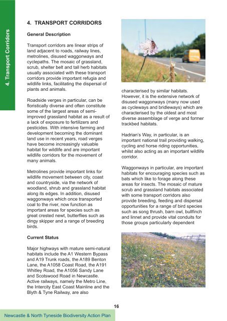
4. Transport Corridors<br />
4. TRANSPORT CORRIDORS<br />
General Description<br />
Transport corridors are linear strips of<br />
land adjacent to roads, railway lines,<br />
metrolines, disused waggonways and<br />
cyclepaths. The mosaic of grassland,<br />
scrub, shelter belt and tall herb habitats<br />
usually associated with these transport<br />
corridors provide important refugia and<br />
wildlife links, facilitating the dispersal of<br />
plants and animals.<br />
Roadside verges in particular, can be<br />
floristically diverse and often constitute<br />
some of the largest areas of semiimproved<br />
grassland habitat as a result of<br />
a lack of exposure to fertilizers and<br />
pesticides. With intensive farming and<br />
development becoming the dominant<br />
land use in recent years, road verges<br />
have become increasingly valuable<br />
habitat for wildlife and are important<br />
wildlife corridors for the movement of<br />
many animals.<br />
Metrolines provide important links for<br />
wildlife movement between city, coast<br />
and countryside, via the network of<br />
woodland, shrub and grassland habitat<br />
along its edges. In addition, disused<br />
waggonways which once transported<br />
coal to the river, now function as<br />
important areas for species such as<br />
great crested newt, butterflies such as<br />
dingy skipper and a range of breeding<br />
birds.<br />
Current Status<br />
Major highways with mature semi-natural<br />
habitats include the A1 Western Bypass<br />
and A19 Trunk roads, the A189 Benton<br />
Lane, the A1058 Coast Road, the A191<br />
Whitley Road, the A1056 Sandy Lane<br />
and Scotswood Road in <strong>Newcastle</strong>.<br />
Active railways, namely the Metro Line,<br />
the Intercity East Coast Mainline and the<br />
Blyth & Tyne Railway, are also<br />
<strong>Newcastle</strong> & North Tyneside Biodiversity <strong>Action</strong> Plan<br />
16<br />
characterised by similar habitats.<br />
However, it is the extensive network of<br />
disused waggonways (many now used<br />
as cycleways and bridleways) which are<br />
characterised by the oldest and most<br />
diverse assemblage of verge and former<br />
trackbed habitats.<br />
Hadrian’s Way, in particular, is an<br />
important national trail providing walking,<br />
cycling and horse riding opportunities,<br />
whilst also acting as an important wildlife<br />
corridor.<br />
Waggonways in particular, are important<br />
habitats for encouraging species such as<br />
bats which like to forage along these<br />
areas for insects. The mosaic of mature<br />
scrub and grassland habitats associated<br />
with some transport corridors also<br />
provide breeding, feeding and dispersal<br />
opportunities for a range of bird species<br />
such as song thrush, barn owl, bullfinch<br />
and linnet and provide vital conduits for<br />
those groups particularly dependent