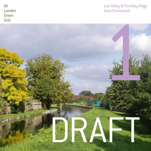
AF01 Lee Valley and Finchley Ridge.pdf - Greater London Authority
AF01 Lee Valley and Finchley Ridge.pdf - Greater London Authority
AF01 Lee Valley and Finchley Ridge.pdf - Greater London Authority

You also want an ePaper? Increase the reach of your titles
YUMPU automatically turns print PDFs into web optimized ePapers that Google loves.
All<br />
<strong>London</strong><br />
Green<br />
Grid<br />
1Lea <strong>Valley</strong> & <strong>Finchley</strong> <strong>Ridge</strong><br />
Area Framework<br />
DRAFT
Contents<br />
1 Foreword <strong>and</strong> Introduction<br />
2 All <strong>London</strong> Green Grid Vision <strong>and</strong> Methodology<br />
3 ALGG Framework Plan<br />
4 ALGG Area Frameworks<br />
5 ALGG Governance<br />
6 Area Strategy<br />
8 Area Description<br />
9 Strategic Context<br />
10 Current Open Space Provision<br />
12 Vision<br />
14 Objectives<br />
16 Opportunities<br />
18 Project Identification<br />
20 Project Update<br />
22 Clusters<br />
24 Projects Map<br />
28 Rolling Projects List<br />
36 Phase Two Projects<br />
38 Project Details<br />
48 Forward Strategy<br />
50 Gap Analysis<br />
51 Recommendations<br />
53 Appendices<br />
54 Baseline Description<br />
56 ALGG SPG Chapter 5 GG01 Links<br />
Group Membership<br />
Note:<br />
This area framework should be read in t<strong>and</strong>em with<br />
All <strong>London</strong> Green Grid SPG Chapter 5 for GGA01 which<br />
contains statements in respect of Area Description,<br />
Strategic Corridors, Links <strong>and</strong> Opportunities.<br />
The ALGG SPG document is guidance that is<br />
supplementary to <strong>London</strong> Plan policies. While it does<br />
not have the same formal development plan status as<br />
these policies, it has been formally adopted by the Mayor<br />
as supplementary guidance under his powers under<br />
the <strong>Greater</strong> <strong>London</strong> <strong>Authority</strong> Act 1999 (as amended).<br />
Adoption followed a period of public consultation, <strong>and</strong> a<br />
summary of the comments received <strong>and</strong> the responses of<br />
the Mayor to those comments is available on the <strong>Greater</strong><br />
<strong>London</strong> <strong>Authority</strong> website. It will therefore be a material<br />
consideration in drawing up development plan documents<br />
<strong>and</strong> in taking planning decisions.<br />
The All <strong>London</strong> Green Grid SPG was developed in parallel<br />
with the area frameworks it can be found at the following<br />
link: http://www.london.gov.uk/publication/all-londongreen-grid-spg<br />
.<br />
Cover Image: The New River in Enfield
Foreword<br />
It is now over five years since the completion<br />
of the first Green Grid Area Framework for the<br />
Lea <strong>Valley</strong>. This review <strong>and</strong> expansion of the<br />
framework provides a valuable opportunity to<br />
reflect on what we have collectively achieved in<br />
that short time, <strong>and</strong> to reassess our aspirations<br />
for the future.<br />
The Olympic Park is rapidly approaching<br />
completion <strong>and</strong> has resulted in a fundamental<br />
transformation of a large part of the valley, with<br />
a magnificent new parkl<strong>and</strong> lying at its heart.<br />
Further south, the first phases of the Lea River<br />
Park is complete or in progress, while to the<br />
north, a range of enhancements to existing open<br />
spaces <strong>and</strong> route networks have been delivered.<br />
Alongside these major projects, many smaller<br />
scale improvements have contributed towards<br />
the ongoing enhancement of the open space<br />
network of the valleys<br />
While we have achieved much, it is also important<br />
to recognise that not all projects have seen<br />
similar progress. Those less advanced projects<br />
highlight the significant challenges we are all<br />
faced with: limitations in funding <strong>and</strong> other<br />
resources, <strong>and</strong> in many cases the sheer difficulty<br />
of resolving physical <strong>and</strong> operational issues.<br />
It is encouraging to see that the response to these<br />
challenging projects is not to simply ab<strong>and</strong>on<br />
them, but to find new ways of collectively working<br />
to deliver them. The Walthamstow Wetl<strong>and</strong>s<br />
partnership is an exemple of this approach, with<br />
organisations coming together from all sectors<br />
to deliver a host of projects that will contribute,<br />
in time, towards a fantastic new open space<br />
resource <strong>and</strong> visitor destination.<br />
The expansion of the Lea <strong>Valley</strong> area to the<br />
west as part of the All <strong>London</strong> Green Grid has<br />
provided a more complete picture of the strategic<br />
opportunities. The opening up <strong>and</strong> enhancement<br />
of the five ‘new’ open space corridors identified in<br />
the exp<strong>and</strong>ed area framework will be a major step<br />
towards the realisation of the Green Grid vision for<br />
<strong>London</strong>.<br />
The area expansion has also highlighted some of<br />
the challenges we face in maintaining productive<br />
Shaun Dawson<br />
Chief Executive,<br />
Lea <strong>Valley</strong> Regional Park <strong>Authority</strong><br />
partnerships across such a large geographical<br />
area, particularly at a time when all organisations<br />
are dealing with increasing pressures <strong>and</strong><br />
reducing resources. Our approach to future<br />
governance of the exp<strong>and</strong>ing Green Grid initiative<br />
will continue to evolve to ensure all stakeholders<br />
are able to play an active, meaningful part.<br />
1
Introduction – All <strong>London</strong> Green Grid Vision <strong>and</strong> Methodology<br />
Introduction<br />
The various <strong>and</strong> unique l<strong>and</strong>scapes of <strong>London</strong> are<br />
recognised as an asset that can reinforce character,<br />
identity <strong>and</strong> environmental resilience. Delivered<br />
alongside existing infrastructure such as transport,<br />
utilities <strong>and</strong> schools an enhanced network of open<br />
spaces <strong>and</strong> green infrastructure can serve to<br />
shape <strong>and</strong> support new <strong>and</strong> existing communities,<br />
respond to the challenges of climate change, support<br />
economic development <strong>and</strong> deliver an improved<br />
quality of life.<br />
The All <strong>London</strong> Green Grid has been developed to<br />
provide a strategic interlinked network of high quality<br />
green infrastructure <strong>and</strong> open spaces that connect<br />
with town centre’s, public transport nodes, the<br />
countryside in the urban fringe, the Thames <strong>and</strong> major<br />
employment <strong>and</strong> residential areas. This approach has<br />
been extremely successful in accelerating delivery of<br />
green infrastructure in East <strong>London</strong> through the East<br />
<strong>London</strong> Green Grid (ELGG).<br />
Policy 2.18 of the <strong>London</strong> Plan (July 2011), promotes<br />
the provision of an integrated green infrastructure<br />
network <strong>and</strong> supports the extension of the Green Grid<br />
to the whole of <strong>London</strong>.<br />
The ALGG objectives are to:<br />
− adapt to climate change <strong>and</strong> promote urban<br />
greening<br />
− increase access to open space<br />
− increase access to nature, <strong>and</strong> to conserve <strong>and</strong><br />
enhance biodiversity<br />
− improve sustainable travel connections<br />
− promote healthy living<br />
− conserve <strong>and</strong> enhance heritage features <strong>and</strong><br />
l<strong>and</strong>scape character<br />
− enhance distinctive destinations <strong>and</strong> boost the<br />
visitor economy<br />
− promote sustainable design, management <strong>and</strong><br />
maintenance<br />
− enhance green space <strong>and</strong> green infrastructure<br />
sector skills<br />
− promote sustainable food production<br />
− improve air quality <strong>and</strong> soundscapes<br />
− improve the quality of <strong>and</strong> access to the Greenbelt<br />
<strong>and</strong> the urban fringe<br />
− conserve <strong>and</strong> enhance the Thames <strong>and</strong> its<br />
tributaries riverside spaces<br />
2<br />
Area Frameworks<br />
Area Frameworks help to support the delivery of<br />
the All <strong>London</strong> Green Grid objectives. By identifying<br />
how the All <strong>London</strong> Green Grid can be delivered at<br />
the l<strong>and</strong>scape scale <strong>and</strong> across administrative<br />
boundaries. To achieve this they;<br />
− establish a comprehensive baseline underst<strong>and</strong>ing<br />
of each area<br />
− define a vision, area objectives <strong>and</strong> strategic<br />
opportunities for each area<br />
− ensure that sub-regional <strong>and</strong> strategic projects<br />
interface with Borough level planning, regeneration,<br />
transport <strong>and</strong> open space strategies <strong>and</strong><br />
processes<br />
− identify the resources required <strong>and</strong> form bidding<br />
strategies to deliver the funding for strategic<br />
projects<br />
− consolidate resources, coordinate efforts <strong>and</strong><br />
facilitate partnership working<br />
− support the preparation of Delivery Strategies<br />
− address the recommendations of the Drain <strong>London</strong><br />
research project <strong>and</strong> ensure that the possible flood<br />
<strong>and</strong> surface water management opportunities are<br />
incorporated within the ALGG.<br />
ALGG Area Frameworks exp<strong>and</strong> on the implementation<br />
points <strong>and</strong> strategic opportunities identified in the All<br />
<strong>London</strong> Green Grid Supplementary Planning Guidance<br />
to the <strong>London</strong> Plan. Subject to boroughs agreement<br />
ALGG Area Frameworks can also form part of Local<br />
Development Plans, Development Plan Documents<br />
<strong>and</strong> or Joint Area Action Plans.<br />
Partnership - Working<br />
Strong <strong>and</strong> open working relationships with many<br />
partners are key to delivering the All <strong>London</strong> Green<br />
Grid. By setting out strategic objectives <strong>and</strong><br />
opportunities at the sub-regional level, the Area<br />
Frameworks help to encourage <strong>and</strong> facilitate existing<br />
<strong>and</strong> new partnerships that involve regional <strong>and</strong> local<br />
government; government agencies; regeneration <strong>and</strong><br />
environmental organisations; private green space<br />
managers; <strong>and</strong> the green space jobs <strong>and</strong> skills sector.<br />
The Green Grid process includes the formation of<br />
Area groups, to implement the Green Grid vision,<br />
objectives <strong>and</strong> projects, at the l<strong>and</strong>scape scale.<br />
By utilising <strong>and</strong> exp<strong>and</strong>ing existing structures <strong>and</strong><br />
forming new groups where they do not exist already,<br />
11 ALGG area groups have been established across<br />
<strong>London</strong>. A <strong>London</strong>-wide Project Board <strong>and</strong> a Working<br />
Group provides the strategic management structure<br />
for the ALGG project.
Introduction – ALGG Framework Plan<br />
The map above illustrates the strategic Framework<br />
Plan for the All <strong>London</strong> Green Grid SPG to the<br />
<strong>London</strong> Plan. The composite drawing illustrates<br />
open space typologies, open space deficiency <strong>and</strong><br />
primary transport corridors. It identifies strategic<br />
opportunities for the Green Grid area.<br />
Map derived from GiGL data 2011 - © Crown Copyright <strong>and</strong> database right 2011. Ordnance Survey 100032216.<br />
Strategic Corridors<br />
Strategic Links<br />
Metropolitan Park Opportunities<br />
Regional Park Opportunities<br />
Regional Parks<br />
Metropolitan Parks<br />
District Parks<br />
Local Park <strong>and</strong> Open Spaces<br />
Small Open Spaces - Pocket Parks<br />
Other / Private Open Spaces<br />
Strategic Walking Routes<br />
Strategic Cycling Routes<br />
3
Introduction – ALGG Area Frameworks<br />
4<br />
<strong>London</strong> Plan<br />
Policy 2.18<br />
Area Frameworks have 4 Sections<br />
Section 1<br />
Area Strategy<br />
This section examines the context<br />
<strong>and</strong> baseline conditions, to propose<br />
a vision, area objectives <strong>and</strong> a set of<br />
area strategic opportunities in line with<br />
the ALGG SPG. Together these form a<br />
framework for future change, project<br />
development <strong>and</strong> evaluation.<br />
All <strong>London</strong> Green Grid<br />
Supplementary Planning Guidance<br />
ALGG vision, Strategic objectives,<br />
Rationale, Recommendations<br />
Development Frameworks<br />
<strong>London</strong> Plan OAPFs<br />
Borough LDF / AAPs<br />
Infrastructure Plans<br />
Open Space Strategies<br />
investment frameworks<br />
Major capital programmes<br />
Major funding bids<br />
Section 2<br />
Project Identification<br />
A schedule of project suggestions for<br />
consideration by the area group, design<br />
advisor <strong>and</strong> working group. Including<br />
interventions to be delivered through<br />
development, <strong>and</strong> those requiring site<br />
acquisition. Each project is mapped<br />
<strong>and</strong> described in a rolling project list.<br />
ALGG Area Frameworks<br />
Lea <strong>Valley</strong> <strong>and</strong> <strong>Finchley</strong> <strong>Ridge</strong><br />
Companion Document<br />
Delivery Plan<br />
Epping Forest <strong>and</strong> Roding <strong>Valley</strong><br />
Thames Chase Beam <strong>and</strong> Ingerbourne<br />
Now absorbed in Areas 2 <strong>and</strong> 3<br />
River Cray <strong>and</strong> Southern Marshes<br />
1 2 3 4 5<br />
South East <strong>London</strong> Green Chain Plus<br />
6<br />
<strong>London</strong>’s Downl<strong>and</strong>s<br />
W<strong>and</strong>le <strong>Valley</strong><br />
Arcadian Thames<br />
River Colne <strong>and</strong> Crane<br />
Brent <strong>Valley</strong> <strong>and</strong> Barnet Plateau<br />
7 8 9 10 11 12<br />
update <strong>and</strong> extend new Area Frameworks<br />
Section 3<br />
Phase Two Delivery<br />
The results of the area’s project<br />
review <strong>and</strong> assessment, identifying<br />
the projects which best deliver the<br />
strategic objectives, as well as those<br />
which are feasible <strong>and</strong> deliverable.<br />
Thereby constituting a next phase of<br />
delivery.<br />
Section 4<br />
Forward Strategy<br />
Central <strong>London</strong><br />
The area chair <strong>and</strong> design advisor<br />
summarise a particular delivery <strong>and</strong><br />
funding strategy to take forward the<br />
first phase of delivery.
Introduction – ALGG Governance<br />
The ALGG SPG proposes that <strong>London</strong> be divided<br />
into eleven Green Grid Areas as illustrated above.<br />
The formation of ALGG Area steering groups bring<br />
together the <strong>London</strong> boroughs, representatives of<br />
partner agencies <strong>and</strong> other stakeholders to develop<br />
<strong>and</strong> implement the Green Grid vision, objectives <strong>and</strong><br />
projects, area by area.<br />
Map derived from GiGL data 2011 - © Crown Copyright <strong>and</strong> database right 2011. Ordnance Survey 100032216.<br />
1<br />
2<br />
3<br />
4<br />
5<br />
Lea <strong>Valley</strong> <strong>and</strong> <strong>Finchley</strong> <strong>Ridge</strong><br />
Epping Forest <strong>and</strong> River Roding<br />
Thames Chase, Beam <strong>and</strong> Ingrebourne<br />
Is now absorbed in Area 2 <strong>and</strong> 3<br />
River Cray <strong>and</strong> Southern Marshes<br />
South East <strong>London</strong> Green Chain Plus Central <strong>London</strong><br />
6 12<br />
7<br />
8<br />
9<br />
10<br />
11<br />
<strong>London</strong>’s Downl<strong>and</strong>s<br />
W<strong>and</strong>le <strong>Valley</strong><br />
Arcadian Thames<br />
River Colne <strong>and</strong> Crane<br />
Brent <strong>Valley</strong> <strong>and</strong> Barnet Plateau<br />
5
View from the Green Belt of the <strong>Finchley</strong> <strong>Ridge</strong> towards Canary Wharf<br />
6
Area Strategy<br />
This section examines the local <strong>and</strong><br />
strategic context to establish a distinct<br />
vision <strong>and</strong> set of objectives for the Lea<br />
<strong>Valley</strong> & <strong>Finchley</strong> <strong>Ridge</strong>. These have been<br />
developed to establish a framework for<br />
future change, project development,<br />
evaluation <strong>and</strong> prioritisation.<br />
7
Area Strategy – Area Description<br />
Area Description<br />
The Lea <strong>Valley</strong> represents a unique area of <strong>London</strong>’s<br />
l<strong>and</strong>scape. Formed by the River Lea - the first tributary<br />
of the Thames to the east of the City - the <strong>Valley</strong> has<br />
until recently been treated as <strong>London</strong>’s backyard; a<br />
place for receiving, making <strong>and</strong> transporting goods;<br />
somewhere to generate, store <strong>and</strong> supply water,<br />
power <strong>and</strong> gas; <strong>and</strong> somewhere to deal with the city’s<br />
sewage.<br />
The presence of industry <strong>and</strong> transport infrastructure<br />
has transformed the natural l<strong>and</strong>scape of the valley<br />
leading to the existence of numerous patches of<br />
neglected vegetation <strong>and</strong> ‘unofficial countryside’, <strong>and</strong><br />
to highly particular post-industrial l<strong>and</strong>scapes. It’s tidal<br />
<strong>and</strong> freshwater marshl<strong>and</strong> character is still prevalent,<br />
however, <strong>and</strong> underpins the diversity of l<strong>and</strong>scapes<br />
within the valley; tidal <strong>and</strong> fresh water wetl<strong>and</strong>s,<br />
marshes <strong>and</strong> meadows, patches of rough grassl<strong>and</strong>,<br />
scrubl<strong>and</strong>, <strong>and</strong> woodl<strong>and</strong>.<br />
Home to the eponymous Regional Park, the <strong>Valley</strong><br />
provides an important l<strong>and</strong>scape for leisure <strong>and</strong><br />
recreation; hosting a diverse range of activities<br />
including walking, cycling, athletics, football, rowing,<br />
horse riding <strong>and</strong> skating. Yet the natural topography,<br />
<strong>and</strong> corridors of transport infrastructure, mean that<br />
the <strong>Valley</strong> still operates as something of a barrier<br />
to movement <strong>and</strong> access - an under-explored but<br />
invaluable part of the city’s l<strong>and</strong>scape.<br />
The <strong>Finchley</strong> <strong>Ridge</strong> is an outcrop of glacial till <strong>and</strong><br />
gravel extending south west from Enfield Town, to East<br />
Barnet, <strong>Finchley</strong> <strong>and</strong> Dollis Hill. The ridge is broken into<br />
a series of hills by streams such as Pymmes Brook,<br />
Salmons Brook <strong>and</strong> Turkey Brook which flow east to<br />
the River Lea, <strong>and</strong> others flowing south to the Brent<br />
River.<br />
Although connected via its river catchment, the<br />
l<strong>and</strong>scape of the <strong>Finchley</strong> <strong>Ridge</strong> is very different<br />
to that of the Lea <strong>Valley</strong>; largely suburban <strong>and</strong><br />
characterised by interwar housing developed<br />
around older Victorian centres. The railway <strong>and</strong> tube<br />
network, which underpinned this suburban expansion,<br />
continues to offer good connections into the city<br />
centre.<br />
The fragmented <strong>and</strong> small-scale nature of its open<br />
space network - local parks, golf courses, cemeteries<br />
etc. - is thrown into relief by the extensive l<strong>and</strong>scape of<br />
the Green Belt to the north, which connects the outer<br />
fringe of the city to the M25 <strong>and</strong> beyond.<br />
8
Area Strategy – Strategic Context<br />
Strategic Context<br />
The Lea <strong>Valley</strong> represents a rupture in <strong>London</strong>’s<br />
urban grain - a corridor of relatively undeveloped<br />
l<strong>and</strong> forming a ‘clearing’ between dense urban<br />
communities lying to the east <strong>and</strong> west, with much of<br />
this l<strong>and</strong> protected as open space or industrial l<strong>and</strong>.<br />
The presence of large-scale transport infrastructure,<br />
particularly running north-south along the <strong>Valley</strong>,<br />
has reinforced the resulting sense of division -<br />
discouraging communities on either side of the <strong>Valley</strong><br />
from using or traversing its l<strong>and</strong>scapes.<br />
The <strong>Valley</strong> is still very much industrial - with large<br />
areas of protected Strategic Industrial L<strong>and</strong>, <strong>and</strong><br />
clusters of high technology businesses replacing<br />
more traditional industry. But the re-shaping of its<br />
industrial l<strong>and</strong>scape, <strong>and</strong> the value of its proximity<br />
to central <strong>London</strong>, have begun to encourage major<br />
transformation in recent years. Both the Lower Lea<br />
<strong>Valley</strong> <strong>and</strong> Upper Lea <strong>Valley</strong> have been identified<br />
by the Mayor as Opportunity Areas, <strong>and</strong> are sites<br />
for major regeneration projects. The siting of the<br />
Olympic Park, between Hackney Wick <strong>and</strong> Stratford,<br />
has provided state of the art sports facilities, a major<br />
new park, <strong>and</strong> 2,800 new homes - <strong>and</strong> has also been<br />
a major catalyst for wider change within the <strong>Valley</strong>.<br />
In the Upper Lea <strong>Valley</strong>, future regeneration projects<br />
include the sustainable transformation of 70ha of<br />
industrial l<strong>and</strong> at Meridian Water.<br />
The <strong>Finchley</strong> <strong>Ridge</strong> is primarily a suburban l<strong>and</strong>scape<br />
- with interwar housing surrounding a series of<br />
small-scale, mainly Victorian town centres; Enfield,<br />
Southgate, Palmers Green, Wood Green, High Barnet,<br />
East Barnet, <strong>and</strong> Muswell Hill. Much of this area is<br />
afforded good connections to the city by virtue of the<br />
rail network <strong>and</strong> the underground (Piccadilly line).<br />
In contrast to the flux of the Lea <strong>Valley</strong>, this is a much<br />
more stable urban l<strong>and</strong>scape, with fewer large-scale<br />
regeneration prospects. The presence of the Green<br />
Belt to the north - an area which represents 38% of the<br />
area of Enfield - is an important parameter. This open<br />
space, which includes Trent Country Park, is linked via<br />
the <strong>London</strong> Loop to the Lea <strong>Valley</strong> <strong>and</strong> Epping Forest,<br />
<strong>and</strong> to the north-south Lea <strong>Valley</strong> Walk.<br />
Map derived from GiGL data 2011 - © Crown Copyright <strong>and</strong> database right 2011. Ordnance Survey 100032216.<br />
Metropolitan Open L<strong>and</strong><br />
Green Belt<br />
Town Centres<br />
Strategic Housing L<strong>and</strong> Availability<br />
Strategic Industrial L<strong>and</strong><br />
Borough walking, cycling, bridleway<br />
Borough green space connections<br />
Borough tree lined streets<br />
L<strong>and</strong>marks, prospects, views<br />
Mineral / Waste Sites<br />
9
Area Strategy – Current Open Space Provision<br />
This page provides an overview of the open space<br />
network in the Lea Vallay <strong>and</strong> <strong>Finchley</strong> <strong>Ridge</strong> -<br />
describing its diverse mix of l<strong>and</strong>scapes, <strong>and</strong> providing<br />
an introduction to forthcoming changes.<br />
Map derived from GiGL data 2011 - © Crown Copyright <strong>and</strong> database right 2011. Ordnance Survey 100032216.<br />
10<br />
+ Overlaid Deficiency in Access<br />
to Public Open Space<br />
–<br />
Regional Parks<br />
Metropolitan Parks<br />
District Parks<br />
Local Parks And Open Spaces<br />
Small Open Spaces<br />
Pocket Parks<br />
Other / Private Open Spaces
Area Strategy – Current Open Space Provision<br />
The Lea <strong>Valley</strong> provides a nearly continuous ribbon<br />
of accessible open space from Hertfordshire to the<br />
Thames - representing a major l<strong>and</strong>scape resource for<br />
<strong>London</strong>. Efforts to create a major open space resource<br />
in the <strong>Valley</strong> date back to the 1960s - since then the<br />
<strong>Lee</strong> <strong>Valley</strong> Regional Park <strong>Authority</strong> has been working<br />
alongside local authorities, government agencies <strong>and</strong><br />
other l<strong>and</strong>owners to realise the aspirations embodied<br />
in the <strong>Lee</strong> <strong>Valley</strong> Regional Park Act. Today, the<br />
boundary of the Lea <strong>Valley</strong> Regional Park (stretching<br />
beyond the edge of <strong>London</strong>) comprises over 4000ha<br />
of l<strong>and</strong>, of which 1600ha are within the ownership of<br />
the <strong>Authority</strong> itself.<br />
Much of this open space lies within the Upper Lea<br />
<strong>Valley</strong>, which provides a largely continuous ribbon<br />
of open space, waterways <strong>and</strong> reservoirs. The<br />
<strong>Authority</strong> provides a range of sports <strong>and</strong> recreation<br />
opportunities in the Upper Lea <strong>Valley</strong>, including<br />
regional centres for athletics, riding <strong>and</strong> ice skating.<br />
The Park also contains large areas of informal open<br />
space <strong>and</strong> highly valued nature reserves, including<br />
a number of Sites of Special Scientific Interest. The<br />
<strong>Authority</strong> is by no means the only open space provider<br />
- with spaces owned by the <strong>London</strong> Boroughs of<br />
Hackney, Waltham Forest, Haringey, Enfield, Epping<br />
Forest District Council, British Waterways, the<br />
Environment Agency <strong>and</strong> Thames Water all making<br />
contributions to the open space network.<br />
The Lower Lea <strong>Valley</strong> represents a very different<br />
l<strong>and</strong>scape to the Upper Lea - with open space provision<br />
far more restricted. A number of smaller open spaces,<br />
local parks <strong>and</strong> nature reserves are scattered down<br />
the <strong>Valley</strong> - with their management diversified across<br />
the Boroughs, the LVRPA, <strong>London</strong> Wildlife Trust <strong>and</strong><br />
other community organisations. The Northern Outfall<br />
Sewer / Greenway - which crosses the <strong>Valley</strong> as it runs<br />
from Abbey Mills to Beckton - forms an important linear<br />
l<strong>and</strong>scape; but the open space network is otherwise<br />
fragmented <strong>and</strong> difficult to navigate. Major projects,<br />
including the Olympic Park <strong>and</strong> the Lea River Park, are<br />
underway to transform the generosity <strong>and</strong> continuity<br />
of open space provision within the Lower Lea.<br />
In the proximity of the Lower Lea, there are some<br />
excellent existing parks - notably Victoria Park <strong>and</strong><br />
Mile End Park - which provide an intriguing contrast<br />
between traditional Victorian park design <strong>and</strong> the<br />
contemporary park spaces being developed within the<br />
<strong>Valley</strong> itself.<br />
The <strong>Finchley</strong> <strong>Ridge</strong> stretching south from the farml<strong>and</strong><br />
of the Green Belt through the suburbs of Enfield,<br />
Barnet <strong>and</strong> Haringey - offers a diverse range of open<br />
spaces. Whilst this territory now divides into the<br />
extensive l<strong>and</strong>scape of the Green Belt (north of Enfield<br />
Town <strong>and</strong> East Barnet), <strong>and</strong> a collection of smaller<br />
open spaces within suburban North <strong>London</strong>, it was<br />
formerly a singular l<strong>and</strong>scape - the ancient woodl<strong>and</strong><br />
of the Forest of Middlesex, which once stretched from<br />
the city walls at Houndsditch. Areas of remaining<br />
woodl<strong>and</strong> across the <strong>Ridge</strong> still offer a memory of its<br />
past - including Monken Hadley Common, Whitewebbs<br />
Park, <strong>and</strong> parts of Trent Park in the north of the area,<br />
<strong>and</strong> Highgate Wood, Queen’s Wood <strong>and</strong> Coppetts Wood<br />
to the south.<br />
In the south of the area, the open space network<br />
comprises a familiar mixture of local parks, recreation<br />
grounds <strong>and</strong> cemeteries. It includes traditional<br />
Victorian parks such as Finsbury Park <strong>and</strong> Alex<strong>and</strong>ra<br />
Park. There are athletics tracks in Finsbury Park <strong>and</strong><br />
Whitehart Lane Community Centre, whilst tennis<br />
courts <strong>and</strong> football pitches are distributed throughout<br />
the area in recreation grounds <strong>and</strong> parks. Numerous<br />
parks across the three boroughs have been awarded<br />
Green Flag status. The presence of the various<br />
tributaries to the River Lea - including Salmons Brook<br />
<strong>and</strong> Pymmes Brook - informs the character of a<br />
number of these spaces. The brooks begin to forge<br />
linear l<strong>and</strong>scape connections between local parks,<br />
although these are often fragmentary <strong>and</strong> incomplete.<br />
The l<strong>and</strong>scape begins to transform towards the Green<br />
Belt. A number of golf courses are found in the north<br />
of Enfield - marking the transition between suburban<br />
city <strong>and</strong> surrounding countryside. The Green Belt<br />
itself comprises a mixture of arable farml<strong>and</strong> <strong>and</strong><br />
woodl<strong>and</strong>, within which the 170 hectare Trent Country<br />
Park, (l<strong>and</strong>scapes by Humphry Repton) <strong>and</strong> Forty<br />
Hall Country Park museum within its Grade 1 listed<br />
Jacobean house, provide significant public l<strong>and</strong>scapes<br />
<strong>and</strong> visitor destinations. The Green Belt also serves<br />
to connect the <strong>Finchley</strong> <strong>Ridge</strong> to the Lea <strong>Valley</strong>, via<br />
the course of the <strong>London</strong> Loop. which follows Turkey<br />
Brook.<br />
Between the <strong>Ridge</strong> <strong>and</strong> the Lea <strong>Valley</strong> itself, the New<br />
River - an artificial waterway built in the 17th Century<br />
to supply fresh drinking water from the River Lea to<br />
<strong>London</strong> - also provides an important north-south<br />
walking route.<br />
Scheduled Future Change<br />
Substantial change to the open space provision within<br />
the area is already underway. Much of this change is<br />
focussed on the Lower Lea <strong>Valley</strong> - where a number<br />
of projects are being progressed to develop a more<br />
continuous open space network which will finally<br />
make possible a generous connection between the<br />
Regional Park <strong>and</strong> the Thames.<br />
The centre-piece of this transformation is the<br />
regeneration opportunity presented by the 2012<br />
Olympics; the creation of the Olympic Park at the<br />
junction with the Upper Lea <strong>Valley</strong> has served to<br />
catalyse wider change as well as itself delivering a<br />
major new park for <strong>London</strong>. The new park will be the<br />
focal point of mixed-use development across 200 ha<br />
of former industrial l<strong>and</strong> <strong>and</strong> l<strong>and</strong>fill sites. Significant<br />
improvements to the open spaces at the immediate<br />
periphery of the Park - such as the transformation of<br />
the Greenway <strong>and</strong> works to Hackney Marshes - have<br />
already been delivered under the impetus of the<br />
Olympic project.<br />
To the south of the Olympic Park, the Lea River<br />
Park promises to deliver the final connection to the<br />
Thames. Over the long-term, the Lea River Park will<br />
itself deliver major areas of new park space in the<br />
south of the Lower Lea. In the short term, the delivery<br />
of a continuous north-south route - the Fatwalk - is<br />
being prioritised <strong>and</strong> will transform the accessibility<br />
<strong>and</strong> visibility of this part of the Lea <strong>Valley</strong>.<br />
Future change in the Upper Lea <strong>Valley</strong> - will be less<br />
spectacular <strong>and</strong> more incremental, but no less<br />
important. A major new l<strong>and</strong>scape strategy has<br />
been developed by key public sector organisations,<br />
setting out a long-term vision for this part of the area,<br />
<strong>and</strong> major initiatives include the opening up to public<br />
access of the Walthamstow Reservoirs.<br />
Aspirations for a network of new <strong>and</strong> better connected<br />
open spaces are recognised as essential components<br />
in creating successful new communities across the<br />
area. Further details are provided on recent progress<br />
to deliver this, <strong>and</strong> anticipated future projects, in the<br />
later parts of this document.<br />
11
Area Strategy – Vision<br />
Vision<br />
The Lea <strong>Valley</strong> <strong>and</strong> the <strong>Finchley</strong> <strong>Ridge</strong> comprise a rich<br />
<strong>and</strong> diverse mixture of open spaces. This open space<br />
network already has many distinctive qualities <strong>and</strong><br />
assets on which to build - the industrial heritage of the<br />
Lea <strong>Valley</strong>, the particular quality of its l<strong>and</strong>scapes <strong>and</strong><br />
water spaces, the topographical quality of the <strong>Finchley</strong><br />
<strong>Ridge</strong>, <strong>and</strong> the extent of the Green Belt l<strong>and</strong>scape<br />
onto which it borders. The existing open spaces serve<br />
both local communities <strong>and</strong> a wider region. There are<br />
multi-fuctional spaces which encompass a broad<br />
spectrum of roles - from sport <strong>and</strong> recreation through<br />
to biodiversity enhancement <strong>and</strong> flood management.<br />
The Green Grid initiative aims to help shape the future<br />
for <strong>and</strong> to improve on this network at a strategic<br />
level. On one h<strong>and</strong>, it is imperative that projects <strong>and</strong><br />
initiatives are responsive to things which are particular<br />
<strong>and</strong> local - <strong>and</strong> this area framework encourages a very<br />
close appreciation of the existing qualities of place<br />
<strong>and</strong> l<strong>and</strong>scape to inform future change. On the other<br />
h<strong>and</strong>, the ambition of the All <strong>London</strong> Green Grid is to<br />
underst<strong>and</strong> <strong>and</strong> shape the strategic role of l<strong>and</strong>scape<br />
at a city-wide scale. The Lea <strong>Valley</strong> was itself the<br />
subject of a big vision - through Abercrombie’s proposal<br />
for a regional park, <strong>and</strong> the subsequent call by Local<br />
Authorities along the <strong>Valley</strong> for the creation of the <strong>Lee</strong><br />
<strong>Valley</strong> Regional Park <strong>Authority</strong> for the development,<br />
preservation <strong>and</strong> management of recreation, sport,<br />
entertainment <strong>and</strong> the enjoyment of leisure.<br />
Fifty years later, what is the open space network<br />
of the Lea <strong>Valley</strong> - <strong>and</strong> by extension, the <strong>Finchley</strong><br />
<strong>Ridge</strong> - for? What roles might it play in a sustainable<br />
<strong>and</strong> healthy city for the twenty-first century? Who<br />
will use these open spaces, <strong>and</strong> what will they do<br />
there? How can the multi-functionality of these open<br />
spaces be maximised, <strong>and</strong> how can more people be<br />
encouraged to use them? Set out opposite are six<br />
ideas - necessarily relatively high-level <strong>and</strong> broad<br />
brush - which might begin to answer these questions<br />
<strong>and</strong> set out a strategic ambition for this part of the All<br />
<strong>London</strong> Green Grid.<br />
12
Area Strategy – Vision<br />
1 From the M25 to the Thames<br />
The Lea <strong>Valley</strong> will continue to operate as a distinctive<br />
regional scale l<strong>and</strong>scape resource. The delivery of<br />
major new open spaces within the Lower Lea <strong>Valley</strong><br />
will finally make possible a generous connection to the<br />
River Thames - symbolically completing, after some<br />
50 years, Abercrombie’s vision for a regional park<br />
connecting the city to the country. This continuous<br />
spine of open space must - work with its unique<br />
industrial heritage <strong>and</strong> l<strong>and</strong>scape character - <strong>and</strong> must<br />
continue to develop the diversity <strong>and</strong> quality of its<br />
offer as a visitor destination for all <strong>London</strong>ers.<br />
4 Water l<strong>and</strong>scapes<br />
The Lea <strong>Valley</strong> benefits from a unique range of waterscapes<br />
- from the linear spaces of Lea River <strong>and</strong> Lea<br />
Navigation, through to the expansive reservoirs in the<br />
Upper Lea. Future projects should work to maximise<br />
the l<strong>and</strong>scape quality <strong>and</strong> visibility of these spaces,<br />
<strong>and</strong> their potential to operate as visitor destinations.<br />
This will include working to transform the accessibility<br />
of existing areas of operational utility space - such<br />
as the Walthamstow Reservoirs - <strong>and</strong> exploring the<br />
potential to to transform them, where appropriate, into<br />
genuine visitor destinations.<br />
2 Connections across the <strong>Valley</strong><br />
Major transport infrastructure at its edge, <strong>and</strong> the<br />
presence of large areas of utilities compounds <strong>and</strong><br />
industrial l<strong>and</strong> within, have historically combined<br />
to make the Lea <strong>Valley</strong> into an unknown space<br />
which operates, both physically <strong>and</strong> perceptually,<br />
as a barrier. Future transformations will improve<br />
connections into <strong>and</strong> across the <strong>Valley</strong>, helping to<br />
better connect it to its neighbouring communities; a<br />
place which encourages use <strong>and</strong> a sense of ownership<br />
amongst local residents.<br />
5 Green Belt<br />
The extensive spaces of the Green Belt will be<br />
developed as a key l<strong>and</strong>scape resource for <strong>London</strong>,<br />
building upon the particular qualities <strong>and</strong> activities<br />
which are already found there, <strong>and</strong> which will<br />
complement the presence of the Lea <strong>Valley</strong> to the east<br />
- the possibility to take a long walk out of <strong>London</strong>, or go<br />
on a big circular walk, go horse-riding, or pick your own<br />
fruit. Strengthening the visitor offer of these spaces,<br />
<strong>and</strong> promoting distinctive activities, will be important<br />
strategies to encourage <strong>London</strong>ers to take a trip to the<br />
Green Belt, <strong>and</strong> to explore its possibilities.<br />
3 Shaping urban regeneration<br />
Within the Lower Lea <strong>Valley</strong>, the creation of major<br />
new open spaces associated with the Olympic Park<br />
<strong>and</strong> the Lea River Park will transform the <strong>Valley</strong> into<br />
a new centre. These important new park spaces will<br />
operate as a focal point for new development at the<br />
edge of the valley, <strong>and</strong> should act as a key structuring<br />
device which helps to shape the form <strong>and</strong> character of<br />
development. In turn, the making of high quality built<br />
edges in the Upper Lea <strong>Valley</strong> will help to better define<br />
the green space corridor, <strong>and</strong> to enable <strong>and</strong> encourage<br />
its use.<br />
6 A good local park network<br />
The various open spaces within the <strong>Finchley</strong> <strong>Ridge</strong><br />
should be developed into a robust local park network,<br />
with good facilities <strong>and</strong> connections to the surrounding<br />
urban fabric. The potential of the tributaries to the<br />
River Lea (including Salmons Brook, Pymmes Brook<br />
<strong>and</strong> Mosselle Brook) to contribute to this network<br />
should be maximised - using these linear routes to<br />
strengthen connections between park spaces <strong>and</strong> to<br />
support sustainable travel routes where possible, <strong>and</strong><br />
building upon the capacity of the brooks to enhance<br />
biodiversity <strong>and</strong> address flood relief requirements.<br />
13
Area Strategy – Objectives<br />
Increasing<br />
creasing Increasing access<br />
access<br />
access to<br />
to<br />
Open<br />
Open<br />
to Open Space<br />
Space<br />
Space Increasing<br />
Increasing<br />
Increasing access<br />
access<br />
access to<br />
to<br />
Nature<br />
Nature<br />
to Nature<br />
Increase access to open space, the Conserve l<strong>and</strong>scape <strong>and</strong> the natural<br />
Managing<br />
Managing<br />
Managing Flood<br />
Flood<br />
Flood Risk<br />
Risk<br />
<strong>and</strong> Risk<br />
<strong>and</strong><br />
Urban <strong>and</strong><br />
Urban<br />
Urban Heat<br />
Heat<br />
Heat Making<br />
Making<br />
Making Sustainable<br />
Sustainable<br />
Sustainable Travel<br />
Travel<br />
Travel<br />
Adapting to climate<br />
Isl<strong>and</strong><br />
change Isl<strong>and</strong><br />
Isl<strong>and</strong><br />
Making sustainable Connections<br />
Connections travel<br />
Connections<br />
connections<br />
Green Belt <strong>and</strong> the urban fringe environment <strong>and</strong> increase access to<br />
nature<br />
14<br />
?<br />
?<br />
To improve the quantity <strong>and</strong> quality To improve visual <strong>and</strong> physical access To utilise the open space network to To improve connections to <strong>and</strong><br />
of accessible open space <strong>and</strong> to to nature, especially in areas of help minimise flood risk <strong>and</strong> reduce between open spaces, to create an<br />
enable people to access it more easily, deficiency, through;<br />
the impact of the ‘heat isl<strong>and</strong> effect’ integrated network of green space. This<br />
especially in areas of deficiency,<br />
through;<br />
can be implemented through;<br />
through;<br />
- Ensuring connectivity of habitats<br />
along the Lea <strong>Valley</strong> <strong>and</strong> its tributaries - Increasing flood storage capacity - Completing the strategic north south<br />
- Overcoming physical barriers (i.e. to encourage a rich biodiversity to through increased open space cycle <strong>and</strong> pedestrian route down the<br />
waterways, railways, roads) to existing flourish<br />
provision within the flood zone, <strong>and</strong> Lea <strong>Valley</strong> to the Thames (e.g. Fatwalk<br />
<strong>and</strong> new open spaces<br />
- Strategic improvements to river<br />
Enhancing - Negotiating Enhancing<br />
Enhancing distinctive <strong>and</strong> distinctive enabling<br />
distinctive visitor access visitor<br />
visitor<br />
to courses Promoting<br />
Promoting including<br />
Promoting healthy<br />
healthy naturalisation,<br />
healthy living<br />
living<br />
living<br />
estinations<br />
destinations open destinations space <strong>and</strong> where <strong>and</strong><br />
boosting <strong>and</strong><br />
boosting access boosting to the the visitor l<strong>and</strong> the<br />
visitor is visitor canalisation, habitat creation, species<br />
currently restricted economy<br />
economy<br />
economy by the l<strong>and</strong>owner re-introduction, <strong>and</strong> improved<br />
(e.g. utility companies)<br />
management regimes of the water<br />
where appropriate the de-canalisation<br />
Promoting of Promoting watercourses<br />
Promoting sustainable<br />
sustainable (e.g.<br />
sustainable<br />
The Olympic food<br />
food<br />
food<br />
Park,<br />
Monatague production<br />
production Recreation production Ground <strong>and</strong><br />
Moselle Park)<br />
- Reducing water run off by promoting<br />
project)<br />
- Extending Skills<br />
Skills <strong>and</strong><br />
Skills <strong>and</strong> enhancing <strong>and</strong><br />
Training <strong>and</strong><br />
Training cycle<br />
Training<br />
routes<br />
(e.g. Sustran’s Greenways) through the<br />
open space network<br />
- Developing pedestrian <strong>and</strong> cycles<br />
- Completing the strategic north south network <strong>and</strong> surrounding l<strong>and</strong>scapes the installation of green roofs <strong>and</strong> routes through the Green Belt as a<br />
recreational route down the Lea <strong>Valley</strong> - Identification <strong>and</strong> protection of sustainable urban drainage through major sustainable transport route<br />
to the Thames, through the Olympic natural resources <strong>and</strong> the habitats development policies<br />
- Improving routes from urban centres<br />
Park <strong>and</strong> the Lea River Park<br />
of protected species, <strong>and</strong>, where non - Changing management regimes <strong>and</strong> transport hubs to the open space<br />
- Developing interconnected <strong>and</strong> linear disruptive, enabling access to currently of amenity open space to cope with network<br />
parks along existing watercourses inaccessible sites<br />
increased drought conditions <strong>and</strong> - Capitalising on the routes of<br />
such as Pymmes, Salmons, Turkey, & - Optimising the ecological value of increase areas of street tree cover, <strong>and</strong> watercourses to create characterful<br />
Moselle Brookes, <strong>and</strong> the New River sites of nature conservation<br />
natural plantscapes to provide shade pedestrian <strong>and</strong> cycle routes<br />
- Ensuring all opportunities offered importance, especially in Special <strong>and</strong> combat the ‘heat isl<strong>and</strong> effect’ - Delivering new pedestrian <strong>and</strong> cycle<br />
through redevelopment of the urban Protection Areas such as Walthamstow - Utilising the potential of flood defence routes across existing infrastructural<br />
fabric, particularly existing industrial Reserviors, <strong>and</strong> William Girling <strong>and</strong> King structures to create paths <strong>and</strong> improve barriers<br />
areas (e.g. Meridian Water), optimise George V Reservoirs<br />
access to currently inaccessible open - Developing routes into <strong>and</strong> across<br />
access to <strong>and</strong> the interface with the - Developing public facilities <strong>and</strong> space (e.g. flood relief channel) the Lea <strong>Valley</strong> for neighbouring<br />
open space network<br />
activities which encourage public<br />
communities<br />
- Developing a network of routes within underst<strong>and</strong>ing <strong>and</strong> engagement with<br />
- Negotiating access to existing routes<br />
the open space spine that offer users a the natural resources in their vicinity<br />
that are currently inaccessible<br />
range of recreational opportunities <strong>and</strong><br />
- Building upon existing walking routes<br />
experiences<br />
<strong>and</strong> trails such as the Capital Ring, The<br />
- Improving signage <strong>and</strong> wayfinding to<br />
<strong>London</strong> Loop, the Lea <strong>Valley</strong> Walk, the<br />
enable access to <strong>and</strong> movement within<br />
Thames Path the Lea <strong>Valley</strong> Pathway &<br />
the open space network<br />
Eastern Side Walk
Increasing ncreasing creasing Area Increasing Strategy access access to – Open Objectives<br />
to Open Space Space Increasing Increasing access access to Nature to Nature Managing Managing Flood Flood Risk <strong>and</strong> Risk Urban <strong>and</strong> Urban Heat Heat Making Making Sustainable Travel Travel<br />
Isl<strong>and</strong> Isl<strong>and</strong><br />
Connections<br />
Enhancing Enhancing distinctive distinctive visitor visitor Promoting Promoting healthy healthy living living Promoting Promoting sustainable sustainable food food<br />
estinations Enhancing destinations <strong>and</strong> distinctive boosting <strong>and</strong> boosting visitor the visitor the visitor Promote healthy living<br />
destinations economy <strong>and</strong> economy boosting the visitor<br />
economy<br />
Promote production sustainable production production food production<br />
To improve the quality <strong>and</strong> range of<br />
visitor destinations to attract visitors<br />
from near <strong>and</strong> far through;<br />
- Improving <strong>and</strong> publicising existing<br />
visitor attractions, facilities, <strong>and</strong><br />
amenities including nature reserves,<br />
golf courses, an ice rink, equestrian<br />
centre, football <strong>and</strong> atheltics stadia,<br />
scenic walking routes, heritage<br />
features (e.g Trent Country Park,<br />
Lordship Rec)<br />
- Promoting the inherent<br />
characteristics of the Lea <strong>Valley</strong>,<br />
with its varied natural <strong>and</strong> artificial<br />
l<strong>and</strong>scapes, as a visitor destination<br />
(e.g. Walthamstow Reservoirs)<br />
- Encouraging local organisations to<br />
maximise the potential of current<br />
facilities <strong>and</strong> introduce new activities<br />
within the existing open space network<br />
- Encouraging the coordination<br />
of diverse <strong>and</strong> complementary<br />
programmes <strong>and</strong> facilities by various<br />
authorities, l<strong>and</strong>owners, <strong>and</strong><br />
organistaions<br />
- Encouraging <strong>and</strong> facilitating the<br />
organisation of events by local<br />
communities<br />
- Offering activities such as festivals<br />
<strong>and</strong> open days to encourage a sense<br />
of place, ownership <strong>and</strong> shared local<br />
identity<br />
To ensure that the green space<br />
network within the area supports the<br />
development of healthy communities<br />
through;<br />
- Improving existing <strong>and</strong> creating new<br />
playspaces <strong>and</strong> sports facilities within<br />
the open space network. (e.g outdoor<br />
gym at Oakhill Park)<br />
- Improving the access to the Lea <strong>Valley</strong><br />
<strong>and</strong> Green Belt for healthy recreational<br />
opportunities, including walking,<br />
gardening, cycling, rowing, horse riding<br />
- Maximising the opportunity for the<br />
Lea <strong>Valley</strong> to become a focal point for<br />
sustainable urban neighbourhoods<br />
such as the new eco-development at<br />
Meridian Water<br />
- Encouraging the use of sustainable<br />
travel connections<br />
- Identifying areas of health inequality<br />
<strong>and</strong> obesity in relation to the<br />
openspace network, <strong>and</strong> improving<br />
access to open space for those in most<br />
need<br />
- Providing suitable facilities <strong>and</strong><br />
activities for the local demographic<br />
such as sports facilities for young<br />
people <strong>and</strong> easily negotiable routes for<br />
the elderly<br />
To build upon the presence of existing<br />
productive l<strong>and</strong>scapes within the Lea<br />
<strong>Valley</strong> <strong>and</strong> <strong>Finchley</strong> <strong>Ridge</strong> area through;<br />
- Improving the quality <strong>and</strong> facilities of<br />
existing allotment sites<br />
- Creating new food growing<br />
opportunities, allotment sites <strong>and</strong><br />
community gardens within the open<br />
space network<br />
- Encouraging <strong>and</strong> enabling social<br />
enterprise schemes<br />
- Looking for opportunities to extend<br />
the provision by exploring possibilities<br />
for creating other productive<br />
l<strong>and</strong>scapes including coppicing, fish<br />
ponds, watercress beds<br />
? ?<br />
Skills Skills <strong>and</strong> Training <strong>and</strong> Training<br />
Promote green skills <strong>and</strong> sustainable<br />
design, management <strong>and</strong> maintenance<br />
To develop green space <strong>and</strong> green<br />
infrastructure sector skills in order<br />
to maintain a high quality green<br />
space network <strong>and</strong> support <strong>London</strong>’s<br />
transition to the low carbon economy<br />
through;<br />
- Engaging the public with open days,<br />
short courses, <strong>and</strong> opportunities for<br />
voluntary work<br />
- Integrating climate change mitigation<br />
<strong>and</strong> adaptation into all areas of green<br />
skills education <strong>and</strong> training<br />
- Providing coordination, access to<br />
expert advice, training <strong>and</strong> knowledge<br />
transfer across various green space<br />
organisations<br />
- Providing instructional signage <strong>and</strong><br />
interpretation throughout the green<br />
space network<br />
15
Area Strategy – Opportunities<br />
Strategic Opportunities<br />
A number of strategic opportunities have been<br />
identified within the Lea <strong>Valley</strong> <strong>and</strong> <strong>Finchley</strong> <strong>Ridge</strong><br />
area. These are significant opportunities - rooted<br />
in real or aspirational projects, which are spatially<br />
specific - which have the potential to deliver the Area<br />
Vision described on the previous pages, <strong>and</strong> the areaspecific<br />
objectives which underpin it.<br />
The identified opportunities build upon, <strong>and</strong> exp<strong>and</strong>,<br />
those which were identified in the previous version<br />
of the Area Framework. They have been arrived<br />
at through consultation <strong>and</strong> discussion with key<br />
stakeholders. The array of opportunities is diverse<br />
<strong>and</strong> extensive - encompassing much of the area,<br />
<strong>and</strong> corresponding closely to the geography of the<br />
area’s strategic corridors <strong>and</strong> links. Each represents<br />
an opportunity to build upon what is already special<br />
about the l<strong>and</strong>scape of the Lea <strong>Valley</strong> <strong>and</strong> the<br />
<strong>Finchley</strong> <strong>Ridge</strong>, but promises to make it a richer, more<br />
accessible <strong>and</strong> more valuable open space network for<br />
<strong>London</strong>.<br />
16
Area Strategy – Opportunities<br />
1 2 3 4 5<br />
Lea <strong>Valley</strong> to The Thames<br />
To complete the strategic<br />
north-south connection<br />
through the Lea <strong>Valley</strong><br />
to the Thames via the<br />
creation of the Fatwalk,<br />
<strong>and</strong> ultimately, the<br />
creation of a series of<br />
new open spaces as part<br />
of the future Lea River<br />
Park.<br />
7 8 9 10 11<br />
The Green Belt<br />
To maximise the potential<br />
of the green belt, by<br />
improving facilities <strong>and</strong><br />
attractions at Trent<br />
Country Park <strong>and</strong> Forty<br />
Hall Park, <strong>and</strong> enhancing<br />
north-south l<strong>and</strong>scape<br />
connections across the<br />
M25 <strong>and</strong> into the wider<br />
extent of the Green Belt.<br />
Olympic Park Legacy<br />
To deliver a new 100ha<br />
park for <strong>London</strong> as part<br />
of the legacy of the 2012<br />
Olympics; a park which<br />
will act as the focal point<br />
for new <strong>and</strong> existing<br />
communities, <strong>and</strong> help<br />
to improve east-west<br />
connectivity across the<br />
Lea <strong>Valley</strong>.<br />
Ponders End Gateway<br />
To transform Ponders<br />
End into a key gateway<br />
into the Lea <strong>Valley</strong> -<br />
creating improved views<br />
<strong>and</strong> connections into<br />
<strong>and</strong> across the valley,<br />
<strong>and</strong> new leisure uses to<br />
attract visitors.<br />
Walthamstow Wetl<strong>and</strong>s<br />
Open Walthamstow<br />
Wetl<strong>and</strong>s (ten<br />
Thames water owned<br />
reservoirs to the north<br />
of the Olympic Park) to<br />
wider public access as<br />
a regionally significant<br />
urban nature reserve <strong>and</strong><br />
wetl<strong>and</strong> centre.<br />
New River Link<br />
To develop the New River<br />
as a key north-south<br />
l<strong>and</strong>scape connection,<br />
sustainable transport<br />
route, <strong>and</strong> a significant<br />
heritage asset.<br />
Finsbury Park link<br />
To strengthen the<br />
connections between a<br />
series of open spaces<br />
between Finsbury Park<br />
<strong>and</strong> the Lea <strong>Valley</strong> -<br />
creating a sustainable<br />
transport route which in<br />
part follows the course of<br />
the Moselle River.<br />
Salmons Brook Link<br />
To maximise the potential<br />
of Salmons Brook as a<br />
north-west to south-east<br />
l<strong>and</strong>scape connection<br />
from the green belt in<br />
Barnet to the Lea <strong>Valley</strong>.<br />
Meridian Water<br />
To provide new areas of<br />
accessible open space<br />
<strong>and</strong> better routes into<br />
<strong>and</strong> across the Lea<br />
<strong>Valley</strong> at Meridian Water<br />
to support <strong>and</strong> shape<br />
anticipated regeneration<br />
<strong>and</strong> the creation of an<br />
exemplary sustainable<br />
neighbourhood.<br />
Alex<strong>and</strong>ra Park Area<br />
To improve the facilities<br />
of, <strong>and</strong> connections<br />
between, Alex<strong>and</strong>ra<br />
Park, Highgate Wood, <strong>and</strong><br />
Queens Wood, in order to<br />
maximise their potential<br />
as a visitor destination of<br />
rich l<strong>and</strong>scape character<br />
offering fantastic views<br />
across <strong>London</strong>.<br />
6<br />
Pymmes Brook Link<br />
To strengthen the<br />
l<strong>and</strong>scape connection<br />
from Monken Hadley<br />
Common to the Lea<br />
<strong>Valley</strong> along the course<br />
of the Pymmes Brook<br />
- providing a chain of<br />
interlinked <strong>and</strong> diverse<br />
open spaces, <strong>and</strong><br />
enhancing the ecology of<br />
the watercourse.<br />
12<br />
Lea <strong>Valley</strong> North<br />
To enhance the l<strong>and</strong>scape<br />
connection of the Upper<br />
<strong>Lee</strong> <strong>Valley</strong> northwards<br />
beyond the M25 into<br />
Hertforshire, <strong>and</strong><br />
eastwards to the green<br />
space network <strong>and</strong><br />
communities of Epping<br />
Forest <strong>and</strong> beyond.<br />
17
Pymmes Brook emerging from Monken Hadley Common into the<br />
suburban streets of New Barnet<br />
18
Project<br />
Identification<br />
This section details all Lea <strong>Valley</strong> <strong>and</strong><br />
<strong>Finchley</strong> <strong>Ridge</strong> Green Grid project<br />
suggestions: public authority projects,<br />
interventions delivered through<br />
development, <strong>and</strong> site acquisitions. Each<br />
project is mapped, described within a<br />
rolling project list <strong>and</strong> assessed against<br />
this area’s strategic opportunities.<br />
There is also an update on progress of<br />
key projects within the previous Area<br />
Framework.<br />
19
Project Identification – Project Update<br />
Since the publication of the original Lea <strong>Valley</strong> Area<br />
Framework in 2007, substantial progress has been<br />
made in the development of the open space network<br />
in the Lea <strong>Valley</strong> area.<br />
Much of this work has been catalysed by the Olympic<br />
Park project, which has brought significant focus<br />
<strong>and</strong> investment to the Lower Lea <strong>Valley</strong>. The delivery<br />
of the Olympic Park itself, as the centrepiece of a<br />
new open space network in the Lower Lea, has been<br />
complemented by a host of smaller projects <strong>and</strong><br />
interventions - including works to Hackney Marshes<br />
<strong>and</strong> the Greenway. Significant progress has also<br />
been made on the development <strong>and</strong> delivery of the<br />
emerging Lea River Park to the south. In the Upper Lea<br />
<strong>Valley</strong>, a number of projects have been progressed<br />
with the help of Green Grid funding.<br />
These pages present an update of a selection of<br />
projects which have developed significantly over<br />
the past four years - a record of progress <strong>and</strong><br />
transformation which helps to foreground the value<br />
of the Green Grid process in supporting <strong>and</strong> initiating<br />
significant improvements to the open space network.<br />
20<br />
1.4 Site Photographs<br />
Existing towpath<br />
1.3.01 & 1.3.02 Harbet Road Towpath<br />
The northern component of this project, to reinstate a<br />
towpath alongside the Harbet Industrial Estate, was<br />
completed in 2008. Works on the southern section<br />
are due for completion spring 2012 supported by<br />
i. View north along existing improved towpath<br />
iii. Edge detail of existing improved towpath<br />
funding from British Waterways, Growth Area Fund,<br />
<strong>and</strong> Section 106 allocation. The project will provide<br />
important links between Olympic venues <strong>and</strong> support<br />
regeneration at Meridian Water.<br />
ii. View south. Junction of existing improved towpath <strong>and</strong> site<br />
Towpath Road Improvement Options Study Adams & Sutherl<strong>and</strong> October 2009<br />
1.3.13 Tottenham Hale Green links<br />
On the back of £57,500 Green Grid investment, £3M<br />
has been assembled <strong>and</strong> an Implementation plan<br />
is being developed to deliver the project by 2012<br />
dependent on capital funding. Detailed designs of the<br />
‘L<strong>and</strong> bridges’ over the railway <strong>and</strong> the Lea Navigation<br />
have been prepared with key project partners<br />
including LDA, LB Haringey <strong>and</strong> TfL to help provide<br />
direct foot <strong>and</strong> cycle connection between Tottenham<br />
High Road <strong>and</strong> the River Lea.<br />
6<br />
Walthamstow Reservoirs<br />
Following a visionary study, a business plan has<br />
been completed that establishes the next steps for<br />
improving links <strong>and</strong> opening access to the Thames<br />
Water owned site <strong>and</strong> enhancing its importance for<br />
nature conservation. The plan also investigates the<br />
potential reuse of existing buildings <strong>and</strong> an ongoing<br />
management <strong>and</strong> maintenance endowment.<br />
1.3.24 Lordship Recreation Ground<br />
Through the commission of design <strong>and</strong> engineering<br />
studies supported by £45k Green Grid funding, £3.6M<br />
has been secured from the Heritage Lottery Fund<br />
for the delivery of the scheme. The project seeks<br />
to add to recent improvements to the district park<br />
through the opening up of the River Moselle, <strong>and</strong> other<br />
l<strong>and</strong>scape <strong>and</strong> facility enhancements.
Project Identification – Project Update<br />
1.5.01 Olympic Site<br />
Works for the 2012 Olympic Games are due for<br />
completion May 2012. From May 2013 onwards, the<br />
Olympic Park Legacy Company will transform the park<br />
- including the conversion of the concrete concourse<br />
into a major new park for <strong>London</strong>. 102 ha. will be<br />
designated Metropolitan Open L<strong>and</strong>, of which 45 ha.<br />
will be wildlife habitats.<br />
1.6.01 - Lea River Park<br />
In 2008 a design framework was completed for<br />
this major new park for <strong>London</strong> - an extension to<br />
the LVRP that will complete the 26 mile l<strong>and</strong>scape<br />
connection between mid Hertfordshire <strong>and</strong> the<br />
Thames. Component projects such as 1.6.02 Fatwalk<br />
<strong>and</strong> 1.6.39 Three Mills Green are progressing towards<br />
completion in the coming years.<br />
1.5.02 & 1.6.32 Greenway upgrade<br />
Improvements to the Olympic component of the<br />
Greenway - a linear park stretching from Victoria Park<br />
to the Thames at Beckton - including new ramped<br />
access at West-Ham Station is complete, while the<br />
extension to Beckton is an ongoing project for which<br />
delivery funding is being sought.<br />
1.6.02 - Fatwalk<br />
The delivery of the first phase of the Lea River Park - a<br />
continuous north-south riverside walking <strong>and</strong> cycling<br />
route - is underway. Planning permission has been<br />
gained for a series of structures <strong>and</strong> a connecting<br />
l<strong>and</strong>scape, <strong>and</strong> detailed design is ongoing.<br />
1.5.13 - Hackney Marshes<br />
The Hackney Marshes Centre has recently been<br />
completed, <strong>and</strong> pavilions along Mabley Green <strong>and</strong><br />
North Marshes are under construction. A L<strong>and</strong>scape<br />
masterplan including new paths, sports pitches,<br />
tree planting, <strong>and</strong> access points is underway. A first<br />
phase of l<strong>and</strong>scaping, funded by the Mayor, has been<br />
completed in early 2012.<br />
1.6.39 - Three Mills Green<br />
The transformation of the park space at Three Mills<br />
Green was completed in March 2011. The project<br />
addresses the shortfall in quantum <strong>and</strong> quality of<br />
facilities for existing communities, <strong>and</strong> anticipates<br />
significant new residential populations as surrounding<br />
development sites are brought forward. Three Mills<br />
Green is also a key linkage in the Fatwalk route.<br />
21
Project Identification – Clusters<br />
Clusters<br />
The figure on the right shows an overview of the entire<br />
project mapping for the Lea <strong>Valley</strong> <strong>and</strong> <strong>Finchley</strong> <strong>Ridge</strong><br />
Green Grid Area <strong>and</strong> identifies eight character areas<br />
– defined to better underst<strong>and</strong> the different contexts<br />
within which the projects are operating. Thematic<br />
contexts of scale <strong>and</strong> l<strong>and</strong>scape often cut across<br />
lines of project ownerships or borough boundaries.<br />
The character areas inform the development of<br />
project clusters, <strong>and</strong> structure the project mapping<br />
that follows.<br />
The eight clusters are:<br />
1.1 Rammey Marsh to Enfield Lock<br />
1.2 Big Reservoirs<br />
1.3 Walthamstow Reservoirs<br />
1.4 The Middle Marshes<br />
1.5 Olympic Park<br />
1.6 Lower Lea <strong>Valley</strong><br />
1.7 <strong>Valley</strong> Fringe Lowl<strong>and</strong>s<br />
1.8 <strong>Finchley</strong> <strong>Ridge</strong><br />
22
Project Identification – Clusters<br />
1.1 Rammey Marsh to Enfield Lock<br />
Among large areas of new housing, a<br />
pattern of isolation is still apparent<br />
from the area’s history of munitions<br />
uses. Farming <strong>and</strong> market gardening<br />
continue to shape the l<strong>and</strong>, <strong>and</strong> it is<br />
still possible to discern the character<br />
of a small market town, set within large<br />
area of marshl<strong>and</strong>. The presence of the<br />
M25 <strong>and</strong> an abundance of flat l<strong>and</strong> has<br />
brought a new topography of big sheds<br />
to these marshes.<br />
1.5 Olympic Park<br />
The Olympic park sits between the<br />
large scale parkl<strong>and</strong> to the north <strong>and</strong><br />
the working river to the south. Industry<br />
is interspersed with allotments<br />
<strong>and</strong> pockets of wildlife bounded by<br />
residential neighbourhoods <strong>and</strong><br />
domestic leisure.<br />
Major-scale infrastructure forms a<br />
l<strong>and</strong>scape of connections <strong>and</strong> disconnections,<br />
changes in level <strong>and</strong><br />
smaller scale pockets of ‘lost’ ground.<br />
Aerial photography: Cities Revealed © The GeoInformation Group 2003<br />
1.2 Big Reservoirs<br />
An area that is both characterised<br />
by the extent of its reservoirs <strong>and</strong><br />
disconnected from them as they<br />
remain both invisible <strong>and</strong> inaccessible<br />
from the ground. Rather than<br />
generate an extensive recreational<br />
area, the reservoirs create a series<br />
of green corridors or long spines of<br />
infrastructure dwarfed by water, or<br />
bounded by the channelised cuts of the<br />
Lea.<br />
1.6 Lower Lea <strong>Valley</strong><br />
An important territory where <strong>London</strong><br />
has incubated new ideas. It has a<br />
continuing polar history of innovation<br />
<strong>and</strong> wealth versus extreme deprivation.<br />
Historically this is a territory of<br />
constant change, evident in the<br />
complex overlayering <strong>and</strong> imposition<br />
of infrastructure. The result is a<br />
fragmentary valley l<strong>and</strong>scape, severed<br />
from the communities on its borders.<br />
1.3 Walthamstow Reservoirs<br />
These smaller reservoirs – the<br />
southern of which are lowered to<br />
ground level – include isl<strong>and</strong>s of<br />
natural woodl<strong>and</strong> <strong>and</strong> scrub traversed<br />
by pathways <strong>and</strong> linked to a more<br />
permeable urban boundary. The Lea<br />
<strong>and</strong> its tributary Dagenham Brook begin<br />
to take a more natural turn as they too<br />
head south, giving way to pockets of<br />
fishing <strong>and</strong> boat moorings.<br />
1.7 <strong>Valley</strong> Fringe Lowl<strong>and</strong>s<br />
Between the Lea <strong>Valley</strong>, <strong>and</strong> the rising<br />
topography of the <strong>Finchley</strong> <strong>Ridge</strong> lies a<br />
tract of flat l<strong>and</strong> threaded north south<br />
by rail <strong>and</strong> road routes, as well as the<br />
New River. The near continuous high<br />
street of the A1010 supports a variety<br />
of retail, industry, leisure, <strong>and</strong> diverse<br />
housing types. West of this artery<br />
suburban housing dominates, with a<br />
sequence of associated local parks.<br />
1.4 The Middle Marshes<br />
This is where the large water bodies end<br />
<strong>and</strong> river valley wildlife overlaps with<br />
industry. The Lea river splits with the<br />
Navigation to create a wide recreational<br />
isl<strong>and</strong> <strong>and</strong> an amateur football pitch<br />
for the whole of <strong>London</strong>. The biggest<br />
collection of football pitches in the<br />
world.<br />
1.8 <strong>Finchley</strong> <strong>Ridge</strong><br />
Along this broken ridge, a series<br />
of Victorian centres surounded by<br />
interwar housing is provided with good<br />
rail connections to the city centre.<br />
Three main brooks rise here <strong>and</strong>,<br />
flowing east towards the Lea, connect<br />
areas of linear open space amidst larger<br />
parks, cemeteries <strong>and</strong> golf courses.<br />
To the north, the suburban l<strong>and</strong>scape<br />
gives way to the farml<strong>and</strong> of the green<br />
belt traversed by the M25.<br />
23
Project Identification – Projects Map<br />
Identified projects<br />
The Lea <strong>Valley</strong> <strong>and</strong> <strong>Finchley</strong> <strong>Ridge</strong> Framework is<br />
composed of a number of projects of various types<br />
including: open space improvements, open space<br />
creation, new access points to open spaces, habitat<br />
or riverine improvements , feasibility studies , <strong>and</strong><br />
promotion projects.<br />
The map illustrates the disposition of the projects<br />
in the framework area. This is followed by the rolling<br />
projects list, which provides a description of each<br />
project alongside delivery arrangements.<br />
2.1.03<br />
24<br />
Open Space Projects<br />
Open Space Projects<br />
Phase Two Project<br />
Completed Project<br />
Linking Project<br />
Phase One Link<br />
Project Code<br />
Related Open Space<br />
Cultural Designation<br />
Sightlines / Avenues<br />
Map derived from GiGL data 2011 - © Crown Copyright <strong>and</strong> database right 2011. Ordnance Survey 100032216.
Project Identification – Projects Map<br />
25
Project Identification – Projects Map<br />
Identified projects<br />
The Lea <strong>Valley</strong> <strong>and</strong> <strong>Finchley</strong> <strong>Ridge</strong> Framework is<br />
composed of a number of projects of various types<br />
including: open space improvements, open space<br />
creation, new access points to open spaces, habitat<br />
or riverine improvements , feasibility studies , <strong>and</strong><br />
promotion projects.<br />
The map illustrates the disposition of the projects<br />
in the framework area. This is followed by the rolling<br />
projects list, which provides a description of each<br />
project alongside delivery arrangements.<br />
2.1.03<br />
Map derived from GiGL data 2011 - © Crown Copyright <strong>and</strong> database right 2011. Ordnance Survey 100032216.<br />
26<br />
Open Space Projects<br />
Open Space Projects<br />
Phase Two Project<br />
Completed Project<br />
Linking Project<br />
Phase One Link<br />
Project Code<br />
Related Open Space<br />
Cultural Designation<br />
Sightlines / Avenues
Project Identification – Projects Map<br />
27
Project Identification – Rolling Projects List<br />
Project<br />
Number<br />
28<br />
Project name Borough Project description Next steps<br />
Project Size<br />
(ha / m)<br />
Project Owner Total cost Funding in place Funding Required<br />
1.1 Rammey Marsh to Enfield Lock<br />
1.1.01 Gunpowder Park Epping Forest DC Open existing EA access road along river for public use; low level fencing, with hedge. Reinforce tree planting on<br />
higher ground, coppicing Alder.<br />
Investigate l<strong>and</strong> contamination, indemnity, subsidence 72.2 ha LVRPA, Environment Agency £740,000 0<br />
1.1.04 Sewardstone Marsh Epping Forest DC Resurfacing pathway, installing picnic areas, changing access arrangements 778 m Janet Green £120,000 7<br />
1.1.05 Patty Pool Mead Epping Forest DC Creation of new wetl<strong>and</strong> habitat for breeding wildfowl. 7.3 ha £80,000 7<br />
1.1.07 Swan <strong>and</strong> Pike Pool to Enfield Enfield Allow for moorings in basin of Swan <strong>and</strong> Pike Pool. Create public space with sitting <strong>and</strong> picnic facilities between Detailed feasibility study. LVRPA needs to acquire l<strong>and</strong> 1336m British Waterways with Thames £1,950,000 1<br />
Lock<br />
former railway track <strong>and</strong> basin, clear area of shrubs to allow better views. New viewing tower. New public space<br />
beside Rifles Pub. Improve pedestrian <strong>and</strong> cycle links from Prince of Wales Playing Fields to Gunpowder Park,<br />
including provision of benches, signage <strong>and</strong> industrial heritage interpretation.<br />
to add to public open space.<br />
Water<br />
1.1.09 Turkey Brook Enfield Signalled surface level crossing, allowing step free access along <strong>London</strong> Loop. Clearance <strong>and</strong> soft l<strong>and</strong>scaping to Detailed feasibility study. Possibility for flood storage. 2464 m Jane Berger, LB Enfield £20,000 1<br />
entrance of path at Turkey Street Station, widen <strong>and</strong> resurface footpath along Turkey Street, incorporate brook in Steering group established. Study produced. Work to<br />
streetscape. New path north of Turkey Brook, new bridge at Albany Park, allow for access from Kettering Road <strong>and</strong> control Japanese Knotweed.<br />
Beaconsfield Road. Naturalise river banks towards the park, possibility to create extensive wetl<strong>and</strong>. New bridge over<br />
railway, ramped approach. In channel habitat improvement, reinforce visibility of brook from Bilton Way, by<br />
introducing high planting. Forms part of NCR 12. Improve the quality <strong>and</strong> accessibility of the green corridor.<br />
1.1.10 Small Lea habitat Enfield This project to improve <strong>and</strong> enhance riverside habitats alongside the River <strong>Lee</strong> Navigation at Rammey Marsh. Was<br />
being implemented in 2010/11 but hit highly contaminated l<strong>and</strong> resulting in the project being largely scraped. Some<br />
improvement gained through creation of reptile hibernacula’s <strong>and</strong> ditch clearance.<br />
10.6 ha Environment Agency £260,000 6<br />
1.1.12 Cornmill <strong>and</strong> Horsemill paths Epping Forest DC Open Horsemill path to public, new bridge, new signage, benches <strong>and</strong> information maps. Replace existing gate <strong>and</strong> Detailed feasibility study. L<strong>and</strong> assembly<br />
fencing. Create new path along Cornmill Stream, between the Flood Relief Channel <strong>and</strong> Waltham Abbey, running<br />
through northern end of Town Mead.<br />
ULVLS £625,000 0<br />
1.1.13 Small Lea footpath Enfield New path connecting Medcalf Road to Turkey Brook path on Mollison Avenue. Alternative route in-between Small<br />
Lea <strong>and</strong> Innova Business Park. Path should continue to existing bridge close to Ordnance Road, new signalled<br />
crossing to Ordnance Road, leading towards Medcalf Road. New bridge over Small Lea.<br />
Detailed feasibility study ULVLS £320,000 0<br />
1.1.14 Rammey Lock Enfield New path <strong>and</strong> bridge across Flood Relief Channel between Rammey Lock <strong>and</strong> Gunpowder Park extension. Open Start discussions with Rammey Lock Cruising Club. EA<br />
ULVLS £1,500,000 0<br />
central strip to public <strong>and</strong> improve habitat, possible to create wetl<strong>and</strong> on line of old watercourse. Reinstate bridge operational site indemnity. Bridges study. EA<br />
over River Lea Navigation, create new path across isl<strong>and</strong> connecting to the FRC path, new bridge over Flood Relief investigating appropriate access to tracks under its<br />
Channel to Gunpowder Park. Additional moorings to <strong>Lee</strong> Navigation, possibility to install access boardwalk on<br />
barrier between River <strong>Lee</strong> Navigation <strong>and</strong> River Lea me<strong>and</strong>er. New bridge between isl<strong>and</strong> <strong>and</strong> Gunpowder Park<br />
across Horsemill Stream.<br />
ownership<br />
1.1.15 Isl<strong>and</strong> Village allotments Enfield Implement small scale allotments <strong>and</strong> community herb gardens in raised beds Productive l<strong>and</strong>scapes forum LB Enfield n/a 0<br />
1.1.16<br />
Swan <strong>and</strong> Pike productive<br />
cluster<br />
Enfield Weekend produce market in Prince of Wales School <strong>and</strong> Royal Small Arms Factory. Community glasshouses, heat Soil testing, Productive l<strong>and</strong>scapes forum<br />
with waste heat from nearby Energy Centre. Include public footpath connecting the residential areas to the north with<br />
Brismdown. Create productive cluster including a variety of scales from community gardens to allotments of various<br />
sizes. Create access ramp <strong>and</strong> steps to reservoir bank, public viewpoint. Floating timber rafts to carry beehives.<br />
Small clubhouse for allotments <strong>and</strong> beekeeping located at bottom of bank.<br />
ULVLS £610,000 0<br />
1.1.17 Prince of Wales Field Paths Enfield Improvements carried out to footpath to improve access into Prince of Wales field. On site LB Enfield £35,000 6<br />
1.1.18<br />
Prince of Wales Field BMX<br />
Track<br />
1.2 Big Reservoirs<br />
1.2.01 Flood Relief Channel Path -<br />
Etons Mead to Gunpowder<br />
Park<br />
Enfield Development of a BMX track in the borough Feasibility study to be undertaken. 2009/10 Montagu<br />
Rec Ground or Prince of Wales Open Space currently<br />
being considered. Possible further area by 2014<br />
Epping Forest District Create new path between Eatons Mead <strong>and</strong> Lea <strong>Valley</strong> Road to the east of the Flood Relief Channel, connect into<br />
the urban area at Eatons Mead <strong>and</strong> College Gardens. New signalled crossing at Lea <strong>Valley</strong> Road. New path to the<br />
east of the Flood Relief Channel. New public open space at Sewardstone Paddock with children's activity <strong>and</strong><br />
wildlife area. Resurface Mill Lane path for pedestrian <strong>and</strong> cycle use. New connection to Gunpowder Park.<br />
1.2.02 Maida Avenue link Waltham Forest New crossing over Lea <strong>Valley</strong> Road into Pole Hill to link cycle route to Epping Forest, LB Waltham Forest would<br />
support project.<br />
1.2.03<br />
1.2.04<br />
1.2.06<br />
Flood Relief Channel Path -<br />
Banbury to Waltham Way<br />
Columbia Wharf Brimsdown<br />
paths<br />
Columbia Wharf water<br />
meadow<br />
Waltham Forest New path from playing fields required leading onto existing path from Eatons Mead onwards. Existing path is tucked Detailed feasibility study, looking at Health & Safety/<br />
in between a fence <strong>and</strong> back of houses. Relocate fence towards FRC, clear path of shrubs to create views towards Indemnity, Containment of tree roots.<br />
the channel <strong>and</strong> the reservoirs. Run path east of FRC between Chalk Bridge <strong>and</strong> Chingford Mill; open existing<br />
maintenance path to public. Path to connect to Lea <strong>Valley</strong> Road, running to east of William Girling Reservoir.<br />
£100,000<br />
Investigate lease <strong>and</strong> indemnity 1493 m ULVLS / EA £200,000 0<br />
0.4 ha Gina Harkell £1,400,000 0<br />
3494 m LB Waltham Forest n/a 0<br />
Enfield New path to west of <strong>Lee</strong> Navigation, linking into new bridge over existing moorings. Foot <strong>and</strong> cycle path continuing<br />
the line of Duck <strong>Lee</strong>s Lane through industrial estate. Requires removal of one unit for improved access to river edge.<br />
Bridges study. Dependent on development 1784 m LB Enfield 0<br />
Enfield Open access to public. Timber boardwalks <strong>and</strong> bird hides to meadow, habitat intensification <strong>and</strong> possible wetl<strong>and</strong><br />
creation.<br />
1.2.07 Lea <strong>Valley</strong> Road Enfield Relocate Thames Water perimeter fence on northern side of road, set at bottom of reservoir bund, to create a<br />
combined foot <strong>and</strong> cycle path between the rows of trees. On bridge over the <strong>Lee</strong> Navigation; relocate security<br />
fencing to separate cyclists from car traffic. New foot <strong>and</strong> cycle bridge over Flood Relief Channel, relieving pinch<br />
point at road bridge. Create threshold to Lea <strong>Valley</strong> Road by planting Plane trees to centre of Meridian Way - Lea<br />
<strong>Valley</strong> Road roundabout.<br />
Detailed feasibility study. Possible quick win. LBE sees<br />
this as a priority through CRISP study. Positive<br />
response from TW to release of l<strong>and</strong>.<br />
7.9 ha LB Enfield 0<br />
1102m Steve Jaggard, LB Enfield £360,000 2<br />
1.2.08 Boundary Brook Enfield Use Boundary Brook as a an east west cycle link to the reservoir. 760m LB Enfield n/a 0<br />
1.2.09 Picketts Lock Leisure Ground Enfield Enhanced leisure cluster, with new facilities <strong>and</strong> better synergies between uses, with improved links to Ponders End Consultants seeking development partners<br />
<strong>and</strong> Columbia Wharf. New Indoor Athletics Centre, completed. Next stage is the scoping study to investigate<br />
potential of leisure ground site in conjunction with a robust destination/business plan. Adjacent development site has<br />
potential to form joint development initiative. Investment Study tendered - pre-commencement negotiations ongoing<br />
to clarify scope of study. Study to address issues of barriers to access to site from west.<br />
64.6 ha LVRPA n/a 1<br />
1.2.12<br />
Pymme's Brook River<br />
Restoration<br />
Enfield The brook requires restoration. Parts have potential for full restoration, parts in channel works only, but some parts<br />
have minimal potential eg next to or under major roads. Potential for restoration of some sections in partnership with<br />
development as project is difficult <strong>and</strong> potentially expansive.<br />
2815 m Environment Agency 0<br />
1.2.13 Edmonton Old railway Enfield Extension of old railway line path, possible open space beside. New foot <strong>and</strong> cycle bridge over railway, Meridian<br />
Way - connecting into Nobel Road.<br />
Partly dependent on development LB Enfield n/a 0<br />
1.2.14 Salmons Brook path Enfield Path passes under Clarendon Arch on raised steel structure. New path along river bank between back gardens. New Detailed feasibility study, Edmonton Green - Enfield 1793m LB Enfield/ Environment Agency £1,750,000 1<br />
path along river bank between school grounds / Bury Lodge Park. Remove fence to park. Path along River bank<br />
between back gardens to Church Lane. Open culverted parts of the brook. Use Salmon's Brook as a ped/cycle link<br />
between Edmonton Green <strong>and</strong> the reservoirs, on going.<br />
Town<br />
1.2.15<br />
Montagu Road Recreation<br />
Ground<br />
Enfield This project seeks to naturalise 250m of Salmon’s Brook through Montagu Recreation Ground Annex, establishing a EA to potentially fund<br />
l<strong>and</strong>scape connection between Edmonton Green <strong>and</strong> the reservoirs. This will provide enhanced river corridor<br />
habitat, improved access <strong>and</strong> an aesthetically improved l<strong>and</strong>scape. Flood retention bunding in Montague Rec.<br />
Signalled crossing (<strong>and</strong> l<strong>and</strong>scape improvements) across Montagu Road. New community gardens to north of<br />
Salmons Brook on Montagu rec, new east-west path.<br />
5.3 ha Environment Agency £750,000 4<br />
1.2.16 Salmons Brook Bury Street Enfield Move highways depot to A1055, turn all surrounding open spaces into an environmental park either side of Salmon's 50k for feasibility 5.5 ha LB Enfield £130,000 0<br />
West<br />
Brook. Conceptual stages, feasibility study required. The study needs to establish the existing geomorphological <strong>and</strong><br />
ecological picture of Salmon's Brook. May include ecological improvements such as native species of scrub/trees,<br />
suitable for riverside setting, <strong>and</strong> areas of wild flower meadow.<br />
1.2.17 Ponders End Triple Bridge Enfield In the Ponders End Waterfront area, an iconic new three-way bridge is proposed to connect the Lea <strong>Valley</strong> Regional Development of the southern Brimsdown site will be<br />
Daisy Johnson, LB Enfield £2,500,000 £0 £2,500,000 3<br />
Park with the southern Brimsdown site <strong>and</strong> the historic Navigation Inn pub site. The bridge will facilitate access to key to progressing the feasibility <strong>and</strong> design of this<br />
the LVRP, the new development site, Navigation Inn, Columbia Wharf Water Meadows, <strong>and</strong> the Meridian Business bridge. Partners already in support for the project<br />
Park.<br />
include, LVRP, British<br />
Waterways, Navigation Inn, <strong>and</strong> Thames Water.<br />
1.2.18<br />
Ponders End Station<br />
footbridge<br />
Complete Phase Two<br />
Enfield Upgrade foot <strong>and</strong> cycle path. New station bridge with ramped access. Upgrade Station approach. Upgrade 30m Further discussions with Network Rail. GAF3 bid, TfL,<br />
footbridge spanning the railway line at Mollison Avenue <strong>and</strong> Ponders End Station to create attractive <strong>and</strong> accessible sec106,<br />
access to LVRP.<br />
Jane Berger, LB Enfield £860,000 2<br />
Stage*
Project Identification – Rolling Projects List<br />
Project<br />
Number<br />
Project name Borough Project description Next steps<br />
1.2.19 King George V Reservoir path Enfield Ramped access to the reservoir bank, connecting to existing bridge at Mossops Creek. New footpath across Clarify operational <strong>and</strong> security constraints. Structural<br />
reservoir on top of bund wall, possibly steel <strong>and</strong> timber structure with balustrades, bridging overflow channel.<br />
Floating reedbeds to either side of the path, provide habitat for birds <strong>and</strong> fish, conceal security fencing. Ramped<br />
access leading onto new bridge over Flood Relief Channel, bridge starting halfway up the bank to keep maintenance<br />
access clear.<br />
survey <strong>and</strong> feasibility study.<br />
1.2.20<br />
Yardley Hill <strong>and</strong> Pole Hill<br />
circular route<br />
New Entrance to Epping Forest, reduce traffic to secondary street <strong>and</strong> l<strong>and</strong>scape down to isl<strong>and</strong> between Holly<br />
Road <strong>and</strong> Hawksmouth. Create visible entrance to forest, including a new footpath from Kings Head Hill to existing<br />
paths. New path from Yardley Hill to King George V. Reservoir crossing. Clearly visible interpretation panel, marker.<br />
Clarify path hierarchy to allow for better orientation in the forest, could be achieved through consistent width <strong>and</strong><br />
surfacing of main routes.<br />
* Project stage: 0 = notional, 1 = scoping /briefing, 2 = feasibility study, 3 = outline designs, 4 = detailed designs, 5 = tender, 6 = implementation, 7 = management plans - ** At time of print project owner names are the current principal contacts<br />
Project Size<br />
(ha / m)<br />
Detailed feasibility. Investigate SAC designation LB Waltham Forest, Epping Forest<br />
District Council<br />
Project Owner Total cost Funding in place Funding Required<br />
Thames Water £3,100,000 0<br />
£175,000 0<br />
1.2.21 Mossops Greek Enfield Planting along Stockingswater Lane leading towards Brimsdown Station Consultations with Business Improvement District LB Enfield £35,000 0<br />
1.2.22 Durants Park link Enfield Connect the east-west links at centre of Durants Park, create new path to allotments next to Alma Road <strong>and</strong> open<br />
path to public through allotment site. Hard l<strong>and</strong>scaping to area around railway bridge. New pedestrian crossing over<br />
Mollison Avenue. Possibility to negotiate pedestrian access to the <strong>Lee</strong> Navigation via existing street leading to the<br />
eastern warehouses.<br />
Detailed feasibility study LB Enfield n/a 0<br />
1.2.23 Mossops Creek community<br />
gardens<br />
Enfield Community allotment gardens between overflow channel <strong>and</strong> Mossops Creek, including small clubhouse. Thames Water 0<br />
1.2.24 Ponders End Marina Enfield New marina. Possible siting to east or west of <strong>Lee</strong> Navigation. Service building for marina could also provide Discussion with site owners, engineering feasibility <strong>and</strong><br />
British Waterways with Thames £3,800,000 0<br />
services for existing moorings at south Columbia Wharf. Intensify usage of open space, e.g. area for minigolf, picnic viability study looking at access road off LV Road,<br />
Water<br />
area <strong>and</strong> adventure playground. Paths connecting the new amenities, small bridges across overflow channel. ownership, <strong>and</strong> Thames Water operations<br />
1.2.25 Viewpoint on reservoir bank Enfield Viewpoint on reservoir bank, possible café. Interface with King George V sailing club, <strong>and</strong> new marina. New access<br />
road from Lea <strong>Valley</strong> Road, ramp onto reservoir bank.<br />
£3,100,000 0<br />
1.2.26 Ponders End Rec Enfield Additional links, l<strong>and</strong>scape works <strong>and</strong> facilities, Great Spaces project LB Enfield n/a 2<br />
1.2.27 Edmonton Green Enfield New footpath along Salmons Brook beside Acton Close. Create link between Salmons Brook path to east <strong>and</strong> west. 0<br />
1.2.28 Deephams Enfield New bridge with ramped access over railway/A1055. New open space along Salmons Brook for flood storage <strong>and</strong><br />
wetl<strong>and</strong> habitat. L<strong>and</strong>scape link to the <strong>Lee</strong> Park Way, new path <strong>and</strong> possible location for community glasshouses.<br />
New bridge over <strong>Lee</strong> Navigation, connecting to existing path south of William Girling Reservoir.<br />
Dependent on long term site development Thames Water n/a 0<br />
1.2.29<br />
Path south of William Girling<br />
Reservoir<br />
Enfield Relocate fences to further away from path, allow connection to new productive l<strong>and</strong>scape. Productive l<strong>and</strong>scape /<br />
Orchard beside existing path. Address aggregates use on MOL<br />
1.2.30 <strong>Lee</strong> Parkway cycle path Enfield New bridge across Pymmes Brook, linking into new foot <strong>and</strong> cycle path towards <strong>Lee</strong> Parkway cycle path. New<br />
ramped access to existing <strong>Lee</strong> <strong>Valley</strong> Parkway bridge. Straightening of cycle path, planting White Poplars<br />
Discussion of operational requirements of Thames<br />
Water<br />
1.2.31 Craig Park Natural Woodl<strong>and</strong> Enfield Development of the former bowls club area, former bowling green into a natural woodl<strong>and</strong> area Started Play Engl<strong>and</strong> £5,000<br />
1.2.32 Montagu Road Pavilion Enfield Upgrade building as one of key sites for community / youth provision. £170,000 £150,000 S106<br />
funding<br />
1.2.33<br />
1.2.34<br />
Highams Park - National Cycle<br />
Network Route 1 (<strong>Lee</strong> <strong>Valley</strong>)<br />
Highams Park - Lower Hall<br />
Lane<br />
LB Enfield - Epping Forest<br />
Chingford - Epping Forest<br />
LB Waltham Forest Identified as part of the NE Greenways study, complete in 2008/9. The route proposes connecting a number of parks A feasibility study of the route is required to confirm the<br />
<strong>and</strong> quite residential roads in the north of the borough. One way street on the route - will need 'point no entry' - none exact alignment, work likely to include; path<br />
currently approved in the borough. Cycling through parks currently not permitted by borough bylaws. Available LIP resurfacing, junction <strong>and</strong> road measures plus route<br />
funding could limit scope of work on the route. Route connects into LB Enfield <strong>and</strong> NCN Route 1.<br />
signing.<br />
LB Waltham Forest Identified as part of the NE Greenways study, complete in 2008/9. East-west route linking into LB Redbridge. Local<br />
topography - route is potentially very hilly.<br />
1.2.35 Pymmes Brook FAS Enfield, Barnet Project to investigate reducing flood risk to properties along the Pymmes Brook, potential creation of two flood<br />
storage areas, one in Arnos Park (a) the other in Oak Hill Park (b) <strong>and</strong> raised flood walls in Angel Close (c), with<br />
associated Environment <strong>and</strong> l<strong>and</strong>scape improvements including river restoration <strong>and</strong> public realm improvements.<br />
1.2.36 Salmons Brook FAS Enfield Flood Alleviation Scheme to reduce risk of flooding to properties. Two flood storage areas to be created, at Enfield<br />
Golf Course <strong>and</strong> at Montague Rd Recreation Ground, improvements to Salmons walk up to Lower Edmonton from<br />
Montague Rd <strong>and</strong> Flood Risk reduction to Saddlers Mill Stream.<br />
1.3 Walthamstow Reservoirs<br />
1.3.02 Harbet Road South (Towpath<br />
Road)<br />
Enfield Section of canal towpath which forms part of the River Lea Navigation towpath. The section in question is called<br />
Towpath Road <strong>and</strong> is located adjacent the A406 North Circular Road in the Edmonton Green ward of the <strong>London</strong><br />
Borough of Enfield. The site sits on the borders of Enfield, Waltham Forest <strong>and</strong> Haringey. - This towpath heads<br />
A feasibility study of the route is required to confirm the<br />
exact alignment, work likely to include; path<br />
resurfacing, junction <strong>and</strong> road measures plus route<br />
signing. North of the borough, away from regeneration<br />
areas in central <strong>and</strong> southern parts of the borough - this<br />
could be seen as an opportunity to spread funding<br />
across the borough.<br />
The Environment Agency is about to begin a detailed<br />
appraisal of this scheme, which will include public<br />
consultation.<br />
LB Waltham Forest 1<br />
LB Waltham Forest 1<br />
20ha Environment Agency £4million £0 Potential funding<br />
from Defra Grant in<br />
Aid<br />
2<br />
EA to fund in 11/12 subject to planning. up to 35ha Environment Agency £12,000,000 £9,500,000 £2,500,000 4<br />
Scheme scheduled to start implementation in February<br />
2011. Work will be carried out by British Waterways<br />
with technical assistance from LB Enfield<br />
LB-Enfield (Adrian McWhinnie) £450K £400K<br />
1.3.05 River Ching walk Waltham Forest<br />
south towards the epi-centre of the Olympic Games as well as providing a significant walking <strong>and</strong> cycling route north<br />
to the Olympic canoe site in Waltham Cross. The vast majority has been improved within the borough & forms a<br />
section of National Cycle Route 1. - However, the Towpath Road stretch alongside the Harbet Road Industrial<br />
Estate is very poor in terms of being disconnected <strong>and</strong> is relatively unsafe as users compete with commercial<br />
vehicles for the same space as the latter exit from the adjoining sites. - This section is not a Right of Way (RoW),<br />
but Enfield Transportation Planning would add it to the network if improved. They have earmarked £35k of S106<br />
monies to British Waterways to undertake a comprehensive feasibility study. This link meets TfL main criteria of<br />
New path on edge of Wadham Lodge playing field, connecting into Wickham Road. Daylighting <strong>and</strong> naturalisation of Partly dependent on development<br />
River Ching, new footpath along the course through the Walthamstow Stadium site dependent on development.<br />
Upgrade lighting, fencing, signage on remainder of River Ching walk to Highams Park <strong>and</strong> Epping Forest.<br />
1604m LB Waltham Forest 0<br />
1.3.07 Cheney Row Rec Waltham Forest Improvements to Cheney Row Recreation Ground. Currently in pre-design local consultation stages. New path<br />
within the Kimberley Industrial Estate housing development, connecting Billet Road with Cheney Row Rec <strong>and</strong> link<br />
to Epping Forest. LB Waltham Forest in pre-planning discussions with developer, Hadley Homes.<br />
Route to be delivered as part of development - concept<br />
designs being progressed.<br />
3.2 ha Linda Thomas, LB Waltham Forest 0<br />
1.3.08 Folly Lane to Wild Marsh East Waltham Forest Upgrade existing gateway, footpaths <strong>and</strong> railings, improve signage, in progress. 661 m LB Waltham Forest 0<br />
1.3.09 Wild Marsh bridge <strong>and</strong> path Haringey New path across Wild Marsh West. New bridge over <strong>Lee</strong> Navigation, connecting Wild Marsh East <strong>and</strong> West. LVRPA £620,000 0<br />
1.3.11 Flood Relief Channel path - Waltham Forest Path to east of FRC along the edge of Douglas Eyre playing fields, making use of the existing railway underpass at Detailed feasibility study, Negotiations with l<strong>and</strong>owners,<br />
LB Waltham Forest, (EA, Thames £1,600,000 2<br />
Coppermill Lane to Banbury<br />
Blackhorse Lane. New signalled crossing to Forest Road. New path through proposed Blackhorse Lane Waterfront may be dependent on development<br />
Water)<br />
Reservoir<br />
Park, bridge to edge of Low Maynard Reservoir. Create link into path to Wild Marsh East north of Banbury Reservoir<br />
1.3.12 Sutherl<strong>and</strong> Road Open Space Waltham Forest Public Open Space for the new residential development, east of Blackhorse Lane. Link waterfront park with<br />
Dagenham Brook.<br />
1.3.13 Tottenham Hale Green Link Haringey East-west connection from Tottenham High Road via Chesnut Road, include bridges across waterspaces to<br />
Paddock <strong>and</strong> Back River path<br />
1.3.15 Back river Path Haringey New path along existing natural river channel. New bridge across River Lea. Boardwalk through new wetl<strong>and</strong> edge<br />
of Paddock site. Path north of Hale Wharf with bridge across at Stonebridge Lock<br />
1.3.16<br />
1.3.17<br />
Walthamstow Reserviors<br />
paths<br />
Walthamstow Reserviors<br />
Visitor Centre<br />
Feasibility study complete, identify funding. Complete<br />
route dependent on development<br />
0.4 ha 0<br />
LB Haringey / TfL £3,000,000 3<br />
Detailed feasibility study LB Haringey £750,000 0<br />
Waltham Forest Wider public access upgrade of paths <strong>and</strong> signage, endowment for maintanance LB Waltham Forest / Thames<br />
Water<br />
£2,750,000 1<br />
Waltham Forest Visitor Centre in existing Pump House <strong>and</strong> visitor attractions. Thames Water £2,750,000 1<br />
1.3.18 Coppermill Lane Waltham Forest Clear shrubs around Springfield Marina, Move Thames Water fence line back to base of reservoir bund, behind<br />
Coppermill Stream. Create new more direct path along base of reservoir, crossing over at Coppermill Stream.<br />
Reprofile edge of Coppermill Meadows (gabion wall), relocate Thames Water car park. Potential to lower cattle<br />
creep by 0.5metres, extend existing ramps accordingly, to allow cycle access.<br />
1.3.19 Markfield Park Haringey Deculvert <strong>and</strong> naturalise Stonebridge brook through Markfield Recreation Ground. Possible public access to West<br />
Warwick Reservoir <strong>and</strong> implementation of new bridges to Markfield, new frontage (path width, fence, tree panting)<br />
onto the riverside. Clear silt from Old Moselle Brook <strong>and</strong> open up to public. L<strong>and</strong>scape improvements include play,<br />
sports pitches <strong>and</strong> hard <strong>and</strong> soft l<strong>and</strong>scaping, new café. Project linked to improvements works on site Beam Engine<br />
Museum. EA recommendation that project should make stronger connections with the River <strong>Lee</strong> by opening up<br />
views to the river <strong>and</strong> removing fences between the park <strong>and</strong> the river.<br />
Investigate engineering feasibility with high water table LVRPA / Thames Water /<br />
LBWaltham Forest<br />
£500,000 1<br />
Environment Agency, LB Haringey 0<br />
1.3.20 Down Lane Recreation Haringey Develop masterplan for area. Link to Tottenham Marshes in the north east Develop masterplan for area. Improvements likely to be 4.9 ha<br />
delivered with development of Ashley Road area<br />
Paul Ely, LB Haringey 1<br />
Stage*<br />
0<br />
0<br />
29
Project Identification – Rolling Projects List Complete Phase Two<br />
Project<br />
Number<br />
1.3.21<br />
30<br />
Project name Borough Project description Next steps<br />
Carbuncle Ditch (Moselle<br />
Brook)<br />
Haringey Deculvert Moselle Brook between back of houses, naturalise banks including tree planting. Close pedestrian access. Underst<strong>and</strong> Water quality issues. Detailed feasibility<br />
Deculvert <strong>and</strong> naturalise Moselle Brook on Scotl<strong>and</strong> Green, creation of wetl<strong>and</strong>/ river edge area at park edge. New<br />
bridge over railway <strong>and</strong> Meridian Way, allow for ramped access <strong>and</strong> viewing platform over the marshes.<br />
study<br />
1.3.22 Chestnuts Recreation Park Haringey Public open space improvements. Stage; implementation of design masterplan, likely to be developed in phases<br />
with first phase in 07/08 focusing on play/youth provision. Further phases may include enhancements for biodiversity<br />
such as hedgerows <strong>and</strong> wild flower meadow.<br />
1.3.24 Lordship Recreation Ground Haringey Opening up of the River Moselle, hard <strong>and</strong> soft l<strong>and</strong>scaping, new play area, bmx track, refurbishment of historic<br />
Model Traffic Area, new Eco Education <strong>and</strong> Play Building. Areas of wild flower meadow, wetl<strong>and</strong> habitat may be<br />
included with improved access <strong>and</strong> management to woodl<strong>and</strong> near south gate.<br />
1.3.25 Downhills Park Haringey Café, arts <strong>and</strong> open space improvements. Ecological improvements. Feasibility study largely in place, seeking<br />
funding for design stage. Cafe completed<br />
1.3.27 Belmont Recreation Ground Haringey Improvements to play facilities, hard <strong>and</strong> soft l<strong>and</strong>scaping works. This project addresses the identified deficiency in<br />
access to nature.<br />
1.3.28 North Circular lightscape Enfield Ambient lighting to viaduct undercroft. artwork to mark crossing of the valley for the users of the North Circular.<br />
Roadside tree planting - White Poplars<br />
Works commenced in March 11 <strong>and</strong> will complete in<br />
July 2012<br />
Project Size<br />
(ha / m)<br />
Project Owner Total cost Funding in place Funding Required<br />
LB Haringey/ Environment Agency £2,200,000 0<br />
2 ha Paul Ely, LB Haringey £370,000 1<br />
20.7 ha Paul Ely, LB Haringey £5,470,000 £5,470,000 £0 5<br />
5.7 ha Groundwork £550,000 1<br />
3 ha Groundwork £430,000 7<br />
Possible quick win LB Enfield, TfL n/a 0<br />
1.3.29 Central <strong>Lee</strong>side Pylon Park Enfield Tree planting on river edge l<strong>and</strong>scape area, open footpath. underst<strong>and</strong> Health & Safety / Indemnity issues Environment Agency n/a 0<br />
1.3.30 New path through woodl<strong>and</strong> Enfield New foot <strong>and</strong> cycle path connecting to existing pedestrian bridge over North Circular. Add viewing platform to<br />
existing bridge, with views over Folly Lane area.<br />
1.3.31 Central <strong>Lee</strong>side link Enfield New path from Ladysmith playground across the National Grid gasholder site into Silvermere Drive. Potential to<br />
create new open space <strong>and</strong> pathways within National Grid gasworks development site. Potential relocation <strong>and</strong><br />
better access from Angel Road station. New foot <strong>and</strong> cycle bridge over railway <strong>and</strong> Meridian Way. New foot <strong>and</strong><br />
cycle bridge over Pymmes Brook, Salmons Brook <strong>and</strong> River <strong>Lee</strong> Navigation.<br />
1.3.32 Central <strong>Lee</strong>side quayside Enfield Possible canal basin / marina. Quayside l<strong>and</strong>scape to the River <strong>Lee</strong> navigation. Including new path to the west of<br />
<strong>Lee</strong> navigation from Chalk bridge to <strong>Lee</strong> Parkway.<br />
1.3.33 Central <strong>Lee</strong>side brooks Enfield Possible creation of new open space around confluence of Salmons <strong>and</strong> Pymmes Brook, as apart of any new<br />
development.<br />
1.3.34 Folly Lane Waltham Forest Reinforced tree planting in Community Woodl<strong>and</strong>. Widen Hedgerow path, new boundary treatment to south.<br />
Possible BMX / scrambler track at Walthamstow Avenue playing fields. Reactivate neighbouring playing field.<br />
1.3.35 Banbury Reservoir Waltham Forest Review access, parking, possible use of former pumping station<br />
L<strong>and</strong>scape enhancements<br />
LB Waltham Forest 0<br />
Dependent on development <strong>and</strong> Station relocation LB Enfield 0<br />
Dependent on development Private / LB Enfield, British<br />
Waterways<br />
n/a 0<br />
Dependent on development Private / LB Enfield n/a 0<br />
Folly Lane Amenity Assessment 2007 LB Waltham Forest n/a 1<br />
Underst<strong>and</strong> operational constraints Thames Water n/a 0<br />
1.3.36 <strong>Lee</strong> Navigation naturalisation Haringey Full restoration of river bank to west of <strong>Lee</strong> Navigation between Stonebridge Lock <strong>and</strong> Chalk Bridge. Environment Agency, LVRPA 0<br />
1.3.37 Marigold Road Haringey Swale <strong>and</strong> Poplar trees to north of Marigold Road. Create small public area beside existing allotments, allow for<br />
views over allotment site.<br />
LB Haringey 0<br />
1.3.38 Pymmes Brook Community Haringey New community gardens between Watermead Way <strong>and</strong> Pymmes Brook. Community glasshouses, possible waste<br />
LB Haringey 0<br />
Gardens<br />
heating.<br />
1.3.39 Park Lane Community gardens Haringey Small scale community gardens for residents of surrounding housing estates. Bridges study Productive l<strong>and</strong>scapes working group<br />
Soil tests<br />
LB Haringey 0<br />
1.3.40 Stonebridge Lock Haringey First phase , with the support of LVRPA, to reinforce <strong>and</strong> replace British Waterways building for operation as café Viability study<br />
British Waterways £450,000 2<br />
<strong>and</strong> watersports facility, using containers <strong>and</strong> viewing platform. Repair works to canal wall required. Later phases<br />
should include a new bridge over Pymmes Brook south of the lock. New paddling pool to south of Stonebridge Lock.<br />
Hard l<strong>and</strong>scaping to create public open space at lock, include seating. Adventure playground <strong>and</strong> soft l<strong>and</strong>scaping<br />
between access way to Stonebridge Lock <strong>and</strong> Pymmes Brook.<br />
BW watersports facility replacement<br />
1.3.41 Marsh Lane footpath Haringey Relocate fences, clear shrubs <strong>and</strong> resurface path. Structure planting beside recycling facility. With construction of<br />
Marsh Lane Recycling Centre<br />
Dependent on development LB Haringey 0<br />
1.3.42 Ferry Lane - Forest Road Haringey New foot <strong>and</strong> cycle path to north of road set away from street, supported by secondary bridges over waterbodies. Set Detailed feasibility study. Possible quick win. Related to<br />
LB Haringey, LB Waltham Forest £400,000 0<br />
back fencing <strong>and</strong> remove shrubs to the Paddock <strong>and</strong> reservoirs site<br />
removal of Tottenham Hale gyratory, services,<br />
highways capacity<br />
1.3.43 LVRP strip Haringey Create more generous entrance. Clear shrubs in front of Lock keepers house. Intensify tree planting to small open<br />
space next to Jarrow Road, additional bridge over Pymmes Brook south of road to open up entrance point. Viewing<br />
terrace off Ferry Lane to isl<strong>and</strong> between <strong>Lee</strong> Diversion <strong>and</strong> <strong>Lee</strong> Navigation, possible location for water bus stop.<br />
LVRPA £600,000 0<br />
1.3.44 Ferry Lane entry to Reservoirs Waltham Forest New entrance with refurbished gatehouse <strong>and</strong> wall. Possible quuick win with Thames Water minor<br />
improvements funding<br />
Natural Engl<strong>and</strong>, LB Hackney, LB<br />
Waltham Forest,Thames Water<br />
£500,000 1<br />
1.3.45 Paddock site river edge Haringey River edge naturalisation, cut down level <strong>and</strong> create area of wet woodl<strong>and</strong>. Refer to Back River Path project. Soil survey, Japanese Knotweed, possible l<strong>and</strong><br />
contamination.<br />
Environment Agency, LB Haringey £270,000 0<br />
1.3.46 Paddock site ventilation tower Haringey New enclosure to ventilation shaft. Include external stairs <strong>and</strong> viewing platform to overlook the Paddock <strong>and</strong> the<br />
reservoirs.<br />
discuss security of ventilation tower with TfL LB Harigney ? 0<br />
1.3.47<br />
Blackhorse Lane Waterfront<br />
Park<br />
Waltham Forest New medium density mixed use area, with park beside Dagenham Brook/ Flood Relief Channel<br />
Open space connection to Blackhorse Lane.<br />
1.3.48 Douglas Eyre Playing Fields Waltham Forest In addition to the Flood Relief Channel path to the west of the playing fields (project 12), open access from<br />
Hawarden Road to connect into FRC path.<br />
1.3.49 New NCN1 route Waltham Forest New fenced foot <strong>and</strong> cycle path between West Warwick Reservoir <strong>and</strong> railway line, Providing a network offering<br />
choices. Does not provide access to Thames Water site. Relocation of railway perimeter fence. New foot <strong>and</strong> cycle<br />
bridge <strong>and</strong> access ramps over <strong>Lee</strong> Navigation.<br />
Feasibility study commissioned Sept 2009. Dependent<br />
on site development<br />
LB Waltham Forest n/a 2<br />
Negotiations with site owners with FRC LB Waltham Forest n/a 0<br />
TfL greenways project. Possible quick win Thames Water,<br />
LVRPA, TfL<br />
1.3.50 West Warwick Reservoir Waltham Forest Full habitat transformation as Barnes Wetl<strong>and</strong> Centre. Gated ramp from Coppermill Lane, connecting to new path Business Plan completed, discussions to progress,<br />
running along the top of the bank on west of reservoir. Viewing platform on southern end of bunded reservoir,<br />
allowing views over the marshes towards the city <strong>and</strong> Canary Wharf. Water edge <strong>and</strong> habitat extension e.g. floating<br />
reedbeds. Boardwalk <strong>and</strong> planted pontoons. Gated footbridge onto Markfield recreation Ground, ramp required on<br />
recreation ground.<br />
bids <strong>and</strong> endowment<br />
1.3.51 Coppermill entry Waltham Forest Set back perimeter of operational compound, new fence. Tree clearance to enable views of the CoppermIll from<br />
Coppermill Lane. New visitor entrance via 2 foot bridges <strong>and</strong> a new path between East Warwick Reservoir <strong>and</strong> the<br />
Coppermill Stream.<br />
Business Plan completed, discussions to progress<br />
operational <strong>and</strong> chlorine risks<br />
£820,000 1<br />
Natural Engl<strong>and</strong>, Thames Water £6,800,000 0<br />
LB Waltham Forest, Thames<br />
Water<br />
1.3.52 Ching Brook FAS Waltham Forest Project to investigate reducing flood risk to properties along the Ching Brook - potential creation of flood<br />
Detailed design to be undertaken 2012/13 Paolo Meotti<br />
compensation area <strong>and</strong> wall in Highams Park upstream of the Greyhound track. Funding in place for detailed<br />
(Paolo.Meotti@environment-<br />
design. Potential integration adjacent school. Potetntial s106 assciated with development of neighbouring dog track.<br />
agency.gov.uk)<br />
1.3.53<br />
Pymmes Brook Weir -<br />
Impoundment removal<br />
Enfield Weir / bridge structure contains a penstock which can be removed thereby allowing fish migration <strong>and</strong> reduction in<br />
upstream water levels (restoring the river). Works to be completed in 2011/12.<br />
1.3.54 Meridian Water Masterplan Enfield To scope how much green infrastructure is required to support the proposed new community.<br />
1.3.55 Bruce Castle Park Haringey Refurbishment of tennis courts <strong>and</strong> installation of flood lights. Disused bowling pavillion to be converted to public<br />
café.<br />
1.3.56<br />
Bruce Castle Museum<br />
Restoration <strong>and</strong> Totenham<br />
Cemetery<br />
Haringey Funding bid to HLF for restoration <strong>and</strong> improvement of facilities. To include works to Tottenham cemetery<br />
l<strong>and</strong>scape including improved biodiversity <strong>and</strong> resurfacing of paths.<br />
£325,000 1<br />
£2.5million 2<br />
Works to ce completed 2011/12 John Bryden ? 1<br />
Bid to be made following HLF comments on previous<br />
bid<br />
LB Haringey (Paul Ely) 6<br />
LB Haringey (Paul Ely) 3<br />
1.3.57 Greenways Link 3. Haringey The Finsbury Park – Lordship Recreation Ground – <strong>Lee</strong> <strong>Valley</strong> Link Green CRISP <strong>and</strong> much implementation LB Haringey (Martin Hall) Contact borough 4 & 6<br />
1.3.58 Reservoir Roofs Waltham Forest A network of roofed viewing points over the Maynard reservoirs<br />
1.3.59 Tottenham Marsh Southern LB Haringey L<strong>and</strong>scape Works to Ferry Lane <strong>and</strong> Millmead entrances plus allotments <strong>and</strong> industrial area, including new fencing<br />
Access<br />
<strong>and</strong> planting <strong>and</strong> some pathway upgrades<br />
1.3.60 Flood Relief Channel<br />
Waltham Forest Investigation into opening strategic north south access along the length of the valley using the Environment Agency Project approval including workshop with key<br />
Waterway Access<br />
asset the flood relief channel. This investigation will be undertaken jointly with the investigations to implement the<br />
Enjoying Water project in the <strong>Lee</strong> <strong>Valley</strong> - this will look at improving facilities for more people to enjoy water related<br />
recreation <strong>and</strong> in particular looking at creating canoe trail from the Olympic park to White Water Canoe centre.<br />
stakeholders<br />
1.4 The Middle Marshes<br />
1.4.01 Low Hall Playing Fields Waltham Forest Development <strong>and</strong> management of <strong>and</strong> footpath improvements in Low Hall Wood; creation of naturalised edges to<br />
the playing fields through planting of mixed deciduous woodl<strong>and</strong> <strong>and</strong> woodl<strong>and</strong> edge species with the help of local<br />
volunteers through Groundwork <strong>London</strong> (Nature Conservation, Environmental Education <strong>and</strong> Awareness<br />
commission) <strong>and</strong> BTCV (Green Gym commission); Amenity tree planting on the southern edge<br />
1.4.02<br />
Walthamstow Marshes<br />
Boundary Ditch<br />
Negotiations currently under way, outline plan. Soil<br />
tests, trial planting<br />
LB Haringey £150,000 £0 £150,000<br />
Environment Agency (Russell<br />
Robson )<br />
unknown 0 1<br />
LB Waltham Forest n/a 0<br />
Waltham Forest Extend, link <strong>and</strong> intensify habitats - refer to Walthamstow Marshes management plan LVRPA n/a 0<br />
Stage*
Project Identification – Rolling Projects List<br />
Project<br />
Number<br />
Project name Borough Project description Next steps<br />
* Project stage: 0 = notional, 1 = scoping /briefing, 2 = feasibility study, 3 = outline designs, 4 = detailed designs, 5 = tender, 6 = implementation, 7 = management plans - ** At time of print project owner names are the current principal contacts<br />
Project Size<br />
(ha / m)<br />
Project Owner Total cost Funding in place Funding Required<br />
1.4.04 Spring Bridge Hackney Improve access to high bridge, new DDA compliant ramps to enable cyclists to cross more easily (bridge owned by Detailed study commissioned by LB Hackney<br />
LB Hackney). LB Waltham Forest study completed.<br />
LB Hackney , LB Waltham Forest £500,000 2<br />
1.4.05 Kings Head bridge Waltham Forest Improvements to Kingshead bridge. Repave Leyton Marsh to Springfield Park towpath with clay pavers/ granite setts British Waterways n/a 1<br />
1.4.06<br />
Black Path: Argyll Industrial<br />
Estate<br />
Waltham Forest New access ramps to existing bridge. Form viewpoint on extended top l<strong>and</strong>ing. Consistent l<strong>and</strong>scape <strong>and</strong> public<br />
realm design through Argyll Industrial Estate<br />
1.4.07 Dagenham Brook Path Waltham Forest Create new path following the brook between Lea Bridge Road <strong>and</strong> Dunedin Road. Opportunity to create wetl<strong>and</strong> on<br />
playing field edge<br />
1.4.08 Marsh Lane Fields Waltham Forest Widen path <strong>and</strong> clear entrance from playing fields (Lammas L<strong>and</strong>). Ramped access to bridge over railway, division<br />
into putting green <strong>and</strong> pitch <strong>and</strong> putt<br />
1.4.12 Springfield Park Hackney The project focus is centred on restoring the White House also includes improvements to the surrounding buildings,<br />
glasshouse <strong>and</strong> walled garden. New play facilities also provided.<br />
1.4.13 Mill Fields Park Hackney Provision of a central hub area which will provide recreational facilities. The hub area includes a central community<br />
facility (café, function rooms, toilets) <strong>and</strong> an associated public square with seating <strong>and</strong> games activities adjacent to<br />
the play area, tennis courts <strong>and</strong> MUGA. Also included within this area is the proposal to implement a formal garden<br />
<strong>and</strong> food growing area, which would be managed in partnership with the local community.<br />
works completed 6ha Hackney 1M<br />
Masterplans complete awaiting to be implemented 10ha Hackney, John Wade 1M<br />
LB Waltham Forest n/a 1<br />
Environment Agency, LB Waltham<br />
Forest<br />
0<br />
ULVLS n/a 0<br />
1.4.14 Coppermill Works Waltham Forest Tree planting around edges of Treatment works (willows <strong>and</strong> plane trees) to tame the utilitarian l<strong>and</strong>scape Underst<strong>and</strong> operational constraints. Possible quick win. Thames Water, LB Waltham<br />
Forest<br />
£20,000 0<br />
1.4.15 Aqueduct path Waltham Forest New bridge across Back River at end of Aqueduct path, direct connection to Hackney Marshes central path. Detailed feasibility study. Possible quick win. Clarify<br />
ULVLS £1,060,000 1<br />
Additional entrance to Waterworks Centre, clear entrance to Middlesex Filter beds <strong>and</strong> reconfigure pathways. New<br />
public open space. Replace in long term with path in clay pavers, straight alignment. Clear shrubbery, new, direct<br />
connections to Lea Bridge foot <strong>and</strong> cycle paths <strong>and</strong> crossings. New path section from railway intersection to<br />
Coppermill.<br />
Thames Water ownership <strong>and</strong> interest<br />
1.4.16 Leyton Marsh Waltham Forest Enhance ecological <strong>and</strong> l<strong>and</strong>scape value of the marsh Investigate contamination (bomb rubble) LVRPA £1,000,000 0<br />
1.4.17 Black Path through Marshes Waltham Forest Continue route of the Black Path. Exact route TBC Dependent on development <strong>and</strong> site negotiations LVRPA <strong>and</strong> Thames water £385,000 1<br />
1.4.18 Black Path through Hackney Hackney Review of cycle routes <strong>and</strong> signage Detailed feasibility study, Historical research English Heritage, LB Hackney, LB<br />
Waltham Forest, LVRPA<br />
1<br />
1.4.19 Lea Bridge l<strong>and</strong>scape Waltham Forest Foot <strong>and</strong> cycle paths set away consistently from road edge, separate path from street with drainage swale. Clear<br />
road edges of shrubs to allow views out to the l<strong>and</strong>scape. Direct path linking into S<strong>and</strong>y Lane, l<strong>and</strong>scape strip lined<br />
with Black Poplars. Reconfigure Ice Centre car park.<br />
Detailed survey, feasibility study. Possible quick win LB Waltham Forest / LVRPA £1,200,000 1<br />
1.4.20 Lea Bridge buildings Waltham Forest Possible location for Youth Hostel to enhance cluster. Extend Paddocks to the foot <strong>and</strong> cycle path to rise awareness investigate market dem<strong>and</strong> <strong>and</strong> viability<br />
of activities on Lea Bridge Road.<br />
LVRPA / development partner £6,250,000 0<br />
1.4.21 Thames Water site Waltham Forest Permeability <strong>and</strong> sight lines from Lea <strong>Valley</strong> road to Back River. Wide l<strong>and</strong>scape strip (>20 metres) along the Back<br />
River from Lea Bridge Road to Hackney Marshes, with new foot <strong>and</strong> cycle path. Continue Aqueduct path through<br />
site, south east section of site as public open space with view corridors to the marshes.<br />
Dependent on development Thames Water n/a 0<br />
1.4.22<br />
Flood Relief Channel path -<br />
Hackney Marshes to<br />
Coppermill Lane<br />
Waltham Forest More direct entrance to existing path from Lea Bridge Road. Continue path to west of FRC north of Lea Bridge Road, Detailed feasibility study, Negotiations with l<strong>and</strong>owners,<br />
widen existing path, pave <strong>and</strong> relocate fence away from path. Connect to existing railway underpass. New path may be dependent on development<br />
across railway chord, new bridge to Low Hall playing fields. New path along Low Hall playing fields, linking under<br />
railway line into Elmfield Road. New path from Elmfield Road to Coppermill Lane.<br />
1.4.23 OWCRE <strong>Lee</strong> <strong>Valley</strong> North Hackney Public realm improvements, including Olympic <strong>and</strong> Legacy wayfinding Scoping complete. Next step is to identify specific route<br />
placement, complete base mapping <strong>and</strong> system<br />
development (e.g. Adding cycle routes)<br />
1.4.24<br />
1.4.25<br />
Higher Level Stewardship<br />
Walthamstow Marshes<br />
Walthamstow - Hackney Marsh<br />
/ Olympic site. North Leyton<br />
Links<br />
Waltham Forest NE are working with LVRPA to secure an HLS agreement for Walthamstow Marshes. HLS could be used as a tool<br />
more widely in the <strong>Lee</strong> <strong>Valley</strong><br />
Waltham Forest Link in the south west of the borough. Confirmation of exact alignment required. Opportunity<br />
to utilise St. James's Park <strong>and</strong>/or Lower Hall sports<br />
ground. Closer examination of OWCRE cross over<br />
needed.<br />
LB Waltham Forest, (EA, Thames<br />
Water)<br />
n/a 0<br />
TfL (Julie Dye <strong>and</strong> Tim Carter) £495,000 £495,000 £0 2<br />
A draft agreement for the LVRPA Natural Engl<strong>and</strong> ?? ?? ?? 0<br />
LBWF 1<br />
1.4.26 Lea Bridge Waterway Wall Hackney Rebuilding of failed waterway wall <strong>and</strong> towpath improvements by Millfields Park (FY10/11) Ongoing LB Hackney £507,141 £507,141<br />
1.4.27<br />
1.4.28<br />
Walthamstow Marshes SSSI<br />
Water Level Management Plan<br />
Dredging of the Dagenham<br />
Brook<br />
1.5 Olympic Park<br />
1.5.01 Olympic Site Newham, Hackney,<br />
Waltham Forest,<br />
Tower Hamlets<br />
Waltham Forest project investigating water levels on SSSI with a view to returning the marsh to recovering condition (in line with PSA Monitoring of boreholes <strong>and</strong> identify if there are links to<br />
targets) - potentially linked to a project to improve Flood Relief Channel.<br />
flood relief channel<br />
Waltham Forest Dredging the Dagenham Brook to improve water quality <strong>and</strong> reduce flood risk - extremely contaminated sediments.<br />
Gravel added to channel bed to improve morphology<br />
Create major area of new public park as part of Olympic Site development, including new bridges, new pedestrian<br />
<strong>and</strong> cycle network, refurbishment of locks, canals <strong>and</strong> waterways:<br />
101 Hectares of Open Space. Delivered by ODA, the park wide design group. In legacy form 2013 Creation of the<br />
Queen Elizabeth Olympic Park. The Park includes four permanent venues including a swimming pool, Velodrome,<br />
Multi Use Sports Venue, <strong>and</strong> Stadium.<br />
John Bryden - Environment Agency ? 2<br />
Completed in 2008 Colin Street 6<br />
Completion for Olympic Games, Transformation by<br />
OPLC for 2013. Parts of park open immediately after<br />
the games.<br />
215.4 ha ODA pre games OPLC Post<br />
games.<br />
1.5.03 Channelsea Path Newham Improve l<strong>and</strong>scape <strong>and</strong> pedestrian / cyclist path along the course of the Channelsea <strong>and</strong> into Stratford Station, as<br />
part of the Olympic master plan. LB Newham want to link this path with the Green Link.<br />
1949 m Newham unknown £165,000 £2,000,000<br />
1.5.06 Highbridge Improvements Waltham Forest Improvements required to Highbridge across the River Lea Navigation. TBC 6449 m <strong>London</strong> Cycle Network TBC<br />
1.5.07<br />
1.5.08<br />
Lea Navigation Bridge to<br />
Hackney Wick<br />
Towpath west of River Lea<br />
Navigation<br />
Hackney New pedestrian/cycle bridge across River Lea Navigation to Hackney Wick, proposed in LLVOAPF as bridge for all tbc<br />
vehicles, LB Hackney wants only ped/cycle bridge (part of masterplan).<br />
0.4 ha LB Hackney tbc<br />
Tower Hamlets New green canal towpath west of River Lea Navigation, notional scheme. tbc 772 m LB Tower Hamlets tbc<br />
1.5.09 Victoria Park Tower Hamlets Turn Victoria Park into a park for the 21st Century, strengthen linkage into the surrounding neighbourhoods,<br />
feasibility by LB Tower Hamlets.<br />
Delivery date for pre 2012 £10M secured HLF £5M<br />
Secured, LBTH, £5M Secured.<br />
9B<br />
87.2 ha LB Tower Hamlets £10m £10m £0 6<br />
1.5.10 Towpath along Regent's Canal Tower Hamlets The towpath needs upgrading to a safe public path. ODA Transport's audit of key walking <strong>and</strong> cycling routes into the Section being delivered pre games as part of the 2521 m Tim Carter TfL £100,000<br />
Olympic Park will identify potential improvements required for Games time <strong>and</strong> legacy. The towpath will be<br />
promoted as a cycle route to the Games during Games time. There is a possibility that ODA Transport will fund<br />
certain improvements to this route identified through the audit.<br />
Olympic <strong>and</strong> cycling walking routes.<br />
1.5.11 Meath Garden Bridge Tower Hamlets New cycle / pedestrian bridge crossing the canal to connect Mile End Park with Meath gardens, feasibility study by<br />
LB Tower Hamlets, funded by TfL.<br />
Bridge Complete 0.2 ha BW £800,000 £600,000 £200,000<br />
1.5.12 Queen Mary University Link Tower Hamlets Link across the railway between Queen Mary's University <strong>and</strong> new residential area, aspiration. tbc 0.2 ha LB Tower Hamlets tbc<br />
1.5.13 Hackney Marshes Path Hackney Path down centre of Hackney Marshes from Olympic Park to entrance of Middlesex Filter Beds. Drainage cuts <strong>and</strong><br />
river tree planting (Poplars <strong>and</strong> Willows) as Hackney Marshes Back river proposals.<br />
1.5.14 Olympic Interim Uses Newham, Hackney, Programme River edge naturalisation of temporary to uses north during of Back the evolution River. of the Olympic Park. Unused development plots <strong>and</strong> areas<br />
Waltham Forest, waiting for future change will have a series of temporary uses <strong>and</strong> will potential create a larger open park than the<br />
Tower Hamlets longer term legacy park. Uses could include temporary hostel, productive l<strong>and</strong>scapes event space.<br />
1.5.17<br />
1.5.18<br />
Legible <strong>London</strong> Olympic<br />
Fringe<br />
Hackney Marshes, Olympic<br />
Fringe<br />
Under construction LB Hackney n/a 6<br />
2014 - 2030 215.4ha OPLC NA<br />
TfL Provide wayfinding system in the Lower Lea <strong>Valley</strong> using the TfL developed system Legible <strong>London</strong>. Phases to come forward before 2012. Roll out of legible LLV wide<br />
<strong>London</strong> will take place of the next 5 years.<br />
Nick Blades TfL £500,000<br />
Hackney 1. Improved Sport offer including a three new cricket fields, new rugby pitches, improved football pitch plating<br />
surface/ drainage <strong>and</strong> new mini league year round pitches.<br />
2. Biodiversity Improvements with new habitats <strong>and</strong> planting.<br />
3. Diversify activities, wider community use play community gardens <strong>and</strong> greater mix of sports.<br />
4. New Changing room community hub facilities.<br />
5. Improved access to <strong>and</strong> through with wayfinding, bridges.<br />
1.5.19 Mabley Green, Olympic Fringe Hackney Mabley Green will be home to four new FA/FF regulation changing rooms that will serve the people playing matches<br />
on the all-weather pitch. Alongside the outdoor gym there are proposals to create another new Astroturf pitch <strong>and</strong><br />
new changing facilities.<br />
1.5.20<br />
Hackney Wick <strong>and</strong> Fish Isl<strong>and</strong>,<br />
Olympic fringe<br />
Hackney Public realm improvements improving links into hackney Wick from surrounding neighbourhoods <strong>and</strong> into the<br />
Olympic Park. This includes tree planting community gardens, new green spaces <strong>and</strong> community engagement.<br />
1. Delivered. 2. Designed <strong>and</strong> to be implemented<br />
2011/12. 3. Being implemented. 4. Built. 5. To be<br />
implemented 2011/12.<br />
The Mabley Green changing rooms are due to be<br />
completed in spring 2011<br />
90ha LB Hackney, John Wade £16,000,000<br />
3ha LB Hackney, Lara Gibson £2,000,000<br />
Public Realm projects to be delivered pre 2012. LB Hackney, LB TH OPLC/ LDA,<br />
Esther Everett<br />
£3,500,000<br />
Stage*<br />
31
Project Identification – Rolling Projects List Complete Phase Two<br />
Project<br />
Number<br />
32<br />
Project name Borough Project description Next steps<br />
Project Size<br />
(ha / m)<br />
Project Owner Total cost Funding in place Funding Required<br />
1.5.21 Leyton Links Waltham Forest Public Realm Improvements along Leyton High Road to Walthamstow. Including footway works raised tables<br />
planting <strong>and</strong> l<strong>and</strong>scape interventions.<br />
Project to be delivered pre Games 3km LB Waltham Forest £3,250,000<br />
1.5.22 Stratford Town Centre Newham Public Realm Improvements at Stratford Town Centre. Improvements to be delivered pre 2012 2km LB Newham £13,000,000<br />
1.5.24<br />
Pudding Mill Lane Station <strong>and</strong><br />
associated works<br />
Tower Hamlets New Station including new public space under DLR tracks, ramp to greenway,. station 2017, ramp 2018, connection to towpath 2016, 400m<br />
all conditions for crossrail to deliver as part of the<br />
crossrail project<br />
Crossrail, Ewan McLean tbc<br />
New floating towpath under Bow Interchange. From Bromley by Bow then over the River Lea currently being implemented 400m LTGDC, Julia Brion 2.25M<br />
Newham<br />
1.5.25 Bow Riverside Tower Hamlets <strong>and</strong><br />
1.5.26 Bromley by Bow Masterplan Tower Hamlets Planning Guidance including approach to improve public realm in Bromley by Bow. Specifically dealing with the<br />
SPG<br />
public space in North West of the Station towards Bow. This will also have a public space strategy for the areas<br />
around the station.<br />
1.5.27 N2 Route Newham Issue: Stratford Masterplan identifies a strategic 'stitch' linking Bow with Stratford Park. The opportunity exists to<br />
extend the scope of this link to provide a strategic walking <strong>and</strong> cycling route connecting Stratford, Green Street, East<br />
Ham <strong>and</strong> Barking. Project: Define <strong>and</strong> implement a route via the Stratford Masterplan between Bow Bridge <strong>and</strong><br />
Stratford Park. Requires bridge connection at Bow Bridge <strong>and</strong> a bridge over the DLR / Jubilee Line for shared use<br />
between pedestrians <strong>and</strong> cycles. Also requires some new street or path connections <strong>and</strong> suitable major road<br />
crossings. Route continues through Stratford Park <strong>and</strong> east towards Barrington Playuing Fields, under the railway<br />
line going south, along Stevenage Road, Leigh Road, Watson Avenue. Crosses the (improved?) footbridge to<br />
Barking. Parks being improved by LBN. Benefits: Adds to range of strategic east-west recreational (<strong>and</strong> local<br />
transport) walking <strong>and</strong> cycling corridors. Improved permeability <strong>and</strong> legibility over Roding <strong>and</strong> Lea <strong>Valley</strong>s.<br />
produce Supplementary Planning Guidance 2km sq LB Tower Hamlets, Simone<br />
Williams<br />
Next steps: Commitment in Core Strategy to defining<br />
route alignment <strong>and</strong> supporting policy (INF2<br />
sustainable transport / Area policy--Urban Newham)<br />
£70,000<br />
LBN <strong>and</strong> (possibly) LBBD TBC TBC TBC 0<br />
1.5.28 N3 Route Newham Issue: Routes are identified in Stratford Masterplan <strong>and</strong> provide proposed walking <strong>and</strong> cycling links between Bow<br />
<strong>and</strong> Leyton. These complement links already proposed in the Olympic Park masterplan, using routes that will be<br />
built. Project: Completion of any 'missing links' in this network to provide the walking <strong>and</strong> cycling links. Benefits:<br />
Consolidation of existing ODA legacy proposals.<br />
Next steps: Approval of details of missing links. OPLC / LBN TBC TBC TBC 0<br />
1.5.29 N4 Route Newham Issue Potential east-west link with connectors forming part of grid network, connecting Olympic Park (Athletes' Next steps: Identify potential minor works. Enter into<br />
Village) <strong>and</strong> Ilford. Part of route passes through Manor Park Cemetery (private l<strong>and</strong>) where public access may be agreement with Manor Park Cemetery to allow walking<br />
restricted. Project: Minor works <strong>and</strong> signage to complete this link. Benefits: Extends scope of ODA legacy proposals; <strong>and</strong> cycling permissive access.<br />
provides a strategic east-west alternative to Romford Road for pedestrians <strong>and</strong> cyclists <strong>and</strong>, with the exception of<br />
the link along the south side of the CoL Cemetery <strong>and</strong> links across the Roding (in LB Redbridge), can be achieved<br />
quickly without major expenditure.<br />
1.5.31 Olympic Park Legacy Tower Hamlets, The ODA is currently completing the new park which will be a central l<strong>and</strong>scape spine in the Olympic precinct The Games-mode Park will be substantially complete 100ha Olympic Delivery <strong>Authority</strong> (John The budget for the £200,000,000 £0 4<br />
Newham, Hackney, during the 2012 Olympic <strong>and</strong> Paralympic Games. After the Games a major new public park for East <strong>London</strong> will be by July 2011. Detailed design <strong>and</strong> procurement of<br />
Hopkins, Project Sponsor) Parkl<strong>and</strong>s <strong>and</strong><br />
Waltham Forest created following some further transformation of l<strong>and</strong>scape areas to reduce the spectator concourse <strong>and</strong> create new contractors for Transformation from Games-mode<br />
Public Realm<br />
park areas when temporary Olympic facilities are removed. It is anticipated that this park will be open to the public in ready for h<strong>and</strong>over to the Legacy owners commences<br />
project is £200m.<br />
summer 2013.<br />
November 2010. Implementation will commence<br />
immediately following the Games.<br />
1.5.32 OWCRE Hackney Parks Hackney A component of 75kms of walking <strong>and</strong> cycling routes to the Olympic Park. Each route is delivered through a series Scoping complete. Next step is to identify specific route<br />
of small projects to upgrade lengths of the route so that the end to end journey experience is improved. Additionally placement, complete base mapping <strong>and</strong> system<br />
the programme provides for the provision of wayfinding primarily for the legacy (delivered pre-games) .<br />
development (e.g. Adding cycle routes)<br />
1.5.33<br />
OWCRE Victoria Park &<br />
Stepney<br />
A component of 75kms of walking <strong>and</strong> cycling routes to the Olympic Park. Each route is delivered through a series Scoping complete. Next step is to identify specific route<br />
of small projects to upgrade lengths of the route so that the end to end journey experience is improved. Additionally placement, complete base mapping <strong>and</strong> system<br />
the programme provides for the provision of wayfinding primarily for the legacy (delivered pre-games) .<br />
development (e.g. Adding cycle routes)<br />
1.5.34 OWCRE Epping Forest Waltham Forest A component of 75kms of walking <strong>and</strong> cycling routes to the Olympic Park. Each route is delivered through a series Scoping complete. Next step is to identify specific route<br />
of small projects to upgrade lengths of the route so that the end to end journey experience is improved. Additionally placement, complete base mapping <strong>and</strong> system<br />
the programme provides for the provision of wayfinding primarily for the legacy (delivered pre-games) .<br />
development (e.g. Adding cycle routes)<br />
1.5.35 OWCRE - Ruckholt Road LB Waltham Forest New bridge span for cyclists <strong>and</strong> walkers - improving the environment for cyclists <strong>and</strong> walks to Ruckholt Road as a<br />
major entrance to the Olympic park from Leytonstone. New bridge.<br />
TfL (Julie Dye <strong>and</strong> Tim Carter) £495,000 £495,000 £0 2<br />
TfL (Julie Dye <strong>and</strong> Tim Carter) £495,000 £495,000 £0 2<br />
TfL (Julie Dye <strong>and</strong> Tim Carter) £495,000 £495,000 £0 2<br />
LBWF £1.5m total. Other contributors<br />
to the project are<br />
ODA (£1.19M),<br />
OPTEMS (£150k)<br />
<strong>and</strong> STIG (£110k).<br />
1.5.36 HUC Public Realm Hackney Towpath <strong>and</strong> public realm improvements eg signage <strong>and</strong> benches - Hertford Union Canal Under Development LTGDC £323,555 £323,555 £0<br />
1.5.37 Olympic Freight Route works Hackney, Newham Dredging <strong>and</strong> bridge protection works to Waterworks River in the Olympic Park for freight barges, leisure <strong>and</strong> water Complete<br />
transport (FY08-FY10/11)<br />
ODA £2,664,000 £2,664,000<br />
1.5.38 Waterworks Dredging Hackney, Newham Dredging in the Olympic Park to improve water quality <strong>and</strong> navigation (FY10/11) Secure funding prior to 2012 ODA £900,000 £900,000 £900,000<br />
1.5.39 Carpenters Road Lock Newham 1st stage refurbishment of lock with heritage value (FY09/10 - FY10/11) Further funding required to complete refurbishment Union Railways (HS1) £1,200,000 £800,000 £400,000<br />
1.5.40 City Mill Lock Newham Mechanisation of lock to complete full refurbishment Ongoing ALSF £475,000 £475,000<br />
1.5.41<br />
River <strong>Lee</strong> Navigation WQ<br />
Dredging<br />
Hackney Dredging of river <strong>Lee</strong> Navigation to improve water quality Complete EA £2,059,884 £2,000,000 Total cost includes<br />
BW contribution<br />
1.6 Lower Lea <strong>Valley</strong><br />
1.6.01 Lea River Park Lower Lea <strong>Valley</strong> The Lea River Park will see the creation of a major new park for <strong>London</strong> along the banks of the River Lea - the final Detailed assessment of phase 2 opportunities involving 60 ha<br />
connection between the <strong>Lee</strong> <strong>Valley</strong> Regional Park <strong>and</strong> the Thames. With huge development pressures <strong>and</strong> potential all public sector agencies/stakeholders <strong>and</strong> engaging<br />
LTGDC - Julia Humphreys £12,000,000 £0 £12,000,000<br />
along the valley, the park is seen as an essential regenerative element, turning what is currently backl<strong>and</strong> into the l<strong>and</strong>-owners of the key sites <strong>and</strong> peripheral<br />
foreground of East <strong>London</strong> <strong>and</strong> making effective links across the valley to the existing communities on either side.<br />
The park is a key initiative for the <strong>London</strong> Thames Gateway Development Corporation in the Lower Lea <strong>Valley</strong>.<br />
development sites.<br />
1.6.02 Fatwalk Lower Lea <strong>Valley</strong> New route of multi-functional l<strong>and</strong>scape connecting sites within the Lower Lea <strong>Valley</strong> Park, providing a continuous<br />
walkway along side the River Lea <strong>and</strong> to connect six new parks.<br />
Component parts all have delivery partner. 48.4 ha LTGDC - Julia Humphreys £12,000,000 £0 £100,000<br />
1.6.04 Sugar House Lane Newham The regeneration of Sugar House Lane to open up access to The Three Mills area including Three Mills Wall River LTGDC working with all l<strong>and</strong> owners to bring forward 1km sq LTGDC TBC TBC TBC<br />
<strong>and</strong> the River Lea Navigation. Regeneration will bring forward 2 new bridges across the River Lea connecting Sugar planning applications to determine the route <strong>and</strong> nature<br />
House Lane to Bromley by Bow.<br />
of the bridges.<br />
1.6.06 Bow fly-over Newham Bow fly-over pedestrian crossing provision. Delivery pre June 2012 4.3 ha TfL Rob Edwards tbc<br />
1.6.12 Three Mills to Bow link Tower Hamlets New pedestrian link over A12 to enhance east west connection from Three Mills Green to Bow, notional scheme,<br />
included in Stratford Metropolitan masterplan.<br />
Taken forward as part of Stratford Metropolitan SPD 0.2 ha LTGDC na<br />
1.6.16 St Andrews Hospital Tower Hamlets New public space connecting to link through 12 Trees Underpass Under construction. 0.8 ha <strong>London</strong> Development Agency tbc<br />
1.6.18 Langdon Park Access Tower Hamlets Provide access from new DLR station into Langdon Park <strong>and</strong> linkage to pedestrianisation scheme at Bright Street. Built 0.4 ha LB Tower Hamlets unknown 7<br />
1.6.22 Pura Food footbridge Newham, Tower<br />
Hamlets<br />
Canning Town may extend concourse below ground to town centre. Bridge proposals need to be revived. Footbridge withdrawn from planning application. 0.8 ha LTGDC<br />
1.6.23 Pura Food Site Tower Hamlets Hard l<strong>and</strong>scaped public space within new private development. Planning application submitted for new footpath<br />
along Bow Creek. Extension of NCR13, with ODA Transport support.<br />
1.6.24<br />
Limmo Site to Canning Town<br />
Connection<br />
Newham New pedestrian <strong>and</strong> cycle path <strong>and</strong> bridge between Limmo Site <strong>and</strong> Canning Town over the rail corridor between<br />
Silver Town Way <strong>and</strong> the Limmo Site. Part of the Canning Town masterplan.The Limmo Site is a high priority for<br />
GLA Access to Nature program.<br />
Parts of planning application approved. L<strong>and</strong>scape<br />
delivered as part of the scheme. Fatwalk will run<br />
through part of the scheme when open.<br />
4.9 ha Michael Bell, Tower Hamlets<br />
0.5 ha LTGDC<br />
1.6.25 Leamouth Footbridge Newham Construct competition winning pedestrian <strong>and</strong> cyclist bridge between Limmo site <strong>and</strong> Hercules Wharf, on hold at the planning application still granted not yet constructed, no 1.7 ha LTGDC<br />
moment; subject to review by LTGDC<br />
funding<br />
1.6.28 Grange Road <strong>and</strong> Star Park<br />
Walking <strong>and</strong> Cycling<br />
Newham Improvements to link Memorial Recreation Ground to Canning Town redevelopment. 1071 m Peter Elia (LB Newham)<br />
1.6.29 Cody Road East Newham Improved green east west street link along Twelvetrees Crescent to connect to the future Cody Road DLR Station,<br />
feasibility study by Alan Baxter Ass. for TfL<br />
713 m LTGDC<br />
1.6.30 Bridges across rail tracks Newham Enhance pedestrian / cycle access <strong>and</strong> create two new bridges across rail tracks, feasibility study by Alan Baxter<br />
Ass. for TfL, incorporated in LTGDC accessibility study.<br />
1.4 ha LTGDC<br />
1.6.31 Link to West Ham Station Newham Improve pedestrian route between Memorial Recreation Ground <strong>and</strong> West Ham Station, 2006. 534 m Peter Elia<br />
1.6.32<br />
Greenway (West Ham Ramp to<br />
Beckton) upgrade<br />
Newham Upgrade Greenway to a safe <strong>and</strong> continuous pedestrian <strong>and</strong> cycle route, ODA transport, subject to project<br />
prioritization. Concept design due for completion end July 2007,<br />
14.6 ha Ian Murdoch (LB Newham) £50,000 £50,000<br />
Stage*<br />
4
Project Identification – Rolling Projects List<br />
Project<br />
Number<br />
1.6.33<br />
Project name Borough Project description Next steps<br />
Feeder cycle / pedestrian route Newham Improvements on gateways <strong>and</strong> routes through park to Grange Road. New l<strong>and</strong>scaping, tree planting <strong>and</strong> lighting.<br />
through Memorial Park<br />
Recreational Ground<br />
New resource centre <strong>and</strong> rugby club. Received planning permission, consultation ongoing, funding being examined.<br />
1.6.34 Whitelegg Road Newham Improved link between Plaistow Station <strong>and</strong> Memorial Recreation Ground. New l<strong>and</strong>scaping connects the Greenway<br />
via Whitelegg Road to <strong>London</strong> Road, received planning permission, funding being examined.<br />
1.6.35 Plaistow Town Centre <strong>and</strong> Newham New ramped footway / cycle path to <strong>London</strong> Road. Cycle / pedestrian link to Whitelegg Road, as part of s106 of the<br />
Links<br />
new Plaistow development, on hold at the moment, decision will be taken in 2008.<br />
1.6.36 North Woolwich Road This project has been renumbered as 2.9.02 <strong>and</strong> is included in Area Framework 2<br />
1.6.37 Peruvian Wharf This project has been renumbered as 2.9.01 <strong>and</strong> is included in Area Framework 2<br />
1.6.38 Thames path extension <strong>and</strong><br />
new Thames side open spaces<br />
This project has been renumbered as 2.9.03 <strong>and</strong> is included in Area Framework 2<br />
* Project stage: 0 = notional, 1 = scoping /briefing, 2 = feasibility study, 3 = outline designs, 4 = detailed designs, 5 = tender, 6 = implementation, 7 = management plans - ** At time of print project owner names are the current principal contacts<br />
Project Size<br />
(ha / m)<br />
Project Owner Total cost Funding in place Funding Required<br />
921 m Nicola Mackie (LB Newham) £2,500,000 £0 £2,500,000<br />
539 m Nicola Mackie (LB Newham) £1,400,000 £0 £1,400,000<br />
720 m LB Newham<br />
1.6.39 Fatwalk North Newham Route connecting the Fatwalk to the Olympic Park. Three Mills element completed. Implementation<br />
required post crossrail to the north, groves bridge<br />
completed March 2011.<br />
1km LDA, Steven Tomlinson £500,000 6<br />
1.6.40 Three Mills Green Newham Community Park with an improved playing field, banked spectator area, improved l<strong>and</strong>scaping <strong>and</strong> integrated play.<br />
The West side includes the Fatwalk element with activity <strong>and</strong> programme including ping pong tables.<br />
Project completed 2.8 ha LVRPA - Rob Cairns £750,000 £750,000 7<br />
1.6.41 East India Dock Basin Tower Hamlets Form a primary pleasure garden for <strong>London</strong> together with an enhanced Nature Reserve. Marks gateway to or<br />
summation of Lower Lea <strong>Valley</strong> Park where Lea joins Thames.<br />
Project development required. 5.2 ha LVRPA - Rob Cairns £1,000,000 £0 £0<br />
1.6.42 LRP-Twelve Trees Park Newham New Major park at Bromley by Bow part of the Lea River Park, Reusing the listed gas holders to make a major Confirm timetable for decommissioning / infrastructure 8.5ha Newham £10,000,000 0/1<br />
<strong>London</strong> attraction.<br />
works. Establish related development opportunities <strong>and</strong><br />
delivery plan. Identification of potential delivery<br />
partners.<br />
1.6.43 LRP-Abbey Mills Newham Opening up Thames Water's Abbey Mills as part of the Lea River Park to create a Wild l<strong>and</strong>scape that visitors can Thames Water to allow access to site, currently no set 10ha OPLC/MDC £500,000<br />
experience.<br />
date for when.<br />
1.6.44 Twelve Trees Bridge Lift Tower Hamlets New lift on the Bow Locks spit to connect with Twelve Trees Bridge. Allowing access connecting three banks of the Being designed <strong>and</strong> to be constructed by June 2011<br />
river <strong>and</strong> allowing access from Bromley by Bow station. Part of the Fatwalk project.<br />
20m BW Andy Nichols £1m<br />
1.6.45 A13 Connector Tower hamlets Walkway under <strong>and</strong> through A13 Old Iron Bridge. Forms part of the Fatwalk. Being designed <strong>and</strong> to be constructed by June 2012 300m TfL Michael Jackson £1m<br />
1.6.46 Poplar Reach Bridge Tower Hamlets New pedestrian <strong>and</strong> cyclist bridge connecting Tower Hamlets' Poplar <strong>and</strong> Newham's Cody Road Business Park.<br />
Part of the Fatwalk project.<br />
Being designed <strong>and</strong> to be constructed by June 2013 100m LB Newham £2m<br />
1.6.47 Three Mills Park Tower Hamlets New park to be delivered as public open space as part of the Tesco development. Planning application approved waiting for outcome of<br />
CPO enquiry. TESCO to deliver as per planning<br />
agreement.<br />
0.5 LB Tower Hamlets, TESCO tbc<br />
1.6.48 A12 Crossing improvements at Tower Hamlets Pedestrian crossing improvements associated with the notion of developing East of the A12 Taken forward by DfL, UDC LBTH as part of Bromley 173 m LB Tower Hamlets - Simone tbc<br />
Bromley by Bow<br />
by Bow SPD.<br />
Williams<br />
1.6.49 Aberfeldy Development Tower hamlets Development comprising 855new dwellings a new local centre<br />
<strong>and</strong> a new park.<br />
Pre application stage tbc<br />
1.6.50 High Street 2012 Newham Public Realm improvements on Stratford High Street with a series of small spaces along it's length created Improvements to be delivered pre 2013 2km LB Newham £5,000,000<br />
1.6.51<br />
Lea River Park - Poplar Reach<br />
Park<br />
Tower hamlets Poplar River Park is a project that exp<strong>and</strong>s the riverside park space of the phase 1 Fatwalk route to create a new Production of detailed masterplan study of the park 7.85ha LTGDC TBC 0/1<br />
local park related to the extraordinary setting of the double bend in the river. The park would connect back to an area <strong>and</strong> its surroundings to include assessment of<br />
existing green space within the Aberfeldy estate to create a varied park space - focussed in particular on community development opportunities <strong>and</strong> potential park phasing.<br />
use - to support existing <strong>and</strong> new residential development at its margins, <strong>and</strong> across the broader area, which Progress discussions with site owners. Ensure Section<br />
currently suffers from a lack of access to open space.<br />
106 contributions are secured from developments<br />
within the surrounding area, <strong>and</strong> are ring-fenced for the<br />
future delivery of the Park.<br />
1.6.52 Bow Lock Redevelopment Tower hamlets potential to improve riverside access along the west bank of the river Lea from Bow Lock to the new District Centre<br />
at Bromley by Bow including a towpath connector under the district line railway bridge at Twelve Trees Crescent<br />
LTGDC to agree design <strong>and</strong> implementation with key<br />
stakeholders<br />
na LTGDC TBC TBC TBC<br />
1.6.53 Lochnagar Junction Tower Hamlets New all movements junction at Lochnagar Street with the A12 to improve vehicular <strong>and</strong> pedestrian access between LTGDC to agree construction programme with TfL for na LTGDC £2.4m £2.4m £0<br />
Poplar <strong>and</strong> Langdon Park<br />
delivery by Summer 2011<br />
1.6.54 Ailsa Street Tower Hamlets The regeneration of Ailsa Street area to create improved employment space, a new primary school, new housing<br />
<strong>and</strong> a new park with improved riverside access between Poplar Riverside <strong>and</strong> Bow Lock.<br />
Agreeing strategy for delivery with key stakeholders. LTGDC TBC TBC TBC<br />
1.6.55 A13 Nutmeg Lane pedestrian Tower Hamlets New Toucan crossing to link Nutmeg lane to the Aberfeldy Estate to improve connections to <strong>and</strong> from Poplar LTGDC seeking agreement from TfL to deliver works<br />
LTGDC £400,000 £400,000 £0<br />
crossing<br />
Riverside<br />
by April 2011<br />
1.6.56 N1.4 Link Newham Issue: Potential connections revealed by Canning Town masterplan implementation. Project: North south<br />
Next steps: Signage LBN through developer<br />
TBC TBC TBC 0<br />
connection between Royal Victoria Dock (ExCeL) <strong>and</strong> Terence McMillan Stadium <strong>and</strong> Newham Hospital. Mostly<br />
implemented, signage only. Connection between Canning Town <strong>and</strong> former Limmo site. Limmo site is identified as<br />
a strategic site in LBN Core Strategy. Benefits: Consolidation of Masterplan intentions to create a more connected<br />
<strong>and</strong> active community. Reinforcement of connection between Custom House, Excel Waterfront <strong>and</strong> Britannia Wharf.<br />
contributions<br />
1.6.57<br />
Olympic Walking <strong>and</strong> Cycling<br />
Route Enhancements<br />
(OWCRE) Greenway<br />
Newham Public realm improvements, including Olympic <strong>and</strong> Legacy wayfinding Scoping complete. Next step is to identify specific route<br />
placement, complete base mapping <strong>and</strong> system<br />
development (e.g. Adding cycle routes)<br />
1.6.60 OWCRE Limehouse Cut Tower Hamlets Public realm improvements, including Olympic <strong>and</strong> Legacy wayfinding Scoping complete. Next step is to identify specific route<br />
placement, complete base mapping <strong>and</strong> system<br />
development (e.g. Adding cycle routes)<br />
1.6.61 OWCRE Lower Lea <strong>Valley</strong> Hackney, Tower<br />
Hamlets, Newham,<br />
Waltham Forest<br />
1.6.62<br />
1.6.63<br />
1.6.64<br />
1.6.65<br />
1.6.66<br />
3 Mills Lock & Water Control<br />
Structure<br />
Limehouse to Old Ford Water<br />
Taxi <strong>and</strong> Moorings<br />
Devons Road Interchange/<br />
Circus<br />
Bow Common Lane/ Cantrell<br />
Road Green Link<br />
Orchard Place/ Orchard Wharf/<br />
Leamouth Peninsula<br />
Public realm improvements, including Olympic <strong>and</strong> Legacy wayfinding Scoping complete. Next step is to identify specific route<br />
placement, complete base mapping <strong>and</strong> system<br />
development (e.g. Adding cycle routes)<br />
Tower Hamlets New lock <strong>and</strong> water control structure at Three Mills - Bromley by Bow - funding for FY07/08 to FY10/11 only Project completed ODA / LTGDC / DfT / Defra / LDA /<br />
TfL / BW<br />
TfL (Julie Dye <strong>and</strong> Tim Carter) £495,000 £495,000 £0 2<br />
TfL (Julie Dye <strong>and</strong> Tim Carter) £495,000 £495,000 £0 2<br />
TfL (Julie Dye <strong>and</strong> Tim Carter) £495,000 £495,000 £0 2<br />
£23,205,570 £17,887,981 £0<br />
Tower Hamlets Water taxi services between Old Ford Lock <strong>and</strong> Limehouse including additional pontoons (FY09/10 - FY10/11) Under Development LTGDC £249,039 £249,039 £0<br />
Tower Hamlets The existing environment along Devons Road between Prospects Park <strong>and</strong> local centre to the west, including<br />
Devons Road DLR Station is heavily dominated by cars, with significant visual clutter <strong>and</strong> confusing pedestrian<br />
access.<br />
Tower Hamlets Improve pedestrian links to existing green spaces <strong>and</strong> accessibility along street through new public realm<br />
improvements <strong>and</strong> improvements to visual links between GG route <strong>and</strong> adjoining open space; integrate new<br />
permitted <strong>and</strong> proposed development sites at Bow Common gasworks <strong>and</strong> Furze Street; ensure green frontage<br />
within future residential development<br />
Tower Hamlets Capitalise on heritage <strong>and</strong> views across river Lea <strong>and</strong> Thames by enhancing the riverside spaces <strong>and</strong> development<br />
areas, improving pedestrian access <strong>and</strong> circulation to area, including public realm improvements such as seating<br />
<strong>and</strong> way finding to improve accessibility; enhance existing bio=diversity <strong>and</strong> create new opportunities for wildlife<br />
habitat; integrate new permitted <strong>and</strong> proposed development sites; create links to across the river Lea to access the<br />
canning Town interchange<br />
1.6.67 Blackwall Reach Tower Hamlets The area along Naval Row, Robin hood Gardens Estate <strong>and</strong> Blackwall DLR station is being regenerated through the<br />
development of Robin hood Gardens Estate <strong>and</strong> is expected to yield public open space, a better interface between<br />
Poplar High street <strong>and</strong> Blackwall Station<br />
LB Tower Hamlets (Manmohan<br />
Dayal)<br />
Aspirational LB Tower Hamlets (Manmohan<br />
Dayal)<br />
Robinhhod Gardens pre application discussions are ongoing<br />
LB Tower Hamlets (Manmohan<br />
Dayal)<br />
LB Tower Hamlets (Manmohan<br />
Dayal)<br />
1.6.68 Blackwall Way improvements Tower Hamlets Improve public realm along river <strong>and</strong> road; greening of roads; LB Tower Hamlets (Manmohan<br />
Dayal)<br />
1.6.69 Southern Grove Lodge Tower Hamlets This stretch of l<strong>and</strong> along the TH Green Grid is dominated by large brick tower blocks, hard surfaces <strong>and</strong> amenity<br />
space with little planting <strong>and</strong> pedestrian scale features. The sequence of spaces include housing amenity l<strong>and</strong>,<br />
Southern Grove Lodge <strong>and</strong> garden (ex council office), the Cemetery entrance <strong>and</strong> wide pedestrian verge at Mile end<br />
Road. The opportunity has arisen to improve connections between Southern Grove <strong>and</strong> Mile end Park via the<br />
Council estate <strong>and</strong> develop a successful public realm.<br />
1.7 <strong>Valley</strong> Fringe Lowl<strong>and</strong>s<br />
1.7.01<br />
Holmesdale Tunnel Pocket<br />
Park<br />
Enfield Create areas of wildlife/conservation <strong>and</strong> allow community access. Application also includes funding for an<br />
additional Parks Outreach officer.<br />
Planning applications for the regeneration of the estate<br />
has been approved. This is expected to lead t some<br />
improvements of the open space <strong>and</strong> public realm<br />
LB Tower Hamlets (Manmohan<br />
Dayal)<br />
Stage 2 application to be submitted. LB Enfield tbc<br />
300,000 approx 250,000 through S<br />
106 money<br />
1.7.02 Painters Lane Enfield Gateway project opening up of small local park on the corner of Painters Lane. Stage 2 application to be submitted. LB Enfield tbc Gateway project<br />
Funding<br />
1.7.03 Turkey Street Enfield Enhancement of Waltham Gardens as part of the Gateway Project On site LB Enfield 6<br />
105,000<br />
Stage*<br />
33
Project Identification – Rolling Projects List Complete Phase Two<br />
Project<br />
Number<br />
34<br />
Project name Borough Project description Next steps<br />
Project Size<br />
(ha / m)<br />
Project Owner Total cost Funding in place Funding Required<br />
1.7.04 Forty Hall Estate (IDP) Enfield Works to support refurbishment to the hall LB Enfield £2,725,000<br />
Heritage <strong>and</strong><br />
Lottery Fund<br />
1.7.05 Forty Hall (IDP) Enfield Conservation <strong>and</strong> restoration of Hall to create a regional heritage visitors centre Planning permission LB Enfield £4,700,000<br />
Heritage <strong>and</strong><br />
Lottery Fund<br />
1.7.06 Clay Hill Fields Enfield Improvements carried out to footpath to improve access into Clay Hill Fields. Initiation stage. LB Enfield Green Spaces<br />
Funded<br />
1.7.07<br />
1.7.08<br />
Enfield Greenways - Enfield<br />
Playing Fields to NCR1<br />
Queen Elizabeth II Stadium<br />
(IDP)<br />
Enfield This will provide a cycle <strong>and</strong> walking route passing through <strong>and</strong> connecting parks <strong>and</strong> green areas as well as using Design work for this route is due to be undertaken in<br />
low trafficked routes to avoid other more heavily trafficked routes. The scheme will include:- the provision of new <strong>and</strong> 2011/12<br />
upgrading of existing paths to shared use; improved surfaces; the provision of new <strong>and</strong> upgrading of existing<br />
pedestrian <strong>and</strong> cycle crossing facilities; traffic calming where the route crosses high speed roads; improved lighting;<br />
the removal of barriers to cyclists; improved accessibility across bridges; route signing <strong>and</strong> junction improvements.<br />
Enfield Refurbishment of running track, restoration of listed st<strong>and</strong>, clubhouse, <strong>and</strong> development of 10x 5 a side football<br />
pitches<br />
1.7.09 Durants Park Enfield 2nd phase upgrade for play area to achieve 1km catchment as key strategic site, adding facilities for older children<br />
later when funding available.<br />
1.7.10 Bush Hill Park Enfield Upgrade play area to achieve 1km catchment as a key strategic site. Opportunity to develop park facilities <strong>and</strong><br />
upgrade park to District Level.<br />
1.7.11<br />
Enfield Greenways - Enfield<br />
Town to NCR1<br />
2009/10 - Upgrade play area for juniors using<br />
Pathfinder funding. 2011/12 - Upgrade park for older<br />
children (£125K).<br />
2009/10 - Upgrade play area for juniors using<br />
Pathfinder funding. 2010/11 - Upgrade park for older<br />
children <strong>and</strong> Toilet facilities to comply with DDA.<br />
Completed<br />
Enfield This will provide a cycle <strong>and</strong> walking route passing through <strong>and</strong> connecting parks <strong>and</strong> green areas as well as using Design work for this route is due to be undertaken in<br />
low trafficked routes to avoid other more heavily trafficked routes. The scheme will include:- the provision of new <strong>and</strong> 2011/12<br />
upgrading of existing paths to shared use; improved surfaces; the provision of new <strong>and</strong> upgrading of existing<br />
pedestrian <strong>and</strong> cycle crossing facilities; traffic calming where the route crosses high speed roads; improved lighting;<br />
the removal of barriers to cyclists; improved accessibility across bridges; route signing <strong>and</strong> junction improvements.<br />
1.7.12 Jubilee Park Management Plan Enfield Prepare Management Plans Completed LB Enfield<br />
1.7.13<br />
Bury Street Park/ Bury Lodge<br />
Gardens<br />
Enfield Upgrade play area to achieve 1km catchment as a key strategic site. Opportunity to develop park facilities <strong>and</strong><br />
upgrade park to District Level<br />
2010/11 - Upgrade play area for juniors using<br />
Pathfinder funding. Upgrade park for older children.<br />
Upgrade toilets<br />
£1,200,000<br />
LB Enfield £500k (Estimate) £250k<br />
LB Enfield, Enfield Town Football<br />
Club<br />
£2,300,000 LB<br />
Enfield & Enfield<br />
Town Football<br />
Club<br />
LB Enfield £125,000<br />
£4,700,000 £0<br />
LB Enfield £125,000 £0<br />
LB Enfield £750k (Estimate) £250k<br />
LB Enfield £125,000<br />
1.7.14 Pymmes Park Enfield To establish gymnasium equipment in Pymmes Park <strong>and</strong> parks across the borough. 2009/10 Pymmes Park other parks to follow £50,000<br />
1.7.15<br />
1.7.16<br />
1.7.17<br />
Pymmes Park Management<br />
Plan<br />
Cherry Blossom Close Open<br />
Space (IDP)<br />
White Hart Lane Community<br />
Sport Centre<br />
Enfield Prepare Management Plans Completed LB Enfield<br />
Enfield Improvements to Cherry Blossom Close open space <strong>and</strong> Salmons Brook Details of scheme to be established via the North<br />
Circular Area Action Plan <strong>and</strong> New Southgate<br />
Masterplan work<br />
Haringey Improvement works <strong>and</strong> maintenance to this site which is currently at risk. Masterplan completed. Private funding to be sought for implementation of<br />
masterplan<br />
LB Haringey (Paul Ely) £10,000,000 1<br />
1.7.18 Florence Hayes Enfield New children's Play Centre <strong>and</strong> Zoned Play Areas Completed Ingleton Wood £1,500,000 £1,500,000<br />
1.7.19 Ducketts Common Masterplan Haringey Masterplan completed by Groundwork for l<strong>and</strong>scape improvements, playground facilities <strong>and</strong> outdoor gym. First phase to be complete April 2011. Second phase<br />
September 2011<br />
LB Haringey (Paul Ely) £200,000 6<br />
1.7.20 Finsbury Park athletics<br />
facilities<br />
Haringey Aspiration to Improve athletics track <strong>and</strong> facilities in dialogue with UK athletics LB Haringey (Paul Ely) 1<br />
1.7.21 Stationers Park playground Haringey Improved playground facilities pending funding bid Awaiting result of bid LB Haringey (Paul Ely) £200k 4<br />
1.7.22<br />
1.7.23<br />
1.7.24<br />
Brimsdown Area Flood<br />
Storage Measures<br />
De-culverting Brimsdown<br />
Sports Ground<br />
Carterhatch Lane Area Flood<br />
Storage<br />
Enfield Consider above ground storage <strong>and</strong> bund in Albany Park <strong>and</strong> creation of a pond or underground storage in<br />
Brimsdown Sports Ground <strong>and</strong> underground storage beneath Wagtail Cl <strong>and</strong> Brimsdown Avenue <strong>and</strong> improved<br />
entry capacity in the road network.<br />
Enfield Determine the feasibility of opening up the existing Thames Water culvert through Brimsdown Sports Ground from<br />
Caterhatch Avenue.<br />
Enfield Consider above ground storage between Hallside Road <strong>and</strong> Caterhatch Lane, <strong>and</strong> at playing fields, <strong>and</strong> additional<br />
below ground storage beneath Orchard Crescent <strong>and</strong> Myddelton Ave (if necessary).<br />
1.7.25 East Enfield Flood Storage Enfield Consider the use of playing fields north of Sketty Road <strong>and</strong> the recreation ground north of Lincoln Road as above<br />
ground storage. Consider underground storage beneath Third Ave, Chatsworth Drive <strong>and</strong> Hazel Grove along with<br />
entry capacity improvements.<br />
1.7.26<br />
Enfield Town Conveyance &<br />
Flood Storage<br />
Enfield Consider de-culverting of Sadlers Mill Stream in Town Park <strong>and</strong> the creation of a flood storage area. Determine<br />
feasibility of constructing an above-ground storage area in the playing fields adjacent to Enfield County School.<br />
Consider improving entry capacity in the road network at Parsonage Lane, Church St <strong>and</strong> Little Park Gardens.<br />
Installation of underground storage in the road as part<br />
of co-ordinated road <strong>and</strong> drainage improvements.<br />
Construction in Albany Park likely to include some<br />
excavation <strong>and</strong> bunding.<br />
Discussions with Thames Water <strong>and</strong> sports ground<br />
users followed by feasibility assessment<br />
Installation of underground storage in the road as part<br />
of co-ordinated road <strong>and</strong> drainage improvements.<br />
Diversion of pipes, flow control <strong>and</strong> creation of either<br />
pond/wetl<strong>and</strong>s or underground storage tanks.<br />
Consultation with local residents <strong>and</strong> Thames Water.<br />
Construction could include excavation <strong>and</strong> demolition of<br />
the culvert, <strong>and</strong> creation of a swale <strong>and</strong> pond system.<br />
LB Enfield Initial cost estimate £0<br />
£970K<br />
Grant in Aid 0<br />
LB Enfield Initial cost estimate £0<br />
£20K<br />
LB only 0<br />
LB Enfield Initial cost estimate £0<br />
£265K<br />
Grant in Aid 0<br />
LB Enfield Initial cost estimate £0<br />
£418K<br />
Grant in Aid 0<br />
LB Enfield Initial cost estimate £0<br />
£1.08mil<br />
Grant in Aid 0<br />
1.7.27 North Circular Surface Enfield Consider creating a bund <strong>and</strong> cutoff drain around the allotment gardens <strong>and</strong> the creation of flood storage areas in Consultation with local residents, excavation <strong>and</strong><br />
LB Enfield Initial cost estimate £0 Grant in Aid 0<br />
Drainage<br />
the playing fields.<br />
bunding to form multipurpose open space<br />
£990K<br />
1.7.28 Tottenhall Road Area & Enfield<br />
Feasibility investigation, including either use of Thames<br />
LB Enfield Initial cost estimate £0 0<br />
Woodside Park Area Flood<br />
Storage<br />
Water models or refined Drain <strong>London</strong> model.<br />
Consider construction of underground storage units beneath Tottenhall Rd, High Rd, Berkshire Gdns <strong>and</strong> Grenoble<br />
Consultation with residents regarding park use to<br />
Gdns with improved entry capacities. Following initial action, consider increasing storage capacity in Woodside<br />
determine potential for wetl<strong>and</strong>/pond. Construction will<br />
Park, either as additional underground storage or changing the FAS to a pond/wetl<strong>and</strong>.<br />
involve excavation (more extensive if pond/wetl<strong>and</strong><br />
created).<br />
£1.43mil<br />
1.7.29a Pymmes Park Flood Storage Enfield Consider using excess material from Pymmes Park pond excavation to create a low level bund around the north Use the excavated material from Pymmes Park pond<br />
LB Enfield Initial cost estimate £0 LB <strong>and</strong> Thames 0<br />
west of Pymmes Park; Below ground storage beneath Sunnyside Road East; Improved entry capacity along expansion to create a low level bund that reduces park<br />
£143K<br />
Water<br />
Sunnyside Road East.<br />
runoff. Installation of underground storage in the road<br />
as part of co-ordinated road <strong>and</strong> drainage<br />
improvements.<br />
1.7.29b Pymmes Park Re-l<strong>and</strong>scaping Enfield Consider increasing pipe sizes around Sheldon Road with an outfall connected to pond in Pymmes Park; Re- Feasibility investigation, including either use of Thames<br />
LB Enfield Initial cost estimate £0 Grant In Aid + 0<br />
<strong>and</strong> Sheldon Road Pipe<br />
l<strong>and</strong>scaping of Pymmes Park <strong>and</strong> playing fields near the A10 to provide additional above-ground storage; Installation Water models or refined Drain <strong>London</strong> model.<br />
£2.97mil<br />
Thames Water<br />
increase<br />
1.8 <strong>Finchley</strong> <strong>Ridge</strong><br />
of underground storage in the railway corridor.<br />
Construction likely to include excavation of l<strong>and</strong> around<br />
pond.<br />
AMP5<br />
1.8.01 Enfield Greenways - Hadley Enfield This will provide a cycle <strong>and</strong> walking route passing through <strong>and</strong> connecting parks <strong>and</strong> green areas as well as using Construction on the 1st stage between Forty Hill <strong>and</strong> 15.5km LB Enfield £750k (Estimate) £500k<br />
Wood to Enfield Isl<strong>and</strong> Village<br />
low trafficked routes to avoid other more heavily trafficked routes. The scheme will include:- the provision of new <strong>and</strong> Enfield Isl<strong>and</strong> Village is due to commence in Nov/Dec<br />
upgrading of existing paths to shared use; improved surfaces; the provision of new <strong>and</strong> upgrading of existing 2010 <strong>and</strong> be completed by April 2011. Consultation on<br />
pedestrian <strong>and</strong> cycle crossing facilities; traffic calming where the route crosses high speed roads; improved lighting; the remainder of the route is under way, design to<br />
the removal of barriers to cyclists; improved accessibility across bridges; route signing <strong>and</strong> junction improvements. commence during 2011/12.<br />
1.8.02<br />
Monken Hadley Management<br />
Plan<br />
1.8.03 <strong>London</strong> loop improvements Barnet<br />
Barnet Monken Hadley Management Plan 2010/2011 - 2015/2016 records the aims, objectives <strong>and</strong> policies adopted by the<br />
Trustees <strong>and</strong> Management Committee for the future of Monken Hadley Common. Potential links between Monken<br />
Hadley Common / JCOSS to Oakhill Park needs looking at in terms of walking <strong>and</strong> cycling. year 5 2009-2010<br />
Reconstruction/renovation of brick bridge or bridleway <strong>and</strong> completion of archiving of records <strong>and</strong> documents.<br />
Improvements to <strong>London</strong> Outer Orbital Path - (Loop), Signage for linking route, stiles, gates, fencing works,<br />
footpaths <strong>and</strong> planting. The section within Barnet runs through or adjacent to the following open spaces: Tudor<br />
Sports Ground, Monken Hadley Common, Hadley Green, King George's Field <strong>and</strong> connects in Totteridge with the<br />
Dollis <strong>Valley</strong> Green Walk <strong>and</strong> rest of the Brent <strong>and</strong> Barnet Plateau Green Grid area <strong>and</strong> objectives. Ludgrove playing<br />
fields is close to the Loop <strong>and</strong> was earmarked by the PPG17 study as a priority site for improvements.<br />
53.5 ha Trust <strong>and</strong> Management Committee approx 3,500 per<br />
year (The Friends of<br />
Hadley Common)<br />
LB Barnet (Jenny Warren/Jane<br />
Shipman)<br />
unknown £0 tbc 3<br />
1.8.04 Tudor Sports Ground Barnet Improvements to recreational facility by provision of cafe at the pavilion Planning application 9.8 ha LB Barnet- Simon Shaer 7<br />
Stage*<br />
6
Project Identification – Rolling Projects List<br />
Project<br />
Number<br />
Project name Borough Project description Next steps<br />
1.8.05 Pymmes Brook Trail Barnet The Pymme's Brook Site of Borough Importance: Grade II. The Pymme's Brook is a small tributary of the River Lea Feasibility Study LB Barnet (Jenny Warren/Jane<br />
which flows approximately north to south through the eastern part of the Borough, eventually reaching the River Lea<br />
at Edmonton. The Pymme's Brook Trail provides access most of the way along the improvements proposed are to<br />
cycle <strong>and</strong> pedestrian access throughout with extension of cycling/shared path throughout entire length <strong>and</strong><br />
waymarking of route including Osidge Lane to Oakhill Park link <strong>and</strong> Oakhill Park to Brunswick Park link. Improve<br />
linkages between Brunswick Park, Waterfall Walk, Oakhill Park <strong>and</strong> Victoria Recreation Ground; improvements to<br />
watercourse improvements in conjunction with the Environment Agency <strong>and</strong> improved access to the Outer <strong>London</strong><br />
Orbital.<br />
Shipman)<br />
1.8.06 Trent Country Park Enfield Improvements toTrent Country Park including; renewal of blind trail for the visually impaired; renovation <strong>and</strong><br />
redevelopment of the Japanese Water Garden; renovation of play facilities; creation of a youth fishing club; new<br />
overspill car park. Also potential for a high-level study to re-appraise the nature <strong>and</strong> location of key facilities within<br />
the Park.<br />
1.8.07<br />
Greenway Route<br />
Grovel<strong>and</strong>s Park to Proposed<br />
NCR12<br />
Enfield This will provide a cycle <strong>and</strong> walking route passing through <strong>and</strong> connecting parks <strong>and</strong> green areas as well as using<br />
low trafficked routes to avoid other more heavily trafficked routes. The scheme will include:- the provision of new <strong>and</strong><br />
upgrading of existing paths to shared use; improved surfaces; the provision of new <strong>and</strong> upgrading of existing<br />
pedestrian <strong>and</strong> cycle crossing facilities; traffic calming where the route crosses high speed roads; improved lighting;<br />
the removal of barriers to cyclists; improved accessibility across bridges; route signing <strong>and</strong> junction improvements.<br />
Commissioning of a high-level study to appraise the<br />
nature <strong>and</strong> location of key park facilities, <strong>and</strong> consider<br />
strategic improvements.<br />
* Project stage: 0 = notional, 1 = scoping /briefing, 2 = feasibility study, 3 = outline designs, 4 = detailed designs, 5 = tender, 6 = implementation, 7 = management plans - ** At time of print project owner names are the current principal contacts<br />
Project Size<br />
(ha / m)<br />
Project Owner Total cost Funding in place Funding Required<br />
169 ha LB Enfeld unknown £350k+<br />
1.8.08 Boxer's lake (Enfield) Potential project to enhance habitat <strong>and</strong> fishery at Boxer's Lake Enfield including community engagement. scope of project to be agreed <strong>and</strong> bids submitted Matt Hart<br />
(Matthew.Hart@environmentagency.gov.uk)<br />
1.8.09<br />
Enfield Greenways - Enfield<br />
Town to New Southgate<br />
Enfield This will provide a cycle <strong>and</strong> walking route passing through <strong>and</strong> connecting parks <strong>and</strong> green areas as well as using Construction on the 1st stage between Enfield Town<br />
low trafficked routes to avoid other more heavily trafficked routes. The scheme will include:- the provision of new <strong>and</strong> <strong>and</strong> Grovel<strong>and</strong>s Parkis due to commence early in 2011<br />
upgrading of existing paths to shared use; improved surfaces; the provision of new <strong>and</strong> upgrading of existing <strong>and</strong> be completed by April 2011. Consultation on the<br />
pedestrian <strong>and</strong> cycle crossing facilities; traffic calming where the route crosses high speed roads; improved lighting; remainder of the route is under way, design to<br />
the removal of barriers to cyclists; improved accessibility across bridges; route signing <strong>and</strong> junction improvements. commence during 2011/12.<br />
1.8.10 Grovel<strong>and</strong>s Park Play Area Enfield 2nd phase upgrade for play area to achieve 1km catchment as key strategic play area, adding facilities for older<br />
children<br />
1.8.11<br />
Oakhill Park - Management<br />
Plan<br />
Barnet Links to Hampstead Heath <strong>and</strong> Highgate Woods from Cherry Tree Woods to create joined-up green corridors,<br />
requires cross-boundary coordination<br />
1.8.12 East Barnet School Barnet New Green school/community use at Chesnut Grove completed 2010. This new sustainable facility includes many<br />
green features.<br />
1.8.13<br />
Oak Hill Woods Local Nature<br />
Reserve<br />
Barnet Oak Hill Woods is 6ha semi-natural ancient woodl<strong>and</strong>; lying at the northern end of the Oak Hill Park, with fine trees<br />
<strong>and</strong> bat species designated local nature reserve <strong>and</strong> Site of Borough Importance: Grade I. A small stream cuts<br />
through from north to south, eventually leading to Pymme's Brook. Working in partnership with the LWT investigate<br />
possibility of biodiversity improvements. East Barnet festival is held in Oak Hill Park.<br />
1.8.14 Oakhill Park Outdoor gyms Barnet Oakhill Park Outdoor gym implemented within this Premier Park & SNIC however extra funding is required for three<br />
more pieces of equipment.<br />
1.8.15<br />
Friary Park - Friary House<br />
restoration<br />
Barnet Friary Park (designated nature conservation site: Site of Local Importance), Green Flag status, Edwardian Park:<br />
Partial restoration complete <strong>and</strong> provision of new accessible toilet complete. Possible provision of new pavilion<br />
subject to a planning application.S106 (East End Wing, Princess Manor Road, 52 Friern Park Manor 25K for<br />
improvements to recreational open space in Friary Park by 2015. Local group : Friends of Friary Park.<br />
1.8.16 Friary Park play facilities Barnet Improved recreational facilities: Skate Park implemented enhancement required to play area including new fencing<br />
(S106 funding).<br />
1.8.17 Friary Park - Management Plan Barnet SNIC; Site of Local Importance. Potential to investigate potential for improvements in conjunction with Friends of<br />
Friary Park. S106 Woodhouse College <strong>Finchley</strong> £22,500 improvements to Cherry Tree Woods. New biodiversity<br />
improvements. There is potential for better links to Hampstead Heath <strong>and</strong> Highgate Woods from Cherry Wood<br />
1.8.18 Coppetts Wood & Glebel<strong>and</strong>s - Barnet Coppetts Wood <strong>and</strong> Glebel<strong>and</strong>s (SNICS) S106 (East End Wing, Princess Manor Road, 52 Friern Park Manor 25K<br />
Management plan<br />
for improvements to recreational open space in Friary Park by 2015. Potential for improved connectivity between<br />
open spaces.<br />
1.8.19 New Southgate Cemetery Barnet New Southgate Cemetery (Site of Borough Importance Grade II). Improve public access, connections <strong>and</strong> signage<br />
as recommended by PPG17 study to improve linkages between Glebel<strong>and</strong>s, Summer Lane <strong>and</strong> Coppetts Wood.<br />
Environmental improvements to biodiversity.<br />
1.8.20 Ladderswood Estate (IDP) Enfield Improved greenspaces in the estate Details of scheme to be established via the North<br />
Circular Area Action Plan <strong>and</strong> New Southgate<br />
Masterplan<br />
1.8.21 New Southgate Masterplan Enfield Improvements to Millennium Green open space; improvements to High Road open space (completed);<br />
Improvements to routes <strong>and</strong> signage to Arnos Park; Design <strong>and</strong> implementation of community food growing on<br />
space left over after housing regeneration; Take the High Road - new walking <strong>and</strong> cycling route with improvements<br />
to open spaces along route.<br />
1.8.22 Arnos Park Enfield Relocate <strong>and</strong> renew play provision within site to reduce safety issues <strong>and</strong> encourage usage. Refurbish existing<br />
Tennis court<br />
LB Enfield & Sustrans £430,000 £250,000<br />
LB Enfield £750k (Estimate) £500k<br />
On site 2009 - 14 LB Enfield £50,000<br />
10ha<br />
LB Barnet- Jenny Warren<br />
unknown £0 0<br />
? 1<br />
Dependent on further funding. 33.48ha LB Barnet Jenny Warren 10k 7<br />
Submission of planning application 2010/2011 9.29ha LB Barnet Anna Lovering 7<br />
Part of Ladderswood Estate Regeneration. On site<br />
2012<br />
9.29ha L B Barnet Jenny Warren 40k 6<br />
LB Barnet- Jenny Warren 7<br />
LB Barnet- Jenny Warren 7<br />
20ha LB Barnet Jenny Warren 6<br />
LB Enfield tbc<br />
Play path finder funding LB Enfield £125,000<br />
1.8.23 Broomfield Park Conservatory Enfield Restoration of conservatory <strong>and</strong> repair listed walls LB Enfield £520,000<br />
1.8.24<br />
Enfield Greenways - Arnos<br />
Park to Haringey<br />
Enfield This will provide a cycle <strong>and</strong> walking route passing through <strong>and</strong> connecting parks <strong>and</strong> green areas as well as using The section of this route south of the A406 is subject to<br />
low trafficked routes to avoid other more heavily trafficked routes. The scheme will include:- the provision of new <strong>and</strong> the A406 improvement works. Construction of the<br />
upgrading of existing paths to shared use; improved surfaces; the provision of new <strong>and</strong> upgrading of existing section between Arnos Park <strong>and</strong> the A406 is due to<br />
pedestrian <strong>and</strong> cycle crossing facilities; traffic calming where the route crosses high speed roads; improved lighting; commence in early 2011 <strong>and</strong> be completed by April<br />
the removal of barriers to cyclists; improved accessibility across bridges; route signing <strong>and</strong> junction improvements. 2011.<br />
1.8.25 Muswell Hill Playing Fields Haringey Major works to the borough's principle sports site. Phase 1 complete September 2010 including skate park,<br />
multiuse games area, playground facilities at a cost of £750k. Phase 2 to replace existing sports pavilion, changing<br />
rooms, <strong>and</strong> council offices with a single community building. Phase 3 L<strong>and</strong>scape improvements including planting<br />
<strong>and</strong> lighting throughout the park.<br />
1.8.26 Cherry Tree Wood Pavilion Barnet New café proposed. PPG17 recommendation includes improvements to linkages between Glebel<strong>and</strong>s, Summer<br />
Lane <strong>and</strong> Coppetts Wood.<br />
1.8.27 Cherry Tree Wood Barnet Cherry Tree Wood is a designated Site of Local Importance for nature conservation. S106 Woodhouse College<br />
<strong>Finchley</strong> £22,500 improvements to Cherry Tree Woods. There is potential for better links to Hampstead Heath <strong>and</strong><br />
Highgate Woods from Cherry Wood<br />
1.8.28<br />
1.8.29<br />
Cherry Tree Park -<br />
Management Plan<br />
Greenways route 2 Muswell<br />
Hill to Alex<strong>and</strong>ra Palace<br />
Barnet Cherry Tree Wood - Sites of Local Nature Conservation Importance. Improvements to linkages from Hendon<br />
Cemetery in Holders Hill through to Copthall <strong>and</strong> through to Mill Hill East development <strong>and</strong> Dollis <strong>Valley</strong> Greenwalk<br />
in the other direction. Holders Hill Circus as a hub point for several key potential walking routes.<br />
LB Enfield £250k (Estimate) £250k<br />
Commence phase 2 LB Haringey (Paul Ely) £3,500,000 £750,000 £2,750,000 6<br />
Planning permission to be submitted. 5.43ha LB Barnet Richard Malinowski 7<br />
5.43ha LB Barnet- Jenny Warren 22k 7<br />
4.7ha LB Barnet- Jenny Warren 0<br />
Haringey complete LB Haringey (Edwin Leigh) 7<br />
1.8.30 Greenways route 4: Wood<br />
Green to Highgate<br />
Haringey LB Haringey (Edwin Leigh) 4<br />
1.8.31 Alex<strong>and</strong>ra Park sports facilities Haringey Sports pitch improvements <strong>and</strong> changing rooms / pavilion Funding currently being sought LB Haringey (Paul Ely) 3<br />
1.8.32<br />
1.8.33<br />
Greenways route 1: Finsbury<br />
Park to Highgate tube<br />
Hadley Wood Railway Flood<br />
Storage<br />
Haringey complete LB Haringey (Edwin Leigh) 7<br />
Enfield Consider above ground storage in playing fields to the west of the railway track <strong>and</strong> Below ground storage beneath<br />
the railway line.<br />
Excavation <strong>and</strong> bunding to create fluvial storage.<br />
Additional below ground storage within the railway<br />
corridor if necessary - determine services location,<br />
performance of existing drainage system <strong>and</strong> structural<br />
requirements for storage. Storage likely to require<br />
additional reinforcement due to trains.<br />
Network Rail Initial cost estimate £0<br />
£187K<br />
Network Rail 0<br />
Stage*<br />
35
Infrastructure <strong>and</strong> utilities in Enfield<br />
36
Phase Two<br />
Projects<br />
This section identifies a phase of<br />
projects to deliver area objectives <strong>and</strong><br />
opportunities.<br />
37
Phase Two – Project Details<br />
1.2.17 Triple Bridge<br />
In the Ponders End Waterfront area, an iconic new<br />
three-way bridge is proposed to connect the Lea<br />
<strong>Valley</strong> Regional Park with the southern Brimsdown<br />
site <strong>and</strong> the historic Navigation Inn pub site. The<br />
bridge will faciliate access to the LVRP, the new<br />
development site, Navigation Inn, Columbia Wharf<br />
Water Meadows, <strong>and</strong> the Meridian Business Park.<br />
38<br />
Associated Projects: 1.2.06 Columbia Wharf Water Meadows,<br />
1.2.24 Ponders End Marina<br />
Partners / Supportive Organisations / Funders: Adjacent<br />
l<strong>and</strong>owners (see below)<br />
Governance: Delivery agency to be LB Enfield, project sponsor<br />
to be funding organisation, Client organisation to be l<strong>and</strong>owners<br />
<strong>and</strong> LB Enfield<br />
Borough: Enfield<br />
Size: 10ha<br />
Location: TQ3695<br />
Project Owner: Daisy Johnson, LB Enfield<br />
L<strong>and</strong> Ownership: LVRPA, British Waterways, Thames Water, Kier<br />
Properties, Mitchell <strong>and</strong> Butler<br />
Total Cost: £2.5m<br />
Funding in place: £0<br />
Funding Required: £2.5m. Potential funding sources include<br />
Local businesses, Section 106, TfL<br />
Planning Issues / Designation: The bridge will require planning<br />
consent. It is is near a designated conservation area, <strong>and</strong> SSSI<br />
reservoirs<br />
Next Steps: Development of the southern Brimsdown site will<br />
be key to progressing the feasibility <strong>and</strong> design of this bridge
Phase Two – Project Details<br />
1.2.35 Pymmes Brook Flood Alleviation Scheme<br />
The Environment Agency has identified an<br />
opportunity to work alongside local communities<br />
to reduce the risk of flooding from Pymmes Brook<br />
<strong>and</strong> improve its social <strong>and</strong> ecological value. The<br />
scheme could reduce the risk of flooding to nearly 350<br />
houses in the Lower <strong>Lee</strong> <strong>Valley</strong>, <strong>and</strong> offer extensive<br />
opportunities for environmental <strong>and</strong> recreational<br />
improvements to two of the area’s largest green<br />
spaces: Arnos Park <strong>and</strong> Oak Hill Park.<br />
There is the opportunity to use these spaces as<br />
temporary flood storage areas, which will keep water<br />
away from residential areas during periods of flooding,<br />
<strong>and</strong> create diverse wildlife habitat. Improvements to<br />
flood defence walls further downstream to protect the<br />
area around Angel Close are also within the scope of<br />
this scheme.<br />
The flood alleviation work will be designed to improve<br />
these areas as public spaces. With the support of the<br />
local community, <strong>and</strong> contributions from third parties,<br />
further benefits can be offered such as; Improving<br />
habitats for wildlife, access to these habitats,<br />
interpretation, education.<br />
If the scheme was to go ahead, then there would<br />
be secure opportunities for investment in the<br />
environmental <strong>and</strong> amenity value of the Lower <strong>Lee</strong><br />
<strong>Valley</strong>’s green spaces.<br />
Associated Projects: 1.2.36 Salmons Brook FAS<br />
Partners / Supportive Organisations / Funders: Defra, LB<br />
Enfield, LB Barnet<br />
Governance: Environment Agency<br />
Borough: LB Enfield, LB Barnet<br />
Size: 20ha<br />
Location: Arnos Park, TQ295927, Oak Hill Park TQ27994<br />
Project Owner: Environment Agency, M. Fern<strong>and</strong>ez<br />
L<strong>and</strong> Ownership: LB Enfield, LB Barnet. The Environment<br />
Agency will seek to implement project by agreement with<br />
l<strong>and</strong>owners, supported by statutory powers to undertake flood<br />
alleviation works. Some site Aquisition may be required for<br />
reservoir embankments<br />
Total Cost: £4m<br />
Funding in place: £0<br />
Funding Required: Potential funding could be from a number of<br />
areas including Defra Grant in Aid<br />
Planning Issues / Designation: Full planning permission<br />
required<br />
Next Steps: The Environment Agency are about to begin a<br />
detailed appraisal of this scheme, which will include public<br />
consultation<br />
39
Phase Two – Project Details<br />
1.2.36 Salmons Brook Flood Alleviation Scheme<br />
The Environment Agency is developing a scheme to<br />
reduce the risk of flooding from the Salmons Brook<br />
<strong>and</strong> has identified an opportunity to work alongside<br />
local communities to improve the river’s social <strong>and</strong><br />
environmental value. The scheme would reduce the<br />
risk of flooding to nearly 750 properties in the Lower<br />
<strong>Lee</strong> <strong>Valley</strong>, <strong>and</strong> offer opportunities for recreational<br />
<strong>and</strong> access improvements to Salmons Walk from<br />
Edmonton Town Centre to Montagu Rd <strong>and</strong> Montagu<br />
Recreational Ground.<br />
The scheme plans to use the Montagu Road<br />
Recreation Ground <strong>and</strong> the Enfield Golf Course, 5km<br />
upstream, as temporary flood storage areas, <strong>and</strong><br />
to raise defences along Salmons Walk. These will<br />
act to keep water away from residential properties<br />
40<br />
during periods of heavy rain <strong>and</strong> high river levels.<br />
The scheme will be designed in a sustainable,<br />
environmentally friendly manor, while enhancing<br />
access <strong>and</strong> recreational opportunities.<br />
With the support of the local community, <strong>and</strong><br />
contributions from third parties, further benefits<br />
can be offered through enhanced environmental or<br />
recreational outcomes, such as: Improving habitats<br />
for wildlife; additional l<strong>and</strong>scaping to recreational<br />
areas; Interpretation <strong>and</strong> education.<br />
Associated Projects: 1.2.35 Pymmes Brook FAS<br />
Partners / Supportive Organisations / Funders: LB Enfiled,<br />
Defra<br />
Governance: Environment Agency<br />
Borough: LB Enfield<br />
Size: Up to 35ha<br />
Location: TQ352931<br />
Project Owner: Environment Agency<br />
L<strong>and</strong> Ownership: LB Enfield, The Environment Agency will<br />
seek to implement project by agreement with l<strong>and</strong>owners,<br />
supported by statutory powers to undertake flood alleviation<br />
works. Some site Aquisition may be required for reservoir<br />
embankments<br />
Total Cost: £12m<br />
Funding in place: £9.5m Mostly Defra Grant in Aid.a<br />
Funding Required: £2.5m<br />
Planning Issues / Designation: Full planning permission<br />
required<br />
Next Steps: EA to fund in 11/12 subject to planning
Phase Two – Project Details<br />
1.3.24 Lordship Rec<br />
One of 3 district parks in Haringey <strong>and</strong> the largest<br />
open space serving the east of the borough, Lordship<br />
Recreation Ground’s current restoration works bring<br />
to fruition nine years of close partnership working<br />
between the Council, local residents, the Environment<br />
Agency <strong>and</strong> a number of other local organisations.<br />
The works to be implemented are:<br />
- The opening up of the Moselle Brook<br />
- A new ‘passivhaus’ accredited environmental centre<br />
incorporating a café <strong>and</strong> toilets.<br />
- Refurbishment of 2 existing buildings.<br />
- Extensive l<strong>and</strong>scape works including drainage,<br />
pathways renewal, furniture <strong>and</strong> lighting.<br />
- Restoration of the historic ‘Model Traffic Area’<br />
- Creation of a new BMX bike track<br />
- Creation of wild flower meadows <strong>and</strong> other works to<br />
promote a more diverse habitat.<br />
Funding for the works is being provided by the<br />
Heritage Lottery Fund (£3,859k) Haringey Council<br />
(£860k), the GLA (£400k) <strong>and</strong> the Environment<br />
Agency (£300k) that includes a contribution<br />
towards improving water quality in the Moselle Brook<br />
catchment area. In line with it’s funding agreement<br />
with HLF, the Council has agreed to maintain the<br />
Park for 10 years to Green Flag st<strong>and</strong>ard following<br />
completion of the works.<br />
As well as the physical improvement works, the<br />
project scope incorporates outcomes for training,<br />
volunteering, audience development <strong>and</strong> heritage <strong>and</strong><br />
conservation.<br />
Associated Projects: 1.3.57 Greenways, Haringey Link 3<br />
Partners / Supportive Organisations / Funders:<br />
Heritage Lottery Fund, Environment Agency, Mayor of <strong>London</strong><br />
Governance: LB Haringey Leisure Services Team. The project<br />
Sponsor is John Morris, Assistant Director for Recreation<br />
Service<br />
Borough: LB Haringey<br />
Location: TQ326902<br />
Size: 23ha<br />
Project Owner: Paul Ely, LB Haringey<br />
L<strong>and</strong> Ownership: LB Haringey<br />
Total Cost: £5.47m<br />
Funding in place: £5.47m<br />
Funding Required: £0<br />
Planning Issues / Designation: Planning permission secured in<br />
July 2010. MOL, SINC<br />
Next Steps: Works commenced in March 11 <strong>and</strong> will complete in<br />
July 2012<br />
41
Phase Two – Project Details<br />
Walthamstow Wetl<strong>and</strong>s (1.3.18 - 1.4.22)<br />
The project aim is to open ten, Thames Water owned<br />
reservoirs, to wider public access, creating visual,<br />
physical <strong>and</strong> intellectual access to an extensive<br />
wildlife habitat <strong>and</strong> metropolitan scale l<strong>and</strong>scape in<br />
an area marked by a deficiency of access to nature,<br />
high urban densities <strong>and</strong> high levels of deprivation.<br />
The project is located within Waltham Forest<br />
<strong>and</strong> borders Haringey <strong>and</strong> Hackney, offering the<br />
opportunity of a shared space, which knits together<br />
communites <strong>and</strong> urban areas. The project includes:<br />
restoration of a heritage building to house an<br />
exhibition on water <strong>and</strong> sustainability, multifunctional<br />
educational space, interpretation <strong>and</strong> cafe; new<br />
<strong>and</strong> improved entry points; heritage routes <strong>and</strong> new<br />
cycle route connecting to the Lea <strong>Valley</strong> path <strong>and</strong><br />
42<br />
Olympic park to the south; outdoor facilities which<br />
promote learning about nature conservation <strong>and</strong><br />
wildlife; <strong>and</strong> improvements to the sites habitats <strong>and</strong><br />
biodiversity. The site is expected to attract 250,000<br />
visitors a year, <strong>and</strong> provide a focus for learning <strong>and</strong><br />
education; promote health <strong>and</strong> wellbeing, support the<br />
development of a visitor economy <strong>and</strong> cotnribute to<br />
the regeneration <strong>and</strong> renewal of the area.<br />
The Walthamstow Reservoir Feasibility Study <strong>and</strong><br />
Master Plan sets out projects for the transformation<br />
of: West Warwick Reservoir (1.3.50), Ferry Lane to<br />
Forest Road (1.3.42), Coppermill Lane (1.3.18), Lea<br />
Bridge Road (1.4.19), flood relief channel (1.3.11),<br />
routes through the reservoir site (1.3.49), Aqueduct<br />
Path (1.4.15), Ferry Lane access (1.3.44), Coppermill<br />
access (1.3.51), Markfield Park (1.3.19).<br />
Associated Projects: Blackhorse Lane Area Action Plan.<br />
Tottenham Hale - Hale Village <strong>and</strong> Hale Wharf<br />
North Olympic Fringe Area Action Plan. Tottenham Gyratory,<br />
Olympic Park Legacy<br />
Partners / Supportive Organisations / Funders: Walthamstow<br />
Wetl<strong>and</strong>s Partnership: Lead <strong>Authority</strong> - <strong>London</strong> Borough of<br />
Watlham Forest. Partners include: Haringey, Hackney <strong>and</strong><br />
Enfield Councils, Thames Water, <strong>Lee</strong> <strong>Valley</strong> Regional Park<br />
<strong>Authority</strong>, Environment Agency, Natural Engl<strong>and</strong>, British<br />
Waterways, English Heritage <strong>and</strong> Design for <strong>London</strong><br />
Governance: Walthamstow Wetl<strong>and</strong>s Partnership with LB<br />
Watlham Forest acting as lead partner <strong>and</strong> accountable<br />
body. Future arrangements will result in the setting up of a<br />
Management Board, made up of the key partners to oversee<br />
project delivery. A Delivery Partner will be invited through<br />
expressions of interest to deliver the programme of acticities<br />
including educational programme, volulnteering <strong>and</strong> training<br />
<strong>and</strong> ensure ongoing site managment <strong>and</strong> conservation<br />
Borough: LB Waltham Forest<br />
Size: 400ha<br />
Project Owner: LBWF / Thames Water <strong>and</strong> partners<br />
L<strong>and</strong> Ownership: Thames Water. As part of the Heritage Lottery<br />
Funding process the site will be leased to LBWF<br />
Total Cost: £6M + £1M for improvements to Ferry Lane/Forest<br />
Road<br />
Funding in Place: £2.1M<br />
Funding required: £3.8M + £1M for improvements to Ferry<br />
Lane/Forest Road<br />
Planning Issues / Designation: The site is designated SSSI, is<br />
part of the Lea <strong>Valley</strong> RAMSAR <strong>and</strong> SPA<br />
Next Steps: Heritage Lottery Funding Stage 1 bid submission<br />
date, Febraury 15th 2012. If successful will fund the<br />
Development Phase, which will include detailed design work.<br />
Total Development Phase costs in region of £500,000.
Phase Two – Project Details<br />
1.5.31 Olympic Park Legacy<br />
The ODA is currently completing the new park which<br />
will be a central l<strong>and</strong>scape spine in the Olympic<br />
precinct during the 2012 Olympic <strong>and</strong> Paralympic<br />
Games. After the Games a major new public park for<br />
East <strong>London</strong> will be created following some further<br />
transformation of l<strong>and</strong>scape areas to reduce the<br />
spectator concourse <strong>and</strong> create new park areas<br />
when temporary Olympic facilities are removed. It is<br />
anticipated that this park will be open to the public in<br />
summer 2013.<br />
The overall Olympic precinct will be transformed after<br />
the Games into a new urban district with 5 Olympic<br />
sporting venues <strong>and</strong> this new park at its heart.<br />
This redevelopment will take around 25 years, <strong>and</strong><br />
will deliver around 10,000 new homes in five new<br />
neighbourhoods which connect into the surrounding<br />
areas, new schools, workplaces <strong>and</strong> transport<br />
connections.<br />
The Olympic Legacy park itself will comprise a rich<br />
network of parks, l<strong>and</strong>scapes <strong>and</strong> public open spaces,<br />
focused on the rivers <strong>and</strong> canals. The central park<br />
area will have distinct characters. To the north the<br />
park will be a ‘classic <strong>London</strong> park’ with lawns <strong>and</strong><br />
meadows, st<strong>and</strong>s of mature trees <strong>and</strong> space for<br />
play, picnicking <strong>and</strong> relaxing, places for local events.<br />
To the south the legacy park will be framed by the<br />
spectacular Aquatics centre, ArcelorMittal Orbit <strong>and</strong><br />
the stadium, <strong>and</strong> will be a lively, busy open space,<br />
with both hard l<strong>and</strong>scaping <strong>and</strong> soft planting. This<br />
will be a major new destination for visitors <strong>and</strong> local<br />
residents alike.<br />
Associated Projects: Numerous within cluster 1.5<br />
Partners / Supportive Organisations / Funders: Funders - DCLG<br />
<strong>and</strong> Mayor of <strong>London</strong><br />
Partners - Lea <strong>Valley</strong> Regional Park <strong>Authority</strong>, British<br />
Waterways, <strong>and</strong> associated <strong>London</strong> Boroughs below<br />
Governance: The client / delivery agency is the Olympic Park<br />
Legacy Company. Future governance to involve OPLC + LVRPA<br />
+ LB Hackney. It is anticipated that OPLC will manage <strong>and</strong><br />
maintain the whole park<br />
Borough: LB Tower Hamlets, LB Newham, LB Hackney, LB<br />
Waltham Forest<br />
Size: The Legacy parkl<strong>and</strong>s <strong>and</strong> Olympic Park open spaces,<br />
including venues <strong>and</strong> development plots, is 250 ha. The legacy<br />
park itself will be 100ha<br />
Project Owner: Olympic Park Legacy Company - Phil Askew<br />
L<strong>and</strong> Ownership: OPLC + LVRPA + LB Hackney<br />
No site acquisition is required<br />
Total Cost: The budget for the Parkl<strong>and</strong>s <strong>and</strong> Public Realm<br />
project is £200m. All funding is in place<br />
Planning Issues / Designation: 102 hectares of open space will<br />
be designated as Metropolitan Open L<strong>and</strong>. 45 hectares of which<br />
will be habitat for wildlife<br />
Next Steps: The Games-mode Park will be substantially<br />
complete by July 2011. Detailed design <strong>and</strong> procurement<br />
of contractors for transformation ready for h<strong>and</strong>over<br />
to the Legacy owners commenced in November 2010.<br />
Implementation to commence immediately following the Games<br />
43
Phase Two – Project Details<br />
1.6.01 Lea River Park<br />
The Lea River Park will see the creation of a major new<br />
park for <strong>London</strong> along the banks of the River Lea - the<br />
final connection between the <strong>Lee</strong> <strong>Valley</strong> Regional Park<br />
<strong>and</strong> the Thames. With huge development pressures<br />
<strong>and</strong> potential along the valley, the park is seen as<br />
an essential regenerative element, turning what<br />
is currently backl<strong>and</strong> into the foreground of East<br />
<strong>London</strong> <strong>and</strong> making effective links across the valley<br />
to the existing communities on either side. The park<br />
is a key initiative for the <strong>London</strong> Thames Gateway<br />
Development Corporation in the Lower Lea <strong>Valley</strong>.<br />
With the delivery stage of phase 1 of the park well<br />
advanced, which will see the completion of an initial<br />
spine route - the Fatwalk - along the full length of<br />
the valley, there is now an opportunity to revisit <strong>and</strong><br />
44<br />
refresh efforts on subsequent phases of work.<br />
This process should seek to re-galvanise direction of<br />
the broader project taking into account the evolving<br />
development context, progress on infrastructure<br />
works, <strong>and</strong> the changing/emerging l<strong>and</strong>scape of<br />
public sector leadership <strong>and</strong> funding.<br />
Boroughs: LB Tower Hamlets & Newham<br />
Governance: to be determined<br />
Size: C. 60ha<br />
L<strong>and</strong> Ownership: Highly complex with multiple l<strong>and</strong>-owners,<br />
<strong>and</strong> leaseholders - <strong>and</strong> significant areas currently not in the<br />
ownership of delivery agencies<br />
Project Owner: Julia Humphreys [LTGDC]<br />
Partner / Supportive Organisations / Funders: LVRPA, LDA, TfL,<br />
LB Tower Hamlets, LB Newham<br />
Total Cost: Budget allocations <strong>and</strong> funding strategies in the<br />
2007 Design Framework require update to assist in determining<br />
a deliverable phase two project<br />
Planning Issues / Designation:<br />
The principle of the park, <strong>and</strong> the associated l<strong>and</strong>-use<br />
designations, are supported by planning policy. Several key<br />
areas of the park are to be delivered through this mechanism,<br />
so l<strong>and</strong>-use <strong>and</strong> planning opportunities should be carefully<br />
monitored by the the local planning authorities<br />
Next Steps:<br />
Detailed assessment of phase 2 opportunities involving all<br />
public sector stakeholders <strong>and</strong> engaging l<strong>and</strong>-owners of the key<br />
sites. In the absence of a single delivery vehicle for the Park,<br />
the potential to establish a steering group of stakeholders, <strong>and</strong><br />
l<strong>and</strong>owners focussed upon the management <strong>and</strong> delivery of the<br />
Park - should be explored
Phase Two – Project Details<br />
Lea River Park - Exotic Wild<br />
Comprises East India Dock Basin [1.6.41] + other<br />
access improvements <strong>and</strong> private development<br />
projects [1.6.02, 1.6.22, 1.6.23, 1.6.24, 1.6.66,]<br />
The wild <strong>and</strong> exotic character of this esturine stretch<br />
of Bow Creek will be reinforced through the provision<br />
of new visitor facilities at East India Dock Basin,<br />
access improvements, ongoing habitat management,<br />
<strong>and</strong> the creation of new open space <strong>and</strong> habitat on<br />
adjacent development sites.<br />
At East India Dock Basin the proposal is that a new<br />
facilities building, improved access routes <strong>and</strong><br />
connections to trails, <strong>and</strong> ecological improvements to<br />
the basin itself, together provide a focus <strong>and</strong> point of<br />
orientation for explorations of the surrounding area -<br />
which already includes genuinely wild areas, the Bow<br />
Creek Ecology Park <strong>and</strong> colossal potential habitats<br />
related to infrastructure <strong>and</strong> new developments.<br />
Boroughs: Tower Hamlets & Newham<br />
Size: 5.5 ha (EIDB only)<br />
Location: TQ391810<br />
L<strong>and</strong> Ownership: Various including LVRPA, LB Tower Hamlets, LB<br />
Newham, TfL <strong>and</strong> private owners<br />
Project Owner: LVRPA (EIDB only)<br />
Total Cost: £1m (estimate for EIDB only)<br />
The full gamut of proposals is not costed, & will in part be<br />
realised by development adjacent to the park.<br />
Stage: 0/1 (EIDB) - notional / scoping<br />
Next Steps: LVRPA to progress scoping/briefing<br />
1.6.01 Lea River Park - Poplar River Park<br />
Poplar River Park is a project that exp<strong>and</strong>s the<br />
riverside park space of the phase 1 Fatwalk route to<br />
create a new local park related to the extraordinary<br />
setting of the double bend in the river. The park<br />
would connect back to an existing green space<br />
within the Aberfeldy estate to create a varied park<br />
space - focussed in particular on community use - to<br />
support existing <strong>and</strong> new residential development<br />
at its margins, <strong>and</strong> across the broader area, which<br />
currently suffers from a lack of access to open space.<br />
It is anticipated that LB Tower Hamlets would take on<br />
governance of the park as an extension of that role on<br />
the riverside Fatwalk route.<br />
Borough: Tower Hamlets<br />
Size: 7.85 ha<br />
Location: TQ387816<br />
L<strong>and</strong> Ownership: National Grid<br />
Project Owner: LTGDC<br />
Cost/Funding: TBC<br />
Stage: 0/1 - notional / scoping<br />
Next Steps:<br />
- Production of detailed masterplan study of the park area<br />
<strong>and</strong> its surroundings to include assessment of development<br />
opportunities <strong>and</strong> potential phasing.<br />
- Progress discussions with site owners. Ensure Section 106<br />
contributions are secured from developments within the<br />
surrounding area, <strong>and</strong> are ring-fenced for the future delivery of<br />
the Park<br />
1.6.42 Lea River Park-Twelvetrees Park<br />
1.6.43 Lea River Park - Abbey Mills/Mill Meads<br />
With the decommissioning of the listed gas holders<br />
at Twelvetrees Crescent <strong>and</strong> reinstatement of<br />
public access to areas of Mill Meads (once the<br />
Tideway project is completed), the creation of a ring<br />
of park spaces - encompassing Three Mills Green<br />
(completed), restored water meadows at Mill Meads,<br />
<strong>and</strong> a major event/park destination at Twelvetrees<br />
connecting Bromley by Bow <strong>and</strong> West Ham - would<br />
become possible.<br />
Borough: Newham<br />
Size: 8.5 ha (excluding Mill Meads & Three Mills Green)<br />
Location: TQ385826 (Twelvetrees), TQ386830 (Abbey Mills)<br />
L<strong>and</strong> Ownership: National Grid, USS, Thames Water<br />
Project Owner: LTGDC<br />
Cost/Funding: TBC<br />
Stage: 0/1 - notional / scoping<br />
Next Steps:<br />
- Confirm timetable for decommissioning/infrastructure works.<br />
- Establish related development opportunities <strong>and</strong> delivery plan.<br />
- Identification of potential delivery partners for Twelvetrees<br />
Crescent destination<br />
45
Phase Two – Project Details<br />
1.8.06 Trent Country Park<br />
At Trent Country Park a number of modest<br />
improvement projects are underway or planned<br />
for the near future. These include A £300,000 car<br />
park improvement project, Heritage Lottery Funded<br />
£50,000 renovations of the Japanese water garden,<br />
a new pathfinder play area, the creation of a youth<br />
fishing club, <strong>and</strong> the renewal of a trail for the visually<br />
impared.<br />
Through the Green Grid consultation process,<br />
an opportunity to build upon these small scale<br />
improvements has been identified in order to<br />
maximise the potential of the Park. It has been<br />
suggested that a high-level study might re-appraise<br />
the nature <strong>and</strong> location of key facilities within the<br />
Park. The objective of such a study would be to<br />
46<br />
explore ways of improving access to the park for<br />
neighbouring communities <strong>and</strong> visitors, <strong>and</strong> to attract<br />
a greater number <strong>and</strong> diversity of users - providing<br />
further strategic direction for future projects. For<br />
the urban communities of north <strong>London</strong>, Trent<br />
Country Park could become both an increasingly vital<br />
destination in it’s own right, <strong>and</strong> a key gateway to the<br />
wide open spaces of the Green Belt <strong>and</strong> beyond.<br />
.<br />
Associated Projects: 1.8.01 & 1.8.07 Enfield Greenways<br />
Partners / Supportive Organisations / Funders: LB Enfield,<br />
<strong>Greater</strong> <strong>London</strong> <strong>Authority</strong>, Heritage Lottery<br />
Governance: LB Enfield<br />
Borough: LB Enfield<br />
Location: TQ2897<br />
Size: 170ha<br />
Project Owner: LB Enfield<br />
L<strong>and</strong> Ownership: LB Enfield<br />
Total Cost: To be identified<br />
Funding in place:£0.35m<br />
Funding Required: To be identified<br />
Planning Issues / Designations: The Park is a Public Open<br />
Space <strong>and</strong> a Country Park. The Park is within a Conservation<br />
area <strong>and</strong> the Green-belt<br />
Next Steps: Commissioning of a high-level study to appraise the<br />
nature <strong>and</strong> location of key park facilities, <strong>and</strong> consider strategic<br />
improvements.
Phase Two – Project Details<br />
47
Following the Pymmes Brook Trail<br />
eastwards to the Lea <strong>Valley</strong><br />
48
Forward<br />
Strategy<br />
This section concludes the Area<br />
Framework with a series of<br />
recommendations for further<br />
action, including funding <strong>and</strong><br />
governance arrangements.<br />
49
Forward Strategy – Gap Analysis<br />
Gap Analysis<br />
The projects included in this area framework have<br />
been identified as capable of contributing towards<br />
the delivery of the Area Objectives <strong>and</strong> Strategic<br />
Opportunities. A high-level analysis has been carried<br />
out to identify gaps in the coverage of these projects.<br />
The Gap Analysis map opposite illustrates a number<br />
of strategic gaps <strong>and</strong> additional aspirational projects<br />
which could help to deliver a more effective Green Grid<br />
within the Lea <strong>Valley</strong> <strong>and</strong> <strong>Finchley</strong> <strong>Ridge</strong> area.<br />
The drawing updates <strong>and</strong> extends the Gap Analysis<br />
in the 2007 Lea <strong>Valley</strong> area framework. Many of<br />
the gaps <strong>and</strong> project recommendations which were<br />
made within this original document have now been<br />
developed as important Green Grid projects, <strong>and</strong> are<br />
included within the Rolling Projects List within the<br />
new area framework. These include:<br />
- the proposals at Walthamstow Wetl<strong>and</strong>s to<br />
provide leisure activities <strong>and</strong> improved access to<br />
Walthamstow Reservoirs, in order to create a key<br />
recreational focus in the Upper Lea <strong>Valley</strong> (1.3.16<br />
Walthamstow Reservoir Paths, 1.3.17 Walthamstow<br />
Reservoir Centre, 1.3.59 Tottenham Marsh Southern<br />
Access);<br />
- projects to improve east-west connections to the<br />
Upper Lea <strong>Valley</strong> along Ching Brook <strong>and</strong> Salmons<br />
Brook (1.2.28 Deephams 1.3.05 River Ching Walk);<br />
- projects to improve access to <strong>and</strong> around King<br />
George V <strong>and</strong> William Girling Reservoirs (1.2.19 King<br />
George V Reservoir Path, 1.2.29 Narrow Path);<br />
- projects to improve eastward connections to the<br />
Lower Lea <strong>Valley</strong> (1.5.36 Hertford Union Canal Public<br />
Realm, 1.6.50 High Street 2012, 1.6.60 Limehouse<br />
Cut Olympic Walking <strong>and</strong> Cycling Route)the majority<br />
of the recommendations contained within the current<br />
Gap Analysis focus on projects which can help to<br />
realise the vision of a well-connected Green Grid<br />
within the <strong>Finchley</strong> <strong>Ridge</strong> area. The projects identified<br />
include;<br />
- improved north-south connections through the<br />
green belt in Enfield <strong>and</strong> the potential for a major<br />
strategic project at Trent Country Park as described in<br />
the project profile on page 62;<br />
- improved access along the central portion of<br />
Salmons Brook;<br />
- improved connections to the green spaces of<br />
Pymmes Brook in Barnet;<br />
- improved green space connections in Haringey <strong>and</strong><br />
the potential for Alex<strong>and</strong>ra Palace to become a more<br />
significant destination within the Green Grid.<br />
50<br />
New Barnet<br />
Link<br />
Friary Park Link<br />
Pymmes<br />
Tributary Link<br />
Green<br />
Belt Link<br />
Trent Country Park<br />
Alex<strong>and</strong>ra<br />
Palace<br />
Identified projects<br />
Strategic gaps in links<br />
Project recommendations<br />
Hornsey Town<br />
Centre Links<br />
Turkey<br />
Brook Link<br />
Salmons<br />
Brook Link<br />
New River link<br />
Wood Green Link<br />
Turkey<br />
Brook Link<br />
Seven Sisters Link<br />
Jubilee Park<br />
Link<br />
Walthamstow<br />
Link<br />
Bow Flyover
Forward Strategy – Recommendations<br />
It is now some five years since the original area<br />
framework was produced. Independent evaluation of<br />
the earlier East <strong>London</strong> Green Grid programme has<br />
confirmed its role in enabling the various partners<br />
<strong>and</strong> stakeholders to work collectively, to assist in<br />
securing funds, <strong>and</strong> encourage organisations to think<br />
about how their activities contribute to the collective<br />
benefits across the wider area.<br />
The rationale for this update was to:<br />
- review progress, recognise successes to date<br />
<strong>and</strong> identify reasons for any projects that have<br />
progressed more slowly than intended<br />
- exp<strong>and</strong> area to the west to take in <strong>Finchley</strong> <strong>Ridge</strong><br />
<strong>and</strong> the catchments of the tributary streams to the<br />
<strong>Lee</strong><br />
- refresh the existing area analysis, project<br />
programme <strong>and</strong> delivery strategy in light of current -<br />
economic operating environment<br />
- increase the range of partners to deliver the<br />
programme, fund it <strong>and</strong> champion it to support future<br />
sustainability<br />
- use the refresh process to engage with strategic<br />
private sector partners such as the utility companies<br />
<strong>and</strong> selected developers etc to steer their future<br />
investments to increase GI delivery<br />
- ensure close alignment with GLA key programmes<br />
such as the Mayor’s Low Carbon agenda plus existing<br />
housing development <strong>and</strong> regeneration priorities<br />
- continue to embed the GG into local planning policy<br />
to maximise sustainability<br />
- support future exit strategies for the Green Grid to<br />
reflect the current Localism <strong>and</strong> Big Society agendas<br />
- take on board additional objectives which offer<br />
the capability to support economic development,<br />
such as increasing the value of the visitor economy,<br />
developing social enterprise models to deliver green<br />
space management <strong>and</strong> maintenance, support the<br />
green skills agenda <strong>and</strong> enable strategic productive<br />
l<strong>and</strong>scape projects<br />
- support the assimilation of the ELGG programme<br />
into the All <strong>London</strong> Green Grid<br />
Governance<br />
One of the defining features of the Lea <strong>Valley</strong> Green<br />
Grid sub area is the complexity <strong>and</strong> diversity of<br />
l<strong>and</strong>owners, managers <strong>and</strong> stakeholders, covering<br />
a large geographical area. While this area framework<br />
has been prepared with input from this range of<br />
organisations, it has become increasingly evident<br />
in the five years since the first area framework was<br />
produced that a single partnership steering group is<br />
unlikely to be the optimum governance structure.<br />
As an alternative, it is proposed that governance<br />
of the Green Grid initiative should, where possible,<br />
become the responsibility of existing partnership<br />
groups, which cover smaller geographical areas<br />
within the Lea <strong>Valley</strong> sub area. In some areas these<br />
partnerships groups are reasonably well established.<br />
In other areas, existing <strong>and</strong> proposed organisational<br />
structures will be required to take the lead in the<br />
Green Grid initiative, while in others still, a new<br />
partnership structure may well be required.<br />
The role of these groups is to:<br />
- ensure the outcomes from the area framework<br />
refresh are locally embedded <strong>and</strong> endorsed<br />
-enable groups to be exp<strong>and</strong>ed/consolidated where<br />
required to take on board partners in the new areas<br />
<strong>and</strong> maximise future sustainability<br />
- encourage the project programme to be<br />
underpinned by robust local funding strategies<br />
-maximise partnership processes to assist in delivery<br />
In order to resolve the above issues, we propose to<br />
investigate in greater detail with key partners the<br />
governance proposal below.<br />
In the Lower Lea, the <strong>London</strong> Thames Gateway<br />
Development Corporation <strong>and</strong> the Olympic Delivery<br />
<strong>Authority</strong> are in their final operating phases although<br />
their work is likely to be progressed by new entities<br />
such as the Mayoral Development Corporation <strong>and</strong><br />
the Olympic Park Legacy Company. It seems likely<br />
that the latter organisation would be well suited to<br />
provide direction <strong>and</strong> momentum to a number of<br />
the projects within the framework, <strong>and</strong> to lead a<br />
partnership approach to delivering the wider Green<br />
Grid programme in the Lower Lea.<br />
In the Upper Lea the concept of the Walthamstow<br />
Wetl<strong>and</strong>s has firmly taken root bringing a number<br />
of stakeholders together to deliver an exciting <strong>and</strong><br />
diverse portfolio of projects. It is a natural extension<br />
of that initiative to incorporate the Green Grid<br />
programme for that area.<br />
In the <strong>Finchley</strong> <strong>Ridge</strong> area, it seems probable that a<br />
new partnership group will be required, particularly<br />
as this area has a different mix of stakeholder<br />
organisations than the Lea <strong>Valley</strong>.<br />
All partners however share the aspiration to deliver<br />
an open space network that will fully meet needs<br />
of both the neighbouring local communities, whilst<br />
at the same time developing destinations that are<br />
attractive to local, regional, national <strong>and</strong> international<br />
visitors.<br />
Programme Overview<br />
In the short term (next 1-2 years) in the Lea <strong>Valley</strong><br />
we propose to continue to provide a number of ‘quick<br />
wins’ that will deliver projects to improve connections<br />
into <strong>and</strong> across the <strong>Valley</strong> <strong>and</strong> to enhance the quality<br />
<strong>and</strong> offer of the existing open spaces. These short<br />
term ambitions continue the earlier framework<br />
priorities to improve access, routes <strong>and</strong> overcome<br />
barriers to allow people to get to <strong>and</strong> through the<br />
existing open space resource: helping to better<br />
connect the neighbouring communities to the open<br />
space network <strong>and</strong> encourage use <strong>and</strong> a sense of<br />
ownership amongst local residents.<br />
These short term ambitions are exemplified by<br />
completed or ongoing projects such as Fatwalk, the<br />
Olympic walking <strong>and</strong> cycling routes work. Existing<br />
open space enhancements at Three Mills Green,<br />
Hackney Marsh <strong>and</strong> Tottenham Marshes will be<br />
followed by similar enhancement projects on other<br />
open space areas.<br />
There will be a focus on taking forward a number<br />
of earlier ELGG supported projects to fruition<br />
particularly those that work to maximise the<br />
l<strong>and</strong>scape quality <strong>and</strong> visibility of key spaces, <strong>and</strong><br />
their potential to operate as visitor destinations.<br />
This will include work to transform the accessibility<br />
of existing areas of operational utility space - such<br />
as the Walthamstow Reservoirs - <strong>and</strong> exploring the<br />
potential to transform them, where appropriate, into<br />
genuine visitor destinations.<br />
In the <strong>Finchley</strong> <strong>Ridge</strong> area we will focus on further<br />
development <strong>and</strong> feasibility assessment of the major<br />
open spaces such as Trent Country Park.<br />
In the medium term (2-5 years) there will be a focus<br />
of further developing the Queen Elizabeth Olympic<br />
Park, establishing new open space areas as part<br />
of Lea River Park, <strong>and</strong> open space improvements<br />
as component parts of major regeneration projects<br />
(e.g. Meridian Water, Ponders End) alongside<br />
Walthamstow Wetl<strong>and</strong>s, <strong>and</strong> <strong>Finchley</strong> <strong>Ridge</strong>.<br />
Thredding through these ambitions will be a desire<br />
to improve the local park networks across the area<br />
but with a focus on those within the <strong>Finchley</strong> <strong>Ridge</strong><br />
to ensure they have good facilities <strong>and</strong> connections<br />
to the surrounding urban fabric, as well as links to the<br />
major open spaces of the Lea <strong>Valley</strong>.<br />
In the longer term (5-10 yrs) there are desires to<br />
link successfully with other key open spaces such<br />
as those within Epping Forest <strong>and</strong> the proposed<br />
metropolitan park in the Roding <strong>Valley</strong>. The Green<br />
Grid has always sought to maximise the capacity<br />
for spaces to become better connected <strong>and</strong> this<br />
51
Forward Strategy – Recommendations<br />
will continue to be an overarching ambition. There<br />
will also be further development of longer term<br />
aspirations to manage the open space network,<br />
particularly in respect of the assets within the Lea<br />
<strong>Valley</strong> as a co-ordinated visitor destination.<br />
Funding<br />
The current economic operating environment<br />
presents a number of challenges to deliver the<br />
framework’s vision. In the short term many key<br />
projects will continue to be supported using central<br />
government funding. We will however need to look<br />
more carefully at external funding sources <strong>and</strong><br />
package projects successfully to maximise the<br />
capacity to lever in funding support <strong>and</strong> attract green<br />
grid investors.<br />
This aspect has already been a significant feature<br />
of the delivery of the earlier framework but we<br />
anticipate we will have to work even harder to<br />
secure this funding in an increasingly competitive<br />
environment. Some of the key sources of potential<br />
capital funding are summarised below:<br />
- Private sector through Planning Obligations <strong>and</strong> its<br />
successor Community Infrastructure Levy<br />
- Specific private sector organisations where they are<br />
the l<strong>and</strong>owner,<br />
- L<strong>and</strong>fill Operators <strong>and</strong> the L<strong>and</strong>fill Communities<br />
Fund.<br />
- National bodies such as Natural Engl<strong>and</strong>,<br />
Environment Agency, English Heritage<br />
British Waterways (building on its new charitable<br />
trust status)<br />
- <strong>Lee</strong> <strong>Valley</strong> Regional Park <strong>Authority</strong>;<br />
- The Mayor of <strong>London</strong>/Transport for <strong>London</strong><br />
- <strong>London</strong> Thames Gateway Development Corporation<br />
(potentially a major funder in the next few years as a<br />
part of its exit arrangements)<br />
- Local Councils through forward capital programmes<br />
<strong>and</strong> reuse of capital receipts<br />
- The Heritage Lottery Fund (Heritage Grants <strong>and</strong><br />
Parks for People);<br />
- The BIG Lottery<br />
- European Structural Funds (ERDF, Intereg <strong>and</strong><br />
LIFE+)<br />
- Central government funding delivered by<br />
organisations such as Olympic Park Legacy<br />
Company, the Olympic Delivery <strong>Authority</strong> <strong>and</strong> Mayoral<br />
Development Corporation<br />
- Regional Growth Funds through the Local Enterprise<br />
Partnerships<br />
Much of the governance requirements of the<br />
framework have not required explicit funding support<br />
to date <strong>and</strong> we see this approach continuing in the<br />
52<br />
short term at least.<br />
Many of the projects in Phase 2 of our programme<br />
have been compiled largely on the basis of<br />
deliverability: projects where the funds are<br />
substantially in place or where a credible bidding<br />
strategy has already been developed, <strong>and</strong> where<br />
there is a project sponsor willing <strong>and</strong> able to see<br />
the project through to completion. There are also a<br />
number of more aspirational proposals identified<br />
which require further investment to fully develop the<br />
scope, viability <strong>and</strong> funding requirements.<br />
Project Delivery<br />
The existing established partnerships throughout<br />
the area are key to delivering the future programme<br />
<strong>and</strong> in many cases comprise of organisations who<br />
are leading on the delivery of individual projects.<br />
We hope to be able to maximise the value of these<br />
partnerships by enabling better co-ordination of the<br />
smaller projects, building them where relevant into<br />
more cohesive packages that deliver better synergy<br />
<strong>and</strong> ultimately a bigger end product. Walthamstow<br />
Wetl<strong>and</strong>s is an excellent example of this approach.<br />
Earlier integration with schemes which address<br />
flood alleviation in the framework presents a<br />
number of opportunities to align them with wider<br />
green infrastructure improvements complementing<br />
future proposals evolving out of the Drain <strong>London</strong><br />
assessments. In this respect the Environment<br />
Agency will be a key delivery partner.<br />
The broadening of membership to include the private<br />
sector will produce a number of opportunities to<br />
increase the level of private sector contribution to<br />
deliver Green Grid projects.<br />
Stakeholder <strong>and</strong> community engagement<br />
Organisational stakeholders have been actively<br />
engaged in the preparation of the updated<br />
Framework through direct involvement in a working<br />
group that has met on a number of occasions to<br />
oversee progress <strong>and</strong> input to the development of<br />
the vision <strong>and</strong> provide specific project details. This<br />
has been complemented by a series of one to one<br />
engagements with specific key stakeholders where<br />
required. The wider group has also been involved in<br />
the selection of projects which will act as a focus for<br />
delivery of phase 2.<br />
The strategic nature of the green grid process does<br />
not always lend itself to meaningful community<br />
engagement however it is priority that engagement<br />
forms an underpinning element of the development<br />
<strong>and</strong> delivery of all projects within the rolling project<br />
list. The current agendas around Big Society <strong>and</strong><br />
Localism are clearly evident within open spaces <strong>and</strong><br />
we will seek to use these priorities to underpin our<br />
approach <strong>and</strong> future delivery.<br />
Specific projects have already had detailed<br />
community engagement throughout their<br />
development not least the extensive activities<br />
to develop the final Olympic Park proposals. The<br />
completion of a number of key projects within the<br />
earlier framework means that their future value will<br />
rely on meeting ongoing community needs.<br />
Programme Management<br />
The Rolling project list represents a large <strong>and</strong> complex<br />
programme of diverse projects spanning at least a<br />
decade. Management of this programme as a whole<br />
is a task beyond the capacity of the local stakeholder<br />
groups at present. Additional support, in terms of<br />
staff <strong>and</strong> systems is required to perform this task.<br />
The Green Grid programme to date has therefore<br />
involved an overarching programme management<br />
function provided by Design for <strong>London</strong>. This<br />
has enabled the co-ordination of seed funding<br />
packages to increase momentum within projects<br />
<strong>and</strong> central collection of outputs <strong>and</strong> impacts from<br />
the programme to demonstrate its value. Whilst<br />
the current economic environment has reduced<br />
the resources to carry out these tasks, to ensure a<br />
coherent future programme funding should be sought<br />
to continue this function.<br />
Long term management <strong>and</strong> maintenance<br />
The Green Grid programme in the past five years<br />
has had to consider explicitly the issues of long<br />
term management <strong>and</strong> maintenance. There are a<br />
number of innovative examples such as the use<br />
of dowries that have met these requirements on<br />
specific projects. Longer term aspirations may<br />
seek to investigate the possibilities of partnership<br />
management/maintenance of open space including<br />
the pooling of resources <strong>and</strong> shared services<br />
between partners.<br />
The major nationally significant projects within Area<br />
1 will hopefully be well provided for in the aspect,<br />
however the challenge will be to ensure the smaller<br />
adjoining spaces <strong>and</strong> connections are addressed too<br />
as there will clearly be a reduced value <strong>and</strong> knock on<br />
impacts if these issues are not resolved. The area<br />
framework will continue to address this on a project<br />
by project basis.
Viaduct in Arnos Park<br />
53
Appendices – Baseline Description<br />
Accessible Open Space<br />
Along the River Lea there is a coherent chain of diverse<br />
green spaces with the potential to form a continuous<br />
open space corridor stretching from rural Hertforshire to<br />
the Thames. However, existing spaces within the central<br />
corridor are often separated by infrastructure or made<br />
inaccessible due to l<strong>and</strong> ownership issues. At present, the<br />
green corridor terminates before reaching the Thames,<br />
but this will be significantly improved through the Olympic<br />
Legacy <strong>and</strong> Lea River Park projects.<br />
To the west, around the <strong>Finchley</strong> <strong>Ridge</strong>, there is a diversity<br />
of parks from the 170 ha Trent Country Park within the<br />
Green Belt to traditional victorian parks in the south such<br />
as Finsbury Park <strong>and</strong> Alex<strong>and</strong>ra Park. There are also<br />
numerous patches of woodl<strong>and</strong>, several golf courses <strong>and</strong> a<br />
pattern of local parks.<br />
54<br />
Regional Parks<br />
Metropolitan Parks<br />
District Parks<br />
Local Parks And Open Spaces<br />
Small Open Spaces<br />
Pocket Parks<br />
Other / Private Open Spaces<br />
Managing Climate Change<br />
The Lower Lea <strong>Valley</strong> is subject to tidal flood, while the<br />
Upper Lea <strong>Valley</strong>, is subject to fluvial flood. The three<br />
tributaries - Pymmes Brook, Salmons Brook, <strong>and</strong> Turkey<br />
Brook - branching westward from the Lea to the <strong>Finchley</strong><br />
<strong>Ridge</strong> are also subject to fluvial flood. Projects <strong>and</strong><br />
initiatives should therefore address the issues of water<br />
<strong>and</strong> flood management <strong>and</strong> risk reduction,taking account<br />
of the potential impact of climate change upon the<br />
projected flood risks.<br />
Strategic Housing L<strong>and</strong> Availability<br />
Brownfield L<strong>and</strong> Database<br />
Indicative Fluvial Flooding<br />
Indicative Tidal Flooding<br />
Open space<br />
Regional, Metropolitan, District <strong>and</strong> local composite<br />
open space deficiency plan<br />
Several areas within the study area suffer from deficiency<br />
in access to open space. Communities either side of the<br />
Lower Lea will benefit from the Olympic legacy <strong>and</strong> Lea<br />
River Park Projects while the west side of the Lea <strong>Valley</strong><br />
could be much improved through improved routes into<br />
<strong>and</strong> across the valley, <strong>and</strong> the negotiation of access to<br />
currently inaccessible open space. The significant areas<br />
of deficiency in central Enfield, <strong>and</strong> smaller areas in<br />
central Haringey <strong>and</strong> eastern Barnet could be relieved<br />
through the creation of new open spaces <strong>and</strong> improved<br />
sustainable connections.<br />
Perhaps surprisingly, areas of the Green Belt to the also<br />
suffer a deficiency, as the plentiful green spaces have<br />
limited public access. This could be alleviated through<br />
improved sustainable transport routes to nearby parks.<br />
+ Overlaid Deficiency in Access to Public Open Space<br />
–
Appendices – Baseline Description<br />
Access to Nature<br />
Around the Lea <strong>Valley</strong> Area, a high proportion of<br />
neighbouring communities suffer from deficiency<br />
in access to nature, <strong>and</strong> there are also pockets of<br />
deficiency along the <strong>Finchley</strong> <strong>Ridge</strong>. Improvements<br />
could be achieved through increasing the<br />
environmental value <strong>and</strong> biodiversity of existing <strong>and</strong><br />
new green space, <strong>and</strong> improving accessible links<br />
into the green space network from these areas of<br />
deficiency.<br />
SSSI SE Engl<strong>and</strong><br />
SINC Metropolitan<br />
SINC Borough 1<br />
SINC Borough 2<br />
SINC Local<br />
Deficiency in Access to Nature<br />
Sites to Reduce Areas of Deficiency<br />
Ecological <strong>and</strong> L<strong>and</strong>scape zones<br />
As would be expected, the areas immediately<br />
around the Lea River <strong>and</strong> associated waterways<br />
are predominantly areas of flood plain soils – this<br />
fluvial swathe cuts through a number of different<br />
adjacent ecological areas on its sweep north-south.<br />
The <strong>Finchley</strong> <strong>Ridge</strong> is underlain by <strong>London</strong> Clay, but<br />
outcrops of glacial till <strong>and</strong> gravel deposits form a<br />
broken ridge of higher l<strong>and</strong> that reaches 98m AOD at<br />
Muswell Hill. The ridge is broken into a series of hills<br />
by streams flowing east to the River Lea (Turkey<br />
Brook, Pymmes Brook <strong>and</strong> Salmon Brook), <strong>and</strong> south<br />
to the Brent River (beyond the study area).<br />
Chalk Solid<br />
Gravel <strong>and</strong> S<strong>and</strong>y hiltops<br />
Clays<br />
Loams<br />
Low level Gravel<br />
Flood PLain soils<br />
Making Connections<br />
The communities of the Lea <strong>Valley</strong> <strong>and</strong> <strong>Finchley</strong><br />
<strong>Ridge</strong> benefit from strong tube / rail routes into<br />
the city centre <strong>and</strong> out through the countryside of<br />
Hertfordshire. But while north south connections<br />
between centres are strong, <strong>and</strong> the Lower Lea<br />
<strong>Valley</strong> has good east west links, lateral connections<br />
between the <strong>Ridge</strong> <strong>and</strong> the <strong>Valley</strong> are limited to the<br />
Victoria line between Manor House <strong>and</strong> Blackhorse<br />
Road, <strong>and</strong> the rail route between Haringey Green<br />
Lanes <strong>and</strong> Blackhorse Road.<br />
Transport Nodes<br />
Rail Network<br />
Underground Network<br />
National Cycle Route<br />
Sustrans greenways<br />
Strategic Walking Routes<br />
Other Walking Routes<br />
Thematic Local Walks<br />
55
Appendices – All <strong>London</strong> Green Grid SPG Chapter 5 GGA01 Links<br />
This Appendix is an unabridged copy of the relevant<br />
links for GGA01, the ALGG SPG was published on 16<br />
March 2012.<br />
56<br />
Strategic Corridors<br />
Strategic Links<br />
Metropolitan Park Opportunities<br />
Regional Park Opportunities<br />
Regional Parks<br />
Metropolitan Parks<br />
District Parks<br />
Local Parks <strong>and</strong> Open Spaces<br />
Small Open Spaces - Pocket Parks<br />
Other / Private Open Spaces<br />
Strategic Walking Routes<br />
Strategic Cycling Routes<br />
Map derived from GiGL data 2011 - © Crown Copyright <strong>and</strong> database right 2011. Ordnance Survey 100032216.
Appendices – All <strong>London</strong> Green Grid SPG Chapter 5 GGA01 Links<br />
The Isle of Dogs Link<br />
forms a short route from the River Thames through<br />
the dockl<strong>and</strong>s area to the Mudchute <strong>and</strong> Millwall Park<br />
green area, joining with the River Thames again at<br />
Isl<strong>and</strong> Gardens.<br />
The Victoria Park/Mile End Park Link<br />
forms a continuous green space corridor from<br />
Limehouse Basin adjacent to the River Thames, to the<br />
<strong>Lee</strong> Navigation canal <strong>and</strong> the <strong>Lee</strong> <strong>Valley</strong> Regional Park.<br />
Linear canals are a dominant feature of this open<br />
space link.<br />
The Elevated Greenway Link<br />
functions as a Greenway; segregated shared access<br />
route with pedestrian priority built on top of the<br />
Northern Outfall Sewer. It is currently the only eastwest<br />
link north of the river in East <strong>London</strong>. The route<br />
is suitable both as a destination route linking with<br />
two major employment areas, <strong>and</strong> as a leisure route.<br />
At present beyond the recently refurbished section<br />
within the Olympic Park boundary the remaining<br />
sections of the Greenway to the River Roding where it<br />
meets the Thames are in need of refurbishment.<br />
The <strong>London</strong> Olympic Link<br />
will join the new parkl<strong>and</strong> <strong>and</strong> local green<br />
infrastructure created as part of the Olympic Legacy,<br />
through the built area to the open l<strong>and</strong>scape of Epping<br />
Forest at Wanstead. The route is mainly urban in<br />
character, with West Ham Cemetery providing a green<br />
space in-between.<br />
The Highams Park Link<br />
comprises a small tributary passing through<br />
residential areas of Highams Park. There is no<br />
formalised right of way along its length.<br />
The Clissold Park Link<br />
forms part of the Capital Ring strategic path, linking<br />
the park, nature reserve, open space, the monuments<br />
<strong>and</strong> chapel of Abney Park <strong>and</strong> through streets to the<br />
<strong>Lee</strong> <strong>Valley</strong>.<br />
The Finsbury Park Link<br />
connects the park with the complex of green space<br />
at Downhills Park <strong>and</strong> Lordship Recreation Ground<br />
through to Bruce Castle Park <strong>and</strong> Tottenham<br />
Cemetery. The Link then connects with the Tottenham<br />
Marshes in the <strong>Lee</strong> <strong>Valley</strong> Regional Park. The linkages<br />
between these green spaces run through largely<br />
residential areas.<br />
The Parkl<strong>and</strong> Walk Link<br />
runs along a disused railway line connecting Finsbury<br />
Park to Highgate Wood <strong>and</strong> Queen’s Wood <strong>and</strong> then<br />
onto Alex<strong>and</strong>ra Park.<br />
The Wood Green Link<br />
connects Clissold Park in the south to Finsbury<br />
Park <strong>and</strong> Alex<strong>and</strong>ra Park to the north, continuing on<br />
through Wood Green to Palmers Green. Outside of<br />
these green spaces the link mainly passes through<br />
built-up areas.<br />
The Pymmes Brook Link<br />
follows a small tributary from Pickett’s Lock on the<br />
River <strong>Lee</strong> out to Monken Hadley Common in the Green<br />
Belt. The Pymmes Brook Trail links with the <strong>London</strong><br />
LOOP in the north <strong>and</strong> the <strong>Lee</strong> <strong>Valley</strong> Walk in the south,<br />
passing through a number of parks, including Oak Hill,<br />
Brunswick, Arnos <strong>and</strong> Pymmes. The trail follows the<br />
waterway along most of its course but goes through<br />
the urban area in several areas, including crossing the<br />
A10.<br />
The Salmon Brook Link<br />
starts in the Green Belt, running through farml<strong>and</strong><br />
before passing through residential areas <strong>and</strong> golf<br />
courses. It then connects to Bury Lodge Park <strong>and</strong><br />
onward through cemeteries <strong>and</strong> playing fields in<br />
Edmonton to the green spaces of the <strong>Lee</strong> <strong>Valley</strong> Park<br />
at Pickett’s Lock. In this last section the Brook is only<br />
visible in these pockets of green space.<br />
The Enfield Link<br />
follows the New River course through Bush Hill Park<br />
golf course <strong>and</strong> the Town Park, connecting with the<br />
town centre. The route follows the river as it loops<br />
around the town <strong>and</strong> playing fields. The Link then<br />
moves north through largely residential areas <strong>and</strong><br />
connects with the Green Belt at Myddelton House <strong>and</strong><br />
Gardens <strong>and</strong> Capel Manor College.<br />
The Turkey Brook Link<br />
follows the <strong>London</strong> LOOP from the <strong>Lee</strong> <strong>Valley</strong> Walk at<br />
the Prince of Wales Open Space via Albany Park <strong>and</strong><br />
through built areas connecting to Forty Hall Country<br />
Park, Hillyfields Park <strong>and</strong> Whitewebbs Park in the<br />
Green Belt.<br />
The Hampstead Heath <strong>Ridge</strong> Link<br />
connects the Heath to Alex<strong>and</strong>ra Park in the north via<br />
Highgate Wood <strong>and</strong> in part follows the northern arm<br />
of the Parkl<strong>and</strong> Walk through Muswell Hill. Parts of the<br />
route pass through residential areas <strong>and</strong> alongside a<br />
golf course.<br />
The Whitewebbs Link<br />
forms a route through the Green Belt from Hillyfields<br />
Park on the urban fringe through Whitewebbs Country<br />
Park <strong>and</strong> beyond.<br />
57
Appendices – Group Membership<br />
Sub-area chair<br />
Rob Cairns rcairns@leevalleypark.org.uk<br />
Rob Cairns is Head of Environmental Design at <strong>Lee</strong> <strong>Valley</strong> Regional Park <strong>Authority</strong>.<br />
He previously worked for EDAW consultants <strong>and</strong> is a specialist in open space<br />
policy <strong>and</strong> strategy.<br />
Design for <strong>London</strong> design advisor<br />
5th Studio <strong>London</strong> @5thstudio.co.uk<br />
5th Studio is an award-winning design practice whose work spans across<br />
the fields of architecture, urbanism <strong>and</strong> l<strong>and</strong>scape. They were the design<br />
advisors for the original 2007 Lea <strong>Valley</strong> Area Framework, <strong>and</strong> are currently<br />
working on a suite of projects within the Lea <strong>Valley</strong>. 5th Studio have<br />
extensive experience of working at a strategic scale within complex urban<br />
l<strong>and</strong>scapes. Recent projects in london include a public realm strategy<br />
for Park Royal, <strong>and</strong> work exploring the urban integration of Crossrail. See<br />
www.5thstudio.co.uk for further information.<br />
Glossary of terms<br />
AAP Area Action Plans<br />
BAP Biodiversity Action Plan<br />
B2B Berwick Woods to Belhus Greenway<br />
CRP Cross River Park<br />
CPMO Capital Programme Management Office<br />
DfL Design for <strong>London</strong><br />
DPD Joint Development Plan Document<br />
EA Environment Agency<br />
EECP Eastbrookend Country Park<br />
ELGG East <strong>London</strong> Green Grid<br />
EWT Essex Wildlife Trust<br />
FALP Further alterations to the <strong>London</strong> Plan<br />
FC Forestry Commission<br />
GLA <strong>Greater</strong> <strong>London</strong> authority<br />
GW Groundwork <strong>London</strong><br />
HLF Heritage Lottery Fund<br />
HxP Hornchurch Country Park<br />
HWP Havering Wildlife Partnership<br />
IVEP Ingrebourne <strong>Valley</strong> Enhancement Programme<br />
IVPO Ingrebourne <strong>Valley</strong> Project Officer<br />
LDA <strong>London</strong> Development Agency<br />
LDF Local Development Framework<br />
LOOP <strong>London</strong> Outer Orbital Path<br />
LRT L<strong>and</strong> Restoration Trust<br />
LTGP <strong>London</strong> Thames Gateway Partnership<br />
LTGDC <strong>London</strong> Thames Gateway Development Corporation<br />
LWT <strong>London</strong> Wildlife Trust<br />
NE Natural Engl<strong>and</strong><br />
OAPF Opportunity Area Planning Framework<br />
58<br />
ODA Olympic Delivery <strong>Authority</strong><br />
PCT Primary Care Trust<br />
PPG17 Planning Policy Guidnace note 17 Sport <strong>and</strong> Recreation<br />
PGSS Parks <strong>and</strong> Green Spaces Strategy<br />
SPG Supplementary Planning Guidance<br />
S106 Section 106 agreement<br />
SRDF Sub Regional Development Frameworks<br />
TfL Transport for <strong>London</strong><br />
TQ Ordnance Survey 100x100km area designation (including <strong>London</strong>)<br />
UEL University of East <strong>London</strong><br />
Members<br />
Maureen Sydric British Waterways<br />
John Bryden Environment Agency<br />
Jamie Dean Design for <strong>London</strong><br />
Peter Treadgold <strong>London</strong> 2012<br />
John Hopkins <strong>London</strong> 2012<br />
Nick Lynch <strong>London</strong> Borough of Barnet<br />
Cathy Munonyedi <strong>London</strong> Borough of Barnet<br />
Jane Berger <strong>London</strong> Borough of Enfield<br />
John Wade <strong>London</strong> Borough of Hackney<br />
Paul Ely <strong>London</strong> Borough of Haringey<br />
Deirdra Armsby <strong>London</strong> Borough of Newham<br />
Manmohan Dayal <strong>London</strong> Borough of Towerhamlets<br />
Rose Jaijee <strong>London</strong> Borough of Walthamforest<br />
Nick Burton <strong>London</strong> Borough of Walthamforest<br />
Andrew Cobden <strong>London</strong> Thames Gatway Development Corporation<br />
Dominic Coath Natural Engl<strong>and</strong><br />
Matt Winfield Sustrans<br />
Michelle Quin Sustrans<br />
Kirsty Jones Thames Water<br />
Julie Dye Transport for <strong>London</strong>
Authors:<br />
5th Studio in dialogue with stakeholder representatives <strong>and</strong> Design for<br />
<strong>London</strong><br />
Photo Credit : xxxxxxx<br />
Notes:<br />
This production of this area framework has been supported by C-Change, a<br />
project funded by the ERDF (European Regional Development Fund) INTERREG<br />
IVB Programme for North West Europe.<br />
All projects identified are considered to be projects of significant benefit to<br />
the All <strong>London</strong> Green Grid. All projects were identified by project owners either<br />
through consultation for the 2007 Lea <strong>Valley</strong> Area Framework, or through<br />
consultation for this document between September 2010 <strong>and</strong> May 2011.