AF01 Lee Valley and Finchley Ridge.pdf - Greater London Authority
AF01 Lee Valley and Finchley Ridge.pdf - Greater London Authority
AF01 Lee Valley and Finchley Ridge.pdf - Greater London Authority

Create successful ePaper yourself
Turn your PDF publications into a flip-book with our unique Google optimized e-Paper software.
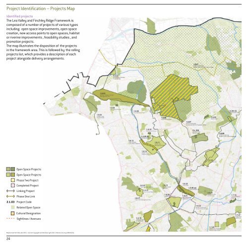
Project Identification – Projects Map<br />
Identified projects<br />
The Lea <strong>Valley</strong> <strong>and</strong> <strong>Finchley</strong> <strong>Ridge</strong> Framework is<br />
composed of a number of projects of various types<br />
including: open space improvements, open space<br />
creation, new access points to open spaces, habitat<br />
or riverine improvements , feasibility studies , <strong>and</strong><br />
promotion projects.<br />
The map illustrates the disposition of the projects<br />
in the framework area. This is followed by the rolling<br />
projects list, which provides a description of each<br />
project alongside delivery arrangements.<br />
2.1.03<br />
24<br />
Open Space Projects<br />
Open Space Projects<br />
Phase Two Project<br />
Completed Project<br />
Linking Project<br />
Phase One Link<br />
Project Code<br />
Related Open Space<br />
Cultural Designation<br />
Sightlines / Avenues<br />
Map derived from GiGL data 2011 - © Crown Copyright <strong>and</strong> database right 2011. Ordnance Survey 100032216.