Vision Document on National GIS - Ministry Of Earth Sciences
Vision Document on National GIS - Ministry Of Earth Sciences
Vision Document on National GIS - Ministry Of Earth Sciences
- TAGS
- ministry
- sciences
- dod.nic.in

You also want an ePaper? Increase the reach of your titles
YUMPU automatically turns print PDFs into web optimized ePapers that Google loves.
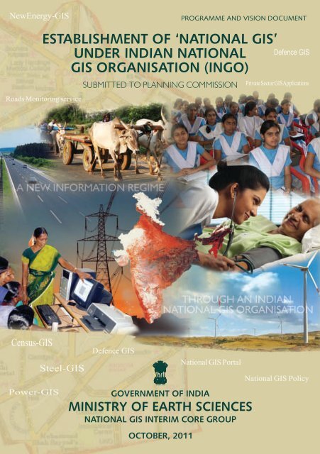
ESTABLISHMENT OF “NATIONAL<br />
<strong>GIS</strong>” UNDER INDIAN NATIONAL<br />
<strong>GIS</strong> ORGANISATION (INGO)<br />
SUBMITTED TO PLANNING COMMISSION<br />
GOVERNMENT OF INDIA<br />
MINISTRY OF EARTH SCIENCES<br />
NATIONAL <strong>GIS</strong> INTERIM CORE GROUP<br />
OCTOBER, 2011
INFORMATION <strong>GIS</strong><br />
VISION<br />
A NEW INFORMATION REGIME SUPPORTING<br />
GOOD GOVERNANCE, SUSTAINABLE<br />
DEVELOPMENT AND CITIZEN<br />
EMPOWERMENT<br />
THROUGH<br />
AN INDIAN NATIONAL <strong>GIS</strong> ORGANISATION<br />
OFFERING<br />
<strong>GIS</strong> DECISION SUPPORT SERVICES FOR<br />
GOVERNANCE, PRIVATE ENTERPRISE AND<br />
CITIZENS<br />
AND MAINTAINING<br />
A NATION-WIDE, STANDARDISED,<br />
SEAMLESS AND MOST-CURRENT <strong>GIS</strong> ASSET<br />
FOR THE NATION
PREFACE<br />
The most effective means of depicting events or phenomena over space and time<br />
is through spatial representati<strong>on</strong> or a map. A Map explains relati<strong>on</strong>ship between<br />
different objects or processes. At the beginning of our civilizati<strong>on</strong>, informati<strong>on</strong><br />
was represented as an artistic depicti<strong>on</strong>. Today, with the advent of remote sensing,<br />
Global positi<strong>on</strong>ing system, organizati<strong>on</strong> of databases around Geographic Informati<strong>on</strong><br />
System as well as advances in computing and communicati<strong>on</strong> technologies and<br />
digital cartography has revoluti<strong>on</strong>ized the map making.<br />
India is growing rapidly and will c<strong>on</strong>tinue to do so in coming years. We will need<br />
robust informati<strong>on</strong> and decisi<strong>on</strong> support systems to aid decisi<strong>on</strong> making process<br />
for planning and implementati<strong>on</strong> of various developmental programs. Geographical<br />
Informati<strong>on</strong> Systems or <strong>GIS</strong> will be mainstay around which such informati<strong>on</strong> and<br />
decisi<strong>on</strong> support systems can be built. In view of this, the Planning Commissi<strong>on</strong><br />
c<strong>on</strong>stituted the Nati<strong>on</strong>al <strong>GIS</strong> Interim Core Group (ICG) to formulate the visi<strong>on</strong>,<br />
define programme details and broad implementati<strong>on</strong> strategy for Nati<strong>on</strong>al <strong>GIS</strong>.<br />
The ICG looked at the status of use of <strong>GIS</strong> in the country. We have several examples<br />
of use of <strong>GIS</strong> in managing disasters, natural resources and envir<strong>on</strong>ment. Many<br />
programs and instituti<strong>on</strong>s such as Nati<strong>on</strong>al Resources Informati<strong>on</strong> System (NRIS)<br />
and Nati<strong>on</strong>al Natural Resources Management System (NNRMS) of the Indian Space<br />
Research Organizati<strong>on</strong>, Nati<strong>on</strong>al Spatial Data Infrastructure (NSDI) and Nati<strong>on</strong>al<br />
Resources Data Management System (NRDMS) of Department of Science and<br />
Technology, Nati<strong>on</strong>al Informatics Centre (NIC), to name few, have been implemented<br />
and provided vital inputs. The tsunami warning system has been built around <strong>GIS</strong><br />
and is capable of providing informati<strong>on</strong> about travel time and run up heights at<br />
1600 locati<strong>on</strong>s al<strong>on</strong>g the Indian Ocean within minutes. However, the use of <strong>GIS</strong> in<br />
many vital sectors such as agriculture, health, educati<strong>on</strong>, rural and urban<br />
development, infrastructure, etc can further be improved. We are yet to utilize the<br />
full potential of <strong>GIS</strong> technology - especially in governance, planning and decisi<strong>on</strong><br />
support.<br />
The ICG had number of c<strong>on</strong>sultati<strong>on</strong>s with various central and state governments,<br />
industries, academia and n<strong>on</strong>-governmental organizati<strong>on</strong>s – thus expanding widely<br />
the opportunity to many professi<strong>on</strong>als to participate in the visi<strong>on</strong>ing exercise. The<br />
final round of c<strong>on</strong>sultati<strong>on</strong> was held in the Nati<strong>on</strong>al Workshop <strong>on</strong> September 14,<br />
2011. In fact, over the series of c<strong>on</strong>sultati<strong>on</strong>s, almost 150+ experts have c<strong>on</strong>tributed<br />
and helped the ICG in this activity.
The ICG, over 6 meetings, also deliberated extensively to develop the c<strong>on</strong>cept of<br />
Nati<strong>on</strong>al <strong>GIS</strong> and the Indian Nati<strong>on</strong>al <strong>GIS</strong> Organisati<strong>on</strong> (INGO). The ICG c<strong>on</strong>sidered<br />
each and every input/recommendati<strong>on</strong> very carefully and addressed them in most<br />
appropriate manner for the visi<strong>on</strong> activity. ICG has obtained about 200+ inputs<br />
and suggesti<strong>on</strong>s – many of which have found way into the visi<strong>on</strong> and programme<br />
document – thereby making the visi<strong>on</strong> document as inclusive as possible.<br />
Nati<strong>on</strong>al <strong>GIS</strong> is mainly a <strong>GIS</strong>-based Decisi<strong>on</strong> Support initiative <strong>on</strong> a well-founded<br />
<strong>GIS</strong>Ready data that is maintained and seamlessly available for the whole nati<strong>on</strong>. It<br />
is expected that N<strong>GIS</strong> will benefit all, including government, industries, academia<br />
and private citizen. Government will be a great beneficiary as it would access a<br />
most modern tool that provides instant and updated <strong>GIS</strong> data and applicati<strong>on</strong>s<br />
that will aid m<strong>on</strong>itoring and implementati<strong>on</strong> of programs. The process of<br />
establishment and subsequent operati<strong>on</strong>alisati<strong>on</strong> would provide c<strong>on</strong>siderable<br />
opportunities for private sector to c<strong>on</strong>tribute and be a part of this nati<strong>on</strong>al<br />
endeavor. Nati<strong>on</strong>al <strong>GIS</strong> would also give a boost to educati<strong>on</strong> and research in <strong>GIS</strong>.<br />
To that extent, it will be a nati<strong>on</strong>al capability building that will make India a<br />
fore-fr<strong>on</strong>t nati<strong>on</strong> in usage of <strong>GIS</strong> for nati<strong>on</strong>-development and also in knowledge<br />
of <strong>GIS</strong> technology that would be important in the geo-political arena.<br />
The ICG feels that the visi<strong>on</strong> and programme definiti<strong>on</strong> exercise has been quite<br />
fruitful and has resulted in focusing a unique and innovati<strong>on</strong> nati<strong>on</strong>al capability<br />
of <strong>GIS</strong> and is of firm opini<strong>on</strong> that India is now ready and prepared to implement<br />
Nati<strong>on</strong>al <strong>GIS</strong> for development and governance.<br />
With the submissi<strong>on</strong> of this report to Planning Commissi<strong>on</strong>, ICG has completed<br />
its main task. I would like to thank all my colleagues in ICG for their c<strong>on</strong>tributi<strong>on</strong>s<br />
in preparing the visi<strong>on</strong> for the Nati<strong>on</strong>al <strong>GIS</strong>.<br />
(Shailesh R Nayak)<br />
Secretary, MoES & Chairman, Nati<strong>on</strong>al <strong>GIS</strong> ICG<br />
(secretary@moes.gov.in)<br />
October 10, 2011
CONTENTS<br />
PREFACE<br />
EXECUTIVE SUMMARY..................................................................................................................................................... i<br />
INDIA – CHALLENGES AHEAD …… AN OUTLOOK ..............................................................................................1<br />
1. INTRODUCTION ......................................................................................................................................................5<br />
2. STATUS OF <strong>GIS</strong> ACTIVITIES .................................................................................................................................7<br />
3. IMPORTANCE AND RELEVANCE OF <strong>GIS</strong> FOR INDIA ..................................................................................9<br />
4. VISION OF NATIONAL <strong>GIS</strong> ................................................................................................................................ 13<br />
5. SCOPE AND OBJECTIVES OF NATIONAL <strong>GIS</strong> .......................................................................................... 17<br />
5.1.NATIONAL <strong>GIS</strong> ............................................................................................................................................... 17<br />
5.1.1. Nati<strong>on</strong>al <strong>GIS</strong> Infrastructure ....................................................................................................... 18<br />
5.1.1.1. Nati<strong>on</strong>al <strong>GIS</strong> Dashboard ......................................................................................... 20<br />
5.1.2. Nati<strong>on</strong>al <strong>GIS</strong> Asset ........................................................................................................................ 21<br />
5.1.3. Nati<strong>on</strong>al <strong>GIS</strong> Applicati<strong>on</strong>s – A <strong>GIS</strong>-Decisi<strong>on</strong> Support System (<strong>GIS</strong>-DSS) .................24<br />
5.1.3.1. Nati<strong>on</strong>al <strong>GIS</strong>-DSS - Governance ...........................................................................25<br />
5.1.3.2. Nati<strong>on</strong>al <strong>GIS</strong>-DSS – Enterprises ............................................................................ 30<br />
5.1.3.3. Nati<strong>on</strong>al <strong>GIS</strong>-DSS – Citizens .................................................................................. 30<br />
5.1.3.4. Nati<strong>on</strong>al <strong>GIS</strong>-DSS – Development Framework .............................................. 30<br />
5.1.4. Nati<strong>on</strong>al <strong>GIS</strong> Portal ........................................................................................................................ 31<br />
5.1.5. Nati<strong>on</strong>al <strong>GIS</strong> Capacity-Building .................................................................................................32<br />
5.1.5.1. Training Needs: Nati<strong>on</strong>al <strong>GIS</strong> Capacity-Building ............................................33<br />
5.1.5.2. Educati<strong>on</strong> Needs: Nati<strong>on</strong>al <strong>GIS</strong> Capacity-Building ....................................... 34<br />
5.1.5.3. Research Needs: Nati<strong>on</strong>al <strong>GIS</strong> Capacity-Building .........................................34<br />
5.1.6. Nati<strong>on</strong>al <strong>GIS</strong> Policy ........................................................................................................................ 35<br />
5.2.IMPLEMENTING NATIONAL <strong>GIS</strong> – AN AGILE ORGANISATION STRUCTURE: INGO .............. 36<br />
5.2.1. INGO – An Agile Organisati<strong>on</strong> ..................................................................................................37<br />
5.2.2. INGO’s Mandate ............................................................................................................................. 38<br />
5.2.3. Structure of INGO ........................................................................................................................ 39<br />
5.2.4. INGO’s Human Resources ......................................................................................................... 41<br />
5.2.5. Performance Metrics definiti<strong>on</strong> for Nati<strong>on</strong>al <strong>GIS</strong> and INGO ......................................42<br />
5.2.6. Linkage of INGO with States, Private sector, NGOSs, Academia ............................ 42<br />
6. STANDARDS, SPATIAL FRAMEWORKS AND BEST-PRACTICES ...........................................................45<br />
7. ROLE DEFINITION FOR NATIONAL <strong>GIS</strong> ACTIVITIES ................................................................................ 49<br />
8. NATIONAL <strong>GIS</strong> AND INTEGRATING NSDI/NNRMS AND LINKAGES WITH<br />
GOVERNEMENT MINISTRIES .............................................................................................................................. 51
9. FUNDING PRINCIPLES FOR NATIONAL <strong>GIS</strong> .................................................................................................55<br />
10. SCHEDULE ...............................................................................................................................................................57<br />
REFERENCES/DISCUSSIONS ................................................................................................................................. 59<br />
TABLE-1: A BRIEF OVERVIEW OF <strong>GIS</strong> ACTIVITIES IN INDIA ............................................................................61<br />
TABLE-2: STATE-OF-ART <strong>GIS</strong> ACTIVITIES IN THE GLOBAL ARENA .............................................................64<br />
TABLE-3: BROAD DETAILS OF NATIONAL <strong>GIS</strong> INFRASTRUCTURE ............................................................66<br />
TABLE-4: LIST OF NATIONAL <strong>GIS</strong> ASSET CONTENT ........................................................................................67<br />
TABLE-5: NATIONAL <strong>GIS</strong> STANDARD ....................................................................................................................77<br />
TABLE – 6: PARAMETERS FOR NATIONAL <strong>GIS</strong> APPLICATIONS AND SERVICES STANDARD ............ 81<br />
TABLE-7: PERFORMANCE METRICS FOR NATIONAL <strong>GIS</strong> ............................................................................... 82<br />
THANKS TO ..................................................................................................................................................................... 83<br />
ANNEXURE-I: NATIONAL <strong>GIS</strong> ICG ORDER ............................................................................................................87<br />
ANNEXURE-2: RECORD OF NATIONAL <strong>GIS</strong> WORKSHOP ...............................................................................91
EXECUTIVE SUMMARY<br />
India is <strong>on</strong> a path of progress and growth. In the 12th Plan, focus is <strong>on</strong> agriculture; manufacturing;<br />
infrastructure, rural c<strong>on</strong>nectivity, health and educati<strong>on</strong> services and addressing special challenges for<br />
vulnerable/deprived areas. Looking even ahead, it is possible that Indian GDP would approach $9-10<br />
trilli<strong>on</strong> by 2025 powered largely by domestic demand and the transformati<strong>on</strong> to a highly industrialized<br />
and technologically advanced ec<strong>on</strong>omy.<br />
With such a level of ec<strong>on</strong>omy, developmental activities in India will demand a new paradigm and<br />
Governance regimes will need c<strong>on</strong>siderable change – moving from the traditi<strong>on</strong>al allocati<strong>on</strong> systems<br />
to determining equitable systems. This would require a scientific mapping of the needs/aspirati<strong>on</strong>s/<br />
desires and limitati<strong>on</strong>s of the beneficiaries and society, especially the most disadvantaged; transparent<br />
systems of inclusivity of citizen participati<strong>on</strong> and entitlements; guaranteed development/service<br />
delivery with high-level of accountability of governance systems and a very effective (feed-back) and<br />
resp<strong>on</strong>sive redressal system.<br />
India will require a vastly different informati<strong>on</strong> regime to arm itself for meeting the above challenges<br />
of a trilli<strong>on</strong>-level of ec<strong>on</strong>omy – powered by very efficient nati<strong>on</strong>al informati<strong>on</strong> systems that will have<br />
to be the foundati<strong>on</strong> for the governing and the governed – bringing the assessment of development<br />
needs, bridging disparity and gaps, bringing equity, transparency, inclusivity and citizen participati<strong>on</strong>.<br />
One such area is Geographical Informati<strong>on</strong> Systems – a <strong>GIS</strong> based Decisi<strong>on</strong> Support System (DSS) will<br />
be essential and important. <strong>GIS</strong> will also be an arena of technological and developmental edge. In the<br />
transforming world, nati<strong>on</strong>s that will possess a sound and progressive system of geographical<br />
informati<strong>on</strong> management will lead and chart ways in their own nati<strong>on</strong>al and internati<strong>on</strong>al arena far<br />
ahead of those that would use more traditi<strong>on</strong>al forms of informati<strong>on</strong> management.<br />
In the above nati<strong>on</strong>al perspective, it is imperative that ……… NATIONAL <strong>GIS</strong> IS AN IMPORTANT<br />
AND CRITICAL NEED.<br />
1. Geographical Informati<strong>on</strong> System (<strong>GIS</strong>) is a system (of hardware/Software/data/applicati<strong>on</strong>s/<br />
policies) that deals with spatially referenced and geographically tagged/linked data. <strong>GIS</strong><br />
allows analysis and integrati<strong>on</strong> of various map/image layers and geo-tagged tabular data to<br />
determine the spatial distributi<strong>on</strong> (say, distributi<strong>on</strong> of hospitals or distributi<strong>on</strong> of flooding in<br />
a city and so <strong>on</strong>), the relati<strong>on</strong>ship between the spatial distributi<strong>on</strong> (say, distributi<strong>on</strong> of hospitals<br />
to roads or flooding spread to Emergency Centres and so <strong>on</strong>), and the correlati<strong>on</strong> of the<br />
variables (does populati<strong>on</strong> correlate with land use or the correlati<strong>on</strong> between soils, slopes,<br />
land use to determine the sediment yield in a reservoir and so <strong>on</strong>) in a geographic unit.<br />
Further, the capability of <strong>GIS</strong> systems now allows creating map visualizati<strong>on</strong> of tabular data<br />
and making amenable the spatial or map representati<strong>on</strong> of populati<strong>on</strong> data, migrati<strong>on</strong> data,<br />
c<strong>on</strong>sumer data, financial transacti<strong>on</strong>s, and beneficiary data and so <strong>on</strong>.<br />
i
2. Applicati<strong>on</strong>s of <strong>GIS</strong> have great nati<strong>on</strong>al relevance and can support governance activities,<br />
help prepare sustainable development strategies, involve citizens in participatory democracy,<br />
enable enterprises to manage business better and bring geographical knowledge to citizens.<br />
3. In India, <strong>GIS</strong> technology is widely used and a good knowledge-base has been created over<br />
the years. <strong>GIS</strong> based initiatives of the Natural Resources Informati<strong>on</strong> System under Nati<strong>on</strong>al<br />
Natural Resources Management System (NNRMS); Nati<strong>on</strong>al Spatial Data Infrastructure (NSDI)<br />
of Department of Science and Technology (DST); Bhuvan Image Portal of Department of<br />
Space (DOS); Delhi State Spatial Data Infrastructure(DSSDI) of Delhi State; Nati<strong>on</strong>al Urban<br />
Informati<strong>on</strong> System (NUIS) of <strong>Ministry</strong> of Urban Development (MUD); establishing G2G <strong>GIS</strong><br />
by Nati<strong>on</strong>al Informatics Centre (NIC); recent efforts at modernizati<strong>on</strong> of land records under<br />
NRLMP; various City-<strong>GIS</strong>s (example Mumbai, Bangalore, Kanpur, Kolkata and many others)<br />
and many other have been implemented. In additi<strong>on</strong>, various <strong>GIS</strong> initiatives of the states<br />
have helped bring good examples of state-wide applicati<strong>on</strong>s of <strong>GIS</strong>. Some private sector<br />
agencies have also been successful in implementing <strong>GIS</strong> soluti<strong>on</strong>s and in providing <strong>GIS</strong> services.<br />
4. In spite of fairly wide usage of <strong>GIS</strong> as a technology, the potential of <strong>GIS</strong> has not been<br />
exploited for decisi<strong>on</strong>-support by planners, stake holders for governance-process, decisi<strong>on</strong>makers,<br />
citizens and many others. Some of the above initiatives have certainly been successful<br />
to prove <strong>GIS</strong> applicati<strong>on</strong> potentials through specific project objectives but <strong>GIS</strong> is yet to get<br />
assimilated and become a part of the process of governance, planning and nati<strong>on</strong>-building<br />
in a significant manner.<br />
5. In today’s transforming world, nati<strong>on</strong>s that will possess a sound and progressive system of<br />
<strong>GIS</strong> will lead and chart ways in their own nati<strong>on</strong>al and in the internati<strong>on</strong>al arena far ahead of<br />
those that would be dependent <strong>on</strong> other nati<strong>on</strong> initiatives for their nati<strong>on</strong>al needs. A nati<strong>on</strong>al<br />
capability in <strong>GIS</strong> is very much required for India to be independent and gain that essential<br />
technological edge in the internati<strong>on</strong>al arena.<br />
6. The major gaps that have been seen in the wide usage of <strong>GIS</strong> include:<br />
6.1. <strong>GIS</strong> is technology centric BUT needs to be Decisi<strong>on</strong>-centric – thereby powering decisi<strong>on</strong><br />
making and this means that decisi<strong>on</strong>-makers – government, enterprises, citizens should<br />
be easily making use of a readily available <strong>GIS</strong> system that can help them to take<br />
better decisi<strong>on</strong>s. What is required is to make <strong>GIS</strong> “so easy to use” for the USER that it<br />
becomes a part and parcel of a governance and nati<strong>on</strong>-building process.<br />
6.2. There is yet no availability of <strong>GIS</strong>-Ready data for the whole country and no agency in<br />
India has overall resp<strong>on</strong>sibility for this activity Thus the sustaining efforts of any<br />
USER to prepare <strong>GIS</strong>-Ready data (which is quite an involved technical activity) and<br />
gaining adequate insights into the ever-changing technology scene of <strong>GIS</strong> becomes<br />
over-whelming for a USER (government user) and inhibit its wider usage.<br />
ii
6.3. <strong>GIS</strong> as project implementati<strong>on</strong>s serve limited operati<strong>on</strong>al purpose as these projects<br />
have a shelf-life and do not get integrated into the process of governance and decisi<strong>on</strong>making<br />
– thus not providing the c<strong>on</strong>tinuity required.<br />
6.4. <strong>GIS</strong> needs to come <strong>on</strong> to every pers<strong>on</strong>’s desk – so that just like using documentati<strong>on</strong><br />
tools or database tools the pers<strong>on</strong> can easily use <strong>GIS</strong> tools for his work relating to<br />
government, enterprise or citizen-interface.<br />
7. C<strong>on</strong>sistent with the government’s visi<strong>on</strong> of bringing a new paradigm for governance and<br />
development with emphasis <strong>on</strong> participatory approach from communities and citizens, the<br />
visi<strong>on</strong> of Nati<strong>on</strong>al <strong>GIS</strong> is aligned to enable a scientific mapping of the resources, needs and<br />
aspirati<strong>on</strong>s of beneficiaries and society, especially the most disadvantaged; support<br />
sustainable and spatial planning; assist quick and reliable m<strong>on</strong>itoring of plan implementati<strong>on</strong><br />
and status of development; enable transparent systems for inclusivity of society and support<br />
real-time mapping of feed-back and redressal systems.<br />
8. The Nati<strong>on</strong>al <strong>GIS</strong> is envisi<strong>on</strong>ed as a critical support to the nati<strong>on</strong>al governance and<br />
developmental process, providing <strong>GIS</strong> support to many aspects of the nati<strong>on</strong>al ec<strong>on</strong>omic<br />
and governance process that would benefit the nati<strong>on</strong>.<br />
9. The goal is two-fold – <strong>on</strong>e, to establish a “Nati<strong>on</strong>al <strong>GIS</strong>” as a technology platform and, two,<br />
to realise an organisati<strong>on</strong>al structure of Indian Nati<strong>on</strong>al <strong>GIS</strong> Organisati<strong>on</strong> (INGO) that will be<br />
resp<strong>on</strong>sible for Nati<strong>on</strong>al <strong>GIS</strong> system, maintaining and operating the <strong>GIS</strong> Platform.<br />
10. The major elements of the Nati<strong>on</strong>al <strong>GIS</strong> platform include following specific activities:<br />
10.1. Nati<strong>on</strong>al <strong>GIS</strong> Infrastructure as a <strong>GIS</strong> Platform and the computing and networking<br />
infrastructure for the Nati<strong>on</strong>al <strong>GIS</strong>. The Nati<strong>on</strong>al <strong>GIS</strong> platform would be developed,<br />
hosted, and based in India. As part of the Nati<strong>on</strong>al <strong>GIS</strong> infrastructure, it is planned to<br />
positi<strong>on</strong> Nati<strong>on</strong>al <strong>GIS</strong> Dashboards for key dignitaries such as PM <strong>Of</strong>fice (PMO); Planning<br />
Commissi<strong>on</strong> and Cabinet Secretariat for high-level reviews/meets etc and promote<br />
the <strong>GIS</strong> usage to key dignitary-levels.<br />
10.2. Nati<strong>on</strong>al <strong>GIS</strong> Asset has organised geo-database of the Nati<strong>on</strong>al <strong>GIS</strong> Asset and<br />
maintaining it. The Nati<strong>on</strong>al <strong>GIS</strong> Asset is proposed to be organized at two-levels -<br />
Seamless, nati<strong>on</strong>-wide <strong>GIS</strong> c<strong>on</strong>tent equivalent to 1:10,000 scale and pockets of “geostitched”<br />
city-level larger scale <strong>GIS</strong> Asset (wherever and as and when available). Nati<strong>on</strong>al<br />
<strong>GIS</strong> Asset includes ~41+ <strong>GIS</strong> Features and a wide range of ~15+ sectoral geo-tagged<br />
attributes/tabular data from census, demographics, planning and development,<br />
infrastructure and other sectoral datasets of ministries/states. It is also proposed to<br />
allow crowd-sourced geo-tagged data c<strong>on</strong>tent into the Nati<strong>on</strong>al <strong>GIS</strong> as an additi<strong>on</strong>al<br />
iii
“citizen-layer” where citizens can populate their datasets grievance-points etc <strong>on</strong> the<br />
<strong>GIS</strong> frame.<br />
10.3. Nati<strong>on</strong>al <strong>GIS</strong> DSS Applicati<strong>on</strong>s enabling <strong>GIS</strong> Asset and Applicati<strong>on</strong>s as a service for<br />
different ministries/departments in government; target groups in private enterprises<br />
and also for citizens. Some of the core <strong>GIS</strong> Applicati<strong>on</strong>s are:<br />
10.3.1. Plan-<strong>GIS</strong> for Planning Commissi<strong>on</strong> supporting the planning, m<strong>on</strong>itoring and<br />
reviewing plans and development.<br />
10.3.2. <strong>GIS</strong> for Public services as part of PIII services in various areas.<br />
10.3.3. Rural-<strong>GIS</strong> for various rural development programmes of the <strong>Ministry</strong> of Rural<br />
Development.<br />
10.3.4. City-<strong>GIS</strong> service to planning, management and development of ~5200 urban<br />
areas for <strong>Ministry</strong> of Urban Development.<br />
10.3.5. Roads M<strong>on</strong>itoring service for PMGSY as well as a Roads-<strong>GIS</strong> for NHAI/<br />
<strong>Ministry</strong> of Surface Transport<br />
10.3.6. Health-<strong>GIS</strong> service as part of support to the <strong>Ministry</strong> of Health & Family<br />
Welfare<br />
10.3.7. Water Resources-<strong>GIS</strong> for water resources management of <strong>Ministry</strong> of Water<br />
Resources<br />
10.3.8. Agri-<strong>GIS</strong> service for the Agriculture and Farm sector through <strong>Ministry</strong> of<br />
Agriculture<br />
10.3.9. <strong>GIS</strong> for Disaster Management Support for supporting management of<br />
disaster for NDMA<br />
10.3.10. <strong>GIS</strong> for Infrastructure sector be they in roads and highways, rail systems,<br />
airport infrastructure or other social infrastructure.<br />
10.3.11. Env-<strong>GIS</strong> for Envir<strong>on</strong>ment and Climate Change m<strong>on</strong>itoring of <strong>Ministry</strong> of<br />
Envir<strong>on</strong>ment and Forests<br />
10.3.12. <strong>GIS</strong> for Aadhar integrated with UID<br />
10.3.13. Census-<strong>GIS</strong> for Registrar General of India<br />
10.3.14. Weather-<strong>GIS</strong> and ES-<strong>GIS</strong> for IMD/MoES.<br />
10.3.15. <strong>GIS</strong> for Security as a support for the security programmes of <strong>Ministry</strong> of<br />
Home Affairs.<br />
10.3.16. NE-<strong>GIS</strong> for meeting the <strong>GIS</strong> data and DSS needs of MONER<br />
10.3.17. Coal-<strong>GIS</strong> for <strong>Ministry</strong> of Coal for supporting coal mining activities<br />
10.3.18. HeavyIndustry-<strong>GIS</strong> for Department of Heavy Industries<br />
10.3.19. NewEnergy-<strong>GIS</strong> for <strong>Ministry</strong> of New and Renewable Energy<br />
10.3.20. Tourism-<strong>GIS</strong> for supporting <strong>Ministry</strong> of Tourism<br />
10.3.21. Panchayat-<strong>GIS</strong> in support of <strong>Ministry</strong> of Panchayati Raj<br />
iv
10.3.22. Stat-<strong>GIS</strong> for the <strong>Ministry</strong> of Statistics and Programme Implementati<strong>on</strong><br />
10.3.23. Power-<strong>GIS</strong> in support of Minister of Power<br />
10.3.24. Steel-<strong>GIS</strong> in support of <strong>Ministry</strong> of Steel and its mining PSUs<br />
10.3.25. <strong>GIS</strong> data access applicati<strong>on</strong>s for use for Defence <strong>GIS</strong> requirements.<br />
10.3.26. Provide for private sector <strong>GIS</strong> applicati<strong>on</strong>s to be hosted and published <strong>on</strong><br />
the Nati<strong>on</strong>al <strong>GIS</strong>.<br />
10.3.27. Citizen access to Nati<strong>on</strong>al <strong>GIS</strong> would be enabled through simple <strong>GIS</strong><br />
Applicati<strong>on</strong>s and integrated e-services.<br />
10.4. Nati<strong>on</strong>al <strong>GIS</strong> Portal development as a single gateway access - with detailed modules<br />
of <strong>GIS</strong> Metadata search, <strong>GIS</strong> data access and <strong>GIS</strong> applicati<strong>on</strong>s access by integrating<br />
the Applicati<strong>on</strong>s<br />
10.5. Capacity building and training whereby the <strong>GIS</strong> training to different ministries and<br />
user groups needs to be taken up. As part of the Nati<strong>on</strong>al <strong>GIS</strong> efforts, it is important<br />
to address the training, educati<strong>on</strong> and research needs as part of the overall capacitybuilding.<br />
It is important to enable nati<strong>on</strong>al interventi<strong>on</strong>s for a knowledge innovati<strong>on</strong><br />
programme and “boosting” present instituti<strong>on</strong>al mechanisms of training, educati<strong>on</strong><br />
and much needed research in <strong>GIS</strong>.<br />
10.6. Nati<strong>on</strong>al <strong>GIS</strong> would comply with current nati<strong>on</strong>al policies. It is essential to have a<br />
Nati<strong>on</strong>al <strong>GIS</strong> Policy for all <strong>GIS</strong> c<strong>on</strong>tent and it should define how activities of <strong>GIS</strong> data<br />
usage and applicati<strong>on</strong>s can be undertaken in the country. INGO would work closely<br />
with Department of Space, Survey of India and other data providing or user agencies<br />
to help positi<strong>on</strong> a pragmatic Nati<strong>on</strong>al <strong>GIS</strong> Policy from time-to-time.<br />
11. Nati<strong>on</strong>al <strong>GIS</strong> is an important and critical nati<strong>on</strong>al requirement and it is recognized that an<br />
organizati<strong>on</strong>al framework will be essential for bringing focus and for instituti<strong>on</strong>alizing the<br />
Nati<strong>on</strong>al <strong>GIS</strong> and promoting the geo-spatial technology usage within government, enterprises<br />
and by citizens. It is important that an AGENCY IS MADE RESPONSIBLE FOR <strong>GIS</strong> IN THE<br />
COUNTRY.<br />
12. It would be appropriate to positi<strong>on</strong> INGO as an organisati<strong>on</strong> that has the flexibility and agility<br />
to meet the needs at various stages of development and growth of Nati<strong>on</strong>al <strong>GIS</strong>. The driving<br />
requirement of the <strong>GIS</strong> organisati<strong>on</strong> is to shape and align all disparate comp<strong>on</strong>ents relating<br />
to geospatial informati<strong>on</strong> infrastructure, technology and services so far evolved in the<br />
country. It should have the primary mandate for the establishment, maintenance and<br />
operati<strong>on</strong>s of the Nati<strong>on</strong>al <strong>GIS</strong> and be resp<strong>on</strong>sible for <strong>GIS</strong> activities in the country.<br />
13. INGO is proposed to be an arm of the Planning Commissi<strong>on</strong>. The INGO can draw best of the<br />
“two-worlds” – the checks and balances of the government system and the intensive<br />
performance drive and positive efficiency of the private-sector. INGO must develop with a<br />
v
usiness-culture right from beginning as after the initial establishment stage the organisati<strong>on</strong><br />
would transform itself into a business model for growth and performance.<br />
14. At the apex level, a Nati<strong>on</strong>al <strong>GIS</strong> Council (NGC) is proposed to be established and it would<br />
be the key strategy and policy body for guiding the activities of Nati<strong>on</strong>al <strong>GIS</strong>. The NGC could<br />
be chaired by (ICG Proposal: H<strong>on</strong>’ble Prime Minister) with Deputy Chairman, Planning<br />
Commissi<strong>on</strong> as Co-Chair; Minister(s) of S&T and Planning; Adviser to PM <strong>on</strong> Public Informati<strong>on</strong><br />
Infrastructure and Innovati<strong>on</strong>; Cabinet Secretary and Member (Science), Planning Commissi<strong>on</strong><br />
as Members.<br />
15. At the operati<strong>on</strong>al level, a fully-empowered Nati<strong>on</strong>al <strong>GIS</strong> Board (NGB) could be the body for<br />
deciding, approving, overseeing and m<strong>on</strong>itoring the activities of Nati<strong>on</strong>al <strong>GIS</strong> and INGO. The<br />
NGB could be Chaired by Member (Science), Planning Commissi<strong>on</strong> and have all relevant<br />
Secretaries - DST, DOS, Agriculture, Rural Development, Urban Development, Health, Planning<br />
Commissi<strong>on</strong>, Home, Defence, Mines, <strong>Earth</strong> <strong>Sciences</strong>, IT and others; selected state<br />
representati<strong>on</strong> (as required) and selected internati<strong>on</strong>al/nati<strong>on</strong>al <strong>GIS</strong> experts (as required<br />
and <strong>on</strong> case by case basis) and CEO of INGO as its Member-Secretary. The NGB as a fully<br />
empowered body would guide, define procedures, approve and accord programmatic,<br />
procurement/c<strong>on</strong>tracting, hiring/recruiting, financial authorisati<strong>on</strong>s and oversight for the<br />
overall activities of INGO and ensure that nati<strong>on</strong>al needs of <strong>GIS</strong> are coordinated across<br />
different ministries/departments and assimilated under INGO.<br />
16. It is proposed to obtain the best <strong>GIS</strong> professi<strong>on</strong>al in the nati<strong>on</strong> to head the INGO as its CEO.<br />
It is proposed that this is accomplished through suitable “search” process within India for<br />
this key positi<strong>on</strong>. To enable the high-level coordinati<strong>on</strong> and also for enabling aut<strong>on</strong>omy of<br />
functi<strong>on</strong>ing and authority, it would be essential to positi<strong>on</strong> the CEO equivalent to Secretary,<br />
Government of India.<br />
17. A team of ~50 pers<strong>on</strong>s could be c<strong>on</strong>tracted/recruited <strong>on</strong> term-basis as experts from<br />
government/private sector agencies, with best practices, to serve as Project Staff for the<br />
Nati<strong>on</strong>al <strong>GIS</strong> and INGO activities. Much of the work could be c<strong>on</strong>tracted through well designed<br />
RFPs and to private industry for implementati<strong>on</strong>. Highly professi<strong>on</strong>al c<strong>on</strong>sultants could be<br />
engaged, wherever needed, to serve specific technical needs of INGO.<br />
18. It is essential to adopt modern practices to drive the performance of Nati<strong>on</strong>al <strong>GIS</strong> and INGO<br />
- based <strong>on</strong> a set of established metrics/KPIs for measuring performance and by adopting a<br />
360o evaluati<strong>on</strong> for performance.<br />
19. Right from beginning, it is envisaged that the success of INGO would be possible <strong>on</strong>ly if<br />
states/local bodies are also involved – as ultimately the management acti<strong>on</strong>s have to be<br />
vi
implemented by the states/local level. Thus, INGO could encourage states to set up State/<br />
Local <strong>GIS</strong> and add-<strong>on</strong> <strong>GIS</strong> databases for governance/development of states.<br />
20. INGO must be founded with a str<strong>on</strong>g industry linkage and must establish Nati<strong>on</strong>al <strong>GIS</strong> and<br />
INGO activities in terms of manageable projects through private sector participati<strong>on</strong>. INGO<br />
would also link with academia to further specific research in the <strong>GIS</strong> domain that will make<br />
Nati<strong>on</strong>al <strong>GIS</strong> more productive and more widely used.<br />
21. Standardisati<strong>on</strong> and Process definiti<strong>on</strong> would be key for the success of Nati<strong>on</strong>al <strong>GIS</strong>. The<br />
Nati<strong>on</strong>al <strong>GIS</strong> would, in fact, have a suite of nati<strong>on</strong>al Standards – broadly two categories of<br />
Standards, namely:<br />
21.1. Basic <strong>GIS</strong> Standards for Nati<strong>on</strong>al <strong>GIS</strong> and its activities - defining the c<strong>on</strong>tent and its<br />
characteristics of Nati<strong>on</strong>al <strong>GIS</strong> Asset; <strong>GIS</strong> database standards for the Nati<strong>on</strong>al <strong>GIS</strong><br />
database, <strong>GIS</strong> Quality Standards etc<br />
21.2. Service Level Integrati<strong>on</strong> Standards: The success of Nati<strong>on</strong>al <strong>GIS</strong> is also dependant <strong>on</strong><br />
the integrati<strong>on</strong> <strong>GIS</strong> services to other nati<strong>on</strong>al services, database and applicati<strong>on</strong>s (like<br />
E-Governance; ERP, CRM etc)<br />
22. The Nati<strong>on</strong>al <strong>GIS</strong> Standards must be founded <strong>on</strong> principles of “open standards” and be<br />
“inter-operable” across platforms and systems and be neutral to any technology (thus, not<br />
being tied with any particular <strong>GIS</strong> or System technology). The Nati<strong>on</strong>al <strong>GIS</strong> Standards must be<br />
c<strong>on</strong>sistent) with internati<strong>on</strong>al ISO TC211 standardisati<strong>on</strong> efforts – especially as India is already<br />
committed to ISO/TC standardisati<strong>on</strong> efforts through the Bureau of Indian Standards (ISO is<br />
a multi-lateral body for standardisati<strong>on</strong> and India is represented by BIS).<br />
23. Existing <strong>GIS</strong> Standards like NNRMS Standard of 2005, NSDI Metadata Standards of 2001/2009<br />
and NSDI Exchange Standards of 2001; NUIS Standards of 2004 have been studied and can<br />
be easily updated/enhanced and integrated into Nati<strong>on</strong>al <strong>GIS</strong> Standards 2011 definiti<strong>on</strong>.<br />
24. The following Standardisati<strong>on</strong> activities would be required:<br />
24.1. Nati<strong>on</strong>al <strong>GIS</strong> C<strong>on</strong>tent Standard and a Nati<strong>on</strong>al <strong>GIS</strong> C<strong>on</strong>tent Thesaurus<br />
24.2. Nati<strong>on</strong>al Spatial Framework (NSF) definiti<strong>on</strong>. While WGS-84 datum can be standardised,<br />
it is important that the geographic projecti<strong>on</strong> be adopted by Nati<strong>on</strong>al <strong>GIS</strong>.<br />
24.3. Nati<strong>on</strong>al <strong>GIS</strong> Database Standard<br />
24.4. Nati<strong>on</strong>al <strong>GIS</strong> Quality Standards.<br />
24.5. Nati<strong>on</strong>al <strong>GIS</strong> Metadata Standard<br />
24.6. Nati<strong>on</strong>al <strong>GIS</strong> Applicati<strong>on</strong>s and Services Standard<br />
24.7. Nati<strong>on</strong>al <strong>GIS</strong> Portal Security Standard.<br />
vii
25. INGO, at the time of implementati<strong>on</strong> and based <strong>on</strong> design decisi<strong>on</strong>s, must also develop<br />
different <strong>GIS</strong> Process <str<strong>on</strong>g>Document</str<strong>on</strong>g>s that define the steps and methods for various activities<br />
– almost 11 practice documentati<strong>on</strong>s will be required.<br />
26. C<strong>on</strong>sidering the importance and criticality of the Nati<strong>on</strong>al <strong>GIS</strong> Standards and also noting the<br />
c<strong>on</strong>tinuously evolving nature of the technology, it would be appropriate to have a<br />
Expert Standing Committee for Nati<strong>on</strong>al <strong>GIS</strong> Standards – c<strong>on</strong>sisting of technical experts<br />
in the nati<strong>on</strong>. Such a technical standing committee can be tasked to help INGO define,<br />
develop, review, update the Nati<strong>on</strong>al <strong>GIS</strong> Standards.<br />
27. INGO must bring about “commitment” of Anchor Agency roles for some key expert agencies<br />
– say, SOI and/or ISRO/NNRMS for <strong>GIS</strong> Asset related activities; NIC for Infrastructure and <strong>GIS</strong><br />
Apps related activities and so <strong>on</strong>. Anchor Agencies are critical as they have the expertise<br />
and human resources to undertake resp<strong>on</strong>sible coordinati<strong>on</strong>/supervisi<strong>on</strong>/QA/QC for<br />
specific elements.<br />
28. Indian industry would have a major role to play in terms of offering high-quality, successoriented,<br />
committed and cost-effective services and work with Anchor Agencies under<br />
c<strong>on</strong>tractual obligati<strong>on</strong>s to INGO. Private sector can undertake bulk of activities by taking up<br />
design and implementati<strong>on</strong> processes.<br />
29. Leading instituti<strong>on</strong>s of repute and knowledge-capacity could be brought in to undertake<br />
specialised performance assessment, policy reviews and provide forward-looking “thinktank”<br />
activities for Nati<strong>on</strong>al <strong>GIS</strong>.<br />
30. Academia and training/educati<strong>on</strong> instituti<strong>on</strong>s (both in public and private sector) could be<br />
encouraged by INGO to undertake the capacity-building and research/training activities.<br />
31. It is ESSENTIAL AND IMPORTANT that Nati<strong>on</strong>al <strong>GIS</strong> and INGO collate the NNRMS and NSDI<br />
aspirati<strong>on</strong>s by properly linking/integrating and ensuring that no duplicati<strong>on</strong> of efforts happen<br />
– this will have to be very clearly worked out at time of implementati<strong>on</strong> of Nati<strong>on</strong>al <strong>GIS</strong>.<br />
32. ICG suggests that any structural integrati<strong>on</strong>/dove-tailing of proposed Nati<strong>on</strong>al <strong>GIS</strong> structure<br />
and present NSDI structure is d<strong>on</strong>e at an appropriate level by Planning Commissi<strong>on</strong>.<br />
33. INGO must build and develop close linkages with each user ministry to support organising<br />
respective ministry-specific <strong>GIS</strong> data needs; linking to Nati<strong>on</strong>al <strong>GIS</strong> and also developing<br />
applicati<strong>on</strong>s for user Ministries. INGO would also address the training needs and provide all<br />
technical anchoring/procurement for any <strong>GIS</strong> support to users.<br />
34. It is envisaged that Government funding for the establishment of the Nati<strong>on</strong>al <strong>GIS</strong> is an<br />
imperative – especially as it has the primary resp<strong>on</strong>sibility to establish the basic<br />
viii
<strong>GIS</strong> infrastructure that helps the nati<strong>on</strong>, as a whole. A business model will become viable<br />
when the basic <strong>GIS</strong> infrastructure is established and it will be possible to attract private<br />
sector investment for Nati<strong>on</strong>al <strong>GIS</strong> operati<strong>on</strong>s.<br />
35. The Implementati<strong>on</strong> of the INGO and Nati<strong>on</strong>al <strong>GIS</strong> could be carried out in 3 major phases:<br />
35.1. Preparatory Phase (through this ICG) (2-3 m<strong>on</strong>ths for <str<strong>on</strong>g>Visi<strong>on</strong></str<strong>on</strong>g>ing, design, standards<br />
characterizati<strong>on</strong> and approvals): <str<strong>on</strong>g>Visi<strong>on</strong></str<strong>on</strong>g> Task, wherein the intent will be to prepare a<br />
Blue-Print for the Nati<strong>on</strong>al <strong>GIS</strong> platform and allow for a smooth implementati<strong>on</strong>. This<br />
activity would be completed by the Interim Core Group.<br />
35.2. There would be a period of 1-2 m<strong>on</strong>ths for necessary government approvals and the<br />
formal establishment of INGO (and positi<strong>on</strong>ing of CEO and a minimal level team to<br />
start with) – which can then start the Nati<strong>on</strong>al <strong>GIS</strong> activities. This is the start time “T”<br />
for all subsequent activities.<br />
35.3. Nati<strong>on</strong>al <strong>GIS</strong> Versi<strong>on</strong> 1.0 and INGO (about 6-9 m<strong>on</strong>ths from ”T”): Starting with the<br />
establishment of INGO, implementati<strong>on</strong> of the Pilot stage of Nati<strong>on</strong>al <strong>GIS</strong> by organizing<br />
Nati<strong>on</strong>al <strong>GIS</strong> Asset Versi<strong>on</strong> 1.0 using 1:50K NSF and available SOI 1:50K base with add<strong>on</strong><br />
of available thematic maps; develop and positi<strong>on</strong> key Nati<strong>on</strong>al <strong>GIS</strong> Applicati<strong>on</strong>s<br />
(for few ministries - Plan-<strong>GIS</strong> for Planning Commissi<strong>on</strong>; <strong>GIS</strong> for Public Services and<br />
Rural-<strong>GIS</strong> for <strong>Ministry</strong> of Rural Development and others); establishment of Nati<strong>on</strong>al<br />
<strong>GIS</strong> Portal; implementing 2 Nati<strong>on</strong>al <strong>GIS</strong> dashboard for PMO and Planning Commissi<strong>on</strong>;<br />
initiate <strong>GIS</strong> Capacity-building activities and efforts for positi<strong>on</strong>ing Nati<strong>on</strong>al <strong>GIS</strong> Policy.<br />
35.4. Nati<strong>on</strong>al <strong>GIS</strong> Versi<strong>on</strong> 2.0 (about 36 m<strong>on</strong>ths from ”T”): Building up<strong>on</strong> Nati<strong>on</strong>al <strong>GIS</strong> Versi<strong>on</strong><br />
1.0 by translating to 1:10k NSF (which has to be freshly d<strong>on</strong>e); establishing 1:10k<br />
Nati<strong>on</strong>al <strong>GIS</strong> Asset for whole country; develop and positi<strong>on</strong> full-scale Nati<strong>on</strong>al <strong>GIS</strong><br />
Apps for governance, full-scale access to private <strong>GIS</strong> Applicati<strong>on</strong>s and also Nati<strong>on</strong>al<br />
<strong>GIS</strong> Applicati<strong>on</strong>s for citizen access; c<strong>on</strong>tinue <strong>GIS</strong> Capacity-building activities; INGO to<br />
c<strong>on</strong>tinuously service <strong>GIS</strong> needs of government agencies<br />
36. Subsequent to this, the updati<strong>on</strong>/maintenance cycle of Nati<strong>on</strong>al <strong>GIS</strong> Asset layers <strong>on</strong> a yearly<br />
basis (or determined cyclic basis) and further support for Nati<strong>on</strong>al <strong>GIS</strong> Applicati<strong>on</strong>s would<br />
have to be taken up.<br />
ix
INDIA – CHALLENGES AHEAD …… AN OUTLOOK<br />
India has a geographical area of about 3.29 milli<strong>on</strong> sq kms and a populati<strong>on</strong> of 1.2 billi<strong>on</strong>, of which<br />
an estimated <strong>on</strong>e third lives in urban areas. India has more than 6.40 lakh villages and more than<br />
5200 cities/towns. Land under active agriculture in India extends to about 1.4 milli<strong>on</strong> sq kms but<br />
still <strong>on</strong>e-sixth of its total area in wastelands. With just about 22% under forest/vegetati<strong>on</strong> cover<br />
and a coastline of ~7500 kms, the envir<strong>on</strong>mental and ecological challenges are many.<br />
India is <strong>on</strong> a path of progress and growth. Despite the challenges of a large populati<strong>on</strong>, the nati<strong>on</strong><br />
has achieved sustained growth all-round. As per Panning Commissi<strong>on</strong>’s assessments (“Issues for<br />
the Approach to the Twelfth Plan”, which is accessible at http://planningcommissi<strong>on</strong>.nic.in/plans/<br />
planrel/12appdrft/12appdrft.htm), GDP growth for the 11th Plan is likely to be 8.2%. Agricultural<br />
growth has improved; there has been progress in poverty reducti<strong>on</strong> and also that in the areas of<br />
health, educati<strong>on</strong> and upliftment of society. As India plans for the next 5 years, a key issue facing<br />
the country is to map the growth of the country. Planning Commissi<strong>on</strong> has proposed a target of<br />
9-9.5% in the referred document. But challenges are many, including need to maintain agricultural<br />
growth, growing demand for infrastructure, growing skill shortages, envir<strong>on</strong>ment and natural<br />
resources, particularly energy and water.<br />
What are the imperatives that Planning Commissi<strong>on</strong> envisages for the 12th Plan? An inclusive<br />
growth strategy is being charted with focus <strong>on</strong>:<br />
• Better performance in agriculture (at least 4% growth).<br />
• Faster creati<strong>on</strong> of jobs in manufacturing. We should specify a target for extra jobs to be<br />
created in this sector in next 5 years. This will be worked out in greater detail, but at its<br />
heart lies our ability to spread industrial growth more widely.<br />
• Creati<strong>on</strong> of appropriate infrastructural facilities in a widely dispersed manner to support<br />
the agricultural and manufacturing growth required.<br />
• Rural c<strong>on</strong>nectivity is particularly important - especially in the backward areas and NE.<br />
• There must be a much str<strong>on</strong>ger effort at health services, educati<strong>on</strong> and skill development –<br />
making a new genre of knowledgeable Indians<br />
• Reforming the government to increase effectiveness of flagship programmes and in achieving<br />
the objective of greater performance and productivity.<br />
• Special challenges focused for vulnerable/deprived groups and backward regi<strong>on</strong>s. The need<br />
for a special focus <strong>on</strong> “backward” regi<strong>on</strong>s is urgent.<br />
Looking even ahead, with a 2011-12 GDP expected to be around 2 trilli<strong>on</strong> USD, it is possible that<br />
Indian GDP would approach $9-10 trilli<strong>on</strong> by 2025. This sustained growth of the ec<strong>on</strong>omy would<br />
be powered largely by domestic demand and the transformati<strong>on</strong> to a highly industrialized and<br />
1
technologically advanced ec<strong>on</strong>omy. With such a level of ec<strong>on</strong>omy, developmental activities in<br />
India will demand a new paradigm and thought-process and India’s geo-political presence as a<br />
dominant ec<strong>on</strong>omic power will be significantly impacting within and even globally.<br />
India will make a significant difference in the coming years in the world scene.<br />
India will have to be significantly different –transforming its process of planning, implementati<strong>on</strong><br />
and development. In the coming years, Governance regimes will need c<strong>on</strong>siderable change –<br />
moving from the traditi<strong>on</strong>al allocati<strong>on</strong> systems to determining equitable systems. With large amount<br />
of socially-powered development, governance and public delivery systems will have to be more<br />
based <strong>on</strong> a scientific mapping of the needs/aspirati<strong>on</strong>s/desires and limitati<strong>on</strong>s of the beneficiaries<br />
and society, especially the most disadvantaged; built <strong>on</strong> transparent systems of inclusivity of<br />
citizen participati<strong>on</strong> and entitlements; guaranteed development/service delivery with high-level<br />
of accountability of governance systems and a very effective (feed-back) and resp<strong>on</strong>sive redressal<br />
system. The c<strong>on</strong>cepts of Total Quality Management in governance/public services will have to be<br />
introduced at all levels – from top of governance to the bottom grass-roots level.<br />
India will need professi<strong>on</strong>ally managed and performance oriented governance/delivery<br />
organizati<strong>on</strong>s with clear mandates, accountability and metrics of measuring performance.<br />
Technology will have to play a large role in the governance systems – almost keeping pace with<br />
the rapidly changing technology regimes across the world. Governance will have to be more<br />
effective, speedy, performing and results-oriented with goal-setting at all levels. Much better<br />
mechanisms for “c<strong>on</strong>verging” or “integrating” the multifarious over-lapping activities of departments<br />
and making “agile” and re-generative organisati<strong>on</strong>s will have to be positi<strong>on</strong>ed. A new thinking of<br />
governance structures is called for.<br />
India will require a vastly different informati<strong>on</strong> regime to arm itself for the trilli<strong>on</strong>-level of ec<strong>on</strong>omy<br />
– powered by very efficient nati<strong>on</strong>al informati<strong>on</strong> systems that will have to be the foundati<strong>on</strong> for<br />
the governing and the governed – bringing the assessment of development needs, bridging disparity<br />
and gaps, bringing equity, transparency, inclusivity and citizen participati<strong>on</strong>. Advanced informati<strong>on</strong><br />
systems with technologies of metrics and measurement of disparity/needs/plans/implementati<strong>on</strong><br />
etc; advanced computing and data mining; special technologies of databases etc will be extremely<br />
important.<br />
One such area is Geographical Informati<strong>on</strong> Systems – surveying/imaging/mapping; geospatial<br />
databases with geo-tagged tabular data; integrative geographical applicati<strong>on</strong>s that will form a <strong>GIS</strong><br />
based Decisi<strong>on</strong> Support System (DSS) will be essential and important. <strong>GIS</strong> is an important technology<br />
area which brings vast benefits to governing systems and also to the stakeholders (citizens) by<br />
bringing about the geographical depicti<strong>on</strong> of disparity (gaps/needs) and development. <strong>GIS</strong> forms<br />
2
the basis of a DSS that is powered by latest image and map informati<strong>on</strong> and transforms reaming<br />
tables into graphic maps.<br />
<strong>GIS</strong> will be an arena of technological and developmental edge. In the transforming world, nati<strong>on</strong>s<br />
that will possess a sound and progressive system of geographical informati<strong>on</strong> management will<br />
lead and chart ways in their nati<strong>on</strong>al and internati<strong>on</strong>al arena far ahead of those that would use<br />
more traditi<strong>on</strong>al forms of informati<strong>on</strong> management.<br />
In the above nati<strong>on</strong>al perspective, it is imperative that ……… NATIONAL <strong>GIS</strong> IS AN<br />
IMPORTANT AND CRITICAL NEED.<br />
3
1. INTRODUCTION<br />
1. Geographical Informati<strong>on</strong> Systems (<strong>GIS</strong>) are systems (of hardware, software, data, applicati<strong>on</strong>s<br />
and policies) that deal with spatially referenced and geographically tagged or linked data.<br />
Over the past 40-50 years, <strong>GIS</strong> technology has evolved into an “integrating” technology that<br />
encompasses surveying & positi<strong>on</strong>ing, map-making and cartography, imaging and image<br />
interpretati<strong>on</strong>, databases, computing and networking technology. Applicati<strong>on</strong>s of <strong>GIS</strong> are<br />
varied and support natural resources management, disaster management, planning and<br />
development, envir<strong>on</strong>mental management, land and water management, ocean and marine<br />
research, climate change and many other areas where people, society are involved. Thus,<br />
<strong>GIS</strong> has become not <strong>on</strong>ly an important technology but is also becoming a tool that assists in<br />
governance, development of society and supports citizen activities.<br />
2. <strong>GIS</strong> allows integrati<strong>on</strong> of multiple maps/image with geo-tagged tabular data and enables<br />
determine spatial patterns and choice based <strong>on</strong> spatial criteri<strong>on</strong>s. For example, <strong>GIS</strong> allows to<br />
determine the spatial distributi<strong>on</strong> of features/objects (say, distributi<strong>on</strong> of hospitals or<br />
distributi<strong>on</strong> of flooding in a city and so <strong>on</strong>), the relati<strong>on</strong>ship am<strong>on</strong>g entities in a spatial<br />
distributi<strong>on</strong> (say, distributi<strong>on</strong> of hospitals to roads or flooding spread to Emergency Centres<br />
and so <strong>on</strong>) and the correlati<strong>on</strong> of multiple spatial variables (does populati<strong>on</strong> correlate with<br />
land use or the correlati<strong>on</strong> between soils, slopes, land use to determine the sediment yield<br />
in a reservoir and so <strong>on</strong>) in geographic space (say, in a district, a watershed or a nati<strong>on</strong> or<br />
the whole <strong>Earth</strong> itself). Further, today’s <strong>GIS</strong> systems allow creating map visualizati<strong>on</strong> of and<br />
making amenable the spatial or map representati<strong>on</strong> of tabular data – say, populati<strong>on</strong> data,<br />
migrati<strong>on</strong> data, c<strong>on</strong>sumer data, financial transacti<strong>on</strong>s, and beneficiary data and so <strong>on</strong>, thereby<br />
allowing creati<strong>on</strong> of populati<strong>on</strong> maps, c<strong>on</strong>sumer maps and their visualisati<strong>on</strong>.<br />
3. Applicati<strong>on</strong>s of <strong>GIS</strong> has seen a quantum jump with its integrati<strong>on</strong> <strong>on</strong> the Web platform -<br />
which now provides a <strong>GIS</strong> engine and fr<strong>on</strong>t-end <strong>GIS</strong> interface to any users <strong>on</strong> a simple<br />
browser. From a technology perspective, the <strong>GIS</strong> Web comp<strong>on</strong>ent can interface with any<br />
type of client - desktop, mobile or Web and serving <strong>GIS</strong> maps and <strong>GIS</strong> Applicati<strong>on</strong>s prolifically<br />
to a large community of users. <strong>GIS</strong> users can now create pervasive geographic knowledge –<br />
their own maps, their <strong>GIS</strong> models and their own workflows and decisi<strong>on</strong>-rules and Geo-web<br />
services can deliver this <strong>GIS</strong> knowledge to every<strong>on</strong>e and, thereby, help better understand<br />
data correlati<strong>on</strong>s in spatial format and therefore help in better decisi<strong>on</strong>s to be made.<br />
4. Applicati<strong>on</strong>s of <strong>GIS</strong> have great social and nati<strong>on</strong>al relevance and can support activities of<br />
government, enable enterprises to better manage business processes and bring important<br />
geographical knowledge to citizens. Thus, <strong>GIS</strong> has c<strong>on</strong>siderable impact <strong>on</strong> the ec<strong>on</strong>omies<br />
of local, regi<strong>on</strong>al, and nati<strong>on</strong>al governance and development - by creating greater efficiency<br />
in informati<strong>on</strong> understanding, more visual communicati<strong>on</strong> for better comprehensi<strong>on</strong> of<br />
informati<strong>on</strong> and better decisi<strong>on</strong> making by informati<strong>on</strong> integrati<strong>on</strong>.<br />
5
2. STATUS OF <strong>GIS</strong> ACTIVITIES<br />
5. In India, <strong>GIS</strong> technology has been in use from 1980s and a good knowledge-base in <strong>GIS</strong> has<br />
been created over the years. <strong>GIS</strong> is being used in many government and private organizati<strong>on</strong>s<br />
and large number of <strong>GIS</strong> applicati<strong>on</strong> projects have been implemented. With the availability of<br />
multi-resoluti<strong>on</strong> satellite images; topographical and thematic maps (forest maps, geological<br />
maps, groundwater maps, soil maps etc), many <strong>GIS</strong> based initiatives have been implemented.<br />
Notable <strong>on</strong>es are the Natural Resources Informati<strong>on</strong> System under Nati<strong>on</strong>al Natural Resources<br />
Management System (NNRMS); Nati<strong>on</strong>al Spatial Data Infrastructure (NSDI) of Department of<br />
Science and Technology (DST); Bhuvan Image Portal of Department of Space (DOS); Delhi<br />
State Spatial Data Infrastructure(DSSDI) of Delhi State; Nati<strong>on</strong>al Urban Informati<strong>on</strong> System<br />
(NUIS) of <strong>Ministry</strong> of Urban Development (MUD); G2G <strong>GIS</strong> by Nati<strong>on</strong>al Informatics Centre<br />
(NIC); recent efforts at modernizati<strong>on</strong> of land records under NRLMP; various City-<strong>GIS</strong>s (example<br />
Mumbai, Bangalore, Kanpur, Kolkata and many others) and many others. In additi<strong>on</strong>, various<br />
states have also undertaken <strong>GIS</strong> initiatives to support state-level projects. <strong>Of</strong> late, many<br />
private sector <strong>GIS</strong> projects have also been successful in the commercial domain. All of the<br />
above have helped in creating a good knowledge- and user-base of <strong>GIS</strong> in the country.<br />
6. TABLE-1 shows the characteristics of the major <strong>GIS</strong> efforts in the country. The table lists a<br />
sampling of agencies that have significant and comprehensive <strong>GIS</strong> related activities and are<br />
menti<strong>on</strong>ed here to more illustrate the wide-range of our nati<strong>on</strong>al capabilities in <strong>GIS</strong>.<br />
7. In the last decade, many nati<strong>on</strong>s have c<strong>on</strong>sidered a “cooperative sharing” framework for<br />
maps and images under the Spatial Data Infrastructure (SDI) c<strong>on</strong>cept – where map/image<br />
data generating agencies agree to share their maps/images as per defined standards. India<br />
too embarked <strong>on</strong> a nati<strong>on</strong>al SDI (NSDI) in early 2000s and from 2005 <strong>on</strong>wards a NSDI<br />
Secretariat coordinates the SDI activities under the Department of Science and technology.<br />
However, the framework of SDI is becoming more of a sharing-platform of map generating<br />
agencies (putting up whatever maps are generated) and serves limited manner for usage of<br />
<strong>GIS</strong> by user agencies/ministries/citizens as part of a decisi<strong>on</strong>-making process. Thus, the SDI<br />
c<strong>on</strong>cept has been seen as unable to bridge the ever-existing gap between what map/image<br />
data is readily available with what <strong>GIS</strong> image/data the decisi<strong>on</strong>-process requires. Many<br />
advanced nati<strong>on</strong>s have realized this gap and recognize that a nati<strong>on</strong>-wide, seamless <strong>GIS</strong><br />
data that is readily available is required and is fundamental to make <strong>GIS</strong> a part and parcel of<br />
decisi<strong>on</strong>-process. Some advanced and developing nati<strong>on</strong>s, like, USA, China (China has g<strong>on</strong>e<br />
ahead and established a multi-agency framework for a nati<strong>on</strong>al <strong>GIS</strong> in China), Australia, Brazil,<br />
Ind<strong>on</strong>esia and some others, are already in the process of extensively working <strong>on</strong> a nati<strong>on</strong>wide<br />
<strong>GIS</strong> and also in establishing a <strong>GIS</strong> which supports its government and citizens with<br />
most advanced decisi<strong>on</strong>-support mechanisms.<br />
7
8. TABLE - 2 shows a summary of how some nati<strong>on</strong>s are undertaking geo-spatial data/<br />
applicati<strong>on</strong>s services.<br />
9. In spite of fairly wide usage of <strong>GIS</strong> as a technology in India, the potential of <strong>GIS</strong> has not<br />
reached where it can make a major impact – for governance, decisi<strong>on</strong>-makers, citizens and<br />
many others. While the present <strong>GIS</strong> efforts have certainly been successful to prove <strong>GIS</strong><br />
potential and have achieved several project objectives, <strong>GIS</strong> is yet to become assimilated<br />
and part of the process of governance, planning and nati<strong>on</strong>-building in entirety. The capability<br />
of <strong>GIS</strong> as a Decisi<strong>on</strong> Support tool in making qualitative and significant difference to decisi<strong>on</strong>s<br />
of government has not yet been exploited.<br />
8
3. IMPORTANCE AND RELEVANCE OF <strong>GIS</strong> FOR INDIA<br />
10. Applicati<strong>on</strong>s of <strong>GIS</strong> can be critical to many aspects of governance and nati<strong>on</strong> building and<br />
can help in reaching the gains of development to the most needy people at the most needy<br />
locati<strong>on</strong>s in the most scientific and transparent manner. Thus, <strong>GIS</strong> can power and support<br />
open-governance methods by involving citizens, opening up informati<strong>on</strong> in easy-tounderstand<br />
map formats and also assist to bring in accountability and resp<strong>on</strong>sibility of public<br />
and governance activities. Applicati<strong>on</strong>s of <strong>GIS</strong> not <strong>on</strong>ly benefit domain of societal governance<br />
but also in areas of governance in nati<strong>on</strong>al security and strategic areas. At the same time,<br />
<strong>GIS</strong> can also help enterprises by enabling spatial soluti<strong>on</strong>s in support of their enterprise<br />
activities (be it in private participati<strong>on</strong> of nati<strong>on</strong>al-building or in the efficiency of businesses).<br />
Citizens too can benefit from the <strong>GIS</strong> by enabling the mapping of their aspirati<strong>on</strong>s, demands,<br />
complaints and suggesti<strong>on</strong>s and become important stake-holders in nati<strong>on</strong>al development.<br />
11. There is tremendous focus for growth in the country and the drive is to achieve it in a<br />
sustainable and rapid manner. Achievement of these goals will crucially depend up<strong>on</strong> the<br />
quality of decisi<strong>on</strong> making at all levels – the demand will be for scientific, sustainable and<br />
participatory decisi<strong>on</strong>-making that can satisfy society and improve the quality of life at all<br />
levels.<br />
12. <strong>GIS</strong> plays an impacting and expanding role in supporting decisi<strong>on</strong> making process. Hence,<br />
when it comes to <strong>GIS</strong> focus must be <strong>on</strong> Decisi<strong>on</strong> Support and emphasis must be <strong>on</strong><br />
improving quality of DECISION MAKING.<br />
13. <strong>GIS</strong> can be a major differentiator for decisi<strong>on</strong>-making at all levels of governance and nati<strong>on</strong>building<br />
– be it in government, in enterprises or by citizens; be it central, state or local-body<br />
levels or be it for l<strong>on</strong>g-term planning or for immediate decisi<strong>on</strong>s. In fact, <strong>GIS</strong> must be able<br />
address all the hierarchical levels – nati<strong>on</strong>al, regi<strong>on</strong>al and state level and then going down to<br />
district and Panchayat level and also covering all government, enterprise and citizen needs.<br />
14. <strong>GIS</strong> is not just about images and maps, but must include a whole host of spatial data<br />
representati<strong>on</strong> of geo-tagged developmental data tables - all of which comprises the<br />
“integrated” <strong>GIS</strong>-c<strong>on</strong>tent for the nati<strong>on</strong>. It must be recognized that in just producing best<br />
satellite images or best topographic maps or best forest maps etc is just half the problem<br />
addressed for a <strong>GIS</strong> Decisi<strong>on</strong> Support. Unless these are fused with large volumes of<br />
development data of government the sec<strong>on</strong>d half of the Decisi<strong>on</strong> Support is not bridged.<br />
Today, with such a readily-available and easily-usable “integrated” <strong>GIS</strong> c<strong>on</strong>tent not available<br />
in the nati<strong>on</strong>, our nati<strong>on</strong>al decisi<strong>on</strong>-process is always denied of this crucial differentiator<br />
and decisi<strong>on</strong>s not <strong>on</strong>ly lack the benefit of the <strong>GIS</strong> approach but are also unable to even<br />
exploit the benefits that can accrue from the simple usage of images and maps.<br />
9
15. Structurally, the government is organized in sectors – thus data collecti<strong>on</strong> and mapping is<br />
also sectoral – BUT what <strong>GIS</strong> can do is enrichment of informati<strong>on</strong> by integrating across<br />
these “sectoral systems” into an integrated data system. Such an “integrated” <strong>GIS</strong> dataset<br />
can be easily super-imposed and correlated to bring to fore new geographical-data<br />
relati<strong>on</strong>ships and patterns, hither-to unavailable, and not just bring scientific perspective of<br />
decisi<strong>on</strong>s but also help determine the right decisi<strong>on</strong>-alternatives right down to grass-roots<br />
level. This will enable making better and qualified decisi<strong>on</strong>s and help sustainable development<br />
with a participatory approach.<br />
16. Presently, there is <strong>on</strong>e major “deterrent” that a prospective user of <strong>GIS</strong> faces in India. India<br />
today lacks <strong>GIS</strong>-Ready data which is most current and which a USER can easily access and<br />
use (though pockets of <strong>GIS</strong>-Ready data maybe are generated by some agency in specific<br />
project mode). In spite of the high-quality satellite images, large amount of survey and mapping<br />
in form of topographic map, forest maps, census data or even image data etc, this gap of<br />
organizing all of these into <strong>GIS</strong>-Ready form still exists. Thus, either the prospective <strong>GIS</strong> USER<br />
has to put tremendous efforts each time in organizing <strong>GIS</strong>-ready data from these maps/<br />
images for Decisi<strong>on</strong> Support activity. So, many a time, even if a USER wants to use <strong>GIS</strong> for<br />
decisi<strong>on</strong>-making, he may be discouraged by the tremendous technological “processing” <strong>on</strong>e<br />
has to get into – and thus may not really exploit the potential of <strong>GIS</strong> to support his decisi<strong>on</strong>making.<br />
17. There is yet another major aspect that needs to be addressed to make <strong>GIS</strong> a part and parcel<br />
of the decisi<strong>on</strong>-process. If <strong>GIS</strong> has to be embedded into a work- or decisi<strong>on</strong>-process, then<br />
it needs to be assured that the <strong>GIS</strong>-Ready data is c<strong>on</strong>stantly updated and so that currency<br />
of data is most recent for the governance process and usage. Further, new sets of <strong>GIS</strong>-<br />
Ready data that becomes possible with advances in <strong>GIS</strong> technology – say, maps <strong>on</strong> 1:10k<br />
scale or larger; re-surveyed land ownership data; terrain data <strong>on</strong> 3D; underground assets <strong>GIS</strong><br />
data in cities; crowd sourced data and so <strong>on</strong> must also get assured to the <strong>GIS</strong> USER and<br />
c<strong>on</strong>tinuously improve the <strong>GIS</strong> Decisi<strong>on</strong> Support services over time.<br />
18. Enabling a wide usage of <strong>GIS</strong> based Decisi<strong>on</strong> Support also requires building policy envir<strong>on</strong>ment<br />
for <strong>GIS</strong> over and above the existing present policies and create an “integrating” and overarching<br />
policy framework. While government has the Remote Sensing Data Policy, 2011 for<br />
disseminati<strong>on</strong> of Remote Sensing images and the Nati<strong>on</strong>al Map Policy, 2005 for usage and<br />
disseminati<strong>on</strong> of SOIs topographic maps, these basically address the individual, but important,<br />
elements of images and topographic maps disseminati<strong>on</strong>. However, as has been emphasized<br />
<strong>GIS</strong> is much more than just images and SOI maps. There is no clear definiti<strong>on</strong> of policies and<br />
guidelines for the range of <strong>GIS</strong> activities that are essential for the Decisi<strong>on</strong> Support – both<br />
from <strong>GIS</strong> data and applicati<strong>on</strong>s service provisi<strong>on</strong> and <strong>GIS</strong> data and applicati<strong>on</strong>s usage point<br />
10
of view. Thus, there is a need for a comprehensive <strong>GIS</strong> Policy which over-arches the existing<br />
images and topographic maps policy definiti<strong>on</strong>s but also covers the gamut of activities of a<br />
<strong>GIS</strong> and that would promote and encourage wide <strong>GIS</strong> usage.<br />
19. It is appropriate to instituti<strong>on</strong>alize the <strong>GIS</strong> activities under an organisati<strong>on</strong>al focus that can<br />
be resp<strong>on</strong>sible and focus <strong>on</strong> addressing the technological, <strong>GIS</strong> data and applicati<strong>on</strong>s services,<br />
inter-organisati<strong>on</strong>al and policy aspects of <strong>GIS</strong>. Presently, each ministry/department or user<br />
entities attempt to address <strong>on</strong> their own the <strong>GIS</strong> activity which is quite a technology-intensive<br />
activity and requires down-stream geo-processing and <strong>GIS</strong> knowledge for organizing the<br />
<strong>GIS</strong>. As a result, multiple effort investments are happening in maintaining the <strong>GIS</strong> data capability<br />
by each ministry/department and the same <strong>GIS</strong>-data is being generated/maintained by each<br />
of the ministry/department. This leads to large-scale duplicati<strong>on</strong> and redundant efforts leading<br />
to tremendous nati<strong>on</strong>al-level data inc<strong>on</strong>sistency in an unsustained manner. There is a need<br />
for a single-window ORGANISATION for generating/maintaining the map/image and <strong>GIS</strong> datasets<br />
as a comm<strong>on</strong> <strong>GIS</strong>-ready data for the nati<strong>on</strong> and also for developing the <strong>GIS</strong> Applicati<strong>on</strong>s<br />
for ministries/departments. This would eliminate the multiple efforts and can enable<br />
ministries/departments and users to avail the <strong>GIS</strong> Decisi<strong>on</strong> Support that would be tuned to<br />
each ministry/department decisi<strong>on</strong>-process.<br />
20. From a global perspective, <strong>GIS</strong> is becoming a critical capability that provides of technological<br />
edge to nati<strong>on</strong>s. In today’s transforming world, nati<strong>on</strong>s that possess an advanced and<br />
progressive system of <strong>GIS</strong> would lead and chart ways in their own nati<strong>on</strong>al and in the<br />
internati<strong>on</strong>al arena far ahead of those that would use more traditi<strong>on</strong>al forms of informati<strong>on</strong><br />
management. <strong>GIS</strong> technology is gaining critical importance in the internati<strong>on</strong>al and multilateral<br />
frameworks – like, addressing cross-cutting issues of envir<strong>on</strong>ment, rivers/drainage<br />
systems, borders, climate change and even in homeland security cooperati<strong>on</strong> and in defence<br />
(particularly as defence equipment and systems are based <strong>on</strong> geospatial technology usage).<br />
A nati<strong>on</strong>al capability in <strong>GIS</strong> is very much required for India to be prepared with its own <strong>GIS</strong>ready<br />
data, satellite images, <strong>GIS</strong> Applicati<strong>on</strong>s and <strong>GIS</strong> infrastructure. Thus, it is essential that<br />
the nati<strong>on</strong> enable itself in <strong>GIS</strong> technology with a knowledge capability that will not <strong>on</strong>ly help<br />
bring benefits of <strong>GIS</strong> to its own nati<strong>on</strong>al development efforts BUT also give it an edge in the<br />
internati<strong>on</strong>al arena. A nati<strong>on</strong>al <strong>GIS</strong> will provide that technological edge to India in the<br />
internati<strong>on</strong>al arena.<br />
21. In summary, the key questi<strong>on</strong>s that need to be addressed are:<br />
21.1. how can the nati<strong>on</strong> ensure that its decisi<strong>on</strong>/governance process is supported by a<br />
comprehensive, easy-to-use <strong>GIS</strong> Decisi<strong>on</strong> Support System that brings scientific,<br />
participatory and quality into decisi<strong>on</strong>s, planning and development<br />
11
21.2. how can the nati<strong>on</strong> ensure that <strong>GIS</strong>-Ready data is easily available and maintained – by<br />
adding a capability over the images and maps that have been invested in<br />
21.3. what instituti<strong>on</strong>al mechanism is required in the country that can be resp<strong>on</strong>sible for<br />
this critical technological and applicati<strong>on</strong>s capability of <strong>GIS</strong> and that can be charged to<br />
meet the <strong>GIS</strong> needs of the country and bring the technological edge in the global<br />
arena.<br />
12
4. VISION OF NATIONAL <strong>GIS</strong><br />
22. C<strong>on</strong>sistent with the government’s visi<strong>on</strong> of faster, sustainable and more inclusive growth,<br />
Nati<strong>on</strong>al <strong>GIS</strong> will help bring a new paradigm for development with emphasis <strong>on</strong> participatory<br />
approach from communities and citizens and support a new model of governance. Within<br />
this larger nati<strong>on</strong>al goal, Nati<strong>on</strong>al <strong>GIS</strong> is envisi<strong>on</strong>ed as a critical support to the nati<strong>on</strong>al<br />
governance and developmental process, providing <strong>GIS</strong> Decisi<strong>on</strong> Support Systems (DSS)<br />
support to various aspects of ec<strong>on</strong>omic and social development and governance processes.<br />
Nati<strong>on</strong>al <strong>GIS</strong> is envisaged to enable a scientific mapping of the nati<strong>on</strong>’s resources, needs<br />
and aspirati<strong>on</strong>s of beneficiaries and society, especially the most disadvantaged; support<br />
sustainable and spatial planning; assist quick and reliable m<strong>on</strong>itoring of plan implementati<strong>on</strong><br />
and status of development; enable transparent systems for inclusivity of society and support<br />
real-time mapping of feed-back and redressal systems.<br />
23. The Nati<strong>on</strong>al <strong>GIS</strong> would be a part of new participatory governance models at local, state and<br />
nati<strong>on</strong>al levels involving government officials, society and citizens; bring accountability and<br />
resp<strong>on</strong>sibility in acti<strong>on</strong>s; promote commerce and business; enable citizens access <strong>GIS</strong> services<br />
and also make the society, at large, to become spatially aware and knowledgeable.<br />
24. The Nati<strong>on</strong>al <strong>GIS</strong> is therefore a "public and merit good" - serving good for larger majority.<br />
The Nati<strong>on</strong>al <strong>GIS</strong> is “missi<strong>on</strong> critical” for nati<strong>on</strong>al and state government, enterprise level <strong>GIS</strong><br />
activity and should also provide a premise for future public and private collaborati<strong>on</strong> within<br />
India in the critical area of <strong>GIS</strong>.<br />
25. Nati<strong>on</strong>al <strong>GIS</strong> is envisi<strong>on</strong>ed to:<br />
25.1. be a major support to GOVERNANCE by embedding <strong>GIS</strong> in different aspects of<br />
governance - planning and implementati<strong>on</strong> at nati<strong>on</strong>al/state/local levels; bringing <strong>GIS</strong><br />
support in decisi<strong>on</strong>-making; enable a sound process of m<strong>on</strong>itoring development and<br />
identifying “gaps in development”; make <strong>GIS</strong> data available at all levels – that helps<br />
bringing accountability and resp<strong>on</strong>sibility in governance.<br />
25.2. support the accelerated development of a number of Enterprise-<strong>GIS</strong> soluti<strong>on</strong>s being<br />
undertaken by private enterprise and help align these to nati<strong>on</strong>al development – by<br />
allowing integrati<strong>on</strong> of the Nati<strong>on</strong>al <strong>GIS</strong> into enterprise soluti<strong>on</strong>s in an appropriate<br />
manner and also c<strong>on</strong>tribute innovative <strong>GIS</strong> software and data c<strong>on</strong>tent/applicati<strong>on</strong>s<br />
for larger and wider use.<br />
25.3. serve the basic needs of citizens by serving nati<strong>on</strong>-wide maps/image/geo-spatial<br />
informati<strong>on</strong>; geo-enabling e-governance and public services and also enabling a “crowdsourced”<br />
interactive process of citizen involvement in providing feed-back/inputs/<br />
data as a virtual geographical ingest.<br />
13
26. Nati<strong>on</strong>al <strong>GIS</strong> must get embedded in all aspects of Planning at nati<strong>on</strong>al/state level; agricultural<br />
development; support disaster management needs; water resources management; managing<br />
climate change; planning of landuse and land records ; urban management; planning better<br />
infrastructure facilities; development of Watersheds; watch and scan of the Envir<strong>on</strong>ment<br />
and empower citizens and communities for better participating in planning and development.<br />
This will require more effective coordinati<strong>on</strong> and cooperati<strong>on</strong> am<strong>on</strong>gst different government<br />
agencies to align and focus synergise the <strong>GIS</strong> data requirements and applicati<strong>on</strong>s across the<br />
government sectors.<br />
27. Through the Planning Commissi<strong>on</strong>, the government should ensure <strong>GIS</strong> usage across its many<br />
ministries, agencies and departments prepare the 12th Plan proposals <strong>on</strong> the backdrop of a<br />
Nati<strong>on</strong>al <strong>GIS</strong> and also deliver ministry/department services <strong>on</strong> the <strong>GIS</strong> Platform.<br />
28. India is embarking <strong>on</strong> a Public Informati<strong>on</strong> Infrastructure (PIII) as a backb<strong>on</strong>e for e-services<br />
and PIII’s e-services must be enabled <strong>on</strong> the Nati<strong>on</strong>al <strong>GIS</strong> platform to serve the basic needs<br />
of citizens, citizen services of e-governance (such as e-Health, e-Legal, e-Files, e-PDS, e-<br />
Registry, NREGA and many others). Citizens could also benefit from access to map and<br />
image informati<strong>on</strong> and simple applicati<strong>on</strong>s like routing, tourism etc.<br />
29. The Nati<strong>on</strong>al <strong>GIS</strong> should also enable the accelerated development of a number of Enterprise<br />
soluti<strong>on</strong>s that power and support many enterprise activities and which can draw “uniform”<br />
<strong>GIS</strong>-Ready data from the Nati<strong>on</strong>al <strong>GIS</strong> - for enterprise soluti<strong>on</strong>s in power, telecom,<br />
infrastructure, aviati<strong>on</strong>, port management and many other sectors. These Enterprise soluti<strong>on</strong>s<br />
often grapple with a combinati<strong>on</strong> of varied technologies (including <strong>GIS</strong>), varying standards<br />
for data and its quality (which are many times unknown) and developing different and<br />
fragmented applicati<strong>on</strong>s which have to be managed in an enterprise envir<strong>on</strong>ment. A<br />
standardised Nati<strong>on</strong>al <strong>GIS</strong> – dove-tailed with standards of other systems would enable a<br />
tightly coupled and seamless integrati<strong>on</strong> facilitating <strong>GIS</strong> enabling of the enterprise soluti<strong>on</strong>s.<br />
30. The Nati<strong>on</strong>al <strong>GIS</strong>, thus, can be a “comm<strong>on</strong> <strong>GIS</strong> platform” and a <strong>GIS</strong> Systems of Systems - for<br />
the support of nati<strong>on</strong>al and state governments, enterprises and others with proper in-built<br />
safe-guards of guarantees of services, security, access, copyright and revenues at the<br />
foundati<strong>on</strong> of the Nati<strong>on</strong>al <strong>GIS</strong>.<br />
31. It is proposed that the Nati<strong>on</strong>al <strong>GIS</strong> be established through a dedicated and resp<strong>on</strong>sible<br />
organisati<strong>on</strong>. A dedicated organisati<strong>on</strong>al structure for India’s Nati<strong>on</strong>al <strong>GIS</strong> will not <strong>on</strong>ly bring<br />
a focused, mandated drive to organize and maintain/update the <strong>GIS</strong> but can also easily<br />
dove-tail the <strong>GIS</strong> into a nati<strong>on</strong>al mainstream of planning/governance, nati<strong>on</strong>-building and<br />
citizen-participati<strong>on</strong>. This organisati<strong>on</strong> will help bridge the gap that exists today for <strong>GIS</strong>-<br />
Ready data.<br />
32. It is envisaged that an organisati<strong>on</strong>al focus for the Nati<strong>on</strong>al <strong>GIS</strong> will give a great boost to <strong>GIS</strong><br />
technology in the country and will ingest much-needed growth to the technology by ensuring<br />
14
its wide usage. This new organisati<strong>on</strong> can also involve the private sector and challenged it<br />
to offer proficient and innovative <strong>GIS</strong> services and create growth of business opportunities<br />
in <strong>GIS</strong> in the country. It is envisaged that Nati<strong>on</strong>al <strong>GIS</strong> can also give a boost to academic and<br />
research activities in <strong>GIS</strong> and give a thrust to innovative and new educati<strong>on</strong>/research activities.<br />
33. Through such an organisati<strong>on</strong> focus, India would be able to gain a pre-eminent positi<strong>on</strong> in<br />
the global <strong>GIS</strong> community and this will help India to play a leadership role in global multilateral<br />
and internati<strong>on</strong>al <strong>GIS</strong> arena.<br />
34. By establishing a Nati<strong>on</strong>al <strong>GIS</strong>, the nati<strong>on</strong> would benefit in various ways:<br />
34.1. Improved efficiency of decisi<strong>on</strong>-making, planning and development acti<strong>on</strong>s by the<br />
powerful <strong>GIS</strong> DSS Applicati<strong>on</strong>s engine that would allow ministries/departments,<br />
citizens etc embed <strong>GIS</strong> applicati<strong>on</strong>s as part of their decisi<strong>on</strong>- and work-processes.<br />
Therefore, Government ministries/departments can deploy sectoral (say, Agri-<strong>GIS</strong>;<br />
Rural-<strong>GIS</strong> and so <strong>on</strong>) <strong>GIS</strong>-DSS easily. Ready availability, accessibility and service of a<br />
<strong>GIS</strong>-Asset for the whole nati<strong>on</strong> of as a collecti<strong>on</strong> of standardised, inter-operable,<br />
seamless and maintained <strong>GIS</strong> datasets<br />
34.2. Improved planning <strong>on</strong> a <strong>GIS</strong> DSS applicati<strong>on</strong>s suite supporting nati<strong>on</strong>al Planning and<br />
Plan M<strong>on</strong>itoring functi<strong>on</strong>s of Planning Commissi<strong>on</strong>;<br />
34.3. Serve unique e-services <strong>on</strong> the <strong>GIS</strong> platform for citizens as part of PIII;<br />
34.4. Availability of nati<strong>on</strong>al (Indian) Standards for Nati<strong>on</strong>al <strong>GIS</strong> datasets, Standards for <strong>GIS</strong><br />
web services, Standards for <strong>GIS</strong> data exchange, Standards for <strong>GIS</strong> Quality, Standards<br />
for <strong>GIS</strong> Metadata and others.<br />
34.5. Positi<strong>on</strong> "volunteered geographic informati<strong>on</strong>" through crowd-sourcing transacti<strong>on</strong>al<br />
workflows that allow citizens/individuals to easily add <strong>GIS</strong> c<strong>on</strong>tent to the Nati<strong>on</strong>al<br />
<strong>GIS</strong> Asset;<br />
34.6. Growth to private sector participati<strong>on</strong> in <strong>GIS</strong> activities by offering efficient <strong>GIS</strong><br />
Applicati<strong>on</strong>s as an all-inclusive support to development activities;<br />
34.7. Positi<strong>on</strong> India in a leading role in internati<strong>on</strong>al <strong>GIS</strong> arena and enabling a larger roleplaying<br />
by India in this critical technology arena in the world.<br />
15
5. SCOPE AND OBJECTIVES OF NATIONAL <strong>GIS</strong><br />
35. The overall scope is two-fold – <strong>on</strong>e, to establish the Nati<strong>on</strong>al <strong>GIS</strong> as a “<strong>GIS</strong> Platform” through,<br />
two, an organisati<strong>on</strong>al structure of the Indian Nati<strong>on</strong>al <strong>GIS</strong> Organisati<strong>on</strong> (INGO). In tandem,<br />
both of these will make the <str<strong>on</strong>g>Visi<strong>on</strong></str<strong>on</strong>g> of Nati<strong>on</strong>al <strong>GIS</strong> a reality and bridge the existing gaps in<br />
positi<strong>on</strong>ing <strong>GIS</strong> Decisi<strong>on</strong> Support and enabling governance, planning and development.<br />
5.1. NATIONAL <strong>GIS</strong><br />
36. Six major elements of the Nati<strong>on</strong>al <strong>GIS</strong> are envisaged – all of which in a holistic manner will<br />
establish the nati<strong>on</strong>-wide <strong>GIS</strong>. These six elements are:<br />
36.1. Nati<strong>on</strong>al <strong>GIS</strong> Infrastructure, a state-of-art computing and networking infrastructure<br />
for hosting/serving the Nati<strong>on</strong>al <strong>GIS</strong> Asset and serving Nati<strong>on</strong>al <strong>GIS</strong> Applicati<strong>on</strong>s<br />
36.2. Nati<strong>on</strong>al <strong>GIS</strong> Asset, a seamless, nati<strong>on</strong>-wide <strong>GIS</strong>-Ready dataset which is standardised<br />
and updated and c<strong>on</strong>figured to meet the <strong>GIS</strong> data and applicati<strong>on</strong> needs of government,<br />
citizens and enterprises.<br />
36.3 Nati<strong>on</strong>al <strong>GIS</strong> DSS Applicati<strong>on</strong>s, a suite of <strong>GIS</strong> applicati<strong>on</strong>s for decisi<strong>on</strong>- and workprocesses<br />
of different ministries/departments in; enterprises <strong>GIS</strong> applicati<strong>on</strong>s and<br />
<strong>GIS</strong> applicati<strong>on</strong>s for public services and citizens.<br />
36.4 Nati<strong>on</strong>al <strong>GIS</strong> Portal, a single gateway access to Nati<strong>on</strong>al <strong>GIS</strong> Asset and Nati<strong>on</strong>al <strong>GIS</strong> DSS<br />
Applicati<strong>on</strong>s - with specialised Metadata service, ingest and publishing services etc<br />
17
36.5 Nati<strong>on</strong>al <strong>GIS</strong> Capacity building, a sustained effort for training and orientati<strong>on</strong> of users/<br />
professi<strong>on</strong>als from government and enterprise in <strong>GIS</strong> and for positi<strong>on</strong>ing an integrated<br />
programme of educati<strong>on</strong> and research in <strong>GIS</strong>.<br />
36.6 <strong>GIS</strong> Policy management and practices, through a c<strong>on</strong>stant policy-definiti<strong>on</strong> and review<br />
that promotes <strong>GIS</strong> usage in the country and creates the envir<strong>on</strong>ment for success of<br />
<strong>GIS</strong> activity in the country.<br />
5.1.1. Nati<strong>on</strong>al <strong>GIS</strong> Infrastructure<br />
37. The Nati<strong>on</strong>al <strong>GIS</strong> Infrastructure must be developed as a state-of-art <strong>GIS</strong> Platform <strong>on</strong> which<br />
the <strong>GIS</strong> Asset and <strong>GIS</strong> DSS Applicati<strong>on</strong>s would “ride” and through which the Nati<strong>on</strong>al <strong>GIS</strong> data<br />
and applicati<strong>on</strong>s can be served. The infrastructure would be a bank of computing facilities,<br />
necessary <strong>GIS</strong> engine and other software, a high-capacity Data Centre, a comprehensive<br />
User Portal and an Administrati<strong>on</strong>/Management Portal with appropriate security and risk<br />
management soluti<strong>on</strong>s.<br />
38. Nati<strong>on</strong>al <strong>GIS</strong> Infrastructure must be architectured with a l<strong>on</strong>g term perspective and be able<br />
to support the Nati<strong>on</strong>al <strong>GIS</strong> activities not just for next few years but for decades ahead.<br />
The facility must be state-of-art that will significantly add to enhance nati<strong>on</strong>al capabilities in<br />
<strong>GIS</strong> technology and applicati<strong>on</strong>s.<br />
39. C<strong>on</strong>figurati<strong>on</strong>s of the <strong>GIS</strong> infrastructure at a broad-level have been studied by ICG through<br />
an expert team of system experts in the country. In c<strong>on</strong>sidering the architecture, the following<br />
important aspects have been c<strong>on</strong>sidered:<br />
39.1. The <strong>GIS</strong> Asset is composed of datasets generated by various agencies- and thus<br />
could be hosted <strong>on</strong> agency systems accessible and seamlessly integrated into the<br />
<strong>GIS</strong> Asset OR <strong>on</strong> INGO systems with INGO datasets that are generated by INGO. Thus,<br />
data servers could be at different places and in different agencies – with a main INGO<br />
hosting-server of <strong>GIS</strong> Asset.<br />
39.2. The Nati<strong>on</strong>al <strong>GIS</strong> Applicati<strong>on</strong>s are also to meet specific governance, enterprise and<br />
citizen demands. While governance demands would be end-to-end <strong>GIS</strong> Applicati<strong>on</strong>s;<br />
enterprise Applicati<strong>on</strong>s would be those that are published and made available by<br />
enterprises (and having a commercial nature) AND citizen Applicati<strong>on</strong>s would be freeto-use<br />
e-services and public <strong>GIS</strong> Applicati<strong>on</strong>s.<br />
39.3. In additi<strong>on</strong>, it is also pragmatic for government to c<strong>on</strong>sider moving away from Capital<br />
Expenditure (CAPEX) model for infrastructure, which requires each and every<br />
government and other organizati<strong>on</strong>s to make c<strong>on</strong>siderable and c<strong>on</strong>tinuous<br />
investments in <strong>GIS</strong> Data Storage/Centers/Systems to a probably suitable Operating<br />
18
Expenditure (OPEX) model so that the large number of government agencies that use<br />
Nati<strong>on</strong>al <strong>GIS</strong> can be freed from the <strong>on</strong>e time investments and overhead costs of<br />
maintenance that is felt as a major barrier for many government agencies and<br />
enterprises in getting benefitted from <strong>GIS</strong> usage. The c<strong>on</strong>cept must be that users<br />
just USE and all other support to ORGANISE is not a user-burden.<br />
40. The “tight-binding” of data and applicati<strong>on</strong>s will require a virtual-seaming of the infrastructure<br />
across agencies/regi<strong>on</strong>s and users – making the c<strong>on</strong>cept of infrastructure virtualisati<strong>on</strong><br />
immensely important. Virtualising a distributed architecture for Nati<strong>on</strong>al <strong>GIS</strong> would bring in<br />
c<strong>on</strong>sistency of systems, data and applicati<strong>on</strong>s – reducing efforts at maintaining data<br />
c<strong>on</strong>sistency, maintenance and also providing seamless access.<br />
41. In an expert assessment carried out under ICG, it is envisi<strong>on</strong>ed that a government-owned<br />
infrastructure in a private “cloud architecture” could be most appropriate – c<strong>on</strong>sidering each<br />
ministry/department, enterprises, citizen data and applicati<strong>on</strong>s as services provided <strong>on</strong> the<br />
“cloud”. It is envisaged that India could benefit from cloud-models for its government and<br />
other services – thus embedding “pay-for-use” c<strong>on</strong>cept for its IT and Nati<strong>on</strong>al <strong>GIS</strong> services<br />
– users can pay for <strong>GIS</strong>-DSS applicati<strong>on</strong>s services OR pay for <strong>GIS</strong> Asset data access services<br />
OR pay for use of Nati<strong>on</strong>al <strong>GIS</strong> Infrastructure services (wither <strong>GIS</strong> engines, database engines<br />
or even hardware) OR pay for customized/dedicated <strong>GIS</strong> services. Appropriate access rules<br />
can be defined so that variable cost-principles are implemented for government access (as<br />
government has funded the Nati<strong>on</strong>al <strong>GIS</strong>), citizen access (sp<strong>on</strong>sored by government due to<br />
its aims of making these services as a nati<strong>on</strong>al commitment) and enterprise access (charged<br />
<strong>on</strong> commercial basis).<br />
42. A Nati<strong>on</strong>al <strong>GIS</strong> platform is envisaged to play a major part in addressing significant improvement<br />
in government and enterprise and citizen <strong>GIS</strong> service delivery. The <strong>GIS</strong> Cloud can significantly<br />
help government departments to straightaway deliver services in easy manner and even<br />
integrate the Nati<strong>on</strong>al <strong>GIS</strong> with other nati<strong>on</strong>al IT systems based <strong>on</strong> ERP, CRM and <strong>Of</strong>fice<br />
automati<strong>on</strong> tools.<br />
43. The infrastructure could be structured as a multi-tiered platform with a fr<strong>on</strong>t-end having of<br />
the Nati<strong>on</strong>al <strong>GIS</strong> Portal offering various “<strong>GIS</strong> data and applicati<strong>on</strong>s services”, a back-end high-<br />
capacity Data Centre that stores the <strong>GIS</strong> Asset and a series of servers architectured to<br />
maintain security and c<strong>on</strong>trolled access to the <strong>GIS</strong> Applicati<strong>on</strong> services. This would also<br />
require a high-bandwidth nati<strong>on</strong>al network (as the Nati<strong>on</strong>al Knowledge Network (NKN) can<br />
be a possibility), which manages the high-capacity data traffic of the infrastructure.<br />
19
44. The Nati<strong>on</strong>al <strong>GIS</strong> Infrastructure must be developed, hosted, and based in India with<br />
appropriate. With focus <strong>on</strong> services, appropriate Business Process C<strong>on</strong>tinuity and disaster<br />
recovery mechanisms would have to be built-in – not <strong>on</strong>ly to safeguard the Nati<strong>on</strong>al <strong>GIS</strong><br />
Asset but to also provide <strong>GIS</strong> Data and Applicati<strong>on</strong> services <strong>on</strong> 24X7 basis.<br />
45. INGO must be charged to design, architecture, establish and maintain the <strong>GIS</strong> platform using<br />
best capability available in the country. It is envisaged that a Nati<strong>on</strong>al <strong>GIS</strong> Infrastructure<br />
Access Protocol (NGIAP) be defined by INGO for access for data providing agencies,<br />
government agencies, enterprises, citizens etc and also define the cost-recovery rules for<br />
each of these – based <strong>on</strong> principles of need-to-access or commercial or societal obligatory<br />
c<strong>on</strong>siderati<strong>on</strong>s. The Nati<strong>on</strong>al <strong>GIS</strong> Infrastructure would be made accessible to government,<br />
private enterprise and citizens for the <strong>GIS</strong> as per NGIAP.<br />
46. Broad details of the Nati<strong>on</strong>al <strong>GIS</strong> infrastructure are given in TABLE-3. At the time of<br />
implementati<strong>on</strong>, INGO must be able to work out detailed design and architecture of this<br />
Nati<strong>on</strong>al <strong>GIS</strong> Infrastructure and also operati<strong>on</strong>alise the infrastructure in a phased manner.<br />
5.1.1.1. Nati<strong>on</strong>al <strong>GIS</strong> Dashboard<br />
47. As part of the Nati<strong>on</strong>al <strong>GIS</strong> Infrastructure, it is planned to positi<strong>on</strong> Nati<strong>on</strong>al <strong>GIS</strong> Dashboards<br />
for key dignitaries such as PM <strong>Of</strong>fice (PMO); Planning Commissi<strong>on</strong> and Cabinet Secretariat (if<br />
other ministries/departments also require the Dashboard the same could also be<br />
implemented) through a <strong>GIS</strong> C<strong>on</strong>trol Centre (GCC). The Nati<strong>on</strong>al <strong>GIS</strong> Dashboard would enable<br />
viewing maps and images of any regi<strong>on</strong> and allow fusing of various data – thus, becoming a<br />
20
part of informati<strong>on</strong>-assimilati<strong>on</strong> process in map format displays for key dignitaries in<br />
governance. It would be appropriate to adopt these dashboards for high-level reviews/<br />
meets and promote this <strong>GIS</strong> usage at key dignitary-levels.<br />
48. The <strong>GIS</strong> dashboard would include a set of specialised hardware, display systems and a suite<br />
of <strong>GIS</strong> applicati<strong>on</strong>s software. Specialised <strong>GIS</strong> Dashboard Applicati<strong>on</strong>s would be c<strong>on</strong>figured<br />
that will allow status m<strong>on</strong>itoring, planning and reviews <strong>on</strong> the Nati<strong>on</strong>al <strong>GIS</strong> view. The <strong>GIS</strong><br />
Dashboard Applicati<strong>on</strong>s could pop-up various abstract-scenarios and situati<strong>on</strong>al awareness<br />
and display maps (like Project Status <strong>GIS</strong> Applicati<strong>on</strong>; Disaster <strong>GIS</strong> Applicati<strong>on</strong>; Crop Status<br />
<strong>GIS</strong> Applicati<strong>on</strong>; NREGA status <strong>GIS</strong> applicati<strong>on</strong> and many others), images and other spatial<br />
data. The <strong>GIS</strong>-Dashboard would serve maps, tables, text and applicati<strong>on</strong>s from the Nati<strong>on</strong>al<br />
<strong>GIS</strong>. Key datasets can be used to show graphical views of statistics. Informati<strong>on</strong> can be<br />
displayed in tables, charts, and thematic maps.<br />
5.1.2. Nati<strong>on</strong>al <strong>GIS</strong> Asset<br />
49. In any <strong>GIS</strong> of relevance, c<strong>on</strong>tent is most important and core to the wide usage of the <strong>GIS</strong><br />
across wide spectrum of users. Nati<strong>on</strong>s that have widely accessible c<strong>on</strong>tent have seen<br />
growth in <strong>GIS</strong> usage and <strong>GIS</strong> business growth – fuelling a new enterprise of success in the<br />
envir<strong>on</strong>ment (examples of this are UK, USA, Japan and more recently nati<strong>on</strong>s like China and<br />
Brazil are also undertaking such a nati<strong>on</strong>-wide <strong>GIS</strong> activity).<br />
50. The Nati<strong>on</strong>al <strong>GIS</strong> Asset is proposed to be organized in a seamless manner at two-levels:<br />
50.1. Nati<strong>on</strong>-wide <strong>GIS</strong> c<strong>on</strong>tent equivalent to 1:10,000 scale mapping (scale is the most<br />
comm<strong>on</strong> form of informati<strong>on</strong> c<strong>on</strong>tent referred by users; in a digital <strong>GIS</strong> domain scale<br />
is a “misnomer” but more relevant is informati<strong>on</strong> c<strong>on</strong>tent or depth of informati<strong>on</strong>)<br />
and use of 5.8m/2.5m/1m IRS (or appropriate) images<br />
50.2. Pockets of “geo-seamed” city-level larger-scale <strong>GIS</strong> c<strong>on</strong>tent (wherever and as and<br />
when available) for urban areas where larger depth of informati<strong>on</strong> c<strong>on</strong>tent would be<br />
available.<br />
51. TABLE-4 shows the list of Nati<strong>on</strong>al <strong>GIS</strong> Asset and their details of c<strong>on</strong>tent, updati<strong>on</strong> required<br />
(as most of these are of old vintage and n<strong>on</strong>e are updated). It is to be noted that larger the<br />
scale of informati<strong>on</strong> (or, say depth of informati<strong>on</strong> c<strong>on</strong>tent), the greater will be the dynamics<br />
of informati<strong>on</strong>, making it challenging to keep it updated. However, a reference time-frame<br />
for updati<strong>on</strong> has been identified for the <strong>GIS</strong> Asset. Cycles of updati<strong>on</strong> of the Nati<strong>on</strong>al <strong>GIS</strong><br />
Asset could be organized by using satellite images and by surveying.<br />
52. Nati<strong>on</strong>al <strong>GIS</strong> Asset includes ~41+ <strong>GIS</strong> Features and a wide range of ~25+ sectoral geotagged<br />
attributes/tabular data from census, demographics, planning and development,<br />
infrastructure and other sectoral datasets of ministries/states. It is also proposed to allow<br />
21
crowd-sourced geo-tagged data c<strong>on</strong>tent into the Nati<strong>on</strong>al <strong>GIS</strong> as an additi<strong>on</strong>al “citizen-layer”<br />
where citizens can populate their datasets/grievance-points etc <strong>on</strong> the <strong>GIS</strong> frame.<br />
53. There is no single agency in India which has ready to use comprehensive <strong>GIS</strong> Asset with<br />
nati<strong>on</strong>wide scope. Thus, building the <strong>GIS</strong> Asset will have to be taken up from the point of<br />
available maps/data to organise the first-time <strong>GIS</strong> Asset for the country.<br />
53.1. Many of the features, individually, would be available from data generating agencies<br />
in map form (like SOI, GSI, FSI, NBSSLUP/Census; some may even have some <strong>GIS</strong> data<br />
for some regi<strong>on</strong>s/areas – but not for whole country and in updated form). The “maps”,<br />
even if they are in digital format, are not <strong>GIS</strong>-Ready and require c<strong>on</strong>siderable process<br />
and efforts to make them <strong>GIS</strong>-ready and ingested into the Nati<strong>on</strong>al <strong>GIS</strong> Asset. However,<br />
this still could be a major input for Nati<strong>on</strong>al <strong>GIS</strong> Asset.<br />
53.2. C<strong>on</strong>siderable efforts would have to be enabled by INGO, with involvement of data<br />
generating agencies, to make the <strong>GIS</strong>-Ready data for the Nati<strong>on</strong>al <strong>GIS</strong> Asset. This<br />
would involve appropriate map-to-<strong>GIS</strong> c<strong>on</strong>versi<strong>on</strong> and <strong>GIS</strong>-readying processes to be<br />
adopted.<br />
22
53.3. All the features would have to be updated to current time-frame and maintained for<br />
Nati<strong>on</strong>al <strong>GIS</strong> <strong>on</strong> a regular basis by positi<strong>on</strong>ing a systematic data-updati<strong>on</strong> cycle for<br />
Nati<strong>on</strong>al <strong>GIS</strong> Asset. To ensure this, INGO would have to take <strong>on</strong> a resp<strong>on</strong>sible and<br />
leadership role.<br />
54. While these ~41+ listings are the present list of Nati<strong>on</strong>al <strong>GIS</strong> Asset c<strong>on</strong>tent, it must be<br />
planned that, in future, the c<strong>on</strong>tent of the Nati<strong>on</strong>al <strong>GIS</strong> Asset would be c<strong>on</strong>stantly reviewed/<br />
modified by INGO, based <strong>on</strong> nati<strong>on</strong>al needs and demands, and the Nati<strong>on</strong>al <strong>GIS</strong> Asset could<br />
get expanded. Thus, in this manner the Nati<strong>on</strong>al <strong>GIS</strong> Asset can include any-level of map/<br />
image/geo-tagged dataset – ALL ON ONE NATIONAL FRAME.<br />
55. As of now, the nati<strong>on</strong> (through SOI) has a 1:50k spatial framework based <strong>on</strong> available 1:50k<br />
toposheet foundati<strong>on</strong>. This can be a starting point BUT it is important to establish a Nati<strong>on</strong>al<br />
Spatial Framework compatible for 1:10k Nati<strong>on</strong>al <strong>GIS</strong> Asset and base all <strong>GIS</strong> assets <strong>on</strong> this<br />
framework. It is essential for these 2 frameworks to be positi<strong>on</strong>ed immediately. It should<br />
be ensured that a Nati<strong>on</strong>al Spatial Foundati<strong>on</strong> Dataset – c<strong>on</strong>sisting of nati<strong>on</strong>al/state/districts/<br />
taluka boundaries linked to Census names is available as a comm<strong>on</strong> and foundati<strong>on</strong> base<br />
data for Nati<strong>on</strong>al <strong>GIS</strong>.<br />
56. The Nati<strong>on</strong>al <strong>GIS</strong> Asset would be organized as per Nati<strong>on</strong>al <strong>GIS</strong> Standards. TABLE-5 lists<br />
some of the most critical parameters in the standardizati<strong>on</strong> domain.<br />
57. INGO must be mandated to get organised, develop, maintain and serve the Nati<strong>on</strong>al <strong>GIS</strong><br />
Asset. INGO, nominally, may not generate any maps or undertake any basic survey that<br />
agencies, like SOI, GSI, NBSSLUP, Census etc are already undertaking (these agencies would<br />
anyway c<strong>on</strong>tinue to be the primary survey and map generating agencies for topography,<br />
geology, soils, census and so <strong>on</strong>). Today, in the nati<strong>on</strong>, some private agencies also generate/<br />
create maps and survey data (which are being used) – and, if required, these could also be<br />
ingestible into Nati<strong>on</strong>al <strong>GIS</strong> Asset – provided all of these map data comply to Nati<strong>on</strong>al <strong>GIS</strong><br />
Standards.<br />
58. INGO could get the <strong>GIS</strong> Asset organized (as per the adopted Nati<strong>on</strong>al <strong>GIS</strong> Standard) by either<br />
of these 3 methods:<br />
58.1. Sourcing available and usable digital maps and geo-tagging of tabular data from<br />
government agencies (like SOI, NRSC, NBSSLUP, AISLUS, CWC, CGWB, TCPO, Census,<br />
Planning Commissi<strong>on</strong> and Ministries, states etc); private agencies (like MapMyIndia,<br />
Navteq etc) and any others that have already generated the map/tabular data across<br />
the country. INGO could ensure that these sourced data elements are made amenable<br />
to ingest into Nati<strong>on</strong>al <strong>GIS</strong> Asset after ensuring compliance to Nati<strong>on</strong>al <strong>GIS</strong> Standards<br />
23
and in a time-bound manner. INGO will have to work out the methods/procedures/<br />
QA for “ingesting” these sourced datasets into the Nati<strong>on</strong>al <strong>GIS</strong> Asset and could<br />
involve the private sector to undertake these voluminous tasks.<br />
58.2. In case of any <strong>GIS</strong> Asset element that is not generated/collected by any agency BUT<br />
there is a nati<strong>on</strong>al need, INGO should then take up the task to initiate surveying/<br />
mapping and initial data generati<strong>on</strong> activity and ensure that such elements are also<br />
available in the <strong>GIS</strong> Asset. In fact, INGO could work with existing agencies (government<br />
and private) and c<strong>on</strong>tract <strong>on</strong> them to generate and supply these <strong>GIS</strong> data elements<br />
and ensure that such <strong>GIS</strong> data elements are quickly made available in Nati<strong>on</strong>al <strong>GIS</strong>.<br />
58.3. Crowd-sourced data that is geo-tagged and available from individual citizens as <strong>GIS</strong>-<br />
Citizen apps.<br />
59. Thus, while ensuring not to “displace” or “duplicate” the existing mapping/surveying activities<br />
of any department/agency, INGO must pro-actively take resp<strong>on</strong>sible and deliverable steps<br />
so that the Nati<strong>on</strong>al <strong>GIS</strong> Asset is c<strong>on</strong>stantly updated and meets nati<strong>on</strong>al needs of <strong>GIS</strong> data.<br />
60. INGO would have to develop and positi<strong>on</strong> some of these critical tools/processes:<br />
60.1. crowd-sourcing technology <strong>on</strong> the Nati<strong>on</strong>al <strong>GIS</strong> platform<br />
60.2. process of real-time and semi-automated data updating of Nati<strong>on</strong>al <strong>GIS</strong> Asset features<br />
60.3. process for establishing correctness/validati<strong>on</strong> when <strong>GIS</strong> data ingest happens into<br />
Nati<strong>on</strong>al <strong>GIS</strong> Asset and certifying the veracity of informati<strong>on</strong> holdings in Nati<strong>on</strong>al <strong>GIS</strong><br />
Asset<br />
61. The Nati<strong>on</strong>al <strong>GIS</strong> Asset must be available for Nati<strong>on</strong>al <strong>GIS</strong> Applicati<strong>on</strong>s. The <strong>GIS</strong> Asset must<br />
also be available as a Data service to users (if they desire so) so that users could also set/<br />
build up their own applicati<strong>on</strong>s using the data asset.<br />
5.1.3. Nati<strong>on</strong>al <strong>GIS</strong> Applicati<strong>on</strong>s – A <strong>GIS</strong>-Decisi<strong>on</strong> Support System (<strong>GIS</strong>-DSS)<br />
62. A <strong>GIS</strong> Decisi<strong>on</strong> Support (<strong>GIS</strong>-DSS) would be the basis for serving and publishing <strong>GIS</strong> Applicati<strong>on</strong>s<br />
and by which users would discover and access a comprehensive set of <strong>GIS</strong> Applicati<strong>on</strong>s in<br />
support of their decisi<strong>on</strong> making purpose. The <strong>GIS</strong>-DSS would be based <strong>on</strong> a single window<br />
<strong>GIS</strong> interface system - providing requested <strong>GIS</strong> data and relevant applicati<strong>on</strong>s through closely<br />
integrated, yet loosely coupled multiple web-based decisi<strong>on</strong> support systems and web <strong>GIS</strong><br />
services.<br />
63. INGO must be charged to ensure development and operati<strong>on</strong> of the <strong>GIS</strong> DSS Applicati<strong>on</strong>s<br />
suite. INGO must work with ministries/departments to ensure that their respective <strong>GIS</strong> DSS<br />
needs are met and available. INGO must also ensure that enterprises can also make available<br />
their <strong>GIS</strong> DSS <strong>on</strong> the Nati<strong>on</strong>al <strong>GIS</strong> Infrastructure.<br />
24
5.1.3.1. Nati<strong>on</strong>al <strong>GIS</strong>-DSS - Governance<br />
64. It is proposed that the Nati<strong>on</strong>al <strong>GIS</strong> Asset would enable a series of specialised <strong>GIS</strong>-Applicati<strong>on</strong>s<br />
for governance – basically a set of <strong>GIS</strong> Applicati<strong>on</strong>s needed by different ministries and<br />
departments.<br />
65. A very comprehensive initial assessment of <strong>GIS</strong> DSS requirements for governance, enterprises,<br />
citizens has been d<strong>on</strong>e through a process of wide user-level c<strong>on</strong>sultati<strong>on</strong>s. In detailed<br />
c<strong>on</strong>sultati<strong>on</strong> meetings held with ministries/departments, private sector, academia and NGOs,<br />
22 ministries/departments have defined their “<strong>GIS</strong>-requirement inputs” indicating specific<br />
DSS requirements. Similarly, several private sector agencies have also defined their<br />
perspectives of <strong>GIS</strong> DSS.<br />
66. One of the important user of Nati<strong>on</strong>al <strong>GIS</strong> would be the Planning Commissi<strong>on</strong> with a core<br />
<strong>GIS</strong> Applicati<strong>on</strong> for Plan-<strong>GIS</strong> (for Planning Commissi<strong>on</strong>) that would have planning, m<strong>on</strong>itoring<br />
and reviewing applicati<strong>on</strong>s of the Annual- and 5-Year Plans <strong>on</strong> the Nati<strong>on</strong>al <strong>GIS</strong>, apart from<br />
generating macro- and micro-indicators of developments as inputs to planning. Planning<br />
Commissi<strong>on</strong> must enable itself to utilize the <strong>GIS</strong>-based spatial planning for the 12th Plan and<br />
also encourage and motivate as many ministries of GOI to prepare <strong>GIS</strong>-based plans/proposals<br />
and use the Nati<strong>on</strong>al <strong>GIS</strong> within their own ministries.<br />
25
67. Based <strong>on</strong> the c<strong>on</strong>sultati<strong>on</strong> and inputs, the following 24 <strong>GIS</strong> Applicati<strong>on</strong>s for Governance are<br />
identified (detailed scoping of each module could be worked out by INGO):<br />
67.1 <strong>GIS</strong> for Public services: The Nati<strong>on</strong>al <strong>GIS</strong> could be the core for PIII services in the<br />
areas of e-Health, e-Legal, e-Files, e-PDS, e-Registry, NREGA and other public and<br />
citizen services. The <strong>GIS</strong> would be a basic layer that provides locati<strong>on</strong>-tag to all<br />
data, plans, programmes, citizen address and other entities.<br />
67.2 Rural-<strong>GIS</strong>, with a focus <strong>on</strong> Mahatma Gandhi Nati<strong>on</strong>al Rural Employment Guarantee<br />
Scheme (MNREGS) and various rural development programmes of the <strong>Ministry</strong> of<br />
Rural Development. <strong>Ministry</strong> of Rural Development has identified the need for <strong>GIS</strong><br />
based watershed planning and m<strong>on</strong>itoring to be included. Watershed boundaries,<br />
c<strong>on</strong>tour, village boundaries, cadastral maps could be handy in deciding the acti<strong>on</strong>s<br />
to be taken <strong>on</strong> ground for watershed based development<br />
67.3 City-<strong>GIS</strong> service to support Jawaharlal Nehru Nati<strong>on</strong>al Urban Renewal Missi<strong>on</strong><br />
(JNNURM) and expanding <strong>on</strong> Nati<strong>on</strong>al Urban Informati<strong>on</strong> System (NUIS) - as the<br />
basis for any urban planning, management and development of urban areas for<br />
<strong>Ministry</strong> of Urban Development and mainly to support urban plan generati<strong>on</strong> and<br />
urban management in all cities of the country. Some of the specific <strong>GIS</strong> Applicati<strong>on</strong>s<br />
are Land and Natural Resources changes; Settlement Pattern analysis; Slums and<br />
Blighted Areas assessment; Urban Envir<strong>on</strong>ment analysis; Re-densificati<strong>on</strong> of Towns/<br />
Cities; M<strong>on</strong>itoring of Land Regulati<strong>on</strong> and Urban Fringe; Transport Planning and<br />
Envir<strong>on</strong>mental Assessment and Safety. MUD proposes to extend its present NUIS<br />
scheme (which has just covered ~150 towns/cities out of 5200+ cities/towns in<br />
country) to cover all towns/cities – this can be d<strong>on</strong>e in integrati<strong>on</strong> with Nati<strong>on</strong>al<br />
<strong>GIS</strong> as c<strong>on</strong>tent for NUIS Apps would get covered by Nati<strong>on</strong>al <strong>GIS</strong>.<br />
67.4 Roads M<strong>on</strong>itoring service for PMGSY as part of a Roads-<strong>GIS</strong> for NHAI/<strong>Ministry</strong><br />
of Surface Transport<br />
67.5 Health-<strong>GIS</strong> service as part of support to Nati<strong>on</strong>al Rural Health Missi<strong>on</strong> (NRHM) –<br />
for the <strong>Ministry</strong> of Health & Family Welfare. <strong>GIS</strong> Apps for disease surveillance,<br />
health amenities mapping, vulnerability analysis etc with <strong>GIS</strong> data <strong>on</strong> health amenities<br />
geo-tagged data, roads, health facilities, census/demographic data etc<br />
67.6. Water -<strong>GIS</strong> (specifically menti<strong>on</strong>ed by <strong>Ministry</strong> of Water Resources) as part of a<br />
Nati<strong>on</strong>al Water Resources Informati<strong>on</strong> System and supporting water resources<br />
management for the <strong>Ministry</strong> of Water Resources. Some important <strong>GIS</strong> Apps<br />
required would be for GW locating and diagnostic services, hydrological modelling,<br />
water-balance estimati<strong>on</strong>, flow-estimati<strong>on</strong>s, reservoir capacity estimati<strong>on</strong>, flood<br />
forecasting & flood inundati<strong>on</strong> model; basin –wise assessment of water resources<br />
potential and others.<br />
26
67.7. Agri-<strong>GIS</strong> service for the Agriculture sector - that can integrate natural resources<br />
of soils, water, fertility etc with ownership/cadastral data and also to agri-facilities<br />
data that includes credit, seeds, fertilizers etc and provide <strong>GIS</strong> advisories to Farmers<br />
for <strong>Ministry</strong> of Agriculture<br />
67.8. <strong>GIS</strong> for Disaster Management Support of NDMA as an integrated system for<br />
supporting management of disaster for NDMA – including modules to disaster<br />
sensitivity/resilience; <strong>on</strong>-line damage visualisati<strong>on</strong>; damage assessments and also<br />
rehabilitati<strong>on</strong> programmes.<br />
67.9. <strong>GIS</strong> for Infrastructure sector as a foundati<strong>on</strong> for infrastructure development –<br />
be they in roads and highways, rail systems, airport infrastructure or other social<br />
infrastructure.<br />
67.10. Env-<strong>GIS</strong> for Envir<strong>on</strong>ment and Climate Change applicati<strong>on</strong>s <strong>on</strong> a Nati<strong>on</strong>al <strong>GIS</strong> base:<br />
Generating an Envir<strong>on</strong>ment Baseline <strong>GIS</strong> data for managing multiple types of<br />
envir<strong>on</strong>mental data (water quality, air quality and land quality) and global change<br />
data (carb<strong>on</strong> emissi<strong>on</strong>s, oz<strong>on</strong>e, climate data, carb<strong>on</strong> credit etc) and Geo-tagged<br />
envir<strong>on</strong>mental data must be included. Enable full-scale m<strong>on</strong>itoring of envir<strong>on</strong>mental<br />
parameters, identificati<strong>on</strong> of hotspots are important element of Env-<strong>GIS</strong> module.<br />
67.11. <strong>GIS</strong> for Aadhar where the Nati<strong>on</strong>al <strong>GIS</strong> Platform is integrated with UID – geolinking<br />
all citizen-ID to spatial assets – land, property etc and geo-tagged public<br />
assets – PDS, NREGS, banks etc. In specific, an interactive <strong>GIS</strong> applicati<strong>on</strong> for residents<br />
enrolment/updati<strong>on</strong> for Aadhaar; <strong>GIS</strong> profiling of Telecom Coverage to assist/<br />
design service delivery tools based <strong>on</strong> Aadhaar based authenticati<strong>on</strong> and <strong>GIS</strong><br />
applicati<strong>on</strong> for mapping Post offices throughout the country to help proper delivery<br />
of Aadhaar letters to residents are specified by UIDAI. These <strong>GIS</strong> Apps would<br />
require detailed <strong>GIS</strong> data at large scales in cities.<br />
67.12. Census-<strong>GIS</strong> – a nati<strong>on</strong>al <strong>GIS</strong>-based Census perspective for <strong>on</strong>-line 2011 Census<br />
data visualizati<strong>on</strong>s and patterns for Registrar General of India based <strong>on</strong> <strong>GIS</strong> data<br />
<strong>on</strong> Landuse, roads, buildings, amenities, village boundary, settlements etc<br />
67.13. Weather-<strong>GIS</strong> and ES-<strong>GIS</strong> which would enable provisi<strong>on</strong> of weather and climate<br />
services and coastal z<strong>on</strong>e management applicati<strong>on</strong> services <strong>on</strong> <strong>Earth</strong> <strong>Sciences</strong><br />
data <strong>on</strong> the Nati<strong>on</strong>al <strong>GIS</strong> frame by IMD/MoES.<br />
67.14. <strong>GIS</strong> for Security: Nati<strong>on</strong>al <strong>GIS</strong> can also be the foundati<strong>on</strong> for Securing and<br />
Protecting the nati<strong>on</strong> – the Nati<strong>on</strong>al <strong>GIS</strong> can be integrated with the Nati<strong>on</strong>al<br />
Intelligence Grid, CCTNS, Maritime security and other security programmes of <strong>Ministry</strong><br />
of Home Affairs.<br />
67.15. NE-<strong>GIS</strong> (at the specific request of <strong>Ministry</strong> for NE Regi<strong>on</strong>) for meeting the <strong>GIS</strong> data<br />
and DSS needs of MONER and also for enabling the NE regi<strong>on</strong> to assimilate and<br />
27
absorb these modern and essential techniques for planning and development.<br />
Some specific <strong>GIS</strong> Apps that are important are Road c<strong>on</strong>nectivity analysis, Hamlet<br />
Mapping, e-governance and public services in NE.<br />
67.16. Coal-<strong>GIS</strong> (specifically requested by <strong>Ministry</strong> of Coal) with specific <strong>GIS</strong> data and<br />
Applicati<strong>on</strong>s needs for coal mining activities. <strong>GIS</strong> Apps for building terrain models<br />
for Blocks, Coalfields etc.; Query based informati<strong>on</strong> for coal deposits for taking<br />
quick decisi<strong>on</strong>s; Analyse/interpret geology, Seams, Mines, Surface features etc.;<br />
Buffering boundary core z<strong>on</strong>e of mining project etc. For this, a customised and<br />
separate Coal-<strong>GIS</strong> Asset of MOC specific data needs to be organised of mine<br />
plans and other mining and coal details – linked to Nati<strong>on</strong>al <strong>GIS</strong> Asset.<br />
67.17. HeavyIndustry-<strong>GIS</strong> (specifically requested by Department of Heavy Industries).<br />
<strong>GIS</strong> is a new c<strong>on</strong>cept for Department of Heavy Industry. Keeping in view the large<br />
number of CPSEs under the administrative c<strong>on</strong>trol of the Department of Heavy<br />
Industry, Nati<strong>on</strong>al <strong>GIS</strong> can help the department in efficient management of CPSEs,<br />
their lands/buildings, machinery and products. Nati<strong>on</strong>al <strong>GIS</strong> can also help in mapping<br />
of various CPSEs data to DHI data with specific <strong>GIS</strong> Apps for Industry cluster<br />
analysis; Industrial safety analysis; State-wise / locati<strong>on</strong> wise industrializati<strong>on</strong>;<br />
Polluting industries; Green energy use analysis; Product supply analysis; Auto sector<br />
NATRIP- Testing facilities planning; Locati<strong>on</strong> wise labour analysis; Machinery<br />
management etc<br />
67.18. NewEnergy-<strong>GIS</strong> (specifically requested by <strong>Ministry</strong> of New and Renewable Energy)<br />
– with specific <strong>GIS</strong> Apps for Criteri<strong>on</strong> Analysis for wind potential sites; Wind<br />
Roughness Analysis; Up-dating of Biomass Atlas; Performance m<strong>on</strong>itoring of<br />
biomass power plant; Identificati<strong>on</strong> of feasible locati<strong>on</strong> of Biomass power plant;<br />
<strong>GIS</strong> Apps for solar energy etc. A customised and separate NewEnergy-<strong>GIS</strong> Asset<br />
of <strong>Ministry</strong> of New and Renewable Energy specific data needs to be organised of<br />
landuse, biomass, wind, terrain, industry locati<strong>on</strong>s and details – linked to Nati<strong>on</strong>al<br />
<strong>GIS</strong> Asset.<br />
67.19. Tourism-<strong>GIS</strong> (specifically requested by <strong>Ministry</strong> of Tourism) with specific <strong>GIS</strong> Apps<br />
for determining the suitability of locati<strong>on</strong>s for tourism development; developing<br />
tourist circuits/ destinati<strong>on</strong>s; optimum planning for tourism development;<br />
m<strong>on</strong>itoring progress of sancti<strong>on</strong>ed projects etc. A customised and separate<br />
Tourism-<strong>GIS</strong> Asset of <strong>Ministry</strong> of Tourism specific data needs to be organised of<br />
landuse, tourism assets data; terrain data; tourism spot locati<strong>on</strong>s and details –<br />
linked to Nati<strong>on</strong>al <strong>GIS</strong> Asset.<br />
67.20. Panchayat-<strong>GIS</strong> (specifically requested by <strong>Ministry</strong> of Panchayati Raj) – with specific<br />
<strong>GIS</strong> Apps for Planning and scheme M<strong>on</strong>itoring at Panchayat-level; Panchayat NR<br />
Accounting; Panchayat’s Assets Management; e-service delivery; Grievance<br />
28
edressal; Social Audit etc. A customised Panchayat-<strong>GIS</strong> Asset for <strong>Ministry</strong> of<br />
Panchayati Raj needs to be organised of panchayat level boundaries, Panchayat<br />
assets, schemes and projects – linked to Nati<strong>on</strong>al <strong>GIS</strong> Asset.<br />
67.21. Stat-<strong>GIS</strong> (Specifically requested by <strong>Ministry</strong> of Statistics and Programme<br />
Implementati<strong>on</strong>): <strong>GIS</strong> Apps that facilitate collecti<strong>on</strong>, compilati<strong>on</strong> and disseminati<strong>on</strong><br />
of statistical data; undertake large scale sample surveys for collecti<strong>on</strong> of data <strong>on</strong><br />
various aspects of Ec<strong>on</strong>omy.<br />
67.22. Power-<strong>GIS</strong> (Specifically requested by Minister of Power) which will include Power<br />
Utility <strong>GIS</strong> Apps for Building Energy Efficiency analysis, Landuse allocati<strong>on</strong>, Power<br />
distributi<strong>on</strong>, Appliances mapping and Labelling etc which will require <strong>GIS</strong> data <strong>on</strong><br />
landuse, building-level, network assets, industries etc. This <strong>GIS</strong> Applicati<strong>on</strong>s could<br />
also need integrati<strong>on</strong> with SCADA, CRM and other datasets.<br />
67.23. Steel-<strong>GIS</strong> (specifically requested by <strong>Ministry</strong> of Steel for its mining PSUs and its<br />
ministry activities) which will include informati<strong>on</strong> needs <strong>on</strong> landuse informati<strong>on</strong> in<br />
mining areas (especially forest cover); water resources maps; mineral maps etc<br />
and <strong>GIS</strong> Apps for mineral resources like ir<strong>on</strong> ore, coking and n<strong>on</strong>-coking coal,<br />
chromium, magnesium etc and <strong>GIS</strong> Apps for mining areas management; lease<br />
demarcati<strong>on</strong> and envir<strong>on</strong>mental impact analysis.<br />
67.24. Nati<strong>on</strong>al <strong>GIS</strong> Asset could also be of use for Defence <strong>GIS</strong> requirements and<br />
appropriate <strong>on</strong>e-way Data Exchange and Applicati<strong>on</strong> services could be integrated<br />
to meet the Defence requirements with appropriate levels of firewalling and<br />
security provisi<strong>on</strong>s.<br />
68. It is envisaged that Ministries would have to provide for their own Sectoral <strong>GIS</strong> Asset activity<br />
that would c<strong>on</strong>tain their sectoral/ministry <strong>GIS</strong> datasets and which would be linked to Nati<strong>on</strong>al<br />
<strong>GIS</strong> Asset as per the Nati<strong>on</strong>al <strong>GIS</strong> Standards. INGO would provide all technical and procedural<br />
wherewithals to Ministries for organizing the Sectoral <strong>GIS</strong> Assets.<br />
69. INGO must be mandated to work with user ministries/departments so as to asses all the<br />
<strong>GIS</strong>-Apps that are required and ensure that these <strong>GIS</strong> DSS Applicati<strong>on</strong>s are developed and<br />
operati<strong>on</strong>ally available to the users. In doing this, it is envisaged that INGO could utilize<br />
private sector c<strong>on</strong>tracting to get these assessments and <strong>GIS</strong> DSS-Apps software developed<br />
and maintained and could, therefore, generate standardised indenting/c<strong>on</strong>tracting procedures<br />
for all user related activities for <strong>GIS</strong> Applicati<strong>on</strong>s.<br />
70. In additi<strong>on</strong>, INGO can also promote and further other ministries and states to develop statebased<br />
applicati<strong>on</strong>s for state-level governance and spawn a series of state-<strong>GIS</strong> Applicati<strong>on</strong>s<br />
– by involving appropriate state-level stake-holders. Almost all states have established a<br />
State Remote Sensing Applicati<strong>on</strong>s Centre (SRSAC) – these could be tasked to interface<br />
with INGO and develop applicati<strong>on</strong> linkages for using Nati<strong>on</strong>al <strong>GIS</strong> at state level.<br />
29
71. Some of the states like Andhra Pradesh, Gujarat, Maharashtra and others have developed<br />
c<strong>on</strong>siderable <strong>GIS</strong> Apps and they also have capability to support Nati<strong>on</strong>al <strong>GIS</strong> activities. Statelevel<br />
<strong>GIS</strong> Apps that have been suggested (INGO can also coordinate with all states and<br />
develop an interface for state-level <strong>GIS</strong> Apps <strong>on</strong> the Nati<strong>on</strong>al <strong>GIS</strong> Platform) are varied –<br />
Criteri<strong>on</strong> Analysis for Envir<strong>on</strong>mental Sensitivity Index; MNREGS m<strong>on</strong>itoring; Amenities locati<strong>on</strong><br />
analysis; Visualisati<strong>on</strong> Analysis for village-wise census data; Land Informati<strong>on</strong> System; Health<br />
Management; Disaster Mitigati<strong>on</strong> Models for Cycl<strong>on</strong>e, Flood & Drought; Groundwater<br />
prospecting; Tank Informati<strong>on</strong> system etc<br />
5.1.3.2. Nati<strong>on</strong>al <strong>GIS</strong>-DSS – Enterprises<br />
72. It is envisaged that the Nati<strong>on</strong>al <strong>GIS</strong> Platform can also provide for private sector <strong>GIS</strong><br />
applicati<strong>on</strong>s to be hosted and published. There are many private sector agencies that would<br />
provide specialised <strong>GIS</strong> Apps – which they could ride <strong>on</strong> the platform and services provided.<br />
Examples of these are <strong>GIS</strong> Apps for Power Utilities, Telecom Utilities, specialised urban-tax<br />
applicati<strong>on</strong>s, routing applicati<strong>on</strong>s etc and these would be promoted. Nati<strong>on</strong>al <strong>GIS</strong> Asset<br />
would be accessible to allow private enterprises to build their own Enterprise <strong>GIS</strong> soluti<strong>on</strong>s/<br />
applicati<strong>on</strong>s - and even allow them to publish their Enterprise <strong>GIS</strong> data and Applicati<strong>on</strong>s <strong>on</strong><br />
Nati<strong>on</strong>al <strong>GIS</strong>. Some of the key sectors that private sector usage of Nati<strong>on</strong>al <strong>GIS</strong> would be<br />
possible in Power, Telecom, Infrastructure - Roads, Airports etc.<br />
73. Any commercial arrangements that are required for these enterprise <strong>GIS</strong> Applicati<strong>on</strong> services<br />
would be as per separate agreements between INGO and private enterprise – detailing<br />
technical, legal and revenue-sharing terms.<br />
5.1.3.3. Nati<strong>on</strong>al <strong>GIS</strong>-DSS – Citizens<br />
74. As part of the PIII, citizen access to Nati<strong>on</strong>al <strong>GIS</strong> would be enabled through simple <strong>GIS</strong><br />
Applicati<strong>on</strong>s of previewing any part of <strong>GIS</strong> Asset India, pre-viewing basic layers and images;<br />
undertake place-find applicati<strong>on</strong>s, routing applicati<strong>on</strong>s and so <strong>on</strong>.<br />
75. Even specialised citizen services like, Railway services, Transport Services could be served<br />
<strong>on</strong> nati<strong>on</strong>al <strong>GIS</strong> - allowing seeing maps of routes etc. The scope of citizen services could be<br />
enhanced to include land records, city plans, e-governance services etc - which could be<br />
triggered by private visualisati<strong>on</strong> and opportunity sizing. The Citizen services of Nati<strong>on</strong>al<br />
<strong>GIS</strong> should also enable people's interacti<strong>on</strong> with governance and allow citizens to voice/<br />
complaint/feed-back <strong>on</strong> locati<strong>on</strong> tags and enable a process of participatory democracy and<br />
people's involvement.<br />
5.1.3.4. Nati<strong>on</strong>al <strong>GIS</strong>-DSS – Development Framework<br />
76. The <strong>GIS</strong> DSS frame work will be founded <strong>on</strong> Nati<strong>on</strong>al <strong>GIS</strong> Asset using web based <strong>GIS</strong> and<br />
database technologies with inherent extensibility for future growth. The framework would<br />
have to be based <strong>on</strong> a Service Oriented Soluti<strong>on</strong> architecture that would:<br />
30
76.1. Enable simultaneous access of Nati<strong>on</strong>al <strong>GIS</strong> Asset and other data sources which could<br />
be based <strong>on</strong> diverse platforms and data formats without any data translati<strong>on</strong>s or<br />
system c<strong>on</strong>versi<strong>on</strong>s.<br />
76.2. Provide tools for seamless integrati<strong>on</strong> of both spatial and geo-tagged n<strong>on</strong>-spatial<br />
features in Nati<strong>on</strong>al <strong>GIS</strong> Asset<br />
76.3. Allows Nati<strong>on</strong>al <strong>GIS</strong> DSS administrators/users to develop and deploy <strong>GIS</strong> centric DSS<br />
using easy to use c<strong>on</strong>figurati<strong>on</strong> and applicati<strong>on</strong> tools. The end users will be able to<br />
avail integrated <strong>GIS</strong> and MIS functi<strong>on</strong>alities using standard web browsers.<br />
76.4. Support real time Localizati<strong>on</strong>. The Nati<strong>on</strong>al <strong>GIS</strong> DSS Applicati<strong>on</strong>s frame work will<br />
enable administrators to c<strong>on</strong>figure multilingual capability.<br />
76.5. Provide ready to use tools to dynamically fetch and display Web services or syndicated<br />
<strong>GIS</strong> feeds of disparate spatial and n<strong>on</strong> spatial data from various sources.<br />
76.6. Enable administrators/Applicati<strong>on</strong> developers to establish c<strong>on</strong>necti<strong>on</strong>s to multiple<br />
n<strong>on</strong>-spatial databases engines, creati<strong>on</strong> and c<strong>on</strong>sumpti<strong>on</strong> of web services for selected<br />
tabular data using advanced c<strong>on</strong>figurable applicati<strong>on</strong> enterprise suite.<br />
76.7. Enable Database Audit to manage all data access audit c<strong>on</strong>figurati<strong>on</strong>s across the<br />
enterprise from a central c<strong>on</strong>sole.<br />
76.8. Provide tools for Security Management to c<strong>on</strong>figure data access c<strong>on</strong>trols, Role Based<br />
Access C<strong>on</strong>trol – and fine grained access c<strong>on</strong>trol<br />
76.9. The overall SOA based soluti<strong>on</strong> architecture will ensure that the ownership of the<br />
data could still remain with defined data owners. As and when new applicati<strong>on</strong> and<br />
additi<strong>on</strong>al data bases are added, they coexist with earlier applicati<strong>on</strong>.<br />
5.1.4. Nati<strong>on</strong>al <strong>GIS</strong> Portal<br />
77. It is proposed to establish a Nati<strong>on</strong>al <strong>GIS</strong> Portal as a nati<strong>on</strong>al gateway for accessing all <strong>GIS</strong><br />
services. All Nati<strong>on</strong>al <strong>GIS</strong> Asset access and <strong>GIS</strong> Applicati<strong>on</strong> services would be through the<br />
Nati<strong>on</strong>al <strong>GIS</strong> Portal as a single gateway access - with detailed modules of Metadata search,<br />
Nati<strong>on</strong>al <strong>GIS</strong> Asset access and Nati<strong>on</strong>al <strong>GIS</strong> Applicati<strong>on</strong>s access. The portal could segregate<br />
traffic of G2G and G2C/G2B access based <strong>on</strong> sign-<strong>on</strong> and log-<strong>on</strong> procedures with multiple<br />
authenticati<strong>on</strong> and verificati<strong>on</strong> process.<br />
78. Nati<strong>on</strong>al <strong>GIS</strong> Applicati<strong>on</strong>s interface would require Indian language fr<strong>on</strong>t-end interface and<br />
thus language-localisati<strong>on</strong> technologies would be essential for <strong>GIS</strong> DSS Applicati<strong>on</strong>s.<br />
79. The Portal would provide access based <strong>on</strong> a Nati<strong>on</strong>al <strong>GIS</strong> Access/Service Policy (NGAP) –<br />
which would outline how and what area of Nati<strong>on</strong>al <strong>GIS</strong> government (categorized to specific<br />
ministry area access and general government access); registered private and citizens can<br />
access.<br />
31
5.1.5. Nati<strong>on</strong>al <strong>GIS</strong> Capacity-Building<br />
80. <strong>Ministry</strong> of Human Resources Development (MHRD) Task Force of 2010 has determined<br />
that geospatial professi<strong>on</strong>als would be required in the country at 5 levels:<br />
80.1. A wide programme of making school children well knowledgeable with geospatial<br />
technology at high-school level.<br />
80.2. Large number of user community in government (state/central); private sector and<br />
even citizen-service providers that would be the user base for nati<strong>on</strong>al <strong>GIS</strong> activities<br />
in the country. These would require 1-2 week orientati<strong>on</strong> to use <strong>GIS</strong> Applicati<strong>on</strong><br />
services for their processes and for their activities.<br />
80.3. Geospatial skilled work-force – a category of large number of human resources<br />
required for meeting the “pyramid-base” as the large work-force for survey/mapping/<br />
<strong>GIS</strong> operators etc. This requirement can be met by more professi<strong>on</strong>al training through<br />
special training programmes.<br />
80.4. Technical Geospatial Professi<strong>on</strong>als - large number of geospatial professi<strong>on</strong>als who<br />
have specific training and knowledge for specific tasks – these form the “pyramid<br />
middle”. These are the specialised training by private industry and technical instituti<strong>on</strong>s<br />
in the country.<br />
80.5. Good number of Geospatial Experts who specialise in geospatial technology and<br />
form the “pyramid top”. These are basically BTech/MTech in Geomatics/<strong>GIS</strong> Science<br />
etc from the University systems.<br />
81. The MHRD Task Force in its draft report has menti<strong>on</strong>ed the <strong>GIS</strong> resource requirements for<br />
India, including for Nati<strong>on</strong>al <strong>GIS</strong>, in the next five years as given below:<br />
Geospatial Survey/ Trained Educated Trained users School-level<br />
Activity Mapping/ workforce for professi<strong>on</strong>als development awareness<br />
Trained skill- Survey/ for Survey/ who would be<br />
workforce Mapping, Mapping, users<br />
Geo-database Geo-database<br />
and <strong>GIS</strong> Apps and <strong>GIS</strong> Apps<br />
Present ~15000-20,000 ~6000-10000 ~800-1200 ~25000-50000 NA<br />
Availability<br />
Estimate<br />
Estimated ~20000 ~15000 ~5000-8000 ~500,000 Estimated in<br />
Additi<strong>on</strong>al @4000-5000 @~2000-3000 @ ~1000-1500 @ ~50-100K phased manner<br />
need by per year per year per year per year thru NCERT/<br />
end of 2015 State School<br />
Boards<br />
32
Geospatial Survey/ Trained Educated Trained users School-level<br />
Activity Mapping/ workforce for professi<strong>on</strong>als development awareness<br />
Trained skill- Survey/ for Survey/ who would be<br />
workforce Mapping, Mapping, users<br />
Geo-database Geo-database<br />
and <strong>GIS</strong> Apps and <strong>GIS</strong> Apps<br />
Knowledge/ Industrial In-depth 4-Year Graduate/ User Basic chapters<br />
Skill- Training in specialised 2- Post-Graduate/ Training <strong>on</strong> in 9-12 science<br />
interventi<strong>on</strong>s specific training PhD in Geospatial specific <strong>GIS</strong> curriculum;<br />
required Geospatial in operati<strong>on</strong>s/ Technology thru apps operati<strong>on</strong>s Additi<strong>on</strong>al<br />
Operati<strong>on</strong>s managing University (1-2 week <strong>GIS</strong> Kit<br />
(2-4 weeks) (3-12 m<strong>on</strong>ths) orientati<strong>on</strong>) knowledge<br />
exercises<br />
Min Qual for 10 th OR 12 th Graduate in 12th Grade Basically a School at 6-8<br />
knowledge/ Grade school Science/Arts leading to BTech/ Geospatial AND<br />
skill Or Diploma in BTech leading to technology user 9-12 Grade<br />
interventi<strong>on</strong>s Comp Apps MTech/PhD in Central/State<br />
governments<br />
Knowledge Professi<strong>on</strong>al PG Diploma BTech OR MTech Applied Proficiency<br />
Credits Certificate OR PhD Certificates Certificate<br />
82. As part of the Nati<strong>on</strong>al <strong>GIS</strong> efforts, it is important to address the above strategy for creating<br />
the knowledge base of <strong>GIS</strong> in the country.<br />
83. While MHRD can initiate its own <strong>GIS</strong> educati<strong>on</strong> and research programmes for schools and<br />
universities, these would bring significant impact over few years with <strong>GIS</strong> knowledge<br />
embedded in the future generati<strong>on</strong>. However, there is an urgent need to address the present<br />
large number of professi<strong>on</strong>als and decisi<strong>on</strong>-makers from government and private sector<br />
with basic knowledge of Nati<strong>on</strong>al <strong>GIS</strong> so that they are tuned and oriented for using <strong>GIS</strong><br />
process flows in their decisi<strong>on</strong>- and work-processes. This must be addressed by INGO.<br />
84. It is important to positi<strong>on</strong> such nati<strong>on</strong>al interventi<strong>on</strong>s for a knowledge innovati<strong>on</strong> programme<br />
and “boosting” present educati<strong>on</strong>/research and training mechanisms in <strong>GIS</strong>.<br />
5.1.5.1. Training Needs: Nati<strong>on</strong>al <strong>GIS</strong> Capacity-Building<br />
85. Training will be a very important element to make the Nati<strong>on</strong>al <strong>GIS</strong> widely used and also get<br />
embedded into the nati<strong>on</strong>’s governing, development and democratic processes. It is envisaged<br />
there would be a large number of professi<strong>on</strong>als in the government (both centre and states),<br />
private sector and even comm<strong>on</strong> citizens who have to have customized and relevant<br />
orientati<strong>on</strong>/training and outreach so as to be “<strong>GIS</strong> literate” and for being able to adapt and<br />
use Nati<strong>on</strong>al <strong>GIS</strong> soluti<strong>on</strong>s within their own work-practices. It was noted that while the<br />
numbers may be large, the depth of training and outreach would be broad and of user<br />
orientati<strong>on</strong>-type to make the users/professi<strong>on</strong>als knowledgeable to use and practice the<br />
Nati<strong>on</strong>al <strong>GIS</strong> soluti<strong>on</strong>s in their work.<br />
33
86. With above in mind, INGO would have to initiate a large capacity-building programme (estimated<br />
at training 500,000 professi<strong>on</strong>als over 5 years atleast) and could involve existing instituti<strong>on</strong>s<br />
(public and private) involved in Training and Capacity-Building.<br />
87. A missi<strong>on</strong> mode would be required to address this requirement. It would be important to<br />
undertake a c<strong>on</strong>tinuous drive for Training/Orientati<strong>on</strong> within government and enable a<br />
capacity-building programme in the country that can also cover private enterprise (<strong>on</strong><br />
commercial terms) and citizens/academia/schools. A c<strong>on</strong>certed effort for training to different<br />
ministries and user groups needs to be taken up. INGO could enable a network of instituti<strong>on</strong>s,<br />
technologies (including satellite based instructi<strong>on</strong> and training), standardisati<strong>on</strong> of basic<br />
curriculum for training/orientati<strong>on</strong> – thereby, playing the role of a critical-agent for achieving<br />
this goal.<br />
5.1.5.2. Educati<strong>on</strong> Needs: Nati<strong>on</strong>al <strong>GIS</strong> Capacity-Building<br />
88. In a l<strong>on</strong>g-term perspective for Nati<strong>on</strong>al <strong>GIS</strong>, it would be essential to have a school-level<br />
programme for <strong>GIS</strong> awareness and knowledge – this must be aimed at making our next<br />
generati<strong>on</strong> <strong>GIS</strong>-aware and thus preparing them to develop and sustain the Nati<strong>on</strong>al <strong>GIS</strong><br />
activities. Nati<strong>on</strong>al <strong>GIS</strong> must include a c<strong>on</strong>certed programme to “ignite the <strong>GIS</strong> spark” for<br />
school level students by incentivizing and facilitating <strong>GIS</strong> educati<strong>on</strong> at schools. Such an<br />
activity can be taken up by MHRD and involving INGO.<br />
89. There are quite a few universities that have geospatial educati<strong>on</strong> leading to MS, BTech/BE,<br />
MTech and some to PhD programmes also. However, the major challenges these instituti<strong>on</strong>s<br />
face is that they lack modern facilities and do not create the ability to modernize and<br />
upgrade c<strong>on</strong>stantly, lack teaching faculty that is upto-date and have not yet made the thrust<br />
for a career orientati<strong>on</strong> for the university educati<strong>on</strong>. This needs urgent attenti<strong>on</strong> and reversal<br />
by way of a boost to university level educati<strong>on</strong> – which MHRD can c<strong>on</strong>sider positi<strong>on</strong>ing with<br />
technical support from INGO.<br />
90. It is important that an Inter-University Centre for <strong>GIS</strong> Educati<strong>on</strong> and Research is established<br />
by MHRD to integrate the universities under a “knowledge umbrella” and bring focused<br />
educati<strong>on</strong> and research in <strong>GIS</strong> to fore. Such a Centre would help build and maintain leadership<br />
in knowledge pool in the country and build technological edge and leadership in the area of<br />
<strong>GIS</strong>. MHRD could establish such an Inter-University Educati<strong>on</strong> and Research Centre and INGO<br />
could help MHRD <strong>on</strong> technical aspects.<br />
5.1.5.3. Research Needs: Nati<strong>on</strong>al <strong>GIS</strong> Capacity-Building<br />
91. There is c<strong>on</strong>siderable gap of high-quality research in <strong>GIS</strong> technology and applicati<strong>on</strong>s. This,<br />
in fact, is causing a limitati<strong>on</strong> in building the knowledge base in <strong>GIS</strong> and also developing<br />
34
indigenous software/soluti<strong>on</strong>s in <strong>GIS</strong>. It is felt that if a good and high-quality <strong>GIS</strong> research is<br />
enabled within the existing university system then the nati<strong>on</strong> would benefit much more by<br />
way of creating a fundamental knowledge base in <strong>GIS</strong> and also enabling the nati<strong>on</strong> to benefit<br />
from <strong>GIS</strong> in terms of good applicati<strong>on</strong>s and also would enable the nati<strong>on</strong> to maintain leadership<br />
in the internati<strong>on</strong>al arena. The Inter-University Centre must work <strong>on</strong> these lines.<br />
92. Advanced <strong>GIS</strong> research is required in many areas – related to standardizati<strong>on</strong>, <strong>on</strong>tology, 3D<br />
<strong>GIS</strong>, Representati<strong>on</strong> theory, Graph Theory, Topology, Geographic Informati<strong>on</strong> System (<strong>GIS</strong>),<br />
Spatial analysis, Spatial autocorrelati<strong>on</strong>, Complete spatial randomness, Modifiable Areal Unit<br />
Problem, Cartography, Geo-visualizati<strong>on</strong>, Spatial Decisi<strong>on</strong> Support Systems, Cellular automat<strong>on</strong>,<br />
satellite remote sensing, airborne remote sensing, geodesy and developing gravity model<br />
for India, cartography and mapping, re-defining Indian Mean Sea Level (MSL), adjusting Indian<br />
Great Trignometrical Survey, photogrammetry mapping, developing an Indian Terrestrial<br />
Reference Frame within the framework of the Internati<strong>on</strong>al Terrestrial Reference Framework<br />
and transformati<strong>on</strong> model between Indian reference system and ITRF, Geographical<br />
Informati<strong>on</strong> System (<strong>GIS</strong>), global positi<strong>on</strong>ing system (GPS), electr<strong>on</strong>ic surveying, laser scanning,<br />
mobile mapping, image processing, algorithms, data structures and computer programming,<br />
applicati<strong>on</strong> modelling research, cost-benefit research, research in social aspects of <strong>GIS</strong>, <strong>GIS</strong><br />
Policy research and many other areas.<br />
5.1.6. Nati<strong>on</strong>al <strong>GIS</strong> Policy<br />
93. Nati<strong>on</strong>al <strong>GIS</strong> would comply with current nati<strong>on</strong>al policies – even as there is a recogniti<strong>on</strong> that<br />
the <strong>GIS</strong> related policies must c<strong>on</strong>stantly and regularly be reviewed and updated frequently<br />
(especially as EO and <strong>GIS</strong> technology is changing rapidly; it would be even appropriate to<br />
have a standing Nati<strong>on</strong>al <strong>GIS</strong> Policy Review Committee that annually reviews and c<strong>on</strong>siders<br />
changes, as required).<br />
94. There are already existing policies for Remote Sensing data (RSDP), topographic maps of SOI<br />
(Open Series Map Policy) and efforts are also <strong>on</strong>going to define and positi<strong>on</strong> a Data Sharing<br />
Policy. It is envisaged that Nati<strong>on</strong>al <strong>GIS</strong> Policy would specifically address the <strong>GIS</strong> aspects –<br />
even as RSDP c<strong>on</strong>tinues to define policy for availability of RS images and OSM c<strong>on</strong>tinues to<br />
define how topographic map data of SOI would be made available. It may be also that<br />
ministries/departments would define their own “policies or guidelines” for their datasets<br />
and these would be c<strong>on</strong>tinued. But Nati<strong>on</strong>al <strong>GIS</strong> Policy must clearly define how a <strong>GIS</strong> c<strong>on</strong>tent<br />
is assimilated, made available, updated and maintained for the country. It is envisaged that in<br />
defining the Nati<strong>on</strong>al <strong>GIS</strong> Policy, INGO could bring an “integrating” and “over-arching” framework<br />
with RSDP and OSM and other policies – thus bringing a “virtual” integrati<strong>on</strong> into a single <strong>GIS</strong><br />
Policy.<br />
95. The <strong>GIS</strong> Policy must basically address for the growth of Nati<strong>on</strong>al <strong>GIS</strong> in India for a broader<br />
usage of geo-spatial technologies and c<strong>on</strong>ducive to manifest benefits from <strong>GIS</strong> in a wider<br />
35
manner (even as the Remote Sensing Data Policy and Nati<strong>on</strong>al Map Policy are being reviewed<br />
separately).<br />
96. It is essential to have a Nati<strong>on</strong>al <strong>GIS</strong> Policy <strong>on</strong> the following principles:<br />
96.1. One harm<strong>on</strong>ised Policy framework for all <strong>GIS</strong> c<strong>on</strong>tent and its use - be it maps, survey<br />
data, satellite/aerial Images and so <strong>on</strong> AND should define how activities of <strong>GIS</strong> data<br />
usage and applicati<strong>on</strong>s can be undertaken in the country.<br />
96.2. Access to and use of any available <strong>GIS</strong> c<strong>on</strong>tent and applicati<strong>on</strong>s must be governed by<br />
“criteria of use” rather than any limiting-principle. Proper Do’s and D<strong>on</strong>t’s and<br />
mechanisms are to be worked out with appropriate Service Level Agreements (SLA)<br />
and resp<strong>on</strong>se-metrics for demand of map/image/<strong>GIS</strong> data in the country.<br />
97. It will be essential that INGO steer and manage this Nati<strong>on</strong>al <strong>GIS</strong> Policy formulati<strong>on</strong> and its<br />
sustenance <strong>on</strong> a c<strong>on</strong>tinuous basis. INGO could work closely with Department of Space,<br />
Survey of India and other data and user agencies to help positi<strong>on</strong> a pragmatic Nati<strong>on</strong>al <strong>GIS</strong><br />
Policy from time-to-time.<br />
5.2. IMPLEMENTING NATIONAL <strong>GIS</strong> – AN AGILE ORGANISATION<br />
STRUCTURE: INGO<br />
98. Nati<strong>on</strong>al <strong>GIS</strong> is an important and critical nati<strong>on</strong>al requirement and it is recognized that, unlike<br />
a specific project, an organizati<strong>on</strong>al structure will be essential for bringing focus and<br />
instituti<strong>on</strong>alizing the Nati<strong>on</strong>al <strong>GIS</strong> and geo-spatial technology usage within government,<br />
supporting enterprises and for our citizens. Just like nati<strong>on</strong>al census activities for the nati<strong>on</strong><br />
is coordinated by a separate Census Organisati<strong>on</strong>; space activities are coordinated under a<br />
separate Space department; energy needs of nati<strong>on</strong> are coordinated under a separate Energy<br />
ministry and so <strong>on</strong>, it is essential to have a separate organisati<strong>on</strong>al structure for the <strong>GIS</strong><br />
needs of the nati<strong>on</strong>s in the form of an Indian Nati<strong>on</strong>al <strong>GIS</strong> Organisati<strong>on</strong> (INGO).<br />
99. Having a separate organisati<strong>on</strong> for <strong>GIS</strong> is important for the following c<strong>on</strong>siderati<strong>on</strong>s:<br />
99.1. <strong>GIS</strong> technology has matured and impacts many nati<strong>on</strong>al activities and the nati<strong>on</strong>’s <strong>GIS</strong><br />
also influence the external envir<strong>on</strong>ment in many ways. Thus, a holistic view for a<br />
nati<strong>on</strong>al <strong>GIS</strong> is essential.<br />
99.2. Nati<strong>on</strong>al <strong>GIS</strong> must be c<strong>on</strong>tinuously updated and maintained and then <strong>on</strong>ly it is useful<br />
for governance and its citizens. Such an updati<strong>on</strong>/maintenance activity cannot be<br />
taken up in project mode (as is d<strong>on</strong>e by the relevant ministries/departments) but in<br />
an organisati<strong>on</strong>al mandated manner.<br />
99.3. It is essential that an AGENCY IS MADE RESPONSIBLE FOR <strong>GIS</strong> IN THE COUNTRY – that<br />
addresses all aspects of end-to-end domain of <strong>GIS</strong> (whether it is <strong>GIS</strong> data/asset; <strong>GIS</strong><br />
36
Apps; <strong>GIS</strong> Policies; <strong>GIS</strong> Training and establishes a full-scale <strong>GIS</strong> practice in the country<br />
within government.<br />
5.2.1. INGO – An Agile Organisati<strong>on</strong><br />
100. In the c<strong>on</strong>text of government’s drive for a modern approach to accountable governance, it<br />
would be appropriate to positi<strong>on</strong> INGO as a new flexi- amoeba-organisati<strong>on</strong> that has the<br />
flexibility and adaptability to the needs at various stages of Nati<strong>on</strong>al <strong>GIS</strong> (what organisati<strong>on</strong>al<br />
capability may be required when Nati<strong>on</strong>al <strong>GIS</strong> first gets established may be different from<br />
the organisati<strong>on</strong>al capability that would be required when Nati<strong>on</strong>al <strong>GIS</strong> has to be maintained/<br />
operated). Thus, INGO would be a “project organisati<strong>on</strong>” sizing and re-sizing itself <strong>on</strong> a<br />
c<strong>on</strong>tinuous (annual) basis based <strong>on</strong> tasks and activities. INGO is envisaged as a trim-and-slim<br />
organisati<strong>on</strong> of best <strong>GIS</strong> experts in the country and functi<strong>on</strong>ing totally based <strong>on</strong> efficient<br />
sourcing tasks through private sector participati<strong>on</strong> – for which efficient and standardized<br />
RFP/c<strong>on</strong>tracting process would get positi<strong>on</strong>ed drawing best practices of government and<br />
private sector. Further, it would also be appropriate to bring a business-like outlook and<br />
performance-based organisati<strong>on</strong>al structure for INGO – where performance and achievement<br />
as per defined plans will determine its growth and success. Thus, INGO must have all the<br />
flexibility that performance-measures demand (in terms of flexibility in resources, manpower<br />
hiring/c<strong>on</strong>tracting, merit-oriented remunerati<strong>on</strong> attracting best <strong>GIS</strong> talents etc).<br />
101. The driving requirement of the <strong>GIS</strong> organisati<strong>on</strong> is to shape and align all disparate comp<strong>on</strong>ents<br />
relating to geospatial informati<strong>on</strong> infrastructure, technology and services so far evolved in<br />
the country towards establishing an integrated Nati<strong>on</strong>al <strong>GIS</strong> and to enable its reliable<br />
operati<strong>on</strong>s and maintenance subsequently.<br />
102. A high degree of c<strong>on</strong>temporary technical skills and multi disciplinary expertise are required<br />
in the organisati<strong>on</strong> of Nati<strong>on</strong>al <strong>GIS</strong>. Sec<strong>on</strong>dly, the new <strong>GIS</strong> organisati<strong>on</strong>al focus would be<br />
based <strong>on</strong>, as emphasised, a lean and flexible set up to meet “establishment” requirements<br />
during development phase and then smooth transiti<strong>on</strong>ing into an operati<strong>on</strong>al phase. This<br />
highly compact and professi<strong>on</strong>al organisati<strong>on</strong> can best take advantage of the specialisati<strong>on</strong><br />
and expertise developed in various government organisati<strong>on</strong>s as well as industry.<br />
103. Thus the proposed structure will c<strong>on</strong>solidate the gains of expertise developed in the country<br />
<strong>on</strong> the <strong>on</strong>e hand and incorporate state of the art features <strong>on</strong> the other. In order to achieve<br />
this, management structure should be enabled by a clear mandate for delivery of overall<br />
Nati<strong>on</strong>al <strong>GIS</strong> system, meeting all performance specificati<strong>on</strong>s. It should facilitate efficient and<br />
effective decisi<strong>on</strong> making process while being fully accountable.<br />
104. In developing a multi user oriented system like Nati<strong>on</strong>al <strong>GIS</strong> with seamless, state of the art<br />
features and meeting stringent service level standards, it is necessary to build in aut<strong>on</strong>omous<br />
functi<strong>on</strong>al capability in the organisati<strong>on</strong> to be able to deliver goods under (i) varying<br />
37
envir<strong>on</strong>ment of end user demands and (ii) to be resilient to any dislocati<strong>on</strong> in supply of<br />
inputs. Modern c<strong>on</strong>cept of flexible organisati<strong>on</strong> must be adopted, incorporating performance<br />
metrics and c<strong>on</strong>forming to highest quality in its class.<br />
105. The compact, flexible organisati<strong>on</strong>al c<strong>on</strong>cept also brings in synergy of networking and<br />
collaborati<strong>on</strong> and endeavours to avoid any burden to the government from large pool of<br />
permanent employment of human resources. Thus organisati<strong>on</strong> will be capable of sizing<br />
and re-sizing itself <strong>on</strong> a c<strong>on</strong>tinuous basis based <strong>on</strong> tasks and activities.<br />
106. With agility the key to INGO, at any stage it would be possible to structure INGO from a<br />
project-based/agile organisati<strong>on</strong> and turn it into a more firm organisati<strong>on</strong> as the need may<br />
arise in the future. In the same c<strong>on</strong>cept, it would be easily possible to up/down-scope<br />
INGO.<br />
5.2.2. INGO’s Mandate<br />
107. The INGO must have the primary mandate of being resp<strong>on</strong>sible for the establishment,<br />
maintenance and operati<strong>on</strong>s of the Nati<strong>on</strong>al <strong>GIS</strong> and, in specific, have following tasks:<br />
107.1. Enable and ensure establishment, organisati<strong>on</strong> and c<strong>on</strong>tinuous maintenance of the<br />
Nati<strong>on</strong>al <strong>GIS</strong> Asset as a seamless, nati<strong>on</strong>-wide geospatial database <strong>on</strong> a comm<strong>on</strong>,<br />
standardised, easy-to-interoperate geospatial standards by sourcing (as available from<br />
any mapping and c<strong>on</strong>tent creati<strong>on</strong> agency), ensuring generati<strong>on</strong> (if need to be<br />
generated) and integrating the maps/image frames into a <strong>GIS</strong> Ready Asset.<br />
107.2. Develop and encourage Nati<strong>on</strong>al <strong>GIS</strong> c<strong>on</strong>tent and <strong>GIS</strong>-DSS applicati<strong>on</strong>s services for<br />
governance, enterprises and citizens and also support the planning/m<strong>on</strong>itoring<br />
requirements of Planning Commissi<strong>on</strong> and also support the e-services of the PIII. In<br />
specific, INGO must support <strong>GIS</strong> Applicati<strong>on</strong> needs of ministries/departments and<br />
could enable a process by which these needs are met – so that value of <strong>GIS</strong> for<br />
meeting the nati<strong>on</strong>al needs are maximized from a technical/cost-effective/procedural<br />
point of view.<br />
107.3. Establish a Nati<strong>on</strong>al <strong>GIS</strong> Portal through which access to these Nati<strong>on</strong>al <strong>GIS</strong> asset, <strong>GIS</strong>-<br />
DSS Applicati<strong>on</strong>s and other technological advancement is provided to the nati<strong>on</strong>al<br />
as a Nati<strong>on</strong>al Service.<br />
107.4. Promote capacity-building in <strong>GIS</strong> and HR development through training and orientati<strong>on</strong><br />
of professi<strong>on</strong>als and supporting nati<strong>on</strong>al focus <strong>on</strong> research and educati<strong>on</strong> innovati<strong>on</strong><br />
in <strong>GIS</strong> technology and applicati<strong>on</strong>s in India. In specific, training and capacity-building<br />
in ministries/departments would be most essential.<br />
107.5. Establish and maintain an infrastructure that supports Nati<strong>on</strong>al <strong>GIS</strong> - from mapping,<br />
images, databases, access and applicati<strong>on</strong>s with a 24X7 service arrangement.<br />
107.6. Develop, manage and positi<strong>on</strong> the right policies and envir<strong>on</strong>ment for furthering <strong>GIS</strong><br />
activities in India<br />
38
107.7. Enable development of <strong>GIS</strong> apps/tools/software etc and maintain a nati<strong>on</strong>al repository<br />
of such research and technology developments for posterity and as a knowledge<br />
bank.<br />
5.2.3. Structure of INGO<br />
108. INGO is proposed to be an arm of the Planning Commissi<strong>on</strong>. The INGO could be established<br />
as an “experiment” in modern organisati<strong>on</strong>al framework and be a model for a separate and<br />
innovative mechanism - to give it the high-level focus and drive that is required. The INGO<br />
can draw best of the “two-worlds” – the checks and balances of the government system<br />
and the intensive performance drive and positive efficiency of the private-sector. The INGO<br />
must be a very agile organisati<strong>on</strong> with a tremendous capability to re-scope and re-define<br />
c<strong>on</strong>stantly as required for the activities to be undertaken – as against a rigid/fixed structure<br />
that can impede speed of acti<strong>on</strong> and also performance. THUS, INGO MUST BE MORE A MISSION-<br />
ORGANISATION – which focuses sharply to defined objectives and tasks in hand. The<br />
advantage of such an approach would be that the organisati<strong>on</strong> is very flexible and would be<br />
“n<strong>on</strong>-permanent” and could be easily re-scoped for newer/modified missi<strong>on</strong> objectives to<br />
be achieved as per a specified performance measure.<br />
109. INGO must develop with a business-culture right from beginning as after the initial<br />
establishment stage the organisati<strong>on</strong> would transform itself into a business model for growth<br />
and performance. Thus, identificati<strong>on</strong> of performance metrics for each and every activity<br />
would be most essential; human resources would all be <strong>on</strong> c<strong>on</strong>tracts that encourage<br />
excellence and performance and thus <strong>on</strong>ly performance would determine c<strong>on</strong>tinuity of<br />
39
c<strong>on</strong>tracted staff; str<strong>on</strong>gly incentivise performance so that the motivati<strong>on</strong> for staff to perform<br />
is always well defined and transparent; obtain best professi<strong>on</strong>als to serve <strong>on</strong> appropriate<br />
c<strong>on</strong>tracts for INGO where remunerati<strong>on</strong> would match the industry/market standards<br />
demanding performance and excellence.<br />
110. INGO’s role is critical for futuristic nati<strong>on</strong>al development for supporting governance, industry<br />
and citizen services. It is an objective and key tool for planning and assessments <strong>on</strong><br />
implementati<strong>on</strong>. Its use thus cuts across several line ministries within government and also<br />
organisati<strong>on</strong>s/people outside the government – thus making the Planning Commissi<strong>on</strong> a<br />
suitable place for its “anchoring”.<br />
111. To be able to fulfil its mandate, INGO has to be given adequate aut<strong>on</strong>omy and authority,<br />
al<strong>on</strong>g with ensuring its accountability.<br />
112. At the apex level, a Nati<strong>on</strong>al <strong>GIS</strong> Council (NGC) is proposed to be established and could be<br />
the key strategy body for guiding the activities of Nati<strong>on</strong>al <strong>GIS</strong>. The NGC could be chaired<br />
by (ICG Proposal: H<strong>on</strong>’ble Prime Minister) with Deputy Chairman, Planning Commissi<strong>on</strong> as<br />
Co-Chair; Minister(s) of S&T/Planning; Adviser to PM <strong>on</strong> Public Informati<strong>on</strong> Infrastructure<br />
and Innovati<strong>on</strong>; Cabinet Secretary and Member (Science), Planning Commissi<strong>on</strong> as Members.<br />
113. At the operati<strong>on</strong>al level, a fully-empowered Nati<strong>on</strong>al <strong>GIS</strong> Board (NGB) could be the body for<br />
deciding, approving, overseeing and m<strong>on</strong>itoring the activities of INGO and Nati<strong>on</strong>al <strong>GIS</strong>. The<br />
40
NGB could be Chaired by Member (Science), Planning Commissi<strong>on</strong> and have all relevant<br />
Secretaries - DST, DOS, Agriculture, Rural Development, Urban Development, Health, Planning<br />
Commissi<strong>on</strong>, Home, Defence, Mines, <strong>Earth</strong> <strong>Sciences</strong>, IT and others; selected state<br />
representati<strong>on</strong> (as required) and selected internati<strong>on</strong>al/nati<strong>on</strong>al <strong>GIS</strong> experts (as required<br />
and <strong>on</strong> case by case basis) and CEO of INGO as its Member-Secretary. The NGB is best as a<br />
fully empowered body that, under the Chairman, NGB, would guide, define procedures,<br />
approve, delegate and accord programmatic, procurement/c<strong>on</strong>tracting, hiring/recruiting,<br />
financial authorisati<strong>on</strong>s as appropriate for the overall activities of INGO and ensure that<br />
nati<strong>on</strong>al needs of <strong>GIS</strong> are met by coordinating activities across different ministries/<br />
departments and assimilating under INGO.<br />
114. It would be essential to develop and positi<strong>on</strong> innovative methods of working where<br />
empowered committee systems determine the acti<strong>on</strong>s required and also ensure that defined<br />
procedures are followed – though the underlying factor would be the performance metrics<br />
of each such entity.<br />
5.2.4. INGO’s Human Resources<br />
115. It is proposed to obtain the best <strong>GIS</strong> professi<strong>on</strong>al in the nati<strong>on</strong> to head the INGO as its CEO.<br />
It is proposed to “search” for the best candidate within India for the CEO positi<strong>on</strong>. The<br />
selecti<strong>on</strong> would be based <strong>on</strong> a search-cum-selecti<strong>on</strong> process established by and supervised<br />
through the Nati<strong>on</strong>al <strong>GIS</strong> Board. The CEO would be resp<strong>on</strong>sible for implementati<strong>on</strong> of Nati<strong>on</strong>al<br />
<strong>GIS</strong> as per plans approved by Nati<strong>on</strong>al <strong>GIS</strong> Board and would report to Chairman, Nati<strong>on</strong>al <strong>GIS</strong><br />
Board.<br />
41
116. The CEO must be enabled for functi<strong>on</strong>al aut<strong>on</strong>omy and resp<strong>on</strong>sibility of acti<strong>on</strong>s and<br />
performance and work towards the successful implementati<strong>on</strong> of Nati<strong>on</strong>al <strong>GIS</strong>. Thus, it is<br />
essential to positi<strong>on</strong> the CEO with full administrative, technical, financial and functi<strong>on</strong>al<br />
authority to implement the activities and it would be necessary to positi<strong>on</strong> the CEO equivalent<br />
to Secretary, Government of India.<br />
117. Presently, a set of ~50 pers<strong>on</strong>s could be c<strong>on</strong>tracted/recruited <strong>on</strong> term-basis as experts<br />
from government/private sector agencies, with best practices, could be drafted as Project<br />
Staff for the Nati<strong>on</strong>al <strong>GIS</strong> and INGO activities. As agility warrants, INGO could make regular<br />
annual assessment of staff and <strong>on</strong> approval of Nati<strong>on</strong>al <strong>GIS</strong> Board, additi<strong>on</strong>al required staff<br />
could be c<strong>on</strong>tracted/recruited. Much of the work could be c<strong>on</strong>tracted through well designed<br />
RFPs to industry for implementati<strong>on</strong>. High calibre professi<strong>on</strong>al C<strong>on</strong>sultants could be engaged<br />
to serve specific technical needs of INGO.<br />
5.2.5. Performance Metrics definiti<strong>on</strong> for Nati<strong>on</strong>al <strong>GIS</strong> and INGO<br />
118. It is essential to adopt modern practices to drive the performance of Nati<strong>on</strong>al <strong>GIS</strong> and INGO<br />
– such as a 360o evaluati<strong>on</strong> of performance, based <strong>on</strong> a set of metrics/KPIs for measuring<br />
performance. At a broad level, the relevant metrics/KPIs for performance are tabulated in<br />
TABLE - 6.<br />
119. The purpose of these Performance metrics is to incentivise efficiency and effective<br />
functi<strong>on</strong>ing of the organisati<strong>on</strong> vis-a-vis the objectives, provide communicati<strong>on</strong>s to the<br />
higher level authorities and stakeholders periodically <strong>on</strong> performance aspects, to enable<br />
any mid course correcti<strong>on</strong>s required, to provide learning value to the management and to<br />
enable future re-scoping/re-shaping and revitalising of the organisati<strong>on</strong>. The metrics will<br />
essentially address the performance with respect to targeted achievements, technical outputs<br />
of the system with respect the specified plans approved by the board and also sec<strong>on</strong>dary<br />
parameters of schedule/budget etc. Further, the metrics will also address assessments of<br />
benefits, quality c<strong>on</strong>trol, risk management and stakeholder satisfacti<strong>on</strong>. A set of documents<br />
will be generated and approved by the Board that specify all the performance indicators<br />
(both at organisati<strong>on</strong>al and individual levels), methodology and the measurement/reporting<br />
frequency.<br />
5.2.6. Linkage of INGO with States, Private sector, NGOSs, Academia<br />
120. Right from beginning, it is envisaged that the success of INGO would be possible <strong>on</strong>ly if<br />
states/local bodies are also involved – as ultimately the management acti<strong>on</strong>s have to be<br />
implemented by the states/local level. Thus, INGO could encourage states, through suitable<br />
State RS Centres, to participate in establishment of Nati<strong>on</strong>al <strong>GIS</strong> and also to set up State/<br />
Local <strong>GIS</strong> and add-<strong>on</strong> <strong>GIS</strong> databases for governance/development of states.<br />
121. INGO must be founded with a str<strong>on</strong>g industry linkage and must establish Nati<strong>on</strong>al <strong>GIS</strong> and<br />
INGO activities through manageable projects through private sector participati<strong>on</strong>. Indian <strong>GIS</strong><br />
42
industries have been c<strong>on</strong>sulted and it is seen that c<strong>on</strong>siderable capacity exists in private<br />
sector to service Nati<strong>on</strong>al <strong>GIS</strong> needs. Industries have been offering <strong>GIS</strong> services to various<br />
agencies and have c<strong>on</strong>siderable expertise in human resources at different levels. Thus, in<br />
the Nati<strong>on</strong>al <strong>GIS</strong> initiative, Indian <strong>GIS</strong> industries would have an important opportunity – not<br />
just for hardware/software supply BUT mainly in implementati<strong>on</strong> and services, such as<br />
offering enterprise services of <strong>GIS</strong> data and <strong>GIS</strong> Applicati<strong>on</strong>s, including complying private<br />
sector <strong>GIS</strong> data <strong>on</strong> the platform etc.<br />
122. INGO would also link with academia to further specific research in the <strong>GIS</strong> domain that will<br />
make Nati<strong>on</strong>al <strong>GIS</strong> more productive and more widely used. Research in areas of <strong>GIS</strong> Policies,<br />
<strong>GIS</strong> Applicati<strong>on</strong>s, Social relevance and assessments, local-area needs, technology impact,<br />
INGO structure effectiveness and other areas would be looked into. Results of research<br />
would feed into c<strong>on</strong>stant improvements in Nati<strong>on</strong>al <strong>GIS</strong> system.<br />
43
6. STANDARDS, SPATIAL FRAMEWORKS AND BEST-PRACTICES<br />
123. Standardisati<strong>on</strong> and Process definiti<strong>on</strong> would be key for the success of Nati<strong>on</strong>al <strong>GIS</strong> and<br />
the scope of Nati<strong>on</strong>al <strong>GIS</strong> Standards and Processes needs to be all encompassing. In the<br />
c<strong>on</strong>text of Nati<strong>on</strong>al <strong>GIS</strong>, a STANDARD is a specific statement/document of the definiti<strong>on</strong>s,<br />
parameters and values, schema and any other c<strong>on</strong>straints governing the naming, c<strong>on</strong>tents,<br />
quality of c<strong>on</strong>tent, operati<strong>on</strong>s of software and hardware, service definiti<strong>on</strong>s etc for Nati<strong>on</strong>al<br />
<strong>GIS</strong> and a PROCESS is a set of sequential steps and acti<strong>on</strong>s that would define an activity.<br />
124. The Nati<strong>on</strong>al <strong>GIS</strong> would, in fact, have a suite of nati<strong>on</strong>al Standards – broadly two categories<br />
of Standards, namely:<br />
124.1 Basic <strong>GIS</strong> Standards for Nati<strong>on</strong>al <strong>GIS</strong> and its activities - defining the c<strong>on</strong>tent and its<br />
characteristics of Nati<strong>on</strong>al <strong>GIS</strong> Asset; <strong>GIS</strong> database standards for the Nati<strong>on</strong>al <strong>GIS</strong><br />
database, <strong>GIS</strong> Quality Standards – defining quality parameters and ranges for<br />
compliance to Nati<strong>on</strong>al <strong>GIS</strong>; <strong>GIS</strong> Metadata Standards – defining the Metadata for the<br />
Nati<strong>on</strong>al <strong>GIS</strong> Asset; <strong>GIS</strong> Compliance Standards for data ingest into to Nati<strong>on</strong>al <strong>GIS</strong>; <strong>GIS</strong><br />
Applicati<strong>on</strong> Service Standards<br />
124.2. Service Level Integrati<strong>on</strong> Standards - the success of Nati<strong>on</strong>al <strong>GIS</strong> is also dependant<br />
<strong>on</strong> the integrati<strong>on</strong> <strong>GIS</strong> services to other nati<strong>on</strong>al services, database and applicati<strong>on</strong>s<br />
(like E-Governance; ERP, CRM etc) and thus the Nati<strong>on</strong>al <strong>GIS</strong> Standard must also be so<br />
designed that it can easily have a 2-way integrati<strong>on</strong> with other IT Services/ERP/CRM/<br />
data systems that may be in use in India (especially in government departments).<br />
125. Similarly, the Nati<strong>on</strong>al <strong>GIS</strong> Processes would be a suite of steps/acti<strong>on</strong>s that define the totality<br />
of a single activity. Processes could include the methods for Data and Applicati<strong>on</strong>s Publishing;<br />
Building a <strong>GIS</strong> Feature database; Using the NSF and so <strong>on</strong>. The more clearly and detailed the<br />
processes are defined, the smoother would be the implementati<strong>on</strong>.<br />
126. The Nati<strong>on</strong>al <strong>GIS</strong> Standards must be founded <strong>on</strong> principles of “open standards” and be<br />
“inter-operable” across platforms and systems and be totally neutral to any technology<br />
(thus, not being tied with any particular <strong>GIS</strong> or System technology).<br />
127. As a nati<strong>on</strong>al system, the possibility of an integrati<strong>on</strong> (if the need arises and is warranted by<br />
government) of an appropriate sub-set of the Nati<strong>on</strong>al <strong>GIS</strong> to global systems is possible<br />
mainly meeting nati<strong>on</strong>’s commitments in multi-lateral and UN frameworks. It is important to<br />
c<strong>on</strong>sider this in advance at design stage. While at no time the full Nati<strong>on</strong>al <strong>GIS</strong> is expected to<br />
dove-tail into global systems, it would be prudent to plan and develop a separate dovetailed<br />
<strong>GIS</strong> system of essential and necessary elements for the UN/multi-lateral integrati<strong>on</strong>, if<br />
at all required. Thus, such a system would be a sub-set derived from the Nati<strong>on</strong>al <strong>GIS</strong> and<br />
can be maintained separately by INGO.<br />
45
128. The Nati<strong>on</strong>al <strong>GIS</strong> Standards must be compliant with internati<strong>on</strong>al ISO TC211 standardisati<strong>on</strong><br />
efforts – especially as India is already committed to ISO/TC standardisati<strong>on</strong> efforts through<br />
the Bureau of Indian Standards (ISO is a multi-lateral body for standardisati<strong>on</strong> and India is<br />
represented by BIS). The BIS has already set up a link-committee for <strong>GIS</strong> Standards and this<br />
link-committee could be the basis for Nati<strong>on</strong>al <strong>GIS</strong> Standards being compliant with ISO/TC<br />
efforts. In the definiti<strong>on</strong> and maintenance of Nati<strong>on</strong>al <strong>GIS</strong> Standards, it would be appropriate<br />
that INGO and the BIS link-committee also regularly refer and interface with other <strong>on</strong>-going<br />
<strong>GIS</strong> Standardisati<strong>on</strong> efforts (like studying what other nati<strong>on</strong>s are doing; GSDI, OGC, ICA,<br />
CEOS/GEO etc) – even recognising that these may have a “specific characteristic” but<br />
n<strong>on</strong>etheless could be useful to leverage and build <strong>on</strong> to the Nati<strong>on</strong>al <strong>GIS</strong> Standards.<br />
129. The Nati<strong>on</strong>al <strong>GIS</strong> Standards documents must be made easily accessible to <strong>on</strong>e-and-all and<br />
enable a seamless, updated and easy-to-understand <strong>GIS</strong> data is available in Nati<strong>on</strong>al <strong>GIS</strong>.<br />
130. The Standardisati<strong>on</strong> activities must adopt core “change management” processes to undertake<br />
any changes and modificati<strong>on</strong>s to the Nati<strong>on</strong>al <strong>GIS</strong> Standards – with rigorous testing and<br />
compliance and certificati<strong>on</strong> procedures INGO must ensure that there are c<strong>on</strong>tractual<br />
obligati<strong>on</strong> <strong>on</strong> the part of participating vendors/developers to adhere to all relevant and<br />
applicable Nati<strong>on</strong>al <strong>GIS</strong> Standards.<br />
131. Existing <strong>GIS</strong> Standards like NNRMS Standard of 2005, NSDI Metadata Standards of 2001/<br />
2009 and NSDI Exchange Standards of 2001; NUIS Standards of 2004 have been studied<br />
and can be easily updated/enhanced and integrated into Nati<strong>on</strong>al <strong>GIS</strong> Standards.<br />
132. Standards and Processes are best defined and documented by INGO at the time of<br />
implementati<strong>on</strong> – mainly because the implementing agency must anchor the standards and<br />
process definiti<strong>on</strong> and further with rapidly changing <strong>GIS</strong> technology the changes of time<br />
must be included in standards.<br />
133. Thus, while a broad definiti<strong>on</strong> of Standards and Processes are envisi<strong>on</strong>ed, at the time of<br />
implementati<strong>on</strong>, INGO could first define following standards and processes (apart from any<br />
others that may be required:<br />
133.1. Nati<strong>on</strong>al <strong>GIS</strong> C<strong>on</strong>tent Standard: This Standard would define the c<strong>on</strong>tent standards<br />
for Nati<strong>on</strong>al <strong>GIS</strong> Asset – identifying what feature would form part of the Nati<strong>on</strong>al <strong>GIS</strong><br />
and from where it would be sourced/generated. (TABLE-5 lists tentatively some of<br />
the most critical c<strong>on</strong>tent and their parameters).<br />
133.2. Nati<strong>on</strong>al Spatial Framework (NSF) definiti<strong>on</strong> with a core standard layer of India boundary<br />
(with states, districts and other major features) as a core Geospatial dataset with<br />
appropriate datum/projecti<strong>on</strong>s defined – which can be made freely available and<br />
accessible for all <strong>GIS</strong> activities in the country. The NSF, initially is to be defined<br />
46
equivalent to 1:50k SOI Open Series Maps (with the available geodetic framework)<br />
and also later for 1:10k Nati<strong>on</strong>al <strong>GIS</strong> Asset (as and when the next depth of geodetic<br />
framework is available) requirement.<br />
133.2.1. While WGS-84 datum can be standardised, it is important that the geographic<br />
projecti<strong>on</strong> be adopted by Nati<strong>on</strong>al <strong>GIS</strong>. This would enable maintaining the<br />
“centrality” of projecti<strong>on</strong> measurements and metrics (of area, perimeter,<br />
shape etc) and at the same time enable delivery in any projecti<strong>on</strong> <strong>on</strong> the fly<br />
to the user. This would also enable the dove-tailing to the Internati<strong>on</strong>al<br />
Terrestrial Reference Frame (ITRF) globally (thereby positi<strong>on</strong>ing India<br />
geographically in correct positi<strong>on</strong> of the global frame).<br />
133.3. Nati<strong>on</strong>al <strong>GIS</strong> Database Standard – defining the spatial database design parameters –<br />
these can be adapted from NNRMS, 2005 Standards. The schema and parameter details<br />
can be appropriately updated by INGO by also referring to other <strong>GIS</strong> Standards –<br />
GSDI, ISO-TC211, OGC etc.<br />
133.4. Nati<strong>on</strong>al <strong>GIS</strong> Quality Standards – adapted from NNRMS, 2005 Standard. The schema<br />
and parameter details can be appropriately updated by INGO by also referring to<br />
other <strong>GIS</strong> Standards – GSDI, ISO-TC211, OGC etc.<br />
133.5. Nati<strong>on</strong>al <strong>GIS</strong> Metadata Standard – adapted from NSDI, 2003/2008 Standard. The schema<br />
and parameter details can be appropriately updated by INGO by also referring to<br />
other <strong>GIS</strong> Standards – GSDI, ISO-TC211, OGC etc.<br />
133.6. It would be important to have a Nati<strong>on</strong>al <strong>GIS</strong> C<strong>on</strong>tent Thesaurus – that defines the<br />
class-categories and enables a comm<strong>on</strong> understanding and also links the categories<br />
to the purpose and use of the classificati<strong>on</strong> system. This definiti<strong>on</strong> can be based <strong>on</strong><br />
“Ontology” c<strong>on</strong>cept to capture relati<strong>on</strong>ships of features and knowledge of domain<br />
of interest (say, agriculture, rural development, urban development, e-governance<br />
etc). <strong>GIS</strong> <strong>on</strong>tology can be “Domain-Specific (expert’s knowledge, vocabulary of same<br />
feature with multiple meaning etc.)”, “Task Specific (for example site suitability for a<br />
particular crop may require data from multiple source)” or “Data Specific (based <strong>on</strong><br />
purpose and scope of project, study area etc.)”. Such Ontology based definiti<strong>on</strong>s<br />
would be useful<br />
133.7. Nati<strong>on</strong>al <strong>GIS</strong> Applicati<strong>on</strong>s and Services Standard: TABLE – 7 shows some of the<br />
parameters for the <strong>GIS</strong> Applicati<strong>on</strong>s and Services Standards.<br />
133.8. Nati<strong>on</strong>al <strong>GIS</strong> Portal Security Standard. Some possible parameters for c<strong>on</strong>siderati<strong>on</strong><br />
are menti<strong>on</strong>ed in TABLE-7.<br />
47
134. INGO, at the time of implementati<strong>on</strong> and based <strong>on</strong> design decisi<strong>on</strong>s, must also develop<br />
different <strong>GIS</strong> Process <str<strong>on</strong>g>Document</str<strong>on</strong>g>s that define the steps and methods for various activities,<br />
including:<br />
134.1. Nati<strong>on</strong>al <strong>GIS</strong> Process document <strong>on</strong> <strong>GIS</strong> Asset creati<strong>on</strong><br />
134.2. Nati<strong>on</strong>al <strong>GIS</strong> Process document <strong>on</strong> Ingest of External <strong>GIS</strong> C<strong>on</strong>tent<br />
134.3. Nati<strong>on</strong>al <strong>GIS</strong> Process document <strong>on</strong> <strong>GIS</strong> Asset maintenance<br />
134.4. Nati<strong>on</strong>al <strong>GIS</strong> Process document <strong>on</strong> <strong>GIS</strong> Apps services publishing<br />
134.5. Nati<strong>on</strong>al <strong>GIS</strong> Process document <strong>on</strong> <strong>GIS</strong> Access<br />
134.6. Nati<strong>on</strong>al <strong>GIS</strong> Performance measure Process<br />
134.7. Nati<strong>on</strong>al <strong>GIS</strong> Process document for Revisi<strong>on</strong>/Updati<strong>on</strong> of Standards<br />
134.8. Nati<strong>on</strong>al <strong>GIS</strong> Infrastructure Access Protocols<br />
134.9. Nati<strong>on</strong>al <strong>GIS</strong> Infrastructure Security Protocols<br />
134.10. Nati<strong>on</strong>al <strong>GIS</strong> Data Providers License Agreement<br />
134.11. Nati<strong>on</strong>al <strong>GIS</strong> Service Level Agreements protocols<br />
135. C<strong>on</strong>sidering the importance and criticality of the Nati<strong>on</strong>al <strong>GIS</strong> Standards and also noting the<br />
c<strong>on</strong>tinuously evolving nature of the technology, it would be appropriate to have a<br />
Expert Standing Committee for Nati<strong>on</strong>al <strong>GIS</strong> Standards – c<strong>on</strong>sisting of technical experts<br />
in the nati<strong>on</strong>. Such a formal nati<strong>on</strong>al-level technical standing committee can be tasked to<br />
help INGO define, develop, review, update the Nati<strong>on</strong>al <strong>GIS</strong> Standards. INGO could also<br />
enable larger c<strong>on</strong>sultati<strong>on</strong> <strong>on</strong> the Indian Standards by appropriately involving larger cross-<br />
secti<strong>on</strong> of users, other experts in the nati<strong>on</strong> and even internati<strong>on</strong>al experts, as required.<br />
136. INGO needs to take all steps to promote, encourage and generate/organise these <strong>GIS</strong><br />
Standards, NSF and <strong>GIS</strong> Process documents and also encourage for using these to be able<br />
to integrate into the comm<strong>on</strong> platform of the Nati<strong>on</strong>al <strong>GIS</strong>. All government/enterprise and<br />
other private agencies need to comply with these standards, and NSF so that practices<br />
within their own processes will be able to c<strong>on</strong>tribute to and benefit from Nati<strong>on</strong>al <strong>GIS</strong>.<br />
48
7. ROLE DEFINITION FOR NATIONAL <strong>GIS</strong> ACTIVITIES<br />
137. Nati<strong>on</strong>al <strong>GIS</strong> is best seen as a public-private involvement to become a reality – with government<br />
having a key role and obtaining the expertise and support of Indian industry and academia<br />
and other relevant agencies. Further, Nati<strong>on</strong>al <strong>GIS</strong> and INGO would not “displace” any existing<br />
activity but would bring in the over-arching integrati<strong>on</strong> for this nati<strong>on</strong>al endeavour.<br />
138. INGO would be key in bringing about the operati<strong>on</strong>alisati<strong>on</strong> and success of Nati<strong>on</strong>al<br />
<strong>GIS</strong> – especially as there is no single agency that is resp<strong>on</strong>sible for <strong>GIS</strong> in the country (even<br />
as many agencies have some elements of a <strong>GIS</strong> well-organised). Thus, INGO has to be created,<br />
established and enabled to bring Nati<strong>on</strong>al <strong>GIS</strong> to success.<br />
139. INGO must bring about “commitment” of Anchor Agency roles for some key expert agencies<br />
– say, SOI and/or ISRO/NNRMS for <strong>GIS</strong> Asset related activities; NIC for Infrastructure and <strong>GIS</strong><br />
Apps related activities and so <strong>on</strong>. Anchor Agencies are critical as they have the expertise<br />
and human resources to undertake resp<strong>on</strong>sible coordinati<strong>on</strong>/supervisi<strong>on</strong>/QA/QC for<br />
specific elements. By leveraging the expertise of available agencies to Anchor specific<br />
activities, INGO would benefit technically and managerially and could afford to be be “slim<br />
and agile”.<br />
140. Indian industry would have a major role to play in terms of offering high-quality, successoriented,<br />
committed and cost-effective services and work with Anchor Agencies under<br />
c<strong>on</strong>tractual obligati<strong>on</strong>s to INGO. Private sector can undertake bulk of task activities by<br />
taking up design and implementati<strong>on</strong> activities.<br />
141. Leading instituti<strong>on</strong>s of repute and knowledge-capacity could be brought in to undertake<br />
specialised performance assessment, policy reviews and provide forward-looking “thinktank”<br />
activities for Nati<strong>on</strong>al <strong>GIS</strong>.<br />
142. Academia and training/educati<strong>on</strong> instituti<strong>on</strong>s (both in public and private sector) could be<br />
encouraged by INGO to undertake the capacity-building and research/training activities.<br />
143. In all the above, “merit” and deep sense of nati<strong>on</strong>al-c<strong>on</strong>tributi<strong>on</strong> must drive the involvement/<br />
selecti<strong>on</strong> of any specific agencies – using most modern/transparent methods of selecti<strong>on</strong>.<br />
144. At a broad level, role definiti<strong>on</strong> for different entities have been identified, as follows:<br />
49
ACTIVITY AGENCY REMARKS<br />
OVERALL PLANNING COMMISSION MISSION-MODE<br />
RESPONSIBILITY (INGO) ESTABLISHMENT<br />
GUIDANCE/ NATIONAL <strong>GIS</strong> – APEX INTEGRATING NNRMS –<br />
STRATEGY COUNCIL (DCH/PM CHAIR) FOCUS OF NR MGMT USING<br />
IMPLEMENTATION/ NATIONAL <strong>GIS</strong> BOARD NATIONAL <strong>GIS</strong>; NSDI – PORTAL<br />
MONITORING (MEM SCIENCE CHAIR GATEWAY OF NATIONAL <strong>GIS</strong><br />
WITH ALL SEC AS MEMBERS) TO BE ADDRESSED<br />
IMPLEMENTATION INGO ESTABLISHED UNDER PLANNING<br />
RESPONSIBILITY COMMISSION<br />
TECHNICAL INGO & ANCHOR AGENCY UNDER INGO SPECIFIC<br />
ARCHITECTURING, COMMITTEES/CONSULTANTS<br />
COORDINATION<br />
NATIONAL <strong>GIS</strong> INGO THRU NIC, SOI, NRSC … A LEAD AGENCY IDENTIFIED<br />
ANCHOR AGENCIES FOR INDIVIDUAL ELEMENTS;<br />
QA/QC CERTIFICATION<br />
NATIONAL <strong>GIS</strong> INGO TASK CONTRACTS AND<br />
PROJECT EXECUTION ASSIGNMENTS TO APPROPRIATE<br />
PUBLIC/PRIVATE AGENCIES<br />
NATIONAL <strong>GIS</strong> APPS INGO AND MINISTRIES DESIGN, DEVELOPMENT,<br />
(MOWR FOR WATER-<strong>GIS</strong>; OPERATIONS THRU TASK<br />
PLG COMM FOR PLAN-<strong>GIS</strong> CONTRACTS TO APPROPRIATE<br />
AND SO ON) PUBLIC/PRIVATE AGENCIES<br />
POLICY STUDIES INGO STUDIES AND EVALUATIONS;<br />
AND PERFORMANCE INVOLVE KEY INSTITUTIONS<br />
EVALUATION<br />
50
8. NATIONAL <strong>GIS</strong> AND INTEGRATING NSDI/NNRMS AND<br />
LINKAGES WITH GOVERNEMENT MINISTRIES<br />
145. The Planning Commissi<strong>on</strong> initiative of NNRMS (established for use of RS images in 1981 and<br />
serviced by DOS) and DST initiative of NSDI (established in 2005 for a “collaborative” and<br />
shared model of data generating agencies to provide spatial data) have been <strong>on</strong>-going.<br />
Much progress has been made by these initiatives – especially in bringing about large-scale<br />
awareness and usage of RS, through specific project-orientati<strong>on</strong>, and generating excellent<br />
quality standardisati<strong>on</strong> procedures for Metadata and Exchange and definiti<strong>on</strong> of a 1:10k<br />
topographic mapping programme.<br />
146. As far as NSDI is c<strong>on</strong>cerned, it has published Metadata and Exchange standardizati<strong>on</strong><br />
documents (while work <strong>on</strong> C<strong>on</strong>tent, Apps etc is going-<strong>on</strong>), state-portals and agency-portals,<br />
policy initiatives etc, it is to be noted that many key SDI related activities could not get<br />
fructified and some could be taken up <strong>on</strong>ly in a limited manner and that NSDI is in fact seen<br />
as merely a DST project. It is clear that NSDI has faced many challenges and thus many<br />
primary and essential goals SDI could not get achieved – though some good work <strong>on</strong><br />
standardizati<strong>on</strong> has been d<strong>on</strong>e for Metadata and SOI-DVD Exchange (with others <strong>on</strong>-going)<br />
and inter-operability tests – apart from the annual C<strong>on</strong>ferences. NSDI has also outlined its<br />
aspirati<strong>on</strong> (in the NSDI Aspirati<strong>on</strong>s <str<strong>on</strong>g>Document</str<strong>on</strong>g> of August, 2011) where the importance and<br />
critical relevance of <strong>GIS</strong> DSS has been underscored. It is all the more important and essential<br />
to see that Nati<strong>on</strong>al <strong>GIS</strong> <str<strong>on</strong>g>Visi<strong>on</strong></str<strong>on</strong>g> does not face the same difficulties of achieving the primary<br />
goals of <strong>GIS</strong> DSS for governance, enterprises and citizens based <strong>on</strong> a nati<strong>on</strong>-wide <strong>GIS</strong> Asset<br />
and thus must address the learnt gaps and positi<strong>on</strong> an instituti<strong>on</strong>al focus that will bring<br />
success and enable the <strong>GIS</strong> DSS for governance, enterprise and citizens.<br />
147. Under the NNRMS framework, ISRO/DOS has implemented various user-requested/funded<br />
projects (ministries and departments) of RS-based thematic mapping and organizing project-<br />
specific <strong>GIS</strong> databases have been achieved (Wastelands-3 cycles; GW Prospects; Wetlands;<br />
Urban <strong>GIS</strong> for 102 cities; Biodiversity-3 cycles etc). Based <strong>on</strong> these, a Natural Resources<br />
Data Base (NRDB) is organized for these projects. NNRMS is also generating 7 layers of<br />
nati<strong>on</strong>-wide seamless <strong>GIS</strong> c<strong>on</strong>tent as part of NR Census – out of which 4 of these are<br />
updated/maintained (Landuse/Landcover, Glaciers/Snow, Wetlands, Vegetati<strong>on</strong>). ISRO has<br />
also developed Portals – Bhuvan (for IRS images), Bhoosampada, WRIS etc NNRMS has also<br />
developed the NNRMS Standards of 2005 that cover most RS and <strong>GIS</strong> activities. It was noted<br />
that ISRO, under the NNRMS framework, would henceforth take up RS and <strong>GIS</strong> projects <strong>on</strong>ly<br />
at user (ministries/department) requests. NNRMS has created many project specific <strong>GIS</strong> and<br />
the 4 layers of NR Census would be most relevant for Nati<strong>on</strong>al <strong>GIS</strong> – these could be major<br />
51
inputs for the Nati<strong>on</strong>al <strong>GIS</strong> Asset (especially the 4 layers of NR Census which is updated<br />
under NNRMS). The experience of NNRMS (NNRMS Standards, NRDB/ Bhuvan and other Portals<br />
etc) is valuable and must get integrated into Nati<strong>on</strong>al <strong>GIS</strong>.<br />
148. Nati<strong>on</strong>al <strong>GIS</strong> is envisi<strong>on</strong>ed to be user-driven and focusing <strong>on</strong> DSS <strong>GIS</strong> Apps for governance/<br />
enterprises/citizens. The Nati<strong>on</strong>al <strong>GIS</strong> aims to establish a nati<strong>on</strong>al <strong>GIS</strong>-Platform for <strong>GIS</strong> DSS<br />
Applicati<strong>on</strong>s – organized <strong>on</strong> a nati<strong>on</strong>wide, seam-less, maintained <strong>GIS</strong> Asset which is much,<br />
much more that just maps and is ~40+ <strong>GIS</strong>-READY features and large amount of n<strong>on</strong>-spatial<br />
(but geo-tagged) critical ministry/department/user tabular data in <strong>GIS</strong>-READY format. The<br />
Nati<strong>on</strong>al <strong>GIS</strong> would directly provide <strong>GIS</strong> services for ~24+ (as of now) ministries/departments<br />
– covering many governance areas.<br />
149. It is ESSENTIAL AND IMPORTANT that Nati<strong>on</strong>al <strong>GIS</strong> and INGO collate the NNRMS and NSDI<br />
aspirati<strong>on</strong>s by properly linking/integrating and ensuring that no duplicati<strong>on</strong> of efforts happen<br />
– this will have to be very clearly worked out at time of implementati<strong>on</strong> of Nati<strong>on</strong>al <strong>GIS</strong>. The<br />
Nati<strong>on</strong>al <strong>GIS</strong> must, in fact, fill the much needed gaps of bringing the Nati<strong>on</strong>al <strong>GIS</strong> Asset,<br />
developing <strong>GIS</strong> DSS Apps, Nati<strong>on</strong>al <strong>GIS</strong> Portal and the Nati<strong>on</strong>al <strong>GIS</strong> infrastructure – thereby,<br />
building over what has been achieved till now and a single-minded nati<strong>on</strong>al focus for <strong>GIS</strong><br />
activities are achieved – which is the utmost important need.<br />
150. ICG suggests that any structural integrati<strong>on</strong>/dove-tailing of proposed Nati<strong>on</strong>al <strong>GIS</strong> structure<br />
and present NSDI structure is d<strong>on</strong>e at an appropriate level by Planning Commissi<strong>on</strong>. However,<br />
a possible scenario of the integrati<strong>on</strong> could be:<br />
150.1. Nati<strong>on</strong>al <strong>GIS</strong> and NSDI (i) have a “dove-tailing” structural integrati<strong>on</strong> of present Nati<strong>on</strong>al<br />
Spatial Data Committee (NSDC) into Nati<strong>on</strong>al <strong>GIS</strong> Apex Council (Ministerial body) and<br />
Nati<strong>on</strong>al <strong>GIS</strong> Board (Secretarial level) and (ii) the present NSDI activities “dove-tailing”<br />
into Nati<strong>on</strong>al <strong>GIS</strong> with c<strong>on</strong>tinuance of a Nati<strong>on</strong>al <strong>GIS</strong> Standards Committee (NSC) for<br />
definiti<strong>on</strong> of Standards and test-beds definiti<strong>on</strong>/implementati<strong>on</strong> etc (that NSDI is<br />
presently undertaking) getting harm<strong>on</strong>ised.<br />
150.2. NNRMS c<strong>on</strong>tinuing its drive of the usage of RS images for various thematic<br />
applicati<strong>on</strong>s and generating user-specified, project-specific thematic <strong>GIS</strong> databases<br />
– especially related to c<strong>on</strong>tent already available but also for the 4 NR Census layers.<br />
These could appropriately form part and parcel of Nati<strong>on</strong>al <strong>GIS</strong> Asset after compliance<br />
to standards and as per practice to be adopted.<br />
151. INGO must build and develop close linkages with each user ministry to support organising<br />
respective ministry-specific <strong>GIS</strong> data needs; linking to Nati<strong>on</strong>al <strong>GIS</strong> and also developing<br />
applicati<strong>on</strong>s for user Ministries. INGO would also address the training needs and provide all<br />
technical anchoring/procurement for any <strong>GIS</strong> support to users.<br />
52
152. INGO must also develop linkages/mechanisms with map/data generating agencies by which<br />
map/data can be sourced from these agencies and processed for <strong>GIS</strong> readiness and then<br />
included in Nati<strong>on</strong>al <strong>GIS</strong>, as per compliance with Nati<strong>on</strong>al <strong>GIS</strong> Standards.<br />
153. Higher-level discussi<strong>on</strong>s are further required for these linkages/integrati<strong>on</strong> and, if required,<br />
re-scoping/re-definiti<strong>on</strong>/re-tasking can be worked out to avoid any redundancy and<br />
duplicati<strong>on</strong> of efforts.<br />
53
9. FUNDING PRINCIPLES FOR NATIONAL <strong>GIS</strong><br />
154. In an initial and tentative estimate, the Nati<strong>on</strong>al <strong>GIS</strong> and INGO establishment would have to<br />
be supported over a 3-years period and, subsequently, an annual recurring expense for<br />
INGO (and maintenance of Nati<strong>on</strong>al <strong>GIS</strong> Asset and Nati<strong>on</strong>al <strong>GIS</strong> Apps) also need to be covered.<br />
155. It is envisaged that Government funding for the establishment of the Nati<strong>on</strong>al <strong>GIS</strong> is a must<br />
– especially as it is the founding resp<strong>on</strong>sibility to establish the basic <strong>GIS</strong> infrastructure that<br />
helps the nati<strong>on</strong>, as a whole. This first step of the Government will bring c<strong>on</strong>fidence for<br />
proper development and usage of <strong>GIS</strong> technology and its benefits and also for any<br />
subsequent private investment model for this activity – just as it happened in any other<br />
sector (telecom, roads, aviati<strong>on</strong>, railways etc – in most of these sectors the business sector<br />
grew <strong>on</strong>ly when the founding investments for the infrastructure had already been made by<br />
government and provided the “platform” and standardisati<strong>on</strong> for a business model to<br />
develop).<br />
156. Thus, the funds for establishing Nati<strong>on</strong>al <strong>GIS</strong> and INGO would have to be committed by<br />
government. A business model will become viable when the basic <strong>GIS</strong> infrastructure is<br />
established and it will be possible to attract private sector investment for the following<br />
activities:<br />
156.1. Revenue from licensed-sale of <strong>GIS</strong> Asset data and <strong>GIS</strong> Applicati<strong>on</strong>s: Nati<strong>on</strong>al<br />
<strong>GIS</strong> must generate revenue by the licensed-sale of the <strong>GIS</strong> Asset data and licensedaccess<br />
of <strong>GIS</strong> Applicati<strong>on</strong>s from appropriate categories of users.<br />
156.2. License to Update Nati<strong>on</strong>al <strong>GIS</strong> Asset and develop Applicati<strong>on</strong>s as a service:<br />
It is planned that the updati<strong>on</strong> and maintaining the Nati<strong>on</strong>al <strong>GIS</strong> should be able to<br />
finance itself and operate <strong>on</strong> its own fund generati<strong>on</strong>. It would be possible to<br />
obtain private investments from Indian private sector for “licensed operati<strong>on</strong> of<br />
Nati<strong>on</strong>al <strong>GIS</strong> tasks” <strong>on</strong> a license fee model for maintaining/updating the Nati<strong>on</strong>al<br />
<strong>GIS</strong> Asset and building a wider <strong>GIS</strong> applicati<strong>on</strong> commerce. Pan-India or Regi<strong>on</strong>al<br />
licensing for multiple private sector agencies to further maintain the <strong>GIS</strong> Asset and<br />
market the data and its applicati<strong>on</strong>s to market needs of government, enterprises<br />
and citizens could be adopted (<strong>on</strong> similar lines of telecom sector).<br />
156.3. Building <strong>GIS</strong> Applicati<strong>on</strong>s Service through B2B and B2C applicati<strong>on</strong>s. Private<br />
investment in <strong>GIS</strong> Applicati<strong>on</strong>s service could increase tremendously. <strong>GIS</strong> Applicati<strong>on</strong>s<br />
can expand into many newer governance, enterprise areas with pay-per-use or fixed<br />
cost models built-in for the service.<br />
55
10. SCHEDULE<br />
157. The Implementati<strong>on</strong> of the INGO and Nati<strong>on</strong>al <strong>GIS</strong> could be carried out in 3 major phases:<br />
157.1. Preparatory Phase (through this ICG) (2-3 m<strong>on</strong>ths for <str<strong>on</strong>g>Visi<strong>on</strong></str<strong>on</strong>g>ing, design, standards<br />
characterizati<strong>on</strong> and approvals): <str<strong>on</strong>g>Visi<strong>on</strong></str<strong>on</strong>g> Task, wherein the intent will be to prepare a<br />
Blue-Print for the Nati<strong>on</strong>al <strong>GIS</strong> platform and allow for a smooth implementati<strong>on</strong>.<br />
This activity would be completed by the Interim Core Group.<br />
157.2. There would be a period of 1-2 m<strong>on</strong>ths for necessary government approvals and<br />
the formal establishment of INGO (and positi<strong>on</strong>ing of CEO and a minimal level team<br />
to start with) – which can then start the Nati<strong>on</strong>al <strong>GIS</strong> activities. This is the start time<br />
“T” for all subsequent activities.<br />
157.3. Nati<strong>on</strong>al <strong>GIS</strong> Versi<strong>on</strong> 1.0 and INGO (about 6-9 m<strong>on</strong>ths from “T”): Starting with the<br />
establishment of INGO, implementati<strong>on</strong> of the Pilot stage of Nati<strong>on</strong>al <strong>GIS</strong> by<br />
organizing Nati<strong>on</strong>al <strong>GIS</strong> Asset Versi<strong>on</strong> 1.0 using 1:50K NSF and available SOI 1:50K<br />
base with add-<strong>on</strong> of available thematic maps, sourced datasets from government/<br />
private agencies; develop and positi<strong>on</strong> key Nati<strong>on</strong>al <strong>GIS</strong> Applicati<strong>on</strong>s (for few<br />
ministries - Plan-<strong>GIS</strong> for Planning Commissi<strong>on</strong>; <strong>GIS</strong> for Public Services and Rural-<strong>GIS</strong><br />
for <strong>Ministry</strong> of Rural Development and others); establishment of Nati<strong>on</strong>al <strong>GIS</strong> Portal;<br />
access to private enterprise and citizen access; implementing 2 Nati<strong>on</strong>al <strong>GIS</strong><br />
dashboard for PMO and Planning Commissi<strong>on</strong>; initiate <strong>GIS</strong> Capacity-building activities<br />
and positi<strong>on</strong> Nati<strong>on</strong>al <strong>GIS</strong> Policy.<br />
157.3.1. As there is interest from private sector agencies to offer their case <strong>GIS</strong><br />
applicati<strong>on</strong>s during Versi<strong>on</strong> 1.0, this maybe examined while implementati<strong>on</strong><br />
by INGO. Such an exercise could have logistical difficulties but this could<br />
be examined and assessed and if feasible implemented.<br />
157.4. Nati<strong>on</strong>al <strong>GIS</strong> Versi<strong>on</strong> 2.0 (about 36 m<strong>on</strong>ths from “T”): Building up<strong>on</strong> Nati<strong>on</strong>al <strong>GIS</strong><br />
Versi<strong>on</strong> 1.0 by translating to 1:10k NSF (which has to be freshly d<strong>on</strong>e); establishing<br />
1:10k Nati<strong>on</strong>al <strong>GIS</strong> Asset for whole country; develop and positi<strong>on</strong> full-scale Nati<strong>on</strong>al<br />
<strong>GIS</strong> Apps for governance, full-scale access to private <strong>GIS</strong> Apps and also Nati<strong>on</strong>al <strong>GIS</strong><br />
Apps for citizen access; c<strong>on</strong>tinue <strong>GIS</strong> Capacity-building activities; INGO to<br />
c<strong>on</strong>tinuously service <strong>GIS</strong> needs of government agencies<br />
158. Subsequent to this, the updati<strong>on</strong>/maintenance cycle of Nati<strong>on</strong>al <strong>GIS</strong> Asset layers <strong>on</strong> a yearly<br />
basis (or determined cyclic basis) and further support for Nati<strong>on</strong>al <strong>GIS</strong> Applicati<strong>on</strong>s would<br />
have to be taken up.<br />
57
REFERENCES/DISCUSSIONS<br />
In preparing the initial documents, the ICG has founded its envisi<strong>on</strong>ing <strong>on</strong> the initial Planning<br />
Commissi<strong>on</strong>’s Background <str<strong>on</strong>g>Document</str<strong>on</strong>g> for the Nati<strong>on</strong>al <strong>GIS</strong>. ICG has referred to a variety of Indian<br />
and internati<strong>on</strong>al documentati<strong>on</strong> <strong>on</strong> <strong>GIS</strong> and its applicati<strong>on</strong>s – some of these have been also very<br />
useful in designing the c<strong>on</strong>cept and plan for Nati<strong>on</strong>al <strong>GIS</strong>.<br />
ICG has also referred to a host of internal programmatic assessments and internal documentati<strong>on</strong><br />
that have given insights to how some of the past programmes have evolved and these have been<br />
useful in addressing any gap and further evolve the c<strong>on</strong>cept of Nati<strong>on</strong>al <strong>GIS</strong>. <strong>Of</strong> particular<br />
references are those that have been generated by GSDI, Indian NSDI, NNRMS, reports by NIC, GSI,<br />
FSI, ESRI reports and inputs from other private sources and media. These have all helped in a<br />
proper understanding of the issues related to <strong>GIS</strong>.<br />
<strong>Of</strong> great help and value have been extensive and intensive inputs provided through a series of<br />
discussi<strong>on</strong>s by the Members of the Planning Commissi<strong>on</strong> - specifically valuable inputs have been<br />
obtained from Mr M<strong>on</strong>tek Singh Ahluwalia, Mr Arun Maira, Mr BK Chaturvedi, Dr Saumitra Chaudhury<br />
and Ms Sudha Pillai. The visi<strong>on</strong>ing exercise has also got c<strong>on</strong>siderable inputs and suggesti<strong>on</strong>s from<br />
Mr Sam Pitroda, Adviser to PM <strong>on</strong> PII and Innovati<strong>on</strong>; Mr Nandan Nilekani, Chairman, UIADAI; Mr PK<br />
Basu, Secretary (A&C) DAC; Mr T Chatterjee, Secretary (MoEF); Mr Dhruv Vijay Singh, Secretary<br />
(MoWR); Mr Navin Kumar, Secretary (MUD); Dr T Ramasami, Secretary (DST); Dr Samir Brahmachari,<br />
Secretary (DSIR) and Dr BK Gairola, DG-NIC. Other eminent pers<strong>on</strong>s who provided insights included<br />
Mr Kiran Karnik and Mr Som Mittal, the past and present Presidents of NASSCOM.<br />
The intensive c<strong>on</strong>sultati<strong>on</strong>s with the Government Users sub-group (which had ~35+ government<br />
agencies/departments); Indian <strong>GIS</strong> Industry sub-group (having ~38+ <strong>GIS</strong> industry representatives);<br />
academia and NGOs (having about 14 academia/NGO representatives) associated in <strong>GIS</strong> have<br />
been extremely valuable and has enabled broad-basing of c<strong>on</strong>sultati<strong>on</strong> and opportunity of inputs<br />
from the best <strong>GIS</strong> professi<strong>on</strong>als in the country. ICG obtained specific <strong>GIS</strong> DSS requirement<br />
definiti<strong>on</strong>s from almost 19+ ministries/departments - these c<strong>on</strong>sultati<strong>on</strong>s have helped ICG with<br />
the inputs for defining the <strong>GIS</strong> DSS of Nati<strong>on</strong>al <strong>GIS</strong> and also key inputs for its implementati<strong>on</strong>.<br />
A large number of officials from Survey of India; NSDI Secretariat; Nati<strong>on</strong>al Innovati<strong>on</strong> Council;<br />
many executives of industries have also provided valuable inputs. ICG has also keep a track of<br />
discussi<strong>on</strong>s <strong>on</strong> Nati<strong>on</strong>al <strong>GIS</strong> in <strong>GIS</strong> publicati<strong>on</strong>s – Coordinates; Geospatial Today; <strong>GIS</strong> Development<br />
and even in media (Ec<strong>on</strong>omic Times; blogs and sites etc) and has taken many appropriate and<br />
valuable inputs from these.<br />
In a Workshop held <strong>on</strong> September 14, 2011, a final round of c<strong>on</strong>sultati<strong>on</strong> and discussi<strong>on</strong> was<br />
held <strong>on</strong> Nati<strong>on</strong>al <strong>GIS</strong> <str<strong>on</strong>g>Visi<strong>on</strong></str<strong>on</strong>g> and important feedback/inputs were obtained and incorporated.<br />
Thus, the <str<strong>on</strong>g>Visi<strong>on</strong></str<strong>on</strong>g> now is inclusive of a broad-based wide c<strong>on</strong>sultati<strong>on</strong> am<strong>on</strong>gst government,<br />
enterprises, academia and NGOs.<br />
59
The secretarial and administrative staff of <strong>Ministry</strong> of <strong>Earth</strong> <strong>Sciences</strong> and office of Member (Science),<br />
Planning Commissi<strong>on</strong> deserve special menti<strong>on</strong> – they supported and made possible the large<br />
amount of documentati<strong>on</strong>/materials that have been organised.<br />
The ICG feels, that as a nati<strong>on</strong>al endeavour, the envisi<strong>on</strong>ing exercise has enriched the internal<br />
nati<strong>on</strong>al capability in <strong>GIS</strong> …………………… Today, India is much more ready and prepared to<br />
implement Nati<strong>on</strong>al <strong>GIS</strong>.<br />
60
TABLE-1: A BRIEF OVERVIEW OF <strong>GIS</strong> ACTIVITIES IN INDIA<br />
No <strong>GIS</strong> ACTIVITY BRIEF OVERVIEW<br />
1 Survey of India topographic SOI topographic maps in digital sheet-format<br />
maps (SOI) as Open Series Maps are available for whole<br />
country <strong>on</strong> 1:50k scale and for c<strong>on</strong>siderable<br />
areas <strong>on</strong> 1:25k scale. These are high-quality<br />
cartographic maps.<br />
2 India NSDI Portal India’s NSDI is an enabling mechanism for <strong>GIS</strong><br />
(www.nsdiindia.gov.in) (DST) standardizati<strong>on</strong> and also for generating<br />
testbeds for inter-operability. However, NSDI<br />
does not have a DSS based <strong>on</strong> spatial data, the<br />
need for which has been recognized.<br />
3 NNRMS (www.nnrms.gov.in) NNRMS has focus for natural resources<br />
(Planning Commissi<strong>on</strong> and ISRO/DOS) management and is undertaking specific<br />
projects for natural resources mapping using<br />
remotes sensing images <strong>on</strong> request by<br />
Ministries/Departments - wastelands, landuse,<br />
vegetati<strong>on</strong>/biodiversity, wetlands, glaciers etc.<br />
These maps are available with respective<br />
Ministries/Departments.<br />
4 NRDMS (DST) Develop computer compatible methodology<br />
for developing spatial databases <strong>on</strong> natural<br />
resources, socio and agro-ec<strong>on</strong>omic<br />
parameters to further the c<strong>on</strong>cept of area<br />
specific decentralized and micro-level planning<br />
and promote R&D in spatial data management.<br />
5 NIC Map Portal Leveraging framework E-Governance & planning<br />
(https://gisserver1.nic.in/india1/) (NIC) services in government upto district level and<br />
set-up Service Oriented Architecture for Multi<br />
Layer <strong>GIS</strong> services integrating spatial as well as<br />
n<strong>on</strong>-spatial data from various organizati<strong>on</strong>s<br />
including Nati<strong>on</strong>al Mapping Agencies as well as<br />
Ministries/Departments.<br />
6 NUIS (MUD) Develop <strong>GIS</strong> databases for 152 towns/cities in<br />
the country in two scales i.e., 1:10,000 and<br />
1:2000. The spatial and attribute databases thus<br />
generated will be useful for preparati<strong>on</strong> of<br />
Master/Development plans, detailed town<br />
planning schemes and serve as decisi<strong>on</strong> support<br />
for e-governance.<br />
61
No <strong>GIS</strong> ACTIVITY BRIEF OVERVIEW<br />
7 Bhuvan (www.bhuvan.com) (NRSC/DOS) Bhuvan is the IRS image visualisati<strong>on</strong> for India<br />
through a image-portal easy visualisati<strong>on</strong> to<br />
informati<strong>on</strong> <strong>on</strong> basic natural resources and<br />
various thematic data generated from different<br />
nati<strong>on</strong>al thematic mapping missi<strong>on</strong>s and<br />
projects.<br />
8 GSI Portal (http://www.portal.gsi.gov.in/) Geological Survey of India has generated<br />
(GSI) voluminous amount of geo-scientific data<br />
through field surveys and laboratory studies.<br />
GSI disseminates these informati<strong>on</strong> in the form<br />
of maps, publicati<strong>on</strong>s and unpublished reports.<br />
The GSI Portal provides access to these.<br />
9MapMyIndia Portal MapMyIndia has <strong>GIS</strong> data asset and applicati<strong>on</strong>s<br />
(www.mapmyindia.com) (MapMyIndia) services that are useful for navigati<strong>on</strong> and<br />
locati<strong>on</strong>-based services and business<br />
geographics. MapMyIndia (and similar other<br />
private ventures) also have nati<strong>on</strong>-wide<br />
seamless <strong>GIS</strong>-ready assets.<br />
10 Soil Maps (NBSSLUP) Soil maps of India are available at associati<strong>on</strong><br />
series level from NBSSLUP as part of the<br />
Nati<strong>on</strong>al Soil Registry.<br />
11 Census Maps Census Maps are available where maps of<br />
(http://www.censusindia.net/) (RGI) census data are visualised.<br />
12 Gujarat State (thru Bhaskaracharya Gujarat has established and is maintaining a<br />
Institute of Space Applicati<strong>on</strong>s and comprehensive state-wide <strong>GIS</strong> asset and has<br />
Geomatics – BISAG) developed a variety of <strong>GIS</strong> applicati<strong>on</strong>s for<br />
various departments (rural development, urban<br />
management, disaster management, amenities<br />
planning, MNREGA programme m<strong>on</strong>itoring and<br />
many others). It is supporting the government<br />
with an active <strong>GIS</strong> soluti<strong>on</strong> in such a way that<br />
most governance activities are now <strong>on</strong> a<br />
<strong>GIS</strong> base.<br />
13 Maharashtra (through Maharashtra Maharashtra has also developed and maintaining<br />
State Remote Sensing Applicati<strong>on</strong>s a state-wide <strong>GIS</strong> asset that is supporting many<br />
Centre – MRSAC) planning and development activities. The state<br />
has developed many <strong>GIS</strong> applicati<strong>on</strong>s of<br />
relevance for rural development, irrigati<strong>on</strong><br />
department, roads and infrastructure and many<br />
others.<br />
62
No <strong>GIS</strong> ACTIVITY BRIEF OVERVIEW<br />
14 Andhra Pradesh (through AP State AP state has also established a state-wide <strong>GIS</strong><br />
Remote Sensing Applicati<strong>on</strong>s Centre – database that is supporting the government<br />
APSRAC) departments. The Centre has developed many<br />
<strong>GIS</strong> applicati<strong>on</strong>s that serve many departments.<br />
15 Haryana (through Haryana State Remote Haryana also has a state-wide <strong>GIS</strong> database and<br />
Sensing Applicati<strong>on</strong>s Centre) a large number of applicati<strong>on</strong>s of relevance for<br />
rural development, irrigati<strong>on</strong>, amenities, land<br />
resources etc<br />
16 Kerala (thru Kerala State Science and Kerala has mapped at panchayat level and is<br />
Technology Council) presently organising a Kerala State SDI with<br />
support from DST.<br />
17 Karnataka (thru Karnataka State Karnataka has a state-wide <strong>GIS</strong> database and<br />
Science and Technology Council and many applicati<strong>on</strong>s that have been developed<br />
Karnataka State Remote Sensing Centre) for state and district administrati<strong>on</strong>. Karnataka<br />
is establishing a SDI with support from DST.<br />
18 Jharkhand (thru Jharkhand Remote Jharkhand has established a <strong>GIS</strong> database for<br />
Sensing Centre) whole state of Jharkhand and the same is now<br />
available as a e-governance initiative <strong>on</strong><br />
Jharkhand <strong>GIS</strong> portal<br />
Note: The above listing is a sampling of agencies that have significant and comprehensive <strong>GIS</strong><br />
related activities and are menti<strong>on</strong>ed here to more illustrate the nati<strong>on</strong>al capabilities. There<br />
are many central/state agencies that have c<strong>on</strong>siderable <strong>GIS</strong> activities through projects,<br />
applicati<strong>on</strong>s etc.<br />
63
TABLE-2: STATE-OF-ART <strong>GIS</strong> ACTIVITIES IN THE GLOBAL ARENA<br />
No Country Status of <strong>GIS</strong><br />
1 USA USA established a seamless geospatial Data Portal as a<br />
standardized process with <strong>GIS</strong> for the Nati<strong>on</strong> – which means <strong>GIS</strong><br />
for the neighborhood, town, state, and country. The goal is to<br />
build an interoperable system of systems that leverages standards<br />
and best practices. The emphasis is <strong>on</strong> local data needs and local<br />
practices, al<strong>on</strong>g with data integrati<strong>on</strong> at State Regi<strong>on</strong>al, and<br />
ultimately Nati<strong>on</strong>al levels. Through the Geospatial OneStop USA<br />
organizes and provides a host of <strong>GIS</strong> datasets and applicati<strong>on</strong><br />
services. (http://gos2.geodata.gov/wps/portal/gos) In recent<br />
times, US has also started discussi<strong>on</strong> <strong>on</strong> a Nati<strong>on</strong>al <strong>GIS</strong> and is still<br />
c<strong>on</strong>sidering this c<strong>on</strong>cept – though the c<strong>on</strong>cept of a nati<strong>on</strong>al<br />
<strong>GIS</strong> dataset is already pervading.<br />
2 China China, in 2009, has established a nati<strong>on</strong>-wide <strong>GIS</strong> Plan as a<br />
government initiative and has initiated steps for organizing a<br />
nati<strong>on</strong>-wide <strong>GIS</strong> layers and access system under China’s<br />
Development and Reforms Commissi<strong>on</strong>.<br />
3 UK UK has established a nati<strong>on</strong>-wide MasterMap <strong>GIS</strong> with involvement<br />
of private mapping/survey agencies and enables public access to<br />
maps and geospatial data <strong>on</strong> specific access and cost terms.<br />
4 Ind<strong>on</strong>esia Ind<strong>on</strong>esia has just announced a Nati<strong>on</strong>al <strong>GIS</strong> Data project under<br />
a Presidential Decree and is using commercial players to establish<br />
the Ind<strong>on</strong>esian <strong>GIS</strong> system.<br />
5 Brazil Brazil is also designing/working out a Brazilian Nati<strong>on</strong>al <strong>GIS</strong><br />
Development System under the <strong>Ministry</strong> of Development and<br />
Ec<strong>on</strong>omics.<br />
6 Singapore Singapore has made a full-scale <strong>GIS</strong> of Singapore<br />
and is available <strong>on</strong> web access and also serves<br />
the needs of all departments and citizens.<br />
7 UAE (Abu-Dhabi) The AD-SDI Geospatial Portal, under the E-Governance initiative,<br />
provides a single point of access for geospatial informati<strong>on</strong> across<br />
the entire UAE community. The portal hosts a wide range of data<br />
and informati<strong>on</strong> as well as providing map services and will serve<br />
the needs of government and citizens access as per c<strong>on</strong>diti<strong>on</strong>s<br />
and terms. (Ref: http://geoportal.abudhabi.ae/geoportal/)<br />
8 European Nati<strong>on</strong>s Infrastructure for Spatial Informati<strong>on</strong> in the European Community<br />
(INSPIRE) is an EU initiative and a geoportal to provide the means<br />
to search for spatial data sets and spatial data services, and subject<br />
to access restricti<strong>on</strong>s, view and download spatial data sets from<br />
the EU Member States within the framework<br />
(Ref: http://www.inspire-geoportal.eu/ )<br />
64
No Country Status of <strong>GIS</strong><br />
9The Netherlands The Geospatial Data Service Centre (GDSC) is a comm<strong>on</strong> initiative<br />
of the Nati<strong>on</strong>al Aerospace Laboratory NLR and the Geomatics<br />
Business Park and aims to delivers to the users integrated<br />
spatial informati<strong>on</strong> services. Presently, it provides an access point<br />
to earth observati<strong>on</strong> data in the Netherlands to aerial<br />
photography, high resoluti<strong>on</strong> satellite imagery and satellite<br />
navigati<strong>on</strong> data. The GDSC fits in the "Infrastructure for Spatial<br />
Informati<strong>on</strong> in the European Community (INSPIRE)" imitative.<br />
(Ref: http://gdsc.nlr.nl/gdsc/en )<br />
9Australia Australia has established a <strong>GIS</strong> Platform for Australia c<strong>on</strong>sisting<br />
of maps and images and pockets of land records data.<br />
10 Russia Russia has established a seamless, nati<strong>on</strong>-wide land cadastre <strong>GIS</strong><br />
Portal that allows land cadastre services offered <strong>on</strong> the network.<br />
(www.maps.rosreestr.ru/portal)<br />
11 Iran The Nati<strong>on</strong>al Geoscience Database of Iran (Ref:<br />
http://www.ngdir.net/AboutUs/AboutUs.asp ) opens its way<br />
through the collecti<strong>on</strong>, systematizati<strong>on</strong> and organizati<strong>on</strong> of<br />
geoscience data in an easy and instant way to supply needs of<br />
managers, administrators, domestic and foreign investors and<br />
industrial, ec<strong>on</strong>omical and political sectors.<br />
65
TABLE-3: BROAD DETAILS OF NATIONAL <strong>GIS</strong> INFRASTRUCTURE<br />
The <strong>GIS</strong> Infrastructure could have following elements:<br />
• Web-Servers bank allowing a single gate-way to Nati<strong>on</strong>al <strong>GIS</strong> Portal<br />
• Data Servers bank and Network Storage systems to host and maintain the Nati<strong>on</strong>al <strong>GIS</strong> Asset<br />
• Security Servers with state of the art security technology deployment (Firewall, Intrusi<strong>on</strong><br />
Preventi<strong>on</strong> System, Gateway Anti-virus Soluti<strong>on</strong>, Proxy Server, URL Blocking etc)<br />
• Payment gateway Servers that manage payments and financial transacti<strong>on</strong>s via banking services<br />
for Nati<strong>on</strong>al <strong>GIS</strong> Asset and Applicati<strong>on</strong> access operati<strong>on</strong>s that may require financial transacti<strong>on</strong>s.<br />
• Disaster Recovery and Business C<strong>on</strong>tinuity servers for the total system<br />
• Various software - operati<strong>on</strong>s systems, cloud-based Database engines, cloud-based <strong>GIS</strong> Servers,<br />
customised <strong>GIS</strong> Applicati<strong>on</strong>s software and others<br />
• Applicati<strong>on</strong> Servers that can be "c<strong>on</strong>figured" in architecture to establish a Nati<strong>on</strong>al <strong>GIS</strong> DSS<br />
services<br />
• A c<strong>on</strong>figurable <strong>GIS</strong> DSS Applicati<strong>on</strong>s framework would be required <strong>on</strong> the <strong>GIS</strong> infrastructure<br />
that allows customizing, publishing and access to a variety of customised <strong>GIS</strong> applicati<strong>on</strong>s.<br />
• Nati<strong>on</strong>al <strong>GIS</strong> based <strong>on</strong> the latest Service Oriented Architecture (SOA) technology. SOA is an<br />
architectural and design protocol c<strong>on</strong>ceived to achieve the goals of increased interoperability,<br />
increased federati<strong>on</strong> (uniting resources & applicati<strong>on</strong>s while maintaining their individual aut<strong>on</strong>omy<br />
& self governance) and increased business & technology domain alignment.<br />
• Easily customizable <strong>GIS</strong> Apps - Pluggable apps-services architecture for customizing/creating<br />
new web-Based <strong>GIS</strong>-DSS Applicati<strong>on</strong>s that do not require user-end large investments in software/<br />
hardware/database technology.<br />
• Infrastructure, Software, Soluti<strong>on</strong>s as a service c<strong>on</strong>cept where the basic c<strong>on</strong>cept should be to<br />
access <strong>GIS</strong> DATA and <strong>GIS</strong> APPS – with no user-end requirements. This would minimise user-level<br />
investments of costs/time/efforts AND maximise value and applicati<strong>on</strong>s.<br />
(Design and Architecture to be worked out in detail by INGO)<br />
66
TABLE-4: LIST OF NATIONAL <strong>GIS</strong> ASSET CONTENT<br />
(SCALE NOT RELEVANT IN <strong>GIS</strong>; INFORMATION CONTENT EQUIVALENT TO SCALE 1:10,000-FOR USER-REFERENCE; ABSTRACTION<br />
FROM LARGER SCALES AND GENERALISATION TO SMALLER SCALES, AS REQUIRED;)<br />
NO CONTENT DESCRIPTION POSSIBLE POSSIBLE POST-2011 LINK FOR ATTRIBUTES<br />
LAYER PRIMARY ALTERNATE UPDATE TABULAR DATA ASSOCIATABLE<br />
SOURCE SOURCES PROCESS (SOURCE)<br />
(VINTAGE)<br />
A] NATIONAL <strong>GIS</strong> FOUNDATION DATASET (OPEN AND FREE ACCESS)<br />
1. 1:50K Framework (2005): A basic Foundati<strong>on</strong> SOI & Census N<strong>on</strong>e By SOI/INGO as Names of States, Census data<br />
Administrative Dataset Ver1.0 and department and when new Districts, tables (2011) and<br />
boundaries - 2011 freely available and <strong>on</strong> Census- districts/states sub-districts, also past Census<br />
(Nati<strong>on</strong>al, State, accessible spatial Code changes happen Taluka and villages tables (RGC)<br />
District, Sub-district, c<strong>on</strong>tent which is<br />
Taluka/Block/ adapted from SOI<br />
Panchayat, Village) maps <strong>on</strong> 1:50K and<br />
with appropriate<br />
geodetic framework.<br />
2. 1:10K Framework An updated basic SOI & Census N<strong>on</strong>e INGO has to take Names of States, Census data<br />
(Future): Foundati<strong>on</strong> Ver 2.0 department <strong>on</strong> this up with SOI Districts, tables (2011) and<br />
Administrative dataset and freely Census-Code for 1:10k geodetic sub-districts, also past<br />
boundaries – 2011 available and accessible framework. Taluka and Census tables<br />
(Nati<strong>on</strong>al, State, District, spatial c<strong>on</strong>tent which villages (RGC)<br />
Sub-district, Taluka/ is adapted from SOI By SOI/INGO as<br />
Block/Panchayat, maps <strong>on</strong> 1:50K and with and when new<br />
Village) appropriate geodetic districts/states<br />
framework. changes<br />
happen<br />
67
NO CONTENT DESCRIPTION POSSIBLE POSSIBLE POST-2011 LINK FOR ATTRIBUTES<br />
LAYER PRIMARY ALTERNATE UPDATE TABULAR DATA ASSOCIATABLE<br />
SOURCE SOURCES PROCESS (SOURCE)<br />
(VINTAGE)<br />
B] BOUNDARY CONTENT<br />
3 Census EB Boundaries of Census Census N<strong>on</strong>e INGO has to link EB Code Census data;<br />
Enumerati<strong>on</strong> Blocks department <strong>on</strong> with Census to <strong>Ministry</strong><br />
Census-EB Code ensure real-time developmental<br />
updati<strong>on</strong> of EB as data etc<br />
and when it<br />
happens<br />
4. Watershed and Boundaries of SLUSI (2008) N<strong>on</strong>e – Watershed Codes Watershed-level<br />
Command area Watersheds - upto data of MoRD<br />
boundaries Micro-watershed level<br />
5. Forest boundaries Forest boundaries of State Forest N<strong>on</strong>e Annual Update Forest Range-level Forest level data<br />
Range, Sub-range, Dept OR Cycle: INGO with codes of MoEnF<br />
compartments etc FSI (2010) FSI to Review<br />
changes every<br />
year<br />
C ] CULTURAL FEATURES<br />
6. Rail lines From SOI Railways/SOI Fresh Annual Update Rail-line attributes Rail data of MOR<br />
Maps/Railway Maps/ (2005) Mapping Cycle: INGO in from MOR<br />
Satellite Images using Images c<strong>on</strong>sultati<strong>on</strong> with<br />
and surveying MOR and also as<br />
and when changes<br />
happen<br />
68
NO CONTENT DESCRIPTION POSSIBLE POSSIBLE POST-2011 LINK FOR ATTRIBUTES<br />
LAYER PRIMARY ALTERNATE UPDATE TABULAR DATA ASSOCIATABLE<br />
SOURCE SOURCES PROCESS (SOURCE)<br />
(VINTAGE)<br />
7. Roads All roads SOI/NHAI/ Fresh Mapping Annual Update Road attributes Roads data of<br />
(EW/NH/SH/DR/ODR/ NRRDA/SRRDA using Images Cycle: By INGO NHAI.MOST<br />
VR/FWR/Tracks) with (2005-2010) and surveying in c<strong>on</strong>sultati<strong>on</strong><br />
attributes with NHAI as and<br />
when changes<br />
happen<br />
D] HYDROLOGY CONTENT<br />
8. Surface water bodies All surface water SOI/MoWR- Fresh Mapping Annual Update _ Surface water<br />
bodies with attributes Hydrology using Images Cycle: To be used body data from<br />
Project (2009) be updated <strong>on</strong> MoWR<br />
annual basis by<br />
INGO with MoWR<br />
9. Drainage Rivers, Streams, Canals, SOI Maps, Fresh Mapping _ Drainage- _<br />
others from satellite SLUSI Maps using Images type/level<br />
images and also from (2005)<br />
SOI maps<br />
10. Canals All Canal systems SOI/MoWR Fresh Mapping Annual Update Canal Index Canal-level data<br />
Hydrology using Images Cycle: To be from MoWR<br />
Project (2009) updated <strong>on</strong> annual<br />
basis by INGO with<br />
MoWR<br />
11. Ground water Groundwater Prospect Rural Dev Fresh Mapping Update Cycle: – GW data from<br />
prospects – 50k Maps <strong>Ministry</strong> thru using Images TBI; INGO with MoWR<br />
(2005-2008) NNRMS MoRD to finalise<br />
69
NO CONTENT DESCRIPTION POSSIBLE POSSIBLE POST-2011 LINK FOR ATTRIBUTES<br />
LAYER PRIMARY ALTERNATE UPDATE TABULAR DATA ASSOCIATABLE<br />
SOURCE SOURCES PROCESS (SOURCE)<br />
(VINTAGE)<br />
12. Groundwater Well Well locati<strong>on</strong>s and MOWR States/WRIS MOWR Well-Id Well attributes<br />
Locati<strong>on</strong>s their attributes data of depth,<br />
water quality etc<br />
E] URBAN AND SETTLEMENT CONTENT<br />
13. Settlement Points Village settlements as Census N<strong>on</strong>e Annual Update Settlement name Census data of<br />
points from Census Cycle: Updati<strong>on</strong> as 2011<br />
and when changes<br />
happen<br />
14. Built-up Map Settlement or built-up SOI (2005) Fresh Annual Update Urban area name Urban data of<br />
polyg<strong>on</strong>s of built-up Mapping Cycle: INGO with cities from MUD<br />
areas <strong>on</strong> a yearly basis using Images MUD<br />
15. Urban Landuse as per Urban area landuse MUD (~150 Fresh 2-yearly update Urban Landuse Plans/schemes<br />
NUIS maps as per NUIS for all cities) (2006) mapping from cycle: INGO with Category data of MUD<br />
cities landuse/building- Satellite MUD (also to<br />
level informati<strong>on</strong> Images expand for all<br />
cities)<br />
16. Hamlet Points Pints of hamlets in SOI (2005) States; Fresh On a cyclic Hamlet Code Hamlet details of<br />
villages Survey basis every RD, Panchayat<br />
year and other<br />
details.<br />
F] ENVIRONMENTAL CONTENT<br />
17. Biodiversity/Vegetati<strong>on</strong> Vegetati<strong>on</strong> richness DBT/NNRMS Satellite Update cycle Codes –<br />
richness - 250k and biodiversity maps Images<br />
18. Wetlands Wetland maps available MoEnF/NNRMS Satellite Update Cycle 5 Wetland Name Wetland data<br />
at 50k Images years and code from MoEnF<br />
19. Forest Vegetati<strong>on</strong> Forest types and FSI – Update every 2 Codes Forest type and<br />
Densities maps of FSI years Desity details of<br />
MoEnF<br />
70
NO CONTENT DESCRIPTION POSSIBLE POSSIBLE POST-2011 LINK FOR ATTRIBUTES<br />
LAYER PRIMARY ALTERNATE UPDATE TABULAR DATA ASSOCIATABLE<br />
SOURCE SOURCES PROCESS (SOURCE)<br />
(VINTAGE)<br />
20. Coastal wetland Coastal Wetlands MoEnF/ NNRMS Fresh mapping 2-yearly cycle: Codes –<br />
(2005) from Satellite INGO with<br />
Images MoEnF<br />
21. Glaciers All Glaciers maps MoEnF/ NNRMS Fresh mapping 2-yearly cycle: Codes –<br />
(2009) from Satellite INGO with MoEnF<br />
Images<br />
22. Polluti<strong>on</strong> Measurement All point locati<strong>on</strong>s CPCB Fresh GPS Annual Update Polluti<strong>on</strong> Average daily/<br />
Points where polluti<strong>on</strong> data based point Cycle: INGO Stati<strong>on</strong> Ref weekly Polluti<strong>on</strong><br />
is collected survey with CPCB data of Air,<br />
water etc<br />
G] GEOLOGICAL CONTENT<br />
23. Geomorphology Geomorphology GSI – One-time – –<br />
informati<strong>on</strong> (50k available)<br />
24. Lithology Lithological GSI – One-time – –<br />
informati<strong>on</strong> (50k available)<br />
25. Structures Structures informati<strong>on</strong> GSI – One-time – –<br />
(50k available)<br />
26. Mine Locati<strong>on</strong>s Locati<strong>on</strong>s of Mines as MOM/GSI – As and when Linkage to Limited to Mine<br />
per GSI/MOM data changes happen – attributes Metadata for<br />
atleast <strong>on</strong>ce a year <strong>on</strong> specific basis Nati<strong>on</strong>al <strong>GIS</strong>;<br />
with MOM/GSI mine details<br />
database for in- specific to<br />
house MOM/GSI MOM/GSI<br />
Apps apps.<br />
71
NO CONTENT DESCRIPTION POSSIBLE POSSIBLE POST-2011 LINK FOR ATTRIBUTES<br />
LAYER PRIMARY ALTERNATE UPDATE TABULAR DATA ASSOCIATABLE<br />
SOURCE SOURCES PROCESS (SOURCE)<br />
(VINTAGE)<br />
H] LANDCOVER/LANDUSE CONTENT<br />
27. Wastelands Wasteland informati<strong>on</strong> MoRD/NNRMS Satellite Images M<strong>on</strong>itoring<br />
(2009) Cycle<br />
28. Landuse /landcover – Landuse/Landcover NRSC (2010) Satellite Update cycle<br />
50K informati<strong>on</strong> <strong>on</strong> 50K Images every 2 years;<br />
Upscope to 1:10k:<br />
INGO to work out<br />
with NRSC<br />
29. Landuse/Landcover – Landuse/Landcover – Satellite INGO to work<br />
10K informati<strong>on</strong> <strong>on</strong> 10K Images out details<br />
I] LAND OWNERSHIP INFORMATION<br />
30. Land Ownership Land ownership level States/NRLMP – INGO to work Ownership Ownership<br />
(as available) maps adjusted into out details Number details<br />
Nati<strong>on</strong>al Frame for this. from DLR<br />
J] TERRAIN INFORMATION<br />
31. Slopes Slopes derived from SOI Maps Cartosat – Slop codes –<br />
20m c<strong>on</strong>tours of SOI Images<br />
maps or from<br />
Cartosat-1 DEM<br />
32. DEM DEM from SOI 20m SOI Cartosat-1 – DEM value –<br />
C<strong>on</strong>tours or DEM<br />
Cartosat-1<br />
72
NO CONTENT DESCRIPTION POSSIBLE POSSIBLE POST-2011 LINK FOR ATTRIBUTES<br />
LAYER PRIMARY ALTERNATE UPDATE TABULAR DATA ASSOCIATABLE<br />
SOURCE SOURCES PROCESS (SOURCE)<br />
(VINTAGE)<br />
K] SOILS INFROMATION<br />
33. Soils Soil associati<strong>on</strong>/series NBSSLUP – Soil associati<strong>on</strong>/ Soil texture,<br />
level informati<strong>on</strong> from Series code depth,<br />
NBSSLUP at level available fertility details<br />
from NBSSLUP<br />
34. Land Degradati<strong>on</strong> Degraded lands maps SLUSI – Update every 5 Code Land Degradati<strong>on</strong><br />
and attributes years by INGO details from<br />
with SLUSI SLUSI<br />
L] SATELLITE IMAGES<br />
35. Satellite Images of 55m Images from NRSCNRSC – Annual Updates as – –<br />
(every half-yearly), 23m as per RSDP per Review cycle<br />
(base-2-years) and 5.8m<br />
XS and 2.5m (every 2-5<br />
years) and 1m (localized<br />
areas images)<br />
M] AMENITIES<br />
36. Amenities Specific data of points – From GPS INGO to work out Point Category Details of<br />
of interest – schools/ Survey update cycle– and Code Amenitiesedu<br />
facilities, hospital/ c<strong>on</strong>tracts atleast every schools/edu<br />
health facilities, banks, by INGO 2 years facilities (from<br />
seed centres, markets, MHRD), hospital/<br />
tourism sites etc from health facilities<br />
GPS Survey (MOH), rural<br />
banks (NABARD),<br />
73
NO CONTENT DESCRIPTION POSSIBLE POSSIBLE POST-2011 LINK FOR ATTRIBUTES<br />
LAYER PRIMARY ALTERNATE UPDATE TABULAR DATA ASSOCIATABLE<br />
SOURCE SOURCES PROCESS (SOURCE)<br />
(VINTAGE)<br />
seed centres<br />
(MOA), markets<br />
(MOA), tourism<br />
sites (MOT)<br />
37. Utilities Power, Gas, Telecom – To be compiled Annual Review Utility codes Details of<br />
from GAIL, Cycle by INGO Utilities from<br />
DOT, et GAIL/DOT etc<br />
N] MET AND CLIMATE DATA<br />
38. Met Data Collecti<strong>on</strong> GPS Locati<strong>on</strong> of points MoES – Regular Met Point Code Average daily/<br />
points associated to average update weekly temp,<br />
daily met data – temp, rainfall, humidity<br />
rainfall, humidity – etc data from<br />
MoES<br />
O] OCEAN STATE DATA<br />
39 Marine and Ocean Boundaries of EEZ, MoES – – – To be<br />
Boundaries other marine assets etc determined<br />
with MoES<br />
40. Ocean Data – PFZ, OSF Ocean-state data MoES - Update cycle to – Ocean state<br />
be worked out details from<br />
MoES<br />
P] PUBLIC-INTERFACE DATA<br />
41. Crowd soured data For public-feedback, – From GPS- As and when Point-code Details of<br />
complaints, events etc enabled mobile required Subscriber,<br />
device inputs etc<br />
74
SPECIFIC SECTORAL <strong>GIS</strong> CONTENT THAT CAN BE ORGANISED IN MINISTRIES FOR NATIONAL <strong>GIS</strong><br />
APPLICATIONS (TENTATIVE; WILL BE UPDATED)<br />
(DETAILS TO BE UPDATED/ADDED/OBTAINED FROM GOVERNEMENT AGENCIES - USER CONSULTATION)<br />
No Nati<strong>on</strong>al Sectoral <strong>GIS</strong> c<strong>on</strong>tent and linkage POSSIBLE SOURCE Linkages to <strong>GIS</strong> (GPS Point/Admin Unit)<br />
<strong>GIS</strong> Applicati<strong>on</strong>s<br />
1. Rural <strong>GIS</strong> All MoRD data with all programmatic and <strong>Ministry</strong> of Rural Villages<br />
financial attributes linked to villages Development<br />
2. Road-<strong>GIS</strong> All road allocati<strong>on</strong>, status and development NHAI/Planning Road<br />
attributes for PMGSY and all other schemes Commissi<strong>on</strong><br />
3. Health-<strong>GIS</strong> All attributes of hospitals, health centre <strong>Ministry</strong> of Health & Amenities data of health facilities<br />
and their usage Family Welfare<br />
4. Gyan-<strong>GIS</strong> All educati<strong>on</strong> facilities and attributes of MHRD Amenities data of school/edu<br />
schools, colleges, universities and their<br />
related attributes<br />
5. Urban <strong>GIS</strong> All urban data of all towns/cities, MUD Settlements, Built-up<br />
approved master plans etc<br />
6. Water-<strong>GIS</strong> All sources of water - surface and MWRD Drainage, Surface-water, Canals<br />
ground-water, attributes of irrigati<strong>on</strong><br />
wells, programmes and sancti<strong>on</strong>s,<br />
water budget estimates etc<br />
7. Agri-<strong>GIS</strong> Data <strong>on</strong> agricultural facilities, banks, seed MOA/States Amenities data of seed-centre, Land<br />
centres, advisories, plans and schemes etc Ownership<br />
8. LIS Cadastre data of ownership and other MRD/States Land Ownership<br />
75
No Nati<strong>on</strong>al Sectoral <strong>GIS</strong> c<strong>on</strong>tent and linkage POSSIBLE SOURCE Linkages to <strong>GIS</strong> (GPS Point/Admin Unit)<br />
<strong>GIS</strong> Applicati<strong>on</strong>s<br />
9. DMA-<strong>GIS</strong> All historical data of disasters, emergency NDMA/States Villages<br />
data, all DM data and c<strong>on</strong>tact details, DM<br />
asset data etc<br />
10. Power-<strong>GIS</strong> Already being established by PFC <strong>Ministry</strong> of Power Utilities-Power<br />
11. Env-<strong>GIS</strong> All data <strong>on</strong> envir<strong>on</strong>ment, forest maps MOEF Forest boundary, Polluti<strong>on</strong> Points<br />
and attributes, polluti<strong>on</strong> data points<br />
and attributes, global change etc<br />
12. UID-<strong>GIS</strong> Basic link of UID primary to coordinates UIDAI Villages<br />
and administrative maps<br />
13. e-Services of PIII All e-services linkage to coordinates and PIII Villages, Amenities<br />
administrative linkage<br />
14. Planning All plan attributes of 11th plan, allocati<strong>on</strong>s, Planning Commissi<strong>on</strong> All layers<br />
Commissi<strong>on</strong>-<strong>GIS</strong> status, past plan allocati<strong>on</strong>s, status etc<br />
15. Citizen Services Basic POI data and other census and PIII and INGO Villages, All layers<br />
developmental data for citizen access<br />
76
TABLE-5: NATIONAL <strong>GIS</strong> STANDARD<br />
(Adapted from NNRMS Standards/NSDI Standards/SOIs I:10K Mapping document)<br />
DEFINITION OF A NATIONAL SPATIAL FRAMEWORK IS REQUIRED – A Standards India (nati<strong>on</strong>) template (at 2-sclaes – 1:50K and 1:10k as<br />
of now) with Intl boundary, state/district/taluk boundaries (with standardized names) – freely and easily available as a Nati<strong>on</strong>al <strong>GIS</strong><br />
Foundati<strong>on</strong> Dataset. This could be used by <strong>on</strong>e-and-all to create and organize mapping/surveying; <strong>GIS</strong> data and services.<br />
No Parameter (All values at 3σ) Nati<strong>on</strong>al <strong>GIS</strong> Versi<strong>on</strong> 1.0 (1:50,000 Versi<strong>on</strong> 2.0 Nati<strong>on</strong>al <strong>GIS</strong> (1:10,000<br />
FRAMEWORK) FRAMEWORK)<br />
Recommended source for Nati<strong>on</strong>al <strong>GIS</strong> Activities Satellite images/Mapping Agencies Satellite images/Fresh Mapping<br />
A NATIONAL <strong>GIS</strong>: SATELLITE IMAGE STANDARDS<br />
1 Generic/Standard Resoluti<strong>on</strong> 5.8m XS or better 5.8m XS or better<br />
2 IRS Image Resoluti<strong>on</strong>s recommended for 5.8 m XS supported by 5.8 m Pan / XS 2.5 m Pan fused XS<br />
Nati<strong>on</strong>al <strong>GIS</strong> activities<br />
3 NSF 1:50K Nati<strong>on</strong>al <strong>GIS</strong> Foundati<strong>on</strong> Dataset 1:10K Nati<strong>on</strong>al <strong>GIS</strong> Foundati<strong>on</strong> Dataset<br />
4 Projecti<strong>on</strong> for image outputs Geographic Geographic<br />
5 Datum for image products WGS 84 WGS 84<br />
6 Image Frames (geometrically corrected; Polyg<strong>on</strong> Polyg<strong>on</strong>s<br />
important for seamlessness)<br />
7 Image Positi<strong>on</strong> (Planimetric) Accuracy 25 5<br />
(0.5 mm of scale) in m<br />
8 Band-to-Band Registrati<strong>on</strong> for XS data ~6 ~1.5<br />
(0.25 pixel) in m<br />
B NATIONAL <strong>GIS</strong>: MAP STANDARDS<br />
1 NSF Nati<strong>on</strong>/State Nati<strong>on</strong>/State<br />
2 Minimum Map Frame size for incorporati<strong>on</strong> 15’ X 15’ 3’ 45” X 3’ 45”<br />
77
No Parameter (All values at 3σ) Nati<strong>on</strong>al <strong>GIS</strong> Versi<strong>on</strong> 1.0 (1:50,000 Versi<strong>on</strong> 2.0 Nati<strong>on</strong>al <strong>GIS</strong> (1:10,000<br />
FRAMEWORK) FRAMEWORK)<br />
3 Image Registrati<strong>on</strong> accuracy @ 0.5 pixel (RMS) 12m 1.25m<br />
4 Map Projecti<strong>on</strong> Geographic Geographic<br />
5 Datum WGS 84 WGS 84<br />
6 Positi<strong>on</strong> (Planimetric) Accuracy (1mm of scale) in m 50 10<br />
7 Minimum Mappable Unit (MMU)<br />
(3 x 3 mm of scale) in sq mts 22500 900<br />
8 DEM Z-Spacing as 1mm of scale in m 50 10<br />
9DEM Z-Accuracy in m 10 5<br />
10 Thematic Accuracy of Classificati<strong>on</strong>/Mapping 90/90 90/90<br />
11 Map Formats • Digital <strong>GIS</strong> compliant • Digital <strong>GIS</strong> compliant<br />
• Paper • Paper<br />
C NATIONAL <strong>GIS</strong>: GEODATABASE STANDARDS<br />
1 Spatial Framework Seamless - Nati<strong>on</strong>al Seamless - Nati<strong>on</strong>al<br />
2 Tie-Point Intervals for Spatial Framework 5’ X 5’ & 3’ 45” X 3’ 45” 45” X 45”<br />
3 Coordinate units for Precisi<strong>on</strong> Decimal-Sec<strong>on</strong>ds Decimal-Sec<strong>on</strong>ds<br />
4 Projecti<strong>on</strong> Geographic Geographic<br />
5 Datum WGS 84 WGS 84<br />
6 Coordinate Precisi<strong>on</strong> Single Single<br />
7 Minimum Frame size for NRR 15’ X 15’ 3’ 45” X 3’ 45”<br />
8 <strong>GIS</strong> DB Tic Registrati<strong>on</strong> Accuracy<br />
(0.25mm of scale) (RMS) in m 12.5 2.5<br />
78
No Parameter (All values at 3σ) Nati<strong>on</strong>al <strong>GIS</strong> Versi<strong>on</strong> 1.0 (1:50,000 Versi<strong>on</strong> 2.0 Nati<strong>on</strong>al <strong>GIS</strong> (1:10,000<br />
FRAMEWORK) FRAMEWORK)<br />
9Positi<strong>on</strong> (Planimetric) Accuracy (1mm of scale) in m 50 10<br />
10 Coordinate Movement Tolerance (CMT)<br />
(0.125mm of scale) in m* 6.25 1.25<br />
11 Weed Tolerance (WT) (0.125mm of scale) in m* 6.25 1.25<br />
12 Sliver Polyg<strong>on</strong> Tolerance (SPT) (LESS-THAN MMU) in m*
No Parameter (All values at 3σ) Nati<strong>on</strong>al <strong>GIS</strong> Versi<strong>on</strong> 1.0 (1:50,000 Versi<strong>on</strong> 2.0 Nati<strong>on</strong>al <strong>GIS</strong> (1:10,000<br />
FRAMEWORK) FRAMEWORK)<br />
7 Output Symbology As per Layer Legend As per Layer Legend<br />
8 Nati<strong>on</strong>al Spatial Framework Accuracy -
TABLE-6: PERFORMANCE METRICS FOR NATIONAL <strong>GIS</strong><br />
PURPOSE • Define a set of parameters that measure the success and<br />
performance of Nati<strong>on</strong>al <strong>GIS</strong>. These metrics would be m<strong>on</strong>itored<br />
and evaluated by a process established within the Nati<strong>on</strong>al <strong>GIS</strong><br />
Structure.<br />
SCOPE • Specific KPI for each major task of Nati<strong>on</strong>al <strong>GIS</strong> to be defined<br />
• Establish a process for measuring the KPI and report to higher<br />
level<br />
• Establish an incentivisati<strong>on</strong> method to promote excellence.<br />
Identify under-performance for corrective acti<strong>on</strong><br />
IMPLEMENTATION • Nati<strong>on</strong>al <strong>GIS</strong> Board to define metrics and values in advance and<br />
make it aware.<br />
• Assessment to be d<strong>on</strong>e with performing entity<br />
• Regular m<strong>on</strong>itoring and corrective acti<strong>on</strong>s<br />
PERFORMANCE METRICS • Planning Com: Successful establishment of Nati<strong>on</strong>al <strong>GIS</strong> in 3<br />
years; 12th Plan based <strong>on</strong> <strong>GIS</strong>; Ministries using <strong>GIS</strong>-based Planning<br />
and Governance<br />
• Nati<strong>on</strong>al <strong>GIS</strong> Council: Successful establishment of Nati<strong>on</strong>al <strong>GIS</strong><br />
in 3 years; Ensure inter-ministerial coordinati<strong>on</strong> at ministerial<br />
level; Empower Nati<strong>on</strong>al <strong>GIS</strong> Board; Approve yearly plans of<br />
Nati<strong>on</strong>al <strong>GIS</strong> Board; Policy c<strong>on</strong>siderati<strong>on</strong>/approval for further<br />
acti<strong>on</strong>s; Annual Review of Nati<strong>on</strong>al <strong>GIS</strong>/INGO<br />
• Nati<strong>on</strong>al <strong>GIS</strong> Board: Successful establishment of Nati<strong>on</strong>al <strong>GIS</strong> in<br />
3 years; Hiring CEO, Sr Professi<strong>on</strong>als in 1 m<strong>on</strong>th; Approvals<br />
Decisi<strong>on</strong>s in 15 days; Empowering CEO for operati<strong>on</strong>al<br />
implementati<strong>on</strong> acti<strong>on</strong>s; Obtaining funds for programme; Policy<br />
positi<strong>on</strong>ing at high-level; Quarterly Review of Nati<strong>on</strong>al <strong>GIS</strong>/INGO<br />
• INGO: Successful establishment of Nati<strong>on</strong>al <strong>GIS</strong> Asset and<br />
Nati<strong>on</strong>al <strong>GIS</strong> Cloud; <strong>Ministry</strong>-wise <strong>GIS</strong> App services; Nati<strong>on</strong>al <strong>GIS</strong><br />
Asset available for Government/Enterprise/Citizens; Best<br />
Procedures and Practices<br />
• Ministries: Establishment of <strong>Ministry</strong>-specific <strong>GIS</strong> App and its<br />
usage; 12th Plan proposals of <strong>Ministry</strong> <strong>on</strong> Nati<strong>on</strong>al <strong>GIS</strong><br />
• CEO, INGO: Establishment of Nati<strong>on</strong>al-<strong>GIS</strong> Ver 1.0 in 6-9 m<strong>on</strong>ths;<br />
Ver 2.0 in 30 m<strong>on</strong>ths; Review Mechanism of operati<strong>on</strong>s<br />
• Nati<strong>on</strong>al <strong>GIS</strong>: Access metrics of Nati<strong>on</strong>al <strong>GIS</strong> Asset; usage metrics<br />
forgovernance/enterprise/citizen apps<br />
• INGO Staff: Specific task metrics identified by CEO<br />
• C<strong>on</strong>tractors: Quality metrics; Schedule metrics; Delivery Metrics<br />
81
TABLE – 7: PARAMETERS FOR NATIONAL <strong>GIS</strong> APPLICATIONS<br />
AND SERVICES STANDARD<br />
A] <strong>GIS</strong> APPLICATION STANDARDS:<br />
Parameter Value (to be defined at Remarks ((to be defined at<br />
Web Servers<br />
Data Base Severs<br />
Applicati<strong>on</strong> Servers<br />
Case Tools<br />
Development Tools<br />
Database Envir<strong>on</strong>ment<br />
Spatially Enabled Databases<br />
Web Forms<br />
Reports<br />
APIs & Utilities (viz. Java)<br />
Web Mapping Framework<br />
Transformati<strong>on</strong> and<br />
Coordinate System<br />
Web-<strong>GIS</strong> Framework<br />
Mobile Mapping Standard<br />
implementati<strong>on</strong> stage) implementati<strong>on</strong> stage)<br />
B] WEB STANDARDS:<br />
Parameter Value (to be defined at Remarks ((to be defined at<br />
Browser Standards<br />
Development Platform/Libraries<br />
HTML Standards<br />
Java Standards<br />
JavaScript<br />
Java Server Pages<br />
XML/GML/KML<br />
Web Server<br />
implementati<strong>on</strong> stage) implementati<strong>on</strong> stage)<br />
C] SECURITY:<br />
Parameter Value (to be defined at Remarks ((to be defined at<br />
Encrypti<strong>on</strong><br />
VPN<br />
Digital Certificates<br />
User Authenticati<strong>on</strong><br />
Cyber Security Auditing<br />
implementati<strong>on</strong> stage) implementati<strong>on</strong> stage)<br />
82
THANKS TO …..........<br />
GUIDANCE AND VISION:<br />
1) Dr M<strong>on</strong>tek Singh Ahluwalia, Deputy Chairman, Planning Commissi<strong>on</strong> (dch@nic.in)<br />
2) Mr Sam Pitroda, Adviser to PM <strong>on</strong> IT, Innovati<strong>on</strong> and Infrastructure and Chairman, Nati<strong>on</strong>al<br />
Innovati<strong>on</strong> Council (s.pitroda@nic.in)<br />
3) Dr K Kasturirangan, Member (Science), Planning Commissi<strong>on</strong> (k.rangan@nic.in)<br />
CONSULTATION/ADVICE/CRITICAL SUGGESTIONS:<br />
4) Mr NandanNilekani, Chairman, UIDAI (nandan.nilekani@nic.in)<br />
5) Dr Saumitra Chaudhury, Member, Planning Commissi<strong>on</strong> (saumitra.chaudhuri@nic.in)<br />
6) Mr BK Chaturvedi, Member, Planning Commissi<strong>on</strong> (bkchaturvedi@]nic.in)<br />
7) Mr Arun Maira, Member, Planning Commissi<strong>on</strong> (arun.maira@nic.in)<br />
8) Prof Abhijit Sen, Member, Planning Commissi<strong>on</strong> (abhijit.sen@nic.in)<br />
9) Ms Syeda Hamid, Member, Planning Commisis<strong>on</strong> (s.hamid@nic.in)<br />
10) Ms Sudha Pillai, Member-Secretary, Planning Commissi<strong>on</strong> (secypc@nic.in)<br />
11) Mr PK Basu Secretary, Department of Agriculture and Cooperati<strong>on</strong> (secy-agri@nic.in)<br />
12) Mr T Chatterjee, Secretary, <strong>Ministry</strong> of Envir<strong>on</strong>ment and Forests (t.chatterjee@nic.in;<br />
titichatterjee@gmail.com)<br />
13) Mr Dhruv Vijay Singh, Secretary, <strong>Ministry</strong> of Water Resources (secy-mowr@nic.in)<br />
14) Mr Navin Kumar, Secretary, <strong>Ministry</strong> of Urban Development (secyurban@nic.in)<br />
15) Dr T Ramasami, Secretary, Department of Science and Technology (dstsec@nic.in)<br />
16) Mr C Balakrishanan, Secretary, <strong>Ministry</strong> of Coal (secy.moc@nic.in)<br />
17) Mr BK Gairola, Director-General, Nati<strong>on</strong>al Informatics Centre (bkg@nic.in)<br />
18) Mr Kiran Karnik, Member, Nati<strong>on</strong>al Innovati<strong>on</strong> Council (kiran@karnik.net.in)<br />
19) Mr Som Mittal, President NASSCOM (smittal@nasscom.in)<br />
SPECIAL MENTION<br />
(SIGNIFICANT ROLE/CONTRIBUTIONS TO ICG):<br />
20) Mr RK Gupta, Planning Commissi<strong>on</strong> (kgupta-pc@nic.in)<br />
21) Ms Kalpana Awasthi, Nati<strong>on</strong>al Innovati<strong>on</strong> Council (Kalpana.awasthi@nic.in)<br />
22) Dr Jaigopal Sharma, MoES (sharmajaigopal@yahoo.com)<br />
GOVERNMENT USER CONSULTATION SUB-GROUP:<br />
23) Mr Surendra Kumar, Department of Land Resources, <strong>Ministry</strong> of Rural Development<br />
(jslr-dolr@nic.in)<br />
24) Mr Arun Goyal, <strong>Ministry</strong> of Urban Development (jsmoud@gmail.com)<br />
25) Mr. Shankar Aggarwal, Department of Informati<strong>on</strong> Technology<br />
(shankar.aggarwal@mit.gov.in)<br />
26) Mr Anurag Goyal, Department of Informati<strong>on</strong> Technology (anurag.goyal@mit.gov.in)<br />
27) Dr. Ajay Kumar, Department of Informati<strong>on</strong> Technology (ajay@mit.gov.in)<br />
28) Mr Rakesh Vardhan, Department of Informati<strong>on</strong> Technology (vardhan@nic.in)<br />
83
29) Dr. R.Narang, Department of Informati<strong>on</strong> Technology (rajesh.nnrang@nisg.org)<br />
30) Dr. Rajendra Kumar, Department of Informati<strong>on</strong> Technology (rajendra@negp.gov.in)<br />
31) Mr .A.K.Malaviya, GSI, <strong>Ministry</strong> of Mines (a.malaviy@gsi.gov.in)<br />
32) Mr. B.Mukhopadhyay, GSI, <strong>Ministry</strong> of Mines (basb.mnkhop@gsi.gov.in)<br />
33) Mr. S.K.Bohra, GSI, <strong>Ministry</strong> of Mines (sbohra@gsi.gov.in)<br />
34) Dr. S.K Wadhawan, <strong>Ministry</strong> of Mines (dirtech.mom@nic.in)<br />
35) Mr .Ashwani Kumar, <strong>Ministry</strong> of Shipping (ashwani.kumar@nic.in)<br />
36) Mr. Amar Singh, <strong>Ministry</strong> of Tribal Affairs (s.amar@nic.in)<br />
37) Dr. G.P.Obi Reddy, NBSSLUP, DARE, <strong>Ministry</strong> of Agriculture (obreddy@nbsselup.nic.in)<br />
38) Mr. Alok Shukla, UIDAI (shukla1966@gmail.com)<br />
39) Mr Vishnuchandra, NIC (vishnu@nic.in)<br />
40) Mr. S.P. Katnauria, Mnistry of Textiles (sp.katnauria@nic.in)<br />
41) Dr A.K.Varshney, <strong>Ministry</strong> of New and N<strong>on</strong>-Renewable Energy (akvarshney@nic.in)<br />
42) Ms .Anjali Dhingra, <strong>Ministry</strong> of Panchayati Raj (anjali.d@nic.in)<br />
43) Mr. Abhishek Sah, <strong>Ministry</strong> of Panchayati Raj (sah.abhishek211@gmail.com)<br />
44) Major Gen Kaliprasad, Survey of India (kskali.prasad@gmail.com)<br />
45) Ms. Deepti Srivastava , <strong>Ministry</strong> of Health and Family Welfare (jdstat4-mohfw@nic.in)<br />
46) Mr. Gajinder P.S Singh, <strong>Ministry</strong> of Health and Family Welfare (gajinder.ps@nic.in)<br />
47) Lt.Col K.Anil Kumar, <strong>Ministry</strong> of Defence (aniltsoc33@gmail.com)<br />
48) Mr. J.P.Saini, Department of Food and Public Distributi<strong>on</strong> (jp.saini@nic.in)<br />
49) Dr .H.Kharkwal, <strong>Ministry</strong> of Envir<strong>on</strong>ment and Forests (h.kharkwal@nic.in)<br />
50) Ms. Jayshree Mukherjee, <strong>Ministry</strong> of Development of North Eastern Regi<strong>on</strong><br />
(jay.mukherjee@nic.in)<br />
51) Mr. Brejesh Mishra, <strong>Ministry</strong> of Development of North Eastern Regi<strong>on</strong> (brejesh.m@nic.in)<br />
52) Mr. S.N.Singh, Nati<strong>on</strong>al Statistical Survey Organisati<strong>on</strong>, Planning Commissi<strong>on</strong><br />
(satyanarain@gmail.com)<br />
53) Dr .A.P.Singh, RGI, <strong>Ministry</strong> of Home Affairs (drg.mop.rgi@censusindia.gov.in)<br />
54) Mr. K.Vivekanand, <strong>Ministry</strong> of Tourism (vivekananad@yahoo.com)<br />
55) Mr. Hakim Singh, <strong>Ministry</strong> of Tourism (hakim@nic.in)<br />
56) Mr. Tarunendra Nayal, Minsitry of Food Processing Industries (thayal@nic.in)<br />
57) Mr. Vinay Thakur, <strong>Ministry</strong> of Rural Development (vinay@nic.in)<br />
58) Mr J B Kshirsagar, <strong>Ministry</strong> of Urban Development (cp.tcp@yahoo.com)<br />
59) Mr. M<strong>on</strong>ish Khan, <strong>Ministry</strong> of Urban Development (cp.tcp@yahoo.com)<br />
60) Mr. Manjit Kumar, Department of Heavy Industry (kumar.mangit@nic.in)<br />
61) Mr. Subhash, NESAC, Dep of Space (ss.puyam@nesac.gov.in)<br />
62) Dr. K.M. Reddy, Andhra Pradesh SRAC (kmthyru@yahoo.com)<br />
63) Mr. T.P.Singh, BISAG (info@bisag.gov.in)<br />
64) Mr. Vinod Bothale, Maharashtra RSAC, Nagpur (vinod.bothale@nic.in)<br />
65) Prof. Pramod K Verma, M.P Council of S & T (dg@mpcost.nic.in)<br />
66) Mr. R.S. Hooda, Haryana RSAC, Hissar (hooda@yahoo.com)<br />
67) Mr Ashok Prim, Dy. Surveyor General, Hyderabad (the1prim@yahoo.com)<br />
84
PLANNING COMMISSION ADVISERS CONSULTATION SUB-GROUP:<br />
68) Mr Tuhin Pandey, Principal Adviser, Planning Commissi<strong>on</strong> (tuhin.pandey@nic.in)<br />
69) Dr. Ranjan Chatterjee, Sr. C<strong>on</strong>sultant (E&F)<br />
70) Dr. Arbind Prasad, Sr. Adviser (Power & Energy) (arbind.prasad@nic.in)<br />
71) Mrs. Naini Jayaseelan, Sr. Adviser (HUD)<br />
72) Dr. C.M. Kumar, Sr. Adviser (C&I) (cmkumar@nic.in)<br />
73) Dr. Nagesh Singh, Adviser (PAMD) (nageshsingh@nic.in)<br />
74) Dr. (Mrs.) Indrani Chandrasekharan, Adviser (E&F)<br />
75) Mr. S.N. Mohanty, Adviser (RD)<br />
76) Mr Somit Dasgupta, Adviser (P&E)<br />
77) Mrs. Suman Kaushik, Adviser (RD)<br />
78) Mr. M.M. Chanda, Adviser (IE) (mmchanda@nic.in)<br />
79) Dr. Manoj Singh, Adviser (Transport) (manoj.singh04@nic.in)<br />
80) Mr. R.D. Chouhan, Director (Finance)<br />
81) Mr. Sandeep Dash, Dy. CAG<br />
INDUSTRY CONSULTATION SUB-GROUP:<br />
82) Mr. D.S. Rawat, ASSOCHAM (d.s.rawat@assocham.com)<br />
83) Mr. Manideep Saha, AUTODESK INDIA Pvt Ltd (manideep.saha@autodesk.com)<br />
84) Mr. Raghu Ganeshan, Avine<strong>on</strong> (rganeshan@avine<strong>on</strong>india.com)<br />
85) Mr. Abhinav Sapru, Bentley Systems (Abhinav.sapru@bentley.com)<br />
86) Mr. Mallikarjun Javali, CII (m.javali@cii.in)<br />
87) Mr.Bal Krishna, COORDINATES (bal@mycoordinates.org)<br />
88) Mr. Jotham Vizard, COWI India (jov@cowi.in)<br />
89) Mr. Ratan Kumar Awasthi, Elcome Technologies (ratan. awasthi@elcometech.com)<br />
90) Mr Nikhil Kumar, NIIT-<strong>GIS</strong> (ESRI India) (nikhil.kumar@niit-tech.com)<br />
91) Dr. Dipanjan Banerjee, FICCI (dipanjan.banerjee@ficci.com)<br />
92) Mr. R Ramprasad, Gateway Media Pvt Ltd (ramprasad@gatewaymedia.in)<br />
93) Mr. Sanjay Kumar, <strong>GIS</strong> DEVELOPMENT (sanjay.kumar@gisdevelopment.net)<br />
94) Mr. Ravi Kumar DCS, IIC Technologies (ravidvs@IICTechnologies.com)<br />
95) Mr. Swapnil Hajare, IndicTrans Technologies (swapnil@indictranstech.com)<br />
96) Mr. Kaushik Chakraborty, LEICA GEOSYSTEMS INDIA Pvt. Ltd.<br />
(Kaushik.Chakraborty@intergraph.com)<br />
97) Dr Atul Kapoor, ML Infomap (atul@mlinfomap.com)<br />
98) Mr. Rama Vedashree, NASSCOM (rama@nasscom.in)<br />
99) Mr. Rajat Tand<strong>on</strong>, Navteq India (rajat.tand<strong>on</strong>@navteq.com)<br />
100) Dr. MK Munshi, OGC India Forum (manosh.munshi@gisdevelopment.net)<br />
101) Mr. Manjit Chaudhary, Pitney Bowes Software India Pvt. Ltd (Manish.Choudhary@pb.com)<br />
102) Mr. S D Baveja, RIDING C<strong>on</strong>sultants (sdbaveja@ridingsindia.com)<br />
103) Mr. Pushpendra Johari, RMSI (pushpendra.johari@rmsi.com)<br />
104) Mr. Rajesh Kalra, Rolta (rajesh.kalra@rolta.com)<br />
105) Mr. T Gangadhar Rao, RSI Softech India Pvt. Ltd. (gangadhar@rsisoftech.com)<br />
106) Mr. Arup Dasgupta, Scanpoint Geomatics Limited (arupdg@scanpointgeomatics.com)<br />
85
107) Mr. Ashutosh Pande, Sirf Technologies (apande@sirf.com)<br />
108) Mr Vijaykumar, TCS (Vijay.kr@tcs.com)<br />
109) Mr. Rajan Aiyer, Trimble Navigati<strong>on</strong> India Pvt Ltd (Rajan_Aiyer@Trimble.com)<br />
110) Mr Puneet Gupta, Orkash Services P Ltd. (puneet.gupta@orkash.com)<br />
111) Mr. M.V.Phanish Raj Kumar, Navayuga Spatial Technologies (phanish@navayuga.com)<br />
112) Ms. Jolly Jacob, NSG India (Jolly.jacob@nsgindia.com)<br />
113) Dr.Yogita Shukla, AGI (Yogita.shukla@agiindia.com)<br />
114) Mr Lokesh Chopra, Genesys<br />
ACADEMIA AND NGO CONSULTATION SUB-GROUP:<br />
115) Dr V S Ramamurthy, NIAS (vsramamurthy@nias.iisc.ernet.in)<br />
116) Dr S Meenakshisundaram, NIAS<br />
117) Dr Ashwin Mahesh, IIM, Bangalore (ash.mahesh@mapunity.in)<br />
118) Dr T V Ramachandran, IISc, Bangalore (cestvr@ces.iisc.ernet.in)<br />
119) Dr K S Rajan, IIIT, Hyderabad (rajan@iiit.ac.in)<br />
120) Dr Anji Reddy, JNTU, Hyderabad (mareddyanjireddy@rediffmail.com)<br />
121) Dr Anjana Vyas, CEPT (anjanavyas@yahoo.com)<br />
122) Dr Prithviraj, KSCST<br />
123) Dr Indrani, Planning Commissi<strong>on</strong> (indrani@nic.in)<br />
124) Ms Tripti Agarwal, Janaagraha, Bangalore (tripti@indiausp.org)<br />
125) Dr Vinay Sinha, TERI, New Delhi (vinay@teri.res.in)<br />
126) Dr V Madhava Rao, NIRD , Hyderabad (madhavaraov@gmail.com)<br />
127) Brig KK Khanzode, Symbiosis Institute of <strong>GIS</strong>, Pune (director@sig.ac.in)<br />
128) Dr T. P. Singh, Symbiosis Institute of <strong>GIS</strong>, Pune<br />
129) Dr MB Rajani, NIAS (rajanihf@gmail.com)<br />
TECHNICAL EXPERT CONSULTATION FOR NATIONAL <strong>GIS</strong> INFRSTRUCTURE:<br />
130) Prof R Govindrajan, Head, SERC, IISc (govind@serc.iisc.ernet.in)<br />
131) Dr Huzur Saran, Professor, CSD, IIT-Delhi (saran@cse.iitd.ernet.in)<br />
132) Dr Umesh Bellur, Professor, IIT-Mumbai (umesh@cse.iitb.ac.in) – through Skype<br />
133) Dr A Ravikumar, Head-CID, NRSC (ravikumar_mv@nrsa.gov.in; mvravikumar@yahoo.com)<br />
134) Dr Srinivas Kumar, Head, INCOIS (srinivas@incois.gov.in)<br />
135) Dr Satyanarayana, Scientist, INCOIS (bvs@incois.gov.in)<br />
86
87<br />
ANNEXURE-I
GOVERNEMENT OF INDIA<br />
PLANNING COMMISSION<br />
&<br />
MINISTRY OF EARTH SCEINCES<br />
REPORT OF NATIONAL <strong>GIS</strong> WORKSHOP<br />
1. The Nati<strong>on</strong>al <strong>GIS</strong> Workshop was organized by Planning Commissi<strong>on</strong> and <strong>Ministry</strong> of <strong>Earth</strong><br />
<strong>Sciences</strong> at India Internati<strong>on</strong>al Centre <strong>on</strong> September 14, 2011 The list of participants is given<br />
in Annexure-1.<br />
2. The Agenda is given in Annexure-2.<br />
INAUGURAL SESSION<br />
3. Dr K Kasturirangan, Member (Science), Planning Commissi<strong>on</strong> welcomed the delegates to the<br />
workshop and traced the steps leading to the workshop. He menti<strong>on</strong>ed that recognizing<br />
that <strong>GIS</strong> has a notable outreach for governance and nati<strong>on</strong>al development, our H<strong>on</strong>’ble PM<br />
posed whether it is not time for us to take the next step of enhancing the value of <strong>GIS</strong> to<br />
the nati<strong>on</strong> by suitable technological, programmatic and organisati<strong>on</strong>al approaches. The Deputy<br />
Chairman of the Planning Commissi<strong>on</strong> asked some of us to take the visi<strong>on</strong> of PM forward<br />
by setting up, as a first step, a nati<strong>on</strong>al level Interim Core Group (ICG) under the Chairmanship<br />
of Dr Shailesh Nayak to examine the different elements and come out with a programmatic<br />
visi<strong>on</strong> for Nati<strong>on</strong>al <strong>GIS</strong>. He noted that the <strong>GIS</strong> requirements were also discussed with Mr Sam<br />
Pitroda, who immediately envisaged <strong>GIS</strong> as an integral comp<strong>on</strong>ent of Public Informati<strong>on</strong><br />
Infrastructure and saw the use of Nati<strong>on</strong>al <strong>GIS</strong> for public e-services.<br />
Dr Kasturirangan went <strong>on</strong> to identify 3 important issues related to <strong>GIS</strong> – first, how can we<br />
ensure that our decisi<strong>on</strong>/governance system is supported by a comprehensive, easy-touse<br />
<strong>GIS</strong> Decisi<strong>on</strong> Support System – whatever the DECISION-MAKER wants must be supported<br />
by <strong>GIS</strong>; sec<strong>on</strong>d, how can any USER be rid of the “hassles” of <strong>GIS</strong> data organisati<strong>on</strong> that he<br />
now faces – ensuring that <strong>GIS</strong>-Ready data is readily available; third, how can we have an<br />
instituti<strong>on</strong>al system in the country that is resp<strong>on</strong>sible for <strong>GIS</strong> and is accountable to meet<br />
the <strong>GIS</strong> needs of the country. He observed that to address these critical issues and to reach<br />
this stage of the Nati<strong>on</strong>al <strong>GIS</strong> Workshop, the ICG had now defined and detailed a <str<strong>on</strong>g>Visi<strong>on</strong></str<strong>on</strong>g> for<br />
Nati<strong>on</strong>al <strong>GIS</strong> and Indian Nati<strong>on</strong>al <strong>GIS</strong> Organisati<strong>on</strong> (INGO) – which has emerged after a large<br />
amount of c<strong>on</strong>sultati<strong>on</strong>s. He menti<strong>on</strong>ed that this Workshop has the major aim of debating<br />
and deliberating <strong>on</strong> the programmatic visi<strong>on</strong> of Nati<strong>on</strong>al <strong>GIS</strong> that can fully c<strong>on</strong>tribute in<br />
meeting the challenges of governance and development in the country.<br />
91<br />
ANNEXURE-II
4. Mr Sam Pitroda appreciated the visi<strong>on</strong> and c<strong>on</strong>cept of the Nati<strong>on</strong>al <strong>GIS</strong> and expressed support<br />
to the programme. He menti<strong>on</strong>ed that India is at the cusp of another technological and<br />
development curve and in its drive for inclusive growth, social equity & development a<br />
major requirement would be to re-engineer many systems and processes. He menti<strong>on</strong>ed<br />
that Informati<strong>on</strong> will be the 4th pillar of democracy and <strong>GIS</strong> will be that important element of<br />
the 4th pillar – helping in the c<strong>on</strong>cept of unified informati<strong>on</strong> infrastructures and bring <strong>on</strong>e<br />
important level of unificati<strong>on</strong> and collaborati<strong>on</strong> am<strong>on</strong>gst many stake-holders. The Public<br />
Informati<strong>on</strong> Infrastructure (PII) had been envisaged to provide broad-band c<strong>on</strong>nectivity and<br />
a host of e-services to every citizen – be in urban or rural areas. He menti<strong>on</strong>ed that PII aimed<br />
to be enabling repositories of citizen needs, geographical and physical characters of our<br />
country and programmes of government. He menti<strong>on</strong>ed major technological thrust being<br />
taken up – first, the laying of a fibre-network for c<strong>on</strong>necting 250k panchayats; establishment<br />
of the Nati<strong>on</strong>al Knowledge Network (NKN) and now the Nati<strong>on</strong>al <strong>GIS</strong>. He stressed the needs<br />
of standardizati<strong>on</strong> – even for Nati<strong>on</strong>al <strong>GIS</strong> and emphasized that creating nati<strong>on</strong>al repositories<br />
will help governance <strong>on</strong>to a single informati<strong>on</strong> and decisi<strong>on</strong> platform. He also appreciated<br />
the c<strong>on</strong>cept of a separate organisati<strong>on</strong> for <strong>GIS</strong> and noted that good leadership will be<br />
required to ensure success of INGO and Nati<strong>on</strong>al <strong>GIS</strong>.<br />
5. Mr M<strong>on</strong>tek Singh Ahluwalia, in his inaugural address, menti<strong>on</strong>ed that India is <strong>on</strong> a path of<br />
progress and sustained growth all-round. He menti<strong>on</strong>ed that in the 12th Plan, focus is <strong>on</strong><br />
social and physical infrastructure with key areas being agriculture; manufacturing;<br />
infrastructure, rural c<strong>on</strong>nectivity, health and educati<strong>on</strong> services and addressing special<br />
challenges for vulnerable/deprived areas. He menti<strong>on</strong>ed that the need and demand is for<br />
good governance – essentially for effective implementati<strong>on</strong> of development and also in<br />
c<strong>on</strong>text of better functi<strong>on</strong>ing of government and private sector in the ec<strong>on</strong>omy. He<br />
menti<strong>on</strong>ed that <strong>GIS</strong> is an important technology area which can form the basis of a DSS. He<br />
highlighted that a nati<strong>on</strong>al-level <strong>GIS</strong> that can serve multiple needs – government, enterprises<br />
and citizens and menti<strong>on</strong>ed that Nati<strong>on</strong>al <strong>GIS</strong> must power more open government and,<br />
thereby, leverage ec<strong>on</strong>omic and social development and reaching the gains of development<br />
to the most needy and at the right place. He noted that <strong>GIS</strong> must also aim to bring<br />
accountability and resp<strong>on</strong>sibility of public activities where decisi<strong>on</strong>-making can be centered<br />
around <strong>GIS</strong> – thus factoring locati<strong>on</strong> and time-domain map informati<strong>on</strong>. Noting that Nati<strong>on</strong>al<br />
<strong>GIS</strong> will be <strong>on</strong>e capability that can support the nati<strong>on</strong>, he highlighted how spatial planning<br />
and determining opti<strong>on</strong>s and alternatives for planning will become important. He menti<strong>on</strong>ed<br />
that a visual display or an image speaks volumes and makes easy understanding as against<br />
words and figures. Citing examples from his experience <strong>on</strong> how satellite images and maps<br />
helped in determining changing scenario over time, he also menti<strong>on</strong>ed that by being able to<br />
now put amenities and even citizen data <strong>on</strong> maps can make a differentiator in understanding<br />
disparities and gaps in development. He menti<strong>on</strong>ed that Nati<strong>on</strong>al <strong>GIS</strong> must also help m<strong>on</strong>itoring<br />
programmes and schemes – provide multi-tiered perspectives for various levels of decisi<strong>on</strong>-<br />
92
making. Justifying the support for investment for Nati<strong>on</strong>al <strong>GIS</strong>, he observed that over the<br />
years, India has already made c<strong>on</strong>siderable investments to develop individual elements of<br />
space-based imaging, mapping systems, informatics systems etc and these have created the<br />
basics but now the Nati<strong>on</strong>al <strong>GIS</strong> will add that key but small value-additi<strong>on</strong> to bring modernism<br />
and technological thrust into the realm of decisi<strong>on</strong>-makers and be a differentiator for planning<br />
and development. He menti<strong>on</strong>ed that India must has the technological capabilities to establish<br />
the Nati<strong>on</strong>al <strong>GIS</strong> and be at the forefr<strong>on</strong>t in the <strong>GIS</strong> arena – though our challenges and our<br />
needs of <strong>GIS</strong> would be very different from what some other nati<strong>on</strong>s are doing. He menti<strong>on</strong>ed<br />
that Indian government would like to use Nati<strong>on</strong>al <strong>GIS</strong> throughout its many ministries, agencies<br />
and departments and because of its integrative capability, <strong>GIS</strong> technology can uniquely provide<br />
a “collati<strong>on</strong>” to the diverse and complex operati<strong>on</strong>s of the nati<strong>on</strong>al and state government<br />
activities. He hoped that within Planning Commissi<strong>on</strong>, he would like to see planning, m<strong>on</strong>itoring<br />
and reviewing of the next Annual- Plan exercise d<strong>on</strong>e <strong>on</strong> the Nati<strong>on</strong>al <strong>GIS</strong>, apart from generating<br />
the 5-Year plans, macro- and micro-indicators of developments as inputs <strong>on</strong> the Nati<strong>on</strong>al<br />
<strong>GIS</strong> platform. He expressed full support from Planning Commissi<strong>on</strong> for the Nati<strong>on</strong>al <strong>GIS</strong> and<br />
expressed happiness at the <str<strong>on</strong>g>Visi<strong>on</strong></str<strong>on</strong>g> that has come to a mature stage of readiness. He<br />
appreciated the intense collaborati<strong>on</strong> that has been d<strong>on</strong>e by ICG and expressed the hope<br />
that so<strong>on</strong> Planning Commissi<strong>on</strong> would be able to take up the approval related activities for<br />
the Nati<strong>on</strong>al <strong>GIS</strong>.<br />
6. Dr Shailesh Nayak gave an overview of the envisi<strong>on</strong>ing exercise for the Nati<strong>on</strong>al <strong>GIS</strong> and<br />
INGO and outlined the 3-tiered process that was adopted for generating the Nati<strong>on</strong>al <strong>GIS</strong><br />
programmatic visi<strong>on</strong>. He menti<strong>on</strong>ed that in 2010, the Internal Planning Commissi<strong>on</strong> had<br />
c<strong>on</strong>sidered the need Nati<strong>on</strong>al <strong>GIS</strong> and had recommended that this should be taken up for<br />
detailed programming. Subsequently, a few Secretaries of GOI (DAC, DST, MoES, MoWR,<br />
MUD, MoEnF, Chairman, PIII, Chairman, UIDAI etc) were c<strong>on</strong>sulted and a background document<br />
<strong>on</strong> Nati<strong>on</strong>al <strong>GIS</strong> had been organized by Planning Commissi<strong>on</strong>. He menti<strong>on</strong>ed that after Planning<br />
Commissi<strong>on</strong> c<strong>on</strong>stituted the ICG in April, 2011, the ICG c<strong>on</strong>sidered the background document<br />
prepared by Planning Commissi<strong>on</strong> <strong>on</strong> Nati<strong>on</strong>al <strong>GIS</strong> and very quickly the experts in ICG prepared<br />
a Ver 1.0 of the Nati<strong>on</strong>al <strong>GIS</strong>/INGO programme visi<strong>on</strong> document and the same was circulated<br />
to government users, industries, academia/NGOS. Detailed c<strong>on</strong>sultati<strong>on</strong> meetings were held<br />
with government agencies where ~34 ministries/departments participated; <strong>GIS</strong> industry and<br />
industry associati<strong>on</strong> where ~38 industries participated and with academia/NGOs where ~12<br />
agencies participated. A detailed c<strong>on</strong>sultati<strong>on</strong> with Planning Commissi<strong>on</strong> Advisers was also<br />
held. Based <strong>on</strong> all these c<strong>on</strong>sultati<strong>on</strong>s and inputs/suggesti<strong>on</strong>s received by ICG, a Ver 2.0 of<br />
the programmatic visi<strong>on</strong> for Nati<strong>on</strong>al <strong>GIS</strong>/INGO was prepared by ICG. This had been circulated<br />
to all government ministries/departments, industries, academia/NGOs and is to be discussed<br />
in this Nati<strong>on</strong>al <strong>GIS</strong> Workshop. He menti<strong>on</strong>ed that any final inputs/suggesti<strong>on</strong>s from this<br />
Workshop would again be c<strong>on</strong>sidered by ICG and a final versi<strong>on</strong> of Nati<strong>on</strong>al <strong>GIS</strong>/INGO<br />
programmatic visi<strong>on</strong> prepared. This would be submitted to Planning Commissi<strong>on</strong> by end<br />
93
September, 2011. He menti<strong>on</strong>ed that Nati<strong>on</strong>al <strong>GIS</strong> has the main aim of thrusting the use of<br />
<strong>GIS</strong> applicati<strong>on</strong>s in governance/planning/development activities. He menti<strong>on</strong>ed that <strong>GIS</strong> is<br />
of great relevance for many government activities, enterprises and for citizen services.<br />
While India has made some progress in using <strong>GIS</strong>, a nati<strong>on</strong>al system of a <strong>GIS</strong> is very important<br />
and timely for the nati<strong>on</strong> to adopt. He menti<strong>on</strong>ed that an organisati<strong>on</strong> focus <strong>on</strong> <strong>GIS</strong> is<br />
required and ICG has envisi<strong>on</strong>ed an agile, re-scoping organisati<strong>on</strong> – Indian Nati<strong>on</strong>al <strong>GIS</strong><br />
Organisati<strong>on</strong> (INGO).<br />
7. Dr Mukund Rao made a presentati<strong>on</strong> <strong>on</strong> the visi<strong>on</strong> and programme elements of Nati<strong>on</strong>al <strong>GIS</strong><br />
and INGO. He observed that the ec<strong>on</strong>omic and development growth in coming years would<br />
demand a significant change in planning and governance in the country with stringent demands<br />
<strong>on</strong> moving from the traditi<strong>on</strong>al allocati<strong>on</strong> systems to determining equitable systems and a<br />
scientific mapping of the needs/aspirati<strong>on</strong>s/desires and limitati<strong>on</strong>s of the beneficiaries<br />
and society. He noted that India will require a vastly different informati<strong>on</strong> regime to arm<br />
itself for meeting the above challenges of a trilli<strong>on</strong>-level of ec<strong>on</strong>omy and justified <strong>on</strong>e<br />
such area is a Nati<strong>on</strong>al Geographical Informati<strong>on</strong> Systems (<strong>GIS</strong>) – a <strong>GIS</strong> based Decisi<strong>on</strong> Support<br />
System (DSS) for better governance and development support, private enterprise growth<br />
and also for citizen’s access. Emphasizing the elements of a state-of-art Nati<strong>on</strong>al-level <strong>GIS</strong><br />
infrastructure, a Nati<strong>on</strong>al <strong>GIS</strong> Asset of ~41 layers of informati<strong>on</strong> (from available maps, satellite<br />
images and geo-tagged tables and crowd-sourced data), a suite of ~28 <strong>GIS</strong> DSS Applicati<strong>on</strong>s<br />
service for governance and public services, the c<strong>on</strong>cept of a Nati<strong>on</strong>al <strong>GIS</strong> Portal and the<br />
need for <strong>GIS</strong> capacity-building, Dr Rao addressed the importance and need for an integrated<br />
Nati<strong>on</strong>al <strong>GIS</strong> policy. He also outlined the justificati<strong>on</strong> for a new organisati<strong>on</strong> resp<strong>on</strong>sible for<br />
Nati<strong>on</strong>al <strong>GIS</strong> and outlined a possible framework of INGO – the organisati<strong>on</strong>al frame for<br />
Nati<strong>on</strong>al <strong>GIS</strong> – basically as an agile and flexi-missi<strong>on</strong>-oriented organisati<strong>on</strong>. Dr Rao also outlined<br />
the systematic process that was adopted through ICG for wide c<strong>on</strong>sultati<strong>on</strong> <strong>on</strong> the Nati<strong>on</strong>al<br />
<strong>GIS</strong>/INGO programmatic visi<strong>on</strong> with government users, industries, academia and NGOs and<br />
menti<strong>on</strong>ed that almost 90+ inputs/suggesti<strong>on</strong>s had been received and addressed by ICG in<br />
the 3-tiered c<strong>on</strong>sultati<strong>on</strong> process reaching upto this Workshop.<br />
8. Dr Rao proposed the Vote of Thanks for the Workshop.<br />
NATIONAL <strong>GIS</strong> TECHNCIAL SESSION<br />
9. Mr Arun Maira, Member, Planning Commissi<strong>on</strong>, in his remarks as Chair, menti<strong>on</strong>ed that Nati<strong>on</strong>al<br />
<strong>GIS</strong> is an important requirement and expressed satisfacti<strong>on</strong> that a separate organisati<strong>on</strong><br />
focus has been addressed. He menti<strong>on</strong>ed that a strategic way at organisati<strong>on</strong> development<br />
is required and we must shun the traditi<strong>on</strong> bureaucratic level-creating organisati<strong>on</strong>al frames<br />
but make it more networked and performance oriented. He stressed the need for defining<br />
decisi<strong>on</strong>-rights and also the importance of right leadership way forward for success of<br />
INGO. He endorsed the way INGO had been envisi<strong>on</strong>ed and supported its framework and<br />
94
agility and re-scoping c<strong>on</strong>cept. He said efficiency is in leveraging strengths and that is what<br />
INGO should do.<br />
10. The following key presentati<strong>on</strong>s were made by ICG Members detailing elements of Nati<strong>on</strong>al<br />
<strong>GIS</strong>:<br />
• Nati<strong>on</strong>al <strong>GIS</strong> Asset including 1:10k Mapping: Dr Subba Rao, Surveyor General, SOI made<br />
a presentati<strong>on</strong> <strong>on</strong> details of Nati<strong>on</strong>al <strong>GIS</strong> Asset. He menti<strong>on</strong>ed that 2 levels of GI<br />
Asset would be organized – <strong>on</strong>e equivalent to 1:10k data and city-wise data at larger<br />
scales. He menti<strong>on</strong>ed that ~41 features had been identified for Nati<strong>on</strong>al <strong>GIS</strong> Asset<br />
apart from almost 19 ministries sectoral data which would be geo-tagged. He<br />
menti<strong>on</strong>ed that SOI would immediately take up Ver 1.0 of Nati<strong>on</strong>al <strong>GIS</strong> Asset using<br />
1:50k framework and whatever data is available with SOI and others. Subsequently, in<br />
Ver 2.0 the Asset would be upscaled to 1:10k based <strong>on</strong> 1:10k base map that SOI<br />
would be generating. He outlined SOI plans for 1:10k large scale mapping by which<br />
SOI would prepare 1:10k maps using satellite images and limited field observati<strong>on</strong>s.<br />
He said that this would take SOi 3 years of work but it would help populate<br />
c<strong>on</strong>siderable c<strong>on</strong>tent to Nati<strong>on</strong>al GSI Asset at large scales.<br />
• Towards Nati<strong>on</strong>al <strong>GIS</strong> Standards: Mr Shantanu Bhatwadekar, Dy. Director (EOS), ISRO<br />
Hq made a presentati<strong>on</strong> <strong>on</strong> Nati<strong>on</strong>al <strong>GIS</strong> Standards and also outlined how these have<br />
been evolved. He menti<strong>on</strong>ed that ICG had identified the importance of Standards and<br />
menti<strong>on</strong>ed that they would be open and inter-operable standards at data level and<br />
also at applicati<strong>on</strong>s levels and that they would be neutral to technology and platforms.<br />
He menti<strong>on</strong>ed that about 8 Standards would get identified and also about 12 processes<br />
would get standardized for Nati<strong>on</strong>al <strong>GIS</strong>. He detailed the foundati<strong>on</strong> of NNRMS and<br />
NSDI Metadata/Exchange Standards – which was widely adopted and prevalent in<br />
ministries/departments/states/private sector for <strong>GIS</strong> data. He menti<strong>on</strong>ed that the<br />
NNRMS Standards not <strong>on</strong>ly identified image/mapping/database standard parameters<br />
but also identified schema which can be adopted for Nati<strong>on</strong>al <strong>GIS</strong>. It was envisi<strong>on</strong>ed<br />
to align India’s <strong>GIS</strong> Standardisati<strong>on</strong> activities to ISO-TC211 through link BIS Committee<br />
<strong>on</strong> <strong>GIS</strong> Standards – apart from having a technical experts committee for reviewing/<br />
modificati<strong>on</strong>s of Nati<strong>on</strong>al <strong>GIS</strong> Standards.<br />
• <strong>GIS</strong> Applicati<strong>on</strong>s Services and Portal: Dr Vandana Sharma, DDG, NIC outlined how NIC<br />
has developed a seamless dataset by integrating various data sets (SOI maps,<br />
administrative units, landuse, soils, land degradati<strong>on</strong>, images etc) from different<br />
organisati<strong>on</strong>s into a single frame. NIC also has utility mapping for 6 cities in <strong>GIS</strong> format.<br />
This data frame is providing NIC the base for <strong>GIS</strong> applicati<strong>on</strong> services that is served<br />
through the internet cloud using ArcSDE engine and Postgis/Oracle database engines.<br />
The NIC <strong>GIS</strong> Portal is mainly available for G2G services and provides mashup interfaces<br />
to Bing, Google and other services. The seamless database is adapted at 12 tiled-<br />
95
levels to get depth of scale-view. The <strong>GIS</strong> apps for mapping post-offices, demography,<br />
amenities, Delhi Sports, Electi<strong>on</strong> activities etc are available as web-enabled <strong>GIS</strong> Apps.<br />
Dr Sharma emphasized that Nati<strong>on</strong>al <strong>GIS</strong> applicati<strong>on</strong>s are to be based <strong>on</strong> Service<br />
Oriented Architecture (SOA) and have modules that support flagship programmes<br />
like NREGA, DDWS etc. She also menti<strong>on</strong>ed that c<strong>on</strong>cept of Cloud-<strong>GIS</strong> needs to be<br />
explored and menti<strong>on</strong>ed that INGO would provide the right directi<strong>on</strong>s for extending<br />
the scope of <strong>GIS</strong> at nati<strong>on</strong>al level.<br />
• Indian Tsunami Early Warning System: Dr Satish Shenoi, Director, INCOIS made a<br />
presentati<strong>on</strong> of an important <strong>GIS</strong> Apps related to Tsunami Warning System that is<br />
operati<strong>on</strong>al as a web service <strong>on</strong> a dedicated high-end infrastructure in INCOIS. He<br />
menti<strong>on</strong>ed that real-time data <strong>on</strong> earthquakes are collected and so are data from<br />
ocean-bottom pressure sensors to detect tsunamis. These are modeled with past<br />
database and Indian regi<strong>on</strong> <strong>GIS</strong> data to predict tsunami warning almost in real-time<br />
basis. He gave examples of how this <strong>GIS</strong> based system has been much advanced to<br />
c<strong>on</strong>temporary tsunami warning systems in the world. This example was an illustrati<strong>on</strong><br />
how the 25+ <strong>GIS</strong> DSS Apps would functi<strong>on</strong> for various ministries/departments.<br />
• INGO – The Organisati<strong>on</strong>al Frame: Mr K R Sridhara Murthi, Sr Expert, PIII made a<br />
presentati<strong>on</strong> <strong>on</strong> the organisati<strong>on</strong>al framework of INGO. He justified the need for an<br />
organisati<strong>on</strong>al focus for Nati<strong>on</strong>al <strong>GIS</strong> through INGO and menti<strong>on</strong>ed that <strong>GIS</strong> has large<br />
nati<strong>on</strong>al and global implicati<strong>on</strong>s and its development and services requires an<br />
organisati<strong>on</strong>al focus. He emphasized that the present project focus was not delivering<br />
the results of <strong>GIS</strong> services for users though it was adding to nati<strong>on</strong>al capability. He<br />
menti<strong>on</strong>ed that INGO would have a clear mandate and resp<strong>on</strong>sibility for <strong>GIS</strong> in India<br />
and be resp<strong>on</strong>sible for Nati<strong>on</strong>al <strong>GIS</strong>. The INGO would be an agile and slim organisati<strong>on</strong><br />
– re-scoping itself for various stages of Nati<strong>on</strong>al <strong>GIS</strong>. INGO would mainly get tasks<br />
d<strong>on</strong>e through efficient involvement of private sector and would enable a eco-system<br />
that would be c<strong>on</strong>ducive to <strong>GIS</strong> growth. He outlined the structure of INGO with an<br />
apex council, an empowered board and a task-oriented CEO with teams of<br />
performance oriented staff. Thus, INGO would draw best from both world – check<br />
and balances of government system and efficiency of private sector to be successful.<br />
INGO and Nati<strong>on</strong>al <strong>GIS</strong> activities would have clearly defined KPI and performance<br />
metrics to measure performance and achievement at all levels.<br />
• Capacity-Building for Nati<strong>on</strong>al <strong>GIS</strong>: Prof N L Sarda, Professor, IIT-Bombay made the<br />
presentati<strong>on</strong> <strong>on</strong> the envisi<strong>on</strong>ing for capacity-building for Nati<strong>on</strong>al <strong>GIS</strong>. He outlined the<br />
4 pr<strong>on</strong>ged approach for capacity building – at school level, at university level, at<br />
professi<strong>on</strong>al training level and need for a knowledge-level nati<strong>on</strong>al centre for <strong>GIS</strong><br />
research and educati<strong>on</strong> planning. He menti<strong>on</strong>ed that <strong>on</strong>e major need for Nati<strong>on</strong>al <strong>GIS</strong><br />
is the training of a large number of users in ministries/departments/private sector rtc<br />
who would use and benefit from Nati<strong>on</strong>al <strong>GIS</strong>. This is important for success of Nati<strong>on</strong>al<br />
96
<strong>GIS</strong>. He stressed that <strong>GIS</strong> is inter-disciplinary and at University level this c<strong>on</strong>cept has<br />
to set in (like in other nati<strong>on</strong>s). He highlighted the advanced research needs especially<br />
in interoperability, <strong>on</strong>tology, data exchange relays and also in standardizati<strong>on</strong>. He<br />
outlined some of the research being d<strong>on</strong>e in other nati<strong>on</strong>s and stressed that Nati<strong>on</strong>al<br />
<strong>GIS</strong> visi<strong>on</strong> must include a focus <strong>on</strong> research and educati<strong>on</strong>.<br />
11. Mr Kiran Karnik, Co-Chair for the sessi<strong>on</strong> delivered the c<strong>on</strong>cluding remarks and menti<strong>on</strong>ed<br />
that Nati<strong>on</strong>al <strong>GIS</strong> is a major nati<strong>on</strong>al effort and urged for its implementati<strong>on</strong> at the earliest.<br />
He endorsed the envisi<strong>on</strong>ing of the Nati<strong>on</strong>al <strong>GIS</strong> visi<strong>on</strong> and menti<strong>on</strong>ed that though the data<br />
is of sovereign nature the capacity of industries must get utilized to a large extent. He also<br />
urged that flagship schemes of government – NREGA, JNNURM etc must be based <strong>on</strong> <strong>GIS</strong><br />
foundati<strong>on</strong>. He menti<strong>on</strong>ed that the challenge is in the organisati<strong>on</strong>al development of INGO<br />
and this needed extensive technical, visi<strong>on</strong>ary and leadership capabilities in the CEO. He<br />
also suggested that a business model must emerge for the Nati<strong>on</strong>al <strong>GIS</strong> and policies for this<br />
must get positi<strong>on</strong>ed.<br />
NATIONAL <strong>GIS</strong> USER NEEDS SESSION<br />
12. Ms Sudha Pillai chaired this sessi<strong>on</strong> and called for presentati<strong>on</strong> to focus <strong>on</strong> user needs. She<br />
highlighted that <strong>GIS</strong> is yet to make a place in planning though the nati<strong>on</strong> has c<strong>on</strong>siderable<br />
technical capabilities in <strong>GIS</strong> and various projects have been implemented. She endorsed the<br />
need for Nati<strong>on</strong>al <strong>GIS</strong> and menti<strong>on</strong>ed that the need is to make it a part and parcel of planning<br />
and development within government.<br />
13. The following key presentati<strong>on</strong>s were made by ministries/department detailing <strong>GIS</strong> App<br />
needs and their present level of <strong>GIS</strong> activities:<br />
• <strong>Ministry</strong> of Panchayati Raj: Mr Sushil Kumar outlined the activities of MOPR and how<br />
panchayat requirements are for project m<strong>on</strong>itoring, c<strong>on</strong>nectivity, infrastructure, eservices<br />
etc and there are 12 core modules of e-panchayat services envisaged. <strong>GIS</strong> is<br />
an important module in this accounting process for panchayat development and is<br />
essential to view a spatial map of panchayat resources, programme and plans<br />
implemented/to be implemented and what is required apart from grievance redressal<br />
applicati<strong>on</strong>s. He menti<strong>on</strong>ed that a Nati<strong>on</strong>al Asset Directory in <strong>GIS</strong> format is required<br />
accounting all assets that are created using public funds with all their details. He also<br />
menti<strong>on</strong>ed the need for social audit of panchayats to be depicted <strong>on</strong> <strong>GIS</strong>.<br />
• Dr Malaviya menti<strong>on</strong>ed about the activities of GSI and the organisati<strong>on</strong> of the GSI<br />
Portal of <strong>GIS</strong> services. He highlighted the extensive efforts undertaken by GSI for<br />
creating <strong>GIS</strong> records of its geological informati<strong>on</strong> and how these are available in query<br />
services. The GSI Portal has been developed using ArcSDE technology using Oracle<br />
database engine. The Portal provides basic map services, atlas services and<br />
user-defined search <strong>on</strong> GSI data. The future plan is for enhancing web-services linked<br />
to Nati<strong>on</strong>al <strong>GIS</strong> and also development of an <strong>on</strong>-line core business process system<br />
for GSI.<br />
97
• AP State: Dr Mryuthunjaya Reddy presented <strong>on</strong> the <strong>GIS</strong> Applicati<strong>on</strong>s that AP State has<br />
positi<strong>on</strong>ed <strong>on</strong> a state-wide <strong>GIS</strong> data that has been organized. A state-wide seamless<br />
<strong>GIS</strong> has been organsied based <strong>on</strong> use of satellite images and c<strong>on</strong>tained various layers.<br />
Dr Reddy menti<strong>on</strong>ed that this is allowing visualisati<strong>on</strong> of natural resources data <strong>on</strong><br />
administrative units and visualise upto village-level. He menti<strong>on</strong>ed how <strong>GIS</strong> Apps for<br />
flood forecasting have helped AP to take correct decisi<strong>on</strong>s <strong>on</strong> evacuati<strong>on</strong> and relief<br />
management – especially in Krishna floods of 2009. He outlined <strong>GIS</strong> Apps of watershed<br />
management, assembly c<strong>on</strong>stituency management, soil data management, irrigati<strong>on</strong><br />
command area management, cropping pattern analysis,<br />
• Gujarat state: Mr TP Singh showed how Gujarat had developed a 140+ parameter<br />
seamless <strong>GIS</strong> database using satellite images and which was correlated to various<br />
administrative hierarchies – thus allowing visualising administrative data <strong>on</strong> natural<br />
features and natural resources data <strong>on</strong> administrative units. He showed specific<br />
examples of <strong>GIS</strong> based DSS for MNREGS and village-level amenities planning that has<br />
been developed and used in Gujarat. <strong>GIS</strong> Apps for site selecti<strong>on</strong>, watershed<br />
management, coastal management, departmental planning etc have been developed.<br />
Specific <strong>GIS</strong> DSS for road infrastructure assessment at village level, irrigati<strong>on</strong><br />
management, urban areas management, forest management etc were also highlighted<br />
by Dr Singh. He emphasized the need to keep the Nati<strong>on</strong>al <strong>GIS</strong> simple for users to<br />
use, build easy-to-use applicati<strong>on</strong>s and c<strong>on</strong>stantly update the <strong>GIS</strong> database to keep it<br />
current.<br />
• MoEnF: Dr Subramanyam presented the <strong>GIS</strong> Apps of MoEnF and the future needs. He<br />
menti<strong>on</strong>ed that maps have been prepared <strong>on</strong> coastal areas, snow and glaciers,<br />
desertificati<strong>on</strong> mapping, wetland mapping etc under NNRMS; bi-annual Forestry Mapping<br />
is carried out by FSI; Z<strong>on</strong>ing Atlas for Siting of Industries has been prepared; mapping<br />
of Ecologically Sensitive Areas – Example of Western Ghats and establishment of<br />
Envir<strong>on</strong>mental informati<strong>on</strong> Centre. He also highlighted a Wetland Informati<strong>on</strong> System<br />
developed and Nati<strong>on</strong>al Coastal Informati<strong>on</strong> System using <strong>GIS</strong>. He menti<strong>on</strong>ed that<br />
MoEnF envisaged a <strong>GIS</strong> DSS for other areas like Polluti<strong>on</strong> preventi<strong>on</strong>, c<strong>on</strong>trol and<br />
abatement; Envir<strong>on</strong>mental impact assessment; Hazardous and solid waste management;<br />
Forest c<strong>on</strong>servati<strong>on</strong> and protecti<strong>on</strong>; Bio-diversity c<strong>on</strong>servati<strong>on</strong> and sustainable use;<br />
Wild life protecti<strong>on</strong>; Climate change; Wetland c<strong>on</strong>servati<strong>on</strong> and management; River<br />
c<strong>on</strong>servati<strong>on</strong> and Desertificati<strong>on</strong> and for functi<strong>on</strong>al processes of MoEnF.<br />
14. Dr Shailesh Nayak c<strong>on</strong>cluded this sessi<strong>on</strong> by highlighting the need for clearly defining <strong>GIS</strong><br />
DSS design for various ministries/departments and citizens. In this c<strong>on</strong>necti<strong>on</strong>, ICG has<br />
broadly obtained inputs and c<strong>on</strong>sulted with various ministries to broadly define the <strong>GIS</strong> DSS<br />
functi<strong>on</strong>alities and INGO would have to further discuss with each ministry to work out<br />
various details at time of implementati<strong>on</strong>.<br />
98
NATIONAL <strong>GIS</strong> OPEN HOUSE SESSION<br />
15. In this sessi<strong>on</strong>, inputs/suggesti<strong>on</strong>s were sought from participating delegates. The various<br />
inputs/suggesti<strong>on</strong>s received from delegates is given below:<br />
• Dr PK Srivastava, DSSDI menti<strong>on</strong>ed that large scale data (say 1:1000 scale) is very<br />
dynamic and poses quite a challenge to capture its latest currency. He also suggested<br />
that it would be good to keep simple <strong>GIS</strong> applicati<strong>on</strong>s to decisi<strong>on</strong>-makers. The <strong>GIS</strong><br />
DSS must serve different verticals in governance.<br />
• Mr AR Dasgupta, Scanpoint Geomatics menti<strong>on</strong>ed that <strong>GIS</strong> Data must not become a<br />
commodity but emphasis must be <strong>on</strong> <strong>GIS</strong> Data as a service; Standards must adopt<br />
inter-operability like OGCs GML; need for Data Delivery Standards. He also menti<strong>on</strong>ed<br />
that <strong>GIS</strong> DSS must be left to users and must not get defined by INGO and observed<br />
that a “centralizati<strong>on</strong>” c<strong>on</strong>cept must not become a drive in Nati<strong>on</strong>al <strong>GIS</strong>. He suggested<br />
that INGO must be an enabling organisati<strong>on</strong> and must not attain a regulating role.<br />
• Dr Munshi, OGC-India menti<strong>on</strong>ed that the need for adopting OGC standards seems<br />
to be under-played and is menti<strong>on</strong>ed in brackets and menti<strong>on</strong>ed that Nati<strong>on</strong>al <strong>GIS</strong><br />
could benefit from already existing OGC Standards. He menti<strong>on</strong>ed that the Table-5<br />
<strong>on</strong> Standards is really not “Standards” but are basically image/mapping specificati<strong>on</strong>s.<br />
He also suggested that the Nati<strong>on</strong>al <strong>GIS</strong> Standards committee could also have<br />
internati<strong>on</strong>al experts. He also noted that the Table-4 is a <strong>GIS</strong> c<strong>on</strong>tent list and there<br />
has to be standardizati<strong>on</strong> for the C<strong>on</strong>tent. He also suggested that Defence <strong>GIS</strong> Apps<br />
must get included.<br />
• Prof Rajan, IIIT-Hyderabad menti<strong>on</strong>ed that efforts must be to remove phobia of<br />
technology as this hinders wider acceptance. He called for research areas to be clearly<br />
defined and suggested that INGO must also maintain a nati<strong>on</strong>al repository of sw/<br />
apps/tools that are developed as this would help in knowledge-base archival INGO<br />
• Anirudha Roy, Navayuga menti<strong>on</strong>ed that it is essential to include Defence <strong>GIS</strong> Apps<br />
and also suggested that Data schemas must get clearly defined in Standards document.<br />
He also suggested that Citizen <strong>GIS</strong> Apps to be made easy (as in Google).<br />
• Dr Baveja, Ridings c<strong>on</strong>gratulated for an excellent Nati<strong>on</strong>al <strong>GIS</strong> visi<strong>on</strong>. He menti<strong>on</strong>ed<br />
that clear standards must get defined for accepting data into <strong>GIS</strong> Asset. He w<strong>on</strong>dered<br />
whether INGO can also undertake certificati<strong>on</strong> for <strong>GIS</strong> services of service-providers<br />
and enable a quality-culture in the eco-system. He called for INGO to also define PPP<br />
norms. He suggested that accuracy for standards to be at 3-sigma level and emphasized<br />
that <strong>GIS</strong> Standards are essential but not become obsessive and also observed that<br />
NRIS/NNRMS/NUIS standards (that is defined in Table-5) have served a good purpose<br />
in the country.<br />
• Dr Vinod Bothale, MRSAC menti<strong>on</strong>ed that there is a need for <strong>GIS</strong> App tool-box c<strong>on</strong>cept<br />
and also suggested self-maintained <strong>GIS</strong> database updati<strong>on</strong> tools – making attribute<br />
data updati<strong>on</strong> easy and part of governance process.<br />
99
• Mr Jitendra, a NGO menti<strong>on</strong>ed that Nati<strong>on</strong>al <strong>GIS</strong> would have to plan for multi-language<br />
display and suggested that trans-literati<strong>on</strong> standards must get defined. He also<br />
suggested that metrics for success in <strong>GIS</strong> usage in public activities/governance/<br />
citizens must get defined to determine success criteri<strong>on</strong> of usage and impact. He<br />
also suggested that there is a need for freely available templates for users to create<br />
<strong>GIS</strong>-Ready data so that their data can get integrated into Nati<strong>on</strong>al <strong>GIS</strong> easily.<br />
• Mr Vijaykumar, TCS suggested that it is important to positi<strong>on</strong> <strong>GIS</strong> data as a web-<br />
Service and noted that this is already included for in <str<strong>on</strong>g>Visi<strong>on</strong></str<strong>on</strong>g> document VEr 2.0. He also<br />
menti<strong>on</strong>ed that <strong>GIS</strong> services would ultimately have to dove-tail with other services as<br />
part of an enterprise soluti<strong>on</strong> and this must be included. He also suggested that<br />
Citizens <strong>GIS</strong> Apps be included in Ver 1.0 of Nati<strong>on</strong>al <strong>GIS</strong> as they can make an immediate<br />
impact.<br />
• Dr Milap Punia, JNU menti<strong>on</strong>ed that <strong>GIS</strong> must get embedded into integrating it for<br />
central governments flagship social schemes; spatial governance/decentralized<br />
governance and participatory democracy need to get wider acceptance and usage<br />
and special efforts must be made to make them impacting. He also called for inclusi<strong>on</strong><br />
of research in social aspects of <strong>GIS</strong>.<br />
• Mr Nikhil Kumar, NIIT-<strong>GIS</strong> menti<strong>on</strong>ed that if the <strong>GIS</strong> Apps of AP/Guj and other states<br />
are up-scoped they can become quick results for <strong>GIS</strong> DSS in Nati<strong>on</strong>al <strong>GIS</strong>. He also<br />
menti<strong>on</strong>ed that technology will be key in defining the characteristics of Nati<strong>on</strong>al <strong>GIS</strong>.<br />
• Mr Anil Kuar, MOD menti<strong>on</strong>ed that Defence agencies may want access to Nati<strong>on</strong>al <strong>GIS</strong><br />
Asset and this needs to be c<strong>on</strong>sidered. He also noted that Defence has its own <strong>GIS</strong><br />
Apps and these are available in MOD but challenges of <strong>GIS</strong>-Ready data also exists in<br />
MOD.<br />
• Ms Dipti, <strong>Ministry</strong> of Panchayati Raj observed that Nati<strong>on</strong>al <strong>GIS</strong> is most important and<br />
observed that at panchayat level <strong>GIS</strong> for health/educati<strong>on</strong> facilities and many services<br />
need to be m<strong>on</strong>itored. She wanted to know how correctness/Validati<strong>on</strong> of data in<br />
Nati<strong>on</strong>al <strong>GIS</strong> would be assured as it derives various inputs. To this, Dr Mukund Rao<br />
clarified that the correctness/accuracy of data is mainly defined by its generati<strong>on</strong><br />
process which is included in <strong>GIS</strong> Metadata. Another aspect is correctness/accuracy<br />
as it is ingest in Nati<strong>on</strong>al <strong>GIS</strong> – for this Nati<strong>on</strong>al <strong>GIS</strong> Ingest Process and Nati<strong>on</strong>al <strong>GIS</strong><br />
QA/Qc Standard would ensure that no degradati<strong>on</strong> happens due to ingest process.<br />
Further, INGO could even positi<strong>on</strong> third-party independent verificati<strong>on</strong> to assess<br />
correctness/verificati<strong>on</strong>.<br />
• Dr Anjana Vyas, School of Planning menti<strong>on</strong>ed that sustainability of career for future<br />
students is essential. She also emphasized the <strong>GIS</strong> educati<strong>on</strong> and research focus and<br />
menti<strong>on</strong>ed that a thrust for capacity-building must be initiated.<br />
100
16. Dr Shailesh Nayak thanked the delegates for their inputs/suggesti<strong>on</strong>s and menti<strong>on</strong>ed that<br />
ICG would c<strong>on</strong>sider these inputs and appropriately include in Final Versi<strong>on</strong> of Nati<strong>on</strong>a <strong>GIS</strong><br />
programmatic visi<strong>on</strong>, as required.<br />
HIGH LEVEL PANEL DISCUSSION: WAY FORWARD FOR NATIONAL <strong>GIS</strong><br />
17. The last sessi<strong>on</strong> was a Panel Discussi<strong>on</strong> where Dr Kasturirangan, Dr Shailesh Nayak and Dr<br />
T Ramasami gave their views <strong>on</strong> way forward for Nati<strong>on</strong>al <strong>GIS</strong>.<br />
18. Dr Shailesh Nayak summarized the day-l<strong>on</strong>g proceedings and noted that while a broad<br />
endorsement for the visi<strong>on</strong> has been obtained, the ICG would c<strong>on</strong>sider views expressed<br />
and inputs from this workshop and would quickly formalize the final versi<strong>on</strong> of the<br />
programmatic <str<strong>on</strong>g>Visi<strong>on</strong></str<strong>on</strong>g> of Nati<strong>on</strong>al <strong>GIS</strong>/INGO so that it can be formally submitted to Planning<br />
Commissi<strong>on</strong>. He menti<strong>on</strong>ed that the challenge that he saw ahead was <strong>on</strong> building the instituti<strong>on</strong><br />
of INGO – which is not just a necessity in present time-frame but also the key-element for<br />
the success of Nati<strong>on</strong>al <strong>GIS</strong>. He noted that INGO has to serve as the “anchor” aligning all<br />
varied elements of technology, requirements, agencies, programmes and even individuals<br />
to make the platform of Nati<strong>on</strong>al <strong>GIS</strong> a reality.<br />
19. Dr T Ramasami made very open and transparent observati<strong>on</strong>s <strong>on</strong> the way forward. He<br />
menti<strong>on</strong>ed that Nati<strong>on</strong>al <strong>GIS</strong> is a foreg<strong>on</strong>e realistic requirement – it is obvious that the<br />
nati<strong>on</strong>al would benefit c<strong>on</strong>siderably by the establishment of Nati<strong>on</strong>al <strong>GIS</strong>. He also agreed<br />
that an instituti<strong>on</strong>al framework for Nati<strong>on</strong>al <strong>GIS</strong> is also a necessity and that INGO must be<br />
the anchor to make Nati<strong>on</strong>al <strong>GIS</strong> successful. He menti<strong>on</strong>ed that the success of Nati<strong>on</strong>al <strong>GIS</strong><br />
will be when <strong>GIS</strong> becomes a part and parcel of decisi<strong>on</strong>-making and all efforts must be in<br />
that directi<strong>on</strong>. He menti<strong>on</strong>ed that a dis-passi<strong>on</strong>ate view must be taken while instituti<strong>on</strong>alizing<br />
INGO – especially <strong>on</strong> how it integrates with various agencies and existing mechanisms. He<br />
expressed satisfacti<strong>on</strong> that INGO was being envisaged as a small, agile and re-scoping<br />
organisati<strong>on</strong> and menti<strong>on</strong>ed that it is time to get away from “permanency” of organizati<strong>on</strong>s.<br />
He menti<strong>on</strong>ed that smaller organisati<strong>on</strong>s can be more effective – not just for themselves<br />
but also in the eco-system – as they have no heritage and background. In this c<strong>on</strong>necti<strong>on</strong>,<br />
he menti<strong>on</strong>ed that he has begun an exercise at re-shaping SOI – towards making it more<br />
resp<strong>on</strong>sible and accountable for its activities to the people’s needs and meeting government<br />
requirements. Towards this, he observed that INGO can help bring that transformati<strong>on</strong> to<br />
existing systems (like SOI) so that they would be more resp<strong>on</strong>sive and technologically<br />
forward-looking. He extended fullest support of DST for Nati<strong>on</strong>al <strong>GIS</strong> and menti<strong>on</strong>ed that<br />
he would further work with Dr Kasturirangan and would support any initiatives that may be<br />
required for strengthening the <strong>GIS</strong> support to the nati<strong>on</strong>.<br />
20. Dr Kasturirangan invited Dr Jack Dangerm<strong>on</strong>d to make brief remarks – especially as he was<br />
present for the briefing meeting <strong>on</strong> <strong>GIS</strong> to H<strong>on</strong>’ble PM last year – after which the Nati<strong>on</strong>al <strong>GIS</strong><br />
101
activity was taken up by Planning Commissi<strong>on</strong>. Dr Dangerm<strong>on</strong>d highly appreciated and lauded<br />
the visi<strong>on</strong> of Nati<strong>on</strong>al <strong>GIS</strong> and menti<strong>on</strong>ed that it was <strong>on</strong>e of the most unique programme<br />
that he had seen. He noted that the Nati<strong>on</strong>al <strong>GIS</strong> is a system of systems and an applicati<strong>on</strong><br />
oriented DSS. He suggested that no self-optimisati<strong>on</strong> must happen – like, the aim is not<br />
Standards but a <strong>GIS</strong>; accuracies can never get achieved but pragmatic progress is essential.<br />
He also suggested that evolve the system – the sub-elements are all envisi<strong>on</strong>ed well and let<br />
the system grow. He also suggested that it is important to focus <strong>on</strong> the main aim – <strong>GIS</strong> DSS<br />
for governance, enterprise and citizens – he suggested that a “killer App” could be to use<br />
Nati<strong>on</strong>al <strong>GIS</strong> to determine spatialisati<strong>on</strong> of funds allocated/spent and let citizens make an<br />
assessment <strong>on</strong> this. He menti<strong>on</strong>ed that the c<strong>on</strong>cept of INGO is unique and it must be a<br />
service-driven organisati<strong>on</strong> and not become technology-driven. On the whole, he appreciated<br />
the <str<strong>on</strong>g>Visi<strong>on</strong></str<strong>on</strong>g> document and the way forward acti<strong>on</strong>s.<br />
21. Dr Kasturirangan menti<strong>on</strong>ed that now that the visi<strong>on</strong> has been discussed and debated the<br />
key acti<strong>on</strong>s must be towards instituti<strong>on</strong>alizing Nati<strong>on</strong>al <strong>GIS</strong>. He also menti<strong>on</strong>ed that all round<br />
support for Nati<strong>on</strong>al <strong>GIS</strong> has been forth-coming and he urged the ICG to quickly finalise the<br />
programmatic visi<strong>on</strong> documents so that Planning Commissi<strong>on</strong> could take up next steps of<br />
obtaining approvals. He expressed his agreement with Dr Ramasami that the organisati<strong>on</strong> of<br />
INGO must be positi<strong>on</strong>ed rightfully and noted that there are just few possibilities that merit<br />
c<strong>on</strong>siderati<strong>on</strong>. He menti<strong>on</strong>ed that the characterizati<strong>on</strong> of INGO has been well written in the<br />
document but the key issues is to enable the network of linkages that INGO will build up<strong>on</strong><br />
with various entities. He also agreed with Dr Ramasami that smaller organisati<strong>on</strong>s are more<br />
effective and that they can, in fact, trigger changing envir<strong>on</strong>ment to larger entities and influence<br />
efficiency and performance. He menti<strong>on</strong>ed that Planning Commissi<strong>on</strong> would take up the<br />
next steps of approvals and instituti<strong>on</strong>alizing Nati<strong>on</strong>al <strong>GIS</strong>. He thanked Dr Nayak, Dr Ramasami<br />
and all delegates for participating in the Workshop.<br />
22. This record issues with approval of Chairman, Nati<strong>on</strong>al <strong>GIS</strong> ICG and Member (Science), Planning<br />
Commissi<strong>on</strong>.<br />
102<br />
(Mukund Rao)<br />
Member-Secretary, Nati<strong>on</strong>al <strong>GIS</strong> ICG<br />
September 21, 2011
ANNEXURE-1: LIST OF PARTICIPANTS IN NATIONAL <strong>GIS</strong> WORKSHOP<br />
DISTINGUISHED DELEGATES<br />
1. Dr M<strong>on</strong>tek Singh Ahluwalia, Deputy Chairman, Planning Commissi<strong>on</strong> (dch@nic.in)<br />
2. Mr Sam Pitroda, Adviser to PM <strong>on</strong> IT, Innovati<strong>on</strong> and Infrastructure and Chairman,<br />
Nati<strong>on</strong>al Innovati<strong>on</strong> Council (s.pitroda@nic.in)<br />
3. Dr K Kasturirangan, Member (Science), Planning Commissi<strong>on</strong> (k.rangan@nic.in)<br />
4. Mr Arun Maira, Member, Planning Commissi<strong>on</strong> (arun.maira@nic.in)<br />
5. Ms Sudha Pillai, Member-Secretary, Planning Commissi<strong>on</strong> (secypc@nic.in)<br />
6. Ms Syeda Hamid, Member, Planning Commisis<strong>on</strong><br />
7. Mr T Chatterjee, Secretary, <strong>Ministry</strong> of Envir<strong>on</strong>ment and Forests (t.chatterjee@nic.in;<br />
titichatterjee@gmail.com)<br />
8. Dr T Ramasami, Secretary, Department of Science and Technology (dstsec@nic.in)<br />
9. Mr Kiran Karnik, Member, Nati<strong>on</strong>al Innovati<strong>on</strong> Council (kiran@karnik.net.in)<br />
NATIONAL <strong>GIS</strong> INTERIM CORE GROUP<br />
10. Dr Shailesh Nayak, Secretary, <strong>Ministry</strong> of <strong>Earth</strong> <strong>Sciences</strong> and Chairman, Nati<strong>on</strong>al <strong>GIS</strong> ICG<br />
(secretary@moes.gov.in)<br />
11. Dr Swarna Subba Rao, Surveyor General of India, (srswarna@gmail.com)<br />
12. Dr A Sundara Moorthy, Director General, GSI (dg@gsi.gov.in)<br />
13. Dr R Sivakumar, CEO, NSDI/Head, NRDMS, DST (siva_k@nic.in)<br />
14. Dr Vandana Sharma, DDG, NIC (sharma.vandana@nic.in)<br />
15. Mr Shantanu Bhatawdekar, Scientist/Engineer-SG, ISRO/DOS (bpshantanu@isro.gov.in))<br />
16. Mr K R Sridhara Murthi, Sr Expert, <strong>Of</strong>fice of Adviser to PM <strong>on</strong> PIII<br />
(krsmurthy09@gmail.com)<br />
17. Prof NL Sarda, Professor, IIT-Mumbai (nls@cse.iitb.ac.in)<br />
18. Mr Rakesh Verma, MD, MapMyIndia (rakesh@mapmyindia.com)<br />
19. Dr Satish Shenoi, Director, INCOIS (director@incois.gov.in)<br />
20. Dr CR Bannur, Regi<strong>on</strong>al Director, Rolta India Ltd (crbannur@rolta.com)<br />
21. Mr A K Verma, Adviser (S&T), Planning Commissi<strong>on</strong> (ajit.verma@nic.in)<br />
22. Dr Mukund Rao, Expert C<strong>on</strong>sultant (Nati<strong>on</strong>al <strong>GIS</strong>), Planning Commissi<strong>on</strong> and Member-<br />
Secretary, Nati<strong>on</strong>al <strong>GIS</strong> ICG (mukund.k.rao@gmail.com)<br />
GOVERNMENT DELEGATES<br />
23. Ms. Jayshree Mukherjee, <strong>Ministry</strong> of Development of North Eastern Regi<strong>on</strong><br />
(jay.mukherjee@nic.in)<br />
24. Mr Surendra Kumar, Joint Secretary, Department of Land Resources, <strong>Ministry</strong> of Rural<br />
Development (jslr-dolr@nic.in)<br />
25. Mr Arun Goyal, Joint Secretary(DL & UD), <strong>Ministry</strong> of Urban Development<br />
(jsmoud@gmail.com)<br />
26. Mr Tuhin Pandey, Principal Adviser, Planning Commissi<strong>on</strong> (tuhin.pandey@nic.in)<br />
27. Mr AK Malaviya, GSI, <strong>Ministry</strong> of Mines (a.malaviy@gsi.gov.in)<br />
28. Mr. B.Mukhopadhyay, GSI, <strong>Ministry</strong> of Mines (basb.mnkhop@gsi.gov.in)<br />
29. Mr SK Bohra, GSI, <strong>Ministry</strong> of Mines (sbohra@gsi.gov.in)<br />
30. Dr SK Wadhawan, <strong>Ministry</strong> of Mines (dirtech.mom@nic.in)<br />
31. Mr Alok Shukla, UIDAI (shukla1966@gmail.com)<br />
103
32. Mr Vishnuchandra, NIC (vishnu@nic.in)<br />
33. Dr A.K.Varshney, <strong>Ministry</strong> of New and N<strong>on</strong>-Renewable Energy (akvarshney@nic.in)<br />
34. Ms Anjali Dhingra, <strong>Ministry</strong> of Panchayati Raj (anjali.d@nic.in)<br />
35. Mr. Abhishek Sah, <strong>Ministry</strong> of Panchayati Raj (sah.abhishek211@gmail.com)<br />
36. Major Gen SV Chinnawar, MOGSGS, <strong>Ministry</strong> of Defence Defense<br />
(svchinnawar@yahoo.com)<br />
37. Ms Deepti Srivastava, <strong>Ministry</strong> of Health and Family Welfare (jdstat4-mohfw@nic.in)<br />
38. Mr Gajinder P.S Singh, <strong>Ministry</strong> of Health and Family Welfare (gajinder.ps@nic.in)<br />
39. Mr JP Saini, Department of Food and Public Distributi<strong>on</strong> (jp.saini@nic.in)<br />
40. Dr H Kharkwal, <strong>Ministry</strong> of Envir<strong>on</strong>ment and Forests (h.kharkwal@nic.in)<br />
41. Mr. Brejesh Mishra, <strong>Ministry</strong> of Development of North Eastern Regi<strong>on</strong> (brejesh.m@nic.in)<br />
42. Mr J B Kshirsagar, <strong>Ministry</strong> of Urban Development (cp.tcp@yahoo.com)<br />
43. Mr. M<strong>on</strong>ish Khan, <strong>Ministry</strong> of Urban Development (cp.tcp@yahoo.com)<br />
44. Dr. K.M. Reddy, Andhra Pradesh SRAC (kmthyru@yahoo.com)<br />
45. Mr. T.P.Singh, BISAG (info@bisag.gov.in)<br />
46. Mr. Vinod Bothale, Maharashtra RSAC, Nagpur (vinod.bothale@nic.in)<br />
47. Prof. Pramod K Verma, M.P Council of S & T (dg@mpcost.nic.in)<br />
48. Mr. R.S. Hooda, Haryana RSAC, Hissar (hooda@yahoo.com)<br />
49. Col Sunil Mishra, D<strong>GIS</strong>, <strong>Ministry</strong> of Defence (suna2003sm@yahoo.co.in)<br />
50. Lt Col K Anil Kumar, D<strong>GIS</strong>, <strong>Ministry</strong> of Defence (aniltsoc33@gmail.com)<br />
51. Mr PK Choudhary, <strong>Ministry</strong> of Tourism (pk.chaudhary@nic.in)<br />
52. Mr. Hakim Singh, <strong>Ministry</strong> of Tourism (hakim@nic.in)<br />
53. Shri Puyam S. Singh, NESAC, Shill<strong>on</strong>g (ss.puyam@nesac.gov.in)<br />
54. Mr Sudhir Saxena, <strong>Ministry</strong> of Drinking Water & Sanitati<strong>on</strong><br />
(sudhirkumarsaxena@gmail.com)<br />
55. Ms Seema Sengupta, <strong>Ministry</strong> of Drinking Water & Sanitati<strong>on</strong> (ssengupta@nic.in)<br />
56. Mr Anurag Goyal, Department of Informati<strong>on</strong> Technology (anurag.goyal@mit.gov.in)<br />
57. Mr Muniram, Department of Informati<strong>on</strong> Technology (muniram@mit.gov.in)<br />
58. Dr Ajit Tyagi, DG-IMD<br />
59. Shri Rahul Saxena, India Meteorological Department<br />
60. Prof Pramod K Verma, MP Council of Space & Technology (dg@mpcost.nic.in)<br />
61. Dr Pradeep K Srivastava, Geospatial Delhi Ltd (md.gsdl@gmail.com)<br />
62. Shri TK Choudhury, Planning Commissi<strong>on</strong> (tks@nic.in)<br />
63. Dr AT Jeyaseelan, Jharkhand RSAC (jeyaseelanat@yahoo.com)<br />
64. Shri AK Malaviya, Geological Survey of India (a.malaviya@gsi.gov.in)<br />
65. Mr HSM Prakash, <strong>Ministry</strong> of Mines (Dirtech.mom@nic.in)<br />
66. Mr RM Sundaram, Geological Survey of India<br />
67. Shri KB Nair, <strong>Ministry</strong> of Steel<br />
68. Dr AP Singh, RGI, <strong>Ministry</strong> of Home Affairs (drg.mop.rgi@censusindia.gov.in)<br />
69. Dr GV Subramaniam, <strong>Ministry</strong> of Envir<strong>on</strong>ment and Forests (gvsmoef2005@yahoo.com)<br />
70. Dr PS Minhas, ICAR-ISARE, <strong>Ministry</strong> of Agriculture<br />
71. Shri MK Bhatnagar, <strong>Ministry</strong> of <strong>Earth</strong> <strong>Sciences</strong> (bhatnagarmk1@gmail.com)<br />
72. Shri MS Agrawal, Planning commissi<strong>on</strong> (ms.agrawal@nic.in)<br />
73. Shri HS Hora, <strong>Ministry</strong> of Tribal Affairs (hs.hora@nic.in)<br />
74. Shri Thomos Varghese, Department of Agri. & Coop., <strong>Ministry</strong> of Agriculture<br />
(thomasv.dac@gmail.com)<br />
75. Dr D. Bhardwaj, Planning Commissi<strong>on</strong> (bhardwaj@yahoo.com)<br />
76. Dr. Manoj Singh, Adviser (Transport), Planning Commissi<strong>on</strong> (manoj.singh04@nic.in)<br />
104
77. Dr. (Mrs.) Indrani Chandrasekharan, Adviser (E&F), Planning Commissi<strong>on</strong> (indu@nic.in)<br />
78. Dr Biswajit Banerjee, Adviser, Planning Commissi<strong>on</strong> (biswajit.banerjee@nic.in)<br />
79. Shri PC Mohanan, <strong>Ministry</strong> of Statistics &Programme Implementati<strong>on</strong><br />
(pcmohanan@rediffmail.com)<br />
80. Shri R Sainath, Nati<strong>on</strong>al Infrmatics Centre (sainath@nic.in)<br />
81. Shri Shailesh Singh, <strong>Ministry</strong> of Urban Development<br />
82. Mr. Manjit Kumar, Department of Heavy Industry (kumar.mangit@nic.in)<br />
83. Shri ND George, <strong>Ministry</strong> of Textiles (ndgeorge@nic.in)<br />
84. Dr C Muralikrishna Kumar, Sr Adviser, Planning commissi<strong>on</strong> (cmkumar@nic.in)<br />
85. Dr. Ajay Kumar, Department of Informati<strong>on</strong> Technology (ajay@mit.gov.in)<br />
86. Shri BP Awasthi, Chief Engineer, <strong>Ministry</strong> of Railways<br />
87. Shri Rajiv Dhankar, <strong>Ministry</strong> of Railways<br />
88. Shri Sushil Kumar, <strong>Ministry</strong> of Panchayati Raj<br />
89. Shri Suneel Arora, <strong>Ministry</strong> of Food Processing<br />
90. Shri George, <strong>Ministry</strong> of Rural Development<br />
91. Mr Abhisek Saha, C<strong>on</strong>sultant, <strong>Ministry</strong> of Panchayati Raj (Sah.abhishek211@gmail.com)<br />
92. Shri Sanjay Kumar, <strong>Ministry</strong> of Food Processing and Public Distributi<strong>on</strong><br />
93. Shri B Shenbakaram, <strong>Ministry</strong> of Food Processing and Public Distributi<strong>on</strong><br />
94. Shri S.Surendra, TCP, <strong>Ministry</strong> of Urban Development<br />
95. Shri NK Srivastava, Department of Land Resources, <strong>Ministry</strong> of Rural Development<br />
96. Shri DC Misra, Nati<strong>on</strong>al Informatics Centre (dcmisra@nic.in)<br />
97. Shri Manoj Kumar, <strong>Ministry</strong> of Road Transport and Highways<br />
98. Mr RK Gupta, Planning Commissi<strong>on</strong> (kgupta-pc@nic.in)<br />
99. Ms Kalpana Awasthi, Nati<strong>on</strong>al Innovati<strong>on</strong> Council (Kalpana.awasthi@nic.in)<br />
100. Dr Jaigopal Sharma, Scientist, <strong>Ministry</strong> of <strong>Earth</strong> <strong>Sciences</strong> (sharmajaigopal@yahoo.com)<br />
INDUSTRY DELEGATES<br />
101. Mr. Manideep Saha, AUTODESK INDIA Pvt Ltd (manideep.saha@autodesk.com)<br />
102. Mr. Raghu Ganeshan, Avine<strong>on</strong> (rganeshan@avine<strong>on</strong>india.com)<br />
103. Mr. Abhinav Sapru, Bentley Systems (Abhinav.sapru@bentley.com)<br />
104. Mr. Mallikarjun Javali, CII (m.javali@cii.in)<br />
105. Mr Bal Krishna, COORDINATES (bal@mycoordinates.org)<br />
106. Mr. Ratan Kumar Awasthi, Elcome Technologies (ratan. awasthi@elcometech.com)<br />
107. Shri S Sridhar, NIIT-<strong>GIS</strong> (sridhar.s@niit-tech.com)<br />
108. Mr Nikhil Kumar, NIIT-<strong>GIS</strong> (ESRI India) (nikhil.kumar@niit-tech.com)<br />
109. Dr. Dipanjan Banerjee, FICCI (dipanjan.banerjee@ficci.com)<br />
110. Mr. Sanjay Kumar, <strong>GIS</strong> DEVELOPMENT (sanjay.kumar@gisdevelopment.net)<br />
111. Mr. Ravi Kumar DCS, IIC Technologies (ravidvs@IICTechnologies.com)<br />
112. Mr. Kaushik Chakraborty, LEICA GEOSYSTEMS INDIA Pvt. Ltd.<br />
(Kaushik.Chakraborty@intergraph.com)<br />
113. Ms Atul Kapoor, ML Infomap (atul@mlinfomap.com)<br />
114. Mr. Rama Vedashree, NASSCOM (rama@nasscom.in)<br />
115. Mr. Rajat Tand<strong>on</strong>, Navteq India (rajat.tand<strong>on</strong>@navteq.com)<br />
116. Dr. MK Munshi, OGC India Forum (manosh.munshi@gisdevelopment.net)<br />
117. Mr. Manjit Chaudhary, Pitney Bowes Software India Pvt. Ltd (Manish.Choudhary@pb.com)<br />
118. Mr. S D Baveja, RIDING C<strong>on</strong>sultants (sdbaveja@ridingsindia.com)<br />
119. Mr. Rajesh Kalra, Rolta (rajesh.kalra@rolta.com)<br />
105
120. Mr. Arup Dasgupta, Scanpoints Geomatics Limited (arupdg@scanpointgeomatics.com)<br />
121. Mr Vijaykumar, TCS (Vijay.kr@tcs.com)<br />
122. Mr. Rajan Aiyer, Trimble Navigati<strong>on</strong> India Pvt Ltd (Rajan_Aiyer@Trimble.com)<br />
123. Mr Puneet Gupta, Orkash Services P Ltd. (puneet.gupta@orkash.com)<br />
124. Dr.Yogita Shukla, AGI (Yogita.shukla@agiindia.com)<br />
125. Shri PM Vashist, TCS (vashist.pm@tcs.com)<br />
126. Shri Lokesh Chopra Genesys Internati<strong>on</strong>al Corpotati<strong>on</strong> (lokesh_chopra@igenesys.com)<br />
127. Dr Ravi Joshi, Cyber Tech System and Software Inc, (ravi.joshi@cybertech.com)<br />
128. Shri Parthasarathi Datta, MapMyIndia (partha@mapmyindia.com)<br />
129. Shri Sanjeev Trehan, Trimble Navigati<strong>on</strong> India Pvt Ltd (Sanjeev_trehan@trimble.com)<br />
130. Shri Maneesh Prasad, Genesys Internati<strong>on</strong>al Corpotati<strong>on</strong><br />
(maneeshprasad@igenesys.com)<br />
131. Shri Prashant Joshi, Geospatial India (prashant@geopatialmedia.net)<br />
132. Ms Ashu Pandey, CSR (ashu.pande@csr.com)<br />
133. Shri Alok Upadhyaya, Navayuga Engineering Company (alok@navayuga.com)<br />
134. Mr Rajesh Mathur, NIIt-<strong>GIS</strong> (rajesh.mathur@niit-tech.com)<br />
135. Mr Jack Dangerm<strong>on</strong>d, Presidet, ESRI (jdangerm<strong>on</strong>d@esri.com)<br />
136. Ms. Yogita Shukla, AGI (yogita.shukla@agiindia.com)<br />
137. Dr Manosi Lahiri, ML Infomap (manosi@mlinfomap.com)<br />
138. Prof. Pramod K. Verma, M P Council of Science & Technology (dg@mpcost.nic.in)<br />
139. Shri Ramakrishnan, Cyber Tech (ramakrishna.chamarthi@cybertech.com)<br />
140. Shri Rajah Jain, ScanPoint Geomatics (rj@scanpointgeomatics.com)<br />
141. Shri Vishal Bargat, CyberTech (vishal.bargat@cybertech.com)<br />
142. Shri Vish Tadimety, CyberTech (vish@cybertech.com)<br />
143. Dr Aniruddha Roy, Navayuga Engineering Company (aroy@navayuga.com)<br />
144. Shri Abishek Jee, NASSCOM (abhishek@nasscom.in)<br />
145. Shri Jitendra Shah, <strong>GIS</strong>E, IIT Bombay<br />
146. Shri Puneet Gupta, ORKASH (puneet.gupta@orkash.com)<br />
147. Shri KV Raja Ram, AVINEON (vkuricheti@avine<strong>on</strong>india.com)<br />
148. Shri Rohit Kaushik, NAVTEQ India (rohitkaushik@navteq.com)<br />
149. Shri Sumeet Gupta, FICCI (sumeetgupta@ficci.com)<br />
150. Shri Sanjay Malaviya, Coordinates (sam@mycoordinates.org)<br />
151. Shri Mohammed Iqbal But, WAPMERR INDIA (m_iqbal@wapmerr.org)<br />
152. Shri Mallikarjun Javali, CII (m.javali@cii.in)<br />
153. Shri Abhinav Sapru, Bentley Systems India (abhinav.sapru@bentley.com)<br />
154. Shri Karthik R Sundaresan, Bentley Systems India (karthik.sundaresan@bentley.com)<br />
155. Shri Sameer Chopra, SECON (sameer.chopra@sec<strong>on</strong>.in)<br />
156. Ms Rama Vedashree, NASSCOM (rama@nasscom.in)<br />
157. Wg Cmdr (retd) AK Jha, Erdas India (ashok.jha@erdas.com)<br />
158. Shri A.K.Shrivastava, NTPC (shrivastavaak@ntpceoc.co.in)<br />
159. Ms. Aditi Bhan, Geospatial Today (aditi@geospatialmedia.net)<br />
160. Shri Manoj Kumar Jain, Pitney Bowes (manoj.kumarjain@pb.com)<br />
161. Shri Pritish Bisoyi, Pitney Bowes (pritish.bisoyi@pb.com)<br />
162. Shri V K Shah, Power Finance Corporati<strong>on</strong> (vk_shah@pfcindia.com)<br />
163. Shri S Rudra, Power Finance Corporati<strong>on</strong><br />
164. Mr Bobbie Kalra, Magnasoft (BOBBIE.H@MAGNASOFT.COM)<br />
106
ACADEMIA AND NGO DELEGATES<br />
165. Dr K S Rajan, IIIT, Hyderabad (rajan@iiit.ac.in)<br />
166. Dr Anji Reddy, JNTU, Hyderabad (mareddyanjireddy@rediffmail.com)<br />
167. Dr Anjana Vyas, CEPT (anjanavyas@yahoo.com)<br />
168. Dr PK Joshi, TERI, New Delhi (pkjoshi@teri.in)<br />
169. Dr V Madhava Rao, NIRD , Hyderabad (madhavaraov@gmail.com)<br />
170. Brig KK Khanzode, Symbiosis Institute of <strong>GIS</strong>, Pune (director@sig.ac.in)<br />
171. Dr T. P. Singh, Symbiosis Institute of <strong>GIS</strong>, Pune<br />
172. Dr Milap Punia, Jawaharlal Nehru University (punia@mail.jnu.ac.in)<br />
173. Shri Bakim Chandra, Teri Univsersity (bakim.chandra@teriuniversity.ac.in)<br />
174. Ms MB Rajani, NIAS (rajanihf@gmail.com)<br />
175. Dr. Vasala Madhav Rao, Center for Geo-Informatics Applicati<strong>on</strong>s in Rural Development<br />
(madhavaraov@gmail.com)<br />
176. Prof. Anjana Vyas, CEPT (anjanavyas@cept.ac.in)<br />
107
ANNEXURE-2<br />
GOVERNMENT OF INDIA<br />
PLANNING COMMISSION<br />
&<br />
MINISTRY OF EARTH SCEINCES<br />
NATIONAL <strong>GIS</strong> WORKSHOP<br />
VENUE: INDIA INTERNATIONAL CENTRE<br />
SEPTEMBER 14, 2011 (0900-1815)<br />
0900 – 1000 Registrati<strong>on</strong> (Tea/Coffee will be served)<br />
1000 – 1115 INAGURAL SESSION<br />
1115 – 1130 Tea/Coffee<br />
• Welcome by - Dr K Kasturirangan, Member (Science), Planning<br />
Commissi<strong>on</strong><br />
• Address – Mr Sam Pitroda, Adviser to PM <strong>on</strong> Public<br />
Informati<strong>on</strong>, Infrastructure & Innovati<strong>on</strong>s (PIII)<br />
• Inaugural Address – Mr M<strong>on</strong>tek Singh Ahluwalia, Deputy<br />
Chairman, Planning Commissi<strong>on</strong><br />
• Nati<strong>on</strong>al <strong>GIS</strong> <str<strong>on</strong>g>Visi<strong>on</strong></str<strong>on</strong>g>ing Exercise - Dr Shailesh Nayak,<br />
MoES/Chairman, ICG<br />
Secretary,<br />
PRESENTATION ON NATIONAL <strong>GIS</strong> (by Dr.Mukund Rao,<br />
Expert in Planning Commissi<strong>on</strong> <strong>on</strong> Nati<strong>on</strong>al <strong>GIS</strong> and Member<br />
Secretary, ICG)<br />
1130 – 1300 SESSION – I: TECHNOLOGICAL AND ORGNISATIONAL ELEMENTS OF<br />
THE NATIONAL <strong>GIS</strong><br />
Co-Chair: Mr Arun Maira, Member, Planning Commissi<strong>on</strong><br />
Co-Chair: Mr Kiran Karnik, Member, Nati<strong>on</strong>al Innovati<strong>on</strong> Council<br />
Rapporteur: Mr Ajit Verma, Planning Commissi<strong>on</strong><br />
• Nati<strong>on</strong>al <strong>GIS</strong> Asset including 1:10k Mapping - Dr Subba Rao,<br />
Surveyor General, SOI<br />
• Towards Nati<strong>on</strong>al <strong>GIS</strong> Standards - Mr Shantanu Bhatwadekar,<br />
Dy. Director (EOS), ISRO Hq/Dr R Sivakumar, CEO, NSDI<br />
• <strong>GIS</strong> Applicati<strong>on</strong>s Services and Portal - Dr Vandana Sharma,<br />
DDG, NIC<br />
108
1300 – 1400 Lunch<br />
• Indian Tsunami Early Warning System – Dr Satish Shenoi,<br />
Director, INCOIS<br />
• INGO – The Organisati<strong>on</strong>al Frame - Mr K R Sridhara Murthi,<br />
Sr Expert, PIII<br />
• Capacity-Building for Nati<strong>on</strong>al <strong>GIS</strong> - Prof N L Sarda, Professor,<br />
IIT-Bombay<br />
1400 – 1515 SESSION – II: <strong>GIS</strong> DECISION-SUPPORT AND USER NEEDS<br />
Chair: Ms Sudha Pillai, Member-Secretary, Planning Commissi<strong>on</strong><br />
Co-Chair: Dr Shailesh Nayak, Secretary, MoES/Chairman,<br />
Nati<strong>on</strong>al <strong>GIS</strong> ICG<br />
Rapporteur: Dr R Sivakumar, CEO, NSDI<br />
• Department of Agriculture and Cooperati<strong>on</strong><br />
• <strong>Ministry</strong> of Rural Development<br />
• <strong>Ministry</strong> of Panchayati Raj – <strong>GIS</strong> Needs: Shri Sushil Kumar,<br />
JS (e-Panchayat)<br />
• <strong>Ministry</strong> of E&F requirements of <strong>GIS</strong>: Dr Subramaniam, Adviser,<br />
PCCF-MP<br />
• <strong>Ministry</strong> of Road Transport and Highways - Shri R.P.Indoria,<br />
DG (Road Development) & Special Secretary<br />
• AP State <strong>GIS</strong>: Dr Mruthyunjay Reddy, Director, APSRAC<br />
• Gujarat State <strong>GIS</strong>: Dr TP Singh, Direct General, BISAG<br />
1530 – 1615 OPEN HOUSE/ INTERACTIONS:<br />
1615 – 1630 Tea/Coffee<br />
Chair: Dr Shailesh Nayak, Secretary, MoES/Chairman, Nati<strong>on</strong>al <strong>GIS</strong> ICG<br />
Rapporteur: Dr Mukund Rao, Expert in Planning Commissi<strong>on</strong> <strong>on</strong> Nati<strong>on</strong>al<br />
<strong>GIS</strong> and Member Secretary, ICG<br />
1630 – 1730 HIGH-LEVEL PANEL: WAY FORWARD FOR NATIONAL <strong>GIS</strong><br />
Chairman: Dr K Kasturirangan, Member (Science), Planning Commissi<strong>on</strong><br />
Panelists:<br />
Dr T Ramasami, Secretary, DST<br />
Dr Shailesh Nayak, Secretary, MoES<br />
C<strong>on</strong>cluding Remarks: Dr K Kasturirangan, Member (Science), Planning<br />
Commissi<strong>on</strong><br />
109
A] CHAIRMAN<br />
NATIONAL <strong>GIS</strong> INTERIM CORE GROUP<br />
(CONSTITUTED BY PLANNING COMMISSION)<br />
1. Dr Shailesh Nayak, Secretary, <strong>Ministry</strong> of <strong>Earth</strong> <strong>Sciences</strong> (secretary@moes.gov.in)<br />
B] MEMBERS<br />
2. Dr Swarna Subba Rao, Surveyor General of India, (srswarna@gmail.com)<br />
3. Dr A Sundara Moorthy, Director General, GSI (dg@gsi.gov.in)<br />
4. Dr R Sivakumar, CEO, NSDI/Head, NRDMS, DST (siva_k@nic.in)<br />
5. Dr Vandana Sharma, DDG, NIC (sharma.vandana@nic.in)<br />
6. Mr Shantanu Bhatawdekar, Scientist/Engineer-SG, ISRO/DOS (bpshantanu@isro.gov.in)<br />
7. Mr K R Sridhara Murthi, Sr Expert, <strong>Of</strong>fice of Adviser to PM <strong>on</strong> PIII (krsmurthy09@gmail.com)<br />
8. Prof NL Sarda, Professor, IIT-Mumbai (nls@cse.iitb.ac.in)<br />
9. Mr Rakesh Verma, MD, MapMyIndia (rakesh@mapmyindia.com)<br />
10. Dr Satish Shenoi, Director, INCOIS (director@incois.gov.in)<br />
11. Dr CR Bannur, Regi<strong>on</strong>al Director, Rolta India Ltd (crbannur@rolta.com)<br />
12. Mr A K Verma, Adviser (S&T), Planning Commissi<strong>on</strong> (ajit.verma@nic.in)<br />
C] MEMBER-SECRETARY<br />
13. Dr Mukund Rao, Expert C<strong>on</strong>sultant (Nati<strong>on</strong>al <strong>GIS</strong>), Planning Commissi<strong>on</strong><br />
(mukund.k.rao@gmail.com)<br />
This document has been prepared by the Nati<strong>on</strong>al <strong>GIS</strong> Interim Core Group (ICG) and has been<br />
finalized after an initial draft versi<strong>on</strong> was prepared based <strong>on</strong> discussi<strong>on</strong>s/c<strong>on</strong>sultati<strong>on</strong>s with<br />
government, industry and academia/NGOs and later a final draft was discussed at a Nati<strong>on</strong>al<br />
<strong>GIS</strong> Workshop held <strong>on</strong> September 14, 2011.<br />
For further informati<strong>on</strong>, please c<strong>on</strong>tact Mr Mukund Rao, Expert <strong>on</strong> Nati<strong>on</strong>al <strong>GIS</strong> at Planning<br />
Commissi<strong>on</strong> and Member-Secretary of Nati<strong>on</strong>al <strong>GIS</strong> ICG (mukund.k.rao@gmail.com) OR<br />
Mr Ajit Verma, Adviser (S&T), Planning Commissi<strong>on</strong> (ajit.verma@nic.in)<br />
113