Download PDF - GeoSpatialWorld.net
Download PDF - GeoSpatialWorld.net
Download PDF - GeoSpatialWorld.net

Create successful ePaper yourself
Turn your PDF publications into a flip-book with our unique Google optimized e-Paper software.
T H E G E O S P A T I A L I N D U S T R Y M A G A Z I N E<br />
SEPTEMBER 2010 VOL 01 ISSUE 02<br />
www.geospatialworld.<strong>net</strong><br />
Price: INR 150 / US$ 15 Subscriber’s copy. Not for Sale
Find street routes.<br />
Try ArcPad Today!<br />
Use GIS with GPS. Label features. Preview maps.<br />
Quickly access field data in the office.<br />
®<br />
ArcPad<br />
Collect and Share Field Information<br />
Immediately Across Your Organization<br />
ArcPad ® software provides an accurate, hassle-free way to collect and<br />
share data using a variety of mobile devices.<br />
Simplify your data collection tasks by capturing, editing, and<br />
synchronizing field information back to the office where advanced<br />
analysis can be performed. ArcPad integrates with GPS, range finders,<br />
and digital cameras to help you make more-informed decisions.<br />
Complete time-sensitive projects, including field mapping, asset<br />
inventory, maintenance, and inspections, while sharing critical enterprise<br />
information across your organization quickly and efficiently.<br />
<strong>Download</strong> a free evaluation of ArcPad software and see how it<br />
improves your fi eld productivity. Visit www.esri.com/arcpad.<br />
Synchronize with the server.<br />
Copyright © 2010 Esri. All rights reserved. Esri, the Esri globe logo, ArcPad, ArcGIS, and www.esri.com are trademarks, registered trademarks, or service marks of Esri in the United States, the European Community, or certain other<br />
jurisdictions. Other companies and products mentioned herein may be trademarks or registered trademarks of their respective trademark owners.
The shortest distance between two points<br />
is not a trip back to the tripod.<br />
TRIMBLE S8 TOTAL STATION<br />
Visit Us at Intergeo 2010<br />
5–7Oct, Cologne<br />
“again”.<br />
Trimble ® VISION technology brings new levels of productivity to the Trimble S8 Total<br />
Station by dramatically reducing trips back to the tripod. Now you can see everything the<br />
instrument sees from your controller.<br />
Why walk back? With the longer range EDM you can stay put and use your controller to<br />
aim, acquire, and capture measurements to reflectorless surfaces – at more than twice<br />
the distance you’re used to.<br />
The Trimble S8 also gives you live video streaming with surveyed data on the screen to<br />
confirm your task list. With photo documentation, you have visual verification for all data<br />
before leaving the site. Eliminating an even costlier form of back and forth.<br />
Trimble VISION is the latest in a long line of innovations designed to make surveying<br />
more productive, in the field, in the office, and wherever the next opportunity takes you.<br />
© 2010, Trimble Navigation Limited. All rights reserved. Trimble and the Globe & Triangle logo is a trademark of Trimble Navigation Limited, registered in the United States<br />
and in other countries. Trimble Access is a trademark of Trimble Navigation Limited. All other trademarks are the property of their respective owners. SUR-185-GIS<br />
0833<br />
8–10 Nov 2010, Las Vegas<br />
www.trimbledimensions.com<br />
0834<br />
www.trimble.com/trimbles8<br />
0835<br />
0905
18<br />
30<br />
34<br />
38<br />
42<br />
46<br />
48<br />
50<br />
52<br />
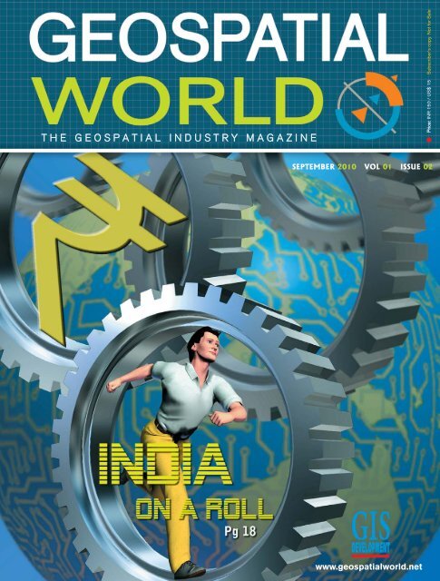
Cover Story<br />
Market Research<br />
India on a Roll<br />
It is well acknowledged that the Indian geospatial industry is witnessing a<br />
growth rate significantly higher than worldwide average…<br />
Theme: URBAN DESIGN<br />
Urban Infrastructure<br />
The Time for Change is Now<br />
Terry D. Ben<strong>net</strong>t, Autodesk<br />
3D Technologies<br />
Unlocking the Potential of Urban Design<br />
Caroline Tasse, Vectuel Middle East<br />
SMART Tunnel<br />
Two Issues, One Solution<br />
Mohd. Noor b. Mohd. Ali, The Stormwater Management & Road Tunnel<br />
Lavasa<br />
Steering Future Indian Cities<br />
Ar. Anubandh M Hambarde, Lavasa Special Planning Authority<br />
Dr. GS Rao, Lavasa Corporation Limited<br />
Public Transportation<br />
Information on the move<br />
Sarah Liu, SuperGeo Technologies Inc.<br />
Focus: IBM Smarter Pla<strong>net</strong><br />
An Ingenious way to connected tomorrow<br />
Conference reports<br />
GITA Geospatial Solutions Conference<br />
Understanding Users: Key to Successful Implementation<br />
Map Asia 2010<br />
Connecting Government with Citizens<br />
07 EDITORIAL 08 NEWS<br />
CHAIRMAN M P Narayanan<br />
EDITOR & PUBLISHER Sanjay Kumar<br />
PUBLICATIONS TEAM<br />
Managing Editor (Honorary) Prof. Arup Dasgupta<br />
Director Publications Niraj<br />
Associate Editor Bhanu Rekha<br />
Assistant Editor Deepali Roy<br />
Sub-Editor Anand Kashyap<br />
Product Manager Shivani Lal<br />
DESIGN TEAM<br />
Sr. Creative Designer Deepak Kumar<br />
Graphic Designer Manoj Kumar Singh<br />
CIRCULATION TEAM<br />
Circulation Manager Priyanka Ujwal, Vijay Kumar Singh<br />
DISCLAIMER<br />
GIS Development does not necessarily subscribe to the<br />
views expressed in the publication. All views expressed in<br />
this issue are those of the contributors. It is not responsible<br />
for any loss to anyone due to the information provided.<br />
Printed and Published by Sanjay Kumar. Press M. P. Printers<br />
B - 220, Phase-II, Noida - 201 301, Gautam Budh<br />
Nagar (UP) INDIA Publication Address A - 92, Sector - 52,<br />
Gautambudh Nagar, Noida, India Editor Sanjay Kumar<br />
GIS Development Pvt. Ltd.<br />
A - 145, Sector - 63, Noida, India<br />
Tel + 91-120-4612500 Fax +91-120-4612555 / 666<br />
PRICE: INR 150/US$ 15<br />
Inside...<br />
Advisory Board<br />
Dato’ Dr. Abdul Kadir bin Taib<br />
Director General of Survey and<br />
Mapping, Malaysia<br />
Bhupinder Singh<br />
Sr. Vice President<br />
Bentley Systems Inc.<br />
Prof. Ian Dowman<br />
Former President<br />
ISPRS<br />
Prof. Josef Strobl<br />
Director, Centre for Geoinformatics<br />
University of Salzburg, Austria<br />
Kamal K Singh<br />
Chairman and CEO<br />
Rolta Group of Companies<br />
Mark Reichardt<br />
President and CEO,<br />
Open Geospatial Consortium<br />
Matthew O’Connell<br />
CEO, GeoEye<br />
USA<br />
Dr. Prithvish Nag<br />
Director<br />
NATMO, India<br />
Prof. V. S Ramamurthy<br />
Director<br />
NIAS, Bangalore, India<br />
KCM Kumar<br />
Chairman & Managing Director<br />
Speck Systems Limited<br />
Brian Nicholls<br />
General Manager<br />
AAM<br />
Shailesh Nayak<br />
Secretary<br />
Ministry of Earth Sciences, India<br />
Prof William Cartwright<br />
President<br />
International Cartographic Association<br />
Dr Derek. G. Clarke<br />
Chief Director: Surveys and Mapping<br />
South Africa<br />
Bradley C Skelton<br />
Chief Technology Officer<br />
ERDAS<br />
Geospatial World I September 2010 5
E d i t o r Speak<br />
India on a healthy growth path<br />
In the 1950's as the American Interstate<br />
I<br />
highways were being laid, Ian McHarg<br />
lashed out at engineers as people who<br />
'gouge and scar' landscape. I wonder if he<br />
would have changed his opinion if he saw<br />
the way urban design is implemented<br />
today. GIS, the technology which he foresaw<br />
through his revolutionary concept of overlay analysis,<br />
is today an essential element in the urban<br />
designer's toolkit. The urban designer has to work<br />
with limited resources and conflicting demands on<br />
those resources. Urban<br />
designs have to factor in sustainability<br />
and environmental<br />
protection while meeting the<br />
basic requirements of the citizens.<br />
Luckily designers have<br />
many other tools like 3D visualisation,<br />
Building Information<br />
Models, GPS, GPR and integration<br />
with ERP and CRM.<br />
iences. This is a challenge to the urban designer<br />
because much of the data on existing structures<br />
and facilities are dated or worse, lost. It would be<br />
interesting to see how modern geospatial tools<br />
could be adapted to meet the requirements of city<br />
rejuvenation.<br />
This issue also takes a look at the geospatial industry<br />
scenario in India. The Indian geospatial industry<br />
is on a healthy growth path. With a strong<br />
outsourcing base and a growing internal demand,<br />
the industry can look forward<br />
to a bright future. Major<br />
government projects like<br />
R-APDRP for the power sector<br />
and NLRMP for the land<br />
records management are two<br />
examples of the future growth<br />
areas. It is interesting to note<br />
that both projects are built<br />
around geospatial technologies<br />
but their scope extends<br />
Geospatial technologies have<br />
much beyond these technolo-<br />
taken centre stage in urban<br />
gies to services and manage-<br />
design and an excellent examment<br />
of services. This is a<br />
ple of this is the Lavasa project.<br />
measure of the maturity of the<br />
The management of the entire<br />
marketplace which looks on<br />
township from planning to con-<br />
geospatial technologies as<br />
struction, maintenance and<br />
essential tools for their work<br />
operation is built around GIS.<br />
and not as separate 'GIS proj-<br />
Another example of the use of<br />
geospatial technologies to<br />
manage the urban environ-<br />
Prof. Arup Dasgupta<br />
Managing Editor (Honorary)<br />
arup.dasgupta@GISdevelopment.<strong>net</strong><br />
ects'.<br />
There are issues which need to<br />
ment is the SMART tunnel in<br />
be addressed. The availability<br />
Kuala Lumpur. This tunnel not only provides a fast of trained manpower is an issue and most projects<br />
access to the city centre but also prevents flooding are being run by IT personnel rather than spatial<br />
during heavy rainfall. This issue covers stories on planners. The NSDI which should have been the<br />
these projects. A question remains: how to revive backbone of these projects still remains a govern-<br />
decaying cities planned hundreds of years ago for a ment showpiece. The regulatory environment is<br />
smaller population and for an easy paced way of uncertain. These issues are not insurmountable<br />
life? There is a need to preserve historical heritage and, given a push by industry, solutions will be<br />
while opening up the city to modern urban conven- found.<br />
Geospatial World I September 2010<br />
7
8<br />
SOUTH AFRICA<br />
Free submarine<br />
cable map<br />
Durban-based software developer,<br />
Greg Mahlknecht, has built a map<br />
showing the world’s submarine<br />
telecommunications cable systems.<br />
Mahlknecht used Microsoft’s Bing<br />
service and Wikipedia’s submarine<br />
communications cables category. In<br />
addition, he visited each cable’s<br />
homepage and gathered alternative<br />
information.<br />
The map will be released under<br />
the General Public Licence, the<br />
same licence that governs the<br />
release of most open-source software<br />
and will be available for free.<br />
INDIA<br />
India gets new<br />
Surveyor General<br />
Swarna Subba Rao has taken over<br />
as the new Surveyor General of<br />
India. He was selected through an<br />
UGANDA<br />
World Bank aid for<br />
modern LIS<br />
International Land Systems (ILS)<br />
has entered into a contract with<br />
World Bank to improve Uganda's<br />
open competition<br />
held by<br />
the Union<br />
Public Service<br />
Commission.<br />
Rao joined<br />
Survey of<br />
India in 1983<br />
and supervised<br />
all disciplines of survey. He<br />
has been associated with GIS related<br />
work for the past two decades.<br />
GAGAN in final<br />
phase<br />
India launched the final operational<br />
Collaboration for<br />
earth observation<br />
South Africa and Russia have<br />
signed a Memorandum of Understanding<br />
(MoU) on collaboration in<br />
the area of earth observation. The<br />
Department of Science and Technology,<br />
South Africa, said that the<br />
MoU paves the way for South<br />
Africa to access historic Russian satellite data collected over southern<br />
Africa. It would benefit remote sensing applications towards addressing<br />
South Africa’s socio-economic problems that rely on the use of such<br />
datasets. Dr Sandile Malinga, Chief Executive of the South African National<br />
Space Agency (SANSA) and Professor Alex Perminov, President of the<br />
Russian Federal Space Agency (Roscosmos), signed the MoU.<br />
land administration systems (LIS).<br />
As part of the contract, the Design,<br />
Supply, Installation, Implementation<br />
of the Lands Information System<br />
and Securing of Land Records<br />
(DeSILISoR) supplementary project<br />
will establish a modern national LIS<br />
to underpin future enterprise creation<br />
and growth.<br />
phase of GAGAN, a satellite-based<br />
navigation system to aid air traffic<br />
from Southeast Asia to Africa.<br />
It is a joint initiative of the Airports<br />
Authority of India (AAI) and the Indian<br />
Space Research Organisation<br />
(ISRO). It will be operational in 2013.<br />
AAI officials said the system will<br />
enable airlines to chart out direct<br />
routes as they will be less dependent<br />
on the ground-based radar systems,<br />
save fuel and increase efficiency.<br />
Civil Aviation Minister<br />
Praful Patel asked AAI to maximise<br />
its investment and market the<br />
capability to other countries in the<br />
region.<br />
Geospatial World I September 2010
Innovative minds<br />
honoured<br />
Innovations for rural markets<br />
designed by Indian students<br />
bagged top honours at technology<br />
competitions organised by<br />
Microsoft and Intel. At the 2010<br />
Microsoft Imagine Cup, a team led by Pranay Sharma<br />
of National Chiao Tung University, Taiwan, emerged as<br />
the winner. Sharma’s team used cloud computing and<br />
satellite-imaging tools to provide real-time agricultural<br />
information to farmers using a mobile phone. On the<br />
other hand, at the ‘Intel India Embedded Challenge<br />
2010’, the top prize went to TractRobot an unmanned<br />
tractor, developed by a four-member team<br />
led by Sanjay Bansal that uses a combination<br />
of GPS, GIS,<br />
remote video<br />
monitoring<br />
and<br />
artificial<br />
intelligence.<br />
INDONESIA<br />
Maps for safer<br />
infrastructure<br />
The Public Works Ministry launched<br />
six new earthquake zone maps to<br />
support the development of earthquake-resilient<br />
infrastructure.<br />
The map-making process<br />
involved 11 experts from the Bandung<br />
Institute of Technology (ITB),<br />
the Indonesian Institute of Sciences<br />
(LIPI), the Climatology, Meteorology<br />
and Geophysics Agency (BMKG),<br />
the Energy and Mineral Resources<br />
Ministry and the Public Works<br />
Ministry.<br />
JAPAN<br />
JAXA and ADB join<br />
hands<br />
The Japan Aerospace Exploration<br />
Agency (JAXA) and the Asian<br />
Development Bank (ADB) agreed to<br />
cooperate in promoting the application<br />
of satellite technology to disaster<br />
management, climate change<br />
mitigation and adaptation, forest<br />
monitoring and water resource<br />
management.<br />
ADB President Haruhiko Kuroda<br />
and JAXA President Keiji Tachikawa<br />
signed a Letter of Intent. JAXA is<br />
also considering to assign person-<br />
Satellite locates ancient<br />
megaliths<br />
Maharashtra Remote Sensing and Applications Centre<br />
(MRSAC) has located two burial sites dating back<br />
3000-3500 years. Though, the sites are known to the<br />
archaeologists, but there is no update in the government's<br />
toposheets since 1930. Recently, discovered<br />
megaliths are spread in an area of about 6-7 km, the<br />
megaliths have a potential to be converted into a heritage<br />
site. The megaliths were located using "Quick<br />
Bird" remote sensing satellite. Vinod Bothale, Director,<br />
MRSAC, said that the megaliths are made of basalt<br />
rocks. Basalt being black the megaliths appear as<br />
small black rings on the satellite image.<br />
nel to ADB to facilitate future<br />
collaboration.<br />
3D map shows<br />
horror of A-bombing<br />
A new website, "Nagasaki Archive"<br />
(http://nagasaki.mapping.jp/) has<br />
been launched. It aims at helping<br />
the world learn about the horror<br />
and destruction of the Nagasaki<br />
atomic bombing (A-bombing), using<br />
a 3-D digital map. It also shows<br />
photographic portraits of A-bomb<br />
survivors and their stories. The 3-D<br />
cityscape on the map can be seen<br />
from the sky and from horizontal<br />
angles as well.<br />
Geospatial World I September 2010 9
SPAIN<br />
Innovative water<br />
conservation system<br />
The team of Vincent<br />
Caselles, professor at<br />
the University of<br />
Valencia, has developed<br />
a remote sensing<br />
system for water conservation.<br />
Vincent expects that<br />
it would save 50% of the global irrigation<br />
water. Recognising the innovative<br />
work, the World Meteorological<br />
Organization (WMO) has awarded<br />
him the Norbert Gerbier-Mumm<br />
International 2010 award. The<br />
award distinguishes the best scientific<br />
article influential in meteorology.<br />
One can avail this method<br />
through the research group’s<br />
website.<br />
UK<br />
OS data accessible<br />
to public sector<br />
Public sector organisations in<br />
England and Wales will have access<br />
to Ordnance Survey (OS) mapping<br />
data under a single agreement for<br />
the first time from April 2011.<br />
The new deal replaces the local<br />
government Mapping Services<br />
Agreement, the Pan Government<br />
Agreement for central government<br />
and the NHS Digital Mapping<br />
Agreement. This new agreement,<br />
known as the Public Sector Mapping<br />
Agreement (PSMA) for England<br />
& Wales, includes over 750 organisations,<br />
with provision for 1,000s<br />
more, and will result in significant<br />
cost savings for the public sector<br />
and greater data sharing.<br />
PBBI introduces<br />
Geosk Platform<br />
Pitney Bowes Business Insight<br />
(PBBI) introduced Geosk Platform,<br />
the geospatial industry’s first location-based<br />
Data-as-a-Service<br />
(DaaS) offering. It allows users to<br />
access and integrate the current<br />
geospatial data into business analyses,<br />
location-based marketing programmes<br />
and risk management<br />
calculations. It provides access to a<br />
comprehensive data catalogue that<br />
includes both free and fee-based<br />
geospatial data from PBBI as well<br />
as content from third-party data<br />
providers such as Ordnance Survey<br />
THE NETHERLANDS<br />
and TomTom. Its new content management<br />
service, Geosk Library,<br />
enables enterprise organisations to<br />
store, share and manage geospatial<br />
data from a cloud-based content<br />
library.<br />
OS Insider launched<br />
Ordnance Survey (OS) launched OS<br />
Insider newsletter. Available on the<br />
OS blog, the newsletter aims to<br />
A joint front to fight disasters<br />
A new cooperation between the Dutch Kadaster (cadastre) and the topographical<br />
services of Nordrhein-Westphalen (Germany) facilitates to detect<br />
and act upon disasters like nature fires and floods faster. The German and<br />
Dutch organisations are the first in Europe to making this way of sharing<br />
possible. With this collaboration, sharing of geomatical knowledge has<br />
been improved using a webservice, combining data of Dutch and German<br />
areas in a common set of co-ordinates. Hence, map images of The<br />
Netherlands and Germany can be displayed in one view.<br />
10 Geospatial World I September 2010
keep everyone informed about<br />
everything that is happening inside<br />
Great Britain’s national mapping<br />
agency. The first edition of OS Insider<br />
focuses on some of the innovative<br />
uses of OS data, including OS<br />
OpenData, OS OpenSpace and the<br />
GeoVation awards programme.<br />
RUSSIA<br />
Governm<strong>net</strong><br />
promotes GLONASS<br />
An import duty of up to 25 percent<br />
on GPS navigation equipment could<br />
be in place from January 1, 2011, as<br />
Russia seeks to promote its rival<br />
GLONASS system, according to<br />
Sergei Ivanov, Deputy Prime Minister,<br />
Russia. However, the official<br />
said there would be no ban on<br />
devices working with the US Global<br />
GPS. "If GLONASS-GPS equipment<br />
is imported than the duty will<br />
remain at zero level," Ivanov said.<br />
"This way we will stimulate not only<br />
domestic but also foreign producers<br />
(to manufacture GLONASS equipment)."<br />
FRANCE<br />
ESSP enters<br />
navigation business<br />
European Satellite Services<br />
Provider (ESSP SAS) received a certificate<br />
of Air Navigation Service<br />
Provider according to the Single<br />
European Sky Regulation<br />
2096/2005. The certification was<br />
delivered by the French National<br />
Supervisory Authority (NSA - Direction<br />
de la Sécurité de l'Aviation<br />
Civile) in cooperation with the<br />
national supervisory authorities of<br />
Belgium, Germany, Italy, Portugal,<br />
Spain, Switzerland, and United<br />
Kingdom. This is an important<br />
milestone towards making the<br />
EGNOS Safety of Life (SoL) services<br />
available to the aviation community.<br />
Geospatial World I August 2010 11
12<br />
AUSTRALIA<br />
‘Virtual Brisbane’<br />
launched<br />
Brisbane City Council launched a<br />
new visualisation and planning tool,<br />
Virtual Brisbane. This innovative 3D<br />
model aims to enhance some of the<br />
business processes of the Council.<br />
It was built by AAM utilising aerial<br />
laser data and Pictometry multiangle<br />
oblique imagery. The model<br />
spans an area of more than<br />
100sqkm, contains models for<br />
about 100,000 structures and is the<br />
largest 3D city model in the southern<br />
hemisphere.<br />
Robot tech for US<br />
Marines<br />
New South Wales (NSW)-based<br />
Marathon Robotics, with the backing<br />
of New South Wales Government,<br />
has bagged USD 57 million<br />
contract with the US Marines to trial<br />
advanced robot technology for<br />
training soldiers in live firing exercises.<br />
Marathon Robotics CEO, Dr<br />
Alex Brooks, said, “The Rover uses<br />
a GPS and a scanning laser<br />
rangefinder for navigation, positioning<br />
and obstacle detection and<br />
avoidance.” Brooks added, “The<br />
Rover system was developed at the<br />
ARC Centre of Excellence for<br />
Autonomous Systems in conjunction<br />
with the Australian Department<br />
of Defence.”<br />
NEW ZEALAND<br />
Contract for border<br />
mapping<br />
NZ Aerial Mapping Limited and the<br />
Kingdom of Saudi Arabia represented<br />
by the Minister of Interior and<br />
the Government of the State of<br />
Kuwait represented by the Minister<br />
of Interior, signed a contract in Jed-<br />
Mipela GIS merges<br />
with GeoSolution<br />
GeoSolutions Australia and<br />
Mipela GIS announced merger<br />
to form a new company – Mipela<br />
GeoSolutions.<br />
The Board of Directors of<br />
Mipela GeoSolutions will consist<br />
of Mipela GIS Director Hayden<br />
McDonald and GeoSolutions<br />
Australia Director Michael<br />
Krome, with Hayden acting as<br />
Managing Director. The new<br />
company will be officially<br />
launched at the Australian<br />
Pipeline Industry Association<br />
(APIA) Conference in Darwin on<br />
13 and 14 September.<br />
dah. Under the contract, the company<br />
will map the partitioned zone,<br />
dividing line and the boundary line<br />
between The Kingdom of Saudi Arabia<br />
and The State of Kuwait. It will<br />
take 20 months to complete.<br />
Quake sensors to be<br />
deployed<br />
New earthquake sensors will be<br />
deployed across Canterbury and<br />
Marlborough in South Island, under<br />
a 45 million-dollar national project.<br />
From next year, GeoNet, a collaboration<br />
between the Earthquake<br />
Commission (EQC) and GNS Science,<br />
will roll out a monitoring station<br />
<strong>net</strong>work across the upper<br />
South Island.<br />
The earthquake and deformationrecording<br />
equipment will<br />
include seismographs, strongmotion<br />
recorders and GPS<br />
equipment.<br />
Geospatial World I September 2010
Policy _______________<br />
Apple collects<br />
location info<br />
Responding to questions from US<br />
lawmakers about what kind of location<br />
data it collects, Apple said it<br />
collects GPS data daily from<br />
iPhones running OS 3.2 or iOS 4.<br />
The phones collect GPS data and<br />
encrypt it before sending it back to<br />
Apple every 12 hours via Wi-Fi.<br />
Attached to the GPS data is a random<br />
identification number generated<br />
by the phone every 24 hours. The<br />
company collects such data from<br />
customers who have approved the<br />
use of location-based capabilities<br />
on the phone and who actually use<br />
an application that requires GPS. It<br />
uses the data to analyse traffic patterns<br />
and density.<br />
Business_________________________________<br />
NGA awards billion dollar contract<br />
The National Geospatial-Intelligence<br />
Agency (NGA) awarded GeoEye and<br />
DigitalGlobe, 10-year contracts<br />
worth a combined USD 7.35 billion to<br />
fulfil intelligence needs of the US<br />
government. DigitalGlobe entered<br />
into a USD 3.55 billion agreement,<br />
under the EnhancedView procurement.<br />
On the other hand, GeoEye<br />
has won a USD 3.8 billion contract<br />
award for increased commercial satellite-imaging capacity. The contract<br />
supports the EnhancedView programme by providing products and services<br />
that will help meet the increasing geospatial intelligence needs of<br />
the Department of Defense.<br />
Bing adds Open Street Map<br />
Open Street Map of the world is<br />
now available as a layer in Bing<br />
Maps. Users who download the<br />
OpenStreetMap app (and Microsoft<br />
Silverlight) can switch between the<br />
traditional layers, which include<br />
bird's eye, aerial and standard<br />
street map views, and Mapnik, a<br />
colourful map that includes businesses<br />
and landmarks labelled by users and devices through Open<br />
Street Map. The announcement of the partnership with Bing comes less<br />
than a month after AOL announced a USD 1 million investment in Open<br />
Street Map.<br />
ITT VIS acquires CreaSo<br />
ITT Visual Information Solutions (ITT VIS) has acquired Creative Software<br />
Systems GmbH, (CreaSo). CreaSo provides software solutions for data<br />
analysis and visualisation and distributes ITT's IDL, ENVI and IAS software<br />
products in Germany, Austria, Switzerland and The Netherlands.<br />
The acquisition expands ITT’s ability to directly support the growing markets<br />
for its software products in Germany, Austria, Switzerland and The<br />
Netherlands and to deliver world class product and services to meet the<br />
greater European demand for integrated software solutions that support<br />
pan-European scientific analysis and remote sensing initiatives.<br />
14 Geospatial World I September 2010
Application____________<br />
GPS-based crash<br />
avoidance system<br />
Ford is developing a new and<br />
advanced crash avoidance system.<br />
It is a GPS and radio-based wireless<br />
system. It will provide a 360-degree<br />
view and uses advanced engineering<br />
algorithms to validate any<br />
threats and react accordingly in real<br />
time. The new technology warns<br />
driver of a potential collision and<br />
even begins braking. Ford is bringing<br />
it to market within the next few<br />
years.<br />
Laser backpack for<br />
3D mapping<br />
Researchers at the University of<br />
California, Berkeley, have developed<br />
a laser backpack that scans its<br />
surroundings and creates an<br />
instant 3D model. The outdoor<br />
version relies on GPS but one can't<br />
rely on GPS indoors. So, the team in<br />
the imaging lab combined a new<br />
breed of miniature laser with an<br />
Appointment_________________<br />
Letitia A. Long to lead NGA<br />
inertial management unit (IMU)<br />
like the ones that guide missiles.<br />
The IMU localises the backpack,<br />
lasers generate the geometry and<br />
cameras generate the texture<br />
map. All three are fused for precise<br />
navigation.<br />
Letitia "Tish" Long become the first woman to head<br />
a major intelligence agency. Long began her career<br />
in 1978 as a civilian engineer in training for the<br />
Navy. After a decade as an engineer, she joined the<br />
staff of Naval Intelligence. As she climbed the<br />
career ladder, Long served a tour of duty at the CIA before holding a succession<br />
of No. 2 positions: as the deputy to the<br />
director of naval intelligence, followed by the Undersecretary of Defense<br />
for Intelligence and finally, at the Defense Intelligence Agency.<br />
Geospatial World I September 2010 15
BRAZIL<br />
RapidEye expands<br />
market base<br />
RapidEye’s distributor in Brazil, Santiago<br />
& Cintra Consultoria expanded<br />
CHILE<br />
its sales territory in South America.<br />
Now, it covers Argentina, Chile,<br />
Uruguay, Paraguay, Bolivia, Peru,<br />
Ecuador and Venezuela markets.<br />
Currently, RapidEye is expanding its<br />
worldwide <strong>net</strong>work of distributors in<br />
order to facilitate easy access to<br />
RapidEye products in various regional<br />
languages. Lara Musse Felix,<br />
Director of Santiago & Cintra Consultoria<br />
said, “RapidEye imagery is<br />
quickly available and information can<br />
be derived from the data. This has<br />
contributed to the success of a number<br />
of important projects in Brazil.”<br />
New approach to predict earthquakes<br />
Alonso Arellano, a Professor<br />
from the Department of Mining<br />
Engineering, Faculty of<br />
Engineering, Universidad de<br />
Santiago de Chile (USACH),<br />
along with Guillermo<br />
Sanchez Arellano, has developed<br />
a new approach to<br />
analyse geotectonic activity<br />
through the study of satellite<br />
images. This has been<br />
achieved through the observation<br />
of the variation in the<br />
density and orientation of the alignments observed in the sequence of<br />
satellite images Terra (Aster) for months before and after the event.<br />
Network of seismic stations<br />
The Chilean authorities will invest USD 18 million to install a <strong>net</strong>work of 65<br />
seismic stations in Santiago. "There are 65 modern broadband seismic stations<br />
for measuring ground vibrations and seismometers that indicate the<br />
speed of ground motion," said Sergio Barrientos, a seismologist at the University<br />
of Chile. Sergio added, “These stations are also GPS-based acceleration<br />
measuring instruments. Each station will be connected to a satellite<br />
dish to send the data directly via satellite to our centre.”<br />
VENEZUELA<br />
MoU to set up<br />
RS centre<br />
With the aim of promoting agricultural<br />
development, Venezuela and<br />
Brazil signed five memoranda of<br />
understanding (MoU). The memoranda<br />
aim to develop a national remote<br />
sensing centre for agricultural purposes.<br />
It also focuses on the implementation<br />
of national seed production<br />
of high strategic value, allowing<br />
a sustained increase in yields. The<br />
agreement was signed by Juan Carlos<br />
Loyo, Minister of Popular Power<br />
for Agriculture and Land (MAT),<br />
Venezuela, and Celso Amorim, Foreign<br />
Minister, Brazil.<br />
IGVSB launches<br />
geoportal<br />
Geographic Institute of Venezuela<br />
Simon Bolivar (IGVSB) under the<br />
Ministry of Popular Power for the<br />
Environment (Minamb), Venezuela,<br />
launched a website, www.geoportalsb.gob.ve,<br />
where Venezuelans can<br />
get access to national geographic<br />
information tools designed with the<br />
gvSIG software. At later stages,<br />
users can also get access maps of<br />
minerals prepared by Institute of<br />
Geology and Mines of Venezuela<br />
(Ingeominas).<br />
16 Geospatial World I September 2010
18<br />
MARKET RESEARCH<br />
INDIA on a roll<br />
IT IS WELL ACKNOWLEDGED THAT THE INDIAN GEOSPATIAL INDUSTRY IS<br />
WITNESSING A GROWTH RATE SIGNIFICANTLY HIGHER THAN WORLDWIDE<br />
AVERAGE OR THAT OF ANY OTHER COUNTRY. SEVERAL SURVEYS HAVE TRIED<br />
TO MEASURE THIS GROWTH TRAIL WITH NOT MUCH OF SUCCESS. IN THIS<br />
EDITION, GEOSPATIAL WORLD BRINGS A SCIENTIFIC MARKET RESEARCH WITH<br />
DETAILED QUANTITATIVE ANALYSIS OF THE INDIAN INDUSTRY DYNAMICS IN<br />
ASSOCIATION WITH DAVE SONNEN, CONSULTANT, IDC<br />
ll<br />
Geospatial World I September 2010
What's in…<br />
Market potential<br />
Market overview<br />
Policies, standards & best practices<br />
Productive capacity<br />
Way ahead<br />
India's 'Vision 2020' envisages the nation evolving<br />
into an information society and knowledge economy<br />
built on the edifice of information and communication<br />
technology (ICT). ICT including geospatial<br />
technologies is being integrated into planning and<br />
management of natural resources, utilities, infrastructure<br />
and urban development and transport sectors.<br />
Geospatial information technology (GIT) is being<br />
assimilated into planning and management to monitor,<br />
evaluate and apply spatial planning and decision<br />
support systems (SPDSS) and is also a front running<br />
agenda for major government agencies.<br />
MARKET POTENTIAL<br />
The Indian geospatial industry's current annual productive<br />
capacity is about `3,944 Cr (39.44 billion) (`represents<br />
Indian Rupee). The industry is expected to grow at a<br />
cumulative average rate of 8.1% to a productive capacity<br />
of `5,818 Cr. (58.18 billion) by 2014. The total allocation for<br />
various projects incorporating geospatial technology<br />
among other components in different sectors is<br />
`623,494.8 Cr and considering that even 1% of this allocation<br />
is meant for geospatial technologies, the geospatial<br />
component works out to be `6,234 Cr.<br />
MARKET OVERVIEW<br />
The Indian geospatial industry consists of two distinct but<br />
mutually supporting segments. The larger, international<br />
segment is geared to provide geospatial data and software<br />
development services for international organisations,<br />
primarily in North America and Western Europe.<br />
The other segment, the domestic segment, caters to pro-<br />
Geospatial World I September 2010<br />
Table 1: Budgetary Allocation in 11th Plan for Geospatial<br />
Projects (2007-12)<br />
Schemes<br />
Water Resources<br />
viding geospatial capabilities to the Indian data<br />
providers/users. This segment is funded, managed and<br />
controlled largely by national and state governments. A<br />
number of Indian firms are contracted to provide services<br />
for government initiatives. India's bimodal industry structure<br />
creates high market potential and worrisome con-<br />
Indian government is trying to bring<br />
e-Governance and g-Governance together.<br />
Geospatial technology is fast becoming an<br />
engine of growth for businesses and is<br />
ready to become a formidable driving force<br />
in the global as well as Indian economy.<br />
Prithviraj Chavan<br />
Minister of State (Independent Charge) for<br />
Science & Technology and Earth Sciences, Govt of India<br />
Amount<br />
(`Cr)<br />
Water Resource Information System 230<br />
National Hydrology Project 150<br />
Hydrology Project - II 180<br />
Environment and Forest Resources<br />
Forest Information Management and Resource Assessment 300<br />
Strengthening of Computer/GIS Centre 5<br />
Land Resources<br />
National Land Records Modernisation Programme/National Land<br />
Resource Management Programme (NLRMP)<br />
Agriculture<br />
1000<br />
Development of National Database and Information for<br />
Natural resource Management<br />
798<br />
Climate Change, Risk and Disaster Management, Agro-climatic<br />
Research Programs<br />
170<br />
Development of Crop Potential Maps<br />
Irrigation<br />
10<br />
Application of GIS/GPS in river inflow/discharge measurements,<br />
Flood Forecasting etc.<br />
Major and Medium Irrigation - Design, Surveys and Investigation 350<br />
Urban Development<br />
National Urban Information System 9.47<br />
Transport<br />
Maintenance of National Waterways - Setting up of DGPS 52<br />
Railway Information System, LRDSS, MIS and other IT applications 52<br />
Remote Control and automation of lighthouses 2.5<br />
R-APDRP - Part A (Core Geospatial) 1500<br />
Space Applications<br />
Cover Story<br />
DMS, VRC, NR Management, etc. 1752<br />
Grand Total 6562.47<br />
1.5<br />
represents Indian Rupee<br />
}<br />
19
20<br />
Space Applications<br />
Land<br />
Water<br />
Irrigation<br />
Urban Dev<br />
Power<br />
Agriculture<br />
Env & Forests<br />
Transport<br />
Figure 1: 11 th<br />
Plan Allocation (%) for Geospatial Projects (2007-2012)<br />
straints. While India's geospatial market potential has<br />
never been higher, realising this potential would be challenging.<br />
The Indian growth rate is significantly higher than<br />
worldwide geospatial industry growth. This can be attributed<br />
to the following factors.<br />
Economic recovery<br />
The macro economic recovery is still fragile, volatile but<br />
positive. Assuming continuing improvement, the Indian<br />
economy is poised to grow about 6.5% in 2010, one of the<br />
most robust GDP growth rates worldwide.<br />
Growth of India's international geospatial business<br />
will depend largely on the economic recovery of international<br />
economies and businesses. Right now, recovery<br />
rates in North America and Europe are at least positive, a<br />
welcome change from 2009's contraction. Planned<br />
spending on internal Indian geospatial projects is almost<br />
as high as India's total productive capacity. So, internal<br />
{The next new IT revolution will not just be<br />
an IT revolution but will be an IT-GIS<br />
revolution, because IT is at the heart<br />
of geospatial technology. Geospatial<br />
technology presents us with an entirely<br />
new and far more attractive medium of<br />
data or information sharing.<br />
Kapil Sibal<br />
Minister for Human Resource Development<br />
Government of India<br />
geospatial growth will depend on two interrelated factors:<br />
how the GOI spends its planned budgets; and how the<br />
industry develops capacity to meet internal demand.<br />
Economic recovery will create another interesting<br />
market potential. In a recession, customers question<br />
existing processes and cut all but essential elements. As<br />
economic conditions improve, customers have a fresh<br />
perspective of what was possible with less. When they<br />
begin to invest again, users will jump on innovations that<br />
provide a major advance cheaper, faster or better.<br />
Outsourcing of data acquisition and software development<br />
to India will still be considered a proven way for<br />
companies to do more. It is expected that the outsourcing<br />
business will increase at a brisk rate as the worldwide<br />
economic recovery continues unless hampered by protectionism<br />
in certain geographies.<br />
Government initiatives<br />
The Government of India (GOI) has budgeted wide range of<br />
initiatives that have a significant geospatial component.<br />
These initiatives, along with state and local level initiatives,<br />
have the potential to motivate a much stronger<br />
internal capacity for Indian geospatial technologies.<br />
The geospatial data usage in India is supported to a<br />
large extent by initiatives set out by the Federal government<br />
through its ministries and various departments.<br />
While defence is the major user of geospatial technologies,<br />
the initial lead for the usage of geospatial technologies<br />
in India was taken by the natural resources sector.<br />
Now, solutions such as decision support systems, asset<br />
management, enterprise wide risk assessment etc. have<br />
opened up avenues for this technology in almost every<br />
sector. The recommendations of the steering committees<br />
and the working groups for the 11th Five Year Plan for the<br />
majority of sectors highlight the importance of using<br />
geospatial tools in proper functioning of the sector and<br />
indicate the commencement of a new phase for the<br />
geospatial sector. As shown in Table 1,in the 11th Five<br />
Year Plan, majority of the sectors have emphasised on the<br />
usage of geospatial data in their current functioning and<br />
launched various new schemes which mandate the use of<br />
geospatial technology.<br />
In addition to the schemes highlighted in Figure 1,<br />
there are various other schemes which are not essentially<br />
geospatial but will use geospatial tools and technologies<br />
as an aid, such as schemes for construction and<br />
maintenance of roads, railways and waterways, civil avia-<br />
Geospatial World I September 2010
tion, public utility services, education, health, command<br />
area development, flood management programme, flood<br />
control, urban renewal, urban water supply, rural water<br />
supply, Integrated Watershed Management Programme<br />
etc. , as shown in Figure 2.<br />
IT transformation<br />
Information technology (IT) is transforming into a foundation-level<br />
capacity for world economies. In the geospatial<br />
arena, transformational influences will come from three<br />
directions - advances in information and communications<br />
technologies (ICT); advances in worldwide geospatial<br />
technologies; from cultural and political changes, including<br />
the open movement and a compulsive push towards<br />
broad economic development.<br />
The rate of change in Indian geospatial capacity tends<br />
to be slower than in North America and Europe and parts<br />
of Asia for two basic reasons:<br />
First, the acquisition and dissemination of Indian<br />
geospatial data (particularly aerial remote sensing) is<br />
subject to certain policies of the Government of India<br />
(defence/internal security). While the Indian capabilities in<br />
the area of Earth Observation (EO) are world class, data<br />
dissemination, particularly to private organisations is<br />
again subject to these policies.<br />
Second, in view of the above 'restrictions to growth' in<br />
the domestic market, Indian geospatial capacity has been<br />
developed, to a large extent, to address the requirements<br />
of international businesses. These requirements are likely<br />
to undergo paradigm changes brought about by<br />
increased automation/ technological innovations. Thus<br />
the current capacities, built on the requirements of the<br />
existing international markets, may not be sustainable.<br />
Today, India's geospatial industry is well-equipped to<br />
handle current requirements. But, as<br />
the pace of IT transformation<br />
accelerates, geospatial data<br />
acquisition and programming<br />
will be increasingly automated,<br />
reducing the demand for<br />
current capacities. Geospatial<br />
capabilities will become<br />
an important but invisible<br />
element in most information<br />
systems.<br />
To keep pace, India will have<br />
to develop substantial new<br />
Geospatial World I September 2010<br />
The political system is fully behind<br />
the industry, interested in developing this<br />
capability in the country as a business<br />
proposition and providing leadership to the<br />
world in this area<br />
Dr. K Kasturirangan<br />
Member, Planning Commission<br />
Government of India<br />
}<br />
capacities for design, development and deep systems<br />
integration. These capabilities are likely to be substantially<br />
different from those required to meet current market<br />
requirements.<br />
The Indian geospatial industry, however, could likely<br />
be constrained by the following factors:<br />
• Lack of skilled manpower and inadequate education/ training<br />
for geospatial technologies<br />
• Policies and planning for GOI geospatial projects not being<br />
adequate in certain sectors<br />
• Competition from other Asian countries<br />
• Security impediments to data acquisition/dissemination and<br />
lack of accountability in the government which comes in the<br />
way of rapid deployment of new technologies<br />
• Technological innovations which may shrink demand for<br />
traditional geospatial data acquisition and software programming<br />
services.<br />
POLICIES, STANDARDS AND BEST PRACTICES<br />
It is often said that, "If you don't get governance right, it is<br />
hard to do anything right." This truism certainly applies to<br />
information systems. As earlier mentioned, the Indian<br />
geospatial industry has adapted well to international policies,<br />
standards and best practices conforming to the<br />
norms of offshore services. Now, India requires a significant<br />
geospatial capacity, conforming to the domestic<br />
market requirements fostered by forward looking policies.<br />
Current GOI initiatives offer little guidance<br />
about geospatial standards, data reuse or<br />
access. Policy makers and the industry will<br />
have to cooperate on these<br />
21
22<br />
Transport and Infrastructure<br />
Rural Development<br />
Irrigation and Water Resources<br />
NRE, Agriculture and Climate<br />
Urban Development<br />
Power<br />
Education<br />
Health<br />
Figure 2: 11 th<br />
Plan Allocation (%) for Projects using Geospatial<br />
technologies in different sectors (2007-2012)<br />
Table 2: Estimated Total Productive Capacity: 2009<br />
Turnover category No. of Employees Revenue<br />
Estimate (crore)<br />
1) < ` 10M 1,710 191.5<br />
2 ` 10-25M 2,091 247.0<br />
3 ` 25-100M 2,661 314.4<br />
4 ` 100-250M 3,969 468.8<br />
5 ` >250M 23,049 2,722.6<br />
Total 33,480 3,944.4<br />
US$ 870,620,874<br />
Typical Productivity<br />
Factor<br />
Note: There is a wide variance in productivity factors between different organisations. The<br />
productivity factor used in this analysis is typical, but may not apply to a given organisation.<br />
Table 3: Estimated Revenue Capacity Forecast: 2010-2014<br />
Revenue capacity<br />
(in `crore)<br />
Note: The worldwide (WW) growth rates are a consensus of growth rates for the geospatial<br />
industry from IDC and other analyst firms.<br />
3.5<br />
2010 2011 2012 2013 2014 CAGR<br />
3,944.4 4,244.1 4,621.8 5,181.1 5,818.4 8.1<br />
India Growth (%) 6.5 7.6 8.9 12.1 12.3<br />
WW Growth (%) 2.3 3.4 6.8 7.1 7.9<br />
important matters building models for effective utilisation<br />
of available funds in a time-bound fashion.<br />
Fortunately, one can take advantage of the considerable<br />
expertise and established standards that are available<br />
from organisations like the Open Geospatial Consortium<br />
(OGC). How well the Indian policy makers and the<br />
industry are able to implement the advice of OGC and others<br />
will have a significant impact on the growth prospect<br />
of the industry.<br />
PRODUCTIVE CAPACITY<br />
Due to the service oriented nature of Indian geospatial<br />
industry, it is pertinent to look at productive capacity to<br />
understand the current geospatial industry, predict<br />
growth rates and assess the impact of future market factors.<br />
The estimated total productive capacity for 2009 is<br />
shown in Table 2, while Table 3 shows the estimated<br />
geospatial revenue capacity for 2010-2014.<br />
WAY AHEAD<br />
It is expected that the annual growth rate will slightly<br />
exceed GDP for 2011 and 2012 as global economies continue<br />
to recover. Figure 3 highlights the percentage<br />
growth for the Indian geospatial industry vis-a-vis worldwide<br />
growth, while the projected revenue capacity for the<br />
Indian geospatial industry is shown in Figure 4. There is a<br />
significant increase expected in productive capacity after<br />
2012 as India's geospatial industry builds out capacity for<br />
new international and internal markets. Like India's GDP,<br />
the growth of India's geospatial market will outpace<br />
growth rate for geospatial markets in the rest of the<br />
world. The market assumption and impacts are shown in<br />
Table 4. There are several ways in which vendors and<br />
users can gear up to realise the full potential of the<br />
expanding Indian geospatial market. With the Indian<br />
14.00<br />
12.00<br />
10.00<br />
8.00<br />
6.00<br />
4.00<br />
2.00<br />
0.00<br />
2010 2011 2012 2013 2014<br />
India Growth (%) Worldwide Growth (%)<br />
Figure 3: Percentage Growth<br />
Geospatial World I September 2010
24<br />
Table 4: Market Assumptions and Impacts<br />
Market Force Assumption Impact<br />
Macroeconomics<br />
Economic<br />
Recovery<br />
India's GDP<br />
Other Asian<br />
economies<br />
Protectionist<br />
policies<br />
GOI initiatives<br />
Global economies will continue to recover<br />
at generally slow rates for 2010 and<br />
2011. After 2011, worldwide GDPs will<br />
return to near-normal rates in most<br />
countries.<br />
High (+) A down economy affects business<br />
and consumer confidence, investment and<br />
internal funding. Geospatial markets will be<br />
inhibited worldwide through 2011.<br />
India's economy will outpace most other<br />
economies, achieving a growth rate of High (+). Indian Geospatial markets will grow<br />
6.5% in 2010. India will see robust GDP at relatively high rates for the forecast period<br />
growth for the rest of the forecast period<br />
Most Asian countries are developing<br />
technology service capabilities. Those<br />
capabilities will continue to grow during<br />
the forecast period<br />
As unemployment remains high, some<br />
countries may enact protectionist policies<br />
that inhibit outsourcing to India.<br />
The Government of India will continue to<br />
fund significant economic and civil infrastructure<br />
initiatives at planned rates.<br />
Technology/Service Developments<br />
Geospatial &<br />
IT Standards<br />
IT<br />
transformation<br />
Mobility<br />
Cloud<br />
computing<br />
Labor Supply<br />
Supply of<br />
skilled<br />
Geospatial<br />
workers<br />
Capitalization<br />
Venture capital<br />
Market Characteristics<br />
Government<br />
Policies<br />
Open Source<br />
Converging<br />
consumer and<br />
enterprise<br />
expectations<br />
Market Ecosystem<br />
User as<br />
participant &<br />
data provider<br />
Standards will continue to grow in importance<br />
within IT systems. OGC standards<br />
will become a common requirement for<br />
many IT systems that incorporate<br />
Geospatial capabilities.<br />
IT transformation and ICT convergence<br />
will continue and are likely to accelerate<br />
User interfaces and computing are<br />
migrating to mobile devices at the edges<br />
of the <strong>net</strong>work. This migration will occur<br />
quickly and will change the dominant<br />
design of information systems. Mobile<br />
devices generate volumes of geospatial<br />
data that can be analyzed and used.<br />
Cloud computing appears to be a disruptive<br />
technology. Early clouds will simply<br />
duplicate current IT approaches. But<br />
going forward, clouds will become platforms<br />
for a new generation of enterprise<br />
IT capabilities. Geospatial technologies<br />
will become an invisible and often marginal<br />
element in those clouds.<br />
India's educational systems are not<br />
providing a sufficient number of skilled<br />
Geospatial workers. Many of the current<br />
curricula are training people for<br />
yesterday's jobs.<br />
The lack of venture capital and other<br />
funding mechanisms for new ventures<br />
will persist.<br />
Indian policies are likely to continue to<br />
constraint the access to Geospatial<br />
information and hence not likely to<br />
foster the use of standards or design<br />
for integration.<br />
Open Source software will continue to<br />
be a strong influence in enterprise and<br />
consumer-facing systems.<br />
Increasingly, enterprise users expect the<br />
same simple interfaces, sophisticated<br />
search and free access that they<br />
experience as consumers.<br />
Users will take an increasingly active<br />
role as participants, data providers and<br />
co-designers of the information systems<br />
they use.<br />
Moderate(-) Other Asian countries will be able<br />
to compete with India on price, forcing Indian<br />
technology service providers to differentiate in<br />
other ways<br />
High (-) If one or more of the countries that<br />
outsource to India enact protectionist policies,<br />
the Indian outsourcing industry will diminish<br />
proportionately<br />
High (+) Most GOI initiatives will require<br />
significant additional geospatial capacity.<br />
High(+)The intelligent use of standards accelerates<br />
IT development and lowers implementation<br />
risks, making Geospatial technologies<br />
more attractive and less risky to implement.<br />
High(+/-) Geospatial capabilities will increasingly<br />
become an element within transformed<br />
ICT environments, broadening markets, but<br />
requiring new skills and business models.<br />
High(+) Mobility and mobility devices will create<br />
a whole new range of Geospatial applications<br />
and business. However, those applications<br />
will be completely different than the<br />
traditional. Vendors will have to retool to meet<br />
demand. After a period of adjustment, mobility<br />
will sharply increase Geospatial opportunities.<br />
High (+/-) Cloud computing will decrease the<br />
need for traditional systems integration and<br />
will change the requirements and profitability<br />
of established service providers. In the short<br />
run, vendors will see decreased revenue and<br />
increased competition. In the longer term,<br />
cloud computing will open significant new<br />
markets.<br />
Moderate (-) The lack of skilled workers will<br />
constrain the development of new Geospatial<br />
capacity and will drive labor costs higher.<br />
Moderate (-) Few new Geospatial startups will<br />
be able to break out of their initial niches. Most<br />
new business will accrue to established firms<br />
Moderate (-) Policy constraints likely to<br />
impede the acquisition and dissemination of<br />
Geospatial data and thus limiting development<br />
of new Geospatial business<br />
Moderate (+/-) Open Source software tends<br />
to drive prices lower and also tends to broaden<br />
the reach of IT systems. Open Source will<br />
become an important tool in keeping Indian<br />
technology costs competitive<br />
High (+/-) Geospatial systems will have to<br />
adopt interfaces and capabilities found in<br />
consumer applications. Applications that<br />
require extensive training will fare poorly.<br />
Meeting these user expectations will require<br />
retooling many development processes<br />
High (+/-) The user's changing role will obsolete<br />
many current practices and conventions.<br />
Vendors may be able to benefit from more<br />
active user participation.<br />
geospatial industry being bi-modal, one segment servicing<br />
international markets, and the other segment serving<br />
internal needs, it is prudent to address the two segments<br />
separately.<br />
Recommendations<br />
International geospatial service industry<br />
Prepare for global IT and service transformation. Information<br />
technology is transforming to an always-on, realtime<br />
phenomena that pervades every aspect of business<br />
and social life. In the past, IT involved the maintenance of<br />
mainframe systems that were connected to PCs. Now, IT<br />
is about a complex <strong>net</strong>work of computers, phones, building<br />
automation, sensors and mobile devices that are<br />
deeply imbedded in the fabric of business and industry.<br />
Web 2.0 and real-time business analytics are driving<br />
applications directly to the customer or employee and<br />
becoming mission-critical on the way.<br />
In the transforming IT environment, the geospatial<br />
information part of IT infrastructure will be constantly<br />
updated by location-specific transactions and sensors -<br />
automatically. Open standards and increasingly open<br />
access will make geospatial information an integral, but<br />
invisible part of customer and business experience. This<br />
transformation may take a decade to realise. As IT transformation<br />
progresses, traditional project-based geospatial<br />
services are likely to become increasingly less necessary<br />
and may eventually diminish. Indian businesses/<br />
geospatial industry needs to adapt to this transformation<br />
by building deeper design, innovation and service delivery<br />
capabilities, so that they are ready for new IT demands.<br />
The key is to continue to remain relevant and viable in this<br />
dynamic environment.<br />
Prepare for increasing competition from other Asian<br />
countries. India has firmly entrenched its position in providing<br />
off-shore geospatial services and IT services gen-<br />
6,000.00<br />
5,000.00<br />
4,000.00<br />
3,000.00<br />
2,000.00<br />
1,000.00<br />
0.00<br />
2010 2011 2012 2013 2014<br />
Figure 4: Revenue Capacity (`Cr)<br />
Revenue Capacity (Rs. Crore)<br />
Geospatial World I September 2010
����������<br />
�������<br />
�����������<br />
�����������������������������������������������<br />
�������������������������������������������������<br />
�������������������������������������������<br />
���������������������������������������������<br />
�����������������������������������������������<br />
�������������������������������������������������<br />
��������������<br />
�������������������<br />
��������������������������������������������������������<br />
������������������������������������������������������<br />
�������������������������������������������������������<br />
������������������������������������������������������<br />
�������������������������������������������������������<br />
������������������������������������������������������<br />
���������������������������������������������������<br />
��������������<br />
������������������������������������������<br />
������������������������������������������������������<br />
�����������������������������������������������<br />
������������������������������������������������<br />
�����������������������������������������������<br />
�������������������������������������������������������<br />
�����������������������������������������������������<br />
���������������<br />
����������������������������������������������������<br />
����������������<br />
�� ����������������������<br />
�� ��������������<br />
�� �����������������������<br />
����������������������<br />
�� ��������������������������������������<br />
�� �������������������<br />
�� ����������������������������<br />
�� �����������������������������<br />
�� ��������������������<br />
������������������������<br />
��������������������<br />
�����������<br />
����������������������<br />
��������������������������������<br />
���������������<br />
������������ ����������
26<br />
{Geospatial data plays a vital role in India,<br />
underpins the nation's domestic economic<br />
activities, aids our national competitiveness<br />
and supports a large array of government<br />
socio-economic initiatives<br />
K K Singh<br />
Chairman and Managing Director<br />
Rolta India Limited<br />
erally. Emulating India's example, most other Asian countries<br />
are developing their own IT service capacities. Many<br />
service firms are developing "multi-shoring" capabilities<br />
and are working on ways to standardise technologies /<br />
production methods, deliver services online, and expand<br />
into business services. These capabilities can make the<br />
service firm an integral part of their customers' operations.<br />
That is good news for some service firms, but this is<br />
likely to diminish the project-based work.<br />
The remaining work will likely be picked up by lowercost<br />
service firms elsewhere in Asia. Understandably, the<br />
margins here would be lower. The response to this evolving<br />
situation is similar to the response needed for the<br />
broad IT transformation discussed earlier. Indian companies<br />
will need to develop the capabilities required to<br />
become an integral, always-on part of their customer's IT<br />
infrastructure. This will require new skills, capabilities<br />
and business models.<br />
Importance of open standards and open source. There<br />
has often been an adversarial relationship<br />
between IT vendors and the<br />
open community. But now, open<br />
standards and open source<br />
have established their value<br />
and can no longer be ignored.<br />
Open standards, like those<br />
developed by OGC, enable<br />
data sharing, reduce development<br />
costs and lower implementation<br />
risk. Open source<br />
software can provide a powerful<br />
way to extend information<br />
systems to much broader<br />
audiences and can increase<br />
financial returns. Open<br />
approaches can also lower<br />
short-term profits, so new business<br />
models and customer relationships<br />
are required. But, the<br />
So far, we have been producing thematic<br />
data, but with Census 2011 we are now<br />
evolving to offer a GIS-based decision support<br />
system for policy makers by bringing<br />
spatial and non-spatial data together<br />
Dr. C. Chandramouli<br />
Registrar General and Census Commissioner<br />
Government of India<br />
}<br />
returns from open, standardised approaches almost<br />
always outweigh the costs.<br />
Internal geospatial service industry<br />
India's international geospatial industry is mature, efficient<br />
and well-organised. India's internal geospatial situation<br />
appears in sharp contrast - at crossroads, emerging<br />
from a 'closed' environment to a gradually 'open' environment.<br />
Initiatives like the Association of Geospatial Industries<br />
(AGI) are expected to transform the parties into a<br />
cohesive body, geared up to address the emerging<br />
(geospatial) challenges in the country. The formation of<br />
the OGC India Forum also bodes well for the industry.<br />
These initiatives are timely, as the potential for India's<br />
internal geospatial markets is enormous. Current GOI<br />
plans call for geospatial capabilities that are larger than<br />
the geospatial industry can currently provide. As India's<br />
economic development unfolds, geospatial capabilities<br />
will be an integral part and will grow at vigorous rates.<br />
Indian vendors and governments could consider the<br />
following actions to build needed capacity and capture the<br />
emerging markets' full potential:<br />
Gain from the experience of others: India's geospatial<br />
situation is quite similar to Europe's twenty years ago.<br />
The European Union (EU) recognised the value of consistent,<br />
standard geospatial information and created a policy<br />
framework that facilitates the best use of geospatial<br />
information for economic development. The EU initiative,<br />
INSPIRE, has taken years and endured lot of political turmoil<br />
to establish. INSPIRE is still a work in progress, but<br />
it works. INSPIRE has become an integral part of the EU's<br />
policy and legal framework. INSPIRE is dynamic and<br />
builds on the ongoing efforts of standards groups like the<br />
OGC, national security agencies, and many diverse mapping<br />
agencies. There is no good reason for India to incur<br />
the costs, time and political expense that the EU has<br />
already paid. While India's situation is unique, the principles<br />
that the EU has developed will be valuable and can<br />
reduce the time and costs of GOI geospatial projects.<br />
Geospatial World I September 2010
HP DESIGNJET PRINTERS<br />
THE HALLMARK OF<br />
PRINT RENDERING.<br />
When it comes to high-precision printing, HP Designjets<br />
lead the way - be it accuracy, colour reproduction, high<br />
definition scanning, continuous tones, smooth transitions or<br />
a wide colour gamut. Simply put, these state-of-the-art<br />
printers have everything you will ever need to bring your<br />
next big idea alive.<br />
©2010 Hewlett-Packard Development Company, L.P.<br />
HP DESIGNJET T1200 HD-MFP<br />
A trusted choice for demanding professionals<br />
• HP Thermal Inkjet Colour MFP<br />
• Print A1 (D)-sized documents in up to 28 secs.<br />
per page<br />
• Scan width-1067mm (42) & Print width-15mm (0.6)<br />
• 38.1cm (15) touch screen graphical display for<br />
easy, intuitive operation<br />
• DVD/CD reader/writer to save files directly to disc<br />
• CCD scanner and embedded post script for<br />
excellent 3D scanning<br />
FOR MORE INFORMATION, VISIT OUR WEBSITE AT WWW.HP.COM/GO/DESIGNJET<br />
HP DESIGNJET T770<br />
A reliable PLUG-AND-PLAY Team Printer<br />
• HP Thermal Inkjet Colour LFP<br />
• 2 A1/D-sized prints per minute<br />
• Precise accuracy of 0.02mm minimum line<br />
width and 0.1% line accuracy<br />
• Front-loading top roll printer saves time<br />
and convenient.<br />
• Built-in <strong>net</strong>work card and original HP-GL/2 and<br />
RTL for greater OS support
28<br />
GIANTS AMONG THE PROJECTS<br />
Re-structured Accelerated Power Development & Reform Programme (R-APDRP)<br />
KEY ACTIVITIES<br />
• GIS mapping, metering of distribution and feeders<br />
• Automatic data logging for all distribution transformers and feeders and<br />
supervisory control and data acquisition/document management system<br />
FUND ALLOCATION<br />
1500 crore for Part A (Core Geospatial) in 11th Five Year Plan.<br />
National Land Records Modernisation Programme (NLRMP)<br />
PROJECT OBJECTIVE<br />
Ushering in the system of conclusive titling.<br />
MAJOR COMPONENTS<br />
• Computerisation of all land records including mutations<br />
• Survey/re-survey and updation of all survey and settlement records including<br />
creation of original cadastral records wherever necessary<br />
• Computerisation of registration and its integration with the land records<br />
maintainence system and development of core GIS<br />
FUND ALLOCATION<br />
`1000 crore in 11th Five Year Plan.<br />
Planning for data integration and reuse. GOI's plans<br />
for geospatial projects offer little guidance for data integration<br />
and reuse. Today, most geospatial projects are<br />
managed by local groups with little thought given to how<br />
the outputs can be reused. GOI's projects are large and<br />
still gaining experience, so certain shortcomings are to be<br />
expected. But, in the long run, the current lack of longterm<br />
planning, design and data architecture is likely to<br />
force the government to rework the current projects,<br />
before the state and national governments can realise the<br />
benefits of integrated systems.<br />
Training new geospatial professionals. Current GOI<br />
geospatial projects will require more skilled workers than<br />
are available or will be trained by the current education<br />
system. This situation will create a skilled manpower<br />
shortage and will drive up labour costs unnecessarily. The<br />
geospatial industry would need to consider ways/means<br />
{Though started with data conversion services,<br />
the Indian geospatial industry moved<br />
up the value chain in client engagement<br />
and is in a strong advantageous position<br />
today. Geospatial content is now a critical<br />
asset of governments and corporates<br />
Rajesh C Mathur<br />
Vice Chairman<br />
NIIT GIS<br />
to improve the educational system for geospatial workers<br />
at skilled and semi-skilled levels.<br />
Organisational mechanism to effect policies, standards<br />
and best practices: In North America and the EU,<br />
professional geospatial organisations play an important<br />
role in defining policies, setting standards and recognising<br />
best practices. These organisations represent users,<br />
vendors and government, often in the same forums. The<br />
working relationships and social connections developed<br />
within these groups are the basis for effective action at all<br />
levels. In this arena, the recently formed Association of<br />
Geospatial Industries (AGI) and the OGC India Forum are<br />
timely. It is hoped that the emerging geospatial community<br />
will participate and strengthen those organisations. If<br />
that does occur, those organisations can become a valuable<br />
channel for policy makers, vendors and users alike.<br />
Analysis of return on investment (ROI): Often geospatial<br />
projects are implemented without any ROI assessment.<br />
Many projects include some cursory assessment<br />
done as a gesture toward "good management" and forgotten<br />
soon after. Without any clear understanding of real<br />
value, geospatial projects are often seen as just an exercise<br />
in spending money. People managing effective projects,<br />
measure returns constantly. The reason is simple:<br />
Unless the project's value is understood, the project has<br />
little value. This simple and clear lesson from successful<br />
organisations is often forgotten in the rush to "get the<br />
work done."<br />
CAPACITY BUILDING<br />
Capacity building is key to capitalise on the opportunities<br />
presented before the Indian geospatial industry. India is<br />
taking due note. India has well defined courses in various<br />
disciplines of geographical information science at undergraduate<br />
as well as post graduate levels. The courses are<br />
run as an allied subject to geography or as stand-alone<br />
courses in GIS, Remote Sensing, Geoinformatics,<br />
Geomatic Science, Surveying etc. Public-private partnership<br />
is also making its presence felt. Recently, Rolta<br />
signed a formal MOU with Central Board of Secondary<br />
Education (CBSE) as the resource partner for providing<br />
Geospatial Technology Vocation Course, for XI & XII<br />
standard students. This course is an initiative of the<br />
Human Resource Development ministry under the leadership<br />
of Minister Kapil Sibal as a part of its vision for<br />
education sector and to provide employment for a large<br />
number of youth in the country.<br />
Geospatial World I September 2010
30<br />
URBAN INFRASTRUCTURE I Terry D. Ben<strong>net</strong>t<br />
The time<br />
for change<br />
is now<br />
Here's a look at the role of<br />
geospatial technologies in<br />
urban infrastructure design for<br />
sustainable development<br />
Growth in human population<br />
and economic development<br />
strain the world's finite<br />
resources such as land, water,<br />
materials, food and energy. To<br />
maintain and in some cases,<br />
improve our quality of life, we need<br />
to develop sustainably - such that<br />
our development meets our needs<br />
for natural resources, industrial<br />
products, energy, food, transportation,<br />
shelter, and waste management;<br />
conserves environmental<br />
quality (indoor and outdoor) and<br />
reduces growing social and<br />
economic inequities. With urbanisation<br />
estimated to grow from<br />
around 53% as of this writing to<br />
64% by 2020 and 70% by 2050 and<br />
close to 6.3 billion people inhabit-<br />
ing our urban settings in the near<br />
future - how do we do it? Intrinsic<br />
to sustainable urban infrastructure<br />
design is the planning, design,<br />
construction, operation, maintenance<br />
and disposal of a city's infrastructure.<br />
How do we address urbanisation,<br />
existing infrastructure and new<br />
infrastructure in a synergistic manner?<br />
The question that will continually<br />
be asked is - Can we fix it,<br />
can we change it to match our<br />
future needs or is it more cost<br />
effective to raze and start over?<br />
Which option gives us the best long<br />
term ROI? And finding those<br />
answers will be an exercise in<br />
3-dimensional (3D) geospatial decision-making.<br />
Traditional industry challenges<br />
Within infrastructure construction,<br />
the diverse set of disciplines<br />
involved may include infrastructure<br />
developers or owners, surveyors,<br />
architects, civil and structural engineers,<br />
environmental and geotechnical<br />
engineers, heating and ventilation<br />
specialists, utilities and road<br />
departments of local governments.<br />
Each discipline has traditionally<br />
maintained its own professional<br />
standards, and has conducted its<br />
work independent from the others.<br />
As a result, each discipline has<br />
maintained an island or silo of technology<br />
related to planning, design<br />
and engineering information and<br />
the eventual work product. The true<br />
quality and accuracy of the designs<br />
Geospatial World I September 2010
is never really known until the unified<br />
construction of the project<br />
begins in the field.<br />
However, the lifecycle of infrastructure<br />
is being compressed due<br />
to economic reality. Owners and<br />
operators are concerned about the<br />
costs of operating and maintaining<br />
these structures. The result is a very<br />
inefficient process characterised by<br />
data redundancy, redundant<br />
processes, and poor data quality.<br />
With our current understanding<br />
of the critical nature of climate<br />
change that is converging with the<br />
migration of the world's population<br />
to urban environments, concern<br />
with sustainable urban environments,<br />
or "green cities," has come<br />
to the forefront. Succeeding in<br />
Geospatial World I September 2010<br />
developing sustainable and economically<br />
efficient urban environments<br />
for our growing communities<br />
requires a rethinking of digital data<br />
which underlie infrastructure and<br />
building design approaches and that<br />
movement is underway.<br />
Uniting GIS/geospatial & BIM<br />
Traditional CAD drawings lack intelligence<br />
because they are designed<br />
to produce a paper drawing and so<br />
GIS information used in planning<br />
needed to be converted to CAD in<br />
order to facilitate design. Now with<br />
the emergence of building information<br />
modeling (BIM) this can change.<br />
BIM is an integrated, collaborative<br />
process that enables engineers,<br />
architects, contractors, and clients<br />
to work from a single, digital project<br />
model so they can share reliable,<br />
coordinated information at every<br />
stage of a project lifecycle-from<br />
planning to design through construction<br />
and ultimately into operations<br />
and maintenance. But GIS in<br />
the traditional sense has also<br />
changed during this time, evolving if<br />
only in name in many cases to<br />
geospatial and the understanding<br />
that users (designers, managers,<br />
analysts and the like) are no longer<br />
just interested in GIS as technology,<br />
but more so in applying geospatial<br />
information as a backdrop to specific<br />
vertical sectors workflows and<br />
processes like BIM for intelligent<br />
and exacting urban planning and<br />
Developing sustainable<br />
urban environments<br />
requires a rethinking of<br />
digital data which underlie<br />
infrastructure and building<br />
design approaches<br />
design and the analysis required to<br />
determine if a particular design<br />
approach is more sustainable long<br />
term than another while still in the<br />
alternative selection phase. Starting<br />
with surveying and all the way<br />
through to supporting construction<br />
processes and into operations, BIM<br />
31
32<br />
Sustainable city urban planning analysis Underground utility model<br />
supported by a geospatial data<br />
allows the extended civil engineering<br />
team to extract valuable data<br />
from the model to facilitate earlier<br />
decision making, more sustainable<br />
designs, and faster, more economical<br />
project delivery. But it doesn't<br />
just stop there - once the infrastructure<br />
in our urban centers is built, it<br />
must be maintained and we are seeing<br />
a need to take these future conditions<br />
and make them an input into<br />
design as a design parameter helping<br />
to future-proof as much as possible<br />
the design based on its intended<br />
life expectancy.<br />
The development of maintenance<br />
plans have been well understood<br />
for many years from the construction<br />
aspect. Going forward,<br />
planners and designers will be<br />
required to optimise an infrastructure<br />
design solution to reduce life<br />
cycle costs over say a 50-60 or even<br />
a 75 year horizon.<br />
More open sharing of information<br />
using BIM allows for the visualisation<br />
simulation and analysis of a<br />
design, addressing clashes, errors<br />
and better understanding of how it<br />
will perform occurs prior to construction.<br />
This effort is aimed at<br />
more efficient and less error prone<br />
construction while also allowing for<br />
better designs that are more aligned<br />
to meet our future needs, not just on<br />
the day construction ends. Sharing<br />
of information means we must<br />
change to accommodate this new<br />
way of collaborating between professionals,<br />
and how the independent<br />
"silos" of information can be integrated<br />
for improved sustainable<br />
impacts.<br />
A vision for intelligent urban<br />
environments<br />
The time for change is now. The<br />
replacement and repair of urban<br />
infrastructure represents opportunities<br />
to integrate sustainable practices.<br />
Visionary green cities are<br />
being announced.The design consultancy<br />
of Arup was hired by the<br />
Chinese government to lead the<br />
construction of Dongtan near<br />
Shanghai, a green city which will<br />
implement techniques for recycled<br />
water, alternative energy from<br />
cogeneration and biomass, with a<br />
high degree of carbon neutrality.<br />
The city of Greensburg, Kansas is<br />
rebuilding its entire community to<br />
the highest LEED rating standard<br />
after being completely devastated by<br />
a tornado in 2007. The growing list<br />
of inspiring projects suggests a<br />
compelling move toward green<br />
building and city design on the part<br />
of the AEC industry.<br />
This move drives increased<br />
commitment to retool as an industry,<br />
with innovative approaches to<br />
professional collaboration, a more<br />
integrated flow of geospatial information<br />
into design, increased productivity,<br />
workforce skill and<br />
sophisticated data integration.<br />
There is a critical need for sustainable<br />
urban environments around the<br />
globe, and the AEC industry is evolving<br />
to meet this challenge.<br />
Terry D. Ben<strong>net</strong>t<br />
Senior Industry Manager - Civil Engineering<br />
and Heavy Construction, Autodesk<br />
terry.ben<strong>net</strong>t@autodesk.com<br />
Geospatial World I September 2010
Cologne, October 5 th to 7 th , 2010
34<br />
3D TECHNOLOGIES I Caroline Tasse<br />
UNLOCKING<br />
THE POTENTIAL<br />
of urban design<br />
Geospatial World I September 2010
Whatever be the<br />
urban strategiesimplemented<br />
by the governments,<br />
the need to<br />
understand and<br />
exchange information is<br />
essential to enable a<br />
sustainable urban design<br />
and planification dedicated<br />
to a better quality<br />
of life for the citizens.<br />
The 3D technologies and<br />
expertise developed by<br />
Vectuel aim to support<br />
major urbanism and<br />
architecture projects at<br />
each stage of their development:<br />
from the design<br />
to the support of decisionmakers<br />
in the project promotion.<br />
From this perspective,<br />
the 3D technologies- 3D<br />
data, tools and 3D virtual<br />
simulator - strongly contribute<br />
to a better understanding<br />
of the existing<br />
environment as well as a<br />
more efficient urban planification<br />
of the territory.<br />
These tools also enable a<br />
mutualisation of the information<br />
and an innovating<br />
communication on the<br />
future projects. Visualising,<br />
simulating and communicating,<br />
that is the<br />
ambition of urban design.<br />
Understanding the<br />
environment for a better<br />
planification<br />
The rapid development of<br />
digital technologies<br />
enables fully building a<br />
city in 3D in high definition.<br />
Geospatial World I September 2010<br />
Thanks to a detailed<br />
and interoperable data,<br />
the analysis of a city can<br />
be done in different ways:<br />
technical analyses and<br />
calculations thanks to GIS<br />
tools, visualisation in high<br />
definition on VStory, display<br />
on the web globes<br />
with worldwide visibility,<br />
edition through urbanism<br />
software - the choice is<br />
wide and meets all needs<br />
of the stakeholders of city<br />
management. The results<br />
of these analyses will support<br />
the town<br />
planners in their design<br />
of new projects in the purpose<br />
of improving the<br />
urban living area.<br />
Simulation and<br />
visualisation, success keys<br />
to plan and design the<br />
future<br />
Crossing the world of GIS<br />
and architecture is the<br />
mission of Vectuel. Taking<br />
into consideration the<br />
existing environment for<br />
the urban design and<br />
including the future developments<br />
in the spatial<br />
analyses opens new doors<br />
in planification and urban<br />
management.<br />
That was the motivation<br />
of the Fujairah Emirate<br />
(United Arab Emirates)<br />
in the creation of a<br />
3D detailed database and<br />
in the acquisition of a virtual<br />
3D simulator VStory.<br />
Its objective is to take into<br />
consideration the existing<br />
cities to design and plan<br />
in a harmonious way the<br />
future developments of its<br />
territory.<br />
The 3D virtual simulator<br />
VStory enables the<br />
insertion of architecture<br />
projects to visualise<br />
"before/after project":<br />
what are the impacts of<br />
my new development on<br />
the existing environment?<br />
What are the changes to<br />
make? Thus we are talking<br />
about the 4th dimension<br />
- 4D - with the display<br />
of the future: what<br />
will my city look like in<br />
2020 or in 2030? What are<br />
the different phases of<br />
construction of my future<br />
city?<br />
This simulation and<br />
visualisation tool is adapted<br />
for architecture competition.<br />
In a fair and<br />
transparent way, one can<br />
assess the different projects<br />
and choose the one<br />
which will best meet one's<br />
expectations and requirements.<br />
Although the projects<br />
are varied - revitalisation<br />
of a parking into a<br />
public garden, development<br />
of an accommodation<br />
building, insertion of<br />
a tramway line downtown<br />
or creation of a new city -<br />
the main need is common:<br />
to be understood by all<br />
project stakeholders, who<br />
sometimes have different<br />
work culture and diverse<br />
expertise, in the purpose<br />
of easing an efficient common<br />
work. That is the reason<br />
why they are interested<br />
in tools and data<br />
usable by all in order to<br />
mutualise the information,<br />
exchange their work and<br />
capitalise on experience<br />
for the future projects.<br />
Interoperability of<br />
the GIS and architecture<br />
world for a better<br />
information mutualisation<br />
Being able to display<br />
architecture projects in<br />
GIS tools and an existing<br />
urban environment in<br />
design software is today<br />
available for all with the<br />
RCP technology. It enables<br />
“<br />
3D technologies-<br />
3D data, tools<br />
and 3D virtual<br />
simulator -<br />
contribute to<br />
a better understanding<br />
of the<br />
existing environment<br />
as well as a<br />
more efficient<br />
urban planification<br />
of the<br />
territory. These<br />
tools also enable<br />
a mutualisation<br />
of the information<br />
and an<br />
innovating<br />
communication<br />
on the future<br />
projects<br />
’<br />
35
36<br />
Objets3D®<br />
usage of one single data<br />
in diverse applications and<br />
to exchange it with partners.<br />
At the scale of a city,<br />
this mutualisation of data<br />
coming from diverse<br />
sources benefit the<br />
department of building<br />
permit: the use of 3D tools<br />
and data enables the simulation<br />
of the future project<br />
into the existing environment<br />
for validation<br />
after analysis. Making<br />
data available to all and<br />
simplicity of use requires<br />
some specifications: the<br />
data should be geometrically<br />
accurate and detailed<br />
and benefit from a high<br />
definition texture in a<br />
standard format. With<br />
software like RCP, one<br />
can optimise and convert<br />
data for all business<br />
applications.<br />
3D dedicated to wide<br />
communication of the<br />
territory<br />
Such 3D data also offers<br />
advantages beyond the<br />
technical circles and the<br />
traditional businesses. It<br />
offers the possibility of<br />
better communicating to<br />
citizens about the choices<br />
and future developments<br />
that they do not always<br />
fully understand.<br />
It can also serve as a<br />
promotion tool when used<br />
via the Web. The virtual<br />
visit in 3D high definition<br />
gives the possibility to display,<br />
as close to reality as<br />
possible, the tourist points<br />
of interest, the economic<br />
attractiveness or the real<br />
estate offerings of the territory.<br />
This asset is fundamental<br />
to attract<br />
investors, tourists, citizens<br />
and to build the<br />
image of its territory. In<br />
this regard, the 3D virtual<br />
simulator VStory has been<br />
chosen by the Abu Dhabi<br />
Future Energy Company<br />
(Masdar) to promote<br />
among diverse public<br />
including general public,<br />
companies, investors,<br />
decision-makers, etc. the<br />
future city of Masdar during<br />
the World Future<br />
Energy Summit in the<br />
UAE. Introducing a new<br />
city goes beyond a simple<br />
presentation.<br />
The needs are<br />
numerous: making the<br />
visitor understand the<br />
concept of Masdar, the<br />
design of the new city with<br />
its advantages and synergies,<br />
experiment the<br />
future lifestyle, etc. This<br />
technology enables a real<br />
experience of the future<br />
project by walking and flying<br />
freely into the<br />
virtual city.<br />
Caroline Tasse<br />
Branch Manager<br />
Vectuel Middle East<br />
c.tasse@vectuel.com<br />
Geospatial World I September 2010
38<br />
SMART TUNNEL I Mohd. Noor b. Mohd Ali<br />
Two issues, one solution<br />
The Stormwater Management and<br />
Road Tunnel (SMART) in Kuala Lumpur<br />
serves the dual purpose of flood<br />
mitigation and easing road congestion<br />
Kuala Lumpur is a booming<br />
city and a nerve centre for<br />
Malaysia’s economy. Topographically,<br />
Kuala Lumpur was built<br />
along the flood plains of the Klang<br />
River and thus, since the earliest<br />
days it was subjected to flooding.<br />
In 1971, the flood lasted for five<br />
days and resulted in extensive<br />
damage. About 445 hectares of<br />
land in the city were inundated<br />
and the cost of damage was estimated<br />
to be in the region of RM36<br />
million. Over the past decades,<br />
incidences of flooding have<br />
become more rampant and<br />
according to a recent study, the<br />
cost of damage due to floods to<br />
the whole country is around RM1<br />
billion a year out of which RM100<br />
million is borne by Kuala Lumpur<br />
city centre alone. Besides the risk<br />
of flooding affecting the city centre,<br />
Kuala Lumpur has also been experiencing<br />
road congestion issue due to<br />
the booming growth in its economic<br />
activities. One of the critical road<br />
alignments heading towards and<br />
from the city centre is the southern<br />
gateway link that connects the city<br />
to the southern part of the country.<br />
The traffic volume on this stretch<br />
Geospatial World I September 2010
has seen a huge growth and an<br />
alternative route to cater to further<br />
growth was greatly needed.<br />
To address both these issues,<br />
MMC-Gamuda Joint Venture presented<br />
the idea of incorporating two<br />
major infrastructure components<br />
into one mega structure to the Government<br />
of Malaysia which gave the<br />
project a go ahead in 2003.<br />
Smart features<br />
The Stormwater Management and<br />
Road Tunnel, better known as<br />
SMART, started construction work<br />
in January 2003. The project<br />
demanded the effort and expertise<br />
of many - from supply of two slurry<br />
mixshield tunnel boring machines<br />
(TBMs) of more than 13 metre diameter<br />
to solving the complex engineering<br />
issues of combining two different<br />
uses in one tunnel, from supply<br />
of bentonite and M&E fittings to<br />
employing the workforce and the<br />
services of international and<br />
domestic leaders in their field. Part<br />
of the challenge was dealing with<br />
the soil condition of Kuala Lumpur<br />
which mostly consists of karstic<br />
limestone and alluvium with many<br />
cavities and pinnacles.<br />
Hence, managing advance of the<br />
tunneling machines and progressing<br />
major surface and open cut<br />
works to refining the operating<br />
standards and protocols for the<br />
safest operations of the dual purpose<br />
facilities were of utmost<br />
importance.<br />
Early results of the 3D modelling<br />
of reflected features at up to 40 m<br />
ahead were promising but the necessary<br />
sensors on the rotating cut-<br />
Geospatial World I September 2010<br />
terhead didn't survive the harsh<br />
environment of the limestone excavation<br />
process and had to be<br />
removed and improvement was<br />
made onto the casing for better and<br />
more robust protection. Being able<br />
to "see" ahead of the tunnel face<br />
however remained a high profile<br />
objective and therefore other methods<br />
of geotechnical survey techniques<br />
were also applied, such as<br />
microgravity, cross hole seismic<br />
survey, ground pe<strong>net</strong>rating radar<br />
and 2D resistivity tomography. The<br />
most beneficial of these was resistivity,<br />
a technique that detects<br />
changing resistivity of features within<br />
the ground to identify potential<br />
anomalies such as karst voids and<br />
fissured rock.<br />
Mechanical and electrical<br />
components<br />
Smart Tunnel is a dual purpose tunnel,<br />
incorporating a double deck<br />
motorway within the middle section<br />
of a stormwater tunnel. It was completed<br />
on 30 June, 2007. The completion<br />
of the Smart Tunnel is attributed<br />
to the implementation of innovative<br />
technologies and skilled team<br />
players. Being the first of its kind in<br />
its concept as a whole, there were<br />
indeed many firsts for the Smart<br />
team. In dealing with the dual purpose<br />
tunnel, amongst the most<br />
important components are the M&E<br />
equipment that can withstand the<br />
dual environment conditions - both<br />
wet and dry.<br />
Smart operations<br />
Smart Tunnel is designed first and<br />
foremost for flood control and as<br />
such stormwater operation mode<br />
will always over-ride the motorway<br />
operation mode. To ensure this protocol<br />
is maintained, the decision to<br />
close the motorway section for flood<br />
operation has been retained with<br />
the Government through its agency,<br />
Department of Irrigation and<br />
Drainage, Malaysia (DID).<br />
Three modes of operation:<br />
Mode 1 - no storm. For most time of<br />
the year, there is no storm or low<br />
rainfall, which means no diversion<br />
of water flow from the upstream<br />
confluence of the Klang River and<br />
Ampang River through Smart infrastructure<br />
to the attenuation pond<br />
downstream in Taman Desa. During<br />
this mode, the road section operates<br />
normally and the traffic is able to<br />
use the tunnel from Kuala Lumpur<br />
city centre - Seremban Highway and<br />
vice versa. There is no discharge of<br />
water into the tunnel in this mode.<br />
Smart Tunnel<br />
incorporates a double<br />
deck motorway within<br />
the middle section of a<br />
stormwater tunnel<br />
Mode 2 - minor storm. When<br />
there are moderate or minor storms<br />
and the river flow at the confluence<br />
exceeds 70 cumec (cubic meter per<br />
second), the Stormwater Tunnel is<br />
39
40<br />
Mode I:<br />
No Storm<br />
Holding Basin<br />
Mode III:<br />
Moderate Storms<br />
Mode III:<br />
Major storms<br />
Total Storage Capacity<br />
3 million cubic meters at 3 main components<br />
Sg Klang<br />
Inlet<br />
600,000m 3<br />
Northern<br />
Section<br />
Operational modes of the SMART<br />
Motorway Tunnel<br />
250, 000m3 750,000m3 activated to "semi-open" status by<br />
allowing diversion of water flow<br />
from the confluence of Klang and<br />
Ampang rivers to the storage pond<br />
located upstream in Kg Berembang,<br />
Ampang, thereafter into the tunnel,<br />
and through the lowest channel of<br />
the road tunnel section and into the<br />
attenuation pond downstream in<br />
Taman Desa.<br />
The flood detection system<br />
(FDS) operated by DID continuously<br />
and closely monitors any changes in<br />
weather conditions. The motorway<br />
section operates normally where<br />
there is no traffic disruption for<br />
those driving through the tunnel<br />
since only the lowest channel is<br />
being used at this juncture.<br />
Mode 3 - major storm. When the<br />
FDS detects a reading at the river<br />
confluence of more than 150 cumec<br />
and predicts heavy and prolonged<br />
downpour, the Stormwater tunnel is<br />
activated to "fully open" status. The<br />
radial gates at the diversion weir are<br />
lowered to divert water flow in full<br />
8%<br />
Storage<br />
Reservoir<br />
Southern<br />
Section<br />
Sg Kerayong<br />
Outlet<br />
1,400,000m 3 3,000,000m 3<br />
capacity from the confluence of two<br />
rivers into the holding pond. At the<br />
same time, the entrances to the<br />
motorway section are closed to traffic<br />
while all vehicles in the tunnel<br />
are evacuated.<br />
This is to ensure that both the<br />
road decks are empty and ready for<br />
flood water to be channelled<br />
through the tunnel to the attenuation<br />
pond. Sufficient time is allocated<br />
to ensure that all traffic is evacuated<br />
before all the relevant gates<br />
such as the road gates, service<br />
gates and emergency gates are activated<br />
to allow the water to be diverted<br />
through the tunnel.<br />
Once the FDS indicates that the<br />
Mode 3 status is over and the<br />
weather is back to normal, flood<br />
water is pumped out of the tunnel<br />
into the attenuation pond and<br />
the tunnel is cleaned of mud and<br />
small debris. In normal process of<br />
cleaning and inspection of the<br />
tunnel condition, Smart tunnel is<br />
reinstated within 48 hours after the<br />
water channelisation is made and<br />
traffic for the motorway section is<br />
allowed back for usage as normal<br />
thereafter.<br />
Smart benefits<br />
After operating for more than three<br />
years, Smart tunnel has proven to<br />
be a success in meeting its primary<br />
and secondary objectives. Through<br />
the Smart tunnel, areas such as<br />
Masjid Jamek area, Dataran<br />
Merdeka, Leboh Ampang and Jalan<br />
Melaka have witnessed no flooding<br />
incidence since 2007.<br />
In mo<strong>net</strong>ary terms, the tunnel<br />
has managed to save around RM112<br />
million, based on the number of<br />
possible major floods that could<br />
affect these areas should there be<br />
no such infrastructure in place for<br />
Kuala Lumpur city centre.<br />
As for the traffic relief, Smart<br />
Tunnel has been widely accepted as<br />
one of the preferred alternative by<br />
road users for their journey into the<br />
Kuala Lumpur city centre from the<br />
southern gateway and vice versa.<br />
The major reason for that is the<br />
travelling time which has been minimised<br />
from the normal 20 minutes<br />
when using the federal road to only<br />
eight minutes when using the Smart<br />
Tunnel.<br />
Besides these benefits, Smart<br />
Tunnel project has also managed to<br />
develop more experts in the tunneling<br />
job where from the project<br />
alone, it has groomed up to 200 local<br />
engineers who are now capable of<br />
taking up any tunneling challenges<br />
anywhere in the world.<br />
Mohd. Noor b. Mohd Ali<br />
Head - Toll Ops & Public Relations<br />
Syartikat Mengurus Air Banjir & Terowong SDN<br />
BHD (The Stormwater Management & Road Tunnel)<br />
mohdnoor@smartco.com.my<br />
Geospatial World I September 2010
November 8–10, 2010<br />
The Mirage, Las Vegas<br />
CONNECTIONS THAT WORK FOR YOU.<br />
Don’t miss Trimble Dimensions 2010—the positioning event of<br />
the year! It’s the one place where you can make connections and<br />
gain insight into positioning solutions that can transform the way<br />
you work. Be inspired by our panel of visionary guest speakers.<br />
Increase your knowledge base from hundreds of educational<br />
sessions that focus on surveying, engineering, construction,<br />
mapping, Geographic Information Systems (GIS), geospatial,<br />
infrastructure, utilities and mobile resource management solutions.<br />
Register now and you’ll learn how the convergence of technology<br />
can make collaborating easier and more productive to gain a<br />
competitive edge.<br />
To fi nd out more about Dimensions 2010, visit www.trimbledimensions.com<br />
©2010 Trimble Navigation Limited. All rights reserved. PN# 022540-039 (5/10)
42<br />
LAVASA<br />
Steering future Indian cities<br />
Lavasa, a hill city currently under development<br />
near Pune in India, is integrating<br />
GIS in all stages of planning to offer<br />
enhanced quality of life to its residents<br />
India's success on the economic<br />
front has not only made it one<br />
of the hotspots on the global<br />
economic landscape but also<br />
brought about social changes in<br />
the country. It has fuelled aspiration<br />
among people about quality of<br />
life and quality of space they use<br />
including private and public<br />
spaces. Architect and urbanist<br />
Charles Correa once said "I would<br />
like to live in a city which is a great<br />
city and a great place. Modern Indian<br />
cities are great cities but terrible<br />
places." Most of the cities in India<br />
lack the availability of safe,<br />
approachable, livable and associative<br />
public spaces.<br />
Lavasa, a hill city currently<br />
under development near Pune, is<br />
setting up the benchmark for future<br />
Indian cities. The core idea of<br />
Lavasa master plan is to create a<br />
hill city to Live - Learn - Work - Play.<br />
Lavasa is pioneering in providing<br />
excellent quality of life to its residents.<br />
A well designed public realm<br />
is the hallmark of Lavasa. GIS has<br />
enabled Lavasa to sensitively incorporate<br />
the natural features in the<br />
master plan, paving the way to a<br />
sustainable and livable town. Planners<br />
in Lavasa have realised that the<br />
potential of GIS is limited not only to<br />
master planning and overall development<br />
strategy but it is also essential<br />
for the next level of detailing of<br />
public realm. Thus urban design<br />
benefits significantly from GIS which<br />
allows design innovation to not only<br />
achieve the desired effect regarding<br />
public realm but also analyse<br />
scientifically pre- and post-design<br />
situations.<br />
Relationship between<br />
GIS and urban design<br />
Understanding patterns, be it of<br />
activities in public realm, land use,<br />
façade styles, value of property or<br />
just movement pattern, is one of the<br />
key factors which helps urban<br />
designers evolve design strategies<br />
for a given place. All these patterns<br />
must be understood spatially since<br />
the solution is governed by spatial<br />
designs. GIS comes handy to urban<br />
designers in studying patterns. GIS<br />
can map various such patterns on<br />
the same spatial reference and can<br />
overlay these patterns to draw critical<br />
inferences which become a<br />
guide for urban designers to take<br />
informed decisions.<br />
The four elements of geodesign:<br />
sketching, spatially-informed models,<br />
fast feedback and iteration<br />
make GIS very useful to spatial<br />
designers working at multiple<br />
scales.In Lavasa, urban designers<br />
have used the analytical capabilities<br />
Geospatial World I September 2010
44<br />
Figure 1 Figure 2<br />
Figure 3<br />
of GIS extensively to solve urban<br />
design tasks. GIS provides critical<br />
mapping and overlay analysis to<br />
master planners from the very<br />
inception stage of master plan. Subsequently,<br />
various layers resulting<br />
from the master plan are provided to<br />
urban designers in required format<br />
to understand the patterns better.<br />
GIS helps designers map the<br />
design decision to understand the<br />
pattern anticipated to evolve as a<br />
result of those decisions. GIS also<br />
helps designers get feedback from<br />
various stakeholders on the design<br />
decision by posting it on the intra<strong>net</strong><br />
GIS portal.<br />
Quick 3D visualisation of<br />
built form<br />
The primary output of any urban<br />
design exercise is the well visualised<br />
character of buildings of the<br />
Figure 4<br />
town. The most effective tool to create<br />
homogenous built form is to<br />
prescribe the common architectural<br />
elements across the buildings in the<br />
town. Depending on the geographic<br />
expanse, one town may have the<br />
same architectural character or a<br />
variety of different districts. Thus,<br />
the prescription for architectural<br />
elements may also remain the same<br />
or may differ. The designer, in order<br />
to understand the relevance and<br />
appropriateness of the built form,<br />
must get a quick 3-dimenstional<br />
visualisation of the suggested<br />
design. In order to zero in on the<br />
best built form, several iterations<br />
may be required.<br />
Pedestrian walkways<br />
The basic concept of Lavasa master<br />
plan is based on the principles of<br />
new urbanism. It configures the<br />
land use distribution in such a way<br />
that concepts like "Walk to Work,"<br />
"Walk to School" and "Walk to Park"<br />
become a reality. The town centre is<br />
the hub of all work places, education,<br />
leisure and socio-cultural<br />
activities. Care has been taken that<br />
maximum permanent residents stay<br />
within walking distance of their<br />
workplaces. In July 2009, Lavasa<br />
management took a decision to<br />
strengthen "Walk to Work" by building<br />
pedestrian walkways in Dasve<br />
town in Lavasa.<br />
With the help of GIS, the pattern<br />
of population density and work place<br />
resultant of land use was mapped<br />
(Figure 2). It was overlaid on the<br />
slope map, natural ravine pattern<br />
and proposed parks. Due to the hilly<br />
terrain, the streets were on different<br />
altitudes. The overlay analysis<br />
showed the need to connect these<br />
streets. The projected population<br />
density mapping also determined<br />
the number of people who are anticipated<br />
to use the pedestrian walks<br />
and thus the frequency and width of<br />
such connections was determined.<br />
The walkways were categorised into<br />
formal and informal walks keeping<br />
in mind the slopes, amount of people<br />
and frequency of usage (Figure<br />
2). Finally the well executed, safe<br />
and robust walkways were constructed<br />
and will provide quick and<br />
safe access between workplaces<br />
and homes in Dasve (Figure 3).<br />
Internal bus transport<br />
nodes<br />
Taking the next step of creating a<br />
safe and livable city, it is imperative<br />
for Lavasa to have an efficient, reliable<br />
and viable public transport system.<br />
Lavasa initiated a study for<br />
internal bus routing system. This<br />
Geospatial World I September 2010
study was in continuation with the overall traffic modeling<br />
study for the entire Lavasa. The bus system was created<br />
to cater to the permanent resident population as<br />
well as the tourist population. The traffic study used GIS<br />
extensively by utilising the capabilities like shortest path<br />
and scenario generation.<br />
The designed bus system used all the analysis done<br />
for traffic study and was overlaid on the population density<br />
pattern. The results helped to determine key factors<br />
of a viable bus system: the bus routes, frequency of trips<br />
and density of bus stops. The location of bus stop was<br />
based on the factor that maximum amount of population<br />
has to be within reach of 5 minutes walk from bus<br />
stop. GIS was used for analyzing the proposed bus stops<br />
for their proximity to houses and work places. In general<br />
a distance of 360m to 450m was considered to be<br />
within 5 minutes walking distance. Post design GIS<br />
analysis showed that with the help of pedestrian walkways<br />
and road sidewalks, 85 to 90% of population was<br />
within 5 minutes walk and 90 to 100% of the population<br />
within 8-10 minutes' walk (Figure 4).<br />
Collaborative process of design<br />
The most significant aspect of urban design, which sets<br />
it apart from all other design processes, is that the<br />
design product is not and cannot be conceived by a single<br />
stakeholder or a single discipline. In Lavasa, it is a<br />
collaborative process involving town planners, urban<br />
designers, architects, landscape architects, product<br />
designers, branding teams, engineers, execution and<br />
operation experts, security experts and most importantly<br />
the user. It is the consensus and creative inputs of all<br />
these stakeholders which makes the design and resultant<br />
created space a success. Lavasa GIS provides the<br />
essential platform to disseminate the concept and collaboration<br />
of all the inputs at a rapid pace. The future of<br />
geodesign and other GIS-based design technologies will<br />
bring far more flexibility and speed in design decision<br />
and make our cities a much better place.<br />
Ar. Anubandh M Hambarde<br />
Sr. Manager – Urban Design, Lavasa Special Planning Authority<br />
anubandh.hambarde@lavasa.com<br />
Dr. G S Rao<br />
Vice President<br />
Geographic Information Systems<br />
Lavasa Corporation Ltd.<br />
govindaraju.rao@lavasa.com<br />
Geospatial World I September 2010
46<br />
PUBLIC TRANSPORTATION I Sarah Liu<br />
Information on the move<br />
A public transportation system in<br />
Taipei, Taiwan aims to help commuters<br />
get real-time bus information easily<br />
and enhance their experience with<br />
city transport<br />
With the rapid development<br />
of information and communication<br />
technologies,<br />
Intelligent Transportation system<br />
(ITS) is emerging as an efficient<br />
tool in solving urban transportation<br />
problems. The Advanced Public<br />
Transportation System (APTS), an<br />
ITS subsystem, employs electronic,<br />
communication, and computer<br />
Geospatial World I September 2010
technologies to assist public<br />
transport operators in raising<br />
efficiency and service levels. An<br />
example of APTS is the Bus Information<br />
and Transit System, developed<br />
by SuperGeo Technologies<br />
using the Inter<strong>net</strong> Map Server Software<br />
SuperWebGIS, for the Public<br />
Transportation Office, Taipei Government.<br />
INTEGRATION OF DATABASES<br />
WITH GIS PLATFORM<br />
The Bus Information and Transit<br />
System is an integrated platform<br />
providing real-time bus information<br />
based on WebGIS technology to<br />
construct an advanced and complete<br />
bus dynamic information system.<br />
It has numerous GIS tools and<br />
easy-to-use interface for commuters<br />
to easily and intuitively<br />
query the bus information before<br />
taking a bus, thereby facilitating<br />
them in planning their route. By<br />
achieving reliability, safety and convenience,<br />
the quality of service of<br />
Windows Server 2003<br />
Linux<br />
System Structure<br />
IIS<br />
SuperWebGIS<br />
Oracle Spatial<br />
Microsoft Server SQL 2005<br />
Geospatial World I September 2010<br />
public transportation can be<br />
improved. The information provided<br />
is collected through devices on the<br />
buses which record movement<br />
information such as coordinates,<br />
speeds, directions, time, etc. and<br />
send the data to the databases<br />
according to their property. Various<br />
back-end software analyse the<br />
information and transfer the analysis<br />
results to the front-end users to<br />
query.<br />
MAIN FUNCTIONS<br />
The Taipei Bus Information and<br />
Transit System provides the following<br />
five functions for bus users:<br />
GIS Bus Route: The function<br />
provides information on bus lines,<br />
bus stops, landmarks and crossroads.<br />
GIS Trip Planner: This function<br />
integrates scenic spots such as<br />
historic sites, museums, hot<br />
springs, hotels and bikeway<br />
entrances, making it convenient for<br />
bus users and tourists to clearly<br />
understand the locations, information<br />
and bus lines<br />
of scenic spots by<br />
checking the<br />
options. In addition,<br />
this function<br />
also helps them<br />
plan a route from<br />
the assigned start<br />
point to the destination.<br />
Quick Search:<br />
The Trip Planner<br />
function in Quick<br />
Search provides<br />
The System is an<br />
integrated platform<br />
with numerous<br />
GIS tools and<br />
easy-to-use interface<br />
for commuters<br />
information on the conditions Stop,<br />
Landmark, Address, Crossroad and<br />
Metro & Bus for users to set the<br />
start point and destination. Besides,<br />
Quick Search is also available for<br />
users to get information on complete<br />
bus routes by stop names, bus<br />
lines or districts. Therefore, the<br />
system will display the route results<br />
clearly for users to choose.<br />
Related Info: The function provides<br />
complete information on all<br />
bus terminals and other useful<br />
transportation links.<br />
My Bus: To use this function,<br />
users need to have a log-in.<br />
Through this feature, commuters<br />
can set the warning information as<br />
the bus approaches the assigned<br />
stop, thereby saving on the waiting<br />
time.<br />
CONCLUSION<br />
The Bus Information and Transit<br />
System not only integrates information<br />
on Taipei's bus system and<br />
scenic spots, but also provides<br />
diverse and real-time information.<br />
While users and tourists can plan<br />
the best route conveniently, government<br />
sector can also utilise WebGIS<br />
technology for better design and<br />
planning of urban transportation.<br />
Sarah Liu<br />
International Marketing Division<br />
SuperGeo Technologies Inc.<br />
sarahliu@supergeo.com.tw<br />
47
48<br />
FOCUS - IBM SMARTER PLANET<br />
AN INGENIOUS<br />
way to connected<br />
tomorrow<br />
Technological advancements are turning the<br />
world into an intelligent, instrumented and<br />
interconnected place. With these changes come<br />
amazing opportunities for society - for every business,<br />
institution and individual.<br />
Today, there are around 4.6 billion mobile phone<br />
subscribers worldwide. Hundreds of satellites orbiting<br />
the earth are generating terabytes of data everyday. At<br />
the same time, we are heading toward one<br />
trillion connected objects in the Inter<strong>net</strong>.<br />
There are as many as 30 billion<br />
Radio Frequency Identification (RFID)<br />
tags produced globally, embedded in<br />
products, passports, buildings and<br />
even animals.<br />
They are becoming smarter<br />
because they are smartly 'interconnected',<br />
using the Inter<strong>net</strong>, GPS,<br />
RFID tags and other means to communicate<br />
with<br />
devices around. They are 'instrumented,'<br />
have the ability to sense<br />
their environments and monitor<br />
their performance. Furthermore, as<br />
Sam Palmisano, CEO, IBM says,<br />
Smart systems are becoming the<br />
basis of competition between nations,<br />
regions and cities. They are changing<br />
everything from organisations' business<br />
models to how they enable their<br />
employees to collaborate and innovate.<br />
SMARTER<br />
PLANET<br />
It is well known<br />
and acknowledged<br />
that companies, cities<br />
and the world is indeed a<br />
system of systems. IBM has<br />
evolved a three step agenda for<br />
building smarter pla<strong>net</strong>. "This consists<br />
of a building system which is 'instrumented'<br />
to collect precise information at the right<br />
time, 'interconnected' to integrate information across<br />
any end-to-end system and 'intelligent' which yields new<br />
insights that drive action to improve the ultimate outcome.<br />
IBM brands this usable information as Informix<br />
Database," according to an IBM spokesperson. He added<br />
that some of its characteristics such as embedability,<br />
continuous availability, real time data management, spatial<br />
data support, scalability and extendibility make it the<br />
Geospatial World I September 2010
database of choice for customers implementing smarter<br />
systems.<br />
GIS support: IBM Informix database introduces two<br />
datablades for GIS support viz. Spatial Datablade and<br />
Geodetic Datablade. The Spatial DataBlade brings all the<br />
significant features and benefits of IBM Informix to location-based<br />
data. It can transform both traditional and<br />
location-based data into essential information. It manages<br />
spatial data using GIS technologies, ensures<br />
precision and accuracy treating Earth as a globe,<br />
uses the R-tree index on integrated space, time<br />
and numeric dimensions, includes database<br />
replication of geospatial data and provides a<br />
clean C-language API that's handy to build<br />
new functions that use the same data structures<br />
and interfaces.<br />
Real-time data management: Much of the<br />
data generated by real life systems are time<br />
series - such as flow data or metering data<br />
from utility systems such as water or energy distribution.<br />
Informix brings a technology called as<br />
"TimeSeries" and "Real Time Loader" for managing<br />
real time data with great efficiency. This technology<br />
shows up to 33 times better performance and up to 70%<br />
disk space saving as against the traditional relational<br />
database technologies for time series data.<br />
EXECUTION OF THE CONCEPT<br />
So far, IBM proved itself successful in its ambitious<br />
smarter pla<strong>net</strong> project with the support of Informix database.<br />
Here are a few testimonies.<br />
DEHEMS Project: The core aim of Digital Environment<br />
Home Energy Management System (DEHEMS) had to<br />
develop and test a home energy management system to<br />
reduce CO2 emissions and electricity bills. The project<br />
involved installing small, low-cost energy monitoring<br />
devices at groups of homes in five European cities. The<br />
challenge was the sheer volume of data. Using GIS on<br />
Informix TimeSeries, energy monitoring for three million<br />
homes or more became a practical proposition. The<br />
Informix TimeSeries technologies created a single database<br />
object for each data-source, and then simply updated<br />
it with the latest readings whenever a new pulse of<br />
data arrived.<br />
Trafficmaster: Trafficmaster's UK services rely on<br />
data feeds collected from black boxes in the vehicles of<br />
around 80,000 customers, numerous vehicle licence plate<br />
Geospatial World I September 2010<br />
recognition cameras and 7,500 roadside sensors. The<br />
data collected constantly provides information on the flow<br />
of traffic on the national road <strong>net</strong>work. To further innovate<br />
its services, the company needed to start collecting<br />
data from vehicles every 20 seconds.<br />
It became a real challenge to extract greater value<br />
from the increased data volumes. To address this challenge,<br />
Trafficmaster took to geospatial technology. As<br />
part of this process, IBM and IBM business partner, Integres<br />
implemented the IBM Informix database technology<br />
and software which receives and processes the vast volumes<br />
of vehicle location data.<br />
CONCLUSION<br />
A smart pla<strong>net</strong> requires a smarter communications infrastructure.<br />
Only high-speed broadband doesn't make a<br />
<strong>net</strong>work smart. We need smart <strong>net</strong>works to be multidirectional<br />
and must have the ability to get infused with<br />
advanced analytics and intelligence.<br />
(Based on inputs provided by IBM)
50<br />
GITA - Conference report<br />
UNDERSTANDING USERS<br />
Key to successful implementation<br />
The three-day 15th<br />
Annual Geospatial<br />
Solutions Conference<br />
organised by<br />
Geospatial Information<br />
and Technology Association<br />
(GITA) Australia/<br />
New Zealand in Brisbane,<br />
Australia from 2-4<br />
August 2010 offered an<br />
excellent opportunity to<br />
see how important it is<br />
to understand the complexities<br />
and dynamics<br />
of user domain.<br />
Each user domain has<br />
its own unique set of<br />
business processes,<br />
issues, challenges and<br />
dynamics. In oder to<br />
serve those industries, it<br />
is fundamental to enable<br />
onself and understand<br />
as much as possible<br />
about their domain.<br />
Having Smarter Infrastructure<br />
for Sustainable<br />
Future as its theme, the<br />
GITA Australia/New<br />
Zealand conference provided<br />
exactly this kind of<br />
opportunity for the<br />
geospatial industry by<br />
bringing some of the top<br />
leaders from utilities<br />
and infrastructure<br />
domain.<br />
The conference began<br />
with an inspiring<br />
Keynote by Councillor<br />
Campbell Newman,<br />
serving his second term<br />
as Lord Mayor of Brisbane<br />
City. He outlined<br />
his priorities and pro-<br />
grammes which are<br />
underway to make<br />
Brisbane a smart thinking,<br />
easy living and<br />
world class city.<br />
Terry Effeney, CEO of<br />
ENERGEX provided a<br />
very detailed overview of<br />
the energy sector with<br />
special emphasis on<br />
priorities of his own<br />
company.<br />
He further added that a<br />
major challenge being<br />
faced by ENERGEX is<br />
decarbonisation of the<br />
energy sector and environmental<br />
compliances,<br />
which is putting additional<br />
burden of costs<br />
leading to price rise.<br />
Peter Birk, Chief Technology<br />
Officer of Energy<br />
Australia stressed upon<br />
building smarter grid<br />
<strong>net</strong>work to ensure optimum<br />
utilisation of every<br />
amount of electricity<br />
being generated and<br />
reducing the losses. Jon<br />
Black, Chief Executive of<br />
UnityWater raised an<br />
alarm on increasing<br />
demand of water and<br />
advocated building better<br />
infrastructure for<br />
water treatment today to<br />
avoid major water crisis<br />
tomorrow. Another very<br />
interesting presentation<br />
was delivered by Peter<br />
Ferris, General Manager<br />
of Planning and Design<br />
of Australian National<br />
Broadband Network,<br />
responsible for design<br />
and planning of fiber,<br />
terrestrial radio and<br />
satellite <strong>net</strong>works for<br />
NBN Co.<br />
He mentioned that<br />
although 93% of<br />
Australia can be very<br />
well covered by the<br />
proposed fibre to home<br />
<strong>net</strong>work, the remaining<br />
7% is much more difficult<br />
and economically<br />
unviable.<br />
Geospatial World I September 2010
52<br />
MAP ASIA 2010 - Conference report<br />
Connecting government<br />
with citizens<br />
GIS Development and The Institution<br />
of Surveyors, Malaysia (ISM) jointly<br />
organised Map Asia 2010 and the<br />
International Symposium and Exhibition on<br />
Geoinformation (ISG) to foster the growth of<br />
geospatial sciences and spread its benefits<br />
for the community through discussions and<br />
deliberations among academicians,<br />
researchers, policy makers and industry<br />
representatives. With the theme "Connecting<br />
Government and Citizen through Ubiquitous<br />
GIS," Map Asia and ISG 2010 turned<br />
out to be a phenomenal success where<br />
there was an active and dynamic participation<br />
of over 1358 members of GIS community<br />
from over 41 countries.<br />
Plenary sessions<br />
The first plenary witnessed speakers from<br />
reputed organisations talking on ways to<br />
connect the government with citizens<br />
through ubiquitous GIS. Assoc Prof Dr<br />
Somchet Thinaphong, Chairman, Geo-<br />
Informatics and Space Technology Development<br />
Agency, Thailand, discussed how<br />
Thailand NSDI is connecting with people<br />
through its services. Margaret Coughlin,<br />
Chief Marketing Officer, DigitalGlobe<br />
described the new features of WorldView-2<br />
and the application of various satellites in<br />
DigitalGlobe constellation. Dean Angelides,<br />
Corporate Director, International Operations,<br />
ESRI analysed how a geospatial platform<br />
is emerging on the Web, creating a<br />
distributed <strong>net</strong>work of data and services.<br />
Dato Dr Ahmad Sabirin Arshad, CEO, ATSB,<br />
discussed how space technology can be<br />
utilised in a high income nation. Dato Dr.<br />
Ahmed added that to be an effective economic<br />
contributor, space and related technology<br />
development is not a miracle cure<br />
and needs to be nurtured properly.<br />
Joel Campbell, President, ERDAS, while<br />
talking in the second plenary on the changing<br />
landscape of remote sensing, said that<br />
the government demand for commercial<br />
imagery will double and the market for spa-<br />
tial information management software/<br />
services will grow from USD 3.2 billion to<br />
5.7 billion. Discussing the societal applications<br />
of earth observation systems, PG<br />
Diwakar, Scientist and Associate Director,<br />
Earth Observation System, ISRO, listed several<br />
space-based applications India has<br />
developed. Opening up the world of LiDAR<br />
to the audience, Brian Nicholls, General<br />
Manager, AAM explained how LiDAR and<br />
Geospatial World I September 2010
Geospatial World I September 2010<br />
integrated GIS can expedite infrastructure<br />
development.<br />
Panel discussion<br />
An interesting and interactive round of panel<br />
discussed the prospects and challenges<br />
of geospatial industry in the Asia<br />
Pacific. Assoc Prof Dato Mohd<br />
Ibrahim Hj. Abu Bakar moderated<br />
the panel. Eminent speakers in<br />
the session included Dr Noordin<br />
Bin Ahmad, Deputy Director General,<br />
ANGKASA and Dr Chih Hong<br />
Sun, Chairman, Taiwan GIS Centre<br />
and Dr Bill Shephard of ESRI-<br />
Singapore.<br />
Parallel sessions<br />
Several parallel sessions on a wide range of<br />
technologies and verticals and meaningful<br />
interaction with exhibitors kept the delegates<br />
and visitors busy. The India Technology<br />
Summit, organised in association with<br />
the High Commission of India in<br />
Malaysia and the Ministry of<br />
Earth Sciences in India, brought<br />
together a spectrum of technologists<br />
and industry personnel to<br />
demonstrate the commitment of<br />
the Indian government to the<br />
Asian community and help them<br />
develop and grow in terms of<br />
their geospatial capabilities. Another theme<br />
which was of much interest to the geospatial<br />
community of the region was utilities<br />
“<br />
Map Asia seminars took up<br />
issues pertinent to the region<br />
like ocean information<br />
services, urban planning and<br />
development and geospatial<br />
for development sector<br />
’<br />
and infrastructure. Informative presentations,<br />
inquisitive audience and a packed hall<br />
made this session interesting to one and<br />
all. Sessions speakers included Geoff Zeiss,<br />
Director of Technology, Autodesk and Abu<br />
Bakar Hashim, Director-IT, Malaysian<br />
Highway Authority. The session discussed<br />
several organisational initiatives by Bintulu<br />
Port, Gas Malaysia and Indah Water Konsortium.<br />
Technical sessions<br />
The last day of Map Asia 2010 and ISG 2010<br />
witnessed a plethora of technologies and<br />
application verticals discussed in packed<br />
halls. While the ISG seminars discussed<br />
core technologies like GPS, GNSS and GIS<br />
with several interesting papers from the<br />
region, Map Asia seminars took up issues<br />
pertinent to the region like ocean information<br />
services, urban planning and development,<br />
geospatial for development sector,<br />
SDI and last but not the least a discussion<br />
forum on capacity building.<br />
Another round of interesting presentations<br />
caught the attention of the delegates in<br />
Urban Planning and Development session.<br />
The 2010 edition of Map Asia witnessed<br />
about 186 paper presentations and several<br />
poster presentations. The exhibition too<br />
witnessed visitors throughout understanding<br />
the latest technologies available for<br />
them. The best exhibitor awards were<br />
bagged by Fugro and Getac, DigitalGlobe<br />
and ESRI.<br />
53