Download PDF - GeoSpatialWorld.net
Download PDF - GeoSpatialWorld.net
Download PDF - GeoSpatialWorld.net

You also want an ePaper? Increase the reach of your titles
YUMPU automatically turns print PDFs into web optimized ePapers that Google loves.
42<br />
LAVASA<br />
Steering future Indian cities<br />
Lavasa, a hill city currently under development<br />
near Pune in India, is integrating<br />
GIS in all stages of planning to offer<br />
enhanced quality of life to its residents<br />
India's success on the economic<br />
front has not only made it one<br />
of the hotspots on the global<br />
economic landscape but also<br />
brought about social changes in<br />
the country. It has fuelled aspiration<br />
among people about quality of<br />
life and quality of space they use<br />
including private and public<br />
spaces. Architect and urbanist<br />
Charles Correa once said "I would<br />
like to live in a city which is a great<br />
city and a great place. Modern Indian<br />
cities are great cities but terrible<br />
places." Most of the cities in India<br />
lack the availability of safe,<br />
approachable, livable and associative<br />
public spaces.<br />
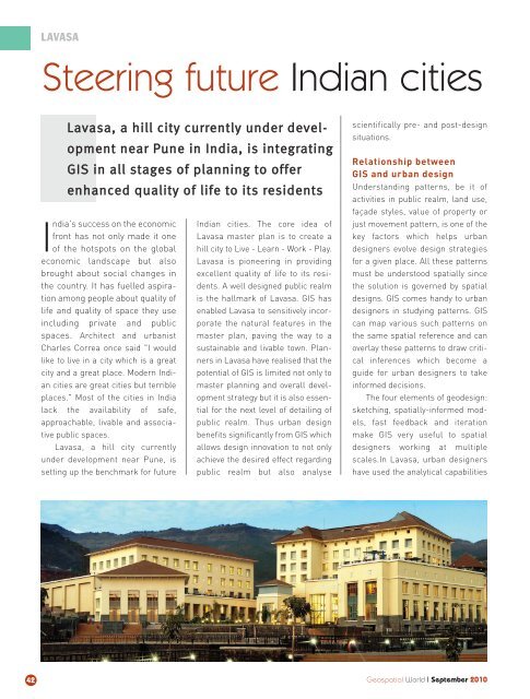
Lavasa, a hill city currently<br />
under development near Pune, is<br />
setting up the benchmark for future<br />
Indian cities. The core idea of<br />
Lavasa master plan is to create a<br />
hill city to Live - Learn - Work - Play.<br />
Lavasa is pioneering in providing<br />
excellent quality of life to its residents.<br />
A well designed public realm<br />
is the hallmark of Lavasa. GIS has<br />
enabled Lavasa to sensitively incorporate<br />
the natural features in the<br />
master plan, paving the way to a<br />
sustainable and livable town. Planners<br />
in Lavasa have realised that the<br />
potential of GIS is limited not only to<br />
master planning and overall development<br />
strategy but it is also essential<br />
for the next level of detailing of<br />
public realm. Thus urban design<br />
benefits significantly from GIS which<br />
allows design innovation to not only<br />
achieve the desired effect regarding<br />
public realm but also analyse<br />
scientifically pre- and post-design<br />
situations.<br />
Relationship between<br />
GIS and urban design<br />
Understanding patterns, be it of<br />
activities in public realm, land use,<br />
façade styles, value of property or<br />
just movement pattern, is one of the<br />
key factors which helps urban<br />
designers evolve design strategies<br />
for a given place. All these patterns<br />
must be understood spatially since<br />
the solution is governed by spatial<br />
designs. GIS comes handy to urban<br />
designers in studying patterns. GIS<br />
can map various such patterns on<br />
the same spatial reference and can<br />
overlay these patterns to draw critical<br />
inferences which become a<br />
guide for urban designers to take<br />
informed decisions.<br />
The four elements of geodesign:<br />
sketching, spatially-informed models,<br />
fast feedback and iteration<br />
make GIS very useful to spatial<br />
designers working at multiple<br />
scales.In Lavasa, urban designers<br />
have used the analytical capabilities<br />
Geospatial World I September 2010