EMPRESAS SUIZAS EN EXPOMIN 9 al 13 de abril de 2012
EMPRESAS SUIZAS EN EXPOMIN 9 al 13 de abril de 2012
EMPRESAS SUIZAS EN EXPOMIN 9 al 13 de abril de 2012

You also want an ePaper? Increase the reach of your titles
YUMPU automatically turns print PDFs into web optimized ePapers that Google loves.
Empresas suizas en <strong>EXPOMIN</strong> + 09 <strong>al</strong> <strong>13</strong> <strong>de</strong> <strong>abril</strong> <strong>de</strong> <strong>2012</strong> + Santiago + Chile<br />
Swiss companies at <strong>EXPOMIN</strong> + april 09 to <strong>13</strong>, <strong>2012</strong> + Santiago + Chile<br />
K E L L E R + G EOT E ST + M A RT I + W Y SS<strong>EN</strong> + GIPO + PA N A L P I N A + H E L I M A P + G EO B R U G G<br />
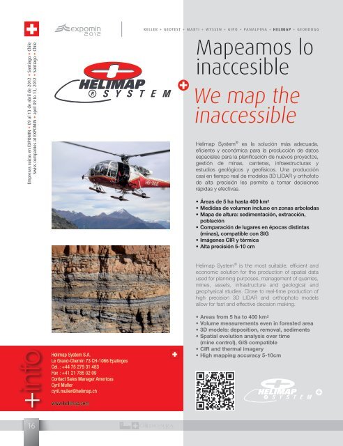
Mapeamos lo<br />
inaccesible<br />
We map the<br />
inaccessible<br />
Helimap System ® es la solución más a<strong>de</strong>cuada,<br />
eficiente y económica para la producción <strong>de</strong> datos<br />
espaci<strong>al</strong>es para la planificación <strong>de</strong> nuevos proyectos,<br />
gestión <strong>de</strong> minas, canteras, infraestructuras y<br />
estudios geológicos y geofísicos. Una producción<br />
casi en tiempo re<strong>al</strong> <strong>de</strong> mo<strong>de</strong>los 3D LIDAR y orthofoto<br />
<strong>de</strong> <strong>al</strong>ta precisión les permite a tomar <strong>de</strong>cisiones<br />
rápidas y efectivas.<br />
• Áreas <strong>de</strong> 5 ha hasta 400 km 2<br />
• Medidas <strong>de</strong> volumen incluso en zonas arboladas<br />
• Mapa <strong>de</strong> <strong>al</strong>tura: sedimentación, extracción,<br />
población<br />
• Comparación <strong>de</strong> lugares en épocas distintas<br />
(minas), compatible con SIG<br />
• Imágenes CIR y térmica<br />
• Alta precisión 5-10 cm<br />
Helimap System ® is the most suitable, efficient and<br />
economic solution for the production of spati<strong>al</strong> data<br />
used for planning purposes, management of quarries,<br />
mines, assets, infrastructure and geologic<strong>al</strong> and<br />
geophysic<strong>al</strong> studies. Close to re<strong>al</strong>-time production of<br />
high precision 3D LIDAR and orthophoto mo<strong>de</strong>ls<br />
<strong>al</strong>low for fast and effective <strong>de</strong>cision making.<br />
+info<br />
Helimap System S.A.<br />
Le Grand-Chemin 73 CH-1066 Ep<strong>al</strong>inges<br />
Cel. : +44 75 279 31 483<br />
Fax : +41 21 785 02 09<br />
Contact S<strong>al</strong>es Manager Americas<br />
Cyril Muller<br />
cyril.muller@helimap.ch<br />
www.helimap.com<br />
• Areas from 5 ha to 400 km 2<br />
• Volume measurements even in forested area<br />
• 3D mo<strong>de</strong>ls: <strong>de</strong>position, remov<strong>al</strong>, sediments<br />
• Spati<strong>al</strong> evolution an<strong>al</strong>ysis over time<br />
(mine control), GIS compatible<br />
• CIR and therm<strong>al</strong> imagery<br />
• High mapping accuracy 5-10cm<br />
16