

opération de cartographie sur l'epave du cap la ... - ImageShack
opération de cartographie sur l'epave du cap la ... - ImageShack
opération de cartographie sur l'epave du cap la ... - ImageShack

You also want an ePaper? Increase the reach of your titles
YUMPU automatically turns print PDFs into web optimized ePapers that Google loves.
Photo S.téphan AUBERT<br />
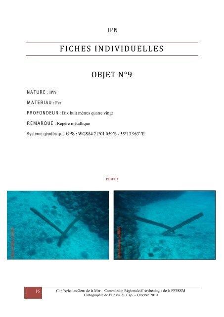
N A T UR E : IPN<br />
M A T E RI A U : Fer<br />
16<br />
IPN<br />
FICHES INDIVIDUELLE S<br />
OBJET N°9<br />
PR O F O ND E UR : Dix huit mètres quatre vingt<br />
R E M A R Q U E : Repère métallique<br />
Système géodésique GPS : WGS84 21°01.059’S - 55°13.963’’E<br />
PHOTO<br />
Photo S.téphan AUBERT<br />
Confrérie <strong>de</strong>s Gens <strong>de</strong> <strong>la</strong> Mer – Commission Régionale d’Archéologie <strong>de</strong> <strong>la</strong> FFESSM<br />
Cartographie <strong>de</strong> l’Epave <strong>du</strong> Cap – Octobre 2010