

opération de cartographie sur l'epave du cap la ... - ImageShack
opération de cartographie sur l'epave du cap la ... - ImageShack
opération de cartographie sur l'epave du cap la ... - ImageShack

Create successful ePaper yourself
Turn your PDF publications into a flip-book with our unique Google optimized e-Paper software.
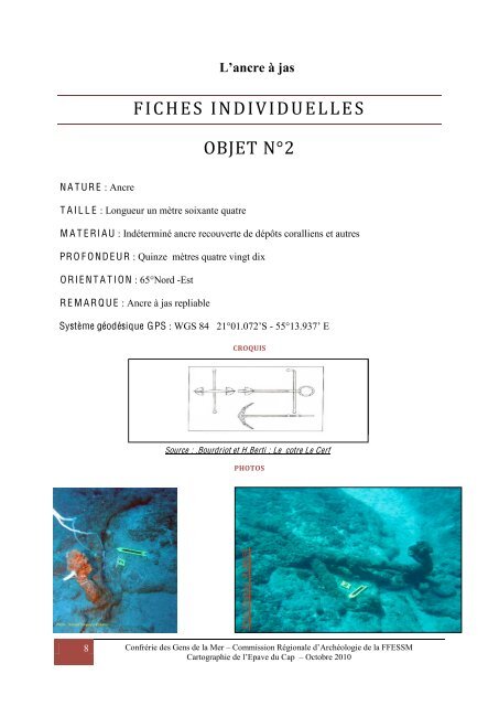
N A T UR E : Ancre<br />
8<br />
L’ancre à jas<br />
FICHES INDIVIDUELLE S<br />
T A I L L E : Longueur un mètre soixante quatre<br />
OBJET N°2<br />
M A T E RI A U : Indéterminé ancre recouverte <strong>de</strong> dépôts coralliens et autres<br />
PR O F O ND E UR : Quinze mètres quatre vingt dix<br />
O RI E N T A T I O N : 65°Nord -Est<br />
R E M A R Q U E : Ancre à jas repliable<br />
Système géodésique GPS : WGS 84 21°01.072’S - 55°13.937’ E<br />
CROQUIS<br />
Source : .Bourdriot et H.Berti : Le cotre Le Cerf<br />
PHOTOS<br />
Photo Stéphan A UB E R T<br />
Confrérie <strong>de</strong>s Gens <strong>de</strong> <strong>la</strong> Mer – Commission Régionale d’Archéologie <strong>de</strong> <strong>la</strong> FFESSM<br />
Cartographie <strong>de</strong> l’Epave <strong>du</strong> Cap – Octobre 2010