

opération de cartographie sur l'epave du cap la ... - ImageShack
opération de cartographie sur l'epave du cap la ... - ImageShack
opération de cartographie sur l'epave du cap la ... - ImageShack

You also want an ePaper? Increase the reach of your titles
YUMPU automatically turns print PDFs into web optimized ePapers that Google loves.
Photo Stéphan A UB E R T<br />
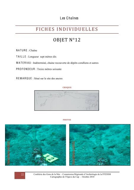
N A T UR E : Chaîne<br />
22<br />
Les Chaînes<br />
FICHES INDIVIDUELLE S<br />
T A I L L E : Longueur sept mètres dix<br />
OBJET N°12<br />
M A T E RI A U : Indéterminé, chaine recouverte <strong>de</strong> dépôts coralliens et autres<br />
PR O F O ND E UR : Treize mètres soixante<br />
R E M A R Q U E : Situé <strong>sur</strong> le site <strong>de</strong>s ancres<br />
CROQUIS<br />
PHOTOS<br />
Photo Stéphan A UB E R T<br />
Confrérie <strong>de</strong>s Gens <strong>de</strong> <strong>la</strong> Mer – Commission Régionale d’Archéologie <strong>de</strong> <strong>la</strong> FFESSM<br />
Cartographie <strong>de</strong> l’Epave <strong>du</strong> Cap – Octobre 2010