binoche renaud giquello - Loeb Larocque
binoche renaud giquello - Loeb Larocque
binoche renaud giquello - Loeb Larocque
Create successful ePaper yourself
Turn your PDF publications into a flip-book with our unique Google optimized e-Paper software.
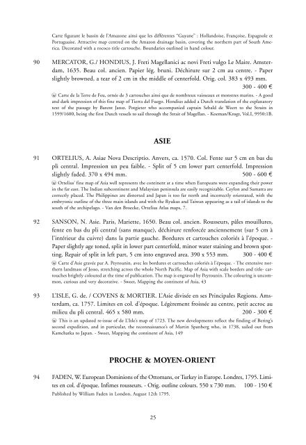
Carte figurant le bassin de l’Amazone ainsi que les différentes “Guyane” : Hollandoise, Françoise, Espagnole et<br />
Portuguaise. Attractive map centred on the Amazon drainage basin, covering the northern part of South America.<br />
Decorated with a rococo title cartouche. Boundaries outlined in hand colour.<br />
90 MERCATOR, G./ HONDIUS, J. Freti Magellanici ac novi Freti vulgo Le Maire. Amsterdam,<br />
1635. Beau col. ancien. Papier lég. bruni. Déchirure sur 2 cm au centre. - Paper<br />
slightly browned, a tear of 2 cm in the middle of centerfold. Orig. col. 383 x 493 mm.<br />
300 - 400 ¤<br />
wo Carte de la Terre de Feu, ornée de 3 cartouches ainsi que de nombreux vaisseaux et monstres marins. - A good<br />
and dark impression of this fine map of Tierra del Fuego. Hondius added a Dutch translation of the explanatory<br />
text of the passage by Barent Jansz. Potgieter who accompanied captain Sebald de Weert to the Straits in<br />
1599/1600, being the first Dutch vessels to sail through the Strait of Magellan. - Koeman/Krogt, Vol.I, 9950:1B.<br />
ASIE<br />
91 ORTELIUS, A. Asiae Nova Descriptio. Anvers, ca. 1570. Col. Fente sur 5 cm en bas du<br />
pli central. Impression un peu faible. - Split of 5 cm lower part centerfold. Impression<br />
slightly faded. 370 x 494 mm. 500 - 600 ¤<br />
wo Ortelius’ fine map of Asia well represents the continent at a time when Europeans were expanding their power<br />
in the far east. The Indian subcontinent and Malaysian peninsula are easily recognizable. Ceylon and Sumatra are<br />
correctly placed. The Philippines are distorted and Japan is too far north and incorrectly orientated, with the<br />
embryonic outline of the three main islands and with the Ryukus and Taiwan appearing as a tail of islands to the<br />
south of the archipelago. - Van den Broecke, Ortelius Atlas maps, 7.<br />
92 SANSON, N. Asie. Paris, Mariette, 1650. Beau col. ancien. Rousseurs, pâles mouillures,<br />
fente en bas du pli central (sans manque), déchirure renforcée anciennement (sur 5 cm à<br />
l’intérieur du cuivre) dans la partie gauche. Bordures et cartouches coloriés à l’époque. -<br />
Paper slightly age toned, split in lower part centerfold, minor water staining and brown spotting.<br />
Repair of split in left part, 5 cm into engraved area. 390 x 553 mm. 300 - 400 ¤<br />
wo Carte d’Asie gravée par A. Peyrounin, avec les bordures et cartouches coloriés à l’époque. - The extensive northern<br />
landmass of Jesso, stretching across the whole North Pacific. Map of Asia with scale borders and title- cartouches<br />
brightly coloured at the time of publication. The map is engraved by Peyrounin. The colouring is uncommon,<br />
curious and very decorative. - Sweet, Mapping the continent of Asia, 43<br />
93 L’ISLE, G. de. / COVENS & MORTIER. L’Asie divisée en ses Principales Regions. Amsterdam,<br />
ca. 1757. Limites en col. d’époque. Légèrement froissée au centre, petit accroc au<br />
milieu du pli central. 465 x 580 mm. 200 - 300 ¤<br />
wo This is an updated re-issue of de L’Isle’s map of 1723. The new developments reflect the finding of Bering’s<br />
second expedition, and in particular, the reconnaissance’s of Martin Spanberg who, in 1738, sailed out from<br />
Kamchatka to Japan. - Sweet, Mapping the continent of Asia, 149<br />
PROCHE & MOYEN-ORIENT<br />
94 FADEN, W. European Dominions of the Ottomans, or Turkey in Europe. Londres, 1795. Limites<br />
en col. d’époque. Infimes rousseurs. - Orig. outline colours. 550 x 730 mm. 100 - 150 ¤<br />
Published by William Faden in London, August 12th 1795.<br />
25


