AEROPORTI DEL MEZZOGIORNO - Oltre l'Occidente
AEROPORTI DEL MEZZOGIORNO - Oltre l'Occidente
AEROPORTI DEL MEZZOGIORNO - Oltre l'Occidente

You also want an ePaper? Increase the reach of your titles
YUMPU automatically turns print PDFs into web optimized ePapers that Google loves.
80<br />
PUGLIA<br />
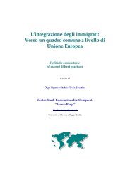
BRINDISI<br />
STATUS<br />
LEGENDA<br />
AEROPORTO MILITARE APERTO<br />
AL TRAFFICO CIVILE COMMERCIALE<br />
NAZIONALE ED INTERNAZIONALE<br />
Codice ICAO LIBR<br />
Codice IATA BDS<br />
Altezza slm 14,1 m<br />
Posizione 3 km da Brindisi<br />
Coordinate geografiche 40°39’38’’ N, 17°56’53’’ E<br />
Sedime 316 ha<br />
Agibilità H24<br />
Piste RWY 05/23 dim. 1.814 m x 45 m<br />
RWY 14/32 dim. 2.532 m x 45 m<br />
Categoria antincendio 8 a ICAO<br />
Assistenze luminose ABN/IBN, SALS<br />
Radioassistenze ILS, GP, NDB, OM,VDF,VORTAC<br />
Gestione e handling <strong>AEROPORTI</strong> DI PUGLIA SpA<br />
ABN aerodrome beacon faro aerodromo<br />
GP glide path sentiero di discesa<br />
IBN identification beacon faro di identificazione<br />
ILS instrument landing system sistema di atterraggio strumentale<br />
NDB non-directional radio beacon radiofaro non direzionale<br />
OM outer marker marker esterno<br />
RWY runway pista di volo<br />
SALS simple approach lighting system sentiero di avvicinamento luminoso semplificato<br />
VDF very high frequency direction - finding station radiogoniometro<br />
VORTAC VOR (VHF omnidirectional radio range) combinazione VOR (radiosentiero<br />
and TACAN (UHF tactical navigation aid) omnidirezionale in VHF) / TACAN<br />
combination (radioassistenza UHF per la navigazione tattica)