Programkatalog_2013-2014 - Högskolan i Gävle
Programkatalog_2013-2014 - Högskolan i Gävle
Programkatalog_2013-2014 - Högskolan i Gävle

Create successful ePaper yourself
Turn your PDF publications into a flip-book with our unique Google optimized e-Paper software.
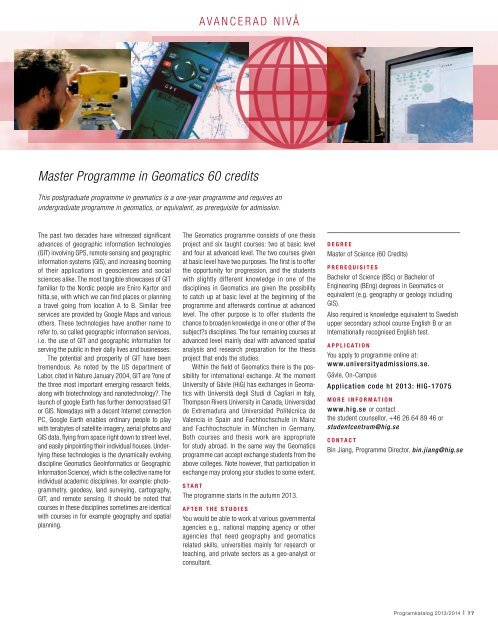
avancerad nivå<br />
Master Programme in Geomatics 60 credits<br />
This postgraduate programme in geomatics is a one-year programme and requires an<br />
undergraduate programme in geomatics, or equivalent, as prerequisite for admission.<br />
The past two decades have witnessed significant<br />
advances of geographic information technologies<br />
(GIT) involving GPS, remote sensing and geographic<br />
information systems (GIS), and increasing booming<br />
of their applications in geosciences and social<br />
sciences alike. The most tangible showcases of GIT<br />
familiar to the Nordic people are Eniro Kartor and<br />
hitta.se, with which we can find places or planning<br />
a travel going from location A to B. Similar free<br />
services are provided by Google Maps and various<br />
others. These technologies have another name to<br />
refer to, so called geographic information services,<br />
i.e. the use of GIT and geographic information for<br />
serving the public in their daily lives and businesses.<br />
The potential and prosperity of GIT have been<br />
tremendous. As noted by the US department of<br />
Labor, cited in Nature January 2004, GIT are ?one of<br />
the three most important emerging research fields,<br />
along with biotechnology and nanotechnology?. The<br />
launch of google Earth has further democratised GIT<br />
or GIS. Nowadays with a decent Internet connection<br />
PC, Google Earth enables ordinary people to play<br />
with terabytes of satellite imagery, aerial photos and<br />
GIS data, flying from space right down to street level,<br />
and easily pinpointing their individual houses. Underlying<br />
these technologies is the dynamically evolving<br />
discipline Geomatics GeoInformatics or Geographic<br />
Information Science), which is the collective name for<br />
individual academic disciplines, for example: photogrammetry,<br />
geodesy, land surveying, cartography,<br />
GIT, and remote sensing. It should be noted that<br />
courses in these disciplines sometimes are identical<br />
with courses in for example geography and spatial<br />
planning.<br />
The Geomatics programme consists of one thesis<br />
project and six taught courses: two at basic level<br />
and four at advanced level. The two courses given<br />
at basic level have two purposes. The first is to offer<br />
the opportunity for progression, and the students<br />
with slightly different knowledge in one of the<br />
disciplines in Geomatics are given the possibility<br />
to catch up at basic level at the beginning of the<br />
programme and afterwards continue at advanced<br />
level. The other purpose is to offer students the<br />
chance to broaden knowledge in one or other of the<br />
subject?s disciplines. The four remaining courses at<br />
advanced level mainly deal with advanced spatial<br />
analysis and research preparation for the thesis<br />
project that ends the studies.<br />
Within the field of Geomatics there is the possibility<br />
for international exchange. At the moment<br />
University of Gävle (HiG) has exchanges in Geomatics<br />
with Università degli Studi di Cagliari in Italy,<br />
Thompson Rivers University in Canada, Universidad<br />
de Extremadura and Universidad Politécnica de<br />
Valencia in Spain and Fachhochschule in Mainz<br />
and Fachhochschule in München in Germany.<br />
Both courses and thesis work are appropriate<br />
for study abroad. In the same way the Geomatics<br />
programme can accept exchange students from the<br />
above colleges. Note however, that participation in<br />
exchange may prolong your studies to some extent.<br />
Start<br />
The programme starts in the autumn <strong>2013</strong>.<br />
After the studies<br />
You would be able to work at various governmental<br />
agencies e.g., national mapping agency or other<br />
agencies that need geography and geomatics<br />
related skills, universities mainly for research or<br />
teaching, and private sectors as a geo-analyst or<br />
consultant.<br />
Degree<br />
Master of Science (60 Credits)<br />
Prerequisites<br />
Bachelor of Science (BSc) or Bachelor of<br />
Engineering (BEng) degrees in Geomatics or<br />
equivalent (e.g. geography or geology including<br />
GIS).<br />
Also required is knowledge equivalent to Swedish<br />
upper secondary school course English B or an<br />
Internationally recognised English test.<br />
Application<br />
You apply to programme online at:<br />
www.universityadmissions.se.<br />
Gävle, On-Campus<br />
Application code ht <strong>2013</strong>: HIG-17075<br />
More information<br />
www.hig.se or contact<br />
the student counsellor, +46 26 64 89 46 or<br />
studentcentrum@hig.se<br />
Contact<br />
Bin Jiang, Programme Director, bin.jiang@hig.se<br />
<strong>Programkatalog</strong> <strong>2013</strong>/<strong>2014</strong> I 77