DRUCK_tvb wilder kaiser_wanderfuehrer_soell_taltouren_16

Erfolgreiche ePaper selbst erstellen
Machen Sie aus Ihren PDF Publikationen ein blätterbares Flipbook mit unserer einzigartigen Google optimierten e-Paper Software.
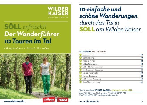
Söll erfrischt!<br />
Der Wanderführer<br />
10 Touren im Tal<br />
Hiking Guide – 10 tours in the valley<br />
10 einfache und<br />
schöne Wanderungen<br />
durch das Tal in<br />
Söll am Wilden Kaiser.<br />
TalTouren | Valley tours<br />
1 Sunnseitweg 08<br />
2 Schattseitweg 10<br />
3 Kleiner Pölven 12<br />
4 Söller Goldrunde 14<br />
5 Söll – Hintersteinersee <strong>16</strong><br />
6 Hochlechen – Rundgang 18<br />
7 Energiewegrunde 20<br />
8 Koller Rundgang 22<br />
9 Pölvenauer Rundgang 24<br />
10 Sonnbichl / Moorsee 26<br />
Tourismusverband Wilder Kaiser — Informationsbüro SÖLL<br />
6306 Söll · Dorf 84 · Tirol · Austria · T:+43 (0) 50509 210<br />
F:+43 (0) 50509 290 · <strong>soell</strong>@<strong>wilder</strong><strong>kaiser</strong>.info<br />
www.<strong>wilder</strong><strong>kaiser</strong>.info<br />
www.<strong>wilder</strong><strong>kaiser</strong>.info<br />
2
IMPRESSUM<br />
Herausgeber: Tourismusverband Wilder Kaiser · 6352 Ellmau · Dorf 35 · Tirol · Austria<br />
T: +43 (0) 50509 · F: +43 (0) 50509 55 · office@<strong>wilder</strong><strong>kaiser</strong>.info · www.<strong>wilder</strong><strong>kaiser</strong>.info<br />
Grafisches Konzept: hœretzeder grafische gestaltung, Scheffau / Tirol<br />
Grafisches Ausführung: Tourismusverband Wilder Kaiser<br />
Fotos: Reiter / von Felbert, Gabriel Eder; Druck: RB Druck GmbH, Saalfelden<br />
Fehler, Änderungen und Irrtümer vorbehalten. © 05.20<strong>16</strong><br />
35<br />
Der Wanderführer Söll
Gemütliches Spazieren<br />
und Wandern im Tal.<br />
Auszeit, Ruhe, Erfrischung und Bewegung. Regionales Essen, saftige<br />
Wiesen und herzhafte Wirtsleute. Dazu bestes Quellwasser und würzige<br />
Luft. Wandern ist in Söll eben weit mehr, als die reine „Müllers Lust“.<br />
Es ist vielfältig und abwechslungsreich, empfehlenswert und besonders wertvoll.<br />
Mit dem Liftl’n, bietet unsere Bergbahn angenehme „fußfreie“ Aufstiegshilfen an,<br />
die sie ob der Aussicht faszinieren werden. Einige Tipps fürs Wandern sind selbst<br />
im 21. Jahrhundert noch gültig:<br />
Söll – schönstes Blumendorf Europas<br />
• Geh Papa, wie weit ist es noch?<br />
Tourenplanung der Kondition und der Wetterlage anpassen.<br />
• Ich habe Durst und mir ist kalt!<br />
Ausrüstungen, wie Sonnenschutz und Regenkleidung, sowie genug zum<br />
Trinken sind unabdingbar.<br />
• Kinder und Hunde sind nicht gleich!<br />
Hunde gehören an die Leine und Kinder brauchen Führung in den Bergen.<br />
einfaches Orientieren<br />
Söll – Dorf<br />
To relax and having a break, to refresh and being active – more than just<br />
nice sounding words in Söll. In the valley and on the mountain, the landscape<br />
is fascinating and inspiring, both at one glance. The traditional food and service<br />
will highlight your outdoor holiday and hiking tours for almost “every breath” are<br />
accessible. The lift’n hike programme gets you easily up the mountain by gondola<br />
or chair lift, where you start hiking at a<br />
tremendous scenery. Some tips for hiking:<br />
Kirche<br />
Barfußwandern<br />
Familienwanderung<br />
• Check the tour in advance and make sure your fitness<br />
is suitable to the tour’s demands.<br />
• Sun and rain protection are compulsory on the mountain,<br />
as well as enough drinking.<br />
• Dogs have to be leashed and children need guidance.<br />
6 Der Wanderführer Söll www.<strong>wilder</strong><strong>kaiser</strong>.info<br />
7
1<br />
Sunnseitweg,<br />
l (NR 1)<br />
Ein Muss für jeden Wanderer in Söll.<br />
! 12 km<br />
, je 550 Höhenmeter<br />
` 3h 50min<br />
* 1.050 m<br />
••••<br />
leicht<br />
F Kinder & Familien<br />
• Wanderstartplatz<br />
Franzlhof, Söll<br />
˚ Franzlhof, Söll<br />
Einkehren:<br />
Franzlhof<br />
T: +43 (0) 5333 5117<br />
Genussstube Hochfilzer<br />
T: +43 (0) 5333 5491<br />
Stallhäusl<br />
T: +43 (0) 5332 76342<br />
Gasthof Badhaus<br />
T: +43 (0) 5333 5365<br />
Gasthaus Agerhof<br />
T: +43 (0) 5333 5340<br />
Ausgangspunkt ist die Freizeitanlage Franzlhof.<br />
Ihr Rundgang wird mit vielen heimatkundlichen<br />
Geheimnissen und den Sunnseit-Gasthäusern<br />
belohnt. Der Hauptweg führt bis zum Reiter Dörfl<br />
am Waldrand entlang, danach rechts hinauf zum<br />
Schwazerbauer. Nach einem kurzen steilen Stück<br />
vorbei am Marienbründl, hinauf zur Lengauer Kapelle<br />
und zum Stallhäusl, retour auf der Straße hinunter<br />
bis linkerhand der Sunnseitweg ins Dorf zurückführt.<br />
It’s a must for hikers in Söll. The starting point for<br />
your tour is at the Franzlhof leisure centre and get<br />
ready to be rewarded with many local secrets and<br />
sun-soaked inns. Follow the main trail to the Reiter<br />
Dörfl before heading up right to the Schwazerbauer.<br />
After a short but steep section that takes you past the<br />
Marienbründl, go to the Lengauer chapel and Stallhäusl.<br />
Head back down the road as the Sunnseit path<br />
on the left takes you on a journey back to the village.<br />
Magischer Stein<br />
8 Der Wanderführer Söll www.<strong>wilder</strong><strong>kaiser</strong>.info<br />
9
kinderwagentauglich<br />
2<br />
l<br />
Schattseitweg<br />
(NR 55)<br />
Ruhe, Kraft und Durchatmen –<br />
dem Kaiser ein Stück näher rücken.<br />
! 5,3 km<br />
˙ <strong>16</strong>0 Höhenmeter<br />
˜ 225 Höhenmeter<br />
` 1h 30min<br />
* 782 m<br />
••<br />
leicht<br />
F Kinder & Familien<br />
• Wanderstartplatz<br />
Bergbahn, Söll<br />
˚ Wanderstartplatz<br />
Bergbahn, Söll<br />
Ausgehend vom Startplatz an der Talstation, werden<br />
Sie vom monumentalen Einganstor der Schattseite<br />
empfangen und spüren auf ca. 5 km die Ursprünglichkeit<br />
der Söller Natur. Einfacher, der Natur angepasster<br />
Wanderweg mit nur sehr geringem Höhenunterschied.<br />
Endpunkt ist das Gasthof Bocking, von wo aus unterschiedliche<br />
Rückwege angeboten werden. Retour mit<br />
dem Kaiserjet oder zu Fuß über das Hauninger Dörfl.<br />
Quietness, strength and with easy breathing<br />
steadily closer to the Wilder Kaiser. Starting from<br />
the mountain railway valley station, you are welcomed<br />
by the monumental entrance of the shady side of the<br />
mountain. This feeling stays with you for the next 5 km<br />
as you make your way through the nature of Söll.<br />
This simple nature trail is relatively flat and ends at<br />
the Bocking Gasthof where different options reveal<br />
themselves for the journey home. For example, one<br />
could take the Kaiserjet bus from the return leg or<br />
walk across the Hauninger Dörfl.<br />
Einkehren:<br />
Gasthof Bocking<br />
T: +43 (0) 5333 5131<br />
Schattseittor<br />
10 Der Wanderführer Söll www.<strong>wilder</strong><strong>kaiser</strong>.info<br />
11
3<br />
l<br />
kleiner pölven<br />
(NR 4)<br />
Der Aussichtsberg der Einheimischen,<br />
steil und faszinierend.<br />
! 4,6 km<br />
˙ 880 Höhenmeter<br />
˜ 30 Höhenmeter<br />
` 2h 30min<br />
* 1562 m<br />
••••<br />
mittelschwierig<br />
• Wanderstartplatz<br />
Franzlhof, Söll<br />
˚ Franzlhof, Söll<br />
Ausgangspunkt ist die Freizeitanlage Franzlhof.<br />
Diese herausfordernde Panorama-Tour starten Sie<br />
zunächst mit dem „Eingehen“ auf dem Teilstück des<br />
Sunnseitweges. Nach dem Kollerblick rechts abbiegen,<br />
in Richtung Pfötschinghof. Nun wandern Sie steil am<br />
Waldrand aufwärts bis Sie zunächst die unbewirtschaftete<br />
Reiteralm erreichen. Weiter am oberen Ende<br />
der Lichtung, bis Sie den Gipfel des 1.562 m hohen<br />
Kleinen Pölven erreichen und einen faszinierenden<br />
Ausblick genießen.<br />
The panoramic spot of the locals, steep and fascinating.<br />
The starting point for this tour is at the Franzlhof<br />
leisure centre. This challenging panoramic tour begins<br />
with a portion of the Sunnseit path and at the Koller<br />
view you go right and wander towards the Pfötschinghof.<br />
Now walk steeply upwards at the edge of the<br />
forest until you reach the unstaffed Reiteralm. At the<br />
upper end of the clearing go through the forest until<br />
you reach the top of the 1,562 m little Pölven.<br />
Einkehren:<br />
Franzlhof<br />
T: +43 (0) 5333 5117<br />
Söll im Herbst<br />
12 Der Wanderführer Söll www.<strong>wilder</strong><strong>kaiser</strong>.info<br />
13
kinderwagentauglich<br />
4<br />
Söller<br />
l Goldrunde<br />
Unser wanderbares Dorfprospekt!<br />
! 3,2 km<br />
, je 90 Höhenmeter<br />
` 50min<br />
* 750 m<br />
•<br />
leicht<br />
F Kinder & Familien<br />
• Wanderstartplatz<br />
Infobüro, Söll<br />
˚ Parkplatz West<br />
Pöven<br />
Vom Infobüro Söll starten sie vorbei am Musikpavillon<br />
nach Pirchmoos. Beim Hotel Greil biegen<br />
Sie rechts ab zum Oberkollerhof. Rechts führt Sie<br />
der Sunnseitweg bis zum Franzlhof. Nun wandern<br />
Sie zum Hotel Feichter (Grashalmlaterne) und zum<br />
Hausbachlweg. Über die Volksschule und Salvenarena<br />
gelangen Sie zum Jausenplatzl. Dort dann rechts<br />
zurück über den „Söller Haubtbahnhof “ zum<br />
Ausgangspunkt.<br />
Looping the village of Söll, the sight seeing hike!<br />
Start this tour at the Tourist Information Center in<br />
Söll before going past the bandstand in the direction<br />
of Pirchmoos. Turn right to the Franzlhof. now get<br />
ready to hike to the hotel Feichter and the Hausbachlweg.<br />
When you reach the elementary school and<br />
Salvenarena, a snack awaits you at the Jausenplathl<br />
and from here, turn rigt and head back to the starting<br />
point over the “Söller Main train station”.<br />
Einkehren:<br />
Entlang des Weges finden Sie zahlreiche<br />
Einkehrmöglichkeiten!<br />
Söll – schönstes Blumendorf Europas<br />
14 Der Wanderführer Söll www.<strong>wilder</strong><strong>kaiser</strong>.info<br />
15
5<br />
l<br />
Söll – Hintersteinersee<br />
(NR 57)<br />
Vom Blumendorf zum Alpenjuwel,<br />
steigungsreich und wasserreich.<br />
! 9,3 km<br />
˙ 570 Höhenmeter<br />
˜ 380 Höhenmeter<br />
` 3h 10min<br />
* 1022 m<br />
•••<br />
mittelschwierig<br />
• Wanderstartplatz<br />
Franzlhof, Söll<br />
˚ Franzlhof, Söll<br />
Einkehren:<br />
Franzlhof<br />
T: +43 (0) 5333 5117<br />
Gasthof Oberstegen<br />
T: +43 (0) 5333 5277<br />
Pension Maier<br />
T: +43 (0) 5358 8203<br />
Jausenstation Goingstätt<br />
T: +43 (0) 5358 8202<br />
Cafe Restaurant Seestüberl<br />
T: +43 (0) 5358 8191<br />
Ausgangspunkt ist die Freizeitanlage Franzlhof.<br />
Über den Moorsee geht es zum Gasthof Obestegen,<br />
wo Sie die Bundesstraße queren. Folgen Sie der<br />
Markierung Hintersteinersee Nr. 57. Hinter dem<br />
„Fiaggnbauern“ gibt es die Abzweigung in Richtung<br />
Hintersteinersee über die Tischleralm. Beim Gasthof<br />
Seestüberl (Ostufer) kann ein Zustieg zum Bus nach<br />
Scheffau gewählt, sowie im Anschluss der Kaiserjet<br />
nach Söll genommen werden.<br />
From the flowery village to the water jewel of the<br />
Alps. Start at the Franzlhof leisure centre and head<br />
towards the Moorsee. It is here that you reach the<br />
Oberstegen Gasthof and need to cross the main<br />
road. Follow the Hintersteinersee no. 57. Behind the<br />
“Fiaggnbauern” is a turnoff towards Hinterseinersee<br />
that takes you over the Tischleralm. At the Seestüberl<br />
Gasthof you can board a bus that takes you to Scheffau<br />
and then be taken by the Kaiserjet to Söll.<br />
Die Seele baumeln lassen ...<br />
<strong>16</strong> Der Wanderführer Söll www.<strong>wilder</strong><strong>kaiser</strong>.info<br />
17
6<br />
l<br />
Hochlechen –<br />
Rundgang (NR 54)<br />
Alter Weg – neu angelegt und<br />
gemütliches Auf und Ab.<br />
! 7,1 km<br />
, je 625 Höhenmeter<br />
` 3h 30min<br />
* <strong>16</strong>00 m<br />
••••<br />
mittelschwierig<br />
• Wanderstartplatz<br />
Bergbahn, Söll<br />
˚ Liftparkplatz<br />
Bergbahn, Söll<br />
Ausgehend vom Startplatz an der Talstation wandern<br />
Sie am Schattseitweg bis zum Weiler Fallbichl/<br />
Heisbauern, rechts etwas ansteigend auf dem Feldweg<br />
bis zum Schadlbauern. Von hier führt ein steiler Pfad<br />
bis zur Jausenstation Hochlechen, Rückweg auf dem<br />
Fahrweg bergab bis zum Gasthof Oberberg, hier links<br />
über die Bauernhöfe Granbach und Ed zum Weiler<br />
„Fallbichl“, von hier auf dem schon bekannten Weg<br />
zurück ins Dorf.<br />
Ever existing path, new developed and combined<br />
with ups and downs. Start at the valley station and<br />
walk on the Schattseit path towards the hamlet Fallbichl/<br />
Heisbauern. You now need to go uphill on a<br />
dirt toad until you reach Schadlbauern. A steep path<br />
leading to the Hochlechen snack bar now presents<br />
itself. To return home, head downhill along the track<br />
to the Oberberg Gasthof before going left at the<br />
Granbach farmhouse. You should see the Fallbichl<br />
hamlet along the way before reaching the familair<br />
surroundings of the village.<br />
Einkehren:<br />
Gasthaus Hochlechen<br />
T: +43 (0) 5358 8351<br />
Berggasthof Bavaria<br />
T: +43 (0) 5358 8353<br />
Blick zum Wilden Kaiser<br />
18 Der Wanderführer Söll www.<strong>wilder</strong><strong>kaiser</strong>.info<br />
19
7<br />
energiewegrunde<br />
l (NR 52)<br />
Auf zwei Wegen der Sonne entgegen.<br />
! 6,3 km<br />
, je 195 Höhenmeter<br />
` 1h 45min<br />
* 724 m<br />
••<br />
mittelschwierig<br />
F Kinder & Familien<br />
• Wanderstartplatz<br />
Infobüro, Söll<br />
˚ Parkplatz West<br />
Pölven<br />
Ausgangspunkt ist die Freizeitanlage Franzlhof,<br />
von wo aus es zunächst hinunter zum Moorsee geht.<br />
Weiter bis zum Gasthof Oberstegen kommen Sie,<br />
durch eine Unterführung in Stallnähe, direkt zum Weg<br />
entlang der Weißache. Sowohl das Klärwerk als auch<br />
Solarthermiestationen geben Einblicke in die Söller<br />
Energiegewinnung. Bei der Mühlbodenbrücke geht es<br />
rechts ab, vorbei am Hundeauslaufplatz und über den<br />
Ortsteil Gänsleit zurück ins Dorf.<br />
A hike towards the sun – from every direction.<br />
Start at the Franzlhof leisure centre before making<br />
your way to the Moorsee. Now head to the Oberstegen<br />
Gasthof where you go through and underpass next<br />
to the path along the Weißache. Both the sewage treatment<br />
plant – with a biogas plant – and solar thermal<br />
stations provide insights into the energy policy of Söll.<br />
When you come to the Mühlbodenbrücke, turn right<br />
and go past the dog running area, through the Gänsleit<br />
district and back to the village.<br />
Einkehren:<br />
Entlang des Weges finden Sie zahlreiche<br />
Einkehrmöglichkeiten!<br />
Aussichtspunkt am Energieweg<br />
20 Der Wanderführer Söll www.<strong>wilder</strong><strong>kaiser</strong>.info<br />
21
kinderwagentauglich<br />
8<br />
l<br />
Koller Rundgang<br />
(NR 3)<br />
Die Wanderrunde auf einem<br />
alten Römerweg.<br />
! 3 km<br />
, je 180 Höhenmeter<br />
` 50min<br />
* 751 m<br />
•<br />
leicht<br />
F Kinder & Familien<br />
• Wanderstartplatz<br />
Infobüro, Söll<br />
˚ Parkplatz West<br />
Pölven<br />
Einkehren:<br />
Hotel Gasthof Postwirt<br />
T: +43 (0) 5333 5081<br />
Pizzeria Giovanni<br />
T: +43 (0) 5333 5705<br />
Franzlhof<br />
T: +43 (0) 5333 5117<br />
Hotel Feichter<br />
T: +43 (0) 5333 5228<br />
Vom Infobüro Söll aus biegen Sie links beim Postwirt<br />
ab, wandern weiter am Musikpavillon vorbei. Folgen<br />
Sie der Straße bis zur Pirchmooser Kapelle. Rechterhand<br />
ist der „Magische Stein“ am Sunnseitweg, hier<br />
verlief einst ein alter Römerweg. Ihm folgen sie nun<br />
bis zum Erbhof Oberkoller. Vorbei an der Kräuterspirale<br />
geht es am Teilstück des Kaisermarathons bis<br />
zum Franzlhof und retour ins Dorf.<br />
Ancient path of the romans – a better stroll.<br />
Begin at the Tourist Information Center Söll before<br />
turning left at the Postwirt. Continue walking all the<br />
way past the bandstand and follow the road until you<br />
come to the Pirchmooser chapel. On the right you will<br />
find the Magic Stone on the Sunnseit path. You now<br />
follow this old Roman road up to the Oberkoller family<br />
farm. Make your way past the herb spiral and enjoy<br />
apotion of the Kaiser Marathon track which overlooks<br />
Söll. Keep going all the way to the Franzlhof leisure<br />
centre and back to the village.<br />
Vitale Kräuter<br />
22 Der Wanderführer Söll www.<strong>wilder</strong><strong>kaiser</strong>.info<br />
23
9<br />
l<br />
Pölvenauer<br />
Rundgang (NR 5 + 60)<br />
Gemütlicher Rundwanderweg zum<br />
romantisch gelegenen Moorsee.<br />
! 5,7 km<br />
, je 335 Höhenmeter<br />
` 2h 15min<br />
* 866 m<br />
••<br />
mittelschwierig<br />
• Wanderstartplatz<br />
Franzlhof, Söll<br />
˚ Franzlhof, Söll<br />
Ausgangspunkt ist die Freizeitanlage Franzlhof.<br />
Folgen Sie sodann der Beschilderung Weg Nr. 60<br />
(Pölvenrunde) bis zum Bauernhof Haberland.<br />
Nach ca. 1000 m auf der Straße zweigen Sie links ab<br />
und wandern durch den Wald bis sie zum Gasthof<br />
Oberstegen gelangen. Von hier aus folgen Sie dem<br />
Energieweg Richtung Moorsee und über den Anstieg<br />
„Kaltes Loch“ zurück zum Ausgangspunkt.<br />
An easy walk to the lake Moorsee. Start at the<br />
Franzlhof leisure centre and follow the sign, path<br />
nr. 60 (Pölvenrunde) to the Haberland farm. After<br />
1 km, take a left and walk through the forest until<br />
you reach the Oberstegen Gasthof. From here follow<br />
the Energie Trail in the direction of the Moorsee and<br />
over the rise to the “Kaltes Loch” and back to the<br />
starting point.<br />
Einkehren:<br />
Franzlhof<br />
T: +43 (0) 5333 5117<br />
Gasthof Oberstegen<br />
T: +43 (0) 5333 5277<br />
Gasthof Moorsee<br />
T: +43 (0) 5333 43069<br />
Bauernhof Rückstegen<br />
24 Der Wanderführer Söll www.<strong>wilder</strong><strong>kaiser</strong>.info<br />
25
10<br />
l<br />
Sonnbichl /<br />
Moorsee (NR 6)<br />
Historische Wege mit alten<br />
Gewässern für jedermann kombiniert.<br />
! 2,4 km<br />
, je 110 Höhenmeter<br />
` 45min<br />
* 741 m<br />
•<br />
leicht<br />
F Kinder & Familien<br />
• Wanderstartplatz<br />
Franzlhof, Söll<br />
˚ Wanderstartplatz<br />
Franzlhof, Söll<br />
Ausgangspunkt ist die Freizeitanlage Franzlhof.<br />
Von hier folgen Sie der Beschilderung in Richtung<br />
„Kriegerdenkmal“. Nachdem Sie dieses passiert haben,<br />
biegen Sie rechts ab in Richtung Hotel Alpenpanorama<br />
– toller Ausblick auf den Söller Hausberg „Hohe<br />
Salve“. Dann weiter in Richtung Schnapflwald und<br />
hinunter über den Wurzelweg zum Gasthof Moorsee.<br />
Auf der gegenüberliegenden Uferseite steigt der Weg<br />
wieder an und bringt Sie zum Ausgangspunkt.<br />
Historical routes combined with rural waters,<br />
pleasant to walk for everyone. Start at the Franzlhof<br />
leisure centre and follow the sign towards the “war<br />
memorial”. After passing the memorial, turn right<br />
towards the Alpenpanorama Hotel where a great view<br />
of the Hohe Salve awaits you. Continue towards the<br />
Schnapflwald an down through the root path to the<br />
Moorsee Gasthof. Take the path on the opposite bank<br />
to make your way back to the starting point.<br />
Einkehren:<br />
Freizeitanlage Franzlhof<br />
T: +43 (0) 5333 5117<br />
Gasthof Moorsee<br />
T: +43 (0) 5333 43069<br />
Hotel Alpenpanorama<br />
T: +43 (0) 5333 5309<br />
Moorsee<br />
26 Der Wanderführer Söll www.<strong>wilder</strong><strong>kaiser</strong>.info<br />
27