ac 91-003 srvsop - ICAO
ac 91-003 srvsop - ICAO
ac 91-003 srvsop - ICAO

You also want an ePaper? Increase the reach of your titles
YUMPU automatically turns print PDFs into web optimized ePapers that Google loves.
AC <strong>91</strong>-<strong>003</strong> SRVSOP<br />
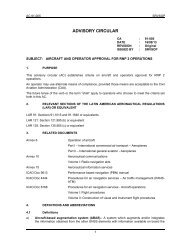
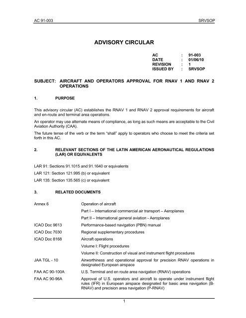
ADVISORY CIRCULAR<br />
1<br />
AC : <strong>91</strong>-<strong>003</strong><br />
DATE : 01/06/10<br />
REVISION : 1<br />
ISSUED BY : SRVSOP<br />
SUBJECT: AIRCRAFT AND OPERATORS APPROVAL FOR RNAV 1 AND RNAV 2<br />
OPERATIONS<br />
1. PURPOSE<br />
This advisory circular (AC) establishes the RNAV 1 and RNAV 2 approval requirements for aircraft<br />
and en-route and terminal area operations.<br />
An operator may use alternate means of compliance, as long as such means are <strong>ac</strong>ceptable to the Civil<br />
Aviation Authority (CAA).<br />
The future tense of the verb or the term “shall” apply to operators who choose to meet the criteria set<br />
forth in this AC.<br />
2. RELEVANT SECTIONS OF THE LATIN AMERICAN AERONAUTICAL REGULATIONS<br />
(LAR) OR EQUIVALENTS<br />
LAR <strong>91</strong>: Sections <strong>91</strong>.1015 and <strong>91</strong>.1640 or equivalents<br />
LAR 121: Section 121.995 (b) or equivalent<br />
LAR 135: Section 135.565 (c) or equivalent<br />
3. RELATED DOCUMENTS<br />
Annex 6 Operation of aircraft<br />
Part I – International commercial air transport – Aeroplanes<br />
Part II – International general aviation - Aeroplanes<br />
<strong>ICAO</strong> Doc 9613 Performance-based navigation (PBN) manual<br />
<strong>ICAO</strong> Doc 7030 Regional supplementary procedures<br />
<strong>ICAO</strong> Doc 8168 Aircraft operations<br />
Volume I: Flight procedures<br />
Volume II: Construction of visual and instrument flight procedures<br />
JAA TGL - 10 Airworthiness and operational approval for precision RNAV operations in<br />
designated European airsp<strong>ac</strong>e<br />
FAA AC 90-100A U.S. Terminal and en route area navigation (RNAV) operations<br />
FAA AC 90-96A Approval of U.S. operators and aircraft to operate under instrument flight<br />
rules (IFR) in European airsp<strong>ac</strong>e designated for basic area navigation (B-<br />
RNAV) and precision area navigation (P-RNAV)
SRVSOP AC <strong>91</strong>-<strong>003</strong><br />
Spain DGAC CO 03/01 Aprob<strong>ac</strong>iones de aeronavegabilidad y oper<strong>ac</strong>ionales para oper<strong>ac</strong>iones<br />
RNAV de precisión (P-RNAV) en el esp<strong>ac</strong>io aéreo Europeo designado<br />
4. DEFINITIONS AND ABBREVIATIONS<br />
4.1 Definitions<br />
a) Aircraft-based augmentation system (ABAS).- an augmentation system which augments<br />
and/or integrates the information obtained from the other GNSS elements with information<br />
available on board the aircraft. The most common form of ABAS is receiver autonomous integrity<br />
monitoring (RAIM).<br />
b) Area navigation (RNAV).- A navigation method that allows aircraft to operate on any desired<br />
flight path within the coverage of ground- or sp<strong>ac</strong>e-based navigation aids, or within the limits of<br />
the capability of self-contained aids, or a combination of these.<br />
Area navigation includes performance-based navigation as well as other RNAV operations that<br />
do not meet the definition of performance-based navigation.<br />
c) Area navigation route.- ATS route established to be used by aircraft with the capability of<br />
applying area navigation.<br />
d) Area navigation system (RNAV system).- An area navigation system that permits aircraft<br />
operation on any desired flight path within the coverage of ground- or sp<strong>ac</strong>e-based navigation<br />
aids or within the limits of the capability of self-contained aids, or a combination of these. An<br />
RNAV system may be included as part of the Flight Management System (FMS).<br />
e) Critical DME. A distance-measuring equipment (DME) f<strong>ac</strong>ility that, when not available, results in<br />
navigation service which is insufficient for DME/DME- and DME/DME//IRU-based operations<br />
along a specific route or procedure. For example, standard instrument departures and arrivals<br />
(SID/STAR) may be published with only two DMEs, in which case, both DMEs are critical.<br />
f) DME/DME (D/D) RNAV. - Area navigation that uses the line of sight of at least two DME f<strong>ac</strong>ilities<br />
to determine aircraft position.<br />
g) DME/DME/Inertial (D/D/I) RNAV. - Area navigation that uses the line of sight of at least two<br />
DME f<strong>ac</strong>ilities to determine aircraft position, along with an inertial reference unit (IRU) that<br />
provides sufficient position information in areas without DME coverage (DME gaps).<br />
h) Flight technical error (FTE).- The FTE is the <strong>ac</strong>cur<strong>ac</strong>y with which an aircraft is controlled as<br />
measured by the indicated aircraft position with respect to the indicated command or desired<br />
position. It does not include blunder errors.<br />
i) Global navigation satellite system (GNSS).- A generic term used by the International Civil<br />
Aviation Organization (<strong>ICAO</strong>) to define any global position, speed, and time determination<br />
system that includes one or more main satellite constellations, such as GPS and the global<br />
navigation satellite system (GLONASS), aircraft receivers and several integrity monitoring<br />
systems, including aircraft-based augmentation systems (ABAS), satellite-based augmentation<br />
systems (SBAS), such as the wide area augmentation systems (WAAS) and ground-based<br />
augmentation systems (GBAS), such as the local area augmentation system (LAAS). Distance<br />
information will be provided, at least in the immediate future, by GPS and GLONASS.<br />
j) Global positioning system (GPS).- The United States global navigation satellite system<br />
(GNSS) that uses precise distance measurements to determine position, speed, and time<br />
anywhere in the world. GPS is made up by three elements: sp<strong>ac</strong>e, control, and user. The GPS<br />
spatial segment nominally consists of, at least, 24 satellites in 6 orbital planes. The control<br />
element consists of 5 monitoring stations, 3 ground antennas, and one master control station.<br />
The user element consists of antennas and receivers that provide the user with position, speed,<br />
and precise time.<br />
2
AC <strong>91</strong>-<strong>003</strong> SRVSOP<br />
k) Navigation specifications.- Set of aircraft and flight crew requirements needed to support<br />
performance-based navigation operations in a defined airsp<strong>ac</strong>e. There are two kinds of<br />
navigation specification:<br />
Required Navigation Performance (RNP) Specification. Area navigation specification that<br />
includes the performance control and alerting requirement, designated by the prefix RNP; e.g.,<br />
RNP 4, RNP APCH, RNP AR APCH.<br />
Area Navigation (RNAV) Specification.- Area navigation specification that does not include the<br />
performance control and alerting requirement, designated by the prefix RNAV; e.g., RNAV 5,<br />
RNAV 2, RNAV 1.<br />
Note 1.- The Manual on Performance-based Navigation (PBN) (Doc 9613), Volume II, contains detailed guidelines on<br />
navigation specifications.<br />
Note 2.- The term RNP, formerly defined as “a statement of the navigation performance necessary for operation within a<br />
defined airsp<strong>ac</strong>e”, has been deleted from the Annexes to the Convention on International Civil Aviation because the RNP<br />
concept has been repl<strong>ac</strong>ed by the PBN concept. In said Annexes, the term RNP is now only used within the context of<br />
the navigation specifications that require on-board performance control and alerting; e.g., RNP 4 refers to the aircraft and<br />
the operational requirements, including a lateral performance of 4 NM, with the requirement for on-board performance<br />
control and alerting as described in the PBN Manual (Doc 9613).<br />
l) Navigation system error (NSE).- The difference between the true position and the estimated<br />
position.<br />
m) Path definition error (PDE).- The difference between the defined path and the desired path at<br />
a given pl<strong>ac</strong>e and time.<br />
n) Performance-based navigation (PBN).- Performance-based area navigation requirements for<br />
aircraft operating along an ATS route, on an instrument appro<strong>ac</strong>h procedure, or in a designated<br />
airsp<strong>ac</strong>e.<br />
Performance requirements are defined in navigation specifications (RNAV and RNP<br />
specifications) in terms of the precision, integrity, continuity, availability, and functionality<br />
necessary to perform the proposed operation within the context of a particular airsp<strong>ac</strong>e concept.<br />
o) Position estimation error (PEE).- Difference between true position and estimated position.<br />
p) Receiver autonomous integrity monitoring (RAIM).- A technique used in a GPS<br />
receiver/processor to determine the integrity of its navigation signals, using only GPS signals or<br />
GPS signals enhanced with barometric altitude data. This determination is <strong>ac</strong>hieved by a<br />
consistency check between pseudo-range measurements. At least one additional available<br />
satellite is required with respect to the number of satellites that are needed for the navigation<br />
solution.<br />
q) RNAV operations.- Aircraft operations that use area navigation for RNAV applications. RNAV<br />
operations include the use of area navigation for operations that are not performed in keeping<br />
with the PBN manual.<br />
r) Standard instrument arrival (STAR).- A designated instrument flight rule (IFR) arrival route<br />
linking a significant point, normally on an ATS route, with a point from which a published<br />
instrument appro<strong>ac</strong>h procedure can be commenced.<br />
s) Standard instrument departure (SID).- A designated instrument flight rules (IFR) departure<br />
route linking the aerodrome or a specified runway of the aerodrome with a specified significant<br />
point, normally on a designated ATS route, at which the en-route phase of the flight commences.<br />
t) Total system error (TSE).- The difference between the true and the desired position. This error<br />
is equal to the sum of the vector of the path definition error (PDE), the flight technical error (FTE),<br />
and the navigation system error (NSE).<br />
Note.- Sometimes the FTE is referred to as the path steering error (PSE) and the NSE is referred to as the position<br />
estimation error (PEE).<br />
3
SRVSOP AC <strong>91</strong>-<strong>003</strong><br />
Total system error (TSE)<br />
4.2 Abbreviations<br />
Total system error (TSE)<br />
4<br />
Desired path<br />
Path definition error (PDE) Defined path<br />
Flight technical error (FTE)<br />
Navigation system error (NSE)<br />
True position<br />
Estimated position<br />
a) CAA Civil Aviation Administration /Civil Aviation Authority<br />
b) ABAS Aircraft-based augmentation system<br />
c) AC Advisory circular (FAA)<br />
d) AFE Field elevation<br />
e) AFM Aircraft flight manual<br />
f) AHRS Attitude and heading reference system<br />
g) AIP Aeronautical information publication<br />
h) AIRAC Aeronautical information regulation and control<br />
i) AP Automatic pilot<br />
j) ANSP Area navigation service providers<br />
k) ATC Air traffic control<br />
l) ATM Air traffic management<br />
m) ATS Air traffic services<br />
n) baro-VNAV Barometric vertical navigation<br />
o) B-RNAV Basic area navigation<br />
p) CA Advisory circular in Spanish (SRVSOP)<br />
q) CA Course to an altitude<br />
r) CDI Course deviation indicator<br />
s) CF Course to a fix<br />
t) CNS/ATM Communications, navigation, and surveillance/air traffic management<br />
u) OC Operations circular (Spain)<br />
v) D/D DME/DME<br />
w) D/D/I DME/DME/IRU<br />
x) DF Direct to a fix
AC <strong>91</strong>-<strong>003</strong> SRVSOP<br />
y) DOC Designated operational coverage<br />
z) DME Distance-measuring equipment<br />
aa) FD Flight dispatcher<br />
bb) EASA European Aviation Safety Agency<br />
cc) EHSI Enhanced vertical status indicator<br />
dd) FAA United States Federal Aviation Administration<br />
ee) FAF Final appro<strong>ac</strong>h fix<br />
ff) FAP Final appro<strong>ac</strong>h point<br />
gg) FD Flight director<br />
hh) FM Course from a fix to a manual termination<br />
ii) FMC Flight management computer<br />
jj) FMS Flight management system<br />
kk) FOM Figure of merit<br />
ll) FTE Flight technical error<br />
mm) GBAS Ground-based augmentation system<br />
nn) GNSS Global navigation satellite system<br />
oo) GLONASS Global navigation satellite system<br />
pp) GPS Global positioning system<br />
qq) GS Ground speed<br />
rr) HAL Horizontal alert limit<br />
ss) HSI Horizontal status indicator<br />
tt) IF Initial fix<br />
uu) IFR Instrument flight rules<br />
vv) INS Inertial navigation system<br />
ww) ILS Instrument landing system<br />
xx) IRS Inertial reference system<br />
yy) IRU Inertial reference unit<br />
zz) LAAS Local area augmentation system<br />
aaa) LAR Latin American Aeronautical Regulations<br />
bbb) LNAV Lateral navigation<br />
ccc) LOA Letter of authorisation/<strong>ac</strong>ceptance letter<br />
ddd) LOC Locator<br />
eee) MCDU Multi-function control display<br />
fff) MEL Minimum equipment list<br />
ggg) OIM Operations inspector manual<br />
hhh) MLS Microwave landing system<br />
iii) MP Monitoring pilot<br />
5
SRVSOP AC <strong>91</strong>-<strong>003</strong><br />
jjj) MVA Minimum vectoring altitude<br />
kkk) NAVAIDS Navigation aids<br />
lll) NDB Non-directional radio be<strong>ac</strong>on<br />
mmm) NOTAM Notice to airmen<br />
nnn) NSE Navigation system error<br />
ooo) <strong>ICAO</strong> International Civil Aviation Organization<br />
ppp) OEM Original equipment manuf<strong>ac</strong>turer<br />
qqq) OM Operations manual<br />
rrr) OpSpecs Operations specifications<br />
sss) PANS-OPS Procedures for Air Navigation Services - Aircraft Operations<br />
ttt) PBN Performance-based navigation<br />
uuu) PDE Path definition error<br />
vvv) PEE Position estimation error<br />
www) PF Pilot flying<br />
xxx) PNF Pilot not flying<br />
yyy) POH Pilot operating handbook<br />
zzz) P-RNAV Precision area navigation<br />
aaaa) PSE Path steering error<br />
bbbb) RAIM Receiver autonomous integrity monitoring<br />
cccc) RNAV Area navigation<br />
dddd) RNP Required navigation performance<br />
eeee) RNP APCH Required navigation performance appro<strong>ac</strong>h<br />
ffff) RNP AR APCH Required navigation performance approval required appro<strong>ac</strong>h<br />
gggg) RTCA Radio Technical Commission for Aviation<br />
hhhh) SBAS Satellite-based augmentation system<br />
iiii) SID Standard Instrument Departure<br />
jjjj) SL Service letter<br />
kkkk) SRVSOP Regional Safety Oversight Cooperation System<br />
llll) STAR Standard instrument arrival<br />
mmmm) TC Type certificate<br />
nnnn) TF Tr<strong>ac</strong>k to a fix<br />
oooo) TGL Transitional guidance material<br />
pppp) TO/FROM To/from<br />
qqqq) TSE Total system error<br />
rrrr) TSO Technical standard order<br />
ssss) VA Heading to an altitude<br />
tttt) VI Heading to an intercept<br />
6
AC <strong>91</strong>-<strong>003</strong> SRVSOP<br />
uuuu) VMC Visual meteorological conditions<br />
vvvv) VM Heading to a manual termination<br />
wwww) VOR VHF omnidirectional radio range<br />
xxxx) WAAS Wide area augmentation system<br />
yyyy) WGS World geodetic system<br />
zzzz) WPT Waypoint<br />
5. INTRODUCTION<br />
5.1 On 1 November 2000, the European Joint Aviation Authorities (JAA) published<br />
transitional guidance material No. 10 (TGL-10) - Airworthiness and operational approval for precision<br />
RNAV (P-RNAV) operations in designated European airsp<strong>ac</strong>e.<br />
5.2 On 7 January 2005, the United States Federal Aviation Administration (FAA) published<br />
advisory circular (AC) 90-100 - U.S. En-route and terminal area navigation (RNAV) operations. This<br />
AC was superseded by AC 90-100A, published on 1 March 2007.<br />
5.3 Although TGL-10 and AC 90-100A establish similar functional requirements, there are<br />
some differences between these documents.<br />
5.4 The guidance material in this AC harmonises the European and the United States RNAV<br />
criteria under a single navigation specification called RNAV 1 and RNAV 2, in <strong>ac</strong>cordance with Doc<br />
9613 – Performance based navigation (PBN) manual of the International Civil Aviation Organization<br />
(<strong>ICAO</strong>).<br />
5.5 Operators approved under AC 90-100A meet the requirements of this CA, while<br />
operators approved under TGL-10 must confirm whether or not their aircraft systems meet the<br />
criteria set forth in this document (see Table 3-1 Appendix 6).<br />
5.6 Current systems that comply with the two documents (TGL-10 and AC 90-100A),<br />
automatically comply with the RNAV 1 and RNAV 2 requirements set forth in this guidance material.<br />
5.7 An operational approval issued by virtue of this document allows an operator to conduct<br />
RNAV 1 and RNAV 2 operations worldwide.<br />
5.8 The RNAV 1 and RNAV 2 navigation specification applies to:<br />
� all ATS routes, including those established in the en-route domain;<br />
� standard instrument departures and arrivals (SID/STAR); and<br />
� instrument appro<strong>ac</strong>h procedures up to the final appro<strong>ac</strong>h fix (FAF)/final appro<strong>ac</strong>h<br />
point (FAP).<br />
5.9 The final appro<strong>ac</strong>h criteria, from the FAF to the runway threshold, along with the<br />
associated missed appro<strong>ac</strong>h manoeuvre are not considered in this document and will be the subject<br />
of another AC.<br />
5.10 The RNAV 1 and RNAV 2 navigation specification was mainly developed for RNAV<br />
operations in radar environments (SIDs are expected to have radar coverage prior to the first RNAV<br />
course change); however, these operations can be used in a non-radar environment or below the<br />
minimum vectoring altitude (MVA), if the CAA that implement these operations can ensure an<br />
appropriate safety system and justifies the l<strong>ac</strong>k of performance monitoring and alerting.<br />
5.11 The basic RNP 1 navigation specification is expected to be used for similar operations<br />
but outside radar coverage.<br />
5.12 It is foreseen that en-route RNAV 1 and RNAV 2 operations will be conducted in direct<br />
controller-pilot communication environments.<br />
7
SRVSOP AC <strong>91</strong>-<strong>003</strong><br />
5.13 Since barometric vertical navigation (baro-VNAV) is not a requirement for RNAV 1 and<br />
RNAV 2 operations, this AC does not establish approval criteria for baro-VNAV systems. RNAV 1<br />
and RNAV 2 operations are based on normal descent profiles and identify minimum altitude<br />
requirements in the segments.<br />
Note 1.- Pilots operating aircraft with a baro-VNAV system can continue using this system in routes, SIDs, STARs, and<br />
appro<strong>ac</strong>hes to the FAF. Operators will guarantee compliance with all of the limitations published in the procedure, using the<br />
barometric altimeter as reference.<br />
Note 2.- Use of the aircraft barometric vertical navigation capability will be subject to the level of familiarisation and training of<br />
the flight crew, and on any other operational approval requirement.<br />
5.14 This AC does not include all of the requirements that may be specified for a particular<br />
operation. These requirements are established in other documents, such as, the aeronautical<br />
information publication (AIP) and <strong>ICAO</strong> Doc 7030 – Regional Supplementary Procedures.<br />
5.15 Although operational approval is normally related to airsp<strong>ac</strong>e requirements, operators<br />
and flight crews shall take into consideration the operational documents required by the CAA before<br />
conducting flights in RNAV 1 and RNAV 2 airsp<strong>ac</strong>e.<br />
5.16 The material described in this AC has been developed based on the following document:<br />
� <strong>ICAO</strong> Doc 9613, Volume II, Part B, Chapter 3 – Implementing RNAV 1 and RNAV<br />
2.<br />
5.17 Where possible, this AC has been harmonised with the following documents:<br />
� JAA TGL - 10 - Airworthiness and operational approval for precision RNAV<br />
operations in designated European airsp<strong>ac</strong>e; y<br />
� FAA AC 90-100A - U.S. Terminal and en route area navigation (RNAV) operations.<br />
Note.- Despite harmonisation efforts, operators must take note of the existing differences between this AC and<br />
the aforementioned documents when requesting an approval from the corresponding Administrations.<br />
6. GENERAL INFORMATION<br />
6.1 Navigation aid infrastructure<br />
a) This AC defines the criteria for the following RNAV systems:<br />
� GNSS;<br />
� DME/DME; and<br />
� DME/DME/IRU.<br />
b) Route design shall take into <strong>ac</strong>count the navigation performance that can be <strong>ac</strong>hieved with the<br />
navigation aid (NAVAID) infrastructure available. Although the requirements for RNAV 1 and<br />
RNAV 2 systems are identical, the NAVAID infrastructure can affect the required performance.<br />
c) When DME is used as the only navigation service for updating position, gaps in DME coverage<br />
may prevent such update. With the inclusion of IRUs in the aircraft navigation system, an<br />
adequate level of performance can be maintained through all such gaps.<br />
Note.- Based on IRU performance assessment, it is expected that the increase in the position error will be less than 2NM<br />
for 15 minutes, after reverting to this system.<br />
d) When there is no IRU on board the aircraft, the aircraft may revert to dead reckoning navigation.<br />
In such cases, additional protection is required <strong>ac</strong>cording to Doc 8168, Volume II – Procedures<br />
for Air Navigation Services – Aircraft Operations (PANS-OPS) in order to compensate for the<br />
increased error.<br />
e) According to the <strong>ICAO</strong> global air navigation plan for communications, navigation, and<br />
surveillance/air traffic management (CNS/ATM) systems (Doc 9750), the use of GNSS should be<br />
authorised whenever possible and the limitations on the use of specific system elements should<br />
be avoided.<br />
8
AC <strong>91</strong>-<strong>003</strong> SRVSOP<br />
Note.- Most modern RNAV systems give priority to GNSS input and then DME/DME positioning. Although VOR/DME<br />
positioning is usually performed in the flight management computer (FMC) when there is no DME/DME positioning<br />
criteria, avionics and infrastructure variability pose serious challenges to standardisation and harmonisation. Therefore,<br />
this document only deals with GNSS, DME/DME, and DME/DME/IRU systems. This does not prevent the conduction of<br />
operations with systems that use VHF omni-directional radio range (VOR), provided they meet the criteria set forth in<br />
this AC.<br />
f) NAVAID infrastructure should be validated by modelling, while the expected performance should<br />
be assessed and verified through flight inspections. Assessments should consider the aircraft<br />
capabilities described in this AC. For example, a DME signal can be used if the aircraft is<br />
between 3 NM and 160 NM from the f<strong>ac</strong>ility, below 40 degrees above the horizon (as seen from<br />
the DME f<strong>ac</strong>ility) and if the DME/DME include angle is between 30 and 150 degrees.<br />
g) The DME infrastructure assessment is simplified when using a screening tool which <strong>ac</strong>curately<br />
matches ground infrastructure and aircraft performance, as well as an <strong>ac</strong>curate representation of<br />
the terrain. Guidance material on this assessment can be found in Doc 8168, Volume II – PANS-<br />
OPS and Doc 8071 – Manual on testing of radio navigation aids.<br />
h) It is considered that DME signals meet signal-in-sp<strong>ac</strong>e precision tolerances when these signals<br />
are received, regardless of the published coverage volume.<br />
i) Field strength below the minimum requirement or where co-channel or adj<strong>ac</strong>ent channel<br />
interference may exist, are considered receiver errors. Air navigation service providers (ANSPs)<br />
shall identify errors resulting from multiple DME signal paths. When these errors exist and are<br />
not <strong>ac</strong>ceptable to the operation, the ANSPs can identify such NAVAIDs as not appropriate for<br />
RNAV 1 and RNAV 2 applications (so that they can be inhibited by the flight crew) or, not<br />
authorise the use of DME/DME or DME/DME/IRU systems.<br />
j) The individual components of the navigation infrastructure must meet the performance<br />
requirements described in Annex 10 to the Chicago Convention – Aeronautical<br />
k)<br />
Telecommunications. Navigation aids that do not meet the requirements of Annex 10 should not<br />
be published in the State AIPs. When significant performance differences are identified in a<br />
published DME f<strong>ac</strong>ility, RNAV 1 and RNAV 2 operations in the airsp<strong>ac</strong>e affected by such f<strong>ac</strong>ility<br />
should be limited to GNSS.<br />
During RNAV operations based on the inertial reference system (IRS), some aircraft navigation<br />
systems revert to VOR/DME–based navigation before reverting to IRS autonomous navigation<br />
(inertial coasting). ANSPs must assess the imp<strong>ac</strong>t of VOR radial precision when the VOR is<br />
within 40 NM of the route/procedure and when the DME/DME navigation infrastructure is not<br />
enough to ensure that aircraft position <strong>ac</strong>cur<strong>ac</strong>y will not be affected.<br />
l) ANSPs shall guarantee that operators of aircraft equipped with GNSS and, where applicable,<br />
with satellite-based augmentation system (SBAS), have <strong>ac</strong>cess to a means of predicting the<br />
availability of fault detection using the aircraft-based augmentation system (ABAS) (e.g., RAIM).<br />
This prediction system can be provided by an ANSP, airborne equipment manuf<strong>ac</strong>turers or<br />
other entities.<br />
m) Prediction services can only be for receivers that meet the minimum performance of a technical<br />
standard order (TSO) or be specific to the receiver design. The prediction service shall use the<br />
current information from GNSS satellites and a horizontal alert limit (HAL) that is appropriate to<br />
the operation (1 NM for RNAV 1 and 2 NM for RNAV 2).<br />
n) Outages shall be identified in case of a predicted, continuous loss of ABAS fault detection of<br />
more than 5 minutes for any part of the RNAV 1 and RNAV 2 operations. If the prediction system<br />
is temporarily unavailable, ANSPs may still allow RNAV 1 and RNAV 2 operations to be<br />
conducted, taking into <strong>ac</strong>count the operational repercussions of such interruptions on the aircraft<br />
or the potential risk associated with an undetected satellite failure when fault detection is not<br />
available.<br />
o) Since DME/DME and DME/DME/IRU systems must only use DME f<strong>ac</strong>ilities identified in the AIPs<br />
of e<strong>ac</strong>h State, the CAAs will list in such publications the f<strong>ac</strong>ilities that are not appropriate for<br />
RNAV 1 and RNAV 2 operations, including f<strong>ac</strong>ilities associated to an instrument landing system<br />
9
SRVSOP AC <strong>91</strong>-<strong>003</strong><br />
(ILS) or a microwave landing system (MLS) that uses a range offset.<br />
Note 1.- Database suppliers may exclude specific DME f<strong>ac</strong>ilities when the RNAV routes are within the reception range of<br />
these f<strong>ac</strong>ilities, which could have a deleterious effect on the navigation solution.<br />
Note 2.- When temporary restrictions occur, the publication of restrictions on the use of DME should be <strong>ac</strong>complished by<br />
use of a notice to airmen (NOTAM) to identified the need to exclude the DME.<br />
6.2 ATS communications and surveillance<br />
a) When radar is used to assist in contingency procedures, its performance must be adequate for<br />
this purpose, e.g., radar coverage, precision, continuity, and availability shall be adequate to<br />
ensure separation in the RNAV 1 and RNAV 2 ATS route structure, and provide contingency in<br />
case several aircraft are not capable of <strong>ac</strong>hieving the navigation performance established in the<br />
RNAV 1 and RNAV 2 navigation specification.<br />
6.3 Obst<strong>ac</strong>le clearance and route sp<strong>ac</strong>ing<br />
a) Doc 8168 (PANS OPS), Volume II, provides detailed guidance about obst<strong>ac</strong>le clearance. The<br />
general criteria contained in Parts I and III of said document, will apply.<br />
b) The CAA may prescribe either an RNAV 1 route or an RNAV 2 route. En-route sp<strong>ac</strong>ing for RNAV<br />
1 and RNAV 2 depends on route configuration, air traffic density, and intervention capability.<br />
c) Until specific standards and air traffic management (ATM) procedures are developed, RNAV 1<br />
and RNAV 2 applications can be implemented based on ATS surveillance radar.<br />
6.4 Publications<br />
a) The AIP should clearly indicate whether the navigation application is RNAV 1 or RNAV 2.<br />
b) RNAV 1 and RNAV 2 routes, SIDs, and STARs must be based on the normal descent profiles<br />
and identify the minimum altitude requirements of the segments.<br />
c) The available navigation infrastructure shall be clearly designated on all appropriate charts (e.g.,<br />
GNSS, DME/DME or DME/DME/IRU).<br />
d) The navigation standard (e.g., RNAV 1 or RNAV 2) required for all RNAV procedures and routes<br />
will be clearly designated in all of the appropriate charts.<br />
e) Any DME f<strong>ac</strong>ility that is critical to RNAV 1 and RNAV 2 operations shall be identified in the<br />
relevant publications.<br />
f) All routes must be based on the coordinates of the World Geodetic System - 84 (WGS-84).<br />
g) The navigation information published in the AIP for routes and NAVAIDs must meet the<br />
requirements set forth in Annex 15 – Aeronautical Information Services.<br />
6.5 Additional considerations<br />
a) For procedure design and infrastructure assessment, it is assumed that 95% of the normal limit<br />
values of the FTE, defined in the operating procedures, are:<br />
1) RNAV 1: 0.5 NM.<br />
2) RNAV 2: 1 NM<br />
b) Many aircraft have the capability of flying parallel paths displ<strong>ac</strong>ed to the left or to the right of the<br />
original <strong>ac</strong>tive route. The purpose of this function is to allow lateral movements for t<strong>ac</strong>tical<br />
operations authorised by air traffic control (ATC).<br />
c) Likewise, many aircraft have the capability to perform a holding pattern manoeuvre using their<br />
RNAV systems. The purpose of this function is to give ATC flexibility for the designation of<br />
RNAV operations.<br />
7. AIRWORTHINESS AND OPERATIONAL APPROVAL<br />
10
AC <strong>91</strong>-<strong>003</strong> SRVSOP<br />
7.1 For a commercial air transport operator to be granted an RNAV 1 and RNAV 2 approval, it<br />
must comply with two types of approvals:<br />
a) the airworthiness approval, which is issued by the State of registry (see Article 31 of the Chicago<br />
Convention, and Paragraphs 5.2.3 and 8.1.1 of Annex 6 Part I); and<br />
b) the operational approval, which is issued by the State of the operator (see Paragraph 4.2.1 and<br />
Att<strong>ac</strong>hment F to Annex 6 Part I).<br />
7.2 For general aviation operators, the State of registry will determine whether or not the<br />
aircraft meets the applicable RNAV 1 and RNAV 2 requirements and will issue the operational approval<br />
(e.g., letter of authorisation – LOA) (see Paragraph 2.5.2.2 of Annex 6 Part II).<br />
7.3 Before filing the application, operators shall review all aircraft qualification requirements.<br />
Compliance with airworthiness requirements or equipment installation alone does not constitute<br />
operational approval.<br />
8. AIRWORTHINESS APPROVAL<br />
8.1 Aircraft requirements<br />
8.1.1 Description of the RNAV navigation system<br />
a) Lateral navigation (LNAV)<br />
1) In LNAV, the RNAV equipment allows the aircraft to fly in <strong>ac</strong>cordance with the appropriate<br />
route instructions along a path defined by waypoints (WPTs) contained in an on-board<br />
navigation database.<br />
Note.- LNAV is normally a mode of flight guidance systems, in which the RNAV equipment provides path steering<br />
commands to the flight guidance system, which controls the FTE through the manual pilot control on a path<br />
deviation display or through the coupling of the flight director (FD) or automatic pilot (AP).<br />
2) For purposes of this AC, RNAV operations are based on the use of RNAV equipment that<br />
automatically determines the position of the aircraft on the horizontal plane, using data<br />
input from the following types of position sensors (not listed in a specific order of priority):<br />
(a) GNSS in <strong>ac</strong>cordance with TSO-C145 (), TSO-C146 (), and TSO-C129 ()<br />
Position data from other types of navigation sensors can be combined with GNSS<br />
data, provided they do not cause position errors that exceed total system precision<br />
requirements. Use of GNSS equipment approved by TSO-C129 () is limited to<br />
those systems that include the minimum system functions specified in Paragraph<br />
8.4 of this CA. As a minimum, integrity should be provided by ABAS. In addition,<br />
TSO-C129 equipment must include the following additional functions:<br />
� pseudo-range step detection; and<br />
� health word checking.<br />
(b) DME/DME RNAV equipment that meets the criteria listed in Paragraph 8.3.2; and<br />
(c) DME/DME/IRU RNAV equipment that meets the criteria listed in Paragraph 8.3.4.<br />
8.1.2 System performance, monitoring and alerting<br />
a) Accur<strong>ac</strong>y<br />
1) RNAV 1.- For operations in RNAV 1 designated airsp<strong>ac</strong>e or routes, total lateral system<br />
error must not exceed + 1 NM for at least 95% of the total flight time. Likewise, along-tr<strong>ac</strong>k<br />
error must not exceed + 1 NM for at least 95% of the total flight time.<br />
2) RNAV 2.- For operations in RNAV 2 designated airsp<strong>ac</strong>e or routes, total lateral system<br />
error must not exceed + 2 NM for at least 95% of the total flight time. Likewise, along-tr<strong>ac</strong>k<br />
error must not exceed + 2 NM for at least 95% of the total flight time.<br />
11
SRVSOP AC <strong>91</strong>-<strong>003</strong><br />
b) Integrity.- Malfunctioning of the aircraft navigation equipment is classified as a major failure<br />
<strong>ac</strong>cording to airworthiness regulations (e.g., 10 -5 per hour).<br />
c) Continuity.- Loss of function is classified as a minor failure if the operator can revert to a<br />
different navigation system and proceed to an appropriate aerodrome.<br />
d) Signal-in-sp<strong>ac</strong>e<br />
1) RNAV 1.- If GNSS is used for operations in RNAV 1 designated airsp<strong>ac</strong>e or routes, the<br />
aircraft navigation equipment must provide an alert if the probability of signal-in-sp<strong>ac</strong>e<br />
errors causing a lateral position error greater than 2 NM exceeds 10 -7 per hour (Annex 10,<br />
Volume I, Table 3.7.2.4.1).<br />
2) RNAV 2.- If GNSS is used for operations in RNAV 2 designated airsp<strong>ac</strong>e or routes, the<br />
aircraft navigation equipment must provide an alert if the probability of signal-in-sp<strong>ac</strong>e<br />
errors causing a lateral position error greater than 4 NM exceeds 10 -7 per hour (Annex 10,<br />
Volume I, Table 3.7.2.4.1).<br />
8.2 RNAV system eligibility<br />
8.2.1 Aircraft with a statement of compliance with the criteria set forth in this CA.-<br />
Aircraft with a statement of compliance with the criteria set forth in this CA or equivalent document in<br />
the AFM, the pilot operations handbook (POH), or avionics operating manual, meet the performance<br />
and functional requirements of this AC.<br />
8.2.2 Aircraft approved under TGL-10 and AC 90-100A.- Aircraft approved <strong>ac</strong>cording to<br />
both documents (TGL-10 and AC 90-100A) meet the criteria set forth in this AC.<br />
8.2.3 Aircraft that comply with TGL-10.- Operators approved <strong>ac</strong>cording to TGL-10 must<br />
confirm whether or not their aircraft systems meet the requirements set forth in this AC (see Table 3-<br />
1 of Appendix 6).<br />
8.2.4 Aircraft that comply with AC 90-100A.- Aircraft that meet the criteria of AC 90-100A<br />
comply with this document.<br />
8.2.5 Aircraft with a statement by the manuf<strong>ac</strong>turer.- Aircraft that have a statement by the<br />
manuf<strong>ac</strong>turer documenting compliance with the criteria of this AC or equivalent document meet the<br />
performance and functional requirements set forth in this document. This statement must include the<br />
substantiation of airworthiness compliance. The operator will determine compliance with RNAV<br />
system requirements described in Paragraph 8.3 and with the functional requirements described in<br />
Paragraph 8.4.<br />
Note 1.- Aircraft with demonstrated RNP capability will announce when they can no longer meet the performance<br />
requirements associated to the operations. However, for procedures based on DME/DME/IRU, the operator will determine<br />
whether or not it complies with the criteria set forth in Paragraphs 8.3.2 and 8.3.4 (DME/DME and DME/DME/IRU).<br />
Note 2.- Aircraft equipped with a TSO-C129 GNSS sensor and a TSO-C115 FMS or C115a FMS might not meet the<br />
requirements set forth in this CA. The operator must assess such equipment in <strong>ac</strong>cordance with the performance and functional<br />
requirements set forth in this document.<br />
8.2.6 Aircraft flight manual, pilot operations handbook or avionics operating manual<br />
(a) Newly manuf<strong>ac</strong>tured or modified aircraft.- For new (capability shown in production) or<br />
modified aircraft, the AFM, POH or avionics operating manual, whichever is applicable, shall<br />
provide a statement identifying the equipment and the certified construction or modification<br />
standard for RNAV 1 and RNAV 2 operations or that the aircraft has RNP 1 capability or better.<br />
(b) Aircraft in use.- For aircraft in use that are already equipped with RNAV systems but for which<br />
the AFM or POH or avionics operating manual does not define or clarify the system capability,<br />
the operator can submit documentation or a statement by the manuf<strong>ac</strong>turer that meets the<br />
requirements of this AC in <strong>ac</strong>cordance with Paragraph 8.2.4 above.<br />
8.3 Criteria for the approval of RNAV 1 and RNAV 2 system<br />
8.3.1 Criteria for GNSS<br />
12
AC <strong>91</strong>-<strong>003</strong> SRVSOP<br />
a) The following systems meet the precision requirements of these criteria:<br />
1) Aircraft with TSO-C129/C129a sensor (Class B or C) and FMS that meets the criteria<br />
established in TSO-C115b, installed for IFR use in <strong>ac</strong>cordance with AC 20-130A;<br />
2) Aircraft with TSO-C145 () sensor and FMS that meets the criteria established in TSO-<br />
C115b, installed for IFR use in <strong>ac</strong>cordance with AC 20-130A or AC 20-138A;<br />
3) Aircraft with Class A1 TSO-C129/C129a (without deviation from the functional<br />
requirements described in Paragraph 8.4 of this document), installed for IFR use in<br />
<strong>ac</strong>cordance with AC 20-138 or AC 20-138A; and<br />
4) Aircraft with TSO-C146 () (without deviation from the functional requirements described<br />
in Paragraph 8.4 of this document), installed for IFR use in <strong>ac</strong>cordance with AC 20-138A.<br />
b) For route and/or aircraft approvals that require GNSS, operators must develop procedures to<br />
check the correct operation of the GNSS when the navigation system does not automatically<br />
alert the crew about loss of such equipment.<br />
c) The operator can integrate position information from other types of navigation sensors with the<br />
GNSS data, provided such information does not cause position errors that exceed the TSE<br />
budget; otherwise, means to cancel the selection of other types of navigation sensors shall be<br />
provided.<br />
d) The RAIM prediction programme shall meet all the criteria established in Paragraph 12 of AC-<br />
138A.<br />
8.3.2 Criteria for the RNAV DME/DME system<br />
The criteria for assessing the DME/DME RNAV system are described in Appendix 1 to<br />
this document.<br />
8.3.3 Criteria for the RNAV DME/DME/IRU system<br />
The DME/DME/IRU RNAV system must comply with Appendix 2 to this document.<br />
8.4 Functional requirements – Navigation displays and functions<br />
The requirements contained in Appendix 3 help to guarantee that the aircraft RNAV<br />
system performance complies with the design criteria of the procedure.<br />
8.5 Continued airworthiness<br />
a) The operators of aircraft approved to perform RNAV 1 and RNAV 2 operations, must ensure the<br />
continuity of the technical cap<strong>ac</strong>ity of them, in order to meet technical requirements established<br />
in this AC.<br />
b) E<strong>ac</strong>h operator who applies for RNAV 1 and RNAV 2 operational approval shall submit to the<br />
CAA of State of registry, a maintenance and inspection program that includes all those<br />
requirements of maintenance necessary to ensure that navigation systems continue fulfilling the<br />
RNAV 1 and RNAV 2 approval criteria.<br />
c) The following maintenance documents must be revised, as appropriate, to incorporate RNAV 1<br />
and RNAV 2 aspects:<br />
1) Maintenance control manual (MCM);<br />
2) Illustrated parts catalogs (IPC); and<br />
3) Maintenance program.<br />
d) The approved maintenance program for the affected aircrafts should include maintenance<br />
pr<strong>ac</strong>tices listed in maintenance manuals of the aircraft manuf<strong>ac</strong>turer and its components, and<br />
must consider:<br />
1) that equipment involved in the RNAV 1 and RNAV 2 operation should be maintained<br />
13
SRVSOP AC <strong>91</strong>-<strong>003</strong><br />
<strong>ac</strong>cording to directions given by manuf<strong>ac</strong>turer's components;<br />
2) that any amendment or change of navigation system affecting in any way RNAV 1 and<br />
RNAV 2 initial approval, must be forwarded and reviewed by the CAA for its <strong>ac</strong>ceptance or<br />
approval of such changes prior to its implementation; and<br />
3) that any repair that is not included in the approved/<strong>ac</strong>cepted maintenance documentation,<br />
and that could affect the integrity of navigation performance, should be forwarded to the<br />
CAA for <strong>ac</strong>ceptance or approval thereof.<br />
e) Within the RNAV maintenance documentation should be presented the training program of<br />
maintenance personnel, which inter alia, should include:<br />
1) PBN concept;<br />
2) RNAV 1 and RNAV 2 application;<br />
3) equipment involved in a RNAV 1 and RNAV 2 operation; and<br />
4) MEL use.<br />
9. OPERATIONAL APPROVAL<br />
Airworthiness approval alone does not authorise an applicant or operator to conduct RNAV<br />
1 and RNAV 2 operations. In addition to the airworthiness approval, the applicant or operator must<br />
obtain an operational approval to confirm the suitability of normal and contingency procedures in<br />
connection to the installation of a given piece of equipment.<br />
Concerning commercial air transport, the assessment of an application for RNAV 1 and<br />
RNAV 2 operational approval is done by the State of the operator, in <strong>ac</strong>cordance with standing<br />
operating rules (e.g., LAR 121.995 (b) and LAR 135.565 (c) or equivalent) supported by the criteria<br />
described in this CA.<br />
For general aviation, the assessment of an application for RNAV 1 and RNAV 2 operational<br />
approval is carried out by the State of registry, in <strong>ac</strong>cordance with standing operating rules (e.g., LAR<br />
<strong>91</strong>.1015 and LAR <strong>91</strong>.1640 or equivalent) supported by the criteria described in this CA.<br />
9.1 Requirements to obtain operational approval<br />
9.1.1 In order to obtain RNAV 1 and RNAV 2 approval, the applicant or operator will take the<br />
following steps, taking into <strong>ac</strong>count the criteria established in this paragraph and in Paragraphs 10, 11,<br />
12, and 13:<br />
a) Airworthiness approval.- aircraft shall have the corresponding airworthiness approvals, pursuant<br />
to Paragraph 8 of this AC.<br />
b) Application.- The operator shall submit the following documentation to the CAA:<br />
1) RNAV 1 and RNAV 2 operational approval application;<br />
2) Description of aircraft equipment.- The operator shall provide a configuration list with<br />
details of the relevant components and the equipment to be used for RNAV 1 and RNAV 2<br />
operations. The list shall include e<strong>ac</strong>h manuf<strong>ac</strong>turer, model, and equipment version of<br />
GNSS, DME/DME, DME/DME/IRU equipment and software of the installed FMS.<br />
3) Airworthiness documents related to aircraft eligibility.- The operator shall submit relevant<br />
documentation, <strong>ac</strong>ceptable to the CAA, showing that the aircraft is equipped with RNAV<br />
systems that meet the RNAV 1 and RNAV 2 requirements set forth in this CA, as described<br />
in Paragraph 8, for example, the parts of the AFM or AFM supplement that contain the<br />
airworthiness statement.<br />
4) Training programme for flight crews and flight dispatchers (FD)<br />
(a) Commercial operators (e.g., LAR 121 and LAR 135 operators) must submit to the<br />
14
AC <strong>91</strong>-<strong>003</strong> SRVSOP<br />
CAA the RNAV 1 and RNAV 2 training syllabus to show that the operational<br />
procedures and pr<strong>ac</strong>tices and the training aspects described in Paragraph 11 have<br />
been included in the initial, promotional or periodic training programmes for flight<br />
crews and FDs.<br />
Note.- It is not necessary to establish a separate training programme if the RNAV 1 and RNAV 2 training<br />
identified in Paragraph 11 has already been included in the training programme of the operator. However,<br />
it must be possible to identify what aspects of RNAV are covered in the training programme.<br />
(b) Private operators (e.g., LAR <strong>91</strong> operators) shall be familiar with and demonstrate<br />
that they will perform their operations based on the pr<strong>ac</strong>tices and procedures<br />
described in Paragraph 11.<br />
5) Operations manual and checklists<br />
(a) Commercial operators (e.g., LAR 121 and 135 operators) must review the operations<br />
manual (OM) and the checklists in order to include information and guidance on the<br />
standard operational procedures detailed in Paragraph 10 of this AC. The<br />
appropriate manuals must contain the operation instructions for navigation<br />
equipment and contingency procedures. The manuals and checklists must be<br />
submitted for review along with the formal application in Phase two of the approval<br />
process.<br />
(b) Private operators (e.g., LAR <strong>91</strong> operators) must operate their aircraft based on the<br />
pr<strong>ac</strong>tices and procedures identified in Paragraph 10 of this AC.<br />
6) Minimum Equipment List (MEL).- The operator will send to the CAA for approval any<br />
revision to the MEL that is necessary for the conduction of RNAV 1 and RNAV 2<br />
operations. If an RNAV 1 and RNAV 2 operational approval is granted based on a specific<br />
operational procedure, operators must modify the MEL and specify the required dispatch<br />
conditions.<br />
7) Maintenance.- The operator will submit for approval a maintenance programme for the<br />
conduction of RNAV 1 and RNAV 2 operations.<br />
8) Training programme for maintenance personnel.- Operators will submit the training<br />
curriculum that corresponds to maintenance personnel in <strong>ac</strong>cordance with Paragraph 8.5<br />
e).<br />
9) Navigation data validation programme.- Operators will present details about the navigation<br />
data validation programme as described in Appendix 4 to this CA.<br />
c) Training programme.- Once the amendments to manuals, programmes, and documents<br />
submitted have been <strong>ac</strong>cepted or approved, the operator will provide the required training to its<br />
personnel.<br />
d) Validation flight.- The CAA may deem it advisable to perform a validation flight before granting<br />
the operational approval. Such validation can be performed on commercial flights. The<br />
validation flight will be carried out <strong>ac</strong>cording to the provisions of Chapter 13, Volume II, Part II of<br />
the SRVSOP Operations Inspector Manual (MIO).<br />
e) Issuance of the approval to conduct RNAV 1 and RNAV 2 operations.- Once the operator has<br />
successfully completed the operational approval process, the CAA will grant the operator<br />
approval to conduct RNAV 1 and RNAV 2 operations.<br />
1) LAR 121 and/or 135 operators.- For LAR 121 and/or LAR 135 operators, the CAA will issue<br />
the corresponding operations specifications (OpSpecs) that will reflect the RNAV 1 and<br />
RNAV 2 approval.<br />
2) LAR <strong>91</strong> operators.- For LAR <strong>91</strong> operators, the CAA will issue a letter of authorisation<br />
(LOA).<br />
10. OPERATING PROCEDURES<br />
15
SRVSOP AC <strong>91</strong>-<strong>003</strong><br />
10.1 Operators and flight crews will become familiar with the following operating and<br />
contingency procedures associated with RNAV 1 and RNAV 2 operations.<br />
a) Pre-flight planning<br />
1) Operators and pilots intending to conduct operations on RNAV 1 and RNAV 2 routes<br />
must fill out the appropriate boxes in the <strong>ICAO</strong> flight plan.<br />
2) On-board navigation data must be current and appropriate for the region of intended<br />
operations and will include NAVAIDS, WPTs, and the relevant ATS route codes for<br />
arrivals, departures, and alternate aerodromes. RNAV STAR procedures can be<br />
designated using multiple runway transitions. Operators that l<strong>ac</strong>k this function will provide<br />
an alternate means of compliance (for example, a navigation database adjusted for these<br />
operations). If there is no alternate means of compliance to fly an RNAV designated<br />
procedure that contains multiple runway transitions, operators will not submit or <strong>ac</strong>cept<br />
an approval for these procedures.<br />
Note.- It is expected that the navigation database will be up to date during the operation. If the AIRAC cycle<br />
expires during the flight, operators and pilots shall establish procedures to ensure the precision of navigation<br />
data, including the suitability of navigation f<strong>ac</strong>ilities used to determine the routes and procedures for the flight.<br />
Normally, this is done comparing electronic data with written documents. An <strong>ac</strong>ceptable means of compliance<br />
is to compare aeronautical charts (new and old) to check navigation reference points before dispatch. If an<br />
amended chart is published for the procedure, the database must not be used to conduct the operation.<br />
3) The availability of the navigation infrastructure required for the intended routes, including<br />
any non-RNAV contingency, must be confirmed for the foreseen period of the operation,<br />
using all available information. Since Annex 10 Volume I requires GNSS integrity (RAIM<br />
or SBAS), it is also necessary to confirm adequate availability of these devices.<br />
4) Aircraft not equipped with GNSS.- Aircraft not equipped with GNSS shall be capable<br />
of updating the DME/DME and DME/DME/IRU position for RNAV 1 and RNAV 2 routes<br />
and for SIDs and STARs.<br />
5) If only TSO-C129 equipment is used to meet RNAV 1 and RNAV 2 requirements, it is<br />
necessary to confirm RAIM availability for the flight route (route and time) foreseen, using<br />
current GNSS satellite information.<br />
6) If only TSO-C145/C146 equipment is used to meet RNAV requirements, the<br />
pilot/operator does not need to make any prediction if it is confirmed that the wide area<br />
augmentation system (WAAS) coverage is available along the entire flight route.<br />
Note.- For areas where WAAS coverage is not available, operators that use TSO-C145/C146 receivers must<br />
confirm the GNSS RAIM availability.<br />
7) RAIM (ABAS) availability<br />
(a) The RAIM levels required for RNAV 1 and RNAV 2 operations may be verified,<br />
either through NOTAMs (when available) or through prediction services.<br />
Operators must become familiar with the prediction information available for the<br />
intended route.<br />
(b) The available RAIM prediction must take into <strong>ac</strong>count the latest usable NOTAMs<br />
and the avionics model (if available). The RAIM prediction service can be provided<br />
through the ANSPs, the avionics manuf<strong>ac</strong>turers, other entities, or through an onboard<br />
RAIM prediction receiver.<br />
(c) In the event of a predicted, continuous loss of appropriate level of fault detection of<br />
more than five (5) minutes for any part of the RNAV 1 and RNAV 2 operation, the<br />
flight plan shall be revised (e.g., delaying the departure or planning a different<br />
departure procedure).<br />
(d) The RAIM availability prediction software does not guarantee the service. This<br />
software is rather a tool for assessing the expected cap<strong>ac</strong>ity to meet the required<br />
navigation performance. Due to unplanned failures of some GNSS elements, pilots<br />
16
AC <strong>91</strong>-<strong>003</strong> SRVSOP<br />
and ANSPs must understand that both RAIM and GNSS navigation can be lost<br />
while the aircraft is on flight, which may require reversal to an alternate means of<br />
navigation. Therefore, pilots must assess their navigation capabilities (potentially to<br />
an alternate aerodrome) in case of failure of GNSS navigation.<br />
8) DME availability<br />
(a) For DME-based navigation, it is necessary to check the NOTAMs to confirm the<br />
status of critical DMEs. Pilots must assess their navigation capabilities (potentially<br />
to an alternative aerodrome) if a critical DME fails while the aircraft on flight.<br />
b) General operating procedures<br />
1) Operators and pilots shall not apply for or submit RNAV1 and RNAV 2 routes, SIDs or<br />
STARs in the flight plan, unless they meet all the criteria set forth in this AC. If an aircraft<br />
that does not meet these criteria is cleared by the ATC to conduct an RNAV procedure,<br />
the pilot will notify the ATC that it cannot <strong>ac</strong>cept such clearance and will request alternate<br />
instructions;<br />
2) The pilot will comply with any instruction or procedure identified by the manuf<strong>ac</strong>turer, as<br />
necessary, to meet the performance requirements set forth in this section;<br />
3) At system initialization, pilots must:<br />
(a) confirm that the navigation database is up-to-date;<br />
(b) verify the current position of the aircraft;<br />
(c) verify the appropriate entry of the assigned ATC route once they receive the initial<br />
clearance, and of any subsequent change in route; and<br />
(d) ensure that the sequence of WPTs as depicted in their navigation system matches<br />
the route drawn in the appropriate charts and the assigned route.<br />
4) Pilots shall not fly an RNAV 1 or RNAV 2 SID or STAR, unless it can be retrieved from<br />
the on-board navigation database using the name of the procedure, and coincides with<br />
the procedure in the chart. However, the route can be modified afterwards by inserting or<br />
deleting specific WPTs in response to ATC clearance. Manual entry or the creation of<br />
new WPTs through manual insertion of latitude and longitude or rho/theta values is not<br />
permitted. Likewise, pilots must not change any RNAV SID or STAR database WPT type<br />
from a fly-by WPT to a flyover WPT or vice versa.<br />
5) Whenever possible, RNAV 1 or RNAV 2 routes must be obtained from the database as a<br />
whole, instead of individually loading the route WPTs from the database to the flight plan.<br />
However, the individual selection and insertion of designated fixes and WPTs from the<br />
navigation database is permitted, provided all the fixes along the published route to be<br />
flown are inserted. Likewise, the route can be modified afterwards through the insertion<br />
or deletion of specific WPTs in response to ATC clearance. Manual entry or the creation<br />
of new WPTs through the manual insertion of latitude and longitude or rho/theta values is<br />
not permitted.<br />
6) Flight crews shall cross-check the cleared flight plan by comparing charts or other<br />
applicable resources to the navigation system text displays and aircraft chart displays, as<br />
applicable. If required, the exclusion of specific NAVAIDs must be confirmed. A<br />
procedure shall not be used if there are any doubts about the validity of the procedure in<br />
the navigation database.<br />
Note.- Pilots may note a small difference between the navigation information described in the chart and the<br />
primary navigation display. Differences of 3° or less may result from the equipment manuf<strong>ac</strong>turer’s application<br />
of magnetic variation and are operationally <strong>ac</strong>ceptable.<br />
7) During the flight, whenever feasible, the flight crew must use the information available<br />
from the NAVAIDs ground-based to confirm navigation reasonableness.<br />
17
SRVSOP AC <strong>91</strong>-<strong>003</strong><br />
8) For RNAV 2 routes, pilots must use a lateral deviation indicator, an FD or an AP on<br />
lateral navigation mode. Pilots may use a navigation chart display with functionality<br />
equivalent to a lateral deviation indicator without an FD or AP.<br />
9) For RNAV 1 routes, pilots must use a lateral deviation indicator, an FD or an AP on<br />
lateral navigation mode.<br />
10) Pilots of aircraft with a lateral deviation display must make sure that the lateral deviation<br />
scale is suitable for the navigation <strong>ac</strong>cur<strong>ac</strong>y associated to the route/procedure (e.g., fullscale<br />
deflection: ± 1 NM for RNAV 1, ± 2 NM for RNAV 2 or ± 5 NM for TSO-C129 ()<br />
equipment in RNAV 2 routes).<br />
11) All pilots are expected to follow the route centreline, as represented on the on-board<br />
lateral deviation indicators and/or flight guidance, during all RNAV 1 and RNAV 2<br />
operations, unless cleared by the ATC to deviate or due to an emergency. For normal<br />
operations, the cross-tr<strong>ac</strong>k error/deviation (the difference between the RNAV system<br />
computed path and the aircraft estimated position relative to that path, i.e. FTE) must be<br />
limited to ± ½ the navigation precision associated with the route or flight procedure (i.e.,<br />
0.5 NM for RNAV 1 and 1.0 NM for RNAV 2). Small lateral deviations from this<br />
requirement are allowed (e.g., overshooting or undershooting the path) during or<br />
immediately after an en-route turn/procedure, up to a maximum of 1 times (1xRNP) the<br />
navigation precision (i.e., 1 NM for RNAV 1 and 2 NM for RNAV 2).<br />
Note.- Some aircraft do not display or do not estimate a path during turns. Pilots of such aircraft may not be<br />
capable of meeting the ± ½ precision requirement during en-route turns; however, they are expected to meet<br />
interception requirements after the turn or in straight segments.<br />
12) If the ATC issues a heading assignment that pl<strong>ac</strong>es the aircraft out of the route, the pilot<br />
shall not modify the flight plan in the RNAV system until a new clearance is received<br />
allowing the aircraft to return to the route or until the controller confirms a new route<br />
clearance. When the aircraft is not on the published route, the specified precision<br />
requirements will not apply.<br />
13) Manual selection of functions that limit the banking angle of the aircraft can reduce the<br />
ability of the aircraft to maintain its desired tr<strong>ac</strong>k and is not recommended. Pilots should<br />
<strong>ac</strong>knowledge that manual selection of functions that limit the banking angle of the aircraft<br />
could reduce their ability to meet ATC path expectations.<br />
14) Pilots operating aircraft with RNP approval in <strong>ac</strong>cordance with the provisions of this AC<br />
do not need to modify the predetermined RNP values of the manuf<strong>ac</strong>turer established in<br />
the FMC.<br />
c) RNAV SIDs specific requirements<br />
1) Before beginning take-off, the pilot must verify that the airborne RNAV system is<br />
available and operating correctly, and that the appropriate aerodrome and runway data<br />
have been loaded. Before the flight, pilots must verify that the airborne navigation<br />
system is operating correctly and that the appropriate runway and departure procedure<br />
(including any applicable en-route transition) have been loaded and are duly displayed.<br />
Pilots assigned to an RNAV departure procedure and subsequently receive a change of<br />
runway, procedure or transition, must verify that the appropriate changes have been<br />
entered and are available for navigation before take-off. A final check of proper runway<br />
entry and correct route depiction, shortly before take-off, is recommended.<br />
2) Altitude for connecting the RNAV equipment.- The pilot must be capable of connecting<br />
the RNAV equipment in order to follow the flight guidance in the RNAV lateral navigation<br />
mode before re<strong>ac</strong>hing 153 m (500 ft) above the aerodrome elevation. The altitude at<br />
which the RNAV guidance on a route begins can be higher (e.g., climb to 304 m (1 000<br />
ft) then direct to…)<br />
3) Pilots must use an authorised method (lateral deviation indicator/navigation chart display<br />
/FD/AP) to <strong>ac</strong>hieve appropriate level of performance for RNAV 1.<br />
18
AC <strong>91</strong>-<strong>003</strong> SRVSOP<br />
4) DME/DME aircraft.- Pilots of aircraft without GNSS that use DME/DME sensors without<br />
inertial input cannot use their RNAV systems until the aircraft is under the appropriate<br />
DME coverage. The ANSP will make sure that adequate DME coverage is available in<br />
every (DME/DME) RNAV SID.<br />
5) DME/DME/IRU aircraft.- Pilots of aircraft without GNSS that use DME/DME RNAV<br />
systems with an IRU (DME/DME/IRU) must make sure that the position in the inertial<br />
navigation system (INS) is within 304 m (1 000 ft/0.17 NM) from a known position at the<br />
starting point of the take-off roll. This is usually <strong>ac</strong>hieved through the use of a manual or<br />
automatic runway updating function. The navigation chart can also be used to confirm the<br />
position of the aircraft if the pilot procedures and the display resolution allow compliance<br />
with the 304 m (1 000 ft) tolerance requirement.<br />
Note.- Based on the assessment of IRU performance, the increase of the position error after reverting to IRU<br />
can be expected to be less than 2 NM per 15 minutes.<br />
6) GNSS aircraft.- When a GNSS is used, the signal must be obtained before starting the<br />
take-off roll. For aircraft using TSO-C129/C129a equipment, the take-off aerodrome must<br />
be loaded in the flight plan in order to <strong>ac</strong>hieve monitoring and the appropriate navigation<br />
system sensitivity. For aircraft using TSO-C145a/C146a avionics, if the departure begins<br />
at a runway waypoint, then the departure airport does not need to be in the flight plan to<br />
obtain appropriate monitoring and sensibility.<br />
d) RNAV STARs specific requirements<br />
1) Before the arrival phase, the flight crew shall verify that the correct terminal route has<br />
been loaded. The <strong>ac</strong>tive flight plan shall be checked, comparing the charts to the chart<br />
display (if applicable) and the MCDU. This includes confirmation of WPT sequence, the<br />
reasonableness of tr<strong>ac</strong>k angles and distances, any altitude or speed constraints, and,<br />
whenever possible, which are fly-by WPTs and which are flyover WPTs. If required by a<br />
route, it will be necessary to confirm that the update will exclude a particular NAVAID. A<br />
route will not be used if there are any doubts about its validity in the navigation database.<br />
Note.- As a minimum, verifications in the arrival phase could consist of simple inspections of an appropriate<br />
chart display that will meet the objectives of this paragraph.<br />
2) The creation of new WPTs by the flight crew through manual entries into the RNAV<br />
system will invalidate any route, and is not permitted.<br />
3) Where contingency procedures require reversion to a conventional arrival route, the flight<br />
crew must complete the necesary preparations before commencing the RNAV route.<br />
4) Route modification in the terminal area may take the form of radar headings or “direct to”<br />
clearances. In this sense, the flight crew must be capable of re<strong>ac</strong>ting in time. This may<br />
include the insertion of t<strong>ac</strong>tical WPTs loaded from the database. The flight crew is not<br />
allowed to make manual entries or to modify a loaded route, using temporary WPT or<br />
fixes not provided in the database.<br />
5) Pilots must verify that the aircraft navigation system is operating properly and that the<br />
correct arrival procedure and runway are properly inserted and displayed.<br />
6) Although a specific method has not been established, any altitude or speed constraints<br />
shall be observed.<br />
e) Contingency procedures<br />
1) The pilot must notify the ATC of any loss of RNAV capability, together with the proposed<br />
course of <strong>ac</strong>tion. If it is not possible to meet the requirements of an RNAV route, pilots<br />
must notify the ATS as soon as possible. Loss of RNAV capability includes any failure or<br />
event that causes the aircraft to be unable to meet the RNAV requirements of the route.<br />
2) In case of a communication failure, the flight crew must continue on the RNAV route,<br />
<strong>ac</strong>cording to the established procedure for lost communication.<br />
19
SRVSOP AC <strong>91</strong>-<strong>003</strong><br />
11. TRAINING PROGRAMME<br />
11.1 The training programme for flight crews and flight dispatchers (DV) shall provide<br />
sufficient training (e.g., using flight training devices, flight simulators, and aircraft) on the RNAV<br />
system to the extent necessary. The training programme will include the following topics:<br />
a) information about this CA;<br />
b) the meaning and proper use of aircraft equipment and navigation suffixes;<br />
c) the char<strong>ac</strong>teristics of procedures, as determined in chart displays and in the text description;<br />
d) the representation of the types of WPTs (fly-by and fly-over) and ARINC 424 path terminations<br />
provided in Paragraph 8.4 and any other type used by the operator, as well as those<br />
associated with the aircraft flight paths;<br />
e) the navigation equipment required to operate in RNAV 1 and RNAV 2 routes, SIDs and STARs<br />
(e.g., GNSS, DME/DME and DME/DME/IRU).<br />
f) specific information on the RNAV system:<br />
1) levels of automation, annunciation modes, changes, alerts, inter<strong>ac</strong>tions, reversals, and<br />
degradation;<br />
2) integration of functions with other aircraft systems;<br />
3) the meaning and convenience of en-route discontinuities, as well as procedures related<br />
to the flight crew;<br />
4) pilot procedures consistent with the operation;<br />
5) types of navigation sensors (e.g., GNSS, DME, IRU) used by the RNAV system and<br />
establishment of priorities, weighting, and consistency with associated systems;<br />
6) turns anticipation taking into <strong>ac</strong>count the effects of speed and altitude;<br />
7) interpretation of electronic displays and symbols;<br />
8) understanding aircraft configuration and the operating conditions required to support<br />
RNAV operations, e.g., appropriate selection of CDI scale (lateral deviation display<br />
scale);<br />
g) operating procedures for RNAV equipment, as applicable, including how to carry out the<br />
following:<br />
1) verify currency and integrity of aircraft navigation data;<br />
2) verify the successful completion of RNAV system self-test;<br />
3) initialize RNAV system position;<br />
4) retrieve and fly a SID or STAR with the appropriate transition;<br />
5) adhere to speed and altitude constraints associated with a SID or STAR;<br />
6) select the appropriate SID or STAR for the <strong>ac</strong>tive runway and become familiar with the<br />
procedures to deal with a runway change;<br />
7) perform a manual or automatic update (with take-off point shift, if applicable);<br />
8) verify the WPTs and flight plan programming;<br />
9) fly direct to a WPT;<br />
10) fly a course/tr<strong>ac</strong>k to a WPT;<br />
11) intercept a course/tr<strong>ac</strong>k;<br />
12) fly radar vectors and return to an RNAV route from a “heading” mode;<br />
20
AC <strong>91</strong>-<strong>003</strong> SRVSOP<br />
13) determine cross-tr<strong>ac</strong>k errors and deviations;<br />
14) resolve en-route discontinuities (insert and delete/eliminate en-route discontinuities);<br />
15) remove or reselect the navigation sensor inputs;<br />
16) when required, confirm the exclusion of a specific NAVAID or any type of navigation aid;<br />
17) when required by the CAA, performs gross navigation errors checks using conventional<br />
NAVAIDs;<br />
18) change the arrival and alternate aerodromes;<br />
19) perform parallel offset functions if that capability is available. Pilots must know how offset<br />
are applied, the functionality of the particular RNAV system, and the need to advise the<br />
ATC if this functionality is not available; and<br />
20) perform RNAV holding functions (e.g., insert or delete a holding pattern).<br />
h) levels of automation recommended by the operator for e<strong>ac</strong>h flight phase and workload,<br />
including the methods to minimise cross-tr<strong>ac</strong>k error that permit the aircraft to follow the route<br />
centreline;<br />
i) radiotelephony phraseology used for RNAV applications; and<br />
j) contingency procedures for RNAV failures.<br />
12. NAVIGATION DATABASE<br />
a) The operator must obtain the navigation database from a supplier that complies with document<br />
RTCA DO 200A/EUROCAE ED 76 – Standards for aeronautical data processing. Navigation<br />
data must be compatible with the intended function of the equipment (see Annex 6 Part I<br />
paragraph 7.4.1). A letter of <strong>ac</strong>ceptance (LOA) issued by the appropriate regulatory authority<br />
to e<strong>ac</strong>h participant in the data chain shows compliance with this requirement (e.g., FAA LOA<br />
issued in <strong>ac</strong>cordance with FAA AC 20-153, or EASA LOA issued in <strong>ac</strong>cordance with EASA IR<br />
21 Subpart G).<br />
b) The operator must advise the navigation data supplier of discrepancies that invalidate a route,<br />
and prohibit the use of the affected procedures through a notice to flight crews.<br />
c) Operators should consider the need to check the navigation database periodically in order to<br />
maintain the existing requirements of the quality system or safety management system.<br />
d) DME/DME RNAV systems must only use the DME f<strong>ac</strong>ilities identified in CAA AIPs.<br />
e) Systems must not use the f<strong>ac</strong>ilities indicated by the CAA as inappropriate for RNAV 1 and<br />
RNAV 2 operations in the AIP, or f<strong>ac</strong>ilities associated with an ILS or MLS that uses a range<br />
offset. This can be done excluding the specific DME f<strong>ac</strong>ilities known to have a detrimental<br />
effect on the navigation solution from the aircraft database, when RNAV routes are within the<br />
receiving range of such DME f<strong>ac</strong>ilities.<br />
13. OVERSIGHT, INVESTIGATION OF NAVIGATION ERRORS, AND WITHDRAWAL OF<br />
RNAV 1 and RNAV 2 APPROVAL<br />
a) The operator will establish a procedure to receive, analyse, and follow up on navigation error<br />
reports in order to determine appropriate corrective <strong>ac</strong>tion.<br />
b) Information indicating a potential for repetitive errors may require the modification of the<br />
training programme of the operator.<br />
c) Information attributing multiple errors to a pilot in particular may call for additional training or a<br />
license review for that pilot.<br />
d) Repetitive navigation errors attributed to the equipment or a specific part of the navigation<br />
21
SRVSOP AC <strong>91</strong>-<strong>003</strong><br />
equipment or to operating procedures can be the cause of cancellation of an operational<br />
approval (withdrawal of RNAV 1 and RNAV 2 IPSec authorisation or withdrawal of the LOA in<br />
the case of private operators).<br />
22
AC <strong>91</strong>-<strong>003</strong> SRVSOP<br />
1. PURPOSE<br />
APPENDIX 1<br />
CRITERIA FOR THE APPROVAL OF RNAV SYSTEMS THAT USE DME<br />
(DME/DME RNAV SYSTEM)<br />
The CAA is responsible for assessing DME coverage and availability in <strong>ac</strong>cordance with<br />
the minimum standards of the DME/DME RNAV system for e<strong>ac</strong>h route and procedure. Detailed criteria<br />
are needed to define DME/DME RNAV system performance, since that system is related to DME<br />
infrastructure. This Appendix describes the minimum DME/DME RNAV system performance and<br />
functions required to support the implementation of RNAV 1 and RNAV 2 routes, SIDs, and STARs.<br />
These criteria must be used for the airworthiness approval of new equipment or can be used by<br />
manuf<strong>ac</strong>turers for the certification of their existing equipment.<br />
2. MINIMUM REQUIREMENTS FOR DME/DME RNAV SYSTEMS<br />
Paragraph Criteria Explanation<br />
a) Accur<strong>ac</strong>y is based on<br />
the performance<br />
standards set forth in<br />
TSO-C66c<br />
b) Tuning and updating<br />
position of DME<br />
f<strong>ac</strong>ilities<br />
c) Use of f<strong>ac</strong>ilities<br />
contemplated in<br />
State AIPs<br />
The DME/DME RNAV system must:<br />
1) update its position within 30 seconds of tuning on DME<br />
navigation f<strong>ac</strong>ilities;<br />
2) auto-tune multiple DME f<strong>ac</strong>ilities; and<br />
3) provide continuous DME/DME position updating. If a third<br />
DME f<strong>ac</strong>ility or a second pair has been available for at<br />
least the previous 30 seconds, there must be no<br />
interruption in DME/DME positioning when the RNAV<br />
system switches between DME stations/pairs.<br />
DME/DME RNAV systems must only use the DME f<strong>ac</strong>ilities<br />
identified in the State AIPs. Systems must not use the<br />
f<strong>ac</strong>ilities that States list in their AIPs as not appropriate for<br />
RNAV 1 and/or RNAV 2 operations, or f<strong>ac</strong>ilities associated to<br />
an ILS or MLS that uses a range offset. This can be done<br />
through:<br />
1) Excluding specific DME f<strong>ac</strong>ilities which are known to have<br />
a deleterious effect on the navigation solution from the<br />
aircraft navigation database when RNAV routes are within<br />
the reception range of said DME f<strong>ac</strong>ilities.<br />
2) the use of an RNAV system that conducts<br />
reasonableness checks to detect errors in all of the DME<br />
f<strong>ac</strong>ilities and excludes those f<strong>ac</strong>ilities from the navigation<br />
position solution as appropriate (e.g., preclude tuning on<br />
co-channel signal f<strong>ac</strong>ilities when the DME f<strong>ac</strong>ilities signalin-sp<strong>ac</strong>e<br />
overlap).<br />
23
SRVSOP AC <strong>91</strong>-<strong>003</strong><br />
Paragraph Criteria Explanation<br />
d) DME f<strong>ac</strong>ilities<br />
relative angles<br />
e) Use of DMEs<br />
through the RNAV<br />
system<br />
f) No requirement to<br />
use VOR, NDB,<br />
LOC, IRU or AHRS<br />
g) Position estimation<br />
error (PEE)<br />
When it is necessary to generate a DME/DME position, the<br />
RNAV system must use, as a minimum, DMEs with a relative<br />
angle between 30° and 150°.<br />
The RNAV system may use any valid (listed in the AIP) DME<br />
f<strong>ac</strong>ility, regardless of its location. A valid DME f<strong>ac</strong>ility:<br />
1) issues a precise signal that identifies the f<strong>ac</strong>ility;<br />
2) meets the minimum signal intensity requirements; and<br />
3) is protected against interference from other DME signals,<br />
in <strong>ac</strong>cordance with co-channel and adj<strong>ac</strong>ent channel<br />
requirements.<br />
When needed to generate a DME/DME position, as a<br />
minimum, the RNAV system must use an available and valid<br />
low altitude and/or high altitude DME anywhere within the<br />
following region around the DME f<strong>ac</strong>ility:<br />
1) greater than or equal to 3 NM from the f<strong>ac</strong>ility; and<br />
2) less than 40° above the horizon when viewed from the<br />
DME f<strong>ac</strong>ility and at a distance of 160 NM.<br />
Note.- The use of a figure-of-merit (FOM) in approximating the designated<br />
operational coverage (DOC) of particular f<strong>ac</strong>ilities is <strong>ac</strong>ceptable, provided<br />
precautions are taken to ensure that the FOM is coded in such a way that<br />
the aircraft can use the f<strong>ac</strong>ility anywhere within the DOC. The use of DMEs<br />
associated with ILS or MLS is not required..<br />
There is no requirement to use VOR, non-directional radio<br />
be<strong>ac</strong>on (NDB), localizer (LOC), IRU or attitude and heading<br />
reference system (AHRS) during normal operation of the<br />
DME/DME RNAV system.<br />
When using a minimum of two DME f<strong>ac</strong>ilities that meet the<br />
criteria contained in Paragraph e) above and any other valid<br />
f<strong>ac</strong>ility that does not meet such criteria, the position<br />
estimation error during 95% of the time must be better than<br />
or equal to the following equation:<br />
2σ<br />
DME / DME<br />
24<br />
≤ 2<br />
( σ<br />
2<br />
1,<br />
air<br />
where: σsis = 0.05 NM<br />
+ σ<br />
2<br />
) (<br />
2<br />
1,<br />
sis + σ 2,<br />
sin( α)<br />
air<br />
+ σ<br />
2<br />
2,<br />
sis<br />
σair is MAX {(0.085 NM, (0.125% of the distance)}<br />
α = angle of inclusion (30 o to 150 o )<br />
Note.- This performance requirement can be met by any navigation system<br />
that uses two DME f<strong>ac</strong>ilities simultaneously, limits the DME inclusion angle<br />
between 30° and 150° and uses DME sensors that meet TSO-C66c<br />
precision requirements. If the RNAV system uses DME f<strong>ac</strong>ilities outside of<br />
the published designated operational coverage, it can still be assumed that<br />
the DME signal-in-sp<strong>ac</strong>e error of valid f<strong>ac</strong>ilities is σgorund = 0.05 NM.<br />
h) Preventing The RNAV system must ensure that the use of f<strong>ac</strong>ilities<br />
)
AC <strong>91</strong>-<strong>003</strong> SRVSOP<br />
Paragraph Criteria Explanation<br />
erroneous guidance<br />
from other f<strong>ac</strong>ilities<br />
i) Preventing<br />
erroneous VOR<br />
signals-in-sp<strong>ac</strong>e<br />
j) Ensuring RNAV<br />
systems use<br />
operational f<strong>ac</strong>ilities<br />
k) Operational<br />
mitigation<br />
l) Reasonableness<br />
checks<br />
outside the service volume (where field intensity and<br />
common or adj<strong>ac</strong>ent interference requirements cannot be<br />
met) do not cause misguidance. This could be <strong>ac</strong>hieved by<br />
including reasonableness checks when initially tuning on a<br />
DME f<strong>ac</strong>ility, or by excluding a DME f<strong>ac</strong>ility when there is a<br />
co-channel DME within line-of-sight.<br />
The RNAV system can use a VOR. However, the RNAV<br />
system must make sure that an erroneous VOR signal-insp<strong>ac</strong>e<br />
does not affect the position error when the system is<br />
within DME/DME coverage. This can be <strong>ac</strong>hieved by<br />
monitoring the VOR signal with DME/DME to make sure that<br />
it does not mislead position results (e.g., through<br />
reasonableness checks).<br />
The RNAV system must use operational DME f<strong>ac</strong>ilities. DME<br />
f<strong>ac</strong>ilities listed in the NOTAMs as inoperative (for example,<br />
being tested or undergoing maintenance) could still reply to<br />
on-board interrogation. Consequently, inoperative f<strong>ac</strong>ilities<br />
must not be used. An RNAV system can exclude inoperative<br />
DME f<strong>ac</strong>ilities by verifying the identification code or inhibiting<br />
the use of f<strong>ac</strong>ilities identified as inoperative.<br />
Operational mitigations, such as the monitoring by pilots of<br />
the sources to update the RNAV navigation system, or time<br />
scheduling, or the exclusion of multiple DME f<strong>ac</strong>ilities, should<br />
be performed before any period of intensive workload or any<br />
critical flight phase.<br />
Note.- The exclusion of individual f<strong>ac</strong>ilities listed in the NOTAMS as out of<br />
service and/or the programming of a route/procedure defined as critical DME<br />
is <strong>ac</strong>ceptable when such mitigation does not require <strong>ac</strong>tion by the pilot<br />
during a critical phase of the flight. Likewise, a programming requirement<br />
does not imply that the pilot should manually enter the DME f<strong>ac</strong>ilities that are<br />
not in the navigation database.<br />
Many RNAV systems perform reasonableness checks to<br />
verify the validity of DME measurements.- Reasonableness<br />
checks are very effective against database errors or<br />
erroneous system inputs (such as, inputs from co-channel<br />
DME f<strong>ac</strong>ilities) and normally can be divided into two classes:<br />
1) the ones the RNAV system uses after a new DME has<br />
been captured, where the system compares the aircraft’s<br />
position before using the DME with the range of the<br />
aircraft to that DME; and<br />
2) the ones the RNAV system continuously uses, based on<br />
redundant information (for example, additional DME<br />
signals or IRU information).<br />
General requirements<br />
Reasonableness checks are intended to prevent navigation<br />
aids from being used for navigation updating in areas where<br />
data can lead to errors in the radio position fix due to cochannel<br />
interference, multipath, and direct signal screening.<br />
25
SRVSOP AC <strong>91</strong>-<strong>003</strong><br />
Paragraph Criteria Explanation<br />
Instead of using the service volume of NAVAIDs, the<br />
navigation system must provide checks that preclude the use<br />
of duplicate frequencies of the NAVAIDs within range, overthe-horizon<br />
NAVAIDs, and NAVAIDs with poor geometry.<br />
Assumptions.- Under certain conditions, reasonableness<br />
checks can be invalid.<br />
1) A DME signal will not remain valid just because it was<br />
valid when captured.<br />
2) Additional DME signals might not be available. The intent<br />
of this specification is to support operations where<br />
infrastructure is minimal (for example, when only two<br />
DMEs are available for en-route segments).<br />
Use of stressing conditions to test the effectiveness of<br />
the verification.- When a reasonableness check is used to<br />
meet any requirement of these criteria, the effectiveness of<br />
the check must be tested under extreme conditions. An<br />
example of this condition is when a DME signal, valid when<br />
captured, becomes distorted during the test, when there is<br />
only one supporting DME or two signals of equal strength.<br />
3. PROCESS TO CONFIRM THE PERFORMANCE OF RNAV SYSTEMS THAT USE DME<br />
New systems may demonstrate compliance with these criteria as part of the airworthiness<br />
approval. For existing systems, operators shall determine compliance with the equipment and aircraft<br />
criteria set forth in this AC based on the information provided by aircraft and equipment manuf<strong>ac</strong>turers.<br />
Manuf<strong>ac</strong>turers that have <strong>ac</strong>hieved compliance with the requirements of paragraph (8.3.2) above and of<br />
this paragraph (8.3.3) shall provide this information through a letter to their customers. Operators may<br />
use this approval as the basis for their operations. Manuf<strong>ac</strong>turers will also be required by the CAA to<br />
provide a copy of the aforementioned letter in order to f<strong>ac</strong>ilitate making this information available to all<br />
operators. Guidance is provided below for aircraft and FMS and DME manuf<strong>ac</strong>turers.<br />
a) Aircraft manuf<strong>ac</strong>turers (type certificate (TC) holders that incorporating FMS and<br />
DME/DME positioning).- The manuf<strong>ac</strong>turer shall review the available data on the integrated<br />
navigation system and shall obtain additional data, as appropriate, to determine compliance with<br />
the criteria set forth in this AC. Manuf<strong>ac</strong>turers that have <strong>ac</strong>hieved compliance with these criteria<br />
shall provide this information by letter to their customers. Manuf<strong>ac</strong>turers are also requested to<br />
provide a copy of this letter to the CAA in order to f<strong>ac</strong>ilitate making this information available to all<br />
operators.<br />
b) Equipment manuf<strong>ac</strong>turers (normally individual DME and/or FMS TSO holders)<br />
1) DME sensor.- The only requirement in this paragraph (8.3.3) that needs to be considered<br />
for a DME sensor is <strong>ac</strong>cur<strong>ac</strong>y. DME sensors have been tested for a variety of performance<br />
requirements of TSO-C66 – Distance-measuring equipment (DME) that operates within the<br />
radio frequency range of 960-1215 megahertz and documents of the Radio Technical<br />
Commission for Aeronautics (RTCA).<br />
(a) TSO-C66 performance standards have evolved as follows:<br />
(1) TSO-C66: (August 1960) RTCA/DO99.<br />
(2) TSO-C66a: (September 1965) RTCA/DO151, <strong>ac</strong>cur<strong>ac</strong>y requirement of a total<br />
error of 0.1 NM attributed to the ground f<strong>ac</strong>ility, an <strong>ac</strong>cur<strong>ac</strong>y of 0.5 NM for<br />
26
AC <strong>91</strong>-<strong>003</strong> SRVSOP<br />
airborne equipment or 3% distance, whichever is greater, with a maximum of<br />
3 NM.<br />
(3) TSO-C66b: (November 1978) RTCA/DO151a, <strong>ac</strong>cur<strong>ac</strong>y requirement of a total<br />
error of 0.1 NM attributed to the ground f<strong>ac</strong>ility, an <strong>ac</strong>cur<strong>ac</strong>y of 0.5 NM for<br />
airborne equipment or 1% of the distance, whichever is greater, with a<br />
maximum of 3 NM.<br />
(4) TSO-C66c: (September 1985) RTCA/DO189, <strong>ac</strong>cur<strong>ac</strong>y requirement as total<br />
error for the airborne equipment of 0.17 NM or 0.25% of distance, whichever<br />
is greater.<br />
(b) TSO-C66c required precision.- The <strong>ac</strong>cur<strong>ac</strong>y required by TSO-C66c is adequate<br />
to support the criteria of this section and AC, and DME equipment manuf<strong>ac</strong>turers<br />
under this TSO version do not need to further assess their equipment for RNAV 1<br />
and RNAV 2 operations. DME sensor manuf<strong>ac</strong>turers may use the following process<br />
to establish a more precise performance than originally credited:<br />
(1) Determination of the precision <strong>ac</strong>hieved.- Rather than relying on the<br />
originally demonstrated performance, the applicant may choose to make a<br />
revision under the original TSO, TC data, or TC supplement to determine<br />
proven <strong>ac</strong>cur<strong>ac</strong>y, and/or make any appropriate changes to qualification tests<br />
to determine the precision <strong>ac</strong>hieved.<br />
Note.- When conducting the precision analysis, the DME signal-in-sp<strong>ac</strong>e error can be assumed to be 0.1<br />
NM 95% of the time. If <strong>ac</strong>cur<strong>ac</strong>y is demonstrated on a test bench or under flight test conditions, the<br />
<strong>ac</strong>cur<strong>ac</strong>y of the test bench equipment or ground f<strong>ac</strong>ility must be considered.<br />
(2) Accomplishing new testing.- New tests must be conducted under the same<br />
conditions used to demonstrate compliance with the original TSO-C66<br />
standard.<br />
(3) Manuf<strong>ac</strong>turers who have demonstrated a more precise DME performance<br />
shall indicate the demonstrated <strong>ac</strong>cur<strong>ac</strong>y in a letter to their customers.<br />
Manuf<strong>ac</strong>turers shall also provide copy of this letter to the CAA to f<strong>ac</strong>ilitate<br />
making this information available to all operators.<br />
2) Multi-sensor systems.- The manuf<strong>ac</strong>turer shall review the data on the integrated<br />
navigation system and obtain additional data, as appropriate, to comply with the criteria<br />
contained in Paragraphs 8.3.2 and 8.3.3 of this AC. Manuf<strong>ac</strong>turers that have <strong>ac</strong>hieved<br />
compliance with such criteria shall provide this information in a letter to their customers,<br />
along with any operational limitation (for example, if the pilot must manually inhibit the use<br />
of f<strong>ac</strong>ilities listed as unavailable in the NOTAM). The certification of the manuf<strong>ac</strong>turer may<br />
limit compliance to specific DME systems, or may reference any DME to TSO-C66c<br />
requirements. Manuf<strong>ac</strong>turers shall also provide a copy of the letter to the CAA.<br />
(a) FMS <strong>ac</strong>cur<strong>ac</strong>y.- FMS <strong>ac</strong>cur<strong>ac</strong>y depends on a number of f<strong>ac</strong>tors, including latent<br />
effects, the selection of DME f<strong>ac</strong>ilities, the method of combining information from<br />
multiple DMEs, and the effects of other sensors used for positioning. For FMSs that<br />
use two or more DMEs at the same time and that limit the DME inclusion angle to<br />
between 30° and 150°, the precision requirement can be met if the DME sensors<br />
meet the precision requirements of TSO-C66c. For FMSs that l<strong>ac</strong>k these<br />
char<strong>ac</strong>teristics, precision shall be assessed under inadequate DME geometry<br />
scenarios and shall consider the demonstrated precision of the DME sensor.<br />
Inadequate geometry scenarios may include angles at the previously specified limits,<br />
with or without additional DME f<strong>ac</strong>ilities available outside these conditions.<br />
(b) Identification of conditions.- The conditions that might prevent compliance with<br />
precision requirements and the means to avoid them shall be identified.<br />
27
SRVSOP AC <strong>91</strong>-<strong>003</strong><br />
PAGE LEFT IN BLANK INTENTIONALLY<br />
28
AC <strong>91</strong>-<strong>003</strong> SRVSOP<br />
APPENDIX 2<br />
CRITERIA FOR APPROVAL OF RNAV SYSTEMS THAT USE DME AND IRU<br />
(DME/DME/IRU RNAV SYSTEM)<br />
1. PURPOSE<br />
This paragraph defines the minimum performance for the DME/DME/IRU (D/D/I) RNAV<br />
system. Performance standards for DME/DME positioning are detailed in Appendix 1. The minimum<br />
requirements set forth in Appendix 1 are applicable to this appendix and, thus, are not repeated,<br />
unless additional performance is required.<br />
2. MINIMUM REQUIREMENTS FOR DME/DME/IRU RNAV SYSTEMS (INERTIAL<br />
SYSTEM PERFORMANCE)<br />
Paragraph Criteria Explanation<br />
a) Inertial system<br />
performance must meet<br />
the criteria set forth in<br />
Appendix G to LAR 121<br />
or equivalent.<br />
b) Automatic position<br />
updating capability is<br />
required from the<br />
DME/DME solution.<br />
c) Since some aircraft<br />
systems revert to<br />
VOR/DME-based<br />
navigation before<br />
reverting to inertial<br />
coasting, the imp<strong>ac</strong>t of<br />
VOR radial <strong>ac</strong>cur<strong>ac</strong>y<br />
when the VOR is<br />
greater than 40 NM<br />
from the aircraft, must<br />
not affect aircraft<br />
position <strong>ac</strong>cur<strong>ac</strong>y.<br />
Note.- Operators/pilots must cont<strong>ac</strong>t manuf<strong>ac</strong>turers to discern if any<br />
annunciation of inertial coasting is suppressed following loss of radio<br />
updating.<br />
A method to comply with this objective is to exclude from<br />
the RNAV system the VORs that are more than 40 NM<br />
away from the aircraft<br />
29
SRVSOP AC <strong>91</strong>-<strong>003</strong><br />
PAGE LEFT BLANK INTENTIONALLY<br />
30
AC <strong>91</strong>-<strong>003</strong> SRVSOP<br />
APPENDIX 3<br />
FUNCTIONAL REQUIREMENTS – NAVIGATION FUNCTIONS AND DISPLAYS<br />
Paragraph Functional requirements Explanation<br />
a) Navigation data, including the<br />
to/from indication and a<br />
failure indicator, must be<br />
shown on a lateral deviation<br />
display [e.g., a course<br />
deviation indicator (CDI), an<br />
enhanced horizontal situation<br />
indicator (E)HSI) and/or a<br />
navigation chart display].<br />
These lateral deviation<br />
displays will be used as<br />
primary means of navigation<br />
of the aircraft, for manoeuvre<br />
anticipation, and for indication<br />
of failure/status/integrity.<br />
They shall meet the following<br />
requirements:<br />
b) The following RNAV 1 and<br />
RNAV 2 system functions are<br />
required as a minimum:<br />
Non-numeric lateral deviation displays (e.g., CDI,<br />
(E)HSI), with to/from indication and failure warning,<br />
for use as primary means of navigation of the<br />
aircraft, manoeuvre anticipation, and indication of<br />
failure/status/integrity, with the following five<br />
attributes:<br />
1) Displays will be visible to the pilot and will be<br />
located in the primary field of view (± 15<br />
degrees from the normal line of sight of the<br />
pilot) when looking forward along the flight path;<br />
2) The lateral deviation display scale must be<br />
consistent with all alerting and advisory limits, if<br />
implemented;<br />
3) The lateral deviation display must also have a<br />
full-scale deflection suitable for the flight phase<br />
and must be based on the total system<br />
precision required;<br />
4) The display scale may be automatically<br />
adjusted by default logic, or set to a value<br />
obtained from the navigation database. The fullscale<br />
deflection value must be known or must<br />
be available for display to the pilot, and must be<br />
consistent with the values for en-route, terminal,<br />
and appro<strong>ac</strong>h operations; and<br />
5) The lateral deviation display must be<br />
automatically slaved to the RNAV calculated<br />
path. The course selector of the lateral deviation<br />
display shall be automatically adjusted to the<br />
RNAV calculated path.<br />
Note.- The normal functions of the stand-alone GNSS meet this<br />
requirement.<br />
As an alternate means, a navigation chart display<br />
must provide a function equivalent to a lateral<br />
deviation display, as described in Paragraph a) 1)<br />
from (a) to (e), with appropriate chart scales; which<br />
may be manually adjusted by the pilot.<br />
Note.- A number of modern aircraft eligible for this specification<br />
uses a chart display as an <strong>ac</strong>ceptable means to meet the<br />
prescribed requirements.<br />
1) The capability to continuously display to the<br />
pilot flying (PF), on the primary flight navigation<br />
instruments (primary navigation displays), the<br />
calculated desired RNAV path and the position<br />
of the aircraft relative to that path. For<br />
31
SRVSOP AC <strong>91</strong>-<strong>003</strong><br />
Paragraph Functional requirements Explanation<br />
c) The means to show the<br />
following items, either on the<br />
primary field of view of the<br />
pilots, or on a readily<br />
<strong>ac</strong>cessible page display [e.g.,<br />
on a multi-function control<br />
display unit (MCDU)]:<br />
d) The capability to execute the<br />
“direct to” function.<br />
e) The capability for automatic<br />
leg sequencing, displaying<br />
the sequence to the flight<br />
operations where the minimum flight crew is two<br />
pilots, means will be provided for the pilot not<br />
flying (PNF) the aircraft or monitoring pilot (MP)<br />
to check the desired path and the position of the<br />
aircraft relative to that path;<br />
2) A navigation database containing current<br />
navigation data officially issued for civil aviation,<br />
which can be updated in <strong>ac</strong>cordance with the<br />
aeronautical information regulation and control<br />
(AIRAC) cycle and from which ATS routes can<br />
be retrieved and loaded into the RNAV system.<br />
The stored resolution of the data must be<br />
sufficient to <strong>ac</strong>hieve negligible path definition<br />
error (PDE). The database must be protected<br />
against flight crew modification of the stored<br />
data;<br />
3) The means to display to the flight crew the<br />
period of validity of the navigation database;<br />
4) The means to retrieve and display the data<br />
stored in the navigation database relating to<br />
individual waypoints and NAVAIDs, to enable<br />
the flight crew to verify the route to be flown;<br />
and<br />
5) The capability to load on the RNAV system,<br />
from the navigation database, the complete<br />
RNAV segment of the SIDs or STARs to be<br />
flown.<br />
Note.- Due to variability in RNAV systems, this document<br />
defines the RNAV segment from the first occurrence of a named<br />
WPT, tr<strong>ac</strong>k or course up to the last occurrence of a named<br />
WPT, tr<strong>ac</strong>k or course. Legs or segments prior to the first named<br />
WPT or after the last named WPT must not be loaded from the<br />
navigation database.<br />
1) The <strong>ac</strong>tive navigation sensor type;<br />
2) The identification to the <strong>ac</strong>tive (TO) waypoint;<br />
3) The ground speed or time to the <strong>ac</strong>tive (TO)<br />
waypoint; and<br />
4) The distance and bearing to the <strong>ac</strong>tive (TO)<br />
waypoint.<br />
Note.- When the CDU/MCDU is used to support precision<br />
checks by the pilot, said CDU/MCDU must have the capability of<br />
displaying lateral deviation with a resolution of at least 0.1 NM.<br />
32
AC <strong>91</strong>-<strong>003</strong> SRVSOP<br />
Paragraph Functional requirements Explanation<br />
crew.<br />
f) The capability of executing<br />
ATS routes retrieved from the<br />
on-board database, including<br />
the capability of performing<br />
fly-by and flyover turns.<br />
g) The aircraft must have the<br />
capability to automatically<br />
execute leg transitions and<br />
maintain tr<strong>ac</strong>ks consistent<br />
with the following ARINC 424<br />
path terminators or their<br />
equivalent:<br />
� Initial fix (IF);<br />
� Course to a fix (CF);<br />
� Direct to a fix (DF); and<br />
� Tr<strong>ac</strong>k to a fix (TF).<br />
h) The aircraft must have the<br />
capability to automatically<br />
execute leg transitions<br />
consistent with the following<br />
ARINC 424 path terminators:<br />
heading to an altitude (VA),<br />
heading to a manual<br />
termination (VM), and<br />
heading to an intercept (VI),<br />
or must be capable of being<br />
manually flown on a heading<br />
to intercept a course or to fly<br />
direct to another fix after<br />
re<strong>ac</strong>hing an altitude of a<br />
specified procedure.<br />
i) The aircraft must have the<br />
capability to automatically<br />
execute leg transitions<br />
consistent with the following<br />
ARINC 424 path terminators:<br />
course to an altitude (CA) and<br />
course from a fix to a manual<br />
termination (FM), or the<br />
RNAV system must permit<br />
the pilot to readily designate a<br />
waypoint and select a desired<br />
course to or from a<br />
designated waypoint.<br />
j) The capability to load an<br />
Note 1.- Path terminators are defined in ARINC 424<br />
specification, and their application is described in more detail in<br />
RTCA documents DO-236B and DO-201A and in EUROCAE<br />
ED-75B and ED-77<br />
Note 2.- Numeric values for courses and tr<strong>ac</strong>ks must be<br />
automatically loaded from the RNAV system database.<br />
33
SRVSOP AC <strong>91</strong>-<strong>003</strong><br />
Paragraph Functional requirements Explanation<br />
RNAV ATS route from the<br />
database into the RNAV<br />
system by its name is a<br />
recommended function.<br />
However, if all or part of an<br />
RNAV route (not SID or<br />
STAR) is entered by manual<br />
entry of WPTs from the<br />
database, the paths between<br />
the manual entry of WPTs<br />
and the preceding or<br />
subsequent WPTs must be<br />
flown in the same way as a<br />
TF leg in terminal airsp<strong>ac</strong>e.<br />
k) The capability of showing an<br />
indication of RNAV system<br />
failure, including the<br />
associated sensors, in the<br />
primary field of view of the<br />
pilots.<br />
l) For multi-sensor systems, the<br />
capability for automatic<br />
reversion to an alternate<br />
RNAV sensor if the primary<br />
RNAV sensor fails. This does<br />
not preclude the provision of<br />
a means for manual selection<br />
of the navigation source.<br />
m) Database integrity Navigation database suppliers must comply with<br />
RTCA DO-200/EUROCAE document ED 76 -<br />
Standards for processing aeronautical data. A<br />
Letter of <strong>ac</strong>ceptance (LOA) issued by the<br />
appropriate regulatory authority to e<strong>ac</strong>h of the<br />
participants in the data chain shows compliance<br />
with this requirement. Discrepancies that invalidate<br />
a route must be reported to database providers,<br />
and the affected routes must be prohibited through<br />
a notice from the operator to its flight crews.<br />
Aircraft operators must consider the need to<br />
conduct periodic checks of the navigation<br />
databases in order to meet the requirements of the<br />
existing safety system.<br />
n) It is recommended that the<br />
RNAV systems provide lateral<br />
guidance so that aircraft<br />
remain within the lateral<br />
boundaries of the fly-by<br />
transition area.<br />
34
AC <strong>91</strong>-<strong>003</strong> SRVSOP<br />
1. INTRODUCTION<br />
APPENDIX 4<br />
NAVIGATION DATA VALIDATION PROGRAMME<br />
The information stored in the navigation database defines the lateral and longitudinal<br />
guidance of the aircraft for RNAV1 and RNAV 2 operations. Navigation database updates are<br />
carried out every 28 days. The navigation data used in e<strong>ac</strong>h update are critical to the integrity of<br />
every RNAV 1 and RNAV 2 route, SID, and STAR. This appendix provides guidance on operator<br />
procedures to validate the navigation data associated with the RNAV 1 and RNAV 2 operations.<br />
2. DATA PROCESSING<br />
a) The operator will identify in its procedures the person responsible for the navigation data<br />
updating process.<br />
b) The operator must document a process for <strong>ac</strong>cepting, verifying, and loading navigation data<br />
into the aircraft.<br />
c) The operator must pl<strong>ac</strong>e its documented data process under configuration control.<br />
3. INITIAL DATA VALIDATION<br />
3.1 The operator must validate every RNAV 1 and RNAV 2 route, SID and STAR before<br />
flying under instrument meteorological conditions (IMC) to ensure compatibility with the aircraft and<br />
to ensure that the resulting paths are consistent with the published routes, SIDs and STARs. As a<br />
minimum, the operator must:<br />
a) compare the navigation data of RNAV 1 and RNAV 2 routes, SIDs, and STARs to be loaded<br />
into the FMS with valid charts and maps that contain the published routes, SIDs, and STARs.<br />
b) validate the navigation data loaded for RNAV 1 and RNAV 2 routes, SIDs, and STARs, either<br />
on the flight simulator or on the aircraft, under visual meteorological conditions (VMC). RNAV<br />
1 and RNAV 2 routes, SIDs, and STARs outlined on a chart display must be compared to the<br />
published routes, SIDs, and STARs. Complete RNAV 1 and RNAV 2 routes, SIDs, and STARs<br />
must be flown in order to ensure that the paths can be used, that they have no apparent lateral<br />
or longitudinal discrepancies, and that they are consistent with the published routes, SIDs, and<br />
STARs.<br />
c) Once the RNAV 1 and RNAV 2 routes, SIDs, and STARs are validated, a copy of the validated<br />
navigation data shall be kept and maintained in order to compare them with subsequent data<br />
updates.<br />
4. DATA UPDATING<br />
After receiving a navigation data update and before using such data on the aircraft, the<br />
operator must compare the update with the validated routes. This comparison must identify and<br />
resolve any discrepancy in the navigation data. If there are significant changes (any change affecting<br />
route path or performance) in any part of a route and if those changes are verified through the initial<br />
data, the operator must validate the amended route in <strong>ac</strong>cordance with the initial validation data.<br />
5. NAVEGATION DATA SUPPLIERS<br />
Navigation data suppliers must have a letter of <strong>ac</strong>ceptance (LOA) in order to process<br />
these data (e.g., FAA AC 20-153 or the document on the conditions for the issuance of letters of<br />
<strong>ac</strong>ceptance to navigation data providers by the European Aviation Safety Agency – EASA (EASA IR<br />
35
SRVSOP AC <strong>91</strong>-<strong>003</strong><br />
21 Subpart G) or equivalent documents). A LOA recognises the data supplier as one whose data<br />
quality, integrity and quality management pr<strong>ac</strong>tices are consistent with the criteria set forth in<br />
document DO-200A/ED-76. The operator´s database supplier must have a Type 2 LOA and its<br />
respective suppliers must have a Type 1 or 2 LOA. The CAA may <strong>ac</strong>cept a LOA issued to navigation<br />
data suppliers or issue its own LOA.<br />
6. AIRCRAFT MODIFICATIONS (DATABASE UPDATE)<br />
If an aircraft system necessary for RNAV 1 and RNAV 2 operations is modified (e.g.,<br />
change of software), the operator is responsible for validating the RNAV 1 and RNAV 2 routes, SIDs,<br />
and STARs with the navigation database and the modified system. This can be done without any<br />
direct assessment if the manuf<strong>ac</strong>turer confirms that the modification has no effect on the navigation<br />
database or on path calculation. If there is no such confirmation by the manuf<strong>ac</strong>turer, the operator<br />
must perform an initial validation of the navigation data with the modified system.<br />
36
AC <strong>91</strong>-<strong>003</strong> SRVSOP<br />
APPENDIX 5<br />
RNAV 1 and RNAV 2 APPROVAL PROCESS<br />
a) The RNAV 1 and RNAV 2 approval process consists of two types of approvals, airworthiness<br />
and operational. Although the two have different requirements, they must be considered in<br />
one single process.<br />
b) This process is an orderly method used by the CAA to make sure that the applicants meet the<br />
established requirements.<br />
c) The approval process is made up by the following phases:<br />
1) Phase one: Pre-application<br />
2) Phase two: Formal application<br />
3) Phase three: Documentation evaluation<br />
4) Phase four: Inspection and demonstration<br />
5) Phase five: Approval<br />
d) In Phase one - Pre-application, the CAA calls the applicant or operator to a pre-application<br />
meeting. At this meeting, the CAA informs the applicant or operator of all the operational and<br />
airworthiness requirements that it must meet during the approval process, including the<br />
following:<br />
1) the contents of the formal application;<br />
2) the review and evaluation of the application by the aviation administration;<br />
3) the limitations (if any) applicable to the approval; and<br />
4) conditions under which the RNAV 1 and RNAV 2 approval could be cancelled.<br />
e) In Phase two – Formal Application, the applicant or operator submits the formal application<br />
along with all the relevant documentation, as established in paragraph 9.1.1 b) of this CA.<br />
f) In Phase three – Documentation evaluation, the CAA evaluates all the documentation and the<br />
navigation system to determine their eligibility and the approval method to be followed in<br />
connection with the aircraft. As a result of this analysis and evaluation, the CAA may <strong>ac</strong>cept or<br />
reject the formal application along with the documentation.<br />
g) In Phase four – Inspection and demonstration, the operator will provide training to its personnel<br />
and will carry out the validation flight, if required.<br />
h) In Phase five - Approval, the CAA issues the RNAV 1 and RNAV 2 approval once the operator<br />
has met the airworthiness and operational requirements. For LAR 121 and 135 operators, the<br />
CAA will issue the OpSpecs, and for LAR <strong>91</strong> operators, a LOA.<br />
37
SRVSOP AC <strong>91</strong>-<strong>003</strong><br />
PAGE LEFT BLANK INTENTIONALLY<br />
38
AC <strong>91</strong>-<strong>003</strong> SRVSOP<br />
APPENDIX 6<br />
TRANSITION ROUTE TO RNAV 1 AND RNAV 2 OPERATIONS<br />
a) The following steps identify the transition route to obtain RNAV 1 and RNAV 2 approval:<br />
1) Operators with no RNAV 1 and RNAV 2 approval.- An operator wishing to operate in<br />
RNAV 1 and RNAV 2 designated airsp<strong>ac</strong>e:<br />
(a) must obtain the RNAV 1 and RNAV 2 approval based on this AC or equivalent<br />
document.<br />
(b) An operator approved based on the criteria of this AC is eligible to operate in<br />
RNAV 1 and RNAV 2 routes in the United States and in European P-RNAV routes.<br />
No additional approval is required.<br />
(c) An operator wishing to operate in P-RNAV designated airsp<strong>ac</strong>e must obtain a P-<br />
RNAV approval in <strong>ac</strong>cordance with TGL-10.<br />
2) Operators with P-RNAV approval.- An operator that maintains a P-RNAV approval<br />
<strong>ac</strong>cording to TGL-10:<br />
(a) is eligible to operate in the routes of any State where routes are based on TGL-10<br />
criteria; and<br />
(b) must obtain an RNAV 1 and RNAV 2 operational approval, with evidence of<br />
compliance with the differences that exist between TGL-10 and this AC or<br />
equivalent document, in order to operate in RNAV 1 and RNAV 2 designated<br />
airsp<strong>ac</strong>e. This can be <strong>ac</strong>hieved by using Table 3-1.<br />
Table 3-1 – Additional requirements to obtain an RNAV 1 and RNAV 2 approval based on a<br />
TGL-10 approval<br />
Operator holding a TG-10<br />
approval<br />
If the approval includes use of<br />
DME/VOR equipment (the<br />
DME/VOR equipment may be<br />
used as the only positioning<br />
input where is explicitly<br />
allowed)<br />
If approval includes use of<br />
DME/DME<br />
RNAV SID specific<br />
requirement for with DME /<br />
DME aircraft<br />
If approval includes use of<br />
GNSS<br />
Needs to confirm the<br />
following RNAV 1 and RNAV<br />
2 performance capabilities<br />
in connection with this CA<br />
RNAV 1 does not include any<br />
DME/VOR RNAV-based route<br />
No <strong>ac</strong>tion is required if the<br />
RNAV system performance<br />
meets the specific navigation<br />
service criteria of this AC:<br />
DME/DME or DME/DME/IRU<br />
RNAV guidance available<br />
before re<strong>ac</strong>hing 500 ft above<br />
field elevation (AFE)<br />
No <strong>ac</strong>tion is required<br />
39<br />
Notes<br />
RNAV system performance must<br />
be based on GNSS, DME/DME or<br />
DME/DME/IRU. However,<br />
DME/VOR input must not be<br />
inhibited or deselected<br />
The operator can ask the<br />
manuf<strong>ac</strong>turer or check the *FAA<br />
website for the system<br />
compliance list<br />
The operator must add this<br />
operational requirement<br />
*http://www.faa.gov/about/office_org/headquarters_offices/avs/offices/afs/afs400/afs410/policy_guida<br />
ce/
SRVSOP AC <strong>91</strong>-<strong>003</strong><br />
PAGE LEFT BLANK INTENTIONALLY<br />
40