

2011 - Geoinformatics
2011 - Geoinformatics
2011 - Geoinformatics

You also want an ePaper? Increase the reach of your titles
YUMPU automatically turns print PDFs into web optimized ePapers that Google loves.
A r t i c l e<br />
Point Clouds and Multi-image Panoramas<br />
Surveying Buildings<br />
The development of building knowledge systems is nowadays a meaningful step when planning<br />
architectural maintenance and managing emergencies during a building’s life cycle. A 3D photo-textured<br />
model, which can describe both spatial connections and material properties, is a measurable<br />
virtual object that is achieved via terrestrial survey techniques, such as laser scanning and imaging.<br />
This article presents the current status of techniques and technologies for the construction of a textured<br />
model, through the support of experiences regarding an ancient historical building in the Lombardy<br />
region of Northern Italy.<br />
By Luigi Colombo and Barbara Marana<br />
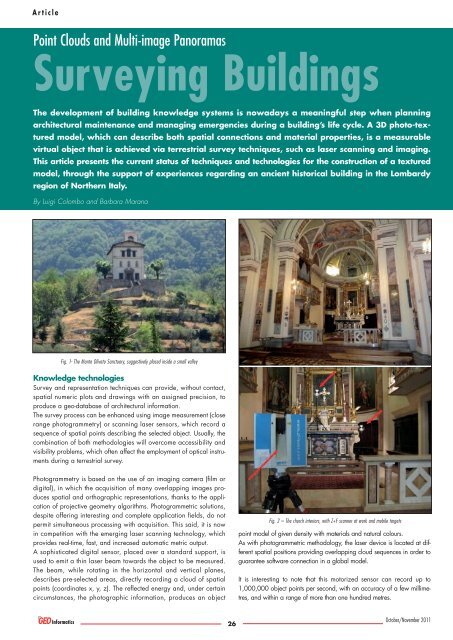
Fig. 1- The Monte Oliveto Sanctuary, suggestively placed inside a small valley<br />
Knowledge technologies<br />
Survey and representation techniques can provide, without contact,<br />
spatial numeric plots and drawings with an assigned precision, to<br />
produce a geo-database of architectural information.<br />
The survey process can be enhanced using image measurement (close<br />
range photogrammetry) or scanning laser sensors, which record a<br />
sequence of spatial points describing the selected object. Usually, the<br />
combination of both methodologies will overcome accessibility and<br />
visibility problems, which often affect the employment of optical instruments<br />
during a terrestrial survey.<br />
Photogrammetry is based on the use of an imaging camera (film or<br />
digital), in which the acquisition of many overlapping images produces<br />
spatial and orthographic representations, thanks to the application<br />
of projective geometry algorithms. Photo gram metric solutions,<br />
despite offering interesting and complete application fields, do not<br />
permit simultaneous processing with acquisition. This said, it is now<br />
in competition with the emerging laser scanning technology, which<br />
provides real-time, fast, and increased automatic metric output.<br />
A sophisticated digital sensor, placed over a standard support, is<br />
used to emit a thin laser beam towards the object to be measured.<br />
The beam, while rotating in the horizontal and vertical planes,<br />
describes pre-selected areas, directly recording a cloud of spatial<br />
points (coordinates x, y, z). The reflected energy and, under certain<br />
circumstances, the photographic information, produces an object<br />
26<br />
Fig. 2 – The church interiors, with Z+F scanner at work and mobile targets<br />
point model of given density with materials and natural colours.<br />
As with photogrammetric methodology, the laser device is located at different<br />
spatial positions providing overlapping cloud sequences in order to<br />
guarantee software connection in a global model.<br />
It is interesting to note that this motorized sensor can record up to<br />
1,000,000 object points per second, with an accuracy of a few millimetres,<br />
and within a range of more than one hundred metres.<br />
October/November <strong>2011</strong>