

Park note - Yarra Ranges NP - Mt Donna Buang - Parks Victoria
Park note - Yarra Ranges NP - Mt Donna Buang - Parks Victoria
Park note - Yarra Ranges NP - Mt Donna Buang - Parks Victoria

Create successful ePaper yourself
Turn your PDF publications into a flip-book with our unique Google optimized e-Paper software.
p a r k n o t e s<br />
Mount <strong>Donna</strong> <strong>Buang</strong><br />
<strong>Yarra</strong> <strong>Ranges</strong> National <strong>Park</strong><br />
At an elevation of 1245 metres, <strong>Mt</strong> <strong>Donna</strong> <strong>Buang</strong> offers panoramic views over Melbourne, the<br />
<strong>Yarra</strong> Valley, Dandenong and Cathedral <strong>Ranges</strong>, Mount Baw Baw and the Alps. While on the<br />
mountain you can take in a rainforest experience and even walk through the tree tops at the<br />
spectacular Rainforest Gallery. In winter the mountain offers the closest and most accessible<br />
snow to Melbourne for family snow-play and tobogganing.<br />
Rainforest Gallery<br />
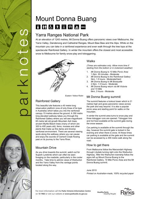
Eastern Yellow Robin<br />
This beautiful site features a 40 metre long<br />
observation platform (one of only three of its type<br />
in Australia) which takes you into the rainforest<br />
canopy 15 metres above the ground. A 350 metre<br />
long elevated walkway takes you through the<br />
Rainforest Gallery where you will see magnificent<br />
65 metre tall old growth Mountain Ash trees,<br />
ancient Myrtle Beech trees (many of which are<br />
300 to 400 years old), ferns, mosses and other<br />
plants that make up this damp and diverse<br />
rainforest environment. There are several viewing<br />
spots along the walkway where you can pause<br />
and enjoy the sounds of Cement Creek flowing<br />
past on its journey to the <strong>Yarra</strong> River.<br />
Mountain Drive<br />
As you drive towards the summit, watch out for<br />
Superb Lyrebirds which can often be seen<br />
foraging on the roadside, particularly in the cooler<br />
months. Take time to admire views of Warburton<br />
and the <strong>Yarra</strong> Valley from the vantage points<br />
located along the way.<br />
For more information call the <strong>Park</strong>s <strong>Victoria</strong> Information Centre<br />
on 13 1963 or visit our website at www.parkweb.vic.gov.au<br />
Walks<br />
(Times are estimates only. Allow more time if<br />
starting from the bottom or in inclement weather)<br />
1. <strong>Mt</strong> <strong>Donna</strong> <strong>Buang</strong> to 10 Mile Picnic Area<br />
1.2km, 30 minutes - Moderate<br />
2. <strong>Mt</strong> <strong>Donna</strong> <strong>Buang</strong> to the Rainforest Gallery<br />
3km, 1.5 hours - Moderate/Hard<br />
3. <strong>Mt</strong> <strong>Donna</strong> <strong>Buang</strong> to <strong>Mt</strong> Boobyalla<br />
2.5km, 1.5 hours - Moderate<br />
4. <strong>Mt</strong> <strong>Donna</strong> <strong>Buang</strong> return via <strong>Mt</strong> <strong>Victoria</strong><br />
and 10 Mile<br />
6km, 3 hours - Moderate<br />
<strong>Mt</strong> <strong>Donna</strong> <strong>Buang</strong> summit<br />
The summit features a lookout tower which is 21<br />
metres high and gives panoramic views across<br />
the park and way beyond. It is also a popular<br />
picnic area and starting point for walks on the<br />
mountain.<br />
In winter the summit area turns to snow play and<br />
three toboggan runs are opened. Toboggan hire<br />
and hot food available at the summit gate during<br />
the snow season.<br />
Car parking is available at the summit through the<br />
day, however the summit gate is locked in the<br />
evening and when there is snow. At these times<br />
car parking is available at the gate and the summit<br />
can be accessed by a 300 metre walk along the<br />
road.<br />
How to get there<br />
From Melbourne follow the Maroondah Highway<br />
through Lilydale turning right onto the Warburton<br />
Highway. After the Warburton township follow the<br />
signs left up Mount <strong>Donna</strong> <strong>Buang</strong> to the<br />
Rainforest Gallery, 10 Mile Picnic Area and the <strong>Mt</strong><br />
<strong>Donna</strong> <strong>Buang</strong> summit.<br />
June 2010<br />
Printed on Australian-made, 100% recycled paper
Dirty Gully<br />
ROAD 2<br />
Badger Creek<br />
Mount <strong>Donna</strong> <strong>Buang</strong><br />
Summit<br />
DONNA BUANG SUMMIT RD<br />
To Healesville<br />
(Winter Closure)<br />
� Mount <strong>Donna</strong> <strong>Buang</strong><br />
Nightly Closure<br />
(Observe Closing Times)<br />
C505<br />
For further information<br />
<strong>Park</strong>s <strong>Victoria</strong><br />
Information Centre<br />
Call 13 1963<br />
or visit the<br />
<strong>Park</strong>s <strong>Victoria</strong> website<br />
www.parkweb.vic.gov.au<br />
<strong>Yarra</strong> Valley<br />
Visitor Information Centre<br />
The Old Courthouse<br />
Harker Street<br />
Healesville 3777<br />
Tel: (03) 5962 2600<br />
Caring for the<br />
environment<br />
Help us look after your park<br />
by following these guidelines:<br />
The park encompasses<br />
major closed catchments for<br />
Melbourne’s pure water supply.<br />
It is vital that everyone helps<br />
to ensure the prevention of<br />
pollution and fire<br />
Take notice of signs stating<br />
No Public Access<br />
Please take rubbish away with<br />
you for recycling and disposal<br />
All native plants and animals<br />
are protected by law.<br />
Please do not disturb them<br />
in any way<br />
Dogs and other pets are not<br />
permitted in the <strong>Park</strong><br />
Light fires only in fireplaces<br />
provided<br />
Portable barbecues must be in<br />
portable barbecue areas<br />
Feeding of birds and other<br />
wildlife is not permitted<br />
Firearms and To other Lilydale weapons<br />
are prohibited<br />
DONNA BUANG ROAD<br />
Ythan Creek<br />
YARRA<br />
10 Mile Turntable<br />
Picnic Area<br />
WARBURTON<br />
MELBA HWY<br />
� Mount Boobyalla<br />
YARRA RANGES NATIONAL PARK<br />
� Mount <strong>Victoria</strong><br />
Entrance Station �<br />
YARRA RANGES NATIONAL PARK<br />
Brisbane Creek<br />
Rocky Creek<br />
O’Shannassy Aqueduct<br />
O’SHANNASSY WALKING<br />
<strong>Yarra</strong> <strong>Ranges</strong><br />
National <strong>Park</strong><br />
To Lilydale<br />
OONDAH<br />
MAR<br />
HWY<br />
Healesville<br />
Lilydale<br />
WARBURTON<br />
HWY<br />
PRINCE<br />
Marysville<br />
To Acheron Gap and<br />
Dom Dom Saddle<br />
Eildon<br />
Jamieson<br />
Neerim<br />
South<br />
HIGHWAY<br />
Matlock<br />
YARRA<br />
RANGES<br />
Warburton NATIONAL<br />
PARK<br />
Powelltown<br />
<strong>Yarra</strong> <strong>Ranges</strong> National <strong>Park</strong><br />
Mount <strong>Donna</strong> <strong>Buang</strong><br />
Sealed road<br />
Unsealed road<br />
Vehicle track<br />
Walking track<br />
Seasonally Closed Gate<br />
Er<br />
TRAIL<br />
Recreational<br />
Facilities<br />
BBQ-Gas<br />
Carpark<br />
RIVER<br />
Facilities for people<br />
with disabilities<br />
Fireplace<br />
Lookout<br />
Warburton<br />
YUONGA ROAD<br />
Rainforest Gallery<br />
DONNA<br />
WOODS<br />
RIVERSIDE<br />
C505<br />
YUONGA<br />
BUANG<br />
To Warburton<br />
Picnic table<br />
Tobogganing<br />
Toilets<br />
Walking<br />
POINT<br />
To Marysville<br />
ACHERON WAY<br />
DONNA BUANG ROAD<br />
Cement Creek<br />
ROAD 6<br />
Anderson Creek<br />
ROAD<br />
DRIVE<br />
ROAD 4<br />
TRACK<br />
ROAD<br />
C507<br />
C507<br />
ROAD 3<br />
C511 250<br />
�0500<br />
METRES<br />
N Cartography by Spatial Vision 2008<br />
M/6834 To Reefton<br />
MELBOURNE ��<br />
©


