

Marine Natural Values Study Summary - Parks Victoria
Marine Natural Values Study Summary - Parks Victoria
Marine Natural Values Study Summary - Parks Victoria

You also want an ePaper? Increase the reach of your titles
YUMPU automatically turns print PDFs into web optimized ePapers that Google loves.
<strong>Marine</strong> <strong>Natural</strong> <strong>Values</strong><strong>Study</strong> <strong>Summary</strong>1
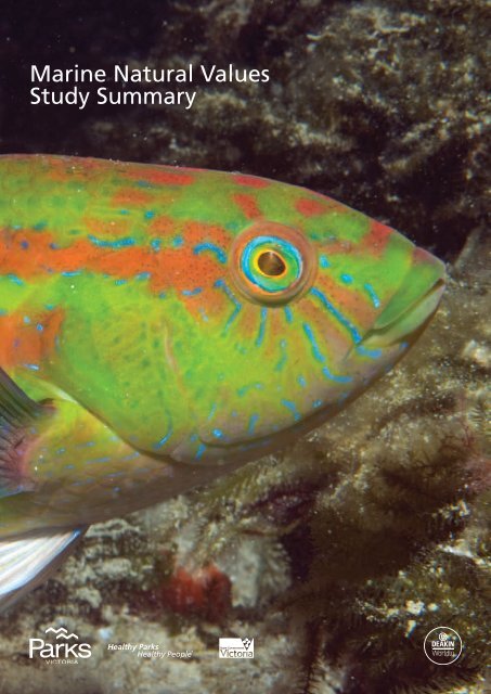
Authorised and published by <strong>Parks</strong> <strong>Victoria</strong>Level 10, 535 Bourke St, Melbourne VIC 3000Copyright © <strong>Parks</strong> <strong>Victoria</strong> 2012Cover image: Senator wrasse (Pictilabrus laticlavius)Julian Finn, Museum <strong>Victoria</strong>Authors: Jan Barton, Adam Pope and Steffan Howe
Australia’s southern waters areunique. Ninety per cent of ourmarine plants and animals arefound nowhere else on earth.<strong>Victoria</strong>’s marine environmenthas been classified into fivebioregions according to anationally agreed scheme(Otway, Central <strong>Victoria</strong>,<strong>Victoria</strong>n Embayments,Flinders and Twofold Shelf).Within each marine bioregionthere are a variety of distinctand unique habitats andbiological communities,structured by a combinationof physical, chemical andbiological processes.In 2002 the marine national parksystem was established to representthe diversity of <strong>Victoria</strong>’s marineenvironment, its habitats andassociated flora and fauna. Themarine national parks and sanctuariesare highly protected (no take) andcover approximately 63,000 hectaresor 5.3% of <strong>Victoria</strong>n statemarine waters.Since declaration of <strong>Victoria</strong>’s marinenational parks and sanctuaries andrelease of the first <strong>Marine</strong> <strong>Natural</strong><strong>Values</strong> <strong>Study</strong> in September 2003there has been an ongoing marinescience program that has focussedon improving baseline knowledgeand addressed important managementchallenges. Much of the researchhas been undertaken as part of theResearch Partners Program involvingcollaboration with various researchinstitutions, while there are alsoa range of ongoing commissionedand community based monitoringprograms. These programs haveconsiderably increased our knowledgeand understanding of the naturalvalues and threats for <strong>Victoria</strong>’smarine national parks and sanctuaries.The second version of the <strong>Marine</strong><strong>Natural</strong> <strong>Values</strong> reports has beendeveloped in partnership with DeakinUniversity. The primary aim of thesereports is to add the new knowledgeand information that has beengenerated through <strong>Parks</strong> <strong>Victoria</strong>’sresearch and monitoring programsand other marine science programsto the description of the natural valuesassociated with <strong>Victoria</strong>’s marinenational parks and sanctuaries. Thereports will be important for informingpark management and will also bea valuable resource for educationand public recognition of the naturalvalues of the marine national parksand sanctuaries.This report contains summaries foreach park which have been developedfrom the full version of the <strong>Marine</strong><strong>Natural</strong> <strong>Values</strong> reports. Thedetailed reports can be foundat www.parks.vic.gov.au.2
<strong>Victoria</strong>n IMCRA Mesoscale Bioregions4
<strong>Marine</strong> <strong>Natural</strong> <strong>Values</strong> <strong>Study</strong> <strong>Summary</strong>Discovery Bay <strong>Marine</strong>National ParkAustralia’s southern waters areunique. Ninety per cent of ourmarine plants and animals arefound nowhere else on earth.The system of <strong>Marine</strong> National<strong>Parks</strong> and Sanctuaries hasbeen established to representthe diversity of <strong>Victoria</strong>’smarine environment, itshabitats and associatedflora and fauna.<strong>Victoria</strong>’s marine environmenthas been classified into fivebioregions according toa nationally agreed schemebased on physical andbiological attributes.Discovery Bay <strong>Marine</strong> NationalPark is one of two marinenational parks and twomarine sanctuaries in theOtway bioregion.Image left:Bull kelp Durvillaea potatorum on subtidal basalt reef.Photo by NRE.Image right:Discovery Bay <strong>Marine</strong> National Park. Photo by NRE.DescriptionThe park covers 2830 hectaresadjacent to Cape Bridgewater alongthe coast from Blacks Beach to WhitesBeach and offshore to three nauticalmiles. Between Whites Beach andCape Duquesne the park boundarycommences 500 metres from thecoastline. The park abuts theDiscovery Bay Coastal Park. Thewrecks of three wooden sailingbarques, the Jane, the Ann and theMarie, are thought to be in the vicinityof the park.Beach access is from Whites Beachand Blacks Beach while boat accessis from Bridgewater Bay andPortland Harbour.<strong>Parks</strong> <strong>Victoria</strong> acknowledges theAboriginal Traditional Owners of<strong>Victoria</strong> – including its parks andreserves. Indigenous tradition indicatesthat the park is part of Countryof Gunditjmara.Physical Parameters and ProcessesThe park is exposed to storms andsouth-westerly swells of the SouthernOcean, and resulting high deepwaterwave energy.The Zeehan Current is influentialmoving water in a south-easterlydirection through the park. The warmLeeuwin Current flows east along thesouthern coast of Australia and mayinfluence water temperature,particularly during La Niña years.The continental shelf is relativelynarrow near the park, extending only50 kilometres offshore. Wind drivencoastal circulation across the shelfcauses the Bonney Upwelling of coolnutrient rich water, particularly duringspring and summer, which stimulatesphytoplankton and zooplanktonblooms, and forms the basis of a richpelagic food chain providing feedinggrounds for seabirds, fish, whalesand seals.Surface water temperatures areinfluenced by the cold BonneyUpwelling, with mean surface watertemperature varying seasonallybetween 14°C and 18°C. Tidalvariation is 0.8 metres for spring tidesand 0.4 metres for neap tides.<strong>Marine</strong> Habitat Distributionand Ecological CommunitiesThe main habitats protected bythe park include subtidal reef, softsediment, and the water column.A relatively small amount of intertidalreef and soft sediment are alsopresent in the park.Important features include basaltand calcarenite intertidal and subtidalrocky reefs, extensive sandy subtidalsoft sediment and the biota they5
support. The park is part of thelargest coastal basalt formationin western <strong>Victoria</strong>.The park has rocky habitats ofcomplex forms, including low profilecalcarenite-capped basalt platforms,isolated low calcarenite reefs,and heavy sloping basalt walls.Its deep (33 metres – 55 metres)calcarenite reefs with thick growthsof sessile invertebrates (e.g. sponges,ascidians, bryozoans and gorgonians)are an important natural value, as areits shallow basaltic reefs covered bylarge kelps such as Ecklonia radiata.The park’s intertidal and shallowsubtidal reefs have a high diversityof invertebrates. Its extensive subtidalsoft sediments of mainly fine sand,with high (80 per cent) carbonatecontent, are an importantnatural value.Bull Kelp Durvillaea potatorum growson the intertidal reef edge. Mixedbrown algae, including kelp Eckloniaradiata and crayweed Phyllosporacomosa, are the canopy formingalgae on the sand free basalt subtidalreefs in the south-east. Also growingon these reefs are the brown algaeScytothalia, Sargassum and GiantKelp Macrocystis pyrifera, and greenalgae Caulerpa spp..Australian fur seals Arctocephalus pusillus doriferuson intertidal reef. Photo by Marcel Hoog Antink.Mobile invertebrates on these subtidalreefs include seastars, Southern RockLobster Jasus edwardsii and BlacklipAbalone Haliotus rubra.Sessile invertebrates, predominatelycompact sponges, occur in isolatedareas within the sand band from35 metres to 55 metres depthsuggesting that the sediment is a thinveneer over hard substrate. Sessileinvertebrates dominate the deeper,and largely sand-inundated, reefsin the west of the park where they arefree of sand. These include abundantascidians, hydroids, and bryozoansalong with gorgonian soft corals, hardcorals, Tethya sponges, zoanthids andthe Sea Whip Primnoella australasiae.The water column is home to a varietyof planktonic and pelagic organisms.Those that make their permanenthome in the water column includesea jellies, salps, many fish, andphytoplankton and zooplankton.A number of marine mammals andseabirds are also found in or usethe water column.Species and Communitiesof Conservation SignificanceThe park has one endemic crustacean,the Southern Hooded ShrimpAthanopsis australis.Seven species of algae and oneinvertebrate are known or presumedto be at the limit of their distributionin the park.Western Blue Groper Achoerodusgouldii have been observed in thehigh profile reef systems in 50mof water west of Cape Duquesne.The open waters of the park area probable habitat for the threatenedmigratory southern bluefin tunaThunnus maccoyii, grey nurse sharkCharcharias taurus, and White SharkCarcharodon carcharias.The intertidal reef provides anoccasional haul-out area for statevulnerable New Zealand Arctophocaforsteri and nationally listed AustralianArctocephalus pusillus doriferusFur Seals. Southern right whalesEubalaena australis, blue whalesBalaenoptera musculus and southernelephant seals Mirounga leonina havebeen recorded in or near the park.The park provides important feedingand roosting habitat for fifteenthreatened bird species. Two of thesespecies are regarded as endangered;the Wandering Albatross Diomedeaexulans and Southern Giant PetrelMacronectes giganteus. The parkalso protects feeding areas for teninternationally important migratorybird species.Major ThreatsMeasures to address or minimisethreats identified for Discovery Bay6
<strong>Marine</strong> National Park form part of thepark management plan. <strong>Parks</strong> <strong>Victoria</strong>also uses an adaptive managementapproach which includes periodicreviews of priority natural values andthreats through processes such as theState of the <strong>Parks</strong> evaluation andsetting of desired conservationoutcomes. Through these processes<strong>Parks</strong> <strong>Victoria</strong> has identified emergingthreats and developed appropriatemanagement responses.Serious threats include poachingof abalone, marine pests anddiseases. Evidence of abalone viralganglioneuritus which can kill a largeproportion of abalone populations inaffected areas has also been observedin much of the Otway bioregion.The introduced algal speciesGrateloupia turuturu, Caulerparacemosa var. cylindracea and Codiumfragile subspecies fragile were alsorecorded in Portland Harbour in 2010and there is some concern about theirpossible spread.Climate change poses a serious mediumto long term threat to natural values.<strong>Parks</strong> <strong>Victoria</strong> will use an adaptivemanagement approach to developresponses and actions that focuson priority climate change issuessuch as extreme weather eventsand existing risks that are likelyto be exacerbated by climate change.sanctuaries. These focus on improvingbaseline knowledge, as well as appliedmanagement questions.Since the establishment of the parksin 2002 our knowledge andunderstanding of natural valuesand threats for the system haveimproved significantly throughthis marine science program. Muchof the research has been undertakenas part of the Research PartnersProgram involving collaborationwith various research institutions.There are four ongoing researchprojects and one habitat mappingproject that are relevant to DiscoveryBay <strong>Marine</strong> National Park, while sixresearch projects and two habitatmapping projects have alreadybeen completed.While recognising there are stillknowledge gaps, <strong>Parks</strong> <strong>Victoria</strong>will continue to focus on addressingthe information needs that willassist management.For more information, includingmarine habitat mapping products,please see the full versions of the<strong>Marine</strong> <strong>Natural</strong> <strong>Values</strong> reportson www.parks.vic.gov.au.Research and Monitoring<strong>Parks</strong> <strong>Victoria</strong> has establishedextensive marine research andmonitoring programs that addressimportant management challengesfor the marine national parks andSubtidal basalt reef in Discovery Bay <strong>Marine</strong> National Park.Photo by NRE.7
<strong>Marine</strong> <strong>Natural</strong> <strong>Values</strong> <strong>Study</strong> <strong>Summary</strong>Merri <strong>Marine</strong> SanctuaryAustralia’s southern waters areunique. Ninety per cent of ourmarine plants and animals arefound nowhere else on earth.The system of <strong>Marine</strong> National<strong>Parks</strong> and Sanctuaries hasbeen established to representthe diversity of <strong>Victoria</strong>’smarine environment, itshabitats and associatedflora and fauna.<strong>Victoria</strong>’s marine environmenthas been classified into fivebioregions according toa nationally agreed schemebased on physical andbiological attributes.The Merri <strong>Marine</strong> Sanctuary isone of two marine sanctuariesand two marine national parksin the Otway bioregion.Image left:Diverse algal community in an intertidal rock pool.Photo by Jan Barton, Deakin University.Image right:Intertidal soft sediment at the mouth of the Merri River.Photo by Jan Barton, Deakin University.DescriptionThe sanctuary covers 29 hectaresfrom Thunder Point in the west andBreakwater Rock in the east, extendingfrom the footbridge on the Merri Riverto the south-west for approximately200 metres. It abuts a coastal reserveand surrounds Middle and MerriIslands, with Pickering Pointa prominent headland.Access is from Thunder Point,Stingray Bay and the Breakwater.<strong>Parks</strong> <strong>Victoria</strong> acknowledges theAboriginal Traditional Owners of<strong>Victoria</strong> – including its parks andreserves. Indigenous tradition indicatesthat the sanctuary is part of Countryof Kirrae Whurrong and Countryof Gunditjmara.Physical Parameters and ProcessesThe sanctuary is exposed to large swellsand south-westerly winds from theSouthern Ocean in winter, withcurrents carrying water from the westand south into the sanctuary. In springand summer the Bonney Upwellingbrings cold water and nutrientsto the coastline, with its predominantsouth-east wind and current flow.Surface water temperatures varybetween averages of 13.5°C and17°C. Tidal variation is 0.8 metresfor spring tides and no variationfor neap tides.The Merri River estuary flows directlyinto the middle of the sanctuary atStingray Bay and is regarded as beingin poor ecological condition.The Warrnambool Sewage TreatmentPlant discharges 500 metres to thewest of the sanctuary and the HopkinsRiver estuary discharges to the east.Freshwater inflow from the Merri Riverinfluences the local hydrodynamicsof the sanctuary and the mouthof the Merri River is often closed.High tides, storms, large swells andfreshwater inflow cause significantsand movement. Modifications in thesanctuary and nearby, including theconstruction of the breakwater, haveresulted in a significant accumulationof sand adjacent to the sanctuary.<strong>Marine</strong> Habitat Distributionand Ecological CommunitiesThe main habitats protected by thesanctuary include soft sediments(intertidal and subtidal) made uppredominantly of fine sand; intertidalreef and subtidal reef made ofcalcarenite including high relief,low relief and cobbles; and thewater column.The intertidal soft sediment is foundmostly the east of Merri Island at themouth of the Merri River. Associatedcommunities have a low diversity ofbenthic macroinvertebrates, though8
this habitat is an important feedingand roosting habitat for shorebirds.Beach-washed materials on the sandybeaches (e.g. drift macroalgae) area significant source of food forscavenging birds, and contribute tothe detrital cycle that nourishes manyof the invertebrates, such as bivalves,living in the sand.Common fish found in subtidal softsediment habitats include sea mulletMugil cephalus, salmon Arripis trutta,cat shark Parascyllium sp., draughtboardshark Cephaloscyllium laticeps and thesouthern eagle ray Myliobatis australis.Intertidal reef is found along thecoastline (backed by coastal dunes)and around the islands. The intertidalreef flora and fauna includes algaesuch as sea lettuce Ulva sp., corallinealgae Corallina officinalis, and lesscommon is Neptune’s necklaceHormosira banksii.Gastropod snails such as the warrenerTurbo undulatus, limpets Siphonariadiemenensis and Cellana tramosericaare the most common invertebrateson the intertidal reefs. Crabs,anemones, brittle stars, and terebellidpolychaetes are also found.Large rockpools can be home to fishincluding sea sweep Scorpis aequipinnis,Tasmanian blenny ParablenniusMerri <strong>Marine</strong> Sanctuary with Merri and Middle Islandsin the background. Photo by Jan Barton, Deakin University.tasmanianus and wrasse. Seagrassis also occasionally seen in the rockpools.Subtidal reefs are the dominant marinehabitat and are either patchy andinterspersed with areas of sand,or more consolidated hard reef cut bydeeper depressions and large crevices.Twenty-one different subtidal reefalgal habitat types have been identifiedin the sanctuary including habitatsdominated by the brown algaePhyllospora comosa, the green algaeCaulerpa spp., the string kelpMacrocystis pyrifera, encrusting andbranching coralline algae, and kelpEcklonia radiata. The bull kelpDurvillaea potatorum is presenton the fringe of the intertidal andsubtidal reef.The subtidal reef associatedinvertebrates present include theblack lip abalone Haliotis rubra, thewarrener Turbo undulatus, sponges,gastropods, crabs, and the occasionalsouthern rock lobster Jasus edwardsii.Common reef associated fish includethe blue-throated wrasse Notolabrustetricus, herring cale Odax cyanomelas,magpie perch Cheilodactylus nigripes,<strong>Victoria</strong>n scalyfin Parma victoriae,zebrafish Girella zebra, sea sweepScorpis aequipinnis, senator wrassePictilabrus laticlavius and thepot-bellied seahorse Hippocampusabdominalis.The water column is home to a varietyof planktonic and pelagic organisms.Those that make their permanenthome in the water column includesea jellies, salps, many fish, andphytoplankton and zooplankton.A number of marine mammal speciesare also found in the water columnin the sanctuary.Species and Communitiesof Conservation SignificanceThe pot-bellied seahorse Hippocampusabdominalis is protected andfrequently seen on subtidal reefsin the sanctuary.Fifty-one shorebirds or seabirdsof conservation significance havebeen recorded in or near the sanctuaryincluding the endangered Australasianbittern Botaurus poiciloptilus, fairytern Sternula nereis, gull-billed ternGelochelidon nilotica and the littleegret Egretta garzetta. Two largeseabirds regarded as endangered,the wandering albatross Diomedeaexulans and the southern giant petrelMacronectes giganteus, are morecommonly found offshoreof the sanctuary.<strong>Marine</strong> mammals including southernelephant seals Mirounga leonine,the Australian fur seal Arctocephaluspusillus doriferus, Australian sea lionNeophoca cinerea and the leopardseal Hydrurga leptonyx have been9
observed in the waters in and aroundthe sanctuary.Major ThreatsMeasures to address or minimise threatsidentified for Merri <strong>Marine</strong> Sanctuaryform part of the park managementplan. <strong>Parks</strong> <strong>Victoria</strong> also uses anadaptive management approachwhich includes periodic reviews ofpriority natural values and threatsthrough processes such as the Stateof the <strong>Parks</strong> evaluation and settingof desired conservation outcomes.Through these processes <strong>Parks</strong> <strong>Victoria</strong>has identified emerging threats anddeveloped appropriate managementresponses.Serious threats include oil spills,terrestrial inputs of poor water quality,marine pests and diseases, litter anddebris, seismic testing, artificialopening of river mouths andhuman access (e.g. trampling).Evidence of abalone viral ganglioneurituswhich can kill a large proportion ofabalone populations in affected areashas been observed in much of theOtway bioregion including Merri<strong>Marine</strong> Sanctuary.The introduced algal speciesGrateloupia turuturu, Caulerparacemosa var. cylindracea and Codiumfragile subspecies fragile were alsoRock lobster on subtidal basalt reef. Photo by NRE.recorded in Portland Harbour in 2010and there is some concern abouttheir possible spread.Climate change also poses a seriousmedium to long term threatto natural values. <strong>Parks</strong> <strong>Victoria</strong>will use an adaptive managementapproach to develop responses andactions that focus on priority climatechange issues such as extremeweather events and existing risksthat are likely to be exacerbatedby climate change.Research and Monitoring<strong>Parks</strong> <strong>Victoria</strong> has established extensivemarine research and monitoringprograms that address importantmanagement challenges for themarine national parks and sanctuaries.These focus on improving baselineknowledge, as well as appliedmanagement questions.Since the establishment of the parksin 2002 our knowledge andunderstanding of natural values andthreats for the system have improvedsignificantly through the marine scienceprogram. Much of the research hasbeen undertaken as part of theResearch Partners Program involvingcollaboration with variousresearch institutions.There are five ongoing research projectsand one habitat mapping project thatare relevant to Merri <strong>Marine</strong> Sanctuary,while five research projects and twohabitat mapping projects have alreadybeen completed. The sanctuary alsohas an ongoing shallow subtidal reefmonitoring program.While recognising there are stillknowledge gaps <strong>Parks</strong> <strong>Victoria</strong> willcontinue to focus on addressingthe information needs that willassist management.For more information, includingmarine habitat mapping products,please see the full versions of the<strong>Marine</strong> <strong>Natural</strong> <strong>Values</strong> reportson www.parks.vic.gov.au.10
<strong>Marine</strong> <strong>Natural</strong> <strong>Values</strong> <strong>Study</strong> <strong>Summary</strong>The Arches <strong>Marine</strong> SanctuaryAustralia’s southern waters areunique. Ninety per cent of ourmarine plants and animals arefound nowhere else on earth.The system of <strong>Marine</strong> National<strong>Parks</strong> and Sanctuaries hasbeen established to representthe diversity of <strong>Victoria</strong>’smarine environment, itshabitats and associatedflora and fauna.<strong>Victoria</strong>’s marine environmenthas been classified into fivebioregions according toa nationally agreed schemebased on physical andbiological attributes.The Arches <strong>Marine</strong> Sanctuaryis one of two marine sanctuariesand two marine national parksin the Otway bioregion.DescriptionThe sanctuary covers 48 hectares andis located 600 metres offshore fromPort Campbell on the Great OceanRoad.The sanctuary can only be accessedby boat.<strong>Parks</strong> <strong>Victoria</strong> acknowledges theAboriginal Traditional Owners of<strong>Victoria</strong> – including its parks andreserves. Indigenous tradition indicatesthat the sanctuary is part of Countryof Kirrae Whurrong and Countryof Gadubanud.Physical Parameters and ProcessesThe Arches <strong>Marine</strong> Sanctuary is ona very exposed coastline, opento the prevailing south-west windsand swells of the Southern Oceanin winter. In spring and summerit is open to prevailing south-eastwinds and swells. The West WindDrift causes an easterly current whichis important for natural processes butalso moves discharged fresh wateror pollutants through the sanctuaryfrom nearby areas.Surface water temperatures varybetween an average 17.5°C in thesummer and 13.5°C in the winter.Tidal variation is 0.9 metres for springtides and 0.3 metres for neap tides.Campbell Creek discharges onekilometre to the north of the sanctuary.<strong>Marine</strong> Habitat Distributionand Ecological CommunitiesThe main habitats protected by thesanctuary include the water column,some subtidal soft sediments, andsubtidal limestone reef made up offormations such as canyons, tunnels,arches, caverns, ledges and verticalsink holes in water depths between19 metres and 25 metres.The subtidal reefs and soft sedimentsin the sanctuary are the remnantsof an ancient eroding coastline; morerecent geological processes haveshaped the limestone featurescloser to the surface.The subtidal reefs support a diverserange of algae, sponges, bryozoans,hydroids, gorgonians and sea starscharacteristic of deeper BassStrait waters.Upper surfaces of arches are coveredwith the kelp Ecklonia radiata and anunderstorey of red seaweeds such asSonderopelta coriacea, Phacelocarpuspeperocarpus, Pterocladia lucida,and Plocamium spp.The undersides and canyon wallsprovide habitat for sessileinvertebrates such as sponges, theencrusting soft coral Erythropodiumhicksoni, which grow on the ledgeedges, the erect gorgonian coralMopsella and the ascidianHerdmania momus.Seastars are the dominant mobileinvertebrates in the sanctuary andinclude Nectria macrobrachia,Nepanthia troughtoni andTosia magnifica.Fish observed on the subtidal reefs aresea sweep Scorpis aequipinnis, barberperch Caesioperca rasor, blue-throatedwrasse Notolabrus tetricus, bastardtrumpeter Latridopsis forsteri, magpieperch Cheilodactylus nigripes and thedusky morwong Dactylophora nigricans.Other common fish species that havebeen reported from this sanctuaryinclude the zebra fish Girella zebra,snapper Chrysophrys auratus, marblefish Aplodactylus arctidens, Australiansalmon Arripis truttacea, scaly finParma victoriae and Port Jacksonshark Heterodontus portusjacksoni.The water column is home to a varietyof planktonic and pelagic organismsincluding sea jellies, salps, many fish,and phytoplankton and zooplankton.A number of marine mammals andseabirds, as well as the leatherbackturtle, are also found in or use thewater column. The short-fin makoshark Isurus oxyrinchus is also knownfrom surrounding waters and isprobably found in the sanctuary.11
Species and Communitiesof Conservation SignificanceThe open waters are a likely habitatfor the threatened migratory southernbluefin tuna Thunnus maccoyii, thegrey nurse shark Charcharias andthe great white shark Carcharodoncarcharias.<strong>Marine</strong> mammals of conservationsignificance found in or near thesanctuary include Southern rightwhale Eubalaena australis, humpbackwhale Megaptera novaeangliae,southern elephant seal Miroungaleonine, and Australian fur sealArctocephalus pusillus doriferus.The leatherback turtle Dermochelyscoriacea is also likely to use the watersof the sanctuary.Birds including the shy albatrossThalassarche cauta, the black-browedalbatross T. melanophris, theshort-tailed shearwater Ardennatenuirostris, the pied cormorantPhalacrocorax varius and theblack-faced cormorant Phalacrocoraxfuscescens use the sanctuaryas a feeding ground and areall of conservation significance.Major ThreatsMeasures to address or minimisethreats identified for The Arches<strong>Marine</strong> Sanctuary form part of thepark management plan. <strong>Parks</strong> <strong>Victoria</strong>also uses an adaptive managementapproach which includes periodicreviews of priority natural values andthreats through processes such as theState of the <strong>Parks</strong> evaluation andsetting of desired conservationoutcomes. Through these processes<strong>Parks</strong> <strong>Victoria</strong> has identified emergingthreats and developed appropriatemanagement responses.adaptive management approach todevelop responses and actions thatfocus on priority climate change issuessuch as extreme weather events andexisting risks that will likely beexacerbated by climate change.Research and Monitoring<strong>Parks</strong> <strong>Victoria</strong> has establishedextensive marine research andmonitoring programs that addressimportant management challengesfor the marine national parks andsanctuaries. These focus on improvingbaseline knowledge, as well as appliedmanagement questions.Since the establishment of the parksin 2002 our knowledge andunderstanding of natural valuesand threats for the system haveimproved significantly through themarine science program. Much ofthe research has been undertakenas part of the Research PartnersProgram involving collaborationwith various research institutions.There are four ongoing researchprojects and one habitat mappingproject that are relevant to The Arches<strong>Marine</strong> Sanctuary, while five researchprojects and one habitat mappingproject have already been completed.While recognising there are stillknowledge gaps <strong>Parks</strong> <strong>Victoria</strong> willcontinue to focus on addressingthe information needs that willassist management.For more information, includingmarine habitat mapping products,please see the full versions of the<strong>Marine</strong> <strong>Natural</strong> <strong>Values</strong> reportson www.parks.vic.gov.au.Serious threats include oil spill,terrestrial inputs of poor water quality,marine pests and diseases, litter anddebris, and seismic testing.Evidence of abalone viralganglioneuritus which can kill a largeproportion of abalone populationsin affected areas has been observedin much of the Otway bioregion.The invasive Japanese kelp Undariapinnatifida has been recently foundin Apollo Bay Harbour and there areconcerns about its possible spread.Climate change also poses a seriousmedium to long term threat to naturalvalues. <strong>Parks</strong> <strong>Victoria</strong> will use an12
<strong>Marine</strong> <strong>Natural</strong> <strong>Values</strong> <strong>Study</strong> <strong>Summary</strong>Twelve Apostles <strong>Marine</strong>National ParkAustralia’s southern waters areunique. Ninety per cent of ourmarine plants and animals arefound nowhere else on earth.The system of <strong>Marine</strong> National<strong>Parks</strong> and Sanctuaries hasbeen established to representthe diversity of <strong>Victoria</strong>’smarine environment, itshabitats and associatedflora and fauna.<strong>Victoria</strong>’s marine environmenthas been classified into fivebioregions according toa nationally agreed schemebased on physical andbiological attributes.The Twelve Apostles <strong>Marine</strong>National Park is one of twomarine national parks andtwo marine sanctuariesin the Otway bioregion.Image left:Sessile invertebrate dominated subtidal reef. Photo by NRE.Image right:Twelve Apostles <strong>Marine</strong> National Park.Photo by Australian <strong>Marine</strong> Ecology.DescriptionThe park covers 7510 hectaresadjacent to Broken Head along thecoast to Pebble Point and offshoreto three nautical miles.Most of the Twelve Apostles <strong>Marine</strong>National Park begins at the high tidemark but additional land areas abovethis are also included such as MuttonBird Island and offshore rock stacks(including the Twelve Apostles). Thewreck of the Loch Ard is also withinthe park.Exclusions to the park are beacheswest of Gibsons Steps to CliftonBeach, and east of Point Ronald toRivernook, from the high water markextending 100 metres out to sea.Access is from Loch Ard Gorge,Gibson Steps, Clifton Beach,Princetown and Rivernook andby boat from Port Campbell.<strong>Parks</strong> <strong>Victoria</strong> acknowledges theAboriginal Traditional Owners of<strong>Victoria</strong> – including its parks andreserves. Indigenous tradition indicatesthat the park is part of Countryof Kirrae Whurrong (to the westof Gellibrand River) and Countryof Gunditjmara (to the east ofGellibrand River).Physical Parameters and ProcessesThe park is exposed to south-westerlywinds and swells of the SouthernOcean in winter and in spring/summerby those arising from Bass Strait in thesouth-east.The West Wind Drift creates a currentmoving easterly through the park.Rock falls and sand movement can beinfluenced by high tides, storms andlarge swells contributing to changesin local hydrology.Surface water temperatures varybetween averages of 13.5°C in winterand 17.5°C in summer. Tidal variationis 0.9 metres for spring tides and0.3 metres for neap tides.The Gellibrand River discharges intothe centre of the park and SherbrookeRiver discharges 600 metres west.<strong>Marine</strong> Habitat Distributionand Ecological CommunitiesThe main habitats protected by thepark include limestone cliffs, intertidalreef platforms, high profile subtidalrocky reefs (western and easternareas), limited intertidal soft sedimentsand beaches, extensive sandy subtidalsoft sediment and the water column.The park is regarded as having thehighest diversity of intertidalinvertebrates on limestone reefin <strong>Victoria</strong>.13
Beaches and intertidal soft sedimentsare restricted to pockets at the base ofcliffs. A number of shorebirds are alsofound in or near the park, includingsome of conservation significance.Subtidal soft sediments (presentas a gently sloping sandy basin in thecentre of the park) are usually devoidof visible biota although the deeperregions have areas of reef beneatha thin veneer of sand allowing sessileinvertebrates to grow.Crustaceans are the most dominantgroup found in the soft sedimentsincluding amphipods, isopodsand cumaceans. Sparse seagrassHeterozostera spp. also growsin 10 metres to 30 metres on theshallow sandy plain providing habitatfor fish and invertebrates.Bull Kelp Durvillaea potatorum growson the intertidal reef edge and canbe seen at the base of the limestonerock stacks. The kelp Ecklonia radiataand the green algae Caulerpa spp.grow in depths less than 40 metresand red algae is found at all depthsincluding: Phacelocarpuspeperocarpus, Melanthalia obtusata,Gelidium asperum, Sonderopeltacoriacea and Haliptilon roseum.Smaller brown algae includingCarpomitra costatum grow in moresandy areas.Coastline of Twelve Apostles <strong>Marine</strong> National Park.Photo by NRE.Mobile invertebrates on the subtidalreefs include seastars such asPlectaster decanus, and the SouthernRock Lobster Jasus edwardsii.Subtidal reef fish in the park aretypical of the region and include theblue-throated Notolabrus tetricus,rosy Pseudolabrus psittaculus andsenator wrasses Pictilabrus laticlavius;the magpie perch Cheilodactylusnigripes and dusky morwongsDactylophora nigricans; sea sweepScorpis aequipinnis; barberCaesioperca rasor and butterflyperches C. lepidoptera; marble fishAplodactylus arctidens; and thebullseye Pempheris multiradiata.The deep reefs (more than 40 metres)are dominated by sessile invertebrates(e.g. erect sponges, gorgonians andthe large hydroid fan Solanderia fusca)and are an important natural value.The water column is home to a varietyof planktonic and pelagic organisms.Those that make their permanenthome in the water column includesea jellies, salps, many fish, andphytoplankton and zooplankton.A number of marine mammals andseabirds are also found in or use thewater column in the park.Species and Communitiesof Conservation SignificanceThe water column of the park isimportant habitat for threatened fishincluding the migratory southernbluefin tuna Thunnus maccoyii and islikely to be used by two shark species:the grey nurse shark Charchariastaurus and the great white sharkCarcharodon carcharias.The park provides important feedingand roosting habitat for eleventhreatened bird species includingthe wandering albatross Diomedeaexulans, little egret Egretta garzetta,and Australasian bittern Botauruspoiciloptilus.A large breeding colony of littlepenguins Eudyptula minor betweenthe Twelve Apostles and LondonBridge is considered a significant site,and two significant hooded ploverThinornis rubricollis nesting sites existon Clifton and Rivernook beaches.Mutton Bird Island also supportsa breeding colony of short-tailedshearwaters Puffinus tenuirostris.The park is important for a numberof resident and migrating marinemammals including Southern rightwhales Eubalaena australis, humpbackwhales Megaptera novaeangliae, NewZealand fur seals Arctophoca forsteri,and Australian fur seals Arctocephaluspusillus doriferus.Major ThreatsMeasures to address or minimisethreats identified for Twelve Apostles<strong>Marine</strong> National Park form part of the14
park management plan. <strong>Parks</strong> <strong>Victoria</strong>also uses an adaptive managementapproach which includes periodicreviews of priority natural values andthreats through processes such as theState of the <strong>Parks</strong> evaluation andsetting of desired conservationoutcomes. Through these processes<strong>Parks</strong> <strong>Victoria</strong> has identified emergingthreats and developed appropriatemanagement responses.Serious threats include oil spills,terrestrial inputs of poor water quality,marine pests and diseases, litter anddebris, and seismic testing.Evidence of abalone viral ganglioneurituswhich can kill a large proportion ofabalone populations in affected areashas been observed in much of theOtway bioregion.Japanese kelp Undaria pinnatifida hasrecently been found in Apollo BayHarbour and there are concerns aboutits possible spread.Climate change also poses a seriousmedium to long term threat to naturalvalues. <strong>Parks</strong> <strong>Victoria</strong> will use anadaptive management approach todevelop responses and actions thatfocus on priority climate change issuessuch as extreme weather events andexisting risks that will likely beexacerbated by climate change.Research and Monitoring<strong>Parks</strong> <strong>Victoria</strong> has establishedextensive marine research andmonitoring programs that addressimportant management challengesfor the marine national parks andsanctuaries. These focus on improvingbaseline knowledge, as well as appliedmanagement questions.Since the establishment of the parksin 2002 our knowledge andunderstanding of natural values andthreats for the system have improvedsignificantly through the marinescience program. Much of theresearch has been undertaken as partof the Research Partners Programinvolving collaboration with variousresearch institutions.There are four ongoing researchprojects and one habitat mappingproject that are relevant to the TwelveApostles <strong>Marine</strong> National Park, whilesix research projects and two habitatmapping projects have alreadybeen completed.While recognising there are stillknowledge gaps <strong>Parks</strong> <strong>Victoria</strong> willcontinue to focus on addressingthe information needs that willassist management.For more information, includingmarine habitat mapping products,please see the full versions of the<strong>Marine</strong> <strong>Natural</strong> <strong>Values</strong> reportson www.parks.vic.gov.au.Sessile invertebrate dominated subtidal reef. Photo by NRE.15
<strong>Marine</strong> <strong>Natural</strong> <strong>Values</strong> <strong>Study</strong> <strong>Summary</strong>Marengo Reefs<strong>Marine</strong> SanctuaryAustralia’s southern waters areunique. Ninety per cent of ourmarine plants and animals arefound nowhere else on earth.The system of <strong>Marine</strong> National<strong>Parks</strong> and Sanctuaries hasbeen established to representthe diversity of <strong>Victoria</strong>’smarine environment, itshabitats and associatedflora and fauna.<strong>Victoria</strong>’s marine environmenthas been classified into fivebioregions according toa nationally agreed schemebased on physical andbiological attributes.Marengo Reefs <strong>Marine</strong>Sanctuary is one of fivemarine sanctuaries and twomarine national parks in theCentral <strong>Victoria</strong> bioregion.Image left:Australian fur seal Arctocephalus pusillus doriferusover subtidal reef.Image right:Blacklip abalone Haliotis rubra on subtidal reef.DescriptionThe Sanctuary covers 12.5 hectaressurrounding and including a reefsystem known as Little Henty Reefand lying within Mounts Bay.The sanctuary is only 150 metresoffshore and access is via boat,swimming, small water craft or duringvery low tides by foot at Hayley Point(Marengo) to the inner reef. Accessto the outer reef is restricted dueto its importance as a seal habitat.<strong>Parks</strong> <strong>Victoria</strong> acknowledges theAboriginal Traditional Owners of<strong>Victoria</strong> – including its parks andreserves. Indigenous tradition indicatesthat the sanctuary is part of Countryof Gadubanud. Other Aboriginalcommunities, including the KirraeWurrung, Framlingham AboriginalTrust, Wathaurung AboriginalCooperative and the Southern OtwaysIndigenous Group have an associationwith the coastal region of this area.Physical Parameters and ProcessesThe coastline is exposed to high waveenergy including large south-westerlyswells affecting the outer reef. Offshorecurrents predominantly carry water fromthe south-west towards the OuterReef while the Inner Reef (separatedfrom the outer reef by a channel)is also influenced by inshore processeswithin Mounts Bay.Complex local hydrodynamics andwave energy contribute to a highdiversity of habitat types. The seaflooris generally less than 15 metres deep.Surface water temperatures varybetween an average 17°C in thesummer and 13.5°C in the winter.Tidal variation is 1.7 metres for springtides and 0.9 metres for neap tides.The Marengo Sewerage TreatmentPlant outfall discharges waste waterfrom Apollo Bay, Skenes Creek andMarengo immediately to the westof the sanctuary. The Barham Riverestuary discharges into Mounts Bay2 kilometres north-east of thesanctuary. The geology of thesanctuary is sandstone, theremnants of eroded islands.<strong>Marine</strong> Habitat Distributionand Ecological CommunitiesThe main habitats protected by thesanctuary include subtidal softsediment, intertidal reefs, subtidalreefs, and the water column.The intertidal sandstone reef is hometo more than one hundred and eightintertidal invertebrates, including nineseastar, five barnacle, seven crab andfifty two mollusc species. The bull kelpDurvillaea potatorum dominates theedge of the reef, and the cray weedPhyllospora comosa can occasionally16
e seen at low tide, though itis generally found on shallowsubtidal reefs.The shallow subtidal rocky reefs arehome to a low diversity of algalspecies, and in addition to theintertidal reef edge species Durvillaeapotatorum and Phyllospora comosa,smaller brown algal species includingCystophora retorta, C. moniliformis,and Acrocarpia paniculata can befound. The algal understorey hasvery few species including a verylow cover of red and green algae.Common grazing subtidalinvertebrates include the warrenerTurbo undulatus, the predatory cartrutwhelk Dicathais orbita, tulip shellPleuroploca australasia, tritonCabestana spengleri, red bait crabPlagusia chabrus and a variety of seastars including Tosia australis, andPatiriella brevispina. The blacklipabalone Haliotis rubra isparticularly abundant.The purple urchin Heliocidariserythrogramma also occurs in lowdensities. The subtidal algae andinvertebrate assemblages are similarto those found at Eagle Rock<strong>Marine</strong> Sanctuary.More than seventeen fish species canbe found on the subtidal reefs.Southern rock lobster Jasus edwardsii under a ledgeon subtidal reef.Common species include theblue-throated wrasse Notolabrustetricus, and purple wrasse Notolabrusfucicola. Other fish that have beenrecorded include the herring cale Odaxcyanomelas and magpie morwongCheliodactylus nigripes, while thehorseshoe leatherjacket Meuscheniahippocrepis has also been recordedin low abundance.The water column is home to a varietyof planktonic and pelagic organisms.Those that make their permanenthome in the water column includesea jellies, salps, many fish, andphytoplankton and zooplankton.A number of marine mammals andseabirds are also found in or use thewater column in the sanctuary.Species and Communitiesof Conservation SignificanceThirteen conservation listed seabirdsand shorebirds have been foundin or near the Marengo Reefs <strong>Marine</strong>Sanctuary including species suchas the Australasian bittern Botauruspoiciloptilus, the eastern great egretArdea modesta, the common sandpiperActitis hypoleucos and the Shy AlbatrossThallassarche cauta amongst others.Hooded plovers Thinornis rubricollisnest on Haleys Point directly to thewest of the sanctuary and on thebeach at Mounts Bay to the north.The nationally listed Australian fur sealArctocephalus pusillus doriferus hasa haul out area on the Outer Reefwhich has been declared a SpecialProtection Area and biotic siteof state significance.The nationally vulnerable southernelephant seal Mirounga leoninahas also been recorded in or nearthe sanctuary.Six fish species of conservationsignificance have been recordedin the sanctuary and includebarracuda Sphyraena novaehollandiae,common gurnard perch Neosebastesscorpaenoides and dusky morwongDactylophora nigricans.The sanctuary is home to nine biotathat are at or presumed to be at theirdistributional limit including red algae,one brown alga, a chiton, and a seacucumber. This may reflect collectioneffort in this area rather than actual<strong>Victoria</strong>n distributions.Major ThreatsMeasures to address or minimisethreats identified for Marengo Reefs<strong>Marine</strong> Sanctuary form part of thepark management plan. <strong>Parks</strong> <strong>Victoria</strong>also uses an adaptive managementapproach which includes periodicreviews of priority natural values andthreats through processes such as theState of the <strong>Parks</strong> evaluation andsetting of desired conservation17
outcomes. Through these processes<strong>Parks</strong> <strong>Victoria</strong> has identified emergingthreats and developed appropriatemanagement responses.Serious threats include illegal harvesting,disturbance of seals, nutrients fromincreased population growth, turbidityfrom sedimentation due to nearbyland use and coastal infrastructuredevelopment, lack of awareness,marine pests and pathogens, smallboat use in the channel disruptingbiota and proximity to thewastewater outfall.Evidence of abalone viral ganglioneurituswhich can kill a large proportion ofabalone populations in affected areashas been observed in much of theOtway bioregion to the west, althoughthere is no evidence that this virus hasaffected abalone in the sanctuary.The invasive Japanese kelp Undariapinnatifida has recently been foundin Apollo Bay Harbour and there areserious concerns about its spread tosanctuary, given its close proximityto the harbour.Climate change poses a seriousmedium to long term threat to naturalvalues. <strong>Parks</strong> <strong>Victoria</strong> will use anadaptive management approachto develop responses and actions thatfocus on priority climate change issuessuch as extreme weather events andexisting risks that will likely beexacerbated by climate change.These focus on improving baselineknowledge, as well as appliedmanagement questions.Since the establishment of theparks in 2002 our knowledge andunderstanding of natural valuesand threats for the system haveimproved significantly through themarine science program. Muchof the research has been undertakenas part of the Research PartnersProgram involving collaborationwith various research institutions.There are five ongoing researchprojects, one habitat mapping projectand one subtidal reef monitoringprogram that are relevant to MarengoReefs <strong>Marine</strong> Sanctuary, while sixresearch projects and one habitatmapping project have already beencompleted. DSE and <strong>Parks</strong> <strong>Victoria</strong>have also commissioned severalsurveys for the Japanese kelp Undariapinnatifida around Cape Otway afterthis species was reported in ApolloBay Harbour.While recognising there are stillknowledge gaps <strong>Parks</strong> <strong>Victoria</strong> willcontinue to focus on addressingthe information needs that willassist management.For more information, includingmarine habitat mapping products,please see the full versions of the<strong>Marine</strong> <strong>Natural</strong> <strong>Values</strong> reportson www.parks.vic.gov.au.Research and Monitoring<strong>Parks</strong> <strong>Victoria</strong> has established extensivemarine research and monitoringprograms that address importantmanagement challenges for themarine national parks and sanctuaries.Pike over subtidal reef kelp beds. Photo by NRE.18
<strong>Marine</strong> <strong>Natural</strong> <strong>Values</strong> <strong>Study</strong> <strong>Summary</strong>Eagle Rock <strong>Marine</strong> SanctuaryAustralia’s southern waters areunique. Ninety per cent of ourmarine plants and animals arefound nowhere else on earth.The system of <strong>Marine</strong> National<strong>Parks</strong> and Sanctuaries hasbeen established to representthe diversity of <strong>Victoria</strong>’smarine environment, itshabitats and associatedflora and fauna.<strong>Victoria</strong>’s marine environmenthas been classified into fivebioregions according toa nationally agreed schemebased on physical andbiological attributes.Eagle Rock <strong>Marine</strong> Sanctuaryis one of five marine sanctuariesand two marine national parksin the Central <strong>Victoria</strong> bioregion.Image left:The seagrass Amphibolis antarctica growing in a rockpoolon intertidal reef. Photo by Jan Barton, Deakin University.Image right:Eagle Rock <strong>Marine</strong> Sanctuary with Eagle Rock on the farright. Photo by Jan Barton, Deakin University.DescriptionThe sanctuary covers 17.9 hectaresand extends from the high water markaround the base of Split Point betweenCastle Rock and Sentinel Rock in thetownship of Aireys Inlet. It extendsoffshore for about 300 metres andincludes the 20 metre high EagleRock and Table Rock.The sanctuary is accessible down stairsfrom Split Point lighthouse visitors’car park onto Step Beach, or from thePainkalac Creek car park by walkingpast the creek mouth.<strong>Parks</strong> <strong>Victoria</strong> acknowledges theAboriginal Traditional Owners of<strong>Victoria</strong> – including its parks andreserves. Indigenous tradition indicatesthat the sanctuary is part of Countryof Wadda wurrung.Physical Parameters and ProcessesThe coastline is exposed to highwave energy and the resulting sandmovement is from the south westin winter and south east inspring/summer.The seafloor is predominantly lessthan ten metres deep. Surface watertemperatures vary between an average17.5°C in the summer and 13.5°Cin the winter. Tidal variation is 1.7 metresfor spring tides and 0.9 metres forneap tides.Painkalac Creek discharges adjacentto the sanctuary and Sandy GullyCreek discharges 0.8 kilometres to theeast. The geology of the sanctuaryis sandstone and basalt. Split Point(cliffs) is geologically significantbecause of the Oligocene basalttogether with pyroclastic andassociated terriginous sedimentsof the Angahook Member.<strong>Marine</strong> Habitat Distribution andEcological CommunitiesThe main habitats protected by thesanctuary include intertidal andsubtidal soft sediment, intertidal andsubtidal reefs, and the water column.The intertidal sandstone platform andbasalt boulders are home to 25 speciesof algae.The brown algae Neptune’s necklaceHormosira banksii is a key habitatforming plant on the intertidalsandstone rocky reef. Articulatingcoralline algae forms a dense coverat the extreme low tide mark andin rock pools. Mixed brown and redalgae, the seagrass Amphibolisantarctica and the green algaeCaulerpa spp. are also found inthe intertidal rock pools. The fringingbull kelp Durvillaea potatorumis also common.19
Mussel beds, coralline algae mats andbarnacles are generally sparse on theintertidal reefs. The sanctuary is hometo over forty eight species of intertidalinvertebrates. Grazers and depositfeeders, such as the black nerite Neritaatramentosa, are dominant in thebasalt boulders.The scavenger chequerboard snailCominella lineolata is more abundantin the rock rubble habitat. Themicrograzers, the variegated limpetCellana tramoserica and siphon limpetSiphonaria diemenensis, and thepredatory cartrut whelk Dicathaisorbita are abundant.Four regionally uncommon intertidalinvertebrates and one alga have beenfound in Eagle Rock <strong>Marine</strong> Sanctuaryincluding three crabs, the shoreCyclograpsis granulosis, spiderNotomitrax sp and red swimmerNectocarcinus turberculosus; theflame limpet Notoacmea flammeaand green alga Codium pomoides.The shallow subtidal rocky reefs arehome to a relatively diverse rangeof small brown algae includingSeirococcus axillaris, Cystophoraretroflexa and Acrocarpia paniculata.Over forty five species of algae havebeen recorded on the subtidal reefs.The main canopy forming alga is theBarnacles Tetraclitella purpurescens growing on intertidalreef. Photo Jan Barton, Deakin University.large brown crayweed Phyllosporacomosa. The assemblage of smallerbrown algae is relatively diverse,including Cystophora retroflexa andAcrocarpia paniculata. Red and greenunderstorey algae is not abundantor diverse. High sand cover on the reefis thought to affect the subtidal flora.The sanctuary has a high abundanceof the warrener Turbo undulatus, withlow numbers of other invertebratessuch as the blacklip abalone Haliotisrubra, the sea stars Tosia australis,Pentagonaster dubeni, Coscinasteriasmuricata and Fromia polypore.Of the twenty five species of fishfound in the sanctuary, the mostabundant include the blue-throatedwrasse Notolabrus tetricus, herringcale Odax cyanomelas, scalyfinParma victoriae and the yellow-stripedleatherjacket Meuschenia flavolineata.Other fish species include thehorseshoe leatherjacket Meuscheniahippocrepis and sea sweep Scorpisaequipinnis, while the magpiemorwong Cheliodactylus nigripesalso occurs in low abundance.Sharks and rays such as the PortJackson shark Heterodontusportusjacksoni, necklace carpetsharkParascyllium variolatum and sparselyspottedstingaree Urolophuspaucimaculatus have beenrecorded on the subtidal reef.The water column is home to a varietyof planktonic and pelagic organisms.Those that make their permanenthome in the water column includesea jellies, salps, many fish, andphytoplankton and zooplankton.A number of marine mammals andseabirds are also found in or usethe water column.Species and Communitiesof Conservation SignificanceThe sanctuary has seven conservationlisted seabirds and shorebirdsincluding the Caspian ternHydroprogne caspia, the white belliedsea eagle Haliaeetus leucogaster,the sooty shearwater Ardenna grisea,the short tailed shearwater Ardennatenuirostris, the Pacific gull Laruspacificus, the black faced cormorantPhalacrocorax fuscescens, andthe common diving petrelPelecanoides urinatrix.The Australian fur seal Arctocephaluspusillus doriferus occasionally uses theintertidal reef as a haul out area.The sanctuary is home to seven biotathat have been recorded or presumedto be at their distributional limitincluding five red algal species(Muellerana wattsii, Psilothalliasiliculose, Lesueuria mindeniana,Ahnfeltiopsis humilis, and Rhodopeltisaustralis) one crab (Amarinusparalacustris), and one marine snail20
(Belloliva leucozona), though thismay reflect collection effort inthis area rather than actual<strong>Victoria</strong>n distributions.Major ThreatsMeasures to address or minimisethreats identified for Eagle Rock<strong>Marine</strong> Sanctuary form part of thepark management plan. <strong>Parks</strong> <strong>Victoria</strong>also uses an adaptive managementapproach which includes periodicreviews of priority natural values andthreats through processes such as theState of the <strong>Parks</strong> evaluation andsetting of desired conservationoutcomes. Through these processes<strong>Parks</strong> <strong>Victoria</strong> has identified emergingthreats and developed appropriatemanagement responses.Serious threats include marine pestsand pathogens, illegal harvesting,nutrients and heavy metals fromsewage outfall, man-made dischargesof freshwater and stormwater,trampling, disturbance throughrecreation (e.g. dogs, horses, vehicles),increased shore-based development,litter from land or sea, oil pollutionand impacts associated withshipwrecks (physical damage,pollution or cleanup impacts).The invasive Japanese kelp Undariapinnatifida has recently been foundMussels Austromytilus rostratus growing on the intertidalreef. Photo by Jan Barton, Deakin University.in Apollo Bay Harbour and there areconcerns about its possible spreadto the sanctuary.Climate change poses a seriousmedium to long term threat to naturalvalues. <strong>Parks</strong> <strong>Victoria</strong> will use anadaptive management approachto develop responses and actionsthat focus on priority climate changeissues such as extreme weather eventsand existing risks that are likelyto be exacerbated by climate change.Research and Monitoring<strong>Parks</strong> <strong>Victoria</strong> has establishedextensive marine research andmonitoring programs that addressimportant management challengesfor the marine national parks andsanctuaries. These focus on improvingbaseline knowledge, as well as appliedmanagement questions.Since the establishment of the parksin 2002 our knowledge andunderstanding of natural values andthreats for the system have improvedsignificantly through the marinescience program. Much of the researchhas been undertaken as part of theResearch Partners Program involvingcollaboration with various researchinstitutions.There are five ongoing researchprojects, one habitat mapping projectand one subtidal reef monitoringprogram that are relevant to EagleRock <strong>Marine</strong> Sanctuary, while eightresearch projects and one habitatmapping project have alreadybeen completed.While recognising there are stillknowledge gaps <strong>Parks</strong> <strong>Victoria</strong> willcontinue to focus on addressingthe information needs that willassist management.For more information, includingmarine habitat mapping products,please see the full versions of the<strong>Marine</strong> <strong>Natural</strong> <strong>Values</strong> reportson www.parks.vic.gov.au.21
<strong>Marine</strong> <strong>Natural</strong> <strong>Values</strong> <strong>Study</strong> <strong>Summary</strong>Point Addis <strong>Marine</strong>National ParkAustralia’s southern waters areunique. Ninety per cent of ourmarine plants and animals arefound nowhere else on earth.The system of <strong>Marine</strong> National<strong>Parks</strong> and Sanctuaries hasbeen established to representthe diversity of <strong>Victoria</strong>’smarine environment, itshabitats and associatedflora and fauna.<strong>Victoria</strong>’s marine environmenthas been classified into fivebioregions according toa nationally agreed schemebased on physical andbiological attributes.Point Addis <strong>Marine</strong> NationalPark is one of five marinesanctuaries and two marinenational parks in the Central<strong>Victoria</strong> region.Image left:A rock pool on the intertidal reef.Photo by Jan Barton, Deakin University.Image right:A sponge garden on deep subtidal reef.DescriptionThe park covers 4,420 hectaresextending from the high water markto three nautical miles offshore withinthe continental shelf. It extends alongnine kilometres of coastline east ofAnglesea to Bells Beach abutting theGreat Otway National Park. PointAddis is a prominent headlandin the middle of the park.The park can be accessed by boatand by shore at Point Addis,Southside and Bells Beach.<strong>Parks</strong> <strong>Victoria</strong> acknowledges theAboriginal Traditional Owners of<strong>Victoria</strong> – including its parks andreserves. Indigenous tradition indicatesthat the park is part of Countryof Wadda wurrung.Physical Parameters and ProcessesThe park has a high coastal exposure andwave energy. The Leeuwin current isthe most prominent influence on watermovement, causing a north-easterlycurrent through the park and sanctuariestowards Port Phillip Heads. At BellsBeach the south-westerly swellis refracted, and remains high andsteep over the shelving sea floorand breaks from west to east.Surface water temperatures varybetween an average 17.5°C in thesummer and 13.5°C in the winter.Tidal variation is 1.7 metres for springtides and 0.9 metres for neap tides.The coastline includes the Angleseasandstone cliffs, containing twooutcrops of the geologically significantPoint Addis limestone. While no majorestuaries run directly into the park,eight small intermittent streamsdischarge within the park boundaries.<strong>Marine</strong> Habitat Distributionand Ecological CommunitiesThe main habitats protected by thepark are beaches (including intertidalsoft sediment), intertidal reefs, subtidalreefs, subtidal soft sediments(including unusually large rhodolithbeds) and the water column.The intertidal soft sediments in thepark include the famous surf beachBells Beach. Beach drift on these softsediments is an important feedingand roosting habitat for shorebirds,including a number of conservationsignificance, and contributes detritusto nourish invertebrates such as bivalves.Subtidal soft sediment habitatsinclude patches of very sparseseagrass Heterozostera nigricaulisin the western region. Large rhodolithbeds (coralline algae) are presenton deep (25 metres to 39 metres)soft sediments.Sessile invertebrates can be foundassociated with deep soft sediments22
(as deep as 50m) including ascidians,soft corals, sponges and gorgonians.These sessile species are large andcreate habitat for fishes and otheranimals. Benthic fauna includescrustaceans (e.g. amphipods),polychaetes, molluscs, cnidarians,pycnogonids and echinoderms.The intertidal reefs are made upof limestone and sandstone and arehome to forty-five invertebratespecies, predominantly molluscs.Common species include the limpetsSiphonaria spp, Patelloida alticostata,Notoacmea mayi and Clypidinarugosa, the periwinkles Nodolittorinaacutispira and N. unifasciata and theconniwink Bembicium nanum.Sessile species common to theintertidal reefs include algae suchas Neptune’s necklace Hormosirabanksii, Ulva spp., turfing algae,and aggregating invertebrates suchas the tube worm Galeolaria caespitosaand the mussels Limnoperna pulexand Austromytilus rostratus.The subtidal reefs in the park extendto a depth of 58 metres, and have ahigh diversity of algal species.The shallow reef 7 metres to 13 metreswest of Point Addis is generallydominated by mixed algae and thekelp Ecklonia radiata.Rhodoliths in Point Addis <strong>Marine</strong> National Park.The reef close to shore off Point Addisis dominated by the bull kelpDurvillaea potatorum while towardsthe centre of the bay the crayweedPhyllospora comosa dominates thesolid reef areas at depths of 5 metresto 7 metres.East of Addiscot Beach the giant kelpMacrocystis pyrifera can be found.Other canopy forming algal speciesinclude Seirococcus axillaris andAcrocarpia paniculata. Understoreyspecies include up to seven speciesof the green Caulerpa spp., the redcoralline alga Haliptilon roseumand smaller fleshy red algae Balliacallitricha, Areschougia congestaand Plocamium spp.Beds of the seagrass Amphibolisantarctica are found in areas of rubblereef in the west of the park and onbroken reef in the bay off AddiscotBeach and support a variety of sessileinvertebrates (e.g. bryozoans), mobileinvertebrates and epiphytic algae.The invertebrate community of thesubtidal reef habitats within the parkincludes blacklip abalone Haliotisrubra, green lipped Haliotis laevigata,warrener Turbo undulatus, rock lobsterJasus edwardsii and a variety of seastars including Nectria spp., Nepanthiatroughtoni and Holopneustesporosissimus.Fish commonly found include theblue-throated wrasse Notolabrustetricus, purple wrasse N. fucicola,sea sweep Scorpis aequipinnis, yellowtailed leatherjacket Meuscheniaflavolineata and horseshoe leatherjacketM. hippocrepis. Other fish includeHerring cale Odax cyanomelas,short-finned pike Sphyraenanovaehollandiae yellowtail kingfishSeriola lalandi and several speciesof salmon.The water column is home to a varietyof planktonic and pelagic organisms.Those that make their permanent homein the water column include sea jellies,salps, many fish, and phytoplanktonand zooplankton. A number of marinemammals, reptiles and seabirds arealso found in or use the water column.Species and Communitiesof Conservation SignificanceA large number of seabirds andshorebirds of conservation significanceincluding terns (e.g. the fairy ternSternula nereis, common tern Sternahirundo, and the caspian ternHydroprogne caspia), the hoodedplover Thinornis rubricollis, albatrosses(e.g. wandering albatross Diomedeaexulans, shy albatross Thalassarchecauta, yellow-nosed albatrossThalassarche chlororhynchos,black-browed albatross Thalassarchemelanophris) and the fairy prion23
Pachyptila turtur have been foundin or near the park.<strong>Marine</strong> mammals of conservationsignificance sighted in the parkinclude the blue whale Balaenopteramusculus, the southern right whaleEubalaena australis, the killer whaleOrcinus orca, and the Australian furseal Arctocephalus pusillus doriferus.The water column also provideshabitat for other transient speciessuch as the pacific ridley turtleLepidochelys olivacea.Within the park there are two redalgal species Rhodymenia verrucosaand Webervanbossea splachnoidesthought to be at their westerndistributional limit. There are alsofourteen invertebrate and algal speciesfound that are regionally uncommonin the area, including the chitonIschnochiton versicolor and the greenalgae Caulerpa cactoides.Major ThreatsMeasures to address or minimise threatsidentified for this park form partof the park management plan.<strong>Parks</strong> <strong>Victoria</strong> also uses an adaptivemanagement approach which includesperiodic reviews of priority naturalvalues and threats through processessuch as the State of the <strong>Parks</strong>evaluation and setting of desiredCuttlefish in Point Addis <strong>Marine</strong> National Park. Photo by NRE.conservation outcomes. Throughthese processes <strong>Parks</strong> <strong>Victoria</strong> hasidentified emerging threats anddeveloped appropriatemanagement responses.Serious threats include marine pestsand diseases, illegal harvesting, litterand debris, physical disturbance anddamage from people, vehicle oranimal trampling, increased coastaldevelopment, oil pollution, andterrestrial inputs of poor water quality.The invasive Japanese kelp Undariapinnatifida has recently been foundin Apollo Bay Harbour and there areconcerns about its possible spreadto the park.Climate change poses a seriousmedium to long term threat tonatural values. <strong>Parks</strong> <strong>Victoria</strong> willuse an adaptive managementapproach to develop responses andactions that focus on priority climatechange issues such as extremeweather events and existing risksthat are likely to be exacerbatedby climate change.Research and Monitoring<strong>Parks</strong> <strong>Victoria</strong> has establishedextensive marine research andmonitoring programs that addressimportant management challengesfor the marine national parks andsanctuaries. These focus on improvingbaseline knowledge, as well as appliedmanagement questions.Since the establishment of theparks in 2002 our knowledge andunderstanding of natural values andthreats for the system have improvedsignificantly through the marinescience program. Much of theresearch has been undertakenas part of the Research PartnersProgram and involves collaborationwith various research institutions.There are five ongoing researchprojects and one habitat mappingproject that are relevant to PointAddis <strong>Marine</strong> National Park, whilenine research projects and two habitatmapping projects have already beencompleted. The park has ongoingintertidal and subtidal reef monitoringprograms, as well as a communitybased monitoring program(Reef Watch).While recognising there are stillknowledge gaps <strong>Parks</strong> <strong>Victoria</strong> willcontinue to focus on addressingthe information needs that willassist management.For more information, includingmarine habitat mapping products,please see the full versions of the<strong>Marine</strong> <strong>Natural</strong> <strong>Values</strong> reportson www.parks.vic.gov.au.24
<strong>Marine</strong> <strong>Natural</strong> <strong>Values</strong> <strong>Study</strong> <strong>Summary</strong>Point Danger<strong>Marine</strong> SanctuaryAustralia’s southern waters areunique. Ninety per cent of ourmarine plants and animals arefound nowhere else on earth.The system of <strong>Marine</strong> National<strong>Parks</strong> and Sanctuaries hasbeen established to representthe diversity of <strong>Victoria</strong>’smarine environment, itshabitats and associatedflora and fauna.<strong>Victoria</strong>’s marine environmenthas been classified into fivebioregions according toa nationally agreed schemebased on physical andbiological attributes.Point Danger <strong>Marine</strong>Sanctuary is one of five marinesanctuaries and two marinenational parks in the Central<strong>Victoria</strong> bioregion.Image left:Egg urchin Holopneustes sp. in an intertidal rock pool.Photo by Mark Rodrigue, <strong>Parks</strong> <strong>Victoria</strong>.Image right:Intertidal reef and rock pool. Photo by Mark Rodrigue,<strong>Parks</strong> <strong>Victoria</strong>.DescriptionThe sanctuary covers 21.7 hectaresand extends from the high watermark around the prominent limestoneheadland of Point Danger betweenthe townships of Torquay andJan Juc. It extends offshore forabout 600 metres to the east and400 metres to the south.The sanctuary is accessible from thecar park or adjacent beaches.<strong>Parks</strong> <strong>Victoria</strong> acknowledges theAboriginal Traditional Owners of<strong>Victoria</strong> – including its parks andreserves. Indigenous tradition indicatesthat the sanctuary is part of Countryof Wadda wurrung.Physical Parameters and ProcessesThe coastline is exposed to strongwinds and large swell (mostly fromthe south and south west), andcurrents that are typical of opencoastal locations. The seafloor ispredominantly less than sevenmetres deep.Surface water temperatures varybetween an average 17.5 °C in thesummer and 13.5 °C in the winter.Tidal variation is 2.1 metres for springtides and 0.7 metres for neap tides.Spring Creek discharges one kilometreto the west of the sanctuary andBarwon River discharges 20 kilometresto the east.The geology of the sanctuaryis limestone.<strong>Marine</strong> Habitat Distributionand Ecological CommunitiesThe main habitats protected by thesanctuary include intertidal andsubtidal soft sediment, intertidal andsubtidal reefs, and the water column.Drift has been observed on theintertidal soft sediments, while manyshorebirds have also been recorded inor near the sanctuary, a number ofwhich are of conservation significance.The intertidal limestone platform ishome to twenty six species of marineplants. The brown algae Neptune’snecklace Hormosira banksii is a keyhabitat forming algae on thelimestone intertidal reef. Other brownalgae (e.g. Cystophora moniliformis,C. subfarcinata, Sargassum spp.) arepredominantly found in rock pools.Patches of small red corallines,filamentous algae and the greensea lettuce Ulva spp. are commonon the intertidal platform.The sanctuary is home to more thanforty four species of intertidalinvertebrates which are mostlyfound underneath rocks on theintertidal reef.The most abundant mobileinvertebrates include the pulmonatelimpets Siphonaria spp., striped25
conniwink Bembicium nanum and therugose slit limpet Clypidina rugosa.Mussel beds made up of the tinyhorse mussel Limnoperna pulex arealso common. The top shellChlorodiloma adelaidae can also beabundant hidden amongst rubble andunder stones. The predatorygastropods Lepsiella vinosa andDicathais orbita are often associatedwith Limnoperna pulex mussel beds.The turban shell Turbo undulatus andthe limpet Patelloida alticostata arepresent but in lower densities thanother molluscs.The shallow subtidal rocky reefs arehome to a mixture of brown algae,while extensive areas of the seagrassAmphibolis antarctica can be foundgrowing over reef and sedimentin the more sheltered areas.The sanctuary is particularlyrecognised for its diverse sea slug(opisthobranch) fauna found on bothintertidal and subtidal reefs withninety six species having beenrecorded, many of which are endemic.The water column is home to a varietyof planktonic and pelagic organisms.Those that make their permanenthome in the water column includesea jellies, salps, many fish, andphytoplankton and zooplankton.The water column is also foraginghabitat for several seabirds.Species and Communitiesof Conservation SignificanceThe sanctuary has eighteenconservation listed seabirds andshorebirds including three speciesof albatross (e.g. the wanderingalbatross Diomedea exulans), twospecies of tern (e.g. the Caspian ternHydroprogne caspia), two speciesof shearwater (e.g. sooty shearwaterArdenna grisea), the Pacific gull Laruspacificus, and the common divingpetrel Pelecanoides urinatrixamong others.The Point Danger <strong>Marine</strong> Sanctuaryis home to two biota that have beenrecorded or presumed to be at theirdistributional limit including one crabHexapus granuliferus and one marinesnail Tubercliopsis septapila, thoughthis may reflect collection effortin this area rather than actual<strong>Victoria</strong>n distributions.Major ThreatsMeasures to address or minimisethreats identified for Point Danger<strong>Marine</strong> Sanctuary form part of thepark management plan. <strong>Parks</strong> <strong>Victoria</strong>also uses an adaptive managementapproach which includes periodicreviews of priority natural values andthreats through processes such as theState of the <strong>Parks</strong> evaluation andsetting of desired conservationoutcomes. Through these processes<strong>Parks</strong> <strong>Victoria</strong> has identified emergingthreats and developed appropriatemanagement responses.Serious threats include marine pestsand pathogens, illegal harvesting,nutrients and heavy metals fromsewage outfall, man-made dischargesof freshwater and stormwater,trampling, disturbance throughrecreation (e.g. dogs, horses, vehicles),increased shore-based development,litter from land or sea, oil pollutionand impacts associated withshipwrecks (physical damage,pollution or cleanup impacts).The invasive Japanese kelp Undariapinnatifida has recently been foundin Apollo Bay Harbour and there areconcerns about its possible spread.Climate change also poses a seriousmedium to long term threat to naturalvalues. <strong>Parks</strong> <strong>Victoria</strong> will use anadaptive management approach todevelop responses and actions thatfocus on priority climate change issuessuch as extreme weather events andexisting risks that will likely beexacerbated by climate change.Research and Monitoring<strong>Parks</strong> <strong>Victoria</strong> has establishedextensive marine research andmonitoring programs that addressimportant management challenges forthe marine national parks andsanctuaries. These focus on improvingbaseline knowledge, as well as appliedmanagement questions.Since the establishment of the parksin 2002 our knowledge andunderstanding of natural valuesand threats for the system haveimproved significantly through themarine science program. Muchof the research has been undertakenas part of the Research PartnersProgram involving collaborationwith various research institutions.There are five ongoing researchprojects and one habitat mappingproject that are relevant to PointDanger <strong>Marine</strong> Sanctuary, while eightresearch projects and one habitatmapping project have already beencompleted. The sanctuary alsohas an ongoing intertidal reefmonitoring program.While recognising there are stillknowledge gaps <strong>Parks</strong> <strong>Victoria</strong> willcontinue to focus on addressingthe information needs that willassist management.For more information, includingmarine habitat mapping products,please see the full versions of the<strong>Marine</strong> <strong>Natural</strong> <strong>Values</strong> reportson www.parks.vic.gov.au.26
<strong>Marine</strong> <strong>Natural</strong> <strong>Values</strong> <strong>Study</strong> <strong>Summary</strong>Barwon Bluff<strong>Marine</strong> SanctuaryAustralia’s southern waters areunique. Ninety per cent of ourmarine plants and animals arefound nowhere else on earth.The system of <strong>Marine</strong> National<strong>Parks</strong> and Sanctuaries hasbeen established to representthe diversity of <strong>Victoria</strong>’smarine environment,its habitats and associatedflora and fauna.<strong>Victoria</strong>’s marine environmenthas been classified into fivebioregions according to anationally agreed schemebased on physical andbiological attributes.Barwon Bluff <strong>Marine</strong>Sanctuary is one of five marinesanctuaries and two marinenational parks in the Central<strong>Victoria</strong> bioregion.Image left:Southern rocklobster Jasus edwardsii on the subtidal reef.Photo by Mark Rodrigue, <strong>Parks</strong> <strong>Victoria</strong>.Image right:Submerged intertidal reef dominated by the brown algaeNeptune’s necklace Hormosira banksii.Photo by Mark Rodrigue, <strong>Parks</strong> <strong>Victoria</strong>.DescriptionThe sanctuary covers 15.7 hectaresand extends from the high water markat the Point Flinders headland, locallyknown as “The Bluff” at the mouthof the Barwon River.Close to the township of BarwonHeads, the sanctuary extends 400metres to the east and south of theheadland. It is accessible from theshore through the Barwon Headstownship or from “The Bluff”via stairways.<strong>Parks</strong> <strong>Victoria</strong> acknowledges theAboriginal Traditional Owners of<strong>Victoria</strong> – including its parks andreserves. Indigenous tradition indicatesthat the sanctuary is part of Countryof Wadda wurrung.Physical Parameters and ProcessesWaters to the east of Point Flindersare relatively calm, influencedpredominantly by tidal currents andthe flow of water from Barwon River.West of Point Flinders the intertidalplatforms and beach are exposed topersistent high-energy south-westerlyswells in Bass Strait.Wind and wave action influence thebeaches, affecting grain size,deposition and erosion. <strong>Natural</strong>hydrodynamic events such as stormsurges displace seaweed and kelpcommunities, erode beaches anddeposit sand over the reefs.Surface water temperatures varybetween an average 17.5°C in thesummer and 13.5°C in the winter.Tidal variation is 2.1 metres for springtides and 0.7 metres for neap tides.The Barwon River estuary runs intoBass Strait 600 metres north ofthe sanctuary. Barwon Heads isgeologically significant as a coastalbluff in Pleistocene dune calcarenitewith interbedded palaeosoils, restingon basalt.<strong>Marine</strong> Habitat Distributionand Ecological CommunitiesThe main habitats protected by thesanctuary include intertidal andsubtidal soft sediment, intertidal andsubtidal reefs, and the water column.The intertidal calcarenite and basaltreef is home to a variety of marineplants. The brown algae Neptune’snecklace Hormosira banksii is a keyhabitat forming plant on theseintertidal reefs. Other brown algae(e.g. Cystophora retorta, C. retroflexa)are largely found very low on theshore or in rock pools. The seagrassAmphibolis antarctica can also befound in rock pools.Large patches of the red turfing algaeCapreolia implexa can have very high27
cover on the intertidal reef. This algacan form a matrix with the tiny horsemussel Limnoperna pulex, whichoccurs in low abundance on the reef.Other aggregating invertebrates foundat in the sanctuary include the rosettebarnacle Tetraclitella purpurascens andsix-plated barnacle Chthamalusantennatus.The sanctuary is home to more thanthirty five species of intertidalinvertebrates including anemones(e.g. Oulactis spp., Aulactinia veratraand Actinia tenebrosa) that arecommon in rock pools, molluscs(e.g. Bembicium nanum, Nodilittorinaspp., Clypidina rugosa, Notoacmeamayi, Cellana tramoserica, Siphonariaspp., Cominella lineolata, Dicathaisorbita, and Aplysia gigantean),seastars (e.g. Meridiastra calcar andParvulastra exigua) and shore crabs(e.g. Cyclograpsus spp. andParagrapsus spp.). The ascidianPyura stolonifera is also presenton the lowest perimeter of the reef.Common fish on the Barwon Headsintertidal platform (found in rockpools) are the Tasmanian blennyParablennius tasmanianus andthe southern crested weedfishCristiceps australis.Bull kelp Durvillaea potatorum covered subtidal reef.Photo by Mark Rodrigue, <strong>Parks</strong> <strong>Victoria</strong>.The shallow (mostly
caspia, Sternula nereis and Sternastriata) and many others.The sanctuary is also home to two fishspecies of conservation significanceincluding the dusky morwongPentaceropsis recurvirostris and thelongsnout boarfish Pentaceropsisrecurvirostris.Major ThreatsMeasures to address or minimisethreats identified for Barwon Bluff<strong>Marine</strong> Sanctuary form part of thepark management plan. <strong>Parks</strong> <strong>Victoria</strong>also uses an adaptive managementapproach which includes periodicreviews of priority natural values andthreats through processes such as theState of the <strong>Parks</strong> evaluation andsetting of desired conservationoutcomes. Through these processes<strong>Parks</strong> <strong>Victoria</strong> has identified emergingthreats and developed appropriatemanagement responses and actions.Serious threats for this sanctuaryinclude illegal fishing, trampling anddisturbance, increased nutrients fromshore and marine pollution, andmarine pests. A number of introducedmarine pests have the potential tocolonise within the sanctuary, fromnearby waters in Port Phillip Bay andthe ocean waters of Bass Strait.Climate change poses a seriousmedium to long term threat to naturalvalues. <strong>Parks</strong> <strong>Victoria</strong> will use anadaptive management approachto develop responses and actions thatfocus on priority climate change issuessuch as extreme weather events andImage left:Old wife Enoplosus armatus on subtidal reef.Photo by Mark Rodrigue, <strong>Parks</strong> <strong>Victoria</strong>.Image right:Port Jackson shark Heterodontus portusjacksoni.Photo by Mark Rodrigue, <strong>Parks</strong> <strong>Victoria</strong>.existing risks that will likely beexacerbated by climate change.Research and Monitoring<strong>Parks</strong> <strong>Victoria</strong> has establishedextensive marine research andmonitoring programs that addressimportant management challengesfor the marine national parks andsanctuaries. These focus on improvingbaseline knowledge, as well as appliedmanagement questions.Since the establishment of the parksin 2002 our knowledge andunderstanding of natural values andthreats for the system have improvedsignificantly through the marinescience program. Much of theresearch has been undertakenas part of the Research PartnersProgram involving collaborationwith various research institutions.There are five ongoing researchprojects and one habitat mappingproject relevant to Barwon Buff<strong>Marine</strong> Sanctuary, while ten researchprojects and one habitat mappingproject have already been completed.The sanctuary has an ongoingintertidal reef monitoring programand two community-based monitoringprograms (Reef Watch and Sea Search).While recognising there are stillknowledge gaps <strong>Parks</strong> <strong>Victoria</strong> willcontinue to focus on addressinginformation needs to assistmanagement.For more information, includingmarine habitat mapping products,please see the full versions of the<strong>Marine</strong> <strong>Natural</strong> <strong>Values</strong> reportson www.parks.vic.gov.au.29
<strong>Marine</strong> <strong>Natural</strong> <strong>Values</strong> <strong>Study</strong> <strong>Summary</strong>Mushroom Reef<strong>Marine</strong> SanctuaryAustralia’s southern waters areunique. Ninety per cent of ourmarine plants and animals arefound nowhere else on earth.The system of <strong>Marine</strong> National<strong>Parks</strong> and Sanctuaries hasbeen established to representthe diversity of <strong>Victoria</strong>’smarine environment, itshabitats and associatedflora and fauna.<strong>Victoria</strong>’s marine environmenthas been classified into fivebioregions according toa nationally agreed schemebased on physical andbiological attributes.Mushroom Reef <strong>Marine</strong>Sanctuary is one of five marinesanctuaries and two marinenational parks in the Central<strong>Victoria</strong> bioregion.Image left:The Anemone Phyctenanthus australis.Photo by Mark Norman, Museum <strong>Victoria</strong>.Image right:Intertidal reef and rockpools in Mushroom Reef <strong>Marine</strong>Sanctuary. Photo by Mark Norman, Museum <strong>Victoria</strong>.DescriptionThe sanctuary covers 56.7 hectares,abutting the Mornington PeninsulaNational Park and extends from thehigh water mark to approximately1kilometres offshore. Close to thetownship of Flinders, the sanctuaryextends 702 metres along the FlindersOcean Beach from 300 metres eastof Kings Street to 500 metres westof the West Head car park.The sanctuary is accessible from thesigned car park off the golf courseor by adjoining beaches.<strong>Parks</strong> <strong>Victoria</strong> acknowledges theAboriginal Traditional Owners of<strong>Victoria</strong> – including its parks andreserves. Indigenous tradition indicatesthat the park is part of Countryof Boonwurrung.Physical Parameters and ProcessesMushroom Reef <strong>Marine</strong> Sanctuaryis protected from large swells bynearby Bismark Reef and is influencedby the ocean waters of Bass Straitand by tidal flows from the westernentrance to Western Port Bay.The seafloor is predominantly lessthan 9 metres deep. Surface watertemperatures vary between anaverage 17.5°C in the summer and13.0°C in the winter. Tidal variationis 2.1 metres for spring tides and0.7 metres for neap tides.The geology of the sanctuary is basalt.The reefs are hexagonal fracturedcolumns formed by the coolingof lava, which weather and breakdown to form rounded cobblesand boulders.Mushroom Reef <strong>Marine</strong> Sanctuaryis named after the shape of its largestintertidal platform. Its large intertidalisthmus or ‘stalk’ has been formed byincoming waves refracting around thereef platform and depositing basaltcobbles into the gap between theplatform and the shore, an unusualcoastal landform known as a tombolo.Double Creek discharges 500 metreswest of the sanctuary and receivesstormwater from the townshipof Flinders.<strong>Marine</strong> Habitat Distributionand Ecological CommunitiesThe main habitats protected by thesanctuary include intertidal andsubtidal soft sediment (includingseagrass), intertidal and subtidalreefs, and the water column.The intertidal soft sediments provideimportant feeding and roostinghabitat for shorebirds such asSooty oystercatchers Haematopusfuliginosus, curlew sandpipers Calidrisferruginea, red-necked stints Calidrisruficollis, Ruddy turnstones Arenaria30
interpres and the hooded ploverThinornis rubricollis.The subtidal soft sediments are hometo seagrasses such as Zostera sp. inthe sheltered areas and Amphibolisantarctica in the exposed areas.The intertidal basalt reef is hometo sixteen species of algae and twoseagrasses (Amphibolis antarcticaand Halophila ovalis restricted to rockpools) that occur in low densities.Common algal species includeHormosira banksii, crustose and erectcoralline algae, black lichen, and sealettuce (Ulva spp.). Small patchesof the small aggregating musselLimnoperna pulex can be found,as well as tube worms (likelyGaleolaria caespitosa).The sanctuary has a highly diverseinvertebrate assemblage with sixtyone species including molluscs (e.g.Siphonaria spp, Dicathais orbita,Bembicium nanum, Austrocochleaconstricta, Nerita atramentosa),crustaceans (e.g. Paragrapsis sp.,Cyclograpsis sp.), worms (e.g.Galeolaria caespitosa), echinoderms(e.g. Parvulastra exigua), ascidians(e.g. Botrylloides leachii) andanemones (e.g. Actinia tenebrosaand Aulactinia veratra).The top shell Calliostoma armillata.Photo by Mark Norman, Museum <strong>Victoria</strong>.Several common algae have beenobserved on the shallow subtidalrocky reefs and include mixed browns(e.g. Cystophora sp.), Phyllosporacomosa and Ecklonia radiata. The bullkelp Durvillaea potatorum is commonon the intertidal platform edges.The seagrass Amphibolis antarcticais also common.Although there have been no detailedsurveys of the subtidal reef invertebrateassemblage, some species recordedin intertidal rock pools are also likelyto be found on subtidal reefs (e.g.sea stars Nectria ocellata andSmilasterias multipara).The water column is home to a varietyof planktonic and pelagic organisms.Those that make their permanenthome in the water column include seajellies, salps, fish, and phytoplanktonand zooplankton. A number seabirdsand Australian fur seals are alsofound in or use the water columnin the sanctuary.Species and Communitiesof Conservation SignificanceThe sanctuary has 15 conservationlisted seabirds and shorebirdsincluding the critically endangeredgrey-tailed tattler Heteroscelus brevipes.Several vulnerable species includingthe fairy prion Pachyptila turtur, shyThalassarche cauta and black-browedT. melanophris albatross and othersof varying conservation significanceare found in or near the sanctuary.One marine mammal speciesof conservation significance, theAustralian fur seal Arctocephaluspusillus doriferus, has been sightedin the sanctuary. The sanctuaryis also home to two known endemiccrustaceans and one presumedto be endemic: Apsolidium densum,Bassethullia glypta andSyrnola jonesiana.Thirty seven marine species have beenrecorded or are presumed to be attheir distributional limit includinga number of algae (including twentysix species of red algae, e.g. Lomentariapyramidalis), shrimp (e.g. Tozeumakimberi), crabs (e.g. Pachygrapsustransverses), marine snails (e.g.Cheirodonta labiata), sea cucumbers(e.g. Apsolidium handrecki) anda chiton Ischnochiton virgatus.Major ThreatsMeasures to address or minimisethreats identified for Mushroom Reef<strong>Marine</strong> Sanctuary form part of thepark management plan. <strong>Parks</strong> <strong>Victoria</strong>also uses an adaptive managementapproach which includes periodicreviews of priority natural values andthreats through processes such as theState of the <strong>Parks</strong> evaluation andsetting of desired conservationoutcomes. Through these processes31
<strong>Parks</strong> <strong>Victoria</strong> has identified emergingthreats and developed appropriatemanagement responses.Serious threats include freshwater,nutrients and sediments fromdischarges, illegal fishing, fossicking,trampling, disturbance of birds andinvasive marine pests. A numberof introduced marine pests havethe potential to colonise within thesanctuary from nearby watersin Port Phillip Bay and the oceanwaters of Bass Strait.Climate change also poses a seriousmedium to long term threat to naturalvalues. <strong>Parks</strong> <strong>Victoria</strong> will use anadaptive management approachto develop responses and actionsthat focus on priority climate changeissues such as extreme weather eventsand existing risks that are likelyto be exacerbated by climate change.Research and Monitoring<strong>Parks</strong> <strong>Victoria</strong> has establishedextensive marine research andmonitoring programs that addressimportant management challengesfor the marine national parks andsanctuaries. These focus on improvingbaseline knowledge, as well as appliedmanagement questions.in 2002 our knowledge andunderstanding of natural values andthreats for the system have improvedsignificantly through the marine scienceprogram. Much of the research hasbeen undertaken as part of theResearch Partners Program involvingcollaboration with variousresearch institutions.There are five ongoing researchprojects and one habitat mappingproject that are relevant to MushroomReef <strong>Marine</strong> Sanctuary, while eightresearch projects and one habitatmapping project have already beencompleted. The sanctuary has anongoing intertidal reef monitoringprogram and a community-basedmonitoring program (Sea Search).While recognising there are stillknowledge gaps <strong>Parks</strong> <strong>Victoria</strong> willcontinue to focus on addressing theinformation needs that will assistmanagement.For more information, includingmarine habitat mapping products,please see the full versions of the<strong>Marine</strong> <strong>Natural</strong> <strong>Values</strong> reportson www.parks.vic.gov.au.Since the establishment of the parksThe sea star Nectria ocellata in Mushroom Reef <strong>Marine</strong>Sanctuary. Photo by Mark Norman, Museum <strong>Victoria</strong>.32
<strong>Marine</strong> <strong>Natural</strong> <strong>Values</strong> <strong>Study</strong> <strong>Summary</strong>Bunurong <strong>Marine</strong>National ParkAustralia’s southern waters areunique. Ninety per cent of ourmarine plants and animals arefound nowhere else on earth.The system of <strong>Marine</strong> National<strong>Parks</strong> and Sanctuaries hasbeen established to representthe diversity of <strong>Victoria</strong>’smarine environment, itshabitats and associatedflora and fauna.<strong>Victoria</strong>’s marine environmenthas been classified into fivebioregions according to anationally agreed schemebased on physical andbiological attributes.Bunurong <strong>Marine</strong> NationalPark is one of two marinenational parks and five marinesanctuaries in the Central<strong>Victoria</strong> bioregion.Image left:Dense diverse seaweed and seagrass at Shack Bay. Photoby Mark Norman, Museum <strong>Victoria</strong>.Image right:Eagles Nest rock formation. Photo by Mark Norman,Museum <strong>Victoria</strong>.DescriptionThe park covers 2,046 hectaresextending from the high water markto three nautical miles offshore along6km of coastline east of Cape Pattersonto just east of Eagles Nest. It abuts theBunurong Coastal Reserve along itsfull length and on either side is theBunurong <strong>Marine</strong> Park. Access tothe park is via The Oaks, Twin Reefs,Shack Bay, Eagles Nest and by boat.<strong>Parks</strong> <strong>Victoria</strong> acknowledges theAboriginal Traditional Ownersof <strong>Victoria</strong> – including its parks andreserves. Indigenous tradition indicatesthat the park is part of Countryof Boonwurrung.Physical Parameters and ProcessesThe coastline of the park is protectedfrom the storm waves of the SouthernOcean and tidal and wave currents arerelatively small. The geology is sandstoneand mudstone and it has a gentlysloping bathymetry with the intertidaland subtidal rock platforms extendingout to sea as a sloping rocky plainto a maximum depth of 56 metres.Prominent rock ridges form seawardextensions off Eagles Nest.Surface water temperatures varybetween an average 17.5 °C in thesummer and 13 °C in the winter. Tidalvariation is 2.1 metres for spring tidesand 1.3 metres for neap tides.No major estuaries run directlyinto the park, though one smallintermittent stream discharges withinthe park boundaries. Substantialsprings and seepage of water occurat the base of the cliffs along thewhole of the Bunurong coast.<strong>Marine</strong> Habitat Distributionand Ecological CommunitiesThe main habitats protected by thepark include intertidal and subtidalsoft sediment, extensive sandstoneintertidal reefs, subtidal reefs(including extensive shallow reefs)and the water column.Beach drift on intertidal soft sedimentsis a food source for scavenging birds,and an important part of the detritusthat nourishes invertebrates living inthe sand. Crustaceans (e.g. amphipods,isopods) and coleopterons (beetles)are common in intertidal soft sediments.Insects such as dipterans (flies e.g.Chaetocoelopa sydneyensis) areconfined to the upper beach zoneand polychaetes (e.g. Scolelepislamellicincta) are confined to thelower beach zone.A wide variety of shorebirds are alsofound in or near the park, includingmany of conservation significance.Subtidal soft sediments in the parkinclude shallow and extensive deepsandy beds predominantly inhabited33
y infauna (small crustaceans andworms that burrow into the sand) andbottom-dwelling skates and rays.Fish such as mullets, hardyheads andsalmon Australian Arripis trutta arefound offshore of sandy beachesand are usually transient. Numeroussharks, including gummy Mustelusantarcticus, school Galeorhinusaustralis, common saw Pristiophoruscirratus, southern saw P. nudipinnis,angel Squatina australis and elephantCallorhynchus milii are likely to occurin the park.The intertidal sandstone reefs arehome to one species of seagrass,Amphibolis antarctica, thirty speciesof algae, fifty-eight species ofinvertebrates and a small numberof rock pool fish species. Commonalgae include Neptune’s necklaceHormosira banksii, the green algaUlva compressa, and the branchedcoralline red algae Corallina officinalis.The most common sessile invertebrateon the intertidal reefs of the park isthe mat forming mussel Limnopernapulex. Mobile molluscs are commonand diverse on the reefs and includethe periwinkle Austrolittorinaunifasciata, and the stripedconniwink Bembicium nanum.Rock ledges at Twin Reefs teeming with fish life.Photo by Mark Norman, Museum <strong>Victoria</strong>.The seastar Patiriella exigua anda range of other fauna includinganemones, barnacles, crabs, seasquirts, urchins and the blue ringoctopus can also be found on theintertidal reef.Common rock pool fish includethe toadfish Tetractenos glaber,the horned blenny Parablenniustasmanianus and the dragonetBovichtus angustifrons.The subtidal rocky reefs have a diversealgal assemblage including brown andred algae such as Seirococcus axillaris,Cystophora spp., Sargassum spp.,Acrocarpia paniculata, Haliptilonroseum, Plocamium angustum andPhacelocarpus peperocarpus. Habitatforming beds of the seagrassAmphibolis antarctica are also found.The park has very diverse subtidal reefinvertebrate communities includingthe blacklip abalone Halitiotis rubra,the warrener Turbo undulatus anda variety of seastars. Common fishfound on these reefs includeblue-throated wrasse Notolabrustetricus, purple wrasse Notolabrusfucicola, senator wrasse Pictilabruslaticlavius and sea sweep Scorpisaequipinnis. Deep subtidal reefswithin the park are home to sessileinvertebrates including sponges,stalked ascidians and bryozoans.The water column is home to a varietyof planktonic and pelagic organisms.Those that make their permanenthome in the water column includesea jellies, salps, many fish, andphytoplankton and zooplankton.A number marine mammals andseabirds are also found in or usethe water column.Species and Communitiesof Conservation SignificanceThe Bunurong <strong>Marine</strong> National Parkhas thirty-one conservation listedseabirds and shorebirds includingspecies such as the southerngiant-petrel Macronectes giganteus,the wandering albatross Diomedeaexulans, the yellow-nosed albatross,the Thalassarche chlororhynchosand the white-faced storm-petrelPelagodroma marina among others.The listed sea cucumber Pentocnusbursatus, which is only known fromthe Cape Patterson area, may alsobe found in the park.<strong>Marine</strong> mammals of conservationsignificance sighted in the parkinclude the humpback whaleMegaptera novaeangliae, southernright whale Eubalaena australis,subantarctic fur seal Arctophocatropicalis, and the Australian fur sealArctocephalus pusillus doriferus.34
The park is home to twenty-one biotarecorded or presumed to be at theirdistributional limit including brownalgae, green algae, sea cucumbers,a seastar, a chiton and crab species.Major ThreatsMeasures to address or minimisethreats identified for Bunurong <strong>Marine</strong>National Park form part of the parkmanagement plan. <strong>Parks</strong> <strong>Victoria</strong>also uses an adaptive managementapproach which includes periodicreviews of priority natural values andthreats through processes such as theState of the <strong>Parks</strong> evaluation andsetting of desired conservationoutcomes. Through these processes<strong>Parks</strong> <strong>Victoria</strong> has identified emergingthreats and developed appropriatemanagement responses and actions.Serious threats for Bunurong <strong>Marine</strong>National Park include physicaldisturbance such as human, vehicleor animal/pet trampling; marine pestsand diseases; lack of education;increased coastal development;terrestrial inputs of poor waterquality and poaching.Climate change also poses a seriousmedium to long term threat to naturalvalues. <strong>Parks</strong> <strong>Victoria</strong> will use anadaptive management approach todevelop responses and actions thatfocus on priority climate change issuessuch as extreme weather events andexisting risks that are likely to beexacerbated by climate change.Research and Monitoring<strong>Parks</strong> <strong>Victoria</strong> has establishedextensive marine research andmonitoring programs that addressimportant management challengesfor the marine national parks andsanctuaries. These focus on improvingbaseline knowledge, as well as appliedmanagement questions.Since the establishment of theparks in 2002 our knowledge andunderstanding of natural valuesand threats for the system haveimproved significantly through themarine science program. Much of theresearch has been undertaken as partof the Research Partners Programinvolving collaboration with variousresearch institutions.There are six ongoing research projectsand one habitat mapping projectrelevant to Bunurong <strong>Marine</strong> NationalPark, while five research projects andone habitat mapping project havealready been completed. The parkhas ongoing intertidal and shallowsubtidal reef monitoring programs.While recognising there are stillknowledge gaps <strong>Parks</strong> <strong>Victoria</strong> willcontinue to focus on addressing theinformation needs that will assistmanagement.For more information, includingmarine habitat mapping products,please see the full versions of the<strong>Marine</strong> <strong>Natural</strong> <strong>Values</strong> reportson www.parks.vic.gov.au.Image left:Shack Bay looking east towards Eagles Nest. Photo by MarkNorman, Museum <strong>Victoria</strong>.Image right:Giant rock formations covered in encrusting growth in thewaters at Twin Reefs. Photo by Mark Norman, Museum<strong>Victoria</strong>.35
<strong>Marine</strong> <strong>Natural</strong> <strong>Values</strong> <strong>Study</strong> <strong>Summary</strong>Port Phillip Heads <strong>Marine</strong>National ParkAustralia’s southern waters areunique. Ninety per cent of ourmarine plants and animals arefound nowhere else on earth.The system of <strong>Marine</strong> National<strong>Parks</strong> and Sanctuaries hasbeen established to representthe diversity of <strong>Victoria</strong>’smarine environment, itshabitats and associatedflora and fauna.<strong>Victoria</strong>’s marine environmenthas been classified into fivebioregions according toa nationally agreed schemebased on physical andbiological attributes.Port Phillip Heads <strong>Marine</strong>National Park occurs in thesouthern part of Port PhillipBay, which also includesthree marine sanctuaries. Thebay is part of the <strong>Victoria</strong>nEmbayments bioregion.Image left:The weedy seadragon Phyllopteryx taeniolatus on subtidalreef. Photo by Australian <strong>Marine</strong> Ecology.Image right:Senator wrasse Pictilabrus laticlavius on subtidal reefat Popes Eye. Photo by Julian Finn, Museum <strong>Victoria</strong>DescriptionThe park has six sections covering3,475 hectares: Point Lonsdale 377hectares; Point Nepean 377 hectares;Popes Eye (The Annulus) 3.1 hectares;Portsea Hole 9.8 hectares; Mud Islands625 hectares; and Swan Bay2,083 hectares.It stretches along approximately34 kilometres of coastline from thehigh water mark, with some sections,Popes Eye, Portsea Hole and MudIslands, not joined to the coast.Point Lonsdale on the BellarinePeninsula and Point Nepean onthe Mornington Peninsula surroundthe headlands on both sides of thebay entrance (the Heads).Popes Eye, a natural sand shoal witha partially completed bluestonefortification and Mud Islands, formerlyknown as Swan Isles, Signet Islandand Flat Islands, are offshore on theGreat Sands in Port Phillip Bay.Portsea Hole, a steep remnant sectionof the ancient Yarra River, is offshorefrom Portsea Pier.The Swan Bay section of the parkon the Bellarine Peninsula includesmost of this shallow bay.The park has a long history of marineprotection with most of it having beena <strong>Marine</strong> Reserve since 1979. Fishinghas been banned in Popes Eyesince 1976.Sections of the park abut conservationmanaged terrestrial areas includingPoint Nepean National Park, PointLonsdale Foreshore Reserve andEdwards Point Wildlife Faunal Reservein Swan Bay, as well as Department ofDefence management of Swan Island.Swan Bay and Mud Islands areinternationally significant shorebirdhabitats and form part of the PortPhillip Bay (Western Shoreline) andBellarine Peninsula RAMSAR site.The wrecks of the Holyhead andGeorge Roper within the park are partof Heritage <strong>Victoria</strong>’s UnderwaterShipwreck Discovery Trail.Sections of the park that adjoin thecoast are accessible by foot exceptfor exclusion zones on Point Nepean.Some sections of the park are onlyaccessible by boat with certainrestrictions.<strong>Parks</strong> <strong>Victoria</strong> acknowledges theAboriginal Traditional Owners of<strong>Victoria</strong> – including its parks andreserves. Indigenous tradition indicatesthat the park is part of Country ofWathaurung (in the west) and Countryof Boonwurrung (in the east, includingMud Islands).36
Physical Parameters and ProcessesThe geology of Port Phillip Heads<strong>Marine</strong> National Park is dunecalcarenite (limestone) with somesections covered with sand, thoughPopes Eye has an artificial structureof basalt blocks. The park has a widevariety of exposure. Outside the Headsthe southern coasts of Point Lonsdaleand Point Nepean are exposed tosouth-westerly weather and swells ofBass Strait. They receive ocean wavesaveraging about 1.7 metres, whichbreak on the outer reef flats and arriveon the beach with reduced energyand wave height.Between the Heads is a narrow, deep(100 metres) stretch of water that isvery turbulent due to swell, waves,tides and weather. Tidal currentsthrough the Heads dominate watercirculation in southern Port Phillip Bayand can be as fast as 2.5m/s.The park beaches on the inside coastof the Heads receive low wave energyand are dynamic with natural accretionand attrition of sand, covering anduncovering the reefs and otherhabitats.Further inside the bay, Popes Eye andPortsea Hole have moderate exposureto waves and currents.Point Nepean, looking across the Heads to Point Lonsdale,Port Phillip Heads <strong>Marine</strong> National Park. Photo by SteffanHowe, <strong>Parks</strong> <strong>Victoria</strong>.The islands of Mud Islands createa sheltered lagoon, however strongtidal currents and storm eventscontinually alter the shape of MudIslands and the Great Sands. SwanBay is a large shallow shelteredlagoon, with a constricted connectionto Port Phillip Bay by natural andartificial channels either sideof Swan Island.The park has an unequal semidiurnaltidal pattern, with flooding andebbing having both a higherand lower event per day.Tides vary in the different sectionsof the park, from 1.2 metres springand 0.6 metres neap tides in PointLonsdale and Point Nepean, to 0.7metres spring and 0.1 metres neaptides in Portsea Hole and Mud Islands.Tidal currents diminish before theyreach Swan Bay, with a tidal amplitude
Wet Saltmarsh Scrubland and WetSaltmarsh Herbland with some CoastalTussock Saltmarsh. Within thesecommunities a number of species areconsidered rare or threatened in <strong>Victoria</strong>.Saltmarsh in Swan Bay is predominatelyoutside the park boundaries but containscommunities of Wet SaltmarshScrubland; Wet Saltmarsh Herbland;Coastal Tussock Saltmarsh; CoastalHypersaline Shrubland; CoastalSaltmarsh; and Estuarine Wetlands.Species include beaded glasswortSarcocornia quinqueflora, creepingbrookweed Samolus repens,Hemichroa pentandra and greyglasswort Halosarcia halocnemoides.Seagrass and UnvegetatedSoft Sediments:The intertidal and subtidal seagrassbeds on the soft sediment in MudIslands and Swan Bay, and on sandcovered subtidal reef in Point Nepean,support abundant invertebrates andjuvenile fish.Intertidal Seagrass and UnvegetatedSoft Sediments:Intertidal seagrass, usually Zosteramuelleri, is an important habitat inthe park, particularly in Swan Bay andMud Islands. The extensive intertidalseagrass beds in Swan Bay alsoinclude Halophila australis, Ruppiatuberosa, Lepilaena marina, andL. cylindrocarpa. Wrack on the shorein Swan Bay can be considerable andcover the inshore seagrass beds.Image left:Western blue devil fish Paraplesiops meleagris on deepsubtidal reef at Point Lonsdale. Photo by Don Love.Image right:Seagrass beds (Zostera muelleri) at Mud Islands.Photo by Mark Rodrigue.Infauna associated with intertidalseagrass beds in Swan Bay isdominated by large numbersof relatively few species. Corophiidamphipods and the amphipodAllorchestes compressa are thedominant crustacea, and thepolychaete fauna is dominatedby capitellids, the nereid Ceratonereispseudoerythraeensis and theorbinid Scoloplos cylindrifer.In unvegetated intertidal soft sedimentsinvertebrate communities are dominatedby oligochaete worms, polychaeteworms Capitella sp., bivalve Myselladonaciformis, gastropod Salinatorfragilis and crane flies Tipulidae.Subtidal Seagrass and UnvegetatedSoft Sediments:Subtidal seagrass is also an importanthabitat the park, particularly in MudIslands and Swan Bay. Mud Islands haslarge persistent beds of Heterozosteranigricaulis in the lagoon and outsidein waters up to 8 metres deep.The extensive subtidal seagrass bedsin Swan Bay include Zostera muelleri,Heterozostera nigricaulis, Halophilaaustralis, Ruppia maritima,R. polycarpa. H. australis is alsofound in deeper water aroundthe Swan Bay jetty area just outsidethe park.The southern deeper end of Swan Bayand near the centre tend to be moredominated by algae such as Caulerpaspp. and filamentous algae thanseagrass.The H. nigricaulis habitat in MudIslands supports at least twenty-sevenspecies of finfish and one speciesof squid.The seagrass assemblages in Swan Baytend to be dominated by large numbersof the spotted pipefish Stigmatoporaargus with other species of pipefishsuch as Vanacampus phillipi. Otherdominant species include the hardyheadLeptatherina presbyteroides, thebridled leatherjacket A. spilomelanurus,the spot-shoulder weed fishHeteroclinus perspicillatus and thecobbler Gymnapistes marmoratus.In the shallow beds, smallmouthhardyheads Atherinosoma microstomaand hardyhead recruits Atherinidaespp. are the most abundant fishspecies along with the wide-bodypipefish Stimatorpora nigra, bridledleatherjacket Acanthaluteresspilomelanurus, little rock whitingNeoodax balteatus, blue spratSparatelloides robustus and spottedpipefish S. argus.In the deeper seagrass beds the mostabundant fish is the wide-bodypipefish S. nigra. Also abundant areleatherjackets, including the bridledA. spilomelanurus, toothbrushA. vittiger and pygmy Brachalueresjacksonianus and the little rockwhiting Neoodax balteatus. TheAustralian giant cuttlefish Sepiaapama has been found in the deeperbeds of H. nigricaulis. Red mulletUpeneichthys vlamingii, little gurnardperch Maxillicosta scabriceps and yankflathead Platycephalus speculator arealso found in the deeper beds.A number of commercially importantspecies, rough leatherjacketScobinichthys granulatus, six-spinedleatherjacket Meuschenia freycineti,and King George whiting Sillaginodespunctatus, settle directly into subtidalH. nigricaulis beds. Skates, rays andstingarees are particularly common38
on the unvegetated sand beds.Species include the eagle rayMyliobatis australis, smooth stingrayDasyatis brevicaudata, banjo rayTrygonorrhina fasciata, southernfiddler ray T. guaneria, sparsely spottedstingaree Urolophus paucimaculatusand spotted stingaree U. gigas.Reefs:The intertidal calcarenite reef in thepark supports a high invertebratediversity. In Popes Eye the intertidaland subtidal reef is an artificial basaltstructure and supports abundant largefish. In Point Lonsdale and PointNepean the shallow subtidalcalcarenite reefs have high algaldiversity and abundance. The reef canbe solid or patchy, high or low profile,with rubble, gutters, ledges andoverhangs and can be inundatedby sand. It can be dominated by largecanopy forming brown algae, or asin parts of Point Nepean, extensivebeds of seagrass Amphibolis antarctica.The kelp Ecklonia radiata growson shallow to moderate depth reefsin Point Lonsdale, Point Nepean andPortsea Hole. Deep subtidal reefin Point Lonsdale, Point Nepeanand Portsea Hole is dominated bysessile invertebrates, predominatelydiverse sponges.Australian gannets Morus serrator roosting on the artificialbasalt structure, the Annulus, at Popes Eye.Photo by Jonathon Stevenson, <strong>Parks</strong> <strong>Victoria</strong>.Intertidal Reefs:One species of seagrass Amphibolisantarctica, and twenty nine speciesof macroalgae, including fourteenspecies of brown algae, are commonlyfound on the intertidal reefs.The macroalgal community isdominated by the brown algaeNeptune’s necklace Hormosira banksii.Other algae growing on the intertidalreef includes Notheia anomala,Echinothamnion sp., Corallinaofficinalis, algal turf, filamentous greensand Sargassum spp. The ephemeralgreen algae Ulva spp. occur as smallpatchily distributed tufts.Habitat forming sessile invertebratesinclude the tube worm Galeolariacaespitosa, and two speciesof mussels, the beaked musselAustromytilus rostratus and the tinyhorse mussel Limnoperna pulex, occurin low abundances on the intertidalreef. Other sessile invertebratesinclude four species of barnaclesChamaesipho tasmanica, Chthamalusantennatus, Tesseropora rosea andTetraclitella purpurascens, the ascidianPyura stolonifera, and three anemonesAulactinia veratra, Actinia tenebrosaand Oulactis muscosa.Thirty species of mobile invertebrates,including twenty nine speciesof molluscs, have been foundon the intertidal reefs.The slit limpet Clypidina rugosa is themost common species along with thevariegated limpet Cellana tramosericaand striped conniwink Bembiciumnanum. Other common molluscsinclude the false limpet Siphonariaspp., ribbed top shell Austrocochleaconstricta, tall ribbed limpetPatelloida alticostata and warrenerTurbo undulatus.Less common species include thecarnivorous gastropods the winemouthedlepsiella Lepsiella vinosa andlineated cominella Cominella lineolata.The small black periwinkle Nodilittorinaacutispira can be very abundanton the intertidal reef, but itsabundance varies considerably.Fish have been described as abundantin the rockpools outside the Headsin Point Nepean and include blennies,gobies, juvenile wrasse, leatherjacketsand old wives.Shallow Subtidal Reef:Macroalgae (seaweeds) provideimportant habitat structure for otherorganisms on shallow subtidal reefs.This habitat structure varies considerablydepending on the type of macroalgaespecies present.Shallow subtidal reef macroalgalcommunities can be grouped as:outside the Heads; inside PointLonsdale in Lonsdale Bay; inside the39
Heads in Point Nepean; and wellinside the Heads at Popes Eye. Theexposed reefs outside the Heads andthe relatively sheltered reefs at PopesEye have very different macroalgalcommunities, with intermediatecommunities inside the Headsat Point Lonsdale and Point Nepean.Outside the Heads the reefs havea Phyllospora comosa or Eckloniaradiata dominated canopy, with anunderstorey of smaller species such asPhacelocarpus peperocarpus. A smallpatch of the seagrass Amphibolisantarctica grows offshore from theSurf Life Saving Club at Point Lonsdale.Inside the Heads in Point Lonsdale,the algal canopy is Ecklonia radiatawith Cladophora prolifera, Cystophoramoniliformis, Seirococcus axillaris andPhyllospora comosa. Amphibolisantarctica forms substantial bedsin the middle of Lonsdale Bay. Thesereefs have a relatively low coverof red algal understorey species, whichincludes Ballia callitricha, Areschougiacongesta, Phacelocarpus peperocarpusand Plocamium spp.Inside the Heads in Point Nepeanthe reef is dominated by largemonospecific stands of the seagrassAmphibolis antarctica and patches ofmixed brown algal species. Beds of A.antarctica are not just restricted to lowreef flats but grow well up the sides ofreef slopes. The brown algae generallyincludes Ecklonia radiata, Phyllosporacomosa, Cystophora moniliformis andC. retorta.The relatively sheltered subtidal reefat Popes Eye is dominated by the kelpEcklonia radiata, with green algaeThe hydroid Solanderia fusca and large sponges on deepsubtidal reef at Point Lonsdale. Photo by Don Love.Caulerpa spp., and a moderateabundance of red algal species. Openpatches of turfing red algae on thereef are maintained by the scalyfinParma victoriae and used as importantfeeding areas for other fish. Phyllosporacomosa, which dominates the moreexposed Point Lonsdale and PointNepean reefs is not recorded at PopesEye. Likewise, the brown algaeCystophora moniliformis is notrecorded at Popes Eye. Small patchesof Ecklonia radiata dieback has beenobserved in recent years on reefsin the park.Over 150 species of opisthobranchmolluscs (colourful sea slugs) havebeen observed on the shallow subtidalreef within Point Lonsdale. PointNepean also has some rare species ofmolluscs. The biscuit star Tosiaaustralis is the most abundant seastaron all the reefs in Port Phillip Heads,although its numbers can bevery variable.As observed with macroalgaecommunities, there are four generalgroups of invertebrate communities,corresponding to the four sitegroupings: outside the Heads; insidethe Heads at Point Lonsdale inLonsdale Bay; inside the Headsin Nepean Bay; and well inside theHeads at Popes Eye. The invertebratecommunity can be very variablethrough time especially insidethe Heads in Point Lonsdale andPoint Nepean.Blacklip abalone Haliotis rubra aremore abundant outside the headsthan inside. Inside the Heads in PointLonsdale greenlip abalone H. laevigataare not as common as blacklipabalone H. rubra, and the warrenerTurbo undulatus and the seastarNectria ocellata are common.Reefs both outside and inside theHeads at Point Lonsdale have lowabundances of purple sea urchinHeliocidaris erythrogramma andfeather star Comanthus trichoptera.Inside the Heads in Point Nepeanthere are moderate abundances ofboth blacklip abalone Haliotis rubraand greenlip abalone H. laevigata. Themolluscs, warrener Turbo undulatusand cartrut shell Dicathais orbita, andfeather star Cenolia trichoptera areabundant along with moderateabundances of the purple sea urchinHeliocidaris erythrogramma. Thebiscuit star Tosia australis is not common.The spaces in the basalt blocksof the reef at Popes Eye have highabundances of the featherstar Cenoliatrichoptera, low abundancesof blacklip abalone Haliotis rubra,and moderate to high abundancesof the purple sea urchin Heliocidariserythrogramma. No greenlip abaloneHaliotis laevigata or the warrenerTurbo undulatus have been recordedin Popes Eye.Over seventy one species of fish arefound on the shallow subtidal reefsof Port Phillip Heads <strong>Marine</strong> NationalPark. There is a less distinct groupingof fish communities than for themacroalgae and invertebratecommunities.Outside the Heads in Point Lonsdale,reef has abundant scalyfin Parmavictoriae and senator wrassePictilabrus laticlavius as well as herringcale Odax cyanomelas, blue-throatedwrasse Notolabrus tetricus andhorseshoe leatherjacketMeuschenia hippocrepis.40
Inside the Heads in Point Lonsdaleand Point Nepean there is a lowerabundance of scalyfin Parma victoriaeand senator wrasse Pictilabruslaticlavius than reef outside the Heads.Point Lonsdale also has a higherabundance of zebra fish Girella zebraand magpie perch Cheilodactylusnigripes than Point Nepean.The Popes Eye fish community isdistinct from elsewhere in the park,with larger, more abundant fish andmore species. Southern hula fishTrachinops caudimaculatus, scalyfinParma victoriae and blue-throatedwrasse Notolabrus tetricus arevery abundant.The interstitial spaces in the basaltblocks of the reef at Popes Eye provideimportant habitat for southern hulafish Trachinops caudimaculatus, whichis not common elsewhere in the park.Sea sweep Scorpis aequipinnis androsy wrasse Pseudolabrus psittaculusobserved at Popes Eye are also rarelyobserved elsewhere in the park.Scalyfin Parma victoriae maintainsopen turfing red algal patches that areused as important feeding areas formagpie perch Cheilodactylus nigripes,banded morwong Cheilodactylusspectabilis and marblefishAplodactylus arctidens at Popes Eye.Purple wrasse Notolabrus fucicola,barber perch Caesioperca razorhorseshoe leatherjacket Meuscheniahippocrepis and herring cale Odaxcyanomelas are also abundant in thissection of the park.Deep Reef:The deeper subtidal reefs, on the topsof the rocky banks of Lonsdale WallHydroids on subtidal reef at Point Lonsdale.Photo by Don Love, Reef Life Survey.and Nepean Banks have beds of kelpEcklonia radiata.On Lonsdale Wall these extend to theedge of the canyon and as smallisolated stands on horizontal shelvesto depths of approximately 27 metres.These deep Ecklonia beds have alower abundance of understorey algaeand lower abundance and diversityof mobile invertebrates, particularlyseastars, and different fish communitythan shallow Ecklonia beds.Vertical sections of the Portsea Holereef have thallose red algae and kelpEcklonia radiata and support a highabundance and diversity of sessileinvertebrates, including sixteendifferent types of sponge such asarborescent, flabellate, encrusting andmassive ruffled sponges. Other sessileinvertebrate fauna includes bryozoanssuch as Orthoscuticella ventricosa,and ascidians Herdmania momusand Ritterella pedunculata.Portsea Hole has a high abundanceand diversity of fish species includingbarber perch Caesioperca razor,southern hulafish Trachinopscaudimaculatus, silver sweep Scorpislineolata and Australian madoAtypichthys strigatus. Othercommonly seen fish species includethe blue devil fish Paraplesiopsmeleagris, butterfly perch Caesiopercalepidoptera, jackass morwongNemadactylus macropterus, gurnardsTriglidae and goat fish Mullidae.The sessile invertebrate communitiesof the deep reefs in the Heads arequite distinct from comparable deepreefs in Point Addis and WilsonsPromontory. Lonsdale Wall’s deepsubtidal vertical reef has a highabundance and diversity of sessileinvertebrates, especially arborescent,encrusting and flabellate sponges, andgorgonian corals. Distinctive speciesinclude hydroids Solanderia fusca,Halopteris glutinosa, Nemertesiaprocumbens and Gymnangiumsuperbum, jewel anemone Corynactisaustralis and the bryozoanOrthoscuticella ventricosa.Over two hundred and seventy onespecies of sponges have been recordedat the Heads, which is a substantialproportion of the known species from<strong>Victoria</strong> and Australia. At least 115of the sponge species are endemicto the Heads. Port Phillip Bay also hashigh bryozoan diversity and is particularlyrich in hydroid fauna. The Heads arethe type locality for three ascidianspecies, one of which is endemic.Deep subtidal reef in Lonsdale Wallhas a diverse fish communitydominated by barber perchCaesioperca razor, southern hulafishTrachinops caudimaculatus and rosywrasse Pseudolabrus psittaculus.Water Column:The water column is home to a varietyof planktonic and pelagic organisms.Those that make their permanenthome in the water column includesea jellies, salps, many fish, andphytoplankton and zooplankton.A number of marine mammals,a marine reptile and seabirds arealso found in or use the watercolumn in the park.Species and Communitiesof Conservation SignificanceThere are thirteen sites of bioticsignificance in the park, sevenof which are minor roost sitesfor wader birds in Swan Bay.41
The park provides important feedingand roosting habitat for fifty-eightthreatened bird species such as thecritically endangered grey-tailed tattlerHeteroscelus brevipes.It protects feeding areas for fortythreeinternationally importantmigrant bird species.There are two hooded plover Thinornisrubricollis nesting sites inside theHeads on the beaches at Nepean Bayand Observatory Point in Point Nepean.Popes Eye is a minor roost for cormorantsand a breeding colony for Australiangannets Morus serrator.Mud Islands is the second largestcrested tern Sterna bergii nestingcolony in <strong>Victoria</strong> and the largestwader roost site in Port Phillip Baywith up to 5000 birds in summer.The islands also have large breedingcolonies of terns, cormorantsand gulls.The park provides habitat for thesouthern right whale Eubalaenaaustralis, humpback whale Megapteranovaeanglia, southern elephant sealMirounga leonine and Australian furseal Arctocephalus pusillus doriferus.Ticonderoga Bay off inner PointNepean is a Sanctuary Zone forprotection of the bottlenose dolphinTursiops truncatus.The open waters off the Headsprovide habitat for conservationlisted southern bluefin tuna Thunnusmaccoyii, grey nurse sharkCharcharias taurus and whiteshark Carcharodon carcharias.The conservation listed loggerheadturtle Caretta caretta is a vagrant thathas been recorded in the bay.The deep reef of Point Lonsdale is partof the Port Phillip Bay entrance deepcanyon marine community which isconservation listed in <strong>Victoria</strong>.One shrimp, a chiton, and a bivalveare endemic and one bivalve anda marine snail are presumed tobe endemic to the park. One hundredand four species of marine flora andfauna are believed to be at theirdistributional limits within the park.Major ThreatsMeasures to address or minimisethreats identified for Port Phillip Heads<strong>Marine</strong> National Park form part of thepark management plan. <strong>Parks</strong> <strong>Victoria</strong>also uses an adaptive managementapproach which includes periodicreviews of priority natural values andthreats through processes such as theState of the <strong>Parks</strong> evaluation andsetting of desired conservationoutcomes. Through these processes<strong>Parks</strong> <strong>Victoria</strong> has identified emergingthreats and developed appropriatemanagement responses.Serious threats include invasive marinepests; increased sedimentationimpacting seagrass, benthic fauna,birds and the water column; coastaldevelopment; visitor impacts;poaching and major oil spills.The introduced Northern PacificSeastar Asterias amurensis and thealgae Codium fragile subspecies fragilehave been recorded in the Mud Islandsand Swan Bay sections of the park.The introduced green shore crabCarcinus maenas is confirmed fromMud Islands but is thought to bepresent in the intertidal zonethroughout the park.Weeds are also a threat in terrestrialparts of Mud Islands and can impacton the islands’ bird populations,ecology and landscape values.Small patches of dieback of thecommon kelp Ecklonia radiata havebeen observed in recent years on reefsin the Point Lonsdale section of thepark, however the cause of thedieback is unknown.The introduced Japanese kelp Undariapinnatifida has also recently beenfound in Queenscliff Harbour andthere are serious concerns about itspossible spread to Swan Bay and othersections of the park.Climate change also poses a seriousmedium to long term threat to naturalvalues. <strong>Parks</strong> <strong>Victoria</strong> will use anadaptive management approach todevelop responses and actions thatfocus on priority climate change issuessuch as extreme weather events andexisting risks that will likely beexacerbated by climate change.Research and Monitoring<strong>Parks</strong> <strong>Victoria</strong> has establishedextensive marine research andmonitoring programs that addressimportant management challenges forthe marine national parks andsanctuaries. These focus on improvingbaseline knowledge, as well as appliedmanagement questions.Since the establishment of the parksin 2002 our knowledge andunderstanding of natural values andthreats for the system have improvedsignificantly through the marinescience program. Much of theresearch has been undertaken as partof the Research Partners Programinvolving collaboration with variousresearch institutions.There are eight ongoing researchprojects and one habitat mappingproject that are relevant to Port PhillipHeads <strong>Marine</strong> National Park, while tenresearch projects and one habitatmapping project have already beencompleted. The park has ongoingintertidal and shallow subtidal reefmonitoring programs. Communitybased monitoring programs have beenundertaken by Reef Life Survey, ReefWatch and Sea Search, and a numberof Friends groups are active in the park.While recognising there are stillknowledge gaps <strong>Parks</strong> <strong>Victoria</strong> willcontinue to focus on addressingthe information needs that willassist management.For more information, includingmarine habitat mapping products,please see the full versions of the<strong>Marine</strong> <strong>Natural</strong> <strong>Values</strong> reportson www.parks.vic.gov.au.42
Sand patches and associated seagrassZostera muelleri beds extend acrossa wide band of the intertidal reef.The macroalgal coverage on theintertidal reef is highly variable,especially the coverage of sea lettuceUlva spp.. Green algae Caulerparemotifolia, brown algae Padina fraseriand red algae Ahnfeltiopsis fastigataalso grow on the reef.There are small patches of aggregatingintertidal reef invertebrates, tubewormsGaleolaria caespitosa andblue mussel Mytilis edulis, low on theshoreline. The anemones, red waratahActinia tenebrosa, green Aulactiniaveratra, sand Oulactis muscosa andwhite-striped Anthothoe albocinctaare also found on the intertidal reef.Twenty-six species of mobileinvertebrates, including 20 speciesof molluscs have been found in lowabundance on the intertidal reefs. Theherbivorous gastropod Austrocochleaporcata is the most abundantinvertebrate. Other less commonmolluscs are the warrener Turboundulatus, conniwink Bembicium spp.,limpet Cellana tramoserica, and thecarnivorous gastropods Cominellalineolata and Lepsiella vinosa.Other intertidal reef invertebratesinclude the shore crabs Cyclograpsusgranulosus and Leptograpsodesoctodentatus, seastars Tosia australisand Patiriella calcar and the invasivemarine pest the green shore crabCarcinus maenas.The intertidal rockpools contain fish,including the Tasmanian blennyBasalt boulders rimmed by the encrusting tubewormGaleolaria caespitosa with intertidal Zostera muelleriseagrass beds.Photo by Trish Rice, <strong>Marine</strong> Care Point Cooke.Parablennius tasmanianus and theweedfish Clinidae.On the subtidal soft sediment theseagrasses Heterozostera nigricaulisand Halophila australis, and cunjevoiPyura stolonifera, form patches ofhabitat. Large beds of green algaeCaulerpa remotifolia, C. longifolia, C.brownii and C. flexilis also grow onthe soft sediment.Over nineteen species of macroalgaehave been recorded in low densityfrom the subtidal reef of the sanctuary.Dominant species include kelpEcklonia radiata, green algae Caulerparemotifolia and encrusting corallinealgae. With low cover of sea lettuceUlva sp., brown algae Dilophusmarginatus and Dictyota dichotoma,and thallose red algae such asGigartina sp.Over twenty one species of mobilemarine invertebrates, dominated byechinoderms including the purple seaurchin Heliocidaris erythrogrammaand seastars Tosia australis, Meridiastragunnii, Coscinasterias muricata,are found on the subtidal reef. Alsoabundant are black lip abaloneHaliotis rubra and the granularseastar Uniophora granifera.Over sixteen species of fish, dominatedby the southern hulafish Trachinopscaudimaculatus occur on subtidalreefs in the sanctuary. Other typicalspecies are the little rock whitingNeoodax balteatus and southerngoatfish Upeinichthys vlaminghii.There are occasional sightings of banjoray Trygonorrhina fasciata, zebrafishGirella zebra, moonlighter Tilodonsexfasciatus, dusky morwongDactylophora nigricans and globefishDiodon nichthemerus.The introduced Japanese kelp Undariapinnatifida, red algae Grateloupiaturuturu and European fanwormSabella spallanzani grow on the reef.The water column is home to a varietyof planktonic and pelagic organisms.Those that make their permanenthome in the water column include seajellies, salps, fish, and phytoplanktonand zooplankton. A number ofseabirds also use the water columnin the sanctuary.Species and Communitiesof Conservation SignificanceSaltmarsh, dunes and wetlands backonto the sanctuary. Its sandy beaches,intertidal reefs and mudflats, offshorebanks and waters provide roostingand foraging habitat for migratoryseabirds and shorebirds.Forty-four threatened bird specieshave been recorded in or in theimmediate surrounds of the sanctuary.These include the critically endangeredorange-bellied parrot Neophemachrysogaster, Australian painted snipeRostratula australis and the intermediateegret Ardea intermedia.The sanctuary protects feeding areasfor thirty internationally importantmigrant bird species. Six species ofmarine flora and fauna, including theghost shrimp Axiopsis werribee, arebelieved to be at their distributionallimits within the sanctuary.Major ThreatsMeasures to address or minimisethreats identified for Point Cooke<strong>Marine</strong> Sanctuary form part of thepark management plan. <strong>Parks</strong> <strong>Victoria</strong>also uses an adaptive managementapproach which includes periodicreviews of priority natural values and44
threats through processes such as theState of the <strong>Parks</strong> evaluation andsetting of desired conservationoutcomes. Through these processes<strong>Parks</strong> <strong>Victoria</strong> has identified emergingthreats and developed appropriatemanagement responses.Serious threats include invasive marinepests, illegal fishing, disturbance andpredation of birds, nutrients fromrunoff, increased sedimentation,industrial spills, trampling andcontaminated groundwater.Several introduced species have beenfound including the Japanese kelpUndaria pinnatifida, red algaeGrateloupia turuturu, green shorecrab Carcinus maenas and EurpoeanFan Worm Sabella spallanzanii.There have also been reportsof the purple urchin Heliocidariserythrogramma increasing inabundance and forming barrenshabitat (usually devoid of macroalgae)in the northern part of the bay,including in Point Cooke <strong>Marine</strong>Sanctuary. It is unclear whether therecent increases in abundance are partof a natural cycle or a persistentincrease in this native species.Climate change also poses a seriousmedium to long term threat to naturalvalues. <strong>Parks</strong> <strong>Victoria</strong> will use anThe blubber jellyfish Catostylus mosaicus.Photo by Andrew Christie, <strong>Marine</strong> Care Point Cooke.adaptive management approachto develop responses and actions thatfocus on priority climate change issuessuch as extreme weather events andexisting risks that are likely to beexacerbated by climate change.Research and Monitoring<strong>Parks</strong> <strong>Victoria</strong> has establishedextensive marine research andmonitoring programs that addressimportant management challengesfor the marine national parks andsanctuaries. These focus on improvingbaseline knowledge, as well as appliedmanagement questions.Since the establishment of the parks in2002 our knowledge and understandingof natural values and threats for thesystem have improved significantlythrough the marine science program.Much of the research has beenundertaken as part of the ResearchPartners Program involvingcollaboration with variousresearch institutions.There are five ongoing researchprojects and one habitat mappingproject that are relevant to PointCooke <strong>Marine</strong> Sanctuary, while sixresearch projects and one habitatmapping project have already beencompleted. The sanctuary has ongoingintertidal and shallow subtidal reefmonitoring programs.While recognising there are stillknowledge gaps <strong>Parks</strong> <strong>Victoria</strong> willcontinue to focus on addressingthe information needs that willassist management.For more information, includingmarine habitat mapping products,please see the full versions of the<strong>Marine</strong> <strong>Natural</strong> <strong>Values</strong> reportson www.parks.vic.gov.au.45
<strong>Marine</strong> <strong>Natural</strong> <strong>Values</strong> <strong>Study</strong> <strong>Summary</strong>Jawbone <strong>Marine</strong> SanctuaryAustralia’s southern waters areunique. Ninety per cent of ourmarine plants and animals arefound nowhere else on earth.The system of <strong>Marine</strong> National<strong>Parks</strong> and Sanctuaries hasbeen established to representthe diversity of <strong>Victoria</strong>’smarine environment, itshabitats and associatedflora and fauna.<strong>Victoria</strong>’s marine environmenthas been classified into fivebioregions according toa nationally agreed schemebased on physical andbiological attributes.Jawbone <strong>Marine</strong> Sanctuaryis the one of three marinesanctuaries and one marinenational park in Port PhillipBay, which is part of the<strong>Victoria</strong>n Embaymentsbioregion.Image left:Intertidal basalt reef in Jawbone <strong>Marine</strong> Sanctuary.Photo by Australian <strong>Marine</strong> Ecology.Image right:The hard coral Plesiastrea versipora on subtidal reef.Photo by Australian <strong>Marine</strong> Ecology.DescriptionThe sanctuary covers 30.5 hectaresin the north-west of the bay, offshorefrom Williamstown. It extends along1.9 kilometres of coast from the highwater mark to a maximum of 300metres offshore, from the fishingclubs in Bayview Street west toWader Beach.The sanctuary abuts the JawboneFlora and Fauna reserve.Access is on designated walking tracksvia Jawbone Reserve and JawboneFlora and Fauna Reserve.<strong>Parks</strong> <strong>Victoria</strong> acknowledges theAboriginal Traditional Owners of<strong>Victoria</strong> – including its parks andreserves. Indigenous tradition indicatesthat the sanctuary is part of Countryof Boonwurrung.Physical Parameters and ProcessesJawbone <strong>Marine</strong> Sanctuary shorelinegeology is basalt, the seaward endof lava flows that characterizeMelbourne’s western plains. Thesanctuary is shallow and mostly< 4 metres deep. It is not subject tolarge waves, strong currents or swellbut in strong westerly conditionswaves can reach heights of 2 metres.<strong>Natural</strong> hydrodynamic events suchas storm surges displace seaweed andkelp, erode beaches and deposit sandover the reefs. The sanctuary has anunequal semidiurnal daily tidalpattern. Spring tides are 0.8 metresand neap tides 0.2 metres, with thewater in the sanctuary exchangedevery 28 – 50 tidal cycles.Surface water temperatures average20.4°C in the summer and 11.6°Cin the winter.Kororoit Creek and stormwater drainscreate episodes of lower salinities inthe sanctuary. This freshwater runoff,phytoplankton blooms and disturbanceof nearby fine sediments frequentlycreate turbid conditions.The former Merrett Rifle Range, nowa Special Protection Area, with itslimited access for over 110 years hasprotected this shoreline. Merrett RifleRange shore platform, with itsQuaternary volcanics, intertidal reef,shell deposits and mangroves is ofregional geological significance.<strong>Marine</strong> Habitat Distributionand Ecological CommunitiesThe main habitats protected by thesanctuary include intertidal andsubtidal basalt reef, intertidaland subtidal soft sediment, seagrassand the water column. Its basalt reefs,shallow inshore waters, mudflatsand seagrass beds provide foragingand roosting areas for local andmigratory seabirds and shorebirds.46
The mangrove Avicennia marinagrows on the soft sediment betweenthe massive intertidal basalt boulders.Associated with the mangroves is anextensive Wet Saltmarsh herblanddominated by the beaded glasswortSarcocornia quinqueflora and backedby coastal hypersaline shrubland.Macroalgae and sessile invertebratecover on the intertidal reef is very lowand the cover of sea lettuce Ulva spp.is ephemeral. Turfing and corallinealgae, seagrass Zostera muelleri andthe calcareous tube-worm Galeolariacaespitosa are present low in theintertidal zone.The mobile invertebrate fauna onthe intertidal reef is dominatedby molluscs including the top shellAustrocochlea porcata, conniwinkBembicium spp., black nerite Neritaatramentosa and variegated limpetCellana tramoserica. Also found, inlow abundance, are whelk Lepsiellavinosa, top shell Austrocochleaodontis, warrener Turbo undulatus,limpets Notoacmea mayi, Patelloidaalticostata, Siphonaria spp. and theseastar Parvulastra exigua.The introduced green shore crabCarcinus maenas is found on theintertidal reefs.The biscuit seastar Tosia australis is an abundantinvertebrate on the subtidal reefs.Photo by Australian <strong>Marine</strong> Ecology.Much of the subtidal soft sedimentis bare of vegetation, but in the northwest of the sanctuary there is a largeZostera/ Heterozostera seagrass bed.The subtidal reef is not diverse, withlow to moderate abundances of thecommon kelp Ecklonia radiata, largebrowns Sargassum spp, filamentousbrown algae Ectocarpales and oftenabundant encrusting coralline algae.The algal communities are indicativeof high nutrients and low salinitieswhich suggests a large estuarineinfluence from Kororoit Creek.The invasive marine pest Japanesekelp Undaria pinnatifida and broccoliweed Codium fragile subspeciesfragile have been observed in thesanctuary since 2009.Sessile invertebrates include the coralPlesiastrea versipora and sponges.The mobile invertebrate assemblageof the subtidal reef is dominatedby the sea urchin Heliocidariserythrogramma, seastars Meridiastragunnii, M. calcar and Coscinasteriasmuricata and blacklip abalone Haliotisrubra and to a lesser extent the biscuitstar Tosia australis.The introduced northern Pacificseastar Asterias amurensis andEuropean fanworm Sabellaspallanzanii have been observedsporadically in low numbersin the sanctuary.More than seventeen species of fishhave been observed on the subtidalreefs with the southern hulafishTrachinops caudimaculatus the mostabundant. Present in very lowabundance are zebrafish Girella zebra,dusky morwong Dactylophoranigricans and little rock whitingNeoodax balteatus.The water column is home to a varietyof planktonic and pelagic organisms.Those that make their permanenthome in the water column include seajellies, salps, fish, and phytoplanktonand zooplankton. Some seabirds alsouse the waters of the sanctuary.Species and Communitiesof Conservation SignificanceThe sanctuary provides importantfeeding and roosting habitat forthirty-six threatened bird species suchas the critically endangered orangebelliedparrot Neophema chrysogaster,grey-tailed tattler Heteroscelusbrevipes and the intermediate egretArdea intermedia.It protects feeding areas for twentyfourinternationally important migrantbird species, including the black-tailedgodwit Limosa limosa and great knotCalidris tenuirostris. Five species ofmarine flora and fauna are believedto be at their distributional limitsincluding the brushtail pipefishLeptoichthys fistularius.47
Major ThreatsMeasures to address or minimisethreats identified for Jawbone <strong>Marine</strong>Sanctuary form part of the parkmanagement plan. <strong>Parks</strong> <strong>Victoria</strong> alsouses an adaptive managementapproach which includes periodicreviews of priority natural values andthreats through processes such as theState of the <strong>Parks</strong> evaluation andsetting of desired conservationoutcomes. Through these processes<strong>Parks</strong> <strong>Victoria</strong> has identified emergingthreats and developed appropriatemanagement responses and actions.Serious threats include trampling,illegal fishing, increasedsedimentation, disturbance of birds,nutrients from stormwater, pollutantsfrom Kororoit Creek and invasivemarine pests.Several introduced species have beenfound in the sanctuary including theJapanese kelp Undaria pinnatifida,green algae Codium fragile subspeciesfragile, Northern Pacific SeastarAsterias amurensis, green shorecrab Carcinus maenas and EurpoeanFan Worm Sabella spallanzanii.There have also been reports of thepurple urchin Heliocidaris erythrogrammaincreasing in abundance and formingEncrusting ruffled orange sponge and the hard coralPlesiastrea versipora on subtidal reef.Photo by Australian <strong>Marine</strong> Ecology.barrens (areas devoid of macroalgae)in the northern part of the bay,including the sanctuary. It is unclearwhether the recent increases inabundance are part of a naturalcycle or a persistent increase in thisnative species.Climate change poses a seriousmedium to long term threat tonatural values. <strong>Parks</strong> <strong>Victoria</strong> will usean adaptive management approachto develop responses and actions thatfocus on priority climate change issuessuch as extreme weather events andexisting risks that are likely to beexacerbated by climate change.Research and Monitoring<strong>Parks</strong> <strong>Victoria</strong> has establishedextensive marine research andmonitoring programs that addressimportant management challengesfor the marine national parks andsanctuaries. These focus on improvingbaseline knowledge, as well as appliedmanagement questions.Since the establishment of the parksin 2002 our knowledge andunderstanding of natural values andthreats for the system have improvedsignificantly through the marine scienceprogram. Much of the research hasbeen undertaken as part of theResearch Partners Program involvingcollaboration with variousresearch institutions.There are five ongoing researchprojects and one habitat mappingproject that are relevant to Jawbone<strong>Marine</strong> Sanctuary, while nine researchprojects and one habitat mappingproject have already been completed.The sanctuary has ongoing intertidaland shallow subtidal reef monitoringprograms. Community basedmonitoring of seagrass habitatthrough Sea Search, and fish throughReef Watch, is also conducted.While recognising there are stillknowledge gaps <strong>Parks</strong> <strong>Victoria</strong>will continue to focus on addressingthe information needs that willassist management.For more information, includingmarine habitat mapping products,please see the full versions of the<strong>Marine</strong> <strong>Natural</strong> <strong>Values</strong> reportson www.parks.vic.gov.au.48
<strong>Marine</strong> <strong>Natural</strong> <strong>Values</strong> <strong>Study</strong> <strong>Summary</strong>Ricketts Point<strong>Marine</strong> SanctuaryAustralia’s southern waters areunique. Ninety per cent of ourmarine plants and animals arefound nowhere else on earth.The system of <strong>Marine</strong> National<strong>Parks</strong> and Sanctuaries hasbeen established to representthe diversity of <strong>Victoria</strong>’smarine environment, itshabitats and associatedflora and fauna.<strong>Victoria</strong>’s marine environmenthas been classified intofive bioregions accordingto a nationally agreedscheme based on physicaland biological attributes.Ricketts Point <strong>Marine</strong>Sanctuary is the one of threemarine sanctuaries and onemarine national park in PortPhillip Bay, which is part ofthe <strong>Victoria</strong>n Embaymentsbioregion.Image left:Zebra fish Girella zebra on the subtidal reef.Photo by Julian Finn, Museum <strong>Victoria</strong>.Image right:Purple sea urchin Heliocidaris erythrogrammaon macroalgal covered subtidal reef.Photo by Julian Finn, Museum <strong>Victoria</strong>.DescriptionThe Sanctuary covers 120.6 hectaresin the north-east of Port Phillip Bayalong 2.9 kilometres of coast fromTable Rock Point in Beaumaristo Quiet Corner in Black Rock.It extends from the high water markto approximately 450 metres offshoreand abuts the Bayside City CouncilForeshore Reserve.The sanctuary is accessible from theshore or by boat.<strong>Parks</strong> <strong>Victoria</strong> acknowledges theAboriginal Traditional Owners of<strong>Victoria</strong> – including its parks andreserves. Indigenous tradition indicatesthat the sanctuary is part of Countryof Boonwurrung.Physical Parameters and ProcessesThe sanctuary is not subject to largewaves, strong currents or swell likeon the open coast, it is exposedto westerly weather across the longfetch of Port Phillip Bay that cancreate turbulent wind-driven waves.It is shallow with the majority of thesanctuary less than four metres deep.Tidal variation is 0.8 metres for springtides and 0.2 metres for neap tides.Surface water temperatures average20.3 °C in the summer and 11.6 °Cin the winter.The sanctuary experiences episodesof lower salinities from stormwaterdrains and the plume of the YarraRiver. This freshwater runoff,phytoplankton blooms anddisturbance of nearby fine sedimentsfrequently create turbid conditions.The shoreline geology is sandstone.The wide shore platform at RickettsPoint, and the Beaumaris monoclineand sea caves at Table Rock Point, arerecognised as regionally significantgeological features.<strong>Marine</strong> Habitat Distributionand Ecological CommunitiesThe main habitats protected by thesanctuary include sandy beaches,intertidal and subtidal sandstone reef,subtidal soft sediments and seagrassmeadows, and the water column.The reef has a variety of microhabitatsincluding rock pools, numerous holesand gullies, boulders and crags.Materials washed up on intertidal softsediment contribute to the detritalcycle that nourishes many of theinvertebrates, such as bivalves livingin the sand, and are a significantsource of food for scavenging birds.Intertidal seagrass beds of Zosteramuelleri support gastropods, bivalves,barnacles, sea stars, polychaetes,ascidians, sea jellies, hydroids,sponges and fish.Plants growing on the intertidal reefinclude Neptune’s necklace Hormosira49
anksii, as well as sea lettuce Ulvaspp., algal turf, Corallina officinalis,Notheia anomala and Gelidiumpusillum and patches of the bluegreenalgae Symploca sp. Aggregatingintertidal invertebrates on the reefinclude tube-worms Galeolariacaespitosa, barnacles Chthamalusantennatus and musselsLimnoperna pulex.Relatively common mobile invertebratesfound on the intertidal reef includethe top shell Austrocochlea porcata,variegated limpet Cellana tramosericaand conniwink Bembicium spp. Otherinvertebrates include the warrenerTurbo undulatus, black nerite Neritaatramentosa and the carnivorousgastropods Lepsiella vinosa andCominella lineolata.The intertidal rock pools contain fish,including the Tasmanian blennyParablennius tasmanianus, weedfishHeteroclinus perpicillatus anddragonet Bovichtus angustifrons.The introduced green crab Carcinusmaenas is also found on theintertidal reef.The subtidal soft sediments providehabitat for infauna (small crustaceansand worms that burrow into the sand)and bottom-dwelling skates and rays.The shallow subtidal soft sedimentsShrimp Palaemon serenus in amongst peacock-weedLobophora variegata on the subtidal reef.Photo by Julian Finn, Museum <strong>Victoria</strong>.are also highly suitable for sub-adultKing George whiting Sillaginodespunctata and greenback flounderRhombosolea tapirina.Seagrass beds of Heterozosteranigricaulis are also found in thesanctuary.Macroalgae on the subtidal reefsincludes the green Caulerpa geminataand C. remotifolia, along with thebrown Sargassum spinuligerum,sparse kelp Ecklonia radiata anda mixture of smaller red and brownseaweeds. There are also urchinbarrens on the reef, in whichencrusting coralline algae andthe hard coral Plesiastrea versiporaare common.The invasive Japanese kelp Undariapinnatifida has recently been foundin the sanctuary. The invasive marinepest broccoli weed Codium fragilesubspecies fragile is also foundon the subtidal reefs.There are relatively few mobileinvertebrate species on the subtidalreef – most common is the purple seaurchin Heliocidaris erythrogramma.Other common species include theblacklip abalone Haliotis rubra, biscuitstar Tosia australis, eleven-armedseastar Coscinasterias muricata andvelvet star Petricia vernicina. Theinvasive Northern Pacific seastarAsterias amurensis has also recentlybeen found at Ricketts Point.The southern hulafish Trachinopscaudimaculatus is the most commonsubtidal reef fish in the sanctuary,along with the southern goatfishUpeneichthys vlaminghii and little rockwhiting Neoodax balteatus. Otherprominent large species of fish includezebra fish Girella zebra, moonlighterTilodon sexfasciatus and horseshoeleatherjacket Meuschenia hippocrepis.Transient species such as Australiansalmon Arripis trutta and snapperChrysophrys auratus havebeen observed.The water column is home to a varietyof planktonic and pelagic organisms.Those that make their permanenthome in the water column includesea jellies, salps, fish, and phytoplanktonand zooplankton. A number ofseabirds also use the watersof the sanctuary.Species and Communitiesof Conservation SignificanceThe intertidal reef platforms areregionally significant for feedingand roosting shorebirds. Eleventhreatened bird species, includingthe white-bellied sea-eagle Haliaeetusleucogaster and the royal spoonbillPlatalea regia can be foundin the sanctuary.50
It also protects feeding areas for seveninternationally important migrant birdspecies, including the glossy ibisPlegadis falcinellus and ruddyturnstone Arenaria interpres.The red algae Bonnemaisonia australisand the swimming crab Ovalipescatharus are believed to be at theirdistributional limits within thesanctuary. The southern hooded shrimpAthanopsis australis is presumedendemic to the sanctuary.Major ThreatsMeasures to address or minimisethreats identified for Ricketts Point<strong>Marine</strong> Sanctuary form part of thepark management plan. <strong>Parks</strong> <strong>Victoria</strong>also uses an adaptive managementapproach which includes periodicreviews of priority natural values andthreats through processes such as theState of the <strong>Parks</strong> evaluation andsetting of desired conservationoutcomes. Through these processes<strong>Parks</strong> <strong>Victoria</strong> has identified emergingthreats and developed appropriatemanagement responses.Serious threats include trampling,nutrients from discharges, increasedsedimentation, disturbance of birdsand invasive marine pests.Several introduced species have beenfound in the sanctuary including theJapanese kelp Undaria pinnatifida,The nudibranch Ceratosoma brevicaudatum is foundon the subtidal reefs in Ricketts Point <strong>Marine</strong> Sanctuary.Photo by Julian Finn, Museum <strong>Victoria</strong>.green algae Codium fragile subspeciesfragile, Northern Pacific SeastarAsterias amurensis and green shorecrab Carcinus maenas.There have also been reports of thepurple urchin Heliocidariserythrogramma increasing inabundance and forming barrens(usually devoid of macroalgae) in thenorthern part of the bay, includingin Ricketts Point <strong>Marine</strong> Sanctuary.It is unclear whether the recentincreases in abundance are partof a natural cycle or a persistentincrease in this native species.Climate change also poses a seriousmedium to long term threat to naturalvalues. <strong>Parks</strong> <strong>Victoria</strong> will use anadaptive management approach todevelop responses and actions thatfocus on priority climate change issuessuch as extreme weather events andexisting risks that are likely to beexacerbated by climate change.Research and Monitoring<strong>Parks</strong> <strong>Victoria</strong> has establishedextensive marine research andmonitoring programs that addressimportant management challengesfor the marine national parks andsanctuaries. These focus on improvingbaseline knowledge, as well as appliedmanagement questions.Since the establishment of theparks in 2002 our knowledge andunderstanding of natural values andthreats for the system have improvedsignificantly through the marine scienceprogram. Much of the research has beenundertaken as part of the ResearchPartners Program involvingcollaboration with variousresearch institutions.There are six ongoing research projects,and one habitat mapping project thatare relevant to Ricketts Point <strong>Marine</strong>Sanctuary, while nine research projectsand two habitat mapping projectshave already been completed.The sanctuary has ongoing intertidaland shallow subtidal reef monitoringprograms. Several community basedmonitoring programs have beenimplemented in the sanctuaryincluding Reef Life Survey andSea Search, as well as a numberof other research and monitoringprograms conducted by an activevolunteer group.While recognising there are stillknowledge gaps <strong>Parks</strong> <strong>Victoria</strong>will continue to focus on addressingthe information needs that willassist management.For more information, includingmarine habitat mapping products,please see the full versions of the<strong>Marine</strong> <strong>Natural</strong> <strong>Values</strong> reportson www.parks.vic.gov.au.51
<strong>Marine</strong> <strong>Natural</strong> <strong>Values</strong> <strong>Study</strong> <strong>Summary</strong>Yaringa <strong>Marine</strong> National ParkAustralia’s southern waters areunique. Ninety per cent of ourmarine plants and animals arefound nowhere else on earth.The system of <strong>Marine</strong> National<strong>Parks</strong> and Sanctuaries hasbeen established to representthe diversity of <strong>Victoria</strong>’smarine environment, itshabitats and associatedflora and fauna.<strong>Victoria</strong>’s marine environmenthas been classified into fivebioregions according toa nationally agreed schemebased on physical andbiological attributes.Yaringa <strong>Marine</strong> National Parkis one of three marine nationalparks in Western Port Bay,which is part of the <strong>Victoria</strong>nEmbayments bioregion.Image left:Periwinkle Austrocochlea sp. on submerged mangroveleaves. Photo by Julian Finn, Museum <strong>Victoria</strong>.Image right:Intertidal bare sediment and mangroves in Yaringa <strong>Marine</strong>National Park. Photo by Adam Pope, Deakin University.DescriptionThe park covers 776 hectares, in thenorth west of Western Port Bay inWatsons Inlet between WatsonsCreek and Quail Island. It is about9 kilometres south-west of thetownship of Tooradin.It extends from the high water markalong 20 kilometres of the WatsonsInlet coastline. Its southern boundaryis between the shore north of theYaringa Marina channel and thesouthern tip of Quail Island.The park is accessible only by boat.It is part of three special protectionareas that cover Western Port Bay.These include the Western Port Ramsarsite, the East Asian-AustralasianFlyway, and Mornington Peninsulaand Western Port UNESCOBiosphere Reserve.The park also includes a SpecialProtection Area for sensitive mangroveand saltmarsh, areas of value forroosting and feeding for seabirdsand shorebirds.<strong>Parks</strong> <strong>Victoria</strong> acknowledges theAboriginal Traditional Owners of<strong>Victoria</strong> – including its parks andreserves. Indigenous tradition indicatesthat the park is part of Countryof Boonwurrung.Physical Parameters and ProcessesThe substrate in the marine nationalpark is soft sediment and the parkis influenced by high turbidity inWestern Port Bay, which arises fromdaily reworking and re-suspensionof fine sediment by tidal, wind andwave action.The park is not subject to large wavesor swell and the large tides are themajor driving force. Tidal variationis 2.6 metres for spring tides and0.9 metres for neap tides.Surface water temperatures varybetween an average 20.5°C in thesummer and 11.5°C in the winter.Watsons Creek flows into the parknorth of Bungower Rd in WatsonsInlet. Langwarrin Creek flows intothe park in the north-west andCannon Creek from behind QuailIsland in the north east.<strong>Marine</strong> Habitat Distributionand Ecological CommunitiesThe main habitats protected by thesanctuary include subtidal andintertidal soft sediments (includingmangroves, saltmarsh, mudflats andseagrass), and the water column.More than 82 per cent of the parkis intertidal.The park includes areas of saltmarsh(dominated by Tetricornia arbuscula52
and/or Sarcocornia quinqueflora) andmangrove (Avicennia marina) habitat.The mangrove fringes are inhabitedby crabs and at high tide fish suchas gobies, mullet, and toadfish.The park also includes extensiveintertidal seagrass (Zostera /Heterozostera) beds that providehabitat for epiphytic algae, hydroids,ascidians, diatoms and sponges, andgrazing invertebrates including manymolluscs, crustaceans, polychaetesand crabs. They are important nurseryareas for many fish includingconservation listed syngnathids(a group that includes seahorsesand pipefish).Large intertidal flats of unvegetatedmud and sand support invertebrates,microphytobenthos and demersalfish. Benthic invertebrates in bothunvegetated and vegetated mudflatsare an important food resource for themany migratory shorebird species thatuse the park.Of the thirty one macroinvertebratespecies found in the mudflats themost common are the ghost shrimpBiffarius arenosus (which is animportant ecosystem engineer),sentinel crab Macrophthalamuslatifrons, polychaete worms Barantollalepte and Lumbrineris sp. and theThe oyster blennie Omobranchus anolius.Photo by Julian Finn, Museum <strong>Victoria</strong>.introduced bivalve molluscMusculista senhousia.The most abundant of the thirteenspecies of fish that have been sampledover intertidal seagrass and unvegetatedsoft sediment in the intertidal zonewere the yelloweye mullet Aldrichettaforsteri and smooth toadfishTetractenos glaber. Also widespreadwere the common galaxid Galaxiasmaculatus, short fin eel Anguillaaustralis and tupong Pseudaphritisurvillii. Other fish recorded include theblack bream Acanthopagrus butcheri,greenback flounder Rhombosoleatapirina, skipjack trevally Pseudocaranxwrighti and Western Australiansalmon Arripis truttaceus.Subtidal soft sediments are mostlyunvegetated though they do includeseagrass beds dominated byHeterozostera nigricaulis. Most of thesubtidal habitat is on the edge orin the deeper channels that drainthe intertidal mudflats. Fish associatedwith the subtidal sediments and inthe channels include stingrays, perch,flathead and gobies.Post-larvae of King George whitingSillaginodes punctatus appear inWestern Port Bay from Septemberto November each year from adultsspawning in South Australia and farwestern <strong>Victoria</strong>.The water column is dominated bydrifting planktonic species, which relyon currents for movement, nutrientsand food. Common plankton foundin the park includes phytoplanktonsuch as diatoms, and zooplanktonincluding copepods, jellyfish andctenophores. Highly mobile fish,sharks and stingrays probably inhabitthe water column.Species and Communitiesof Conservation SignificanceYaringa <strong>Marine</strong> National Park providesimportant feeding and roostinghabitat for 39 conservation listed birdspecies such as the orange-belliedparrot Neophema chrysogaster,grey-tailed tattler Heteroscelusbrevipes and the intermediate egretArdea intermedia, which are listedunder the Flora and Fauna GuaranteeAct and regarded as criticallyendangered in <strong>Victoria</strong>.The park protects feeding areas fortwenty seven internationally importantmigrant species protected under theAustralia Migratory Bird Agreementwith either China (CAMBA)or Japan (JAMBA).In addition to birdlife, syngnathids(the group that includes seahorsesand pipefish) are likely to be presentand are listed as threatened.Potentially thirty two speciesof marine flora and fauna are53
at their distributional limits in WesternPort Bay and could occur withinthe park.Major ThreatsMeasures to address or minimisethreats identified for Yaringa <strong>Marine</strong>National Park form part of the parkmanagement plan. <strong>Parks</strong> <strong>Victoria</strong>also uses an adaptive managementapproach which includes periodicreviews of priority natural values andthreats through processes such as theState of the <strong>Parks</strong> evaluation andsetting of desired conservationoutcomes. Through these processes<strong>Parks</strong> <strong>Victoria</strong> has identified emergingthreats and developed appropriatemanagement responses.Serious threats for Yaringa <strong>Marine</strong>National Park include coastal erosion,litter, sediment and nutrients from theland and increasing urbanisation,vessels disturbing shorebirds, marinepollution and invasive marine pests.The introduced Asian Date MusselMusculista senhousia has been foundin the park.The Northern Pacific seastar Asteriasamurensis is well established in PortPhillip Bay and was recently foundat San Remo (although the SanRemo population may have beenWorm holes in the soft sediment.Photo by Julian Finn, Museum <strong>Victoria</strong>eradicated). There are concerns aboutpossible spread of this species.Poor water quality from WatsonsCreek at the northern end of the parkposes a risk to natural values withmarket gardens contributing to thehigh nutrient and pesticide levelsin the creek.Climate change also poses a seriousmedium to long term threat to naturalvalues. <strong>Parks</strong> <strong>Victoria</strong> will usean adaptive management approachto develop responses and actions thatfocus on priority climate change issuessuch as extreme weather eventsand existing risks that will likelybe exacerbated by climate change.Research and Monitoring<strong>Parks</strong> <strong>Victoria</strong> has establishedextensive marine research andmonitoring programs that addressimportant management challengesfor the marine national parks andsanctuaries. These focus on improvingbaseline knowledge, as well as appliedmanagement questions.Since the establishment of the parksin 2002 our knowledge andunderstanding of natural values andthreats for the system have improvedsignificantly through the marinescience program. Much of theresearch has been undertakenas part of the Research PartnersProgram involving collaborationwith various research institutions.There are four ongoing researchprojects and one habitat mappingproject that are relevant to Yaringa<strong>Marine</strong> National Park, while fourresearch projects and one habitatmapping project have already beencompleted.While recognising there are stillknowledge gaps <strong>Parks</strong> <strong>Victoria</strong> willcontinue to focus on addressingthe information needs that willassist management.For more information, includingmarine habitat mapping products,please see the full versions of the<strong>Marine</strong> <strong>Natural</strong> <strong>Values</strong> reportson www.parks.vic.gov.au.54
<strong>Marine</strong> <strong>Natural</strong> <strong>Values</strong> <strong>Study</strong> <strong>Summary</strong>French Island <strong>Marine</strong>National ParkAustralia’s southern waters areunique. Ninety per cent of ourmarine plants and animals arefound nowhere else on earth.The system of <strong>Marine</strong> National<strong>Parks</strong> and Sanctuaries hasbeen established to representthe diversity of <strong>Victoria</strong>’smarine environment, itshabitats and associatedflora and fauna.<strong>Victoria</strong>’s marine environmenthas been classified into fivebioregions according toa nationally agreed schemebased on physical andbiological attributes.French Island <strong>Marine</strong> NationalPark is one of three marinenational parks in WesternPort Bay, which is partof the <strong>Victoria</strong>nEmbayments bioregion.Image left:Stalked barnacle Smillium peronii.Photo by Julian Finn, Museum <strong>Victoria</strong>.Image right:The pencil urchin Goniocidaris sp.Photo by Julian Finn, Museum <strong>Victoria</strong>.DescriptionThe park is 2,978 hectares in size andapproximately 10 kilometres south ofthe township of Tooradin. It extendsoffshore from the high water markfor 15 kilometres along the northernshore of French Island, from Scrubto Palmer Points. The northernboundary surrounds Barrallier Islandand follows the North Arm and theHorseshoe Channels. Its southernboundary abuts French IslandNational Park.It is accessible only by boat fromWarneet, Blind Bight, Tooradin andother shore jetties.The park is part of three specialprotection areas that cover the bay.These include the Western PortRamsar site, the East Asian-AustralasianFlyway, and Mornington Peninsulaand Western Port UNESCOBiosphere Reserve.Within the park a Special ProtectionArea for <strong>Natural</strong> <strong>Values</strong> of 450hectares (16 per cent) covers thesaltmarsh and mangrove areas.<strong>Parks</strong> <strong>Victoria</strong> acknowledges theAboriginal Traditional Owners of<strong>Victoria</strong> – including its parks andreserves. Indigenous tradition indicatesthat the park is part of Countryof Boonwurrung.Physical Parameters and ProcessesThe park is influenced by high turbidityin Western Port which arises from dailyreworking and re-suspension of finesediment by tidal, wind and waveaction. Water moves through thebay in a clockwise direction aroundFrench Island.The park is not subject to large wavesor swell and the large tides are themajor driving force. Tidal variationis 2.6 metres for spring tides and0.9 metres for neap tides.Surface water temperatures varybetween an average 20.8°C in thesummer and 11.3°C in the winter.The substrate is predominantly softsediment though some gravel-cobblereef occurs in intertidal and subtidalareas. No rivers or creeks flow intothe park.<strong>Marine</strong> Habitat Distributionand Ecological CommunitiesThe main habitats protected by thepark include subtidal and intertidalsoft sediments (including seagrasses,mangroves and a small area ofsaltmarsh), and the water column.Over 73 per cent of the park is intertidal.The Avicennia marina MangroveShrubland community grows on thesediment on intertidal mudflats belowthe saltmarsh communities. The trunksand pneumatophores of mangroves55
provide habitat for epiphyticfilamentous algae, gastropods,barnacles, and mussels. The mangrovefringes are inhabited by crabs andat high tide fish such as gobies,mullet, and toadfish.On intertidal soft sediments, denseseagrass beds (Zostera/ Heterozostera),and two small patches of Halophilaaustralis occur. Intertidal seagrass bedsof Zostera muelleri and subtidal bedsof Heterozostera nigricaulis coverapproximately a third of the park.Large areas of unvegetated mudand sand support invertebrates,microphytobenthos and demersalfish. Benthic invertebrates in bothunvegetated and vegetated mudflatsare an important food resource forthe many migratory shore bird speciesthat use the park.Of twenty eight species surveyed inthe mudflats, the most common wasthe ghost shrimp Biffarius arenosus.Also common were the polychaeteworms Barantolla lepte andLumbrineris sp.Intertidal gravel-cobble reef occursaround Barrallier Island and alongthe shores of French Island. Shorebirdsand waders use the reef and sandWavy volute Amoria undulata on the soft sediment.Photo by Julian Finn, Museum <strong>Victoria</strong>.shoals to roost. Subtidal gravel-cobblereef is thought to occur aroundBarrallier Island.The subtidal seagrass beds, whichare predominately H. nigricaulis, havea different epifaunal assemblage fromthat found in intertidal Z. muelleribeds. Dialids, Mysid shrimps andDexaminid amphipods are at muchhigher densities in the subtidalseagrass than in the intertidal seagrass.Subtidal soft sediments in the channelsare generally coarse sand and arehome to infauna including polychaetes,crustaceans, bivalves and gastropods.Epifaunal species living on the subtidalchannel sediments in the bay includegastropods, sea stars, urchins andascidians. Seapens Sarcoptilus grandiscan be abundant along with the broochshell Neotrigonia margaritacea, theMud Ark Anadara trapezia andthe brachiopod lamp shellMagellania flavescens.Fish associated with the subtidalsediments and in the deep channelsinclude stingrays, perch and gobies.The park used to be fished recreationallyfor King George whiting Sillaginodespunctatus, and rock flatheadPlatycephalus laevigatus, mostly in thedeeper channels. Post-larvae of KingGeorge whiting Sillaginodes punctatusappear in the water column fromSeptember to November each yearfrom adults spawning in SouthAustralia and far western <strong>Victoria</strong>.The park also used to be fishedrecreationally for snapper Pagrusauratus, and southern sea garfishHyporhamphus melanochir, mostlyin the deeper channels.The water column is dominated bydrifting planktonic species, which relyon currents for movement, nutrientsand food. Common plankton foundin the park includes phytoplanktonsuch as diatoms, and zooplanktonincluding copepods, jellyfish andctenophores. Highly mobile fish,sharks and stingrays also inhabitthe water column.Species and Communitiesof Conservation SignificanceFrench Island <strong>Marine</strong> National Parkprovides important feeding androosting habitat for forty conservationlisted bird species such as theorange-bellied parrot Neophemachrysogaster, grey-tailed tattlerHeteroscelus brevipes and theintermediate egret Ardea intermedia,which are listed under the Flora andFauna Guarantee Act and regardedas critically endangered in <strong>Victoria</strong>.The park protects feeding areas fortwenty-seven internationally importantmigrant species protected under theAustralia Migratory Bird Agreement witheither China (CAMBA) or Japan (JAMBA).56
The brittle star Amphiura triscacanthais listed under the Flora and FaunaGuarantee Act and has been recordedin the park.Syngnathids (the group that includesseahorses and pipefish) are protectedand are found in the park.Potentially forty species of marineflora and fauna are at theirdistributional limits in Western PortBay and could occur within the park.Major ThreatsMeasures to address or minimisethreats identified for French Island<strong>Marine</strong> National Park form part of thepark management plan. <strong>Parks</strong> <strong>Victoria</strong>also uses an adaptive managementapproach which includes periodicreviews of priority natural values andthreats through processes such as theState of the <strong>Parks</strong> evaluation andsetting of desired conservationoutcomes. Through these processes<strong>Parks</strong> <strong>Victoria</strong> has identified emergingthreats and developed appropriatemanagement responses.Serious threats include coastal erosion,litter, sediment and nutrients from theland and increasing urbanisation,vessels disturbing shorebirds, marinepollution and invasive marine pests.French Island <strong>Marine</strong> National Park.Photo by Chris Hayward, <strong>Parks</strong> <strong>Victoria</strong>.The Northern Pacific seastar Asteriasamurensis is well established in PortPhillip Bay and was recently found atSan Remo (although the San Remopopulation may have beeneradicated). There are concerns aboutpossible spread of this species toFrench Island <strong>Marine</strong> National Park.Climate change poses a seriousmedium to long term threat to naturalvalues. <strong>Parks</strong> <strong>Victoria</strong> will use anadaptive management approach todevelop responses and actions thatfocus on priority climate change issuessuch as extreme weather events andexisting risks that are likely to beexacerbated by climate change.Research and Monitoring<strong>Parks</strong> <strong>Victoria</strong> has establishedextensive marine research andmonitoring programs that addressimportant management challengesfor the marine national parks andsanctuaries. These focus on improvingbaseline knowledge, as well as appliedmanagement questions.Since the establishment of the parksin 2002 our knowledge andunderstanding of natural values andthreats for the system have improvedsignificantly through the marine scienceprogram. Much of the research hasbeen undertaken as part of the ResearchPartners Program involving collaborationwith various research institutions.There are four ongoing researchprojects and one habitat mappingproject that are relevant to FrenchIsland <strong>Marine</strong> National Park, whilefour research projects and one habitatmapping project have alreadybeen completed.While recognising there are stillknowledge gaps <strong>Parks</strong> <strong>Victoria</strong> willcontinue to focus on addressingthe information needs that willassist management.For more information, includingmarine habitat mapping products,please see the full versions of the<strong>Marine</strong> <strong>Natural</strong> <strong>Values</strong> reportson www.parks.vic.gov.au.57
<strong>Marine</strong> <strong>Natural</strong> <strong>Values</strong> <strong>Study</strong> <strong>Summary</strong>Churchill Island <strong>Marine</strong>National ParkAustralia’s southern waters areunique. Ninety per cent of ourmarine plants and animals arefound nowhere else on earth.The system of <strong>Marine</strong> National<strong>Parks</strong> and Sanctuaries hasbeen established to representthe diversity of <strong>Victoria</strong>’smarine environment, itshabitats and associatedflora and fauna.<strong>Victoria</strong>’s marine environmenthas been classified into fivebioregions according toa nationally agreed schemebased on physical andbiological attributes.Churchill Island <strong>Marine</strong>National Park is one of threemarine national parks inWestern Port Bay, whichis part of the <strong>Victoria</strong>nEmbayments bioregion.Image left:The ‘living fossil’ lampshell or brachiopod Magellaniaflavescens on subtidal sediments. Photo by NRE.Image right:Churchill Island <strong>Marine</strong> National Park.Photo by Chris Hayward, <strong>Parks</strong> <strong>Victoria</strong>.DescriptionThe park covers 670 hectares and islocated south of Rhyll on the easternshore of Phillip Island. It extends fromthe high water mark along 11 kilometresof the Swan Bay coastline. The northboundary of the park is between LongPoint on Phillip Island and North Pointon Churchill Island.The intertidal areas of the park canonly be accessed from the cobble andshingle beaches and the rest of thepark by boat.The park is part of three specialprotection areas that cover WesternPort Bay including the WesternPort Ramsar site, the East Asian-Australasian Flyway, and theMornington Peninsula and WesternPort UNESCO Biosphere Reserve.The mudflats, mangroves and saltmarshof Churchill Island and Swan Bay arerecognised as locally significanton the National Trust Register.Within the park a Special ProtectionArea for <strong>Natural</strong> <strong>Values</strong> covers thesaltmarsh and mangrove areas,extending seaward from the highwater mark to the edge of theintertidal vegetation.<strong>Parks</strong> <strong>Victoria</strong> acknowledges theAboriginal Traditional Owners of<strong>Victoria</strong> – including its parks andreserves. Indigenous tradition indicatesthat the park is part of Countryof Boonwurrung.Physical Parameters and ProcessesThe park is influenced by highturbidity in the bay which arises fromdaily reworking and re-suspensionof fine sediment by tidal, wind andwave action.The park is protected from prevailingsouth-westerly winds, but is exposedto some wind-driven waves. Tidalvariation is 2 metres for spring tidesand 0.8 metres for neap tides. Surfacewater temperatures vary betweenan average 20.4°C in the summerand 11.7°C in the winter.The substrate is predominantly softsediment though some gravel-cobblereef occurs in intertidal areas. No riversor creeks flow directly into the park.Active and reflective cliffs indicativeof higher sea levels at Swan Corner,and raised beach and emerged coastalforms between Chambers Point andLong Point are significant geologicalfeatures within the park.<strong>Marine</strong> Habitat Distributionand Ecological CommunitiesThe main habitats protected by thepark include intertidal and subtidalsoft sediments (including small areas58
of mangroves and saltmarsh, andseagrasses), some shingle-cobble rockareas, and the water column.The majority of the saltmarsh in thepark is Wet Saltmarsh Herblandcommunity dominated bySarcocornia quinqueflora.Stands of the mangrove Avicenniamarina are home to the barnacleElminius covertus which is the dominantepifaunal organism on pneumatophores,the lower parts of mangrove trees andon mangrove seedlings at the seawardedge of the forest. Also found in theMangrove shrublands are the commonlittorinid Bembicium auratum. Thetrunks and pneumatophores ofmangroves also provide habitat forepiphytic filamentous algae, gastropodsand mussels. The mangrove fringesof the park are also inhabited by crabsand, at high tide, fish such as gobies,mullet, and toadfish.Small shingle and cobble spits providehabitat for reef associated faunaoff the bluffs and promontoriesin the park.The exposed intertidal flats are largelybare of vegetation or have sparsecover of the seagrass Zostera muelleri.The majority of the park is subtidalSeagrass in Churchill Island <strong>Marine</strong> National Park.Photo by <strong>Parks</strong> <strong>Victoria</strong>.habitat and is covered with densebeds of Zostera / Heterozosteraseagrass and algae.The soft sediments in the park haveabundant microalgae growing on theirsurface, considerably more than manyother areas in the bay. Of theseventeen macroinvertebrate speciesfound in the intertidal mudflats, themost common were the sentinel crabMacrophthalamus latifrons and thePhoronid Phoronopsis albomaculata.Also common were the polychaeteworms Barantolla lepte andLumbrineris sp. and the bivalvemollusc Tellina deltoids.Dense populations of the highlyunusual and rare ‘living fossil’lampshell or brachiopod Magellaniaflavescens are found on the subtidalsediments in the park.The dendritic network of tidalchannels provide a habitat fora range of invertebrate speciessuch as gastropods, sea stars, urchins,ascidians, and the seapen Sarcoptilusgrandis. Fish associated with thesubtidal sediments and in the channelsinclude stingrays, perch, flatheadand gobies.The water column habitat is dominatedby drifting planktonic species, whichrely on currents for movement,nutrients and food. Commonplankton found in the water columnincludes phytoplankton such asdiatoms, and zooplankton includingcopepods, jellyfish and ctenophores.Highly mobile fish, sharks and stingraysalso inhabit the water column.Post-larvae of King George whitingappear in the bay from Septemberto November each year from adultsspawning in South Australia and farwestern <strong>Victoria</strong>.Species and Communities ofConservation SignificanceThe park provides important feedingand roosting habitat for forty-oneconservation listed bird species suchas the orange-bellied parrotNeophema chrysogaster andgrey-tailed tattler Heteroscelusbrevipes, which are listed underthe Flora and Fauna Guarantee Actand regarded as critically endangeredin <strong>Victoria</strong>.The park and surrounds is a feedingarea for twenty-nine internationallyimportant migrant species protectedunder the Australia Migratory BirdAgreement with either China(CAMBA) or Japan (JAMBA).The rare ‘living fossil’ lampshellMagellania flavescens occurs in highdensities on the subtidal sedimentsin the park.59
Potentially thirty two species ofmarine flora and fauna are at theirdistributional limits in Western PortBay and may occur within the park.Major ThreatsMeasures to address or minimisethreats form part of the parkmanagement plan. <strong>Parks</strong> <strong>Victoria</strong>also uses an adaptive managementapproach which includes periodicreviews of priority natural values andthreats through processes such as theState of the <strong>Parks</strong> evaluation andsetting of desired conservationoutcomes. Through these processes<strong>Parks</strong> <strong>Victoria</strong> has identified emergingthreats and developed appropriatemanagement responses and actions.Serious threats for Churchill Island<strong>Marine</strong> National Park include oil spills,invasive marine pests, humandisturbance and fox predation ofbirds, and excessive nutrients andsediments from the catchment.The Northern Pacific seastar Asteriasamurensis is well established in PortPhillip Bay and was recently foundat San Remo (although the San Remopopulation may have been eradicated).There are concerns about possiblespread of this species to the park.Mangroves Avicennia marina fringing Churchill Island<strong>Marine</strong> National Park. Photo Chris Hayward, <strong>Parks</strong> <strong>Victoria</strong>.Climate change also poses a seriousmedium to long term threat tonatural values. <strong>Parks</strong> <strong>Victoria</strong> will usean adaptive management approachto develop responses and actions thatfocus on priority climate change issuessuch as extreme weather events andexisting risks that will likely beexacerbated by climate change.Research and Monitoring<strong>Parks</strong> <strong>Victoria</strong> has establishedextensive marine research andmonitoring programs that addressimportant management challengesfor the marine national parks andsanctuaries. These focus on improvingbaseline knowledge, as well as appliedmanagement questions.Since the establishment of the parksin 2002 our knowledge andunderstanding of natural values andthreats for the system have improvedsignificantly through the marinescience program. Much of theresearch has been undertaken aspart of the Research Partners Programinvolving collaboration with variousresearch institutions.There are four ongoing researchprojects and one habitat mappingproject that are relevant to ChurchillIsland <strong>Marine</strong> National Park, whilefour research projects and one habitatmapping project have alreadybeen completed.While recognising there are stillknowledge gaps <strong>Parks</strong> <strong>Victoria</strong> willcontinue to focus on addressingthe information needs that willassist management.For more information, includingmarine habitat mapping products,please see the full versions of the<strong>Marine</strong> <strong>Natural</strong> <strong>Values</strong> reportson www.parks.vic.gov.au.60
<strong>Marine</strong> <strong>Natural</strong> <strong>Values</strong> <strong>Study</strong> <strong>Summary</strong>Corner Inlet <strong>Marine</strong>National ParkAustralia’s southern waters areunique. Ninety per cent of ourmarine plants and animals arefound nowhere else on earth.The system of <strong>Marine</strong> National<strong>Parks</strong> and Sanctuaries hasbeen established to representthe diversity of <strong>Victoria</strong>’smarine environment, itshabitats and associatedflora and fauna.<strong>Victoria</strong>’s marine environmenthas been classified intofive bioregions accordingto a nationally agreed schemebased on physical andbiological attributes.Corner Inlet <strong>Marine</strong> NationalPark is the only marinenational park in Corner Inlet,which is part of the <strong>Victoria</strong>nEmbayments bioregion.Image left:Solitary corals Culicia australiensis on subtidal reef.Photo by Julian Finn, Museum <strong>Victoria</strong>.Image right:Potbellied seahorse Hippocampus abdominalis in Posidoniaaustralis seagrass bed.Photo by Mark Norman, Museum <strong>Victoria</strong>.DescriptionThe park covers 1,333 hectares andcomprises two separate sections in thesouth-east coast of Corner Inlet.The northern section of the parkextends west from near White DogPoint to a point approximately6 kilometres offshore and then backto the shore at Tin Mine Cove. Thenear shore areas include the deepwaters of Bennison Channel. Thesouthern section extends west fromthe southern part of Chinaman LongBeach to Bennison Island, and fromBennison Island south to Barry Hill.It can be accessed by boat, or on footfrom Wilsons Promontory National Park.The park forms part of an area thathas been recognised as a wetlandof international significance underthe Ramsar Convention. It is partof the East Asian-Australasian Flywayfor migratory waders. A specialProtection Area – <strong>Natural</strong> <strong>Values</strong> Areamanagement overlay covers the parkexcept Bennison Channel, to protectthe significant seagrass beds andwading bird habitats from disturbance.<strong>Parks</strong> <strong>Victoria</strong> acknowledges theAboriginal Traditional Owners of<strong>Victoria</strong> – including its parks andreserves. Indigenous tradition indicatesthat the park is part of Countryof Gunai/Kurnai and Countryof Boonwurrung.Physical Parameters and ProcessesThe park is influenced by tidal variationswhich are further complicated bychanges in wind speed and direction,high and low pressure systems,wave action and storm surges. Tidalvariation is 2.1 metres for spring tidesand 1 metre for neap tides. Surfacewater temperatures vary betweenan average 20°C in the summerand 12°C in the winter.The substrate is predominantly softsediment though a regionallysignificant area of weathered graniteshore platform and active granitesand spit development occursbetween Barry Hill and BennisonPoint. Direct discharges into the parkinclude Chinaman Creek and severalintermittent creeks from WilsonsPromontory National Park.<strong>Marine</strong> Habitat Distributionand Ecological CommunitiesThe park protects a wide varietyof marine habitats ranging from deepchannels to extensive shallow seagrassbeds, tidal sand and mud flats, sandybeaches, and some rocky reefs,mangroves and saltmarsh.The park is especially significant forover-wintering migratory wadingbirds, supporting up to 50 per cent61
of <strong>Victoria</strong>’s migratory waders and20 per cent of <strong>Victoria</strong>’s total waderpopulation. Another important naturalvalue of the park is the extensive bedsof the seagrass Posidonia australis,the only large beds in <strong>Victoria</strong>.Mangrove and saltmarsh communitiesin and adjacent to the park contributeorganic matter to Corner Inlet, andare breeding and nursery groundsfor many organisms includingmicrocrustacea, bivalves and fish,and act as filters for sediments andother matter.The white mangrove Avicennia marinasubsp. australasica reaches the mostsouthern extent of its distribution inCorner Inlet. The A. marina MangroveShrubland community grows on thesediment on intertidal mudflats onthe shores of the southern section ofthe park and fringes the seaward edgeof saltmarsh. The main saltmarshcommunity is Wet Saltmarsh Herblanddominated by beaded glasswortSarcocornia quinqueflora.Large areas of unvegetated intertidalmud and sand support invertebrates,microphytobenthos and demersalfish. Benthic invertebrates in bothunvegetated and vegetated mudflatsare an important food resource forSparsely spotted stingaree Urolophus paucimaculatusover subtidal soft sediment. Photo by Mark Norman,Museum <strong>Victoria</strong>.many migratory shorebirds. Intertidalcobbly reef occurs around Granite andBennison Islands and along the shorein the northern section of the park.Shorebirds use the reef and sandshoals to roost.Subtidal soft sediments are hometo invertebrates such as polychaetes,crustaceans, bivalves and gastropods.Epifaunal species of Corner Inletinclude gastropods, sea stars, urchinsand ascidians. Fish associated with thesubtidal sediments and in the deepchannels of Corner Inlet includestingrays, perch, flathead, and gobies.Four of <strong>Victoria</strong>’s five main speciesof seagrass form meadows in theintertidal and subtidal soft sediments.The short eelgrass Zostera muelleriforms dense mats around theintertidal fringes and frequently liesexposed at low tide. The long eelgrassHeterozostera nigricaulis is foundin slightly deeper water. Broad-leafseagrass or strapweed Posidoniaaustralis is the dominant seagrasson the submerged banks and isconsidered to be a “keystone” speciesproviding shelter and food for manyother creatures in Corner Inlet. Thesouthern paddleweed Halophilaaustralis occurs sparsely aroundbroad-leaf P. australis seagrass bedsor across sandy patches, althoughit can be locally common.Seagrass beds are home toleatherjackets, conservation listedsyngnathids (the group that includesseahorses and pipefish), and smalljuvenile fish (e.g. Whiting Sillaginodespunctata). Rock flathead Platycephaluslaevigatus are permanent residentsof seagrass beds.Small areas of subtidal reef occur mostlyin shallow waters (
Flora and Fauna Guarantee Act andregarded as critically endangered bothin <strong>Victoria</strong> and nationally.The park protects feeding areas forfourteen internationally importantmigrant species protected under theAustralia Migratory Bird Agreementwith either China (CAMBA) or Japan(JAMBA).Ten species of marine flora and faunaare believed to be at their distributionallimits within the park.Major ThreatsMeasures to address or minimise threatsidentified for Corner Inlet <strong>Marine</strong>National Park form part of the parkmanagement plan. <strong>Parks</strong> <strong>Victoria</strong>also uses an adaptive managementapproach which includes periodicreviews of priority natural values andthreats through processes such as theState of the <strong>Parks</strong> evaluation andsetting of desired conservationoutcomes. Through these processes<strong>Parks</strong> <strong>Victoria</strong> has identified emergingthreats and developed appropriatemanagement responses.Serious threats include increasedsediment and nutrients from thecatchment, seawalls, invasive marinepests, changed catchment hydrology,dredging, propeller scour, and oilor chemical spills.Two marine pests, the green shorecrab Carcinus maenas and broccoliweed Codium fragile subspecies fragile,have been recorded in the park.The cordgrass Spartina anglica is alsopresent in the park, but is morewidespread in northern Corner Inletin the <strong>Marine</strong> and Coastal Park.Six-spine leatherjacket Meuschenia freycinetti abovePosidonia australis seagrass bed.Photo by Mark Norman, Museum <strong>Victoria</strong>.Since the 1970s large areas of theseagrass Posidonia australis havebeen lost in Corner Inlet throughdieback, particularly in the west.The most probable cause is thoughtto be associated with the increasedsediment and nutrient loads.P. australis loss has not been observedin the park, although the potentialfor it to occur is a significant threat.Climate change also poses a seriousmedium to long term threat tonatural values. <strong>Parks</strong> <strong>Victoria</strong> will usean adaptive management approachto develop responses and actions thatfocus on priority climate change issuessuch as extreme weather events andexisting risks that are likely to beexacerbated by climate change.Research and Monitoring<strong>Parks</strong> <strong>Victoria</strong> has establishedextensive marine research andmonitoring programs that addressimportant management challengesfor the marine national parks andsanctuaries. These focus on improvingbaseline knowledge, as well as appliedmanagement questions.Since the establishment of the parksin 2002 our knowledge andunderstanding of natural values andthreats for the system have improvedsignificantly through the marinescience program. Much of theresearch has been undertaken as partof the Research Partners Programinvolving collaboration with variousresearch institutions.There are four ongoing researchprojects and one habitat mappingproject that are relevant to CornerInlet <strong>Marine</strong> National Park, while fiveresearch projects and one habitatmapping project have already beencompleted. There is one ongoingcommunity based monitoring program(Sea Search), which monitors thebroad-leaf seagrass in the park.While recognising there are stillknowledge gaps <strong>Parks</strong> <strong>Victoria</strong> willcontinue to focus on addressingthe information needs that willassist management.For more information, includingmarine habitat mapping products,please see the full versions of the<strong>Marine</strong> <strong>Natural</strong> <strong>Values</strong> reportson www.parks.vic.gov.au.63
<strong>Marine</strong> <strong>Natural</strong> <strong>Values</strong> <strong>Study</strong> <strong>Summary</strong>Wilsons Promontory <strong>Marine</strong>National ParkAustralia’s southern waters areunique. Ninety per cent of ourmarine plants and animals arefound nowhere else on earth.The system of <strong>Marine</strong> National<strong>Parks</strong> and Sanctuaries hasbeen established to representthe diversity of <strong>Victoria</strong>’smarine environment, itshabitats and associatedflora and fauna.<strong>Victoria</strong>’s marine environmenthas been classified into fivebioregions according toa nationally agreed schemebased on physical andbiological attributes.Wilsons Promontory <strong>Marine</strong>National Park is the onlymarine national parkin the Flinders bioregion.Image left:Yellow zoanthid Parazoanthus sp. and sponge.Photo by Julian Finn, Museum <strong>Victoria</strong>.Image right:Australian fur seal pups Arctocephalus pusillus doriferuson Kanwona Island. Photo by Michael Sale.DescriptionThe park covers 15,580 hectares andis the largest of the marine nationalparks. It surrounds the southernmosttip of Wilsons Promontory National Park.The park extends offshore from thehigh water mark along 44.6 kilometresof coastline from the southern endof Norman Bay to Cape Wellington,and offshore to within 300 metresof the Glennie Group of islands.The park surrounds the Anser Groupof islands (Anser, Wattle and KanownaIslands and Anderson Islets, part ofWilsons Promontory National Park)to the mean high water mark along13.3 kilometres of island coastline.The park adjoins the section ofWilsons Promontory <strong>Marine</strong> Park thatextends north along the west coastof Wilsons Promontory fromNorman Bay.It also adjoins the sections of WilsonsPromontory <strong>Marine</strong> Reserve nearCape Wellington and surroundingthe Glennie Group of islands.The park is accessible by boator by foot through WilsonsPromontory National Park.<strong>Parks</strong> <strong>Victoria</strong> acknowledges theAboriginal Traditional Owners of<strong>Victoria</strong> – including its parks andreserves. Indigenous tradition indicatesthat the park is part of Countryof Boonwurrung and Countryof Gunai/Kurnai.Physical Parameters and ProcessesThe Wilsons Promontory coastline isless exposed to swells than other partsof the <strong>Victoria</strong>n coast, but is subjectto strong current flows and highwinds. These winds can createsubstantial surface waves, affectlocal currents and cause turbidity.Strong and complex tidal patternsoccur in the park. The western coastis generally subject to a south-westswell, and the eastern coast toa south-east swell. The only majorcurrent in the park area is the veryweak termination of the EastAustralian Current.The seafloor is predominantly morethan 20 metres deep. Surface watertemperatures vary between anaverage 17.5°C in the summer and13°C in the winter. Tidal variationis 1.8 metres for spring tides and1.4 metres for neap tides.Numerous small estuaries run directlyinto the park.The shoreline geology is dominatedby a massif of Devonian granite.The area includes numerous geologicaland landform features of nationalgeological and geomorphologicalsignificance.64
Within the park, Cleft Island in theAnser Group is listed as having Stategeological significance.Just outside the park the numeroussheets of granite at Norman Pointare also listed while the sea cavesof Great Glennie Island are ofregional significance.Wilsons Promontory is an importantbiogeographic barrier for biologicalcommunities.<strong>Marine</strong> Habitat Distributionand Ecological CommunitiesThe main habitats protected by thepark include intertidal and subtidalsoft sediment, intertidal and subtidalreefs, and the water column.The intertidal boulders in the park arehome to marine plants such as lichens(e.g. Lichina confinis, Gasparinniamurorum), various brown algae(e.g. Splachnidium rugosum), and theglobular cyanobacteria Rivularia firma.Near the low water mark encrustingcalcareous red algae, and mediumsized brown algae Cystophora spp.can be common. Further down theshore the large brown algae Durvillaeapotatorum is dominant.Also dominant in the surge zoneexposed only by low spring tides areThe Red Velvetfish Gnathanacanthus goetzeei.Photo by Mark Norman, Museum <strong>Victoria</strong>.the brown algae Ecklonia radiata andPhyllospora comosa, along withcoralline red algae.Aggregating invertebrates found inthe rocky intertidal zone include themussel Austromytilus rostratus; thebarnacles Chthamalus antennatus,Chamaesipho columna, Catomeruspolymerus and Austromegabalanusnigrescens; and the ascidian Pyurastolonifera.Mobile invertebrates found on theintertidal rocks include the periwinklesAustrolittorina unifasciata andAfrolittorina praetermissa. In amongstthe mussels and barnacles are thelimpets Cellana solida, C. tramoserica,Notoacmea alta, N. mayi, N. petteridi,Patelloida victoriana, and P. latistrigata.The predatory gastropods Dicathaisorbita and Lepsiella vinosa are alsocommon and feed on the mussels andbarnacles. Near the low-water markthe gastropods Dicathais orbita andTurbo undulatus, chitons of the genusPlaxiphora spp. and the limpet Patellaperoni are common.The subtidal soft sediments arepredominantly inhabited by infauna(small crustaceans and wormsthat burrow into the sand) andbottom-dwelling skates and rays.Drift algae and algae attachedto shells and debris are alsocommon on soft sediments.Seagrass beds of Halophila australisand Heterozostera nigricaulis arerestricted to sheltered waters, inparticular Waterloo and Oberon Bays.A variety of fish have been recordedon seagrass and associated sandsubstrate including the southerngoatfish Upeneichthys vlamingii,silverbelly Parequula melbournensis,wide-bodied pipefish Stigmatoporanigra, spotted pipefish S. argus,slender weed whiting Siphonognathusattenuatus, blue-throated wrasseNotolabrus tetricus, gobiesNesogobius spp., weedfishHeteroclinus spp. and Cristiceps spp.and toothbrush leatherjacketsAcanthaluteres vittiger.The demersal fish fauna of subtidalsoft sediment environments are typicalof much of the shallower parts of BassStrait and include the sparsely spottedstingaree Urolophus paucimaculatus,Tasmanian numbfish Narcinetasmaniensis, banded stingareeUrolophus cruciatus, angel sharkSquatina australis, shortnose sawsharkPristiophorus nudipinnis, sand flatheadPlatycephalus bassensis, silver trevallyPseudocaranx dentex, and pricklytoadfish Contusus brevicaudus.Benthic invertebrates found withinthe sediments are made up mostlyof crustaceans including amphipods,cumaceans, isopods and ostracods65
and polychaetes.Subtidal reefs and the assemblagesassociated with them are stronglyinfluenced by the position of the reef,its orientation, slope, depth, exposureand topography. These physicalparameters influence key physicalprocesses such as light, water flowand sedimentation, and biologicalprocesses such as foraging andrecruitment.Shallow subtidal reefs are oftendominated by canopy forming algae.Deep reefs, where light penetrationis limited, may be dominated by largesessile invertebrates such as massivesponges, whip corals (Primnoellaaustralasia), soft corals andcolonial ascidians.Sessile invertebrates on moreshallow reefs include zoanthids(e.g. Parazoanthus sp.) andgorgonians (e.g. Pteronisis sp. andAcabaria sp.). Both canopy formingalgae and large sessile invertebratescan form habitat and food sourcesfor invertebrates and fish.The diversity and species compositionof subtidal reefs in the park varieswith location.Some of the common macrophytesinclude canopy forming brown algae(e.g. Phyllospora comosa, Eckloniaradiata and Seirococcus axillaris),understorey species (predominantlyred algae, e.g. Phacelocarpuspeperocarpus, Plocamium spp.,Pterocladia lucida, Ballia callitricha,Haliptilon roseum and MelanthaliaImage left:A common species in the park: butterfly perchCaesioperca lepidoptera.Image right:Hermit crab (probably Strigopagurus strigimanus).Photo by Julian Finn, Museum <strong>Victoria</strong>.obtusata), and mixed brown algae(e.g. Sargassum spp. Perithalia cordataand Acrocarpia paniculata).Mobile invertebrates found onsubtidal reefs in the park includesea urchins (e.g. Heliocidariserythrogramma), sea stars (e.g.Cenolia trichoptera, Nectria spp.and Plectaster decanus), molluscs(e.g. Haliotis rubra, Turbo undulatus),pycnogonids (e.g. Stylopallenedorsospinum and Acheliatransfugoides) and bryozoans(e.g. Canda arachnoides, Amathiaspp., Euthyroides episcopalis andTriphyllozoon munitum).The fish fauna includes wide-rangingcool temperate species endemicto Southern Australian, with a muchsmaller proportion of warmer-watertemperate species towards thesouthern limits of their range.Common species include old wivesEnoplosus armatus, the large bastardtrumpeter Latriopsis forsteri, variousperch Caesioperca spp., variouswrasse Notolabrus spp., southernhulafish Trachinops caudimaculatus,various sweep Scorpis spp., magpieperch Cheilodactylus nigripes,the toothbrush leatherjacketAcanthaluteres vittiger, herringcale Odax cyanomelas and madoAtypichthys strigatus.The water column is home to a varietyof planktonic and pelagic organisms.Those that make their permanenthome in the water column includesea jellies, salps, many fish, andphytoplankton and zooplankton.A number of marine mammals,turtles and seabirds are also foundin or use the water column.Species and Communitiesof Conservation SignificanceThe park has many species ofconservation significance includingtwenty five bird species (e.g. Latham’ssnipe Gallinago hardwickii, sanderlingCalidris alba, Caspian ternHydroprogne caspia and white-belliedsea-eagle Haliaeetus leucogaster),5 marine mammals (e.g. humpbackwhale Megaptera novaeangliae andthe killer whale Orcinus orca) and theleatherback turtle Dermochelyscoriacea on state, national orinternational conservation lists.The conservation listed green turtleChelonia mydas is a vagrant thathas also been recorded in or nearthe park.Seven species of fish found in thepark are also regarded as beingof conservation significance as theyare numerically and spatially rareat the state level (e.g. Sphyraenanovaehollandiae and Pentaceropsisrecurvirostris).The park is also a nationally significantarea for recovery of white sharkCarcharodon carcharias populations.It is home to one hundred and twentysix biota that have been recorded orpresumed to be at their distributionallimit including algae (e.g. Caulerpaspp. and Cystophora spp.), seagrass(Amphibolis antarctica), shrimp (e.g.Rhynchocinetes kuiteri), sea stars(e.g. Nectria multispina andEuantedon paucicirra), molluscs(e.g. Pisinna tumida tumida andNotoplax speciosa), sea urchins(e.g. Centrostephanus rodgersiiand Spatangus luetkeni), and fish(e.g. Dotalabrus aurantiacus andUpeneichthys vlamingii).66
Two species of marine snail (Liotellavercoi, Cystiscus halli) and two speciesof chiton (Eulima styliformis, Eulimavictoriae) are presumed to be endemicto the park, though this may reflectcollection effort in this area ratherthan actual <strong>Victoria</strong>n distributions.Major ThreatsMeasures to address or minimisethreats identified for WilsonsPromontory <strong>Marine</strong> National Parkform part of the park managementplan. <strong>Parks</strong> <strong>Victoria</strong> also uses anadaptive management approachwhich includes periodic reviews ofpriority natural values and threatsthrough processes such as the Stateof the <strong>Parks</strong> evaluation and settingof desired conservation outcomes.Through these processes <strong>Parks</strong> <strong>Victoria</strong>has identified emerging threatsand developed appropriatemanagement responses.Serious threats include invasivemarine pests, nutrients from sewage,propeller scour, major oil spills andboat disturbance of seal colonies.One introduced species has beenrecorded from the south-east of thepark, the bryozoan Bugula neritina.It is thought that the introduced greenshore crab Carcinus maenas is alsofound within the park.The invasive New Zealand seastarAstrostole scabra and screw shellMaoricolpus roseus have beenPort Jackson shark Heterodontus portusjacksoni.Photo by Mark Norman, Museum <strong>Victoria</strong>.reported from marine protected areasto the east of Wilsons Promontoryand there are concerns about theirpossible spread.The Northern Pacific seastar Asteriasamurensis was found at nearbyAnderson Inlet in 2004–05, at SanRemo in 2011, and most recentlyin 2012 in Tidal River in the WilsonsPromontory National Park. Thesepopulations appear to have beencontrolled, however there areconcerns that this speciescould spread.Climate change also poses a seriousmedium to long term threat to naturalvalues. <strong>Parks</strong> <strong>Victoria</strong> will use anadaptive management approachto develop responses and actions thatfocus on priority climate change issuessuch as extreme weather events andexisting risks that will likely beexacerbated by climate change.There are already some signs ofclimate change related effects ineastern <strong>Victoria</strong> with the black spinedurchin Centrostephanus rodgersiiexpanding its range from NSW witha strengthening of the East AustralianCurrent. This species forms urchinbarrens (devoid of macroalgae)when it reaches high densities andsignificantly reduces biodiversityof subtidal reefs. At present,densities of this urchin in the parkare relatively low.Research and Monitoring<strong>Parks</strong> <strong>Victoria</strong> has establishedextensive marine research andmonitoring programs that addressimportant management challengesfor the marine national parks andsanctuaries. These focus on improvingbaseline knowledge, as well as appliedmanagement questions.Since the establishment of the parksin 2002 our knowledge andunderstanding of natural valuesand threats for the system haveimproved significantly through themarine science program. Muchof the research has been undertakenas part of the Research PartnersProgram involving collaborationwith various research institutions.There are nine ongoing researchprojects and one habitat mappingproject that are relevant to WilsonsPromontory <strong>Marine</strong> National Park,while nine research projects and onehabitat mapping project have alreadybeen completed. The park has anongoing shallow subtidal reefmonitoring program.While recognising there are stillknowledge gaps <strong>Parks</strong> <strong>Victoria</strong> willcontinue to focus on addressingthe information needs that willassist management.For more information, includingmarine habitat mapping products,please see the full versions of the<strong>Marine</strong> <strong>Natural</strong> <strong>Values</strong> reportson www.parks.vic.gov.au.67
<strong>Marine</strong> <strong>Natural</strong> <strong>Values</strong> <strong>Study</strong> <strong>Summary</strong>Ninety Mile Beach<strong>Marine</strong> National ParkAustralia’s southern waters areunique. Ninety per cent of ourmarine plants and animals arefound nowhere else on earth.The system of <strong>Marine</strong> National<strong>Parks</strong> and Sanctuaries hasbeen established to representthe diversity of <strong>Victoria</strong>’smarine environment, itshabitats and associatedflora and fauna.<strong>Victoria</strong>’s marine environmenthas been classified into fivebioregions according toa nationally agreed schemebased on physical andbiological attributes.Ninety Mile Beach <strong>Marine</strong>National Park is one of threemarine national parks andone marine sanctuary in theTwofold Shelf bioregion.Intertidal soft sediment of Ninety Mile Beach <strong>Marine</strong>National Park.DescriptionThe park covers 2,650 hectares andis located immediately southwest ofthe township of Seaspray extendingoffshore for approximately fivekilometres (three nautical miles) tothe limit of <strong>Victoria</strong>n waters from thehigh water mark along 5 kilometresof coastline.The park is adjacent to Ninety MileBeach, which extends from CornerInlet to Red Bluff, broken only by theartificial entrance at Lakes Entrance.It is part of a major barrier systemthat fronts the Gippsland Lakes.The park is relatively inaccessiblefrom the land, except through privateproperty, but is readily accessibleby boat from Seaspray. It includesareas between the high and lowwater mark that were formerly partof McLoughlins Beach – SeasprayCoastal Reserve.<strong>Parks</strong> <strong>Victoria</strong> acknowledges theAboriginal Traditional Owners of<strong>Victoria</strong> – including its parks andreserves. Indigenous tradition indicatesthat the park is part of Countryof Gunai/Kurnai.Physical Parameters and ProcessesThe park is protected from southwesterlyswells by Tasmania but isstrongly influenced by south-easterlyand easterly swells. The combinationof these tidal currents and highenergy swells result in well-mixedcoastal waters.Wind patterns also influencehydrodynamics, with south-westerlywinds dominating in winter, resultingin an overall north-easterly movementof water and sand along the coast.Surface water temperatures varybetween an average 18°C in thesummer and 13°C in the winter.Tidal variation is 0.9 metres for springtides and 0.6 metres for neap tides.The shoreline geology is quartzosesands and the subtidal soft sedimentis recent Holocene sand.Three waterways and one saline wastewater outfall discharge into the seain the vicinity of the park.<strong>Marine</strong> Habitat Distributionand Ecological CommunitiesThe main habitats protected by thepark include intertidal and extensivesubtidal soft sediments, and thewater column.The intertidal soft sediment containsa low biodiversity of invertebratefauna including isopods, bivalves,polychaetes, amphipods and insectlarvae. Flora is restricted to macroalgaedrift and macroalgal epiphytes.The intertidal zone is an important68
oosting and feeding area for severalthreatened shorebirds.The subtidal soft sediments are hometo a highly diverse invertebrateassemblage (regarded as one of mostdiverse in the world) and crustaceansare the dominant group found in grabsamples. Ascidians (mainly Pyuraaustralis), seastars includingCoscinasterias muricata that occuralong this coast in large numbers,as well as an unusual soft coralPseudogorgia godeffroyi, are themost common of the largeinvertebrates found in the park.While there have been no detailedsurveys of nearshore fish in the park,recreational fishing guides for areasoutside the park indicate Australiansalmon Arripis sp., snapper Pagrusauratus, tailor Pomatomus saltatrixand flathead are present in the area.Newborn pups of gummy sharksMustelus antarcticus inhabit shallowinshore areas and there is someevidence to suggest the park maybe an important feeding area forthese sharks.Subtidal low calcarenite rocky reefsmay occur along Ninety Mile Beach.Preliminary mapping has not locatedthe reefs within the park, althoughthey may have been covered by sand.The water column is occupied byplanktonic (drifting with the current)and pelagic (actively swimming)species, for example snapper Pagrusauratus, Australian salmon Arripis sp.,long-finned pike Dinolestes lewini,short-finned pike Sphyraenanovaehollandiae and white sharkCarcharodon carcharias. A numberof marine mammals, reptiles andseabirds are also found in or use thewater column in the park.Species and Communitiesof Conservation SignificanceThe open waters are a transienthabitat for the endangered southernright whale Eubalaena australis,Australian fur seal Arctocephaluspusillus doriferus and vulnerable NewZealand fur seal Arctophoca forsteri.The park also is likely to providehabitat for aggregations of juvenilewhite shark Carcharodon carcharias.Five conservation listed marine reptilesincluding the loggerhead turtleCaretta caretta, green turtle Cheloniamydas, Pacific ridley turtle Lepidochelysolivacea, leatherback turtle Dermochelyscoriacea, and yellow-bellied sea snakePelamis platurus are vagrants that areoccasionally recorded in or near the park.Twenty-eight conservation listed shoreor sea birds have been sighted in orin the immediate surrounds of NinetyMile Beach <strong>Marine</strong> National Park andinclude terns (e.g. Sternula spp. andHydroprogne caspia), plovers (e.g.Thinornis rubricollis and Pluvialis fulva)sandpipers (e.g. Tringa stagnatilis andCalidris acuminata) and many others.Major ThreatsMeasures to address or minimise threatsidentified for Ninety Mile Beach <strong>Marine</strong>National Park form part of the parkmanagement plan. <strong>Parks</strong> <strong>Victoria</strong>also uses an adaptive managementapproach which includes periodicreviews of priority natural valuesand threats through processes suchas the State of the <strong>Parks</strong> evaluationand setting of desired conservationoutcomes. Through these processes<strong>Parks</strong> <strong>Victoria</strong> has identified emergingthreats and developed appropriatemanagement responses.Serious threats include humandisturbance of shorebirds, invasivemarine pests and introducedpathogens via fish bait.The invasive New Zealand screw shellMaoricolpus roseus has been reportedfrom Point Hicks and Cape Howemarine national parks to the eastof Ninety Mile Beach and there areconcerns about its possible spread.Climate change also poses a seriousmedium to long term threat to naturalvalues. <strong>Parks</strong> <strong>Victoria</strong> will use anadaptive management approachto develop responses and actionsthat focus on priority climate changeissues such as extreme weather eventsand existing risks that will likely beexacerbated by climate change.Research and Monitoring<strong>Parks</strong> <strong>Victoria</strong> has established extensivemarine research and monitoringprograms that address importantmanagement challenges for themarine national parks and sanctuaries.These focus on improving baselineknowledge, as well as appliedmanagement questions.Since the establishment of the parksin 2002 our knowledge andunderstanding of natural values andthreats for the system have improvedsignificantly through the marinescience program. Much of theresearch has been undertakenas part of the Research PartnersProgram involving collaborationwith various research institutions.There are four ongoing researchprojects and one habitat mappingproject that are relevant to NinetyMile Beach <strong>Marine</strong> National Park,while three research projects andone habitat mapping project havealready been completed.While recognising there are stillknowledge gaps <strong>Parks</strong> <strong>Victoria</strong> willcontinue to focus on addressingthe information needs that willassist management.For more information, includingmarine habitat mapping products,please see the full versions of the<strong>Marine</strong> <strong>Natural</strong> <strong>Values</strong> reportson www.parks.vic.gov.au.69
<strong>Marine</strong> <strong>Natural</strong> <strong>Values</strong> <strong>Study</strong> <strong>Summary</strong>Beware Reef<strong>Marine</strong> SanctuaryAustralia’s southern waters areunique. Ninety per cent of ourmarine plants and animals arefound nowhere else on earth.The system of <strong>Marine</strong> National<strong>Parks</strong> and Sanctuaries hasbeen established to representthe diversity of <strong>Victoria</strong>’smarine environment, itshabitats and associatedflora and fauna.<strong>Victoria</strong>’s marine environmenthas been classified into fivebioregions according toa nationally agreed schemebased on physical andbiological attributes.Beware Reef <strong>Marine</strong> Sanctuaryis the only marine sanctuaryin the Twofold Shelf bioregion,which also includes threemarine national parks, andcompletely encapsulatesBeware Reef.Image left:Eastern red sea fan Mopsella sp. Photo taken by Friendsof Beware Reef <strong>Marine</strong> Sanctuary.Image right:Female herring cale Odax cyanomelas. Photo takenby Friends of Beware Reef <strong>Marine</strong> Sanctuary.DescriptionThe sanctuary covers 220 hectares,and is around 5 kilometres southeast of Cape Conran and around2.6 kilometres offshore from theCape Conran Coastal Park.Beware Reef <strong>Marine</strong> Sanctuary isaccessible by boat from the WestCape ramp at Cape Conran.<strong>Parks</strong> <strong>Victoria</strong> acknowledges theAboriginal Traditional Owners of<strong>Victoria</strong> – including its parks andreserves. Indigenous tradition indicatesthat the sanctuary is part of Countryof Bidwell and Country of Gunai/Kurnai. The Monero-Ngarigo peopleand Moogji Aboriginal Council peoplealso have an association with thecoastal region of this area.Physical Parameters and ProcessesThe sanctuary is influenced by thewarm East Australian Current, coolerBass Strait waters and frequent coolproductive upwelling at the edge ofthe continental shelf. Surface watertemperatures vary between anaverage 18.5°C in the summer and13.5°C in the winter. Tidal variationis 0.9 metres for spring tides and0.6 metres for neap tides. Thegeology of the sanctuary is granite.No estuaries or intermittent creeksrun directly into the park as it is anisolated offshore reef.In addition to Beware Reef itself,three steamship wrecks, the Auckland,Ridge Park and Albert San are alsoimportant recreational diving sitesin the sanctuary.<strong>Marine</strong> Habitat Distributionand Ecological CommunitiesThe main habitats protected by thesanctuary include subtidal softsediments, intertidal and subtidal reef,and the water column. Most of thesubtidal area of the sanctuary isdeeper than 20 metres.The shallow (< 10 metres) subtidalreef is home to stands of canopyforming algae such as bull kelpDurvillaea potatorum and crayweedPhyllospora comosa, with a lessercontribution by the common kelpEcklonia radiata. Red algaedominatesthe understorey and includesRhodymenia wilsonii, R. linearisand Plocamium dilatatum.The subtidal reef invertebrateassemblage includes a large numberof the feather star Cenolia trichoptera,and high densities of the black seaurchin Centrostephanus rodgersii andblacklip abalone Haliotis rubra.Common fish found on the subtidalreef are blue throated wrasseNotolabrus tetricus and purple wrasseN. fucicola. Other fish species includethe Maori wrasse Ophthalmolepis70
lineolata, one-spot puller Chromishypsilepis, white-ear damselfish Parmamicrolepis, toothbrush leather jacketAcanthaluteres vittiger and largeaggregations of butterfly perchCaesioperca lepidoptera.A small intertidal granite reef areais present which is wave-sweptin high seas. Thick stands of bull kelpDurvillaea potatorum dominate thelower intertidal reef, with corallinealgae and fleshy green and brownalgae occurring elsewhere. Thecunjevoi Pyura stolonifera is thedominant invertebrate on theintertidal reef. Large barnacles andmussels cover much of the rock,while other areas are bare.Subtidal soft sediments are extensive.No biological surveys have beenundertaken of this community withinthe sanctuary to date, but it probablysupports numerous polychaetes,isopods, gastropods, euphausiids,ophiuroids, bivalves, amphipods,cumaceans and cephalopods.Surveys of nearby areas have revealeda number of common fish and sharkspecies likely to inhabit the sanctuary.Examples include sparsely spottedstingaree Urolophus paucimaculatus,gurnard Lepidotrigla spp., flatheadFinger sponge, feather stars, zoanthids and butterfly perchCaesioperca lepidoptera on subtidal reef. Photo by MarkNorman, Museum <strong>Victoria</strong>.Platycephalus spp., common gurnardperch Neosebastes scorpaenoides.Numerous shark species were alsofound in the survey including swellshark Cephaloscyllium laticeps, angelshark Squatina australis, and PortJackson shark Heterodontusportusjacksoni. Newborn pups ofgummy sharks inhabit shallow inshoreareas and there is evidence to suggestthat the inshore sandy areas east ofWilson Promontory may be importantfeeding areas for gummy shark pups.The water column is home to a varietyof planktonic and pelagic organisms.Those that make their permanenthome in the water column includesea jellies, salps, many fish, andphytoplankton and zooplankton.A number of marine mammals,reptiles and seabirds are also foundin or use the water column.Species and Communitiesof Conservation SignificanceThe sanctuary provides importantfeeding habitat for several threatenedbird species such as the shy albatrossThalassarche cauta and wanderingalbatross Diomedea exulans.The threatened southern right whaleEubalaena australis, humpback whaleMegaptera novaeangliae, southernelephant seal Mirounga leonina andNew Zealand fur seal Arctophocaforsteri use the waters in thesanctuary. New Zealand fur seals andAustralian fur seals Arctocephaluspusillus doriferus use the intertidalreef as a haul-out site for muchof the year.The killer whale Orcinus orca,bottlenose dolphin Tursiops truncatusand common dolphin Delphinusdelphis have been observed in thewaters in and around the sanctuary.Seventeen species of marine floraand fauna are believed to be at theireastern or western distributional limitswithin the sanctuary.Major ThreatsMeasures to address or minimisethreats identified for Beware Reef<strong>Marine</strong> Sanctuary form part of thepark management plan. <strong>Parks</strong> <strong>Victoria</strong>also uses an adaptive managementapproach which includes periodicreviews of priority natural valuesand threats through processes suchas the State of the <strong>Parks</strong> evaluationand setting of desired conservationoutcomes. Through these processes<strong>Parks</strong> <strong>Victoria</strong> has identified emergingthreats and developed appropriatemanagement responses.Serious threats for Beware Reefmarine sanctuary include invasivemarine pests from commercial andrecreational boats, anchor damage,poaching of abalone and increasedsediments from catchment runoff.71
The introduced New Zealand seastarAstrostole scabra has been reported inthe sanctuary, while the New Zealandscrew shell Maoricolpus roseus hasbeen recorded within the Point Hicksand Cape Howe <strong>Marine</strong> National <strong>Parks</strong>and there are concerns about possiblespread to the sanctuary.Climate change also poses a seriousmedium to long term threat to naturalvalues. <strong>Parks</strong> <strong>Victoria</strong> will use anadaptive management approach todevelop responses and actions thatfocus on priority climate change issuessuch as extreme weather events andexisting risks likely to be exacerbatedby climate change.There are already some signs ofclimate change related effects ineastern <strong>Victoria</strong>, including BewareReef <strong>Marine</strong> Sanctuary, with the blackspined urchin Centrostephanusrodgersii expanding its range fromNSW with a strengthening of the EastAustralian Current. This species formsurchin barrens (devoid of macroalgae)when it reaches high densities andsignificantly reduces biodiversityof subtidal reefs.Research and Monitoring<strong>Parks</strong> <strong>Victoria</strong> has establishedextensive marine research andmonitoring programs that addressimportant management challengesfor the marine national parks andsanctuaries. These focus on improvingbaseline knowledge, as well as appliedmanagement questions.Since the establishment of theparks in 2002 our knowledge andunderstanding of natural values andthreats for the system have improvedsignificantly through the marinescience program. Much of theresearch has been undertakenas part of the Research PartnersProgram involving collaborationwith various research institutions.There are five ongoing researchprojects and one habitat mappingproject that are relevant to BewareReef <strong>Marine</strong> Sanctuary, while eightresearch projects and one habitatmapping project have already beencompleted. The sanctuary has anongoing subtidal reef monitoringprogram in addition to high qualitycommunity monitoring by ReefLife Survey.While recognising there are stillknowledge gaps <strong>Parks</strong> <strong>Victoria</strong> willcontinue to focus on addressinginformation needs that willassist management.For more information, includingmarine habitat mapping products,please see the full versions of the<strong>Marine</strong> <strong>Natural</strong> <strong>Values</strong> reportson www.parks.vic.gov.au.Green moray eel Gymnothorax prasinus.Photo taken by Friends of Beware Reef <strong>Marine</strong> Sanctuary.72
<strong>Marine</strong> <strong>Natural</strong> <strong>Values</strong> <strong>Study</strong> <strong>Summary</strong>Point Hicks <strong>Marine</strong>National ParkAustralia’s southern waters areunique. Ninety per cent of ourmarine plants and animals arefound nowhere else on earth.The system of <strong>Marine</strong> National<strong>Parks</strong> and Sanctuaries hasbeen established to representthe diversity of <strong>Victoria</strong>’smarine environment, itshabitats and associatedflora and fauna.<strong>Victoria</strong>’s marine environmenthas been classified into fivebioregions according toa nationally agreed schemebased on physical andbiological attributes.Point Hicks <strong>Marine</strong> NationalPark is one of three marinenational parks and one marinesanctuary in the TwofoldShelf bioregion.Image left:A school of butterfly perch Caesioperca lepidoptera overa subtidal reef sponge garden. Photo by Mark Norman,Museum <strong>Victoria</strong>.Image right:Featherduster worms Sabellastarte australiensis on subtidalreef. Photo by Mark Norman, Museum <strong>Victoria</strong>.DescriptionThe park covers 3,810 hectares andadjoins Point Hicks Lighthouse Reserveand the Croajingolong National Park.It extends offshore to state limitsfrom the high water mark along9.6 kilometres of coastline from2 kilometres east of Clinton Rocksto Stable Bay.The park includes Whaleback Rockand Sensation Reef and is accessibleby a short walk from Point Hicks Road,or less readily by boat.<strong>Parks</strong> <strong>Victoria</strong> acknowledges theAboriginal Traditional Owners of<strong>Victoria</strong> – including its parks andreserves. Indigenous tradition indicatesthat the park is part of Country ofBidawal and Country of Gunai/Kurnai.The Monero-Ngarigo people alsohave an association with the coastalregion of this area.Physical Parameters and ProcessesThe park is subject to high energywaves and twice daily tides. Prevailingwinds and swells are generally fromthe south-west and north-east. Itis influenced by both cool southernwaters and the warm East AustralianCurrent. The continental slope is quiteclose and cold-water upwellingsare frequent.Surface water temperatures varybetween an average 19°C in thesummer and 14°C in the winter. Tidalvariation is 0.9 metres for spring tidesand 0.6 metres for neap tides.The geology is granite with somemetamorphic outcrops west of thelighthouse. No estuaries or creeks rundirectly into the park.<strong>Marine</strong> Habitat Distributionand Ecological CommunitiesThe main habitats protected by thepark include the water column, subtidaland intertidal soft sediments, andsubtidal and intertidal reefs. Over80 per cent of the subtidal area of thepark is deeper than 20 metres.It has been reported that thecomposition of invertebrateassemblages living on the intertidalreefs are more similar to those foundat Mallacoota, Merimbula andBermagui than to assemblagesfound further west along the <strong>Victoria</strong>ncoast. East coast species contributingto these differences have lowerdensities at Point Hicks than in NSW.The subtidal reef consists of highlyexposed granite slopes, boulders, rockgullies and outcrops and includesshallow reefs, as well as deep reefsthat extend below 80 metres depth.Eastern temperate and southerncosmopolitan species co-occur,as a result of the mixing of warmeastern and cool southern waters.73
The marine flora and fauna of thesubtidal reefs are spectacular andinclude colourful and diverse sessileinvertebrates. In very shallow subtidalwaters red algae and the bull kelpDurvillaea potatorum are thedominant algae.Other important characteristicsof are the canopy forming algae(e.g. crayweed Phyllospora comosaand common kelp Ecklonia radiata)and small understorey algae (e.g.Halopteris spp., Cladostephusspongiosus, Dilophus marginatus,Acrotylus australis and Sinkoraenatasmanica), and encrusting and erectsponges.The Phyllospora invertebratecommunity includes relatively highabundances of the predatory whelkCabestana spengleri and the seastarPatiriella calcar, and moderateabundances of blacklip abaloneHaliotis rubra and the red bait crabPlagusia chabrus.The herbivorous seaurchin Centrostephanus rodgersii canremove all erect algae to create‘urchin barrens’ on the reefs.Fish assemblages are a mixture of coolsouthern and warm eastern speciesand include large numbers of theblue-throated and purple wrasse(Notolabrus tetricus and NotolabrusBlack urchins Centrostephanus rodgersii and yellowzoanthids. Photo by Mark Norman, Museum <strong>Victoria</strong>.fucicola). Other fish species includethe banded morwong Cheilodactylusspectabilis, sea sweep Scorpisaequipinnis, Maori wrasseOphthalmolepis lineolata, one-spotpuller Chromis hypsilepis andwhite-ear damselfish Parmamicrolepis. The eastern bluegrouper Achoerodus viridis is alsopresent in low numbers.Subtidal soft sediments include wholeand broken shells (known as biogenicgravel) often encrusted in pink algaesuggesting that rhodoliths may bepresent in these areas. Shell areastend to have many small orange ballsponges (Tethya sp.) in amongst theshells, and vertical sponges attachedto larger shells are also sometimespresent. Sand areas tend to be bare,although if vegetation is present,it is usually clumps of the greenalgae Caulerpa spp.Coastal surveys of benthic infaunafound that crustaceans were thedominant taxa, mostly made upof amphipods, cumaceans, as wellas isopods and ostracods. The invasiveNew Zealand screw shell, Maoricolpusroseus, was identified in very highdensities at 40 metres depth. Thisspecies is associated with a reductionin other infauna indicating that thisexotic species poses a serious threatto the high diversity of infauna thatis characteristic of much of Bass Strait.The dominant fish species on subtidalsoft sediment are school whitingSillago flindersi, sparsely spottedstingaree Urolophus paucimaculatus,piked dog shark Squalus megalops,jack mackerel Trachurus declivis, roundsnouted gurnard Lepidotrigla mulhalli,red rock cod Scorpaena papillosus andcocky gurnard Lepidotrigla vanessa.Other important species includebanded stingaree Urolophus cruciatus,short finned gurnard, scaberleatherjacket Parika scaber andgurnard perch Neosebastesscorpaenoides.There is some evidence to suggestthat the inshore sandy areas eastof Wilsons Promontory, including thepark, may be important feeding areasfor gummy shark pups. The subtidalsoft sediment may also be animportant feeding ground forgummy sharks, saw sharks andelephant sharks.The water column is home to a varietyof planktonic and pelagic organisms.Those that make their permanenthome in the water column includesea jellies, salps, many fish, andphytoplankton and zooplankton.A number of marine mammals,reptiles and seabirds are also foundin or use the water columnin the park.74
Species and Communitiesof Conservation SignificanceTwenty-six conservation listed shoreor sea birds have been sighted inor in the immediate surroundsof the park. Twenty are recognizedas threatened in <strong>Victoria</strong> and two areregarded as endangered (the littleegret and fairy tern).Four birds are listed as vulnerableat both the state and national level,including the northern giant-petrel,fairy prion, and shy and black-browedalbatross. Twelve birds are recognizedinternationally under the AustraliaMigratory Bird Agreement (CAMBAor JAMBA). Hooded plover nestingsites have been recorded along thecoast to the east of the park and atthe mouth of the Mueller and ThurraRivers, and it is likely that they foragealong the park’s shore.Two whales of conservationsignificance including the southernright whale Eubalaena australisand humpback whale Megapteranovaeangliae have been recordedin or near the open waters of thepark. The killer whale Orcinus orca,leopard seal Hydrurga leptonyx,Australian fur seal Arctocephaluspusillus doriferus and New Zealandfur seal Arctophoca forsteri havebeen observed in the waters.The yellow-bellied sea snake Pelamisplaturus has been recorded in or nearthe park. Four other conservationlisted marine turtles occur as vagrantsalong the eastern <strong>Victoria</strong>n coastincluding loggerhead Caretta caretta,green Chelonia mydas, Pacific ridleyLepidochelys olivacea and leatherbackDermochelys coriacea, and probablytransit through the park.Fish of conservation significancepresent include the state andnationally vulnerable Australiangrayling, the nationally threatenedwhale shark, and the recentlyprotected eastern blue groperAchoerodus viridis.Thirteen biota including algae andinvertebrates have been recorded orpresumed to be at their distributionallimit. The whale shark Rhincodontypus is also presumed to be at thelimit of its distribution in the park.Major ThreatsMeasures to address or minimisethreats identified for Point Hicks<strong>Marine</strong> National Park form part of thepark management plan. <strong>Parks</strong> <strong>Victoria</strong>also uses an adaptive managementapproach which includes periodicreviews of priority natural values andthreats through processes such as theState of the <strong>Parks</strong> evaluation andsetting of desired conservationoutcomes. Through these processes<strong>Parks</strong> <strong>Victoria</strong> has identified emergingthreats and developed appropriatemanagement responses.Serious threats include introducedmarine pests from commercial andrecreational vessels, and abalonepoaching. The introduced NewZealand seastar Astrostole scabra andscrew shell Maoricolpus roseus havebeen reported in the park.Climate change also poses a seriousmedium to long term threat tonatural values. <strong>Parks</strong> <strong>Victoria</strong> will usean adaptive management approachto develop responses and actions thatfocus on priority climate change issuessuch as extreme weather eventsand existing risks that will likelybe exacerbated by climate change.There are already some signs ofclimate change related effects ineastern <strong>Victoria</strong>, including Point Hicks<strong>Marine</strong> National Park, with the blackspined urchin Centrostephanusrodgersii expanding its range fromNSW with a strengthening of the EastAustralian Current. This species formsurchin barrens (devoid of macroalgae)when it reaches high densities andsignificantly reduces biodiversity ofsubtidal reefs.Research and Monitoring<strong>Parks</strong> <strong>Victoria</strong> has establishedextensive marine research andmonitoring programs that addressimportant management challengesfor the marine national parks andsanctuaries. These focus on improvingbaseline knowledge, as well as appliedmanagement questions.Since the establishment of theparks in 2002 our knowledge andunderstanding of natural values andthreats for the system have improvedsignificantly through the marinescience program. Much of theresearch has been undertakenas part of the Research PartnersProgram involving collaborationwith various research institutions.There are five ongoing researchprojects and one habitat mappingproject that are relevant to Point Hicks<strong>Marine</strong> National Park, while eightresearch projects and two habitatmapping projects have already beencompleted. The park has an ongoingsubtidal reef monitoring program inaddition to high quality communitymonitoring by Reef Life Survey.While recognising there are stillknowledge gaps <strong>Parks</strong> <strong>Victoria</strong> willcontinue to focus on addressingthe information needs that willassist management.For more information, includingmarine habitat mapping products,please see the full versions of the<strong>Marine</strong> <strong>Natural</strong> <strong>Values</strong> reportson www.parks.vic.gov.au.75
<strong>Marine</strong> <strong>Natural</strong> <strong>Values</strong> <strong>Study</strong> <strong>Summary</strong>Cape Howe <strong>Marine</strong>National ParkAustralia’s southern waters areunique. Ninety per cent of ourmarine plants and animals arefound nowhere else on earth.The system of <strong>Marine</strong> National<strong>Parks</strong> and Sanctuaries hasbeen established to representthe diversity of <strong>Victoria</strong>’smarine environment, itshabitats and associatedflora and fauna.<strong>Victoria</strong>’s marine environmenthas been classified into fivebioregions according toa nationally agreed schemebased on physical andbiological attributes.Cape Howe <strong>Marine</strong> NationalPark is one of three marinenational parks and one marinesanctuary in the TwofoldShelf bioregion.Image left:The sea tulip Pyura sp. on subtidal reef.Photo by Mark Norman, Museum <strong>Victoria</strong>.Image right:An adult cat shark in sponges, sea whips and algaeat about 30 metres depth. Photo by the Coastal CRC.DescriptionThe park covers 4,060 hectares andis around 15 kilometres east ofMallacoota. It borders the coastlinefrom approximately 1 kilometres eastof Telegraph Point and Gabo Islandto the New South Wales border,excluding a section of coast and seaaround the Iron Prince Reef, extendingoffshore to state limits from the highwater mark.Abutting the Cape Howe WildernessZone of Croajingolong National Park,it is <strong>Victoria</strong>’s most easterly marinenational park. The park can beaccessed from the adjoining beach.Aboriginal tradition indicates thatthe park is part of Bidwell Country.The Yuin Nation people also havean association with the coastal regionof this area.Physical Parameters and ProcessesThe park is subject to high energywaves and swells, and twice dailytides. Prevailing winds and swells aregenerally from the south-west andnorth-east. The park is influenced byboth the warm East AustralianCurrent, and cool productive watersupwelling at the edge of thecontinental shelf.Surface water temperatures varybetween an average 19°C in thesummer and 14°C in the winter.Tidal variation is 0.9 metres for springtides and 0.6 metres for neap tides.The geology of the park is sandstoneand granite. A small intermittentestuary, the outflow from Lake WauWauka, runs directly into the park.<strong>Marine</strong> Habitat Distributionand Ecological CommunitiesThe main habitats protected by thepark are intertidal and subtidal softsediments, intertidal and subtidal reef,and the water column. Over 85 percent of the subtidal area of the parkis deeper than 20 metres.The dominant intertidal reef algaeincludes sea lettuce Ulva australis,Neptune’s necklace Hormosira banksiiand various red coralline algae. Thebull kelp Durvillaea potatorum occurson the intertidal fringe, while mostof the upper intertidal rocks areunvegetated. Invertebrate faunaincludes barnacles Tesseropora rosea,Chthamalus antennatus and musselsXenostrobus pulex, with Sydney rockoyster Saccostrea glomerata, red baitcrabs Plagusia chabrus, keyholelimpets Fissurellidae and hermit crabsPaguridae occurring in rock pools.In deeper pools, the elephant snailScutus antipodes, abalone Haliotisrubra and Haliotis coccoradiata,seastars Patiriella spp. and swiftfootedcrab Leptograpsus variegatusare common. Little is known about76
intertidal fish, although sea mulletMugil cephalus are sometimes foundin rockpools in the park.The subtidal reef is a mixture of solidreef and boulders. Eastern andsouthern temperate species co-occur,as a result of the mixing of warmeastern and cool southern waters.The shallow subtidal reef is dominatedby a mixture of crayweed Phyllosporacomosa and bull kelp Durvillaeapotatorum, the reef further offshoretends to be dominated by a P. comosacanopy with encrusting coralline algaedominating the understorey. Otherunderstorey macrophytes includebrowns (e.g. Carpomitra costata,Zonaria turneriana) and reds (e.g.Delisea pulchra, Phacelocarpuspeperocarpus, Arthrocardia wardiiand Haliptilon roseum).Deeper waters have macroalgal bedson sand covered reef, including largebeds of the green algae Caulerpa spp.in the north-east of the park. On thesereefs the herbivorous sea urchinCentrostephanus rodgersii, canremove all erect algae to create‘urchin barrens’.Common invertebrates on subtidalreefs include the blacklip abaloneHaliotis rubra, the warrener Turboundulatus and another turban shellThe introduced New Zealand screw shell Maoricolpusroseus in high densities on deep soft sediments.Astralium tentoriformis. The deep(30 metres to 50 metres) sandstonereefs are heavily covered witha diverse array of sponges, ascidiansand gorgonians.Subtidal reef fish assemblages includeherring cale Odax cyanomelas, rockcale Crinodus lophodon, leatherjacketMeuschenia freycineti, striped madoAtypichthys strigatus, bandedmorwong Cheilodactylus spectabilis,Maori wrasse Opthalmolepis lineolatusand the damselfishes Parma microlepisand Chromis hypsilepis. The easternhulafish Trachinops taeniatus and theyellow tail mackerel Trachurusnovaezelandiae can be numericallydominant at individual sites. Largelong-finned pike Dinolestes lewinioccurs widely on the shallowsubtidal reefs.In waters deeper than 10 metresthe velvet leatherjacket Meuscheniascaber and butterfly perch Caesiopercalepidoptera are common over bothreef and sediment covered reef. Theeastern blue groper Achoerodus viridisis strongly associated with solid reefand boulders.Subtidal soft sediments includeCaulerpa spp. dominated macroalgalbeds at 30 metres to 40 metres depth.Sponges dominate sediment deeperthan 40 metres, with orange ballsponges of the genus Tethyadominating sediments in 40 metresto 60 metres depth. Sampling of theinvertebrate fauna has foundcrustaceans were the dominant taxaincluding amphipods, cumaceans,isopods and ostracods. Polychaeteswere also common.In deeper waters (> 10 metres) themost common fish over sediments isyellow scad Trachyurusnovaezelandiae. The oceanleatherjacket Nelusetta ayraudi,Grubfish Parapercis sp. and flatheadPlatycephalus are associated withdeep sediments whilst schools ofwhiting Sillago spp. are commonlysighted over more shallow areas.The eastern blue-spotted flatheadPlatycephalus caeruleopunctatus isfound throughout the relativelyshallower depths of the park (
organisms. Those that make theirpermanent home in the water columninclude sea jellies, salps, many fish,and phytoplankton and zooplankton.A number of marine mammals,reptiles and seabirds are also foundin or use the water column.Species and Communitiesof Conservation SignificanceOne fish of conservation significanceis present in Cape Howe <strong>Marine</strong>National Park – the protected easternblue groper Achoerodus viridis.Thirty-eight conservation listedshorebirds or seabirds have beensighted in the park or in theimmediate surrounds. Twenty-six ofthese are recognised as threatenedin <strong>Victoria</strong>. Four species including thesooty oystercatcher Haematopusfuliginosus, little tern Sternulaalbifrons, short-tailed shearwaterArdenna tenuirostris and white-facedstorm-petrel Pelagodroma marinahave been recorded as breedingin or in the immediate surroundsof the park.Two whales of conservationsignificance including the southernright whale Eubalaena australis (whichhas also been observed to calf in thepark) and humpback whaleMegaptera novaeangliae have beenrecorded in or near the park. The killerwhale Orcinus orca and minke whaleBalaenoptera sp. have been observedin the waters in and around the park.The state vulnerable New Zealand furseal Arctophoca forsteri has also beenrecorded breeding in the park.Several conservation listed marinereptiles have been recorded includingthe leatherback turtle Dermochelyscoriacea, the green turtle Cheloniamydas and the hawksbill turtleEretmochelys imbricata turtle. Threeother listed marine reptiles occur aswarm water transients along theeastern <strong>Victoria</strong>n coast: loggerheadturtle Caretta caretta, Pacific ridleyturtle Lepidochelys olivacea andyellow-bellied sea snake Pelamisplaturus and probably use the watersof the park.Thirty-eight biota including algae,seagrass and invertebrates have beenrecorded or presumed to be at theirdistributional limit in Cape Howe<strong>Marine</strong> National Park.Major ThreatsMeasures to address or minimisethreats identified for Cape Howe<strong>Marine</strong> National Park form part of thepark management plan. <strong>Parks</strong> <strong>Victoria</strong>also uses an adaptive managementapproach which includes periodicreviews of priority natural values andthreats through processes such as theState of the <strong>Parks</strong> evaluation andsetting of desired conservationoutcomes. Through these processes<strong>Parks</strong> <strong>Victoria</strong> has identified emergingthreats and developed appropriatemanagement responses and actions.Serious threats for Cape Howe <strong>Marine</strong>National Park include introducedmarine pests from commercial andrecreational vessels, abalone poachingand anchoring. The introduced NewZealand seastar Astrostole scabra andscrew shell Maoricolpus roseus havebeen reported in the park.Climate change also poses a seriousmedium to long term threat to naturalvalues. <strong>Parks</strong> <strong>Victoria</strong> will use anadaptive management approach todevelop responses and actions thatfocus on priority climate change issuessuch as extreme weather events andexisting risks that are likely to beexacerbated by climate change.There are already some signs ofclimate change related effects ineastern <strong>Victoria</strong>, including Cape Howe<strong>Marine</strong> National Park, with the blackspined urchin Centrostephanusrodgersii expanding its range fromNSW with a strengthening of the EastAustralian Current. This species formsurchin barrens (devoid of macroalgae)when it reaches high densities andsignificantly reduces biodiversity ofsubtidal reefs. Urchin barrens havebeen observed in Cape Howe <strong>Marine</strong>National Park.Research and Monitoring<strong>Parks</strong> <strong>Victoria</strong> has establishedextensive marine research andmonitoring programs that addressimportant management challengesfor the marine national parks andsanctuaries. These focus on improvingbaseline knowledge, as well as appliedmanagement questions.Since the establishment of the parksin 2002 our knowledge andunderstanding of natural values andthreats for the system have improvedsignificantly through the marinescience program. Much of theresearch has been undertaken aspart of the Research Partners Programinvolving collaboration with variousresearch institutions.There are seven ongoing researchprojects and one habitat mappingproject that are relevant to CapeHowe <strong>Marine</strong> National Park, whileeight research projects and twohabitat mapping projects have alreadybeen completed. The park has anongoing subtidal reef monitoringprogram in addition to high qualitycommunity monitoring by ReefLife Survey.While recognising there are stillknowledge gaps <strong>Parks</strong> <strong>Victoria</strong> willcontinue to focus on addressingthe information needs that willassist management.For more information, includingmarine habitat mapping products,please see the full versions of the<strong>Marine</strong> <strong>Natural</strong> <strong>Values</strong> reports onwww.parks.vic.gov.au.78


