

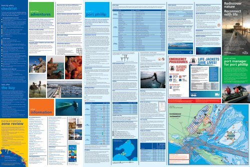
Port Phillip Recreational Boating Guide map - Parks Victoria
Port Phillip Recreational Boating Guide map - Parks Victoria
Port Phillip Recreational Boating Guide map - Parks Victoria

Create successful ePaper yourself
Turn your PDF publications into a flip-book with our unique Google optimized e-Paper software.
parks victoria<br />
port manager<br />
for port phillip<br />
<strong>Parks</strong> <strong>Victoria</strong> is the local port and waterway manager for<br />
the local port of <strong>Port</strong> <strong>Phillip</strong> and manages piers and jetties,<br />
mooring permits, aids to navigation and Marine National <strong>Parks</strong><br />
and Sanctuaries. <strong>Parks</strong> <strong>Victoria</strong> also acts as a referral agency for<br />
planning matters and authorisation of new structures.<br />
<strong>Parks</strong> <strong>Victoria</strong> has the accountability for the safety of water<br />
users, control of vessel activities and movements in the local<br />
port and is authorised under the Marine Act 1988 to issue<br />
infringement notices or prosecute people who break the law.<br />
The <strong>Victoria</strong>n Water Police can also issue infringement notices<br />
and work in partnership with <strong>Parks</strong> <strong>Victoria</strong> on <strong>Port</strong> <strong>Phillip</strong> to<br />
ensure the bays are used safely.<br />
For further information contact the <strong>Parks</strong> <strong>Victoria</strong> Information<br />
Centre on 13 1963 or visit www.parkweb.vic.gov.au<br />
boating safety<br />
checklist<br />
To ensure you have the best possible boating<br />
experience on <strong>Port</strong> <strong>Phillip</strong> it’s important to do<br />
a few things before you depart.<br />
Be prepared before you leave<br />
l Carry safety equipment according to the regulations, including<br />
approved life jackets or PFD-1s.<br />
l All children under the age of 10 years must wear an approved<br />
lifejacket or buoyancy vest/garment, or PFD-1, 2 or 3 while in<br />
a recreational boat that is underway, unless the child is within<br />
a deckhouse, cabin, half cabin or a secure enclosed space.<br />
l Have a chart of where you are going and a radio.<br />
l Tell someone where you are going and when you expect<br />
to return.<br />
l Know the rules, local regulations and distress signals.<br />
l Check out local conditions, weather and tides.<br />
l Carry sufficient fuel, water and a first aid kit.<br />
l Ensure engine reliability and adequate fuel system and always<br />
carry sufficient fuel.<br />
l Don’t overload your boat.<br />
On the water<br />
l Adhere to the prescribed speed limits.<br />
l Ensure you always keep to the right of channels.<br />
l Wear your life jackets.<br />
l Keep a safe distance between your boat and other boats.<br />
Remember your wake can affect others users, including those<br />
on floating infrastructure.<br />
l Keep a lookout at all times, especially for rowers or non<br />
powered craft who are generally harder to see and hear.<br />
l Never mix alcohol and operating a vessel.<br />
l Keep well clear of moving ships as they may alter course and<br />
without notice.<br />
l Do not obstruct the movement of large vessels by drifting in<br />
shipping channels and across shipping tracks.<br />
l Be aware that the bow-wave or wash from large ships, including<br />
the large commercial ferries, can cause your boat to capsize or roll<br />
heavily as to cause serious injury to its occupants.<br />
l Take care not to cross ahead of a large vessel as you may<br />
underestimate its speed and not be seen.<br />
l If you hear a vessel sounding at least five short and rapid blasts<br />
on its horn, you must get out of its way.<br />
l Keep a careful watch on the weather and watch out for other<br />
boats and hazards.<br />
l Ensure a low wake is maintained when passing rowers and<br />
other non powered vessels.<br />
Regulations to be observed<br />
• Immediately slow down to 5 knots around swimmers or divers.<br />
• Don’t exceed the speed limit.<br />
• Observe boat zone boundaries and restrictions.<br />
• Know the Marine National Park and Marine Sanctuary<br />
boundaries and restrictions.<br />
• Take all rubbish home with you and dispose of appropriately.<br />
• Remember all native plants and animals are protected by law.<br />
• Jumping or diving from piers or bridges is not permitted.<br />
• Vessel operators over 21 years of age must have a BAC below 0.05.<br />
• The discharge of sewage and other waste from boats is prohibited.<br />
look after<br />
the bay<br />
Boat operators have a responsibility to protect the marine<br />
environment and ensure it can be enjoyed for future generations<br />
to come. You can protect <strong>Port</strong> <strong>Phillip</strong> and minimise your<br />
environmental impact by following these simple guidelines:<br />
• Avoid anchoring over seagrass and reef areas and consider<br />
purchasing an anchor that does less damage to seabeds.<br />
• Keep your boat clean and protected from aquatic pests.<br />
• Reduce speed when operating power boats in shallow water or<br />
when close to the shore line as propellers can cause considerable<br />
damage to sensitive seabeds.<br />
• Prevent pollutants such as petrol, oil, sewage and detergents<br />
from entering the water.<br />
• Store rubbish securely on your boat and always take all rubbish<br />
home with you.<br />
• Dispose of sewage waste properly and use pump out facilities<br />
where they are available.<br />
• Clean out bilges and sumps regularly.<br />
• Launch or retrieve your craft at designated launching ramps.<br />
• Observe recreational fishing regulations.<br />
• Keep clear of bird nesting and roosting areas.<br />
• Remember all native plants and animals are protected by law.<br />
• Get involved with a marine friends group. For information<br />
contact <strong>Parks</strong> <strong>Victoria</strong>.<br />
Kite<br />
Boarding<br />
Area<br />
Kite<br />
Boarding<br />
Area<br />
St Kilda<br />
Pier<br />
Station<br />
Pier<br />
St Kilda<br />
Beach<br />
Lagoon<br />
Pier<br />
Kerferd<br />
Road Pier<br />
Albert Park<br />
<strong>Port</strong> Melbourne<br />
Middle Park<br />
Sandridge<br />
Beach<br />
<strong>Boating</strong><br />
only<br />
Swimming only<br />
All vessels including personal<br />
watercraft, powered and non power<br />
vessels are not permitted in this zone<br />
All vessels must adhere to 5 knot<br />
speed limit within 200m of the shore<br />
<strong>Port</strong> <strong>Phillip</strong> Directory<br />
Emergency<br />
000 or 27MHz – Ch 88 or VHF – Ch 16<br />
Australian Hydrographic Service<br />
02 4223 6500 www.hydro.gov.au<br />
Australian Volunteer Coast Guard<br />
9598 9092 www.coastguard.com.au<br />
Bureau of Meteorology<br />
9669 4000 www.bom.gov.au<br />
Dept. of Primary Industries<br />
136 186 www.dpi.vic.gov.au<br />
Dept. of Sustainability and Environment<br />
136 186 www.dse.vic.gov.au<br />
Environment Protection Authority<br />
9695 2722 www.epa.vic.gov.au<br />
Fisheries <strong>Victoria</strong><br />
13 FISH (13 3474)<br />
www.dpi.vic.gov.au/fishing<br />
Government Information Centre<br />
1300 366 356 www.vic.gov.au<br />
Heritage <strong>Victoria</strong><br />
8644 8800 www.heritage.vic.gov.au<br />
Marine Safety <strong>Victoria</strong><br />
1800 223 022<br />
www.marinesafety.vic.gov.au<br />
<strong>Parks</strong> <strong>Victoria</strong><br />
13 1963 www.parkweb.vic.gov.au<br />
<strong>Port</strong> of Melbourne Corporation<br />
1300 857 662 www.portofmelbourne.com<br />
<strong>Victoria</strong>n Regional Channels Authority<br />
5225 3500 www.regionalchannels.vic.gov.au<br />
<strong>Victoria</strong>n Water Police<br />
9399 7500<br />
Peak Organisations<br />
One of the best ways to learn more about<br />
a new sport or recreational activities on<br />
<strong>Port</strong> <strong>Phillip</strong> is to contact one of the following<br />
specialist peak organisations:<br />
Australian Powerboat Association<br />
www.ausapba.com.au<br />
Australian Volunteer Coastguard<br />
On water assistance, boating skills and licences<br />
www.coastguard.com.au<br />
<strong>Boating</strong> Industry Association<br />
www.biavic.com.au<br />
<strong>Boating</strong> <strong>Victoria</strong><br />
www.boatingvictoria.com.au<br />
Canoeing <strong>Victoria</strong><br />
www.vic.canoe.org.au<br />
Kite Boarding <strong>Victoria</strong><br />
www.kbv.org.au<br />
Life Saving <strong>Victoria</strong><br />
www.lifesavingvictoria.com.au<br />
Rowing <strong>Victoria</strong><br />
www.rowingvictoria.asn.au<br />
SCUBA Divers Federation of <strong>Victoria</strong><br />
www.sdfv.org.au<br />
VR Fish – <strong>Victoria</strong>n <strong>Recreational</strong> Fishing<br />
www.vrfish.com.au<br />
<strong>Victoria</strong>n Water Ski Association<br />
www.vicwaterski.com.au<br />
Wake Board <strong>Victoria</strong><br />
www.wakeboardvictoria.com.au<br />
Yachting <strong>Victoria</strong><br />
www.vic.yachting.org.au<br />
Publications<br />
Admiralty charts<br />
Available from most <strong>map</strong>ping outlets<br />
The Marine Act and associated regulations<br />
Available from the Government Information<br />
Centre<br />
<strong>Port</strong> <strong>Phillip</strong> Safety Chart Grid<br />
Available from the Australian Volunteer<br />
Coast Guard<br />
<strong>Victoria</strong>n <strong>Recreational</strong> <strong>Boating</strong> Safety<br />
Handbook<br />
Available from Marine Safety <strong>Victoria</strong><br />
<strong>Victoria</strong>n Tide Tables<br />
Available from <strong>Port</strong> of Melbourne Corporation<br />
Vessel Operating and Zoning Rules<br />
Available from Marine Safety <strong>Victoria</strong><br />
It’s no wonder <strong>Port</strong> <strong>Phillip</strong> is one of <strong>Victoria</strong>’s<br />
most popular recreational destinations.<br />
Whether it’s fishing, boating, kite boarding,<br />
diving, swimming or simply walking along<br />
one of the many piers, there’s so much to see<br />
and do both on and under the water.<br />
Discover a sunken warship<br />
Lying in approximately 28 metres under the surface, the ex-HMAS<br />
Canberra is a spectacular dive with many sections of the ship open<br />
for exploration including flight decks, the bridge, engine rooms,<br />
galley, and accommodation quarters.<br />
Access to the dive site is restricted to those participating in diving<br />
and snorkelling activities only. To enter the dive site divers must<br />
either book a dive tour with a licensed tour operator or book a<br />
2 hour time slot on the public mooring. Contact <strong>Parks</strong> <strong>Victoria</strong> for<br />
more information or for bookings visit www.parkstay.vic.gov.au<br />
Map Ref F14<br />
Encounter whales, dolphins and seals in their<br />
natural habitat<br />
As you travel across the bay, be on the lookout for whales,<br />
dolphins or seals. Dolphins tend to be seen more often at the<br />
southern end of <strong>Port</strong> <strong>Phillip</strong> while seals can be seen soaking up<br />
the sun at Chinamans Hat. Remember to keep a safe distance<br />
from wildlife at all times.<br />
Contact the Department of Sustainability and Environment for<br />
guidelines on watching wildlife.<br />
Map reference K14<br />
Experience the new Queenscliff Harbour<br />
The redeveloped Queenscliff Harbour is definitely worth the trip.<br />
Restaurants and cafes complement the setting and the viewing<br />
tower provides stunning views over <strong>Port</strong> <strong>Phillip</strong> Heads and Swan<br />
Bay. The historic Queenscliff Pier and the charming Queenscliff<br />
Township are only a short stroll away.<br />
Map reference J13<br />
Explore amazing underwater marine life<br />
<strong>Port</strong> <strong>Phillip</strong> is home to four Marine National <strong>Parks</strong> and Sanctuaries<br />
which host diverse marine life not seen anywhere else in the world.<br />
These marine protected areas provide a variety of snorkelling and<br />
diving opportunities for varying skill levels. Within <strong>Port</strong> <strong>Phillip</strong><br />
Heads Marine National Park, Popes Eye is a great sheltered dive for<br />
beginners while <strong>Port</strong>sea Hole is an excellent challenge for divers<br />
with more experience. See Marine National <strong>Parks</strong> section.<br />
Hook a fishing adventure<br />
With a surface area more than 35 times the size of Sydney Harbour,<br />
there’s endless scope for fishing adventures in <strong>Port</strong> <strong>Phillip</strong>.<br />
Whether you’re catching trevally, snapper, squid, leatherjackets,<br />
salmon or bream, most fantastic fishing adventures start at<br />
Patterson River. Four launching ramps with multiple lanes,<br />
ample parking and continually improving facilities cater for over<br />
50,000 boat launches each year and make Patterson River one of<br />
Australia’s most popular boat ramp facilities.<br />
Map reference W8<br />
Visit coastal villages<br />
Plan a day trip to one of the many seaside villages dotted around<br />
<strong>Port</strong> <strong>Phillip</strong>. Accessible via local piers, the coastal villages have a<br />
range of services and attractions to explore including restaurants<br />
and cafes. Highlights include the peaceful <strong>Port</strong>arlington fishing<br />
village, the historic maritime precinct at Williamstown, St Kilda’s<br />
cosmopolitan foreshore and the bustling boutiques of Sorrento.<br />
Licensed Tour Operators<br />
Take the easy approach to organising your great bay adventures<br />
by booking a tour, dive or fishing trip with one of <strong>Parks</strong> <strong>Victoria</strong>s<br />
licensed tour operators. For more information contact <strong>Parks</strong> <strong>Victoria</strong>.<br />
Rediscover<br />
nature<br />
Reconnect<br />
with life<br />
Throughout the world there is growing recognition<br />
of the vital contribution parks and waterways make<br />
to a healthy environment, healthy individuals and<br />
a healthy society. Enjoying <strong>Port</strong> <strong>Phillip</strong> is not only<br />
a great day out – it’s good for you.<br />
For further information contact the<br />
<strong>Parks</strong> <strong>Victoria</strong> Information Centre on 13 1963<br />
or visit www.parkweb.vic.gov.au<br />
There are a number of rules and regulations<br />
that must be observed to protect the bay<br />
environment and ensure safety for all users<br />
of <strong>Port</strong> <strong>Phillip</strong>.<br />
Anchoring<br />
When anchoring ensure you always place anchors correctly and<br />
securely. Anchors damage reefs and seagrass beds when they are<br />
allowed to shift. Consider purchasing a new anchor that does less<br />
damage to seabeds. Where possible avoid anchoring over seagrass<br />
and reef areas. Anchoring is not permitted in mooring grounds or<br />
shipping channels and fairways.<br />
Aquaculture reserves<br />
Eight offshore marine Aquaculture Fisheries Reserves have been<br />
established in <strong>Port</strong> Philip. These reserves total 1,990 ha including<br />
existing aquaculture areas and have been farmed for over 30 years.<br />
The reserves are clearly identified by yellow ‘special marks’ (piles<br />
or buoys) with ’Aquaculture‘ inscribed in black lettering on the<br />
yellow ‘X’ top mark and yellow synchronised lights at the external<br />
boundaries. Within the Reserves are Crown lease areas designated<br />
for marine farming. <strong>Recreational</strong> users may enter the reserves at<br />
their own risk and proceed with caution but cannot enter the lease<br />
areas (within the marked boundaries) without permission of the<br />
leaseholder.<br />
<strong>Recreational</strong> fishing can be undertaken throughout non-leased<br />
parts of the reserves in accordance with the conditions below:<br />
• Keep to public areas of the Aquaculture Fisheries Reserves.<br />
• Watch for divers and keep vessels and equipment a safe distance<br />
from aquaculture equipment.<br />
• Always travel at a safe speed and keep boat wash to a minimum.<br />
• Be aware of and comply with all boating and fisheries related<br />
regulations.<br />
• Don’t enter Crown leases without the express permission of the<br />
leaseholder.<br />
• Don’t encroach on Crown leases by keeping all equipment such<br />
as anchors, fishing lines and lures away from these areas.<br />
• Don’t tie up to navigation aids, aquaculture equipment or<br />
external Crown lease boundary buoys.<br />
• Don’t berley, clean fish or discharge human waste in or around<br />
the AFRs.<br />
For more information contact Fisheries <strong>Victoria</strong>.<br />
Aquatic pests<br />
When you participate in recreational boating activities you may be<br />
unknowingly spreading marine pests. You can protect <strong>Port</strong> <strong>Phillip</strong><br />
by keeping your boat and equipment clean and following these<br />
simple steps:<br />
1. Dislodge all plants and animals and bin them.<br />
2. Drain water from boat and gear Try not to let it drain back<br />
into the water.<br />
3. Dispose of unwanted live bait in a bin.<br />
4. Douse your boat and gear with freshwater and try not to let<br />
it drain back into the water.<br />
5. Dry your boat and equipment.<br />
6. Don’t forget to apply an authorised antifoulant where<br />
appropriate (within the antifoulant maximum in-service period<br />
and as directed on the can).<br />
For more information contact the Department of Primary Industries.<br />
Berthing facilities<br />
Public berthing is available on piers and jetties all over <strong>Port</strong> <strong>Phillip</strong><br />
for up to 48 hours at a time. Time limits and other restrictions are<br />
detailed on <strong>Parks</strong> <strong>Victoria</strong> signs at each location. Some areas have<br />
been leased or allocated for commercial boat operators only. These<br />
berths are not available for public use, including short term berthing.<br />
Please observe these restrictions to ensure fair access for everyone.<br />
Key<br />
l up to 48 hours (vessels should be attended)<br />
l Short Term – up to 4 hours (check signage)<br />
l Loading<br />
l Permit and commercial<br />
BERTH LOcATiOn Type Map Ref.<br />
north<br />
<strong>Port</strong> <strong>Phillip</strong><br />
Werribee Jetty l J5<br />
Altona Pier l N2<br />
Gem Pier l Q1<br />
Ferguson St Pier l l l P1<br />
Lagoon Pier l Q1<br />
Kerferd Road Pier l R1<br />
St Kilda Pier l R1<br />
East<br />
<strong>Port</strong> <strong>Phillip</strong><br />
Middle Brighton Pier l S3<br />
Hampton Pier l l S4<br />
Black Rock Jetty l T5<br />
Mordialloc Pier l V6<br />
Seaford Pier l W9<br />
Frankston Pier l W10<br />
Mornington Pier l l U12<br />
Mornington Fisherman’s Jetty l U12<br />
Dromana Pier l S15<br />
Rosebud Pier l Q16<br />
Rye Pier l N17<br />
Sorrento Pier l l L16<br />
<strong>Port</strong>sea Pier l l K15<br />
West<br />
<strong>Port</strong> <strong>Phillip</strong><br />
Point Lonsdale Pier l H14<br />
Queenscliff South Pier l J14<br />
Swan Bay Jetty l I12<br />
St Leonards Pier l l K11<br />
Indented Head Jetty l K10<br />
<strong>Port</strong>arlington Pier l l l I9<br />
Berthing is also available in harbours, marinas and sheltered<br />
waters throughout <strong>Port</strong> <strong>Phillip</strong>. Contact marina and harbour<br />
operators to book a berth prior to arrival.<br />
Dredging<br />
When encountering a dredge vessel recreational boat operators<br />
should always maintain a safe speed and pass on the non<br />
obstruction side of the dredge vessel.<br />
The safe side of passage is indicated by a double black diamond<br />
signal on the vessel. A double black ball signal indicates the<br />
obstruction side to avoid. A third black ball, black diamond, black<br />
ball signal indicates the vessel is restricted in its manoeuvrability.<br />
Maintenance dredging is conducted by <strong>Parks</strong> <strong>Victoria</strong> to maintain<br />
safe access to boating facilities in key locations such as Queenscliff,<br />
Patterson River, Werribee River, St Kilda Pier and Mordialloc Creek.<br />
Water depth surveys for Patterson River and Mordialloc Creek are<br />
available from the <strong>Parks</strong> <strong>Victoria</strong> website.<br />
Dredging of shipping channels and fairways is managed by<br />
the <strong>Port</strong> of Melbourne Corporation and <strong>Victoria</strong>n Regional<br />
Channels Authority.<br />
Pass safely this side Obstruction this side<br />
Event exclusion zones<br />
A number of the spectacular events that take place on the<br />
bay requires sections of <strong>Port</strong> <strong>Phillip</strong> to be closed for event and<br />
spectator safety. Exclusion zones are created by a temporary<br />
change to the Marine Act 1988 that allows the closure of a<br />
designated area of water for the safety of event patrons and the<br />
general public. Exclusion zones are patrolled by <strong>Parks</strong> <strong>Victoria</strong><br />
patrol boats and recreational boat operators should follow the<br />
directions of <strong>Parks</strong> <strong>Victoria</strong> officers at all times.<br />
The exclusion zone boundaries are usually indicated in the rivers<br />
by red ‘Stop No Boats’ buoys for all events that require exclusion<br />
zones in order to run an event organised race.<br />
Exclusion zones and river closures are advertised periodically in<br />
the public notices section of the Herald Sun and the Government<br />
Gazette. A Notice To Mariners is distributed prior to the event. For<br />
more information contact <strong>Parks</strong> <strong>Victoria</strong>.<br />
Fishing<br />
Fishing is permitted on <strong>Port</strong> <strong>Phillip</strong> and may be undertaken from<br />
either a vessel or on land excluding channels and Marine National<br />
<strong>Parks</strong> and Sanctuaries. A <strong>Recreational</strong> Fishing Licence is required<br />
by all anglers in <strong>Victoria</strong> for persons aged between 18 – 70 unless<br />
exempt. Please observe all fishing regulations and remember to<br />
check bag and size limits, fishing methods and closed seasons. For<br />
more information contact Fisheries <strong>Victoria</strong>.<br />
Fuel<br />
For your safety refuelling should always be carried out ‘on-boat’<br />
and not by leaning over the boat from a pier, jetty or landing.<br />
Care should always be taken to ensure fuel, oil and other potential<br />
pollutants are stored and transferred carefully and not spilt –<br />
especially on banks, in the water or on piers and jetties. When in<br />
public areas all diesel or unleaded fuel should be transported in<br />
AS2906 containers with a volume no greater than 25 litres. Larger<br />
containers or smaller sub-standard containers should not be used.<br />
Multiple containers can be used or fuel can be purchased from<br />
boat fuel retailers around <strong>Port</strong> <strong>Phillip</strong>.<br />
Fuel Retailers Map ref. Contact<br />
Martha Cove Marina T14 5987 0287<br />
Patterson Lakes Marina W8 9772 6622<br />
Pier 35 Marina P0 9646 1200<br />
Royal Geelong Yacht Club A10 5229 0799<br />
Queenscliff Harbour J13 5258 5459<br />
Sandringham Yacht Club S4 9598 7444<br />
St Kilda Marina S2 9535 0448<br />
Hazards and risks<br />
Should you encounter damaged aids to navigation, malfunctioning<br />
navigation lights, vessels adrift, submerged objects and other<br />
dangerous debris floating in the local port, please contact <strong>Parks</strong><br />
<strong>Victoria</strong> to report them immediately on 13 1963.<br />
Marine national <strong>Parks</strong> and Sanctuaries<br />
Marine National <strong>Parks</strong> and Sanctuaries are magnificent places for<br />
exploring marine life, snorkelling, scuba diving, swimming, low<br />
speed recreational boating or sailing and photography. They protect<br />
a unique and diverse range of marine plants, animals and habitats<br />
for the benefit of current and future generations. Around 90 percent<br />
of the plants and animals are found nowhere else in the world.<br />
There are four Marine National <strong>Parks</strong> and Sanctuaries within<br />
<strong>Port</strong> <strong>Phillip</strong>:<br />
Q Jawbone Marine Sanctuary (30 ha)<br />
W Point cooke Marine Sanctuary (290 ha)<br />
E Ricketts Point Marine Sanctuary (120 ha)<br />
R <strong>Port</strong> <strong>Phillip</strong> Heads Marine national Park (3580 ha)<br />
comprises six separate areas – Mud Islands, Point Lonsdale,<br />
Point Nepean, Popes Eye, <strong>Port</strong>sea Hole and Swan Bay.<br />
Marine National <strong>Parks</strong><br />
and Sanctuaries locations<br />
The Barwon Bluff T and Mushroom Reef Y Marine<br />
Sanctuaries are also nearby.<br />
Know the boundaries – penalties apply<br />
A number of activities are not permitted within the boundaries of<br />
<strong>Victoria</strong>’s Marine National <strong>Parks</strong> and Marine Sanctuaries. It’s your<br />
responsibility to know the boundaries.<br />
• No fishing<br />
• No spear fishing<br />
• No taking or damaging of any animals,<br />
plants and objects (artefacts)<br />
Offences by individuals may incur an infringement notice, or carry<br />
penalties of up to 12 months imprisonment and/or fines of up to<br />
$20,000. Vessels, vehicles and equipment may also be seized.<br />
To report offences call the Department of Primary<br />
industries on 13 3474.<br />
For more information on Marine National <strong>Parks</strong> and Sanctuaries<br />
contact <strong>Parks</strong> <strong>Victoria</strong>.<br />
Snorkeler steps from a boat at Popes Eye<br />
Moorings<br />
<strong>Parks</strong> <strong>Victoria</strong> directly manage approximately 1,950 of an<br />
estimated 2,900 swing moorings in 51 locations around <strong>Port</strong> <strong>Phillip</strong><br />
Bay and Western <strong>Port</strong>. The balance are managed by 11 various<br />
Yacht and boat clubs and mooring associations acting as agents for<br />
<strong>Parks</strong> <strong>Victoria</strong>. For more information contact <strong>Parks</strong> <strong>Victoria</strong>.<br />
Book with <strong>Parks</strong> <strong>Victoria</strong> to stay at public destination moorings<br />
in Queenscliff, Limeburners Bay (near Geelong), Williamstown<br />
and Sorrento.<br />
notice to mariners<br />
A Notice to Mariners is issued by a Harbour<br />
Master, <strong>Port</strong> Manager or Waterway Manager<br />
to advise commercial mariners, recreational<br />
boaters and waterway users of a significant<br />
change in a port or waterway which may affect<br />
the safe navigation of a vessel. Boat operators<br />
should always check the latest Notice to<br />
Mariners before operating a boat on <strong>Port</strong><br />
<strong>Phillip</strong>. Notice to Mariners are available on the<br />
<strong>Parks</strong> <strong>Victoria</strong>, <strong>Port</strong> of Melbourne Corporation<br />
and <strong>Victoria</strong>n Regional Channels Authority websites.<br />
Boat operators should carry accurate Australian navigation charts<br />
(Aus 143, Aus 144, Aus 153, Aus 154, Aus 155, Aus 157 and Aus<br />
158) which can be purchased through <strong>map</strong>ping retailers and the<br />
Australian Hydrographic Service.<br />
<strong>Port</strong> security<br />
<strong>Victoria</strong>n Water Police manage port security in partnership with<br />
port managers. If you see something suspicious on the water,<br />
contact the Water Police.<br />
<strong>Port</strong> security boats patrol the restricted waterside zones. In line<br />
with the International Ship and <strong>Port</strong> Facility Security Code, ports<br />
have three security levels– Level 1 is the default. The <strong>Port</strong> of<br />
Melbourne Corporation website provides advice on the current<br />
security level.<br />
Pump out facilities<br />
Poor water quality affects the health of the bay and in turn<br />
the enjoyment of recreational boating and fishing activities on<br />
<strong>Port</strong> <strong>Phillip</strong>. Discharge of sewage and other waste from boats is<br />
prohibited, adds pollutants to our valuable waterways and poses<br />
a risk to marine ecosystems and human health.<br />
Use a holding tank for sewage and dispose of waste properly on<br />
land or use provided pump out facilities. Boat sewerage pump<br />
out systems are used designed for larger boats that have holding<br />
tanks. Sewerage hoppers are designed for boats that use a<br />
portable toilet.<br />
Location Contact Map ref.<br />
Sewerage<br />
Pump out<br />
Hoppers<br />
Anchorage Marina 9397 9677 P1 Yes No<br />
Blairgowrie Yacht Squadron 5988 8453 M16 Yes No<br />
Martha Cove Marina 5987 0287 T14 Yes Yes<br />
Pier 35 Marina 9646 1200 P0 Yes Yes<br />
Queenscliff Harbour 5258 5459 J13 Yes Yes<br />
Royal Brighton Yacht Club 9592 4022 S3 Yes Yes<br />
Sandringham Yacht Club 9598 7444 S4 Yes No<br />
St Kilda Marina 9535 0448 S2 Yes No<br />
Radio channels<br />
Marine radio is potentially a life line for vessels in an emergency.<br />
Avoid unnecessary communications on marine radio. Be aware<br />
of the following Marine Radio channels and frequencies when<br />
operating a motorised vessel in <strong>Port</strong> <strong>Phillip</strong>:<br />
<strong>Recreational</strong> Vessels VHF Channel 72, 73 and 77<br />
27MHz Channel 96<br />
<strong>Port</strong> Operations VHF Channel 12<br />
Emergency Calls and calling VHF Channel 16 and 67<br />
27MHz Channel 86 and 88<br />
Rowing and non powered vessels<br />
<strong>Port</strong> <strong>Phillip</strong> is popular for non-motorised vessels such as kite<br />
boarding, rowing, kayaking and canoeing. When passing non<br />
powered vessels, please ensure a low wake is maintained so as not<br />
to disturb or tip these vessels over as they are more susceptible to<br />
capsizing than larger motorised vessels.<br />
Shipping channels and fairways – steer clear<br />
Large ships travel <strong>Port</strong> <strong>Phillip</strong> shipping channels during all hours<br />
of the day and night and sometimes travel outside designated<br />
fairways. A ship’s blind spot can extend for many hundreds of<br />
metres and it is very difficult for ships to change course quickly.<br />
It is the responsibility of recreational boat operators to:<br />
• Keep clear of ships at all times.<br />
• Never anchor in shipping channels or transit only zones.<br />
• Never obstruct the path of ships or assume a ship can see you.<br />
• Never tie up to navigation aids such as buoys or channel markers.<br />
Penalties apply.<br />
For more information contact <strong>Port</strong> of Melbourne Corporation or<br />
<strong>Victoria</strong>n Regional Channels Authority.<br />
Shipwreck Protection Zones<br />
Historic Shipwreck Protection Zones are no entry areas around<br />
very fragile shipwrecks. It is important to steer clear of these zones<br />
because the fragile wrecks within them could easily be damaged<br />
by anchoring, fishing or diving activities. It is illegal to enter a<br />
protected zone without a permit from Heritage <strong>Victoria</strong>. Penalties<br />
apply. For more information contact Heritage <strong>Victoria</strong>.<br />
Speed restrictions<br />
Speed can be dangerous on the water. Not only is there a risk of<br />
crashing into other vessels, land or navigation aids, there are many<br />
other obstacles such as swimmers and divers or obstructions hidden<br />
under the surface. Always maintain a good lookout and operate at<br />
a safe speed and check local speed restrictions before you leave.<br />
A maximum speed of 5 knots applies on <strong>Port</strong> <strong>Phillip</strong> when<br />
operating a vessel:<br />
• Within 50m of swimmers, other vessels and fixed<br />
or floating structures.<br />
• Within 100m of divers flags.<br />
• Within 200m of waters edge in coastal and enclosed<br />
waters. Greater speed limit distances are in place along<br />
the shallower Mornington Peninsula bay beaches.<br />
Swing basins<br />
Swing basins are areas where large commercial ships turn when<br />
entering and leaving berths. Be aware of ships at all times near<br />
swing basins and steer clear for your safety.<br />
Wildlife watching<br />
<strong>Port</strong> <strong>Phillip</strong> is home to an amazing array of wildlife. When you<br />
see dolphins, seals or whales, make sure you give them plenty<br />
of space. Never approach closer than 100 metres and leave them<br />
alone if they show signs of agitation such as diving or rapid<br />
changes in direction.<br />
At the Ticonderoga Bay sanctuary zone (<strong>map</strong> ref J15), vessels<br />
cannot approach dolphins and whales any closer than 200 metres.<br />
For more information contact the Department of Sustainability<br />
and Environment.<br />
Boat ramps<br />
Boat ramps are managed by several different agencies and councils throughout <strong>Port</strong> <strong>Phillip</strong>. Launching fees and facilities vary at each site.<br />
If you’re unfamiliar with a particular boat ramp its recommended you contact the relevant boat ramp manager for more information<br />
before your trip.<br />
Boat ramp location Map Ref. Managed by Contact no.<br />
northern<br />
<strong>Port</strong> <strong>Phillip</strong><br />
Werribee South J5 Wyndham City Council 9742 0777<br />
Altona O1 Hobsons Bay City Council 9932 1000<br />
The Warmies P1 Hobsons Bay City Council 9932 1000<br />
St Kilda S2 St Kilda Marina 9534 0448<br />
Elwood S2 Bayside City Council 9599 4444<br />
Eastern<br />
<strong>Port</strong> <strong>Phillip</strong><br />
Black Rock T4 Bayside City Council 9599 4444<br />
Mordialloc V6 Kingston City Council 1300 653 356<br />
Patterson River W8 <strong>Parks</strong> <strong>Victoria</strong> 13 1963<br />
Kannanook Creek W10 Frankston City Council 1300 322 322<br />
Frankston – Olivers Hill W10 Frankston City Council 1300 322 322<br />
Mornington U12 Mornington Peninsula Shire Council 1300 850 600<br />
Fishermans Beach T12 Mornington Peninsula Shire Council 1300 850 600<br />
Safety Beach S15 Mornington Peninsula Shire Council 1300 850 600<br />
Anthonys Nose R16 Dromana Foreshore Committee 5981 0933<br />
Tootgarook O17 Capel Sound Foreshore Committee 5986 4382<br />
Rye N17 Mornington Peninsula Shire Council 1300 850 600<br />
Blairgowrie – Tyrone M16 Whitecliffs – Camerons Bight Foreshore Committee 5985 3288<br />
Sorrento L15 Mornington Peninsula Shire Council 1300 850 600<br />
Western<br />
<strong>Port</strong> <strong>Phillip</strong><br />
Queenscliff J14 Borough of Queenscliffe 5258 1377<br />
Swan Bay I12 <strong>Parks</strong> <strong>Victoria</strong> 13 1963<br />
St Leonards K11 Bellarine Bayside 5259 2764<br />
Indented Head K10 Bellarine Bayside 5259 2764<br />
Grassy Point J9 Bellarine Bayside 5259 2764<br />
Point Richards H9 Bellarine Bayside 5259 2764<br />
Clifton Springs F10 City of Greater Geelong 5272 5272<br />
Limeburners Point A10 City of Greater Geelong 5272 5272<br />
North Shore ZZ9 City of Greater Geelong 5272 5272<br />
Corio A8 City of Greater Geelong 5272 5272<br />
guide to<br />
port phillip<br />
great bay<br />
adventures<br />
other<br />
information<br />
Available from <strong>Parks</strong> <strong>Victoria</strong>:<br />
Who do you call?<br />
<strong>Guide</strong> to Government<br />
departments and agencies on<br />
<strong>Port</strong> <strong>Phillip</strong> and Western <strong>Port</strong><br />
Notice to Mariners<br />
www.parkweb.vic.gov.au<br />
© Copyright <strong>Parks</strong> <strong>Victoria</strong> 2010.<br />
Free publication. 6th edition, July 2010.<br />
nOTE: THiS iS nOT A nAViGATiOn cHART<br />
This <strong>map</strong> is not for navigation use. Navigation aids are shown for information only.<br />
For navigation of <strong>Port</strong> <strong>Phillip</strong>, chart AUS 143 should be consulted. Notices to<br />
Mariners issued by <strong>Parks</strong> <strong>Victoria</strong> are published on www.parkweb.vic.gov.au<br />
Disclaimer: <strong>Parks</strong> <strong>Victoria</strong> does not guarantee that the publication is without flaw<br />
or is wholly appropriate for your particular purpose and therefore disclaims all<br />
liability for any error, loss or other consequence which may arise from you relying<br />
on any information in this publication.<br />
For more information on the new boating and<br />
swimming zones contact <strong>Parks</strong> <strong>Victoria</strong> on 13 1963<br />
or visit www.parkweb.vic.gov.au<br />
boating and swimming<br />
zone review<br />
<strong>Parks</strong> <strong>Victoria</strong> is introducing new boating and swimming zones<br />
to improve safety across <strong>Port</strong> <strong>Phillip</strong> and Western <strong>Port</strong>.<br />
The new zones will be introduced in stages with new aids to<br />
navigation and clear signage installed prior to each new zone<br />
coming into effect.<br />
The new zone changes between <strong>Port</strong> Melbourne and St Kilda<br />
will come into effect in September 2010.<br />
The changes include:<br />
• Revised kite board operating area near Catani Gardens<br />
• Swimming only zone in front of <strong>Port</strong> Melbourne and South<br />
Melbourne Life Saving Clubs<br />
• Swimming only zone between Wright and Nimmo streets<br />
in Middle Park<br />
• <strong>Boating</strong> only zone at St Kilda Marina and entrance<br />
• Swimming only zone between St Kilda Marina and St Kilda Pier<br />
• Improved visibility of aids to navigation and easy to<br />
understand signage<br />
1 Fishing, Frankston Pier.<br />
2 Seals, Chinamans Hat.<br />
3 Pot-bellied seahorse (Hippocampus bleekeri),<br />
<strong>Port</strong> <strong>Phillip</strong> Heads Marine National Park.<br />
4 Beach Play, Mornington Peninsula National Park.<br />
5 Queenscliff Harbour.<br />
6 Diving, ex-HMAS Canberra dive site (Photo Mary Malloy).<br />
Y Joanna<br />
SEE INSET<br />
Observatory<br />
Point<br />
N E P E A N<br />
B A Y<br />
<strong>Port</strong> <strong>Phillip</strong> Heads<br />
Marine National Park<br />
(Point Lonsdale)<br />
<strong>Port</strong> <strong>Phillip</strong> Heads<br />
Marine National Park<br />
(Point Nepean)<br />
P O I N T N E P E A N<br />
N A T I O N A L P A R K<br />
M O R N I N G T O N P E N N I N S U L A<br />
N A T I O N A L P A R K<br />
Point Nepean<br />
Nepean Reef<br />
Corsair Rock<br />
Big Rock<br />
Petriana Reef<br />
Nepean Rock<br />
W<br />
T H E R I P<br />
Lonsdale Rock<br />
38º17’35”S<br />
144º36’09”E<br />
38º17’22”S<br />
144º36’20”E<br />
38º17’22”S<br />
144º36’20”E<br />
38º18’03”S<br />
144º37’18”E<br />
38º18’16”S<br />
144º37’24”E<br />
38º19’33”S<br />
144º39’01”E<br />
38º18’45”S<br />
144º40’00”E<br />
38º18’21”S<br />
144º41’14”E<br />
38º16’59”S<br />
144º46’53”E<br />
38º13’29”S<br />
144º41’54”E<br />
38º13’08”S<br />
144º41’04”E<br />
38º15’38”S<br />
144º46’53”E<br />
38º15’36”S<br />
144º45’13”E<br />
38º16’57”S<br />
144º45’10”E<br />
38º17’31”S<br />
144º38’24”E<br />
Point Lonsdale<br />
Reef<br />
Mushroom Rock<br />
Yellowtail Rock<br />
Point Lonsdale<br />
Lighthouse<br />
L<br />
L O N S D A L E B A Y<br />
POINT LONSDALE Victory Shoal<br />
Rocky Point<br />
Jetty (ruins)<br />
QUEENSCLIFF<br />
SPOIL GROUND<br />
L A K E<br />
V I C T O R I A<br />
Wedge<br />
Tide Pile<br />
Chinaman’s Hat<br />
The Narrows<br />
Clarkes Beacon<br />
Pilot Jetty<br />
S W A N<br />
S W A N<br />
B A Y<br />
B A Y<br />
S W A N<br />
B A Y<br />
<strong>Port</strong> <strong>Phillip</strong> Heads<br />
Marine National Park<br />
(Swan Bay)<br />
<strong>Port</strong> <strong>Phillip</strong> Heads<br />
Marine National Park<br />
(Swan Bay)<br />
G R E A T<br />
S A N D<br />
Fl.WR6s<br />
West Channel Pile<br />
Q.R<br />
G<br />
R<br />
Swan Bay Jetty<br />
Sorrento Pier<br />
Aero Lt.VQ.R<br />
2F.R<br />
R<br />
R<br />
Y<br />
G<br />
Fl.R5s BRB<br />
Fl.G5s<br />
Point King<br />
PORTSEA<br />
<strong>Port</strong>sea Pier<br />
S O U T H C H A N N E L<br />
Lighthouse Point<br />
S O U T H S A N D<br />
Fl.W3s2M<br />
South Channel Pile<br />
Lighthouse Building<br />
Sth Channel Fort<br />
Sth Channel Fort Jetty<br />
Fl.2M<br />
P I N N A C E C H A N N E L<br />
C H A N N E L<br />
S Y M O N D S<br />
W E S TC H A N N E L<br />
G R R<br />
G<br />
G<br />
G<br />
Ticonderoga Bay<br />
sanctuary zone<br />
Ticonderoga Bay<br />
sanctuary zone<br />
Marcus Hill<br />
Column<br />
Radar Tower<br />
<strong>Port</strong> <strong>Phillip</strong> Heads<br />
Marine National Park<br />
(Mud Islands)<br />
<strong>Port</strong> <strong>Phillip</strong> Heads<br />
Marine National Park<br />
(Popes Eye)<br />
Fl.5s<br />
Q.G<br />
Y<br />
Y<br />
Y<br />
Y<br />
G<br />
Y<br />
Y<br />
Point Lonsdale Pier<br />
Point Lonsdale Pier<br />
AQUACULTURE<br />
AQUACULTURE<br />
250m<br />
500m 150m<br />
150m<br />
Queenscliff Pier<br />
Queenscliff Pier<br />
G<br />
G<br />
PROHIBITED<br />
ANCHORAGE<br />
ZONE<br />
PROHIBITED<br />
ANCHORAGE<br />
ZONE<br />
PROHIBITED<br />
ANCHORAGE<br />
ZONE<br />
Y<br />
Clarence<br />
38º18’43”S<br />
144º42’52”E<br />
38º18’49”S<br />
144º42’45”E<br />
38º18’40”S<br />
144º42’33”E<br />
38º18’34”S<br />
144º42’41”E<br />
RESTRICTED<br />
NAVAL<br />
WATERS<br />
RESTRICTED<br />
NAVAL<br />
WATERS<br />
No.3<br />
Fl(2)G4s<br />
Fl.WR.6s<br />
F & Oc.15s 40m 14M High Lt<br />
Fl.R3s<br />
Oc.WRG.15s 28m 12-6M Low Lt<br />
F.WRG.21m 6/4M<br />
F.AI.WR3s 12m 6/4M<br />
Q.R<br />
Fl.R3s<br />
Q.R<br />
YB<br />
POPES EYE<br />
VQ(6)+LFl.10s<br />
Q<br />
BY<br />
Y<br />
Or<br />
Fl.WG3s<br />
F.RG<br />
No.1<br />
Fl.G3s<br />
No.7<br />
Fl(4)G12s<br />
No.2<br />
Fl.R3s<br />
No.3<br />
Fl(2)G5s<br />
No.4<br />
Fl(2)R5s<br />
No.6<br />
Fl(3)R10s<br />
No.3<br />
Fl(2)G5s<br />
No.10<br />
Fl.R3s<br />
No.8<br />
Fl(4)R12s<br />
Y Y Y<br />
Y<br />
Y<br />
Y Y<br />
Y<br />
LFl(2)WGR.15s 12/10M<br />
Horn(2)30s<br />
F.G<br />
Q.G<br />
F.Bu<br />
Fl.Y5s<br />
No.2<br />
Fl(2)R4s<br />
No.4<br />
Fl(2)R4s<br />
Fl.R3s<br />
Q.R<br />
Coles<br />
Fl.4s<br />
No.5<br />
Fl(2)G4s<br />
No.7<br />
Fl(2)G4s<br />
No.6<br />
Fl(2)R4s<br />
G<br />
Fl.G5s<br />
G<br />
R<br />
No.8<br />
Fl(2)R4s<br />
No.9<br />
Fl(2)G4s<br />
P O R T L I M I T<br />
<strong>Port</strong> <strong>Phillip</strong> Heads<br />
Marine National Park<br />
(<strong>Port</strong>sea Hole)<br />
K I L O M E T R E S<br />
0 3<br />
1.5<br />
0<br />
SCALE 1:75,000<br />
N A U T I C A L M I L E S<br />
THE RIP –<br />
PORT PHILLIP HEADS<br />
EMERGENCY<br />
PROCEDURES<br />
RAISE THIS ALARM<br />
STAY WITH THE BOAT<br />
ALL OCCUPANTS<br />
TO PUT ON PFDs<br />
LIFE JACKETS<br />
SAVE LIVES!<br />
• MARINE RADIO<br />
27 MHz – Ch 88<br />
VHF – Ch 16<br />
• FLARES<br />
Activate when<br />
you see a<br />
potential rescuer<br />
• EMERGENCY<br />
Call 000<br />
• EPIRB<br />
Activate your<br />
distress beacon<br />
• A vessel is a lot easier to<br />
spot than a swimmer<br />
• Anchor your boat to<br />
maintain position if safe<br />
to do so<br />
All information is current at the time of printing (May 2010). For full<br />
legislative details, refer to the Marine Act 1988 and the Marine Regulations<br />
2009. For a free copy of the <strong>Victoria</strong>n <strong>Recreational</strong> <strong>Boating</strong> Safety<br />
Handbook call 1800 223 022 or visit www.marinesafety.vic.gov.au<br />
LIFE JACKETS<br />
SAVE LIVES!<br />
Wearing PFDs on recreational vessels at all times<br />
Wearing a PFD is now compulsory for all occupants when in an open areas<br />
of the following vessels, whiles under way:<br />
• Power driven vessels up to and including 4.8 metres (m) in length and<br />
personal watercraft (PWC)<br />
• Off-the-beach sailing yachts, pedal boats and fun boats<br />
• Canoes, kayaks, rowing boats<br />
• <strong>Recreational</strong> tenders<br />
Wearing PFDs on recreational vessels during times of heightened risk<br />
A PFD must also be worn by all occupants of the following vessels at time<br />
of “heightened risk” when occupants are in an open area of a vessel which<br />
is under way.<br />
• Yachts (including monohull, trailerable and multihull yachts, excluding<br />
off-the-beach sailing yachts)<br />
• Power driven vessels greater than 4.8m and less then 12m.<br />
What type of PFD must I wear?<br />
When occupants of a vessel are required to wear a PFD (refer above), the<br />
following specified PFDs must be worn.<br />
“Heightened Risk” means:<br />
• when boating alone<br />
• when crossing an ocean bar<br />
• when operating at night or in<br />
restricted visibility<br />
• when operating in an area<br />
where a gale, storm of severe<br />
thunderstorm warning or severe<br />
weather warning issued by the<br />
Bureau of Meteorology is current<br />
• when the vessel is a yacht<br />
without safety barriers or safety<br />
harnesses in use<br />
• when the vessel may capsize or<br />
be swamped or when occupants<br />
are at risk of falling overboard<br />
Vessel type Coastal waters Enclosed waters<br />
Powerboats up to and including 4.8m in length PFD Type 1 PFD Type 1<br />
Powerboat greater than 4.8m and less than 12m PFD Type 1 PFD Type 1<br />
Personal watercraft PFD Type 1 or 2 or 3 PFD Type 1 or 2 or 3<br />
<strong>Recreational</strong> tender PFD Type 1 PFD Type 1 or 2<br />
Off-the-beach sailing yacht PFD Type 1 (>2 nm) or 2 PFD Type 1 or 2<br />
Yacht PFD Type 1 PFD Type 1 or 2<br />
Kite board and sail board PFD Type 1 or 2 PFD Type 1 or 2 or 3<br />
Canoe, kayak, rowing boat, raft, pedal boat or fun boat PFD Type 1 or 2 or 3 PFD Type 1 or 2 or 3<br />
<strong>Port</strong> <strong>Phillip</strong> Heads – The Rip<br />
Navigating <strong>Port</strong> <strong>Phillip</strong> Heads (or ‘The Rip’ as it’s commonly<br />
known) can be quite difficult due to a combination of strong<br />
tidal movements, large and unpredictable waves and frequent<br />
shipping traffic. All boat operators should seek quality advice<br />
before attempting to pass through <strong>Port</strong> <strong>Phillip</strong> Heads.<br />
Vessels are prohibited from landing at Point Nepean within the<br />
<strong>Port</strong> <strong>Phillip</strong> Heads Marine National Park.<br />
Hovercraft are prohibited from entering <strong>Port</strong> <strong>Phillip</strong> Heads Marine<br />
National Park.<br />
1<br />
6<br />
2 3<br />
5<br />
4
PUBLIC<br />
MOORING<br />
SB<br />
PARKS VICTORIA<br />
COMMITTEE OF MANGEMENT<br />
2F.G<br />
Fergusion St Pier<br />
Gem<br />
Pier<br />
F.R<br />
COMMERCIAL<br />
VESSELS ONLY<br />
0 K I L O M E T R E S<br />
1<br />
0<br />
Y<br />
0 N A U T I C A L M I L E S<br />
Car park<br />
Ramp<br />
0<br />
F.Bu<br />
COrIO bAY<br />
RIPPLESIDE<br />
Coast<br />
Guard<br />
SCALE 1:25,000<br />
F.G<br />
Ramps<br />
Fl.<br />
NORLANE<br />
C O R I O<br />
Q U A Y<br />
Silos<br />
YB Q(6)+<br />
LFl.Bu15s<br />
Fl.R3s<br />
F.R<br />
Fl.R3s<br />
2F.Bu<br />
F.G<br />
Q.G<br />
CITY<br />
Pier<br />
GEELONG<br />
Church Spire<br />
BRIDGE<br />
Jetty<br />
Basin<br />
Breakwater<br />
South<br />
Jetty<br />
F.Bu<br />
Jetty<br />
Q.R<br />
CHANNEL<br />
Q R.G.Y.C<br />
F.G<br />
No.22<br />
Fl.R5s<br />
F.<br />
Chimney<br />
Refinery<br />
Workshops Jetty<br />
Boyd Jetty<br />
Fl.R3s<br />
L A S C E L L E S<br />
W H A R F<br />
Fl.R3s<br />
Beacon<br />
CORIO<br />
Fl.R2s<br />
F.R<br />
Fl.G3s<br />
Q.R<br />
YBY<br />
Q(9)15s<br />
BY<br />
R A B B I T<br />
Jetty<br />
I S L A N D<br />
Fl.<br />
Pontoon Jetty<br />
SCALE 1:1,000<br />
Boat ramp<br />
Groyne<br />
Fl.R3s<br />
Fl.G3s<br />
QUEENSCLIFF<br />
Fl.R4s<br />
0.5<br />
Pontoon Jetty<br />
DREDGED<br />
BASIN<br />
M E T R E S 100<br />
N A U T I C A L M I L E S<br />
SCALE 1:9,000<br />
Fl.G4s<br />
Q.R<br />
SOUTHERN<br />
ANCHORAGE<br />
Baths<br />
F.G<br />
Ann St Pier<br />
Booth Pier<br />
Basin<br />
Breakwater<br />
North<br />
Fl.G3s<br />
F.R<br />
Bcn.<br />
COMMERCIAL SHIPPING CHANNEL<br />
Reid St Pier<br />
Q<br />
F.<br />
No.21<br />
Fl.G5s<br />
Dockyard<br />
Pier<br />
No.20<br />
Fl.R2s<br />
Nelson<br />
Pier West<br />
2F.R(hor)<br />
Gellibrand Pier<br />
NO<br />
BOATING<br />
SB<br />
F.<br />
Fl.R2s<br />
Breakwater Pier<br />
F.G<br />
Fl.R3s<br />
LIMEBURNERS POINT<br />
Tower<br />
L I M E B U R N E R S<br />
B A Y<br />
WILLIAMSTOWN<br />
No.19 Fl.G2s<br />
No.19A Fl.G5s<br />
No.17A Fl.G5s<br />
Fl.R2s<br />
Grammar School<br />
Limeburners Y.C.<br />
Fl.G(3)6s<br />
Fl.R(3)6s<br />
Fl.R(3)6s<br />
Fl.G(3)6s<br />
Fl.R(3)8s<br />
Fl.G(3)8s<br />
POINT ABEONA<br />
2F.R F.R<br />
Fl.G3s<br />
Fl.G3s<br />
CHANNEL<br />
Fl.G3s<br />
I N N E R<br />
H A R B O U R<br />
WESTERN<br />
& EASTERN<br />
ANCHORAGE<br />
Yacht<br />
Club<br />
F.G<br />
YB F.Q(6)+<br />
LFl.bu15ss<br />
Fl.R4s<br />
HOPETOUN<br />
Fl.R4s<br />
Fl.G4s<br />
S T I N G A R E E B A Y<br />
No.17<br />
Fl.G5s<br />
TRANSIT ONLY ZONE<br />
(NO ANCHORING<br />
OR DRIFTING)<br />
Commercial<br />
Ramp<br />
R<br />
DREDGE<br />
MATERIAL<br />
GROUND<br />
G<br />
G R<br />
YBY<br />
No.7<br />
Fl.G4s<br />
AVALON BEACH<br />
NORTH CHANNEL<br />
Q<br />
BY<br />
POINT HENRY<br />
Tide<br />
Gauge<br />
R Twr.<br />
F.Bu<br />
Pier<br />
F.Bu<br />
F.Bu<br />
CHANNEL<br />
No.5<br />
Fl.G4s<br />
No.6<br />
Fl.R4s<br />
G<br />
R<br />
7<br />
8<br />
9<br />
No.44<br />
F.R+Fl.R2s<br />
Y A R R A V I L L E<br />
STONY CREEK<br />
BACKWASH<br />
No.40<br />
F.R+Fl.R2s<br />
No.38<br />
F.R+Fl.R2s<br />
No.34<br />
F.R+<br />
Fl.R2s<br />
Chimney<br />
F.R<br />
No.30<br />
F.R+Fl.R2s<br />
S a l t<br />
No.36<br />
F.R+<br />
Fl.R2s<br />
No.32<br />
F.R+<br />
Fl.R2s<br />
No.28<br />
F.R+Fl.R2s<br />
MARIBYRNONG<br />
RIVER<br />
SB<br />
H o l d e n<br />
D o c k<br />
No.37<br />
F.G+Fl.G2s<br />
WESTGATE LANDING<br />
WESTGATE<br />
BRIDGE<br />
No.35<br />
.G+Fl.G2s<br />
No.33<br />
.G+Fl.G2s<br />
No.31<br />
F.G+Fl.G2s<br />
No.29<br />
F.G+Fl.G2s<br />
No.28<br />
F.R+Fl.R2s<br />
VQ.G<br />
BATES POINT<br />
Q(4)Y12s<br />
AQUACULTURE<br />
Bcn.<br />
POINT LILLIAS<br />
BIRD ROCK<br />
YB<br />
G<br />
R<br />
No.4<br />
Fl.R4s<br />
No.3<br />
Fl.G4s<br />
TRANSIT ONLY ZONE NO ANCHORING<br />
Queenscliff<br />
Pier<br />
Water Tower<br />
0 K I L O M E T R E S<br />
0.4<br />
Channel<br />
Breakwater<br />
North<br />
DREDGED<br />
Fl.G3s<br />
CHANNEL<br />
Channel Breakwater South<br />
F.Bu<br />
0.25<br />
HARBOUR<br />
HARBOUR<br />
NO PERSONAL<br />
WATERCRAFT<br />
S A N D I S L A N D<br />
F.WG.28m 11/8M<br />
Fl.R<br />
Q.G<br />
Ferry<br />
Terminal<br />
Fl.G3s<br />
No.8<br />
Fl.R4s<br />
Fl.R3s<br />
Fl.R5s<br />
Fl.G3s<br />
ALTONA HArbOur<br />
WErrIbEE rIVEr<br />
Ramp for<br />
Personal Water<br />
Craft only & Personal<br />
Water Craft Zone<br />
NO PERSONAL<br />
WATERCRAFT<br />
Tide Pile<br />
Fl.Y5s<br />
0 K I L O M E T R E S<br />
3<br />
0 N A U T I C A L M I L E S<br />
K I L O M E T R E S<br />
N A U T I C A L M I L E S<br />
C u r l e w i s<br />
SCALE 1:10,000<br />
SCALE 1:60,000<br />
No.2<br />
Fl.R4s<br />
F.R<br />
Y<br />
No.1<br />
Fl.G4s<br />
No.1<br />
Q.Y<br />
Q.R<br />
Note Dredge operates at entrance – navigate with<br />
care. Check dredging information on reverse<br />
side. for more details<br />
Q.R<br />
Q.R<br />
QuEENSCLIff<br />
Y<br />
Legend<br />
SB<br />
No.47<br />
F.G<br />
F.R<br />
No.43<br />
F.G+Fl.G2s<br />
PIER 35 MARINA<br />
W E B B D O C K<br />
W I L L I A M S T O W N<br />
10<br />
38°10'<br />
11<br />
F.R<br />
No.50<br />
F.R+Fl.R2s<br />
SB<br />
No.48<br />
F.R+Fl.R2s<br />
Fl.R4s+F.R<br />
No.81<br />
No.82 Fl.G5s<br />
Fl.R5s+F.R<br />
No.24 SB<br />
F.R+Fl.R4s<br />
POINT GELLIBRAND<br />
COASTAL HERITAGE PARK<br />
G<br />
B e d s<br />
Q.R<br />
B a n k<br />
No.46<br />
F.R+Fl.R2s<br />
No.41<br />
F.G+Fl.G2s<br />
No.39<br />
F.G+Fl.G2s<br />
No.27<br />
F.G+Fl.G2s<br />
1.5<br />
F.Bu<br />
& Q.Bu<br />
F.Bu<br />
& Q.Bu<br />
Q.R<br />
DREDGE<br />
MATERIAL<br />
GROUND<br />
F.Bu<br />
F.Bu<br />
Fl.R2s<br />
Fl.R2s<br />
S W A N S T O N<br />
D O C K<br />
No.25<br />
F.G+Fl.G2s<br />
VQ.WRG<br />
No.23<br />
Fl.G4s+F.G<br />
F.R<br />
No.84<br />
No.22<br />
Fl.R5s<br />
F.G<br />
Point Gellibrand<br />
38º17’24”S<br />
144º29’48”E<br />
S U R F C O A S T H W Y<br />
Y A R R A R I V E R<br />
No.49<br />
F.G+Fl.G2s<br />
144° 20’<br />
WESTGATE<br />
PARK<br />
NO<br />
BOATING<br />
No.21<br />
Fl.G5s<br />
Y<br />
NORTH SHORE<br />
TORQUAY<br />
F.R<br />
NO<br />
BOATING<br />
P R I N C E S H W Y<br />
CORIO<br />
F.R<br />
Fl.G3s<br />
Fl.G3s<br />
Fl.R3s<br />
G R<br />
Fl.R3s Fl.G3s<br />
R<br />
Fl.R3s<br />
Q(6)+LFl.Bu15s Fl.G3s<br />
YBY<br />
DREDGE<br />
MATERIAL<br />
Q.R WESTERN<br />
& EASTERN<br />
GROUND<br />
Fl.R2s<br />
F.R<br />
ANCHORAGE<br />
Q<br />
FL.R3s<br />
BY<br />
F.G Fl.R4s<br />
Q.G Q.R<br />
SOUTHERN<br />
ANCHORAGE<br />
ANCHORAGE<br />
Q.R<br />
Q(9)15s<br />
Limeburners Point<br />
Point<br />
Henry<br />
2f.Bu<br />
S T I N G A R E E<br />
B A Y<br />
Fl.G3s<br />
Fl.G3s<br />
GEELONG<br />
BREAMLEA<br />
No.74 Fl(2).R4s No.75 Fl(4).G4s<br />
Station Peak<br />
Fl.R<br />
Y O U Y A N G S<br />
R E G I O N A L P A R K<br />
S E R E N D I P<br />
S A N C T U R A Y<br />
L I M E B U R N E R S<br />
B A Y<br />
Fl.G4s<br />
H O P E T O U N C H A N N E L<br />
F.Q(6)+LFl.Bu15s<br />
Fl.R4s<br />
TRANSIT ONLY<br />
Fl.R4s<br />
No.8 Fl.R4s<br />
38°20'<br />
C O R I O B A Y<br />
No.7 Fl.G4s<br />
No.6 Fl.R4s<br />
G<br />
R G<br />
R<br />
YB<br />
F.R<br />
FOUL GROUND<br />
G<br />
Q.R<br />
Q.R<br />
A N T S P I T<br />
SEE INSET<br />
Q(4)Y12s<br />
AQUACULTURE<br />
YB<br />
Point Lillias<br />
Q<br />
Q.R<br />
No.5 Fl.G4s<br />
No.4 No.3 Fl.G4s<br />
No.1 Fl.G4s<br />
Fl.R4s<br />
No.2<br />
Fl.R4s<br />
Y<br />
No.12<br />
Fl.R4s<br />
O U T E R<br />
BARWON HEADS<br />
C H A R L E M O N T R E E F<br />
144° 30’ 144° 30’<br />
W I L S O N S P I T C H A N N E L<br />
No.11 Fl.G4s<br />
No.10<br />
Fl.R4s<br />
No.9 Fl.G4s<br />
No.8<br />
Fl.R4s<br />
L A K E C O N N E W A R R E<br />
S T A T E G A M E R E S E R V E<br />
L A K E<br />
C O N N E W A R R E<br />
YB<br />
No.7 Fl.G4s<br />
No.6<br />
Fl.R4s<br />
B A R W O N<br />
R I V E R<br />
5<br />
6<br />
Point Wilson<br />
RESTRICTED<br />
H A R B O U R<br />
DREDGE<br />
MATERIAL<br />
GROUND DREDGE MATERIAL<br />
GROUND<br />
F.G<br />
No.5 Fl.G4s<br />
NO ANCHORING<br />
No.4<br />
Fl.R4s<br />
Iso.2s<br />
R<br />
Barwon Bluff<br />
Marine Sanctuary<br />
Fl.Y6s<br />
No.3 Fl.G4s<br />
No.2<br />
Fl.R4s<br />
B E L L A R I N E H W Y<br />
Fl.Y6s<br />
WATERS<br />
3F.G<br />
F G H I J K L M N O P Q R S T U V W<br />
38°00'<br />
OCEAN GROVE<br />
Beacon Point<br />
SEE<br />
INSET SEE INSET<br />
Kirk Point<br />
O C E A N G R O V E<br />
N A T U R E R E S E R V E<br />
L E A D I N G L I G H T S<br />
2 6 0 º ( T )<br />
Fl.Y6s Fl.Y6s<br />
No.1 Fl.G4s<br />
Q<br />
BY<br />
No.15<br />
Fl.G4s<br />
Q.G<br />
ex-HMAS<br />
Canberra<br />
L O N G<br />
R E E F<br />
DREDGE MATERIAL GROUND<br />
Fl.Y6s<br />
No.13<br />
Fl.G4s<br />
No.14<br />
Fl.R4s<br />
No.11A<br />
Fl.G4s<br />
P R I N C E S F W Y<br />
AQUACULTURE<br />
P O I N T R I C H A R D S C H A N N E L<br />
No.16<br />
Fl.R4s<br />
Q(4)Y10s<br />
Q<br />
No.11<br />
Fl.G4s<br />
Q(4)Y10s<br />
Q<br />
BY<br />
DREDGE<br />
MATERIAL<br />
GROUND<br />
Q(4)Y10s<br />
Q(4)Y10s<br />
CLIFTON SPRINGS<br />
L A K E<br />
V I C T O R I A<br />
Q(4)Y10s<br />
POINT<br />
LONSDALE<br />
P O R T O F M E L B O U R N E LIMIT<br />
B A S S S T R A I T<br />
No.9<br />
Fl.G4s<br />
YB<br />
No.7A<br />
Fl.G4s<br />
No.10<br />
Fl.R4s<br />
No.12<br />
Fl.R4s<br />
Q(4)Y10s<br />
No.12A<br />
Fl.R4s<br />
Fl.G4s<br />
No.7<br />
No.8A<br />
Fl.R4s<br />
R<br />
No.5<br />
Fl.G4s<br />
No.8<br />
Fl.R4s<br />
No.6<br />
Fl.R4s<br />
R<br />
No.3<br />
Fl.G4s<br />
YB<br />
Point Richards<br />
PORTARLINGTON<br />
Swan Bay Jetty<br />
QUEENSCLIFF<br />
Point Nepean<br />
WERRIBEE SOUTH<br />
Wedge Point<br />
W E D G E S P I T<br />
Y<br />
Artificial<br />
Reef<br />
Fl(4)Y10s<br />
AQUACULTURE<br />
No.4<br />
Fl.R4s<br />
Fl(4)Y10s Fl(4)Y10s<br />
No.1<br />
Fl.G4s<br />
<strong>Port</strong> <strong>Phillip</strong><br />
Heads Marine<br />
National Park<br />
(Pt Lonsdale)<br />
Point Lonsdale Pier<br />
LFl(2)WGR15s<br />
Point Lonsdale<br />
Fl.G6s<br />
Y Y<br />
<strong>Port</strong>arlington<br />
Pier<br />
B A Y<br />
WATERSKI ACCESS LANE<br />
Point George<br />
144° 40’<br />
W E R R I B E E<br />
P A R K<br />
Grassy Point<br />
INDENTED HEAD<br />
ST LEONARDS<br />
S W A N<br />
Y<br />
Y<br />
Q.G Y Y<br />
Y R<br />
37°50'<br />
P R I N C E G E O R G E<br />
B A N K<br />
BY<br />
G O V E R N O R<br />
Indented Head Jetty<br />
R E E F<br />
No.4<br />
Q(3)10s<br />
Fl.R3s<br />
BYB<br />
R<br />
BRB<br />
Y<br />
St Leonards Pier<br />
Fl.G10s<br />
C O L E S<br />
Chimney<br />
2F.Bu<br />
Werribee Jetty Twr. WATERSKI ACCESS LANE<br />
Y<br />
W E R R I B E E<br />
PERSONAL WATER CRAFT ONLY ZONE<br />
Y<br />
R I V E R<br />
Fl.Y5s<br />
SEE INSET<br />
P O R T<br />
O F G E E L O N G<br />
L I M I T<br />
Q<br />
BY<br />
No.2<br />
Fl.R4s<br />
Fl.5s<br />
<strong>Port</strong> <strong>Phillip</strong> Heads<br />
Marine National Park<br />
(Swan Bay)<br />
High Lt.<br />
F&Oc.15s<br />
Low Lt.<br />
Oc.WRG15s<br />
PROHIBITED<br />
ANCHORAGE<br />
ZONE<br />
<strong>Port</strong> <strong>Phillip</strong><br />
Heads Marine<br />
National Park<br />
(Pt Nepean)<br />
AQUACULTURE<br />
WATERSKI ACCESS LANE<br />
<strong>Port</strong> <strong>Phillip</strong> Heads<br />
Marine National Park<br />
(Swan Bay)<br />
L E A D I N G L I G H T S 3 0 9 º 2 6 ' ( T )<br />
Fl(4)Y12s<br />
Fl(4)Y12s Fl(4)Y12s<br />
Fl(4)Y12s<br />
Fl(4)Y12s Fl(4)Y12s<br />
BY<br />
YB<br />
Q.G<br />
F.G<br />
Y<br />
Fl.R3s<br />
Q.R<br />
Fl(2)R4s<br />
F.R<br />
Q.G <strong>Port</strong> <strong>Phillip</strong> Heads<br />
Marine National Park<br />
Queenscliff<br />
(Popes Eye)<br />
Fl(2)G4s<br />
Pier Pier<br />
R<br />
Fl.WR6s<br />
R<br />
Wedge<br />
DREDGE<br />
MATERIAL<br />
GROUND<br />
C H A N N E L<br />
RESTRICTED<br />
G Fl(2)R4s Fl(2)G4s<br />
NAVAL<br />
GG<br />
RRG Coles<br />
Fl.4s<br />
Fl(2)R4s Fl(2)G4s<br />
WATERS<br />
Fl(2)R4s<br />
W E S TC H A N N E L<br />
Chinaman’s Hat<br />
Tide Pile<br />
VQ(6)+LFI10s<br />
Y<br />
Q.<br />
BY<br />
YBY<br />
Y<br />
Y<br />
No.1<br />
BYB<br />
YB<br />
M O R N I N G T O N<br />
SORRENTO<br />
ZZ A B C D E F G H I J K L M N O P Q R S T U V W<br />
Exposed at Low Water<br />
Water between 0m and 2m deep<br />
Water between 2m and 5m deep<br />
Water between 5m and 10m deep<br />
Water between 10m and 15m deep<br />
Water 15m and above<br />
Rocks<br />
SB No.54<br />
F.R+Fl.R2s<br />
P O R T M E L B O U R N E<br />
YG<br />
G G<br />
Y<br />
PRINCES<br />
PIER<br />
F<br />
No.80 Fl(2)R4s<br />
No.78 Fl(2).R4s<br />
ENCLOSED WATERS INLAND WATERS<br />
BOLTE<br />
BRIDGE<br />
NO PERSONAL<br />
WATERCRAFT or<br />
SAILBOARDS<br />
STATION<br />
PIER<br />
SB<br />
Y<br />
LAGOON PIER<br />
F.G<br />
H O B S O N S B A Y<br />
COMMERCIAL COMMERCIAL SHIPPING SHIPPING CHANNEL CHANNEL COMMERCIAL SHIPPING CHANNEL<br />
No.76 Fl(2).R4s<br />
No.20<br />
Fl.R2s<br />
No.19<br />
Fl.G2s<br />
No.19A Fl.G5s<br />
F.<br />
F.G<br />
Q<br />
F. SB<br />
No.17A Fl.G5s<br />
2F.R(hor)<br />
F.<br />
Fl.R2s<br />
No.72 Fl(2).R4s<br />
No.17<br />
Fl.G5s<br />
F.Bu+Q(3)10s<br />
Ex-HMAS<br />
CANbErrA<br />
Iso.2s<br />
38º17’20”S<br />
144º30’02”E<br />
Fl.R2s<br />
38º17’21”S<br />
144º30’02”E<br />
Point Flinders<br />
(The Bluff)<br />
Barwon Bluff<br />
Marine Sanctuary<br />
bArWON bLuff<br />
SCALE 1:8,000<br />
Y<br />
Moorings 1 2<br />
3 4<br />
Y<br />
SPECIAL USE ZONE<br />
Diving only<br />
No boating<br />
12m<br />
approx.<br />
14-17m<br />
approx. 50m<br />
17m<br />
approx.<br />
N<br />
38º17’36”S<br />
144º30’04”E<br />
No.16<br />
Fl.R5s<br />
TRANSIT ONLY ZONE<br />
(NO ANCHORING<br />
OR DRIFTING)<br />
Y<br />
No.15<br />
Q(9)15s<br />
38º17’20”S<br />
144º30’21”E<br />
No.14<br />
Fl(2)R4s<br />
VQ(9).10s<br />
BYB<br />
F.Bu<br />
F.G<br />
COMMERCIAL SHIPPING CHANNEL<br />
Fl.WRG3s<br />
Fl.5s<br />
F.Bu<br />
No.77 Fl(4).G4s<br />
No.73 Fl(4).G4s<br />
No.70<br />
Fl(2).R4s<br />
No.71 Fl(2).G4s<br />
No.12<br />
Q.R<br />
2F.(Vert)<br />
No.11 Fl(2)G4s<br />
Fl(2)G.5s<br />
Fl(2)R.5s<br />
No.79 Fl(4).G4s<br />
VQ(4)Y4s<br />
0 K I L O M E T R E S<br />
2<br />
0<br />
NO<br />
BOATING<br />
Y<br />
Y<br />
N A U T I C A L M I L E S<br />
SCALE 1:40,000<br />
A L B E R T P A R K<br />
Y<br />
KERFORD RD<br />
PIER F.R<br />
Y<br />
Y<br />
G<br />
Y<br />
5 Knot Zone<br />
10 Knot Zone<br />
NO<br />
BOATING<br />
Note: Boat zones shown from <strong>Port</strong> Melbourne to<br />
Point Ormond are revised boating and swimming<br />
zones commencing September 2010.<br />
Contact <strong>Parks</strong> <strong>Victoria</strong> for more information.<br />
Note: When entering, transiting or leaving the Prohibited<br />
Anchorage Zone, vessels at all times should keep to<br />
eastward when inward bound and westward when<br />
outward bound.<br />
HObSONS bAY and<br />
YArrA rIVEr<br />
m e l b o u r n e port zone<br />
1<br />
Y<br />
37º51’45”S Y<br />
144º52’15”E<br />
Jawbone<br />
Marine<br />
Sanctuary<br />
Restricted Water and limited access<br />
Shipping Fairway – Transit only zone<br />
Marine National Park / Marine Sanctuary<br />
National Park and Conservation Areas<br />
37º52’11”S<br />
144º52’42”E Y<br />
JAWbONE<br />
SCALE 1:40,000<br />
37º51’40”S<br />
144º52’25”E<br />
J A W B O N E<br />
R E S E R V E<br />
37º52’03”S<br />
144º53’01”E<br />
Note: Vessels are prohibited from landing along most<br />
of Jawbone Marine Sanctuary shoreline<br />
37º55’39”S<br />
144º46’49”E<br />
37º56’02”S<br />
Y 144º46’48”E<br />
37º54’37”S<br />
144º47’49”E<br />
POINT COOK<br />
SCALE 1:75,000<br />
37º55’14”S<br />
Y 144º48’42”E<br />
Q(3)10s<br />
BYB<br />
37º55’45”S<br />
Y 144º48’41”E<br />
Point Cooke<br />
Marine Sanctuary<br />
SB<br />
DEPARTMENT OF PRIMARY INDUSTRIES<br />
Report illegal fishing<br />
- call 13 FISH (133 474)<br />
No <strong>Boating</strong><br />
No Personal Water Craft<br />
No Personal Water Craft or Sailboards<br />
No Kite Boarding<br />
Waterski Access Lane<br />
Swinging Basin<br />
No anchoring<br />
Helpful information includes:<br />
♦ Time and date<br />
of activity<br />
♦ Place<br />
♦ Number of<br />
people involved<br />
♦ Vehicle/boat<br />
registration<br />
♦ Activity<br />
♦ Equipment<br />
Information provided will assist in<br />
planning patrols and enforcement<br />
operations when no immediate field<br />
response is possible.<br />
For bi-monthly reports on the 13 FISH<br />
service visit www.dpi.vic.gov.au/fishing<br />
or call 136 186.<br />
S Y M O N D S<br />
C H E E T H A M<br />
W E T L A N D S<br />
P O I N T C O O K<br />
C O A S T A L P A R K<br />
Fl(2)G4s<br />
Ticonderoga<br />
Bay sanctuary<br />
zone<br />
P O I N T N E P E A N<br />
N A T I O N A L P A R K<br />
<strong>Port</strong> <strong>Phillip</strong> Heads<br />
Marine National Park<br />
(<strong>Port</strong>sea Hole)<br />
Fl.WG3s<br />
F.WRG<br />
<strong>Port</strong>sea Pier<br />
Monash<br />
PORTSEA<br />
BRB<br />
Fl.G5s<br />
Point King<br />
Fl.R5s<br />
Fl.G3s<br />
G<br />
BRB<br />
G<br />
BRB<br />
Y<br />
Clarence<br />
No.2 Fl.R3s<br />
No.3 Fl(2)G5s<br />
FIRING<br />
PRACT.<br />
AREA<br />
YBY BYB<br />
R<br />
G<br />
Y<br />
Joanna<br />
Jetty<br />
West Channel Pile<br />
Fl.WR6s<br />
R<br />
G<br />
C H A N N E L<br />
G R E A T<br />
S A N DY<br />
Y<br />
S O U T H C H A N N E L<br />
Aero Lt. R<br />
VQ.R R<br />
Sorrento Pier 2F.R<br />
Y<br />
WATERSKI ACCESS LANE<br />
Point Cook<br />
37º55’39”S<br />
144º46’49”E<br />
2FR(Vert.) 37º56’02”S<br />
144º46’48”E Y<br />
P A R K S V I C T O R I A<br />
P O R T O F M E L B O U R N E<br />
L I M I T<br />
Fl.R4s Prince George Light<br />
No.4<br />
Q.R<br />
No.4 Fl(2)R5s<br />
Y<br />
Y<br />
S O U T H<br />
P E N I N S U L N A T I O N A L<br />
AP A R K<br />
The Sisters<br />
Boat Ramp<br />
Fuel<br />
G<br />
37º54’37”S<br />
144º47’49”E<br />
P O R T O F M E L B O U R N E<br />
L I M I T<br />
P A R K S V I C T O R I A<br />
Fl(3)G10s<br />
No.6 Fl(3)R10s<br />
Q(9)15s<br />
Blairgowie<br />
Safe Harbour<br />
37º55’14”S<br />
144º48’42”E<br />
Y<br />
Point Q(3)10s<br />
Cooke BYB<br />
Marine Y37º55’45”S<br />
Sanctuary 144º48’41”E<br />
SEE INSET<br />
SEE INSET<br />
144° 50’<br />
144° 50’<br />
YARRAVILLE<br />
SPOTSWOOD<br />
SEE INSET<br />
F.R F.R<br />
Fl.5s, Iso.WRG3s & B.Bu<br />
Chimney F.G<br />
Lagoon PierALBERT<br />
PARK<br />
F.R<br />
Y<br />
Y G<br />
VQ(4)Y4s<br />
NEWPORT<br />
F.G<br />
Kerford Rd<br />
2F. F.G<br />
Refinery Tower<br />
Pier<br />
Fl.R5sStation<br />
Pier Y MIDDLE PARK<br />
F.R<br />
Y<br />
Fl.G5s<br />
F.G<br />
Fl(4).R6s Y SEE INSET<br />
G<br />
Fl.R2s<br />
Y Y<br />
SEE INSET<br />
17A<br />
Y ST KILDA<br />
Fl.R5s<br />
Fl.Y3s<br />
No.17 Fl(4).G6s<br />
SEE INSET<br />
Gem Pier<br />
St Kilda Pier<br />
KITE BOARDING ONLY<br />
Fl.G5s<br />
Fl.G Y<br />
ALTONA<br />
WILLIAMSTOWN<br />
No.71<br />
Fl.R Fl.G<br />
Y<br />
Fl.G3s<br />
No.15 Fl(2)G4s<br />
Fl.R3s<br />
Altona Pier<br />
Y Brooks JettyY<br />
S E A H O L M E Y<br />
Y<br />
Q(9)15s<br />
VQ(4)Y<br />
Y<br />
Jawbone<br />
R E E F<br />
R<br />
Fl.G5s<br />
No.12<br />
R<br />
Q.R No.11<br />
Marine Sanctuary VQ(4)Y4s Fl(2)G4s<br />
No.3<br />
SEE INSET<br />
A L T O N A<br />
No.1<br />
YB<br />
R E E F<br />
No.10 Fl.R4s No.9 Fl(2)G4s<br />
Point Ormond<br />
VQ(4)Y4s<br />
VQ(4)Y Fl.Y4s<br />
Y<br />
Fl.Y3s<br />
No.8 Fl.R4s<br />
VQ(4)Y4s<br />
No.7 Fl(2)G4s<br />
Y<br />
WATERSKI ACCESS LANE<br />
P O R T P H I L L I P<br />
Y<br />
<strong>Port</strong> <strong>Phillip</strong> Heads<br />
Marine National Park<br />
(Mud Islands)<br />
No.7<br />
Fl(4)G12s<br />
Y<br />
P I N N A C E C H A N N E L<br />
No.8 Fl(4)R12s<br />
S A N D<br />
BLAIRGOWRIE<br />
Public destination mooring<br />
R<br />
Y<br />
OUTER ANCHORAGE<br />
Q.R<br />
Sth Channel Fort<br />
Sth Channel Fort Jetty<br />
Fl.2M<br />
Y<br />
Fl(4)Y12s<br />
No.9<br />
Fl.G3s<br />
R Y E C H A N N E L<br />
R<br />
Fl(4)Y12s<br />
Fl(4)Y12s<br />
AQUACULTURE<br />
Fl(4)Y12s<br />
No.10 Fl.R3s<br />
South Channel<br />
Pile Lighthouse<br />
Building<br />
Fl.W3s2M<br />
Y<br />
Fl.R12.5s<br />
G Y<br />
Y<br />
Rye Pier<br />
RYE<br />
Fl(4)Y12s<br />
Fl(4)Y12s<br />
W E S T G AT E F W Y<br />
Fl(4)Y12s<br />
Fl(4)Y12s<br />
No fishing, netting, spearing, taking or killing of<br />
marine life. All methods of fishing, from the shore<br />
or at sea, are prohibited<br />
No swimming<br />
Pump out facility<br />
No.11<br />
V.Q<br />
Shipwreck protected zone<br />
Fl(4)Y12s<br />
Y<br />
Q(3)10s<br />
BYB<br />
Fl(4)Y12s<br />
AQUACULTURE<br />
Fl(4)Y12s<br />
Fl(2)W6s<br />
Fl(4)Y12s<br />
No.12 Fl(2)R5s<br />
Y<br />
Fl(4)Y12s<br />
No.13<br />
Fl(3)G10s<br />
F.R<br />
DREDGE<br />
MATERIAL<br />
GROUND<br />
DREDGE<br />
MATERIAL<br />
GROUND<br />
Y<br />
Y<br />
Y<br />
P2<br />
Y<br />
Fl.Y4s<br />
Fl.Y5s<br />
No.14 Fl(3)R10s<br />
No.15<br />
Fl(4)G12s<br />
Y<br />
TOOTGAROOK<br />
LIGHTS<br />
F.R<br />
F.R<br />
F.G<br />
PORT MELBOURNE<br />
INNER<br />
ANCHORAGE<br />
VQ(4)Y4s<br />
Fl.R6s<br />
Y<br />
Y<br />
Rosebud Pier<br />
R O S E B U D<br />
F O R E S H O R E<br />
M ‘ T O N P E N I N<br />
ROSEBUD<br />
F W Y<br />
F.R<br />
PROHIBITED<br />
Hovell Pile ANCHORAGE<br />
Fl.6s ZONE<br />
Fl(2)R5s<br />
No.14 Fl(4)R12s<br />
No.18<br />
Fl.R3s<br />
Y<br />
VQ(4)Y4s<br />
VQ(4)Y4s<br />
VQ(4)Y4s<br />
VQ(4)Y4s<br />
VQ(4)Y4s<br />
VQ(4)Y4s<br />
VQ(4)Y4s<br />
VQ(4)Y4s<br />
VQ(4)Y4s<br />
HIGH TRAFFIC SHIPPING AREA HIGH TRAFFIC SHIPPING AREA TRANSIT ONLY ZONE NO ANCHORING<br />
No.6 Fl.R4s<br />
No.4 Fl.R4s<br />
F.G<br />
No.5 Fl(2)G4s<br />
VQ(4)Y4S<br />
No.3 Fl(2)G4s<br />
VQ(4)Y4S<br />
No.2 Fl.R4s No.1 Fl(2)G4s<br />
No.19<br />
VQ(4)Y4S<br />
VQ(4)Y4S<br />
F.<br />
Fawkner Beacon Fl.5s<br />
VQ(4)Y4S<br />
VQ(4)Y4S<br />
VQ(4)Y4S<br />
VQ(4)Y4S<br />
VQ(4)Y4S<br />
VQ(4)Y4S<br />
Fl(2)G5s<br />
Fl(2)G5s No.21<br />
MELBOURNE<br />
Fl(3)Y10s<br />
270 280 290 300 310 320 330 340 350<br />
260<br />
250<br />
McCRAE<br />
A L B E R T<br />
P A R K<br />
Gas Gas Pipeline Pipeline<br />
240<br />
230<br />
Fl.WR5s<br />
Green Point<br />
220<br />
DREDGE<br />
MATERIAL<br />
GROUND<br />
Y<br />
Y WATERSKI<br />
ACCESS LANE<br />
Y<br />
Eastern Light<br />
(not in use)<br />
A R T H U R S S E A T<br />
S T A T E P A R K<br />
Fl.G5s<br />
Y<br />
Fl(2)WR7.5s<br />
Picnic Point<br />
210<br />
Artificial Reef<br />
Y<br />
Martha Point<br />
Fl(4)Y12s<br />
Fl.R3s<br />
VQ(9)10s<br />
A N O N Y M A<br />
S H O A L<br />
200<br />
AQUACULTURE<br />
Dromana Pier<br />
145° 00’<br />
ELWOOD<br />
BRIGHTON<br />
Middle Brighton Pier<br />
Y<br />
DROMANA<br />
HAMPTON<br />
Y<br />
Y<br />
145° 00’<br />
C E N T R E R D<br />
SANDRINGHAM<br />
Hampton Pier<br />
Red Bluff<br />
Fl.5s Y<br />
Cerberus<br />
Black Rock Jetty<br />
190<br />
Fl.3Y10s<br />
R1<br />
Y<br />
Q(3)5s<br />
MAGNETIC NORTH 11º30'E 2009 (1'E)<br />
Y<br />
Y<br />
Y<br />
Y<br />
Y<br />
G<br />
BLACK ROCK<br />
SAFETY BEACH<br />
BEAUMARIS<br />
Ricketts Point G<br />
Marine Sanctuary<br />
YBY<br />
BYB<br />
AQUACULTURE<br />
AQUA<br />
Fl.G5s<br />
YB<br />
Ricketts Point YB<br />
SEE INSET<br />
B E A U M A R I S<br />
B A Y<br />
Fl.6s<br />
Mornington Pier<br />
Schnapper Point<br />
G<br />
Y<br />
RY<br />
Fisherman Beach<br />
Y<br />
Y<br />
SEE INSET<br />
MOUNT MARTHA<br />
WATERSKI ACCESS LANE<br />
N E P E A N H W Y<br />
WATERSKI ACCESS LANE<br />
0 10 20 30 40 50 60 70 80 90<br />
TRUE NORTH<br />
180<br />
170 160 150 140 130 120 110 100<br />
Fl.(4)Y6s Fl.(4)Y6s<br />
Fl.(4)Y6s<br />
P A R K S V I C T O R I A<br />
P O R T O F M E L B O U R N E<br />
L I M I T<br />
P A R K S V I C T O R I A<br />
P O R T O F M E L B O U R N E<br />
L I M I T<br />
AQUACULTURE<br />
Fl.R<br />
Fl.G<br />
Martha<br />
Cove<br />
G<br />
G<br />
Fl.(4)Y6s<br />
Y<br />
WATERSKI ACCESS LANE<br />
0<br />
MENTONE<br />
Davey Point<br />
MORNINGTON<br />
M O R N I N G T O N P E N I N S U L A F W Y<br />
K A R K A R O O K<br />
P A R K<br />
TRIAL ARTIFICIAL REEF<br />
E 145°04.616’<br />
S 38°02.168’<br />
L O W E R D A N D E N O N G R D<br />
Y<br />
Y<br />
Y Mordialloc Pier<br />
Fl.R<br />
Q.G<br />
Foul Ground<br />
Y<br />
N E P E A N H W Y<br />
WATERSKI ACCESS LANE<br />
13<br />
14<br />
15<br />
38°20'<br />
B R A E S I D E<br />
P A R K<br />
MORDIALLOC<br />
Y<br />
Y<br />
ASPENDALE<br />
Y<br />
Y<br />
SEE INSET<br />
Y<br />
Y<br />
Q.R<br />
Y Y<br />
Seaford Pier<br />
MOUNT ELIZA<br />
Water Tower<br />
CHELSEA<br />
P A T T E R S O N<br />
R I V E R<br />
CARRUM<br />
SEAFORD<br />
TRIAL ARTIFICIAL REEF<br />
E145°05.479’<br />
S38°08.483’<br />
Frankston Pier Y<br />
Fl.G4s<br />
Y<br />
NO SAILBOARDS<br />
SAILBOARDS ONLY<br />
W O O L E Y R E E F<br />
BRB<br />
YBY<br />
BY<br />
0 K I L O M E T R E S<br />
5<br />
N A U T I C A L M I L E S<br />
SCALE 1:125,000<br />
Indicates a light structure or a lit beacon Special<br />
Y Y Y<br />
Iso. Isophase Fl. Flashing<br />
<strong>Port</strong> hand – even numbers<br />
Oc. Occulating Q. Quick Flashing<br />
R R<br />
F. Fixed<br />
VQ. Very Quick Flashing<br />
eg. Fl.(2)8s A group of 2 flashes every 8 seconds<br />
G Green R Red W White Y Yellow Bu Blue<br />
Mo Morse Code<br />
MARKS<br />
Starboard hand – odd numbers<br />
BY BY YB YB BYB BYB YBY YBY<br />
North South East West<br />
safet y notice to<br />
Boat operators<br />
For your own safety, steer<br />
clear of ships at all times<br />
TRIAL ARTIFICIAL REEF<br />
E 145°05.953’<br />
S 38°05.245’<br />
3<br />
BRB<br />
Q.G<br />
37°50'<br />
1<br />
2<br />
3<br />
4<br />
5<br />
38°00'<br />
FRANKSTON<br />
Water Tower<br />
6<br />
7<br />
8<br />
WATERSKI ACCESS LANE<br />
9<br />
10<br />
38°10'<br />
11<br />
12<br />
16<br />
17<br />
Marine National Park boundary markers (land)<br />
Isolated Danger (Black and Red)<br />
Beacon or Conspicuous Mark<br />
Cardinal – Pile or Pillar Buoy (Yellow and Black)<br />
with appropriate black top mark<br />
37º59’01”S<br />
145º00’52”E<br />
Y<br />
37º59’22”S<br />
145º01’13”E<br />
G<br />
MOrNINGTON HArbOur<br />
SCALE 1:8,000<br />
S C H N A P P E R<br />
P O I N T<br />
Kiosk<br />
Ramp<br />
Car<br />
Park<br />
Jetty<br />
Fl.6s<br />
Pier<br />
Slipway<br />
Ramp<br />
NO<br />
BOATING<br />
Y<br />
Fl(2)10s<br />
Y<br />
Fl.R5s<br />
PENGUIN HABITAT<br />
NO ACCESS TO<br />
BREAKWATER<br />
Ricketts<br />
Point<br />
Marine<br />
Sanctuary<br />
37º59’31”S<br />
145º01’24”E<br />
G<br />
Y<br />
NO<br />
BOATING<br />
Q(2)Y.4s2M<br />
Y<br />
Breakwater<br />
Ricketts Point<br />
St Kilda<br />
Harbour<br />
Gate<br />
Note: Boat zones shown from <strong>Port</strong> Melbourne to<br />
Point Ormond are revised boating and swimming<br />
zones commencing September 2010.<br />
Contact <strong>Parks</strong> <strong>Victoria</strong> for more information.<br />
Boat Hire<br />
Reef<br />
M I D D L E P A R K<br />
St Kilda Pier<br />
& Kiosk<br />
K I L O M E T R E S<br />
N A U T I C A L M I L E S<br />
SCALE 1:17,500<br />
0 K I L O M E T R E S 1<br />
0<br />
Y<br />
Beaumaris<br />
Life Saving Club<br />
Y<br />
N A U T I C A L M I L E S<br />
SCALE 1:30,000<br />
B E A U M A R I S<br />
S T K I L D A W E S T<br />
Y<br />
Slipway<br />
NO<br />
BOATING<br />
Y<br />
G<br />
No.3<br />
G<br />
KITE BOARDING AREA<br />
R<br />
ST KILdA HArbOur<br />
NO<br />
BOATING<br />
No.1<br />
G<br />
Point<br />
WATERSKI<br />
Ormond<br />
ACCESS LANE<br />
FI.2s Y<br />
YBY<br />
Jetties<br />
G<br />
Y Y<br />
Reef<br />
S T K I L D A<br />
Obelisk<br />
A L B E R T<br />
P A R K<br />
Brooks Jetty<br />
St Kilda<br />
Marina<br />
E l w o o d<br />
bEAuMArIS bAY C a n a l<br />
Bcn<br />
37º59’44”S<br />
Bcn NO 145º02’20”E<br />
BOATING<br />
BYB<br />
Fl(4)Y10s<br />
37º59’46”S<br />
145º02’24”E<br />
Fl(4)Y10s<br />
W A T K I N S B AY<br />
37º59’52”S FI.G5s<br />
145º01’46”E<br />
Table Rock<br />
YB Point<br />
37º59’52”S<br />
AQUACULTURE<br />
FISHERIES<br />
RESERVE<br />
37º59’57”S<br />
145º02’03”E YB<br />
145º02’18”E<br />
NO PERSONAL<br />
WATERCRAFT<br />
nOTe: THIS IS nOT<br />
A nAVIgTIOn CHART<br />
This <strong>map</strong> is not for navigation<br />
use. Navigation aids are<br />
shown for information only.<br />
For navigation of <strong>Port</strong> <strong>Phillip</strong>,<br />
Chart AUS 143 should be<br />
consulted. Notices to Mariners<br />
issued by <strong>Parks</strong> <strong>Victoria</strong> are<br />
published on<br />
www.parkweb.vic.gov.au<br />
Bonbeach<br />
Life Saving Club<br />
Y<br />
Q.R<br />
TRANSIT LANE<br />
STRONG<br />
CURRENTS<br />
Q.G<br />
NO<br />
SWIMMING<br />
STRONG<br />
CURRENTS<br />
NO PERSONAL<br />
WATERCRAFT<br />
Y NO<br />
BOATING<br />
BOATING<br />
ONLY<br />
Carrum<br />
Life Saving<br />
Club<br />
0.5<br />
Fl(4)Y10s Fl(4)Y10s<br />
B O N B E A C H<br />
TRANSIT LANE<br />
BBQ<br />
Ramp 2<br />
Ramp 1<br />
P A T T E R S O N R I V E R<br />
Kiosk & Tackle Shop<br />
C A R R U M<br />
M E N T O N E<br />
Mentone<br />
Life Saving Club<br />
NO BOATING<br />
B E A U M A R I S<br />
B A Y<br />
PATTErSON rIVEr<br />
Note Dredge operates at entrance – navigate with<br />
care. Check dredging information on reverse<br />
side. for more details<br />
TRANSIT LANE<br />
SCALE 1:12,500<br />
Ramp 4<br />
Ramp 3<br />
0 K I L O M E T R E S 0.5<br />
0<br />
N A U T I C A L M I L E S<br />
PORT<br />
PHILLIP<br />
recreational boating<br />
6TH EDITION, JULY 2010<br />
GUIDE<br />
0.25


