Tomales Bay Abbotts Lagoon Bombing Range ... - Corpsfuds.org
Tomales Bay Abbotts Lagoon Bombing Range ... - Corpsfuds.org
Tomales Bay Abbotts Lagoon Bombing Range ... - Corpsfuds.org

You also want an ePaper? Increase the reach of your titles
YUMPU automatically turns print PDFs into web optimized ePapers that Google loves.
DEFENSE ENVIRONMENTAL RESTORATION PROGRAM<br />
FORMERLY USED DEFENSE SITES<br />
FINDINGS AND DETERMINATIONS OF ELIGIBILITY<br />
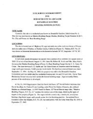
TOMALES BAY BOMBING TARGETIABBOTT'S LAGOON BOMBING TARGET<br />
MARIN COUNTY, CALIFORNIA<br />
SITE NO. J09CA7292<br />
FINDINGS OF FACT<br />
1. <strong>Tomales</strong> <strong>Bay</strong> <strong>Bombing</strong> Target was located in Marin County at a Latitude of 38' 12'N d d a<br />
Longitude of 122'56'W near or one Hog Island. A water-borne target was constructed in<br />
<strong>Tomales</strong> <strong>Bay</strong> under Contract Noy 4165. On 16 October 1956, <strong>Tomales</strong> Point Aerial Mine Laying<br />
<strong>Range</strong> was establtshed west of <strong>Tomales</strong> Point. It covered an area approximately 28,000 feet long<br />
and varied from 7,000 to 12,000 feet in width and was located more than 100 yards from the<br />
shoreline. Abbott7s <strong>Lagoon</strong> <strong>Bombing</strong> Target was also located in Marin County in the southern<br />
portion of Abbott's <strong>Lagoon</strong>. Revocable Permit No. 40 was granted by the State Lands<br />
Commission and took effect on 4 April 1941, granting the U.S. the legal right to use the southern<br />
portion of Abbott's <strong>Lagoon</strong>.<br />
2. At the <strong>Tomales</strong> <strong>Bay</strong> <strong>Bombing</strong> Target Navy Aircraft used two types of practice bombs at this<br />
range. The first type was a miniature bomb with a marker charge similar to a shotgun shell. The<br />
second was a water bomb consisting of a light metal shell filled with water. No explosives were<br />
used. A public notice by the United States Engineer Office, San Francisco, dated June 4, 1941<br />
declared <strong>Tomales</strong> <strong>Bay</strong> <strong>Bombing</strong> Target a danger zone. The danger zone had a 750-yard radius<br />
and was located 2,000 yards, 129 degrees true from the southwesterly extremity of <strong>Tomales</strong><br />
Point. At <strong>Tomales</strong> Point Aerial Mine Laying <strong>Range</strong> wooden markers three inches in diameter, 14<br />
inches long, and weighing approximately five pounds were dropped into the Pacific Ocean.<br />
Abbott's <strong>Lagoon</strong> <strong>Bombing</strong> Target was also a practice bombing target where U.S. Army and Navy<br />
pilots would drop practice bombs at a pyramid shaped target with sides that were approximately<br />
25 feet long.. This target was anchored in the middle of the southern portion of the lagoon.<br />
When the practice bombs struck the target they left white stains that washed away when it rained.<br />
3. A memorandum from Commander Fleet Air, Alarneda to Commander Naval Air bases,<br />
Twelfth Naval District lists <strong>Tomales</strong> and ~bbott's'~a~oon as targets for Permanent Retention.