

Victorian Subtidal Reef Monitoring Program - Parks Victoria
Victorian Subtidal Reef Monitoring Program - Parks Victoria
Victorian Subtidal Reef Monitoring Program - Parks Victoria

Create successful ePaper yourself
Turn your PDF publications into a flip-book with our unique Google optimized e-Paper software.
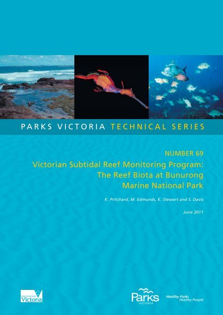
parks victoria technical series<br />
number 69<br />
victorian subtidal reef monitoring program:<br />
the reef biota at bunurong<br />
marine national park<br />
K. Pritchard, M. Edmunds, K. Stewart and S. Davis<br />
June 2011
© <strong>Parks</strong> <strong>Victoria</strong><br />
All rights reserved. This document is subject to the Copyright Act 1968, no part of this<br />
publication may be reproduced, stored in a retrieval system, or transmitted in any form, or by any<br />
means, electronic, mechanical, photocopying or otherwise without the prior permission of the<br />
publisher.<br />
First published 2011<br />
Published by <strong>Parks</strong> <strong>Victoria</strong><br />
Level 10, 535 Bourke Street, Melbourne <strong>Victoria</strong> 3000<br />
Opinions expressed by the Authors of this publication are not necessarily those of <strong>Parks</strong> <strong>Victoria</strong>,<br />
unless expressly stated. <strong>Parks</strong> <strong>Victoria</strong> and all persons involved in the preparation and distribution<br />
of this publication do not accept any responsibility for the accuracy of any of the opinions or<br />
information contained in the publication.<br />
Authors:<br />
Katharine Pritchard – Marine Ecologist, Australian Marine Ecology Pty Ltd<br />
Matt Edmunds – Principal Ecologist, Australian Marine Ecology Pty Ltd<br />
Kim Stewart – Marine Ecologist, Australian Marine Ecology Pty Ltd<br />
Shaun Davis – Marine Ecologist, Australian Marine Ecology Pty Ltd<br />
National Library of Australia<br />
Cataloguing-in-publication data<br />
Includes bibliography<br />
ISSN 1448-4935<br />
Citation<br />
Pritchard K, Edmunds M, Stewart K and Davis S (2011) <strong><strong>Victoria</strong>n</strong> <strong>Subtidal</strong> <strong>Reef</strong> <strong>Monitoring</strong><br />
<strong>Program</strong>: the reef biota at Bunurong Marine National Park. <strong>Parks</strong> <strong>Victoria</strong> Technical Series No. 69.<br />
<strong>Parks</strong> <strong>Victoria</strong>, Melbourne.<br />
The <strong><strong>Victoria</strong>n</strong> <strong>Subtidal</strong> <strong>Reef</strong> <strong>Monitoring</strong> <strong>Program</strong> was initiated and funded by the then<br />
Department of Natural Resources and Environment until 2002, when <strong>Parks</strong> <strong>Victoria</strong> assumed<br />
responsibility.<br />
Printed on environmentally friendly paper
<strong>Parks</strong> <strong>Victoria</strong> Technical Paper Series No. 69<br />
<strong><strong>Victoria</strong>n</strong> <strong>Subtidal</strong> <strong>Reef</strong> <strong>Monitoring</strong><br />
<strong>Program</strong>:<br />
The <strong>Reef</strong> Biota at Bunurong Marine<br />
National Park<br />
Katharine Pritchard<br />
Matt Edmunds<br />
Kim Stewart<br />
Shaun Davis<br />
Australian Marine Ecology Pty. Ltd.<br />
June 2011
<strong>Parks</strong> <strong>Victoria</strong> Technical Series No. 69 Bunurong <strong>Subtidal</strong> <strong>Reef</strong> <strong>Monitoring</strong><br />
EXECUTIVE SUMMARY<br />
Shallow reef habitats cover extensive areas along the <strong><strong>Victoria</strong>n</strong> coast and are dominated by<br />
seaweeds, mobile invertebrates and fishes. These reefs are known for their high biological<br />
complexity, species diversity and productivity. They also have significant economic value<br />
through commercial and recreational fishing, diving and other tourism activities. In order to<br />
effectively manage and conserve these important and biologically rich habitats, the <strong><strong>Victoria</strong>n</strong><br />
Government has established a long-term <strong>Subtidal</strong> <strong>Reef</strong> <strong>Monitoring</strong> <strong>Program</strong> (SRMP). Over<br />
time the SRMP will provide information on the status of <strong><strong>Victoria</strong>n</strong> reef flora and fauna and<br />
determine the nature and magnitude of trends in species populations and species diversity<br />
through time.<br />
The monitoring program in, and around, the Bunurong Marine National Park (MNP) began in<br />
1999. Since that time between 4 and 12 sites have been surveyed over 10 census events.<br />
The monitoring involves standardised underwater visual census methods to a depth of 8 m.<br />
This report aims to provide:<br />
• A general description of the biological communities and species populations at each<br />
monitoring site; and<br />
• An identification of any unusual biological phenomena, interesting communities, strong<br />
temporal trends and/or the presence of any introduced species.<br />
The surveys were done along a 200 m transect line. Each transect was surveyed for:<br />
1. Abundance and size structure of large fishes;<br />
2. Abundance of cryptic fishes and benthic invertebrates;<br />
3. Percentage cover of macroalgae; and<br />
4. Density of a dominant kelp species (Macrocystis pyrifera).<br />
To date over 300 different species have been observed during the monitoring program in and<br />
around Bunurong Marine National Park. The algal community structure at Bunurong is one of<br />
the most diverse of <strong><strong>Victoria</strong>n</strong> coast. This is partly due to the predominance of large brown<br />
algal species including Seirococcus axillaris, Cystophora species, Sargassum species and<br />
Acrocarpia paniculata. The invertebrate community was largely composed of the blacklip<br />
abalone Haliotis rubra, the gastropod Turbo undulatus and a variety of sea stars, particularly<br />
Meridiastra gunnii and Tosia australis. The common fish species included blue-throated<br />
wrasse, purple wrasse, senator wrasse, silver sweep and scalyfin.<br />
I
<strong>Parks</strong> <strong>Victoria</strong> Technical Series No. 69 Bunurong <strong>Subtidal</strong> <strong>Reef</strong> <strong>Monitoring</strong><br />
Key observations from the monitoring program were:<br />
• Seaweed species richness and diversity remained relatively high and was consistently<br />
higher within the MNP.<br />
• Fish species richness and diversity was lower in the MNP during 2006 and 2010.<br />
• The seagrass Amphibolis antarctica was at maximum abundances in 2010.<br />
• There were no changes in dominant seaweeds inside and outside the MNP from 2006 to<br />
2010.<br />
• The abundances of the dominant invertebrates, particularly blacklip abalone Haliotis<br />
rubra, warrener Turbo undulatus, dogwhelk Dicathais orbita and sea urchin Heliocidaris<br />
erythrogramma peaked during the baseline period (2001/2002) then decreased to lowest<br />
abundances in 2006 and 2010. These changes were both inside and outside the MNP.<br />
• The close-interval baseline monitoring identified intra and inter-annual fluctuations in<br />
density of reef fishes, particularly blue throated wrasse Notolabrus tetricus, purple<br />
wrasse N. fucicola and senator wrasse Pictilabrus laticlavius.<br />
• The densities of blue throated wrasse N. tetricus were similar inside and outside the<br />
MNP, with densities after MNP declaration varying within a similar range.<br />
• The densities of purple wrasse N. fucicola were higher inside the MNP before<br />
declaration, but have since dropped to densities similar to the reference areas.<br />
• The density of senator wrasse P. laticlavius was generally low inside the MNP following<br />
declaration.<br />
• Exceptionally low densities were observed for zebrafish Girella zebra in 2005, 2006 and<br />
2010 and for magpie morwong Cheilodactylus nigripes in 2010, inside and outside the<br />
MNP.<br />
• Seastars were very low in abundance in 2010, inside and outside the MNP.<br />
• There were very low abundances of string kelp Macrocystis pyrifera from 2003 onwards,<br />
which is a cold-water species.<br />
• There was a substantial decline in sizes of blacklip abalone Haliotis rubra. Abundances<br />
have been at lowest recorded levels since 2005, both inside and outside the MNP.<br />
There was a distinct decline in fish abundances over 200 mm length, with densities in 2010<br />
being at or below previously recorded levels. This decline was more marked inside the<br />
Bunurong MNP.<br />
II
<strong>Parks</strong> <strong>Victoria</strong> Technical Series No. 69 Bunurong <strong>Subtidal</strong> <strong>Reef</strong> <strong>Monitoring</strong><br />
CONTENTS<br />
Executive summary .............................................................................................................. I<br />
Contents...............................................................................................................................III<br />
1 Introduction.................................................................................................................. 1<br />
1.1 SUBTIDAL REEF ECOSYSTEMS OF VICTORIA ................................................................. 1<br />
1.2 SUBTIDAL REEF MONITORING PROGRAM ....................................................................... 6<br />
1.2.1 Objectives .......................................................................................................... 6<br />
1.2.2 <strong>Monitoring</strong> Protocols and Locations ................................................................... 8<br />
1.3 SUBTIDAL REEF MONITORING AT BUNURONG ............................................................... 8<br />
2 Methods .......................................................................................................................10<br />
2.1 SITE SELECTION AND SURVEY TIMES ...........................................................................10<br />
2.2 CENSUS METHOD ..............................................................................................................13<br />
2.2.1 Underwater Visual Census Approach ............................................................... 13<br />
2.2.2 Survey Design .................................................................................................. 13<br />
2.2.3 Method 1 – Mobile Fishes and Cephalopods .................................................... 14<br />
2.2.4 Method 2 – Invertebrates and Cryptic Fishes ................................................... 15<br />
2.2.5 Method 3 – Macroalgae.................................................................................... 15<br />
2.2.6 Method 4 – Macrocystis ................................................................................... 15<br />
2.2.7 Method 5 – Fish Stereo Video .......................................................................... 16<br />
2.3 DATA ANALYSIS - CONDITION INDICATORS ..................................................................22<br />
2.3.1 Approach ......................................................................................................... 22<br />
2.3.2 Biodiversity....................................................................................................... 23<br />
2.3.3 Ecosystem Functional Components ................................................................. 24<br />
2.3.4 Introduced species ........................................................................................... 26<br />
2.3.5 Climate change ................................................................................................ 26<br />
2.3.6 Fishing ............................................................................................................. 28<br />
3 Bunurong Marine National Park ................................................................................30<br />
3.1 BIODIVERSITY ....................................................................................................................30<br />
3.1.1 Community Structure ....................................................................................... 30<br />
3.1.2 Species richness and Diversity ......................................................................... 41<br />
3.1.3 Abundances of Selected Species ..................................................................... 45<br />
3.2 ECOSYSTEM COMPONENTS ............................................................................................55<br />
3.3 INTRODUCED SPECIES .....................................................................................................55<br />
3.4 CLIMATE CHANGE .............................................................................................................62<br />
3.5 FISHING ...............................................................................................................................70<br />
4 References ..................................................................................................................79<br />
5 Acknowledgements ....................................................................................................82<br />
III
<strong>Parks</strong> <strong>Victoria</strong> Technical Series No. 69 Bunurong <strong>Subtidal</strong> <strong>Reef</strong> <strong>Monitoring</strong><br />
INDEX OF FIGURES AND TABLES<br />
Figures<br />
Figure 1.1. Examples of species of macroalgae found on <strong><strong>Victoria</strong>n</strong> subtidal reefs. .... 3<br />
Figure 1.2. Examples of species of invertebrates and cryptic fish found on<br />
<strong><strong>Victoria</strong>n</strong> subtidal reefs. ....................................................................................... 4<br />
Figure 1.3. Examples of fish species found on <strong><strong>Victoria</strong>n</strong> subtidal reef. ....................... 5<br />
Figure 1.4 An example plot depicting change in an environmental, population<br />
or community variable over time (days, months or years) and potential<br />
patterns from isoldated observations. .................................................................. 7<br />
Figure 1.5. The Eagles Nest stack rising above intertidal platforms, eastern end<br />
of Shack Bay. ...................................................................................................... 9<br />
Figure 2.1. Location of survey sites associated with the Bunurong Marine<br />
National Park and Eastern and Western Conservation Zones of the<br />
Bunurong Marine and Coastal Park. ................................................................. 12<br />
Figure 2.2. Biologist-diver with transect line. ............................................................ 14<br />
Figure 2.3. The cover of macrophytes is measured by the number of<br />
points intersecting each species on the quadrat grid. ........................................ 16<br />
Figure 3.1. Three-dimensional MDS plot of algal assemblage structure at<br />
Bunurong for each site: (a) MNP sites (b) reference sites. Kruskall stress<br />
value = 15.78. .................................................................................................... 31<br />
Figure 3.1 (continued). Three-dimensional MDS plot of algal assemblage<br />
structure at Bunurong for each site: (a) MNP sites (b) reference sites.<br />
Kruskall stress value = 15.78............................................................................. 32<br />
Figure 3.2. Control charts of algal assemblage structure inside and outside<br />
Bunurong Marine National Parl. ........................................................................ 33<br />
Figure 3.3. Three-dimensional MDS plot of invertebrate assemblage<br />
structure at Bunurong for each site: (a) MNP sites; and (b) reference sites.<br />
Kruskal Stress value= 16.86. ............................................................................. 35<br />
Figure 3.3 (continued). Three-dimensional MDS plot of invertebrate<br />
assemblage structure at Bunurong for each site: (a) MNP sites; and<br />
(b) reference sites. Kruskal Stress value= 16.86. .............................................. 36<br />
Figure 3.4. Control chart of invertebrate assemblage structure inside and<br />
outside Bunurong Marine National Park. ........................................................... 37<br />
Figure 3.5. Three-dimensional MDS plot of fish assemblage structure at<br />
Bunurong for each site: (a) MNP sites; and (b) reference sites. Kruskal<br />
Stress value = 19.93. ......................................................................................... 38<br />
Figure 3.5 (continued). Three-dimensional MDS plot of fish assemblage<br />
structure at Bunurong for each site: (a) MNP sites; and (b) reference sites.<br />
Kruskal Stress value = 19.93. ............................................................................ 39<br />
Figure 3.6. Control chart of fish assemblage structure inside and outside<br />
Bunurong Marine National Park. ....................................................................... 40<br />
Figure 3.7. Algal species diversity indicators (± Standard Error) inside and<br />
outside Bunurong Marine National Park. ........................................................... 42<br />
Figure 3.8. Invertebrate species diversity indicators (± Standard Error) inside<br />
and outside Bunurong Marine National Park. .................................................... 43<br />
Figure 3.9. Fish species diversity indicators (± Standard Error) inside and<br />
IV
<strong>Parks</strong> <strong>Victoria</strong> Technical Series No. 69 Bunurong <strong>Subtidal</strong> <strong>Reef</strong> <strong>Monitoring</strong><br />
outside Bunurong Marine National Park. ........................................................... 44<br />
Figure 3.10. Percent cover (± Standard Error) of predominant seagrass and<br />
algal species inside and outside the Bunurong Marine National Park. .............. 47<br />
Figure 3.10 (continued). Percent cover (± Standard Error) of predominant<br />
seagrass and algal species inside and outside the Bunurong Marine<br />
National Park. .................................................................................................... 48<br />
Figure 3.10 (continued). Percent cover (± Standard Error) of predominant<br />
seagrass and algal species inside and outside the Bunurong Marine<br />
National Park. .................................................................................................... 49<br />
Figure 3.11. Mean abundance (± Standard Error) of predominant<br />
invertebrate species inside and outside the Bunurong Marine National Park. ... 50<br />
Figure 3.11. (continued). Mean abundance (± Standard Error) of<br />
predominant invertebrate species inside and outside the Bunurong<br />
Marine National Park. ........................................................................................ 51<br />
Figure 3.12. Mean abundance (± Standard Error) of predominant fish species<br />
inside and outside the Bunurong Marine National Park. .................................... 52<br />
Figure 3.12 (continued). Mean abundance (± Standard Error) of predominant<br />
fish species inside and outside the Bunurong Marine National Park. ................ 53<br />
Figure 3.12 (continued). Mean abundance (± Standard Error) of predominant<br />
fish species inside and outside the Bunurong Marine National Park. ................ 54<br />
Figure 3.13. Seaweed functional groups (± Standard Error) inside and outside<br />
the Bunurong Marine National Park. ................................................................. 56<br />
Figure 3.13 (continued). Seaweed functional groups (± Standard Error) inside<br />
and outside the Bunurong Marine National Park. .............................................. 57<br />
Figure 3.14. Mean abundance (± Standard Error) of invertebrate functional<br />
groups inside and outside the Bunurong Marine National Park. ........................ 58<br />
Figure 3.14 (continued). Mean abundance (± Standard Error) of<br />
invertebrate functional groups inside and outside the Bunurong Marine<br />
National Park. .................................................................................................... 59<br />
Figure 3.15. Mean abundance (± Standard Error) of fish functional groups inside<br />
and outside the Bunurong Marine National Park. .............................................. 60<br />
Figure 3.15 (continued). Mean abundance (± Standard Error) of fish functional<br />
groups inside and outside the Bunurong Marine National Park. ........................ 61<br />
Figure 3.16. Mean cover (± Standard Error) of sediment inside and outside<br />
the Bunurong Marine National Park .................................................................. 61<br />
Figure 3.17. Abundance (± Standard Error) of Maugean algae species inside<br />
and outside the Bunurong Marine National Park. .............................................. 64<br />
Figure 3.18. Abundance (± Standard Error) of Maugean fish species inside<br />
and outside the Bunurong Marine National Park. .............................................. 65<br />
Figure 3.19. Abundance (± Standard Error) of Western algae species inside<br />
and outside the Bunurong Marine National Park. .............................................. 66<br />
Figure 3.20. Abundance (± Standard Error) of Western invertebrate species<br />
inside and outside the Bunurong Marine National Park. .................................... 67<br />
Figure 3.21. Abundance (± Standard Error) of Eastern fish species inside<br />
and outside the Bunurong Marine National Park. .............................................. 68<br />
Figure 3.22. Abundance (± Standard Error) of string kelp Macrocystis pyrifera<br />
inside and outside the Bunurong Marine National Park. .................................... 69<br />
Figure 3.23. Abundance (± Standard Error) of different size classes of the<br />
Blacklip Abalone Haliotis rubra at Bunurong Marine National Park and<br />
reference sites. .................................................................................................. 71<br />
V
<strong>Parks</strong> <strong>Victoria</strong> Technical Series No. 69 Bunurong <strong>Subtidal</strong> <strong>Reef</strong> <strong>Monitoring</strong><br />
Figure 3.24. Density (± Standard Error) of southern rock lobster Jasus<br />
edwardsii inside and outside the Bunurong Marine National Park. .................... 72<br />
Figure 3.25. Fish size (± Standard Error) spectra inside and outside the<br />
Bunurong Marine National Park. ....................................................................... 73<br />
Figure 3.26. Biomass (± Standard Error) of fished species inside and outside<br />
the Bunurong Marine National Park. ................................................................. 74<br />
Figure 3.27. Density (± Standard Error) of larger fished fish species inside<br />
and outside the Bunurong Marine National Park. .............................................. 75<br />
Figure 3.28. Abundance (± Standard Error) of different size classes of the Blue<br />
throat Wrasse Notolabrus tetricus at Bunurong Marine National Park and<br />
reference sites. .................................................................................................. 76<br />
Figure 3.29. Abundance (± Standard Error) of different size classes of the<br />
Senator Wrasse Pictilabrus laticlavius at Bunurong Marine National Park<br />
and reference sites. ........................................................................................... 77<br />
Figure 3.30. Abundance (± Standard Error) of different size classes of the<br />
purple wrasse Notolabrus fucicola at Bunurong Marine National Park and<br />
reference sites. .................................................................................................. 78<br />
Figure 3.31. Abundance (± Standard Error) of different size classes of the<br />
magpie perch Cheilodactylus nigripes at Bunurong Marine National Park<br />
and reference sites. ........................................................................................... 78<br />
Tables<br />
Table 2.1. <strong>Subtidal</strong> reef monitoring sites within zones of the Bunurong Marine and<br />
Coastal Park and Bunurong Marine National Park. ……………………………11<br />
Table 2.2. Survey times for monitoring at Bunurong. ................................................ 11<br />
Table 2.3. Mobile fish (Method 1) species censused at Bunurong. .......................... 18<br />
Table 2.4. Invertebrate and cryptic fish (Method 2) species censused at Bunurong. 19<br />
Table 2.5. Macroalgae (Method 3) species censused at Bunurong. ......................... 20<br />
VI
<strong>Parks</strong> <strong>Victoria</strong> Technical Series No. 69 Bunurong <strong>Subtidal</strong> <strong>Reef</strong> <strong>Monitoring</strong><br />
1 INTRODUCTION<br />
1.1 <strong>Subtidal</strong> <strong>Reef</strong> Ecosystems of <strong>Victoria</strong><br />
Shallow reef habitats cover extensive areas along the <strong><strong>Victoria</strong>n</strong> coast. Prominent biological<br />
components of <strong><strong>Victoria</strong>n</strong> shallow reefs are kelp and other seaweeds (Figure 1.1). Large<br />
species, such as the common kelp Ecklonia radiata and crayweed Phyllospora comosa, are<br />
usually present along the open coast in dense stands. The production rates of dense<br />
seaweed beds are equivalent to the most productive habitats in the world, including<br />
grasslands and seagrass beds, with approximately 2 kg of plant material produced per<br />
square metre per year. These stands typically have 10-30 kg or more of plant material per<br />
square metre. The biomass of seaweeds is substantially greater where giant species such as<br />
string kelp Macrocystis pynifera and bull kelp Durvillaea potatorum occur.<br />
Seaweeds provide important habitat structure for other organisms on the reef. This habitat<br />
structure varies considerably, depending on the type of seaweed species present. Tall<br />
vertical structures in the water column are formed by Macrocystis pynifera, which sometimes<br />
form a dense layer of fronds floating on the water surface. Other species with large, stalk-like<br />
stipes, such as Ecklonia radiata, Phyllospora comosa and Durvillaea potatorum, form a<br />
canopy 0.5-2 m above the rocky substratum. Lower layers of structure are formed by: foliose<br />
macroalgae typically 10-30 cm high, such as the green Caulerpa and red Plocamium<br />
species; turfs (to 10 cm high) of red algae species, such as Pterocladia capillacea; and hard<br />
encrusting layers of pink coralline algae. The nature and composition of these structural<br />
layers varies considerably within and between reefs, depending on the biogeographical<br />
region, depth, exposure to swell and waves, currents, temperature range, water clarity and<br />
presence of sand.<br />
Grazing and predatory mobile invertebrates are prominent animal inhabitants of the reef<br />
(Figure 1.2). Common grazers include blacklip and greenlip abalone Haliotis rubra and H.<br />
laevigata, the warrener Turbo undulatus and sea urchins Heliocidaris erythrogramma,<br />
Holopneustes species and Amblypneustes species. These species can influence the growth<br />
and survival of habitat forming species. For example, sponges and foliose seaweeds are<br />
often prevented from growing on encrusting coralline algae surfaces through the grazing<br />
actions of abalone and sea urchins. Predatory invertebrates include dogwhelks Dicathais<br />
orbita, southern rock lobster Jasus edwardsii, octopus Octopus maorum and a wide variety<br />
of seastar species. Other large reef invertebrates include mobile filter feeding animals such<br />
as feather stars Comanthus trichoptera and sessile (attached) species such as sponges,<br />
corals, bryozoans, hydroids and ascidians.<br />
1
<strong>Parks</strong> <strong>Victoria</strong> Technical Series No. 69 Bunurong <strong>Subtidal</strong> <strong>Reef</strong> <strong>Monitoring</strong><br />
Fishes are also a dominant component of reef ecosystems, in terms of both biomass and<br />
ecological function (Figure 1.3). <strong>Reef</strong> fish assemblages include roaming predators such as<br />
blue-throated wrasse Notolabrus tetricus, herbivores such as herring cale Odax cyanomelas,<br />
planktivores such as sea sweep Scorpis aequipinnis and picker-feeders such as the six-<br />
spined leatherjacket Meuschenia freycineti. The type and abundance of each fish species<br />
varies considerably, depending on exposure to swell and waves, depth, currents, reef<br />
structure, seaweed habitat structure and many other ecological variables. Many fish species<br />
play a substantial ecological role in the functioning and shaping of the ecosystem. For<br />
example, the feeding activities of fishes such as scalyfin Parma victoriae and magpie<br />
morwong Cheilodactylus nigripes promote the formation of open algal turf areas, free of<br />
larger canopy-forming seaweeds.<br />
Although shallow reef ecosystems in <strong>Victoria</strong> are dominated, in terms of biomass and<br />
production, by seaweeds, mobile invertebrates and fishes, there are many other important<br />
biological components to the reef ecosystem. These include small species of crustaceans<br />
and molluscs from 0.1 to 10 mm in size (mesoinvertebrates), occupying various niches as<br />
grazers, predators and forages. At the microscopic level, films of microalgae and bacteria on<br />
the reef surface are also important.<br />
<strong>Victoria</strong>’s shallow reefs are a very important component of the marine environment because<br />
of their high biological complexity, species diversity and productivity. <strong>Subtidal</strong> reef habitats<br />
also have important social and cultural values, which incorporate aesthetic, recreational,<br />
commercial and historical aspects. Shallow subtidal reefs also have significant economic<br />
value, through commercial fishing of reef species such as wrasses, morwong, rock lobster,<br />
abalone and sea urchins, as well as recreational fishing, diving and other tourism activities.<br />
2
<strong>Parks</strong> <strong>Victoria</strong> Technical Series No. 69 Bunurong <strong>Subtidal</strong> <strong>Reef</strong> <strong>Monitoring</strong><br />
Green alga Caulerpa flexilis Encrusting coralline algae at the base of<br />
3<br />
crayweed Phyllospora comosa holdfast<br />
Red coralline alga Haliptilon roseum Thallose red alga Ballia callitricha<br />
Crayweed Phyllospora comosa canopy Common kelp Ecklonia radiata canopy<br />
Figure 1.1. Examples of species of macroalgae found on <strong><strong>Victoria</strong>n</strong> subtidal reefs.
<strong>Parks</strong> <strong>Victoria</strong> Technical Series No. 69 Bunurong <strong>Subtidal</strong> <strong>Reef</strong> <strong>Monitoring</strong><br />
Southern rock-lobster Jasus edwardsii Red bait crab Plagusia chabrus<br />
Blacklip abalone Haliotis rubra Feather star Comanthus trichoptera<br />
Nectria ocellata Common sea urchin<br />
Heliocidaris erythrogramma<br />
Fromia polypora Red velvet fish Gnathanocanthus goetzeei<br />
Figure 1.2. Examples of species of invertebrates and cryptic fish found on <strong><strong>Victoria</strong>n</strong> subtidal reefs.<br />
4
<strong>Parks</strong> <strong>Victoria</strong> Technical Series No. 69 Bunurong <strong>Subtidal</strong> <strong>Reef</strong> <strong>Monitoring</strong><br />
Sea sweep Scorpis aequipinnis and Scalyfin Parma victoriae<br />
butterfly perch Caesioperca lepidoptera<br />
Blue-throated wrasse Notolabrus tetricus Six-spined leatherjacket Meuschenia freycineti<br />
(male) (male)<br />
Magpie morwong Cheilodactylus nigripes Old-wife Enoplosus armatus<br />
Figure 1.3. Examples of fish species found on <strong><strong>Victoria</strong>n</strong> subtidal reef.<br />
5
<strong>Parks</strong> <strong>Victoria</strong> Technical Series No. 69 Bunurong <strong>Subtidal</strong> <strong>Reef</strong> <strong>Monitoring</strong><br />
1.2 <strong>Subtidal</strong> <strong>Reef</strong> <strong>Monitoring</strong> <strong>Program</strong><br />
1.2.1 Objectives<br />
An important aspect of the management and conservation of <strong><strong>Victoria</strong>n</strong> marine natural<br />
resources and assets is assessing the condition of the ecosystem and how this changes over<br />
time. Combined with an understanding of ecosystem processes, this information can be used<br />
to manage any threats or pressures on the environment to ensure ecosystem sustainability.<br />
Consequently, the <strong><strong>Victoria</strong>n</strong> Government has established a long-term <strong>Subtidal</strong> <strong>Reef</strong><br />
<strong>Monitoring</strong> <strong>Program</strong> (SRMP). The primary objective of the SRMP is to provide information on<br />
the status of <strong><strong>Victoria</strong>n</strong> reef flora and fauna (focussing on macroalgae, macroinvertebrates<br />
and fish). This includes monitoring the nature and magnitude of trends in species<br />
abundances, species diversity and community structure. This is achieved through regular<br />
surveys at locations throughout <strong>Victoria</strong>, encompassing both representative and unique<br />
habitats and communities.<br />
Information from the SRMP allows managers to better understand and interpret long-term<br />
changes in the population and community dynamics of <strong>Victoria</strong>’s reef flora and fauna. As a<br />
longer time series of data are collected, the SRMP will allow managers to:<br />
• Compare changes in the status of species populations and biological communities<br />
between highly protected marine national parks and marine sanctuaries and other<br />
<strong><strong>Victoria</strong>n</strong> reef areas (e.g. Edgar and Barrett 1997, 1999);<br />
• Determine associations between species and between species and environmental<br />
parameters (e.g. depth, exposure, reef topography) and assess how these associations<br />
vary through space and time (e.g. Edgar et al. 1997; Dayton et al. 1998; Edmunds, Roob<br />
and Ferns 2000);<br />
• Provide benchmarks for assessing the effectiveness of management actions, in<br />
accordance with international best practice for quality environmental management<br />
systems (Holling 1978; Meredith 1997); and<br />
• Determine the responses of species and communities to unforeseen and unpredictable<br />
events such as marine pest invasions, mass mortality events, oil spills, severe storm<br />
events and climate change (e.g. Ebeling et al. 1985; Edgar 1998; Roob et al. 2000;<br />
Sweatman et al. 2003).<br />
A monitoring survey gives an estimate of population abundance and community structure at<br />
a small window in time. Patterns seen in data from periodic surveys are unlikely to exactly<br />
match changes in the real populations over time or definitively predict the size and nature of<br />
6
<strong>Parks</strong> <strong>Victoria</strong> Technical Series No. 69 Bunurong <strong>Subtidal</strong> <strong>Reef</strong> <strong>Monitoring</strong><br />
future variation. Plots of changes over time are unlikely to match the changes in real<br />
populations because changes over shorter time periods and actual minima and maxima may<br />
not be adequately sampled (e.g. Figure 1.4). Furthermore, because the nature and<br />
magnitude of environmental variation is different over different time scales, variation over<br />
long periods may not be adequately predicted from shorter-term data. Sources of<br />
environmental variation can operate at the scale of months (e.g. seasonal variation,<br />
harvesting), years (e.g. El Niño), decades (e.g. pollution, extreme storm events) or even<br />
centuries (e.g. tsunamis, global warming). Other studies indicate this monitoring program will<br />
begin to adequately reflect average trends and patterns as the surveys continue over longer<br />
periods (multiple years to decades). Results of this monitoring need to be interpreted within<br />
the context of the monitoring frequency and duration.<br />
Parameter<br />
Time<br />
Figure 1.4 An example plot depicting change in an environmental, population or community variable<br />
over time (days, months or years) and potential patterns from isolated observations.<br />
7
<strong>Parks</strong> <strong>Victoria</strong> Technical Series No. 69 Bunurong <strong>Subtidal</strong> <strong>Reef</strong> <strong>Monitoring</strong><br />
1.2.2 <strong>Monitoring</strong> Protocols and Locations<br />
The SRMP uses standardised underwater visual census methods based on an approach<br />
developed and applied in Tasmania by Edgar and Barrett (1997). Details of standard<br />
operational procedures and quality control protocols for <strong>Victoria</strong>’s SRMP are described in<br />
Edmunds and Hart (2003).<br />
The SRMP was initiated in May 1998 with 15 sites established on subtidal reef habitats in the<br />
vicinity of Port Phillip Heads Marine National Park. In 1999 the SRMP was expanded to reefs<br />
in the vicinity of the Bunurong Marine National Park, Phillip Island and Wilsons Promontory<br />
Marine National Park.<br />
In 2003 and 2004, the <strong>Subtidal</strong> <strong>Reef</strong> <strong>Monitoring</strong> <strong>Program</strong> was expanded to include Marine<br />
National <strong>Parks</strong> and Marine Sanctuaries throughout <strong>Victoria</strong>.<br />
1.3 <strong>Subtidal</strong> <strong>Reef</strong> <strong>Monitoring</strong> at Bunurong<br />
This report describes the subtidal reef monitoring program in the Bunurong region and<br />
results from eleven surveys, incorporating Bunurong Marine National Park and the adjacent<br />
conservation areas of the Bunurong Marine and Coastal Park. The objectives of this report<br />
were to:<br />
1. Provide an overview of the methods used for SRMP;<br />
2. Provide general descriptions of the biological communities and species populations at<br />
each monitoring site up to March 2010;<br />
3. Describe changes and trends that have occurred over the monitoring period;<br />
4. Identify any unusual biological phenomena such as interesting of unique communities or<br />
species; and<br />
5. Identify any introduced species at the monitoring locations.<br />
8
<strong>Parks</strong> <strong>Victoria</strong> Technical Series No. 69 Bunurong <strong>Subtidal</strong> <strong>Reef</strong> <strong>Monitoring</strong><br />
Figure 1.5. The Eagles Nest stack rising above intertidal platforms, eastern end of Shack Bay.<br />
9
<strong>Parks</strong> <strong>Victoria</strong> Technical Series No. 69 Bunurong <strong>Subtidal</strong> <strong>Reef</strong> <strong>Monitoring</strong><br />
2 METHODS<br />
2.1 Site Selection and Survey Times<br />
Eight long-term monitoring sites were established along the Bunurong coast in June<br />
1999 (Sites 1 to 8, Table 2.1, Figure 2.1) The sites were located in 4 - 6 m depth in<br />
three zones: Western Zone (2 sites); the Central Zone (4 sites); and the Eastern<br />
Zone (2 sites). Three deep-water reconnaissance sites were surveyed in 16 m depth,<br />
with one site in each of the Western, Central and Eastern zones (Sites 9 to 11; Table<br />
2.1, Figure 2.1).<br />
A further four sites were established at 4-6 m depth during the second survey in<br />
January/March 2000 (Sites 12 to 15; Figure 2.1). The second Bunurong survey was<br />
over three periods because of persistent poor visibility conditions throughout the<br />
summer period (Table 2.2).<br />
The third survey commenced in winter 2000. However, persistently bad weather and<br />
heavy rainfalls affected diving conditions and underwater visibility for much of winter<br />
and spring. Only four sites could be surveyed: Sites 6, 12, 7 and 8.<br />
An analysis of wind and rainfall data indicated the best periods for monitoring at<br />
Bunurong were in January/February and in June.<br />
All sites were surveyed in summer 2000/2001 (Survey 4), winter 2001 (Survey 5),<br />
summer 2001/2002 (Survey 6), winter 2002 (Survey 7), spring 2003 (Survey 8),<br />
summer 2004/2005 (Survey 9), autumn 2006 (Survey 10) and summer 2009/2010<br />
(Survey 11; Table 2.2).<br />
10
<strong>Parks</strong> <strong>Victoria</strong> Technical Series No. 69 Bunurong <strong>Subtidal</strong> <strong>Reef</strong> <strong>Monitoring</strong><br />
Table 2.1. <strong>Subtidal</strong> reef monitoring sites within zones of the Bunurong Marine and Coastal<br />
Park and Bunurong Marine National Park.<br />
Region No. Description Status Depth<br />
Western Zone 3001 Cape Patterson Reference 4<br />
Marine National<br />
Park<br />
3002 C. Pat. Boat Ramp Reference 6<br />
3015 Boat Ramp East Reference 7<br />
3009 Patterson West Deep Reference 15<br />
3014 The Oaks Beach MPA 7<br />
3003 Oaks East MPA 6<br />
3004 Twin <strong>Reef</strong>s MPA 6<br />
3005 Shack Bay West MPA 5<br />
3012 Shack Bay beach MPA 7<br />
3006 Shack Bay Middle MPA 6<br />
3010 Twin <strong>Reef</strong>s Deep MPA 16<br />
Eastern Zone 3007 The Caves Reference 6<br />
3013 Petrel Rock West Reference 6<br />
3008 Petrel Rock East Reference 5<br />
3011 The Caves Deep Reference 16<br />
Table 2.2. Survey times for monitoring at Bunurong.<br />
Survey Number Season Survey Period<br />
1 Winter 1999 8-26 June 1999<br />
2 Summer 1999/2000 9-14 Jan, 17 Feb, 27-28 Mar 2000<br />
3 Winter 2000 30-31 August 2000<br />
4 Summer 2000/2001 18 Dec 2000 to 3 Jan 2001<br />
5 Winter 2001 11-12 May, 4-6 June 2001<br />
6 Summer 2001/2002 14-16 February, 5-7 March 2002<br />
7 Winter 2002 1-3 August, 10-11 August 2002<br />
8 Autumn 2003 28-29 April, 13-15 May 2003<br />
9 Summer 2004/2005 29-30 Nov 2004, 31 Jan to 21 Feb 2005<br />
10 Autumn 2006 2-23 March 2006<br />
11 Summer 2009/2010 21 Dec 2009, 17-18 Feb and 12 Mar 2010<br />
11
<strong>Parks</strong> <strong>Victoria</strong> Technical Series No. 69 Bunurong <strong>Subtidal</strong> <strong>Reef</strong> <strong>Monitoring</strong><br />
Figure 2.1. Location of survey sites associated with the Bunurong Marine National Park and Eastern and Western Conservation Zones of the Bunurong<br />
Marine and Coastal Park.<br />
12
<strong>Parks</strong> <strong>Victoria</strong> Technical Series No. 69 Bunurong <strong>Subtidal</strong> <strong>Reef</strong> <strong>Monitoring</strong><br />
2.2 Census Method<br />
2.2.1 Underwater Visual Census Approach<br />
The visual census methods of Edgar and Barrett (Edgar and Barrett 1997, 1999;<br />
Edgar et al. 1997) are used for this monitoring program. These are non-destructive<br />
and provide quantitative data on a large number of species and the structure of the<br />
reef communities. The Edgar-Barrett method is also used in Tasmania, New South<br />
Wales, South Australia and Western Australia. The adoption of this method in<br />
<strong>Victoria</strong> provides a systematic and comparable approach to monitoring reefs in<br />
southern Australia. The survey method includes practical and safety considerations<br />
for scientific divers and are designed to maximise the data returns per diver time<br />
underwater. The surveys in <strong>Victoria</strong> are in accordance with a standard operational<br />
procedure to ensure long-term integrity and quality of the data (Edmunds and Hart<br />
2003).<br />
At most monitoring locations in <strong>Victoria</strong>, surveying along the 5 m depth contour is<br />
considered optimal because diving times are not limited by decompression schedules<br />
and these reefs are of interest to natural resource managers. However the actual that<br />
can be surveyed varies with reef extent, geomorphology and exposure. <strong>Monitoring</strong><br />
sites along the central coast of <strong>Victoria</strong> are between 4 and 7 m deep.<br />
2.2.2 Survey Design<br />
Each site was located using differential GPS and marked with a buoy or the boat<br />
anchor. A 100 m numbered and weighted transect line is run along the appropriate<br />
depth contour either side of the central marker (Figure 2.2). The resulting 200 m of<br />
line was divided into four contiguous 50 m sections (T1 to T4). The orientation of<br />
transect was the same for each survey, with T1 generally toward the north or east<br />
(i.e. anticlockwise along the open coast).<br />
For each transect line, four different census methods were used to obtain adequate<br />
descriptive information on reef communities at different spatial scales. These<br />
involved the census of: (1) the abundance and size structure of large fishes; (2) the<br />
abundance of cryptic fishes and benthic invertebrates; (3) the percent cover of<br />
macroalgae and sessile invertebrates; and (4) the density of string-kelp Macrocystis<br />
pynifera plants (where present). In 2010, a new diver-operated stereo video method<br />
(Method 5) was implemented as a trial to assess its efficacy for monitoring fish<br />
diversity, abundances and sizes. The stereo video system enables precise<br />
measurements of fish lengths and sample volume or area for density estimates<br />
13
<strong>Parks</strong> <strong>Victoria</strong> Technical Series No. 69 Bunurong <strong>Subtidal</strong> <strong>Reef</strong> <strong>Monitoring</strong><br />
(Harvey et al. 2001a, 2001b, 2002a, 2002b; Harmen et al.2003;Westera et al. 2003;<br />
Watson et al. 2010).<br />
The depth, horizontal visibility, sea state and cloud cover are recorded for each site.<br />
Horizontal visibility was gauged by the distance along the transect line to detect a<br />
100 mm long fish. All field observations are recorded on underwater paper.<br />
Figure 2.2. Biologist-diver with transect line.<br />
2.2.3 Method 1 – Mobile Fishes and Cephalopods<br />
The densities of mobile large fishes and cephalopods are estimated by a diver<br />
swimming up one side of each of a 50 m section of the transect, and then back along<br />
the other side. The predominant fish species observed are listed in Table 2.3. The<br />
diver records the number and estimated size-class of fish, within 5 m of each side of<br />
the line (50 x 10 m area). The size-classes for fish were 25, 50, 75, 100, 125, 150,<br />
200, 250, 300, 350, 375, 400, 500, 625, 750, 875 and 1000+ mm. Each diver had<br />
size-marks on an underwater slate to enable calibration of their size estimates. Four<br />
10 x 50 m sections of the 200 m transect are censused for mobile fish at each site.<br />
The data for easily sexed species are recorded separately for males and<br />
female/juveniles. Such species include the blue-throated wrasse Notolabrus tetricus,<br />
herring cale Odax cyanomelas, barber perch Caesioperca rasor, rosy wrasse<br />
Pseudolabrus rubicundus and some leatherjackets.<br />
14
<strong>Parks</strong> <strong>Victoria</strong> Technical Series No. 69 Bunurong <strong>Subtidal</strong> <strong>Reef</strong> <strong>Monitoring</strong><br />
2.2.4 Method 2 – Invertebrates and Cryptic Fishes<br />
Cryptic fishes and mobile megafaunal invertebrates (e.g. large molluscs,<br />
echinoderms, crustaceans) are counted along the transect lines used for the fish<br />
survey. A diver counts animals within 1 m of one side of the line (a total of four 1 x 50<br />
m sections of the 200 m transect). A known arm span of the diver is used to<br />
standardise the 1 m distance. The predominantly observed species are listed in<br />
Table 2.4. The maximum length of abalone and the carapace length and sex of rock<br />
lobsters were measured in situ using vernier callipers whenever possible. Selected<br />
specimens are photographed or collected for identification and preservation in a<br />
reference collection.<br />
2.2.5 Method 3 – Macroalgae<br />
The area covered by macroalgal and sessile invertebrate species is quantified by<br />
placing a 0.25 m 2<br />
quadrat at 10 m intervals along the transect line and determining<br />
the percent cover of the all plant species (Figure 2.3). The predominantly observed<br />
seaweed species are listed in Table 2.5. The quadrat is divided into a grid of 7 x 7<br />
perpendicular wires, giving 50 points, including one corner. Cover is estimated by<br />
counting the number of points covering a species (1.25 m 2 for each of the 50 m<br />
sections of the transect line). Selected specimens are photographed or collected for<br />
identification and preservation in a reference collection.<br />
2.2.6 Method 4 – Macrocystis<br />
Where present, the density of Macrocystis pyrifera plants are estimated. While<br />
swimming along the transect line between quadrat positions for Method 3, a diver<br />
counts all observable plants within 5 m either side of the line. Counts are recorded for<br />
each 10 m section of the transect (giving counts for 100 m 2 sections of the transect).<br />
15
<strong>Parks</strong> <strong>Victoria</strong> Technical Series No. 69 Bunurong <strong>Subtidal</strong> <strong>Reef</strong> <strong>Monitoring</strong><br />
Figure 2.3. The cover of macrophytes is measured by the number of points intersecting each<br />
species on the quadrat grid.<br />
2.2.7 Method 5 – Fish Stereo Video<br />
A diver operated stereo video system (DOVS; SeaGIS design) was used to<br />
supplement the diver UVC fish surveys. The videos were Canon HG21 Handycams<br />
recording to SD card in 1080p format. The cameras were calibrated in a pool before<br />
and after the excursion using a SeaGIS calibration cube and SeaGIS CAL software<br />
for calibration of internal and external camera parameters. The cameras were<br />
mounted permanently fixed to a diver frame. A flashing LED mounted on a pole in<br />
front of the frame was used for synchronisation of paired images from each camera.<br />
The stereo camera system was used by a single diver who did the UVC fish survey<br />
at the same time (Method 1). The camera system was pointed parallel with the<br />
transect line with the diver swimming 2.5 m to one side of the transect and then<br />
returning on the other side of the transect, 2.5 m from the transect line. The camera<br />
unit was tilted vertically (up or down) according to the fish seen to ensure adequate<br />
footage for size measurements. Lateral movement of the unit was minimised. The<br />
survey speed was 10 m per minute (0.16 m s -1 ).<br />
16
<strong>Parks</strong> <strong>Victoria</strong> Technical Series No. 69 Bunurong <strong>Subtidal</strong> <strong>Reef</strong> <strong>Monitoring</strong><br />
In the laboratory, the stereo video footage was converted from MTS to AVI format.<br />
The SeaGIS EventMeasure and PhotoMeasure software were then used for<br />
extracting and recording fish density and fish length estimates from the stereo video<br />
footage. Measured fish were those without body flexure and orientated transverse to<br />
the camera, as well as with the measurement points visible. Standard lengths (SL)<br />
were measured (tip of snout to end of caudal fin ray). The original video footage and<br />
frames used for fish length measurements were archived. The results of this method<br />
were archived for future analysis and were not reported here.<br />
17
<strong>Parks</strong> <strong>Victoria</strong> Technical Series No. 69 Bunurong <strong>Subtidal</strong> <strong>Reef</strong> <strong>Monitoring</strong><br />
Table 2.3. Mobile fish (Method 1) species censused at Bunurong.<br />
Method 1 Method 1 Method 1 Method 1<br />
Cephalopoda Mobile Fishes (cont.) Mobile Fishes (cont.) Mobile Fishes (cont.)<br />
Sepia apama Arripis georgianus Dactylophora nigricans Meuschenia australis<br />
Parequula melbournensis<br />
18<br />
Sphyraena<br />
novaehollandiae Meuschenia flavolineata<br />
Mobile Sharks and Rays Pagrus auratus Achoerodus gouldii Meuschenia freycineti<br />
Heterodontus<br />
portusjacksoni Upeneichthys vlaminghii Ophthalmolepis lineolata Meuschenia galii<br />
Parascyllium variolatum Pempheris multiradiata Dotalabrus aurantiacus Meuschenia hippocrepis<br />
Cephaloscyllium laticeps Kyphosus sydneyanus Eupetrichthys angustipes Meuschenia venusta<br />
Orectolobus halei Girella tricuspidata Notolabrus tetricus Meuschenia scaber<br />
Dasyatis brevicaudata Girella zebra Notolabrus fucicola Eubalichthys gunnii<br />
Myliobatis australis Scorpis aequipinnis Pseudolabrus rubicundus Aracana aurita<br />
Urolophus paucimaculatus Scorpis lineolata Pictilabrus laticlavius Aracana ornata<br />
Urolophus gigas Atypichthys strigatus Odax acroptilus Tetractenos glaber<br />
Mobile Bony Fishes Tilodon sexfasciatus Odax cyanomelas Diodon nichthemerus<br />
Pseudophycis barbata Enoplosus armatus<br />
Siphamia cephalotes<br />
Pentaceropsis<br />
recurvirostris Neoodax balteatus<br />
Dinolestes lewini Parma victoriae Thyristes atun<br />
Sillaginodes punctata Parma microlepis Seriolella brama<br />
Siphonognathus<br />
attenuatus Unidentified fish<br />
Pseudocaranx georgianus Aplodactylus arctidens Acanthaluteres vittiger<br />
Trachurus declivis Cheilodactylus nigripes Scobinichthys granulatus<br />
Cheilodactylus<br />
spectabilis
<strong>Parks</strong> <strong>Victoria</strong> Technical Series No. 69 Bunurong <strong>Subtidal</strong> <strong>Reef</strong> <strong>Monitoring</strong><br />
Table 2.4. Invertebrate and cryptic fish (Method 2) species censused at Bunurong.<br />
Method 2 Method 2 Method 2 Method 2<br />
Cnidaria Mollusca (cont.) Echinodermata (cont.) Cryptic Fishes<br />
Phlyctenactis tuberculosa<br />
Turbo undulatus Nectria multispina<br />
19<br />
Neosebastes<br />
scorpaenoides<br />
Unidentified anemone Astralium tentoriformis Nectria saoria Helicolenus percoides<br />
Cypraea angustata Petricia vernicina Aetapcus maculatus<br />
Crustacea Cypraea comptoni Fromia polypora Gnathanacanthus goetzii<br />
Jasus edwardsii Cabestana spengleri Plectaster decanus Pempheris multiradiata<br />
Paguristes frontalis Sassia subdistorta Echinaster arcystatus Girella elevata<br />
Strigopagurus strigimanus Dicathais orbita<br />
Pseudonepanthia<br />
troughtoni<br />
Parma victoriae (juv.)<br />
Pagurid unidentified Pleuroploca australasia Meridiastra gunnii Parma microlepis (juv.)<br />
Nectocarcinus tuberculatus Penion mandarinus Coscinasterias muricata Bovichtus angustifrons<br />
Plagusia chabrus Cominella lineolata Uniophora granifera Trinorfolkia clarkei<br />
Unidentified chiton Conus anemone Amblypneustes spp. Heteroclinus tristis<br />
Mollusca Mitra glabra<br />
Holopneustes<br />
porosissimus Heteroclinus johnstoni<br />
Haliotis rubra Sagaminopteron ornatum Holopneustes inflatus Unidentified heteroclinid<br />
Haliotis laevigata<br />
Haliotis scalaris<br />
Cephalopoda<br />
Scutus antipodes Sepia apama<br />
Holopneustes<br />
purpurascens<br />
Heliocidaris<br />
erythrogramma<br />
Calliostoma armillata Cryptic Fishes<br />
Austrocochlea odontis Echinodermata Parascyllium variolatum<br />
Phasianotrochus rutilus Comanthus tricoptera Scorpaena papillosa<br />
Phasianotrochus eximius Comanthus tasmaniae Glyptauchen panduratus<br />
Phasianella australis Tosia australis<br />
Phasianella ventricosa Nectria ocellata<br />
Nectria macrobrachia
<strong>Parks</strong> <strong>Victoria</strong> Technical Series No. 69 Bunurong <strong>Subtidal</strong> <strong>Reef</strong> <strong>Monitoring</strong><br />
Table 2.5. Macroalgae (Method 3) species censused at Bunurong.<br />
Method 3 Method 3 Method 3 Method 3<br />
Chlorophyta (green algae) Phaeophyta (cont.) Rhodophyta (red algae) Rhodophyta (cont.)<br />
Ulva spp Zonaria spiralis Gelidium asperum Polyopes constrictus<br />
Chaetomorpha sp Zonaria turneriana Gelidium australe Halymenia sp. nov.<br />
Abjohnia laetevirens Zonaria sp Gelidium spp<br />
20<br />
Thamnoclonium<br />
dichotomum<br />
Cladophora spp Lobophora variegata Pterocladia lucida Plocamium angustum<br />
Dictyosphaeria serica Carpomitra costata Pterocladia capillacea Plocamium costatum<br />
Caulerpa scalpelliformis Perithalia caudata Asparagopsis armata Plocamium mertensii<br />
Caulerpa longifolia Bellotia eriophorum Delisea hypneoides Plocamium dilatatum<br />
Caulerpa brownii Ecklonia radiata Delisea pulchra Plocamium preissianum<br />
Caulerpa cf browni (v. fine<br />
ramuli)<br />
Caulerpa obscura<br />
Macrocystis pyrifera Ptilonia australasiae Plocamium cartilagineum<br />
Xiphophora<br />
chondrophylla<br />
Caulerpa flexilis Seirococcus axillaris<br />
C. flexilis var. muelleri Scaberia agardhii<br />
Caulerpa geminata<br />
Caulocystis<br />
cephalornithos<br />
Asparagopsis spp. Plocamium leptophyllum<br />
Mastophoropsis<br />
canaliculata<br />
Champia viridis<br />
Metamastophora<br />
flabellata Champia sp.<br />
Amphiroa gracilis Botryocladia sonderi<br />
Caulerpa hodgkinsoniae Acrocarpia paniculata Amphiroa anceps Rhodymenia australis<br />
Caulerpa cactoides Cystophora platylobium Jania spp Rhodymenia obtusa<br />
Caulerpa simpliciuscula Cystophora moniliformis Corallina officinalis Rhodymenia prolificans<br />
Codium lucasi Cystophora pectinata Arthrocardia wardii Rhodymenia spp<br />
Codium pomoides Cystophora monilifera Haliptilon roseum Cordylecladia furcellata<br />
Codium mamillosum Cystophora brownii Cheilosporum sagittatum Griffithsia sp<br />
Codium duthieae Cystophora retorta Metagoniolithon radiatum Ballia callitricha<br />
Codium spp Cystophora siliquosa Encrusting corallines Euptilota articulata<br />
Phaeophyta (brown algae) Cystophora retroflexa Erect corallines Hemineura frondosa<br />
Ectocarpus spp Cystophora subfarcinata Solieria robusta Dictymenia harveyana<br />
Halopteris paniculata Carpoglossum confluens Hypnea ramentacea Jeannerettia lobata<br />
Halopteris spp Myriodesma tuberosum Callophyllis rangiferina Lenormandia marginata<br />
Cladostephus spongiosus Myriodesma sp. Nizymenia australis Epiglossum smithiae<br />
Dictyota (fine)<br />
Sargassum<br />
heteromorphum<br />
Dictyota dichotoma Sargassum decipiens<br />
Sonderopelta coriacea Laurencia filiformis<br />
Peyssonelia<br />
novaehollandiae<br />
Laurencia elata<br />
Dilophus marginatus Sargassum sonderi Peyssonelia sp. Laurencia spp<br />
Dilophus gunnianus<br />
Sargassum varians<br />
Sonderopelta/<br />
Peyssonelia<br />
Echinothamnion sp<br />
Dilophus sp Sargassum verruculosum Phacelocarpus alatus Echinothamnion hystrix<br />
Pachydictyon paniculatum Sargassum fallax<br />
Phacelocarpus<br />
peperocarpus<br />
Heterosiphonia gunniana
<strong>Parks</strong> <strong>Victoria</strong> Technical Series No. 69 Bunurong <strong>Subtidal</strong> <strong>Reef</strong> <strong>Monitoring</strong><br />
Phaeophyta (cont.) Phaeophyta (cont.) Rhodophyta (cont.) Rhodophyta (cont.)<br />
Lobospira bicuspidata Sargassum vestitum Rhodopeltis australis Thuretia quercifolia<br />
Dictyopteris acrostichoides Sargassum spinuligerum Erythroclonium sonderi Filamentous red algae<br />
Dictyopteris muelleri Sargassum spp Erythroclonium spp Other thallose red alga<br />
Chlanydophora microphylla Brown algae unidentified Callophycus laxus<br />
Distromium spp Brown algal turf Areschougia congesta Magnoliophyta<br />
Homeostrichus sinclairii Areschougia spp Halophila ovalis<br />
Homeostrichus olsenii Acrotylus australis Amphibolis antarctica<br />
Zonaria angustata Melanthalia obtusata Other<br />
Zonaria crenata Melanthalia abscissa Algal turf<br />
21
<strong>Parks</strong> <strong>Victoria</strong> Technical Series No. 69 Bunurong <strong>Subtidal</strong> <strong>Reef</strong> <strong>Monitoring</strong><br />
2.3 Data Analysis - Condition indicators<br />
2.3.1 Approach<br />
<strong>Reef</strong> quality indicators were developed to encompass key features of MPA<br />
performance assessment and management interest. The selection of indicators for<br />
reef ecosystem management were reviewed by (Turner et al. 2006) and further<br />
theoretical and field considerations are provided by (Thrush et al. 2009). Both<br />
reviews suggest a variety of indicators, of both ecosystem structure and function,<br />
should be used. (Rapport 1992) noted that it is easier to recognise adverse changes<br />
of an ecosystem from stressors than systems in the natural range or in ‘good health’.<br />
Adverse changes to an ecosystem include:<br />
• A shift to smaller organisms;<br />
• Reduced diversity with loss of sensitive species;<br />
• Increased dominance by weedy and exotic species;<br />
• Shortened food chain lengths;<br />
• Altered energy flows and nutrient cycling;<br />
• Increased disease prevalence; and<br />
• Reduced stability/increased variability (Rapport et al. 1992).<br />
A suite of indicators was developed for the Tasmanian reef monitoring program,<br />
which uses the same Edgar-Barrett underwater visual census methods (Stuart-Smith<br />
et al. 2008). The indicators are grouped into the general categories: biodiversity;<br />
ecosystem function; introduced pests, climate change and fishing. The Stuart-Smith<br />
indicators were followed and adapted for the <strong><strong>Victoria</strong>n</strong> SRMP. These indices are<br />
consistent with the reviews mentioned above. Key adaptations were the use of<br />
absolute values rather than proportions, as the <strong><strong>Victoria</strong>n</strong> data had considerable<br />
concurrent variation in the numerator and denominator of many indices, making<br />
proportional indices difficult to interpret. The Stewart-Smith approach for examining<br />
community changes was extended by using the multivariate control charting method<br />
of Anderson and Thompson (2004).<br />
The indicators were calculated separately for the three survey components, fishes,<br />
invertebrates and algae.<br />
22
<strong>Parks</strong> <strong>Victoria</strong> Technical Series No. 69 Bunurong <strong>Subtidal</strong> <strong>Reef</strong> <strong>Monitoring</strong><br />
The indicators presented in this report provide a basis for assessment and further<br />
refinement of indicators for marine protected area performance assessment and<br />
management.<br />
2.3.2 Biodiversity<br />
Community Structure<br />
The hyper-dimensional information in the dissimilarity matrix was simplified and<br />
depicted using non-metric multidimensional scaling (MDS; Clarke 1993). This<br />
ordination method finds the representation in fewer dimensions that best depicts the<br />
actual patterns in the hyper-dimensional data (i.e. reduces the number of dimensions<br />
while depicting the salient relationships between the samples). The MDS results were<br />
then depicted graphically to show differences between the replicates at each<br />
location. The distance between points on the MDS plot is representative of the<br />
relative difference in community structure.<br />
Kruskall stress is an indicator statistic calculated during the ordination process and<br />
indicates the degree of disparity between the reduced dimensional data set and the<br />
original hyper-dimensional data set. A guide to interpreting the Kruskal stress<br />
indicator is given by (Clarke 1993): (< 0.1) a good ordination with no real risk of<br />
drawing false inferences; (< 0.2) can lead to a usable picture, although for values at<br />
the upper end of this range there is potential to mislead; and (> 0.2) likely to yield<br />
plots which can be dangerous to interpret. These guidelines are simplistic and<br />
increasing stress is correlated with increasing numbers of samples. Where high<br />
stress was encountered with a two-dimensional data set, three-dimensional solutions<br />
were sort to ensure adequate representation of the higher-dimensional patterns.<br />
Trends in Community Structure<br />
Multivariate control charting was used to examine the degree of changes in<br />
community structure over time. Two criteria were assessed, the first being the<br />
deviation in community structure at a time t from the centroid of baseline community<br />
structures. This criterion is more sensitive to the detection of gradual changes over<br />
time away from the baseline conditions. In this case, the first 5 surveys were used for<br />
the baseline centroid (recognising there were 6 baseline surveys for 8 sites and 5<br />
baseline surveys for 4 sites). The second criterion was the deviation in community<br />
structure at time t to the centroid of all previous times (t-1). This criterion is more<br />
sensitive at detecting abrupt or pulse changes.<br />
23
<strong>Parks</strong> <strong>Victoria</strong> Technical Series No. 69 Bunurong <strong>Subtidal</strong> <strong>Reef</strong> <strong>Monitoring</strong><br />
Control charts were prepared for each site as well as on a regional basis for<br />
combined sites inside the marine protected area and for reference sites. The regional<br />
analysis used average species abundances across sites within each region. The<br />
analysis used the methods of Anderson and Thompson (2004) and calculations were<br />
done using the software ControlChart.exe (Anderson 2008). The analysis used the<br />
Bray-Curtis dissimilarity coefficient and the same data transformations described<br />
above. Bootstrapping was used to provide control-chart limits for identifying changes<br />
that are ‘out of the ordinary’. In this case, a 90 th percentile statistic was calculated<br />
from 10 000 bootstrap samples as a provisional limit or trigger line. The 50 th<br />
percentile was also presented to assist in interpreting the control charts.<br />
Species Diversity<br />
The total number of individuals, N, was calculated as the sum of the abundance of all<br />
individuals across species. This index is used to show any simultaneous depression<br />
of abundances across all species.<br />
Species richness, S, is given as the number of species observed at each site.<br />
Cryptic, pelagic and non-resident reef fishes were not included.<br />
Species diversity, as a measure of the distribution of individuals among the species,<br />
was indicated using Hill’s N2 statistic (which is equivalent to the reciprocal of<br />
Simpson’s index). The value varies between 1 and S (i.e. the total number of species<br />
in the sample) with higher values indicating higher diversity. In general, Hills N2 gives<br />
an indication of the number of dominant species within a community. Hills N2<br />
provides more weighting for common species, in contrast to indices such as the<br />
Shannon-Weiner Index (Krebs 1999), which weights the rarer species.<br />
The diversity statistics were averaged across sites to for the marine protected area<br />
and reference regions.<br />
Abundances of Selected Species<br />
Mean abundance of selected species were plotted over time for the marine protected<br />
area and reference regions. The species presented included abundant or common<br />
species as well as any with unusual changes over time.<br />
2.3.3 Ecosystem Functional Components<br />
Plant Habitat and Production<br />
Biogenic habitat and standing stocks of primary producers was indicated by the<br />
pooled abundances of macrophyte groups:<br />
24
<strong>Parks</strong> <strong>Victoria</strong> Technical Series No. 69 Bunurong <strong>Subtidal</strong> <strong>Reef</strong> <strong>Monitoring</strong><br />
Crustose coralline algae;<br />
Canopy browns – defined here as Ecklonia radiata, Undaria pinnatifida, Lessonia<br />
corrugata, Macrocystis pyrifera (which includes the M. “angustifolia” ecomorph),<br />
Durvillaea potatorum, Phyllospora comosa, Seirococcus axillaris, Acrocarpia<br />
paniculata, Cystophora platylobium, C. moniliformis, C. pectinata, C. monilifera,<br />
C. retorta and C. retroflexa;<br />
Smaller browns (all other brown species except Ectocarpales);<br />
Erect coralline algae;<br />
Thallose red algae (except filamentous species);<br />
Green algae; and<br />
Seagrass Amphibolis Antarctica.<br />
The index of summed species points-cover does not equate to a total cover estimate<br />
in some cases as using species cover can be overlapping with other species at<br />
different heights.<br />
Invertebrate Groups<br />
The abundance of invertebrates was pooled into the functional groups:<br />
Grazers and habitat modifiers, including gastropods and sea urchins;<br />
Filter feeders, including fanworms and feather stars;<br />
Predators, including gastropods, crabs and lobsters but excluding seastars; and<br />
Seastars, which are mostly predators, although Meridiastra gunnii may also be a<br />
detritus feeder.<br />
Fish Groups<br />
The abundance of fishes was also pooled into trophic groups:<br />
Herbivores and omnivorous grazers;<br />
Foraging predators, including pickers and foragers of stationary, benthic prey<br />
such as amphipods, crabs and gastropods;<br />
Hunter predators, including fishes that hunt mobile prey, particularly other fishes,<br />
as chasers and ambushers; and<br />
Planktivores, including feeders of zooplankton and small fish in the water column.<br />
25
<strong>Parks</strong> <strong>Victoria</strong> Technical Series No. 69 Bunurong <strong>Subtidal</strong> <strong>Reef</strong> <strong>Monitoring</strong><br />
Sediment Cover<br />
The percentage cover of sand and sediment on the survey transect (using Method 3)<br />
is the only relevant abiotic parameter measured for the SRMP. This index may<br />
indicate changes in hydrodynamic or coastal processes.<br />
2.3.4 Introduced species<br />
The status of introduced species is initially reported as presence-absence of species.<br />
Where a species is established and the SRMP measures the abundance of that<br />
species, indicators of status are:<br />
Number of introduced species;<br />
Total abundance of introduced species; and<br />
Where data are suitable, time series of abundance of selected introduced species<br />
– noting the timing of surveys may influence the time series.<br />
2.3.5 Climate change<br />
Species Composition<br />
Climate change is likely to cause changes to current strengths and circulation<br />
patterns which affect both the ambient temperature regime and the dispersion and<br />
recruitment of propagules or larvae. In <strong>Victoria</strong>, there may be increased incursions of<br />
the East Australia Current into eastern <strong>Victoria</strong> and the South Australia Current into<br />
western <strong>Victoria</strong> and Bass Strait. Biological responses to such changes are<br />
potentially indicated by biogeographical changes in the species composition, toward<br />
that of adjacent, warmer bioregions. For this analysis, each species was assigned a<br />
nominal geographical range:<br />
Coldwater species, reflecting the ‘Maugean’ province, from approximately<br />
Kangaroo Island in South Australia, around Tasmania and into southern New<br />
South Wales;<br />
Western species, reflecting the ‘Flindersian’ province, from southern Western<br />
Australia, along the Great Australian Bight and South Australia to western<br />
<strong>Victoria</strong>;<br />
Eastern species, reflecting the ‘Peronian’ province, encompassing New South<br />
Wales and into eastern <strong>Victoria</strong>;<br />
Southern species, including species ranging widely along the southern Australian<br />
coast; and<br />
26
<strong>Parks</strong> <strong>Victoria</strong> Technical Series No. 69 Bunurong <strong>Subtidal</strong> <strong>Reef</strong> <strong>Monitoring</strong><br />
Northern species, including warm temperate and tropical species in Western<br />
Australia and New South Wales and northward.<br />
The number of species and total number of individuals was calculated for the<br />
coldwater, western and eastern groups.<br />
Macrocystis pyrifera<br />
The string kelp Macrocystis pyrifera (which includes the former species M.<br />
angustifolia, Macaya and Zuccarello 2010) is considered potentially vulnerable to<br />
climate change through reduced nutrient supply from drought and nutrient poorer<br />
warmer waters (Edyvane 2003). The mean abundance of string kelp Macrocystis<br />
pyrifera was plotted using densities from Method 4, or cover estimates from Method 4<br />
where density data were unavailable. Macrocystis provides considerable vertical<br />
structure to reef habitats and can also attenuate water currents and wave motion.<br />
The loss of Macrocystis habitats are likely to reflect ecosystem functional changes.<br />
Centrostephanus rodgersii<br />
The long-spined sea urchin Centrostephanus rodgersii has been increasing its range<br />
conspicuously over the past decades (Johnson et al. 2005). This grazing species can<br />
cause considerable habitat modification, decreasing seaweed canopy cover and<br />
increasing area of ‘urchin barrens’. Abundances are determined using Method 2 and<br />
average abundances are plotted through time. The abundances of C. rodgersii are<br />
also influenced by interactions with abalone as competitors for crevice space,<br />
abalone divers, who may periodically ‘cull’ urchins within a reef patch and by sea<br />
urchin harvesters.<br />
Durvillaea potatorum<br />
The bull kelp Durvillaea potatorum is a coldwater species that is likely to be<br />
vulnerable to increased ambient temperatures. There is anecdotal evidence of a<br />
decline in range down the New South Wales coast by approximately 80 km. Most of<br />
the SRMP sites specifically avoid Durvillaea habitats as these occur on highly wave-<br />
affected and turbulent reefs. Some sites contain Durvillaea stands, providing limited<br />
data on population status. Durvillaea potatorum is potentially two species, having<br />
genetically and morphologically distinct eastern and western forms (Fraser et al.<br />
2009).<br />
27
<strong>Parks</strong> <strong>Victoria</strong> Technical Series No. 69 Bunurong <strong>Subtidal</strong> <strong>Reef</strong> <strong>Monitoring</strong><br />
2.3.6 Fishing<br />
Abalone<br />
Indicators of changed population structure from harvesting pressure on abalone were<br />
mean density and the proportion of legal sized individuals. The size-frequency<br />
histograms were also examined. The indicators were calculated for the blacklip<br />
abalone Haliotis rubra in most regions and for the greenlip abalone H. laevigata<br />
where present in suitable densities (in central and western <strong>Victoria</strong>).<br />
Rock Lobster<br />
The southern rock lobster Jasus edwardsii is present throughout <strong>Victoria</strong> and the<br />
packhorse lobster Jasus verreauxi is present in the Twofold Shelf region. The SRMP<br />
transects generally did not traverse rock lobster microhabitats, however abundances<br />
and sizes are reported for suitable data.<br />
Fishes<br />
Potential fishing impacts or recovery of fishing impacts within marine protected areas<br />
were indicated by:<br />
Abundances of selected fished species;<br />
Mean size and size-frequency histograms of selected fished species;<br />
Total abundance of fishes > 200 mm length, this being the approximate legal<br />
minimum size for most fished species;<br />
Biomass of fishes > 200 mm length, calculated using length-weight relationships;<br />
and<br />
Parameters of the size-spectra of all fishes.<br />
The size spectrum of all fishes at a site was first centred and linearised. Size<br />
frequencies for each field size class were aggregated into classes centred on 87.5<br />
mm (classes 1-6), 200 mm (class 7); 275 mm (classes 8-9); 356.25 mm (classes 10-<br />
11); 400 mm (class 12); 500 mm (class 13); 625 mm (class 14); and 750+ mm (class<br />
15). The frequencies and size classes were loge(x +1) and the size classes are<br />
centred by subtracting the mean. Linear regression was used to estimate the slope<br />
and intercept (which is also the half-height of the slope) of the log-transformed<br />
spectrum.<br />
Biomass was calculated for selected species ≥ 300 mm. Lengths were converted to<br />
weights using published conversion factors for the power relationship:<br />
weight(grams)=a x Length(cm) b. The weight estimations used the coefficients<br />
28
<strong>Parks</strong> <strong>Victoria</strong> Technical Series No. 69 Bunurong <strong>Subtidal</strong> <strong>Reef</strong> <strong>Monitoring</strong><br />
compiled by Lyle and Campbell (1999). The selected species were the most common<br />
species under heaviest fishing pressure (where present):<br />
Banded morwong Cheilodactylus spectabilis (a = 0.0629, b = 2.881);<br />
Bastard trumpeter Latridopsis forsteri (a = 0.0487, b = 3.14);<br />
Blue throated wrasse Notolabrus tetricus (a = 0.0539, b = 2.17);<br />
Purple wrasse Notolabrus fucicola (a = 0.0539, b = 2.17);<br />
Crimson banded wrasse Notolabrus gymnogenis (a = 0.0539, b = 2.17); and<br />
Eastern blue groper Achoerodus viridis (a = 0.0539, b = 2.17).<br />
29
<strong>Parks</strong> <strong>Victoria</strong> Technical Series No. 69 Bunurong <strong>Subtidal</strong> <strong>Reef</strong> <strong>Monitoring</strong><br />
3 BUNURONG MARINE NATIONAL PARK<br />
3.1 Biodiversity<br />
3.1.1 Community Structure<br />
Macroalgae<br />
The algal assemblages at Bunurong were generally characterised by a diverse range of<br />
medium-sized brown algal species. The predominant brown algal species included<br />
Seirococcus axillaris, Cystophora platylobium, C. moniliformis, C. retorta, C. retroflexa,<br />
Acrocarpia paniculata and Sargassum fallax. Other larger brown species such as Ecklonia<br />
radiata and Phyllospora comosa were generally absent or in very low abundances. The<br />
predominant green algae were Caulerpa brownii and Caulerpa flexilis; however these<br />
species were relatively low in abundance. Other predominant components of the algal<br />
assemblages included the seagrass Amphibolis antarctica, coralline algae such as Haliptilon<br />
roseum and Metagoniolithon radiatum, as well as the red algae Areschougia congesta,<br />
Plocamium angustum and Phacelocarpus peperocarpos.<br />
The MDS plots indicated there was an overall east-west gradient in changes in algal<br />
assemblage structure (Figures 3.1a and 3.1b). This change in site algal assemblage can be<br />
largely attributed to an increasing predominance of the seagrass Amphibolis antarctica, as<br />
well as the brown algae Seirococcus axillaris and Cystophora pectinata in the far eastern<br />
sites. The eastern sites also had much lower abundances of Acrocarpia paniculata and<br />
Phacelocarpus peperocarpos than the western sites.<br />
The sites within the Bunurong Marine National Park (MNP) were relatively similar in<br />
structure; although the structure at each site was still distinguishable form other sites during<br />
each survey time (Figure 3.1a).<br />
Amongst the western reference sites, Site 3001 (Cape Paterson) was quite different in<br />
assemblage structure and was reasonably isolated at the lower left of the MDS plot (Figure<br />
3.1b). This was largely because Site 1 had a higher abundance of Amphibolis antarctica,<br />
Cystophora retorta and C. retroflexa, lower abundance of Phacelocarpus peperocarpos and<br />
an absence of Seirococcus axillaris. This algal assemblage is more similar to the far eastern<br />
sites (Sites 3007, 3013 and 3008) and this is reflected in its relative position in the MDS plot.<br />
There was considerable overlap in assemblage structure for the three eastern reference sites<br />
(Figure 3.1b).<br />
The algal assemblage control charts indicated a few sites with significant deviation from the<br />
baseline or prior times centroid during 2005, however only Cape Paterson (Site 1) was<br />
30
<strong>Parks</strong> <strong>Victoria</strong> Technical Series No. 69 Bunurong <strong>Subtidal</strong> <strong>Reef</strong> <strong>Monitoring</strong><br />
outside the 90th percentile limit in 2010. This site had significant deviation from both the<br />
baseline centroid and the prior times centroid (Figures 3.2c and 3.2d). This was reflected in<br />
the regional data, with the reference control chart just outside the 90th percentile limit<br />
(Figures 3.2e and 3.2f).<br />
a. nMDS - Algae - MPA<br />
31<br />
mpa - 14 The Oaks Beach<br />
mpa - 3 Oaks East<br />
mpa - 4 Twin <strong>Reef</strong>s<br />
mpa - 5 Shack Bay West<br />
mpa - 12 Shack Bay beach<br />
mpa - 6 Shack Bay East<br />
Figure 3.1. Three-dimensional MDS plot of algal assemblage structure at Bunurong for each site: (a)<br />
MNP sites (b) reference sites. Kruskal stress value = 15.78.
<strong>Parks</strong> <strong>Victoria</strong> Technical Series No. 69 Bunurong <strong>Subtidal</strong> <strong>Reef</strong> <strong>Monitoring</strong><br />
b. nMDS - Algae - Reference<br />
32<br />
ref - 1 Cape Patterson<br />
ref - 2 C. Patt. Boat Ramp<br />
ref - 15 Boat Ramp East<br />
ref - 7 The Caves<br />
ref - 13 Petrel Rock West<br />
ref - 8 Petrel Rock East<br />
Figure 3.1 (continued). Three-dimensional MDS plot of algal assemblage structure at Bunurong for<br />
each site: (a) MNP sites (b) reference sites. Kruskall stress value = 15.78.
<strong>Parks</strong> <strong>Victoria</strong> Technical Series No. 69 Bunurong <strong>Subtidal</strong> <strong>Reef</strong> <strong>Monitoring</strong><br />
Deviation<br />
15 20 25 30 35 40 45 50<br />
Deviation<br />
15 20 25 30 35 40 45 50<br />
Deviation<br />
10 15 20 25 30<br />
a. MPA Sites - Baseline Centroid<br />
2000 2002 2004 2006 2008 2010<br />
c. Reference Sites - Baseline Centroid<br />
2000 2002 2004 2006 2008 2010<br />
e. Regions - Baseline Centroid<br />
2000 2002 2004 2006 2008 2010<br />
Year<br />
mpa - 14 The Oaks Beach<br />
mpa - 3 Oaks East<br />
mpa - 4 Twin <strong>Reef</strong>s<br />
mpa - 5 Shack Bay West<br />
mpa - 12 Shack Bay beach<br />
mpa - 6 Shack Bay East<br />
ref - 1 Cape Patterson<br />
ref - 2 C. Patt. Boat Ramp<br />
ref - 15 Boat Ramp East<br />
ref - 7 The Caves<br />
ref - 13 Petrel Rock West<br />
ref - 8 Petrel Rock East<br />
region - MPA<br />
region - Reference<br />
Control Chart - Algae<br />
33<br />
Deviation<br />
15 20 25 30 35 40 45 50<br />
Deviation<br />
15 20 25 30 35 40 45 50<br />
Deviation<br />
10 15 20 25 30<br />
b. MPA Sites - Prior Times Centroid<br />
2000 2002 2004 2006 2008 2010<br />
d. Reference Sites - Prior Times Centroid<br />
2000 2002 2004 2006 2008 2010<br />
f. Regions - Prior Times Centroid<br />
2000 2002 2004 2006 2008 2010<br />
Year<br />
Figure 3.2. Control charts of algal assemblage structure inside and outside Bunurong Marine National<br />
Parl.
<strong>Parks</strong> <strong>Victoria</strong> Technical Series No. 69 Bunurong <strong>Subtidal</strong> <strong>Reef</strong> <strong>Monitoring</strong><br />
Invertebrates<br />
The invertebrate fauna was largely composed of the blacklip abalone Haliotis rubra, the<br />
gastropod Turbo undulatus and a variety of sea stars, particularly Meridiastra gunnii and<br />
Tosia australis. Other commonly encountered species included greenlip abalone H.<br />
laevigata, the dogwhelk Dicathais orbita and seastar Nectria ocellata.<br />
The MDS analysis showed similar variation throughout time for most sites, with considerable<br />
overlap in structure between sites (Figures 3.3a and 3.3b). Petrel Rock East (Site 8) was the<br />
most different from other sites, having relatively low abundances of H. rubra and T. undulatus<br />
and relatively high abundances of the seastar M. gunnii and sea urchin H. erythrogramma.<br />
The control charts detected significant departures in invertebrate assemblage structure from<br />
both the baseline centroid and prior times centroid. Within the MNP, these were at Twin<br />
<strong>Reef</strong>s (Site 4), Oaks Beach (Site 14) and Shack Bay Beach (Site 12; Figures 3.4a and 3.4b).<br />
All but two reference sites, Boat Ramp East (Site 15) and Cape Paterson (Site 1), were<br />
outside the 90th percentile limit for the reference sites during 2010 (Figures 3.4c and 3.4d).<br />
This was reflected in the regional plot, with the reference region outside the limit for deviation<br />
from both the baseline centroid and the prior times centroid (Figures 3.4e and 3.4f).<br />
Fishes<br />
The fish assemblages primarily consisted of blue throated wrasse Notolabrus tetricus, purple<br />
wrasse Notolabrus fucicola, senator wrasse Pictilabrus laticlavius and sea sweep Scorpis<br />
aequipinnis. Other common species included the scaly fin Parma victoriae, magpie perch<br />
Cheilodactylus nigripes, herring cale Odax cyanomelas, zebra fish Girella zebra and a variety<br />
of monacanthids (leatherjackets).<br />
The MDS analysis indicated there were no marked differences in assemblage structure<br />
between sites, with considerable overlap of trajectories through time (Figures 3.5a and 3.5b).<br />
At many of the sites, the trajectories of shift in community structure oscillated in similarity<br />
between summer and winter surveys, indicating seasonal processes may be occurring<br />
(Figure 5.5).<br />
The control charts indicated substantial departure from average conditions at Shack Bay<br />
Beach (Site 12) and The Oaks Beach (Site 14) from both baseline and prior times centroids<br />
in 2010 (Figures 3.6a and 3.6b). This was reflected in the regional trends, with the MNP<br />
average outside the 90th percentile limits for distance to baseline centroid and distance to<br />
prior times centroid (Figures 3.6e and 3.6f). For the reference sites, Boat Ramp East (Site<br />
15) was outside the 90th percentile distance from both baseline and prior times centroids<br />
(Figures 3.6c and 3.6d).<br />
34
<strong>Parks</strong> <strong>Victoria</strong> Technical Series No. 69 Bunurong <strong>Subtidal</strong> <strong>Reef</strong> <strong>Monitoring</strong><br />
a. nMDS - Invertebrates - MPA<br />
35<br />
mpa - 14 The Oaks Beach<br />
mpa - 3 Oaks East<br />
mpa - 4 Twin <strong>Reef</strong>s<br />
mpa - 5 Shack Bay West<br />
mpa - 12 Shack Bay beach<br />
mpa - 6 Shack Bay East<br />
Figure 3.3. Three-dimensional MDS plot of invertebrate assemblage structure at Bunurong for each<br />
site: (a) MNP sites; and (b) reference sites. Kruskal Stress value= 16.86.
<strong>Parks</strong> <strong>Victoria</strong> Technical Series No. 69 Bunurong <strong>Subtidal</strong> <strong>Reef</strong> <strong>Monitoring</strong><br />
b. nMDS - Invertebrates - Reference<br />
36<br />
ref - 1 Cape Patterson<br />
ref - 2 C. Patt. Boat Ramp<br />
ref - 15 Boat Ramp East<br />
ref - 7 The Caves<br />
ref - 13 Petrel Rock West<br />
ref - 8 Petrel Rock East<br />
Figure 3.3 (continued). Three-dimensional MDS plot of invertebrate assemblage structure at<br />
Bunurong for each site: (a) MNP sites; and (b) reference sites. Kruskal Stress value= 16.86.
<strong>Parks</strong> <strong>Victoria</strong> Technical Series No. 69 Bunurong <strong>Subtidal</strong> <strong>Reef</strong> <strong>Monitoring</strong><br />
Deviation<br />
10 20 30 40 50 60<br />
Deviation<br />
10 20 30 40 50 60<br />
Deviation<br />
10 20 30 40 50<br />
a. MPA Sites - Baseline Centroid<br />
2000 2002 2004 2006 2008 2010<br />
c. Reference Sites - Baseline Centroid<br />
2000 2002 2004 2006 2008 2010<br />
e. Regions - Baseline Centroid<br />
2000 2002 2004 2006 2008 2010<br />
Year<br />
mpa - 14 The Oaks Beach<br />
mpa - 3 Oaks East<br />
mpa - 4 Twin <strong>Reef</strong>s<br />
mpa - 5 Shack Bay West<br />
mpa - 12 Shack Bay beach<br />
mpa - 6 Shack Bay East<br />
ref - 1 Cape Patterson<br />
ref - 2 C. Patt. Boat Ramp<br />
ref - 15 Boat Ramp East<br />
ref - 7 The Caves<br />
ref - 13 Petrel Rock West<br />
ref - 8 Petrel Rock East<br />
region - MPA<br />
region - Reference<br />
Control Chart - Invertebrates<br />
37<br />
Deviation<br />
10 20 30 40 50 60<br />
Deviation<br />
10 20 30 40 50 60<br />
Deviation<br />
10 20 30 40 50<br />
b. MPA Sites - Prior Times Centroid<br />
2000 2002 2004 2006 2008 2010<br />
d. Reference Sites - Prior Times Centroid<br />
2000 2002 2004 2006 2008 2010<br />
f. Regions - Prior Times Centroid<br />
2000 2002 2004 2006 2008 2010<br />
Year<br />
Figure 3.4. Control chart of invertebrate assemblage structure inside and outside Bunurong Marine<br />
National Park.
<strong>Parks</strong> <strong>Victoria</strong> Technical Series No. 69 Bunurong <strong>Subtidal</strong> <strong>Reef</strong> <strong>Monitoring</strong><br />
a. nMDS - Fishes - MPA<br />
38<br />
mpa - 14 The Oaks Beach<br />
mpa - 3 Oaks East<br />
mpa - 4 Twin <strong>Reef</strong>s<br />
mpa - 5 Shack Bay West<br />
mpa - 12 Shack Bay beach<br />
mpa - 6 Shack Bay East<br />
Figure 3.5. Three-dimensional MDS plot of fish assemblage structure at Bunurong for each site: (a)<br />
MNP sites; and (b) reference sites. Kruskal Stress value = 19.93.
<strong>Parks</strong> <strong>Victoria</strong> Technical Series No. 69 Bunurong <strong>Subtidal</strong> <strong>Reef</strong> <strong>Monitoring</strong><br />
b. nMDS - Fishes - Reference<br />
39<br />
ref - 1 Cape Patterson<br />
ref - 2 C. Patt. Boat Ramp<br />
ref - 15 Boat Ramp East<br />
ref - 7 The Caves<br />
ref - 13 Petrel Rock West<br />
ref - 8 Petrel Rock East<br />
Figure 3.5 (continued). Three-dimensional MDS plot of fish assemblage structure at Bunurong for<br />
each site: (a) MNP sites; and (b) reference sites. Kruskal Stress value = 19.93.
<strong>Parks</strong> <strong>Victoria</strong> Technical Series No. 69 Bunurong <strong>Subtidal</strong> <strong>Reef</strong> <strong>Monitoring</strong><br />
Deviation<br />
20 30 40 50 60 70<br />
Deviation<br />
20 30 40 50 60 70<br />
Deviation<br />
10 15 20 25 30 35 40 45<br />
a. MPA Sites - Baseline Centroid<br />
2000 2002 2004 2006 2008 2010<br />
c. Reference Sites - Baseline Centroid<br />
2000 2002 2004 2006 2008 2010<br />
e. Regions - Baseline Centroid<br />
2000 2002 2004 2006 2008 2010<br />
Year<br />
mpa - 14 The Oaks Beach<br />
mpa - 3 Oaks East<br />
mpa - 4 Twin <strong>Reef</strong>s<br />
mpa - 5 Shack Bay West<br />
mpa - 12 Shack Bay beach<br />
mpa - 6 Shack Bay East<br />
ref - 1 Cape Patterson<br />
ref - 2 C. Patt. Boat Ramp<br />
ref - 15 Boat Ramp East<br />
ref - 7 The Caves<br />
ref - 13 Petrel Rock West<br />
ref - 8 Petrel Rock East<br />
region - MPA<br />
region - Reference<br />
Control Chart - Fishes<br />
40<br />
Deviation<br />
20 30 40 50 60 70<br />
Deviation<br />
20 30 40 50 60 70<br />
Deviation<br />
10 15 20 25 30 35 40 45<br />
b. MPA Sites - Prior Times Centroid<br />
2000 2002 2004 2006 2008 2010<br />
d. Reference Sites - Prior Times Centroid<br />
2000 2002 2004 2006 2008 2010<br />
f. Regions - Prior Times Centroid<br />
2000 2002 2004 2006 2008 2010<br />
Year<br />
Figure 3.6. Control chart of fish assemblage structure inside and outside Bunurong Marine National<br />
Park.
<strong>Parks</strong> <strong>Victoria</strong> Technical Series No. 69 Bunurong <strong>Subtidal</strong> <strong>Reef</strong> <strong>Monitoring</strong><br />
3.1.2 Species richness and Diversity<br />
Macroalgae<br />
The total algal abundance remained at complete substratum coverage throughout the survey<br />
period (Figure 3.7a). Macrophyte species richness was relatively high (30-40 species per<br />
site) and stable at most sites over time (Figure 3.7b). Species diversity was consistently<br />
greater within the MNP compared to the reference areas (Figure 3.7c). Both species richness<br />
and diversity have remained relatively high since declaration of the MNP.<br />
Invertebrates<br />
Total invertebrate abundance peaked in 2001, both inside and outside the MNP area, before<br />
decreasing to below baseline surveys in 2005 and 2006, with little subsequent change to<br />
2010 (Figure 3.8a). Invertebrate species richness had a similar pattern over time (Figure<br />
3.8b).<br />
Species diversity in terms of Hill’s N2, was generally confined to between 2 and 3 dominant<br />
species in both regions, with no discernable trends over time (Figure 3.8c).<br />
Fishes<br />
Total fish abundance fluctuated over time both inside and outside the Bunurong MNP (Figure<br />
3.9). Total abundances inside the MNP largely followed the reference area variations, except<br />
for low total abundances in 2006 (Figure 3.9a).<br />
Both species richness and species diversity had similar levels and temporal patterns<br />
between the reference and MNP areas prior to the park declaration. This pattern did not<br />
continue after 2005, with species richness and diversity being lower within the MNP during<br />
2006 and 2010 (Figures 3.9b and 3.9c).<br />
41
<strong>Parks</strong> <strong>Victoria</strong> Technical Series No. 69 Bunurong <strong>Subtidal</strong> <strong>Reef</strong> <strong>Monitoring</strong><br />
Total Points<br />
No. Species<br />
Hills N2 N2<br />
0 400 800 1200<br />
0 10 20 30 40<br />
0 5 10 15<br />
a. Algal Abundance Index<br />
2000 2002 2004 2006 2008 2010<br />
Year<br />
b. Algal Species Richness<br />
2000 2002 2004 2006 2008 2010<br />
Year<br />
c. Algal Diversity<br />
2000 2002 2004 2006 2008 2010<br />
Figure 3.7. Algal species diversity indicators (± Standard Error) inside and outside Bunurong Marine<br />
National Park.<br />
Year<br />
42<br />
MNP<br />
ref<br />
MNP<br />
ref<br />
MNP<br />
ref
<strong>Parks</strong> <strong>Victoria</strong> Technical Series No. 69 Bunurong <strong>Subtidal</strong> <strong>Reef</strong> <strong>Monitoring</strong><br />
Density Density (per (per 200 200 mm^2) m^2)<br />
2 )<br />
No. Species<br />
Hills N2 N2<br />
0 50 150 250 350<br />
0 5 10 15<br />
0 1 2 3 4<br />
a. Invertebrate Total Abundance<br />
2000 2002 2004 2006 2008 2010<br />
Year<br />
b. Invertebrate Species Richness<br />
2000 2002 2004 2006 2008 2010<br />
Year<br />
c. Invertebrate Diversity<br />
2000 2002 2004 2006 2008 2010<br />
Figure 3.8. Invertebrate species diversity indicators (± Standard Error) inside and outside Bunurong<br />
Marine National Park.<br />
Year<br />
43<br />
MNP<br />
ref<br />
MNP<br />
ref<br />
MNP<br />
ref
<strong>Parks</strong> <strong>Victoria</strong> Technical Series No. 69 Bunurong <strong>Subtidal</strong> <strong>Reef</strong> <strong>Monitoring</strong><br />
Density Density (per (per 2000 2000 mm^2) m^2)<br />
2 )<br />
No. Species<br />
Hills N2 N2<br />
0 50 100 150<br />
0 5 10 15<br />
0 1 2 3 4<br />
a. Fish Total Abundance<br />
2000 2002 2004 2006 2008 2010<br />
Year<br />
b. Fish Species Richness<br />
2000 2002 2004 2006 2008 2010<br />
Year<br />
c. Fish Diversity<br />
2000 2002 2004 2006 2008 2010<br />
Figure 3.9. Fish species diversity indicators (± Standard Error) inside and outside Bunurong Marine<br />
National Park.<br />
Year<br />
44<br />
MNP<br />
ref<br />
MNP<br />
ref<br />
MNP<br />
ref
<strong>Parks</strong> <strong>Victoria</strong> Technical Series No. 69 Bunurong <strong>Subtidal</strong> <strong>Reef</strong> <strong>Monitoring</strong><br />
3.1.3 Abundances of Selected Species<br />
Macroalgae<br />
The seagrass Amphibolis antarctica is found in high abundance in the eastern zone<br />
reference sites. Petrel Rock West (Site 13), Petrel Rock East (Site 8) and The Caves (Site 7)<br />
have shown an increase since the 2006 survey, which is reflected in the reference area<br />
average (Figure 3.10a). Although abundances were much lower inside the MNP, there was a<br />
concurrent increase in A. antarctica coverage to 2010.<br />
There were no marked changes in abundances of the dominant brown algae Acrocarpia<br />
paniculata, Seirococcus axillaris, Cystophora retorta and Cystophora platylobium over the<br />
monitoring period inside or outside the MNP (Figures 3.10b to 3.10e). Similarly, there were<br />
no major changes in abundances of the red algae Haliptilon roseum and Plocamium<br />
angustum inside or outside the MNP (Figures 3.10f and 3.10g). There was a slight increase<br />
in coverage of the red alga Phacelocarpus peperocarpos inside the MNP between 2006 and<br />
2010 (Figure 3.10h). Although there have not been discernable trends in average regional<br />
abundances, there have been moderate fluctuations in abundance within sites.<br />
Invertebrates<br />
The average abundance of blacklip abalone H. rubra increased considerably from 1999 to<br />
peak abundances in 2001, both inside and outside the MNP (Figure 3.11a). There was a<br />
subsequent, gradual decline to 2005 for the reference area and 2006 for the MNP, with no<br />
appreciable increase by 2010 (Figure 3.11a). A similar pattern was observed for the<br />
periwinkle T. undulatus, with peak abundances in 2001 and minima in 2006, however there<br />
were slight increases in abundances to 2010 (Figure 3.11b). The dogwhelk D. orbita also had<br />
a distinct peak in abundance, but lagged to 2002, with low abundances in 2010. Abundances<br />
were higher inside the MNP than the reference areas during the baseline monitoring period,<br />
but were lower than the reference areas during more recent surveys (Figure 3.11c).<br />
Average abundances of the common sea urchin Heliocidaris erythrogramma were relatively<br />
high during the baseline period compared to the recent survey periods, although low<br />
abundances were observed during 2000 (Figure 3.12d). Abundances in 2010 were among<br />
the lowest observed levels.<br />
Fishes<br />
The frequent baseline surveys detected considerable intra- and interannual fluctuations in<br />
blue throated wrasse N. tetricus, with subsequent surveys having abundances within the<br />
range of baseline variations. The abundances of N. tetricus were very similar inside and<br />
outside the MNP over time (Figure 3.13a).<br />
45
<strong>Parks</strong> <strong>Victoria</strong> Technical Series No. 69 Bunurong <strong>Subtidal</strong> <strong>Reef</strong> <strong>Monitoring</strong><br />
The abundances of purple wrasse N. fucicola fluctuated considerably during the baseline<br />
monitoring, with abundances higher inside the MNP (sanctuary) area. Post declaration,<br />
abundances inside the MNP were lower than baseline levels, with densities similar to the<br />
reference areas (Figure 3.13b).<br />
A similar, but weaker, decline in abundances inside the MNP was apparent for senator<br />
wrasse P. laticlavius (Figure 3.13c).<br />
Zebrafish Girella zebra were largely absent from both inside and outside the MNP in 2005,<br />
2006 and 2010, which is inconsistent with baseline observations (Figure 3.13d).<br />
There are no apparent trends in density for sea sweep Scorpis aequipinnis (Figure 3.13e).<br />
The densities of magpie morwong Cheilodactylus nigripes were similar inside and outside the<br />
MNP at all times and had similar temporal fluctuations. The densities in 2010 were relatively<br />
low, however low densities were also observed in 1999 and early 2000 (Figure 3.13f).<br />
The density of herring cale Odax cyanomelas was consistently higher inside the MNP during<br />
the baseline period, to 2002, after which average densities were slightly lower and similar to<br />
the reference areas (Figure 3.13g).<br />
The densities of scalyfin Parma victoriae were similar inside and outside the MNP, with<br />
similar fluctuations up to 2005. Densities were notably higher than previously observed in the<br />
reference areas in 2006 and 2010 (Figure 3.13h).<br />
46
<strong>Parks</strong> <strong>Victoria</strong> Technical Series No. 69 Bunurong <strong>Subtidal</strong> <strong>Reef</strong> <strong>Monitoring</strong><br />
Cover (%)<br />
Cover (%)<br />
Cover (%) (%)<br />
0 5 10 20 30<br />
0 10 20 30 40<br />
0 5 10 15 20 25<br />
a. Amphibolis antarctica<br />
2000 2002 2004 2006 2008 2010<br />
Year<br />
b. Acrocarpia paniculata<br />
2000 2002 2004 2006 2008 2010<br />
Year<br />
c. Seirococcus axillaris<br />
2000 2002 2004 2006 2008 2010<br />
Figure 3.10. Percent cover (± Standard Error) of predominant seagrass and algal species inside and<br />
outside the Bunurong Marine National Park.<br />
Year<br />
47<br />
MNP<br />
ref<br />
MNP<br />
ref<br />
MNP<br />
ref
<strong>Parks</strong> <strong>Victoria</strong> Technical Series No. 69 Bunurong <strong>Subtidal</strong> <strong>Reef</strong> <strong>Monitoring</strong><br />
Cover (%)<br />
Cover (%)<br />
Cover (%) (%)<br />
0 5 10 20 30<br />
0 2 4 6 8 10 14<br />
0 2 4 6 8 10 14<br />
d. Cystophora retorta<br />
2000 2002 2004 2006 2008 2010<br />
Year<br />
e. Cystophora platylobium<br />
2000 2002 2004 2006 2008 2010<br />
Year<br />
f. Haliptilon roseum<br />
2000 2002 2004 2006 2008 2010<br />
Figure 3.10 (continued). Percent cover (± Standard Error) of predominant seagrass and algal species<br />
inside and outside the Bunurong Marine National Park.<br />
Year<br />
48<br />
MNP<br />
ref<br />
MNP<br />
ref<br />
MNP<br />
ref
<strong>Parks</strong> <strong>Victoria</strong> Technical Series No. 69 Bunurong <strong>Subtidal</strong> <strong>Reef</strong> <strong>Monitoring</strong><br />
Cover (%)<br />
Cover (%)<br />
0 1 2 3 4<br />
0 2 4 6<br />
g. Plocamium angustum<br />
2000 2002 2004 2006 2008 2010<br />
Year<br />
h. Phacelocarpus peperocarpos<br />
2000 2002 2004 2006 2008 2010<br />
Figure 3.10 (continued). Percent cover (± Standard Error) of predominant seagrass and algal<br />
species inside and outside the Bunurong Marine National Park.<br />
Year<br />
49<br />
MNP<br />
ref<br />
MNP<br />
ref
<strong>Parks</strong> <strong>Victoria</strong> Technical Series No. 69 Bunurong <strong>Subtidal</strong> <strong>Reef</strong> <strong>Monitoring</strong><br />
Density Density (per (per 200 200 mm^2) m^2)<br />
2 )<br />
Density (per 200 m^2) m 2 )<br />
Density Density (per (per 200 200 mm^2) m^2)<br />
2 )<br />
0 50 100 150 200<br />
0 50 100 150<br />
0 2 4 6 8<br />
a. Haliotis rubra<br />
2000 2002 2004 2006 2008 2010<br />
Year<br />
b. Turbo undulatus<br />
2000 2002 2004 2006 2008 2010<br />
Year<br />
c. Dicathais orbita<br />
2000 2002 2004 2006 2008 2010<br />
Year<br />
Figure 3.11. Mean abundance (± Standard Error) of predominant invertebrate species inside and<br />
outside the Bunurong Marine National Park.<br />
50<br />
MNP<br />
ref<br />
MNP<br />
ref<br />
MNP<br />
ref
<strong>Parks</strong> <strong>Victoria</strong> Technical Series No. 69 Bunurong <strong>Subtidal</strong> <strong>Reef</strong> <strong>Monitoring</strong><br />
Density Density (per (per 200 200 mm^2) m^2)<br />
2 )<br />
0 2 4 6 8<br />
d. Heliocidaris erythrogramma<br />
2000 2002 2004 2006 2008 2010<br />
Figure 3.11. (continued). Mean abundance (± Standard Error) of predominant invertebrate species<br />
inside and outside the Bunurong Marine National Park.<br />
Year<br />
51<br />
MNP<br />
ref
<strong>Parks</strong> <strong>Victoria</strong> Technical Series No. 69 Bunurong <strong>Subtidal</strong> <strong>Reef</strong> <strong>Monitoring</strong><br />
Density Density (per (per 2000 2000 mm^2) m^2)<br />
2 )<br />
Density Density (per (per 2000 2000 m m^2)<br />
2 )<br />
Density (per 2000 2000 m^2) m^2) m 2 )<br />
0 20 40 60 80<br />
0 2 4 6 8 10 14<br />
0 2 4 6 8 10<br />
a. Notolabrus tetricus<br />
2000 2002 2004 2006 2008 2010<br />
Year<br />
b. Notolabrus fucicola<br />
2000 2002 2004 2006 2008 2010<br />
Year<br />
c. Pictilabrus laticlavius<br />
2000 2002 2004 2006 2008 2010<br />
Figure 3.12. Mean abundance (± Standard Error) of predominant fish species inside and outside the<br />
Bunurong Marine National Park.<br />
Year<br />
52<br />
MNP<br />
ref<br />
MNP<br />
ref<br />
MNP<br />
ref
<strong>Parks</strong> <strong>Victoria</strong> Technical Series No. 69 Bunurong <strong>Subtidal</strong> <strong>Reef</strong> <strong>Monitoring</strong><br />
Density Density (per (per 2000 2000 mm^2) m^2)<br />
2 )<br />
Density (per 2000 2000 m^2) m^2) m Density (per 2000 m^2)<br />
2 ) Density (per 2000 m 2 )<br />
0 10 20 30 40<br />
0 5 10 20 30<br />
0 1 2 3 4 5 6<br />
d. Girella zebra<br />
2000 2002 2004 2006 2008 2010<br />
Year<br />
e. Scorpis aequipinnis<br />
2000 2002 2004 2006 2008 2010<br />
Year<br />
f. Cheilodactylus nigripes<br />
2000 2002 2004 2006 2008 2010<br />
Figure 3.12 (continued). Mean abundance (± Standard Error) of predominant fish species inside and<br />
outside the Bunurong Marine National Park.<br />
Year<br />
53<br />
MNP<br />
ref<br />
MNP<br />
ref<br />
MNP<br />
ref
<strong>Parks</strong> <strong>Victoria</strong> Technical Series No. 69 Bunurong <strong>Subtidal</strong> <strong>Reef</strong> <strong>Monitoring</strong><br />
Density Density (per (per 2000 2000 mm^2) m^2)<br />
2 )<br />
Density Density (per (per 2000 2000 m m^2)<br />
2 )<br />
0 1 2 3 4<br />
0 2 4 6 8 10<br />
g. Odax cyanomelas<br />
2000 2002 2004 2006 2008 2010<br />
Year<br />
h. Parma victoriae<br />
2000 2002 2004 2006 2008 2010<br />
Figure 3.12 (continued). Mean abundance (± Standard Error) of predominant fish species inside and<br />
outside the Bunurong Marine National Park.<br />
Year<br />
54<br />
MNP<br />
ref<br />
MNP<br />
ref
<strong>Parks</strong> <strong>Victoria</strong> Technical Series No. 69 Bunurong <strong>Subtidal</strong> <strong>Reef</strong> <strong>Monitoring</strong><br />
3.2 Ecosystem Components<br />
Habitat and Production<br />
Cover of different algae functional groups has remained relatively constant since the<br />
pervious survey in 2006, with canopy browns being the most dominant group. Over a larger<br />
time scale, some patterns are evident with crustose coralline algae cover decreasing by<br />
approximately half between 2005 and 2006 (Figure 3.14a). There have been corresponding,<br />
but slight, increases in abundance of smaller browns and thallose red algae (Figures 3.14c<br />
and 3.14e).<br />
Invertebrate Groups<br />
Abundance of Invertebrate grazers is by far the largest of the invertebrate functional groups<br />
in all surveys (Figure 3.15a). Peaks in the densities of invertebrate grazers and predators<br />
occurred prior to the MNP introduction and have since declined and remained relatively<br />
constant, with a simular trend occurring in reference sites (Figures 3.15a and 3.15c). No<br />
trends were detected in the density of invertebrate filter feeders. Although there was an<br />
increase in abundance in the first survey after the MNP declaration, densities were relatively<br />
low during most surveys (Figure 3.15b). Seastar densities were very low inside the MPA in<br />
2006 and 2010 and in the reference areas in 2010 (Figure 3.15d).<br />
Fish Groups<br />
The fish functional group indicators were similar between inside and outside the MNP, with<br />
patterns of change through time (Figure 3.16). An exception was a lower density of fish<br />
grazers inside the MNP during 2006 and 2010 (Figure 3.16a).<br />
Sediment Cover<br />
Sediment cover was not recorded during the first two surveys. There were no marked<br />
changes from baseline surveys until a peak in 2005, returning to original levels during the<br />
subsequent 2006 and 2010 surveys (Figure 3.17).<br />
3.3 Introduced Species<br />
There were no introduced species observed at the Bunurong monitoring sites during any of<br />
the survey times.<br />
55
<strong>Parks</strong> <strong>Victoria</strong> Technical Series No. 69 Bunurong <strong>Subtidal</strong> <strong>Reef</strong> <strong>Monitoring</strong><br />
Cover (%)<br />
Cover (%)<br />
Cover (%) (%)<br />
0 5 10 15<br />
0 20 40 60 80<br />
0 5 10 15 20<br />
a. Crustose Coralline Algae<br />
2000 2002 2004 2006 2008 2010<br />
Year<br />
b. Canopy Browns<br />
2000 2002 2004 2006 2008 2010<br />
Year<br />
c. Smaller Browns<br />
2000 2002 2004 2006 2008 2010<br />
Figure 3.13. Seaweed functional groups (± Standard Error) inside and outside the Bunurong Marine<br />
National Park.<br />
Year<br />
56<br />
MNP<br />
ref<br />
MNP<br />
ref<br />
MNP<br />
ref
<strong>Parks</strong> <strong>Victoria</strong> Technical Series No. 69 Bunurong <strong>Subtidal</strong> <strong>Reef</strong> <strong>Monitoring</strong><br />
Cover (%)<br />
Cover (%)<br />
Cover (%) (%)<br />
0 5 10 15 20<br />
0 5 10 15 20 25<br />
0 1 2 3 4<br />
d. Erect Coralline Algae<br />
2000 2002 2004 2006 2008 2010<br />
Year<br />
e. Thallose Red Algae<br />
2000 2002 2004 2006 2008 2010<br />
Year<br />
f. Green Algae<br />
2000 2002 2004 2006 2008 2010<br />
Year<br />
57<br />
MNP<br />
ref<br />
MNP<br />
ref<br />
MNP<br />
ref<br />
Figure 3.13 (continued). Seaweed functional groups (± Standard Error) inside and outside the<br />
Bunurong Marine National Park.
<strong>Parks</strong> <strong>Victoria</strong> Technical Series No. 69 Bunurong <strong>Subtidal</strong> <strong>Reef</strong> <strong>Monitoring</strong><br />
Density Density (per (per 200 200 m m^2)<br />
Density (per 200 m^2)<br />
0 1 2 3 4 5 6<br />
0 50 150 250<br />
2 ) Density (per 200 m 2 )<br />
Density (per (per 200 200 m m^2) 2 )<br />
0 2 4 6 8 10<br />
a. Invertebrate Grazers<br />
2000 2002 2004 2006 2008 2010<br />
Year<br />
b. Invertebrate Filter Feeders<br />
2000 2002 2004 2006 2008 2010<br />
Year<br />
c. Invertebrate Predators<br />
2000 2002 2004 2006 2008 2010<br />
Figure 3.14. Mean abundance (± Standard Error) of invertebrate functional groups inside and outside<br />
the Bunurong Marine National Park.<br />
Year<br />
58<br />
MNP<br />
ref<br />
MNP<br />
ref<br />
MNP<br />
ref
<strong>Parks</strong> <strong>Victoria</strong> Technical Series No. 69 Bunurong <strong>Subtidal</strong> <strong>Reef</strong> <strong>Monitoring</strong><br />
Density (per 200 m^2) m 2 )<br />
0 10 20 30 40 50<br />
d. Seastars<br />
2000 2002 2004 2006 2008 2010<br />
Figure 3.14 (continued). Mean abundance (± Standard Error) of invertebrate functional groups inside<br />
and outside the Bunurong Marine National Park.<br />
Year<br />
59<br />
MNP<br />
ref
<strong>Parks</strong> <strong>Victoria</strong> Technical Series No. 69 Bunurong <strong>Subtidal</strong> <strong>Reef</strong> <strong>Monitoring</strong><br />
Density Density (per (per 2000 2000 m m^2) 2 )<br />
Density (per (per 2000 2000 m m^2) 2 )<br />
Density Density (per (per 2000 2000 m m^2) 2 )<br />
0 10 20 30 40<br />
0 50 100 150<br />
0 1 2 3 4 5<br />
a. Fish Grazers<br />
2000 2002 2004 2006 2008 2010<br />
Year<br />
b. Fish Foragers<br />
2000 2002 2004 2006 2008 2010<br />
Year<br />
c. Fish Hunters<br />
2000 2002 2004 2006 2008 2010<br />
Figure 3.15. Mean abundance (± Standard Error) of fish functional groups inside and outside the<br />
Bunurong Marine National Park.<br />
Year<br />
60<br />
MNP<br />
ref<br />
MNP<br />
ref<br />
MNP<br />
ref
<strong>Parks</strong> <strong>Victoria</strong> Technical Series No. 69 Bunurong <strong>Subtidal</strong> <strong>Reef</strong> <strong>Monitoring</strong><br />
Density Density (per (per 2000 2000 m m^2) 2 )<br />
0 10 20 30 40 50<br />
d. Fish Planktivores<br />
2000 2002 2004 2006 2008 2010<br />
Year<br />
61<br />
MNP<br />
ref<br />
Figure 3.15 (continued). Mean abundance (± Standard Error) of fish functional groups inside and<br />
outside the Bunurong Marine National Park.<br />
Cover (%)<br />
0 5 10 15<br />
Sediment Cover<br />
2000 2002 2004 2006 2008 2010<br />
Year<br />
MNP<br />
ref<br />
Figure 3.16. Mean cover (± Standard Error) of sediment inside and outside the Bunurong Marine<br />
National Park
<strong>Parks</strong> <strong>Victoria</strong> Technical Series No. 69 Bunurong <strong>Subtidal</strong> <strong>Reef</strong> <strong>Monitoring</strong><br />
3.4 Climate Change<br />
Species composition<br />
There have not been major declines in cold water, Maugean seaweed species richness or<br />
total abundance over the monitoring period. Maugean algal species richness was at the<br />
lower range level during 2010 (Figure 3.19). The Maugean fish species richness and total<br />
abundance has been at the lower baseline levels since MNP declaration (Figure 3.19).<br />
The occurrence of western algal species was relatively low and sporadic throughout the<br />
monitoring period (Figure 3.20). Similar trends in western invertebrate species were recorded<br />
both inside and outside the Park, with a decline in species richness following the baseline<br />
period (Figure 3.21).<br />
The eastern algal species in the Bunurong region were not well represented at any time (e.g.<br />
Figure 3.22). Eastern invertebrate species were recorded intermittently in very low densities<br />
over the monitoring period.<br />
Macrocystis pyrifera<br />
The string kelp Macrocystis pyrifera can grow up to 10 m in height and form dense forests<br />
with a thick canopy floating on the surface. Consequently, M. pyrifera is a significant habitat<br />
forming species. Anecdotal evidence suggests Macrocystis pyrifera was once present in<br />
relatively high abundance along the <strong><strong>Victoria</strong>n</strong> coast, forming large forests in some locations.<br />
Abundances of M. pyrifera have been reduced considerably for much of this decade.<br />
Possible causes of this decline include a rapid succession of El Niño events in the late 1980s<br />
and early 1990s (affecting water temperature and nutrient levels), a long-term increase in<br />
average sea temperature (1 ºC over the last 40 years) and changes to coastal nutrient<br />
inputs.<br />
The quadrat-cover measurements detected substantial changes in Macrocystis cover<br />
between the first two surveys. During June 1999, the highest coverage was at Cape<br />
Patterson (Site 1), Oaks East (Site 3), Twin <strong>Reef</strong>s (Site 4) and Shack Bay West (Site 5) with<br />
coverage of 2.5, 1.6, 0.8 and 1.5 percent respectively. By January 2000, this had increased<br />
to 15 % at Sites 3003 and 3004, with minor increases or decreases detected at other sites.<br />
There was a general decline in abundance to the fourth survey, December 2000, with<br />
quadrat coverage of 2.2 and 0.5 % detected only at Cape Patterson (Site 1) and Shack Bay<br />
Beach (Site 12). M. pyrifera cover has remained low at most sites during subsequent<br />
surveys. Exceptions include Oaks East (Site 3), where cover increased to 5.4% at Survey 6<br />
before decreasing to 0.7 % in Survey 7. No M. pyrifera was recorded in the quadrat-cover<br />
measurements during Surveys 8 and 9. Low percentage cover was recorded during Survey<br />
62
<strong>Parks</strong> <strong>Victoria</strong> Technical Series No. 69 Bunurong <strong>Subtidal</strong> <strong>Reef</strong> <strong>Monitoring</strong><br />
11 in 2010 at Cape Patterson (Site 1), Shack Bay Beach (Site 12), The Oaks Beach (Site 14)<br />
and Boat Ramp East (Site 15), with 0.9, 0.2, 0.3 and 1.4 % cover respectively (Figure 3.23a).<br />
The quadrat-cover method is generally insensitive in detecting small changes in abundances<br />
of sparsely distributed individuals such as this species. Therefore, given the importance of<br />
this species, a new census technique was introduced during the second survey, summer<br />
2000. As described in Section 2.2.6, this method quantified the number of plants within 10 x<br />
10 m sections of the transects.<br />
The quadrat results were also reflected in the plant density measurements. Densities were<br />
highest during the first survey using this method, January 2000 (Figure 3.23b). Abundances<br />
have tended to decline or remain low during all subsequent surveys (Figure 3.23b). During<br />
Survey 7, only 25 plants were observed, all being at Site 14 (Oaks Beach West). This decline<br />
continued with few plants observed during the eighth survey (Autumn 2003) and no plants<br />
observed during the ninth survey (Summer 2004/2005). During the tenth survey (Autumn<br />
2006) four to five plants were observed at Sites 1, 2, 4 and 5 during quadrat-cover<br />
measurements, however these plants where juveniles and undetectable during plant density<br />
measurements. During the eleventh survey plants were recorded at only three sites. One<br />
plant was recorded at Oaks East (Site 3) and eleven at both Cape Patterson (Site 1) and The<br />
Oaks Beach (Site 14). Over the eleven years surveyed, this represents a major decrease in<br />
M. pyrifera at the Bunurong Marine National Park and surrounding area, a trend reflected in<br />
many other subtidal reefs along the south east Australian coast (Figure 3.23b).<br />
63
<strong>Parks</strong> <strong>Victoria</strong> Technical Series No. 69 Bunurong <strong>Subtidal</strong> <strong>Reef</strong> <strong>Monitoring</strong><br />
No. Species<br />
Points Index<br />
0 2 4 6 8 10<br />
0 50 150 250<br />
a. Maugean Algal Species<br />
2000 2002 2004 2006 2008 2010<br />
Year<br />
b. Maugean Algal Abundance<br />
2000 2002 2004 2006 2008 2010<br />
Year<br />
64<br />
MNP<br />
ref<br />
MNP<br />
ref<br />
Figure 3.17. Abundance (± Standard Error) of Maugean algae species inside and outside the<br />
Bunurong Marine National Park.
<strong>Parks</strong> <strong>Victoria</strong> Technical Series No. 69 Bunurong <strong>Subtidal</strong> <strong>Reef</strong> <strong>Monitoring</strong><br />
No. Species<br />
Density (per (per 2000 2000 m m^2) 2 )<br />
0 2 4 6 8 10 12<br />
0 20 40 60 80<br />
a. Maugean Fish Species<br />
2000 2002 2004 2006 2008 2010<br />
Year<br />
b. Maugean Fish Abundance<br />
2000 2002 2004 2006 2008 2010<br />
Figure 3.18. Abundance (± Standard Error) of Maugean fish species inside and outside the Bunurong<br />
Marine National Park.<br />
Year<br />
65<br />
MNP<br />
ref<br />
MNP<br />
ref
<strong>Parks</strong> <strong>Victoria</strong> Technical Series No. 69 Bunurong <strong>Subtidal</strong> <strong>Reef</strong> <strong>Monitoring</strong><br />
No. Species<br />
Points Index<br />
0.0 0.4 0.8 1.2<br />
0 2 4 6 8<br />
a. Western Algal Species<br />
2000 2002 2004 2006 2008 2010<br />
Year<br />
b. Western Algal Abundance<br />
2000 2002 2004 2006 2008 2010<br />
Figure 3.19. Abundance (± Standard Error) of Western algae species inside and outside the Bunurong<br />
Marine National Park.<br />
Year<br />
66<br />
MNP<br />
ref<br />
MNP<br />
ref
<strong>Parks</strong> <strong>Victoria</strong> Technical Series No. 69 Bunurong <strong>Subtidal</strong> <strong>Reef</strong> <strong>Monitoring</strong><br />
No. Species<br />
Density Density (per (per 200 200 m m^2) 2 )<br />
0.0 1.0 2.0 3.0<br />
0 10 20 30 40<br />
a. Western Invertebrate Species<br />
2000 2002 2004 2006 2008 2010<br />
Year<br />
b. Western Invertebrate Abundance<br />
2000 2002 2004 2006 2008 2010<br />
Year<br />
Figure 3.20. Abundance (± Standard Error) of Western invertebrate species inside and outside the<br />
Bunurong Marine National Park.<br />
67<br />
MNP<br />
ref<br />
MNP<br />
ref
<strong>Parks</strong> <strong>Victoria</strong> Technical Series No. 69 Bunurong <strong>Subtidal</strong> <strong>Reef</strong> <strong>Monitoring</strong><br />
No. Species<br />
Density (per (per 2000 2000 m m^2) 2 )<br />
0.0 0.5 1.0 1.5 2.0<br />
0 10 30 50 70<br />
a. Eastern Fish Species<br />
2000 2002 2004 2006 2008 2010<br />
Year<br />
b. Eastern Fish Abundance<br />
2000 2002 2004 2006 2008 2010<br />
Figure 3.21. Abundance (± Standard Error) of Eastern fish species inside and outside the Bunurong<br />
Marine National Park.<br />
Year<br />
68<br />
MNP<br />
ref<br />
MNP<br />
ref
<strong>Parks</strong> <strong>Victoria</strong> Technical Series No. 69 Bunurong <strong>Subtidal</strong> <strong>Reef</strong> <strong>Monitoring</strong><br />
Cover (%)<br />
Density (per (per 2000 2000 m m^2) 2 )<br />
0 2 4 6 8<br />
0 50 150 250<br />
Macrocystis pyrifera<br />
2000 2002 2004 2006 2008 2010<br />
Year<br />
Macrocystis pyrifera<br />
2000 2002 2004 2006 2008 2010<br />
Figure 3.22. Abundance (± Standard Error) of string kelp Macrocystis pyrifera inside and outside the<br />
Bunurong Marine National Park.<br />
Year<br />
69<br />
MNP<br />
ref<br />
MNP<br />
ref
<strong>Parks</strong> <strong>Victoria</strong> Technical Series No. 69 Bunurong <strong>Subtidal</strong> <strong>Reef</strong> <strong>Monitoring</strong><br />
3.5 Fishing<br />
Abalone<br />
The average size of blacklip abalone Haliotis rubra was similar between the Bunurong<br />
Marine National Park and the reference areas during most surveys, with variations in mean<br />
size generally less than 5 mm length (Figure 3.24a). There was a marked decrease in mean<br />
size of abalone H. rubra both inside and outside the MNP between 2009 and 2010, to well<br />
below previously observed sizes (Figure 3.24a). The proportion of legal sized abalone has<br />
also declined during this period to lowest observed levels, both inside and outside the Marine<br />
National Park (Figure 3.24b).<br />
Rock Lobster<br />
The southern rock lobster Jasus edwardsii is common inside the MNP, however the survey<br />
sites do not encompass their preferred microhabitat and do therefore do not adequately<br />
survey their abundances (Figure 3.25).<br />
Fishes<br />
The size spectrum analysis indicated a reduction in abundance of larger fishes outside the<br />
MNP from 2006 and inside the MNP during 2010, to levels lower than recorded previously<br />
(Figure 3.26). The biomass and density of fishes above 200 mm length was also at a<br />
minimum in 2010 (Figures 3.27 and 3.28). There was an apparent decline in size of the<br />
larger, fished species, including blue throated wrasse N. tetricus, purple wrasse N. fucicola,<br />
senator wrasse P. laticlavius and banded morwong Cheilodactylus nigripes (Figures 3.29 to<br />
3.32).<br />
70
<strong>Parks</strong> <strong>Victoria</strong> Technical Series No. 69 Bunurong <strong>Subtidal</strong> <strong>Reef</strong> <strong>Monitoring</strong><br />
Length (mm)<br />
Proportion (%)<br />
Frequency<br />
80 85 90 95 100<br />
0 10 20 30<br />
150<br />
100<br />
50<br />
0<br />
a. Mean a. Mean Size Size – - Haliotis Haliotis rubra<br />
2000 2002 2004 2006 2008 2010<br />
Year<br />
b. Proportion of Legal Sized Abalone<br />
2000 2002 2004 2006 2008 2010<br />
MNP<br />
60 80 100 120 140<br />
Length (mm)<br />
Year<br />
Frequency<br />
71<br />
100<br />
80<br />
60<br />
40<br />
20<br />
0<br />
Reference<br />
Length (mm)<br />
MNP<br />
ref<br />
MNP<br />
ref<br />
60 80 100 120 140<br />
Figure 3.23. Abundance (± Standard Error) of different size classes of the Blacklip Abalone Haliotis<br />
rubra at Bunurong Marine National Park and reference sites.
<strong>Parks</strong> <strong>Victoria</strong> Technical Series No. 69 Bunurong <strong>Subtidal</strong> <strong>Reef</strong> <strong>Monitoring</strong><br />
Density (per 200 m^2) m 2 )<br />
0 1 2 3 4<br />
Jasus edwardsii<br />
2000 2002 2004 2006 2008 2010<br />
Year<br />
Figure 3.24. Density (± Standard Error) of southern rock lobster Jasus edwardsii inside and outside<br />
the Bunurong Marine National Park.<br />
72<br />
MNP<br />
ref
<strong>Parks</strong> <strong>Victoria</strong> Technical Series No. 69 Bunurong <strong>Subtidal</strong> <strong>Reef</strong> <strong>Monitoring</strong><br />
Spectrum slope<br />
Spectrum intercept<br />
-2.5 -1.5 -0.5 0.0<br />
0 1 2 3<br />
a. Fish Size Spectrum Slope<br />
2000 2002 2004 2006 2008 2010<br />
Year<br />
b. Fish Size Spectrum Intercept<br />
2000 2002 2004 2006 2008 2010<br />
Year<br />
Figure 3.25. Fish size (± Standard Error) spectra inside and outside the Bunurong Marine National<br />
Park.<br />
73<br />
MNP<br />
ref<br />
MNP<br />
ref
<strong>Parks</strong> <strong>Victoria</strong> Technical Series No. 69 Bunurong <strong>Subtidal</strong> <strong>Reef</strong> <strong>Monitoring</strong><br />
Biomass (kg)<br />
Biomass (kg)<br />
0 5 10 15 20<br />
0 5 10 15<br />
Biomass of Fished Species - Total<br />
2000 2002 2004 2006 2008 2010<br />
Year<br />
Biomass of Fished Species - over 200 mm<br />
2000 2002 2004 2006 2008 2010<br />
Year<br />
Figure 3.26. Biomass (± Standard Error) of fished species inside and outside the Bunurong Marine<br />
National Park.<br />
74<br />
MNP<br />
ref<br />
MNP<br />
ref
<strong>Parks</strong> <strong>Victoria</strong> Technical Series No. 69 Bunurong <strong>Subtidal</strong> <strong>Reef</strong> <strong>Monitoring</strong><br />
Density Density (per (per 2000 2000 m m^2) 2 )<br />
0 5 10 15 20 25<br />
Density of Fished Species - over 200 mm<br />
2000 2002 2004 2006 2008 2010<br />
Figure 3.27. Density (± Standard Error) of larger fished fish species inside and outside the Bunurong<br />
Marine National Park.<br />
Year<br />
75<br />
MNP<br />
ref
<strong>Parks</strong> <strong>Victoria</strong> Technical Series No. 69 Bunurong <strong>Subtidal</strong> <strong>Reef</strong> <strong>Monitoring</strong><br />
Length (mm)<br />
Density<br />
0 50 100 150 200<br />
0.008<br />
0.006<br />
0.004<br />
0.002<br />
0.000<br />
Mean Mean Size - – Notolabrus Notolabrus tetricus tetricus<br />
2000 2002 2004 2006 2008 2010<br />
MNP<br />
0 100 200 300 400 500<br />
Length (mm)<br />
Year<br />
Density<br />
76<br />
0.008<br />
0.006<br />
0.004<br />
0.002<br />
0.000<br />
Reference<br />
Length (mm)<br />
MNP<br />
ref<br />
0 100 200 300 400 500<br />
Figure 3.28. Abundance (± Standard Error) of different size classes of the Blue throat Wrasse<br />
Notolabrus tetricus at Bunurong Marine National Park and reference sites.
<strong>Parks</strong> <strong>Victoria</strong> Technical Series No. 69 Bunurong <strong>Subtidal</strong> <strong>Reef</strong> <strong>Monitoring</strong><br />
Length (mm)<br />
Density<br />
0 50 100 200<br />
0.010<br />
0.008<br />
0.006<br />
0.004<br />
0.002<br />
0.000<br />
Mean Mean Size Size – - Pictilabrus laticlavius<br />
2000 2002 2004 2006 2008 2010<br />
MNP<br />
0 100 200 300 400 500<br />
Length (mm)<br />
Year<br />
Density<br />
77<br />
0.012<br />
0.010<br />
0.008<br />
0.006<br />
0.004<br />
0.002<br />
0.000<br />
Reference<br />
Length (mm)<br />
MNP<br />
ref<br />
0 100 200 300 400 500<br />
Figure 3.29. Abundance (± Standard Error) of different size classes of the Senator Wrasse Pictilabrus<br />
laticlavius at Bunurong Marine National Park and reference sites.
<strong>Parks</strong> <strong>Victoria</strong> Technical Series No. 69 Bunurong <strong>Subtidal</strong> <strong>Reef</strong> <strong>Monitoring</strong><br />
Length (mm)<br />
0 50 100 150 200<br />
Mean Mean Size Size – - Notolabrus Notolabrus fucicola<br />
2000 2002 2004 2006 2008 2010<br />
Figure 3.30. Abundance (± Standard Error) of different size classes of the purple wrasse Notolabrus<br />
fucicola at Bunurong Marine National Park and reference sites.<br />
Length (mm)<br />
0 100 200 300 400<br />
Year<br />
Mean Mean Size Size – - Cheilodactylus Cheilodactylus nigripes<br />
2000 2002 2004 2006 2008 2010<br />
Year<br />
78<br />
MNP<br />
ref<br />
MNP<br />
ref<br />
Figure 3.31. Abundance (± Standard Error) of different size classes of the magpie perch<br />
Cheilodactylus nigripes at Bunurong Marine National Park and reference sites.
<strong>Parks</strong> <strong>Victoria</strong> Technical Series No. 69 Bunurong <strong>Subtidal</strong> <strong>Reef</strong> <strong>Monitoring</strong><br />
4 REFERENCES<br />
Anderson M.J (2008) ControlChart: a FORTRAN computer program for calculating control<br />
charts for multivariate response data through time, based on a chosen resemblance<br />
measure. Department of Statistics, University of Auckland, New Zealand.<br />
Anderson MJ and Thompson AA (2004) Multivariate control charts for ecological and<br />
environmental monitoring. Ecological Applications 14, 1921-1935.<br />
Clarke KR (1993) Non-parametric multivariate analyses of changes in community structure.<br />
Australian Journal of Ecology 18: 117-143.<br />
Dayton PK, Tegner MJ, Edwards PB and Riser KL (1998) Sliding baselines, ghosts, and<br />
reduced expectations in kelp forest communities. Ecological Applications 8: 309-322.<br />
Ebeling AW, Laur DR and Rowley RJ (1985) Severe storm disturbances and reversal of<br />
community structure in a southern California kelp forest. Marine Biology 84: 287-294.<br />
Edgar GJ (1998) Impact on and recovery of subtidal reefs. In: Iron Barron Oil Spill, July<br />
1995: Long Term Environmental Impact and Recovery. Tasmanian Department of Primary<br />
Industries and Environment, Hobart, pp273-293.<br />
Edgar GJ, Barrett NS (1997) Short term monitoring of biotic change in Tasmanian marine<br />
reserves. Journal of Experimental Marine Biology and Ecology 213: 261-279.<br />
Edgar GJ and Barrett NS (1999) Effects of the declaration of marine reserves on Tasmanian<br />
reef fishes, invertebrates and plants. Journal of Experimental Marine Biology and Ecology<br />
242: 107-144.<br />
Edgar GJ, Moverly J, Barrett NS, Peters D, and Reed C (1997). The conservation-related<br />
benefits of a systematic marine biological sampling program: the Tasmanian reef<br />
bioregionalisation as a case study. Biological Conservation 79: 227-240.<br />
Edmunds M and Hart S (2003) <strong>Parks</strong> <strong>Victoria</strong> Standard Operating Procedure: Biological<br />
<strong>Monitoring</strong> of <strong>Subtidal</strong> <strong>Reef</strong>s. <strong>Parks</strong> <strong>Victoria</strong> Technical Series No. 9. <strong>Parks</strong> <strong>Victoria</strong>,<br />
Melbourne.<br />
Edmunds E, Roob R and Ferns L (2000) Marine Biogeography of the Central <strong>Victoria</strong> and<br />
Flinders Bioregions – a Preliminary Analysis of <strong>Reef</strong> Flora and Fauna. In: L. W. Ferns and D.<br />
Hough (eds). Environmental Inventory of <strong>Victoria</strong>’s Marine Ecosystems Stage 3 (Volume 2).<br />
<strong>Parks</strong>, Flora and Fauna Division, Department of Natural Resources and Environment, East<br />
Melbourne. Australia.<br />
79
<strong>Parks</strong> <strong>Victoria</strong> Technical Series No. 69 Bunurong <strong>Subtidal</strong> <strong>Reef</strong> <strong>Monitoring</strong><br />
Edyvane K (2003) Conservation, <strong>Monitoring</strong> and Recovery of Threatened Giant Kelp<br />
(Macrocystis pyrifera) beds in Tasmania – Final Report. Report to Environment Australia<br />
(Marine Species Protection <strong>Program</strong>), Tasmanian Department of Primary Industries, Water<br />
and Environment, Hobart.<br />
Fraser CI, Spencer HG and Waters JM (2009) Glacial oceanographic contrasts explain<br />
phylogeography of Australian bull kelp. Molecular Ecology 18, 2287-2296.<br />
Harmen N, Harvey E and Kendrick G (2003). Differences in fish assemblages from different<br />
reef habitats in Hamelin Bay, south-western Australia. Marine and Freshwater Research 54:<br />
177-184.<br />
Harvey ES, Fletcher D and Shortis MR (2001a). A comparison of the precision and accuracy<br />
of estimates of reef-fish lengths made by divers and a stereo-video system. Fisheries Bulletin<br />
99: 63-71.<br />
Harvey ES, Fletcher D and Shortis MR (2001b). Improving the statistical power of visual<br />
length estimates of reef fish: A comparison of estimates determined visually by divers with<br />
estimates produced by a stereo-video system. Fisheries Bulletin 99: 72-80.<br />
Harvey ES, Fletcher D and Shortis MR (2002b). Estimation of reef fish length by divers and<br />
by stereo-video. A first comparison of the accuracy and precision in the field on living fish<br />
under operational conditions. Fisheries Research 57: 257-267.<br />
Harvey ES, Shortis MR, Stadler M and Cappo M (2002a). A comparison of the accuracy and<br />
precision of digital and analogue stereo-video systems. Marine Technology Society Journal<br />
36: 38-49.<br />
Holling CS (1978) Adaptive Environmental Assessment and Management. Wiley, Chichester.<br />
Krebs CJ (1999) Ecological Methodology, Second Edition. Benjamin/Cummings, Menlo Park.<br />
Lyle JM and Campbell DA (1999). Species and Size Composition of Recreational Catches,<br />
with Particular Reference to Licensed Fishing Methods. Final Report to the Marine<br />
Recreational Fishery Advisory Committee. Tasmania Aquaculture and Fisheries Institute,<br />
Hobart.<br />
Johnson C, Ling S, Ross J, Shepherd S and Miller K (2005) Establishment of the Long-<br />
Spined Sea Urchin (Centrostephanus rodgersii) in Tasmania: First Assessment of Potential<br />
Threats to Fisheries. FRDC Project No 2001/044. Tasmanian Aquaculture and Fisheries<br />
Institute, Hobart.<br />
80
<strong>Parks</strong> <strong>Victoria</strong> Technical Series No. 69 Bunurong <strong>Subtidal</strong> <strong>Reef</strong> <strong>Monitoring</strong><br />
Macaya EC and Zuccarello GC (2010) DNA barcoding and genetic divergence in the giant<br />
kelp Macrocystis (Laminariales). Journal of Phycology, published online: May 13 2010<br />
5:00pm, DOI: 10.1111/j.1529-8817.2010.00845.x.<br />
Meredith C (1997) Best Practice in Performance Reporting in Natural Resource<br />
Management. Department of Natural Resources and Environment, Melbourne.<br />
Rapport D. J. (1992) Evaluating ecosystem health. Journal of Aquatic Ecosystem Health 1,<br />
15-24.<br />
Roob R, Edmunds M and Ball D (2000) <strong><strong>Victoria</strong>n</strong> Oil Spill Response Atlas: Biological<br />
resources. Macroalgal Communities in Central <strong>Victoria</strong>. Report to Australian Marine Safety<br />
Authority, Australian Marine Ecology Report No. 109, Melbourne.<br />
Stuart-Smith R, Barrett N, Crawford C, Edgar G and Frusher S (2008) Condition of Rocky<br />
<strong>Reef</strong> Communities: A Key Marine Habitat around Tasmania. NRM/NHT Final Report.<br />
Tasmanian Aquaculture and Fisheries Institute, Hobart.<br />
Sweatman H, Abdo D, Burgess S, Cheal A, Coleman G, Delean S, Emslie M, Miller I,<br />
Osborne K, Oxley W, Page C and Thompson A (2003) Long-term <strong>Monitoring</strong> of the Great<br />
Barrier <strong>Reef</strong>. Status Report Number 6. Australian Institute of Marine Science, Townsville.<br />
Thrush SF, Hewitt JE, Dayton PK, Coco G, Lohrer AM, Norkko A, Norkko J and Chiantore M<br />
(2009) Forecasting the limits of resilience: integrating empirical research with theory.<br />
Proceedings of the Royal Society B 276, 3209-3217.<br />
Turner DJ, Kildea TN, Murray-Jones S (2006) Examining the health of subtidal reef<br />
environments in South Australia, Part 1: Background review and rationale for the<br />
development of the monitoring program. South Australian Research and Development<br />
Institute (Aquatic Sciences), Adelaide. 62 pp. SARDI Publication Number RD03/0252-3.<br />
Watson DL, Harvey ES, Fitzpatrick BM, Langlois TJ and Shedrawi G (2010) Assessing reef<br />
fish assemblage structure: how do different stereo-video techniques compare? Marine<br />
Biology 157: 1237-1250.<br />
Westera M, Lavery P and Hyndes P (2003) Differences in recreationally targeted fishes<br />
between protected and fished areas of a coral reef marine park. Journal of Experimental<br />
Marine Biology and Ecology 294: 145-168.<br />
81
<strong>Parks</strong> <strong>Victoria</strong> Technical Series No. 69 Bunurong <strong>Subtidal</strong> <strong>Reef</strong> <strong>Monitoring</strong><br />
5 ACKNOWLEDGEMENTS<br />
This project was initially funded by the Department of Sustainability and Environment and<br />
subsequently by <strong>Parks</strong> <strong>Victoria</strong>. Supervision was by Dr Steffan Howe. Field support for the<br />
last survey was kindly provided by Mr Pete Walton of T-Cat charters and Mr David Wailes of<br />
Orca II charters.<br />
82
<strong>Parks</strong> <strong>Victoria</strong> is responsible for managing the <strong><strong>Victoria</strong>n</strong> protected<br />
area network, which ranges from wilderness areas to metropolitan<br />
parks and includes both marine and terrestrial components.<br />
Our role is to protect the natural and cultural values of the parks<br />
and other assets we manage, while providing a great range of<br />
outdoor opportunities for all <strong><strong>Victoria</strong>n</strong>s and visitors.<br />
A broad range of environmental research and monitoring activities<br />
supported by <strong>Parks</strong> <strong>Victoria</strong> provides information to enhance park<br />
management decisions. This Technical Series highlights some of<br />
the environmental research and monitoring activities done within<br />
<strong>Victoria</strong>’s protected area network.<br />
Healthy <strong>Parks</strong> Healthy People<br />
For more information contact the <strong>Parks</strong> <strong>Victoria</strong> Information Centre<br />
on 13 1963, or visit www.parkweb.vic.gov.au


