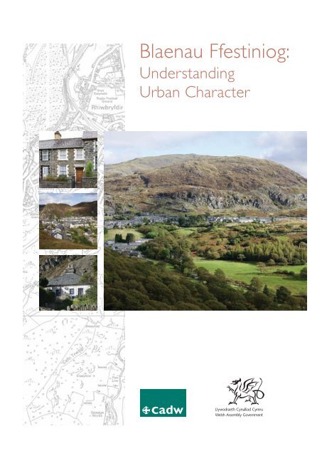
Blaenau Ffestiniog: Understanding Urban Character - Cadw - Welsh ...
Blaenau Ffestiniog: Understanding Urban Character - Cadw - Welsh ...
Blaenau Ffestiniog: Understanding Urban Character - Cadw - Welsh ...

You also want an ePaper? Increase the reach of your titles
YUMPU automatically turns print PDFs into web optimized ePapers that Google loves.
<strong>Blaenau</strong> <strong>Ffestiniog</strong>:<br />
<strong>Understanding</strong><br />
<strong>Urban</strong> <strong>Character</strong>
<strong>Blaenau</strong> <strong>Ffestiniog</strong>:<br />
<strong>Understanding</strong><br />
<strong>Urban</strong> <strong>Character</strong><br />
1
2<br />
Acknowledgements<br />
As part of this study, historical research and<br />
mapping was carried out by Govannon<br />
Consultancy (Dr David Gwyn) under contract to<br />
<strong>Cadw</strong>. Dr Gwyn has acknowledged the assistance<br />
of the following individuals in the preparation of<br />
his study: John Alexander, Martin Duncan, Falcon<br />
Hildred, Peredur Hughes, Bill Jones, Gwynfor<br />
Pierce Jones, Mary Jones, Michael J.T. Lewis,<br />
Steffan ab Owain and Mike Schumann. The Royal<br />
Commission on the Ancient and Historical<br />
Monuments of Wales (RCAHMW) provided<br />
most of the photography for this study. Sites for<br />
which further information is available on Coflein<br />
are listed in the appendix to this report. Finally,<br />
<strong>Cadw</strong> wishes to thank Falcon Hildred for the<br />
drawings on pages 16 and 24.
Contents<br />
Introduction 5<br />
Aims of the Study 5<br />
Historical Development 6<br />
<strong>Blaenau</strong> <strong>Ffestiniog</strong> before the<br />
Slate Quarries 6<br />
From Sheep to Slate: The Development<br />
of the Quarries 7<br />
A Working Landscape 8<br />
The Town Takes Shape: Infrastructure 10<br />
Building a Town 14<br />
Historical Topography 21<br />
The <strong>Character</strong> of Building 23<br />
Building Style and Detail 23<br />
Materials: City of Slates? 32<br />
<strong>Character</strong> Areas 37<br />
1. Benar Road and The Square 37<br />
2. Church Street 39<br />
3. High Street and Summerhill 40<br />
4. Diffwys Square and Lord Street 42<br />
5. Maenofferen 43<br />
6. Bethania and Mount Pleasant 44<br />
7. Manod, Congl y Wal and Cae Clyd 46<br />
8. Rhiwbryfdir 48<br />
9. Tan y Grisiau, Glan y Pwll<br />
and Oakeley Square 49<br />
Statement of Significance 51<br />
Selected Sources 52<br />
Appendix I 55<br />
Endnotes 57<br />
List of Maps pages 58–71 6. Benar Road and The Square<br />
7. Church Street<br />
1. <strong>Blaenau</strong> <strong>Ffestiniog</strong> before the Slate 8. High Street and Summerhill<br />
Quarries: Pre-Industrial Settlement 9. Diffwys Square and Lord Street<br />
2. The Growth of Settlement 10. Maenofferen<br />
in <strong>Blaenau</strong> <strong>Ffestiniog</strong> 11. Bethania and Mount Pleasant<br />
3. <strong>Blaenau</strong> <strong>Ffestiniog</strong>: Patterns of Landownership 12. Manod, Congly y Wal and Cae Clyd<br />
4. All <strong>Character</strong> Areas 13. Rhiwbryfdir<br />
5. All <strong>Character</strong> Areas with Scheduled Ancient 14. Tan y Grisiau, Glan y Pwll<br />
Monuments and Listed Buildings and Oakeley Square<br />
3
Introduction<br />
Aims of the Study<br />
<strong>Urban</strong> characterization aims to describe and<br />
explain the historic character of towns to give<br />
a focus to local distinctiveness and to serve as<br />
a tool for the sustainable management of the<br />
historic environment. It seeks to inform and<br />
support positive conservation and regeneration<br />
programmes, help improve the quality of planning<br />
advice, and contribute to local interpretation<br />
and education strategies.<br />
<strong>Urban</strong> characterization defines the distinctive<br />
historical character of individual towns, and identifies<br />
the variety of character within them, recognizing<br />
that this character is fundamental to local<br />
BLAENAU FFESTINIOG: UNDERSTANDING URBAN CHARACTER<br />
distinctiveness and pride of place, and is an asset in<br />
regeneration. It looks at how the history of a town<br />
is expressed in its plan and topography, in areas of<br />
archaeological potential, and in its architectural<br />
character. The survey is not just an audit of features,<br />
but a reconstruction of the themes and processes<br />
which have shaped the town.<br />
The immediate purpose of this study is to<br />
inform emerging proposals for regeneration<br />
in <strong>Blaenau</strong> <strong>Ffestiniog</strong>. These plans focus on the<br />
centre of the town, but this study examines<br />
the historic character of the whole of the<br />
built-up area of the town, and it is intended<br />
that this study will provide a baseline for<br />
strategic planning as well as local management,<br />
including housing renewal.<br />
The town of <strong>Blaenau</strong><br />
<strong>Ffestiniog</strong>, dominated<br />
by the slate quarries<br />
which sustained it<br />
(Crown Copyright:<br />
RCAHMW).<br />
5
BLAENAU FFESTINIOG: UNDERSTANDING URBAN CHARACTER<br />
<strong>Blaenau</strong> <strong>Ffestiniog</strong> about<br />
1924: a thoroughly<br />
industrial town<br />
(© The Francis<br />
Frith Collection).<br />
6<br />
Historical Development<br />
<strong>Blaenau</strong> <strong>Ffestiniog</strong><br />
before the Slate Quarries<br />
The town of <strong>Blaenau</strong> <strong>Ffestiniog</strong> owes its existence<br />
entirely to the development of slate quarrying<br />
during the nineteenth century. Situated on the<br />
margin between the lower-lying enclosed lands<br />
and the uplands (the blaenau) of the historic<br />
parish of <strong>Ffestiniog</strong>, this was once a remote<br />
region with only a few farms, open fields and<br />
sheep walks; but in this unlikely location grew<br />
what became, for a time, the largest town in<br />
Merioneth. For generations small and sporadic<br />
slate workings had probably taken place in the<br />
vicinity (there are documentary references to<br />
quarrying from the sixteenth century), but it<br />
was only after about 1760 that the potential<br />
value of the mountains for slate quarrying<br />
on a revolutionary scale was realized.<br />
The slate quarries — and to a lesser extent the<br />
town itself — have obliterated many traces of<br />
the pre-industrial landscape, but it still asserts<br />
itself in relics that symbolize a different pattern<br />
of land use. Farmhouses survive at Cwm Bowydd,<br />
Gelli, and Pen y Bryn, and there are also ruined<br />
buildings amongst the small enclosures at Cefn<br />
Bychan. Other farms are memorialized in place<br />
names: the former farm of Maenofferen has<br />
lent its name to the area of the town around<br />
Wynne Road. The farm itself lay between<br />
Wynne Avenue and Maenofferen Street, behind<br />
Fairview (formerly Maenofferen Cottages), but it<br />
apparently burnt down in the nineteenth century.<br />
Slate tips buried Rhiwbryfdir Farm in the 1890s,<br />
and Tan y Manod Farm was demolished in the<br />
1960s to make way for social housing. Here and<br />
there, a pattern of small fields survives on the<br />
edge of the town, for example between High<br />
Street and the road leading to the former Diffwys<br />
Quarry from Tan y Manod, and on the slopes
elow Manod Road and High Street. Some of the<br />
footpaths, tracks and roads are also the legacy of<br />
an agricultural land use. Other place names hold<br />
clues to this earlier history — Hafod Ruffydd,<br />
where ‘Hafod’ implies early agricultural practice.<br />
To some extent, agriculture continued alongside<br />
industry and was never completely replaced by it.<br />
Indeed, the nineteenth-century town included<br />
some industries directly related to farming (the<br />
fulling mill at Tan y Grisiau being one example).<br />
From Sheep to Slate:<br />
The Development<br />
of the Quarries<br />
‘The population of <strong>Ffestiniog</strong> has much increased<br />
of late in consequence of the employment offered<br />
in the slate quarries in the immediate<br />
neighbourhood, which are carried out with<br />
considerable spirit by some wealthy companies’. 1<br />
Ownership and Land Use<br />
Ownership and land use in the late eighteenth<br />
century was based on a series of farms, many of<br />
which belonged to landed estates. The<br />
development of slate extraction in a series of<br />
different quarries took place firmly within this<br />
pattern of landownership, which also helped to<br />
shape settlement in the nineteenth-century town.<br />
The first quarry to be developed in the area was<br />
Diffwys; it lay on Gelli Farm, which was the<br />
BLAENAU FFESTINIOG: UNDERSTANDING URBAN CHARACTER<br />
property of the Wynns of Peniarth. In about 1760,<br />
experienced quarrymen from Cilgwyn in Arfon<br />
began quarrying slate on Gelli Farm. They were led<br />
by one Methusalem Jones, said to have come to<br />
<strong>Ffestiniog</strong> following a revelation in a dream that<br />
there was slate in the Diffwys Gorge. The farm was<br />
leased by eight partners in 1776, but in 1800 this<br />
<strong>Welsh</strong> partnership was bought out by a group of<br />
entrepreneurs including William Turner and William<br />
Casson, both quarry managers from the English<br />
Lake District. They acquired the freehold of Gelli<br />
Farm, and began a massive expansion of the quarry,<br />
where underground working had started by 1820. 2<br />
There was another substantial local estate centred<br />
on Plas Tan y Bwlch near Maentwrog, which was<br />
owned by the Oakeley family in the nineteenth<br />
century. It included land to the west of the valley,<br />
with the uplands above it, where three major slate<br />
quarries ultimately combined as the Oakeley Slate<br />
Mine in 1882. The first of these (Lower Quarry)<br />
was established on Rhiwbryfdir Farm in 1819 by<br />
Samuel Holland, and was taken over by the <strong>Welsh</strong><br />
Slate and Copper Mining Company in 1828. Above<br />
this were Middle Quarry or Gloddfa Ganol, and<br />
Upper (Hollands) Quarry. 3<br />
The Glynllifon estate, owned by Lord<br />
Newborough, also held land in this area. It was on<br />
its Cwm Bowydd Farm and Maenofferen Farm<br />
that much of the town developed during the<br />
nineteenth century. Lord (also known as Bowydd)<br />
Quarry, Fotty and Maenofferen Quarries were<br />
also developed on Glynllifon land. Quarrying at<br />
Lord Quarry began in 1779, and Lord<br />
Newborough involved himself in its operation<br />
from 1802. The quarry had small beginnings —<br />
Gelli Farm (Crown<br />
Copyright: RCAHMW).<br />
7
BLAENAU FFESTINIOG: UNDERSTANDING URBAN CHARACTER<br />
Slate quarries are still<br />
a powerful presence<br />
above the town (Crown<br />
Copyright: RCAHMW).<br />
8<br />
employing six men in 1788, and thirteen soon<br />
after 1802. It worked only intermittently until<br />
taken on by John Greaves in 1834. Fotty Quarry<br />
was being worked by 1813 (taking its name from<br />
an adjacent farm called Haffotty — proving yet<br />
another link with pre-industrial land use), while<br />
Llechwedd Quarry was developed by Greaves<br />
after 1846, on an area of shared grazing. 4<br />
There were several smaller estates. The Tan y<br />
Grisiau estate was leased from 1823 by Samuel<br />
Holland of the <strong>Welsh</strong> Slate Company, and the Glan<br />
y Pwll, Tan y Manod and Cae-du estates were all<br />
locally owned in the nineteenth century. On each,<br />
industrial activity and urban development was<br />
undertaken to varying degrees. Samuel Holland<br />
was particularly active in promoting development<br />
at Tan y Grisiau, for example.<br />
The presence of so many individual estates<br />
shaped the character of the slate industry, as each<br />
developed its own quarry on its own land. The<br />
character of the town, as a series of settlement<br />
areas each with their own identity, is also a direct<br />
consequence of this pattern of landownership.<br />
Place names continue to give strong clues about<br />
ownership — Lord Street, Newborough Street,<br />
Wynne Road, Glynllifon Street, and Baron Road<br />
all refer to the Newborough estate, for example.<br />
A Working Landscape<br />
If the quarries were originally contained by<br />
the farmland on which they developed, they<br />
quickly became prominent elements of the<br />
landscape in their own right, radically changing<br />
its form, visually dominant, and helping to shape<br />
other development.<br />
Early workings were opencast, but from the<br />
1820s onwards the rock had to be followed deep<br />
into underground chambers, because the cost of<br />
removing overburden for surface working became<br />
too great. Extensive underground workings were<br />
established, requiring elaborate pumping and<br />
drainage systems as well as a cost-effective means<br />
of moving both workable rock and waste within<br />
the quarries. The first internal railway in a<br />
<strong>Ffestiniog</strong> quarry dates from 1804, and their<br />
use was practically universal by the 1820s. They<br />
required extensive flat areas for sidings and yards,<br />
and inclined planes to deal with changes of level.<br />
The engineering of these features, often on<br />
massive stone walls, is a distinctive feature of the<br />
landscape immediately outside the town.<br />
From the mid-nineteenth century, much of the<br />
processing of the slate took place in large
industrial mill buildings sited within the quarries.<br />
There is only one off-site slab mill for Diffwys<br />
Quarry within the town, at Pant yr Ynn. This<br />
geographical separation was accommodated by<br />
strong transport links — railways and inclined<br />
planes, but also by paths connecting the town<br />
to remote places of work. This network of<br />
connections remains an important feature<br />
of the landscape around the town.<br />
Vast quantities of waste were produced,<br />
engulfing the sheep walks, some farms, and<br />
even some of the first generation of industrial<br />
housing. These sculpted waste heaps are dramatic<br />
testimony to the sheer scale of extraction.<br />
Another by-product of quarrying was the<br />
generation of electricity: the first public supply<br />
in Gwynedd was generated at Dolwen, serving<br />
not only the quarries but also the town. This was<br />
the first time that a public electricity supply had<br />
been generated entirely by water in the United<br />
Kingdom. Llechwedd Quarry established its<br />
private supply in 1904–05 at Pant yr Afon. More<br />
recently, the pumped storage scheme at Tan y<br />
Grisiau was the stimulus for radical interventions<br />
in the landscape, most notably the construction<br />
of the reservoir and of new access roads.<br />
Although slate extraction dominates the<br />
landscape, it was not the only quarrying to<br />
be undertaken in the area. Two quarries —<br />
at Cefn Bychan (the <strong>Ffestiniog</strong> Granite Quarry)<br />
and Manod — extracted ‘granite’ (this may not<br />
be its geological definition). There were also<br />
several smaller quarries of convenience for<br />
building stone, opened to serve the needs<br />
of the growing town — a good example<br />
survives to the south of Jones Street.<br />
BLAENAU FFESTINIOG: UNDERSTANDING URBAN CHARACTER<br />
Top left: An inclined<br />
plane is a strong<br />
feature of the landscape<br />
above Pant yr Ynn<br />
(Crown Copyright:<br />
RCAHMW).<br />
Above: Pant yr Ynn<br />
was built as a slab mill<br />
for Diffwys Quarry<br />
(The National Library<br />
of Wales).<br />
Left and below: Slate<br />
waste piled high above<br />
the town (Crown<br />
Copyright: RCAHMW).<br />
9
BLAENAU FFESTINIOG: UNDERSTANDING URBAN CHARACTER<br />
Reproduced by permission of Ordnance Survey on behalf of HMSO. © Crown copyright and database right 2011.<br />
All rights reserved. <strong>Welsh</strong> Assembly Government. Licence number 100017916.<br />
A mix of early paths,<br />
tracks and new roads,<br />
created to serve the slate<br />
quarries, provided the<br />
framework on which<br />
the town grew up.<br />
10<br />
The Town Takes Shape:<br />
Infrastructure<br />
<strong>Blaenau</strong> <strong>Ffestiniog</strong> is shaped by a mesh of<br />
route-ways. Railways and roads, agricultural and<br />
industrial routes, all provide the structure around<br />
which the town has developed.<br />
Roads<br />
As part of the upland landscape of <strong>Ffestiniog</strong>, and<br />
an integral part of its agricultural economy, the<br />
blaenau were linked to lowland farms by a series<br />
of paths and tracks. The area later occupied by<br />
the town also lay at the foot of an important<br />
mountain pass, linking the Vale of <strong>Ffestiniog</strong> with<br />
the Lledr Valley to the north. The present road<br />
pattern, however, is largely a product of industry,<br />
leaving the earlier routes to survive as an<br />
extensive series of tracks and footpaths. One of<br />
these early routes is shown on the 1818 draft<br />
Ordnance Survey map. It ran along the west side<br />
of the Afon Bowydd from Ty’n y Cefn (on the<br />
present A496 south-west of the town), climbing<br />
via Bryn Bowydd and the modern Dorvil Road<br />
to a point near where St David’s Church stands<br />
on the site of an earlier dwelling, Penrhos-bach.<br />
Thence it led to Rhiwbryfdir Farm and Tal y<br />
Waenydd and over the Crimea Pass to<br />
Dolwyddelan. Access to Maenofferen Farm was<br />
via a track leading from this road, approximating<br />
to the line of the present Church Street and<br />
Maenofferen Street. Another early route probably<br />
went from Llan <strong>Ffestiniog</strong> by Congl y Wal, thence<br />
dipping to the valley floor, passing Cwm Bowydd<br />
Farm and crossing Pont Frongoch before climbing<br />
up towards Maenofferen Farm.<br />
Only part of the modern main road through the<br />
settlement corresponds to a pre-industrial road<br />
line; this is Church Street, which once gave access<br />
to the lost Maenofferen Farm. The rest of the<br />
modern route was made as a direct response<br />
to the growth of the quarries and the need to<br />
establish good lines of communication from them<br />
to the quays at Maentwrog. The earlier roads<br />
survive as footpaths, and a pre-industrial history<br />
also asserts itself in other footpaths that radiate<br />
out from Cwm Bowydd Farm. The meandering<br />
line of Cae Clyd is probably another early<br />
route, joining farmsteads to the east with the<br />
through-route to Dolwyddelan from Congl y Wal.<br />
The winding path at Fucheswen might be another.<br />
The development of the quarries put considerable<br />
pressure on the existing network of routes and<br />
also necessitated new connections, both from the<br />
quarries to existing roads, and to the wharves on<br />
the Dwyryd from whence slate was first exported.<br />
Privately built tracks and cart roads from the<br />
quarries are recorded from 1801.<br />
The first of the new roads was the Diffwys<br />
partners’ road, built from an existing road at<br />
Congl y Wal to lead to the Diffwys Quarry in<br />
1801. It forms the basis of the main road from<br />
Congl y Wal to Bethania, and thence as the<br />
steeper road past Pant yr Ynn. Shortly afterwards,<br />
the road to Lord Quarry was established as a<br />
mixture of new build and adaptation of existing<br />
roads. It ran from Congl y Wal to Pont Frongoch,<br />
and thence forms the present Cwm Bowydd<br />
Road and Lord Street.
By 1818, a link had been established between<br />
the road to Lord Quarry and the early track that<br />
led from Penrhos-bach to Maenofferen Farm, thus<br />
creating the line of High Street and Church<br />
Street. In 1825, Samuel Holland made another<br />
new road from the junction of these existing<br />
roads (henceforward known as Four Crosses)<br />
to Tan y Manod and the Diffwys partners’ road at<br />
Bethania. This completed the main axis through<br />
the town. By 1839–41, this road (the present<br />
A470) had become the backbone of the<br />
emerging settlement.<br />
On the west side of the valley, a new road from<br />
Cwmorthin Quarry and Tan y Grisiau to Rhyd y<br />
Sarn (on the A496 west of Llan <strong>Ffestiniog</strong>) was<br />
BLAENAU FFESTINIOG: UNDERSTANDING URBAN CHARACTER<br />
constructed in the 1820s. This provided another<br />
route to the quays at Maentwrog, and was linked<br />
across the valley to Congl y Wal and the Diffwys<br />
partners’ road by Ffordd Casson. These roads<br />
survive in the line of the modern A496 below<br />
Tan y Grisiau and the minor road that connects<br />
it with Congl y Wal. Then in the 1830s, Samuel<br />
Holland built a road from Glan y Pwll to Tan<br />
y Grisiau, virtually completing the horseshoe<br />
of roads along which the town developed. 5<br />
Thereafter, there were no major changes to<br />
the road system until the construction of the<br />
upper section of the A496 west of the town<br />
in 1963, and the upgrading of the A470 at<br />
Pant yr Afon from 2005.<br />
The town of <strong>Blaenau</strong><br />
<strong>Ffestiniog</strong>, strung out<br />
along historical<br />
route-ways surviving<br />
as tracks and footpaths,<br />
and along the network<br />
of roads developed<br />
to serve the slate<br />
quarries (Crown<br />
Copyright: MOD).<br />
11
BLAENAU FFESTINIOG: UNDERSTANDING URBAN CHARACTER<br />
A network of railways<br />
was crucial in the<br />
development of the<br />
town and its industry.<br />
Reproduced by permission of<br />
Ordnance Survey on behalf of HMSO.<br />
© Crown copyright and database right<br />
2011. All rights reserved. <strong>Welsh</strong><br />
Assembly Government. Licence<br />
number 100017916.<br />
12<br />
Railways<br />
Of the three public railways which served<br />
<strong>Blaenau</strong>, the Festiniog Railway, which opened in<br />
1836, was the earliest and did most to transform<br />
the town and make the fortunes of its slate<br />
industry. On this railway, slate was carried out<br />
on the first stage of its journey all over the<br />
world, and building materials, consumer goods,<br />
and even quarrymen, were brought into the<br />
town. The line was established in the earliest<br />
days of building the town, and it exerted<br />
considerable influence on the location and<br />
layout of settlement.<br />
It was Samuel Holland who was instrumental<br />
in obtaining a bill to build a railway to<br />
Porthmadog from the quarries and, initially,<br />
he was the only quarry owner to use it, some<br />
refusing to touch it until the 1860s. However,<br />
over the years, more and more branches were<br />
constructed from the quarries to the railway —<br />
one even extended over the moorland to<br />
quarries in Penmachno parish. Although some of<br />
the early inclined planes associated with these
anch lines have been buried by slate rubble,<br />
many survive, and are a distinctive and important<br />
feature of the landscape. Examples include<br />
Cwmorthin (1861–62), Nith y Gigfran (about<br />
1867), Dinas incline (1905), Lower Quarry incline<br />
(1872), Llechwedd incline (1854), Fotty or<br />
Rhiwbach incline (1862), Diffwys incline (1864),<br />
BLAENAU FFESTINIOG: UNDERSTANDING URBAN CHARACTER<br />
and the Craig Ddu inclines (1865–87). Other<br />
branches were the Manod Granite Quarry siding<br />
and the Groby Granite Quarry siding. 6<br />
Steam traction was introduced on the Festiniog<br />
Railway in 1863 and passenger services in 1865.<br />
A branch line to Llan <strong>Ffestiniog</strong> opened in 1868 and,<br />
at one time or another, the railway operated four<br />
passenger stations (Dinas, Exchange, Central, Duffws)<br />
within 0.6 miles (1km) of each other at <strong>Blaenau</strong>, acting<br />
as a natural hub for the developing town.<br />
By the 1870s, the railway not only directly served<br />
all the major quarries, but also had direct access<br />
to Holland’s iron foundry in Tan y Grisiau<br />
(established in 1851), two timber yards, a steam<br />
corn mill, the market hall and two coal yards.<br />
It had its own goods shed at the Duffws terminus.<br />
The London and North West Railway (LNWR)<br />
arrived (from Llandudno Junction) in 1879, and<br />
the Great Western Railway from Bala in 1883<br />
(on the trackbed of the Festiniog branch line<br />
to <strong>Ffestiniog</strong>). Further stations, a railway hotel<br />
(now demolished), and interchange yards<br />
between standard and narrow-gauge systems<br />
were all established. Most of the Victorian rail<br />
infrastructure has been lost, with only Duffws<br />
station surviving, albeit reused since the 1930s<br />
as public conveniences. Nonetheless the<br />
railway corridors continue to thread through<br />
the town, and are an important component<br />
of the townscape.<br />
Above: Housing<br />
aligned with the<br />
railway in the town<br />
centre (Crown<br />
Copyright: RCAHMW).<br />
Left: The line of the<br />
Festiniog Railway as<br />
it threads through the<br />
town (Crown Copyright:<br />
RCAHMW).<br />
13
BLAENAU FFESTINIOG: UNDERSTANDING URBAN CHARACTER<br />
14<br />
Building a Town<br />
‘<strong>Ffestiniog</strong> is a small but increasing village. Population<br />
1,648, principally employed in the slate quarries<br />
about four miles from the village. Mrs Oakeley of<br />
Tan y Bwlch has built and endowed a chapel of<br />
ease near the quarries, consecrated September last.<br />
It is intended for the convenience of the inhabitants<br />
of the houses that have been built in the vicinity<br />
of the quarries.’ 7<br />
The Chronology of Development<br />
As we have seen, <strong>Blaenau</strong> was nothing more than<br />
a few farms at the end of the eighteenth century.<br />
A hundred years later, it had all the trappings of<br />
a town, based almost exclusively on a single<br />
industry and with a population that had grown<br />
from 3,460 in 1851, to 11,274 in 1881. 8 In 1873,<br />
the <strong>Welsh</strong> Slate Company Quarry employed<br />
about 700 men, Hollands Quarry, about 500, and<br />
Llechwedd, 330. Contrast this with the thirteen
men employed in Lord (or Bowydd) Quarry<br />
soon after Lord Newborough began working<br />
it in 1802, or the twelve men who worked at<br />
Diffwys Quarry in 1794. Even in 1800, only<br />
about sixty men in total worked in the quarries<br />
of <strong>Blaenau</strong> <strong>Ffestiniog</strong>. 9<br />
Even though there was a sufficiently large<br />
population in the immediate vicinity of <strong>Blaenau</strong><br />
to warrant the establishment of a church and a<br />
school in the 1840s, it was not until the 1860s<br />
and especially the 1870s, during the boom years<br />
of the slate industry, that something resembling a<br />
town really took shape. It was in this period that<br />
linear development along what had become the<br />
main road began to be supplemented by planned<br />
developments away from its axis. Bowydd Street,<br />
Leeds Street and Cromwell Street were at the<br />
planning stage in 1874. Wesley Street and<br />
Glynllifon Street date from the 1870s as does<br />
Park Square, Tan y Clogwyn, Summerhill and<br />
Richmond Terrace. The plans for New Market<br />
Square and the streets associated with it were<br />
drawn up by Charles Easton Spooner, engineer<br />
BLAENAU FFESTINIOG: UNDERSTANDING URBAN CHARACTER<br />
of the Festiniog Railway, in 1876–77. In 1887,<br />
however, the square itself was still little more<br />
than a field, with houses laid out along its<br />
northern and part of its eastern perimeter.<br />
The houses on Bowydd Road and Cwm<br />
Bowydd Road date from the 1880s, as do<br />
Oxford Terrace and Picton Terrace. In Bethania<br />
and Manod, terraces date variously from the<br />
1870s to the 1890s, with some earlier rows. 10<br />
It was a similar story to the west, where most of<br />
the development followed the line of the road<br />
from Tan y Grisiau to Glan y Pwll, and Rhiwbryfdir.<br />
Here, however, there was very little in the way of<br />
planned developments away from the road line:<br />
Oakeley Square was not started until the 1890s<br />
and was never completed.<br />
The gradual closure of many of the quarries after<br />
1914 meant that there was little pressure for<br />
further development in the twentieth century<br />
and the town has retained its nineteenth-century<br />
extent and character to a remarkable degree.<br />
With the exception of social-housing schemes<br />
Both pages: Small-scale<br />
planned developments<br />
of the 1870s and 1880s<br />
(Crown Copyright:<br />
RCAHMW).<br />
15
BLAENAU FFESTINIOG: UNDERSTANDING URBAN CHARACTER<br />
Above (Crown<br />
Copyright: RCAHMW)<br />
and top right (© Falcon<br />
Hildred): Yr Uncorn, an<br />
unusual and distinctive<br />
cottage design for the<br />
Glynllifon estate, owners<br />
of Lord Quarry.<br />
Right: Dolgarregddu<br />
Terrace is amongst the<br />
earliest of surviving<br />
houses within the town<br />
(Crown Copyright:<br />
RCAHMW).<br />
16
at Benar Road/Jones Street and at Manod,<br />
development in the twentieth century has been<br />
on a very small scale.<br />
The Organization of Building<br />
For many years after the beginning of commercial<br />
quarrying in about 1760, existing farmhouses<br />
and agricultural labourers’ dwellings were<br />
sufficient to accommodate the relatively small<br />
numbers of quarrymen, many of whom only<br />
lodged in the area on a weekly basis. The first<br />
building projects were small-scale and haphazard.<br />
A cluster of houses known as pentre (village)<br />
or Tai Newyddion y Gloddfa was erected from<br />
1806 onwards on Gelli land to house Diffwys<br />
quarrymen; there were other houses built at<br />
Pant y Lleidr on the Oakeley estate by 1824. 11<br />
All of these houses have long been covered<br />
by slate rubble. In 1825, the manager of<br />
Newborough’s Lord Quarry, John Hughes,<br />
built a number of cottages on Glynllifon land,<br />
one of which survives as Yr Uncorn. 12<br />
Dolgarregddu Terrace was also built on<br />
Glynllifon land, in 1838–39. 13<br />
As the quarries continued to grow, so did the<br />
scale and ambition of individual building projects.<br />
However, there were several focal points for<br />
development, which only gradually coalesced<br />
into a recognizable town.<br />
With few exceptions, housing was generally<br />
organized as terraced rows, rather than as single<br />
houses, regardless of how it was provided.<br />
Building leases became the most common way<br />
in which housing provision was arranged, and<br />
the Tan y Manod estate was the first to lease out<br />
land for quarrymen to build their own houses. 14<br />
These are probably represented by the oldest of<br />
BLAENAU FFESTINIOG: UNDERSTANDING URBAN CHARACTER<br />
the straggling houses along the present A470<br />
between Congl y Wal and Tan y Manod. Plots<br />
were set out, allowing individual builders to<br />
take responsibility for their development.<br />
<strong>Character</strong>istically, units of development were<br />
small — even a single terrace may have had<br />
more than one builder. Building societies were<br />
important in enabling quarrymen to finance<br />
small-scale building projects: the <strong>Ffestiniog</strong><br />
Building Society was established in 1836 and<br />
it is probably no coincidence that the registered<br />
office of the Merionethshire Building Society,<br />
established in 1877, was in <strong>Blaenau</strong> <strong>Ffestiniog</strong>. 15<br />
Some housing was provided directly by quarry<br />
companies and landowners. Cwmorthin Quarry<br />
erected houses on the Tan y Grisiau estate from<br />
the 1830s, as well as providing the workmen with<br />
a reading room. 16 However, it was Samuel Holland<br />
as landowner who built the greatest number of<br />
houses here from 1836 onwards. By 1845 forty-two<br />
dwellings and other buildings, including three<br />
chapels, had been erected. 17 The earliest of these<br />
were built facing the Festiniog Railway, until the<br />
road supplanted it as the main focus for building.<br />
Some housing development took place away<br />
from the town itself. Houses for specialist quarry<br />
workers, such as winding-engine drivers and their<br />
families, were built by the quarry companies and<br />
tended to be located in the quarries themselves.<br />
Some such buildings, much adapted to the<br />
requirements of tourism, survive at Llechwedd’s<br />
Quarry Tours operation. There is a listed row of<br />
quarrymen’s cottages dating from the 1840s at<br />
Oakeley Quarry. Barracks were also provided at<br />
some of the quarries.<br />
<strong>Urban</strong> housing along the<br />
main road whose line<br />
was completed in 1825.<br />
Differences in the<br />
stonework betray the<br />
fact that many terraces<br />
were the work of more<br />
than one builder (Crown<br />
Copyright: RCAHMW).<br />
17
BLAENAU FFESTINIOG: UNDERSTANDING URBAN CHARACTER<br />
Above: Some of the<br />
smallest houses of the<br />
nineteenth-century town,<br />
recorded in photographs,<br />
but now demolished<br />
(The National Library<br />
of Wales).<br />
Above right: The former<br />
Central School,<br />
Wynne Road (Crown<br />
Copyright: RCAHMW).<br />
Opposite: Ysgol Glan y<br />
Pwll, recorded by John<br />
Thomas in the late<br />
nineteenth century<br />
(The National Library<br />
of Wales).<br />
18<br />
Building and Society<br />
Industrial development created a town where<br />
there had not been one before. <strong>Blaenau</strong> <strong>Ffestiniog</strong><br />
was essentially a working community, and very<br />
few of the moneyed families lived in the<br />
immediate vicinity. Of the major landowners,<br />
the Newborough family were based in Glynllifon,<br />
administering their <strong>Ffestiniog</strong> lands through an<br />
agent, and only Mrs Oakeley of Tan y Bwlch<br />
seems to have had much interest in the social<br />
welfare of the community, establishing a church<br />
in 1841–42 and a hospital in 1848. William<br />
Turner and his colleagues, Samuel Holland, and<br />
the Greaves family of Llechwedd Quarry, at one<br />
time or another all made their homes in the area<br />
— the Greaves’ home, Plas Weunydd of 1870,<br />
survives as the offices of Llechwedd Quarry.<br />
As they grew wealthier, however, they either<br />
moved away or withdrew from active<br />
participation in the town and its development.<br />
Instead, the local elite was drawn from the ranks<br />
of the workers, from quarry stewards, ministers<br />
of religion and local professionals. The pattern<br />
of building closely reflects the social structure<br />
of this working town, with a relatively ‘flat’<br />
hierarchy of types — many small terraced<br />
houses subtly distinguished one from another,<br />
a small number of larger semi-detached houses,<br />
and a tiny number of detached houses. Historical<br />
photographs suggest that this hierarchy has been<br />
truncated by the loss of some of the smallest<br />
house-types, but what survives still presents<br />
remarkably detailed evidence for the structure<br />
of this industrial town.<br />
Early accounts of <strong>Blaenau</strong> stress its remoteness,<br />
a long way overland from Bala, Dolgellau or<br />
Llanrwst and, to be viable, the town needed<br />
to establish its own economic infrastructure.<br />
The earliest shop in the area is credited by G. J.<br />
Williams to one Captain Richards of Porthmadog,<br />
and was built next to the railway at Tan y Grisiau,<br />
though it cannot long have pre-dated the first<br />
shop at Four Crosses, opened in 1836. 18 Owen
Roberts, of Dolgarregddu, built the market hall in<br />
1861–64, to plans drawn up by Owen Morris of<br />
Porthmadog. Many of the buildings on Church<br />
Street, between the railway station and Four<br />
Crosses, were built as shops in the mid-nineteenth<br />
century, but the most flamboyant building was the<br />
Cocoa Rooms and Temperance Café. Built in<br />
1878–79, it later served as a library, a council<br />
chamber and a magistrates’ court, and it is now a<br />
licensed club. Brymer’s Department Store and the<br />
Co-op indicate that local purchasing power was<br />
still considerable until after the First World War.<br />
Education was an important aspect of social<br />
provision in <strong>Blaenau</strong> <strong>Ffestiniog</strong>. The town boasts<br />
a good series of schools, the first of which<br />
was the British School, built in 1846. Others are:<br />
Ysgol Glan y Pwll — now workshops, but built<br />
as a Board School in 1880; the former Central<br />
School, Wynne Road (now the Community<br />
Centre); and Ysgol y Moelwyn, Wynne Road<br />
(1899–1900). There are also schools at Manod<br />
and Tan y Grisiau. 19<br />
BLAENAU FFESTINIOG: UNDERSTANDING URBAN CHARACTER<br />
19
BLAENAU FFESTINIOG: UNDERSTANDING URBAN CHARACTER<br />
Capel Tabernacl, Mount<br />
Pleasant, in about 1875<br />
(The National Library<br />
of Wales).<br />
20<br />
Along<br />
with the schools, chapels also give a<br />
trong indication of the scale and ambition<br />
f the community. Construction of large and<br />
rchitecturally flamboyant chapels began in<br />
he 1860s, coinciding with the growing boom<br />
n the slate industry. G. J. Williams quotes<br />
amuel Holland as observing that houses grew<br />
p around chapels, which suggests that chapels<br />
ometimes acted as nodes for settlement. 20<br />
s<br />
o<br />
a<br />
t<br />
i<br />
S<br />
u<br />
s<br />
Several<br />
have been demolished, but surviving<br />
examples include: Bethesda Calvinistic<br />
Methodist Chapel, Manod Road (1848);<br />
Carmel Independent Chapel, Tan y Grisiau<br />
(1861–62); Jerusalem Independent Chapel,<br />
Four Crosses (1867–68); Rhiw Calvinistic<br />
Methodist Chapel, Rhiwbryfdir (1867–68);<br />
Capel Seion, Lord Street (1879); Bowydd<br />
Calvinistic Methodist Chapel, The Square<br />
(1882); and Calfaria Baptist Chapel, Towyn<br />
Road (1881–82). 21
Historical Topography<br />
<strong>Blaenau</strong> <strong>Ffestiniog</strong> is strongly linear, strung out<br />
mainly along the A470, with Tan y Grisiau<br />
completing the horseshoe of development<br />
around the head of Cwm Bowydd. This through<br />
route was assembled piecemeal, but had been<br />
completed by about 1830. Rapid urban growth<br />
was initiated several decades later, and the road<br />
was the obvious framework for it; although the<br />
Festiniog Railway also influenced the alignment<br />
of settlement, especially where it pre-dated the<br />
road, as at Tan y Grisiau. The town developed<br />
away from the road either where there were<br />
other transport axes (roads, railways and inclines<br />
from the quarries), or where small parcels of<br />
land were made available for development.<br />
BLAENAU FFESTINIOG: UNDERSTANDING URBAN CHARACTER<br />
Above: The thin line<br />
of urban settlement<br />
at Manod (Crown<br />
Copyright: RCAHMW).<br />
Left: Houses aligned<br />
with the railway at<br />
Tan y Grisiau (Crown<br />
Copyright: RCAHMW).<br />
21
BLAENAU FFESTINIOG: UNDERSTANDING URBAN CHARACTER<br />
The natural topography<br />
of Cwm Bowydd divided<br />
one part of the town<br />
from another (Crown<br />
Copyright: RCAHMW).<br />
Right: An unusual<br />
example of a formally<br />
planned layout (Crown<br />
Copyright: RCAHMW).<br />
Far right: Oakeley<br />
Square was never<br />
completed (Crown<br />
Copyright: RCAHMW).<br />
From some vantage<br />
points, the backs of<br />
houses are a prominent<br />
feature of the townscape<br />
(Crown Copyright:<br />
RCAHMW).<br />
22<br />
Piecemeal growth associated with different<br />
landowners and linked to different quarries<br />
encouraged the development of separate settlements,<br />
each with its own cultural identity, notwithstanding<br />
strong similarities in the building stock. Although<br />
strung out along the main road and linked by it,<br />
these settlement areas were often also divided by<br />
topography or transport features. The steep scoop of<br />
Cwm Bowydd, for example, divided Fron-fawr from<br />
Maenofferen and, in turn, the railway line effectively<br />
separated Maenofferen from the town centre. More<br />
recently, the A496 has severed Tan y Grisiau from the<br />
rest of the town. Units of planning were generally<br />
small — small terraced rows and small blocks of land<br />
— and there were a few attempts at formalized<br />
planning, such as in the area around The Square, and<br />
the little grid of streets behind it. Whatever ambitions<br />
there were for Oakeley Square were never fully<br />
realized. Elsewhere, the character of development<br />
was largely opportunistic — a series of small-scale<br />
building projects relied on a network of roads and<br />
paths to unite them.<br />
The natural topography of the area contributed<br />
decisively to the character of the settlement.<br />
The town occupies a shelf on steeply sloping<br />
ground: development runs mostly along the<br />
contours, and hooks right round the head of<br />
Cwm Bowydd. There are therefore many views<br />
over and across the town, and the backs of<br />
houses are often as prominent as the fronts<br />
from one vantage point or another.
The <strong>Character</strong> of Building<br />
Building Style and Detail<br />
The earliest surviving houses are from the<br />
1820s and 1830s, but most building activity was<br />
between 1860 and 1880, with the rate of growth<br />
slowing down thereafter. With the exception<br />
of a series of self-contained public-housing<br />
developments in the post-war period, there is<br />
little twentieth-century development, and there<br />
have been only small-scale losses, making <strong>Blaenau</strong><br />
an especially well-preserved nineteenth-century<br />
industrial town.<br />
With the exception of the main commercial axis,<br />
building is remarkably uniform from Congl y Wal<br />
right round to Tan y Grisiau, mostly consisting of<br />
terraced rows of variable length, usually made up<br />
of houses of uniform plan. The earliest surviving<br />
terraced houses are those at Dolgarregddu, which<br />
BLAENAU FFESTINIOG: UNDERSTANDING URBAN CHARACTER<br />
are double-fronted (representing an application<br />
of traditions of building developed in a rural<br />
context), with long and low proportions and<br />
often relatively small window openings. This plan<br />
type occurs elsewhere in the town, and is<br />
probably indicative of a building date before<br />
the mid-nineteenth century. Other early housing<br />
is notable for its small size and, sometimes,<br />
the irregularity of openings.<br />
Above and left:<br />
A double-fronted plan<br />
is a feature of some of<br />
the earliest house-types<br />
in the town (Crown<br />
Copyright: RCAHMW).<br />
23
BLAENAU FFESTINIOG: UNDERSTANDING URBAN CHARACTER<br />
Small early cottages<br />
at Bethania (Right:<br />
Crown Copyright:<br />
RCAHMW; Below:<br />
© Falcon Hildred).<br />
24<br />
Later housing is much more uniform,<br />
characteristically single-fronted with a<br />
double-depth plan, and it is this type that<br />
dominates the town. There are small variations in<br />
size — the most significant being whether there<br />
are one or two windows in the first floor — and<br />
there are also subtle differences in storey heights<br />
and in property width. There are few departures<br />
from this form. One such departure is visible in<br />
larger houses such as those on Bowydd Road and<br />
in The Square. In The Square, an attic storey is<br />
given round-arched windows in gabled dormers.<br />
Other examples of this type are to be found<br />
here and there in the bigger houses of the<br />
town. Another departure from a strongly<br />
conventional plan is where a more consciously<br />
picturesque style was used — Yr Uncorn is the<br />
most remarkable example of this, but other<br />
later examples are the terraces in Park Square<br />
and at Isfryn Terrace, Bethania. There are small<br />
numbers of individually built houses, their rarity<br />
a reflection of the distinctive social structure of<br />
this industrial town.
BLAENAU FFESTINIOG: UNDERSTANDING URBAN CHARACTER<br />
Differences of scale in<br />
single-fronted houses<br />
contribute to the varied<br />
character of the<br />
townscape (Crown<br />
Copyright: RCAHMW).<br />
Larger houses have<br />
their own distinguishing<br />
character: Bowydd Road<br />
(far left) and The Square<br />
(left) (Crown Copyright:<br />
RCAHMW).<br />
Picturesque detail<br />
distinguishes housing<br />
in Park Square (far left)<br />
and Isfryn Terrace (left)<br />
(Crown Copyright:<br />
RCAHMW).<br />
Individually built houses<br />
like these are relatively<br />
rare in <strong>Blaenau</strong><br />
<strong>Ffestiniog</strong> (Crown<br />
Copyright: RCAHMW).<br />
25
BLAENAU FFESTINIOG: UNDERSTANDING URBAN CHARACTER<br />
Varied boundary detail is<br />
an important component<br />
of the townscape (Crown<br />
Copyright: RCAHMW).<br />
26<br />
Another significant component of character is<br />
the relationship of house to street — whether<br />
there are front gardens, front yards, or whether<br />
the buildings are straight onto the pavement.<br />
Where there are front gardens or yards, the<br />
boundary treatment is an important component<br />
of the townscape. Wall construction is varied,<br />
including slate as well as rubble, and there are<br />
some slate-pillar fences, and a rich tradition of<br />
decorative ironwork for railings.
BLAENAU FFESTINIOG: UNDERSTANDING URBAN CHARACTER<br />
Sash windows were once ubiquitous, but with<br />
the march of UPVC are now rare survivals.<br />
The earlier terraces probably had twelve-pane<br />
sash windows originally, but by the time of the<br />
boom years of the 1860s and 1870s, the<br />
four-pane and then the two-pane sash<br />
predominated; there were some variations,<br />
including sashes with margin lights.<br />
Surviving sash windows<br />
are rare and should be<br />
treasured (Crown<br />
Copyright: RCAHMW).<br />
27
BLAENAU FFESTINIOG: UNDERSTANDING URBAN CHARACTER<br />
Chimneys were a<br />
prominent feature of the<br />
townscape in the 1950s,<br />
but many have now<br />
been lost (The National<br />
Library of Wales).<br />
Missing chimneys,<br />
varied surface treatment<br />
and piecemeal changes<br />
to detail mar the<br />
essential formality<br />
of housing in The Square<br />
(Crown Copyright:<br />
RCAHMW).<br />
The use of render<br />
obscures original<br />
stonework detail (Crown<br />
Copyright: RCAHMW).<br />
28<br />
The essential unity of the terraced form has been<br />
steadily eroded, not only by changes in surface<br />
treatment (render and sandblasting), but also by<br />
the loss of chimneys, and the piecemeal approach<br />
to new windows and to pointing — in Lord<br />
Street for example.
BLAENAU FFESTINIOG: UNDERSTANDING URBAN CHARACTER<br />
Missing chimneys, and<br />
modern render and<br />
window detail have<br />
eroded the original<br />
character of this terrace<br />
(Crown Copyright:<br />
RCAHMW).<br />
Loss of chimneys has<br />
damaged the original<br />
rhythm of the terrace<br />
(Crown Copyright:<br />
RCAHMW).<br />
Park Square: Picturesque<br />
detail has been lost in the<br />
modern replacement of<br />
porches (left) and gable<br />
detail (below) (Crown<br />
Copyright: RCAHMW).<br />
29
BLAENAU FFESTINIOG: UNDERSTANDING URBAN CHARACTER<br />
Large-scale building and<br />
architectural render are<br />
characteristic of the town<br />
centre near Diffwys<br />
Square (Crown<br />
Copyright: RCAHMW).<br />
Visual variety is a<br />
characteristic of the<br />
commercial centre of<br />
the town (Crown<br />
Copyright: RCAHMW).<br />
30<br />
Church Street and High Street developed with<br />
mainly commercial property. Although strong<br />
individual designs are rare (the former North<br />
and South Wales Bank — now HSBC Bank —<br />
and the former Cocoa Rooms are two notable<br />
exceptions), commercial building traditions here<br />
are quite distinct from the residential. There is a<br />
wider set of variations and a richer vocabulary of<br />
detail. Many of these buildings owe their character<br />
to the late nineteenth century, when the<br />
prosperity of the town was at its height and best<br />
able to sustain a dynamic commercial economy.<br />
In the core of the town near Diffwys Square<br />
particularly, many buildings are of a larger<br />
scale often with three storeys, and many have<br />
ornamental cornices, flamboyant gables and<br />
other embellishments. Whereas exposed<br />
stone predominates for the domestic building,<br />
commercial buildings are more often rendered,<br />
and this had its own stylistic traditions.
BLAENAU FFESTINIOG: UNDERSTANDING URBAN CHARACTER<br />
Distinctive detail marks<br />
out individual shop<br />
buildings (Crown<br />
Copyright: RCAHMW).<br />
31
BLAENAU FFESTINIOG: UNDERSTANDING URBAN CHARACTER<br />
32<br />
Materials: City of Slates?<br />
Building Stones<br />
Slate, notwithstanding that it was the basis of the<br />
town’s existence, is not the dominant building<br />
material in <strong>Blaenau</strong> <strong>Ffestiniog</strong>. Although nearly<br />
everything in the town is stone-built, it is other<br />
locally available building stones that were almost<br />
always used. Important variations in appearance<br />
arise partly from the choice of stone, but also<br />
from its finish and treatment, ranging from<br />
uncoursed rubble, to coursed and dressed blocks.<br />
If at first sight the town presents a uniform<br />
appearance, closer examination belies this initial<br />
impression. Amongst the ordinary housing stock<br />
there are at least ten different techniques for<br />
finishing a wall, ranging from random rubble<br />
intended to be limewashed, through coursed<br />
stonework in a variety of sizes — from large<br />
blocks to small rubble, to squared and dressed<br />
stone. This variety gives us a strong clue to the<br />
organization of building: sometimes even a single<br />
terrace displays different stonework styles,<br />
suggesting that it is the work of more than one<br />
hand. This probably reflects the use of building<br />
leases, enabling quarrymen to take responsibility<br />
for the construction of their own houses.
BLAENAU FFESTINIOG: UNDERSTANDING URBAN CHARACTER<br />
Both pages: Contrasting<br />
stonework styles (Crown<br />
Copyright: RCAHMW).<br />
33
BLAENAU FFESTINIOG: UNDERSTANDING URBAN CHARACTER<br />
Limewash and render<br />
were once more common<br />
as a finish for stone<br />
(The National Library<br />
of Wales).<br />
Right: Surviving<br />
examples of limewash<br />
and render are now rare<br />
on domestic buildings<br />
(Crown Copyright:<br />
RCAHMW).<br />
Top right and bottom<br />
right: Render used<br />
decoratively on<br />
commercial property<br />
(Crown Copyright:<br />
RCAHMW).<br />
34<br />
There is some evidence for the use of renders<br />
and limewash, which may once have been more<br />
widespread on rubble walls. Render was always<br />
common on the commercial properties of High<br />
Street and Church Street, often with its own<br />
decorative treatment. The use of modern<br />
renders in recent renewal work for housing is<br />
undermining the overall uniformity of terraced<br />
rows; it is also obscuring the subtle differences<br />
in the handling of stone, which are such an<br />
important reminder of the many individuals<br />
involved in building the town.
BLAENAU FFESTINIOG: UNDERSTANDING URBAN CHARACTER<br />
An important status marker for places of worship,<br />
banks, and other prestigious buildings, was the use<br />
of non-local stone. Examples are the sandstone<br />
windows and belfry in the parish church, and the<br />
limestone in the former Cocoa Rooms.<br />
Locally quarried slate is virtually universal for<br />
roofing; mostly it is laid in evenly sized slates,<br />
although there are some instances of random<br />
roofs, and also of the use of shaped slate. Slate<br />
was also frequently used for ancillary features<br />
such as garden walls and outhouses.<br />
Left: A fine example<br />
of slate roofing at<br />
Yr Uncorn (Crown<br />
Copyright: RCAHMW).<br />
Slate as a walling<br />
material is rare in the<br />
town, but was sometimes<br />
used for outbuildings<br />
(far left) and ancillary<br />
structures (left) (Crown<br />
Copyright: RCAHMW).<br />
35
BLAENAU FFESTINIOG: UNDERSTANDING URBAN CHARACTER<br />
Brick provides a striking<br />
accent to late nineteenthcentury<br />
housing on<br />
Wynne Road (Crown<br />
Copyright: RCAHMW).<br />
36<br />
Brick<br />
The opening of the railway from Bala Junction<br />
in 1881 paved the way for brick and ceramic<br />
products from the Ruabon area to reach <strong>Blaenau</strong><br />
<strong>Ffestiniog</strong>. In practice, brick is a rare commodity<br />
in the town, and where it occurs it lends a<br />
distinctive character.<br />
Imported timber<br />
Pine imported from the Baltic and the New<br />
World arrived in Gwynedd in the 1820s and<br />
became commonplace from around the<br />
mid-century. For <strong>Blaenau</strong>, an immediate context<br />
for the introduction of pine was probably the<br />
establishment, in 1848–50, of a steam sawmill at<br />
Boston Lodge on the Festiniog Railway. The first<br />
substantial structures using imported pine in<br />
<strong>Blaenau</strong> were Holland’s foundry of 1851 in<br />
Tan y Grisiau, the first mill at Llechwedd Quarry<br />
(1851–52), and the <strong>Welsh</strong> Slate Company’s<br />
viaduct over the Barlwyd, of which now only one<br />
column and an abutment survive. Other large<br />
industrial buildings requiring pine trusses also<br />
appear from the early 1850s, followed by<br />
architecturally pretentious chapels of which the<br />
earliest to survive are Carmel, Tan y Grisiau, and<br />
Salem, Rhiwbryfdir, of 1861 and 1861–62<br />
respectively. The market hall of 1861–64 is<br />
another notable building relying on exceptionally<br />
long spans of timber for its architectural effect.<br />
The importance of eastern European pine to the<br />
developing town may be indirectly acknowledged<br />
in the name of The Baltic Hotel.
<strong>Character</strong> Areas<br />
1. Benar Road<br />
and The Square<br />
Historical Background<br />
Charles Easton Spooner, engineer of the Festiniog<br />
Railway, drew up plans for New Market Square<br />
(now The Square) and its associated streets in<br />
1876–77. Development appears to have<br />
proceeded slowly, as the Ordnance Survey map<br />
of 1887 shows the square still in the process of<br />
being laid out with only the north side, and two<br />
small blocks to the east and west built, together<br />
with Bowydd Calvinistic Methodist Chapel (1882)<br />
to the south. The park in the square itself was<br />
probably completed in the 1890s, and there was<br />
another small park on the site of the present<br />
supermarket and its car park.<br />
Benar Road, Benar View Terrace (now Towyn<br />
Road), and Dorvil Street, Dorvil Road and<br />
Bowydd View are all shown on the map of 1887,<br />
but, with the exception of Jones Street (where<br />
Taliesin Terrace had already been built by 1888),<br />
BLAENAU FFESTINIOG: UNDERSTANDING URBAN CHARACTER<br />
development south of Dorvil Street comprises<br />
social housing of the twentieth century,<br />
continuing the grid pattern already established.<br />
Dorvil Road almost certainly marks the line<br />
of an earlier route from the south (it continues<br />
as a footpath to the west of Afon Bowydd<br />
and to the former farm of Cefn Bychan),<br />
but the rest of this area appears to be laid out<br />
with little constraint.<br />
Top: Housing laid out in<br />
the 1880s, following an<br />
existing route-way and<br />
developing the previously<br />
open land around it<br />
(Crown Copyright:<br />
RCAHMW).<br />
Above: Twentiethcentury<br />
housing<br />
extending earlier<br />
building lines (Crown<br />
Copyright: RCAHMW).<br />
37
BLAENAU FFESTINIOG: UNDERSTANDING URBAN CHARACTER<br />
Above and right:<br />
Formality of layout and<br />
larger houses distinguish<br />
The Square (Crown<br />
Copyright: RCAHMW).<br />
38<br />
The <strong>Character</strong> of Building<br />
The area is entirely residential with the exception<br />
of two surviving chapels on Towyn Road and The<br />
Square. It incorporates an unusual hierarchy of<br />
house-types, ranging from the three-storeyed<br />
buildings of The Square, to the distinctive<br />
developments on Towyn Road. In Towyn Road the<br />
variously single and double-fronted houses are<br />
distinguished by bay windows, gables over<br />
round-arched windows and, in some cases, by<br />
verandas with cast-iron columns, and by small<br />
front gardens with cast-iron railings. The Square is<br />
a rare example in the town of planned formality,<br />
but very little original detail survives, and<br />
subsequent change has introduced considerable<br />
variation, including the loss of bay windows, the<br />
addition of modern renders, and sandblasting.<br />
Elsewhere, there is greater uniformity in the form<br />
of the terraces, which are generally in long units<br />
of development. Variation comes in plot layout<br />
(houses on Towyn Road and Dorvil Street have<br />
front gardens with cast-iron railings), size (mainly<br />
height), and in detail (some of the houses on<br />
Dorvil Street have bay windows). There is<br />
variation especially in the original finish, which<br />
encompasses a range of stonework styles<br />
including rock-faced rubble and painted coursing<br />
on exposed stone. There are also examples of<br />
original render, especially on Towyn Road where<br />
there is some scribing.
2. Church Street<br />
Historical Background<br />
Church Street probably represents the first axis<br />
for the development of settlement following an<br />
existing route line. It was originally a track leading<br />
to Maenofferen Farm from an early road on the<br />
west side of the valley, via the line of Dorvil Road<br />
to the site of St David’s Church (then occupied by<br />
a dwelling called Penrhos-bach), and thence over the<br />
pass to Dolwyddelan. In 1818, this track was linked<br />
through to existing roads to the east (the present<br />
Four Crosses), creating a convenient axis for the<br />
development of settlement. There is, however, no<br />
evidence of building earlier than 1841, when the<br />
church and former rectory were built and<br />
established by Mrs Oakeley of Tan y Bwlch. The<br />
former National School also dates from the 1840s,<br />
and it is possible that some of the housing also dates<br />
from this period, though much of the commercial<br />
building is clearly later, and probably broadly<br />
contemporary with the block of streets to the south,<br />
which were laid out in 1874. At the eastern end of<br />
Church Street, Diffwys Square became established<br />
as the natural centre of the town, with a secondary<br />
focal point at the western limit of the street, marked<br />
by the marketplace and market hall of 1861. Beyond<br />
this originally lay the terminus station of the main<br />
London and North Western Railway.<br />
The <strong>Character</strong> of Building<br />
Church Street is part of the main ribbon of<br />
development forming the backbone of the town,<br />
BLAENAU FFESTINIOG: UNDERSTANDING URBAN CHARACTER<br />
close to the former Central and Duffws stations<br />
on the Festiniog Railway, which itself acted as<br />
an urban hub. Development is strongly<br />
commercial, interspersed with civic and social<br />
buildings as well as some domestic property.<br />
Isallt is a rare example of a large detached villa,<br />
built to face the view and with its back to the<br />
street, but most development is firmly oriented<br />
to the street in a continuous building line.<br />
Informal terraces are often assembled from<br />
short units of development or even single<br />
buildings. This piecemeal pattern is reinforced<br />
by the considerable variety in the design and<br />
detail of individual buildings. One of the most<br />
architecturally flamboyant buildings in the town<br />
is the former Cocoa Rooms, but there are<br />
other good examples of distinctive commercial<br />
building (typically three-storeyed), including:<br />
Y Cwm (The Commercial), with its gabled<br />
dormers and oversailing eaves; The Co-op of<br />
1883; and several other shops, some of which<br />
retain original shop fronts (Nos 1 and 2, for<br />
example). Materials and finish are also varied,<br />
ranging from the large squared stone blocks<br />
used in the former vicarage (Tan y Maen),<br />
Y Cwm and the former British School, to<br />
the renders which are typical of the<br />
commercial buildings.<br />
By contrast, the area between Church Street<br />
and the Festiniog Railway was developed with<br />
uniform terraced housing in 1874. The strong<br />
uniformity of these streets is beginning to be<br />
marred by the introduction of render and by<br />
the use of sandblasting, but continuous roof<br />
lines that retain chimneys are a strong feature<br />
of these streets.<br />
Top left: Y Cwm (The<br />
Commercial), with its<br />
distinctive form and<br />
large stonework blocks,<br />
is a prominent feature<br />
of the townscape (Crown<br />
Copyright: RCAHMW).<br />
Above: Church<br />
Street in its heyday<br />
(© The Francis Frith<br />
Collection).<br />
39
BLAENAU FFESTINIOG: UNDERSTANDING URBAN CHARACTER<br />
Above: <strong>Character</strong>istic<br />
linear development along<br />
High Street (Crown<br />
Copyright: RCAHMW).<br />
Right and bottom right:<br />
Variety of detail is<br />
characteristic of<br />
commercial buildings<br />
in the town centre<br />
(Crown Copyright:<br />
RCAHMW).<br />
40<br />
3. High Street<br />
and Summerhill<br />
Historical Background<br />
High Street extends eastward from Diffwys<br />
Square to the boundary with Bethania,<br />
intersected by the junction of Lord Street<br />
and Cwm Bowydd Road at Four Crosses.<br />
Like Church Street, High Street is essentially<br />
ribbon development following the road, with<br />
discrete areas of housing to either side of it.<br />
The road was only established following the start<br />
of serious quarrying: its line from Diffwys Square<br />
to Four Crosses is early nineteenth century, and<br />
was in existence by 1818. The line west of Four<br />
Crosses to Tan y Manod was completed in 1825.<br />
Some of the housing in this area may have been<br />
built shortly after this date, but most of it dates<br />
from the 1870s and 1880s. West of Four Crosses,<br />
the mainly commercial development is largely late<br />
nineteenth-century in character, and the housing<br />
developments in the streets to the south of High<br />
Street date from the 1870s. Summerhill and<br />
Mount Pleasant also date from this period.
The <strong>Character</strong> of Building<br />
West of Four Crosses, there is a piecemeal<br />
pattern of building. The continuous terraces<br />
are assembled as a series of individual<br />
developments, with a rich variety of finish.<br />
The civic and commercial hub of the town is<br />
at Diffwys Square; here, The Queen’s Hotel and<br />
its neighbours are real town-centre buildings<br />
of considerable scale, and there are other<br />
examples of distinctive commercial architecture,<br />
such as Britannia Chambers with its elements of<br />
art deco. In this area, the buildings are relatively<br />
large-scale, many of them three-storeyed, often<br />
with high upper floors (the principal living<br />
accommodation associated with the shops).<br />
These commercial buildings are also often<br />
distinguished by flamboyant detailing including<br />
oriel windows, dormer gables, and terracotta<br />
or timber cornices. There is a particularly good<br />
example at 4 Newborough Street, with<br />
high-quality art-nouveau detail in its shopfront.<br />
After the junction with Glynllifon Street, the<br />
buildings are generally more modest in both<br />
scale and detail. East of Four Crosses, there is<br />
a little more commercial property, but the<br />
general character is residential. On the south<br />
side, the first terrace may date to about<br />
1830–50: it is an unusual example of a two-unit<br />
plan, double-fronted house. Beyond this, the<br />
single-fronted terraced house predominates,<br />
with some variation in scale and also in stone<br />
treatment and finish.<br />
To the south of High Street, Newborough<br />
Street and Glynllifon Street cross the railway<br />
and link this area with Maenofferen. They are<br />
largely uniform developments of the 1870s,<br />
with variations in stonework treatment and<br />
some loss of detail in recent renewal work,<br />
including the removal of chimneys and the<br />
introduction of modern render.<br />
Summerhill is a small planned development,<br />
with small variations in the scale of housing.<br />
Nearby are two examples of the gabled villa<br />
type of house.<br />
BLAENAU FFESTINIOG: UNDERSTANDING URBAN CHARACTER<br />
An unusual<br />
double-fronted terrace<br />
on High Street (Crown<br />
Copyright: RCAHMW).<br />
The uniformity of 1870s<br />
housing development is<br />
eroded by modern render<br />
(Crown Copyright:<br />
RCAHMW).<br />
A small planned<br />
development at<br />
Summerhill (Crown<br />
Copyright: RCAHMW).<br />
Summerhill in about<br />
1875 (The National<br />
Library of Wales).<br />
41
BLAENAU FFESTINIOG: UNDERSTANDING URBAN CHARACTER<br />
Above: Yr Uncorn,<br />
an unusual cottage<br />
development by the<br />
Glynllifon estate (Crown<br />
Copyright: RCAHMW).<br />
Top and middle right:<br />
In terraces of uniform<br />
plan, variations in the<br />
character of the<br />
stonework clearly stand<br />
out (Crown Copyright:<br />
RCAHMW).<br />
Right: The variation in<br />
the scale and finish of<br />
terraces on Lord Street<br />
show how development<br />
was organized as a series<br />
of small-scale building<br />
projects (Crown<br />
Copyright: RCAHMW).<br />
42<br />
4. Diffwys Square<br />
and Lord Street<br />
Historical Background<br />
Diffwys Square was a convergence point for<br />
railways coming down inclined planes from<br />
Maenofferen and Diffwys Quarries, to the terminus<br />
of the Festiniog Railway, but development here was<br />
beginning even before the railway arrived in 1836.<br />
Yr Uncorn is the sole survivor of a series of<br />
cottages built on land belonging to the Glynllifon<br />
estate in 1825. Following the arrival of the railway,<br />
Dolgarregddu Terrace was built in 1838–39, but<br />
much of the other housing in this area dates from<br />
the 1870s. Lord Street follows the line of the road<br />
to Lord Quarry, connecting the eponymous quarry<br />
with a route down the valley to the quays at<br />
Maentwrog. The quarry road was established in the<br />
early years of the nineteenth century, but there is<br />
no evidence that it was developed for housing<br />
before about 1860–70; Capel Seion was built in<br />
1864. Park Square was developed in an odd space<br />
between Lord Street and the south-east side of<br />
Diffwys Square, further constrained by the line of<br />
an aqueduct carrying the Afon Bowydd. Housing on<br />
Park Square was built in the 1870s, but the former<br />
County Police buildings were not built until 1902.<br />
The <strong>Character</strong> of Building<br />
There has been some clearance and replacement<br />
of housing on the north-west side of Diffwys<br />
Square, but Dolgarregddu Terrace survives, albeit<br />
much altered: its houses each have a two-unit<br />
plan with central doorway and asymmetrical<br />
placing of windows. The later housing consistently<br />
adopted a single-unit plan form of greater<br />
regularity. There are important variations in<br />
stonework treatment and in plot layout: Geufron<br />
Terrace, for example, has long front gardens, with<br />
some sawn-slate outbuildings and slate-pillar<br />
fences. Yr Uncorn is a very rare example of an<br />
experimental form of model housing, designed<br />
originally as a cluster of four dwellings around a<br />
central chimney. Variations in the scale and finish<br />
of houses on Lord Street clearly show how
development was organized as a series<br />
of relatively small-scale building projects.<br />
By contrast, Park Square appears to be a single<br />
development, perhaps more directly controlled<br />
by the landowners — the Glynllifon estate; where<br />
original detail survives, the houses have all the<br />
hallmarks of estate cottages.<br />
5. Maenofferen<br />
Historical Background<br />
This area was originally farmland associated with<br />
Maenofferen Farm. The farm itself was apparently<br />
burnt down in the nineteenth century, but lay<br />
immediately west of the present Maenofferen<br />
Street, to the rear of what is now Fairview on<br />
Wynne Road. Maenofferen Street almost certainly<br />
represents the original access to Maenofferen<br />
Farm: it was part of a track leading via the line of<br />
Church Street from an early road on the west<br />
side of Cwm Bowydd. Some houses are aligned<br />
with the Festiniog Railway, presumably built before<br />
the area began to be more systematically<br />
developed for housing in the 1870s, when<br />
Maenofferen Street and Bowydd Road were laid<br />
out. Elsewhere, development was more<br />
piecemeal. Although Mills Row, Oxford Terrace<br />
and Picton Terrace are all shown on the 1888<br />
Ordnance Survey map, it was only after this date<br />
that Wynne Road was established, carved across<br />
pre-existing boundaries to link The Square with<br />
Bowydd Road, thereby lending some coherence<br />
to this area. As a relatively large area of amenable<br />
level ground, this area was chosen for Ysgol y<br />
Moelwyn and the former Central School, as well<br />
as for the Memorial Hospital in 1924. There has<br />
also been some modern housing development on<br />
the north side of Wynne Road.<br />
<strong>Character</strong> of Building<br />
The area has varied character, partly in<br />
consequence of its piecemeal and protracted<br />
development. Bowydd Road represents a<br />
coherent development of semi-detached houses,<br />
which are amongst the largest in the town,<br />
spaciously laid out with large gardens. Oxford<br />
Terrace, Picton Terrace and Mills Row are also<br />
distinguished by the size of their plots; some of<br />
their detached gardens have slate-pillar fence<br />
BLAENAU FFESTINIOG: UNDERSTANDING URBAN CHARACTER<br />
boundaries. Housing in Maenofferen Street is<br />
more closely built with the typical single-unit plan<br />
houses that are so characteristic of the town.<br />
On Wynne Road, a similar plan is adopted, but<br />
rock-faced stone and brick dressings distinguish<br />
the later development here. Notwithstanding<br />
limited use of brick for building here, stone<br />
dominates and was even used for facing in<br />
semi-detached houses of the 1920s and 1930s.<br />
Typical terraced houses<br />
with distinctive<br />
stonework finish<br />
(Crown Copyright:<br />
RCAHMW).<br />
The use of brick<br />
dressings distinguishes<br />
housing on Wynne<br />
Road (Crown<br />
Copyright: RCAHMW).<br />
Larger houses spaciously<br />
laid out on Bowydd<br />
Road (Crown Copyright:<br />
RCAHMW).<br />
43
BLAENAU FFESTINIOG: UNDERSTANDING URBAN CHARACTER<br />
Above: Old and new<br />
terraced houses in Cwm<br />
Bowydd (Crown<br />
Copyright: RCAHMW).<br />
Above right: Roadside<br />
development at<br />
Bethania in the 1870s<br />
(The National Library<br />
of Wales).<br />
44<br />
6. Bethania and<br />
Mount Pleasant<br />
Historical Background<br />
The area developed on the framework of roads<br />
that were established to link Diffwys Quarry with<br />
an existing road at Congl y Wal, and thence with<br />
the wharves at Maentwrog. The very straight road<br />
north from Congl y Wal through Manod certainly<br />
has the character of a new road of the nineteenth<br />
century, but the steeper section past Pant yr Ynn<br />
takes a more meandering course. It is possible<br />
that the quarry road incorporated an earlier<br />
route here, originally connecting farms with their<br />
upland grazing. On this line, the name given to<br />
the small settlement of Hafod Ruffydd suggests<br />
a pre-industrial land use. The quarry road was<br />
joined to other through-routes at Four Crosses<br />
in 1825, but development along it was slow in<br />
coming. Some of the cottage rows below Pant<br />
yr Ynn are of an early character, with their<br />
two-unit plans and irregular patterns of openings,<br />
and they may be amongst the first developments<br />
in the area. Pant yr Ynn was built as a slab mill<br />
in 1846; located alongside the quarry road,<br />
and with good waterpower potential, it was<br />
a strategic location for a working building.<br />
Most of the housing stock along the main road<br />
dates from the 1870s and 1880s.<br />
Away from the roads, this area retains a rural<br />
character, with a pattern of small fields between<br />
Pen y Bryn and Mount Pleasant, and the footpath<br />
that meanders past Fucheswen with its small<br />
cottages, to Summerhill. The farm of Gelli, below<br />
the road, was the nucleus for the development<br />
of Diffwys Quarry in the 1760s, and Pen y Bryn<br />
above it is another important link to an<br />
agricultural land use perhaps predating the<br />
development of quarrying. The lower slopes of<br />
the valley also retain their agricultural character,<br />
notwithstanding the small development of houses<br />
of about 1870–80 (Bron-dwyrydd), the pattern<br />
of short linear rows being successfully echoed in<br />
mid-twentieth-century housing<br />
The role of chapels in providing a nucleus for<br />
settlement is also clear in this area, both at<br />
Bethania (the chapel itself now demolished) and<br />
also at Mount Pleasant, where a small housing<br />
development grew up around Capel Tabernacl.<br />
Pengwyndwn and Maes y Plas are<br />
twentieth-century developments of social<br />
housing, which highlights the limited scale of<br />
any development in <strong>Blaenau</strong> after about 1900.
The <strong>Character</strong> of Building<br />
Much of the settlement adheres to the main road<br />
and comprises terraces of the standard single-unit<br />
plan, with small variations in size, scale and detail<br />
(for example, the use of arched heads to<br />
windows at Gwesty’r Manod, and of bay<br />
windows). Distinctions are strongest in the use<br />
of stone, showing clearly how single terraces<br />
were sometimes built by several builders.<br />
The earliest rows are between Tan y Manod<br />
and Pant yr Ynn, distinctive for their small scale,<br />
asymmetrical façades, and the remains of a thin<br />
render and limewash. Isfryn Terrace is a rare<br />
exception to the standard terraced house<br />
frontage, with its dormer gables. Many terraces<br />
have small front gardens or yards, and the varied<br />
treatment of their retaining walls and boundaries<br />
is also an important component of character<br />
here. The longer gardens at Isfryn Terrace retain<br />
some slate-pillar fences, and the footpath from<br />
Mount Pleasant to Hafod Ruffydd retains slate<br />
and stone slab fencing. Buildings at Fucheswen<br />
have a vernacular character.<br />
BLAENAU FFESTINIOG: UNDERSTANDING URBAN CHARACTER<br />
Limewash and rough<br />
stonework boundary<br />
walls (Crown<br />
Copyright: RCAHMW).<br />
Larger terraced houses<br />
with bay windows<br />
(Crown Copyright:<br />
RCAHMW).<br />
Slate-pillar fences and<br />
picturesque detail at<br />
Isfryn Terrace (Crown<br />
Copyright: RCAHMW).<br />
Typical terraced<br />
housing along<br />
Manod Road (Crown<br />
Copyright: RCAHMW).<br />
45
BLAENAU FFESTINIOG: UNDERSTANDING URBAN CHARACTER<br />
Linear development<br />
along the main road<br />
at Manod (Crown<br />
Copyright: RCAHMW).<br />
46<br />
7. Manod, Congl<br />
y Wal and Cae Clyd<br />
Historical Background<br />
Congl y Wal and Manod form a linear settlement<br />
along the main road, with a small area of development<br />
between the road and the railway. An early road<br />
north from Llan <strong>Ffestiniog</strong> passed via Congl y Wal<br />
before taking a lower route up Cwm Bowydd to<br />
Pont Frongoch. This was probably part of a network<br />
of pre-industrial routes, including the road at Tyddyn<br />
Gwyn, which crosses the railway line and continues<br />
alongside field boundaries to form part of the longer<br />
north-south route. The modern road from Congl y<br />
Wal to Tan y Manod was established in 1801 as part<br />
of the Diffwys partners’ road from Diffwys Quarry<br />
to Maentwrog. The road that runs south-west from<br />
Congl y Wal was established in the 1820s, and the<br />
railway (originating as a branch of the Festiniog<br />
Railway to Llan <strong>Ffestiniog</strong>) was constructed in 1868.<br />
With one or two exceptions at Congl y Wal, where<br />
there may be some earlier development, most of<br />
the housing here dates from the 1870s and 1880s.<br />
The original Bethesda Calvinistic Methodist Chapel<br />
was established in 1819, and a more substantial<br />
building provided in 1848, suggesting that there<br />
may have been some housing in the vicinity by that<br />
time. Some of the area formed part of the Tan y<br />
Manod estate, which was the first to introduce<br />
building leases on its land. Limited modern<br />
development is confined to a small series of private<br />
developments close to the railway line below Ysgol<br />
Manod, and infill development on the site of the<br />
school at Llwyn Hir.<br />
Cae Clyd is also essentially a linear settlement,<br />
but its meandering lines and the survival of small<br />
fields in the vicinity suggest that the settlement<br />
originated as small-scale speculations in the<br />
mid-late nineteenth century, alongside an earlier<br />
track serving farms further to the east. There has<br />
been some late twentieth-century building within<br />
former fields to the south of the road.<br />
The immediate area surrounding the settlement<br />
retains its pre-industrial pattern of small fields,<br />
which is an important foil to the essentially linear<br />
character of the industrial settlement itself.
BLAENAU FFESTINIOG: UNDERSTANDING URBAN CHARACTER<br />
The <strong>Character</strong> of Building<br />
Most of the housing along the main road<br />
comprises terraced rows of single-fronted houses,<br />
with minor variations in plot layout, size and scale,<br />
and the detailed use of materials. At Congl y Wal,<br />
the units of development are generally smaller,<br />
with more visible variety in the phases of building<br />
and their scale. Nos 166–171 Manod Road are<br />
much smaller in scale with varied plans, and may<br />
represent early development here. The earliest<br />
building in the area is probably 64 Manod Road,<br />
which served as the minister’s house to the<br />
original Bethesda Calvinistic Methodist Chapel<br />
built in 1819. In contrast to most of the housing<br />
stock here, it has a two-unit plan more often<br />
associated with rural vernacular traditions. Later<br />
housing at Glan y Wern is distinguished by its<br />
more spacious layout, with long front gardens; the<br />
houses are built with rock-faced rubble combined<br />
with yellow brick dressings. At Tyddyn Gwyn,<br />
there is a single row of larger houses, with<br />
round-arched windows in gabled dormers.<br />
Cae Clyd comprises a more piecemeal and<br />
informal development pattern, though the buildings<br />
themselves largely conform to the terraced<br />
house-type which is characteristic of <strong>Blaenau</strong>.<br />
More recent development adjacent to the railway<br />
marks a departure from the traditional terraced<br />
form, with a more random alignment of buildings.<br />
Far left: Typical<br />
single-fronted terraced<br />
houses, with long front<br />
gardens (Crown<br />
Copyright: RCAHMW).<br />
Left: A terraced house,<br />
rare in retaining original<br />
detail (Crown Copyright:<br />
RCAHMW).<br />
Contrasting scales<br />
of terraced housing<br />
(Crown Copyright:<br />
RCAHMW).<br />
Spacious layouts<br />
at Tyddyn Gwyn (Crown<br />
Copyright: RCAHMW).<br />
Wide windows with<br />
brick dressings are<br />
hallmarks of housing<br />
at Tyddyn Gwyn (Crown<br />
Copyright: RCAHMW).<br />
Distinctive larger<br />
housing at Tyddyn<br />
Gwyn (Crown<br />
Copyright: RCAHMW).<br />
47
BLAENAU FFESTINIOG: UNDERSTANDING URBAN CHARACTER<br />
Above: Rhiwbryfdir,<br />
overshadowed by<br />
quarrying, about 1875<br />
(The National Library<br />
of Wales).<br />
Right: Capel Rhiw,<br />
about 1875 (The<br />
National Library<br />
of Wales).<br />
48<br />
8. Rhiwbryfdir<br />
Historical Background<br />
Rhiwbryfdir was one of the farms that pre-dated<br />
the development of slate quarrying; it was on its<br />
land that the first of the three quarries that<br />
eventually became the Oakeley Quarry was<br />
established in 1819. The farm itself lay just to the<br />
west of Pant yr Afon and was buried by slate<br />
waste in the 1890s. The distinctive triangle of<br />
roads that forms the structure of settlement here<br />
was not shown on the Ordnance Survey map of<br />
1839–41, though the main road north probably<br />
approximates to the line of the early route over<br />
the pass to Dolwyddelan. The meandering line<br />
taken by the settlement may suggest that it<br />
followed an earlier route of sorts. The hospital<br />
was built in 1848, so presumably the road<br />
immediately south of it was established at this<br />
date. Capel Salem was built in 1861 and Capel<br />
Rhiw in 1867–68, so there was already the<br />
nucleus of a settlement by this time, and the<br />
presence of the chapels may have stimulated<br />
further building in the area.
The <strong>Character</strong> of Building<br />
The pattern of development here is largely linear,<br />
following the line of the roads, with a tiny bit of<br />
infill behind Baltic Road. Development is notably<br />
more informal than that of the main settlement<br />
of the town and the units of development are<br />
generally smaller. Front gardens are common, with<br />
varied wall and railing detail. Although many of<br />
the terraces conform to the standard single-unit<br />
plan, there are some more unusual buildings in<br />
the area (examples being: Erw Fair, Dwyryd<br />
Terrace and 1 Dinas Road), as well as some<br />
single-storey cottages on the main road at Llwyn<br />
y Gell. This diversity is matched by variety in the<br />
use of building materials, including some sawn<br />
slate (rare in the town), slate hanging (Erw Wen),<br />
and graded slate roofs.<br />
9. Tan y Grisiau, Glan y<br />
Pwll and Oakeley Square<br />
Historical Background<br />
Tan y Grisiau was a small estate, leased from 1823<br />
by Samuel Holland of the <strong>Welsh</strong> Slate Company.<br />
BLAENAU FFESTINIOG: UNDERSTANDING URBAN CHARACTER<br />
Holland was the promoter of the Festiniog<br />
Railway, which opened in 1836, and is known<br />
to have been an enthusiastic builder of houses:<br />
by 1845, forty-two dwellings had been built,<br />
along with three chapels. The Cwmorthin<br />
Quarry also erected houses in this area in<br />
the 1830s, and provided a reading room, which<br />
(converted into housing) survives just above<br />
the railway. Early development followed the<br />
railway and included several single-storey<br />
cottages, some of which survive. The railway<br />
was soon supplanted by roads as the framework<br />
for the growth of settlement; a road up the<br />
valley to Tan y Grisiau was built in the 1820s,<br />
and Tan y Grisiau was connected to Glan y<br />
Pwll by Samuel Holland, probably in the 1830s.<br />
The parish adopted the road through Tan y<br />
Grisiau in 1854 and, until the creation of the<br />
A496 in the 1960s, it was the main axis on<br />
the west side of the valley, and settlement<br />
largely followed it. Although there are some<br />
pre-1850 buildings, most date from the 1860s<br />
and 1870s. The steep road down from<br />
Cwmorthin Quarry also provided a focus<br />
for settlement in the same period.<br />
Oakeley Square was an attempt to break<br />
away from the resolutely linear pattern of<br />
settlement here. It was not started until the<br />
1890s and was never completed.<br />
Top left: Original detail<br />
surviving on a building<br />
behind Capel Rhiw<br />
(Crown Copyright:<br />
RCAHMW).<br />
Above: Tan y Grisiau in<br />
June 1954, before the<br />
A496 was created, strung<br />
out along road and<br />
railway (Crown<br />
Copyright: MOD).<br />
49
BLAENAU FFESTINIOG: UNDERSTANDING URBAN CHARACTER<br />
Above: Linear<br />
development patterns<br />
at Tan y Grisiau (Crown<br />
Copyright: RCAHMW).<br />
Right and below right:<br />
Typical terraced housing<br />
(Crown Copyright:<br />
RCAHMW).<br />
50<br />
The <strong>Character</strong> of Building<br />
Under the auspices of Samuel Holland, Tan y<br />
Grisiau began to be developed as early as the<br />
1830s, and its longer development history has<br />
contributed to its distinctive character. Although<br />
the standard <strong>Blaenau</strong> terraced house-type of the<br />
1860s and 1870s is dominant, there are several<br />
departures from it, including some much smaller<br />
units of development, and also a more consciously<br />
picturesque terrace at Glan yr Afon Terrace.<br />
Most of the housing is set back with short front<br />
gardens and their boundary walls and railings are<br />
an important component of their character.
Statement of Significance<br />
<strong>Blaenau</strong> <strong>Ffestiniog</strong> is a remarkably well-defined<br />
nineteenth-century industrial town. Over the<br />
course of that century the area was transformed<br />
by slate quarrying from upland grazing into a<br />
major town, but the rapid growth of the boom<br />
years was not sustained in the twentieth century,<br />
and the character laid down in just a few decades<br />
continues to this day. Perched on a natural shelf<br />
encircling the head of the Vale of <strong>Ffestiniog</strong>, and<br />
overshadowed by the raw beauty of the quarries,<br />
the town could hardly have a more distinctive<br />
topographical character. Essentially linear, the<br />
pattern of settlement is structured by networks<br />
of road and railway, created to serve the<br />
transport needs of the quarries. Underlying it are<br />
traces of a pre-industrial landscape that was never<br />
entirely effaced. These include a mesh of paths<br />
and tracks, as well as field patterns and<br />
farmsteads. In the abrupt transition from a rural<br />
to an urban landscape graphically rests the history<br />
of transformation, which is the essence of the<br />
industrial revolution.<br />
Its short chronology of development has given<br />
<strong>Blaenau</strong> <strong>Ffestiniog</strong> an unusual coherence, and the<br />
character and composition of an industrial town<br />
BLAENAU FFESTINIOG: UNDERSTANDING URBAN CHARACTER<br />
are here revealed with exceptional clarity.<br />
Cultural and economic aspiration is displayed<br />
in the architectural variety of its commercial<br />
buildings, and in the ambition of its schools and<br />
chapels. By contrast, the housing stock seems<br />
remarkably uniform, until a series of subtle<br />
distinctions is recognized: small differences in size<br />
and scale, variations in the way building materials<br />
were used and finished, and in plot layouts and<br />
their boundaries. It was by these means that<br />
urban society was differentiated in the nineteenth<br />
century, and they remain important components<br />
of character today. Sustaining local distinctiveness<br />
means being alive to the significance of these<br />
minor variations.<br />
<strong>Blaenau</strong> <strong>Ffestiniog</strong> slate roofed the world, and<br />
the town faced out to global markets via the<br />
transport links that made its development<br />
possible. The town itself, however, has a strong<br />
local character derived from its remarkable<br />
position, and from the extensive use of local<br />
materials contrived to express all the nuances<br />
of a working community. It is this local character<br />
combined with a global outlook that gives<br />
<strong>Blaenau</strong> <strong>Ffestiniog</strong> its unique place in the world.<br />
51
BLAENAU FFESTINIOG: UNDERSTANDING URBAN CHARACTER<br />
52<br />
Selected Sources<br />
Archaeological records<br />
Gwynedd Archaeological Trust<br />
Historic Environment Records.<br />
Archival sources<br />
Bangor University Manuscript Department<br />
Maenan 419.<br />
Gwynedd Archives<br />
Caernarfon Record Office<br />
Breese Jones Casson papers; 198 — schedule of<br />
Glan y Pwll leases (XBJC); 227–60 — papers<br />
of Tan y Manod estate, 1701–1890 (X647).<br />
‘Building of uncorn’ (XD2/12699).<br />
‘Map of Cwm Bowydd and Maeny Feram Farm<br />
situate in North Wales’; undated, but from<br />
between 1773 and 1777, as the adjacent Gelli<br />
land is identified as the property of Sir<br />
George Warren (XD2A/1559).<br />
Map of Llechwedd Quarry, Llechwedd y Cyd,<br />
Llwyn y Gell and Ffridd Blaen Llechwedd,<br />
1884 (XD8/4/1058).<br />
Map of Vale of <strong>Ffestiniog</strong> 1813, showing proposed<br />
and actual roads and railways (XD2A/387).<br />
Newborough estate papers relating to properties<br />
in <strong>Blaenau</strong> <strong>Ffestiniog</strong>, 1860s onwards; 401 —<br />
plan of land required for Festiniog and <strong>Blaenau</strong><br />
railway, 1867; 11041 — drains and sewers for<br />
Bowydd Street, Leeds Street and Cromwell<br />
Street; 11051 et seq. — leases on Maenofferen<br />
and Cwm Bowydd lands, 1860s–1870s<br />
(XD2A/386-422).<br />
Plan of proposed Festiniog Railway, 1825<br />
(X/Plans/R/4).<br />
Plan of Festiniog Railway, 1832 (X/Plans/R/5).<br />
Plan of Diffws to Machno railway, 1853<br />
(X/Plans/R/21).<br />
Plan of Portmadoc and Beaver Pool turnpike,<br />
1863–64 (X/Plans/RD/17).<br />
James Spooner, ‘Plan of an Intended Road to the<br />
Festiniog Slate Quarries’,1827 (XD2A/388).<br />
‘Bird’s eye view’ map of quarries and farms,<br />
May 1802 (XD2A/394).<br />
C. E. Spooner, Plan of proposed development<br />
at New Market Square and adjacent streets,<br />
1876 (XD2A/406).<br />
C. E. Spooner, Plan of proposed development<br />
at New Market Square and adjacent streets,<br />
1876 (XD2A/407).<br />
C. E. Spooner, Plan of proposed development<br />
at New Market Square and adjacent streets,<br />
1877 (XD2A/409).<br />
Dollgellau Record Office<br />
Breese Jones Casson papers, Lands at Tan y<br />
Grisiau under the will of Ellis Humphreys, n.d.<br />
(H828); Map of Tan y Grisiau, n.d.(H829).<br />
Parish Registers.<br />
Plan of Portmadoc and Beaver Pool turnpike,<br />
1863–64 (Z/CD/171).<br />
Tan y Bwlch papers, estate paper for<br />
township/parish of <strong>Ffestiniog</strong>, 1429–1603.<br />
Tithe Map and Award, Parish of <strong>Ffestiniog</strong>, 1840.<br />
The National Library of Wales<br />
Ms Maps, Volume 96, p. 196, ‘Plan of Cwmbowydd<br />
and Maen y Feram’, 1788 (list of holdings on<br />
pp. 197–98).
Cartographic sources<br />
Ordnance Survey, Draft two inches to one mile,<br />
1818 (British Library).<br />
Ordnance Survey, Reprint of the first edition of the<br />
one-inch Ordnance Survey of England and Wales:<br />
Harlech and Bardsey(original surveyed<br />
1838–39, published 1838–41; reprint Newton<br />
Abbott: David and Charles reprint, second<br />
impression, 1982).<br />
Ordnance Survey 1:2500 (25-inch)<br />
Merionethshire, First Edition, 1887–99<br />
Ordnance Survey 1:2500 (25-inch)<br />
Merionethshire, Second Edition, 1899–1901,<br />
Ordnance Survey 1:2500 (25-inch)<br />
Merionethshire, Third Edition, 1919.<br />
Published sources<br />
J. I. C. Boyd, The Festiniog Railway Vol. 1: History and<br />
Route, 1800–1953 (Blandford, 1975).<br />
J. I. C. Boyd, The Festiniog Railway Vol. 2:<br />
Locomotives, Rolling Stock and Quarry Feeders<br />
(Blandford, 1975).<br />
J. I. C. Boyd, Narrow Gauge Railways in North<br />
Caernarvonshire, Volume 3 (Oxford, 1986).<br />
H. Carter, ‘<strong>Urban</strong> and Industrial Settlement in<br />
the Modern Period, 1750–1914’, in D. Huw<br />
Owen (ed.), Settlement and Society in Wales<br />
(Cardiff, 1989).<br />
John Davies, A History of Wales (London, 1993).<br />
E. Evans, ‘Golwg ar Gae Clyd’, Rhamant Bro 24<br />
(Gaeaf 2005).<br />
A. Gray, The Spooner Album<br />
(Garndolbenmaen, 2003).<br />
D. Gwyn, ‘From Blacksmith to Engineer: Artisan<br />
Technology in North Wales in the Early<br />
Nineteenth Century’, Llafur 7 (1999).<br />
D. Gwyn, ‘The Industrial Town in Gwynedd:<br />
A Comparative Study’, Landscape<br />
History, 2002.<br />
BLAENAU FFESTINIOG: UNDERSTANDING URBAN CHARACTER<br />
D. Gwyn, ‘The Landscape Archaeology of the<br />
Vale of <strong>Ffestiniog</strong>’, Industrial Archaeology Review,<br />
Vol. 27 No. 1 (May 2004).<br />
D. Gwyn, Gwynedd Inheriting a Revolution: The<br />
Archaeology of Industrialisation in North–West<br />
Wales (Chichester, 2006).<br />
R. Haslam, J. Orbach, and A. Voelcker, Gwynedd:<br />
Anglesey, Caernarvon and Merioneth,<br />
The Buildings of Wales (London, 2009).<br />
J. Hemingway, Panorama of the Beauties,<br />
Curiosities, and Antiquities of North Wales,<br />
2nd ed. (London, 1835).<br />
S. Holland, The Memoirs of Samuel Holland:<br />
One of the Pioneers of the North Wales Slate<br />
Industry (Merionethshire Historical and<br />
Record Society, 1953).<br />
J. G. Isherwood, Slate from <strong>Blaenau</strong> <strong>Ffestiniog</strong><br />
(Leicester, 1988).<br />
J. G. Isherwood, Cwmorthin Slate Quarry<br />
(Dolgellau, 1982).<br />
E. Jones, <strong>Blaenau</strong> <strong>Ffestiniog</strong> in Old Picture Postcards<br />
(Zaltbommel, 1985).<br />
E. Jones, Stiniog (Caernarfon, 1988).<br />
I. W. Jones, Slate and Slatemen of Llechwedd<br />
(<strong>Blaenau</strong> <strong>Ffestiniog</strong>, 1975).<br />
I. W. Jones, Victorian Slate Mining<br />
(Ashbourne, 2003).<br />
I. W. Jones and G. Hatherill, Llechwedd and Other<br />
<strong>Ffestiniog</strong> Railways (<strong>Blaenau</strong> <strong>Ffestiniog</strong>, 1977).<br />
J. G. Jones, ‘The <strong>Ffestiniog</strong> Slate Industry: The<br />
Industrial Pattern to 1831’, Journal of the<br />
Merionethshire Historical and Record Society,<br />
Vol. VI No. 1 (1969).<br />
J. G. Jones, ‘The <strong>Ffestiniog</strong> Slate Industry: The<br />
Industrial Pattern, 1831–1913’, Journal of the<br />
Merionethshire Historical and Record Society,<br />
Vol. VI No. 2 (1969).<br />
O. Jones, Cymru: Hanesyddol, Parthedigol, a<br />
Bywgraphyddol (London, Glasgow and<br />
Edinburgh, 1875).<br />
53
BLAENAU FFESTINIOG: UNDERSTANDING URBAN CHARACTER<br />
54<br />
R. M. Jones, The North Wales Quarrymen<br />
1874–1922 (Cardiff, 1981).<br />
M. J. T. Lewis, ‘Quarry Feeders’, FR Heritage Group<br />
Journal, Vol. 13 (Spring 1988).<br />
M. J. T. Lewis, Sails on the Dwyryd: The River<br />
Transport of <strong>Ffestiniog</strong> Slate (<strong>Blaenau</strong> <strong>Ffestiniog</strong>,<br />
1989).<br />
M. J. T. Lewis, ‘Archery and Spoonerisms: The<br />
Creators of the Festiniog Railway’, Journal of<br />
the Merionethshire Historical and Record Society,<br />
Vol. XII Part 3 (1996).<br />
M. J. T. Lewis and J. Denton, Rhosydd Slate Quarry<br />
(Shrewsbury, 1974.)<br />
M. J. T. Lewis and M. C. Williams, Pioneers of<br />
<strong>Ffestiniog</strong> Slate (Maentwrog, 1987).<br />
Jean Lindsay, A History of the North Wales Slate<br />
Industry (Newton Abbot,1974).<br />
S. ab Owain, Neuadd y Farchnad, <strong>Blaenau</strong><br />
<strong>Ffestiniog</strong>: Cipdrem ar ei Hanes (<strong>Blaenau</strong><br />
<strong>Ffestiniog</strong>, 1995).<br />
S. ab Owain, ‘Hen Felinau Plwyf <strong>Ffestiniog</strong> (2)’,<br />
Rhamant Bro 24 (Gaeaf 2005).<br />
S. ab Owain, ‘Hen Ffowndri Tanygrisiau’ Rhamant<br />
Bro 24 (Gaeaf 2005).<br />
E. Parry, Cambrian Mirror, or A New Tourist<br />
Companion Through North Wales,<br />
(London, 1846).<br />
Rh Parry, ‘Fermydd a Chaeau <strong>Blaenau</strong> <strong>Ffestiniog</strong>’,<br />
Rhamant Bro 26 (Gaeaf 2007).<br />
R. T. Pritchard, ‘Merionethshire Roads and Turnpike<br />
Trusts’, Journal of the Merionethshire Historical<br />
and Record Society, Vol. IV No. 1 (1961).<br />
A. J. Richards, A Gazeteer of the <strong>Welsh</strong> Slate<br />
Industry (Capel Garmon, 1991).<br />
G. J. Williams, Hanes Plwyf <strong>Ffestiniog</strong><br />
(Wrexham, 1882).<br />
M. C. Williams, The Slate Industry<br />
(Princes Risborough,1991).
Appendix 1<br />
The Royal Commission<br />
on Ancient and Historical<br />
Monuments of Wales<br />
(RCAHMW): Survey<br />
and Archive of<br />
<strong>Blaenau</strong> <strong>Ffestiniog</strong>.<br />
The National Monuments Record of Wales<br />
(NMRW) holds the national collection of<br />
archives for the built heritage of Wales, including<br />
survey drawings, photographic surveys, aerial<br />
photographs, maps, reports and historical archive<br />
material. Information on the sites and buildings in<br />
<strong>Blaenau</strong> <strong>Ffestiniog</strong> listed below is available through<br />
the RCAHMW’s free online database, Coflein —<br />
www.coflein.gov.uk<br />
Alternatively, you can contact RCAHMW’s<br />
enquiries service:<br />
Library and Enquiries Service<br />
RCAHMW<br />
Crown Building<br />
Plas Crug<br />
Aberystwyth<br />
Email nmr.wales@rcahmw.gov.uk<br />
Tel 01970 621200<br />
Bethania <strong>Welsh</strong> Independent Chapel (8369)<br />
Bethesda <strong>Welsh</strong> Calvinistic Methodist Chapel<br />
(8393)<br />
<strong>Blaenau</strong> <strong>Ffestiniog</strong> Central Station (41298)<br />
<strong>Blaenau</strong> <strong>Ffestiniog</strong> Town (305760)<br />
Bowydd <strong>Welsh</strong> Calvinistic Methodist Chapel<br />
(8394)<br />
Brynbowydd <strong>Welsh</strong> Independent Chapel (8372)<br />
Bwlch Iocyn (28238)<br />
Cae Canol Mawr (28244)<br />
BLAENAU FFESTINIOG: UNDERSTANDING URBAN CHARACTER<br />
Cae Du (300116)<br />
Caersalem Baptist Chapel (8382)<br />
Calfaria <strong>Welsh</strong> Baptist Church (8383)<br />
Congl y Wal Calvinistic Methodist Sunday School<br />
(8396)<br />
Craig–Ddu Incline (34932)<br />
Diffwys Railway Station (34934)<br />
Diffwys Slate Quarry (85487)<br />
Ebenezer Wesleyan Methodist Chapel (8415)<br />
English Calvinistic Methodist Chapel (8409)<br />
<strong>Ffestiniog</strong> Methodist Chapel (8413)<br />
Garregddu <strong>Welsh</strong> Calvinistic Methodist Chapel<br />
(8400)<br />
Gloddfa Ganol, <strong>Ffestiniog</strong> Quarry, Nos 1–3<br />
Quarrymen’s Cottages (302225)<br />
Gwylfa Calvinistic Methodist Chapel (8402)<br />
Hyfrydfa <strong>Welsh</strong> Independent Chapel (8377)<br />
Jerusalem <strong>Welsh</strong> Independent Chapel (8378)<br />
Llechwedd Slate Quarries (400426)<br />
Maenofferen Calvinistic Methodist Chapel<br />
(8404)<br />
Maenofferen Slate Quarry (400427)<br />
Moelwyn Fulling Mill, Tan y Grisiau (40924)<br />
Moelwyn Petrol Pump (85486)<br />
Oakeley Slate Mine and Quarry (404307)<br />
Pantllwyd Calvinistic Methodist Sunday School<br />
(8405)<br />
55
BLAENAU FFESTINIOG: UNDERSTANDING URBAN CHARACTER<br />
56<br />
Pant yr Afon Hydro Electric Power Station<br />
(85488)<br />
Pant yr Ynn Mill; Manod Woollen Mill (28620)<br />
Pisgah Baptist Chapel (8386)<br />
Rhiw Calvinistic Methodist Chapel (8407)<br />
Salem <strong>Welsh</strong> Independent Chapel (8380)<br />
Salem Baptist Chapel (8387)<br />
Sardis Baptist Chapel (8388)<br />
Seion <strong>Welsh</strong> Baptist Chapel (8389)<br />
Soar Baptist Chapel (8390)<br />
Soar Wesleyan Methodist Chapel (8418)<br />
Tabernacle Calvinistic Methodist Chapel (8410)<br />
Tai Uncorn, Unicorn Cottage (28880)<br />
Tan y Manod Hall (28766)<br />
Trefeini Calvinistic Methodist Sunday School<br />
(8412)<br />
Uwchllaw’r Ffynnon (28882)
Endnotes<br />
1. Edward Parry, Cambrian Mirror, or A New<br />
Tourist Companion Through North Wales<br />
(London, 1846).<br />
2. M. J. T Lewis and M. C. Williams, Pioneers<br />
of <strong>Ffestiniog</strong> Slate (Maentwrog, 1987).<br />
3. Jean Lindsay, A History of the North Wales<br />
Slate Industry (Newton Abbot, 1974).<br />
4. M. J. T Lewis and M. C. Williams, Pioneers<br />
of <strong>Ffestiniog</strong> Slate (Maentwrog, 1987).<br />
5. G. J. Williams, Hanes Plwyf <strong>Ffestiniog</strong><br />
(Wrexham, 1882).<br />
6. J. I. C.Boyd, The Festiniog Railway Vol I: History<br />
and Route, 1800–1953 (Blandford, 1975);<br />
J. G. Isherwood, Slate from <strong>Blaenau</strong> <strong>Ffestiniog</strong><br />
(Leicester, 1988).<br />
7. J. Hemingway, Panorama of the Beauties,<br />
Curiosities and Antiquities of North Wales,<br />
2nd ed. (London, 1835).<br />
8. John Davies, A History of Wales<br />
(London, 1993).<br />
9. Jean Lindsay, A History of the North Wales<br />
Slate Industry (Newton Abbot, 1974);<br />
M. J. T. Lewis and M. C. Williams, Pioneers of<br />
<strong>Ffestiniog</strong> Slate (Maentwrog, 1987).<br />
10. Caernarfon Record Office, XD2A/401;<br />
XD2A/406,407,409; XD2/10627–10765.<br />
11. Dolgellau Record Office, Parish Registers.<br />
12. Caernarfon Record Office, XD2/12699, p.52.<br />
13. I. W. Jones and G. Hatherhill, Llechwedd<br />
and Other <strong>Ffestiniog</strong> Railways (<strong>Blaenau</strong><br />
<strong>Ffestiniog</strong>, 1977).<br />
14. G. J. Williams, Hanes Plwyf <strong>Ffestiniog</strong><br />
(Wrexham, 1882).<br />
15. Jean Lindsay, A History of the North Wales<br />
Slate Industry (Newton Abbot, 1974).<br />
BLAENAU FFESTINIOG: UNDERSTANDING URBAN CHARACTER<br />
16. Dolgellau Record Office, Z/DAF/2293,<br />
y Rhedegydd 28, Ionawr 1911.<br />
17. Dolgellau Record Office, ZPE/1/20,<br />
BJC/H/827; Caernarfon Record Office,<br />
BJC Addit boxes H1073–1181.<br />
18. M. J. T. Lewis and M. C. Williams, Pioneers<br />
of <strong>Ffestiniog</strong> Slate (Maentwrog, 1987);<br />
G. J. Williams, Hanes Plwyf <strong>Ffestiniog</strong><br />
(Wrexham, 1882).<br />
19. R. Haslam, J. Orbach and A. Voelcker,<br />
Gwynedd: Anglesey, Caernarvon and Merioneth,<br />
The Buildings of Wales (London, 2009).<br />
20. G. J. Williams, Hanes Plwyf <strong>Ffestiniog</strong><br />
(Wrexham, 1882).<br />
21. R. Haslam, J. Orbach and A. Voelcker,<br />
Gwynedd: Anglesey, Caernarvon and Merioneth,<br />
The Buildings of Wales (London, 2009).<br />
57
BLAENAU FFESTINIOG: UNDERSTANDING URBAN CHARACTER<br />
1 <strong>Blaenau</strong> <strong>Ffestiniog</strong> before the Slate Quarries: Pre-Industrial Settlement<br />
58<br />
Reproduced by permission of Ordnance Survey on behalf of HMSO. © Crown copyright and database right 2011.<br />
All rights reserved. <strong>Welsh</strong> Assembly Government. Licence number 100017916.
2 The Growth of Settlement in <strong>Blaenau</strong> <strong>Ffestiniog</strong><br />
Reproduced by permission of Ordnance Survey on behalf of HMSO. © Crown copyright and database right 2011.<br />
All rights reserved. <strong>Welsh</strong> Assembly Government. Licence number 100017916.<br />
BLAENAU FFESTINIOG: UNDERSTANDING URBAN CHARACTER<br />
59
BLAENAU FFESTINIOG: UNDERSTANDING URBAN CHARACTER<br />
3 <strong>Blaenau</strong> <strong>Ffestiniog</strong>: Patterns of Landownership<br />
60<br />
Reproduced by permission of Ordnance Survey on behalf of HMSO. © Crown copyright and database right 2011.<br />
All rights reserved. <strong>Welsh</strong> Assembly Government. Licence number 100017916.
4 All <strong>Character</strong> Areas<br />
Reproduced by permission of Ordnance Survey on behalf of HMSO. © Crown copyright and database right 2011.<br />
All rights reserved. <strong>Welsh</strong> Assembly Government. Licence number 100017916.<br />
BLAENAU FFESTINIOG: UNDERSTANDING URBAN CHARACTER<br />
61
BLAENAU FFESTINIOG: UNDERSTANDING URBAN CHARACTER<br />
5 All <strong>Character</strong> Areas with Scheduled Ancient Monuments and Listed Buildings<br />
62<br />
Reproduced by permission of Ordnance Survey on behalf of HMSO. © Crown copyright and database right 2011.<br />
All rights reserved. <strong>Welsh</strong> Assembly Government. Licence number 100017916.
6 Benar Road and The Square (1)<br />
Reproduced by permission of Ordnance Survey on behalf of HMSO. © Crown copyright and database right 2011.<br />
All rights reserved. <strong>Welsh</strong> Assembly Government. Licence number 100017916.<br />
BLAENAU FFESTINIOG: UNDERSTANDING URBAN CHARACTER<br />
63
BLAENAU FFESTINIOG: UNDERSTANDING URBAN CHARACTER<br />
7 Church Street (2)<br />
64<br />
Reproduced by permission of Ordnance Survey on behalf of HMSO. © Crown copyright and database right 2011.<br />
All rights reserved. <strong>Welsh</strong> Assembly Government. Licence number 100017916.
8 High Street and Summerhill (3)<br />
Reproduced by permission of Ordnance Survey on behalf of HMSO. © Crown copyright and database right 2011.<br />
All rights reserved. <strong>Welsh</strong> Assembly Government. Licence number 100017916.<br />
BLAENAU FFESTINIOG: UNDERSTANDING URBAN CHARACTER<br />
65
BLAENAU FFESTINIOG: UNDERSTANDING URBAN CHARACTER<br />
9 Diffwys Square and Lord Street (4)<br />
66<br />
Reproduced by permission of Ordnance Survey on behalf of HMSO. © Crown copyright and database right 2011.<br />
All rights reserved. <strong>Welsh</strong> Assembly Government. Licence number 100017916.
10 Maenofferen (5)<br />
Reproduced by permission of Ordnance Survey on behalf of HMSO. © Crown copyright and database right 2011.<br />
All rights reserved. <strong>Welsh</strong> Assembly Government. Licence number 100017916.<br />
BLAENAU FFESTINIOG: UNDERSTANDING URBAN CHARACTER<br />
67
BLAENAU FFESTINIOG: UNDERSTANDING URBAN CHARACTER<br />
11 Bethania and Mount Pleasant (6)<br />
68<br />
Reproduced by permission of Ordnance Survey on behalf of HMSO. © Crown copyright and database right 2011.<br />
All rights reserved. <strong>Welsh</strong> Assembly Government. Licence number 100017916.
12 Manod, Congl y Wal and Cae Clyd (7)<br />
Reproduced by permission of Ordnance Survey on behalf of HMSO. © Crown copyright and database right 2011.<br />
All rights reserved. <strong>Welsh</strong> Assembly Government. Licence number 100017916.<br />
BLAENAU FFESTINIOG: UNDERSTANDING URBAN CHARACTER<br />
69
BLAENAU FFESTINIOG: UNDERSTANDING URBAN CHARACTER<br />
13 Rhiwbryfdir (8)<br />
70<br />
Reproduced by permission of Ordnance Survey on behalf of HMSO. © Crown copyright and database right 2011.<br />
All rights reserved. <strong>Welsh</strong> Assembly Government. Licence number 100017916.
14 Tan y Grisiau, Glan y Pwll and Oakeley Square (9)<br />
Reproduced by permission of Ordnance Survey on behalf of HMSO. © Crown copyright and database right 2011.<br />
All rights reserved. <strong>Welsh</strong> Assembly Government. Licence number 100017916.<br />
BLAENAU FFESTINIOG: UNDERSTANDING URBAN CHARACTER<br />
71
BLAENAU FFESTINIOG: UNDERSTANDING URBAN CHARACTER<br />
72
<strong>Cadw</strong> is the <strong>Welsh</strong> Assembly Government’s historic environment service,<br />
working for an accessible and well-protected historic environment for Wales.<br />
<strong>Cadw</strong><br />
<strong>Welsh</strong> Assembly Government<br />
Plas Carew<br />
Unit 5/7 Cefn Coed<br />
Parc Nantgarw<br />
Cardiff CF15 7QQ
<strong>Cadw</strong><br />
<strong>Welsh</strong> Assembly Government<br />
Plas Carew<br />
Unit 5/7 Cefn Coed<br />
Parc Nantgarw<br />
Cardiff CF15 7QQ<br />
Telephone: 01443 33 6000<br />
Fax: 01443 33 6001<br />
First published by <strong>Cadw</strong> in 2011<br />
ISBN 978-1-85760-288-3<br />
© Crown Copyright 2011<br />
<strong>Cadw</strong> is the <strong>Welsh</strong> Assembly Government’s historic environment service,<br />
working for an accessible and well-protected historic environment for Wales.
![Datganiad Sefyllfa 2008 [pdf, 4190Kb] - Cadw](https://img.yumpu.com/17215647/1/190x135/datganiad-sefyllfa-2008-pdf-4190kb-cadw.jpg?quality=85)

![North Wales Gwynedd [pdf, 485kb] - Cadw](https://img.yumpu.com/17215232/1/184x260/north-wales-gwynedd-pdf-485kb-cadw.jpg?quality=85)
![North Wales Denbigh [pdf, 855kb] - Cadw](https://img.yumpu.com/17215220/1/184x260/north-wales-denbigh-pdf-855kb-cadw.jpg?quality=85)

![Conwy Castle - Notes for Teachers [pdf, 506kb] - Cadw](https://img.yumpu.com/17214402/1/184x260/conwy-castle-notes-for-teachers-pdf-506kb-cadw.jpg?quality=85)